Leaderboard

Popular Content
Showing content with the highest reputation on 09/26/18 in all areas
-
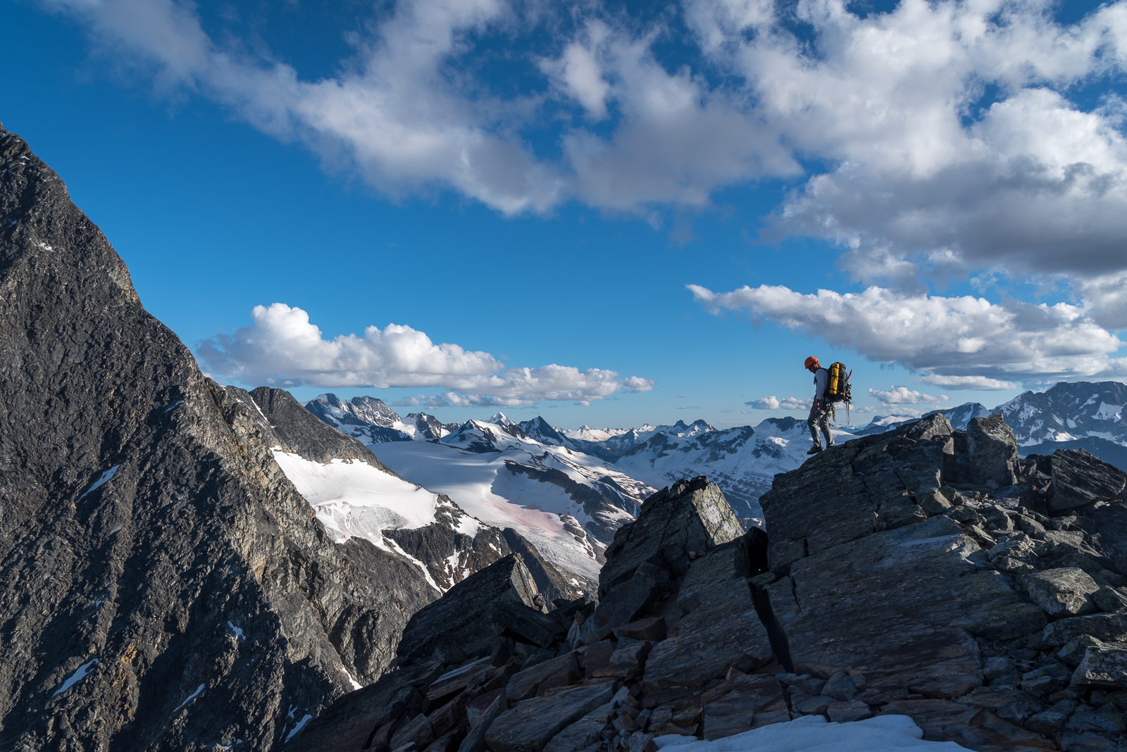
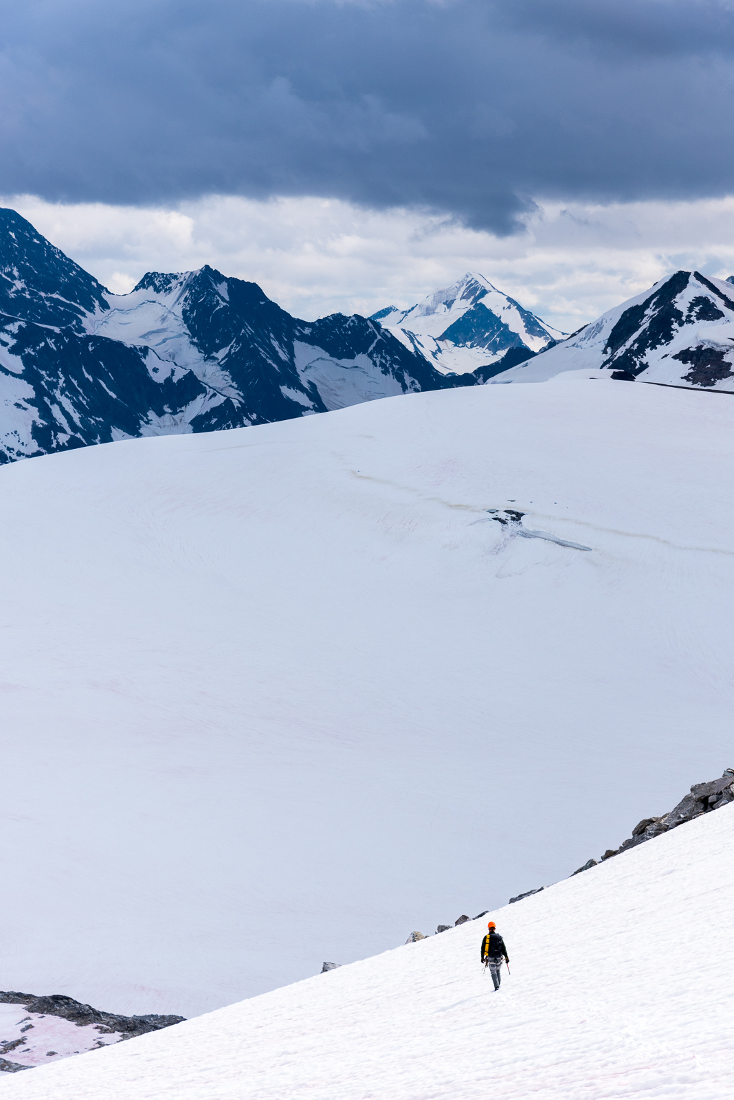
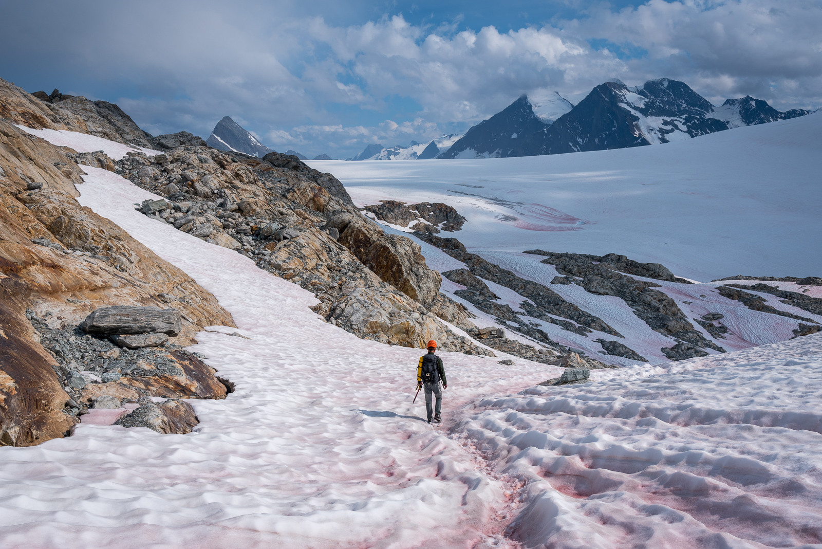
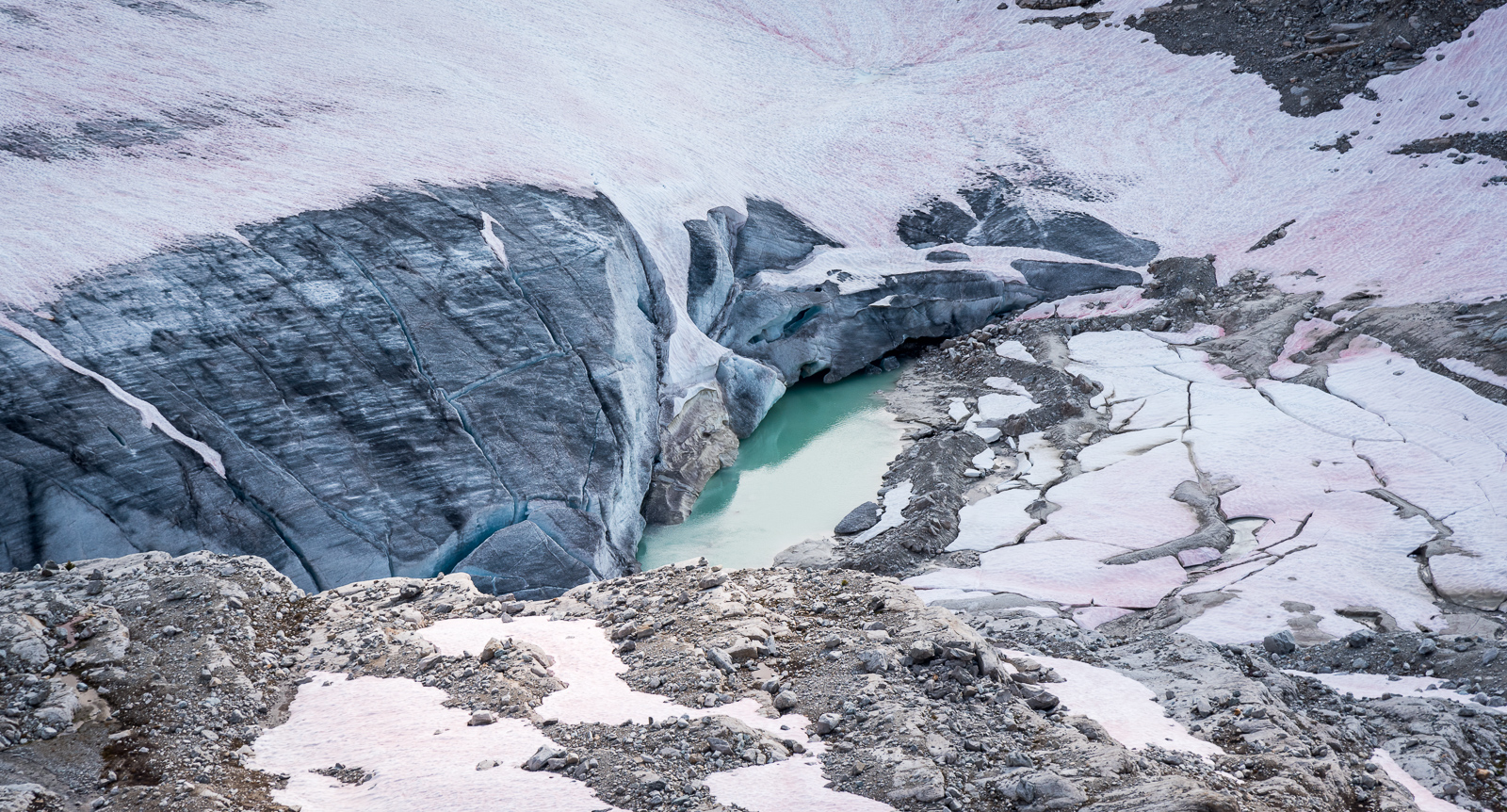
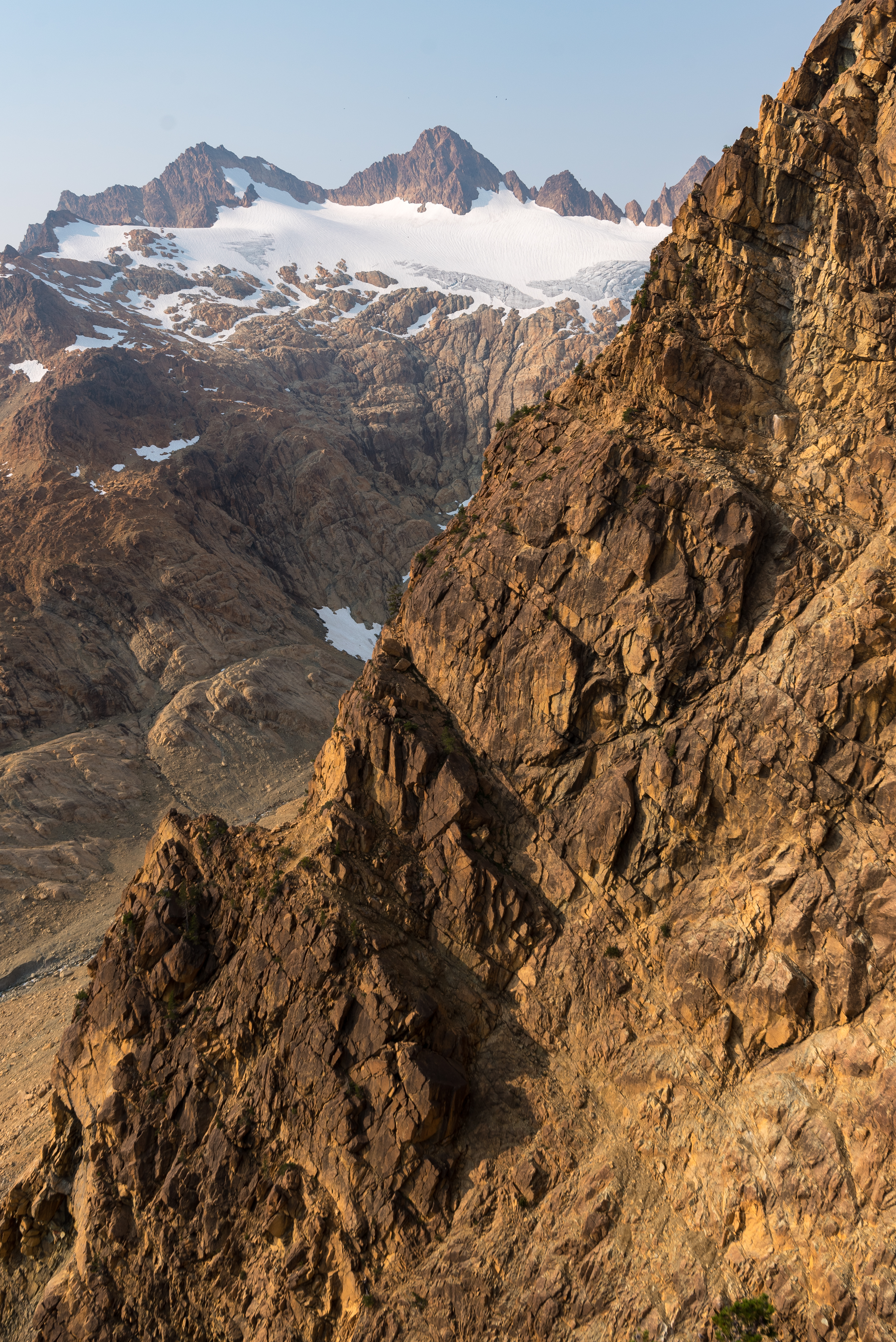
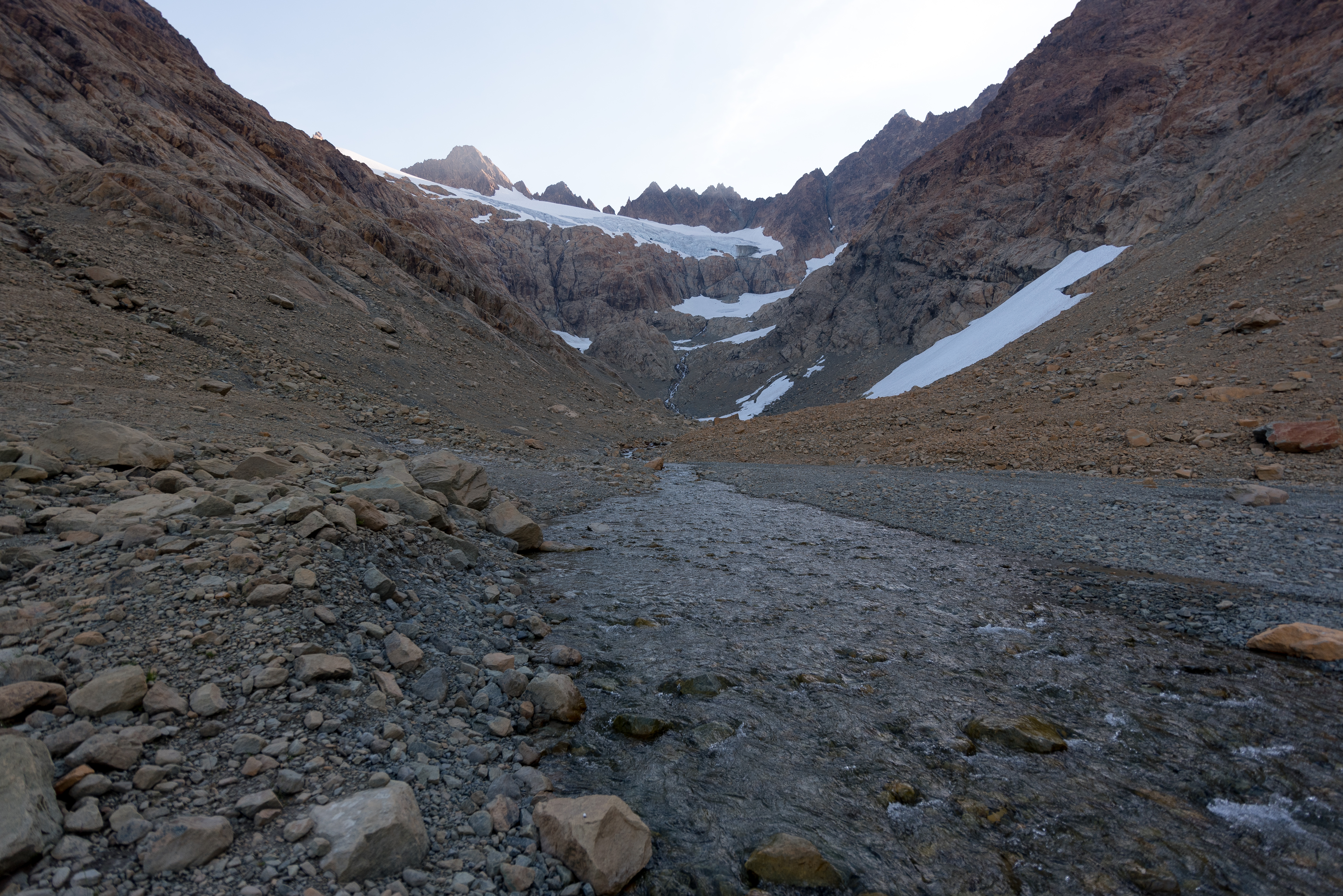
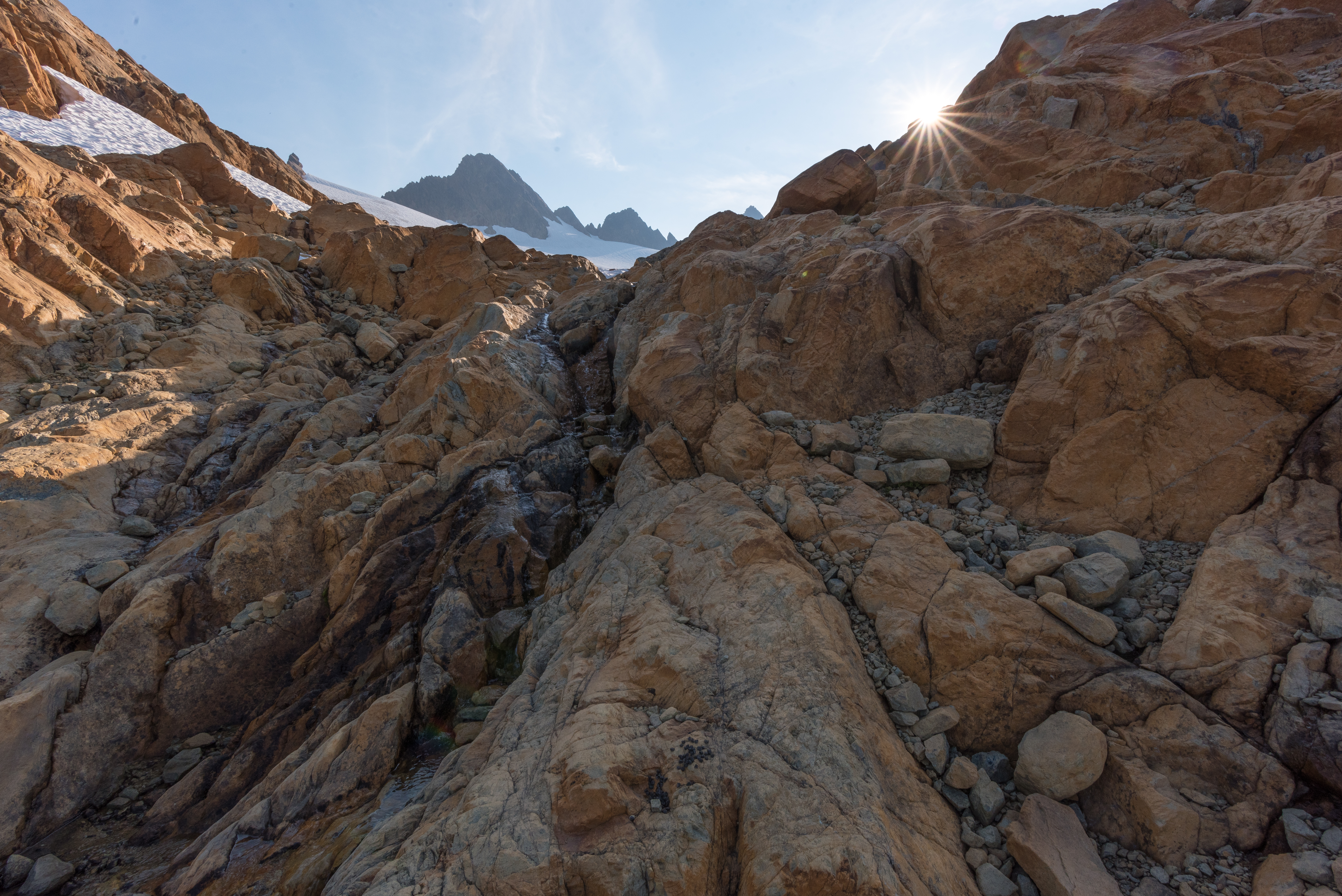
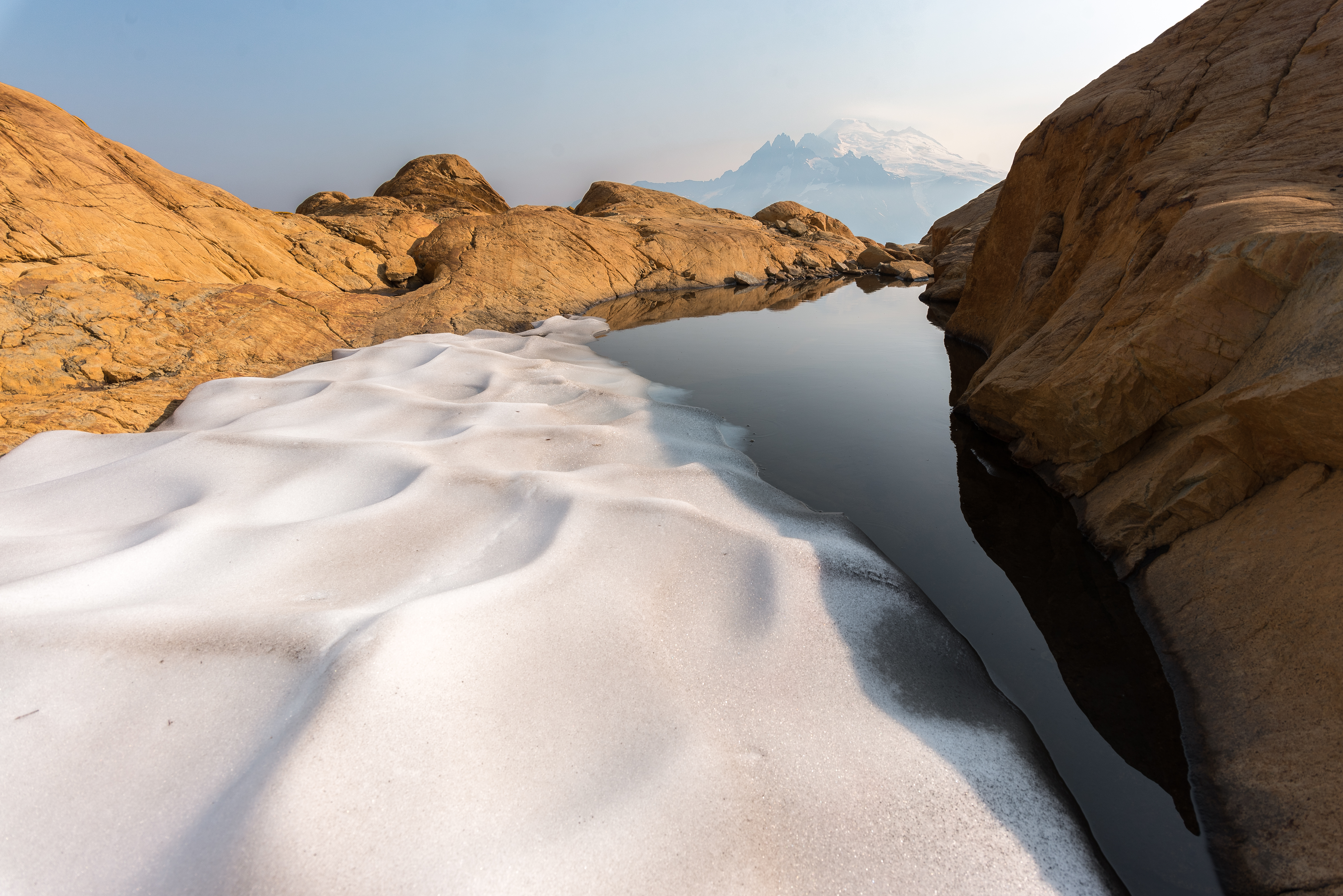
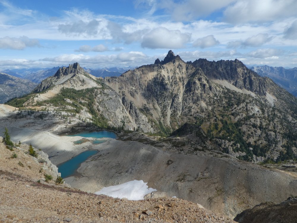
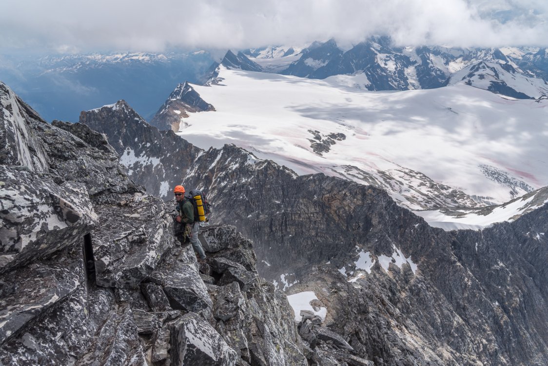
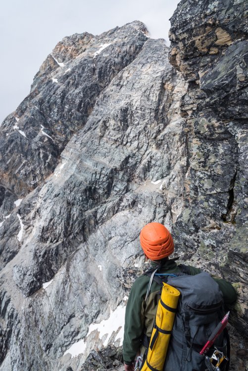
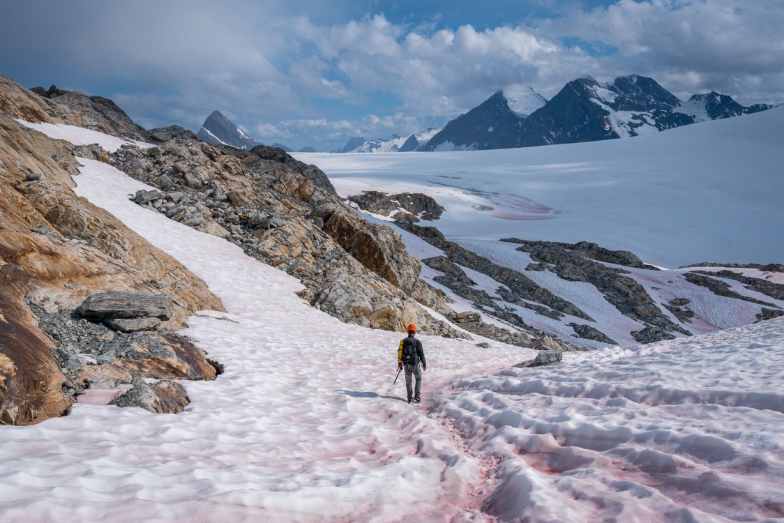
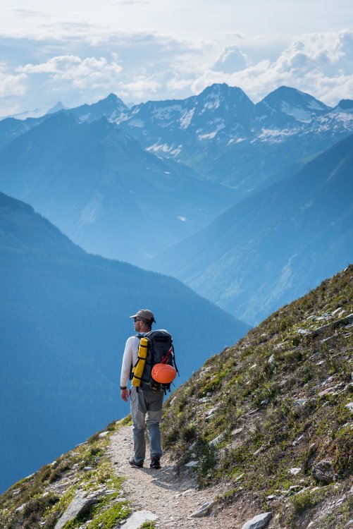
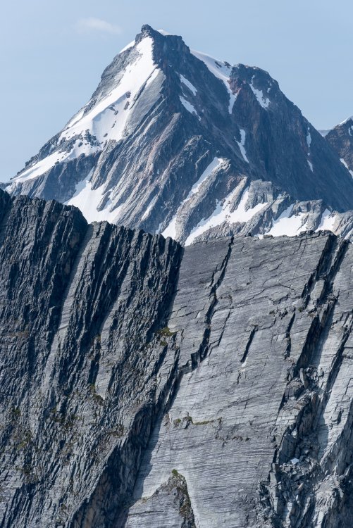
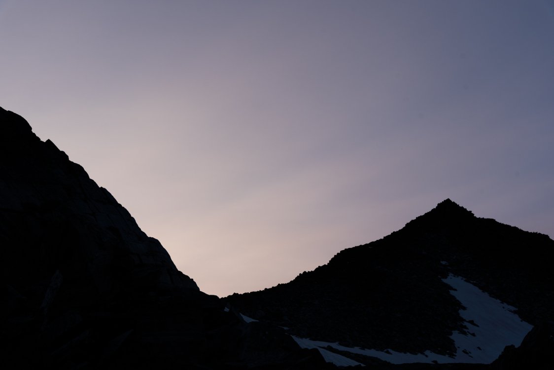
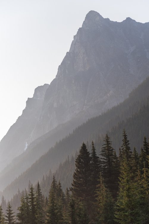
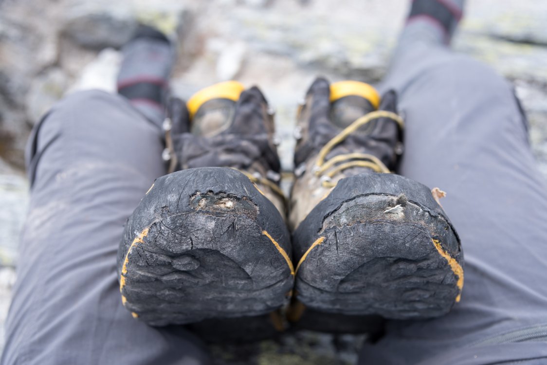
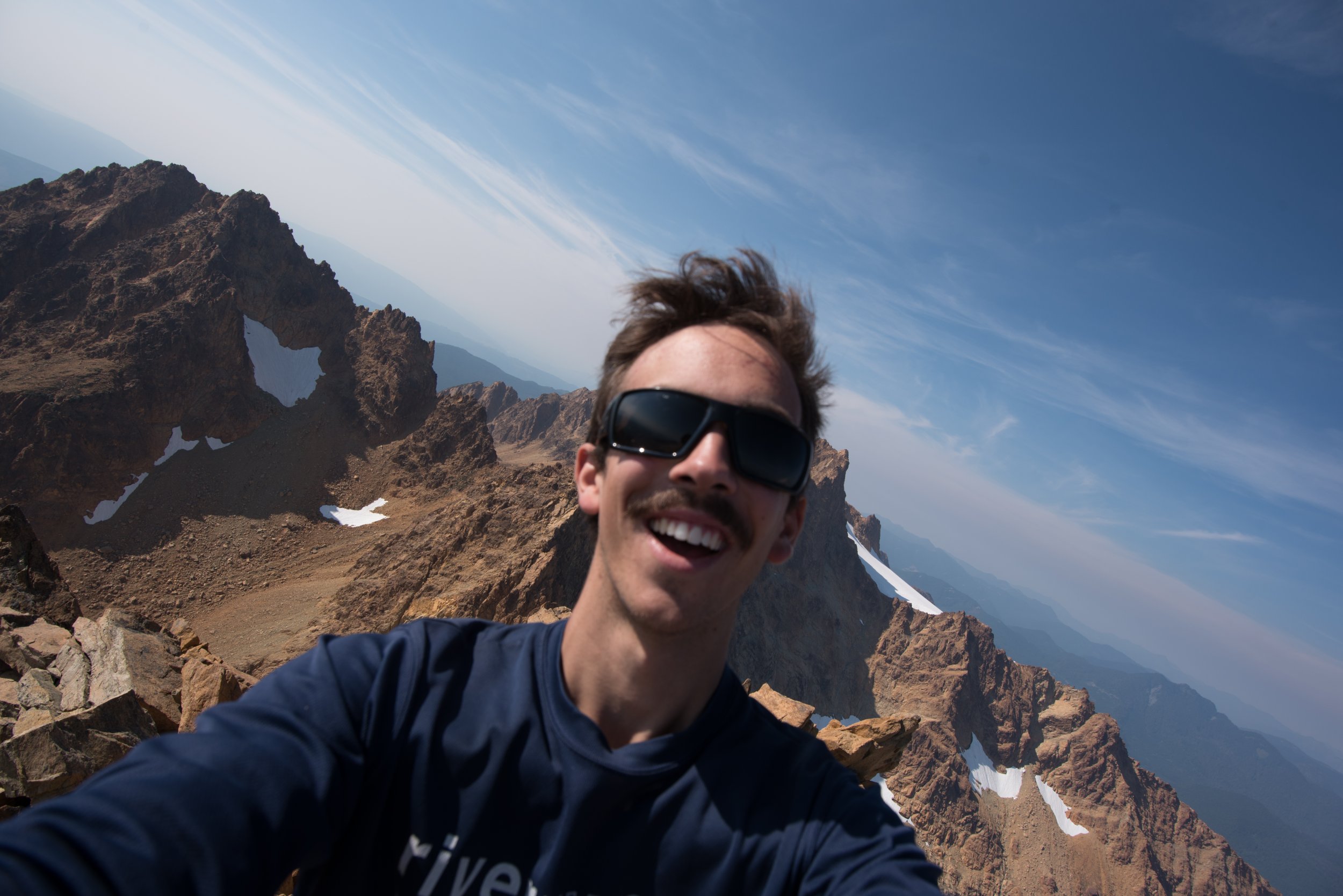
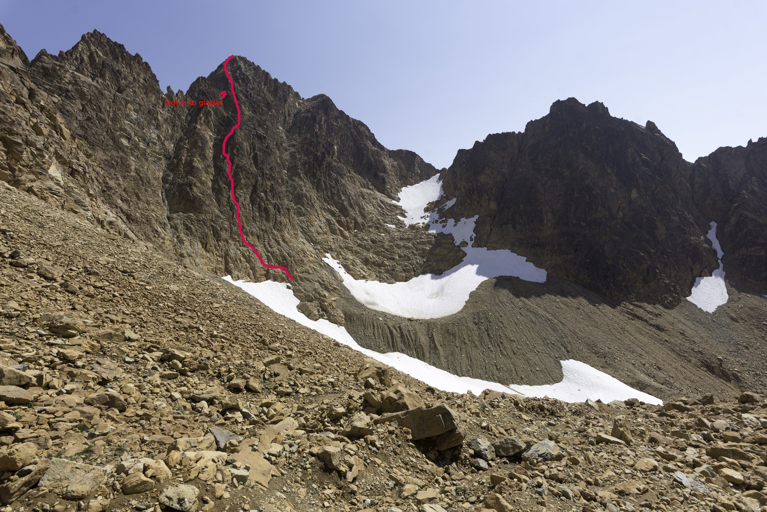
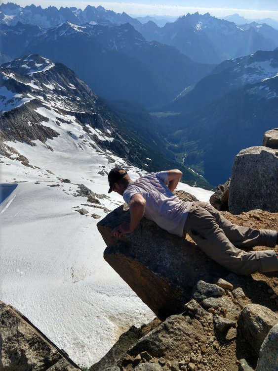
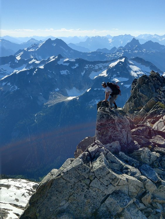
Trip: North Sister - NW Ridge Trip Date: 09/23/2018 Trip Report: Friends. This is my first non-trivial mountain (well, there was Hodge Crest, but that was unnecessarily complicated). I'm rather hyperbole averse, but I still feel good about calling this a harrowing climb. Sorry it's so long, I can't help myself. Not sorry. I disliked descriptions of the standard approach (South Ridge): seems like a complicated set of gendarmes to navigate over crappy terrain. Plus I've already sunk into a crevasse on the Collier glacier and could use something new. Plus beaten path, eww. The NW ridge caught my eye via caltopo: it just generally seemed more appealing. I later shelled out 40$ for a usable misprint of Oregon High, and found some interesting info there, with the FA of Glisan especially entertaining. The internet by contrast is sparse: there's a trip report of a failed attempt on traditionalmountaineering.org, and another on a personal site I can no longer find which was so vague it could've been a different route. Walking out of Scott TH a hearty two hours later then intended, I imagined how I'd word the solitude, firmly believing I wouldn't see a soul for two days. That was contradicted in minutes. The hike in is beautiful, really dry and wet at the same time. Cotton jeans + t shirt felt slightly questionable, but I was wearing them yesterday and picking fresh clothes would've been too much work. Eventually I came upon Collier's geologic diarrhea dump, then through more forest, then through Collier cone's interior (by previous logic, its anus?). I left the PCT and went over the cone's southern ridge down to the Collier glacier's moraine's terminus, where I was relieved to find muddy water (earlier streams I was hopeful about were dry). I set up camp at the edge of the moraine, right under the NW ridge, on a bit of a saddle. I was paranoid about lightning (there was none), but didn't want to be low in case of precipitation, so finding the saddle was a relief. I've been near a lightning storm once, and seeing agitated dark clouds tumbling over the ridges gave me some serious heebie jeebies. I also heard weird sounds, possibly even voices, and remember reading others' accounts of feeling generally weird before lightning, so things sucked. I calmed down and went to bed at 19:30, and slept like a baby (that is, woke up 10 times but got the right amount of quality rest). It rained for a few hours, which was not forecasted, I worried a bit about my water "resistant" single wall tent but it did fine. Enthusiastically up at 6:30, with stars still visible but the beautifully clear sky brightening. I was extremely low energy yesterday, and was elated to be in the mindset for ass whooping today. I heard voices again, and was shocked to see two climbers already going up the ridge. Hey! This is my obscure project! No, honestly it was a relief to not be totally alone. Also relieved not to be hearing things. I ate my homemade granola and packed my stuff. Crampons and axe? Hmmmn, I looked up the mountain, saw a dusting of snow, and imagined that'd be gone in an hour and I'd feel like a chump for carrying them (some backpackers questioned me yesterday). On the other hand, the remaining elevation gain is Dog Mountain, I can use the training weight. The climb up the ridge was very straightforward. I don't know if it was the rime covering the rocks or what, but things were sturdy and scrambling very, very fun. Rule of thumb: from the base till Glisan pinnacle, either go over obstacles (many are easier than they look) or go right. I caught up to the pair, they too were surprised to see me here. One of them had tried this once before, only getting up "Gilson peak". Passing them, I saw some faint footprints here and there. Not as obscure a route as I thought. Traversing under Glisan is where I first encountered proper loose rock, but it was easy enough. I started up a notch leading to a saddle leading to the South route, and happily put crampons on there: they helped immensely. This wasn't snow, this was a granular mix of snow, ice, and mud that gave my ancient spikes extremely good purchase. Over the saddle, traversed some more loose rock, and looked up. Is that the bowling alley? Nah, can't be, too steep. Wussies climb this (I have no idea why I tell myself this). I looked around some more. Yeah, that actually was it. I climbed a small step and headed up. I realized I'm cramponing 45ish° without an ice axe, so I get that out, swing it, and find it useless. So, it's slippery enough that a fall would suck, but forget self arrest. Don't fall then, gotcha. I go up some more, then climb a couple near vertical steps and then back down, terrified. I curse myself and resolve to get outta here. Then I try a slightly different way and, cursing loudly (no bad words, much worse: genuine bad sentiments), it becomes tame again, more and more. I am so happy to have crampons, and so happy the rocks are firmly cemented in place. I walk to the south horn because it has a cairn. From there, north horn looks higher, plus maybe I can scout a different (better?) descent. I climb it, and sit on the peak taking time to declutter my head. I was starving before, but can't eat now, and that's when how distressed I am fully sinks in. Looking around - there's not a better way down this pinnacle (Jeff Thomas made the NE aspect sound doable... nope, though I'd love to try with snow). I decide I'll be ok descending as slowly and deliberately as possible. This works out - I actually found the descent easier. Passed the crux and felt huge relief. Found two different climbers just below the bowling alley; they had no crampons and quickly decided to call it. They'd cowboy camped in that rain, I admire their high spirits. Sitting to eat, the other two from earlier emerged: one soon turned back, the other went up the bowling alley a bit and came back down. No crampons. Poor guys, but I'd be lying if I denied that me being the only of five to summit that morning wasn't a bit of a tremendous ego boost. During this, I remembered how sure I was that the cruxy fun was of type 3, and was amused that I demoted it to type 2. Rime, rock, and my layers are starting to peel off. I traverse back under Glisan, and scurried down the ridge, tripping over loose rock a few times. Yeah, I think the ice made a positive difference on the way up, lucky me! I ran much of the way back to the car and made it back to Portland just an hour late to pick up my daughter. Memorable :). My least favorite thing about this trip is that my micro 4/3 camera broke just before - I used my phone like a normal person. Gear Notes: Crampons, ice axe, and why did I leave a flash drive in my pocket? Approach Notes: Yeah, it's a long drive, but refrain from Schubert sonatas on your way in. That shit gets stuck in your head and then it's not fun.1 point
-
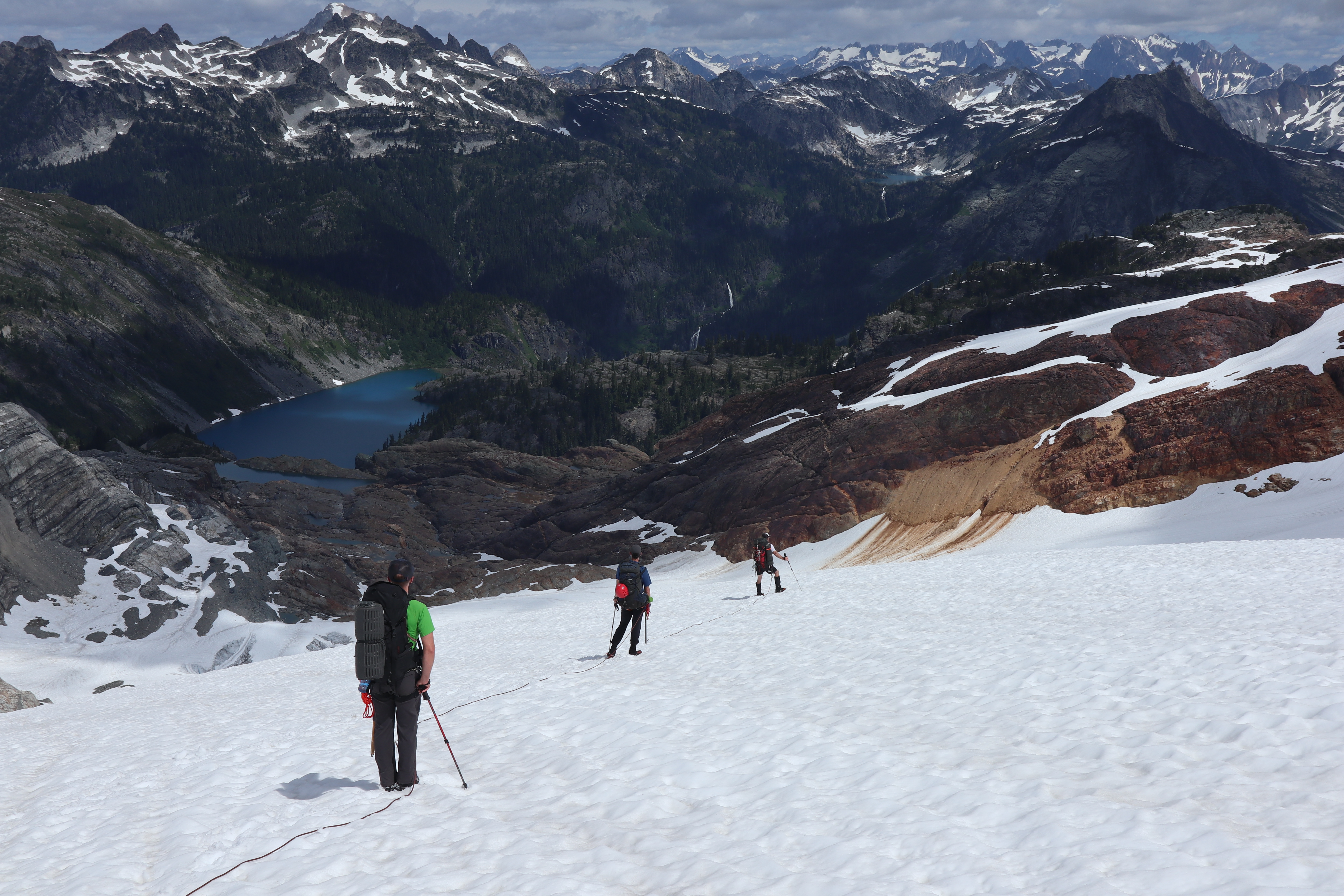
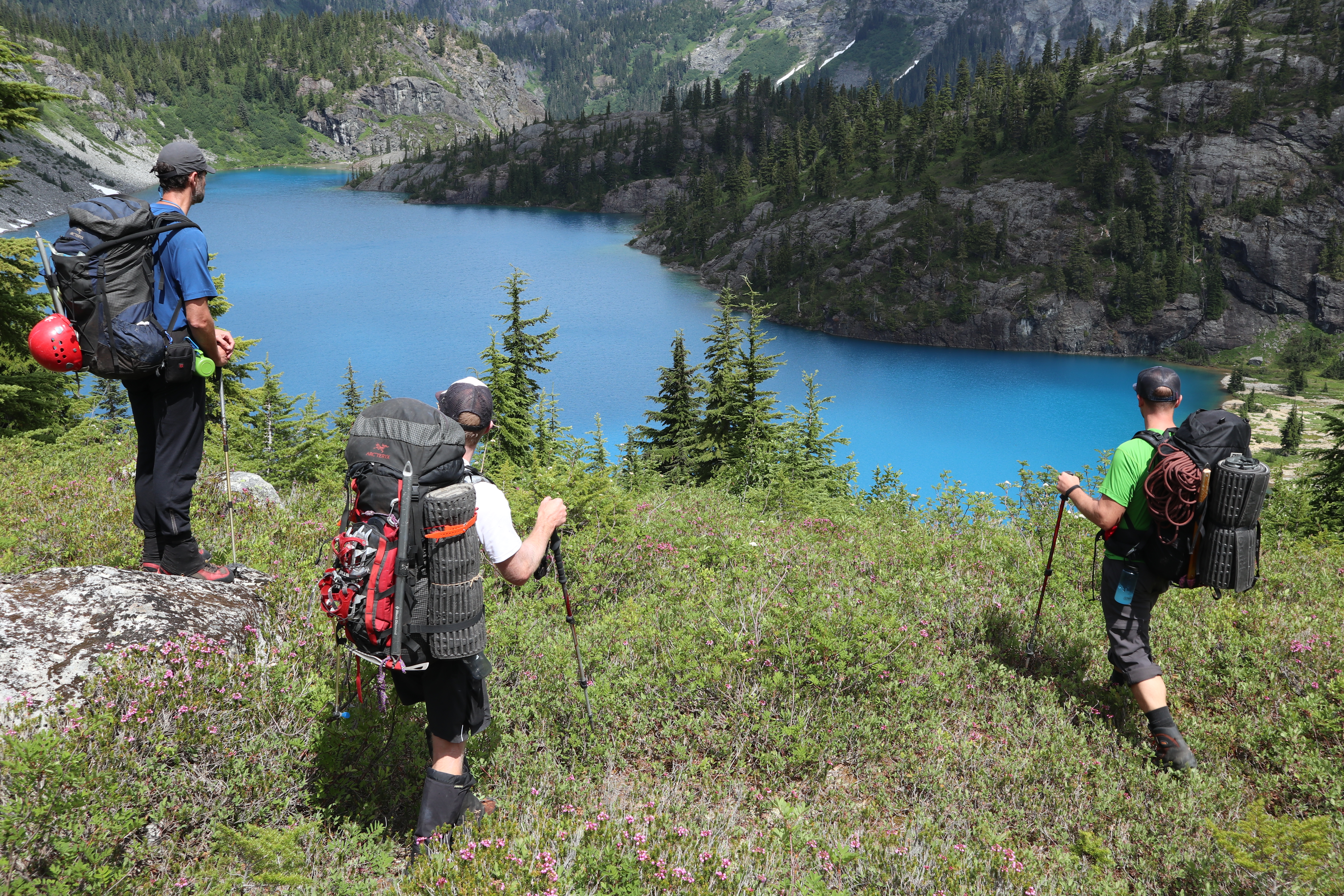
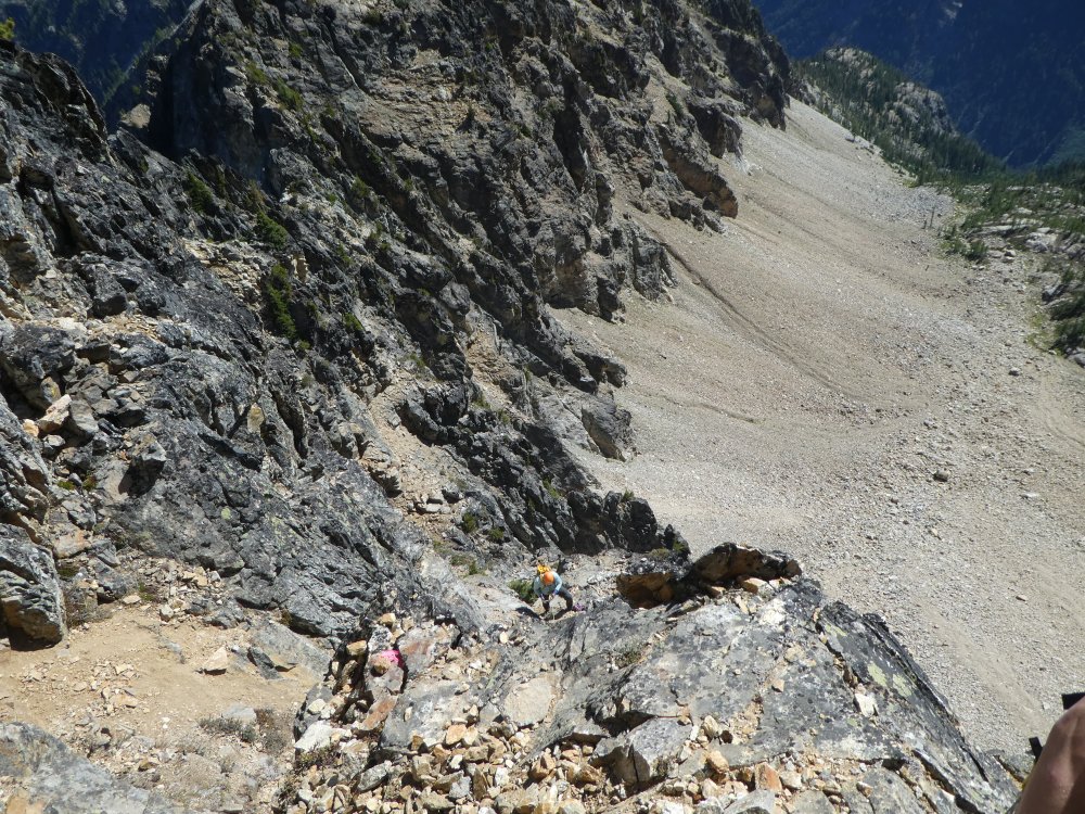
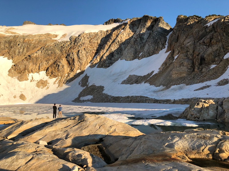
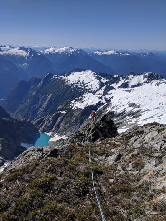
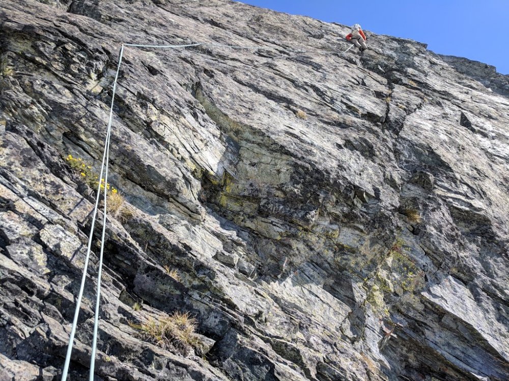
Trip: Tupshin and Devore - SE Routes Trip Date: 09/01/2018 Trip Report: This year I decided to celebrate an extended Labor Day weekend near Stehekin. For a bonus, the recent rains had cleared out the smoke we've been engulfed in and the forecast showed no rain. On Saturday we rode a very crowded Lady Express from Field Points Landing to Stehekin. We then caught a late (30 min) but almost empty Red Bus to Harlequin Bridge and hiked up the Stehekin River Trail and Devore Creek Trail to Bird Creek Camp. From here we turned uphill and schwacked our way to flat terrain around 5400' and camped. Time to camp was just under 7 hours. Sunday we arose pre-dawn (which is late and luxurious these days) and hiked straight uphill over towards Tupshin. At about 7000' we attained the ridge leading to the basin below Tupshin's SE face. We crossed the talus fields and ascended to about 7600' and the base of the route. There was no snow whatsoever on our approach which made for a lot of tedious travel, but fuck, it is September! We scrambled the first bit of the SE face and tied in just below the minor block that marks P1. I opted to lead the exposed class 3 around the 5.2 block and flipped my rope over the top of the block before proceeding to a 4th class quasi-chimney. P2 was mostly scrambling. P3 and P4 were more interesting, each with a nice (but short) low-fifth section (5.4-ish). At the top of the fourth pitch, we untied and scrambled to the summit. Although there is a ton of loose rock, the ascent seemed mostly safe and secure. The descent - not so much. We ended up rappelling five times, including the section at the bottom that we had scrambled. It was a constant fight not to knock rocks down and move carefully to stay out of each other's fall line. Once off the route, we made our way back to camp. There whisky awaited me, and I drifted off to sleep happy to finish this one off safely. On Monday we ascended to the 5800' basin below Devore and hiked up the steep gully leading to a basin. From here we ascended the steepening basin to rock bands that we scrambled to the edge of the lakes at 7000'. We ascended some horrible shitty choss to the shoulder of the ridge (7500'). then ran the ridge to a large gendarme. To compensate for the choss-slog we were treated for some of the most spectacular views I've seen: Our route descriptions said "do NOT go around the S side" (of the gendarme). We ended up wasting 2 hours trying to get around the N. The snow patch here was too melted back and icy (rotten ice). Eventually we gave up and I checked out the S side. It went! From there it was a quick shit-slog through choss up and right about 300' to a notch in the ridge, a short ridge traverse to a 4th class step and finally a scramble finish to the summit. We did 2 rappels down (both short) and retraced our steps to camp. Everyone was tired and wanted to head out the next day so we set our alarms to allow for plenty of time to get to the bus in time. Tuesday was an easy hike back to Harlequin where we all rinsed off in the river and relaxed waiting for the bus. We got some goodies at the bakery and a beer on the boat. By that morning the smoke was back in force so we were not too sad to save Flora for another trip. Gear Notes: 60m rope, small alpine rack, helmet Approach Notes: Open forest with some schwacking
 1 point
 -
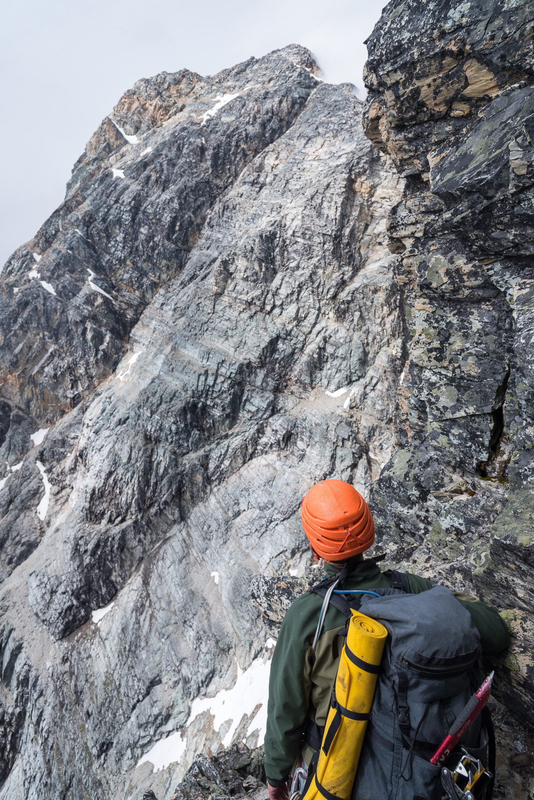
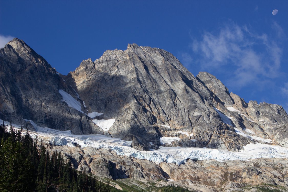
Trip: Goode and Storm King - NE Buttress Trip Date: 09/02/2018 Trip Report: Nate and I climbed the NE Buttress of Goode and Storm King then took a scenic exit via Park Creek Pass and Easy Pass. We started from the Bridge Creek TH at 11pm on Thursday 8/30 and exited at the Easy Pass TH a couple hours before sunset on Sunday 9/2. Getting onto the Goode Glacier was difficult, and the bridge across the moat on the left side of the NE Buttress won't be around for much longer. I wouldn't recommend the route at this point in the season. I wrote up a full TR on my site here: https://www.laneaasen.com/2018/09/goode-ne-buttress-storm-king.html Gear Notes: Approach shoes, crampons, ice axes 8 small nuts and 5 slings for NEB 60m half rope, doubled for simuling Approach Notes: Approached from Bridge Creek TH, exited via Park Creek Pass and Easy Pass
 1 point
 -
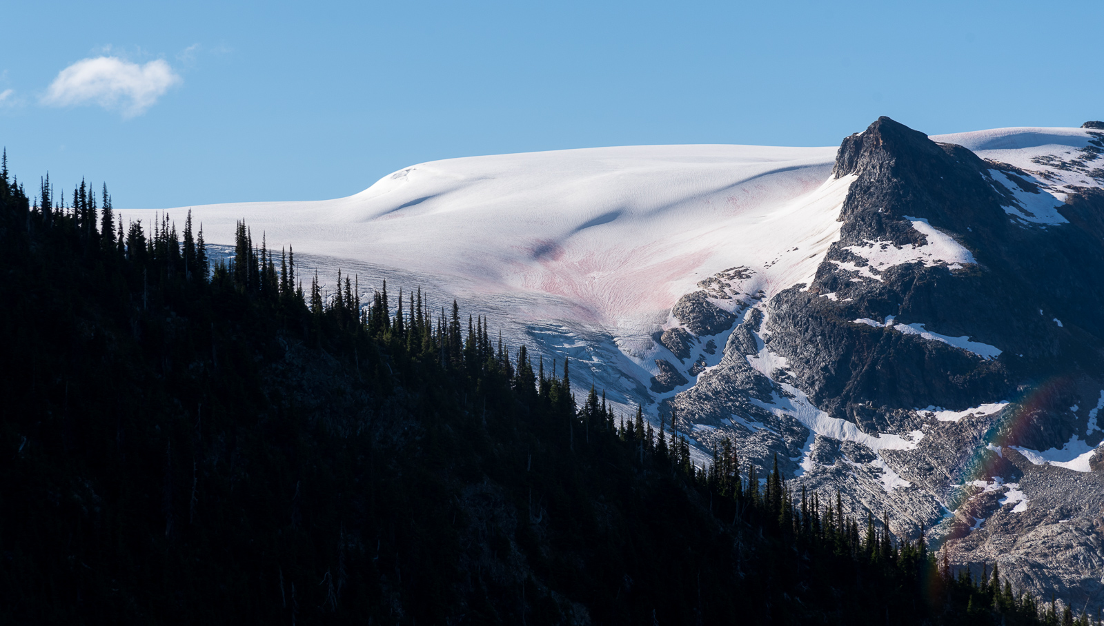
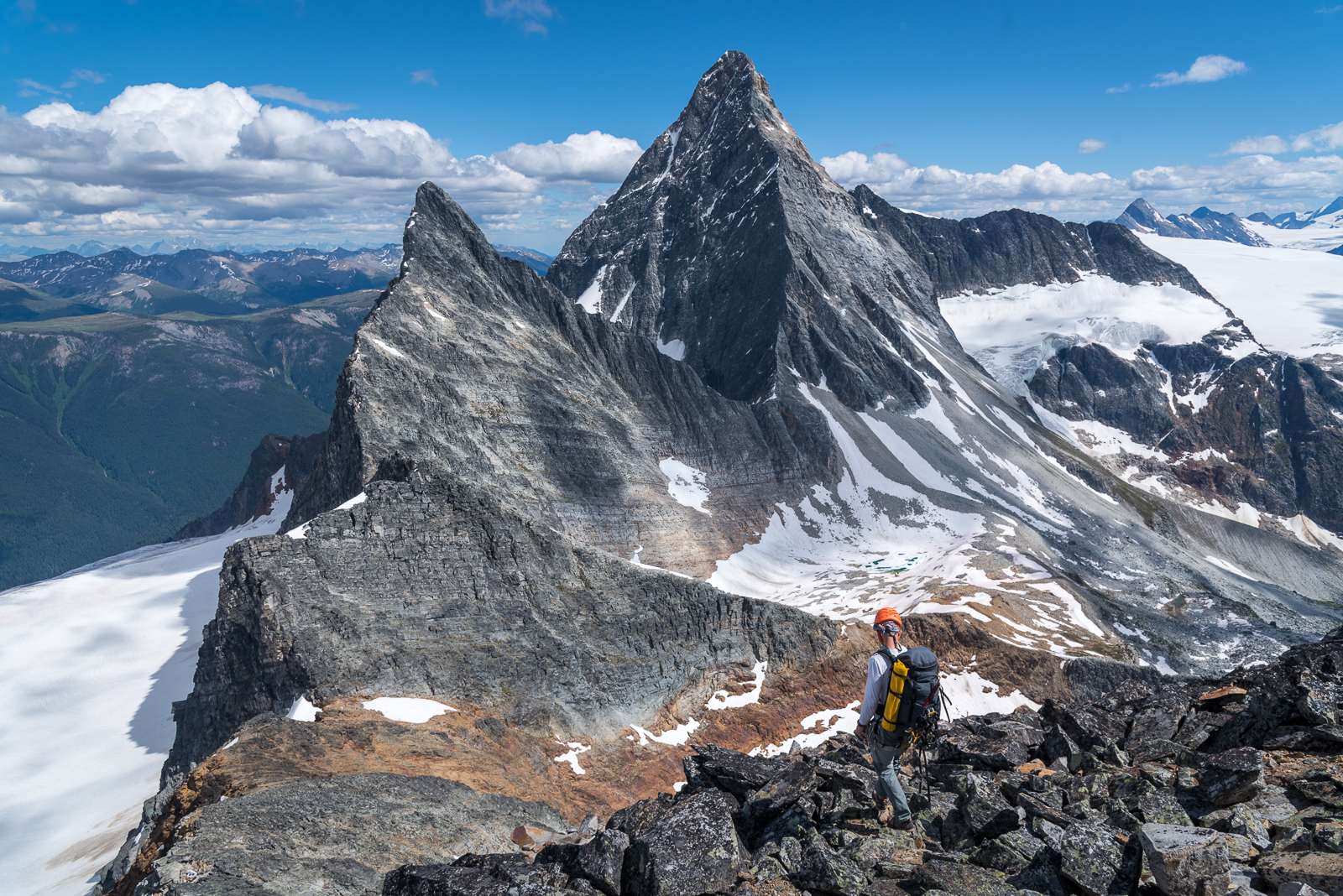
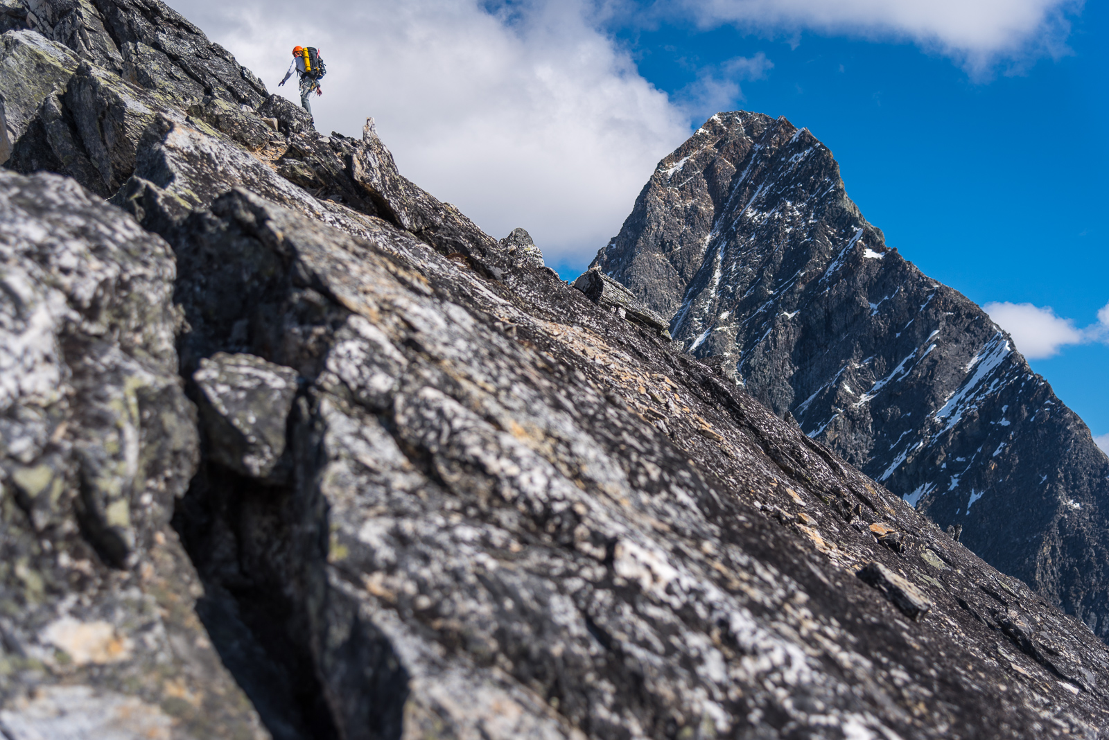
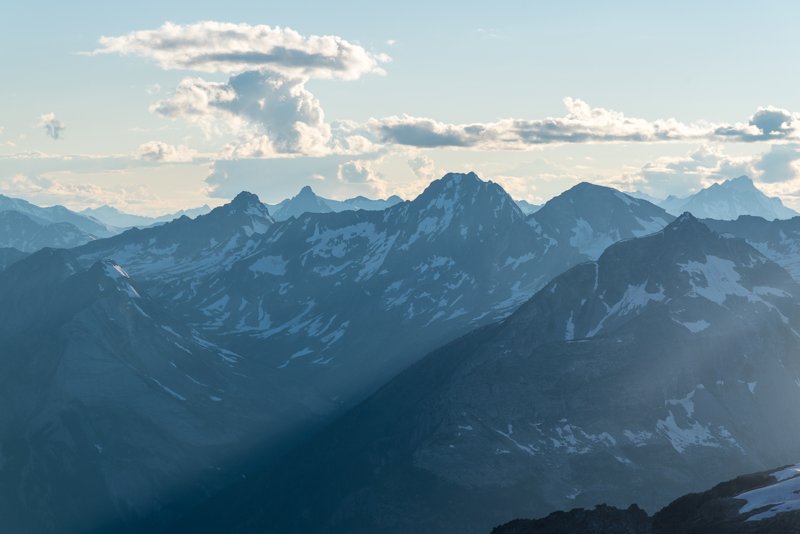
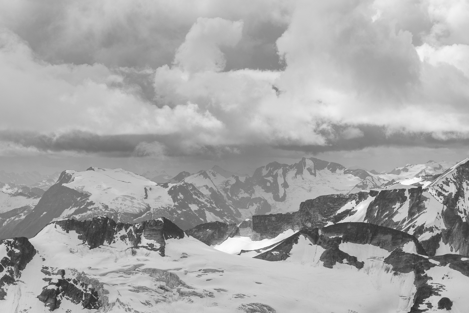
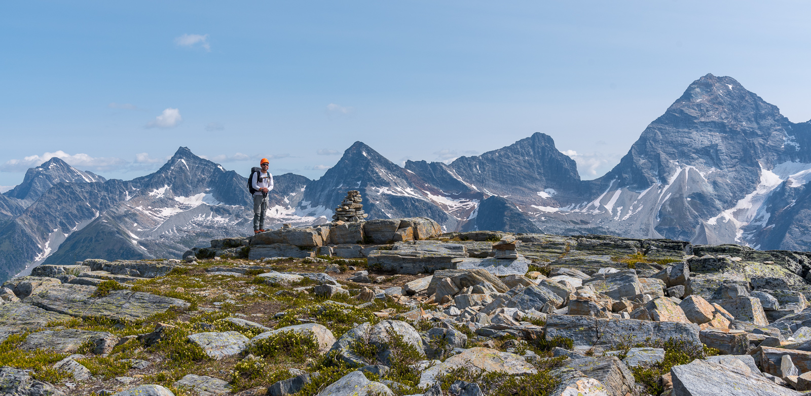
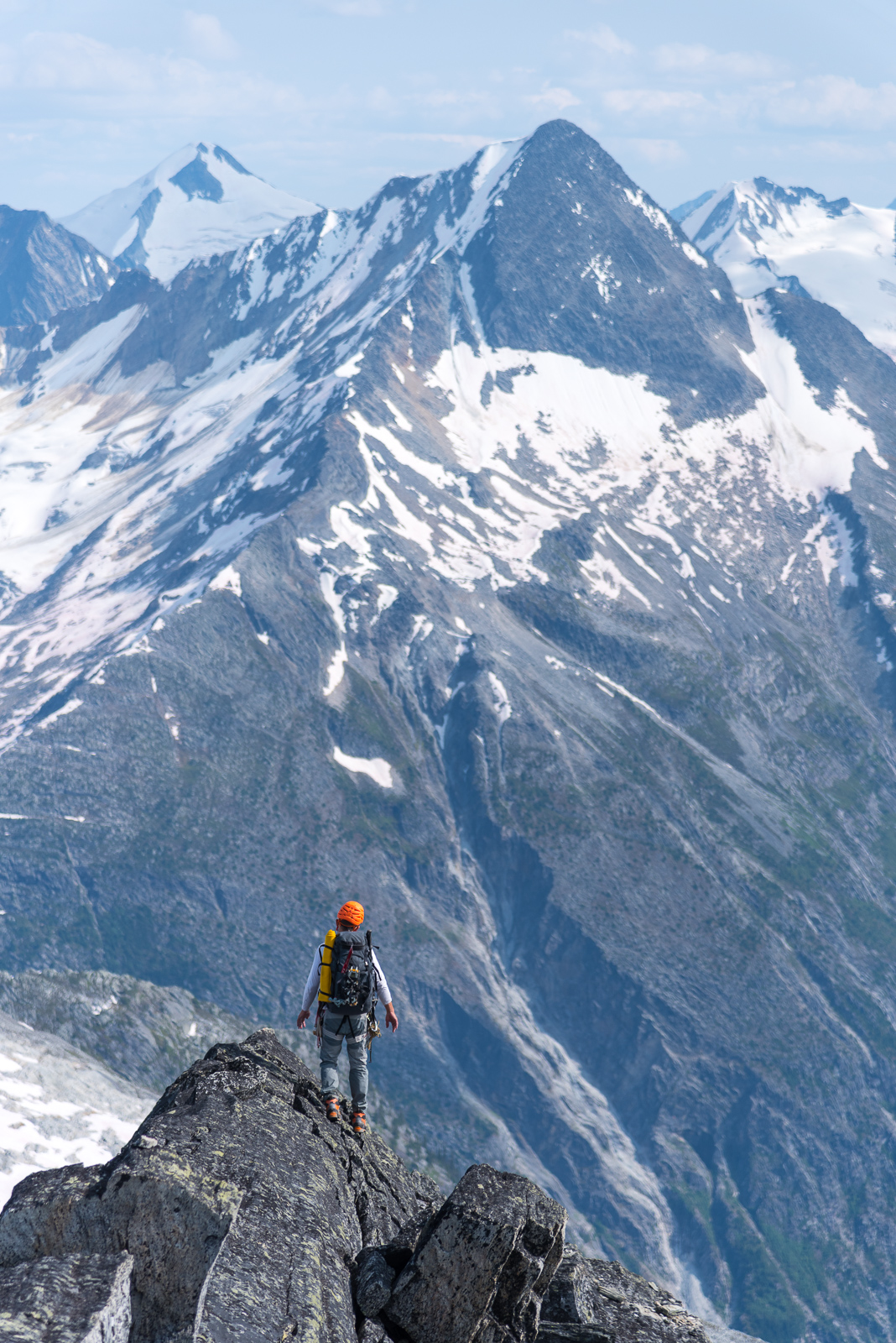
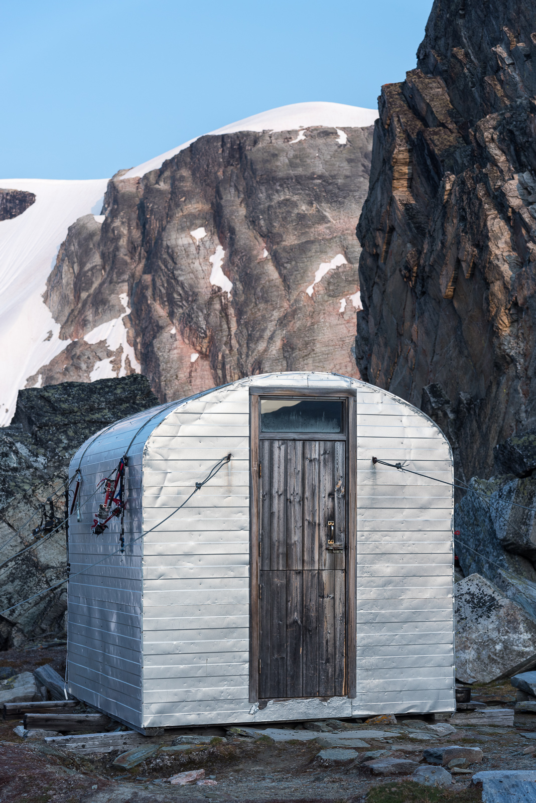
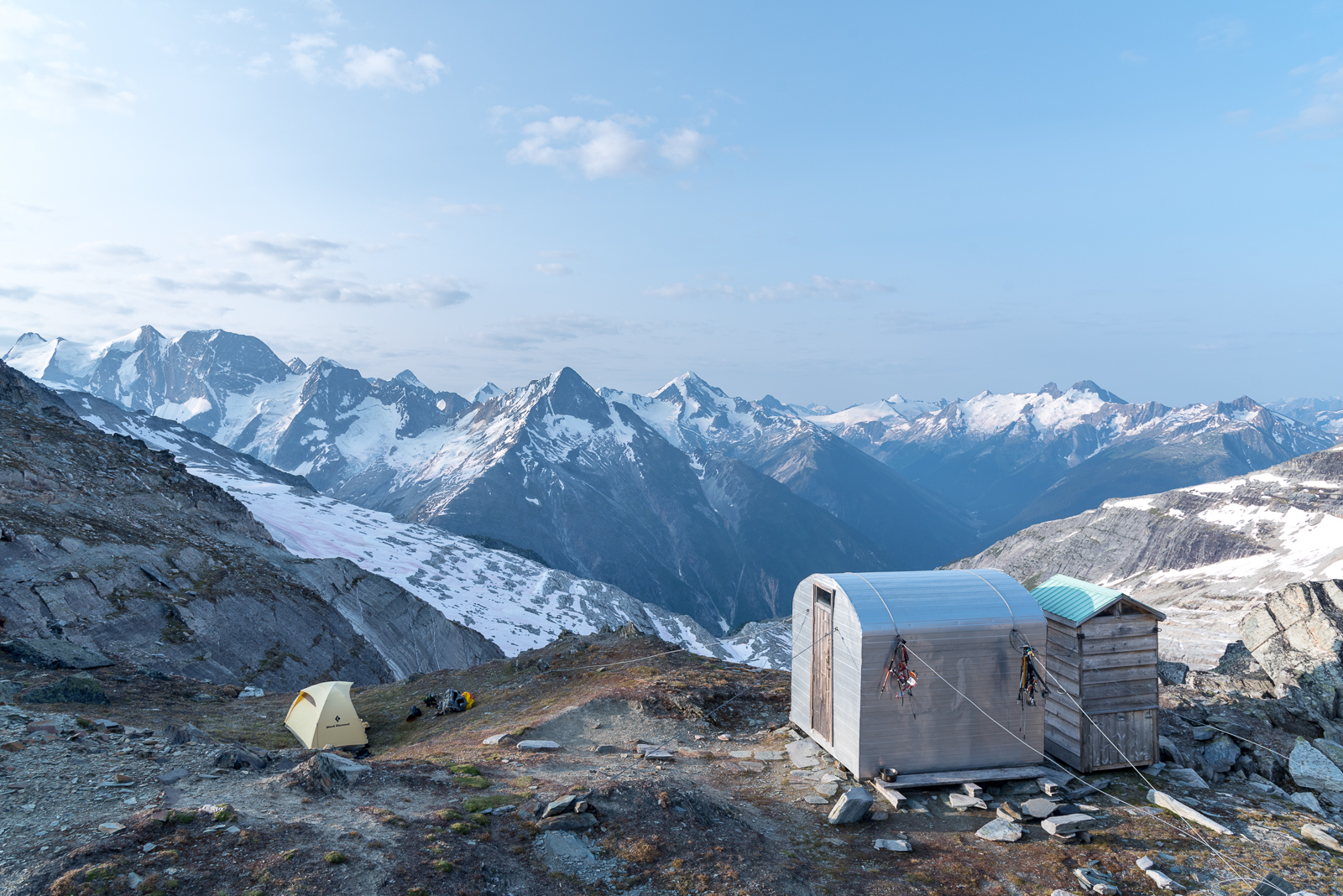
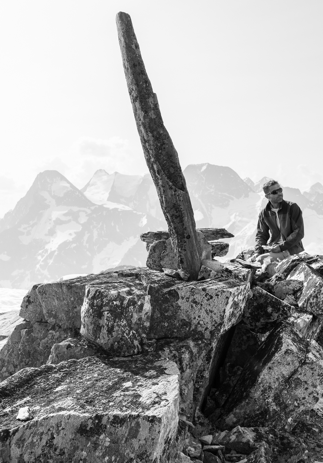
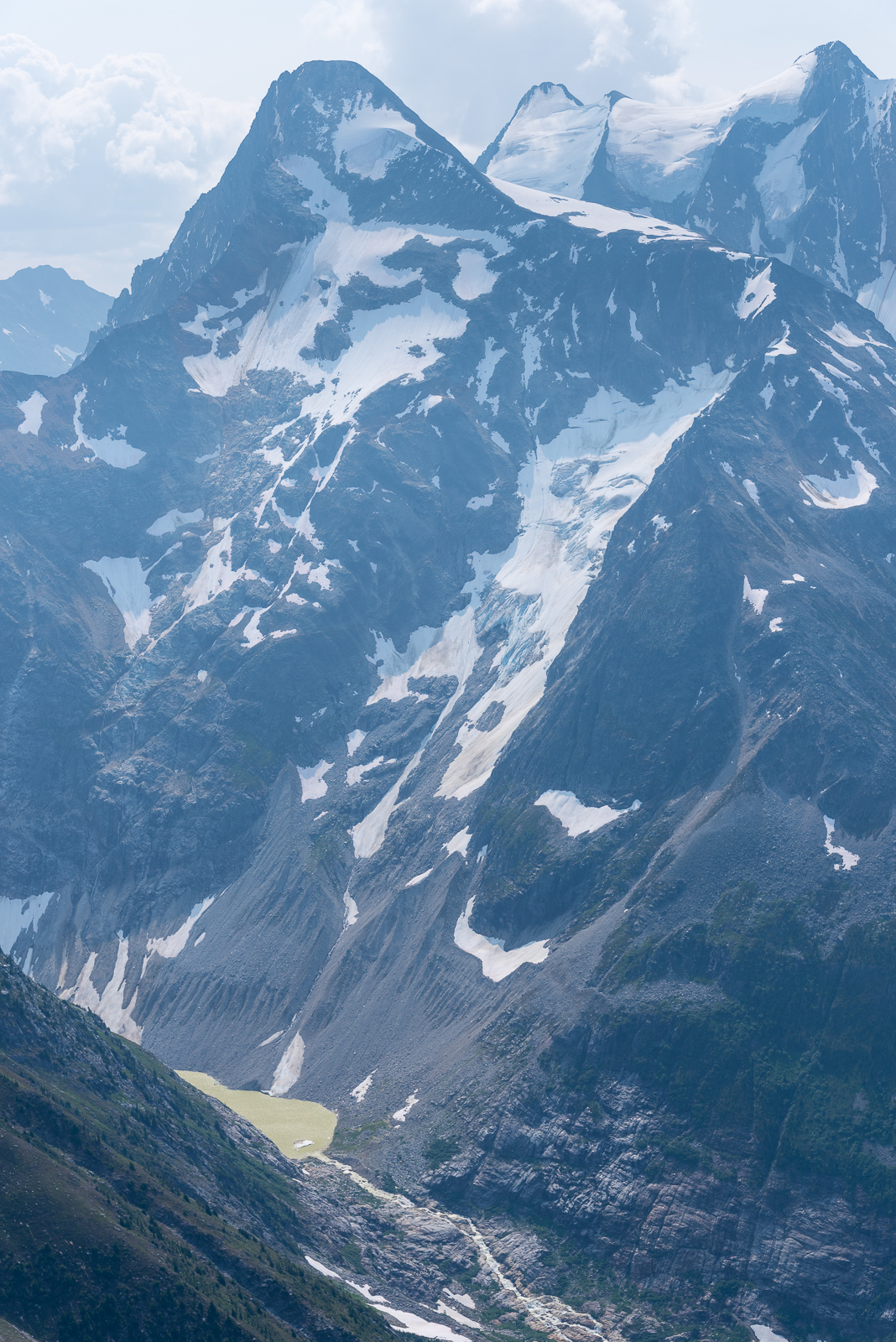
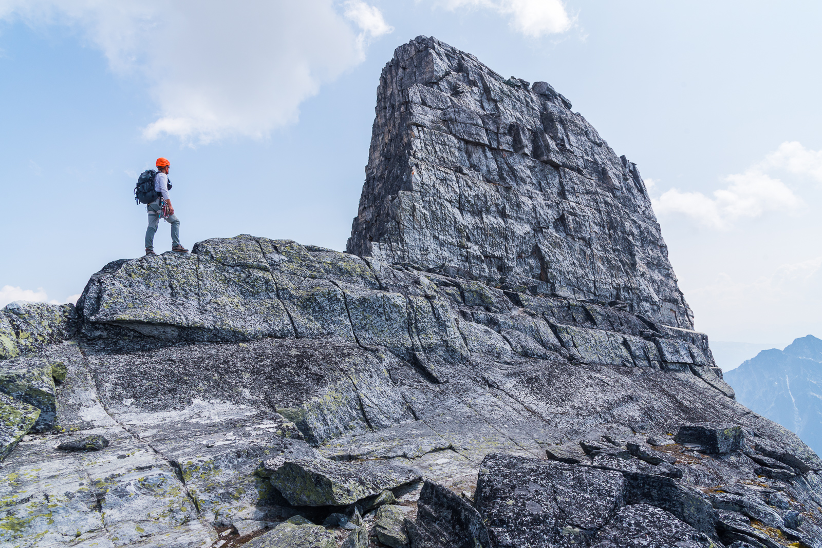
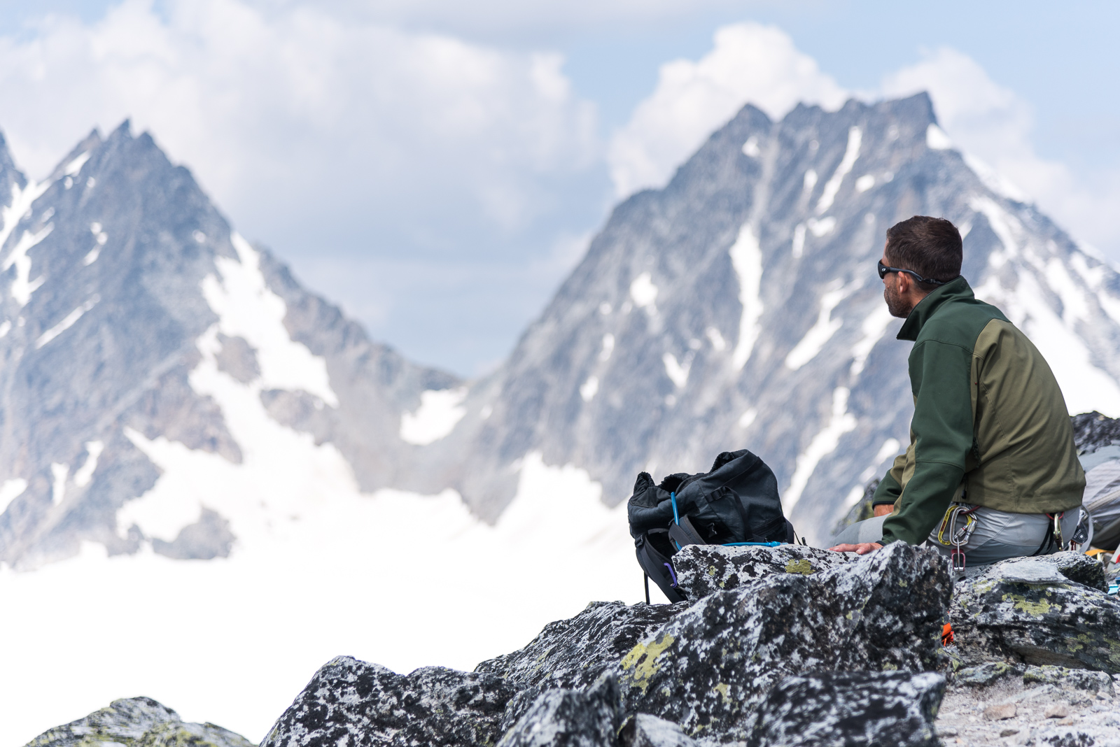
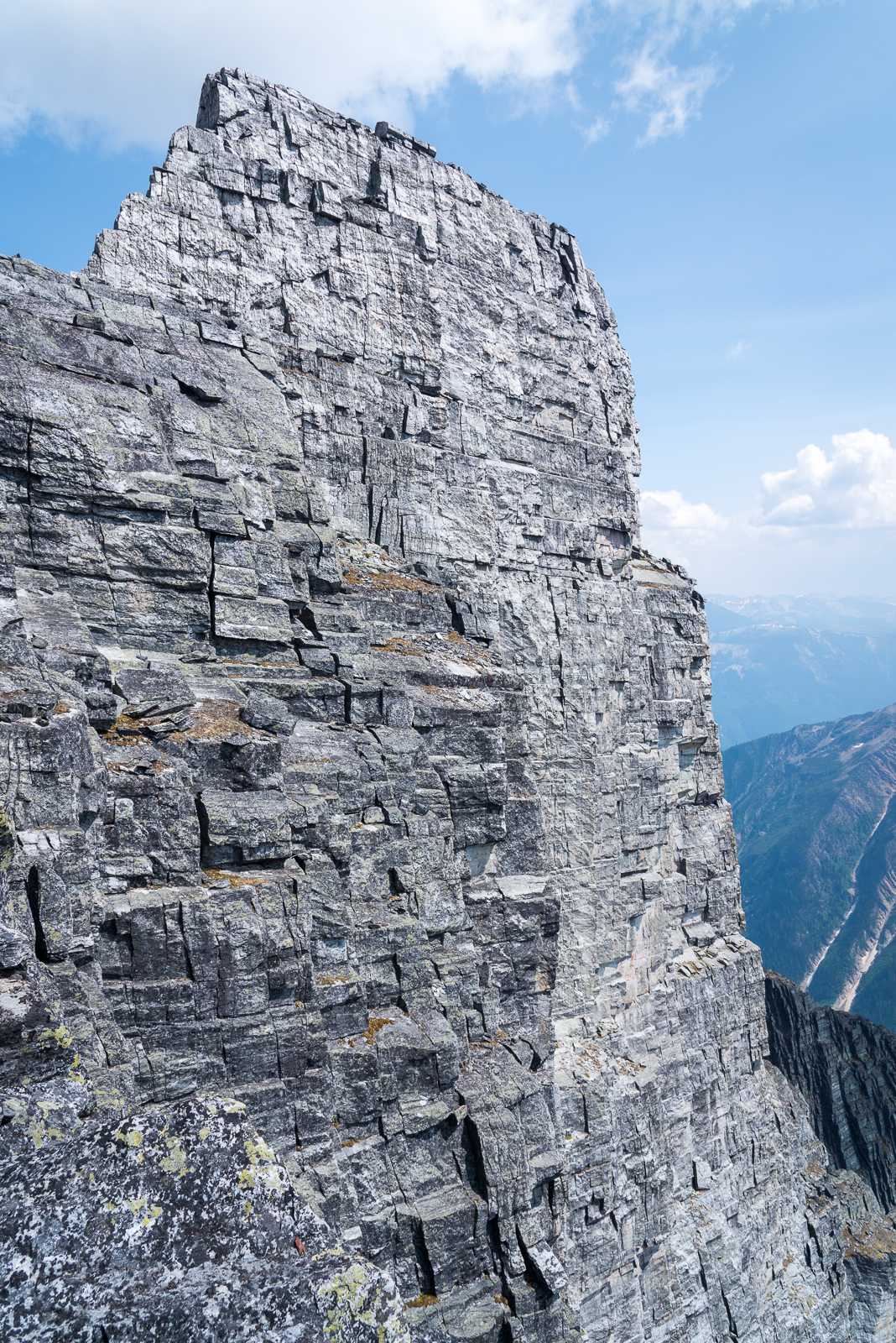
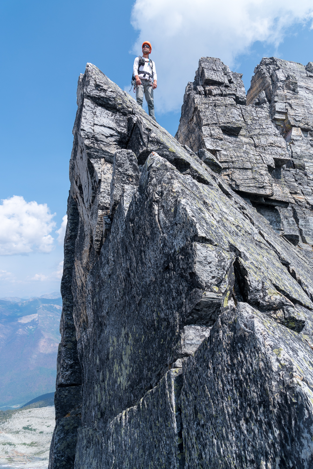
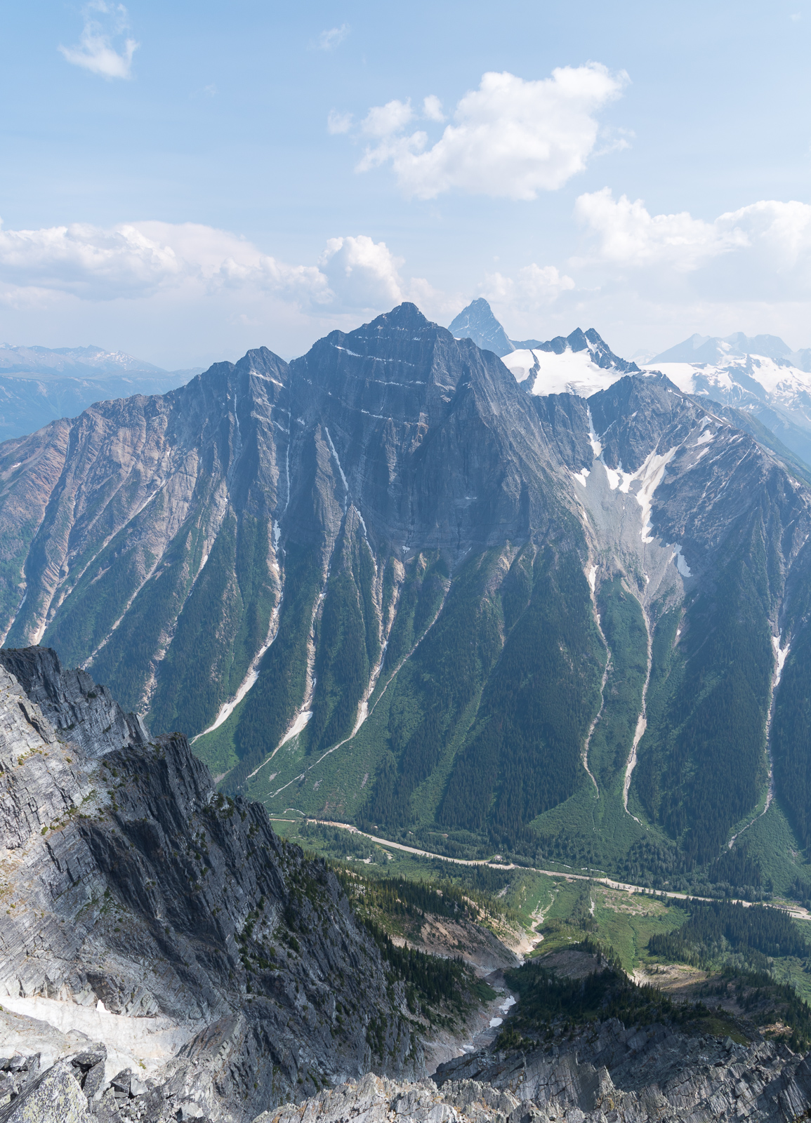
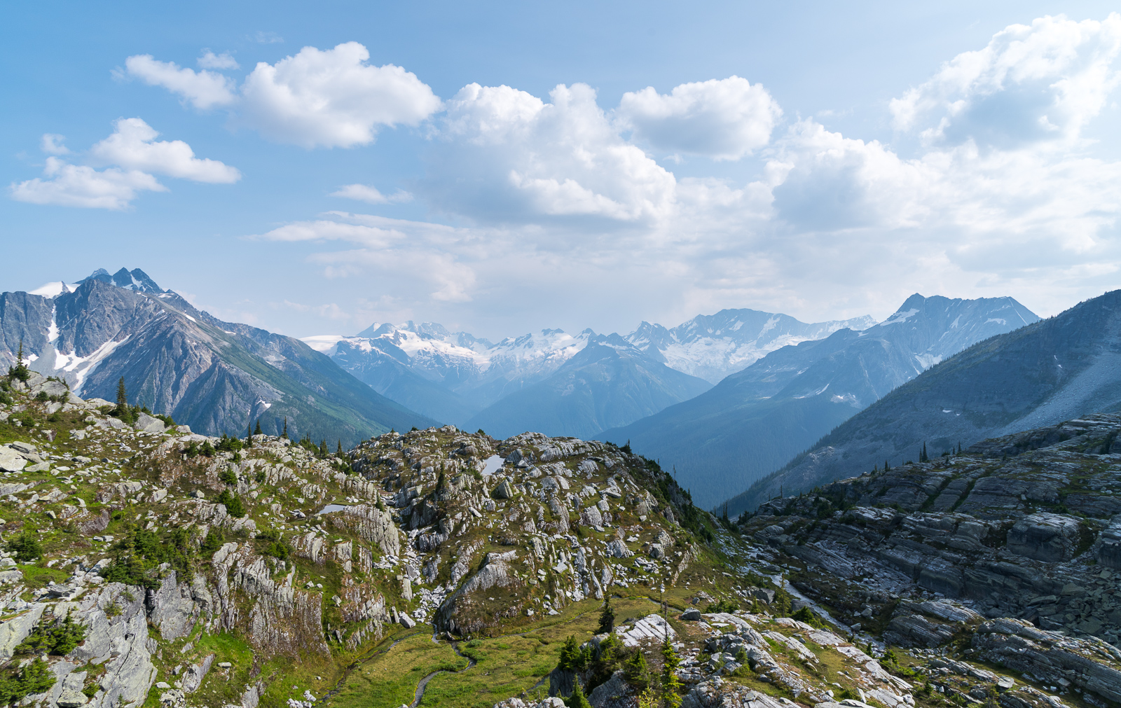
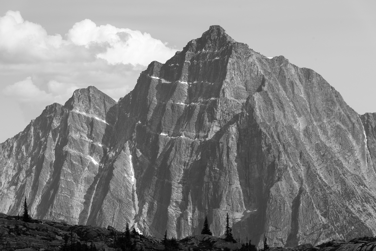
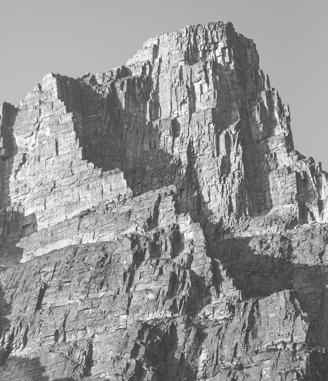
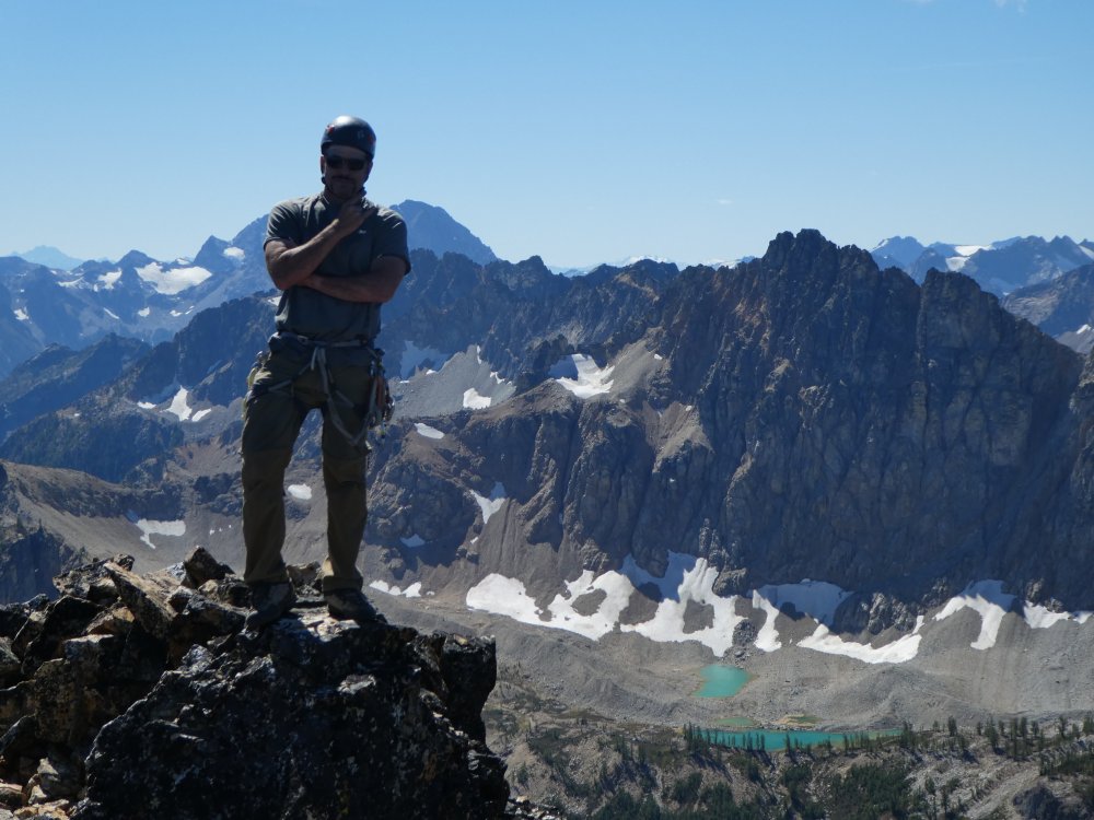
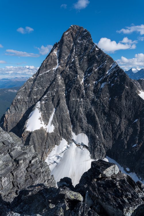
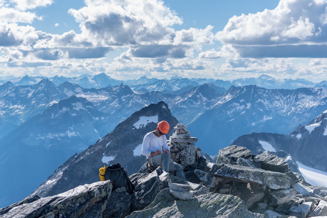
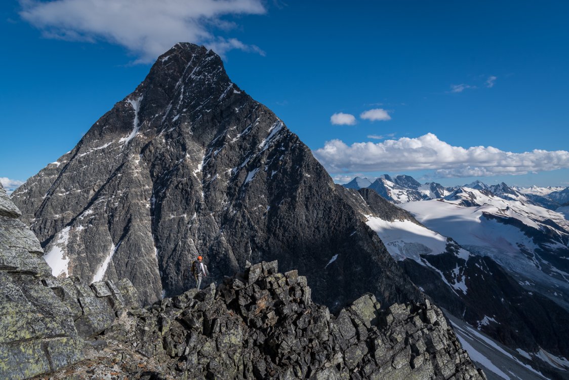
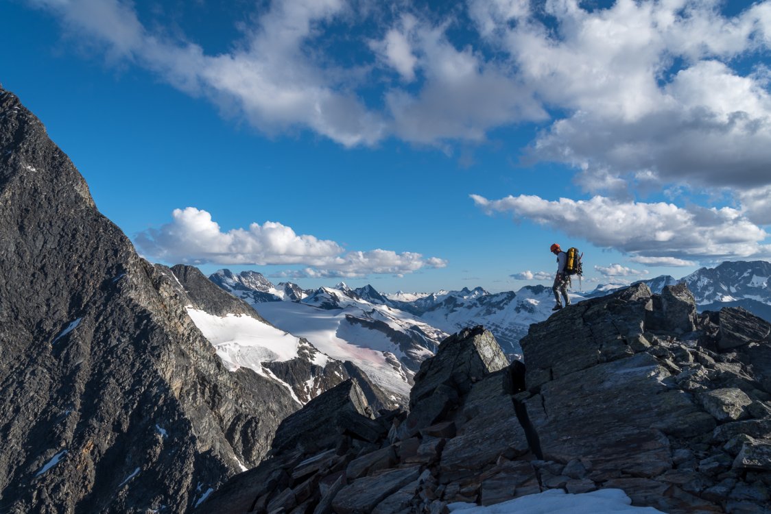
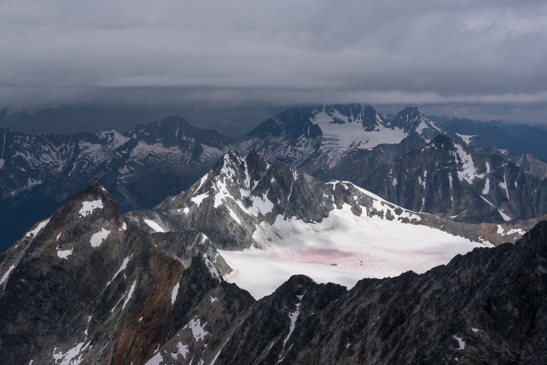
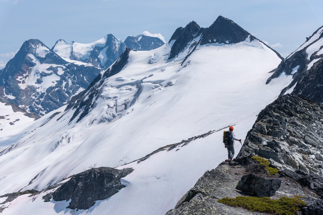
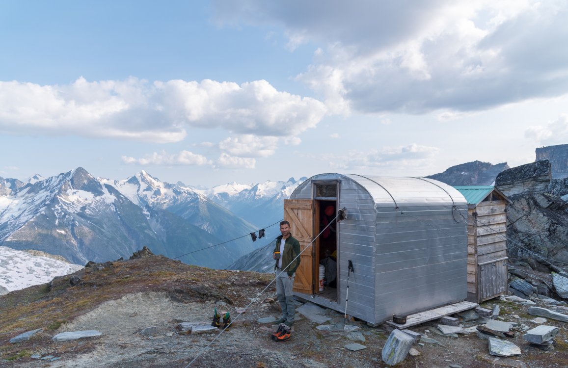
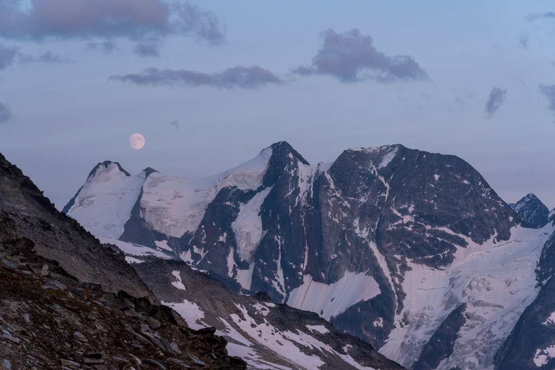
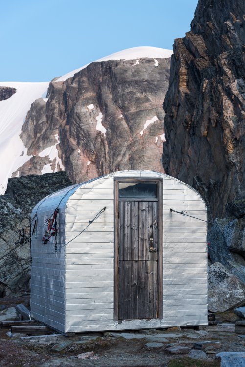
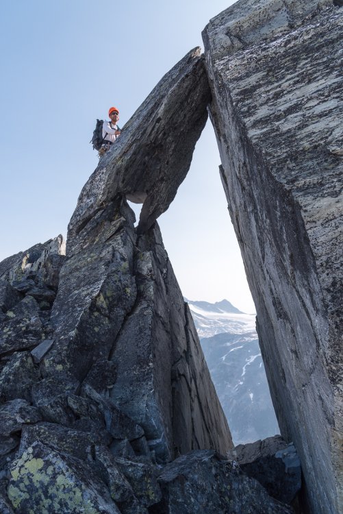
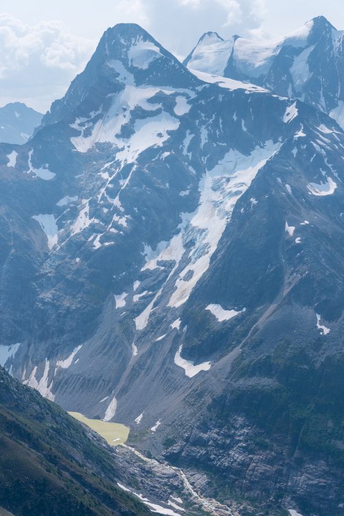
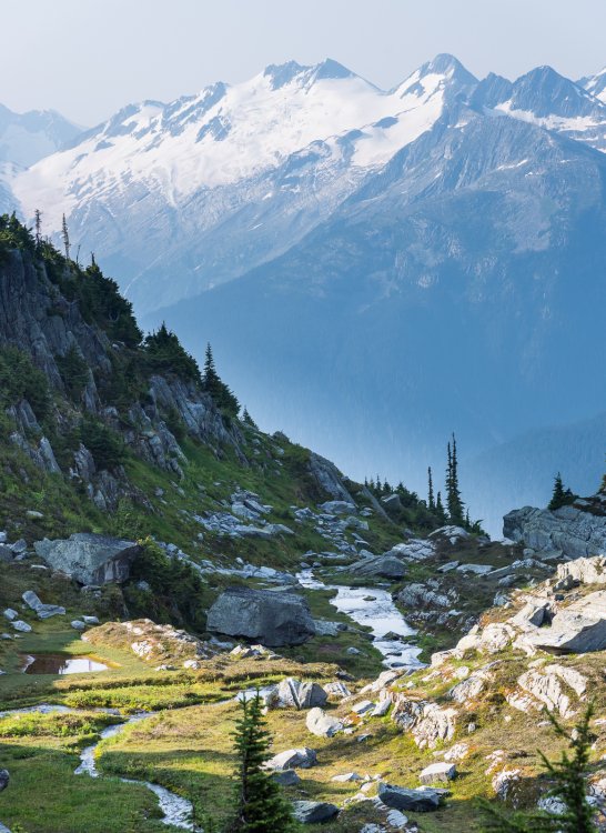
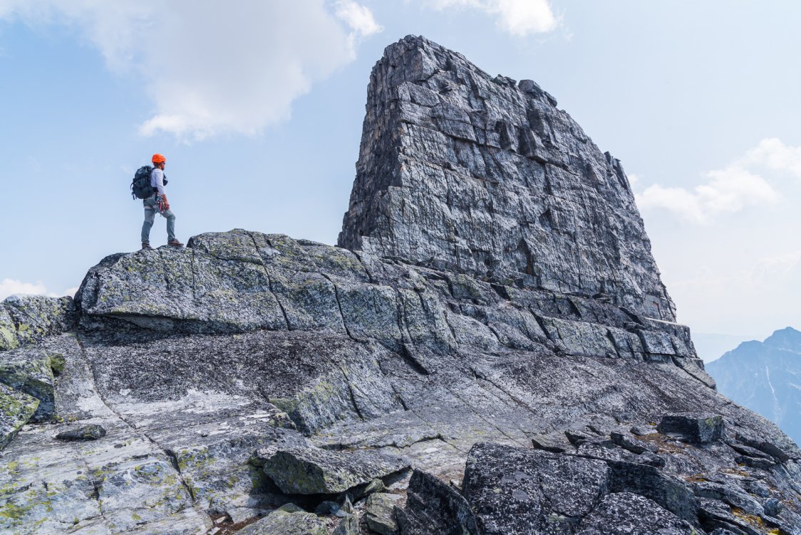
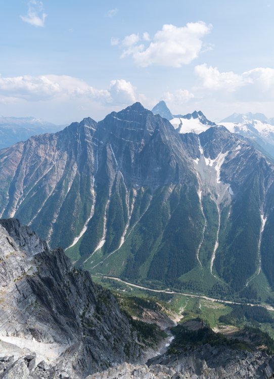
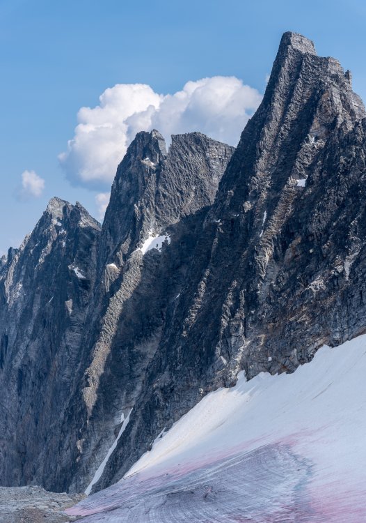
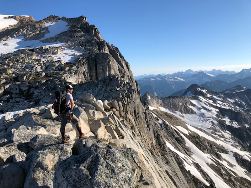
 Trip: Rogers Pass Ridge Running - Avalanche, Eagle, Uto, Sir Donald, Asulkan Ridge, Tupper Trip Date: 07/25/2018 Trip Report: It's no secret that Rogers Pass has some of the best moderate alpine rock routes anywhere. Still, I was surprised by just how great the climbing is up there. I had been to the pass in 1999 on an attempt of Sir Donald (verglas turned us around low on the NW ridge) and driven though it many times on my way further east, but I had never spent much time there until a few weeks ago. Wow. And so few people! When we ran into a local midway through the week and asked him about this, he shrugged his shoulders, grinned, and said "this is as busy as it gets." I think we ran into two parties on 11 peaks over the course of the week and nobody actually on a route we were climbing. Even on the uber "popular" Sir Donald, we were the only party on the NW ridge. Of course, thunderstorms were building and we did have to run away from 3/4s of the way up it! Oh well, a good reason to go back. But the trip has hardly a failure, overall. Using the newish Jones book as our guide we managed three trips totaling five days: 2 days on Avalanche, Eagle, Uto, and Sir Donald (strenuous, camped at Uto-Sir Donald col); The Asulkan Ridge Traverse (Abbott, Afton, Rampart, Dome, Jupiter with camp at Sapphire col); and a day trip up the west ridge of Tupper - All five star outings (there are many other excellent traverses and routes detailed in the guide). If you haven't been up there, put it on your list! Speedy at the Top Sekrit HELLACAMP! A different sort of alpine hazard: Looking up at the impressive Illecillewaet Glacier: Steve starting up Avalanche, en route to Eagle, Uto, and Sir Donald: The incomparable view from Eagle of Uto and Sir Donald: Looking back at Avalanche. Swiss Peaks in the background, right: Ummmmmmmm.....That's quite a North Face Sir Donald has: Steve, putting our names in the Uto register: Descending Uto: We scored the best site at the Uto-Sir Donald col: Steve leading the charge up the NW ridge of Sir Donald: Crap! Watching as the summit slowly disappears into the approaching thunderstorm. We bailed about here and traversed around to the South ridge to descend: Steve on the descent of the south ridge of Sir Donald: Looking back at the summit of Sir Donald, between cells: We descended the South Ridge and walked off the Terminal side of the mountain. Here Steve is on his way to Pearly Rock: Trip #2. The Asulkan Ridge Traverse. The Illecillewaet Neve from the Abbott ridge trail: Abbott, Afton, and Bonney: Summit of Abbott I think. You can see the Avalanche, Eagle, Uto, and Sir Donald ridgeline we traversed above Steve: The North ridge of Swanzy is supposed to be uber classic. In the foreground is part of the Asulkan ridge traverse: Near the summit of the Rampart. Jupiter above Steve. Dawson Range in the distance: Trying to find a way off the Dome: Sapphire Col hut! Moonrise over the Dawson Range: Classic scrambling up Castor (summit of Jupiter): Summit of Leda (another Jupiter peak): Mount Fox with the Dawson Range behind: Approaching the Asulkan Hut: The Johannesburg of the Selkirks, Mount Macdonald: Hermit meadows, looking back at the Asulkan Ridge: The summit block of Tupper! Tuppertoe: At the summit of Tupper, looking at the Swiss peaks: The incredible SW face of Tupper: The Hermit Gendarme on Tupper: Looking across the highway from the summit of Tupper at the huge north face of Macdonald and Sir Donald in the distance: North Face of Tupper: The bugs were as impressive as the views from Hermit meadows: North Face of Macdonald: South face of Tupper! Gear Notes: half rope, medium rack to 2", approach shoes (which I didn't have), ice axe, Al crampons, helmet Approach Notes: Trans Can and walk


 1 point
 -
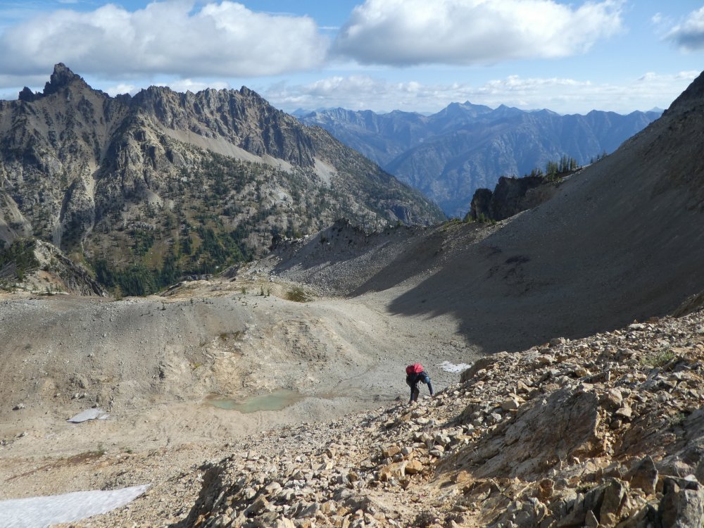
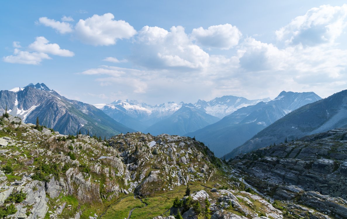
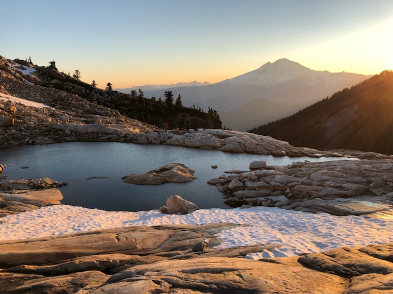
Trip: Twin Sisters Range - Green Creek (Lite) Circuit Trip Date: 08/28/2018 Trip Report: I've really only dabbled in the Twin Sisters area since moving to Bham for school a couple years ago, but what a surprisingly complex, interesting and under-appreciated resource it is, so close to town. The recently cleared air got me giddy, and after being unable to find a partner for any adventures further afield I set my sights closer to home. The Green Creek Circuit looked like a great way to familiarize myself with lesser-traveled corners of the range, and it was. Definitely gained a new appreciation for this area. I crossed the Middle Fork and began hiking the Elbow Lake trail in the deep blue, pre-dawn glow graciously accompanied by the feeling that some apex predator was eyeing me from the bushes which tends to happen while hiking solo in unfamiliar places. The "bushwack" into the cirque has apparently really cleaned up since previous TRs I've read; I've had harder times following trails to popular crags in Squamish. There's solid tread the whole way and the route is generously marked with blue reflective diamonds, perhaps excessively so, but it eased any worries I had about potentially having to hike this section in the dark. Some of the ancient cedars and firs in this area are really impressive. The Green Creek cirque is gorgeous. It wouldn't even be unreasonable for the highly motivated boulderer to haul some pads out here - there's some great looking boulders and lines. I couldn't have felt any further way from Bham or other familiar places up the Nooksack. Truly wild zone, that is until I had to pick up someone's pile of plastic food wrappers that were clearly too heavy to pack out. Seriously? I started up Green Creek Arete as the sun poked over Mt. Baker and began to fill the valley. Solid, clean rock, nice exposure, great scrambling. I haven't felt that relaxed and in tune with the mountains in a while. As I topped out, smoke began to fill the air and Kulshan was temporarily obscured - bleh. It slowly cleared, though, and crossing slabs and tarns en route to the Sisters Glacier was another unexpected scenic highlight of the trip. Easy travel, great views and lots of peaks ahead. The moat crossing to S Twin NE Ridge was easy, and the ridge was a lot shorter than I expected. On top around 10, I started to relax and slow my pace down with all the daylight still in front of me. As I scooted down the south face gullies, I was eyeing Skookum with a little apprehension. I didn't bring a rope, and the Jaws Tooth downclimb didn't sound very up my alley, so I was looking at climbing directly up to the Jaws Tooth notch and finishing up Skookum. It looked like a large moat to steep choss - which, in hindsight after climbing other things on this traverse, I'm sure it wasn't, but I also became more worried about sketchy looking conditions crossing the Hayden Col, Little Sister Col and dropping back on the glacier, and ended up passing Skookum by. I know I probably missed out on the best climbing of the whole outing, but that was my call in the moment. I'll be back. A common theme of the Sisters area appears to be things looking much steeper/chossier/more difficult than they really are from a distance. Despite being totally melted out, the Hayden Col was casual, so I scrambled over to a summit I thought to be Ribbon Point, but was actually the one just to the north of it. Either way, cool spot. The talus crossings weren't nearly as bad as I'd heard they might be without snow, though my bruised tailbone might think differently. Slower going, but reasonable. Not wanting to miss out on any more good climbing, I eyed up my line on Little Sister's NW face and settled on the rightmost of the two ribs on the left side of the face. Surprisingly good 5.4ish up and sometimes left of a little corner system, stepping left onto a beautiful, highly featured and varnished slab to bypass a small bulge, leading to class 3 up the rib to the summit. Stellar! selfies are hard with an slr! stoked on top of little sister route up little sister with the easy-ish access to green ck glacier marked I dropped my pack at the notch just above the Green Creek Glacier, sussed it out and found passage via a collapsed snow bridge. All around, the schrund was huge, and I decided to go with the devil I knew and hop across here, as opposed to traversing Little Sister and Cinderella and potentially not being able to get back down to the glacier. This I think was a good call, the normal col where people drop onto the glacier was severely melted out with a large looking moat. The hike down the glacier, into the valley and out was calm and tranquil. The smoke had fully cleared, I don't think I've ever had as good of a view of Lincoln and Colfax as this. Grassy benches without a trace of human travel, bright orange rock contrasting with Baker's white, and the jagged cirque and glacier at my back. 15 hours car to car, for what little peakbagging I actually accomplished I'd say this is a modest time that could be significantly improved with less lollygagging, summit naps, routefinding snafus and blueberry pit stops. But I like all those things. Gear Notes: axe and pons, sense of adventure Approach Notes: now equipped for the masses


 1 point
 -
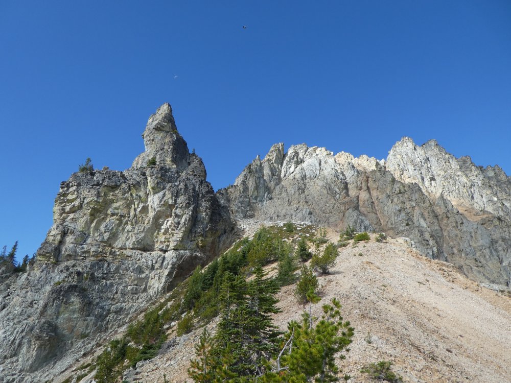
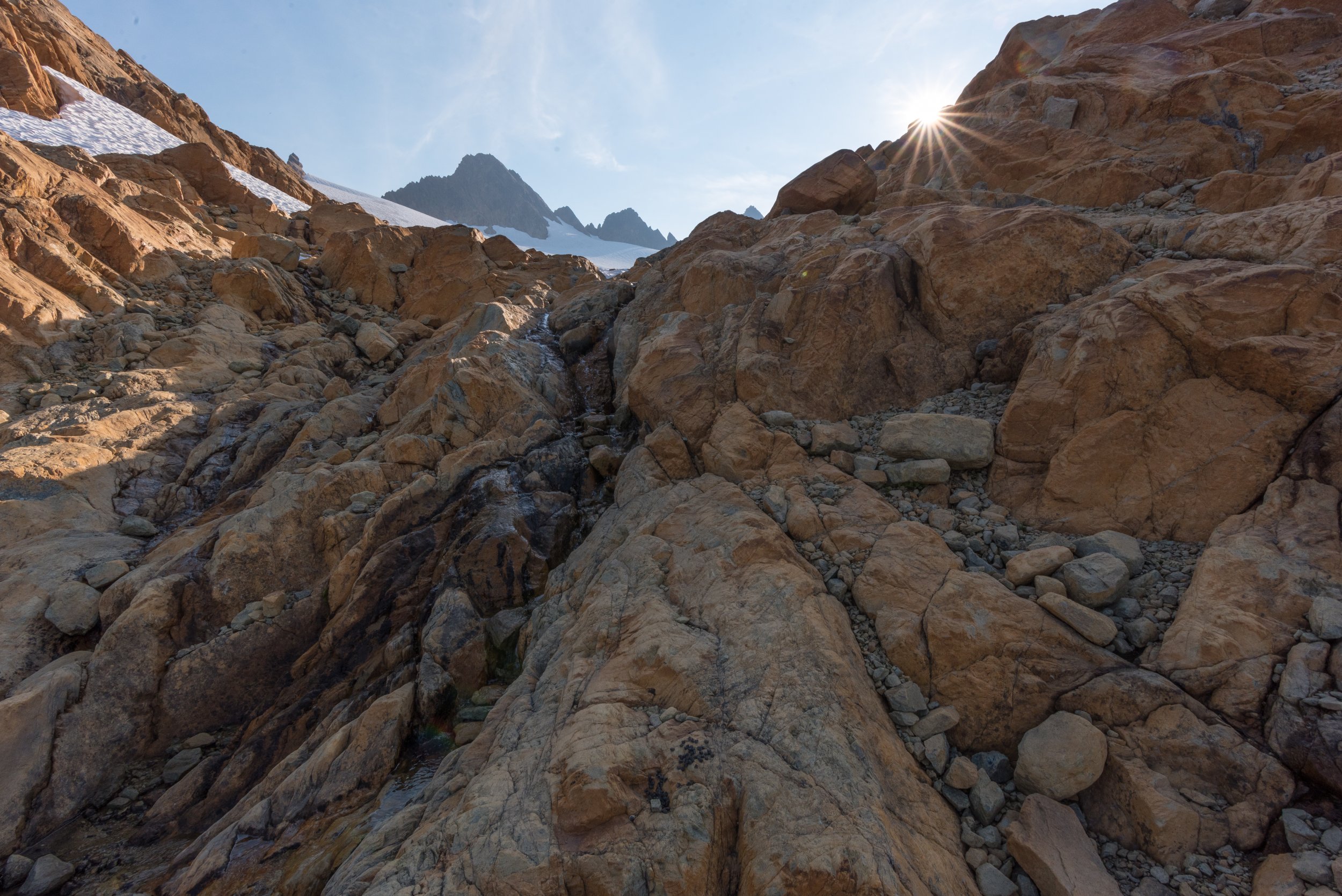
Trip: Noisy Diobsud/Stephen Mather Wilderness - Bacon-Hagen-Blum High Route Trip Date: 07/20/2018 Trip Report: From July 20th-23rd Dave, Darren, Matt and I traverse from Anderson Lakes to Blum Creek summiting Bacon, Hagen and Blum along the way. The route is characterized by excellent views of the Baker and Sister Range to the west the the National Park to the east. Awesome camp sites and outstanding alpine lakes make this a most memorable route. Brush bashing wasn't all that severe save the walk down Blum Ridge to Baker River. You won't find me walking up that route anytime soon. I have been doing trips with these guys for nearly 20 years and I am ever thankful for the friendships and the adventures over the years. I would like to have an intense conversation with the douchbag that left a pile of trash shoved under a rock and shitty TP strewn about at the high camp SW of Bacon. Beer cans and mountain outhouse bags don't decompose and it doesn't seem that difficult to pack out your trash. Alpine eye candy Gear Notes: Ice axe, light crampons, and glacier rope. Approach Notes: Anderson Lakes to north side of Mount Watson.


 1 point
 -
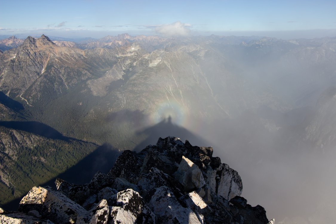
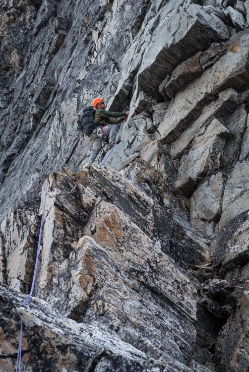
Trip: Mt. Slesse - NEB Trip Date: 07/19/2018 Trip Report: Anyways went up and climbed North East Butress on Mt. Slesse with friends Chuck and Yale on July 19th-21st. Great trip full of adventure. Went up on the 19th, on the way up got the truck stuck and had visions of spending the weekend digging the sucker out. Luckily after a half hour of piling rocks and digging out the undercarriage we were able to drive away and continue as planned. The plan was to hike to the view point today and check out pocket glacier, there was word that it was still in place. Which it was, we hung out for a while listening and watching and all seemed good and stable, but not completely reassuring after hearing tales of it sliding from the likes of Otto. Anyways we decided to give it a go and check it out. The next day we were up at 2:00 and hitting the trail at 2:30, from the parking lot. The plan was to get to the glacier before the sun hit it. It appeared our plan worked out since we arrived before the sun and things seemed quite stable. After a quick crossing we were finally on the climb proper and we could put all the apprehension about the glacier behind us, though I kept thinking what if we need to retreat. Luckily that didn’t happen. Not much to say except it was a stellar climb with lots of pitches. Chuck led the crux 10a in good style with an big overnight pack on. We were running short on daylight towards the end so motor out the class 4 scramble at the end, but we’re still benighted and spent the night on the summit. Since it was a planned bivy I was quite comfortable I had a sleeping bag, even had coffee and muesli in the morning though cold. It was by far one best bivy I have had on a climb. The crossover descent was sort of uneventful, though there was still a lot of snow slopes in place, which probably slowed things down, but we eventually back down to the car around 4:00pm on the 21st. Can’t stop thinking of the climbing and can’t wait for my Upcoming Matterhorn trip. Gear Notes: Alpine rack Approach Notes: Missed the parking lot on the drive in. Basically where there is a sign pointing to Mt. Rexford is where the parking is for Slesse.1 point
-
It was a great(long) day up there with Darin. The climbing was very enjoyable and would recommend it, but the run under the ice fall was full on alpine gauntlet.

 1 point
 -
No joke Jason. Have a hard time wrapping my head around the fact that someone that would do the work to get there would act in such a manner.0 points