Leaderboard


Popular Content
Showing content with the highest reputation on 06/18/18 in all areas
-
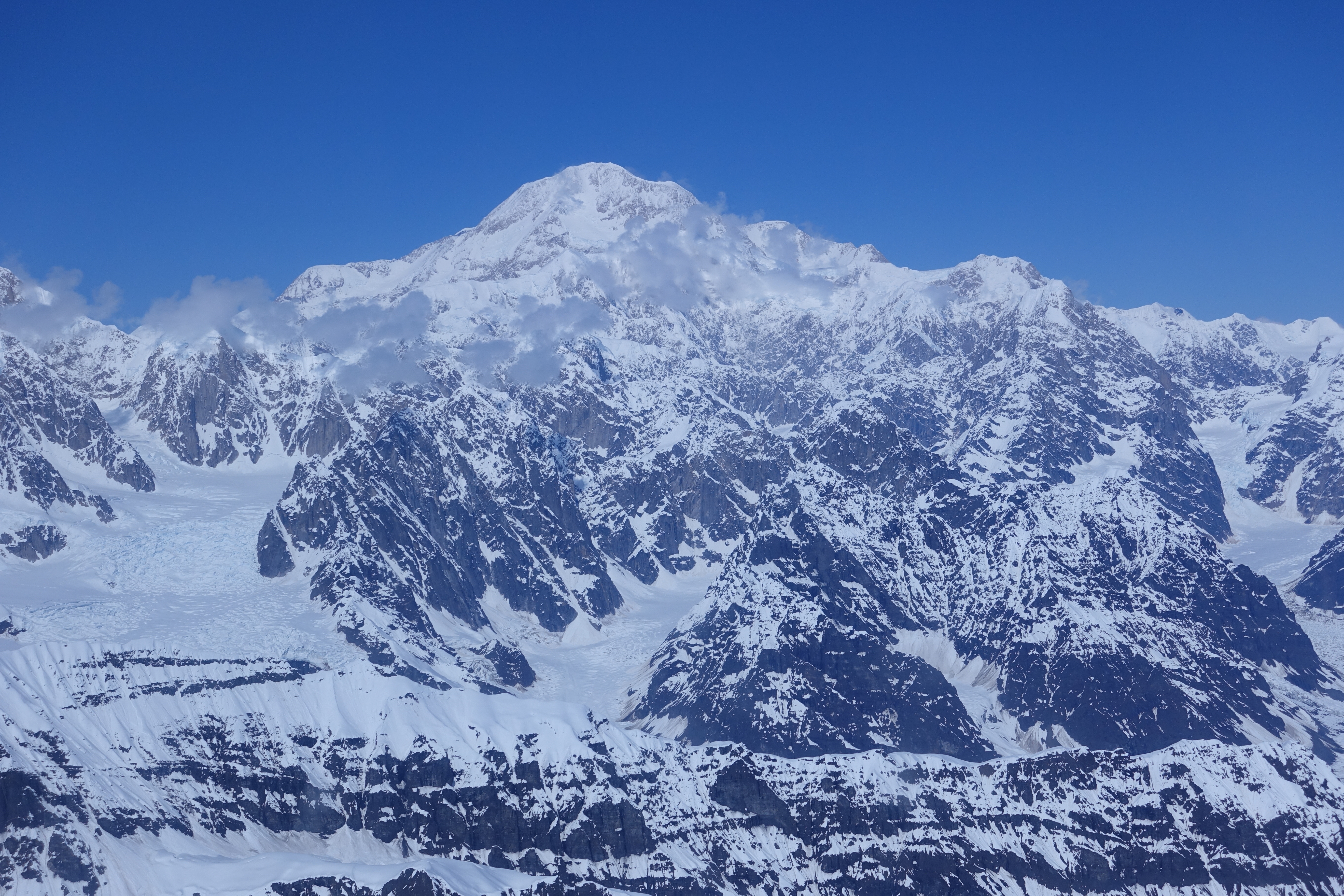
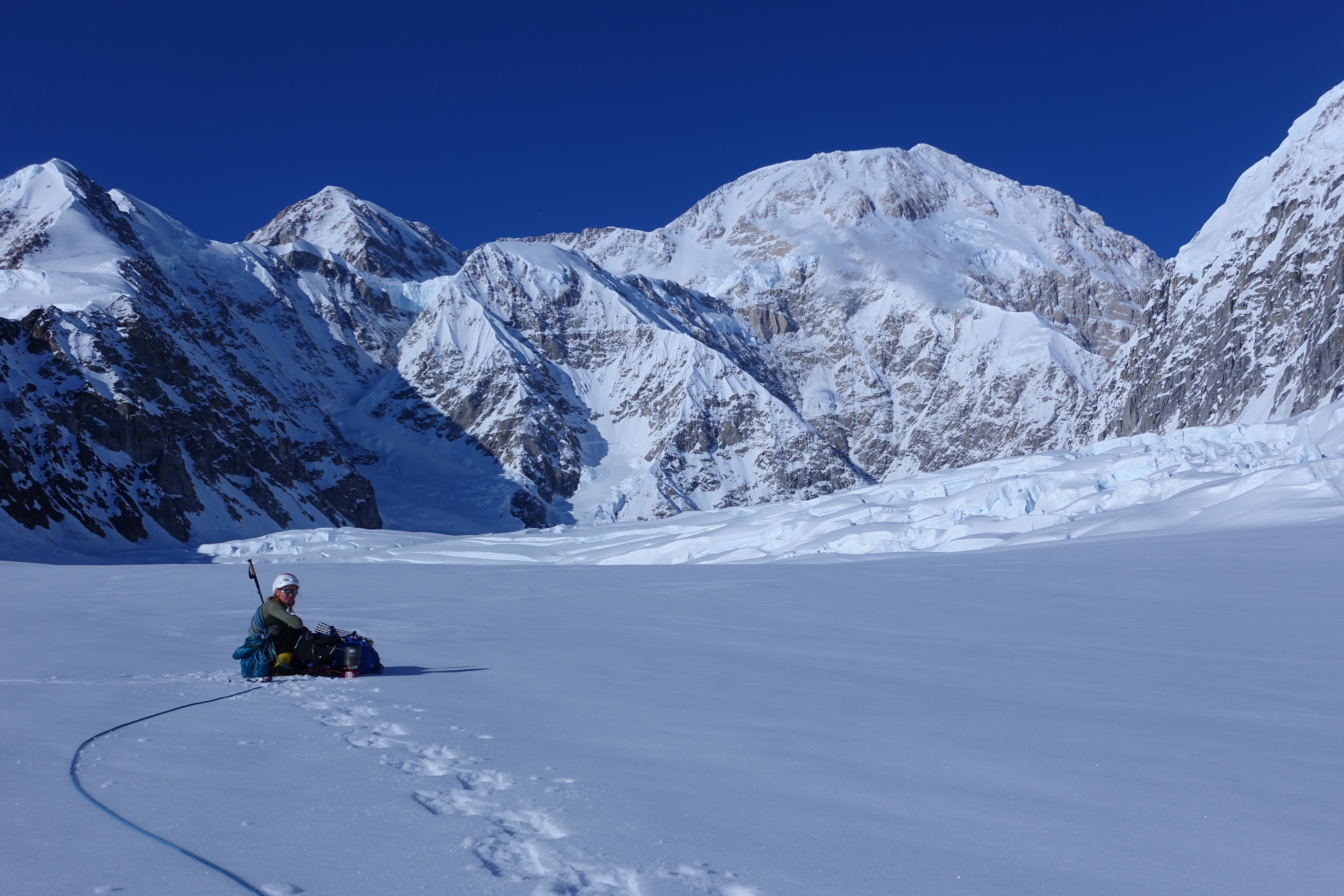
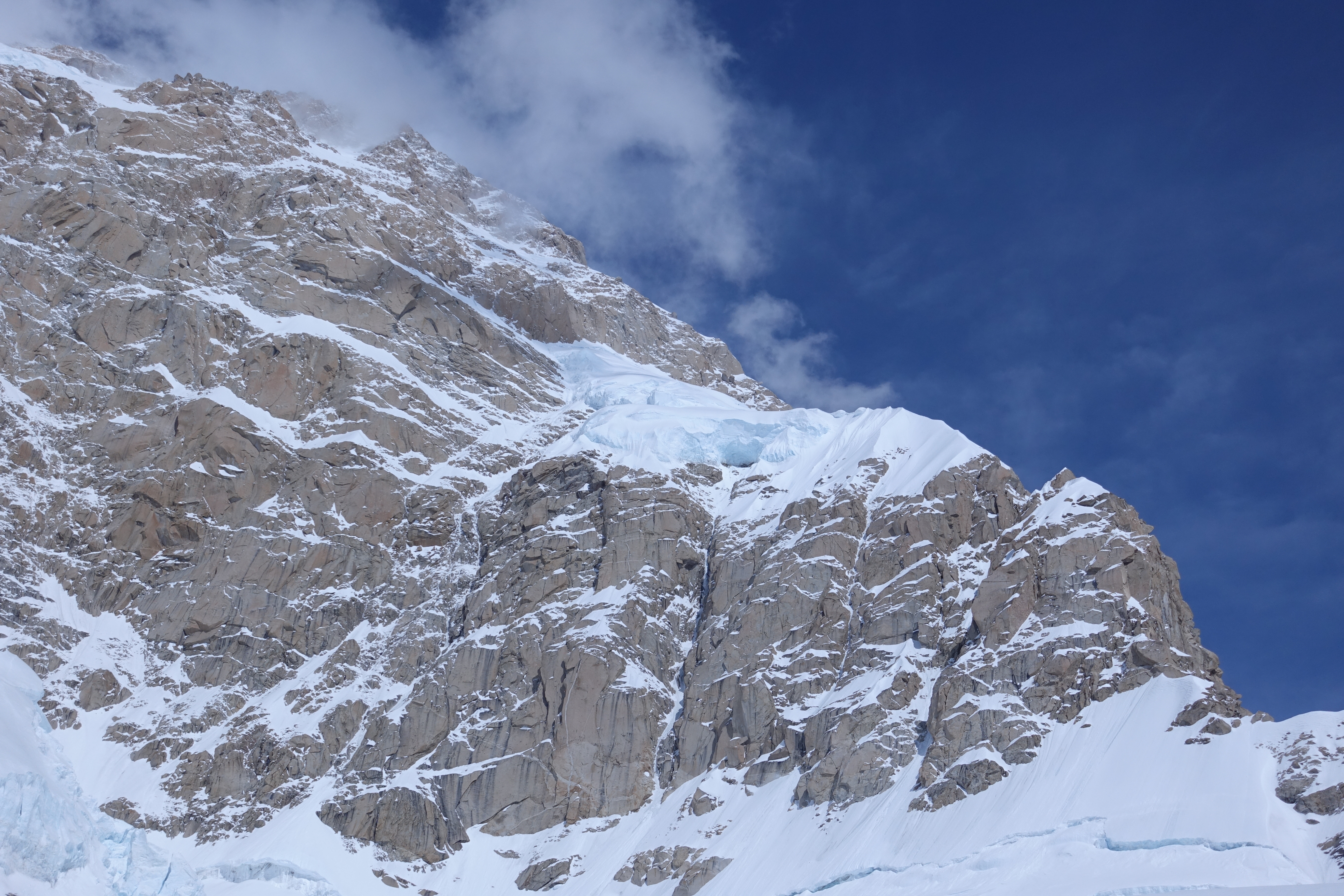
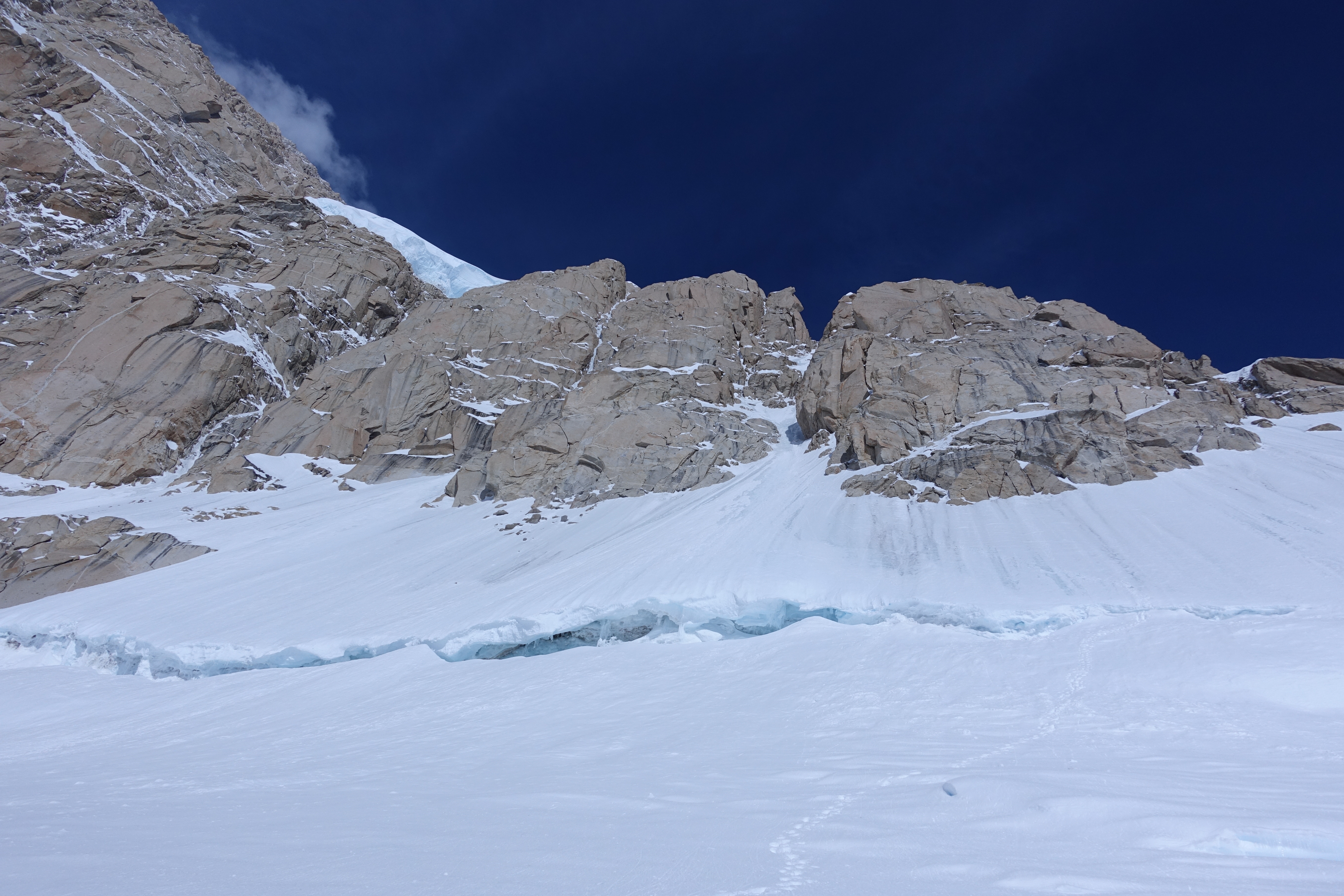
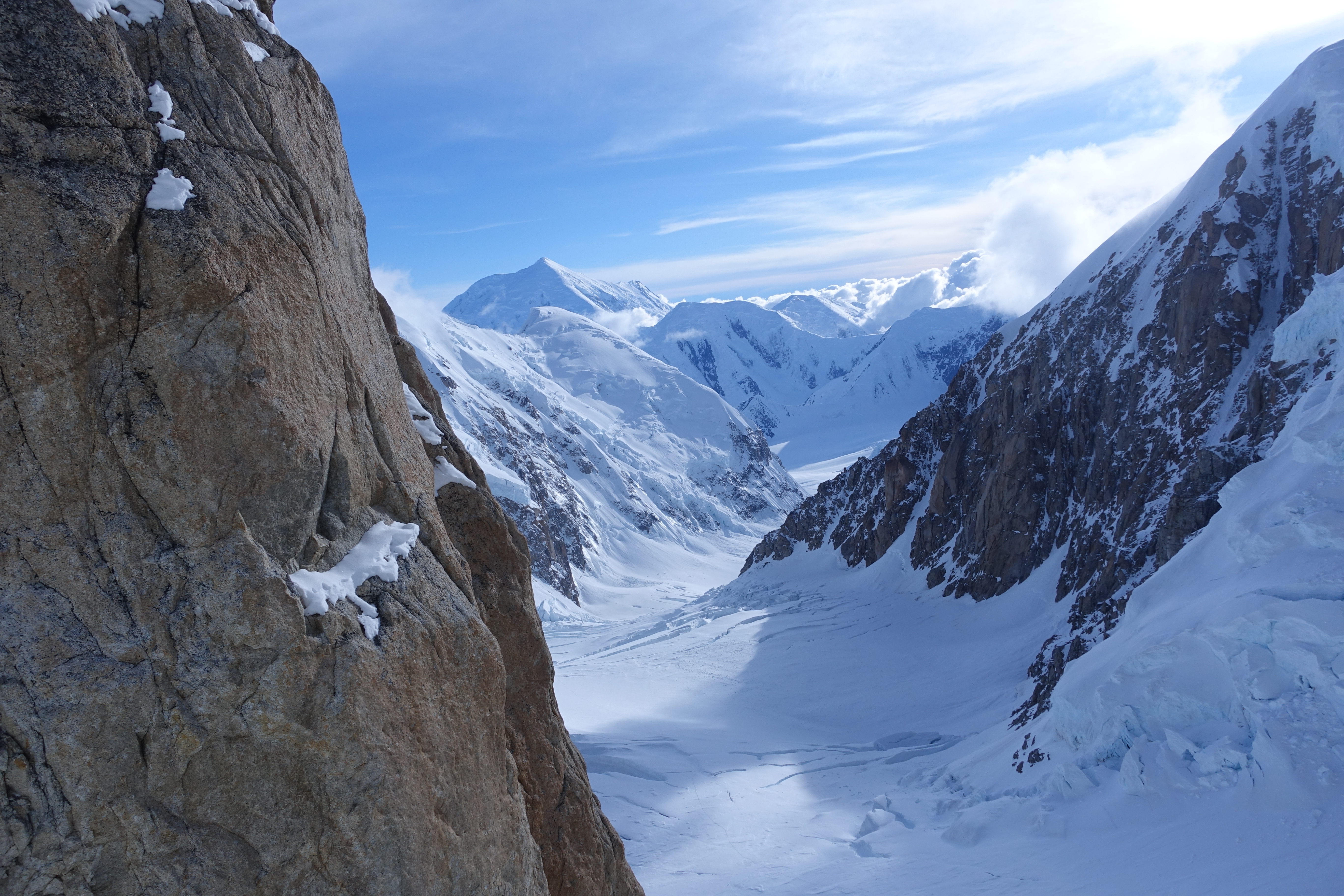
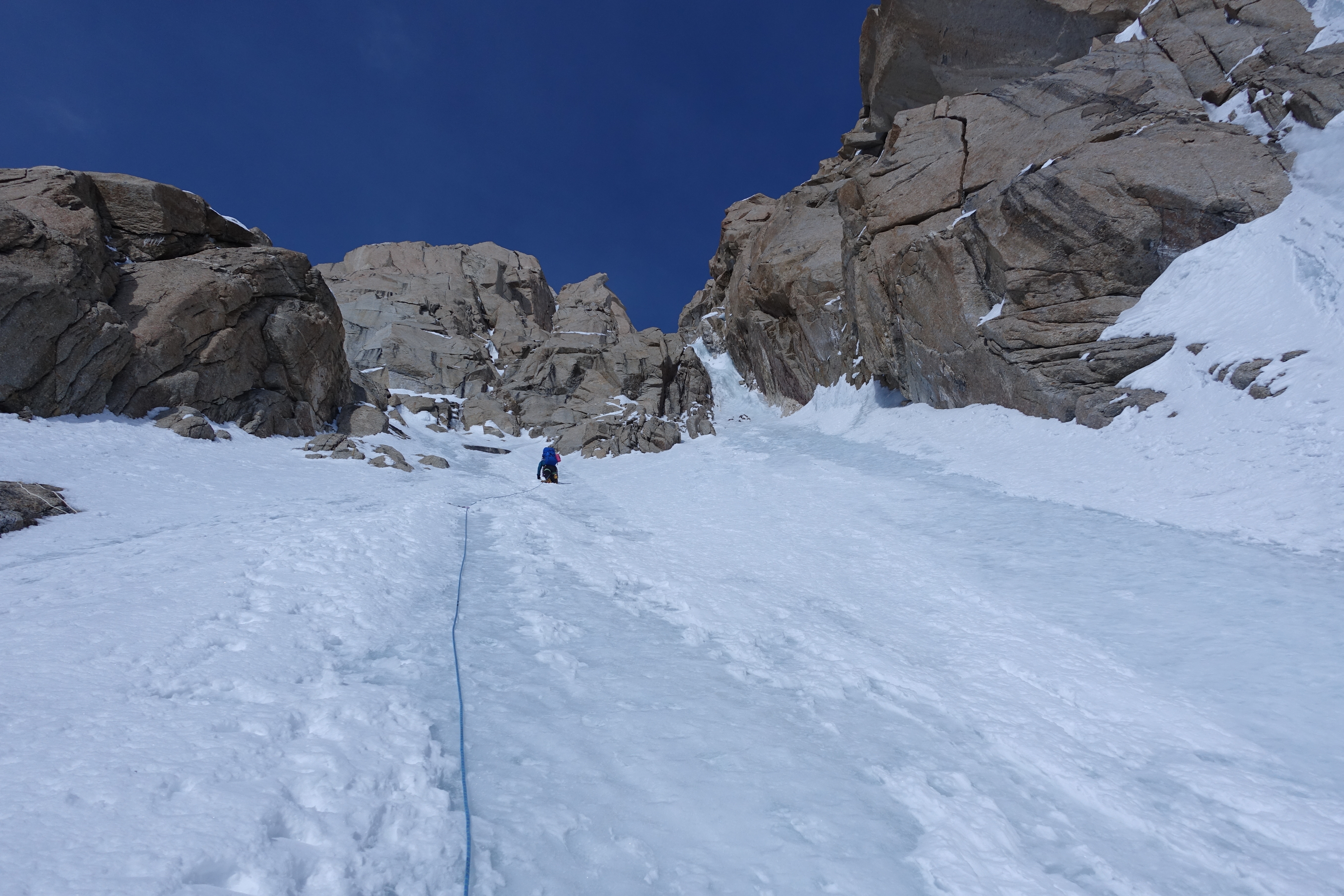
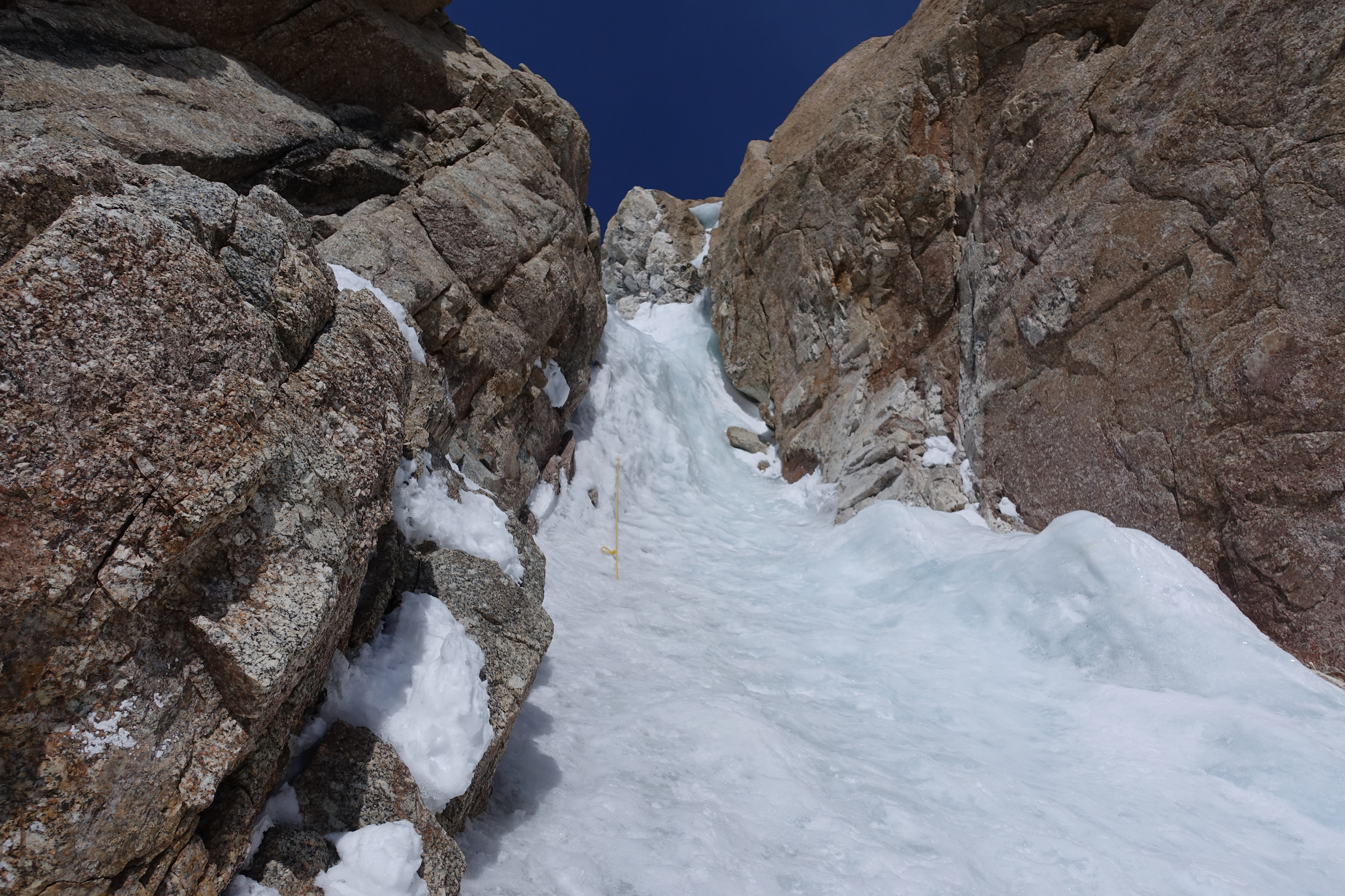
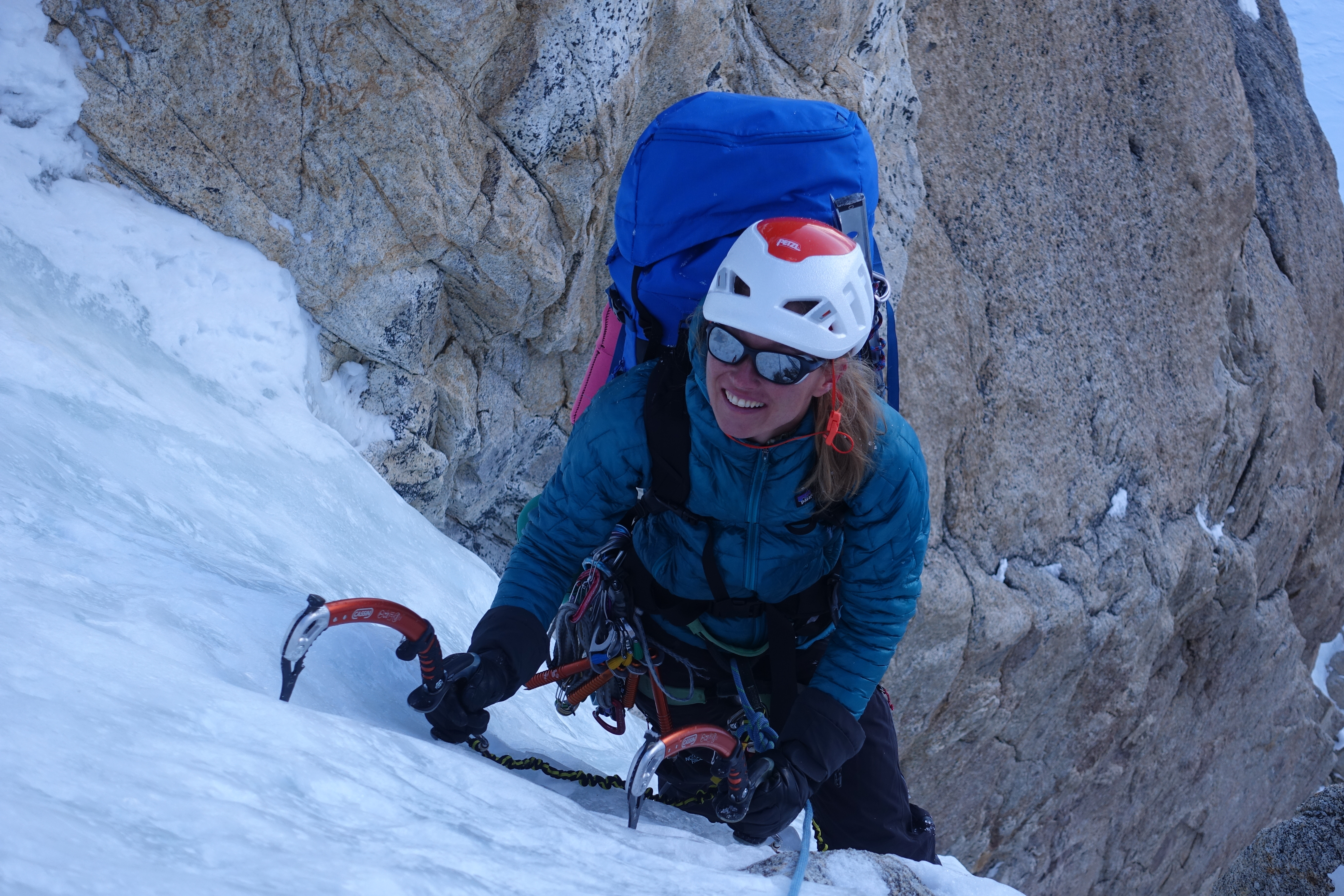
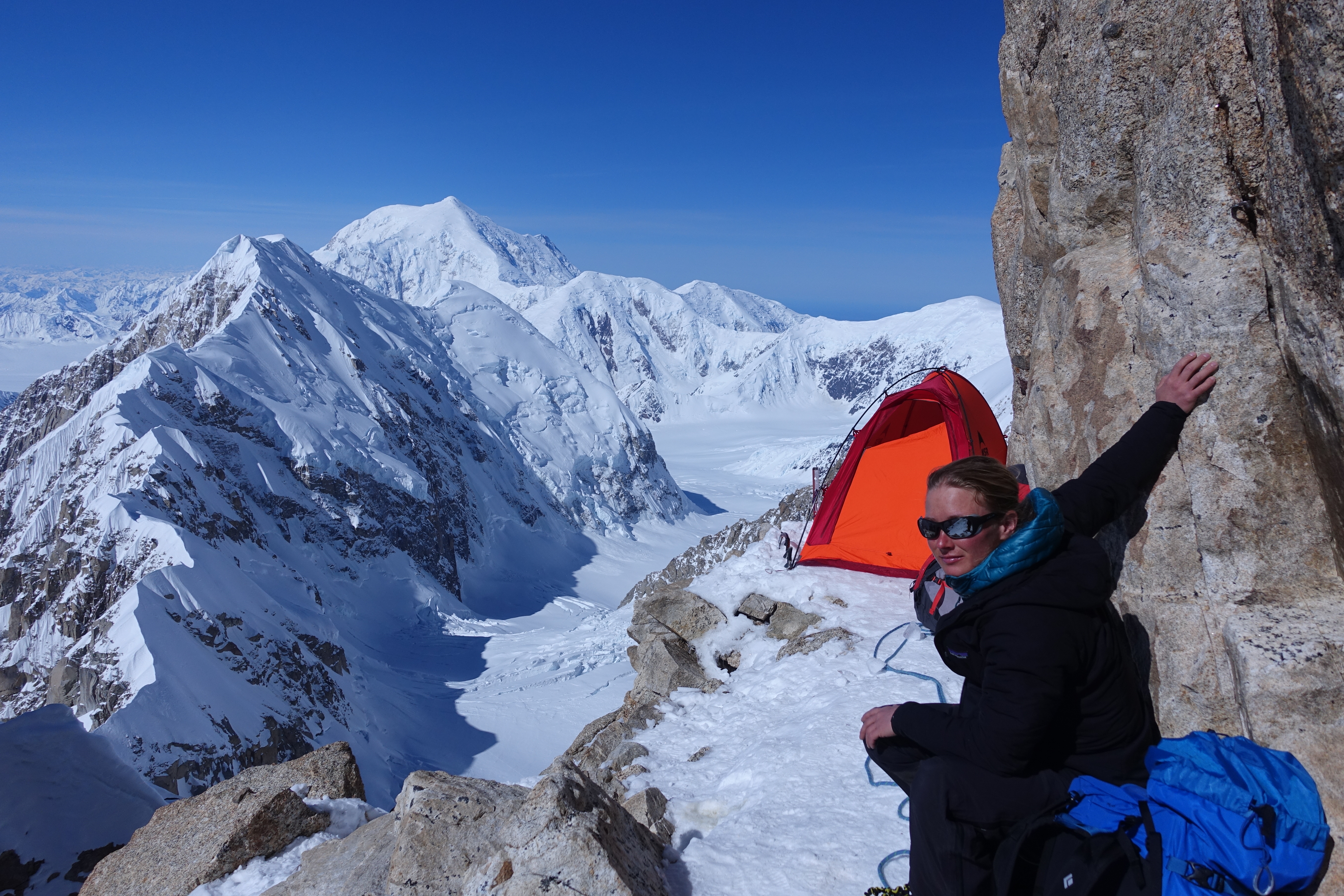
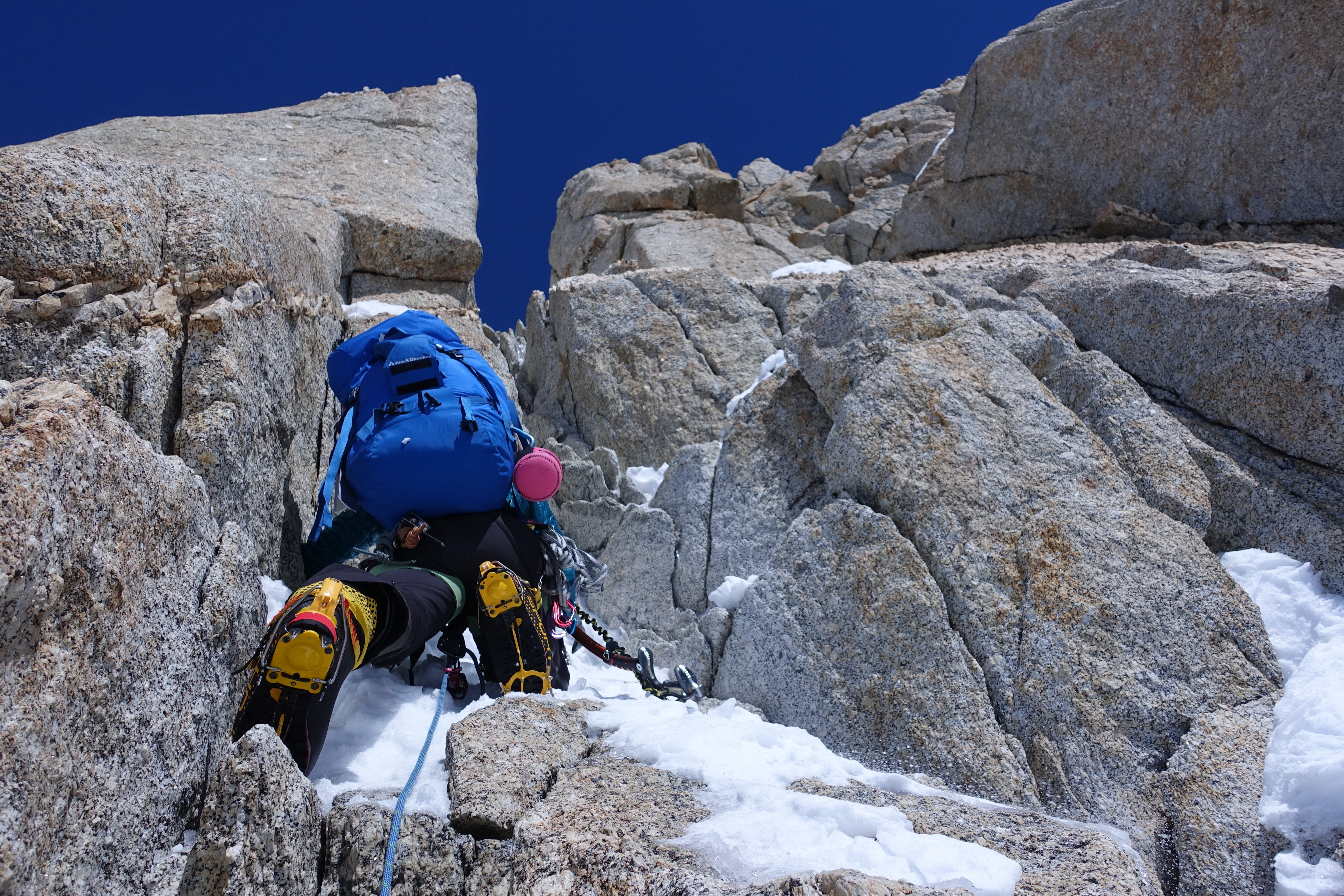
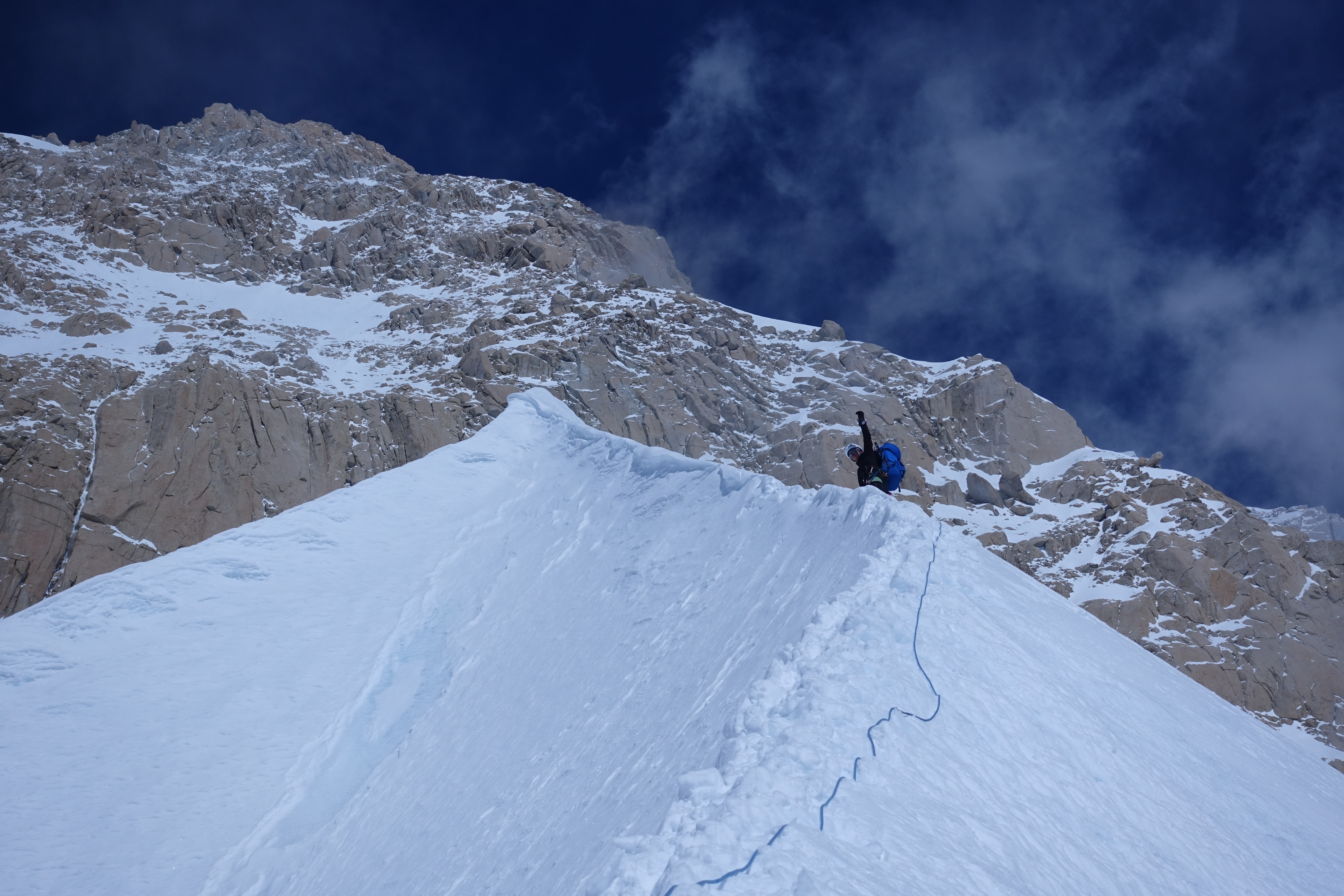
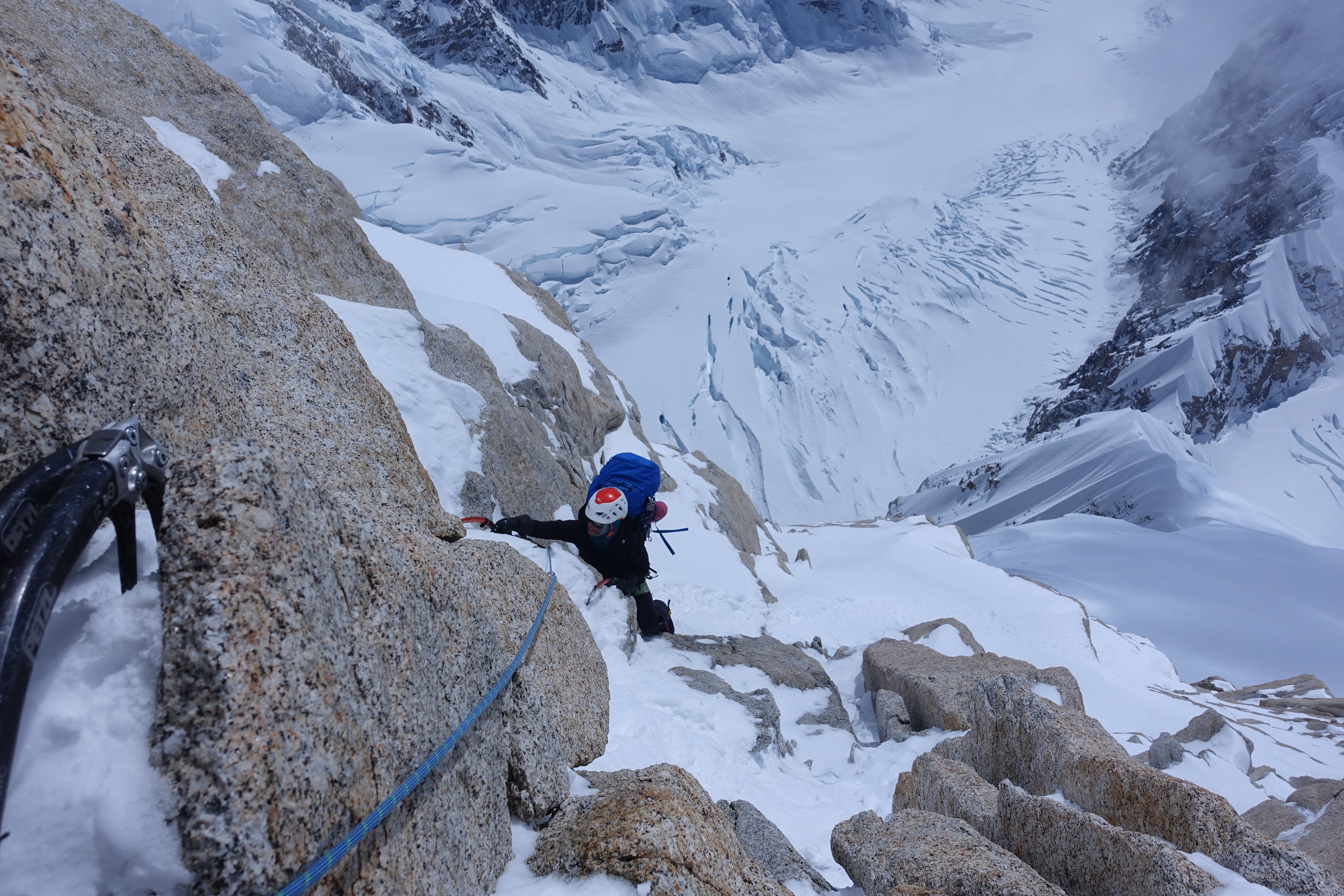
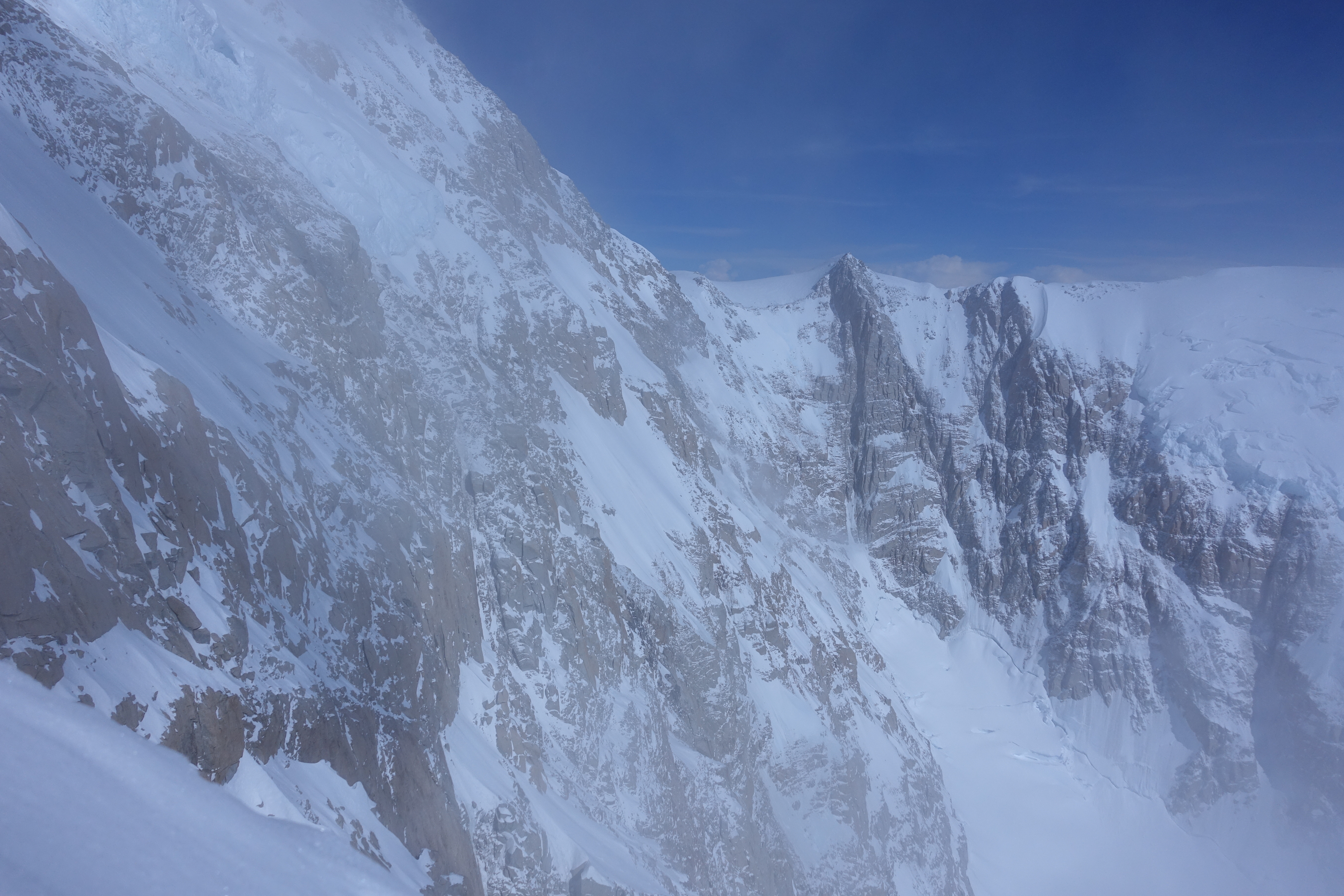
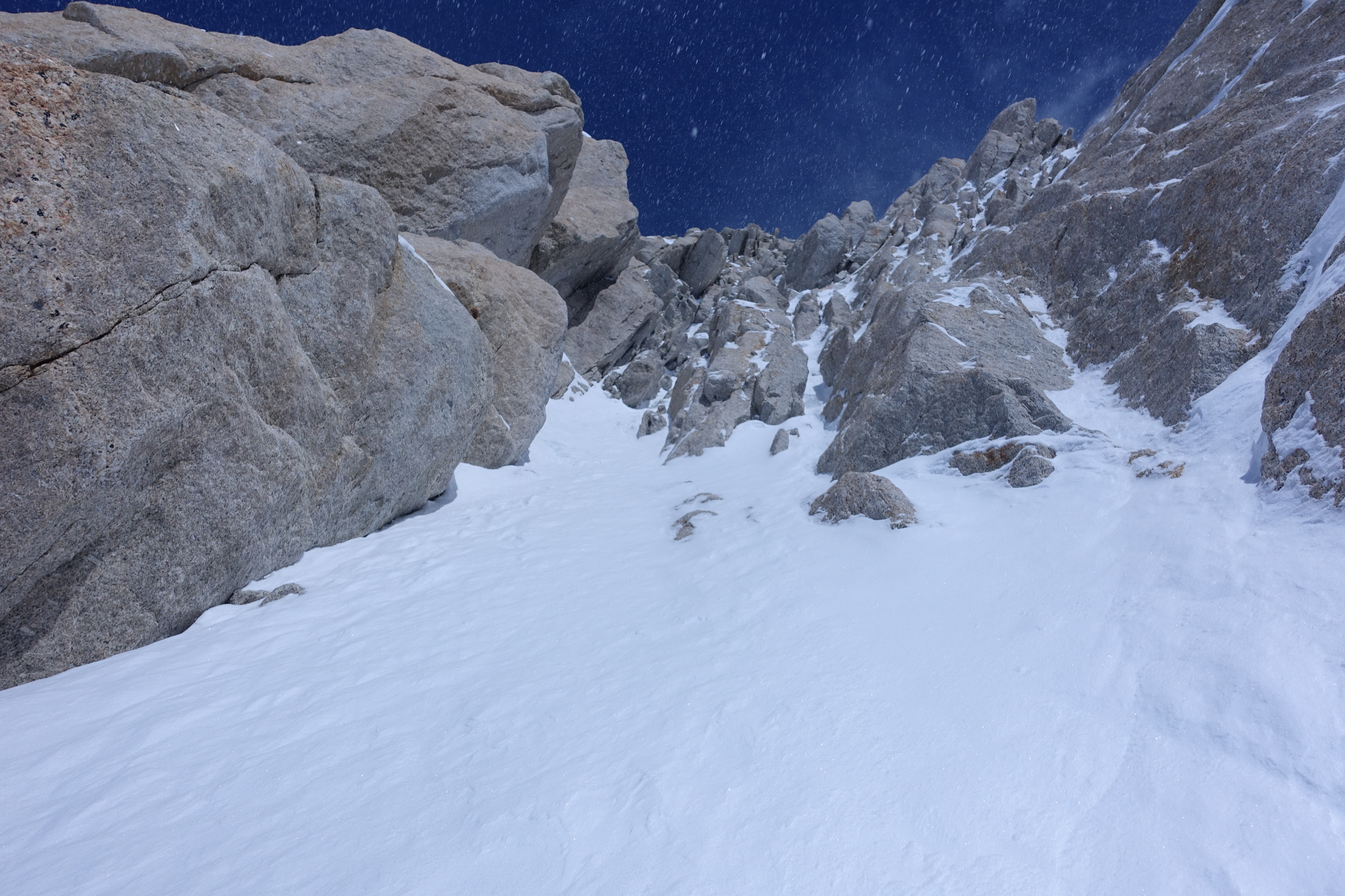
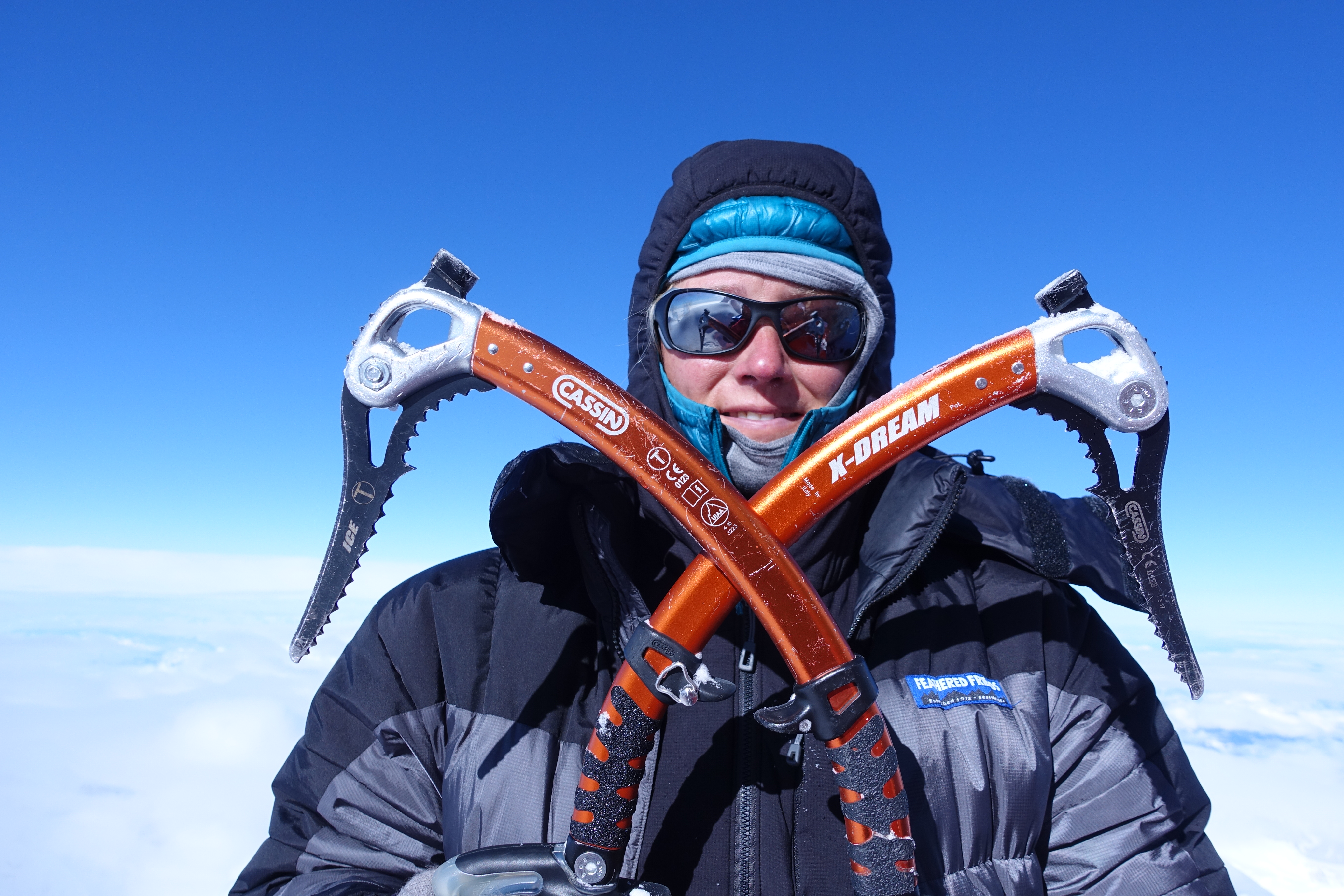
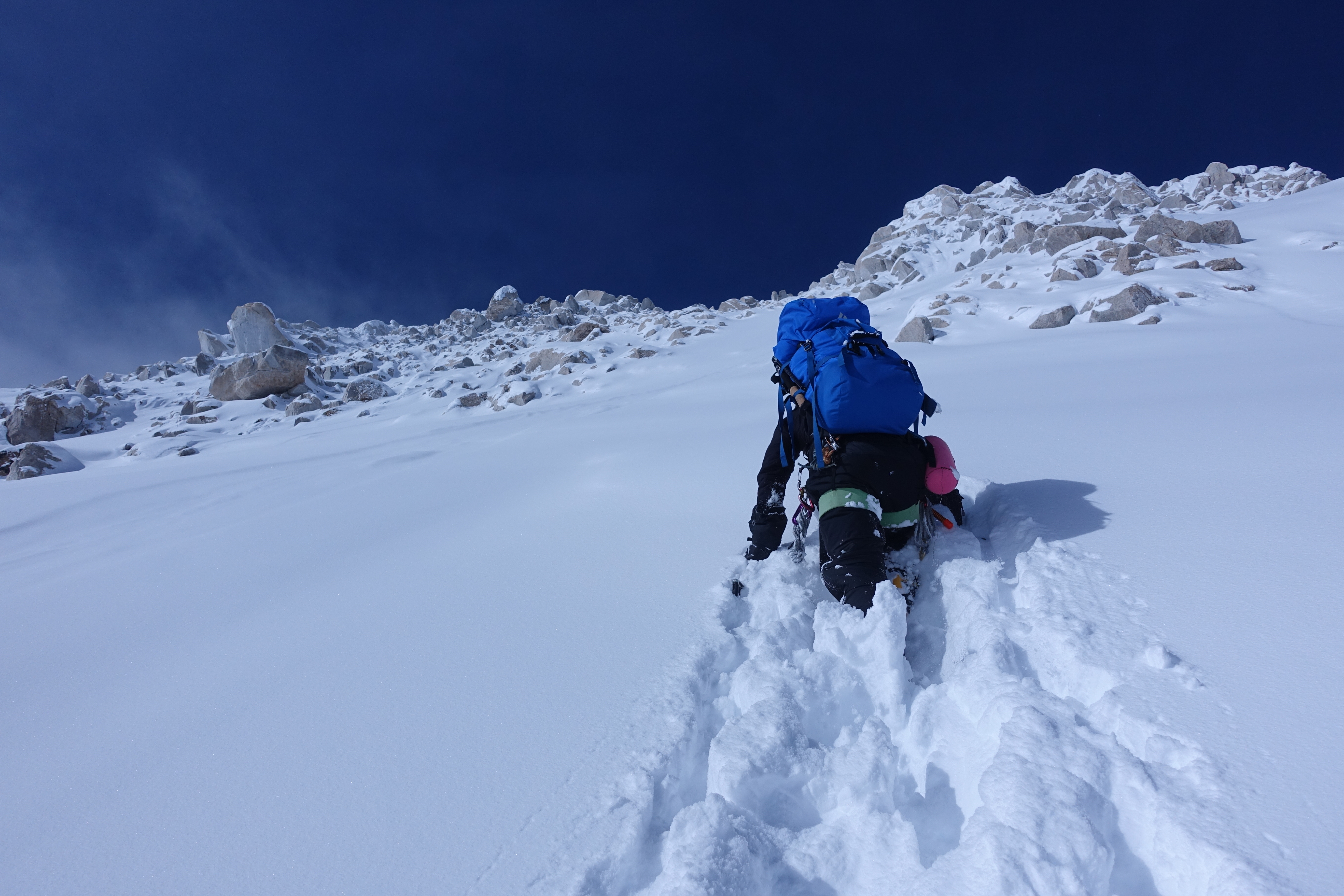
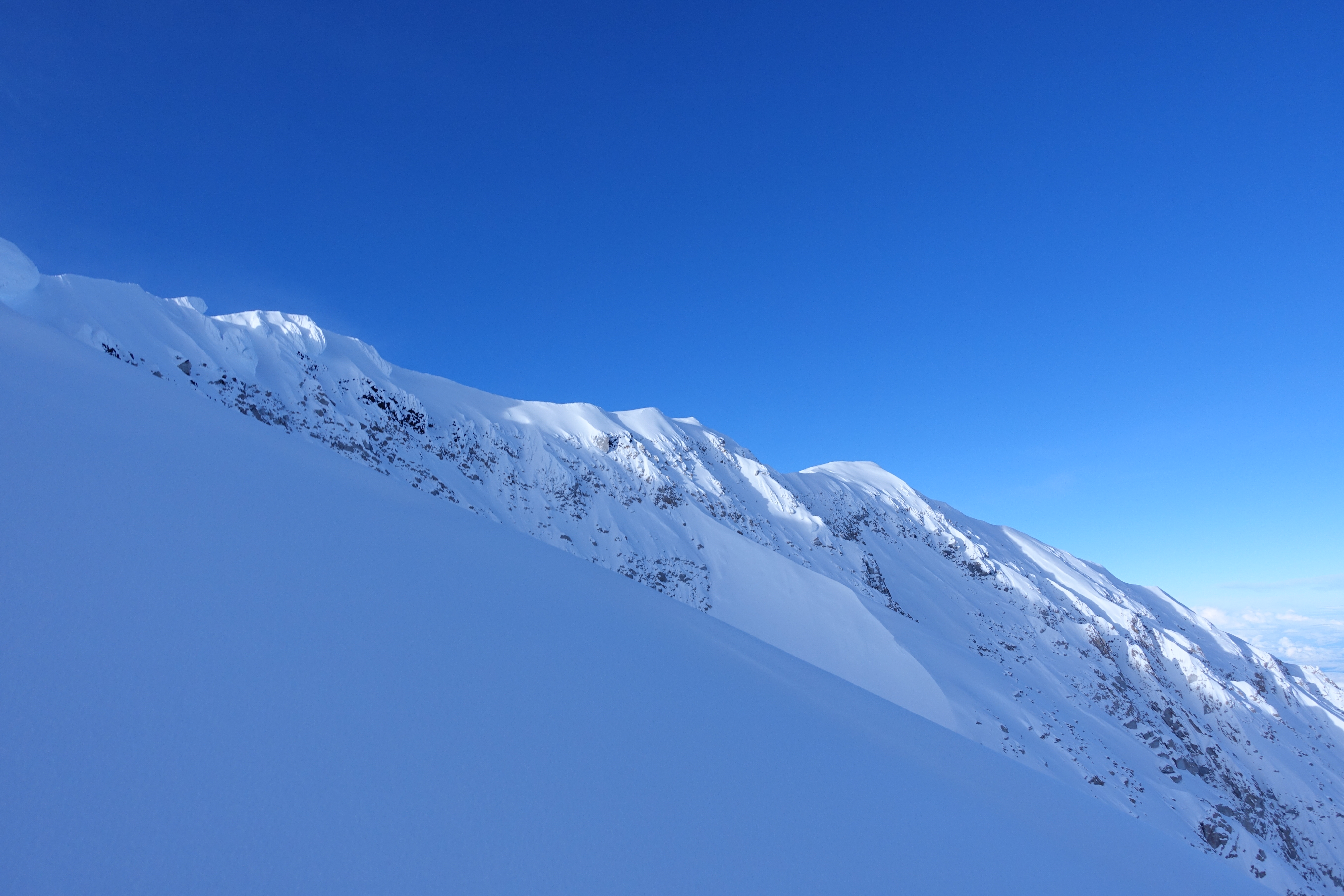
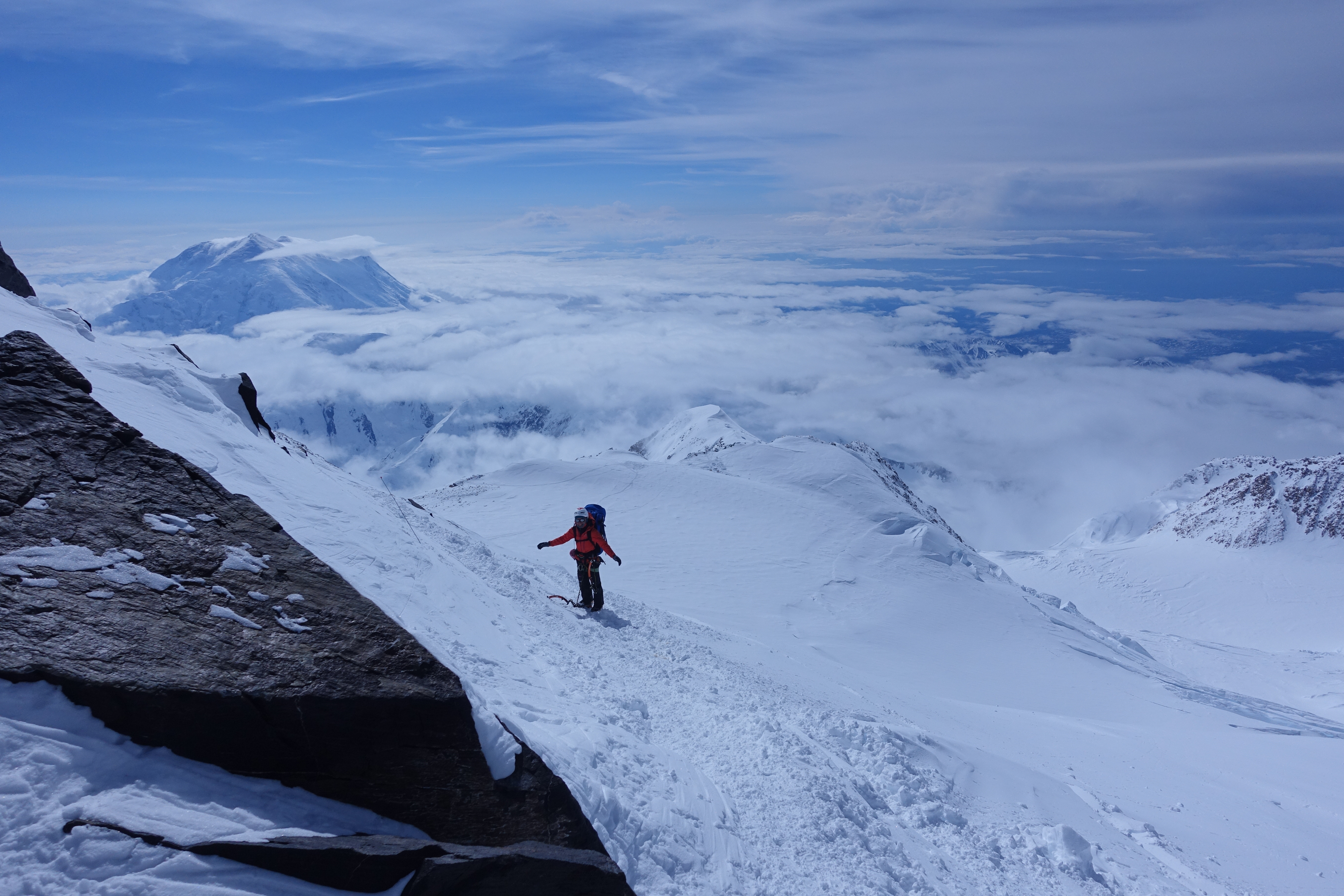
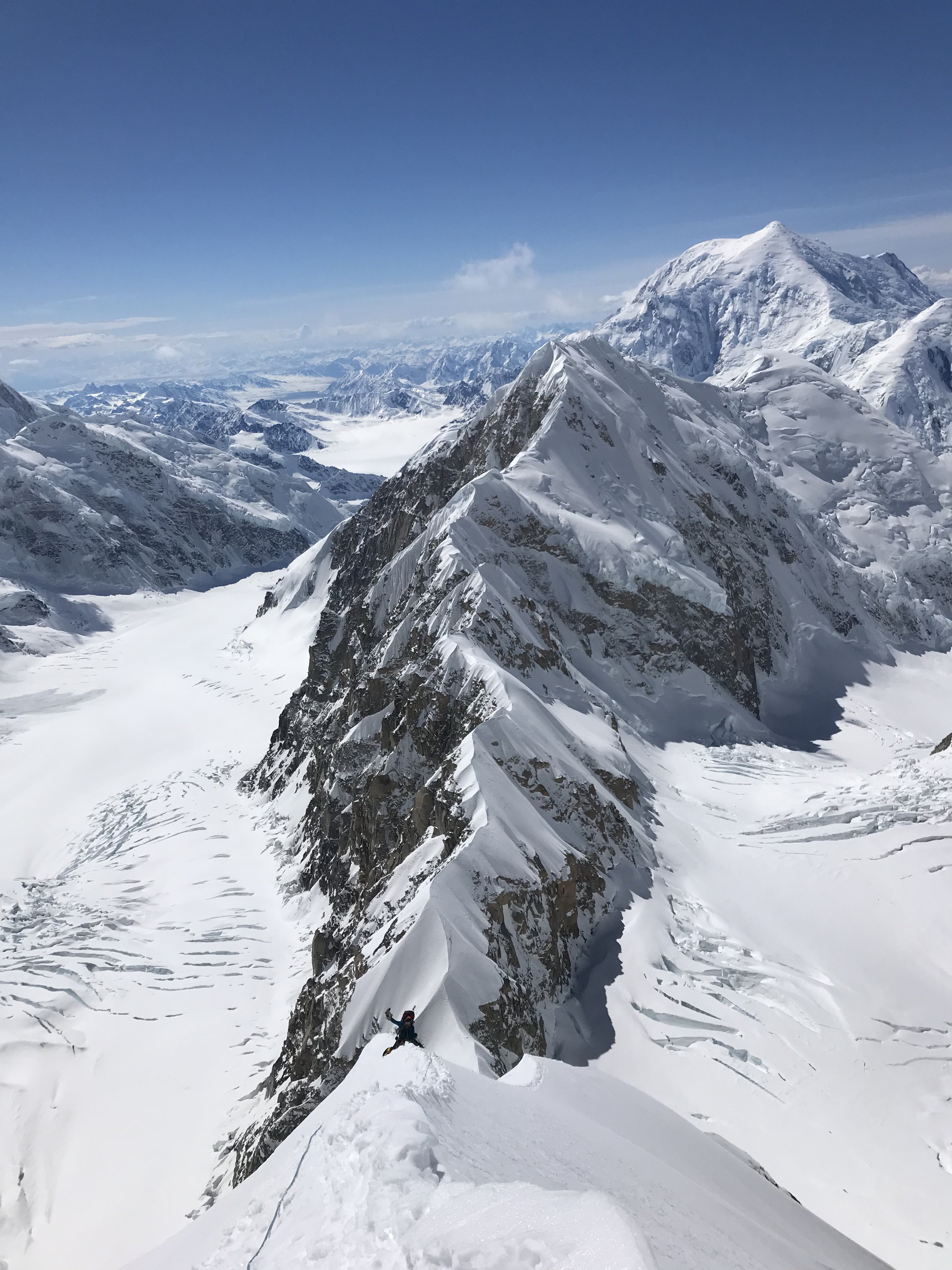
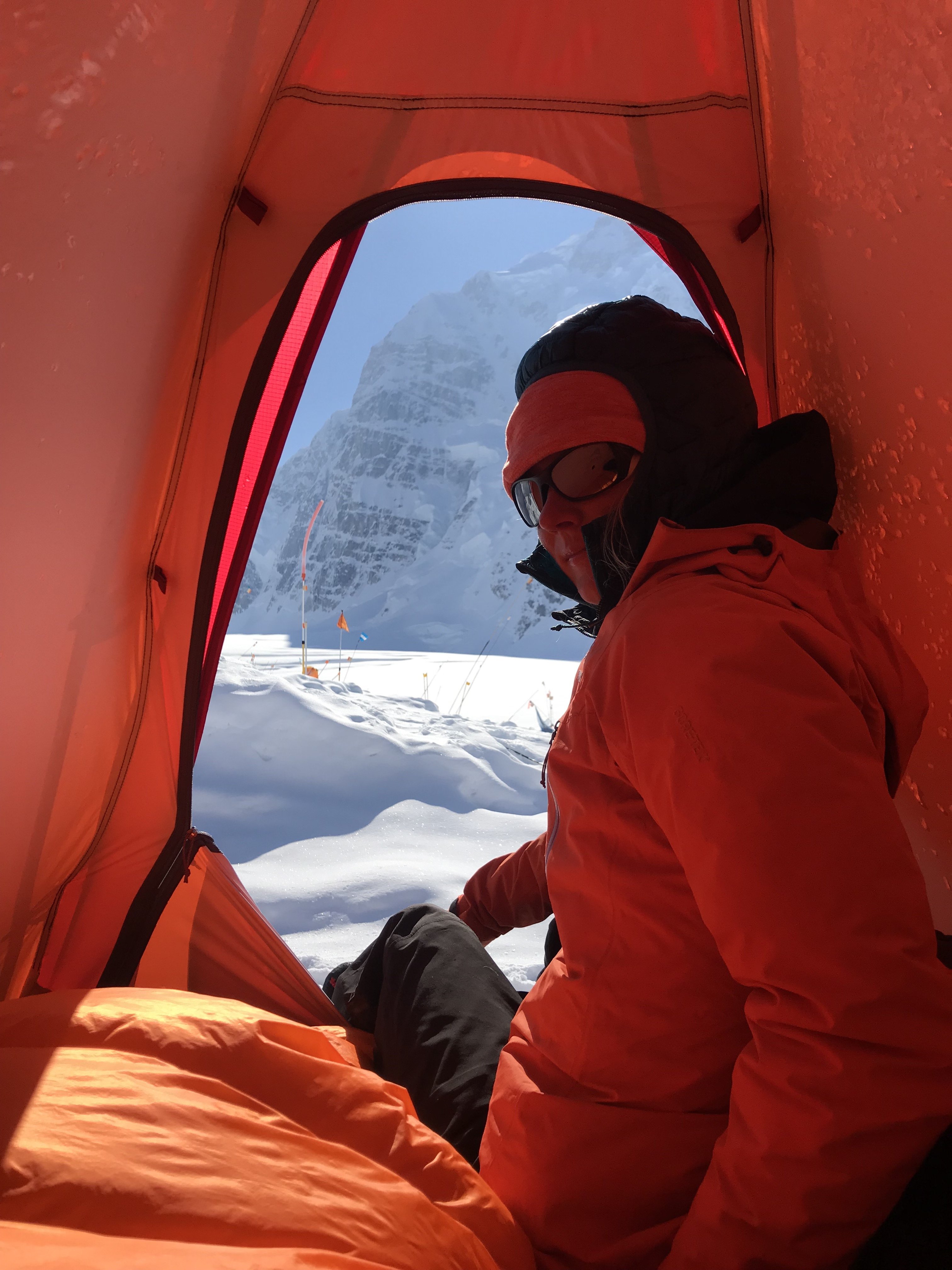
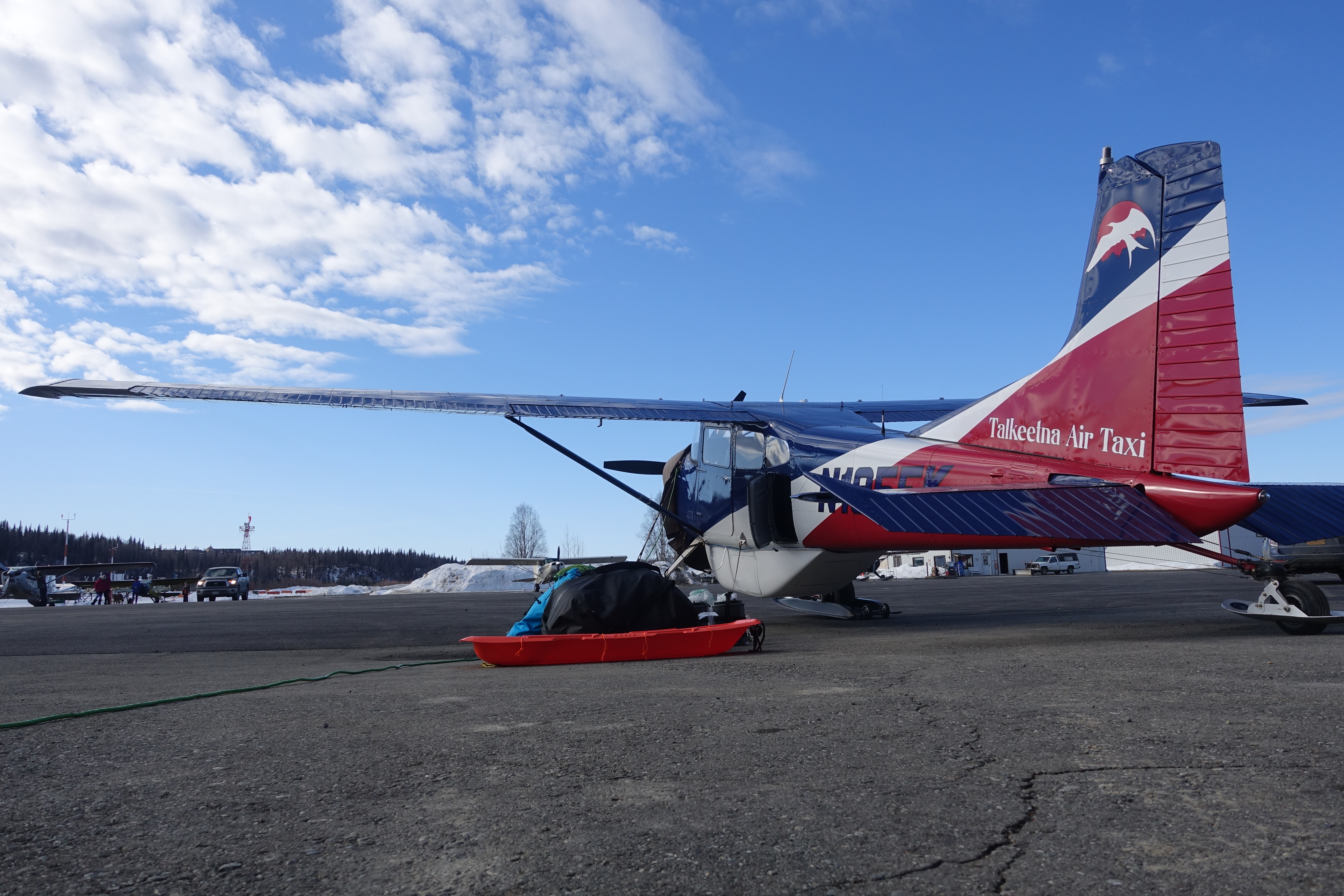
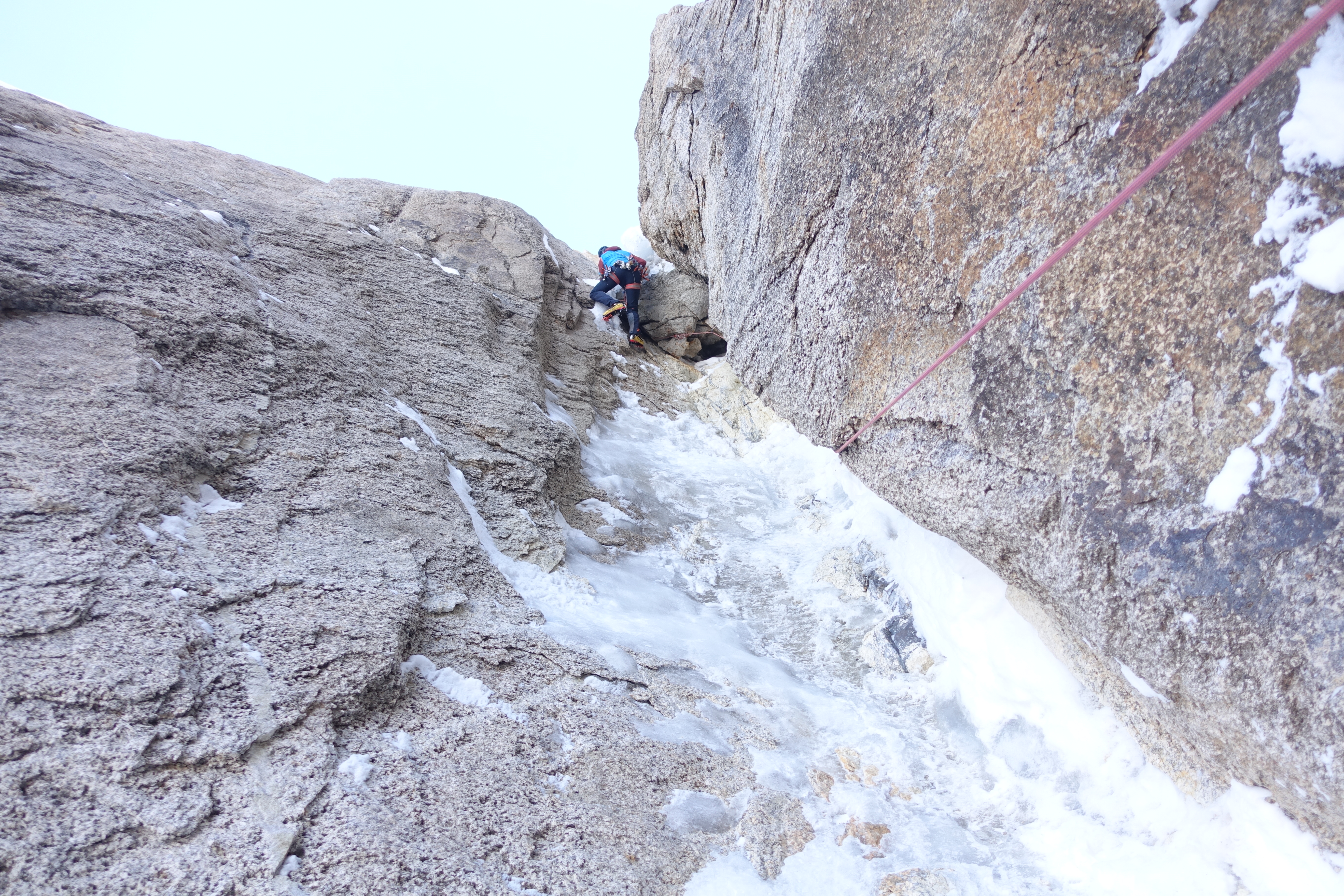
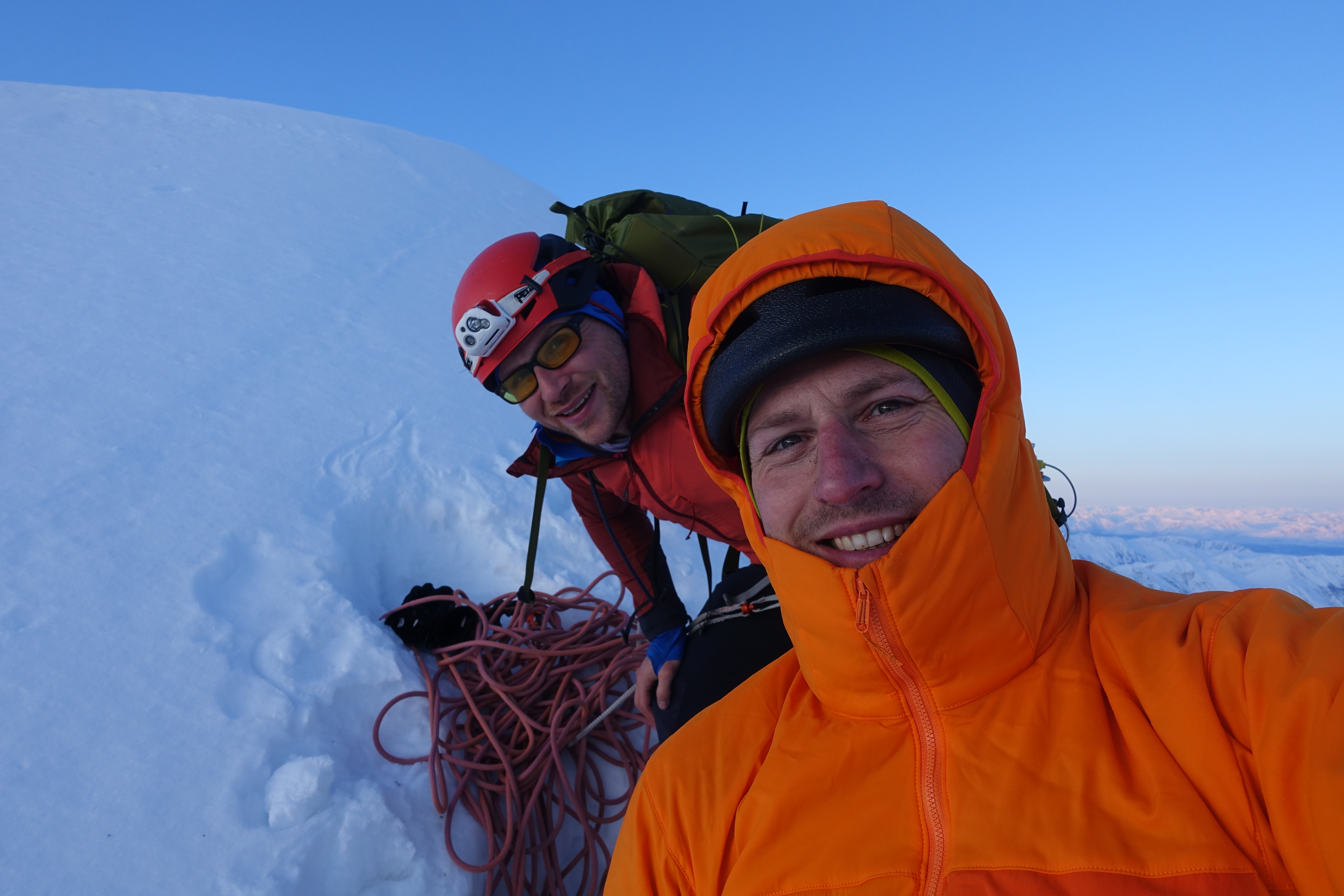
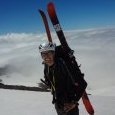
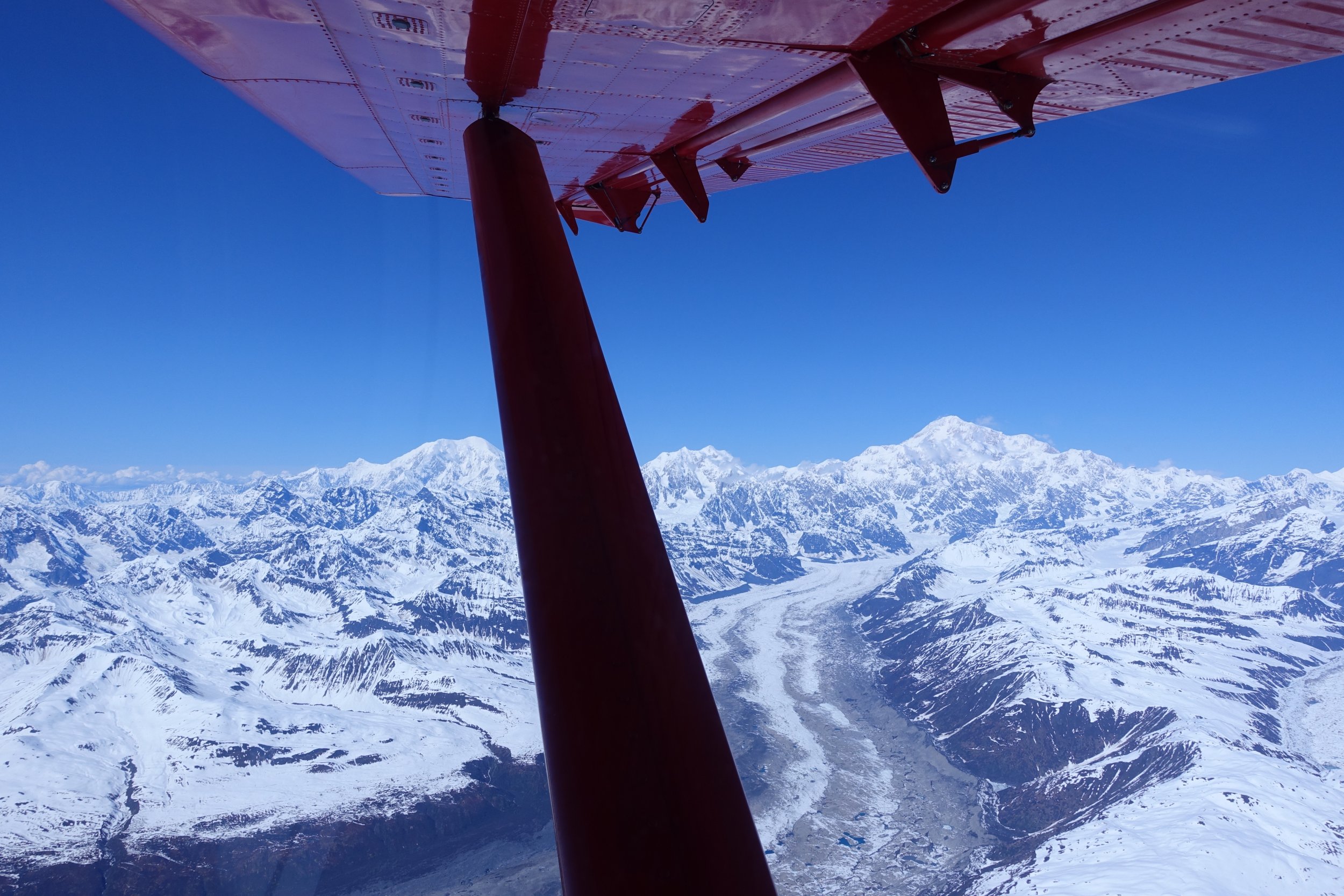
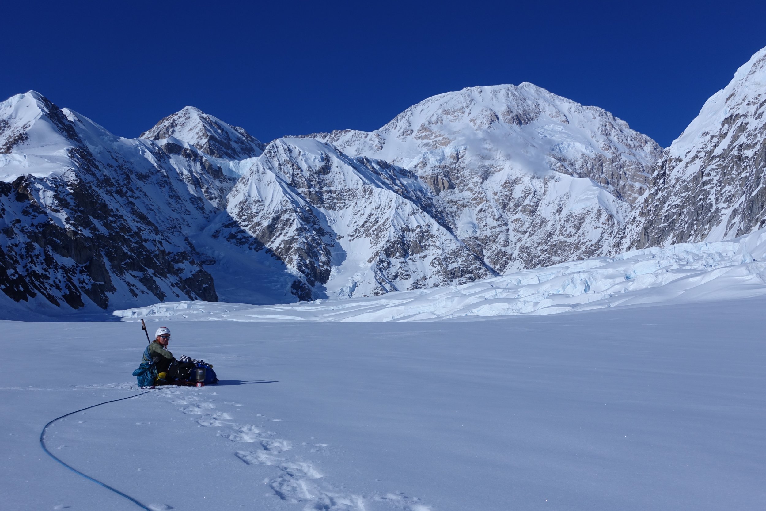
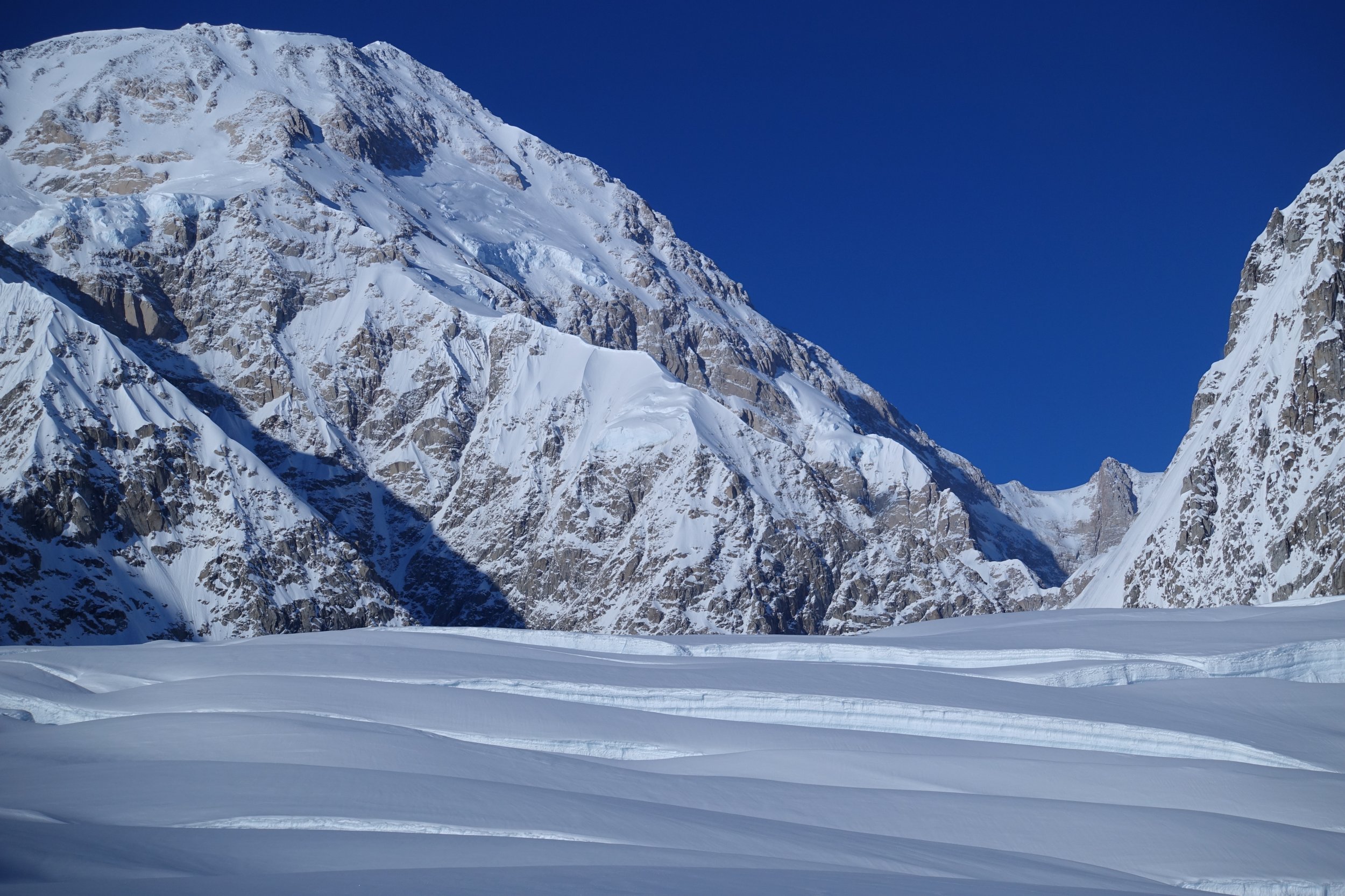
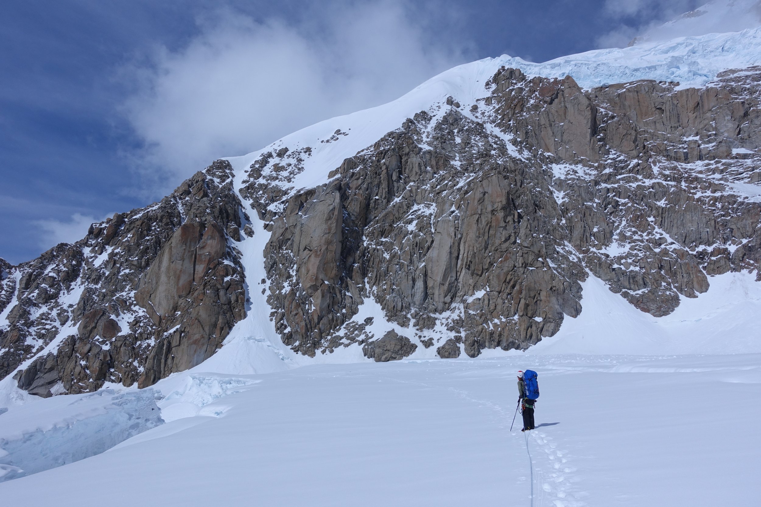
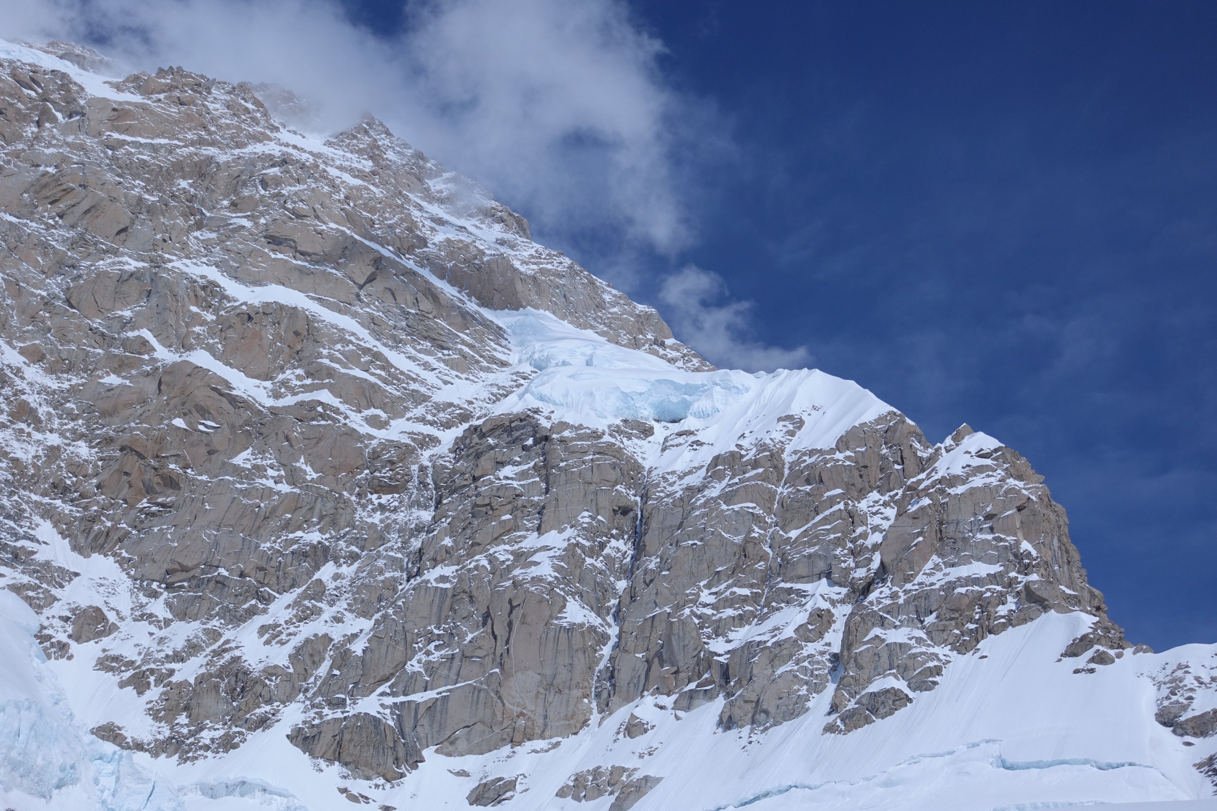
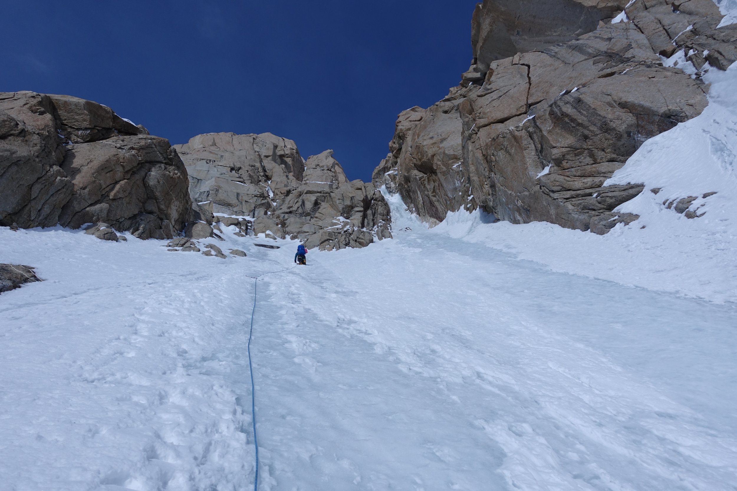
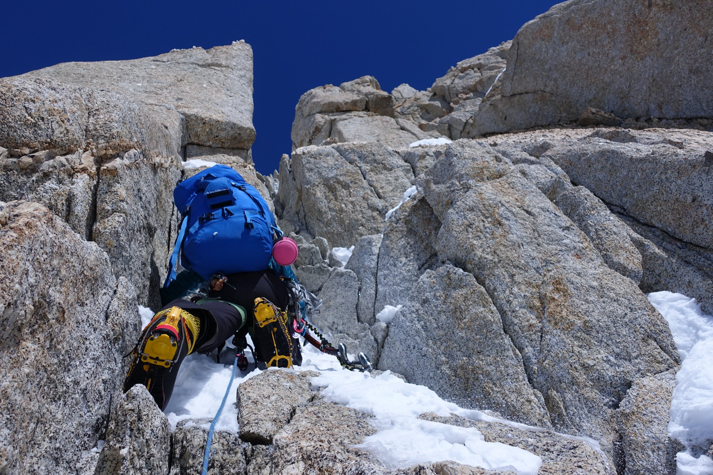
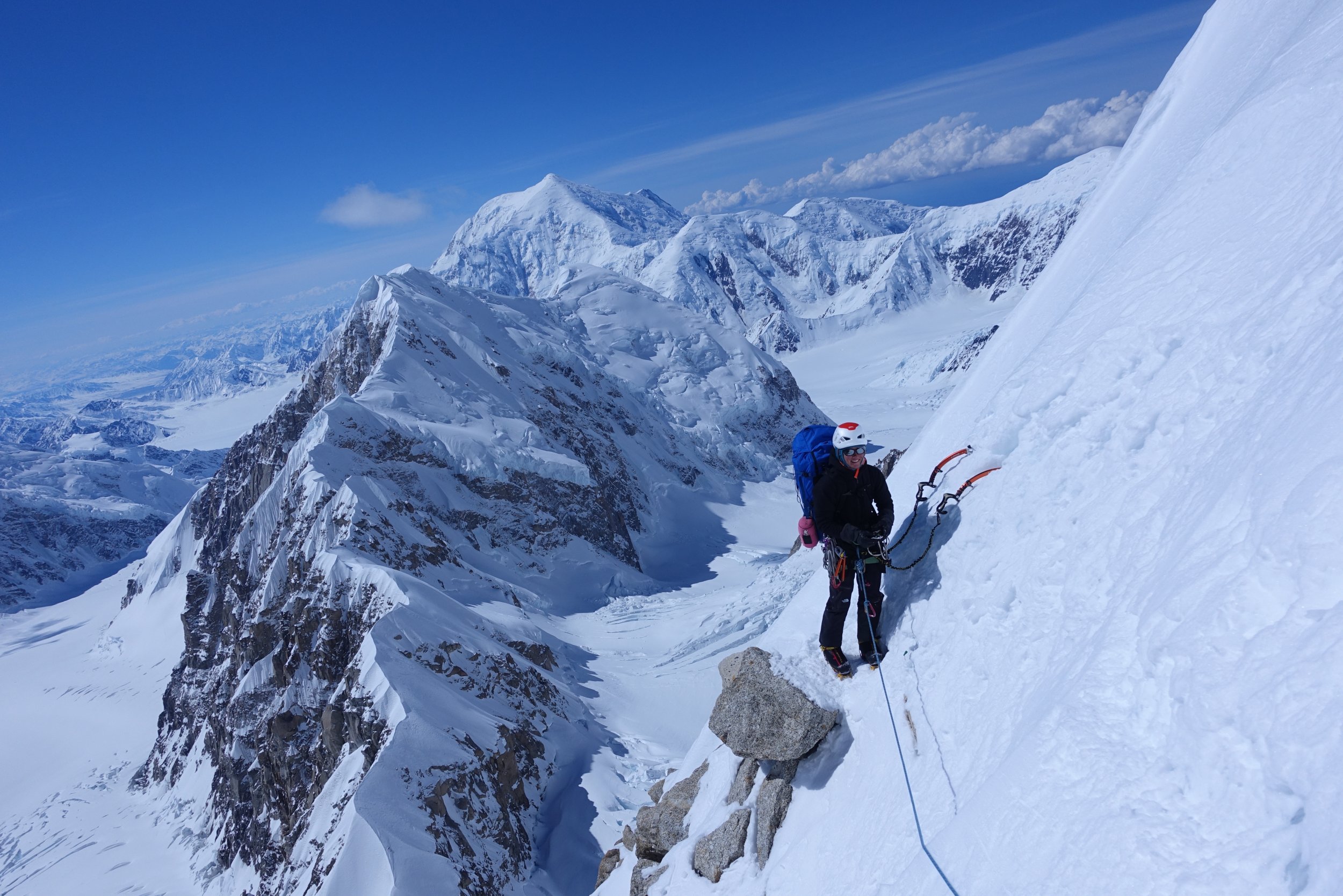
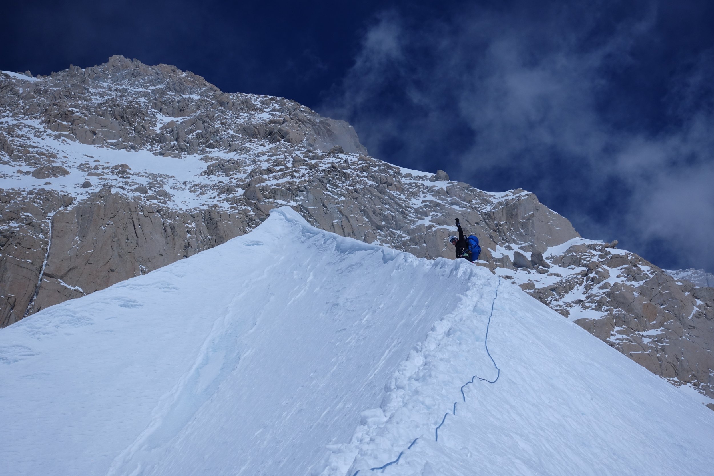
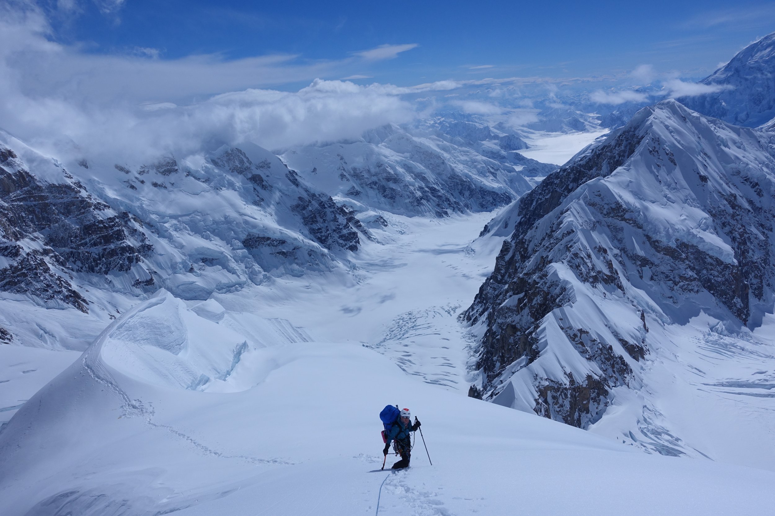
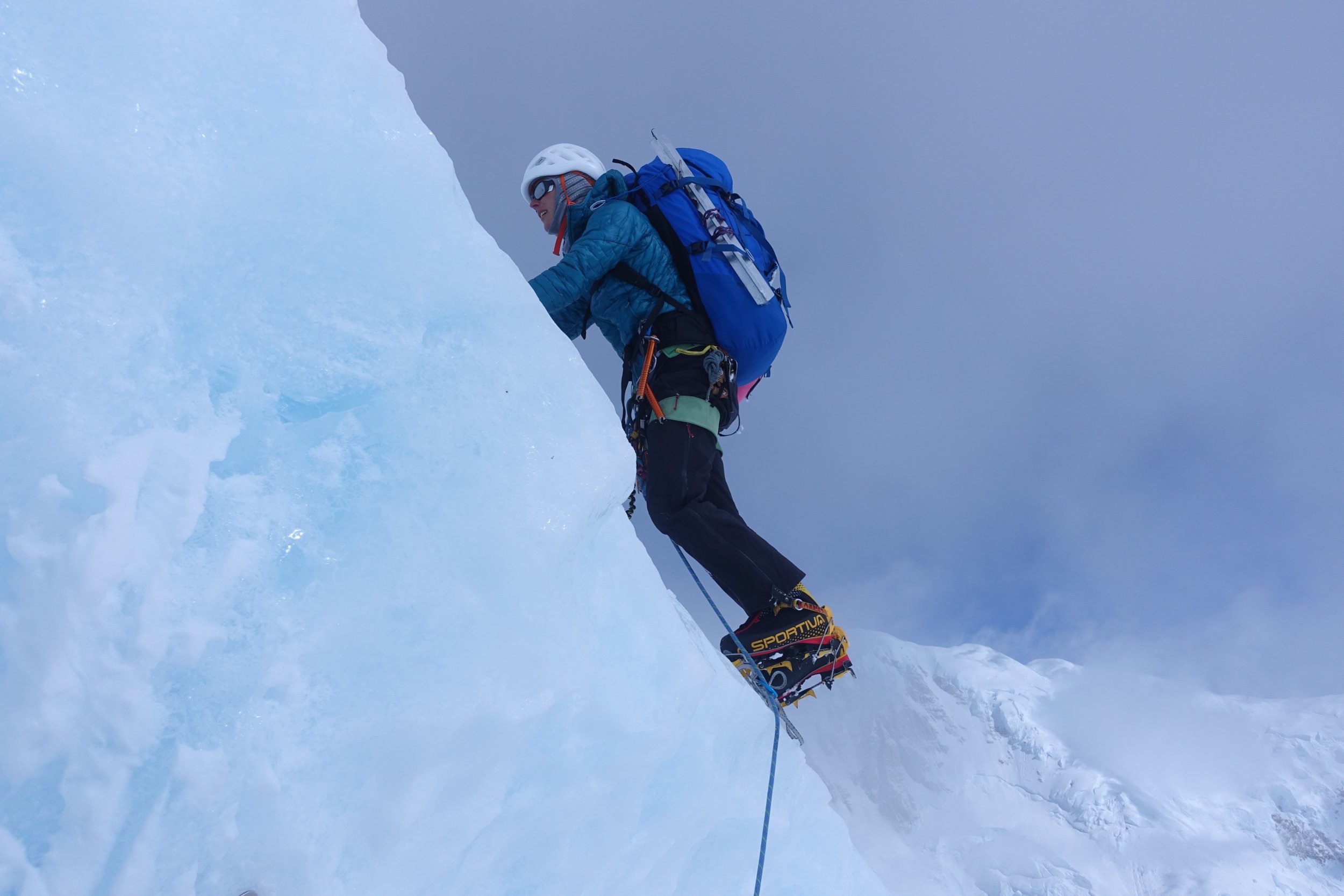
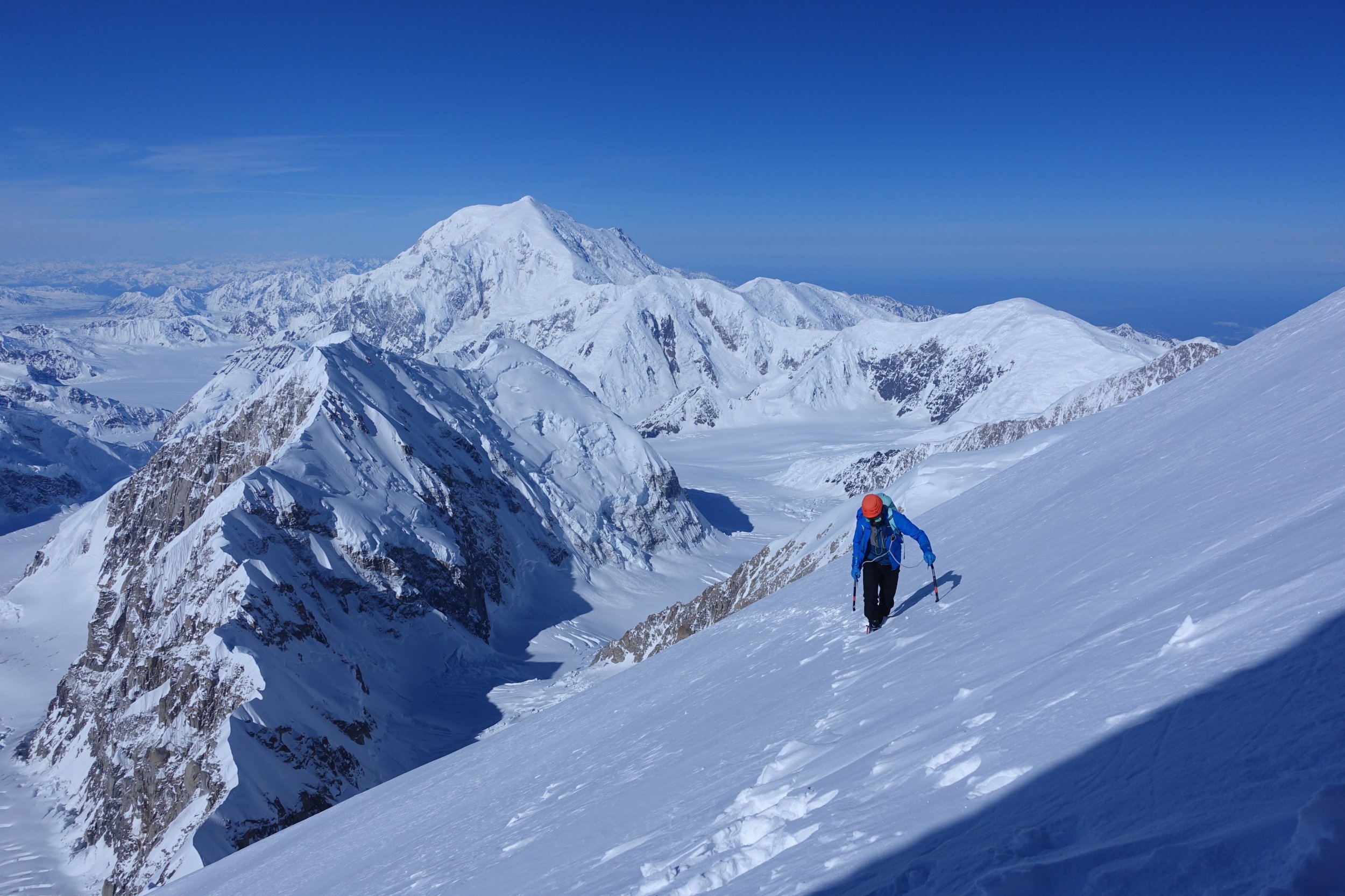
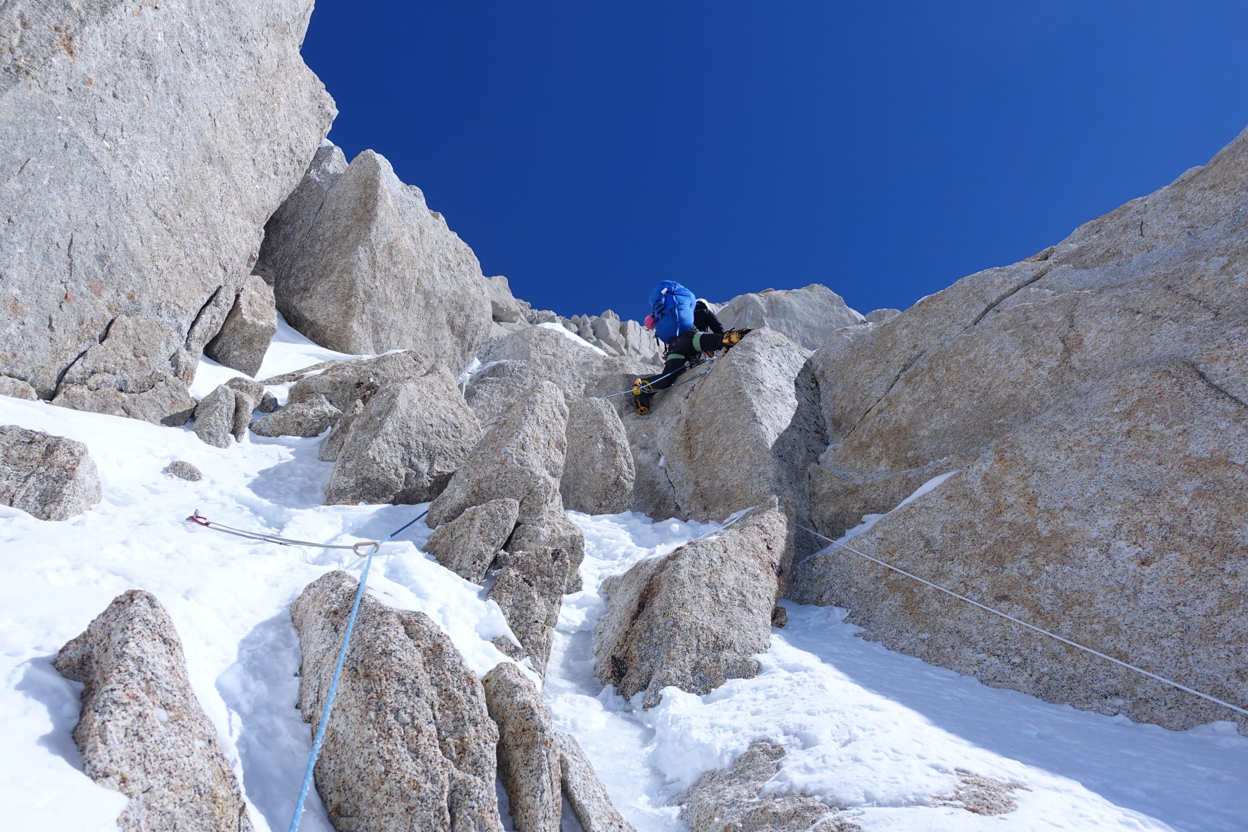
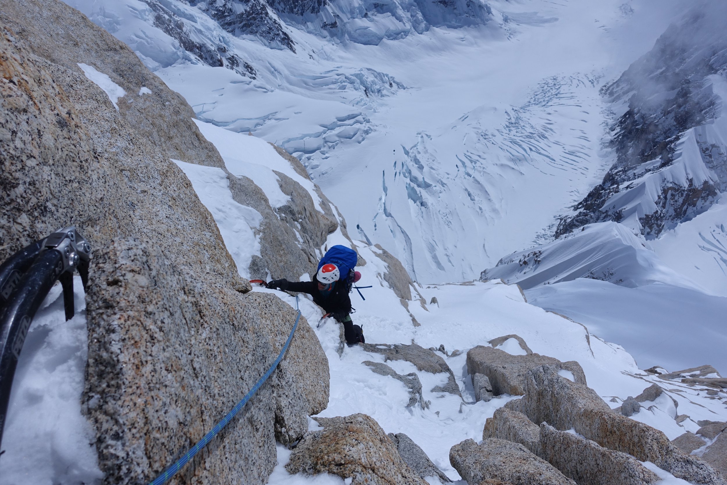
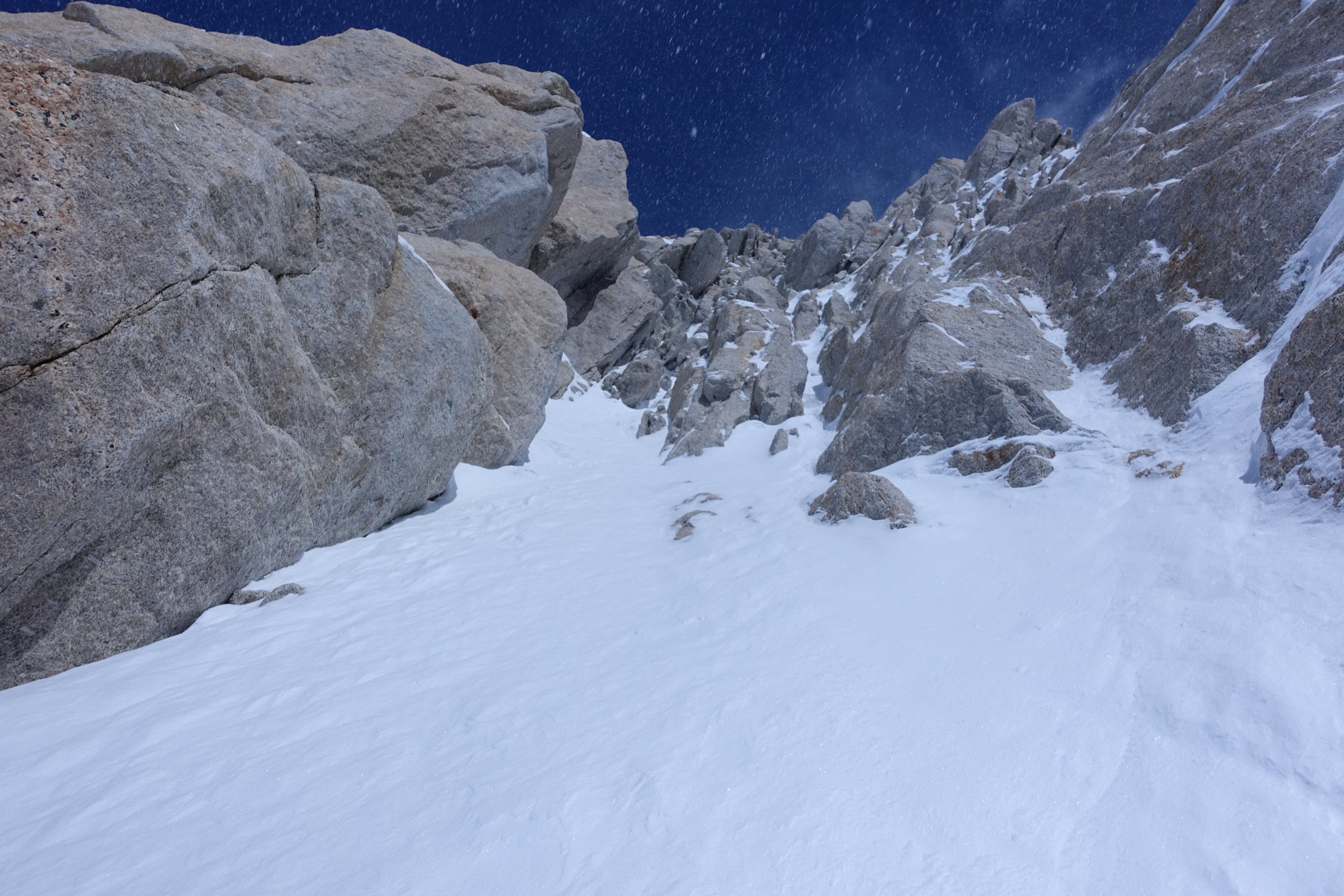
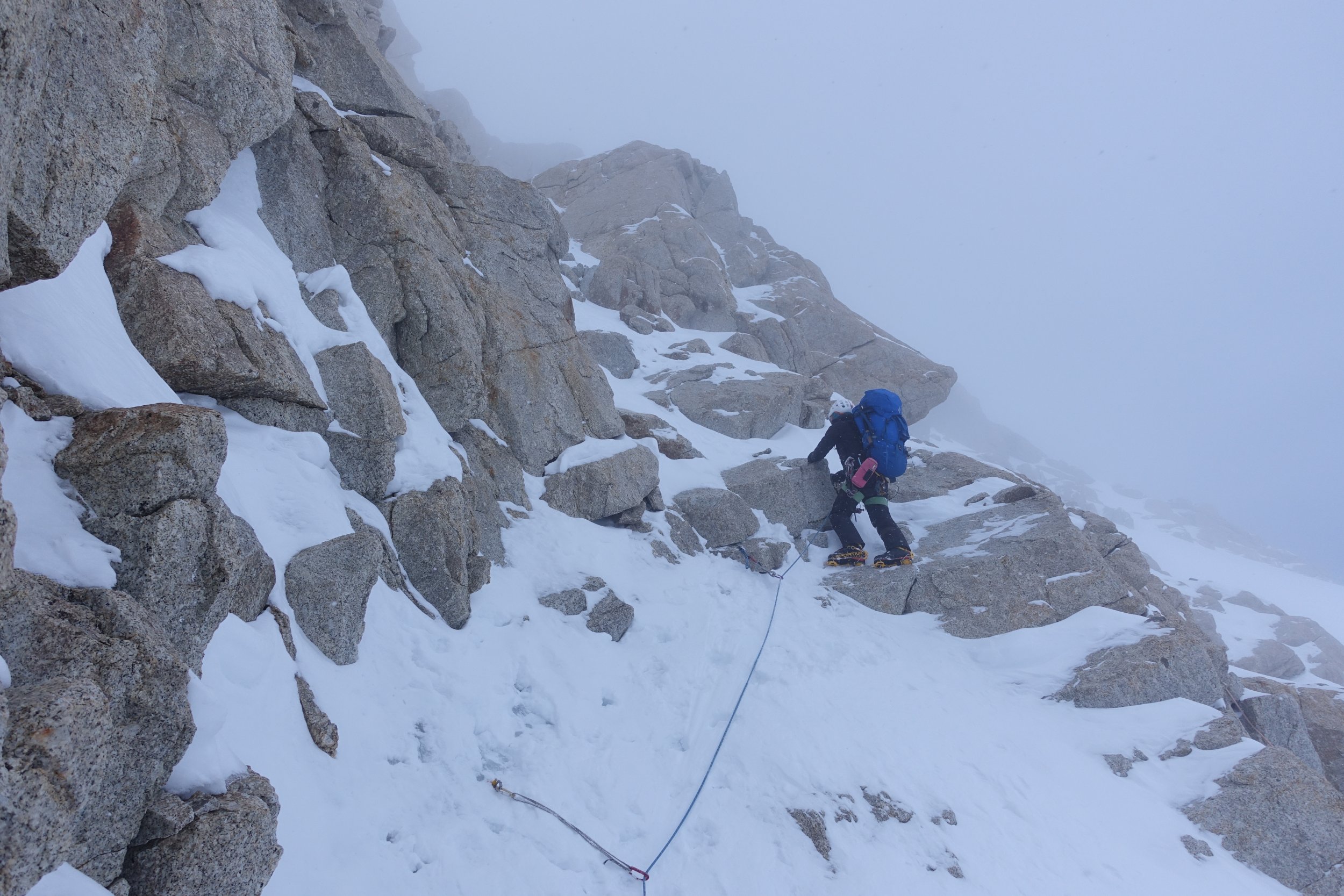
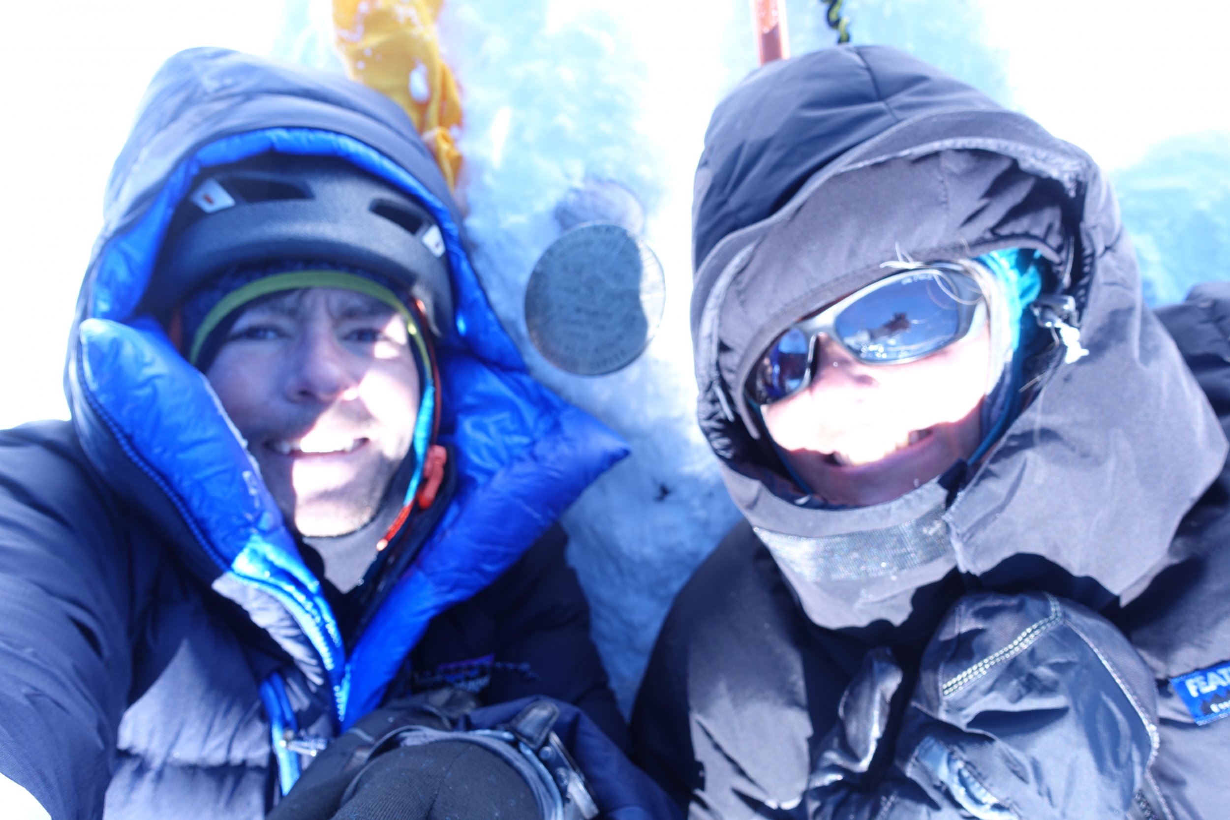
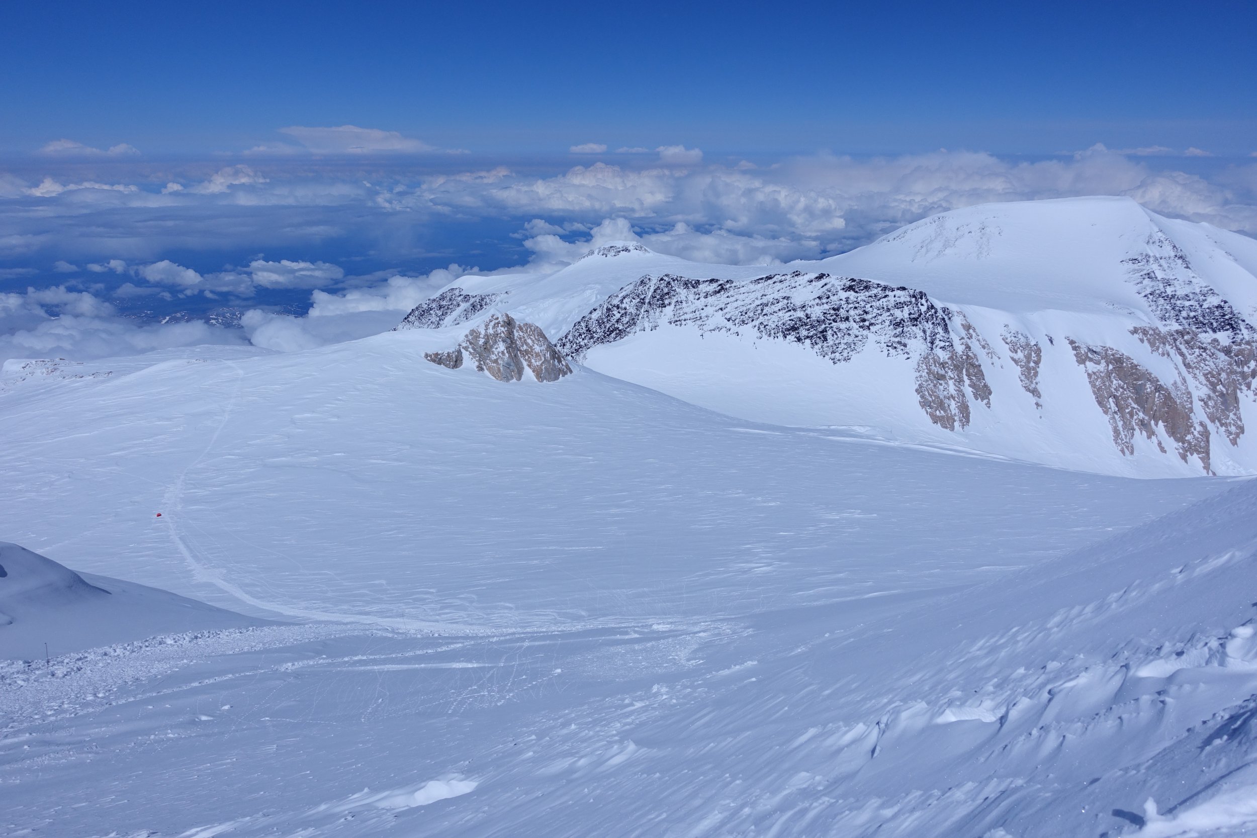
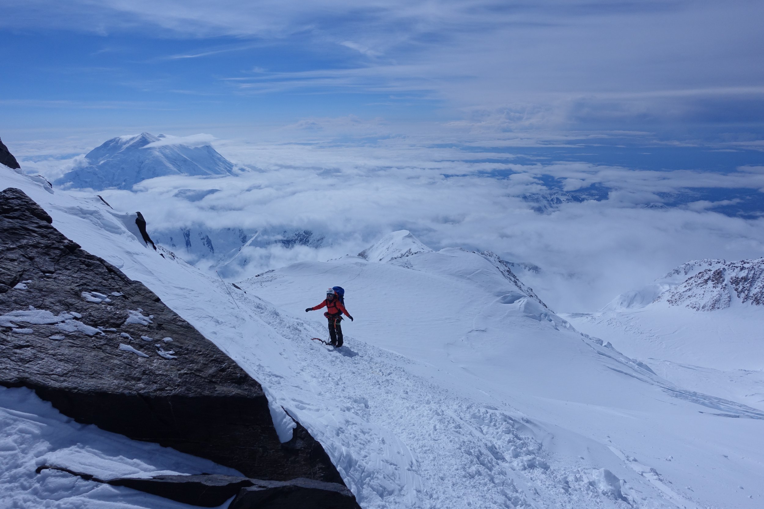
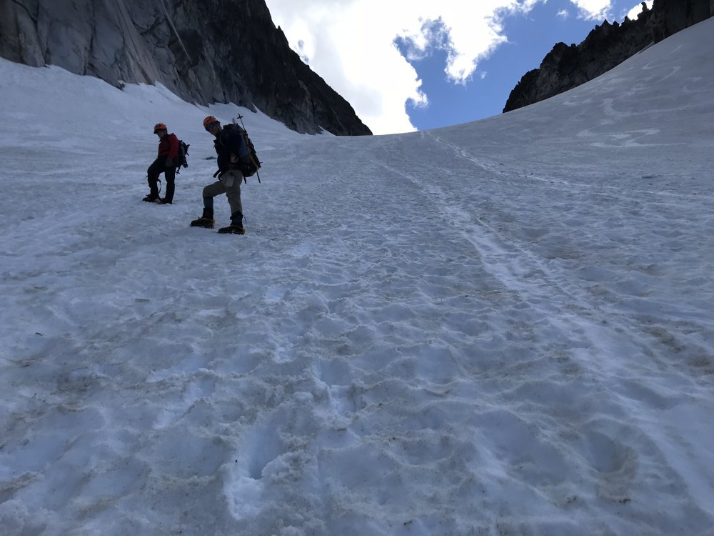
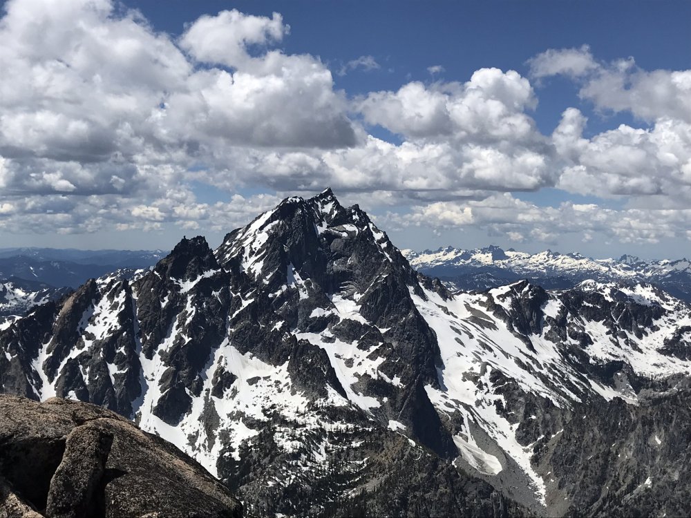
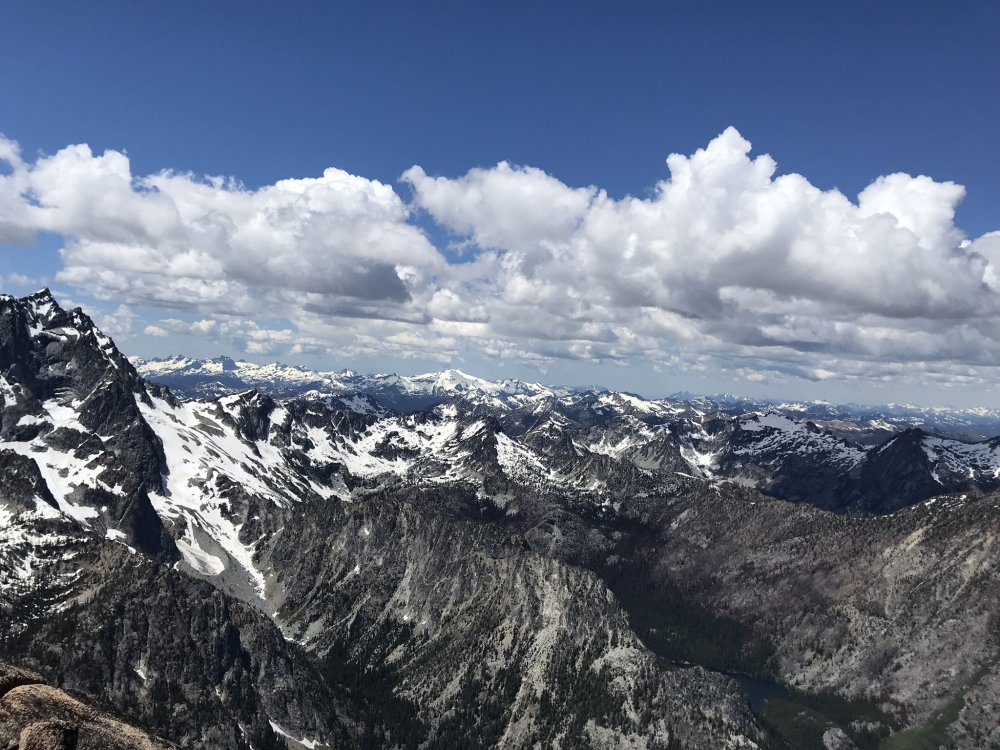
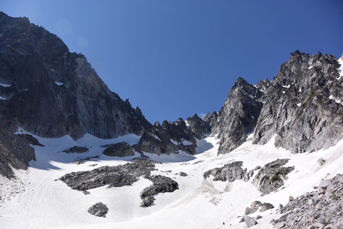
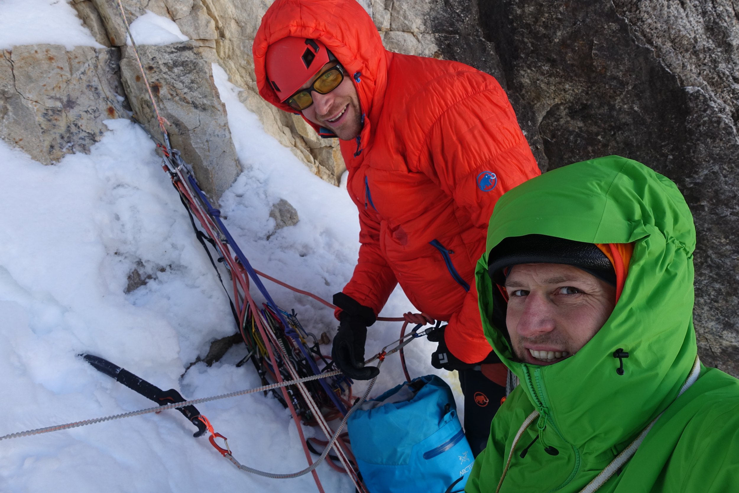
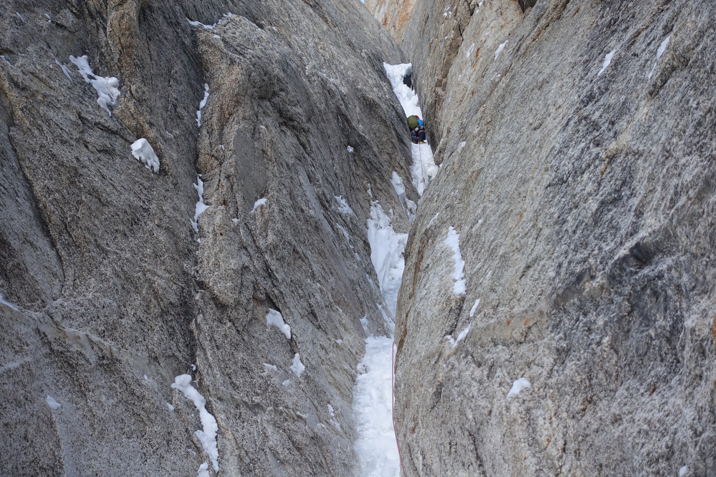
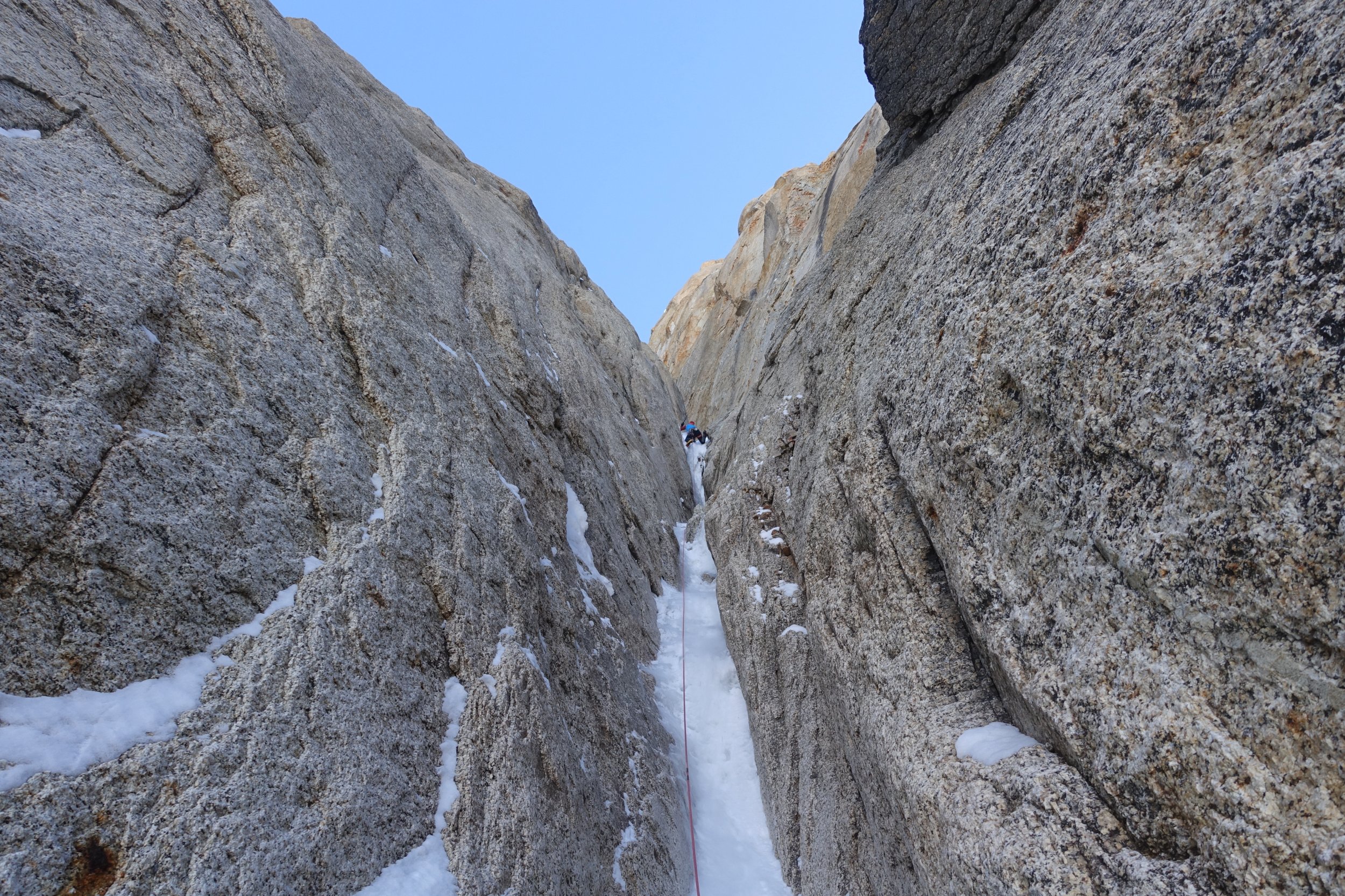
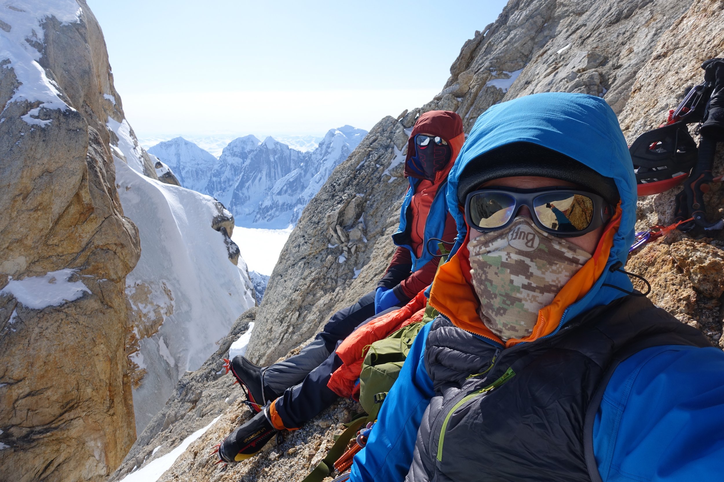
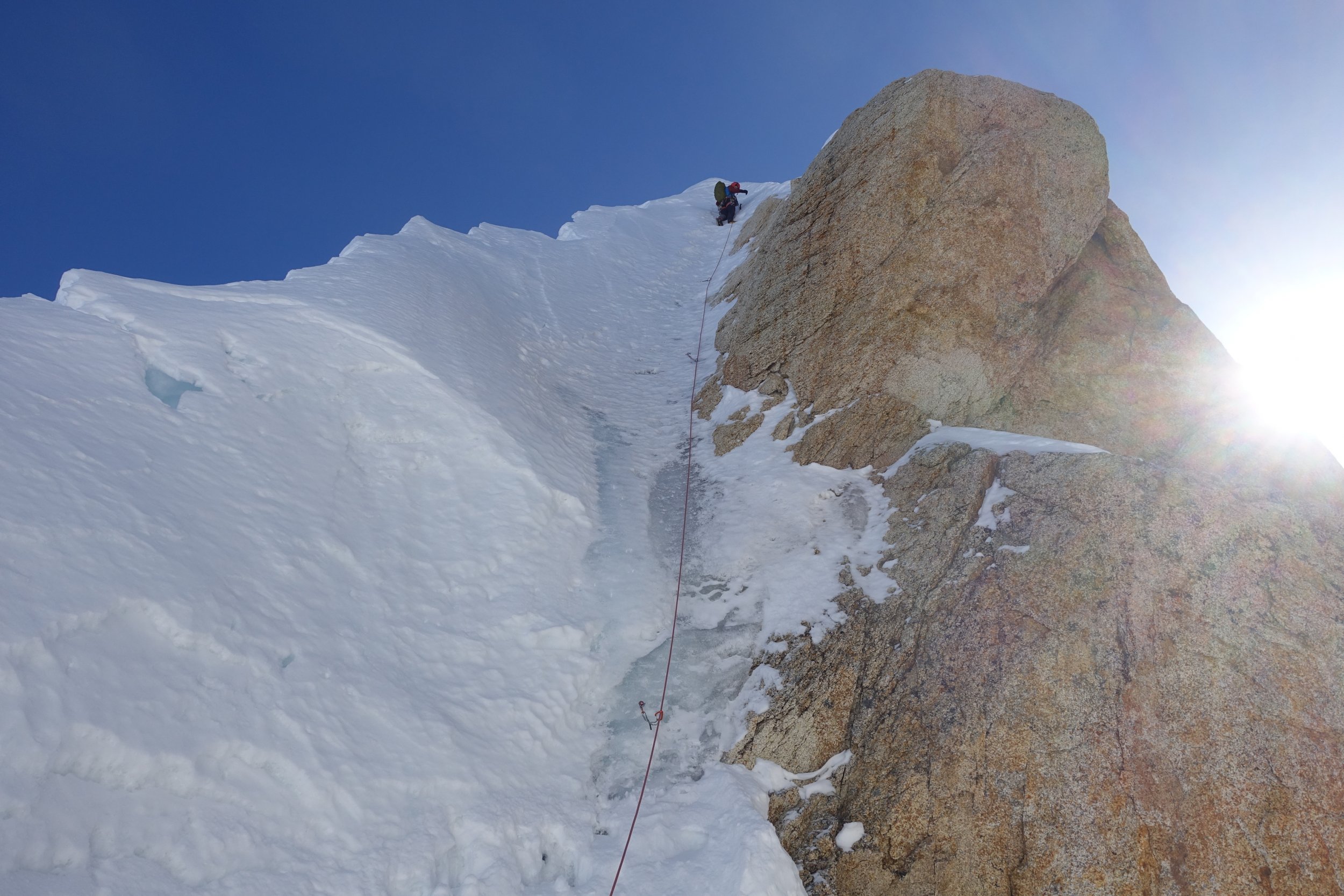
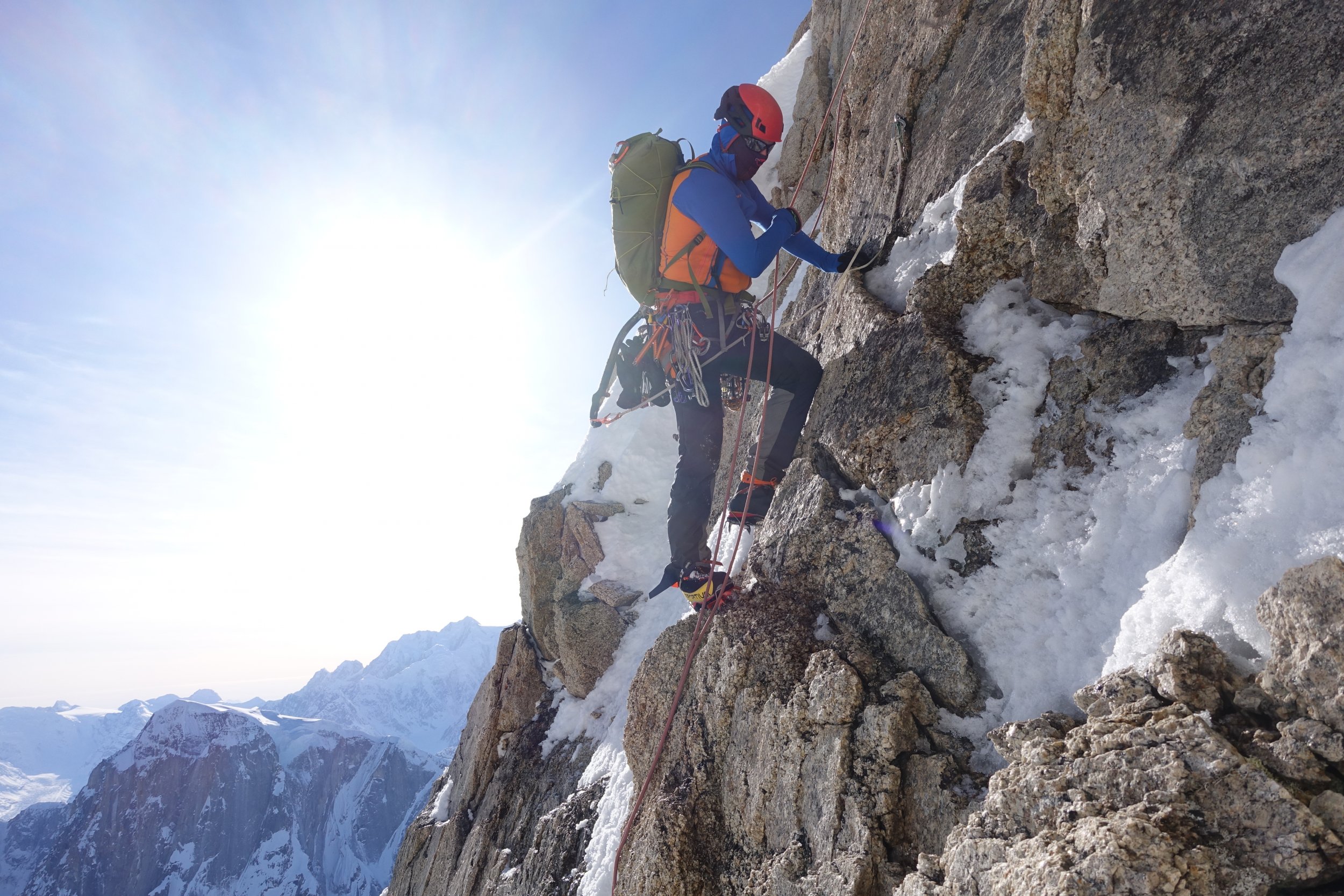
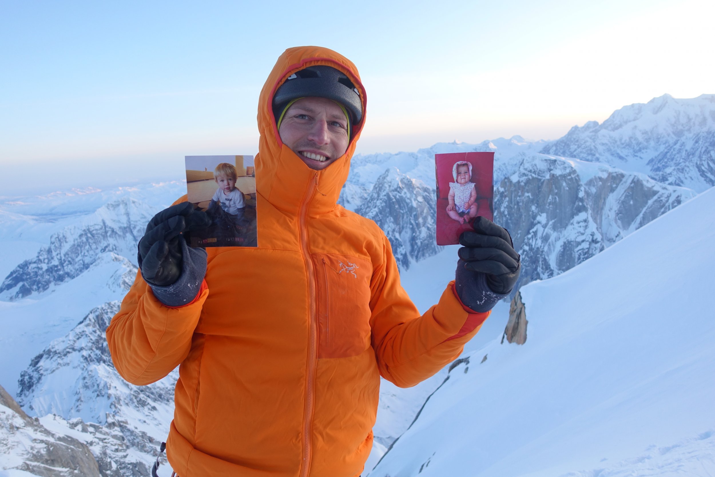
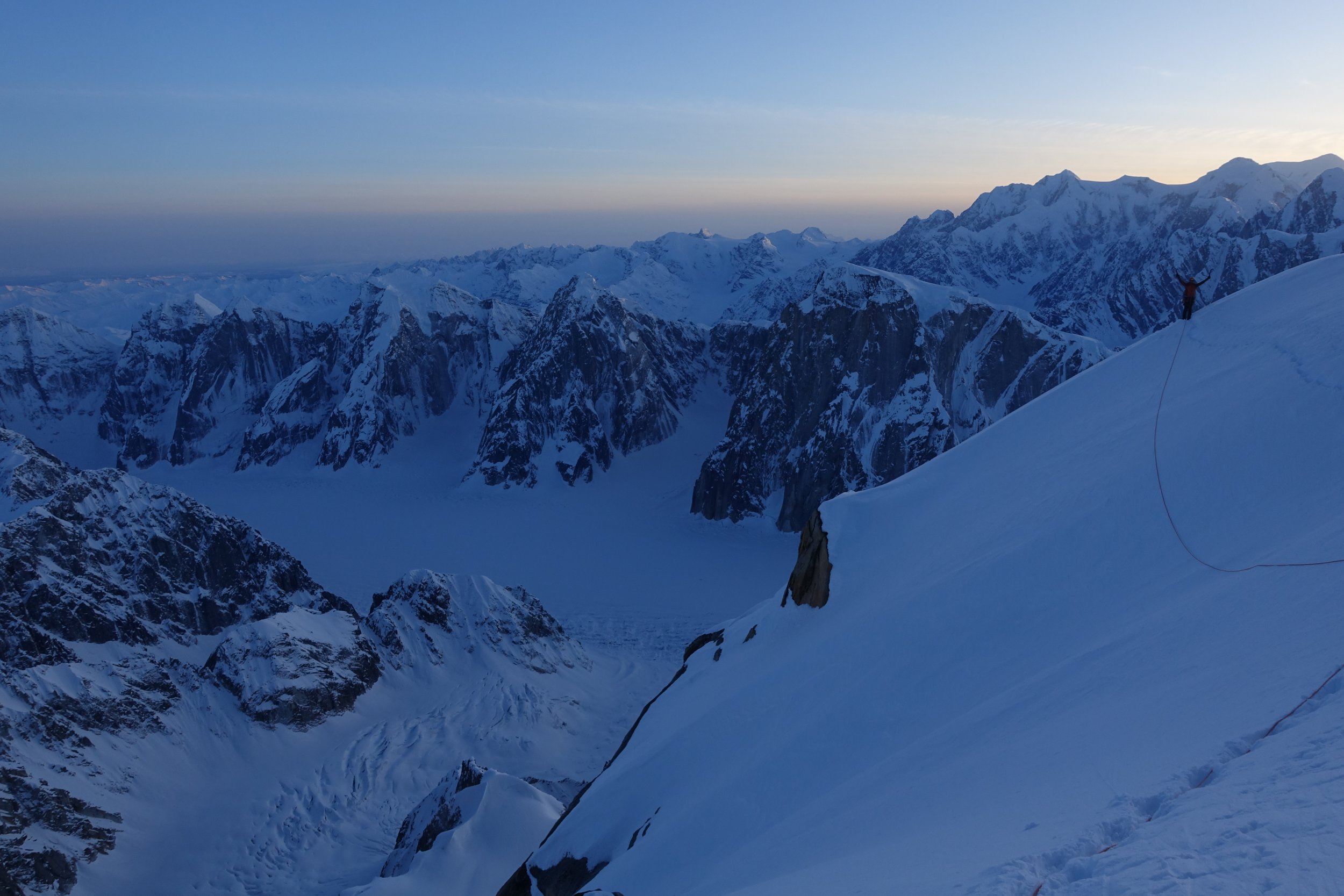
Trip: Denali - Cassin Ridge (Alaska Grade V, 5.8, AI4, 8,000ft), Alpine Style* Trip Date: 06/09/2018 Video: Between June 2 and June 11, Priti and I climbed the Cassin Ridge on the South Face of Denali approaching via the NE Fork of the Kahiltna Glacier (the “Valley of Death”), spending 6 days on route (including 1 rest/weather day at 17,700ft), summiting on June 9, and descending the West Buttress route. The whole trip was 10 days 7 hours door-to-door from Seattle. The Cassin Ridge is the second most popular route on Denali, with an average of 9 successful climbers each year, compared to an average of 584 successful climbers each year on the West Buttress route over the past decade. We carried everything up and over, climbing Ground-Up, with 38lbs packs each at the start, no sleds, and moving camp as we climbed, without caches. It was a Smash ’n’ Grab, meaning we decided to go at the last minute when we saw a good weather window. We watched Denali weather every day since early May until there was about a week of good weather. It took 24 hours from being at work on a Friday afternoon deciding to pull the trigger to being at Kahiltna Base Camp (including packing, Ranger orientation, flights, etc). We climbed Rainier 3 times the month and a half before our trip (Gib Ledges, Kautz, and Liberty Ridge), sleeping in the summit crater the weekend before. Still, we took Diamox while on Denali and had 2 weeks of food/fuel in case we felt altitude on route. Luckily, we had no altitude issues, and were only bounded by our own fitness, weather, and desire to move only when the sun was on us. Overall, weather was windless, clear, and sunny during the days with a few flurries at night. It was an “old-school” style of climbing, slow and heavy, while most folks nowadays opt to acclimatize on the West Buttress and climb the Cassin Ridge starting from 14,000ft camp on the West Buttress, then climb light-and-fast via the Seattle ’72 ramp or the West Rib (Chicken Gully) in a few days — this was our plan for our attempt last year with Ilia Slobodov, but didn’t get the weather window. Overall, a very successful trip, and we’re so excited to have pulled it off, after 3 years of dreaming of this route. *Alpine Style: The route was completed Alpine Style with the following exceptions: -Snowshoes were cached at Camp 1 in case the lower Kahiltna Glacier was sketchy on the way back. Didn’t really ever need snowshoes. The NE Fork was boot-able. There weren’t tracks going up the NE Fork, but it was wanded to the base of the West Rib. -We clipped into the existing fixed lines on the West Buttress descent above 14k, but this was unnecessary since it was basically a staircase. We didn’t clip into the existing pickets on the Autobahn above 17k. Google Street View: Apparently, nobody had done a 360 Photo Sphere Google Street View of the summit of Denali, so we obliged https://www.google.com/maps/@63.0690675,-151.0060278,3a,75y,78.91h,50.18t/data=!3m7!1e1!3m5!1sAF1QipOR4OLfMm5iBn15nn4OdiMbVTWa7lwk40pPUlnH!2e10!3e12!7i8704!8i4352 Itinerary: -June 2: Arrived at Kahiltna Base Camp at 3:00PM and moved to “Safe Camp” in the NE Fork of the Kahiltna Glacier (“Valley of Death”). We cached snowshoes at Camp 1 and took a right turn up the NE Fork. This “Safe Camp” is the widest part of the NE fork, where you are least threatened by avalanches and serac-fall sweeping the entire valley floor. -June 3: Hiked from "Safe Camp" halfway down the Valley of Death and climbed the Japanese Couloir and camped on Cassin Ledge with a sweeping view of Kahiltna Peaks and the entire NE Fork. -June 4: Climbed the 5.8 crux, Cowboy Arete, and Hanging Glacier, camping at the Hanging Glacier Bergschrund at the Base of the First Rock Band -June 5: Woke up to Colin Haley strolling by our bivy site on his 8hr7min speed ascent of the Cassin Ridge (he approached via the East Fork of the Kahiltna Glacier). This was a total surprise and very inspiring see him up there! We climbed the First Rock Band that day and bivied between the First and Second Rock Band just next to the rib. -June 6: Climbed the Second Rock Band and found the crux to be the sustained "Hidden Rock Couloir" at the entrance, which is sustained mixed 70-80deg for about 50m. At the end of the Second Rock Band, a Chilean Team of 2, plus Colin Haley, plus our team of 2 all took the wrong (harder) exit. From the overhanging triangle, we all traversed right about 40ft then went straight up, finding difficulties to M4-M5. We should have traversed right another 40ft or so to find the 5.6 slab pitches and the 5.6 dihedral as described in Super Topo. This ended the technical difficulties of the route. That night, we bivied at Mark Westman’s “excellent bivy site” at 17,700ft. This turned out to be very hard to find and we spent several hours looking around for it. It is way further up and right on the col than expected. -June 7: Lots of snow! So we decided to sleep all day, acclimatize and waiting out the weather. -June 8: So much snow accumulated on the upper mountain the previous day that it took us over 12 hours to ascend the final 2,500ft to Kahiltna Horn. We were knee to waist deep almost the entire day. Mark Westman told us later that he was watching us all day through the high-powered scope from Kahiltna Base Camp and he could see the long trench we left in our wake. Presumably, many day-tourists at Base Camp watched us in our embarrassing slog to the top. This was by far the hardest day of the trip! When we reached Kahiltna Horn at 10:30PM, we had no energy to go to the summit, so we slept on the “Football Field” at 20,000ft. The night was beautiful, calm, and cold! -June 9: Went back up to tag the summit, then descended 12,500ft to Camp 1. -June 10: Got to Kahiltna Base Camp from Camp 1 at 10:00AM but it was overcast all day so TAT could not come and pick us up. -June 11: TAT finally picked us up around noon, after we endured the most miserable and wettest night of the entire trip! Left to Right: Sultana (Mount Foraker), Begguyya (Mount Hunter), Denali Denali, the High One Heading into the NE Fork of the Kahiltna Glacier (the "Valley of Death"), the West Rib visible up the center of the peak The West Rib in the Center, The Cassin Ridge roughly up the right skyline Closer up view of the Cassin Ridge. The Japanese Couloir is the gash on the right. The Cowboy Arete (Knifedge Ridge) is above, followed by the First and Second Rock Bands Looking back at the West Rib and the Chicken Couloir Looking up the Japanese Couloir and the bergschrund at the base of the Cassin Ridge Looking back at the NE Fork Looking up at the crux of the Japanese Couloir (AI4) The Cassin Ledge. Razor thin, great views fo the whole NE Fork, Kahiltna Peaks, and Sultana! The 5.8 Crux just off the Cassin Ledge The Cowboy Arete The Base of the Hanging Glacier, the Cowboy Arete behind A short overhanging step to get over the bergshrund Colin Haley approaches! The crux of the First Rock Band, just above the M-rocks Somewhere near the top of the First Rock Band The South Face! Looking up at the "Hidden Rock Couloir", the beginning of the Second Rock Band, and the crux of the route, in my opinion Just below the V-shaped overhang in the Second Rock Band Slog to the top Denali Summit Ridge Summit Marker The Football Field on the West Buttress Route and our bivouac Heading down the Autobahn, 17k camp below on the West Buttress The Cowboy Arete Base Camp with Moonflower Buttress behind (North Buttress of Begguyya, Mount Hunter) Gear Notes: -6 screws (1x21cm, 2x17cm, 3x13cm) -40m rope -Small Rack of nuts -5 cams (.3-1) -2 pickets (didn’t use on route; just for glacier travel) -5 single alpine draws, 2 double alpine draws (no cordalette) -2 ice tools each (Nomics for him, X-Dream for her) -Monopoint crampons -Boots: Olympus Mons for him, G2SM+overboots for her -MSR AdvancePro2 Tent -Feathered Friends Spoonbill Sleeping Bag -2x Thermarest NeoAir Xtherm + 1x shorty closed cell foam pad (for emergency) -MSR Reactor + hanging kit + 3 medium cans of isopro Approach Notes: Approached via the NE Fork of the Kahiltna Glacier


 2 points
 -
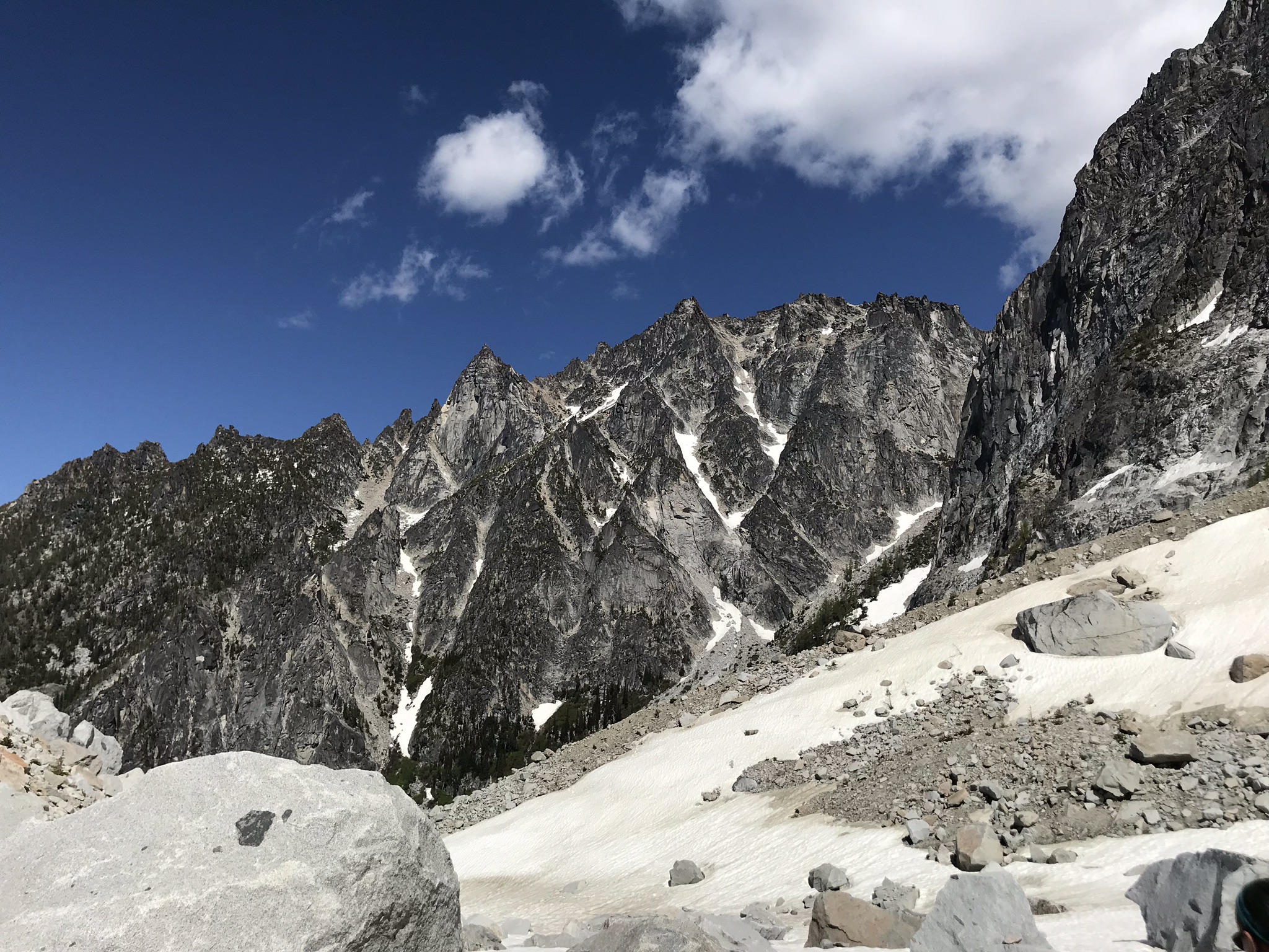
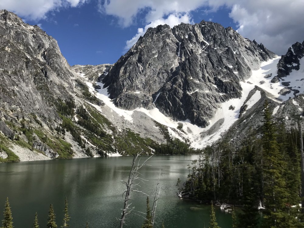
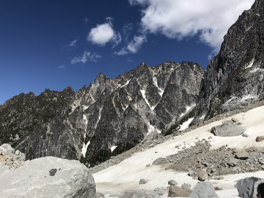
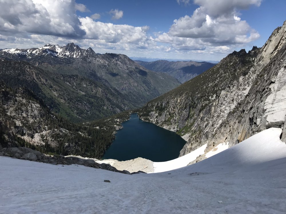
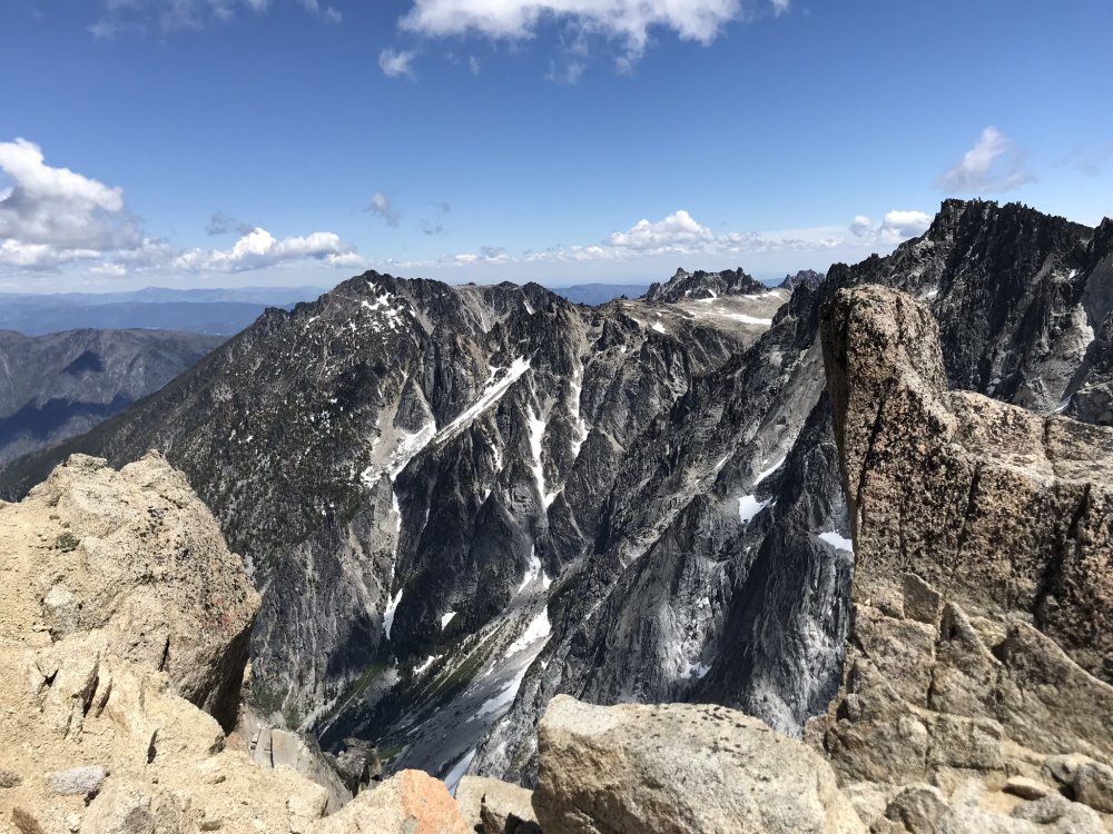
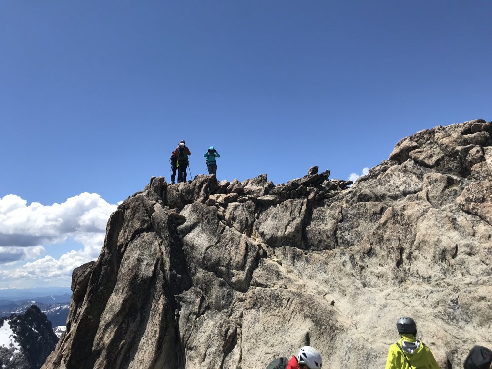
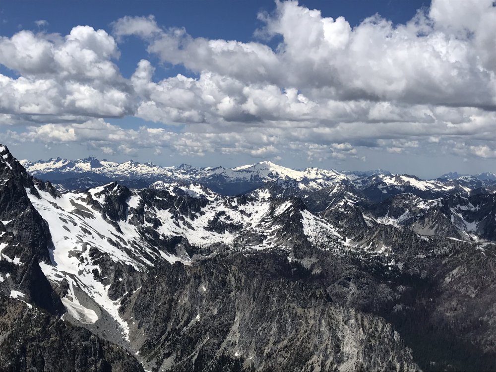
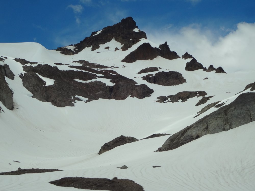
Trip: Colchuck Peak - Colchuck Glacier Trip Date: 06/17/2018 Trip Report: We started at 6:30 AM from Stuart Trail Head and reached to Lake Colchuck at 8 AM and then base of Colchuck Glacier . Snow was hard in the morning so we put the crampons on and started ascending the glacier. There were other parties mostly skiers were heading up for dragon tail . Weather was beautiful and little cold breeze over the upper portion. Going up we had one big rock passed us some how it was lose and dropped from the right side of ridges .We reached on the the pass from where we took off the crampon and start scrambling towards right Colchuck peak, it took another 30 mins to reach the summit . . Summit was short ledges but good enough to accommodate 8-10 climbers. We spent good amount on summit and took pictures. It took us 6:30 hours to reach summit views were beautiful we took our good time and stops along the way. Once we started heading down we see more ski parties heading up , we took the same Glacier route to go down . Snow was still hard on top but almost 1000ft down snow becomes more soft easy to do plunge steps. On way down skier and snow boarder we met on summit passed us . Over all beautiful day and trip . Gear Notes: Crampon, ice axe , helmet and light Sportiva Trango Boots Approach Notes: Trail was

 2 points
 -
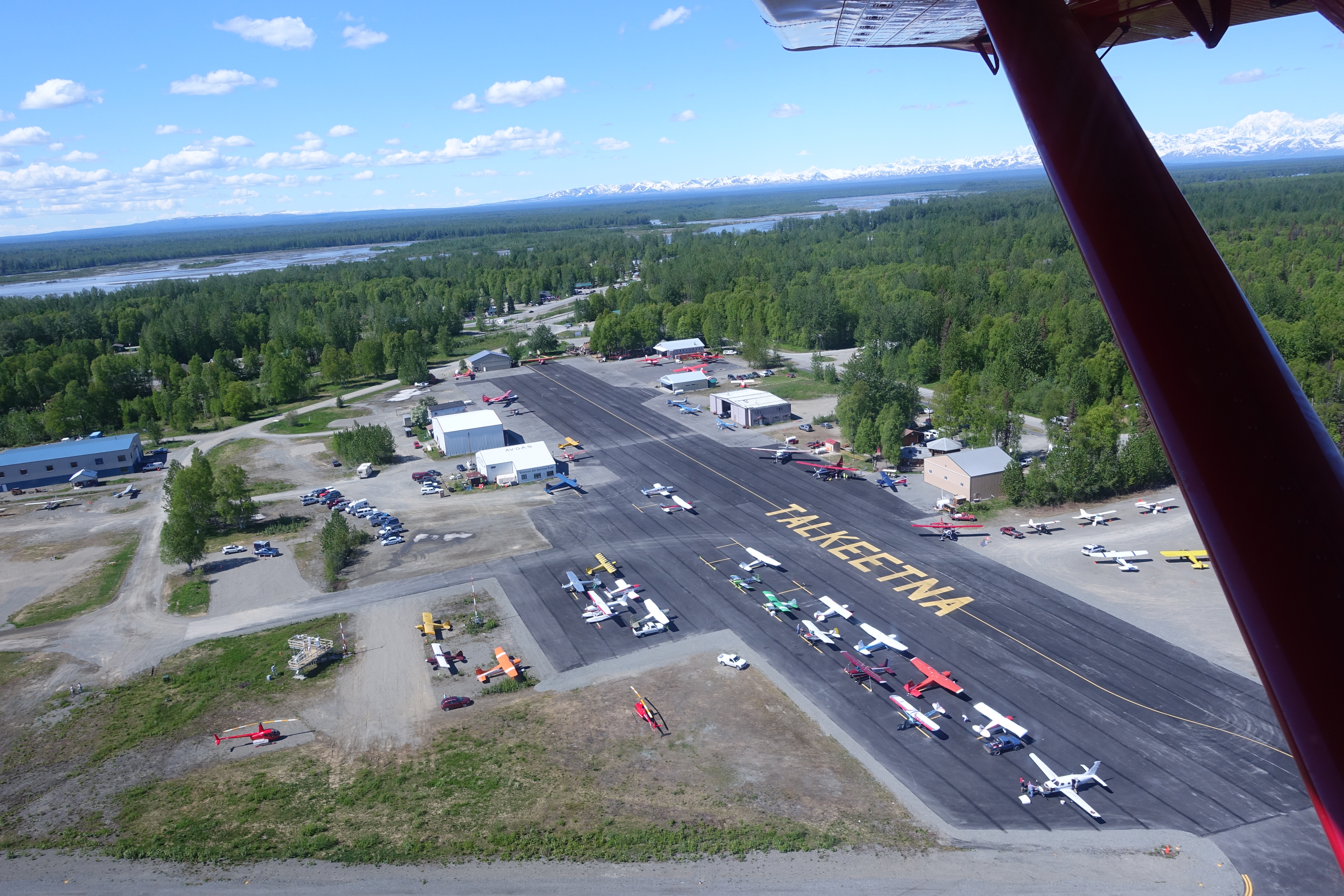
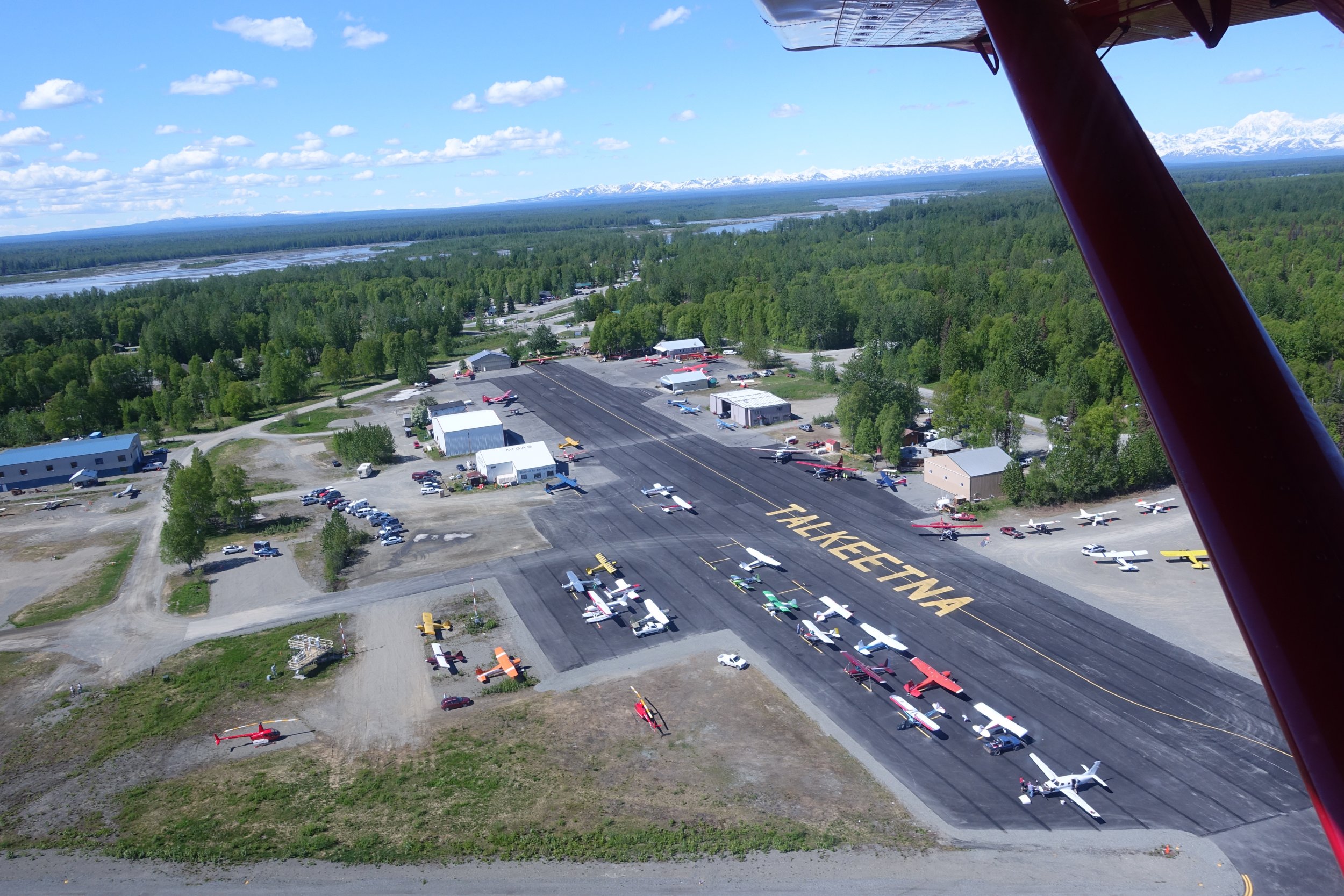
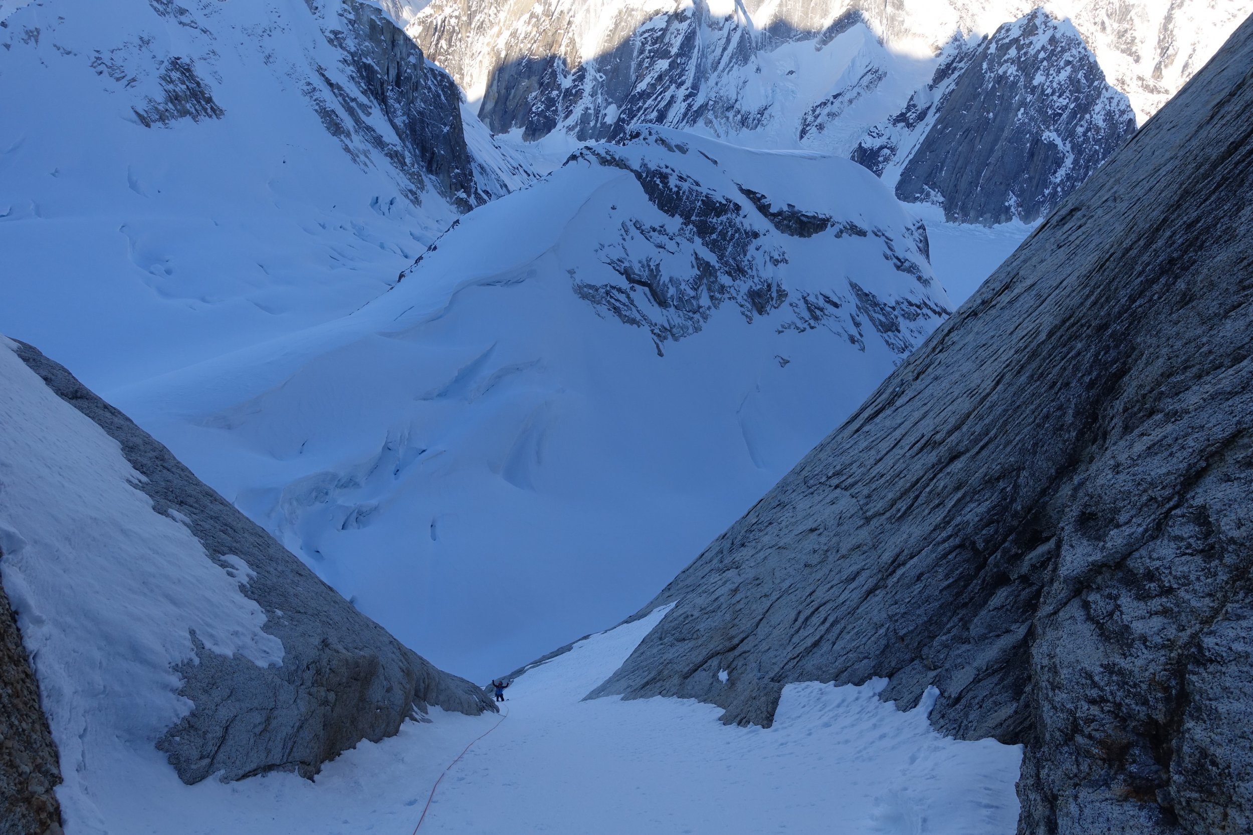
Trip: Moose's Tooth - Shaken, Not Stirred Trip Date: 04/15/2018 Summary: Ascent of Moose's Tooth to the summit via the route "Shaken, Not Stirred" 19 hours camp to camp with Doug Shepherd April 15th 2018. Details: Alaska. Finally. After multiple trips to Alaska every year since 2009 life priorities had forced me to take a "leave of absence" since my last trip in March of 2016. It was nice to finally return and with Doug Shepherd, someone who I've done numerous trips with including my very first trip to AK in 2009. Various existing commitments limited us to a 3 day trip but weather and temps the week leading up suggested we would likely find something we could climb during the short window. I grabbed Doug at ANC early Saturday morning and we blasted for Talkeetna. After the usual shenanigans (weight in, repack) Paul zipped us in. After looking at possible objectives on the flight in we settled on Shaken, Not Stirred on the Moose's Tooth. Though I had climbed the Moose's Tooth in 2010 it was via Ham and Eggs. I'd always wanted to climb Shaken but had never seen it in. A SLC team was coming out at the same time we were getting dropped off and had attempted it the day prior. They had bailed at the crux due to lack of ice but after quickly looking at their pictures we thought we should at least give it a try as it appeared like it would go with some mixed climbing. We departed camp later than normal on Sunday (~6 am) to allow temps to warm slightly; this allowed us to wear single boots. I took the first simul block to just below the narrows where Doug took over. Doug fired a few amazing pitches that took us to the crux which was ice free but Doug was able to safely protect and find a mixed way through the crux. Following the pitch I have to say it was a very impressive lead. Some more climbing took us to the Englishman’s Col where we enjoyed an extended hydrate + coffee break before heading to the true summit. I will say the terrain between the Englishman’s Col and the true summit is a lot of up and down with at least two rappels and nearly constant crevasse and cornice danger. "Enjoy" We tagged the summit sometime after sunset but before dark; Doug's first time and my second. We managed to start the rappels down Ham and Eggs before it got truly dark so at that point it was just hitting rap anchors and/or making naked threads as needed. We arrived back at camp ~19 hours later and flew out the following day, Monday, before heading back to the lower 48. Good times. Gear Notes: partial set of nuts, single set 00-2 c3, double set 0.4 -> 4 ultralights, 10 laser speed light ice screws, 3 micro trax, single + tag line Approach Notes: Talkeetna Air Taxi is the best


 1 point
 -
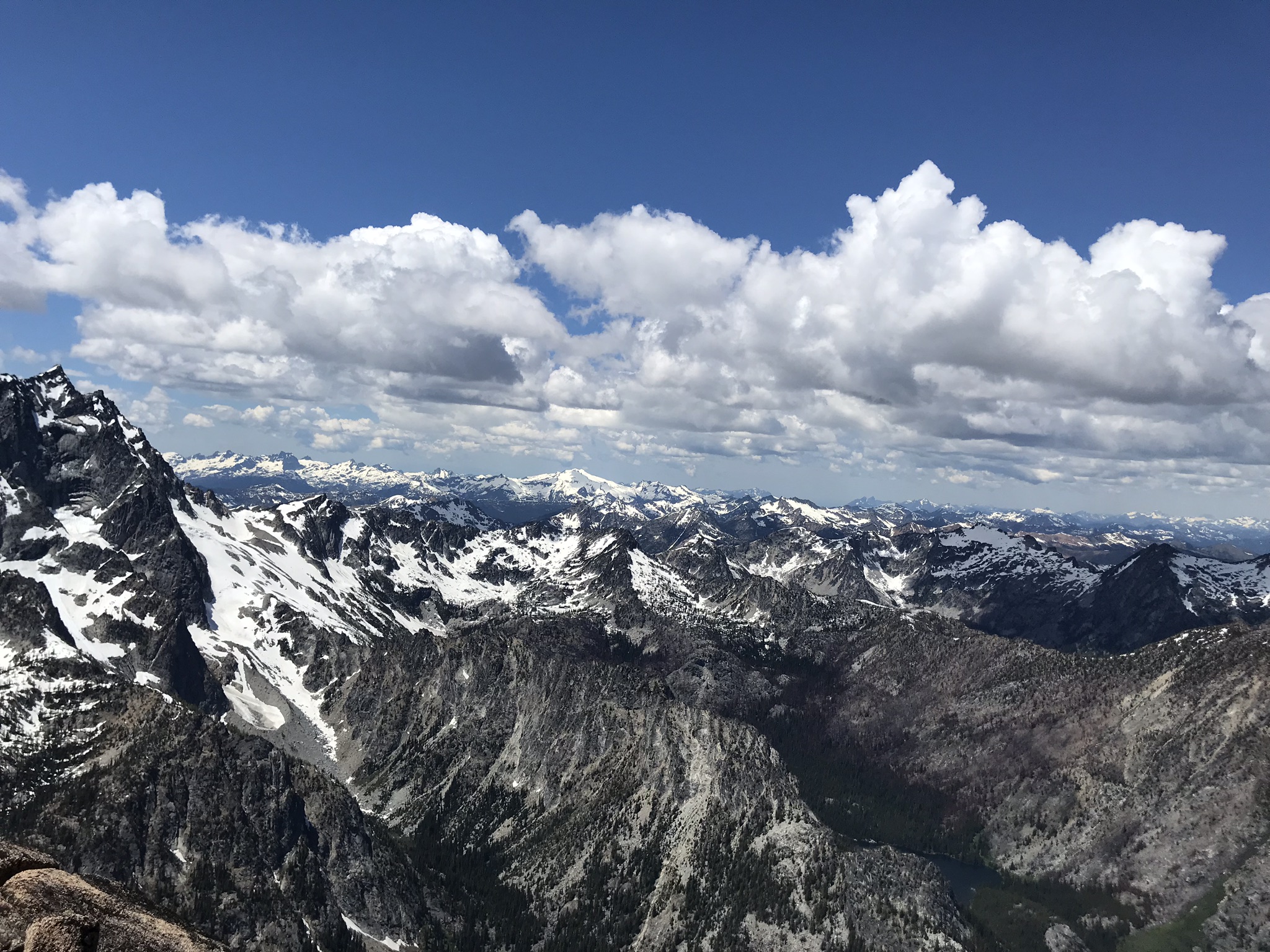
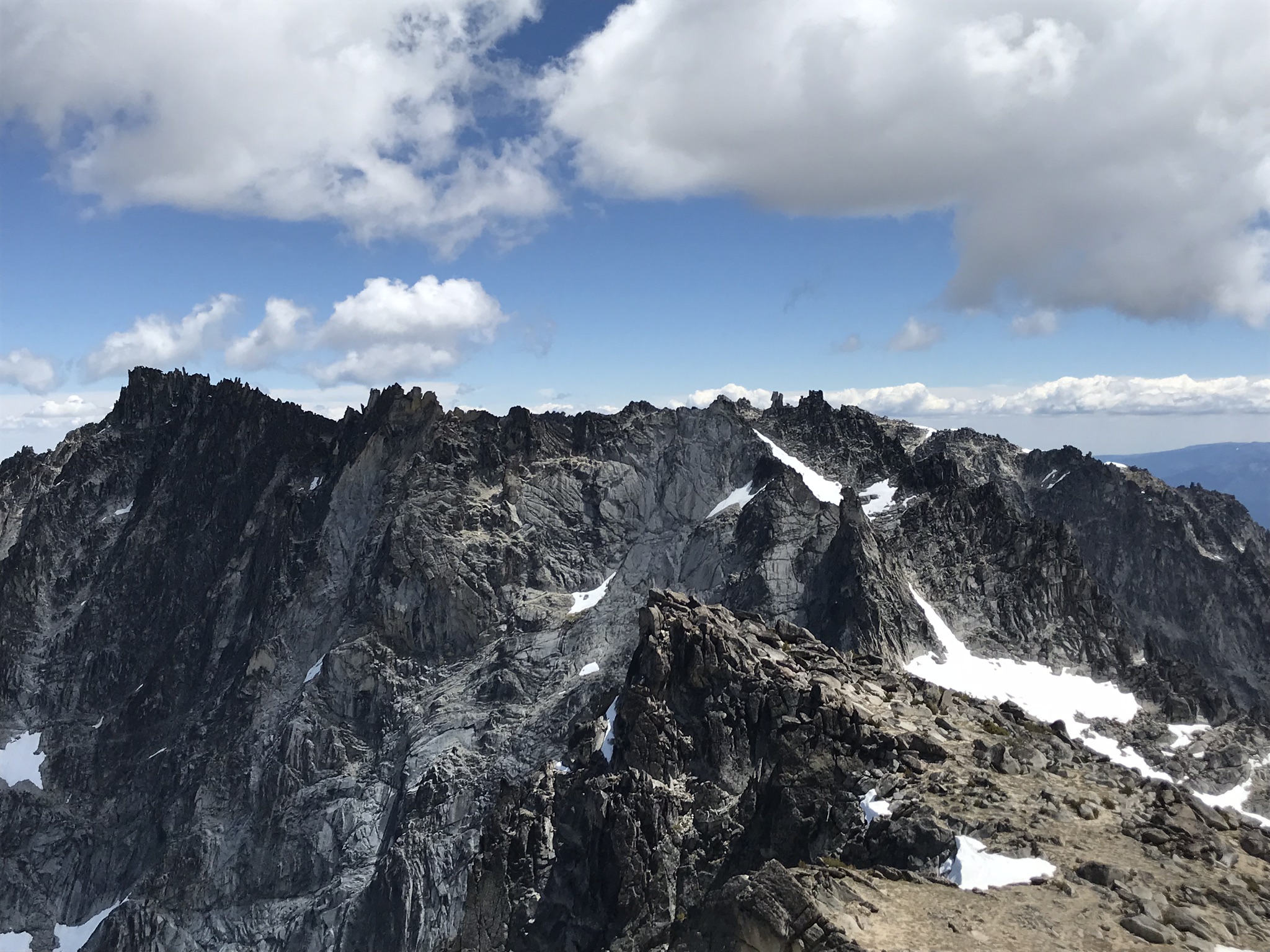
Trip: Northern Pickets - East Fury and Luna in a weekend Trip Date: 06/16/2018 Trip Report: Intro pic from the top of Luna: I did a solo trip up Mt Challenger a few weeks ago and enjoyed myself so much I decided I needed another dose! I've become a huge fan of weekend sufferfests. Doing stuff in a day is cool and fun, but you don't get as much of an alpine experience. I like making oatmeal at 4am in a rock bivy, waking up before sunrise at high camp, etc. etc. My pack weight for these trips is probably only 30 lbs or so anyway. I wanted to get to Luna on this trip, and figured East Fury would be a good stretch goal. I'm too cheap to pay for the water taxi, so I schlepped it 13 miles around Ross Lake and up to 10 mile shelter after work on Friday (I couldn't actually find 10 mile shelter, does it exist?). Saturday morning I started the much-not-looking-forward-to slog up Access Creek. I used the log crossing at 48.8395, -121.2090, although I could not find any kind of trail from Big Beaver trail to the river crossing. From the log jam, I headed up and right toward Access Creek (I found the higher I went the less bushy it was), and crossed Access Creek at 3k ft (thanks to the people who did Luna in a day last summer for this beta). Took about 3 hours from turning off Big Beaver trail to the headwater of Access Creek (was way faster on the way down once I improved my route-finding). The chutes up to the 6,100 ft notch were firm snow which was awesome. ^ Looking down at Access Creek The traverse to Luna Col was quick and painless with all the snow. Arrived at Luna Col at 1pm, decided to be ambitious, drop my bivy gear and try to bag East Fury. ^ East Fury from the 6100 ft notch below Luna Col. I took the right-leaning snow-ramp to the left of the major rock formations. Not sure what the standard route is. It took 3.5 hours from Luna Col to top of East Fury, and some micro-storms starting rolling through as I approached the summit. Raised my heartbeat a bit, but made for some good pictures. ^Southern pickets from Fury Back to Luna Col by 6pm and pretty exhausted, but the sky started clearing so just before sunset I couldn't resist scrambling up Luna. ^Looking north from Luna at sunset. The final ridge scramble was spicy! No snow whatsoever, but thought-provoking nonetheless. The last summit log entry was from late last summer. ^Southern Pickets and Fury from Luna Probably should have brought a headlamp up Luna. Best weekend trip to date! Gear Notes: Hiking poles and crampons Approach Notes: Ross Lake Dam - Access Creek - Luna Col1 point
-
fascinating to see Colin Haley pass you by unexpectedly!!!1 point
-
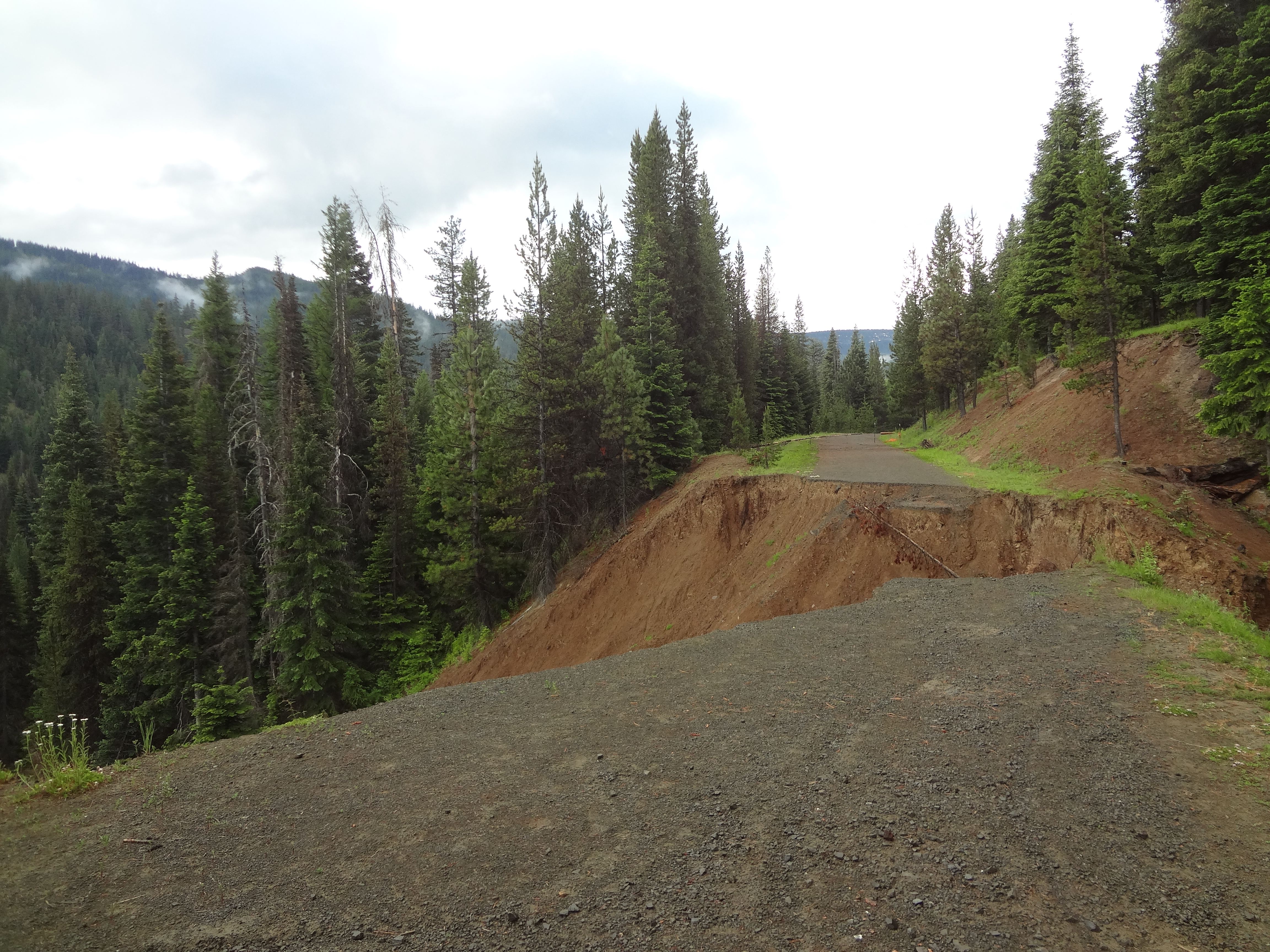
Trip: Curt-Gilbert - Meade Glacier Trip Date: 06/16/2018 Trip Report: Made a quick trip up Curtis Gilbert to ski the Meade Glacier yesterday (6/16/18). Route was fine, but really only skiable from from 7,700 feet to 6,250 - so a long walk for a few turns. It might be a better ski earlier season, but so much of the trip is up a flat river valley and wooded ridge that you'll never get a lot of vertical from a single run. If you're going to do CG, I definitely suggest doing it as an overnight so you can score a few more runs. Plus, it's a long way back in there. Car to car was like 24 miles (not completely sure because my garmin died - but I think it's a good bet). Snow starts at 6'000 feet Gear Notes: Ice axe, crampons, skis, Mt Bike (see approach notes) Approach Notes: South Fork Tieton road is washed out 1.2 miles before Conrad Meadows CG. From the CG, it's another 2 miles to the trailhead. I brought a Mt Bike and was able to cycle up the road, saving myself about 6.5 miles of walking in total. A note about navigation - I was using some older maps that showed trails allowing shortcuts to trail 1120. I don't recommend these. There are all kinds of trails snaking around from hikers, game, and livestock. 1120 is barely maintained, and the others not at all. I had numerous times in my day even on 1120 where I lost the trail in blow-downs and had to backtrack and search - super annoying on a long day. Also - the trails are not marked so take care to know where you're going or you'll find yourself floundering in blow-down hell. If there is snow all the way to the meadow, overland travel would not be a big deal, but if it's melted out you'll want the trail. Take trail 1120 from the trailhead. There is a passable bridge over the Tieton, but it's not in great shape. After about two miles the trail forks. It's unmarked. Take the right fork. If you take the left fork and come to a bridge after which the trail starts ascending - you've gone too far. Go back and try again. Ascend the ridge via trail. At about 5600 feet the trail forks again - it's easy to miss. You'll be able to see the cliffs of point 6250 above you and to your left. Take the right fork and ascend to the ridge top at 6000 feet. Stay on the climber's left hand side of the ridge and follow a faint path until the ridge broadens out and meadows appear (6,250'). Hike the meadow West dropping up and down until you get to a steep moraine/cliff. Ascend snow to a large bench at 6,350'. Fabulous camping here. From 6,350 ascend the glacier - for me on the right hand side and the traverse to the obvious notch at 7,700 feet just to the left of the summit pyramid. Scramble to the top and ski on back down Everything you need for a trip on the Meade Washout 1.2 miles before camp ground. It's passable on the right Meade Glacier on Curtis-Gilbert - snapped it from the bench at 6,350 during a rare moment of visibility. Most of 6/16/18 was fogged in


 1 point
 -
Solid work! Looks like a sweet trip!!1 point
-
SP is dead to us. There is only Cascade Climbers.1 point