
All Activity
- Today
-
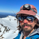
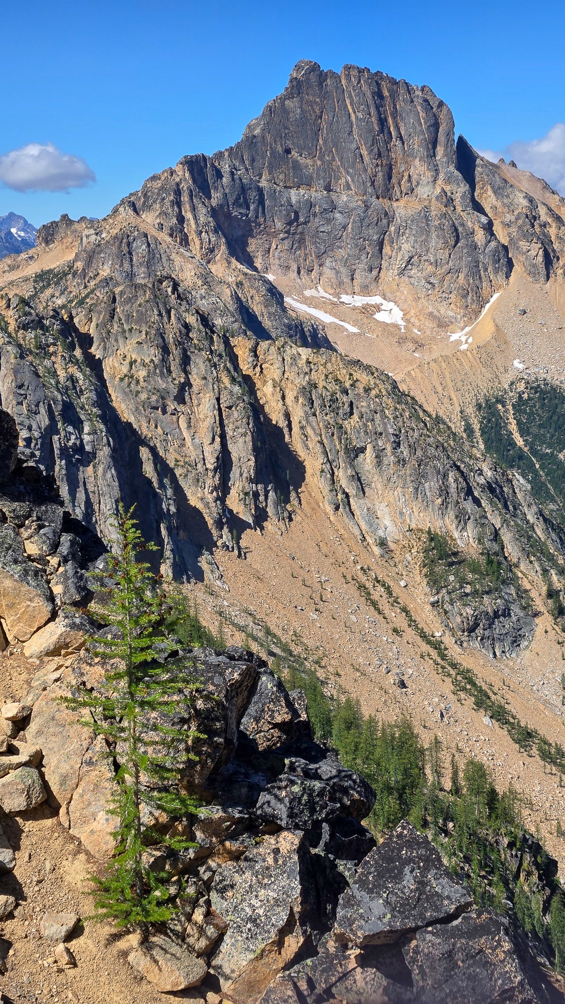
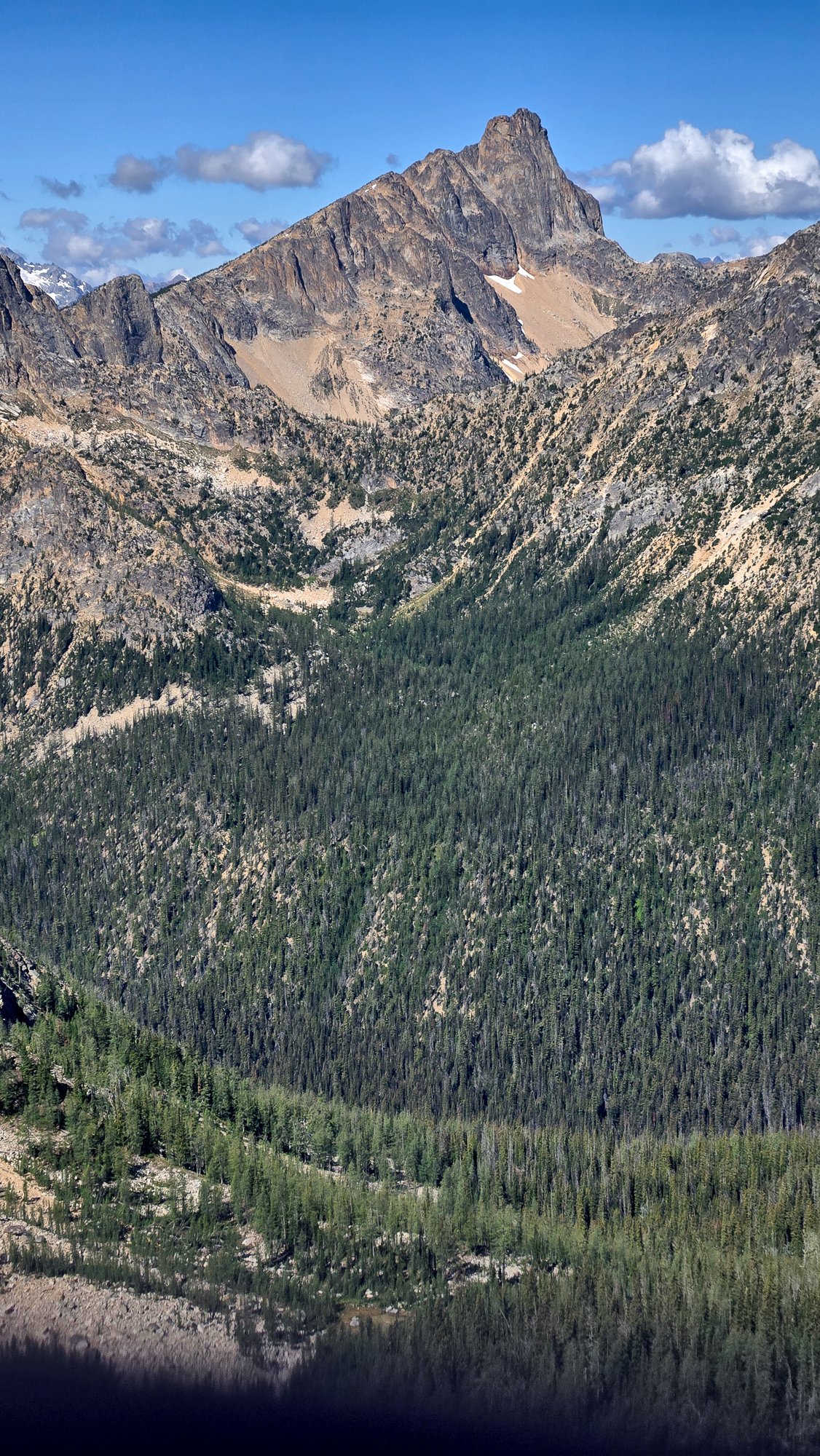
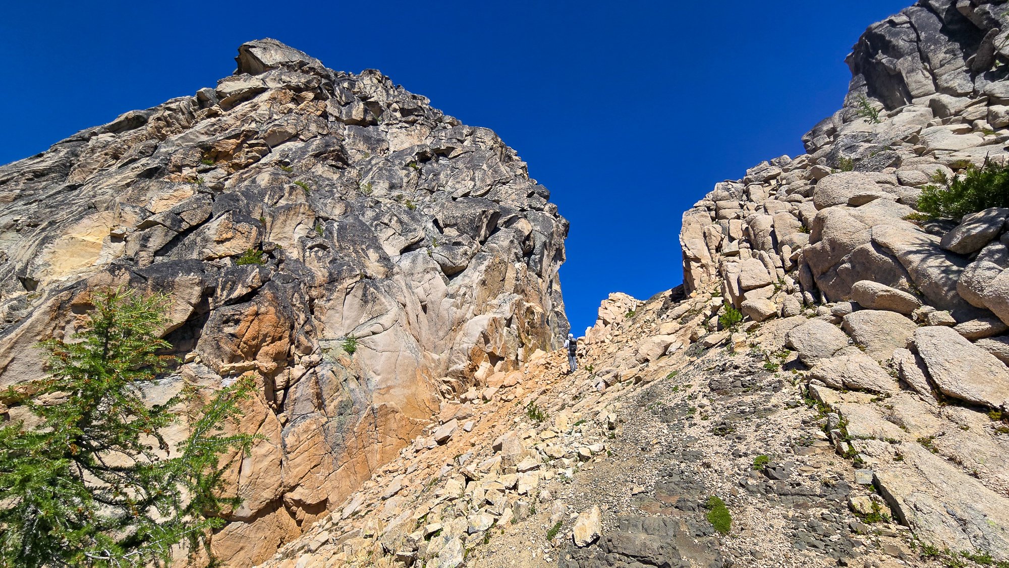
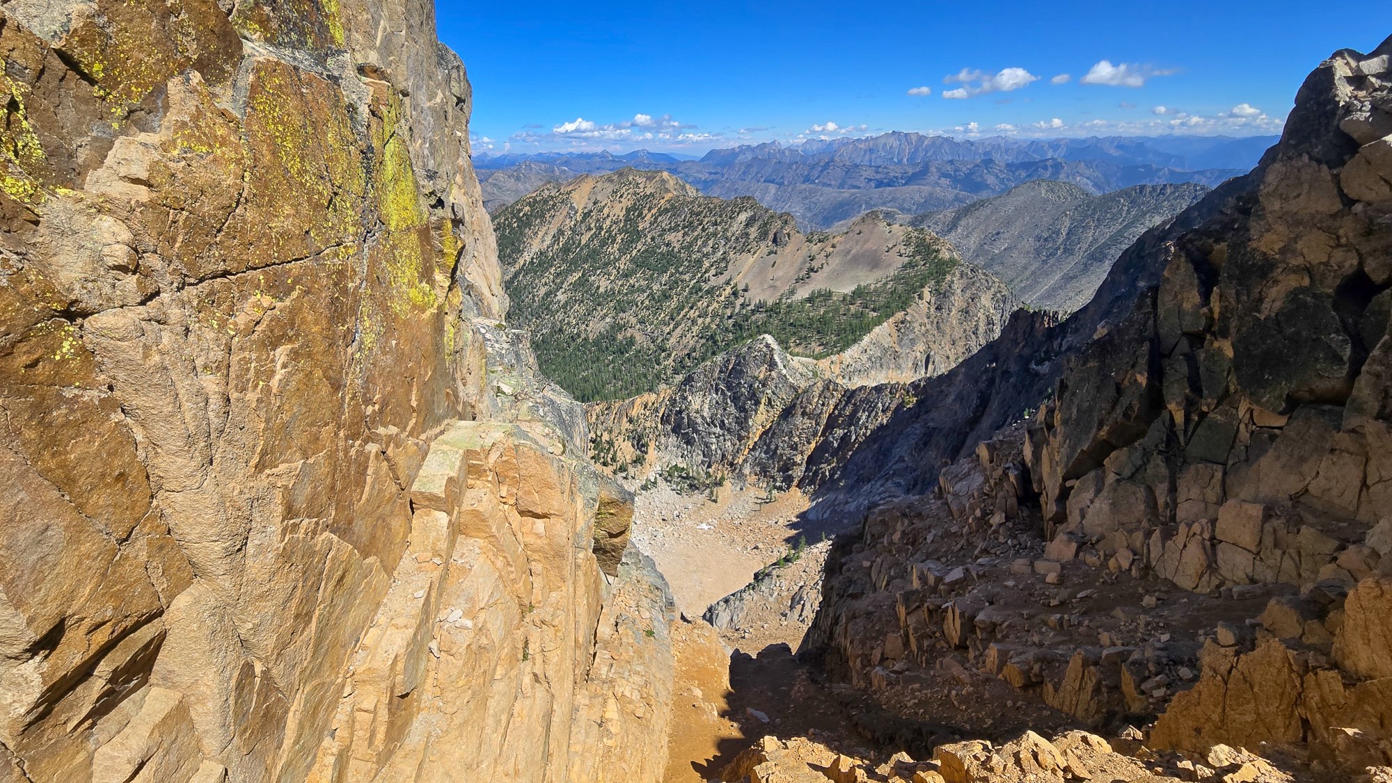
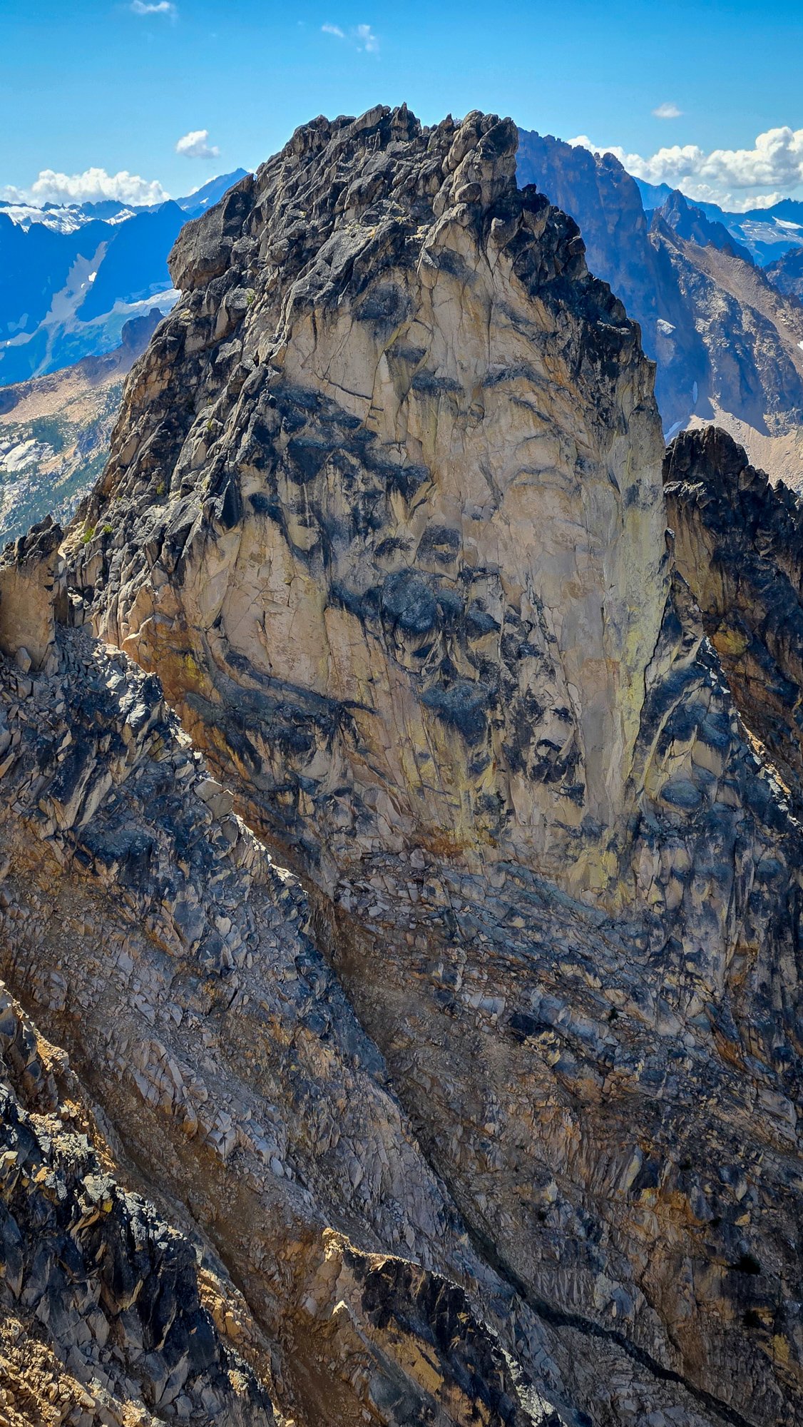
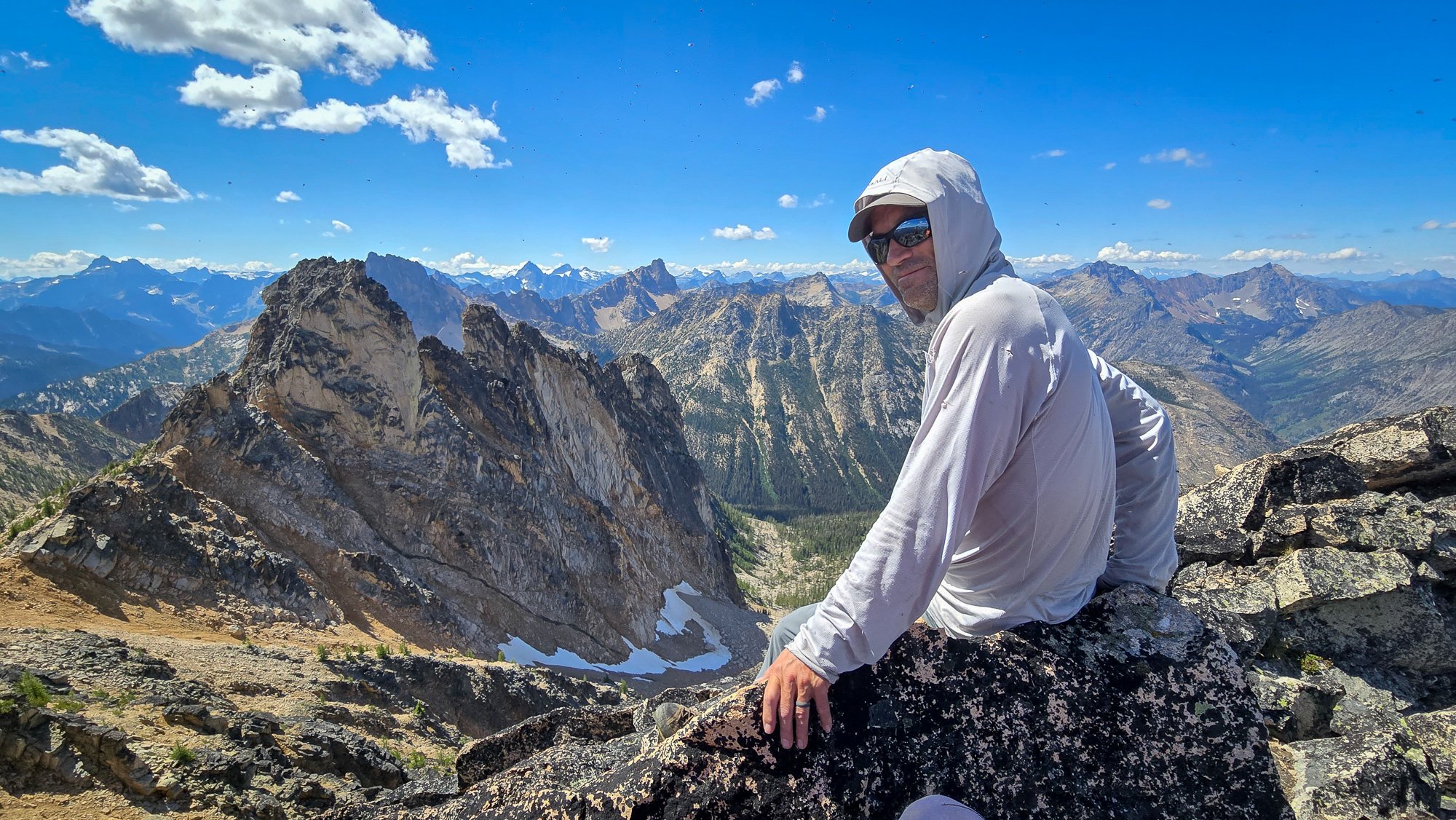
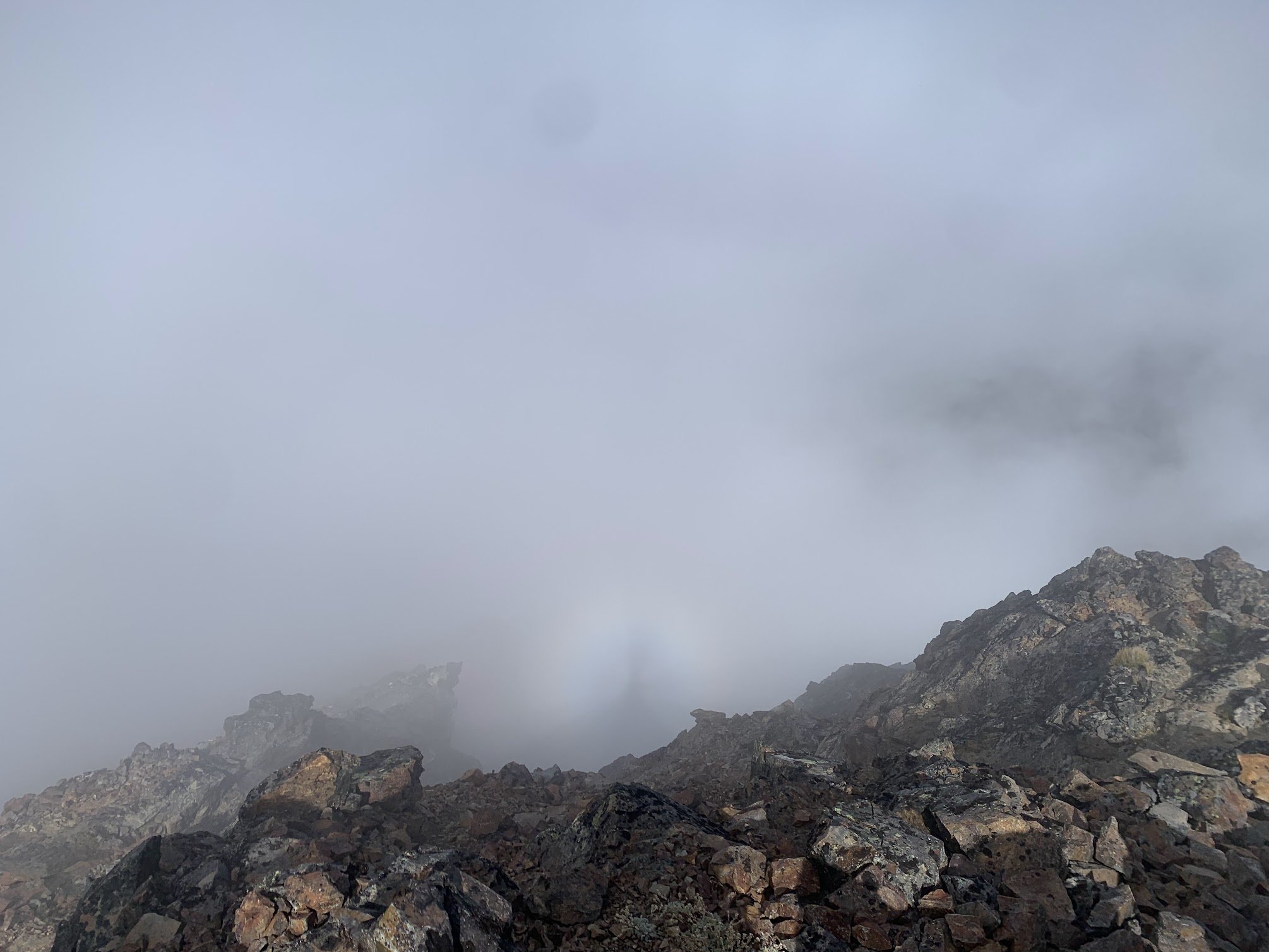
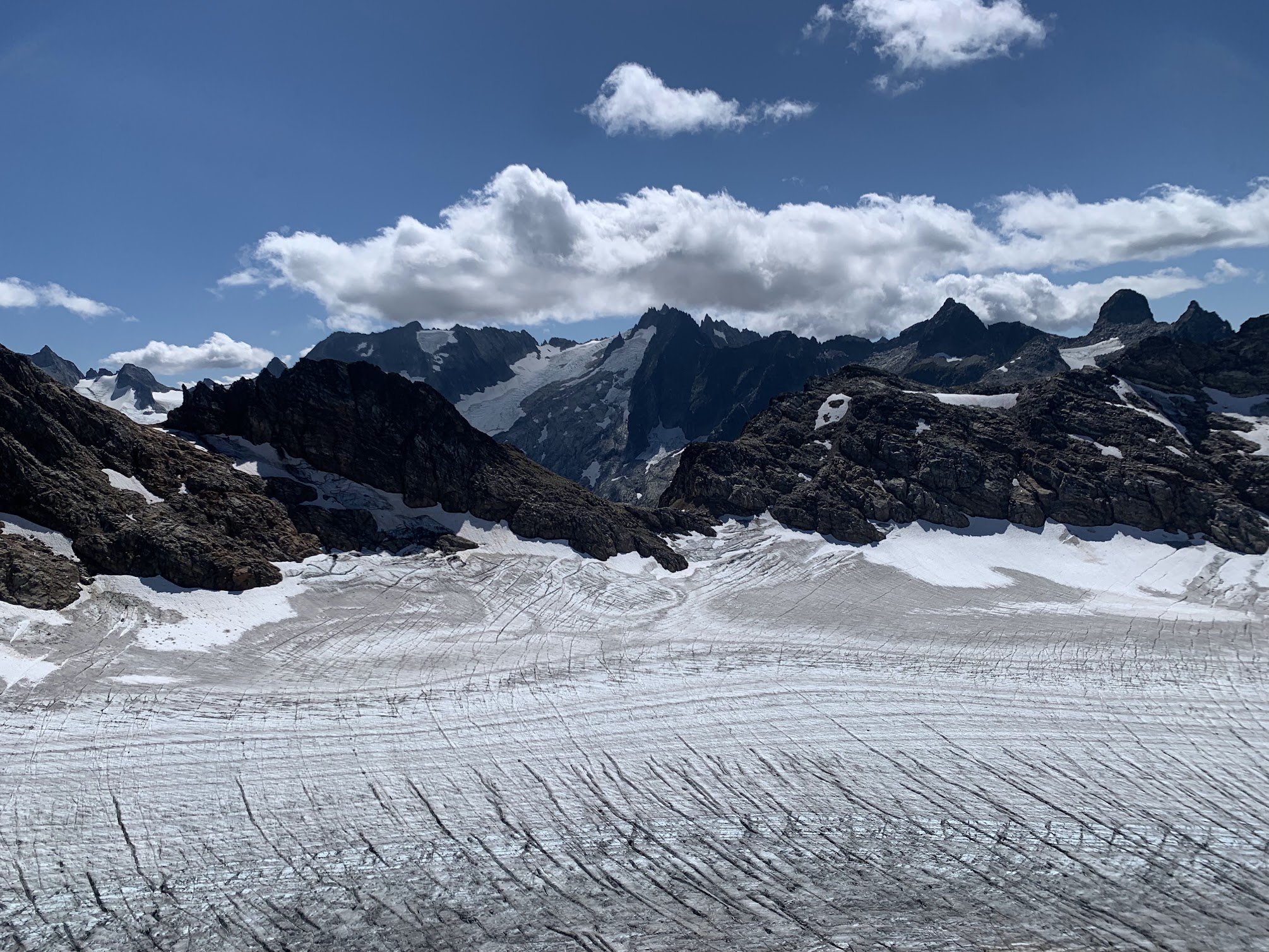
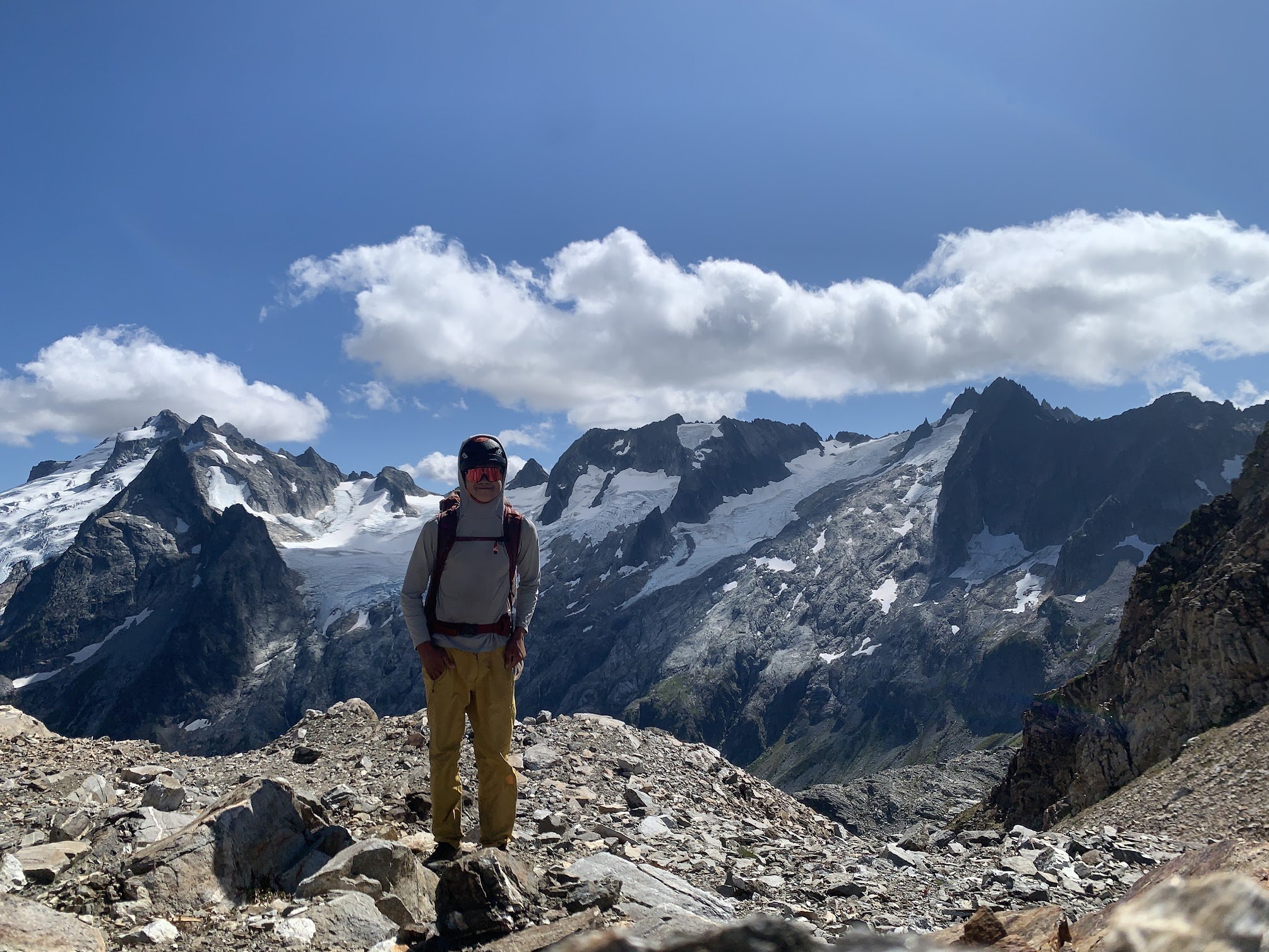
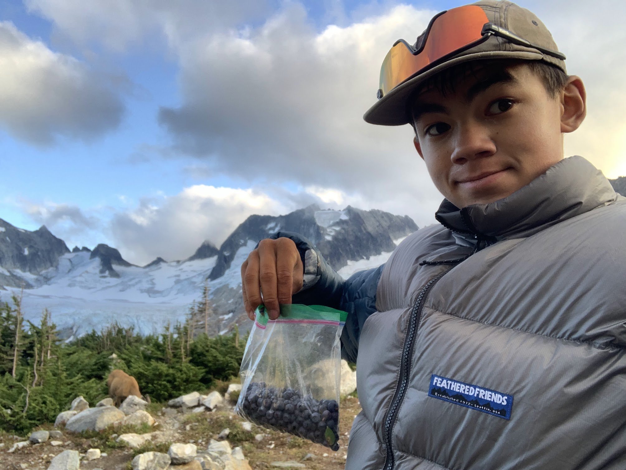
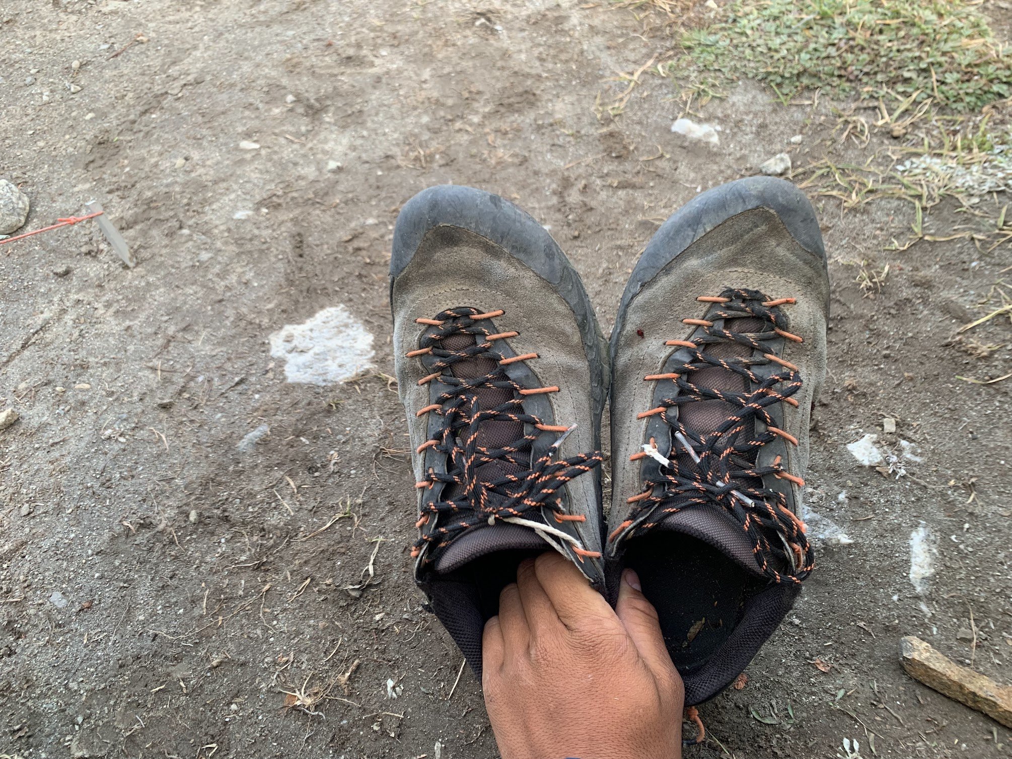
 Trip: Seefar Peak, Brooks Range, The Long Way - East Gullies From Marsh Fork To Dalton Highway Trip Date: 07/28/2025 Trip Report: TLDR Version/Intro: Me and 4 buddies went to the Brooks Range in Alaska for 12 days of hiking through one of the largest wilderness areas in North America. July 28 to Aug 10. We had a blast and it went great. We got flown in by a bush flight, walked along many river valleys, hiked up a talus pile peak and then through the wilderness, across rivers and over hills to the Dalton Highway where we got picked up by a commercial shuttle service that drove us back to Fairbanks and the World. Long version: Day 0: Drive from Bellingham to Seattle, Fly from Seattle to Fairbanks on Alaska Air (duh), van ride, Uber ride. Walk around town, hit a bar, Thai food. Beers in the hotel room. Day 1: Fly to Coldfoot on Wright Air, slight delay due to missed flight (don’t believe the hotel that you don’t need to be early to Wright Air, they take their business very seriously). Immediately upon landing in Coldfoot we jumped into prop plane the same age as my parents and fly with Dirk of Coyote Air into Upper Marsh Fork landing strip on the Marsh Fork of the Canning River. The flight was incredible, frequently with wheels just clearing ridgetops and flying the terrain up and down valleys. Extremely scenic, caribou and sheep. Upon landing there was much exclaiming and pointing and backslapping. Once we got settled down and the final packing completed we hiked up valley. Warm, patchy sun, overnight hard rain. Glorious, glorious, glorious! I got a good chuckle out of everyone later admitting that they were forcing down the nausea the whole bush flight and hiding it from the others. 5.5 miles, 2.5 hours. “Rainy Camp” Day 2: Hike up Marsh Fork, cross into unnamed very upper East Fork tributary of the Ivishak River drainage. Camp at headwaters. Hard day, with technical talus and side-hilling above cliffs and raging water. The river was running pretty high from the previous night's rain so walking in the canyon bottom was not an option for us, otherwise this would have been easier. Cool and misty with rain. Amazing, just like home but nothing like it at all at the same time, so great all around; we expected weather, didn’t rain enough to get wet. Much exclaiming about the scenery. 12 miles, 9 hours “Frosty camp” Day 3: Awoke to frost on the tents and plants. Hiked down canyon to junction with upper east fork of the Ivishak, down river past multiple small confluences, easy walking. Over interminable ridge with tussocks (our first!) to Ivishak River main stem. Camp in a “hay field”. Bluebird sun and warm, 2 long great breaks for lunch. Much exclaiming about the scenery. We pushed hard on this day to set ourselves up for a potential summit tomorrow assuming the weather held out. We didn't want to get stranded up high looking for a campsite with no water. 16 miles, 11 hours “Hayfield camp” Day 4: Ascended Ivishak valley toward Continental Divide, turn south to climb Seefar Peak via dogleg east gully, awesome snow in first gully, then major talus slog to the summit. Amazing time spent on the summit, warm but breezy. Lots of cool fossils in the limestone. Descent to the south and west terrible talus, so we bailed off the ridge early to Wind River valley. Made camp. Amazing dry tundra camp next to river. Shoes and socks dry at camp! First time since 5 minutes into the trip. Bathed in river and washed clothes. Bluebird, sun, warm. Much exclaiming about the scenery. A good time was had by all. 10 miles 4000', 10 hours “Swimming Hole Camp” Day 5: Hiked down Wind River, saw wolves with puppies, then later moose which led us into a lousy tussock field, camped in side creek. Very mediocre spot, but extremely close to water and some dry wood, so we had a fire and drank margaritas to enliven the spirits a little. It worked. Much exclaiming about the scenery. 14.3 miles, 7.5 hours “Margaritaville Camp” Day 6: Up wind River tributary, saw a grizzly with two cubs, a heard of sheep way up high, and a lone wolf across the valley making quick work of the talus. Up a unique talus-ey canyon, over two passes, one being the Continental Divide, down a tributary of a southern fork of the Ribbon River. Great walking most of the time. We got showered on twice, but mostly sunny. The area where we looked to camp was somewhat brushy with knee-high vegetation and it took a bit of looking to find a good campsite, eventually made a spot work quite well with great moss and blueberries. 13 miles, 8 hours “Barefoot camp” Day 7: Nice enough weather early, quickly turned to rain, then hard rain, despite the Inreach weather saying it would improve throughout the day. Misery. Trudged up to beautiful lake, too windy and cold to enjoy it. Saw wolf puppies briefly. Over pass separating the Ribbon and Accomplishment Creek and down to tundra on other side, just past dangerously slick boulder field. Dove into tents soaked through. Very cold and wet. Lunch in tent, nap. Whiskey helped spirits a lot... at least in my tent. Less exclaiming about the scenery today, though everyone admitted it would have been great if we could have enjoyed it. 8 miles, 4 hours, no breaks. “Sunny dry happy fun camp” Day 8: Woke to fog but no rain, weather improved dramatically throughout the morning. This was clutch since our base layers were completely soaked. First thing in the morning everybody got ready to hike then leapt into our wet clothes and immediately started walking quickly to warm up in an attempt to dry out some clothes. Down Accomplishment Creek, up side creek over a pass with lots of caribou antlers, half way down canyon on other side to camp. Beautiful country, lots of exclaiming over the scenery, sunny and warm, dried out everything. Decent walking. Saw moose, wolverine. Drizzle just before camp. “Sewing camp” due to a near catastrophic pack blowout. 9.5 hours. 16 miles Day 9: Drizzle, fog, cool. Down interesting puzzle canyon, that was tons of fun to figure out, left side, right side, in the creek, does it go? It goes! Saw a griz at a distance, then across a big river, nameless east tributary of the Sagavanirktok, (tough, fast crossing), hardest of the trip. Slogged up a tussock hill, to canyon, over pass and down to Sag valley, mediocre camp, not many options. We were told that the Sag was a tough crossing that kills people from time to time, so we were excited to get a look at it from up high. I had done a lot of satellite and map reconnaissance of the entire route and had picked out an area of the Sag that is quite braided, hopefully making for the easiest crossing. I had read a few scattered reports of people who crossed just a couple miles further north and had to use rafts. “Lumpy camp” 12 miles, 7.5 hours Day 10: Foggy AM, then sunny and warm. Across the Sag! It ended up being not that big a deal, but it helped that we were on day 10 and river crossing 1 million +/- a couple hundred thousand. Up the valley wall to an amazing broad sunny saddle with rolling fog, for a tea break. We were on a plateau above the confluence of the Atigun and Sagavanirktok Rivers. The fog started to break up after break, we walked slowly; some bad weather was predicted today and the next couple so over the previous few days we had hustled to make sure we could get across the Sag before the rain set in. Unlike the previous days, the weather report ended up being pessimistic and we had great afternoon sunshine. We strolled through tussocks to camp on a sunny alpine tundra slope. Amazing day. Surprise sun! Everyone tard sailed all their gear out on the tundra to dry out everything. Dry socks even!! The low tundra around camp made for great lounging and camping, and beautiful. The sun and sense of accomplishment really made the light on the hills glow that long afternoon. “Kick Ass Camp” 5 miles, 5 hours Day 11: Hiked off the plateau to the Atigun River, up the river valley to the road, road!? Long road walk to Galbraith Lake camp. My knees hurt after the 8 miles of road for the first time in the entire trip. Mostly cloudy with sun patches and a short drizzle. Surprising amount of traffic on the road, saw a civic! Fire and celebratory attitude at camp. “Galbraith Lake Campground” 6 hours 15 miles Day 12: Woke up leisurely, lounged around, day hike to West Galbraith Peak, tea and coffee on the summit. Camp time, eating everything that was left. Mostly cloudy, mild. “Galbraith Lake Campground” 5 mi, 4.5 hours Day 13: Lounged in the tent, rain and drizzle, picked up by van at 11. Wes from Dalton Highway Express picked us up in a beater 15 passenger van. Two entrees and a beer at the truck stop in Coldfoot. Food at the farthest north truck stop and bar in America was cheaper than in Bellingham. “Hotel Camp” 10 hours in the van, zero walking. Photo credits to Mike Graw. Gear Notes: backpacking gear, bear spray, rain gear Approach Notes: Airplane, deproach by van.
-
- 1
-

-
 This is an awesome TR, thanks for sharing your adventures and for fanning the flame of Cascadian stoke!
 -
 @JasonG when you printing up “I’m tired” tshirts? I think the motto has legs!
 -
I'm new to mountaineering! I just climbed Baker two weeks ago as part of a class. So very little experience and no experience on Rainier.
-
Yeah, I wouldn't mind going again. It is late season though and maybe only three weeks of climbing left. Really depends on if there's another good weekend of weather. What's your climbing experience Wren?
-
Hi! If you're planning to go again and still looking for climbing partners, I would love to join!
-
 Wren joined the community
 -
 Well done, amigos Jason and Steve! And kudos for the rare TR that includes poetry, history, geography and fashion, as well as the outstanding photography we have come to expect.
 -

Home to Dome - 7 day bike to climb on the southern end of the Ptarmy
JonParker replied to Lucas Ng's topic in North Cascades
Wow, what a week! Glad you got graced with a glory too. -
Hey, yeah, I've got 5 summits of Rainier now. I'd be down to go again though. I just got back a couple hours ago from climbing Rainier and the route is in really good shape right now. Email me at elithompson90909@gmail.com and we can talk more details.
-

Home to Dome - 7 day bike to climb on the southern end of the Ptarmy
JasonG replied to Lucas Ng's topic in North Cascades
Yeah @Lucas Ng, glad I could inspire the trip! That is one of my favorite places in all of the cascades, so great that you got there! And thanks for the heads up that the trail has been improved....just might need to make another trip in there for Old Guard and the German Helmet. - Yesterday
-

Home to Dome - 7 day bike to climb on the southern end of the Ptarmy
Lucas Ng replied to Lucas Ng's topic in North Cascades
There was a defined trail the entire way. On my way in I got off-trail once but quickly picked it back up and on my way down I was able to go from the cub-lake notch to the downey-bachelor split in 2 hours without checking any gps. still a good amount of logs to step over and every once in a while there'd be some shenanigans to end-run a blow-down but far from horrific. I'd seen some other TR's mention the new condition of it in the past year or two but not sure if I'll be able to find them. By the way, your trip report was one of the big things driving me to explore the area so thank you. That photo you took of dome with the tree at white rocks lake has been stuck in my mind for a while.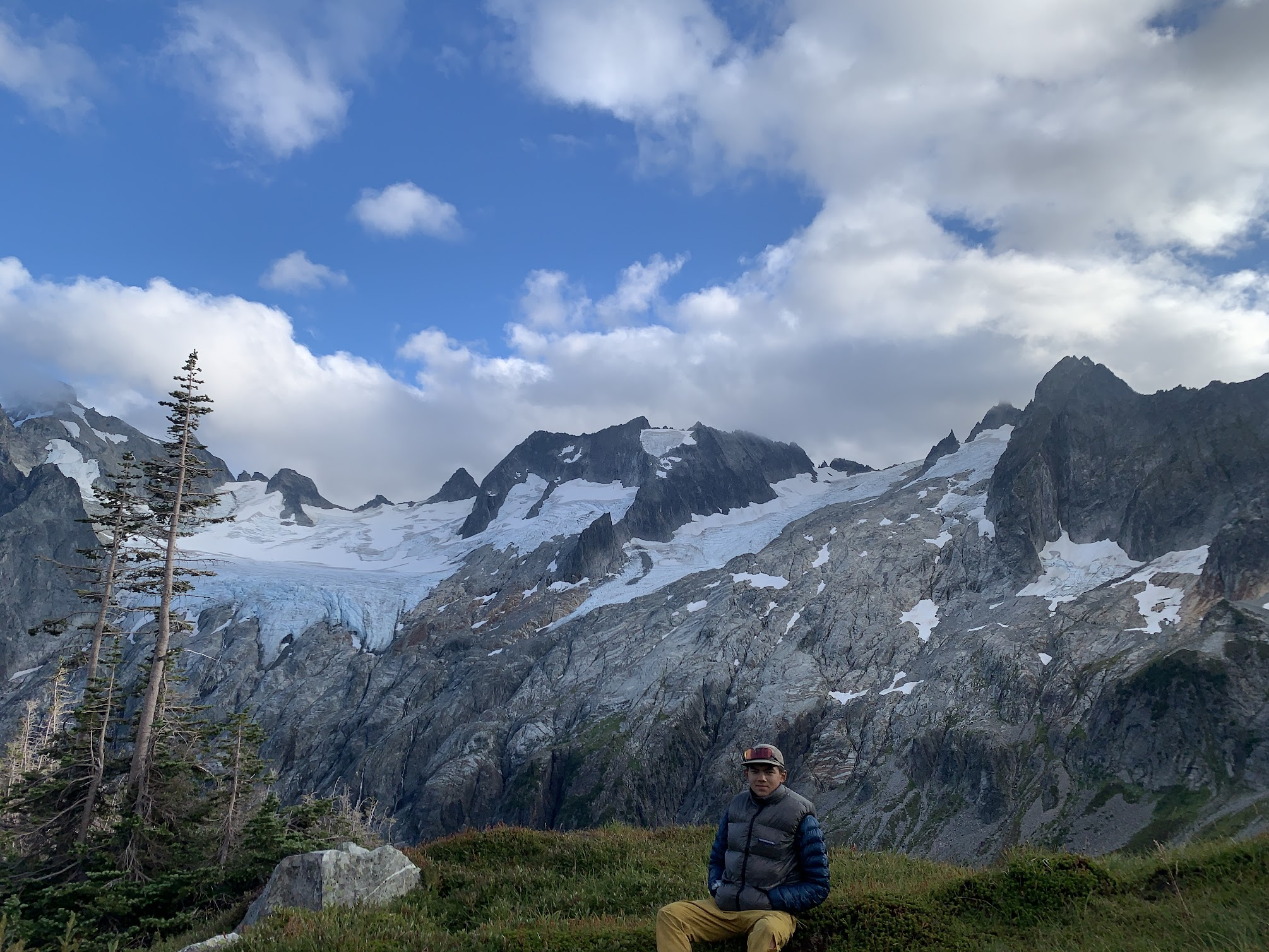
-
 willajs joined the community
 -
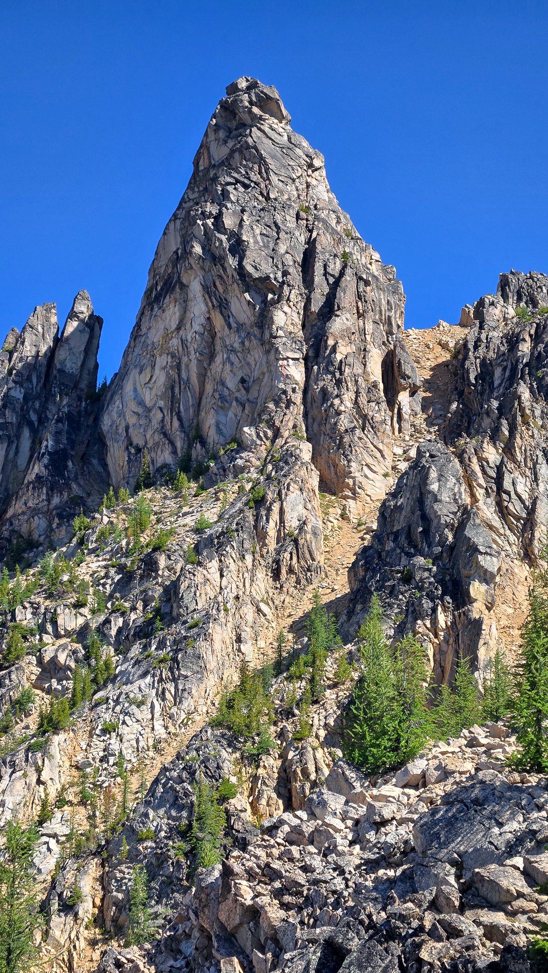
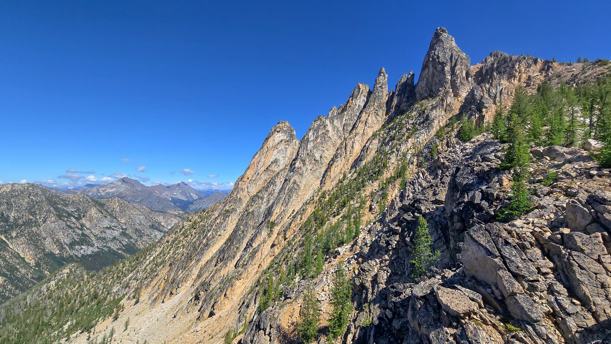
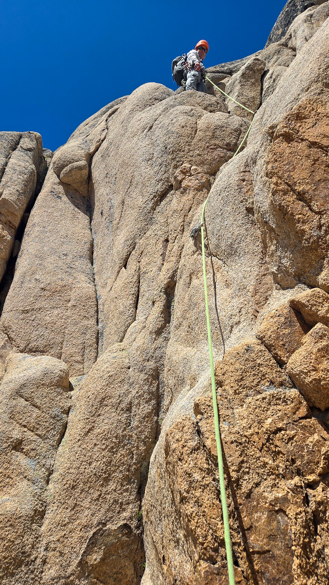
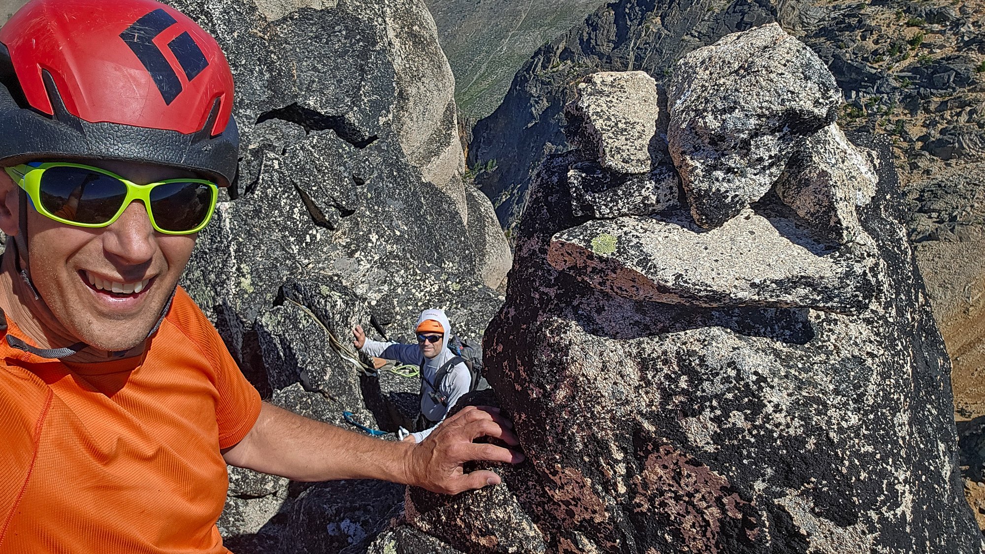
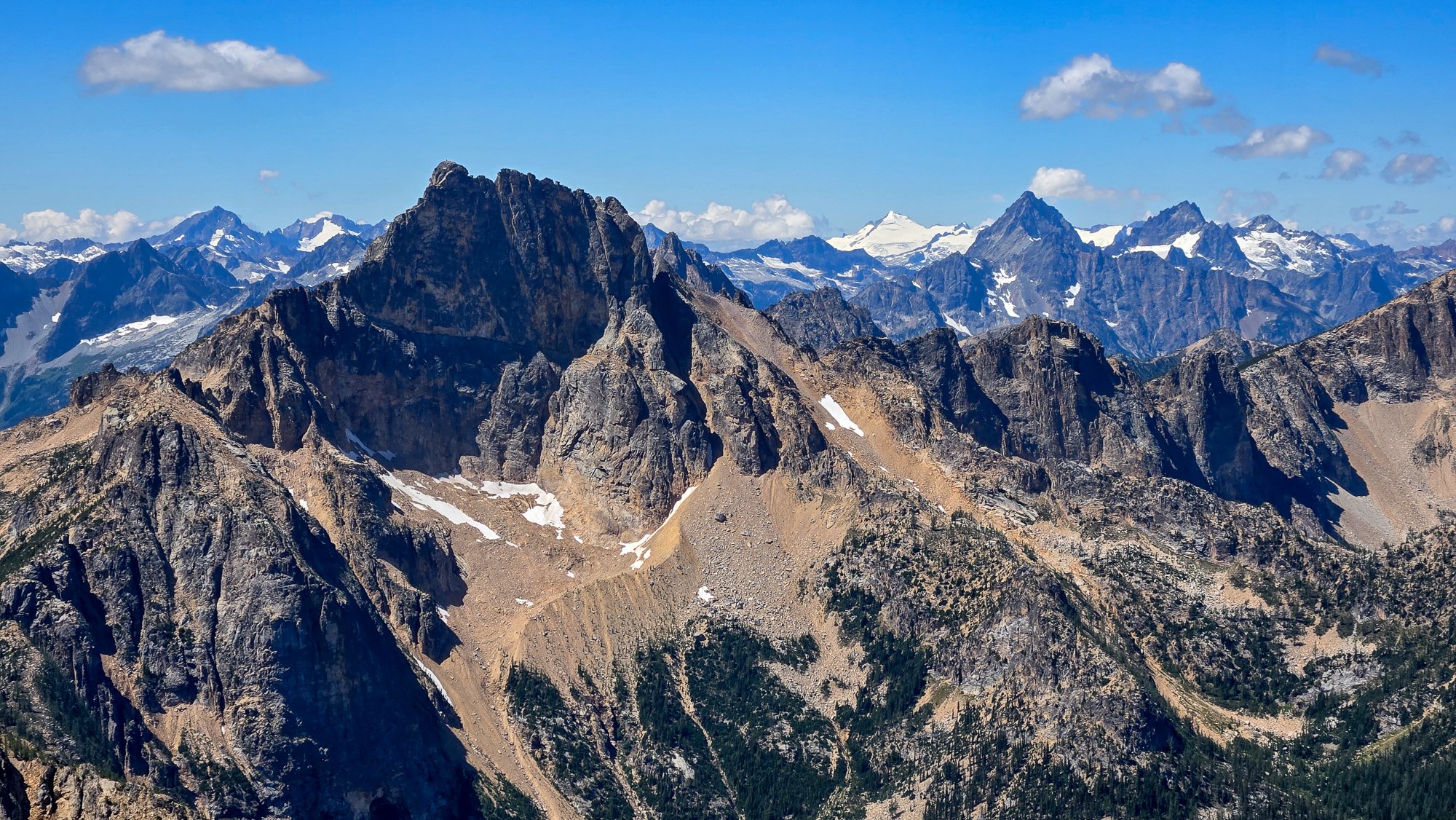
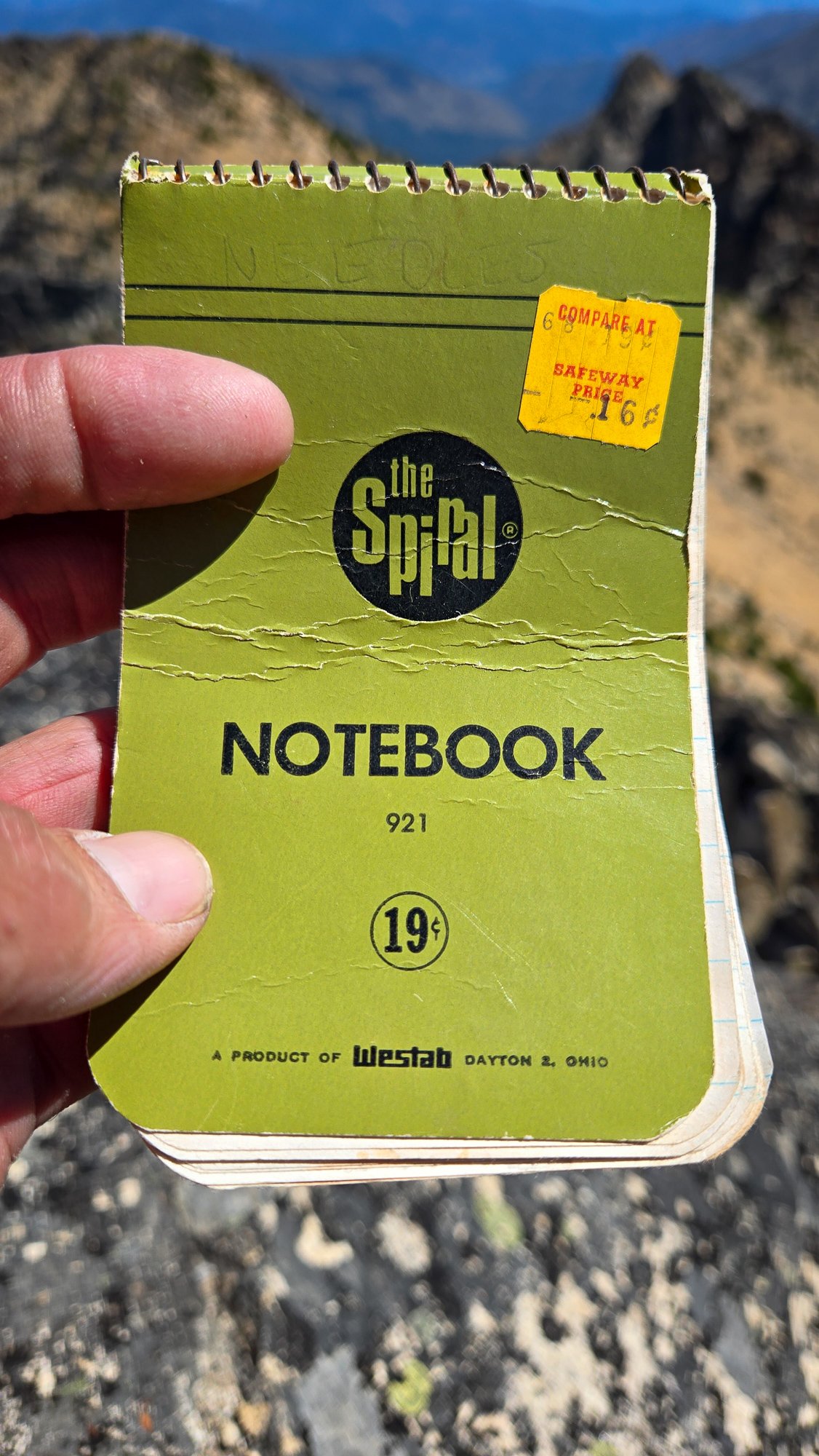
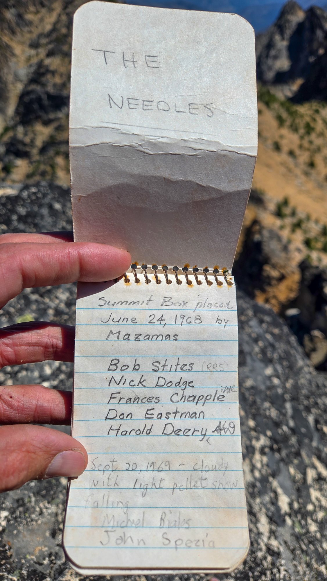
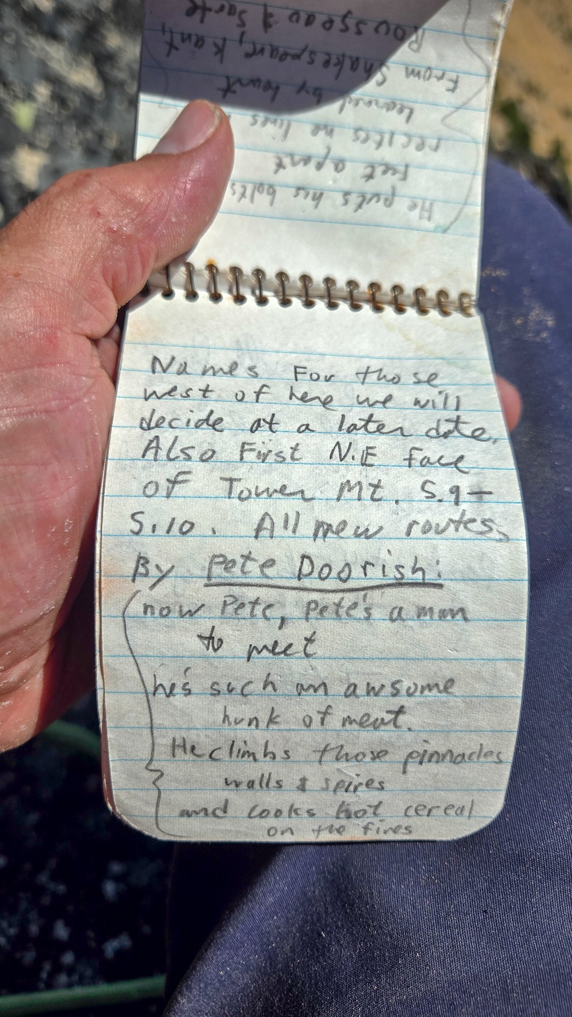
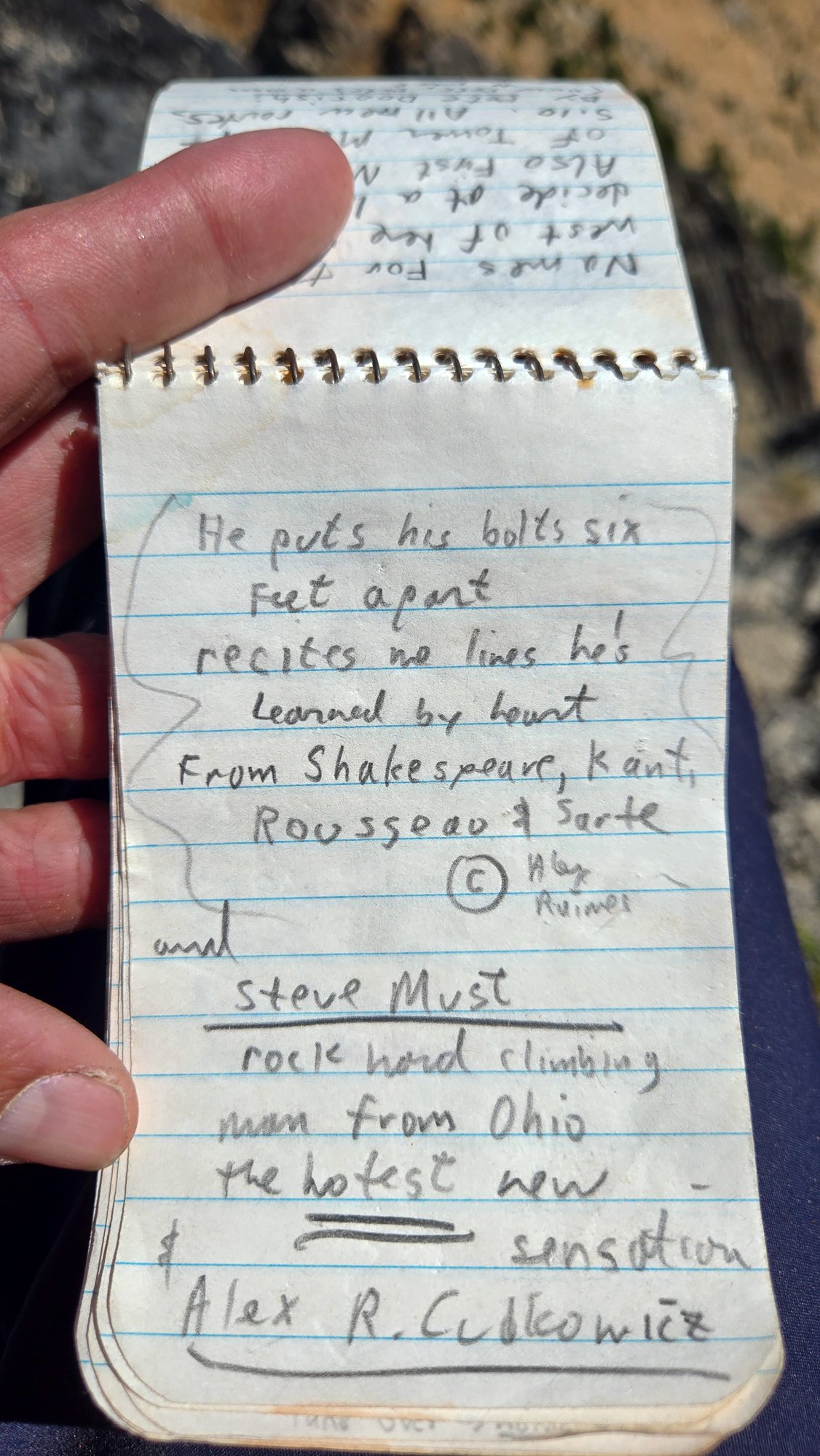
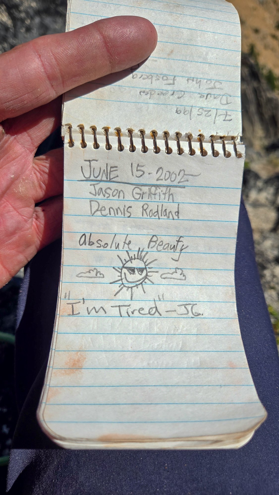
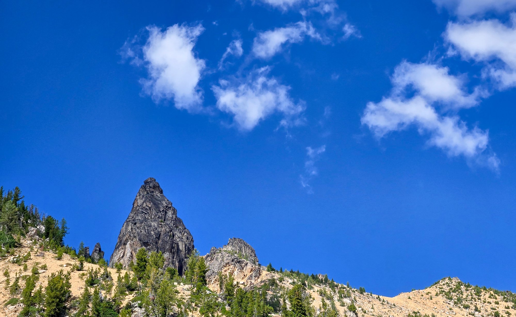
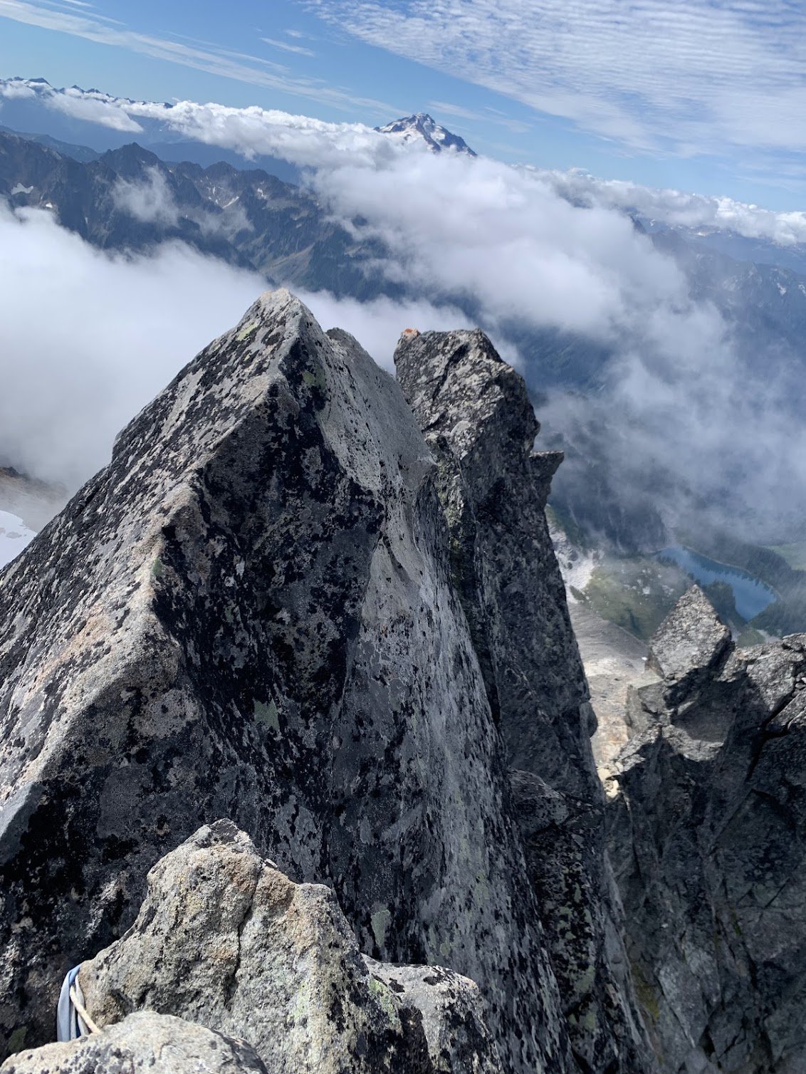
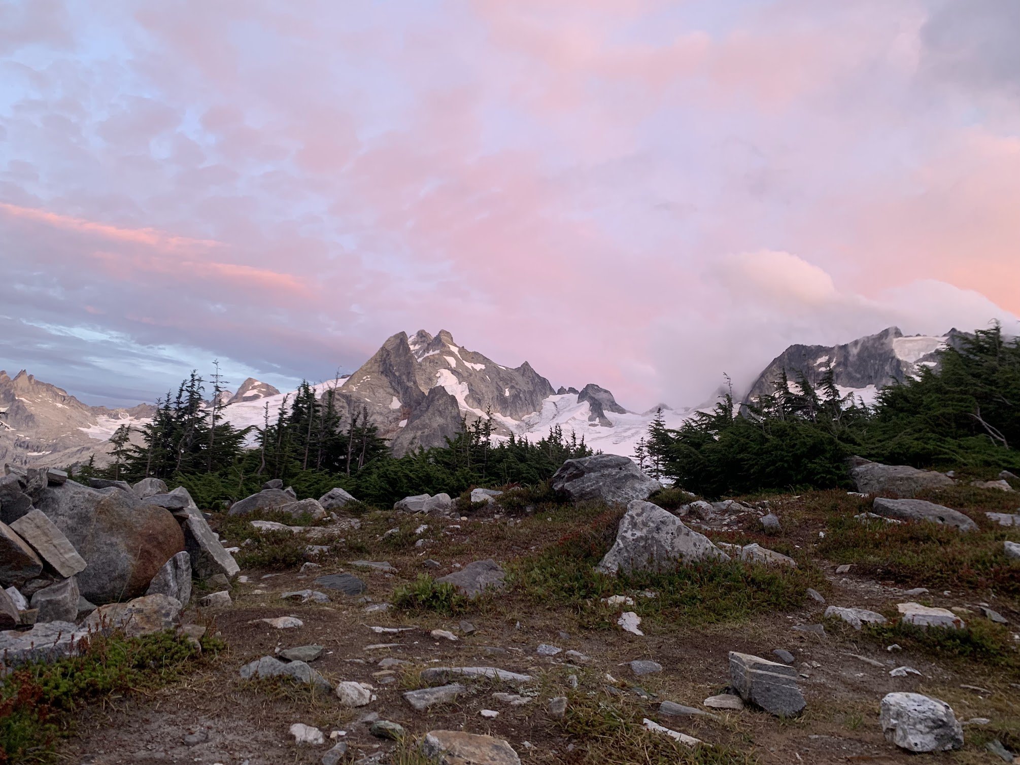
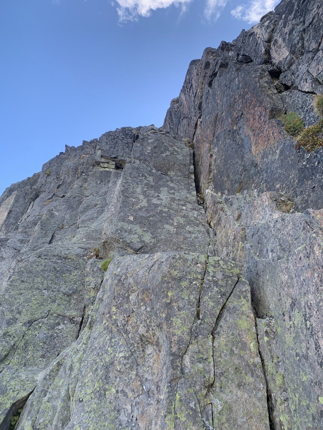
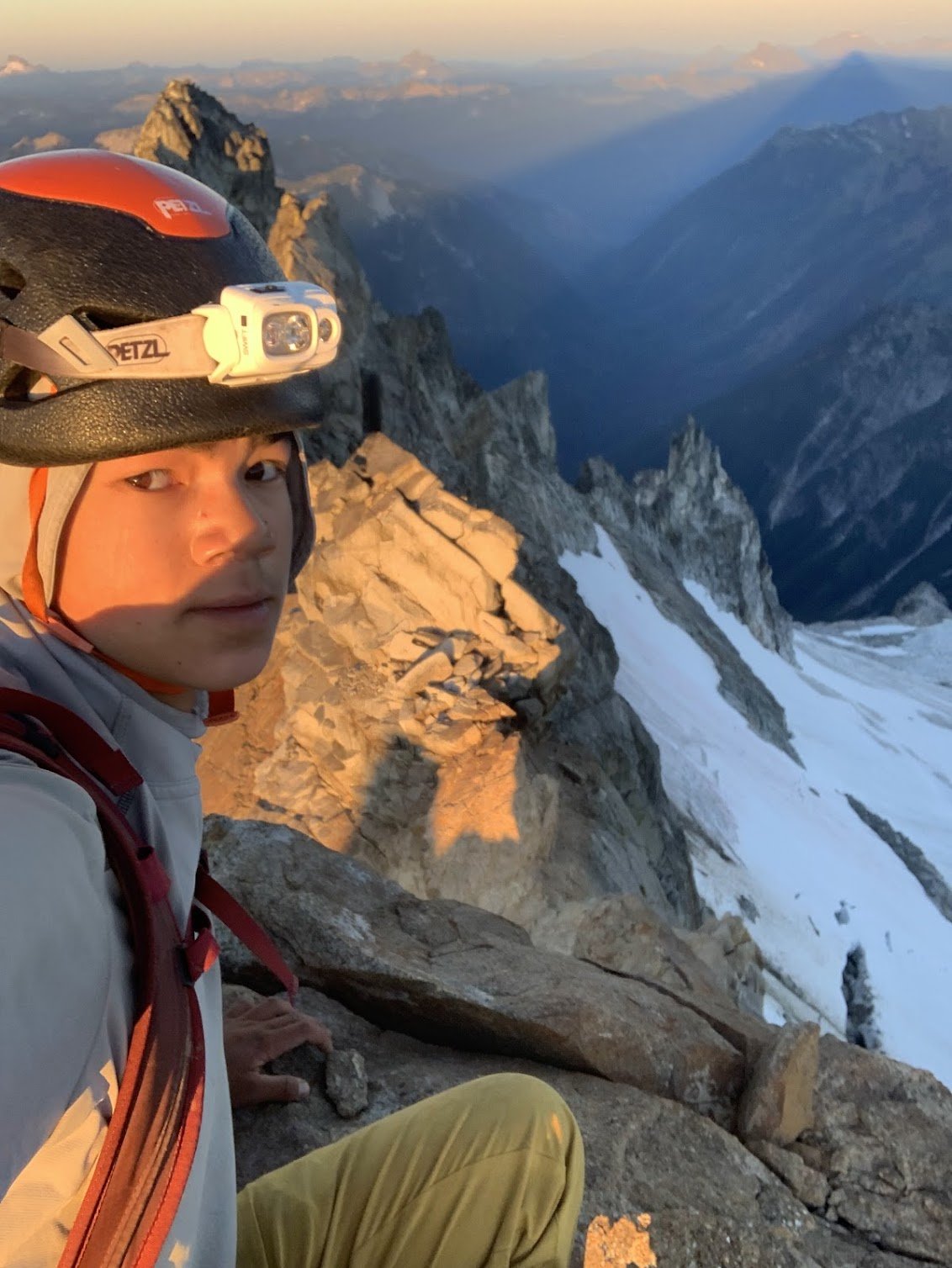
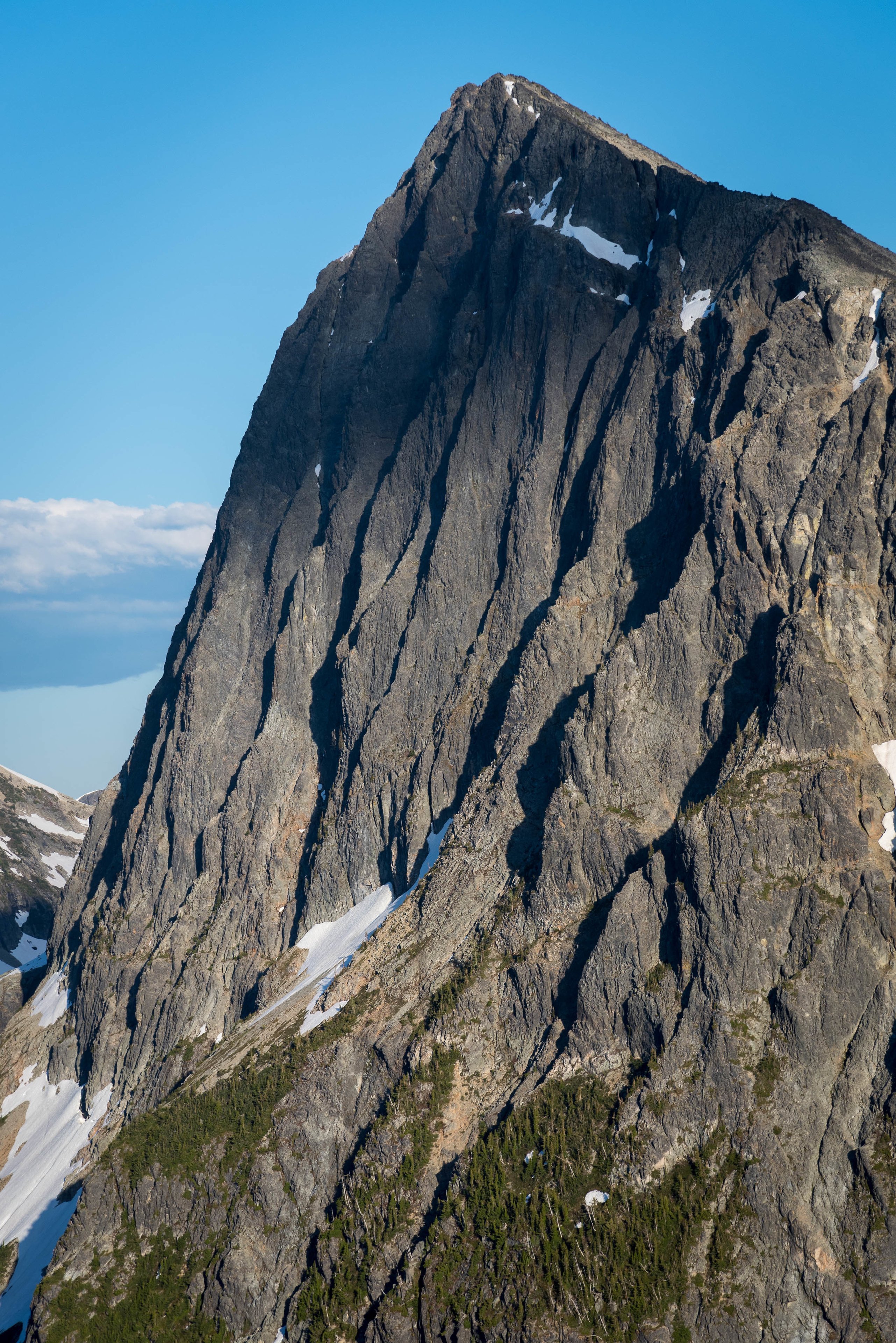
Trip: High point of The Needles (AKA Big Methow Needle) plus the East Peak - Standard Trip Date: 08/02/2025 Trip Report: It seems to be that after 20 years you can repeat a peak and it is almost like you've never climbed it before. Almost. The memory of the character building approach in soft snow wasn't entirely forgotten when @Trent suggested the high point of the Needles (Top 200!) on a Saturday a few weeks back. I had last been up that way 23 years before with my friend Dennis and we had gone straight up from the highway/campground, traversing endless ribs and isothermic mush for a few short 5th class pitches. BUT, Steve had found a better way! Or, so I sincerely hoped, and so I found myself gearing up on the shoulder of 20 again, peering into the brush and looking for the faint hint of a trail @Eric Gilbertson had mentioned was in there. After some minimal thrashing indeed a halfway decent trail emerged, though downed logs were beginning to reclaim it slowly but surely. Things were looking better than I remembered and we continued up. Thankfully the valley thrashing is relatively short lived and the ascent up an open forest rib soon lifts one to views and cooling breezes. A couple hours slogging brought our first views of the Methow Needle, which was more impressive than I remembered. The views to Tower and Golden Horn were also much better than I remembered: Soon we were at the base of the climbing, racking up for 3 pitches of 4th/mid fifth class: @Trent took the sharp end first and launched up on the surprisingly steep first pitch, which was solid, if somewhat kitty litterish: A couple more rambly pitches brought to the lonesome summit, which really hasn't gotten much more popular since the register was placed in 1968. It was a much more entertaining read than most, and I especially enjoyed the firsthand accounts of FA by Pete Doorish and his partners many moons ago: We were definitely not worthy, but we were there, on the summit nonetheless: And the views, of course, were better than I remembered. Buckner, Boston, Sahale, Tower, Eldorado, Mesahchie, Katsuk, Kimtah (L-R): When I had last climbed it via the not recommended approach in less than ideal snow conditions, I was a young man and was still thoroughly whupped by the end of the day after climbing only Big Methow Needle. This time, we were older and wiser and had some extra energy to head over to the East Peak of the Needles which afforded a grand view of the North side of The Needles, along with many ladybugs (visble at black specs in the photo of @Trent below): But, pleasant as it was up there, we couldn't stay forever and reluctantly had to descend back to the brush and blowdown to battle the masses back west across the pass. Still, a parting view of Big Methow Needle as we dropped to treeline was a good reminder that we have an exceptional backyard here in the North Cascades: Gear Notes: Light Rock rack to 2", 60m rope, helmet Approach Notes: Stay in the valley and find an old trail up Pine Creek on south side. Where it crosses to north side of creek follow for a bit longer into timber until it peters out and you head up via open forest to treeline and the peak.

-
Home to Dome - 7 day bike to climb on the southern end of the Ptarmy
JasonG replied to Lucas Ng's topic in North Cascades
Quite the effort @Lucas Ng! A lot of summits for a week human powered, those are all way back in there. So let me get this straight....somebody cut through all the avy debris on the Bacehlor creek trail?! That was pretty horrific just a few years ago (2022) when I last came through. I didn't think anyone would put in the effort to clear it ever since the USFS gave up decades ago. -
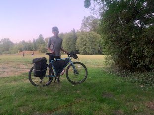
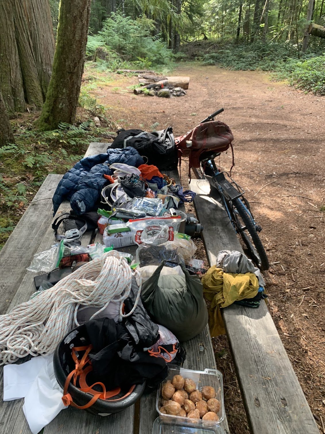
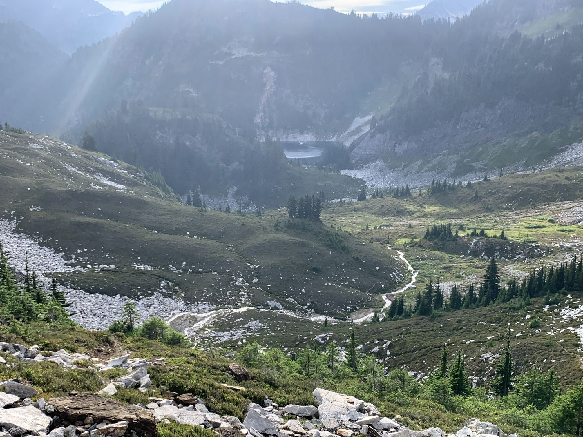
During the past school year, I’d made the plan of doing a bike to climb trip this summer. Mainly due to the fact that it’s difficult to borrow a car from my parents for a while, but it also just seemed like a neat concept, and I was down for an adventure. After getting back from the North end of the ptarmigan traverse, I was inspired by the peaks further south. My partners were either out of commission or had came up with the lame excuse of “work” and “paying bills” so I figured I’d make it a solo trip. The peaks on the ptarmigan traverse made good sense for this since they’re usually 4th or low 5th making it a pain to bring rock gear. The only challenge was glaciers, but I hoped with my later-season climb they would be mostly dry. I was pretty lazy about prep so a late Saturday night found me and my brother binging a show. I woke up at the too-early time of 7am on Sunday and packed my bike before setting off at 10. Sunday 8/17 The first day was quite chill until I got to the centennial. At my first break on the centennial, I went for my phone when I realized my pannier pocket had been completely open and in a position to spill out the contents for the last hour while I’d been biking down a windy hill and over railroad tracks. I looked around but couldn’t find it so I asked a kind stranger to see if I could call my parents to find out the location. The man, Tom, ended up driving me back an hour of biking to the last known location but after a 1.5 hour ordeal, I came out empty handed. I figured I’d continue on with a garmin and stop by somewhere to get a map. Hour or so later, When I reached down in my frame bag for some snacks, I found it tucked behind some bike tools. The rest of the day went smoothly and I got into Darrington around 6 or 7 in time to get some food, buy groceries, and set up camp. Monday 8/18 As was the trend for the trip, monday was also a moderate day. I biked 30 miles to the trailhead and hiked up to itswoot ridge. The Downey/Bachelor creek trails are now well cut out. Always able to see your feet. At the Bachelor turn-off I ran into two climbers who were coming down from dome. Once I got to cub lake, I met a backpacker who had twisted his ankle a few days ago. An hour later I watched a helicopter come pick him up. I worked it up to Itswoot ridge where I went over to back the peak before setting camp at the established bivy sights to a nice view of dome and glacier. Tuesday 8/18 Trying to save phone battery and figuring the ptarmigan was obvious, I navigated the old fashion way. I knew that I had to climb through snowfields to the spire col so went to what I thought would be the obvious one. Once I was climbing the gully to the col, I found that it was much much looser than I had expected. Topping out, I realized I was definitely in the wrong place, I’d gone to the spire/west spire col. A shitty descent and some more vert later, I got to the right col. I scrambled up spire peak and enjoyed a mix of sun and clouds. TR’s had reported a licheny slab that wouldn’t be fun in approach shoes but it wasn’t too licheny anymore. From here I made the awful descent down to the basin where I traversed around to cub lakes. The only snow of the entire day was between the col and the base of the spire point. I got into cub lakes early and bagged 7340 and Lizard before heading to bed. Wednesday 8/20 The goal for the day was simple, Sentinel and Old Guard. The south cascade glacier was entirely dry and it was cool to see all the glacier monitoring equipment. I found a nice left leaning ramp up the West face of sentinel and scrambled to the top. With the sun and clouds there was a cool glory effect. I descended down, traversed over to the Leconte Glacier, and followed the dry glacier to the col. With some endrunning I was able to stay entirely on ice except for a large snow patch right before the col past the schrund. The scramble up was fun and I enjoyed good views of the more northern peaks. I descended back down and got back to camp by 4. Made some oatmeal and figured I’d scramble up old guard at 4:30. Made it from camp to the base of the North ridge in 45minutes before realizing that there may be some 5th class. It ended up being about 5.6 but it was a secure chimney so I felt comfortable. Made my way down by 6:30 where I found a deer at camp. Picked lots of berries alongside the deer before settling in for the night. Also lots of unfazed marmots. Thursday 8/21 Woke up to find my helmet 20 yards away from my tent. The marmots had stolen the foam padding from it. Spent the morning walking over to the dome-dana col. I went up and over to the itswoot ridge side since I didn’t want to solo the Dana glacier. Set up a nice camp before scoping out conditions. Figured it would probably be do-able but I wanted to do it in the early morning before sun hit everything and while snow conditions were firm. I was doing everything in approach shoes and hybrid crampons so steep stuff was not my forte. Listened to podcasts and sat around for the easy afternoon. That night was horrible, some mice disturbed me for two hours, eventually getting into my tent by making holes in the mosquito netting. My food was hanging but they still walked around by my feet. Didn’t get a ton of sleep. Friday 8/22 Started at 5am, picked my way up the glacier trying to stay on ice. Summited dome at 6:30, down by 7:30 before the sun had even hit camp. Figured I might as well make it down to the trailhead where I found myself at 2pm. Quickly packed the bike and headed towards darrington where I stopped to gorge myself at the burger place. Afterwards I hopped back on the bike in the 93 degree heat to bike to arlington where I camped in a park. This night also sucked too. Loud music + heat + my grimy body only gave me like 2 hours of sleep Saturday 8/23 I knew it’d get hot so I was moving as soon as it was light out, made it home in 5.5 hours where I showered and gorged myself. I’d been doing some moderate rationing for most of the trip so was, and still am, quite hungry. Overall it was a great trip to end the summer. I’ve got a oral surgery tomorrow that will put me out for 2 weeks and by then, I’ll be a week into the school-year. Been busy getting out recently but with this off-time, I’ll probably put together some mini-TR’s on my site(https://lucasfng.blogspot.com/). I’d been wanting to do a long trip over the summer so this satiated my hunger, though it would’ve been nice if I could've got more than one in.
-
 ocnliam joined the community
 -
Little J-Berg! Thanks to @John_Roper, @rat, and @lunger for getting me to peruse some images and revive this thread!
-
Beta Needed for Finding Howard(?) Tower in the Sisters Range
JasonG replied to Bravebatty's topic in Climber's Board
paging @dberdinka.... -
Also, I want the record to show that somehow when I was trying to edit the tags I accidentally rated this thread one star and I can't change it to 5! So, sorry @rat and @lunger if I'm ruining your Zagat FA rating.
-
And so it shall be in the Griffith house! Thanks for that bit of history @John_Roper, always fun to hear new details for the familiar vistas in our backyard.
- Last week
-
 Mountain Cat joined the community
 -

MRNP Carbon River/Mowich Lake Access Closed
Fairweather replied to Fairweather's topic in Access Issues
https://www.thenewstribune.com/news/local/community/puyallup-herald/ph-news/article311802624.html -
-
 Hey! Life long Bellinghamster here who is in love with the Sisters Range. We went out to do the Green Creek Circ recently and heard some guides talking about Howard Tower. Well, we found Eifel Tower, but we have no idea where to find this Howard Tower, or what it looks like. We'd love to explore and climb more of what the Sisters has to offer us.
 -
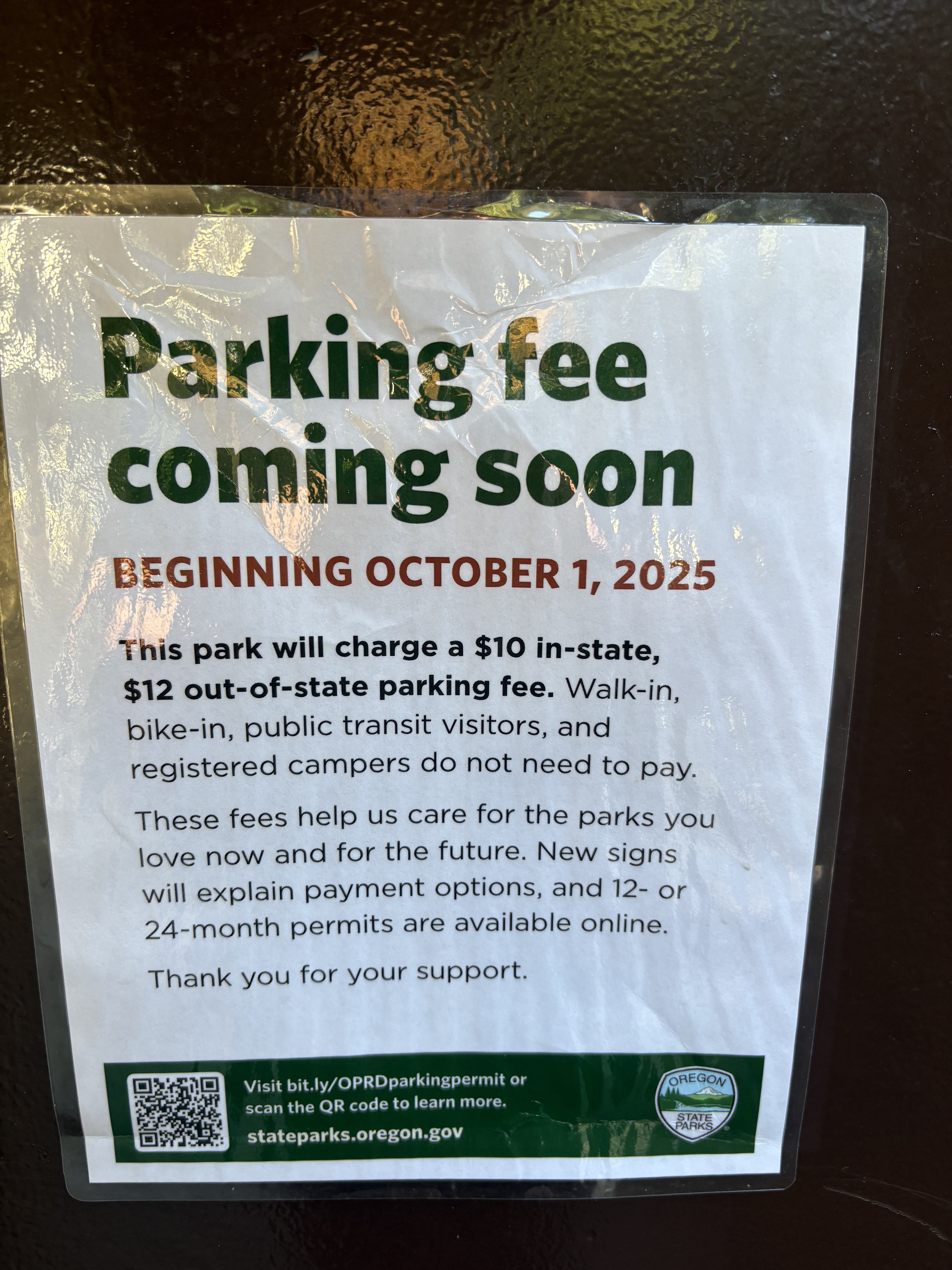
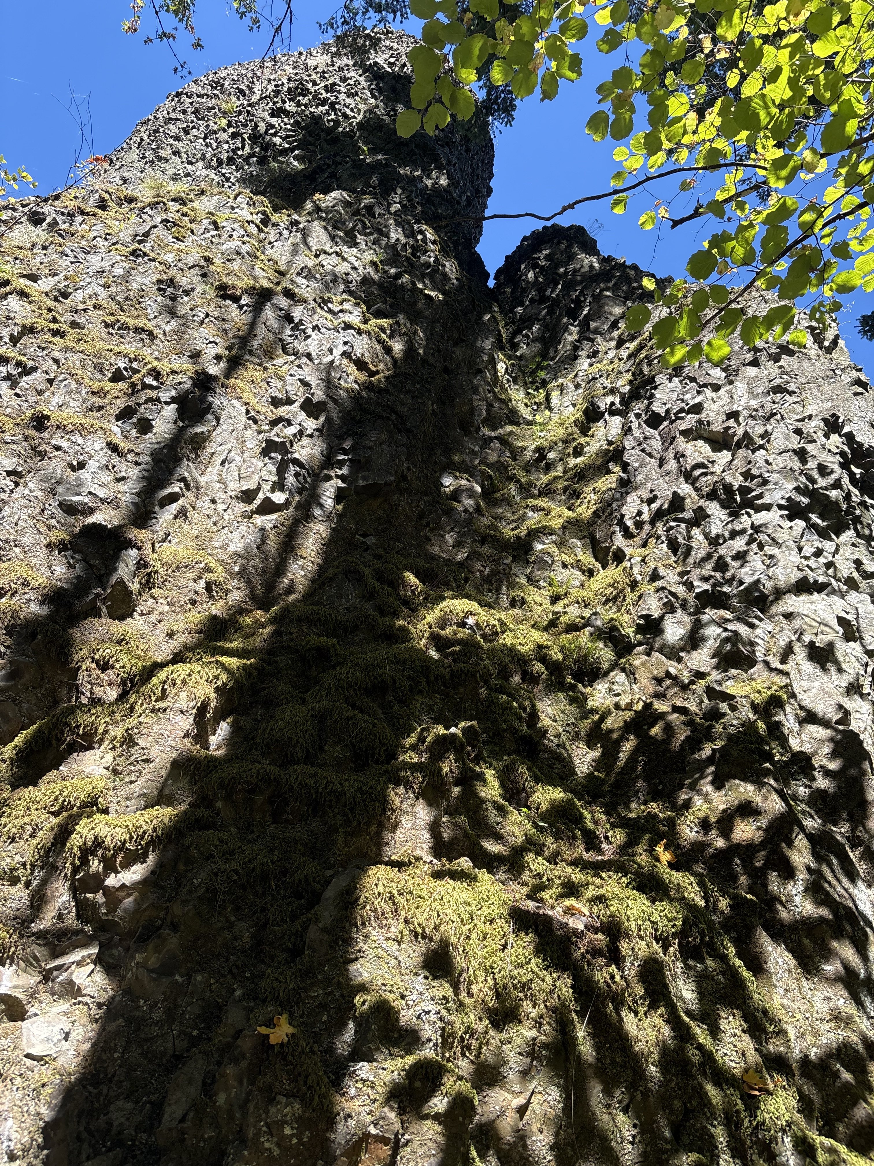
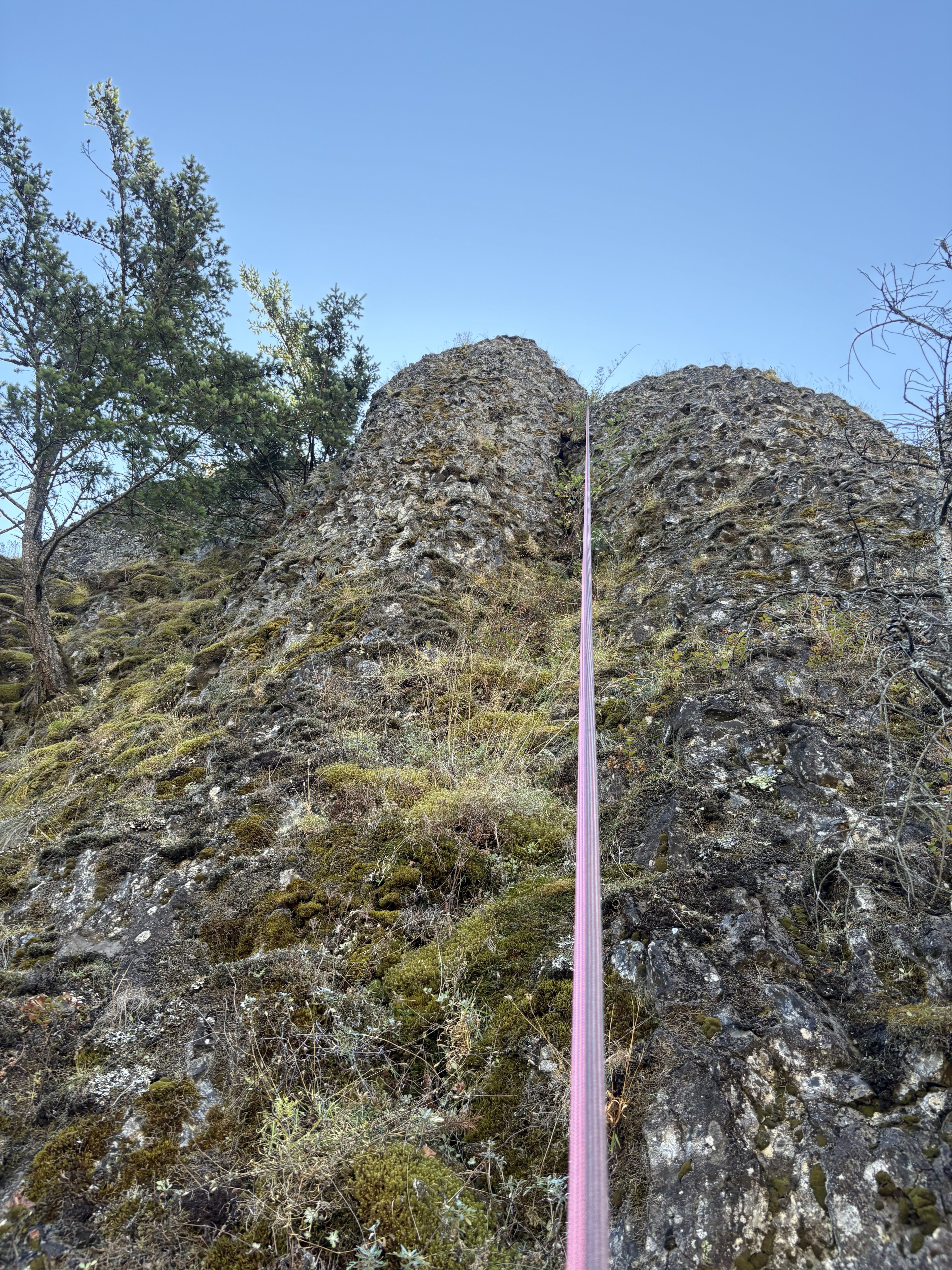
Noticed this at our meet up parking lot; Broughtons Bluff—
-
 "The climbing is moderate, but generally solid and fun, with adequate protection." "We opted for the safer option" Nice job, BUT WHO ARE YOU GUYS and what did you do with Eric and Rolf???
 -
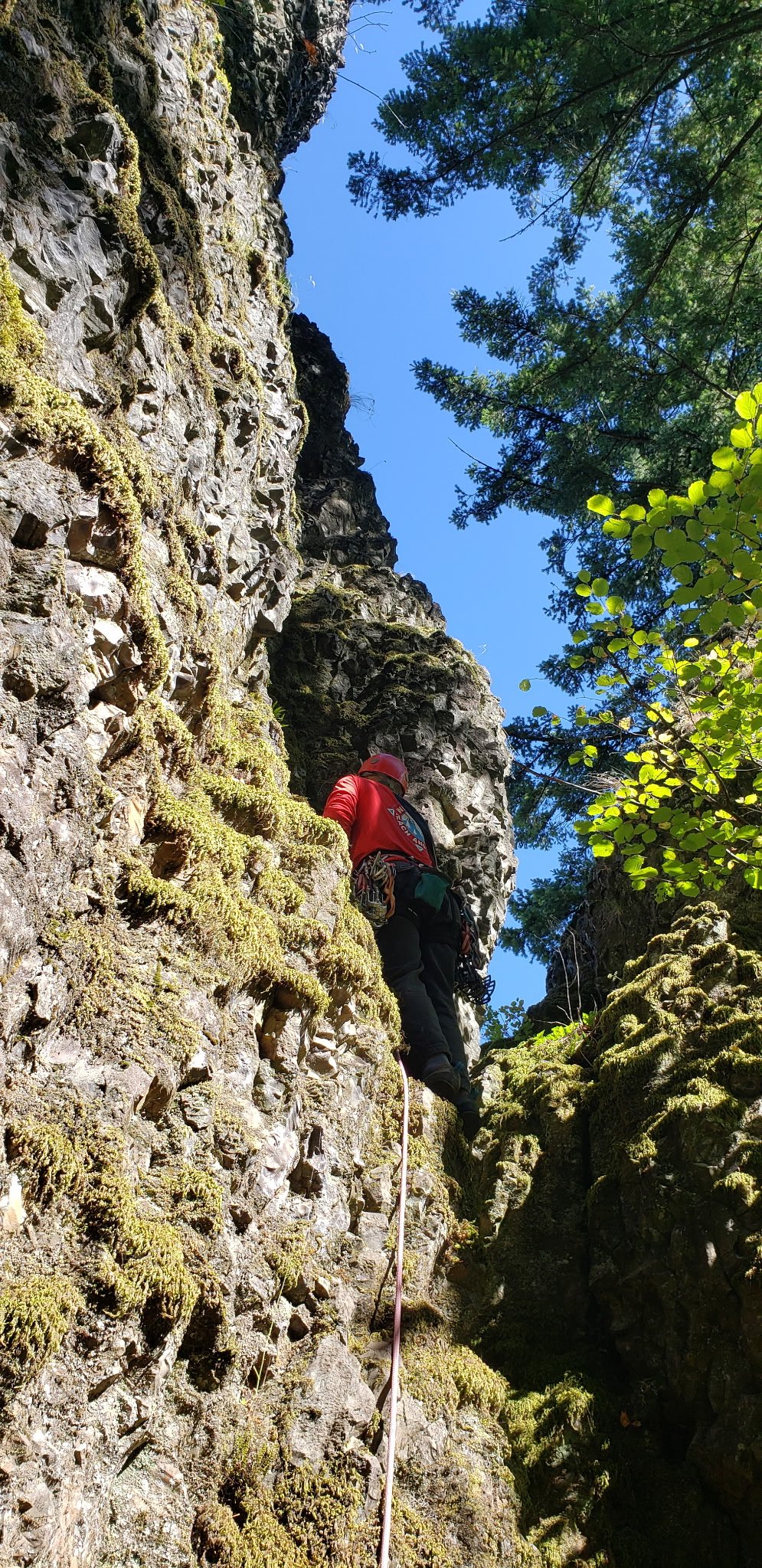
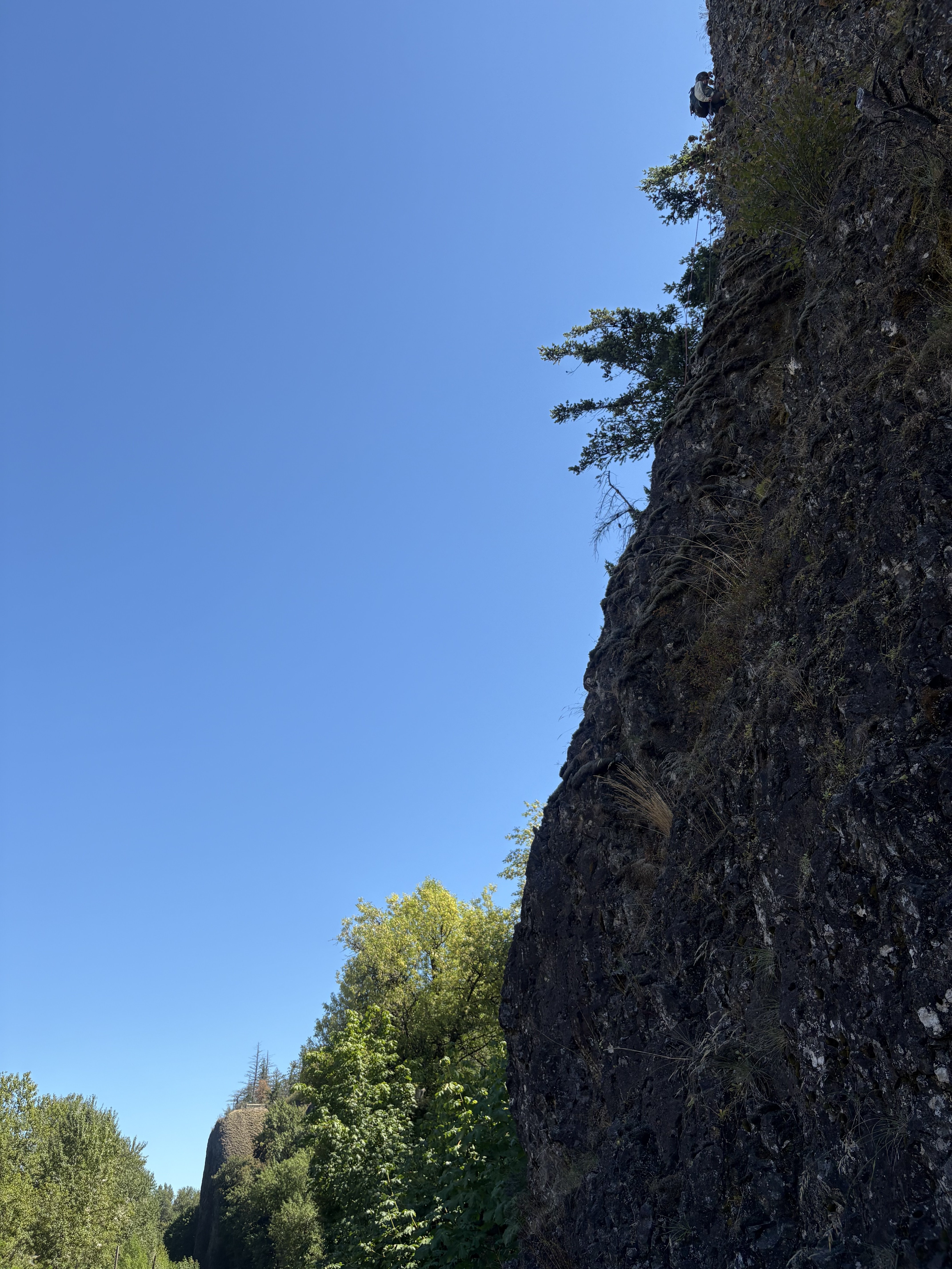
This approach is an appetizer of nettles and other thorny shrubbery types that thoroughly enjoy tickling your ankles with utter abandon. The 5.4 on the super gorge classic corner is a splendid main course in prime conditions currently. Though we wondered if frozen moss would allow for less rope drag when pulling to rap? How old is the pin by the tree?
-

Kelty Cloud 6500 Pack vs Wild Things Andinista
ahutton replied to erewhon's topic in The Gear Critic
It's now over 20 years later; and I still don't regret the purchase of the Kelty Cloud (or my Hilleberg tent) and it's as durable as it was on day one though a bit dirtier. Sometimes good gear is good gear.


