All Activity
- Today
-
 Hi there, I’m planning a trip to Mount Waddington and was looking for another group to split flights. If we flew with West Coast Heli, we could get 5 people total for <$1,000 each. I can have a group of 2 or 3. If there was a group of 2 or 3 interested, could be nice to help each other out. Thinking early-mid August, but can be flexible with dates.
 -

[TR] Tokaloo Rock (Sunset Ridge bailure) - Standard 06/29/2025
olyclimber replied to JasonG's topic in Mount Rainier NP
Sorry it didn’t happen for you brother, and I hope you can get to it in better conditions. But a nice hike regardless. -
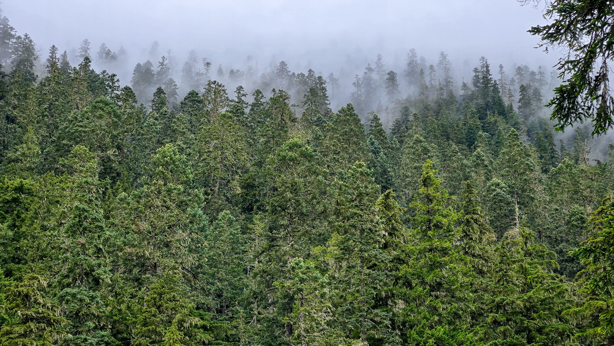
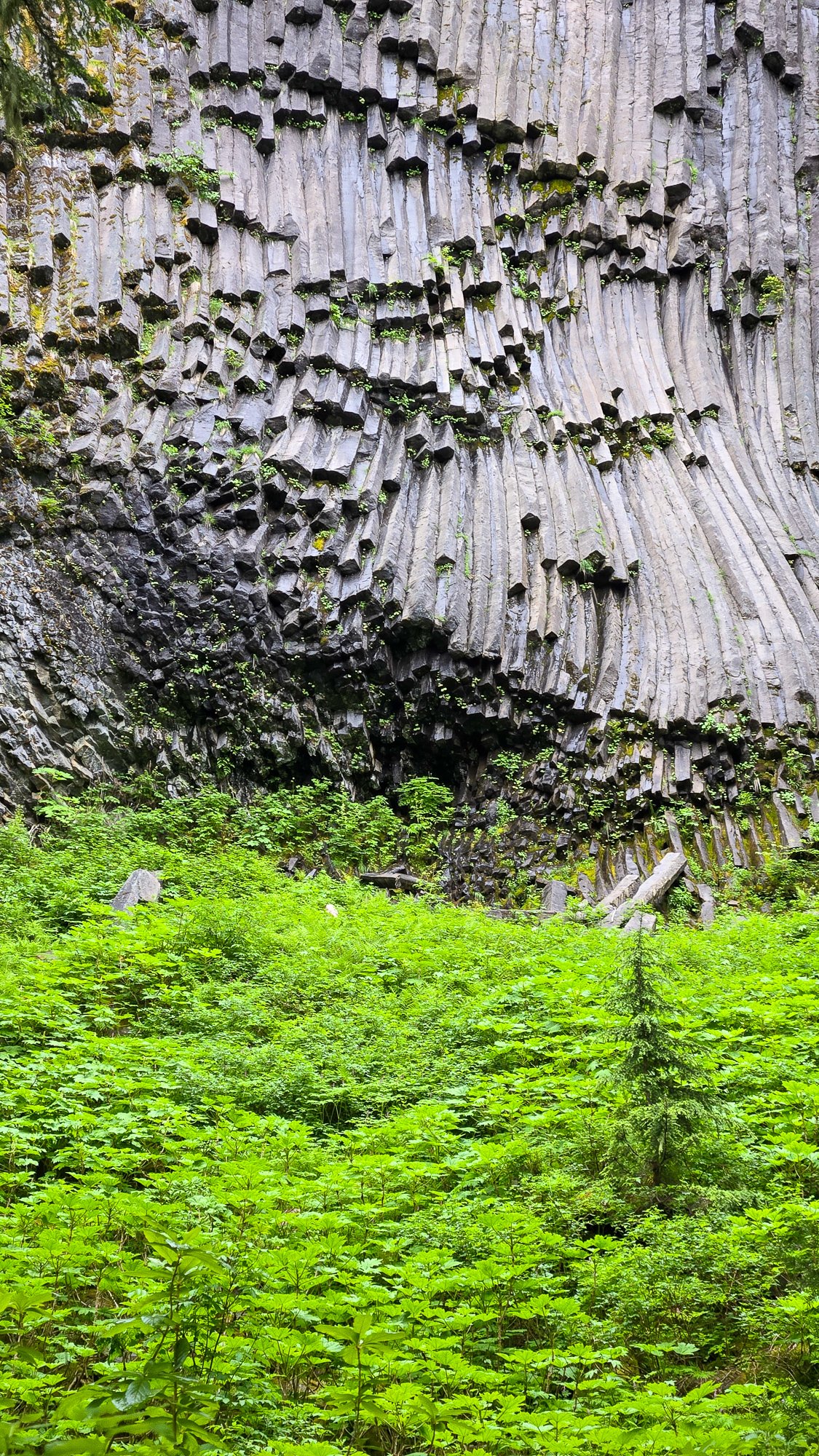
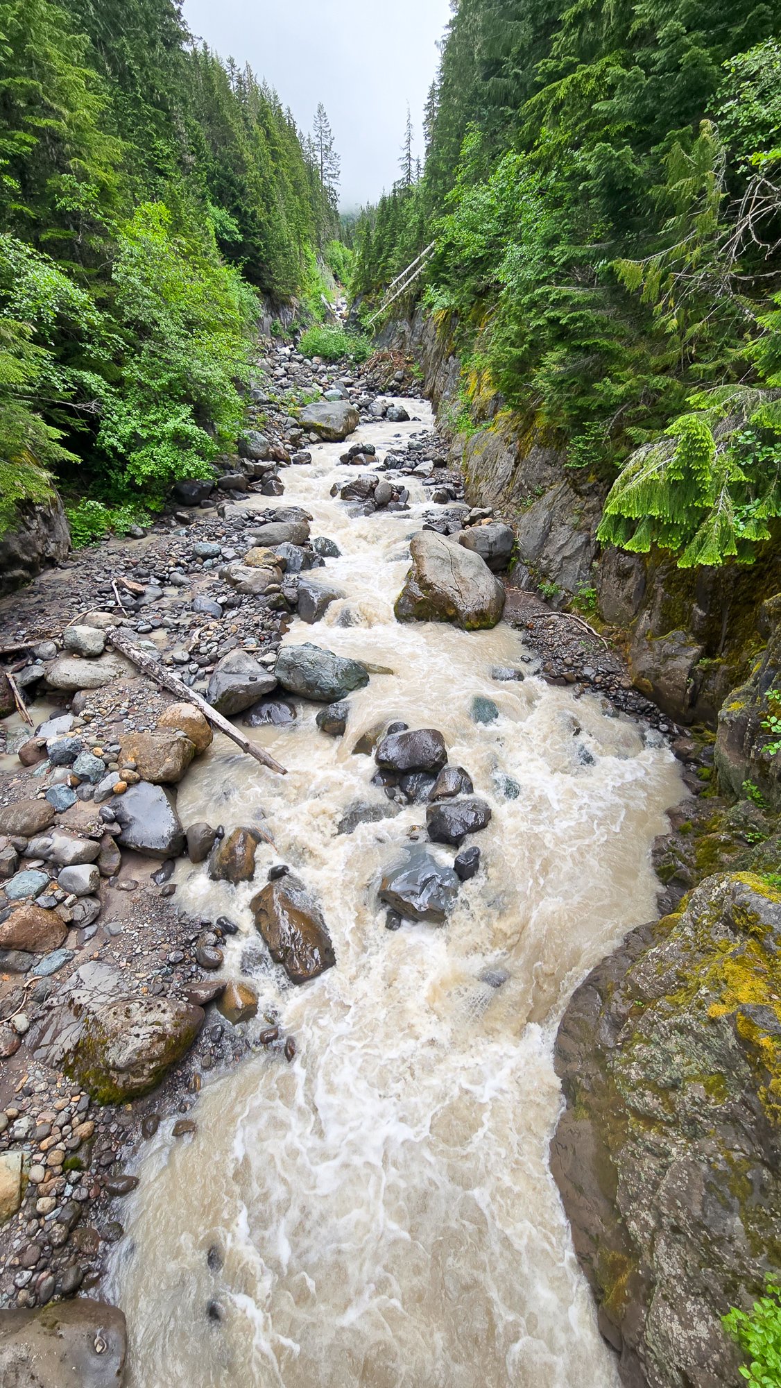
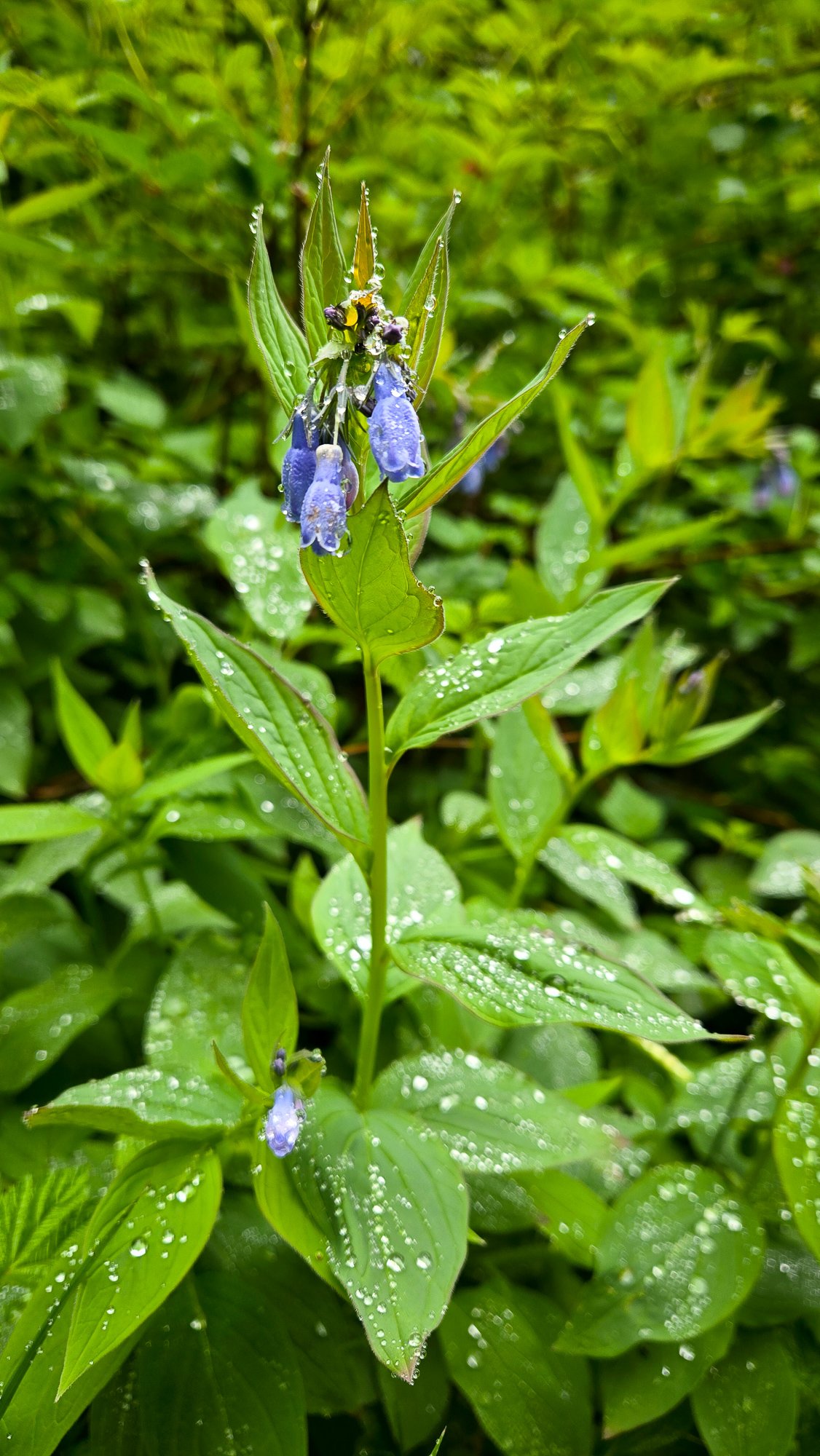
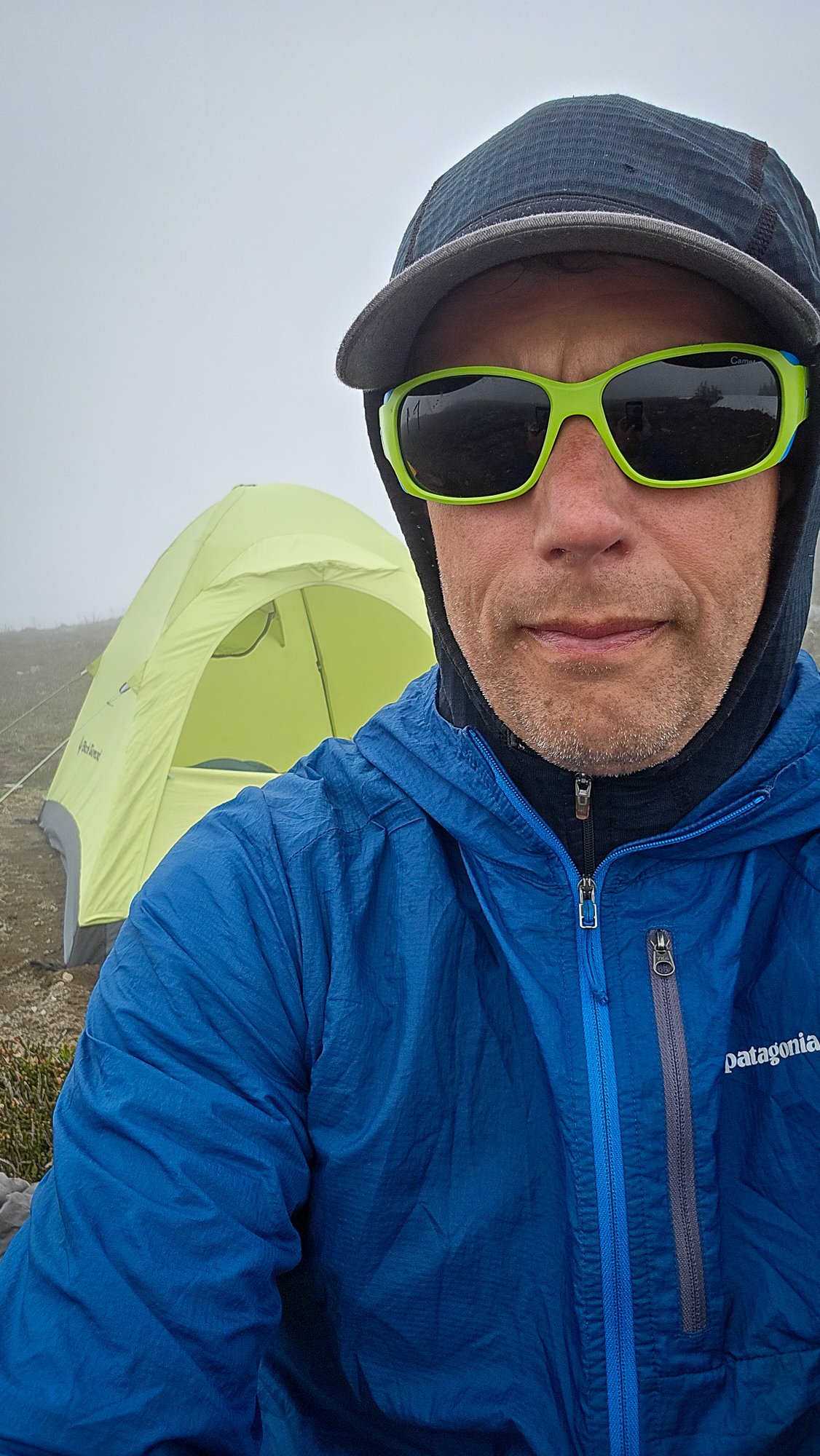
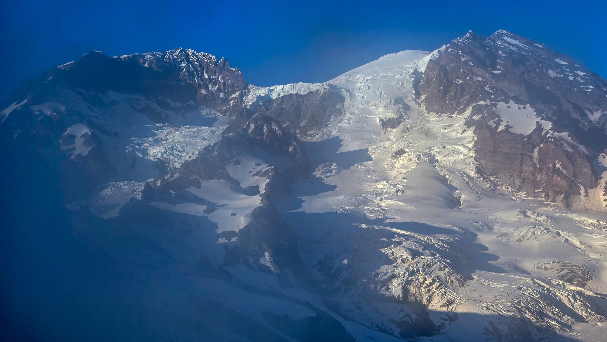
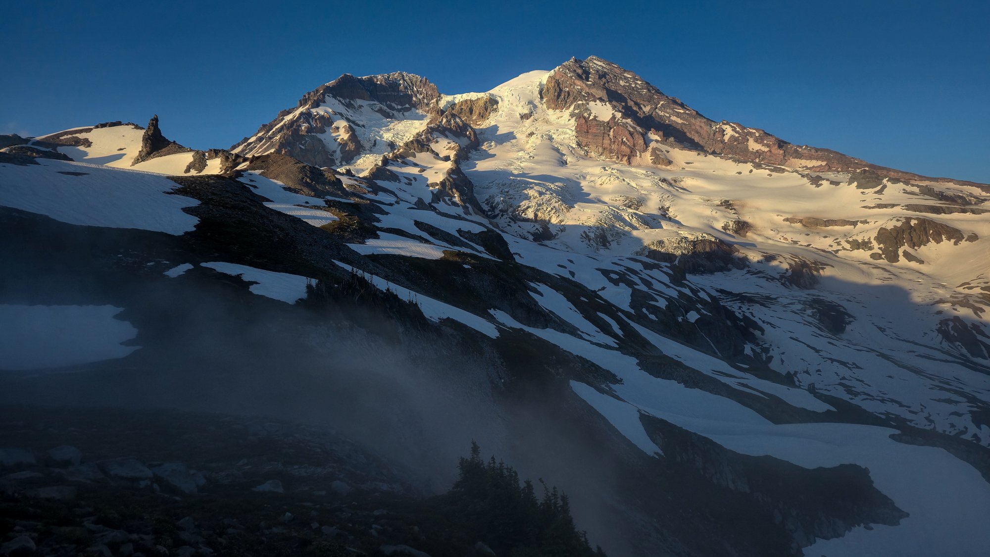
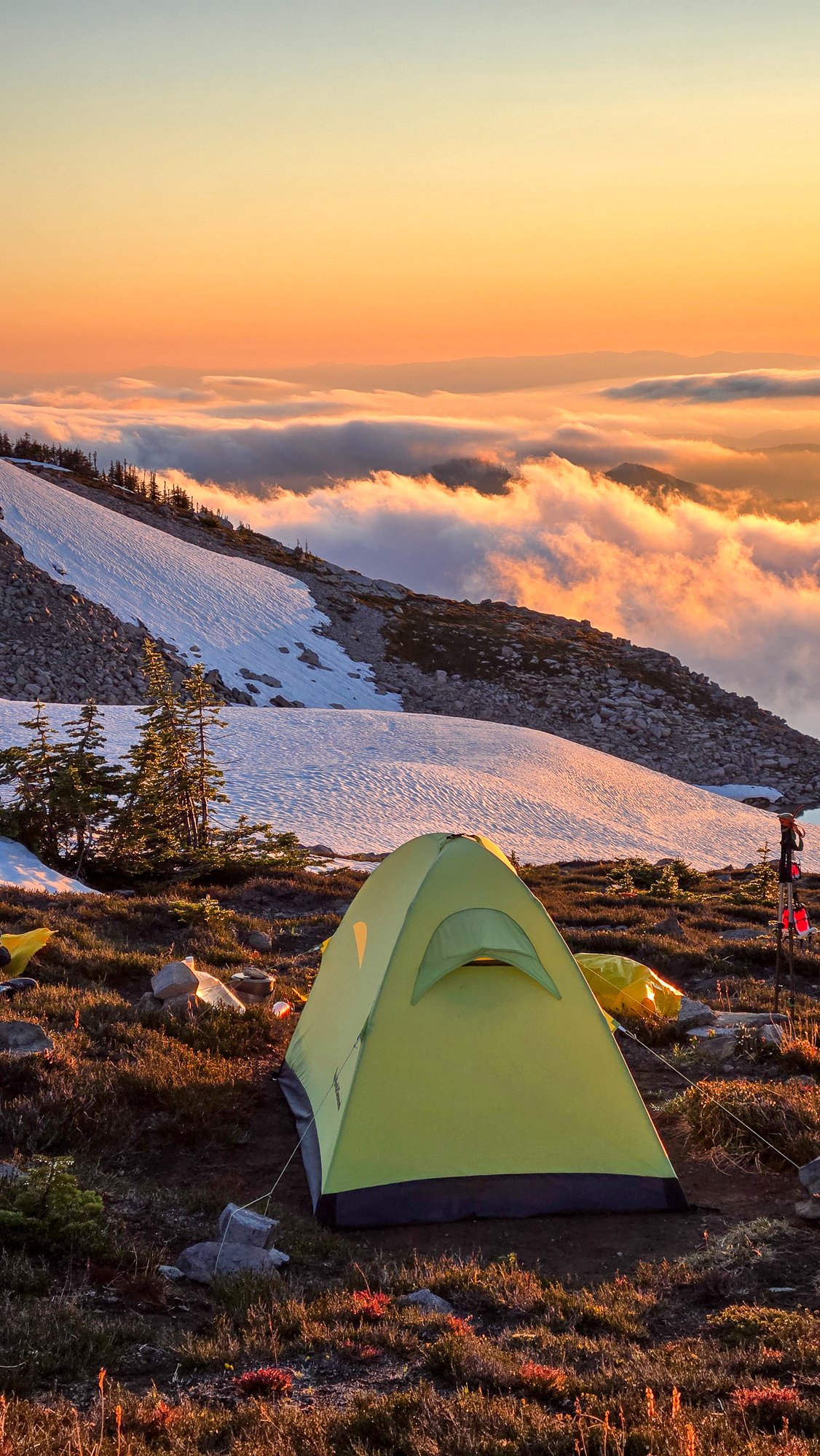
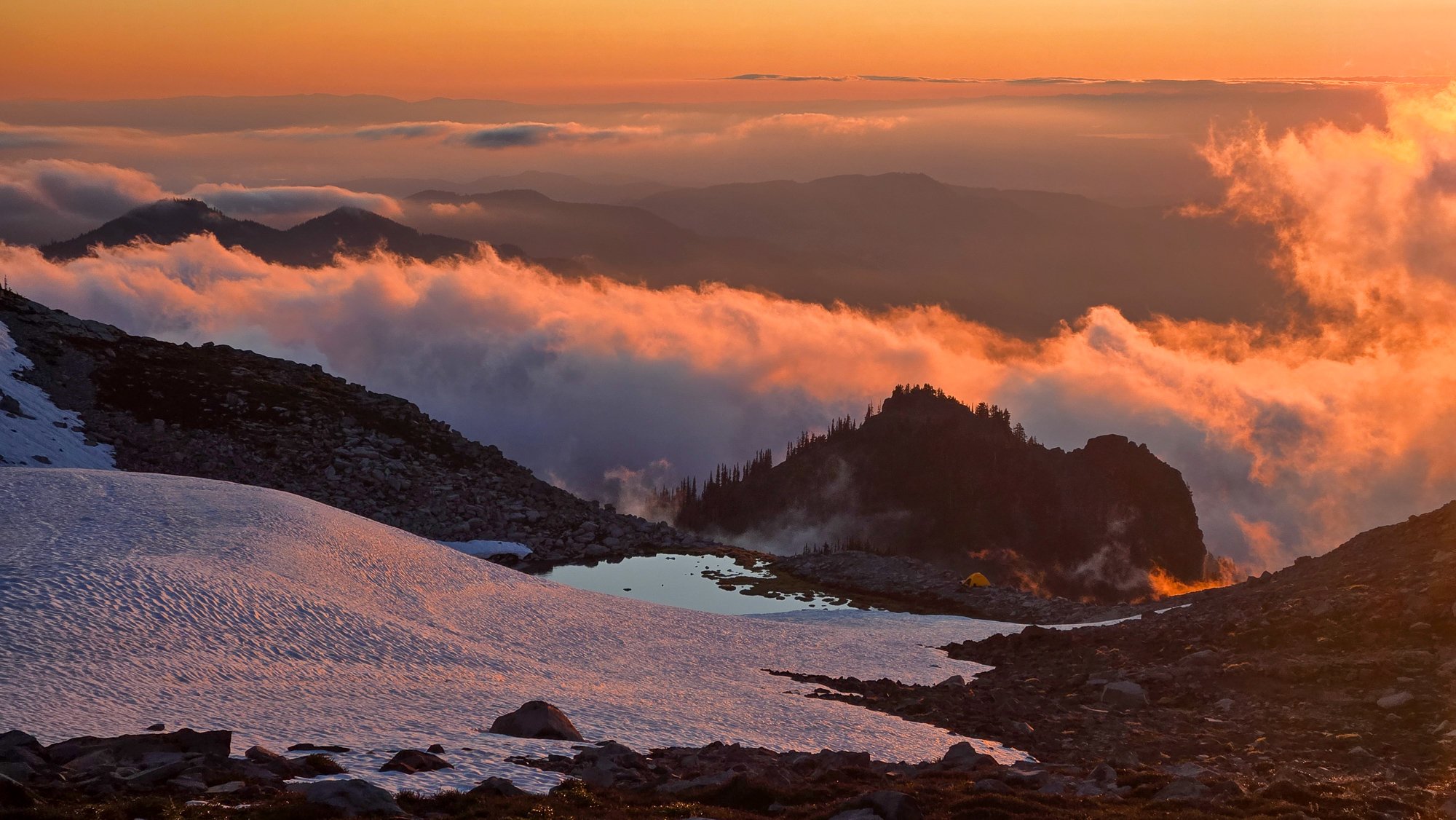
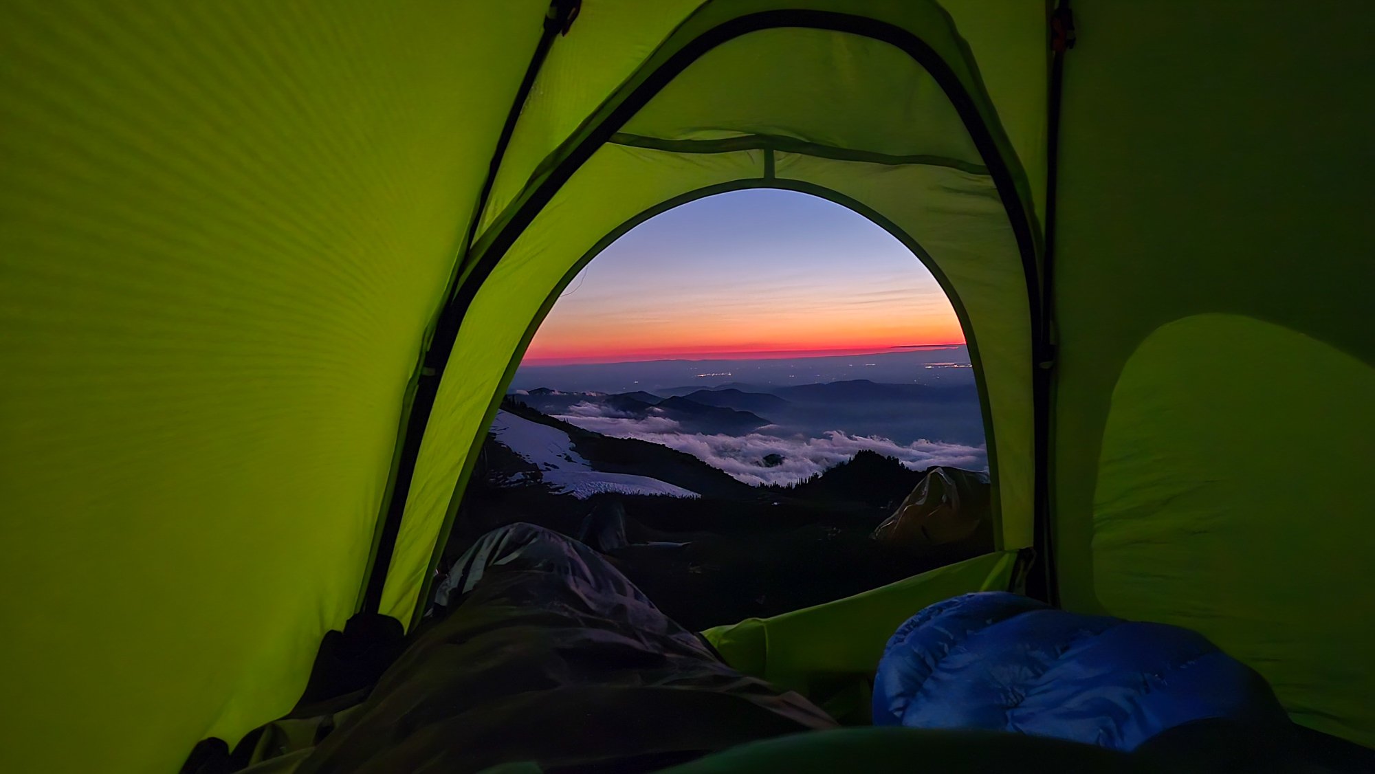
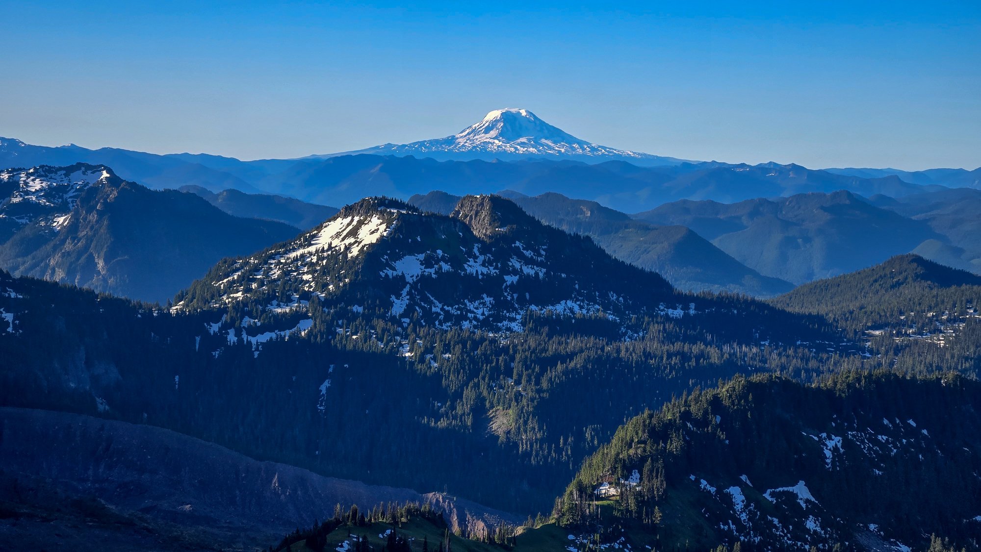
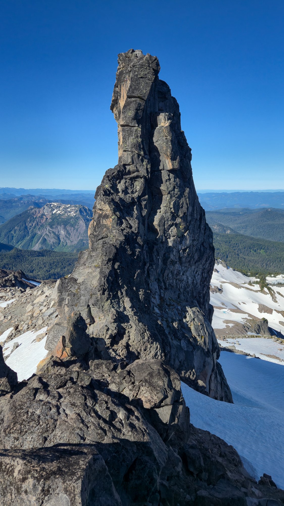
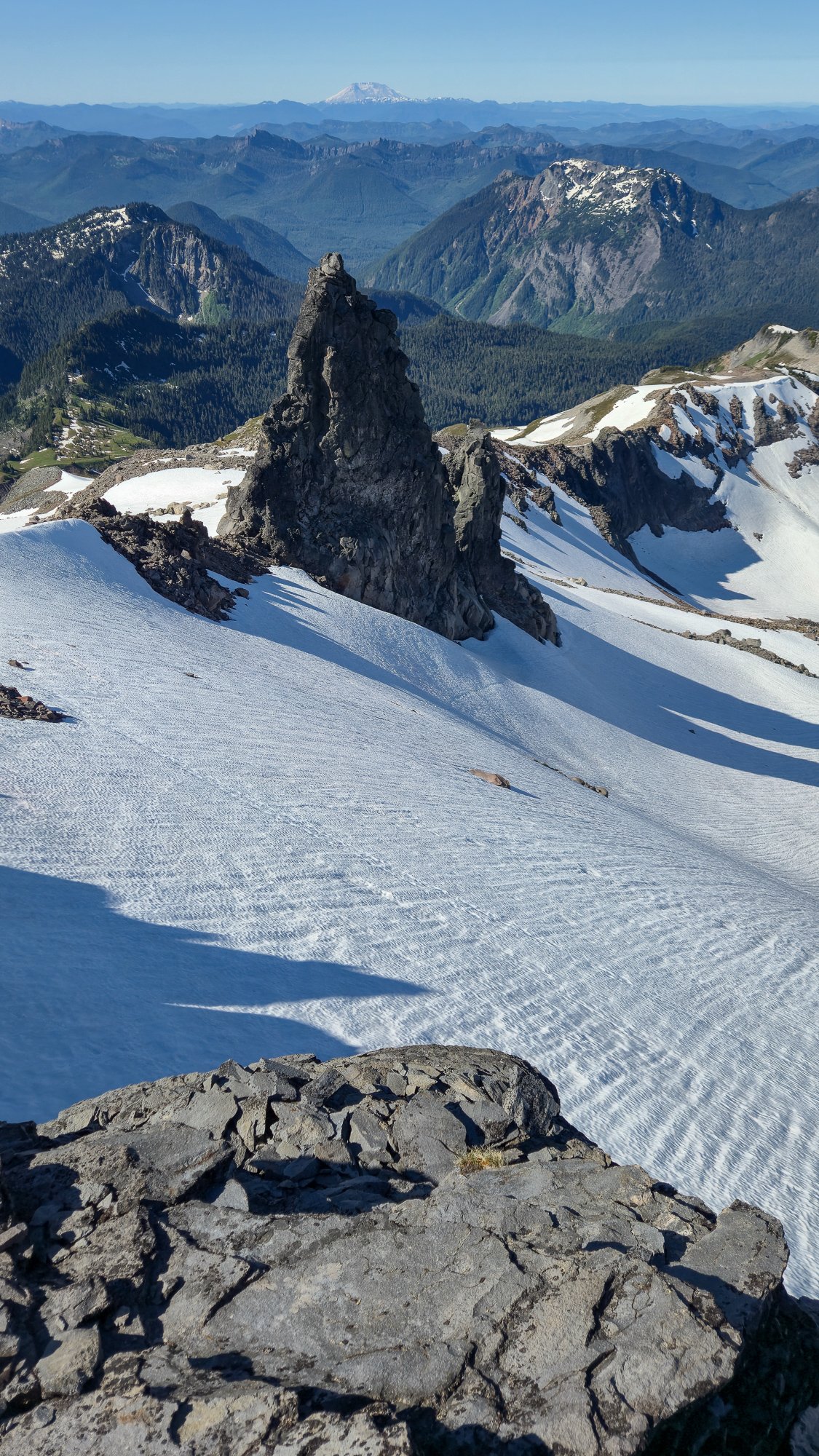
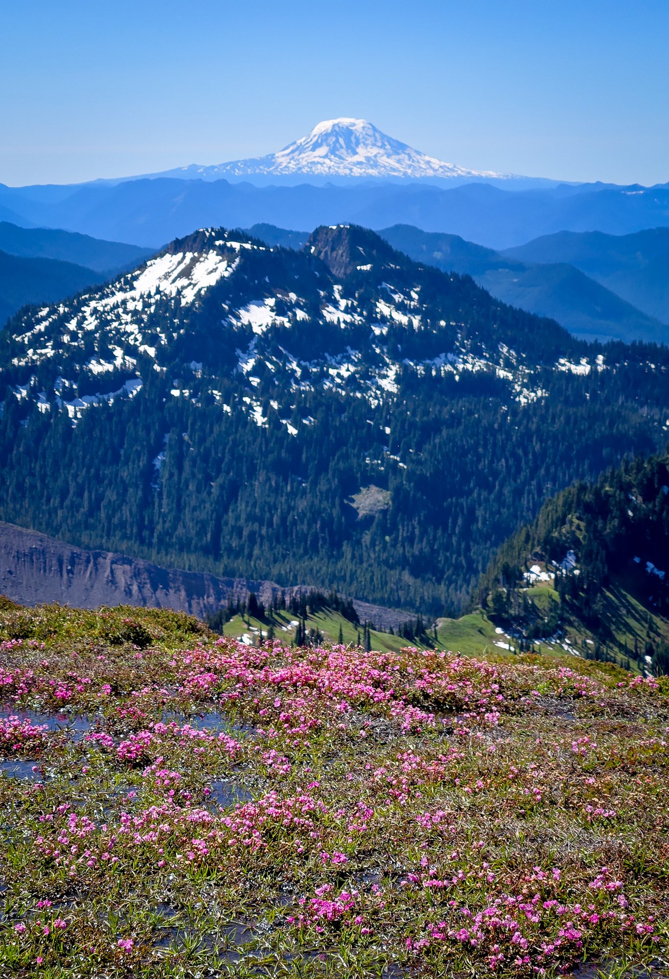
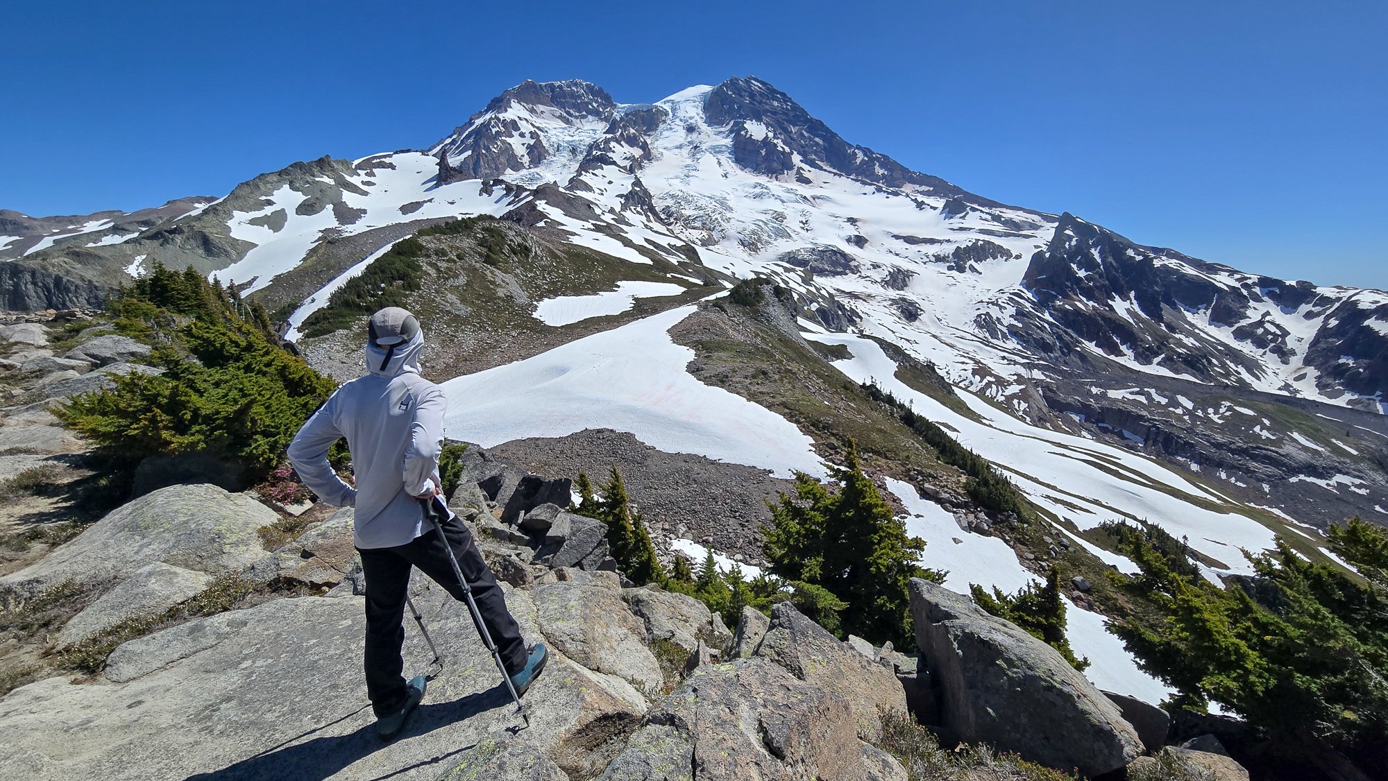
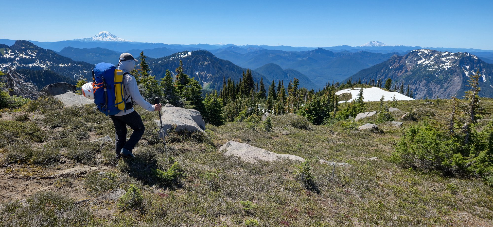
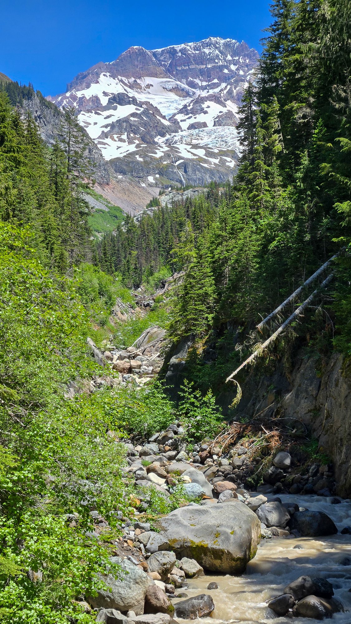
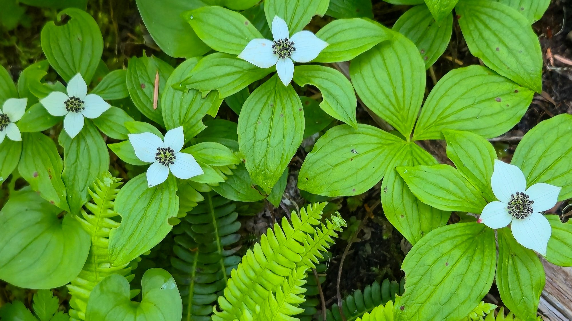
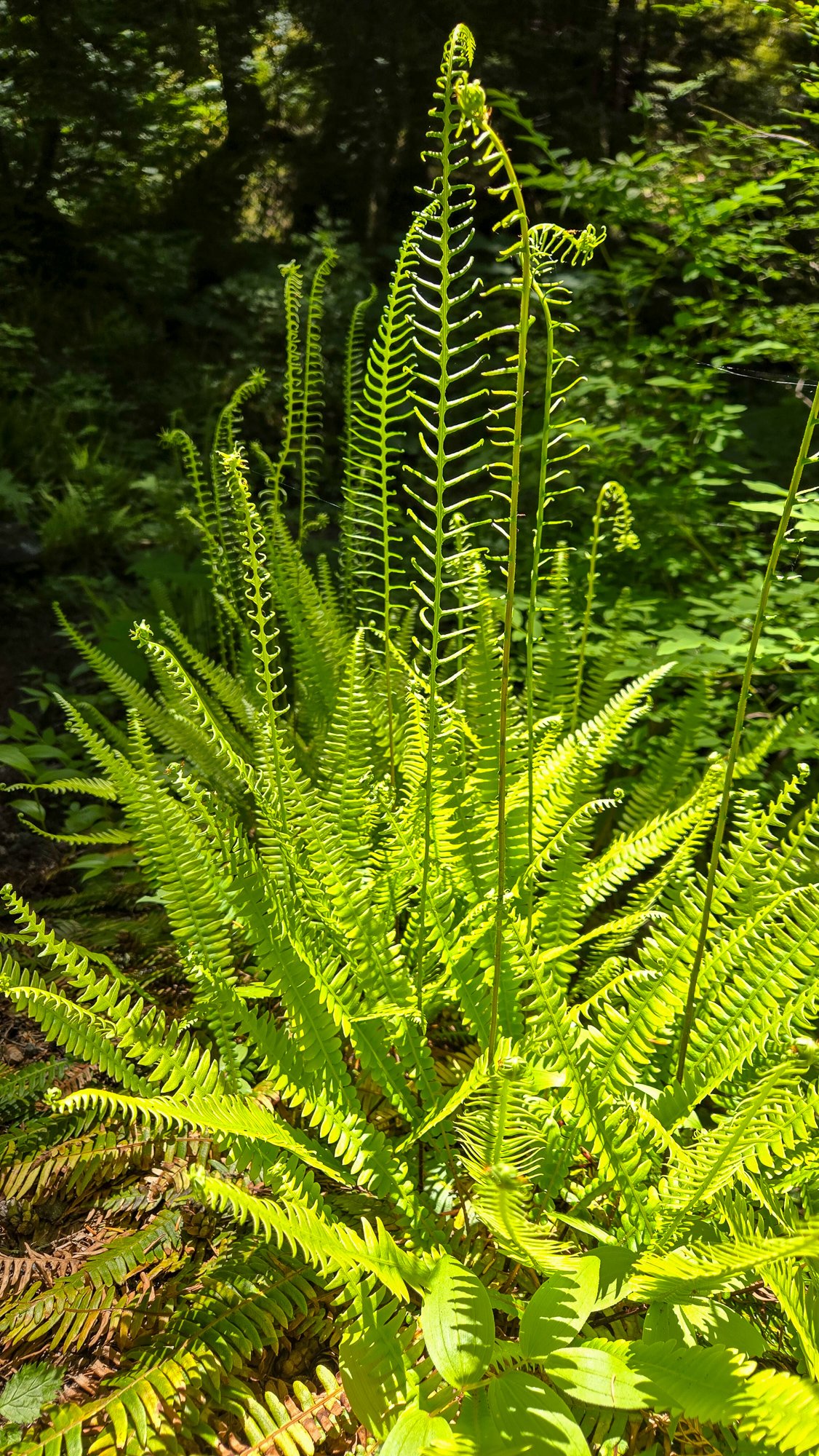
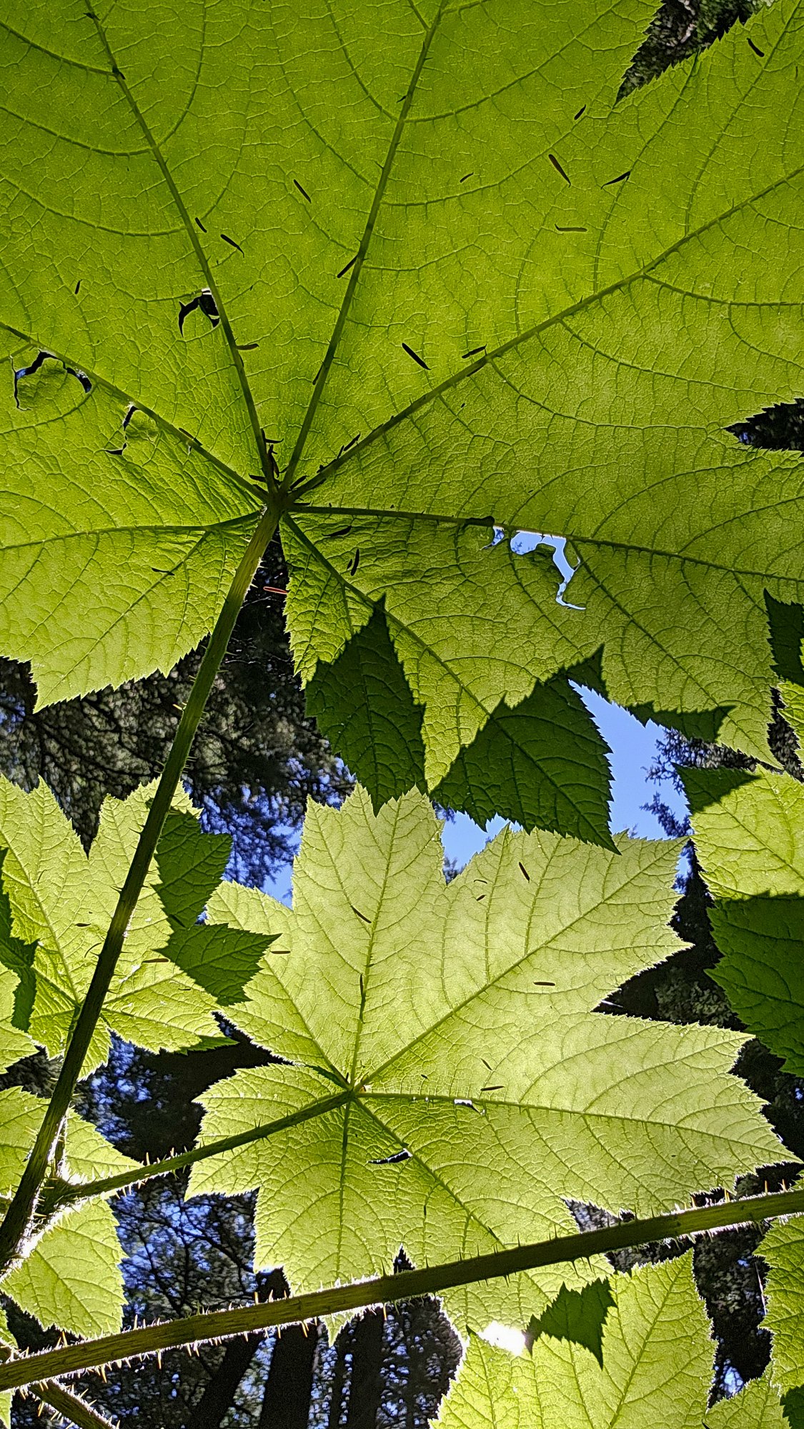
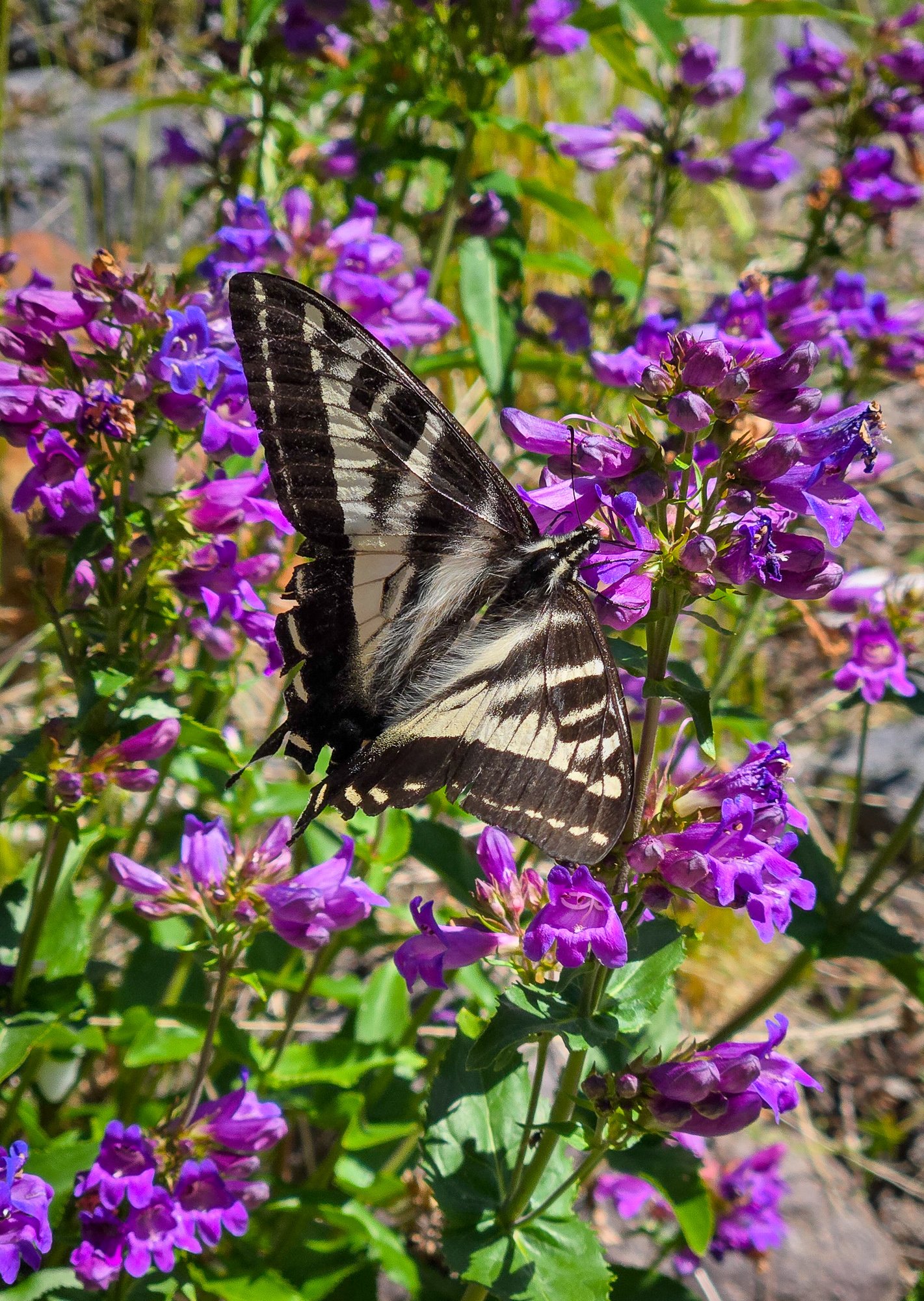
 Trip: Tokaloo Rock (Sunset Ridge bailure) - Standard Trip Date: 06/29/2025 Trip Report: Sometimes prudence is the better part of valor....or at least that is what @Trent and I told ourselves as the murk cleared and we had our first good look at Sunset ridge after walking in for 10 miles in our venerable Lowa Civettas. We were camped at what we thought was going to be our "low" camp, next to some partially melted tarns to the NE of Andrew Benchmark, above St. Andrews park. Our high camp was planned for about 11.1k on Sunset ridge the next day. However, the entire upper mountain was very boney in the fading light and it looked like a several hundred vertical foot section of the ridge where the route went was completely bare of snow (~11.5-12k). Hmmmm. We had enjoyed the scenic ramble in from the NPS gate at their chosen spot on the still very drivable West Side Road earlier that day. Lush forest, interesting geology, wildflowers, and swirling mists, it was unlike most approaches to the highest point in WA. But then we got to camp and the predicted clearing didn't materialize and so we sat, napped, and stewed. But then, like magic, the veil was lifted and Tahoma was revealed! As was the camp of a neighbor, who had snuck up on us in the mists. We would find out the next day that it was none other than our very own @DPS, who I had last climbed with back in 2005! But as we turned in for the night, @Trent and I both agreed that we didn't want to climb Sunset the next day. We wanted to climb it in good conditions, not just climb it, and it was plain that it was not in good nick. To be continued.....I'll add some words to flesh out the photos below..... Gear Notes: snow gear if there is snow.... easy class 3 scrambling to the top of the rock. The Spire is considerably harder Approach Notes: West side road to South Puyallup Trail to Wonderland Trail to off trail near St. Andrews Park. Good camps at tarns just NE of Andrew Benchmark
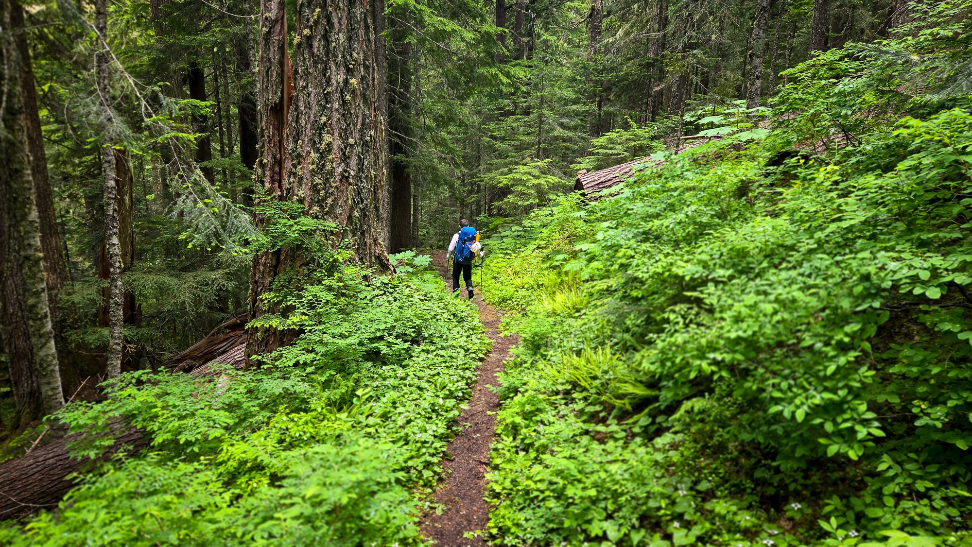
- 1 reply
-
- 1
-

-

Tahoma Glacier - 6/21-24/2025 - with crevasse fall
Fairweather replied to mthorman's topic in Mount Rainier NP
Great report! Well done on the self-rescue too.👍 -
[TR] Mount Rainier - Emmons Central 06/30/2025
Fairweather replied to jiri's topic in Mount Rainier NP
Outstanding! Just when you think there's nothing new under the sun, someone like you goes out and finds it! - Yesterday
-

[TR] East Fury - North Buttress attempt 06/29/2025
simlikestoski replied to JonParker's topic in North Cascades
huge effort Jon, and great write-up - Last week
-
 Sean503 joined the community
 -
Super cool to have solitude on that side! Thanks for the report....
-
Cool route, especially the camp spot. It looks like about what these guys skied this spring: https://turns-all-year.com/trip-reports/emmons-glacier-to-terminus-mt-rainier
-
 gfos joined the community
 -
 Lutian75 joined the community
 -
 Cole Cascadian Fulton joined the community
 -
Пожалуйста (I don't speak Russian and I looked that up) it's a long single-day trip for sure. Many people camp at Lunch Counter on night one and then make their summit bid the next morning. not sure if you need permits for that but probably. space to camp at the trailhead can be tight - i had to cowboy camp on some open grass by the road once, but it all worked out. good luck!
-

[TR] East Fury - North Buttress attempt 06/29/2025
JonParker replied to JonParker's topic in North Cascades
Yeah that west side looks real sketch -
spasibo! Thank You. I have attempted one time at the end of May, reached 9986 feet and went down. but we started around 5 am. it was car to car, driving in the night. This time planing about getting there the evening before and staying in the camp or car.
-
 Leon h joined the community
 -
[TR] Tetons - The Grand Traverse 8/31/2015
Leon h replied to nutsandbolts's topic in The rest of the US and International.
I know this is 2015 but curious I want to solo the traverse but was wondering about the 5.8 /5:7 climbing I have the whole last week of July off so want to take advantage -

[TR] East Fury - North Buttress attempt 06/29/2025
Alisse replied to JonParker's topic in North Cascades
Beautiful 😍 -
there will be plenty of people up there. take more sun protection than you think you need (hats, buffs, glasses - sunscreen never lasts long enough). Take lots of water and start early. 3 AM from the parking lot is probably early enough if you're fast, otherwise it is more pleasant as a two-day trip. take a trash bag or waterproof pants for the glissade down! (remove crampons for the glissade)
-
[TR] East Fury - North Buttress attempt 06/29/2025
JasonG replied to JonParker's topic in North Cascades
Hmmmm....important distinction....let's see....I think the west side? -
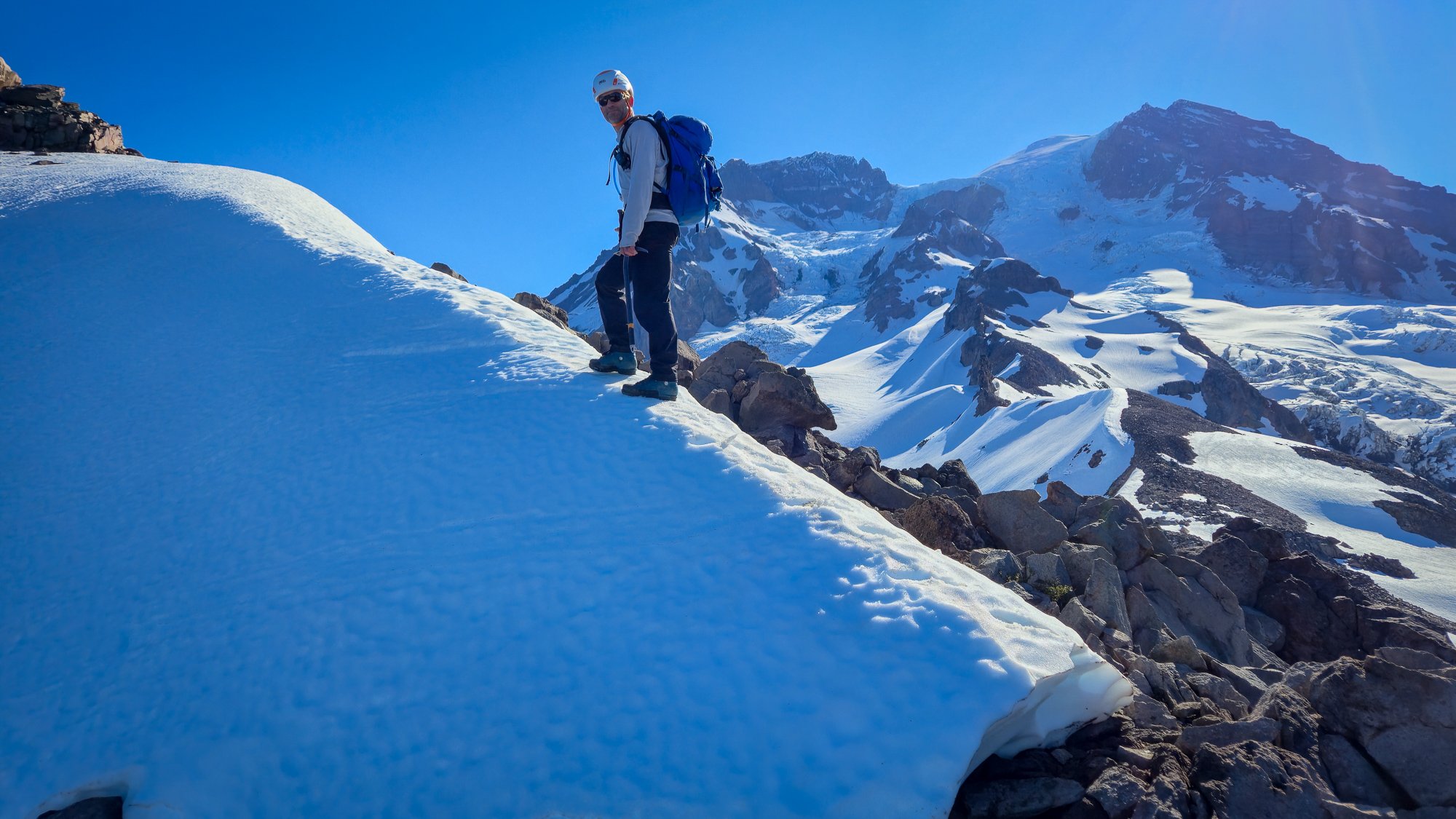
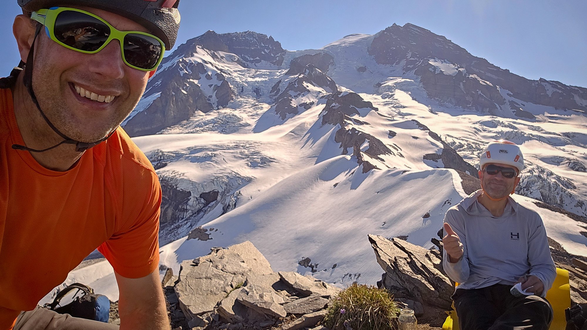
Trip: Mount Rainier - Emmons Central Trip Date: 06/30/2025 Trip Report: When looking at Emmons from Sunrise, Andrew got the idea of trying a route that would connect with a feature similar to the Emmon-Winthrop route corridor but positioned in the middle of the expansive glacier. This feature starts around 10k and provides easy direct access to the upper mountain. I was skeptical about the idea until I had a closer look myself a few weeks ago while climbing Cowlitz Chimney. We could not find any information about this route and decided to refer to it as Emmons Central. Please, let us know if you know the history or previous ascents. To spice things up Adrew pitched starting the glacier terminus. We scouted access to the moraine Saturday afternoon and took closeup picture of the route to weight our options. The pictures did not show any clear paths to the corridor but the “right” side variation looked the most promising. Sun morning, we hiked and shwacked to the terminus and started making our way up the glacier. The idea was to skirt very broken up lower section on the right, then hook left trying to ascend to a rocky ridge in the middle of the glacier. We could then follow the ridge for a little bit until being able to push right to access the start of the corridor. We identified one potential make-it-or-break-it crevasse below the rocky ridge but did not see any clear dead ends along this option. After leaving the moraine and getting on snow we started aiming for a nunatak at 9400 following open slopes with minimal crevasse issues. From here we initiated our left hook as the glacier became more broken up. After some navigation we reached the crevasse with a question mark and were able to get across on an exposed but solid bridge far left. This brought us to the rocky ridge where we set up the camp at exactly 10080ft. Being in the middle of a glacier with the largest area in the contiguous US and having dry ground to sit on was awesome. Looking up from camp revealed crevasse problems we did not see in the pictures. The general plan was to keep going right and that is exactly what we did in the darkness the following day. It was obvious when we finally gained the ramp because there were no crevasses in sigh as far as the headlamps could shine. The angle starts around 40 degrees and gradually eases off with elevation as it trends slightly left. Around 12.5k the route connects with the late season DC route variation. To our luck we ran into set of boot prints around this elevation. Later on the boot path became marked with wands so my guess is that the guides or rangers prepared the route for when the regular DC gets too broken up. We followed the boot prints and wands until connecting with the regular DC and the well beaten path to the summit. We descended via the standard Emmons-Winthrop route. Gear Notes: pickets Approach Notes: Moraine trail to "End of maintained trail" sign then follow a boot path down. We then hiked along the vegeration up until it looked more open
-
[TR] East Fury - North Buttress attempt 06/29/2025
JonParker replied to JonParker's topic in North Cascades
Yikes, yeah that would do it. I’m curious was that on the west or east side of the buttress? -
Pretty great, the force is strong in this one.
-
[TR] East Fury - North Buttress attempt 06/29/2025
JasonG replied to JonParker's topic in North Cascades
Well done surviving an attempt on that one! It was on the list until it I saw it firsthand in 2007 and realized I wasn't nearly tough enough.... but maybe it was the massive/serac rockfall that strafed the approach while we watched, or at least that was the mental excuse I used all these years. -

[TR] Mount Index North Peak - North Face 06/29/2025
Bronco replied to Lucas Ng's topic in Alpine Lakes
The North Peak of Index is a proud outing. One of the difficult 10 if you didn't know and now you have first hand route details for going back for the full traverse. -
 gds joined the community
 -
[TR] Argonaut Peak - NW Arete 06/14/2025
JasonG replied to Christopher Fisher's topic in Alpine Lakes
So GREAT! -
Trip: East Fury - North Buttress Trip Date: 06/29/2025 Trip Report: In the couloir leading to the buttress from its east side, the drawbridge is up. It’s hard to think of a route in the cascades that I haven’t climbed that I was more excited to try. From Luna col the position of upper snow arete looks insane. And the photos in this 2017 report don’t hurt: https://cascadeclimbers.com/forum/topic/100747-tr-mt-fury-north-buttress-6232017/?tab=comments I was lucky to find a partner inspired enough to take a day off and put in the considerable effort to get out there and check it out. Saturday was a little cloudy and not too hot, which kept things relatively smooth on our way from big beaver to Luna Col. Even though I’d seen it before, the first sight of the northern faces of the southern pickets that rewards the grind up to -6400 was literally breathtaking. I let out a little pious whoa. The last mile or so took approximately forever but we arrived well before dark, 11.5 hours after drop off. A ghost set up our tent. From the col the couloir didn’t look too promising but wasn’t obviously impossible so we proceeded to go for it the next morning, leaving camp at 5am (4:30 might have been better). As in the trip report from 2017, we trended left on the descent to Luna lake, which worked well. From the lake we traversed W and SW, bottoming out around 4500’. At this point we could see the snow was not continuous in this first couloir and quite a bit lower, maybe 15-20 feet, than in the 2017 reference photo. We found a ~5.0 exit onto slabby rock and got up to easier ground. Continuing up we traversed as quickly as possible across the exposed face to the entrance of the main couloir. From below it still looked worth trying. But only about 200’ up it we encountered a hidden moat spanning wall to wall, just above where I am in this photo. It was tall and unnervingly hollowed out. Questing up and left on the rock for a bypass was fruitless. I found steep slabs without much pro. And transitioning from boots and crampons to rock shoes while exiting a tenuous snow location onto a narrow rock stance turns out to be very awkward. At 30m I ran out of rope (folded 60m half), placed a piece and down climbed on top rope back to the snow. We down climbed the steep snow back out the couloir. About to down climb to the first couloir. Looking up on our return to Luna lake I thought, hmm, we came down that? It looks improbably steep but is actually reasonable. All throughout the cirque there was surprisingly little activity given how warm the day was. At camp 12 hours after we left the evening was unpleasantly hot and buggy and I impatiently awaited the reprieve of dusk. In the meantime there was some helicopter activity near Outrigger. I hope everyone involved is all right. The heat was considerable already at 7am the next morning when we began our descent. I used crampons but there really was no hard snow to be found. We took a long break at the stream by Luna camp and it seemed then that we’d make our 5pm taxi in plenty of time. One small delay occurred when we saw two bear cubs climbing to the top of a tree right off of the trail. Mama wasn’t making herself seen or heard, so we backed up a little, made a bunch of noise and gave them a few minutes to clear out. We didn’t see the cubs again and did see the mother a little bit off trail, not acting aggressively. Checking the time. As the afternoon miles went by we realized that we were slipping behind and had to really push to get there right at 5pm. The driver was very nice and encouraged us to take the time to cool off in the lake. I don’t know if I have it in me to try this route again but if I did it would have to be possibly even earlier in the calendar, and in a year with above average snow pack come June. The west side alternative doesn’t appeal much to me, the photos from Steph Abegg make it look like overhead exposure would last a lot longer than it does while traversing in from the east. Gear Notes: Crampons, ax, whippet, 60m half rope, single picket, light rack and some bail gear Approach Notes: Big beaver to Luna col to Luna lake


-
https://www.climbing.com/culture/ethan-morf-youngest-climber-free-el-capitan-in-a-day this is hilarious and awesome. I mean that’s how I learn how to do almost everything. Just fire up YouTube and watch a couple videos and get after it.
-
 Helen_ joined the community
 -
Looking for some folks to climb mt.Adams in July. Prefer to start 3 am.
-
[TR] Argonaut Peak - NW Arete 06/14/2025
Alisse replied to Christopher Fisher's topic in Alpine Lakes
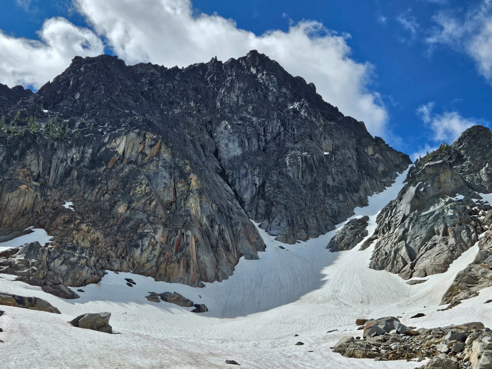
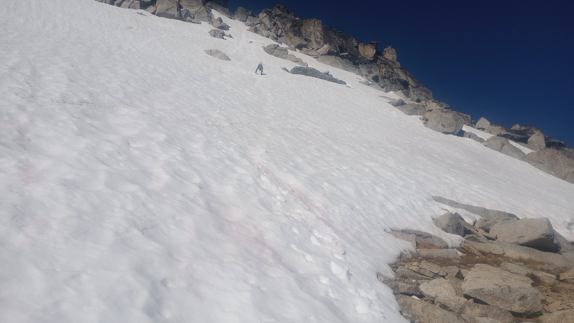
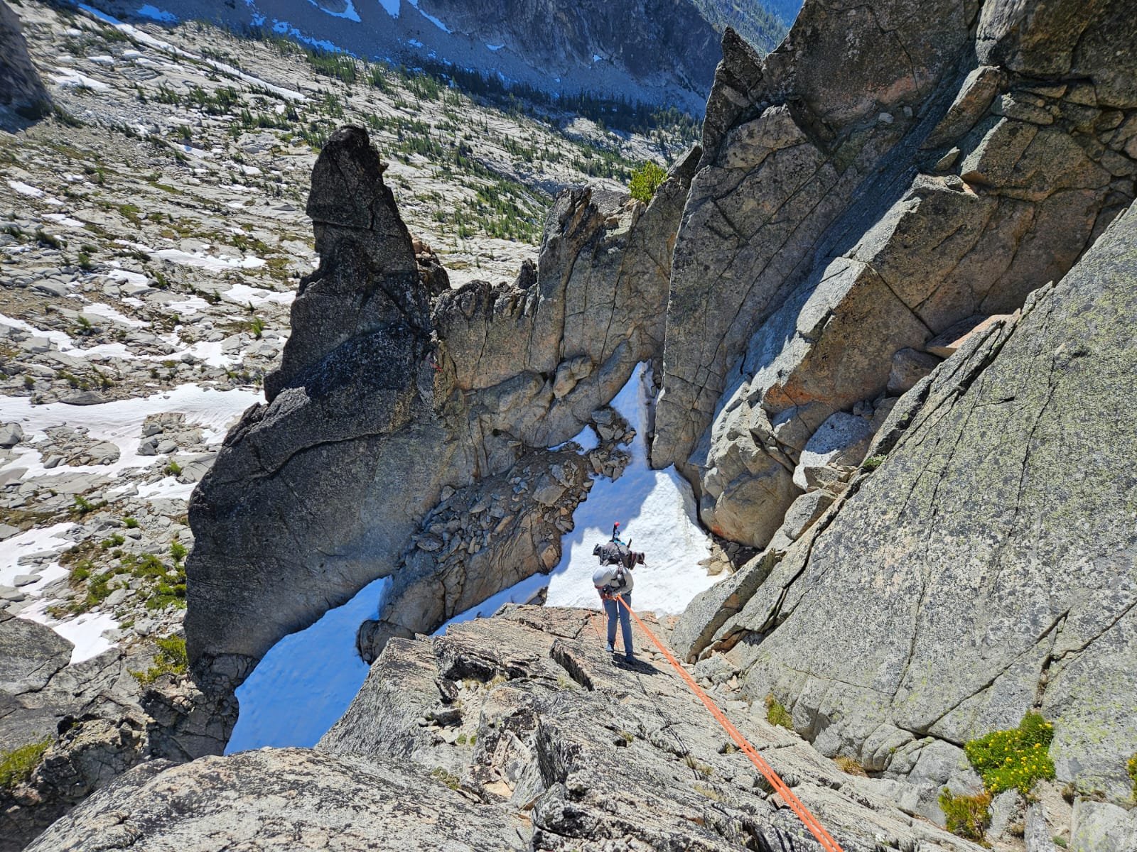
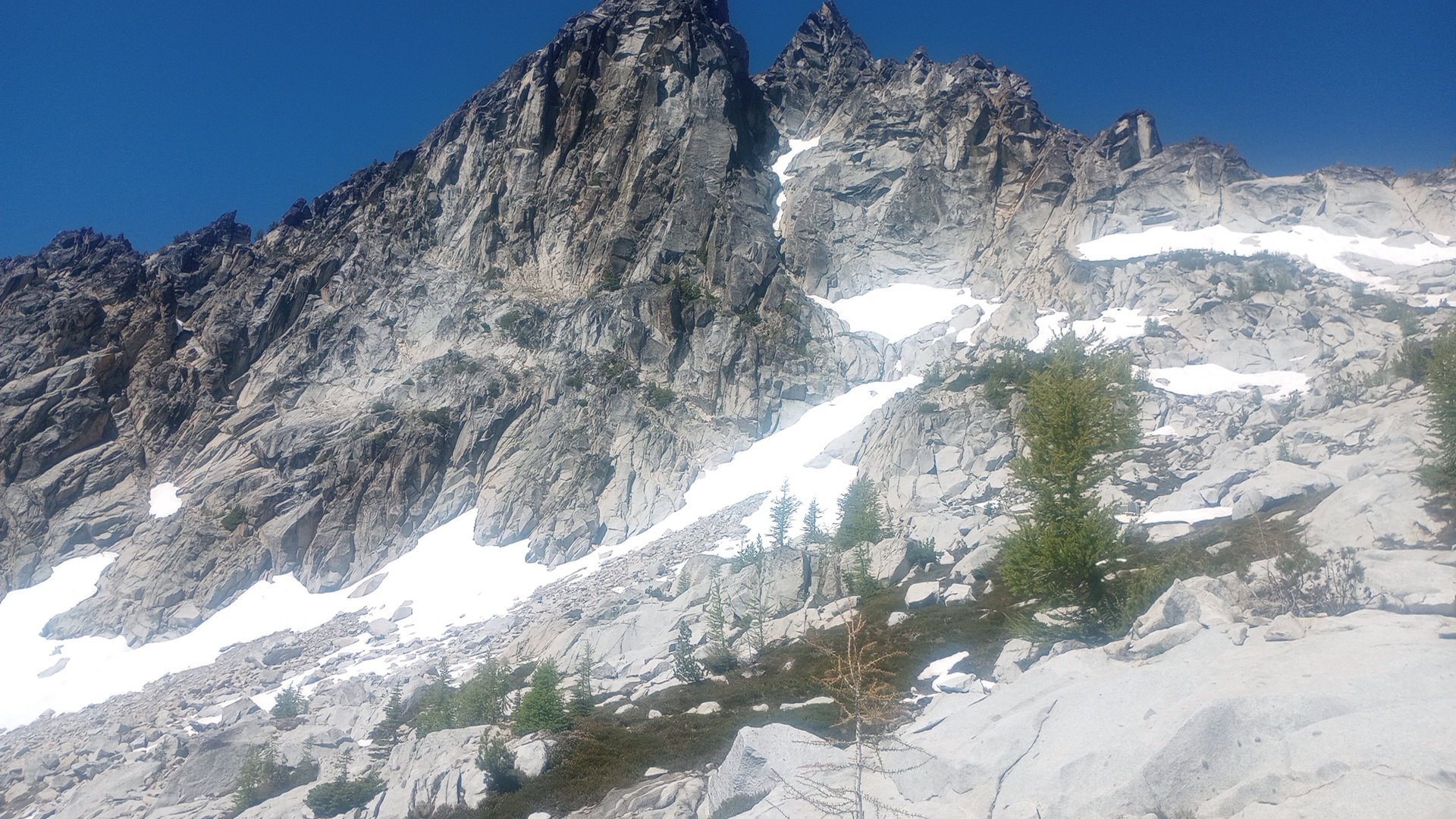
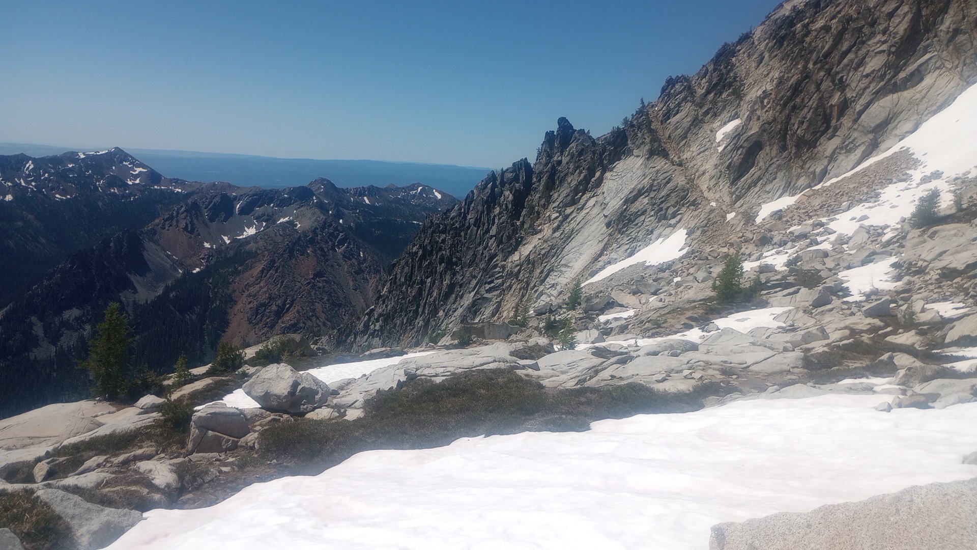
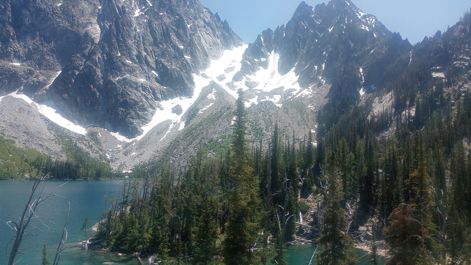
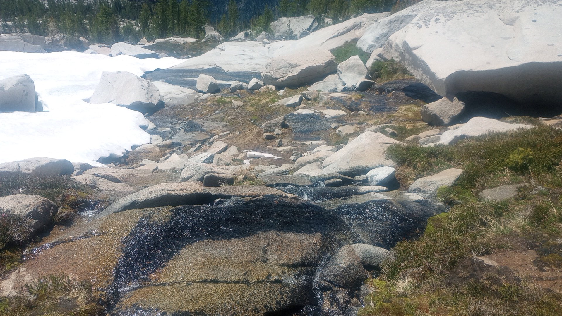
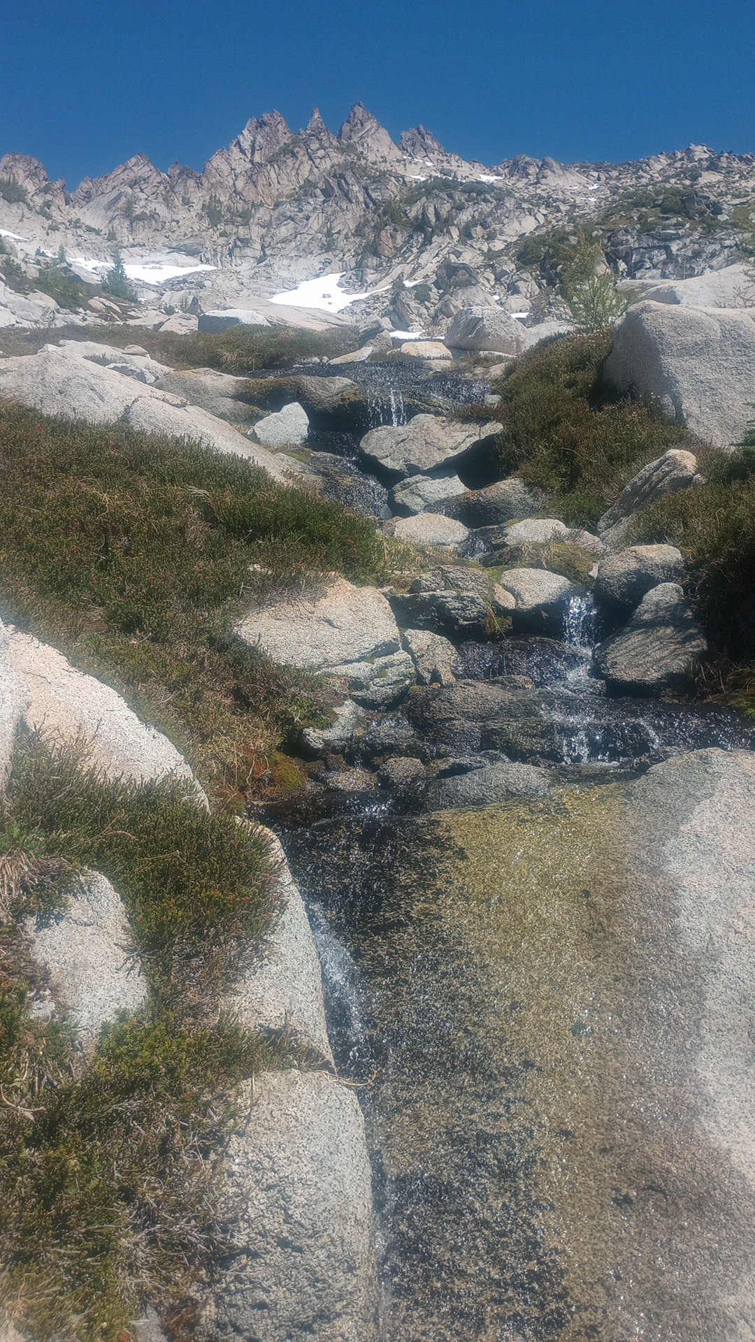
Thanks for your TR, Christopher! Dan and I had our own alpine adventure on the NW arete of Argonaut this past weekend, approaching and climbing to the summit on Saturday, sleeping near the summit, and descending Sunday. I am definitely glad we did it this way -- it made for two relaxed days without any need for headlamps and the snow on both approach day one and post-rappels day two was great for climbing, never too firm or icy. We thought the climbing was really fun and the whole trip had good adventure factor. I felt silly wearing trail runners and carrying light mountaineering boots AND rock shoes but it worked well for me; I think if I'd been climbing a whole lot of 5.8 recently I'd probably have felt good in approach shoes/not needing a third pair of footwear. We brought a single rack and that worked for us for 5 long pitches with a tiny bit of simuling. We were able to avoid MOST of the slide alder but luckily we weren't carrying skis and it wasn't the "trap you in place" variety so the handful of minutes of it didn't feel too tuff. We both switched to rock shoes for the "slab crossing" before the snow finger. The rock was sticky and great. There was snow under the big summit block so we didn't go thirsty with our summit bivy (beautiful sunset!). The descent made us think a little bit, but there are a lot of rap stations and trees and lots of beta. We did three single rope rappels and some 4th class downclimbing that could have been avoided... Here are our pics in case they're helpful for people heading out soon or hoping to check snow conditions in the area (high-quality photos are Dan's): Snow finger (that's a false top to it) Snowfield on the descent before starting rappels: Our second single rope rappel into the gully, we walked across 4' of flat snow then butt scooted/au chevalled the moat to get to the notch, rapped off tree on other side for third rappel: The traverse from the bottom of the raps over to the south side of the Colchuck Col was BEAUTIFUL: