
All Activity
- Past hour
-
 Wow! It has taken me 40 years to get half of that done! Thanks for the TR.
 -
 explor8tion joined the community
 -
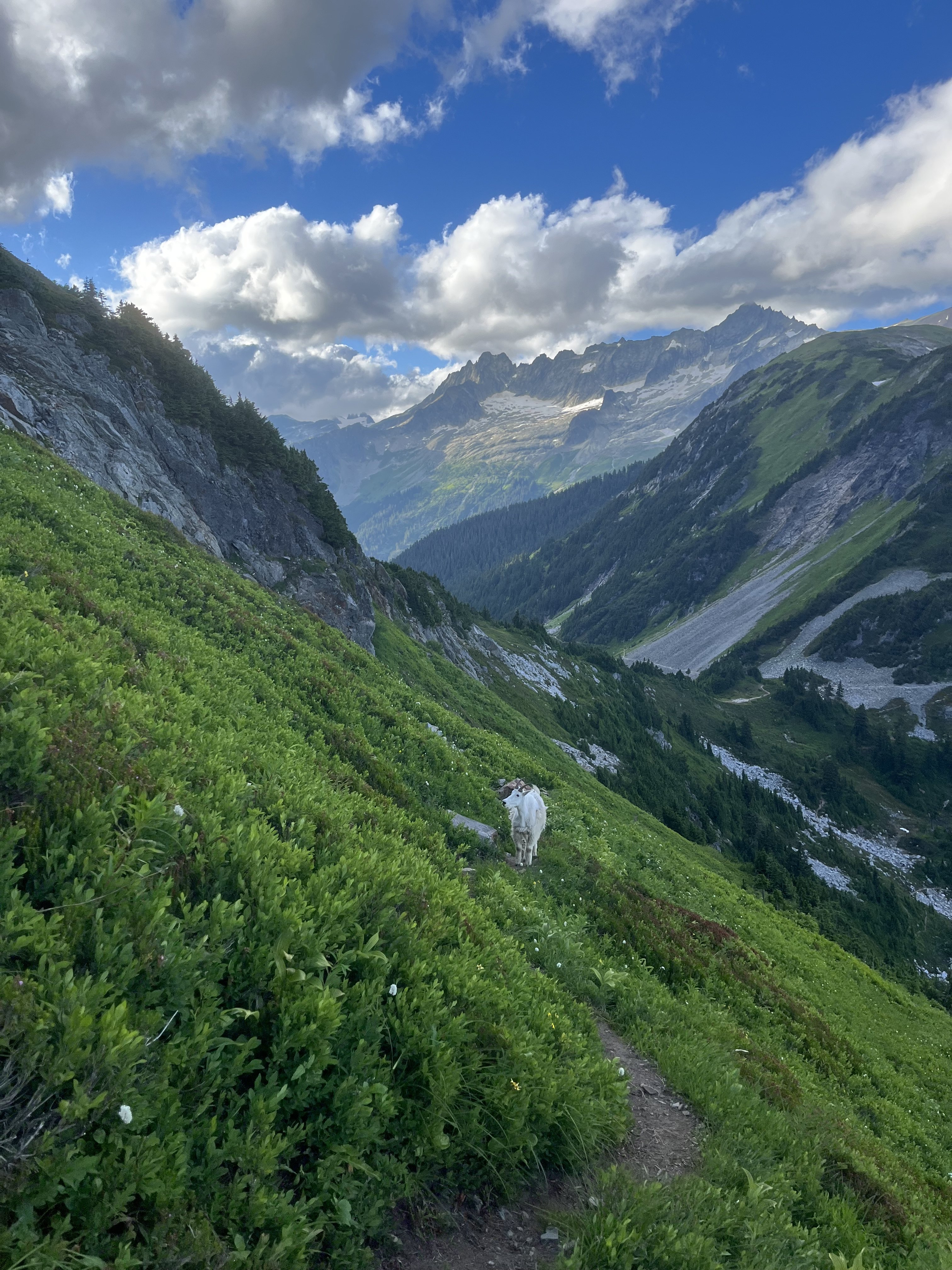
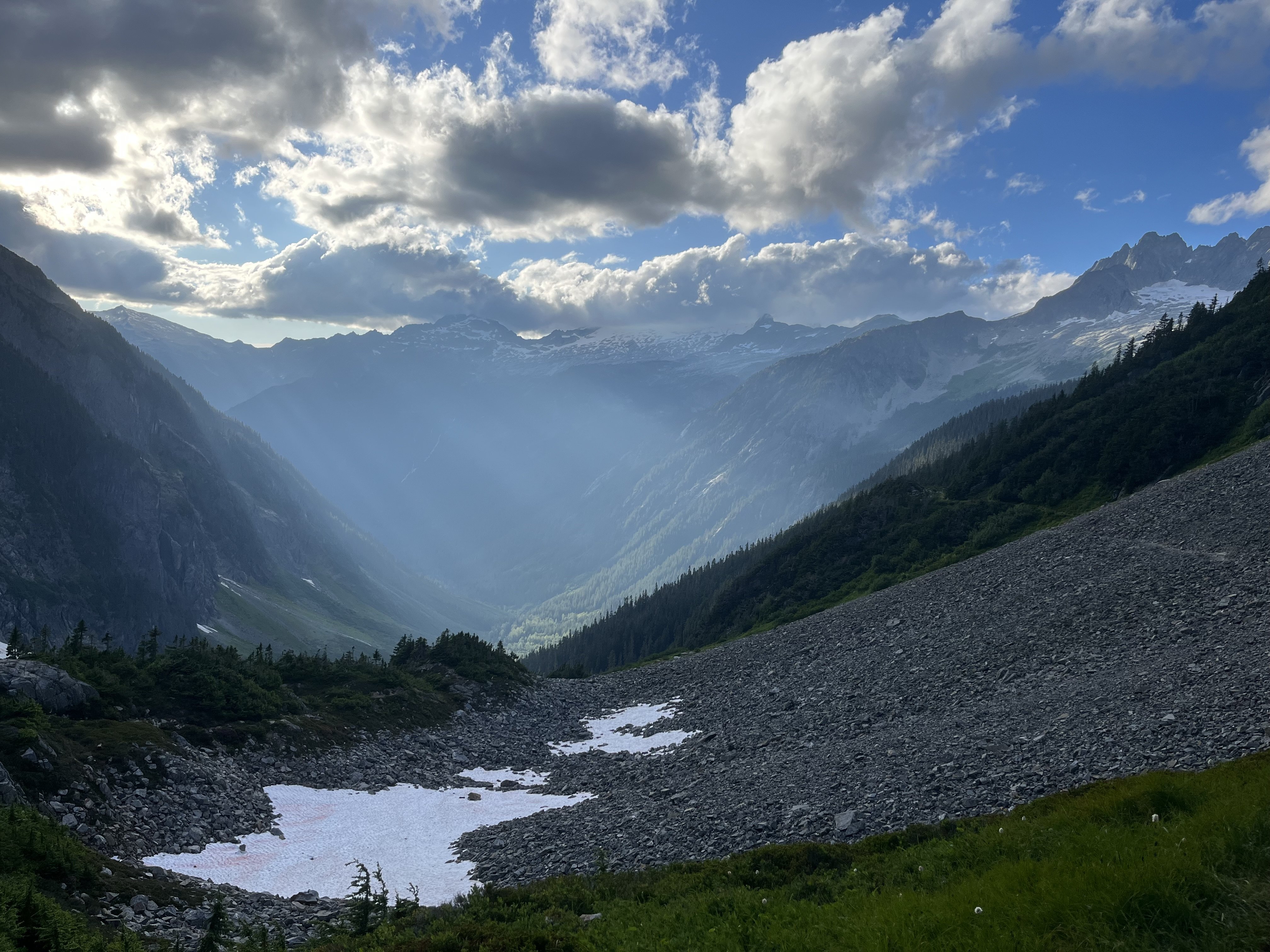
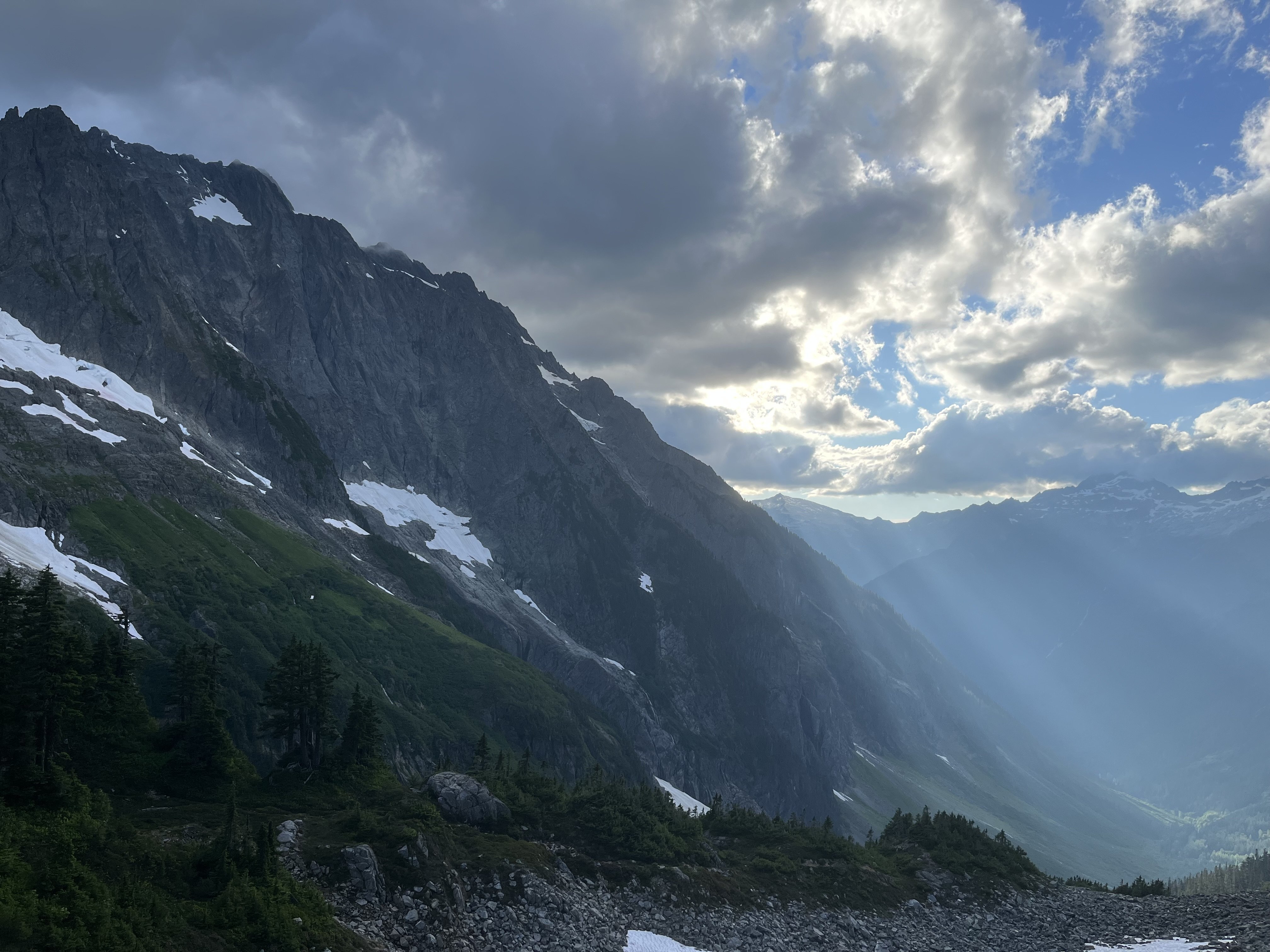
[TR] Mount Challenger - Eiley Wiley Ridge 08/17/2020
explor8tion replied to dadoufergy's topic in North Cascades
Hey! Thanks for the super helpful report. It appears the images you originally attached aren't accessible anymore any chance you still have them onhand and can re-upload them?? - Today
-
 dogandbrew joined the community
 -
 Dan Mcnerthney and I climbed the Stoddard buttress exactly 10 years ago in mid July and here is my few cents. 1. The approach from the Crescent creek basin to the base of Stoddard buttress IS long. It took us 9! hours which included climbing the snow/ice couloir plus dry rock to the col, 2 rappels into a moat, ice climbing out of the moat (steel crampons and boots were highly appreciated here), followed by traversing Mustard glacier on cl. 4 - low cl. 5 ledges and more ice climbing to get on to the buttress. 2. The climb itself to the true summit of Terror IS much longer and more complex than most descriptions make it sound. Simul climbing was feasible on the bottom half of the route but climbing becomes harder higher up.
 -
 Did you read the TR? Resupply at hwy 20.
 -
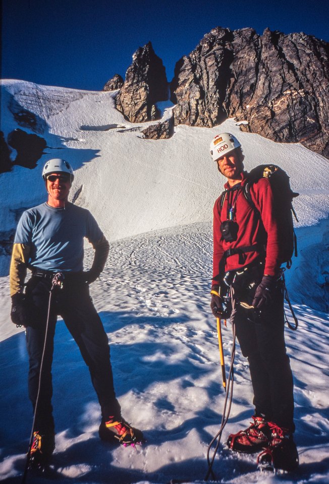
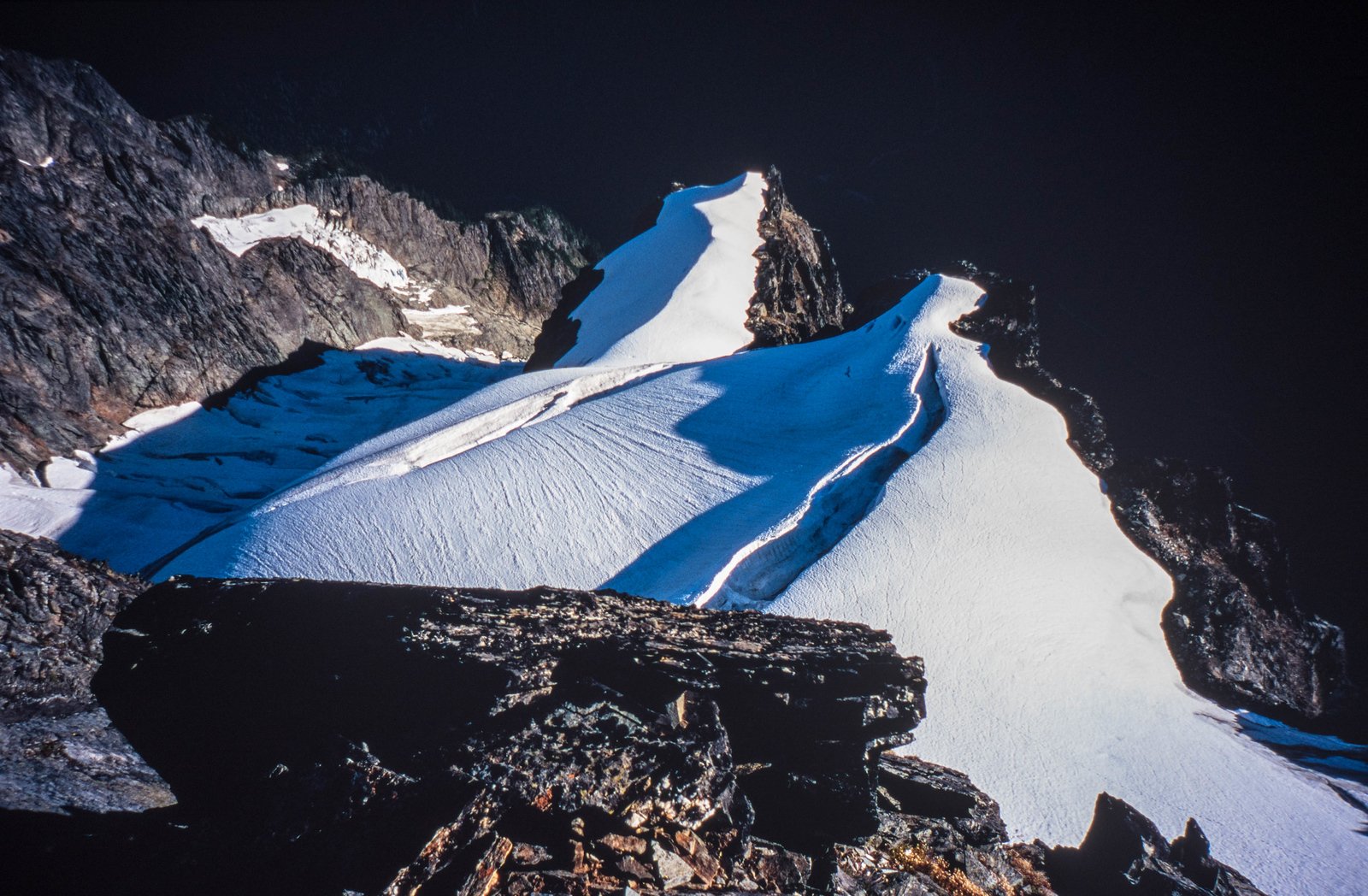
@Phil K and Rod above the snow arete 2006 (check out the glacial differences from the photos above): Looking down from near the top onto the glacier: Strong work @JonParker!!
- 1 reply
-
- 1
-

-
 Holy shit! Amazing. You carried 17days worth of food?
 - Yesterday
-
 macropipette joined the community
 -
Holy cow!!!
-
 justmytwospence joined the community
 -
This is rad, I dig the understated and humble approach to the write up. Inspiring.
-
 Amazing!
 -

[TR] Johannesburg mountain - Northeast buttress ‘51 rib 07/26/2025
JonParker replied to A=A's topic in North Cascades
Wow, sounds like you had time for a second lap that day! -
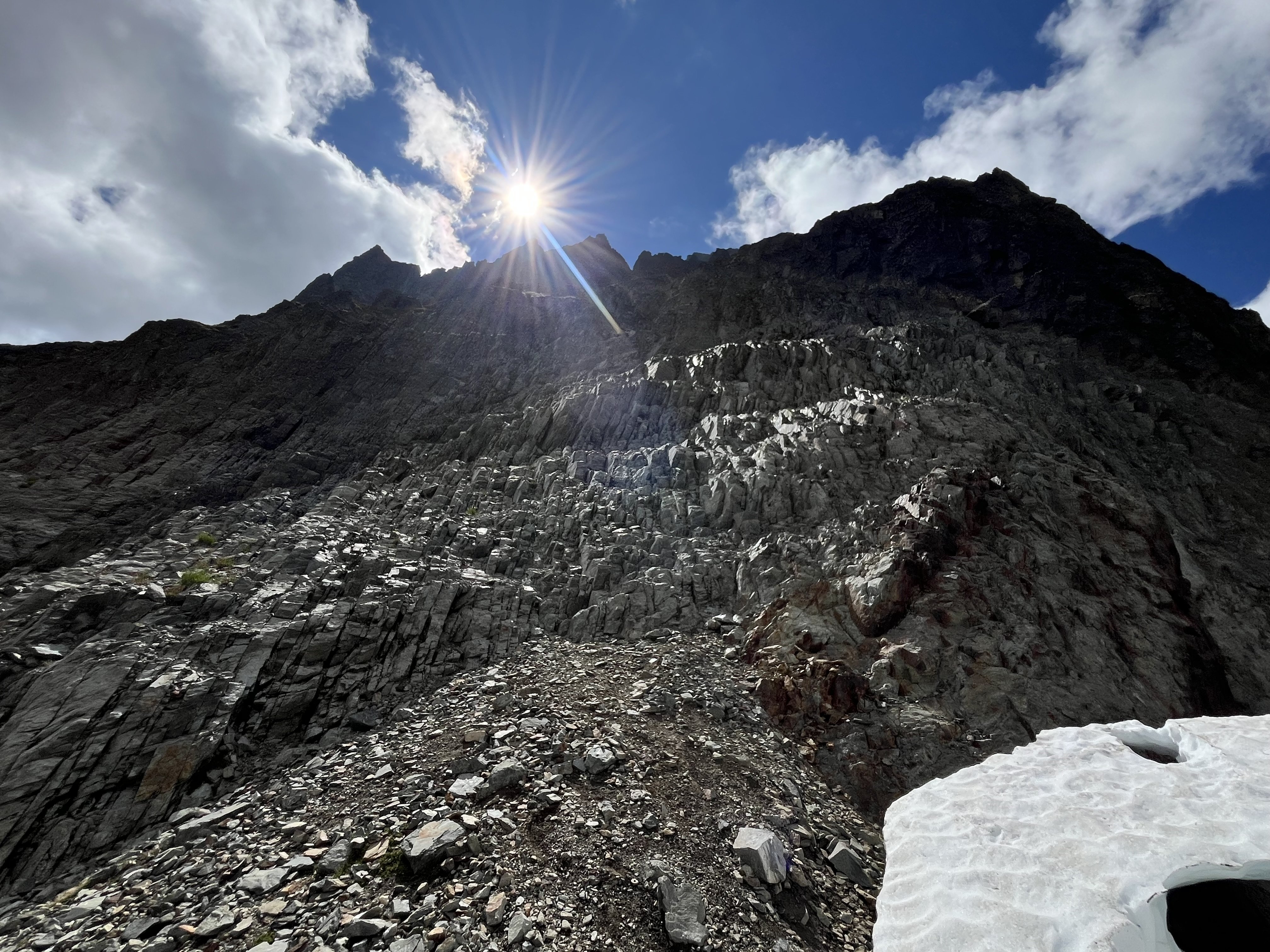
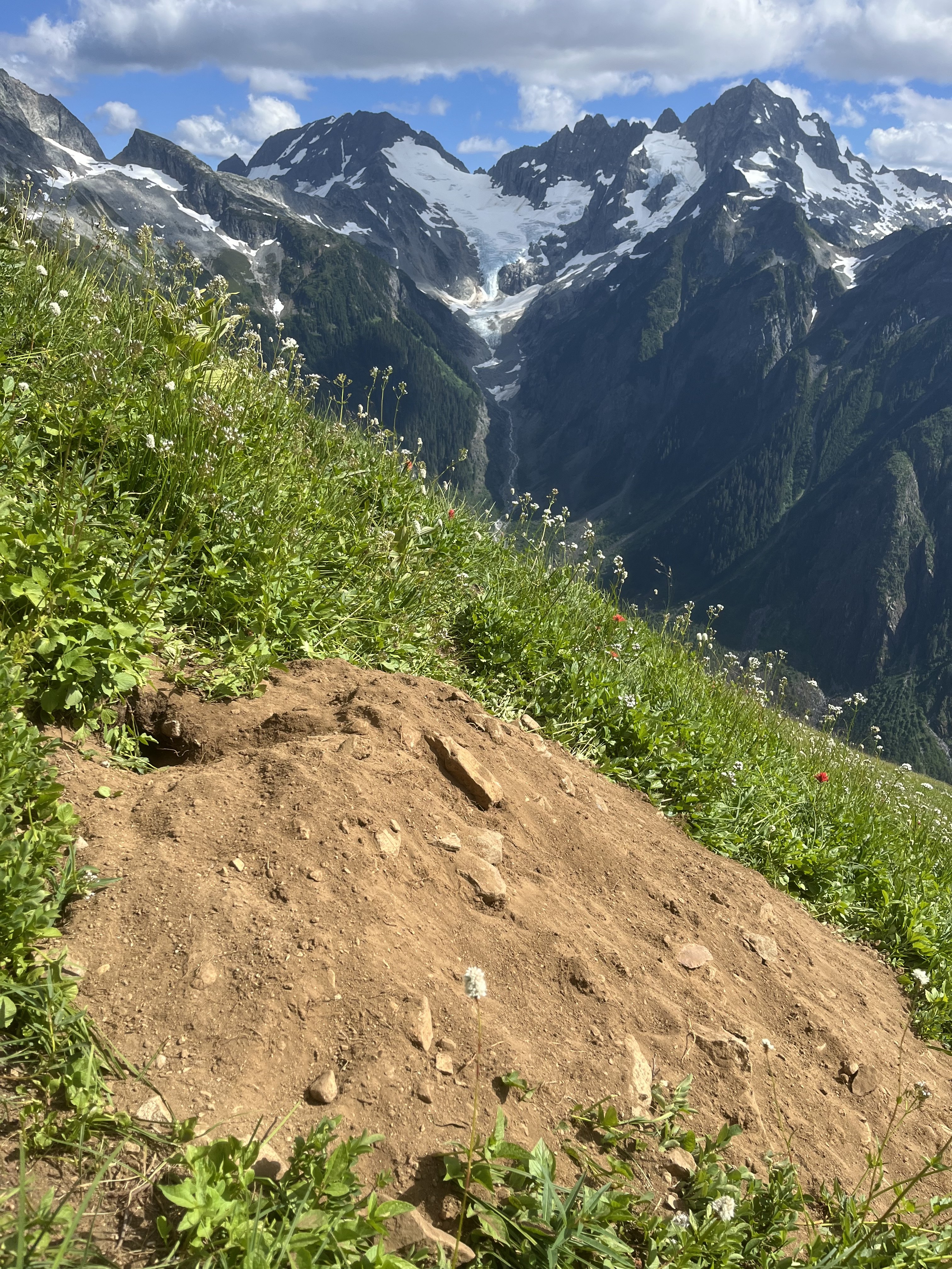
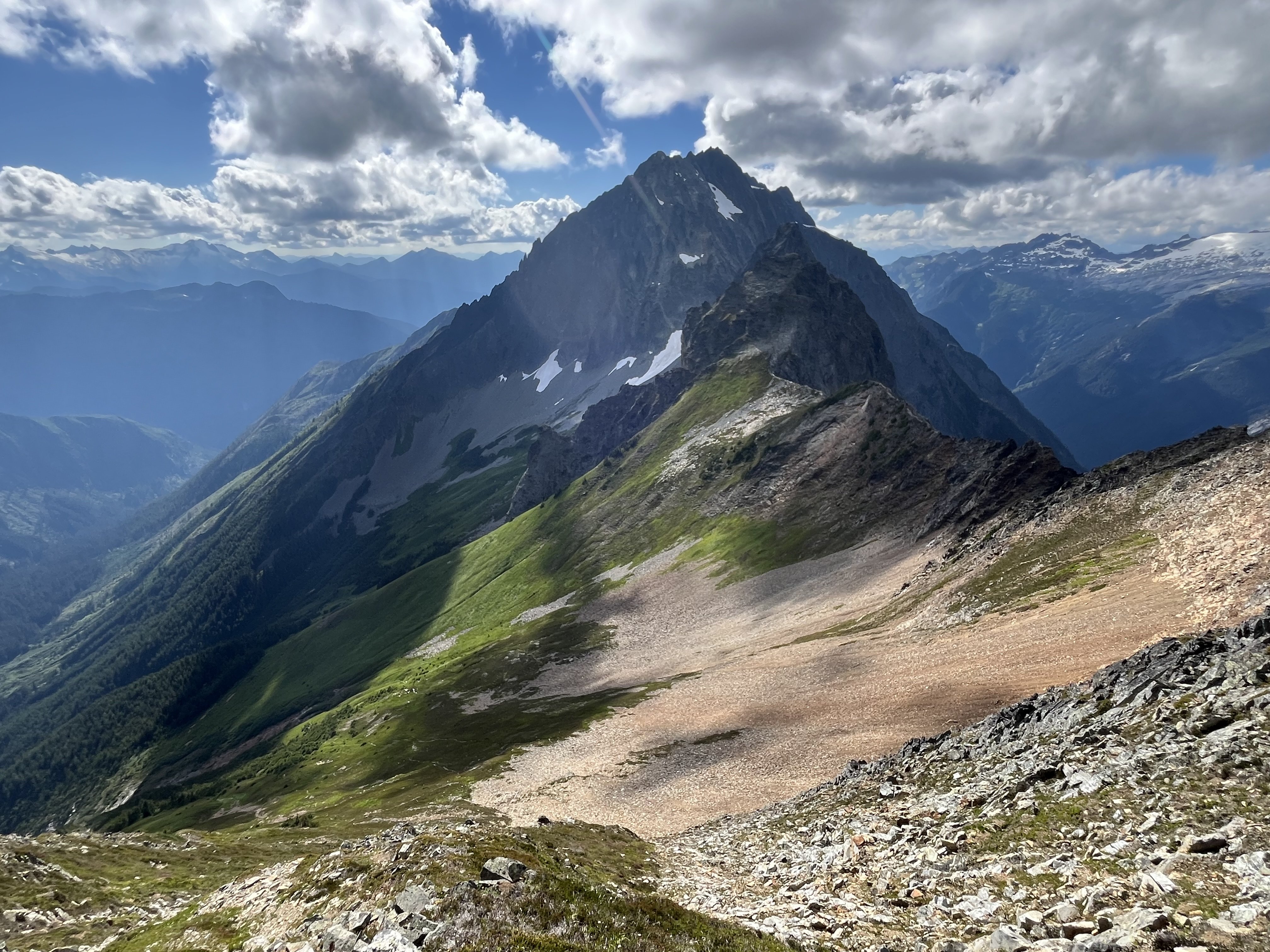
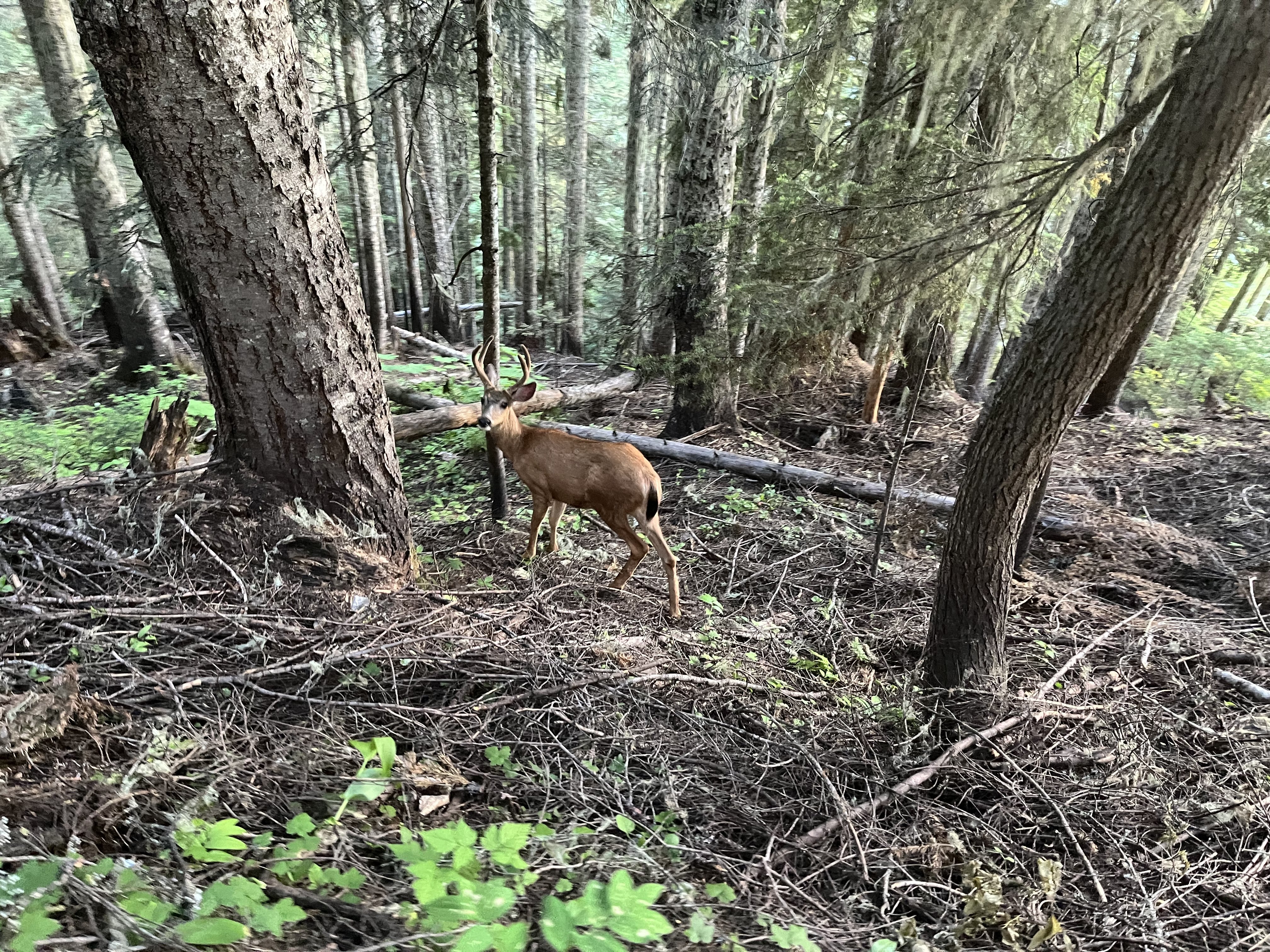
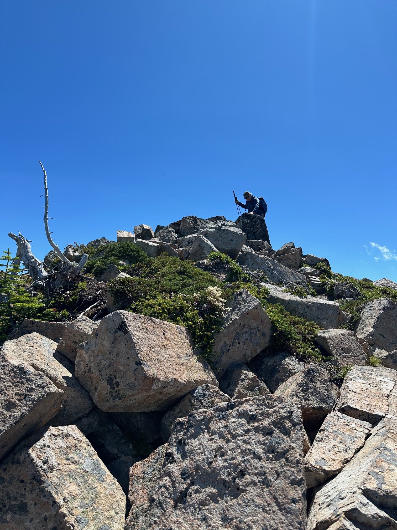
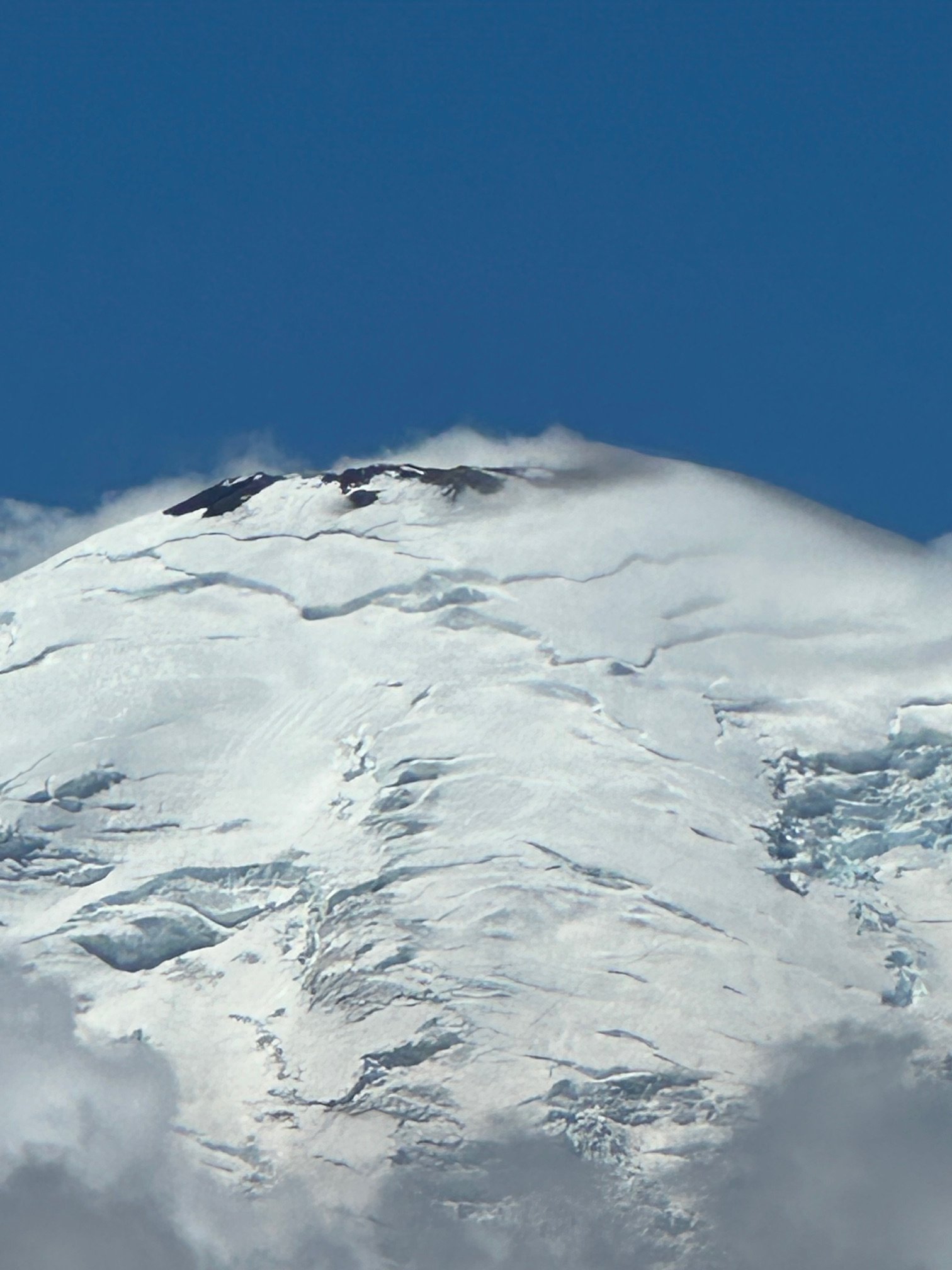
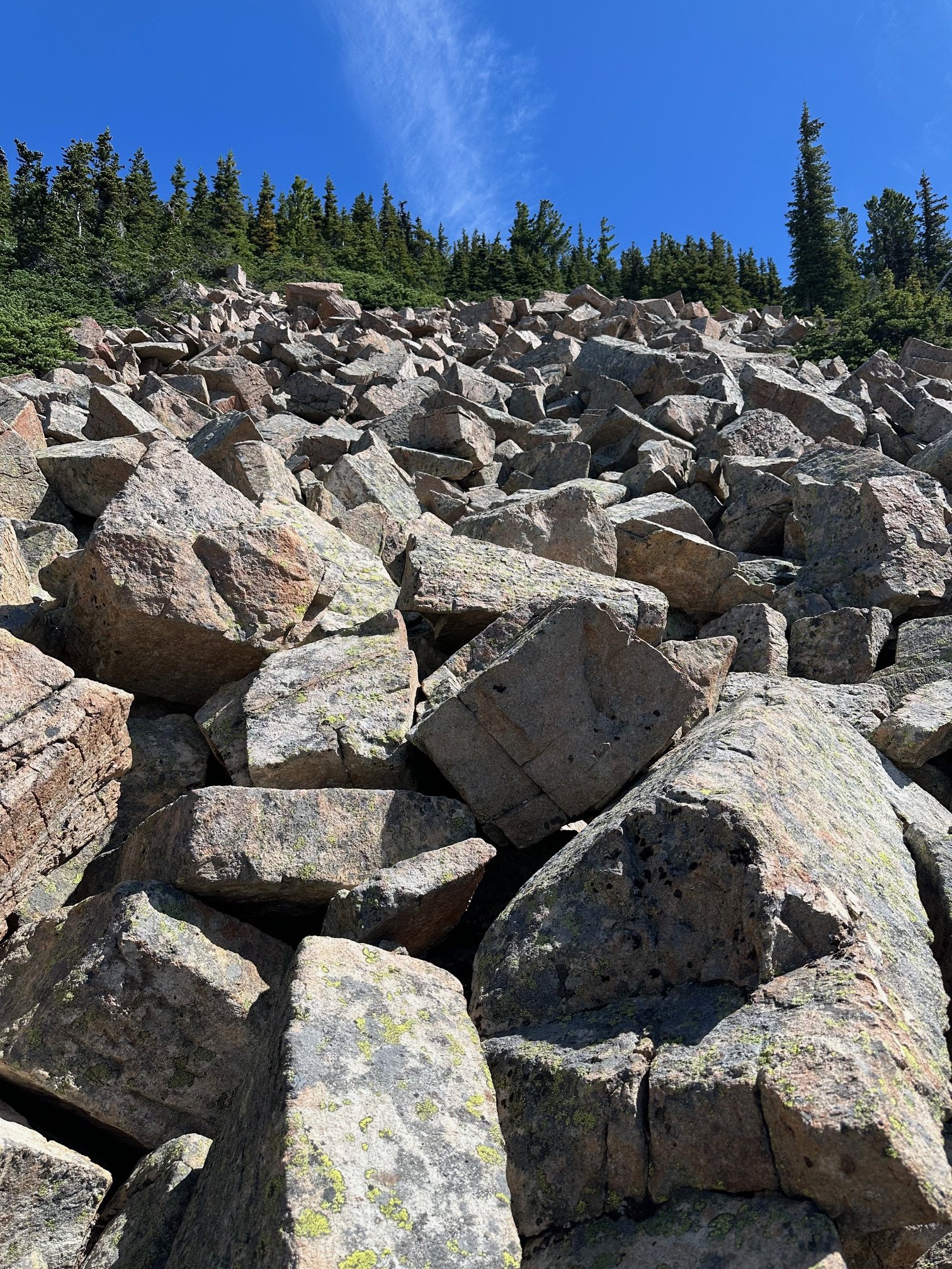
 Trip: Johannesburg mountain - Northeast buttress ‘51 rib Trip Date: 07/26/2025 Trip Report: I drove to the parking lot Friday night, threw my sleeping bag in the back of the truck, and fell asleep staring at Johannesburg. About an hour after sunrise I locked the truck and started walking down the road with just a hipbelt loaded with microspikes, ul rain jacket, ice axe, garmin, work gloves, 6 gu’s, and 500 ml of water. Getting to the snow was quite straight forward. I stayed on talus, just climbers left of the moraine for as long as I could, and then traversed straight across the moraine to where I could step onto the initial slabs to gain the rib. Figuring out these initial first pitches before the brush was slightly tricky, perhaps requiring the most thoughtful climbing of the whole route. Just above the slabs was a large patch of snow. I drank some water and filled up here and then started tree climbing. I was elated to not have a pack on for this section. The work gloves and trailspikes also made life much easier through this part of the route. Once I made it to the steep heather section I was able to mostly stay on the ridge crest with semi decent rock. I did not end up joining the 1957 route near the top like I’ve read in some trip reports, and instead continued up the 51 rib. This section contained the highest quality rock and climbing of the entire route. The crux of this section was probably a bomber near vertical handcrack(5.6) that lasted a couple body lengths. Suddenly, I was on snow. The glacier and snow conditions were nearly perfect, firm but not icy. I transitioned to rock close to the top of the glacier where it became too steep for 1 axe and microspikes. Moments later I was on the summit, 3h 40m from the car. I snapped some photos, and then started down the east ridge. The cairns were quite nice to have for encouragement. Less than an hour later I was at the C-J col. The heather up to Mixup was quite unstable, frustrating, and exhausting, but it was over soon enough. Meeting up to the Ptarmigan “trail” was mostly straight forward. I feel I could have found a slightly better way, but what I did worked just fine. Just above Cascade Pass, I emptied the rocks from my shoes, downed the rest of my water and a GU, and battened down the hatches before running down to the lot. The parade of hikers were true obstacles, but it was pretty fun blasting past them. Made it to the lot 6h 49m after leaving the truck. A very good day. Gear Notes: Work gloves, microspikes, axe Approach Notes: Short and sweet
- 1 reply
-
- 6
-

-

-

-
PM’d
-
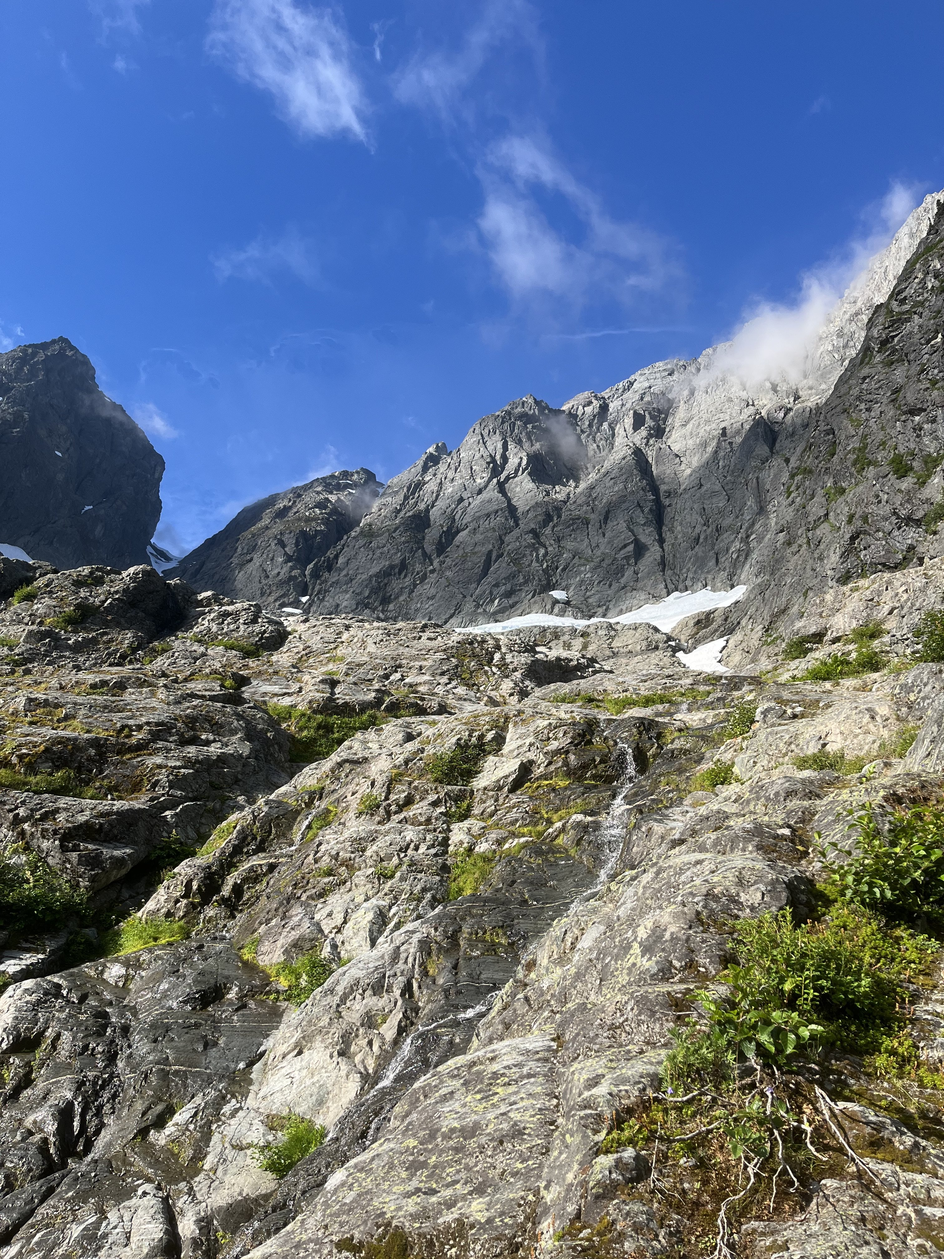
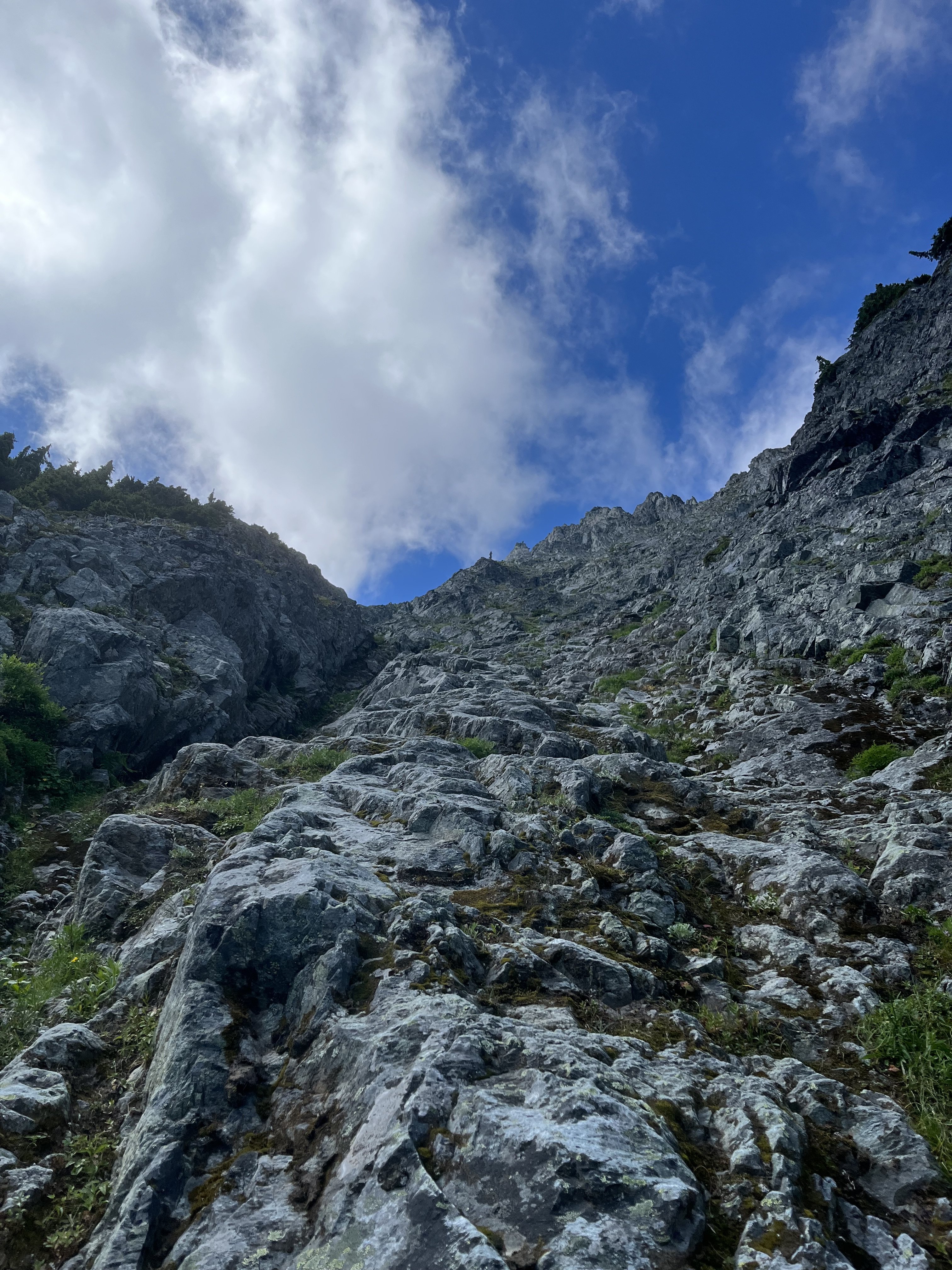
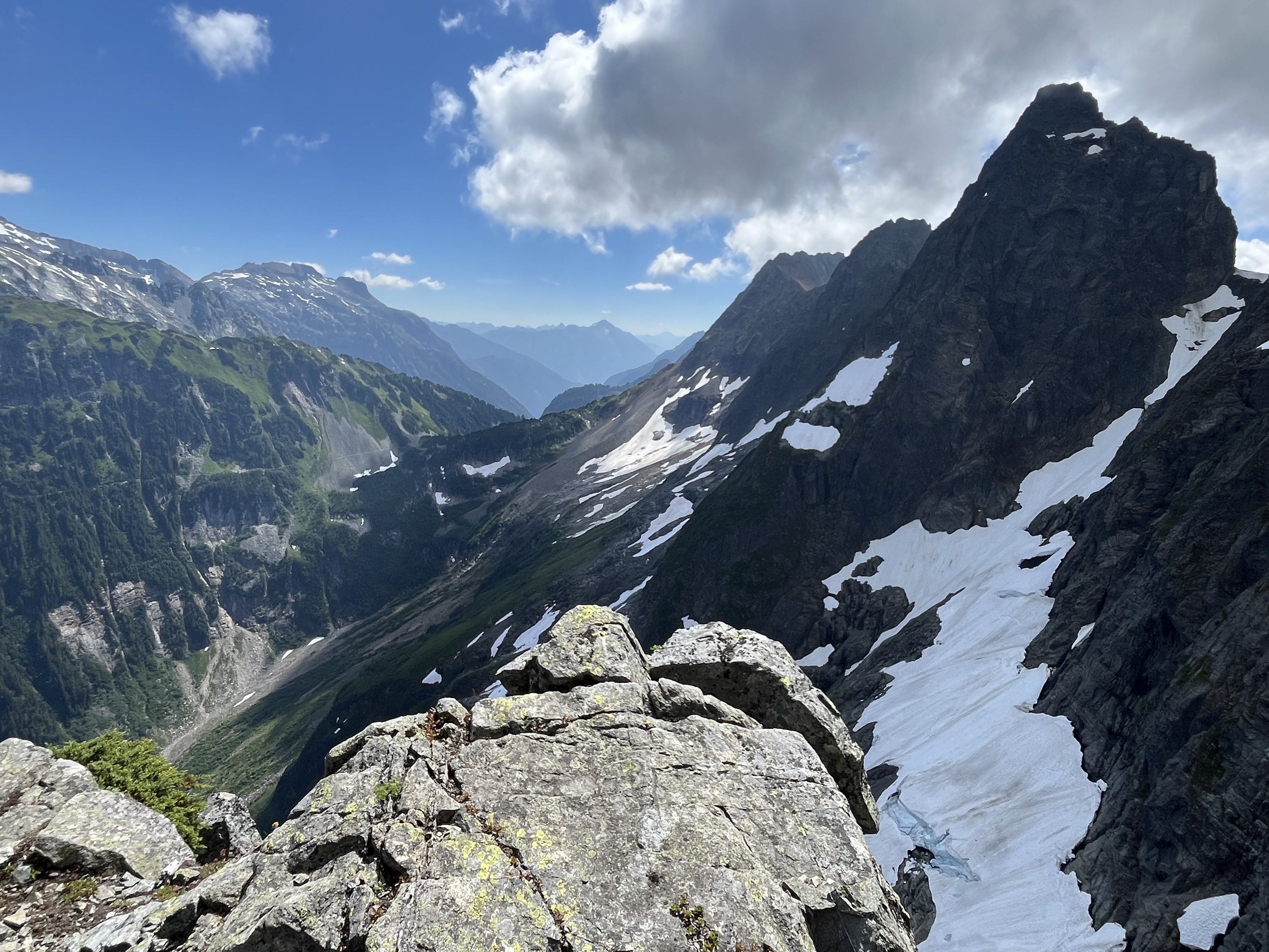
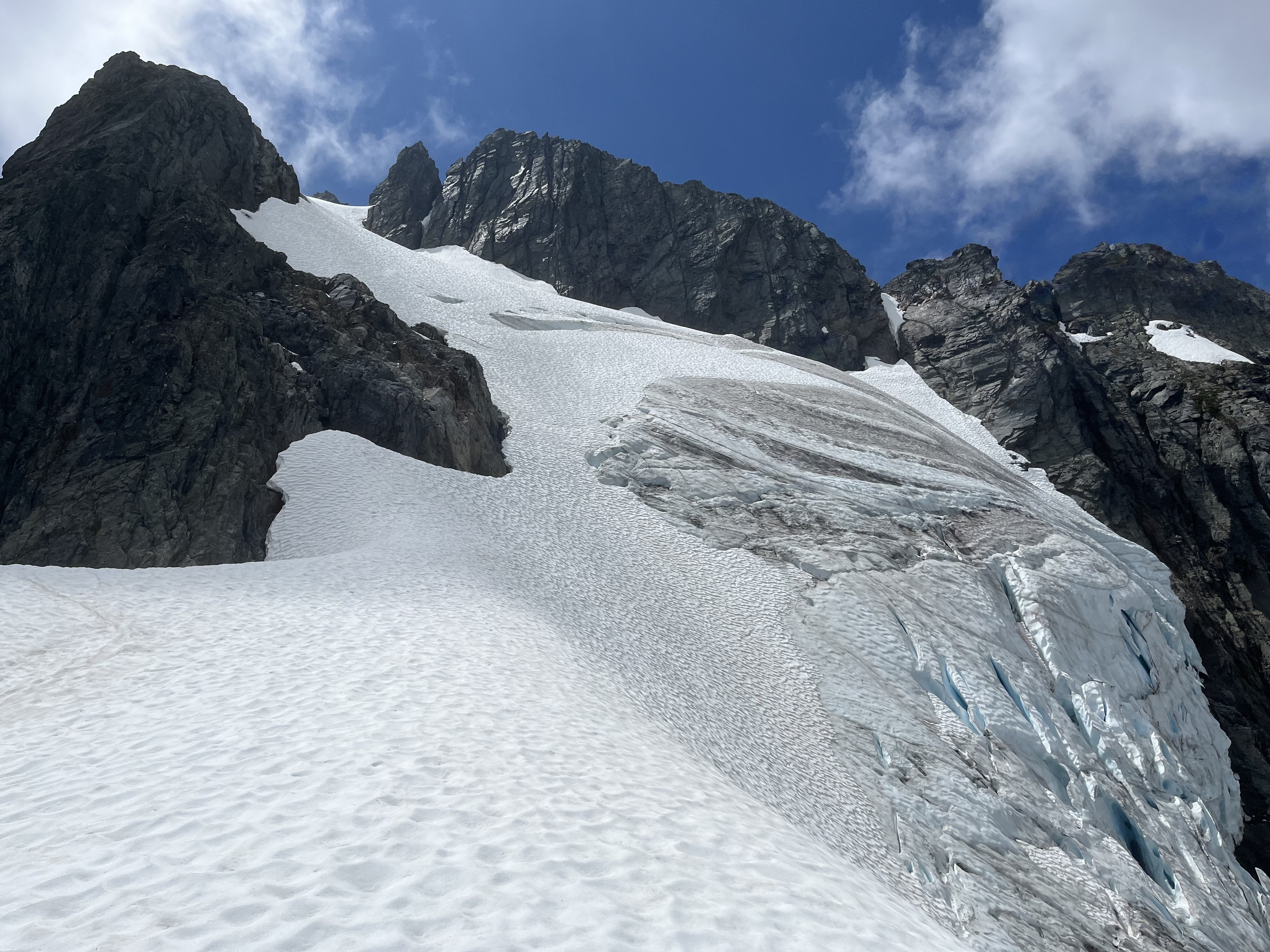
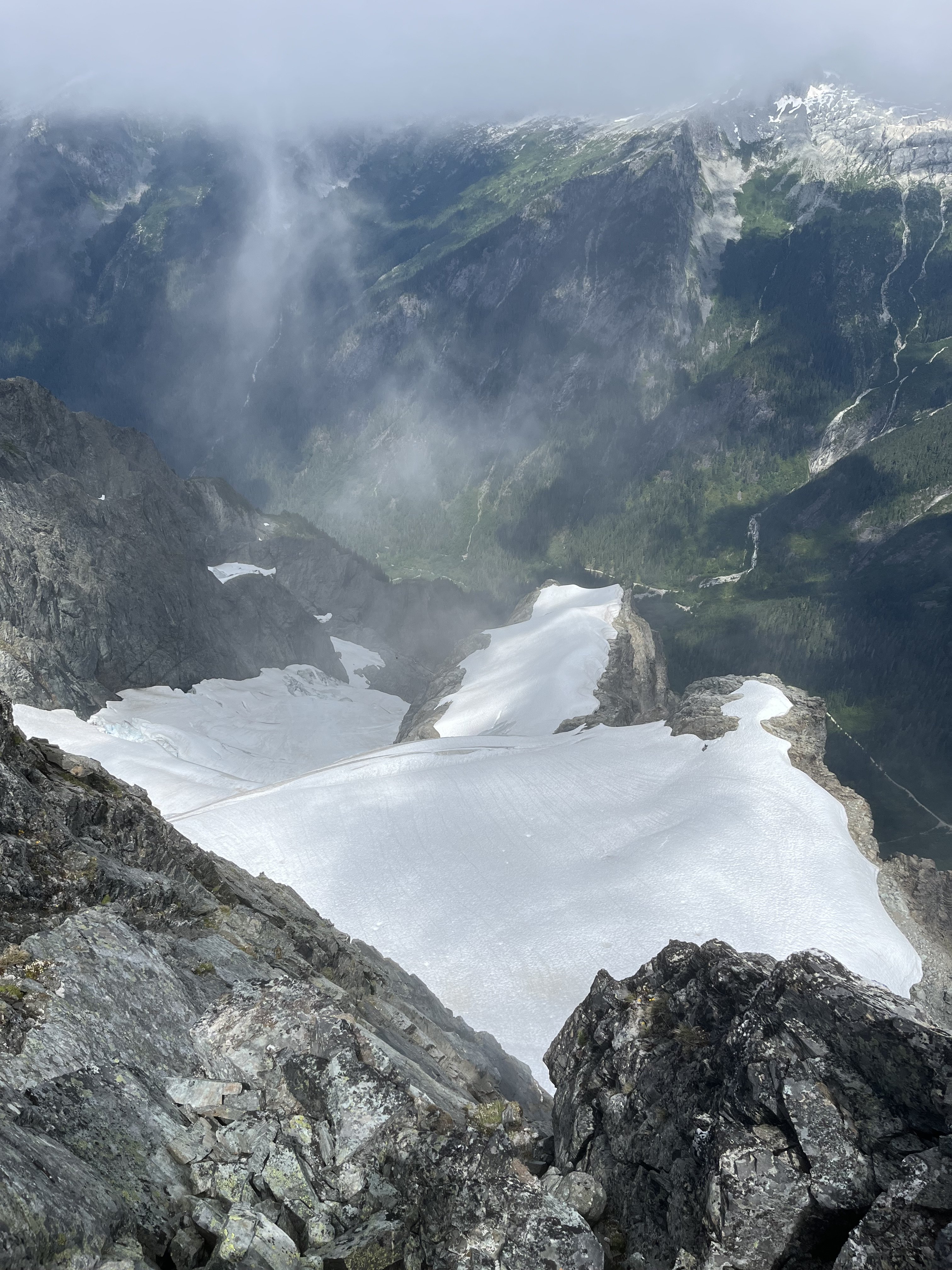
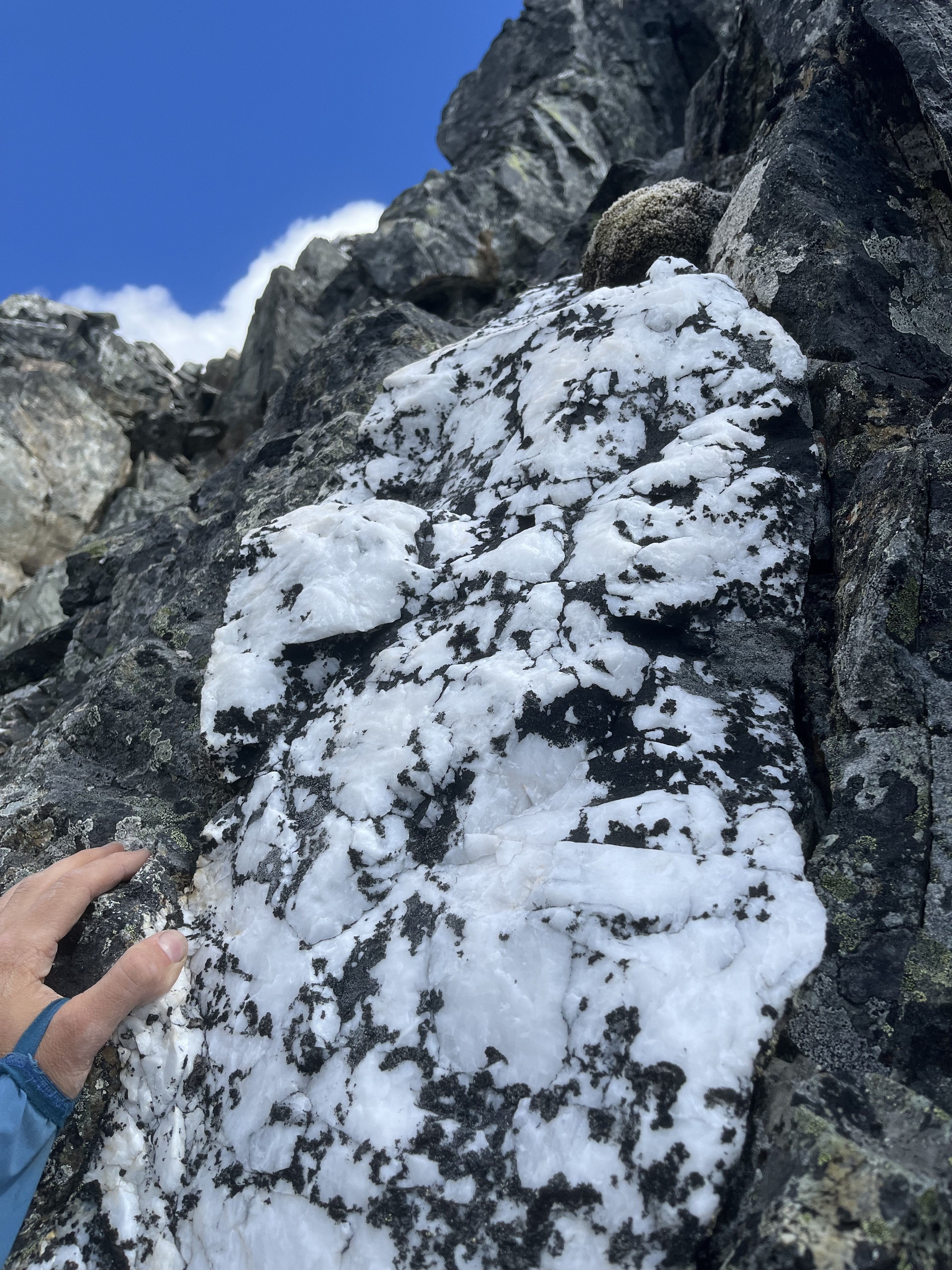
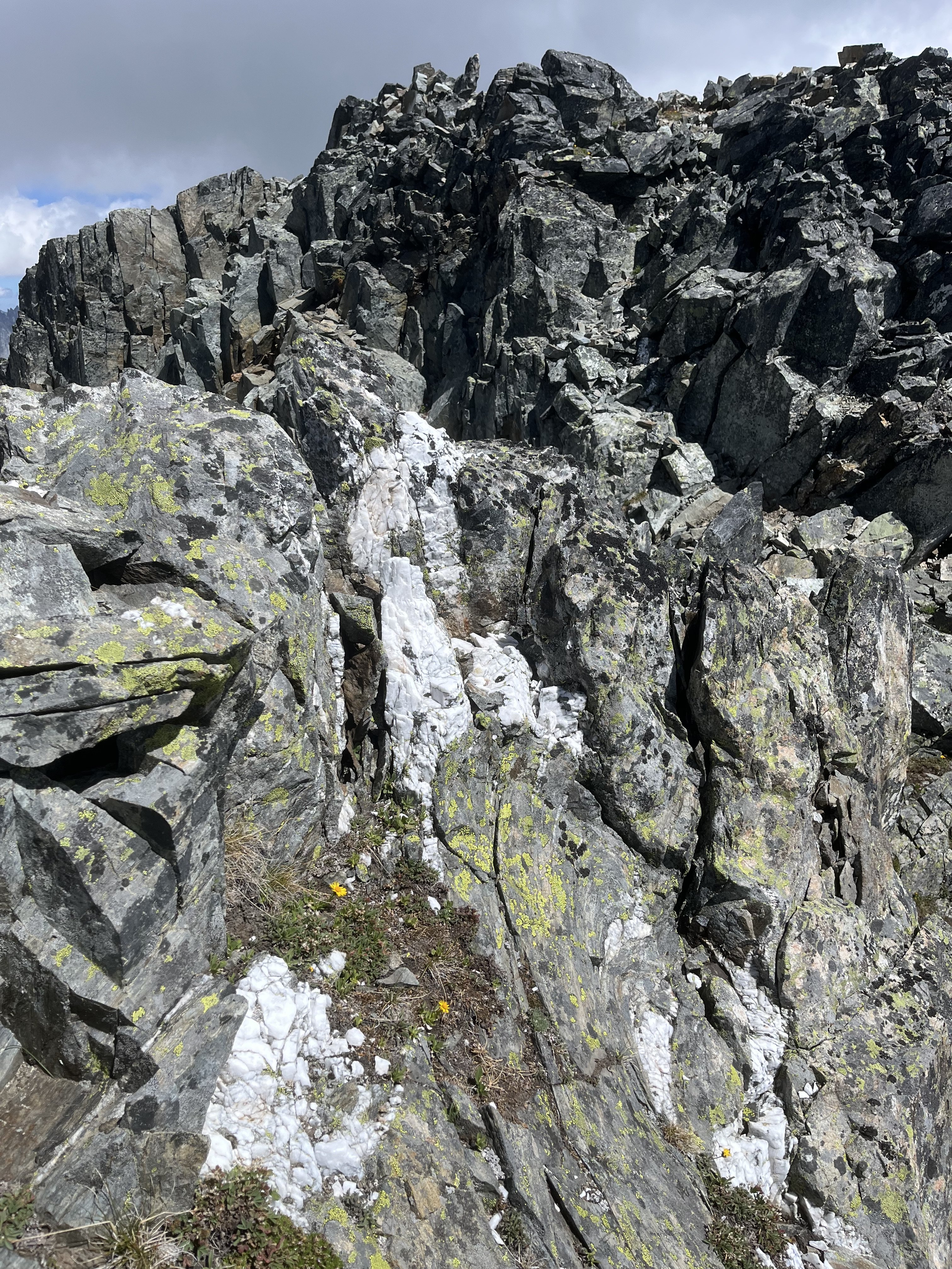
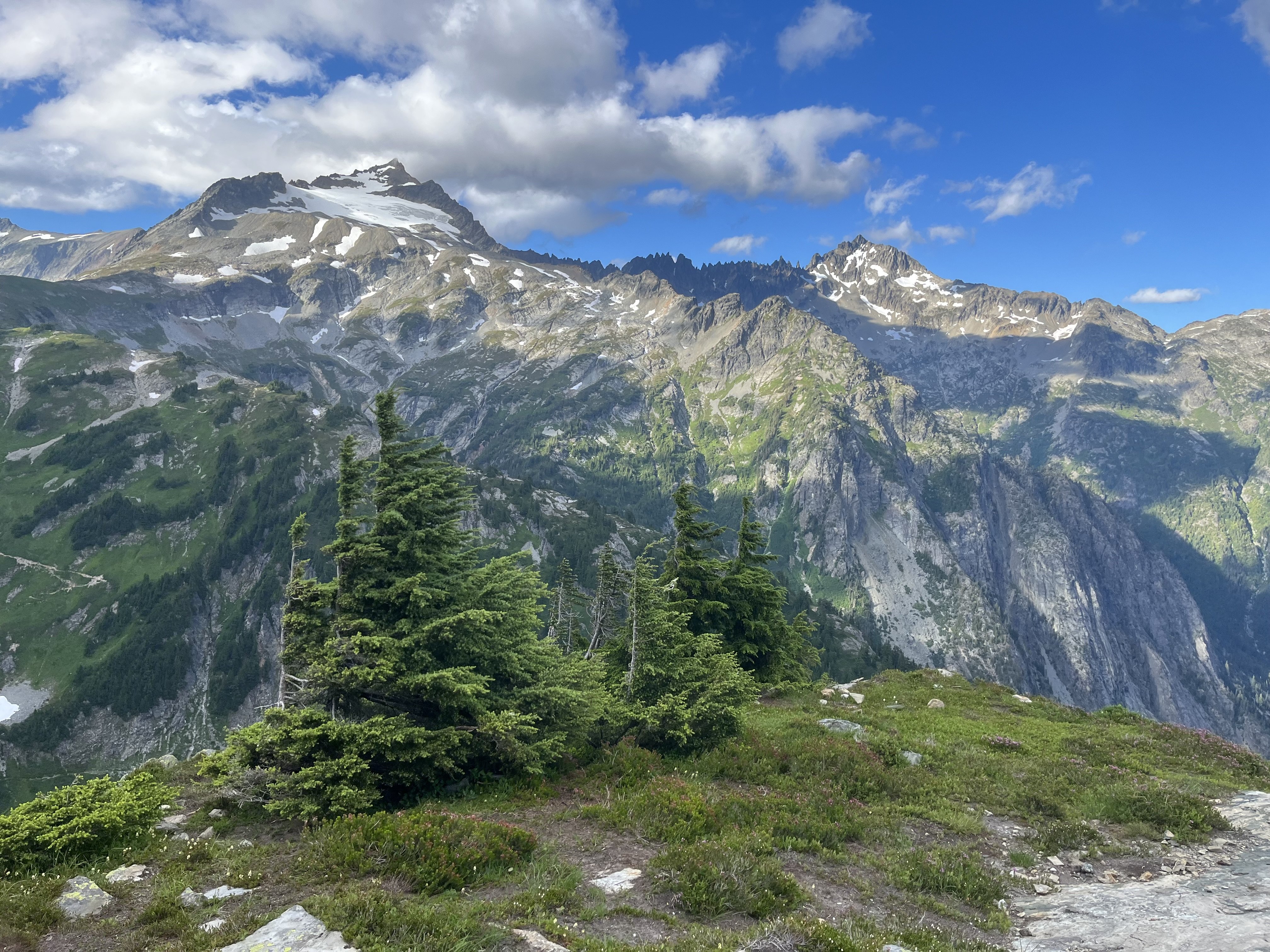
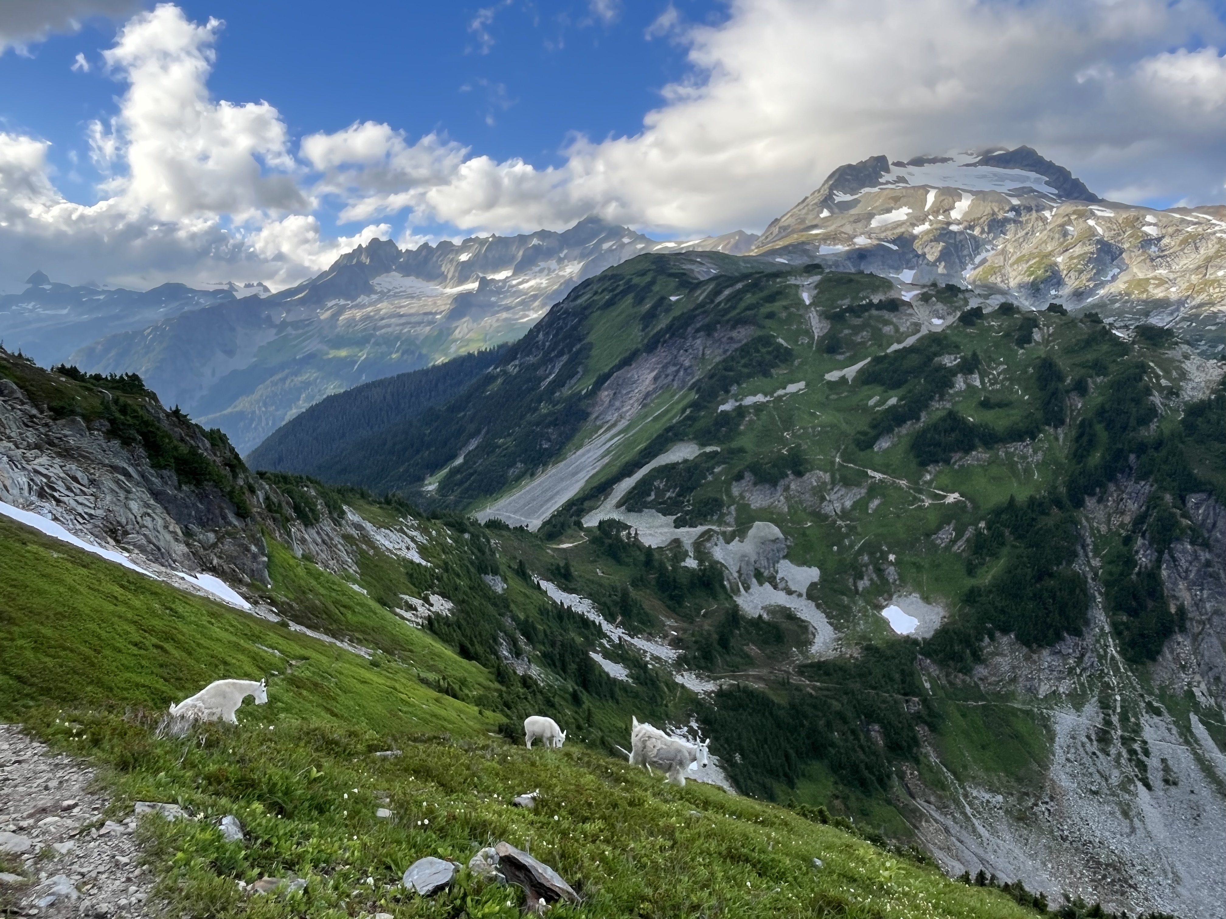
Trip: Johannesburg - NE Rib Trip Date: 07/24/2025 Trip Report: Another Johannesburg NE rib trip report is something the world likely doesn’t need but I’m in a bit of beta happy mood lately. Certain kinds of climbers might find the endless scrambling pretty enjoyable. And with perfect route finding the route doesn’t have to be especially sketchy, though as I found, navigation errors might be punished severely. The steep dirt embankment right off the road is a heads up rude awakening that foreshadows what lies ahead. And for such a short approach the bushwhacking is not insignificant. Steph Abegg has a good photo of the start of the route but the snow fan cuts off the very bottom of the slab and the elevation is wrong. You gain the rock more like 4100’. This confused me back in early June when I came to try the route. I got spooked off the slabs at the start. Thinking I may have missed something due to the “4400’” annotation, I climbed snow higher, but found only sheer cliffs above. On my way back down I saw from Steph’s picture that I had been in the right place after all but it turned out to just be really hard instead of easy class 4. During my second attempt I began by trying to follow blocky terrain on the left side of the slab. It started out good but when it came time to move right, a drip formed an impossibly slimy 10 foot wide barrier to passage. I retreated nearly back to the bottom and instead headed up to a right facing corner left of a roof with a wet slab below it. I went this way on my first attempt before bailing. It starts with a bit of lieback on a jug and a high reach to another jug, after which you can pull up to easier ground. Right after I took this photo my feet blew on slime. It’s a low angle stance, so fortunately I didn’t go far. Humbly I reapplied and was accepted on the second try. This short sequence felt like 5th class though as my fall demonstrated, maybe not exposed enough to count as true 5th. Though I’ve spent more than my fair share of time on that slab by now, I still have no idea where the path of least resistance is. Having failed to find the “easy class 4” I also failed to find the “sketchy 5th”. At the top of the slab next to the waterfall I found good solid rock and was on my way. Worse was yet to come in the jungle section. From the stream below I noticed some tall cedars and guessed that it wouldn’t be too crowded at their bases. This was true, I was able to move between them and the rock buttress without any real entanglement (18L pack with ax and tool covered in socks and just barely stuffed inside). However I was getting further and further west and not gaining enough elevation. Finally I saw something I was hoping to find, a steep, rocky and mostly dry bed. But guarding access was minor cliff band maybe 15’ tall. Overly committed, I explored three fairly terrifying options at 5.forest and managed to get through, relying far more on good fortune than I’d like. The episode left a bitter taste on an otherwise umami day. I definitely prefer my climbs not avoidably harrowing. Above that section I tended to stay in or just to the right of the gully between the two ribs, with a wider diversion to the right just above the last major snowfield. Where the vegetation finally gives way to solid, polished rock beginning around 6K’ was the highlight of the route for me, both because this was the best quality rock for the day, and because of the sense of relief for escaping what was just below. At about 6450’ I found a promontory with a great view of the northeast face. Beyond this point the rock quality declined some (but not terrible) and the route complexity increased. I saw that I needed to move diagonally up and right to get to where the snow was on my map. I found reasonable ramps and ledges cut with interesting quartz bands. There was one more section of minor drama with steep, exposed choss to get around the corner. Then I could see the snow and ice spilling down from Johannesburg’s north face. I gained the snow at 7200’, maybe missing the famous bivy, though I noticed one small one at 7000’ with good but not panoramic views. The snow arete was AWOL. My guess is the high heat has melted it down to a boring broad shape. Passage on the left was a little narrow but in good shape. There were no real difficulties with shrunds and crevasses and no mandatory hard ice. At the upper face especially the snow was steep enough that I was glad to have sharp things on each limb. Unlike my first time here, I couldn’t locate the summit register. Before long I began the descent to the east. It was helpful to have been up and down this way before. I had forgotten how much griffin shit is in this zone. I seemed to take a long time descending. Probably I was mentally fatigued from all the no fall terrain. It was a lovely afternoon as I traversed the basin over to the ridge off of Mixup, pierced with many marmot cries dying off with slow haunting decay. Industrious workers of the underworld, unite! More mental fatigue descending the slabs coming down from that notch, then a long overdue water break below the snow (though somehow I didn’t get dehydrated despite running out shortly after the summit). Pretty straightforward and gratuitously beautiful from there back to the trailhead. It took me slightly less time than going up and down Doug’s direct had, a little under 15 hours. I think I lost at least an hour with the slab and forest cliff navigation fiascos. Many reports say this climb is best done once. I think that’s not untrue but if you really like scrambling this could be a good one, because the scrambling goes on and on hypnotically. That said, it’s a slippery one. Gear Notes: Approach shoes, steel strap-on crampons, one tool, one light ax. Approach Notes: Last hair pin before the Cascade pass trailhead. Don’t fall down the very steep hard dirt.
- 1 reply
-
- 6
-
-
-
- Last week
-
 baanielsen joined the community
 -
If they were hosted on this site I could fix the images. But they wre hosted elsewhere on a site that is long gone.
-
 This is a great TR, I really wish I could see the pictures. Camping below the "waiting tower" seems amazing, it's a very underrated feature.
 -

Looking for a partner to climb Hood with in July
Justinl3 replied to quinnc55's topic in Climbing Partners
Messages -
Messaged
- 1 reply
-
- 1
-
-
Good to see folks getting on this one! If you want to see photos and a description of the descent down the South Face, here is a TR from way back with my friend TJ (RIP) and @therunningdog.
-
Let's do it @geosean!
-

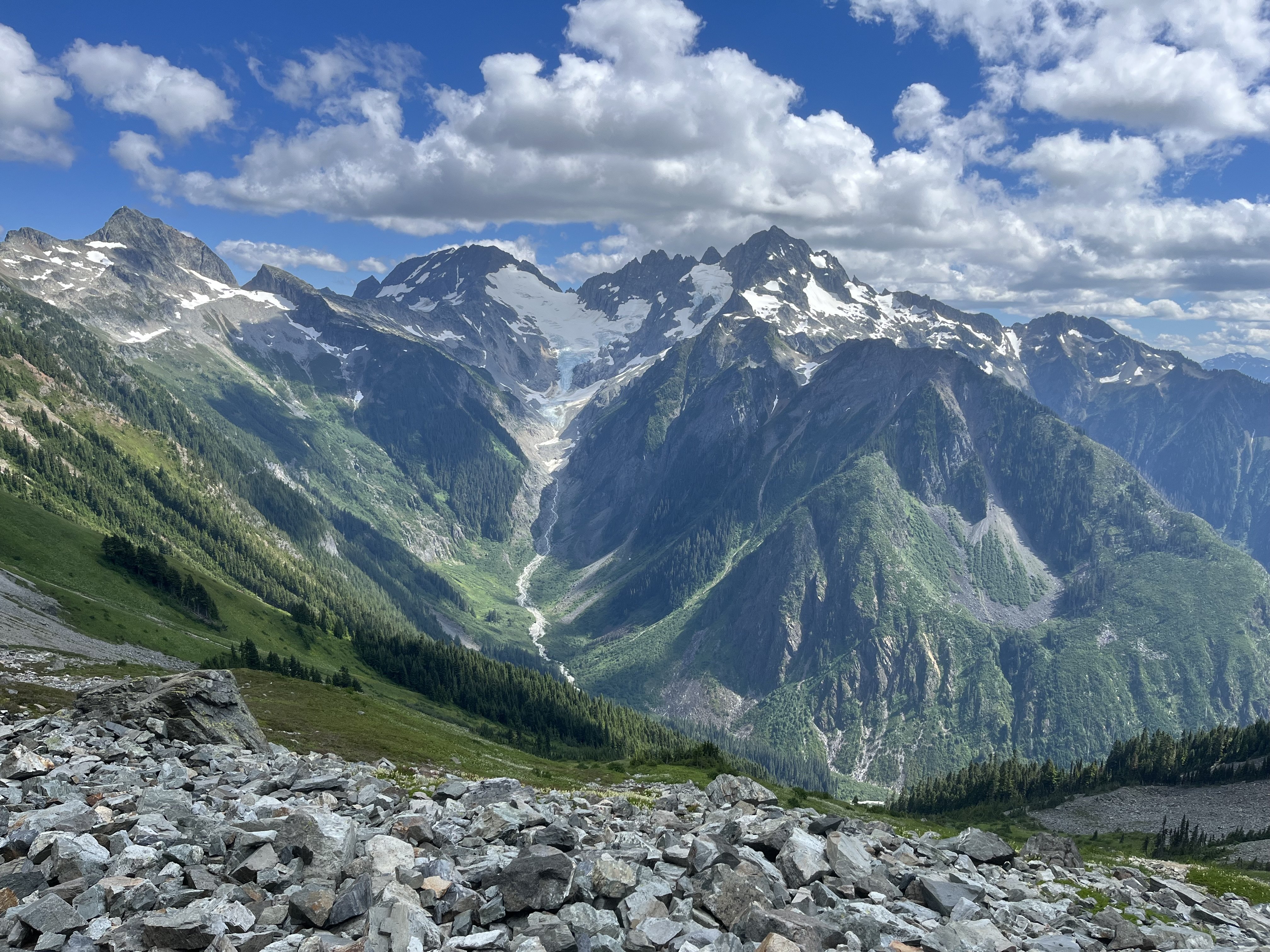
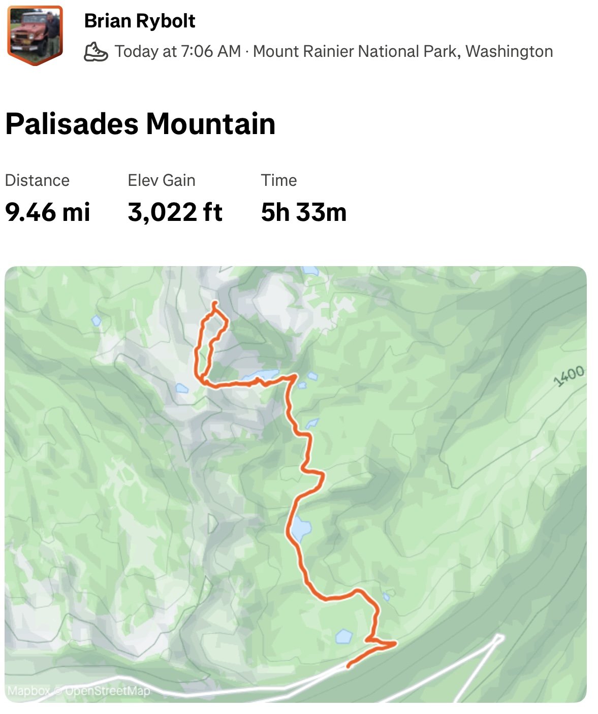
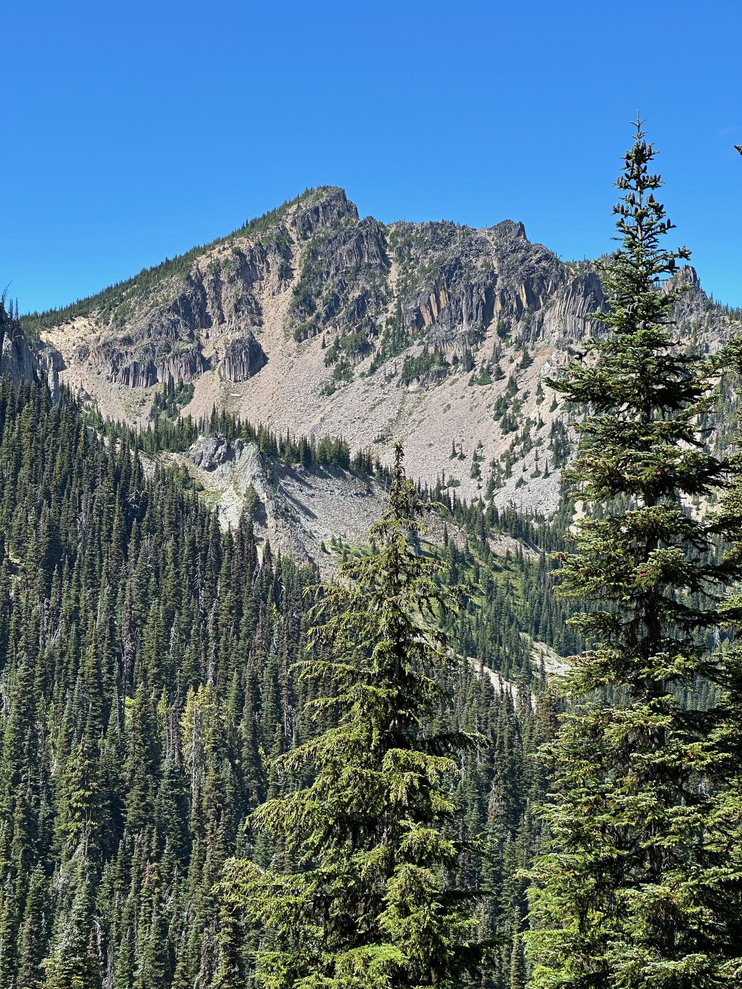
[TR] Palisades Mountain - From Hidden Lake 07/25/2025
JasonG replied to Fairweather's topic in Mount Rainier NP
Keep the MRNP minor peak TRs coming @Fairweather! Another good looking one for me to put on the list....so many great options that aren't THE Mountain. -
Looking for a mountaineering partner in this range of dates for either mt Olympus, rainier, or others.
-
Justinl3 joined the community
-
This has been revived by a TR post elsewhere. Thanks for the beta, maybe I'll check this out. I've been up Sloan a couple of times but never thought about rock climbing, sounds fun.
-

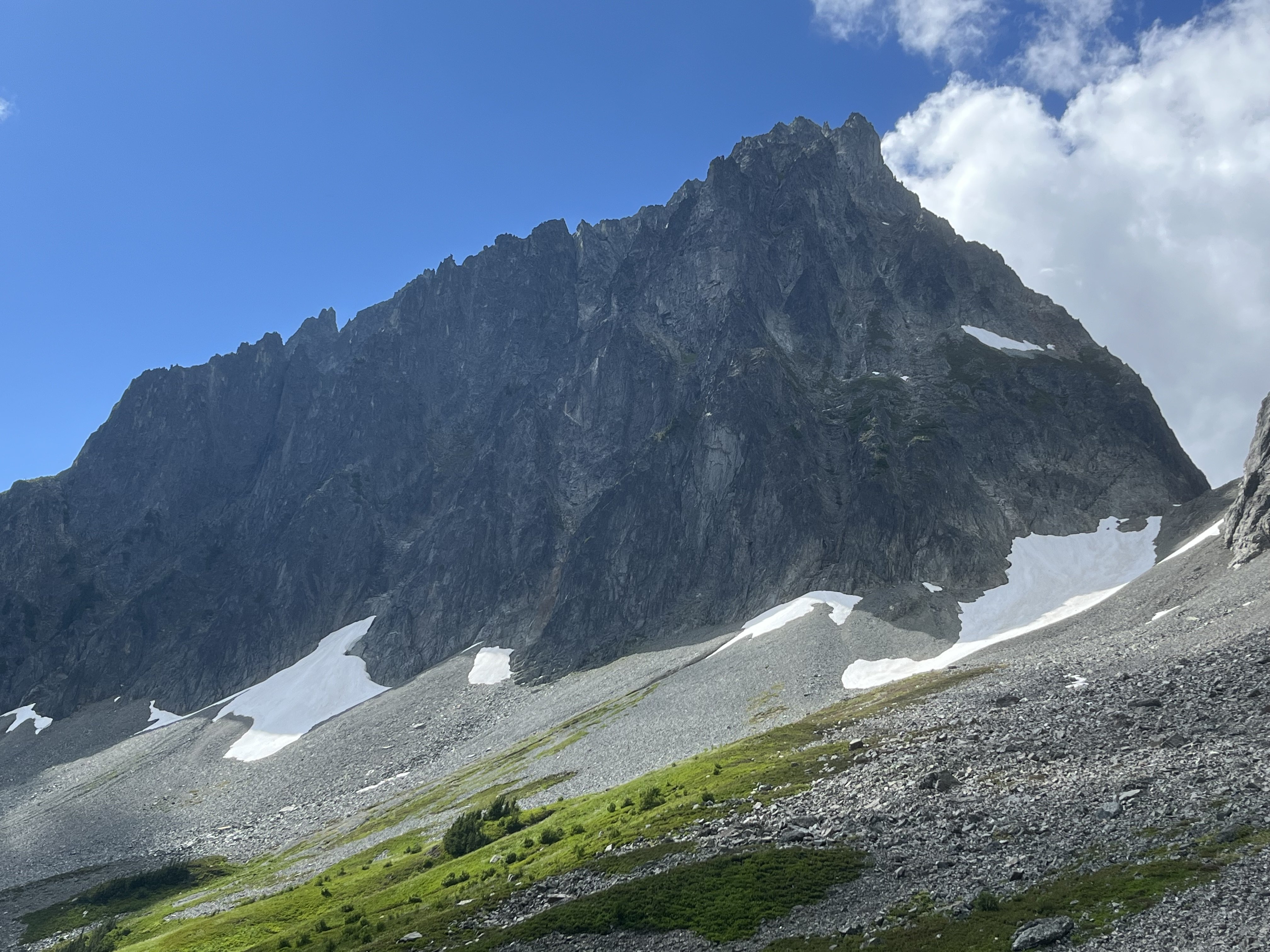
[TR] Seahpo / Cloudcap Peak - NE Ridge 07/05/2025
geosean replied to geosean's topic in North Cascades
The scenery was indeed amazing around Icy @JasonG. Camping between Icy and Seahpo was top notch! Great place for a camping trip even if you're not climbing. -

[TR] Palisades Mountain - From Hidden Lake 07/25/2025
Fairweather posted a topic in Mount Rainier NP
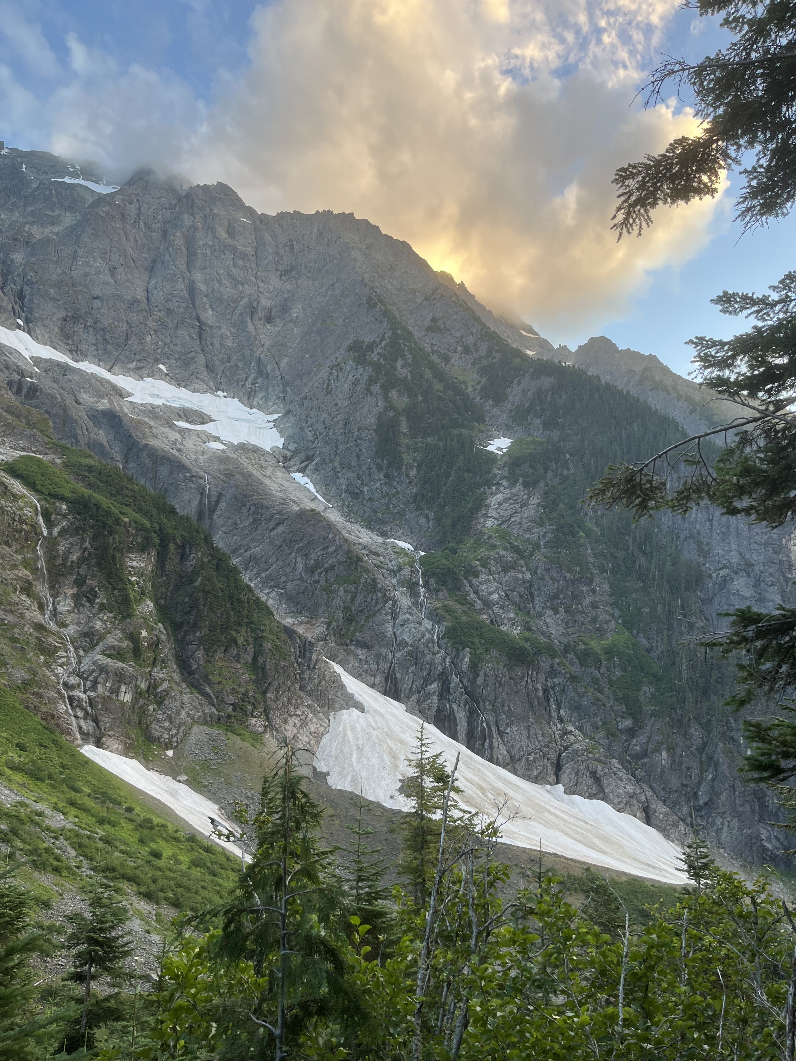
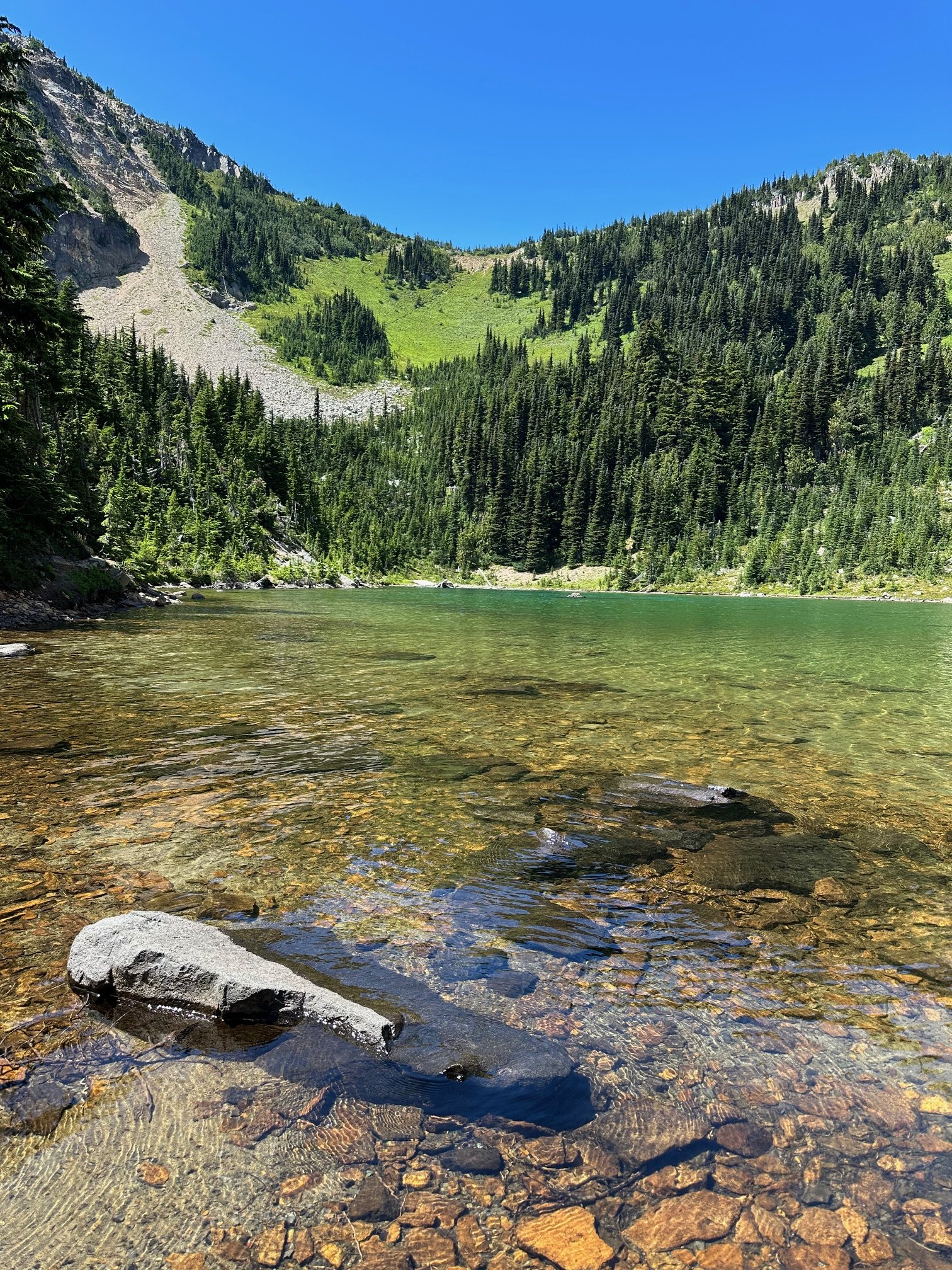
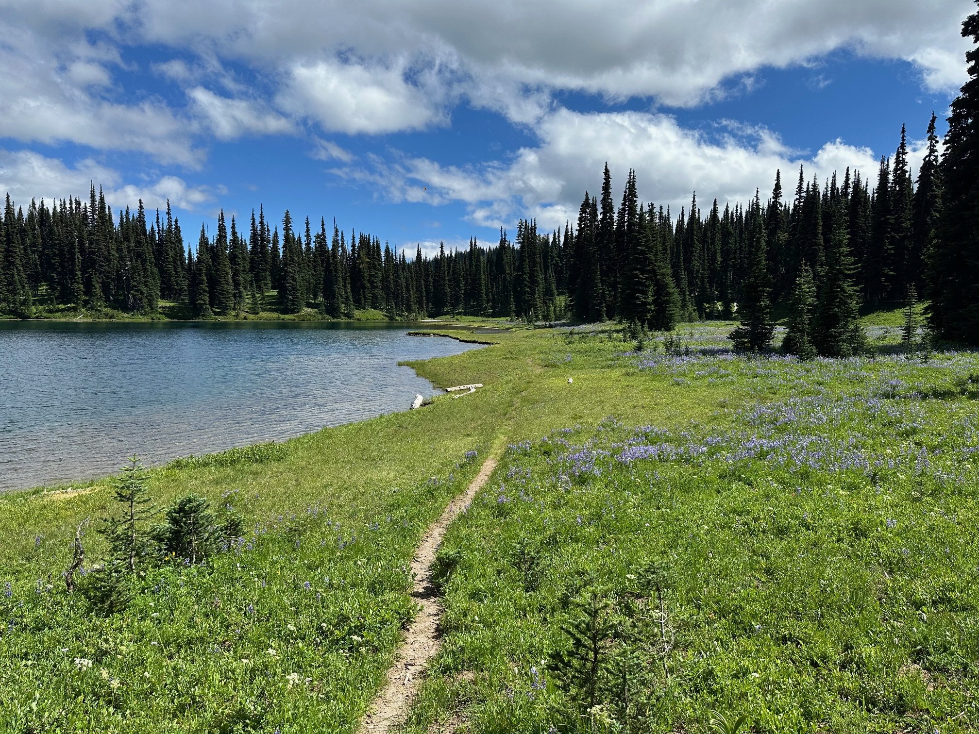
Trip: Palisades Mountain - From Hidden Lake Trip Date: 07/25/2025 Trip Report: Dwayner and I continue our "minor peaks" quest inside MRNP. Got a little off route on the way up from Green Pass, but found traces of a long-ago boot path during our descent. My first time in this area. The lakes and meadows are the best in the park! Flowers are out. And so are the mosquitoes. Gear Notes: . Approach Notes: .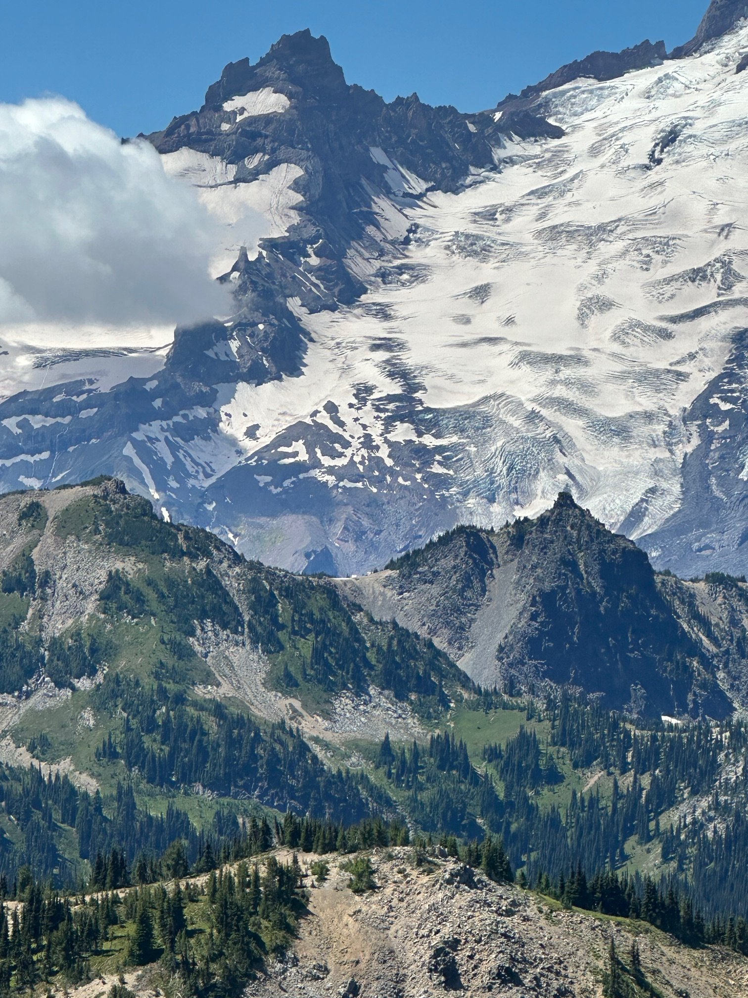
-
uh. DAMN. You basically compressed most of my north cascades 25 year career into one trip. I should take up knitting.

