Search the Community
Showing results for tags 'best of cc.com'.
-
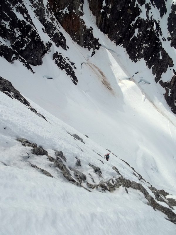
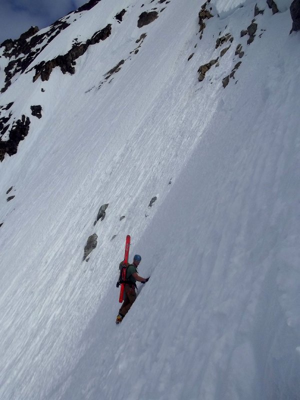
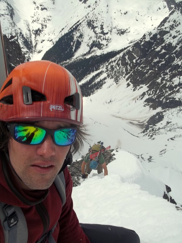
Trip: Denali - Isis Face Date: 5/18/2008 Trip Report: BACKGROUND: In 1996, Joe Puryear and I made what was probably the most recent (as of 2013) ascent of Denali's 1954 South Buttress (Thayer) route. At the time we were inexperienced on technical terrain, and engaging it in Alaska at that time still seemed to be just a distant dream. On this climb, we hauled enormous sleds and packs from the Mountain House in the Sheldon Amphitheater all the way up the west fork of the Ruth, across the colossal south buttress, down into and across the mysterious Thayer Basin on Denali's east side, and then up the Thayer Ridge to where it arcs into the northeast ridge, which we followed to the summit on May 6th, our 28th day after leaving the Mountain House. We spent the next three days carrying all of our still heavy kit up and over Denali Pass and down the west buttress, arriving at basecamp on our 31st day on the mountain. We saw nobody for 26 days at one point! Joe Puryear on the south buttress, April, 1996: Early in the trip, while in the west fork, we stopped to take a lunch break as we passed by the Isis Face, looming above us. Isis takes the central rib: The Isis is located on the southeast face of the south buttress of Denali and rises over 7000 vertical feet above the glacier. It is imposing, and the line of ascent, first completed by Jack Tackle and Dave Stutzman in 1982, is the only reasonably safe line on an otherwise savage wall rimmed by menacing hanging seracs. I vividly recall sitting on my sled eating my lunch and silently wondering how something like that could be climbed. Tackle had made two attempts on the face prior to his successful ascent. The first ended when his partner took a 240 foot leader fall and fractured his femur, resulting in Tackle having to ski out alone for help. Help returned to the scene in the persons of Tackle, Mugs Stump, and Jim Logan, who lowered Tackle's partner to the glacier and who was then evacuated by air. Tackle's second attempt didn't make it far due to illness and poor conditions, but the third time was the charm. Even then, they did not continue on from the intersection with the 1954 route atop the buttress crest due to Stutzman having contracted a staph infection from gashing his wrist with his crampons. As it has been with a number of routes I've done in Alaska, it was this story of persistence and determination which captured my imagination, and, even as a wide-eyed novice sitting in the shadow of the route, motivated me to be up there someday. Six years and many routes later, Joe and I skied to the base of the route, knowing full well that we would not be climbing it, as the June warmth had turned the snow to mush. Nonetheless, the foray added a layer of knowledge and also strengthened the aura of intrigue and mystery. In 2005, I returned with Marcus Donaldson and Chris Donharl. This time, we were armed for combat and loaded for an ascent. Unfortunately the invaders were armed with slingshots, to quote an old phrase, and as we approached, less than an hour from the foot of the wall, a serac at mid height which I judged a bit questionable suddenly discharged a massive amount of debris right down the line of ascent. Had we been 1-2 hours earlier it would have been the end. The crew wisely mutinied and we ran away to do something else. The next two seasons Eamonn Walsh and I had loose plans for an attempt but other routes and better conditions in other parts of the range kept us away. In May of 2008, Eamonn and I made the route our top priority, and the snow conditions in the range fortuitiously aligned with our intentions. In cold conditions, we acclimatized by ascending the lower south buttress starting from Kahiltna Basecamp, following terrain I'd been over before. This ridge (aka Pt. 12,200' and Pt. 12,240') is absolutely breathtaking as it takes you to "Margaret Pass" between the Kahiltna's east fork and the Ruth's west fork and an intersection with the 1954 route. I had descended this ridge in the blind on a failed attempt on the south buttress in 1995 and it remains one of my favorite spots in the Alaska Range, commanding panoramic views all at once of Hunter, Foraker, Denali, and Huntington...a real seat amongst the action. In frigid weather and utilizing snow caves for comfort, we ascended to 15,400'. Along the way we passed the "Lotsa Face" a 1000 foot, 50 degree face of Alaskan blue boilerplate. In 1996, with our 90 pound packs and embarrassing lack of experience on ice, this face took us the entire day to climb...each of the two times we climbed it. On this day, 12 years later, it took all of one hour. We left a cache of food and fuel atop the Isis Face, for use in either continuing on to the summit after our ascent, or for dealing with getting down were we to top out in a storm. The route only had two ascents- the second was in 2003 by four French climbers- and neither ascent had continued beyond the crest of the buttress. After returning to basecamp, we waited about a week before a stable stretch of weather arrived. We were flown to the west fork of the Ruth by Talkeetna Air Taxi. Late in the afternoon we started up the route and we topped out on the face 47 hours later. The Japanese "Giri Giri Boys' had climbed the route about a week earlier for the route's third ascent. Snow in the meantime had obscured all trace of their passage save for a dropped ice screw we found high on the route. Atop the route, we learned by radio that Jumbo, Sato, and Ichi had continued from here by descending the dangerous Ramp Route into the East Fork of the Kahiltna...from here they made the fourth ascent of the Slovak Direct on Denali's 2700 meter south face, rising directly across from us...one of the most impressive achievements in modern Alaskan climbing. Their linkup relieved us of any 'ego burden' of doing the route's first linkup to the top of Denali. Our own comparatively diminutive plan of continuing up the much tamer southeast spur, including a lot of terrain I had been on before, now seemed more like an enormous hypoxic slog. So despite the continuing good weather, Eamonn and I were content with having made the fourth ascent of the face. The ascent had been as smooth as we could ever have hoped for, the technical difficulties were high quality and easier than we had expected, and the scenery on route had been spectacular beyond belief. For once we did the right thing and quit while we were ahead. We retrieved our cache and made a casual descent of the lower south buttress and arrived back at basecamp the following afternoon. A few days later we made the first ascent of "Bacon and Eggs", a fun ice and mixed route on a small tower next to the Mini Moonflower on Hunter's northeast ridge. It capped another great trip in the mountains I love the most. PICTURES, VIDEO- In HD quality, here's the visual story: https://vimeo.com/75055591
-
 Trip: North Hozomeen Mtn - Zorro Face, IV 5.9 Date: 8/31/2013 Trip Report: “squamish?” Written at the end of a planning email for Hozomeen which addressed some nagging details, this would become our refrain throughout the trip. Labor Day offered a nice climbing window, and our list of objectives included just plain ol’ good times at Squamish, which typically promises immediate rock, clean rock, solid rock, protectable rock—all conspicuously (or suspected) absent at our objective. Most likely, many of you are aware of the opening passage in Jack Kerouac’s Desolation Angels: “Hozomeen, Hozomeen, most beautiful mountain I ever seen, like a tiger sometimes with stripes, sunwashed rills and shadow crags wriggling lines in the Bright Daylight, vertical furrows and bumps and Boo! crevasses, boom, sheer magnificent Prudential mountain, nobody’s even heard of it, and it’s only 8,000 feet high, but what a horror when I first saw that void the first night of my staying on Desolation Peak waking up from deep fogs of 20 hours to a starlit night suddenly loomed by Hozomeen with his two sharp points, right in my window black – the Void, every time I’d think of the Void I’d see Hozomeen and understand – Over 70 days I had to stare at it.” Later in the novel: “The void is not disturbed by any kind of ups or downs, my God look at Hozomeen, is he worried or tearful?... Why should I choose to be bitter or sweet, he does neither? – Why cant I be like Hozomeen and O Platitude O hoary old platitude of the bourgeois mind ‘take life as it comes’…” “take life as it comes” indeed. This is a useful mantra when approaching the west face. We had suspected an approach from the N down a gully would grant us access—Colin Haley’s blog post seemed to confirm this suspicion. However, this approach is nontrivial; the initial gully third-class down-climb, while loose, and dangerous, pales next to the shenanigans required to cross several precipitous ribs to our targeted launch point. A slip at any point spells an unpleasant end in the valley a couple thousand below. The approach took us a tedious and painstaking 4.5 hours (this after a first day of humping heavy loads 11+ miles to a camp just N of the peak.) Camp in that basin; S and N Hozomeen left to right, with the west (Zorro) face mostly out of view; some of its northern margin on the right skyline. Our approach continues down (out of view) from the furthest notch on right. Views during approach included the Picket range. Approach soloing; downclimbing skills or funeral bills. squamish? “take life as it comes”, also a useful mantra when trying to piece together leads up loose, sometimes friable and/or vegetated and/or wet, mostly welded shut (read: sparsely protected) metamorphosed basalt. The stuff is also called Hozomeen chert and was valued by the Salish for making knives and arrowheads. Hozomeen apparently is native Salish for "sharp, like a sharp knife." Looking up at much of our (foreshortened) route, which tends left to the central summit in this pic. Finally at the base, we decided to take it one pitch at a time, figuring we would try to retain the option to bail. squamish? Rock, paper, scissors, Rolf wins first lead this time. End of rope. I follow and gain an appreciation for the climbing challenges this Hozomeen chert will proffer; sparse pro and selective handholds will be the order of the day. I lead up a second long pitch to the only evidence of human visitation: a ¼ inch bolt and a bail ‘biner. Someone came, saw, and turned around; foreboding. (We did not see any other indication of passage higher than this.) After a couple pitches of metamorphosed basalt, we were talking about turning around too. But we could see trees on ledges above, and figured we could still bail in a relatively safe and reasonable manner. squamish? The land of milk and honey beckoned us. The third pitch required an exposed step-around with muddied feet; expletives drifted down to my belay. No pics. My pitch 4 went steeply up to a ledge, and traversed left; we were somehow making our way, and could still bail. Rolf’s face at the pitch 4 transition betrays some of our uncertainty. During his pitch 5 lead, some curses and words in the wind, “I wanna go home”. It was probably just the wind; he would’ve said simply, “squamish?” I’d like to forget pitch 6. I was forced up a steep 5.9 corner/arête with a paucity of gear. And what few pieces there were went into mungy and rotten fissures. Loose rock abounded, and without gear, there was no way to constrain the ropes from sending it down. Rolf didn’t get hit, but reported that he dutifully tied knots below his brake hand in case he was knocked out—so sensitive to my needs. I grunted up to a fat ledge, and Rolf managed to follow without getting shelled. Then Rolf drew one of the plum pitches, the seventh. 5.9+, climbs a nice corner (but with a section of unavoidable decking potential), then a tricky traverse to another corner, up and then traverse again to the only belay opportunity. Again, only so much gear and rope management was possible; missiles flew by my safe belay spot, but a few also threatened while climbing—somehow, no carnage. This wouldn’t happen in … Rolf up the p7 corner. Hand jams!?! Pitch 8 had a couple steep sections. Here Rolf discerns which holds to clean and/or trust. Pitches 9 and 10 stretched the ropes, continuing up the “corner” system we had identified as a weakness. More 5.9 (mostly easier) runouts. At the belay at top of pitch 10 I placed the only iron we used, a crappy pin to back up a solid piece and a marginal piece. For pitch 11, Rolf raced the sunset to a ledge. Uncharacteristically, this pitch didn’t stretch the rope; he thought we should take the bivouac bird in hand. I thought we were close to the summit and could possibly manage to climb to the top in the twilight-soon-to-be-night. He pointed out that idea was risky, and his logic prevailed. In retrospect it was definitely the right move. “take life as it comes”, also useful for shivering through the beautiful folly of an exposed bivy on a sloping ledge one nasty pitch from the summit. We’d brought some warm clothes but could have been warmer. All in all, the bivy wasn’t so bad, and definitely not as miserable as our unplanned bivy on Lemolo Mox across the way. Hozomeen wasn’t done with us. In the morning, I put together a long and winding pitch on some of the worst rock and pro conditions on the face—one strong cup of coffee, scary to the last drop. But it got us to the summit ridge! Unfortunately, the only spot to belay again made rope-disturbing rubble unavoidable. On the finishing moves, Rolf got clocked right in the helmet with a softball-sized rock, but was ok. Shudder. Top of our climb, just North of the summit, shortly after getting rocked. Glad to have done it. Another Scurlock masterpiece. Our route makes its way up to the left-facing corners directly below the summit. Our bivy occurred on the relatively large snow patch right below the summit. In the background is the Southwest Buttress, climbed many years ago by some hardcores. Kerouac again: “And I will die, and you will die, and we all will die, and even the stars will fade out one after another in time.” But we won’t die on Hozomeen. Hopefully not in Squamish either. But I will climb again at the latter. Both Rolf and I have mildly obsessed over this face for years, and were gratified (gruntled, even) to execute our vision. I expected technical demands exceeding 5.9, but given the challenges of Hozomeen chert, was glad for the limit. Probably half the pitches had some 5.9 moves, depending on what you trust for holds. We stretched the rope for most of the 12 pitches of pure adventure. I am fortunate to have a teammate like the curmudgeon: rich in experience (old), strong (for his weight), solid (old), and somehow able to check my relentlessly positive delusions. Thanks hardcore. A couple summit shots: And more pics. BTW, we descended the North Face route, rested, ate and drank, packed up and marched to car. The mosquitoes for the last couple miles were some other $#!+. Gear Notes: Single set of nuts. Tricams up to hand size v useful. We took lots of small cams, but the doubles would actually be better in the mid-range. Approach Notes: Nontrivial. Day 1, due to tons of rain the day before, we elected to take the scenic Skyline trail instead of the steep bushwhack. Day 2, follow your nose and low sense of self-worth.
 -
 Trip: Isolation Traverse with alternative finish down to Thunder Creek to get back to our car. Date: 8/26/2013 Trip Report: Dates: July 10–15, 2013 Robert Crouse and I (Doug Walsh) took 6 days to complete the Isolation Traverse in North Cascades National Park, with an alternate finish so as to avoid a car shuttle. I dropped Robert off at Pyramid Creek Trailhead, and then drove the car to Thunder Creek Trailhead at Colonial Creek Campground. After hitching the 3.5 miles back to the Pyramid Lake Trailhead, we started up the trail around 1 pm, following the Isolation Traverse route for the next 3.5 days to get to a camp at the col between Dorado Needle and Tepeh Towers on the McAllister Glacier. From here, we hiked to Klawatti Col and then north around the Austera Towers and over Primus Peak down to Thunder Creek, which we followed back to our car at Thunder Creek Trailhead. We found the scenery on this route to be stunning, while the travel was 90% casual and pleasant. The remaining 10% of travel was not very pleasant or casual, but such is the price one pays for getting to see country such as this. Day 1: We hiked up the relatively pleasant Pyramid Lake Trail for 2.5 miles. Once at the lake, we followed a relatively well worn climbers path steeply up the ridge toward Pyramid Peak. After 3 hours of grunting up the steep and often overgrown “trail” beyond Pyramid Lake, we cleared treeline and found a nice spot on the ridge close to a snowmelt stream. Day 2: (8.5 hours) We broke camp around 8:30am and worked our way over to the glacial lake at the base of the Colonial Glacier. It was relatively easy going up the Colonial Glacier (no visible crevasses) to the col that separates this glacier from the Neve Glacier. From this col, the view of the Neve Glacier was surreal, as we witnessed a number of big crevasses visible during brief clearings in the mist. We took a nice break here, hoping for some clearing in the weather to facilitate easier routefinding on this crevassed glacier. Once we did get moving again, it was a relatively steep descent onto the Neve, where we roped up. Fortunately for us, the weather cleared as we proceeded, and routefinding was easy as we climbed southward towards the pass between The Horseman and Snowfield Peak. Robert on the Neve Glacier. Col separating Neva and Colonial Glacier visible above him. Once at this pass, we took another break and contemplated a side trip to summit Snowfield Peak. We were both feeling the weight of our still loaded packs, and decided to skip Snowfield. This was a good decision, as we promptly ran into some unexpected challenges after leaving the pass. Our goal was to gain the ridge running between Snowfield and Isolation Peak. We headed S–SE hoping to reach an obvious flat area on this ridge, but ran into a huge gash which was hidden from our view back at our break spot. This gash was deep and with near vertical walls, and thus stopped all forward progress. It appeared that our only option was to turn around and gain all the elevation we’d lost in an attempt to detour around this feature. Fortunately, as we were climbing back up, Robert spotted a gully leading SW onto gentle snow below that looked like it would go. We gave it a shot and found this path to work – only a short section of easy 3rd class scrambling at the bottom of the gully to gain the snowfields below. Solid line shows our path. Dashed line is standard route followed south of Horseman/Snowfield col. Once on the gentle section of ridge between Isolation and Snowfield, we headed down SE a few hundred feet to a nice bench with great views and running water for a camp. Camp at end of day 2 Day 3: (9 hours) This was a tough day. Not much distance traveled, but a lot of up and down, with much of it very steep. We started out on a gradual descending traverse to the beautiful tarn east of Isolation Peak. From this tarn, one can follow a snowfield (40–45 degree snow) up to a bench on SE shoulder of Isolation Peak. From this bench, we contoured west below cliffs until we reached the top of a steep grassy ramp that lead down SW into a drainage running SE off of Isolation Peak. We hugged cliffs to our right and above us as we descended down this ramp on very steep heather. I wouldn’t want to go down this way if this slope was wet. As it was, we slipped and landed on our butt every couple of minutes. Fortunately, this only lasted 45–60 minutes or so. This ramp led us into 100 yards of so of dense schwacking as we crossed the head of the drainage. Then we contoured (steep side¬-hilling) SW thru forest until we were able to gain the ridge running SW off of Isolation Peak. In retrospect, we thought it would have been better to avoid the steep ramp descent and simply climb Isolation from the bench on SE shoulder, and then descend directly to ridge (see dashed line below). After a short distance on this ridge, we contoured over to the snowfield south of Wilcox Lakes. From here, we climbed SE up to a col. From this col, we descended on very steep forested and then rocky terrain down to a large snowfield at the head of an arm of McAllister Creek. This was another VERY steep descent, from which we got great views east towards the double pour off of the McAllister Glacier. From the snowfield, take the obvious couloir that leads S–SE up to backbone ridge. We bypassed a section of very steep snow in this couloir about 2/3 of way up by climbing onto rocks on left side. We followed the rock to the top of the ridge on left side of couloir and ran this ridge to the top of the couloir where we camped. Day 4: (9 hours) The Devils and Mt. Baker from camp on morning of day 4 Routefinding on this day was easy. After leaving camp, we contoured SW over to a spur ridge running SW off of backbone ridge. As we turned this spur, the beauty of backbone ridge was laid out before us. We contoured SE across gentle slopes on SW side of Backbone Ridge into the head of the Marble Creek drainage, and then followed an easy snow gully (25-30 degrees max) up to the col between Dorado Needle and Tepah Towers for a camp (take the right most of two distinct notches at top of this snow-filled gully to get onto McAllister Glacier). This was a pretty mellow and pleasant day with easy routefinding and gentle terrain. We passed through a short section of beautiful old growth in the Marble Creek drainage as we turned NE up the snow gully towards our camp, and found the shade a welcome respite from all the snow and sun. Camp at edge of McAllister Glacier on day 4 The standard route for Isolation Traverse on Backbone Ridge goes up the Marble Glacier and climbs up 5th class loose rock to a rotten col from which you must do a long rappel onto 50–70 degree snow above gapping crevasses on the McAllister Glacier. Doesn’t sound like much fun to me. Unless one is on skies and looking forward to skiing the McAllister Glacier (or the marble Glacier if you do the Isolation Traverse in opposite direction as we did), I see no reason to take this route over what we did. Our route was elegant, scenic, zero stress and quite pleasant. Day 5: (5 hours) This day’s agenda was to cross the Eldorado Icecap and climb Austera Peak. I had done the Eldorado Icecap Traverse in 2010, and climbed Klawatti, Eldorado, Dorado Needle and Primus, but missed Austera due to bad weather. I’ve been wanting to get back and climb Austera ever since to see what I had missed, so I figured what better way to approach Austera than the Isolation Traverse? Why climb a mountain in only 2 days when you can do it in 6 and see some new gorgeous country in the process? We left camp at around 8am and wandered over to Klawatti Col (flat area west of Klawatti Peak). Eldorado Peak from Klawatti Col We crossed over onto the Klawatti Glacier via a col that required maybe 15–20 feet of steep downclimbing (low 5th) on East side. We slung a boulder with a runner and rapped this to be safe. From here, we headed NE and then N to highest point of Klawatti Glacier at base of Austera Peak. We then dropped our glacier gear and scrambled north towards the summit towers. Once at the base of the twin towers, we worked right on a ledge on right most tower, wrapping around to NE side of the tower. From the end of the ledge, climb up steep class 3–4 to top of this tower. Descend into notch between towers on steep 4th class rock. From this notch, we walked up some remnant snow (not visible in photo below) until we were able to get onto rock on left tower at a good spot. From here, 20–25 feet of rock (class 4+, maybe a couple of 5.0 moves) put us on the summit. Eldorado Icecap from Austera Peak After some time gawking at the amazing view of the Eldorado Icecap and the McAllister Glacier’s twin pour off, we rapped off the summit and scrambled back to the rest of our gear at top of Klawatti Glacier. From here, we descended the Klawatti Glacier, heading east along edge of Austera Towers, until we reached a nice snow free ledge overlooking Klawatti Lake at around 1pm. We decided to take a break here, and eventually decided to make this camp. There aren’t many opportunities to spend time enjoying a place like this, and we had two days of food left, so there was no need to push on to the glacial lake at base of Borealis Glacier as we had originally planned for the day. Day 6: (11.5 hours) After a bit of a lazy morning, we left camp at 9am and headed up the North Klawatti Glacier towards Primus Peak. A mere two hours after leaving camp, we were on the summit. Robert summiting Primus Peak Klawatti Lake from Primus Peak After some time taking in more crazy amazing views (especially loved the gaping maw of the Thunder Creek draninage some 7,000 vertical below us to the north), we headed down the east ridge of Primus (class 2 if you stay to the south of a prominent rocky outcrop on this ridge just below the summit) to Lucky Pass. From Lucky Pass, we traversed NW across the Borealis Glacier until we could find and easy way down into the glacial lake basin below the cliffs. We walked past this glacial tarn on the east side, crossed an outlet stream not shown on the topo, and then worked our way north on a prominent moraine to the top of the forested ridge that leads N–NE down to McAllister Camp on the Thunder Creek Trail. After a lunch break, we began the descent down this ridge around 2pm. The descent began gently, on a well-defined climber’s trail. Soon however, we entered forest with brushy undergrowth and the trail became much more difficult to follow. At one point, we got off the ridge crest and into dense brush on the west side of the ridge. Once we realized our error, we had to schwack up steep slopes to regain the ridge proper. From that point on, we were much more careful to stay right on the ridge crest, although this was not always well-defined enough to be obvious. As we reached point 4835, the ridge steepened considerably. At 4,200 ft, the ridge steepened even more, and we were both glad we were going down instead of up. There were a number of very steep sections to navigate, some of which required we turn around and face the slope using tree limbs and roots as handholds as we downclimbed slowly. At one point, I found myself going down a very steep climber’s trail full of gravel and dirt. I looked down below me and realized that if I slipped here (a very real possibility), I would likely slide/tumble down a couple of hundred feet and over a minor cliff band. A bit unnerved, I noticed what looked like a trail contouring off to the left. We took this “trail” as it contoured beneath a small cliff band, and thankfully it led to easier ground. After what seemed like an eternity to our feet and thighs, we finally reached the bottom of this ridge and the Thunder Creek Trail around 6:30 pm. As the bugs were biting fiercely, and our car was only 6 miles by trail away, we went on autopilot and cranked out the remaining trail to our car. Nothing like 6 days of off trail travel in the North Cascades to make one appreciate the ease of mechanized travel. ) But oh what a glorious trip this was! Gear Notes: – one 60 meter rope (30 meters would have been sufficient) – helmet – standard glacier travel gear – ice axe and crampons.
 -
 Trip: Slesse Twice in a Day - Date: 7/15/2013 Trip Report: It's been a long time since I posted a report here. But I think some of you may enjoy this read. Here's a link to the report on my blog. Slesse Trip Report Cheer, Marc-Andre Gear Notes: Rock shoes, one tool, strap on pons for my tennies. Approach Notes: Watch out for bears.
 -
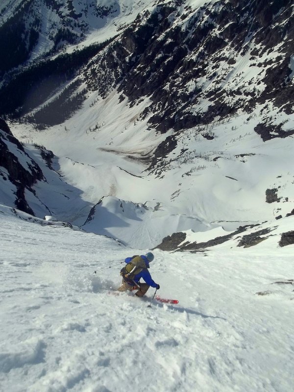
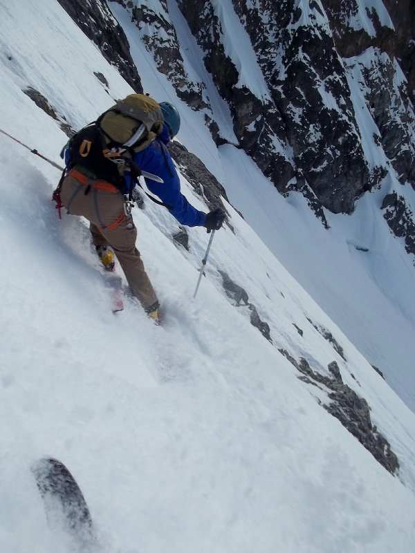
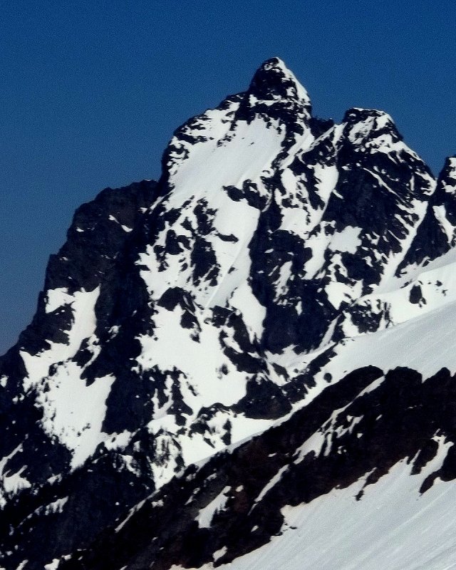
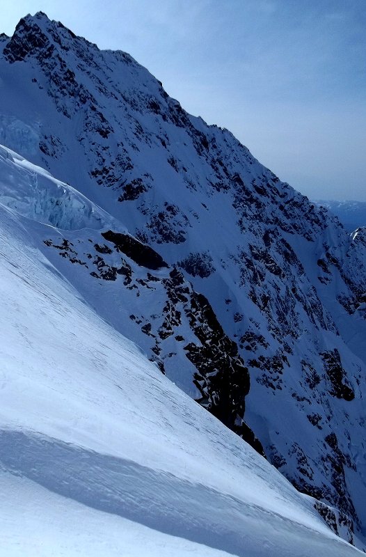
Announcing the winners of the 2013 CascadeClimbers Almost Annual Photo Contest presented by American Alpine Institute. First, thanks to our wonderful sponsors who stepped up in a major way this year to offer the most prize value we have ever had. Sponsors are American Alpine Institute, Rab, Seattle Bouldering Project, and Mountain Gear. Big thanks also to BackcountryGear in Eugene. Second, thank you to all the entrants. This year did not disappoint and we again had some remarkable submissions. Hopefully next year we can offer a better system for display and voting which gives these photos justice. Third, we will be announcing some random winners in the coming days we just need to do some nerdy database stuff to select some winners. The Winners by Category! Rab Alpine Category -- Rab Xenon Jacket goes to JasonG AAI Cragging Category -- $330 AAI Gift Cert goes to bramski AAI Scenic Category -- $330 AAI Gift Cert goes to wfinley Mountain Gear Skiing & Boarding Category -- Mountain Gear Backcountry Essentials Avy Package goes to Alasdair Seattle Bouldering Project Bouldering Category -- 6 month pass to Seattle Bouldering Project goes to Winter Rab Ice Category -- Rab Infinity Jacket goes to lukeh Humor Category -- $120 BackcountryGear.com + (2) 1 Month SBP passes goes to scottwesh Lastly the new AAI Video Category -- $330 AAI Gift Cert goes to lukeh big pimpin sandbagger Winners. Drop me a PM to claim your prizes.
-
 Trip: Blade Runner FA + info on 18 new routes at Shangri La, X38 ONE PAGE PRINTABLE TOPO ADDED BELOW. Date: 10/12/2012 Trip Report: Blade Runner First Ascent (Shangri La new route info follows). We like to think that our best days are ahead of us. As climbers, we believe that if we train harder, learn new techniques, and buy the right gear we’ll break through to a new level. This works for a while, but the tides of time are against us. At some point we must pass our high water mark. Most of us won’t recognize this milestone until months or years later, but sometimes you know when it happens. Mine was 8am on October 12th, 2012. For 15 years I’d been on a 5.9 to 5.10 plateau. There were always excuses. Grad school, post-doc, start-up, kids, remodel. Years of weekend warrior climbing rolled past. The tide finally turned in 2006 when I took a job across the street from the UW climbing gym. I started bouldering regularly and met new partners. Two of them, Alex and Scott, opened up my eyes to the world of new route development. Together, we put up a handful of 5.9 and 5.10 lines in the Deception area of Exit 38. That summer I climbed my first 5.11 in 15 years. 5.11 is barely a warm-up for strong climbers, but for me this was a breakthrough. For almost two decades, 5.11 had been a psychological barrier, an impenetrable ceiling through which I thought I would never pass again. This made me wonder what my potential really was. At 38, I knew I didn’t have long to find out, so I set a goal to climb my first 5.12 before I turned 40. It was a long shot, but if I tried I might bump up to a new level and be able to climb routes that had long been out of reach. There were obstacles. I was working full time, managing our home remodel, and riding the night train of two small kids with a third on the way, but I did climb. First ascents on the Shangri La cliff at Exit 38 marked a slow but steady rise in my abilities. 2007 Guillotine, 5.10. A gear-protected corner with a sharp flake in the middle. History Book, 5.10. A gear-protected crack with an ancient piton. Small Arms Fire, 5.10. A sustained route with small holds on a steep slab. 2008 Metamorphosis, 5.10+. A two-pitch line on a 300 foot face with a mix of bolts and gear. Crouching Tiger, 5.10+. A route with sloping features and rock as rough as #100 sandpaper. Forty came and went without a 5.12 redpoint, but I did climb some great 5.11s around the Northwest. The following year, I found three spectacular lines at Shangri La at my limit. To climb them, I had to learn a new process: find solutions for each crux, rehearse the moves, draw a detailed map, visualize the sequences, work to link sections, and then go for the redpoint. This type of mind/body training is not new. Tony Yaniro was one of the first US climbers to build a training wall that simulated the specific movements he needed for his project. Top climbers of the day scoffed at his approach, calling it cheating, but our bodies are remarkable machines that adapt to the challenges we present to them. If you want to get good at pull-ups you train by doing pull-ups. If you want to get good at certain climbing moves you train by doing those moves. In 1979, Yaniro’s training paid off when he established The Grand Illusion, then the hardest route in North America. On the mental side, repetition of movements creates muscle memories that allow our bodies to perform complex motor functions. Once these muscle programs, or motor engrams, are mastered they can be played back with minimal conscious input. Watch a toddler try to eat with a spoon for the first time and you’ll appreciate how complex this task really is and how much focus is required to learn new tasks. What enables us to eat our cereal without spilling while walking down stairs and talking on the phone? We’ve mastered each of these tasks through repetition. Interestingly, we can also train for complex movements through visualization, or virtual rehearsal, where we imagine ourselves performing the task. Thus, training your mind actually trains your body, and vice versa. Achieving mastery of complex motor functions allows us to focus on higher levels of control, such as managing fear, optimizing arousal levels, relaxing unnecessary muscles, and staying focused in stressful situations. Even strength can be traced back to mental training, when we consider that strength training is driven by motivation, discipline, planning, and self-assessment. Free your mind and your body will follow. I started using these tools and was able to do three 5.11 first ascents: 2009 Free Radical, 5.11-. A striking line on an exposed arête. Hidden Dragon, 5.11. Four different cruxes spread over a hundred feet. Hypertension, 5.11+. A hard opening and then several more cruxes. But I still hadn’t climbed 5.12. The few I'd tried felt impossibly hard. It didn’t help that I was spreading my energies across different sub-disciplines: bouldering indoors, setting routes in the climbing gym, climbing routes outdoors, developing new bolted routes, and climbing in the mountains a few times per year. Time was flying past. If I was going to cross the 5.12 threshold I needed to focus on that goal. In early 2010, I found my first target: Rainy Day Women at Little Si. It suited my style, with three bouldery sections separated by good rests. I found solutions that worked for me, drew a detailed map, rehearsed, and tailored my training to the three cruxes. On March 14th everything came together. The final crux, which had felt desperate on previous attempts, went smoothly and I made the redpoint. I was elated, but RDW is known to be soft for the grade, so I looked for my next target. I’d heard Lay of the Land was good, so we gave it a try. As before, I made a plan, drew my map, visualized the sequence, and trained for the crux. I planned to skip a bolt near the end that was difficult to clip and created rope drag. The second trip out I made it to the anchor but missed a key foothold and fell trying to clip the chains. I added that foothold to my mental map and sent the route on our next trip. The satisfaction of climbing a route is usually immediate and fleeting, but this was deeper and grew over time. One route might be a fluke, but not two. I’d started across the elusive 5.12 threshold. Two months later, I bolted a spectacular line at Shangri La that I knew would be in the 5.12 range: Skullduggery. It was continuously overhanging, sustained, and technical. New routes are particularly enticing for me because they represent unsolved puzzles on unexplored terrain. Maybe a few will become classics that people will climb for decades to come. Skullduggery had all the right ingredients, but I couldn’t link the moves. Psychology shows that motivation is highest when the chance of success is around 40% to 60%. Above 80%, we assume we’ll succeed and don’t bother preparing. Below 20%, we probably don’t think it’s worth the time and effort to try hard. But it’s not that simple. Creativity, visualization, rehearsal, and route-specific training can dramatically increase the odds of success on a route. Finding a solution to the crux that matches your skills and strength might increase the overall odds of success from 2% to 20%. Rehearsing sequences makes you more efficient and gives you more energy for the final cruxes, perhaps increasing the overall success rate from 20% to 60%. But you have to choose the right objectives. Skullduggery was a perfect goal for me in 2010 because it represented a possible first ascent just beyond my limit. I drew a map that detailed 68 hand and foot movements, rehearsed the moves, and trained for specific movements. Being strong enough to do the moves doesn’t guarantee success. The proper mental state is also essential. I needed to be calm but psyched to give 100%, energized but relaxed, and, perhaps most importantly, focused on the process and not on the outcome. Zen. On a cool summer morning in July of 2010, after two weeks of rehearsing and training on a fixed line, I went up with Jens to go for the first ascent of Skullduggery. Fortunately, that morning I was in the zone, that rare space where mind and body perform seamlessly as one. It was almost as if I was a detached observer watching a carefully choreographed gymnastics routine. I sent the route first go. Oddly, it was both anti-climactic and deeply satisfying. Skullduggery was the hardest route I’d ever climbed and is definitely harder than the four other 5.12a routes I climbed in 2010. As far as I know it hasn’t been repeated. Fifty feet left of Skullduggery is a clean overhanging face whose crux involves improbable moves on a protruding blade of rock. This feature inspired the route’s name: Blade Runner. The day I climbed Skullduggery, Jens and I tried Blade Runner. We could do the opening moves but were completely shut down by the crux. There were features, but we couldn’t work out how to use them. My brain wrestled with this puzzle on and off over two years. I would envision a solution, get excited, and go try it. Each time, I was shut down and went home thinking I would never climb the route. But I kept turning the puzzle over and over in my mind. In the summer of 2012, I made a close inspection of all of the features on the route and started working in earnest to find a solution. Idea #1: Grab two sloping holds and do a huge dynamic leap to an undercling and sloper that must be caught simultaneously. Fail. The slopers aren’t as positive as they look, the footholds are crappy, and the catch holds are too far away. Idea #2: Lie back up the left side of the blade. Fail. This is very strenuous, and the blade ends well below the next set of holds. Idea #3: Knee bar up the cleft left of the blade. Fail. The wall where you place your feet slopes away so this is challenging, and the knee bars end where the blade ends, well below the next set of holds. I wasn’t making any progress. Truth be told, there were times I was tempted to chip a hold. A tiny foot chip on the blade, or an incut in the arch, might allow me to get past the crux. I have a chisel and hammer. No one would know. But I would. And I would be bringing the route down to my level instead of meeting the challenge presented by nature. So I refrained, as I always have, even if it meant I would never climb the route. Instead, I started to break the problem down into smaller puzzles. Idea #4 and Solution Part 1: I figured out I needed to lie back on a vertical sidepull above the blade to reach the next set of holds. Getting to the vertical sidepull became the new crux. I tried to get my left foot up onto a high hold to set up the lie back. Fail. I can’t get my foot that high without falling because the handholds aren’t in the right positions. Idea #5 and Solution Part 2: I figured out I could get a heel/toe cam on the flat wall of the blade and use this in opposition with the sloping rail to move up to the vertical sidepull in a compression sequence. The new crux became the transition between the compression sequence and the vertical sidepull. Fail. If you compress too hard you fly off when you try to bump your hand up to the vertical sidepull. But this can be fixed. Idea #6 and Solution Part 3: I needed to work out how to move into and through the compression moves, maintaining high body tension, without pushing myself off when I made the bump to the vertical sidepull over my head. Small adjustments to foot, hand, and body positions, as well as force angles and force magnitudes, were going to be critical. After many hours on the rock I found an optimal combination and could just barely make the compression to sidepull transition. I’d solved the hardest part of the crux but still needed to move over to the next holds out left. Idea #7 and Solution Part 4: Maintain tension and pinch the blade between my feet to push out left to a crimp. This feels strange, but it works. The opening moves needed to be more efficient so I would have enough energy for the crux and the hard moves beyond it. The section after the crux would provide unexpected challenges and an amazing sequence as well, and, of course, I would need to link it all together, but I was zeroing in on my solution. I wrote a map that detailed 75 precise hand and foot movements from start to finish. After each work session I updated this choreography. Now I needed to link the sequences together, figure out where and how to clip the bolts, and train my mind and body to perform the route. To prepare for Blade Runner’s crux, I trained to compress two sloping sidepulls while maintaining high core tension and balancing on my right tiptoe. From this position, I had to bump my right hand to the vertical sidepull over my head. What had once seemed impossible was beginning to loom on the horizon as something I might just pull off. But time was running out. It was October. We’d had the longest continuous run of good weather in a decade, but the winter rains were on the way. I trained for the specific movements I needed for the route, rehearsed and refined my solution for the crux, worked out the most efficient path for sequences before and after the crux, and started to put it all together. When mind and body are primed for peak performance there is a window of opportunity to break through to a new level. I had entered that window for Blade Runner, but it wouldn’t be open for long. On October 6th, I went out with Ed to try to climb the route. Unfortunately, I had a cold and was on pseudoephedrine. Attempt #1: I moved smoothly through the opening but fell at the crux due to lack of body tension. I rested, but the pseudofed wouldn’t allow my heart rate to return to baseline. Attempt #2: I got through the crux but fell on one of the last hard moves after burning too much energy clipping the last bolt. Attempt #3: I made it through the crux but fell below my previous high point. Attempt #4: I fell at the crux, too spent to maintain enough body tension to make the bump to the vertical sidepull. I needed a little more strength, a better foot sequence after the crux, and a better strategy for clipping or skipping the last bolt. We went home. I rested on Sunday, did movement-specific training on Monday, refined my foot sequence, and planned to skip the last bolt. I felt ready, but the Fates were about to intervene. The long-range forecast showed a wall of rain coming on Friday, October 12th that would shut us down for the season. Several partners said they could go out on Saturday the 13th, but that would probably be too late. My window was about to slam shut. I was 44 and had three growing kids, a growing list of minor injuries, and a job that was growing more fun and more demanding. There was no guarantee I’d be strong enough, healthy enough, or have enough time to climb Blade Runner in 2013, or perhaps ever. I made two back-up plans. The first was duct tape. Blade Runner is steep enough that only three of its holds get wet after a light rain. I dangled from the rope and fashioned duct tape tents and drain systems for these holds in case I had to make an attempt on Saturday in the drizzle. The second plan was to call Jens and ask if he would go on a Friday dawn patrol mission. Thankfully, he knew how much I wanted this and was willing to give it a shot despite a mediocre forecast that showed rain starting around 10am. We planned to leave my house at 6am. My wife would take the kids to school. Thursday evening I ate a hearty meal, got the kids to bed, packed the gear, took a hot bath to relax the body and mind, and went to bed early. Then my wife’s pager went off. A patient in Bellingham needed emergency surgery. If the patient came down Friday morning I’d need to take the kids to school and we wouldn’t get to the crag until at least 10. By then it would probably be raining. Kids and patients come before climbing, of course, but it felt like the Fates were taunting me. The patient came to Seattle at 11pm, and my wife did surgery until 1am, so I was free to go at 6am as planned, assuming there were no more emergency calls. There weren’t. I woke at 5:20am. It was pitch dark, but I saw water running down the window and heard rain gently pattering on the roof. Everything was wet. I looked at the forecast for North Bend. 70% chance of rain for 7am and 8am, 30% for the rest of the morning, then 60% for the rest of the day. The window had slammed shut. Should I text Jens and tell him to stay in bed? I’ve worked too hard to give up now, and he was probably already on the way over. Let’s just go take a look. Jens arrived at 6am and we drove East through the rain. There was no wind. The wall of rain was marching slowly and steadily East toward Blade Runner. Was the crag wet? Would the duct tape keep the holds dry? There was no way to know until we got there. Amazingly, we emerged from the leading edge of the advancing rain when we reached North Bend. I turned the windshield wipers off. The highway was dry. We got to the trailhead just before 7am. Everything was still dry. Either the sky was about to open up or the forecast I’d seen was wrong. We would soon find out. We hiked up to the Shangri-La cliff. Temps were cool. The rock was dry. All was calm. We didn’t know how much time we’d have before the wall of rain was upon us, but I needed a warm-up so we quickly climbed Crouching Tiger. Then it was time for Blade Runner. I knew I wouldn’t have enough strength for a lot of attempts, and the rain could start falling any minute, but I stayed calm. I was ready. I’d climbed the route many times in my head. It was time to climb it in real life. I tied into the rope, put my shoes on, climbed up to clip the first bolt, and then climbed back down again. I closed my eyes and breathed slowly in and out, in and out, to get my heart rate down. After a few minutes, I opened my eyes and cast off: crossover from the undercling into the first lieback, twist my left leg as I move into the second undercling (the opening flowed smoothly) clip the bolt at the crux, set my heel-toe cam on the blade, move smoothly into the compression sequence, tense the core, bump to the vertical sidepull (my mind was empty but focused) pinch my feet on the blade, press to reach the small crimp out left (I was now through the crux but had fallen past here before) keep weight on small footholds, skip the last bolt, deadpoint to a good hold (just a few more hard moves) reach left to the pinch, pop to the undercling (almost done now - breathe) cross through with the feet, balance on two slopers, lock a heel hook down, and move to the final sloping sidepull...Clip. Clip. It was done. The impossible dream had been realized. It was 8am on October 12th, 2012. I’d reached my high water mark. Jens tried the route, and then we removed the quick draws and pulled the rope. By the time we reached the car the rain had started. It wouldn’t stop for over a month, and the whole cliff would be soaked until spring. Blade Runner was one of the most rewarding experiences in my 22 years of climbing not because it was the hardest route I’ve ever climbed, but because it required a huge mental and physical investment that pushed me beyond my perceived limits. I’ll probably never climb a harder route. I’m OK with that. But twenty feet right of Blade Runner is an even steeper, more intimidating line that looks amazing. I’m sure it’s way too hard for me, but maybe I’ll just go take a look... ……………………. Shangri La Details on 18 new routes in the Shangri La area of X38 -Please pack out all trash. Obvious pathways away from the crag are on the lower approach so please don't soil them with human waste. Please leave carabiners on anchors for lowering a la Nason ridge. Enjoy! ………………………… Most of these routes get good sun exposure and dry fast. The start of History Book and one section of Guillotine are prone to seepage after a lot of rain, but most other routes dry quickly. Blade Runner and Skullduggery face South and are best climbed in the early morning or on a cloudy day. Metamorphosis faces East and can be hot on a summer morning. Route distribution*: 5.8 3 5.9 1 5.10 7 5.11 5 5.12 2 * - Ratings are subjective. Proposed ratings are suggestions based on how the routes might compare to similar routes at the Lower Town wall at Index. I will enter these on Mountain Project. Feel free to suggest your own ratings so we can arrive at a consensus. …………………………………….. Printable topo Approach notes: Orientation: The Far Side area of X38 has several East-facing crags in a line: Interstate Park, Eastern Block, Squishy Bell, and Headlight Point crags. Ellie's Sweet Kiss is a very popular route in the middle of Interstate Park. Shangri-La is on the Eastern and Southern faces of the large rock formation across the giant talus field East of these crags. A few Far Side maps: Driving map Roads and topo for X38 Far Side Crags map Far Side trails The trails map is not to scale. Winter Block is almost directly above Shangri La. Hiking directions: Go to the Far Side parking lot. Start up the trail that starts just N of the bridge over the SnoQ river. When the trail forks go left, then an immediate right/straight, cross a wet area on a tiny boardwalk, then go left. Gritscone is in front of you at this point. Follow the wide trail, avoiding turnoffs to the right. When the trail steepens turn left into the forest at a small saddle. Follow the trail up steeply to the where it flattens out. Turn right on one of the side trails and make your way to the line of cliffs that includes Interstate Park, Eastern Block, Squishy Bell, and Headlight Point. Shangri La is East of the obvious talus field East of these cliffs. There are two ways to approach Shangri-La from the talus field: 1 - Aim for an obvious dead snag on the buttress that is about the same level as Ellie's Sweet Kiss. To get there, follow a series of easy but exposed ledges that start below some brush on the E edge of the talus. Pass below a large pine and head to the dead snag. From the snag, scramble down about 25ft of 4th class to the East. This brings you to the base of the wall. The first obvious feature is History Book, a left-leaning dihedral. You may notice some chains at the top of the face near the dead snag. This is the anchor on Small Arms Fire, which is a rap in and climb out route. 2 - Follow the talus down to the bottom of the buttress, cross under the bottom of the buttress on a faint trail that passes a giant tree with a cable on it. When you get to a smaller talus field, go straight up hill. When the talus ends at the forest go straight up to the base of the Shangri-La crag with History Book and Guillotine and Skullduggery. You'll know you're in the right place when you see a giant corner with a huge flake about 40 feet up (Guillotine), and several bolted lines. To get to Metamorphosis and Magic Carpet Ride, go right at the top of the little talus field mentioned above. View of the talus and upper and lower approaches from the top of Ellie's Sweet Kiss. Looking back past Shangri-La with Ellie's Sweet Kiss in the background. Looking up at the 4th class scramble. It's easier than it looks. ……………………………………… The following routes are on a wall on the left side of the guillotine corner. From left to right: Science Friction = 5.10d bolted face with two friction cruxes. Left of History Book. 5 bolts. 15 meters. FA Roberts, August, 2012. History Book = 5.10a trad crack in a left-leaning dihedral. Follow the crack to chains at the top of the cliff. DO NOT trust the ancient rusty aid piton! A standard rack will suffice. 20 meters. FA (ground-up onsight) Roberts, August, 2007. Crouching Tiger = 5.10c bolted roof and face climbing. Start 10 feet left of History Book, head up and right to the first bolt, and then go straight up over a series of small roofs. 8 bolts. 20 meters. FA Roberts, October, 2008. Hidden Dragon = 5.11c (11+ if shorter than 5’9”) bolted face and roofs. Start 8 feet right of History Book. This route has four different cruxes, multiple roofs, and a clean upper dihedral. 12 bolts. 29 meters. FA Roberts, July, 2009. Hypertension = 5.11+/12- bolted face and roofs. A stick clip might be wise as the bouldery crux is off the ground. Requiring power, balance, and body tension, this route will test your versatility. 13 bolts. 28 meters. FA Roberts, September, 2009. Guillotine = 5.10b trad crack and flake in a giant corner. Enter the corner near the first bolt of Free Radical (a solid cam can be placed at the lip if you’re a purist). Climb up to and past the namesake flake on the right wall and follow the corner to its end. Then clip a fixed nut and make some airy moves up and right to the chains. A standard rack is fine. 22 meters. FA Roberts, August, 2007. Free Radical = 5.11a bolted route on the arête right of Guillotine. Outstanding moves in a great position. Shares an anchor with Guillotine. 9 bolts. 22 meters. FA Roberts, August, 2009. Hangman = 5.10a bolted face and roof with fun friction moves at the top. This starts at the Guillotine/Free Radical anchor and goes a full 30m to chains. You can link Free Radical and Hangman for a 52 meter pitch. You'll need about 23 quickdraws to get up and a 60m rope to get down. 13 bolts. 30 meters. FA Roberts, June, 2007. The following routes are on the overhanging face right of Guillotine: Bladerunner = 5.12c? (5.11 to V6 to 5.11) overhanging bolted face on pristine rock. Unrepeated. This route takes a striking line up the super-clean, overhanging face right of Free Radical. It has a devious crux that requires core strength and creativity. Easy to top rope after climbing Guillotine or Free Radical, but be sure to use the Bladerunner anchor as there is a sharp roof above that could damage the rope if you TR from the Guillotine/Free Radical anchor. Overhanging, South-facing exposure keeps this route dry most of the year. 4 bolts. 10 meters. FA Roberts, October, 2012. Skullduggery= 5.12b? Unrepeated. A bit of skullduggery (an act of trickery or deception) may be needed to get up this steep, technical, and sustained line Overhangs 17 feet in its 40 foot length. Starts fifty feet right of Free Radical. A worthy test piece. Use the hand line to ascend the slab. Belay/start at the bolt and fixed cam that anchor the hand line. 5 bolts. 13 meters. FA Roberts, July, 2010. Open Project = 5.12+ or harder route on an overhanging face right of Skullduggery. Bolted. The following routes are on walls around to the right from Shangri-La. To get there, descend a trail about 100 feet and then veer left into the next amphitheater. Three routes are ready for climbers: Meta Cliff: Metamorphosis = 5.10d adventurous two pitch line up the center of a 300ft face. If you stand at the giant tree, look up and left at a big face. Metamorphosis p1 (10+) climbs up the center of this. The first pitch starts at a small roof at the ground, gear goes in a small crack, two bolts lead past a bulge, gear protects moves up higher, and there is one final bolt before the belay just below a large ledge (5.10+). The second pitch starts up a flake and vertical crack, moves up and left and then back right past bolts and gear, follows three bolts up thin and exposed face climbing, passes a short crack before a ledge, and ends with a bouldery finish past a bolt (5.10+). You could continue up 4th class terrain to a bolted anchor at an airy perch atop the Shangri-La cliff. Rap with one or two 60m ropes. Ropedrag might be bad if you try to link the two pitches. Note: it is best to belay for the first pitch very low at a divot in the vegetation. Start climbing in tennis shoes and change to rock shoes at the small roof. Needs an approach trail. Gear from small cams to #2 camalot. 50 meters total. FA Roberts, May, 2008. Metaphysics = 5.11R? (5.10R to a well-protected V3 crux at the roof to a 5.10 upper section). Unrepeated. This trad line follows the start of Metamorphosis to the flake below the first bolt. Place cams in a diagonal crack on the face 6ft below this flake and then traverse straight right 6 feet. Follow holds straight up and over the obvious roof. There is good protection in cracks on the slanting roof section. Climb up to the second roof, place gear, and zag up and left to the anchor at the top of the first pitch of Metamorphosis. Microcams to a single #4 camalot for the last placement. FA Roberts, November, 2011. Magic Carpet Ride = 5.8ish trad crack up a series of corners. This is on the large slabby face about a hundred feet right of Metamorphosis. Head up to a large tree. Pass this and continue up to the higher of two left-traversing cracks. Follow a series of corner cracks/dihedrals to the top of the buttress. You’ll see the scrub line. Turn the last roof on the right and follow a mossy ramp to anchors up and left. This route is about 40 meters and will get better with more traffic. You can rappel with two ropes, just barely get down with a single 70 meter rope, or rap to the tree with a single 60 and rap again or down climb. Standard rack. 40 meters. FA Roberts, April, 2008. Unnamed = 5.9ish bolted line. This starts about fifty feet right of Magic Carpet Ride. Follow a scrub line up and right toward a small roof and a bolt. Follow a line of bolts up nice but slightly dirty climbing. Bolts are in a line but some zigzagging is needed to climb past the roof. It’s about 35m to the anchors so bring two ropes. Nice moves all the way to the end. 10 bolts? FA Krawarik, 2009. The following climb is on a face above the giant tree below the buttress with the dead snag. This can be approached by rapping in from chains at the top of the buttress next to the dead snag. Direct approach from the bottom may be developed. The following climb starts at the base of a large pine just uphill from the dead snag. Drive By = 5.8 bolted arête and face in a great position with excellent views. Clip one chain, skip the next chains. Put a long runner on a bolt 15 or so feet higher, and then aim for the slab/arête feature above you. There are several bolts on the slab leading to a final mantle. Rap the route. Be careful not to drop things on parties below. 25 meters. 8 bolts. FA Roberts, Krawarik, Anderson, May, 2007. Unnamed = 5.8 trad corner above Drive By that needs some gardening but is still fun. 27 meters? Standard rack. FA Krawarik, Locke, June, 2007. The following climb is on a face above the giant tree below the buttress with the dead snag. This can be approached by rapping in from chains at the top of the buttress next to the dead snag. Small Arms Fire = 5.10c bolted face with thin, balancy moves in a great position. Rap down to the starting anchor from chains near the dead snag. Lead out or do a top belay. 6 bolts. 20 meters. FA Roberts, August, 2007. The following route is quite close to Headlight Point, on the way to the lower approach to Shangri-La. Approach: Headlight Point is the first cliff you get to when coming from the Gunshow area. It is the Southern-most crag of easy (5.6ish) climbs on the trail. Right behind those climbs, is a tree and a dirt ramp that leads a few meters down into the forest. Follow the ramp a few feet. Skirt a bush, drop a few feet along a tiny talus field, and head across to the obvious cliff. A large flat rock at the base of a tree marks the start of Third Stone from the Sun. To continue to Shangri La, follow the small cliff to its end at the giant talus field. Cross that and head for the approach that goes below the bottom of the large buttress as described above. Third Stone from the Sun = 5.11c bolted overhanging face. Lots of action in a small package. 5 bolts. 11 meters. FA Roberts, June, 2011. Photos: History Book Crouching Tiger low Crouching Tiger middle Crouching Tiger high - McClellan Butte in the background. Hidden Dragon Red line is Hidden Dragon. Green is Hypertension. Both continue out of sight above. Guillotine Free Radical is the arete right of Guillotine, which Ian is climbing here. The Guillotine flake is visible on the left. Free Radical is the arete left center. Blade Runner is right center and ends at the visible chains. Duct tape engineering on Blade Runner Skullduggery Skullduggery Yellow is Metamorphosis. Red is Metaphysics. Metamorphosis is the yellow line. I'm approaching the top of Metaphysics. Both routes share a belay. Metaphysics Metaphysics Small Arms Fire Gopro shot from the top of Small Arms Fire. The dead snag is 10 feet behind me. Third Stone from the Sun Don't forget to hit the swimming hole! stay tuned for more... THANKS TO MANY GREAT PARTNERS AND HELPERS OVER THE YEARS: Alex, Scott, Jens, Matt, David, Ed, Michael, Mike, Blake, Leland, Frank, Scott, Ryland, and others. Gear Notes: See route descriptions above. Approach Notes: X38 Far Side trails. See details and links above.
 -
 Trip: Mt. Deception + peak 7638' - east face, ne chute + east face Date: 3/31-4/2/2013 Trip Report: I left Sunday afternoon with plans to explore Royal Basin, stocked with several days worth of food an gas, a guitar, and plenty of stoke. I got there as the day was fading, and eyed a potential line on the East face of Mt. Deception. Got started around dawn and was happy to find good consolidated spring conditions low down, the snow got deeper with elevation. I was tempted to ski linked turns off the summit, but sluff management was necessary. The crux came in a gully low on the face. I first tried to ski the way I had climbed, but found it too awkward and icy so I climbed back up a little and went skiers left over a ice bulge, it was steeper but sun kissed unlike the way I had climbed. I skied down to the floor of the basin and was so stoked I decided to climb and ski the NE chute. Conditions were a little crusty in spots but not bad, it is a beautiful line and was very fun to ski. That night was cold and windy and I didn't get much sleep. In the morning I half dozed in my sun warmed sleeping bag for a while enjoying the sounds of the wind through the trees. My plan was to slog out that day. On the way out I saw an alluring east face and decided to go for it. It was awesome, a little shorter and steeper than the east face route I skied on Deception. On my drive in, I came across a stranded couple walking down the road, they had listened to their radio too long roadside camping and killed their battery. I didn't have jumper cables but I obliged to letting them swap out my truck battery for a few minutes. IMG_0010 by danhelmstadter, on Flickr Mt. Deception east face by danhelmstadter, on Flickr IMG_0031 by danhelmstadter, on Flickr IMG_0046 by danhelmstadter, on Flickr crux, icy neve in the shade. IMG_0049 by danhelmstadter, on Flickr IMG_0039 by danhelmstadter, on Flickr East face of Needles peak 7638' on left IMG_0081 by danhelmstadter, on Flickr needles by danhelmstadter, on Flickr View south to Deception IMG_0097 by danhelmstadter, on Flickr IMG_0104 by danhelmstadter, on Flickr 7638' from lower down IMG_0114 by danhelmstadter, on Flickr
 -
Trip: Big Four - north face Date: 3/25/2013 Trip Report: Eric and I left Sunday afternoon and bivied near the ice caves at the base of Big4. We got there just as the sun was leaving. I hadn't seen that part of the Mountain Loop before, and was in awe of the impressive face above. Ski conditions looked questionably thin in many places on the face, I think we both thought that our planned effort was likely going to result in us turning back from poor conditions, but we did have a light rack and thin rope to deal with minor shenanigans if need be. Early in the morning we started up through a tricky cliff band next to a resonant waterfall. The climbing involved some monkeying around on vegetation since there was a lot of rotten snow over rock. Once above, we traversed a broad sloping bench to gain the central rib. The rib held knee+ deep unconsolidated pow. The going was slow, and we alternated skins and booting. From the road, there looked to be a few potential options on the face. We climbed up with those options in mind, and let the conditions dictate our direction. We ended up making an unplanned climbers left traverse then up a right trending icy gully to easier ground that led to the summit. The skiing was great. We found some variable and ice in spots, but there was also a lot of powder. The rib especially held amazing quality snow and really fun featured terrain. We didn't want to exit the face via the waterfall cliff band we had climbed up, so we traversed left, but missed the snow exit and ended up making a short rap off a tree. our line on big four by danhelmstadter, on Flickr 100_2367 by danhelmstadter, on Flickr bigfour by danhelmstadter, on Flickr 100_2392 by danhelmstadter, on Flickr 100_2398 by danhelmstadter, on Flickr 100_2403 by danhelmstadter, on Flickr 100_2408 by danhelmstadter, on Flickr variable conditions in steep trees by danhelmstadter, on Flickr steep trees by danhelmstadter, on Flickr 100_2426 by danhelmstadter, on Flickr 100_2419 by danhelmstadter, on Flickr bigfourtwo by danhelmstadter, on Flickr
-
Trip: Three Fingers - east face couloir Date: 3/9/2013 Trip Report: On days when it's not raining, There's a great view of Three Fingers from eastbound 20 out of Anacortes. Sometime recently I made that drive on one of those days when the sky is fine art. Cool cloud formations and late afternoon sun hit the mountain just right, and got me thinking about going up there for a closer look. The approach went well, the bush'wackin wasn't very grim, and I made it to my bivy spot by a boulder near the foot of the slope below the east face with time left to kill. I started my ascent in the dark hours of the morning, and soon my decision to leave skins behind became a nagging regret. The snow went from supportable easy going, to variable knee deep, but with a few healthy curses I made it to the base of the couloir before the sun started really cooking the wall above. Conditions made for slow going up the couloir. To make it easier, I followed the edge of a runnel that hugged climbers right. I kept my head up as much as possible to watch for big sh*t, there was debris coming down everywhere. Most of it small, but I did get bashed a couple times. The couloir topped out on a high shoulder, and I continued up moderating slopes towards the middle summit. The snow was much different above the shoulder, about a foot of consolidated cold snow overlay an ice crust. The entire ridge line was corniced except for a little notch just right of the rimmed summit nub. I aimed for that notch. I was about about 20 feet below it when I felt and heard a sickening WUMPH. No slab cut out, but It was a clear indication of instability in those final feet below the ridge, and the consequences were high. I backed off a few steps and clicked on the skis. Ski conditions were good, the slight double fall line nature of the couloir naturally managed my sluff. Timing seemed about right since the sun had softened up the icy parts, and left the couloir just after I skied it, I suppose I could have got started a little earlier to help avoid the ice/rockfall on the climb. 100_2229 by danhelmstadter, on Flickr Stoked about my new crampons from Jim's shop. 100_2226 by danhelmstadter, on Flickr John Scurlock photo John Scurlock image by danhelmstadter, on Flickr climbing above shoulder shoulder by danhelmstadter, on Flickr 100_2243 by danhelmstadter, on Flickr 100_2254 by danhelmstadter, on Flickr morning sunhit morninglight by danhelmstadter, on Flickr 100_2228 by danhelmstadter, on Flickr
-
Trip: Distal Phalanx - Busted Distal Bicep Couloir Date: 2/10/2013 Trip Report: I woke in the bed of my truck five minutes before my alarm went off bleary eyed to headlights from an approaching car around the bend of highway 20 near it's west side winter closure. At that hour of morning it could only be my friends Ryan and Eric who had already been up and driving for hours. It didn't take very long before we found ourselves scrambling in the dark up steep muddy embankments and unpredictably punching through the shallow rotten snow in the bush of Colonial Creek. We reached it's headwaters at the crack of dawn, welcoming open blue skies and deepish light snow. At one point on our upwards zigzagging, I caused a snow bridge spanning a large glide crack to loudly fail just by getting too close. From a col high on Colonial, we looked far across the Neve drainage to the beautiful couloir on Distal Phalanx that was our ski objective. By that time, it seemed doubtful we'd make it since the day was already getting old. We talked about our options, and changed our minds several times. The difficult conditions and amount of elevation gained had ate up a lot of time, and we knew we would be setting ourselves up for an epic by continuing towards Distal Phalanx. Still collectively undecided, Ryan said something about epic days being memorable, the logic seemed right, the beautiful an slightly scary view of the couloir on such a bluebird windless afternoon seemed to call us at that moment of indecision, and we dropped down to the valley towards the Distal Phalanx with smiles. We alternated trail breaking up the deep snow in the couloir, dodged a couple ice chunks, found some wind affected snow, and topped out to find the sun low and red on the horizon. I was last to drop in, and triggered a slab after just a few turns. Eric and Ryan were in safe zones on the side of the couloir as the lanch trucked past them. It got dark quickly and we skied the lower section with headlamps. Hours of skinning back up to the col under starlight followed. We got a bit turned around high on the Colonial/Neve/Paul Bunion's Stump massif, but found the way with not too much sweat, and skied mostly enjoyable powder down through a developing marine layer to Colonial Creek. We milked what we could of the deproach through the woods on skis, we had to pack the skis when it got too patchy and clustered with deadfall to ski. We still had a ways to go. The snow was rotten in spots so every 20 steps or so, one of us would unpredictably punch through, with unseen hazards below, and we were sidehilling next to the creek which was steep in places. Somewhere near our creek crossing Ryan took an unlucky digger from punching through the shitty rotten snow in a bad spot, and hurt his arm. His bicep looked weird and he couldn't bring his forearm up very far. Ryan is one tough dude, I could hardly tell he was injured as we made our way out, even though I knew he was in pain. Eric and Ryan drove back to Seattle that night. I just heard from Ryan that his Distal Bicep tendon is torn. In all we gained 11,000+ feet of elevation and took 22.5 hours car to car. It seems that there are several approach options, and in 20/20 hindsight, it is clear that we chose an approach that given the conditions we found, may have not have been ideal. I didn't take many pictures, and this one below is courtesy of Ryan. The Busted Distal Bicep Couloir is in the distance. Ryan Lurie Image by danhelmstadter, on Flickr climbing by danhelmstadter, on Flickr lateday topout by danhelmstadter, on Flickr 100_2161 by danhelmstadter, on Flickr
-
Trip: Shuksan - Circumnavigation + Summit Date: 1/21/2013 Trip Report: In our eternal quest to get a sunburn in every month of the year (turns out you can get burned in January in the North Cascades), Gord, Kit, Chad and myself made plans to spend a couple of days on Mt. Shuksan. Chad had driven all the way in from southern ID for a N. Cascades sampler, and the conditions lined up nicely to get him way up high in the range.On the way out of the lot on Sunday morning we ran into the one and only Daniel Helmstadter, newly back in ass-kicking action. He promptly dropped us like we were standing still (which we did frequently based on the silly overnight loads we carried), and we never saw him again. He had a First Descent on the south side of Shuksan to get to, but I'm somewhat certain he has teleportation abilities as well. That man can move! We, however, took our time getting to camp at the top of the Fisher Chimneys, but still arrived with time to watch a spectacular afternoon. We didn't even need to level a spot for the Megamid- fantastic! In the late afternoon we saw Jason4 and a group head down Winnie's slide The night was as long as expected, but not too cold. We were reluctant to leave our sleeping bags and camp in the morning, not rolling until around 0800. Up the Upper Curtis, through Hell's Highway, and up the Shulphide to the summit gully, we found ourselves booting up to the tippy top around noon. We ended up belaying a short bit from the gully to the summit ridge, mostly on the way down. Dan had kicked some great steps that made a lot of it easier. Unlike him though, we left our skis at the base. What a view! The summit of Shuksan never disappoints, but especially in winter. Wow. Chad was suitably impressed as the view was a bit different than the Tetons (his home range). We had the summit to ourselves, naturally, but couldn't stay too long due to the short days. We returned to our skis at the base of the summit pyramid and proceeded to circle the mountain's north side via the Crystal and Hanging Gls. A scenic way to complete the tour, and we were back at camp without too much delay. Packing up camp went quickly,and soon we were faced with the unpleasant ski down the VERY firm White Salmon with full packs. That was certainly a theme on the trip- great climbing conditions but generally poor ski conditions. Ski crampons were very useful. We battled the usual shenanigans in the valley bottom, getting back up to the parking lot around 1730. The gate wasn't locked, and we were soon in Kendall wishing Gord well on his way back across the border. Another North Cascades adventure complete! Pics: Skinning up the White Salmon Camp Chad admires the view north Gord exploring above camp Baker from camp Lower Curtis Icefall Dan, you are THE MAN. I think there are two of his First Descents visible, maybe more. Topping out on Hell's Highway Skinning up the Sulphide In the Summit gully Kit topping out on the summit ridge On the summit Looking east to Icy, the Pickets, and beyond Dropping onto the Crystal Gl. Pausing at the transition between the Hanging and Upper Curtis Gls. Skiing the Upper Curtis Gord hanging on near Winnie's Slide Gordo Fausto always leads the way for his North American clients. What a handsome man! Gear Notes: Ski crampons, whippet, boot crampons, axe, helmet, rando rope- all useful and used. Approach Notes: Park at the White Salmon Lodge. You can't miss it.
-
Trip: Mt. Shuksan - South Couloir Date: 1/20/2013 Trip Report: I am so happy to be out and about pain free in the mountains again. I've been plagued by a nasty debilitating hip pain since summertime. I tried a bunch of different treatments for it, none seemed to work until I got a shot of cortisone in the bursa at the top of my femur bone a few days ago. Phew. A couple days before I got the shot, I was taking a lackadaisical drive up the Baker Lake road with my dog. I noticed a striking line on the South side of Shuksan. south couloir by danhelmstadter, on Flickr I formed a plan to go explore it - if my hip ever got healthy, which I was doubtful it would. The first part of the day felt like a familiar Shuksan experience, I got a bit of a late start (but was able to grab a coffee and use the facilities at the White Salmon Lodge), snow was good for travel, good weather etc... I was stoked to run into my friend Russell Cunningham on the White Salmon. The summit was beautiful, and the pyramid gully skied ok. summit by danhelmstadter, on Flickr I was a bit reluctant to start sking towrds the South Couloir for several reasons, and almost wanted to go check out the NW Couloir. But with the thought that I could always turn around (moon + good weather) I proceeded as planed. I dropped in and enjoyed great springlike snow with some variable in places as to be expected. The couloir is about 2000 vertical feet, and the whole South face about 5500'. Towards the bottom of the couloir the slope steepened then cliffed out. I made a steep downwards traversy scramble on mixed shallow rotten snow, ice, and chossy rock. Luckily the rock had enough solid positive holds. It was scary and felt a little dangerous at times. scramble by danhelmstadter, on Flickr 100_2150 by danhelmstadter, on Flickr A bit more steeps after the scramble, then wide open slopes with heavy snow. I stuck to skiers left through the trees for the remaining skiing, to avoid cliffs that lie everywhere else at the bottom. It was getting dark as I reached the valley at 2000' elevation on the Baker Lake side. I skinned many moonlit hours up to, and over the Shuksan Arm back to my truck at White Salmon. More Photos... roll at top of the south face roll by danhelmstadter, on Flickr Couloir entrance couloir entrance by danhelmstadter, on Flickr zoomer zoomer by danhelmstadter, on Flickr sundown set by danhelmstadter, on Flickr
-
Trip: Incredible Hulk - Positive Vibrations Date: 9/3/2012 Trip Report: I concluded a really fun six week summer road trip with this stellar route. I’d done it before in 2009 but it is worth doing again and again. Jed and I met up in Reno, I was driving from the Tetons where my wife and I had just had a blast climbing the Exum Ridge and Irene's Arete. Jed flew in from Chicago. We got our permit early the next morning and we made the hike in to the base in two hours from Twin Lakes. Hulkamania: We had enough time that we really could have done the Red Dihedral that afternoon but I figured we’d want to be feeling pretty fresh for the PV. Jed started us off the next morning at first light, climbing awkward cracks with a distinct 10a crux passing a small roof. I fired us up the next pitch, a short 10c tips splitter and some easy but runout face climbing that gains two bolts on a nice belay ledge. First pitch: Jed continued up the 5.8 corner above, then across the delicate traverse which ends with a somewhat spicy, but short, sideways 5.11a sequence to gain a handjam, then a jughaul to the belay, another pair of bolts. Beginning of pitch 3. The crux traverse is just above the roofs. Pitch 4 is 5.10c and is a great stemming and bridging corner, with two distinct bulges. Gear is anywhere you want it. I passed a set of bolts and continued up a thin and tenuous finger crack in a corner with a hard stem and crack switch right at the end, a long 50 meter pitch. Jed following p4: Jed took us up a fantastic pitch towards the prow of the Hulk’s west face. Multiple cracks lead to a single crack which begins wide and tapers to thin hands, a rather awkward and strenuous section that felt a little harder than the 10a rating would suggest, but soon gives way to an extended section of splitter hands. Pitch 5: I now tackled the crux pitch which begins in a smooth corner with intricate stemming and some pretty dicey gear; suspect tiny cams (incl. #000 and #00 C3’s), a mishmash of rp’s, and the need for long slings due to having to protect mainly in the crack on the left wall. Just after I got the gear arranged and started going for it, my foot skated and I whipped onto an HB brass nut and blew the redpoint. After a unnerving runout to the roof where you can finally get some good gear, I continued past burly underclings with crispy feet into a steep, sustained, and incredible crack that passes a bulge on thin hands. A little unnerved from the fall, I dogged it a bit through here until I got my mojo back, and then continued on up in better style as the crack becomes a stellar finger jamming extravaganza on an open wall with incredible exposure. Due to rope drag (and being a bit worked) I made a belay at a small stance just below the 5.11 crux. Up to here the pitch rates 5.10d although I thought overall it is much harder (due to being physical and sustained) than the next section of technical 5.11a fingers. Jed coming up p6: I led us past the 11a thin fingers and face sequence passing a wildly exposed overhang with a ton of air beneath the feet! I pressed the pitch another 15 meters higher and belayed below the next set of splitters. Jed leaving the belay to start following the 11a section. Exposure and beautiful rock! The next pitch begins with steep, strenuous fingers and thin hands, giving way to another incredible hand crack. The angle lets off but then the pitch gets harder, with a difficult face move to the next crack right, then cranking hard up a sustained off fingers jam crack that never seems to let up. At the end, make an improbable step down and left to gain a great belay ledge. 5.10d. Jed in Splitterville: It just stays awesome. The next pitch can go to the very top if you have a 70 meter rope and a lot of endurance and don’t mind spacing your pro, a lot. I took it only 40 meters before I wimped out and belayed; I was low on hand sized gear and our rope was a 60m. The corner starts easily enough but becomes sustained 5.10b hand and fist jamming up a very steep corner and past a roof. A short distance above the roof I made a belay in the crack system at a blockier area, about 10-15’ right of a solitary bolt on the prow that makes no sense. Jed took us to the ridge from here, moving to the right and climbing another phenomenal finger, thin hands, then hands, hands, hands crack!!! Last pitch on the wall: From here, if you don’t plan to rappel Venturi Effect (70 meter rope mandatory) continue along the ridge- not entirely trivial. Apparently you can stay right on the crest and go through a chimney between flakes, but both times I’ve now stayed down and left. This is not entirely straightforward and is rather dirty and loose. After a couple ropelengths of “mostly” 4th and low 5th you join the Red Dihedral for the final 5.8 crack and the classic wormhole exit onto a bench just below the top. Jed coming on through: Jed on the summit, psyched: This route is at least as good as the Rostrum, maybe better because it is up in the mountains, and it’s longer. The rock is flawless, if the pictures don’t already demonstrate. Go do this thing. If it’s super windy at the base, consider another route- the upper part of the route is extremely exposed as it is right on or near the prow. The next day we got a more civilized start and ran up the Red Dihedral, the third time I had done this classic. Not quite as quality as the PV, but this is sort of like saying, for example, Seasoned in the Sun in Squamish isn’t as good as Exasperator. Do them both. Now. Gear Notes: Set of stoppers including rp’s, long slings. Double rack of cams from tiny stuff (#000 or grey tcu) to #3 BD camalot, with triples from 0.3 BD to #2. Nothing bigger than a #3 needed. Could avoid some of the triples perhaps, but most pitches are quite long so you either would have to break them up more, or run it out a fair bit. 70 meter rope could be useful especially if wanting to rap Venturi Effect. I’ve heard that rope hangup can be an considerable issue if choosing that course. Approach Notes: Climbers trail seems to get better by the year. Supertopo beta is out of date, there’s now a good log crossing and no wading in swamps is needed. Trail begins climbing the slope well to the looker’s left of the canyon entrance, then eventually traverses into the canyon. 2-3 hours from Twin Lakes. Bikes are NOT ALLOWED any longer on the initial part of the trail.
-

best of cc.com [TR] Ptarmigan Traverse FKT - 8/16/2012
off_the_hook posted a topic in North Cascades
Trip: Ptarmigan Traverse FKT - Date: 8/16/2012 Trip Report: Uli Steidl and I completed the Ptarmigan Traverse in 12:17, a new FKT (fastest known time). It has been three years since I last enjoyed the Ptarmigan Traverse so it was time to come back to see some of the most beautiful scenery in the Cascades and refresh the prior FKT, which was set by Colin Abercrombie and me on July 28, 2009 (14:36) . This time I was joined by distance running legend Uli Steidl who has innumerable running victories and accolades to his name from road marathons to mountain running to ultras. Conditions were very similar to 2009 with nearly identical weather (hottest days of the summer). Prior to this run I figured somewhere in the 12 hour range was possible and we were able to hit that target finishing the traverse in 12:17. We started at the Cascade Pass trailhead at 4:49 am and finished at Downey Creek Bridge at 5:06 pm. Overall, the 2 hr, 19 min improvement from the 2009 time was due to a consistently faster effort throughout the traverse (see comparison below). I attribute this to more route experience and dialing in on nutrition and hydration, which helped keep energy levels high especially in the second half of the traverse. Bachlor Creek was as lovely (brushy) as ever although we avoided making any time consuming errors in the brush and the Downey Creek Trail felt as long as I had remembered. The 8.5 mile jog along the Suiattle River Road seemed especially needless because there were five forest service vehicles parked at the Downey Creek Bridge. In fact, the closed portion of the road is in better shape than the open part! It seemed like they were prepping the road, perhaps for opening? [video:youtube] Comparison: 2012 vs. 2009 vs. 2008 (difference 2012 to 2009) Cascade Pass TH (3,600 ft) : 0 / 0 / 0 Cascade Pass (5,392 ft) : 43 / 48 / 55 (- 5) Cache Col (6,920 ft) : 1:39 / 1:50 / 2:13 (- 11) Spider-Formidable Col (7,320 ft+) : 3:26 / 3:40 / 5:00 (- 14) Yang Yang Lakes (5,830 ft) : 4:10 / 4:26 / 6:20 (- 16) White Rock Lakes (6,194 ft) : 6:25 / 7:11 / 9:51 (- 46) Spire Col (7,760 ft+) : 7:52 / 8:54 / 11:55 (- 1:02) Cub Pass (6,000 ft+) : 8:55 / 10:16 / 13:42 (- 1:21) Bottom of Bachelor Creek (2,440 ft) : 10:51 / 12:48 / 16:30 (- 1:57) Downey Creek TH (1,415 ft) : 12:17 / 14:36 / 18:10 (- 2:19) Location (Elevation): Time Elapsed / Split / Real Time Cascade Pass TH (3,600 ft) : 0 / 0 / 04:49 Cascade Pass (5,392 ft) : 43:10 / 43:10 / 05:32 Cache Col (6,920 ft) : 1:38:34 / 55:24 / 06:27 Spider-Formidable Col (7,320 ft+) : 3:25:37 / 1:47:02 / 08:14 Yang Yang Lakes (5,830 ft) : 4:10:17 / 44:40 / 08:59 White Rock Lakes (6,194 ft) : 6:24:54 / 2:14:36 / 11:14 Spire Col (7,760 ft+) : 7:52:01 / 1:27:07 / 12:41 Cub Pass (6,000 ft+) : 8:54:49 / 1:02:47 / 13:44 Bottom of Bachelor Creek (2,440 ft) : 10:51:23 / 1:56:34 / 15:40 Downey Creek TH (1,415 ft) : 12:17:15 / 1:25:51 / 17:06 Gear Notes: Axe and crampons Footwear: La Sportiva Nutrition: First Endurance EFS and Ultragen, energy bars Approach Notes: Typical Bachelor Creek brush -
best of cc.com [TR] Black Peak - NW face 5/19/2012
danhelmstadter posted a topic in the *freshiezone*
Trip: Black Peak - NW face Date: 5/19/2012 Trip Report: In a collaborative effort, Eric Wehrly and I climbed and skied the NW face of Black Mountain. There are ski lines that when viewed from a deceptive perspective, or through some camera trickery appear to be truly steep when in fact they are only moderate in slope angle. The Northwest face of Black mountain is not one of those lines. Steep, sustained, exposed, are words that come to mind when contemplating a description. Snow conditions were scary in places, but good enough for a complete descent in proud style. Rocks and holes shallowly buried with sugar snow, slick ice crusts lurking under variably meager depths, these conditions added spice to both the climbing and skiing. Little in the way of progress came easy, the ground we gained was fought hard for in places, and entailed many white knuckled / no mistakes hours of fun. As I write this days later, I am still in a daze of emotions and memories that will be long to fade. We got some good pictures, this is my favorite one, Eric shreds the knar John Scurlock photo Black peak NW face (left), and Black peak western summit (right). This was our first view of the NW side of Black, we had to make a long steep downslopeing traverse on variable snow to get to the beginning of the NW face (far right). Eric Wehrly photo On the traverse, Eric Wehrly photo E$ climbing lower face Eric Climbing steep sugar over rock and ice high on the face. cruxin Looking down on our route from the summit. Eric Wehrly photo $ $ $ Eric Wehrly photo Eric Wehrly photo Eric Wehrly photo $ $ $ Eric Wehrly photo E-Money crossing a runnell mid-face E-Money Eric Wehrly photo Eric Wehrly photo Eric Wehrly photo Eric Wehrly photo Looking back on the traverse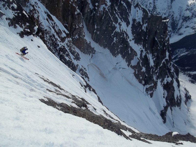

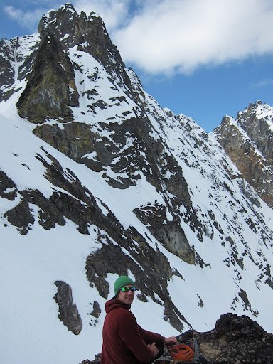
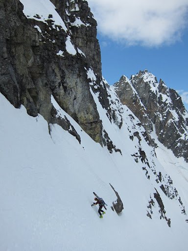


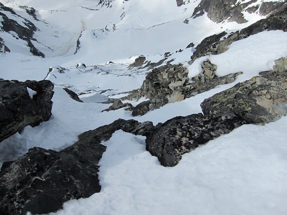
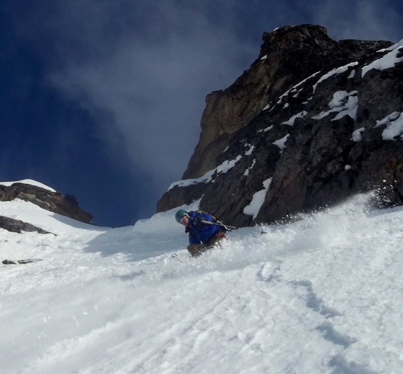
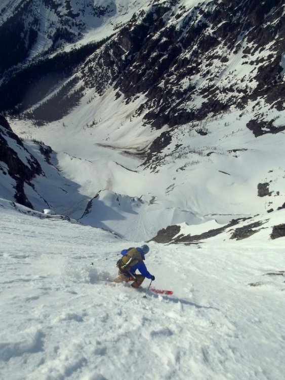
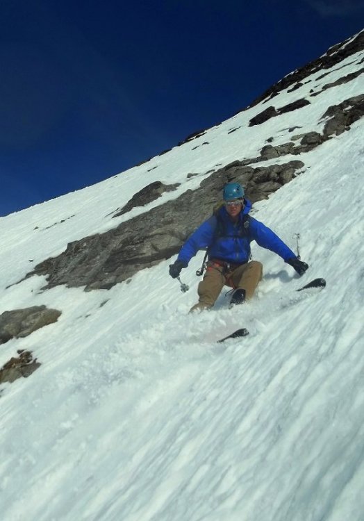
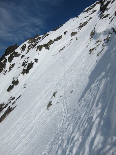
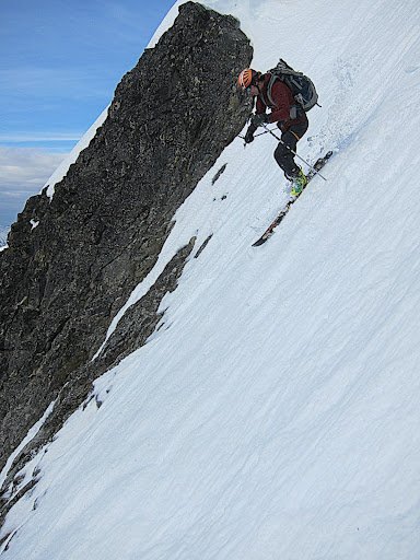

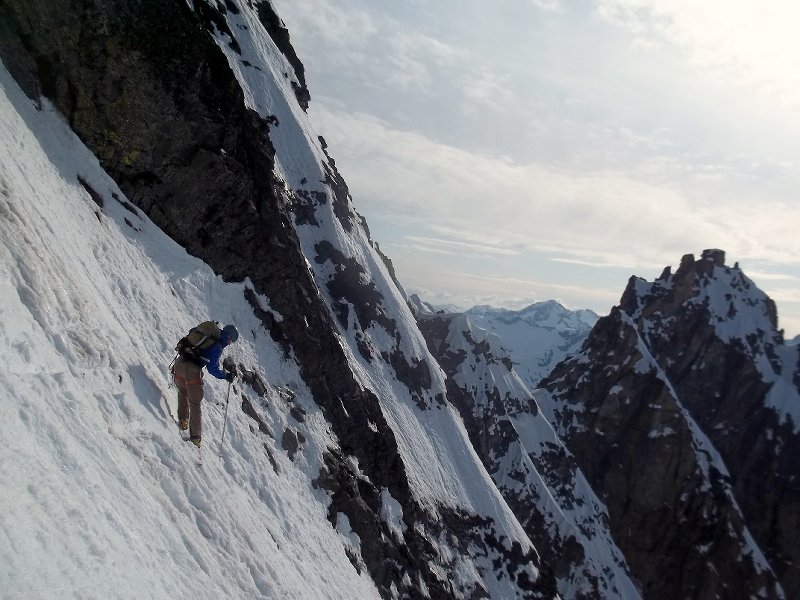
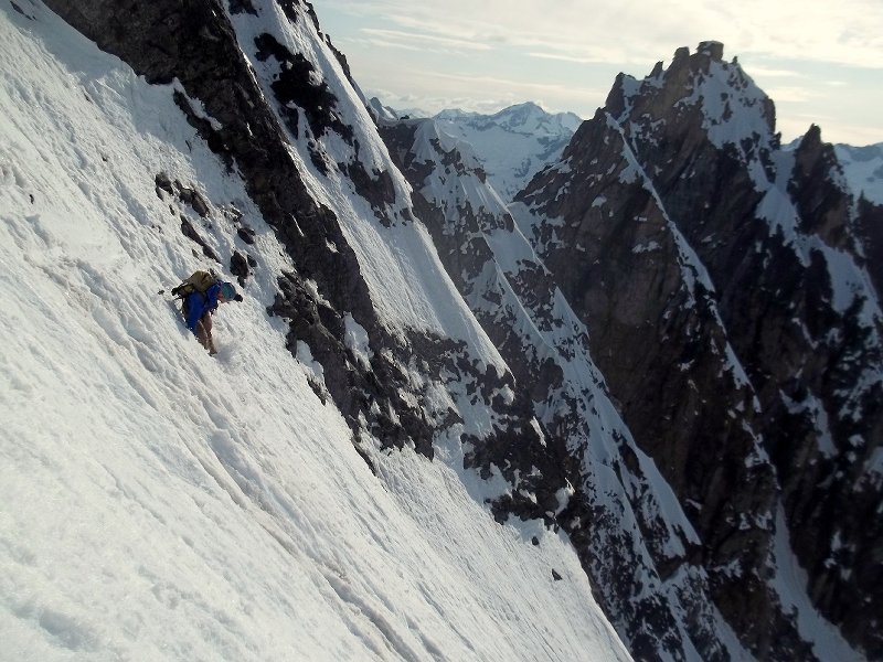
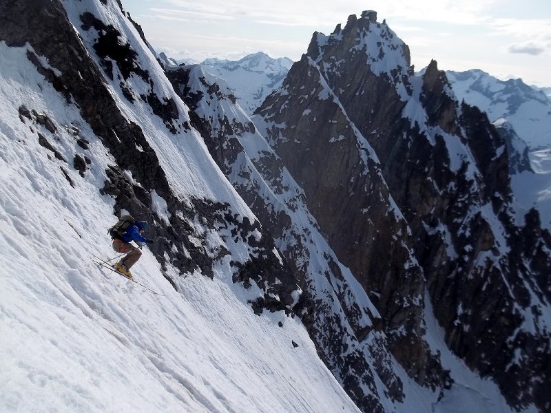
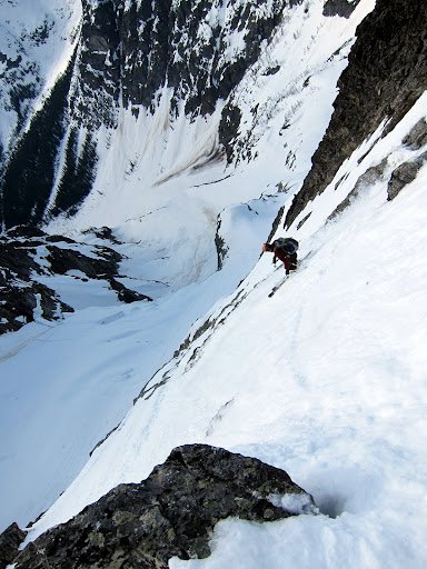
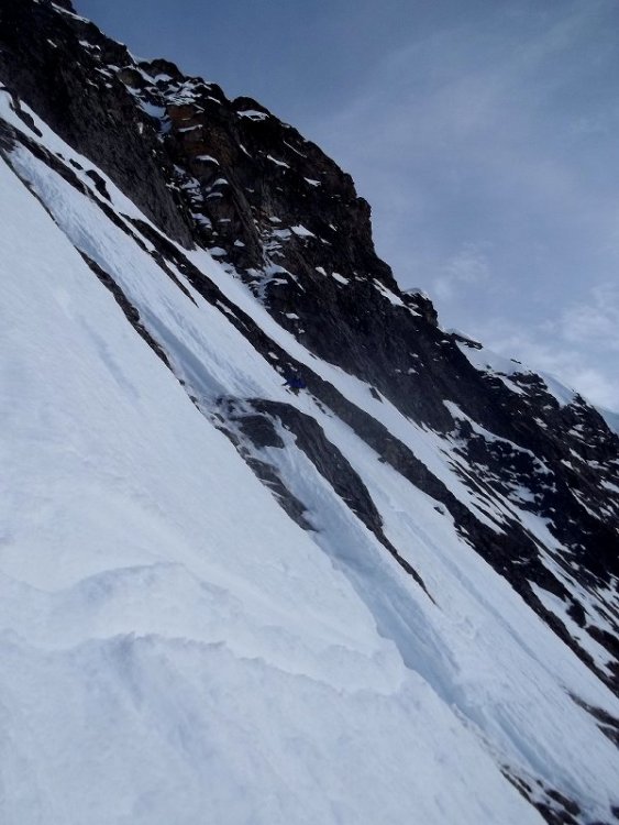
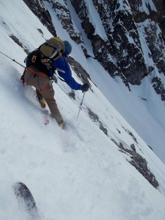
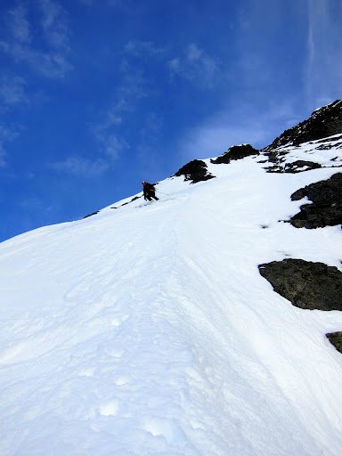
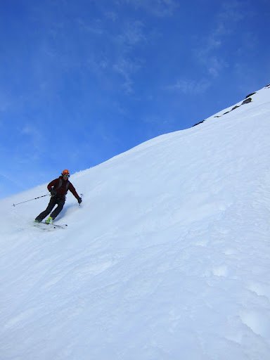
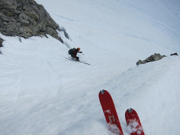
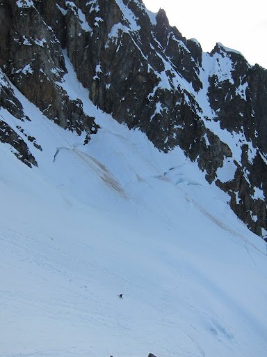
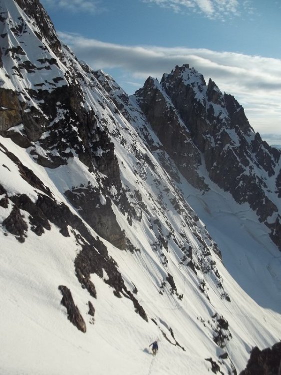
-
Trip: American Border Peak & Canadian Border Peak - abp - east face, cbp - sw face Date: 5/10-13/2012 Trip Report: I took this photo from the summit of Pleiades in early February, at first glance, a ski line on the east face of ABP seems improbable, but the photo captivated my imagination and eventually provoked me to attempt ABP, Twice I made it to the summit of Winchester in April, getting shut down first by a nasty cold, then by stormy weather. approximate route I climbed and skied on ABP (photo from feb 12) On Thursday I went in heavy with extra food and gas. Bivying by the south face of Larrabee, the night was cold, and snow solid the next morning for the approach. The first sight of the east face of ABP was not inspiring. Conditions appeared to have deteriorated considerably since February - melted out and runnelled. I decided to keep circling 'round in hopes of more coverage on the NE aspect, there was. I climbed up moderate glaciated slopes for about a thousand feet, then went left onto the steep east face, following what appeared to be the least icy way. The way was complicated, a few times I thought I would dead end in a chute and have to back track, but it went, twisting and turning up chutes and ribs. Conditions were a little scary. There was lots of icy slide worn neve, and lots of crust, with powder here and there shallowly burying the slickened neve. There was just barely enough snow clinging to the summit nub to make it skiable. Exposure was intense, especially looking down the sheer ~1000' cliff of the west face. I clicked into my skis and cautiously made my way down. Lots of crust, ice, death balls, and edgy runnels made catching a tip and taking a slide for life a frightening possibility. Friendly snow conditions such as pow or corn would have made this a much different experience, instead I was on edge the whole time. I headed back to my bivy feeling good, and decided to ski the cool looking southwest face of Canadian Border Peak the next day. Approaching CBP was somewhat of a pain in the ass - probably just a few miles, but lots of up and down getting over cleavers of high basins. The SW face of CBP was fun to shred, much less serious than the east face of ABP, and conditions were ideal for fast turns. I skied the sw face from 50 feet below the summit where the snow ended. The next morning I skied lookers left on south face of Larrabee, nice & friendly low stress conditions. South West face CBP Views from the summit of ABP east face abp, no bueno conditions low on abp turns on moderate slopes down low on abp north face of larrabee abp from somewhere on cbp view of international border cool formations I already miss the soft hazy red sunsets over Tomyhoi.
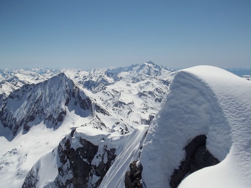
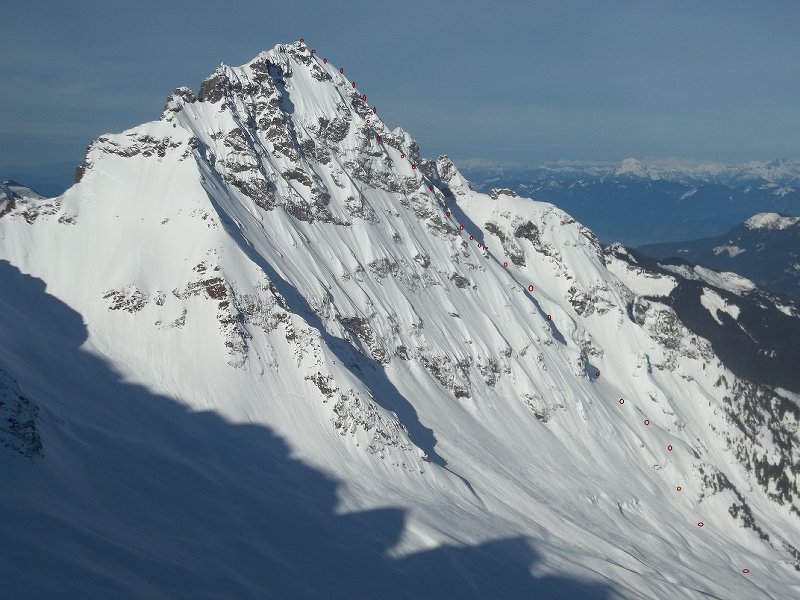

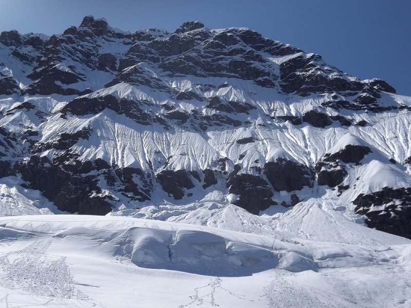
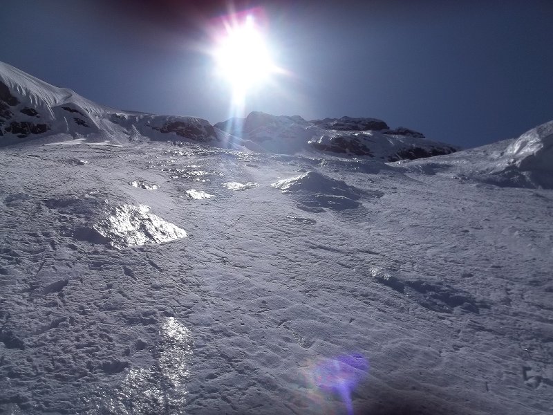
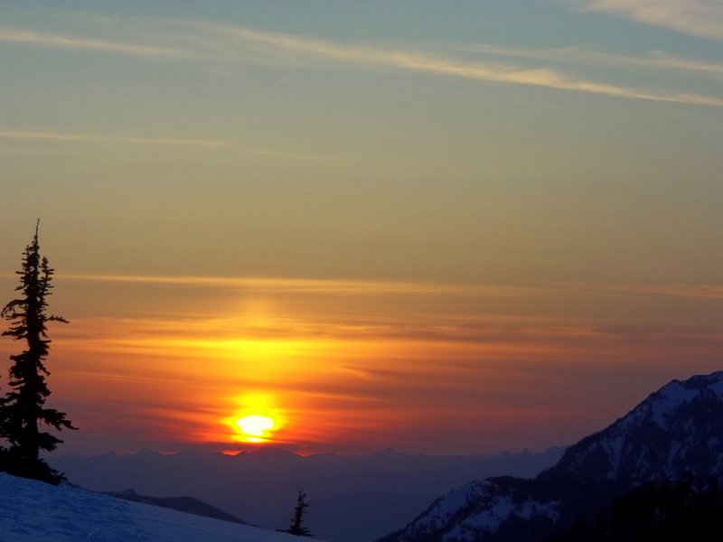
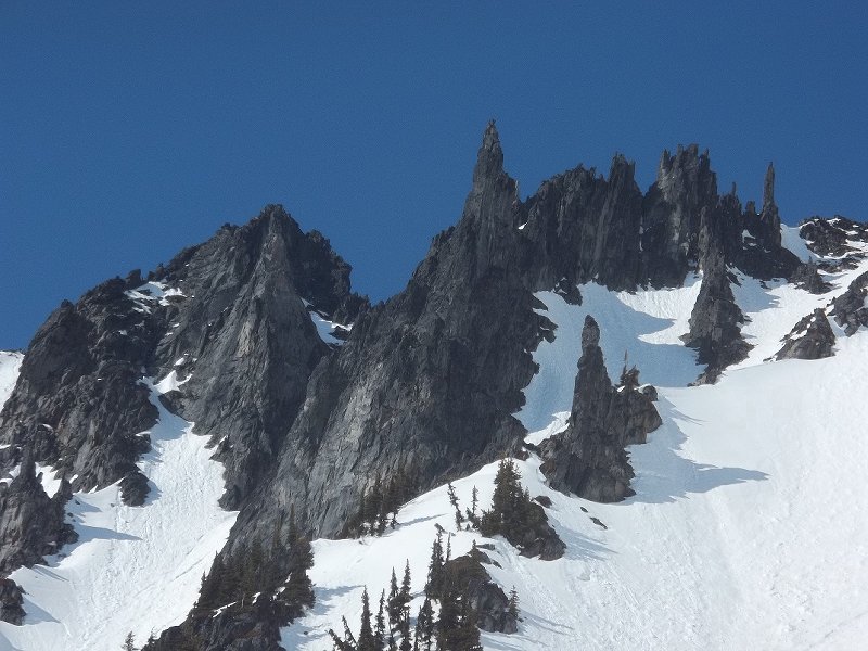
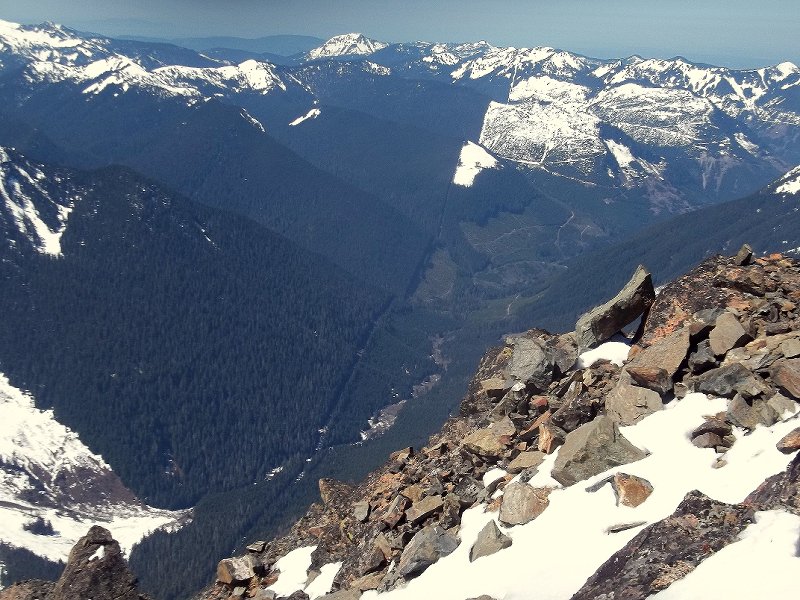
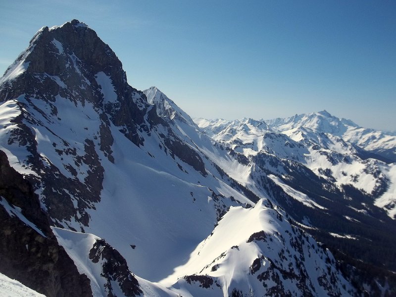
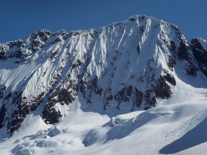
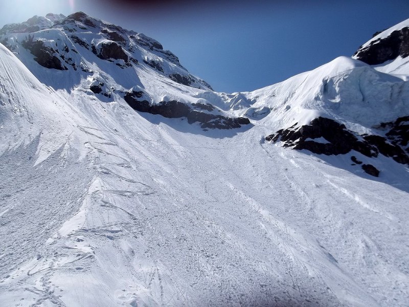
-
Trip: Mt. Shuksan - Curtis Ridge Date: 3/25/2012 Trip Report: I was looking forward to schlarping the fabulous powder that I had just skinned past on the White Salmon, but maybe, just maybe instead I would drop into a steep west facing line that I've eyed wistfully for years, the line is however quite exposed, steep, and windward... So my expectations of finding acceptable conditions were low. I reached the col from the sunnyside where I could survey the said line, looking down on it my first thoughts were -- there's no way I'm going to ski this thing! but after some time of thoughtfully soaking up the fearsome view, I slowly weaned myself off comfortable thoughts of powder on the White Salmon and adjusted to the possibility of accepting commitment to the exposure below. I downclimbed the first few hundred feet to scope conditions, and was amazed and stoked to find mostly powder with just a few crusty sections here and there, I scampered back up to the top drunk off stoke. The descent was awesome, favorite turns of the season for sure. Crossing under the seracs at the bottom was creepy, but over quick enough.
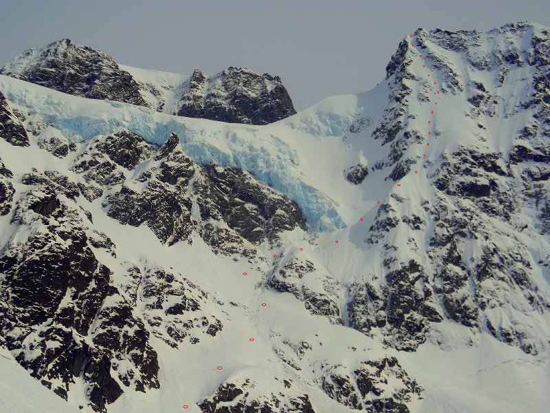


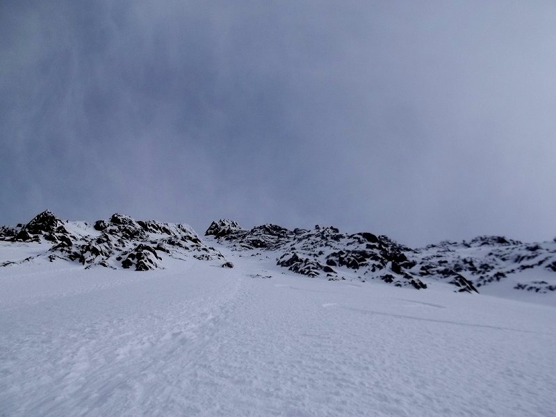
-
 Trip: Picket Range - Complete Enchainment Attempt Date: 9/2/2011 Trip Report: On September 2nd Jens Holsten, Dan Hilden and myself (Sol Wertkin) began an 8 day attempt at the Complete Picket Range Enchainment. While we came quite short of our original goal, we were able to complete the 2nd ascent of the Souther Picket Range Ridge Traverse (Bunker, Haley, Wallace 2003) and push it forward a bit to the North through Picket Pass, and over Outrigger and Luna Pk before exiting via Access Creek (15 summit in total). Day 1: The Three McMillan Spires Day 1 is a true ass-kicker, gaining over 10,000 vertical feet, and unfortunately I had been here before, 2 years earlier Blake Herrington and I had made an attempt at the Southern Traverse, completing 5 peaks before bailing out via fried nerves and weather via Terror Creek. We had fallen short of our intended itinerary on day 1 bivying between the East and West McMillan Spires. It was with this knowledge that I set the alarm even earlier this time around. As predicted, we approached as a weather system cleared the area and lucky for us an amazing high pressure window graced us for the remainder of the trip. The days objectives: SE Face of Little McMillan 7,600 ft, East ridge of East McMillan 7,992 ft, and the East Ridge/Face of the West McMillan Spire 8,000 ft. Though the packs were heavy, the views were incredible, the rock wasn't half bad, and the psyche was high. Myself celebrating the Triple Cumbre We were happy to have completed our goal for the day, but undeniably worked from the long approach and rock climbing with such heavy packs. We settled into the bivy just as it became dark. Day 2: The East Towers Traverse to Inspiration Peak We slept in until nearly 8 am on day 2 rationalizing that to complete such a big undertaking we would need to periodically recover. I began our late start pushing the rope on familiar terrain around the East Towers towards Inspiration. I was able to gain precious time compared to Blake and myself's onsight attmept and within a few hours we were starting up beautiful stone low on Inspiration Pk's East Ridge. Jens led on, scaling Inspiration's two beautiful crux pitches. It was here, at the base of the 5.9 pitch on Inspiration, where, 2 years earlier, I had come as close to dying as I ever have in the mountains. A microwave sized block that Blake was stemming on came loose and crashed onto the belay ledge from 50 ft. I narrowly escaped by jumping barefoot off the ledge with just enough play in my tether to dodge the missle. It felt strange to be back at the scene of the incident and was a relief to climb on uneventfully. The traverse over the E and W Summits of Inspiration 7,880 ft was as aesthetic as ever. But my oh my, where had the time gone? By the time we descended the W Ridge of Inspiration it was nearly 4 in the afternoon. On my previous attempt Blake and I had pioneered frightening new ground at 5.10R on our next objective, The Pyramid. Not feeling the need to launch into another late day epic on Pyramid we made the hard decision to bivy there and tackle it first thing in the morning. We had fallen incredibly short of the first ascencionest itinerary (in which they had amazingly moved on through Pryamid, Dengenhart, and Terror to a summit bivy on the Rake), but felt it was a necessary decision considering the time of the day and the enormity of our objective. Day 3: The Pyramid, Dengenhardt, Terror, and The Rake Our third day began with a more traditional alpine start and Dan took the lead and nailed it. Climbed The Pyramid the right way and it was a great route. Dan on the 5.8 crux of the East Ridge of The Pyramid Near the summit of The Pyramid 7,920 ft Mt. Degenhardt, 8,000 ft, was an easy scramble and we kept trucking on towards Terror. It was near the base of Terror where I had given Blake, "the look." The look that says, "dude, i'm done, it's over," and we had bailed. This time around I just focused on placing one foot in front of the other, and really didn't look ahead too much at the exceedingly intimidating East Ridge of Terror. We knew that Wayne and party had had a hair-raising experience scaling it's loose flanks so we just focused on finding the best path. And we did, and it wasn't so bad. Myself, leading our first pitch on the East Ridge of Mt. Terror Jens on the Summit of Mt. Terror, 8,151 ft. While the ascent wasn't so bad, the descent sure was. Loose unprotected down-climbing characterized the descent and before long we were strung out on a steep face searching for anchors or a way to continue down. Eventually we found some very old pins, and rapped off into the col, a disgusting place, perhaps the loosest col of them all. On the menu for dinner was the Rake, and Jens took the lead for the first and crux pitch. Loose climbing took Jens out of view and before long it was only his breathing and moans that we could decipher. I could tell the climbing was hard and that for the first time of the trip Jens was, "going for it." In the face of steep overhangs, Jens had set two OK nuts, equalized them and embarked on a 9+ traverse across "solid" edges, running it out 50-60 ft to a belay. Luckily for Dan and myself we were able to get intimate with some super-choss and keep the protection slightly more sane as we followed. Endless simuling ensued as we traversed onto the true ridge of the Rake. The rock quickly changed and we climbed phenomenal stone around the East Summit. Jens climbing into the golden hour on the Rake DFH getting his follow on Loving it Late-night belay duty Climbing at night, deep in the Pickets, high on the Rake, isn't the most relaxing endeavor. But things continued to unfold well. We wandered around many false summits and gendarmes and finally late into the night we heard a distant "monkey-call"from Jens and knew that we had finally arrived at the West Summit of the Rake, 7,840 ft. A short rap into the high col ended a long day. A wind-protected bivy we affectionately named,Ice Station DarkStar. We were in deep now. Day 4: East Twin Needle, West Twin Needle, and the Himmelhorn We awoke to a crisp morning on day 4. I started off the day wandering down the long west ridge of the Rake towards the Twin Needle Spires. Looking back at the Rake As we approached the summit ridge of the E Twin Needle the rock got better and better. Crescendoing with a wild pitch of 10- to the summit, 7,936. Jens leading through terrible rope drag DFH Scary downclimbing (a theme for the trip) got us off the E Twin and we simuled up the West Twin. The Himmelhorn, the crux of the traverse (10+), was wildly intimidating. Jens got're done, finding the right path up the sheer north face. We pushed on over the summit, down the backside, where two long rappels took us to a good bivy at the Ottohorn-Himmelhorn col. Day 5: The Ottohorn We again woke up late, intending on first bagging the Ottohorn via it's 3rd class East Face, and then the Frenzelspitz. We were worked from the previous's day's climbing and moved slowly out of the bivy with quivering legs and throbbing fingers. Unfortunatly, our romp was not to be as new rockfall just below the summit proved too unsafe to tackle unroped. Dejected, we turned around and headed back to camp. We rested for a couple hours, discussed the high proabability that the complete objective was not to be, and headed back up the Ottohorn, this time with a rope and rack. Dan led us to the to summit via two quality pitches of solid 5.7. We returned to camp and continued resting. Day 6: Outrigger Pk (SE Fury) Though our fifth day had been predominatly characterized by resting we still awoke to day six tired, sore, and HUNGRY. Our rations basically consisted of 4 bars and 4 GU's for breakfast, lunch and snacks, a Mountain House meal for dinner and a group instant potato meal as a second dinner/before bed snack, with some random sausage, cheese, and extras here and there. Somewhere in the ballpark of 1400-2000 calories/day. While this works for the first few days, by day six you've burned through your reserves and you can't help but feel the effects as you start to metabolize your muscles. Nonetheless, as we rapped off into the Ottohorn-Himmelhorn coulouir I began to formulate my, "let's keep going" speech to be delivered after we easily tagged the Frenzelspitz and effortlessly galavanted across Picket Pass. Jens, aka "Alpine Man" preparing to do work in the Ottohorn-Himmelhorn coulouir A long double rope rappel onto the snow, led to another long double rope rappel, lots of downclimbing, and more rapping. While we were at times just 10-15 ft away from tromping up the 4th class East Face of the Frenzelspitz, the late-season snow was laying the "smack-down" on our spirits with hard sun-cupped conditions and impassable moats. Nearly 4 hours after first rapping into the coulouir we crested the snow to solid terra-firma. It was a strange mental space in that we were now deeper then ever, but at the same time, finally off of the demanding 5th class terrain of the Southern Range. Any wishes of sending the Frenzelspitz collapsed into the impassable September moat as did my Pattonesque speech. What do you know, more sketchy downclimbing moved us up and over Cub Scout Pk, and onto Picket Pass. On a route punctuated with many highpoints it was interesting to feel equally moved by the brush and sub-alpine trees of Picket Pass, our first major low-point in a number of days. We hydrated and pushed on up and over Outrigger (SE Pk of Fury)7,757 ft. via aesthetic slabs, exposed ridges, and golden staircases. Chossy downclimbing led us off of Outrigger onto the flanks of the SE Glacier of Fury, which we elegantly traversed down and onto a heather basin, beneath a large ridge connecting Fury and Luna Pk. We reached running water and a fine bivy high on the ridge just a hour or so into the dark night. Day 7: Luna Pk The next morning we awoke to sore bodies and breathtaking views. The effort of the past few days was layed out in front of us and we could finally get the feeling that we had accomplished something. The beautiful high ridge route continued on and before too long we were ditching our packs and heading up to tag Luna. Great view of our route from high on Luna Pk, 8,331 ft From Luna we descended and traversed steep heather slopes into Access Creek. Jens strung-out in the heather We continued descending through the brush of Access Creek to the forest of the Big Beaver Valley and Luna Camp. Day 8: The Deproach 12+ miles of hiking found us in the heat of the valley and finally back to the car. We had the great pleasure of celebrating our adventure with good friends who happened to be in the area. I can't give enough thanks to the many folks who helped us out on this endeavor including Cheryl and Adam Mckenney of Leavenworth Mountain Sports, Jim Nelson of Pro Mountain Sports, Teresa Bruffey/Outdoor Research, John Race and Olivia Cussen of the Northwest Mountain School, Geoff Cecil, Blake Herrington, and of course Wayne Wallace. Wayne's advice, psych, and willingness to let us give his project a go proved instrumental in our success. We were awed by his bold leads while on route and kept discussing that we couldn't imagine a more committing objective than solo on the Mongo Ridge. On our final day of preparations we orchestrated a phone consultation with Wayne where we hurriedly jotted down notes in the drizzle of a Safeway parking lot as we picked his brain. This beta sheet proved quite valuable (I will scan it and post up). Gear Notes:I plan to blog in detail about the gear we used for this objective in the near future. I will link the blog post here. Links: Jen's Blog: Always Upwards Day 1 & 2 Day 3 Day 4 Day 5 Day 6 Day 7 Dan's Blog Colin Haley's original TR for the Southern Ridge Traverse AAJ: Walking the Fence Josh Kaplan's original TR for the Northern Enchainment (Kaplan, Wallace, 2005) NWMJ: Northern Pickets Enchainment We sure do live in a special place to be able to embark on an adventure of this magnitude just a few hours from home.
 -
 Trip: Shuksan - Price Glacier via NE Chute+NE Rib linkup Date: 8/3/2011 Trip Report: Zloi54 and I climbed one of the 50 classics of NA list – the scary Price glacier on Shuksan - over 08/01 – 08/04/11. After my arrival from PDX on Sat 07/30, we arranged for a car shuttle between Nooksack Cirque TH and Bagley lakes picnic area. Hwy 542 was then blocked by snow and gated to Austin Pass, but is reopened now. A 30% chance of showers predicted for our Sunday’s approach turned out to be 100% full on rain and meant open biving in the ditch for two nights at Nooksack cirque TH while waiting for the weather to clear. Day 1. Approach to the Nooksack Tower. Nooksack Cirque TH (2200’): Two whitewater crossings of Ruth Creek right off the TH are currently in the brand new “fir tree” state: After about 3 miles on the Nooksack Cirque trail, we took the climbers trail down (just past Wilderness boundary sign) to the Nooksack river. Getting to the old log crossing along the riverbank sucked - due to high water level this year I guess, but traversing 20’ above it made the trick. Nooksack River crossing (another classic by itself) is still solid and welcomes visitors: Sticking with the faint trail in the alder (about 50 m to the left of Price Creek) on the other side of Nooksack river was not that bad and brought us to the open moraine above Price lake. Price Lake down below: North side of Shukshistani represents: “Open moraine” quickly turned into snow moraine as we continued towards the glacier: Some beta advised NOT to head up to Price gl before the cirque seriously cliffs out. Probably being retarded, this is what we ended up doing: we headed up way early through the steep moat-mined snow, and then climbed nearly vertical muddy rock with tools and hauling packs. Getting to Price glacier somehow came at high price of wasted energy and time. The cirque below from the approach: Approaching Nooksack Tower on Price gl: Getting to the Nooksack Tower bivy sites took some imagination for crossing the crevasses below. The approximate line, looks easier than it was in reality: Camping out by the Nooksack Tower (6600’): Sunset and dreams about Canada: Day 2. Upper Price glacier. We started at the base of Nooksack tower at sunrise, sprinted through the sketchy ice chute being constantly fed by the material from the looming above ice cliff, and then squeezed through a couple of fragile chimneys before hitting safer ground somewhere in the middle of Price gl: At this point, routefinding choices had to be made and while trying to compromise between the contradictory beta “to stay on the left” vs “to stay on the right” of the gl, we went up in the center (red line): The ice was good, took screws well and we could not see any major obstructions ahead. Yet. Z coming up first ice pitch: More ice above: Z coming up on the traverse: I then led an 80 deg snow dome and hit a dead end in the maze of overhanging ice walls and our further progress had significantly slowed down. After trying a few options, we rapped down in the underground and begun traversing east (left) through the system of corridors and chimneys, most of which we soloed. The plan was to somehow get on the above snowfields to approach the rock band by the main shrund from the left where things were least broken up. Rapping down off ice features: In the crevasse chimneys: Contemplating the overhangs: By 7 pm we run out of options and pitched in the tent in between the ice walls with the haunted Nooksack Tower watching us for the second night in a row. I am not sure how often people do that, well we had no other choice: Another sunset by Nooksack Tower: Day 3. Upper Price gl., NE chute and NE Rib. For the lack of options on the east side of Price gl, we retraced our steps through the chimneys in the seracs, downclimbed and rapped down to the point where we could get to its west (right) side framed by a vertical serac wall and steeper snice slopes. Z heading up the right side of Price: West side of Price: Finally we got to the main shrund on Price, passing through which would have taken multiple overhanging raps as was later confirmed from my vantage point in the NE chute. The green line to the main shrund and traverse to the NE chute: We made a good call on the safest option of all: the NE chute with its scary entrance made of delicate soft ice flutings over 100 feet deep cracks and its monstrous ice roof right above our heads ready to collapse at any moment. The entrance to the NE chute: Typical terrain: Z coming up on the traverse to the center of the NE chute: Z heading up the easy snow above the second shrund in the NE chute: Z climbing up to the NE shoulder to find a bypass to the Crystal glacier – a “no go” in the current conditions: After he downclimbed the snow, I traversed and went up the NE Rib made of good and bad rock. Z traversing to the NE rib: Amazing views of Price lake down below: Solid alpine rock above on P2 - highly recommended: Z starting up on the P3 of the NE rib finish: After we had finally crawled across one of the endless knife edge snow ridges, we found no summit pyramid to our delight, but another corniced ridge which I think is a part of the Hanging glacier. So, we camp again. By the Hanging glacier snow ridge this time. And we run out of food. Day 4. Summit Pyramid and Fisher Chimneys descent. Next morning we climbed up and over the Hanging glacier cornice and thank god landed on the easy slopes of the North face top out. Just about time. The Summit pyramid from the north is looking mighty: While traversing across the Crystal gl and up the summit pyramid, we spotted the chopper making its way towards us. It turned out the authorities were concerned that we are 3 days overdue (including one extra day we bivied at the Nooksack cirque TH waiting on weather) but provided us with so needed food for our descent! What a treat! Baker from the summit pyramid: Hells highway was in the straightforward shape as was the lower crossing to Winnie’s slide. We took the skiers right variation of the Fisher Chimneys. After two raps over snow covered rock, we downclimbed 50 deg snow with a tool (no crampons were needed), and then merged with the left FC variation and downclimbed the rest on more often than not dry rock all way down to the moat. Traversing the snow covered boulder fields was OK, but getting through the moat on the last rap off the tree took more time than expected. There are a couple of options here: either shorter 10’ overhanging steps to get on the snow slope or a 20’ vertical section, both requiring crampons and a good tool. The descent to lake Ann was under snow, and will probably be for another month. We took the shortcut through the snow-covered slopes rather than sticking to the trail in the trees. Gear Notes: 5 screws, 3 pickets, rock pro to 1 inch, KBs could have been helpful, and were brought but not used because I am lazy. Approach Notes: Nooksack Cirque to Lake Ann carryover
 -
 Trip: Violence, Alcohol and Shenanigans in NW China - Kingata Shan Date: 6/24/2005 Trip Report: This is the story of a trip I took with my friend TJ in 2005. At the last minute, we jumped on an expedition going to Northwest China after I received an "spammish" email from a man named Yoehan who was located somewhere in Central Asia. Most people would just click "Delete" and forget about this suspicious email. But not me. Having a habit of getting myself into a bit of trouble at times, all in the interest of extracting a good story...I threw caution to the wind, wired some money to some bank in China and started packing. After all, the price was right, I was unemployed with some spare cash. And, I had a cool partner, TJ. For me, I have noticed that as the years pass, the reality of an experience (what really happened) can sometimes morph into something else...memories of events that happened 5 years, 10 years, 15 years ago become plastic and evolve into something else...they slowly emerge as similar events with small, convenient adaptations...adaptations that tend to paint ones-self in a better light, or adaptations filled with hyperbole to make for better story telling. Over time, these people and places and events become mythical in your mind...and only a quick reference to a journal entry (if one exists) bring you back to what really happened. This is the story of our trip to China. I cannot attest to its truth or accuracy, although it travels along the general path of truth, often times these stories start drifting towards the gutter... Sometime around Memorial Day in 2005, I hopped on a flight to Beijing. The plan was for me to travel the "Silk Road" to Urumqui in the Xinjiang Province of China, and meet TJ there about a month later. From there we would travel to Kashgar to meet our "Permit Procurement Officer", later to be known as our "Provision Procurement Douchebag", Yoehan , who was based in Urumqui. We would then join some Slovenians for an expedition to climb some "unclimed" peaks. The price was low, and we had moderate expectations. So, for several weeks I made my way up the Silk Road with a tiny backpack, while TJ got to schlepp my climbing gear halfway across the world. I got the better half of the deal for sure. At least I think that is what happened... A few shots of my journey up the silky road... These guys were pretty stoked to see a white guy...this was in a small village up in the hills...the guy on the motorcycle was the local Karaoke champion. At least I think thats what they told me... Normal sights along the road which parallels the old Great Wall... Meat soon to be festering in 120+ degree afternoon heat...too hot for even the flies. I finally arrived in Urumqi after a very hot 3-week tour up the Silk Road by bus. Midday temps were over 120 degrees. Luckily there were swimming pools all over the place, and I made a habit of going swimming to cool off. The only problem was that the Chinese, who are suppoedly obsessed with the size of the white-man-unit, would continually stare at my junk in the shower room. Kinda creepy. Kinda confidence-inspiring. I finally met TJ in Urumqi for our flight to Kashgar. It was great to see a familiar face. Traveling on my own was fun, and the Chinese are very friendly people, but it was great to be with someone who wasn't staring at my junk all the time. Hey Buddy! The overweight charges in China are completely ridiculous, $100 per extra kilo. Now, I am NOT saying that Chinese people are stupid, but this is the first time of many over the next several weeks where we found ourselves muttering "Stupid Chinese..." So, with ice screws and all the climbing gear we we about $4000 overweight. We wore our entire climbing kit on the plane! Arriving in Kashgar by plane, we gathered our bags and headed out into the reception area, looking for our man, Yoehan. Well, we found him! Dressed in tight black Beavis-like shorts and a black shirt with a Commie hammer and sickle...bursting belly peeking out underneath, he was a behemoth of a man. He welcomed us to Kashgar in a deep Northern European accent, and pointed us in the direction of our taxi. He seemed OK. Just OK, and from there it just went downhill... Yoehan, en route to Base Camp... Our first order of business the next day was to buy food and get our gear ready so we could leave Kashgar the next morning, bright and early. Yoehan had agreed to provide a most of the camping gear...base camp tents, cooking gear, "schlingies", etc. Since he told us that he had all that stuff ready to go(he WAS our Provision Procurement Douchebag(PPD) after all), we ended up drinking instead. Buying vegetables could wait. We awoke the next day a bit hung over, but psyched to get on the road westward towards the Pakistan-Afghanistan-Tajikistan-China border, where Johan told us we would hire some camels to take us to our base camp. From base camp, we would spend a month or so bagging "unclimbed" peaks in the Kingata Shan(Range). But, yet another caveat. Yoehan informed us in the morning, in his confirmed dutch-accented voice that the team of Slovenians that would be joining us were arriving in Kashgar a day or two late. We would have to wait in Kashgar at least another night. Ugh! I guess we would just have to get drunk again. At least that would give us some more time to get to know Yoehan. Finally, buying vegetable in the Kashgar market... At some point, the Slovenian team of three arrived over the Kunjerab Pass from Pakistan, and we were ready to roll. These Slovenians were cool guys, despite having weird names, and one of them was going to make of film of the expedition! Sweet! We would be on camera! You can see the film here: Kingata Film by Anze Cokl The plan was to hire a bus to take us to a small village, then take camels to base camp. At least that was the trip Yoehan sold us... Somewhere around this time, he told us that he "doesn't do rescues". Cool. I think it was about this time he told us how he was recently beaten to a pulp for impregnating a local Uighur girl. But, that part is foggy... Yoehan, dispatching disparaging remarks to our cook, Jaink, who didn't really understand what he was saying anyways... The idea of camels taking us to base camp sounded exotic to me. I have to say that the camels were about 50% of the reason for me going on this trip. In the end, it turned out that we didn't need any camels after all...all we needed was a bloody truck! So, without even ONE CAMEL, we ended up DRIVING right to our base camp. Yoehan and Jaink negotiate with the local Kyrgyz for passage... Well, we got to base camp after after negotiating passage with the local Kyrgyz herders, and getting the bus stuck several times. By this time, we had been around Yoehan for about 3-4 days, and he was drunk pretty much the whole time. Not only that, but he wore the same clothes every day...could he possibly continue like this for a whole month in the mountains...drinking incessantly and wearing the same clothes? What we discovered was truly horrifying. At any rate, we had arrived at Base Camp. It was super easy to get there, and it was beautiful! Locals "helping" us unload the truck Mustagh Ata in the distance: At this point, if you're still reading...you're probably wondering if we are going to do any climbing on this trip...and that what we were starting to wonder, too... But, now that we were finally at Base Camp, all we had to do was eat, try our best to deal with Johans considerable alcoholism and perceived impending violence(he started saying angry things about this point), eat, and climb. Oh, yeah, we had to keep an eye on the local Kyrgyz...who looked innocent enough, but were milling about our camp constantly...obsessed with our high-tech trinkets like swiss-army knives, condoms, and sunglasses. Dont ask about the condoms, please. Local Kyrgyz: Innocent looking, but deadly! How can you ever trust a moslem with an "I heart Jesus" hat?? Don't forget the condoms! Kidding. IT WAS TIME TO DO SOME CLIMBING! We were hoping to climb Kingata Tagh, 6760 meters. But first we settled on a little acclimitization climb of a non-technical peak nearby, Karajira IV. None of these peaks seem to have official names, but Yoehan assured us that Karajira IV is both unclimed, and also actually named Karajira IV. We spent two full days bagging Karajira IV...really just a long slog up yak-slopes, then steep rotten snow... TJ heading up Yak-slopes, with Kingata Tagh in the distance. She would be our nemesis, that dirty girl! The descent path of one of the Slovenians...he had AMS pretty bad...note how un-straight is boot path is!! Summit of Karjira IV: We bagged Karajira IV just minutes after the Slovenians did. Of course, they claimed the first ascent for their country, and we shamefully walked the 8 hours back to Base Camp with our tails between our legs... We then spent a few days in Base Camp recouperating. We passed the time by playing frisbee with the locals and shooting the yaks with a slingshot! Frisbee! Yak Abuse! Treasures abound around Base Camp! By this time, Yoehan was starting to become quite the shit-show. He doesnt use sunscreen, so he had returned from two days on the glacier with his skin red, blistering, and peeling. At the Base Camp dinner table he would pick his scabs, then dip his scab-moistened hands into the sugar jar to sweeten his tea. Absolutely disgusting. He was starting to run out of alcohol, and began getting very grumpy. He had not yet bathed, and was still wearing the Beavis shorts and the hammer-sickle t-shirt. Also, he got diarrhea ("tin shits" as he called it) up on the mountain somewhere, and instead of going outside the tent to shit in the middle of the night, he thought it better to squirt his diaroeah (how many ways can you spell diorreah, anyways?) in our ONLY cooking pot small enough to take up high on summit day. He shit in our cooking pot. WTF?!!? He claimed that since he boiled water in it afterwards, that it was OK. "Don't worry about it", he said. Mommy, where do "Tin Shits" come from?? Disgusted by Yoehan, we were amped to get up-valley and give a shot at Kingata Tagh... The valley where our upper base camp was located: Kingata Tagh from advanced Base Camp... Long story short, we spent about 10 days high on the mountain trying to climb Kingata Tagh. The weather was crap. Every morning we would wake to blue bird skies, and every day around 11am the storm clouds would come in to deposit about 3 inches of graupel. Despite the crap weather, we finally made a dash for the summit as our last days of our trip were approaching. After putting in a high camp around 6100 meters, we ended up getting turned back by steep ice climbing that we were not prepared for...neither of us felt healthy. At high camp: High on the mountain on our summit push...Pakistan and a bunch of other "Stans" lurk on the horizon... Four weeks of of living on crappy Chinese food had taken their toll. The last days we were subsiding on Chinese "Powerbars" that weighed as much as a dime. The night we ate the mystery meat was a momentous one! Disappointed, and completely exhausted and hungry, we packed up our high camp, then our ABC and headed back down to Base Camp where we could spend one last day with Yoehan before heading back to Kashgar. Seems as if Yoehan had run out of alcohol while we were up on the mountain...and he had gotten very ornery. Very ornery. Honey badger-type ornery. Yoehan was getting angry. He started talking about how much he hated Americans. And about how noble Stalin was for doing "what he believed", etc. I could tell that something bad was going to happen. But, we got packed up the next day and left Base Camp without incident... Yoehan sits while others do the work: Departing the enchanted land of the Kyrgyz: Finally arriving back in Kashgar, we decided it was time for a little celebration. The celebration would include myself, TJ, the three Slovenians and, unfortunately, Yoehan. The night started off normal enough. But, eventually, we found ourselves sitting at an outdoor table at a main junction in Kashgar...drinking fairly heavily. Yoehan, excited to have unlimited amounts of alcohol at hand (and access to Uighur prostitutes), began to get drunk...and belligerant. He started yelling to everyone withing earshot that I was a CIA spy. Then, moments later, pushed his chair back, pulled out a leather man...and moved to stab me. TJ, hating Yoehan like no other, stands up, rears, and hauls off a punch across the table into Yoehans jaw, sending him flying backwards in his chair. It was awesome. I think that was the only time TJ ever punched anyone in his life. Turned out the Yoehan had actually pulled out the corkscrew part of the leatherman, not the knife...but, that is besides the point. Moments before the "Leatherman Incident" Well, our party quickly dissipated after the melee, and we all said our good-byes and headed to bed. But not Yoehan. He kept drinking. And drinking. One of the Slovenians was sharing a room with Yoehan for the night. When he awoke at 5 am, this is what he saw. Frightening: The next day, TJ headed home, I headed to Kyrgyzstan, and Yoehan probably got drunk and bought a few whores. Classy guy. At least I THINK all this stuff happened. Things are starting to get foggy...I think I will burn my journals and continue to let reality morph into myth. BTW: You can see a more detailed trip report here: Gear Notes: Bring your own cooking pot. Approach Notes: Go halfway around the world, then turn right.
 -
1)Read the rules/info here before voting: http://cascadeclimbers.com/forum/ubbthreads.php/topics/1012183/Re_Best_Trip_Report_Voting_Con#Post1012183 2)I'll start the nominations off with my own: http://cascadeclimbers.com/forum/ubbthreads.php?ubb=showflat&Number=495658 "Layton-Wolfe. September.05" From the objective, to the route, to the writing - I can't remember a better candidate for "Greatest TR Ever" than Mike and Erik's TR from their FA on the East Face of Mox Peak. 4/7 Update: Changed the thread title to better reflect the main idea of this contest.
-
 Trip: Patagonia - FA. The Washington Route - Fitzroy Date: 2/8/2011 Trip Report: This last season down in Patagonia was my 5th season of toiling and suffering down there. Finally after all of those years I feel like I've actually gotten to climb some stuff. But it wasn't until the last week of my trip this year that I made it up the Fitz. Its was a long time coming.... During the first week of February the weather forecast started to show a possible 4 day weather window. The only problem for us was we were suppose to catch a plane back the states right in the middle of the goods. As the predicted weather approach it became apparent that we’d have to change our tickets for an attempt at the Fitz. A few frustrating hours on the phone and 1k and spent we were good to go. I kept telling myself it better be worth it…. I've been burnt before changing tickets down there. On Monday the 7th we packed our bags and made our way through Piedre Fraile and onto the bivi at Piedra Negra. As luck would have it, the weather Monday night wasn’t so great. Just past midnight it started to sprinkle. To save weight on the approach we opted for no tent, so we sat there in a light rain deciding what to do. After much contemplation we decided we should just get up and start. It was 12:45am. To our dismay the glacier hadn’t yet frozen as we made our way from Paso Guillaumet to the base of La Brecha. We had figured the it would only take us 3 hours from camp to the base but it ended up taking nearly 5. Which wasn’t that much of a problem but it meant we would then be climbing the Brecha in the full effect of the sun. Not fun nor that safe. Onwards and upward we went climbing right threw the waterfall that was starting run down the Brecha. Due to the running water we were forced to stop on top of the Brecha in the sun for a couple hours to dry our clothes. At this point we were starting to run way behind. Little did we know were about to fall way behind schedule as we traversed to base of the south face. A few years ago we had covered this same terrain and has cruised right across it. This time we found boiler plate hard blue ice. Our old worn out aluminum crampons were drastically inadequate as well as our single light weight ice tool. Late in the evening it became glaringly apparent that we were going to need to bivi before we even got on the “route.” We were both a little frustrated and morale was going down. With out any obvious bivi sites available we had to keep traversing farther to the base of the California route, even though this was taking us out of the way. Thankfully we reached the base of a large ice slope where we could excavate a decent platform for the two of us. We had a great view of our proposed new route up the south face which did give us hope as it didn’t look to intimidating. On Wednesday the 9th we started up the real business of the route, which first involved making a short traversing pitch across the ice slope and then a 60m rappel down to the base of the system (a place where we had nearly been before but had to continue past to find the bivi.) I had lead a good majority of the climbing the day before as it was more of the alpine variety which I’m slightly more efficient at then Kate, so now it was Kate’s turn to take the lead and get the rope up. The first couple pitches were on good rock but unfortunately they were choked full of ice. She slowly chopped the ice out of the cracks resorting to a mix of aid and free. The rope moved up at a steady pace though. It wasn’t until a couple pitches up that the ice had disappeared allowing Kate to move and an even more rapid pace. I followed behind doing whatever it took to get up the pitch, this often involved “poor man’s jumaring,” which is just yarding up the rope in between pieces and then Kate would take the rope as tight as she could. ( I can’t even remember how many times in my guiding days did I tell clients to never do that….) Kate lead on through a variety of cracks but most were in the hands to fist to off-width size. After getting set slowed down by poor conditions yesterday it felt nice to be moving efficiently on good rock in good conditions. Pitch after pitch fell below as we continued up sustained cracks. After 12 pitches or so we veered right at our first opportunity, hoping for easier terrain. Kate turned over the lead to me at the first ledge we came to as she had been leading for over 8 hours and was properly cooked. The steepness eased up and after a few more pitches we reached a point where we started simul-climbing up the 4th class terrain that lead to the final snow slope. Both of us had really hoped to top out in the light but that just wasn’t in the cards for us. We stumbled up the last easy 100m and reached the summit just before 11pm to tired and hungry to be that excited. A short discussion ensued about rappelling through the night but we choose the much more conservative and colder option of spending the night on the summit. For some unknown reason Kate and I had opted to NOT bring a sleeping bag up Fitz. This was undeniably a very very poor choice. Our teeth literally chattered all night long. No amount of spooning was going to keep us warm. We put chemical warmers into our boots and hot water bottles in our jackets, this barely helped. But each and every chatter of the teeth were quickly forgotten as the sun rose and illuminated our location on top of Fitzroy. The excitement finally hit. Somehow we had managed to climb a new route on Fitz. This one won’t soon be forgotten.
 -
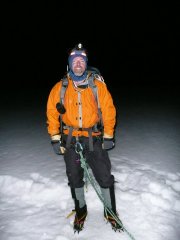 Trip: Breithorn, Pollux, Castor, and Monte Rosa - Various Date: 7/29/2005 Trip Report: Ever since my brother got me my first ice axe and introduced me to mountain climbing, one mountain above all fascinated me...the Matterhorn. In 2005 I had the funds, partner, and time off to pursue that dream. When my friend Rod and I arrived in Zermatt, the Matterhorn was in perfect climbing condition.We decided to acclimatize a bit with a climb of the Breithorn (4164 meters)We ascended the west ridge to the summit, then dropped back down and climbed the central summit (4159 meters) We had hired a guide, Larry Dolecki, to maximize our chances of success and time. We met up with him in Zermatt and decided to do another acclimatization climb of the Obergabelhorn SE ridge before trying the Matterhorn. We approached the Arben Hut via bolted ladders. We awoke to a white out storm, and retreated back to Zermatt. We waited one day, hoping the weather would improve. It would take a long spell of good weather before the Matterhorn was in shape, so we decided to climb whatever we could until then. We took the cable car to Klein Matterhorn and headed onto the Verra glacier hoping to find better weather on the Italian side of the mountains. We dropped down to the Gnifetti Hut and enjoyed the pleasures of hot food, warm beds, international company, and alcoholic beverages. The next morning dawned clear and we were treated to views towards Mont Blanc. Our next goal was to climb Liskamm (4527 meters) as a traverse going west to east and end up near Monte Rosa. We headed up to the west ridge, but high winds turned us back a few hundred feet from the west summit. We headed back and climbed Castor (4228 meters) instead. We traversed south below Liskamm and descended the Gren Glacier to the Monte Rosa hut. The next morning we awoke early with about a hundred other climbers and started climbing by headlamp. The hut is at about 2795 meters(9200 feet), and the Monte Rosa summit is 4634 meters(15,199 feet). We passed all but two parties on the glacier and soon were on the rocky west ridge. The rock was a little verglassed, but soon we were on the summit. Unfortunately, it was socked in, so we didn't get to enjoy the view. We returned to the hut, rested and hydrated, then crossed the Gorner glacier and hiked up to Gornergrat to catch the train back to Zermatt. The weather improved and gave us a nice view of both Monte Rosa and the Matterhorn (alas with new snow). We enjoyed a rest day, then headed back up to climb Pollux (4092 meters). Another storm came in and dropped another half foot of new snow, and so ended my hopes of climbing the Matterhorn on this trip. I must say I still had a great time! Gear Notes: Standard glacier gear. Ear plugs and a sleeping sack for the huts. Approach Notes: From Zermatt, cable car and train access and well marked trails make approaches pretty easy. If you want to stay in the huts, make reservations...they fill up early in peak season. We were turned away from the Margherita Hut.
 -
 Trip: Banks Lake ice with ropegunning wife - various Date: 12/11/2010 Trip Report: A week ago I tied the knot with the decision to secure myself a partner for life. Now a week later I tie a different knot. We both love ice, had never climbed WI together, so on Sat, 12/11, we finally got the chance to test our new marriage against some icicles!! Banks was looking promising so we drove up late from Seattle on Friday and slept in the Osborn bay Fish and Wildlife camping area (none of those climbs are in). Sat we got a lazy start, overcast, temps around 34 degrees in the morning, and headed to the Devil's punchbowl area. Lots of big ice debris below many of the climbs although we didn't see anything big coming down during the day. Trotsky's folly looked delaminated at the top and ready topple so we skipped it and headed up to start with Trotsky's Revenge. The wife asked me if she could have the first lead of the day. Now, I might be new to this but I know you should not be arguing with the wife. Gotta please the woman! The topout was a little hollow, but doable. The chimneying was great fun! At that time we saw two cc.com allstars coming up - John Plotz (telemarker)and Kyle Flick. They hopped on the punchbowl while we finished off Revenge. We chit-chatted and swaped climbs, running up punchbowl before the last remaining icicle falls off. Feeling good we finished off, waved adieu to Plotz and Flick, and headed over to Pee Wee's. We beeline to the right flow, which is the better looking one of the area. It's steep but the blobs, previous traffic, and thankfully short length (we just doubled up our 70m half rope), made it doable for me with much shaking out Pretty tied up When V runs up it I'm getting antsy to get off this flow since every small kick or swing she makes just reverberates all the way up the climb, reminding one that ice is a temporary ever-changing medium Very happy with our pump we packed up and headed a little north to complete the day with huge plates of delicious Mexican food at La Presa. Here's looking to future climbs and following some hard stuff my wife puts up for me!!
 -
 Trip: Lake Wenatchee - AK47 Date: 12/12/2010 Trip Report: Redpointed my new route at the Demilitarized Zone- a crag just West of Lake Wenatchee. Enjoy. I'm calling it m 7. Climb it in crumby conditions for brownie points. [video:youtube]http://www.youtube.com/watch?v=CcGRfQXYZsY Gear Notes: QD's. Approach Notes: ~ 2 miles up the White River Road on the Right hand side right before the river access turn out on the left. Please be courteous and park off of the road in either turnoff. If you need beta on how to get there pm me.