Search the Community
Showing results for tags 'best of cc.com'.
-
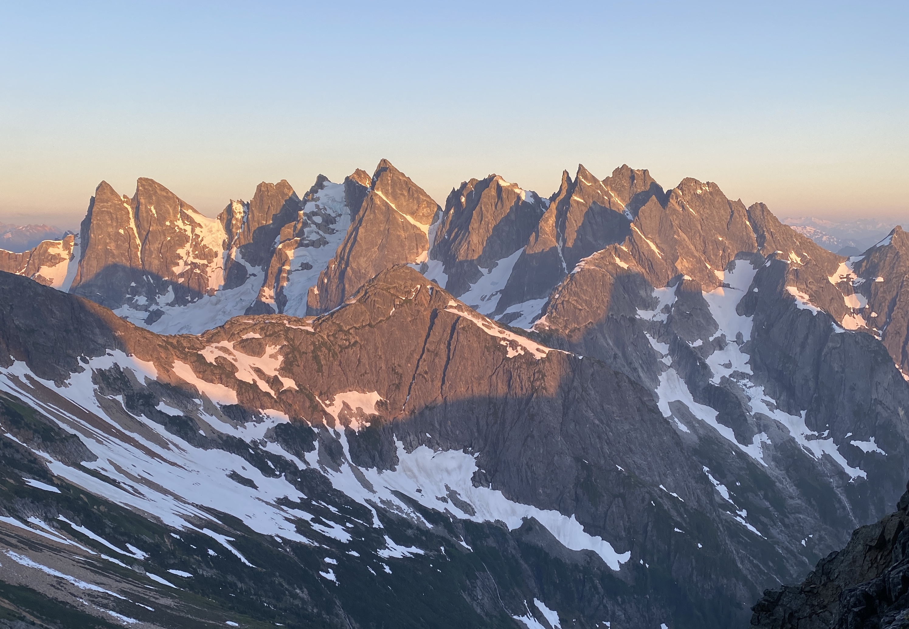
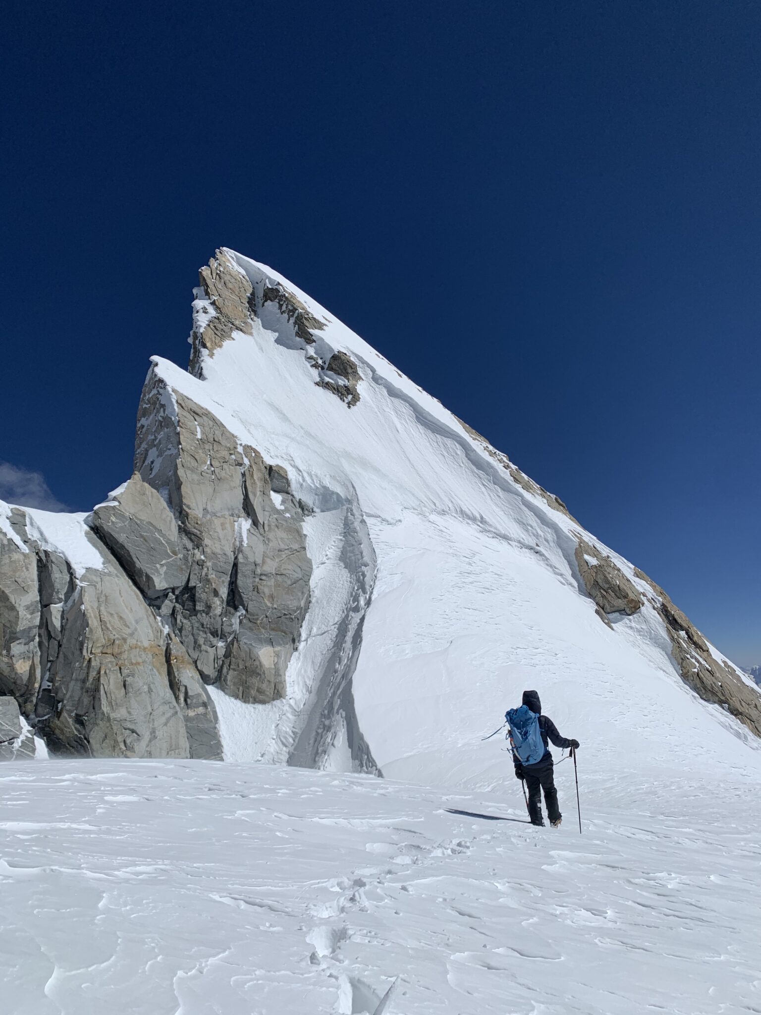
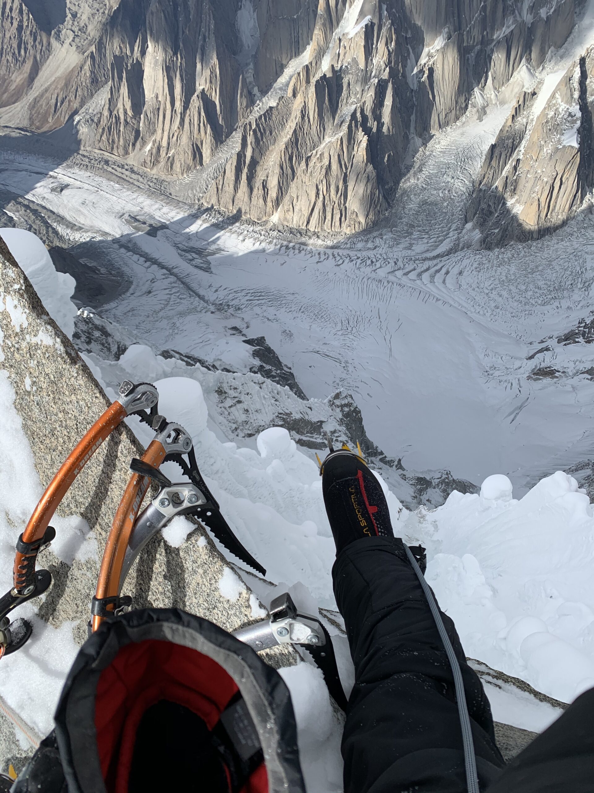
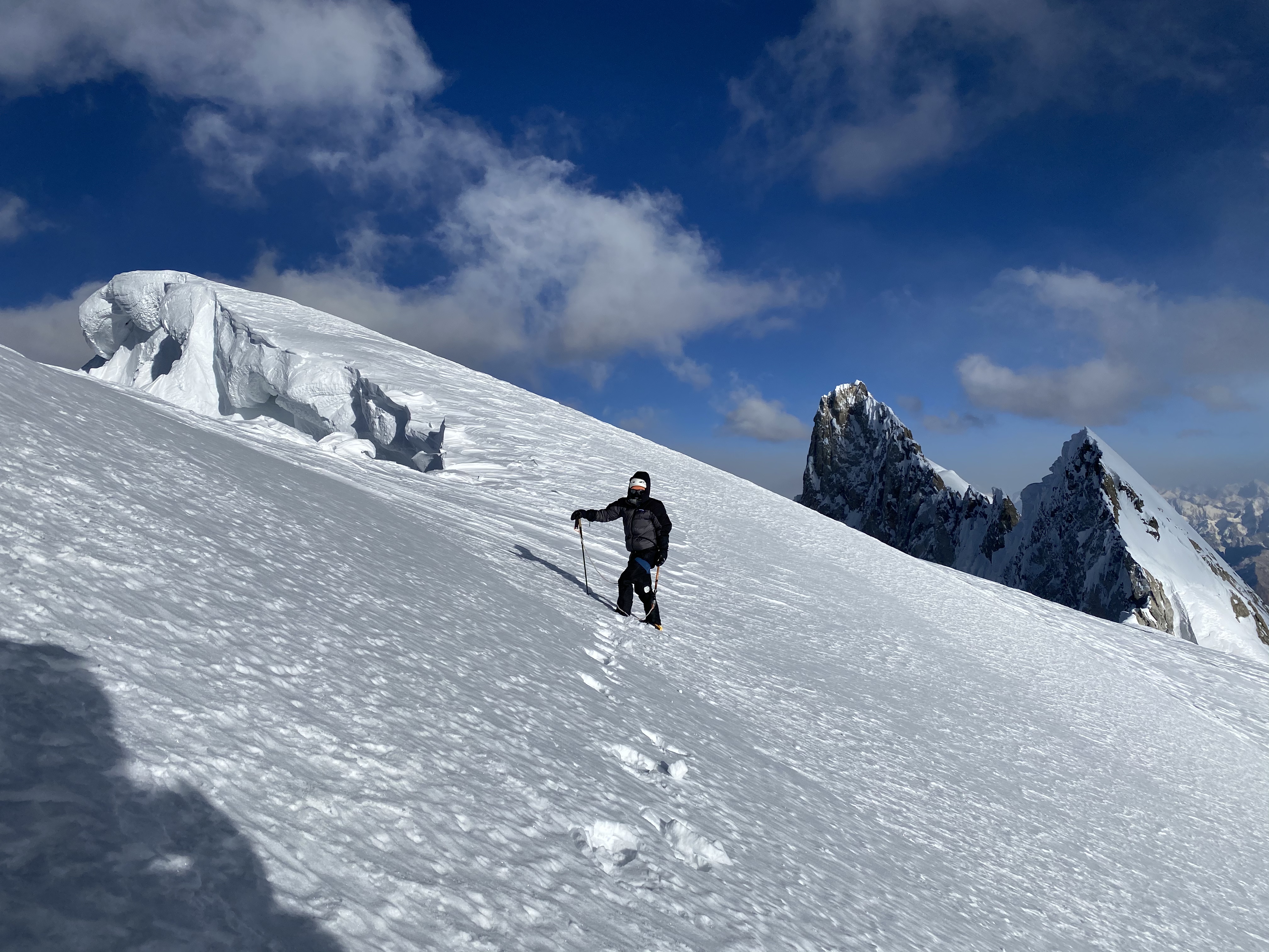
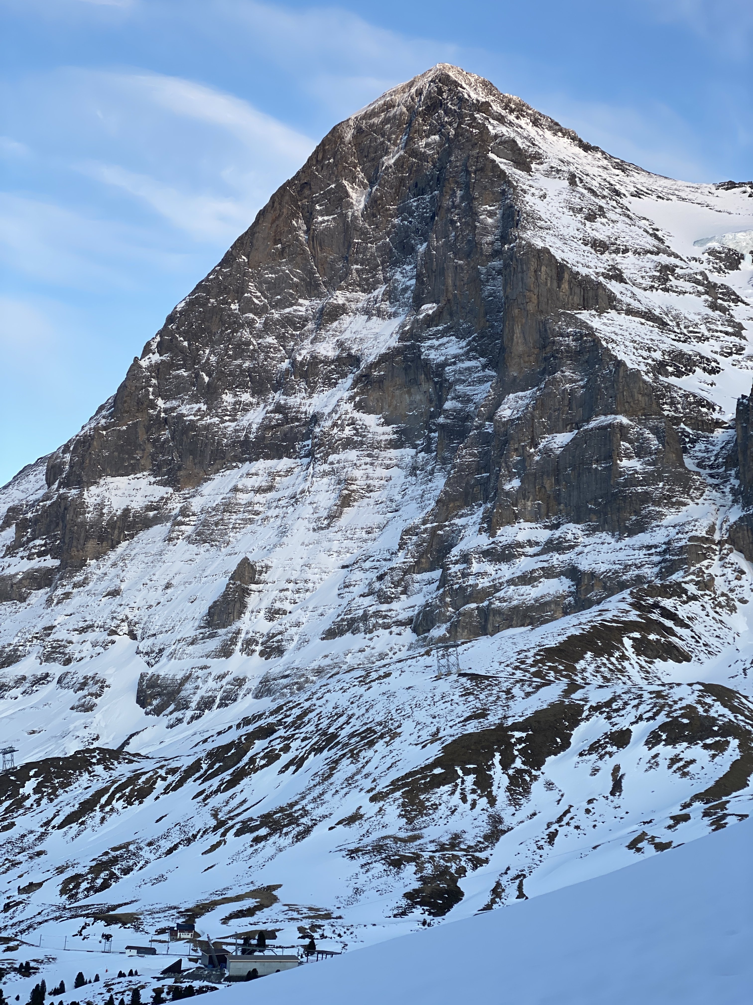
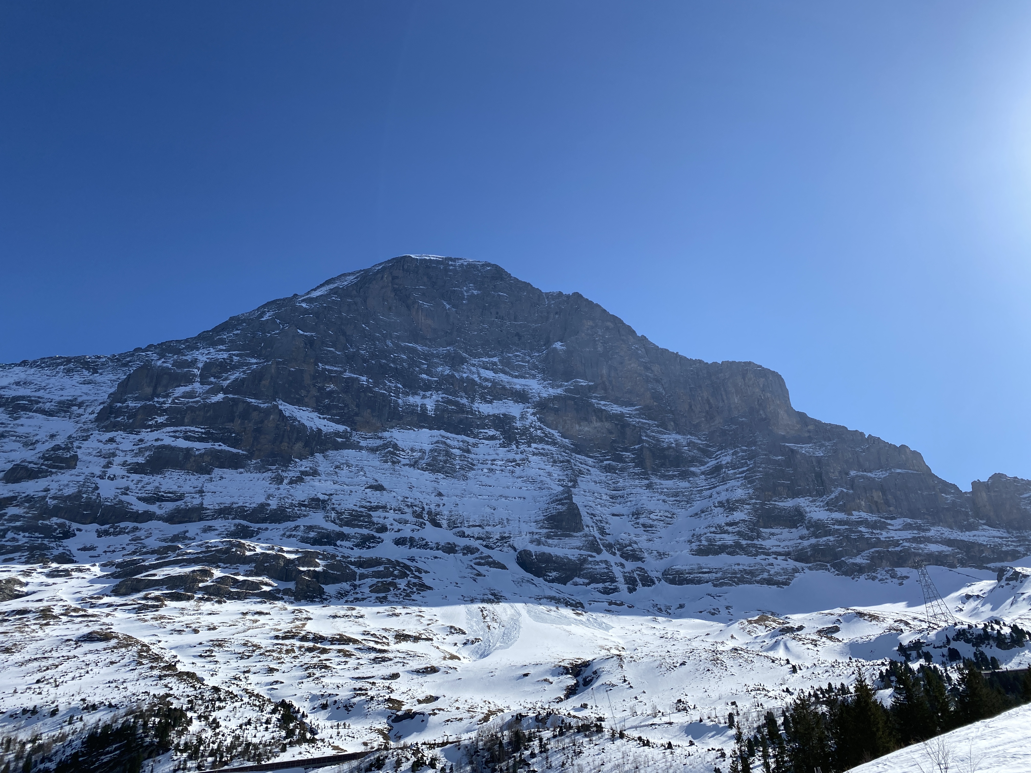
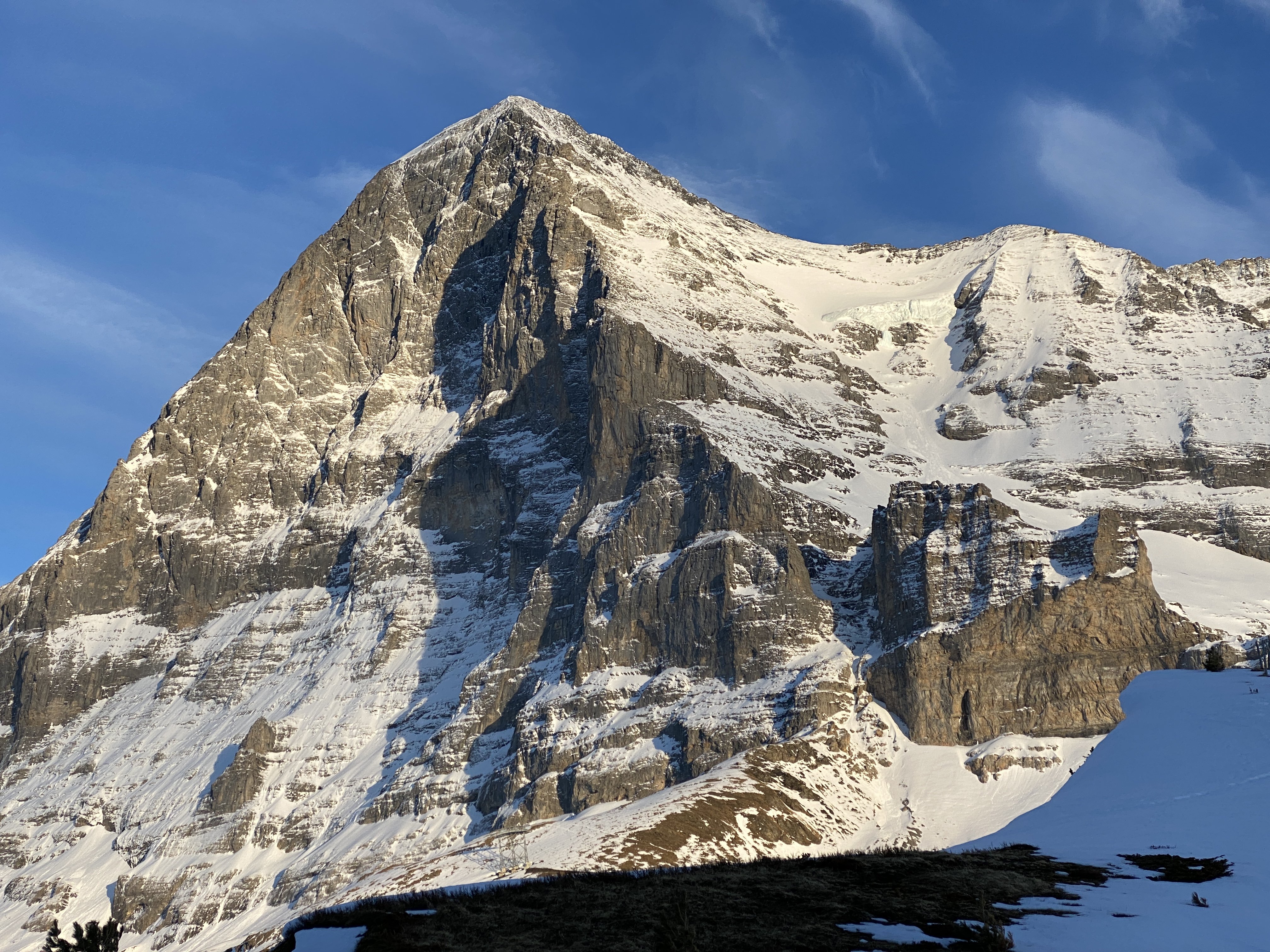
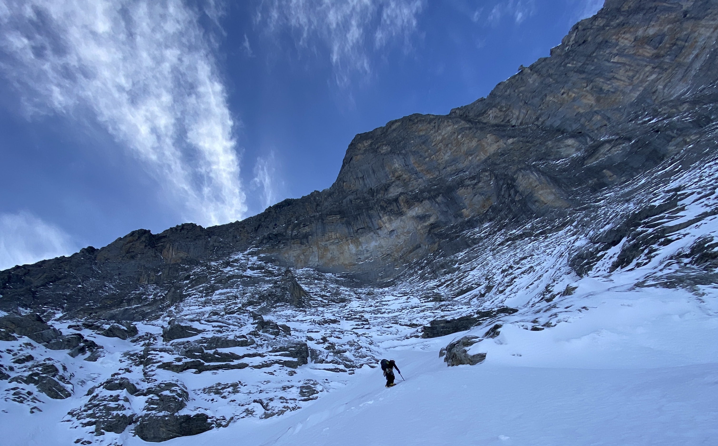
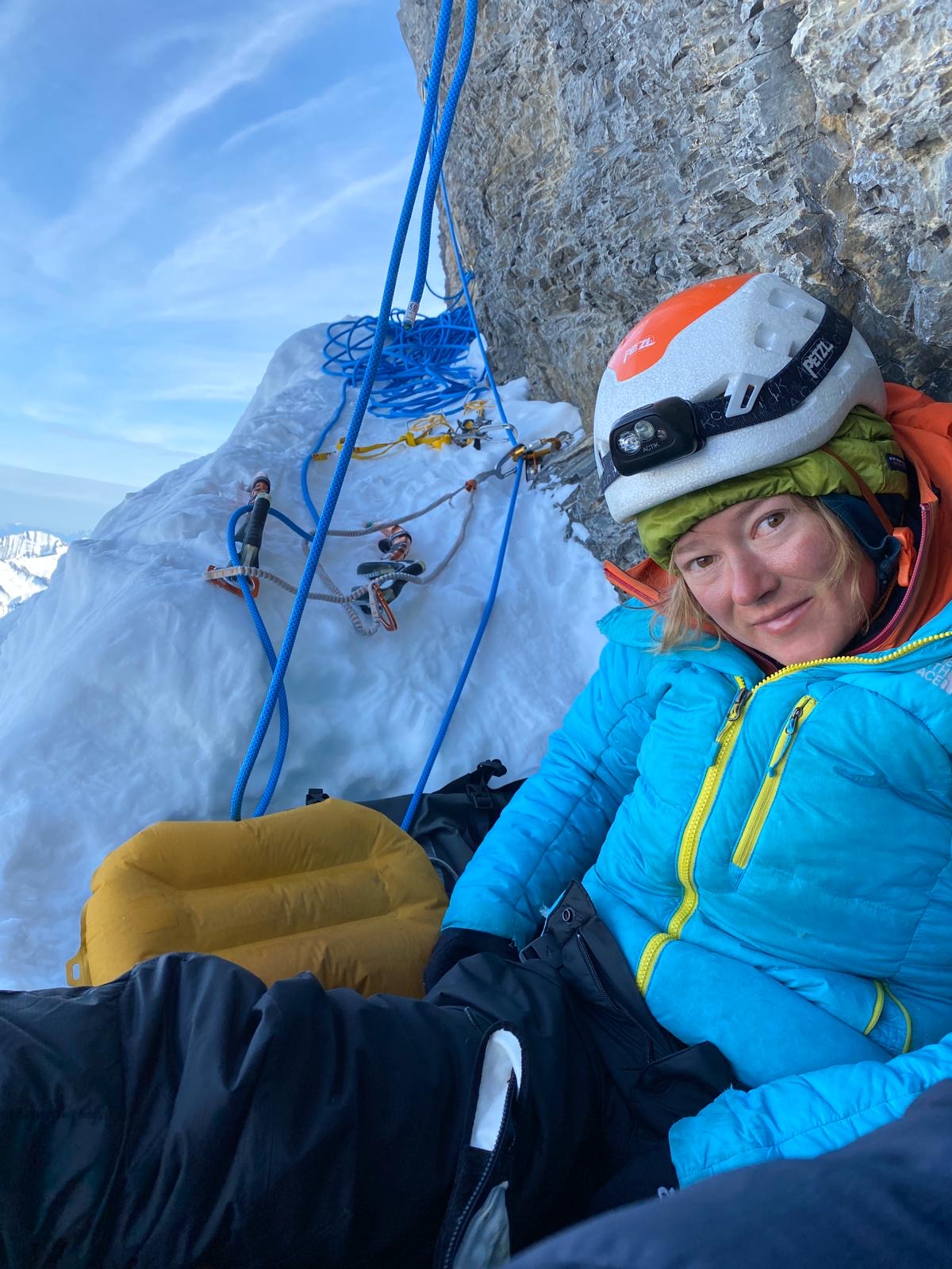
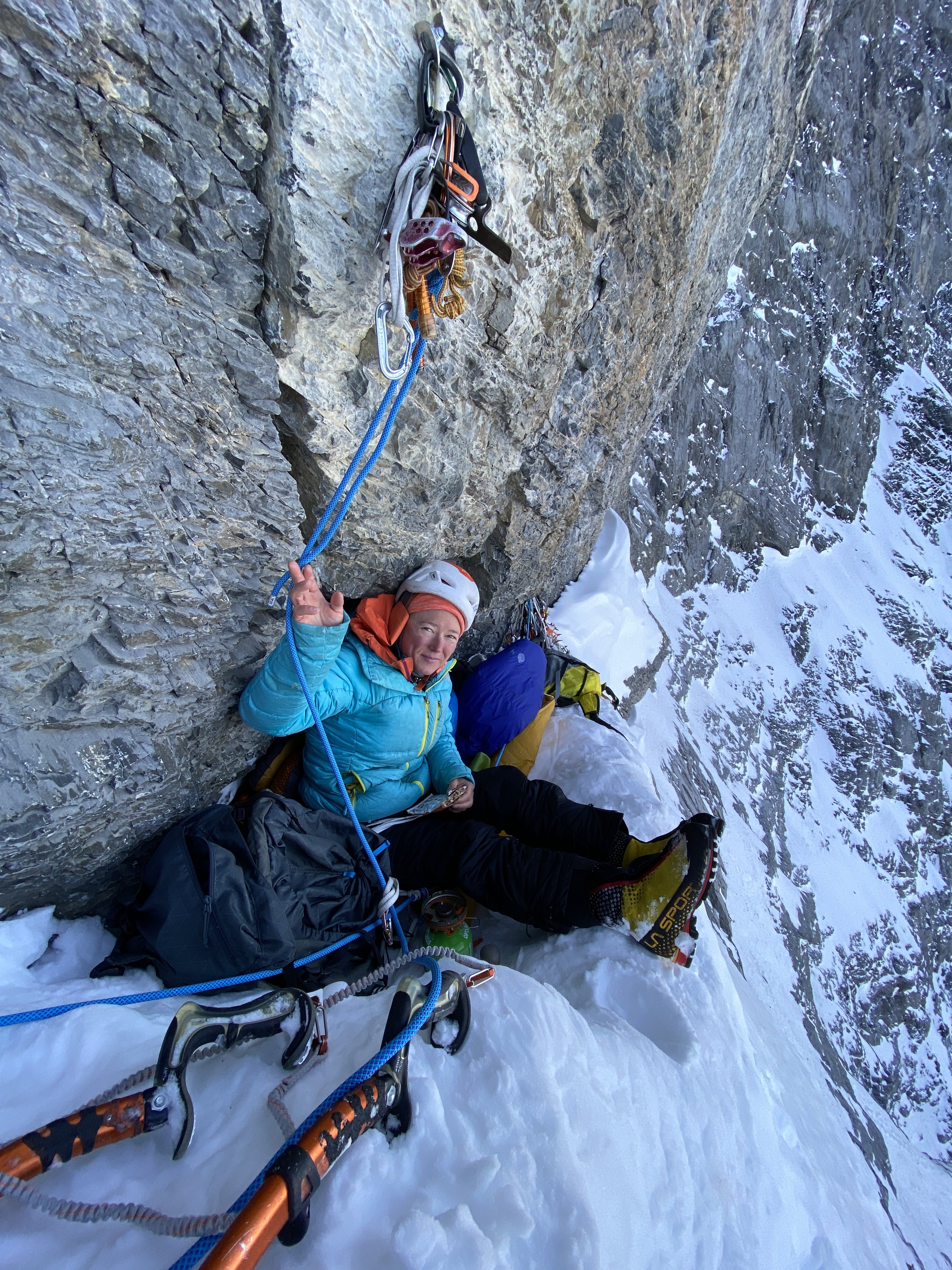
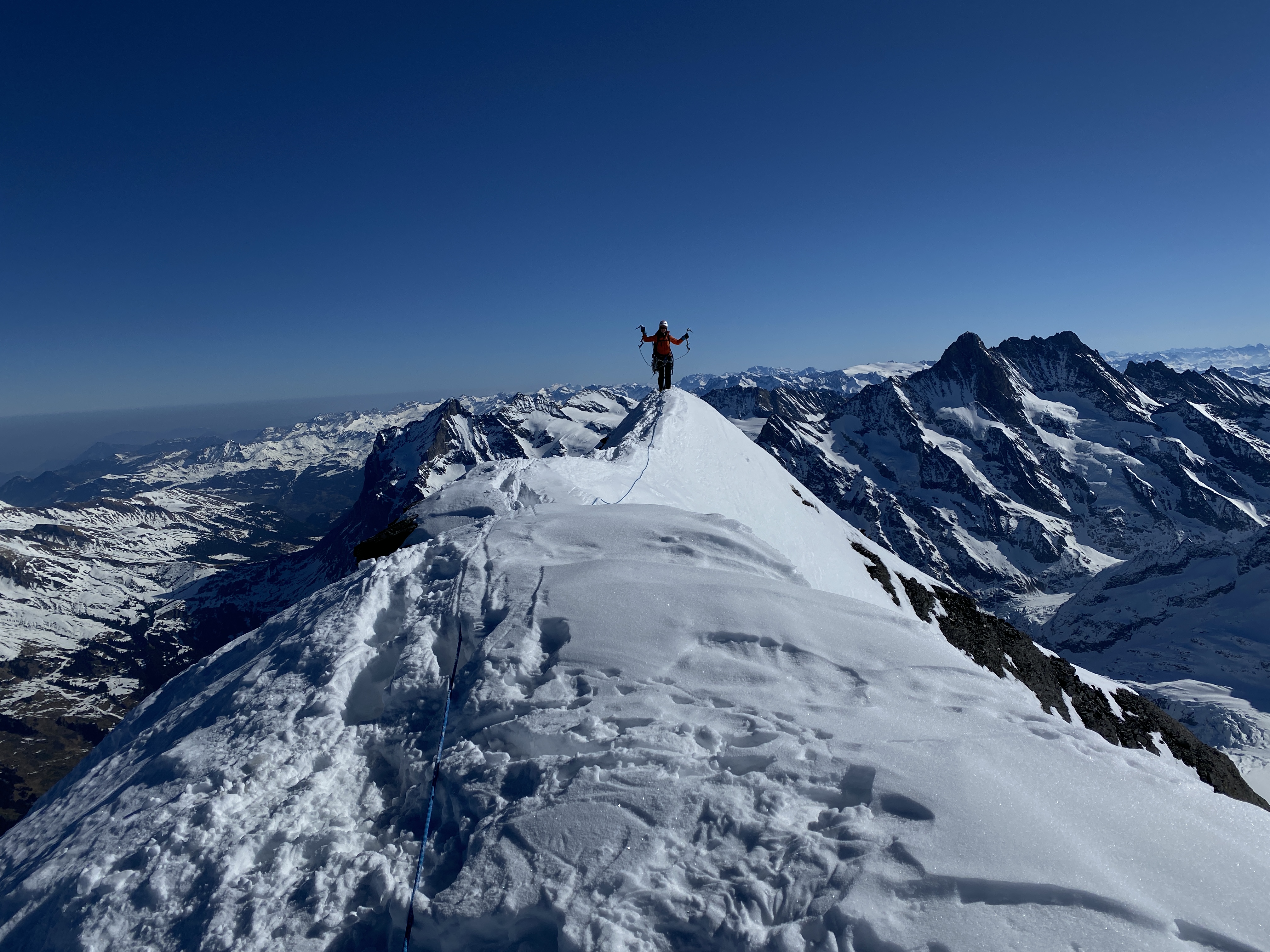
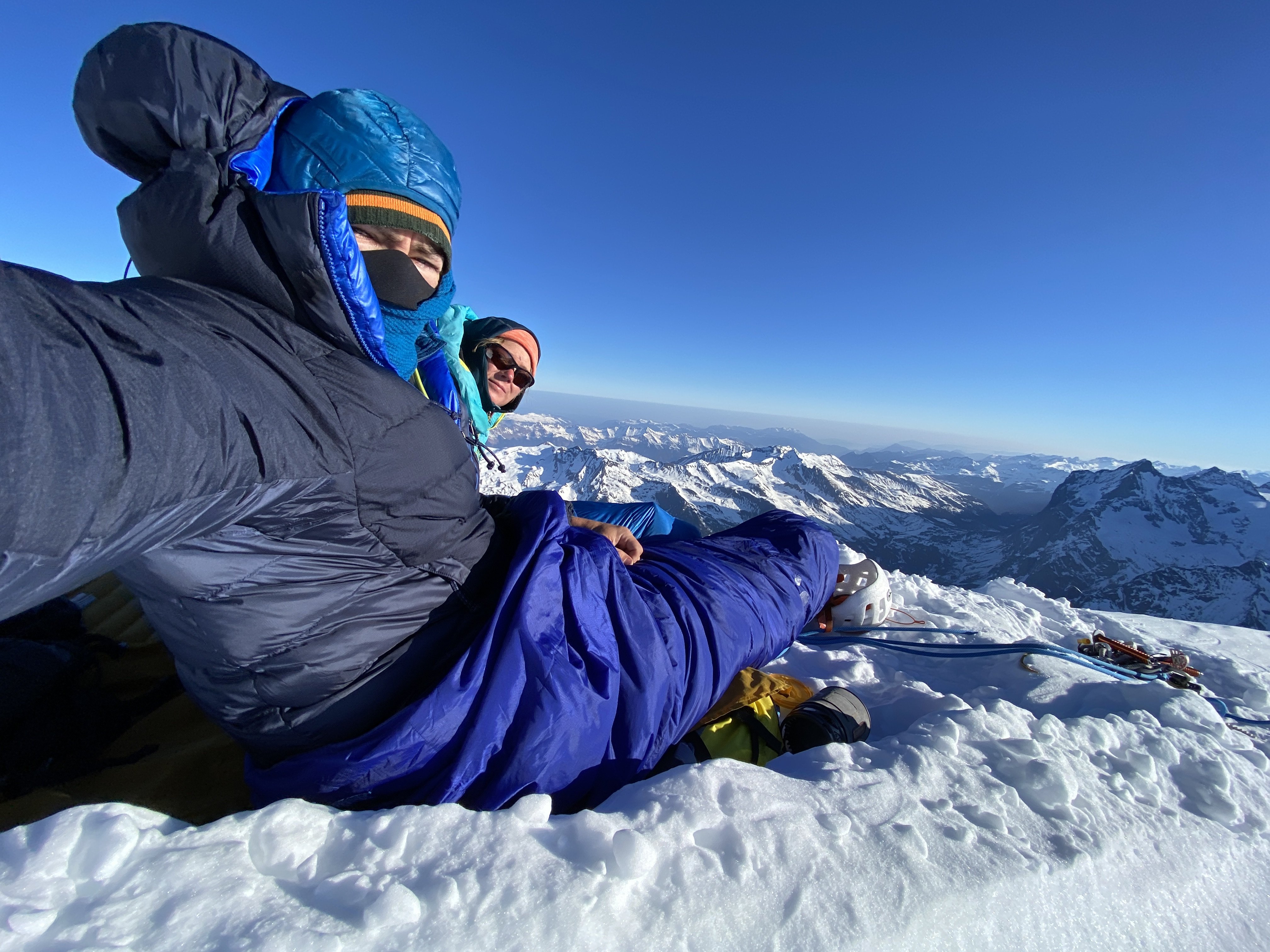
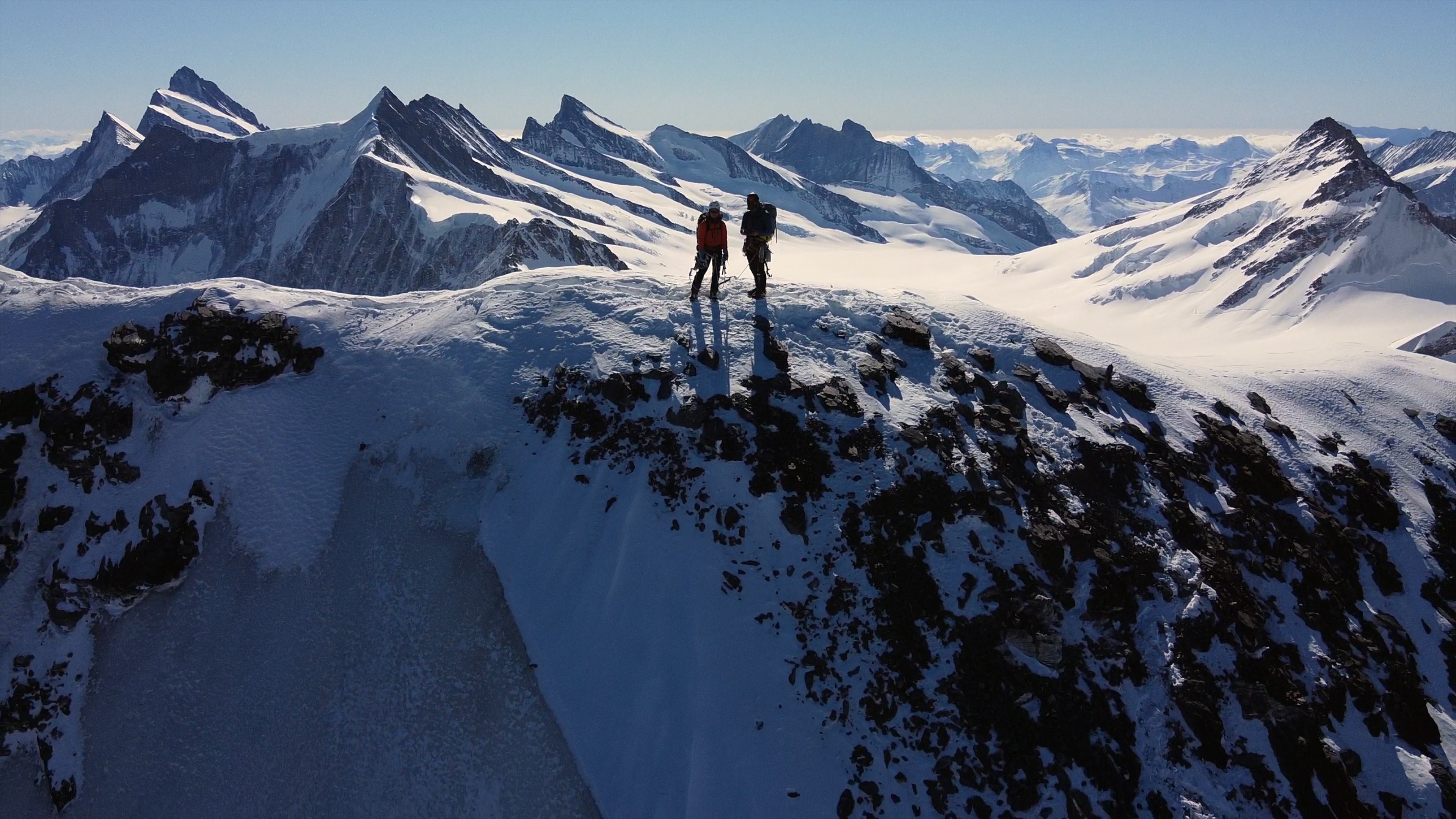
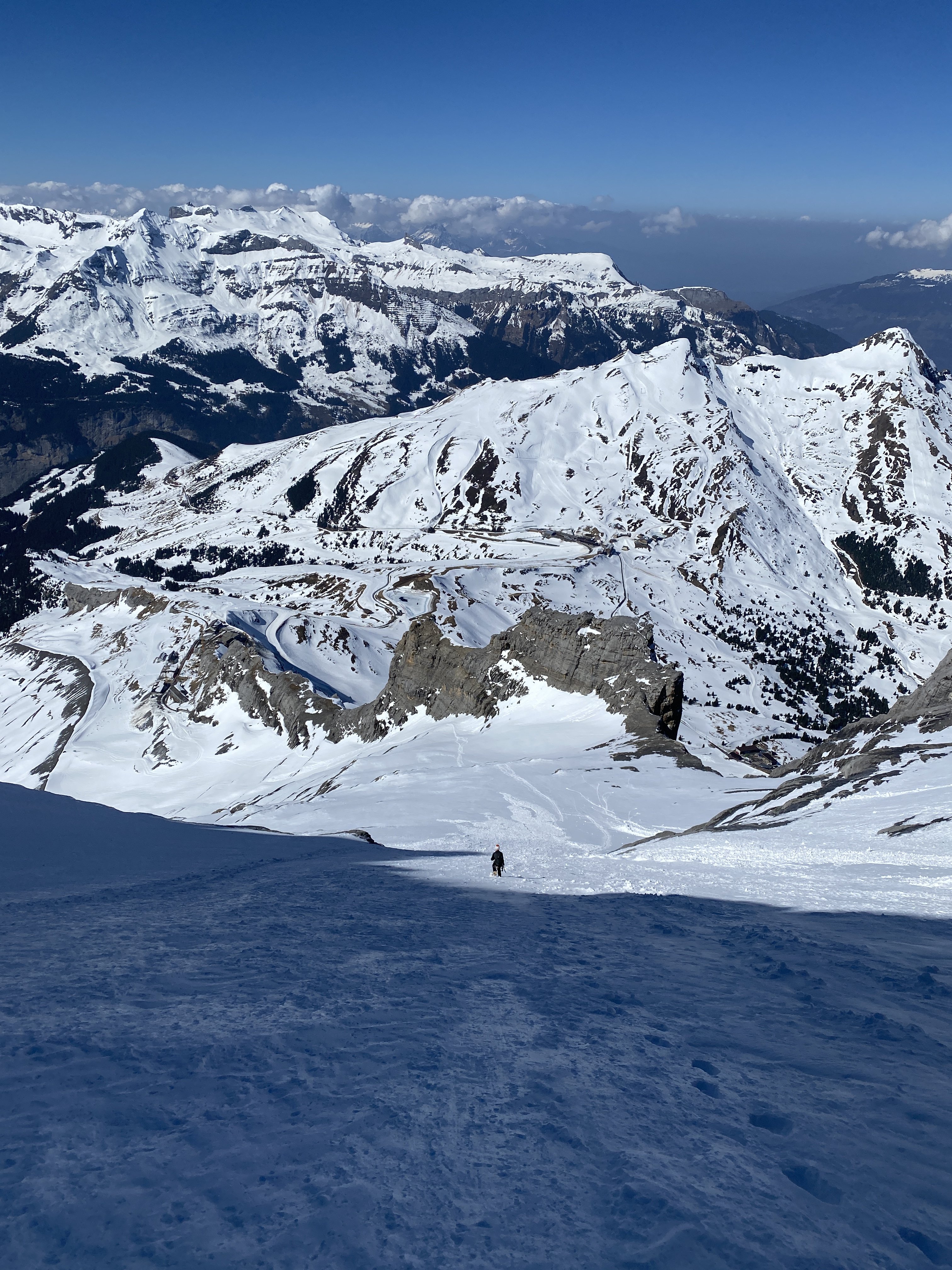
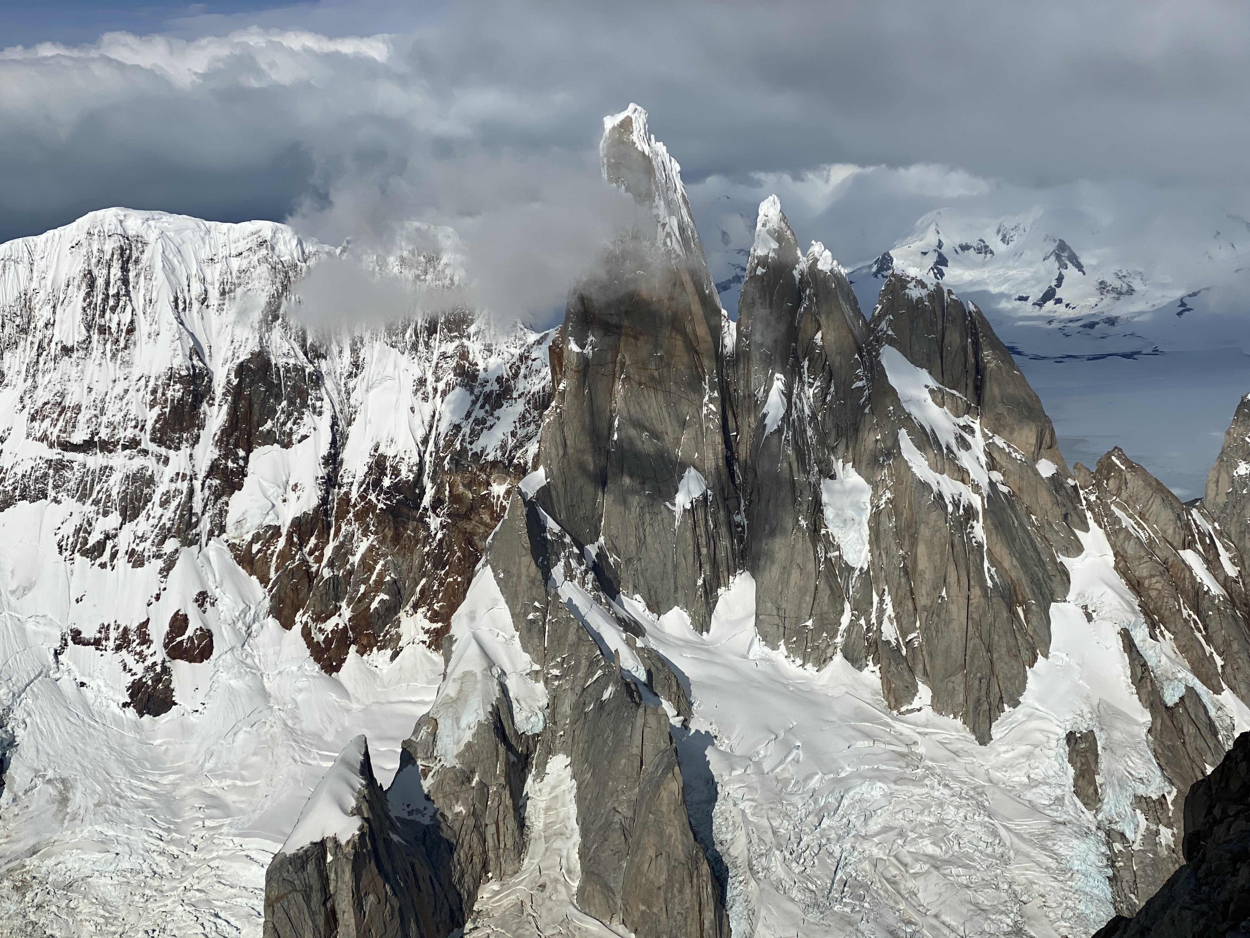
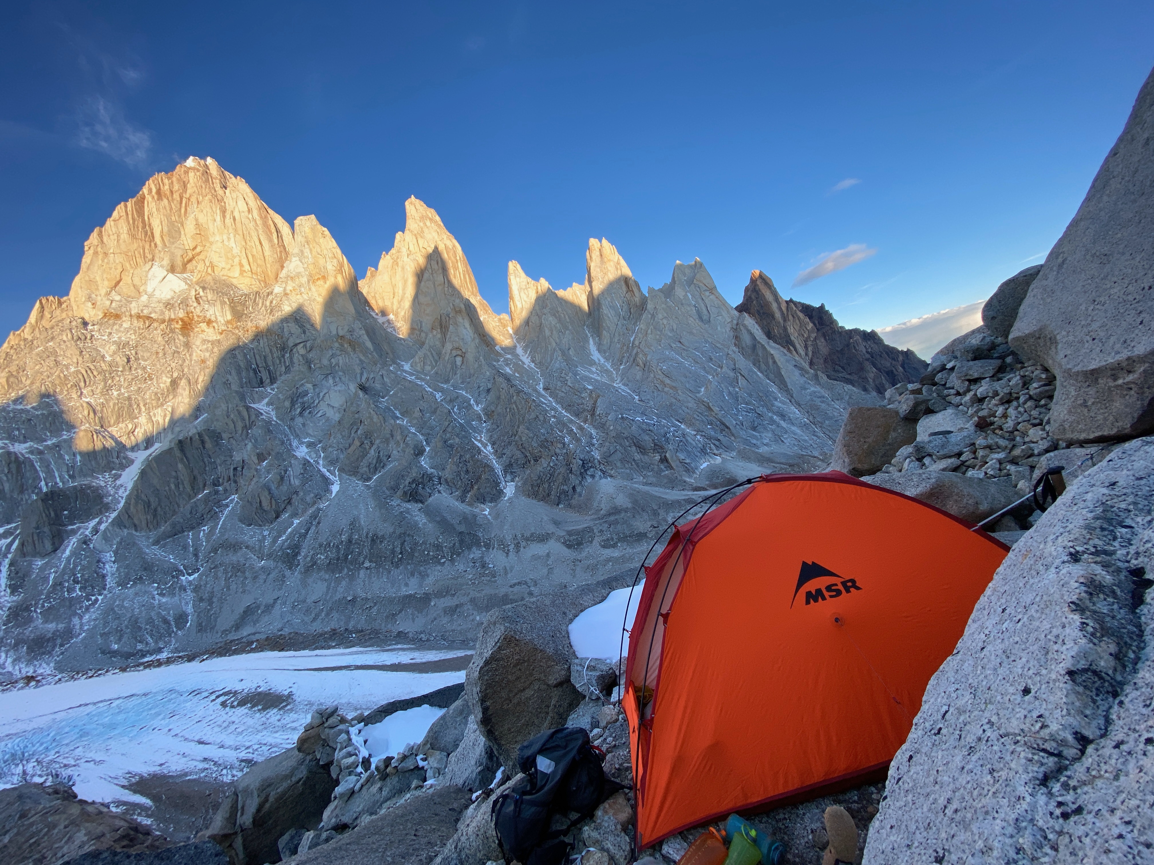
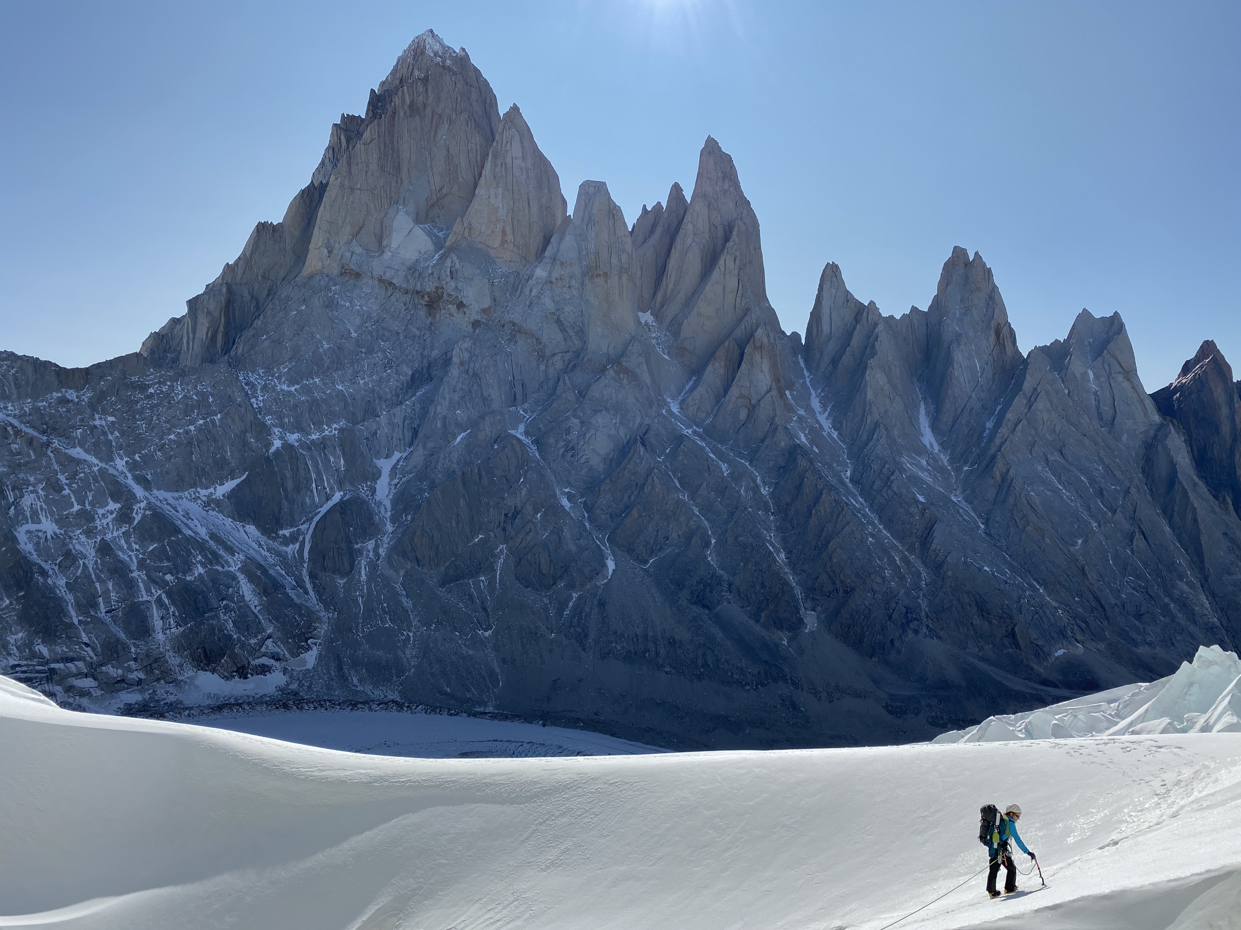
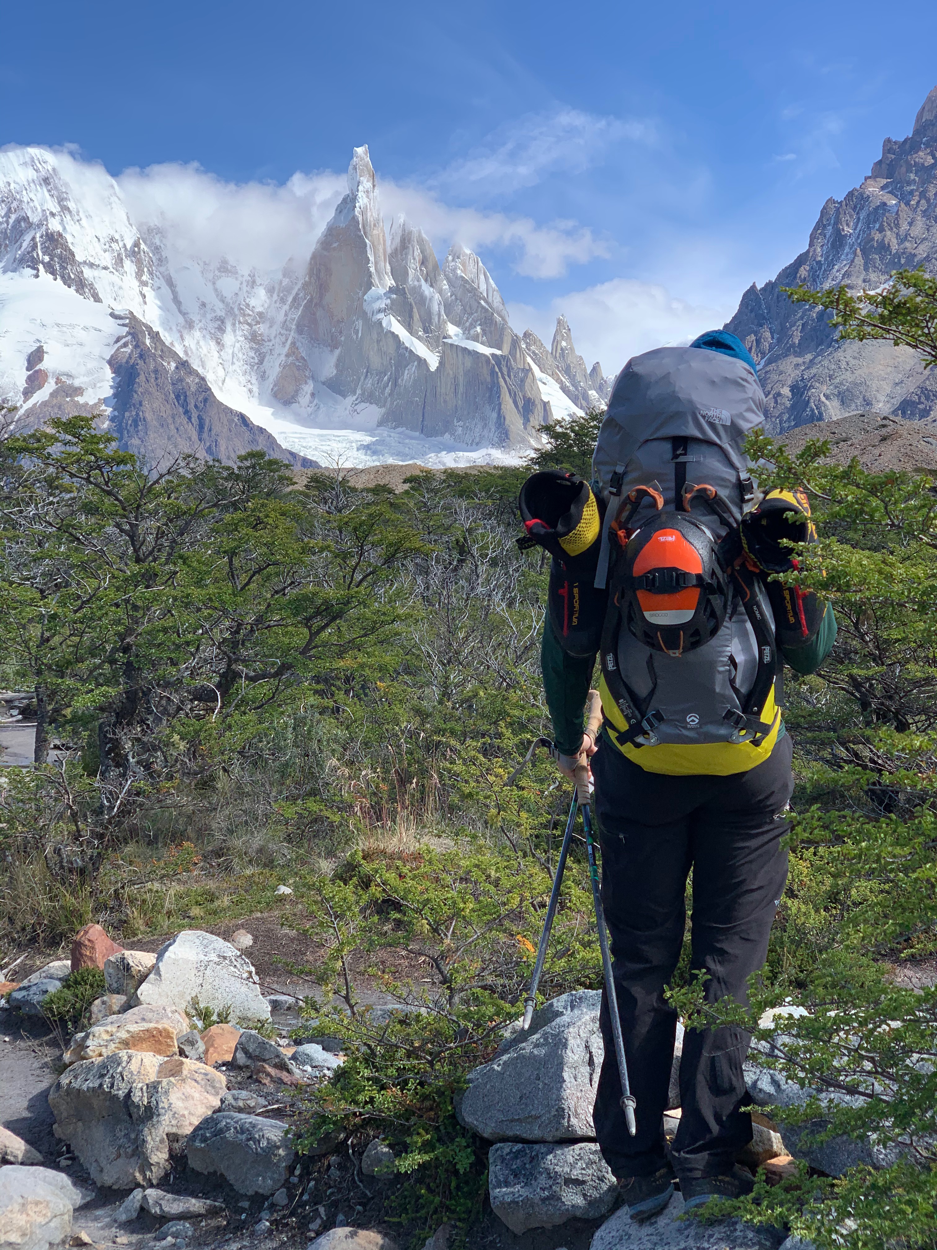
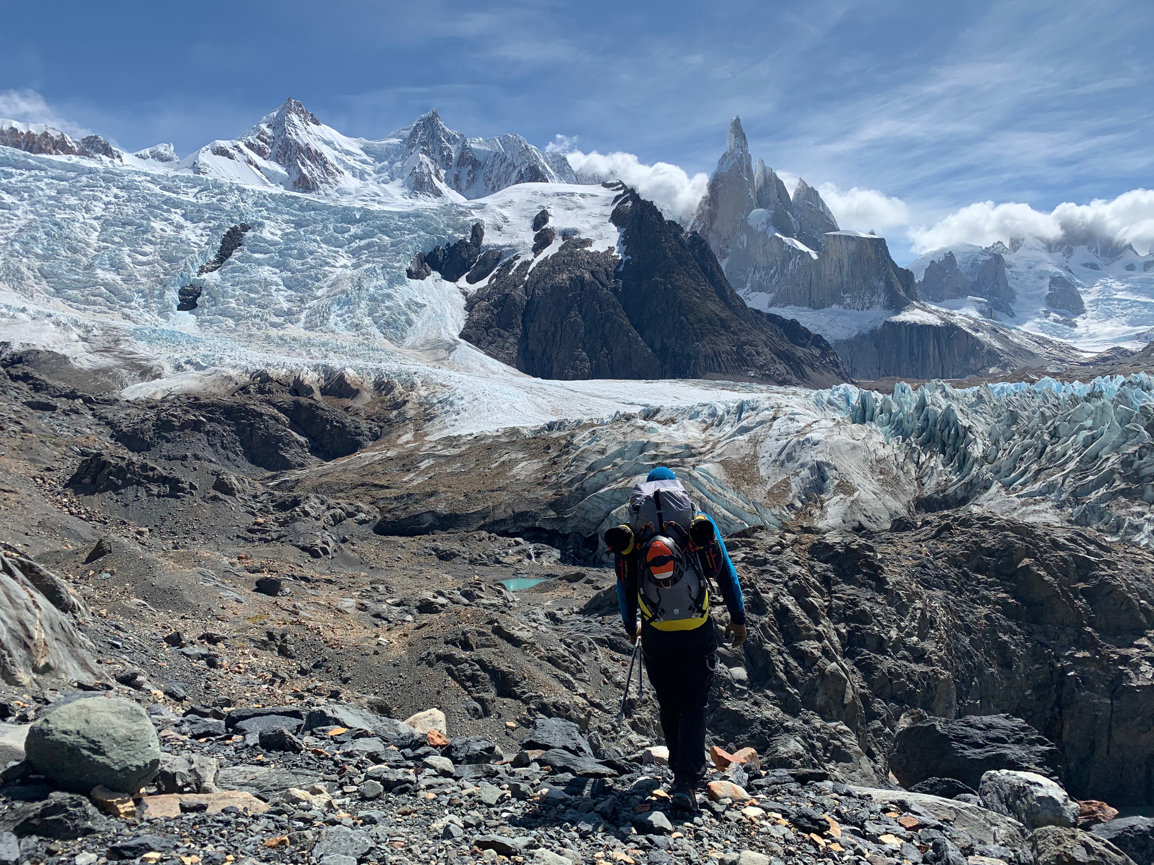
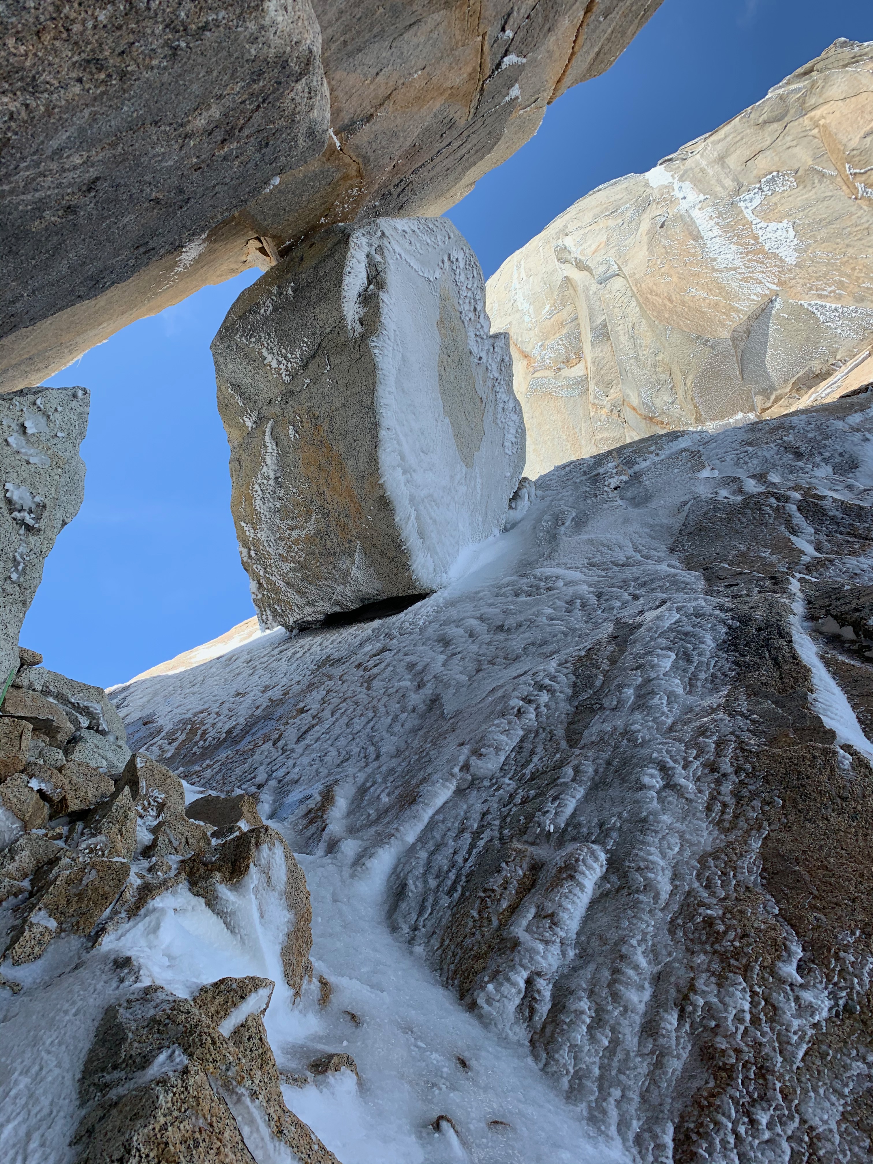
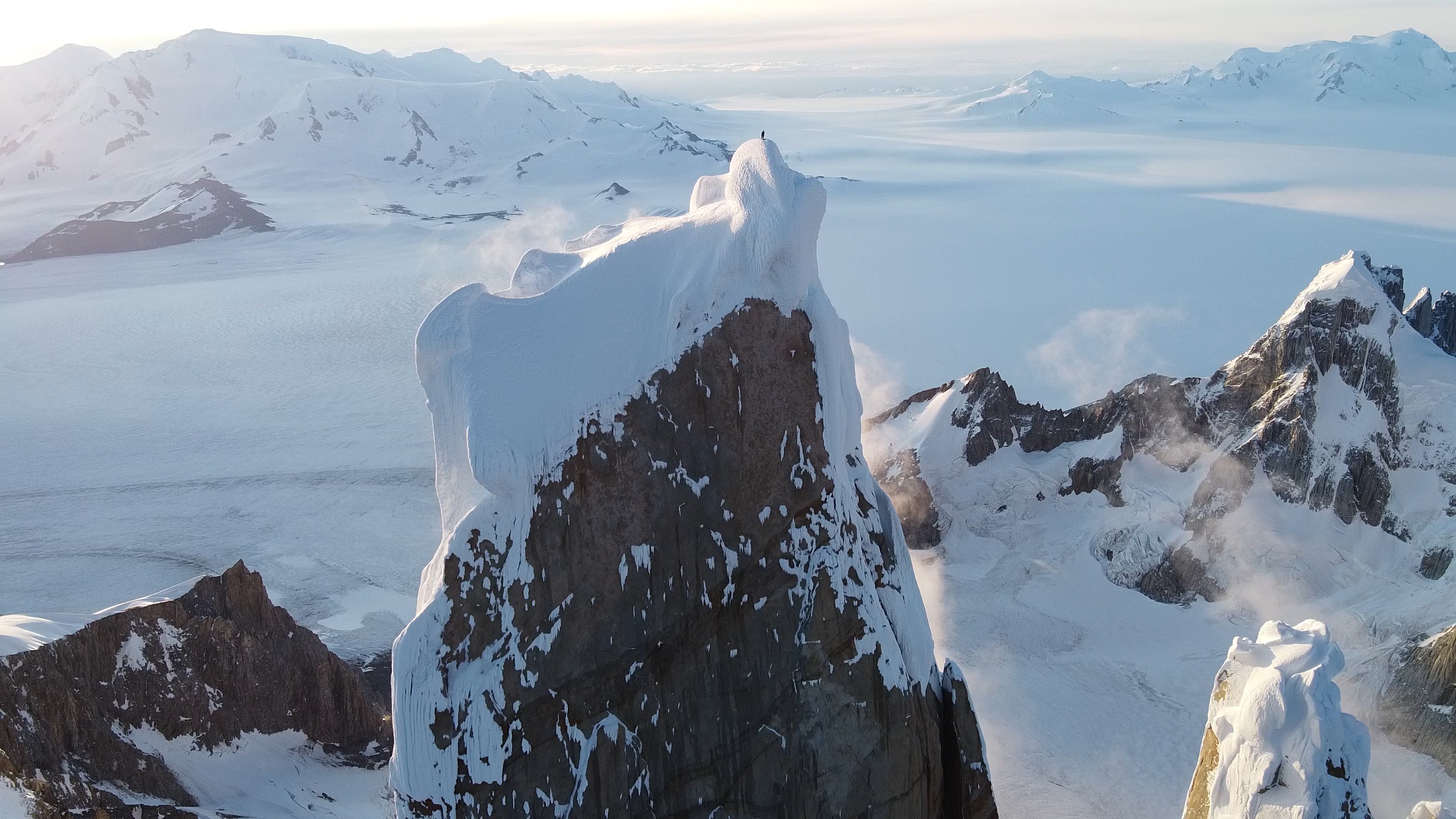
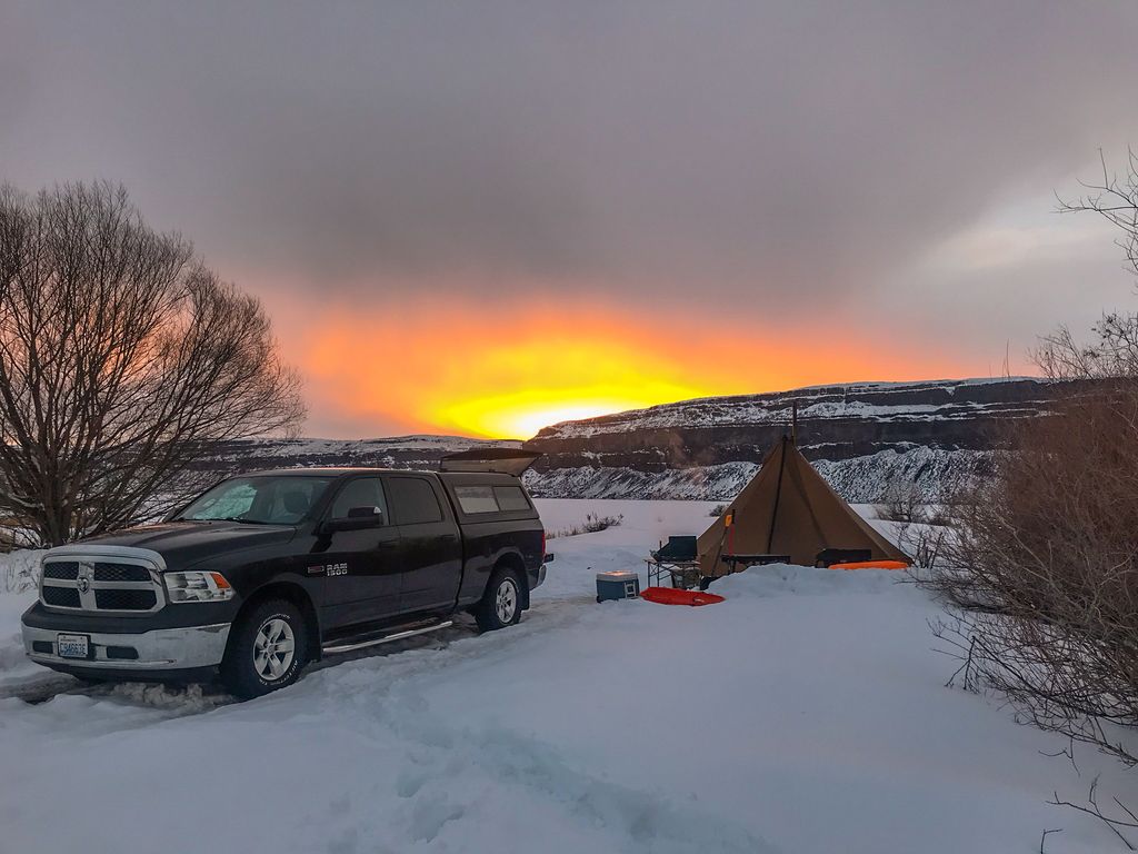
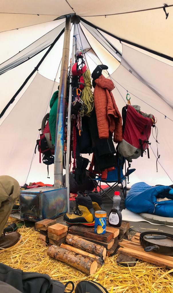
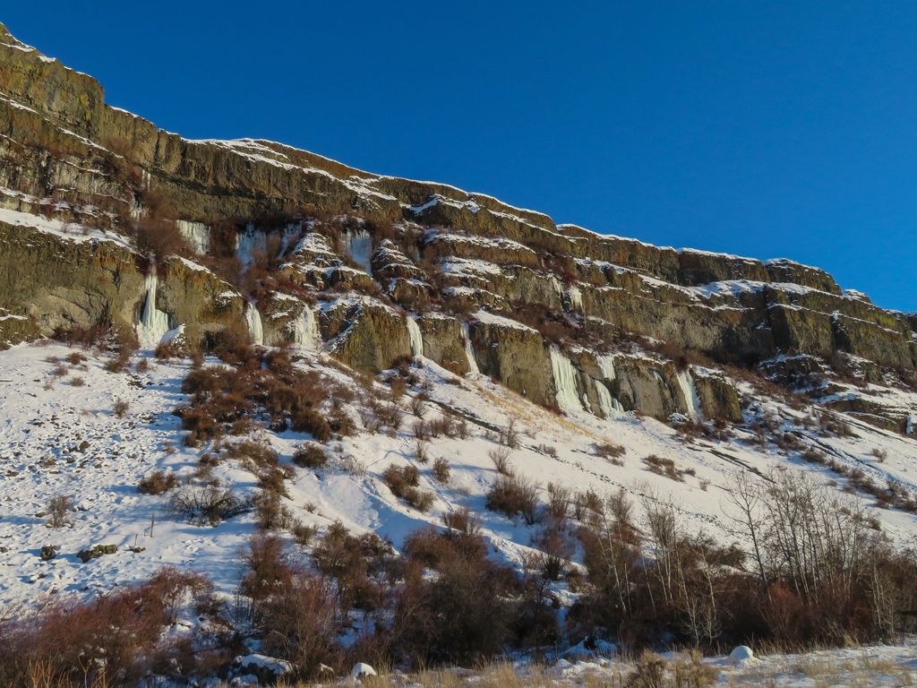
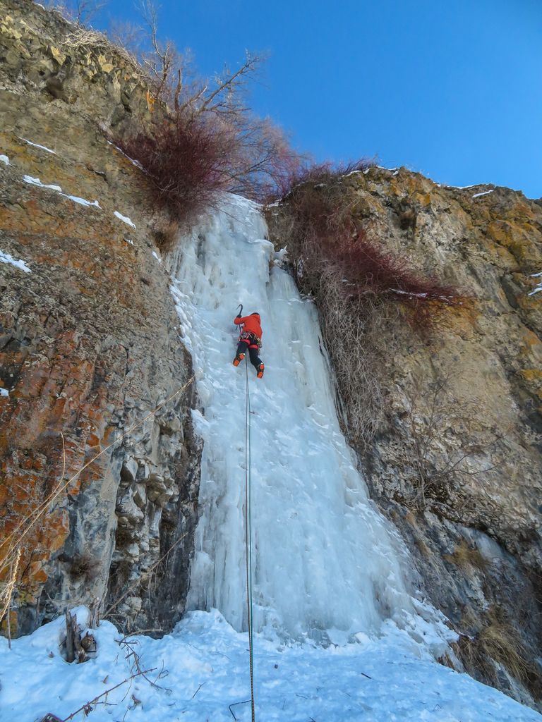
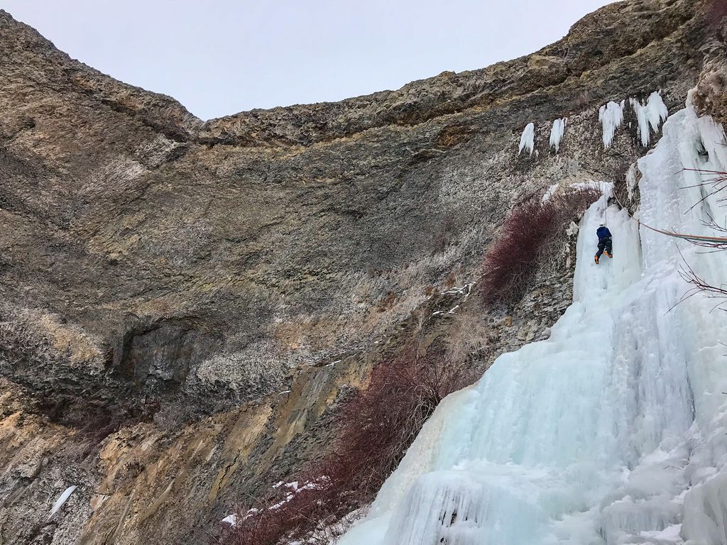
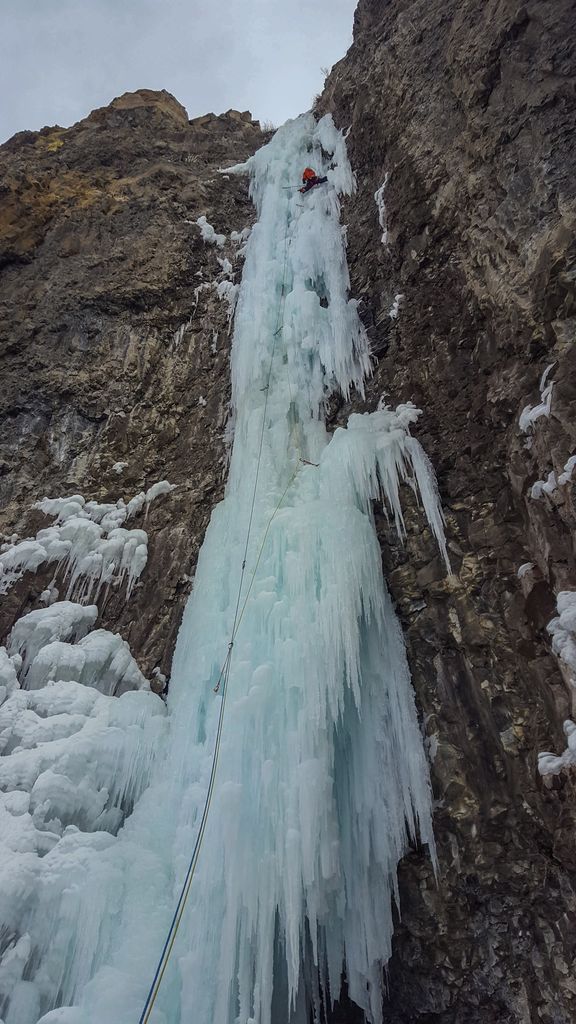
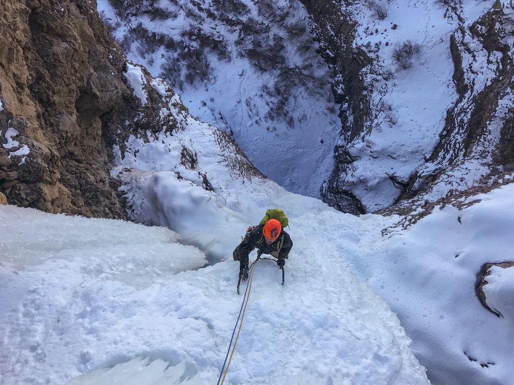
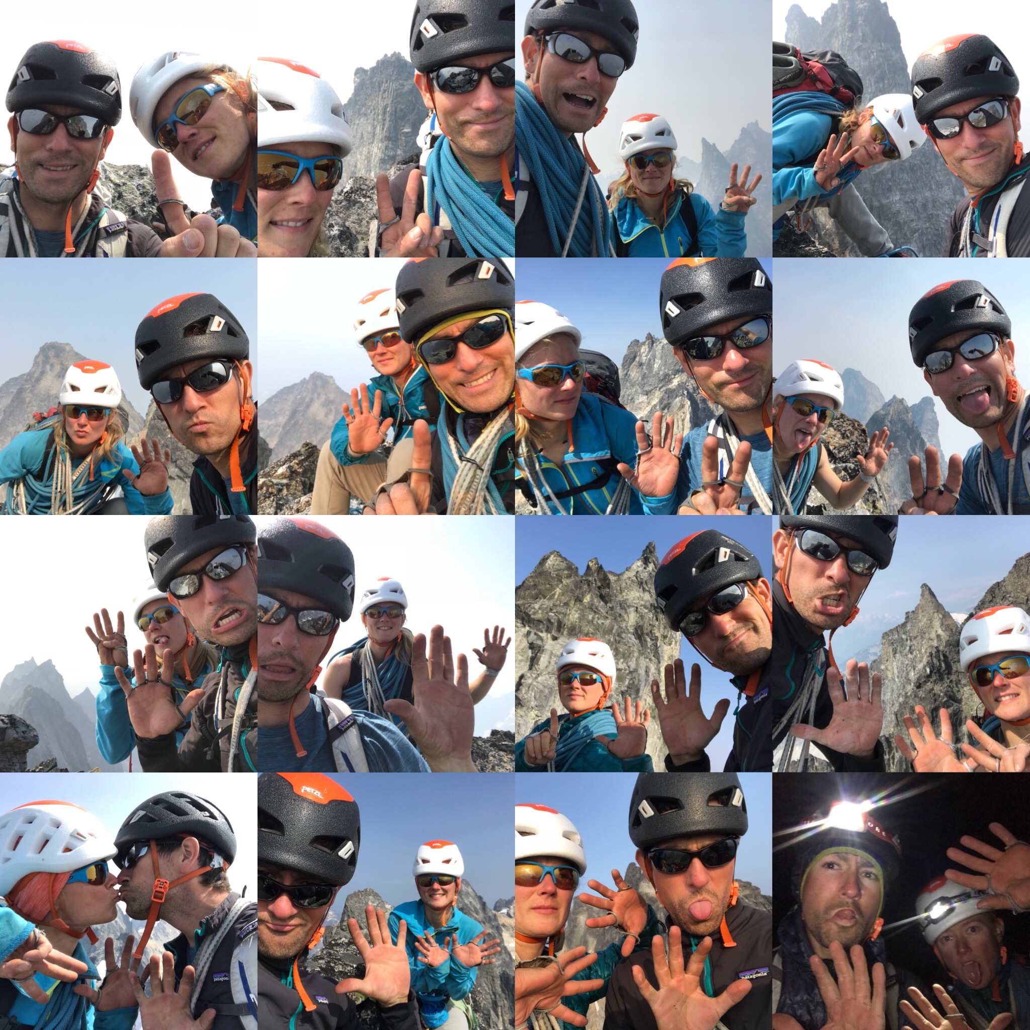
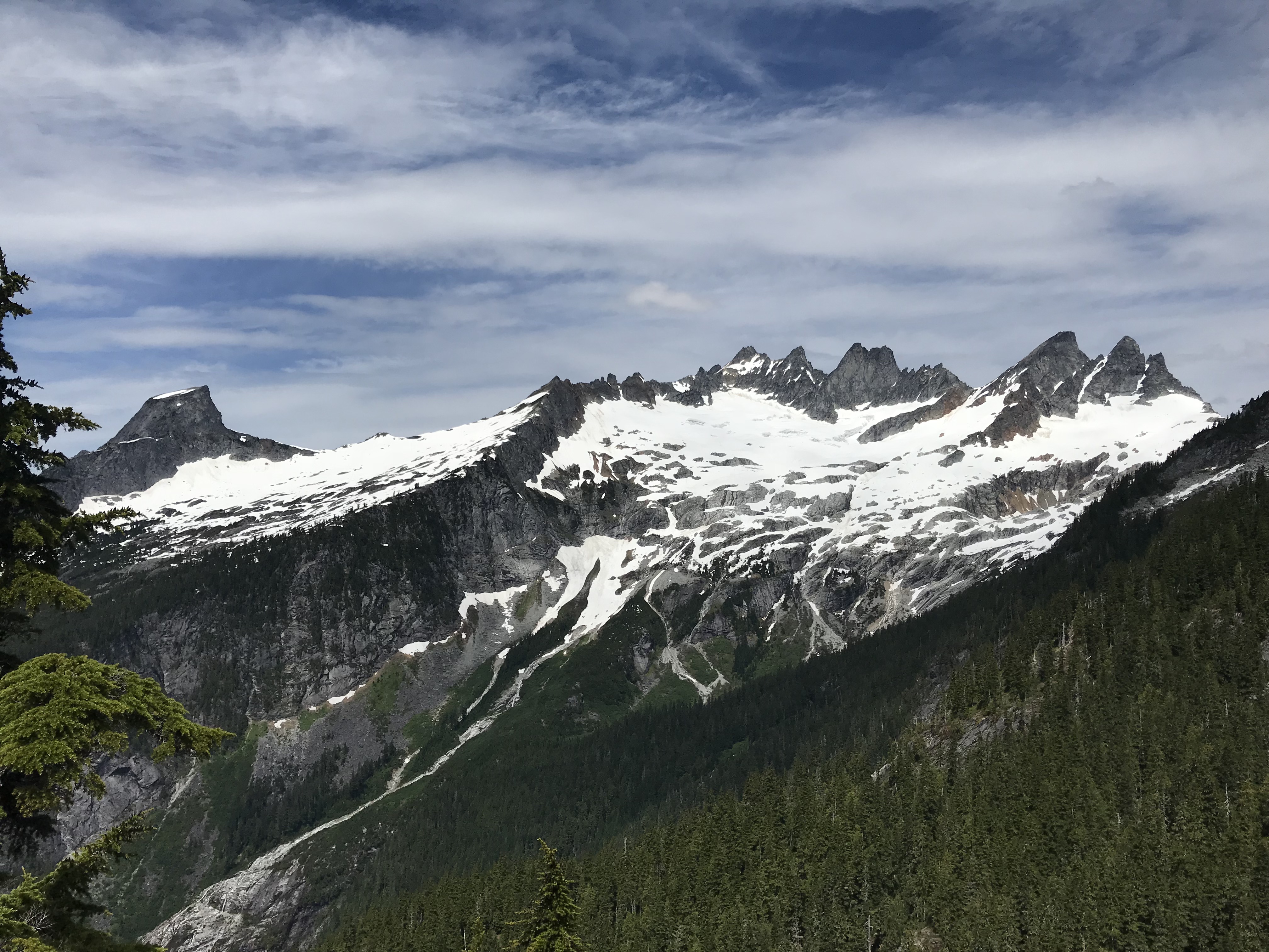
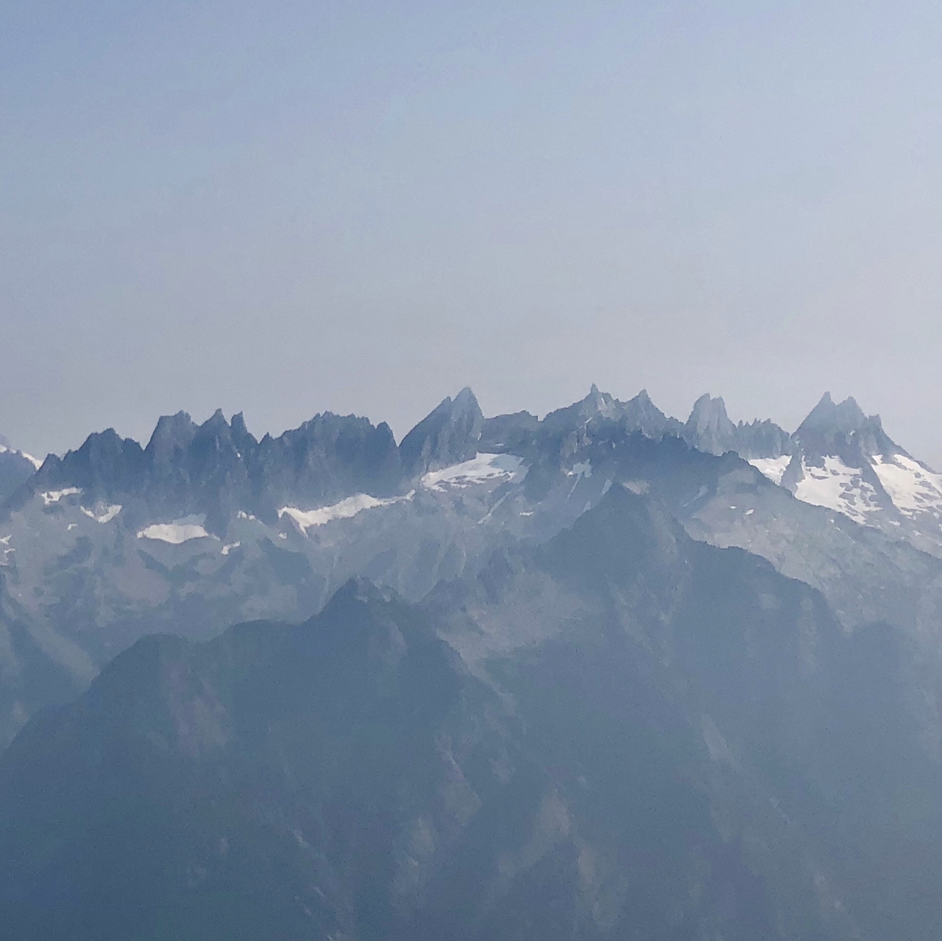
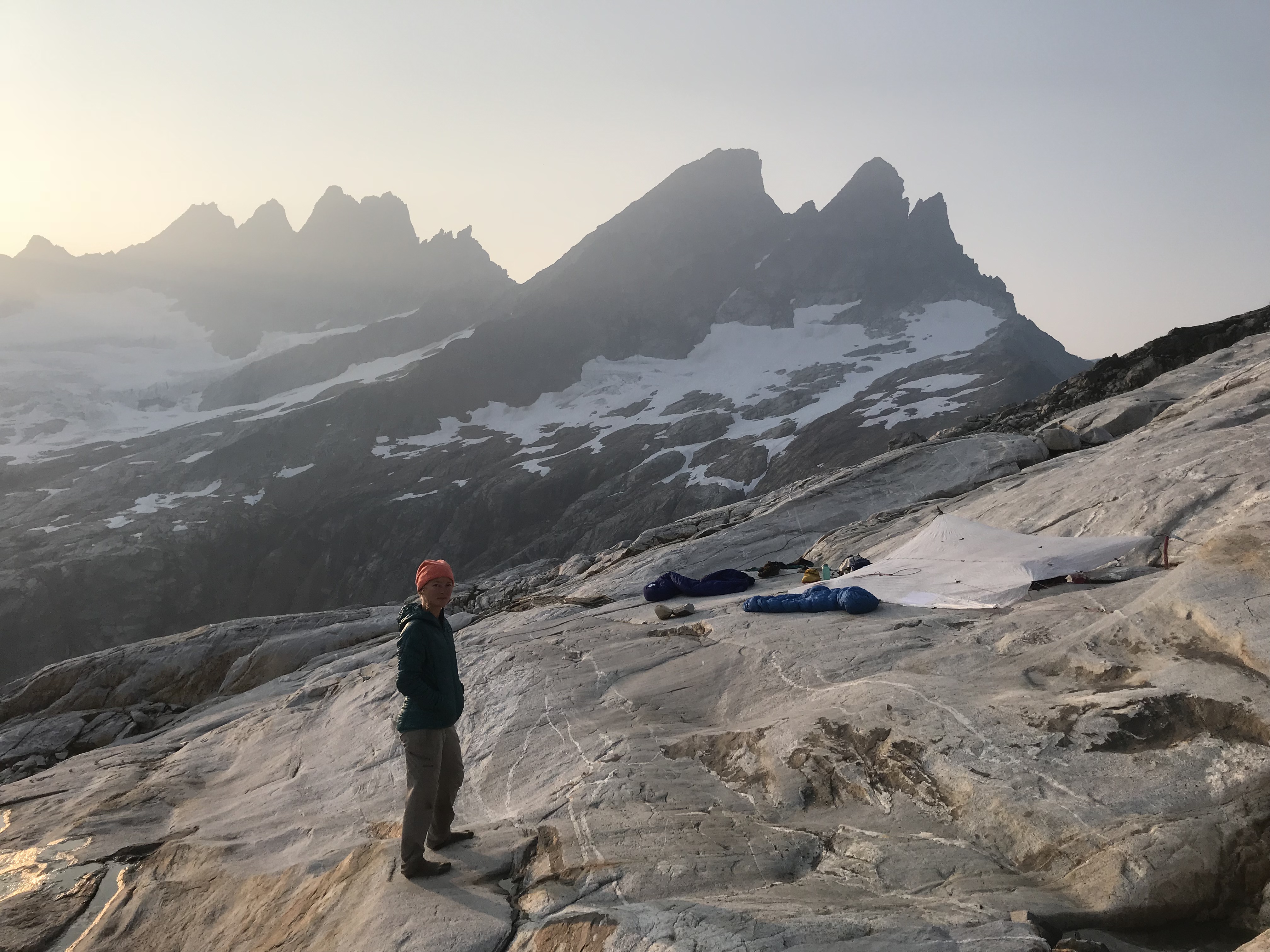
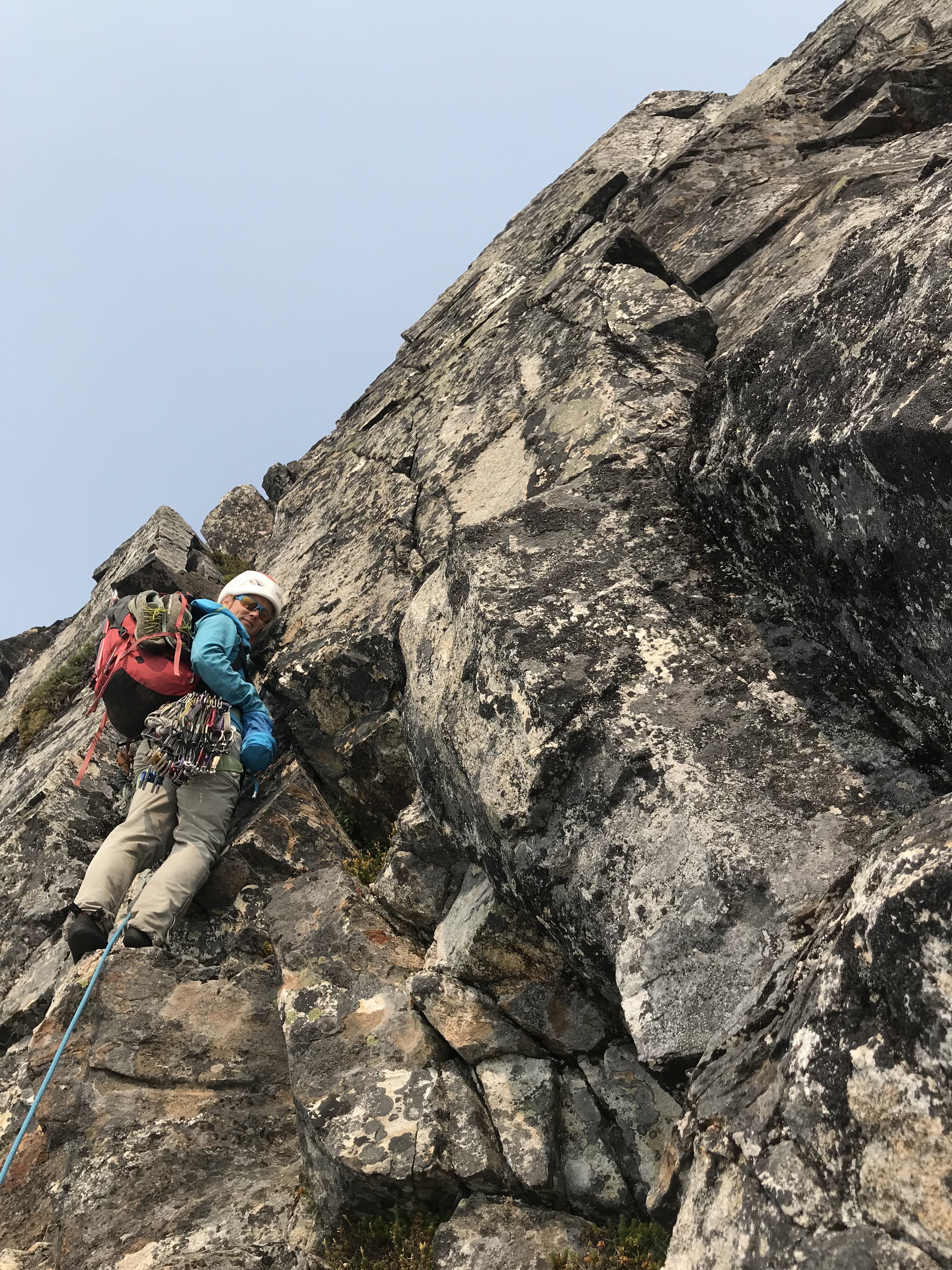
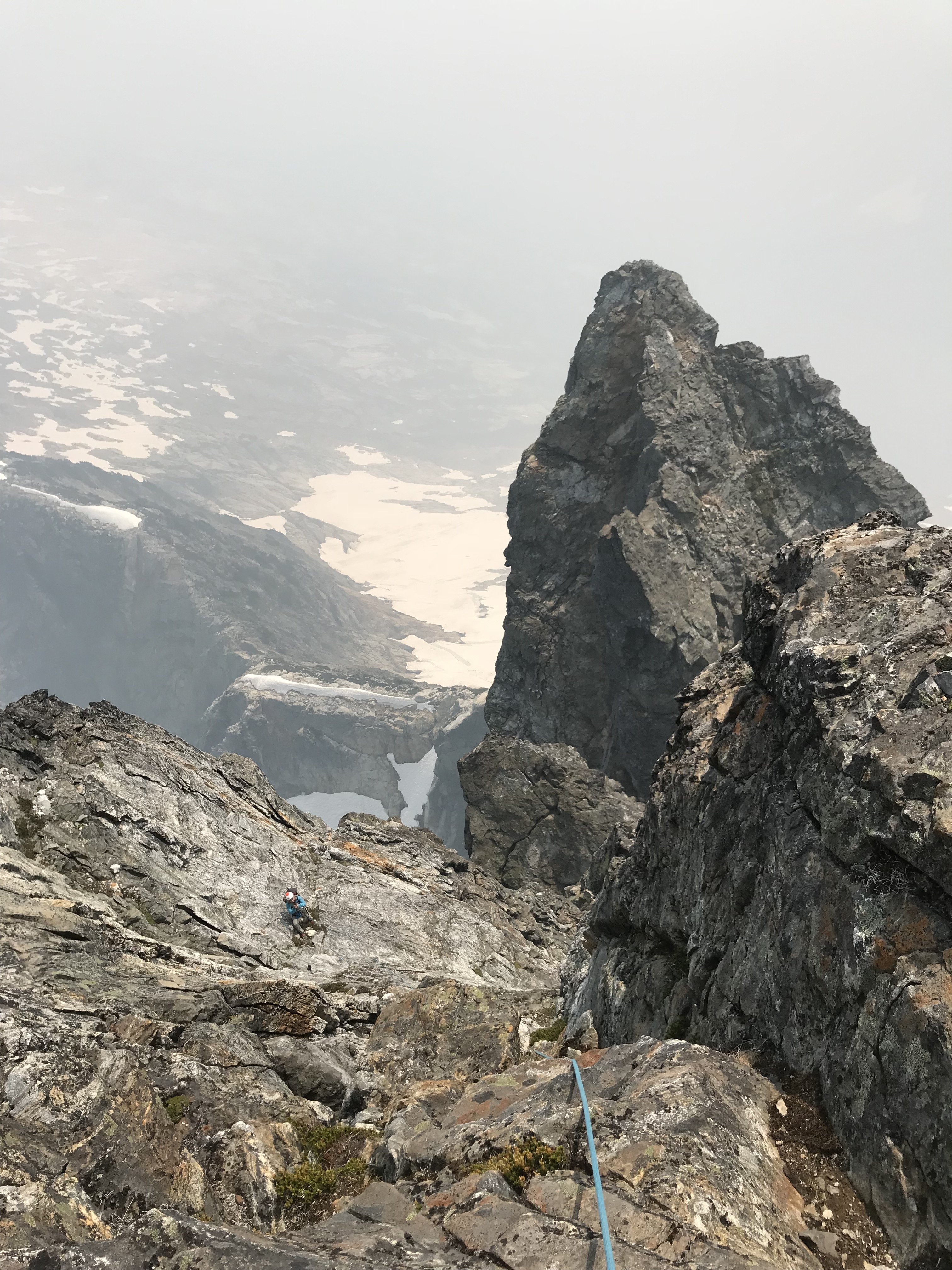
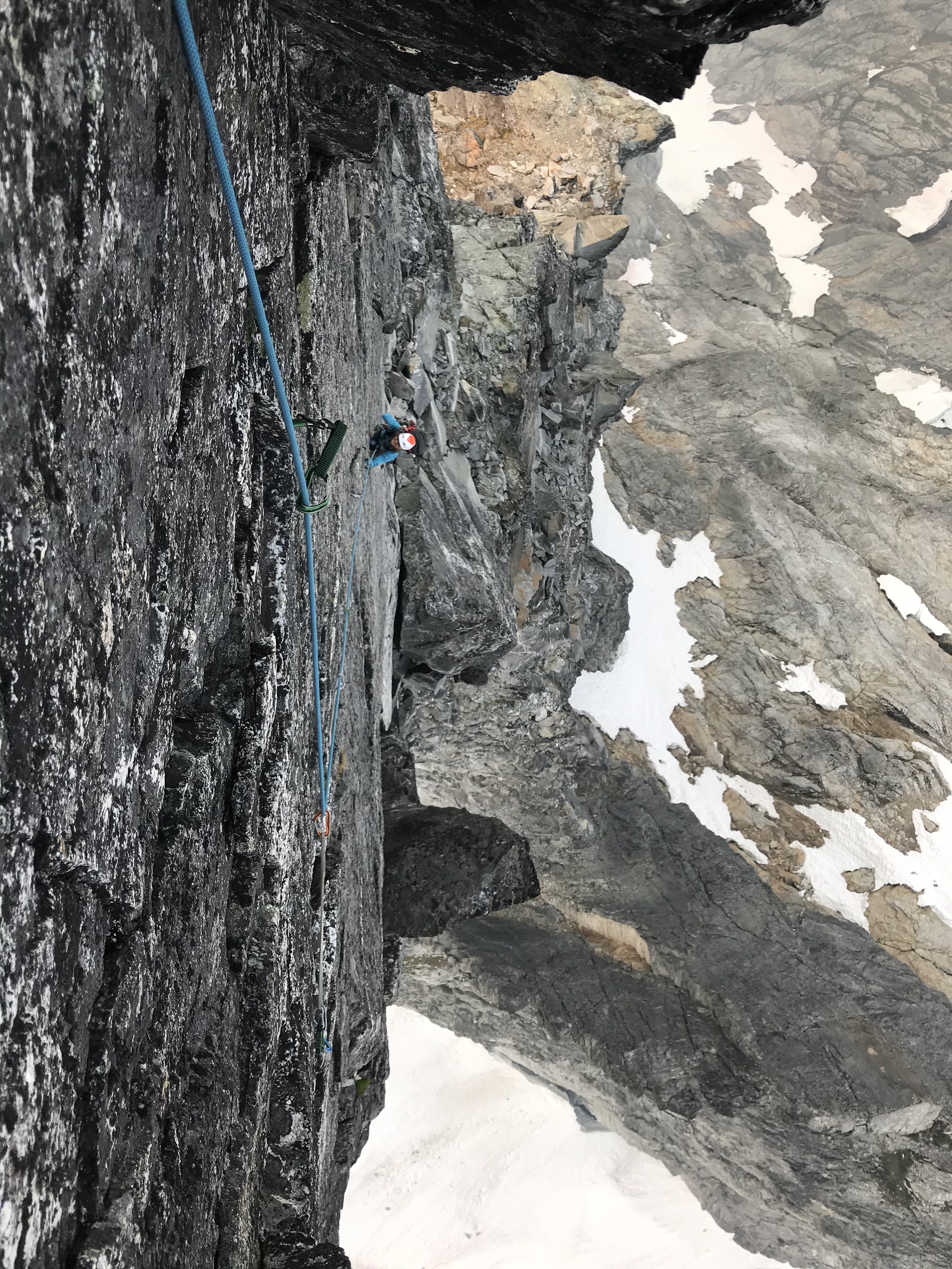
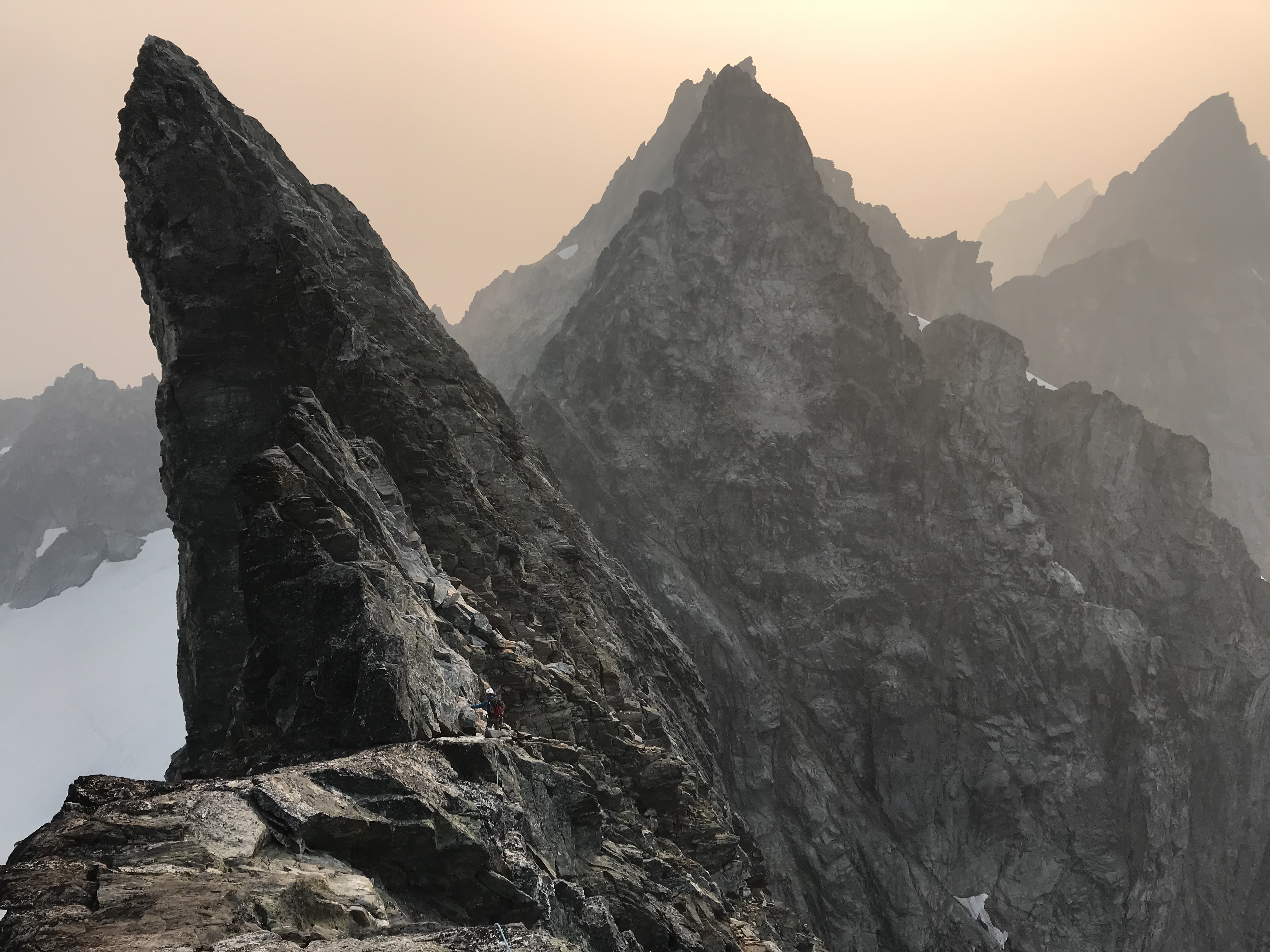
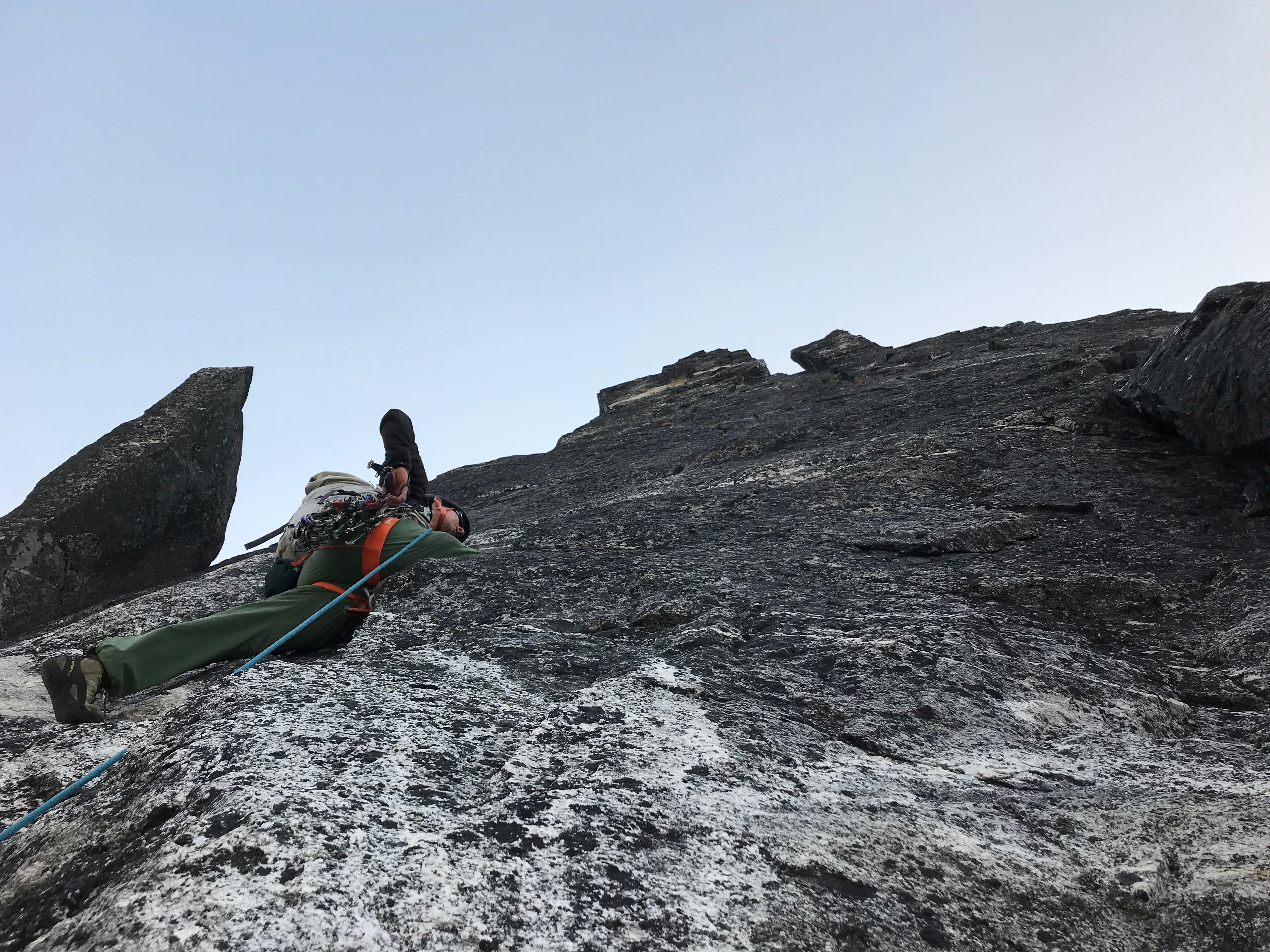
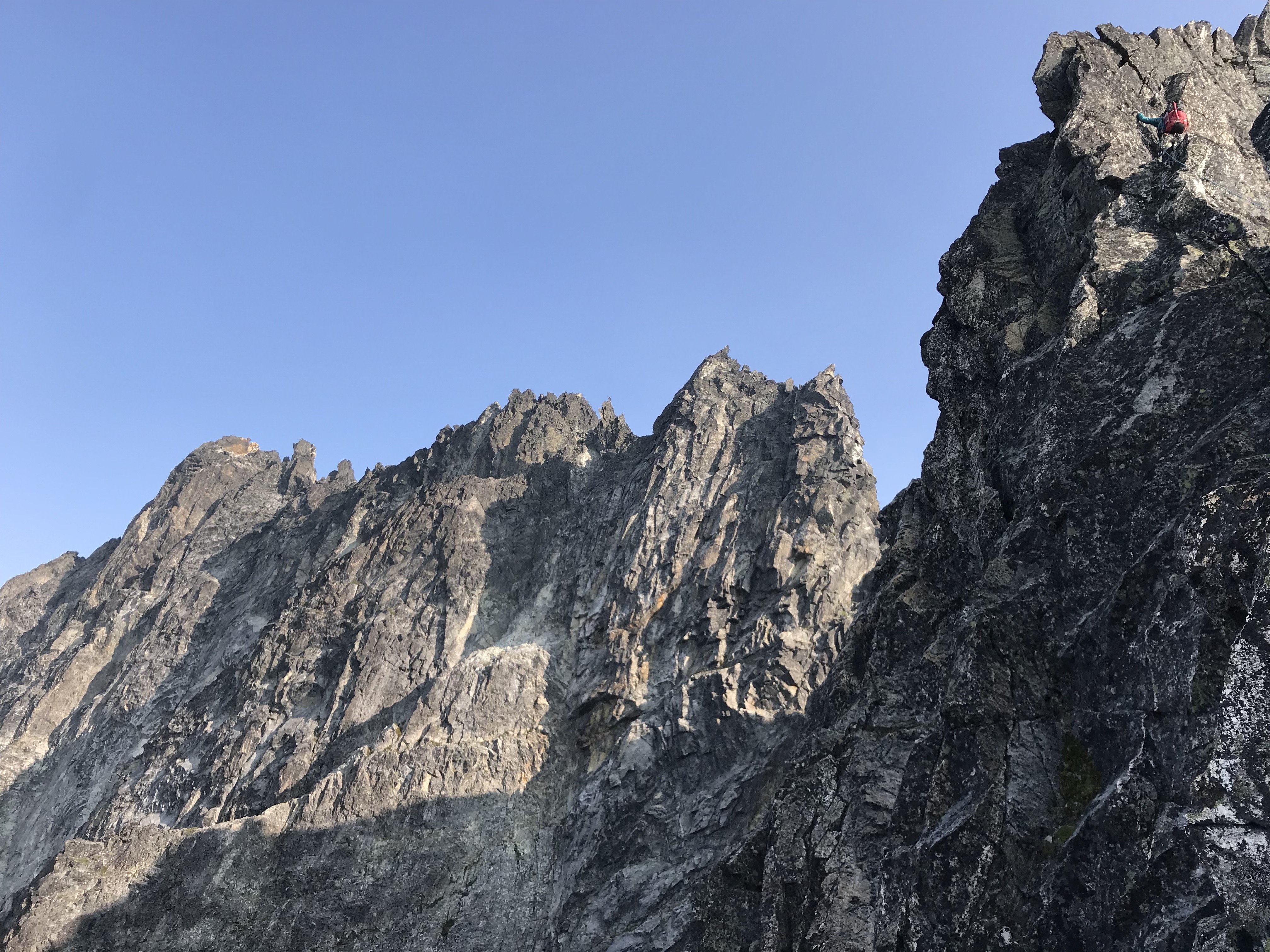
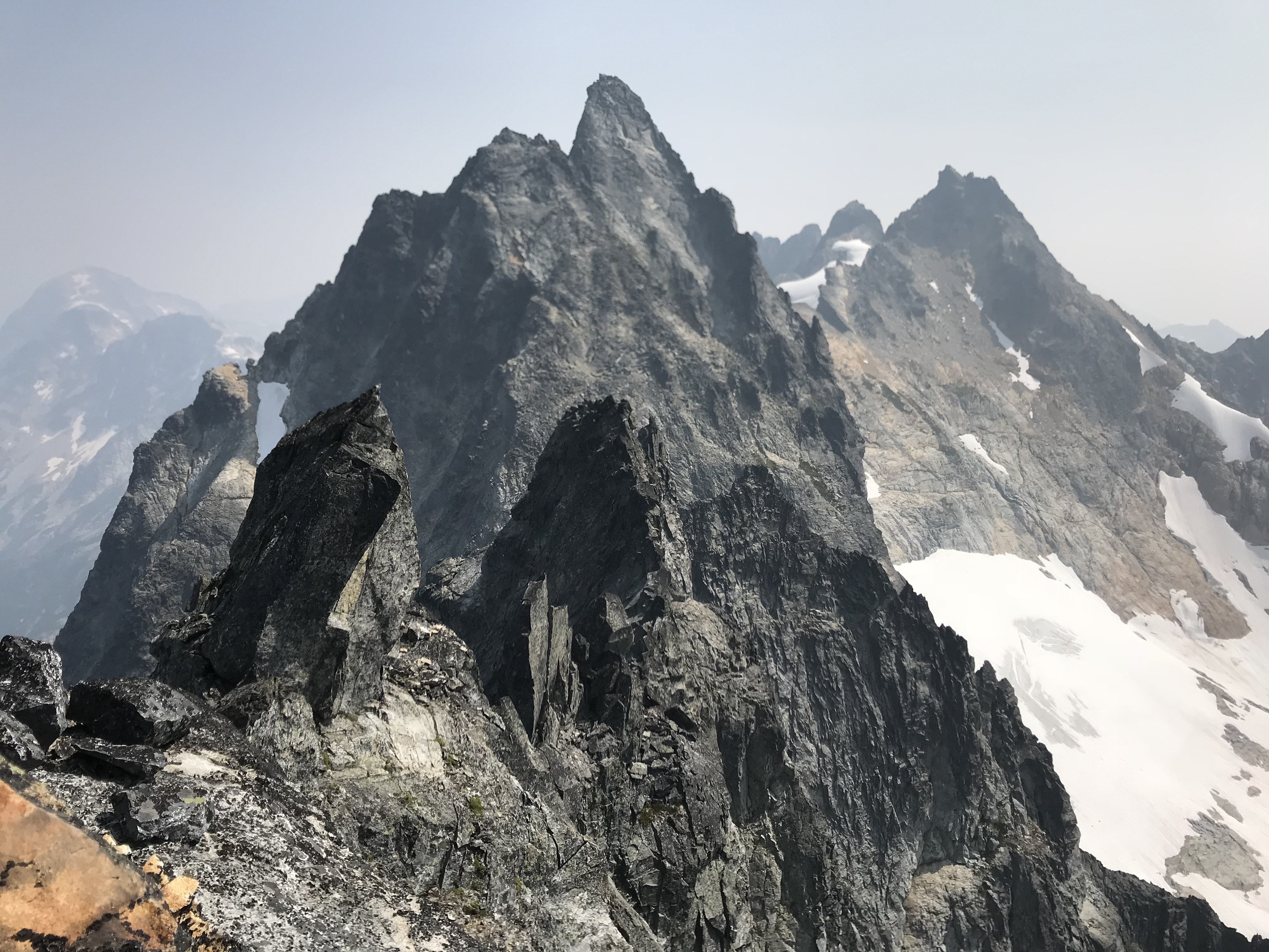
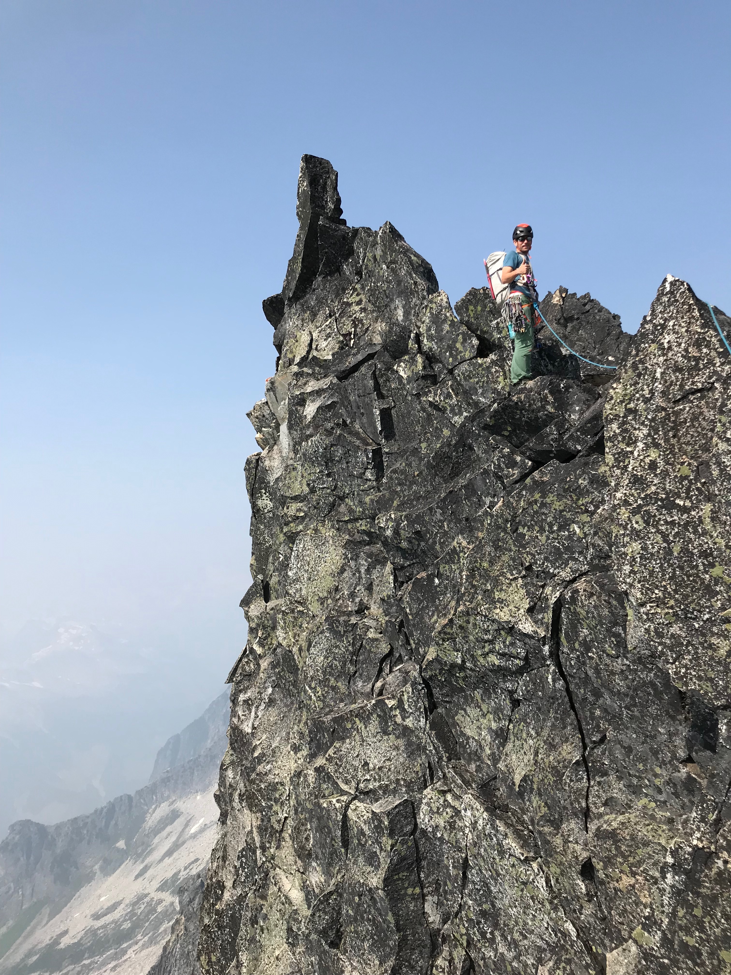
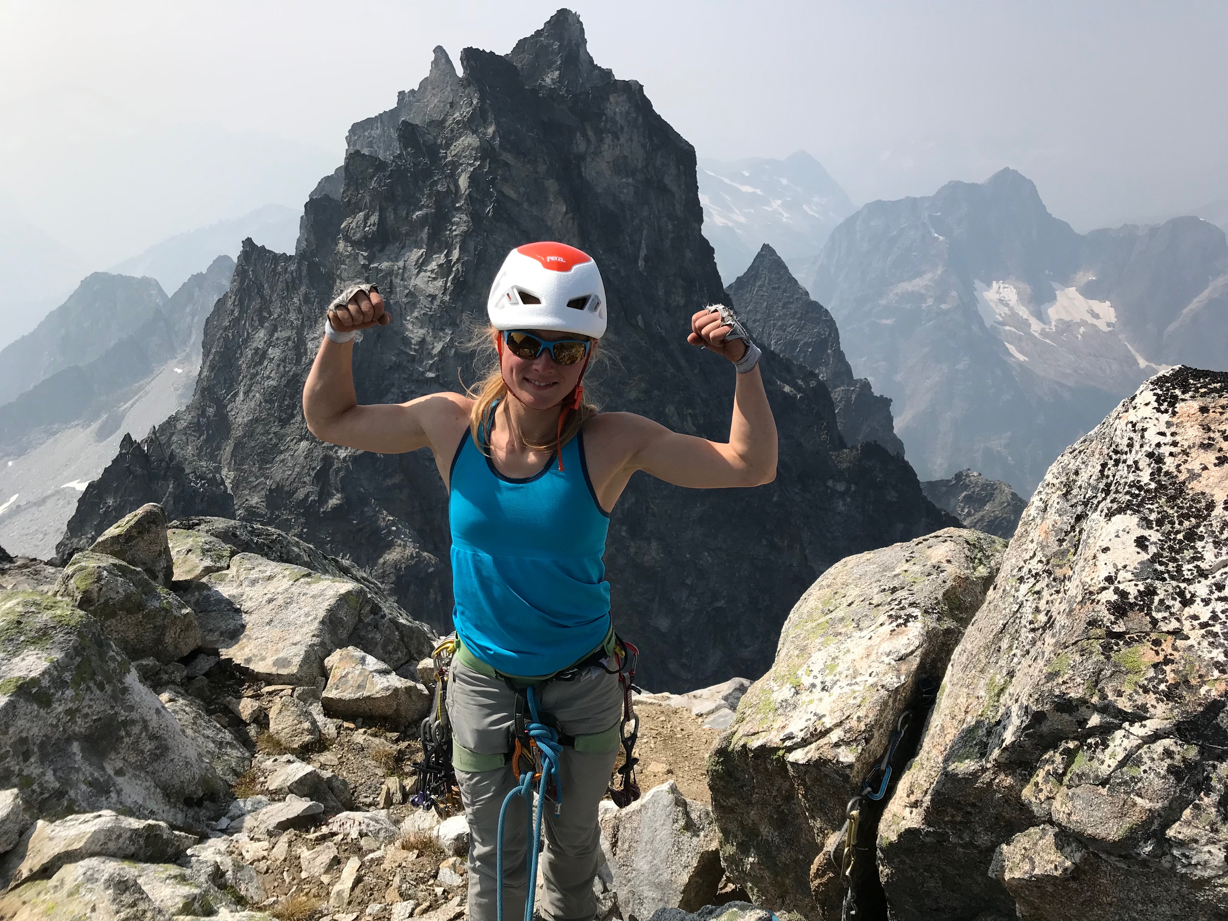
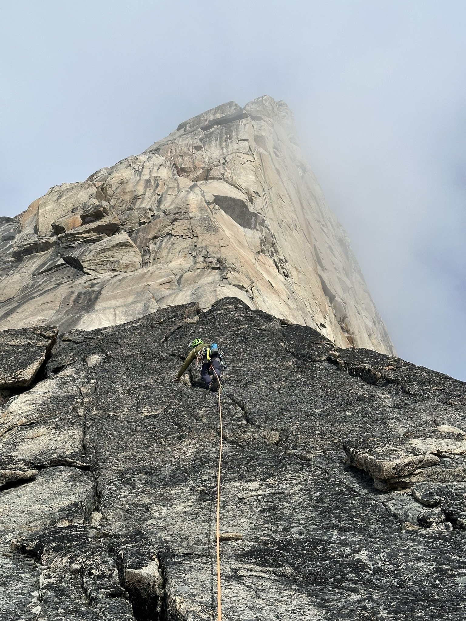
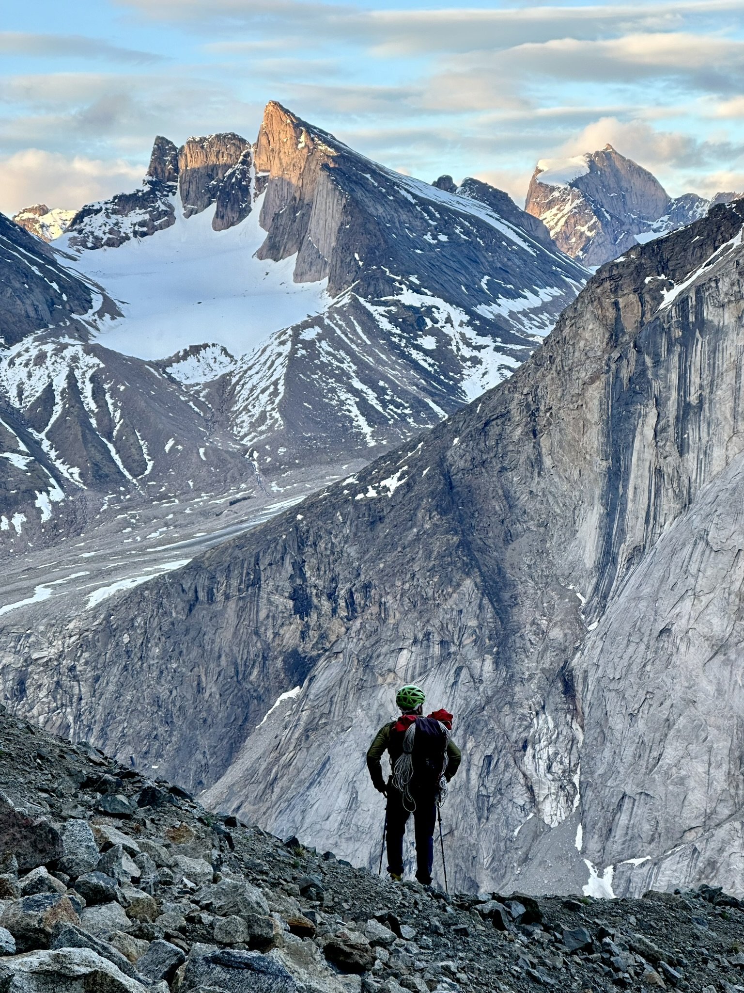
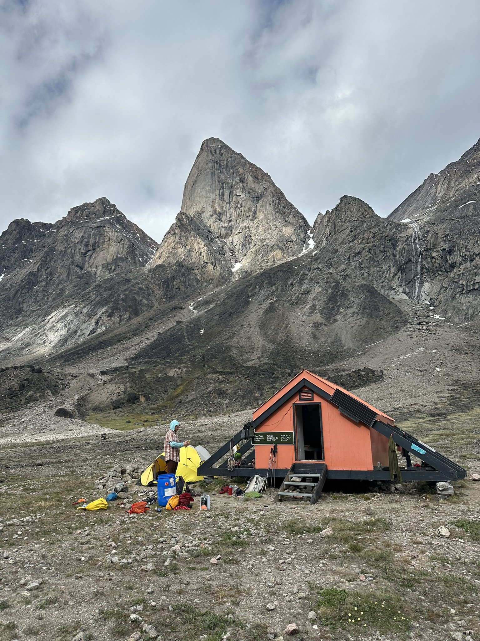
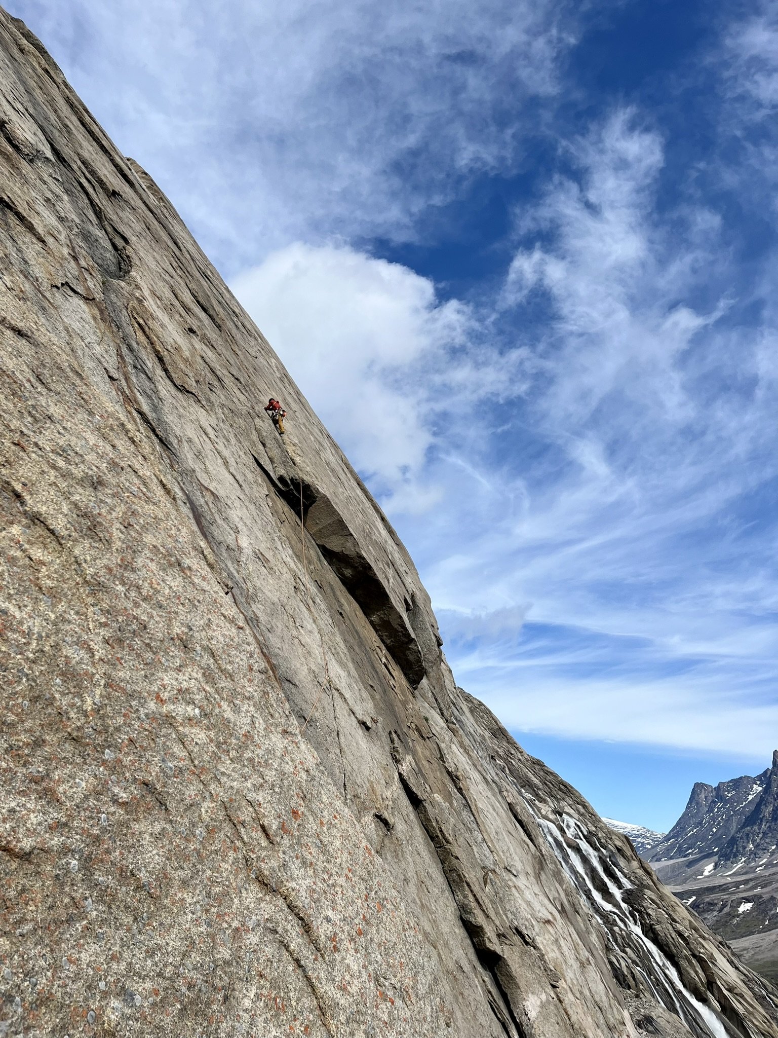
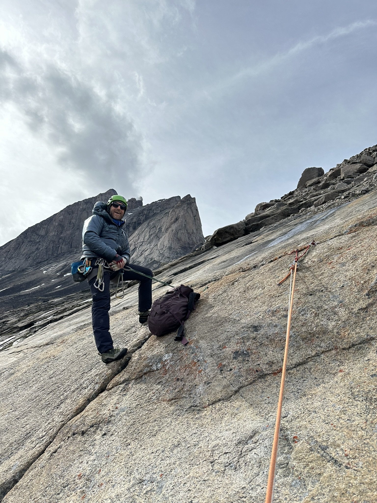
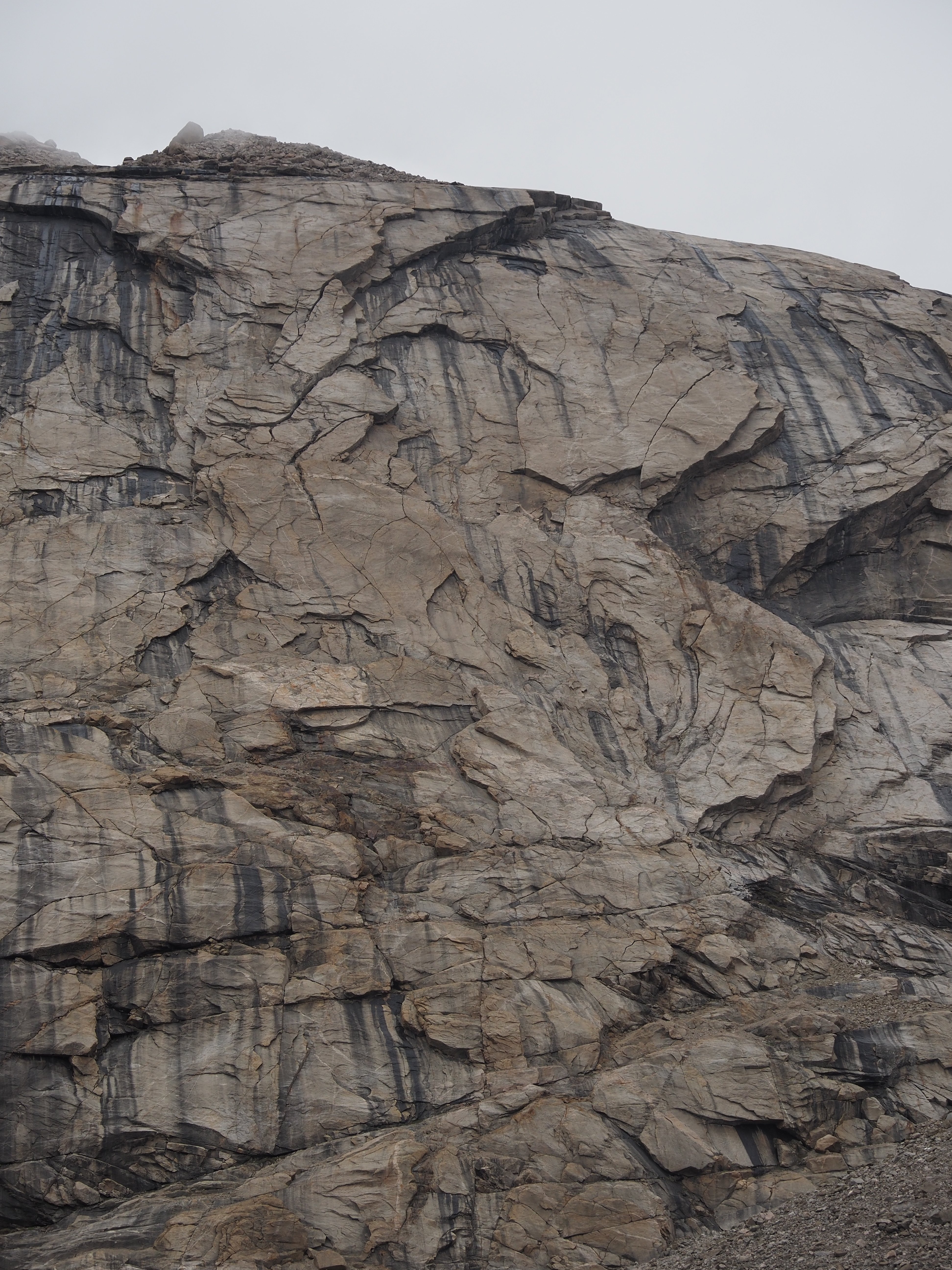
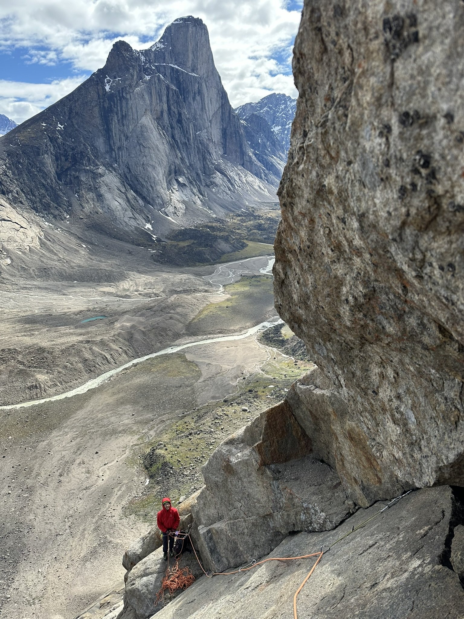
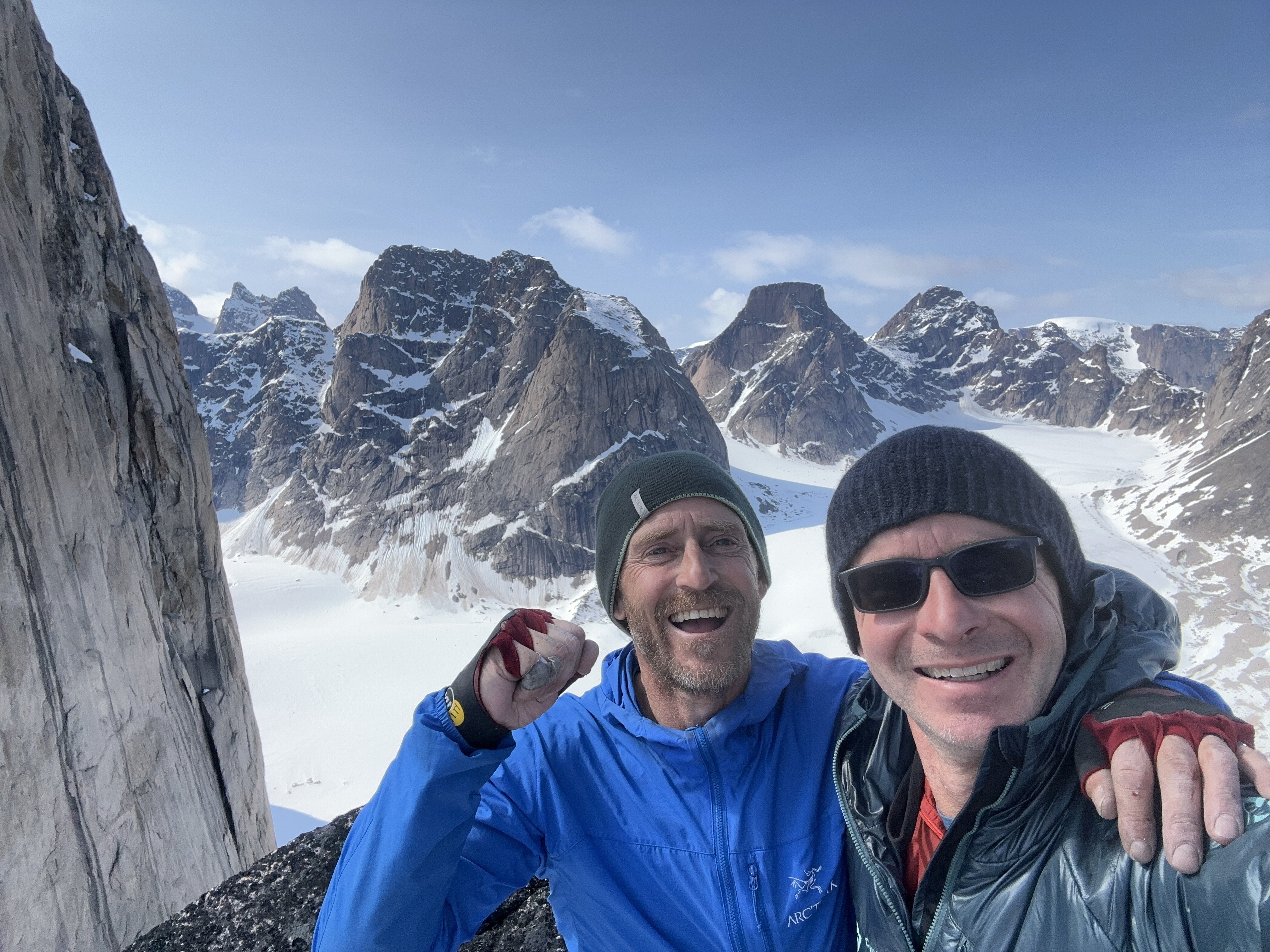
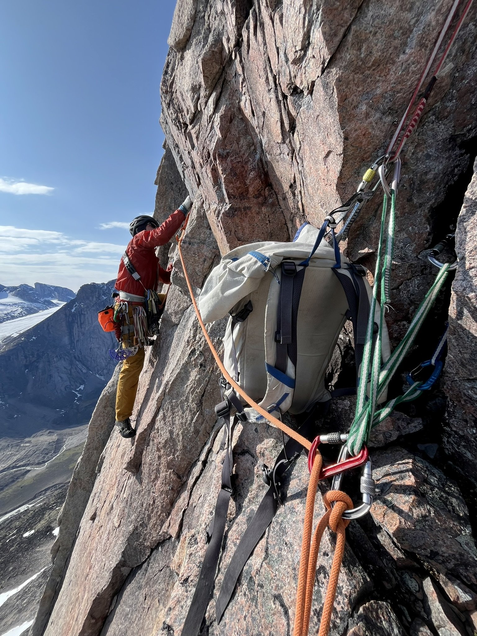
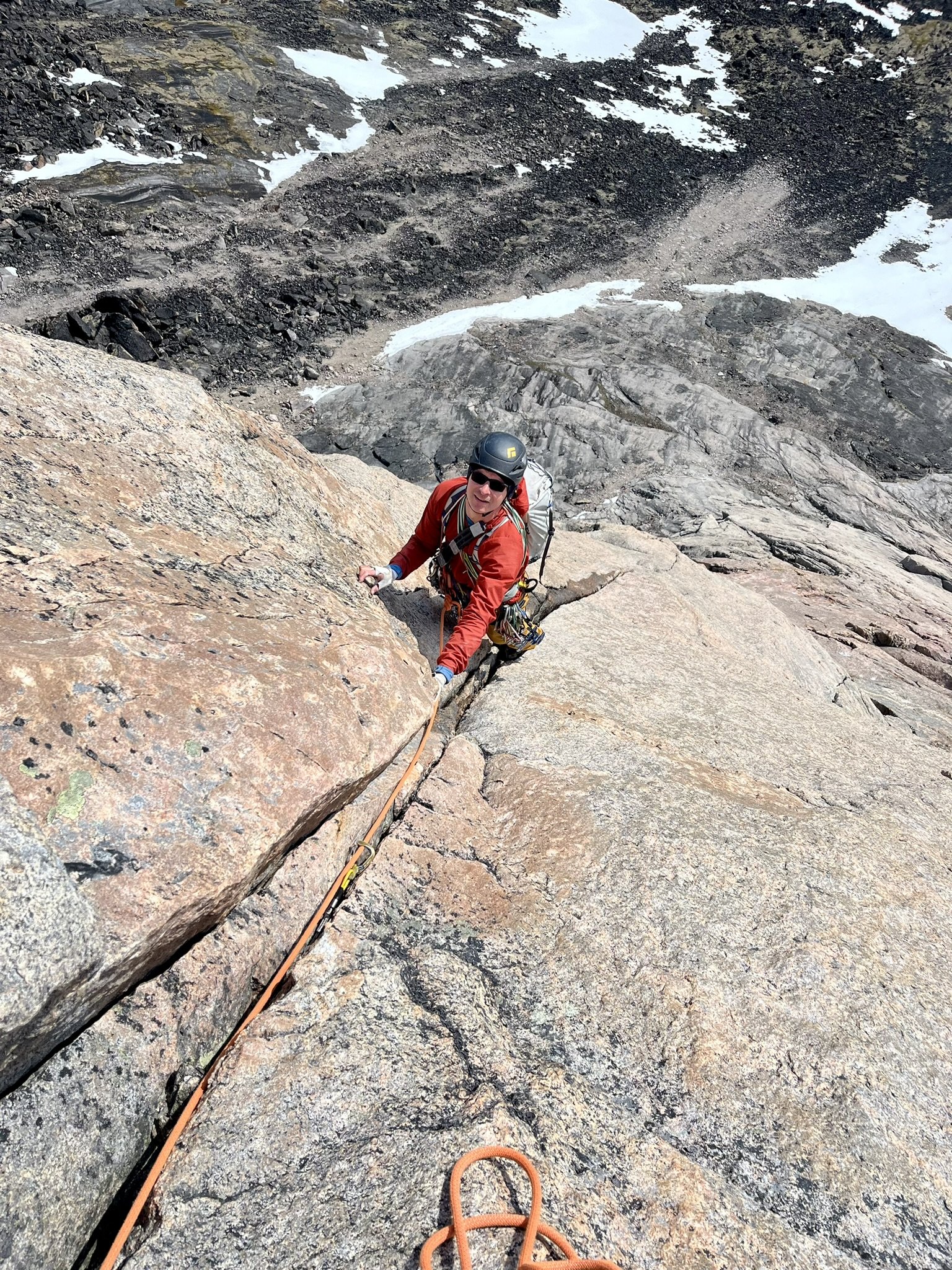
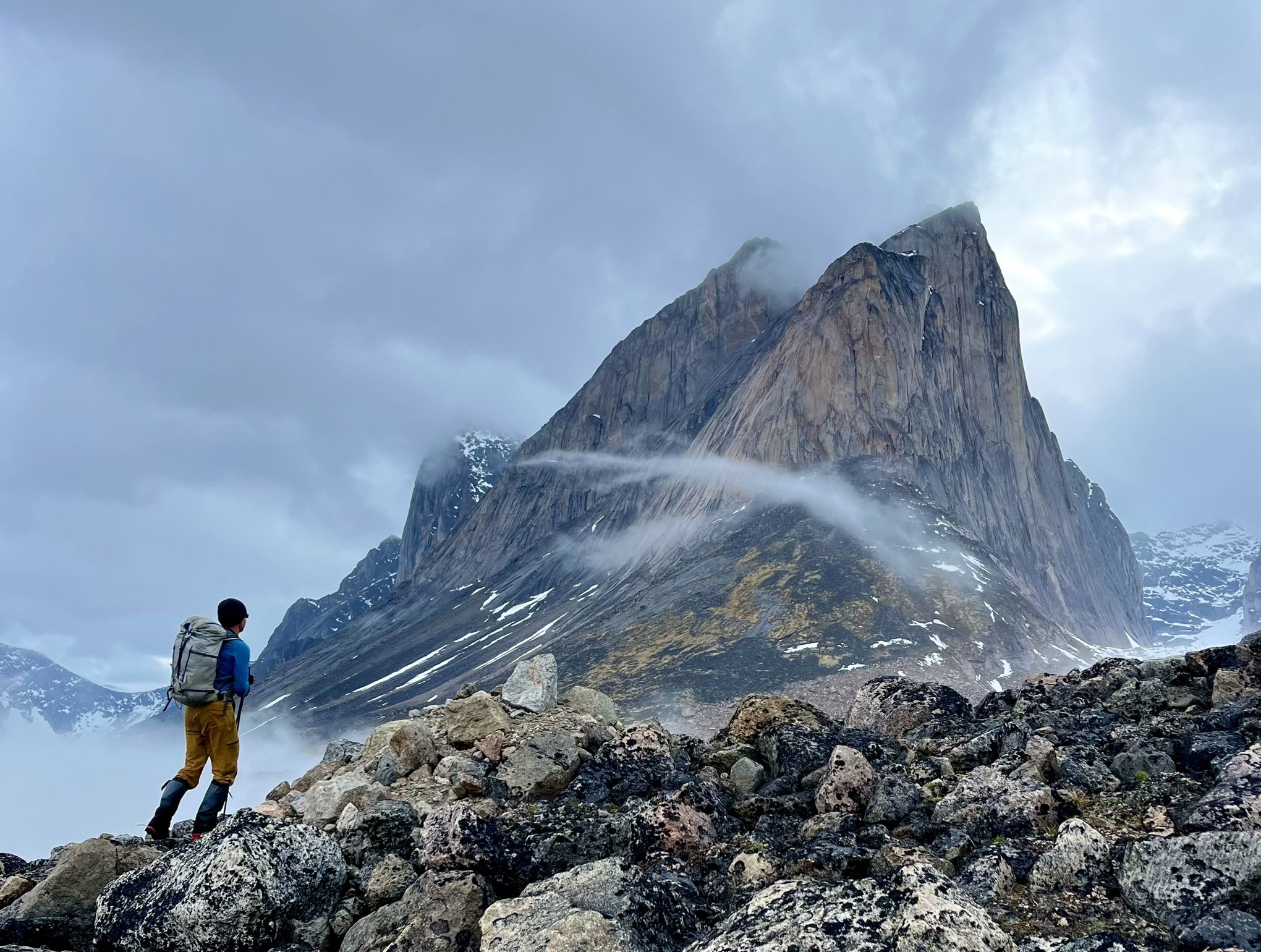
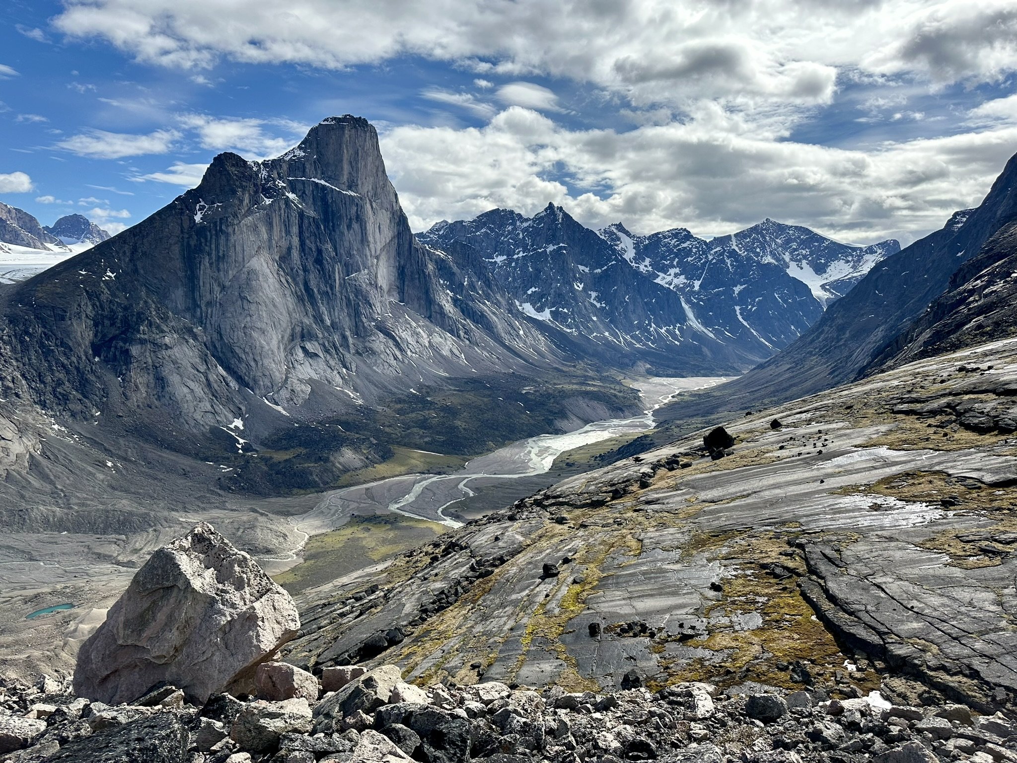
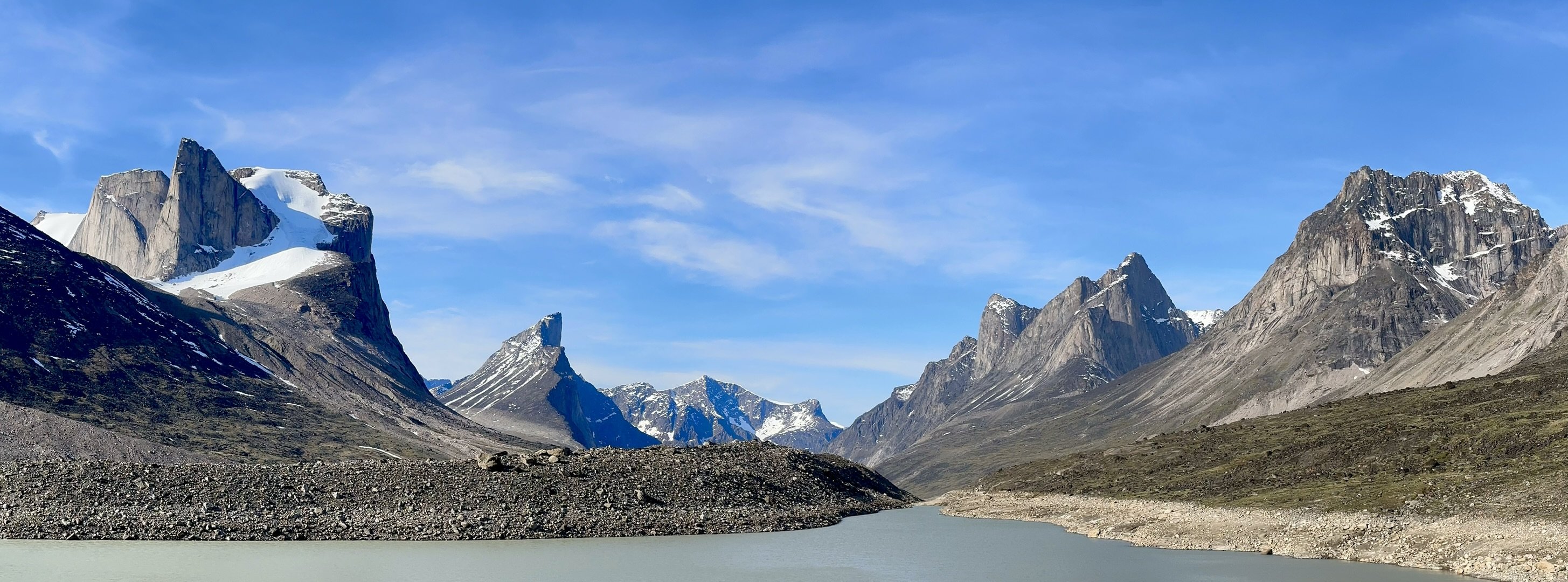
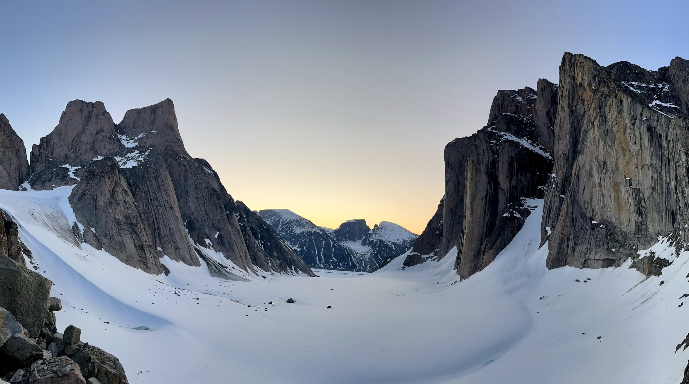
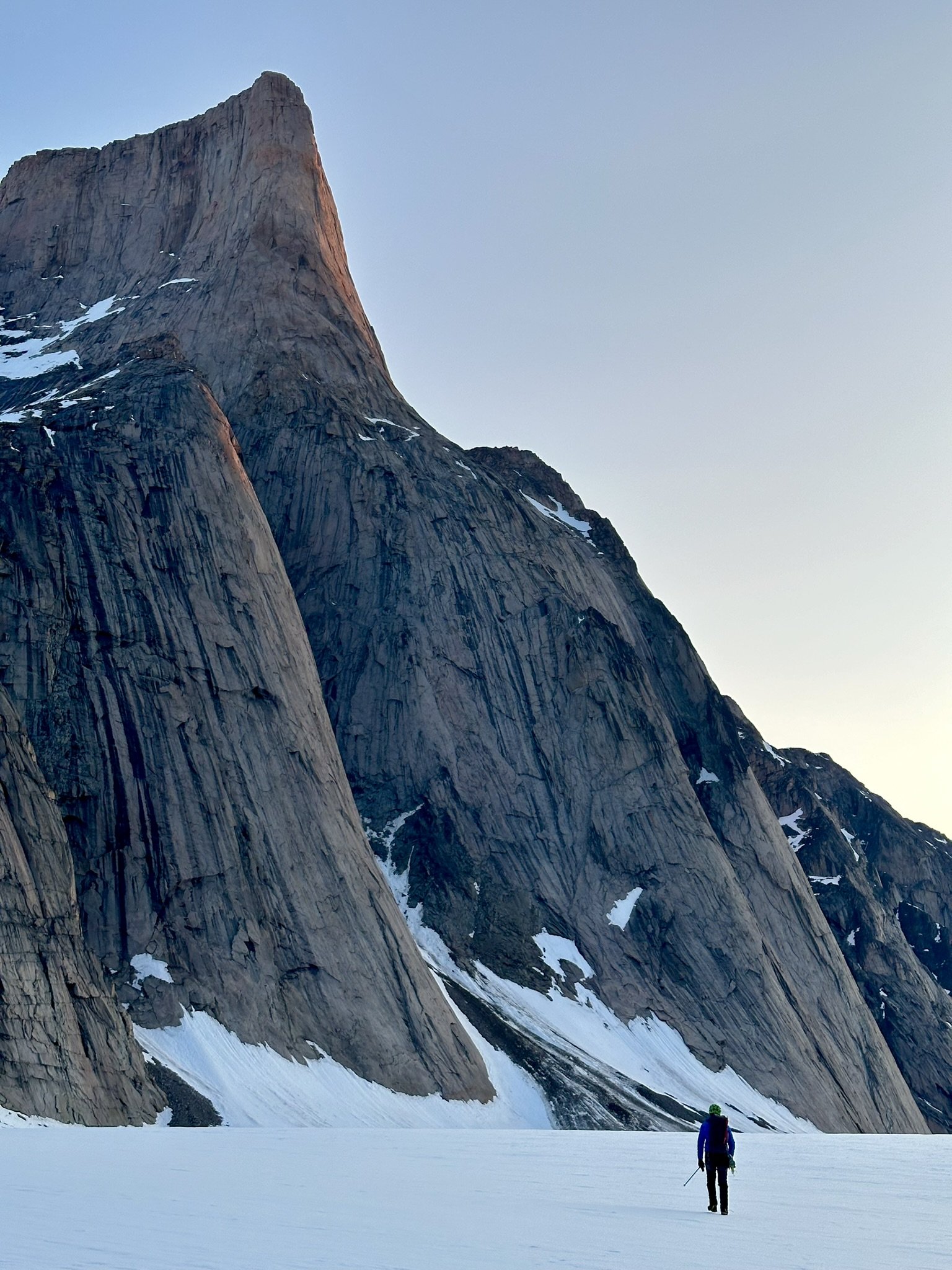
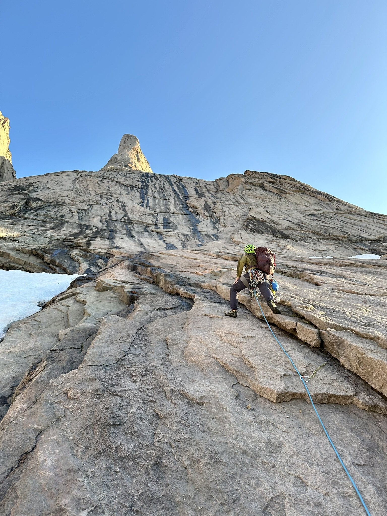
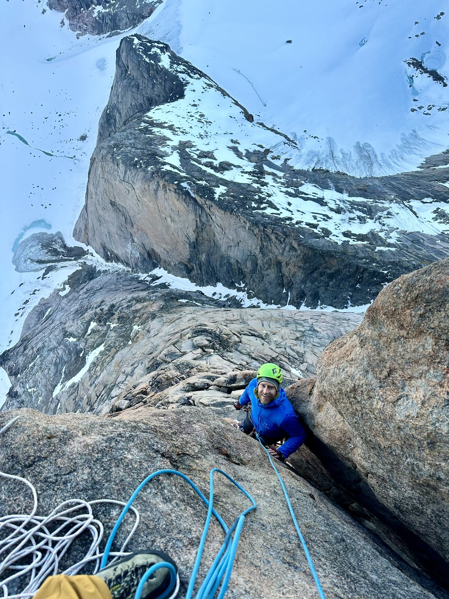
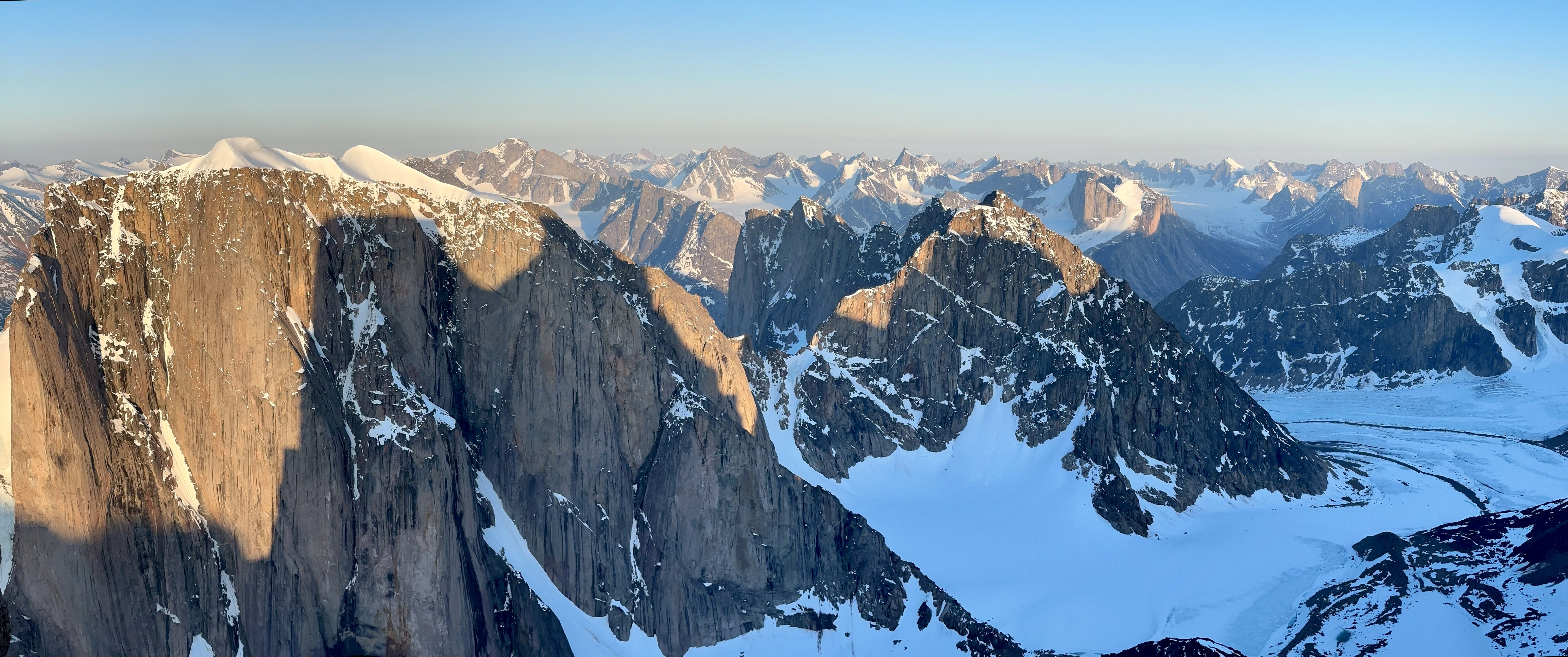
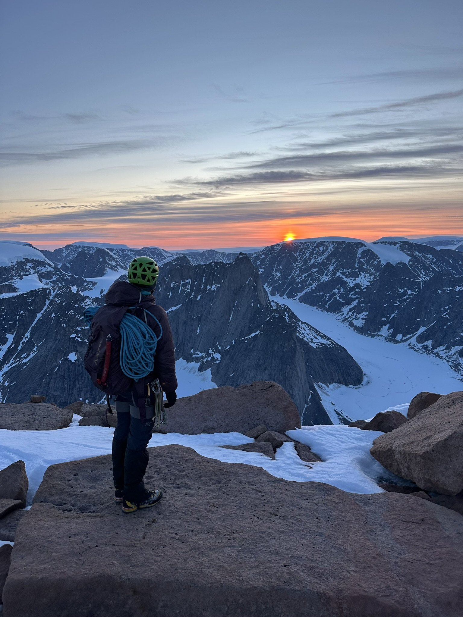
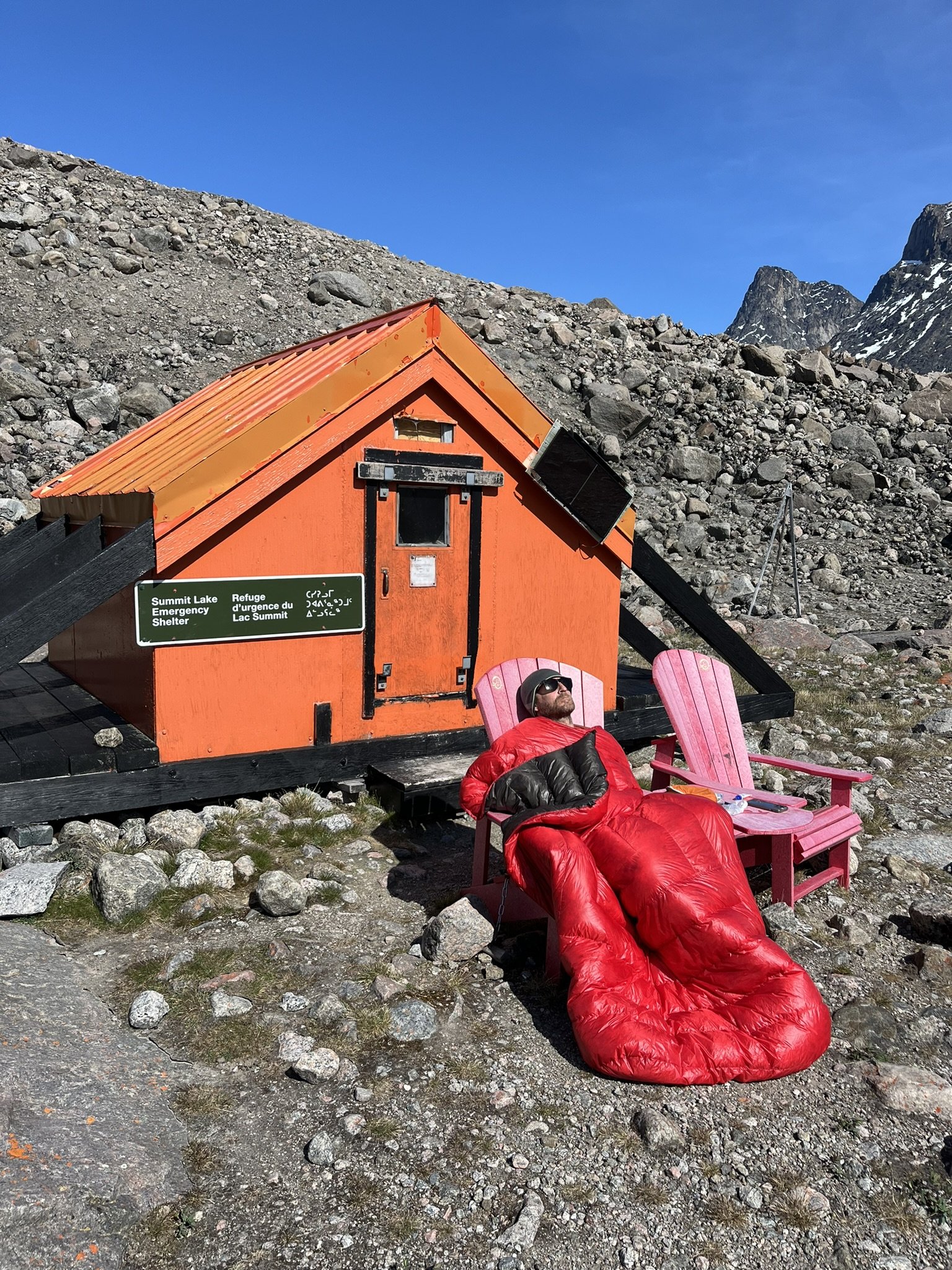
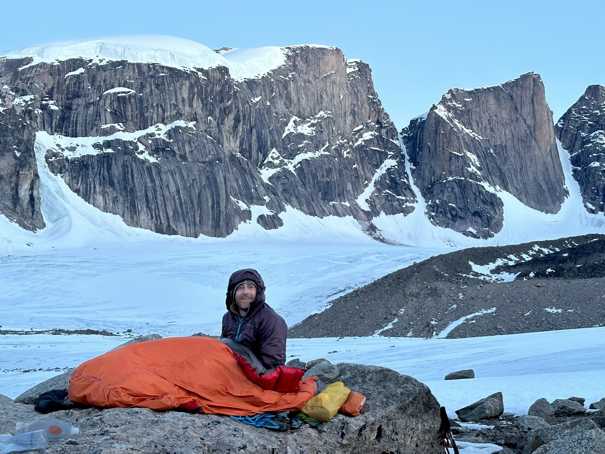
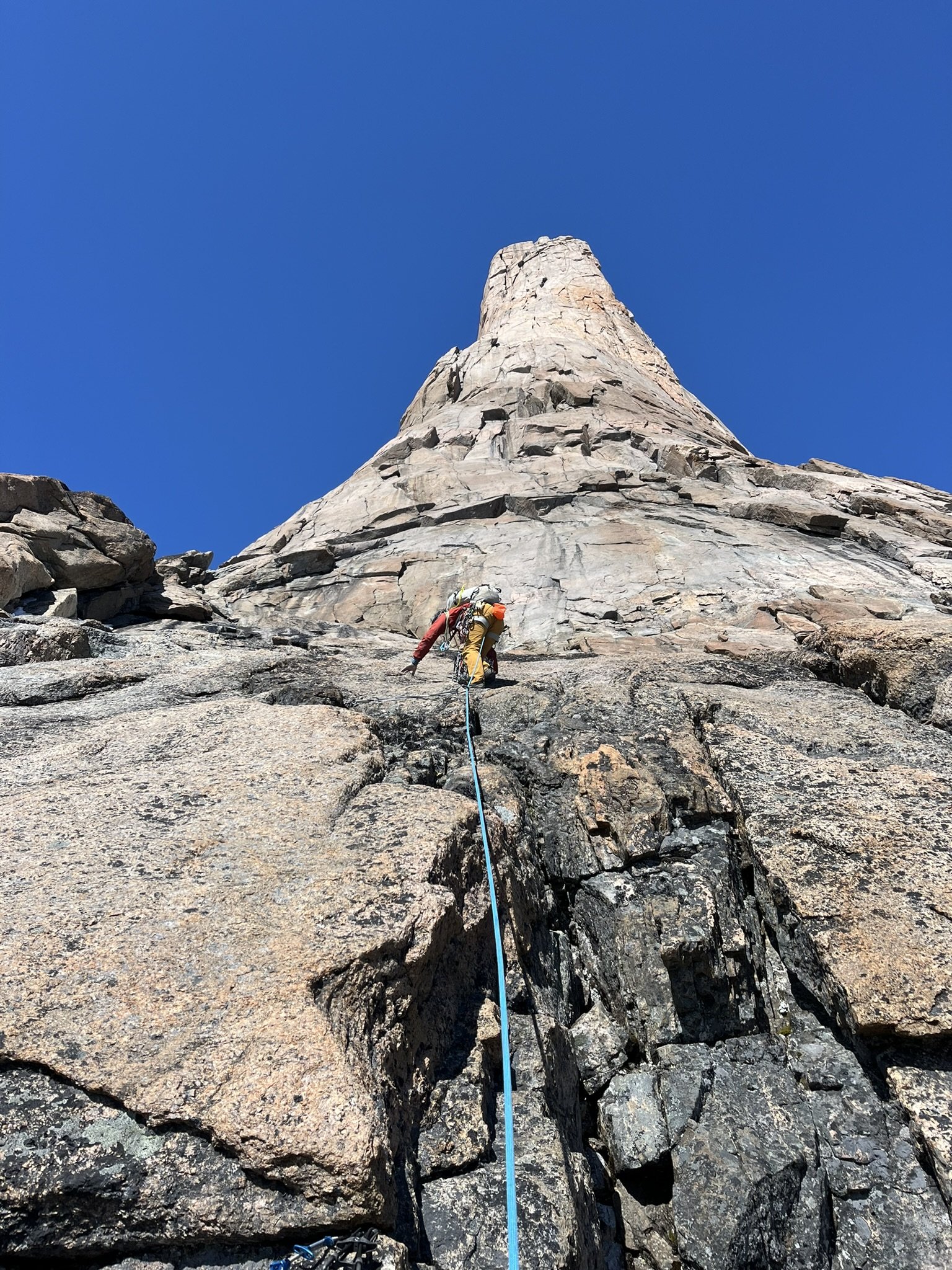
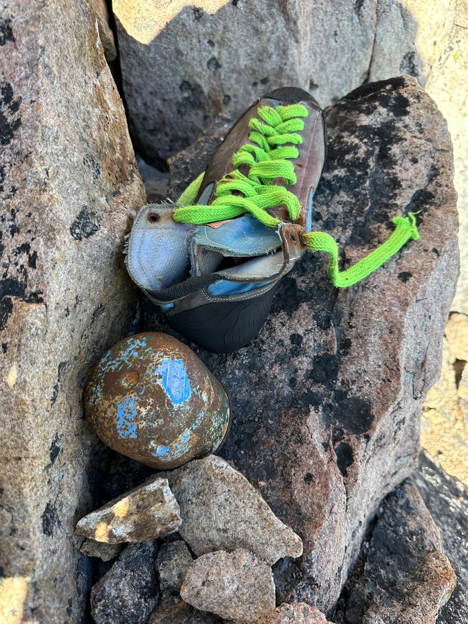
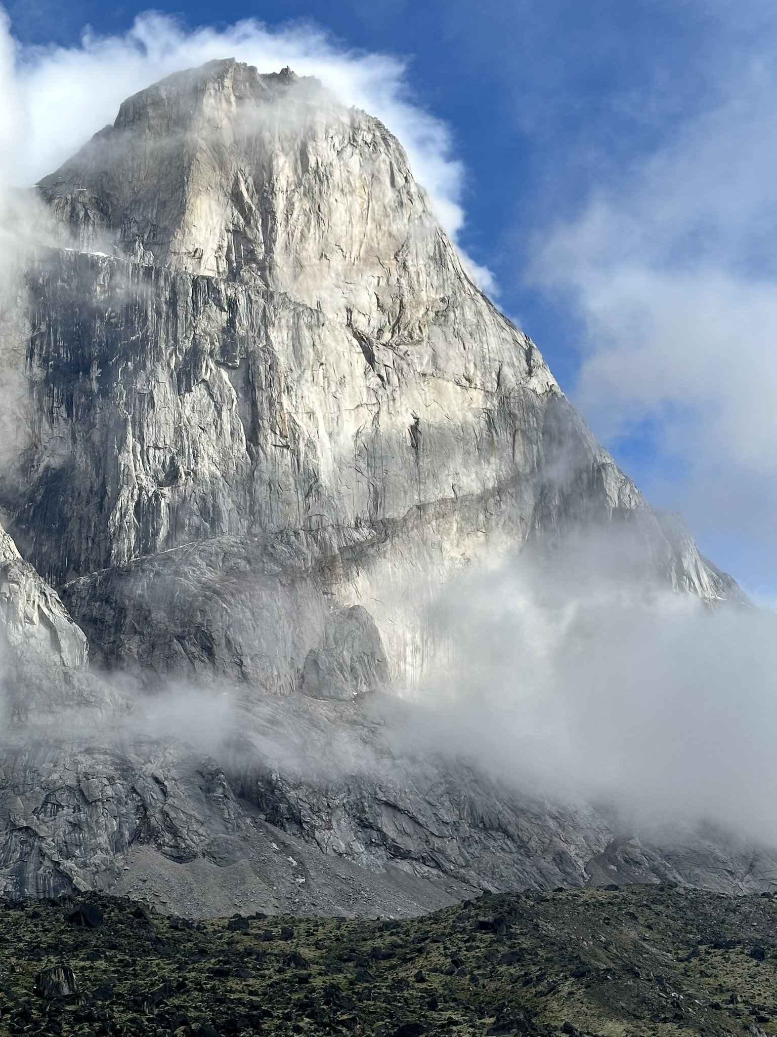
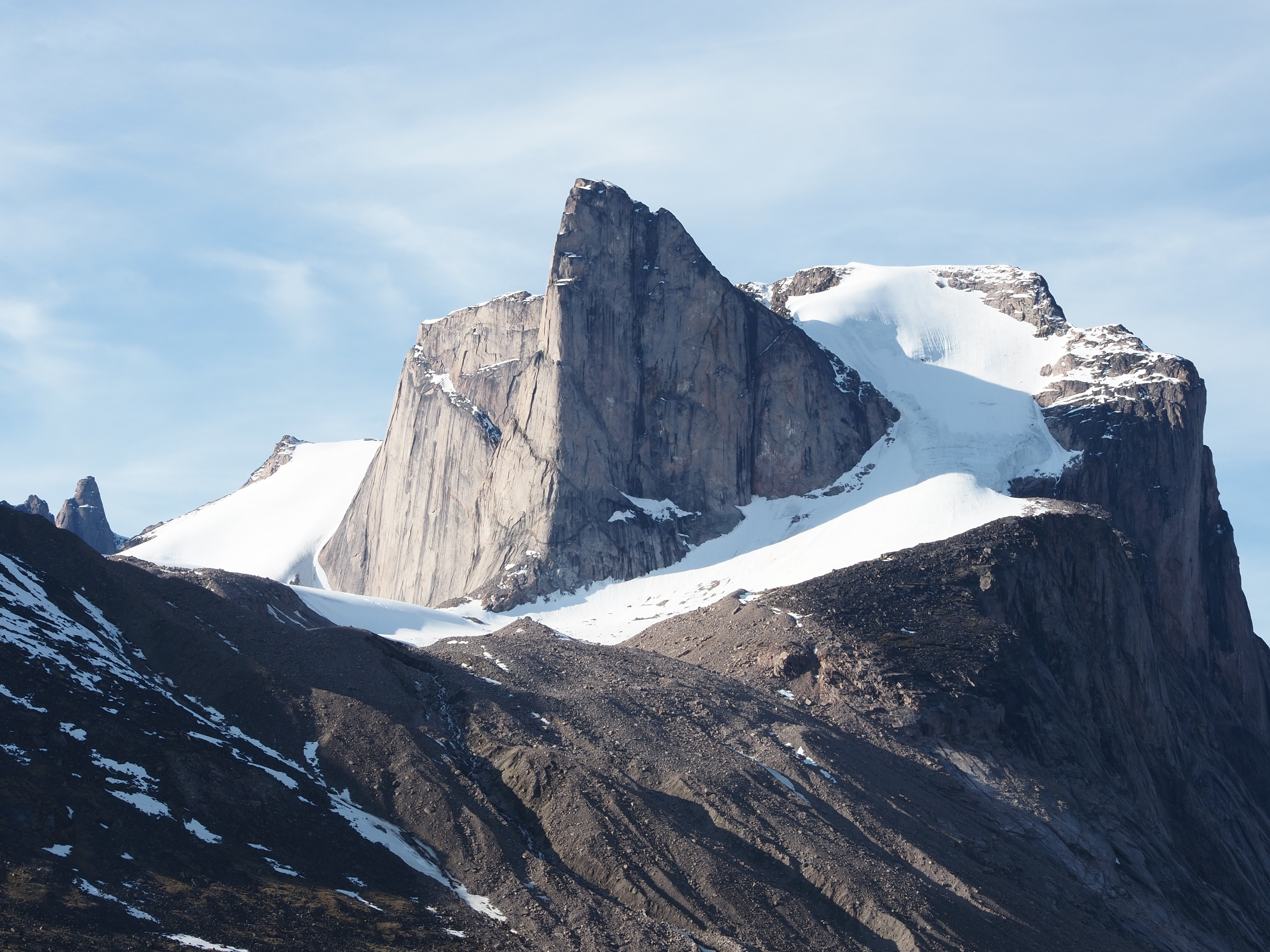
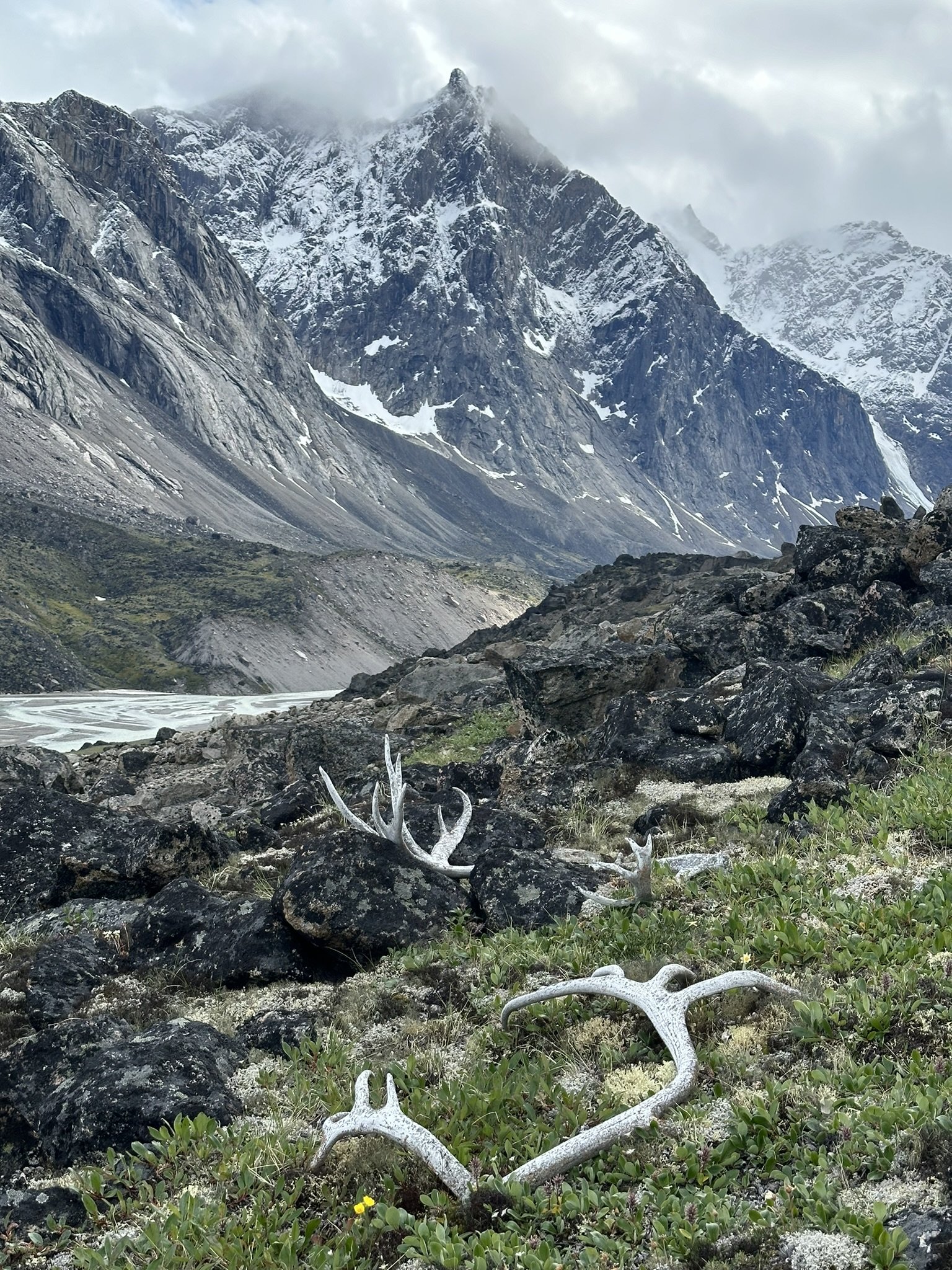
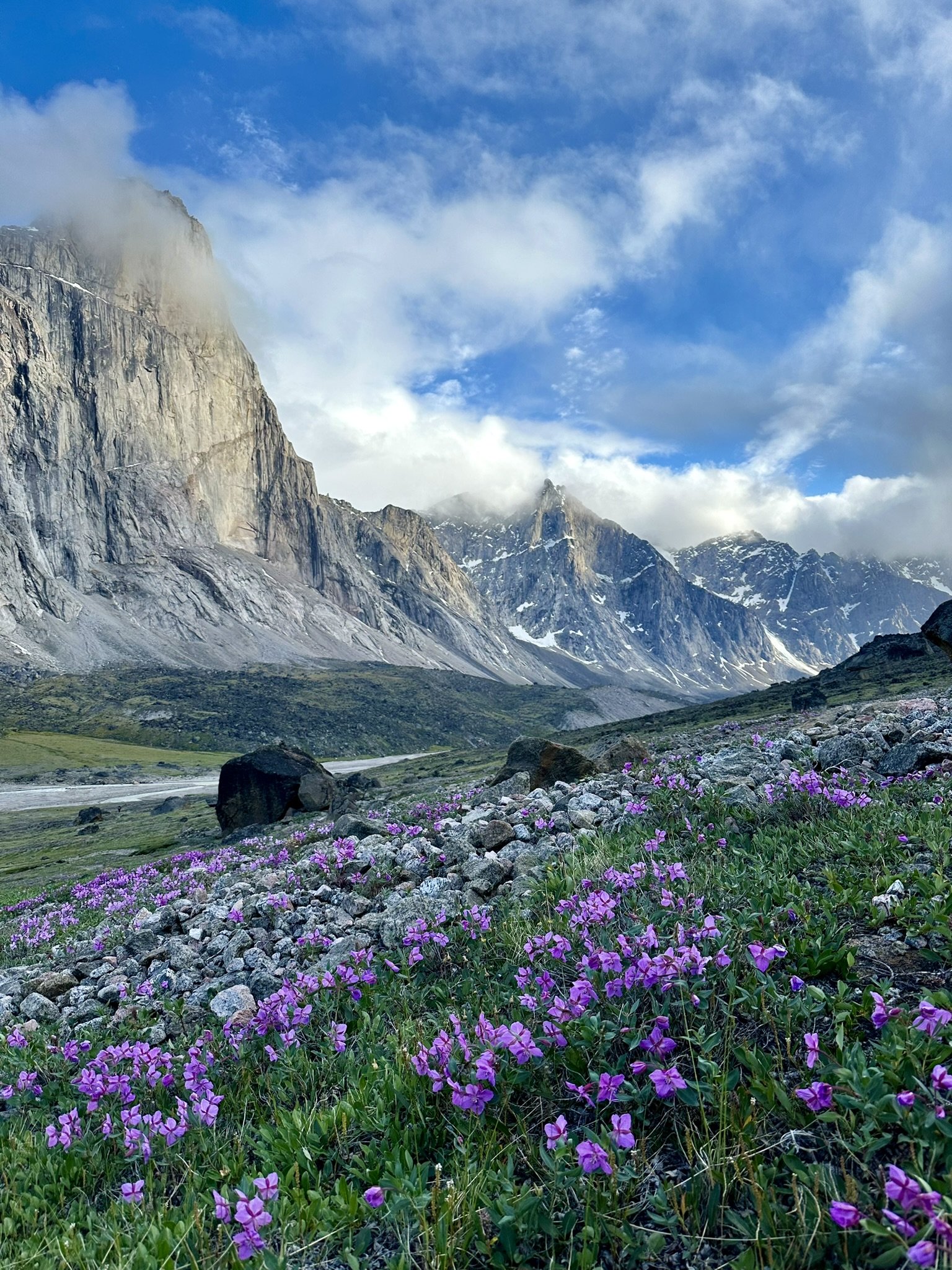
 Trip: Baffin Island - Auyuittuq Trip Date: 08/02/2024 Trip Report: Prologue If a memory cannot be refuted by evidence than it must be the truth so I present this memory as such even if I have some misgivings whether it is in fact the case. I entered Western Washington University in 1991 and as a freshman living on campus I would frequently find myself in the Wilson Library thumbing through what already felt like an antiquated copy of Doug Scott’s “Big Wall Climbing”. Published in 1974 it was only seventeen years old but felt a world apart from the climbing culture and techniques of the early 1990’s. Within a chapter entitled “The Development of Big Wall Climbing in Remote Regions” the author had written a detailed description of his recent expeditions to Baffin Island. And I would claim it was here I first became aware of Mount Asgard. Asgard, a tremendous granite turret with an ice-covered summit plateau rearing 3,000 vertical feet out of an endless labyrinth of glacier ice. The “Scott Route”, a 4,000 foot-long free climb following a beautifully sculpted pillar of exquisite granite. This was clearly a route I wanted to climb. In fact it was The Route I wanted to climb and for over thirty years it always remained as such. A fantasy at the top of my bucket list exceeding the ability, vision or time I had available at different stages of my life. A transcription of our logbook entry at the Thor Emergency Shelter written on July 28th, 2024 We arrived in Pangnirtung on July 3rd. A healthy snowpack and a cool spring had left the mountains still draped in snow and the head of the fjord still covered in ice. A fortunate warm and windy day broke up the ice and on July 5th we entered the park, arriving here on the 6th under cold, leaden skies in a stiff wind Establishing basecamp, we were then unknowingly blessed with largely cool dry days that alternated between overcast and windy or quiet and partly cloudy. The ice slowly melted from the river, the snow on the peaks melting even slower. The first wildflowers bloomed and the days grew perceptibly warmer, Via both success and failure we developed our understanding of these mountains. Huge approaches, difficult climbing, long descents. On our second attempt we climbing the southwest ridge of Mount Menhir, the looming monolith just west of the hut. We were also fortunate to establish two first ascents on impeccable rock with relatively easy access and quick descents. On the large slab wall approximately 40 minutes up valley we linked beautiful splitters into a ten pitch 5.9 we called “Pang Ten”. Later we climbed it again and added sturdy rap anchors. With a twenty minute approach from the trail and no summit it’s a crag climb on Baffin! Above “Pang Ten” we eyed the beautiful flowing east buttress of the East Tower of Northumbria. From the hut here it’s the right skyline of the rightmost peak of the Northumbria group. With binoculars you can pick out the extensive splitters we climbed just this side of the skyline. Eight pitches of moderate 5.8-5.9 climbing on the most perfect rock. Just pure fun and now setup with solid rap stations. The link up of these two routes would make for an amazing Grade V climb without the extensive approaches or difficult descents of other long routes. Highly recommended! July 19th through the 22nd brought the stable, clear weather climbers dream of on Baffin. A long casual approach with a nice siesta at Summit Lake took us to a high bivi on a thankfully melted out Caribou Glacier. Starting at 1 am on the 20th we approached the fabled Scott Route on the North Summit of Asgard. 1200 meters of climbing over 23 pitches took us to the summit at 10 pm. Witness to a spectacular sunset, an endless sea of jagged peaks like diamonds in the periwinkle glow of the midnight sun. Being on that summit is as “out there” as we’ve ever been. The descent was long and tenuous with terrible snow conditions. We returned to our high camp 30 hours after leaving it. Since then the weather has deteriorated into more typical Baffin conditions, lots of rain, snow in the mountains and strong winds. Thoughts turn to home and family as our remaining days here melt into one another. Yesterday we hauled our first load out to Schartzenbach Falls, tomorrow on the 29th we leave for good. Our stay here has been perfect. So many memories. The intensity and beauty of the high peaks balanced by many wonderful rest days here around the hut, mending clothes, doing laundry, cooking, reading and soaking in the views. The world is vast and we may never return to this location again but our memories will always be of much contentment here, we wanted for nothing. Darin Berdinka (Bellingham, WA) & Owen Lunz (Lafayette, CO) 7/6/24-7/29/24 View up fjord upon arrival in Pang Starting the approach in inclement weather Basecamped next to and occasionally in the Thor Emergency Shelter. Mount Menhir in background. Left skyline is SW Ridge V 5.9. Starting up the southwest ridge of Menhir. Twelve pitches. Possibly 3rd ascent based on archeological assessment of rappel tat. Supernatural alpine beauty Pano from basecamp. Menhir on left, multiple summits of Northumbria on right. Looking up the Active Recovery Wall. Forty minutes up valley of the Thor Hut. Surprised to find no evidence of prior passage. Pitch 5 or so, climbing perfect splitters. Enjoyable corners high on the slab. Thor in background. Top of the slab. A few days later we'd climb the clean 1200' buttress just right of Owen. Approaching the East Tower of Northumbria. Pulling through a roof on perfect locks and crimps. Most of the climbing was in lovely splitters on the best imaginable rock. Summit views out over largely untrodden peaks. View out over Weasel River Valley with Thor across the way once again. View down valley from Summit Lake Emergency Nap in the Emergency Adirondack Chairs at the Summit Lake Emergency Shelter. Looking out over the Parade Glacier at 3 am. Asgard on left. Frigga on right. Another party was establishing a new A5 route on the left most pillar of Frigga that day. Asgard. Route started along right side of square snowpatch. 2nd pitch. Runout slabs. I look stupid in this photo but it does provide an excellent view of the upper pillar. Abandoned equipment high on the route. What epic unfolded here? 2nd to last pitch. Wet, wide and exhausting. Sunset view from just below summit. The artic gloaming. Loki in foreground. Epilogue So on a lovely day in the summer of 2024, several weeks after having climbed Asgard via the Scott Route I returned to the Wilson Library to see if I could track down the book. The library and its grounds felt little changed and somewhat surprisingly the book was still there, biding its time on a dusty shelf. Despite now being three times older than when I first perused it the book felt no more antiquated then it once had. And despite the passage of thirty-three years since those august days of youth I pleasantly realized that, on this day at least, I didn’t feel significantly different either. Other Images The incomparable Breidalblik Peak. Sun/shade line climbed in 1971 at V 5.9 A1. On the wrong side of the river for easy access. Bivi on the Caribou Glacier. Mount Tyr and Mount Walle in background. West Face of Mount Thor Signs of life below Mount Sif. Gear Notes: standard rack Approach Notes: Fly to Pangnirtung. Boat twenty miles up fjord. Hike 25 miles to Asgard. Supplies can be hauled in by sled in winter. Contact Peter Kilabuk.


- 11 replies
-
- 18
-

-

-

-

-
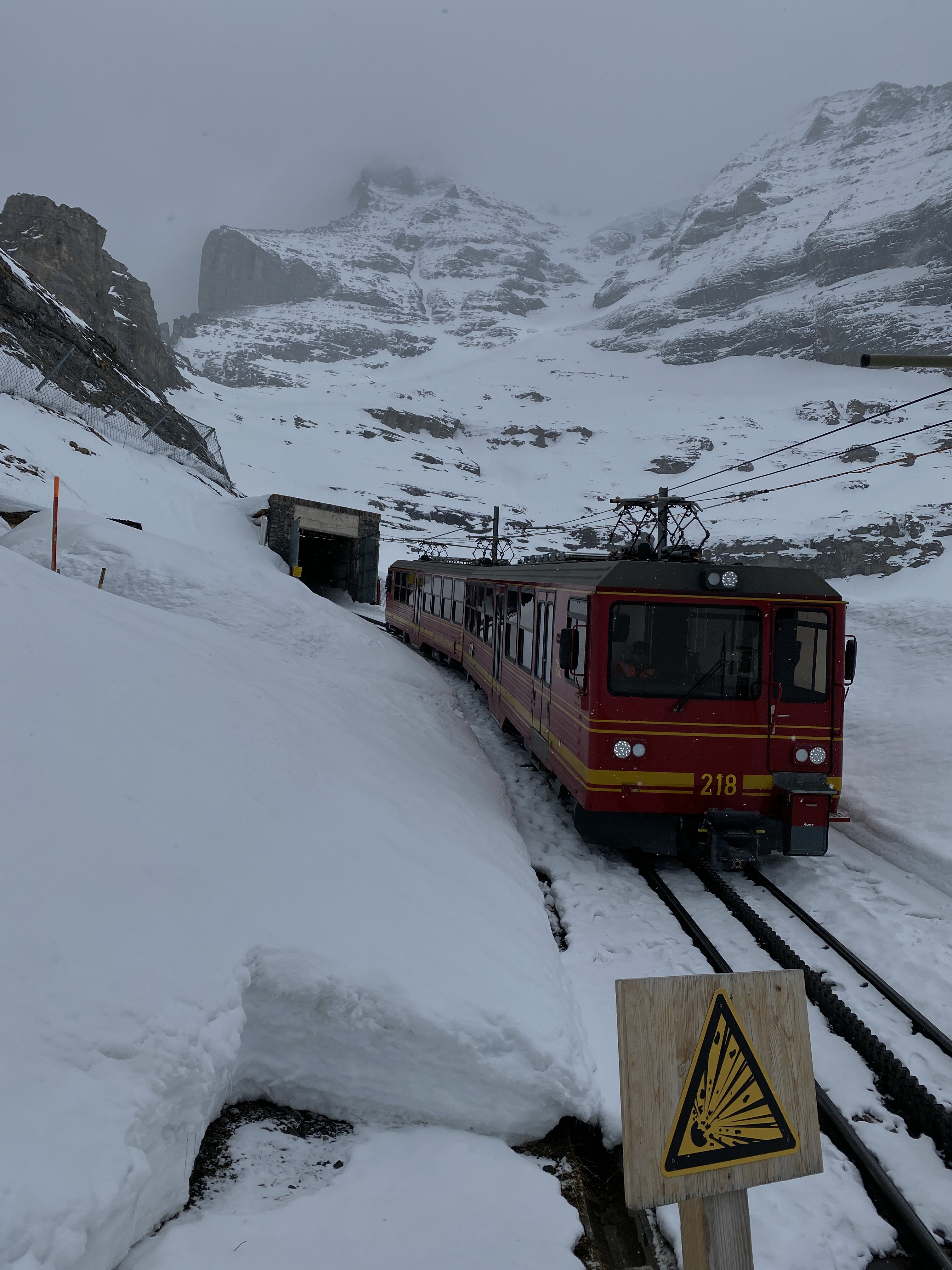
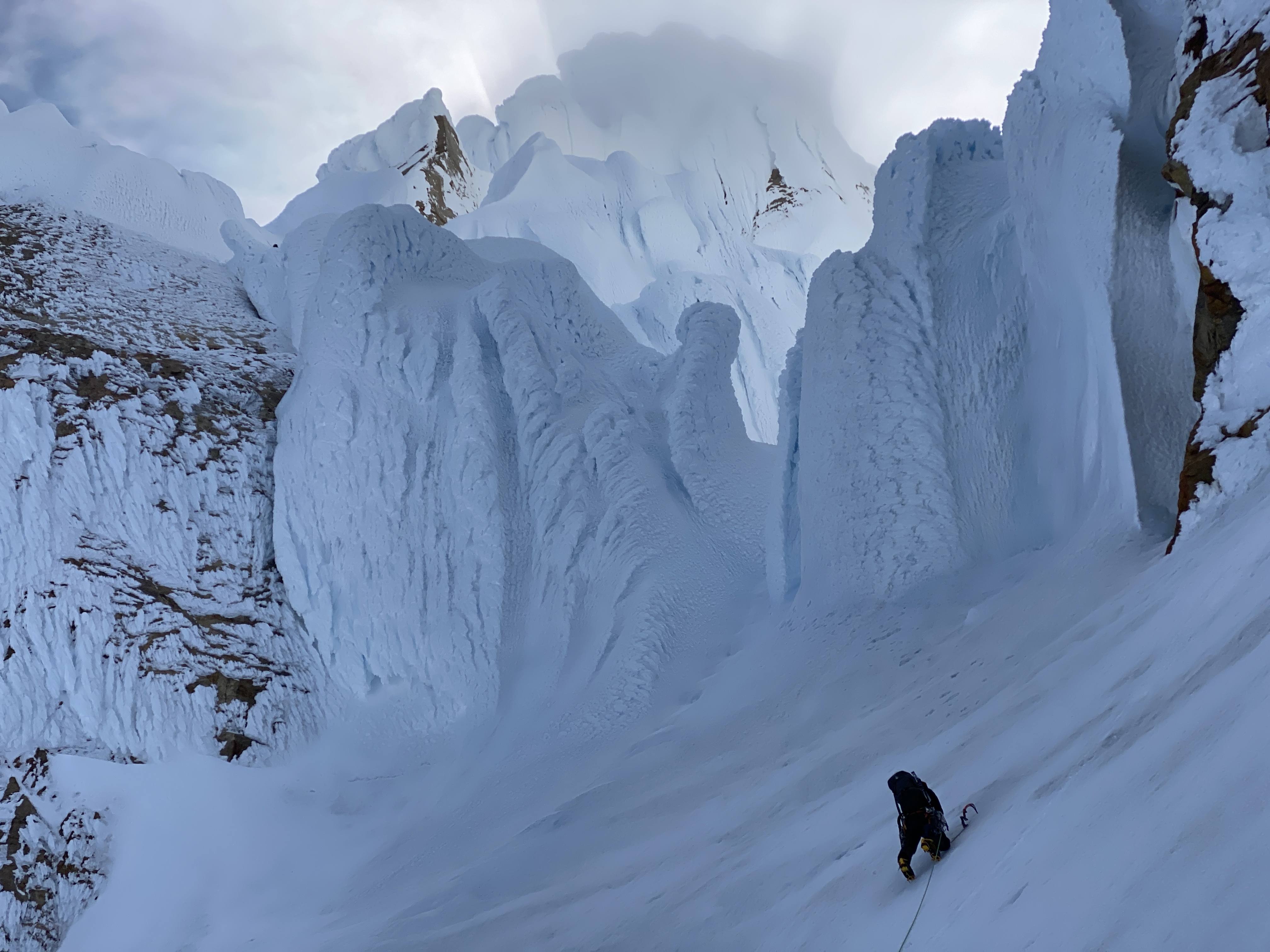
 Trip: Kangchenjunga - SW Face Trip Date: 06/01/2023 Trip Report: Kangchenjunga (28,169ft/8586m) Highpoint of India Third highest mountain in the world June 1, 2023 Eric Gilbertson On the summit (photo by Anna Gutu) May 27 – Heli from Kathmandu to Lukla, delayed by bad weather in Lukla May 28 – Heli to Tapethoke village, delayed there by bad weather May 29 – Heli to Kangchenjunga basecamp May 30 – Climb to camp 2 May 31 – Climb to camp 4, start for summit 7:30pm June 1 – Summit 5:30am, descend to basecamp June 2 – Heli to Taplejung, jeep to Suryodaya June 3 – Jeep to Bhadrapur, flight to Kathmandu June 4 – Flight to US Location of Kangchenjunga Kangchenjunga is the third highest mountain in the world and straddles the border between Nepal and India. It is officially the highest mountain in India, but is closed to climbing from the India side for religious regions. So it is only climbed from the Nepal side. The name means “The five treasures of the high snow” and indeed the peak has five sub summits. This very often leads to confusion with climbers taking routes to a summit that is not the true highest point. Aside from routefinding issues, the normal route to the summit is technical with steep rock and snow sections. I was in Nepal for the spring and my goal was to climb Mt Everest and Kangchenjunga. I’m working on climbing country highpoints and this would theoretically get the highpoints of China, Nepal, and India. The normal climbing season for both peaks is mid/late May, and it is difficult for me to get time off this time of year due to my teaching schedule. So if I could get time off for one peak I might as well try to squeeze them both in. The route I officially got time off to climb Mt Everest, so I needed to go for that one first. Then if I happened to finish that climb early enough, was still feeling ok, and the monsoon and high winds hadn’t yet started yet, then I could give Kangchenjunga a shot. I would theoretically already be acclimated so Kangchenjunga should only take a few extra days to climb. I arranged logistics with the cheapest company I could find, Seven Summit Treks, and paid for basecamp services for each peak and helicopter transportation between basecamps. I was planning to climb both peaks without supplemental oxygen and without personal sherpa support, just on my own above basecamp. This was mostly to save money so I could afford both peaks in the same season. I had previously climbed K2 this way in the summer of 2022, so the strategy seemed feasible. Climbing with supplemental oxygen and personal sherpa support significantly increases the price. Flying out of Kathmandu Three partners – Matthew, Steven, and Darren – would join for Everest, but I would be on my own for Kangchenjunga. On May 22 I made my solo no O2 summit attempt on Mt Everest, but had to turn around at 8500m after showing signs of HACE. I had been troubled by a dislocated shoulder in the Khumbu Icefall, two weeks of being sick from a respiratory infection, and not enough time for all the rotations I had intended. Unexpected wind had then delayed my summit push making me spend 40 hours above 8000m without oxygen and pull two consecutive all-nighters before moving up from camp 4. It seemed like luck was not on my side that attempt, though I did make it back down unscathed to basecamp with just a bit of sunburn on my nose. The Khumbu Icefall was effectively closed a few days after I descended (ie all ladders across crevasses were pulled), meaning there was no time for another attempt, unfortunately. After hiking two days down to Lukla I caught a late-morning flight to Kathmandu May 26 and considered my options. Flying to Lukla I was using weather forecasts from professional meteorologist Chris Tomer, and he told me there was still a summittable weather window on Kangchenjunga in late May and early June. It appeared the weather on Kangchenjunga was a bit different than on Everest, since the Everest season effectively ended May 26 due to increasing winds. I had already paid for permits, transportation, and logistics support for Kangchenjunga. And I was already acclimated. The elevation I had reached on Everest was approximately the elevation of the summit of Kangchenjunga. The only potential reasons not to go were that I was still exhausted from Everest and the hike out, and I might end up being alone on the mountain. But I had heard that a group from Elite Expeditions was planning to head from Everest directly to Kangchenjunga, so I wouldn’t be alone. And perhaps if I rested a few days I could regain some energy. I met in person with Dawa and Thanes from SST shortly after landing. It turned out there were currently two solo no-O2 clients of SST in trouble on Everest and Kangchenjunga and rescue teams were being sent to help. Suhajda Szilard, who I knew from basecamp and some of my rotations, had attempted to climb Everest solo with no O2 two days after me on May 24 but had not made it down. He was last seen laying down below the Hillary Step. SST was scrambling to send a rescue team to find him (the search would end up being unsuccessful). Also, skier Luis Stitzinger had failed to return from his solo no-O2 summit bid on Kangchenjunga also on May 24. SST was currently organizing another rescue team to look for him (he didn’t survive and his body was later found at 8300m). With this situation unfolding, understandably SST did not want another solo no-O2 client up on one of those mountains. I was told I needed to go with sherpa and supplemental oxygen. I was confident I was acclimated enough to summit without oxygen, but it appeared my options were to either summit with oxygen and personal sherpa or go home and lose all the money I’d already spent on permits and logistics. Grounded in Tapethoke village It would cost another $11k to hire sherpa and oxygen for Kangchenjunga, and I could just barely afford that if I zeroed out my bank account. That would be cheaper than losing all the money I’d already invested and then paying more a future year to come back, so I reluctantly agreed. Dawa made some calls and indeed a team of four clients and eleven sherpas from Elite Expeditions was planning to helicopter to basecamp the next morning and start a summit push. I would have the highest chance of success if I went on the same schedule as that team. I would go with Pemba Sherpa and he would bring three oxygen cylinders for me to use on summit day. He would bring a spare regulator and he knew how to fix any issues with the system. Approaching basecamp So I had that afternoon and evening to quickly cram in some resting and eating before heading out at 5am the next morning. Most of the SST climbers were back from Everest now and everyone was at the Fairfield or Aloft hotels. It appeared I was one of the few cheapskates who hiked out and most other climbers helicoptered back from basecamp. I met up with Matthew and Steven for a big Indian lunch, then Steven and Elena for a buffet dinner at the Aloft hotel. I tried to cram in as much food as possible since I’d lost a lot of weight on Everest, but it’s not possible to make up for all that in just two meals unfortunately. Made it to basecamp After dinner I quickly repacked one duffle worth of gear for Kangchenjunga. Unfortunately one of my bags of gear was still stuck at Lukla, but Steven lent me crampons, harness, and helmet just in case I couldn’t recover my gear. May 27 The next morning I left the hotel at 5am and met up with Pemba and a three-man rescue team at the airport. We would all head to Kangchenjunga together. We crammed our packs and gear into a helicopter and soon took off. The plan was to stop at Lukla, which was on the way, then change helicopters and continue. It was a scenic one-hour flight, and we soon made it to Lukla in increasing clouds. I found my duffle in a pile of bags under a tarp outside the airport, and switched out my crampons/harness/helmet from the bag for Stevens. I was soon ready to go again, but the weather had different plans. The clouds got thicker and it started raining. I hung out in the helipad terminal with a bunch of other climbers killing time. I’ve found that basically all expeditions are characterized by the “hurry up and wait” situation. That morning I had rushed to make an early morning flight, only to wait and kill time the rest of the day. Indeed, the weather never improved, and I spent the whole day milling around the terminal killing time. In basecamp By 4pm Pemba made the call that it was too late to fly out and we needed to spend the night in Lukla. We walked over to the Everest House Hotel, ate dinner, and soon went to bed. I was instructed to be back at the terminal ready to go by 5:30am the next morning. May 28 I got to the terminal a bit early at 5:15am, and was of course the only one there for the next hour. The weather was still socked in, and I suppose I could have easily slept in a lot longer. Over the next few hours some climbers trickled in, until the terminal was full by 11am. The clouds gradually started lifting and a few helicopters flew in and out. By mid afternoon the SST helicopter made it to the helipad. It had to make a few trips before it could take us last, though. It made a shuttle trip to Namche first. Then they removed all the seats to save weight and headed up to Camp 2. The rescue team looking for Szilard on Everest had made the summit but found no trace of him, unfortunately, and had descended back to Camp 2. The Khumbu Icefall had been closed by then with all ladders removed, but the team got extracted by the helicopter from Camp 2 back to Lukla. By mid afternoon it was our turn. I loaded up with Pemba and the rescue team and we finally took off. We headed due east in marginal weather, zipping above jungle and villages. We went for around an hour, starting to head up valleys to the northeast, but then the pilot suddenly descended and landed on a small helipad at Tapethoke village. The pilot had been on the radio with a pilot from an Elite Expeditions helicopter up ahead of us and the weather was too bad to make it to basecamp. The other helicopter had been stopped at Tseram, so we decided to stop there. In basecamp A few locals got out to help direct the landing, then they showed us to a small guest house. The village was pretty small and I bet they don’t see too many outsiders. There was a very rough jeep track going through, so it is accessible, barely, by road. They killed a rooster and we had chicken soup with dahl bat that night. The sherpas tried to convince me to eat sherpa style with my bare hands but I managed to find a spoon to eat with. It seems a lot cleaner to eat rice with a spoon to me. May 29 The next morning the skies were clear and we took off at 5:45am. It was a short and scenic flight up the valley to the edge of treeline at Tseram at 3700m. The helicopter couldn’t go fully loaded all the way to basecamp at 5400m so had to make shuttle runs from there. We unloaded everything, then Pemba and I got in with our gear while the rescue team waited. We helicoptered up to 5400m and landed on a small pedestal of rock sticking up from basecamp. The view from basecamp The basecamp location was amazing. It was a peninsula of rock jutting out between two glaciers and sticking up enough that it was sheltered from any avalanches from above. Even at its height there were small patches of grass growing on it. Kangchenjunga loomed above behind camp, and yellow tents were scattered all over the peninsula. It appeared only Seven Summit Treks and Elite Expeditions still had camps there. A handful of climbers were milling around, having recently successfully summitted. I got out and soon ran into Flor, whom I’d met on K2 last year. She’d summitted a few days earlier and had known Luis, the climber the rescue team would be looking for. There were a half dozen climbers all getting ready to fly out on the same helicopter. Lots of Sherpas would stay to run the camp while we were there. I was ushered into the dining tent and served a great breakfast. I stuffed as much food down as possible since I was still kind of in recovery mode from Everest. The helicopter did one more shuttle run and got the rescue team in, then shuttled a bunch of climbers out. More basecamp views The rescue team quickly packed up and started up, but it didn’t seem like Pemba was in much of a hurry. It was only 7am and there was plenty of daylight left, and the weather was perfect. My forecast from Chris was for great weather today, and sunny for the next four days, but increasing summit winds each day. It seemed to make the most sense to me to summit as soon as possible before the winds got too high. I told this to Pemba and he went and talked to the Elite Expeditions team, which had just arrived. Their plan was to take a rest day in basecamp and start up the next day. This didn’t make any sense to me. All packing could be done within an hour and we would have plenty of time to make it up to camp two or three. We had just rested the past two days with the bad weather delays. The rescue team had just started up and they were planning to make it to camp 3 that night. But since the Elite Expeditions team wasn’t going up we had to also wait. This is one reason I like going unguided, so I can make all decisions on my own. But I was basically obligated to go with everyone else. So I reluctantly unpacked my gear, found a tent, and tried to nap the rest of the day. I suppose one good thing about all these delays was that I actually got three unexpected rest days, which I probably needed anyways. And the delay in Tapethoke village gave me another night at low elevation, which probably helped with recovery. Hiking up to camp 1 The Elite Expedition Sherpas were planning to move to camp 2, then camp 4, then summit June 1. Chris’s forecast was for summit winds 25-35mph on June 1, which seemed marginal. Generally I want winds less than 20mph for summitting without O2. With O2 I’ve heard a common threshold is 30mph. Supplemental oxygen warms the body up so you can tolerate more extreme wind chills. So June 1 would be marginal while May 31 would have been acceptable in my view. But the Elite Expedition Sherpas said the route up the southwest face is generally sheltered from the winds, so you really just experience them briefly on the summit ridge. Chris confirmed the winds were indeed from the WNW and that ought to leave most of the route sheltered. The sherpas had done this mountain plenty of times so I had to trust they knew the conditions. May 30 The next morning we got ready early and by 8:30am the Elite Expedition team started up. So we started up behind them. Pemba and I split the group gear (tent, stove, fuel) and he said the rescue team had taken up a few extra oxygen cylinders. Still, my pack was around 65 pounds with the down suit, -20F sleeping bag, and tent strapped on. Nearing camp 1 I noticed the clients with Elite Expeditions didn’t seem to be quite as loaded down. They just had small day packs. It appeared there were a lot more sherpas in that team to help carry gear. There was even a professional photographer along and a few guides! I’m quite certain I paid a lot less than they did, though, and I was fine with carrying all my own gear. Despite this, Pemba and I still somehow managed to pass most of the climbers and ended up near the front of the pack. We started out hiking through a talus field, then went up a gradual snow slope and eventually hit a set of fixed lines. The slope was steep enough that you didn’t want to fall, so I was happy clipping my ascender on. It made me a little nervous that most of the sherpas tended to just clip a beaner on but not their ascender. This meant if they slipped nothing would stop them and they would run in to the climber below. In fact, I’d heard on Dhalguiri earlier this season a sherpa in this situation had slipped, crashed into the climber below, and broken his leg! Traversing to camp 2 Luckily no incidents like that happend on this trip. We made steady progress up the snow slope, which eventually got quite steep. We then made a long traverse and hit camp 1 at 6100m on a ridge. I’ve heard camp 1 is really just used on early acclimation rotations, and indeed there was no evidence left of a camp there. We stopped briefly for a snack break, then continued. From that ridge the route actually descends a bit to the glacier below and very soon reached camp 2. We dropped down the opposite side of the ridge and arm-wrap descended a gradual slope. I rappelled one short and steep dirt section down lower, then made a short and flat hike to camp 2 around 2pm. It was only about an hour between camps 1 and 2, so I can see why camp 1 soon gets skipped. Camp 2 was on a large flat section of glacier at 6200m and looked very safe from any rock or ice fall. There were already three tents set up there from Satori Expeditions and 8K, and I think Elite Expeditions had arranged for those to be left there for them. The other climbers jumped in those tents while Pemba and I set up ours. I’m glad we brough the SST tent because it weighed about the same as mine but was 50% bigger! Camp 2 We soon threw our stuff inside and Pemba started melting snow. A steep icy headwall loomed above between us and the summit and I could make out an orange tent on a bench near the top. That was camp 3, where the rescue team had made it the previous night. Higher up in the distance we could make out a snow gully leading up towards the summit, and there were a few climbers in it. That appeared to be the rescue team searching for Luis. We rested the remainder of the afternoon, and after an early dinner went to bed at sunset. May 31 The sun woke us up at 4:30am and we were soon packed up. This time we all started out in down suits and I left some extra gear to try to save weight. Pemba advised that I could just wear a base layer under the down suit and leave my jacket, snow pants, and extra layers behind. On Everest I had worn absolutely every layer and been barely warm enough, but I guess breathing supplemental oxygen would take care of keeping me warm. Climbing up to camp 3 The thought had crossed my mind to just hang the oxygen mask off my neck and not use it so I could still get a no-O2 ascent. But the more I thought about it the worse that idea seemed. We were already planning to go up in conditions that were too windy to safely go without O2 in my mind. Pemba said the group planned to start at 7:30pm that night to summit at sunrise. That gauranteed going mostly at night, when I was at most risk of getting frostbite with no O2. I would really want to start more like 1am to minimize time at night, but I had to go with the group so that was not possible. Also, I would be carrying two oxygen cylinders, which each weighed 10 lbs. It would be silly to carry 20 lbs of unneccessary and unused weight on my back if I didn’t use the O2. I couldn’t just leave the O2 and go on my own schedule because SST had told me I was required to go with O2 and sherpa. So I was basically cornered into going with the group with the O2. At least it increased chance of success, even if a bit less honorable than I had hoped. So I ditched the unneccessary gear, and since I wore my down suit my pack was considerably lighter. I kind of wanted to leave my sleeping bag too, since we only planned to rest a few hours in the daylight and not sleep at camp 4. But based on my experience on Everest pulling all-nighters at camp 4 there without a sleeping bag I figured it was wise to bring it just in case plans changed and we ended up needing to sleep at camp 4. Above camp 3 By 5:30am we rolled out of camp and started up the flat glacier. As before, Pemba and I soon found ourselves near the front of the pack. As we reached the base of the steep headwall we saw the rescue team of four sherpas coming down. They were dragging something in the snow and that didn’t look good. As they got closer I could tell it was the body of Luis wrapped up in a tarp. It had been nearly a week between his accident and them arriving due to the weather delays, so I suppose it had always been unlikely they would find him alive, unfortunately. We jugged up the steepening ice and snow slope, and it soon leveled out just below camp 3. A small ice avalanche had wiped out part of the fixed lines there, so we had to unclip briefly. Higher up I took a few ice screws from a sherpa and built some new anchors for the rope and did some re-directing to make improvements. We soon reached the small bench that is camp 3 and took a break. By this point some of the Elite Expedition clients had already started using oxygen, I think starting around 6500m. The plateau at 7100m There was a single tent there and some Elite Expedition sherpas took it down to move it to camp 4. They had really planned things out well, having tents left on the mountain for them so they didn’t have to carry as much from basecamp. The route got quite steep just above camp 3, but then did some traversing and climbing over small shoulders. Eventually Pemba, I, and Dawa were far in the lead and Pemba took over breaking trail. The rescue team had been up there that morning but the wind had drifted their tracks over. When we hit 7100m the slope leveled out to a big bench and I mistakenly thought this was camp 4. But Pemba said it was the next higher bench. We took a brief rest then continued. The route dropped down into a small valley then ascended up a steep ice slope. There were no steps kicked in and we took turns on the rope. Just around the corner from the ice slope we finally arrived at camp 4 at 7300m by 2pm. The short descent before camp 4 As before Elite Expeditions had an 8K tent already set up waiting for them. Dawa jumped inside while Pemba and I kicked out a platform and set up our tent. The slope wasn’t too steep, but it did still take a lot of effor to kick out the platform without ice axe or shovel breathing the thin air at 7300m. More Elite Expedition crew soon showed up, and everyone except me, Dawa, and Pemba was breathing supplemental oxygen. I was feeling pretty good at that elevation. I’d already spent about 48 continuous hours above 8000m without oxygen on Everest a week ago so 7300m wasn’t a problem. Dawa had been very generous to melt us some snow while we were making our tent platform, so we threw all our gear in the tent and laid down to rest. Pemba put his oxygen mask on and started breathing, but I thought I should save any oxygen for summit push emergencies. And I was breathing fine anyways. Arriving at camp 4 Pemba then gave me a lesson in how to use the system. I’d never used oxygen before so had no idea what was going on. He had brought a third regulator as backup, which comforted me. We tested that two cylinders fit in my backpack with the pressure valves visible. He showed me how to put the mask on, and said I shouldn’t wear a helmet since that made taking the mask off to eat or drink difficult. I said I didn’t care and I was definitely going to wear a helmet. There’s always risk of rockfall or icefall in the mountains. I said if I was thirsty I’d just take the helmet off then take the mask off. The regulator went in increments of 0.5L/min up to 4L/min flow rate. I’ve heard more expensive setups go up to 8L/min and lots of Everest climbers use that flow rate. But that means they need to have more cylinders brought up. Pemba said 2L/min would be a good rate and that should last 6-9 hours. We would start that immediately and that would probably get us to the summit. Then we would switch to a second bottle for the descent. I would carry both bottles, and he would carry a third as spare just in case. Then he would just use two. I think the plan was each of us would just use two but the third was a spare for either in case of emergencies. Testing out the mask I’ve had multiple friends have their regulators break on summit push on Everest. I also heard Darren had his oxygen run out before his sherpa noticed on his Everest push and he was feeling pretty crappy and starting to black out before it got switched. These stories make me nervous about relying on a mechanical system like that when unacclimated. I was comforted by several facts, though. I was already acclimated enough to summit without oxygen, so would be perfectly fine if the system didn’t work. I just might move slower and get colder. Pemba had a spare regulator that we verified worked. And, we were with a big group so among all of us there were plenty of spare components and cylinders. We took naps in the afternoon, then had an early dinner. I had a very strong appetite and had no problem finishing my two packs of Ramen noodles and quarter pound of extra sharp cheddar cheese. I don’t often have that strong an appetite above 7000m, so this tells me I was in fact very well-acclimated. By 7pm the sun set and we started getting ready, and by 7:30pm we were out of the tent and moving at the back of the big pack of 15 other climbers. Starting out just after sunset This was the first time I had breathed supplemental oxygen, and I was very curious how it would affect me. I’ve heard people say it lowers the apparent altitude by a few thousand meters, so I expected to feel like I had down at basecamp. It was still kind of hard work walking around down there with a pack so my expectations weren’t too high. Maybe it would help an extra 20%. What I actually experienced felt like an extra jolt of energy with each breath. After a few steps I’d get a little tired, then I’d suck in a breath and instantly be back up to full strength with energy ready to power forward. I kind of thought of myself like a cyclist on EPO in the Tour de France. I basically had unlimited energy, and something felt not quite right about that, like I hadn’t earned it. Hiking up with the EE team I could basically go twice the speed as I could without supplemental oxygen, and never got tired. And this was on a modest 2L/min. Could people on 8L/min on Everest be getting 4x the extra energy boost as me? I’m not sure if it scales that way, but no wonder oxygen use is common 8000m peaks. I think the only people that truely understand this advantage are the ones that have climbed 8000ers without oxygen and also tried it with oxygen. (I’d previously climbed Broad and K2 without O2 and gotten to 8500m on Everest without O2). As an added bonus, my fingers and toes never got cold. Not even a hint of being numb. If I was without O2 like on Everest I’d have to be stopping every 10 minutes to warm things up. But now I could just go continuously for hours, never needing to rest or warm up appendages. In my experience it is an order of magnitude easier to climb with supplementary oxygen than without. For better or worse, I was definitely going to make the summit this time. Looking back towards Jannu in the moonlight We generally stayed together as a big 17-person group down low, and I commend the sherpas in the front for breaking trail. Fortunately the tracks from the rescue team were still around so I don’t think it was quite as bad breaking trail. As we got higher the team started spreading out, with two EE sherpas and client in the front, then me, Pemba and Dawa all making up the lead group. Behind us the remaining climbers started slowing down more. Progress was slow and steady, and we didn’t stop for any breaks for the first five hours. That’s the power of supplemental O2 for you. By 1am we took a 5-minute break to eat some snacks, and then a few hours later we stopped again for a quick water break at the base of the rocks. Navigation can sometimes be problematic on Kangchenjunga I’ve heard, but an advantage of us coming at the end of the season was that other climbers had already figured out the route and left the fixed ropes there for us. We just had to jug up them. Sunrise on Yalung Kang June 1 The steep snow slopes got a bit tedious but then around 3am the climbing got more interesting when we hit the base of the rock band. There was a little bit of a traffic jam going up but when I got to the rocky section it just seemed like fun scrambling to me. Maybe that’s since I do a lot of mixed climbing in the winter in washington that I knew exactly how to wriggle up the features. We crested one rocky section, then started a traverse. We were then stalled a bit as the three lead climbers figured out a way up a tricky section. By then it had been 8 hours and I was worried about my oxygen canister running out at in inconvenient spot. Since we were already stopped I asked Pemba to check, and indeed it was about empty. He quicky switched the hose to the other canister and we continued up. Hiking up the final snow slope We scrambled up one final rock section then topped out on a snowy ridge just as the sun was coming up around 5am. From there it was a short snow traverse, then climbing up another short steep snow slope to the final summit pyramid. We traversed on rocks around the base of the pyramid, passing one old dead body lower on the rocks. Up until that point the wind had been mercifully light, but above us on the summit it looked like it was ripping very fast. Maybe Chris’s 25-35mph forecast was actually an underestimate! Though he did say it would be at its lowest at 6am, and it was almost that time. The group of three in front of us crested the ridge and I soon followed. Amazingly, once I poked my head up over the ridge the wind seemed to die down and was almost calm! I had feared it would be a knife-edge rock ridge but, while my side was all rock, the other side was a gentle snow slope. The final rocky bit before the summit I easily marched up the snow slope and reached the summit at 5:30am, ten hours after starting. I was the second one up there. The photographer for Elite Expeditions had gotten their first and was waiting to take pictures of the clients. Conditions were perfect. Only partly cloudy with great views around, almost no wind, and not even too cold (probably because I was breathing the oxygen). I got a few pictures and a brief video, then Anna Gutu from EE made it up and I took some pictures of her. She returned the favor for me, but then my camera froze and wouldn’t turn on! I thought keeping it warm in my inner pocket would help, but I guess it was actually kind of cold up there (forecast -15F) and it had gotten too cold. The only way to salvage it in this situation I’ve found is to plug it in to an external battery. But I didn’t want to fool around with that on the summit so I called that good enough for pictures. I yielded the top to the other climbers coming up and stood off to the side admiring the view. But I soon started getting a little nervous. More and more climbers were trickling up and it seemed risky somebody would knock another person over the edge with all the jostling for pictures. So I told Pemba I was good and we should head back down. On the summit Ten minutes had been plenty up there to admire the view, plus if we were the first ones down we could rappel all the steep lines and not have to wait in a queue. This would be especially important if the weather turned sour, and it was indeed supposed to get windier over the day. We made fast progress down, and took turns rappelling the steep lines and arm wrap descending the others. Pemba was much faster so he went first, and we soon spread out enough that I didn’t have to wait at all to rappel. At the base of the rocky section I noticed a pack sitting by itself in the snow with a set of skis sticking up next to it. This must have been from the climber Luis that the rescue team found. Way lower on the slope I had seen a few stuff sacks earlier, also likely from him. I arm wrapped down the snow slope, though managed to rappel a few of the steeper sections. By 8:30am, three hours after summitting, we both staggered back into camp 4. It felt good to pull off the oxygen mask and finally be breathing normally. It turned out we had a lot of extra oxygen. I had only used a little over one canister and Pemba the same. So we had a few extra canisters. There was no need for any oxygen going down, and empty canisters are much lighter, so we opened the valves and released the extra gas. It felt kind of wasteful, but didn’t make sense carrying so much extra weight down. Back at camp 4 Pemba proposed a two-hour break, then we would descend back to basecamp. So I repacked everything, then laid down for a brief nap. We had just pulled an all-nighter so both appreciated the rest. By 10:30am we got out of the tent and started taking it down. There had been a suggestion that we just leave the tent there, but there were no other teams coming up that season that could use it, and it would just become trash. I volunteered to take it down since I’d carried it up. By 11am we were all packed up and heading down. My pack was now monstrous again since it was too hot to wear the down suit and I had to put it in the pack. By then some of the EE team had made it back, but most were still working their way down from the summit. I think our time of 3 hours down was kind of fast. Descending back down We made good time down from camp 4, again enjoying the benefits of being first since there were no queues to wait in and we could rap down any line we wanted. (For reference, two people can climb up a rope at the same time but two cannot rappel down a rope at the same time – they must take turns, which can slow things down descending). We passed through camp 3, then took an extended break at camp 2. It was getting hot and I was out of water by then. The rescue team had been in camp 2 the previous day and was hoping for a helicopter extraction, but for some reason conditions weren’t good and the helicopter couldn’t land. So they had moved everything to camp 1 and would get extracted from there. Meanwhile, they had generously melted a pot of water and left it for us, and left a bag of coke bottles for us! Last look at the upper slopes I chugged the water and Pemba cracked open some cokes. I don’t really like carbonated beverages, but I was low on energy and liquid and figured the sugary beverage might help. Pemba passed out more cokes to EE sherpas coming down and everyone was in good spirits. Some clients came down and took naps in the three tents remaining there, and Pemba and I soon packed up and headed out. I really was not looking forward to the uphill to reach Camp 1 after already putting in a big day. I think the coke didn’t agree with my stomach since I don’t usually drink carbonated bevereages. At any rate I was not feeling 100% approaching that hill, and it took me twice as long as it should have to make it up. Descending below camp 1 I eventually made it and caught up to Pemba resting at Camp 1. From there it was easy arm wrap descending down. A few sections of the route had been hit by small loose wet avalanches, likey earlier that day. It was indeed kind of hot there in early June. But by the time we got there evening clouds had built and the slopes were stable. We dropped back down and eventually staggered in to basecamp around 530pm for a 22 hour day. We had an excellent chicken and spaghetti dinner, and I even got to take a warm bucket shower before bed. June 2 Back to basecamp for dinner An Elite Expedition helicopter arrived at 6am and immediately started shuttling climbers out. That would be the only helicopter and it had to service everyone. I quickly packed up and took my turn to shuttle down to Tseram. There we all waited for a few hours drinking tea at the local teahouse. When all the climbers and sherpas were out the helicopter then started shuttling us all to the Taplejung air strip. This was the closest village with a paved road to basecamp. I had been told the whole SST crew would get flown to Kathmandu that morning. This was important since I had purchased a flight out of Kathmandu for that evening. I had purchased it just before heading in to Kangchenjunga, and thought building in four buffer days would be enough. But with the weather delays and the delay in starting out of basecamp it had eaten into my buffer time. The flight could still work, but then Pemba told me we would not in fact be going to Kathmandu that day. The one helicopter would take the elite expedition clients back, but the sherpas and I would be taking a 10-hour jeep ride to the nearest major airport at Bhadrapur and taking a scheduled fixed wing flight to kathmandu the next day. Flying out That was a little frustrating, but I guess it was my fault for not building in enough buffer days. I called up the airlines and it turned out the flight cancellation fee was almost exactly the price of the flight. So I basically lost $1000 by that mistake. However, I decided I’d rather stick it to the airline and just not show up instead of cancelling. That way they couldn’t resell the ticket to make more money. I lost an extra $30 or so but it felt worth it to me. I figured I basically gained $1000 by hiking out of Everest basecamp instead of flying out, so maybe now I was even. That afternoon Pemba and I hopped in a jeep with the rescue team and we started the long, windy drive out. We crossed mountain passes and dropped way down to cross river valleys. Basically the whole way was blind turns on the side of cliffs down in the jungle. Eventually we reached Suryodaya eight hours later and stopped there for the night. June 3 The next morning we drove two more hours to Bhadrapur, then got on the 9:30am flight to Kathmandu. In Kathmandu I took a taxi to the Fairfield Hotel, and Thanes brought over my bag that SST had gotten from Lukla. I had enough spare time to meet a friend Sandro for dinner, then made my 2am flight back out for Seattle. Gear Notes: Standard 8000m gear Approach Notes: Helicopter to basecamp
 -
Trip: Winter Hard Mox and Spickard - West Ridge, South Face Trip Date: 12/29/2023 Trip Report: Hard Mox (8,504 ft) and Mt Spickard (8,979 ft) Winter Ascents Eric and Nick Dec 27 – Jan 2, 2023-2024 First Winter Ascent of Hard Mox, Second Winter Ascent of Spickard On the summit of Hard Mox Dec 27 – Double carry zodiac boat and gear from Ross Dam trailhead to Frontage road, drag boat to Ross Lake, motor to Little Beaver, hike to Perry Creek shelter Dec 28 – Bushwhack to upper Perry Creek basecamp Dec 29 – Climb Hard Mox via Perry Glacier to West Ridge route (M5 WI2 5-pitch), return to basecamp, 18 hours camp to camp Dec 30 – Bad weather day, rest in camp (rain all day) Dec 31 – Climb Spickard via south face Jan 1 – Bushwhack down Perry Creek, hike to Little Beaver, paddle 9 hours down Ross lake when motor doesn’t start, drag boat up Frontage road, triple carry up trail to truck by 3am Jan 2 – Drive home The route Hard Mox is considered the most difficult of the Washington Hundred Highest/Bulger peaks, and had previously never been climbed in winter. I’m working on climbing all the Bulgers in winter and this peak is the crux of that list. Hard Mox has numerous elements that make it uniquely challening in winter. 1. It is very remote. The nearest road on the US side of the border is 15 miles away line of sight (Hannegan Pass trailhead), and the second closest 18 miles away (Ross Dam Trailhead). Hiking mileage from these trailheads is close to 30 miles, and the trails are likely snowed-over and unbroken in winter. Note: I’m following a rule that ascents must be made legally, so I don’t count roads or trails on the Canadian side of the border. One way to shorten the approach is to take a water taxi run by the Ross Lake resort. These don’t operate in winter, though, so that isn’t an option. Detailed route view 2. The peak is technical. The easiest summer route is 4-pitch 5.6. It was unclear if this was the best winter route, though, since the peak hadn’t been climbed in winter. 3. The weather is unstable in winter. Hard Mox is in the West North zone of the cascades, which generally has more precipitation and less stable weather than other zones. This also means the avalanche conditions are more likely to be unstable in this zone in winter. 4. There are no trails to the peak (on the US side). Bushwhacking is required, and this can be very challenging in the North Cascades, especially in winter. Climbing Hard Mox in July 2018 (photo by Steven) I first climbed Hard Mox in July 2018 with Steven Song, and we entered and exited via Canada. We followed the standard Depot Creek approach, crossed the ridge of Gendarmes to the south face of Hard Mox, descended to the base of the south gully, then climbed up the gully and to the summit via the West Ridge. This is the route that nearly all climbers take to climb Hard Mox. In 2020 I started considering how to climb Hard Mox in winter. I’m following a rule that all winter ascents must be completely legaly (no sneaking in from Canada), so I needed to find an alternative approach. I considered three approach options, and made scouting trips to determine the feasibility of each in winter. Over the next three years I would make a half-dozen scouting trips and two unsuccessful winter attempts on Hard mox. Scouting the Ross Dam approach and paddling Ross Lake in November 2020 First, I considered the Ross Dam trailhead approach. This route is to start at the Ross Dam trailhead, hike up the lake to Big Beaver, then hike to Redoubt Creek and bushwhack up to meet the summer route. This route is 30 miles one way. It has the advantage that the first half is mostly low elevation and often snow-free in winter, though it requires crossing Beaver Pass, which would likely be snow covered. In mid November, 2020 I did a trip where I hiked this approach to Redoubt Creek, then continued to Little Beaver and packrafted back to Ross Dam in a big loop. That approach would probably take two days in good conditions in winter. Scouting the Hannegan Pass approach in December 2020 I next considered the Hannegan Pass approach. This would require hiking or skiing in from the Hannegan Pass trailhead to the Chilliwack River, bushwhacking up Bear Creek, then meeting up with the standard summer route at the Redoubt-Easy Mox col. It would be about 28 miles one way. In December 2020 I drove up the road towards the Hannegan Pass trailhead and found a sign that the road is groomed for skiing in winter and closed to snowmobiles. This meant there would be an additional 5-mile approach in winter, making the approach 33 miles. I skied up the trail to near Hannegan Pass, but progress was slow. That approach would probably take at least two days. Those approaches would be too long for me to squeeze Hard Mox in a regular weekend or even a 3-day weekend. Ideally I could find a one-day approach so Hard Mox could be possible in one of my two long holiday weekends of the winter (presidents day weekend and MLK day weekend). I’m a teacher so can’t take vacation days, meaning these holiday weekends are my options in winter. I next considered a boat approach on Ross Lake. I have a packraft, but I discovered it can take most of a day to paddle between Little Beaver and Ross Dam. I really needed that to take on the order of a few hours so the rest of the day can be used for hiking and bushwhacking in. For that to be feasible the boat really needed to be motorized. Ross Lake is in the unique situation that motorized boats are allowed on the lake, but there is no road access for the general public. It is possible for workers at the dam or at the Ross Lake resort to drive to the lake by taking a vehicle ferry from the town of Diablo to upper Diablo lake, then driving up Frontage road connecting the two lakes. This service is not available to the public, meaning Frontage road is not reachable by vehicle from other roads. There exists a road on the north end of Ross Lake – the Silver Skagit Road – and this theoretically allows the public to drive to the lake and launch private motor boats. However, that road was washed out in November 2021 and it is unclear when it will ever reopen. It is possible that the road might be passable to a snowmobile in the winter, and an intriguing option might be to drag a boat behind a snowmobile to access the north end of the lake. I haven’t been able to test this, though, and I’m not sure if it would technically be legal to come in from canada that way if the road is closed and there is no official checkpoint open at the border along the road. There are currently two options to get a personal motor boat to Ross Lake. The first is to carry it down the 0.6-mile trail from the Ross Dam trailhead to Frontage Road, and then take it 0.5 miles down the road to the lake. The other is to put the boat in at the boat launch at Diablo Lake, ride to Frontage Road, then somehow carry or drag the boat up Frontage Road (1.5 miles, 600ft gain). From talking to friends with experience boating I settled on two main options. The first was to use a canoe with an electric outboard motor. This could theoretically be carried down the trail in multiple loads. It could also theoretically be dragged up Frontage road on a dolly, though only if Frontage road were snow-free. However, the canoe has several disadvantages. First, it is not very stable. I have friends who’ve tipped over in canoes on Diablo lake. That would be dangerous in winter, and winter is when the weather is generally worse on Ross Lake. Also, the biggest motors I could find for canoes were electric trolling motors that would struggle to get 15 miles up to Little Beaver, even at a very slow speed. Plus, an electric motor is not as reliable in cold conditions as a gas motor. The zodiac boat’s maiden voyage on Stave Lake during a climb of Mt Judge Howay in BC The other option was a zodiac-style inflatable boat with gas or propane outboard motor. This vessel is much more stable than a canoe and very difficult to tip over. It is made of durable thick material with multiple chambers. It has a much higher capacity than a canoe, and can go much faster and farther with the gas or propane engine. It deflates, so is portable. They even come with retractable wheels that can be deployed to drag the boat along frontage road. This appeared to be the optimal solution. My friend Matt had such a boat and we went on a test trip together in September 2022 in British Columbia to climb Mt Judge Howay (which requires a boat approach up Stave Lake). The boat had a 4-stroke propane motor, which is very clean and reliable and meets the strict environmental requirements for personal motor boats on Ross lake. That trip went well, and I ended up buying the boat from Matt. The boat as a 5 horsepower motor that is about 60 pounds, the boat itself is 70 pounds, and a full 5-gallon propane tank is about 50 pounds. A duffle bag of accessories (wheels, oars, life jackets) weighs about 40 pounds. Each one of these items is manageable to carry, which makes this a good solution. The motor allows the boat to go a max speed of 5.7mph fully loaded, but this is actually a perfect speed for Ross Lake. Taking the boat for a test run on Lake Chelan with my dog Lily, October 2022 Through multiple tests I’ve found that a fully loaded boat and full tank of propane has a range of 40-50 miles. Little Beaver is a 30-mile round-trip journey, so the propane tank is just the right size with a little bit of safety factor. One problem with Ross Lake is that in the winter the lake level drops and submerged tree stumps stick out in seemingly random and unexpected locations. In winter it is likely that boating on Ross Lake to approach Hard Mox will need to be at night, and it is thus dangerous to go too fast in the dark for risk of hitting the stumps. That’s particularly risky in an inflatable vessel. A speed of 5.7mph is slow enough that stumps can most likely be avoided. To make a trip safer, though, I called the Ross Lake resort and had them mail me a map with general stump locations marked. I also found a fishing depth map of the lake and charted a GPS course to follow the deepest section and avoid known stump areas. I would load this track on my GPS watch before boating up Ross Lake in the dark. First test run of the boat in Ross Lake boating to Little Beaver, October 2022 In October 2022 I did the first test run of the boat in Ross Lake. The goal would be a thorough simulation of the entire Winter Hard Mox approach and climb. My friend Ryan Stoddard recommended the Perry Creek approach to Hard Mox based on his approach to the Chilliwacks the previous year. He said the bushwhacking was difficult, but it would give direct access to the south face – west ridge route without requiring a traverse from the ridge of gendarms that might be sketchy in winter. I first wanted to test the Diablo lake + Frontage Road method. Talon joined, and we decided to climb Hard Mox in a weekend. Saturday morning we put in at Diablo Lake, motored through zero-visibility forest fire smoke in the dark, then reached Frontage road. The takeout was tricky to get the boat up the dock, and dragging the boat and gear up Frontage road was very difficult and time consuming, even with the nice deployable wheels. On the summit of Hard Mox in October 2022 with Talon We made good time up Ross Lake moving at 5.7mph, and got to Little Beaver after 2.5 hours on Ross Lake. We then hiked to Perry Creek shelter. To get up Perry Creek I’d seen on an old quad that there used to be a trail up the north and east side of the creek in the 1940s, but it was long-abandoned. Other groups, including Ryans, had followed that side of the creek and it sounded tough. We decided on a different approach. We went straight up the creek, scrambling on boulders on the side. It was actually fun and basically no bushwhacking. Then we hit old growth forest and followed that on the south side of the creek all the way to the edge of treeline. This showed the Perry Creek bushwhack was actually not bad at all! That was valuable information for winter. In the basin below Hard Mox in October 2022 We camped at the basin below Hard Mox, then the next morning climbed up the Perry Glacier. We were unsure if there would be easy passage from the glacier up to meet the standard summer route, but were surprised to find an easy 3rd-class gully connecting to the route. From there we climbed the standard west ridge route, and it was useful to refresh my memory of which of the lower gullies is the correct one (many teams lose time route-finding in that area). We ended up topping out by 9am, then descended all the way back to the boat, rode out, and I got home Monday morning 4:45 am, barely in time to make it to catch a nap before my morning lecture. This scouting trip successfully showed that basecamp could be reached in a single day with the zodiac boat, as hoped for. I also was able to test my new custom offroading headlights with motorcycle battery that I’d velcroed to the front of the boat. This allowed for boating in the dark, which would likely be necessary in winter. Ross Lake was foggy, though, so visibility wasn’t perfect. However, the approach had the one disadvantage that if Frontage road were covered in snow, then dragging the boat up would likely be very difficult. So that approach might not be ideal. Carrying the boat and motor down the trail in late October 2022 Talon had a friend that worked at Ross Dam, but unfortunately they didn’t have anywhere I could store the boat securely for winter access. We contacted the Ross Lake resort, but they didn’t want to store the boat. So, I would have to get it to the lake on my own and store it at home. I next wanted to test the second option to get the boat to Ross Lake, via carrying it down from Ross Dam trailhead. In late October Nick and Talon joined for another mission. My main goal was to test that boat approach, but a secondary bonus goal was to go survey East Fury. I suspected it might be high enough to be a Washington Top 100 peak. To get the boat down the trail I researched different methods hunters use to transport animals on trails. One way is a single-wheeled device with handlebars and a brake, with racks on the side. I bought materials and hatched a design to modify my mountain unicycle into a boat-transporting device. Nick had another idea to strap the boat to his e-bike and wheel it down the trail then use power-assist to wheel it back up. The boat loaded up with survey gear and the new offroading headlights Saturday night we loaded up the bike and strapped the motor to a pack (upside down, since that seemed most stable). Unfortunately the trail was so rocky and uneven that the bike didn’t really work well. We decided that just carrying the gear in multiple trips made the most sense. With a double carry we got all the gear down to Frontage road and inflated the boat. We then slept a few hours back at the truck, then Sunday at midnight dragged the boat and survey equipment down to ross lake. We put in and boated to Big Beaver. We then hiked up to Luna peak with my theodolite and surveyed East Fury (which I discovered is tall enough to be a new WA top 100 peak). We returned to the boat, motored back, dragged it up the road, and double carried back to the truck. Carrying the boat back up the trail From this trip I determined that it is actually a bit faster and easier to get the boat to Ross Lake via the trail than via Diablo Lake. It also works even if Frontage Road is snow covered. So this would be my preferred method to get the boat to Ross Lake. I now had all the pieces in place to mount a winter attempt on Hard Mox. I had figured out an approach that could get me to basecamp in one day in winter, I had verified that the climbing route worked from my planned basecamp, and I had figured out the optimal method to get the boat to and from Ross Lake. Next, it would be a waiting game. I needed many stars to align for a winter Hard Mox trip to be successful, even with all the logistics already worked out. 1. I had to have a partner available on a holiday weekend (my only holiday weekends were MLK day and Presidents day three-day weekends) 2. Weather had to be stable on the Sunday of the weekend, with minimal precipitation 3. Snow had to be stable on the Sunday 4. Wind had to be low for boating on Ross Lake and for keeping snow stable 5. Ross Lake had to be ice-free 6. Snow conditions have to be manageable on skis if skiing 7. The lake level has to be high enough to cover submerged tree stumps if boating at night. Boating up Ross Lake in January 2023 In January 2023 it looked like all stars would align on MLK day weekend. Satellite images had shown ice a half mile south of Little Beaver on the upper end of Ross Lake, but it was forecast to be warm and rainy for the week leading up to the weekend. We expected the ice would melt then, but as a backup we decided we could walk a half-mile along the shore if needed to Little Beaver River, then cross the river one at a time in my packraft, towing it back with paracord or rope. We planned to ski to increase speed. To ensure we knew about up-to-date snow conditions on the route I wrote custom python software to scrape the NWAC avalanche forecast website every evening and send a message with the forecast to my inreach. This would ensure we had the most up-to-date forecast before deciding to go for the summit. Stopped short by ice, January 2023 Saturday morning we successfully got the boat to Ross Lake and boated up, but we discovered that the ice had not melted. We parked the boat on shore a half-mile line-of-sight from Little Beaver, but unfortunately the shore had many impassable cliffs. This was not obvious from the satellite images. We had to bushwhack around the cliffs, then packraft across Little Beaver, and it took us 6 hours to cover just 0.5 miles line-of-sight distance. The next morning we skinned up to Perry Creek shelter, but above that the snow was too icy and crusty for skiing to be safe. Postholing up Perry Creek would be too slow and difficult. Plus, the additional 6-hour deproach to the boat would leave us too short on time. We bailed back to Little Beaver. Crossing Little Beaver with packraft and skis, January 2023 To get back we were able to do what I call belayed packrafting to get around the cliffs in melted-out sections and avoid bushwhacking. The first person would packraft around trailing our climbing rope. Then once around the cliff they would yell and the second person would pull the packraft back, then paddle around the cliff. This way we could inch worm around the cliffs and avoid bushwhacking. We managed to make it safely back to the zodiac and get back to Ross Dam that night. From that trip we learned that the lake absolutely has to be ice-free the whole way in order to attempt the trip. We also decided that snowshoes are a better choice than skis. With snowshoes we wouldn’t really have to care about snow conditions in the Perry Creek basin. Speed might be slower in snowshoes, but it was more likely we could reach the basecamp than with skis. Packrafting back between the cliffs and ice, January 2023 In February it looked like all the stars would align over Presidents Day long weekend. Nick and I decided to try again. This time the satellite images showed no ice on the upper lake. We decided to go with snowshoes. The only marginal star was the weather. It looked like snow and conditions were stable Friday through Saturday late afternoon, but then a storm was supposed to come in. If we could summit and get back below treeline before the storm, we would be ok hiking out in the rain and boating back in stormy conditions. This time we first carried the boat down to Frontage Road Friday night, then slept back at the trailhead. Early Saturday we carried the gear down, inflated the boat, and dragged the boat down the road. We started boating just at sunrise. In February the lake level is lower and more stumps stick out, so it’s more important to boat in the daylight. Days are a bit longer than in January, though, so this is not as big of a problem to wait until sunrise to boat. Successfully reaching Little Beaver, February 2023 We made it all the way to Little Beaver in 2.5 hours, then hiked up to Perry Creek. We were able to bushwhack up Perry Creek in snowshoes. Snow coverage was good, and we could mostly stay in the creek on the lower sections. Once we reached the old growth we made quick progress, reaching basecamp just at sunset. The next morning we left camp at 2:30am following my GPS track from October on my GPS watch. Pit tests showed the snow was stable, though deep, and we made slow progress. By a bit after sunrise we reached the bottom pitch of the route. The wind started increasing then, almost knocking us off balance. Nick led partway up the first pitch, but my route from October was not the best winter route. It had required crossing one sloping slab down low, which was easy in rock shoes but tough in crampons. Bailing on the first pitch when the weather deteriorated, February 2023 Also, it was difficult to find any cracks to stick gear in. Nick tried a few variations, then lowered down. I gave it a go, but couldn’t find gear placements. By then the storm was intensifying and we decided to bail rather than keep trying. We were concerned the increasing wind might start forming dangerous wind slabs down low. Indeed, as we descended the Perry Glacier we triggered a few small slabs. They were no problem, but given a few more hours they would likely get dangerously deeper. We descended all the way down to the trees as it got windier and started raining. We bailed all the way out to Little Beaver that night. The next morning the storm was raging and we started boating out into whitecaps and heavy wind. The boat took on lots of water and I had to navigate through a stump forest in the waves to get to shore and bail it out with my helmet. We then hugged the shore and made it safely back to Ross Lake. Bailing out water with my helmet on the ride back after navigating through a stump forest and heavy wind and waves, February 2023 From that trip we learned that the stars of weather and snow conditions absolutely have to align with the weekend. High wind is not good on Ross Lake, even with a stable zodiac boat. In October 2023 I did one additional test trip on Ross Lake. I bought yellow fog lights to replace the off roading headlights to make it safer to boat at night, when it is usually foggy on Ross Lake. For that trip Matt Lemke and Mike Black joined me to bring survey equipment up Castle peak. We boated up and back in the dark 10-miles up lake, and the new lights worked much better in the fog. This increased my confidence about boating on Ross Lake in the dark on a future Hard Mox attempt. We ended up surveying that Castle peak is over 30ft taller than the quad-surveyed height, so is solidly on the WA top 100 list. In October I started strategizing about how to try for Winter Hard Mox again. With so many stars that needed to align it seemed like relying on only two long weekends the whole winter was not a high chance of success. That only gave two possible summit days all winter. My only longer break was the Christmas-New Years break. I usually leave the country to work on climbing country highpoints during that window, but decided to stick around this year and prioritize a winter hard mox trip. Testing the new yellow fog lights on Ross Lake, October 2023 I would be available for a full week between Dec 26 – Jan 2. In October Nick and I coordinated that we would both be available, and if all stars aligned we’d give Hard Mox another shot. It helped that enough time had passed since our last attempted that we had sort of forgotten all the hardships we’d encountered. That’s always important before attempting a difficult peak again after an unsuccessful attempt. For this third attempt we would try to make further improvements but stick with some methods and gear that had worked before. We would again go by snowshoes, and would carry the boat down from the Ross Dam trailhead. For the boat I would use an aluminum propane tank instead of a steel tank. I had previously gotten myself stranded on Blake Island in Puget sound when the motor wouldn’t start and I had to row back through 5 miles of ocean. I later took the motor to the shop and the issue was that the steel propane tank had rusted on the inside and debris had clogged the fuel system. Hopefully that wouldn’t happen with an aluminum tank. Dragging the boat up Frontage Road, October 2023 For the Perry Glacier we would bring ascent plates. These are small mini-snowshoes that sandwhich between the crampon and boot and are ideal for ascending steep snow slopes where postholing and snowshoeing are inefficient. This would have saved us time on our February ascent. We each machined custom carbon-fiber plates for the trip. For climbing gear, in addition to a single rack of cams and a few pitons and nuts we’d brought before, I’d also bring a set of hexes. I’ve found these can be hammered into icy cracks where cams and pitons won’t stick. Duncan and I had used hexes to protect Forbidden Peak during our winter ascent in January 2021 and they worked very well. We’d also bring a second set of cams up to 2 inches. For technical tools this time I would bring two BD vipers instead of a viper and a venom. The venom is a hybrid with a straight shaft that is good for plunging, but it’s a bit harder to use dry tooling than the curved shaft. The viper is a curved shaft and better for mixed climbing. I decided it was unlikely I’d need to plunge the tool for an anchor. Nick would bring a Beal Escaper device which would allow for full 60m single-strand rope rappels. This would increase efficiency descending. For crampons Nick converted his petzl Lynx to monopoint to make the mixed climbing easier. I intended to convert my Petzl Lynx to monopoint also, but forgot to do that. For boots I would again bring my Olympus Mons 8000m double boots. It’s important on a weeklong winter trip to have a double boot so the liner can be dried out overnight in the sleeping bag. It’s also important to have a built-in supergaiter, since a separate gaiter easily gets frozen with ice and snow and is difficult to deal with. My 8000m boots were a bit overkill with warmth, but those are the only double boot with built in gaiter that I have. Nick had a similar but lighter boot that was a bit more appropriate. For the tent we would bring a modified mega-mid. Nick sewed on special skirts along the edges to anchor down with snow and increase space on the inside. This would be lighter and more spacious than the ultralight 2-man mountaineering tent we’d brought previously. We would each bring vapor barrier liners for our sleeping bags. This would ensure the bags would stay drier than before over multiple nights in potentially wet weather. Nick would bring a dry suit for the boat ride. I already use one every boat ride and it is much warmer and safer than a rain jacket and snow pants in choppy conditions. I would bring a new SUP hand pump for the boat that would make inflation faster. Plus, this would give us a backup pump in case anything went wrong with the primary pump. In the fall we also got a bit more serious about training for mixed climbing. We did a practice trip together dry tool climbing at Wayne’s World crag off I-90, and Nick did a bunch of additional dry tooling sessions. By mid December it looked like the stars might finally align for the trip. December had been unusually warm and satellite images showed Ross Lake ice free. The weather forecast looked favorable and there was a good chance there would be a window of stable snow. Ross Lake was 15ft higher than it had been in January (based on publicly-available USGS height data), so stumps were unlikely to be problematic. The first potential summit window looked like Friday Dec 29. We decided to give ourselves two full days to get in, to give buffer time for having heavier packs with more days of food. Then we’d establish basecamp at upper Perry Creek as before. We’d have three or four potential summit days, then a day to get out. Hard Mox was the top priority, but if we somehow managed to climb it we’d use our other days to climb other Bulgers in the area. To make our plan completely legal we emailed North Cascades National Park and got a permit for the trip. I flew back from visiting family on Dec 25, then Dec 26 spent the day packing and preparing. I took the zodiac boat out for a short test run in Lake Washington and everything worked fine. Finally we were ready to give it another go. Dec 27 Carrying the boat down to Frontage Road, December 2023 (photo by Nick) I picked up Nick in the morning and we drove up to Ross Dam trailhead by 9am. In our first load I carried the boat motor and propane while Nick carried climbing gear. I think it’s important to bring the motor down in the first load since that is the item most likely to get stolen if left unattended at the trailhead. Next I carried the boat while Nick carried remaining boat accessories and climbing gear. We got the full load down efficiently in two hours. Once all the gear was at Frontage road we pumped up the boat, which went twice as fast with the new hand pump as with the old foot pump. I mounted the wheels, mounted the motor, then we loaded all the gear as far back as possible to be as directly over the wheels as possible. Nick rigged up the rope on the front, then we each put the rope over our shoulders and started dragging the boat. We made sure to keep our steps in synch to minimize bouncing of the boat. Dragging the boat down to the lake We soon got the boat towed down to the lake edge. As usual, a truck from one of the resort workers was parked at the edge of the water. Luckily there was just enough space to squeeze the boat around to get to the water edge. There we each changed into dry suits, water shoes, and put on our life jackets. We loaded the sharp objects wrapped up inside packs or duffles. We placed a tarp on the bottom of the boat, loaded two climbing packs and one accessory duffle on top, then wrapped the tarp over everything and bungied it to the boat. This would protect the gear from waves splashing over and filling the boat with water. Starting the motor (photo by Nick) I pushed off in the boat, wading slightly into the water, while Nick went to the nearby dock. I then retracted the wheels and rowed over to pick up Nick. This allowed him to keep his feet dry. He then pushed off, and I rowed a bit deeper into open water. I connected the propane tank, turned the motor to neutral, plugged in my key, pulled out the choke, turned the handle to start, and gave the pull cord a pull. On the fourth pull the motor started, which is really good for starting cold. Usually it starts on the tenth pull. I then depressed the choke and we started off by 11:45am. Boating up lake I went at half speed to the water gate, a small gap in the floating log fence that protects the resort buildings from waves. We found the gate at the far end of the lake, marked by green cones, Once through I cranked the motor to max speed and we cruised along at 5.7mph. I’d gotten pretty familiar with Ross Lake after all the scouting trips and attempts and knew all the landmarks. We cruised around Cougar Island to the east, avoiding the temptation to cut the corner in the gap with the coast, since I’ve found this can be deceptively shallow. We passed close to Roland Point, but not too close since I recalled a few stumps in that area. Taking out at Little Beaver After passing Pumpkin mountain we rounded rainbow point and on to Devils Creek. That’s the site of a big stump forest which was luckily submerged today. From there I crossed to the west side following my memory of the lane of deepest water. We passed tenmile island, which was still an island at this water level, and then passed Lightning Creek, which surprisingly had deeper water coverage than in October. Loaded up and hiking up the trail (photo by Nick) Cat Island was barely an island, and I hugged the west coast. I was careful, though, since I recalled a few rogue stumps across from Cat Island on the west side. This time they were submerged. The only issue we encountered was a big floating log just past Cat Island. That would have been hard to spot at night, but I easily steered around it in the daylight. By 2:15pm we cruised up to Little Beaver Camp. The upper lake was ice-free as expected. The water level was not ideal for docking, though. The regular dock was high and dry, and the lower bench of shore was submerged, so the whole shoreline was kind of steep. We found one boulder that was kind of flat and were able to deploy the boat wheels and drag it up there. We tied it off on a stump, raised the motor, raised one wheel so the boat could rest level, and removed the gear. At the Perry Creek shelter We double carried the gear all up to the Little Beaver Shelter and took a short food break. We then ditched the boat gear in a bear box, packed up our climbing gear, and started up by 3pm. The trail was snow-free so we started hiking in light hiking boots with extra gear strapped on the packs. After three miles we hit deep snow, and switched to double boots and snowshoes as it started to rain lightly. I was happy to have my waterproof hyperlite pack to keep the gear dry. We continued to the shelter shortly after sunset around 5pm. It was very nice to get out of the rain in the shelter and not have to set up the tent. We each threw out bivy sacks and sleeping bags, cooked up some dinner, and were soon asleep. Starting up Perry Creek (photo by Nick) Dec 28 We got up at sunrise the next morning and were moving by 9am. It seemed unwise to be bushwhacking in the dark, so we wanted to be sure to start the bushwhack in the daylight. We ditched our hiking boots in the cabin and proceeded in mountaineering boots and snowshoes. I had loaded my October GPS track on my garmin Fenix 6 watch to help with navigation, but I pretty much remembered the whole route since I’d already done it a few times. From the shelter we stayed on the left side of the creek, and the snow soon got thin enough that we ditched the snowshoes. In general we tried to stay as close to the creek as possible, only bushwhacking around cliffs and waterfalls. Often there are good open lines next to the creek that allow for fast progress. Scrambling up the creek (photo by Nick) This time the creek was flowing much higher than it had been in October, while the snow coverage on the side was much less than it had been in February. This seemed to be a sweet spot that made the creek as difficult to follow as possible. If the flow was lower and the sides drier, it would have been easy to walk on sloping slabs on the side. If the slabs had been covered in a foot of snow, it would also have been easier to walk on them. But this time they were usually covered in a thin sheet of ice. That meant we had to bushwhack around more often than my previous two times. Navigating a slide alder thicket One time the bushwhack around verglassed slabs required crawling up through steep slide alder with slippery mud underneath. I pulled up with my right hand at an awkward angle and slipped in the mud. Immediately I felt a painful pop and realized my shoulder became dislocated. Ever since I dislocated it in the Khumbu Icefall on Mt Everest last spring it’s been more vulnerable, and the heavy pack with awkward fall was enough to pull it out. I howled in pain, but luckily I knew a trick to get it back in on my own. I immediately clasped my hands, relaxed my right arm, and pushed my knee through my clasped hands and pushed. The shoulder popped right back in and the pain soon subsided. It had only been out for about 5 seconds. I vowed to be extra careful going forward with pulling with my right arm. Finally into the old growth forest (photo by Nick) This and a few other detours slowed us down a bit. Higher up we had to pass through one slide alder thicket I hadn’t remembered. I think in October I’d stayed in the creek, and in February it had been covered in snow. That was the only memorably tough section, though. By 3400ft after rounding the corner we hit the old growth forest, which was a welcome relief. I knew it would be smooth sailing from there all the way to basecamp. It had been drizzling all morning and we were both soaked, but at least there would be fewer bushes to brush against in the old growth and our body heat might start drying things out. We ascended steeply up into the forest, and soon the snow got deep enough to warrant snowshoes. From there the woods were nice and open and progress was fast. It was fast until we started having snowshoe issues, though. One by one each of the four snowshoes failed in some way. The metal supports under each of my feet cracked, making the rotating part of the snowshoe detach. I ended up using ski straps to strap the part back on, and the stretchiness in the straps allowed my foot to rotate. First view of Hard Mox (photo by Nick) For Nick almost every individual strap ripped off. He ended up using a long ski strap to strap one foot to the shoe, and some spare cord to tie the other shoe in. I guess this is normal for an expedition to improvise when gear inevitebly fails. Finally we resumed our fast pace through the old growth. I recalled in February we had strayed a bit too high to the south, which forced us into side hilling to maintain elevation. This time I made sure to stay closer to the creek, and the terrain was nice and flat. As we got closer we started looking for a good stick for the middle of the mega mid. Usually on single-night trips I strap to ski poles together for the middle pole. But if we were using the tent as a dedicated basecamp I would want those poles on day climbs. I had a separate carbon fiber pole for the middle support, but wanted to save weight so left it in the truck. Nick managed to find a perfect stick on the way, and we took turns carrying that up through the woods. Basecamp at 4500ft By 6pm we reached the edge of treeline at 4500ft on the edge of the talus field. The snow coverage was much lower than in February, and many more trees and slide alder patches were sticking out. This time the bushwhack took 9 hours instead of the 6 hours it had taken us in February. This slower time was likely because of the unfavorable creek level and snow conditions, necessitating more side bushwhacks. Also the heavy packs, shoulder injury, and broken snowshoes slowed us down. But we successfully reached camp approximately on schedule. We had considered the possibility of pitching camp at 6700ft on the Perry Glacier that night to make summit day shorter. But the snow conditions were not stable that day, and getting up to 6700ft required crossing avy terrain. So we decided to pitch camp at the same place as before at 4500ft. This had the advantage that we knew there would be running water there, which was indeed true. Moving up the next morning We leveled out a spot, mounted the stick, and pitched the mega mid tent. Nick’s skirts on the tent worked great for piling snow on the outside while maintaining space on the inside. We dug out a ditch for our feet and cooked up dinner. At 7pm I got my inreach messages with the updated avy forecast. Friday looked like stable snow conditions and dry weather, as expected. So we decided to go for it. We ideally wanted to get to the base of the rock climbing at sunrise to be able to climb in the light. We expected our speed to be a bit faster than in February with the more consolidate snow and the ascent plates. Also, sunrise was later (8am), so we decided to start up at 4am this time. Dec 29 Looking down to Perry Creek basin It drizzled into the evening but eventually ended. I was unfortunately still wet from the approach hike, and made the unwise decision of putting my wet socks and wet liners in my sleeping bag to dry them out for summit push. This indeed dried them out, but left me damp all night and I ended up getting very little sleep. The 3am alarm came way too early, and we reluctantly started nibbling on bars and getting out of our sleeping bags. The drizzle had stopped, the skies had partially cleared, and a nearly-full moon illuminated the sky almost enough to not need headlamps. This was much better than in February when it had been blowing snow and low visibility as we had ascended. This time was much warmer also, which would be nicer for climbing. On the upper Perry Glacier We were suited up and moving by 4am. I had my October track loaded on my watch, but navigation was easy even without that in the moonlight. The east face of Lemolo loomed above us, with the true summit of Hard Mox just hidden behind. We alternated leads breaking trail in 15-minute shifts up to the cliff below the Perry Glacier, then right into the lower-angle gully. We hiked up some old avy debris that had more consolidated snow underneath. After reaching the first shoulder we hooked left, then found a weakness in the upper steeper slopes. We eventually reached a flat area at the toe of the Perry Glacier. Switching to ascent plates At this point in October I had continued directly up slabs to avoid the glacier, and in February we had continued left onto the glacier with lower angle terrain. This time we decided to avoid glacier travel and ascended right of the slabs. The snow was well-consolidated and travel efficient with the heel risers lifted on the snow shoes. We crested the flat area above the slabs, then ascended higher onto the Perry Glacier. We soon reached a cliff at the top of the glacier and decided to ditch the snowshoes there. It was getting too steep for them to be efficient, so we switched into ascent plates. Looking up at the climb Nick led the way and travel was again very efficient. Each step required only one kick, unlike in February with snowshoes when we had to clear snow with hands, then knees, then double kick to make progress. We made it up the snow gully to the point where the summer route descends and traverses climbers right to the final gully. The terrain got briefly icy, but the ascent plates allow the crampon frontpoints to stick out, so this was not a problem. Nick leading up the first pitch We continued up with our whippets for protection until we reached the based of the first pitch. Here Nick put a cam in a crack, then we clipped in and kicked out a nice platform below the shelter of a rock wall by 10am. Nick is the stronger climber so he took all the gear while I took the pack with a little bit of food, water, and warm clothes. We ditched our remaining gear at the platform and pulled out the technical tools and clipped them to our umbilical cords. The summit was socked in the clouds, but it wasn’t very windy and this time the weather was predicted to improve throughout the day. I always like climbing into improving weather rather than racing to beat a storm that might come in early. Nick at the first crux Nick optimistically started up into the chockstone gully to try to climb directly up. This appeared to be full of ice, which might make it easier than the rock slab. However, he found the ice was hollow and not safe to climb, so backed off. He then climbed directy up the rock wall to the right, where I had climbed in October. He got a piece in down low, then got above the lip, reaching the same highpoint as before. This time he was able to excavate out a crack on the left that took a hex pounded in. That seemed to be the key to getting past this lower crux. He continued up to the bench above the chockstone, and made an anchor slinging horns. Me leading the gully pitch I soon followed, and manged to get decent sticks in thin neve above the lip, and a few good hooks. Of course, I had the advantage of a top rope, so felt much safer. At the anchor Nick handed over the remaining gear and belayed me up the gully. In October I had soloed the gully since it wasn’t too steep or exposed, but in winter it’s fully of ice and you wouldn’t want to fall. It’s kind of long, but not hard, so we decided to simul climb it. I got a few pieces in on each sided, including a good hex hammered in a crack that wouldn’t take a cam. I soon reached the col above and clipped on to the rap anchor at the horn. Nick leading out of the col I belayed Nick up, then handed the gear back over. I recalled the next pitch had been the crux in October, and I was happy Nick was OK leading it. Getting out of the col was a little tricky, and I pushed Nick’s back as he pulled on the lower moves. He got good pieces in going up and right on the face. The next move was to cross over to the right into a gully and ascend. That ended up being the crux. I suppose in summer I’d frictioned up slabby bits in my rock shoes with no problem, but that’s hard in crampons. Nick somehow managed to bang a hex in a crack and excavate out a key micro ledge for the front points. This allowed passage, and he climbed all the way up to the pedestal anchor above. I was yelling out directions from below since I was familiar with the route, having climbed it twice before. Me following the first pitch I followed, and was starting to get a bit nervous about our speed. We really wanted to top out by sunset, but the days were short and sunset was around 4:15pm, which wasn’t too many hours away. So I tried to climb up as fast as possible. Since Nick had already excavated out the good footholds and tool hooks I was able to make fast progress up to the pedestal. The pedestal anchor is kind of awkward since it requires a semi-hanging belay. To increase efficiency we decided to swing leads again. This was kind of nice that I didn’t have to stay at the awkward anchor, but the pitch above looked kind of tricky. I took all the gear and started up. Me leading up the next pitch above the col The rock was interesting since it was all plastered in tiny white rime ice feathers. This made it very slippery, but that wasn’t a problem with crampons and ice tools. I delicately hooked ledges and got a few cams in until I reached a vertical section. There I traversed up and left to a good ledge climbed on top. Above me I could see a nice bench on the ridge, but it looked like an unprotectable slab for 20ft to get to it. I optimistically started digging and clawing around with my tool and luckily found a few cracks under the snow. With cams in I continued up getting good sticks in the neve and hoooking ledges until I reached the bench. I recalled the next rap anchor was just above this bench, but it was a 15ft tall vertical wall that looked tricky. I was running low on gear and Nick was far enough below to not be able to see me there. It seemed like the kind of section where you want good pro and an attentive belayer, so I decided to make an anchor there and bely Nick up. Nick at the pedestal anchor Nick soon climbed up and said he was OK leading the next bit. I told him the anchor was just above, and this should be the last pitch up to the summit. Nick got in three solid pieces on the upper step, then pulled himself over. He made steady progress above that, topping out almost exactly at sunset. Meanwhile, I was admiring the amazing view opening up below me. The clouds were gradually clearing revealing the pickets to the southwest, Easy Mox and Redoubt to the west, and Custer and Rahm to the north. Climbing the last gully to the summit Nick put me on belay and I carefully surmounted the vertical bit. Luckily there were very solid hooks at the top I trusted to pull myself over. I walked past the rap anchor, brushing some snow off, then walked through the low-angle bowl section to the final gully. I was impressed to see nearly every piece of pro was a hex! I had brought six hexes and they all got used on that pitch! And to think, those hexes almost never get used on any other occasion. They really are the right tool for the job in icy cracks, though. Summit panorama I made the final pull over the upper chockstone and reached the summit ridge at 4:35pm. From the anchor it was On the summit a short walk over to the highest little pedstal, which we both did unroped. Our timing was perfect just around sunset with the last rays of sun lighting up the surround peaks, which were passing in and out of thin clouds. That was probably the most scenic time of the whole day. We took turns posing for summit pictures and taking videos and panoramas. It felt amazing to finally reach this point after so many scout trips and failed attempts. I spent a few minutes trying to dig around for the summit register, but couldn’t find it. That’s usually the case in the winter on peaks like this. Nick on the summit After 10 minutes on top we decided to head down. I recalled the main anchor is a small slung boulder on the edge of the cliff that doesn’t inspire much confidence. In October I’d backed it up to a bigger boulder, and saw that was still in place. We backed it up another time and I rapped down first to the next anchor. Nick soon followed by the time it was dark enough to need headlamps. Rapping off the summit At the next anchor I knew a 60m rap would reach the col. We rigged up Nick’s Beal Escaper and planned to do a single-rope 60m rappel. The device is kind of like a chinese finger trap wrapped around the rope. The way it works is once you’re at the bottom you do about 20 pulls and releases, and it gradually releaseas the rope from the trap. I was a little skeptical since I’d never used it before, so I went first and had it backed up. By now the wind really picked up and it was hard to lower the rope down without it blowing away to the side. The rappel is a little awkward to begin with too, since it kind of goes down a ridge. I somehow managed to keep the rope untangled and safely reached the col. I then tugged twice on the rope to make sure it would start passing through the escaper device. Rapping down Nick assessed that conditions were not good for the Beal Escaper to work properly, so he pulled the rope up and made a standard 30m rappel to the pedestal, then another 30m rappel to the col. The wind had really picked up and it was started to get pretty cold, so I was happy when he arrived down safely. At the col we attached the beal escaper and I made a full 60m rap down the gully. I had recalled seeing an intermediate rap anchor on a slung horn, but by the end of the rope I was still 15ft above that anchor. Maybe someone with a 70m rope made that anchor. Luckily I found some cracks in the wall and was able to make an anchor with a few nuts and a girth-hitched constriction. At the col Nick came down and we did 20 pulls and the beal escaper magically released. That was pretty nice to get the full 60m rappel in with the 60m rope and save some time. I next rapped off my anchor and easily reached our platform and gear. It felt great to finally be done with the technical section. Nick followed and did the same trick with the 20 pulls until the beal escaper released. This time, though, the rope got stuck on something just above the chokstone. We tried flicking the rope all directions, and finally pulling down as hard as we could. It was no use, though. The rope was officially stuck. Downclimbing to the snowshoes At that point we had two options. First, one of us could lead back up the lower crux on the other strand of rope and get the top end unstuck, then build another rap anchor and rappel down. That sounded dangerous. It would be tempting to just prussik up the stuck end, but that was also dangerous since we didn’t know how much weight it could bear. Second, we could cut the bottom of the rope off as high as possible and leave the remaining piece. Both of us were planning to return to Hard Mox the coming summer anyway (I wanted to take my differential GPS up to get an accurate elevation reading), so we decided to cut the rope and retrieve the other end in the summer. Descending the Perry Glacier That was the safe decision and felt like the correct decision. So we cut the rope at the middle marker and packed it up. We were soon all packed up and downclimbed back to our snowshoes. We then packed up the snowshoes and continued down our tracks in our crampons. The tracks were nice and visible and not drifted over, which was a good sign that no new wind slabs had formed. We made good progress all the way off the glacier and back down to camp by 10pm for an 18 hour day. Descending the Perry Glacier We checked the latest avy and weather forecast on my inreach and the next day was supposed to be stable snow also, but rain and snow and socked in all day. Sunday was supposed to be better weather, though. So we decided to take a rest day the next day. I definitely needed one anyways. Dec 30 I slept in to 10am, which felt great. It had started drizzling around 3am and would continue on and off throughout the day. Indeed, it looked like a bad day to be above treeline. I stayed drier that night by not putting any wet items in my sleeping bag and diligently staying inside the vapor barrier liner. Rainy rest day in camp We soon discussed objectives for the rest of the trip. Hard Mox had been the primary objective, but we wanted to Resting in the tent tag any other Bulgers nearby that made sense. From the summit of Hard Mox we realized that Redoubt and Easy Mox would be very difficult to access from our camp. We had optimistically hoped to be able to cross over col of the wild to access these peaks. But the glacier north of Hard Mox was heavily crevassed. It looked like steep slabs to gain the col, which had a huge cornice overhanging to the east. That option would not work. The only remaining Bulger accessible from our camp was Spickard. We decided to go for Spickard Sunday, then hike and boat out Monday and Tuesday as originally planned. Rain was supposed to end around 5am, so we would start up at 6am to give a bit of buffer time. Starting up Spickard We spent the rest of the day eating and drying out clothes and socks using body heat. Dec 31 The rain ended as schedule and we were up and moving by 6am. We had planned a route using shaded relief maps to minimize exposure to steep slopes. We took turns breaking trail, and now the once-slushy snow had firmed up with an icy crust on top. This was good news for stability. Good views of Hard Mox We followed the left-most and largest of four snow gullies to our north, soon reaching a low-angle shoulder at 6000ft. From there we traversed right to a big drainage, then hiked up to the toe of the Solitude-Spickard glacier. By then the sun came out and we were treated to great undercast views below. We met up with the standard Spickard route I recalled from my previous ascent, and traversed right on a ledge between two cliff bands to gain the south face of Spickard. Spickard started out socked in the clouds but they gradually cleared and we could see a route up. We ascneded low-angle slopes almost to the ridge, then traversed right below a steeper band. The snow was stable with only a thin unreactive wind slab in a few isolated places. Climbing Spickard Below a small saddle we ditched the snowshoes and switched to ascent plates. From there we easily marched straight up to the saddle, then continued along the ridge until we were blocked by gendarmes. There we noticed a nice snow traverse on the north face. We ditched the ascent plates and got out our ice tools. One by one we traversed the icy face, reaching the summit by noon. The undercast views were amazing, and with no wind and sunshine it was actually kind of pleasant. This was a rare treat to be able to spend more than a few minutes on a winter summit. We took tons of picture and admired the views. On the summit I recalled last year Stu Johnson and Max Bond had climbed Spickard via the NE ridge in what was likely the first winter ascent. I peered over the ridge and it looked way more difficult than what we had done. I think the south face is the easiest way to go in winter if the snow is stable. We soon dropped back down, traversed the north face, and took a food break in the sun on the south side. We downclimbed back to our snowshoes, packed them up, then cramponed back down of the face. We made excellent time retracing our route back down, reaching camp a bit before sunset. It felt great to get both Bulgers bagged from the Perry Creek drainage. I still have four left in the Chiliwacks in winter, but I’ll have to figure out a different way to access those. Summit panorama Leaving camp in the moonlight Jan 1 Our goal was to get all the way back to the trailhead the next day if possible, so we were up and moving by 6am. We made good time following our snowshoe tracks through the old growth, and switched to boots back at the creek at 3400ft. The bushwhack and scramble down went smoothly, and we reached the Perry Creek shelter by 11:30am for a 5.5 hr descent. There we switched into our stashed hiking boots and made fast time back to Little Beaver shelter. Nearing Ross Lake It felt really cold down there, and that may have been associated with the clear weather that day. By 3pm we were bundled up in dry suits and down jackets and soon had the zodiac boat loaded up and pushed off into the lake. For some reason, though, the motor wouldn’t start. I fought with it for 30 minutes before finally giving up. I suspect it was related to the cold. I’ve never taken it out in this cold of temperature, so some possible problems are that the propane was too cold or the motor oil wasn’t rated to the cold temperature. I’m working on debugging that issue still. Trying to get the motor running The boat has a set of oars as a backup, and we started rowing. It would be a 15-mile trip back to Ross Dam and we would try to be efficient. I’d previously packrafted from Little Beaver to Ross Dam and that had taken all day, even with a tail wind. This time luckily the wind was calm, though generally it comes from the south in the evening on Ross Lake. The zodiac oars seemed more efficient than packraft paddles, luckily. We measured that pulling hard and fast we could get up to 3.5 mph, but pulling at a comfortable pace was closer to 2mph. Broken oar lock fixed with bungee cord We took 10-15 minute shifts, rotating out when the person in the bow got too cold. Every shift I would play around with the motor trying to get it to start. We even dunked the propane tank in the water to try to warm it up, but that didn’t work. It soon got dark and we were paddling by starlight. Our strategy was the person in front would give directions until the heading was appropriate, while the roarer would pick a point in the distance to the north and keep the back of the boat pointed at that to maintain heading. Back at Ross Dam When we were near Rainbow Point, a bit over halfway, one of the oarlocks broke so that the paddle was no longer connected to the boat. This looked like bad news. It would be very tough and slow to row out with just one paddle, or even to detach both paddles and row out like a canoe. The oar orientation was way more efficient. Luckily I was able to jerry rig a solution with bungy cords to reconnect the oar to the boat, and we continued on at our normal speed. By 11:45pm we finally reached the takeout at Ross Dam. We pulled the boat out of the water, deployed the wheels, and dragged it up Frontage road. From there Nick immediately took a load of climbing gear up while I packed up the boat and motor. I then hiked up with the boat. Nick came down and got my climbing pack and the propane tank while I returned to get the motor. Finally, Nick made one more trip to get the boat accessories. So it was a 2.5-carry up while it had been a double carry down. I think if the propane tank had been empty as it would have been if the motor had worked, we could have gotten it up more easily in a double carry. By 3am we were loaded up back at the truck. We slept a few hours until sunrise, then drove back to Seattle. 62/100 Winter Bulgers Movie of the trip: Gear Notes: Technical tools, double rack to 2in, hexes (very useful), pitons (unused), 1 stubby screw (unused), ascent plates, zodiac boat, dry suit, double boots, NWAC-scraping-to-inreach python script, beal escaper, single 60m rope, avy gear Approach Notes: Carry boat to Ross Lake, boat to Little Beaver, hike to Perry Creek shelter, bushwhack up Perry creek
-
Trip: K2 - Abruzzi Spur Trip Date: 07/28/2022 Trip Report: K2 (28,261ft) Highpoint of Pakistan Second highest Mountain in the world July 28, 2022 Eric Gilbertson and Andreas Frydensberg No supplemental oxygen, independent unguided climb K2 as seen from basecamp June 13 – July 19 – Acclimate by climbing Broad Peak (26,414ft) July 20 – 22 – rest in broad BC after climbing Broad Peak July 23 – move to K2 BC in afternoon July 24 – climb to C2 6700m (I got hit by a big rock on the way up dislodged by descending climbers and was limping for next few days) July 25 – move to c3 7200m, evening summit plans thwarted by 20cm new snow so slept there in friends tent with only one sleeping bag July 26 – more unexpected snowfall, spend another night in c3 with no sleeping bags. We found an abandoned tent to shiver in all night. Food basically zero since we were delayed and ran out. July 27 – move to C4 7800m after weather cleared, then start up bottleneck 11pm in snow squall. July 28 – reach summit 8611m around 8am. We kept up with oxygen climbers most of the way. On descent I helped rescue two climbers near the bottleneck. Descend to c1 6000m in dark before a snow storm hit so stayed there for the night. July 29 – descend to K2 Basecamp 5000m July 30 – Aug 7 – hike out, drive back to Islamabad. Location of K2 K2 has a reputation as being the hardest mountain in the world. It is nicknamed the “savage mountain” and the “killer mountain”, and before this year it reportedly had a death rate of around 25%. K2 was first climbed in 1954, and by 2021 had only seen around 500 ascents. Many factors make K2 difficult. It is nestled deep in the Karakorum and takes nearly a week of trekking just to reach its base. In fact, it is so remote that there did not exist a local name for it. Surveyors gave it the name K2 for Karakorum 2, and the name stuck. It is the second tallest mountain in the world and the oxygen content is low enough at that height that most climbers will need to breath supplemental oxygen. Our route from Skardu The easiest route, the Abruzzi Spur, is very technical. The weather is notoriously bad with cold temperatures and extreme wind. I’m working on climbing the highest peak in every country on earth and K2 is the highpoint of Pakistan, so I needed to climb it. I’ve been working my way up increasingly higher and more difficult peaks over the years in preparation for a climb like this. Closer view of the route My first big peak was Denali in 2010. I gained more experience at high altitude and cold peaks with Mt Logan in Canada and a bunch of 6000m peaks in South America like Aconcagua, Ojos del Salado, and Sajama. I’ve gained technical experience over the years putting up a new 30 pitch rock route on Mt Nirvana in NWT, climbing a mixed route on Noshaq (7492m) in afghanistan, and a long ice route at altitude on Shkhara in Russia. Last summer, 2021, I started climbing 7000m peaks in Kyrgyzstan. I climbed Lenin, Khan Tengri, and Pik Pobeda via the Abalokov route. All this experience of technical climbing at altitude gave me confidence I could give K2 a try, though success would be uncertain. The Abruzzi Spur route on K2 The biggest unknown for me would be how my body would perform at altitude. The highest I’d been was 7492m on Noshaq in Afghanistan. I did fine then, and I’ve never really gotten altitude sickness before, but K2 was significantly higher and I’ve heard things get much more difficult above 8000m. Of course, I could always use supplemental oxygen on the summit, but that is very unappealing to me. The major difficulty of a mountain that tall is the height and lack of oxygen on the summit. By breathing supplemental oxygen you basically get around that difficulty, reducing the apparent altitude. I definitely wanted to climb K2 without supplemental oxygen. Some climbers higher a high altitude porter to accompany them to the summit carrying an oxygen canister to use just in case they need it. But this is unappealing to me compared to climbing without that porter and canister. I would consider the gold standard climb as not having any porters or sherpas supporting you with oxygen canisters. It also seems expensive and risky to use supplemental oxygen. I’ve had multiple friends climb Everest recently and have their oxygen system malfunction above 8000m. I’ve also read many reports of other climbs where oxygen systems froze up or just stopped working for different reasons. It sounds very dangerous to be stuck unacclimated at a high altitude with the supplemental oxygen system not working. Perhaps technology has improved now, but I am not necessarily convinced. To deal with the risk of a possible oxygen system malfunction it is a good idea to have someone along who is very familiar with debugging and fixing the technology. This means highering a sherpa or high altitude porter, which of course increases expense. The team in Skardu I also wanted to climb it unsupported above basecamp. People have recently started climbing K2 with sherpas carrying all their gear and setting up their tents and guides leading the way and making all decisions. I definitely did not want to get guided up and didn’t want anyone else carrying my gear up. Acclimation hike to Mazur Rock overlooking Skardu Of course, I still wanted a reasonable chance of success, and that meant climbing the standard route, the Abruzzi Spur. This meant climbing with a bunch of other climbers. Inevitably they would help break trail, and I was ok with that. Also, because there would be guided groups they would of course fix ropes on crux sections for the clients. I was ok with paying to use fixed ropes on the mountain, as this is very standard practice on peaks like this. It would be silly to climb next to a fixed rope and not use it. I had previously used fixed ropes twice before – on Denali near 14 camp and on the upper slopes of Khan Tengri. Rough jeep track past Askole For acclimation we decided to climb Broad Peak first. Broad is one of the easier and lower 8000m peaks and made sense as my first 8000er. We would climb the standard west ridge route without supplemental oxygen and with no support above basecamp. We could see how our bodies reacted above 8000m and hopefully learn lessons to apply later on K2. We planned to acclimate very slowly and thoroughly on Broad to give us the best chance of success on K2. I know I often get impatient and want to tag a summit quickly, but the goal on Broad was complete acclimation, not a quick summit. Hiking in to Paiju I found a conservative Broad peak itinerary listed on the summitclimb guided group website, and we planned to use this as our baseline itinerary. We would do three rotations progressively higher to 7000m before a final summit push. If everything went well on Broad then we would request a K2 permit and go for K2. If for some reason we had a lot of trouble with breathing above 8000m on Broad then we could always skip K2. Passing trango towers near urdukas camp Acclimating on Broad would also be much safer than acclimating on K2. For some reason this year many more climbers planned to climb K2 than in any previous year. Around 400 permits were issued for K2 and in the past at most around 60 climbers ever climbed K2 in one season. I’m not sure what caused the increased popularity this year. This many climbers makes K2 dangerous. Rockfall below c2 is notoriously bad, and more climbers means more rocks. Also, c1 and c2 are very small and there’s no way this many climbers can fit at once. By acclimating on Broad we would only have to go up K2 once instead of doing multiple acclimation rotations. This would minimize rockfall exposure and time fighting for campsite space. Concordia Finally, it was likely that whenever we summitted Broad would coincide with the first summits on K2 (they are right next to each other and would likely have the same weather windows). We hoped that a majority of climbers would summit K2 in this first weather window and soon leave the mountain. Our strategy would be to wait for the next weather window ( if it occurred) and push for the summit then. Hopefully then the mountain would be free of climbers, rockfall danger would be minimal, campsites would be available, and there would be no waiting in line behind inexperienced guided climbers. Me at broad basecamp, looking back at k2 For logistics we wanted to go as cheap as possible to get our permits and get ourselves and our gear to basecamp. We went with Alpine Adventure Guides with Ali Saltoro and I could not have been more pleased. He is the cheapest operator for 8000ers in the Karakorum as far as I can tell and takes care of everything from the time you land in Islamabad to basecamp. He organizes all the permits and porters and transportation and you get a basecamp staff to cook meals down in basecamp. But you are completely on your own above basecamp. Ali is very well-connected with people in government and the military and if you need anything done he is the best man to talk to. He also knows tons of information on climbing history in the area and which peaks and routes are unclimbed. Some climbers pay up to $95,000 (Madison Mountaineering) for a guided climb up K2, but we paid just $4,800 for permits and service for Broad peak plus $2,000 for a K2 permit. One final piece of logistics is we needed reliable weather forecasts. In the past I’ve had friends inreach message me forecasts from online sites like mountain-forecast.com, but this is not super reliable. If our weather forecast is wrong it can cost a lot of time in failed summit attempts. This year and the past few years we’ve paid a professional meteorologist, Chris Tomer, to give us daily forecasts. Chris gave us forecasts last year on Pik Pobeda and Khan Tengri and was extremely accurate. He also previously forecast for the successful first winter ascent of K2 (by Nims and team in 2019) so we knew he knew the area well. He would send daily forecasts to my inreach as with last summer. Looking over camp towards Concordia With all the logistics sorted out I made one final decision, and that was to not tell anyone I was planning to climb K2. I know many climbers spread news about their plans far in advance to try to get sponsors and increase publicity, but I’m a fan of the climber mantra “send before you spray”. It seems weird to me to get publicity for something you haven’t yet done but are only planning to do. But more importantly, I didn’t want any external pressure to affect my decision making on K2. If I told a bunch of people in advance I was planning to climb K2, then I might feel pressure to push for the summit in dangerous conditions to not disappoint them. If nobody knew I was trying for K2, then I would have no reservations turning around if conditions weren’t right. Broad peak from camp So I said my plan was just Broad peak. If I didn’t do well at altitude on Broad I could always skip K2 with no shame and nobody knowing. The only people that knew about the possible K2 plans were my climbing partners Andreas and Marie and Ali Soltoro so he could get the permit if we needed it. I departed for Pakistan June 13 a few hours after submitting my final grades for Seattle University. Between June 14 – July 8 we flew to Skardu, took jeeps to past Askoli, trekked in to Broad basecamp, and did several rotations. Cramped camp 1 on Broad On July 8 we tried to summit Broad peak, and Andreas and I broke trail by ourselves all the way from c3 at 7000m to the col at 7900m. But then a storm rolled in and we had to retreat. We had felt ok at 7900m, even breaking trail, and thought that was enough data to convince us we could attempt K2 without oxygen. So back at basecamp we contacted Ali to complete the paperwork and payment for K2 permits for us. I hadn’t realized previously, but it is not normal to request a last minute K2 permit like this and is not easy. Most climbers get this permit months or a year in advance. The government wanted to send in a new liason officer from Islamabad for this, but that would take much too long. Ali made lots of calls and pulled strings, and our liason officer Zishan was also instrumental in helping us out. In the end we got the permit in just 5 days, as Ali had told us would be the case. Looking down from C2 on broad peak One day while waiting for good weather we walked up to K2 basecamp and talked to a few climbing teams. We talked to Marie’s Estonian friend Krisli at Madison Mountaineering and she said they were looking to go for the summit July 22. Interestingly, Madison had a ratio of two guides and 11 sherpas per client! I think they were on one end of the support spectrum and we were on the other. We heard Elite Expeditions led by Nims was guiding up the princess of Qatar, but she was kind of reclusive and we never saw her. I bet she had the absolute highest level of support. First summit attempt on broad looking down from c3 We also talked to Dawa at Seven Summit Treks and he was super friendly. I knew they had fixed a lot of rope on the route but he said we could use it without paying. He gave us a bottle of coke and we talked for a while until he needed to get back to work coordinating clients. On July 18 in the next weather window we summitted Broad peak, the fourth and fifth climbers of the season (since there were no fixed ropes at the top the guided groups had all turned around without summitting.) We made it back to basecamp July 19 and started our rest. We had essentially done five rotations up Broad peak, twice tagging near or above 8000m, and it seemed like our acclimation was very thorough. It was perhaps even more helpful for our K2 attempt that we had required two summit attempts on Broad, since this gave us another rotation. Second attempt on broad, approaching the false summit I was coughing a lot, but I knew from recovering from our first Broad attempt that it was not serious and would gradually go away. Climbers call this the Karakorum cough, and both Andreas and I had it. I think it was a result mostly of the dry air at altitude and me being dehydrated from the climb. Unfortunately for us there had not yet been any K2 summits, and we really needed to wait for the main wave of climbers to go up and down so the peak could clear out and be safer. We definitely did not want to get tangled up in a 400 person stampede for the summit. On Broad it had just been me, Andreas and our friend Bartek on the summit with three friends later reaching the top. Six people total summitting all day was a safe and reasonable number. Andreas on the summit of broad with k2 in the background We rested for a few days reading, sleeping, and eating a lot. Fidali and the cook team prepared tons of excellent food for us every day. The weather was great those first few days and I felt a bit bad sitting in basecamp, but I knew rest was important. After dinner july 21 just as it was getting dark I noticed headlamps high up on K2 above c4 on the shoulder. This was the highest I’d seen headlamps all summer. Later after 10pm we saw them progress above the bottleneck and we figured it must be a rope fixing team. This was great news since that meant the first wave would be going up soon. Me, Andreas and Bartek on the summit of broad Indeed, we later learned a team of five strong sherpas from Madison Mountaineering and Seven Summit Treks fixed lines from c4 that night, reaching the summit around 10:30pm. I was surprised they would go completely at night, but I suppose this was so clients would have time to follow and summit by sunrise. As the sherpas neared the summit the rush was on. Clients from Madison Mountaineering started up just before the sherpas finished, trying to be at the head of the pack. They ended up summitting at 230am, well before sunrise. Behind them was a huge lineup of between 150-200 climbers (I heard different estimates based on who I talked to). Apparently everyone was using supplemental oxygen except three climbers – Nims, a pakistani porter, and one more person. Everyone I heard of was part of a guided trip. Descending to basecamp The guided climbers with oxygen could get by doing just one acclimation rotation in advance up to 6800m before doing a summit push while climbers without oxygen would have to do at least three rotations to properly acclimate like we did. Thus climbers using oxygen could more easily summit in the first wave since they didn’t really need to acclimate as much while climbers not using oxygen generally had to go in a later weather window like us. I heard many climbers started using oxygen at c2 at 6700m, which means they had to have many oxygen containers hauled up for them by sherpas and porters to cover the rest of the climb. I later saw a video (by Mingma G) of a traffic jam just above the bottleneck and it looked agonizing. I’m very happy we weren’t tangled up in that. It sounded dangerous to be stuck in the lower section of that traffic jam in the bottleneck below a hanging glacier. The safest thing to do in that zone is to move as fast as possible. But, it was excellent news that most climbers would soon clear out from the route. We soon started making plans for our summit bid. We figured if everyone summitted on the 22nd, then they should be able to make it down to basecamp by the 23rd. So by the 24th the mountain should have cleared out. Chris said there was a little bit of snowfall expected on the 25th but there would be a second weather window the 26-28. Then by the 29th the jet stream would hit the summit with heavy snow and the climbing season would likely be over. From talking to guided clients it sounded like the standard summit push itinerary is to climb to c1 and sleep, then c2, then c3, then c4, then summit. This sounded way too slow, though. On our Broad peak summit push we had climbed directly BC to c3 (4800m to 7000m) then left for the summit directly that night. So almost a single push. A helicopter evacuation from BC. These were surprisingly common. I heard rumors some climbers faked injuries to get a free flight out. Otherwise the flight is $30k usd. Some rich climbers just paid to fly out. I’ve found that I generally don’t get a good sleep above 7000m, so we thought maybe we could skip camps and also avoid sleeping up high on K2. We were used to skipping camps on high peaks (for instance on Pobeda last summer on the Abalokov route we skipped every other camp). So our plan was to climb BC to c2 (5000m to 6700m) the first day, then leave the overnight gear at c2 and climb to c3 at 7300m the next morning, rest a few hours in a friends tent, then push on for the summit at 8pm. This would allow us to go fast and light above c2 and not try to sleep above 7000m where its difficult to sleep anyways. It would put us at c4 at 7600m around 11pm, which is the time our friends recommended starting up for the summit anyways. Then after the summit we would descend back to c2 to sleep. This meant in total we would just need to pack three days of food. The weather was supposed to be clear the morning of the 26th, so it seemed like a reasonable schedule. From my experience on Broad I knew I would have trouble eating anything above 8000m. So summit day we would likely not need to bring much food. But I still needed calories to function. To solve this problem I would put gatorade in both my nalgenes. Then I could ingest calories without throwing them back up like I had when I tried to eat hard food on Broad peak. From talking to Dawa we knew a guided team from SST (Seven Summit Treks) was also planning to summit the 26th, so there would be other climbers on the mountain to help with trail breaking if needed. But they were the only remaining guided team still planning to summit, and they were only five sherpas and five clients, so it would not be crowded. With 200 climbers already summitting and only a small amount of new snow forecast for the 25th, it seemed like we wouldn’t need to break any trail and could just march up in the existing track. So even if it were just us two we could make it up. Our plan seemed like it could work, assuming the forecast held, and we had the added benefit that the 27th and 28th could be backup summit days since they were also forecast to be dry. Moving to k2 basecamp With logistics hashed out and our permit in order we started packing up on the 23rd. Our basecamp at Broad peak was an hour hike from K2 basecamp, and we had three friends also with Alpine Adventure Guides who had a basecamp set up at K2 basecamp. So we planned to sleep with them that night to let us start our climb the 24th a little closer to the mountain. After lunch Andreas, I, and Marie set out in nice clear weather and hiked up to K2 basecamp. We had dinner with Serge, Mauritz and Corinne, who were resting after their last rotation on K2 and getting ready for their own summit bid. K2 basecamp. Much bigger than broad BC. Our cook, Honey, cooked up some excellent rice and dahl. Honey actually works as a cook for former prime minister Imran Kahn when he’s not on expeditions, and I can see why Imran Kahn hired him! That night I tried to get to sleep early in preparation for a big day the next day, but it was difficult. At 8pm our neighbors at the Madison Mountaineering camp started playing loud music and setting off firecrackers to celebrate the successful ascent and return of their two clients Krisli and Nelly. This lasted until 10pm, when our other neighbors in the Elite Expeditions camp started their own celebrations with even louder music and, of course, more firecrackers. I thought I had packed my earplugs but I had unfortunately left them in broad BC. That was a huge mistake. Also, unfortunately, Marie hadn’t fully recovered yet from Broad peak and was coughing all night. We were all sleeping on the floor of the cook tent, so it was impossible for me to sleep. At 11:30pm after three hours of unsuccessfully trying to sleep I picked up my sleeping bag and walked outside far away from our tent. I laid the bag directly on the ground and tried to fall asleep there. By this time Nims team at Elite Expeditions had finally run out of firecrackers and were merely blasting loud music. I was far enough away from our mess tent that this was the only noise I now had to contend with. Finally by 2am I managed to doze off, but was awoken by my alarm at 3am that it was time to move. Elite Expeditions was still partying hard with music blasting. They would continue until nearly sunrise. Marie was still coughing and we convinced her to take another rest day. It didn’t seem wise to start up K2 when still feeling sick. So it would be Andreas and I going up as a team and Marie following up independently. We had heard ropes were fixed up the whole route, so going up solo would be doable and reasonably safe. The weather window was supposed to be long enough that Marie should be able to summit a day or two after us. After eating some porridge and chapati we headed up around 4am. Mauritz, Corinne, and Serge had said they usually started up around 4am on their rotations and this seemed reasonable. We started out in our light hiking boots carrying our mountaineering boots on our packs, since the first stretch of the route was on rocky morrain. This made our packs heavy, but not as bad as on Pobeda last year (we made many comparisons between K2 and Pobeda, ultimately concluding K2 was easier). That time we needed to carry a 60m rope, a week of food, rock and ice racks and two tools each. But since K2 had fixed lines we could get by with just one ice ax each (to use just in case ropes got cut), with no rope or rack, and half as much food. We had considered taking a light rope for the bottleneck in case the ropes got cut by icefall while we were at the summit and we needed to rappel. This had happened in the 2008 accident on K2, when some climbers had to downclimb. But we figured there would be plenty of fixed line above the bottleneck and worst case we could cut that and use it to rappel if needed. We brought a few ice screws and v thread tool in case we needed to simul climb across the traverse section and make some anchors going down. If the ropes got cut before we ascended we could borrow some lower fixed rope and re fix the cut section while taking turns climbing with our two tools. This allowed us to save a bit of weight and move faster. Hiking up to advanced basecamp The trail out of BC was poorly defined but we roughly stayed on the rocks between the icy sections. By sunrise we reached the end of the rocks and started following occasional flags in the ice. We gradually gained elevation, and as we neared advanced basecamp we encountered more and more slippery icy sections. Finally we stopped and put on our olympus mons boots and crampons, and that made progress much easier. We eventually followed flags off the glacier on the left side and took the crampons off. Amazingly, I saw one patch of grass on the side in the dirt! That was the highest vegetation I saw on the whole route, at nearly 5300m. Looking back from ABC towards basecamp We reached ABC around 6am just as a sherpa and client were hiking down. There were two tents set up but nobody was in the camp. We carefully hid our light hiking boots under some rocks and put our crampons back on. Above us was a huge wide icy snow slope on the right bordered by a rock slope on the left. There were no obvious fixed lines but we could vaguely see old tracks on the snow on the rock snow border. Our friends had told us the route hugged this border, with the rope fixed on rock while the route followed the snow. Starting up the snow slope We started kicking steps up the snow and soon reached the start of the fixed lines sheltered behind a big cliff. A handful of hiking poles and other gear items were stashed in the rocks and we added our poles to the pile. It was unlikely they would be useful any higher. I was a bit disappointed that the fixed lines were the white Korean rope we had come to know from Broad peak. This is cheap static line that is sold in 200m sections in every mountaineering shop in Skardu. It is thin, frays easily, and does not inspire confidence. But as long as it just takes body weight statically it somehow works. I wasn’t complaining, though. Some other climbers had spent a lot of time and effort putting it up and it had apparently held for 200 climbers going up and down during the first summit wave. Looking back down the route Fortunately there were two independent lines, so I could put my ascender on the strongest-looking one and clip my backup to the other line. In general there would usually be at least two lines up the whole route. I clearly wasn’t the only climber mildly sketched out by the Korean line. To increase my confidence I would generally try to not weight the rope and only use it as backup. We slowly started up the route with Andreas in the lead, but it would soon get very dangerous. After 30 minutes we rounded a corner and heard a loud noise up above. Soon a big green oxygen canister came blasting down the slope like a missile! Then a second one blasted down just behind it! We frantically swung as far to the left as possible, with the missiles passing 15 ft to our right. We hung out sheltered behind a rock band watching amazed as a backpack, then sleeping bag, then pad rocketed down. Fortunately no person fell down, but it appeared a sherpa had somehow managed to lose the entire load of him or his client! Heading up After the slope settled we cautiously started up, very rattled. We would sprint from safe zone to safe zone, nervously glancing above us every few seconds. Frequently we would here mini helicopter noises and then rocks would zip by at lightning speed. Clearly a group of climbers above was being extremely careless. I think this is one dangerous consequence of guiding inexperienced clients up a major peak like this. They don’t necessarily have the mountaineering background to know the importance of being extremely careful with rockfall. As we got higher we had to cross one particularly long and risky section. At some point I heard yet another helicopter noise as a grapefruit size rock came hurdling down. I jumped to the side but at the last minute the rock took a wild turn and hit me directly in the calf! It went between my legs from the right, hitting me in the left leg. I bent over in pain and swore at the top of my lungs at the climbers above. I hoped they understood english, but I doubt it caused them to change their behavior. My calf was throbbing but miraculously the rock had missed my shin. It might have broken my leg if it had hit bone, it was going so fast. I had a huge black and blue mark but luckily no bleeding. I had to limp to keep going, but it seemed like the kind of injury that would gradually improve. We seriously considered turning around, but it looked like we were almost at the end of the snow slope and the rocky terrain above looked like it provided more protection. Up was safer than down at that point, so we continued up. Soon some sherpas and clients descended down, and I warned them to be more careful about rockfall. They said we shouldn’t be ascending so late in the morning, but that’s no excuse for sending rocks down! If we had ascended in the dark it might be more dangerous since we couldn’t see oncoming rocks to avoid them! Descending climbers really need to be more careful. It’s not difficult on that route to avoid dislodging rocks I now know. Camp 1. Not my favorite place to hang out We passed about 15 sherpas and clients coming down and they had all summitted in the July 22 wave. We had expected them to all descend on the 23, but I guess many were slower than we expected and were taking two days to descend. By 10am we finally reached camp 1 and stopped for a break. That was the first flat spot since ABC. The camp was deserted, with just a few tents still standing, likely abandoned. The camp stunk of excrement and had trash and flattened tents everywhere. There were perhaps 20 platforms created in the rocks and, precariously, in the snow at the edge of camp, but nearly all were empty. I was very happy to not have to camp there, especially when it was full. Looking up from c1 I was surprised how much trash was in this camp given that the camps on Broad were generally clean. Both peaks had a similar number of climbers registered for permits and c1 and c2 on Broad were also small. The only difference I can think of is K2 has almost exclusively guided groups while Broad had a high percentage independent groups. Perhaps independent groups clean up after themselves better and don’t leave old tents on the mountain? I’m not sure. It was actually a bit sketchy walking around in crampons through all the trash and discarded tents, but we found a place to sit and eat a snack. Heading up to c2 Soon two sherpas from Seven Summit Treks descended to camp and stopped to talk. They said there were only a few other climbers left above us on the route and they were coming down. That was great to hear the route would soon be empty and the rockfall danger would be much less. They confirmed the group of ten from SST was on their way up from ABC and were planning to summit on the 26th just like us. They also said the fixed rope up the bottleneck was high quality thick dynamic rope just put up July 21, and this boosted our spirits. Climbing to c2 They soon headed down and we continued up. I decided to power through the pain in my calf since it would likely improve with time. Just as we were leaving camp another rock whizzed down past us! It appeared camp 1 was not a totally safe zone, surprisingly. There must be a climber above us still, and we stayed vigilant watching above for projectiles. Many ropes to choose from! We followed more korean line up the rocks, and this was soon replaced by higher quality black rope. We were ultra vigilant not to dislodge rocks, and I’m pretty confident we were successful. It wasn’t very difficult. Heading up At one point we traversed through a small waterfall, then climbed a short snow slope and returned to rock scrambling. One solo Pakistani climber descended by us, and I think he was a porter ferrying a load down. At some points the fixed rope situation was almost comical. One anchor had literally 15 different unique strands of rope coming off! The trick was always to find the two strands that looked the newest and clip one with the ascender and the other with the backup line. Interestingly, in some places it looked like a Climbing the house chimney brand new 10mm orange dynamic line had been placed next to older Korean static line. But often the orange line was core shot while the Korean line was still holding together. Perhaps the Korean line was stronger than I gave it credit for. Though there were still plenty of places where it had been cut and tied back together. We eventually reached a small flat area with a single yellow Kailas tent pitched. Just above this we encountered the infamous house chimney. Looking down the chimney This is the first technical section of the abruzzi spur route, and is a 30m tall vertical chimney that goes at around 5.7. Long ago climbers left a metal cable ladder strung in the chimney, and there were two new fixed ropes in the middle (one was placed by our friends Mauritz, Corinne and Serge.) I’ve heard horror stories of climbers waiting hours in line for a chance to go up or down this section, but luckily we had it all to ourselves. I started up first and it was tricky squeezing through and up with a big pack but still pretty fun. I generally used the ladder rungs as handholds and stepped on ledges on the side. Looking down from c2 I didn’t notice it at the time but my friends later showed me pictures of a big loose boulder balanced above the chimney. Climbers have wrapped ropes around it to hold it up but they don’t look very effective if it actually got dislodged. It kind of reminds me of chain rock in Kentucky. Maybe it’s for the best we didn’t notice the boulder as we were climbing. Once I topped out Andreas started up while I waited. Above the chimney we passed a solo climber going down. He looked very tired and said he had summitted on the 23rd and was trying to make it to basecamp. We congratulated him, then made the last short climb up to c2 by 3pm. Tent platforms made from old tents Like c1, c2 was completely deserted. Four tents remained and they were all in tough shape and very likely abandoned. The trash situation in c2 was much worse than in c1. Most of the tent platforms were literally piles of old tents. There would be 10 flattened old tents, then a platform with a pile of trash on top. Empty fuel cans were everywhere, as well as food wrappers and all kinds of random junk. It’s as if climbers come down from the summit exhausted and decide they’d rather leave their gear and trash there and go down light and buy new gear later instead of carrying their gear down. This is terrible! All future climbers have to then deal with the trash! My LNT instructors from boy scouts would be appalled at this situation. Nice views down from camp Luckily I later learned a cleaning team is scheduled to go up and remove the trash if there’s a weather window. Hopefully this is what our $200 environmental fee is helping to fund. We looked around for a spot sheltered from the wind and the calmest spot ended up being on a pile of old tents. I cleared off some trash from the top and then we pitched Andreas’ ultralight MSR tent. We tied it off to some pickets on the surrounding platforms and threw our sleeping bags inside. Looking up towards the black pyramid I was quite concerned about finding clean snow, but luckily there was a good patch above the highest platform where I was quite confident nobody had pooped. There was actually a shovel there which appeared to be used to harvest clean snow. We carefully filled up a stuff sack of snow and brought it down to our tent. By that time one sherpa from SST made it up and he started setting up a big tent he had stashed there. Then he went to two of the abandoned tents and threw gear inside. The ethics about tent usage on K2 is interesting. The camp locations are so small that they can’t possibly sleep all climbers at the same time. But climbers generally leave tents set up in camp to claim spots. So the ethics are generally that you are allowed to sleep in a tent if it is empty, since there may be no spots available to pitch your own tent. This was formally agreed upon by all the major expedition leaders at a meeting in K2 BC at the beginning of the season to cope with the unprecedented crowds on the mountain. If you sleep in another person’s tent you obviously should leave everything inside undisturbed and zip it back up when you leave. But, unsurprisingly, many climbers are not very considerate. On Broad peak some climber slept in my tent in c2 (even though there were empty sites available they could have pitched their own). Then they left the door and vestibule unzipped right before a storm. When I found it the vestibule was ripped off, sides were ripped, and snow had filled the inside! In the future I will will lock the entrance of my tent on 8000m peaks. In c2 the abandoned tents all had their doors unzipped. This appeared to again be from inconsiderate climbers, unfortunately. But the SST sherpa had claimed a few and I knew they would be well taken care of that night at least. We soon cooked up some backpackers pantry freeze dried lasagna and settled in to the tent. We had a great view that evening of the Goodwin-Austin glacier 2000m below extending from BC down to Concordia. We could see Broad peak across the valley and could see the black pyramid looming above us. The sherpa soon went back down and returned with a pink backpack from a client. Later a few other sherpas and then a few clients made it up to camp. We talked to one client, a friendly lady from Poland. She had already climbed Nanga Parbat, Broad, and some 8000ers in Nepal. She said she was trying to climb all 14 8000ers this year and was going with Seven Summit Treks for all of them. Interestingly, by my count this year at least four women are each trying to climb all 14 8000ers (all guided using oxygen and heavy sherpa support). There’s the Polish lady with SST, a Norwegian lady with 8k, a Taiwanese lady, and an American. I suspect they were inspired by Nims’ amazing push in 2019 to climb all 14 8000ers in around 6 months. I was thrilled to hear this, since the Polish lady would be very motivated to reach the top of K2, meaning the sherpa guiding her would very likely push for the summit and be able to help us break trail if needed. By sunset the last few SST members reached camp and we went to bed. July 25 Heading up in marginal weather The tent was quite small but we stayed very warm and had a good sleep. We intended to sleep in with no alarm to try to catch up on sleep from our sleepless previous night in basecamp. I think the SST crew was similarly in no hurry since they had gotten to camp late the previous day. I poked my head out the door around 8am and unfortunately the weather was socked in with snow showers. Chris had predicted an inch of snow, so this wasn’t too surprising. I hoped maybe the system had just come in early and would then clear out early for our evening summit push. Amazingly, the night of rest had done wonders for my calf and it was feeling much better (still sore but not enough to cause me to limp). This was excellent news for continuing up the mountain. The black pyramid We took our time eating breakfast and at 9am it was still snowing. We got a morning update from Chris and he said there was considerable uncertainty in the days forecast. I didn’t like how things were looking but the sherpas said they were still heading up, and the Polish lady soon left camp going up. We considered spending another day in camp to wait out the weather. But it seemed like a huge advantage if we could go up the same day as the sherpas. I figured a bigger group would increase safety and give a better chance of success on the route if there was any trail breaking. The weather was supposed to clear that evening, so it seemed like our original plan was still good as long as we were ok walking through some snow showers and low visibility. But there were ropes on the route to follow, so visibility wasn’t concerning. And the predicted snowfall, one inch with low wind, shouldn’t be enough to increase stability concerns. The vertical rock step So we quickly packed up. We left the tent set up with sleeping bags inside, since we would go directly for the summit and come back to c2 to sleep. We also left a bit of food to eat when we came back. Once packed we headed up, with the Polish lady ahead of us and the rest of the SST crew still getting ready. Looking up the rock step The ropes were mostly newer, thick dynamic rope instead of the white Korean rope. We soon started climbing the black pyramid and it was pretty fun. There were steep scramble sections interspersed with snow slopes. At times the wind picked up, blowing snowing and decreasing visibility, but it didn’t last long. The trickiest part was another vertical rock section with two metal cable ladders and fixed lines hanging down. The rock was loose and wet, and it was a bit tricky climbing. Like in the House chimney I generally used the rock for footholds and pulled on the ladder for handholds. Andreas coming up At the base two climbers descended, then at the top I met three climbers coming down. One happened to be Sara Strattan, and she was also getting forecasts from Chris Tomer! She had summitted on the 24th when the weather was great. She said she had hired a high altitude porter to help carry gear and oxygen and she had used oxygen on summit day. I half wondered if I should have done that to increase chance of success, but I was still happy giving it a try unsupported without supplemental oxygen, even if we ended up bailing before the summit. The snow picked up then and stayed hard for a while. We caught up to the Polish lady at camp 2.5, where there were platforms for about six tents. Two empty tents were set up and I suspect they were abandoned. We passed the Polish lady and continued up. There were a few steep sections with core shot rope but generally the scrambling was fun and easy as before. Climbing the snow slope below c3 Eventually we reached the last rock, which signaled the top of the black pyramid. I let Andreas take over then and he led up a gentle snow slope with some light trail breaking. We passed the body of an Afghan climber who had died there a few weeks early from complications related to altitude sickness. Before long the slope leveled out and we were at camp 3, 4.5 hours of climbing up to 7300m. There were five tents set up and we quickly spotted the tent of our friends Serge, Mauritz and Corinne. The tent situation had a bit of confusion. Serge didn’t want us planning to sleep in their tent in case they needed to sleep in it the same night. That was understandable and we agreed. But Mauritz said it was ok to rest in it a few hours on our way up for the summit bid. And that was our plan. Camp 3 They had locked their door but we had the combination and went inside. There were no pads but we found some laying around outside and brought those in. For some reason c3 was much cleaner than the other camps with no obvious piles of trash or flattened tents. But I suspect this is because c3 is on the glacier and is a lot snowier than the other camps. The trash is likely just buried under the snow and not visible. We soon started melting snow and cooking up dinner in preparation for our evening summit bid. Before long one of the sherpas came up and threw some gear in a big SST Kailas tent. Then he threw more gear in an Elite Expedition tent. I think most of the tents were abandoned and he just started claiming the biggest ones for his team. Elite Expeditions had already summitted July 22 and wasn’t sending any more teams up, so they had clearly just abandoned their tent. Looking up from c3 It was still snowing by mid afternoon and I went over to talk to the sherpa. He said they were still planning to head up at 6 or 7 pm but he shook his hand like there was some uncertainty. The rest if his team still hadn’t made it up. I was feeling uncertain about the weather. With all this new snow the old tracks and fixed lines would be covered up. Navigation would be difficult in the dark and I was starting to worry about stability. There was a steepish snow slope above c3 (the camp itself appeared safe though). The old snow had had a week to stabilize but the new snow was starting to be enough to maybe slide. If it were just me and Andreas I would delay by a day and maybe go up in the daylight if the snow stopped soon. If the team of ten SST climbers went up that night, though, I would be tempted to follow since the route would be found, trail broken, and stability tested ahead of us. Camp 3 I radioed Zishan at basecamp and interestingly he said BC was hot and sunny and he could see the summit of K2 in the clear most of the day, but there was a middle layer of clouds stuck on the mountain. It appeared it was only snowing on mid elevations of K2, and we were stuck in the snow. A few more hours passed and it continued snowing. The rest of the SST crew trickled in. By 7pm I got an evening update from Chris and he said it would dry out at 10pm. That sounded too late to wait. We wanted to hit the summit the next morning when the wind would be low. By afternoon it was forecast to increase. I told the sherpa our forecast and he agreed it was best to delay. So the plan was to go up the 26th in the afternoon and summit the 27th. This put us in a bit of a dilemma. We’d only brought enough food to summit the 26th, and hadn’t brought sleeping bags to spend the night at c3. For better or worse our appetites get suppressed a lot at altitude, so we figured we could stretch our food another day. We weren’t supposed to be sleeping in the tent that night, but since it wasn’t conflicting with our friends sleeping plans that night we decided to sleep there instead of descending all the way to c2. We would just wear all our down jackets and down pants. The temperature for the summit was supposed to be around -10f/-2f, which was much warmer than normal, and we figured it would be above 0f down at c3. So it could probably work. Luckily we even found one sleeping bag in our friends tent, which we could use as a blanket. I thought back to early July when our friend Nico was alone at c3 on Broad peak on a summit push and had accidentally dropped his sleeping bag down the mountain. We had let him sleep in our tent using my down jacket stashed there as a blanket. He made it through the night ok so we figured we’d be ok too. It kept snowing hard until 10pm, then stopped just as Chris had predicted. I saw stars outside and hoped things would stay cleared out and stabilize. In total it had snowed about 8 inches, much more than expected. The night was chilly but we managed to stay warm enough to get some good sleep. Clear views in the morning July 26 The next morning dawned sunny, but it didn’t last long. By late morning it started snowing again and I started getting nervous about our summit chances. The forecast was for high sun and low clouds, but it appeared we were stuck in the low clouds and they had unexpectedly high moisture content. We stayed resting in the tent and early afternoon started melting snow. Looking towards China from camp Soon more climbers started showing up. A handful were more SST clients and a few independent climbers showed up. Flor from Peru and Iman from Iran were independent climbers and had left the tent next to ours, which they crawled into. Soon Serge came up and he was not happy to see us in his tent. I quickly got out with all my gear so he wouldn’t get more angry. I gave him my fresh nalgene of boiling water to warm his cold fingers and I think this smoothed things over. We hopefully just needed to hang out a few more hours before moving up, and shouldn’t need to sleep another night. The plan was to move up at 7pm with SST again. But since it was snowing it would be nicer to rest in a tent. Views toward broad peak Our sherpa friend saw me getting out and motioned to an abandoned tent at the bottom of camp. He said it was nobody’s and I was free to use it. I went over but then a client started eying it. He clearly had his own tent brought up by the sherpas but just didn’t want to set it up. I told him we just needed to rest a few hours in a tent before heading up and were hoping to use that one. He looked annoyed but reluctantly acquiesced and let me go inside. The tent was nice and big, but the snow underneath had collapsed under half of it so the space was actually small. More views towards broad I threw my gear inside and Andreas soon joined. I went outside to melt snow and soon met Mauritz climbing up. He said Corinne had gotten hit by a rock below c1 and decided to turn around. It wasn’t serious, but she didn’t want to risk getting hit again. Their plan was to move to c4 the next day and summit the 28th. I told them we planned to move up that night if the weather cleared, but it wasn’t looking good yet. Inside the tent we made some interesting discoveries. The owner had left two freeze dried meals, a pair of small women’s down pants, and a fuel bottle with a little bit of fuel. This was perfect for us! The sherpa said the tent was abandoned so I felt ok using these items. We were short on food and fuel so they would potentially be useful. If we hadn’t found these we would still have managed with our food and fuel, but they were nice to have. We cooked the food for dinner with the extra fuel. Then Mauritz was kind enough to give us a little extra of their food they didn’t need since Corinne had turned around. So we had sufficient food for that day. The snow continued and by 6pm we talked to the SST sherpas and agreed it was wise to delay another day. But based on our forecast and food supplies that was as long as we could hold out. We had to either move up for the summit the next day or move down to our gear at c2 or lower. Plus, the jet stream was supposed to move over K2 on the 29th, so really the 28th appeared to be our last shot. The SST client appeared now to be annoyed at us that we weren’t moving up after all. I think his main annoyance was that he had to pitch his tent! I told him it was just snowing too much to be safe and we had to delay. I promised we’d help break trail for him if we were moving up together. That night would prove to be rougher than before. We really wanted to stay at c3 so we could move directly up for the summit push. But we didn’t have sleeping bags, not even one to use as a blanket. If we descended to c2 to retrieve our tent and bags and extra food it would likely take too much energy for us to be able to make a summit bid. So we reluctantly decided to spend the night without sleeping bags in that abandoned tent. It was supposed to be a similar temperature as the previous night, probably around 0F, and seemed marginally tolerable. For reference, last summer we had attempted a single push ascent on Khan Tengri but at midnight my partners got tired out and needed to sleep at 5500m. So I gave them all my spare clothes and backpack to sleep on in an open bivy while I did jumping jacks and melted snow all night without sleeping. I made it through that night no problem, and this night looked to be considerably more comfortable, so I was not concerned. We removed two of our scavenged pads from Mauritzs tent (and left them one to be nice) and placed these in our tent. We put on all our layers – down jacket and down pants- and wore our boot liners. We then each put one leg up to our shin in the small down pants we’d found and the other leg in our packs. We huddled onto the pads and got close. The floor space wasn’t big enough for us to lay on our backs so we laid on our sides. The night started out ok but later it got windy and cold. I had to force myself to shiver every once in a while to warm up and occasionally had to wiggle my toes so they didn’t freeze. We had to adjust the pads some so we each had two underneath. Eventually, amazingly, I fell asleep. Improving weather on the 27th July 27 Somehow we each managed to get several hours of sleep in and seemed sufficiently rested by morning. I think it helped that we had napped a bit the previous day when it was warmer out. By morning my remaining food was a bag of gatorade and four bars. I gave Andreas a bar, ate one for breakfast, and saved the last two for summit push. We had to make a summit attempt today with or without the sherpas and I went outside to rally some help. By now the weather seemed to finally be clearing. Preparing for the summit push I knew from trail breaking on Broad peak that if it were just me and Andreas it would be a lot of work and go very slowly. But Serge and Mauritz said they would join at 10am. Then Flor and Iman said they would also join. So we had six oxygenless independent climbers planning to join forces for trail breaking. If we rotated often that might just work. I talked to the three Italians going without oxygen and supported by SST. However, they would only go if the sherpas went. I’m not sure why. I then went to the the sherpas and told them the six of us were going up at 10am. I think this might have pushed them over the edge and convinced them to go. They said they would also go up at 10am. Leaving camp This was great news! A bigger group of climbers, including sherpas with oxygen who were familiar with the route, would definitely increase our chance of success. By then the sun disappeared and we were back stuck in the clouds. I radioed basecamp and Zishan said the summit was in the sun, though. So it appeared we were just stuck in a middle cloud layer that we might be able to pop out of. If we were lucky the upper mountain might have gotten significantly less snow than we had gotten. The sherpas got ready fast and some started up at 9am with clients, all wearing oxygen masks. We took our time more and headed up closer to 10am as planned. I felt a little bad not being at the head if the pack breaking trail, but they had a huge advantage breathing supplemental oxygen and trail breaking would be much easier for them. Starting up the snow slope By the time we started up visibility was again low. We followed the other climbers up slowly. The fixed line was back to the old Korean rope, but it didn’t really matter on the gentle snow slope. Higher up as the slope angle decreased we eventually popped out above the clouds as expected! Mauritz was having trouble with a cough and stopped for a break as we passed. The weather finally clearing At one point I found a lone crampon laying in the trail. Somehow it had fallen off a climbers boot. I picked it up and carried it up to give it back to its owner. I figured it was probably a careless client but it turned out to be from Andreas! I would now be nervous the rest of the climb. He had lost a crampon descending from Pobeda last summer and that was very dangerous. I did not want that to be repeated on K2. The route near camp 3.5 We soon passed a group of Polish climbers without oxygen stopping to take a break. Then we reached camp 3.5 on a small flat slope and we had caught up with the sherpas. A team of five sherpas was working hard to break trail and I commend them for their effort. It seemed futile for us without oxygen to try to help them so we took a break with the other climbers. Nice views towards china The views were great across the valley to broad peak and up the Goodwin-Austen glacier into China. Down glacier we could see Chogolisa and Concordia in the distance. Eventually the clients with oxygen joined back up with the sherpas and we followed behind. The route steepened up another snow slope to another small flat area below a serac. There were two tents here (abandoned) and I guess you could call this camp 3.7. Just above camp 3.7 Above this we climbed and traversed one final snow slope and at last popped out at c4 on a broad flat shoulder. The bottleneck and the famed hanging glacier loomed above, though far enough away not to be dangerous. I was amazed to have read so much about this area and seen so many pictures and now finally I was seeing it in person. It looked less intimidating than I expected, but of course I hadn’t yet climbed it. The bottleneck seen from camp 4 My watch read 7600m and I was feeling great. It was only early afternoon and we didn’t plan to head up until 11pm (to put us on top in the morning when the wind was supposed to be low). So we had a lot of hours to hang out. In retrospect we should have brought a tent. We had originally planned to start up from c3 in the evening and pass quickly through c4, but that hadn’t happened. There were three Kailas tents that SST clients were using and two 8k tents other climbers jumped in. Closeup view of the bottleneck I found a flattened Kailas tent and our sherpa friend said I could use it if I could repair it. I went over and started excavating it, but then one of the Italians rushed over and started trying to dig inside it while i was working on it! “What are you doing?!” I asked. He said he was taking a pad from it. But SST sherpas had already provided a tent and gear for the Italians! It seemed pretty mean for him to come steal gear from us. I didn’t want to start a fight so I just asked that he please leave us a pad if there were two (even though it wasn’t his gear in the first place). Luckily there were two pads and he quickly took the bigger one and left without saying anything more. I guess for some mountaineers it’s every man for himself on 8000ers. It took me a while to dig out the tent and put it up, and I spent some time trying to fix the poles. There was a partly full fuel tank, reactor stove, and a bag of nuts inside which I salvaged. Meanwhile Flor and Iman watched me working hard and offered that Andreas and I could just rest in their tent. They had gotten permission from 8k to use one of the big 8k four-person tents already up there and they had plenty of room for us inside. Plus it would be warmer with four people instead of two. That was extremely nice of them and we accepted their offer. We brought over our pad and hung out inside melting snow and telling stories. It turned out the reactor stove I found worked a lot better than Andreas’s stove for some reason so we ended up just using that. We munched on the nuts I found and my last handful of trail mix but saved our remaining few bars and gatorade for the summit push. We all planned to start up at 11pm, though the sherpas wanted to start earlier around 8pm or 9pm. They wanted to get the clients all the way back down to basecamp after summitting the next day. We were told it would take around ten hours to reach the summit without oxygen and I wanted to be passing through the bottleneck after sunrise when it wasn’t quite as cold. I’d had trouble keeping my fingers and toes warm on Broad peak, and had previously gotten frostbite on Pik Pobeda last summer, so I wanted to be extra careful on K2. I’d heard the lack of oxygen makes you more susceptible to frostbite if you go without supplemental oxygen. Luckily the forecast temperatures for K2 were actually slightly warmer than the temperature had been on Broad peak so I suspected I would be ok. Though less oxygen on K2 could complicate things. By sunset we decided to take a nap to rest up before pulling an all nighter summit push. By now we were getting used to sleeping without sleeping bags, though I really wish the Italian hadn’t stolen the other pad. We put our pad down but it wasn’t quite big enough for both Andreas and I to fit. So I had to lay down half on and half off the pad. We wore all our clothes but I was still cold. I put a boiling nalgene between my legs and one on my chest and that helped a bit. Forced shivering also helped. Somehow I managed to doze off and get at least an hour of sleep. But by 830pm there started to be a lot of commotion outside as the guided group headed up. I couldn’t get back to sleep after that, and by 10pm our alarms finally went off to get started. I ate my second to last bar for “breakfast” and waited while Flor and Iman heated up water and cooked food. There wasn’t a whole lot for me and Andreas to do to get ready since we didn’t really have food to eat, we’d already heated up water before bed and added gatorade to it, we were already wearing all our clothes, and we didn’t have sleeping bags to pack up. Finally 11pm rolled around and we thanked Flor and Iman for their hospitality and said we would start up. We slipped our boots on, strapped on our crampons, and started up. Just as we were leaving camp, though, we saw a light coming up from below. It was Serge! He and Mauritz had camped at camp 3.5 but Mauritz was coughing a lot and couldn’t continue. So Serge was going up solo. He asked if there was a tent he could rest in and we directed him to rest in our spot in Flor and Iman’s tent, which they graciously allowed. We then started up. It was unfortunately snowing then but we could faintly see lights from the guided group up ahead. Andreas led the way with me following. I took my time trying to maintain a constant heartrate while Andreas moved faster. After an hour we broke above the clouds and snow and I could at last see stars overhead. Maybe it would clear after all! I also saw flashes of lightning in the distance, and later learned our friends Jeff and Priti on K7 Central got caught in a thunderstorm that day. We were lucky it wasn’t over K2! I was surprised there was no fixed line on the route for navigation, but the slope was very low angle at the beginning. It soon steepened, though, and I took out my ice ax. As I got closer to the bottleneck and the slope steepened more I eventually encountered a good fixed line which I clipped to. Looking up the bottleneck towards the traverse I was comforted that I didn’t see any signs of debris even though we were under a massive hanging glacier. I’ve heard that there haven’t been any major accidents under the hanging glacier since the 2008 incident. This makes me think the bottleneck isn’t quite as risky as people make it sound. For sure it’s a high consequence area but I think there’s still a low probability of icefall. The bottleneck was mostly a snow climb with short sections of rock (though this changes from year to year). It never got very steep, probably less than 50 degrees, and wouldn’t be a big deal to climb unroped with an ice ax if needed in those conditions. Interestingly there were a handful of intermediate rock outcrops that would provide shelter from icefall, and I felt ok taking short breaks there to catch my breath. Halfway up I noticed a headlamp approaching rapidly and I stopped to let a sherpa with oxygen pass. I later learned he would summit in around 12 hours BC to summit, which is now the speed record with supplemental oxygen. At the top of the bottleneck I finally caught up to Andreas, who had caught up to the three Italians. They had started two hours before us but I think the lack of oxygen was affecting them more than it affected us since we were moving much faster. Sunrise starting I scrambled up a last rock step and was at the base of the hanging glacier. From there the route traverses a narrow snow and rock ledge to the left end of the hanging glacier before cutting steeply up. I waited to give the Italians a head start on the traverse so we could spread out a bit. It was still dark then and we hadn’t quite stuck to the plan of doing the bottleneck after sunrise. But I guess it was hard to predict we would move that fast above 8000m. After the Italians made it across I started over carefully. There were two fixed ropes and I clipped both. The snow track was only 10″ wide and very exposed, so I took my time to avoid slipping. One section was a rock slab covered in a dusting of snow, and that was a little sketchy, but I soon made it across. After the tesverse the route went up very steeply, but I felt relieved to no longer be under the hanging glacier. It must have been cold if my exhale was freezing to my face I recalled reading a report from famous professional mountaineer Adrian Ballinger who climbed K2 without oxygen (with three sherpas supporting with oxygen) and he said it took six hours to get through the danger zone. I had assumed this would be a lower bound for us amateur mountaineers of time in the danger zone. However, somehow we had gotten through in just three hours. I was very pleased to have beaten my expectations and reduced time in that risky area. Around the corner I noticed the sun was finally starting to rise. This meant it would soon warm up, but was currently the coldest part of the night. A steep section after the traverse It was about then I noticed my fingers and toes starting to go numb. I could easily warm my fingers by making a fist in my BD trigger finger mitts and doing the “penguin dance” trick to send a surge of blood to my finger tips. It was harder to warm my toes, though. I’ve never had a problem with cold toes before this summer. I’ve climbed big cold peaks like Denali and Logan where it was -20F on top but my toes were always warm. More snow slopes This summer on Broad peak near the summit ridge I started having trouble keeping my toes warm and now I had the same problem on K2, even though the temperature was probably closer to -10F. My only thought is it must be an affect of so little oxygen in the air and me going without supplemental oxygen. To warm up my toes I ended up kicking my feet out in various directions and curling my toes back and forth quickly for a few minutes. This would generally rewarm them, but after ten minutes I would need to do it again. Still, I caught back up to the Italians at a steeper section and continued up the rope. Surprisingly they got very angry at me and told me not to touch the fixed rope. They said I needed to use my ice axe. This was perplexing. The whole point of a fixed rope is that you use it to help your ascent. You don’t need your ice ax if a rope has been fixed. I touched the rope anyways and they yelled furiously to get off. They were really mean. My only thought is the lack of oxygen was affecting them psychologically. I felt the safest strategy was to stay far away from them. So I spent the next ten minutes standing at the anchor warming my toes and fingers. When it looked like they were safely away I yelled up to ask if they were off the rope and they said yes. Then I cautiously started ascending. This section got very icy, but so many people had climbed on the 22nd that many places had steps kicked into the ice. But the sections without steps were somewhat awkward. Higher up there were often several ropes to choose from and I made sure not to touch any ropes the Italians might be on. Around 8400m I passed a dead climber curled up and tied to a rope. I later learned he was an Icelandic climber that had died on a 2021 winter attempt. I think it was too risky to remove the body from that altitude. The final slope to the summit Above the body the slope gradually eased and got snowier. I briefly lost focus and touched a rope one of the Italians was on, and he yelled back at me, furious again. “Calm down, it’s a fixed rope. You’re touching it and I’m also allowed to touch it” I said back to him. He turned around and continued climbing up. At this point I could see the group of oxygen climbers ahead and I had nearly caught up to them. But it seemed like my pace started to slow a bit above 8500m and they started pulling away. I wanted to go faster to catch up to Andreas and I had the energy, but now I was stuck behind the Italians. I was worried I would really piss them off if I tried to pass or asked to pass, and I didn’t want to find out the consequence. So I maintained a safe distance behind going at a slow pace. Soon a sherpa started descending rapidly and it was the one that had passed me in the morning on the speed ascent. Then I noticed another climber coming up behind rapidly. Andreas coming down He closed the distance between us amazingly quickly and soon passed me. He had oxygen, of course, and was from Elite Expeditions (not Nims though). He had also started in basecamp last night and would get a time of 14 hours to the summit. Shortly later the guided SST crew started their descent down from the summit. I thanked the sherpas for their hard work breaking trail. Amazingly, going at the modest speed behind the Italians I didn’t really have any trouble breathing. I was always able to catch my breath by taking in a big gulp if needed and didn’t need to do pressure breathing. I didn’t have a headache and was feeling ok. Of course, I’m sure that would have changed if I was breaking trail or pushing to go faster, but it seemed like I was doing ok overall at that altitude. On the summit Soon I neared the summit and passed Andreas on his way down. He had managed to pass the Italians and make it up earlier but was now eager to descend. Around 8am I popped put on the summit ridge and met the fast sherpa taking a video. We exchanged fist bumps and then I marched the last few steps to the highest point, a cairn covered in prayer flags. I was amazed to make it the whole way with no supplemental oxygen and no adverse altitude effects. It had taken nine hours from c4, though if I could have gone my own speed I could have shaved off some more time and summitted with Andreas. The Italians and I were the only ones at the summit cairn, and I appreciated the lack of crowds. By now they were in good spirits and all my past infractions seemed to have been forgotten. Summit panorama One of them was nice enough to take a few summit pictures of me and I returned the favor taking pictures of them. I think they had a lot of sponsors since they had a lot of flags to get in different pictures. It seems like Andreas and I were some of the only unsponsored climbers I heard of to make the summit, but that’s fine with me. Unfortunately the summit was stuck in the clouds and I didn’t get any views. I imagined the views would be similar to those I got on the summit of Broad, and those had been spectacular. I radioed Zishan to tell him we made the summit and he congratulated us and told us to be careful on the descent. I spent a little time looking for a summit rock (no luck) then a bit more time taking pictures of the whiteout. Last look up at the summit I was soon getting antsy to head back down, though. In my experience it’s a bad idea to spend too much time on a high altitude summit. Eventually bad altitude effects start kicking in. So I soon started my descent. The angle was low enough that it was most effective to do an arm wrap descent instead of rappelling. I made quick progress down, and met a few climbers on their way up. Flor and Iman were looking strong and Iman gave me a fist bump and congratulations. I caught up to Erix and Dorje from SST and got slowed down a bit. Erix was rapping down each section while Dorje and I descended with arm wraps. We soon reached the steep icy bit and one Polish climber was still ascending. I worried he would be topping out pretty late. He told me a French climber wearing purple was in trouble down below and I should help if possible. Lower down just above the dead body I saw Erix and Dorje stopping and taking a while to descend. I waited until they unweighted the rope so I could rappel. I later learned that the French climber in trouble was Benjamin, from our group! He had told us he would try to climb from basecamp to the summit in one push without oxygen that day to try to break the speed record. He had already set an amazing new Broad peak speed record (7.5 hrs bc to summit) a few weeks earlier so I had assumed he would have no trouble on K2. But in fact he had passed out near the dead body due to effects from altitude. He would later tell us he lost his memory of that time. Dorje graciously gave Ben his own oxygen container and mask. This brought Ben back to life and he started down slowly. Meanwhile I started rappelling down once the rope got unweighted. I made it a few more rope lengths, always being careful to choose the newest-looking rope. But then there was a traffic jam below and I had to wait at a sketchy anchor with a small stance. It appeared Serge was coming up and we had to wait to let him pass. There wasn’t any room at the anchor for anyone else and I yelled up for the descending Italians to wait a minute until the jam cleared. They said ok bit still continued rappelling down! So I pulled one of the ropes taught like a fireman belay to force them to stop. “There’s no room at this anchor, just wait a minute until climbers clear below me and you can come down,” I said. Starting the traverse back They said ok, so I released the rope. But then they just continued rapping to the anchor anyways! I was very frustrated with them. They got to the anchor and it got very sketchy trying to balance with them there. Maybe their judgement was still being effected by lack of oxygen. Eventually Serge passed and I made a few more raps to the start of the traverse. There I saw Erix and Dorje waiting while another climber in purple was standing the middle of the traverse not moving. Eventually the climber made very slow progress across and I started across the traverse. On the other side the slow climber slipped and fell, sliding 10 ft down the snow slope before the rope caught him! At that point I recognized his helmet, pack, and jacket and realized it was Ben moving down slowly. The italians coming across I made it across the traverse and Ben had gotten back up and climbed up to the anchor. By then the Italians also made it across. The Italians then revealed that one member of their group, Pietro, had snow blindness and needed help getting down. So we had two climbers in need of assistance getting down the bottleneck. I suspected Dorje would need to help Erix get down since Erix was a client, so it was unlikely they could help. Francois, one of the Italians, volunteered to help Ben down while I would help Pietro. We were figuring this out standing in the danger zone below the hanging glacier and I was very eager to speed things up and get moving quickly. So I told Dorje and Erix to start down immediately. They soon cleared out and there were two ropes heading down. Ben started down one under Francois’ supervision and I went down the other. I made sure Pietro was attached to the correct rope first then I put him on a fireman belay when I got to the bottom. Rapping the bottleneck In general there were two ropes on every pitch, which was very helpful. I would generally go down first then yell up instructions for the other guys. (Some rope rigging was not standard and required us to do things differently). We generally moved quite efficiently, and soon reached the end of the fixed rope and the end of the steep section. By then Bem seemed to be doing much better and Pietro said he would be ok unassisted from there. We followed our tracks down and eventually were low enough that I considered us out of the danger zone from the hanging glacier. By then we were in a whiteout and the tracks below had mostly drifted over. Descending in the whiteout We soon caught up to Andreas and two other climbers sitting and resting. They had lost the tracks and were waiting for other climbers to help. I had recorded the ascent on my watch GPS and noted our up tracks were a bit to the right. I was about to start down when two sherpas came from behind. Without hesitation they continued breaking trail down. It was an easy choice to follow them since they seemed so confident. Back to c4 The trudge back took a while and balance was a bit difficult without hiking poles, but by noon we arrived at camp 4, 13 hours after leaving. I was amazed that I still had plenty of energy. The only things I’d eaten all day were a cereal bar at 10pm and 1.5 liters of gatorade during the climb. But that was enough to keep me going and I hadn’t thrown up the gatorade or the bar. My remaining food was just some more gatorade powder and one bar, though. There was plenty of daylight left and we decided to make it down as far as possible. But first we needed to melt some snow to rehydrate. Descending to c3 We stopped off at Flor and Iman’s tent and melted a few liters of water. I put in some aqua tabs and we waited the 30 minutes for it to kick in. We needed a rest anyways since we hadn’t really rested the whole climb except for a few minutes on the summit. Once the water was ready I chugged half a liter and ate my last bar while Andreas ate some leftover nuts. Then we were ready to head down, with our food officially reduced to zero. Descending to c3 We made quick progress rappelling and arm wrap descending down towards camp 3. Just above camp we passed a solo climber going up and it turned out to be Dennis Urubko ( though I didn’t know this at the time). I asked when he planned to summit but he didn’t want to tell me. I was confused why he was so secretive but I wished him good luck. Shortly below we passed Marie climbing up. We told her Chris had forecast good weather the next morning but bad in the afternoon so a summit was possible if she was quick. She sounded kind of sick and we were a bit concerned but she was determined to give it a shot so we wished her luck. Descending to c3 Back at camp 3 we met back up with Ben. He had just unfurled his paragliding wing and was getting ready to fly back to basecamp. That would surely cure any altitude sickness symptoms quickly! I wished I could fly down, but I think it seems a little too risky to me. I’m sure Ben is experienced enough to be safe, though. Once packed he pulled up the wing, ran downhill, and then was airborne. It looked very fun and I think he was back to BC within 20 minutes. Descending to c2 We took a short break and then continued our descent. We soon caught up to a sherpa and client moving slowly and they kindly let us pass. In general we rappelled the steep sections and arm wrapped the low angle sections with our safety backup clipped on. The weather occasionally cleared to give views of the glacier below but was usually in the clouds. By 5pm we reached camp 2, which was deserted. Unfortunately the front of Andreas’s tent was ripped open, possibly by the wind. Luckily our sleeping bags inside were undamaged, though. At c2 This made camping at c2 kind of unappealing, especially if the weather turned bad. We could always crawl in one of the abandoned tents or just repair ours with a lot of duct tape, but we started thinking it might be best to just descend all the way to basecamp. That way we wouldn’t have to sleep in the dirty c2 or c1 and we could maybe avoid rockfall since it was unlikely any other climbers would be descending at night. It was a tough call, though, since if any rocks fell at night we couldn’t see them to avoid them, but it was very unlikely rocks would be dislodged with no climbers to dislodge them. Looking down from c2 We quickly packed up and headed down around 6pm. We rapped the House chimney and worked our way down the scramble section. I led the way and the trickiest part was usually finding the most trustworthy looking rope to rap down. Once I found it then Andreas would follow the same one. At least going down I knew the rope wasn’t core shot since I could inspect it starting from the anchor. When ascending I would have no ide of the rope quality above me. Darkness soon set in and we descended by headlamp. But we could always follow the ropes so navigation was no problem. Darkness setting in We eventually neared c1 but by then the wind picked up and it started snowing. Conditions were actually pretty nasty. We took a short break at c1 and considered our options. If we continued we were basically committed to descending the whole way since there weren’t really any more flat campable spots. But the weather could get worse. While descending I had actually heard one or two rocks whiz by and in the dark I was kind of nervous I couldn’t see to jump out of the way (they were likely dislodged from a client and two sherpas I later learned were descending above us). Rapping the house chimney But if we camped we’d have to try to repair the broken tent. However, we did see one big abandoned tent in c1. I poked my head inside and it was in good condition and snow free. So we decided to ride out the storm there. We threw out our sleeping bags and crawled inside them around 1030pm. It felt kind of weird sleeping in a sleeping bag after the previous three nights of shivering without bags. But I soon got used to it. We had a small bit of food now that we’d stashed in c2 but for some reason I wasn’t really hungry, despite eating basically nothing the past 24 hours. I figured I’d make up for it back in basecamp. Camp 1 We soon went to bed amidst the loud howling wind and blowing snow. July 29 The next morning I was awoken by talking outside around 6:30am and it sounded like the client and sherpas had also spent the night at c1 and were now heading down. At first I was delighted that they would below us and couldn’t knock rocks down on us. Looking down towards basecamp We quickly packed up and started down. After 10 minutes we caught up to them and I recognized them as SST sherpas and client. I thanked the sherpas for their hard work breaking trail. Descending from c1 Unfortunately they were very slow though. The client did not look very confident rappelling and one sherpa would go next to her on a parallel strand each rappel while the other sherpa stayed up high. It was agonizing for Andreas and I to be going one third of our normal speed and wait so long at the anchors. Soon rockfall started coming down around us and we knew more climbers were descending. The safest action was to get down as soon as possible to leave the danger zone. We cursed ourselves for not waking up earlier. At the end of the fixed ropes. Fortunately the sherpa said it was ok if we passed, and I went around and arm wrap descended for speed. The lower ropes had all gotten cut (probably from rockfall) and retied so they were too tight to rappel, so I ended up arm wrap descending most of the rest of the way. Looking down at ABC I would look up every ten seconds for rockfall and had to jump out of the way a few times but we eventually made it safely to the end of the fixed line behind the rock buttress. I found my whippet where I’d stashed it but someone had stolen my other hiking pole! I cursed the unknown thief. Why would a climber do that? The same thing happened on Pobeda where we stashed our poles at the base of the climb and someone stole Andreas’ poles. At least they left the whippet, which is more valuable. Looking back up from ABC. Me with K2 in background (photo by Andreas) We hiked down the slushy snow, still looking up every few seconds to check for rockfall. Finally we made it to ABC and were out of the danger zone. Sadly, I later learned that a few days earlier two dead climbers were found right there at the base of the route. It appeared they fell down from c1 or c2 and were killed in the fall. A team went to recover the bodies, but while they were resting drinking tea an avalanche came down the snow face and covered the bodies. I think they are still buried. Hiking out We walked over the avy debris and found our stashed boots, luckily not stolen. We then purified some water in a stream and continued down. Miraculously, I found my missing pole leaning against a rock next to the stream! It appeared the person had just used it to descend the snow slope then left it. But it was still mean of them to take it. I would have certainly appreciated using my own pole on the snow slope also. Hiking out Below ABC the glacier was more melted out than before and most of the flags had fallen over. We soon put crampons on and had trouble following the route. At one point we made a tricky stream crossing and found fallen flags on the other side. But then a trekker on the other side waved over to us that the route was there. It appeared there were two flagged routes, but the trekkers were coming up from BC so we knew theirs worked. So we crossed back over. Back to k2 basecamp From there it was easy following the route. We met one guy coming up who congratulated us on our climb and handed us each a chocolate bar. At first I thought he was being nice but then he asked for money. So we gave him back the bars. We were only 30 min from BC and decided to hold out. By late morning we made it to K2 BC and stopped for a break. Mauritz, Corinne, Ben and Zishan were all there and we had a nice celebratory lunch. Looking back up towards broad peak That afternoon we learned on the radio that Serge had turned around before summitting the previous day and Marie had turned around that morning around 8200m. Only she and Dennis Urubko had pushed for the summit that morning. The snowstorm had apparently wiped out our tracks and Dennis broke trail up to the summit by 7:30am. Marie had started feeling the altitude so turned around. Then she texted that she likely had HACE (high altitude cerebral edema) and needed help down. Fresh snowfall in the morning Flor and Iman had spent the night in c4 and were luckily able to help give Marie a Dexamethasone injection and help her get down to c2 that evening. Andreas and I spent the night at K2 BC. July 30 The next morning it was snowing hard in BC and I felt bad for the descending climbers. But Serge and Marie made it down to ABC and Mauritz and Corinne met them there to help carry their gear. Meanwhile Andreas, I and Ben hiked down to Broad BC. On the way we stopped at Celebration cake back in broad BC. Lela camp and ate some cake with Dennis Urubko to celebrate his birthday. He said he was planning to climb Broad peak (again). He’s trying to break the record of the most ascents of 8000m peaks, which is currently somewhere around 27 (including repeats). I think dennis is close to that now since he climbed Broad, G2, and K2 this summer. We later returned to our own camp and had another cake, this time a K2 summit cake. Marie and Serge later made it to K2 BC that afternoon so our whole team was finally off the mountain. July 31 Final view of k2 on the hike out The porters came in the morning and we packed everything up to give them. Marie hiked down to Broad BC but was still feeling bad effects from the HACE. So we decided to try to get her a helicopter rescue. Zishan stayed to coordinate that while Andreas, Ben and I started trekking out. We hiked through Concordia then up to Ali Camp by evening. We would take a shorter route out directly to Hushe instead of the longer route to Askoli. Ali camp This Hushe route went over a sketchy 5500m pass, Gondokhoro Pass, and is generally not used for the approach to BC because this is difficult if unacclimated. Unfortunately the porters don’t take this route out since it is too steep and icy. In fact, there is a rescue crew stationed near the pass to help climbers across. Sunset at ali camp We reached Ali camp at sunset, ate some dinner, and went to bed. Aug 1 That night we got up at midnight and one member of the rescue crew started leading us up the pass. There was a lot of fresh snow and it was actively snowing so trail breaking was tough. Descending the south side of the pass There were fixed ropes near the top and we reached the pass around 3am. Our leader jumped in a waiting tent at the pass and then we were on our own. The south side was extremely steep with a few inches of snow on loose rocks and slabs. We arm wrap descended down fixed lines but still slipped a lot. The snow continued all morning, changing to rain down lower. By sunrise we reached a Chuspang camp and stopped to eat some chapati and eggs. Almost back to Hushe We then continued down, eventually reaching Hushe village by early afternoon. We were at last back to civilization after six weeks in the mountains. We stayed at the only hotel in town, eating a big meal and taking a nice shower. Over the next few days we would make our way back to Skardu, wait for porters to bring our gear our, then drive to Islamabad and fly out. Celebration cake in skardu, with pictures of broad and k2 Marie ended up taking a horse down to Askoli since the weather was too bad for helicopters to fly. After July 29 the whole K2 basecamp cleared out, and the season basically ended. It appeared the jet stream had returned with heavy wind and snow that covered the route. From what I’ve heard, approximately 200 climbers summitted K2 this season, mostly on July 22, of which approximately 15 were without oxygen including us. A vast majority of the climbers were with commercial guided groups using supplemental oxygen and heavy support from sherpas. This total at least triples the previous record for ascents of K2 in a season. Link to more pictures: http://www.countryhighpoints.com/k2/ Gear Notes: Standard 8000m gear Approach Notes: Jeep from Skardu to Jhula, hike to basecamp with donkeys carrying gear
- 22 replies
-
- 13
-
-
-
-
-
 Trip: Picket Range - Southern Pickets Enchainment Trip Date: 8/4-7/2022 Trip Report: It's Pickets season folks! Kurt and I were supposed to be in the Bugaboos last week, but unstable weather encouraged us to stay local and sample a little bit of what the Pickets have to offer. Between weather and work on Monday, we had a pretty tight schedule that was surely going to be a challenge. On Thursday we slept in and got a casual start. AM rain was forecasted, and "all" we had to do was hike in to the base of little Mac spire. As we drove north, the rain poured down. By the time we reached the trailhead there was blue sky poking through, but all the brush was thoroughly soaked. The hike up went on for an eternity, and I was beginning to understand why the Pickets see so little traffic. By the time we made it to the alpine, we were drenched from head to toe, and the cold wind made for some rather uncomfortable slogging up to camp. Thankfully by the time we arrived, we were mostly dried out apart from our feet, which wouldn't fully dry out for another day. Day 2: Little Mac, East Mac, West Mac, Tower 1, Tower 5, Inspiration, Pyramid, Degenhardt. A cold and windy night brought us to a cold and windy morning, but the clouds had finally cleared and we could see our first peak. The brush and soil on little mac was still wet from the day before which made for some pretty unnerving scrambling up the first half of the mountain, but once the sun hit things began to dry out. Little Mac and East Mac went pretty smoothly with mostly scrambling and a couple pitches of roped climbing to the summits. West Mac however provided a little more adventure as Kurt tried to quest up some roofs in the middle of the east face but was thwarted and had to downclimb half a pitch. Thankfully we found the easy way and were off to the races. The East Towers sucked up so much time, and honestly I don't remember what we did to get through them. Huge props to Jeff Wright for remembering all the beta and writing such a detailed trip report. I wish I had that good of a memory.... or maybe I'd rather forget. Surfin' the East Towers Inspiration was Classic! By far the best climbing on route. Super straightforward, fun and engaging crack climbing. A large panel of the west face of Inspiration fell off some time recently, taking one or more of the rap anchors with it. This involved some downclimbing between stations and lots of loose rock on the rappels. At least one new station would be needed to fully rap the face. Rapping through the rock scar "Hey Kurt, I found the anchor!" Low on water, we brewed up below Pyramid and rested for the rest of the climbing ahead. Kurt took the leads up Pyramid and quested us up into some hard 5.10 roofs that ended up bring the crux of the entire traverse. We still have no idea where that 5.8 chimney is. Or where we were for that matter. We forgot to take a picture on top of Pyramid, so here's number 7! Summit 8! Having lost a fair bit of time, we raged up Degenhardt at sunset. Racing the fading light, we traversed along the ridge over to the base of Terror and the supposed "excellent" bivy. We didn't have to climb with headlamps! A cold wind howled up the north side, sending morale plummeting. The only somewhat flat spots were on the frigid windy side of the ridge so after an unsuccessful attempt to rig up my tarp to block the wind, we opted to engineer our own spots to the south. We were both somewhat successful in digging out our own bivys, and went to bed late and exhausted. Day 3: Terror, The Rake, The Blip, East Twin Needle, West Twin Needle, Dusseldorfspitz, Himmelhorn The next morning came too soon and we started with Terror for breakfast. The east ridge went quickly and the mountain most definitely didn't live up to the name. Summit of Terror for the actual ninth summit. The Rake, similar to the East towers sucked up an incredible amount of time. We went too high on the first gendarme and had to downclimb the ridge to get to the 5.7 traverse. The rest was just slow route finding up along over and below the ridge. Low on water and with a lot of climbing still ahead of us. We brewed up again below The Blip, four more towers standing between us and camp, two of which being the 5.10 cruxes of the route. Summit 10! Wonderful rap anchor off The Rake. We cruised over the Blip and up the lower pitches of East Twin Needle. A little intimidated by the 5.10 crux, I took the lead up the spectacular knife edge ridge to where it kicks back to a slight overhang. With my pack feeling heavy, I sized up the moves above me, poked my head around to the left and balanced my way around the corner. Skipping the crux. With that out of the way, we raced down up and over West Twin Needle and over to the base of the intimidating East ridge of Himmelhorn. As the only one who brought rock shoes, I took this crux pitch as well. Pulling around the corner I was greeted by a fixed nut, and wild face climbing on hollow sounding rock. It wasn't all too hard, but by feet and calves were pumping out from the heavy pack and everything we had done up to that point. Thankfully I pulled it off without a hitch, and all the hard climbing was behind us. This pitch is probably only around 10a/b, but I absolutely would have called it 10+ if I had climbed it as an onsight first ascent. The overnight pack certainly doesn't help. Summit 13 and the east ridge of Himmelhorn trying to intimidate us. Dusseldorfspitz! Gipfel 14! Day 4: Ottohorn & Frenzelspitz The next morning at the Himmelhorn-Ottohorn col I woke up to sunlight casting off the mountains around us. I must have turned off my alarm at some point and fallen back asleep without realizing it. Kurt forgot to set one as well. Neither of us were upset by the extra half hour of sleep, but knew we needed to get things moving if we wanted to get out at a reasonable hour. Don't roll over! A quick jaunt up and down Ottohorn started day four. The effort of the last three days weighted on our legs, but the lack of overnight packs made it feel less like a chore. We carried a rope and rack up for the supposed 5.6 summit block, but they never saw any use. Once back down at the col, we scrambled down to the north and around the east face of Ottohorn to reach Frenzelspitz. I don’t think we took the same route as Priti and Jeff, but regardless it got us where we needed to go at loose 4th class with tiny bits of low 5th. Continuing this trend, we scrambled up to the base of the last pitch of Frenzelspitz where Kurt took the sharp end and led us up a short pitch to our final summit. We have a serious problem. This was summit 16. Someone teach us how to count. The descent went pretty much as expected. Lots of knee pain and schwacking took us around Crescent Basin, down stump hollow and out along Goodell creek. Huge thanks to Wayne, Jeff and Priti for all the beta. I can’t imagine how much longer everything would have taken without those detailed topos for every climb and descent. Both Kurt and I were blown away that the FA team of three did it in almost the same timeframe as us, and even tacked on the Chopping Block! Gear Notes: Single rack .1-2 doubles .4-1, One rack "nice" nuts and a half rack leaver nuts, 10 single runners & 4 doubles, 30 feet 5mm cord for rap anchors, 60m 8.5mm rope, Light Axe and Crampons Approach Notes: Over the river and through the woods, then up up up and some more up through more forest until you're finally in the alpine oh god.
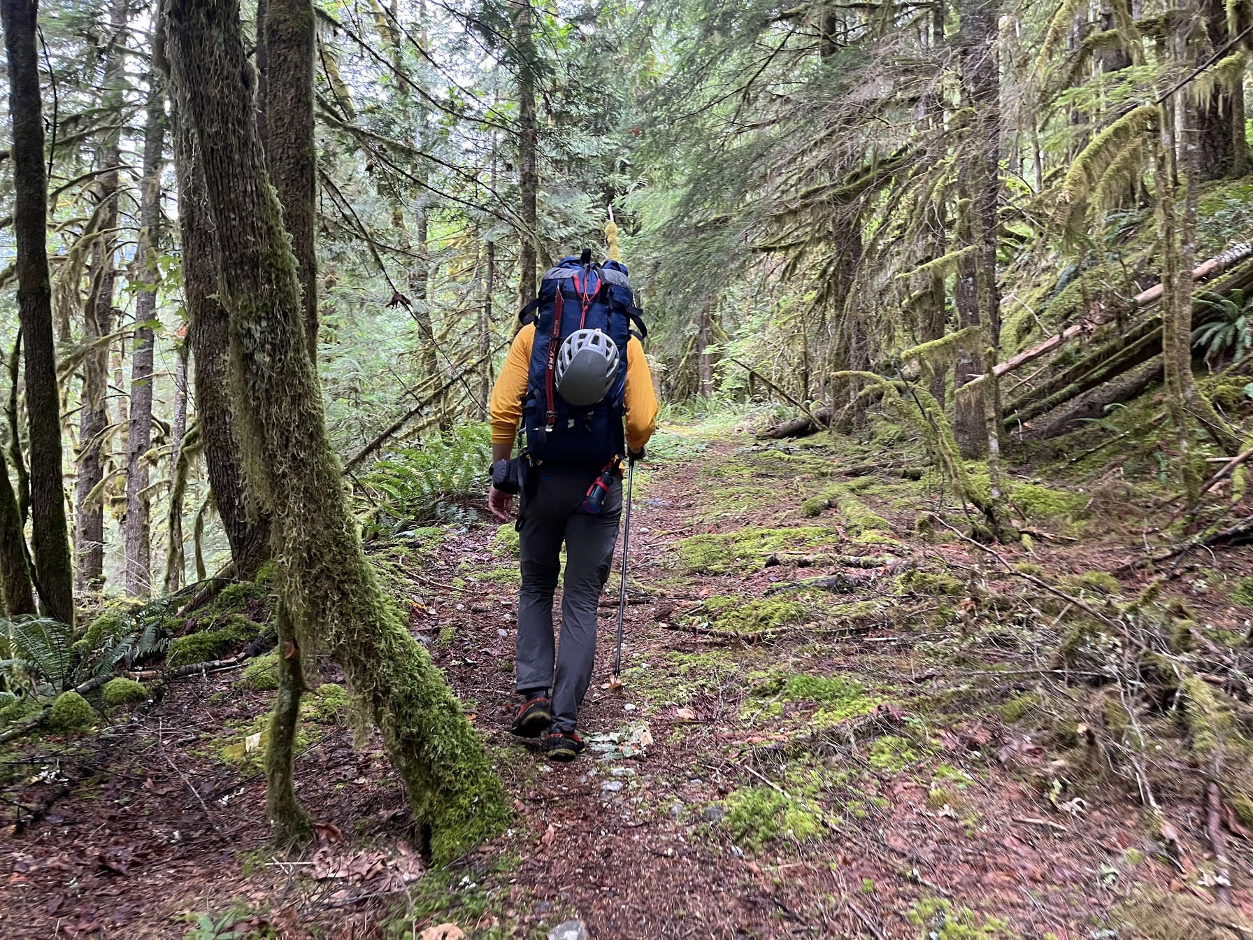
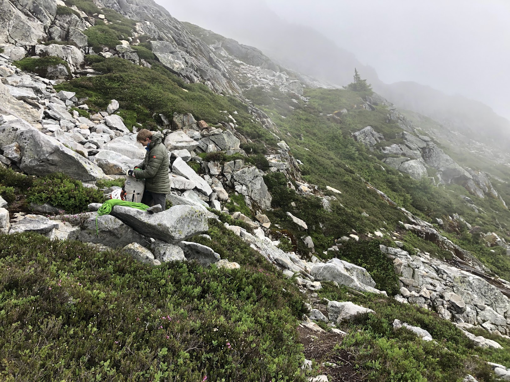
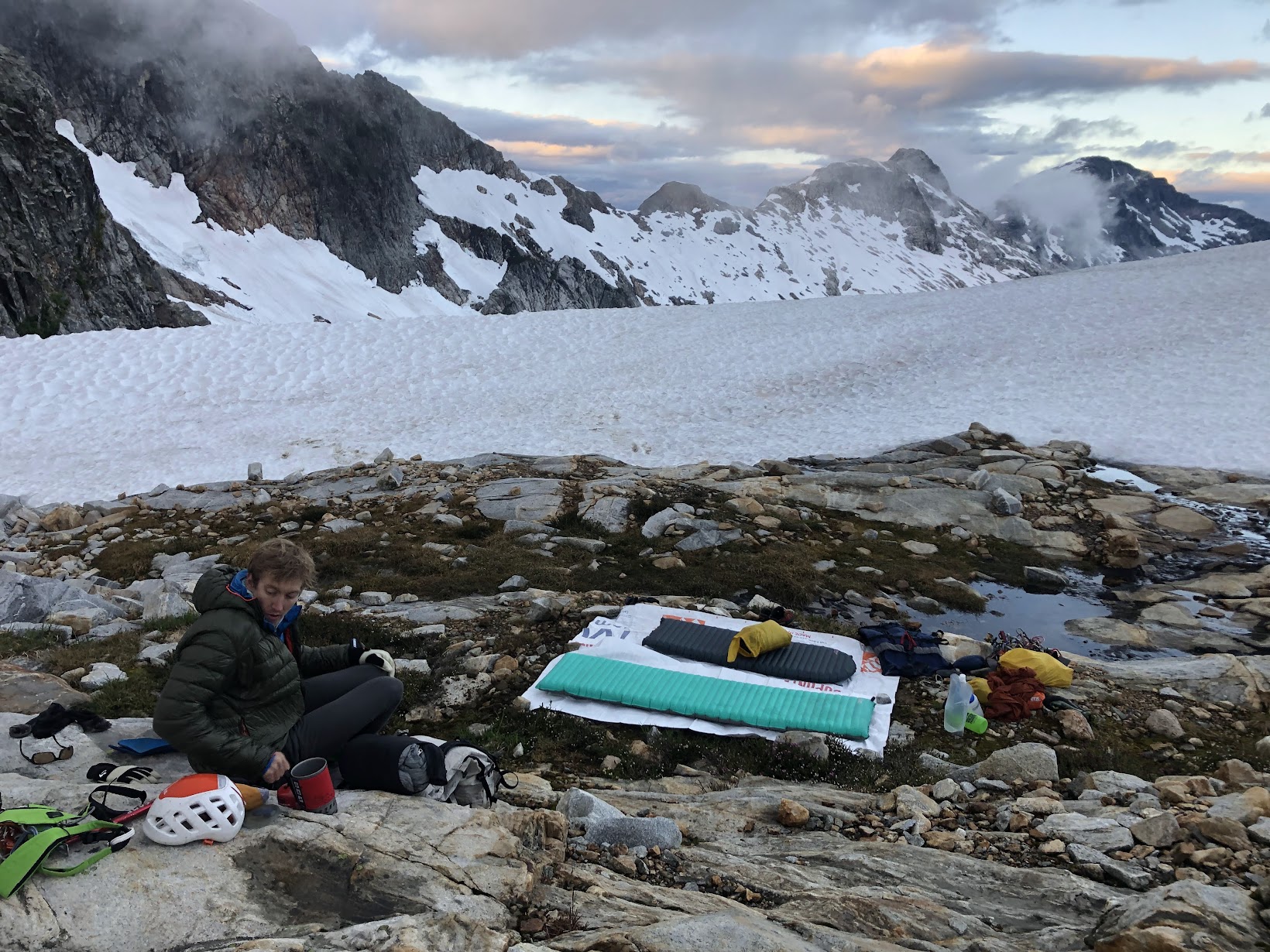
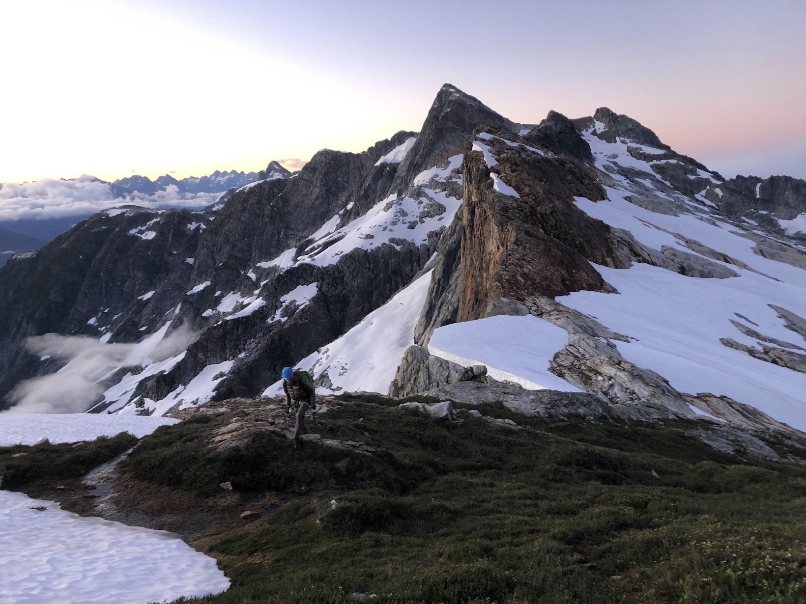
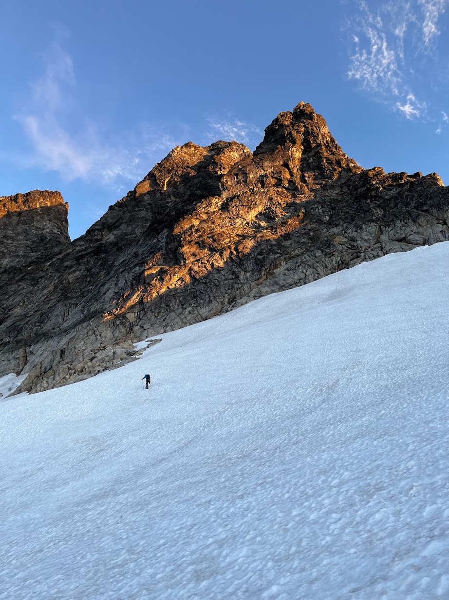
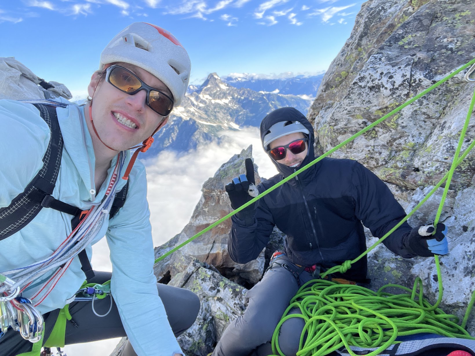
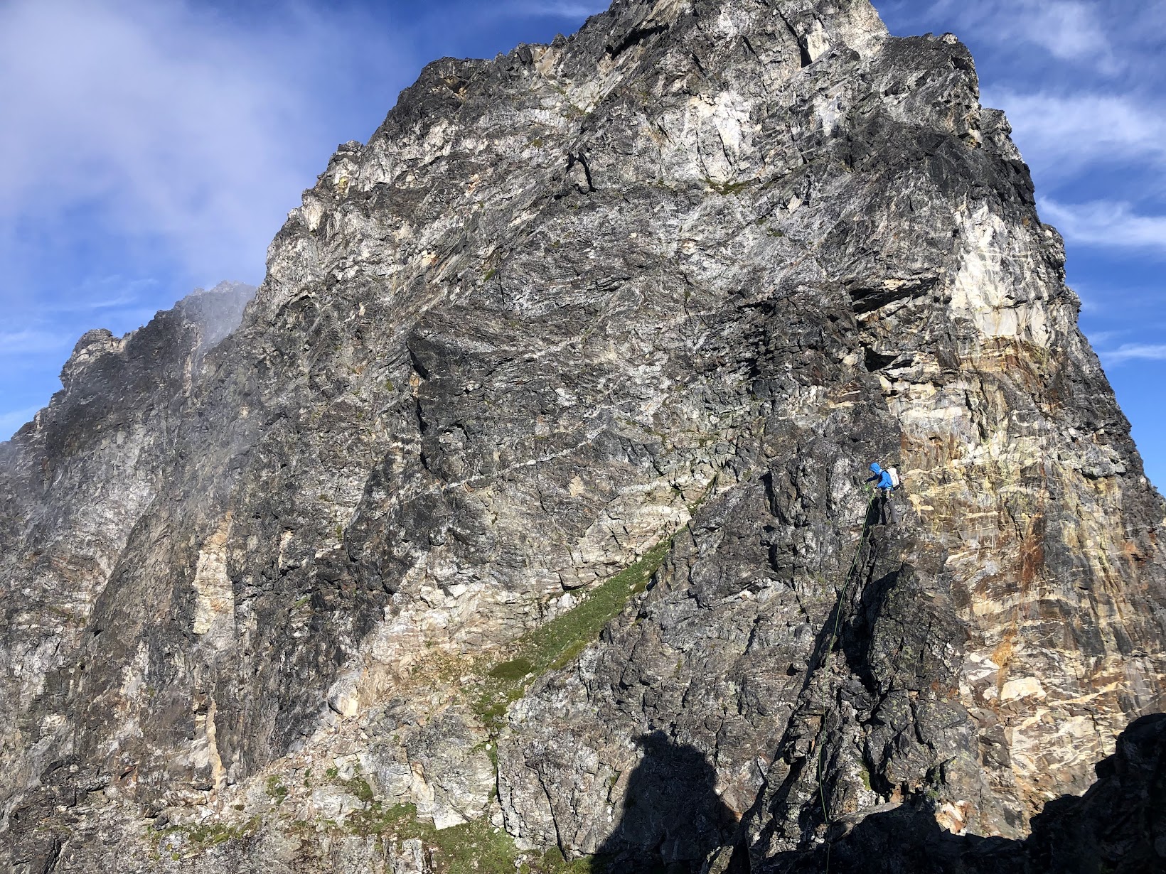
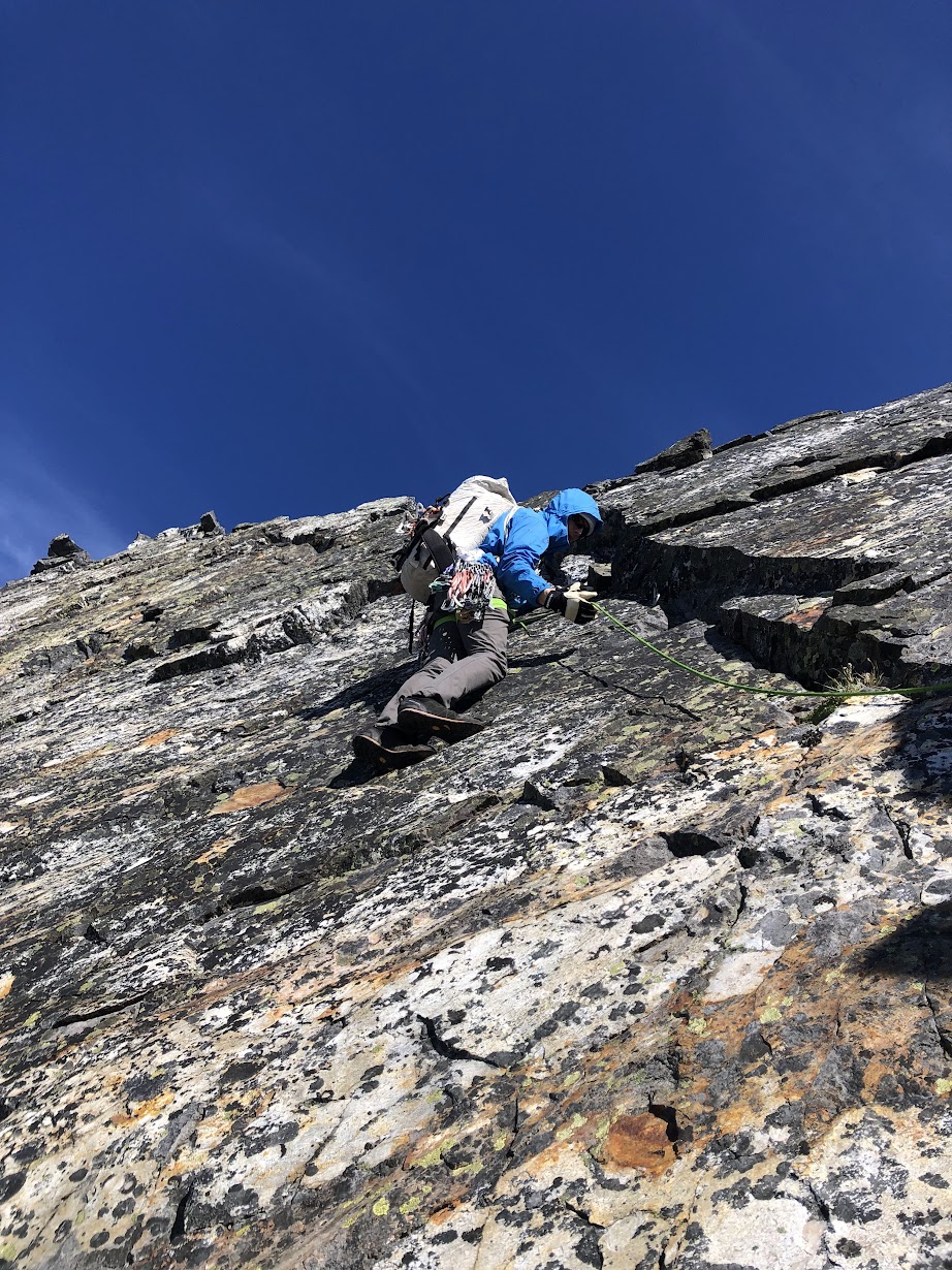
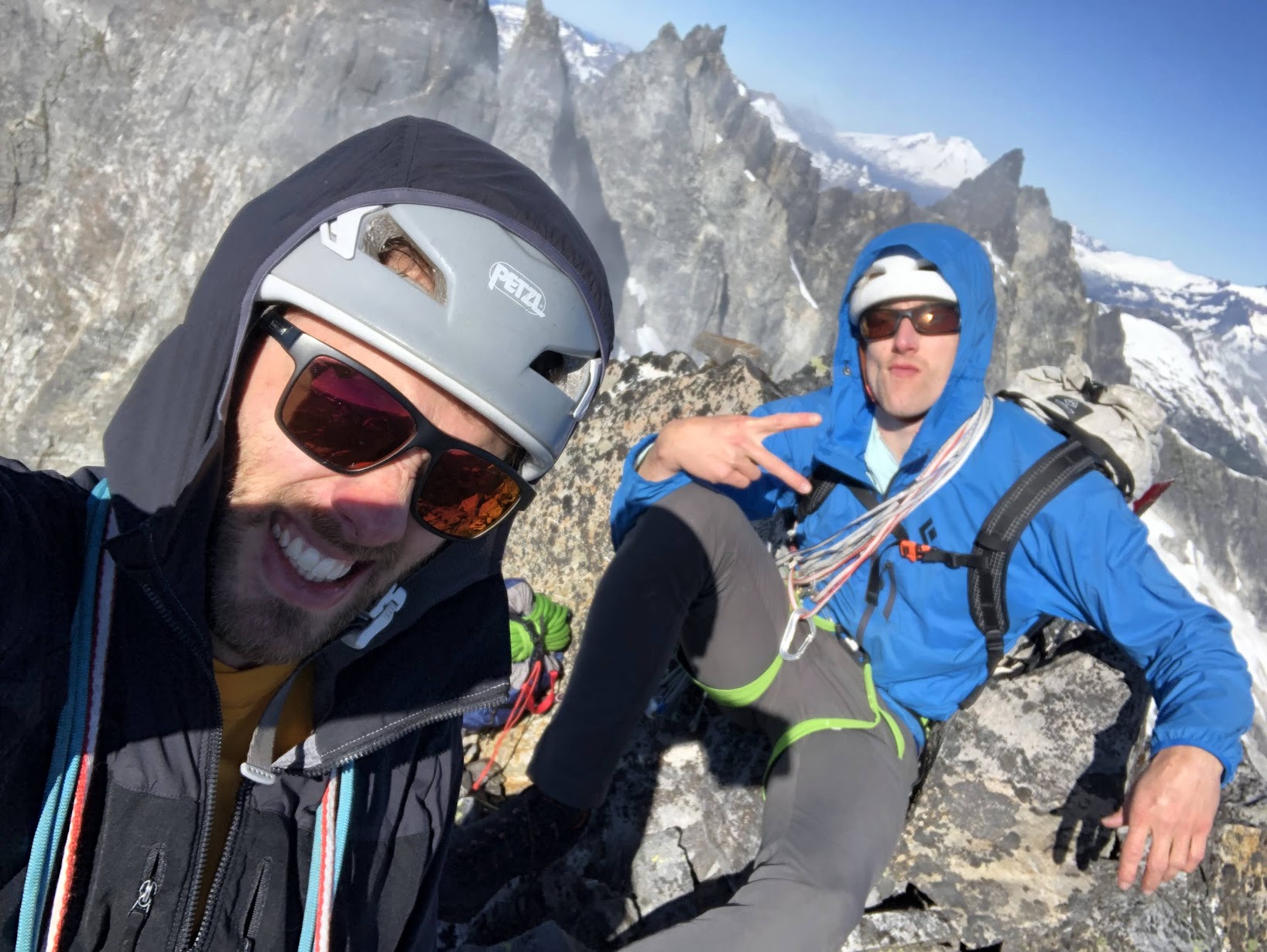

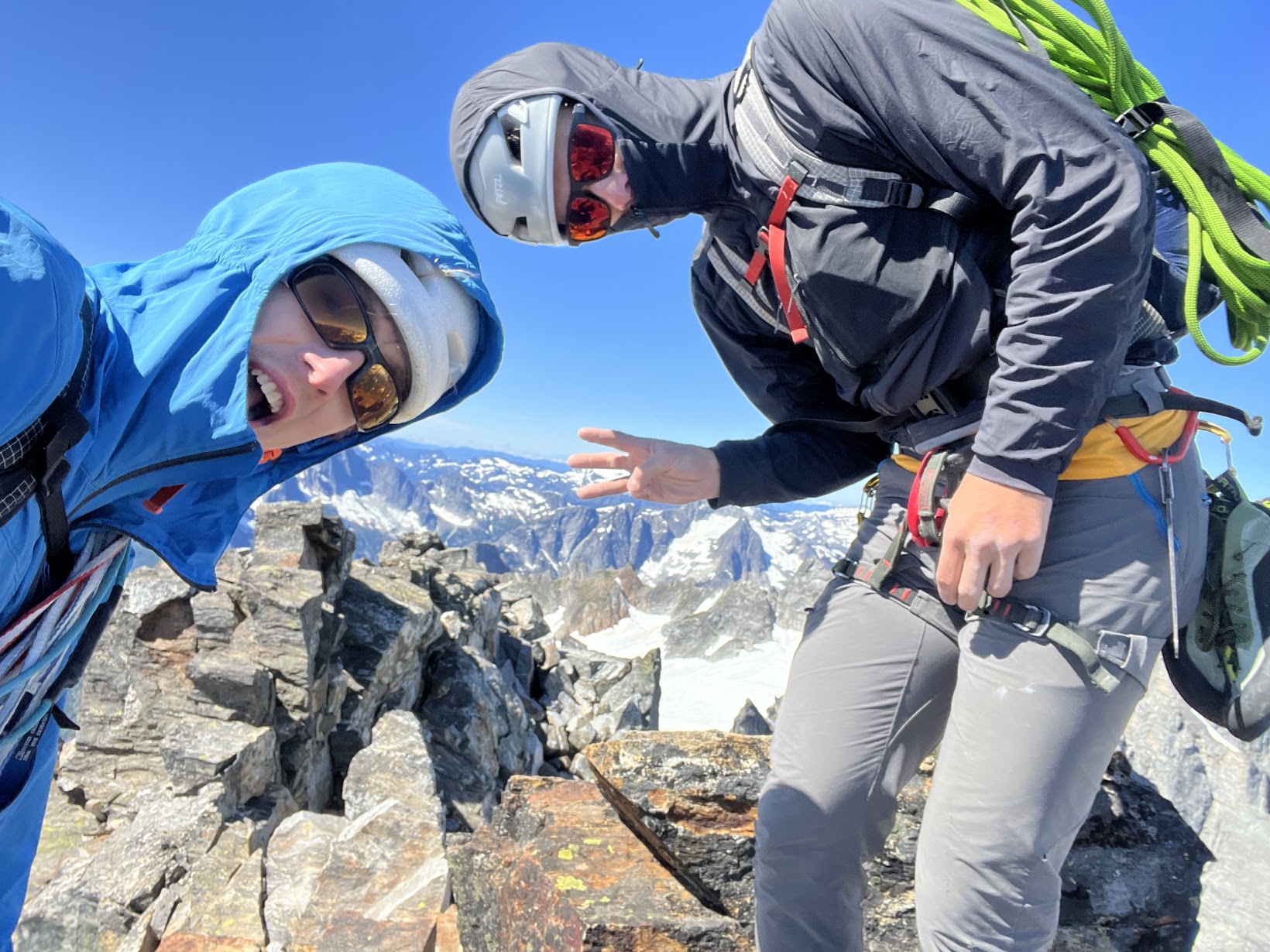
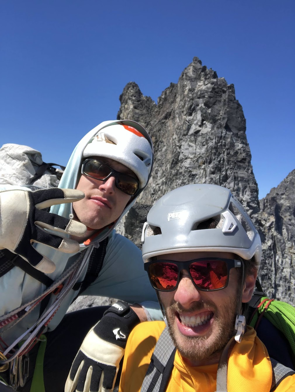
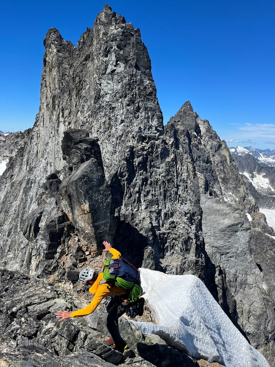
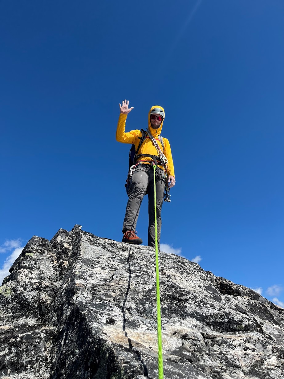
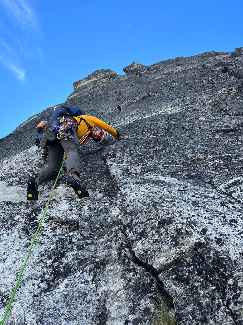
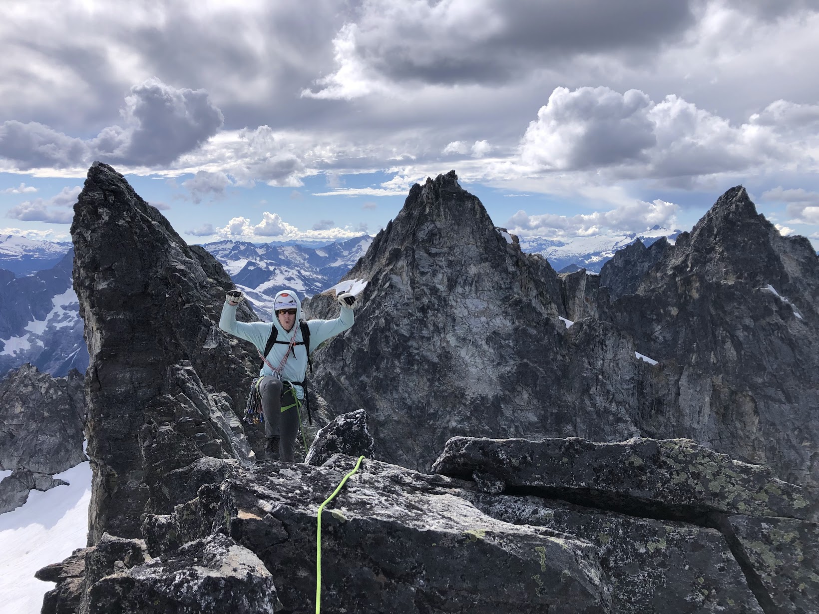
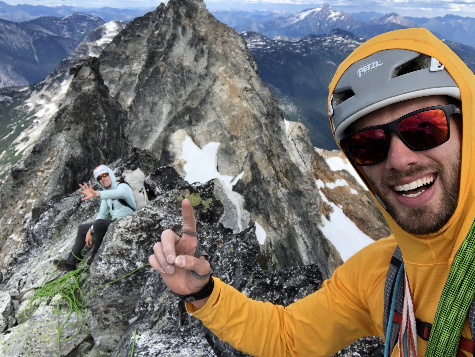
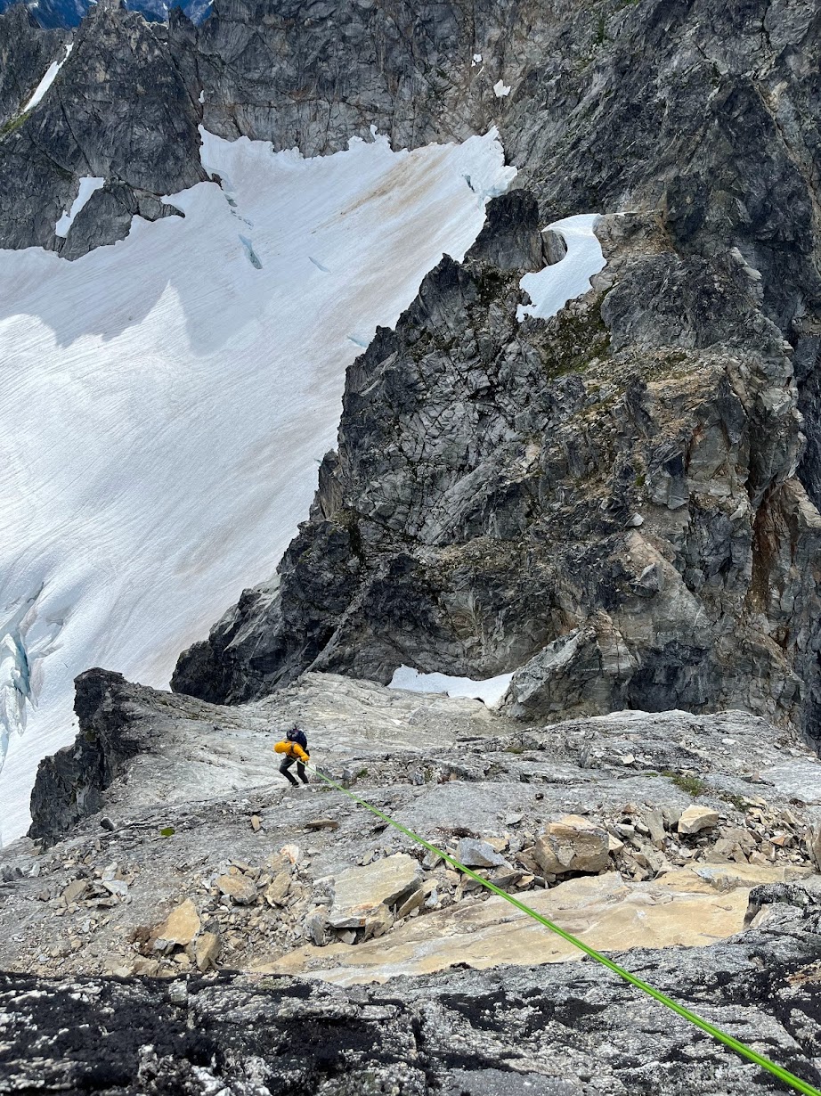
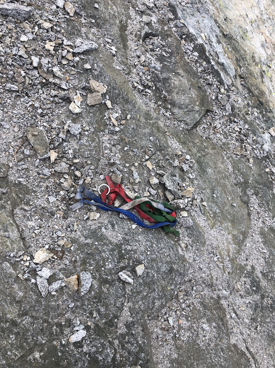
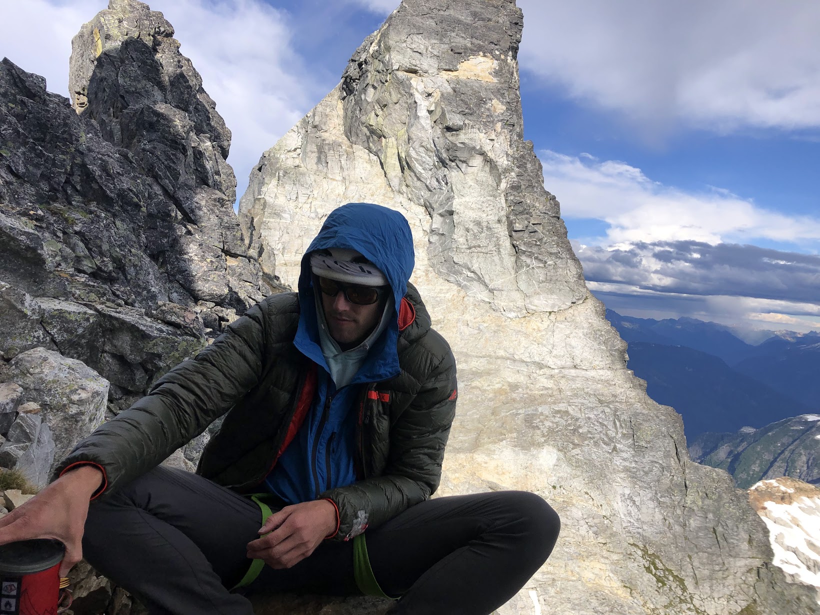
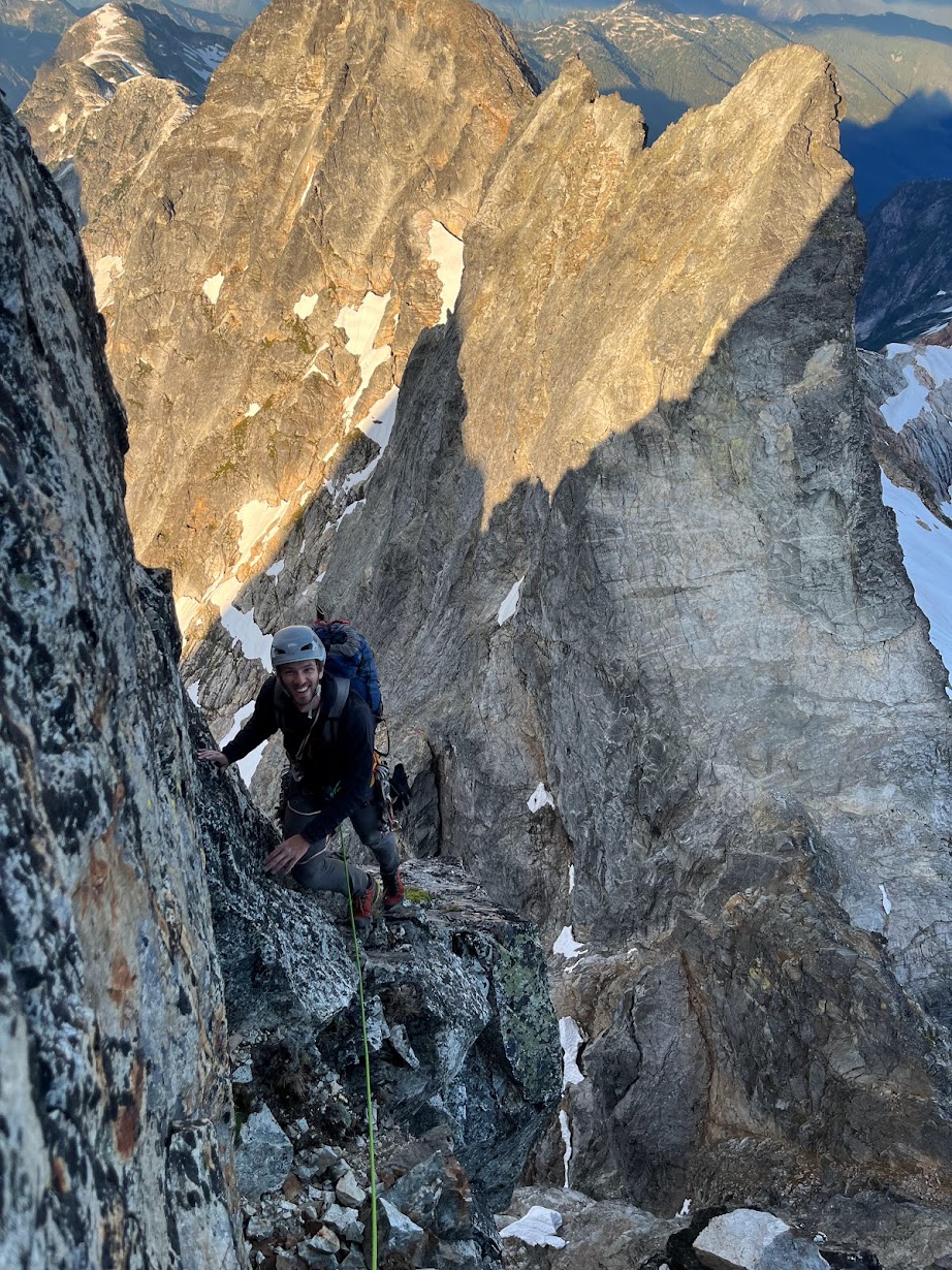
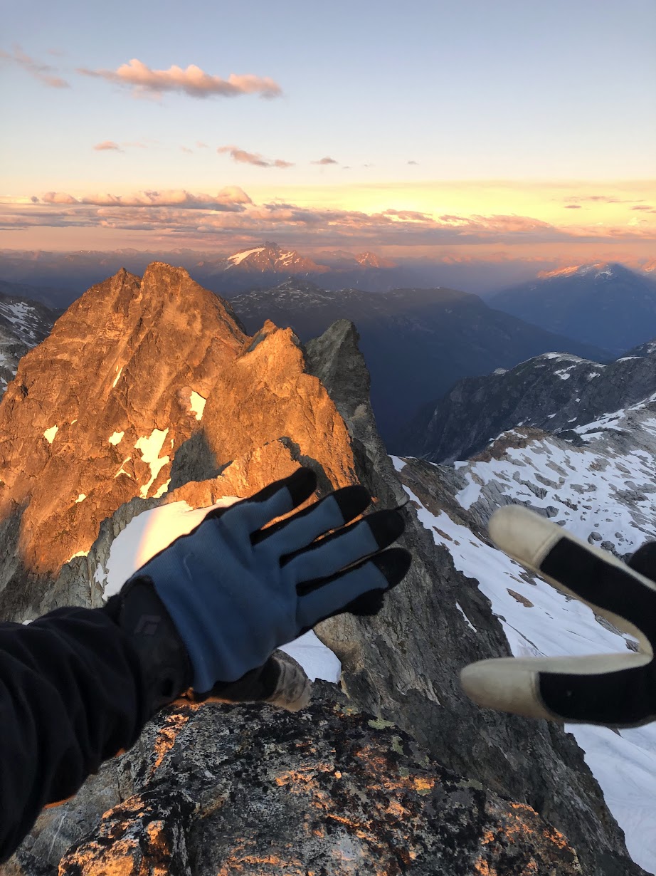
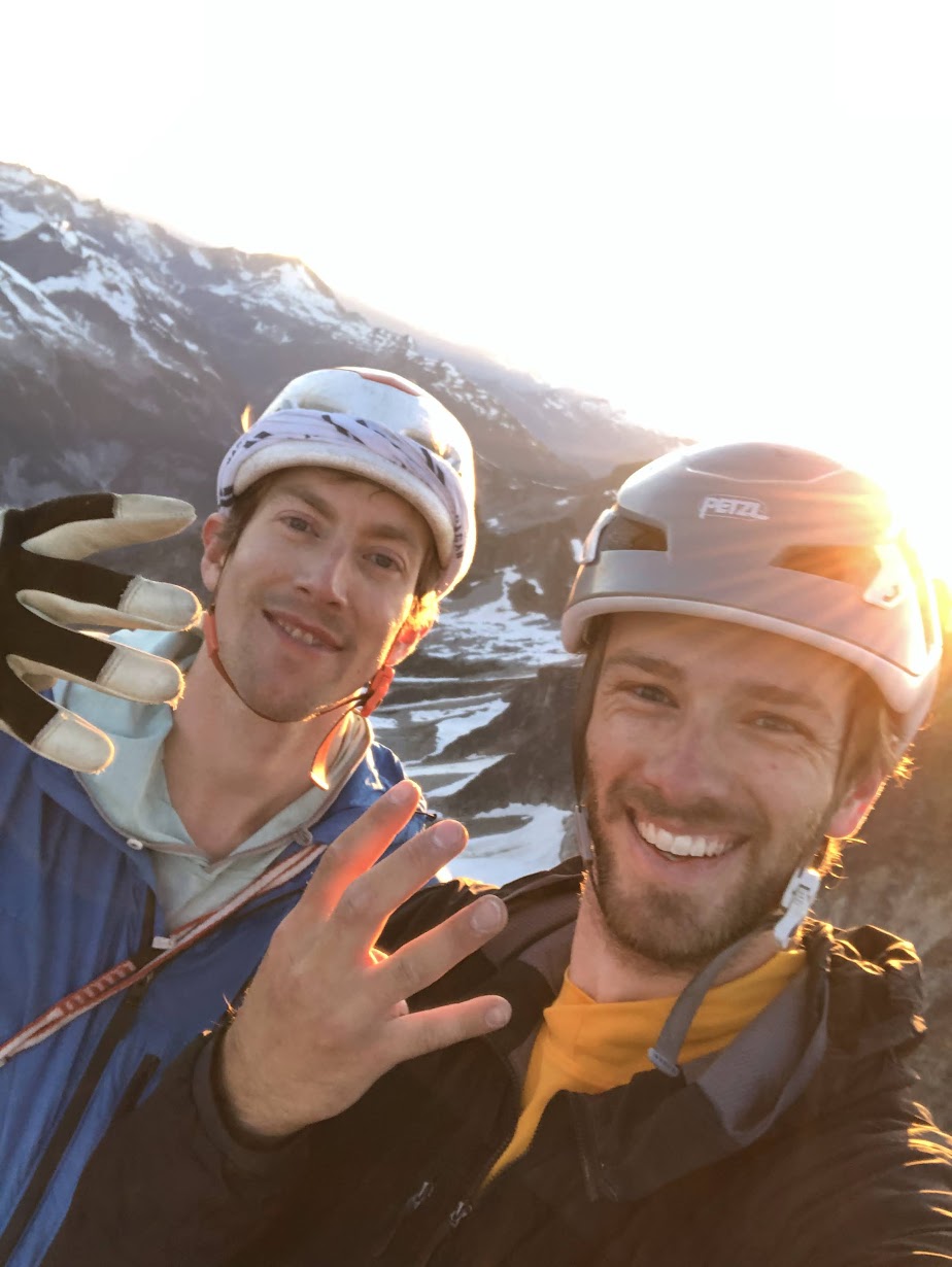
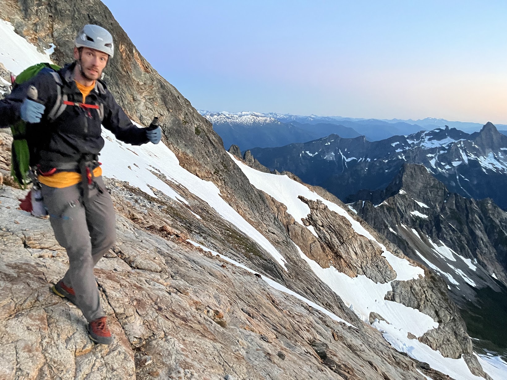
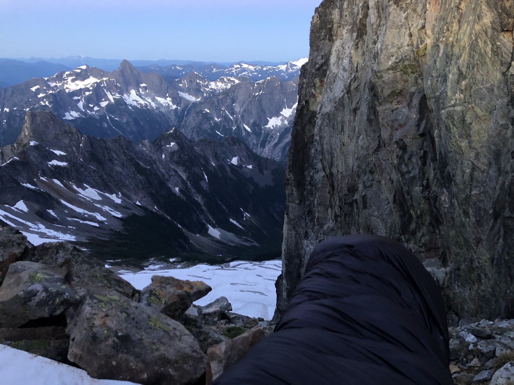
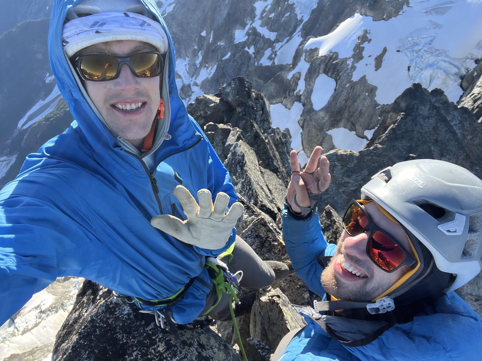
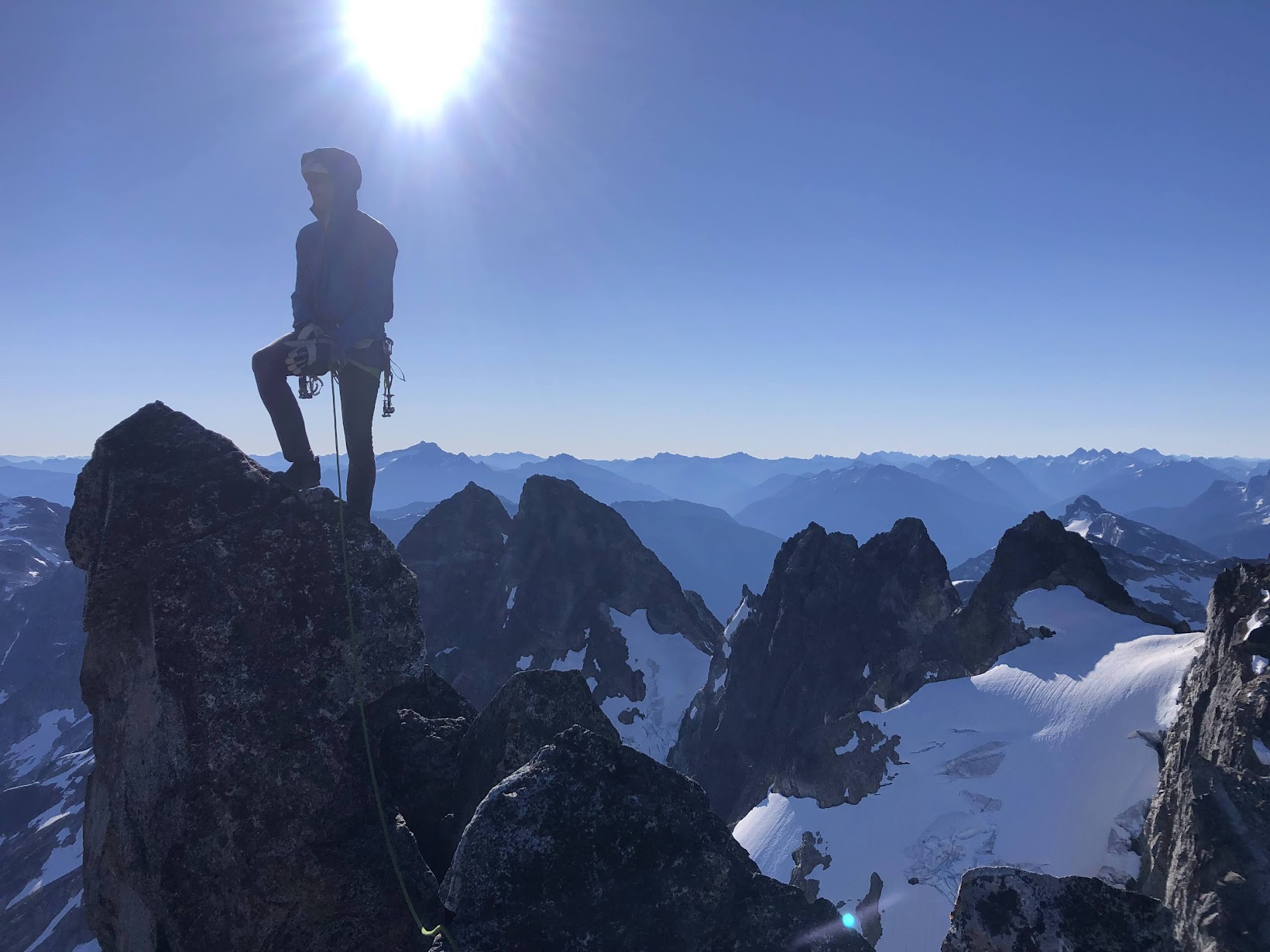
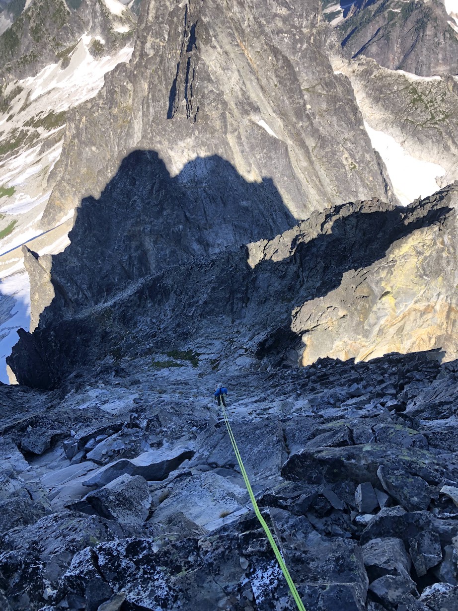
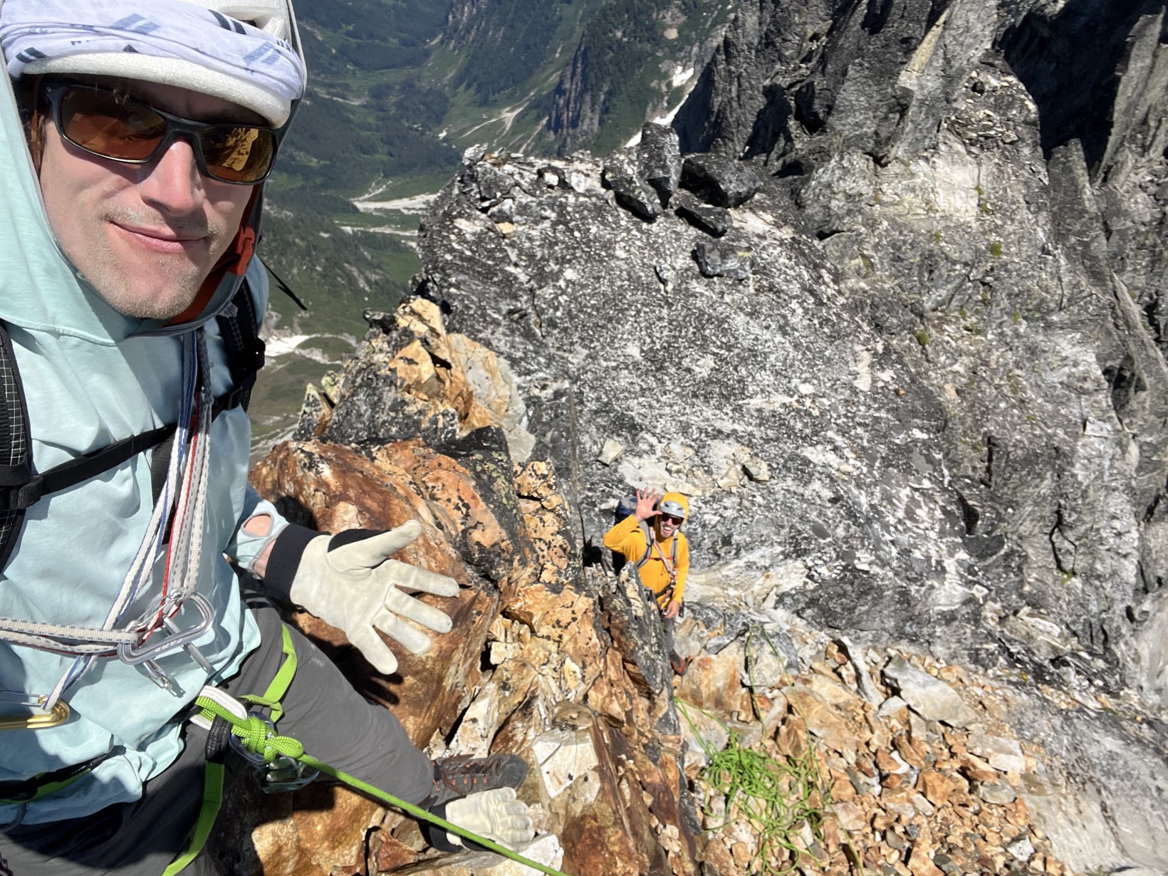
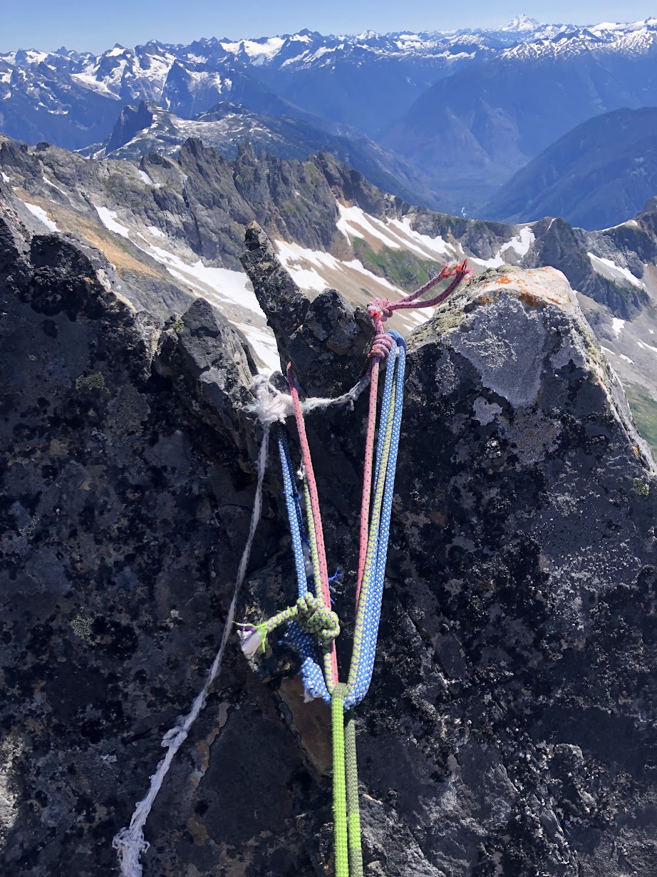
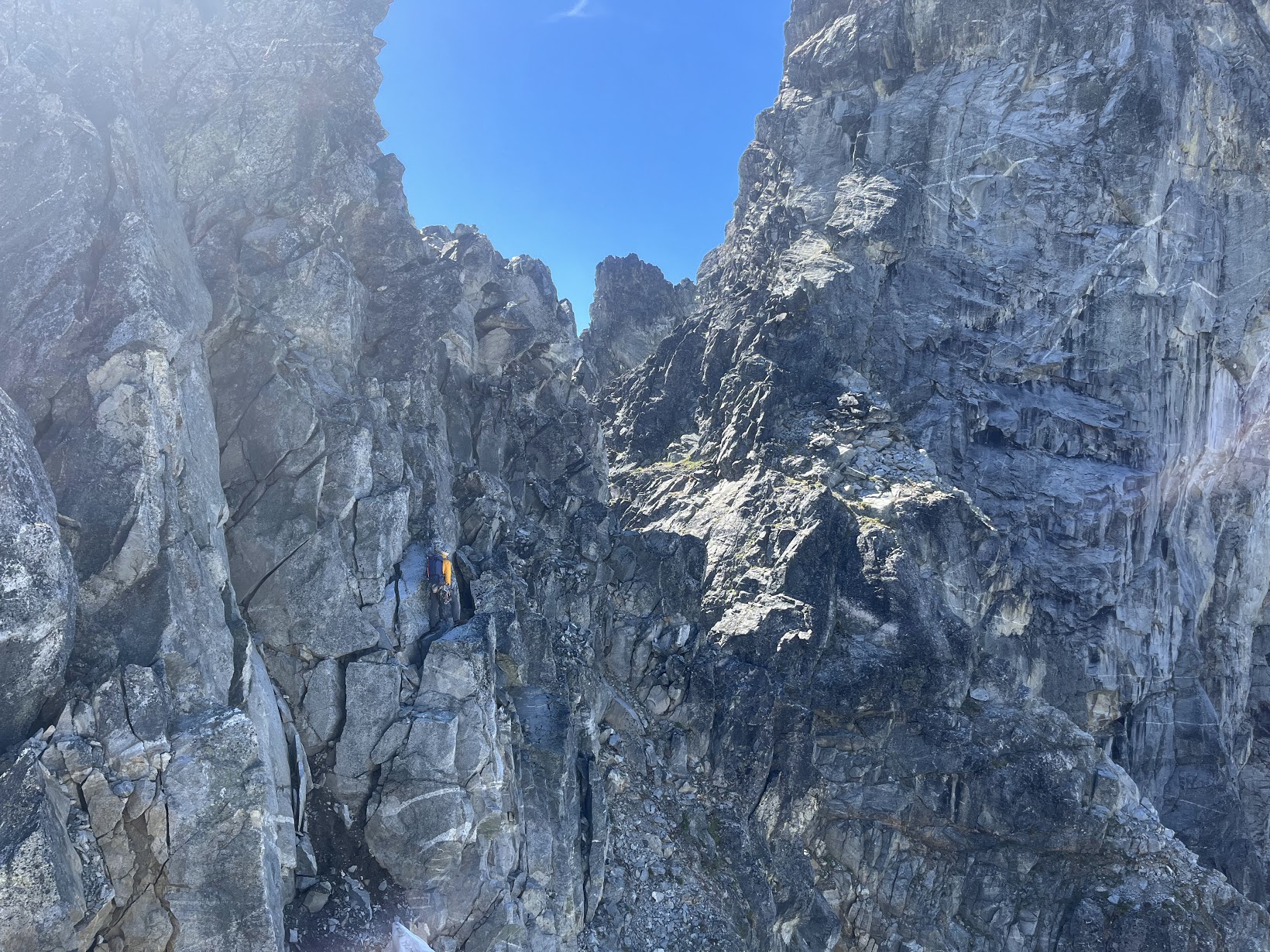
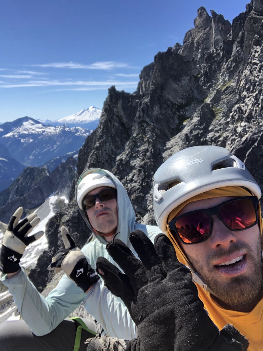
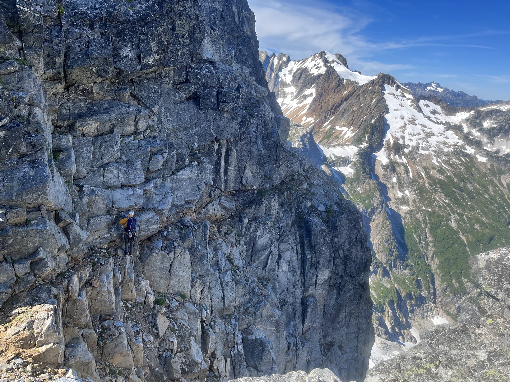
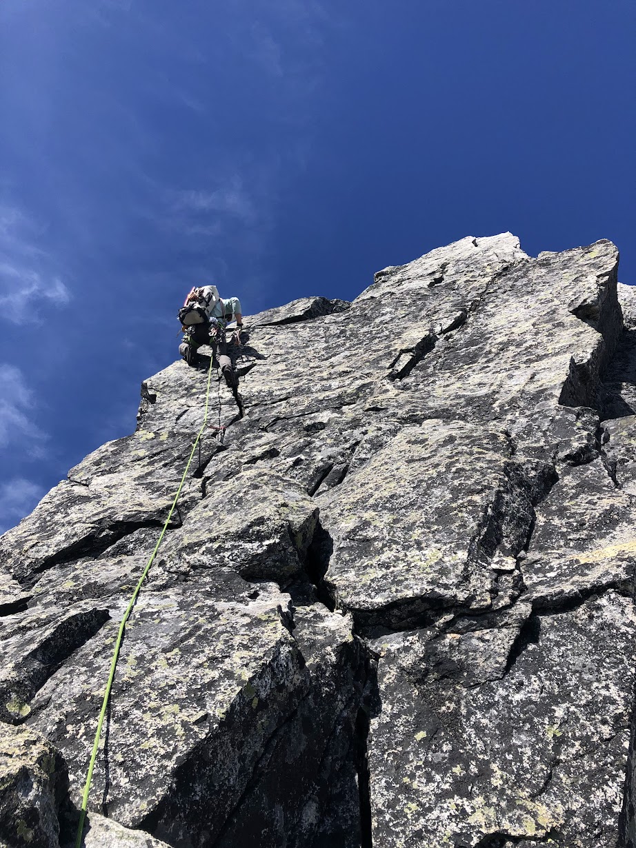
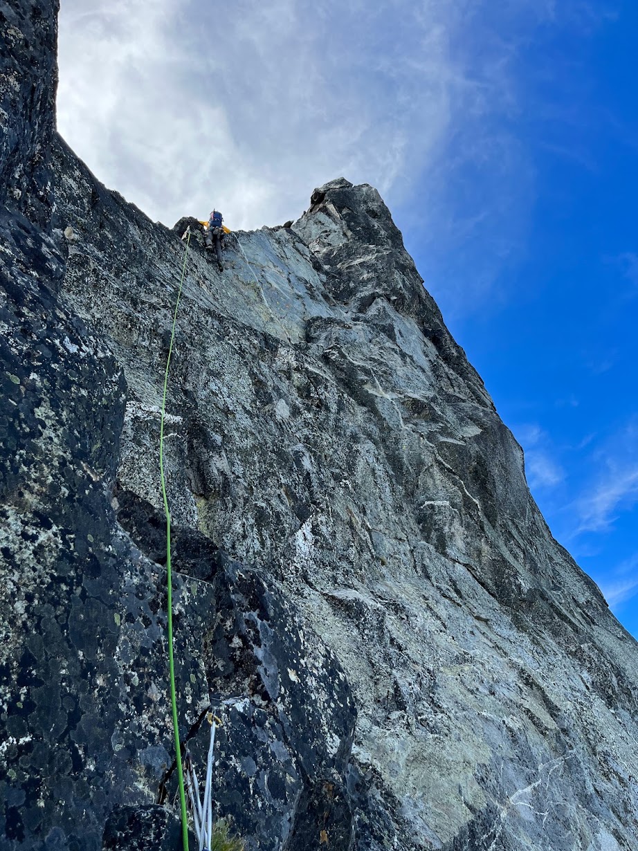
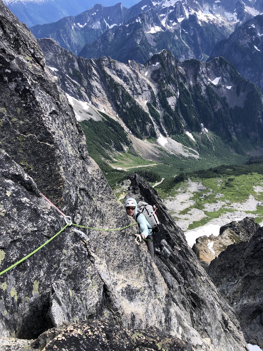
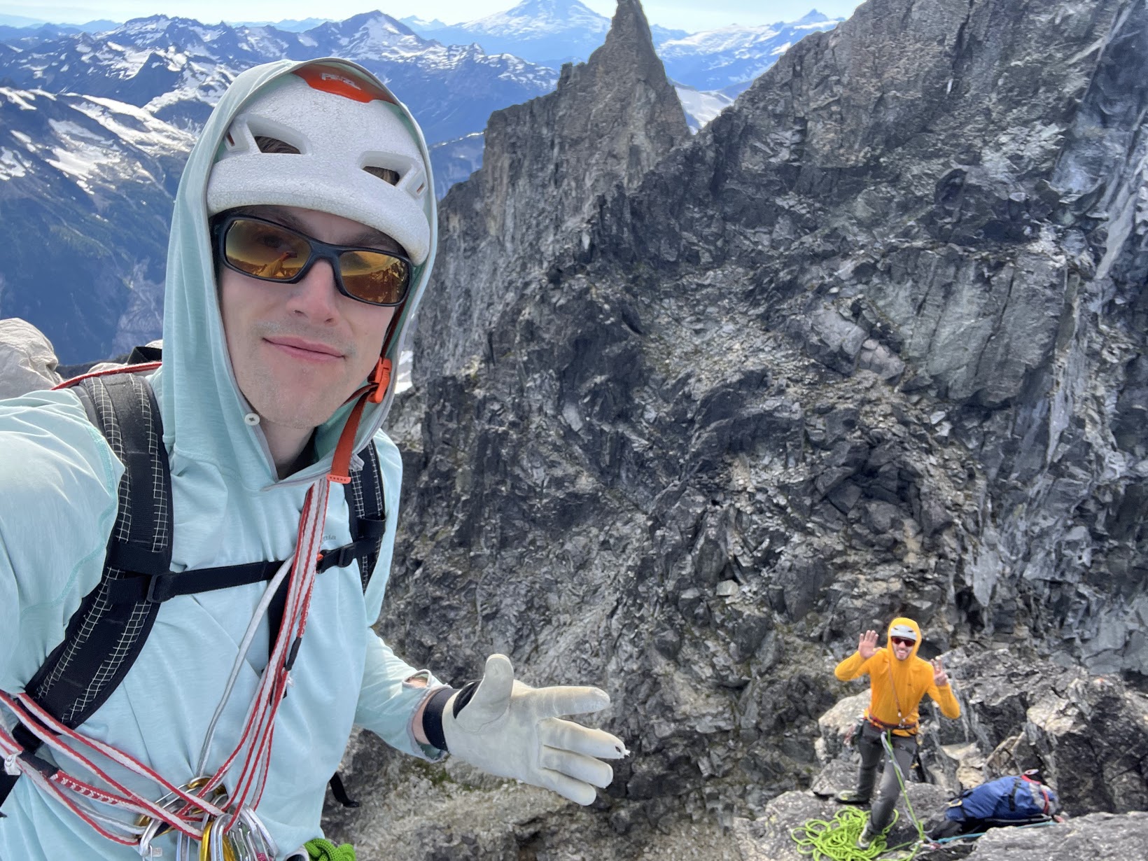
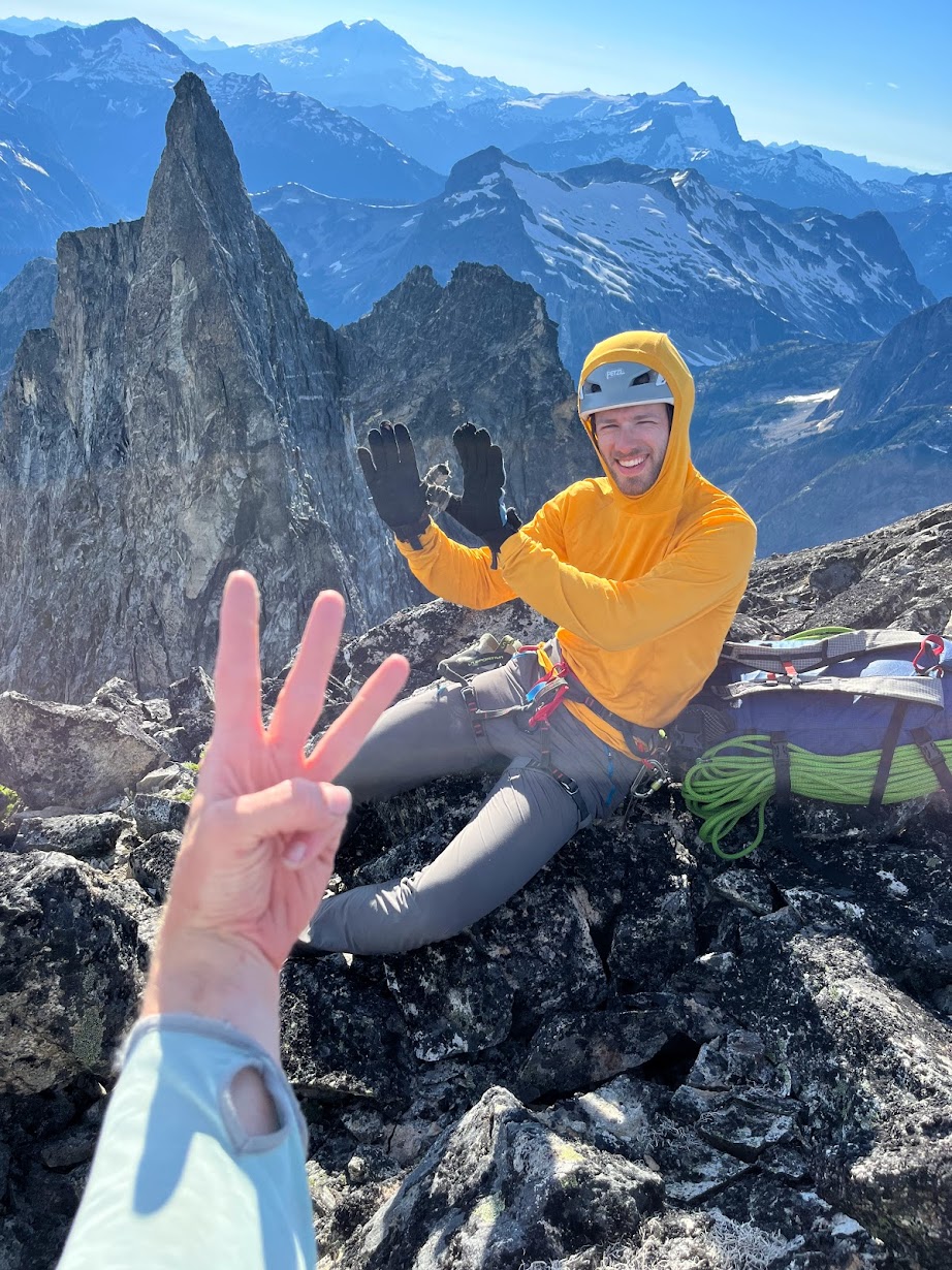
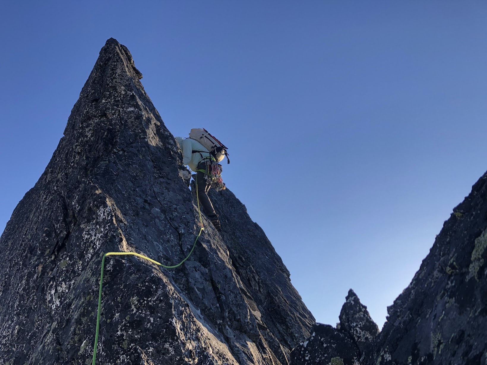
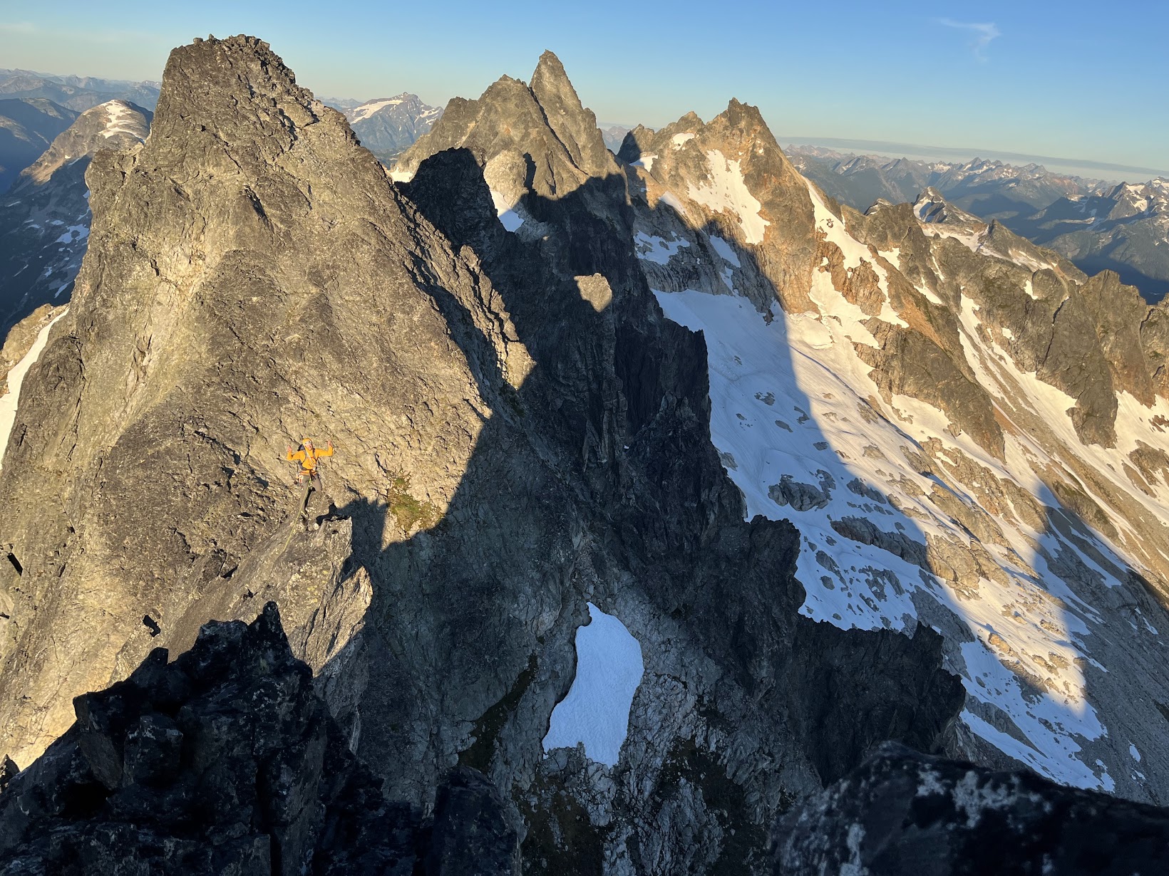
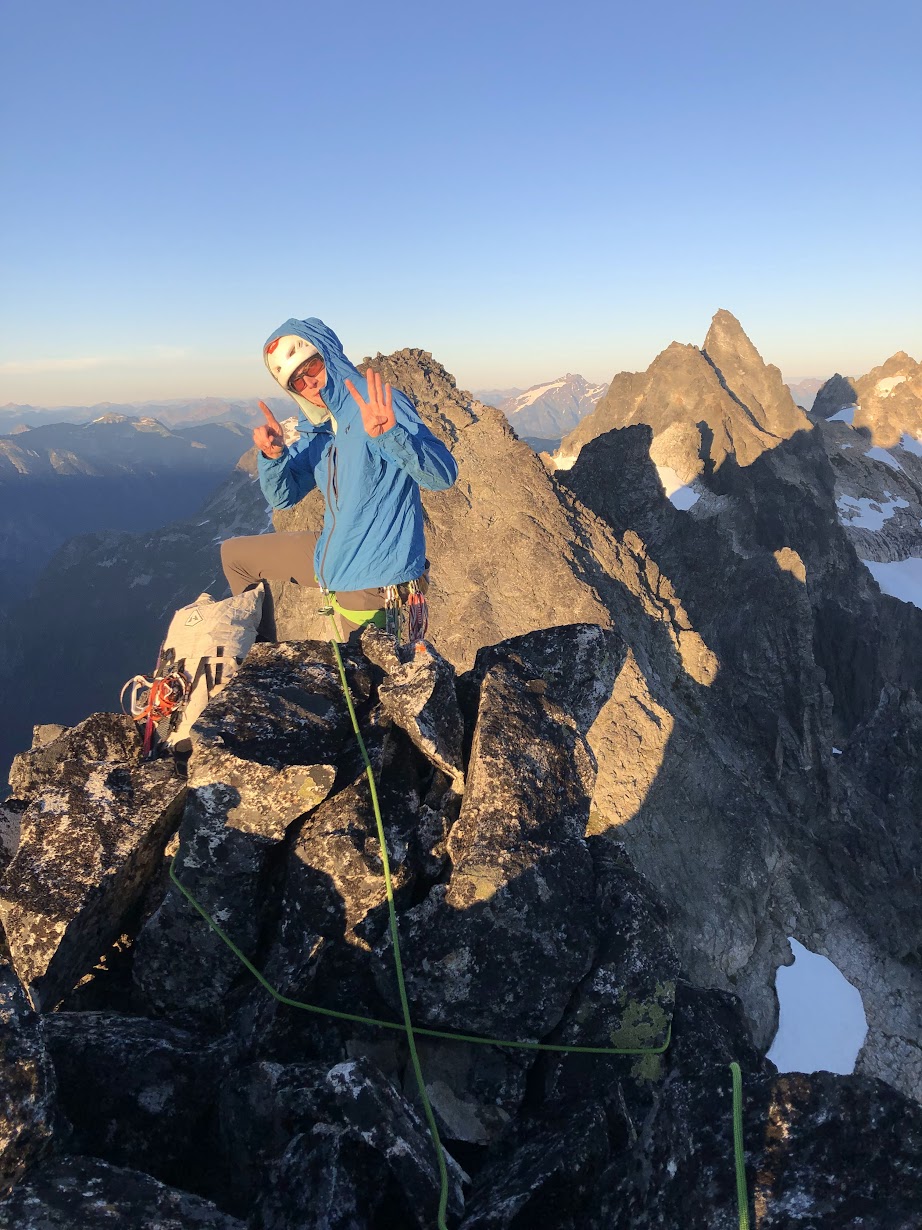
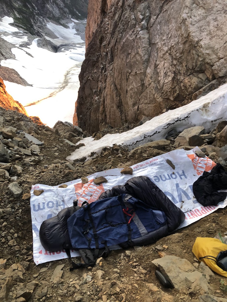
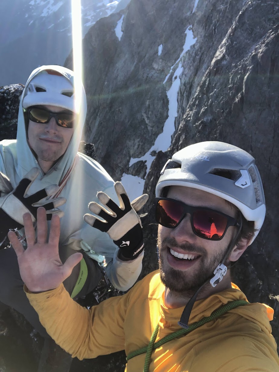
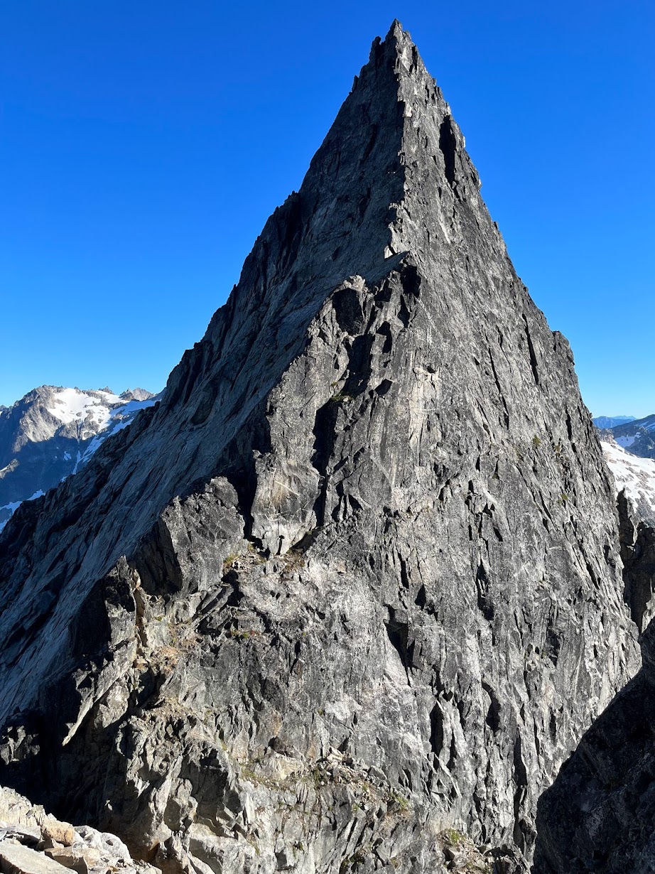
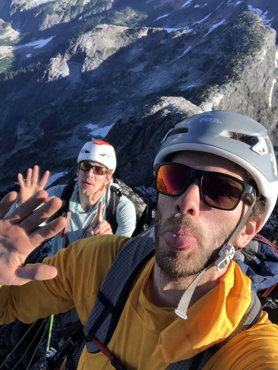
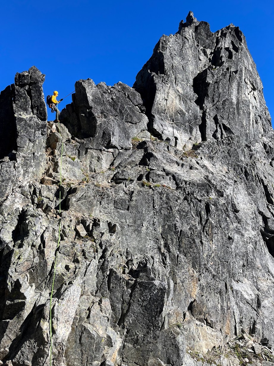
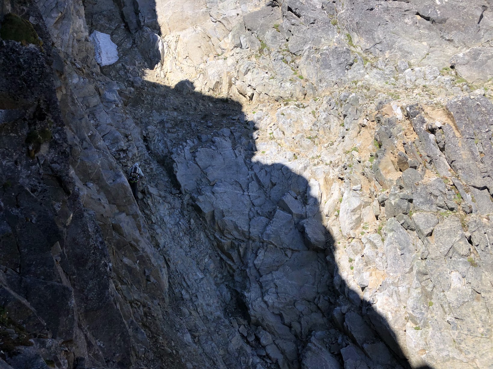
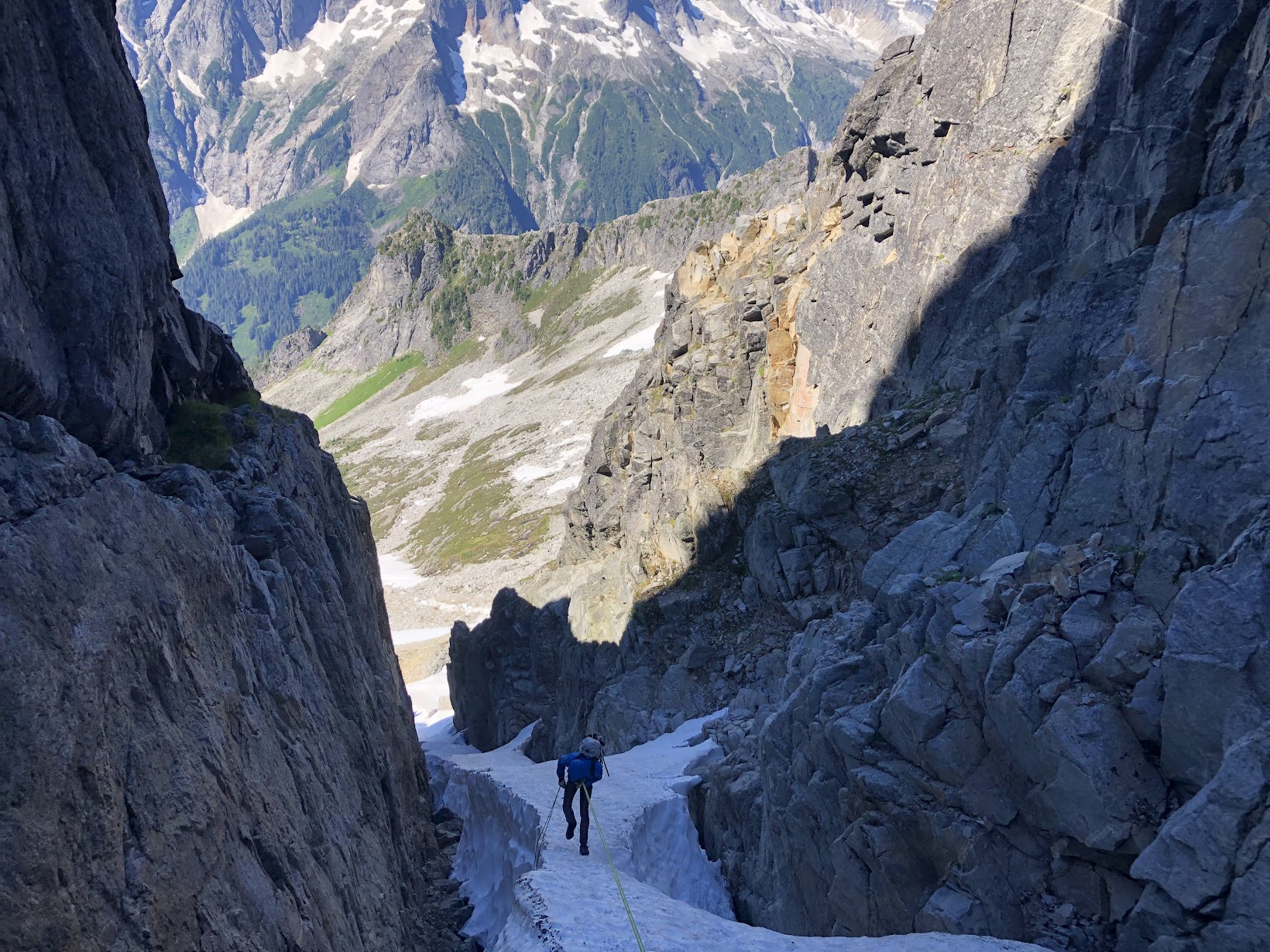
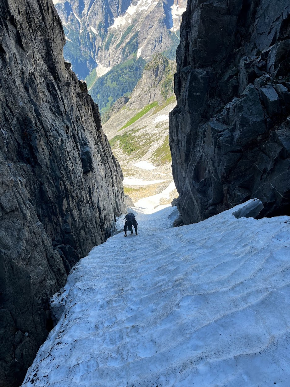
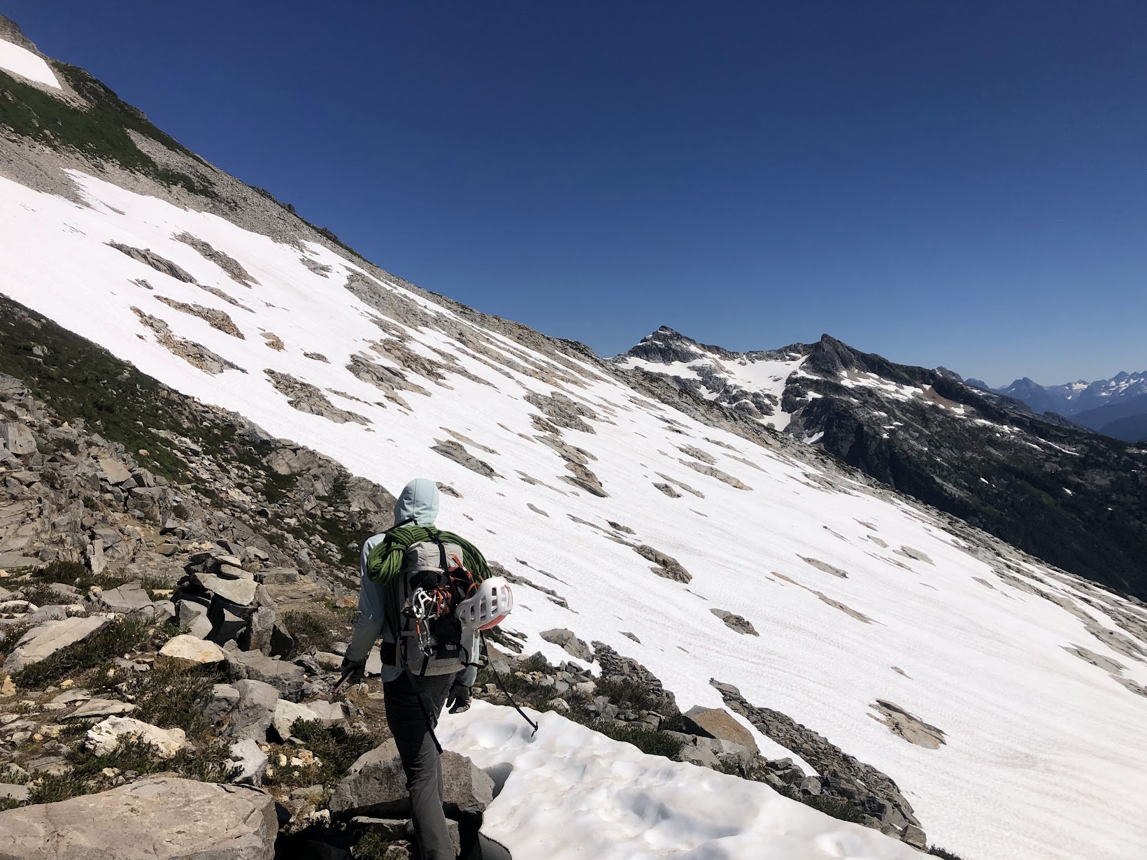
- 11 replies
-
- 10
-
-
-
-
 Trip: Dome and the Lizard - Ptarmigan (Ptarmithumb) Traverse Trip Date: 07/22/2022 Trip Report: Ah, the classic Ptarmigan....is there a finer high traverse in the Cascades? After 25ish year of rambling around the range I'm not sure there is a more scenic and pleasant high route. And so, after a 19 year hiatus it was time to return with none other than @Juan Sharp. My thumb was still broken with a pin, but no matter, we would take it easy over 6 days and savor the experience. There is probably too much already written about this particular trip, but I will say that it is worth repeat visits, if only to camp in the places you wished you had camped the first time! And, amazingly enough, the traverse was much quieter than I had it in 2003. Probably "closures" on both ends had something to do with that (check notes below for additional beta). High points, for us, included perfect weather, good snow conditions, few bugs, an evening visit from a couple curious goats, ethereal marine layer mists from White Rock Lakes, Northern lights from the Dome/Dana Glacier col, solos of Dome and the Lizard (for me), sunrise/sunset on Dakobed, and a surprise visit from @jenny.abegg and partner who were mountain running from Canada to Stehekin, along the crest, in ONE WEEK. They covered in A DAY, what took us 4 days! To say we were amazed would be an understatement. I can't wait to see the movie made by the film crew running along with them for a couple sections. Low points would be the brush of Bachelor and Downey Creeks, but there is always a price of admission to the glory of the North Cascades parklands. I'll be back, but I won't wait as long next time! Heading up the closed cascade river road: @Juan Sharp below Mixup on the way to Cache col: Formidable: Camp 1 with a good view of the NF of Spider: Traversing over to Middle Cascade Gl: Passing thru Spider/Formidable col, Old Guard and LeConte in the middle: Climbing up above Yang Yang Lakes: Camp 2: Formidable at sunrise: Heading out on Day 3: Traversing to LeConte Gl.: South Cascade Gl.: The majestic north side of Sinister/Dome and the Chickamin Gl.: Camp 3 at White Rock Lakes: NF of Sinister and the Chickamin: Elephant Head and Dome from WRL: The aptly named Elephant Head: Agnes! Snout of the Dana: The German Helmet lost in the mists to the right of @Juan Sharp: Summit ridge of Dome: Hydramatic Spire: Camp 4, North Cascades style: @jenny.abegg and crew heading towards the Chickamin one evening: Dakobed from Camp 4: Surprise aurora borealis one night....it didn't look like this to the naked eye, 25 sec. exposure. Heading toward Itswoot ridge on day 5: Dome and @Juan Sharp: Sussing out the way to Cub lake from Itswoot ridge: False hellebore: Getting to the fun part in Bachelor Creek: @Juan Sharp crossing Bachelor Creek after doing battle with the worst of it. Note the bloody shins: The Bachelor Creek trail has sustained significant damage from slides this past winter: Camp 5, on the banks of Downey Creek: We're not in Colorado any more! Thru the burn at the end of the Downey Creek trail: Gear Notes: 30m rope, glacier gear, helmet, ice axe, crampons Approach Notes: Cascade River Road closed at Eldorado. Bachelor/Downey creek trails officially "closed" but in decent shape, esp. thru the burn. Bachelor Creek trail in good shape above 4500'. Cross Bachelor Creek at the alternate 4500' crossing. Flagged from there down to old log across Bachelor Creek at 4100'. Lots of blowdown in Lower Bachelor Creek and upper Downey Creek trails. Much bear sign.
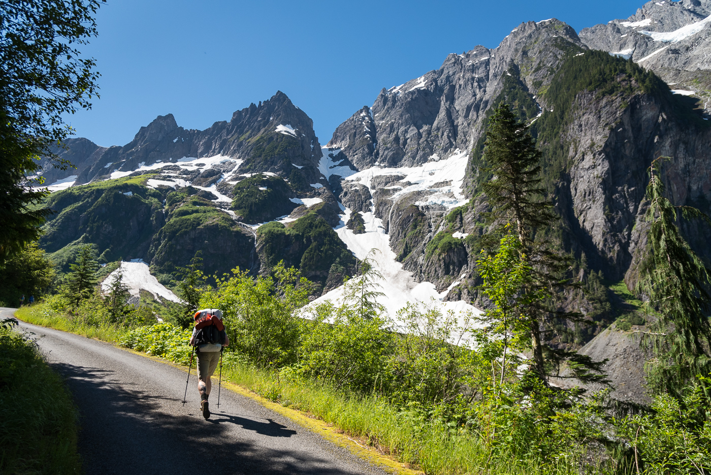
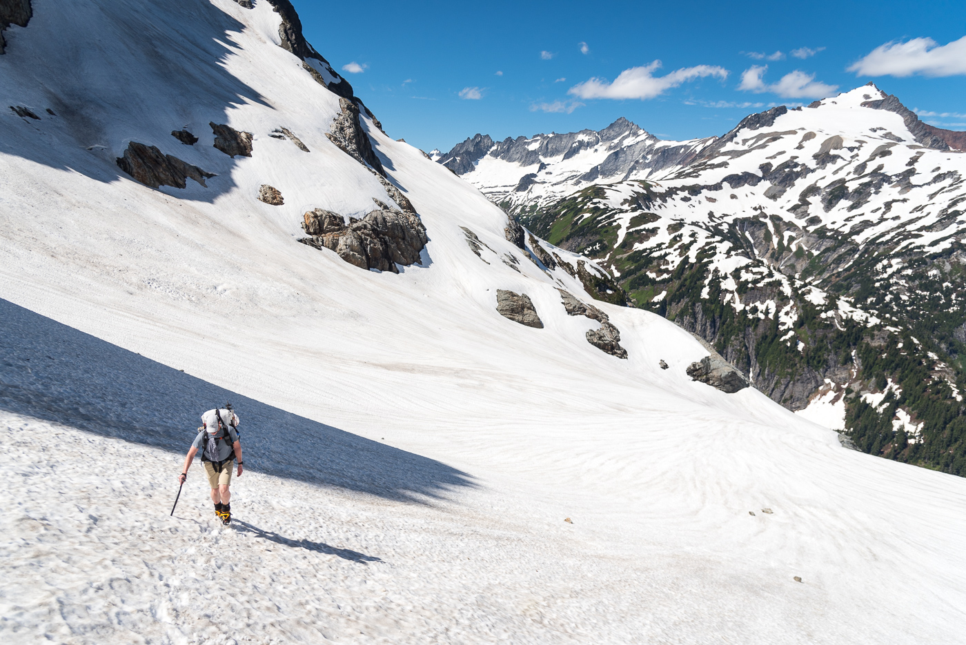

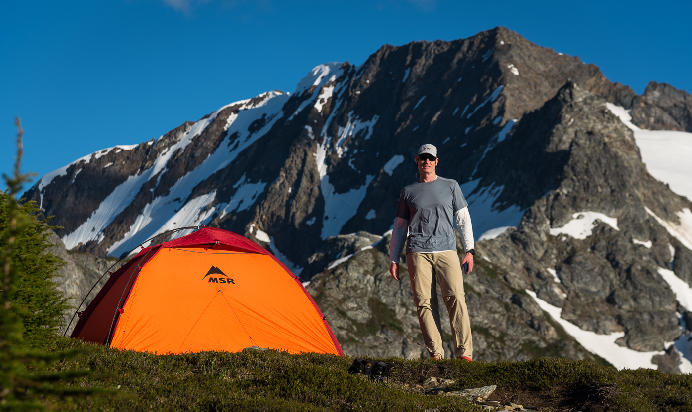
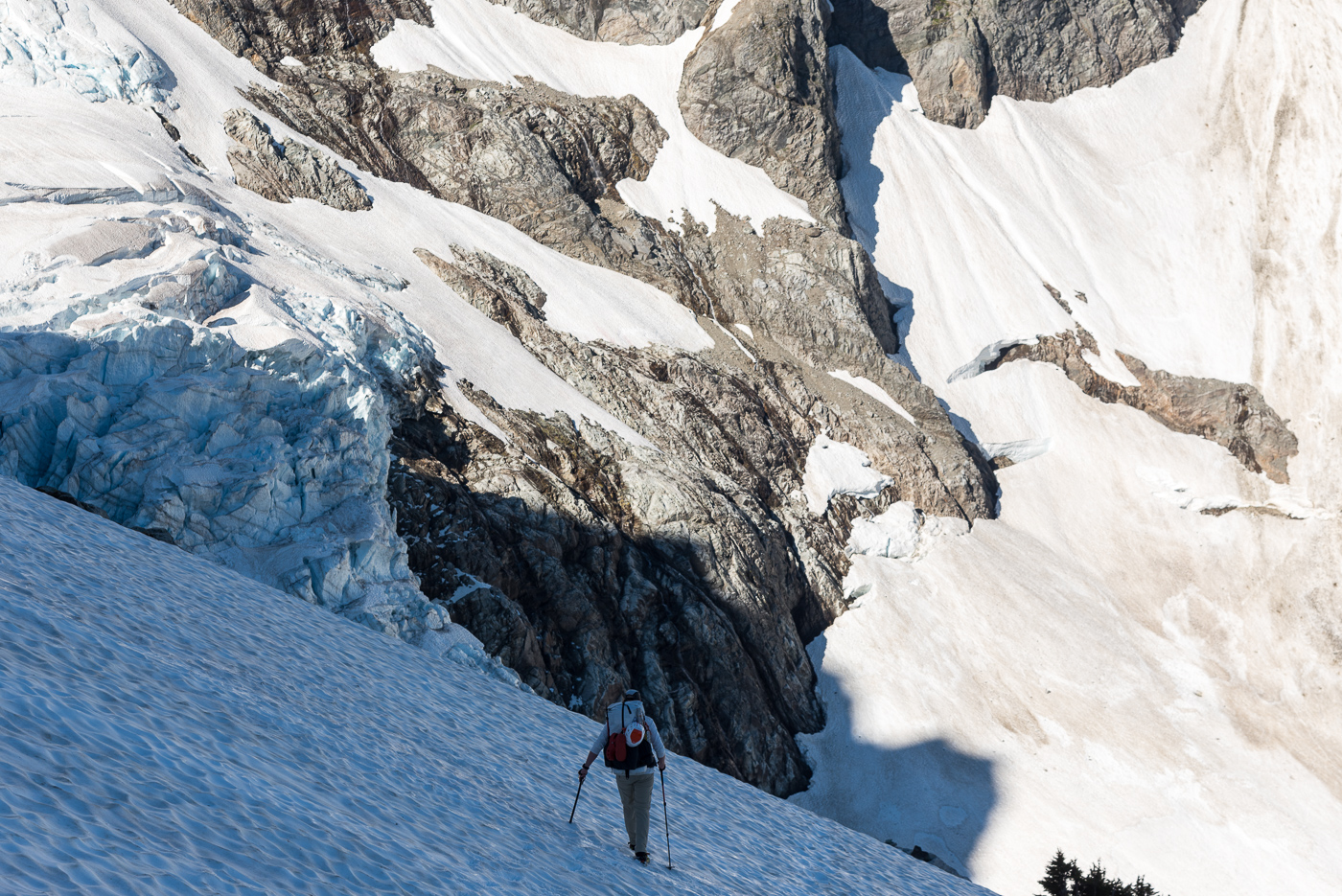
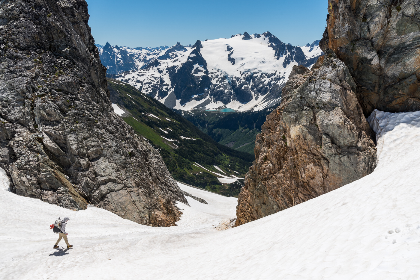
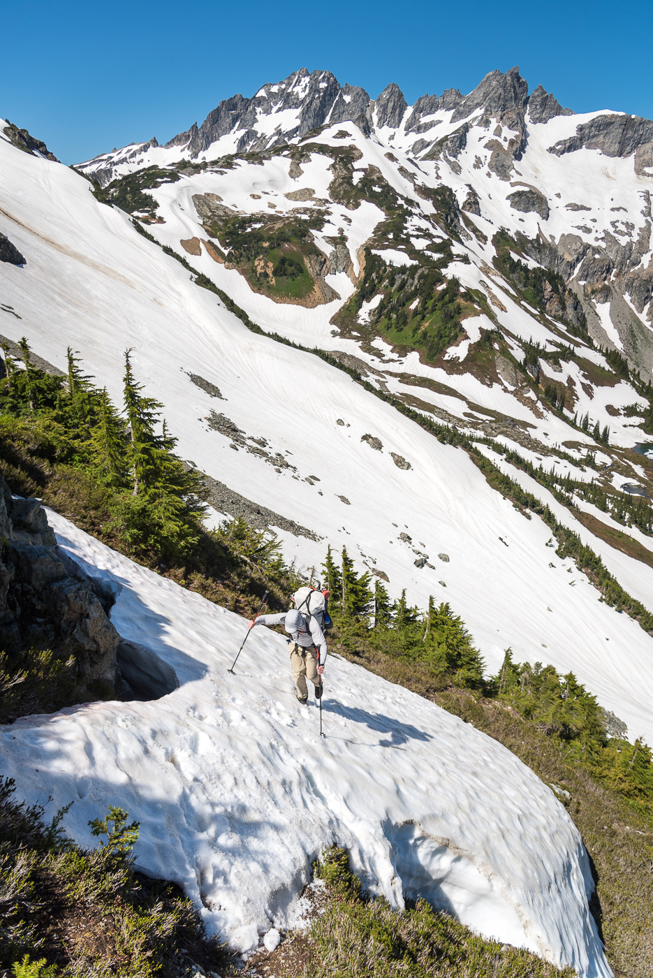
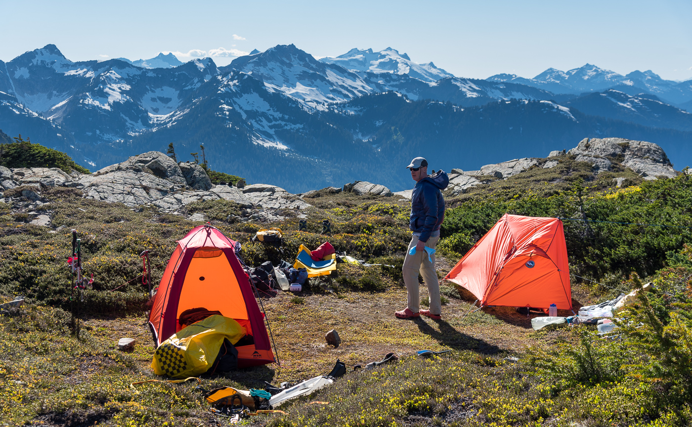
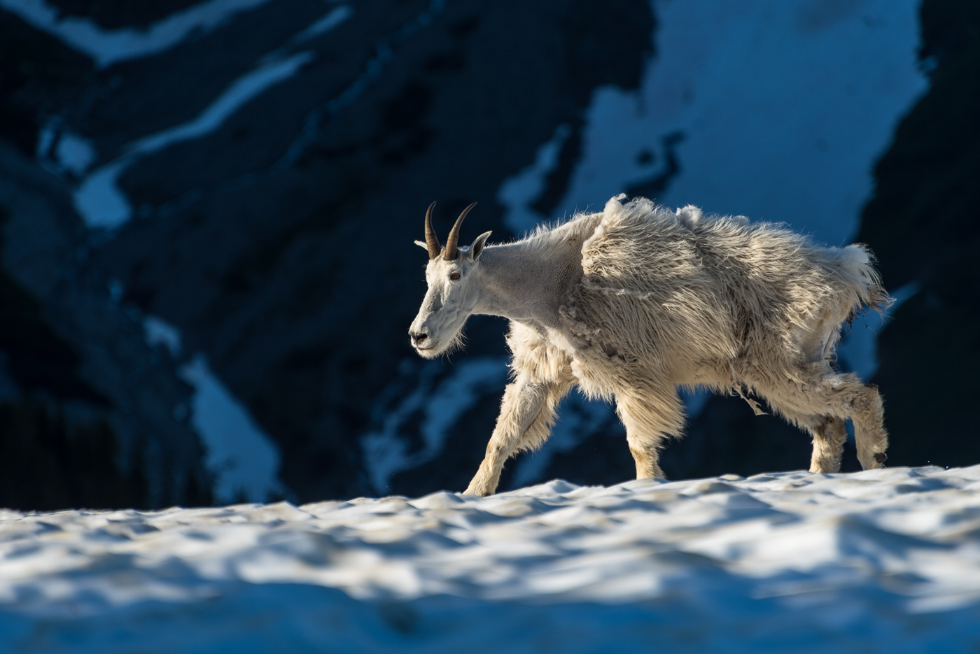

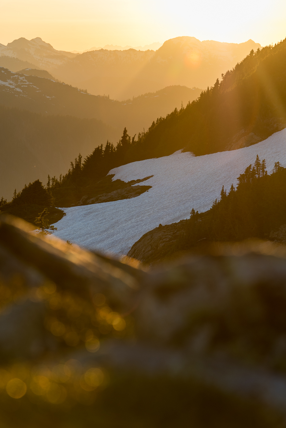
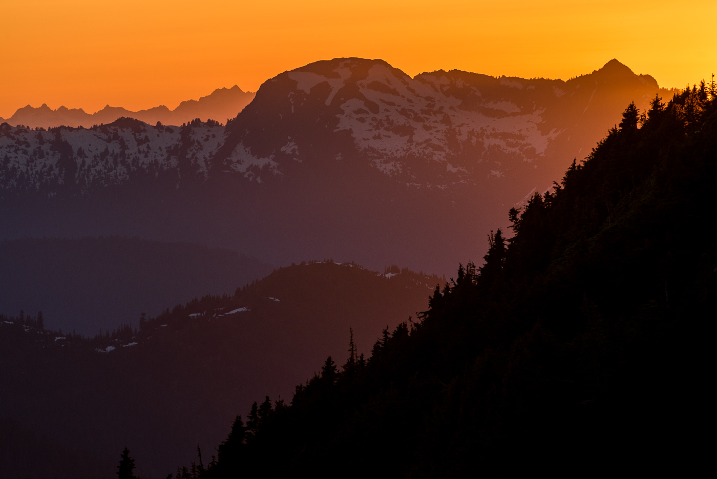
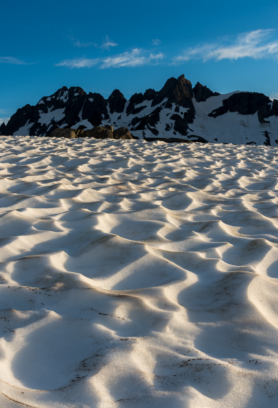
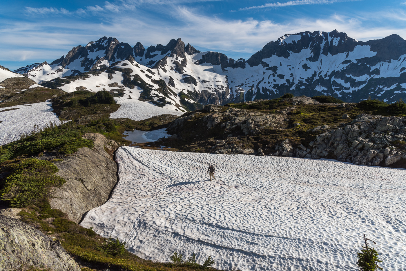
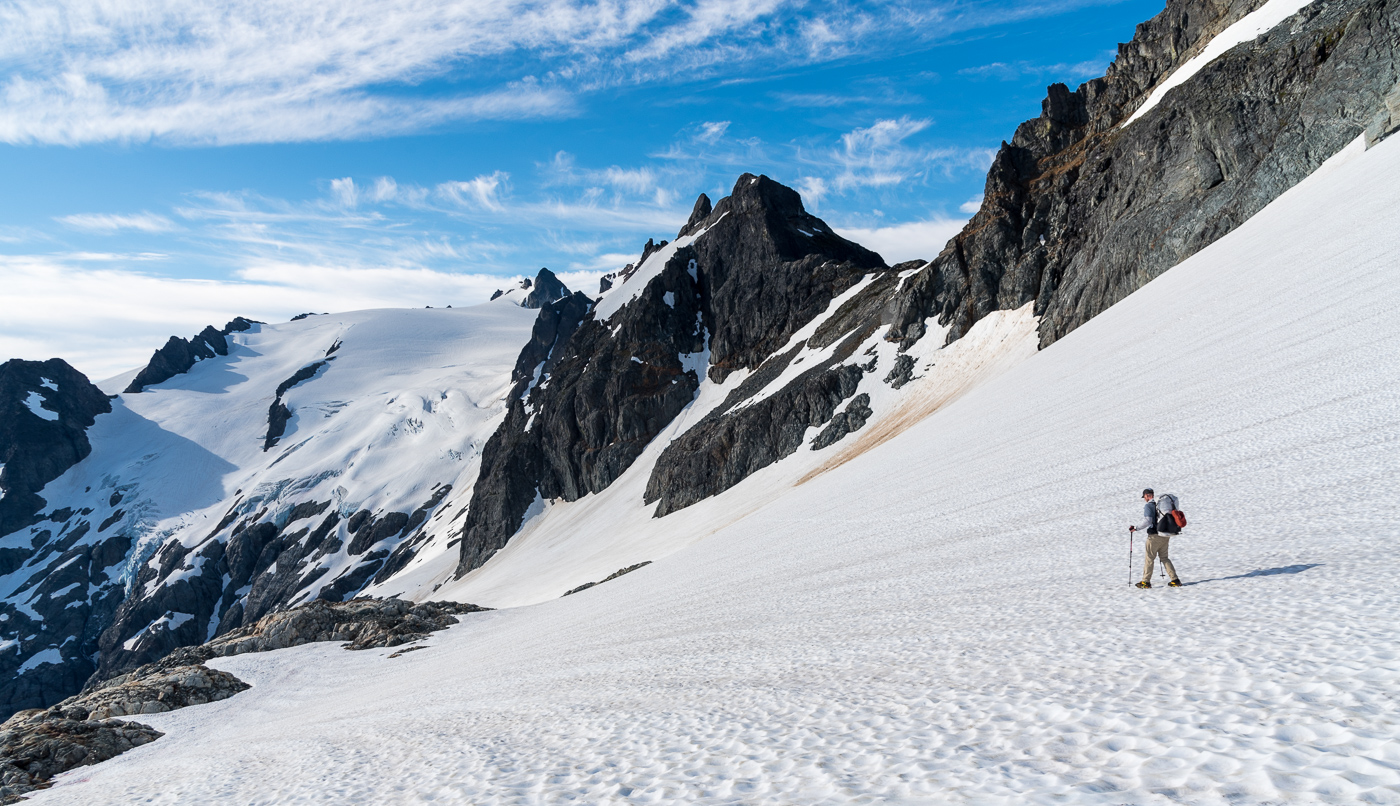
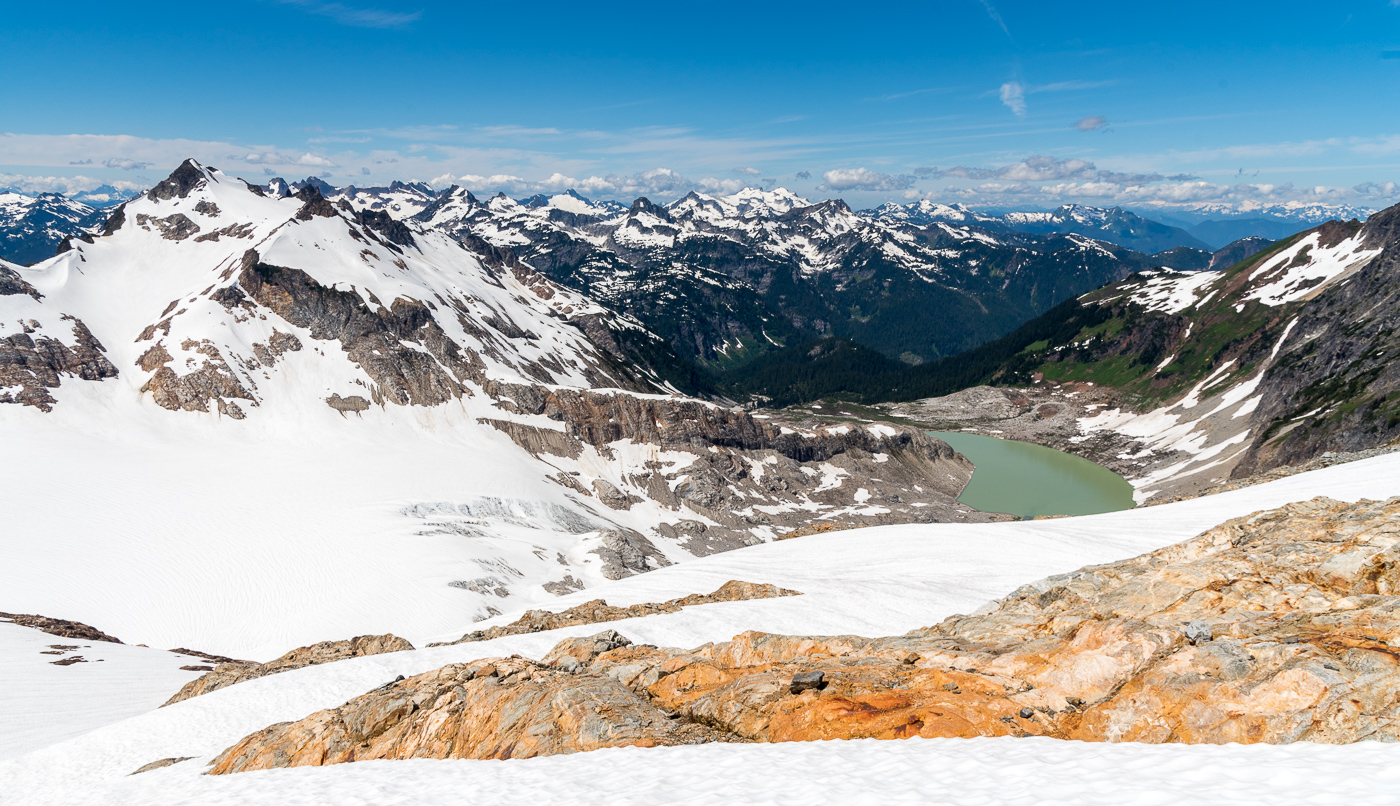
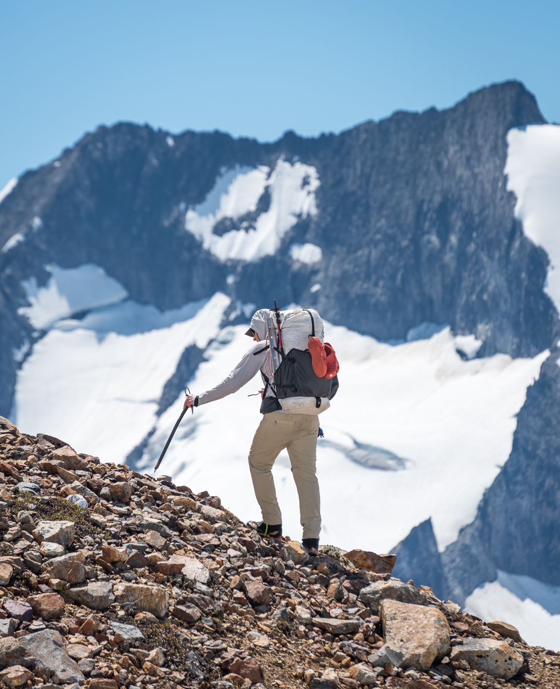

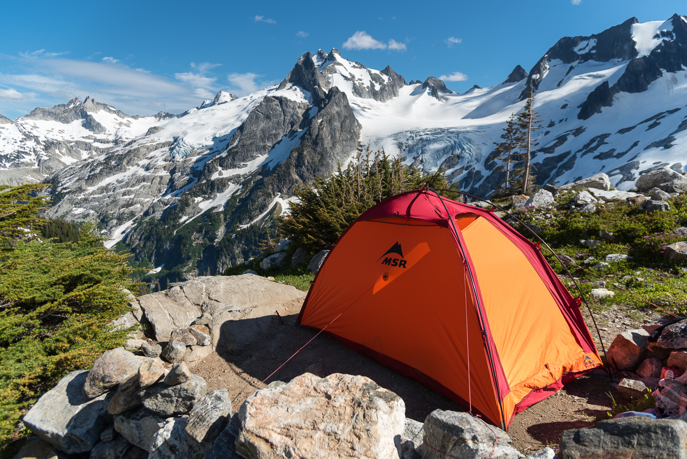
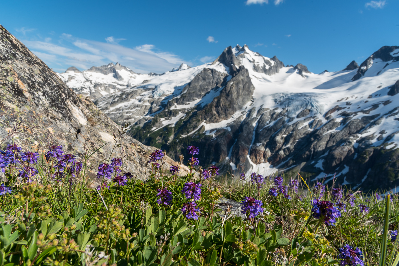
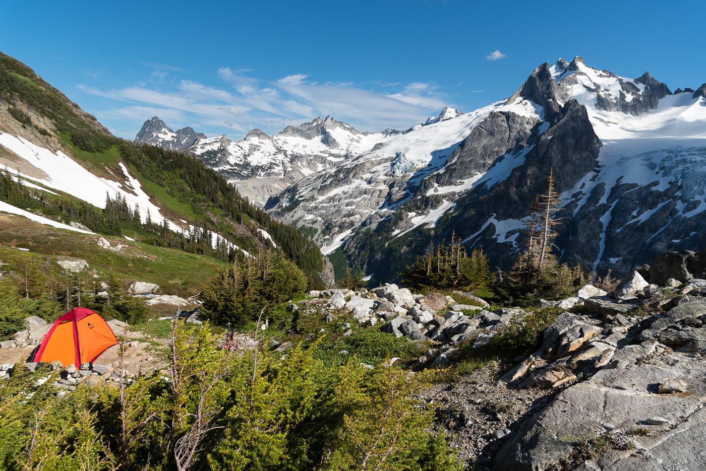
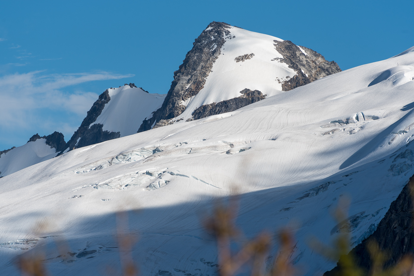
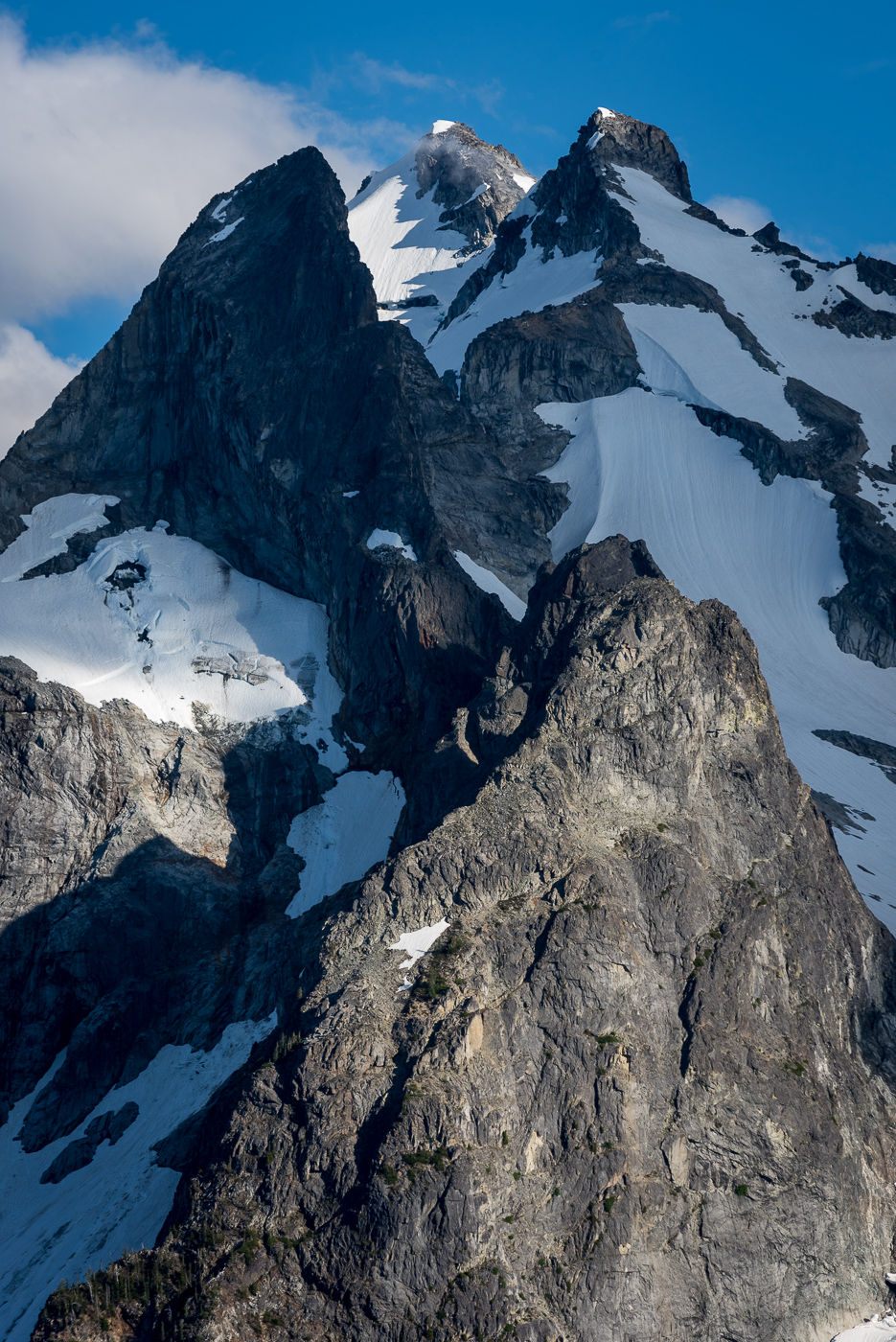
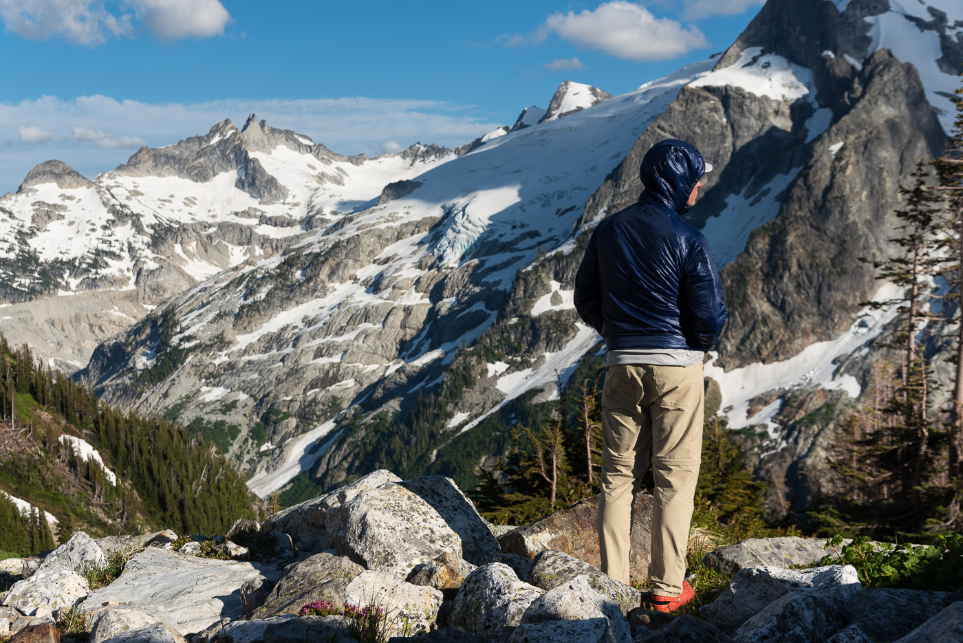
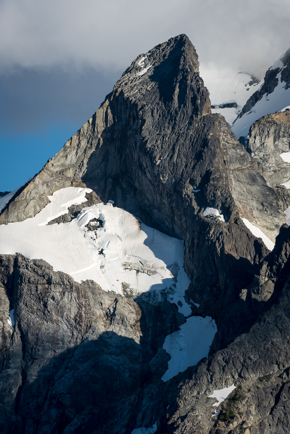
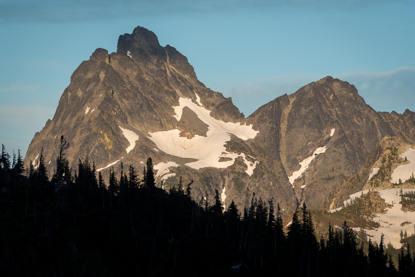
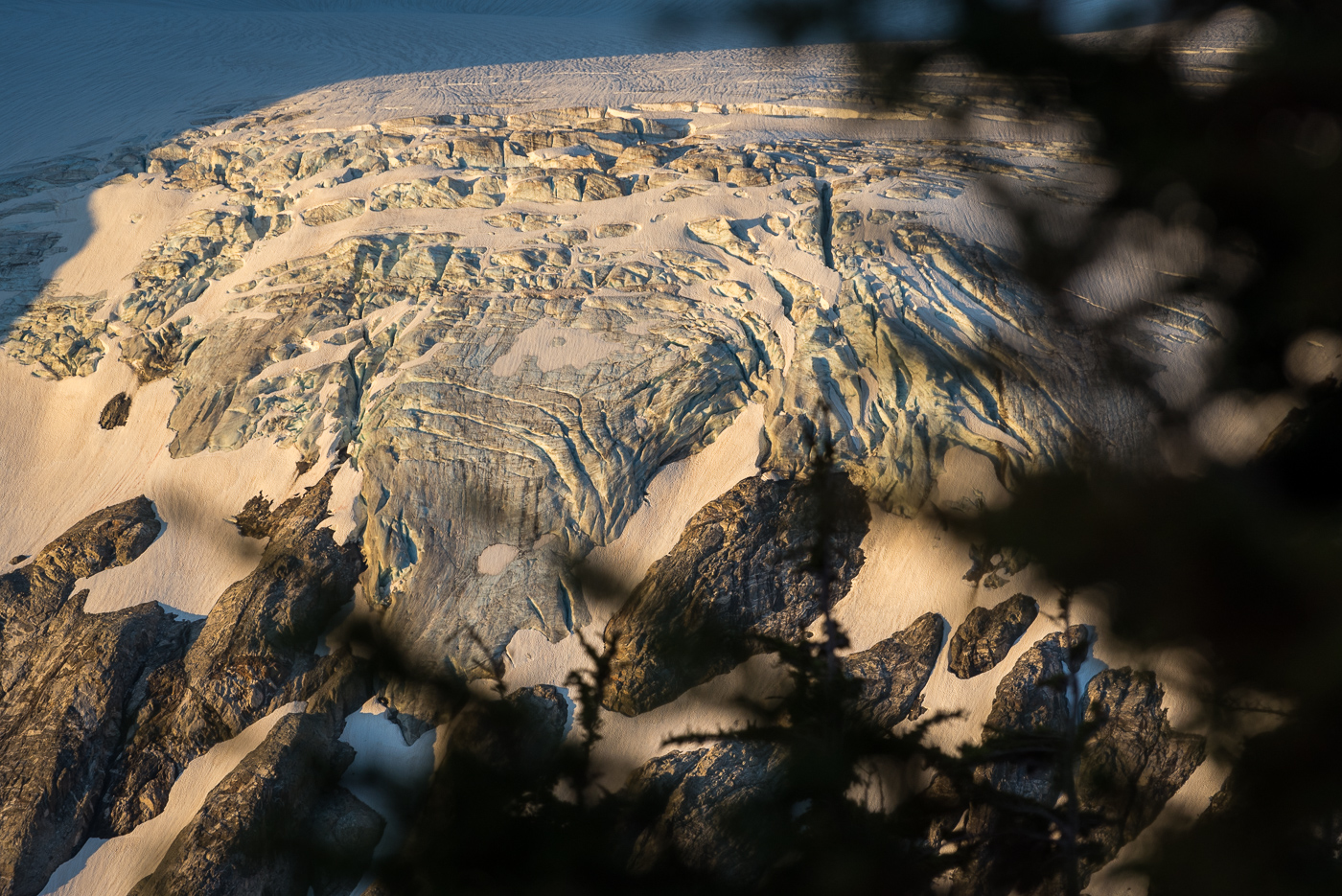
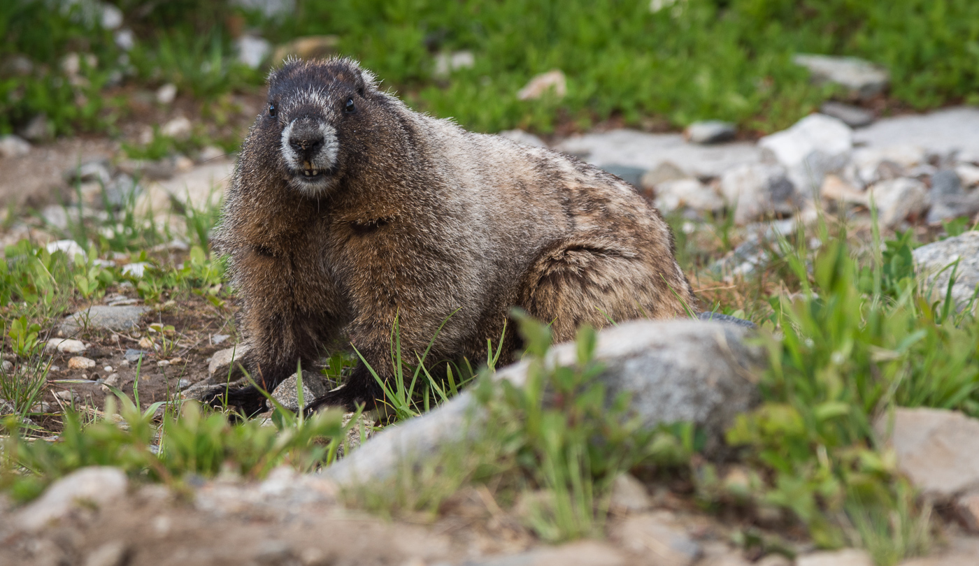
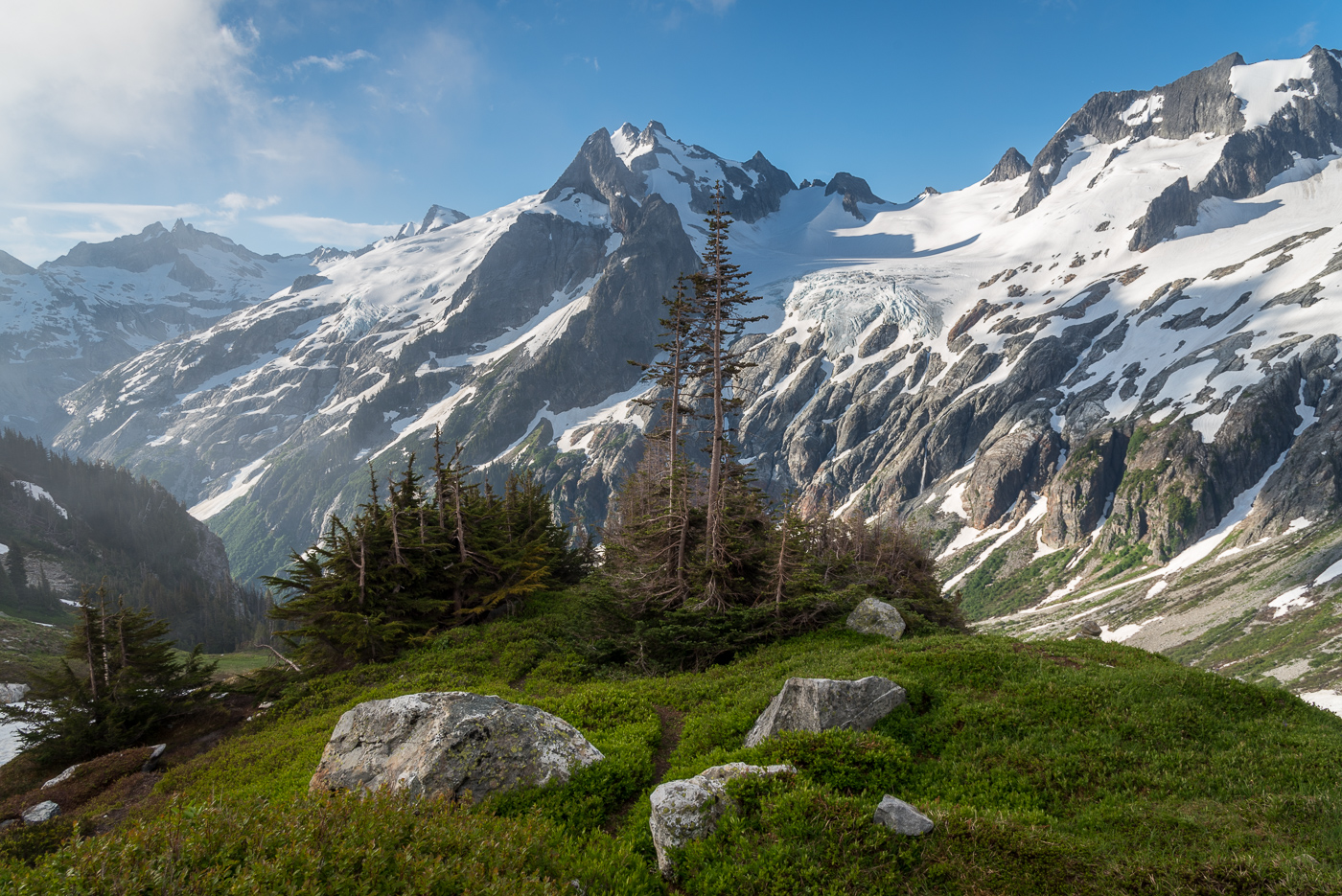
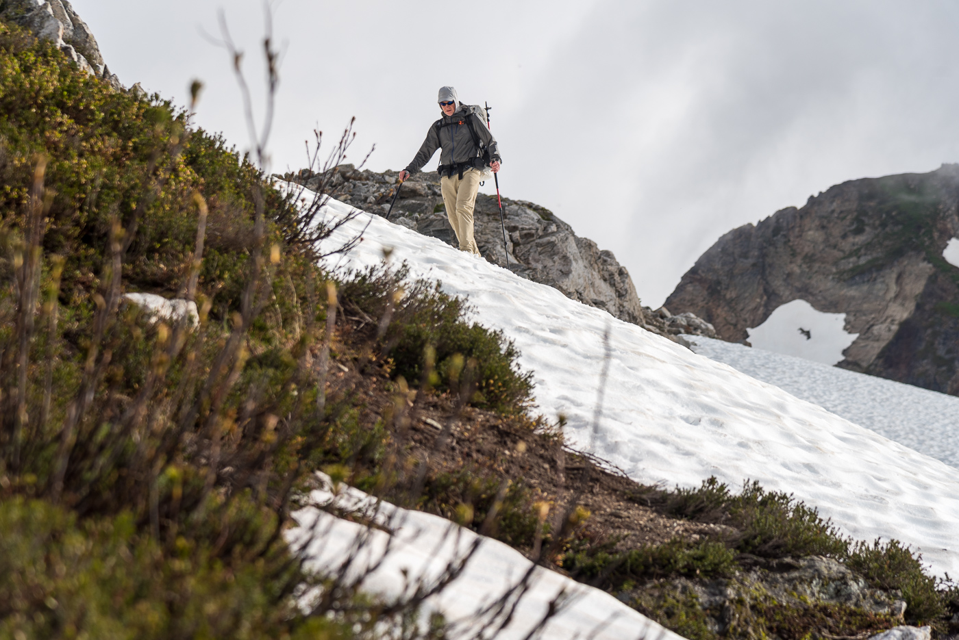
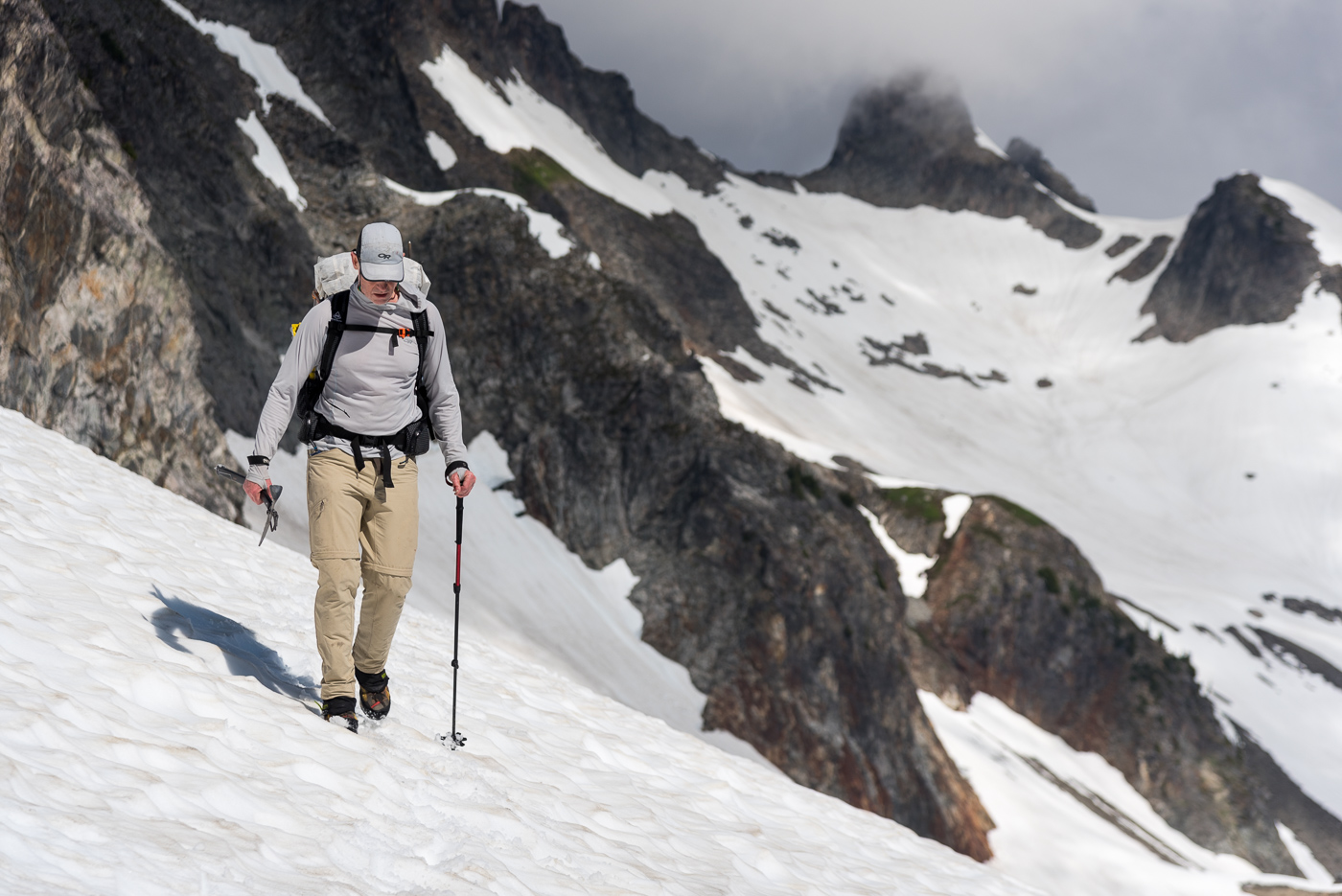
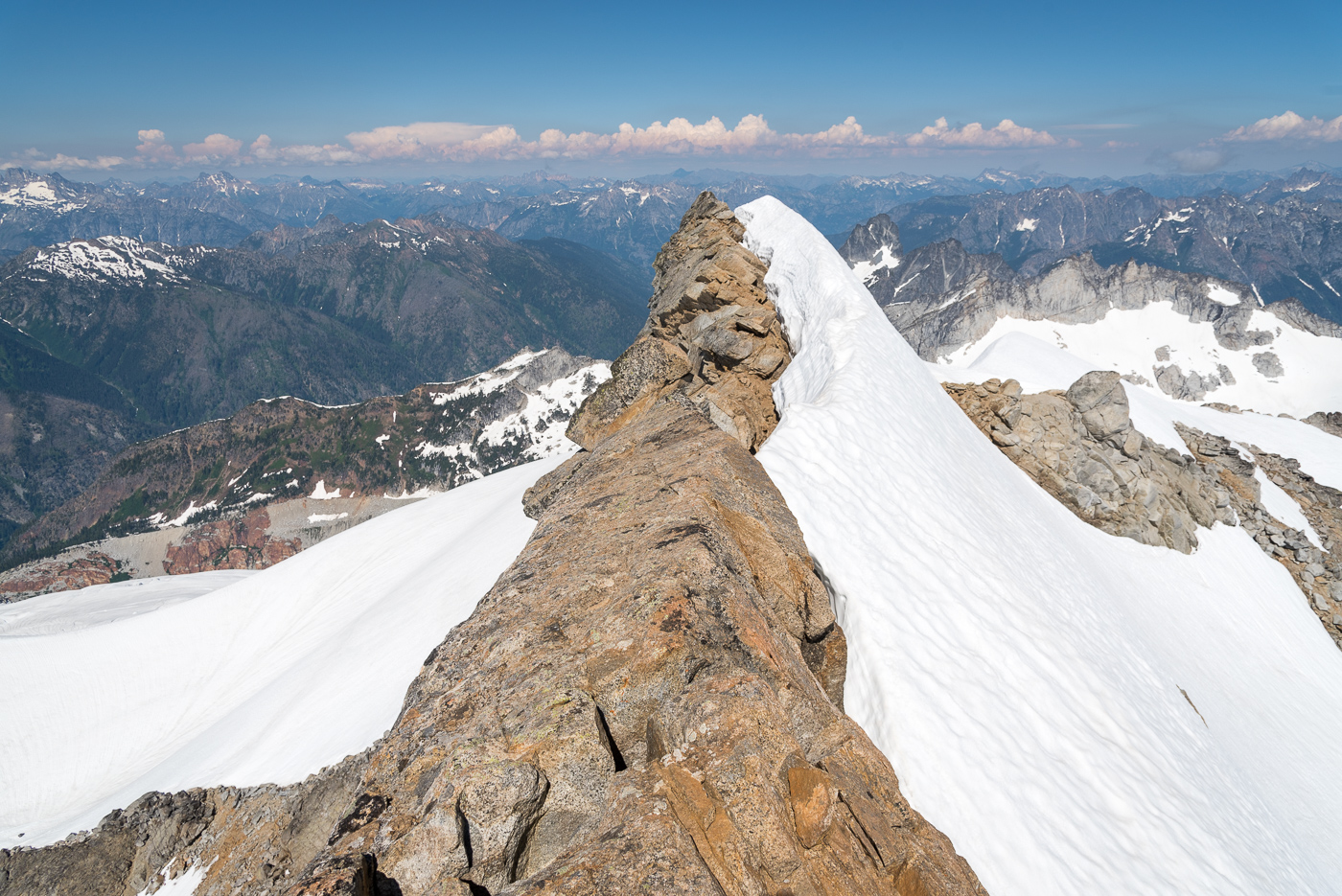
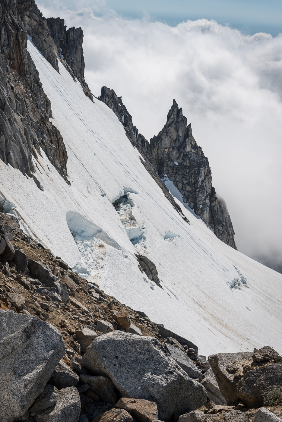
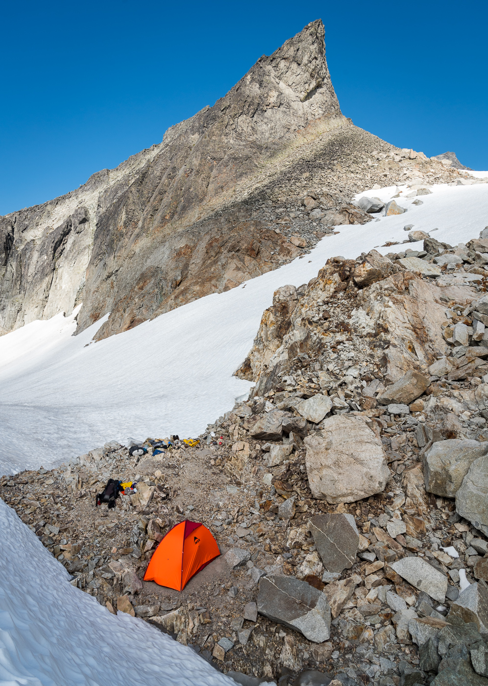
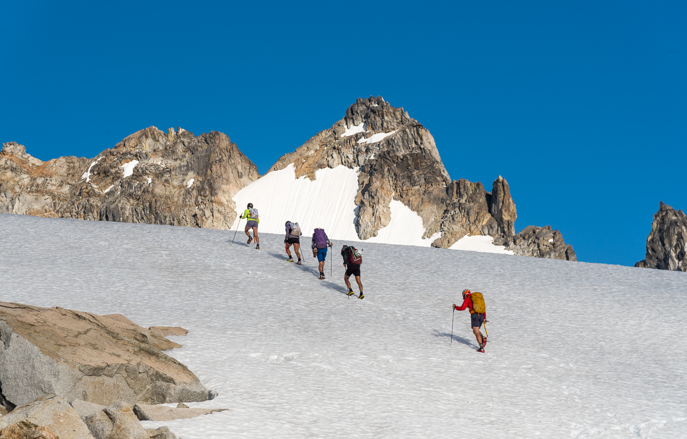
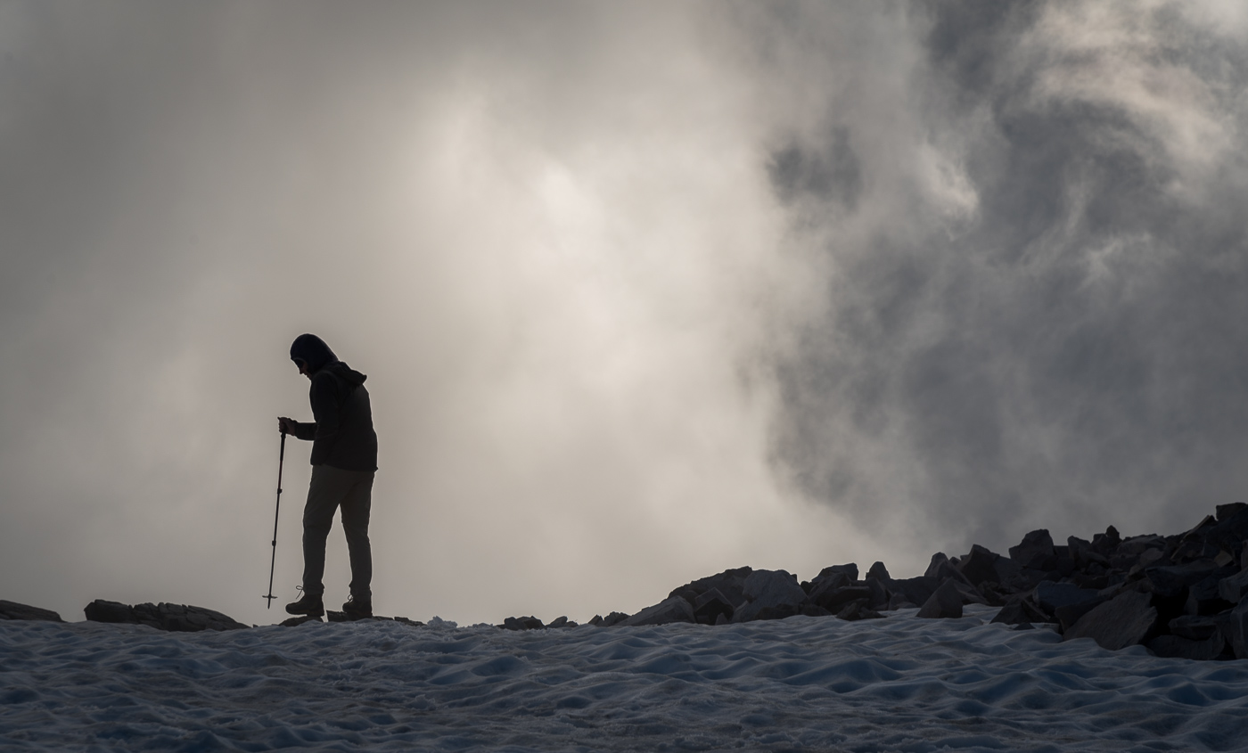
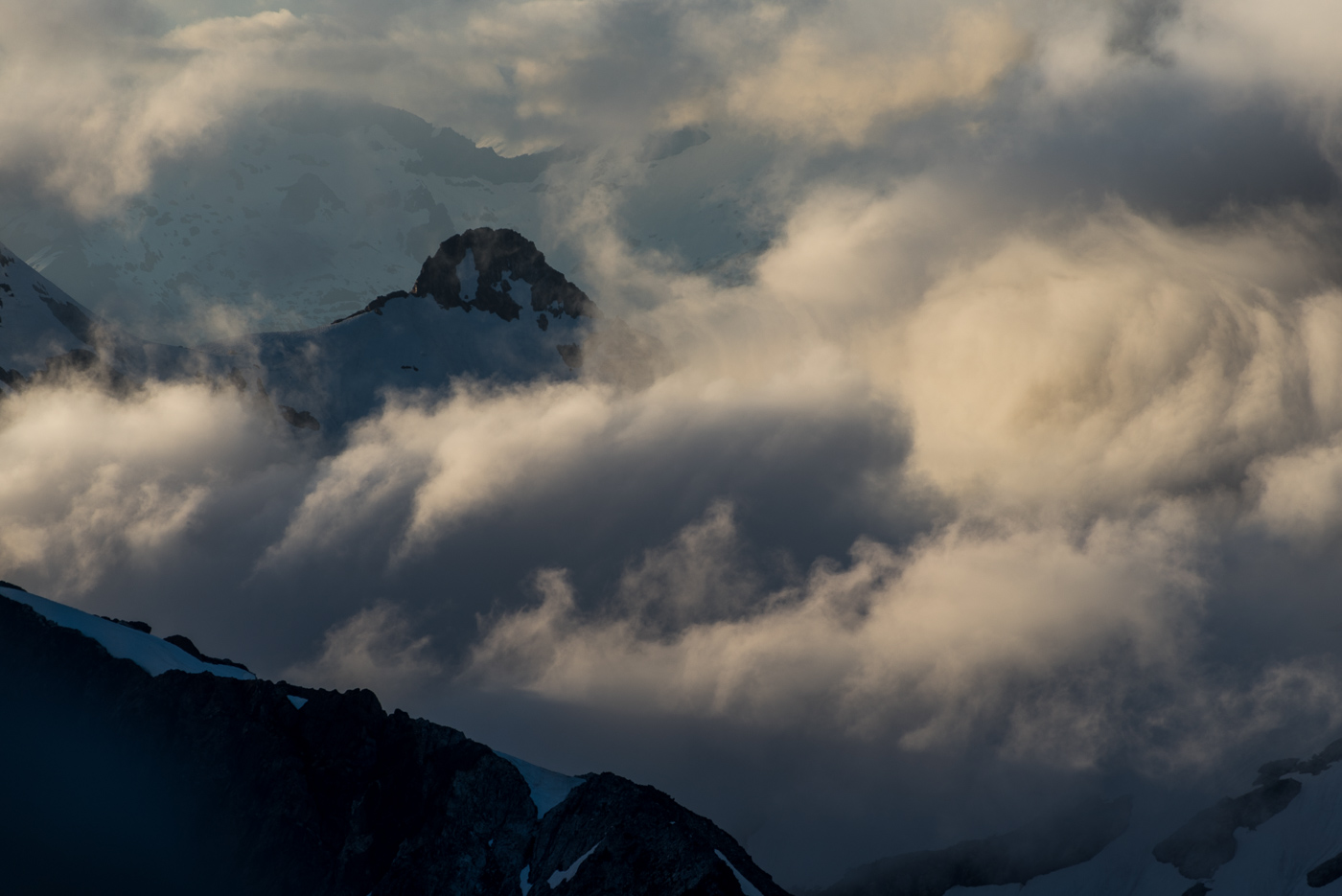
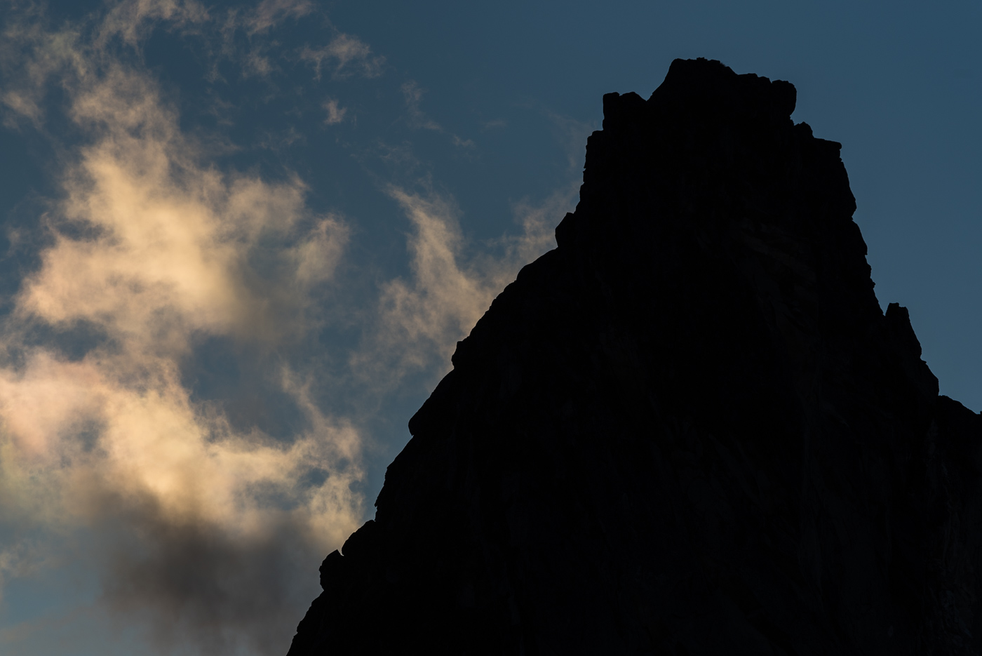
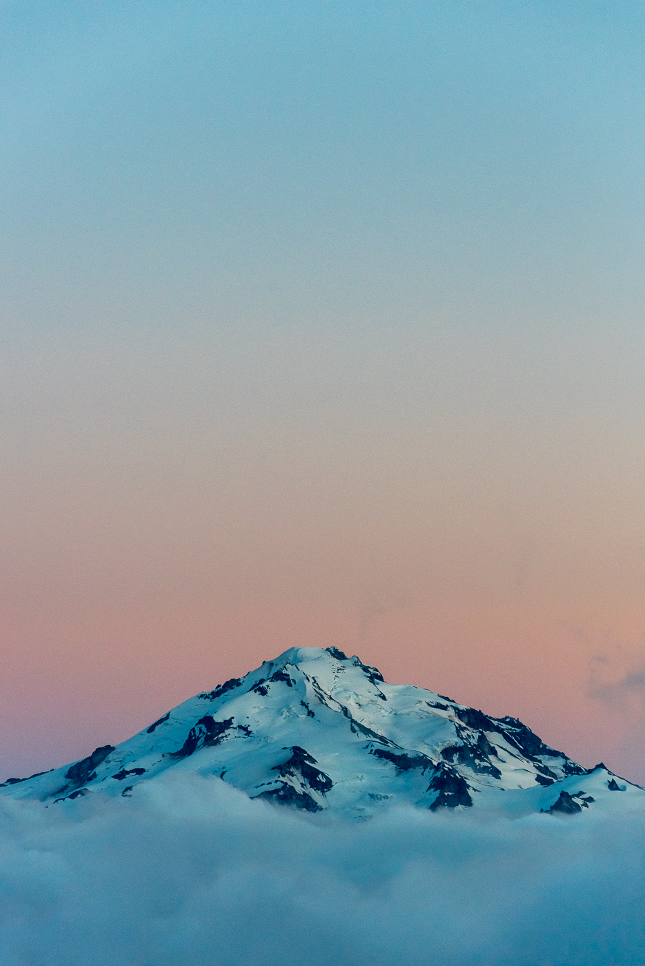
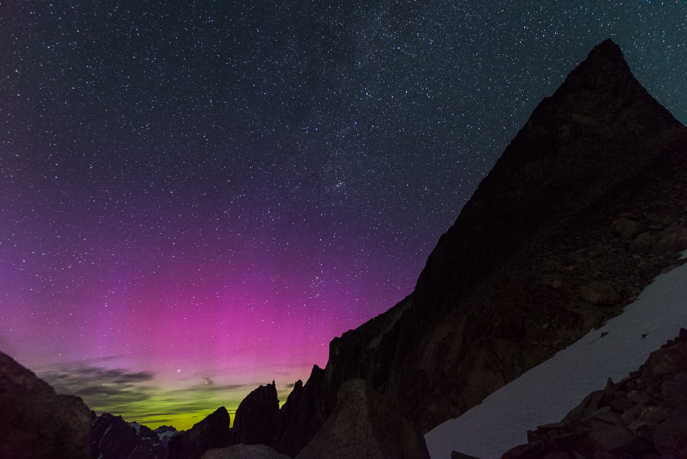
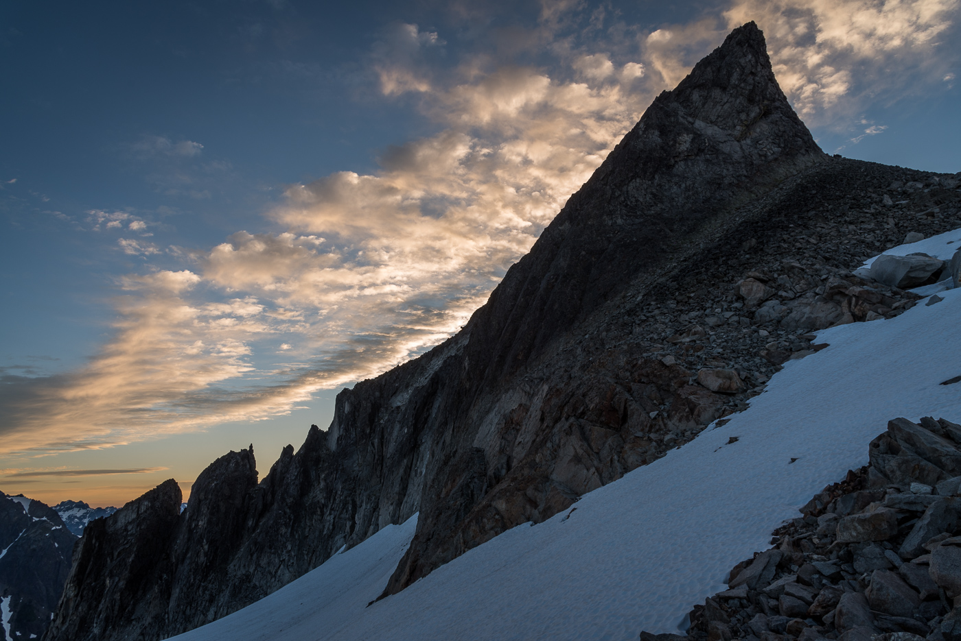

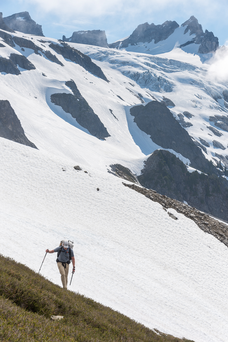
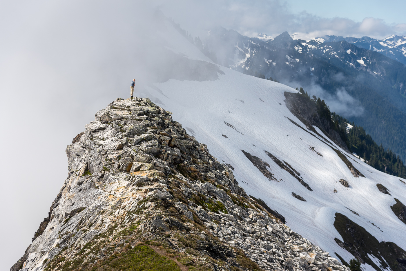
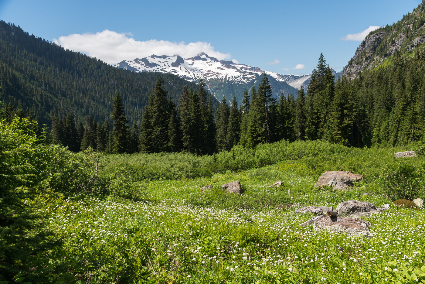
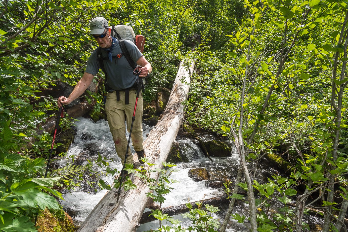
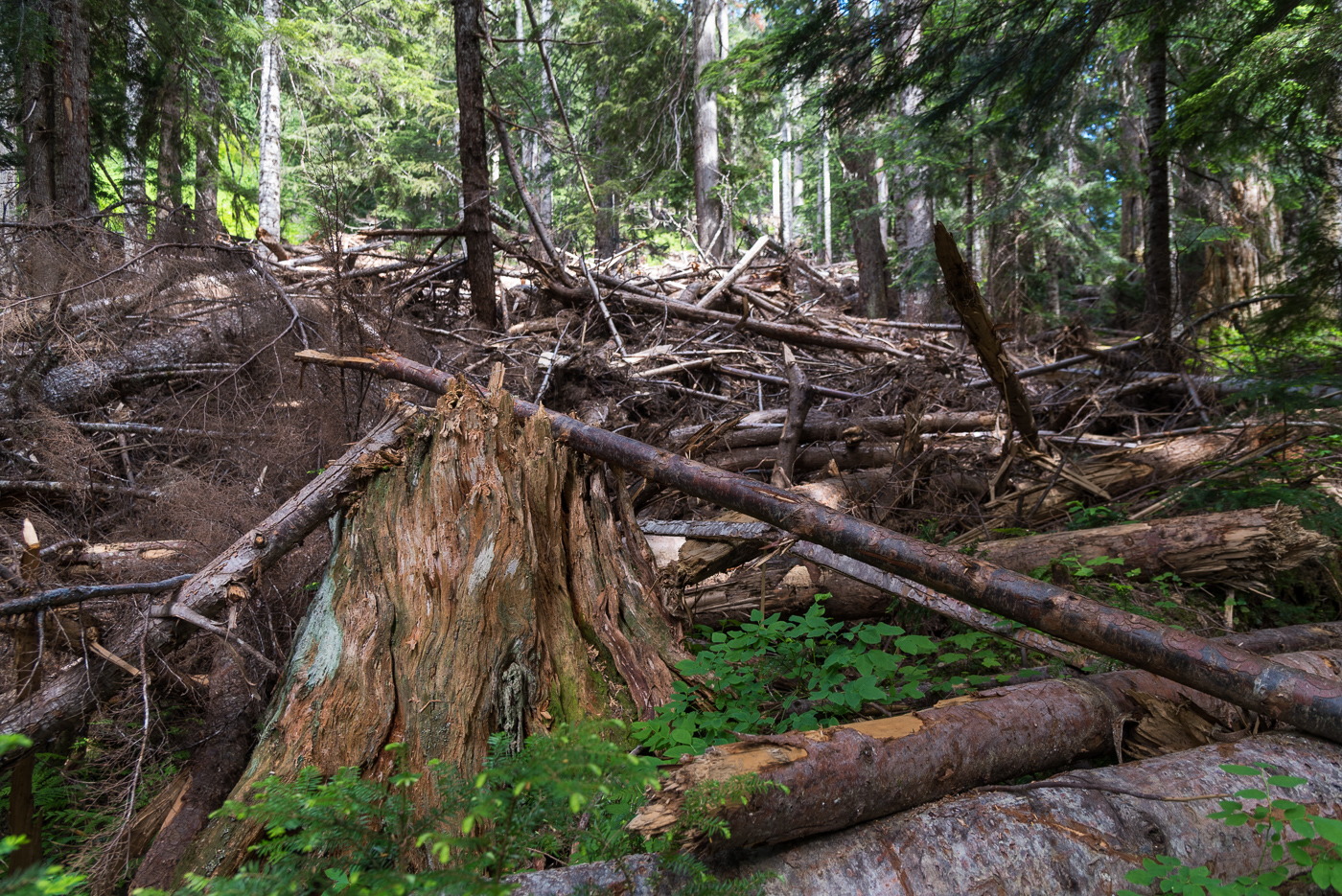
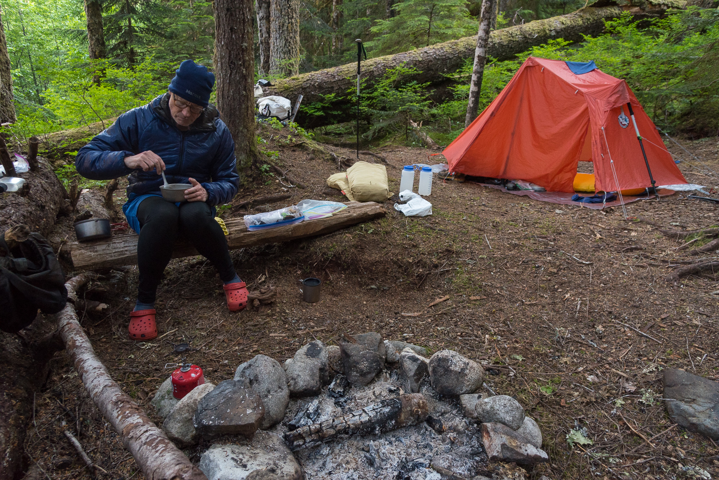
-
Trip: Guye Peak - A slightly more improbable than usual ascent of the Improbable Traverse Trip Date: 07/22/2022 Trip Report: Late last Thursday Joe and I made the questionable decision to try and dawn patrol the Improbable Traverse. Neither of us had climbed the route before, nor did we do much research, which in hindsight may have saved us a headache or two. At the time we were blissfully unaware of the massive rockfall event that happened last November. A quick search here would have informed us. However lately CC isn't the place I go for up to date condition reports, being that i'm often one of three users logged on at any time . A quick mountain project browse provided no info other than it hadn't been climbed this year. Long story short the route has been obliterated, and it would take a heroic amount of trundling and sweeping to revive it. All the pitches up to the traverse got bombed and are absolutely plastered in dirt and loose rock. We'd heard it the route was loose, but this seemed a little extreme. The flexing pin at the start of the traverse is still there, and the only reason I knew where to go. The pictures and beta I had weren't quite lining up. It was at this point that I realized what had happened, and made the decision to try and top out rather than bail with our short 40m rope. Traversing out I came across a large 40x40ft rock scar where the routes 5.8R crux used to be. Already 20ft out, I snaked my way over and down some insecure sloping edges which provided the routes new crux at somewhere around 5.9+ downclimbing. Once on a larger foot ledge I was able to keep traversing to the end of the rock scar and onto the original route. All told it was somewhere around a 50+ foot mandatory runout off the old tied off flexing pin. If it was R before, it's likely X now. The worst part by far was the top of the left trending ramp that exits the main face. This section cuts straight through the middle of the main rockfall zone and is now composed of the loosest unstable blocks held in by dirt I have ever climbed. It's hard to state exactly how nasty it was without sounding terribly dramatic, but It was bad. I was worried the entire slope was going to fall away around me. This pitch had no acceptable protection. Basically what I'm trying to say here is don't be dumb and climb this like we did. The lower pitches are right beneath an active rockfall zone and we are lucky we didn't get taken out. We were both late for work. Gear Notes: Just don't. But if you do, a few KB's might be useful on the new traverse. Approach Notes: Same as is ever was
-
 Trip: Patagonia - Torre Egger Smash 'n Grab - Huber-Schnarf Trip Date: 01/21/2022 Trip Report: Climbers: Jeff and Priti Wright Location: Patagonia - Chaltén Massif - El Chaltén, Argentina Traverse of 3 peaks: Aguja Standhardt - Punta Herron - Torre Egger Climb Date: January 18, 2022 - January 21, 2022 Full Trip Report: https://alpinevagabonds.com/torre-egger-traverse-a-smash-n-grab-story/ Climbs/Rappels Aguja Standhardt Climb via the North Ridge route Festerville (400m 90° 6c) in 15 pitches (14 pitches of rock and 1 pitch of rime ice) from Col Standhardt Aguja Stanhardt Rappel via South Face (7 Rappels) Punta Herron Climb via North Face route Spigolo dei Bimbi (350m 90° 6b) in 9 pitches (5 pitches of rock and 4 pitches of snow+ice+rime ice) Punta Herron Rappel via South Face (1 Rappel) Torre Egger Climb via North Face route Espejo del Viento (200m 80° 6a+, often referred to as the “Huber-Schnarf” route) in 5 pitches (3 pitches of rock and 2 pitches of snow+rime ice) Torre Egger Rappel via Titanic (countless Rappels, two downclimbing snowfields, and one 30m downclimb from the summit) In January of 2022, we completed another Patagonian “Smash ‘n Grab”, summiting three of the four peaks in the Torre Range via previously established routes (11 days Seattle-to-Seattle): Aguja Standhardt, Punta Herron, and Torre Egger. Including our ascent of Cerro Torre in 2020, we have now climbed all four summits of the Cerro Torre skyline, making Priti the first female to summit all four peaks. 2022 marked our fifth climbing trip to El Chaltén. In 2019, we completed a 10 day Smash ‘n Grab of Cerro Chaltén (Fitz Roy). In 2020, we spent two months in El Chaltén, during which time we climbed Cerro Torre on the route Via dei Ragni. Urgency and several parties in line behind compelled us to accept a top-rope on the final pitch of the summit mushroom of Cerro Torre, joining the conga line. Pink: The accidental line we took on wet, grimey terrain....oops (not recommended); Blue: the original route Festerville on golden granite Their 2022 traverse from Aguja Standhardt to Torre Egger enchained three distinct climbing routes (all established by different parties), climbing for four days and three nights, bivying twice on Standhardt and climbing through the third night up-and-over Torre Egger. After arriving in El Chaltén, we cached a tent at the standard Niponino Base Camp, carrying a tarp and a double sleeping bag for the traverse. We started on the route Festerville (400m 90° 6c) which follows the spine of the North Ridge of Aguja Standhardt for approximately 13 rock pitches. Another team of two (Michał Czech from Poland and Agustín de la Cerda from Chile) started up the route ahead of us and the four effectively joined forces, climbing symbiotically, each team helping the other along the way. After summiting Cerro Standhardt via 30 meters of 90° ice and rime, Michał and Agustín rappelled the Exocet route back to Base Camp while we (Jeff and Priti) made seven rappels down the South Face of Cerro Standhardt, continuing the traverse. The South Face rappels end 30 meters below the Col de los Sueños (the col between Standhardt and Punta Herron), requiring climbing the final 30m of the route Tobogán to reach the col. The traverse continued up to Punta Herron via the route Spigolo dei Bimbi (350m 90° 6b) climbing 5 pitches of rock and another two pitches of beautiful, vertical ice and rime to the summit. A single rappel from the summit of Punta Herron led down to Col de la Luz under the North Face of Torre Egger. Spigolo dei Bimbi included some of the most fantastic rock climbing that we have ever climbed in Patagonia! From Col de la Luz, we continued up the route Espejo del Viento (200m 80° 6a+, often referred to as the “Huber-Schnarf” route) in the dark of night for three rock pitches which ends in a long, run-out, wet, technical slab traverse under Torre Egger’s overhanging summit mushroom. We continued through the night, climbing two more moderate pitches up the mushroom on easier 70 degree snow and ice to the summit of Torre Egger at 2:00AM, the most difficult summit in the Chaltén massif. We continued through the night without a bivouac, descending 27 rappels and down-climbing along the route Titanic which follows the East Pillar of Torre Egger. Upon reaching the tent at Niponino in the Torre Valley after 44 hours of constant movement, we collapsed in the tent realizing we were too late to catch their planned flight home. Unfortunately, we neglected to notify anyone that we were missing our early-morning airport taxi. When the taxi arrived at our hostel Aylen-Aike, the driver woke up Korra Pesce who was sleeping in the room where we had previously slept. Korra notified the hostel owner Seba and Rolando “Rolo” Garibotti who were all quite worried and proceeded to notify rescue teams. Later that morning, Rolo successfully contacted us on our inReach before any rescue efforts began, teaching us a valuable lesson: let people know if you're going to be late! A week later, a team of bold volunteers attempted an unsuccessful rescue of Korra Pesce, the legendary French-Italian Alpinist, on the North Face of Cerro Torre who will be sorely missed by his friends, family, companions, and fans. Being back at home in the US by the time the accident occurred, we wished that we had been present to aid the operations. The 2021/2022 Patagonia season was marked by several notable deaths and rescues in the mountains as well as several celebrated new climbs. Patagonia continually demands of its visitors the humility that this place deserves. We really want to thank Rolando Garibotti and Colin Haley for their beta, support, and encouragement; Agustín and Michał for being a great team to partner with as we shared the same objective on Cerro Standhardt; Aylen-Aike for putting us up at the last minute in El Chaltén; Hector Tito Soto Nieto and Andrew Reed for loaning us your cams (we decided what route to do while on the airplane); our bosses and work colleagues for letting us go for a week with hardly any notice; Ilia Slobodov for the awesome weather updates while on route; and Kelly Cordes for the rad Patagonia gear. Priti on the summit of Torre Egger, 2:00AM. Time to rappel. Gear Notes: 2x Camalots to #1, 2x TCUs, 1x Camalots to #3, 6 ice-screws, a set of stoppers, and deadman stuff sack (substitute a jacket instead?) to rappel off of Torre Egger (or a retrievable ice tool anchor or downclimb) Approach Notes: Approach as for Col Standhardt
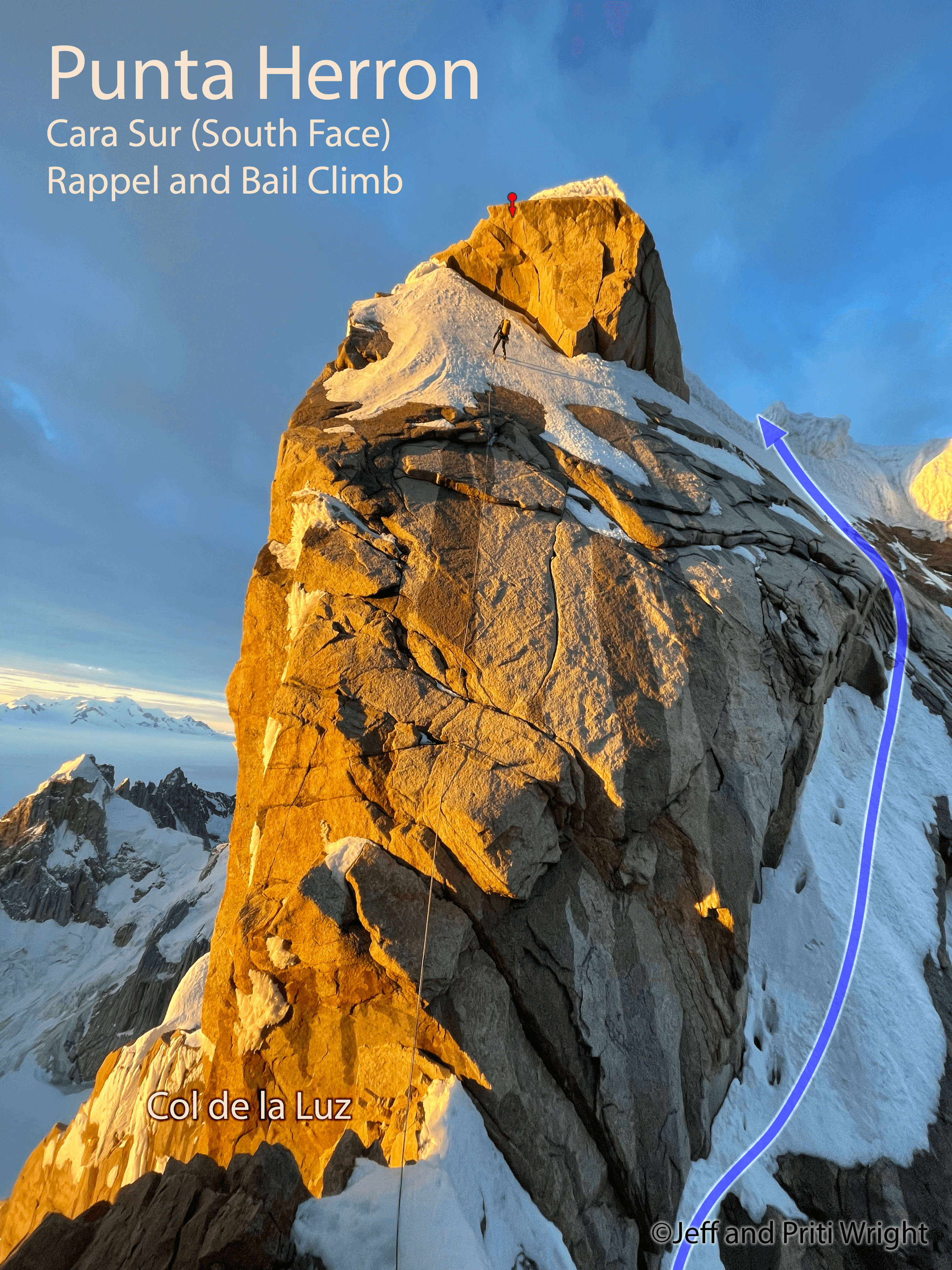
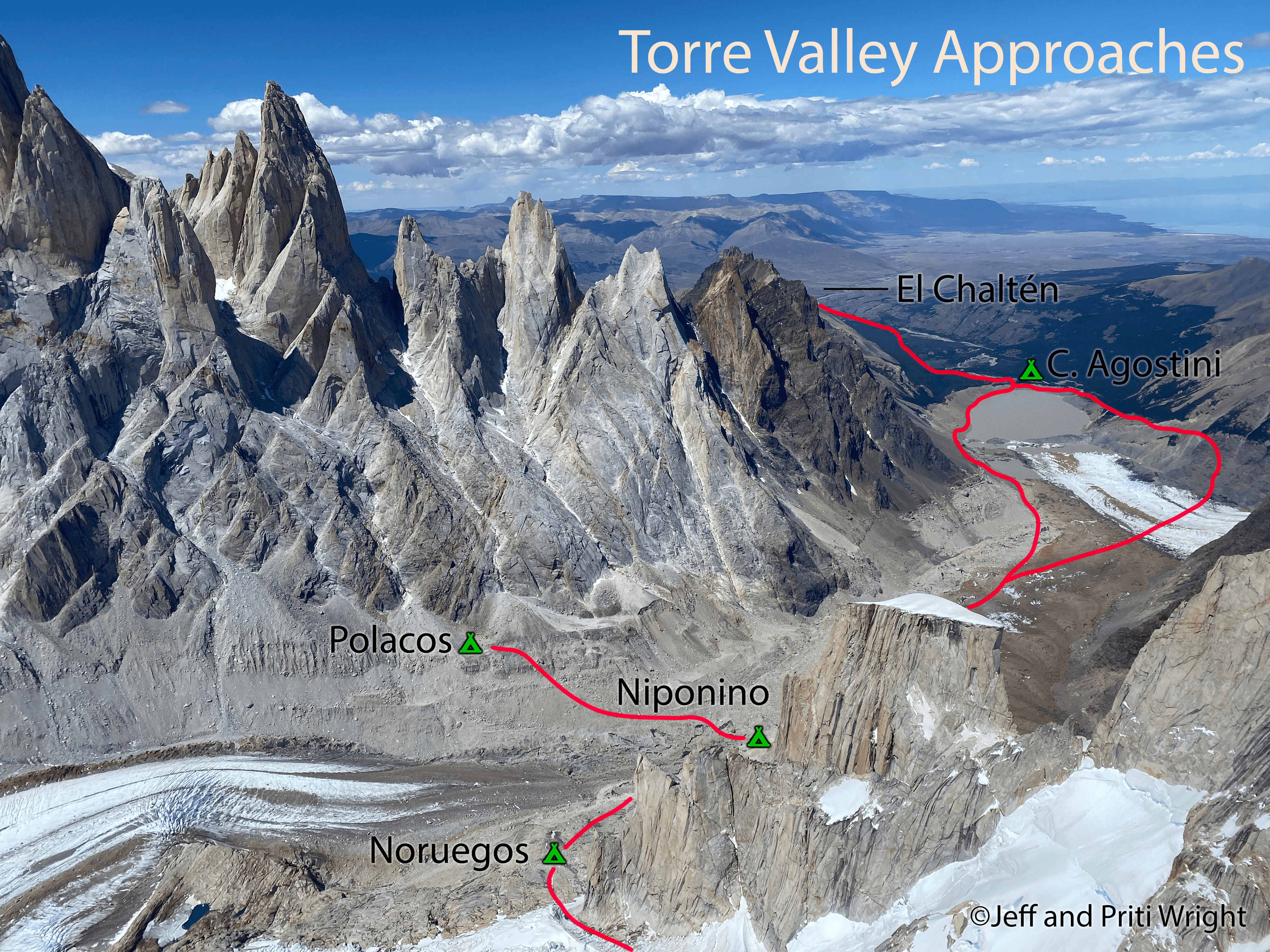
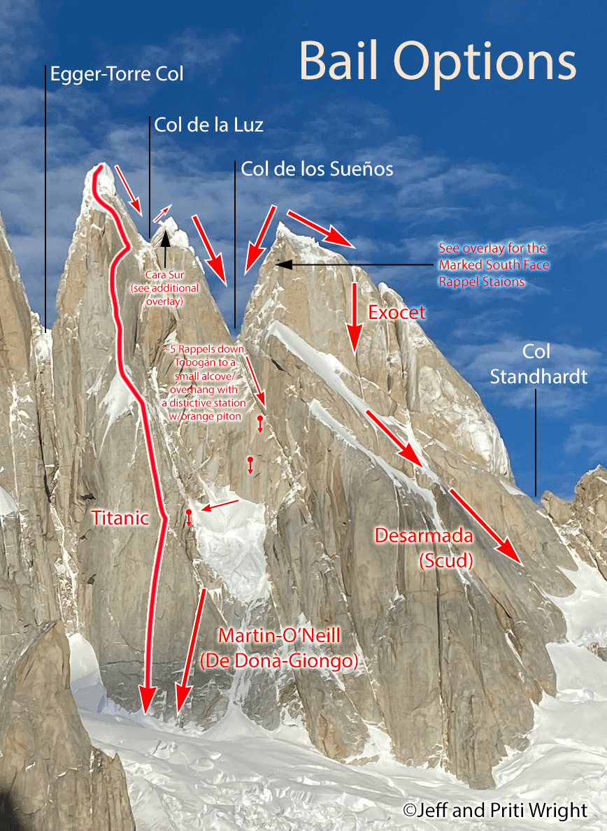
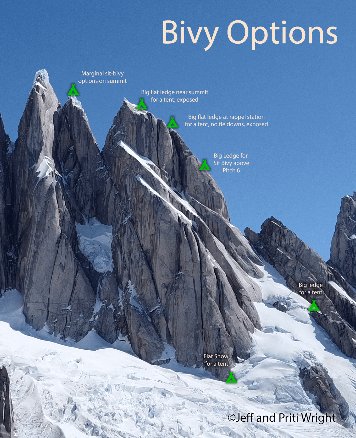
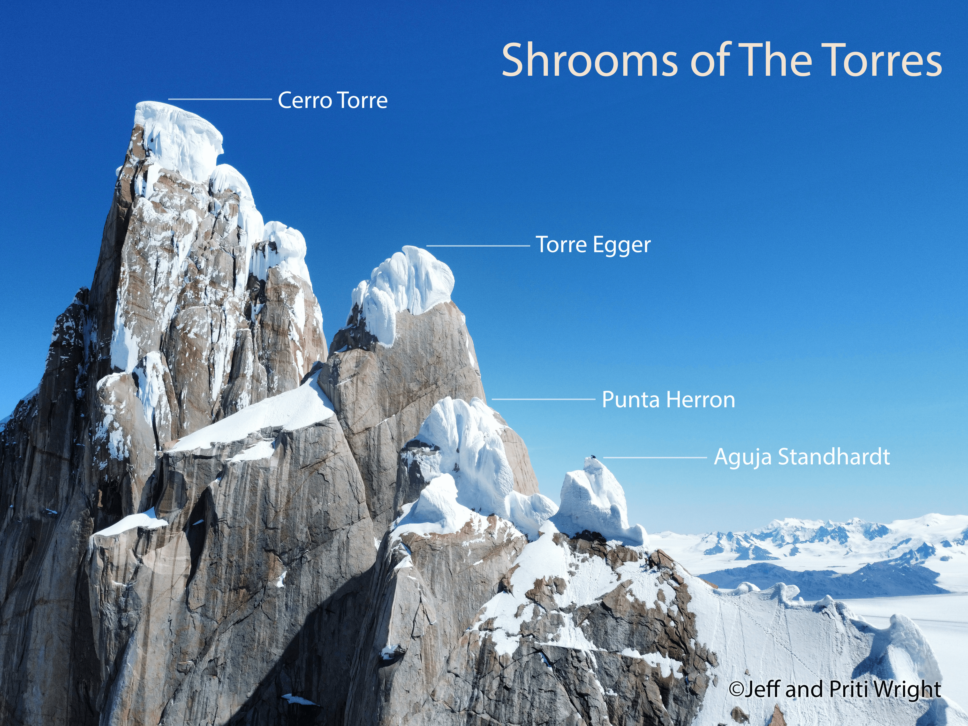
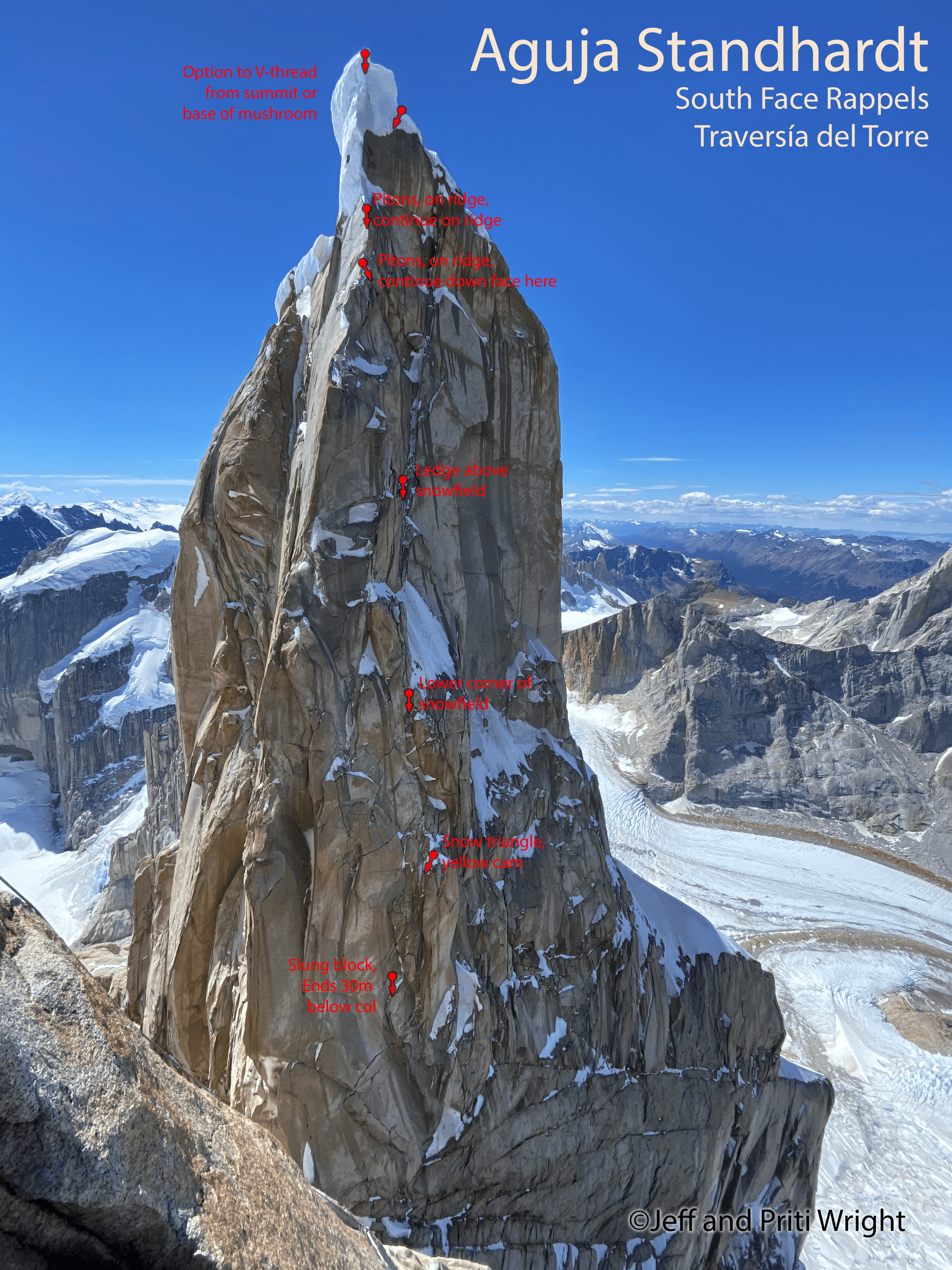
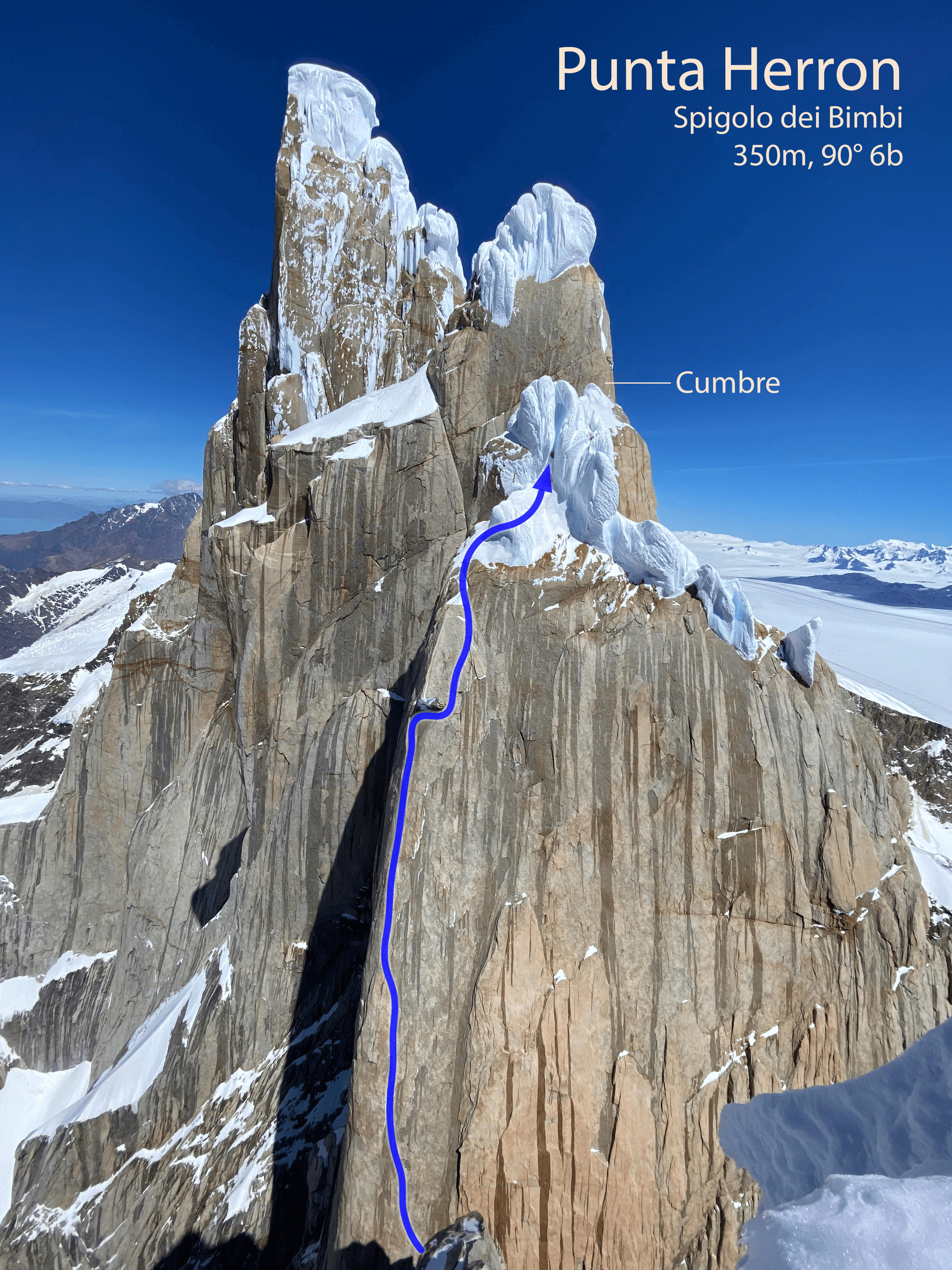
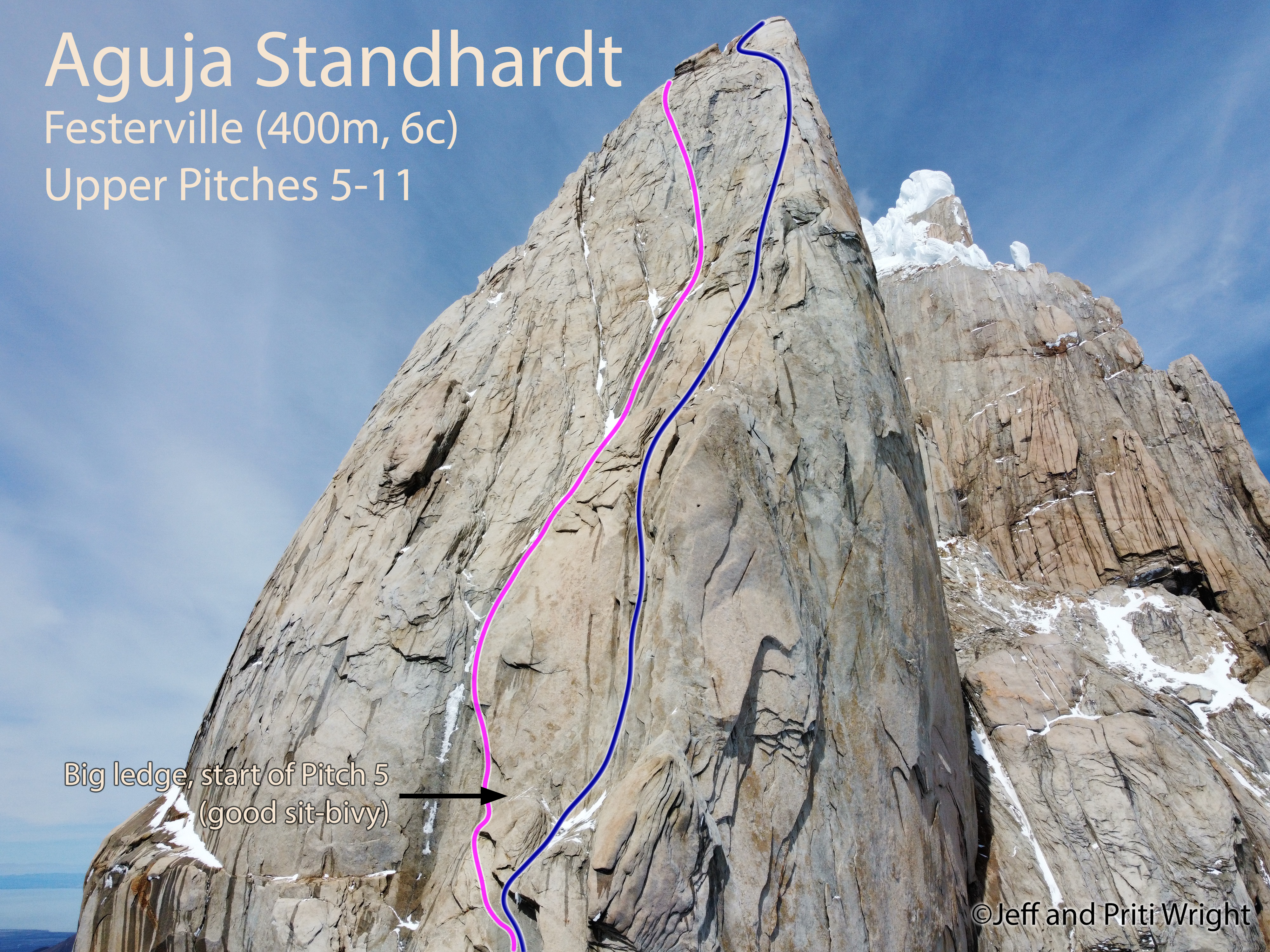
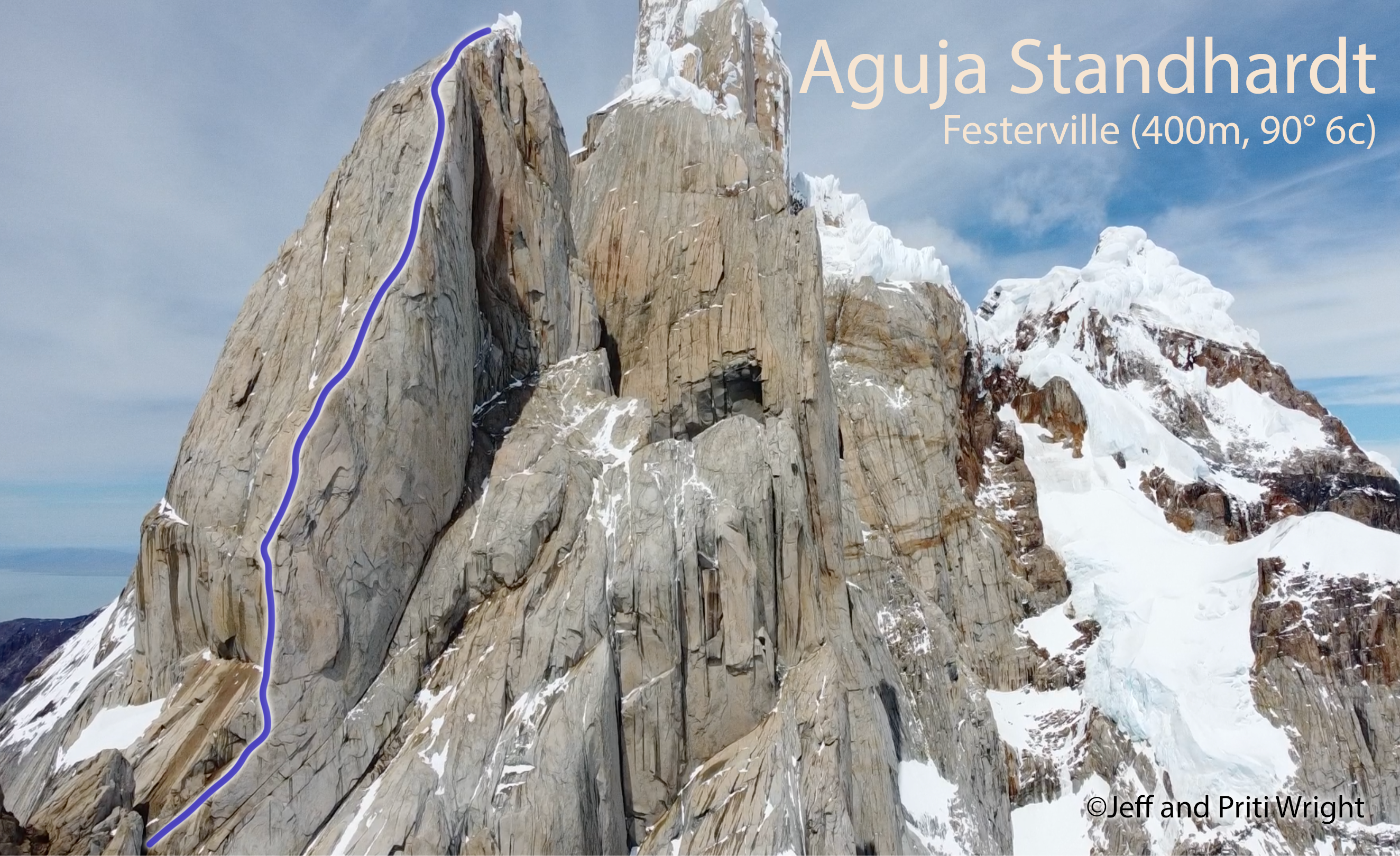
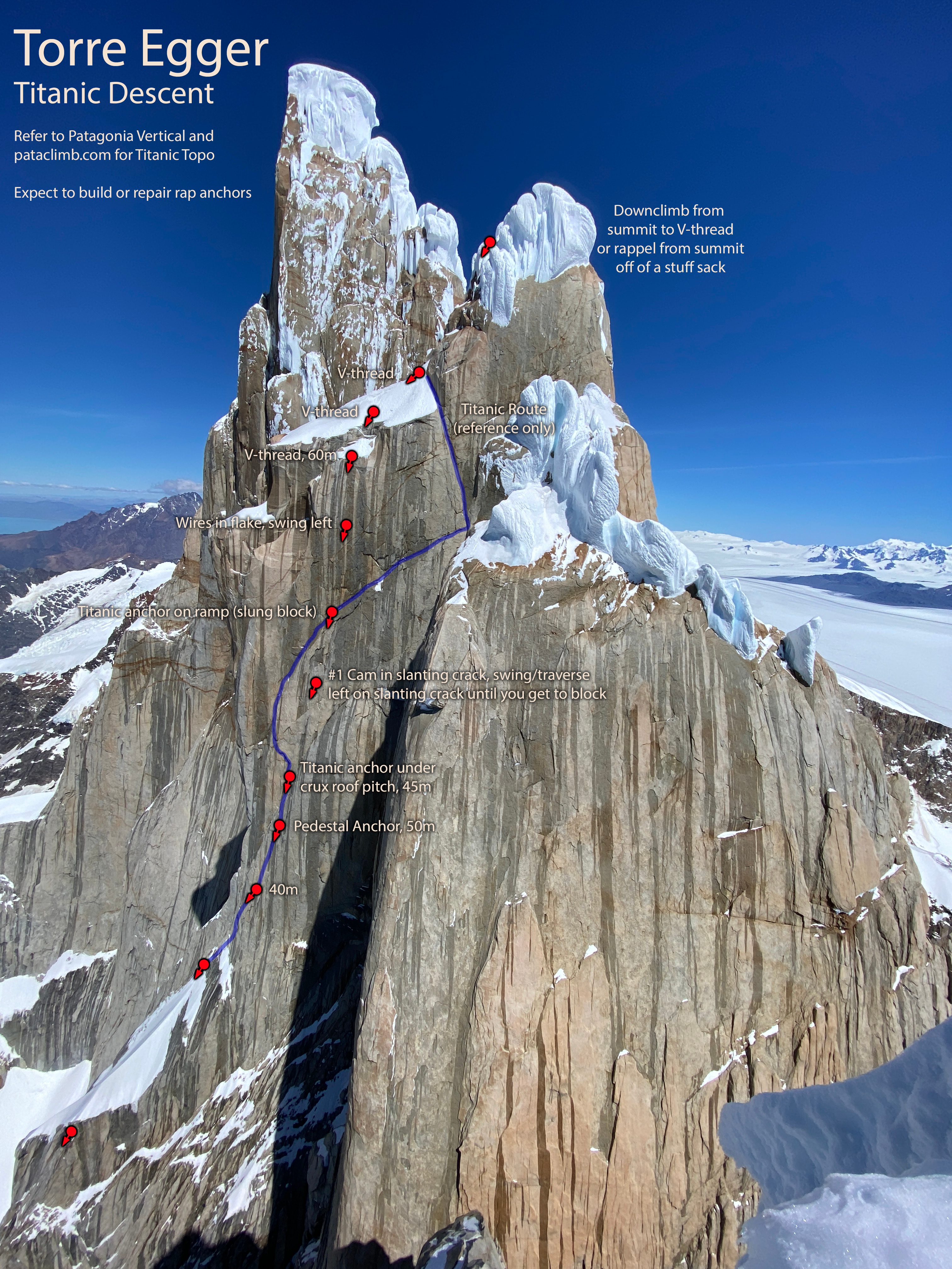
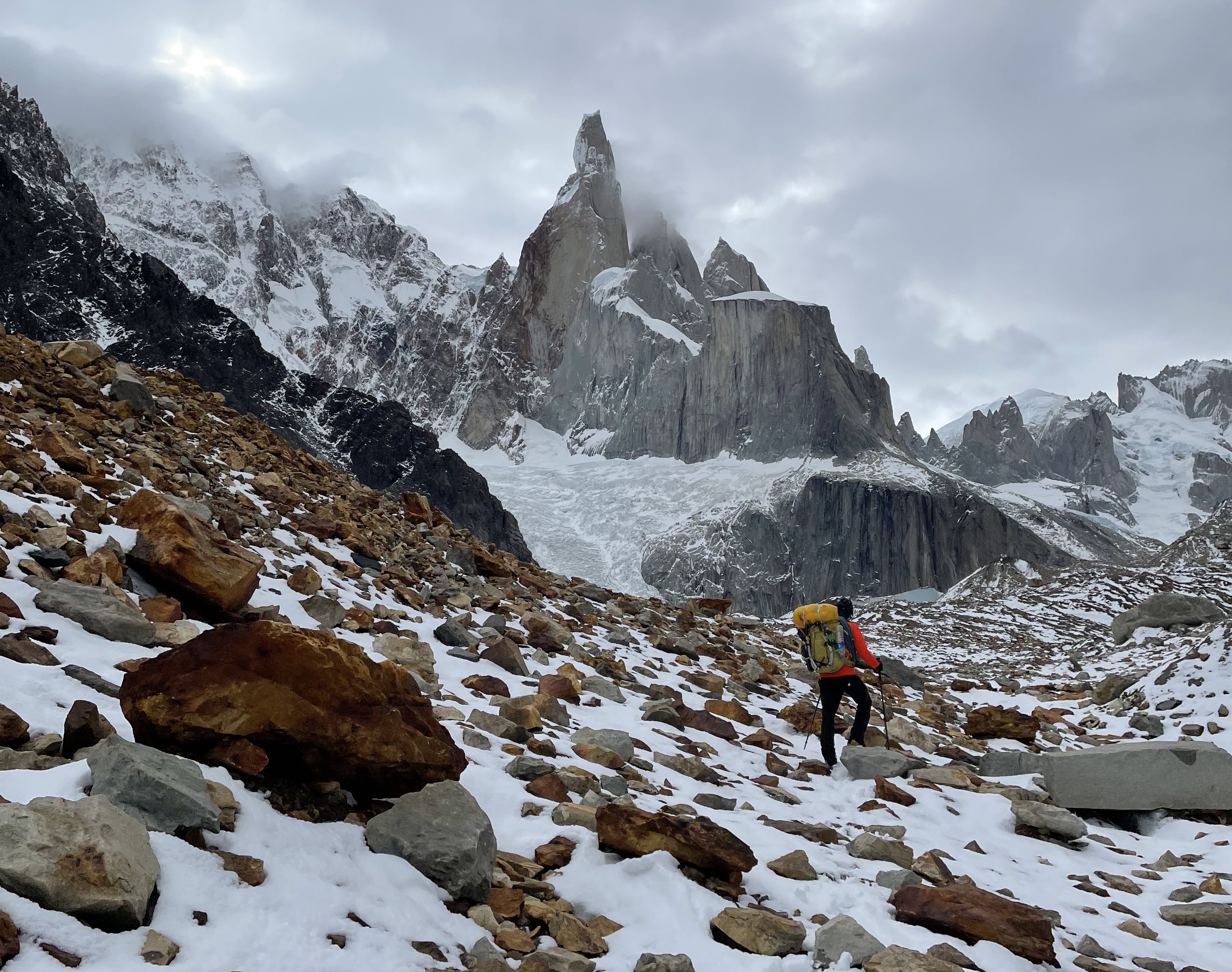
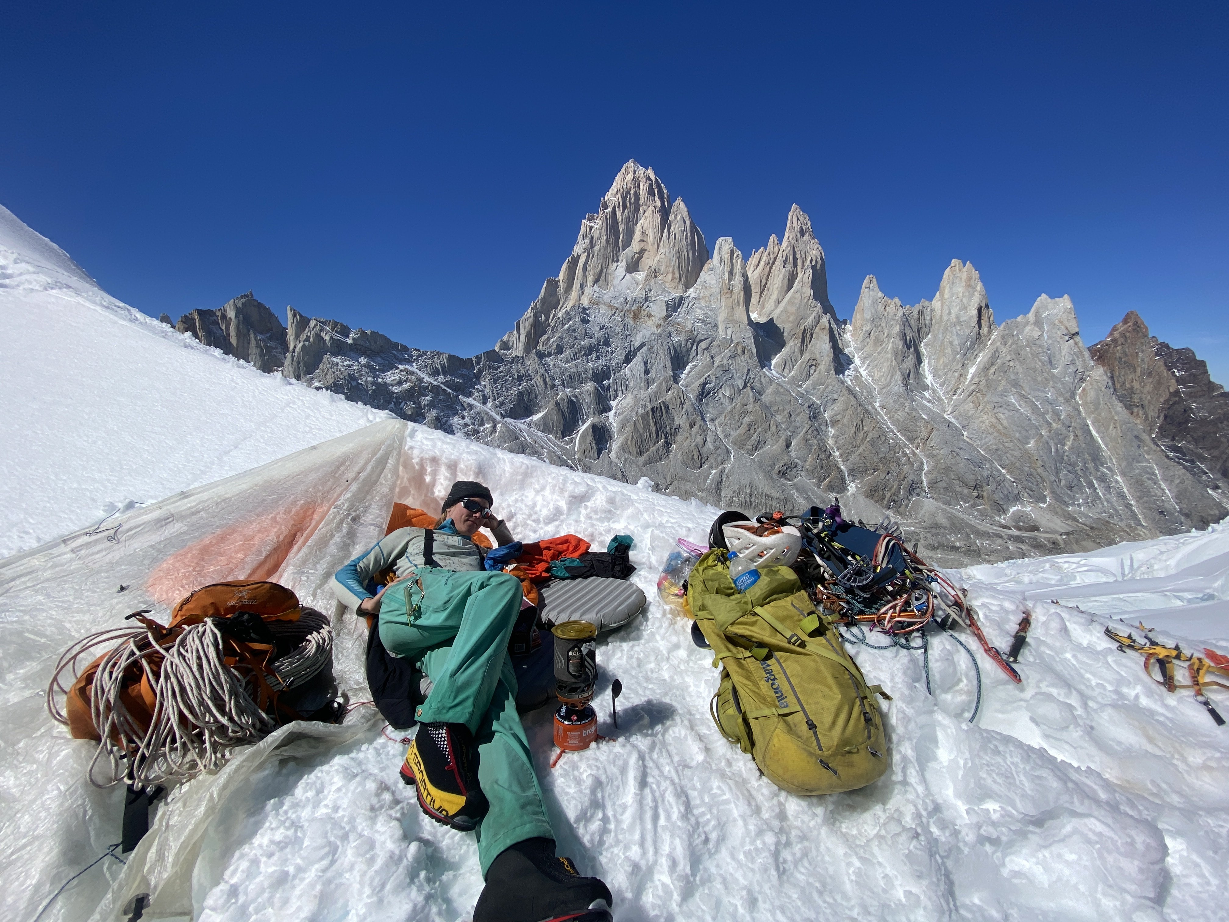
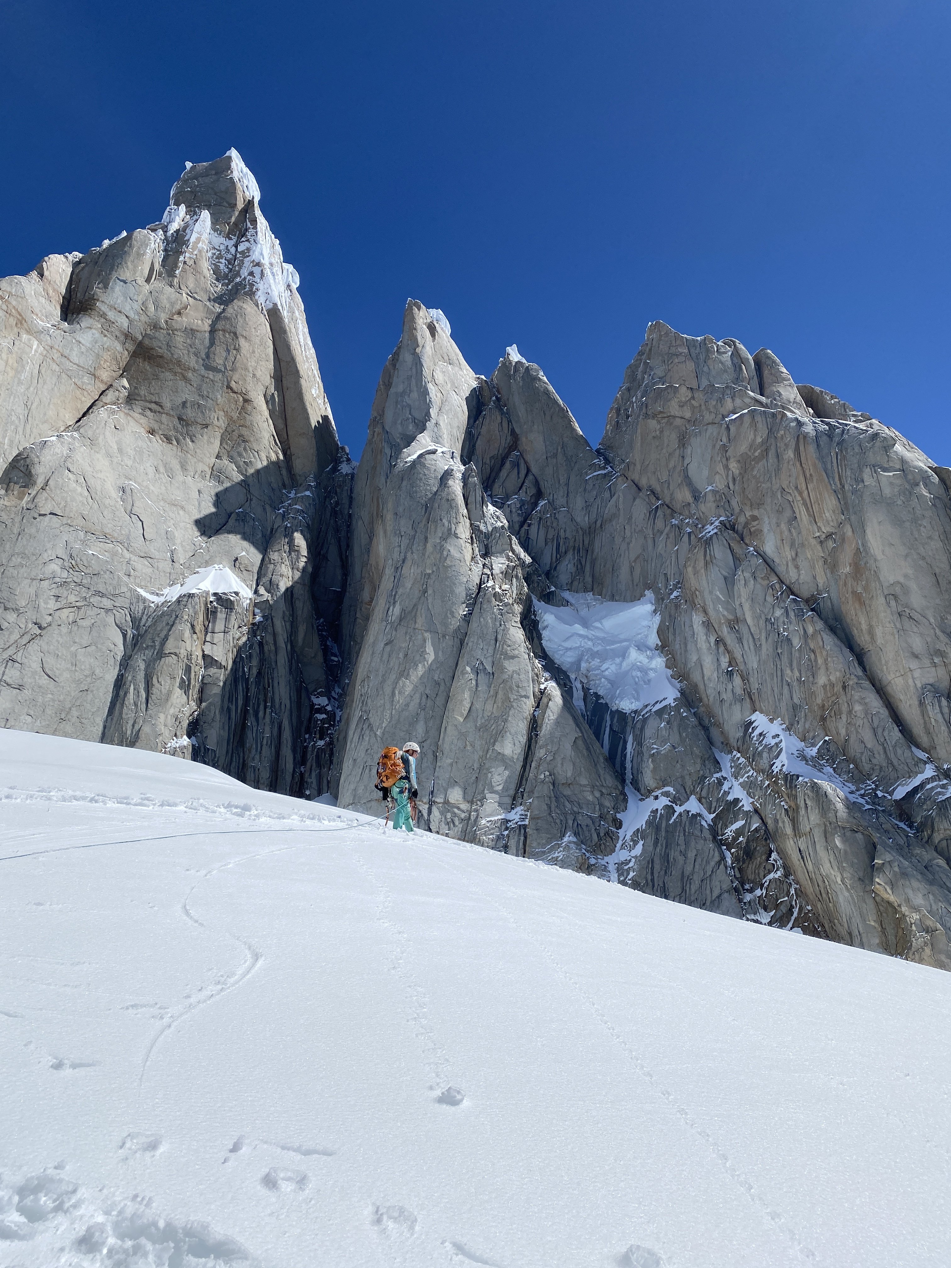
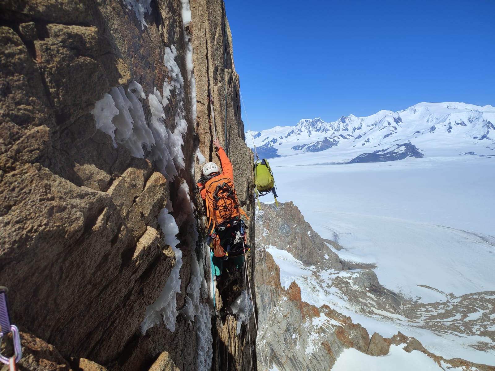
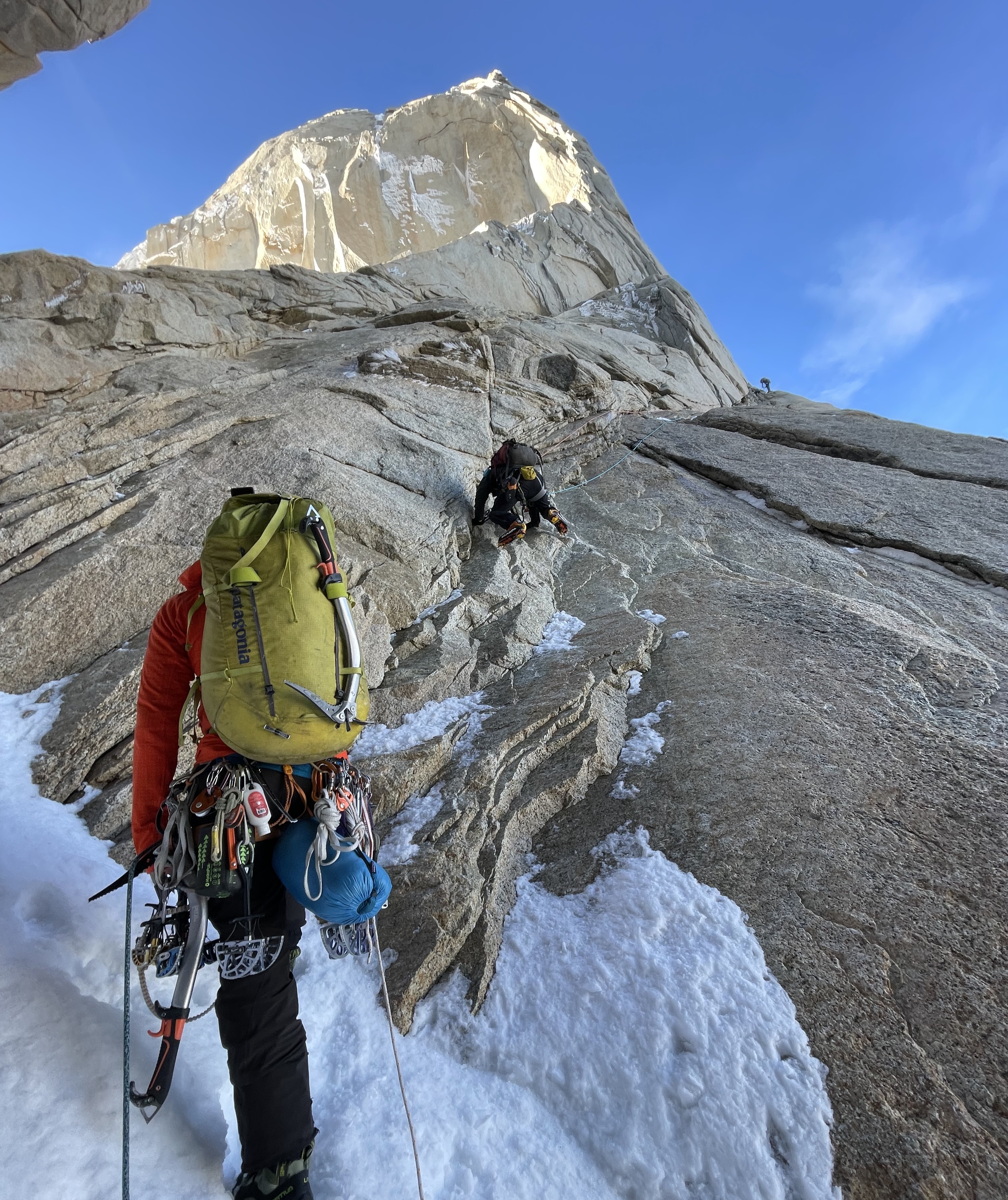
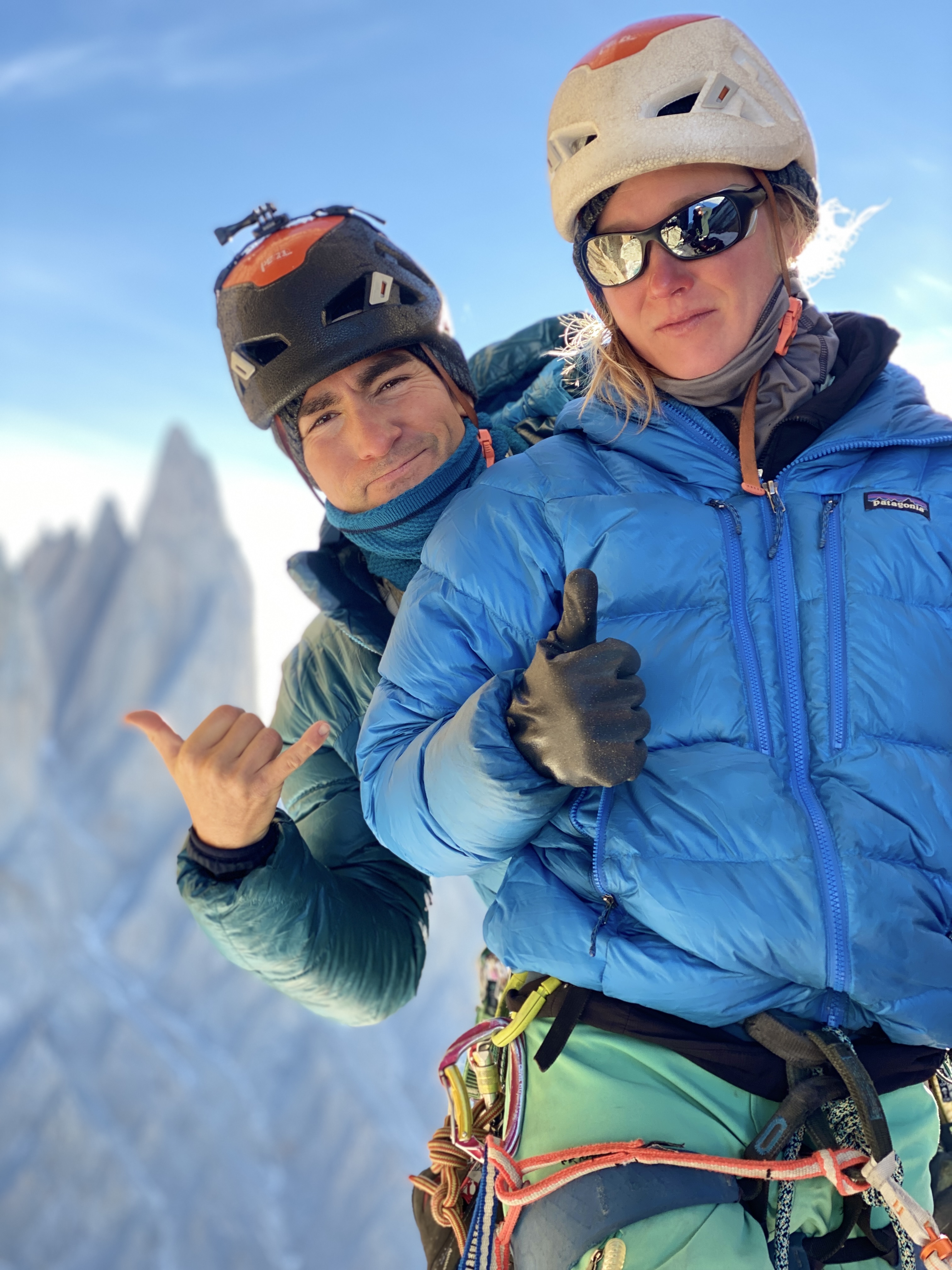
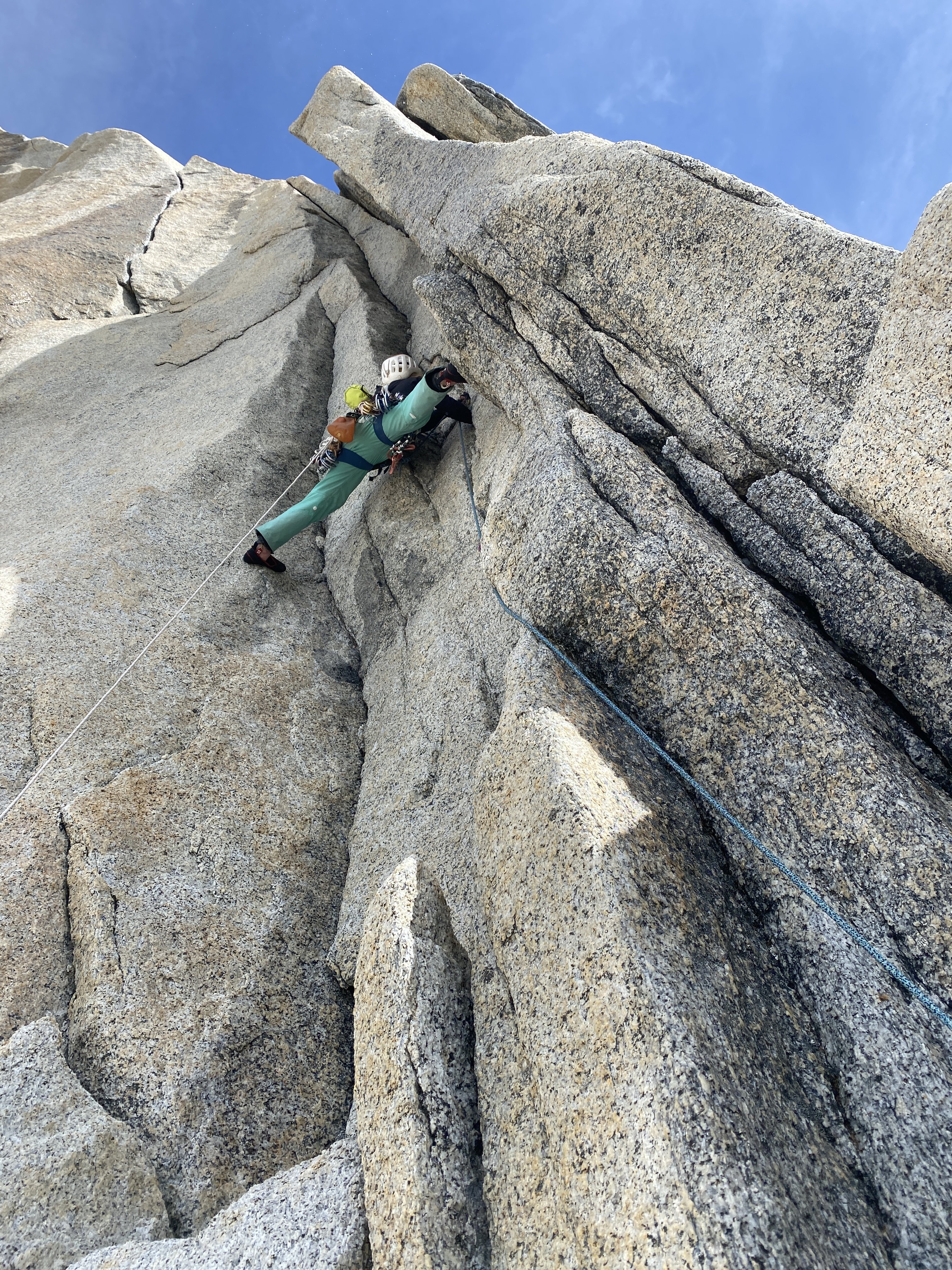
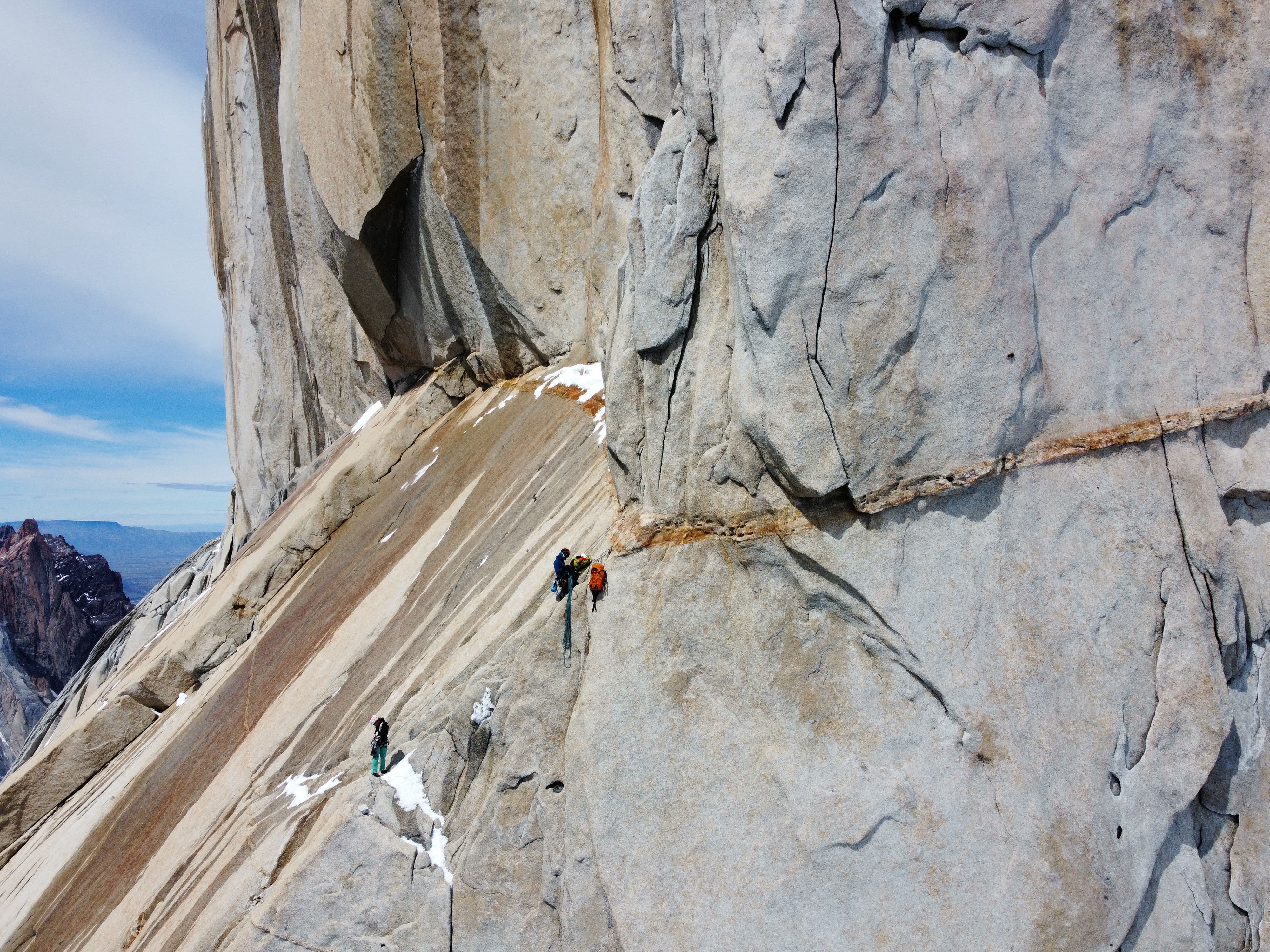
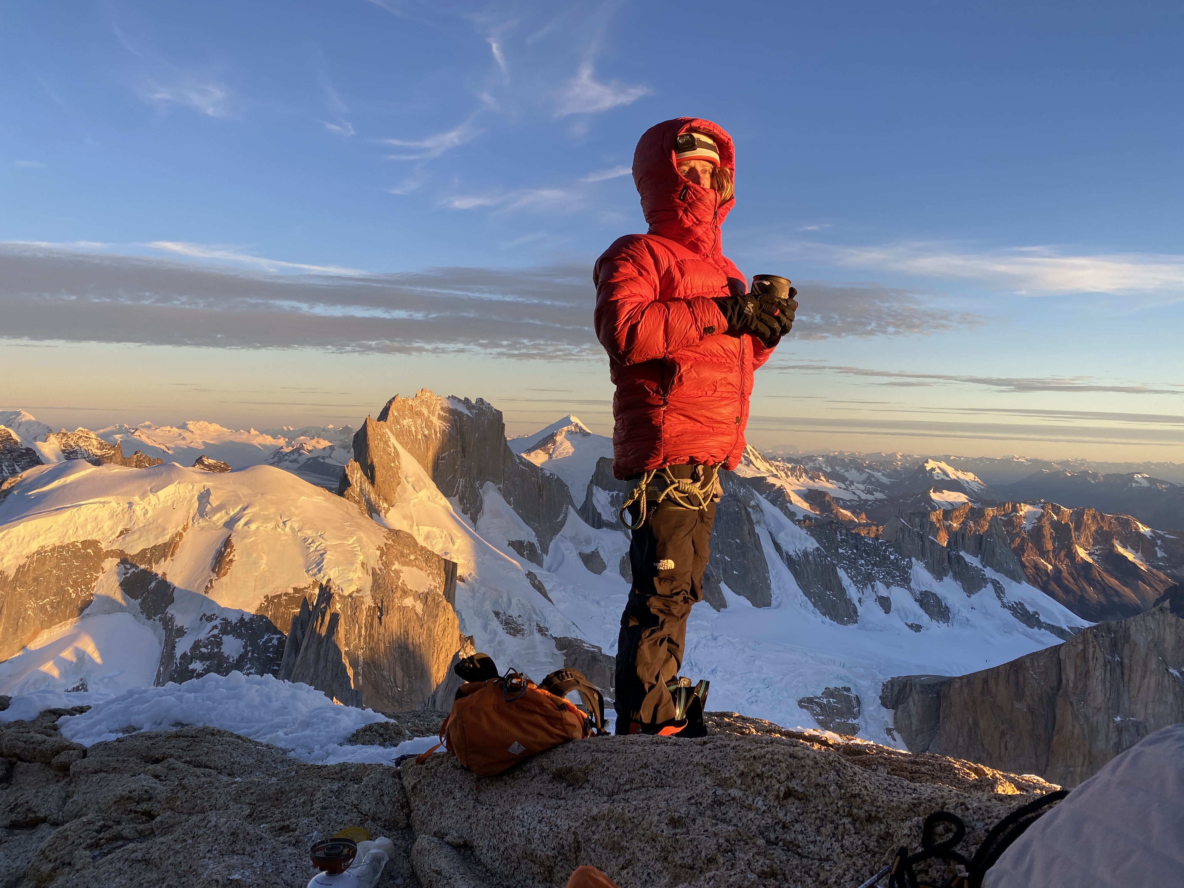
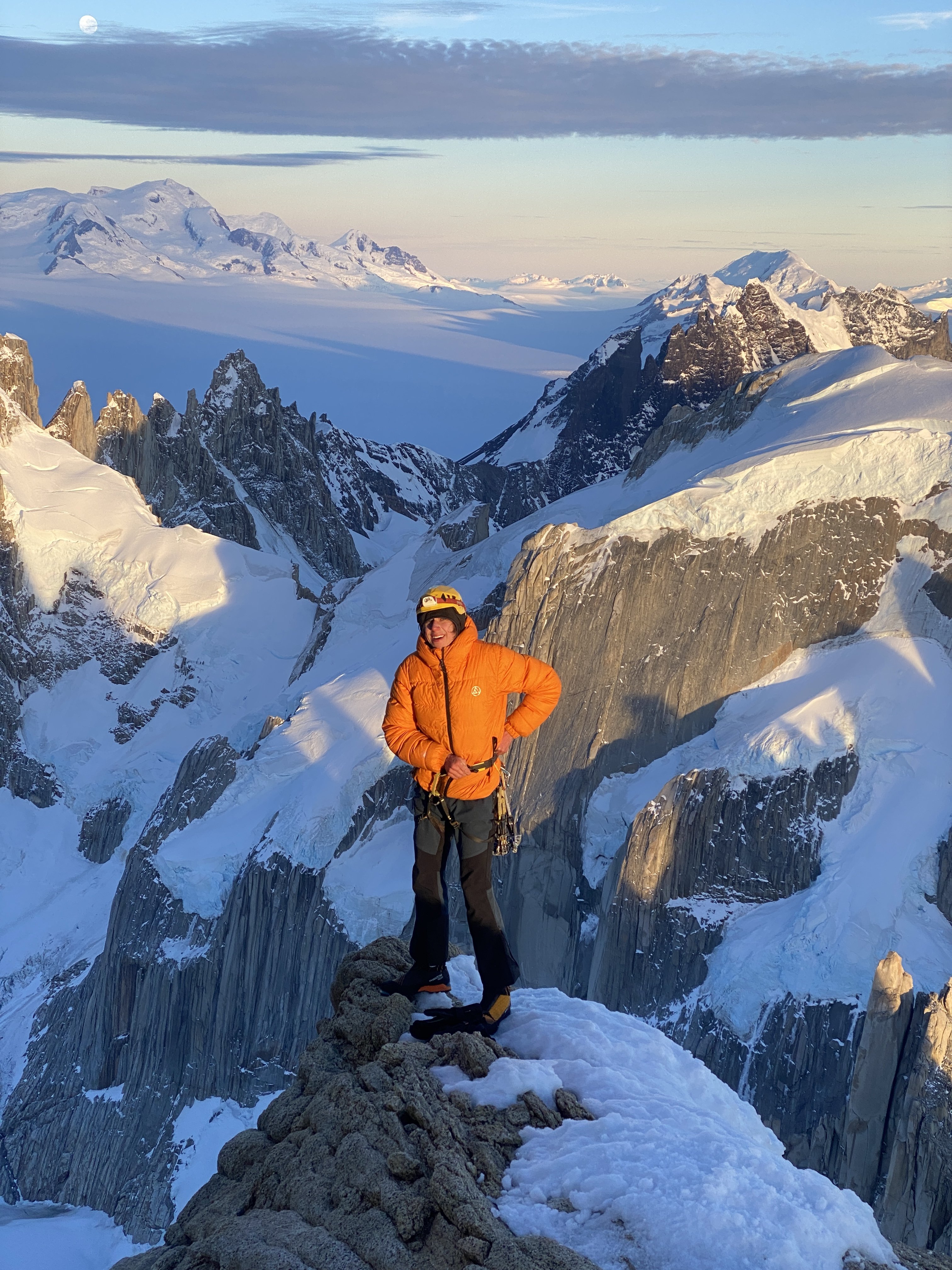

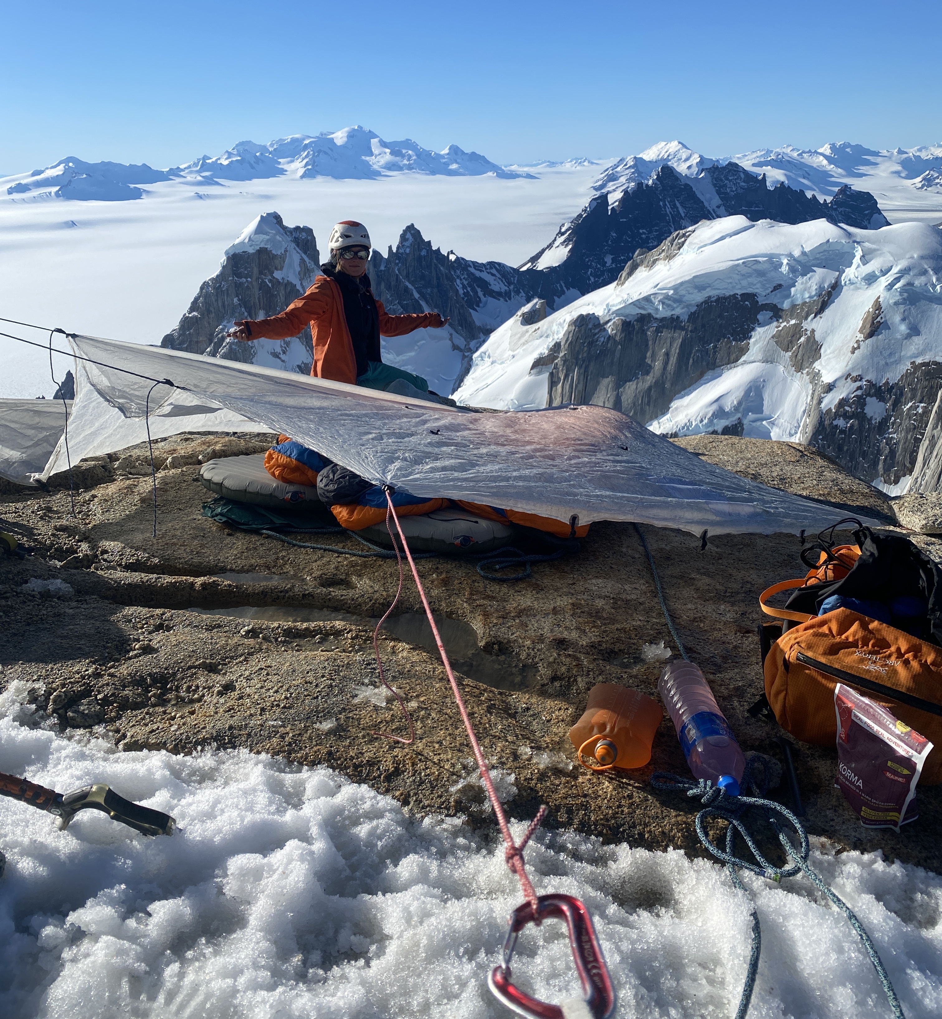
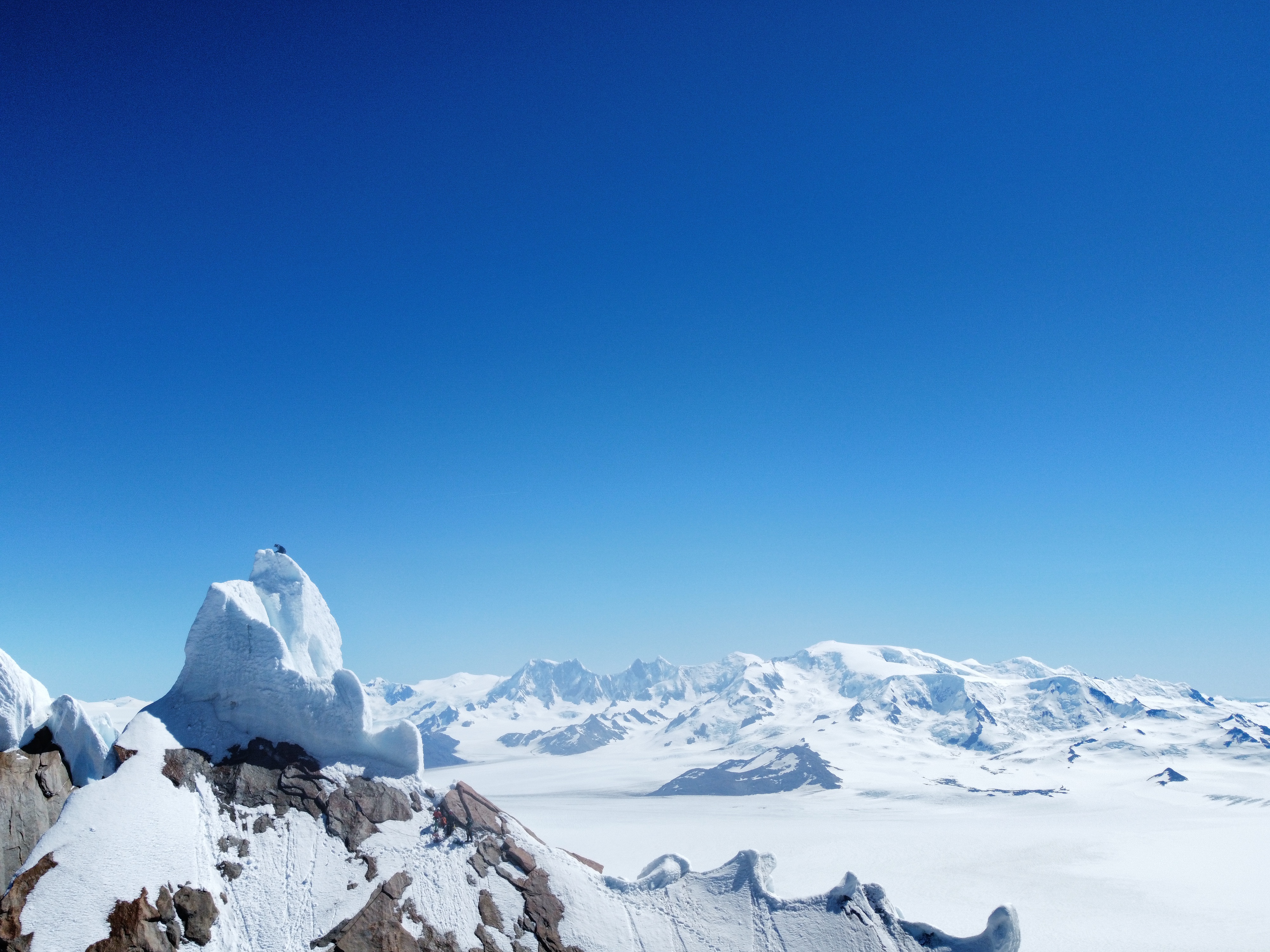
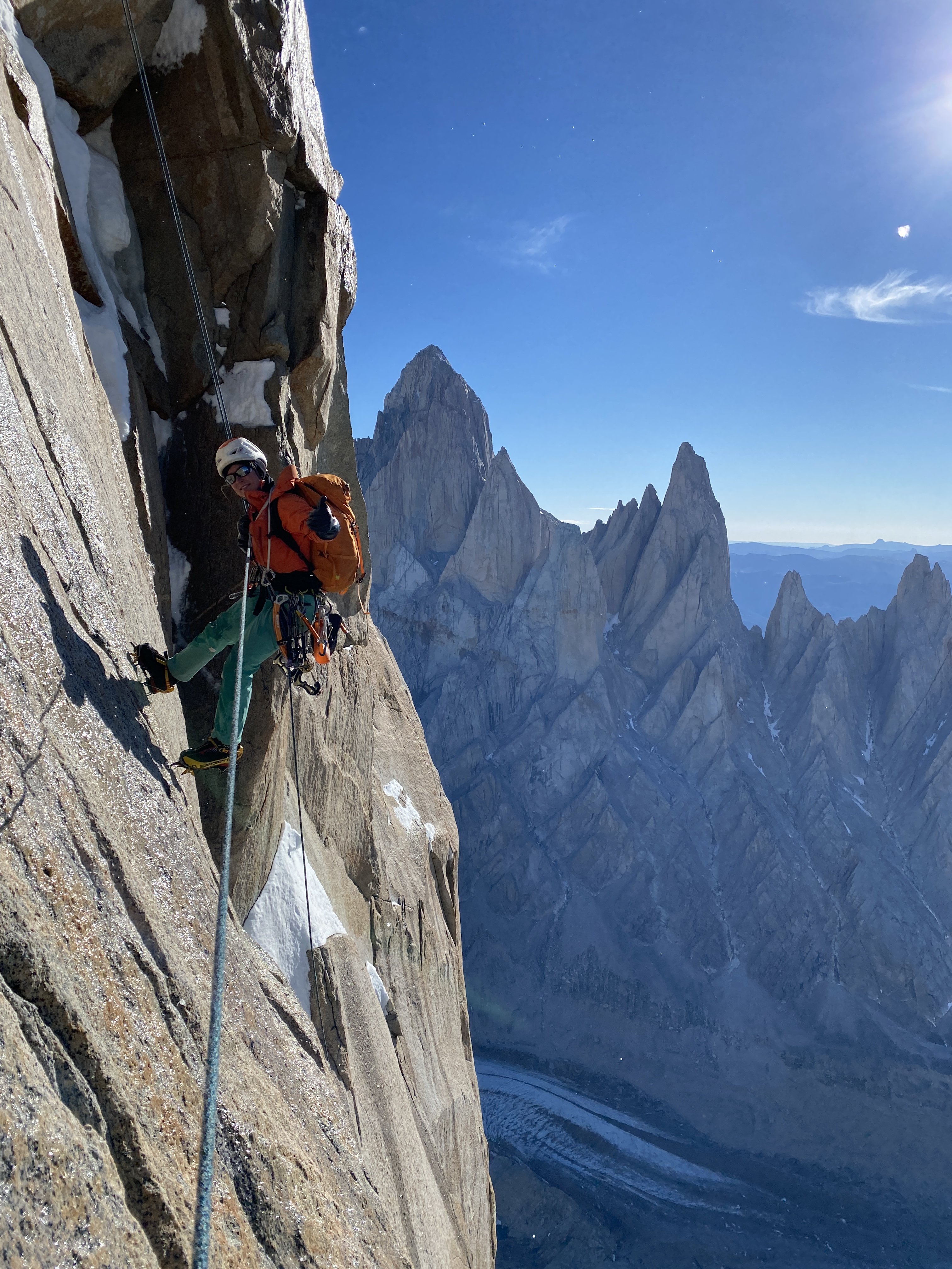
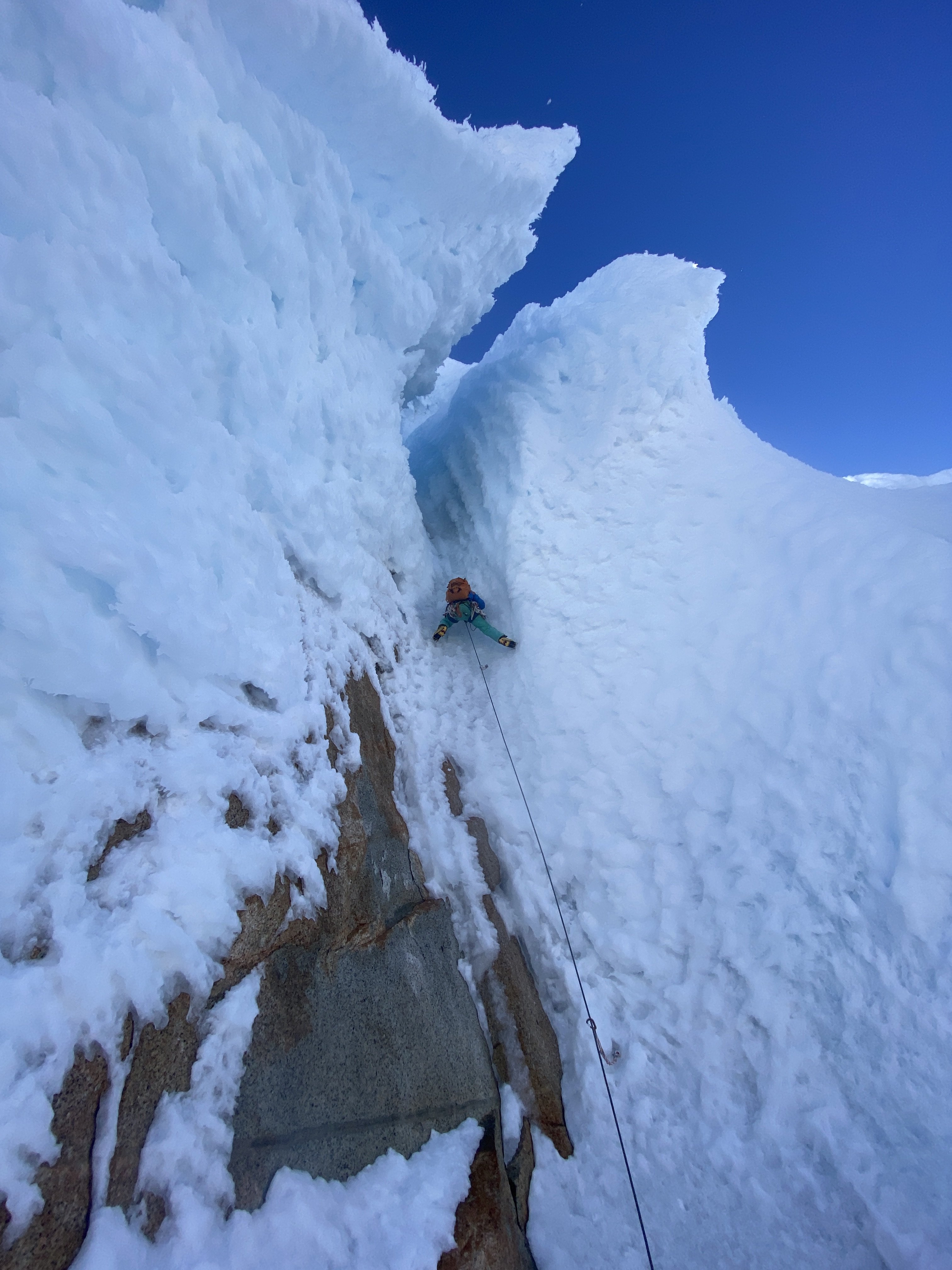
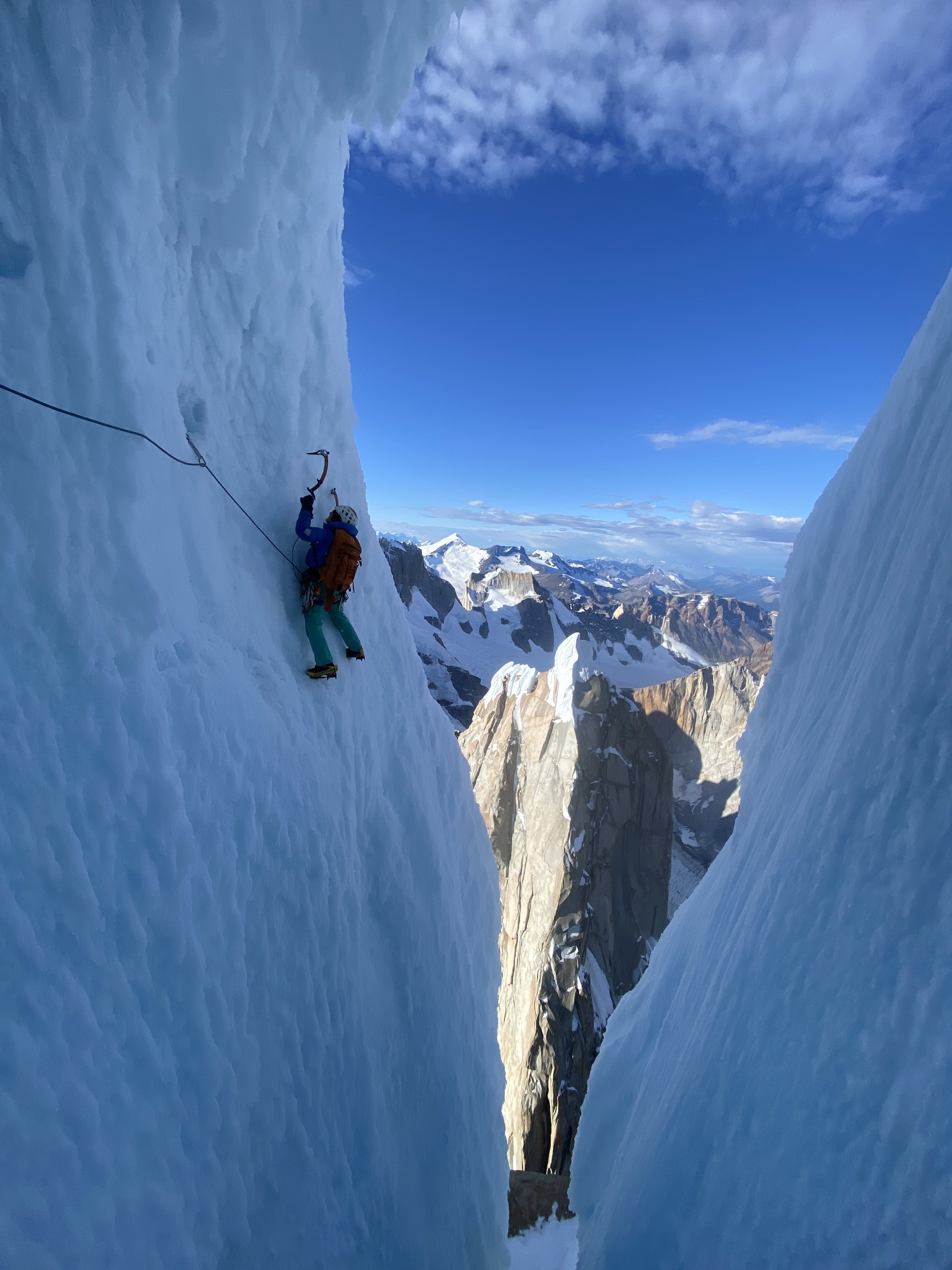
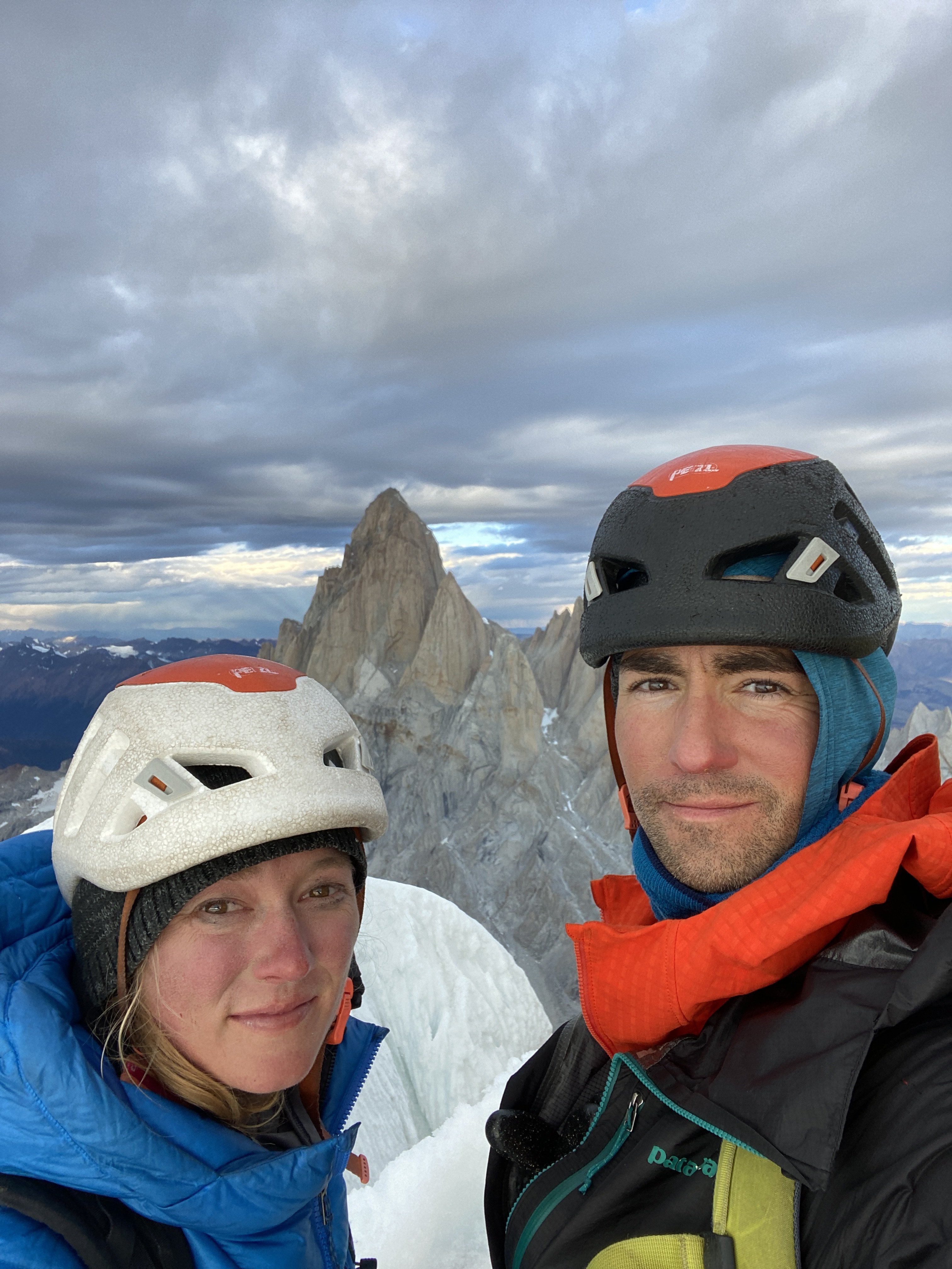
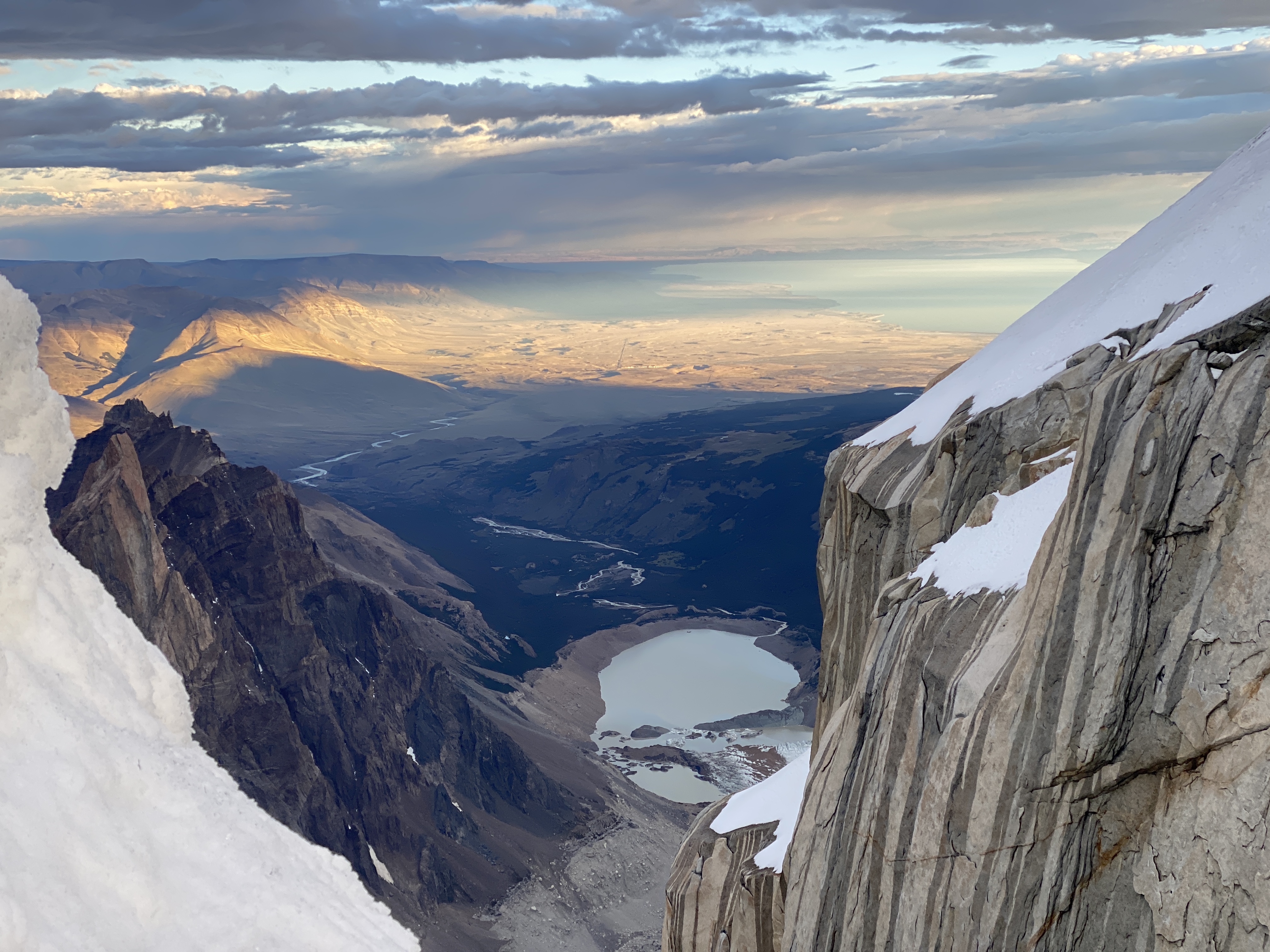
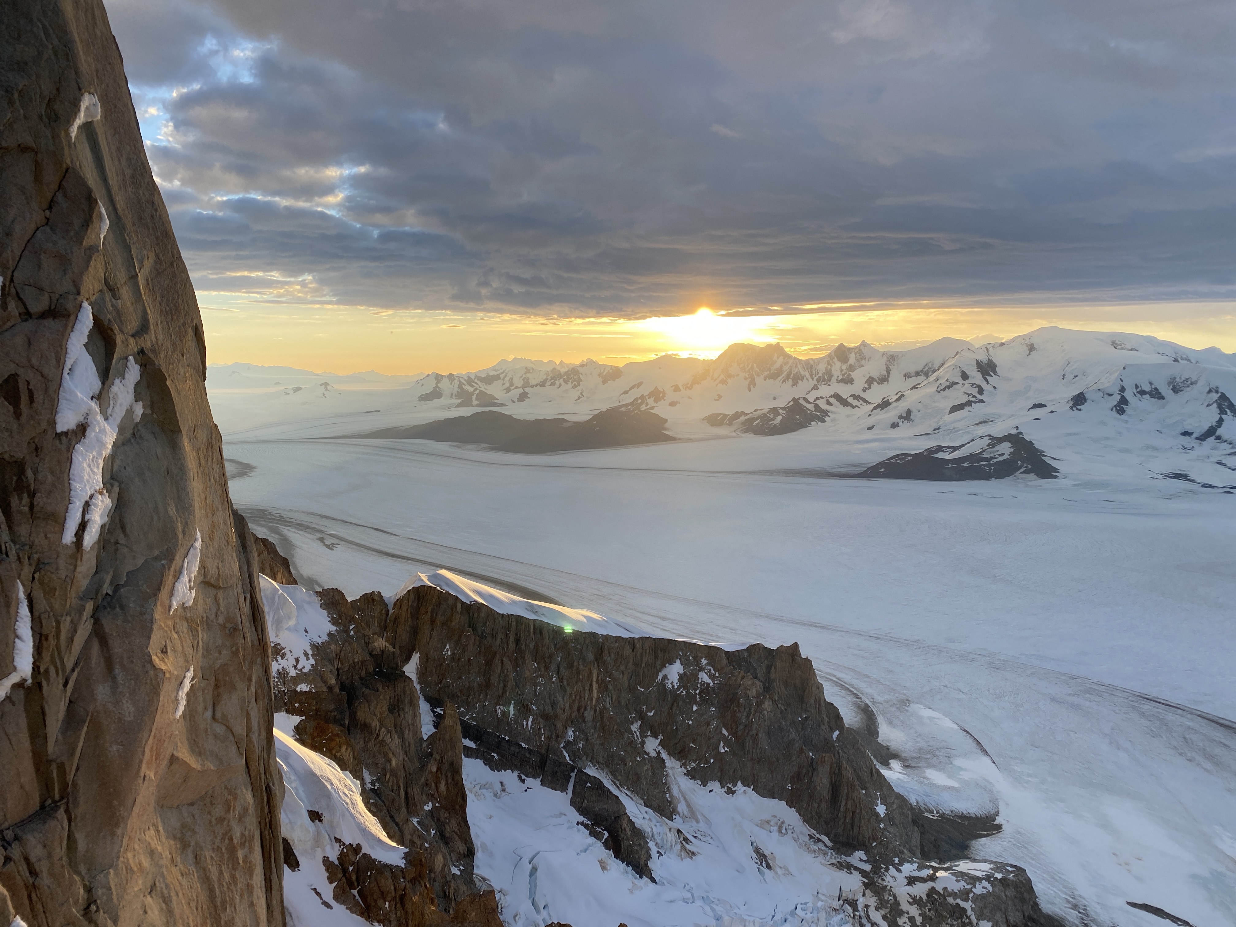
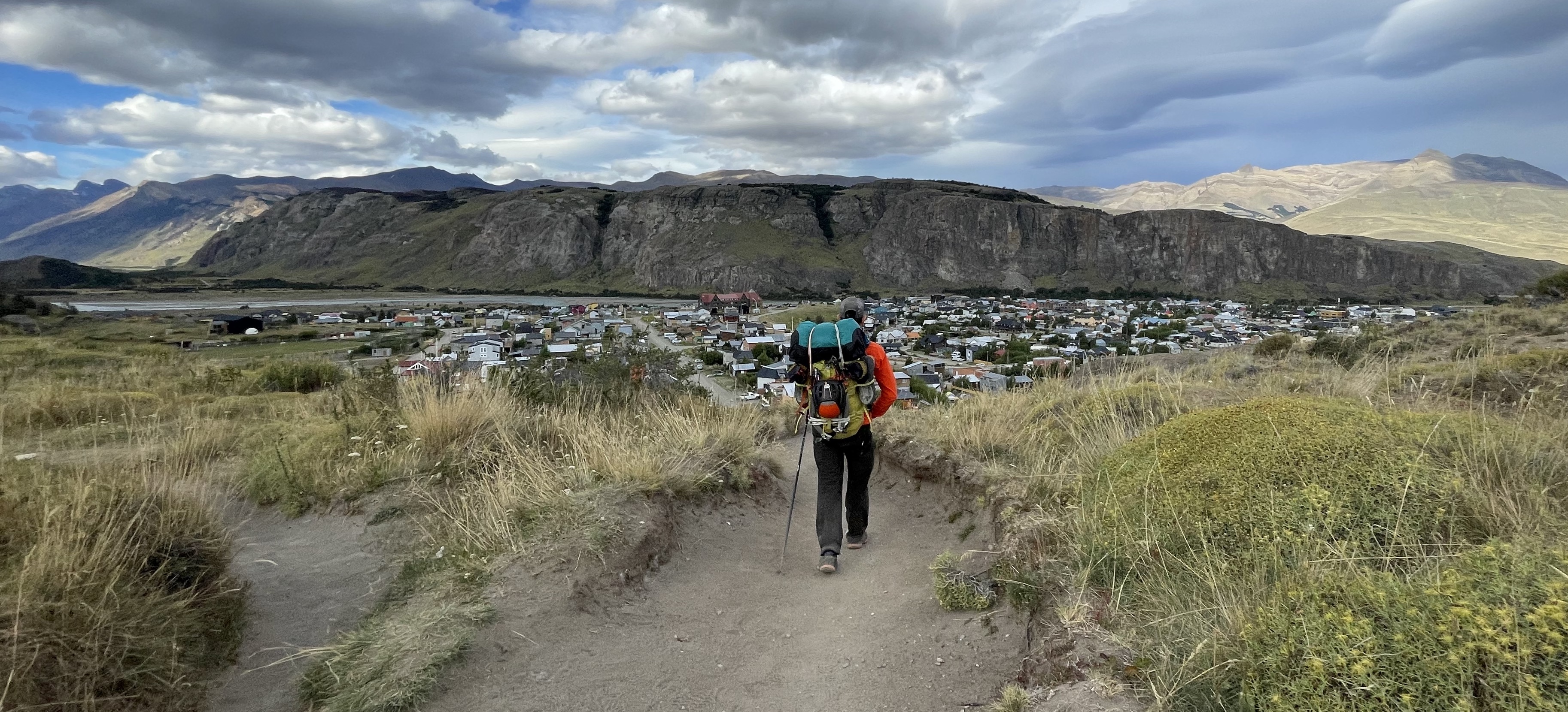
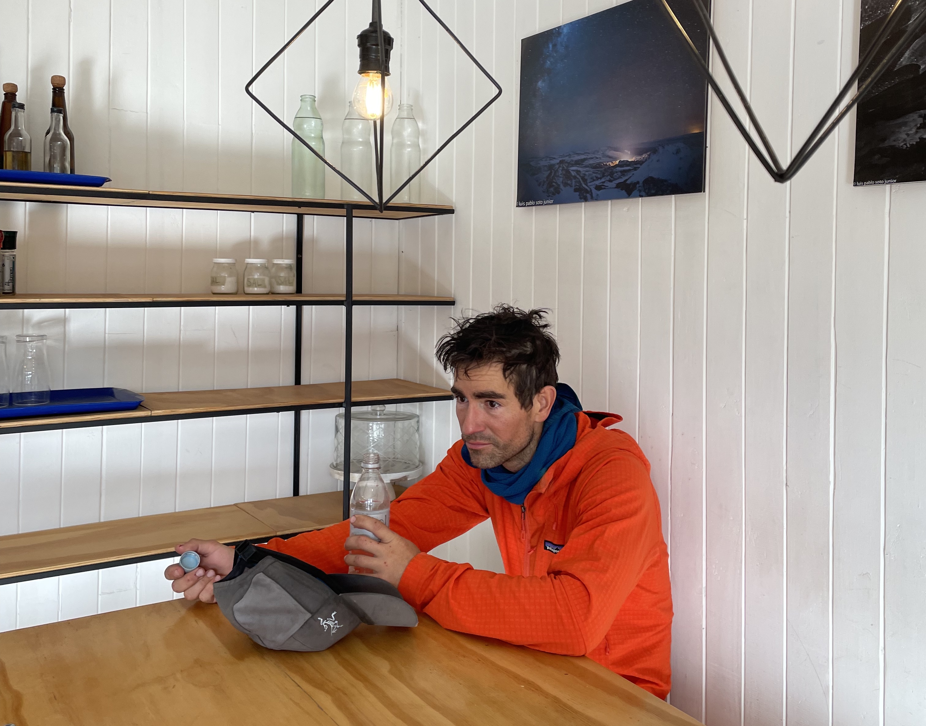
-
Trip: Sherpa Peak - East Ridge Trip Date: 02/05/2022 Trip Report: Sherpa Peak (8,605ft) via East Ridge Feb 5-6, 2022, Eric and Nick 10 miles Snowmobiling, 18 miles skiing/climbing On the summit (photo by Nick) Sherpa Peak is an interesting technical mountain in the Enchantments area east of the Cascade crest. It is probably most famous for the huge balanced rock perched along the summit ridge. The mountain is fairly popular to climb in the summer, but becomes much more difficult in the winter. Roads to the standard trailheads on the north (stuart lake trailhead) and to the south (Esmeralda or Beverly Creek) are unplowed, adding many additional miles to the approach. Rroutes to the summit are technical, and they become much more difficult when covered in snow and ice. The route Nick and I were looking to climb Sherpa in winter, and I tried to research previous winter ascents to see what was the best winter route. I found reports of people climbing up snow couloirs on the north side in winter, but I couldn’t find reports of anyone reaching the summit, so it was unclear what the optimal route would be (I’d be very interested to hear about other winter ascents). The main routes are the west ridge and east ridge. We had both already climbed the west ridge route in summer, and it involves five or so pitches of 5th class rock. Nick had also climbed the east ridge route, which involved mostly 4th and some low 5th class climbing. Those seemed like our best options. I’ve found it’s very important for success on a winter ascent to have already done the route at least once in summer. Some people claim the balanced rock is the true highpoint of Sherpa, and this seems somewhat controversial. The balanced rock is a more difficult climb than the western summit, and most reports I’ve seen of people who have climbed the balanced rock claim it is the true highpoint. But people who don’t climb the balanced rock generally claim it is lower. In my experience the only way to know for sure is to measure the elevation difference with a sight level. Measuring the balanced rock shorter in 2017 In 2017 Katie and I climbed the west ridge route to the western summit and I brought a surveyors sight level. From the western summit I measured a 0.5 degree declination down to the top of the balanced rock, meaning the balanced rock is 2ft lower than the true western summit. Thus, I’m 100% confident the western summit is the true summit. This meant Nick and I didn’t have to worry about climbing the balanced rock on this trip (though Nick has already climbed it in summer). Our route choice then depended on the conditions. Friday there were supposed to be strong winds from the west and southwest, which might load leeward sides. This meant our best bet was to avoid the couloirs on the north and east side and access the routes from the south side. From this approach, the route to the base of the west ridge route was all low angle or southwest facing, meaning it would likely be scoured. So the west ridge would likely be very safe for snow conditions. But it would also take longer to climb with more technical pitches. Loading up at the sno park (photo by Nick) The east ridge route was accessed by climbing a south facing gully, which could potentially be cross loaded. But if snow conditions were safe the route would be faster since it had less technical climbing. Friday night we saw there had been much less snow transport than forecast, and it appeared the east ridge route might be doable. But we packed and prepared for either. We decided to bring a 60m half rope that we could double up to simul climb either route. This would let us do 30m rappels. We each brought two tools and a bunch of rock, ice, and snow protection. We would climb in ski boots and crampons. Previously this winter I climbed Forbidden in mountaineering boots, and I hadn’t done much mixed climbing in ski boots, but it seemed like it might not be that much more difficult. At the Beverly Creek trailhead To approach the route we had two options – start at Esmeralda trailhead and ski over Longs Pass, or start at Beverly Creek trailhead and ski over to fourth creek. I have a snowmobile so either trailhead is equally accessible. The Longs Pass route is slightly shorter mileage skiing, but requires dropping into some steep northeast facing terrain. The Beverly creek route is 1.5 miles longer, but doesn’t cross any avy terrain to get to the base of Sherpa. I had just done the Longs Pass approach last weekend to ski Stuart, and it was fine then when the snow was stable. But we were still a bit worried about wind loading, so opted for the Beverly Creek approach. It was the same elevation gain as Longs Pass, and I had previously done this approach in December to ski Colchuck, so I knew it would work well. The snowmobile approach is also 5 miles instead of 10, so there was a bit of time savings there. Crossing Bean Creek (photo by Nick) We planned to do an overnight trip to give ourselves the option of climbing Argonaut Sunday if the conditions were good and we weren’t too tired out from Sherpa. Friday night we drove to the 29 Pines sno park and slept a few hours in the car. By 3:30am we had the sled packed up and were cruising up the road. We hoped this would be an early enough start to tag the summit mid afternoon and get back to camp. I brought a chainsaw and ax just in case there were blowdowns on the road. Skiing down Fourth Creek before sunrise We made quick progress to the Beverly Creek turnoff on groomed track, then I broke trail with the sled up the ungroomed road to the Beverly Creek trailhead. Shortly after 4am we were suited up and started up the trail. We followed ski tracks to Bean Creek, but then they diverged. We carefully crossed Bean Creek on a crumbling snow bridge and then started breaking trail up Beverly Creek. Crossing Ingalls Creek We alternated trail breaking and travel was efficient. By 7am we reached the pass and were soon skiing down the other side. The snow was generally fun powder. We stayed on the west side of Fourth Creek, trying to stay high enough and avoid getting too close to open water holes. Down near Ingalls Creek the snow got icier and we sideslipped down to the edge of the water. Last weekend I had crossed Ingalls Creek a few miles upstream en route to Mt Stuart and it was only ankle deep and trivial to walk across. But here it was shin deep and nontrivial. We scouted around a bit, and I made a short fouray walking into the creek but turned around when I slipped and dunked a foot in. Luckily there was a 1ft diameter log across the creek nearby. We took turns scooting across au cheval style, and made it to a flat spot on the other side by 8am. Skinning up the southeast facing gully We ditched our overnight gear there, took a break, then headed upstream. Around 4,600ft we left the trail and started zig zagging up the southeast-facing gully that leads to the Stuart-Sherpa col. The gully is mostly low angle all the way to the col, and travel went smoothly. Lower down in the gully the powder snow was heating up in the sun and starting to glop on the skis, but when we got into the trees it improved. Climbing up the south gully As we neared 7000ft we noticed the southwest facing slope at the base of the west ridge was scoured to talus, as expected. So there were no stability concerns there. The south gully to gain the east ridge was still partially in the shade. We found only about 6″ or less fresh snow on the late January crust on the south aspect, and it hadn’t softened up yet in the sun at that elevation. So we decided it would be safe and most efficient to go for the east ridge route. Worst case, if we were worried about it heating up later in the afternoon we could wait around til dark to descend once it iced over. At the notch (photo by Nick) The base of the gully had a few short cliff bands, and we decided to ditch our skis at the base of the cliffs so we didn’t have to worry about skiing down above cliffs. Climbing would also go much faster if we didn’t have to carry skis on our backs. We took out our tools and started kicking steps up around the cliff band through some bushes and up the gully. Nick found a short ice pitch to climb in one of the cliff bands while I went around up a steep snow ribbon. Higher in the gully the snow was nice and firm on top of some old avy debris, and we soon popped out in a notch on the east ridge at 8,200ft. There we were able to lighten our loads a bit more. I ditched avy gear since that was the end of the avy terrain, and I ditched my ascent plates which I hadn’t ended up needing. Climbing the first 30m step (photo by Nick) Interestingly, the wind was coming from the northeast and had formed some small cornices overhanging the south side. There was some blowing snow as we marched up the ridge, but it eventually died as we moved onto the south side. We scrambled and front pointed up to the base of a cliff below the balanced rock on the south side of the ridge. From there we soloed up some fun mixed fourth class rock to a slung horn on the ridgecrest. Traversing on the north face (photo by Nick) Nick had actually done this route before in summer so volunteered to lead from there. We would simulclimb for efficiency and doubled up the rope. I recalled Beckey says to traverse onto the north face to get around the balanced rock, so that’s where we went. Nick led across, and after 30m I followed. The traverse might be class 3 or 4 in summer, but it feels much more difficult than that in mixed conditions. I traversed across the top of a slab with pretty big exposure beneath on the north face. There was a lip I could hook my tools on, but the feet were thin snow dust and ice on slab. It was quite insecure and I was happy Nick had gone first to find the route. I carefully inched my way across, and then started diagonalling up and right. I followed Nick’s tracks in the snow, and occasionally hooked ledges to pull myself over steps. Climbing on the ridge Nick belayed me back up to the ridge crest between the balanced rock and the true summit, and then I belayed him back out. We wove back onto the north face, then kicked steps up to the ridge crest and scrambled along the crest. We then reached a cliff face below the summit and moved back onto a ledge on the north face, then climbed steeper mixed terrain to the ridgecrest just past the summit. Nick on the crux slab We had now at least reached the crux pitch. The last 30m to the summit were a downsloping slab with big exposure on the north side. This is the point where the east and west ridge routes meet, and I remember this section not being too hard in the summer. I had just relied on friction to walk on the slab. But you can’t really rely on frictioning a slab like that in crampons. Nick after reaching the summit The slab had an inch or so of light powder on top which wasn’t bonded at all. It looked pretty sketchy, and there were no obvious features to hook with the tools. Nick bravely volunteered to give it a shot. I slung a horn and we flicked the rope around a bulge on the ledge so he’d at least be protected from a slip to the north side. Nick got farther along, and wasn’t able to find any gear, and it was looking grim. But then the powder changed to verglass and he was able to barely stick his front points in. That was enough to make it across to the other edge of the slab and sling a nub on the top. That was the crux, and Nick made it across a gap and over a ridge on the other side. I belayed him all the way to the summit, which was about the end of the 30m of rope. I then belayed him back partway and he found an anchor. I then started across. It was still unadvisable to slip since I was traversing but I had more protection from the rope than Nick had had. The best technique seemed to be to try to balance my frontpoints on micro features in the slab until I got to the verglass, and then I could delicately stick them in. I was able to barely hook micro nubbins above me with my tools and eventually balanced my way across the slab. Summit panorama On the summit I then crossed the ridge and downclimbed to a good ledge. I really didn’t want to downclimb that slab on the return, and vowed we’d leave whatever gear was necessary to rap off another way. Luckily underneath the snow we excavated an existing rap anchor. Nick clipped in to that and belayed me the short remaining slab to the summit. I found the register, but it was frozen shut. This seems to be common in the winter. Either the register is buried too deep under snow, or if you find it it’s frozen shut. I think I’ve only been able to sign a few registers in winter. The view towards the balanced rock I took a few pictures on the summit and got an amazing sunset view. Rainier and Adams were basking in dark orange and red sky with undercast to the west. Sunsets and sunrises are always great in the winter. We really wanted to be done with the rappels before dark, so I soon retreated back to the anchor. Nick went first, and rapped directly down the north face. I followed, and then we simulclimbed back. We definitely didn’t want to repeat the traverse on the north face below the balanced rock, so agreed to find an alternative rappel back. We simulclimbed directly to the balanced rock, and I briefly looked up at it. Sunset at the last rappel (photo by Nick) That would have been very difficult in crampons to get up the friction bit at the top. Perhaps if we had brought rock shoes and had been there a few hours earlier we could have tried it. But it wasn’t the summit, so we skipped it. We followed the ridge down to the east of the balanced rock and came across a good rap anchor. Maybe this is the standard way down after all. Nick went first, but unfortunately the rope was a few meters short of reaching a good ledge on the bottom. Nick untied and downclimbed, but I instead rapped to an intermediate anchor I saw, then did another rappel down. By then we needed to turn on headlamps, which was good timing since we had just finished the last rappel. Scrambling down the ridge We scrambled back down to the notch, then I packed up my stashed gear and we descended the gully. By now the gully was icy and there was no concern about loose wet slides. We marched down to the top of the icy rock cliff, then downclimbed the steep snow ribbon to the side. By 7pm we were back to the skis. Downclimbing to the skis (photo by Nick) At that point I really wished it was still daylight and the snow was soft. By the time we started skiing the snow was all ice. We carefully sideslipped and skied down, but it eventually turned to breakable crust. We made some jump turns, but that was tiring with all the climbing gear in our packs. So we reluctantly put the skis on our packs and booted down. Back in the trees the snow turned back to powder and we put skis back on. From there the skiing was pretty fun. We occasionally broke out into open terrain and icy snow, but then returned to powder in the trees. Finally we reached our camp and set up the tent and cooked some dinner. Leaving camp Sunday morning Sherpa had taken longer than anticipated. I think I had been estimating time based on climbing Stuart last weekend. But the snow was all firm then and travel fast, while for Sherpa it was much slower going in the softer snow. We talked about whether to still go for argonaut the next morning. Sunday was supposed to be much warmer, meaning the south side up argonaut would be prone to loose wet slides. Our plan had been to climb it at night while the snow was icy, topping out at sunrise and descending before it heated up. But based on our speed on Sherpa we figured we’d have to wake up around midnight for that to work. We didn’t make it into the tent til 10pm, and 2 hours of sleep was unappealing after the tough 16 hour day. We also didn’t want to be racing against the clock while sleep deprived to hustle up argonaut before the sun hit. That seemed risky. Back to the sled So we decided to save argonaut for another trip and just sleep in. Sunday morning we rolled out of bed at 8:30am after what seemed like just the right amount of sleep. We took our time getting ready and had an interesting scoot back across the log over Ingalls Creek. We skinned back up Fourth Creek and the snow was glopping pretty bad in all the heat. At the top of the pass we transitioned and had a fun ski back. Travel was fast zipping along our up tracks, and it looked like nobody else had been up in the valley all weekend. We reached the snowmobile by early afternoon, and soon loaded up and rode back to the sno park. Link to more pictures: http://www.countryhighpoints.com/sherpa-peak-winter-ascent/ Gear Notes: 60m rope, two tools, light rock rack, skis, (brought but didn't need pitons, screws, picket) Approach Notes: Snowmobile to Beverly Creek TH
-
Trip: Forbidden Peak Winter Ascent - West Ridge Trip Date: 01/23/2022 Trip Report: Forbidden Peak (8,815ft) via West Ridge Jan 22-23, 2022 Duncan and Eric On the summit (photo by Duncan) Forbidden Peak is a classic peak in the North Cascades and a very popular summer climb. All routes to the summit are technical, and glaciers flank the cliffs at its base. The West Ridge route is listed in the 50 classic climbs of North America and can be quite crowded in the summer. But winter is a different story. In the winter the approach road, Cascade River Road, is generally snowed over and unplowed, adding many miles to the approach just to get to the trailhead. Snow and rime covers the route, with potential cornices on ridges, cracks filled with ice, and more challenging weather. Forbidden Peak was first climbed in winter by Catellani and Corriveau in February 1981 via the west ridge. There was also an ascent to the false west summit via the west ridge in March 1968 by Sumner, Bertulis, and Williamson. I haven’t been able to find accounts of winter ascents since the 1981 FWA, though. (I would be very interested to hear about other winter ascents). The route I’m working on climbing the Bulgers in winter and Forbidden is one of the toughest peaks on the list this time of year. I’d previously climbed it via the west ridge in August 2018 with Katie, and remembered it being fun but crowded, even mid week. Duncan was also interested in climbing Forbidden in the winter, and we started planning for the ascent in December 2020. The first question was which route to take. We looked over aerial photos from John Scurlock on various winter dates and it looked like the west ridge was generally less corniced than the north or east ridges. This made sense, since the winds generally come from the west which means the west ridge would be windward and the north and east ridges leeward. The south face was another option, though the routes there are more technical. Given that the only winter ascent we knew about was via the west ridge, and we had each already climbed that route in summer, we decided that was the route to try in the winter. The approach involved climbing some steep snow slopes, so we needed to wait for stable snow conditions and stable weather. Those stars seldom align west of the crest in winter, but in late December the window arrived. Our highpoint on the ridge in December 2020 On December 27, 2020 we were able to drive to milepost 16 on cascade river road. From there we mountain biked to just past the Eldorado lot, then skied up to Boston Basin. The next morning we climbed the snow couloir variation to the notch on the west ridge. Duncan then led a ropelength along the ridge, but couldn’t get any gear in. The cracks were too full of ice and rime for cams or pitons to stick. We reluctantly bailed and skied and biked out. We hadn’t given up on Forbidden in winter, though. With time and reflection we decided we could return with different gear and hope for better conditions. In late January, 2022 conditions again aligned for an attempt. The snowpack had been reset with warm temperatures followed by stable weather, and we were optimistic about fast and safe travel conditions. However, getting to the trailhead might be difficult. The approach on Cascade River Road can be tricky in the winter. We’d gotten lucky in December 2020 that we could drive so far in. But in my experience in winter, snow generally starts around the hidden lakes lookout turnoff. It is not always continuous, though. The road goes up to 1800ft beyond this turnoff, then drops to 1400ft afterwards before climbing again. The snow can be deep on the hill and then the road can be completely melted out after the hill. This was the case when I skied in with Matthew in early March 2020 up to the Cascade Pass area. The problem with these conditions is the snow can be too deep to drive through, but the melted out portion can be tough to get through with a snowmobile. So it’s not clear what the best way through is. NOHRSC snow coverage prediction map for the weekend This time there had been a lowland snow event from early January that apparently hadn’t yet melted out, meaning we could maybe snowmobile to the trailhead to make for a quick road approach. Recent satellite images and NOHRSC snow coverage maps showed nearly continuous snow all the way from Marblemount. A friend had told me in mid January deep snow started at milepost 5 on the road. In theory that sounded like it would be possible to snowmobile in on continuous snow all the way to the trailhead. But I still wanted to be cautious. Unlike east of the crest, on the west side roads often see less snowmobile traffic and aren’t necessarily groomed or cleared in winter. I remembered in March 2020 Cascade River Road had tons of blowdowns on it. That could derail the approach if the road was covered in blowdowns. Just the previous weekend I’d snowmobiled up a road near Winthrop (to climb Cathedral and Amphitheater) and been blocked by blowdowns that would take too long to axe out. Just to be safe, this time I bought a chainsaw I’d plan to bring for cascade river road to supplement my ax. I’ve actually spent a summer on trail crew cutting out trees in the Sierras in 2006, so hoped I could put those skills to use if needed. Most recent available clear satellite image from sentinal hub Melted out road sections could still be problematic, since they would cause the snowmobile to overheat and could break the skis. NOHRSC was showing trace amounts of snow in some low-elevation sections. I had previously installed retractable wheels on the skis on my snowmobile so I could get through long pavement sections without damaging the carbides (I had one of those break off last November). I also installed two sets of ice scratchers (tunnel and rail) to help with overheating if it was patchy ice on melted out sections. It looked like the weekend of Jan 22-23 was finally time to pull the trigger on the trip again. This time we planned to do gear a little differently than our previous winter attempt. We decided to bring snowshoes instead of skis since it appeared conditions would be very icy and firm below treeline. I’ve broken a ski in half in conditions like this in the past, and wanted to avoid that. For the route we would bring pickets, screws, cams, nuts, hexes, and pitons. Hopefully this would allow us to protect the route somehow. Instead of one mountaineering ax I would bring a technical ax with hammer and a hybrid ax with adz, then use umbilicals instead of leashes. I’d used the hybrid ax on Pik Pobeda last summer and it had an adjustable pinky rest and straight shaft. This meant I could ice climb up to WI3 and hook ledges for mixed climbing, but I could also slide the pinky rest up and plunge the straight shaft in the snow if needed. I would use water proof insulated Showa gloves for climbing, but also brought a backup pair of BD guide trigger finger mittens. Last summer I’d gotten frostbite on my fingers climbing Pik Pobeda, and a K2 guide I’d met in basecamp recommended these gloves for cold technical routes. It had been 5 months since my frostbite and my fingers had done fine on a short technical bit on Cathedral Peak the previous weekend, so I figured they’d be ok on this trip. Friday evening we left town after rush hour and met up at the Marblemount NCNP office. I filled out a permit, which was amazingly easy to do compared to summer time. There’s no competition in the winter. Then we loaded up in Duncan’s Tacoma to scout the road. Camping out with the sled at the edge of snowline on Cascade River Road I pulled my snowmobile on a trailer with my Forester and was nervous about turning it around. Usually I park at sno parks where turning around isn’t an issue, but this time we’d just be starting wherever the snow started, which could be on a narrow section of road. I was worried about driving up to snow, then having to back up a long distance to find a pullout. Backing up the trailer at night on a narrow rough road can be tough. We drove past the last house on the road, then it started getting full of blowdowns that were luckily sawed out. At about MP 4 we encountered patchy snow and by MP 5 it was bottoming out the Tacoma. There was a wide patch of melted-out pavement there wide enough for our purposes, so we turned around and I marked the coordinates on my phone. We then drove back to Marblemount to my forester. I drove in front this time to the scouted place and pulled over. This was my first time turning the trailer around on a narrow road in practice, though I’d planned it out in theory. I first rode the snowmobile off and parked it in the snow. Then I unhooked the trailer, then Duncan and I both picked up the front and turned the trailer around. I then turned the forester around and hooked the trailer up to it. It all worked very smoothly and I’m now less worried about turning around on a narrow road. As we were going through these shenanigans another truck pulled up. Two guys got out and said they were also planning to climb Forbidden. I was very surprised. What are the odds that a peak that hasn’t been climbed in winter in the past 40 years now has two teams going for it at the same time? It was actually great news for chances of success. They had a snowmobile and a chainsaw also, so there was increased chance of getting to the trailhead and more climbers to help break trail. All of that was very good news. Chainsawing out trees Their truck was much more capable than my forester so they said they’d continue driving a bit farther before unloading the sled. We said we’d meet them sometime in the morning. Probably whoever started second would eventually catch up to the first team sawing out trees or breaking trail anyways. By 10pm we were asleep. Saturday We optimistically assumed it would be a relatively easy day, so got a non-alpine start at 5am. We loaded up the sled, strapped the chainsaw on top for easy access, then got started. It was tough getting through the deep wheel ruts in the snow with two people on the sled, and I drove cautiously. We soon passed the other guys, who were still sleeping. After two miles we hit our first big tree across the road and I whipped out the chainsaw. I made quick work of the tree, and we pushed through. Now I realize why people don’t cut the full tree out when they are clearing a road. There’s uncertainty how many trees will be down farther along the road, and it makes sense to make the minimum cuts to get through to save time. This often means one cut and ride over the fallen tree, or two cuts where the tree is narrowest. Lots of minor blowdowns to saw out We encountered a dozen or so more places where I needed to pull out the chainsaw. I got pretty good at riding over logs, and appreciated the tips of the snowmobile skis being angled up so high to get over the logs. For a few I hopped off and squeezed the snowmobile under, flexing the windshield a bit, and for some Duncan helped lift so I could squeeze under. Progress was slow, and we were only averaging about 5mph with all the blowdown clearing. We eventually passed the hidden lakes turnoff and realized we still had a ways to go. Interestingly, the ascent up to the crest of the road at 1800ft was completely melted out down to gravel. I knew the sled was working hard taking two people and gear up the steep bare slope, and I was very worried about overheating. I swerved to hit any small patch of mud or ice, and amazingly we reached the snowy crest without overheating. The tree we couldn’t ride past In flat snowy patches I tried to gun the engine to prevent spark plug fouling and clogging, though this was probably uncomfortable for Duncan in the back. Snow was mostly continuous from there, but at milepost 15, after two hours and 10 miles riding, we hit a major obstacle. There was a massive 5ft diameter old-growth tree across the road. My 10in chainsaw had no chance. We stopped to consider our options. There was a steep mud bank on the right and a melted out steep dense forest on the left. Riding around was not an option with such little snow cover (and my limited snowmobile skills). The only way to get the snowmobile past was to build a ramp. Unfortunately, snow cover was very thin, so it would have to be mostly with debris. That sounded like it could potentially take an hour or two. We could do it, and it would be kind of fun, but there was a risk that there would be more massive trees like that farther along the road. We still had eight miles left to the trailhead, and it appeared the January storm had been capable of bringing down lots of trees. If there were more large trees like that, it could take all day to get the sled to the trailhead. Snowshoeing to the national park boundary We really needed to get to the bivy site below the climb that night, though. Back in December 2020 it had taken us seven hours to skin up from the trailhead to the bivy site below the climb. We reasoned if we snowshoed the road from there, it would be four hours to the trailhead, plust seven to the bivy. That would put us there a bit after dark, which would still work. If we spent two hours building a ramp and got the snowmobile across, but then encountered more trees like that, it was likely we wouldn’t make it to the bivy that night and would have to abandon the climb. Views near the Eldo lot We decided to park the snowmobile there and continue on foot. That sounded like it gave us the highest chance of success on summitting. I unloaded gear, turned the sled around, and packed back up. We climbed over the tree and continued down the road on snowshoes. There was another tree just behind the big one that would have taken a lot of work to saw through. And then another big tree had fallen on the bridge near the Mineral Park campground. That would have been another project to get the sled past. I think we made the right call with ditching the sled. We hiked up the road after the campground, going across melted-out south-facing sections and more blowdowns, and soon reaching the park boundary. They had installed a new gate since last time I was there (May 2021) and it was left open, though half buried in snow. There were a dozen or so more blowdowns between there and the Eldo lot, though they all would have been manageable. Hiking up with views of Johannesburg We took a break at the Eldo lot and decided to ditch a few items of gear at the outhouse to pick up on the return. It seemed important to conserve energy if at all possible given so much extra distance we had to cover. The gate was closed at the Eldo lot and a semi-permant looking sign installed that said “Gate Closed Ahead”. I wonder if it was closed all last summer. Interestingly, past the Eldo Lot there were zero blowdowns and we made quick time on the firm snow. Though there was one avy slide that would be tricky to sled past. We had great views of Johannesburg above as we climbed higher. Looking up at Boston Basin Morning Star Creek we saw the huge washout that closed the road last spring. It looks like it’ll take more work still to clear all the debris from that. In December 2020 we had skied directly down from Boston Basin down that drainage, but it involved a lot of dense bushwhacking and cliff avoidance and we decided to avoid that route. Finally by 12:30pm we reached the Boston Basin trailhead and stopped for a break. In the summer that tiny lot is always overflowing, but not in the winter. It appeared we had the whole zone to ourselves. We started up the Boston Basin trail, and snow conditions were nice and firm. We zigzagged up the old mining road, then directly up an open slope and traversed to cross Midas Creek. That appeared to be the last flowing water of the trip so we each topped off our water bottles. We then traversed across Morning Star Creek and went directly up the open slopes from there. Johannesburg at sunset By 3:30pm we popped out above treeline and were treated to amazing views of Boston Basin, the Quien-Sabe Glacier, and Johannesburg across the valley. Above treeline around 6,000ft the snow got more powdery and we actually started sinking in a bit. But we had made excellent time up to there and it looked like we would beat our 7 hour time from before. We alternated breaking trail and soon made it to the typical summer campsite in Boston Basin. This is where we’d camped in December 2020, but there was still daylight left and we recalled a flat bench higher up. Somehow we had cut our time prediction in half, likely because the snow was much more consolidated this time. We decided we wanted to minimize our ascent on summit day, so we would continue and bivy as high as possible. We wrapped around some hills and then snowshoed up the south face. The sun was setting by then and we had amazing views of Johannesburg across the valley. By 6pm we crested a small bench at 7,600ft and stopped there for the night. Sunset near the bivy site I set up my mega-mid ultralight pyramid tent and we threw out our bivy sacks inside. I like this tent since I can use hiking poles as the middle pole, and the bottom is open so I can dig it out to make lots of room. We melted a bit of snow, cooked some dinner, and were sleeping by 8pm. Sunday We wanted to get as early a start as possible with the constraint that we needed daylight for climbing on the west ridge. The snow couloir could be done in the dark, though. So we planned to climb to the col on the west ridge by sunrise and start the ridge climb then. Sunrise from the couloir We got up at 4am and left camp soon after. We snowshoed up for the first 15 minutes but then it got too steep and icy so we transitioned to crampons. I led the way kicking steps up to the rocks on the left edge of the base of the couloir. In summer I had climbed the cat scratch rock rib variation to gain the west ridge, but now that was covered in rime and snow and looked tricky to climb and protect. The snow couloir was well filled-in and worked for us last time, so we decided to go for it this time. Sunrise from the couloir In December 2020 we had wallowed up deep snow in the gully and progress was slow, but now the snow was much more consolidated and travel was quick. We decided to rope up in the gully for a few reasons. First, there were occasional bits of rime chunk falling off the rocks into the gully, and we wanted to be roped up in case a bigger chunk happened to fall. Second, it could get icy up higher as it got steeper, and a rope seemed wise. At the notch (photo by Duncan) I put in a cam and sling on the wall and we roped up. I led up kicking steps. I hugged the left wall as much as possible to stay away from the rime chunks falling down. I got a cam and nut in, but when the gully curved left it seemed like no more gear options. I pounded a picket in at the end of the rope length and we simul climbed from there. I traversed to the right edge of the couloir and was able to get gear in on the rock wall. Then at the top I traversed left under a cliff band and climbed a very steep snice section up to the crest of the cat scratch route. I was happy to have already done this part of the climb before, since I was able to avoid a dead-end variation I had taken in 2020 that had cost a bit of time. From there the slope angle eased and I marched up to the notch. I cleared out a crack in the notch, got a red cam in, and belayed Duncan up. Duncan starting up the west ridge The sun was just rising and we were still on schedule. The view was amazing of colorful snowy mountains in all directions. I peered over at Primus, Austera, and Jack to the north and over at Johannesburg, Sahale, Gunsight, and Rainier in the distance to the south. Duncan soon arrived and we stopped to take a break. I put on my big orange puffy jacket and scarfed down some food while Duncan warmed up his feet. On one of the au cheval sections (photo by Duncan) We looked up at the route and it looked almost identical to the conditions in December 2020. Luckily there were no cornices, and the false summit looked tantalizingly close. Duncan is a very strong mixed climber and we agreed he’d lead the ridge to the summit. Our plan was to simulclimb as much as possible for speed, but perhaps pitch out a few steep steps. In the summer time I recalled staying generally close to the ridge crest but often venturing onto the north face to wrap around obstacles. The north face is steep but still lower-angle than the south face. That strategy wouldn’t necessarily work in the winter, though. It looked like there were more rocks poking out on the direct ridge crest, and we would need exposed rocks to find gear options. So we would try to stay on the crest as much as possible. I belayed Duncan up and the first ropelength started on gentle snow slopes, which soon gave way to a more narrow snowy ridge crest. Near the end of the rope Duncan found an exposed rock and hammered a hex in a crack. Hexes or pitons that can be hammered in generally hold better in icy cracks than cams, and I was happy we had gear in. This was already an improvement from the last attempt. Starting up the crux tower The rope ran out, I took down the anchor, and started up. The crest stayed mostly low-angle and we slowly simul-climbed up. Duncan was generally able to get at least two pieces in per rope length, and the terrain was easy enough that this was sufficient. As we got higher the crest got narrower until it was less than a foot wide. I actually scooted au cheval in several sections, with one leg hanging off to the very exposed south face, the other on the snowy and steep north face. Sometimes if a bit of rock was exposed I’d step down onto the north face, hold onto the rock, and traverse. Me approaching the crux tower (photo by Duncan) After the au cheval stretch Duncan built an anchor and belayed me over. We were below the big step that I recalled was the crux in the summer. In the summer I recalled stepping across a gap and walking over some friction slabs below this crux, but this was all covered in snow and rime now and the friction slab was no problem. Duncan leading the crux tower I handed over the gear, flaked the rope, and put Duncan on belay. I was happy to not be leading this section in mixed conditions. Duncan got two solid pieces in and quickly made it up over the step. Then the rope ran out and it was my turn. I followed his steps in the rime, but the vertical part was tricky. I had to hook my right tool on a narrow slanting ledge while leaning left, then delicatly step left around a rock bulge onto a sloping ledge. This got me to the base of a small corner. I banged out a piton there and clipped it on my harness. Above me I was able to hook a small ledge with both tools then pull up and get my foot on an ice bulge. Above that I reached my left tool up as high as possible and could just barely hook an invisible edge of rock. I then hooked my right crampon up onto the rime and pulled myself up. The final bulge was loose snow but I jammed both picks in and pulled my way up. The crux was over. The terrain leveled out briefly and then steepened again. Duncan belayed me over to a small rock overhang and we exchanged gear again. Now I could see the false west summit and we were close. Duncan led up, kicking steps briefly on the north face to get around the bulge and continuing out of site. I started up when the rope reached me. The north face snow was pretty insecure and I was happy to have gear in above. I eventually climbed back up to the crest and noticed the south side snow was much more secure. It had likely gone through melt-freeze cycles that the north face had not. Summit panorama There were a few more au cheval sections, and then the terrain eased at the base of the false summit. In the summer I had climbed up to the false summit and downclimbed a 10ft step on the other side. But in the winter that downclimb was too sketchy. So we traversed around the false summit on the north face. This was our longest foray onto the north face and made me appreciate the ridge crest. The snow was very insecure. Some footholds held, but on others I’d break through to powder and sink down a foot. Luckily there were rocks exposed and Duncan got a piton in to protect the traverse. Me on the summit (photo by Duncan) On the other side we regained the ridge, then climbed a short narrow snow ridge to the summit. We topped out at 11am, three hours after leaving the notch, and approximately on schedule. It looked a lot different than in the summer. The summit was a steep snow pyramid and we tapped the top of it. Duncan was belaying me on the other side off two tools in the snow. The wind had picked up from the north and it was blowing spin drift all around. Luckily the air temperature wasn’t too cold (maybe upper teens), but it wasn’t a good place to hang out for too long. Duncan on the summit The views were amazing of snowy cascade peaks in all directions. To the southeast Boston and Sahale were plastered in rime ice, and the ragged ridge spread out to the north. Interestingly, there was a fairly large cornice just past the summit on the East Ridge. The north ridge looked heavily corniced also, and I think our route up the west ridge is the best way in winter. We hadn’t encountered any cornices en route (though that could change in other years). Starting the descent Looking back at me on the summit (Photo by Duncan) We stayed about 5 minutes, but wanted to get out of the spindrift and soon started heading out. I pounded in a picket and my ice ax as an anchor and belayed Duncan down. Our plan was to simul downclimb as much as possible, with a few raps on the steep steps. Duncan climbed around to the false summit and got a picture of me on the summit before heading down. I took my time on the sketchy north face traverse, then on the ridge crest on the other side I faced in and downclimbed. Downclimbing the low-angle but sharp ridge was kind of tricky. I had to face up so couldn’t easily see below me, and there wasn’t a whole lot of gear in between us so I had to be extra careful not to slip. But I had our up tracks to follow which helped. Looking for anchors We found an old rap anchor exposed at the top of the highest step, so we backed it up and clipped in. Duncan rapped first and made it to above the crux and I followed. I’m sure there is a good anchor somewhere there to rap the crux, but we couldn’t find it under all the rime and snow. So we slung a small horn sticking out toward the north face and were careful to just weight it towards the step. Duncan rapped down and I followed and we met at another gear anchor. From there I recalled in the summer rapping again down the north face and traverseing back to the ridge, but we wanted to avoid traversing the north face in the insecure snow conditions. So Duncan climbed back down the ridge to the au cheval section and started digging around for anchors. The spin drift was pretty bad with the north wind but he found a small horn that we could use to diagonally rappel back to the crest below. Duncan excavating the last rap anchor horn I climbed over and we were very careful to weight that anchor only straight down. It was fine straight down, but I suspect the wind would probably blow it away if unweighted. We rappelled diagonally down, which was tricky in the north face snow. Then Duncan got a piton in back on the ridge crest and we clipped in. It looked the ridge was lower angle from there and we decided to simul downclimb. I belayed Duncan down, but when the rope got to me I struggled to get the piton out. The snow was sliding out from under my feet and I had to swing my hammer at full arm extension to reach the piton. I banged on it for 10 minutes, but then gave up. I recalled we hadn’t used pitons below that point, so wouldn’ be necessary for the remaining climb, and was too risky to get out since once it popped out I would be far above the next piece. Final look up at the ridge from the notch I carefully unclipped the beaner and started downclimbing. There were some tricky steep snice sections and I took my time, making very careful and deliberate pick and crampon placements. I extracted the next piton no problem, and soon reached the easy snow slopes that were a short march away from the notch. We reached the notch at 2pm, so it had taken the same time up as down. The west ridge is tricky that way, since you can’t just rap the whole route and be off quickly. You have to do some climbing on the descent also. Looking up at the couloir from the bivy site We decided the fastest way down the couloir would be to simul downclimb again. I led the way, placing gear in the exact places as on the way up. This time, though, the afternoon sun was hitting the rime above the gully and even more ice chunks were falling down. The right side of the gully was like a shooting gallery, so I stayed on the left out of the danger zone. This meant fewer gear options, but I got a few intermediate pickets in. We soon reached the bottom, found our stashed snowshoes, and quickly hiked out of the danger zone and back to camp by 3pm. I breathed a big sigh of relief that the roped portion of the climb was over. But we were still a long ways from the cars. Hiking out into the sunset We spent some time melting snow, breaking down camp, and packing up. By 4pm we were hiking back down, and got to enjoy another amazing sunset over Johannesburg mountain. Our tracks had drifted over on the upper mountain, but down lower we regained them. The sun set as we descended below treeline, and conditions got steeper. I was happy not to have skis, though, since the icey breakable crust would have been challenging. In the trees the slope steepened and we took off the snowshoes to posthole down. But back at Morning Star Creek we changed back to snowshoes and followed our up tracks. By 6pm we reached the road and stopped for another break. It was much colder down in the valley, and it may have been an inversion. Hiking out looking back at Forbidden (photo by Duncan) We made good time walking down the road in snowshoes, and even remembered to pick up our stashed gear at the Eldo outhouse. I sort of expected to see tracks from someone else in there, maybe someone going into the Eldo zone, but it appeared we had been the only ones in there all weekend. Conditions hiking out were much firmer now in the dark, and we made good time. The south facing aspect of the road was more melted out around MP 16.5, but down in the valley the snow was still deep. By 9:30pm we finally reached the snowmobile and stopped for another break. We saw one other set of snowmobile tracks that got to the old growth tree and turned around. Those must have been from the other two climbers that were planning on climbing Forbidden with us. It’s understandable that they’d turn around there since it was still such a long ways from the climb. Back at the sled We strapped everything down and the sled started no problem. This time I expected a much quicker ride since we’d already chainsawed out a bunch of trees, but I was a bit concerned about the road melting out more. That could cause delays if the sled overheated. Progress was smooth in general, and I weaved around, under, and over all the familiar trees from the way in. The melted out sections had gotten a bit bigger on the west side of the 1800ft crest, but now we were going downhill and the motor didn’t overheat. Finally we got to within a few miles of the starting point and encountered deep fresh ruts in the road. That made it very difficult to balance, and at one point the sled tipped enough that Duncan jumped off. I vowed to be more careful. We soon found the culprit of the ruts – a jeep that was stuck in the snow with boot tracks heading back down. I was happy to be on a snowmobile, which seemed like the right tool for the job in those conditions. Heading home at midnight Below the jeep the melted out sections got even larger, with long sections of bare pavement. I deployed my retractable wheels and was able to steer no problem while saving the carbides. I would swerve to hit any snow patch possible, and the wheels automatically retracted on deeper snow. Somehow we made it the whole way back to the Forester without overheating at all. We were soon unloaded and had the sled back on the trailer by midnight. Unfortunately the patchy pavement/gravel conditions had worn down my ice scratchers, but I know if I didn’t have the scratchers deployed the whole time I would have overheated. They were critical when I would swerve to hit the occasional ice patch on the pavement to cool the engine. Duncan pitched a tent to camp out but I needed to get back home to give a lecture the next morning. So I headed out at midnight, and made it home by 3am. Link to more pictures Gear Notes: Pickets, pitons, hexes, nuts, cams, one screw, snowshoes Approach Notes: Snowmobile from MP 5 on Cascade River Road
-
Trip: West Fury - Mongo Ridge Trip Date: 07/05/2021 Trip Report: In our relentless pursuit to ride the coattails of THE Wayne Wallace, Priti and I made the second ascent* of Mongo Ridge (the SW Ridge of West Fury in the Northern Pickets of the North Cascades). It is a Stegasaurus ridge which rises 4,000ft over a mile from Goodell Creek punctuated by thick clusters of gendarmes that look like they’re straight out of the Karakoram. [*2024 Update: Since our ascent, two more parties have ascended the SW Ridge of West Fury (total of four ascents as of July 2024, detailed below)] August 26-27, 2006: Mongo Ridge First Ascent Wayne Wallace (solo) making one bivouac past the Rooster Comb and Pole of Remoteness (with all of the route's technical climbing completed). Legend! https://waynewallace.wordpress.com/2014/05/ July 5, 2021: Jeff and Priti Wright make the Second Ascent of SW Ridge of West Fury, following Wayne's line of ascent but bypassing both the Rooster Comb and the Pole of Remoteness. They did not bring bivouac gear on route (bad call), and they did not make any bivouacs on route. Camp-to-camp in 23hrs from the summit of East Fury (base camp). July 11-13, 2022: Sam Boyce and Lani Chapko make the Third Ascent of the SW Ridge of West Fury, following Wayne's line of ascent, taking Jeff and Priti's Rooster Comb bypass, making the second ascent of the Pole of Remoteness (following Wayne's approximate 5.7 line), and making two biouacs on route (base camp at Luna Col). https://www.theclimbingguides.com/post/mongo-ridge-and-the-pole-of-remoteness-7-09-2022-7-14-2022 Early July, 2024: Emilio Taiveaho and Adam Moline make the Fourth Ascent of the SW Ridge of West Fury, following Wayne's line of ascent including the Rooster Comb (second ascent) and the Pole of Remoteness (third ascent, and by a new line of two pitches of 5.9R) making them the Second Complete Ascent of Wayne Wallace's Mongo Ridge! https://cascadeclimbers.com/forum/topic/107832-tr-mt-fury-wayne-wallace’s-mongo-ridge-second-ascent-of-the-rooster-comb-and-new-line-on-the-pole-of-remoteness-07072024/?fbclid=PAZXh0bgNhZW0CMTEAAaZGeT7NzsHS7Pk4D4-BEz-9Fi4D7NGD8mzAiVTHkasQ-41sIDl0dhUtNzM_aem_PLTVnZmmLRYxsTBP00Ynuw#replyForm We first heard about Mongo when Wayne came to speak for a BOEALPS - Boeing Employees Alpine Society Banquet in 2015 and regaled a captive audience with his bold adventures. We warmed up Wayne's feature presentation with a talk on our trip to Patagonia climbing Aguja de l'S. Then Wayne came on stage talking about Mongo, making de l'S look like a mole-hill. Wayne climbed this route in 2006 SOLO, like a boss, questing into unknown terrain that easily could have landed him into mandatory hard free climbing. With vertiginous cliffs on both sides, he knew that bailing from the route was not an option and that he had to climb whatever the mountain presented. The difficulties on the route were up to 5.9, with an additional 5.10b pitch (a routefinding error), but the towers presented possibilities up to 5.11 if we weren’t lucky enough to have Wayne’s beta. The first ascent is one of the legendary, mythical ascents of the Cascades and even of the climbing world. After 15 years, only a handful of folks to my knowledge have even considered attempting it again. The bottom half of the ridge has four narrow towers which require you to summit and rappel in order to make vertical progress on the ridge. Long, double-rope rappels and hard technical climbing discouragingly makes it take hours just to ascent 100ft at times. Above these four towers are the “Rooster Comb” and the “Pole of Remoteness” (named by John Roper who figured it was the hardest place to get to in the lower 48). After Tower 4 and before the Rooster Comb, we scramble traversed low around each of these features and did not summit the Pole of Remoteness since it was getting dark and we did not bring bivy gear. At Wayne’s suggestion, we planned to climb camp-to-camp which was situated at the summit of East Fury. This means that while we did ascend the topographic feature of Mongo Ridge to the summit of West Fury, we did not truly climb “Wayne Wallace’s Mongo Ridge” in the manner that he climbed, including many more pitches of technical terrain. When we talked to Wayne in 2019, I told him that “Somebody needs to repeat this route, just so the world can understand what you accomplished.” It’s impossible to understand the scale of this route without being on it, competing as “one of the largest features on any mountain anywhere.” “You have to climb a major mountain [East Fury] just to start a most major climb.” Even with Wayne’s pictures and descriptions, we were still filled with dread as we attempted to route-find up each tower. While I am proud of what we did accomplish, I am still shaken at the boldness and audacity of the first ascent. Our tale should be considered a celebration of that event. Wayne called it Alpine Grade VI, but Beckey downgraded it to V deeming it (incorrectly imho) similar in commitment to Slesse NE Buttress (ref. Cascade Alpine Guide Book 3, pg. 118). We concur with Wayne's Grade VI rating, although I won't be even slightly offended if anyone wants to challenge the grade while ensconced in sofa cushions. Our itinerary: -7/3/21: 2PM boat ride from Ross Lake Resort to Big Beaver TH. Bivy in Access Creek basin. -7/4/21: Access Creek Basin to East Fury Summit. Left summit bivy in situ. -7/5/21: 23hr day camp-to-camp including Mongo Ridge and the traverse from West Fury to East Fury. -7/6/21: East Fury to Access Creek Basin -7/7/21: Access Creek Basin to Big Beaver TH. 2:30PM boat back to RLR. Here are collected links regarding Wayne's FA, for reference: https://waynewallace.wordpress.com/2014/05/ http://www.alpinist.com/doc/ALP19/climbing-note-fury https://www.nytimes.com/2006/10/21/sports/othersports/21outdoors.html http://www.alpenglow.org/nwmj/07/071_Mongo.html http://publications.americanalpineclub.org/articles/12200713002?fbclid=IwAR0iS9vNBvJ1XUQPOTPIXy8eymiTsuWFHI5TJtuAvLJUNb5LknfgeYgTriI Scurlock Picture: https://www.pbase.com/nolock/image/65948954 I won't go through too much detail on our approach to Luna Col and East Fury, since it is detailed well in many other places: https://onehikeaweek.com/2020/08/02/mount-fury/ http://www.nwhikers.net/forums/viewtopic.php?t=8021967 (specifically useful here is the traverse from East Fury to West Fury) Since we planned to do the route camp-to-camp (situated on the summit of East Fury), we studied the traverse from West Fury to East Fury in detail since we figured we'd be onsighting it in the dark to get back to camp. I will point out the "Red Ledge" (pictured above) just past Luna Col is reached by staying directly on the ridgeline from the col to begin the traverse over to East Fury. Past the Red Ledge, the next tower (called "Crux Tower" in some reports) is ascended directly via 4th class ledges and short 5.4 steps. A rope and gear would not be useful here. There is significant foreshortening here, as the route looks much more accessible as you get closer. Unless you're climbing in Winter or Spring, you will not be able to get across the bergshrund (as shown in the Beckey overlay), but instead will traverse left then right to reach the summit arête. Furthermore, the approach to the base of Mongo Ridge from East Fury's summit as discovered by Wayne is the easiest approach. While it is possible to reach Mongo's base via Picket Pass (either by navigating over Outrigger Peak "Southeast Peak" or Otto-Himmel Col), these approaches would be significantly more effort...or bushwhack for days up Goodell Creek. As you approach, notice the grey washboard streak with an overhanging gully. The route will start to the right of this feature. The 4,000ft descent from East Fury's summit may involve a lot of slab if the snow levels are low. We regret not bringing bivy gear on route. An alternative itinerary could be: -Day 1: Big Beaver TH to Luna Col -Day 2: Luna Col to Mongo Ridge Tower 1. Option to leave stove and tent on East Fury Summit as you pass by. There are no good bivouac sites on route. Just bring a sit pad and a sleeping bag and open bivy if splitter forecast. -Day 3: Tower 1 to either East Fury or Luna Col. A note on weather: The Pickets have notoriously unpredictable weather. Even with a splitter forecast, you can still have rain or even storms. Consider a tarp as backup shelter. Crossing the moat is the first crux. The moat is huge! Only found one place where it touched the rock slightly. On the approach, don't come down anything you can't go back up! Here I had to cross a giant moat (unprotectable compact snow), using both Gully tools (then passed the tools down to Priti). A picket here would have been very useful...but that's a big cost. Might have to bury a tool and rap/swing across the moat. Tower 1 was a TIME KILLER! Wayne reported a 5.8 overhang crux which we did not find. Instead we got suckered into a runout 5.10b overhang in the grey washboard gully. Recommend future parties to avoid this gully completely, and instead stay on the face to its right. Our second mistake was getting suckered into a difficult 5.8 grassy gully. Wayne later clarified that he immediately captured the ridge first, then went straight up the ridge (recommended). We started in an obvious chimney (5.6), gaining the face on the left then going right (many variations). After the chimney, we went left to the 5.10b overhanging grey gully instead of going up. It looked harder to gain the face above, but it is 5.8 if you can find Wayne's Way. The slopes to gain the ridge are all STEEP. We breathed a sigh of relief once we were on situated on the upper slopes of Tower 1, but route finding continued to be a challenge. A 30m rappel took us down to the notch between Tower 1 and 2. It seems possible to bail here back down the glacier and back up to East Fury. Perhaps the last legitimate bail option, so we considered the time and knew we would be climbing through the night. Tower 2 is only 2 pitches of 5.7 with no real route finding difficulty and went pretty quickly. The rock is REALLY loose however, so I was careful not to knock anything down on my belayer. Route lines are all approximate by the way! The first double rope rappel from Tower 2 led to the notch between Tower 2 and Tower 3. Tower 3 is the technical crux of the route and another TIME KILLER! It takes hours just to gain 100ft elevation. Once atop, it's demoralizing to look down and see the top of Tower 2 so close. Wayne reported a 5.10a bulge which I think we avoided by staying on and just right of the ridgeline. From the notch between Towers 2 and 3, a 5.4 traverse gains a grassy belay with 5 more pitches above ( 5.9 30m, 5.9 30m, 5.9 30m, 5.9 50m, 5.6 65m). Priti stopped whenever she found a good belay spot. We also hauled packs on 4 pitches expecting 5.10a climbing at any moment. It was real 5.9 climbing, consistently on decent rock for four pitches. Next time, instead of hauling just load everything into the follower pack and leave the leader with a mostly empty backpack instead. We took two backpacks on this climb to evenly distribute weight and bulk while simul-climbing. This was a good method. We consistently trended right above the belay. Higher Hiiiiiigher Hiiiiiiiiiigher Another 60m rappel deposited us to the notch between Towers 3 and 4. Finally, we got through the technical crux and we were losing sun fast! We knew we were in for an open bivy or a heartbreaking omission of the Pole of Remoteness. Tower 4 is another quick one. Two pitches, 5.9 then 5.7. It looks like really hard climbing going straight up! Instead we followed Wayne's advice and traversed out right for ~20m on 5.9 terrain with decent protection, then up following flakes and grass to a good belay. As you start climbing up, the climbing doesn't ease up, but instead is engaging, fun 5.9. Then 65m simul-climb to the summit. A final 50m rappel down to the base of the Rooster Comb. We were a bit confused here since the terrain opened up into a minefield of gendarmes. The Pole of Remoteness was indistinguishable among all of the towers. We knew we had to boogie so we took all the shortcuts that we could find. We noticed that the Rooster Comb could be bypassed on the right on low-5th terrain by taking another 30m rappel, then down climbing and traversing its Eastern flanks to a grassy gully. Wayne went up and over the Rooster Comb, not realizing there was a bypass. The Rooster Comb is very complex with several small flagpoles that required rappels. Wayne describes the final rappel off the rooster comb as a "diagonal rappel" that you can redirect off of horns, after which he flicked the rope to retrieve. There are at least two more intermediate gendarmes between the Rooster Comb and the Pole of Remoteness that we skirted around. Wayne found himself on their left side while we were on their right side. Wayne captured the upper 4th class slopes via a grassy gully (shown above). From here it's all 4th class to the "False Fury" summit. I coin the label "False Fury" because we stared at this point almost along the entire route thinking it was the West Fury Summit, but instead is fairly far from the true West Fury summit. Above is pictured our Rooster Comb bypass route which required an additional 30m rappel (or easy down climb). This was the first time we encountered snow on route, but don't count on it being there! Bring 4L water each. Southern Pickets in all their glory. Wayne traversed around the right side of the Pole of Remoteness to reach the col and summit it from the backside. To climb it directly would probably be 5 pitches of hard, loose climbing. From the notch between "False Fury" and the Pole of Remoteness, Wayne reported 1 pitch of 5.7 to reach the summit of the PoR. There is no anchor on top, so he threw a rope around a loose block and solo downclimbed, using the rope as a backup. If you are a team, consider downclimb-belaying. We sadly felt the need to skip the pole since it was total darkness by the time we got to the notch with a lot of traversing left to go. Once atop "False Fury", we couldn't find the summit register and realized that the real West Fury was maybe .25miles away separated by 4 more gendarmes, first downclimbing (or rappelling) down and right and traversing around the first gendarme, then weaving up, over, and around the others to finally reach the real West Fury summit. Glad to have put in the time to memorize the traverse beta between West and East Fury, it went off slowly but smoothly. One piece of key beta was at the end of Tower 1 (the last tower between the Fury's), you can find a secret 4th class ramp around to the North (climber's left) to find the rappel station that leads to the final push up the slopes back to East Fury. This is a 30m rope stretcher rappel, by the way! Thanks to Wayne for all of your support and encouragement! I think this route is more of a classic in the way that Hummingbird Ridge is a classic. We should really just sit back and marvel at the first ascent. It's a true Picketeering adventure, but loose rock, lack of bail options, and lack of bivy sites is pretty discouraging. The Pole of Remoteness still needs a second ascent, however! But it would a pretty doable day to get to PoR in-a-day from your East Fury bivouac by traversing high along the ridge and scrambling down from "False Fury", then reversing the route. Gear Notes: Single Rack .1 to 2, doubles .3-.75, small cams (TCU 00, TCU0). We like small cams in the Pickets! Small rack of nuts. 1 screw and 1 V-threader for glacier (didn't use). 60m single rope, 60m pull cord (three long rappels + optional pack hauling), 1 Petzl Gully (technical light ice axe) each, 10 single alpine draws, 3 double alpine draws, 1 quad, 50ft 5mm cord for rap anchors (used it all), left three caribeeners on rappel stations, steel horizontal front-point crampons. Approach Notes: Boat from Ross Lake Resort to Big Beaver Creek - Access Creek - Luna Col - East Fury - 4000ft descent on South side - Mongo Ridge - West Fury - Easy Fury

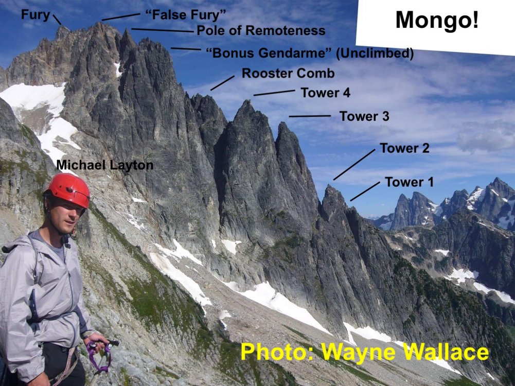
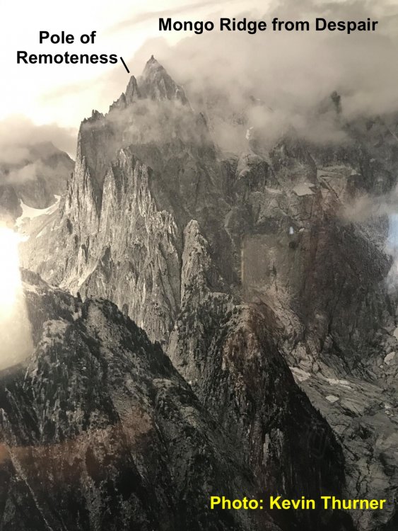
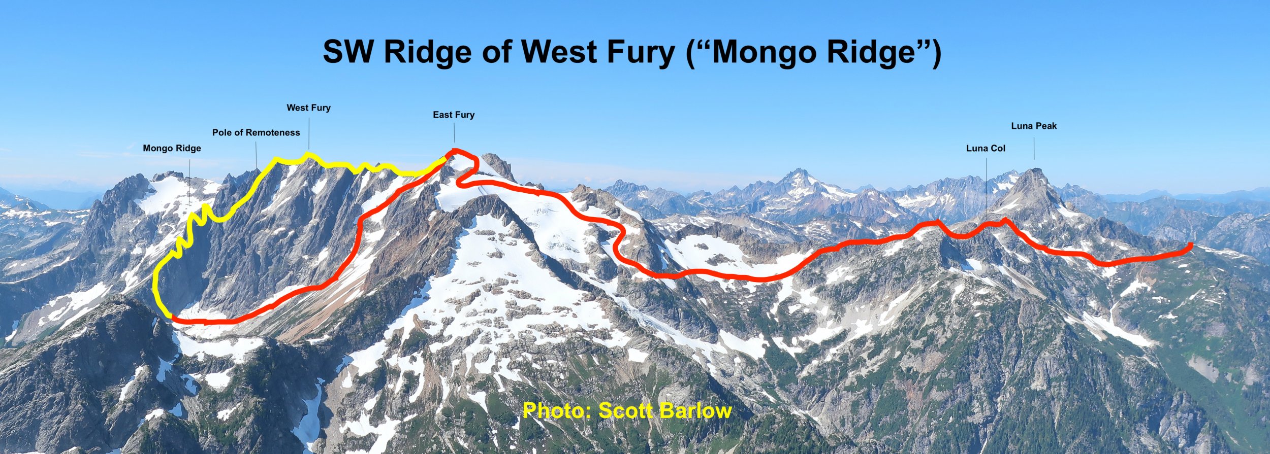

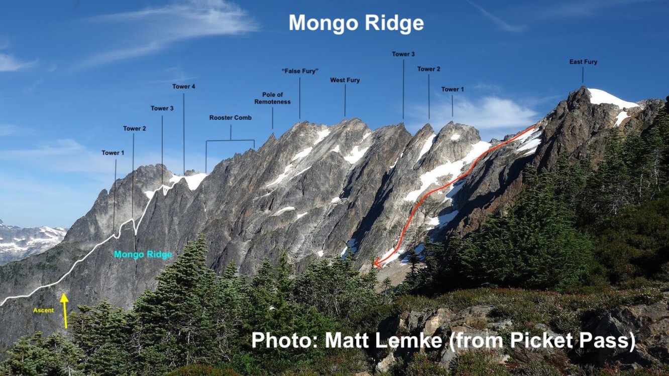
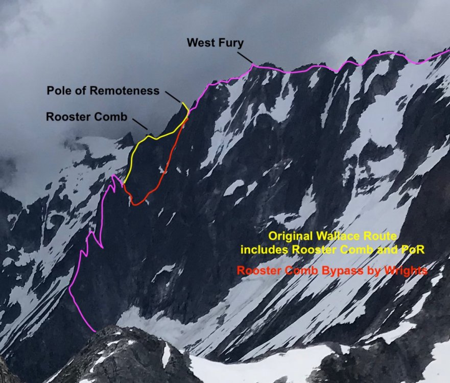
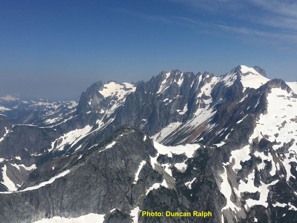
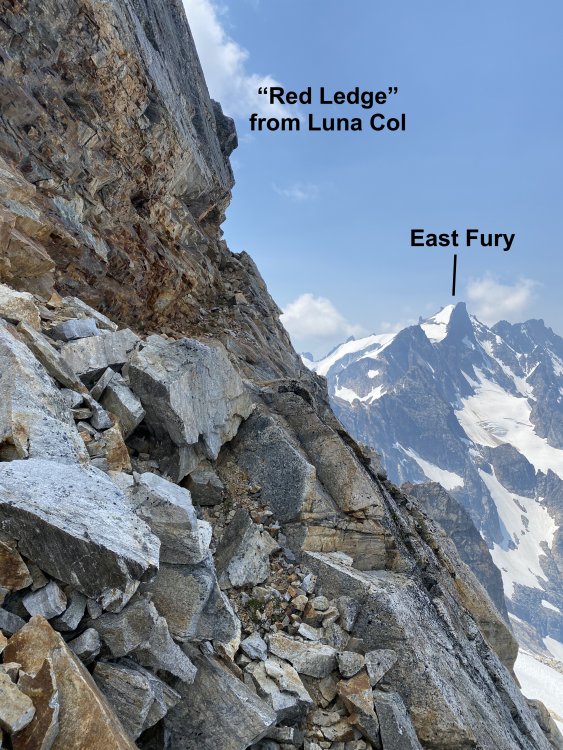

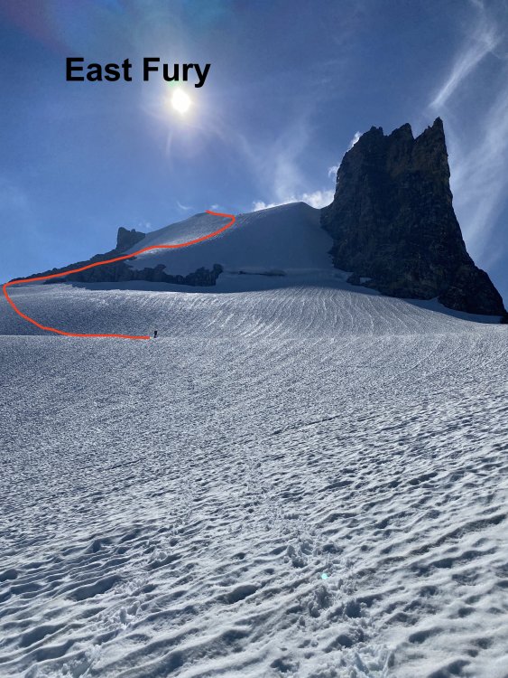

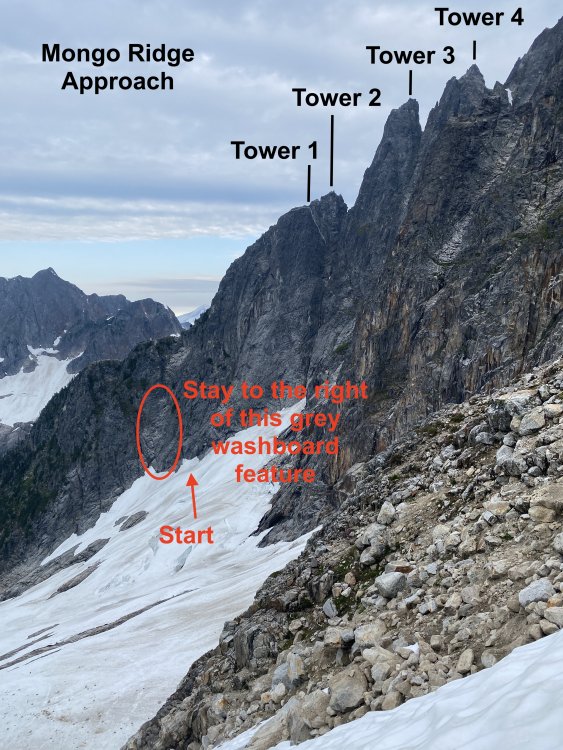

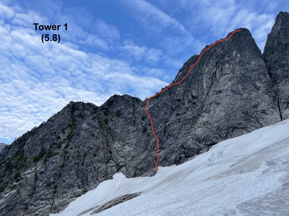
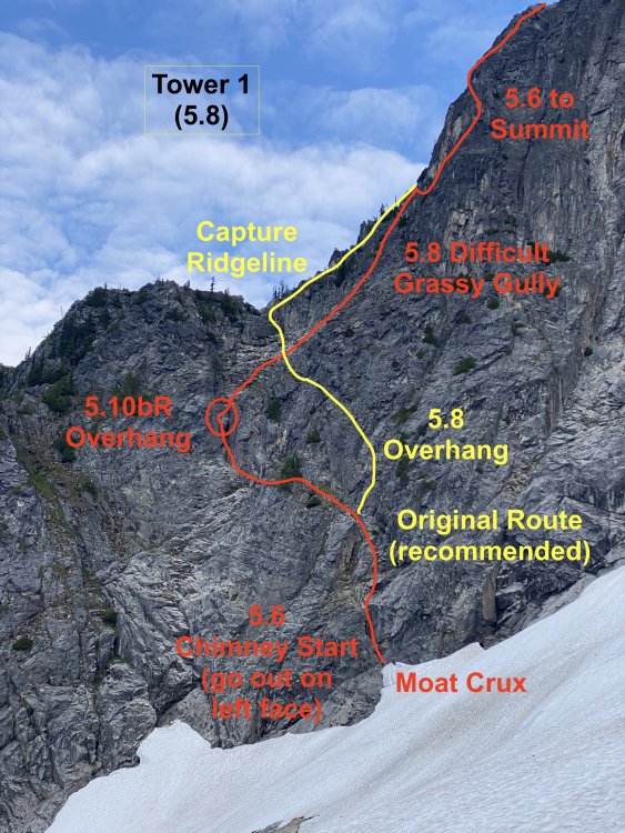
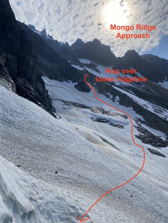

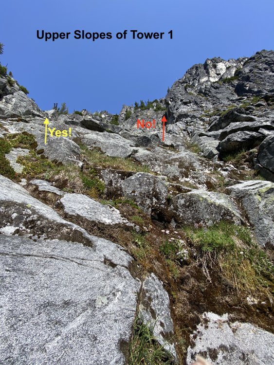
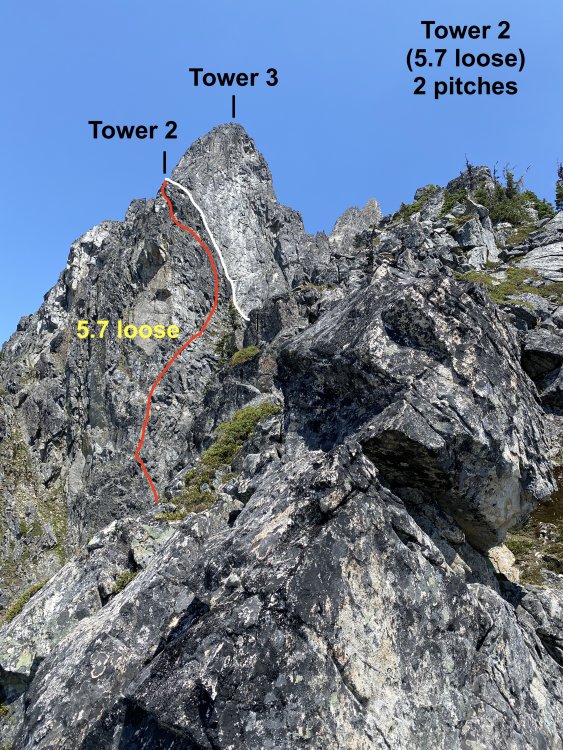
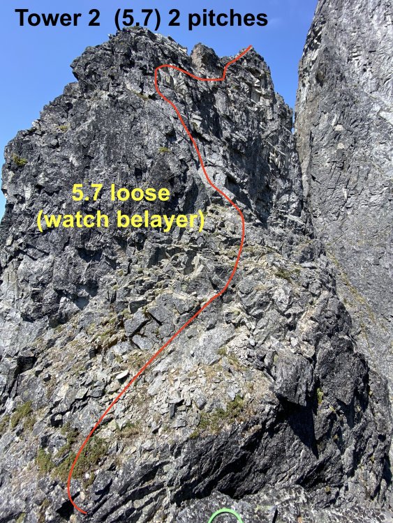
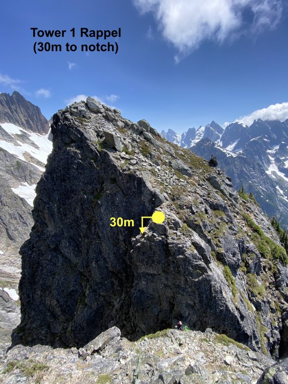
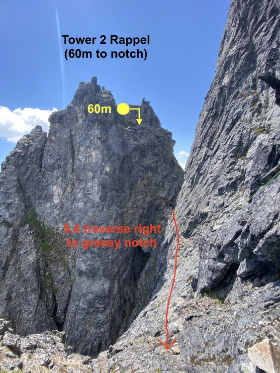
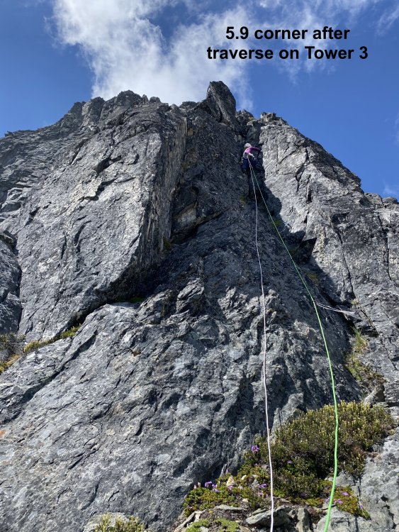
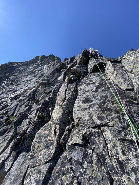
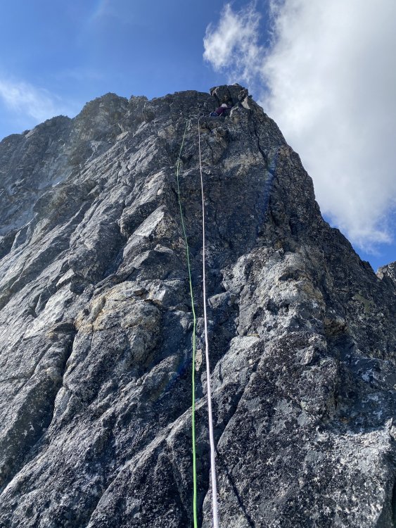
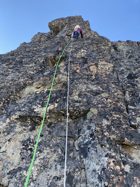


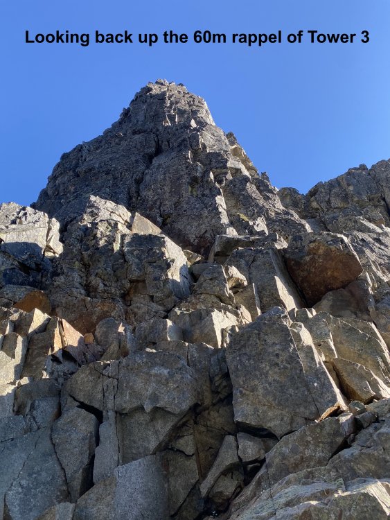
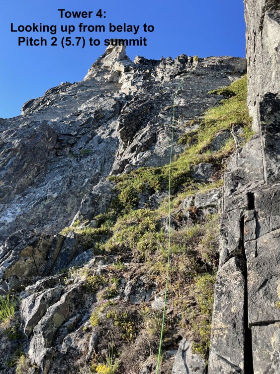
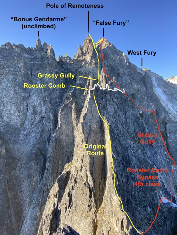
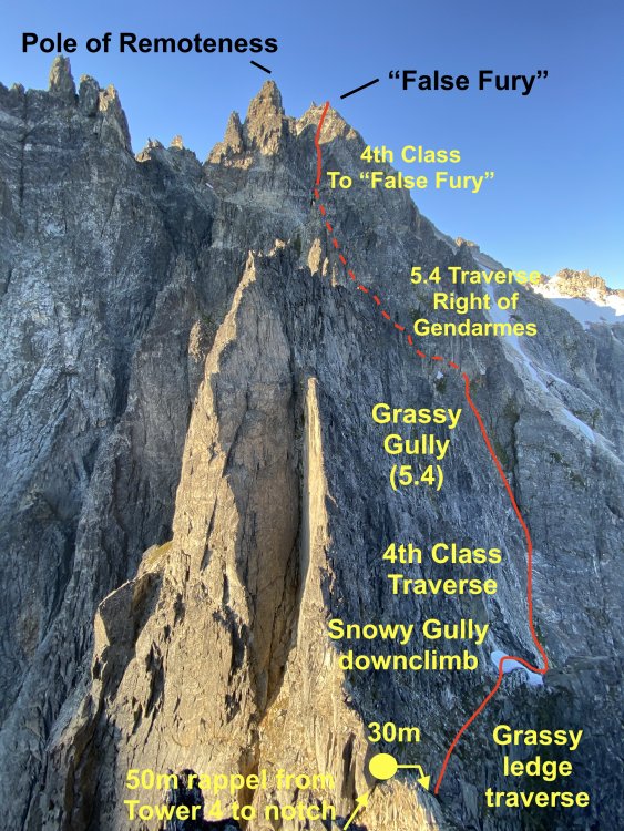
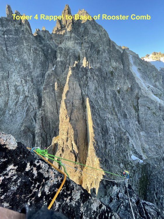
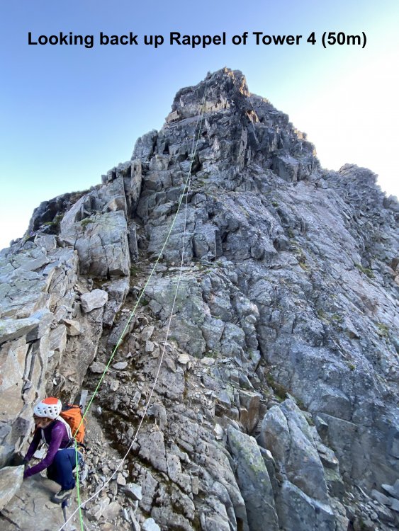
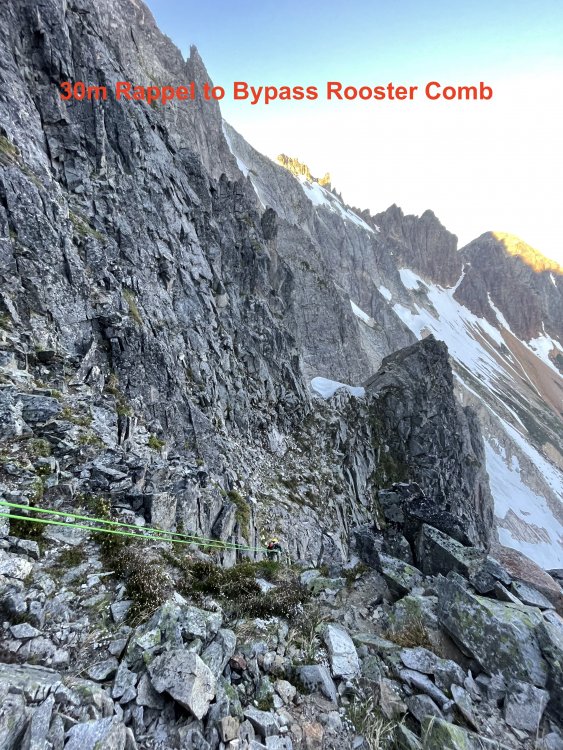
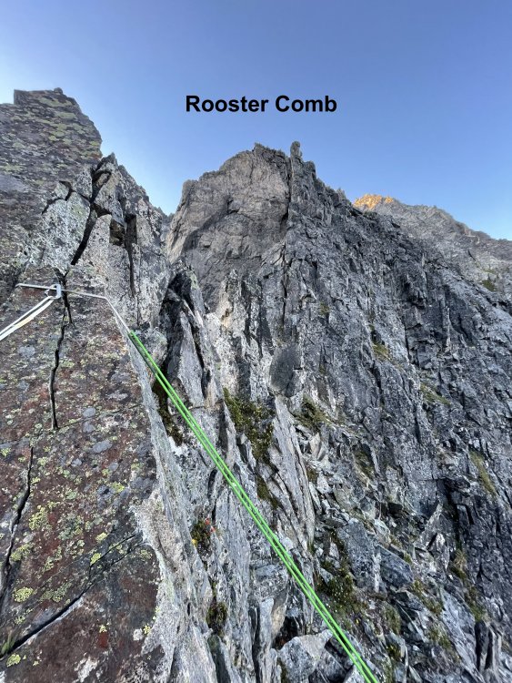
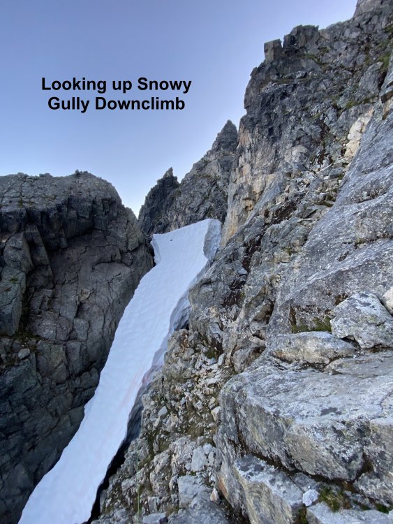
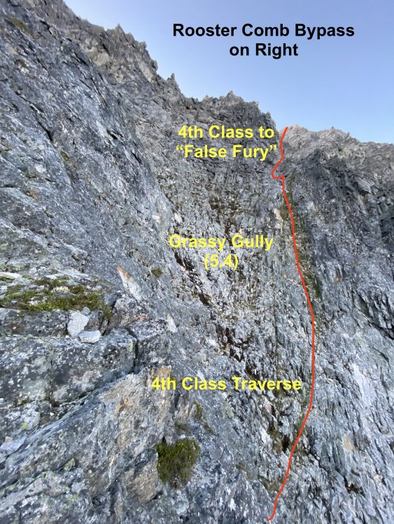

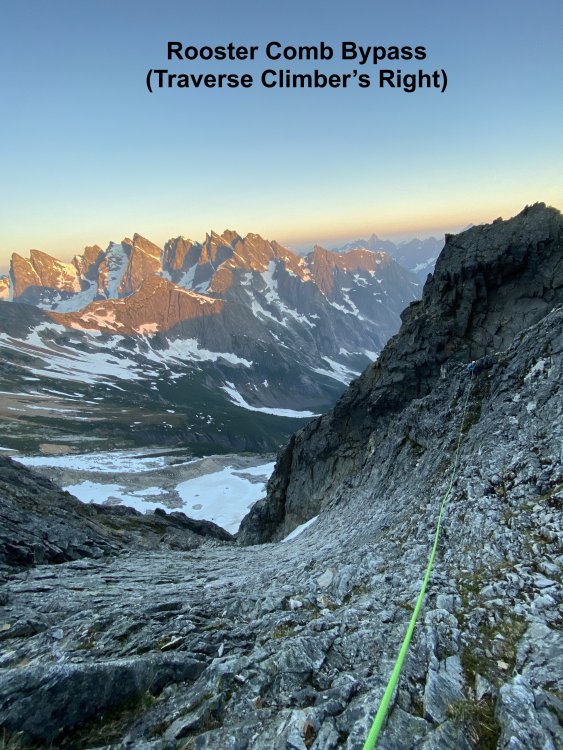

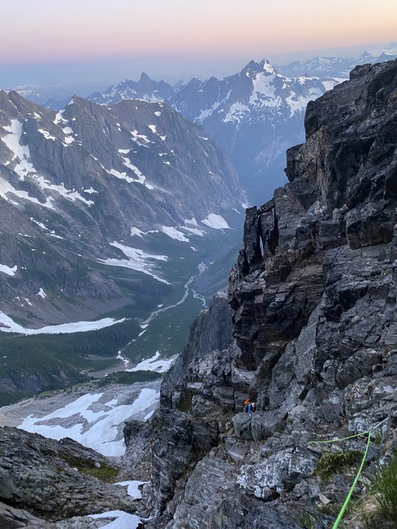
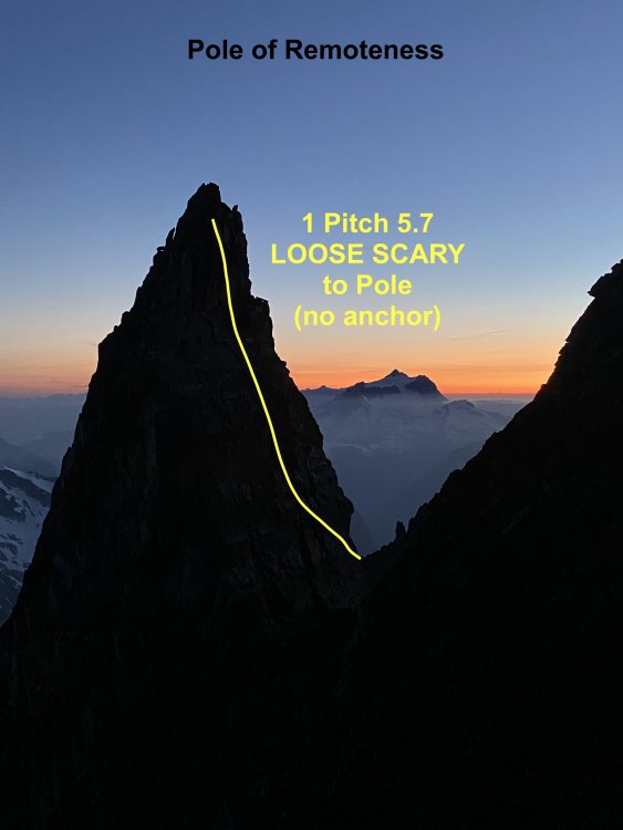
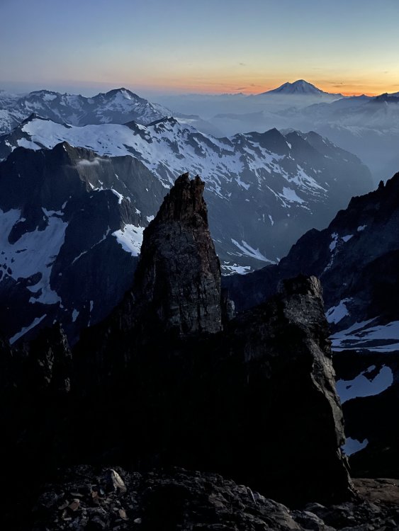

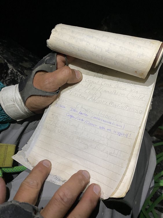

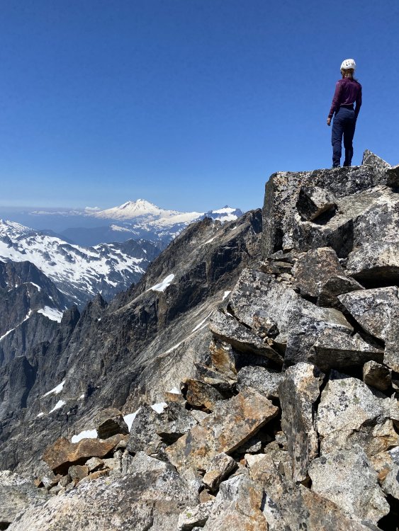
- 16 replies
-
- 12
-
-
-
-
- tripreport
- cctripreport
- (and 1 more)
-
 Trip: Dhaulagiri - Life and Death on the 7th tallest peak in the world - Normal Route Trip Date: 05/20/2018 Trip Report: Intro This write up is my personal experience of our attempt to climb the 7th tallest peak in the world, Dhaulagiri. I brought my iPad along on the trip with the intent to write down details daily or as often as I could when returning to base camp in order to remember the most amount of information about our experience on the mountain. This is a long read with lots of pictures and dozens of videos that took me months to put together. I hope whoever reads this vicariously experiences the reality of being there on the mountain with us from the safety of your home. Before this trip would end I would have a near death experience (day 45), deal with the death of a teammate, and experience cold, delays, and struggles on a level I've never experienced before. Around 23,000ft on Dhaulagiri getting close to camp 3 with Annapurna looming large in the distance. The Fundraiser I have and always will consider mountaineering a selfish endeavor. You spend lots of time training, preparing, missing important events with friends and family just so YOU can to get ready for an expedition to prove something to YOURSELF. I never really liked this part about mountaineering. When I go on an expedition to a major mountain, I like to make it more than just about "you and the climb." My friend, Alan Arnette the oldest American to summit K2 and who has raised hundreds of thousands of dollars for Alzheimer's research, has been a big inspiration to me. To me, if you can reach the summit of a big peak or at least try while raising money to help those in need, your endeavor is much more meaningful. Through my friends Lynn McGregor and Elliot Couch, I became aware of the Himalayan Cataract Project that has done amazing work on providing life changing eye care. I was intrigued by this idea, and knew I wanted to connect with this group immediately. For $25 an eye, you can literally help someone go from being totally blind to sighted with a simple cataract surgery. The link to this project can be found HERE. As of this writing, we have raised over $8080 for the Himalayan Cataract project on this trip alone providing life changing eye care to over 160 people! The Mountain Dhaulagiri, also known as "White Mountain”, is the the 7th tallest peak In the world rising 26,795ft (8167 meters) above sea level. It is known as one of the hardest and more dangerous of the only fourteen 8000 meter peaks in the world with incredibly steep rising flanks exposed to extreme weather and treacherous terrain. I would never recommend this as an intro 8000 meter peak. I only considered it as my second 8000 meter peak after Gasherbrum 2 because of the incredibly experienced and strong teammates I would have on this trip. The Team The beginning of our trip started off with 5 climbers and three trekkers. The climbers were Nicholas Rice (USA), Badia Bonilla Luna (Mexico), Mauricio Ahunada (Mexico), Christopher Manning (Canada) and Ryan Kushner (USA). Jeremy and Simon, friends of Nick's from Los Angeles, and Nick's mom Wendy Knowles were along for the trek to base camp. We would meet Lina Quesada (Spain), our team leader, in base camp. With Lina’s, Nick’s, Badia's and Mauricio’s climbs combined, they have over 26 summits of 8000 meter peaks. Badia is the ONLY WOMAN in all of the Americas with eight 8000 meter peak summits on her climbing resume. We would meet and join forces with other climbers eventually in base camp. Among them were big time climbers like Alex Gavan (Romania), Simone LaTerra (Italy), and Pawel Michalski (Poland), all of which have 4 or more 8000 meter peak summits on their resume. Every one of the other climbers, except for Chris and I, had summited at least four 8000 meter peaks in preparation for Dhaulagiri. For me, this felt like being a park and rec basketball player and then being asked to play with the Golden State Warriors. Days 1 and 2 travel from Denver to Kathmandu April 6th Traveling from Denver to Kathmandu went pretty smoothly. The 34 hour travel time to get there was long but went off without a hitch. My flights took me from Denver to New York to Doha to Kathmandu. I arrived at the same time as the Etihad flight with Nick, Jeremy, Simon and Wendy - thankfully with all our bags. We made a quick transition to Hotel Samara in Kathmandu where Chris had already arrived and where we would meet Damber Parujli, the head of Prestige Logistics, as well. Sunrise from the top of our hotel in Kathmandu. Photo by Christopher Manning. Day 3 packing and Re packing April 8th Pokhara is the town where all attempts for Dhaualgiri would start. It is only a 35 minute flight from Kathmandu, which sounded great to me after previously being on and off airplanes for almost 2 days. As it turns out, we were only allowed 90 lbs of gear to be brought to Dhaulagiri base camp by vehicle porters. We would attempt to come in from the town of Marpha hiking 6210 meter Thapa Peak on the way into Dhaulagiri Base Camp. To do this, we could only bring about 45 lbs of gear on the tiny airplane that would fly us to Pokhara. As usual, I brought too much food for the whole trip. I packed and repacked in Kathmandu as I did my best to get rid of food and certain clothing items that I wouldn't need until the end of the trip. I recommend doing this anyway, because it is really nice to have clean clothes and good food to look forward to at the end of an expedition when you get back into a big city. When we finally finished packing, Chris and I strolled the local streets of Kathmandu looking for the best deal we could get on fuel for our stoves for the mountain. Small mountaineering stores are everywhere, so if you forgot an important piece of gear it's pretty easy to get it in Kathmandu. Just be careful you don't get ripped off by poor knock offs of quality gear. Day 4 flight to Pokhara and Drive to Beni April 9th That morning we met our trekking guide, Sai, who was going to accompany us to Dhaulagrii base camp. Badia, Mauricio, Nick, Simon, Wendy, Chris, Jeremy and I arrived early for our flight at 11AM only to find it was delayed an additional 20 minutes. That might not sound like much, but domestic flights in Nepal are a little different in that they don't give you a time when the flight is delayed, instead they give you a time when the next update about your delayed flight will be. This had us concerned as we waited in the very chaotic domestic terminal for our 11:25 AM update when suddenly at 11:20, with no announcement at all, we began boarding our 35 minute flight on Buddha Air to Pokhara. After a short ground delay, we were off. I was really excited to sit on the right side of the plane knowing that the Himalayan giants such as Makalu, Everest and Lhotse, should be just off to our right and, as we flew closer to Pokahara, we also might be able to see Manaslu, Annapurna and Dhaulagiri as well. Unfortunately, as we approached our high altitude of 20,000 ft, there was nothing off to our right but a giant wall of clouds. After a bumpy landing and a quick change of vehicles, we jumped into a modified 4x4 jeep/van type vehicle and grabbed a quick lunch. The chaos of Kathmandu was quickly a forgotten memory as Pokhara, elevation 2,700ft, was a much more picturesque town with rolling green hills, beautiful lakes, and a lot less traffic and pollution. The restaurant where we ate was decent but what really caught our attention were the beautiful views. The restaurant was located on a lake with hang gliders enjoying themselves above the lake and young kids playing volley ball in the grass near the shoreline. The clouds above and around the lake still hid the giant peaks we came so far to see. After lunch, we left for the five hour drive to the town of Beni. As soon as we left the city limits of Pokhara, the ride became very bumpy as the road quality quickly deteriorated. We arrived in Beni late that night without issues. Our hotel situation was a little strange as nothing was set up by our logistic provider. We then had to go to three different hotels to see if there was enough room for our group. We eventually found a hostel late at night where we grabbed a quick night of sleep before having to get up early to start the long drive to Marpha. Day 5 drive to Marpha/problems start April 10th I was excited to finish our last long day of driving and begin our hike the following day. Our ride was supposed to meet us in Beni. Our trekking leader Sai said the van we had yesterday couldn't pick us up at the hotel, so we had to walk "just a couple blocks down the street." This seemed strange to me as we began walking before the sunrise, and the couple of blocks ended up being a 45 minute walk to the next town where we, along with our new porter friends, had no idea what was going on. Sai disappeared, and the porters began to start walking with all our gear. I followed the group of porters not knowing where they were going. None of the porters spoke any English, and, after 15 minutes walking further and further away from the rest of the group, I told the porters to stop. I had no idea where my group was, where Sai was, where I was, and where the porters were planning to take all our gear. About 20 minutes later, my group showed up. We still had no idea where Sai went. Luckily, Sai found us but did not seem very confident in being able to secure us a ride. After another 30 minutes of confusion, our ride finally showed up. The comfy small 4x4 jeep/van we had for our group the day before was swapped out for an old bus loaded with porters sitting all over each other as we rocked and rolled our way for the next 8 hours to Marpha, which is located at 8900ft. We were lower than Breckenridge, but I was finally happy to not be de-acclimating like I had been the last several days at elevations lower than Denver. Once there, we found a very simple hotel in Marpha. I was really impressed how far away from major civilization we were yet still had decent rooms, good food, beer, as well as intermittent wifi. Day 6 First Day of trekking Marpha to Yak Karak. .. .or so we thought/disaster day 1 April 11 We started off today with a huge smile ready to start our trek to Thapa peak and then to Dhaualgiri base camp. Our plan was to trek from Marpha to Yak Kharka (13,400ft) the first day, rest there on day 2, hike to Thapa Pass (17,000ft) the third day, hike to Thapa Peak Base camp (16,700ft) the fourth day, climb Thapa Peak the fifth day, descend back to That Peak base camp, and then hike to Dhaualgiri base camp the next day. Chris wasn't feeling well. Considering we had 2 days of rest/acclimation planned in Yak Kharka at 13,600ft after just one day of hiking, he decided to rest another day at the hotel and try to catch up with us the following day. We had porters bring our heavy gear. I went light carrying my first lite tent, a mattress pad, one down layer, a soft shell, 2 liters of water and snacks. Sai, Wendy, Badia and Mauricio got an early start. Jeremy, Nick, Simon, our trekking cook, and I followed later. The day started off all smiles as the trail rose steeply, and we began to see views of the start of the Annapurna range. Our group began to spread out as I caught up to Badia and Mauricio. Nick stayed behind with Jeremy, Simon, Wendy, Sai and a couple of porters. Badia, Mauricio, our cook for the trek, and I got to Yak Kharka first. The sunny and warm weather we started out in began to get cool and cloudy. Unfortunately, the tents and most of our warmer gear was behind us with the porters. I had my black diamond first lite tent, sleeping pad, and some warmer layers, so I set up camp at Yak Kharka and got comfortable inside my tent. Soon after, it began to lightly snow but started getting heavier and heavier. I was fine inside my small tent but began to worry about Badia, Mauricio, and the cook sitting out in the cold and even more so about Jeremy, Simon, Wendy and Nick. After an hour of waiting with no sign of anyone else coming, I told Badia and Mauricio to crawl inside my tent if they got too cold and that I was going to walk down to try and find the rest of the group. The snow got heavier as I walked down and found the others. They were soaked in a heavy set snow. I got soaked also but saw two of the six porters behind them. It turns out our trekking guide Sai had no idea where he was going and was hoping the cook or the porters knew the way. I had only descended 700ft below camp before I met up with them, so I told them how close they were and that I'd help them find it, but we needed tents and our warm clothes. I gave the rest of the group basic directions on where to go and walked down to the two porters behind them. I told them people are really cold at Yak Kharka and asked if I could grab tents and carry them up so we all have some shelter. The problem was these guys only had cooking gear and they told me the porters with tents and all our warm gear were hours behind. Had I not asked these porters where our tents were, everyone would have kept walking to Yak Kharka waiting for tents out in that cold with no warm gear or protection. My tent could only fit 2 maybe 3 max. I radioed Nick who was getting closer to Yak Kharka and told him the problem. We decided that everyone had to go down to a safe spot to wait for our porters with our tents and warm weather gear. A temporary cook tent was set up by the two porters at 12000ft, but I had to run back up to Yak Kharka to inform Badia, Mauricio, and our cook what was happening, since they didn't have a radio. When I reached Badia and Mauricio, they were borderline hypodermic. We found our way down to Nick and the tent which was a temporary shelter from the cold. Simon and I were now soaked to the bone and began to shiver. The cook tent was keeping us warm for the moment but with sunlight fading, the temperatures dropping, and no porters with our warm gear in sight, we knew we were in trouble. Nick and I made the team decision to make everyone descend back to Marpha. We had no other choice. It was now dark, cold, and snowy as we all began to go back downhill beyond frustrated at the situation. I also feared that if the porters stole our gear, I would be in trouble without some of my essential gear for Dhaulagiri. One of the cooks and I led the way down in a hurry to get warm and moving again. We also stopped at every goat house and little rock shelter we could find along the descent route hoping our gear had been stashed somewhere. After descending for about 30 minutes, I finally started to warm up. About 15 minutes after that, the cook and I were checking one of the goat houses when my eyes popped out of my head. In a little goat house around 11,3000ft, there was everyone's gear, food, tents, cooking equipment, and everything else we needed. I radioed to the rest of the group, and we all felt a huge sigh of relief. The problem was we had way too much stuff to bring down ourselves. With a lot of the group still cold, most decided to go down back to a hotel in Marpha. Nick, Jeremy, and I decided to pitch our tents on top of the goat house to watch our gear. Our trekking guide Sai said he would be back in the morning and most likely have porters to continue our trip the following day. Day 7 Goat house back to Marpha problems get worse. Disaster day 2 April 12 After a rough previous day we woke up to good views from the rooftop of the goat house. The goat house where we found our gear and camped on top of. The views from the top of the goat house toward the Annapurna range. Nick, Jeremy and myself were met by Sai again that morning. He told us to leave our stuff here and that the porter problem would be fixed. He would send someone up to watch our gear and stay with it for the day so we could regroup and come back up the following day. Nick, Jeremy and I descended back to Marpha to plan and rest for going back up the following day. With our gear already half way up, it would help the porters significantly to get it the short rest of the distance to Yak Kharka. At lunch, we met up with the rest of the group and started to going over our plans to go back up the next day. Hope returned as we realized we really only lost two days at most. Unfortunately, that afternoon our Sai received bad news and said the porters will not be going back up to Yak Kharka. Now all of our gear, which we could have gotten down that day, is still half way up to Yak Kharka. We now could not continue in this direction at all because we could not get new porters to Marpha. (Apparently, porters in this area are really hard to find on short notice. Most of them are on Everest working for bigger paychecks.) The route we had been planning to do while acclimating on the way and paying another $500 for the permit to climb Thapa peak for acclimation was no longer an option. We would now have to back track all the way to Beni, drive 2 more hours to Darbang trek for the normal route to Dhaulagiri base camp, and could lose anywhere from 4 to 7 days. This could very easily cost us a chance to summit as Nick, Chris, Baida, Mauricio and I fell further and further behind in our acclimation plan. Day 8 Drive from Marpha to Muktinath April 13 We needed new porters, and our logistics company was not being helpful at all. This was the same season as their big-paying Everest clients, so we were more of an afterthought. Back in Kathmandu our logistics leader, Damber Parajuli, could not give us a set date on when porters could arrive in Darbang to start the trek to Dhaulagiri by the normal route. He "hoped" they would arrive tomorrow. Hope was not what we were looking for and dropping down to a lower elevation to wait in Beni or Darbang below 4,000 would have us lose what little acclimation we had gained so far. We were frustrated enough already, and Nick told him in very stern terms to have the porters in Darbang in 4 days. We didn't have a lot of faith in the logistics leader by this time so we were giving him extra time to fix the problem. We decided to make the best of the situation. The drive to Beni and Darbang was one long rough day, but it was still only a day to get there so this gave us a little time. We decided to drive in the opposite direction of the original Dhaulagiri trek until we knew for sure we were going to have porters. After looking at the map of the area, we saw the town of Muktinath at 12,000ft on the map and realized you could hike from there up to Thorong La Pass at 17,770ft for acclimation that was part of the Annapurna circuit. We drove up to the little town of Muktinath at 12,000 to help with our acclimation as well as hike to Thorong La Pass at 17,000+ feet the following day. A local on a roof greets us in Muktinath. Photo by Christopher Manning. After dinner at a local restaurant we all went to bed and prepared for the first acclimation climb of our trip the following day. Day 9 Muktinath to Thongorla PassApril 14 We finally awoke to a good view and our fist site of Dhaulagiri shown in the video below. By the way my pronunciation of Muktinath in the video below is not accurate. After a quick breakfast we started walking out of the town of Muktinath to Thorong La Pass. This pass is actually part of the Annapurna circuit so it was a popular hiking route for trekkers. That morning there were hundreds of tourists as we left town and we were stopped by dozens of people who wanted to take pictures with us. Most of these people were from India. Apparently Muktinath is considered holy to both Hindu and Buddhism religions. The founder of Tibetan Buddhism spent significant time meditating there at some point. Regardless, we happily obliged to take pictures with the other tourists and continued on our way. After the troubles we had had the previous days, it was great to see so many smiling faces and a few of the locals. A few of the locals. Dhaulagiri is background left. Around 13,000ft the views of Dhaulagiri were out of this world. I am pretty sure we were near the spot where the main photo for Dhaulagiri on the Wikipedia page was taken. Dhaulagiri from our hike a little above Muktinath. My photo not the Wikipedia one. We slowly worked our way higher and higher as each of us slowed down more with the higher altitude. There were numerous trekkers coming down from Thorong La Pass. Most asked us if we were going to the top of the pass, and they seemed to think we were crazy for coming all the way from Muktinath. The views of Dhaulagiri disappeared, but near the top of the pass, the views were pretty nice of Thorong La Peak and a few of its surrounding neighbors. Badia, Mauricio, Nick, Jeremy, and I all reached the top at 17,770 ft. Jeremy absolutely crushed his previous altitude record of 14,120ft on Mt. Shasta. Wendy and Simon also broke their previous altitude record reaching above 15,000ft. Wendy had hiked all her life and had never been higher than 14,411ft on Mt. Rainier. The smile on her face as she cracked 15,000ft was priceless. Simon Weaver captures these 4 short but incredible time lapse clips below from around 15,000ft. Everyone was happy with how the day went and we descended at our own pace back to Muktinath to have dinner once again at the same restaurant and prep for the long drive from Muktinath to Darbang the following day. We got word from Damber that porters were said to be finally ready in Darbang on the 16th of April. Day 10 Drive to Darbang April 15 Based on our itinerary, I was scheduled to celebrate my 36th birthday at Thapa Peak base camp but instead spent it bouncing all over the place in an old jeep/bus on a 4x4 road for 12 hours traveling from (12,000 ft) in Muktinath back down to (3,500 ft) in Darbang. The silver lining to this day was that we finally could start our trek the following day. In addition, I got a quick glimpse of Annapurna on one of the stops during the drive. After arriving at our hostel in Darbang, I was thrilled to shower with a bucket of warm water. We met a trekker from Australia named Sam Martin in Darbang. He was thrilled to meet some other English speakers. He had recently finished graduate school and decided to take on a great adventure by hiking through the entire country of Nepal. We chatted and shared stories of our experiences so far. Chris brought me some birthday beers which were very much appreciated. I finally felt that things were starting to go right. Day 11 Start Trek from Darbang to Khamla April 16 Unfortunately due to all our problems, this would be the last night Jeremy would accompany the rest of us. He had work deadlines back in LA and would not have time to complete the base camp trek anymore. We took our first and last group photo of everyone on the trip so far. Group shot left to right, Jeremy, Nick, Wendy, Badia (front) Simon, myself, Chris and Mauricio Maybe one of the reasons I like big mountain climbing is because I do a lot better in the cold than I do in the heat. I am not sure if that’s from my college days in the "great mountaineering state of North Dakota" dealing with winters there, but I have never been a fan of the heat. Nepal's weather pattern seems to be super hot and humid during the day, rain with afternoon thunderstorms, then cool and clearing in the late evening and overnight. We tried to leave early to beat some of the heat. However, within minutes we were pouring sweat as the temperature and humidity skyrocketed. I think Nick measured the temperature at 91 degrees by 9am. We did our best to drink as much water as we could but it seemed impossible to stay hydrated. You could see some monster peaks off in the distance. I don't know what they were called nor was I able to get a good shot of the peaks off in the distance, but Christopher Manning sure did. Some big Peaks off in the distance at the start of the trek. Photo by Christopher Manning We stopped at a teahouse on the way and were greeted by some photogenic locals one of which we may have bribed with candy for a photo. Photo by Christopher Manning A little later the afternoon clouds and light rain were actually a welcome sight to at least slightly cool us off. We arrived in the small hillside village of Khmla at an altitude of only 4600ft, which was really more like just a few tea houses than a town. After a big dinner of eggs, soup, and French fries we all called it a night. Tea House photo taken with my crappy cell phone camera. Day 12 Trek Day 2 Khamla to Bagan April 17 We woke up to soaked tents because of the constant humidity. After drying off as much as we could, the heat this day was relentless again. Even as we slightly gained altitude, Nick's thermometer read 93 degrees with humidity once again off the charts. The mugginess of the lower altitude continued and seemed to block most of the good views. We really couldn't see any big peaks. We walked through a canyon that had some interesting terrain as the walking paths to and from the local villages are literally carved out of the side of the mountain as seen in the video below. We arrived at a tea house in Bagan elevation 6000ft as the rain and even some hail came down for hours. Photo of Bagan. Our Tea house is in middle far left of this picture. That evening some local women were walking around doing their daily chores with a couple of their kids. They had the big baskets on their heads. To our surprise, one of them was full of clothes and a baby inside the basket on top of the clothes. Chris tried to snap a photo of the baby lying in the rucksack, and the locals noticed him doing this. They began to laugh . . . hysterically. I am not sure what was said, but they posed for pictures the whole time unable to control their laughter. It was a simple and short time where no words were spoken but lots of laughter which overshadowed any language barrier. It was a simple but beautiful moment. Chris showing the locals his photos he took. Day 13 Trek Day 3 Bagan to Doban April 18 We woke up to tents once again soaked by the humidity over night. The heat again was relentless . . . Notice a pattern? Today we felt like we were in a jungle, but the scenery began to improve as we began to see more and more waterfalls. One of the local women was working in her little hut off the trail and began to make us tea during one of our breaks. Photo of a woman preparing food for her family who stopped to make us tea. After the quick little stop we slowly climbed up to the town of Doban at 8000ft where we once again just beat the rain. We had a quick dinner and called it a night. Day 14 Trek Day 4 Doban to Italian Base Camp April 19 We awoke to another incredibly damp morning once again, but this morning was finally cooler. It was the first time I wore full pants rather than shorts for about an hour into our trek until the temperatures warmed up. As we began to gain more and more altitude, the scenery changed from jungle to forest with big mossy trees that reminded me a lot of Muir Woods in California. As we got higher the trees became less dense, and we began to see the giant monstrous peaks surround us. We arrived at Italian Base Camp at approximately 11,800 feet where the views improved significantly. It felt like we were finally getting near the mountain we came so far to try and climb. Left to right Myself, Chris and Nick "the gringos" at Italian Base Camp. Day 15 Finally reach Base Camp! April 20th It was a long trek from Italian Base Camp to Dhaulagiri Base Camp. We left the last of the green scenery of plants and trees that we would see again for some time. As we followed a stream, we took a hard left and we were now on a glacier that reminded me a lot of the Baltoro Glacier in Pakistan. The large mountains began to reveal themselves as we could begin to see one of the flanks of Dhaulagiri and other mountains nearby. To look up in the video below and see how much further we had to go from 13,700ft was really intimidating. After about 5 hours, I recorded my initial arrival in base camp below with a view of the start of the route. Shortly after I arrived, I met the Base Camp logistics manager and greeted him with a friendly "hello" in an excited voice happy to be there. I was greeted instead with, "Where is the other cook? Did you bring a bus boy?" I didn't know the answers to either question. One of the porters did cook, but I had no idea if he was the expedition cook they were looking for. Nick, Badia and Maricio all arrived shortly after and were greeted with pretty much the same welcome. We went into the base camp dining tent not sure what to do next. The weather was fine and we wanted to set up our base camp tents, but we weren't getting much of a response from the base camp manager. Wendy and Simon showed up a few hours later as the snow now began to fall. Although tired, Wendy had this huge smile on her face now that she arrived at base camp at 15,100ft beating her old altitude record by 100ft set only a few days ago. She had once again broken her altitude record this time just by reaching base camp. After about 3 hours of waiting, we finally asked for the umpteenth time about our base camp tents to which the base camp manager Aziz grabbed two of his assistants and began to help us put up our tents. Not quite the reception we were hoping after such a rough start to the trip. Badia, Mauricio, Nick, and I all looked at each other at the same time and began to reminisce how much we all missed the incredible logistics lead by Manzoor Ahmad of Karakorum Tours in Pakistan. Manzoor had been our logistics provider for all of us previously in Pakistan on multiple different expeditions and was absolutely incredible with logistics, food, and base camp comforts. If you ever go to Pakistan for trekking or for an expedition we all highly recommend using his service when you are there. Regardless, the situation we were currently in is not how any of us wanted to start off our Dhaulagiri expedition especially after all the problems so far. After a small dinner we went to bed and called it a night. We were looking forward to two days rest after five days of trekking and to turn our focus away from our problems getting there and focussing our attention towards working our way up the mountain. Day 16 Rest Day at Base Camp April 21 The first day we spent organizing all of our gear. I had three duffel bags worth of half clothes and half food to organize. My tent was set up the previous evening when the light was fading. As I woke up in the morning, I found that my tent had at least five holes the size of golf balls to bigger in various parts of both doors as well as two broken zippers. I was really only protected by wind from the vestibule which still worked. With two broken main doors, temps inside the tent at night were similar to sleeping outside. Wendy and Simon were tired from the trek so they decided to rest a day at base camp before heading down. Wendy still had the permanent smile on her face having reached base camp of the 7th tallest peak in the world with her son. You could tell she was really enjoying herself. We met the small group of three the European English speaking team of Alex Gavan from Romania, Pawel Michalski from Poland, and Simone La Terra from Italy. All incredibly nice and humble guys who did their best to make us feel welcome and were happy to have more English speakers in base camp. I had met Alex before on Gasherbrum 2 in 2016 and knew him as a strong climber who was very talkative with a huge laugh. It was great to see him as we shared stories, struggles and laughs of our 2016 G2 expedition. Simone kindly offered Nick and I some incredible Italian sausage and cheese. Mauracio, Badia, Nick and Christopher and I sat around and chatted over our plans for the next few days. As temps dropped in the dining tent, we all crawled into our own personal tents around 9pm and called it an evening. Day 17 Rest Ray at Base Camp April 22nd Wendy and Simon along with a porter began their long trek out. We all said our goodbyes and wished them well. I know Nick was incredibly proud of his mom and friend for making the trek to base camp. The Dhaulagiri trek is arguably one of the hardest treks to any of the 8000 meter peaks, so having them make it was awesome. Our sub climber team of five was part of a larger group of 15 climbers from countries around the world. There was our group of 5, the 3 European English speaking team, and 7 others all from Chili and Spain who were climbing together. Most of the Spanish and Chilean climbers were either up on the mountain doing their first rotation to a lower camp or climbing Thapa Peak for acclimation when we reached base camp. We met a few of the Spaniards that night as they came down, and we pumped them for information about the route . . Or should I say Nick, who is fluent in Spanish asked them information about the route. The largest team on the mountain was the Seven Summits group right next to us in base camp with about 30 climbers. Their most famous client by far is Carlos Soria who at 79 years old is trying to become the oldest person to finish all fourteen 8000 meter peaks, having only Shishmapangma and Dhaulagiri left to complete the list. As successful as he has been in the past on big peaks, this was his 8th attempt at trying to summit Dhaulagiri. Their base camp accommodations and food made all of us jealous. We began packing that evening discussing what to bring and all excited to finally step foot on Dhaulagiri the following day. We packed and repacked trying to keep our pack weight under 40lbs. After all was said and done, both Nick’s and my pack weighed 46 lbs while Christopher's was about 38. I wasn't able to thank Simone for the gift of Italian sausage and cheese the day before so I did this afternoon. He kindly replied "you are welcome my friend I have plenty come by anytime." . . . . . . . . A quick conversation I would play over and over in my mind later. He left to go up the mountain the following day for a rotation to camp 3. Day 18 Base camp to camp 1 April 23rd We awoke early excited to take our first steps on Dhaulagiri. From base camp it was a 22 minute walk across the glacier to the start of the route which gets serious instantly. You gain very steep altitude right away. You begin climbing up a steep slope of snow, rock and ice averaging between 70 and 80 degrees with even some low class five moves mixed in. Luckily, there were fixed ropes which we were happy to use for safety purposes. Climbing this kind of terrain at altitude with a 46 lb pack was a tough and demoralizing way to start. I would later nickname this first section "The Demoralizer." I thought to myself "wow this mountain gets seriously tough right out of the gate." Me climbing up the "Demoralizer" photo by Nicholas Rice Almost to the top of "The Demoralizer" you can see how steep it is again looking down behind me. The steep climb gives way to a traverse on the left side of the the Dhaulagiri Eiger. Photo by Christopher Manning as we hug the far right side of the icefall. You gain altitude a little slower before entering crossing a very crevassed area before a somewhat flat Plateau. We will get back to this area later . . . . . . After going through this crevassed area the route flattens out. Photo of the flat section that would change drastically later in the trip and almost end my life twice. . . . Photo by Christopher Manning At the end of the flat plateau where this picture was taken the route once again gets steep as you ascend fixed ropes and climb over a few crevasses. Photo above showing the end of the flat plateau before it gets steep again. Camp 1 is roughly at the lower portion of the saddle in the photo above right where the shade and sun meet. As we got higher, we negotiated a few more crevasses some of them were not very wide but deep enough to see my condo back home in Colorado. The temperatures began to rise as the sun reflected off the glacier and snow creating a giant solar oven that made our climb hotter and hotter as the heat began to zap our energy. After about 6 hours, I arrived at camp 1 at 18,600ft and started digging out platforms for our tents. Nick arrived shortly after followed by Badia and Mauricio. Chris was having stomach issues and really struggled on the heat of the glacier. He arrived about two hours later and was happy to crawl into the tent to eat and rehydrate with some water we had ready for him. We could tell we were not as acclimated as we had hoped to be, as we all had headaches that afternoon and evening. Luckily after a few ibuprofen, we all slept pretty well that evening. We packed and prepared to go up to and touch camp 2 before coming down. I was really excited because tomorrow I knew I would finally get a really good view of Annapurna. Day 19 camp 1 to camp 2 and back/Injury April 24th Temperatures on big peaks swing widely. When I arrived at Camp 1 the day before, I was wearing just a base layer. That evening temperatures plummeted and I woke up to temperatures in the single digits inside my tent. Chris wasn't feeling well and decided to descend to base camp. Despite some headaches from the night before, Nick and I woke up feeling strong for our move to Camp 2. I was ready first and slowly started making my way upward in the freezing cold. After 20 minutes, the sun hit me and the temperature soared to where I was wearing just a base layer again. After about two hours I crested a rise and there it was . . . the world’s most dangerous and intimidating 8000 meter peak looking beautiful across the valley. A Sherpa was taking a rest break and I asked him to grab a quick photo. Photo of me taken by Sherpa from the Seven Summits Team at 20,000ft with Annapurna in the background. I began to work my way up further until I reached roughly 20,367ft more or less the height of Denali, the highest peak in North America. I took a quick video that takes a few seconds to adjust but really captured some of the beautiful views of the area. Soon I began to really feel the altitude and my lack of acclimation as I struggled the last 1000ft up to Camp 2. Clouds that were lower in the valley began to push and rise into Dhaulagiri. We could tell some weather was coming in. I quickly touched camp 2 where I spent less than 3 minutes taking a quick video before heading down because of some impending weather. Camp 2 is on a very steep narrow slope at the top of a serac at 21,300ft. The video below really puts in perspective. You need to be every careful where you put your tent because this area is prone to avalanches. You could see the weather behind us getting ready to unleash an afternoon snowstorm. Nick reached Camp 2 shortly after I did followed again by Badia and Mauricio. The weather looked almost apocalyptic as clouds ran into Dhaulagiri and pushed themselves up into the sky while not bringing any type of weather in our direction for the moment. Apocalyptic looking cloud I quickly headed down. As I got near camp 1, the spooky clouds decided to turn on us bringing a little bit of snow. Then it turned into almost a total whiteout as I was about half way down to Camp 1. Luckily, I was able to see a faint outline of the route. I tracked the route on my phone with Strava which I followed partially back to camp 1 during brief periods of total white out. Nick was also tracking the route, so I knew he'd be okay. However, I became worried back at camp when he hadn't arrived for over two hours. He eventually reached camp after having taken a partial crevasse fall where he was able to catch himself but twisted his left leg badly in the process. What took him 45 minutes to climb up took him almost 3 hours to descend as he used his trekking poles as crutches to help himself get back to camp. I could tell by the look on his face he was in a lot of pain. Badia and Mauricio arrived a little later having trouble finding their way down in the white out as well. I boiled some hot water for Nick and gave Badia and Mauricio some of my hot tea. We all called it an early night as the snow continued to fall. Day 20 Descend to Base Camp April 25th We woke up to over a foot of new snow that morning. After climbing high the day before and sleeping lower, we slept great that night getting close to 10 hours of sleep. All of us slept well except for Nick who apparently slept through the night with incredible pain. He was afraid to move his leg, and we knew we were going to have to help get him down. He was in good spirits as Badia and Mauricio helped encourage, pushed and pulled him down down to Base Camp as I plowed trail, dug up ropes and was the leader of the game called "find the crevasse under fresh snow." Chris had gone down the day before and what took him 2 hours to descend took the four of us 6 hours. We were all in no hurry because, thanks to Chris Tomer's forecast of impending bad weather, we knew we were going to have at least four days of going nowhere in base camp. Nick was in great spirits despite the accident. Who smiles while going down one of the most dangerous peaks in the world with a busted leg . . . . Nicholas Rice does We were greeted by the Spanish climbers as we arrived back in Base Camp where everyone was worried about Nick’s injury. Alex Gavan came over and chatted with us and gave his condolences to Nick for his injury. Nick seemed optimistic that things weren't broken. He knew how to work through injury and actually climbed 23,406ft Pik Lenin with a broken bone in his foot. With bad weather coming for the next several days, we knew Nick would get a little bit of rest from his injury. We were shocked to hear other climbers were still high on the mountain with heavy snow and high winds over the next few days. Day 21 Rest Day in Base Camp/assess Nick's injury April 26th Luckily one of the Spanish climbers, Nicko, was a doctor who assessed Nicks injury as a severe knee sprain with some possible small ligament tear and would need about 4 days of rest. As bad as this sounded, Nicks injury for now meant his trip was not over and this rest period would fit perfectly with our rest schedule in base camp. Our team was now huge. A mix of 15 plus climbers from around the world were on our team. Each and every other climber now on our team had a minimum of three 8000 meter peak summits on their resume . . . . Everyone except Chris and I. Chris had his one successful summit of Manaslu, and I had my one successful summit of Gasherbum 2. With the English speaking European team in their own smaller dining tent and the rest of the Spanish and Chilean climbers now in our larger tent, we were now one loud Spanish-speaking group of 12. The Sub Spanish/Chilean team was made up of five. Eva Zarzuela(Spain)and Jonatan Villa(Spain) were co leaders of this sub group along with climbers Juan Prieto (Chile), Jean Heekeren (Chile) and Nicko Reyes (Chile) who was their expedition doctor. Nicko was great to have around as he was able to diagnose Nicks leg as either a really bad sprain or a partial tear of some ligaments. An injury like that would send most people home, but Nick was tough. He knew, although maybe not as strong, he could continue the expedition. His plethora of medicine and medical advice was greatly appreciated. At dinner, Chris and I struggled to make out what little Spanish we could understand. The jokes and laughter amongst everyone else made us feel left out, as for the first time in a long time I was not able to join in and have fun conversations in a group with others. The famous Spanish Climber, Carols Soria from the Seven Summits Team, knew Badia and Mauricio from previous expeditions, and he drew a crowd when he came by our dining tent. Although we didn't speak long after being introduced and were both limited with each other's first language, he seemed kind and willing to chat and share some information with our group. Since we were very confident with our weather forecasts from Chris Tomer, we would share this information with them and other members from their team throughout the expedition. I can't say enough good things about Badio and Mauricio. They could sense Chris and I were becoming uncomfortable because of the language barrier and did their best to include us in conversation since they were fluent in both languages. Badia and Mauricio are an amazing couple who have summited eight 8000 meter peaks together over the last 18 years. As I mention previously, Badia is the ONLY WOMAN in all of the Americas with eight 8000 meter peak summits on her climbing resume. Even though I was much less experienced than them, they gave me confidence and great advice for this incredibly daunting mountain. Day 22 Rest day at base camp/important phone call April 27th Not a lot happened on this day except two important things. I was finally able to do laundry which I desperately needed to do, and Nick, thankful for our help the other day helping him get down to base camp, let me use his Sat phone with only limited minutes for the whole trip. Being gone on this trip seemed to me to be so much harder than my last 8000 meter peak for several reason. I was still feeling a little down and a little more like one of the outcasts in the group, mostly because of my lack of Spanish, but making a phone call home to my girlfriend Jenn really helped. It was great to hear her voice, talk about her move into her new house, and hear how our two dogs were doing. Everything about talking to her and being reminded of home and the people who care about you really made my day. Day 23rd Rest day at Base Camp April 28th Chris had decided he had enough of waiting and was feeling better. Hearing that English speaking European group was going up, Chris decided to join them. Alex and Pawel's partner, Simone, had gone up the day before, and Chris was anxious to try to catch up with him. Chris knew he was a little behind so a few extra days up high in good weather sounded good to him. With Chris going up early, Badia, Mauricio, Nick and I discussed our plan to go up on the 30th as there was a stretch of good weather in the forecast. Our plan was to climb to camp 1 spend a night, climb to camp 2 spend a night, climb to camp 3 and come down to camp 2 to spend another night, then come all the way down to base camp from camp 2 that following morning before the next round of bad weather comes. That afternoon I saw one of the largest avalanches I have ever seen. To put in perspective of how big it was, I only saw half of it and it was still the largest avalanche I've ever seen. A fog layer around 17000ft obscured the view of anything higher. We heard the noise and all ran out of the dining tent after hearing it. A split second after Chris said that it was too hazy to see it, a monster avalanche plummeted below the cloud layer with a roar I had never heard before. It was maybe a quarter mile wide and half a mile from us. The ground shook as it hit the glacier and moved our way losing steam over the flat glacier but still pushing a huge wave of snow into the air. It slowed, and the wave of air and snow it pushed forward hit us later after about 5 minutes dropping the temperature instantly about 20 degrees and bringing with it a light dusting of snow over camp. It was incredibly humbling to say the least. Unfortunately, we did not get a good video of this one. Day 24 Death on the Mountain April 29th Chris was feeling better and eager to get back up high. He left real early this morning with Alex and Pawel while the rest of the Spanish team struggled to get ready. Nick and I were awake early due to the noise as they excitedly packed to head up the mountain when we got the news. Our base camp manager Aziz came up to Nick's tent around 6 AM, and I couldn't hear exactly what was said but I knew it was not good. . . . . . Simone our Italian friend was missing and that's all he knew at the time. We walked up to the big Seven Summits team to get more information since they were the ones who originally told our base camp manager. Simone was high on the mountain during the bad weather period which we chose to wait out. We found out Simone did not quite make it to Camp 3 around 7000 meters (23000ft) where he pitched a tent on the very narrow and exposed ridge along part of the route. Another Polish climber Walde from the Seven Summits Team tried to pitch a camp in the real Camp 3 a couple hundred feet higher but was unable to find a good spot because of the increasingly bad weather. He descended and asked Simone if he could share with him to which Simone agreed. Just after this quick conversation, Simone had climbed inside his tent alone, which was not anchored down yet, for less than a minute when a big gust of wind came caught his tent like a sail and blew him right off the mountain. Walde watched in horror as he screamed "NO NO NO NO" while trying to grasp for the tent sliding away only to watch it be blown off the ridge falling thousands of feet. After this, Walde would descend to camp 2. Because of the weather that evening, the search for Simone by helicopter would have to continue the following day. Simone LaTerra from Italy, a part of our team, had died. Dealing with death is something I've never come across on a mountain. Two climbers died back in 2014 when I was on Aconcagua but I never new, met, or saw them. I didn't know Simone well but in the few moments I shared with him, he seemed kind and genuine extending kindness to someone he hardly knew who was still very new, a noob you might say, to 8000 meter peak climbing. Nick had known him since 2007 making this a lot more personal for him. Sadly, this wasn't the first time Nick had to deal with a mountain tragedy, especially being involved in the K2 2008 disaster, so he was unfortunately more accustomed to it. Climbers from all over base camp discussed back and forth what to do, send a helicopter to search for his body, can a helicopter come with the typical afternoon bad weather, who tells his family, when does someone tell his family and so on. Everyone around me talked in Spanish or Nepalese and discussed what to do. I sat there in stunned silence all morning for the first time somewhat relieved that I didn't speak the languages being heard around me. Simone is survived by his wife and two parents back home in Italy. Rest in Peace Simone La Terra After a discussion at dinner due to what we had found out this day and the continued unexpected snow that afternoon, Badia, Mauricio, Nick and I decided to wait another day or two before continuing up the mountain. It didn't feel right to go up the following day. Day 25 A Day of Respect/body recovery April 30th We woke up early to a buzz of helicopter activity as the search was in full swing to find Simone's body before the weather turned. They found his sleeping bag first which was retrieved by his friend and climbing partner, Alex Gavan from Romania. They had hoped to find him inside the sleeping bag but it was empty. A short time later the body was found but in a very dangerous place at 5900 meters (19,350ft). This meant he had fallen over 3,600ft (1,100 meters) from where he was originally blown off the mountain. Alex, who was up with Pawel and Chris near camp one when they found out the terrible news, had flown back to base camp in the helicopter to help with gear and to figure out a plan to try to recover Simone's body. Alex was talking to Simone's wife, a phone call I never hope I have to make, who asked him one more time to try to retrieve the body. Alex was unsure it could be done because I could hear him say over the satellite phone "it's in such a dangerous place I was freaking out." Alex bravely flew back again to try one more time to retrieve Simone's body. A short time later he recovered the body as the helicopter brought it back to base camp bloody, frozen, twisted and crushed. I couldn't believe what I was seeing and could only hope his death was quick and painless. The helicopter went back and picked up Alex, who once back in base camp jumped off the helicopter for the last time. With the help of some local porters and sherpa from the Seven Summits team, Simone was loaded into a helicopter and flown away. Seeing the body back at base camp after it had fallen 3,600ft was absolutely awful. But that didn't haunt me as much as the call Alex had to make to Simone's wife to let her know. Seeing that conversation as it happened still bothers me to think about to this day. As the helicopter took off for Kathmandu Alex crumpled in a heap with the full weight of what had happened finally hitting him. Nick put his arm around him and all I could do was put my hand on his shoulder for comfort as Alex let it all out. Alex and Simone's climbing partner Pawel who had come down from camp 1 walked up to him as they both sat by each other's side for some time. Pawel and Alex having an emotion reunion Shortly after the helicopter took off with Simone heading back for Kathmandu for cremation so he could be returned to his wife in Italy. We passed most of the rest of the day in silence waiting as snow started to fall heavier and heavier that afternoon. By dinner time we knew that once again we would not be going back up the following day. Day 26th Another rest day May 1st Our suspicions about not going up on this day were confirmed when shortly after breakfast monster avalanches began coming down from several locations on nearby peaks. After much discussion at breakfast and comparing multiple weather forecasts saying there would be very little snow that evening, we now were officially planning to go up the following day. The forecast wasn't ideal with the following day predicting heavy snow in the evening two days from now and then clearing. Our plan was to get up to camp two before it hit trying to spend a night or two there as we wait out the one day of bad weather, maybe touch camp 3, and come all the way down before another storm hits. We were already packed from the day before so now we just had to wait for this day to end, hope we didn't get our everyday afternoon snowfall, and then head back up early the following morning. For Pawel and Alex it was their last night in base camp and they chose to invite only Nick and I to their last dinner on the mountain. After the death of Simone, they chose to go home. I can't blame them for not wanting to be there anymore. I can't say the thought didn't cross my mind either. Day 27 move to Camp 1 May 2nd I was happy to get out of base camp. I wanted to get away from all that had happened there the last few days and keep moving. My pack to camp one was once again 46 lbs. Though we moved to camp one an hour earlier than our previous attempt, ”The Demoralizer" was no easier, and we still spent the last two hours suffering in the heat. I took a little video in the flat section to give an idea of how immense the area is. My pace instantly slowed to less then half once the heat hit me around 17,000ft. I struggled the last 1600 ft up to camp stopping approximately every 100 steps but still beat my first trip up to camp one by 45 minutes. Was the acclimation working? Either way, it was nice to be back high, and we were excited to get up early and head to camp 2 the following day. The photo above shows the giant upper portion of Dhaulagiri as Mauricio began to get ready for the night. As soon as that sun dropped behind the mountain, temperatures plummeted. Day 28 trapped in camp 1 May 3rd We knew it was going to snow later on in the day. However, we were expecting it to come after noon, so we were hoping to get up early enough and hit camp 2 before the heavier snow began. We got up at 5am with expectations of hitting the trail up to camp 2 by 6am. As we were getting ready, it began to snow a little. By 5:30 am, it was snowing harder . . .and harder and we all soon knew without speaking that we weren't going anywhere today. Since I thought this would be a quick trip where we would be moving each day, I didn't bring my nook or iPod for entertainment. I spent the rest of the day staring at the tent walls listening to the snow hit the tent. I only left the tent to go outside and shovel the snow off my tent as it accumulated deeper and deeper. We probably got around a foot of new snow with the high winds driving the snow. We knew that there was no way that we could to move to camp 2 the next day. Also with the snow deeper higher on the mountain, we knew that when the sun hit the mountain the next day, there would be a high risk of huge avalanches, so our only option was to descend to base camp early the next morning to avoid these avalanches. Day 29 Descend to base camp May 4th We all were out of the tent and moving around 6am. I led the way plowing a trail in the new snow which was difficult even on descent. I was digging up fixed ropes where I thought I remembered them and being extra cautious avoiding the areas I knew where crevasses were located but were now hidden with the newly fallen snow. Mauricio descending "The Demoralizer" We all made it down to base camp around 9am with no issues. The highlight of the rest of the day was that we all took bucket showers and had ice cold Coca Cola upon our return to base camp. I never drink regular soda but on expeditions it's fantastic. When we returned, the Spanish/Chilean group had moved into Alex, Pavel, and Simone's old dining tent. Other than Eva and Niko from this group, the rest of them really began to distance themselves from us. Day 30 Rest day in Base camp/realization May 5th The highlight of today was doing lots of laundry in the melting glacier water. I was down to my last clean pair of . . . .well everything so it was nice to get that done. During the day, we came to the realization of a few limitations. The biggest was that we are getting tight on time for a summit attempt with the approaching monsoon. We had only been to 21,300ft on this trip that was 9 days ago. We still needed to touch at least 7000 meters then come back down and rest 2 or 3 days at base camp before a summit attempt which would take an additional 4 or 5 days. There are usually two summit weather windows in the Himalayas of Nepal in the Spring season. Historically on Dhaulagiri, you get a window around May 9th to 12th and again around the 17th to 20th. Of course those days aren't set in stone and can sometimes vary but, statistically on Dhaulagiri, those seem to be the days when most people summit due to good weather. Since we were so far behind in acclimatization, we were now hoping to use this first summit window to at least touch camp 3 for acclimatization, then come down and pray we would be rested and ready for the second summit window, which would be our one and only chance at the summit before we would have to catch our flights home. Day 31 Trek to French Pass May 6th With insanely high winds high on the mountain, several of us decided to trek to French Pass at 17,700ft which would have been on our trek had we come in the original way we planned from the small town of Marpha. Nick was having issues with his leg from the descent a few days ago so he decided to stay in camp and rest more. The trek terrain reminded me a little bit of Mt. Bross or Mt. Columbia in Colorado with loose shale and sometimes scree a lot of the way to the top of the pass. The significant difference, of course, were the "slightly" better views of Dhaulagiri and the surrounding peaks. Smiling with Dhaulagiri in the background. The memorial dedicated to the climbers who lost their life on this peak was on this way to French Pass as well. We somehow missed it on the way up, but Chris and I stopped on our way back to pay our respects. It was similar to the Gilkey memorial on K2 but a lot smaller with a lot fewer names. I knew that sadly at some point Simone's name would be the newest addition to this memorial. Back at base camp that evening, we experienced 50 mph wind gusts off and on for about 3 hours. We could only imagine how high winds were on the upper parts of the mountain. Day 32 rest Day at Base Camp/good news May 7th The weather had been kicking our butts and humbling us over and over again on this trip. (Dhaulagiri and the other 8000 meter Giants in Nepal/Tibet are literally so tall they reach into the jet stream making it impossible to summit with jet stream winds raking the top of the peaks reaching well over 100 miles per hour and often bringing lots of snow to the peaks as well.) The winds were literally so strong on the summit that, even in base camp at times, we could hear the summit winds sounding like a freight train as winds howled over the tops of the peaks. We received our weather forecast from Chris Tomer this morning and FINALLY got some good news. He was forecasting over the next few days that the jet stream would be moving north away from the Himalayans which would finally give us time to go up the mountain. Unfortunately, we would still have to wait 3 or 4 more days and this would only be an acclimation trip since we had not been high enough to attempt the summit yet. We would need one more weather window right after this. Time was running out. Day 33 base camp Planning/strategizing/storm inside my tent May 8th Talk around base camp was spreading. It looked like there could be a weather window from The 11th to 15th. We sensed this could be our only chance to try for the summit. We hatched a plan on how to potentially try to go for it with only being as high as 21,3000ft so far over 2 weeks ago. With good weather forecasted, we mapped out the following plan: May 11 to camp 1 May 12 to camp 2 May 13 stay in camp 2 May 14 to camp 3 May 15 try to summit Sounds like a legit plan right? But having only been as high as camp 2, this seemed next to impossible for for me. I do well at altitude normally but I take longer to acclimate than others maybe because I am a lot heavier than most high altitude climbers. Other climbers from the Seven Summits group with similar problems were now going to use oxygen to summit. A friendly climber named Endigo from the Seven Summits Team came by our tent most nights to discuss weather. When he brought up what we thought of the idea of using oxygen to be stronger, Nick, Chris, Badia, Mauricio and I all agreed that we would rather not summit and go home than use it. That evening after dinner a storm came in base camp. It lasted over 6 hours with snow and 50 to 60 mph wind gusts. With my interior tent doors broken, wind drove snow underneath the tent vestibule and began to coat the inside of my tent and me with snow. I had to use the mesh part of the tent door (used to keep bugs out) to keep the snow out as best as I could. It helped but was a very uncomfortable night.The fact that we paid for a logistics company that did not provide or fix the tent problems the entire time we were there was extremely disappointing. This peak was really testing us and we had hardly climbed any of it. Day 34 Base camp May 9th We woke up to clear and calm skies. Snow had been blown everywhere and covered 1/3 of the inside of my tent. I awoke to drops of water falling on me as the frozen snow coating the inside my tent began melting once the early morning sun hit my tent. Our encouraging forecast for the 11th to 15th window now had a hiccup. Sunday the 13th, right in the middle of our potential summit push, now had snow in the forecast. Though we openly shared our ideas with the Spanish/Chilean group as well as our weather forecasts which they continued to ask for daily, they refused to discuss strategy with us. Day 35 Forecasting/still in base camp May 10 Everyone was waiting to see when the weather would improve. New forecasts kept pushing back our start day. Our chance of an acclimation rotation to 7000 meters, an absolute must for a chance to summit before the season ends, was now no longer a possibility. Our only chance was a quick light summit push which would be very dangerous considering we had not been above 18,600ft for over a week and over 21,300 in two weeks. The feeling of defeat I had held off until now slowly started to sink in. I knew that we would try with our one weather window to summit but I considered our chances of summiting less than 10%. I was resigned to the idea that I would probably have to turn around near camp 3 not being acclimated enough to go much higher. We were willing to see how high we could go but were not willing to risk our lives or loss of toes and fingers to reach the top. It snowed another couple of inches that evening. Day 36 Waiting and Discussing/still in base camp. May 11th Walde from Poland, part of the Seven Summits team who was right next to Simone when he fell, came by this morning to discuss plans and weather. Even though we arrived really late to base camp due to logistical problems, we had not missed anything so far. Not a single person on the mountain had summited yet this year or gotten higher than camp 3. Everyone was getting anxious with the last days of the climbing seasons fast approaching. The climbing season would end around the 22nd after which the Monsoon Season would approach and completely shut down the mountain with constant snow and rain until late summer. Day 37 Back to French Pass/Plan in place May 12th With avalanche conditions still a worry and our team going crazy in base camp, we decided to hike once again up to French Pass. Eva broke free from the Spanish/Chilean group and joined our group to get some exercise and again try to get as high as we could. Eva was having issues with the leadership in her group and was considering ditching the Spanish/Chilean to join us whenever the summit push came around. This time Nick joined us - Eva,Chris, Badia, Mauricio, and me. The trek was even more beautiful than last time. The high winds which we encountered early in the morning disappeared about an hour into the trek. The clouds that had blocked Dhaulagiri and the surrounding peaks earlier disappeared and gave way to incredible views. Watching, waiting, and trying to learn what the mountain is going to tell us near French Pass at 17,700ft The trek down was uneventful and we made it back to base camp for lunch. We looked at the weather forecast, discussed when we had to planned to go home, and hatched a plan. We would attempt the summit without having been above 18,600ft for over to weeks. Our plan at this time was follows. Rest and Pack May 13 Move to Camp 1 May 14th Move to Camp 2 May 15th Rest day in Camp 2 May 16th Move to Camp 3 May 17th Attempt to summit May 18th Descend to camp 1 or base Camp May 19th Extra Day for descent May 20th This plan was our last chance and would not change. Before we left for the summit push, we needed to schedule a day for porters to return. We decided on May 21st which we could not change once scheduled. Our time had run out and we were left with our one and only chance to summit. Day 38 Pack/rest May 13th I can't really explain the nerves before a summit attempt on an 8000 meter peak. Over a year of planning and preparation and almost 40 days away from home came down to this last try. We would only get one shot. So many questions ran through my head as we packed and repacked. I was throwing out any additional weight that was not needed and sending messages to family and friends to let them know it was almost time. Day 39 To camp 1 May 14th Badia, Mauricio and I were up early and anxious to move to camp 1. Nick and Chris followed behind an hour or so later. We were nervous when we started because it was very lightly snowing when we got up. We debated calling it and waiting another day, but time was not on our side. Luckily the weather began to clear on the way up and we made it back up to camp 1 without issues . . . . at least until the evening. Day 40 stuck in camp 1 May 15th Our plan today was to move up to Camp 2 but once again it began to snow that morning as we were getting ready for our move. We decided to wait another hour or two to see if the snow died down but it kept coming. Within 2 hours, there was almost 10 inches of new snow on the mountain. We knew we were not going anywhere that day. Most of the other climbers from the Seven Summits team, knowing the season was drawing to a close, came up early that morning and were astonished to see how much snow was on the upper portion of the mountain. Back at camp 1 after we dig out the tents. Luckily later in the afternoon the clouds cleared and revealed Dhaulagiri. We would move on to camp 2 the following day as one large team working together. Day 41 move to camp 2 May 16 I would like to say this day was easy but having only been as high as camp 2 on the whole expedition; it was not. We were all carrying heavy loads and made it to camp 2 at our own pace where we set up camp for the night. Nick took this incredible shot from camp 2 over a sea of clouds and began to pack to go to camp 3, the highest we had been on the whole trip, the following day. Killer shot from camp 2 by Nick Rice. Im in the lower left corner in blue about to set up my tent. Day 42 move to camp 3 May 17 We got a much later start than I would have hoped. To be honest, we were ready first but timid to begin this section that we had not been on yet that was so incredibly steep. About an hour out of camp, I took a quick video around 22,000ft with camp 2 sadly not too far away in the background. As windy as that last video was the higher we went the worse the winds got. About half the climbers were now on supplemental oxygen. Several climbers on Oxygen Going without oxygen You can really see the steepness of the route in the above photo. I took this "selfie" during a brief break in the winds which unfortunately would keep getting stronger as seen in the photo below. Nick took this great shot looking up towards camp 3 around 23,000ft that really gives you an idea of how bad the winds were. Nick took the above photo and this incredible video below that really captured how intense the winds were. Right around this point he would turn around due to intense pain in his leg having climbed to 7000 meters. We would later find out that he had broken his tibia in the crevasse fall earlier in the trip. I’m not sure what the Guinness Book of World Records holds for highest altitude climbed with a broken leg, but Nicholas Rice may have that record. This was quite the push but the views were incredible and rewarding. Around 7000 meters or 23,000ft this time Chris and I stopped to take a little break on a small little flat section on the ridge where Chris captured this incredible photo. Incredible photo - but at a creepy spot. Our friend Walde (in yellow) caught up to us and as soon as he could catch his breath said, "This is exactly where Simone fell." It was really spooky being in a place where one of our teammates had fallen to their death. Chris and I looked each other with that blank stare and after a few moments continued on. At the time, we were getting tired so we tried to push that thought out of our heads and continue moving up to camp 3. Chris and I continued to move well and arrived to camp 3 around 2pm. It was later than we had planned but at least we were feeling decent under the circumstances. The problem was now we had to dig a tent platform in almost bullet proof snow at 23,762ft. Dhaulagiri did not let up as it took us two hours to dig a tent platform on the steepest spot I had ever camped. We anchored our tent especially well knowing what the winds could do to tents this high on the mountain. The thought about attempting to summit the following day was now impossible. We were too tired. Chris was smart enough to get into our tent first. When I got into the tent after him, I realized I was on the side closest to the steep drop. As I lay down, I could feel my left shoulder slightly leaning over the abyss. Tent views from 23,760ft. You can see how steep the slope is here. It was a rough day and our bodies needed to get any rest possible if we were going to have a successful attempt on the summit. Later that night, we were blasted by a snow storm with very strong winds until well after 2am as seen in the video below. Every breath we took froze instantly to the tent walls. Soon after the tent shook violently in the wind knocking the new moisture off the tent walls on to us creating our own indoor snow shower. I’ve been super happy with the Black Diamond first lite tent, but this time I was really worried the winds were going to rip it apart. Day 43 wait in camp 3 May 18 The previous day really took its toll on some others. Badia and Mauricio were having some minor frostbite issues on their toes and decided their trip was over. They began their descent later that morning. At this point Carlos Soria and every member of the Seven Summits team except Walde threw in the towel and descended as well. Lina was having trouble so we helped her dig a tent platform so she could set up her tent, rest, and hydrate for the day. At 23,762ft, this took quite a while. The anticipation was building for a summit attempt, but we were all exhausted. Everyone was keeping an eye on each other to make sure that no one had any high altitude issues other than normal headaches and fatigue. This would be the highest I had ever camped and we would spend close to 40 hours at or above this altitude. We would leave at 10:30 pm this evening for our summit push. Our intended plan was to go all night until we hopefully reached the summit. Day 44 summit attempt May 19 We were now down to 8 climbers out of 60 or so. We were a mixed group with Chris, myself, Lina, Eva, some Koreans, and Walde. The initial climb out of camp 3 was incredibly steep. I felt strong; I felt good. I had slowly passed the others and made quick work up this section where I hit 24,100ft and crested a rise . . . . and was immediately blasted with wind. I was officially alone high on the mountain in wind chills that were now approaching minus 40. I took a quick video where you can see the snow blasting me in my headlamp. My optimism faded and a small sense of fear took over. I waited for a few of the others. After a quick regroup, we pushed on feeling better that the remaining 8 of us were now moving up to the summit together. It was just after midnight and we made slow progress slowly up the mountain. We trudged through the snow as the clock ticked past 1am, then 2am, then 3am, and the winds persisted as we got colder and colder. I had every heavy duty layer on that I had yet was still cold. At 25,032ft, according to my GPS, the fixed ropes disappeared. It looked as if an avalanche or rock slide had swept the area in front of us clean. We were now nearing the dangerous upper portion of the mountain, and the winds were beginning to knock us around even more. Our remaining group descended only slightly around a corner to be partially protected from the winds and discuss what to do next. For me, right then and there, I knew my trip was over. This trip had had so many things go wrong from the beginning, and we were now pushing past my risk for safety tolerance. Without being properly acclimated at 25,032ft, I could tell I wasn't feeling as strong as I did on Gasherbrum 2 during my summit push. While everyone thought about what to do and how to move forward the only thought in my head was "well we can probably summit maybe getting frostbite on the way, . . . but if we do I KNOW we will never get down safely in this kind of wind." I was able to capture that moment in video where I knew it was over. Chris was feeling the same way. We had a quick discussion and that was it, the two of us began our descent. The remaining 6 climbers would climb a few hundred more feet before turning back as well. Their descent would be a lot more difficult than ours with some suffering minor frostbite injuries on the way down. Chris and I slowly made our way down. It was still brutally cold and Chris kept blinking his eyes to keep them from freezing. I do remember the feeling of disappointment leaving me. Instead of being incredibly disappointed, I felt a bigger sense of relief. What does that mean? Did I make the right call? All these thoughts popped through my head as we slowly worked our way down getting pushed around in the winds the whole time. As the sun rose, we were greeted with one of the most incredible views I have ever seen. I dropped just below the lip where I was hit with the heavy winds earlier that morning. My phone app said 24,100ft and as I was now mostly blocked from the winds, I looked up to a view that made my jaw drop. I took out my camera and recorded my favorite video of the trip: sunrise video high above the clouds with Annapurna looming large. If you listen closely you can hear how hard I was breathing just standing there taking this video. Chris and I got back down to camp 3 and decided to take a quick nap before descending further to camp 2. We decided we need to get down the mountain quickly and would go down to camp 2 later in the afternoon. After a 2 hour nap, we packed up and began descending. The feeling of relief left as the thought of regret slipped into my mind. We were descending and temperatures got warmer and more comfortable. Did I make the right decision? After a slow staggering decent down the very steep route, we made it to camp two and set up our tents for the night. We could see a large portion of the route back down to base camp. The flat section that we had not seen in a few days from above looked totally different. What had been all snow and easily walked through now looked like it had melted out significantly. There were little rivers and mini lakes now running through our descent route. We would deal with that the following day. Our friend Walde caught up with us in camp 2 that evening having turned around only shortly after us. The three of us planned to descend together the next day. The group that had pushed on did not get much further and did not return to camp 3 until very late that evening.. Not a single person would summit Dhaulagiri this season . . meanwhile Mt. Everest saw a record breaking 700+ summits this season with an 11 day window of great weather. Day 45 near death experience on descent to base camp May 20 Our plan was to be moving by 6am down the mountain before the heat of the day hit. We knew we would make good time down even with all our gear. I remember being ready to go by 6, but Chris and Walde were still getting ready. Seven o'clock passed, and I began to get antsy. We were finally on the move by 8am, 2 hours later than I had hoped. By the time we got down to camp 1, it was about 10am and was so warm I remember wearing just a base layer. As we left the mountain, our packs were overloaded with all our gear and accumulated trash. I even had to duct tape, clip, and tie items to the outside of the pack. Walde, Chris, and I began our descent from Camp 1 to base camp which initially went smoothly until we hit the flat section. I remember seeing running water going through the glacier and seeing large puddles and thought to my self "Oh Sh!t”. Walde made the comment, "Be very careful. The Polish climber who made the first winter ascent of an 8000 meter peak died here on Dhaulagri." I tried to brush off the comment as he pulled out a rope big enough for just him and Chris to tie into. I would essentially try and stay as close to them as possible as we tried to travel through this section as quickly as possible. In previous videos or pictures, you can see this area has two very steep rising flanks one of which is Dhaulagiri the other a neighboring peak. I was now wearing just a long sleeve base layer as the temperatures rose. We were now around 16,500ft, and a mist had formed above us around 18,000ft. We could hear small avalanches coming down the flanks of both Dhaulagiri and the neighboring peaks far enough to not cause any concern but close enough to keep us on our toes . . .. then it happened. The crack happened from above on the Dhaulagiri side. I couldn't see it at first but with a thundering sound you know exactly what it was. It was terrifying knowing what was coming and not being able to see it through the mist. After a moment it came crashing down in a way I can't explain. Like watching a skyscraper plummet out of the sky at you. I remember looking at Walde when he screamed “RUN!" at the very top of his lungs. With 50 to 60lb packs, crampons, and all our gear, we sprinted as fast as we could down the mountain trying to outrun this thing as it headed towards us summersaulting ice blocks from suitcase size to the the size of buildings. I looked back several times to make sure we were gaining distance as we slowly pulled away from this avalanche. I looked back repeatedly as we all ran for our lives. I thought we had reached a safe distance from it when I wanted to look back just one last time and to make sure we were far enough away and we were . . .but when I looked forward, as I was slowing my jog to a walk, my left foot stepped on a little crack. Well, that was not a little crack but a snow bridge over a crevasse that opened up under my weight, and I went in completely unroped only feet from the start of the fixed lines again. I remember falling thinking there is no way this is happening. I thought I was going to fall across most of it but I didn’t. I began to fall in catching my self with my right arm up on the top of the crevasse lip as I went in neck deep before stopping. I had stopped my fall but couldn't hold on as my crampons scrapped ineffectively against the bullet proof icy walls of the crevasse that was hundreds of feet deep. I was going to die. I did my best not to look down and tried to think as quickly as possible what to do. I took a big calm breath and then slipped another inch down into the crevasse. Just when I thought I was done for, Walde grabbed my arm in a death grip. But being 200 lbs with 50+lbs on my back, I began to pull him into the crevasse slowly with me. I knew there was no way he could hold on forever. I would let go and fall before ever taking someone else down with me. The scariest moments after he had my hand were when I knew he couldn't hold on and I slowly slipped just slightly deeper and deeper into the crevasse. All of a sudden I stopped slipping. I wasn't able to climb up but I wasn't going any deeper. I didn't know it at the time but Chris was grabbing the top of my pack from behind on the other side of the crevasse. I took a deep breath and looked around when something caught my eye. The only thing that saved my life at this point was the fact that Walde and Chris had temporally slowed my fall into the bottomless crevasse. I looked around quickly and saw a little ice bulge back to the right behind my right knee. Nothing big but it was it just enough for my crampons to fight for purchase on the icy wall. I lifted my right leg awkwardly and dug into it with my crampons as hard as I could. In some some awkward way, it was just enough that I was able to twist and shimmy as Walde and Chris pulled with all their strength. I slid right over the top of the crevasse on to solid ground. I was completely and utterly in shock, and all my strength was gone. I had used EVERYTHING I HAD to get out. Yet, without my teammates it would not have been enough. I was still in shock but we were still in the crevassed section and you could hear cracks in the ice underneath us due to the heat. We were now nearing the Dhaulagiri Eiger which began to toss blocks of ice down at us in the rising temperatures. I’ll never forget Chris looking at me saying "this mountain is trying to kill us." We had no choice. We began to walk as fast as we could even lightly jogging as we approached the top of "The Demoralizer" before our last rapel off the mountain. I remember clipping in to the fixed lines as ice blocks began to come down to our left and our right. This mountain wanted to keep us here permanently I thought. We were almost off the last rappel on "The Demoralizer" when I saw a suitcase size piece of ice come right at Chris, who was above me, and myself, it bounced on a rock 20 feet above Chris and split in two pieces falling to both his and my left and right. Chris caught up to me as we got off the rappel and ran to the flat part of the lower glacier now mostly safe. Walde was a minute or two behind us. I sat there now finally safe off the mountain known as Dhaulagiri and tried to contemplate what all had happened in the last hour or so. The mountain threw everything at us and somehow we made it. I had no words for Walde and Chris and grabbed them both into a hug as tight as I could and said "Thank you." Walde left, Chris in the middle, and a still very in shock me . . . with the two men who saved my life Back at base camp I went into the dining tent unable to eat or drink. Our trip was over, I had somehow survived the mountain that tried to kill me twice in 5 minutes and several other near misses during the last final 1000ft of descent. Had I died on descent, Walde would have been face to face with two people dying on this expedition. Day 46 pack in base camp May 21st To say I was ready to go home was an understatement. Seeing my friends, family, and Jenn all sounded like heaven to me. We packed and repacked as we prepared for the mules and porters to meet us the following day for our trek out. I took this shot of teammate Eva that really struck me. Holy Glacial Melt! When Eva arrived about 35 days earlier that area was mostly flat. That meant that in just over a month almost 4 feet of thousands of year old solid glacier ice had melted around the tent. The tent provided shade so directly underneath didn't melt, but everything around it did. Remember it snowed almost every day we were there and this is at 15,100ft. For those who don't think glaciers are melting at an alarming rate you might need to go see for yourself. Day 47 start trek home May 22nd Once again logistics didn't go as planned. Our porters and mules that were supposed to be there at 7am showed up at 11am, but hey we were happy to be moving and on our way home. All the dangers were behind us right? Remember the canyon we hiked in shortly after Italian Base camp to Base camp earlier in the expedition when waterfalls ice were frozen holding rocks into place? . . . well now they were not frozen. With the heat of the day and late in the season, we began dodging mud slides and huge rocks as they hurtled down from hundreds of feet above us. I took the video below of myself and Eva, with a near miss as we outran a small mud slide. As I looked up toward the rocks and "stones" coming down, I tried to continue filming but noticed a Mini Cooper size rock coming at us. I shut off the camera immediately and got ready to run as the Mini Cooper size rock hit another stationary one and exploded into hundreds of pieces. We needed to keep moving! After another intense 2 hours, we arrived late to Italian Base camp. My nerves were fried, and I climbed into my tent for the night drinking some water and snacking on some Lara Bars not interested in socializing or a bigger meal. Day 48 Trek day 2 back to Italian Base Camp May 23rd As we awoke I ran into Walde again. This would be the last time I would see him since I was trekking out with Chris, Badia, and Mauricio. Walde was taking a helicopter back to Kathmandu from here. I once again extended my gratitude to the man who saved me from certain death in the crevasse. Myself left with Waldemar Kowalewski from Poland. Thank you Walde Day 49 Trek from Italian Base Camp to Doban May 24th I was ready to be home and wanted to get out of the adverse conditions. As you leave Italian Base camp, the dangers subside and you really only have to worry about spraining an ankle or the heat of the day. As you descend further, plants begin to become greener, the humidity returns, the smell of plants and animals comes rushing back to you. It’s this really euphoric experience where you feel like you are returning to the land of the living. An Elder and a young child. Day 48 Trek Day 3 Doban to Khama May 25th This would be along endless day in the heat. Despite that it was great to start walking through more villages and seeing some of the Nepali people again. Badia with a cute little local Chris took this great shot of Badia with a little local girl. After being in a grim environment for so long, it was exhilarating to walk back into these little towns and see people again and see kids playing on their way to school. The appreciation for every little thing in life you took for granted came rushing back. After what had happened on the peak, I was just now so grateful to be alive and on my way home to see my girlfriend, friends, and family back in the states. Day 49/50 Doban to Darbang, then an all night drive to Kathmandu May 26th/27th After a short hike from Doban, we quickly reached where the dirt road ended. There was a bus waiting to take us from there to Darbang. We sat there and reflected knowing the trek and climb part of the trip was over. Our bus took us all the way back to Beni where we were to catch our long all night 12 hour drive back to Kathmandu. More logistical problems plagued us as the bus supposed to pick us up at Beni did not come from Pokhara as we were promised. We then found another older bus that was willing to do the long drive from Beni back to Kathmandu. After 12 hours of driving through the afternoon and evening, we finally arrived at 4 am back at our original hotel in Kathmandu where we would get our first real shower in over a month. Day 51 Last full day in Kathmandu May 28th I spent my last day in Nepal reflecting on what had happened. Damber Parajuli tried to make this day nice and acted like he had done an excellent job providing our logistics, but he knew that none of us were pleased. I spent the afternoon getting a lunch with my now even closer friends, Chris, Nick, Badia, and Mauricio. We had all been through so much together. I was with super experienced people - strong, smart, and not one of us or anyone for that matter would summit Dhaulagiri this season. Mauricio and Badia seemed to be the most at peace with it when they taught me a really good lesson. Mauricio said that, other than the logistics, he was happy with the expedition. He had enjoyed time with his teammates; he had enjoyed meeting new friends and experiencing a mountain he had never been on before. Even though he didn't summit, to him it was still a good trip. I took a lot away from his positivity. Day 52/53 Fly from Kathmandu to Doha to Chicago back to Denver Day 29th/30th The long time traveling home went off without a hitch. After the summit of Gasherbrum 2 in Pakistan, I came home with a huge smile and the long travel home was easy. This time it was a tough coming back with my first big defeat on a major expedition. However, as I walked out of the terminal and saw my girlfriend there smiling with tears in her eyes and my dog Sophie and her dog Molli losing their minds when they saw me for the first time in 53 days, I knew everything would be okay. I put the thoughts of a rough expedition out of my head and relished in the fact that I was now happy at home with people and pets that care about me. For anyone interested in more photos I have made my Facebook album for more Dhaulagiri photos public. Follow Up This experience really challenged me in every way. Experiencing the death of a teammate or being close to your own was something I always had the " it would never happen to me" mentality. However, the mountains are wild, uncontrollable, beautifully spectacular objects that have withstood the test of time and will be here long after we are gone. We need to treat all of them, even the "easy" ones with great respect. Would I go back to Dhaulagiri ever again? Absolutely! I don't like to leave things unfinished. I know so many things are out of my control such as the weather and avalanches. I would definitely consider going back with a good team and if the finances are in place. After taking some time off from the mountains and being back in Colorado for several months, the passion for the mountains has returned. Taking a break is sometimes good allowing you to refocus on what in life really matters to you. For now, Dhaulagiri will be on a long term hold. I would go back, but there are other experiences on other big peaks in the Himalayas that I am considering. I am looking forward to new adventures, beautifful scenery, and people I have not yet met along the way. I won't ever get tired of climbing while doing things for a good cause. Because of those who have donated to the Himalayan Cataract Project, thanks to this expedition alone, over 160 people have now had partial or fully restored vision. A child with their sight resorted seeing for the first time in years. Final Thoughts For those who think big expeditions to taller peaks over 14,000feet are out of their reach, I climbed my first 14er Mt. Bierstadt 9 years ago at the age of 27 where it took me 8 hours to summit . . . . .in August and I hardly made it. In time, with good mentors, training, and motivation you can do anything you put your mind to. Thanks for reading! Ryan Kushner @ryan.Kushner Gear Worn on Summit Day: Feet - Scarpa Phantom 8000 meter boots - New Version - Black Diamond Cyborg Crampons - Heavy weight wool socks Legs - Mountain Equipment Lightline down pants - REI Middleweight long underwear Upper Body - Merino Wool Base Layer - First Ascent Tech Hoodie - First Ascent Down Shirt - Outdoor Research down hoodie - First Ascent Guide Jacket - First Ascent Peak XV Down Parka Head - Four Seasons hat - Beanie - Julbo Glacier Glasses - Buff Hands - OR PL 400 liner gloves - Hestra Heli Gloves - North Face Himalayan Mittens. Other - Black Diamond Carbon Cork Trekking Poles - North Face Raven Pro Ice Axe with insulated handle. Gear Notes: 8000 meter peak gear Approach Notes: 5 day trek averaging 4300 vertical gain per day.
 -
Trip: Pakistan - K6 Central Trip Date: 10/09/2020 Trip Report: Dear CC friends, Sorry we haven't been on here much, but we've been working a lot on our blog. It's more of a diary for us since we don't care about hits or ad content. We really don't want to just post a link to our blog TR and leave it at that. We want to see CC thrive and grow! So we've copied our latest TR from Pakistan below. If you are interested in other TR's from our 2020 year of traveling and climbing, like our ascent of all Six of the Great Alps North Faces and Cerro Torre in Patagonia, check out our blog or Vimeo page. https://alpinevagabonds.com https://vimeo.com/user37304873 Stats Location: Masherbrum Range, Karakoram Mountains, Gilgit-Baltistan, Pakistan K6 West, 7,140m, 3rd ascent, October 8, 2020 K6 Central, 7,155m, 1st ascent, October 9, 2020 Climbers: Jeff and Priti Wright Trip Report K6 Central Summit Selfie (7,155m) We climbed K6 West (third ascent 7,140m) and K6 Central (first ascent 7,155m) this October. We summited West on Oct 8th and Central on Oct 9th. We had been planning to climb K6 from the Nangmah valley side for over two years. When COVID struck, we held on to the hope of going but delayed our trip from the original June-August until late September-October when the country announced they were allowing tourists to enter with a valid COVID test. A week before we departed, Colin Haley decided to join our trip to climb various objectives solo. Colin has been a hero to us, and was a major inspiration for us to start Alpine Climbing over six years ago. In fact, we modeled our Sabbatical Year on a typical year in Colin’s life (Patagonia – Chamonix – Pakistan). It was a real treat for us to have him join us at Base Camp, and he provided us with a wealth of knowledge and advice in this new game (for us) of high altitude Alpinism. Jeff on K6 Central’s summit This was a difficult year for climbers, world-wide, due to COVID. Nearly all serious expeditions canceled their plans, so when we continued with our planned Karakoram expedition to K6, we were quite alone in the whole range. Certainly no one expected us to make a first ascent of K6 Central, a 7,000m peak, in late season. K6 has three major summits along its summit ridge: West (7,140m), Central (7,155m), and Main (7,281m). K6 Main was first climbed by an Austrian Expedition in 1970 led by Eduard Koblmueller. Before the expedition, we were lucky enough to get in contact with one of the original expedition members of the young Austrian team, Fred Pressl, who graciously shared pictures and stories from his 1970 expedition. In 2013, Ian Welsted and Raphael Slawinski became the first ascensionists of K6 West via a highly technical route from the North (Charakusa) side (for which they won a Piolet d’Or). Then in 2015, Graham Zimmerman and Scott Bennett became the second ascensionists of K6 West from the South (Nangmah) side. But an impending storm forced them to retreat without continuing the traverse to K6 Central, and it remained unclimbed. Priti with K6 West on the left, Main in the middle and Central on the right The first hurdle to overcome was getting to Pakistan. We kept in contact with Ali Saltoro, our expedition tour operator, who kept us informed on the COVID status there. We delayed our trip a month and a half, but when he told us that tourism had opened up in Pakistan, we dusted off our Visas from December 2019, bought plane tickets and got the fresh COVID tests required for entry. We had heard of no expeditions traveling this season, and we didn’t know what to expect. We arrived in Islamabad on August 23rd, Ali met us at the airport, and hours later we flew to Skardu, without even leaving the airport. We arrived smoothly and safely at basecamp in the Nangmah valley on Aug 26th, with zero hassle. Advanced Base Camp, with the South Face of K6 behind Once we got to basecamp, we started acclimatizing on nearby Kapura Peak and had a full view of K6’s SW Ridge and West Face from what’s called Alam’s Col (a route first climbed by Portugese Daniela Teixeira and Paulo Roxo in 2013). From this vantage point, we could see that there were several options for climbing the West Face. After acclimatizing on Kapura Peak (no summit attempt) located on the West Nangmah Glacier, we moved over to the East Nangmah Glacier and made an Advanced Base Camp. We continued acclimatizing, exploring two of the three alternative lines that would bypass nearly all of the technical mixed climbing found by Graham and Steve. We climbed up to 6200m and slept above 5700m for 5 nights, before determining that Graham and Scott’s descent line would be the ideal line of ascent as well. Bivy high on K6, with the East and West Nangmah Glaciers below We descended back to Base Camp (4,400m), upon learning that Colin had fallen ill. Colin ended his trip and returned to France, but we made plans for a summit attempt when we received a promising weather forecast. We were well acclimatized, and poised for attack, despite the dropping temperatures and rapidly shortening days. Paragliding near base camp, Shingu Charpa behind On October 2nd, we headed back up to ABC at 5,150m. From there, the route starts on a major ramp on the southwest flank of the peak, following up to 60 degrees ice/snow to the SW ridge for about 600m to the southwest ridge. We then traversed for 300m across the West Face, across the bergschrund, then straight up the icy 900m West Face. When Graham and Scott descended by this line in 2015, they made 19 Abolokov’s to get below the bergschrund. The 900m ascent of the West Face was a strenuous, calf-burning, 12hr day to reach 6,600m on the southwest ridge. The West Face consisted primarily of a few inches of névé over solid, very hard ice (~70deg for 900m), which we simul-climbed. The West Face of K6 The upper slopes consisted of deep snow, and we wallowed the last 400m to the summit ridge at 7,000m. Our weather forecaster warned us that we would encounter the jet stream above 6,500m with sustained winds of at least 45km/hr and a morning low of -21C; he was correct. This late season ascent meant climbing in cold, clear, windy weather, and especially short days and cold, long nights. We climbed new terrain along the traverse from K6 West to K6 Central. The West Face of K6 Central was up to 80 deg ice/snow including a bergschrund and a tenuous cornice to overcome. Final slopes to K6 Central The North side of the sharp, rocky summit ridge of K6 Central precipitously dropped dead vertically into the Charakusa Valley. When we finally reached the highest point of the fan-shaped crest of K6 Central’s summit, we sat on the knife-edge ridge with one leg over the Lachit Valley and one leg over the Charakusa Valley. Strangely, climbing an unclimbed peak did not feel any different from climbing any other peak. However the clear weather gave us great views of the enormous 7,000 and 8,000 meter peaks that spread out around us in a vast panorama in all directions, and we felt exuberant and humbled. But our elation was short-lived because we had a long way to descend. Priti’s foot dangling from the summit of K6 Central, over the Charakusa glacier We owe many thanks to Steve Swenson, Graham Zimmerman, and Ian Welsted for their helpful beta, to Colin Haley for his great advice and wonderful company, to the rest of our base camp crew, Ishaq our basecamp manager, Azhar our cook, Captain Zohaib our liaison officer, and of course Ali Saltoro, our expedition tour operator. We couldn’t have done it without them! Our basecamp crew: Jeff, Priti, Colin, Azhar, Ali, Captain Zohaib, Ishaq Gear Notes: 6 Ice Screws, 6 Alpine Draws, 60m Beal Opera, 60m tag line, two tools each, dual points. Gear brought but not used (bummer!): 5 cams, extra Alpine Draws, small rack of nuts Approach Notes: Approach via East Nangmah Glacier
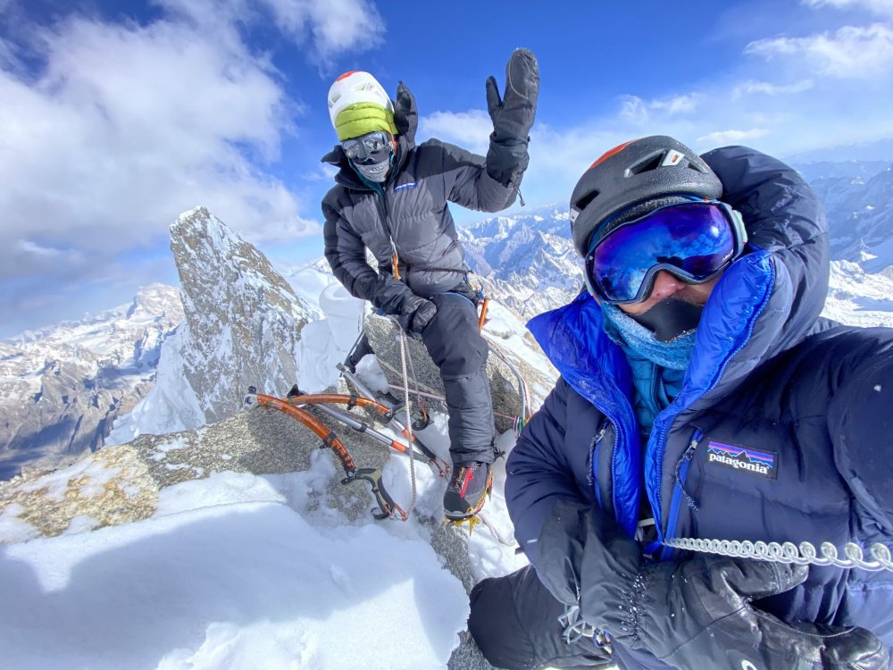

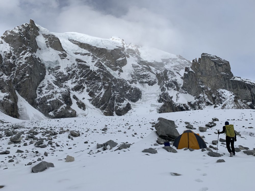

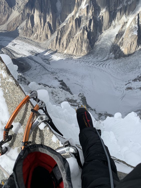
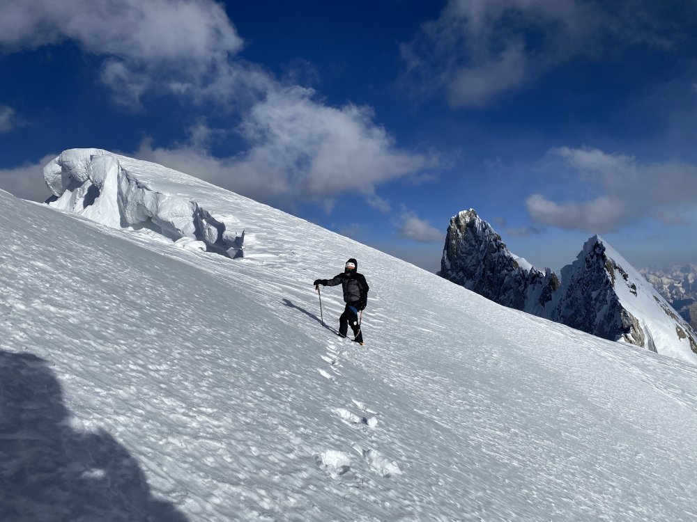

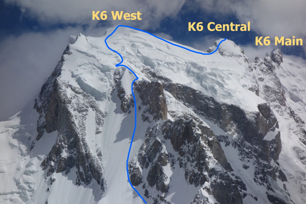
-
Trip: Eiger North Face - 1938 Heckmair Route Trip Date: 03/18/2020 Trip Report: First off: I'd be remiss not to mention the extenuating circumstances we're all in right now. Priti and I have been at home in Chamonix since March 19 now, and we'd encourage everyone to do so as well. This climb occurred prior to the French, Swiss, and US lockdowns. We returned home to quarantine with the rest of France just after this trip. I hope this trip report will entertain and inform you so you can start your own Eiger Training Plan and trip planning! Don't FOMO, we're not doing anything right now either! Your friends, J&P “Anyone who returns from the Eigerwand cannot but realize that he has done something more than a virtuoso climb: he has lived through a human experience to which he had committed not only all his skill, intelligence and strength, but his very existence.” -Lionel Terray, Conquistadors of the Useless “Yes, we had made and excursion into another world and we had come back, but we had brought the joy of life and of humanity back with us. In the rush and whirl of everyday things, we so often live alongside one another without making any mutual contact. We had learned on the North Fae of the Eiger that men are good, and the earth on which we were born is good.” -Heinrich Harrer, The White Spider The 1938 Heckmair Route. Photo Credit: @eiger_daily (Instagram)...the best overlay we found. Posted here with permission. Climbers: Jeff and Priti Wright Luckily (or not), our ascent of the 5,000ft Eiger North Face (or ‘Eigerwand’ or ‘Eiger Nordwand’) in mid-March 2020 may have been on the quietest days in the face’s history of climbing since its first attempt in 1934. No summertime cow bells ringing in the rugged hillsides of Alpiglen above the town of Grindelwald, no cars and honks were noticed, no sounds of ski lift machinery, no joyous skiers on the hillsides of the Jungfrau ski resort which sits at the foot of the Eiger, few trains were in operation (and solely for construction workers). Not even any sounds came from the sky as we climbed in perfect, bluebird weather for three days. Frankly, I could’ve used more cow bell. Among the reasons I climb, isolation is not one of them. I appreciate the sights and sounds of civilization from a climb which provides significant psychological aid. We did, however, see several helicopters fly by delivering goods and construction materials to the future site of a new lift within the resort, along with several Swiss Air Force F-18’s practicing formations through the beautiful Berner Oberland valley. Jon Krakauer wrote in Eiger Dreams: “I didn’t want to climb the Eiger, I wanted to have climbed the Eiger.” This is a sentiment I think most climbers can understand at some level. For years this quote has haunted me. There are many climbs to which I could solidly attribute this feeling. I knew, however, that whenever I would finally step out onto the snowy slopes of the Eiger, I didn’t want to have this feeling. The Eiger is just too dangerous; too big; too bold. I always knew that if I felt this way, I would simply turn around. I wanted to be in it, and enjoy my time wrestling with the alligator. Luckily, both Priti and I were itching to attack, having fun the whole way. Left to right: Eiger, Mönch, Jungfrau We arrived in Grindelwald, Switzerland from Chamonix the day before our intended climb and took an overpriced 1hr train ride to Kleine Scheidegg, the central hub of the Jungfrau Ski Resort. Kleine Scheidegg is crowned by the historic and elaborate alpine resort, established in 1840: Hotel Bellevue des Alpes (where ‘The Eiger Sanction’ and ‘Nordwand’ were filmed). Many of the more well-sponsored Eiger climbers throughout history have stayed here. But not all. You would have thought that the Third Reich could have at least put up Karl Mehringer and Max Sedlmeyer up for a few nights! Many climbers discreetly bivy near the foot of the Eiger within the ski resort, or on the floor of the restaurant at the Eigergletscher complex (the uppermost hub of the Jungfrau ski resort). However, we were expressly denied permission to sleep on the restaurant floor. Furthermore, we also found the Women’s and Handicapped restrooms permanently locked. All of the construction workers are male, and the proprietor must have caught on to the unexpected guests of the Women’s restroom from recent Eiger Conquistadors. If a climber wants to step up their bivouac accommodations slightly above a bathroom stall or a restaurant floor, they can stay at the Eigergletscher Guesthouse (hostel). However, with the ongoing construction of a brand-new, state-of-the-art gondola which will link Grindelwald directly to Eigergletscher by the end of 2020, the guesthouse is exclusively housing construction workers until the end of the project. There is another hostel at Kleine Scheidegg (Hotel Bahnhof), but it had already been closed for a few weeks due to Coronavirus precautions. Staying at Eigergletscher or Kleine Scheidegg is ideal so that you can start your first day of climbing as early as you like (however, many climbers do start their first day from the 7:00AM train in Grindelwald). During summer months, climbers might also base camp in pastures beneath the face, as Mehringer and Sedlmeyer did for their attempt in 1936, however the train is so expensive that base camping in Grindelwald is now the norm while waiting for weather and conditions. The thing about the Eiger is that even if the forecast looks splitter, you never know when the semi-mythical and unexpected ‘foehn’ will show up. These are southerly winds that blow on the north side of the Alps in winter. The foehn (literally meaning ‘hair dryer’) frequently surprises climbers bringing sudden bursts of warm air and stormy weather. The Jungfrau ski resort is unusual in that its primary artery is a 128 year old railway: the “Jungfraubahn”, highest railway in Europe. A climb of the Eiger usually begins with an expensive 1hr train ride from Grindelwald to Kleine Scheidegg, then a change of trains for another 10min ride up to Eigergletscher. Exiting the Eigergletscher deposits one out onto the lower slopes of the North Face. The train, however, does continue on, burrowing up through the depths of the Eiger and on to a high saddle (the “Jungfraujoch”) between two of the Alps’ most impressive 4000m peaks: Jungfrau and Mönch. From Kleine Scheidegg, one gets an incredible vantage point for the skyline of these three behemoths: Eiger, Mönch, and Jungfrau. Modern folklore has it that the Monk (Mönch) guards the Virgin (Jungfrau) from the Ogre (Eiger). The actual German word for Ogre is “Oger”, and the true etymology of the word ‘Eiger’ stems from a curious and long-forgotten amalgam of middle high German, Swiss vernacular, and Latin for something like “high peak”. There is a multi-use, groomed run which connects Kleine Scheidegg up to Eigergletscher. Trying to save some money, we skinned up this run instead of buying a train ticket to reach Eigergletscher (only 30-45min of easy skinning). Then, we skied down an amazing groomed run for 6 miles and 4500ft of descent from Eigergletscher all the way down to our hostel next to the train station in Grindelwald. All day, the ski resort was bustling and vibrant, and no one at the resort or the train station expected any disruption of service any time soon due to Coronavirus precautions. With the Eigergletscher Guesthouse closed due to construction, Hotel Bahnhof closed due to health precautions, and the Hotel Bellevue des Alpes open but too ritzy, we planned to discreetly bivouac near Eigergletscher. Upon arrival back at Grindelwald, however, we got word that the entire resort (lifts) and the trains would discontinue operation that evening for the indefinite future due to Switzerland’s precautions against Coronavirus. A final and devastating setback. Hotel Bellevue des Alpes with (left to right) Eiger, Mönch, and Jungfrau behind We had originally come to Grindelwald due to a large high pressure system which was bringing a week of unusually phenomenal weather to the otherwise grim mountain. We’d planned to at least visit in order to understand the approach, logistics and start to observe the conditions on the mountain. The lack of train meant an extra 6 miles and 4500ft gain of approach to the mountain…a mere “sit-start”. We were not yet about to give up and call it quits. Back home, Chamonix-Mont-Blanc lifts were still running under normal operations and both France and Switzerland were not under lockdown, so there was no urgency to leave; no compelling ethical reason to begin self-quarantine. As luck would find it, we found a companion for our laborious day of skinning our heavy load up to Kleine Scheidegg. Another BOEALPS veteran happened to be in Grindelwald at the same time: Fabien Mandrillon. He is revered within the club for his years instructing classes and for being Head Instructor of the Basic Rock Class (as we had also been). He had emigrated to Zurich before we joined the club, and we had hoped to meet him at some point on our Sabbatical. Having pleasant company under these unfortunate circumstances was certainly a delightful way to start our adventure. Surprisingly, we saw only a few other backcountry skiers on the hike up from Grindelwald. The resort had even groomed the track from Grindelwald that morning expecting the closures would not to keep people off the slopes. It was a beautiful day after a light dusting of fresh snow the day prior. If this situation were in Washington, the trail would have been packed with backcountry skiers! Priti and Fabien enjoying a lovely day of skinning Eiger North Face, West Ridge, and West Flank (descent route) Once we were back up at Kleine Scheidegg, under full expectation of sneak-bivouacking within the resort, we were delighted to find one set of accommodations still open (under extenuating circumstances). The grand Hotel Bellevue des Alpes had remained open a few extra days because of a few VIP guests which they were unwilling to expel. Thus, we took a sizable chunk from our Sabbatical budget to fork over to one night of luxury before we took on the Eigerwand. The evening was reminiscent of one of my favorite films, Wes Anderson’s ‘Grand Budapest Hotel’. The entire establishment glistened with immaculate, Old World luxury. Only the remaining handful of guests were being served the magnificent 4-course meal (indeed, one of the greatest in my life) within the halls of the elaborate dining rooms. At dinner, the guests were seated segregated by an optimal number of empty tables so as to assuage our newfound distaste for social interactions. Under strict orders of “No sports attire during dinner”, we sheepishly dined wearing our Eigerwand armor and our complimentary, fuzzy bathroom slippers while the other guests wore formal wear of suits, ties, dresses, and formal shoes. As we found out later, the few guests remaining were elderly patrons going back decades, one of whom had lost her husband of 47 years the week prior, escaping to a memory of their life together. Feeling the rush to appreciate our accommodations with the clear acknowledgement of our pre-dawn start, we spent a few minutes alone in each of the exquisite rooms of the establishment, excitedly recollecting the various scenes filmed there for The Eiger Sanction: the billiards room, the parlor, the bar, the lobby, even the concierge desk. The tolerant bartender with an immaculately groomed beard and pencil-long mustache, served us some truly delightful concoctions ginger ale, tonic water, and citrus: no summit, no party. We wryly noted that whenever we expressed our intent on climbing the Eigerwand, nobody would bat an eye. Naturally expecting some expression of praise (“vanity is one of the prime movers of the world”), we were taken aback at the utter apathy to which the world judged our sepulchral pursuit. We were not special! “Eiger-birds” (hopeful climbers) were a dime a dozen, and we were to receive no accolades before or after our adventure. From our bedroom that evening, we watched winter’s shy sun set early on the North Face of the Eiger, and the nocturnal eyeball of the “Stollenloch” wake up to illuminate the lower slopes. At the turn of the 20th Century, enterprising Swiss railway Engineers blasted an impressive tunnel through the heart of the Eiger, from which two windows were poked through Eiger’s North Face about a third of the way up. One upstream (the “Eigerwand Station”) on the looker’s left side of the face, and one downstream (the “Stollenloch”) on the right side. The Stollenloch (“Door 38”) is a small, purely utilitarian window which was used to jettison debris from the early railroad construction over a century ago and was never a tourist observation window. Some climbers have approached by walking up the railroad tracks and exiting the Stollenloch to bypass the lower snow slopes of the face. Approaching via the Stollenloch is generally considered taboo, while nearly all climbers take the train up to Eigergletscher (and down as well). We have to start somewhere, and it’s not Bern! Still, it’s worth noting that Kurz and Hinterstoisser biked from Berchtesgaden, Germany, nearly 400miles away…perhaps the true sit-start for the Eigerwand! When there is enough snow, climbers stash skis up high for a victory ski lap back down to Grindelwald to top off the climb. Train entering the depths of the Eiger tunnel The Heckmair route goes very near the Stollenloch which has given this window quite a reputation through the climbing history of the face. The other gallery (the Eigerwand Station) is not near any other popular climbing route and is on the far left side of the face. The Eigerwand Station is an engineering feat, clearly visible from the valley floor, consisting of a series of several large balconies (later converted to glass windows) that mar this limestone sculpture. Since the Jungfraujoch extension opened in 1912, tourists have been able to lean over the vertiginous parapets to marvel at the face’s dizzying slopes. The balconies were even outfitted with paper bags in the event that a tourist experienced any physiological discomforts! The Eigerwand Station was a 5 minute train stop solely for tourist observation from 1912 until 2016, when newer, faster railway vehicles were incorporated, and this renowned observation point was put out of service. Interestingly, since the Eigerwand Station’s closure, “much of the publicity material fails to acknowledge that this viewpoint station ever existed” (Wikipedia). Quizzically, the iconic and celebrated Eigerwand station was axed in order to add one more train and reduce travel time to Jungfraujoch. The smaller, unassuming window, the Stollenloch, on the other hand, still plays just as an important role as it ever has. In 1936, after his other partners perished on the face, Tony Kurz froze to death in front of the Stollenloch while rappelling in free space, unable to pass a knot in the rope, just out of reach from rescue workers (recounted in the German film ‘Nordwand’). Clint Eastwood was rescued through this window in The Eiger Sanction. A window which has always served as a trap door for climbers to miraculously transport themselves from the unforgiving alpine face to the civilized world. The window from which many climbers escaped storms including Mugs Stump, who in 1981 after finding this shelter and bounding down the tunnel towards Eigergletscher was only to realize the true horror of trying to plaster his body within the 1-foot clearance of the rocky walls while the immutably time-conscious Swiss train rolled past him (Source: Krakauer’s “Eiger Dreams”). I made sure to have a copy of the train’s timetable in case we had to Gooney our way down this escape-chute/death-trap! While climbing this route, we were most impressed at the abilities of the early climbers 80 years prior being able to climb on such difficult terrain with such rudimentary equipment: Karl Mehringer, Max Sedlmeyer, Andreas Hinterstoisser, Toni Kurz, Ludwig Vörg, Anderl Heckmair, Louis Lachenal, and Lionel Terray. These climbers were total badasses. Their efforts boggle the mind. Many of the cruxes on this route are no-shit overhangs on brittle rock, downsloping ledges, and poor protection (if any at all). With a pre-dawn start from our comfortable beds at the foot of the Eiger, we stepped out into a frozen darkness. We walked the extra 45min from Kleine Scheidegg up to Eigergletscher on a deserted ski run, passing by several early-morning construction workers who were less-than-enthusiastic about our presence as we tip-toed through the construction site onto the lower snow slopes of the Eigerwand. A recent blog post by an Italian team had us hopeful that their steps in the snow would pave the way. But alas, we found no steps and instead had to make our path and kick our own steps (later deeming that the blogpost was not clearly dated and was actually from earlier in January). Since much of the route is snow travel, the existence (or not) of another party’s snow steps can drastically alter your timeline in terms of both physical exertion and time spent routefinding. It is important to intimately know the features on the face, the names of the pitches, the condition of the cruxes. The route was so meticulously memorized as we quizzed each other on the drive up, that it felt as though we were executing a victory lap of versed, choreographed sequences of movements through Nintendo’s Mario Bros (with a princess waiting on top). First, traverse across easy snow slopes towards the First Pillar, zig-zagging across snowed-over limestone ledges up to the Shattered Pillar, and finally the ‘Difficult Crack’, the crux-y start of the actual climbing. Memorize This! Sadly, we never even saw the Stollenloch. The route passes nearby, but not directly over the Stollenloch, and is very much out-of-the-way. A party behind us on the same day purposefully started late so that they could spend their first night inside the Stollenloch (requiring a good amount digging). The Difficult Crack is still truly difficult (and also hard to find)! The Difficult Crack is the start of the technical part of the climb. If there is low snow coverage, you’ll have an extra pitch much lower down, before The Difficult Crack (just above the bergschrund and next to ‘the plaque’) which is a straight up rock corner. However, we were able to easily bypass this pitch with an easy snow ramp. Many parties don’t even find The Difficult Crack and instead pick their way up much harder variations to get up to the Hinterstoisser Traverse. It’s especially important to know what the Difficult Crack looks like (keep pictures on your phone) and how to get there (a traverse about 10-15m long heading right and slightly downhill). After that, the rest of the routefinding on the Heckmair is relatively trivial. The Hinterstoisser Traverse is infamous for its very difficult climbing with snow/ice over blank slabs situated under the impressive overhang of the massive blank face of the Rote Fluh. The Rote Fluh is one of two major obstacles on the face (the other is the Gelbewand), and they are both seriously impressive overhanging faces. Shown above: start of Hinterstoisser (low angle snow) which then turns into steep slab with fixed ropes (no picture) A permanent rope is affixed to the Hinterstoisser Traverse due to its incredible difficulty (everybody pulls on them!) but also as an homage to the 1936 tragedy when the entire team perished while trying to retreat down the face but were unable to reverse the traverse (likely due to fresh verglas plastered to the slabs). Our feeble notion of “free-ing” the Heckmair route quickly evaporated in our minds almost at the very first move of technical climbing. This route is longer and more difficult than we could have imagined, but we were prepared for every obstacle. The mixed climbing is seemingly never-ending and the overhanging steepness of the cruxes were shocking for a route completed 80 years ago. After the Hinterstoisser Traverse, more fixed lines lead up through a short chimney (‘Swallow’s Nest’) to the First Icefield, which had good névé and offered good step-kicking. A narrow gully connects the First and Second Icefields with the only pure ice climbing pitch on the route: the Ice Hose. If you’re unlucky, the pitch is bone-dry and makes for extremely difficult rock climbing (a variation on its left). Lachenal and Terray opted for the rock variation on the second ascent of the route in 1947, deeming that the WI3 Ice Hose would take too long to chop steps! Nowadays, with modern ice climbing technique, climbers are truly blessed if they find it was we did: in WI3 conditions, heavily featured, and easily accepting “stubby” ice screws. The start of the ice hose is just visible in the middle (sorry I didn't get a better pic) The Second Icefield is a long, snowy traverse on low-angled ground to get to mixed corners (Bügeleisen, or ‘Flatiron’ buttress) and finally to the wall’s first and only decent bivouac: the ‘Death Bivouac’ (aka ‘Karl-Max Bivouac’ where Mehringer and Sedlmeyer froze to death in 1935). It was dark by the time we got to the mixed corners of the ‘Flatiron’ and the climbing was terribly difficult with long runouts and poor protection at about M5. The corners were bare of snow and ice. While leading the pitch, I recalled a story from Barry Blanchard in The Calling of his and Kevin Doyle’s ascent of the Grand Central Couloir on Mount Kitchener where Doyle took off his mitts and licked his fingers so that they would stick to the rock and help his purchase. I took off my beefy climbing gloves in the cold darkness and found the extra stickiness of my bare fingers also provided excellent aid on the downsloping ledges! I could withstand the pain for a few minutes (it was probably 15F outside) if it helped prevent me from falling from my precarious perch. We finally made it to the Death Bivouac and we had been moving much slower than anticipated all day with only 12hrs of sunlight. Knowing that it was improbable that we would make the summit the next day, we planned to have a short day and bivouac again at the route’s only other decent bivouac: the ‘Traverse of the Gods’. Here at the Death Bivouac, we had to dig out a platform under a narrow overhang. Surprisingly, our ledge was just wide enough to sleep side-by-side… a welcome and unexpected luxury. We had each brought a thin, lightweight sleeping bag and a short, inflatable ‘summer’ sleeping pad. While brewing up dinner, I was horrified to discover that my sleeping pad had a hole which prevented it from staying inflated. I therefore had to sleep three nights in sub-freezing temperatures on narrow ledges with only ropes and backpacks under my ass! Every morning was difficult. We woke with the sunlight and made coffee with very little urgency. The entire climb felt rather like a holiday with a very leisurely itinerary and perfect weather. Ashamedly, we spent more time on the face than the first ascent in 1938 and the second ascent in 1947. The face doesn’t receive sun until late in the evening where you are lucky to get 30-60min of direct sunlight on your face. After the Death Bivouac, a short traverse across the Third Icefield leads to ‘The Ramp’, several pitches of easy mixed ground which funnels up to the ‘Waterfall Chimney’ (possibly the crux of the entire route). The Ramp (much like the Hinterstoisser) crawls timidly under another massive overhanging face, the Gelbewand. The ‘Waterfall Chimney’ is a genuine overhanging chimney of few holds which gushes with water in the summertime. Luckily, being in winter there was no water (good) but also no ice (bad). Usually when climbed in colder parts of the night, the spring/summer thaw freezes and makes the pitch much more palatable. Above here, the route splits into another chimney on the right (not advised) and a tenuous traverse above a head-spinning overhang on the left. The chimney above looked so well protected with fixed ropes and pitons everywhere, but every topo told us to go left around the corner instead. This leftward traverse spits the climber above a dizzying overhang, balancing on delicate, unprotectable limestone discs. A fall would mean a giant pendulum into space, dangling thousands of feet above the concave of the face below. Luckily, a multitude of pitons after a long runout help surmount a final bulge to a short, stout icefield cirque. Above: the Waterfall Chimney, overall crux of the route (in our opinion). Other contenders: Difficult Crack, Crystal Crack, Exit Chimney Above this icefield is a steep wall which you traverse on the ‘Brittle Ledges’. In Conquistadors of the Useless, Lionel Terray describes the Brittle Ledges as “tottering, piled up crockery”, which is as best a description as I can surmount. Luckily those piled up crockery are surprisingly solid, making for very interesting traversing on impossibly protruding discs. One final crux to reach our next bivouac: the Brittle Crack. From a hanging belay, you surmount a sizable bulge via perfect hand/fist cracks. This may have been the most fun pitch of the route, gleefully taking off my gloves and jamming my way up solid cracks in sub-freezing temps. Above: Traverse of the Gods bivouac Here, one finds a final bivouac at the beginning of the ‘Traverse of the Gods’, so named because it miraculously provided passage to the final major feature (the White Spider) for the first ascensionists. This accommodation was much narrower than the Death Bivouac and we were forced to sleep narrowly in a line, head-to-toe (with feet dangling off the sides). A typical timeline is to do the route in 2 days with one bivouac here at the ‘Traverse of the Gods’, making for a VERY big first day from Eigergletscher. The ‘Traverse of the Gods’ takes easy mixed ground rightward to the lower-left appendage of the ‘The White Spider’, a large snow/icefield high on the face. The White Spider is an obvious concave weakness in the wall spotted from the valley floor which was more black-and-blue this time of year than “white”. In winter, the snow/hail sloughs off immediately and the upper part of the face does not get above freezing during the day. Therefore, the White Spider was hard ice for us (instead of easy névé of the late spring and summer). This made for strenuous front-pointing on bullet-hard ice to the final left-trending ramp (the ‘Exit Cracks’) which led to the summit slopes. Above: Start of the Traverse of the Gods. Just before the next belayer in the background, the traverse goes up slightly, then back down. Above: Further along the Traverse of the Gods (the lower end of the White Spider just visible) Above: The White Spider, with Exit Cracks (ramp) above Moderate mixed terrain up this ramp ends at a final crux, the 15 meter long ‘Quartz (or Crystal) Crack’ (due to the splotches of Quartz on the limestone face). Sometimes there can be ice in this off-width overhang, but we found it dry. Steve House calls this pitch “Enjoyable when dry”. Priti led this pitch brilliantly, employing virtually every tool in the kit. Another mixed corner leads to a short traverse/rappel on a fixed line to the left-most couloir: the ‘Exit Chimney’. Above: Quartz Crack (technical crux, but short) It was my turn to lead on what looked like an exceptionally fun pitch of easy 5.6 terrain in a wide, hamstring-stretching chimney, of which all three walls resembled a washboard of downward-sloping holds. The crux here is not so much its difficulty as is its headiness. If you’re lucky, there is ice in this chimney (for climbing on and not for placing ice screws in!), but we found it dry as is expected in winter. The limestone is so compact in this chimney that protection does not exist for about 20ft. Your first piton is visible from the bottom of the pitch and you eye it up ravenously as you climb higher. Wide stemming and outward bare-handed palming are more valuable than pure dry tool technique. Here, mono points find value in the corners of the shallow chimney as you try not to look down. A fall would mean cheese-grating on this washboard slab onto a narrow snowy ledge over an overhang into space. The final moves to the first piece of protection were some of the headiest of my life as I made a dynamic (admittedly ungraceful) throw with my ice tool to the weathered cord hanging from a doubtful piton. After this point, another 100m of much lower-angled couloir climbing takes you to the ‘Summit Snowfields’. Above: Exit Chimney (psychological crux) This pain-in-the-ass route never ends! Above: 200m low-angle mixed just before summit snow/icefield You still have 200m of easy, mixed terrain followed by another 200m of bullet-hard low-angle ice to finally reach where the summit ridgeline meets the Mittellegi Ridge. We knew the summit was flat enough for a bivy site, but we found a luxuriously wide flat spot earlier, at this juncture with the Mittellegi Ridge. Here, this comfortable bivouac overlooked the Bernese Oberland down to the North and the Ischmeer Glacier (‘Ice Sea’) down to the South, with a brilliant sunset and sunrise. Above: Our final bivouac, just where the Mittellegi Ridge meets the summit ridgeline. The next morning was a casual stroll on an easy, snowy ridgeline to the summit as we enjoyed finally being showered in sunlight. Earlier, at the ‘Traverse of the Gods’ a French team of two and a Swiss team of two passed us as we made coffee. We were glad to have people pass us so they would blaze a descent trail down the West Flank of the Eiger. In summer, the descent can be an annoying affair with rappels and down climbing. But in winter, it’s easy snow all the way down to Eigergletscher, and we were glad to have tracks going down the slopes. Above: looking down at Grindelwald and the Berner Oberland Above: Looking down the Eiger's West Flanks (Eigergletscher and Kleine Scheidegg are visible below) Above: View from Eigergletscher up the Eiger's West Flanks. Check out (Instagram) @eiger_daily post (Feb 5, 2020) for a good overlay and description of the descent. We picked up our cached skis at Kleine Scheidegg and enjoyed the victory ski lap down to Grindelwald on yet another perfectly sunny day in a deserted ski resort. As soon as we got back to Grindelwald, we got an automated text from the French government (sent to all French phone numbers) that France was now in lockdown. The next morning, we high-tailed it back to Chamonix to commence 4 weeks of mandatory lockdown. Selected History of the Eigerwand: 1935 - Karl Mehringer and Max Sedlmeyer established a line to the First Icefield (much further left on the face from the Heckmair route) and established the path to the ‘Death Bivouac’ where they perished. Their line to the First Icefield is not often climbed and has much more sustained difficulty and objective hazard. 1936 - Toni Kurz and Andreas Hinterstoisser established a new line to the First Icefield which then met up with the Mehringer-Sedlmeyer route up to the ‘Death Bivouac’ before retreating in a storm. This new line went up through ‘The Difficult Crack’ and across the ‘Hinterstoisser Traverse’. Hinterstoisser masterfully crossed this difficult slab with a series of strenuous tension traverses. Nowadays, most climbers just pull on the fixed lines across the Hinterstoisser Traverse, although with enough snow and skill, the Traverse can be free’d. Kurz, Hinterstoisser, and two other climbers (Willy Angerer and Edi Rainer) perished on retreat during a storm, as recounted dramatically in the German movie Nordwand. 1938 - Anderl Heckmair, Heinrich Harrer, Fritz Kasparek and Ludwig Vorg complete the first ascent via the Kurz/Hinterstoisser variation (reference Harrer’s book The White Spider). 1947 - Second Ascent by Lionel Terray and Louis Lachenal (reference Terray’s book Conquistadors of the Useless). 1957 - Two Italians (Claudio Corti and Stefano Longhi) and two Germans (Franz Meyer and Gunther Nothdurft) epic on the Heckmair Route in bad weather (scathingly recounted in Conquistadors and White Spider). Only Corti survived. Corti sat for four days on a narrow ledge near the top of the face at the base of the Exit Chimney before a 52-person rescue operation unfolded, finally rescuing him with the use a summit-mounted winch and steel cable. Topo maps still point out this “Corti Bivouac”, however the term “bivouac” is more tongue-in-cheek since this tiny protrusion would no place to spend a night. 1961 - First winter ascent, Walter Almberger, Toni Hiebeler, Toni Kinshofer, and Anderl Mannhardt. 1963 - First solo ascent, Michel Darbellay, in 18hrs. 1964 - Daisy Voog first female ascent. 1971 - First helicopter rescue from the face. Today, the company ‘Air-Glaciers’ regularly plucks climbers off the face with reliable mastery. 1987 - Christophe Profit free-solo’s an enchainment of the North Faces of the Eiger, Matterhorn, and Grandes Jorasses (the “Alps Trilogy”) in a single push (with paraglider and helicopter transport) in under 42 hours. Many say this event marked the beginning of the era of the “fast and light” style in mountaineering. 1991 - Jeff Lowe put up the Metanoia route straight up the middle of the face (solo and in winter) with unparalleled, visionary madness. 2007 - Roger Schaeli (“Mister Eiger”, with 52 ascents of the Nordwand at the time of this writing) belayed by Christoph Hainz establish the route “Magic Mushroom” (so named for the iconic mushroom-shaped pillar on the West Ridge on which the route tops out), rated 7c+ (5.13a) 2008 - Dean Potter free-BASE’s a Nordwand route called Deep Blue Sea (5.12+) then jumps from the top. 2015 - Sasha DiGiulian first female to free “Magic Mushroom”, along with Carlo Traversi 2015 - Ueli Steck solos the Heckmair Route in 2 hours 22 minutes 50 seconds 2016 - After 25 years, Jeff Lowe’s Metanoia route sees a second ascend by phenoms Thomas Huber, Roger Schaeli, and Stephan Siegrist. Beta side-note: Bring a pocket full of Swiss Franc coins! There are large lockers at the Kleine Scheidegg train station to store ski boots (5 Swiss francs), ski lockers (2 Swiss francs per pair of skis), and a high-powered viewing telescope at the Hotel Bellevue des Alpes to look at conditions on the face (1 Swiss franc). Special Thanks to @eiger_daily for your incredible hospitality, support, and beta; you are truly fostering a wonderful community in the Berner Oberland. Resources: Aside from browsing blog posts and Google Images for route overlays, Eigertopo.com is the best route description we found. This little pamphlet provides pitch-by-pitch descriptions as well as informative overlays. This little book is literally all you need!! Also check out @eiger_daily (Instagram) for recent pictures of the face and also scroll through the post for the best overlay and gear beta. More important beta from Steve House: https://www.uphillathlete.com/climb-eiger-north-face/ Uphill Athlete Training Plan: https://www.uphillathlete.com/eiger-north-face-training-plan/ The Italian topo here is VERY descriptive and shockingly accurate. Take belay locations with a grain of salt. Link or simul as many pitches as you can: https://www.camptocamp.org/routes/189333/en/eiger-n-face-heckmair-route Gear Notes: Single rack #.3-1 (5 cams), nuts, 1 piton (didn't use), 5 ice screws (2 stubby's), 2 technical ice tools each, monopoint crampons, light (summer) sleeping bags, puffy pants, big-ass belay parkas, short 3/4 length (summer) inflatable sleeping pad, 60m 8.7mm rope, 6 quickdraws, 4 single-length alpine draws, 4 double-length alpine draws, cordalette, 3 micro traxions for the team (for simul climbing) Approach Notes: Normal approach from Eigergletscher
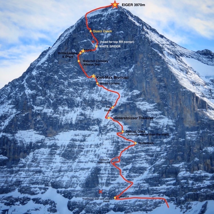
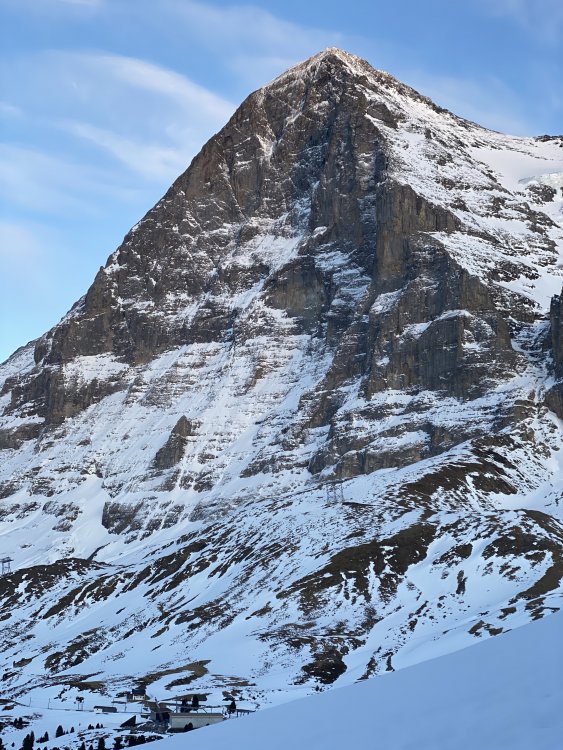
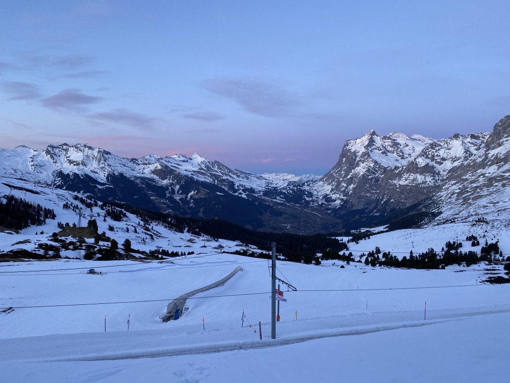


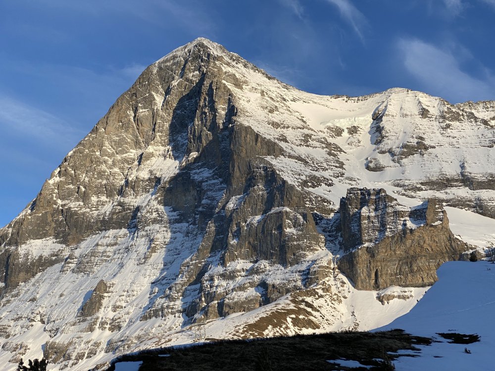
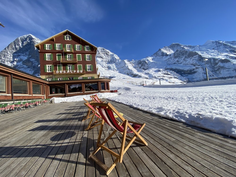
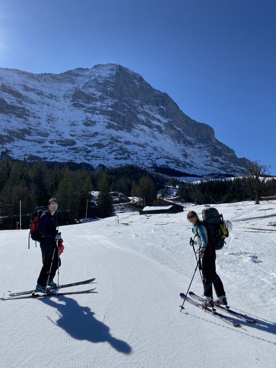
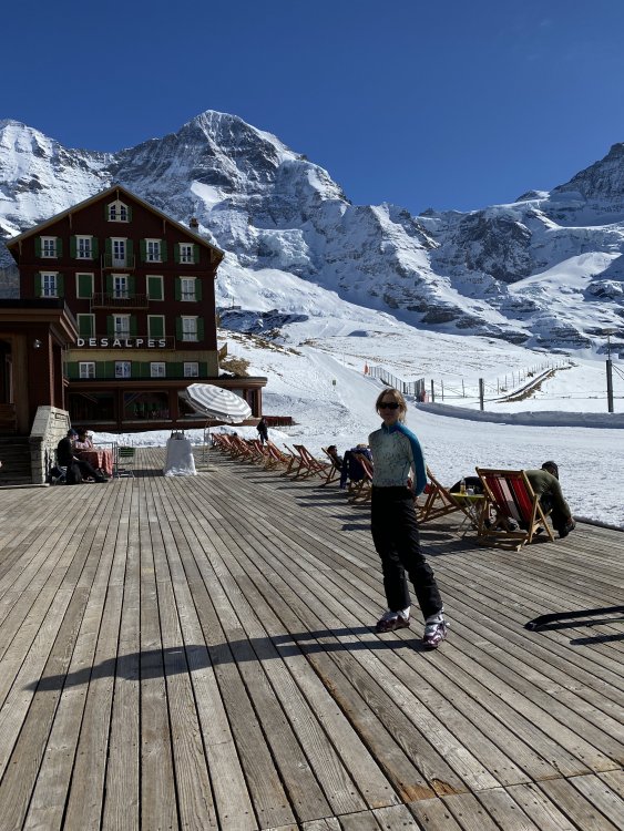


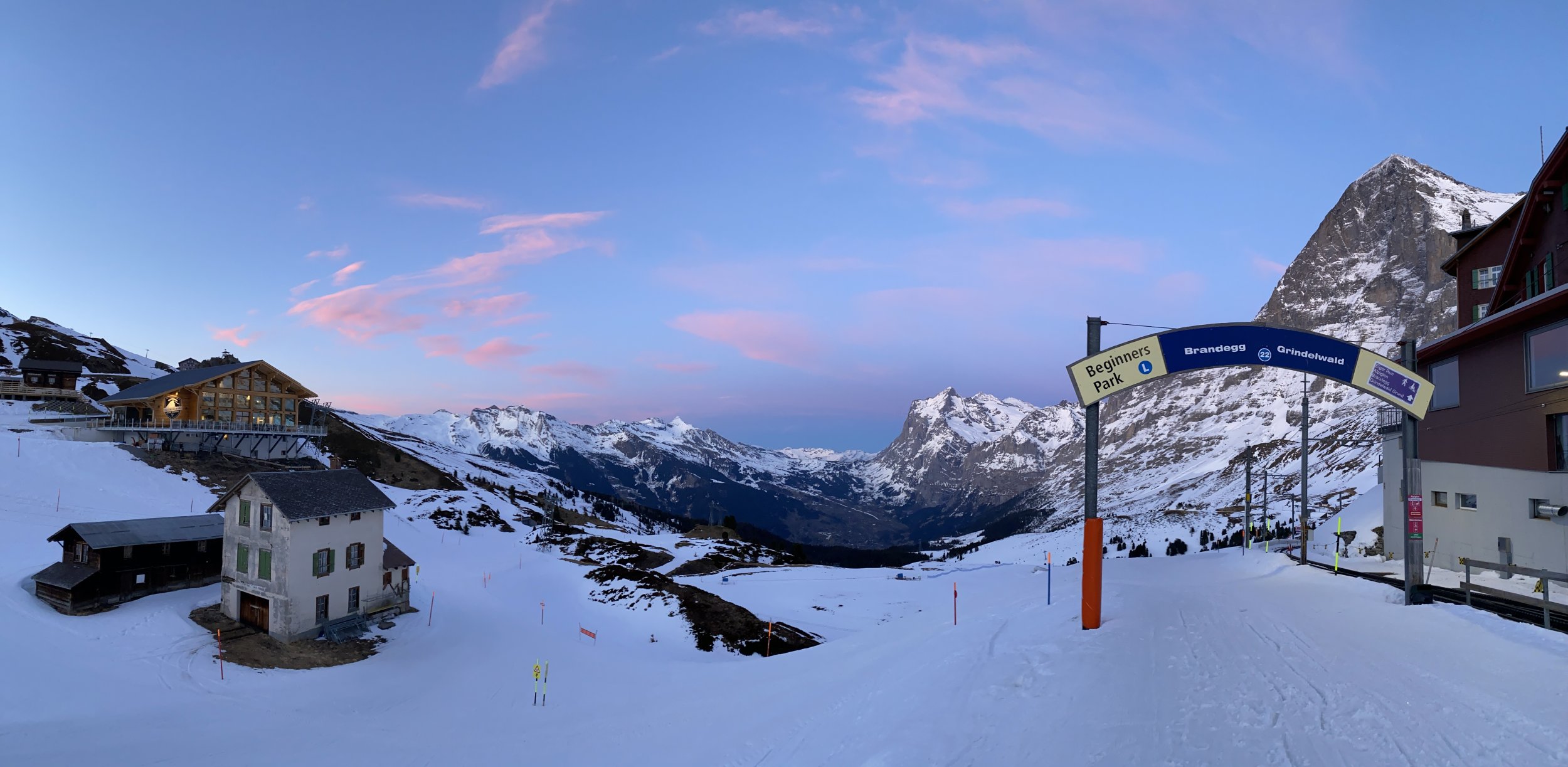
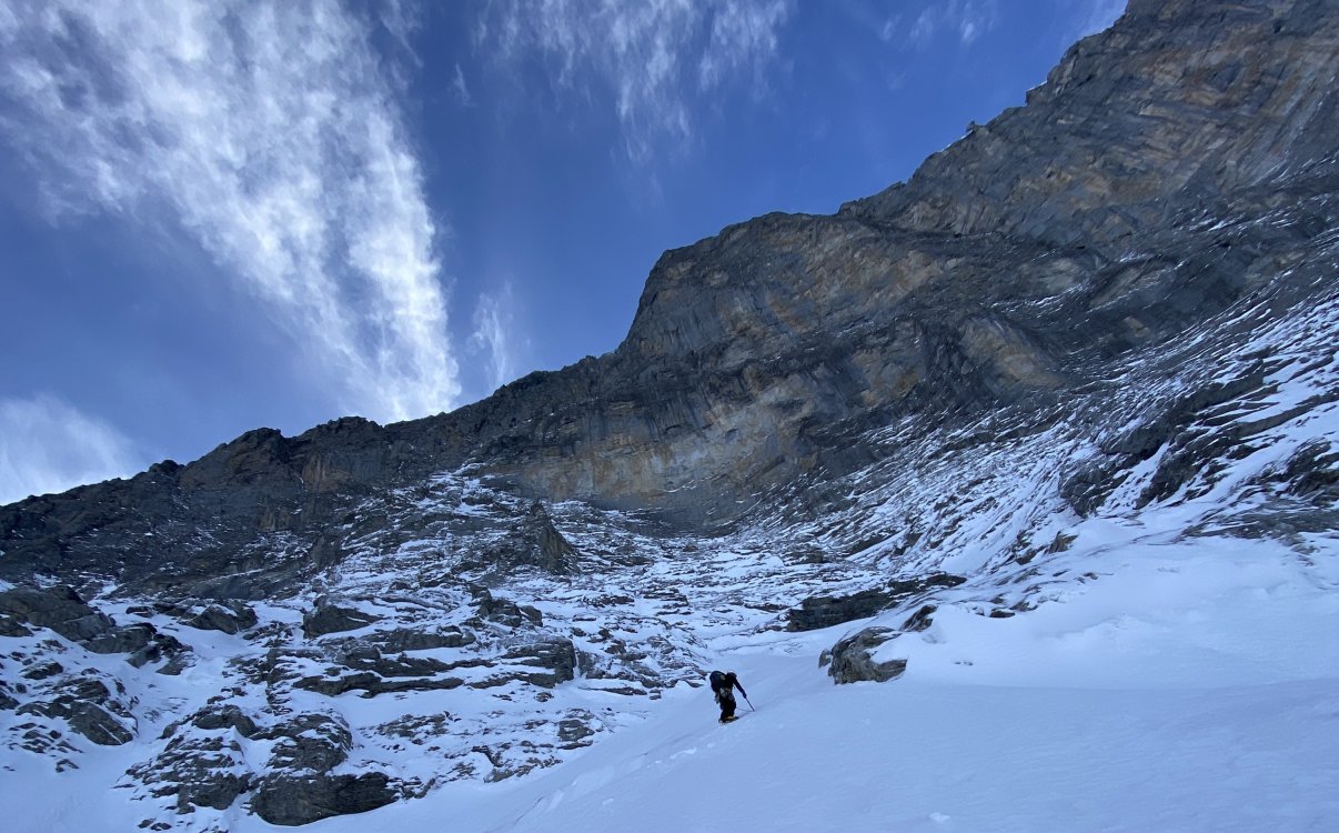
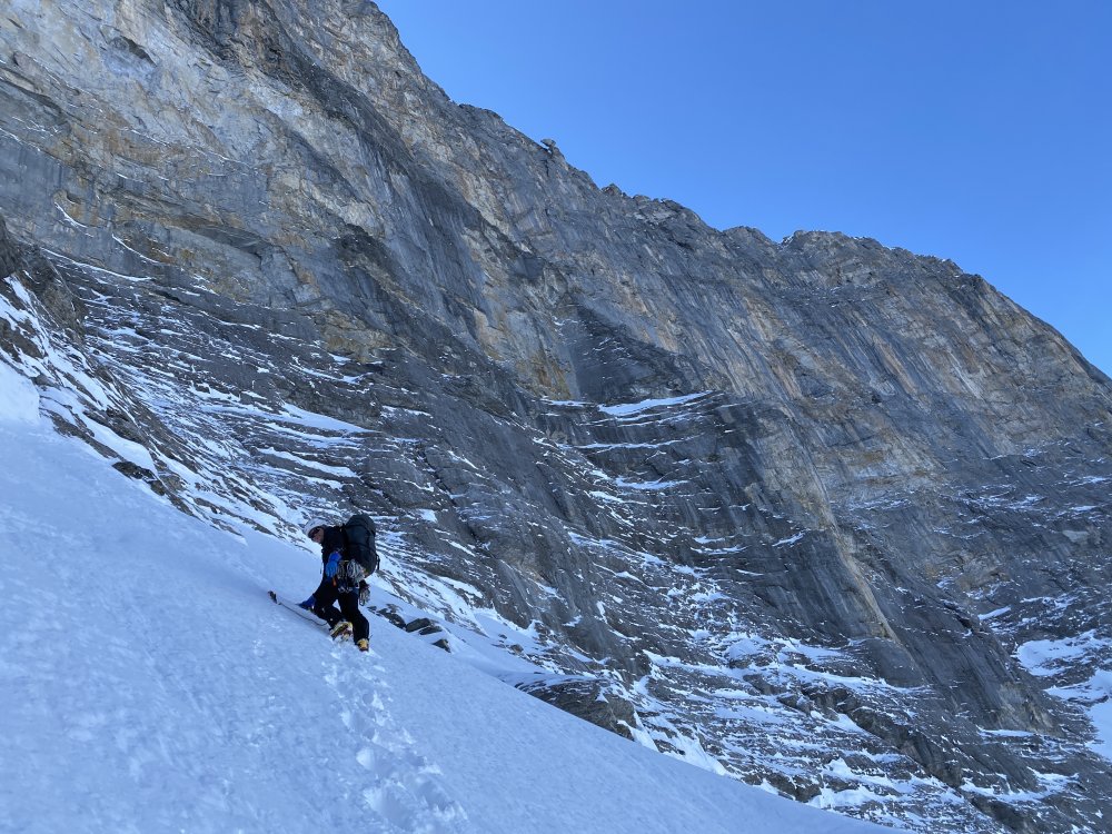
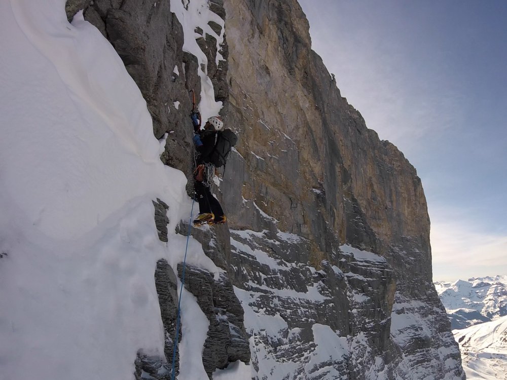

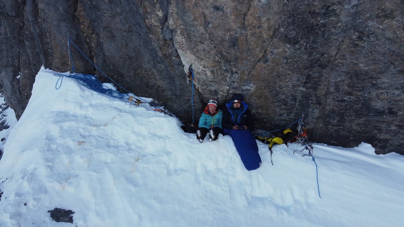

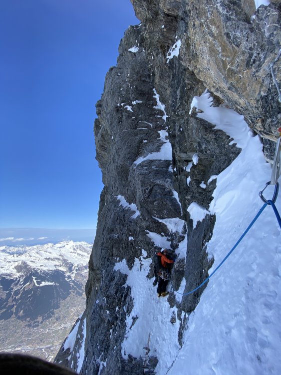

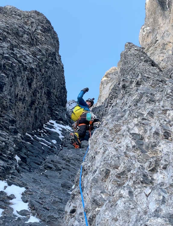
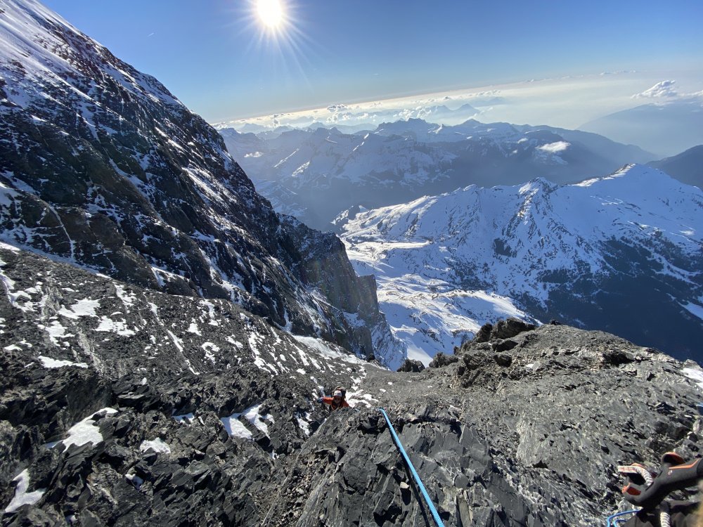

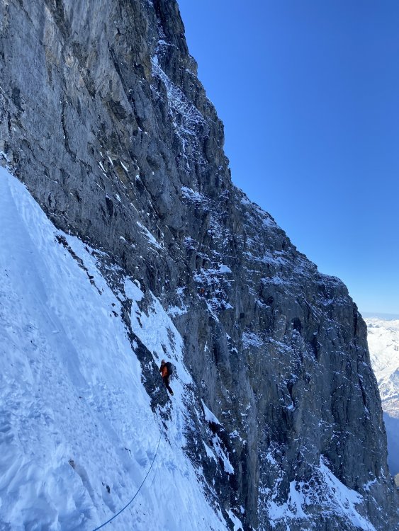
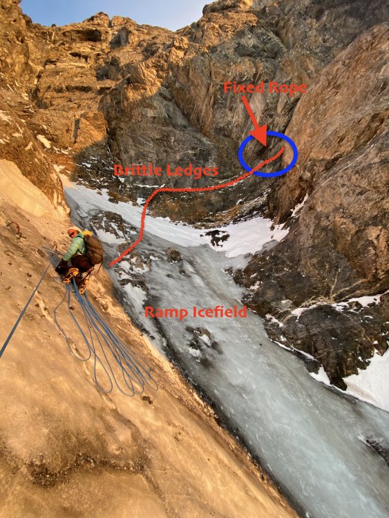

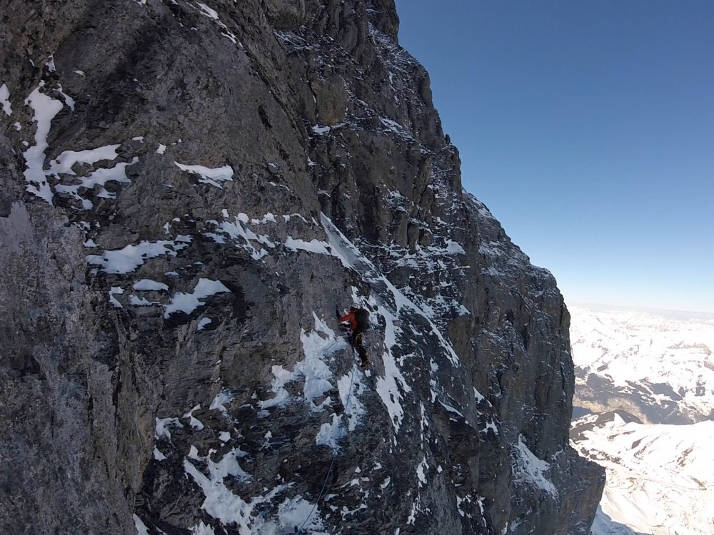
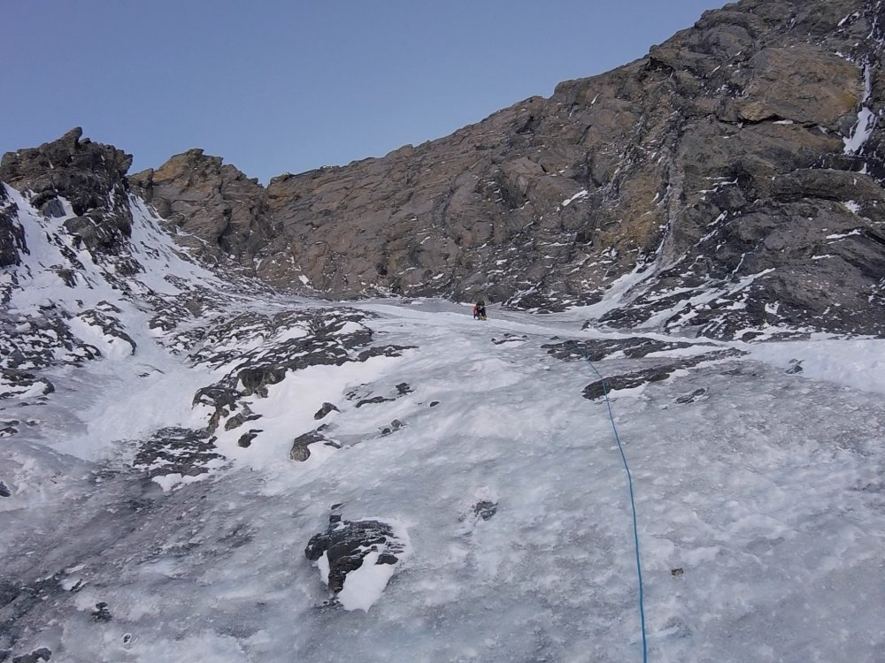
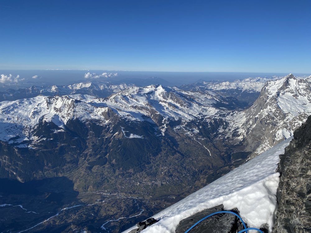
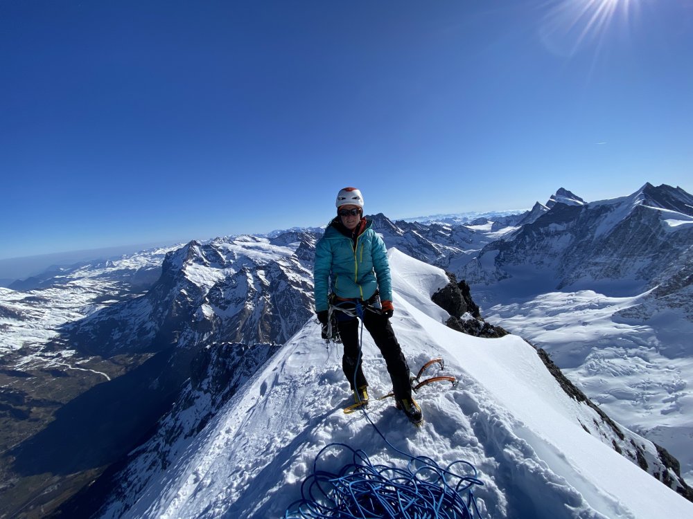
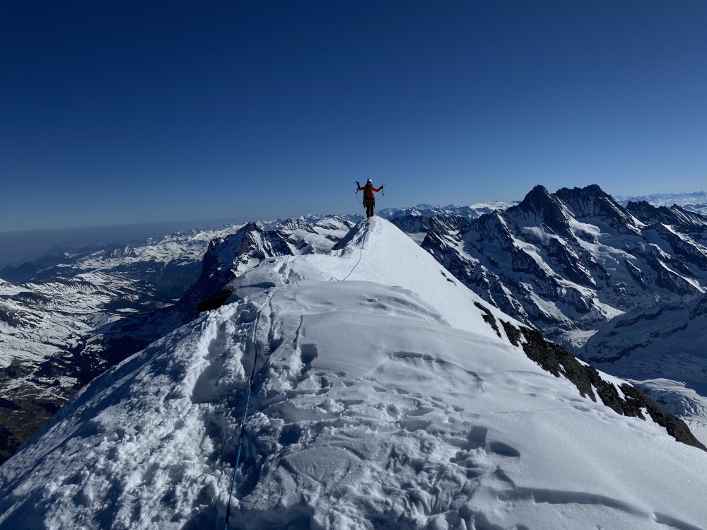

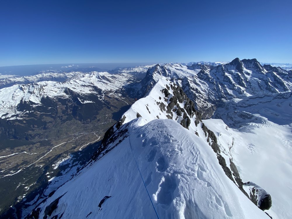

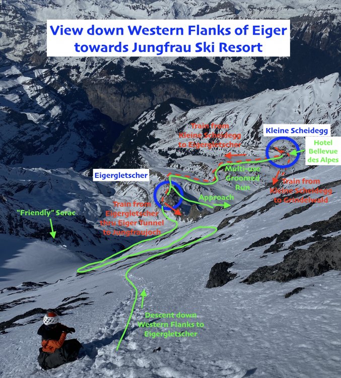
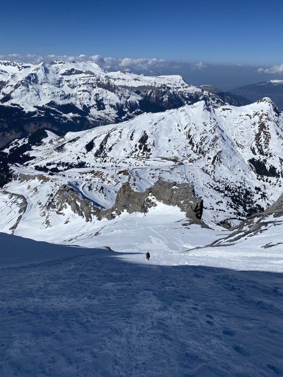
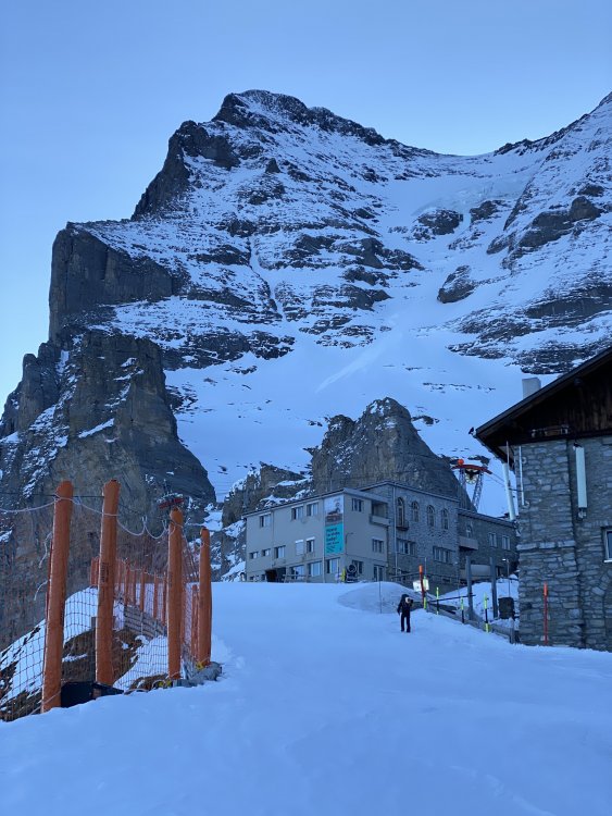
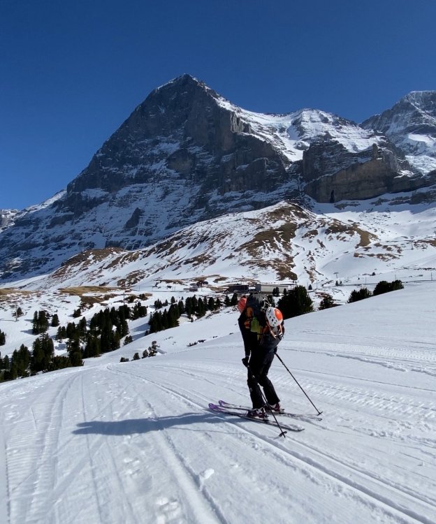
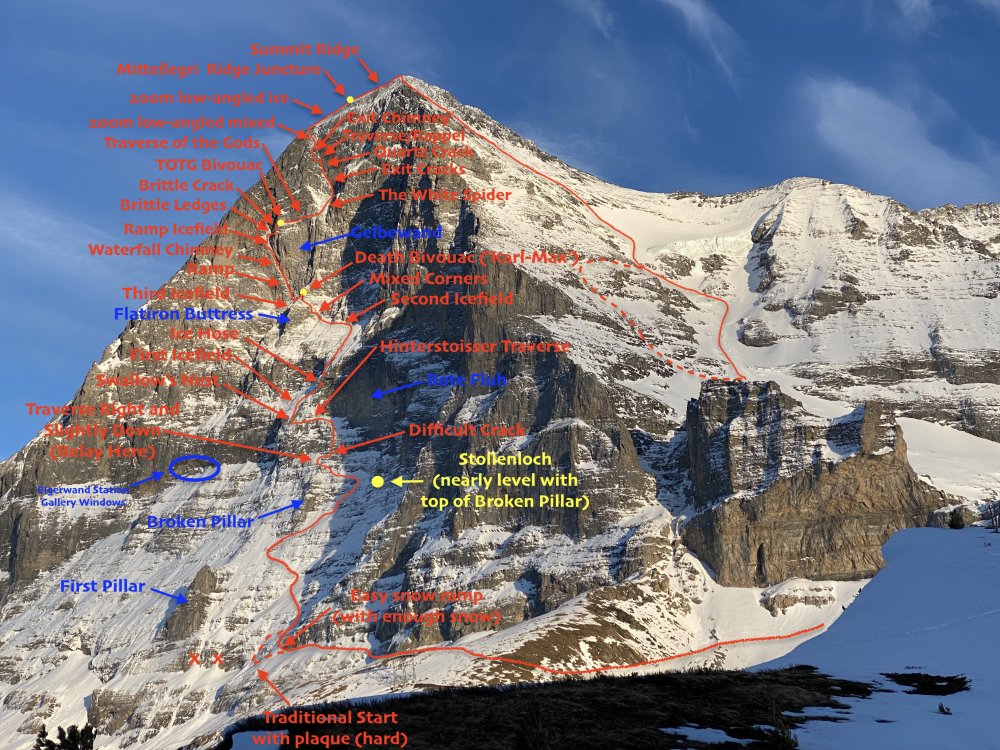
- 21 replies
-
- 11
-
-
-
-

-
 With some time on my hands with the quarantine and all, I decided to compile some research. Here's a list of "forgotten" Cascade alpine testpieces (ice focused) or FACTs. Feel free to add some others I left out! Who's gonna be the first to tick the entire list? I apologize for all the weird formatting. I just copied this post from my blog https://climberkyle.com/2020/03/22/forgotten-cascade-alpine-ice-routes/. I90 I90 climbs offer the best access and easiest conditions to predict. There are undoubtedly many more climbs to be discovered in this area with easy access, generally good rock, and surprisingly rugged little mountains. Mt. Kent, North Face (multiple variations): the greatest north face in the Snoqualmie region with many long 1000 ft lines. Bonus: you can see conditions from I90 near exit 42 while driving west! This has been super high on my list to explore. Snoqualmie Mt, North Face (multiple variations): an abundance of mixed ice lines like the classic New York Gully and the lesser known Pineapple Express and Blue Moon. Abiel Peak, North Face (multiple variations): the “Ben Nevis” of the PNW has many shorter alpine ice and mixed lines. Bryant Peak, Hot Tubbs: Maybe this route hasn’t been around long enough since Jacob and I published it, but it reportedly hasn’t seen much action, so I think it’ll be forgotten soon enough… Summit Chief Mountain, North Face: Colin Haley said this line had “more ice climbing than any other Cascade ice climb” he had ever done at the time. Big compliment. The North Face is much like Dragontail, just fatter. Peak 3964, False Idol: An incredible 10 pitch ice route off the Middle Fork Snoqualmie that needs very cold temps to form. I believe this is just scratching the surface of the ice potential in the Middle Fork. US2 US2 offers some hotspots like the Stuart Range, with its steep granite peaks, and a sprinkling of other incredible routes in the Lake Wenatchee area. Weather is generally colder and drier on the east side, which is good for ice. Chiwawa Mountain, Intravenous: Cutting edge Colin Haley mixed route deep in the Glacier Peak Wilderness. Buck Mountain, Buckshot: Another bold line in a wilderness setting. One of the great underrated north faces in Washington. Mt. Index, North Face: Steepest peak in Washington, visible from the highway. Always an involved matter for a sub-6000 ft peak. Another huge route is Murphy's Law. Dragontail Peak, NE Couloir: This route feels much more full on than Triple Couloirs next door, and seems to be difficult to get in proper (fall) conditions. Colchuck Peak, NE Buttress Couloir: Often overlooked with Triple Couloirs and the North Buttress Couloir next door. Ends with a cornice-tunnel! Argonaut Peak, NE Couloir: Also a rock/snow route in early summer, this can be a fantastic mixed/ice route in late fall. Mt. Stuart, Ice Cliff Glacier: a technically easy but deceptively committing and full-on climb in a wild setting. Argonaut Peak, Chad Kellog Memorial Route: Challenging new age mixed route in the heart of the Stuart Range. Mt. Stuart, Lara Kellog Memorial Route: Climbs the incredible NE Face of Stuart above the Ice Cliff Glacier. Looks directly across to the Chad Kellog Memorial Route. Mt. Stuart, Stuart Glacier Couloir: A classic route where the crux is arguable climbing the west ridge in mixed winter conditions. Nason Ridge, Alpine Dropout: A fantastic looking ice route that sits just above Lake Wenatchee. Mountain Loop Close to Seattle but tragically overlooked, the peaks of the Mountain Loop are as rugged as anywhere in the North Cascades but with surprisingly decent winter access. The myriad of big climbs in this little region speaks volume to the incredible terrain. Big Four Mt, North Face (multiple variations): multiple routes, including the famous Spindrift Couloir. This is a mighty north face, and routes often take multiple days. Hall Peak, North Face: little brother to Big Four supposedly has some ice routes. Three Fingers, NE Face: This is a big route on a surprisingly big mountain. I believe there’s much more potential on the east side of Three Fingers. Whitechuck Mt, E Face Couloir: A very aesthetic couloir ice/mixed route. Access can be challenging unless it is a very low snow year. Whitehorse Mt, E Couloir: This steep route splits the Squire Creek Headwall for a fantastic line. I think it might even be visible from Darrington?! Sperry Peak, E Face Gully: Another beautiful, long, moderate ice/mixed route that likely varies in technicality from fall to spring. Sloan Peak, Full Moon Fever: This route climbs the weakness on the NW Face of Sloan. Having been at the base, I can say there is HUGE potential all over the place near the route. Sloan Peak, Superalpine: I certainly hope this climb isn’t forgotten, as Porter and I believe it is truly the best moderate alpine ice route we have climbed in the Cascades (better than Cosley Houston or the NW Couloir of Eldorado), but I know how things go around here… Lake 22 Headwall: who would think that one of the greatest alpine walls in the Cascades was just a short hour drive and hike from Seattle? There are so many unclimbed 2000 ft lines up this face, and you can get conditions updates by searching Instagram! Highway 20 Highway 20 undoubtedly has many huge ice lines, but difficult winter access has limited exploration. During lower snow years, the Cascade River Road could be a great area for exploration and development. Eldorado Peak, NW Ice Couloir: This route was sort of “remembered” in Fall 2019 when probably 20 parties climbed it (me included), but it’s a fantastic easier route, so I’ll leave it here. Colonial Peak, North Face (multiple routes): The mega line Watusi Rodeo offers 4000 ft of front point terrain and is “easily” accessible all winter. First Date is another attractive route. Pyramid Peak, NE Face (multiple routes): Home to some challenging mixed/ice routes on a wonderfully aesthetic peak. Graybeard, North Face: Everyone seems to report this deceptively big route deepened their sense of mortality. Davis Peak, No Milkshakes: the north face of Davis Peak is supposedly the steepest vertical mile drop in Washington. Silver Star, West Face Couloir: Originally planned as a ski descent, it actually turned out to be a huge ice climb! Visible from the highway, but you probably need a sled to get up there. Cutthroat Peak, Cauthorn Wilson: Gaining popularity lately, can be climbed right before the highway closes or after it opens. Early Winters Couloir: This one is sort of a classic and can be climbed in both fall and spring. Highway 542 The areas around Baker and Shuksan are generally well explored, but still offer great adventure. The Black Buttes are one of the centerpieces for hard alpine ice climbing. Lincoln Peak, Wilkes-Booth: A huge, challenging route on one of the hardest peaks in Washington. Assassin Spire, NW Face: Considered by many to be the toughest summit in Washington, this was also the first peak where the first ascent was made in winter. Colfax Peak, Ford’s Theater: The “forgotten” next door neighbor of the ultra classic Cosley Houston. Mt. Rainier / Tatoosh This area is dominated by the mountain, but I’m guessing the Tattosh have good stuff and certainly easy access. Rainier, Mowich Face: A long moderate route on the “quiet” (NW) side of the big hunk-a-hunk. Rainier, Ptarmigan Ridge: A steeper, more sustained route than its next door neighbor, the world-renowned Liberty Ridge. Mt. Hood I don’t know much about Hood, but I’m sure there are some great routes that are infrequently climbed, so I’ll take suggestions here!
 -
Via dei Ragni: Grade VI, 95deg snow/rime/ice, M4, 1000m Scribe/Photos/Climbers: Jeff and Priti Wright Google Street View: Cerro Torre Summit 360 Panorama https://youtu.be/nZ4O199GfAo?si=Kr-etK2F4MSCGxVn https://youtu.be/RNNtXFuI_RQ?si=DDMqTiOcCEcDAJGP https://youtu.be/iRWR_DQoL3A?si=ebEbe75BW4pbSuKz We’ve had a picture of Cerro Torre on our desktops, phone wallpapers, and posters above our bed for the past 5 years. It was the reason we took up ice climbing in the first place. In February 2016, we made our first attempt on this route, hoping to at least get a glimpse of the scale of the mountain and understand what it took to climb it. The weather was too hot by then for the climb, and after three days, our high point was below the hard technical climbing. Previous trip report: The road to El Chaltén The Fitz Roy Massif These past two months were our fourth (and longest) climbing trip to the Chaltén Massif, and sixth year of watching the Patagonian weather patterns. We wanted to return to attempt Cerro Torre again, but the next two seasons were not possible because of bad weather. Last year, at the beginning of February, we saw a fantastic weather window, and the stars aligned. We flew down to Patagonia in a 9-day magical whirlwind of constant movement, and summited Fitz Roy via the Franco-Argentina route. While on the summit of Fitz Roy, looking down at the surreal summits of the Torre, we were determined more than ever to come back the following season. Day 1. We arrived in El Chaltén on New Years Eve, the last day of a 4-day weather window (brecha)…we missed it! Since then, January was filled with short stints (8-12hrs) of good weather in the mountains, and the arrival of a 6-day mega window in early February sent an electric buzz throughout town. We were a couple of bats out of hell with our 40lbs packs each as we set towards Laguna Torre. The plan was to pass through the Niponino base camp in the Torre Valley and bivouac at the higher Noruegos (Norwegian) bivouac, which would put us closer to Col Standhardt (the next day’s objective)…the passageway to the West Face of Cerro Torre where the Via dei Ragni route begins. Our bivy site at Noruegos Day 2. From the Noruegos bivy site high on the slopes of the Torre Valley, we traversed near the base of the Torres, under the celebrated SE Ridge (perhaps the greatest climb in the world) and also the 1959 Maestri line to the triangular snowfield where so much history and controversy took place. From the East, all of the Torres stand impossibly steep and impassable. To get to the Ragni route on the West side, we would climb up and over the Col Standhardt where an implausible car-sized chockstone sits interminably between the col’s steep walls. From the col, one gets the first glimpse of the Southern Patagonian Ice Cap (Hielo Continental), a massive expanse of ice 200mi long. On a rare, clear day such as this day, we could see green Chilean fjords across the Ice Cap between large, snowy volcanos. A Lighthouse Several rappels deposited us down to the Circo de los Altares (Cirque of the Alters), an impressive crescent of white-capped peaks and toothed spires. From there we headed up another glacial ramp on Cerro Torre’s West Face to a high camp, 150m below the Col de la Esperanza (Col of Hope), first reached by Walter Bonatti in 1958 who hoped that this col would one day blaze a path to the summit. It wasn’t until 1974 that a team of Italians from the Ragni di Lecco (thus the name “Via dei Ragni”) completed Bonatti’s vision. Circo de los Altares Steep snow climbing and easy mixed terrain led us towards the camp at Col de la Esperanza, the camp we hadn’t reached on our last attempt. As we hiked past our previous high point, our hearts soared. This time around, the climbing felt much easier with 4 more years of climbing experience under our belts. Day 3. This day was a rest day of sorts. To set ourselves up for success on summit day, we were moving to the highest camp a few hundred meters up: El Elmo (“Helmet”), a prominent plateau below the steep, technical climbing. Those who were faster and stronger than us had gone straight to the highest camp the day before and were now going to do the hard work of battle-axing the bullet-hard blue ice and cleaning the cotton candy mushrooms of the summit. As we came over the Col of Hope, we entered an otherworldly expanse of mangled rime towers and precarious exposure. These deformed blobs of ice towers with icicle branches and feathery leaves seem like something only God or Dr. Seuss could conjure. It’s something so beautiful and terrifying at the same time. We were face to face, looking up at thisbeastly Tower. A spectacular nightmare. Day 4. Summit Day! We were pretty antsy to get going on the summit push. Falling snow greeted us when our alarms went off at 2:00AM as the mountain was enveloped in a cloud. All over camp, alarms went off and were snoozed as the precipitation discouraged movement. When the stars finally came out again, we were the first to muster our strength and get to work. Walking up to the base of El Elmo in the darkness, the first overhanging rime ice mushroom of the route, we gave a sigh “ah, breakfast!” The last 10m didn’t actually have any good protection (besides maybe a horizontal picket), and it was a sequence of cutting the feet loose, campus’ing from questionable tools, and shoving knees into the soft rime to make upward progress. Once at the top of El Elmo, a crowd had formed at the base, chomping at the bit. All of camp was finally up. The snooze button had proved an epic failure of our collective, strategically staggered alarms. We all watched in awe and gave whooping shouts from this low perch as our friend, Fabi Buhl, paraglided from the summit in the wee hours of the morning, slowly swirling in front of the spectacular sunrise over Lago Viedma. He was the first ever to fly off the summit of Cerro Torre having climbed the mountain first (and not dropped off via helicopter). After El Elmo, the mixed pitches zig-zag through a maze of rock and ice up to the base of The Headwall. Two pitches of blue, overhanging, bullet-hard ice. The final pitches mount three tiers of giant rime mushrooms facing the Ice Cap. This high ridge gets pummeled by the wet, freezing storms that race around the Southern Ocean to create these crazy rime formations. The first and second rime mushrooms had formed spectacular, natural blue-ice tunnels created by vortices of wind spiraling up the ridge, clearing a path through the thick outer layer of soft rime ice. Climbing into this vertical subway tunnel for 60 meters felt like entering a portal into another world. It eventually funneled up to an elevator shaft and spat us out of a squeeze tube. For the second and third mushrooms, we attached Petzl prototype “wings” to our ice tools to make purchase in the soft, overhanging, cotton-candy rime. These wings are horizontal plates that bolt onto the picks of our ice tools like Dilophosaurus gills. The Final (Summit) Mushroom was a beast. The previous day, it had taken the other parties many hours to clear a natural half-pipe, then dig a tunnel through the steepest part for many hours. Their line then exited their manufactured tunnel out onto the overhanging summit lip. Walking up to the steepest point on Cerro Torre on a perfectly still, clear day was absolutely surreal, basking in the bright orange-red glow of the sunset. The 200 miles of the Continental Ice Cap stretched before us and the Pacific Ocean now clearly visible. Behind, on the other side of the Torre Valley, small, wispy clouds hovered over the summit of Fitz Roy. We were lucky to get perfect lighting to fly our drone around for 30 minutes alone before we headed back down to our tents at El Elmo for the night. Days 5 and 6. To get back to town, you can reverse your way up Col Standhardt (M7 shenanigans), or take one of two trekking passes along the Ice Cap. We had experience taking the Northern pass (Paso Marconi) which was now in really bad shape. We opted for the Southern pass (Paso del Viento) to try something new, and hopefully be able to turn our brains off for a few days (sadly, this was not the case). The Hielo Continental spans 50mi across and crawls 200mi north to south across Southern Patagonia. It looked so beautiful and serene from our climb. Now, face to face with this beastly crocodile, it was the stuff of horrors. Canyons after canyons of impassable crevasses, we zig-zagged our way in no logical direction under a bright, unhelpful, full moon. From the air, our tracks must have looked like the random scribbling of a toddler on a massive, blank white floor. A sun dog greeting us after our descent. Finally reaching the pass and seeing people again after such a mental test of sanity was nothing short of jubilant. A popular trek is to take the pass South to Lago Viedma: the Huemul Circuit. We were now on a delightful trekking path and could now…finally… turn our brains off and just put one foot in front of the other for a mere 14 miles back to ice cream and showers and safety. Thanks: We had good confidence in the forecast and the length of the window, but it’s still important to have daily weather updates to anticipate the inconsistencies between each day. We’re so grateful for our weathermen who sent us updates to the inReach and gave us both confidence and peace of mind each day that we spun ourselves further from civilization: Dan Berdel, Devin Monas, and Rolando Garibotti. We’d also like to thank Dave Burdick (Alpine Dave!) for his support, inspiration and beta on the route. Also thanks to the American Alpine Club Live Your Dream Grant for supporting this trip. Recommended Reading: The Tower, Kelly Cordes Patagonia Vertical, Rolando Garibotti Enduring Patagonia, Greg Crouch Gear Notes: 13 ice screws (including 3 stubbies) 1 Picket (to place horizontally in vertical rime!) small set of nuts (Wildcountry Superlight) small rack of cams (Black Diamond Ultralight cams .4-1, Metolius Mastercam 1-3) 2 Petzl Nomic Ice Tools + Petzl prototype wings (rented from Viento Oeste gear shop in town) Petzl V-link Umbilicals 2 stuff sacks (gear management in pack, and also to leave for snow anchors) The North Face Phantom 50 backpack 4 double-length Petzl Pur'anneau runners with 2 Camp 22 biners each 2 double-length Petzl Pur'anneau runners with 1 Camp 22 biner each 7 single-length Petzl Pur'anneau runners with 1 Camp 22 biner each (can’t have too many runners) Patagonia R2 Jacket Patagonia Micro Puff jacket Patagonia Macro Puff jacket Patagonia Kniferidge hardshell jacket (didn't use)...also, it's now the "Ascensionist Jacket". Mainly wore the Micro Puff for outer layer Patagonia Nano Air Pants Patagonia Softshell pants (bibs) Patagonia base layer (top+bottom) Platypus 2L soft bottle Garmin inReach Mini (love this little guy!) Petzl Dart Crampons 2x Mammut Twighlight Twin Rope (7.5mm) Petzl Sirocco helmets Petzl Sitta harness (for him) and Arc’teryx harness (for her) Metolius Feather Nut Tool (each) Mammut Smart belay device (not the Alpine Smart) 3 lockers for group: Grivel Tau K12L, Grivel Lambda HMS, Grivel Plume 2 medium fuel canisters Jetboil Sol stove Safety ‘biner (each) – Edelrid 19g caribeener, Petzl Micro Traxion, short Sterling Hollowblock, Trango Piranha knife Bivy setup – Full Length Thermarest NeoAir XTherm sleeping pad, Exped Air Pillow UL, Feathered Friends Spoonbill sleeping bag MSR Advance Pro 2 Tent (amazing!) La Sportiva TX4 Approach shoes La Sportiva G2SM boots Petzl Reactik headlamps (each) + 3 extra AAA batteries + Petzl e+LITE headlamp Other things: 1 long spoon to share, chapstick to share, small Joshua Tree sun stick to share, Frog's Tung phone leash, lighter, whistle, duct tape, Thermarest repair patches, Voke tabs, Nuun, pain killers, 1L Platypus soft water bottle (for her) and 750mL HydraPak Stash (for him), warm headband, glove liners, 1 pair thick long socks (each), sunglasses, ear plugs, WRFA emergency form, small pencil, cotton handkerchief, wad of toilet paper, ID, Credit Card 1 Swix alpine pole (with snow basket) Arcteryx ball cap Adidas Sunglasses (with nose sun guard), no longer available iPhone 11 Pro (with route beta downloaded) GoPro HERO 5 Session (with helmet mount) DJI Mavic Mini Drone (remote and drone stored in USPS Tyvek bag) Dinner: 2 AlpineAire meals, 3 Near East Couscous boxes repackaged with small olive oil packets in ziplock bags, salt Day food was mostly bulky, yummy snacks: vegan jerky, dried mango, nuts, Cheese-Its, sesame sticks, Gu, nut butter, etc Approach Notes: Approached via Col Standhardt. Also possible to approach via Paso Marconi (currently in difficult/sketchy conditions) or Paso del Viento (long). We came back via Paso del Viento, but it's also possible to climb back over Col Standhardt (M7 shenanigans with old fixed ropes here and there).
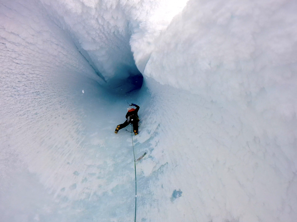
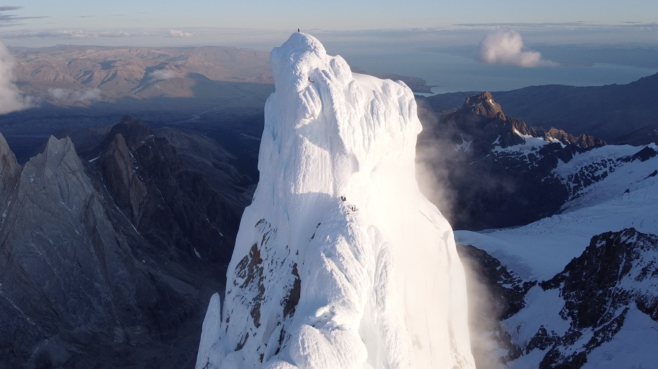
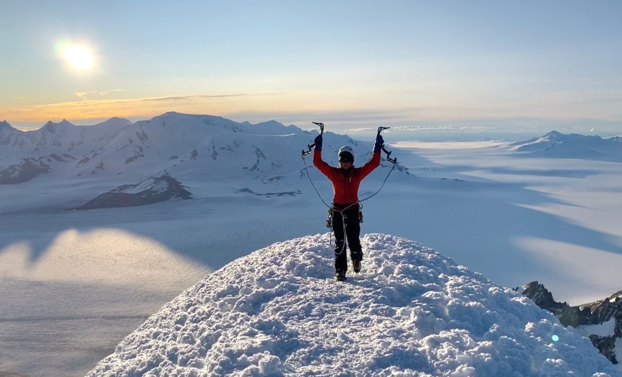
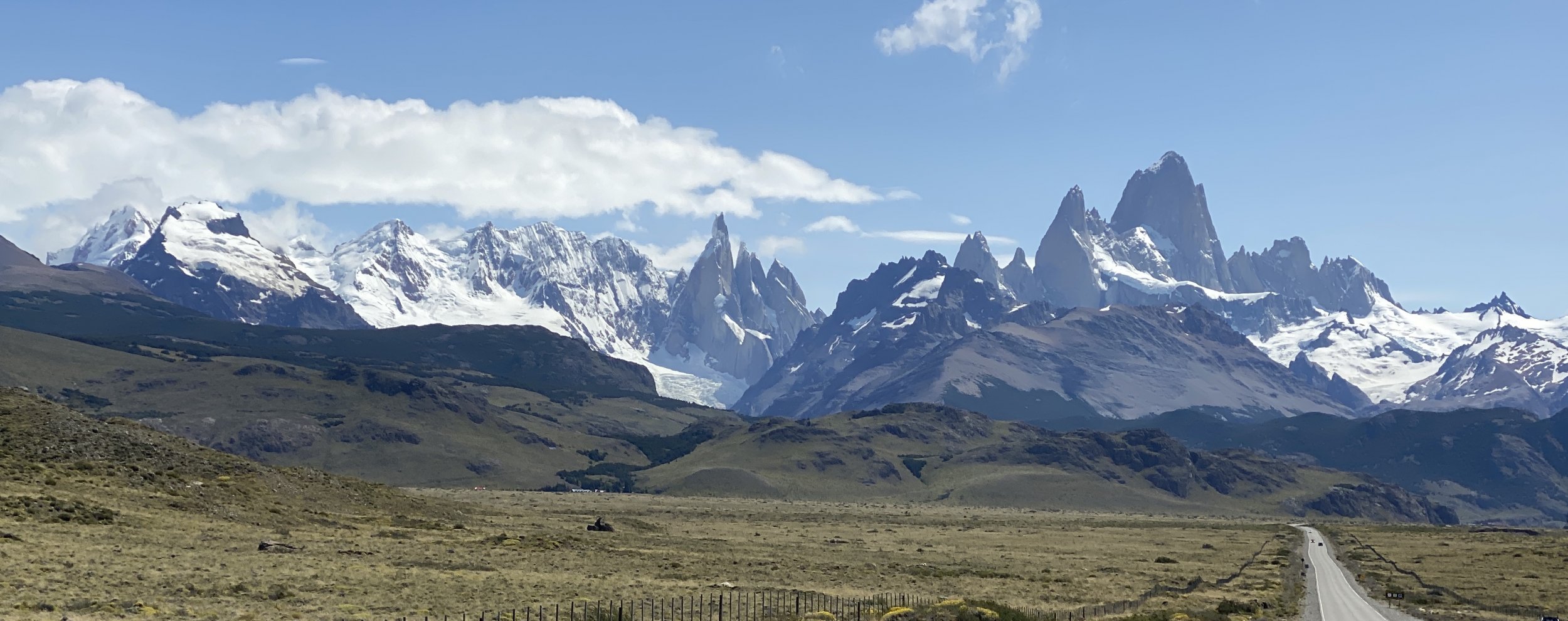
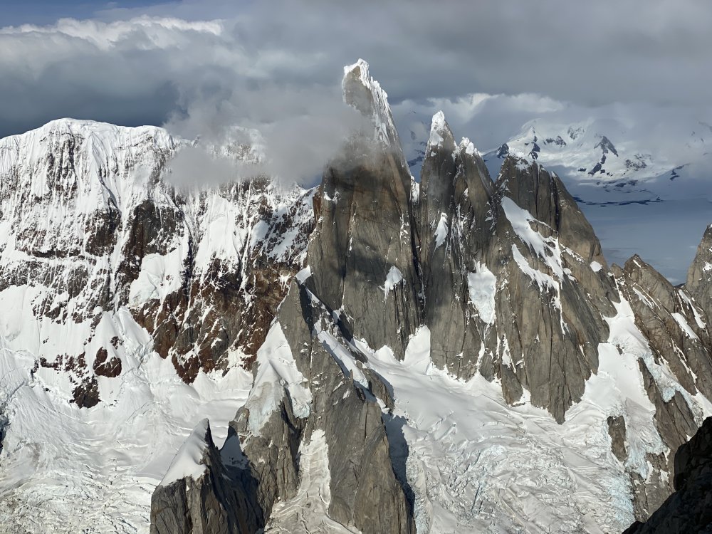

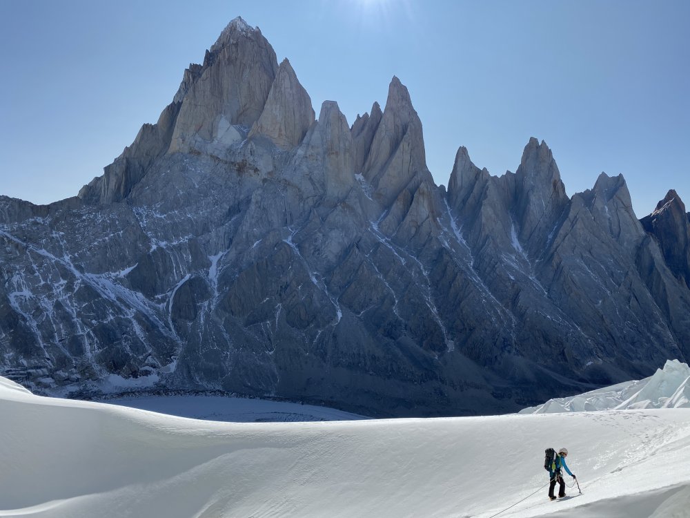

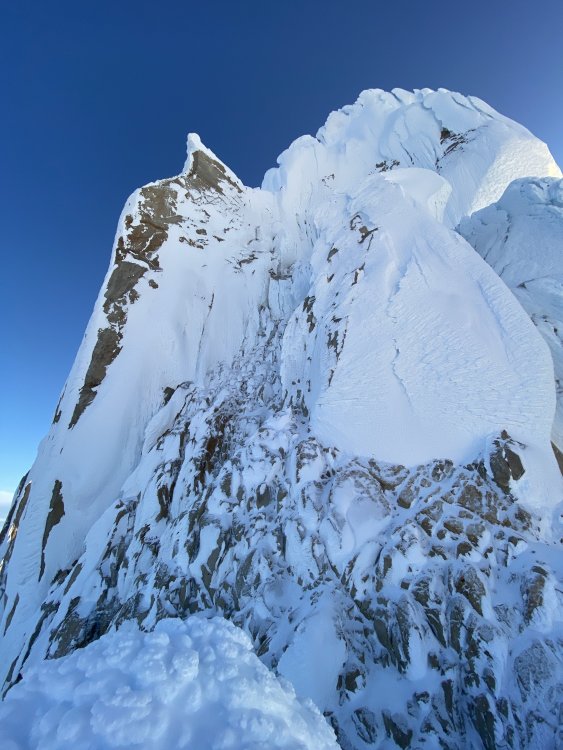
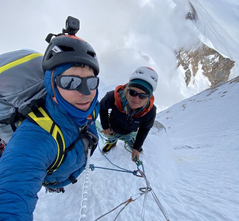
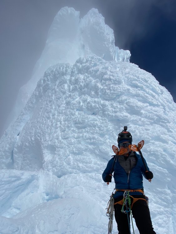
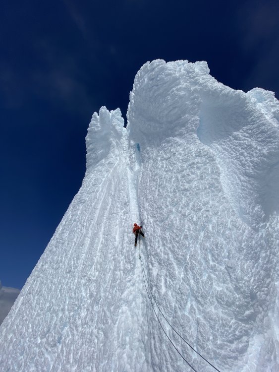


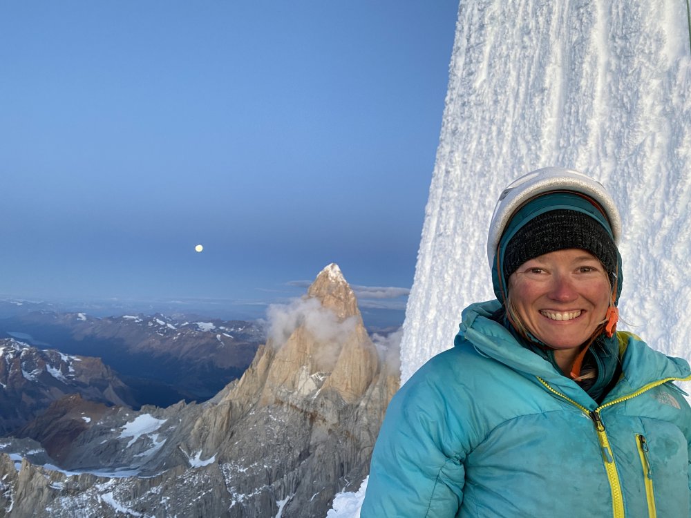
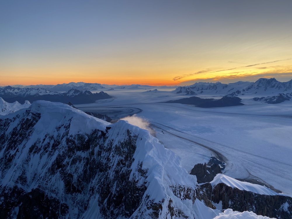


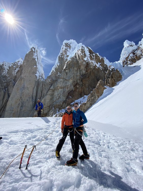

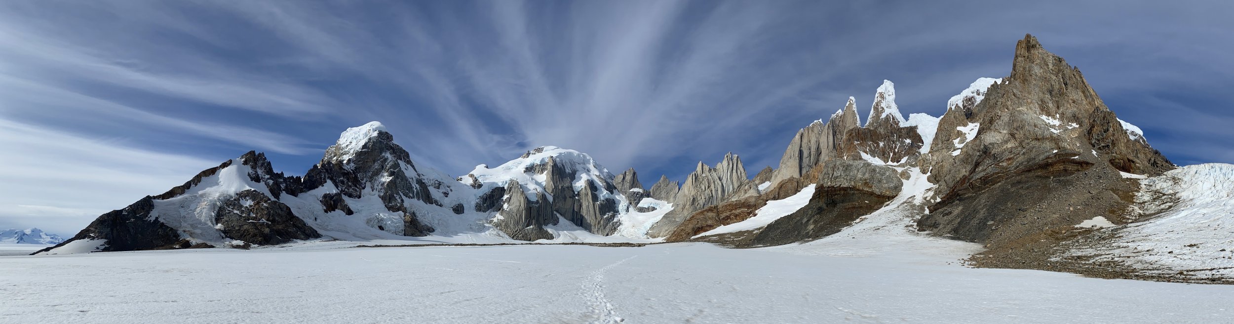
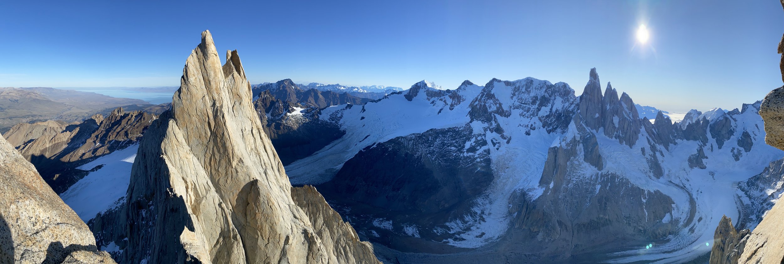
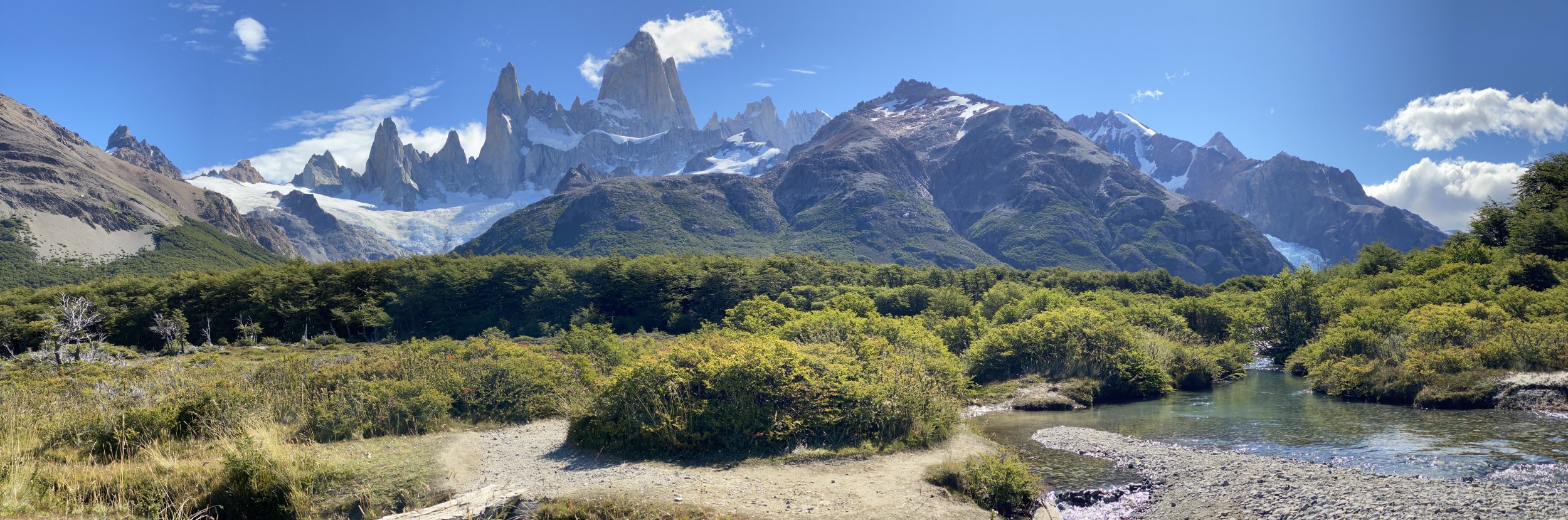

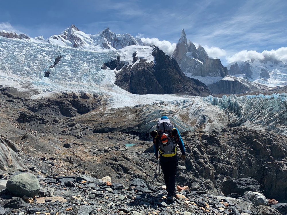
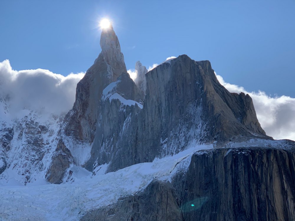


-
 Trip: Banks Lake, WA - Zenith, Emerald, Cable, Razorblades plus others Trip Date: 03/03/2019 to 03/14/2019 Trip Report: With reports of an incredible season at Banks Lake, my partner (Joe Peters) and I decided we needed to get over there. We drove over on March 3 to find a good place to set up a camp. Joe had to finish a couple things at work, but my wife Trisha came out to climb for the 1st two days until Joe got back. Then Joe and I were able to spend another 9 days climbing some of the wildest ice I have ever been on. Banks lake is that good!! I didn't list any grades in this trip report. Banks is a funny place and I found that grades were tricky to judge. In the end I decided that Wayne Wallace was right when he said..."Grades don't matter, everything here is hard." We camped in Joe's tipi tent which is pretty luxurious complete with stove for heat and drying gear. The best spot we found to camp was right across from Salt and Pepper. Camping limit is 15 days, it was free, and there was a toilet. We were able to sit in camp and stare up at Salt and Pepper every evening. Evening light in our camp. The view of Salt and Pepper from camp. (photo credit Joe Peters) Living it up inside the tipi. With that stove we could be sitting around in a t-shirt. It was absolutely essential for drying out boots and other wet gear after climbing every day. Here is a brief overview of our trip. 3/4 - Peewees #2, 3, 4, 6, and 7 3/5 - Climb below Emerald, Trotsky's Folly and Trotsky's Revenge (also called Phase Transition) 3/6 - Peewees #1 and 5 3/7 - The Emerald and Satan's Panties (also called Absent Minded Professor) 3/8 - Tea 'n' the Sahara 3/9 - The Cable and H2O2 3/10 - Unnamed climb Butch Cassidy in Moses Coulee 3/11 - Bombs over Old Baghdad (the climb across Banks lake at MP3) 3/12 - Shitting Razorblades 3/13 - Salt and Pepper 3/14 - Zenith I will just let the pictures tell the rest of story with a few captions. Peewee's Playground. I referenced these from right to left starting with 1 and ending with 8. Me leading Peewee #4 on the 1st day. A great place to start getting used to Banks ice! (photo credit Trisha Thorman) Craig Pope had just put up this line which he thought was probably an FA. It transitioned from the ice through the rock and out to the hanging dagger. It is Peewee #2 and he named it Turn the Page. This is a couple guys from MT climbing it on TR in the beautiful afternoon sun. The next day Trisha and I climbed this little flow. It was fantastic steep climbing that eased off about half way up. It is right off the road at the Emerald Pullout. It is amazing to me that there are so many of these lines that don't have names. Anywhere else and these good pitches of ice would all be named! Trisha doing a TR lap on Trotsky's Revenge. Day 3 Trisha headed back home and Joe arrived. Here Joe is arriving at the top of the fantastic Peewee #1. This is Satan's Panties (also called Absent Minded Professor). Rumor is that it hasn't come in for multiple years. It was a really fun multi-tiered climb that was a great warmup for the bigger climbs at Banks. The Emerald sits tucked up in a small valley above the main Banks Lake proper. It was a fantastic steep pitch of excellent climbing. It even faced north so it didn't get any sun to ruin the ice! Me leading the Emerald. (photo credit Joe Peters) Joe topping out on the Emerald at the end of a great day! With a cloudy day we decided to brave the lake and head across for some of the bigger lines. Thankfully the lake ice was thick and solid with no noises. The climb directly above me is Tea 'n' the Sahara. The one to my right is unknown.....it never came in this year unfortunately (or at least the dagger never touched down). (Photo credit Joe Peters). A closer view of Tea 'n' the Sahara. This was definitely my favorite climb of the trip. It consisted of 4 steep pitches each about 90-120 feet in length. The ice was typical Banks with plenty of excavating but the position and length of the climbing make it a classic for sure. Joe climbing the final steep 4th pitch. Looking back up at pitch 4 of Tea 'n' the Sahara from rappel. We were able to rappel the entire route with 2 rope stretching 70m rappels......take 70m ropes! (photo credit Joe Peters) The Cable....it is such an amazing, steep, crazy, gymnastic, different route. An absolute must do at Banks. Here Brian Williams is a little past halfway up the long pitch. Me leading the Cable. It is so good......just go do it! (photo credit Joe Peters) The Cable in the setting sun. Next we went to climb H2O2. Here are a couple of unknown climbers on it the night before. Yet another great pitch of climbing right next to the road. Here Joe is putting up H2O2 in the evening sun. The following day we drove over to Moses Coulee. Unfortunately Butch Cassidy and the Sundance Kid were pretty wrecked by the sun. This is an unnamed climb on the same road about 1/2 mile before Butch Cassidy. After reviewing the guidebook and talking with several other people this is actually Butch Cassidy. The climb between Butch and Sundance Kid is unnamed (although climbed). The WA ice guidebook has the wrong mileage to these climbs. Looking up at Unnamed route Butch Cassidy was awe inspiring. There were so many hanging daggers through the steep upper roofs. I gave it a go on lead but ended up sitting on a screw in the roof. I found out I wasn't fit enough to lock off on a tool and clean hanging daggers for that long. Still an awesome experience! Me approaching the large ice roof of hanging icicles. (Photo credit Joe Peters) The next day was cloudy so we headed back across the lake. This climb is right across from MP3. It isn't in the WA ice book and nobody seems to know what it is called. After staring at it disappearing into the fog above we decided to call it Stairway to Heaven. (Edit: sounds like it is called Bombs over old Baghdad) Here is Joe leading up pitch 2. The next day was time to get on Razorblades. This is a climb that had been on my list to do for a while and it didn't disappoint. Some years the first pitch isn't in or so thin that you can't protect it well. This year it was fat! Me leading up the crux first pitch of Razorblades. I don't think I have ever climbed ice by pulling on ice mushrooms with my hands instead of swinging my tools into the ice....fun but funky! (Photo credit Joe Peters) Finally after staring at Salt and Pepper every night for a week, we decided we needed to go and do it. The guidebook made the 1st pitch sound hard and scary. It climbs the loose rock on the left and traverses up the snow ramp to the ice. It was loose, but I found a decent pin and a couple cam placements. You definitely don't need a #3 C4. I would take a couple of KB pins and a set of cams from BD .3 to #1. The crux step of rock is easy 5th but it is loose and a fall would be very bad. Joe climbing up the steep ice of Salt and Pepper. It was a fantastic climb with big exposure. This is looking straight down for about 300 feet. We wrapped up our trip with Zenith. A fitting end to a fantastic trip. It was very fat this year but still steep and long! (Photo credit Joe Peters) Joe and I on Zenith. Being a roadside crag, many times a few people stop and watch. Sue Tebow was one such person but she was kind enough to leave us her contact information so we could get a couple pictures she took. It is always a treat to get both the leader and the follower in the same picture. Thanks Sue! (Photo credit Sue Tebow) A final parting shot of the huge deathcicle above Zenith. It was so fascinating to look up at but we wasted no time in getting out of there. It consisted of a thin hollow tube of ice that extended 30 feet or so below the cliff. Out of the center poured a huge amount of water. (Photo credit Joe Peters) Gear Notes: Ice screws and 70m ropes Approach Notes: Short and easy unless you are crossing the lake!


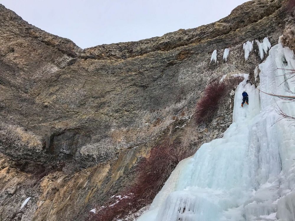
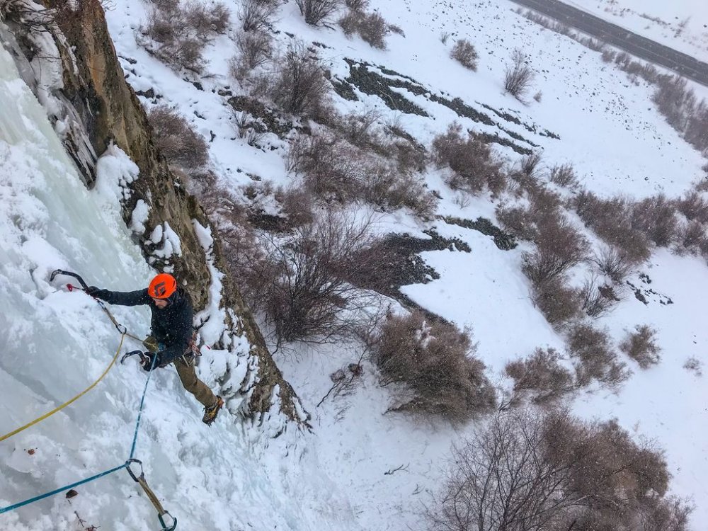
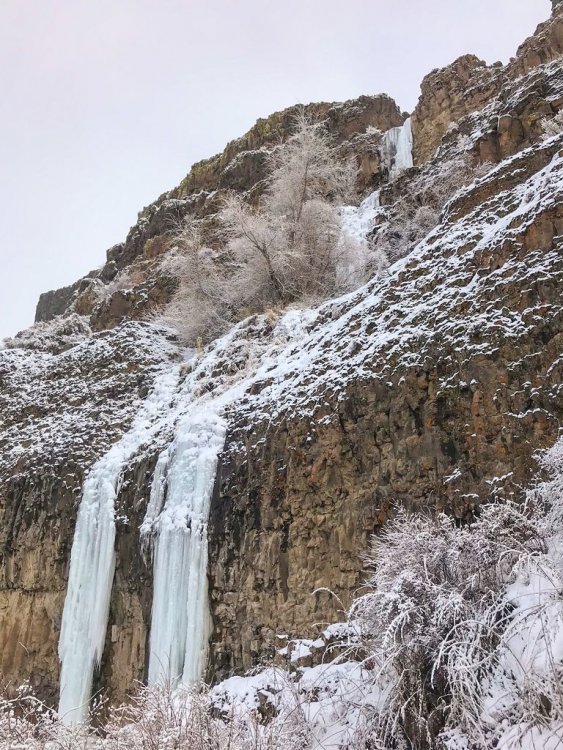
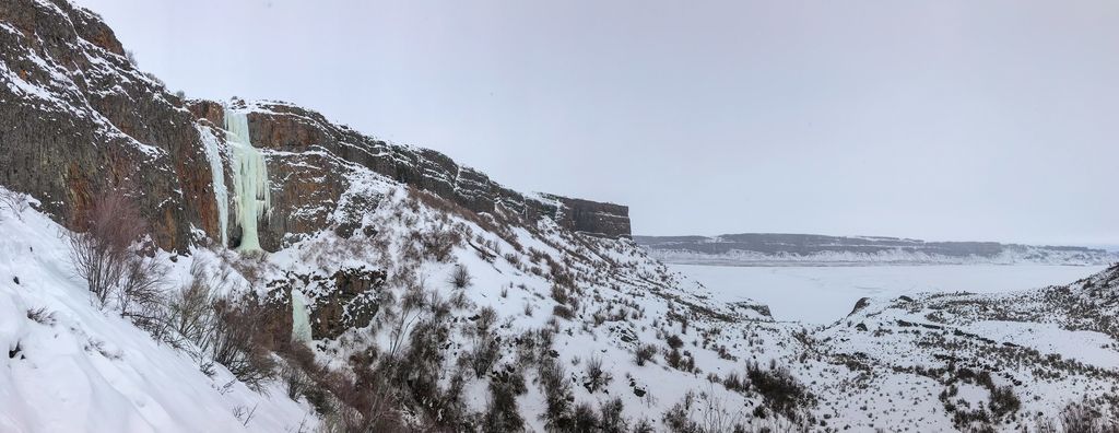
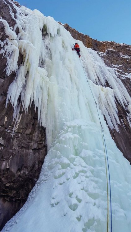
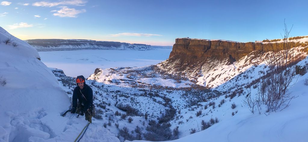
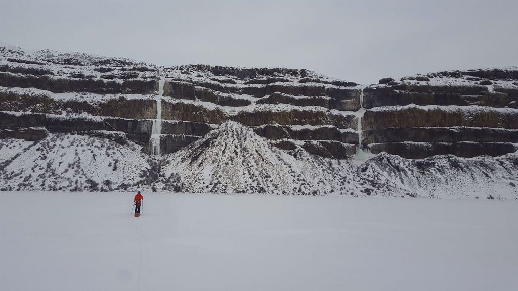
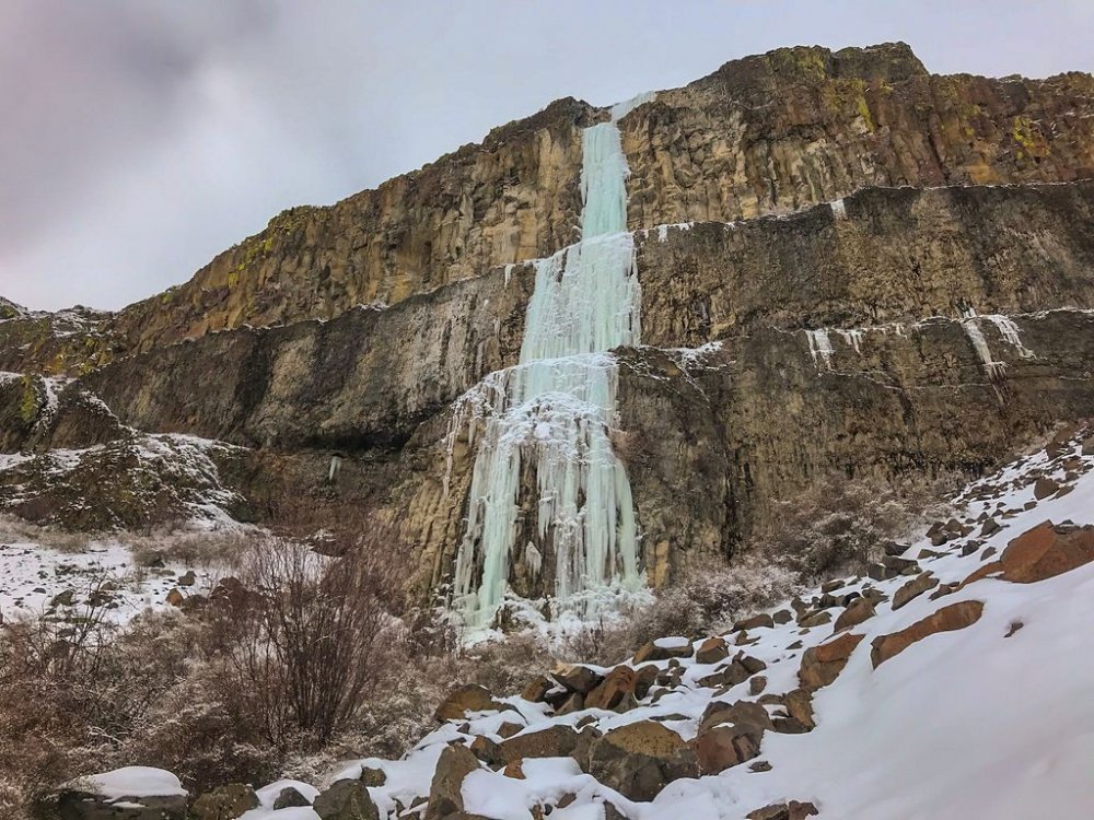
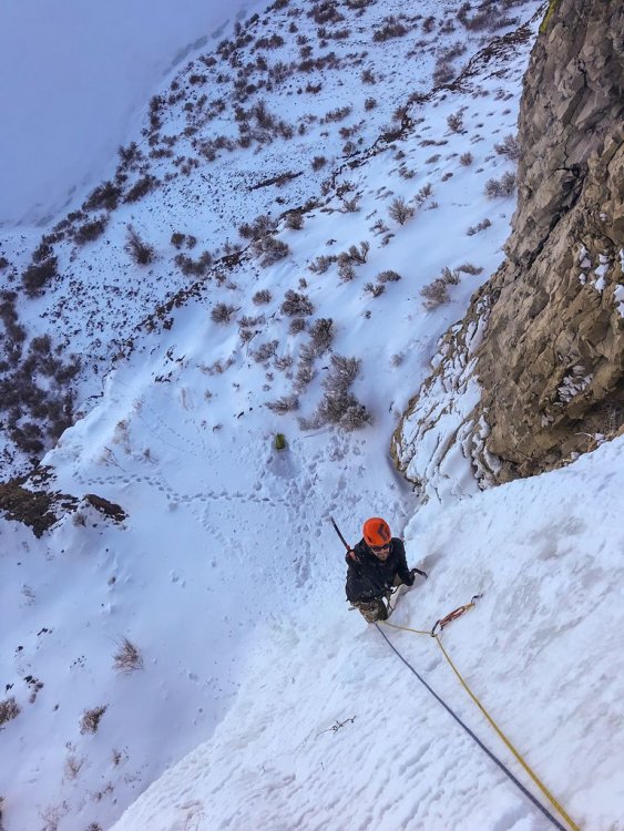

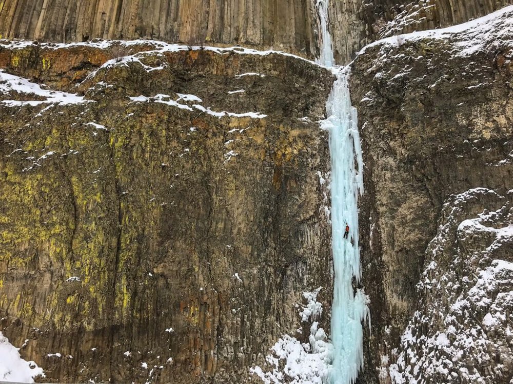

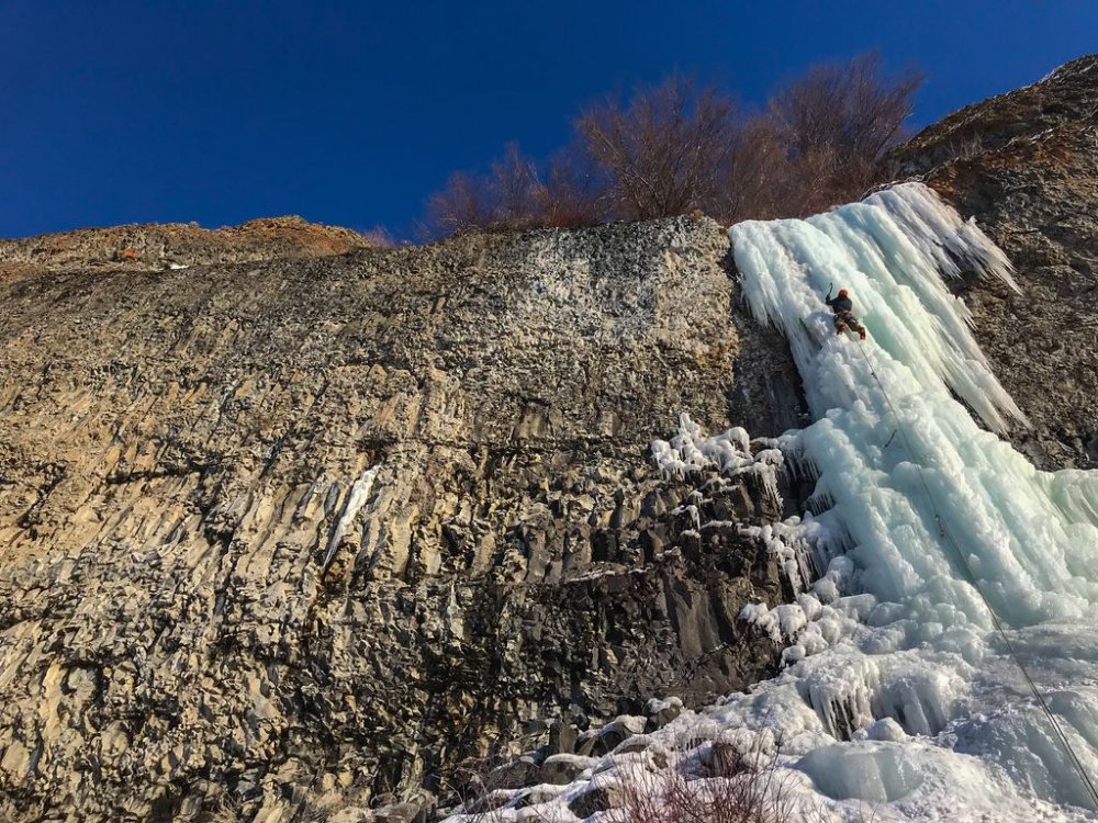
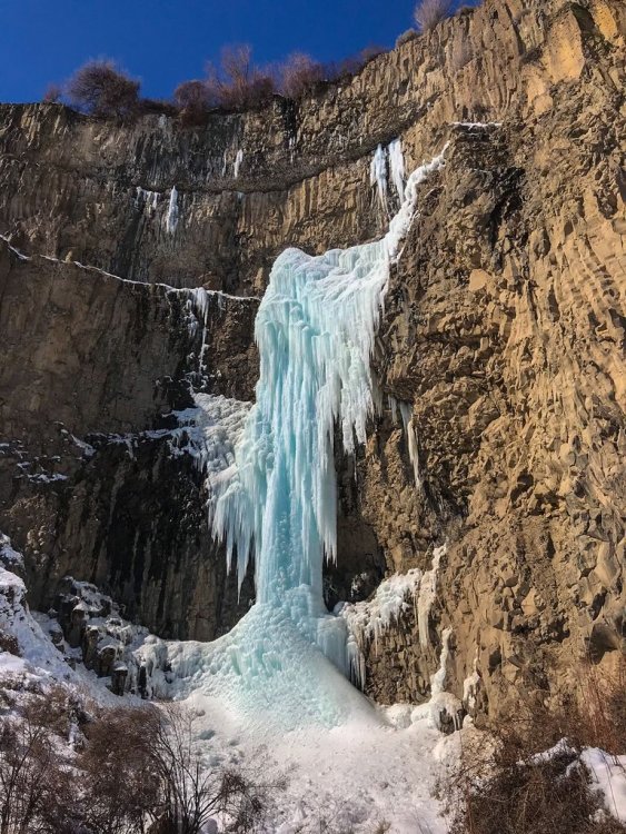
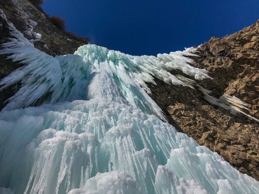
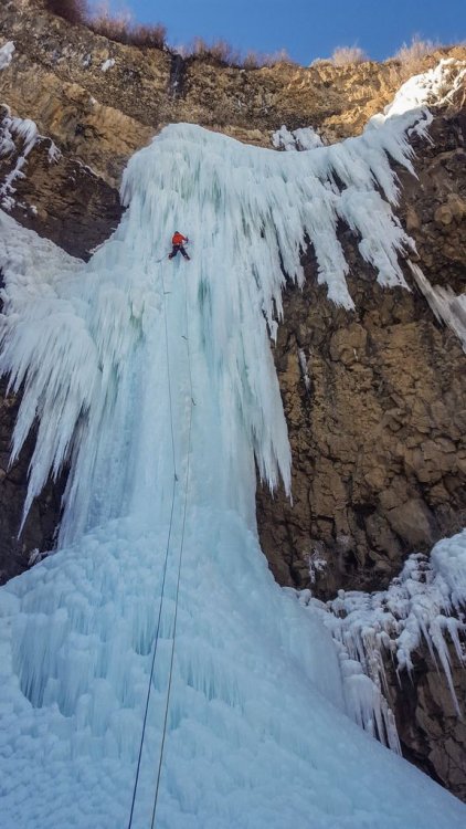
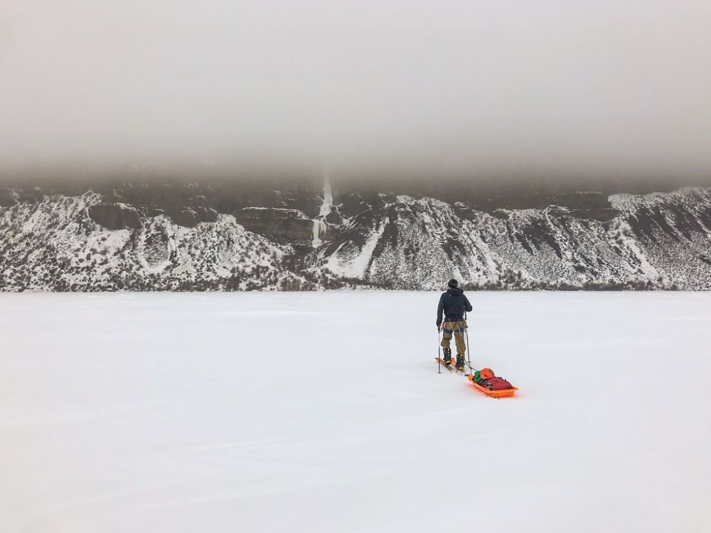


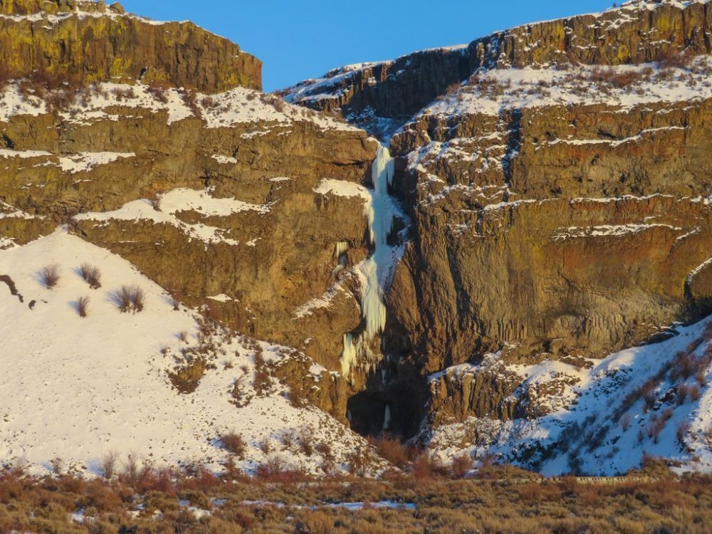
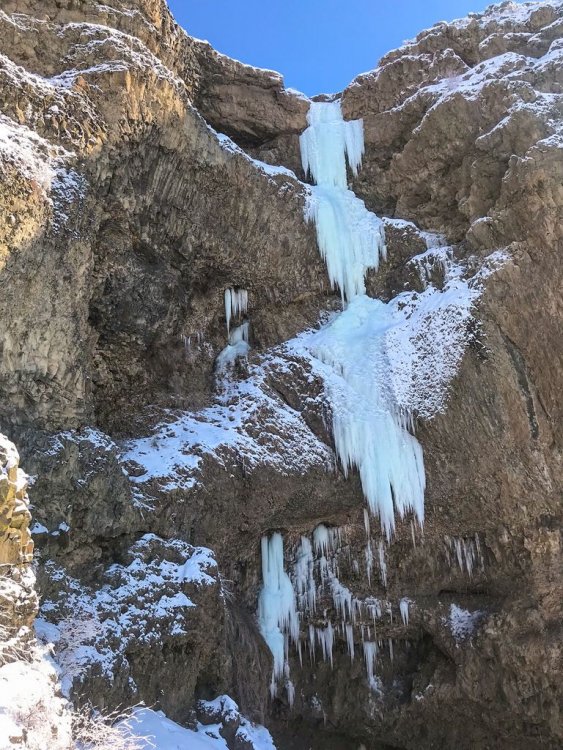

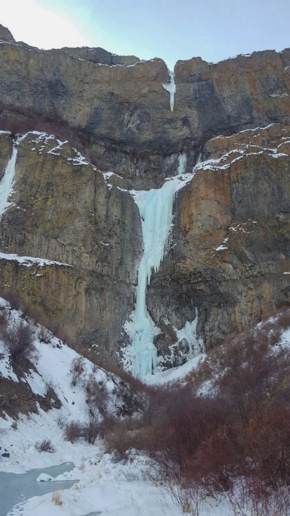
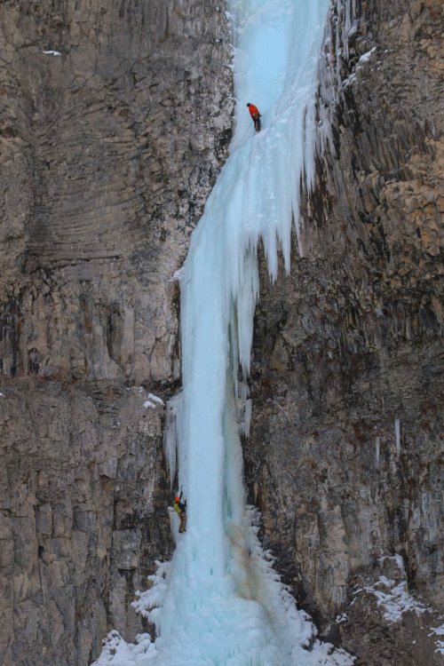
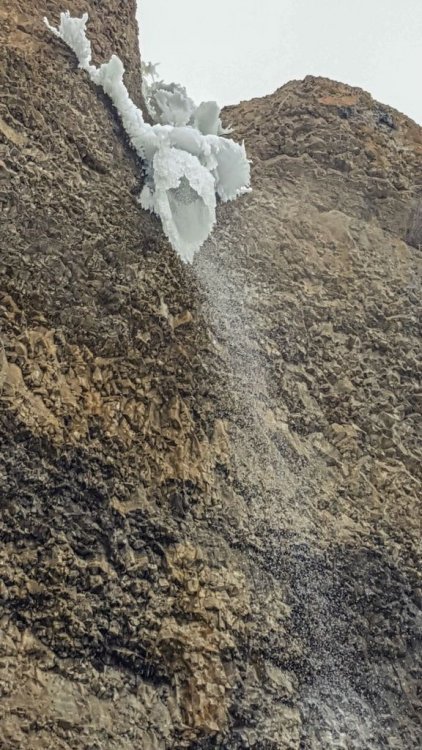
-
 Trip: Bear Mountain - North Buttress: Beckey Route Trip Date: 07/15/2018 Trip Report: Bear Mountain: Two new dads trying to keep a 10 year dream alive For me, mountains can become obsessions, sometimes to the point of irrationality. In my life, no mountain, or route has been more indicative of this than the North Buttress of Bear. I stumbled upon Bear in 2007 in my early days of climbing WA by devouring each page of the Beckey guides like they were some gripping novel. Trip reports from this site only further set the dream of someday ascending this monster objective. Being nothing but a budding sport climber at the time, this peak seemed out of my grasp. As the years went on, I honed my mountain skills. I learned to trad lead, sent my first few alpine rock routes, got on my first glaciers, and began developing the mind for the rigors of schwacking in the cascades. By 2011, I began thinking this dream could possibly become a reality for me. I even found a climbing partner, Andrew, who shared my dream. Each year we'd talk about making our dream a reality but each Summer would come and go without an attempt. For 5 years in a row we'd try to make plans only to see them fall through. Timing, schedules, obligations, weather, forest fires, and work all conspired against us. Fast forward to 2016, and each of us became fathers of our first children. Yet another reason to push Bear farther from our grasps. During the first year of fatherhood I discovered, although not surprised, that being a father does not easily co-exist with committing alpine objectives. My fit physique, lead head, and drive for summits began to recede like the glaciers surrounding the peaks I had grown to love so much. Over trail runs, occasional crag days, and family outings, Andrew and I still spoke of our mutual dream contrasted with our diminished abilities. One thing was clear from these conversations: the dream, and our stoke was still alive for our beloved Bear. Spring of 2018 came around. It had been a dismal Winter of training. Trips to the crags confirmed, family obligations and our lack of training over the Fall and Winter had left both of us less than prepared to crush in the coming Summer, but we began to discuss plans for Bear as we did every year. We settled on the dates of July 13-15 and began attempting to play catch up with our training. As the dates drew closer, one thing became certain, neither of us felt strong. But the week of July 4th came and still nothing looked to foil our set plans. So early July 13th we made the early morning drive to the end of the Chilliwack road along Chilliwack Lake in British Columbia. The bushwhack across the border and out to bear camp lived up to its dreaded hype. Six hours of magical, rarely touched old-growth forest contrasted with the torturous efforts required to navigate and move through said forest left us bewildered and uncertain. This uncertainty as well as the contrast of beauty and torture would be a reoccurring theme over these 3 days. From bear camp to the bivy on the western shoulder of bear is 4000 vertical feet up. A quarter of the way up, late afternoon, and we were beat. I am on liter 5 of water, schwacking in my underwear due to the heat and effort. Both of us are bonking and cursing ourselves for thinking we could pull this objective off. We were not fit. We had not trained enough. Doubt began to dominate our thoughts. It has already been 8 hours of this shit and we still had 3,000 feet of trail-less hell ahead of us. Who were we kidding? There was no way we were going to make it to camp before dark. We sat, uncomfortably, on a steep slope, in the middle of nowhere and began talking of retreat. "Squamish isn't too far away, is it?" "I guess we could always just crag at Mt. Erie on our way back to Seattle." Inside, a voice screams at my exhausted brain, "MT. ERIE!!!!???? Are you fucking serious!!?? I am never coming back into this valley again. It is now or never for Bear. The dream either lives or dies on this shitty, viewless, insignificant slope." My senses kicked back in. Remember, anything too big to fathom all at once needs to be broken into digestible chunks. The decision to push on grew from this and we decided to at least try to make it to the lake for the night and we would make the next decision from there. Two hours later, after 1,000 feet of extremely steep blueberry bush pulling, we broke out into the alpine and our spirits began to soar like a vulture in a thermal updraft. It’s amazing how something as simple as alpine views can change the mindset and determination of a climber. I began to feel rejuvenated. Maybe we could make the bivy site before dark. A heather-strewn meadow on a gentle shoulder gave us the first real physical break of the day. Panoramic views of remote North Cascade summits rose all around us. A mother Ptarmigan and her brood of chicks sprinted out of the bushes, snapping me from my alpine daze. Discussions of a potential closer bivy site gave us a closer goal. Running on fumes, past the lower bivy spot, and we still have light. Must, keep, moving. At last, 12 hours after leaving our car, we collapsed at the col. We had made it. I promptly gave the double middle finger to the valley below, clearly showing the shit-show we just wallowed through. We promised ourselves we would not make a decision about what to do about the next day until after we ate. Dinner went quick. As we crawled into our bags, we listened to the cacophony of a thousand tiny flying vampires trying desperately to find a way through our netting and into our skin. Twilight lit the sky with a rainbow of color. We both agreed that since we had overcome the uncertainty and brutality of what many, including us, consider the hardest approach in the Cascades, we felt obligated to throw ourselves at the North face the next morning even as our bodies screamed in opposition. We awoke with the sunrise. I shook the heaviness of last nights sleep from my head and felt somewhat shocked that yesterday wasn't some dream/nightmare. I was here. We were about to start our summit day. A day we have both been dreaming of for at least 10 years. With each sip of coffee, my stoke began to rise. We strapped on our crampons and make a quick and pleasant descent onto the north side of the mountain. We turned a corner to catch our first glimpse of Bear's north buttress. Ominous, glorious, stunning, perfection on ice. Words cannot really describe the feelings I had, but these are close. Upon seeing both the direct north buttress and the north buttress couloir, we checked in. The direct looked safer as the couloir looked broken up near the top, but our energy levels and dismal cumulative rock pitches for the year had us thinking that the extra rock pitches might not be reasonable. We settled on following the couloir and Beckey's footsteps. In hindsight, this might this might have been a bad idea, but I am pretty sure I would have said the same thing if we had taken the other option. Either way we felt the collective weight of our dreams, the debilitating approach that we vowed never to do again, and the sheer power of what we were trying to accomplish. I felt as if every step upwards tightened the grip of the vice we were in. Committed, for better or worse, to move upwards. We switched back and forth from approach shoes to crampons a few times and quickly found ourselves in irreversible territory. There is terror and clarity in realizing the only way out of a predicament is forward. We broke out the rope to lead our first pitch out of the couloir. A shit show of snow, poor pro behind detached blocks, and slopey ledges littered with rocks of all shapes and sizes. My rope skirted across a ledge and sent a microwave down towards Andrew. Our years of work together in the mountains gave us the foresight to expect such events and was glad Andrew had set himself out of harm’s way before I led. We had reached the 4th class ledge system that would get us up to the North buttress proper. Kitty litter, slopey ledges, and the exposure below made for careful, calculated movements while simuling, often without adequate gear between us. Trust in each other became paramount and again I found myself thinking that I was thankful to be climbing with such a trusted partner. At last, we reached the first real quality pitch of the route. Beckey's glorious left facing 5.8 corner. Andrew led and we both laughed at the idea of "5.8" at the top. It felt like index 5.9+ but would be an instant classic if situated at the lower town wall. We were finally finding some type 1 fun. I linked the next two pitches of fun and deposited us at the base of the infamous 10a offwidth. DE8DD876-06ED-4585-BEE2-4CF80B5ED29B.MOV It was at this point that we began to feel the efforts of the pat 36 hours. Dehydrated, low on energy, and stoke, Andrew reluctantly agreed to lead the next pitch and quickly made the decision to take the 5.8 bypass pitch. We ended up breaking this pitch into two because the lower portion of the offwidth took most of our small cams and the upper 5.8 portion looked to take nothing bigger than a .75 BD. Crap. We swapped leads under the only stance Andrew could find conveniently under a car sized detached block. I was tasked with leading over it and him without touching it. Yikes. I led to a nice ledge and brought up my partner. Both of us feeling both physically, mentally, and emotionally drained, we began to flounder. Neither felt the desire to lead the next pitch. Bonking hard, I finally took the sharp end. Staying on the crest I mantled to the base of a steep featured, but unprotect-able face. I began to lose my cool. 15 feet above a ledge and my last piece and seeing committing climbing and no cracks above me, I retreated. Reversing the mantle had me nearly hyperventilating but I, somehow, safely made my way back to the anchor. We discussed our predicament, spied a horn with rap slings 30 feet down to our right and consulted our beta. We both thought that this was the Beckey rappel that would take us to a 4th class gully exit but our position would not allow us to confirm it. Below us, the gullies looked vertical, smooth, and crack-free. Committing to the rappel felt serious. Andrew rappelled at a diagonal across ribs, at times placing gear as directionals to reach the farthest gully. Upon reaching the first gully, Andrew looked up. There is no way that is 4th class. Second gully. Sweet baby jesus! It goes! Relief washed over us like a warm caribbean breeze. I rappelled down and we quickly began to lead. We both just wanted to be done with this endeavor. How quickly a dream becomes dread. My mind screamed, "Get me the fuck off this mountain!" After two rope stretching pitches and some mid fifth climbing (another sandbag) the Sun hit our darkened spirits and the tomb I'd climbed myself out of was no more. A few hundred feet of 3rd class was all that separated us from the summit. Elated, exhausted, and emotional, we hugged. I looked over the edge, down the north face and wept. Tears of joy, relief, and sadness fell hundreds of feet down the alpine face of my dreams. I always pictured myself feeling triumphant at this moment, but instead all I felt was relief and the intense desire to hug my wife and two year old son. We had done it. We had fought through constant moments of fear and uncertainty to obtain our dreams, but I felt far from dreamy. As we began the descent, I turned around and gave one last look at the summit of my dreams and gave it the double middle finger. I was done. I could close this chapter of my climbing pursuits. Fatherhood has changed my drive, my dreams, and my abilities. I am unsure if I will ever climb anything like this again, but much like any overwhelming obstacle, I will take it one decision at a time. Who knows how I will feel about such commitment and risk taking in the future. We hit a mellow snow slope and just like any decision we made that day, we assessed the terrain and made the best choice for moving forward. The joy in the glissade took me by surprise and I burst out into a giggle fit. Type 1 fun!!!! What a wild ride of emotions. We reached our bivy a half an hour before sunset. We smiled and laughed as we recapped the day. Feeling thankful and shocked to have pulled the ascent off, we crawled into our bags, passed a joint back and forth and fell into philosophical ramblings about life and reality. What a life we live. The next morning we made the long march back down to bear camp and through what felt like endless old growth shenanigans pushed by the thought of a dip in Chilliwack lake and the beer stashed there. Upon reaching the lake we found the beer gone, hoards of people on what I thought would be a secluded beach, and leash-less dogs aggressively charging us while the owner continued to flirt with some bikini-clad girl. WTF. I thought that was the shit-cream on top of a long and miserable day, but oh no. Upon reaching the trailhead I saw my car in the distance but somehow it did not look like my car. The back window was missing! Someone had broken into my car! Son-of-a-bitch! As we got closer, the horrific reality set in. My car had not only been broken into, it had been set on fire. The tires, the windows, the interior. Everything that could have burned did. My car was a hunk of metal and nothing more! I was in disbelief. How was this possible!?? How are we going to get out of here? Is this a nightmare? Am I still in the mountain sleeping in my bag and this is some horrid hallucination fueled by the joint and exhaustion? Nope. This was reality. Whoever did this also nearly set the entire forest on fire based on the completely burnt cedar behind my car. Jesus Fucking Christ! We could have been trapped in that valley if they had succeeded in doing so! As my mind swirled with the gravity of our situation, the last car in the parking lot approached us and gave us a ride into town dropping us off at the Chilliwack police. After reporting what had happened, expecting surprise, they just smiled and said, "Yep, this has been happened a lot this Summer and there was little they could do about it. They gave us our police report number and directed us to a local bar and motel. I called the border to confirm they would let me back into the states without my passport (burnt in the car) and made arrangements for a friend to come pick us up. ”the urban mountaineer” This trip will live in my mind till the day I die and will hopefully entertain many. Journeys like this are great reminders for what is important in your life and just how lucky I am to be apart of this amazing planet. Get after what fuels your soul people! Gear Notes: 60 m rope Double rack tops to fist. Single 4 and a set of stoppers. Lots of alpine slings Approach Notes: Follow the tape till you can’t then turn on your zen and be one with the forest.
- 26 replies
-
- 14
-
-
-
-
Trip: North Cascades - Southern Pickets - Southern Pickets Enchainment (Traverse) – Second Ascent Trip Date: 08/17/2018 Trip Report: Climbers/Scribe/Photos: Jeff and Priti Wright Priti and I completed the Second Ascent of the full Southern Pickets Enchainment (Traverse) between 8/12/2018 and 8/17/2018 via the first ascensionists’ agenda (VI 5.10+, ca. 3 miles). Thirteen peaks in four days staying on technical terrain enchaining every peak in the Southern Picket Range from East to West. The Chopping Block was our 14thpeak on the last day à la Bunker-Haley-Wallace. We were lucky to have splitter weather the whole time except for our approach day which was non-stop drizzling and kept us from jumping on the rock right away. We had previously attempted this climb during the July 4thweek earlier this summer but were stormed off at the base of Mount Terror. View of the entire Southern Pickets from Mount Triumph. Photo Credit: James Blackmon (1) Little Mac Spire, (2) East McMillan Spire, (3) West McMillan Spire, (4) Tower 1 summit of the East Towers aka "Don Tower", (5) Tower 5 summit of East Towers, (6) Inspiration Peak, (7) Pyramid Peak, (8) Mount Degenhardt, (9) Mount Terror, (10) The Rake aka "The Blob", (11) The Blip, (12) East Twin Needle, (13) West Twin Needle, (14) Dusseldorfspitz, (15) Himmelhorn, (16) Ottohorn, (17) Frenzelspitz, and (18) The Chopping Block The Chopping Block is on the left. History: FA: In 2003, this visionary line of 13 summits (Little Mac Spire to Frenzelspitz) was first completed by Mark Bunker, Colin Haley, and Wayne Wallace in an incredibly speedy 4 days car-to-car. http://c498469.r69.cf2.rackcdn.com/2004/34_wallace_pickets_aaj2004.pdf https://cascadeclimbers.com/forum/topic/15094-walking-the-fence/ 2011: Dan Hilden, Jens Holsten, and Sol Wertkin completed 12 of the Southern Pickets summits (Little Mac Spire to Ottohorn), but were halted by an impassable moat under the South Face of the final bookend peak, Frenzelspitz (a lesson we borrowed to not take the snow approach). https://www.outdoorresearch.com/blog/article/chad-kellogg-jens-holsten-tackle-complete-picket-range-enchainment http://www.alpinist.com/doc/web15s/wfeature-never-ending-holsten-kellogg https://cascadeclimbers.com/forum/topic/82900-tr-picket-range-complete-enchainment-attempt-922011/?tab=comments#comment-1029444 2013: Jens Holsten and Chad Kellogg traversed 11 of the Southern Pickets summits (Little Mac Spire to Himmelhorn), and carried on to the Northern Pickets to do a mind-blowing Southern and Northern Pickets traverse. Even though Jens humbly calls their climb an “attempt” since they left out three minor summits, their ascent was easily one of the greatest alpine achievements in the lower 48. https://cascadeclimbers.com/forum/topic/92032-they-made-it/?tab=comments#comment-1101276 http://jensholsten.blogspot.com/2013/07/desperate-country-seven-day-enchainment.html https://www.outdoorresearch.com/blog/article/chad-kellogg-jens-holsten-tackle-complete-picket-range-enchainment Legend In the topos below, note the following color codes -Blue circle: belays that we chose to take (all are optional, obviously) -Yellow arrows: Bail options, or ways to enter/exit shorter segments of the Enchainment -Green tent: bivy sites (note the comments) -Red lines: Ascent -White circles: Rappels -White lines: Descent Day 1 With our packs each weighing in at 28lbs, we hiked in to Terror Creek Basin via Goodell Creek through wet bushes and a light drizzle and bivied at the Terror Creek Basin High Camp. Day 2 As we roped up at the base of the start (Little Mac Spire) on Day 2, Priti glumly pulled two left-footed red Moccasym rock shoes out of her pack, but decided to keep going like the hardcore badass that she is! We climbed from Little Mac Spire (5.8) through East McMillan Spire (5.6), West McMillan Spire (5.8), the East Towers (5.8) summiting Don Tower and Tower 5, and finishing the day with Inspiration Peak (5.9). We had to climb up 1/3 of Pyramid to find a small snow patch for water and dinner. On our last trip in early July there was a lot of snow at the cols, so it was easy to find water. There was a lot less snow in the cols in August, making finding water along the traverse very tricky, to say the least. We filled our dromedary up every time we found snow. The smoke made the views hazy, but we could tell how far away the later peaks were, and how far we had to go. The base of Little Mac Spire The start of the technical climbing (5.7) on the face of Little Mac Spire The upper ridge of East McMillan Spire View looking West in July View looking West in August Upper face of West McMillan Spire Starting up Tower 1 Priti is belaying below Pitch 2 (5.8 with a hand/fist overhang) Inspiration Peak Summit is the impressive overhang on the left Day 3 On Tuesday (day 2 of climbing, day 3 of the trip), we started out on Pyramid (5.8), and traversed over Degenhardt (3rd class). We chose a steep face crack for the first pitch on Terror to start. This may be the 5.8 start Jens and Chad did. Starting further out left might go at 5.6. After finding the piton rappel off Terror, we downclimbed about half of the Rake-Terror col before starting up a loose gulley on The Rake (skier’s right). The climbing didn’t feel too hard, and we must have avoided the 5.9 R climbing described by previous parties. However we didn’t make it to the nice bivy at the summit, instead hunkering down on a slopey grassy ledge for the night. Snafflehounds poked me in the face and jumped on my feet to start the night out. The meteor shower sparkled above us. In the morning, Jeff found his helmet strap had been gnawed through, his crack gloves stolen and the nut butter munched. Nothing a little duct tape won’t fix! Starting up the technical climbing on Pyramid Peak Inside the crux chimney Day 4 On Wednesday (day 3 of climbing, day 4 of the trip), we only climbed for a few hours doing lots of fun ridge climbing on the Rake (5.8) which took us to the best bivy spot of the trip: on top of the West Rake Summit. It was so nice, we decided to relax the rest of the day and camel up for the next day. The choosy 4th class gully which exits the Terror-Rake col (about halfway down) on climber's right The entire Rake ridgeline is pictured here. Priti is on the initial ridgeline, heading to the Rake's deep, major notch (right of center). Stay high on this initial ridge to get to a 5.6 traverse about even with the notch to get over to the notch. Starting the traverse too soon may result in 5.9R climbing. The vertical ridgeline just left of the major notch is the technical crux. The technical crux of The Rake. This is the second pitch after getting to the major notch which takes you to the The Rake's ridge proper. 5.8+ ledges with small gear. Starting out on the Rake's ridge proper. Looking back at the Rake (Eastward) from the summit Guns out! Amazing bivy site! Don't stop at the col (aka "Ice Station Dark Star"), but continue to this bivy after a short pitch. Day 5 Thursday morning we woke up stoked for the Twin Needles and Himmelgeisterhorn. The Blip between the Rake and the Needles was a quick jaunt (5.6). In the descent gulley, Priti kicked a small rock down, which tipped a precarious car-door sized boulder over and core-shot our rope. She literally had two left feet! We just climbed the rest of the way with 40m of rope out. East Twin Needle (5.10a) had some of the best climbing on the trip, following an aesthetic line up the knife edge ridge, that looks like a gothic tower. There was a TCU that the previous party stuck behind a flake, and was reminded of the giant footsteps we were following. The last couple moves were extremely dirty though. The left variation of the crux is much easier than sticking right. West Twin Needle was chill 3rd Class. Then came Himmelgeisterhorn (5.10), the “Horn of the Sky Spirit”. The climbing was fantastic: engaging, with great position, and unique au chevaling! We climbed over Düsseldorfspitz, on the way to the summit of Himmelhorn. We rappelled down the North Face of Himmelhorn with our 60m rope which worked out perfectly. Ottohorn took about an hour to summit and get back down to the Himmel-Otto col. The 3rdclass route that Bunker-Haley-Wallace took is gone due to some fresh rock fall. Instead of taking the 2 pitch 5.7 variation that Hilden-Holsten-Wertkin took, we attacked the fresh rock scar directly which was splitter 5.6 hand cracks for maybe 15 m to the ridge and summit. In the fading light, we then headed over to Frenzelspitz (the final peak of the Enchainment) from the Himmel-Otto col, traversing along rock on the north side of Ottohorn. The ledge/gulley traverse had the most heinous, scary, exposed choss. Luckily the climbing on Frenzel was pretty great 5.7ish. We made four fresh rappel anchors, starting with a runner on the summit block, two double-nut anchors, and another slung horn. 5.8 ridge (vertical blocks) The fantastic climbing on the technical crux of East Twin Needle. Priti leading out onto the technical crux (and I mean technical!) - face climbing on crimps with small gear Looking up and over Dusseldorfspitz. Priti is belaying between Dusseldorfspitz (foreground) and Himmelhorn (background). The crazy outcropping (Dusseldorfspitz) just East of the summit of Himmelhorn Looking back down from the Himmelhorn summit at the belay. Left to right: Dusseldorfspitz (the small spire along the ridgeline, just below the summit), Himmelgeisterhorn ("Horn of the Sky Spirit", also a small suberb of the German city of Dusseldorf), Ottohorn, and Frenzelspitz...three names taken from the label of a mustard bottle brought along by Joan and Joe Firey (kindred spirits and personal heroes of ours) during their first ascent of these peaks in 1961. Ed Cooper, also on the trip, was "aghast" at the names chosen! The magnificent Northern Pickets Frenzelspitz, a perfect pyramid Day 6 The last day we climbed the Chopping Block via the NW Route (4thClass) and hiked out via “Stump Hollow” to Terror Creek. Mega thanks to Wayne, @solwertkin, and @jensholsten for their great beta, inspiration, and support. Priti and I have been dreaming of this climb for years now since reading Alpinist 47 magazine’s expansive article on the Picket Range and being inspired by Jens Holsten and Chad Kellogg’s 2013 Pickets Traverse (of both the Southern and Northern Pickets, 10 miles) after we had just taken the @boealps Basic Climbing Class. The next level of alpinism in the Southern Pickets may be to complete the entire enchainment in a day! This seems like an entirely reasonable feat (especially for a soloist) given enough familiarity and speed. Bivy Beta: Primo bivies (East to West) base of West McMillan Spire descent (snow through the summer, nice bivy walls) base of Mount Terror, cross over ridge to North side - late season snow available on top of the Rake sub-peak (1 pitch past the “Ice Station Dark Star”) – lots of snow just a short scramble distance away along the Rake descent. Himmel-Otto col (if no snow on the col, make one rappel toward Crescent basin to find snow) Terrible bivies (East to West) base of East McMillan Spire descent (sloping ledges, snow early season) slabby ledge about 1/4 the way up the Inspiration West Ridge (exposed) Pyramid-Inspiration col (no snow late season) grassy ledges down and climbers left when you first gain the ridge proper at the start of the Rake “Ice Station Dark Star” (as coined by Hilden-Holsten-Wertkin) which is the col after just rappelling from The Rake summit (snow early season, but rappel north late season to find snow down a heinous choss gully)…if no snow just at the col, then recommend continuing on to the Rake descent to find tons of easily accessible snow in late season Himmelhorn summit (no snow) Gear Notes: small set of nuts and some brassies doubles BD UL Camalots .4-2 single BD UL Camalot 3 (for Inspiration East Face) singles BD C3 000-1 (extra green 0) single BD Camalot X4 Offset 0.1/0.2 single BD Camalot X4 0.3 singles Metolius Mastercam 0-3 4 double-length runners with 2 Camp 22 biners each 3 double-length runners with 1 Camp 22 biner each 9 single-length runners with 1 Camp 22 biner each (can’t have too many runners) 30L Patagonia Ascensionist pack (for him) and 30L Black Diamond Speed pack (for her) Patagonia Micro Puff jacket (each) Patagonia Alpine Houdini jacket (each) Patgaonia Nano-Air Light Hybrid Jacket (for him) 2L MSR DromLite (essential!) Garmin inReach Mini (love this little guy!) Beal Escaper (for emergency bails) Petzl Leopard FL crampons (each) Petzl Sirocco helmets Petzl Sitta harness (for him) and Arc’teryx harness (for her) Metolius Feather Nut Tool (each) Camp Corsa Nanotech 50cm (each) chalk bag, each (didn’t use) tape gloves (for her) and OR Splitter gloves (for him) x2: Mammut Smart belay device (not the Alpine Smart) + Grivel Sigma Wire D carabiner 3 lockers for group: Grivel Tau K12L, Grivel Lambda HMS, Grivel Plume 60m 8.5mm Beal Opera rope 15m 5mm cord (did not use ever) 1 medium fuel canister 1 small fuel canister (did not use) Jetboil Sol stove Safety ‘biner (each) – Edelrid 19g caribeener, Petzl Micro Traxion, short Sterling Hollowblock, Trango Piranha knife Bivy setup (each) – Short Thermarest NeoAir XLite sleeping pad, Exped Air Pillow UL, Feathered Friends Vireo UL sleeping bag 8.5ft^2 tarp by Hyperlite Mountain Gear TC Pros (for him) and Moccassyms (for her) La Sportiva TX2 (for her) and TX4 (for him) approach shoes Petzl Reactik headlamps (each) + 3 extra AAA batteries + Petzl e+LITE headlamp Other things: 1 long spoon to share, chapstick to share, small Joshua Tree sun stick to share, Kenu iPhone tether, lighter, whistle, duct tape, Thermarest repair patches, Voke tabs, Nuun, pain killers, 1L Platypus soft water bottle (for her) and 750mL HydraPak Stash (for him), warm headband, glove liners, 1 pair thick long socks (each), sunglasses, ear plugs, WRFA emergency form, small pencil Dinner: 2 AlpineAire meals, 3 Near East Couscous boxes repackaged with small olive oil packets in ziplock bags, salt Day food was mostly bulky, yummy snacks: vegan jerky, dried mango, nuts, Cheese-Its, sesame sticks, Gu, nut butter, etc Approach Notes: Excellent Approach trail Goodell Creek to Terror Basin. The descent from Crescent Basin is tricky The luxurious tree marker where one descends from the ridge below "Stump Hollow" towards Terror Creek Log crossing Terror Creek on descent


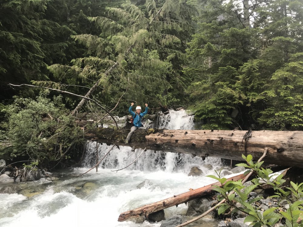
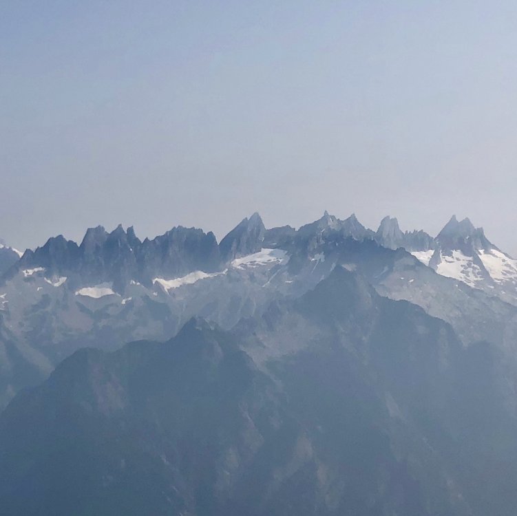


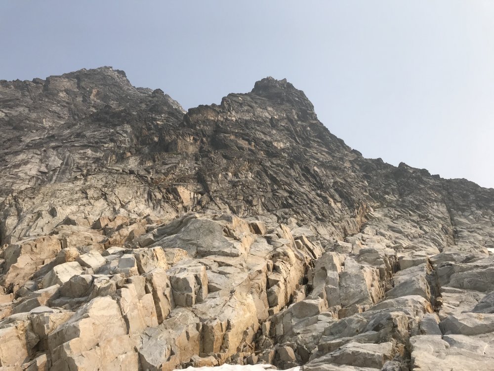
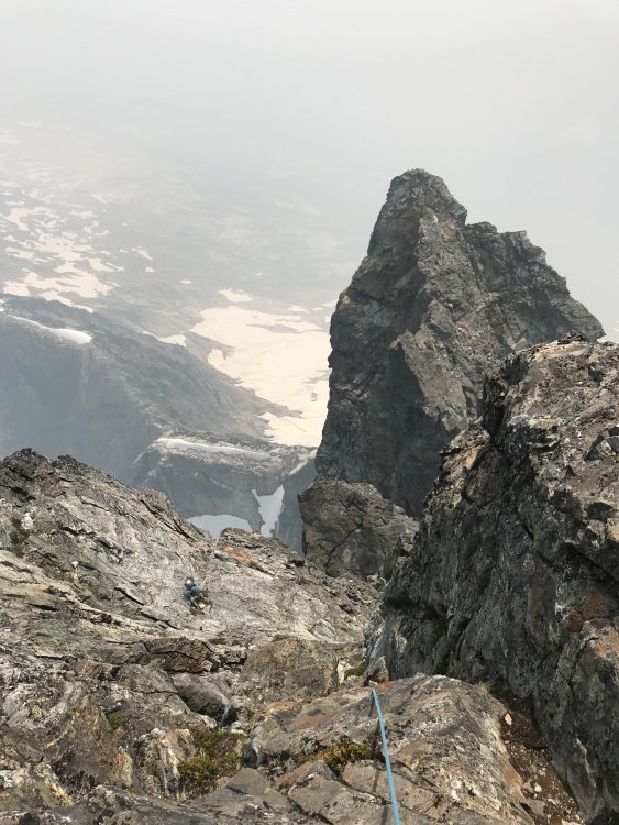
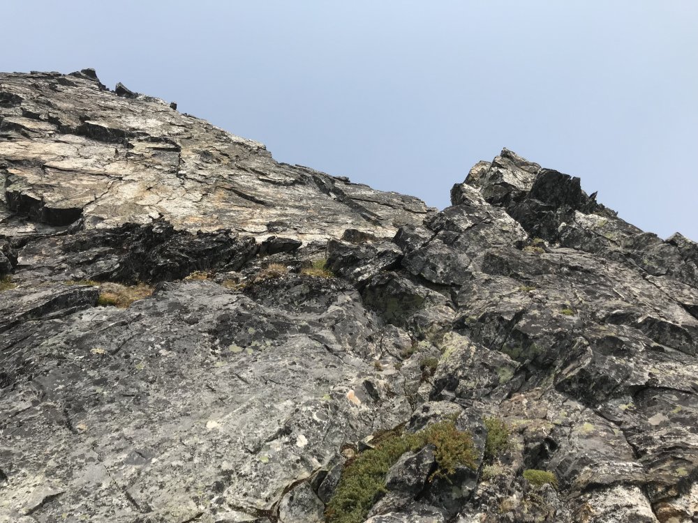

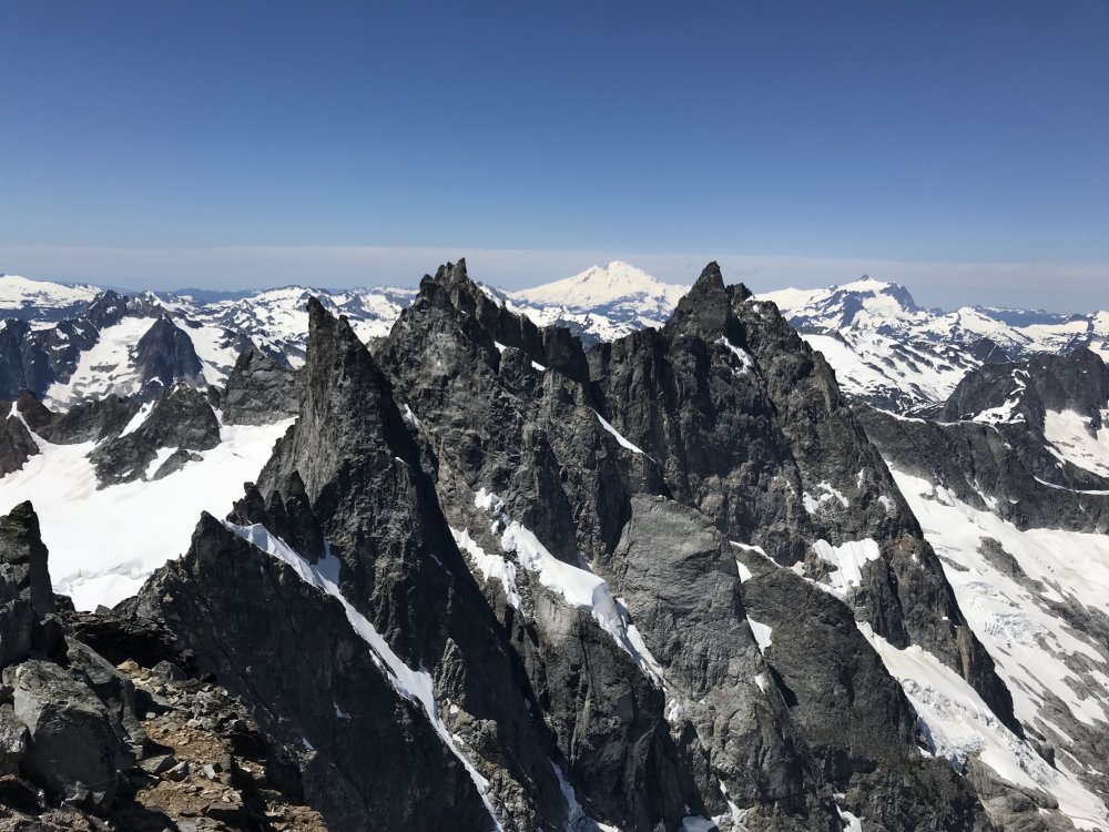
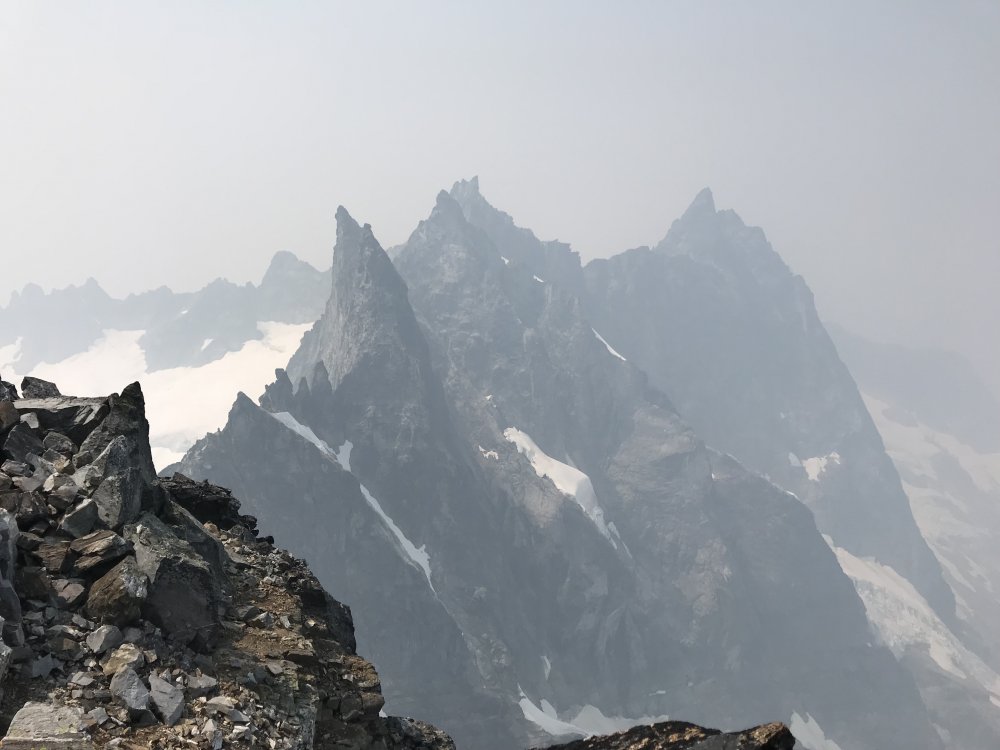

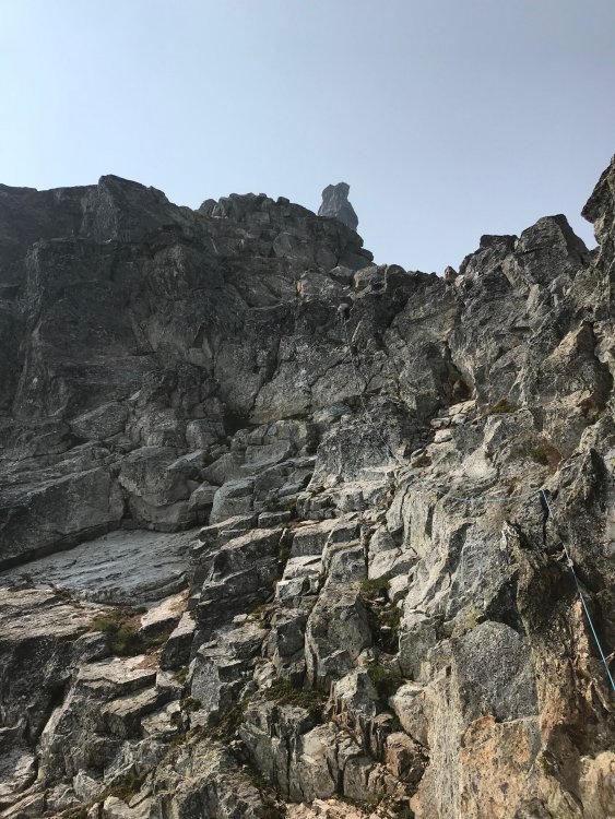

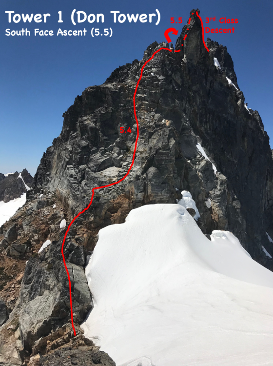
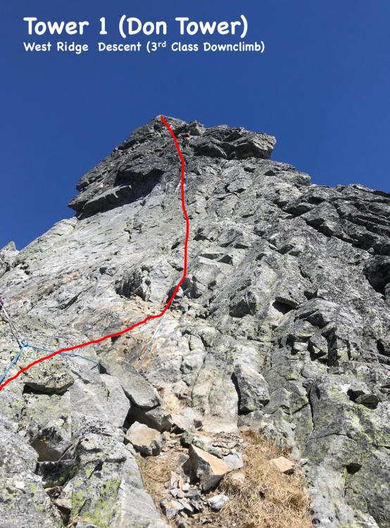
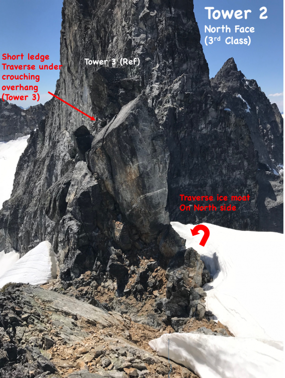
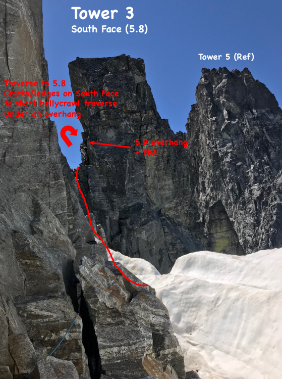
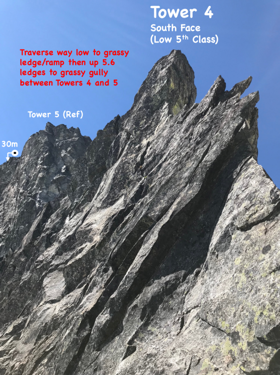


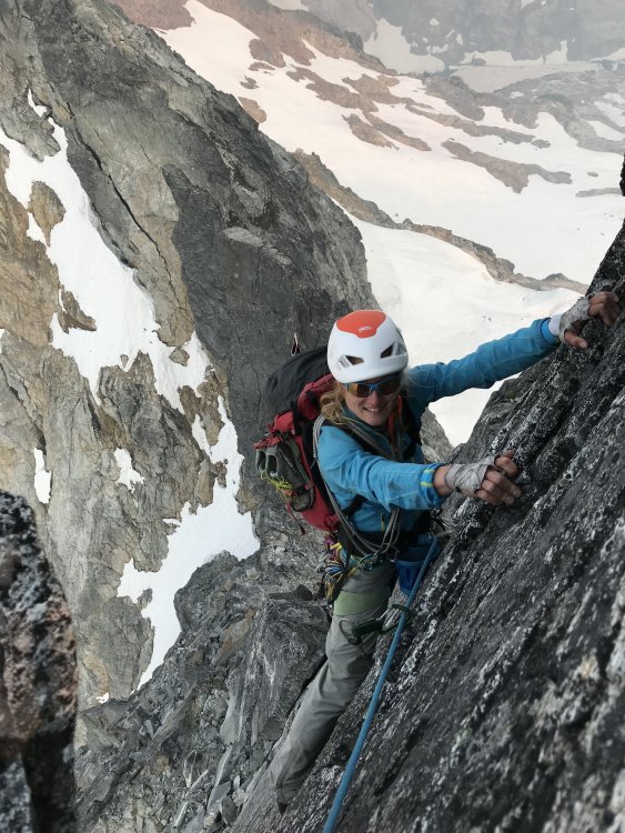
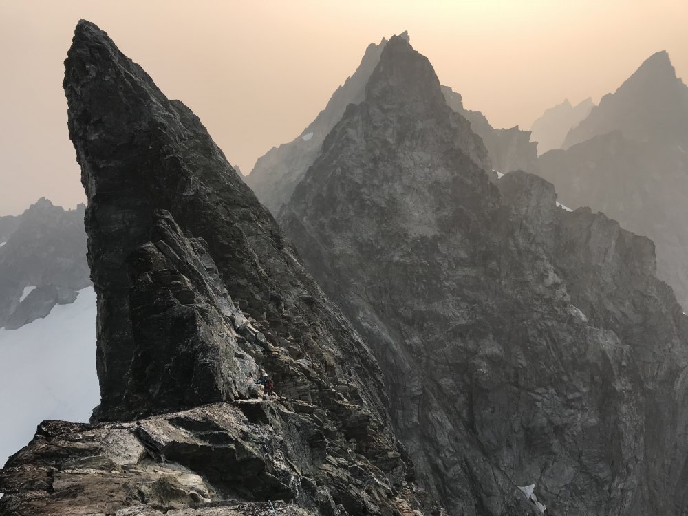
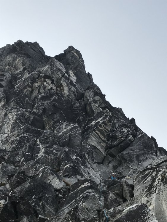
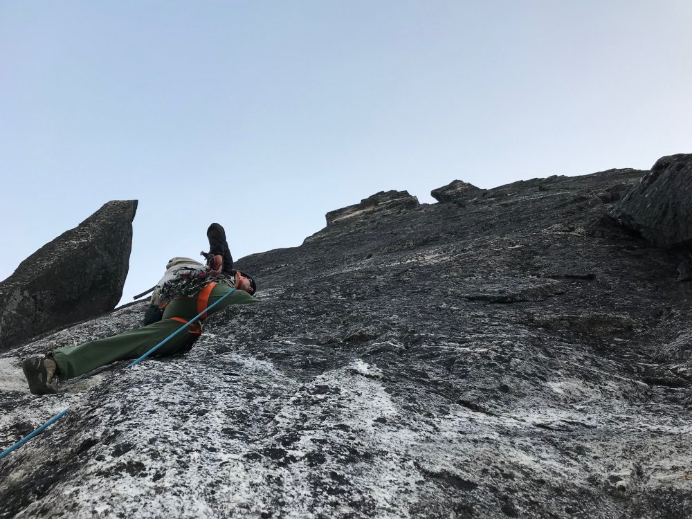
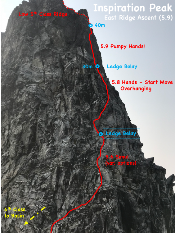

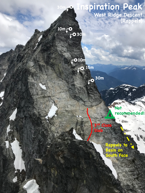
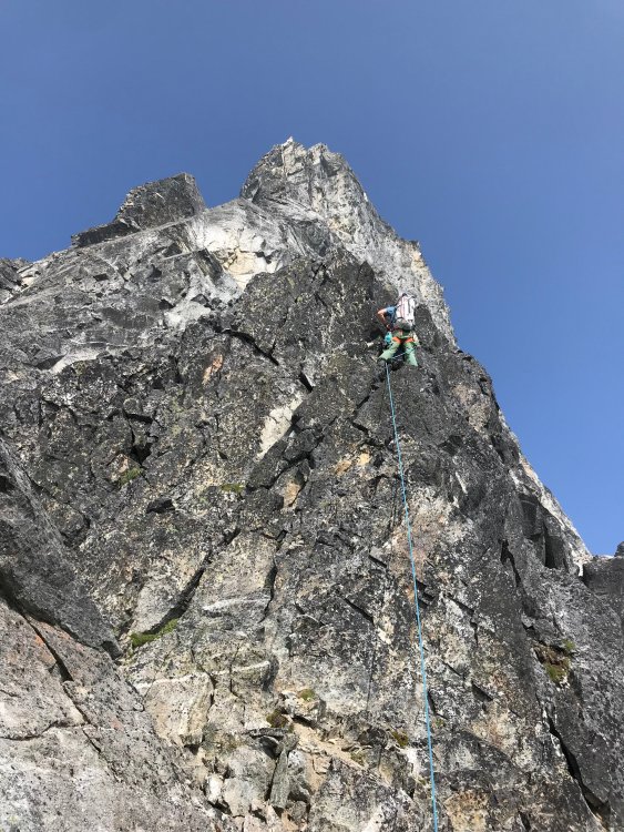
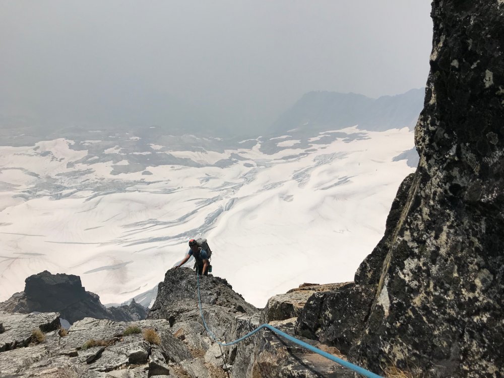
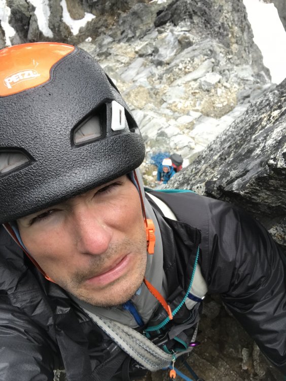
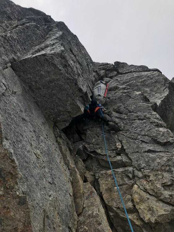
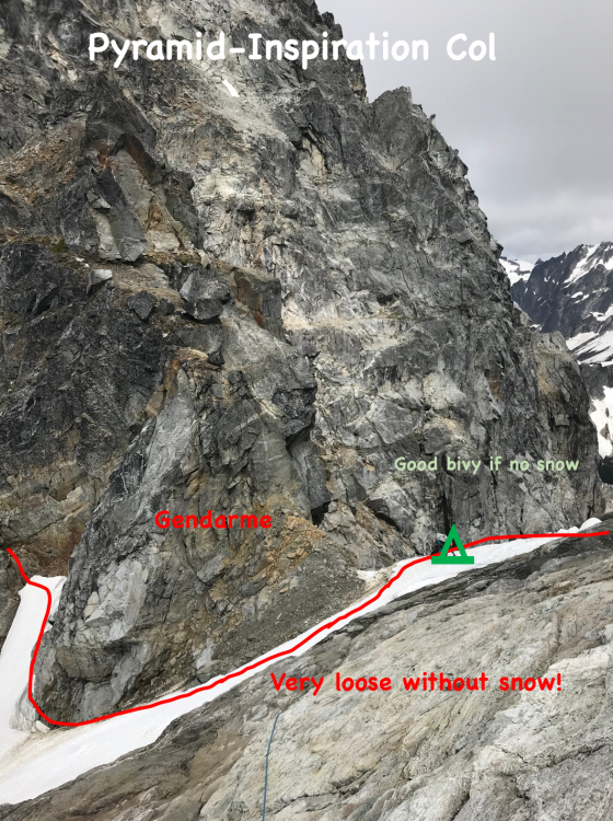
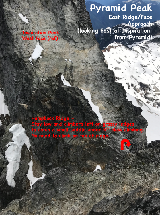
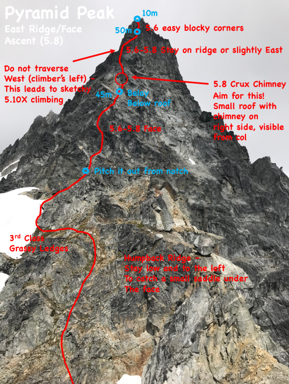


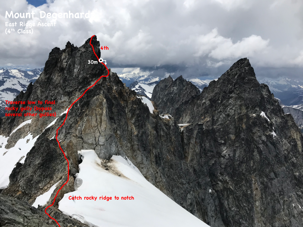
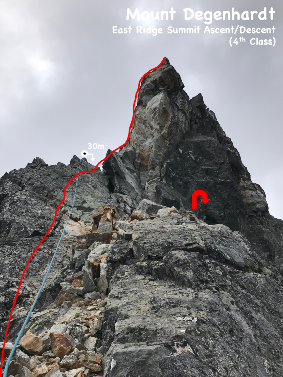
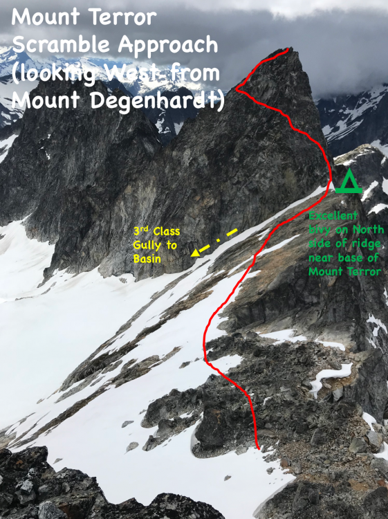
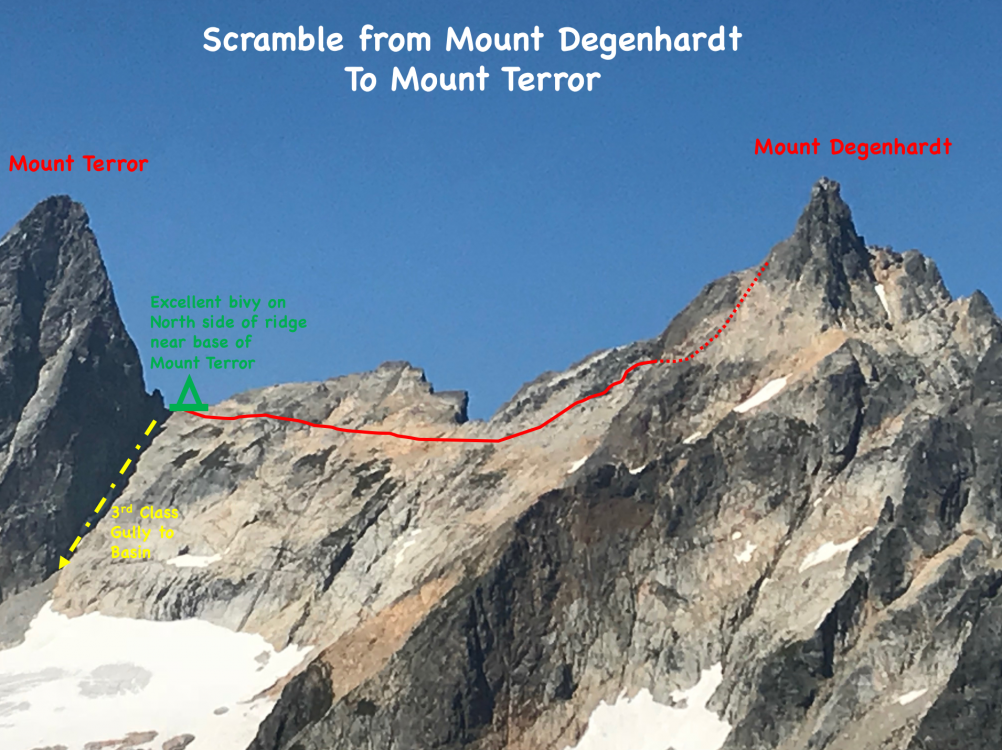
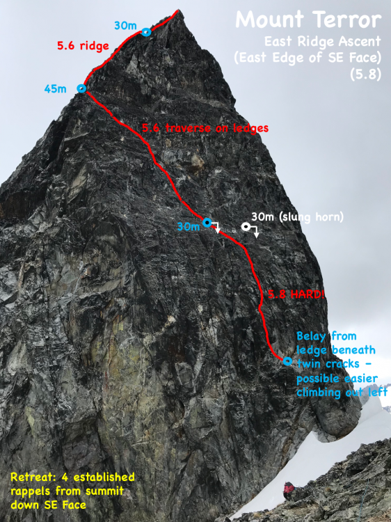
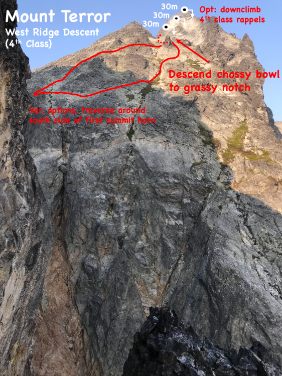
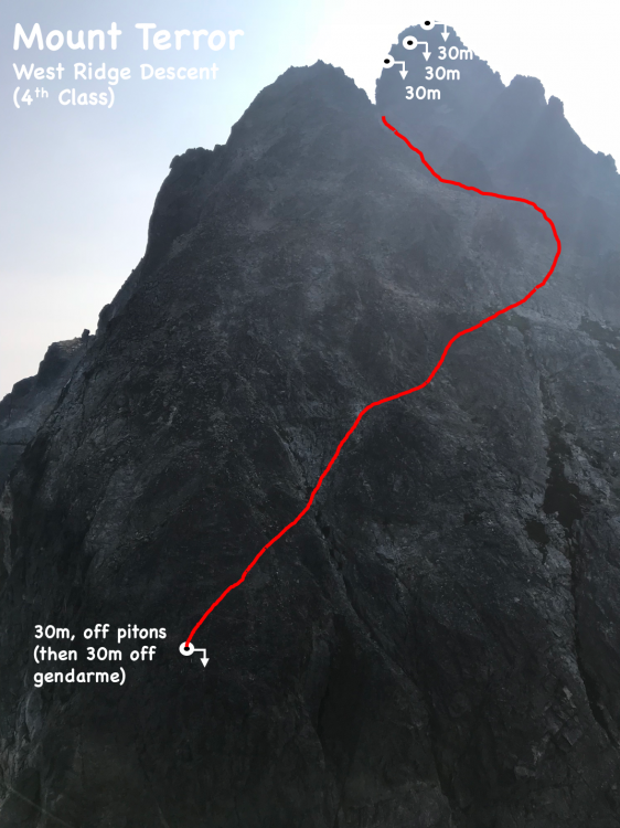


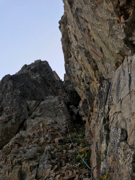
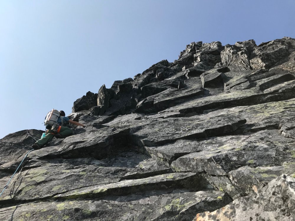
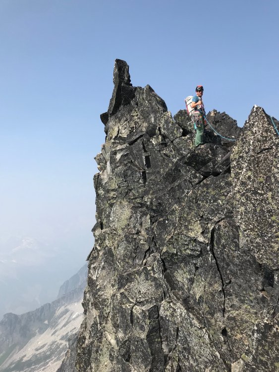
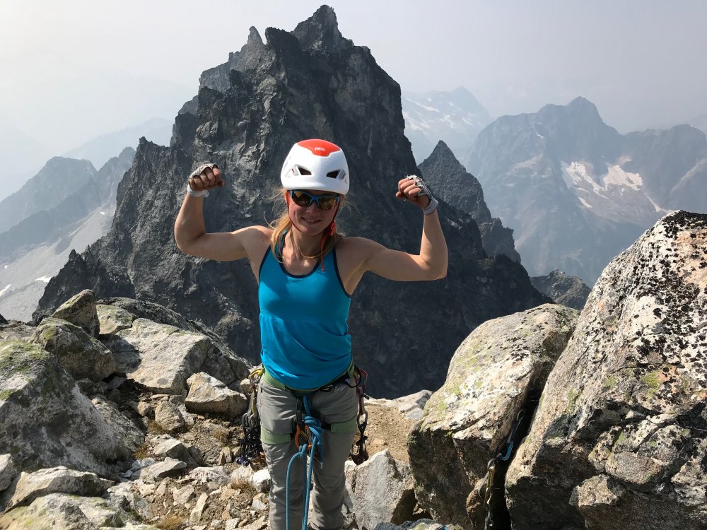


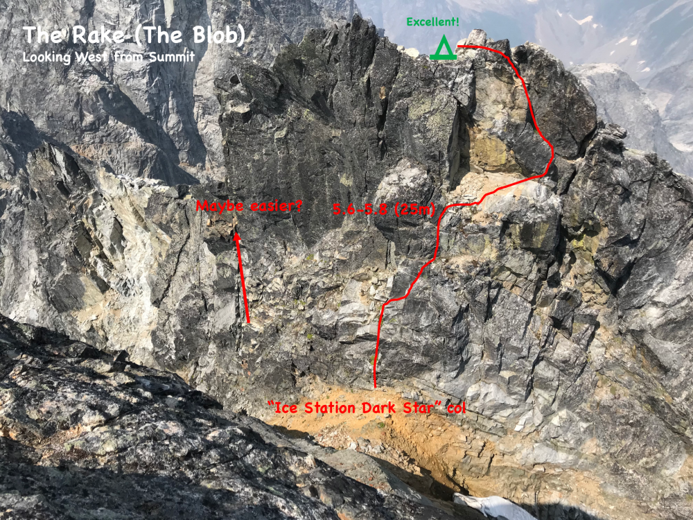


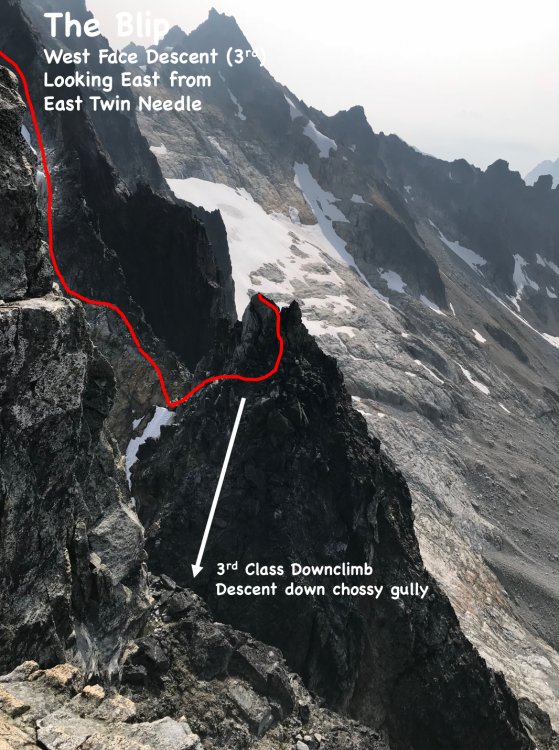


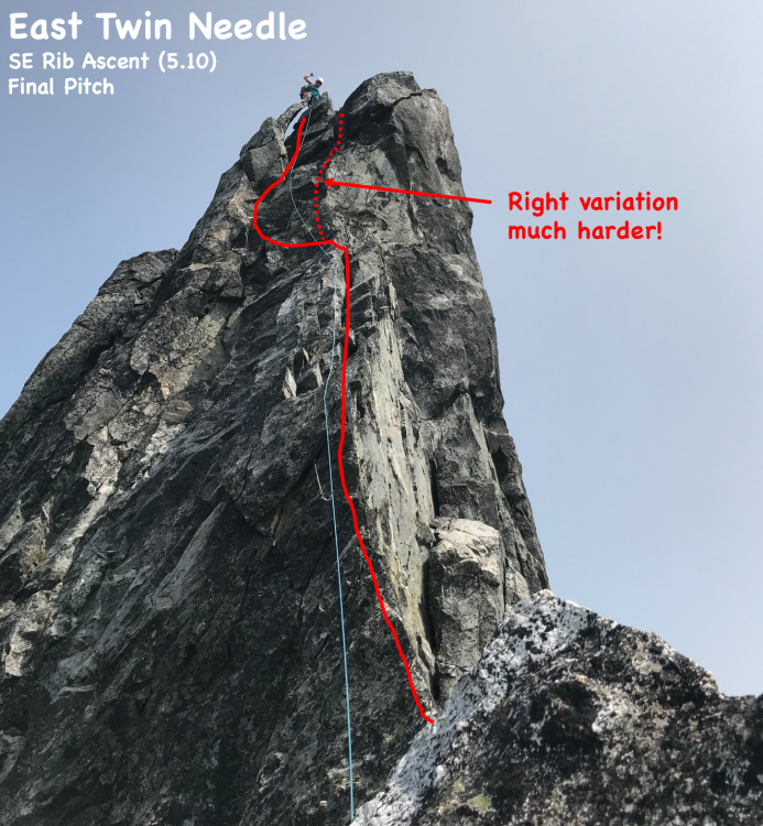
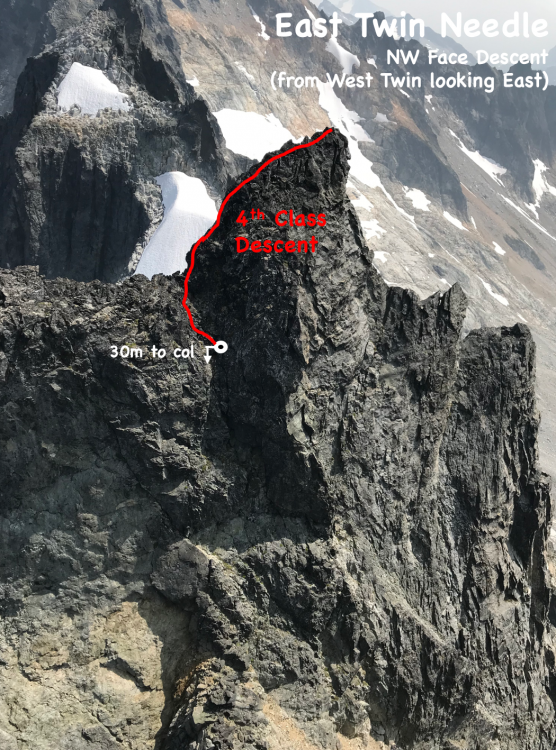
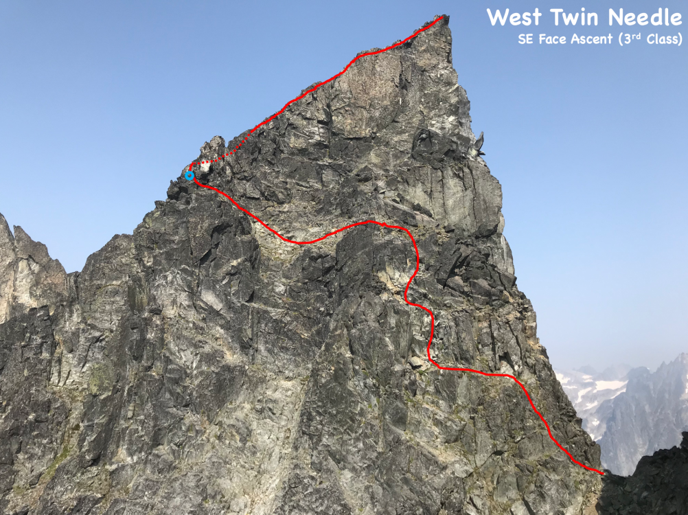
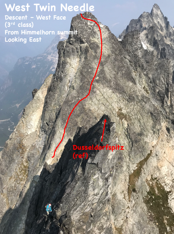
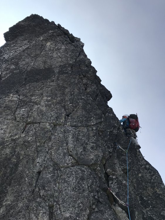
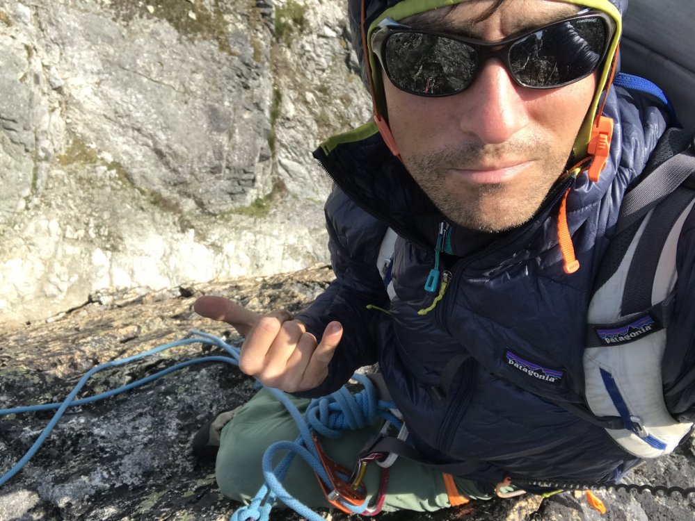
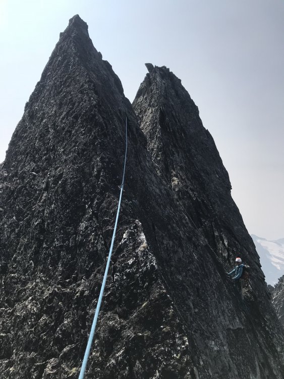
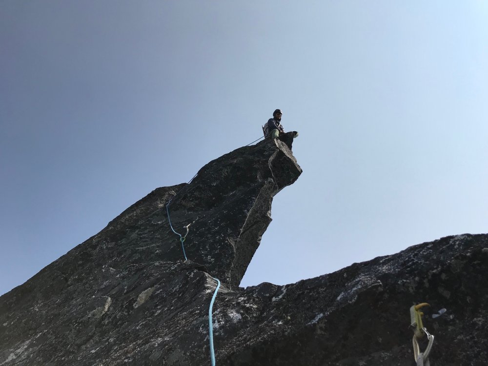
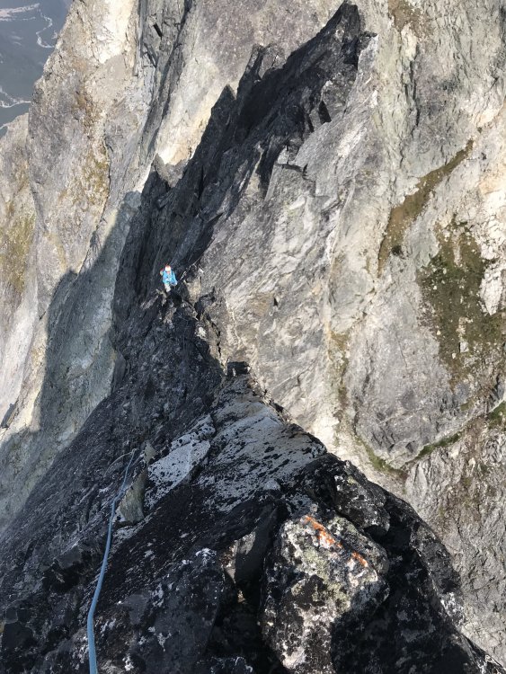

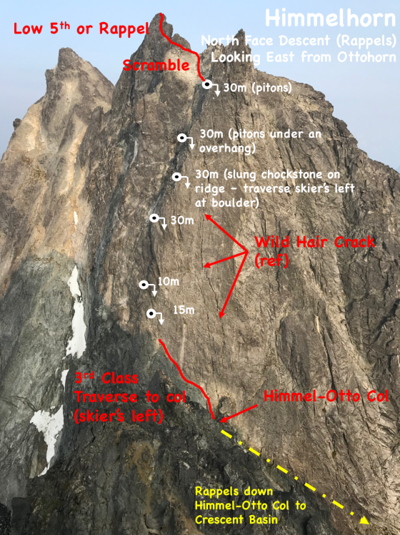
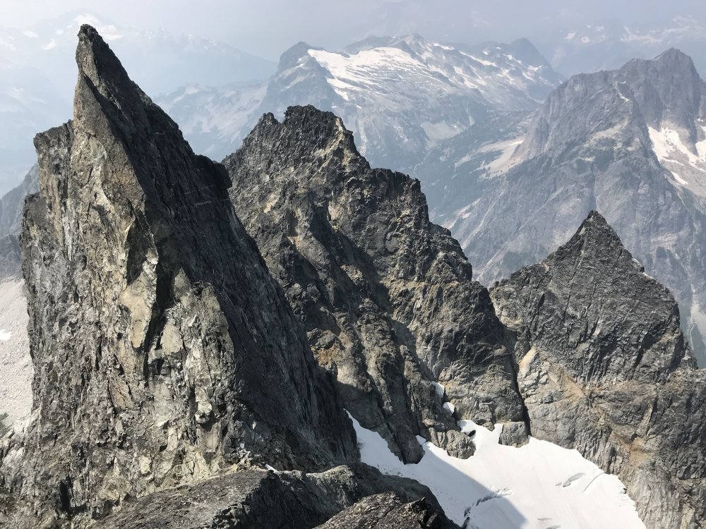


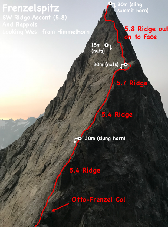


- 23 replies
-
- 13
-
-
-
-
-

best of cc.com [TR] Pickets - Northern Pickets Traverse 8/7/2017
seano- posted a topic in North Cascades
Trip: Pickets - Northern Pickets Traverse Date: 8/7/2017 Trip Report: I thought some people here would find this interesting and/or amusing. For the original version, with some smoky photos, see here. The central northern Pickets are arguably the most remote peaks in the lower 48, so it was only a matter of time before I had to try them. I had visited both ends of the northern Pickets: Challenger in 2014, Luna in 2015, and East Fury in 2016. On this last effort I had been planning to go for more, but I was stopped after a single pea by route-finding errors, a lack of drive, and the realization that I had underestimated my objective. While it is possible to pick off the peaks one-by-one, for the sake of efficiency and style I wanted to nab them all and claim the coveted Northern Pickets Traverse. I had estimated that it would take me 24-30 hours with a shuttle from Hannegan Pass trailhead back to my car at Ross Dam. Unfortunately I was unable to set up a shuttle on short notice, forcing me to either hitch, or use a different route. Not liking my chances of finding a ride first thing in the morning after rolling in late to Hannegan and taking a dirt nap, I used a significantly longer and harder route, descending the cross-country Eiley-Wiley ridge to Beaver Pass, then "running" 20 miles of trail back to my car. This put me at the upper end of my estimated time range. I got a few hours' sleep at the Ross Dam trailhead, but it is noisy right by the highway, and I was too wired to sleep, so I turned off my midnight alarm, drank my Cup of Sadness fortified with beet nitrates (found at a Walmart full of obese tweakers in Bellingham), and started down the trail around 12:15. The toads seemed more numerous than last year, and I even met a few on the trail down to the dam. It is around 17 miles to where you leave the trail for Access Creek, so this would normally be far too early to start, but I had a good GPX track of the cross-country route from last summer, so I could do it at night without losing too much time. This was key to giving myself as much daylight as possible to deal with the ridge and unknown de-approach. The approach worked about as well as it ever does. I bashed down to the river, where I almost immediately found the remnants of the log bridges I had used in 2014. I wasted only a bit of time dithering (I still hate getting wet), then forded barefoot to try to keep my feet dry and minimize the damage they would suffer in the evening. I found a bit of a boot-pack along the subtle ridge right of the creek that is least brushy. My worst mistake was crossing south one slide path too early, but that did not cost much time. As a result, I reached East Fury's summit in only 10h15, vs. the 11h30 I took last year. Now it was time to launch into the unknown. The final scramble up East Fury consists of shockingly mobile large talus, and the same continues on the way to West Fury. Beckey's guide suggests that this traverse takes multiple hours, but I found most of it to be standard chossy 4th class, and reached West Fury in under an hour. The first ascent register was still in good shape, and I was surprised to supposedly be the 19th "party" to visit. Up to this point, the best exit would be to retrace my steps. Once I headed down the west ridge, things would become more complicated, possibly involving a long and unfamiliar cross-country route around the north end of the range. I steeled myself, then followed the first ascent route down the west ridge. Starting slightly east of the summit, I descended a chute, then made a descending choss-traverse back west to the ridge. I followed that a bit, then made my way down dirty, ledge-y terrain on the other side to gain the small glacier northwest of the peak. From there, I easily kicked my way back across to the saddle with Swiss. I made my way more or less up and over several small pinnacles of mediocre rock on the way to Swiss, a broad NW-SE summit with a permanent snowfield on its southwest side. I found the rock pleasantly solid, climbing a line on its southwest face and descending near the northwest ridge. I stuffed some snow in my Camelbak, then tossed that out when I found running water below the snowfield. This was a valuable find, as running water is scarce on the rest of the ridge, and it was hot enough to be sweating in shorts and a t-shirt on the crest. Given the time and my longer-than-desired descent route, I skipped "Spectre Peak" without a second thought, then spent some time considering my route to the saddle with Phantom. The ridge itself looked unusably steep, the gully to its west at least somewhat navigable. Looking back, I think a line just right (east) of the ridge would have been better, blocky low 5th on decent rock. My chute was a garbage-fest with a tricky chockstone, and the traverse back to the ridge was outward-sloping dirt and death-choss. The rock was somewhat less chossy on the way up Phantom, but still not great. I mistakenly climbed a lower summit to the northeast, earning zero bonus points, then found the original register on the true summit. It was in bad shape, and probably not long for this world, being protected by only a bashed-up tin canister and a plastic bag. There appeared to be even fewer entries than on West Fury, but I was concerned enough about my position that I did not pay much attention. Phantom is about one third of the way from West Fury to Challenger, and if things continued apace, I would be lucky to make it off by dark. The misery continued descending off Phantom, with tricky route-finding on rotten rock on its left to bypass steps in the ridge. Considering the prospect of a bivy or a very long night made me think of efficiency: I turned off my GPS to save batteries for night-time navigation, and skipped the ridge crest whenever I thought it would save me time. As I made my slow way north, I was examining my escape route down the west side and up between two of Challenger's lower summits. Fortunately things improve considerably at "Ghost," a subpeak of Crooked Thumb. I could have gone up some line along the south ridge, but Beckey mentions that Roper had climbed an "exposed class 4" route on the west face. Good choice! The rock reminded me a bit of the Tetons' golden granite, and I had my first fun in awhile romping up steep, solid rock with incut holds. The ridge from this point looks long, but the climbing remains mostly fun, with the best route generally on or near the ridge, and the descents to the north usually easier than the climbs from the south. Reaching Crooked Thumb, I found quite a bit more traffic in the register than on previous peaks, though still only a party or two per year. Since I was not rappeling, I had to make a substantial deviation west to reach the first saddle on the way to Challenger. From there, I stayed near the ridge to enjoy the fine, exposed climbing, deliberately not thinking of the grim headlamp time that awaited. Challenger's summit ridge is a wonderful finale, a series of narrow fins with the holds angled so that the easiest route climbs right along the spine. I let out a whoop of joy, looked around for a summit register, then made the short downclimb to the Challenger Glacier. I had three options at this point: exit to Hannegan and hitch (16 trail miles), traverse to Whatcom Pass and take the trail back over Beaver Pass (25-30 trail miles?), or descend Eiley Ridge directly to the pass (20 trail miles). Given the time, I should have sucked it up and chosen the second, but I optimistically and foolishly took the new-to-me Eiley Ridge descent. Things started out great, with a nice hogsback of snow providing a clear path around the yawning summit crevasses, and easy jogging on the lower glacier to Challenger Arm. I climbed Point 7374', then was forced to sketch my way down a dirt-chute to the snowfield on its northeast side. I got more water at a tarn near frozen Wiley Lake, then continued making good time on snowfields south of the ridge to Eiley Lake. So far, so good -- I thought I would be near the final bushwhack down to Beaver Pass by headlamp time. Unfortunately I made a mistake here, straying too far southeast of the ridge. There are several places where it is temptingly easy to descend directly east here, but they lead to Luna Creek, which is supposedly one of the worst places in the world. When I realized what had happened, I tried to fight though some scrub pines back toward the ridge, then tried side-hilling across steep grass and flowers to rejoin the ridge. Unfortunately the ridge rises again; maybe the correct route goes over Point 4984', but I have no idea, and that was not an option for me now. Before it got dark, I had programmed my GPS with a point a bit south of the pass, so I turned it on, turned on my headlamp, and continued via IFR. My strategy was to traverse until the point was directly down-slope, then bash my way toward it. I found plenty of wretched scrub, blueberries, and alder, but also some surprisingly open groves of big trees. Unfortunately all of it was steep and slick, but I suppose sliding on your butt is an efficient way to lose elevation. There was much less devil's club than I expected when I finally reached the valley bottom, but I reached my random point without hitting the trail. I did my best to bash due east, and almost fell as I stumbled out onto the trail. At the first stream that seemed safe-ish to drink, I got some water, downed a couple ibuprofen, rinsed my feet, and switched to my dry socks. My calluses were all white, soft, and wrinkled, so I knew my feet were in for a beating, but I hoped that the clean (and thinner) socks would reduce the suffering. On a normal outing, this return would take about 4.5 hours, 3 to Ross Lake and 1.5 back to the dam. I started off at a reasonable jog, but realized shortly after Luna Camp that it would not last. I could motivate myself to jog with a mixture of Rammstein and reminders that the more I jogged the sooner it would be over, but it was a pathetic shuffle. As I neared the lake, I tripped more often, and was worried I might face-plant into one of the toads, which are even more disturbing after 3 hours' sleep and 27 hours on the move. I could probably have gone to sleep curled up on the trail, but I wanted to do this in a single push, and did not want to be woken by a ranger's boot or the splat of a toad to the face. I took in the moonset while crossing Ross Dam, and for once was grateful to be finishing in evening headlamp time -- at least it wasn't quite dawn. Gear Notes: Trail runners, ice axe (necessary), crampons (not used), 12 Clif bars, 7 packs pop-tarts, half a bag of Chex Mix, ibuprofen (necessary) Approach Notes: Access Creek is a lot easier when you have a good GPX track from the year before. Eiley-Wiley... ugh. -
Trip: Ruth Gorge Alaska - Ham & Eggs, Shaken Not Stirred, and SW Ridge 11300 Date: 5/16/2016 Trip Report: Joe Peters and I just got back from a great 2 week trip to the Ruth Gorge in Alaska. This was my 2nd Alaska expedition (the first being to Denali WB) and I was a little surprised at how much easier it is to "plane camp"....no hauling sleds!! The packing phase for this trip was more like 4 books....sure; 2 sets of tools....why not; a dozen eggs....yes!! You get the picture. You can pretty much take whatever you want as long as you are willing to pay the extra money when you have over 125lbs of gear. Overall we had a fantastic time and were able to climb three great routes. Overview April 30 - Fly to Anchorage, travel to Talkeetna May 2 - Fly with TAT to the Root Canal May 4 - Climb Ham and Eggs on Mooses Tooth May 7 - Climb Shaken Not Stirred on Mooses Tooth May 12 - Bump flight to the West Fork of the Ruth May 14 - Climb Southwest Ridge of Peak 11300 May 15 - Fly home to Spokane Warning: as usual, I tend to ramble and be lengthy so if you are looking for the pictures just scroll down. A couple words about gear/food. As I said you can bring whatever you want. We brought a Hilleberg Nammatj 3GT for base camp and an MH EV2 to use if we wanted to on routes. In the end we just single pushed all the routes so we each had our own tent at camp. It may have been overkill but it was nice on storms days! Both Joe and I brought Exped MegaMat 10LXW sleeping mats. They are heavy and bulky but they sleep as though you were on your mattress at home!! By far the best base camp mat I have ever seen or used. The kitchen tent was super nice even for just a party of 2. Great to get out of the weather, cook, hangout, store gear etc... Speaking of storage bring Rubbermaid boxes. We only brought one and wished we had more. They stack, keep stuff organized, make excellent places to eat/cook, and keep your chips and bread from getting mashed. As for food bring anything and everything. On storm days or rest days cooking gives you something to do. We made breakfast burritos, fajitas, pasta and lots of other great dishes. My personal favorite was our make shift oven. I took a round cooling rack and used a circular baking sheet on top of it. Then I put the cooling rack in a deep dish frying pan and put the lid on it. This elevates the baking sheet up an inch and you can bake to your hearts content. We made warm biscuits with butter and honey, chocolate chip cookies, and my favorite...personal pizzas. We took split boards which worked well for flotation and gave us something to do for an active recovery. Bring a 5 gallon bucket and a toilet seat that fits on top. It is WAY better than squatting over the little CMC cans the NPS provide. Last minute sorting while waiting to load our stuff into one of Talkeetna Air Taxi's Otters. Paul flew us in....also a treat to fly with such a great pilot. Views looking up the Gorge as we approach the Root Canal Glacier. The huge east face of Mt Dickey dwarfs the 2,500 ft tall Mt. Barril with Denali in the background. After landing on the Root Canal we took advantage of good weather to get on Ham and Eggs a couple days later. I can see why this climb is so popular. The crux sections are steep but short and the final summit ridge to the top is safe but great exposure and views. In talking with a guide who has been to the Ruth many seasons, he said this year it was in "friendly condition". It was busy that is for sure. We left camp at 4am about 1 1/2 hrs behind the first group of 2. Another party of 3 left 1 1/2 hrs behind us. And while occasionally we had to wait for people or others waited for us, everyone got along and all parties summited. There is lots of beta out there so I won't get into too much detail. We broke up the climbing into lead blocks. I pitched out the 1st couple entrance pitches through mixed terrain and an ice step. From there we simuled over easy snow to the crux. Joe got in a couple of good screws then clipped some fixed pins right before the top out. Above the crux we simuled to the top. The ice steps were in good condition and gave adequate protection making for some really fun climbing. From the col we continued up to the summit passing a v-thread and a couple of buried pickets on the way. We had clear but windy skies up top. Beautiful views of the Alaskan Range. Started back down and had a couple of rappels and some down climbing to get to the col. Then about 16 rappels later we reached the glacier below. All the rap stations had good fixed gear, and all told we were just under 10 hrs round trip from camp. Unloading our stuff at the Root Canal airstrip. Happy to be on glacier. Our camp on the ridge above the Root Canal with Mooses Tooth and our objectives in the background. Joe leading the way through the lower easy snow slopes. You can see the 2 of two ahead of us on the crux of Ham and Eggs. Joe leading us through the easier ice steps above the crux of Ham and Eggs. Climbing past a huge boulder along the ridge on the way up Ham and Eggs. Joe topping out on the corniced summit of Mooses Tooth after completing Ham and Eggs. Looking south across the range from the summit of Mooses Tooth. Rappelling one of the pitches mid way up Ham and Eggs. Shaken Not Stirred is the big brother to Ham and Eggs. Not in the sense of height or vantage but in the degree of difficulty. Overall the route has a lot more steep sections of ice and more mixed rock. Then the crux is obviously harder. We talked with 2 separate parties who bailed before the crux. So armed with some determination we took all the gear....aiders, talon hooks, the usual rack, and even rock shoes. For Shaken to be good you need a very cold night best after some warm afternoon. On Saturday we woke up at 4am to 15F in the tents and decided it was the day. Outside the weather was less than perfect with some low clouds coming and going, but we opted to give it a shot. As it turns out they all burnt off and it was a great day out. We left camp at 5am and quickly arrived at the base. The beginning couple of pitches were not rotten or scary as had been reported. We found neve snow and good ice. Joe led up to the easy couloir where I took over the step kicking and simuled up to the "narrows". From here we pitched it out changing leads. Even if you don't get to the top of the route the narrows are totally worth climbing. Absolutely cool and appropriately named. At 1 spot you couldn't face into the ice because your shoulders wouldn't fit between the rock walls. The ice quality was generally good and pretty soon we arrived at the crux. I led the pitch below the crux and put the belay on the right wall about 20 feet below tucked out of the way. The climb turns a bit left at the crux so my belay spot was out of the firing line which as it turns out was probably one of the best decisions I made that day. The crux is basically a chockstone jammed between the walls. It protrudes out 3 or 4 feet from the back wall. Ice pours over the chockstone and the cave it forms underneath was full of snow. The right side is steep rock while the left was a little more friendly with a couple of thin cracks and a veneer of ice. Joe took a look and said he was going to do it. He decided to leave his pack at the belay and soon took off. Climbing up he got in a 10cm stubby screw in the ice on the left. He put it as high as the ice allowed before it thinned down but it was probably 15 feet below the actual chockstone. From there he worked up towards the ice above. The large section of snow was soft and unconsolidated. Attempting to get a handhold to weight slightly while reaching up with the other tool the unthinkable happened. The entire section of snow probably the size of several refrigerators gave out and it all came crashing down. I caught his fall and flattened myself into the corner as the huge chunk of snow cartwheeled just a few feet to my left. His stubby screw held and nobody was injured. Now that the snow was gone he climbed right back up and was able to get a #1 BD C4 high up underneath the chockstone. Then he worked out left and up mixed terrain. Finally he got in some good sticks above and pulled over the chockstone. We both relaxed a bit as he got in a good screw. I followed but had my own challenge as the large ice coming over the chockstone broke off with me on it. After dangling in space for a minute I was able to drytool up under where the ice had been and reach the easier terrain above. We were excited to have got the crux, and I took over the lead expecting 3 easy pitches worth of snow above. It was quickly apparent that was not the case. The topo we had said to go up over a snow hump then traverse left. As I went up my progress soon slowed as I began excavating. It wasn't quite a tunnel but at times it felt like it as I worked up digging a 3 foot wide trench through the vertical snow. An hour or so later I had made it up 30-40 feet and dug a big hole through the snow hump looking down into the traverse and the next couloir. Joe followed the pitch then we simuled up to the top. After a couple quick pictures and some water we started the process of descending the route. It was obvious from the rap stations that Shaken doesn't get climbed as much as Ham and Eggs. We replaced several cords, added some rap rings/carabiners and beefed up a couple of stations with a pin or nut. Rappelling the 1st couple pitches at the bottom drove home the need for cold temps. All the snow and ice had turned to mush in the afternoon sun. We arrived back at camp at 5:30pm in time for a much needed dinner. We were super stoked to have climbed such a fine line, but also very taxed both physically and mentally. Looking up at Shaken Not Stirred on the day before our climb. Joe leading through some of the ice on the 1st couple of pitches of Shaken. Joe coming up the snow couloirs below the "narrows". Joe climbing up through the 1st pitch of the narrows. Unbelievably cool climbing! Joe leading another awesome pitch of narrows climbing. Here is Joe working on the crux prior to his fall. Here is what the crux looks like after the snow all fell out. Quite a big hole!! Looking back at the traverse and top of the trench through the snow hump. After a couple of days rest we started to get itchy to move. We wanted to "bump" to the West Fork of the Ruth and try Peak 11300's SW ridge. The weather was nice so we called TAT to get our bump. They said to get ready ASAP. Unfortunately in the meantime of breaking camp it clouded back up and we had packed for nothing. Not wanting to drag all of our stuff back up the ridge to our camp we settled for taking the necessities. The next day we arrived back at the airstrip cache to find our stuff in a complete mess. The ravens had opened up everything and destroyed, carried off, or ate about 2 weeks of Joe's food. I only lost a couple days worth because a lot of mine was in a rubbermaid box. Spirits were low as the snow fell for another day but the lesson was learned....Rubbermaids all around next year! Spending some time watching the clouds and light dance on the mountains. The big rock buttress looks very inspiring!! Our big mess of destroyed food after the ravens got into it. Bring Rubbermaids, bury your stuff or keep it in a tent! The dreary days of waiting......listening to music, cooking, reading. A shot looking down the Ruth Gorge on our bump flight to the West Fork of the Ruth. We finally got our bump on Thursday and proceeded to setup camp at the base of Peak 11300 while we watched avalanches and seracs fall off the faces as the sun moved. We decided to attempt the route in a single push with only down parka/pants for backup. We also brought an MSR Reactor stove and 16oz of fuel along with 1 cooked meal per person. The weather window looked good but temps were very warm. As a resulted we decided to leave fairly early and try to beat the heat. Alarms went off and we were soon following the boot pack out of camp at 2:15am. I led out as we transitioned from the flat glacier to the starting slopes up to the ridge. Simul-climbing we quickly reached the 1st rock band. We simuled through it, then I brought Joe up so I could get the gear back. Another block of snow and rock and we were just below the "thin man's squeeze". The rock steps were just so much fun with great gear that I couldn't stop smiling. Another block and we took a break at the 1st col to rehydrate and eat. The sun was starting to light up Huntington and the other surrounding peaks. Another simul block brought us up through the S couloir and to the rap into the 2nd col. I pitched out the next short section through the ledges and mantle move, more for rope drag than anything else. From here Joe took over the lead and we headed up weaving around rocks, up snow, and climbing mixed steps. For the most part the route stayed on the ridge or just to the right of it. The crux of the route felt like it was the last "5.8 gully" noted on the topo. Joe got the lead as we continued our simul climbing through it. It was super fun climbing and protected very well. From there we pretty much made a beeline to the summit. The last few hundred feet were snow although you could dig down and put a screw in the ice to protect every once in a while. Topped out at 10am and into the warmth of the sun. The views from the summit and along the ridge are stunning, some of the best I have seen! We quickly headed for the descent as we knew things were getting sloppy. The ridge to the top of the rappels had a bookrack but required a little bit of down climbing in some spots with serious runout in soft snow. We added another rappel anchor at the 1st rock outcrop above the sheltered col because the down climb looked hazardous in the current conditions. Then once over the col the regular raps started. There is actually a fair bit of traversing between rappels but never too bad. Finally after 8 raps or so we made it over the bergshrund and on to the glacier below. We had watched the slopes slide yesterday so we quickly made our way down crossing a couple of crevasses on the way. The whole bowl was baking in the sun by now and we longed for the shade of the tents at camp. We got back at 2:30pm making it in 12hrs and change tent to tent. The rest of the afternoon was a blur and by 5:30pm we were sitting at the Mountain High Pizza Pie in Talkeetna with the great white mountains only a memory. And so an Alaska trip is over but we are already talking about next year!! Our camp on the West Fork of the Ruth. It is such a beautiful setting. Peak 11300 catches some afternoon sunshine in the Ruth. Rooster Comb can be seen the background. A panorama somewhere below the 1st col. Joe is just a tiny dot along the ridge line in the middle. Looking up to the "grey rock" and the S couloir from the 1st col. The North Face of Huntington catches rays of morning sunshine. In the foreground you can see the tracks at the rappel to the 2nd col. Joe leading the way up the upper section of the ridge as the sun is starting to round the summit. A super wide angle showing the Ruth Gorge and Alaska range. On the right Joe is coming down the summit ridge behind me and on the left you can see the boot track continue down the corniced ridge. Looking back up at the steep corniced ridge that we descended.
-
 Trip: Tower Rock - FA - Rapunzel's Back in Rehab - C1 Date: 7/15/2015 Trip Report: The Beast - don't be fooled, them thare are full-grown trees Tower Rock, 2 hours from everywhere, appears oddly neglected - Brown Beckey's got the tiniest blurb of the single route up it done in 1982 (anyone know of a second ascent? i can't find anyone who's tried it) but no picture n' no topo - tim olson's oregon rock guide has some more detail than beckey, but still the vast monolith appears to have continued unloved tower's just south of randle, an unladen swallow's flight from the cispus river - the face is gigantic,something like 1200 feet tall - the rock is basaltic, according to beckey, but like nothing i've seen - like over-baked brownies, it's composed of a hodge-podge of components - incredibly solid and compact, it's cross-hatched in all directions, crackless, and crumbles into bricks and blocks of all conceivable sizes - the tower looms over it's talus field, fiercely steep, it's upper-wall reminiscent of the right side of el cap, incredibly bulging and over-hanging tower is composed of two giant faces seperated by a ledge/fault system that was the path taken by the first team to climb the face - currently, after 7 days of effort, our route climbs the lower wall - it'll be just as much work to finish the upper wall, if the rock quality holds as it currently exists yeah, there's a lot more to go, but as it stands, what's there is 600 feet tall and a great day-tripper's aid adventure already - i figure the worst that can come of telling folks about this now before it's complete is that some other sad fools can go do it for me trip the first: fuck, this happened so long off i wonder if my recollection's right at all - me n' bill n' ben in the late winter - a burr up their bespectacled asses about a mythical 10-pitch free route up a largely untouched tower - the plan to hike to the top then set a rap-line down the likely route - out of town on a friday night to the frightful fall of rain - ghetto camp before the gate in gales of damnable damp - the roar of frogs - the next morning the most sordid thang - endless hours uphill w/ drill n' bolts n' chains in the continuous cloud-fuck n' frenzied chilly breeze - near the summit gob-smacked to gain a blazed trail barely a mile from a seasonal road - the top a huge disappointment, it characterized by clouds and beaming rainbows and rock so rude they rarely accoladed the attribution - soon there after the weekend righteously concluded and me around for the sweet family on the sabbath trip the second: on the reconnaissance earlier, dejected at finding a kitty-litter summit, we'd paused after a tortuous overladen descent on the boulder field and pondered on future options - a man w/ an aid-climber's conscious could do a take on "infinite bliss" and find a bitching way up the crazy big blank face - it was sure to take a mort of mortal work, but bill n' geoff are true gentlemen all measured and solid for this kinda goofy shit - we banged up from p-town on a friday night and made camp up at the turn around on the forest road - stumble-fucking up the forest we arrived amazed and ready to ramble on - many mozzies n' deer flies this damned trip - pitch 1 went quickly between geoff and bill, the later bounding up free on low-angle stacked mossy talus to make an anchor atop tier 1 - me i got tier 2 - all bolts at first until i no longer feared the ledge, then lotza 2-hook moves in a row until reaching the top of the tier where i left a fixed hook to protect a low-angle romp to the second anchor - we retired to camp n' soggy fires n' fulsome screeching music - day 2 we jugged to the top of p2 and bill and geoff got up a ways before yielding to me, whereupon i drilled n' hooked to a high point we marked w/ red tat before descending and returning to our troubled and lonely little lives - i recollect getting a true n' glorious drunk on in the passenger seat n' slumbering back to vantucky geoff putting up the first pitch on the scrubby, compact low-angle first tier the artist as a young asshole ascending the second steeper tier geoff workign on pitch 3, the first steps onto the very steep lower wall trip the third: lovely ospreys n' robins round the lake - pete n' pam play camp hosts - camp weddings n' nightly fishing sheenaningans - muskrats n' pond-skimming swallows - bastard mozzies n' mean biting flies, mostly in obeisance for the first couple cold days, but growing in malevolence as the weather waxed towards wicked hot - the sweet ne face of Tower almost totally shade-soaked for the mid-morning riser - kids n' retirees n' rv's n' jumping trout n' tame dogs - the listless routines of an aimless life - awake w/ the sun - fresh shits n' dewy breakfasts - a short but grim uphill grind through steep forest w/ plentiful windfall, shirt soaked through by the time we hit the sunny talus field at the base but soon blessed w/ shade - warm juggy work to start and then to the serious business - fear frenzies despite being armed w/ all the wonderful war machines of modern man - a long time of terror n' toil - the day dispatched, we make a rapid descent, each time by a different winding way - beer n' stripping soaked clothes off at the mercifully close car - me auolde yosemite food bin rummaged through for a desperate dinner, usually of beer n' tobacco n' pringles n' whatever benevolent bill threw my way - an hour or so of bird-watching n' binge-reading on maggie thatcher's frigid teeming fucking bush - to sleep at the post-gloaming in a grand 6-man tent alone, racked out on a queen sized inflatable air mattress, wrapped in down and dozy drunkenness - the night passed moaning to sore muscles as i twist n' turn until the dawn drags me to my addled senses, then it all runs off the reel much as it reckoned the day before... first several days of murmurings n' mumblings w/ just me n' bill (me a damn baby in comparison to my venerable and august elder - that baby weighing in at a mean 250 bare-nekkid pounds and a coward to boot of course) - bill a bastion of genteel sincerity that must sadly have bitch-left this world many generations ago - me strangely silent of song for days - my mind scrambled and saddened by the robust requirements of 6-weeks of family-left sorrows gone off in the valley - eventually songs to lift my times and shape my senses - "mining for gold" by the cowboy junkies running on an eternal loop in my mind - long after-shocks of "burn down the mission" caused by geoff for sure after 3 days of toil we grow weary and call in the cavalry - the silverman boys gonna come down n' save us from our misery - we make a rest day out of walking the mountain side w/ them, then retiring to the big boulder to pound pbr's n' provide Adult Supervision - they lounge around camp afterwards, contemplating on crashing the redneck wedding well under-way - we smoke bales of weed n' cackle n' cough n' find high times are treasure enough in this wicked world - eventually all good things must get on the bus w/ gandhi though and they roll off into the night in the hms revenge, ready i hope to return for more the last day done-off as surely as a band-aid - after a fearful arduous jug up the wild steep fixed lines ole bill baits the question ("good news or bad?" - which would you take?) - - dedication to a last day of determined work - 5 hours of bolting and hooking on endless steep traversing ground until i was gut-wrenched at what it was likely to take me to get get back to bill - epic amounts of gear left as i rapped into the void and quickly grew dependent on bill to reel me back in - the retreat then fully declared we rapped n' ruminated n' laid our plans like parchment paper, all of it ultimately putting us on sweet terra-firma w/ a fuck-load of gear to get off - surprised by bill's pronouncement of this day, i had no proper pack to cram all the crap into eventually we ambled on down the way, me overloaded like a gypsy carnival-whore w/ rope-bags aplenty such that i swooned on multiple occasions as the straps cut into me wind-pipe and i passed yards off unyielding to gratuitous thoughts, my mind in a true and lovely gray place - the last night spent in part w/ militant california-paul, such as exemplar of that shakespearean clap-trap about sounding of fuck-all and negative fury, yet yielding nothing our objective from the relative sanity of the rv park n' its teeming trout pond white-boys jugging the first 2 tiers - at this angle the lower wall takes up most of the entire frame, but the upper wall's just as big n' steeper 700 feet of ropes n' route-making machine just starting the second pitch bags of bolts n' drills n' bullshit - starting to install pitch 4 geoff at the top of p4, kyle jugging up to the mid-pt anchor closing thoughts: happy to share the discovery w/ the nw brethren - leave yer self-righteous bolting morals at home w/ yer bitches - the place went unloved for a reason - the only cracks evident are where awful rock-fall is just a geologic fart-in-a-stiff-wind away - if intending to push the route higher (what's there is plenty for a day-tripper), please let me or bill or geoff know so one of us can come along - perhaps a dozen separate lines could be pushed to the top in the same style, each likely to take weeks n' 1000$ to put in place - recon trip to the top found almost no real rock up there - at some point all lines must turn to awful kitty litter, but maybe it'll go anyhow? topo as it currently stands - hope to see this fucker get taller in the fullness of insensible time Gear Notes: - up to 30+ draws if clipping all bolts - 2 bathooks (talons can work, but they risk blowing out the drilled holes) - ideally 2 70 meter ropes, but 2 60'S can work if careful - cheater stick not bad idea, as many of the bolts were installed by a fear-fucked orangutan at his max reach - lower off tat or quick-links/biners for follower at traversing parts - helmets essential - much potential for rockfall of all sizes, especially if hauling or jugging - base area very dangerous in strong winds or if below climbers on first 2 approach pitches - upper pitches largely protected from natural rockfall (be careful up there ) Approach Notes: Exit 68 off i5 - east on 12 to randle (about an hour) - right (south) turn at randle (follow signs for tower rock RV park) - quick left about a mile south of randle, then another turn right about 6 miles later - rt turn at tower rock RV park/cispus learning center signs - left onto logging road (75?76?) just a 100 yards before rt turn to tower rock forest service camp (or straight for another mile to the RV park) - forest road is closed at gate near main road during winter/early spring - about 1 1/2 mile up road (stay on main road at split a 1/2 mile up) there's a turn around (about .25 mile past a steep switchback) - from there you can continue in car but there's no turnaround - walk or drive 1/4 mile to road-end - at wierd stone-forest-altar begin hiking up steep forrested slope - about 45 minutes to base - occasional game and human trails, generally trending right and up - copious windfall in middle section of trail - steeper for last 1/3 of trail - idea is to skirt talus field on right and join base from tree at right edge of wall - 1st bolt is just 5 feet off ground near clump of trees about 50 feet above a huge lounge-like boulder that is a great/safe observation spot descent: currently rapping from top of p5 to top of p4 is extra-ordinarly hard - in the future ideally there'll be a rap line straight down through p5 - for now be prepared to leave a fixed line to get back to the top of p4 and for the first rapper to have to haul the second back over - descending from the top of p4 requires 2 70 meter ropes or a stop at the mid-pt anchor (no rings) - the rap overhangs but you just barely touch the wall at the mid-pt anchor - use terrain to help you rap in the right direction
 -
 Trip: Slesse Northeast Buttress - 2nd Winter Ascent - Date: 4/6/2015 Trip Report: This is a full month late, likely a by product of my brain exploding after my Patagonia trip as well as this climb I am about to describe. It is now undeniable that I have some kind of addiction to climbing Slesse Mountain. I have climbed the mountain more than 10 times by at least five different routes both solo and with partners. I think the main reasons for this are that: 1: It is ridiculously easy to access from the East. 2: The East flank of the mountain is hands down the raddest face in the area. 3: I can be a creature of habit. I had always wanted to climb a big route on Slesse in the winter, and after learning to 'really' mixed climb in the Canadian Rockies it became even more of a priority. I spent most of my winter in Patagonia, managing to bang off some great climbs in the Torres, including a solo ascent of the beautiful Cerro Torre. As I made the journey back north to Canadia a bit of sleuthing had me convinced that Slesse must be in the 'condition of the century' for winter climbing. I tried to find a partner to attempt Navigator Wall, but with only one or two days of stable weather remaining it was too short of notice. Listening to an interview with Stevie Haston on the airplane, I heard him describe his free solo ascent of The Walker Spur in winter which got me psyched, so I began to formulate a new plan. I had climbed the Northeast Buttress of Slesse too many times in summer, including a speed ascent in one hour and fifteen minutes. But in winter the line would certainly provide a completely new challenge. The line had only seen one winter ascent, in 1986, which required several bivouacs as well as aid on the upper headwall. Because I knew the route intimately I was able to slowly convince myself that I may be able to free solo the route in winter, for the 2nd winter ascent and first free winter ascent. It seemed a bit of a lofty goal, so I brought along an 80 meter 6mm Esprit cord and some pins and wires to bail with 'just in case'. John Scurlock photo. Isn't it just irresistible?! My sister, who lives in Chilliwack dropped me off at the start of Nesakwatch Creek FSR and I briskly walked to the Memorial Plaque beneath the mountain where I spent the night. I awoke at 4am the following morning, and after spending nearly an hour huddled in my sleeping bag I mustered the psyche to get a move on. At 5am, I left the memorial and approached directly through the basin beneath the mountain. The snow conditions were generally quite good, and a short WI2 step soon brought me to the slightly threatened slopes beneath the toe of the Buttress. I veered left here, joining the standard summer approach through the pocket glacier cirque. The upper section of the cirque still held a surprising number of deep crevasses, likely caused by avalanche debris from the East Face forming deep craters on impact. I crossed over several bergschrunds on the right hand side of the cirque then climbed directly up to the bypass ramps leading to the Buttress crest. This section, normally a third class ledge walk in summer, was a surprisingly steep and exposed traverse on snow. As I neared the crest the angle and exposure kicked back and I quickly made my way upwards on good snow to the first 5.8 rock pitch. This pitch was surprisingly easy in the conditions I found it in, the air was just warm enough that I could climb barehanded, as long as I stopped every two minutes to re warm my numb fingers. The pitch only required a few minutes of careful climbing and soon I was back on steep snow and neve, now accustomed to the exposure. Dylan Johnson photo of the route, taken the day before my solo. Line shown in red. On the traverse into the Beckey Ramps I climbed slightly too high and had to make a very exposed down climb to reach the correct ramp on the north face. The ramps were coated with perfect ice and neve, making for fun, fast and easy climbing with a spectacular view down into the 'Heart of Darkness'. "This is rad", I said out loud. The ramps led me back onto the crest of the Buttress and the second 5.8 rock pitch, which looked to be slightly more mixed than the pitch lower down. I removed my gloves again, and was able to climb about half the pitch with my hands before transitioning to proper mixed climbing. Finding a thin crack for my right tool, I danced over leftwards with my feet on small patches of ice until I could reach a thin veneer in which to place my left tool. The pitch felt around M5 in difficulty, and above the climbing slowly eased off until I reached to huge bivy ledge at mid height. At the bivy ledge I took a break to eat some snacks and assess conditions on the upper headwall. The steepest pitch appeared to be fairly free of ice, but above, where the angle relented slightly, the rock was decorated by a patchwork of thin white ice. It looked interesting to say the least. The snowslope leading to the headwall was relatively boring and does not need much description, nor does the WI3 runnel I took to bypass the first 5.8 pitch on the headwall. The 'rotten pillar' pitch was straightforward enough and soon I was on the crux, stemming in crampons around detached flakes in a corner. On top of one of these flakes I paused to remove my crampons and warm my hands before embarking on a slightly insecure bit of climbing on downwards sloping holds. I traversed back right to a small roof which I passed on juggy finger locks, and now at the apex of the small overhang I was able to peer upwards to the iced up slabs I had observed from below. It was clear I was going to need my crampons again. I placed a large nut and clipped myself to it for security, then gingerly stepped into my crampons one foot at a time. I mentally rehearsed my next sequence as it appeared from my airy stance, then removed the nut securing me to the wall and committed. I switched my feet on a good hold and stepped up and right onto the slab. With my frontpoints set in small divots I balanced upwards, holding a small edge with my left hand for balance. I uclipped the ice tool from my right side and reached upwards for a small bit of ice pasted to the wall. Now at the edge of my comfort zone, I gently tapped the tool twice against the ice until the first two teeth sunk in. I tested the tool carefully, then took care not to make any sudden movements while I slowly searched out higher edges for my feet. The edges I found sloped slightly downwards but my frontpoints found purchase enough to balance higher still. I carefully pulled out my left tool and placed it in thin but good ice above bringing me to a comfortable stance on a ledge. The crux now behind me, I allowed the mental RPM to decrease steadily until I was ready to continue. Jim Nelson photo from their 1986 ascent. This shows the crux pitch with the same patches of thin ice that I encountered. As I climbed excellent mixed terrain above I could really admire my wildly exposed position on this beatiful mountain. The whole buttress stretched out below me, black stone stained white with snow and ice. My tools found purchase on the well featured rock and the climbing gradually eased off pitch by pitch until I crested the final summit ridge and found myself standing in the sun. Eating a bar with the summit register in hand, I wrote, "Northeast Buttress - 2nd winter ascent. March 9 2015. Very exciting". The crux pitch was likely delicate M6, perhaps M5+, but someone will have to do a second free winter ascent to verify. The west side of the mountain was surprisingly warm compared to the shady, iced up North face, but the ledges and gullies were still covered in snow and neve making for a quick and pleasant descent. Descending the scree slopes on the Crossover Pass descent was nicely facilitated by the well settled snow and I was rewarded with a spectacular view of the route I had just climbed. After stumbling down the steep wooded trail below, I arrived at my bivouac site and ate a candy bar before packing up my equipment. Walking the road back towards civilization I pondered my options. I had no ride back and considered walking the fity kilometers to my sister's house through the night. I thought back to the ascent I had just made, it's often surreal when a long time dream, like climbing Slesse in winter, glides into the present, then into the past. I knew that my mind needed a break, I needed to relax and digest the adventures of the past months. As I thought these things, an animal control vehicle pulled up to offer me a ride. The driver was a likeable guy named Mark and we chatted, mostly about travelling, until he pulled up to a bus stop in Chilliwack and bode me farewell. A bus arrived a moment later and soon I was just a block from my sister's home. Her husband Robert saw me walking down the street through the window and came to greet me at the door. They welcomed me in happily, and at 6:30pm we all sat down to a delicious supper. Parting shot, taken from a plane that flew around the mountain the day of my solo. If you zoom in on a high res version my track is visible bottom center. Gear Notes: Lightweight bail kit! Approach Notes: Super chill relative to radness of climb.
 -
A Google search led me to this site today, and this is my first post here. No one on this site knows me and with what I am about to post I understand why there will be people who are skeptical of this story... I am going to be deliberately vague at this time because I need to figure out the best way to present my geologic discovery to the world. Here is a summary of the discovery and an explanation of why I am not revealing the details until approximately November of this year: In the summer, I manage helicopters (Helitack) for the U.S. Forest Service on wildfire assignments. I spend weeks on end flying in helicopters all across the U.S.A. During the summer of 2010, I was managing a helicopter on a wildfire here in Oregon (I live here and I am a native Oregonian). During that assignment we had a mission to pick up two government resource advisors at a location in a wilderness area, and fly them to the fire line. Because of dense smoke we had to fly miles off course and circle back to the site where we were going to pick up the two resource advisors. During that detour, we fly low through some drainages to avoid smoke that was higher. Deep in the wilderness area, but not close to any trails, I spotted an amazing and significant geologic feature. I marked the coordinates on my Garmin GPS. The view from the helicopter was fleeting. The winds were squirrelly and we had a mission to complete so we were not able to hover and take an extensive look. The first thing that many people will think is that there are no significant undiscovered places in Oregon. People have told me that "every square inch of Oregon has been explored." Some examples: It is logical to believe that there are no undiscovered waterfalls in Oregon that are higher than Multnomah Falls? Or limestone caves that are larger than Oregon Caves? Those are just examples - I did not discover a record breaking waterfall or a limestone cave. However, the stunning site that I discovered is not only rare in the northwest; it is also more spectacular than the other similar known geologic features in Oregon. After the 2010 wildfire season wound down; in September, 2010, a friend and I attempted to backpack to the site that I discovered from the air. After a grueling seven hour hike (no trails), we set up a base camp approximately 1.5 miles from the geologic site. The next day (carrying basic survival and photography gear in our day packs) we attempted to reach the site but at only 0.34 miles from our goal we were stopped by an obstacle that we did not anticipate. This obstacle required technical rock climbing equipment to get past. My friend and I are explorers and backpackers, but we are not climbers. So the 2010 "expedition" was a failure. And a huge disappointment to me. In the four years since, you could say that I have been obsessed with reaching and photographing that site. Work and other commitments kept me from organizing a second attempt until last week. This time, two rock climbers (with climbing gear) came with me. We set up a base camp at the same place where I camped in 2010. The next day (Saturday, July 12) we successfully reached the site. It took four hours from the base camp to cover the 1.5 mile distance to the site. We spent about one hour exploring and photographing the site, and then another four hours to make it back to our base camp just before dark. We spent a second night at the base camp and hiked out yesterday (July 13). From the ground, the site was everything and more that I had hoped it would be. Awesome and stunning are good descriptors. I believe this site will become famous. Hard core backpackers and climbers will want to go there. Why am I posting this here and not disclosing the details? OK, I am not saying this compares to Hillary's summit of Mt. Everest, nor Admundsen reaching the South Pole. But for the Pacific northwest, especially Oregon, this is an amazing discovery! I am organizing my photographs and planning to write a full account of the expedition. When I have it all organized, I will disclose everything; maps, photos, GPS coordinates, routes, etc. Which brings me back to the reason for posting this. What would be the best way to present this to the public? An article in Outside or Backpacker magazine? Or is there a good regional magazine? Or the OPB TV program "Oregon Field Guide"? Maybe I could even get National Geographic interested in covering the story... Presenting it in a public setting, similar to a slide show, is another way that I would consider. However I do not belong to any club such as the Mazamas. I hope I have stirred interest with this mysterious post, and that someone will have some contacts or suggestions on ways to share this amazing find with the world.
-
Trip: Dragontail - Boving-Christensen Date: 7/14/2014 Trip Report: Faced with 100-degree temps yesterday, a trio of heat-stroked locals went up to Dragontail to try the Boving-Christensen. We had heard all kinds of horror stories, and I asked Matt if he felt that a bolt or two was worth placing at the belays. He said the belays were fine, so the hammer, pins, and 1/4"ers stayed home. The route is really fun and feels like something out of Darrington. We were all impressed that Paul and Matt (ages 20? and 17) put up the route in 1977 with only a set of hexes and stoppers, freeclimbing most of the line! We forgot the iPhone with the topo down at the lake, so it was mostly just following whatever looked good. This actually may have worked out to our advantage. Jens was leading P1 and couldn't figure out what to do after about 30m of fun, well-protected low angle crack climbing. There were a couple foot holds out left leading toward a spot where we had noted a piton and some tat. But the holds seemed bad. He mentioned repeatedly that the feet were slippery and there were no hands. Eventually he went back and forth, up and down, and just decided to go up the same crack. He had to garden a bit of moss on the fly, but made it happen and found a good red alien where there had only been sod. He belayed up and left, and was talking all day about the slippery feet and no hand holds. We assumed we were on route, and that the piton out left was not the correct way. The following 4 pitches flowed well, with generally good protection and a few delicate but slabbby face traverses. All three of us felt that 5.10c was (and is) the correct grade for the roof on P3. The funniest part of the day came as we were having dinner back in town and pulled up Matt Christensen's notes on the climb where he writes: The move we avoided was described using nearly identical language by Jens (who didn't try it after all) and by the FA team. I don't know about the idea of dynamic moves being categorically ungradeable, but our hats are off to Paul Boving who did the dynamic handless slab dyno launch in 1977! If this route were done a couple times a season, the moss/grass on P1 would clean up nicely and there would be more pro and holds, but it's totally fine as-is, and there's now a direct slab-jump-avoidance option. Atop the clean wall, there is a broken chossy sidewalk which you can walk/scramble rightwards on, leading WAY right, around onto 4th class ledges, which lead back up and past 1-2 pitches of 5.4-5.7 moves to the summit crest. This topout was fast and easy. There is a hummingbird nest tucked into a wide spot in the crack high on P1 - take care. Following P1 Gear Notes: Bring a good nut tool for the leader Doubles of cams from tiny to #1, single #2, #3, and bring a #4 if 5.10 is at your limit. We used some offset aliens and offset wires at a few belays. Approach Notes: Soft snow