geosean
-
Posts
220 -
Joined
-
Last visited
-
Days Won
51
Everything posted by geosean
-
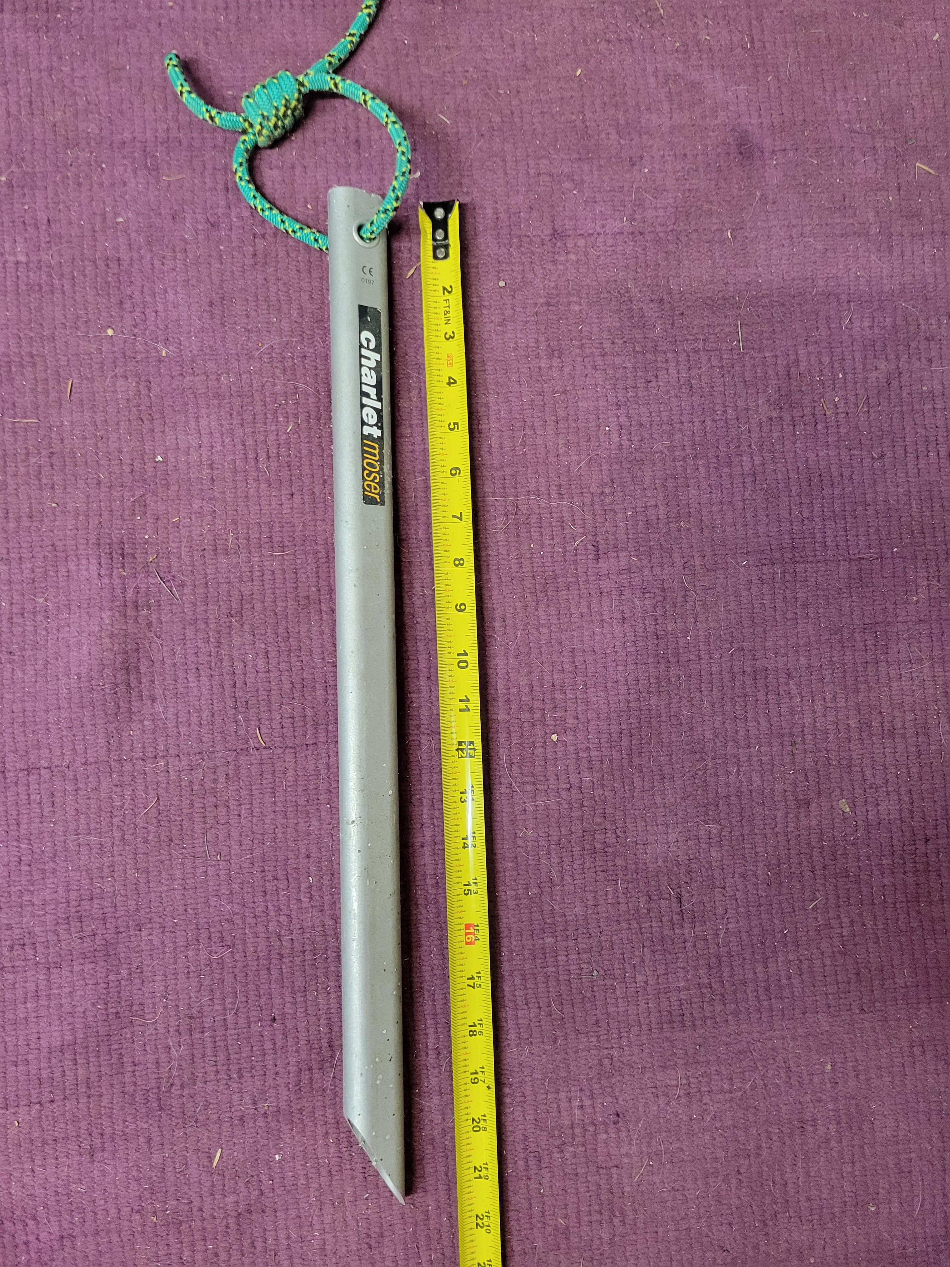
Hi all, I bought some ice screws off of somebody on craigslist like 13 years ago and he threw in this thing as well, I assuming is a snow anchor of some sort, but I have no idea. Can't find anything online either. Does anybody know what this is? If anyone can tell me what it is or how to use it they are welcome to have it for free! (unless it turns out it's really valuable) ?. I have never even carried it on a trip in over a decade.
-

[TR] South Hozomeen Mountain - SW Route 09/08/2024
geosean replied to geosean's topic in North Cascades
@JasonG, hard man points all the way. No way was I going to let him solo it and not do the same. -
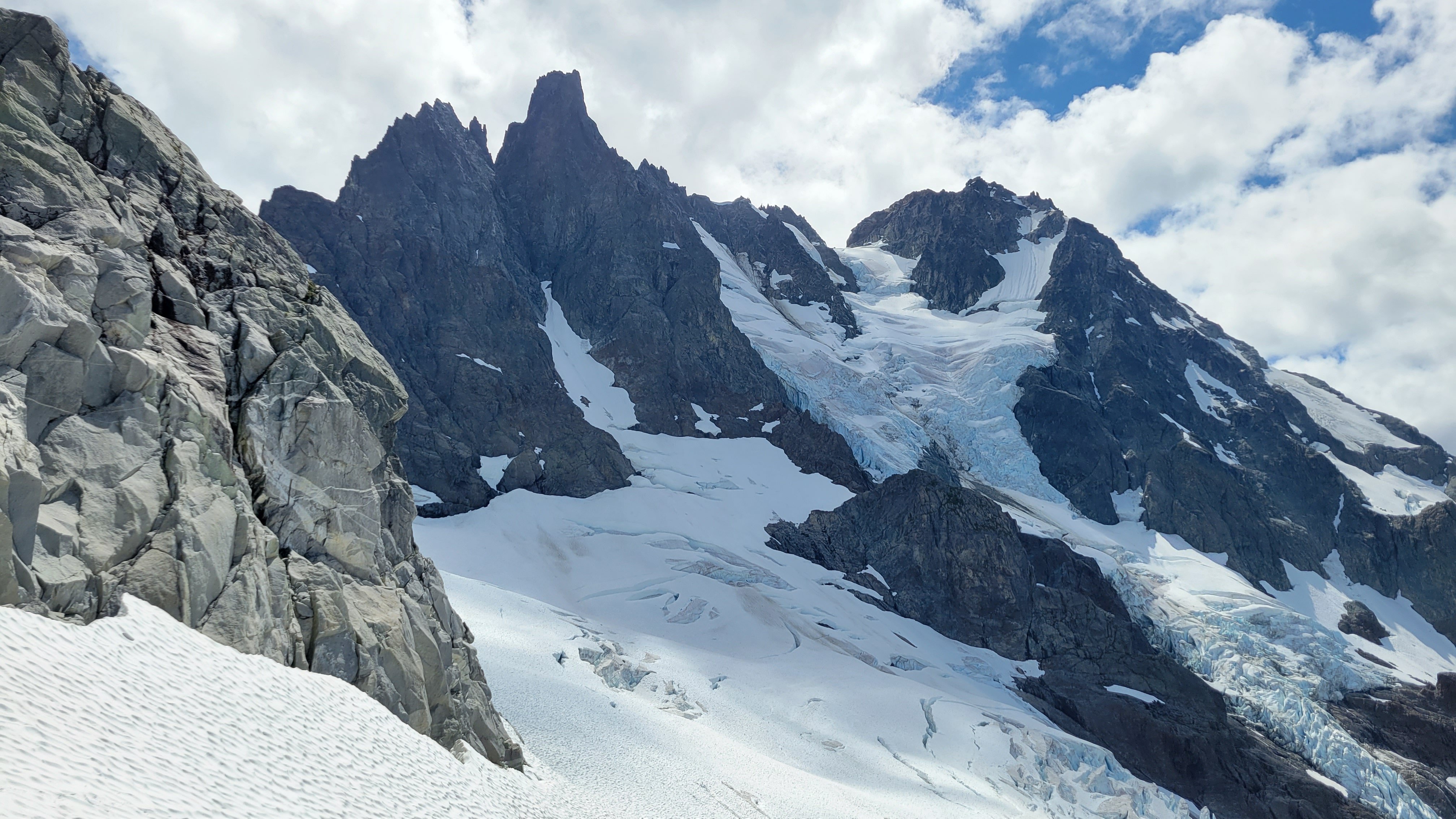
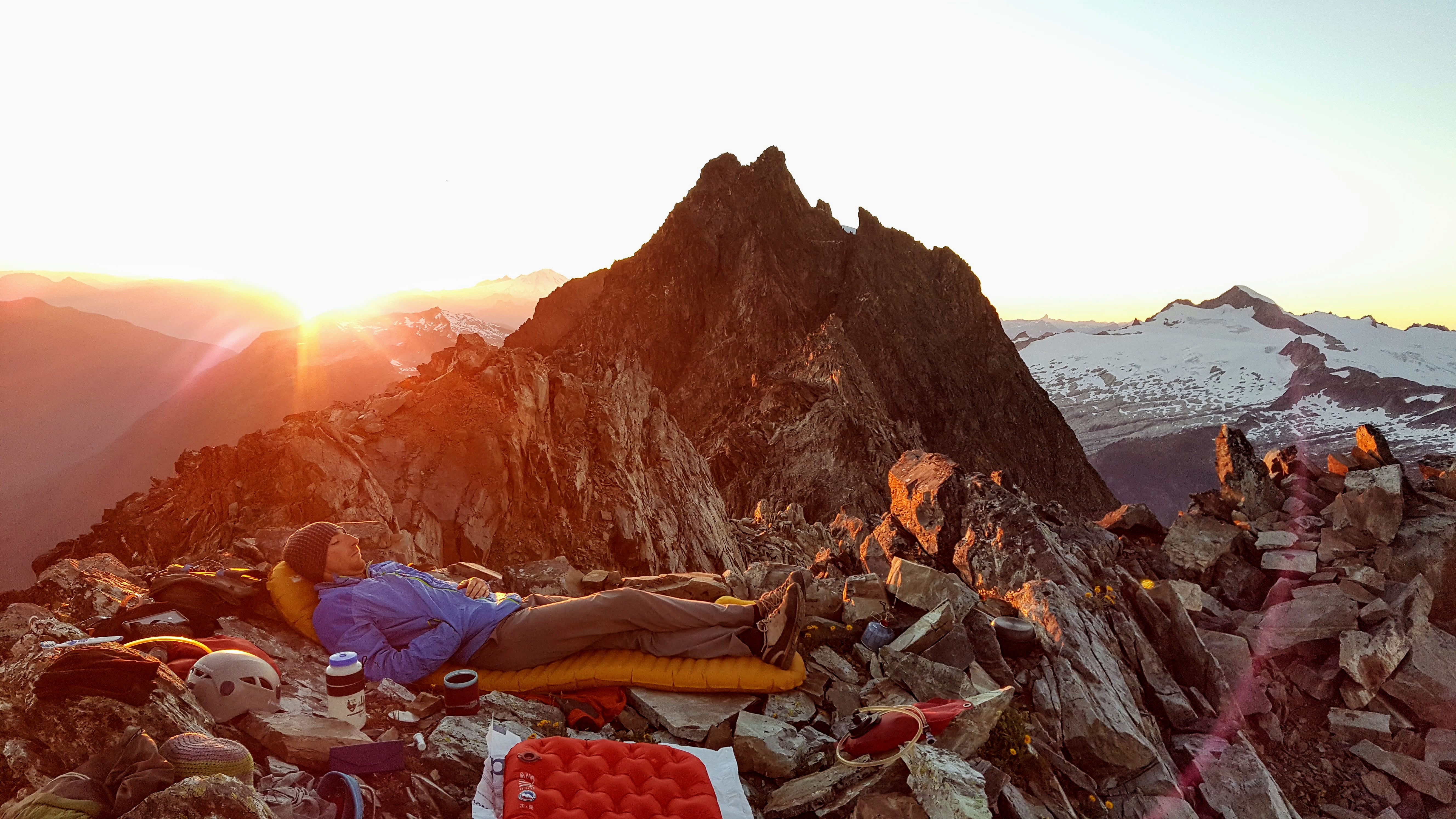
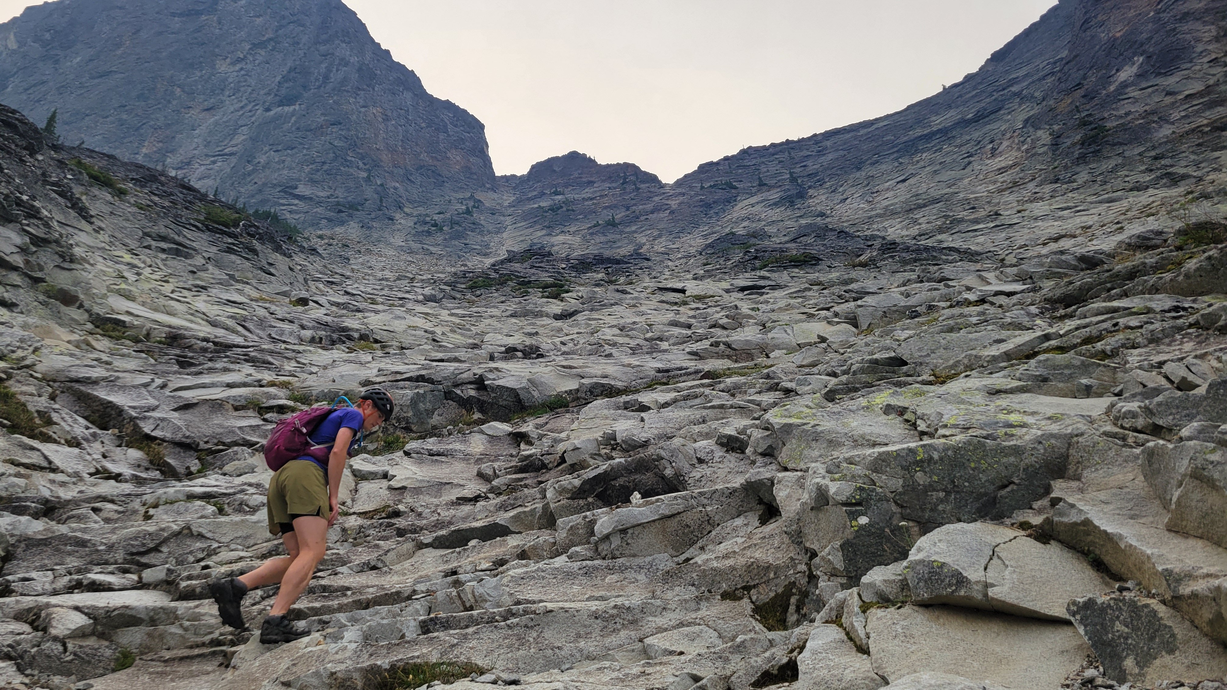
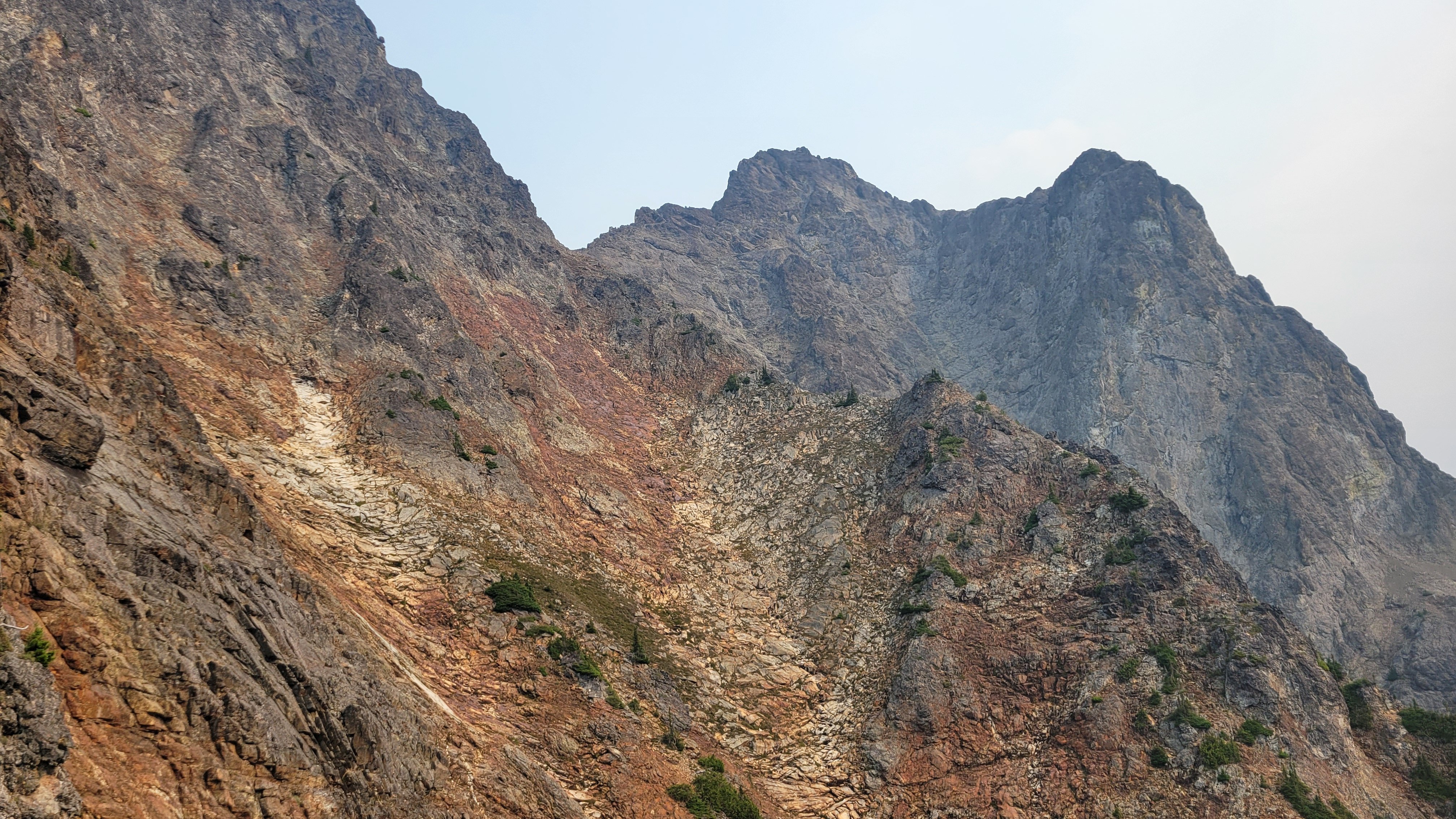
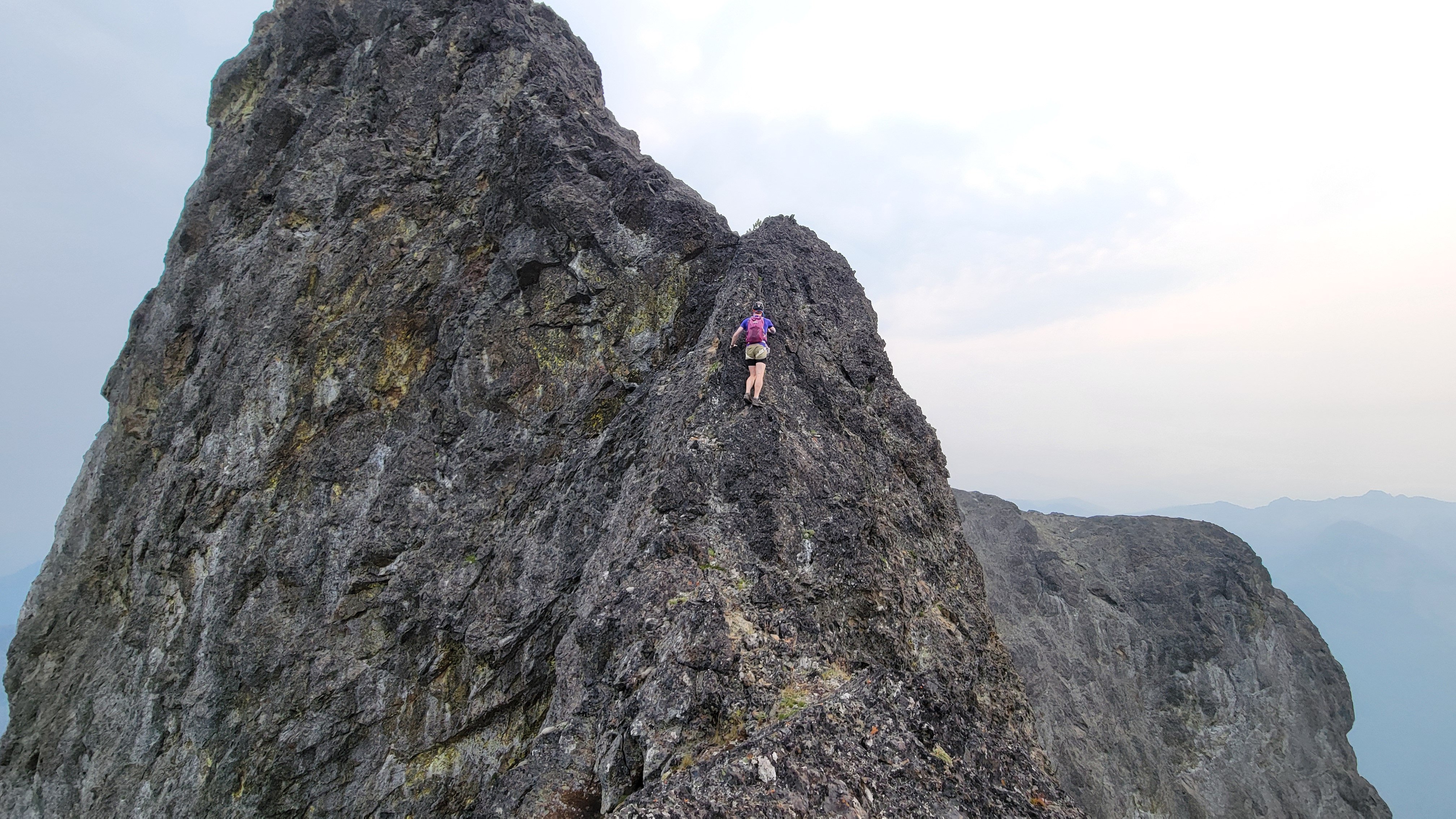
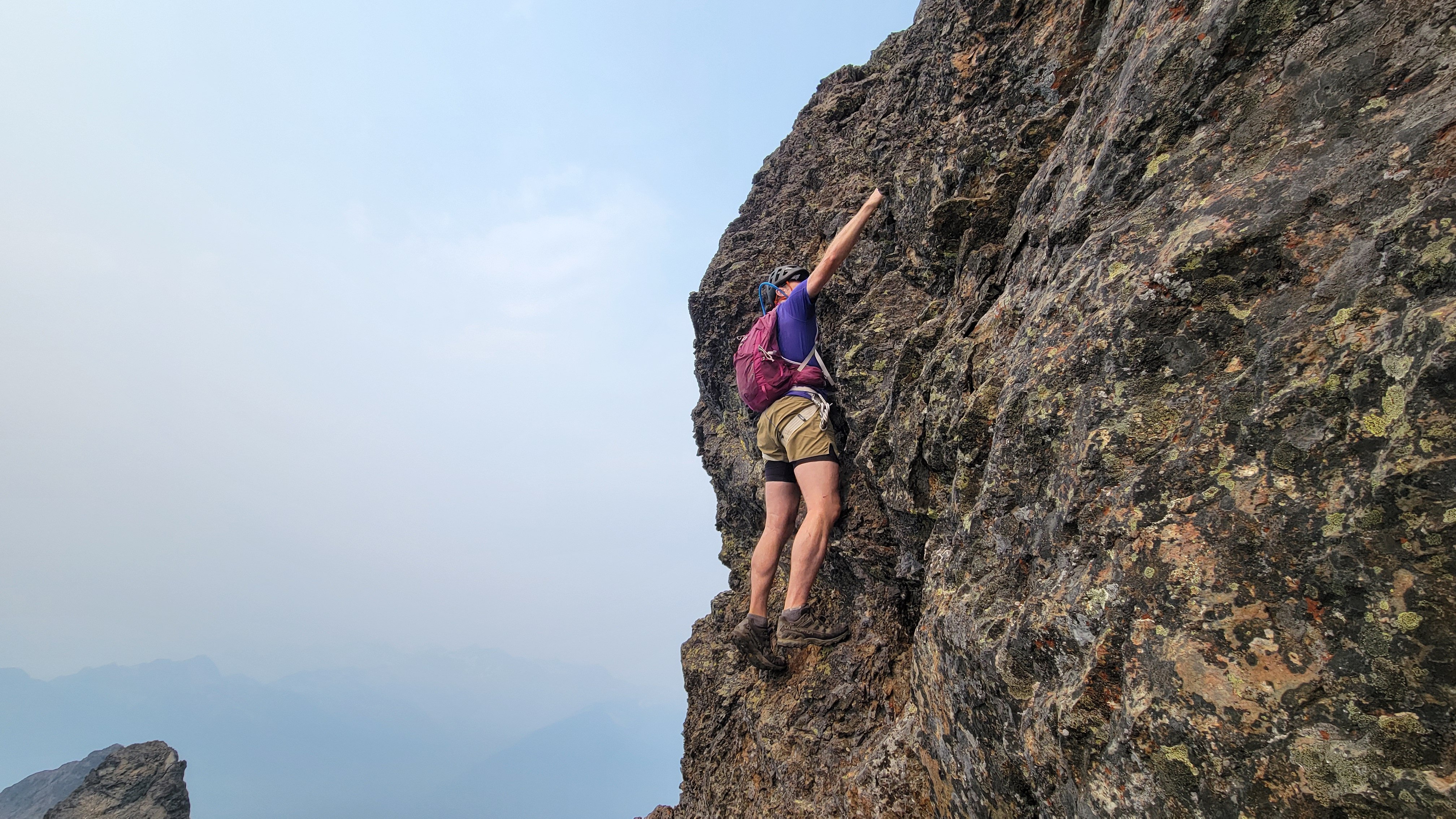
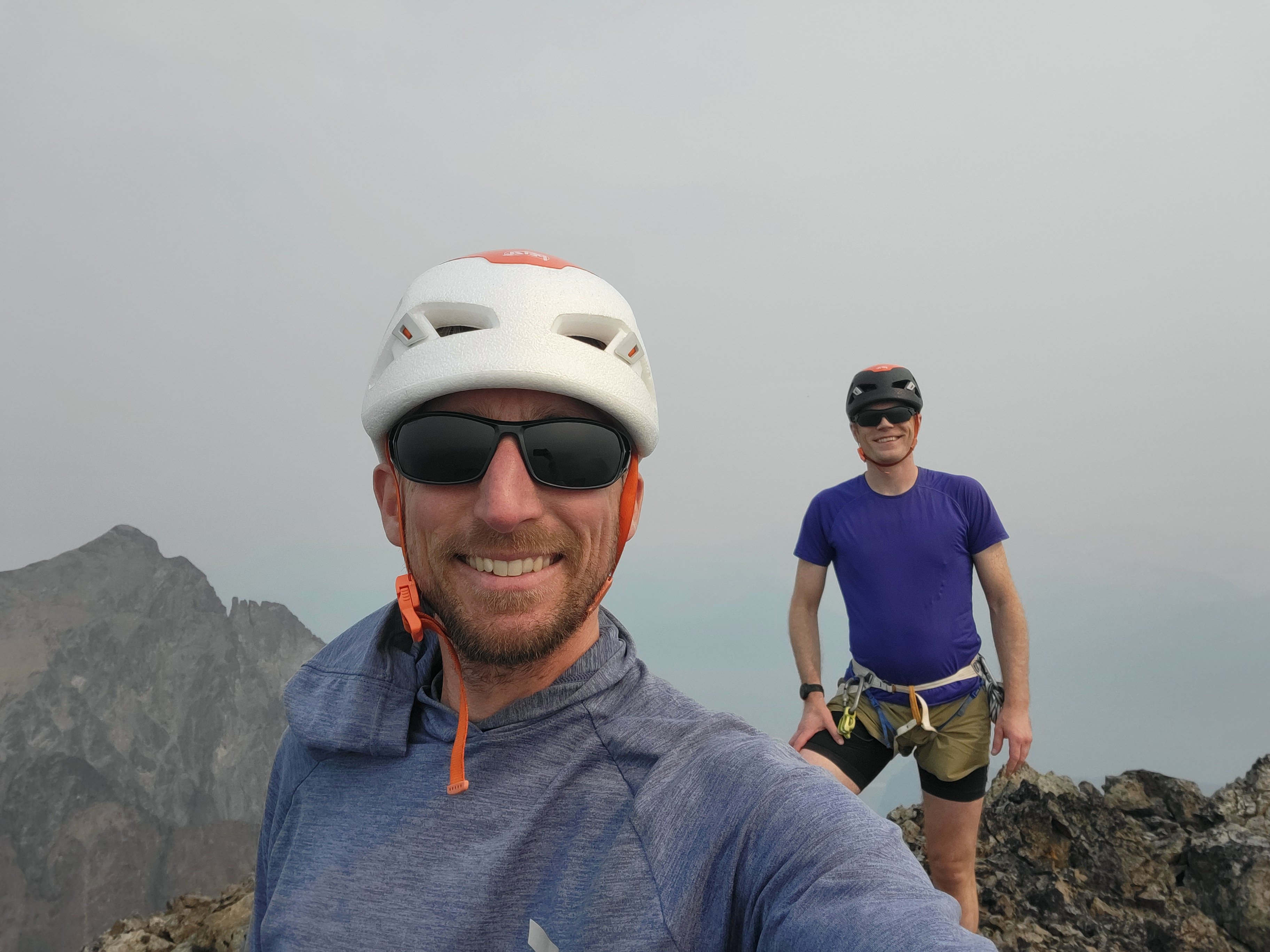
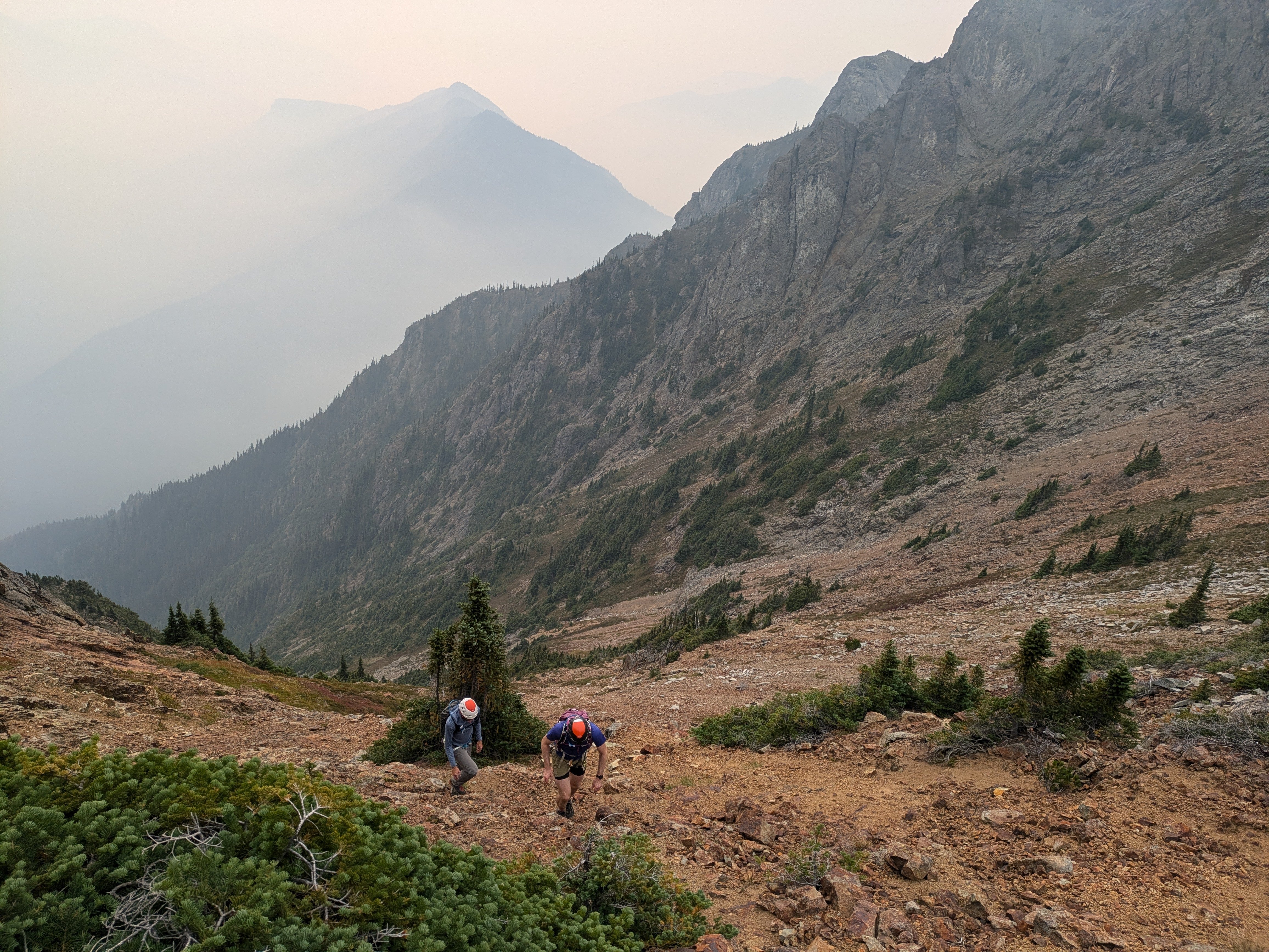
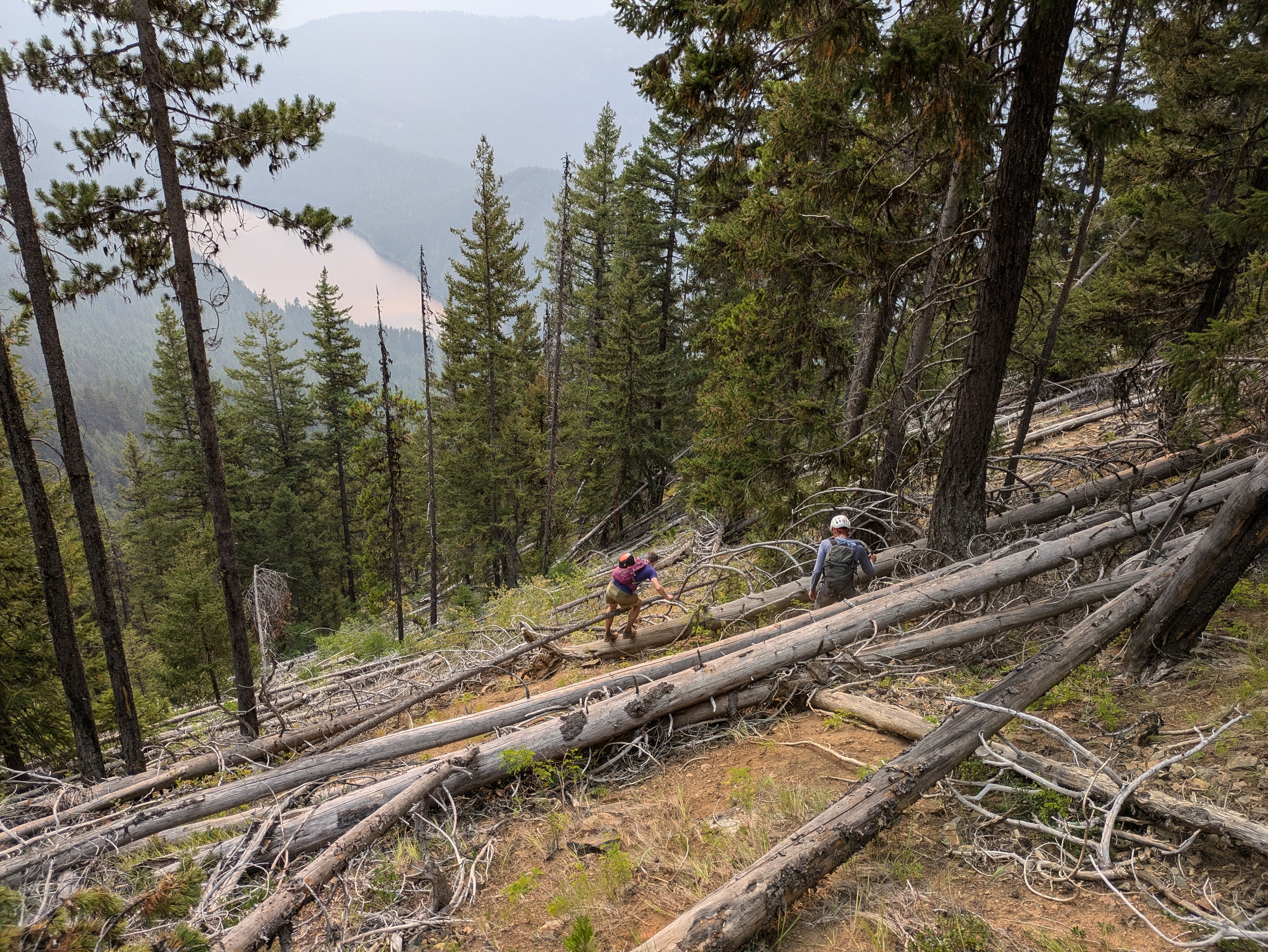
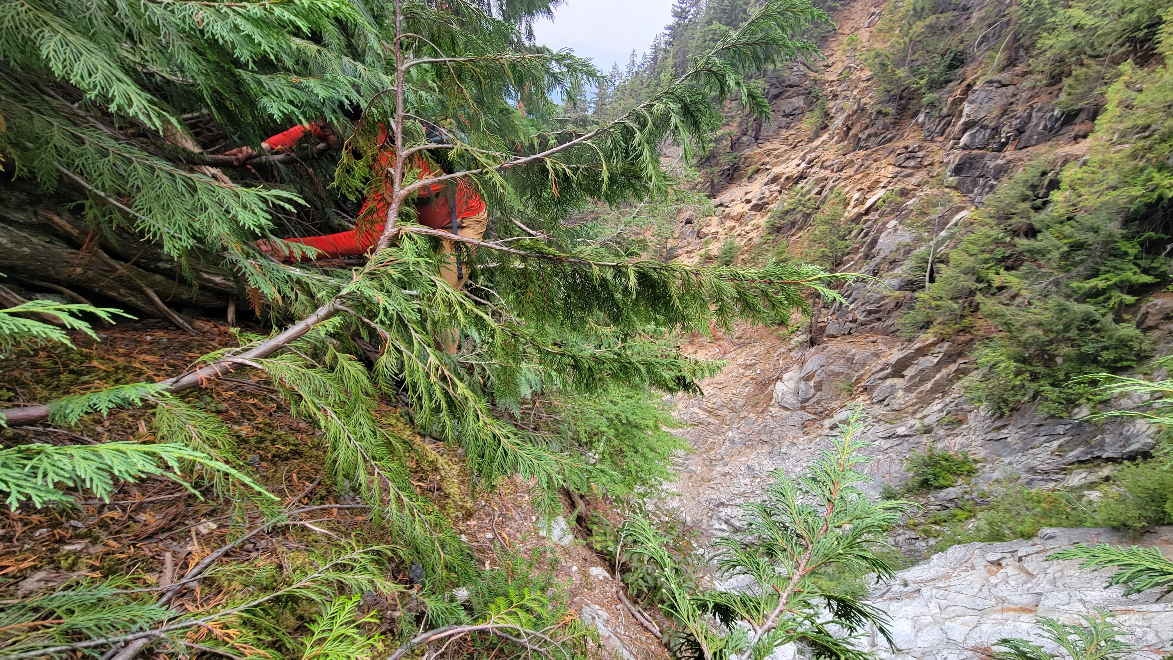
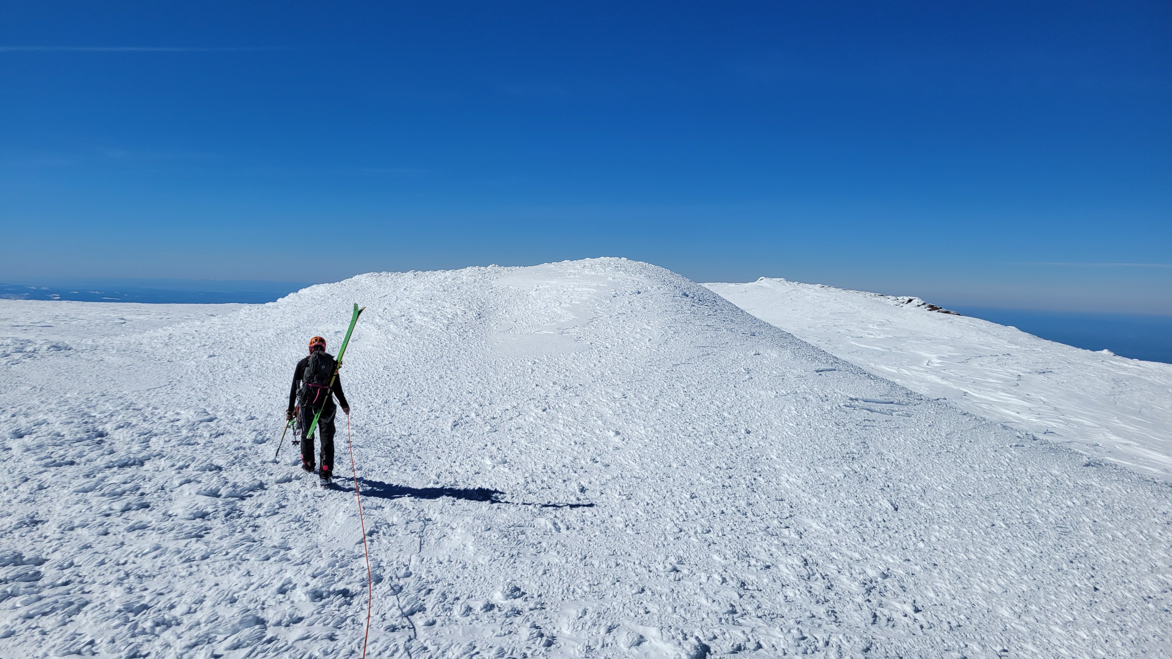
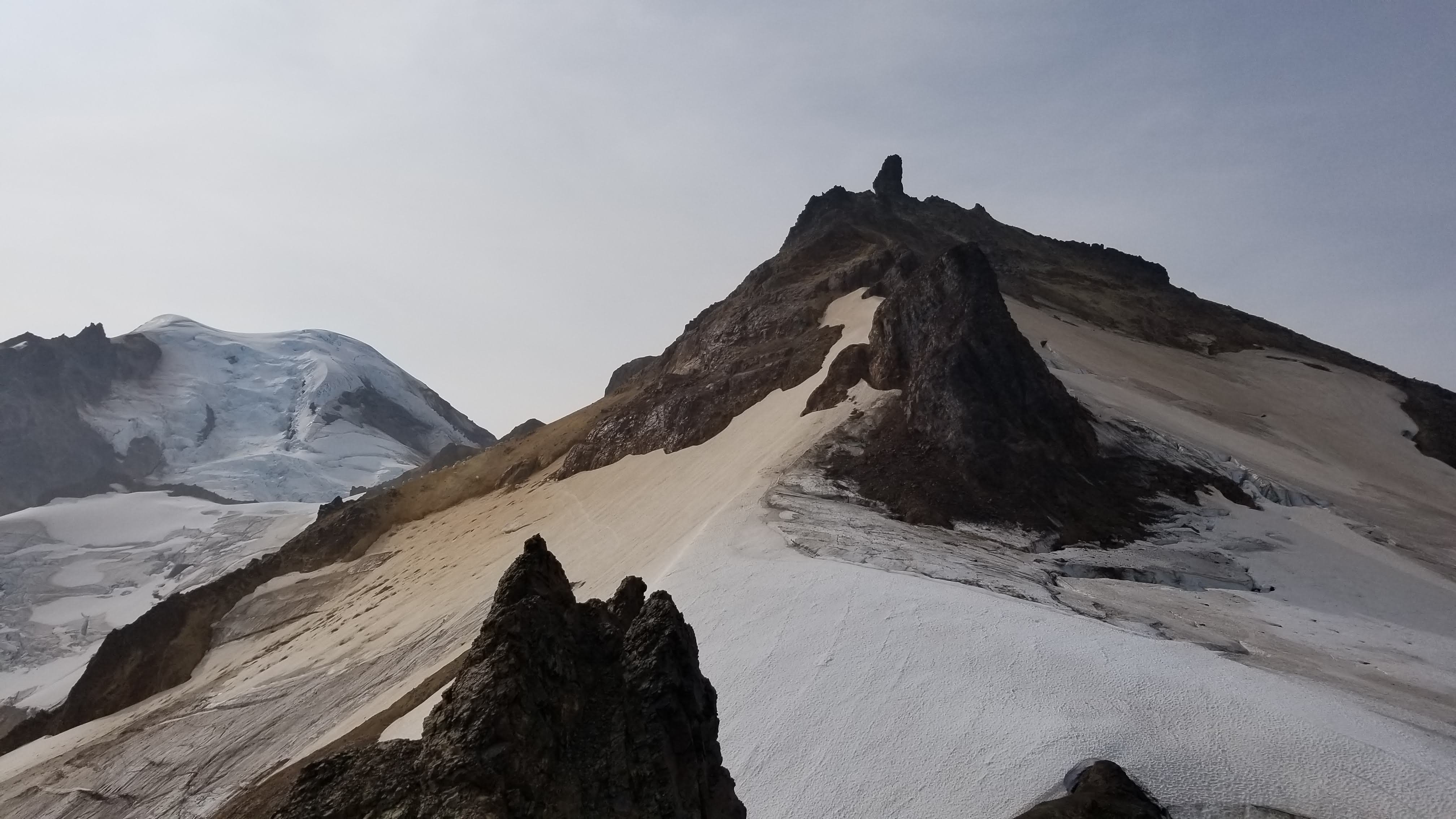
Trip: South Hozomeen Mountain - SW Route Trip Date: 09/08/2024 Trip Report: On Saturday September 7th, me, Mike, and @thedylan drove up to Canada and then darn near back into the US to go for South Hozomeen. We camped at the Skagit River Campground in the provincial park. The next morning we woke up at 4:00, drove a couple of hundred meters (that's what they use up there) to the international boundary and parked near the gate, the NPS implied on their website that it was totally fine to walk across the border, not that anything less would have stopped us. We walked around the gate and into a different country. The couple of miles (that's what we use around here) of trail were immaculate, the NPS has done some maintenance, all too quickly though we plunged off the trail and into the brush and deadfall of the low elevation valley bottom. GPS proved essential through here, particularly at night, but even in the daytime coming out. We hit the creek bottom that drains the cirque between South and Southwest Hozomeen as soon as we could, if only just for navigational purposes. The brush was pretty bad but it really wasn't that long, pretty quickly the creek bed opened up and it was easy boulder and occasional slab walking. 3000' ish: There were a few easy scramble steps and ample water available in the creek bed up until 4100' where we encountered a waterfall and an impasse. We did a gorilla scramble just climbers right of the waterfall and made it through, although it was ugly. Above that more easy walking and boulders and occasional short scrambles until you hit the beautiful slab walking at around 5800’ I think. 200 or 300 ft below the 6900 ft saddle the slab walking turns into scrambling but it wasn't too bad on the way up, we tried to follow beta that we had but I think it's pretty much follow your nose. Gorilla Scramble (Reminds me of J-Berg): Slab City: At the saddle our entreaties finally failed and Mike called it a day, he had been not on form for the last hour or two, although we were still moving pretty quickly. If you're just not feeling it this is definitely not the peak to push it on, so he made the right call. I think he was exhausted from riding his bike to the farmers market Saturday morning. Me and Dylan descended from the saddle, contoured left and crossed through two minor rib notches, then up the rib to the ridge crest at about 7,600’. From there it's basically straight up to the summit which is where it looks like. The route finding was quite straightforward… if there's a notch go through it. Everything since 6900’ looked intimidating and you wonder “how the heck are we going to do that?”, then you just start moving and it falls into place; we both had the same image of Indiana Jones and the Last Crusade when he does the leap of faith and walks along the easy bridge. It was kind of like that… but the bridge is class 4 here. Leap of Faith: There was some tricky exposed scrambling on the ridge crest but stuff was solid when you needed it. We soloed the obvious 12’ crux step and finished the scramble to the summit. Over the last couple of hours the smoke had really filled in so we were very glad to be done going uphill, there was no view at all so we just turned around and headed down. It was thrilling to be done but only in a very muted way, knowing that we had to descend for it to count. Classic Ridge Scramble Shot: Crux: Worth it for the Views: On the descent to the 6900’ saddle there was a whole lot of “how the heck am I going to do this?” But you just have to start and it all falls into place. I liked this route because there's no dinking around, there's not really any point in route finding or thinking about gear or anything since that's not possible (there is basically no pro anywhere on this whole mountain above 6900’). There aren't any features to the rock, it's just pillowy and jumbled, pretty much any line is as good as the next. We confirmed that you only need a 30 m rope to do the crux rappel. We made it without incident back to the saddle, then descended 100-200’ where me and Mike decided to rappel, Dylan down climbed of course. We did a 100’ rap through the worst of the scrambling down to boulders and slabs. Approaching Mike's Nap Spot: After cruising down the slabs and part of the gully we made a stupid decision (possibly my fault). We traversed skiers right out of the gully, across two minor gullies to the forested slope. For some reason we thought this would be more efficient than down scrambling all of the steps and then figuring out how to rappel the gorilla scramble. This was not true. If I were to do it again I would definitely chance the gully and just figure out a rap. I've been climbing in the Cascades for 15+ years and this was the worst forest slope I've ever descended. I don't know how it's possible but this had everything that sucks, lots of sharp pokey downed logs, loose rock, deep loose dirt, then lower, brush, but still lots of loose rocks somehow! Wtf!? Even Dylan admitted that it sucked! Pokey Logs, (there was a lot of this): Anyway, eventually we swore our way down the slope and back to the trail then cruised back to the car in Canada. We were extremely thrilled to be done, but the no-see-ums made it impossible to relax with a beer. Me and Dylan washed off in the Skagit River (the lake is too far away), then we made the 2.5 hour drive home to Bellingham. I think if you could take the gully all the way back down to where it fades into the forest slope the descent could end up being okay, then this climb would be not too bad. The way we did it I will definitely never go back. @Albuquerque Fred has done this three times! What's with that guy!? This was certainly a very challenging peak, but I would say most of the overall difficulty is just getting to the high country, from the 6900’ saddle up it is one of the easier difficult 10 peaks, but overall it definitely deserves to be on the list! Gear Notes: 2x 30m rope (only 1 necessary for the crux), helmets, approach shoes. Approach Notes: Canada, US. Easy trail, then brush. I recommend hitting the gully ASAP and go up.
-
Daaaaaamn, nice work! We did two 16-hour days on that route. You guys cruised, it sounds like you soloed a lot more than we did. Very strong work and thanks for the writeup.
-
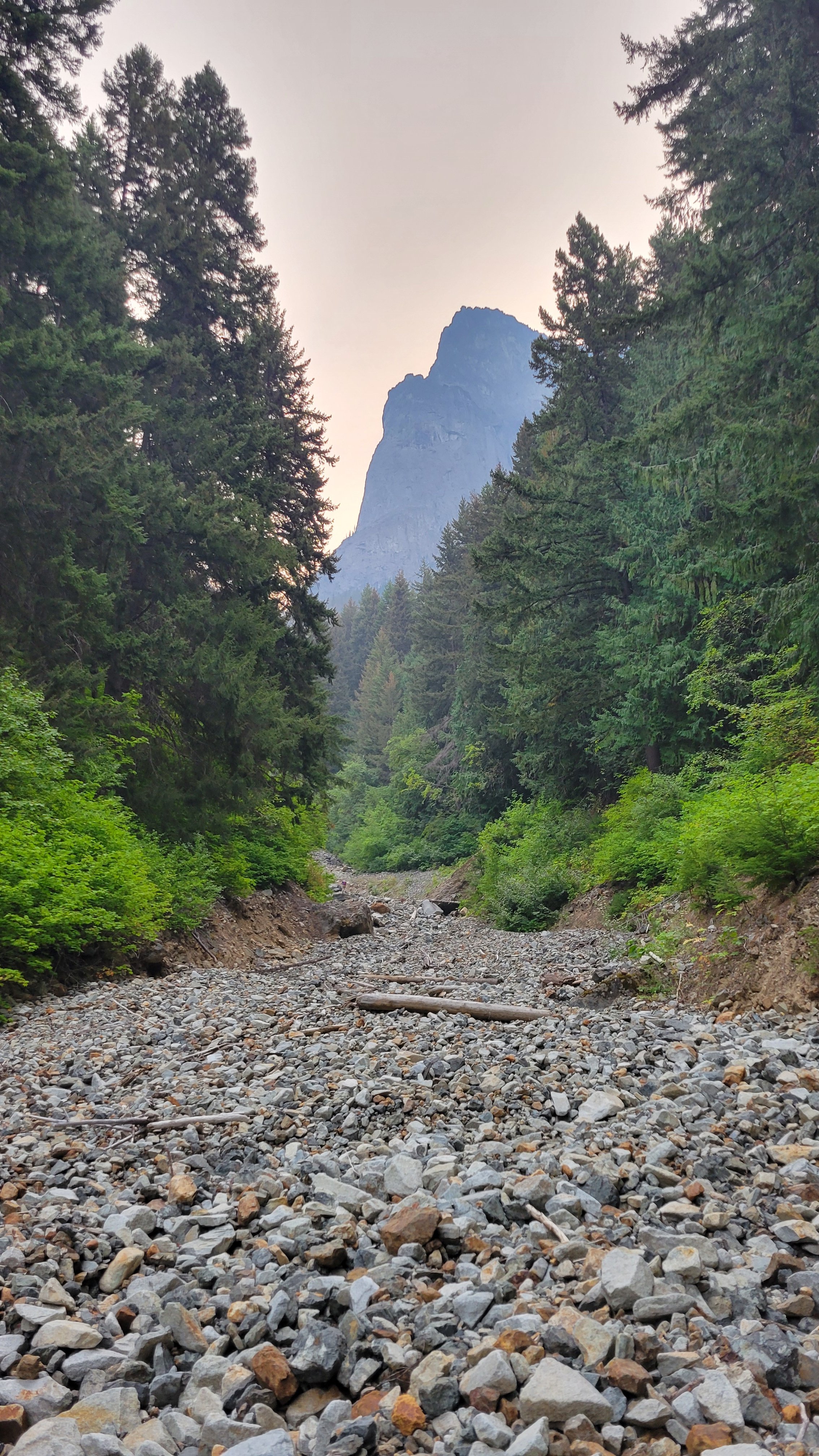
Trip: Inspiration Peak - South Face Trip Date: 07/14/2024 Trip Report: Me, @Albuquerque Fred and Mike climbed the south face of Inspiration Peak over two days July 13 and 14. We also walked up Glee on the way to camp since Inspiration in two days wasn't enough exercise for them. For beta we had @JasonG's TR: and @Steph_Abegg's beta, although I thought her suggestion to go past the base of the gash was crazy. We did so and it involved an insanely airy step across where the ramp disappears briefly just past the gash, then you climb up just to go back down to just above where you were before the airy step. I say go up the ramp to the gash, then go up, easy. This photo of Steph's was gold: The camp is melting out with about 5 good sites available and dry. We had excellent conditions on the glacier, easy navigating up a direct line, then a walk directly onto the approach buttress where we left the snow gear. A pitch, then simul traversing, up the ramp, up the gash, to the top. Easy route finding. We did like 12 or so raps with a tiny bit of down climbing right back to our snow gear. Many of the raps are tough. The big block to start the South Face raps has quick links going both directions, with additional stations below both ways. We went more westerly off the block but it was a hard steep traverse at the bottom of the rap to get to the next station. What have other people done here? The climbing was, I thought, great in the gash. A good, tough route to a tough peak. Crazily enough the mountain was getting tons of action this weekend. We talked to a group that did the east ridge the day before, another that did the south face, and then on the hike out another going for the east ridge on Monday. We were stupid and hiked out on the same day as the summit. Around 14 hours camp-summit-camp, 20 hours camp-summit-car. +2.5 home. Ew. In bed at 3:00 am with a 5:30 alarm for work. The trail: In camp: Fred finding the direct line through the glacier: Easy moat: On the summit, beautiful day: So happy to be on dirt again: Terror Basin conditions from Glee: Gear Notes: Single Rack to #2, 2 30m half ropes, crampons not really needed but used, rock shoes. Approach Notes: Grueling to camp, easy from there.
-
Wow, "reservable overnighting facilities operated by three private commercial entities" is exceedingly vague about who gets to use it. I feel like if you're going to allow any kind of development on public land it should be publicly accessible. The way I understood it last time was that the huts were going to be for private guided groups. I don't want more access for the rich pay to play crowd at the expense of any portion of the public trust. Cheap public huts like in Canada... maybe.
-
"something felt not quite right about that, like I hadn’t earned it." Hahahaha, nice. I wouldn't have expected anything less from you Eric! Glad you made it at least even if it wasn't exactly your style. I bet Pemba was thrilled to have you as a client on that one! I assume you're way less work and more helpful and self reliant than basically everyone else that uses Sherpa support. Thanks for the great read, I loved it.
-
Rainier Gib Ledges and Ingraham Direct - 3/17/24
geosean replied to Anton Koveza's topic in Southern WA Cascades
Nice seeing you guys up there (we stayed at the shelter with you). Glad you guys made it too! Did you get out through the gate ok? -
Wow dude, amazing write up, and a great effort! Thanks for all the effort explaining the whole trip; I'm actually more interested in the logistics than the thought of climbing the peak so it was very interesting. Did you do a write up of Kangchenjunga?
-
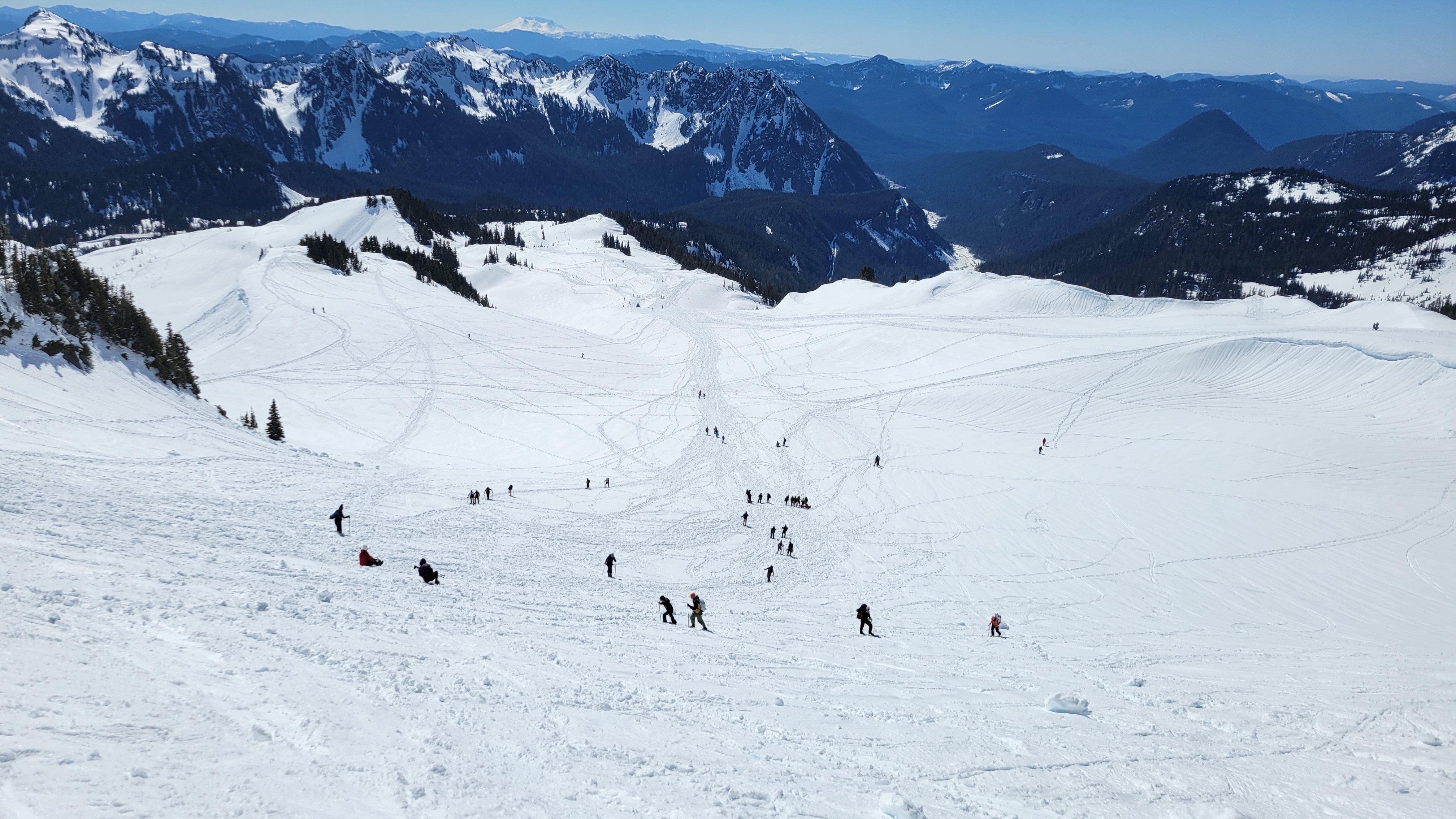
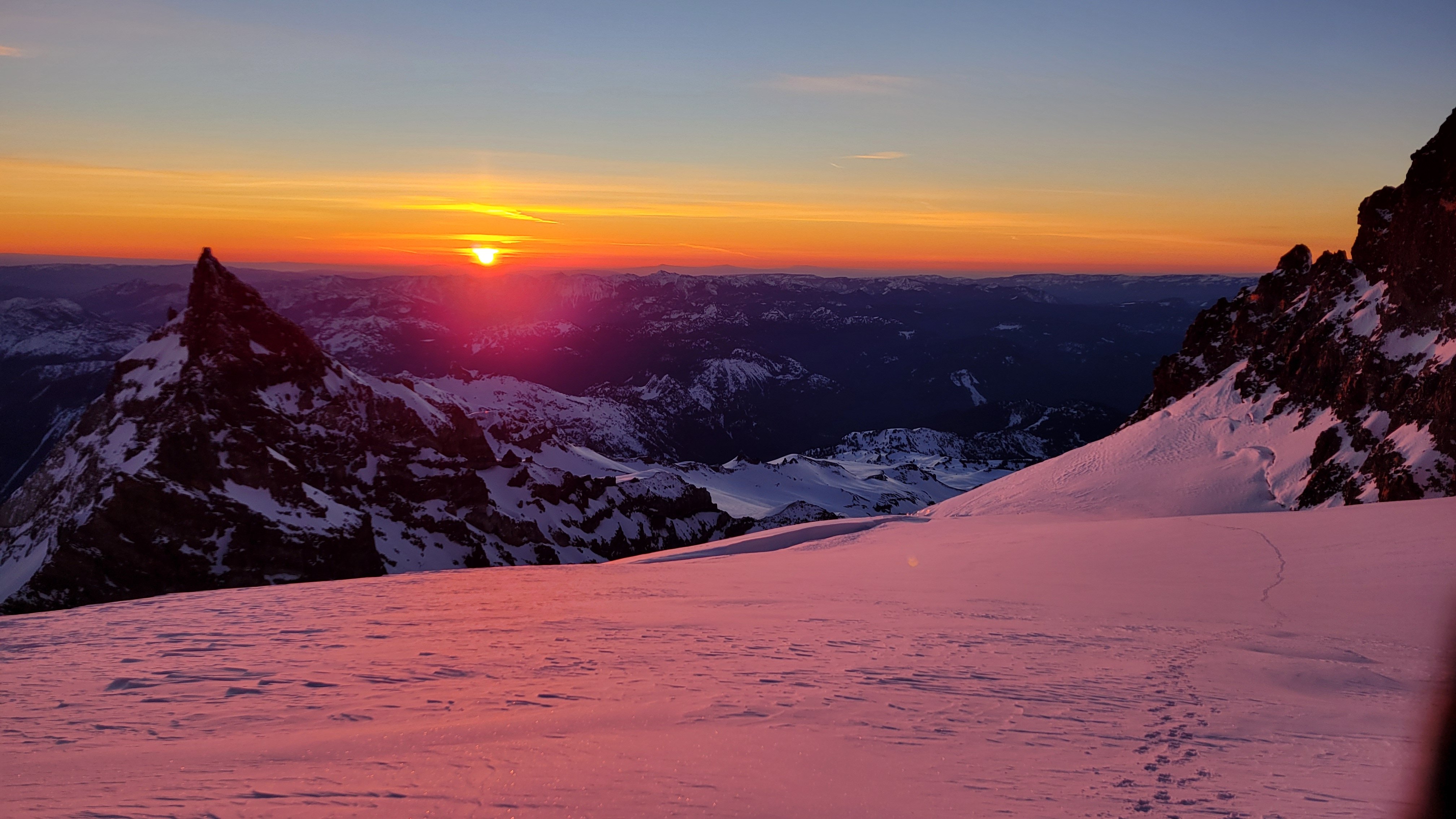
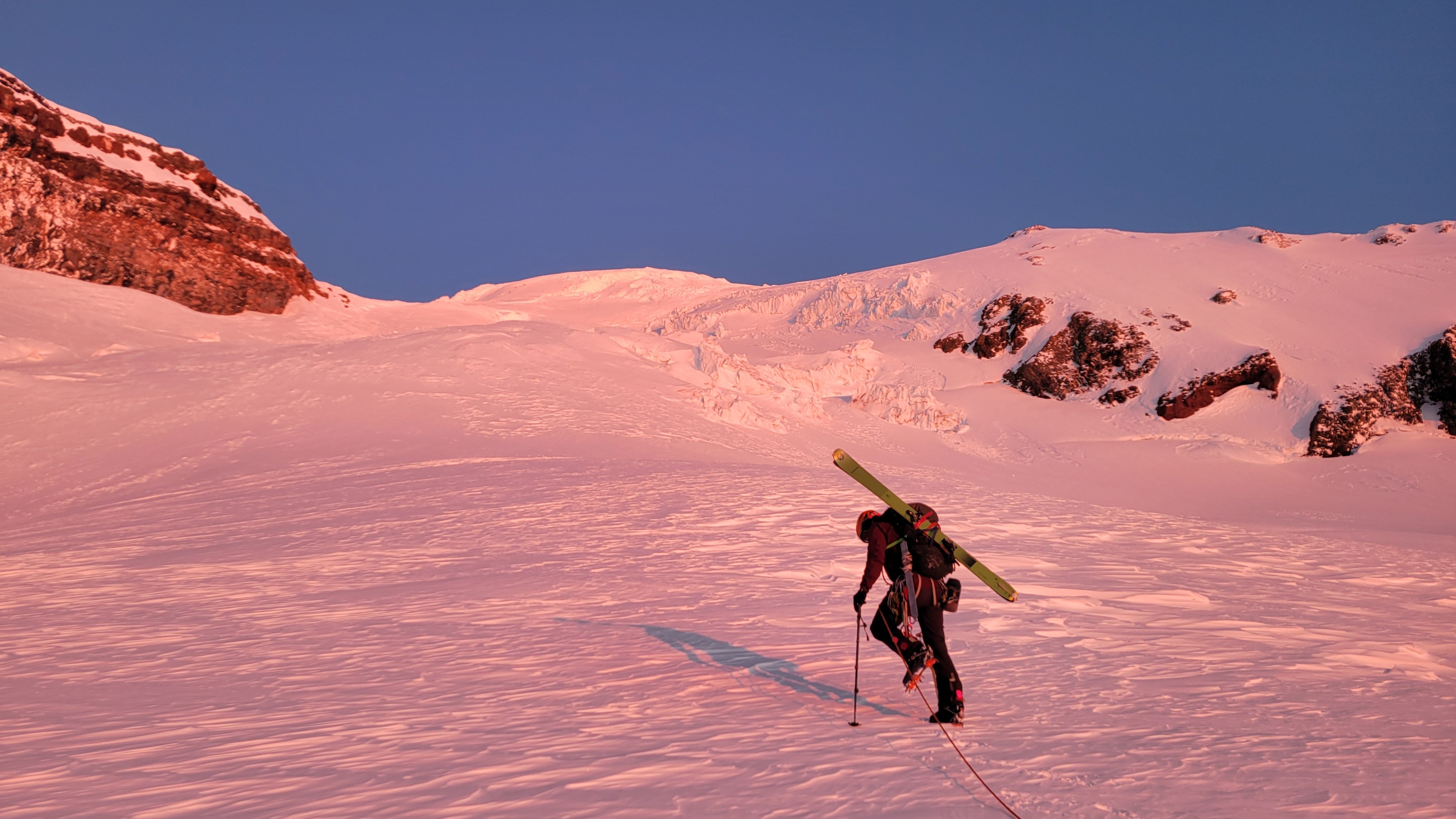
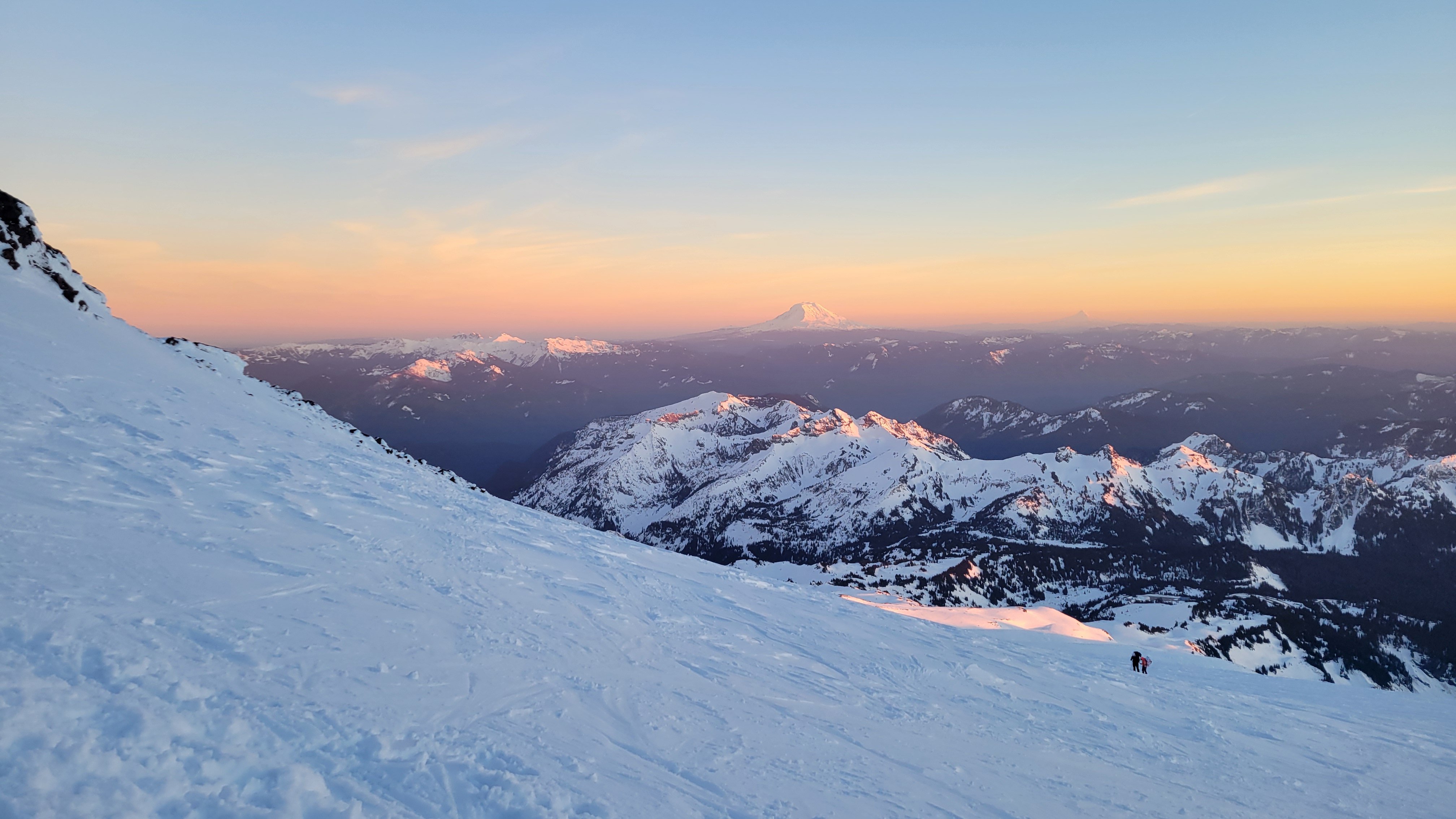
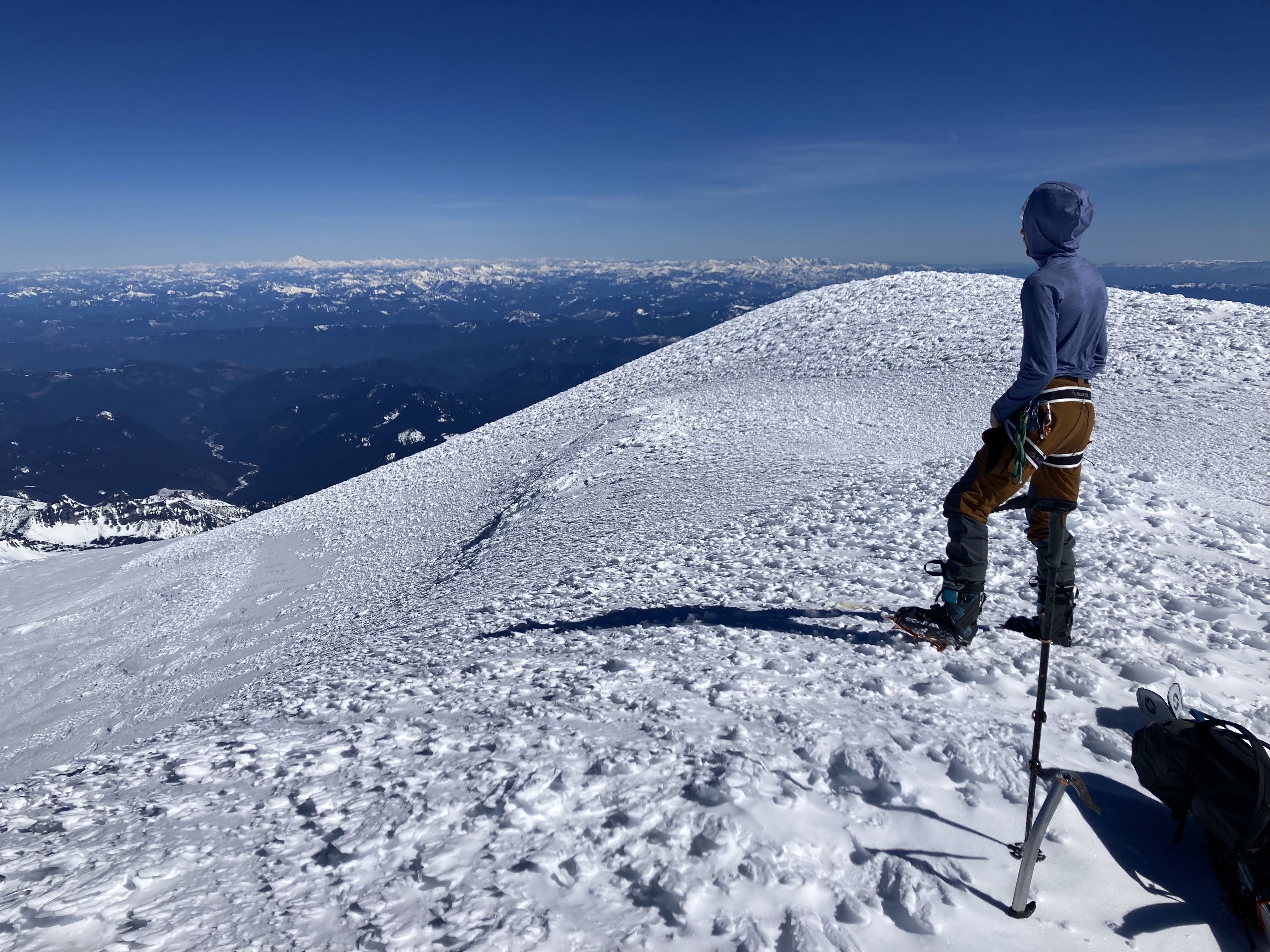
Trip: Mount Rainier - Ingraham Direct Trip Date: 03/17/2024 Trip Report: Mount Rainier in calendar winter... ??? Whooooo oooo ohhhhh ??? Scarry Well, this wasn't like that. With the big first warm-up of spring predicted, NWAC was saying considerable at all elevation bands everywhere due to wet slides. This actually made a calendar winter climb of Rainier seem spot on for the weekend of St Patrick's Day. Me and @Albuquerque Fred headed out hoping for an easy nab. So that I could get some extra sleep and to let the gate opening crowds thin out we left Seattle at 9:00, getting to Paradise close to noon. The ranger at Paradise (where we self-registered) literally said "you should have no problems"! This was extremely surprising after getting used to rangers telling you how scary and dangerous everything is, assuming that you are getting in way over your head. I think this may have had the opposite effect and made me nervous. It was 68° in the parking lot at 12:30 p.m. We slogged uphill passed about 400 people, mostly snowshoeing in jeans, good for them getting outdoors though. I think it was due to the heat but we felt like we made awful time getting to camp Muir but upon further reflection it took 4.5 hours which seems respectable with overnight packs. There was one other party of four staying at the shelter that night, they were going to bed extremely early for an Alpine start, so we hung out outside in the warm weather making water and cooking and eating and watching the sunset. We turned in at a halfway reasonable hour for a 4:00 a.m. wake up. At 4:00 it was indeed quite cold, especially after my pad went flat and I had to blow it up like five times. The prediction was for low 20s° weather, that seemed about right. We started hiking at 5:15 with our skis on our backs in the pitch black. It was cold, but calm. Booting up Cathedral Gap got me mostly warmed up, and it started to get a little light by the time we crested the ridge. I was taking diamox for the second time on Rainier (the second with diamox that is), and I didn't realize it but tingling in your fingers is a side effect, I thought they were very cold all morning but I think there was just extra blood flow. It felt a lot like light duty screaming barfies though. The sun rose right when we hit Ingraham Flats right around 11k, it was stunning. The going was hard, punching through breakable crust while booting, but it seemed like skinning would just be icy and scary, and the crust was intermittently supportable. The perfect conditions for disheartening travel, right when you think you are making headway on top of the crust you start breaking through, then you have to put extra effort into stomping the crust down so you don't pitch forward. There were two crevasses, one we stepped over, and the other had a nice stable bridge/plug. We went straight up the gut although I think climber's right is actually more filled in. We made slow progress up to 12,200' where we briefly tried to skin, but it immediately was supportable and icy and steep and scary, once I got to a place I could get out of my skis I did so with gratitude. Due to the hard going we decided to hang a left off the Ingraham Glacier to gain the upper part of the Gibraltar Ledges route and follow the other party's boot pack. There was some minor crevasse dodging here at the ridge crest but nothing challenging, then we followed the boot pack to the summit passing the other party on their way down. The head wall above 12800' above Gibraltar Rock was easy cramponing. As soon as the sun came up it had started to get extremely warm, the bowl of the Ingraham Glacier was absolutely roasting, I was wearing long underwear and couldn't really take it off so I was down to just a sunshirt on top with no gloves and no hat all the way from about 12K to the summit. I summitted in a sweat soaked sunshirt, there was basically no wind the whole way. The crux of the entire climb was definitely the heat, it sapped us pretty hard and made for slow going. This was also very unexpected so it was hard to convince yourself you needed to shed a layer. We were very far behind schedule after almost 7 hours camp to summit, so we didn't linger, we stripped skins, put our skis on for the first time in hours and headed down. I found the skiing to be very challenging for the top 1000 ft on hard packed sastrugui, with the occasional hard-packed smooth pocket that made for easy turns. At about 13,000' there was a long smooth steep head wall that made for great linking turns, though very fast and icy. From here down I found all of the skiing to be quite excellent all the way back to camp Muir and below. With the heat the snow from about 12,800' and below was creamy on top, but still supportable. I made it to Muir with my skis on. Fred is less into sketchy, bumpy, icy, exposed turns, so he found the whole thing much less enjoyable. I guess it's just a matter of taste. We packed up camp and headed down. The snow below Muir was excellent until 6700' were a bad case of mashed potatoes set in. It didn't really matter anyway as this was boot packed out 50 ft wide, so we just survival skied the boot pack back to the sign-in hut, and eventually the car. From summit to car with 30 minutes of packing was 3 hours. It all goes to show you that "calendar winter" is total BS and everything should be based on conditions rather than man-made dates. I found this trip to be a more challenging ascent than the Emmons Glacier was in the spring last year, due to the hot conditions and punchy crusty snow. Gear Notes: Avalanche gear, crevasse rescue gear, 2 30m ropes, sleeping gear (no tent, but a pad with a hole in it), way way way too many clothes, not enough water. Approach Notes: Show up late and skip the gate line, it only takes a third of a day to get to Muir, and what are you going to do before it's reasonable to go to bed anyway? It was a bust day on Saturday: Nice sunset though, views all the way to Jefferson: Fred slogging on the Ingraham: Sunrise: Fred finishing it off: Warm summit break:
- 1 reply
-
- 6
-

-

-

-
Hey, I need a little help, I'm planning a trip to Waddington this summer and would LOVE to get my hands on Don Serl's The Waddington Guide. Does anyone know where I could buy or borrow one? If I could borrow yours for a few days or hours to snap some pictures and take a few notes that would be great also! Thanks all!! Here's a pic of me looking super stoked on a recent "skiing" trip to BC. We hiked down a mountain carrying our skis because conditions were so bad.
-
[TR] Mount Chaval - Standard Western Ramp 09/28/2018
geosean replied to JasonG's topic in North Cascades
Hahaha, I just have to revive this. I can't believe no one asked... @kukuzka1, when did you lose the walkman? Too bad about the AC⚡DC. -
Same problem as every other thing in the world: too many people. Get a vasectomy (if you're a man).
-
I'm not sure what the story is with the gate, looking through the internet it seems somewhat random. You could do 90% of the road with a Subaru or anything similar, the last switchback is the worst but it's only .25 mile. I would have been really torn if we'd showed up and the gate was open, it would be almost too easy to drive to 2800'.
-
Yeah Jason, get with the running game. I've done Hadley a few times over the last couple of years, it's a spectacular run from Skyline Divide. We pushed on to Bastille one time, also excellent. I think I've seen goats every time I've been up there. Once I gave up on summiting Bastille because I didn't want to keep driving the goats onto the Mazama Glacier. They always seems to take the same route a climber would. You can just make out the line of goats on the left ridgeline, and their trail across the snow.
-
Trip: Mount Persis - Trail Trip Date: 11/29/2023 Trip Report: After such a beautiful Sunday on Gunn me and @Albuquerque Fred decided we had better play hooky and go catch the last of the high pressure system on Wednesday 11-29, but the best we could motivate ourselves for was Mount Persis. We knew the gate would be long so we took bikes and resigned ourselves to pushing uphill, a lot. This proved to be even more lousy than expected, but totally worth it for the downhill! In a previous trip report I claimed that the trail to Gunn Peak wasn't that bad, this one was THAT bad. I think purses might be the worst trail that people have ever called a trail. I've done a lot worse climber's paths, animal trails, routes, ETC, but everybody calls us a trail, it was tough. The 2,500 vertical feet of biking and pushing probably didn't help. The snow held off until the terrain eased up at about 4500 ft, then we boot packed with minimal penetration, through the forest until popping out into the open. Where the sun had been doing its work over the past week we walked on a nice firm crust seldom sinking in, all the way to the summit. It was cold, so we didn't stay long. The sun didn't materialize today, but it was worth it, plus I was getting paid for being sick. The view of the Indexes is amazing! The view of Fred is always amazing: My butt bones hurts after this: Worth it for the downhill! Gear Notes: Bikes. Approach Notes: Bike the road, as God intended. Then trail, maybe take some pruners.
-
Wow, nobody else went out there on a great Saturday! Amazing. It was such a fantastic weekend.
-
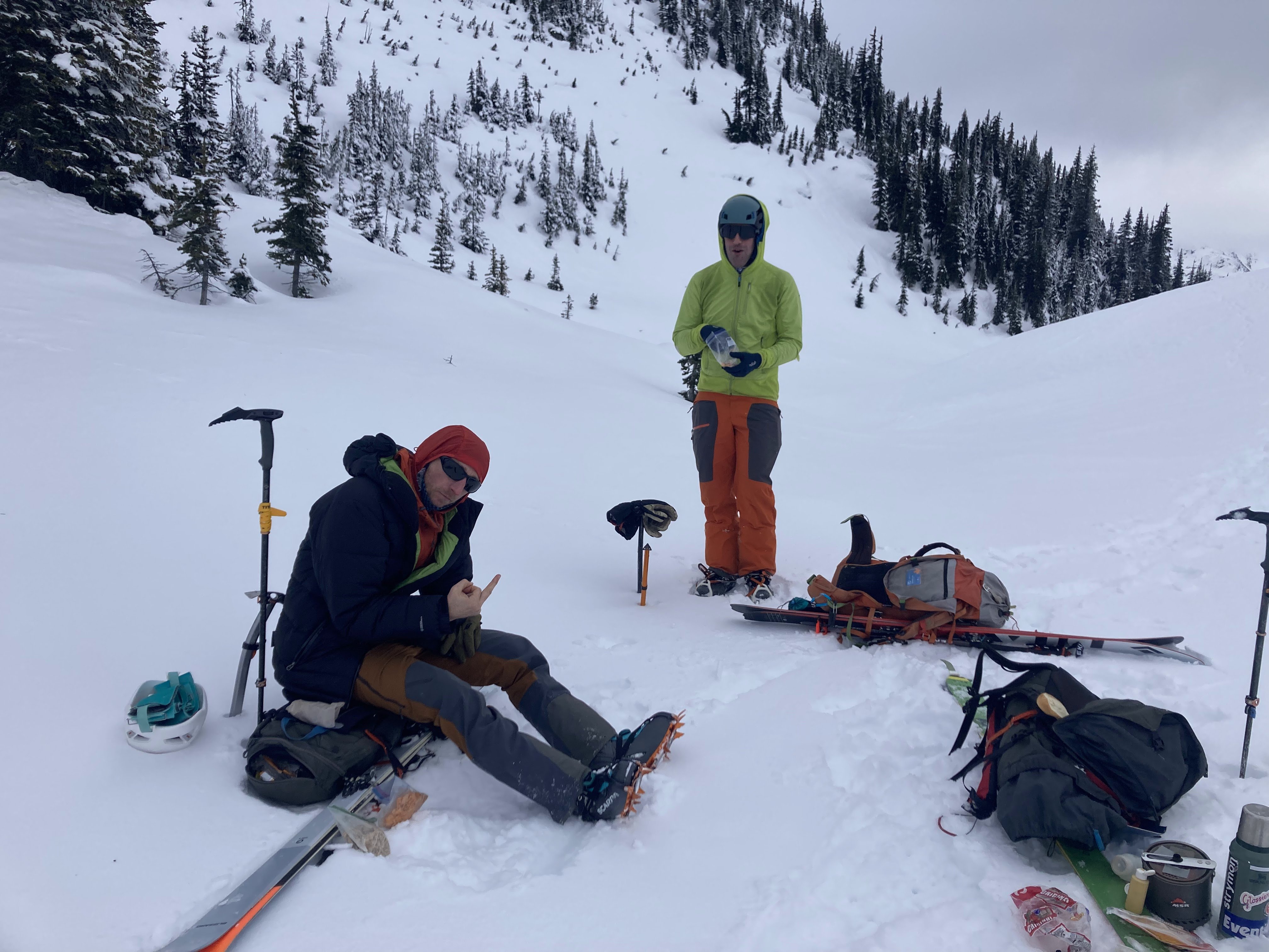
Trip: Gunn Peak - Uh, south. Standard. Trip Date: 11/26/2023 Trip Report: On 11-26-23 me and @Albuquerque Fred climbed Gunn and Tailgunner peaks. It was grand fun made much easier than is typical for this season due to the long high pressure system that melted and crusted the snow. Not knowing what to expect from the conditions we brought all kinds of gear: rope, pro, axes, crampons, helmets, snowshoes. We didn't use any of the technical stuff, just axes and crampons, and helmets. The trail wasn't as bad as we expected from the reputation, but it was pretty bad. The heavy frost down low made sure the brush was dry at least. We had to use crampons to manage the log crossing at Barclay Creek. Snow began at 4300', then we broke out into the open and thanked the crust for making the walking easier. Another party in days past broke some trail that helped a bit. Yada yada yada, we donned crampons at the base of the "hidden ledge", not so hidden and definitely more of a gully than a ledge. There was some ice and since 2 climbing for a short distance. The upper snowfield was easy. The ridge crossover at 6100' was the make or break when we got our first look at the traverse ledge on the north side. I was pleased to see that the previous part left us some steps and a bit of a trough. It was a piece of cake actually, though heady. This was what we brought the pro for. You descend, then a really thin snow ledge with exposure, then ascend again. It would protect very well as the belayer is at a notch and there are several great cracks at the low point, then trees at the top on the far side. Then an easy walk to the summit. It had been very warm in the sun all day and it was positively balmy on the summit, T-shirts and lady bugs (not a euphemism). The descent was about the same, crust plodding, then up Tailgunner. Then down, down, down. Headlamps for 15 minutes. Given a high snow level to make the trail tolerable, I think this would make a fine all year summit if you bring pro for the north side (or are bold on a steep slope with exposure going both up and down and across). The route: First crux: Second crux: Summit: Frost line stayed in the valley all day: Gear Notes: Carried a lot. Used axe, crampons, helmet. Approach Notes: Trail is ok, not as bad as advertised.
- 1 reply
-
- 4
-
-
-
Wow, an amazing adventure to be sure!! That looks like a wild area to explore. Thanks for the writeup!
-
Wow, you make this sound easy! So did you summit Ruth from climber's left of the glacier? Oh yeah, and did you do the "more secure route" or the "more exposed route" up Mineral? Per Crowder and Tabor.
-
Wow, amazing. I can't say it looks like a classic but it sounds great nonetheless. Thanks for the post! Quite the adventure.
-
I know right! That's why I'm becoming a mountain runner, I'll run up to the north side of Rainier then scramble Liberty Ridge in dry conditions in August of 2040.
-
I agree about getting better at ice climbing for late season, but on a snow or ice route you can't just go earlier for more snow because the consolidation effect greatly changes the route. For instance sure you could do the Price Glacier in April but you would be wallowing in deep snow for much of it, then by the time the snow consolidates the cracks are open. But yeah, I could do something like the Price in august if I was a better ice climber.
-
[TR] Bearpaw Mountain and Church Mountain - Uh, whatever 08/19/2023
geosean replied to geosean's topic in North Cascades
Haha, you came with credentials! -
Hey, I've been thinking a bit about routes that a person should plan to do sooner rather than later in the big scheme of things due to climate change. Basically routes that will get much harder as snow conditions go out. I'm thinking Nooksack Tower, Liberty Ridge, Price Glacier (almost too late already). They don't have to be snow routes but just routes with snow access that is getting difficult. Anybody have any thoughts? For instance, the Price Glacier Right used to be a viable route: Photo from July 22nd this year.