JonParker
-
Posts
104 -
Joined
-
Last visited
-
Days Won
12
Content Type
Profiles
Forums
Events
Everything posted by JonParker
-
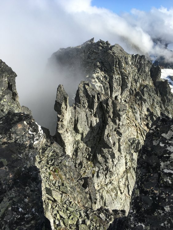
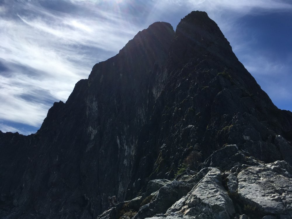
Love the shadows heading back to the notch
-
[TR] Cascade pass - Magic, Formidable, Mix-up, Sahale 09/02/2020
JonParker replied to JonParker's topic in North Cascades
Yeah thought it was unlikely but I hadn’t seen one that color before, thanks for the info! -
[TR] Cascade pass - Magic, Formidable, Mix-up, Sahale 09/02/2020
JonParker replied to JonParker's topic in North Cascades
Ooh nice one! Cool, ok it was probably the smallest variety of weasel around. Weasel shaped, but size of a squirrel, maybe smaller. Ermine is probably the winner. -
[TR] Cascade pass - Magic, Formidable, Mix-up, Sahale 09/02/2020
JonParker replied to JonParker's topic in North Cascades
Thanks! Yeah it did look a bit like that. Smaller than a gray squirrel. Those are great photos! -
[TR] Cascade pass - Magic, Formidable, Mix-up, Sahale 09/02/2020
JonParker replied to JonParker's topic in North Cascades
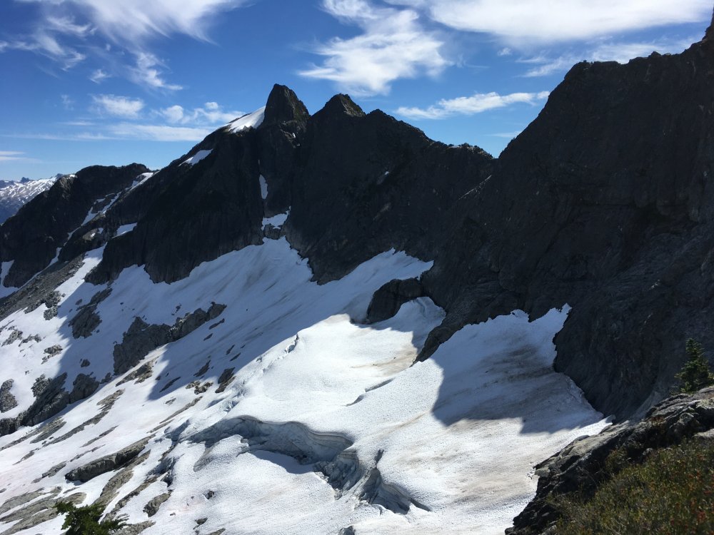
Amazing country for sure. There are two toes of rock meeting snow in your photo. I crossed snow there and gained the nice ledgy slabs somewhere between those two toes. -
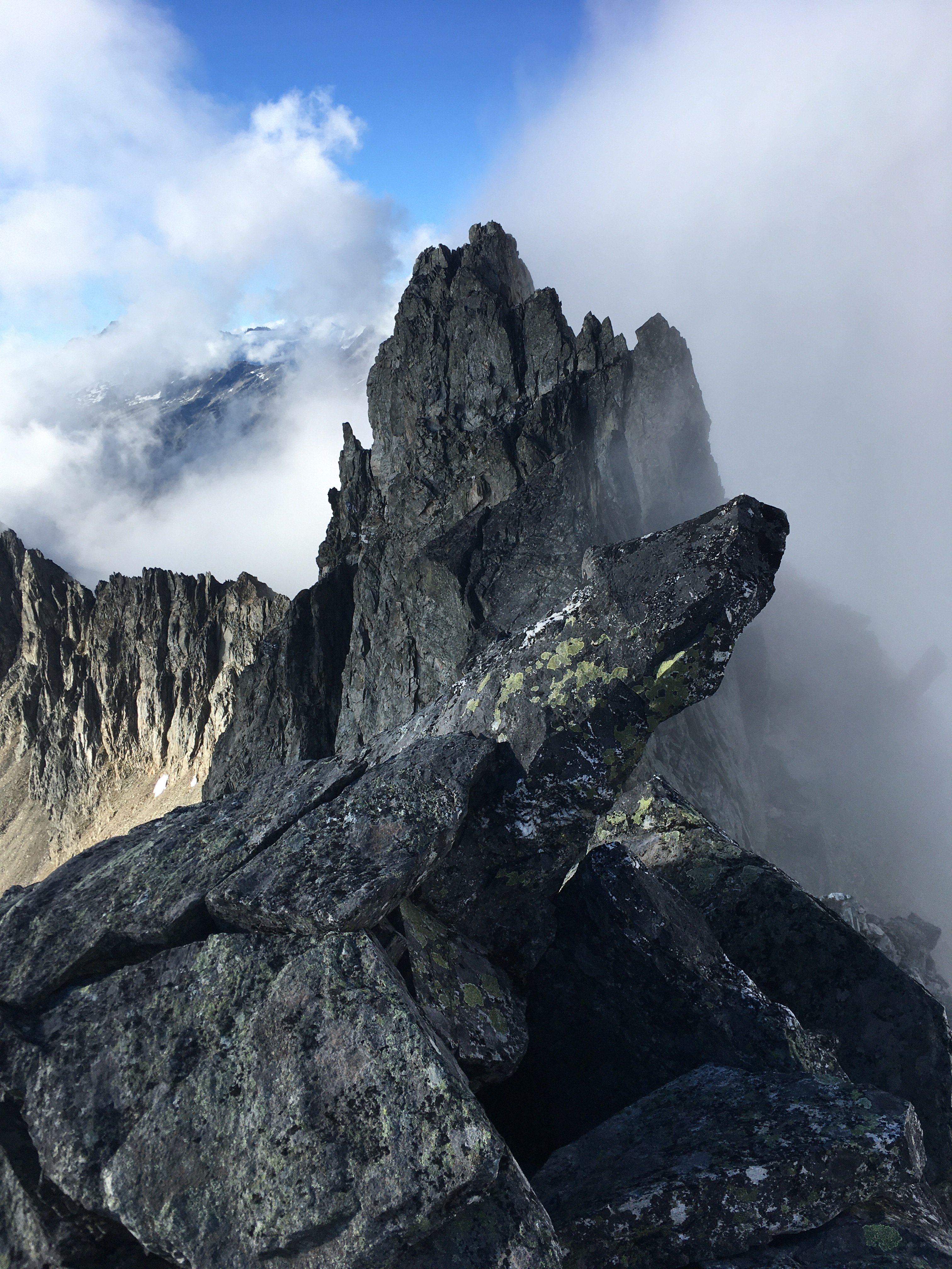
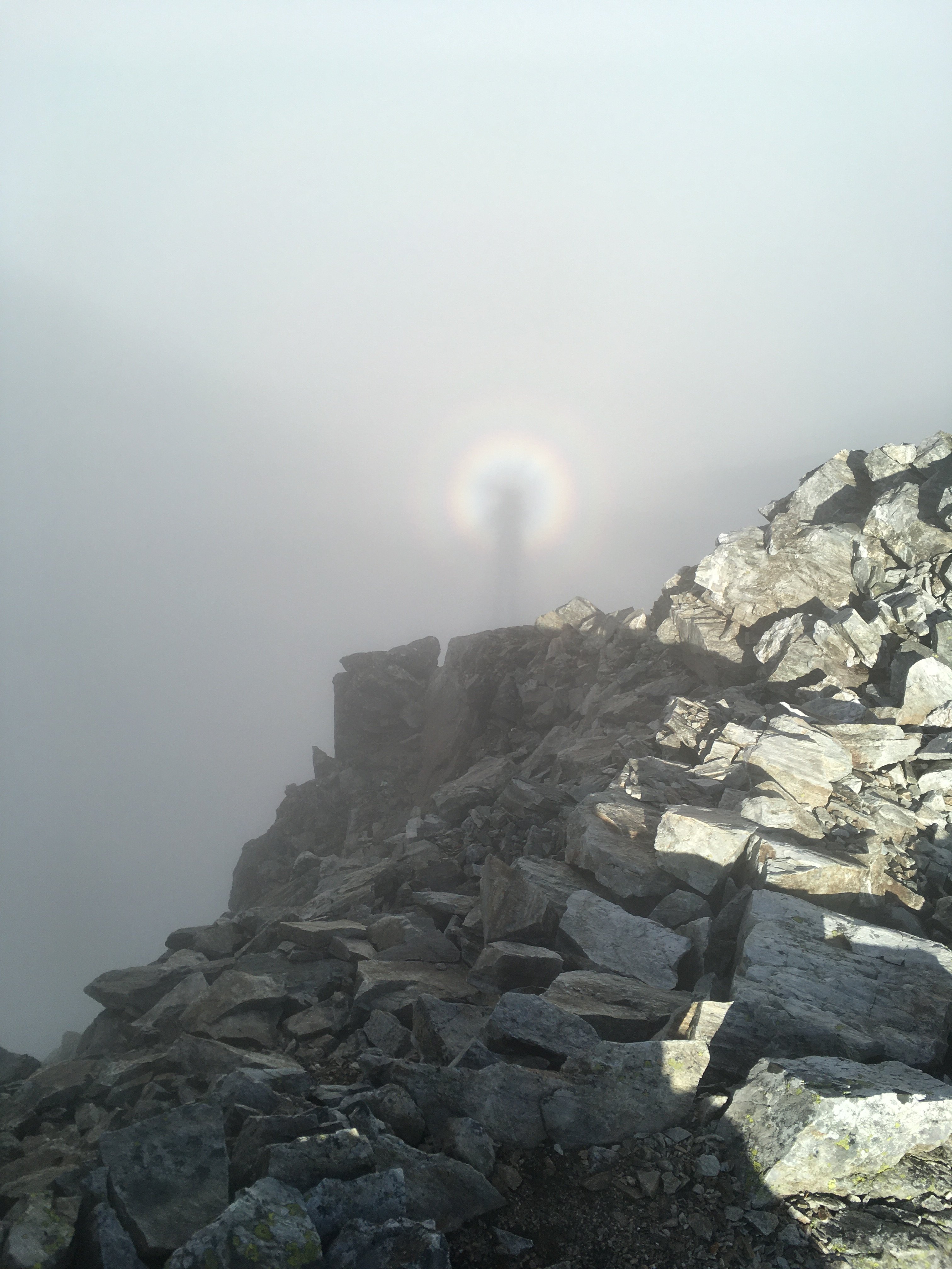
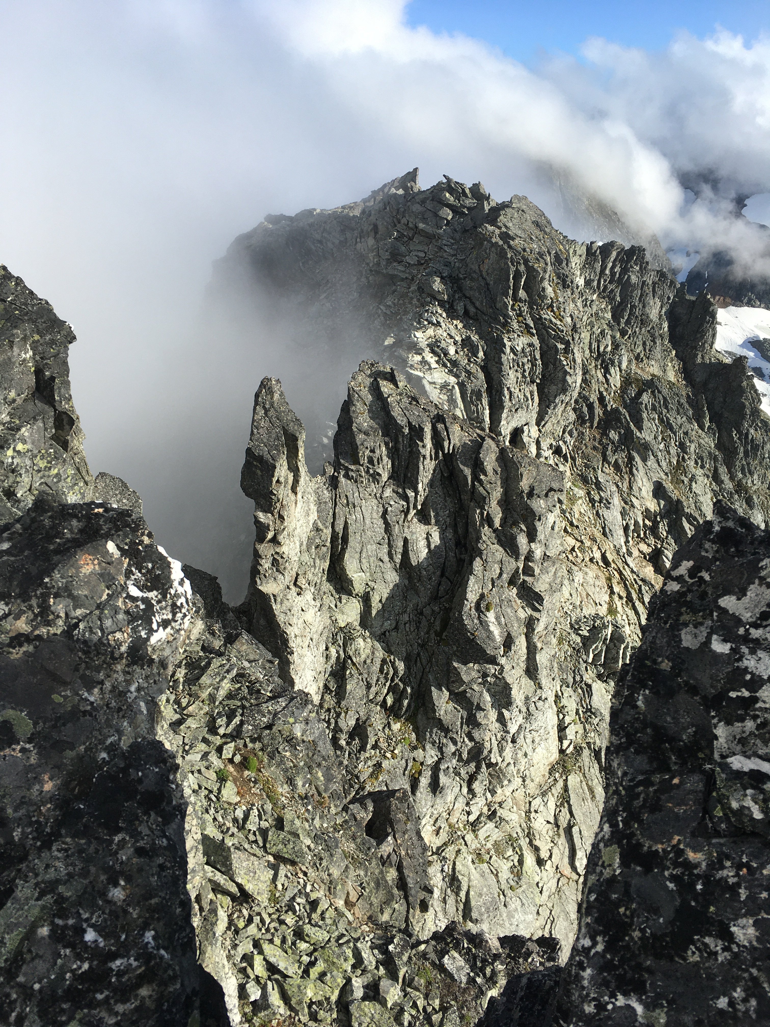
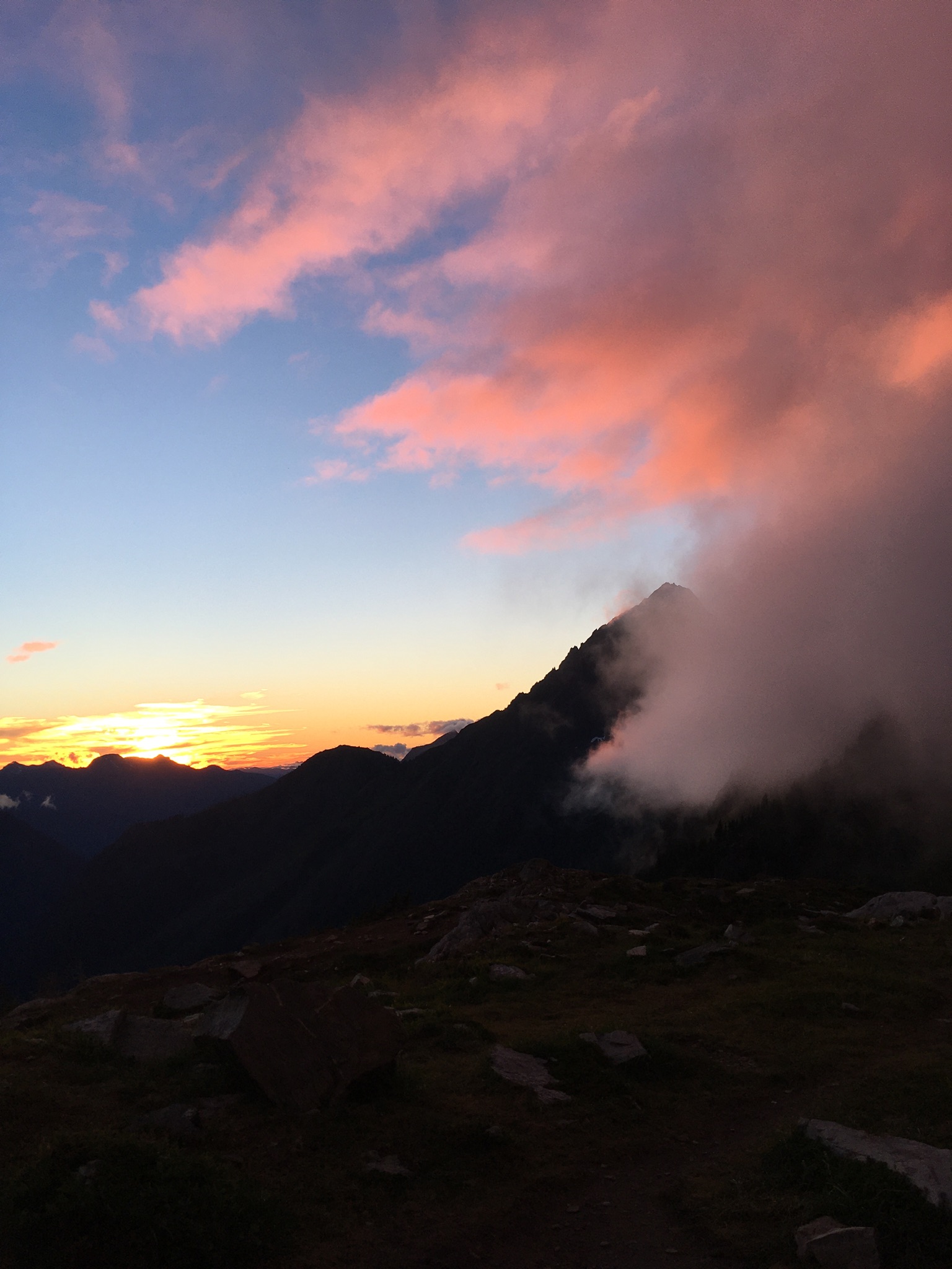
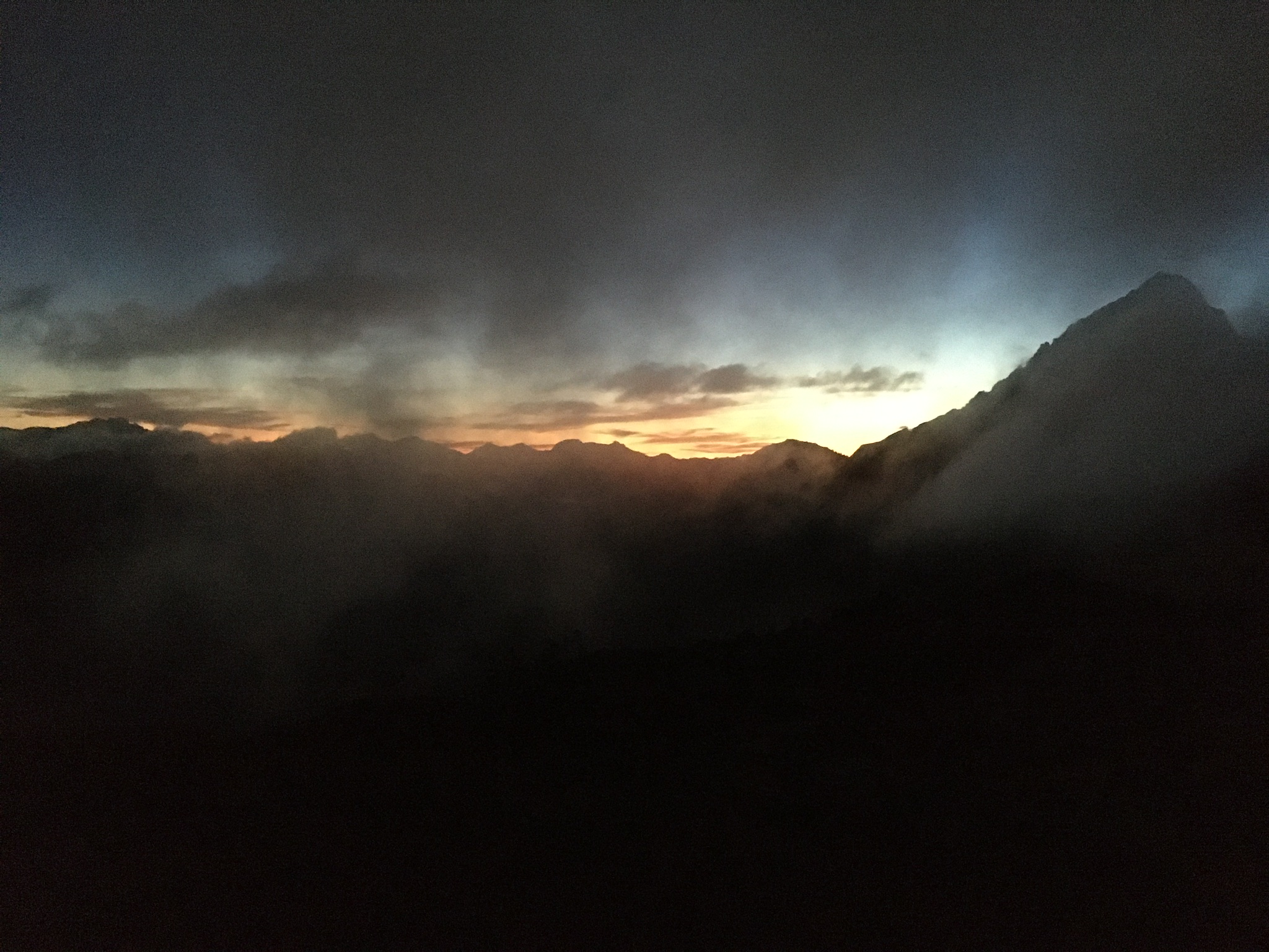
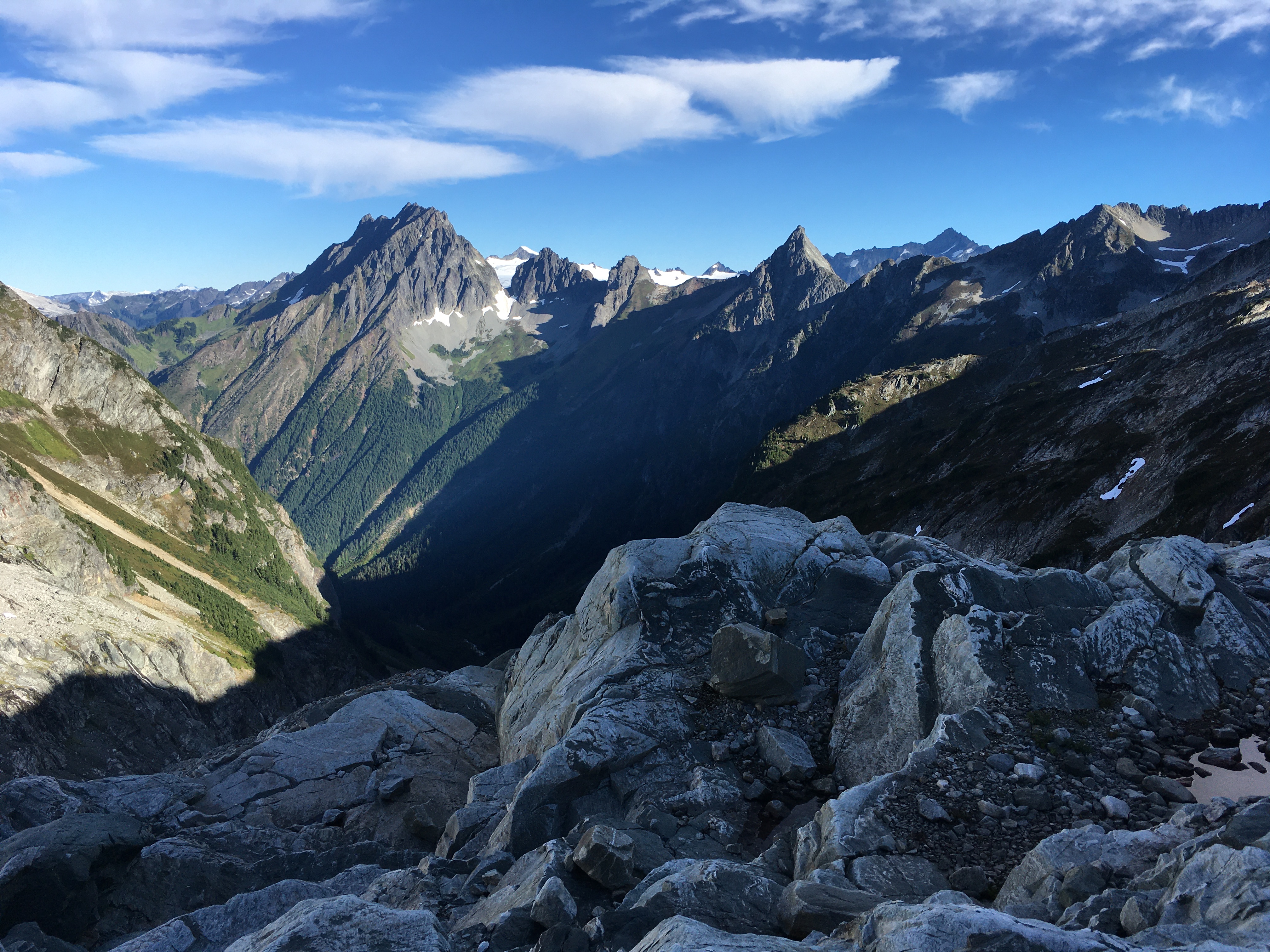
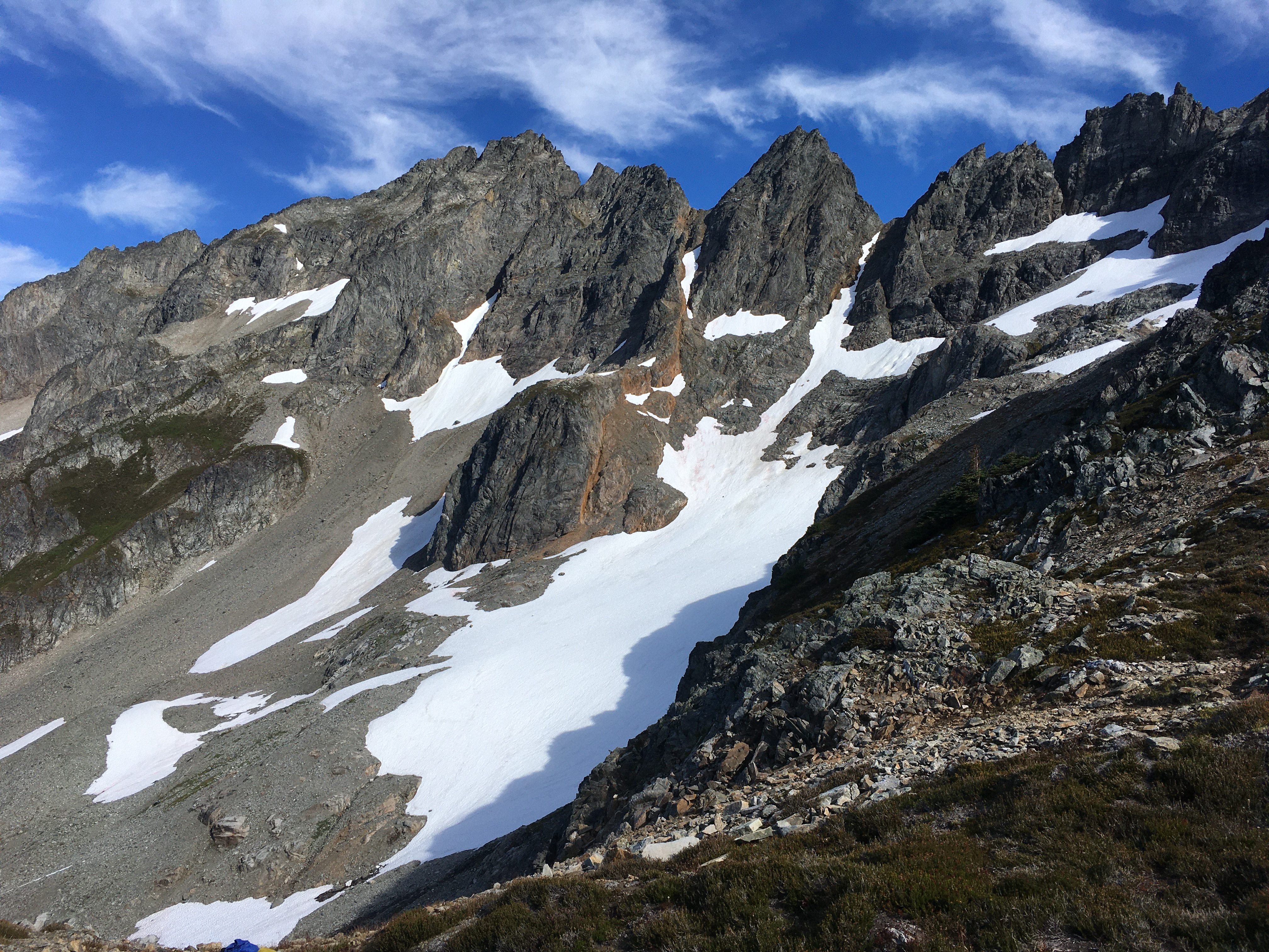
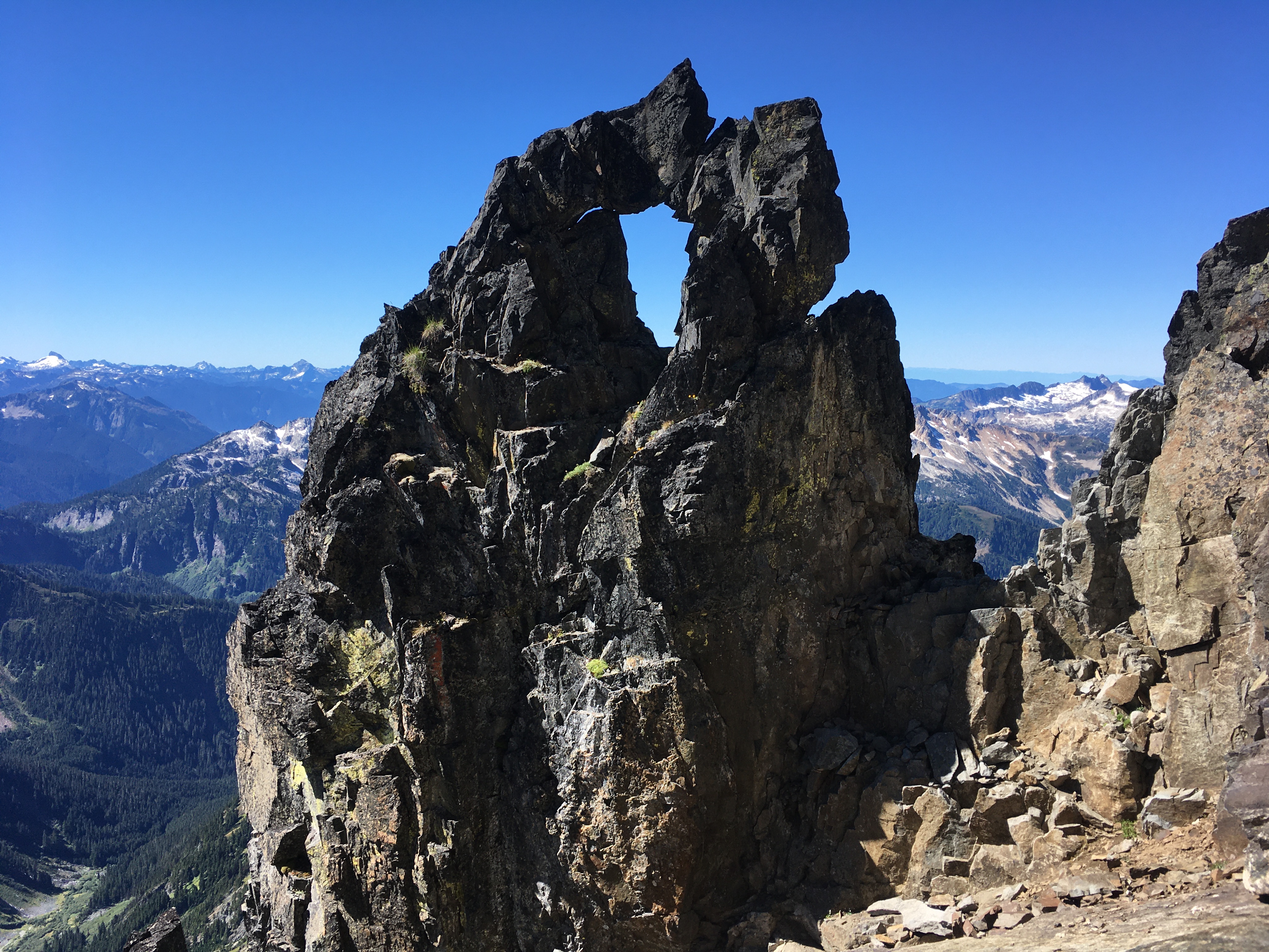
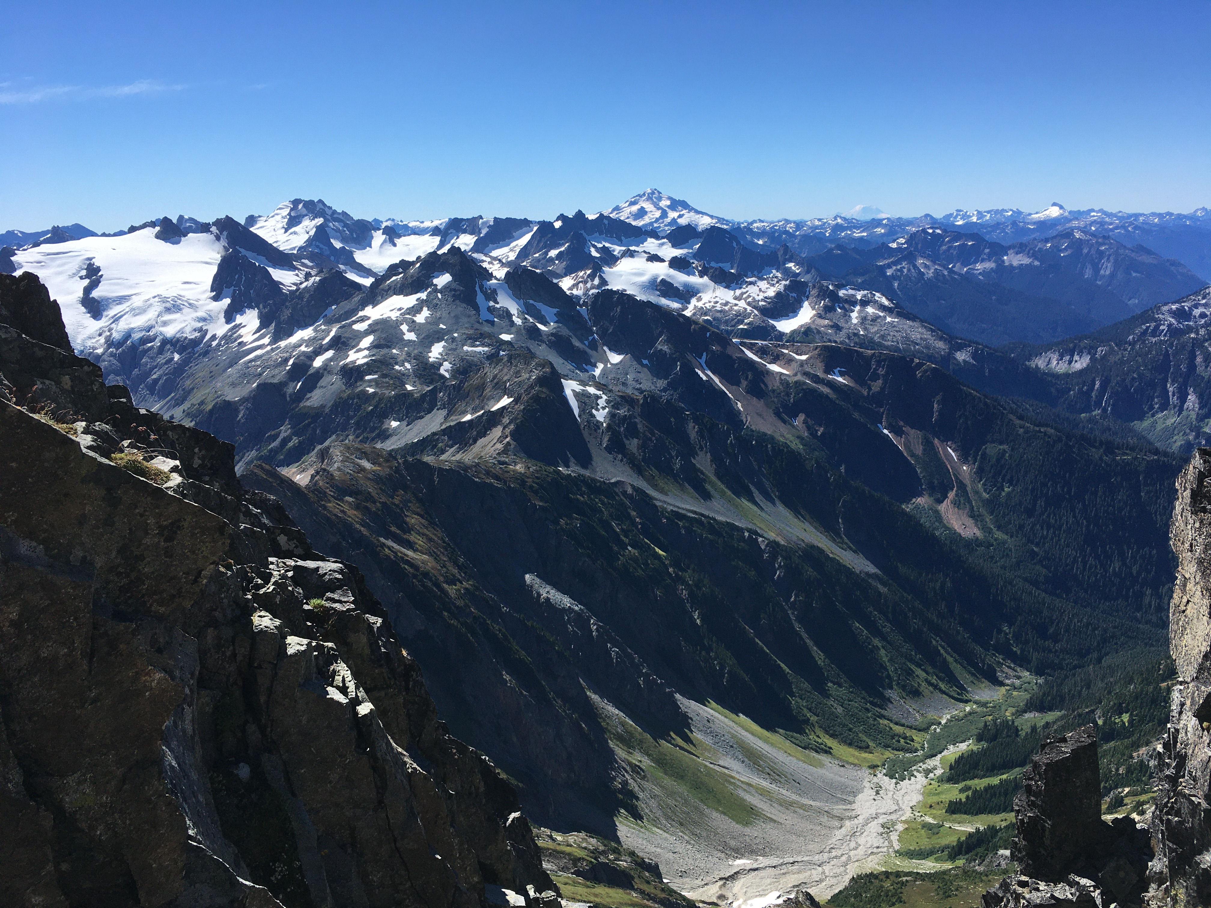
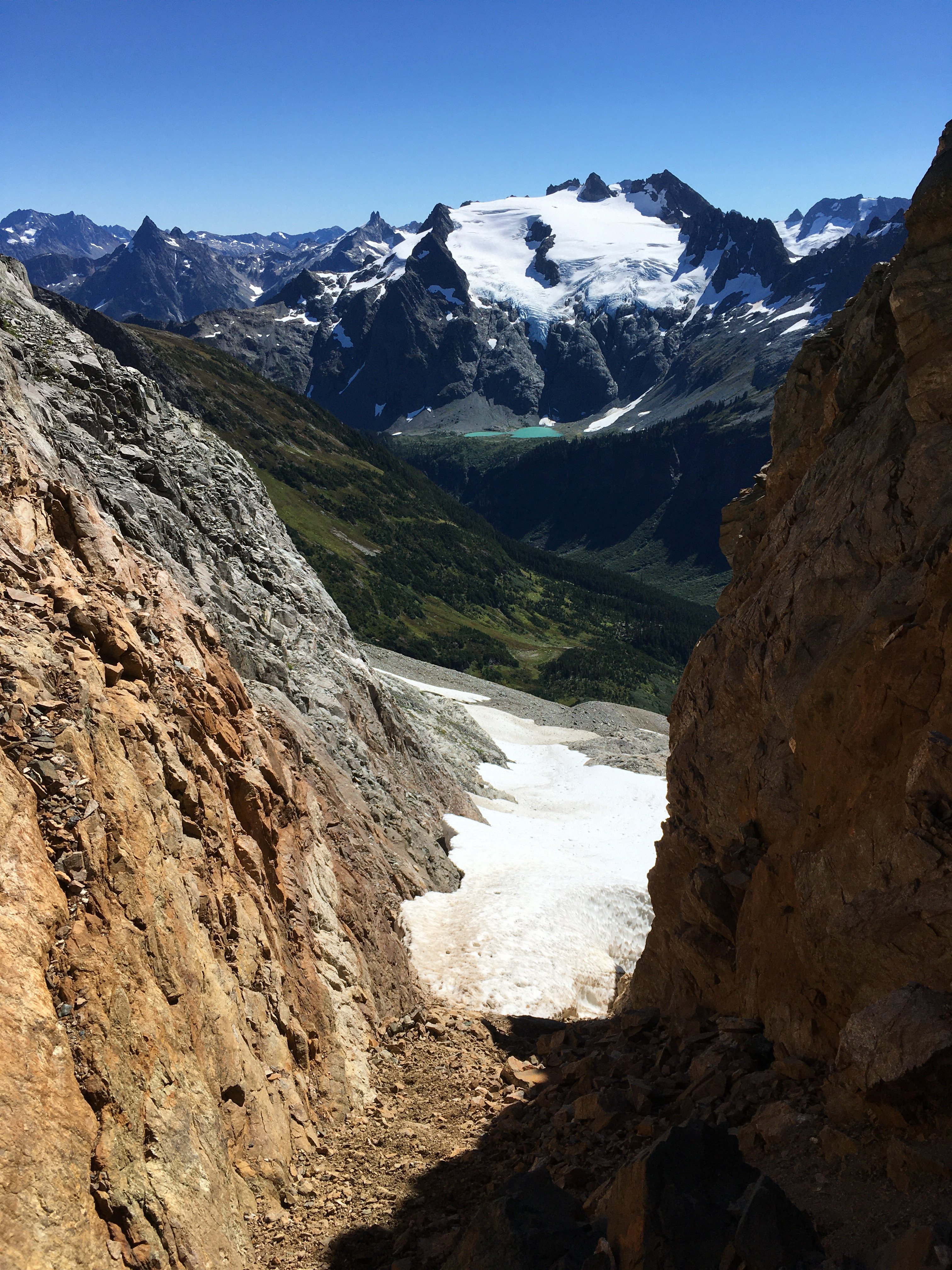
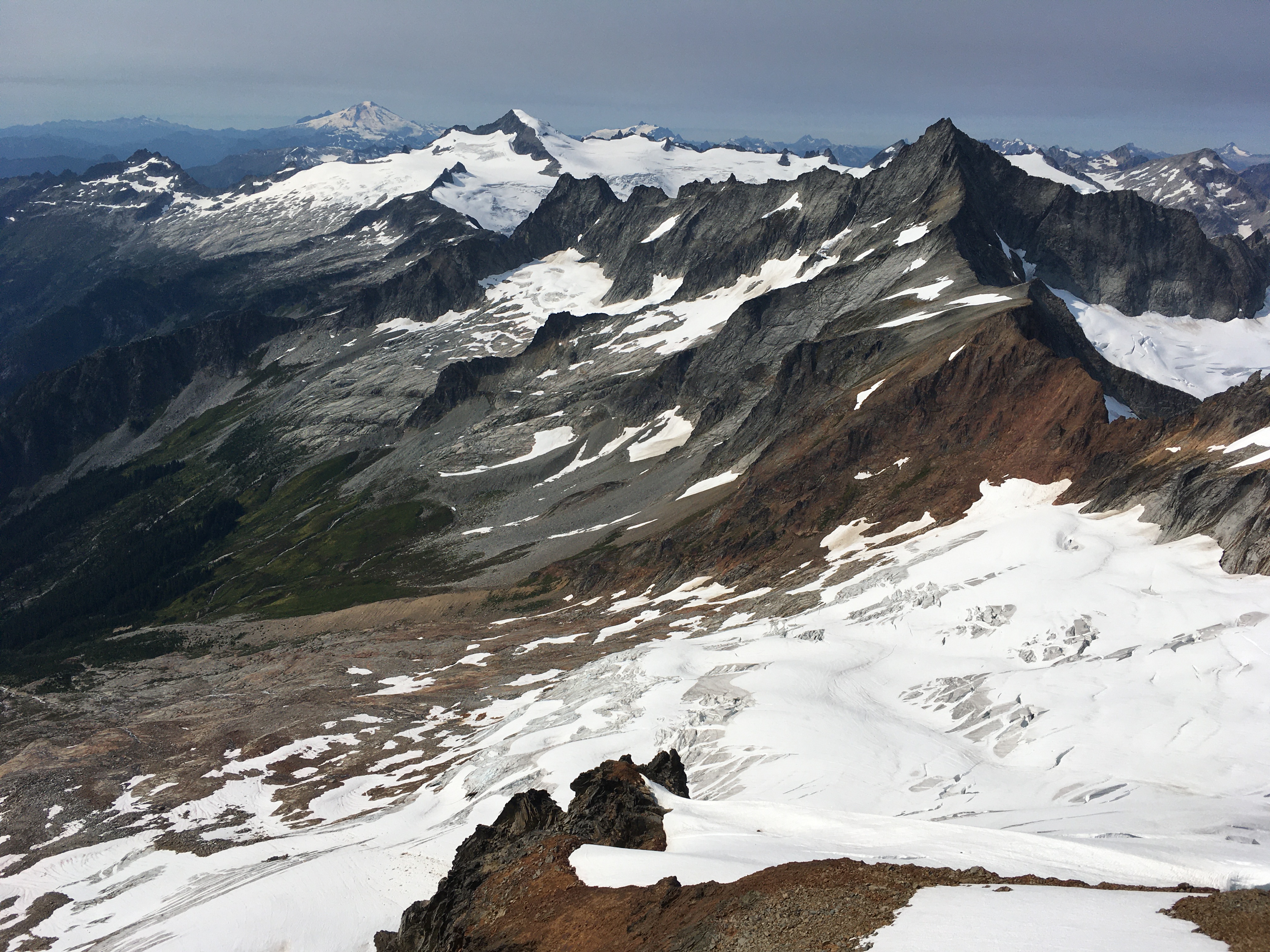
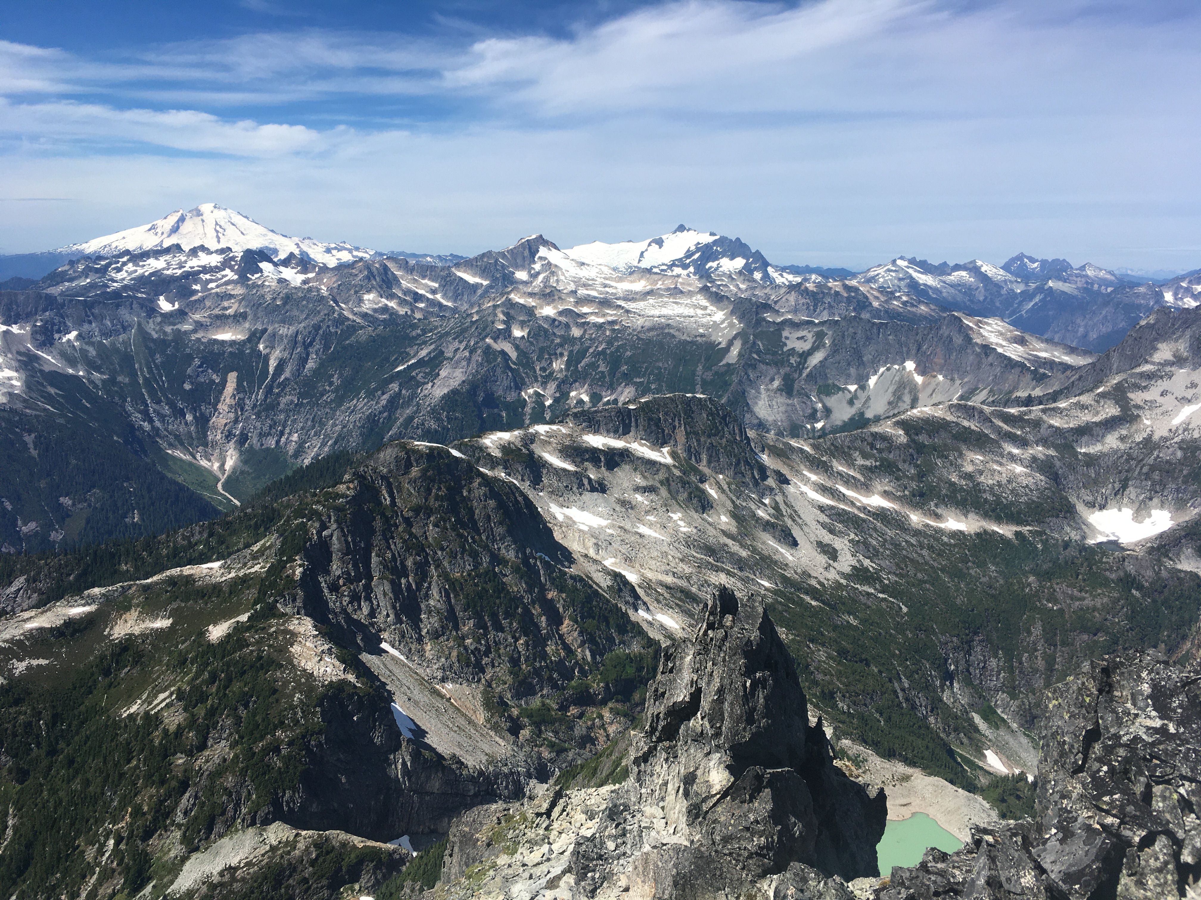
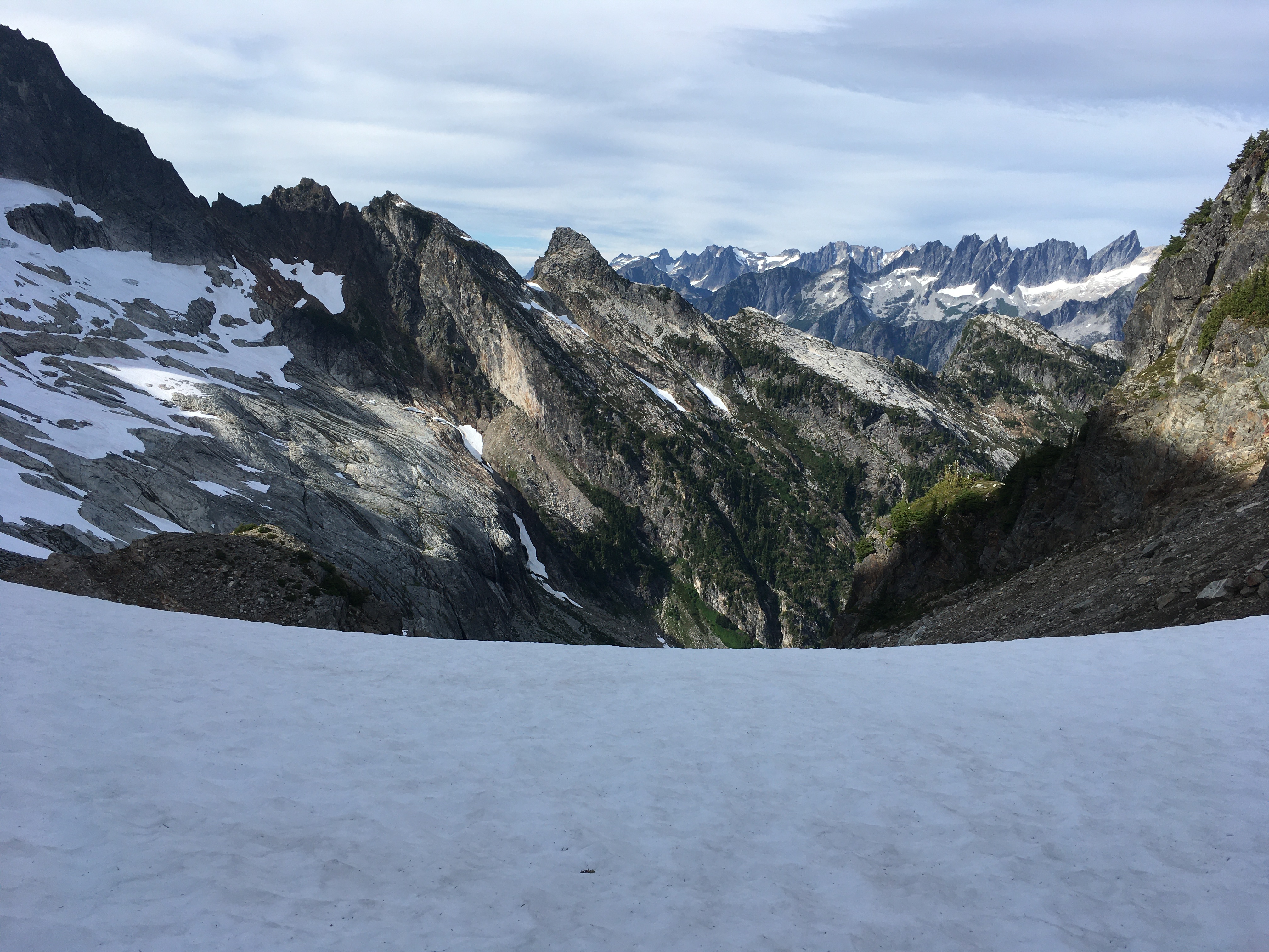
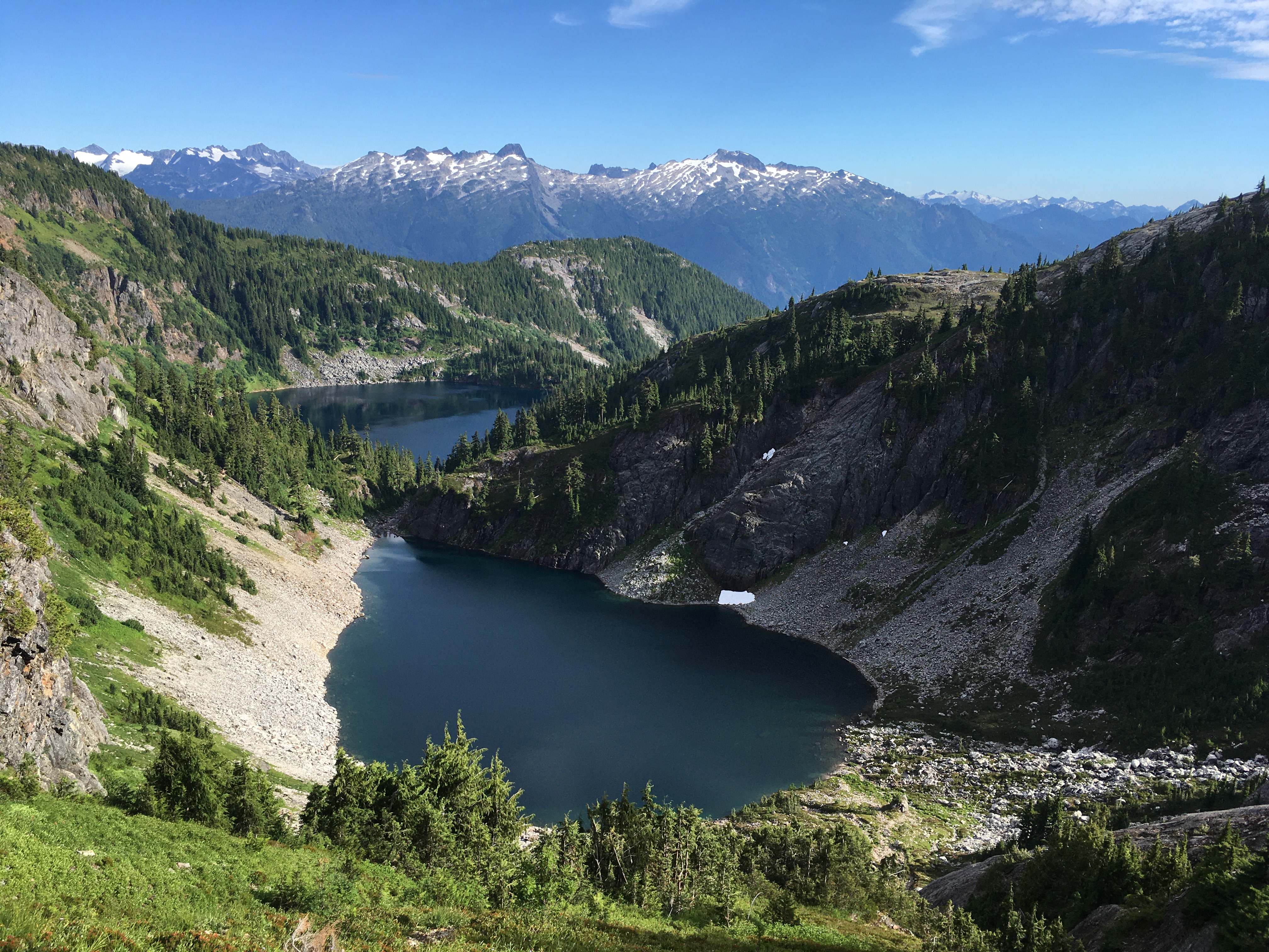
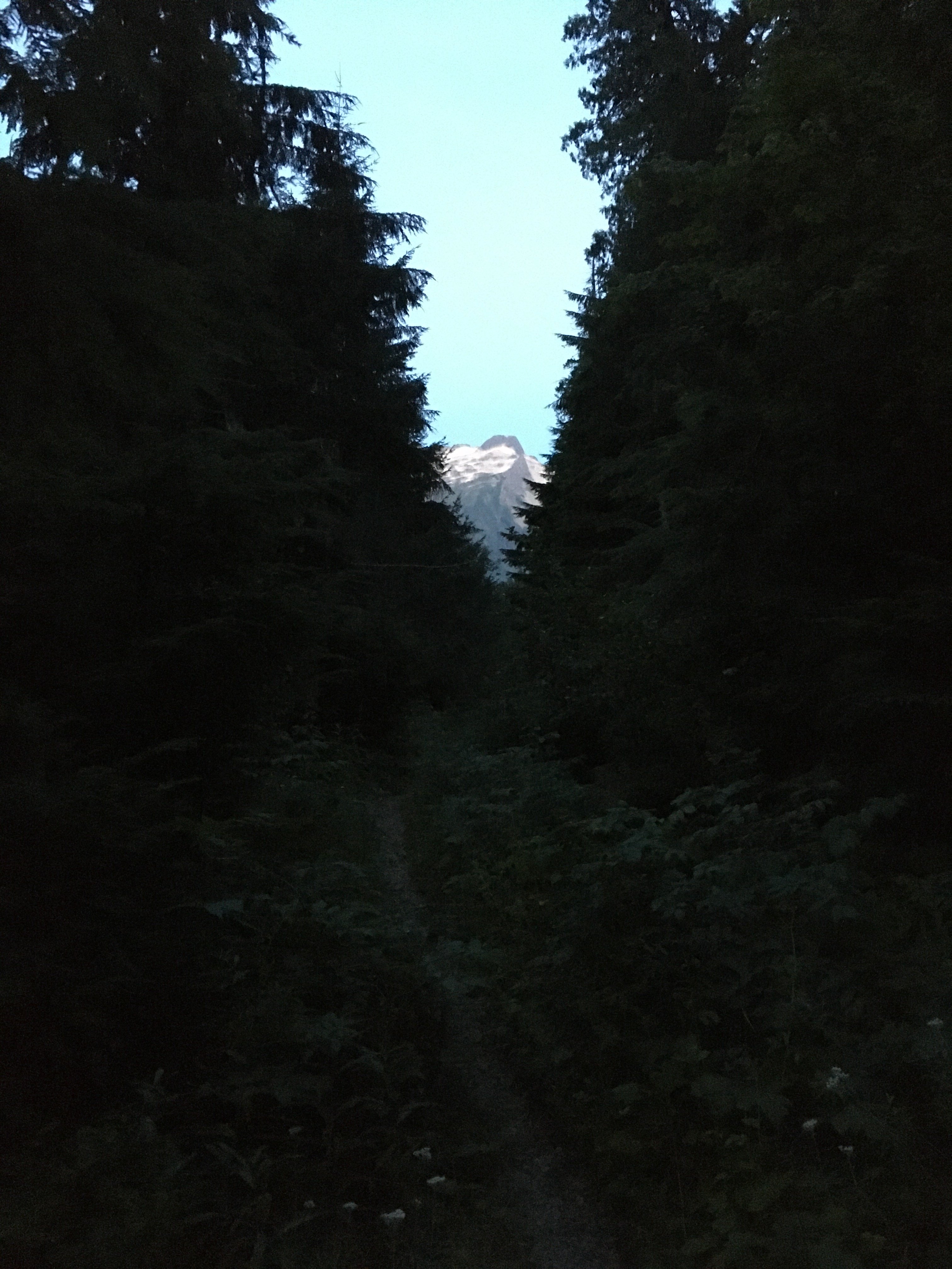
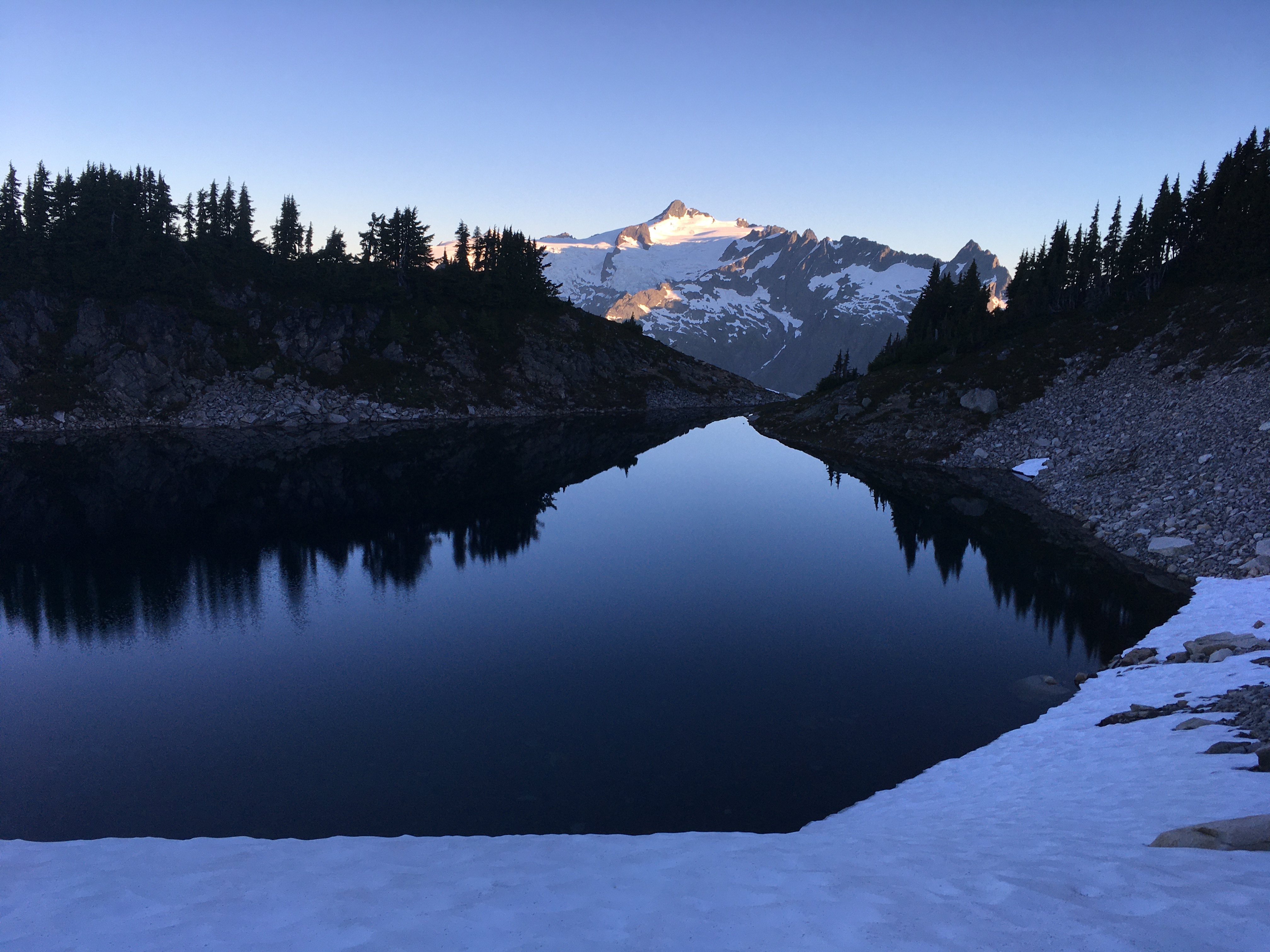
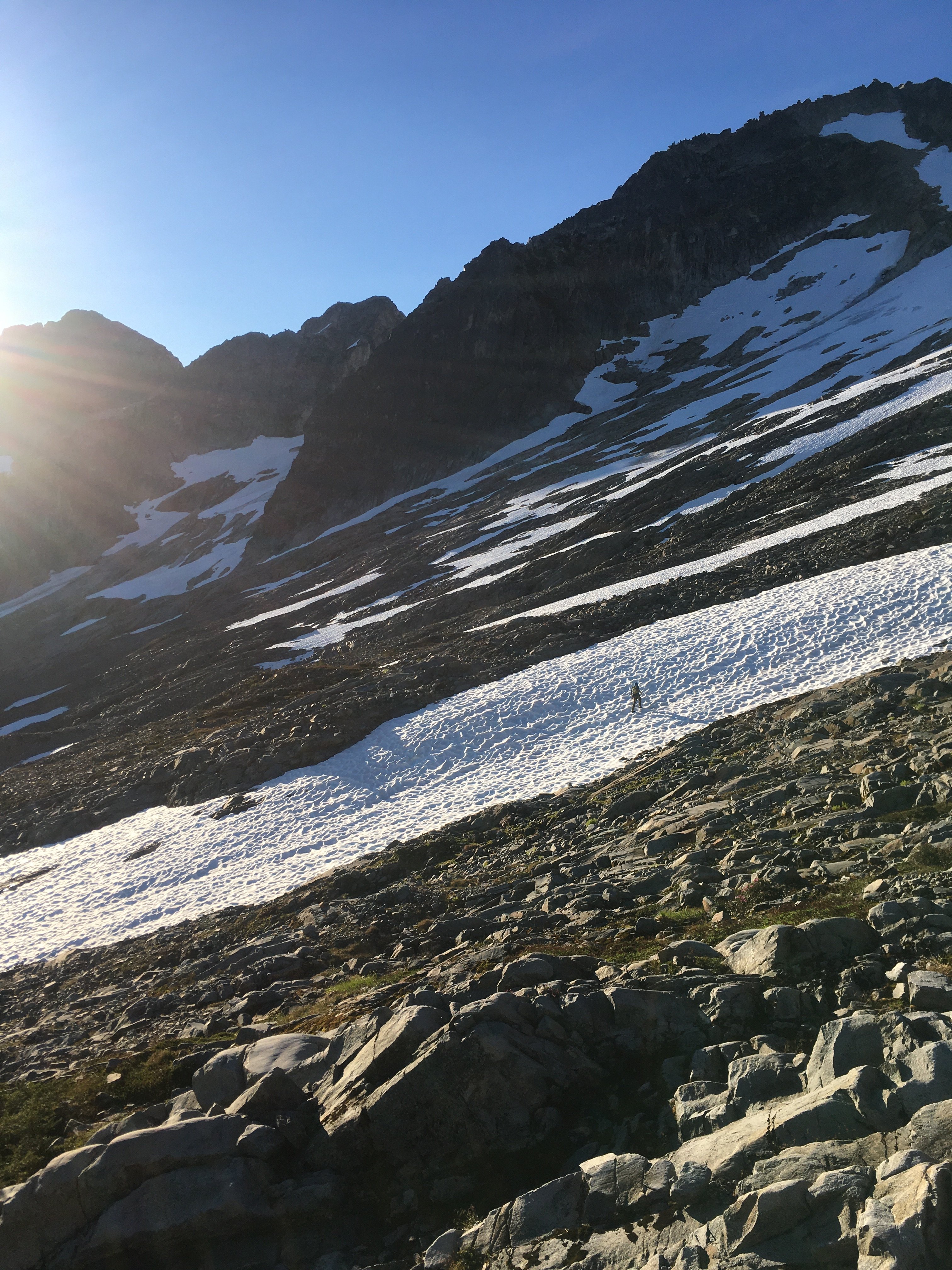
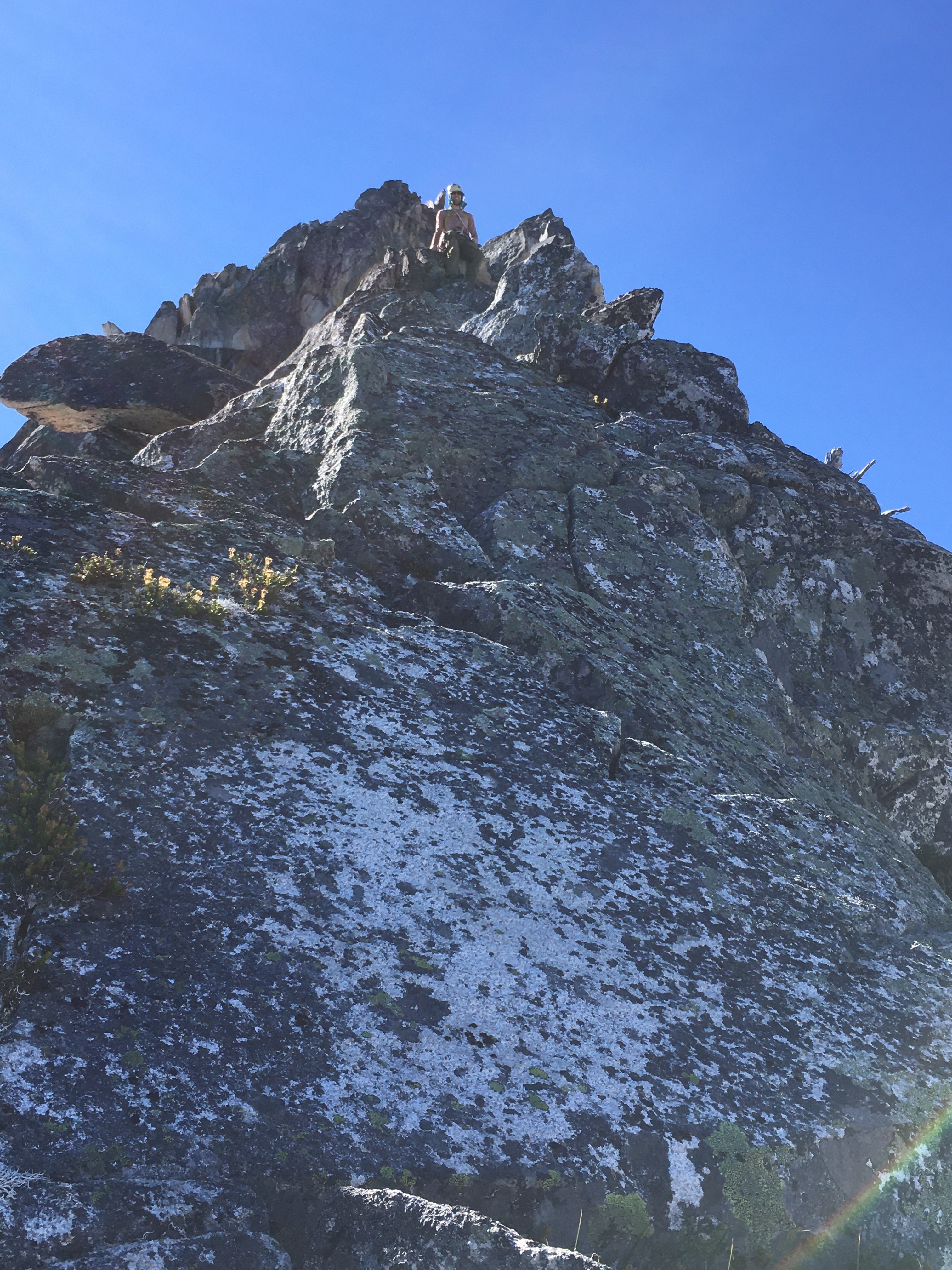
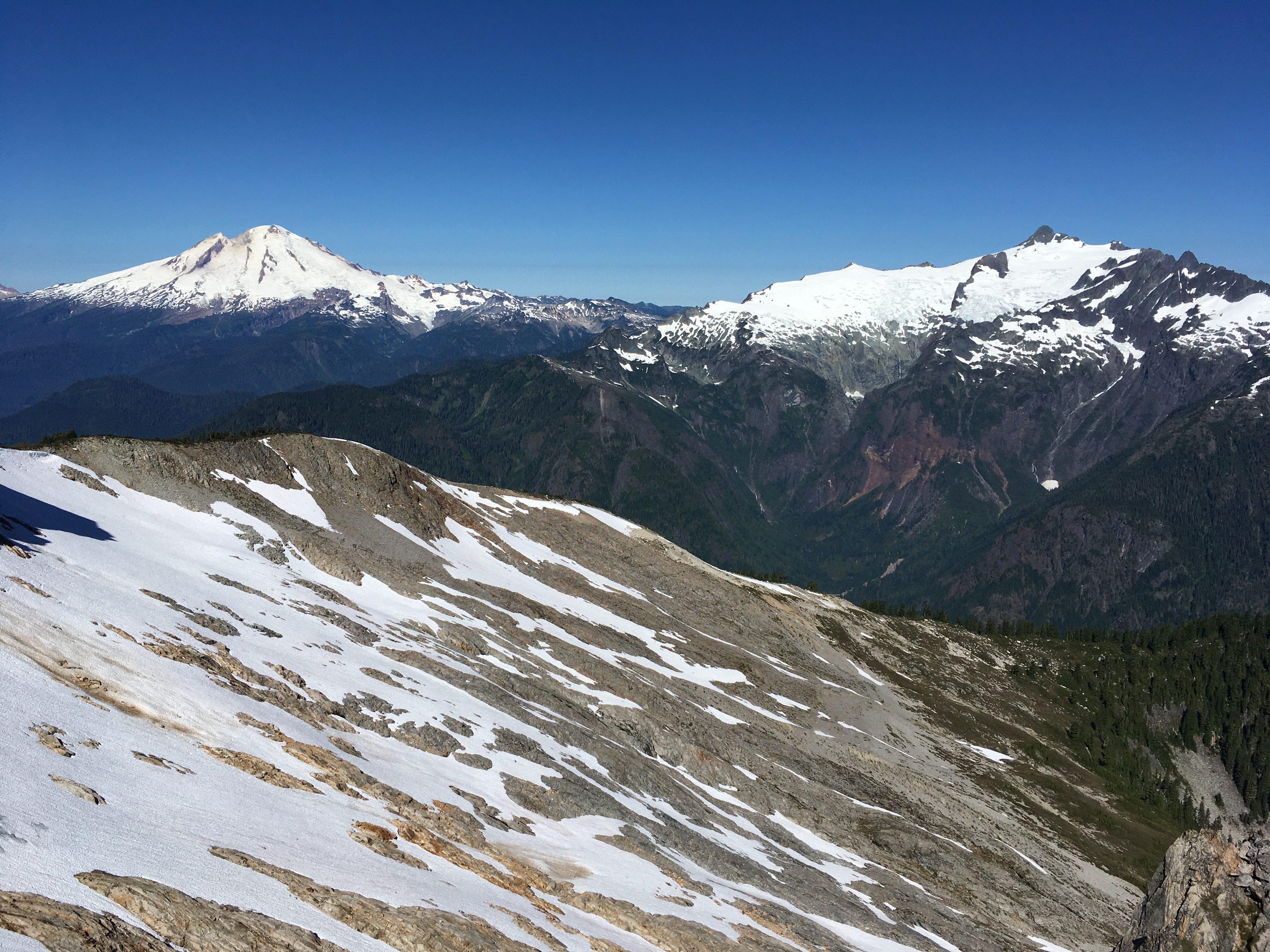
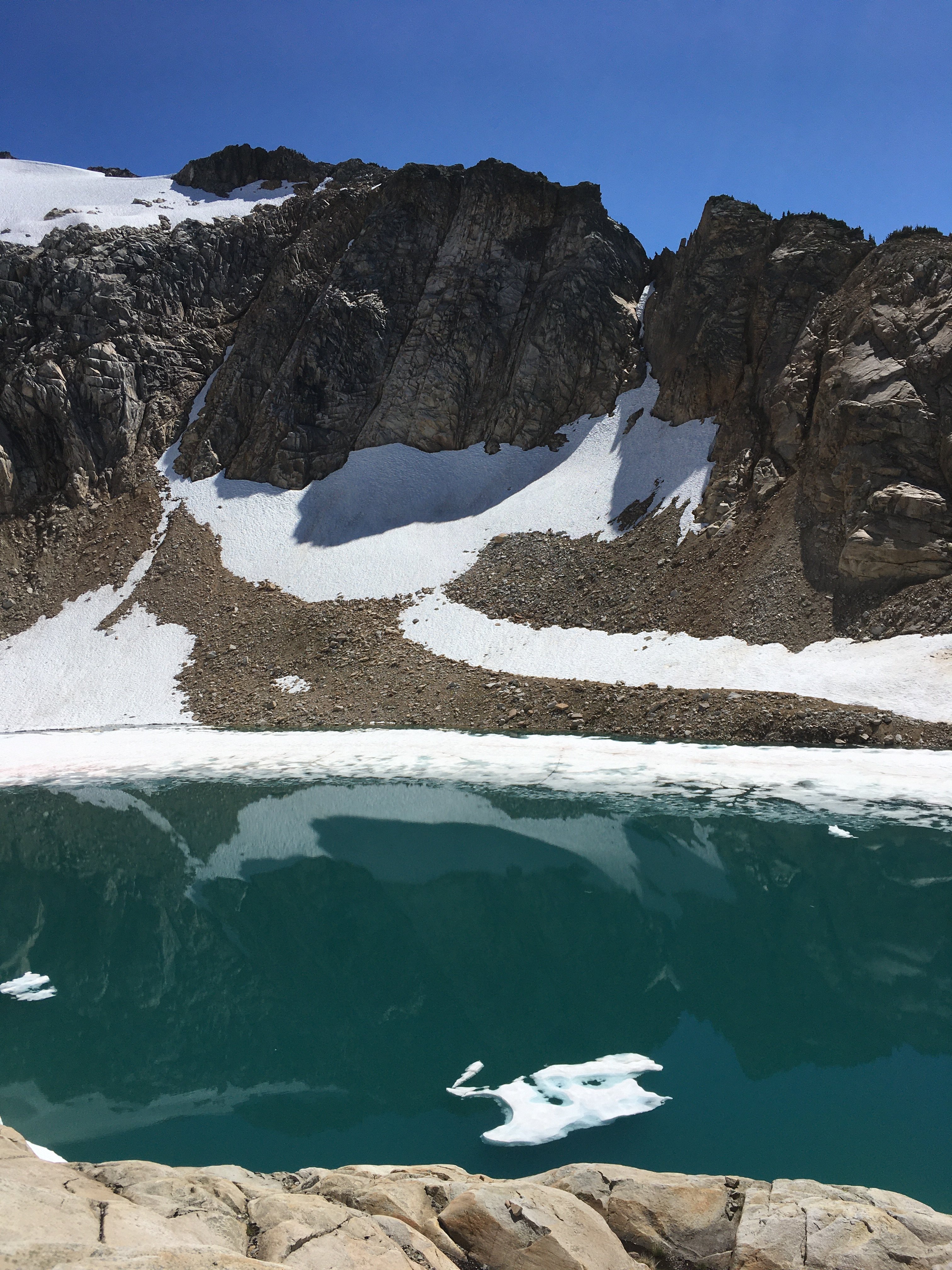
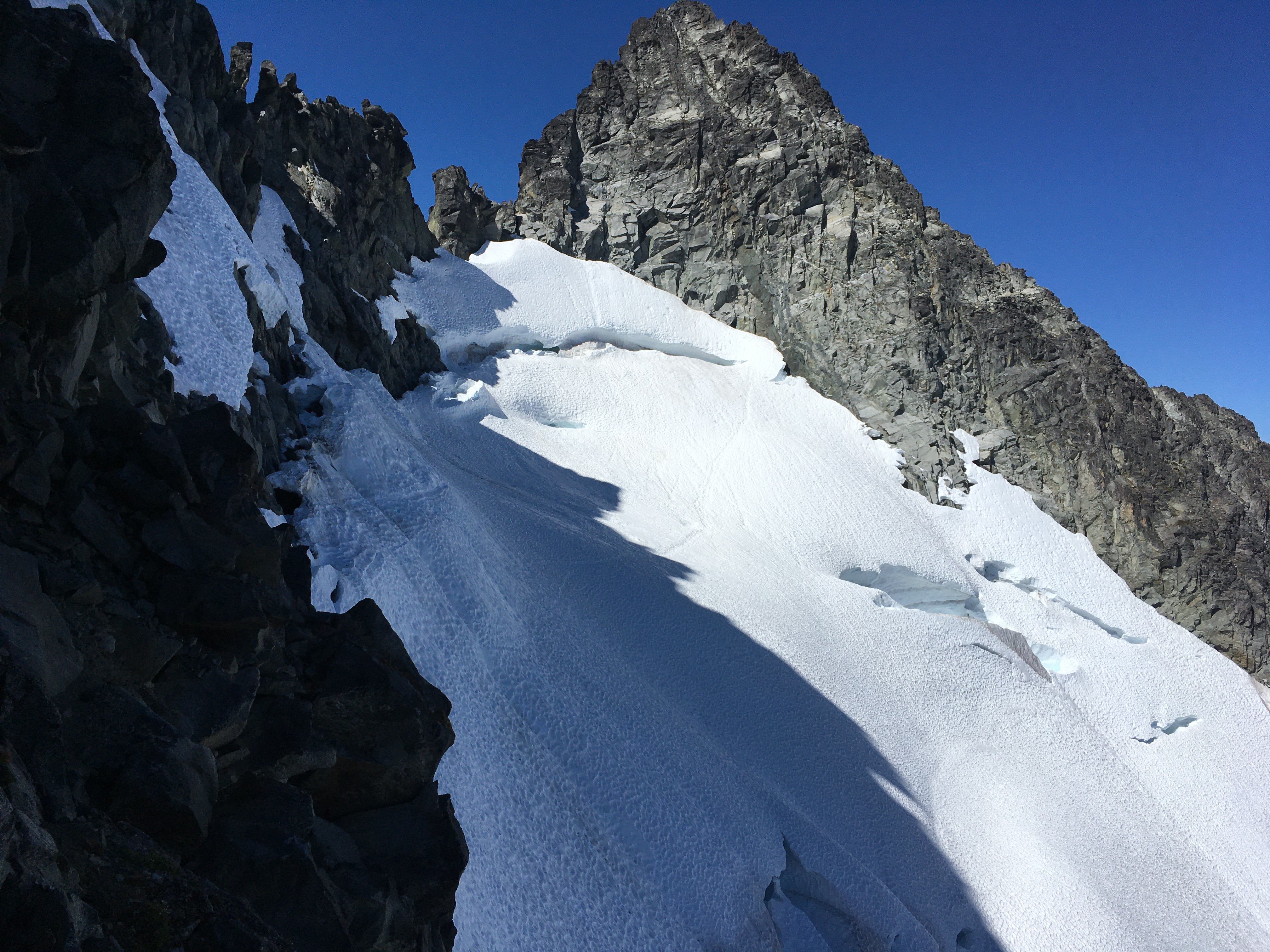
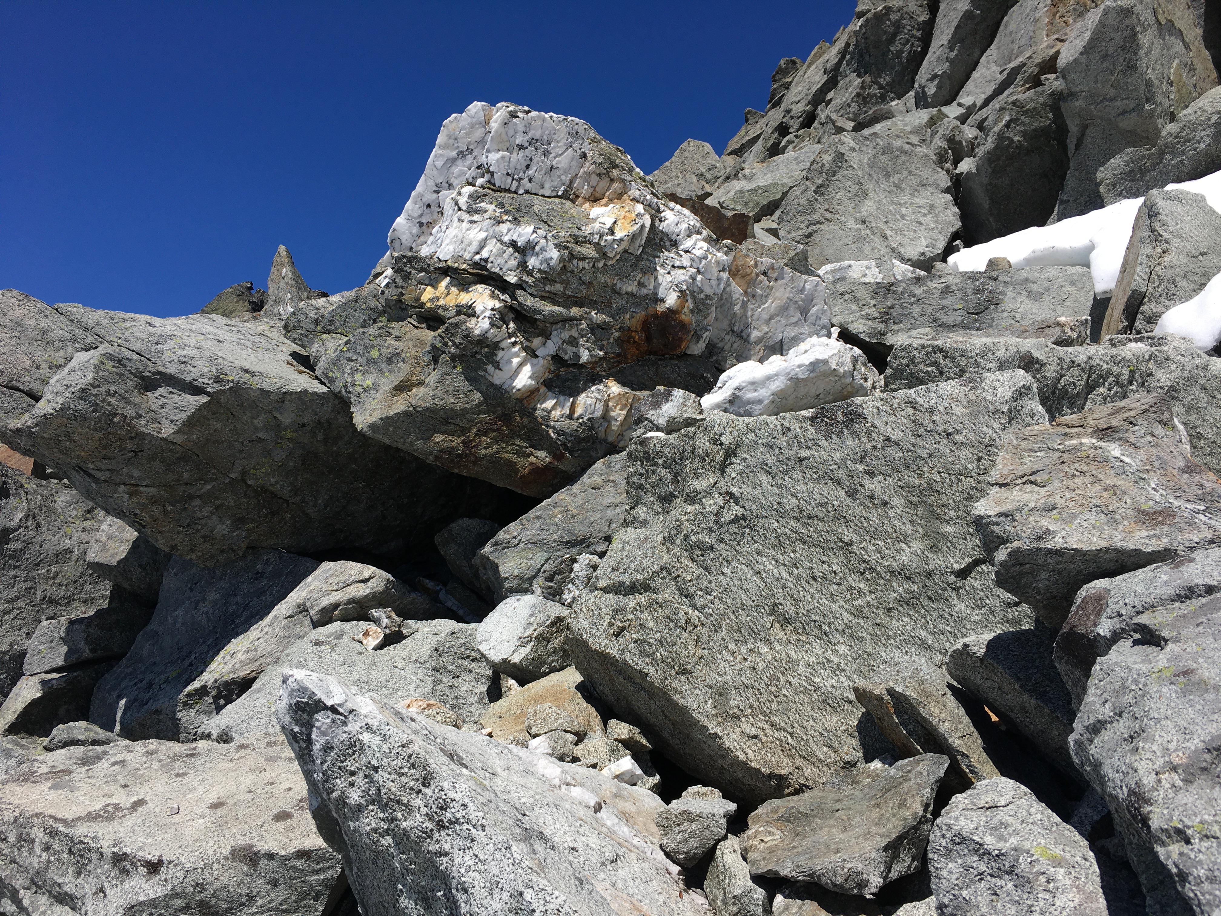
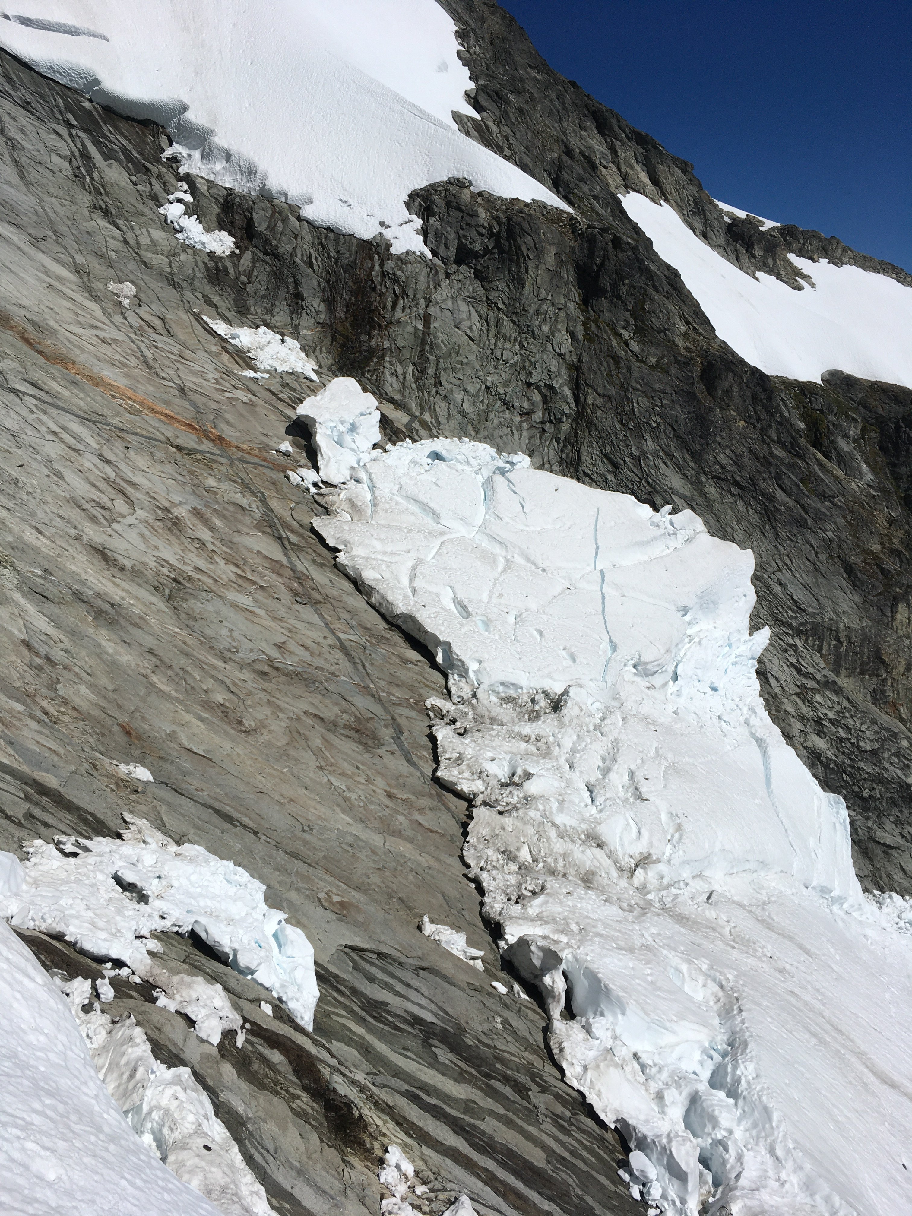
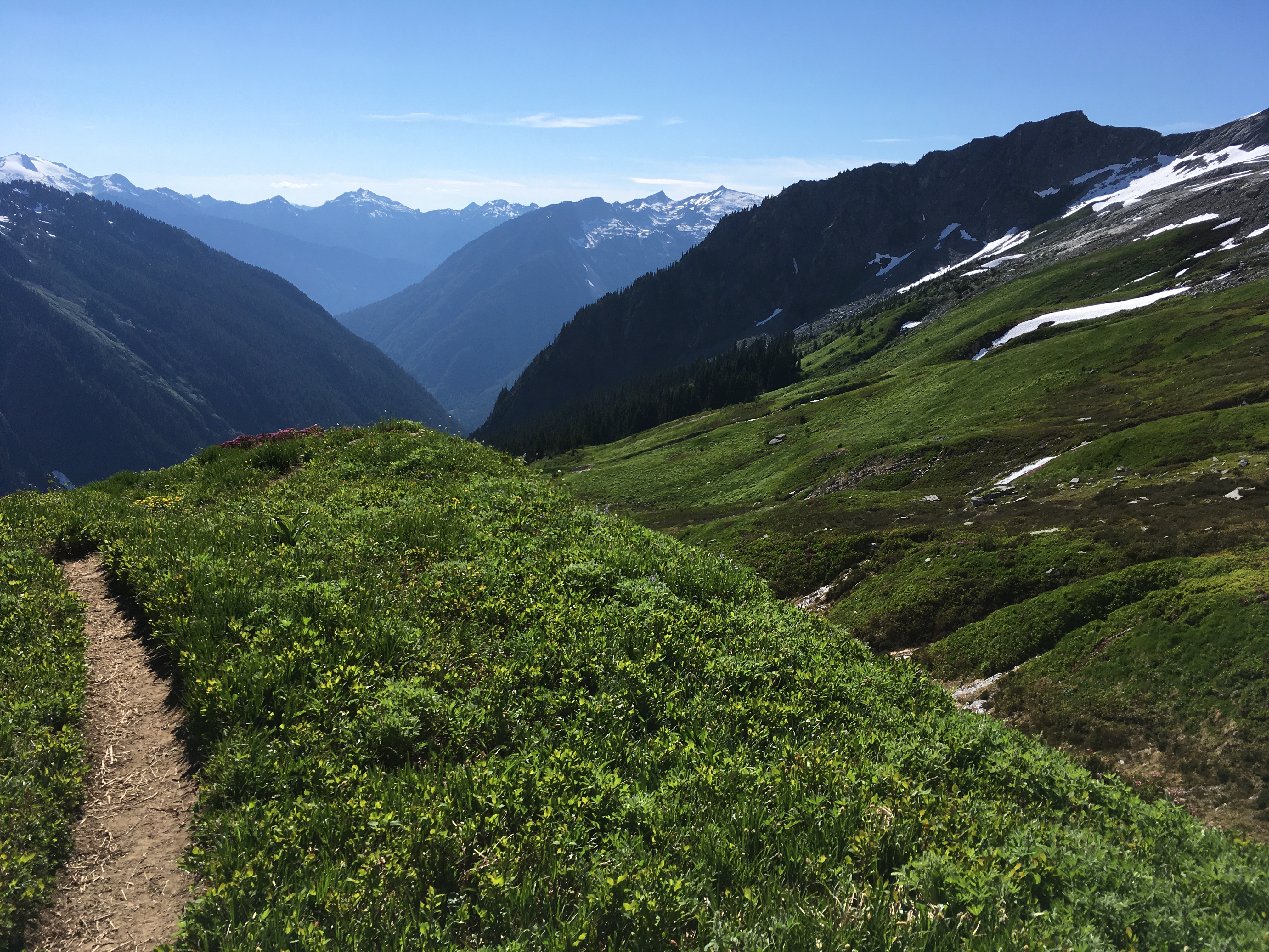
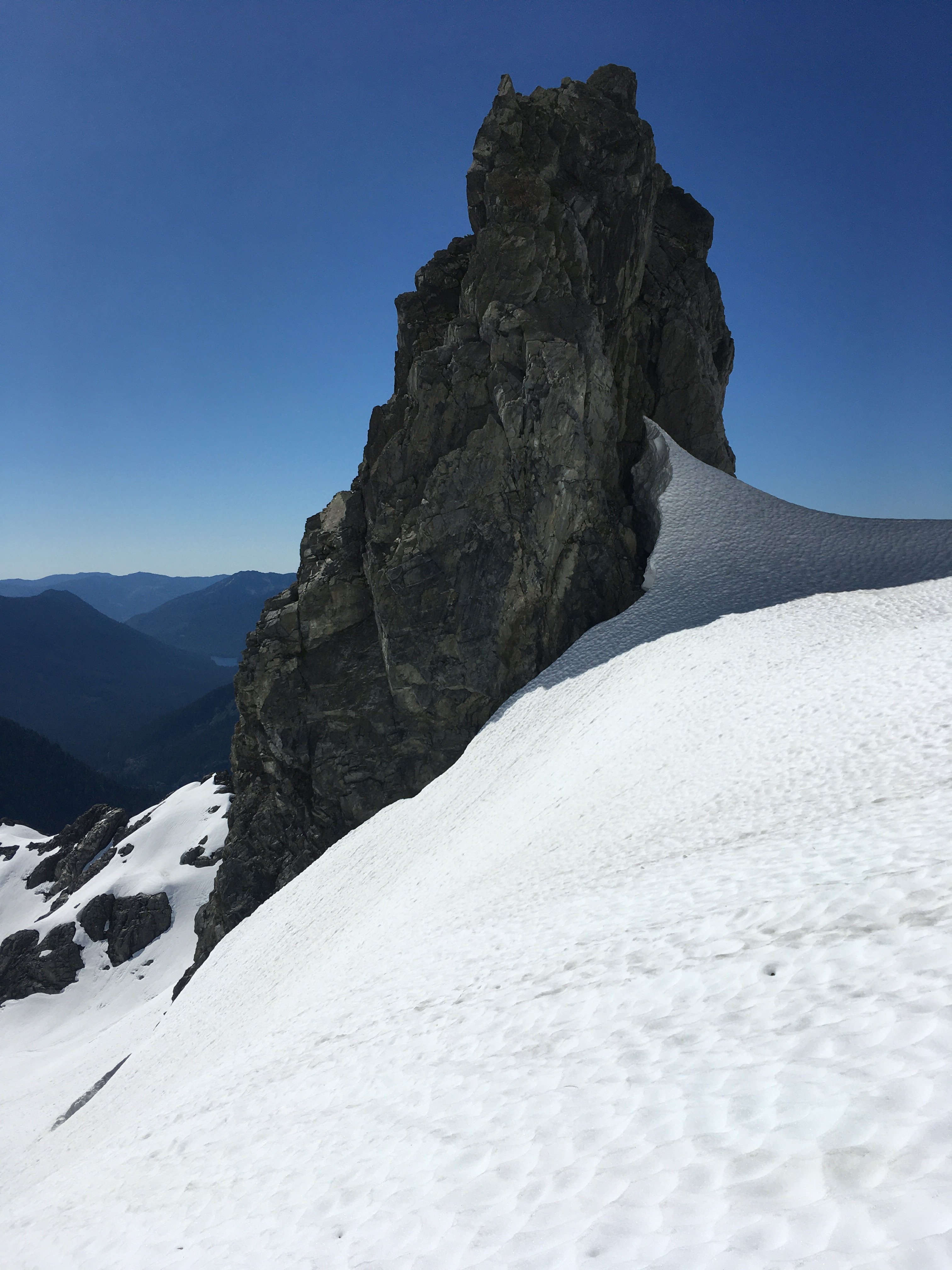
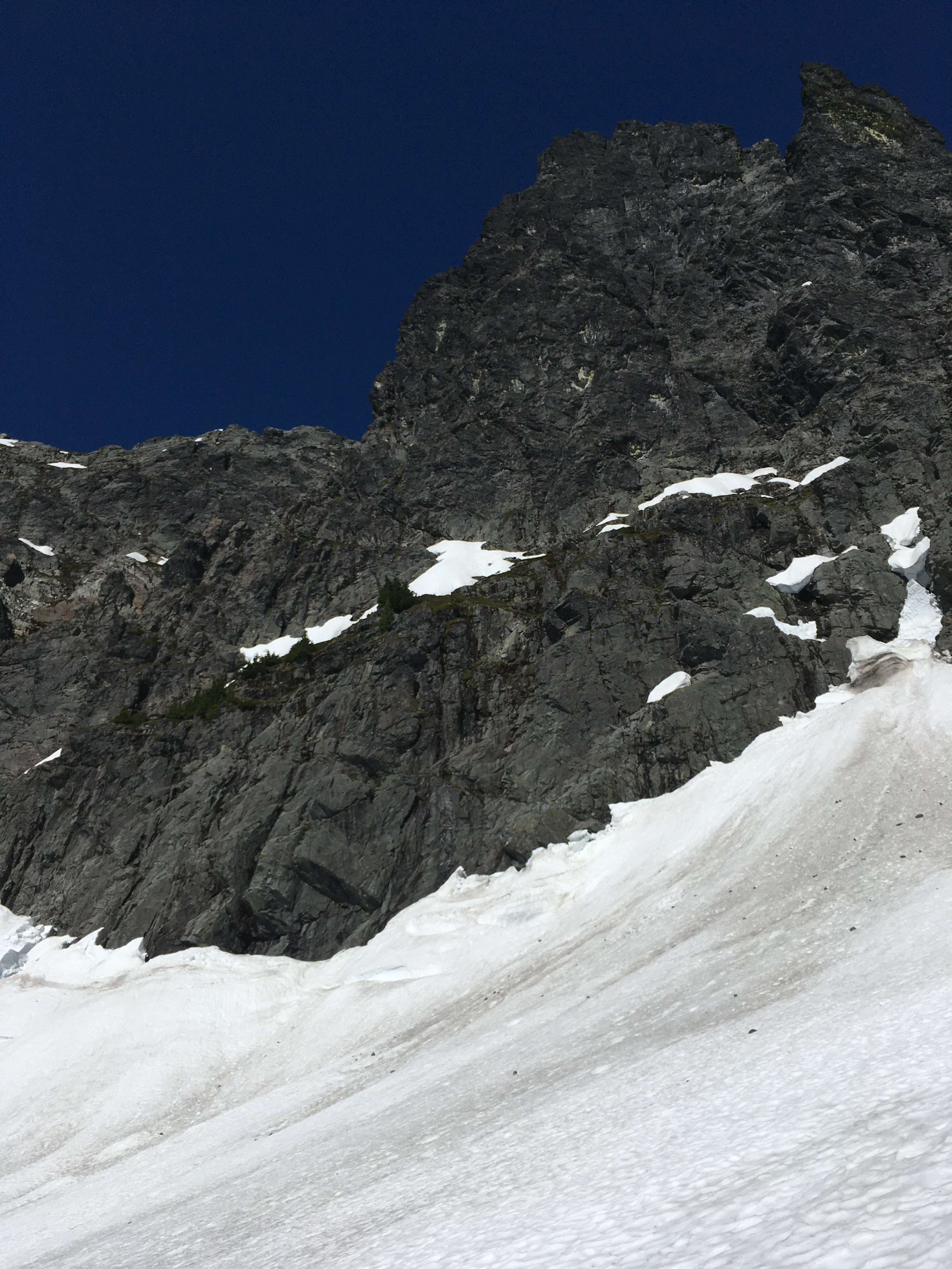
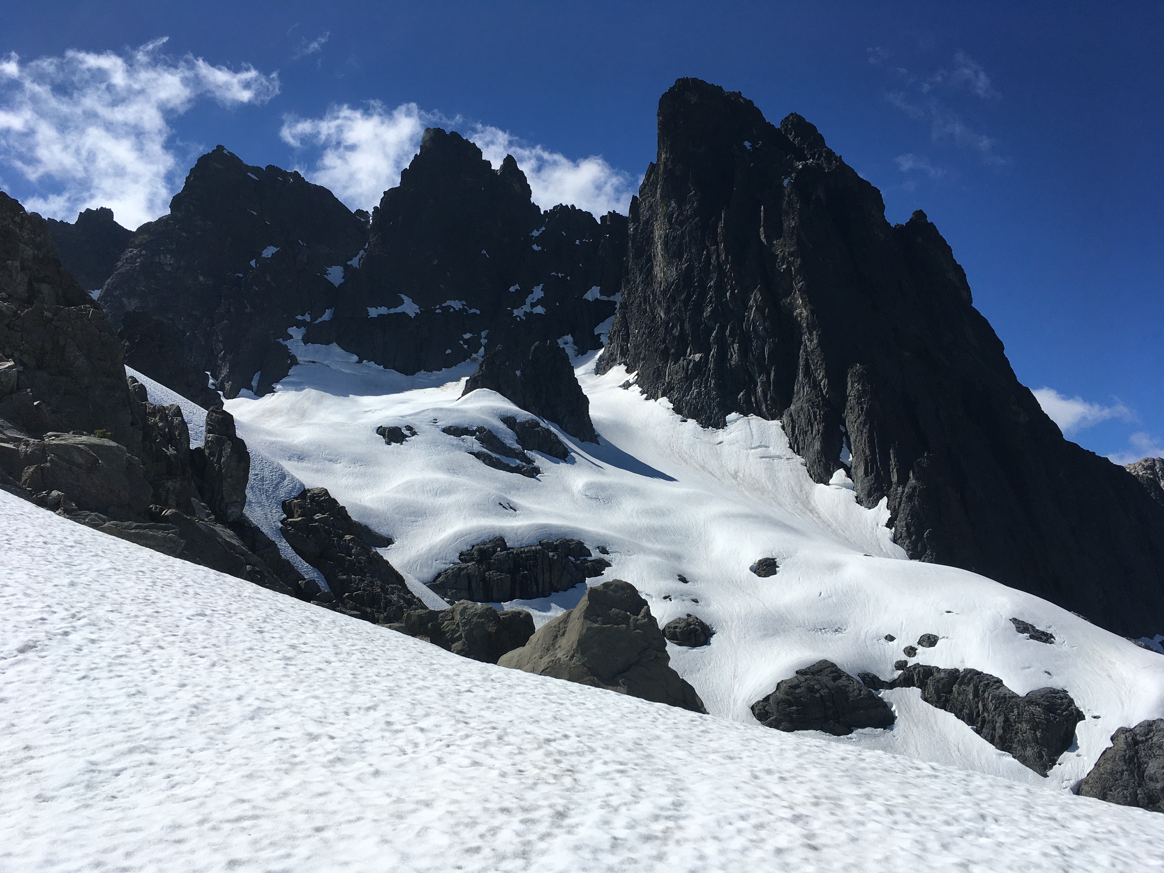
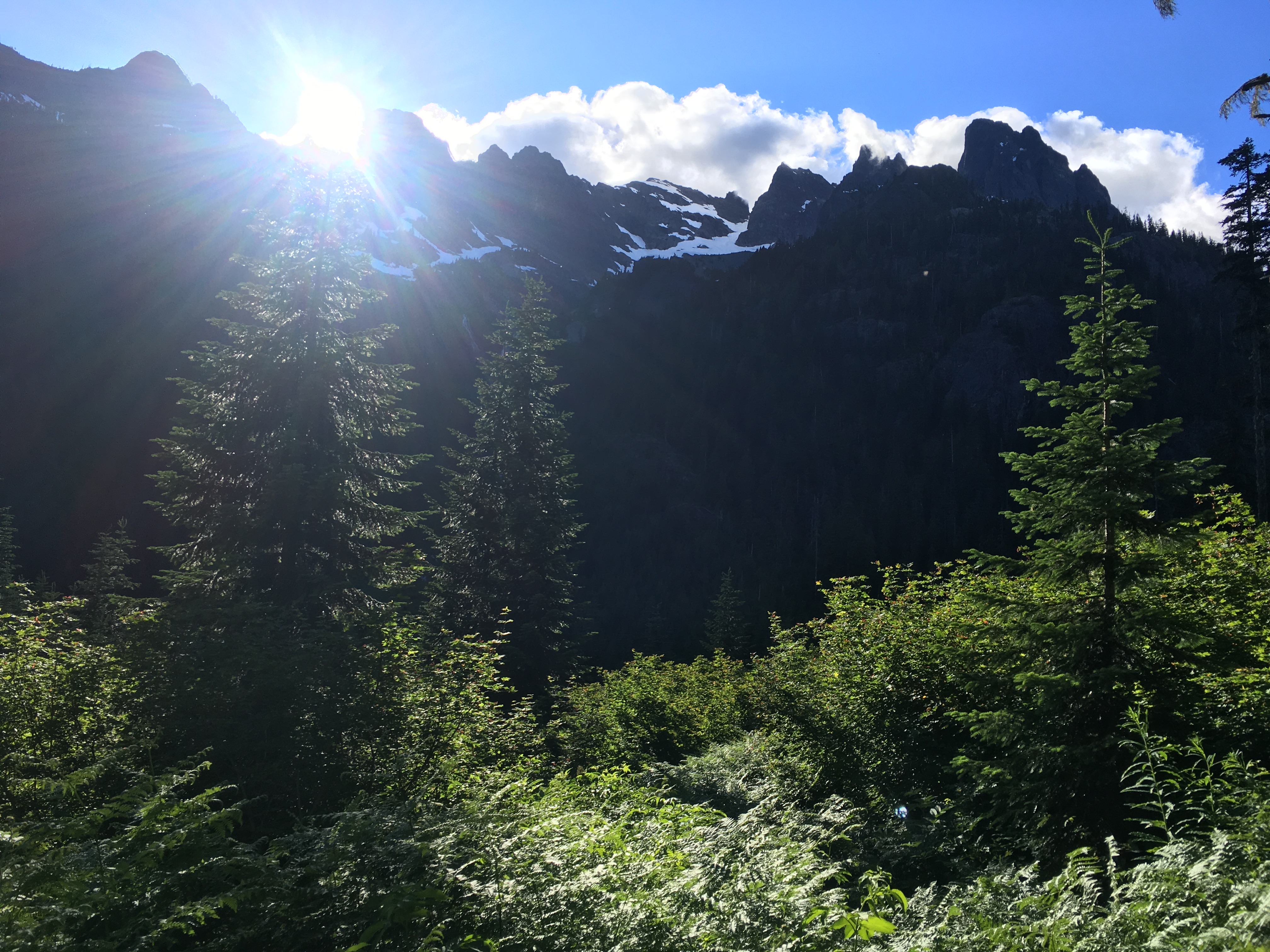
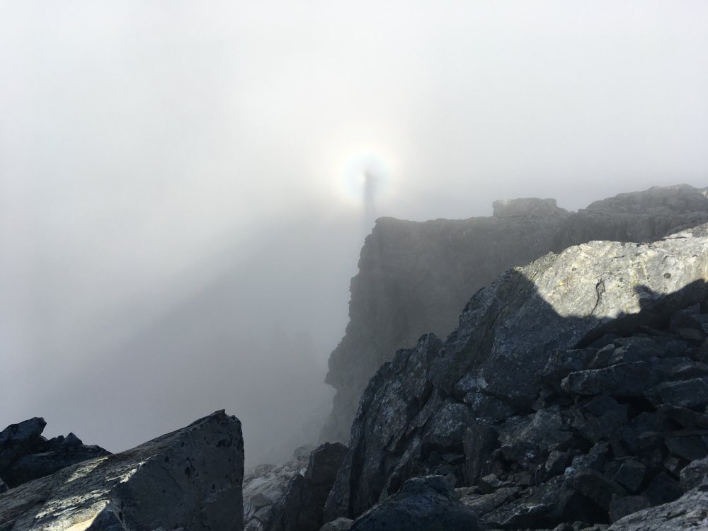
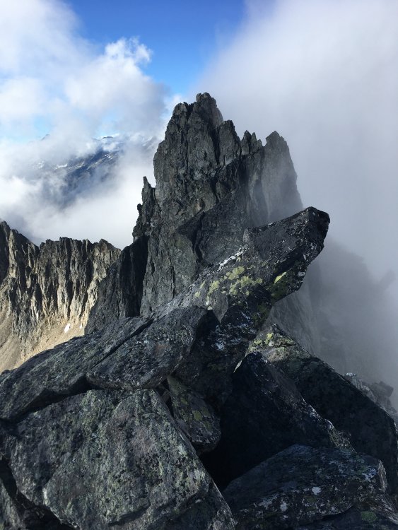
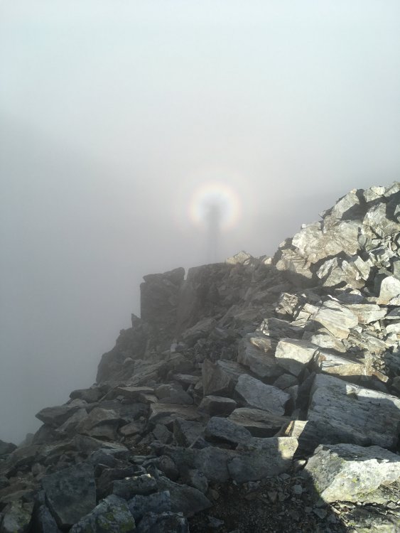
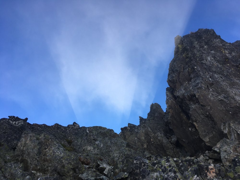
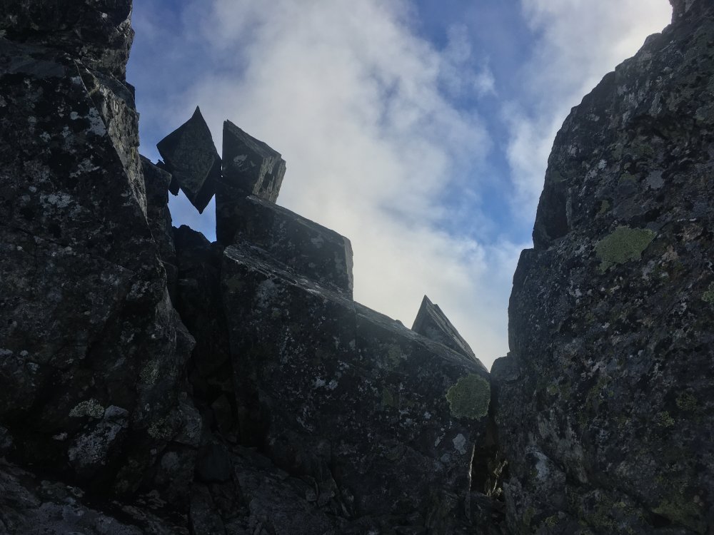
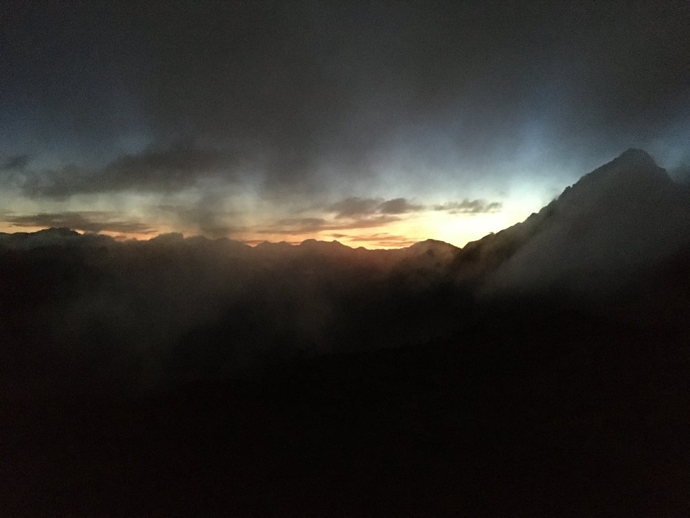
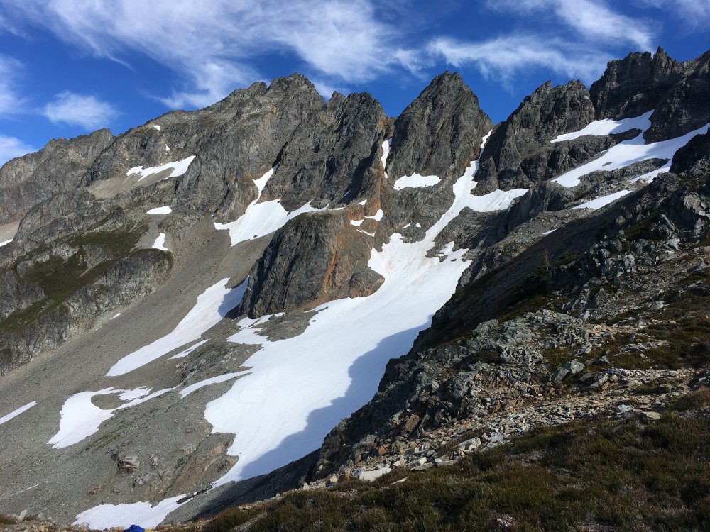
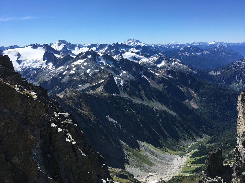
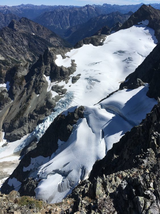
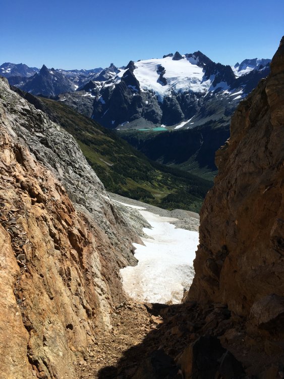
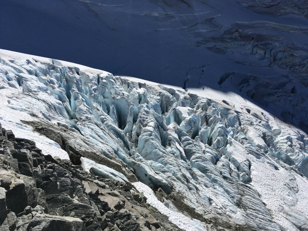
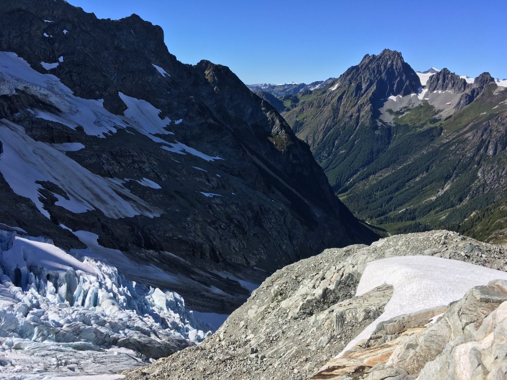
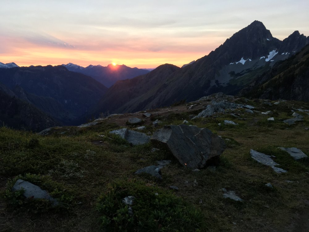
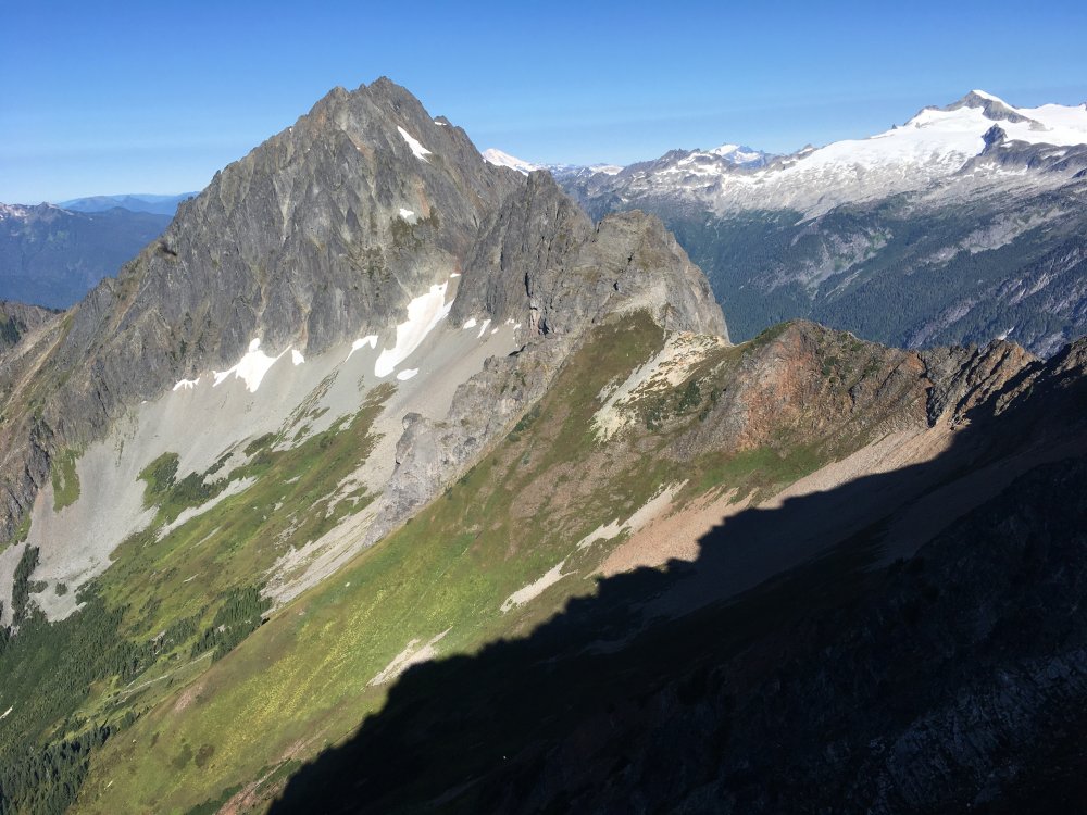
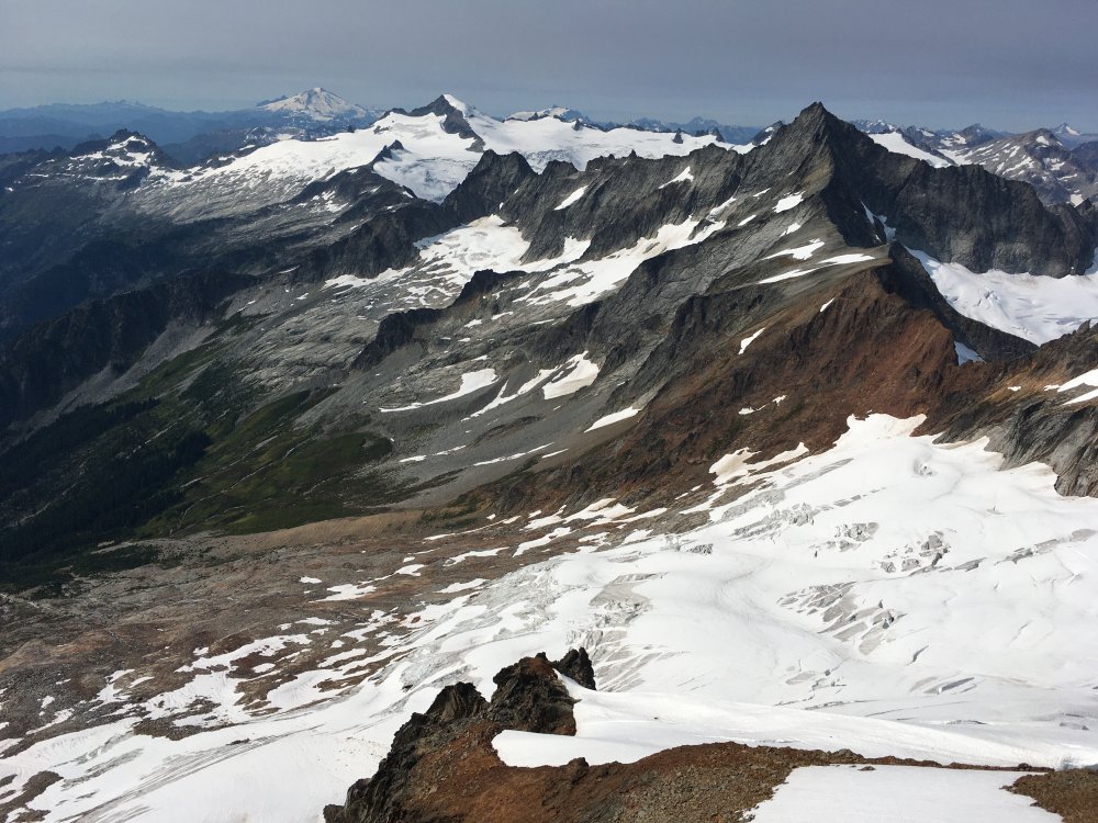
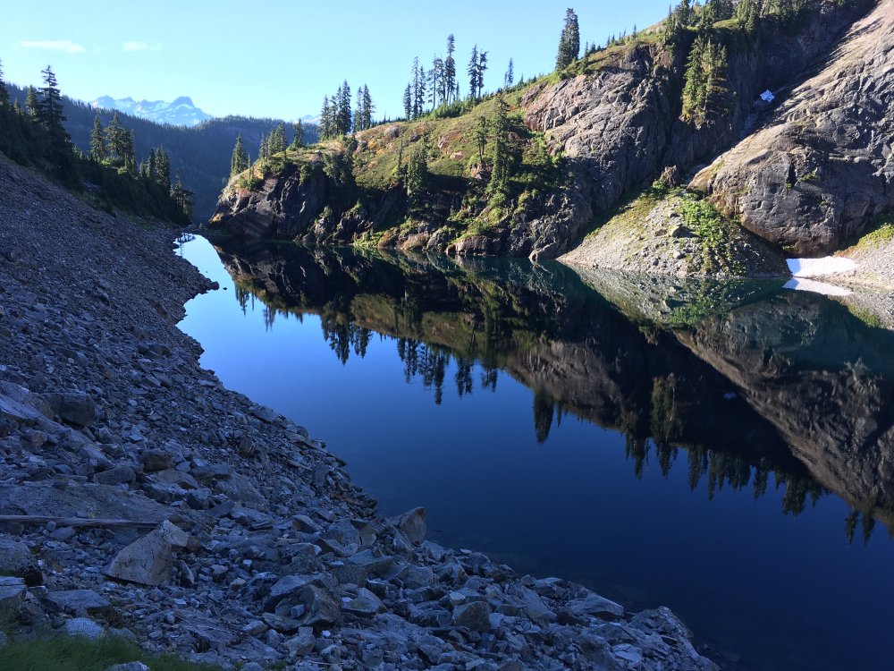
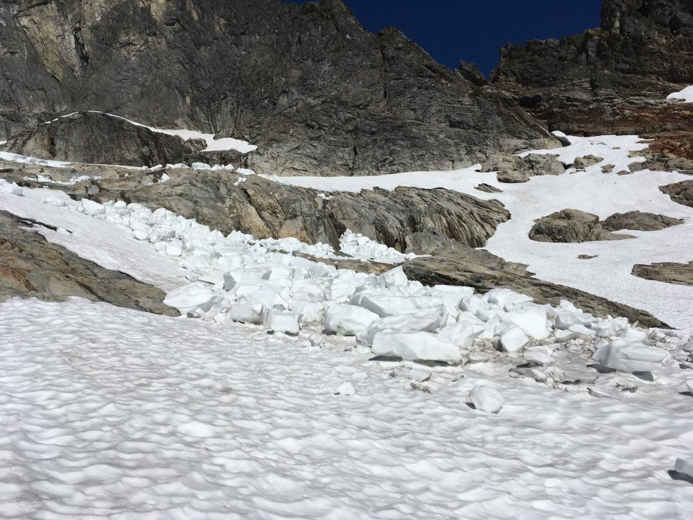
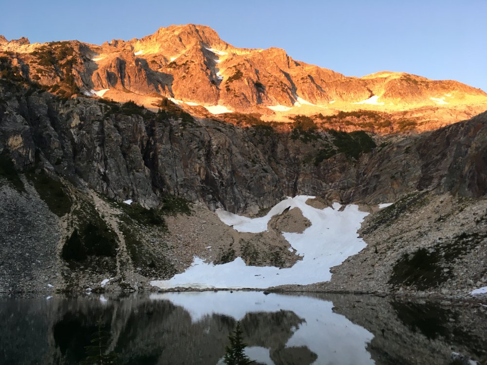
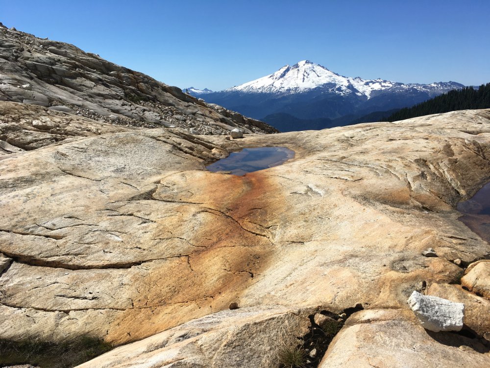
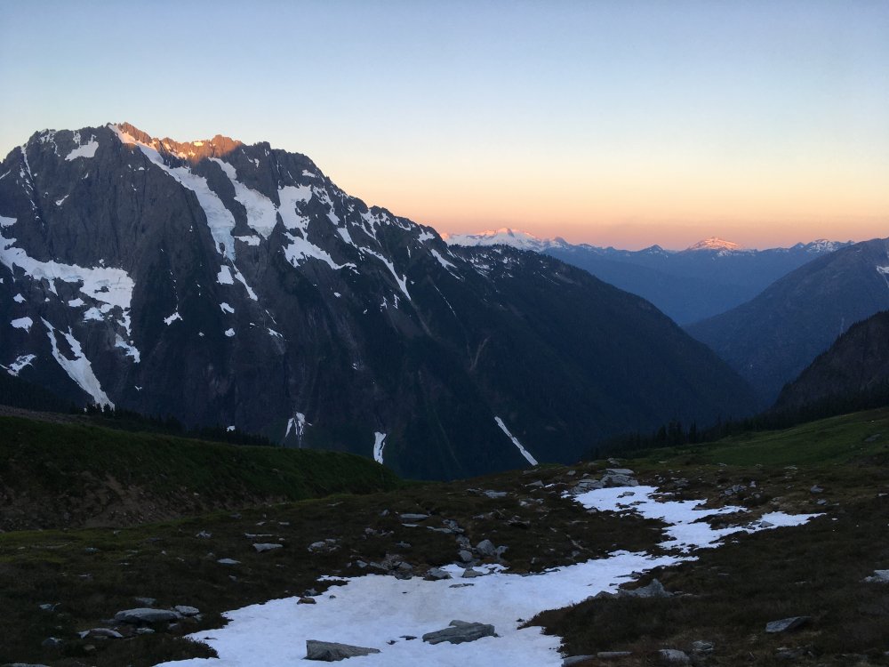
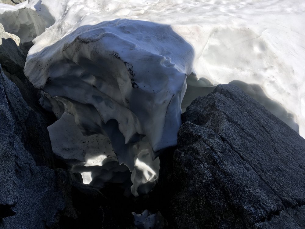
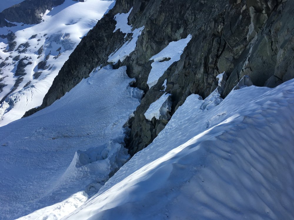
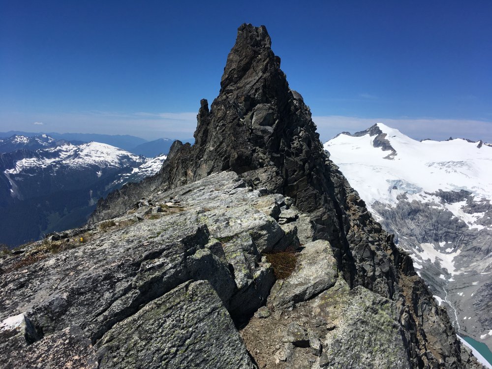
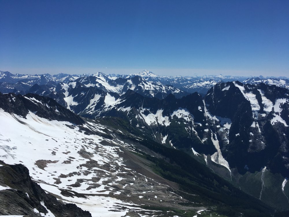
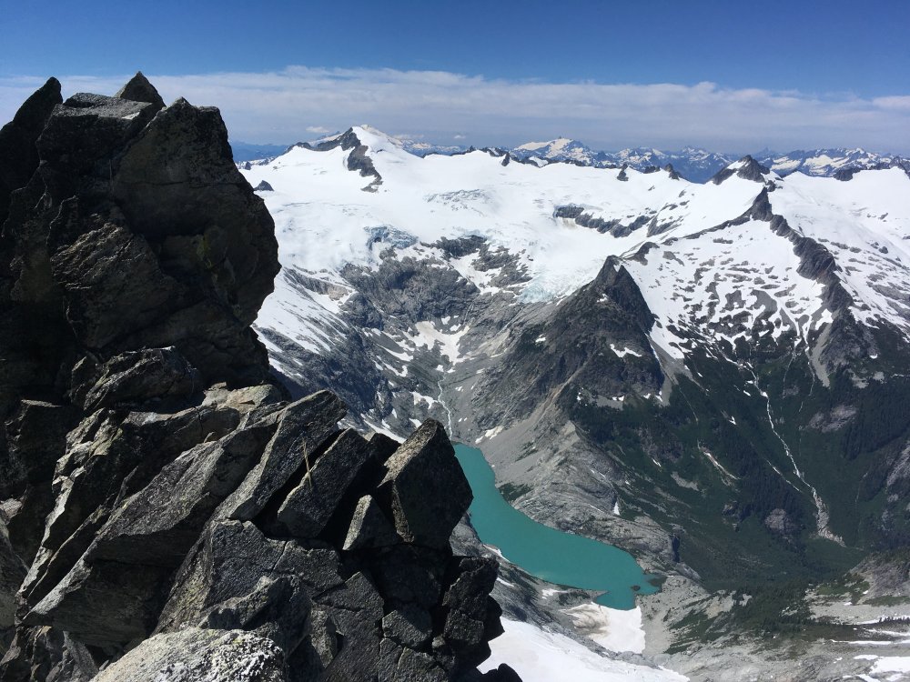
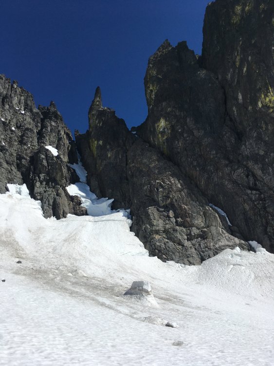
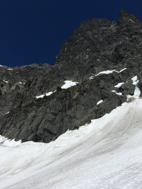
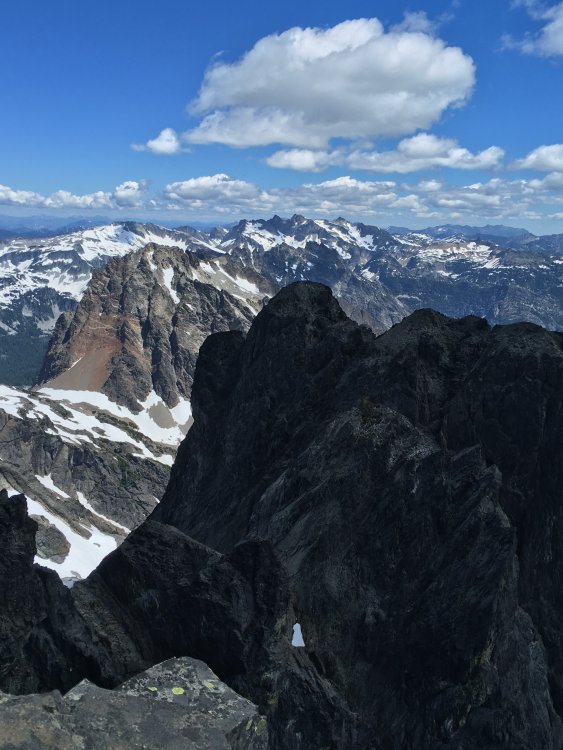
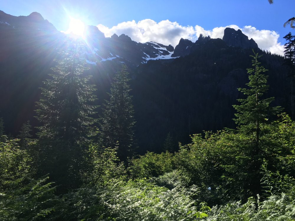
Trip: Cascade pass - Magic, Formidable, Mix-up, Sahale Trip Date: 09/02/2020 Trip Report: First time S from Cascade pass for me. Wonder what took me so long. I guess the lack of good rock, but it’s really goddamned beautiful. At the knoll before Cache glacier it was drizzling and the strong wind was blowing wet stuff up. I crawled under the leeward side of a small tree, one of the last I could see. Waited for 4 hours, cursing forecasters and getting bitter. I didn’t know that I was in for the most beautiful day in the mountains I ever had. After those cramped 4 hours the weather was still very unsettled but improves enough that I could now see where I was going, so I headed up and over cache col. It was sunnier on the other side. Dropped camp at kool aid lake, pleasantly surprised to be alone, and headed up to magic mountain. It lived up to its name. A crazy glory followed me all along the ridge. It wasn’t a fleeting thing. My first and last photos of it are 50 minutes apart. I had only seen photos of the effect till now, so I don’t know if this is common, but it had a large diameter bright white ring far outside the inner rainbow rings. The outer white ring didn’t come through in my photos. So surreal. I was also treated to sights reminiscent of laser shows when I was on the east side of the ridge. That night moonlight gradually illuminated magic mountain but the moon itself stayed hidden behind Hurry-up peak until much later. Wow. The weather was much calmer next day as I approached Formidable. Route passed above some significant crevasses on the Middle Cascade. Easy, but no-fall terrain, especially in the morning with icier snow. Formidable has the good, bad, and the ugly. Some soul sucking steep dirt and scree, some nice smooth but low angle and ledgy slabs, a scary rotten steep 15ft section just below the summit, and fantastic exposure along a short row of incisors to the summit. Yup, pretty fun overall. Took a long break at the bottom of the glacier on my way back to watch shadows grow across the beautiful mess down below. Most of the abundant ledges here aren’t flat but there could be a spot or two for bivying. Would be very nice to do so if you can get comfortable. A group had showed up to kool aid lake but there is plenty of room to spread out there. After dinner I walked north a little to pick berries. After having my fill I sat on a rock facing west and noticed a bear feeding down the slope maybe a 1/4 mile away. It seemed large and had a light brown coat, totally different than the smaller dark black bear I saw playing in a pool not far from cascade pass the next day. I don’t know if it’s possible it was a grizzly? Then after another incredible sunset at camp in the dusk light popped up a creature I had never seen before. It had a long but tiny body, and was springy/twitchy like a pika or chipmunk. I think it was a weasel. But so much smaller than I pictured a weasel to be. It bounced around, locked eyes with me a couple times, then bounced off elsewhere. Next day I got moving back to cache col to try to get Mixup and Sahale same day. Originally I planned to do mixup on day 1 but the weather prevented that. I found out about the East face route from@bellows TR last year (thanks!). Found one small acceptable route down the moat on the upper right edge of snow. Gross steep dirt and rotten rock to gain the U notch. Wrapped around to the V notch and climbed up and left from there. It’s about 20 ft of I dunno 5.5 or so, but the rock didn’t seem very trustworthy. I only noticed one good spot for pro. It wasn’t terribly loose or rotten, but seem to be fractured into blocks that are probably not glued down all that well. So, beware. White staircase was excellent as advertised. Class 2 until near the top where vertical walls force you right into class 4. There is a very brief awkward but not difficult 5th class move to gain the ridge just north of the summit. I did rap this part on the way down, and a rap to the V notch. The rap station above the V notch was, mmm, creative. Got the job done though. Back at the U notch I chose to rap on a fixed line hanging there. Not sure if that was a great idea, but it’s so dirty there, was nice to skip some of it. Still had to down climb a little bit more precarious garbage after that rap to get back to my overnight pack. On to Sahale. Up till now I had enjoyed quite a bit of solitude. Knew that wouldn’t be the case back at the pass but I was still surprised at how many people were day hiking to sahale arm/glacier. This was less fun. Fun resumed at Sahale glacier. And I was pleased to find a nice short crack near the summit. There was one other climber summiting at the same time, after already approaching quien sabe same day, but turning around due to a sick partner. She was moving fast. Wednesday weather had been so strange and amazing, then crystal clear Thursday through Friday, but Friday afternoon smoke had blown in. Views were still pretty great. Had some nice approach shoe skiing down the glacier and then all of a sudden I was back at the car, enjoying the drive through cascade river even more than usual. Gear Notes: 60m rope for mixup, crampons, ax Approach Notes: Back and forth and back and forth


-
Maybe a long shot buuut nice weather forecast this week has me feeling the itch for doing early morning spire SW face and the Eldorado west arete routes in the same trip to marble creek basin over 4 days. 1 day for getting there, 1 for early morning spire back to camp, 1 for up and over Eldorado via west arete, and 1 to get back out. Wednesday or Thursday through Saturday or Sunday could work for me. Lemme know!
-
Yeah really glad you weren’t in the wrong place at wrong time then. Thanks for the warning in your TR, it was definitely on my mind during our approach. I never saw anything concerning, but it was a different time of year and I’m not certain we started the ridge climbing in the same place as you.
-
[TR] Twin Sisters - Obscurities Redux 08/23/2020
JonParker replied to dberdinka's topic in North Cascades
Ooo this looks nice -
It’s easier to post here than it used to be
-
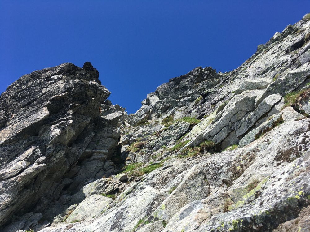
Trip: Triumph - NE Ridge Trip Date: 08/23/2020 Trip Report: Soloed the route c2c yesterday. Driving up Saturday night I passed cars at many pullouts near the trailhead so I was shocked to roll into an EMPTY PARKING LOT. Approach was smooth and shaded until the glacier crossing. Nearing the notch I heard voices up ahead. I thought I’d try to catch up with them at the base of the 5.7 pitch and check if they’d be willing to trail my rope and give me a quick belay from above that crack. Since they didn’t sound very far up the route that gave me some time for exploration. My first diversion was trying to take the snow tongue as a short cut to the notch, but it ended up being quite tall and steep on all sides, so I descended back the way I came, carefully stepping down into the west side near the start of a granite ramp. Several years ago I had made it as far as the bivy ledge with a friend who succumbed to some minor heat stroke (very hot day). We spent the night there and headed back the next morning instead of climbing the route. I remembered the start of the route being crappy, so this granite ramp caught my eye. Maybe a better bypass route could be found along it. I traversed along it for quite a ways, passing an anchor (maybe for bailing?) until it petered out. Tried a few spots to get up towards the ridge but it just didn’t quite go, everything seemed to have 1 or 2 sketchy 5.7-5.8 face moves to get off the ledges. So I backtracked to that anchor. I tried climbing above it, initially on good low 5th knobs but again hit a dead end. I went down and East again, almost back to the start of the route. After all this wandering for an hour or so I was able to bypass the first pitch, but no more. Back on route I quickly caught up with the pair ahead just as they were nearing the 5.7 pitch, as planned. I asked about the belay but it was a guide and client and they were planning to bypass it to the right. Thin face traversing + route finding didn’t sound safer to me than a straight forward obvious crack, so I passed them there and climbed up to the crack. I hope I didn’t freak them out too much climbing it. People don’t usually mention taking a #4 on this route so I had hoped a #3 would be big enough. It wasn’t, really. You can protect this part with smaller pieces by sticking them deeper in the crack, but doing so feels a little insecure, especially while soloing (there’s was a fixed .75 that I automatically starting trying to free for 3 seconds before remembering where I was and what I was doing ). For those inclined to solo the route, plan on about 15 ft of 5.5ish to start, then another 12 ft or so of 5.7. And bumping up a #4 as you go might decrease your risk. Near the summit I spied a corner with hand and finger cracks that looked more appealing than the loose and heathery ledges surrounding it. It was probably 15 ft, 5.6. There was a loose microwave at the top of it that I took care to step over. Such good summit views there. Downclimbed what I could, with 5 raps along the way. Like many have noted, it usually takes longer to descend than ascend this ridge and that was the case for me if you don’t count the granite ramp exploring I did at the start. About 20 minutes longer, I think. Had a very nice plunge at the upper lake (2nd one, not the third one higher up). It was too cold to swim for more than a few seconds. Very refreshing though! Smooth sailing from there. Made it to the car at 830 just as it was getting dark. So it was 14.5 hours including time for exploring, enjoying the summit, and a dip at the lake. Gear Notes: #2 (unused), #3 (used) wish I had a #4 instead 60m for raps Approach Notes: Straightforward


-
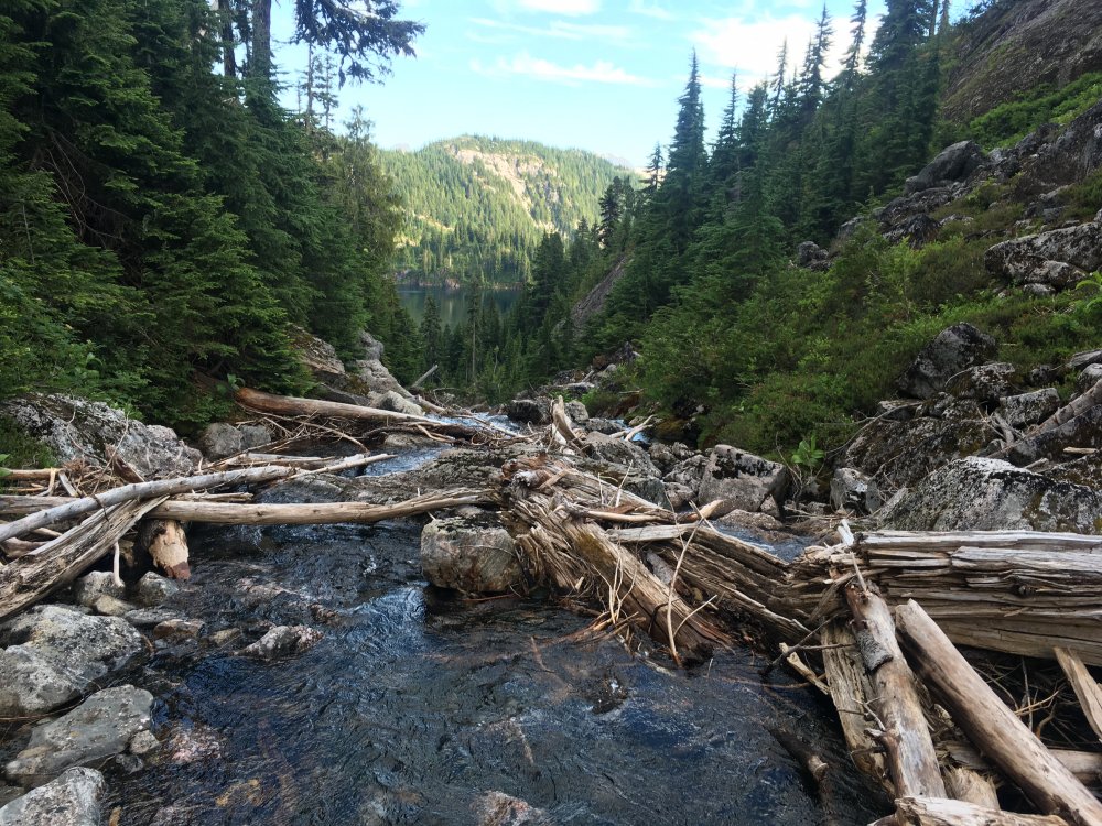
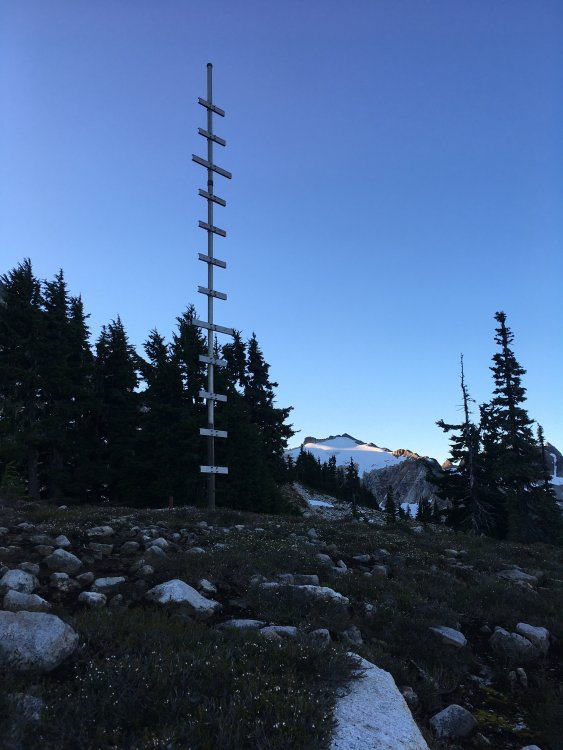
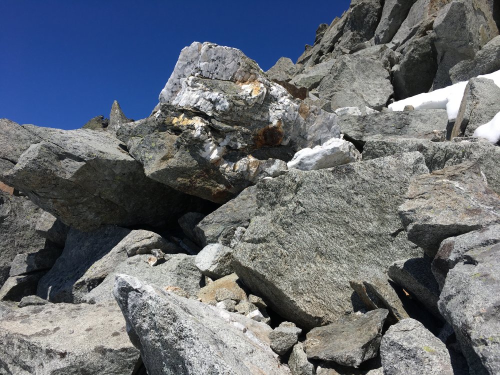
Trip: Blum - North ridge Trip Date: 08/15/2020 Trip Report: A few thoughts from our climb of Blum’s north ridge last weekend. Arrived at the ranger station around 10:30 on Friday, with a budget of about an hour for waiting for permit. I started about 30 places back in line and made it to about 24 places behind in that hour. Doing the math it was an easy call to just head out to the unpopular Blum zone sans permit rather than wait another 2+ hours. Would be nice if NCNP got their shit together with the permit situation someday. The approach hike is short on views but it’s a beautiful forest. Its shade was much appreciated this hot weekend. It’s very difficult to keep on the climbers trail. A lot of it is pretty faint but distinct enough, but it seems to abruptly disappears in several spots only to reappear later. Especially during the relatively flat traverse around 4400-4800’ I never noticed a path. At least the forest is more open in that part. Impressed by the determination and passion of those who found their way up these hills without gps or any trail. I was glad to have screenshots of tracks here for reference https://www.nps.gov/noca/blogs/mt-blum-north-glacier-july-12-2016.htm Bivy at the lake was lovely except for the voracious mosquitoes. We got an early start next morning in the hopes of avoiding groping around the bush in the dark on the way back to the cars. Headed off a little before 6am. Passed a beautiful reflection lake and what looks like a remnant of an antenna or something? This, one piton, 1 chewed up piece of tat, and the summit register were the only evidence of humanity that we saw past the bivy lake. I had assumed the start of the N ridge would be more obvious. There were actually 3 distinct ridges coming down the the glacier. The first one furthest west was clearly not the right one. We took the second one but there was more further left that we didn’t really explore. I took the first lead up and diagonally right. There was one long runout but plenty of jugs in that area. I encountered a difficult move with a wide crack roof just above and right of a finger crack. There was a piton nearby and the crack took cams well, so this crux seemed like it could be on route and was reasonably well protected. It could be 5.9, maybe harder, especially if you’re short. Anchored off a boulder up and right after nearly a full 60m. After this it was some scrambling up the ridge, ending in a dirty gully. We started to wonder if we were off route then. But this led to a really nice low 5th ridge traverse that we sailed up. We passed a nearly flat polished section of rock and arrived at a tower that seemed too tall and featureless to down climb (10-15’). So we backtracked past the flat spot and took an exposed traverse climber’s left into another gully. The traverse ended with a handrail into a low angle wide crack right facing corner. Pretty sure this wasn’t standard because it would take a #3 to protect it. We didn’t have a #3 but the crack wasn’t very long. Including it we did 2 short meandering pitches up and left to gain another ridge, which we took to its end. There was another tower that seemed to block the way and we surveyed a sketchy looking down climb left into another gully but found instead that the tower could be bypassed on its right. Cresting here we took off the rock shoes for the last ridge section leading to the summit. The summit views are . . . Real nice. We were the 4th party to sign the register this year. Always nice to descend without having to do any raps. More beautiful scrambling on the way down, passing a jade lake still holding some snow, and rusty polished granite slabs everywhere. The first gully after that lake’s outlet stream was unappealing so we continued west but found uglier options. One at a time we picked our way down a rotten sandy gully before crossing back over into a better one to get back to the bivy lake. We cooled off in the lake and hit the ‘trail’ a little before 5, which didn’t leave much time to get back before dark. Route finding was generally a little better on the way back, but my phone died at the last inscrutable section after I pocket dialed a long video of the inside of my pocket. So we no longer had a track to follow. We thrashed down and right after the trail disappeared at a flag around a little cliff and stumbled upon a faint path again. We could follow this down to Blum creek before it vanished again and we traded back and forth between boulder hopping adjacent to the creek and being forced back into the bushes. We reached the wooden bridge and gravel path that marked the end of difficulties. Well, almost. From here back to the car seemed so much longer than the day before. The last hour of hiking down the hills in fading light had sapped all my energy. It took 4 hours from the bivy to the cars. And although it wasn’t a terribly long day as far as these things go, I was truly spent. Worth it? Yes, amazing scenery and plenty of good rock. In no rush to repeat that hike though. Gear Notes: Crampons (didn’t use due to laziness but would be useful) Ice ax Cams in the .4-.75 range were most useful. Single #1, #2 was fine Approach Notes: Good luck


-
Kinda makes you wonder where the other bags are. Maybe it’s not too late for new skis
-
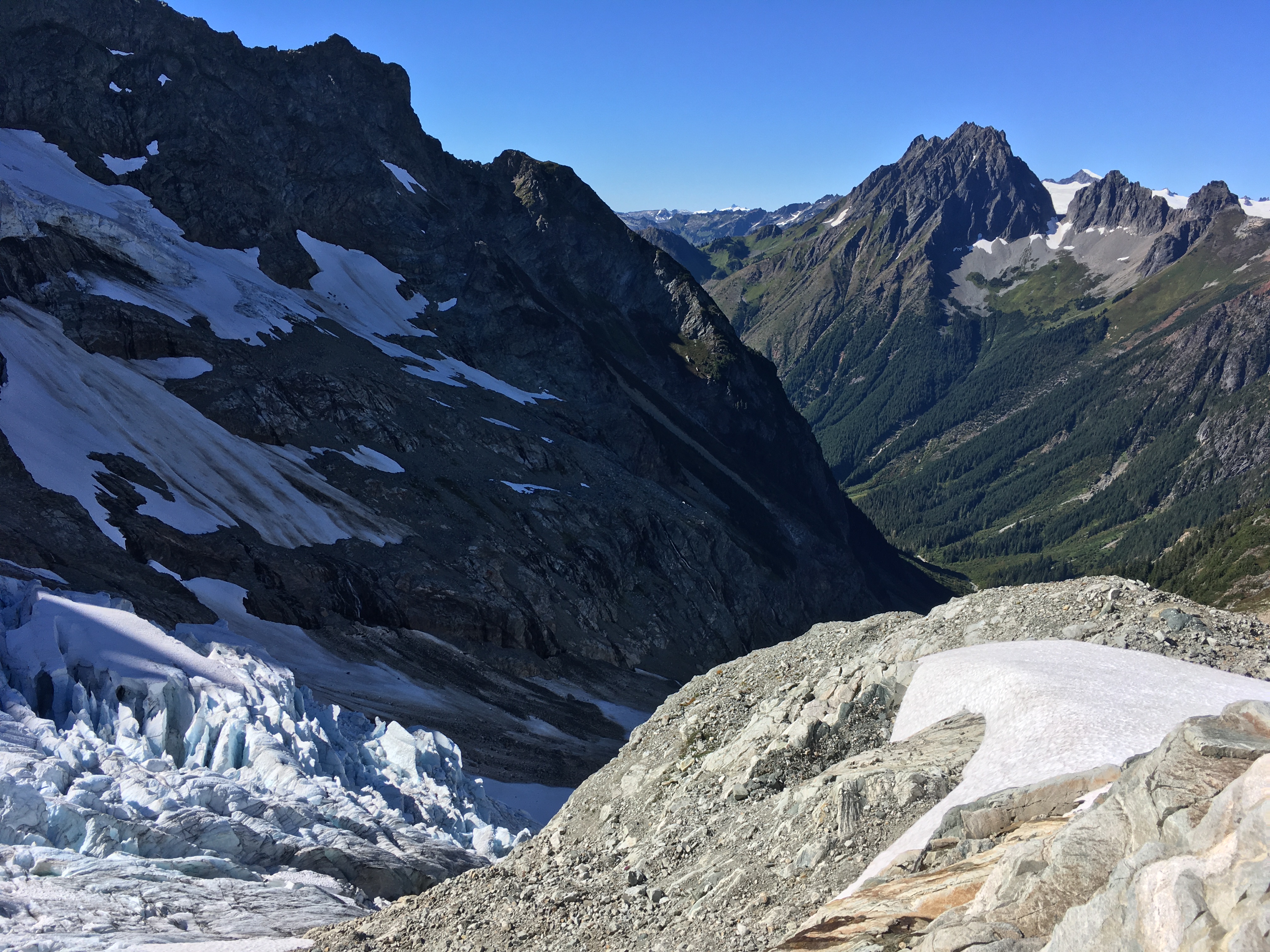
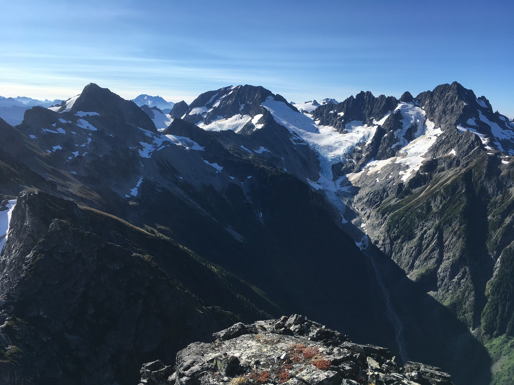
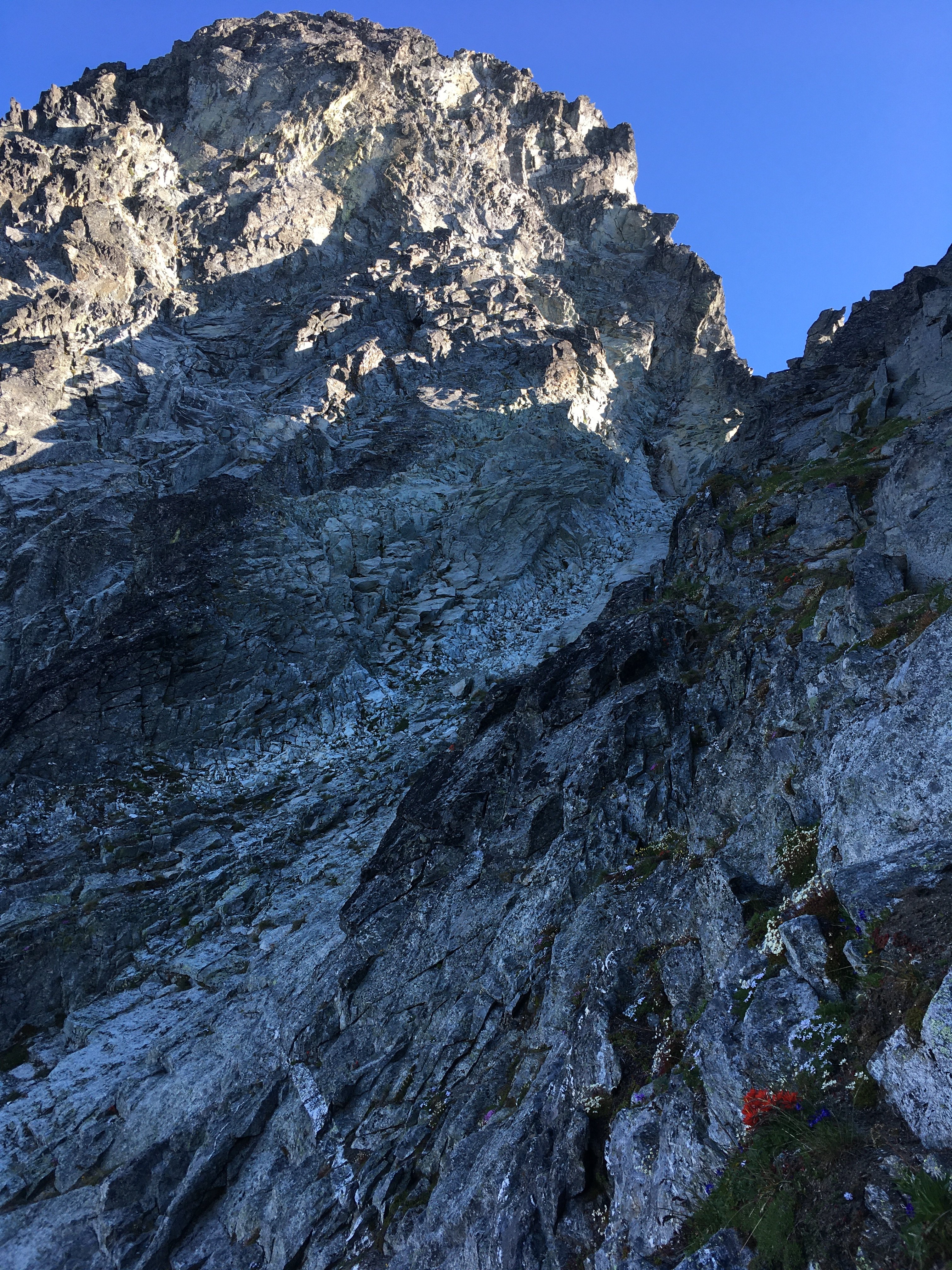
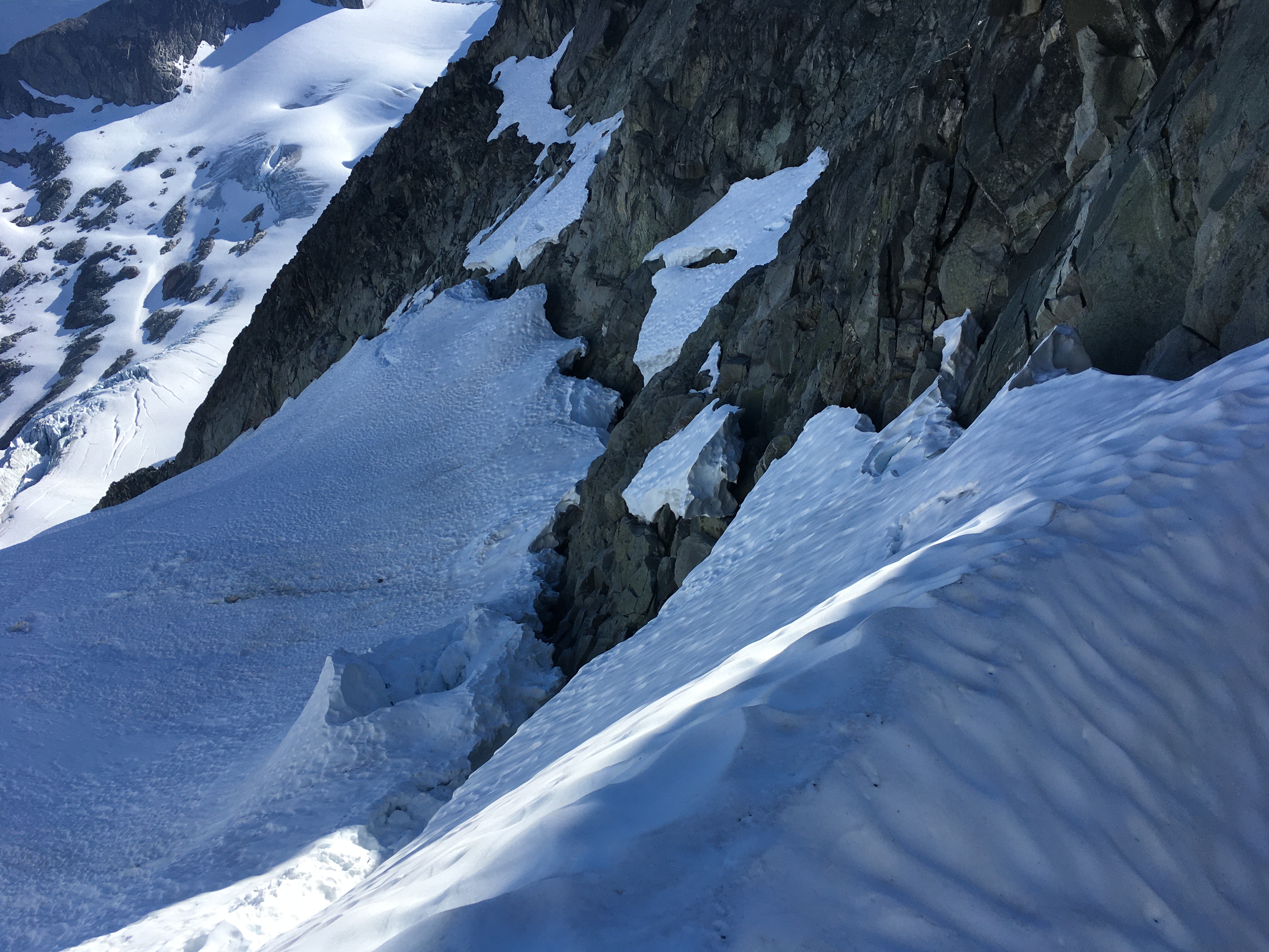
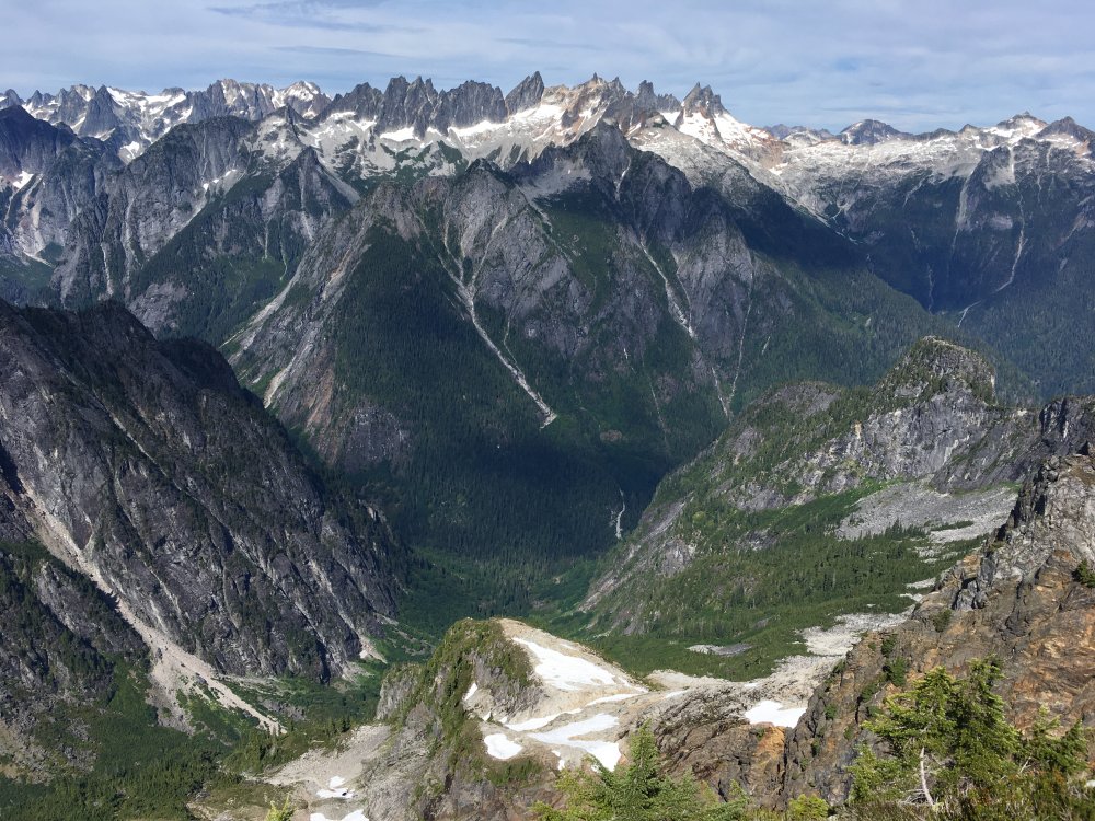
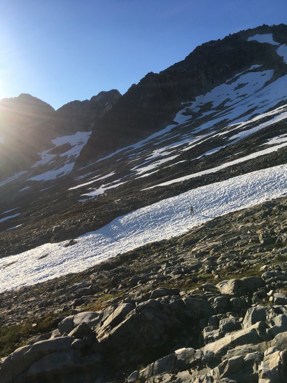
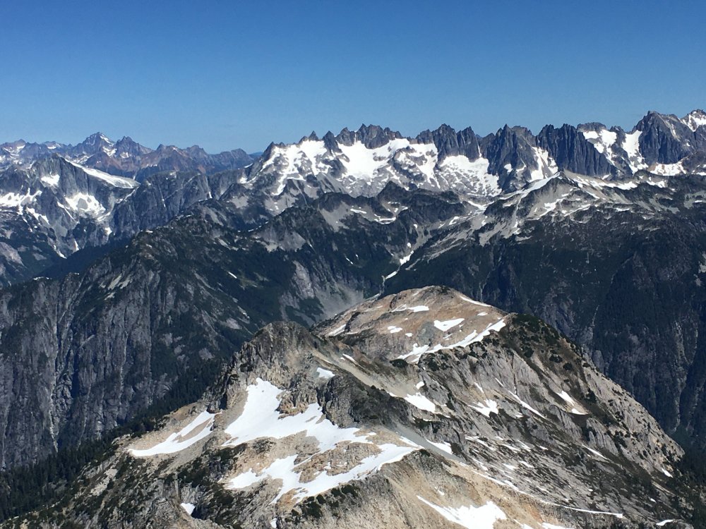
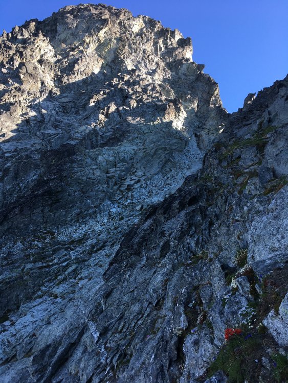
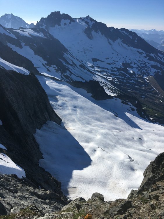
Trip: Torment forbidden traverse - Tft Trip Date: 07/28/2020 Trip Report: While driving to the cascade pass trailhead Monday night I noticed that I didn’t seem to care about climbing. So I was a little unsure about why I was going but part of me knew I would be having a great time the next day. Arriving in the night, the sound and sights of Johannesburg (snow glowing in the starlight) rekindled my stoke. I slept about 4 hours, then rolled down to the boston basin trailhead and hit the trail just before 4am. Even in the early morning the creeks were raging. I’ve always beenable to find a dry route through these creeks, but not so on Tuesday. I took time to remove my shoes and dry my feet afterwards at 3 crossings. It was going to be a long day and I didn’t want to start out with wet shoes. At Boston basin I started ascending too soon but fortunately realizedthis without getting too far off, descending 200 ft or so to the SW around cliffs to get to the slabs leading to Torment. I stocked up on water at the last flow I saw a few hundred feet below the notch. I noticed another party nearing the top of Torment, which was a little surprising for a weekday. I would later pass them on the steep snow traverse while they were doing the rock bypass. The first thing I was worried about for this route was the moat at the notch. It wasn’t too bad. Snow was pretty hard there. Could get dicey soon. Moving across the moat the gully was steep and muddy. I squirmed up the gully using my axe in the ice to my left for leverage and getting a bit of a mud bath in the process. Didn’t feel super secure here given the steep mud. At the top of that snow+ice I was able to move from the mud to rock and was soon at the top of the gully. The first couple moves off the deck were harder than I expected, maybe 5.6. It was all pretty easy from there. The two keys to the route finding are to take the ledges down and left after that first steep 15 feet, and then to go left when you get to the gully that’s around that corner, instead of entering the gully. It’s all pretty intuitive after that, and there are rap anchors along the route to help you keep your bearings. I thought Torment was quite fun actually. The rock isn’t terrible and the Johannesburg and Eldorado backdrops are excellent. Would be worthwhile on its own, and makes for a nice warmup for the traverse. After descending Torment, at the notch with the rappel to north side snow I saw there was a block of snow bridging the moat that will probably be gone in a few days. But since it looked like there was a bergschrund below I did the first rap anyway, heading skier’s right toward another rap. Unfortunately that one wouldn’t reach a safe spot on the snow, so I kept rapping skier’s right along rock ledges. Finally on the 4th rap from the notch I got to a flat spot on snow. Looking back I saw the bergschrund was actually still closed at skier’s left. I could have avoided all the raps if I had gone that way. But it was very steep there, almost vertical. Pretty intimidating from above. I wasted some time with all the raps and scouting the terrain, but it felt safer than the skier’s left option. After you get to the next rock ridge the terrain is indistinct. I followed the path of least resistance, hoping I wouldn’t get cliffed out, and it worked ok. After crossing over, the route then goes straight up the ridge on its east side. I was pleasantly surprised with a lot of wildflowers in this section just before the steep snow traverse. I brought two ice tools and steel strap-on crampons. This was probably overkill. Snow was pretty soft, so a single regular ax and aluminum crampons would have been ok for these conditions. It was almost too soft. Occasionally the snow would collapse a few extra inches under my feet while shifting my weight to the left. Would have been worried about getting mushed off the face if it were much warmer. Not sure that pickets would have been any help, so going solo here wasn’t necessarily more dangerous than pitching it out, maybe safer (faster). The traverse doesn’t look very wide, but carefully side stepping took me about a half hour. It was a little tedious. Next time I’d like to do the rock bypass instead. I took my first real break of the day afterward, digging into lunch and trying to dry out a little. Then I continued on the south side. There is a snowpatch dripping into some slabs that requires a little care. I was traversing the top of the slabs near the snow and got sketched out for the last 10 feet, backed up, and found a better way a little lower. Next came some nice granite boulder hopping and then another vegetated flowery area. Did some more boulder hopping from there to regain the ridge. Exposure along the ridge was pretty fun, but not quite as good as the E ridge . The rock was quite good, reminded me of the upper part of the NW ridge. My decision to climb the route despite low motivation was being validated with every step. I stayed mostly on the ridge, with a little bypass on the north side at one point. In at least one place I did some steep downclimbing instead of rapping. Near the end of the traverse I headed south on sandy ledges to reach the base of the west ridge notch. At this time there was one party that had just descended, one still descending, and one probably just arriving at the summit. Busy, but not terribly crowded. I hadn’t found much info about doing the climb c2c beforehand, so was a little worried about squeezing it all in. Would have been ok skipping the W ridge if I was short on time. And I had been moving cautiously throughout the day, at times even timidly. Even so, it was still early afternoon at this point so I felt I had the time. I put on rock shoes and put a rope on my back. I had downclimbed the route in the past (after NW ridge) so it was familiar. But I had not yet ascended it. Was nice to see it again. I like the first wide step across a gap at the start, and the last slightly overhanging block that you have to downclimb right before the summit. It was a warm, clear day and summit views were obviously wonderful. I downclimbed the ridge except for one rap at the 5.6 tower, where I had stashed the rope I brought. The other party on the traverse was arriving at the base of the W ridge when I got back to my pack. Changed back into approach shoes and downclimbed most of the gullies leading to boston basin, with one rap at the end onto the snow. From there, some approach shoe skiing, passing through boston basin, then marmot metropolis, and then another nice break after crossing the E fork of Boston creek. For all its thunder there was a way through that was only about knee deep. It wasn’t clear to me how long to expect the different portions of the climb to take. I had guessed it would be 15-18 hours total. It ended up being a little less than 15. I noted the time for various points along the climb, in case it helps anyone planning a c2c trip. Of course snow+moat conditions could make things faster or slower, belaying any of the route would make it slower, and trying to get off Forbidden on a weekend is a guaranteed traffic jam. That said, I took my time, didn’t race. 3:50 leave trailhead 7:10 moat crossing start of Torment 8:30 summit of Torment 8:50 first rap to Forbidden glacier to begin traverse 10:05 done rapping 10:50 begin steep snow traverse 11:20 finish steep snow traverse, lunch 11:45 resume traverse on S side 12:40 start of sidewalk 1:10 base of Forbidden W ridge 1:25 start climbing W ridge 1:50 summit Forbidden 2:05 start W ridge descent (including one rap) 2:40 back at the start of W ridge, start descending gullies 3:40 out of the gullies onto snow 6:35 back at car This is a fantastic route, one of my favorites so far. Especially everything east of the steep snow traverse. Would do again Gear Notes: Rope, tools, crampons Approach Notes: Creeks are high


-
I don’t think so, I did the e face direct described on summitpost
-
Trip: Chimney Rock - E Face Trip Date: 07/18/2020 Trip Report: Low 5th solos came to mind as an option given the pandemic and I thought I’d check out chimney rock. Hit the road on Friday later than intended so I didn’t start the hike until 6:30pm which didn’t leave a lot of time to get to the bivy before dark. Even so, scratching up the climbers trail in the fading light, which is at points extremely steep, wasn’t too bad. Made it to the bivy area as the stars were coming out (about 3.5 hours?) found a reasonably flat rock and enjoyed fantastic star gazing as I drifted off. I’ve seen singular bright flashes a couple times while star gazing recently. What is that? Took my time in the morning, left around 8am. Proceeded to nearly lose my phone in a crack between a rock and snow while putting on crampons. Luckily was able to blindly excavate it with my axe. Glacier approach was uncomplicated but once at the rock I checked 3 or 4 different options twice each before picking a way onto the rock that was just barely tolerable solo. A trip report from a week earlier mentioned snow straight onto rock but this seemed to already be deteriorating. By now the block of snow I stepped on is probably gone. Sometimes these things have a way of getting worse but then improving again depending on how snow melts and how the rock is. So I wouldn’t rule out getting onto to the rock now, but assume it will not be trivial. The route was pretty easy to follow. I had screenshots of the copious internet beta to help (good thing I rescued my phone ). I wore climbing shoes for extra security. All the 4th + 5th seemed pretty reasonable to me, managed to almost entirely avoid sketchy rock. There are cuts everywhere in the rock which keeps things low stress. No committing slabs or down sloping sections that I can remember. The most insecure part was the snow on the 2nd pitch, which was quite steep and exposed, had to switch back to approach shoes and crampons and axe for that. Treated to great views from the summit. I hadn’t got around to climbing anything in the area before. Stuart and Thomson are the closest I had yet been. It’s a worthwhile summit, I was pleased to be there. The descent wasn’t very fun, no surprise there. I could have paid more attention to the rap anchor locations on the way up. Had to do some wandering and down climbing less than clean exposed 4th to find a couple of them. I’ve been spoiled by steeper routes where one rap glides smoothly into the next. Packing the rope and scrambling between raps I kept tangling the rope. Finally made it back to the glacier, I think on the 7th rap, which easily got me over the moat. Things went smoothly from there and my spirit was high until near Pete lake. By this time the evening was getting on, around the same time as my approach the previous day. For some reason the bugs the day before were pretty annoying but not horrible, but this day they were absolutely insatiable and soul crushing. I ran as much as I could (good thing the trail is flat), threw my bag in the car, flailed my arms and legs around for a minute, jumped in the car and sped away. Gear Notes: 60m rope for raps Approach Notes: Most of climbers trail easy to follow once you find the log crossing but https://www.peakbagger.com/climber/ascent.aspx?aid=1424334 gps track was appreciated. No issues on glacier, moat was just starting to get complicated.


-
That looks really fun (except for the shwacking) and beautiful, thanks for posting!
-
I’m in good hiking shape and permitless, so looking to do this car to car. Ive done Backbone ridge and Acid Baby c2c in recent weeks and would love to go back there for one more this summer. Ideally Monday 8/26 but I could be talked into other days. Give me a shout if interested, thanks!
-
[TR] North Cascades - NW Face of Forbidden Peak 08/04/2019
JonParker replied to Bill8's topic in North Cascades
Yeah, I also found the access to the ridge to be slightly harrowing late July last year. I expected a fairly direct approach from the rap across the glacier to the ridge, but we kept butting up against crevasses that weren’t visible from above, so this forced us down and to the right. As we neared the ridge the terrain became steep, icy, and riddled with crevasses. Some pro would have been nice but we had none. After traversing above gaping crevasses we reached a moat too wide to cross so I made a bollard, rapped about 10 feet into it, then scrambled up the rock on the other side and found a spot for a gear anchor for my partner. This was probably around 200 feet above the toe of the ridge and the rock climbing was immediately straightforward once on the ridge. I think it was a good place to get on, but very exposed on the way there. -
[TR] Mt. Stuart - Stuart Glacier Couloir 05/05/2019
JonParker replied to kmfoerster's topic in Alpine Lakes
Awesome! Saw your headlamps when I woke up for the ICG. For what it’s worth I found the booting totally miserable both the way there and back -
Thinking of bivying at the road end Friday night and climbing car to car on Saturday. PM me if looking for a partner and we can hash it out.
-
Great climbing with you!
-
Also interested. Climbed NEB on 1/27 and ran into a party on the way out who did the N Face and reported that it was great. Feel free to drop a line
-
Thinking about it, preferably Sunday. If you’re interested let me know.
-
I’m free 8/30 - 9/1 and hoping for another hit of the n cascades good stuff. I had early morning spire on the brain, maybe dorado needle too, but my partner lost some days off. Get in touch if that sounds good or if you want to do something similar. Thanks!