

caverpilot
-
Posts
132 -
Joined
-
Last visited
Everything posted by caverpilot
-
This won't be true for the lunch counter in July. The rocks get plenty warmed up during the day. Good point! I was actually thinking (winter or summer) of sleeping on a foot of snow versus sleeping on the frozen soil/ground - in that case, it is far warmer to sleep on the snow. However, after a little Googling, I realized (duh!) that volcanic rock has many air pockets and is therefore generally warmer than snow. Some online sources peg snow with a R-value of 1.0 and Pumice as 1.5.... and by the way I did sleep on the rocks on the Lunch Counter!! Thanks for pointing out that nonsense!
-
I can't recommend any... search "iPhone Topos GPS no 3G" and check it out... Gaia GPS, "iTopoMaps," "Topo Maps," etc all work this way. I use a free app called Topos2Go free, which doesn't locate me on the map but is nice for reconning the route in the tent...
-
5/23/09: 6 miles of road to hike to Cold Sprngs CG 6/20/09: drive to CG, snow at CG There's a LOT more snow this year by all accounts. With the wet weather, I'd guess a couple miles at least - I'm betting 7/4 weekend will be one of the first drive-to Cold Springs snow-free weekends....
-
either way, get ones that the size zippers come completely off - that way you can put them on/off without removing your skis or crampons, diaper style. Personally, I typically climb in fleece or polyester pants, and use my Mountain Hardware hardshells when it gets too cold, wet or nasty. Plus you can fall down a lot and not get wet! Ha ha! Full zips!!
-
Anyone been up to Diamond Peak via Pioneer Gulch yet (not counting the Feb. TR)this spring? Drive to trailhead? Thanks!!
-
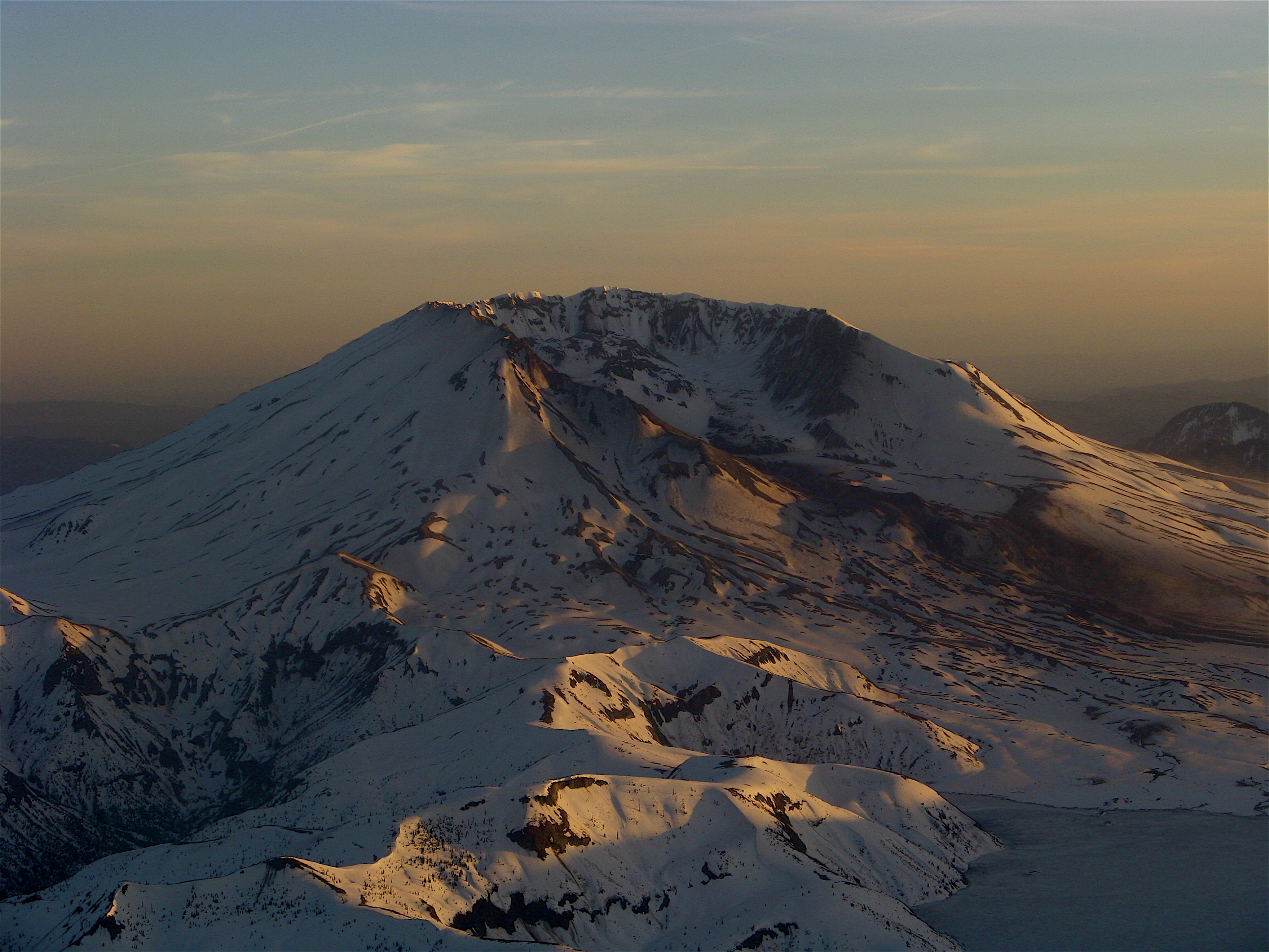
A map and compass are part of the 10 essentials. Never climb without them. No one can predict whiteouts, even on bluebird high pressure days (been there, done that) A GPS makes wandering in the clouds that much easier. There are off-route cliffs and crevasses. A GPS confirms you location, compass only confirms your direction. There are free topo maps you can download of Mt. Adams on your iPhone. Then, the GPS will place you on the map. iPhone DOES NOT NEED A CELL SIGNAL FOR THE GPS TO WORK. You just need a MAP that is ALREADY downloaded to your phone. (Otherwise, you'll see where you are with no reference since it needs cell coverage to download the Google map)To verify this, download the map, turn on airplane mode, and make sure the map is actually on your iPhone. Remember, sleeping on SNOW is WARMER than sleeping on ROCKS. Snow is an excellent insulator - rocks are very poor insulators. And hard. The steepest part of the climb is just below Piker's Peak (false summit.) If you're weary of icy conditions on a steep slope, then wait till the sun comes up to leave the Lunch Counter. If not, watch it rise from the top!
-
Check NOAA's NWS ADDS (Aviation Digital Data Service) Here is the link to the TAF (Terminal Aerodrome Forecasts) Aviation Forecast Type "KPDX" and Click "Translated" then "Get TAFs" This will show you the clouds, winds, and ceiling in AGL units - that's Above Ground Level, so you have to add Portland's elevation of a whopping 31 feet to that number. Example: Clouds: broken clouds at 2500 feet AGL = 2531 MSL overcast cloud deck at 4000 feet AGL = 4031 MSL Terms: Few: 1/8 sky coverage Scattered: 2/8 to 4/8 sky coverage (less than 50% of the sky) Broken: 5/8 to 7/8 sky coverage (more than 50% of the sky) Overcast: 8/8 sky coverage Or get the free AeroWeather app for pilots - you can compare forecasts for PDX and The Dalles and at least get a rough idea that way.
-
I've been using a Dakine Poacher Pack pack for all my AT adventures for years. It is big enough for an overnighter (including axe/crampons) if you're efficient, and cinches down for lighter day pack loads. It has a back-access zippers and contours enough to be unnoticeable even fairly loaded. There is a loop cross-carry system that is quick to deploy, even with a full pack. Under the lid there is a clear map window that has proven handy. Disclaimer: I can't vouch for the new ones but the specs appear fairly similar. A friend recently pointed out "Aren't most of you backcountry adventures day trips?" He was right - as much as I hate to admit it I do more day touring than I do overnighters overall. So when my REI dividend came this year I bought the Dakine Pro 2 (mines red) which is a bigger version of the classic Heli-Pro. It is tight - I can carry shovel,probe,spare everything, 10 essentials, a couple of Fort George Vortex IPAs, blah blah blah without the pack feeling overloaded. And it is roughly half the size of the Poacher. If you're still carrying a hand-held camera (everyone has a HD helmet cam right?) then you may like the watertight, fleece-lined camera pouch on the belt. Shit, Dakine, where's my commission on this sale? ~ Pros: Fairly cheap, fairly durable. Cross-carry system is quick on/off, even with a heavy pack. Clearance sales every spring. Cons: Made in China (be a North American patriot and buy an Arc'teryx!), Cross-carry system may be too wide if you 'schwack a lot or do a lot of narrow trails. Loop carry may be too small for super fat skis. Dakine caters more to snowboarders than skiers.
-
from the link above.... "The road is Marble Mountain snow park will re-open to vehicle traffic on Friday, April 22 at noon." my bad... here's the scoop: Washington Sno-Park Permits WA Daily Permits are $20. WA Seasonal permits are $40 - both online here. Note: Washington-licensed vehicles must have a Washington Sno-Park permit, and a one-dollar fee may be charged by retail vendors - JasonDowns reports a $58 fine in 2011 for failure to display permit Oregon Sno-Park permits OR Daily permits are $4. OR Annual permits are $25, available at DMV offices or at outfitters listed here Note: Oregon Sno-Park permits are recognized in Washington (cars licensed in Oregon), and the vendors may charge a service fee, usually $1-$2 Thanks parkerm - good point, there's only 8 days left in the Sno-Park permit season! (Nov 1 - Apr 30), so its probably a gamble at this point...but I can imagine this conversation: "the guy at the front desk told me I didn't need one...well sir, it clearly says until April 30th, who did you talk to?...uhhhhhh...rolls eyes..."
-
I was actually just exposing my girlfriends to backcountry skiing, and sleeping in a snow cave - we only toured to the base of the climb (they're noobs on skis), and back. However, last year I climbed to the summit and back, starting late (after 9 I think?) and made it back to the car by dark, but I was skiing down - If you don't want to slop it up in mashed taters I'd say start pre-dawn if you can - depending on fitness, I've heard anywhere from 4-7 hours up, and 1-4 hours down depending on descent style. With slowshoes I'd max your daylight hours - leave by 6 and you'll be on the climb by 8.... of course, then it will be a bit icy.... gonna have to run the gauntlet on the snow methinks....
-

[TR] DeadHo Cave - The Wet Drippy Crawly One 11/20/2010
caverpilot replied to ivan's topic in Southern WA Cascades
Actually, there's many active caving clubs in the area! In Washington, there's the Cascade Grotto, in Oregon, the Oregon Grotto , the Willamette Valley Grotto , and the Oregon High Desert Grotto all make trips to this and other areas - Check out the states' map at: National Speleological Society These guys will hook you up with the right equipment and show you some of the nicer, hard-to-find caves out there! All (most) of the caves out there have been mapped, which helps find hidden rooms and entrances, etc... Ivan, after Dynamited your're gonna be disappointed - that's the "best" lava tube out there. "Real" caves are in limestone, not lava, and around here you'll have to head to Vancouver Island, Cave Ridge (in WA), or the Marble Mountains (in CA) to find something better. That said, there's hundreds of small lava tube caves on St. Helens and Adams - find a flow and follow it - you may even find something virgin! (map it and send it to the grotto!) -
On 3/18/2011, the bootpack was hike-able all the way to treeline, (and made an awesome skin track), the snow at the Marble Mountain Sno-Park was DEEP, and the foot o' pow was taters - considering all the snow lately, I'd bet you're gonna be in for a helluva trip! Snow has been really bi-polar lately! I'll bet plenty of snow at the trailhead in two weeks... Recommend: 1. Park at Marble Mountain Sno Park 2. Buy a day-pass Sno-Park online, print out at home, for $5 if you don't have one (JasonDowns reports $52 fine!!) 3. Go early - (before 8am) - lots of pissed off RVers there couldn't find a spot, since the lower lot was COMPLETELY UNPLOWED (isn't my pass paying for this service?) - so there was low to NO parking! (We dug for 30 minutes to get my 'burban into a spot)
-
I also learned this lesson the hard way. My buddy has a "great" photo of me carrying my skis up an otherwise awesome ridge in Montana's Bitterroots on a perfect spring day. I always use Glop Stopper wax and haven't had issues since. I agree with all of the previous comments, and would also add that reading Allen and Mike's Really Cool Backcountry Ski Book (lots of pictures!) is well worth the time. The book doesn't teach you how to ski, rather it gives you a variety of great tips that will come in handy, and the illustrations are cartoons and quite amusing. Buy for $10 on Amazon, or apparently, read some pages for free on Google Books, here: Google Books preview also here: CascadeClimbers Gear
-
Anyone know the approach conditions on the trail to Three Fingered Jack? Heading up this weekend. Thanks for any info whatsoever including past year's conditions.
-
I have a 26 year-old friend that just moved to Portland and she is looking to network with other female climbers, cavers, and/or backpackers in the area. She has summited Mt. Hood and Mt. St. Helens, is active every weekend, and is very friendly and a safe climber. She is looking to steadily improve her skills and gain experience. I will put you in contact with her if you are interested. Thanks!