


sambataro
-
Posts
39 -
Joined
-
Last visited
Content Type
Profiles
Forums
Events
Everything posted by sambataro
-

first ascent Sloan Peak - [FA] Borrowed Time (WI5 M7)
sambataro replied to Michael Telstad's topic in North Cascades
Nice work Michael! Impressive. -
Wow! I once tried to organize a winter ascent of Redoubt from the Canadian side in 2008, but we didn't get close. Nice work figuring it all out.
-
[TR] Sloan Peak - West Face "The Sloan Slither" 01/29/2023
sambataro replied to Tucker_Merrill's topic in North Cascades
Solid work! I second Jason’s comment and re: Scurlock credit and book…agree! Look familiar?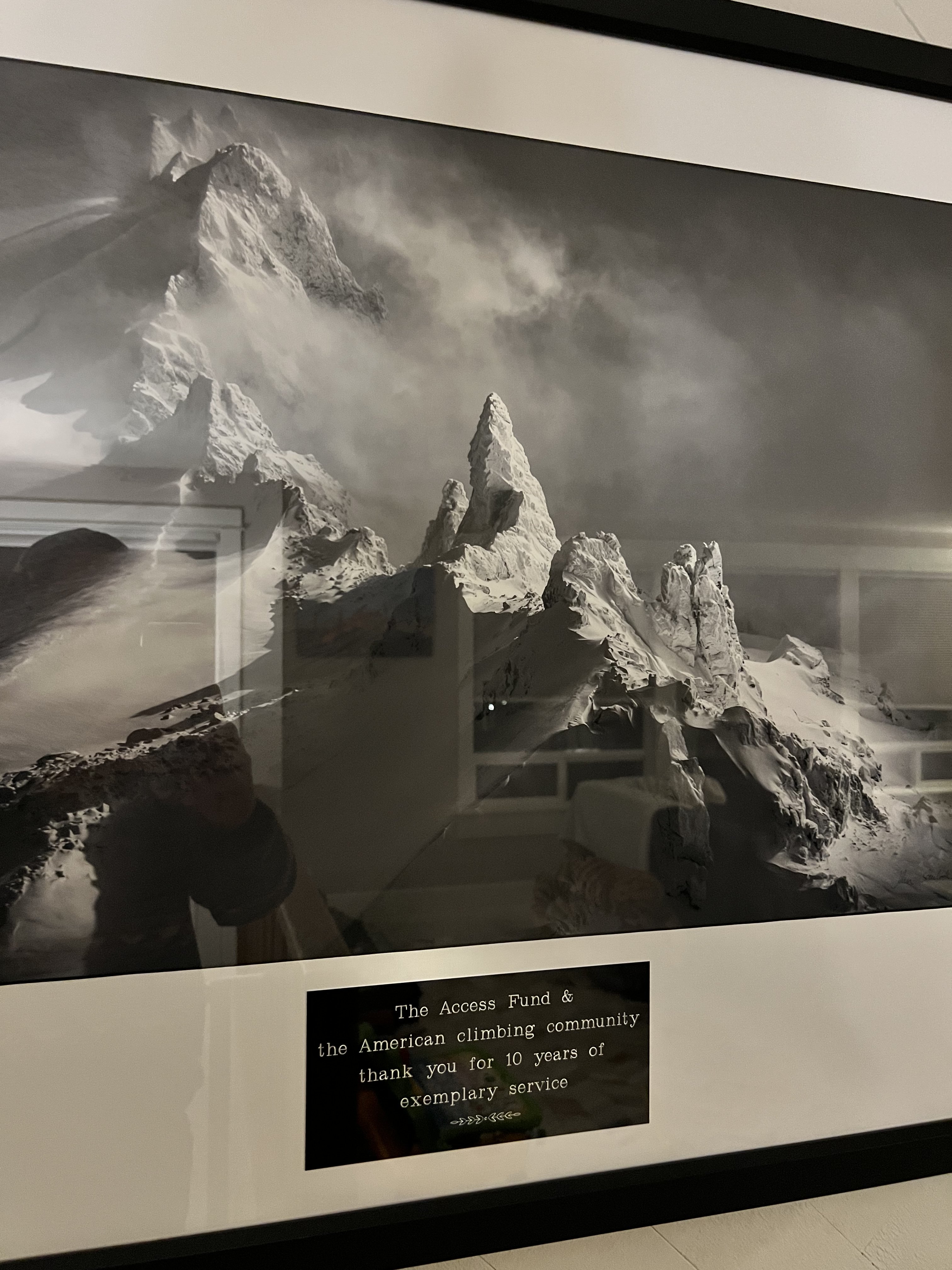
-
I received these brand new Anasazi Pros as a gift but they are the wrong size. Never used. Sizing is in line with VCS model.$100The Five Ten Anasazi Pro takes the basic Anasazi VCS model and adds some uprated details. First there is a Stealth Mi6 toe patch for extra toe hooking ability indoors and out, the Mi6 rubber is supple enough to not create hot spots on your toe knuckles too. There is also a more breathable tongue and sleeker velcro straps for slight weight savings and better air circulation. The Anasazi Pro also offers a slightly more aggressive and precise fit thanks to a heel which has more tension that the standard Anasazi model.
-
[TR] Buckhorn Mountain - High Traverse 11/18/2018
sambataro replied to bellows's topic in Olympic Peninsula
Pretty zone -
Bump. Scarpas price reduced.
-
TCs sold. Scarpas for sale.
-
Selling: SOLD: TC Pros size 39, worn less than 6 times. I sized them too big. $110 OBO Scarpa Feroce 39.5, worn 3 or less days. Doesn't work for my feet. $70 OBO PM me.
-
first ascent [TR] The Himmelhorn - South Face-"Stonehenge" (FA) 7/6/2015
sambataro replied to sparverius's topic in North Cascades
Awesome TR Jason! Been waiting for this one too. With two big alpine trips, you can chillax and just crag at the LTW the rest of the summer. Love climbing with both these fellas! -
Trip: Golden Horn - East Face - F*@$ The Pain Away (FA) Date: 6/27/2015 Trip Report: Eight years ago, I just wrapped up an awesome week of climbing CBR, Girth Pillar, and TRL (aid) with my buddy Kyle and was keen to check out some other areas around Washington Pass. I hiked in the 10 miles along the PCT from Rainy Pass to scramble Golden Horn with Ty, Jaga, and my wife. We had just started dating and she had never climbed or scrambled, so I thought I'd throw her in the fire and see if it worked out - I guess it did! A short report is also up at Alpinist.com: Crumbling Holds and Expanding Cracks: Sambataro and Schilling's New Route on Golden Horn. From the ridgeline, you get a sneak peek of the impressive, unclimbed east face. Around the corner, Gordy Skoog and Jim Walseth did the first ascent of the Northeast Arete (Class III, 5.8) in 1979, with Lowell Skoog leading a KOMO-TV film crew to document the climb a year later. I knew it would involve some choss from my recon and rumors afield, but I’ve been eyeing those photos since we got back from our 5-year stint in Colorado. My partner Jason "Spiceman" and I have spent the last couple winters making the drive to climb ice in Cody, but this would be our first alpine trip together. We started hiking in via Swamp Creek off Highway 20 at 5:00 PM on Friday after work, involving some easy bushwacking and a steep sandy slope to gain the PCT. It required only 3.5 hours and 5 miles to reach camp at Snowy Lakes vs the 10 mile hike along the PCT. We left camp Saturday morning around 4:30am, scrambled up scree from the southwest and dropped down the east side via a snow couloir. Crampons and a tool/axe made the descent straightforward. We traversed to the base of the east face and started climbing at 6:30 am to allow enough time for the 1000-foot face, but this meant we were baking in the sun for over half the climb. Our 5 liters of waters just lasted to the summit. We hit the summit around 5:30pm and opted to stay an extra night in camp to rehydrate and recover. Pitch breakdown -I led the odd pitches, Jason even. We each onsighted our leads and followed clean: 1. 5.7 off snow to large bench, moved belay 2. 5.9 good cracks 3. 5.10+ linked intermittent cracks and finished with a boulder sequence on slopers – good rock 4. 5.10 R good rock led to a 20 foot stretch of kitty litter and poor protection, dubbed “Pitch of Terror”. It reminded me of the “Rite of Passage” pitch on King of Swords of the Diamond and my pitch on McNerthney Pillar of Mt. Waddington where a block fell in my waste. Kudos to Jason for committing to the terrifying expanding cracks and decomposing holds to top out this pitch clean! 5. 5.8 leftward ramp 6. 5.9+ on good rock 7. 5.10 intermittent kitty litter 8. 5.10 crack and bouldery finish 9. 5.8 corner/gulley 10. 5.6 gulley continued 11. 5.6 scramble to summit block First Ascent of East Face, "F*%# the Pain Away," 11 pitches, 5.10+ R. The name is an inside joke from listening to Peaches on our 13-hour road trips to Cody. For a good laugh, check it out on .For the first alpine climb of the season, it was quite the adventure with a strong and equally crazy partner. Topo of our route and the NE Arete climbed in 1979. Photo by Lowell Skoog. Our approach line from the InReach GPS/messenger The approach up the Swamp Creek drainage View of the East Face from the ridgeline at sunrise. Getting stoked! Tower at Sunrise Views from Snowy Lakes of Tower, Hardy, and Golden Horn Approach down the gully Jason at the base, ready to take on the hot sun Me starting up the first pitch with the east face above Jason starting up the second pitch on clean granite Jason following pitch 3, a highlight of the climb and the 10+ crux is shown here, transitioning from a crack around the corner to slopers. Jason heads off into the unknown of Pitch 4 with the soon-to-be-terrifying kitty litter above him Jason following Pitch 5 Me coming up pitch 6, and psyched to get a break from the hot sun Me heading out into the unknown of pitch 7, starting with another band of loose rock and doing his best to hold the rock together and get some pro And last but not least, the summit shot - the classy version! Gear Notes: Double rack to #3 would work well. We also carried #4 and #5 cams (largely unnecessary), knifeblades (but never placed any), and didn't leave any gear or anchors as you descend the standard scramble route. Tool and/or crampons for descent down gully. Approach Notes: Swamp Creek approach. See topo map.
-
Doug and I did the Sevenmile Creek approach on Friday 4/17/15. We parked the car at the bridge, hiked 30 min to Sevenmile Creek and headed up the slope about a hundred yards west of the creek crossing over FS Rd 35. We headed up about 400-500 ft gain before we found some new-looking flagging that marked the way until you hit a ridgeline. Once you find the flagging, follow it - that helped a bunch. It was steep, about 2K gain in 0.5 miles, but straightforward with no major bushwacking. Snow slowed us down, but we still reached Goat Flat in 3.5 hours from the car. We headed off towards Tin Can Gap, but postholing past our knees in unconsolidated wet snow turned us around. On the way down, the approach was steeper then we remembered and we lost the flagging a couple times. Towards the end, we hiked out near the creek, which is not advised. Overall, Doug said this approach is shorter and preferred compared to Meadow Mt or Tupso Pass. As long as your partners are comfortable off trail and as long as that bridge is out, it appears to be the best way. Due to its steepness, it will never get a ton of traffic and by no means is this Sevenmile Creek rib approach a trail. Approximate path:
-
Trip: Mt. Constance - North Chute/Terrible Traverse (1A) Date: 1/11/2015 Trip Report: Adding my trip report for our January climb of Mt. Constance, since I couldn't find anything online for a winter climb. Having grown up in Edmonds, the skyline of Mt. Constance across the Puget Sound is embedded in my brain. I especially love the view of its snow-cloaked ridgeline on a crisp winter day, just beckoning to be climbed. My last climb in the Olympics was a winter solo of the South Brother in 2006 so I was long overdue. My longtime friend and climbing partner Kyle "Engine" was in town from Chicago and had 3 days to climb, looking to train for an upcoming AK trip. On our last WA climbing trip together in 2008, we lucked out with a week of perfect summer weather, climbing Colchuck Balanced Rock, Mt. Stuart's Girth Pillar, and Thin Red Line on Liberty Bell (aid). I recruited Laurel "Machine", who is always up for an alpine adventure. Maybe it was the forecast, but we had no other takers. I for one take my alpine suffering medicine in smaller doses these days, preferring clean granite lines at Index, Washington Pass, or the Enchantments. I warned Kyle that favorable winter alpine conditions in the Northwest are a complicated concoction of ingredients, requiring the right timing and proportions to get it right. Sadly for our skiing and snowpack, recent snow was followed by skyrocketing freezing levels and rain up high Sunday January 4th. Avalanches released throughout the Cascades and Olympics, but then settled down as the snow firmed up with freezing level down to 4,000 ft by Saturday January 10th. But we didn't have a clear weather window with light snow forecasted. Regardless, we decided to give Mt. Constance a go on Sunday. The three of us left Seattle at 3:00AM and pulled up to the Dosewallips Road washout around 5:30AM. We started the long 5-mile march down the road, only to accidentally pass the unmarked trailhead in the dark by a mile. I marked the Lake Constance trailhead on my Inreach satellite messenger/GPS, but the tree cover prevented a clear signal. 7 miles later, we started up the actual trail, which was strung with downed trees for nearly a mile. We were sure glad we weren't carrying skis! The old growth giants, house-sized boulders, and silent morning made the area feel like a true Wilderness. We didn't see a spec of snow until the lake at 4,700 ft. It felt more like summer, hopping boulders in the scree. We finally reached more consistent snow at 5,500 ft. While Kyle and Laurel started cruising up the North Chute (1A/Mountaineer Route) in perfect neve snow, I felt my legs burning. Originally thinking a turn around time between 2:00 and 3:00PM, we decided to toss that in the garbage bin, giving the amount of effort it took to get back this far in the winter. Two days would make a more reasonable slot of time for a Constance winter attempt. At the top of the chute, we wandered our way around buttresses and snow gullies in rolling clouds of snow across the "Terrible Traverse". We climbed a short ice step only to realize we started up to the skyline too early. The clock ticked down towards sunset. An incredible mini-corkscrew ridge led to the summit. Nearby mountains and foothills peaked through the clouds and I could even see crevasses on the north side of Crystal Pass between Constance and Warrior Peak, adding a greater sense of remoteness as we climbed the last couple steps to the 7,743 ft tall summit. 4:15PM. After a short stay, we down-traversed back to the notch just before dark. The chute proved easy enough to downclimb backwards, yet slow. The path down was straightforward enough with headlamps. Once back to the road, we started our delirious trudge back to the car, relieving our barking feet and knees at 12:45AM. 20+ miles and 8,000 ft of gain was more then enough for a day trip. We carried a rope and small rack, but they stayed in our packs. While the exposure wasn't negligible, the climbing stayed third class. We did encounter some snow, but we never got rained on. Best of all, the Olympics were silent with very little to no wind on the climb. Gear Notes: One ice tool, helmet, and crampons. Rack and rope carried along for training weight but never left our packs. Approach Notes: Park at the end of Dosewallips Road and hike 5 miles to the trailhead, which is currently unmarked but just across Constance Creek. The main 2002 wash out is about 3.7 miles from the trailhead but a new wash out means you have to hike further now.
-
The Jeep Conservation Team is the Access Fund's "on-the-road" team of climbing area stewards. They're travelling around the US, 10 months a year, assessing climbing area conservation and stewardship needs, working with locals to address these needs, training best management practices and motivating volunteers. This time around, the Conservation Team (CT) will be in your area, working with the Washington Climbers Coalition (WCC) and our partners at a variety of local events and Adopt a Crags. Take a look at their busy schedule below, their WA visit kicks off off TOMORROW! Wednesday, August 27: From 5-9pm, the Conservation Team and WCC will be hanging out at Stone Gardens - Bellevue. Come by for games and beer! $5 Day Pass! Thursday, August 28: The CT will be setting up a table and attending the Vertical World Summer Slam event starting at 5pm. This annual Vertical World celebration will make a great addition to the CT tour! Friday, August 29: Starting at 1pm the Seattle Flagship REI store will welcome the CT and be providing them an opportunity to set up their materials in the middle of the store. If you happen to swinging by REI that day, be sure to say hi to Amanda & Mike! Saturday, August 30 @ 9am: The CT will be working with the WCC and Mountains to Sound Greenway Trust to host an Adopt a Crag at the Exit 38 Far Side Crags, with support from the Mountaineers and Pro Guiding Service. Mark the date on your calendar and come improve this Seattle area signature climbing area. More info HERE Thursday, September 4: Swing by the Seattle Bouldering Project (SBP) from 5-9pm and say hi to Mike & Amanda as they share their work at climbing areas across the country, as well what the Access Fund has been up to so far in 2014. Saturday, September 6 @ 9am: Come volunteer with the CT, WCC and Mountaineers as they work alongside the US Forest Service at an Adopt a Crag event out along the Three O'Clock Rock approach trail in Darrington, WA. More info HERE If you have some time, a pair of gloves, a strong back and some stable boots...the CT, WCC, Mountaineers and our other partners could use your help at the Adopt a Crag events! [img:center]http://www.accessfund.org/atf/cf/%7B1F5726D5-6646-4050-AA6E-C275DF6CA8E3%7D/Conservation%20Team_Jeep.jpg[/img]
-
Nice work fellas. I haven't been on Mt. Pugh for 14 years - makes me want to get back up there!
-
WCC, AF, and AAC are compiling a response to the recent letter expressing the moratorium on installation of new fixed anchor bolts in NCNP Wilderness (99% of the Park). Also to clarify, the steel fixed anchors removed by NPS were outside of the gully, looker's left. AAC is further looking into the details of the recent accident as well.
-
Trip: Waddington Range - Bicuspid Tower - FA of "On a Recky" Date: 7/23/2013 Trip Report: This is the follow up to Ben's McNerthney Pillar trip report. I was waiting to confirm some details of past routes on the face and I got backlogged getting my place ready to sell here in Boulder so we can move back home to Washington. It’s time to end my 5-year hiatus from the Cascades! And for the record, that jump shot with Peter Rabbit only took one go… [img:left]http://farm4.staticflickr.com/3686/9556712328_58681c0bd1.jpg[/img] Now then, after a much-celebrated rest day wandering around in the hot sun after coming down from Waddington, Ben and I went on a reconnaissance trip to scout out the Stilletto Glacier approach and potential new lines on Dentiform Peak. With Bicuspid Tower as a secondary objective for the day, we planned to leave a rope and rack at the base for a full attempt the following morning. The idea was that with the path dialed and lighter packs the next day, the approach could be done in 1.5 hours. I had called Graham Zimmerman from the sat phone the day before to see what he knew of routes up there. I just happened to catch him after he flew out of the Revelations with Scott and gleaned some more beta from their 2012 trip. After all, we still had a few more days of high pressure overhead so we wanted to make the most of it. As we left camp at 5:30am, our packs still felt heavy. I struggled to keep up with Ben on the initial third class scramble to the snow ramp leading to the middle section of the glacier. Could it have been that I wasn't fully recovered from McNerthney? Hmmm... We threw in the occasional wand to track our path but, this being our first go; we traversed too high and had to retrace our steps to reach the opposite end of the Stilletto Glacier. And with only a hundred feet to go, we came to a rather intimidating snow bridge requiring a narrow traverse and steep exit on soft snow. I believe Ian Nicholson had a similar obstacle in 2005 that he dubbed "Crunch Time.” After 2 short belays, we were across and at the base in 3 hours from Sunny Knob – turns out GZ was right on about approach time first go. [img:left]http://farm4.staticflickr.com/3704/9553979235_cd8a362826.jpg[/img] Serras, Stilletto, Blade, and Dentiform [img:left]http://farm8.staticflickr.com/7301/9553987657_1faed1ec9f.jpg[/img] Phantom Tower and Grand Cappaccino centered in photo Yet, bone-white granite and clean continuous cracks caught my eye on the steepest face of Bicuspid, and I soon lured Ben into my increasing frenzy to attempt a new route ground up and onsight. While much shorter, Bicuspid's splitter cracks looked more appealing than the various potential lines up Dentiform. And as if I needed any more justification, continuous cracks on clean granite were the perfect juxtaposition from McNerthney’s complex, adventure climbing. Only a tiny moat lay at the base and we found a nice ledge to switch into rock climbing mode. We left a pack, boots and crampons at the base of the climb with the plan of rapping back to the base. Bicuspid Tower sits just west of ridge line proper. If you plan on climbing Stilletto, Blade, or Dentiform from the Stilletto Glacier, it is far easier to rap down the opposite side onto the Upper Tellot. A short jaunt will take you to Plummer Hut. Ben led off the first series of 5.8 clean cracks rightward to reach a prominent ledge below the steepest part of the face. From here, it was like being in a candy store with numerous cracks to salivate over! The two furthest right led to a massive left facing corner crack, but thin unprotectable seams blocked the way and I wasn’t interested in aiding. I considered traversing high into one, but the possibility of a 40-foot sideways whip if I slipped out of a thin 5.11 corner did not sound…fun. On the far left, numerous wide cracks had their appeal too, but I had a hunch Ian may have climbed that part of the face. [img:left]http://farm8.staticflickr.com/7321/9553995917_4a85d09610.jpg[/img] Pitch 1 Instead, We opted for the center crack splitting the face with changing corners. Fortunately, narrow ledges off right and left provided options for pro and stances to suss out each section. I led up with an ice tool and a few knifeblades in case I had no other gear options. Fun 5.10 climbing, some flaring cracks, and a hand traverse with a quick heal hook led to the first crux of the route, a tricky 5.11 sequence of slopers and crimps where the crack pinched down to a thin seam. [img:left]http://farm4.staticflickr.com/3736/9556739566_e269e2603d.jpg[/img] Pitch 2 Pumped and psyched to get it clean, I set a belay after the crux in a small alcove since I was running out of gear. The third pitch only proved to be more amazing! A thin 5.10 crack with perfect pro and stems lead into amazing splitter hands on par with the middle 5.9 section of Thin Fingers at Index. And that’s no exaggeration! Ben took the 4th pitch, a 5.9 V-slot angling right. Most of the chock stones were solid yet he moved with stealth around a few loose blocks since I was right below. [img:left]http://farm6.staticflickr.com/5460/9553951403_fa7b876b87.jpg[/img] [img:left]http://farm4.staticflickr.com/3773/9556713334_8be3219efe.jpg[/img] Photos of splitters on Pitch 3! [img:left]http://farm4.staticflickr.com/3705/9556804042_1161e6a05c.jpg[/img] Pitch 4 - the V-slot We made it through the steep section of the face, but the climbing difficulty didn't subside. Directly above, we climbed a short 5.10 corner into 5.9 face cracks to a large ledge. I initially climbed further up and left but the face blanked out and I down-climbed to the base of an intimidating R-facing crack. Ben came up and I passed the remaining gear to Ben. Ben headed up the 6th pitch, but we left behind a couple finger-sized pieces at camp and the rock around the crack flaked off small chips as Ben worked his way up. Ben led through some strenuous finger locks to reach a tricky pod. After a few solid goes and proud whips, we swapped sharp ends and I climbed up to Ben’s high point. A wide stem on a small flake and mantle move brought us above the pod, but the crack above required an insecure layback. Past this 5.11 section, I continued up and around a tricky 5.10 stem to reach the top of the east summit. [img:left]http://farm8.staticflickr.com/7381/9556794352_dae9e2eda0.jpg[/img] Pitch 6 - the second crux pitch Wowie! Amazing cracks and stout cruxes on a clean continuous 6-pitch new route is dubbed “On a recky” since the best climbs are often those unplanned and not in a guidebook. [img:left]http://farm4.staticflickr.com/3794/9553939105_5747127b11.jpg[/img] Route topo with previous known routes roughly marked We slung a large block and completed three full 60-meter raps down to our packs. We radioed Tim once we were across “Crunch Time” and wandered back into camp just after dark. After 17.5 hours, we were back in camp enjoying a hot meal and taking in the stark contrast yet unreal fortune of adding this spectacular new route to our second ascent of McNerthney. The next day, day 7 of the trip, I woke up exhausted, debating whether to join Tim and Ben on a final mission to hike up to Plummer Hut that day for another climb. Tim heads off mid-day while Ben and I rest a bit more at Sunny Knob. After eating, sleeping, and wandering around aimlessly a bit, we take off around 6:30pm. I plug the headphones in and head across the lower Tiedemann to the 1000-ft moraine of loose ball bearings. With that surmised, easy snow leads up and around the Claw peaks to Plummer Hut with only a short gully of rotten orange rock in between. 2.5 hours later, we plop down next to the Hut and eat a small meal to enjoy the sunset. Tim has his eyes set on Serra One in the guidebook and we make plans to head up the next morning. [img:left]http://farm6.staticflickr.com/5494/9553971985_e089688abc.jpg[/img] [img:left]http://farm4.staticflickr.com/3731/9556734840_5bcc6e9481.jpg[/img] [img:left]http://farm6.staticflickr.com/5345/9556711448_9f91a72656.jpg[/img] [img:left]http://farm3.staticflickr.com/2834/9556751366_3bb01053a7.jpg[/img] Sunset and dusk shots from Plummer Hut A long but straightforward approach up the Tellot Glacier led us to the base. We stepped across a small schrund and traversed across ice to the base. We roped up midway, which was smart because the snow bridge eventually collapsed leaving one of us dangling our feet in the crevasse. Tim led off and we started simuling behind. Fun moderate climbing up to 5.7 brought us to the summit of Serra One. [img:left]http://farm4.staticflickr.com/3693/9556727370_45f0f0949d.jpg[/img] [img:left]http://farm4.staticflickr.com/3830/9553935431_5a5e5f2d10.jpg[/img] The ridge travels down to Stilletto Needle, Stilletto, and the Blade. Behind us, the Serras’ complex ridgelines lead into the Asperity/Tiedemann massif. We could see Sunny Knob far below as well as the upper half of McNerthney Pillar. Yet another amazing 360 degree view of the Waddington Range with bluebird skies and peaks as far as the eye could see! It’s never a dull moment tied in with Ben and Tim and they break into a Spanish conversation as we summit, capping the trip off with wild shouts of “quesadilla” and “seven layered burritos.” [img:left]http://farm6.staticflickr.com/5336/9556731716_777bf6ac85.jpg[/img] [img:left]http://farm4.staticflickr.com/3818/9556715102_5488148549.jpg[/img] We head back to the hut, repack, and charge back down to Sunny Knob, psyched with the continued fortune. We verify that weather is on its way so we opt to fly out 3 days early. We do our best to finish the booze and eat all the left-over goodies that night, prepping to fly out the next morning on day 9 of the trip. The chopper arrives on time and we enjoy our final ride out back to civilization. 5 years in Colorado with only a short trip to the Ruth Gorge back in 2011 meant I hadn't been in real mountain terrain with complex glaciers for far too long. I was lucky to have 2 great partners I'm psyched to rope up with when I return to Washington. Hope to see you out there! [img:left]http://farm4.staticflickr.com/3725/9556712888_d0daabac3c.jpg[/img] [img:left]http://farm6.staticflickr.com/5322/9553940011_1dbebb37cc.jpg[/img] [img:left]http://farm4.staticflickr.com/3690/9556727314_91b3ee69e6.jpg[/img] Map of the Waddington Range with our travel shown in blue over the course of 8 days Photos by Joe, Ben, and Tim
-
POOM! Nice report Ben! More to follow from the trip. I realize we lucked out with the weather, but more climbers should make a trip to the Waddingtons - what an incredible place!
-
[TR] Bugaboo Provincial Park - 8/4/2012
sambataro replied to jesselillis's topic in British Columbia/Canada
looks like you had an awesome trip jesse! -
Northwest Climbers: Access Fund Action Alert: If you live in one of the following states, you have the ability to help Arizona climbers save Oak Flat from being sunk by a proposed mining operation: NM, OR, WA, CO, NH, WV, AK, WY, ID, UT, KY, NV, TN, AZ. Your Senator sits on the Committee on Energy and Natural Resources, which will hear testimony on the Southeast Arizona Land Exchange this Thursday. Please visit www.accessfund.org/saveoakflat to take action before Thursday!
-
Fine work fellas!
-
[TR] Mt. Goode - Northeast Buttress 7/4/2009
sambataro replied to AlpinWeiss's topic in North Cascades
Nice work guys! Know thats been on your list for a while. -
[TR] North Early Winter Spire - Flycatcher Route 9/27/2008
sambataro replied to sambataro's topic in North Cascades
Supposedly the A3 is the second pitch going through the roof before the long corner. That wasn't my lead, but I remember Kyle placing the orange HB offset nut a few times and maybe one hook, but I could see folks maybe calling it C2+... -
Trip: North Early Winter Spire - Flycatcher Route Date: 9/27/2008 Trip Report: Howdy folks, A couple weeks ago I climbed the Flycatcher Buttress on North Early Winter Spire's east face. Despite a cc.com thread about how horrendous this climb was, I convinced my partner Dan to join me on the adventure. And I've never seen an actual cc.com post and I certainly don't feel like I'm giving away a hidden gem. I wouldn't have made the drive for one day of climbing (sister's wedding was on sunday--couldn't miss that), but it was the last route for me to complete all 5 east face routes of the Liberty Group in 2008 and the weather was looking good. It started with Lexington, then Thin Red Line, a weekend of Minuteman and DEB of SEWS, and I wanted to squeeze NEWS in before the major snow came. I won't go as far as giving a personal ranking but my summary is below. Flycatcher Buttress crux pitch: Topo of East Faces (Photo from May 4, 2008 ski touring trip to Kangaroo Ridge, opening weekend of Hwy 20--no or little snow during later ascents) Photo Galleries East Face of Lexington, May 31: The key to offwidths and chimneys: keep moving. Even if just an inch. And if a 2x4 piece of wood presents itself as pro--clip it. Friable rock leads to a good series of corner cracks, traverses under roofs, offwidths and chimneys. Snow on the top kept our attention. Put it on your tick list--its a MUST. 9 pitches, 5.9 Thin Red Line of Liberty Bell, June 11 Brass offset nuts: get a pair and leave the hammer at home. 7 pitches of aid make it a big wall climb. It comes complete with hauling and an overnight bivy. A direct line, thin granite cracks, and a perfect warm-up for the Valley. 12 pitches 5.9 C3 East Face of Minuteman, August 9 Dont let the first 4 pitches get you down--the top two rock. A fun hand crack leads to an exposed 5.8 roof. From the top of Minuteman, you'll see why the East Face of Concord is unclimbed, and will (I dare to say it) remain unclimbed. 6 pitches, 5.10a Direct East Buttress of SEWS, August 10 Here's the classic, most-climbed east face route. Leave the aid gear behind and if it doesn't go free, do it french style. And if the snow blows in and your partner starts rapping down, wait for the sucker hole to convince your partner to climb back up. The 10+ arete felt as hard as the 11a bolt ladder, but hey, some of us forget how to sport climb. 9 pitches, 5.9 A0 Flycatcher Buttress of NEWS, September 27 Never heard of it? My friend Ryan informed me the original ascentionists found a dead bird on route. Its not in the Selected Climbs or the Becky Guide, but I hear its in North Cascades Rock. Sometimes you have to revert to hand drawn topos transmitted via a facsimile for a good adventure. A tricky 5.9 entry pitch leads to a 50 meter low fifth class traverse under an overhanging wall, behind bushes, and between loose blocks. The flycatcher pitch is a hoot, but I'll be honest here, if you're looking for good rock and stellar pitch after pitch, stick with the west face of NEWS or the NW corner. Even the last bit proved to be another wild and spicy east face pitch. Topping out the 45th pitch of the series, luck doesn't even describe it: another great weather window, climbing partner, and expansive view east over the hairpin, Kangaroo Ridge, Wine Spires, and Mazama. 9 pitches, 5.10b Gear Notes: Double rack to 2", singles to 4", single rope OK with standard rappel and descent back to Blue Lake trailhead. Approach Notes: Approach as for DEB of SEWS from the hairpin. The start of the climb is 50 ft down from the end of the gully between SEWS and NEWS.
-
Hello everyone, I'm excited to share among this great news. The celebration on Saturday was a blast. Heybrook Ridge, 130 acres of mature forestland above the Town of Index and directly opposite the Town Walls, is now a county park. It was a partnership with the Friends of Heybrook Ridge, Snohomish County, Cascade Land Conservancy, and the landowners, W.B. Foresters. It came with the support of many donors and hard work among the local community and many of us who consider Index a second home. As the project manager for CLC in Snohomish County, I was fortunate to provide the transactional assistance and negotiate the purchase and assign it to Snohomish County. Now, the Friends of Heybrook Ridge and County will continue their amazing work for stage 2 to build hiking trails and spearhead environmental education with the local community. Thanks to everyone that gave their support along the way! Click here for photos of the celebration More background info can be found at: Friends of Heybrook Ridge Cascade Land Conservancy Cheers, Joe
-
Hey folks, To help provide some accurate data: The majority of the climbing at Frenchman's Coulee is on WA Dep of Fish and Wildlife Land, not DNR. US BLM land surrounds much of it: On the other hand, Frenchman Falls is on private land: Sun Canyon Inc out of Bellevue In general, the best way to figure out who owns various climbing areas is to go to the specific county government website and follow links to their parcel viewers GIS site. Generally, each GIS map allows you to view the aerial photo to help identify sites and look up tax parcel information, as shown above. Regarding the stage of the Sun Canyon development, I could not find any further information online. Grant County does not have public records online like some counties. Contacting the county or the developer is likely necessary. Good Luck!!!
