
Leaderboard


Popular Content
Showing content with the highest reputation on 09/12/22 in all areas
-
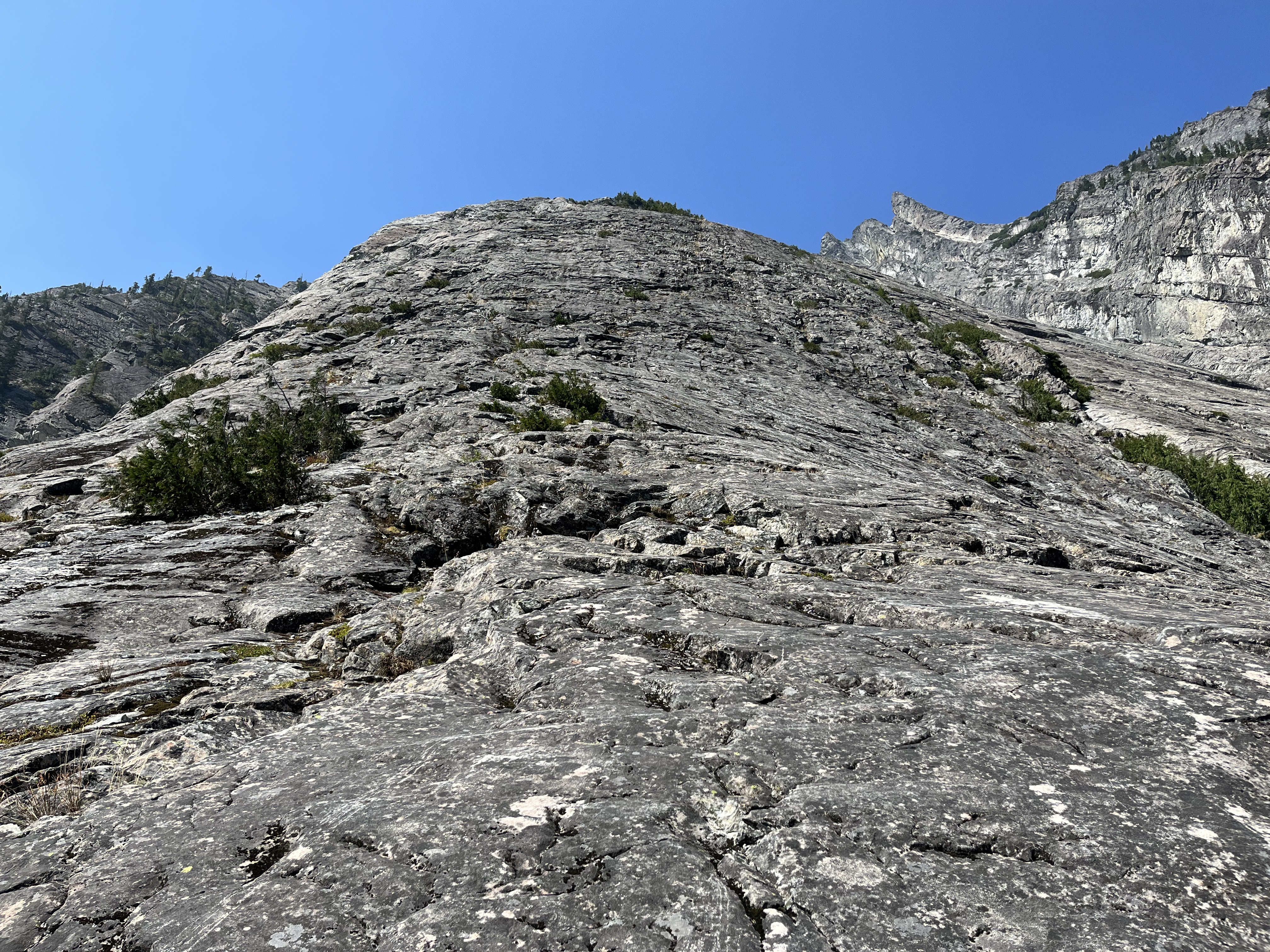
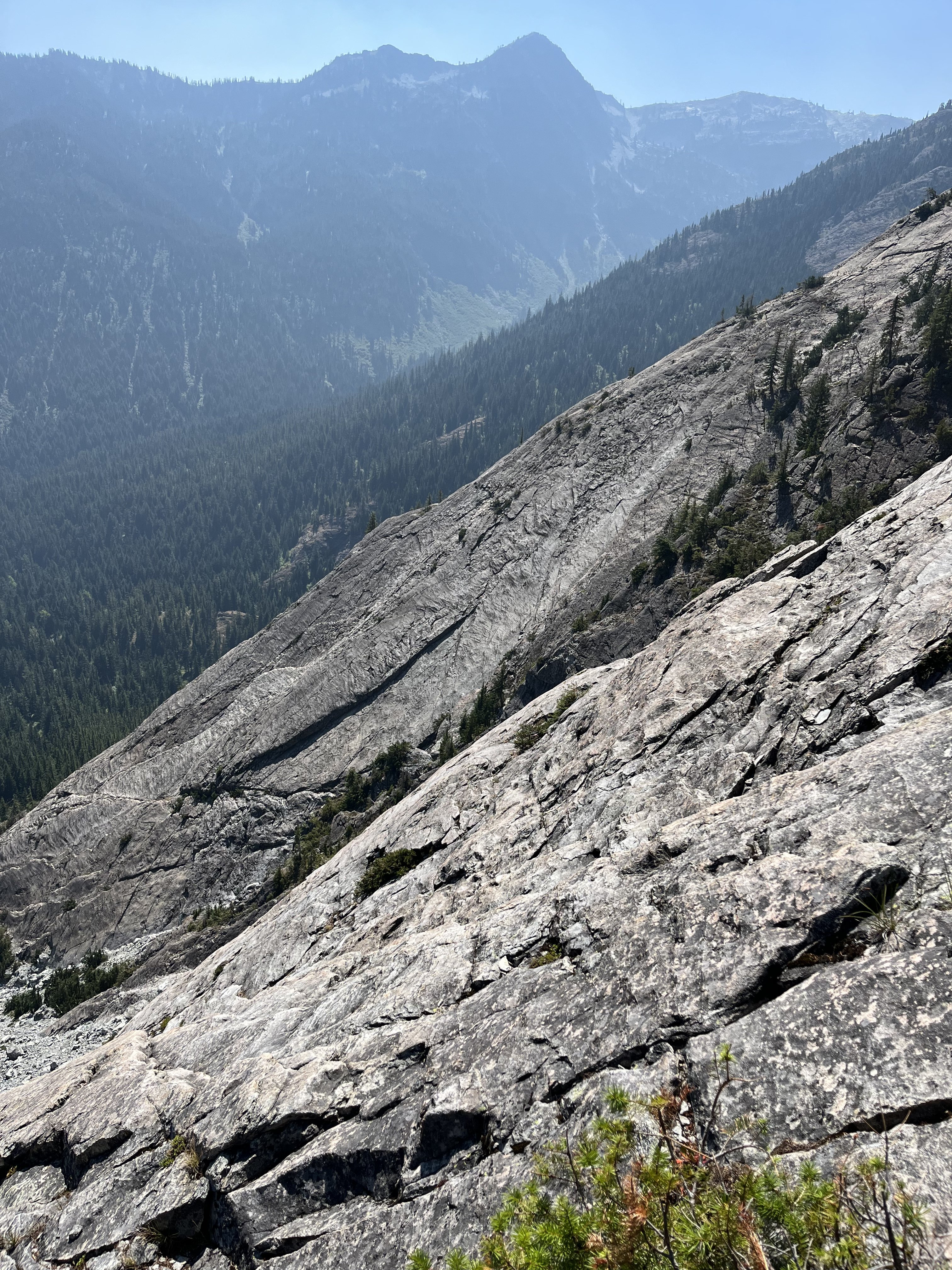
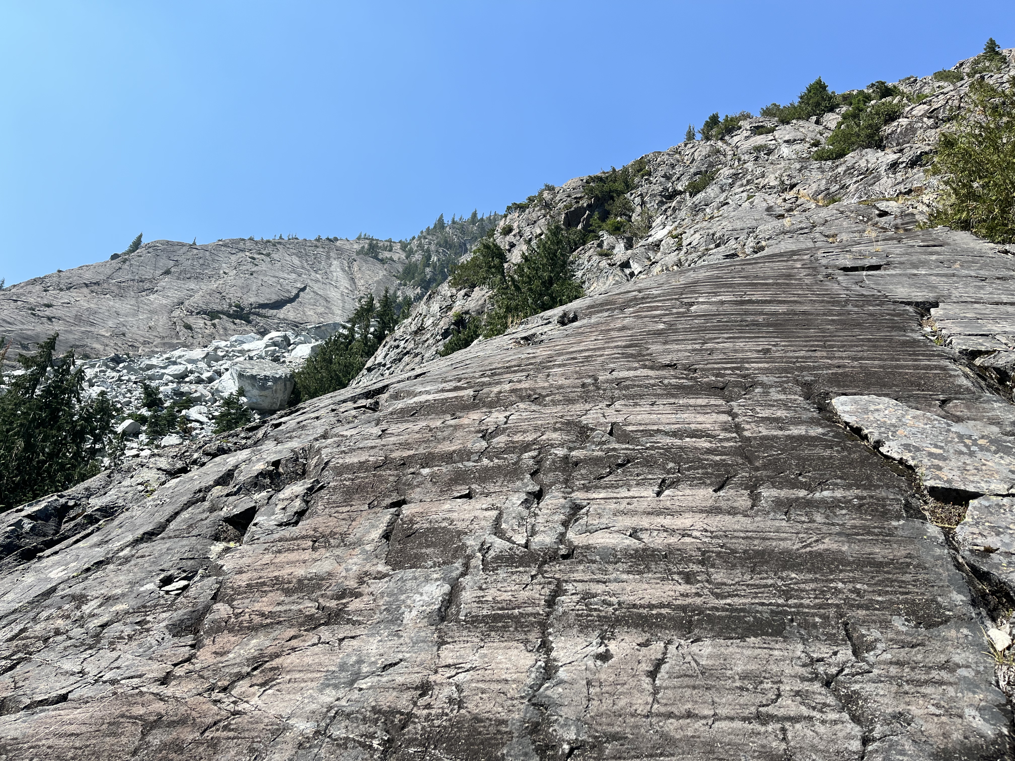
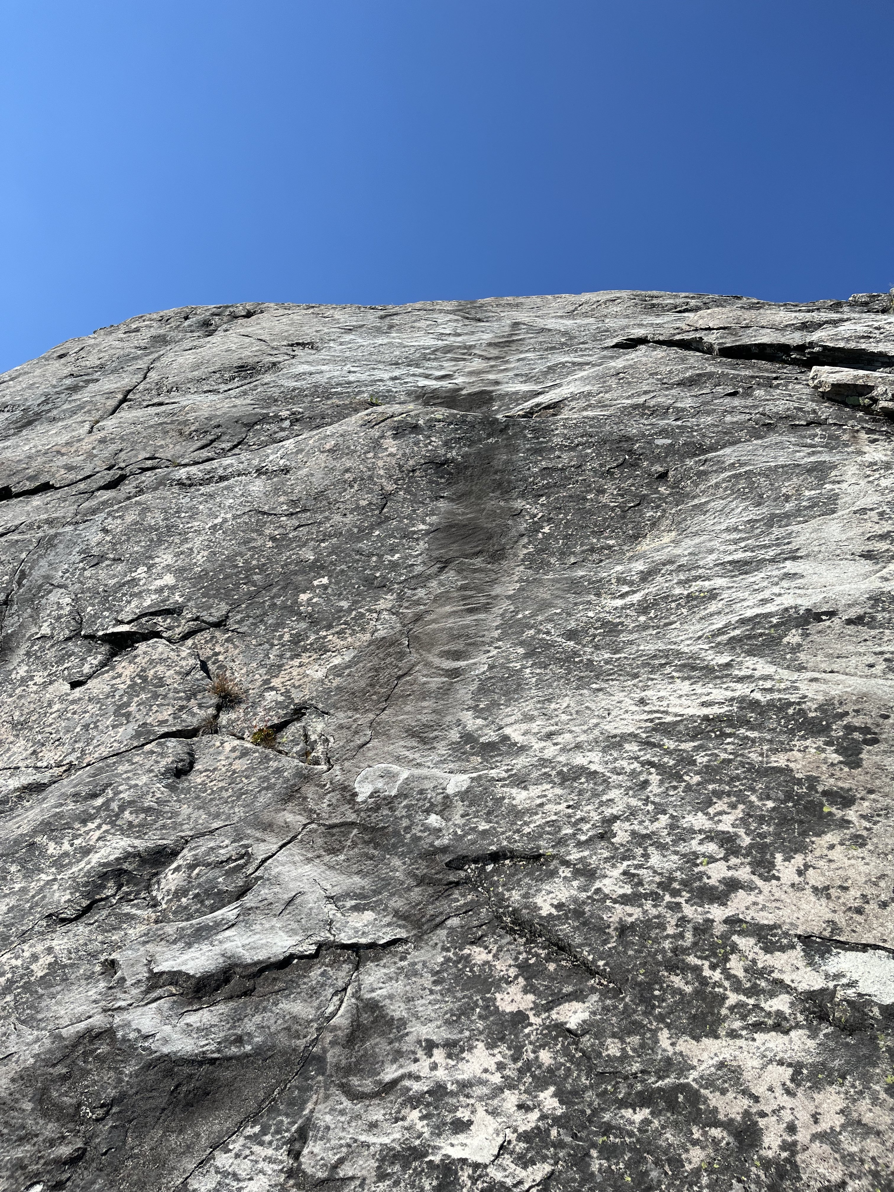
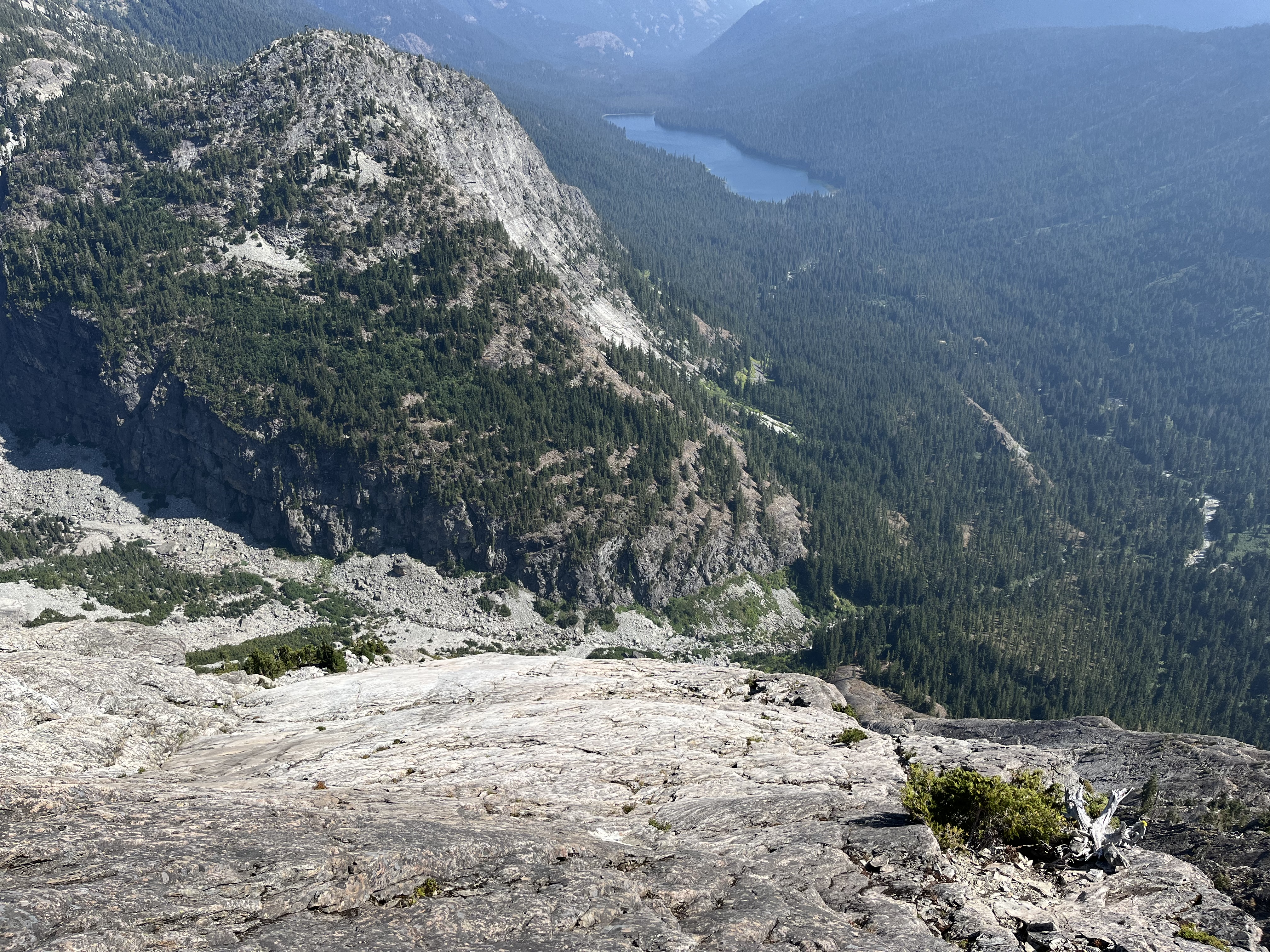
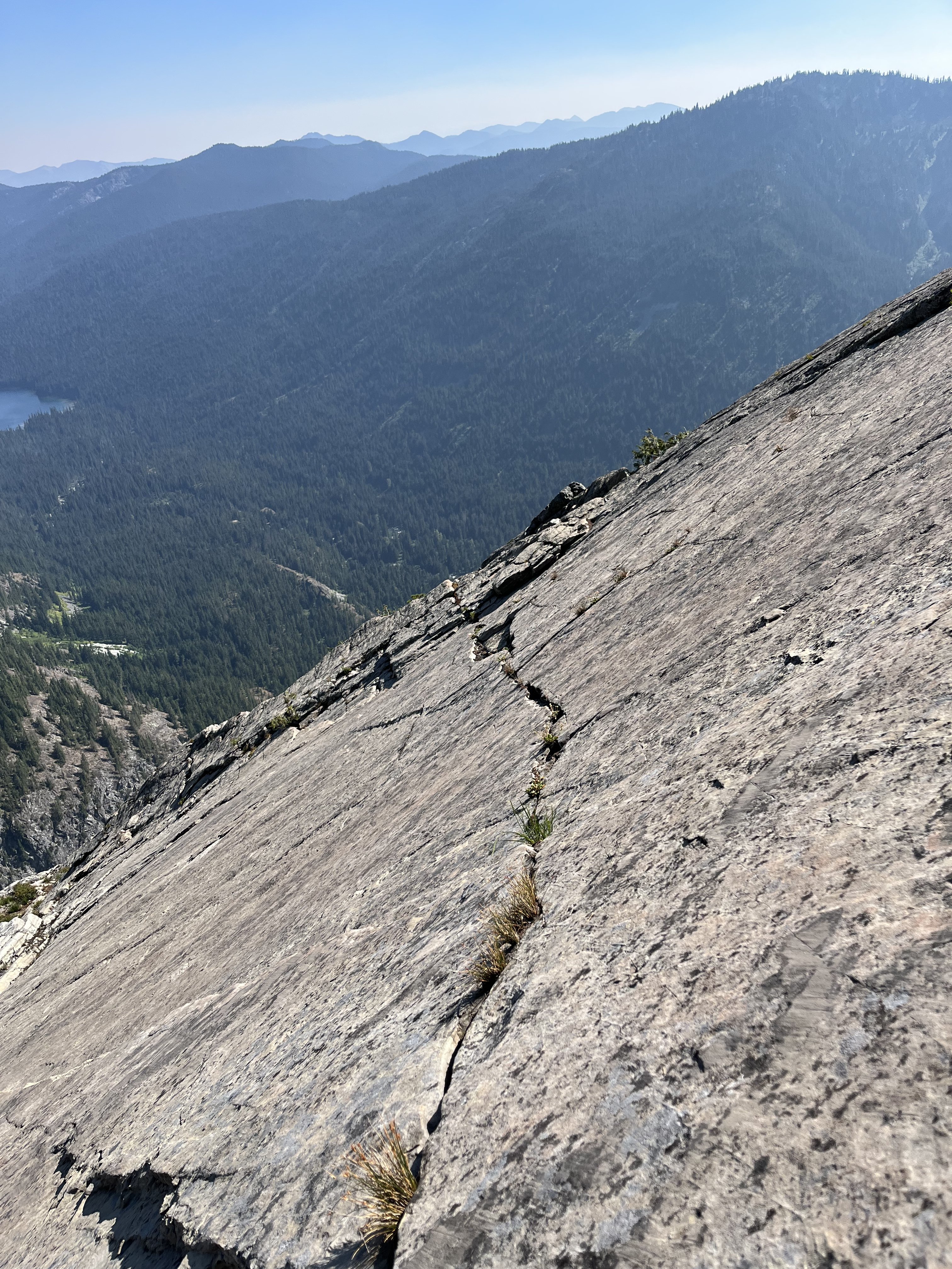
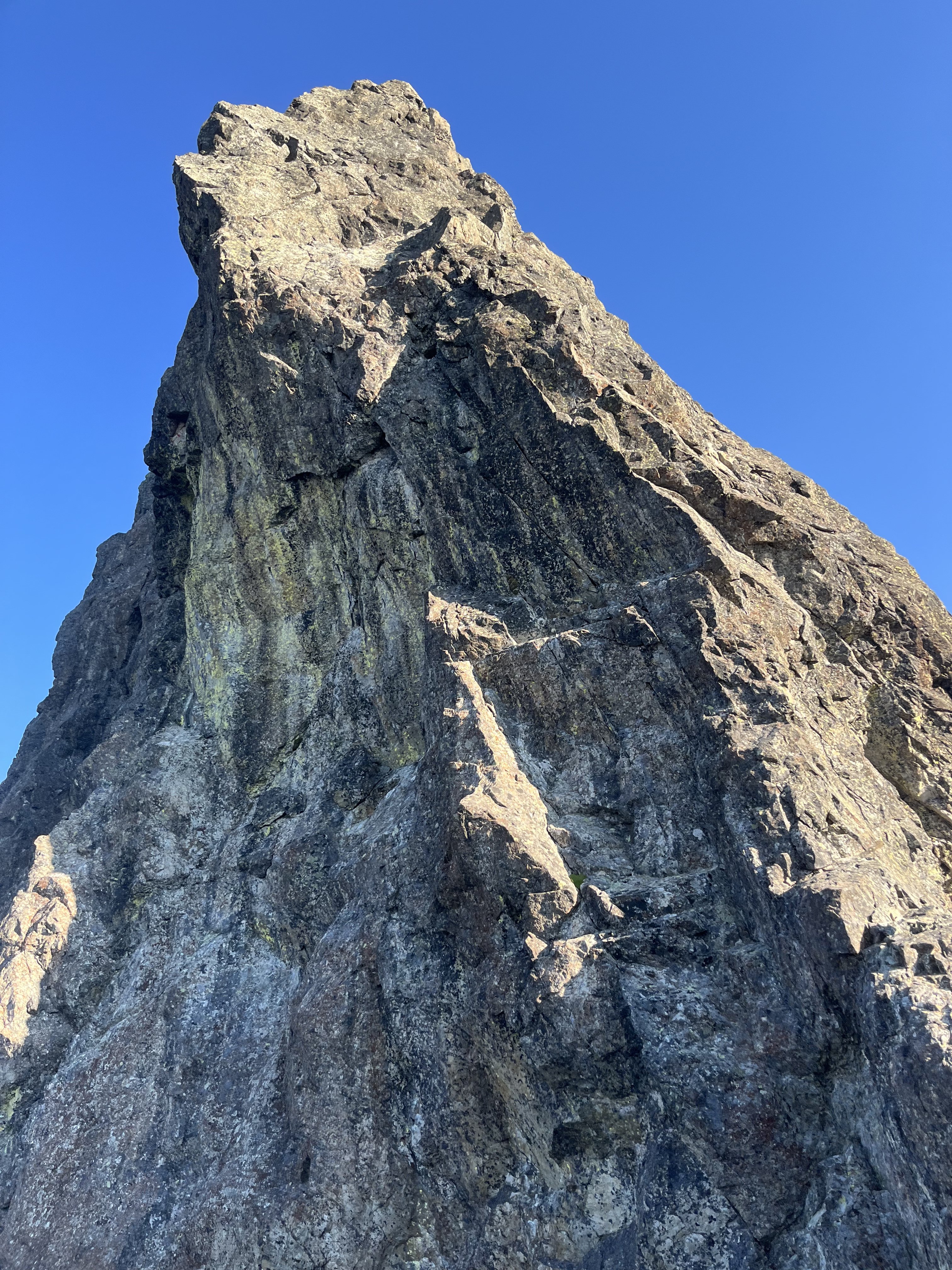
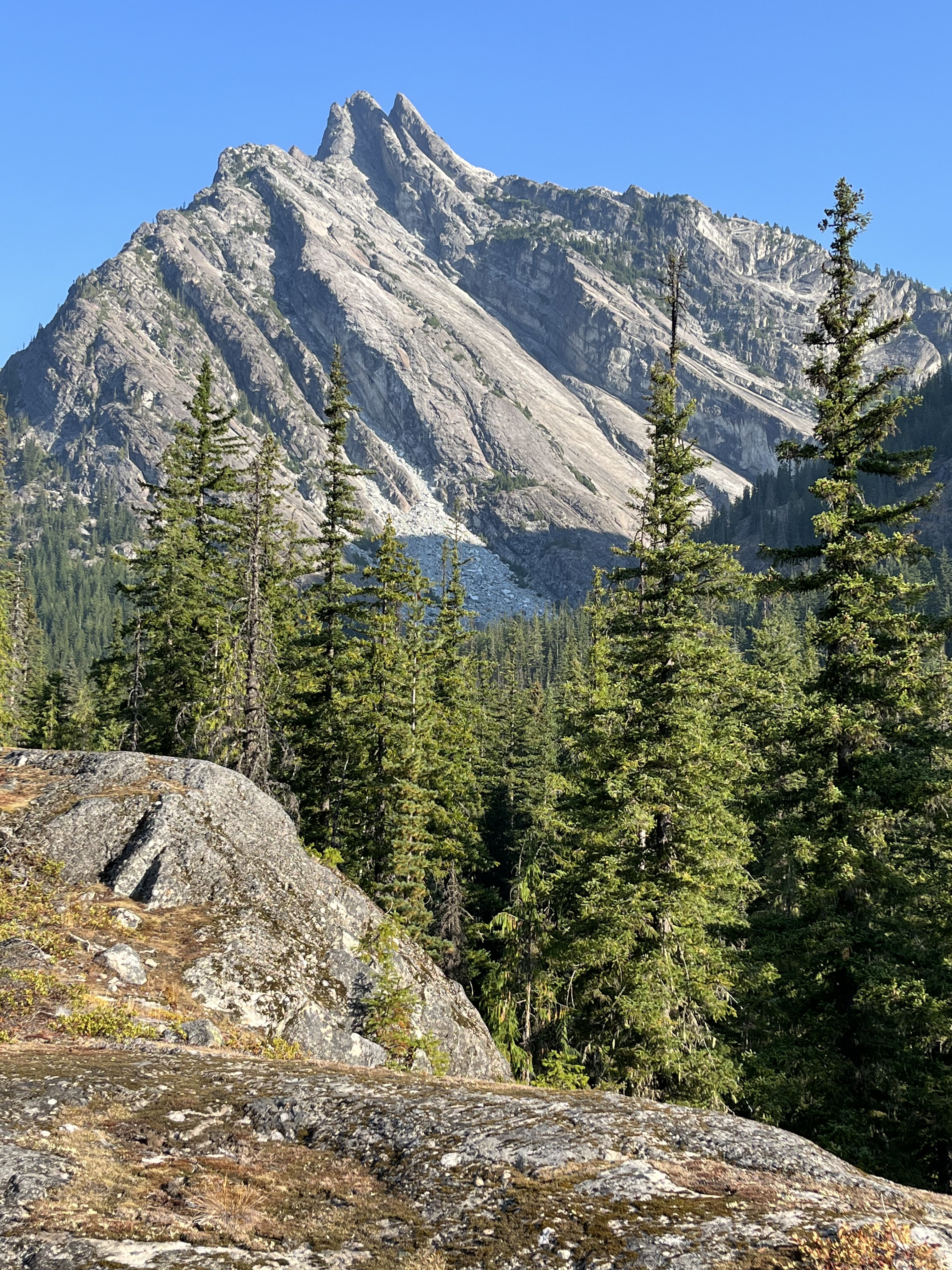
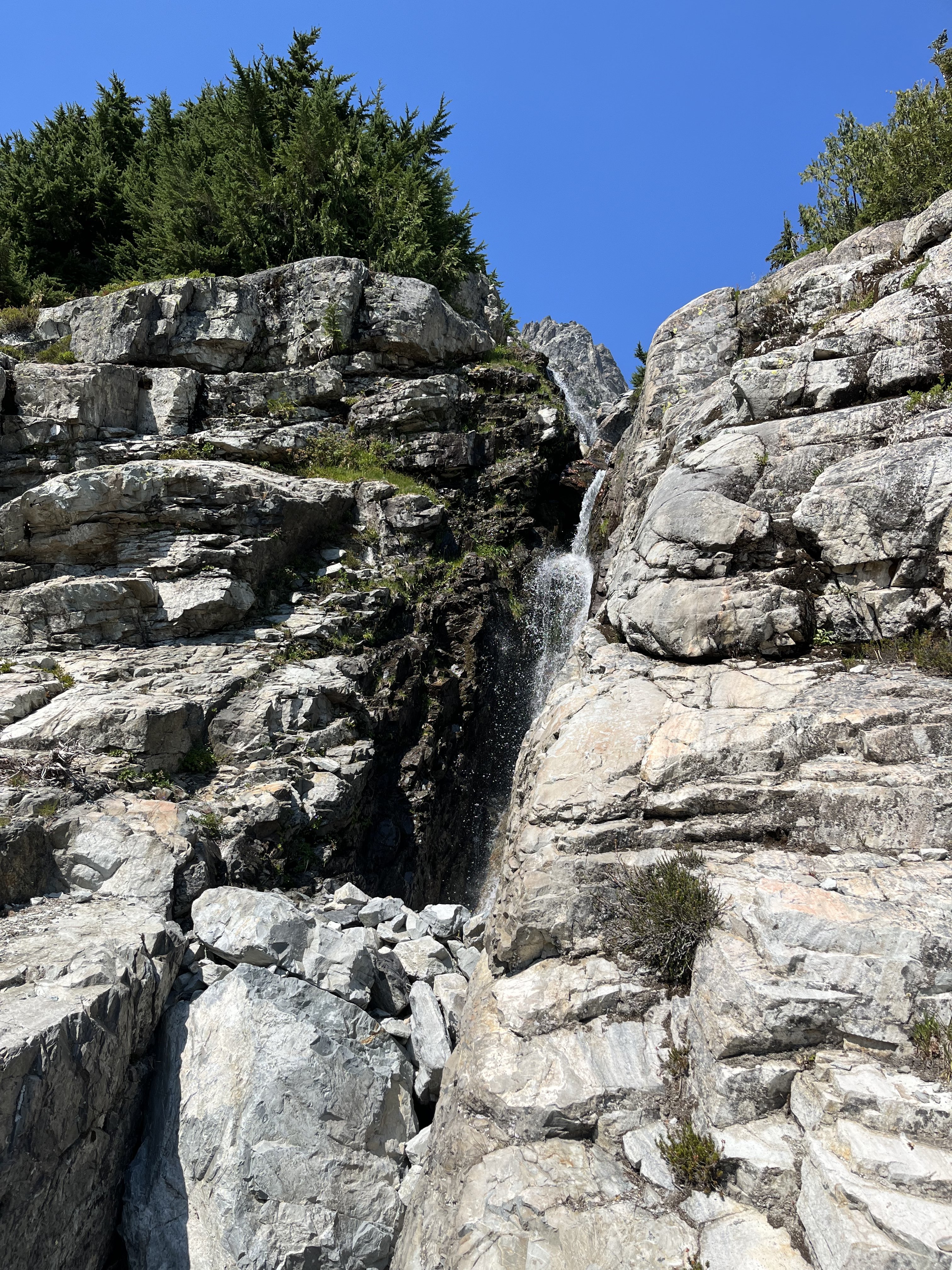
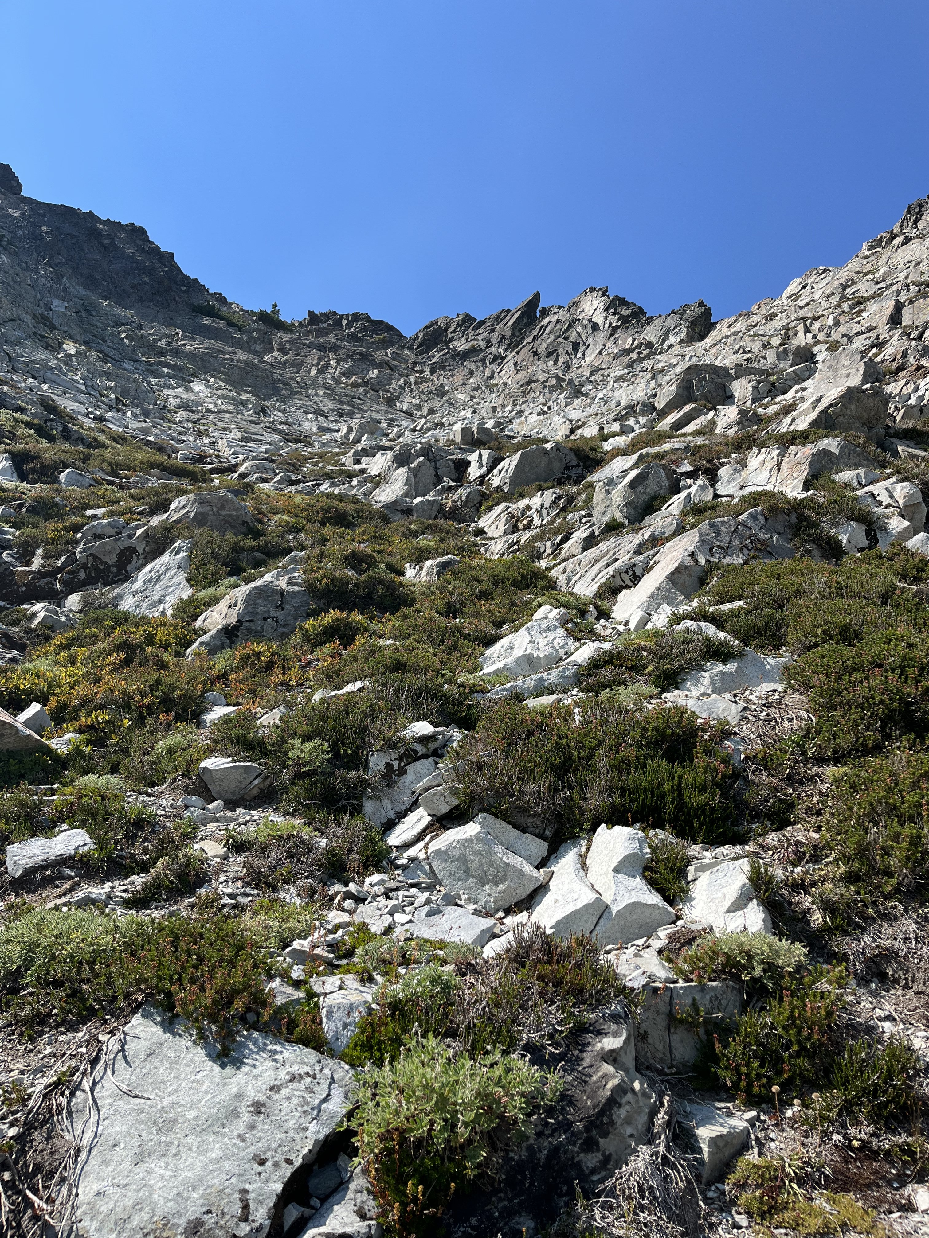
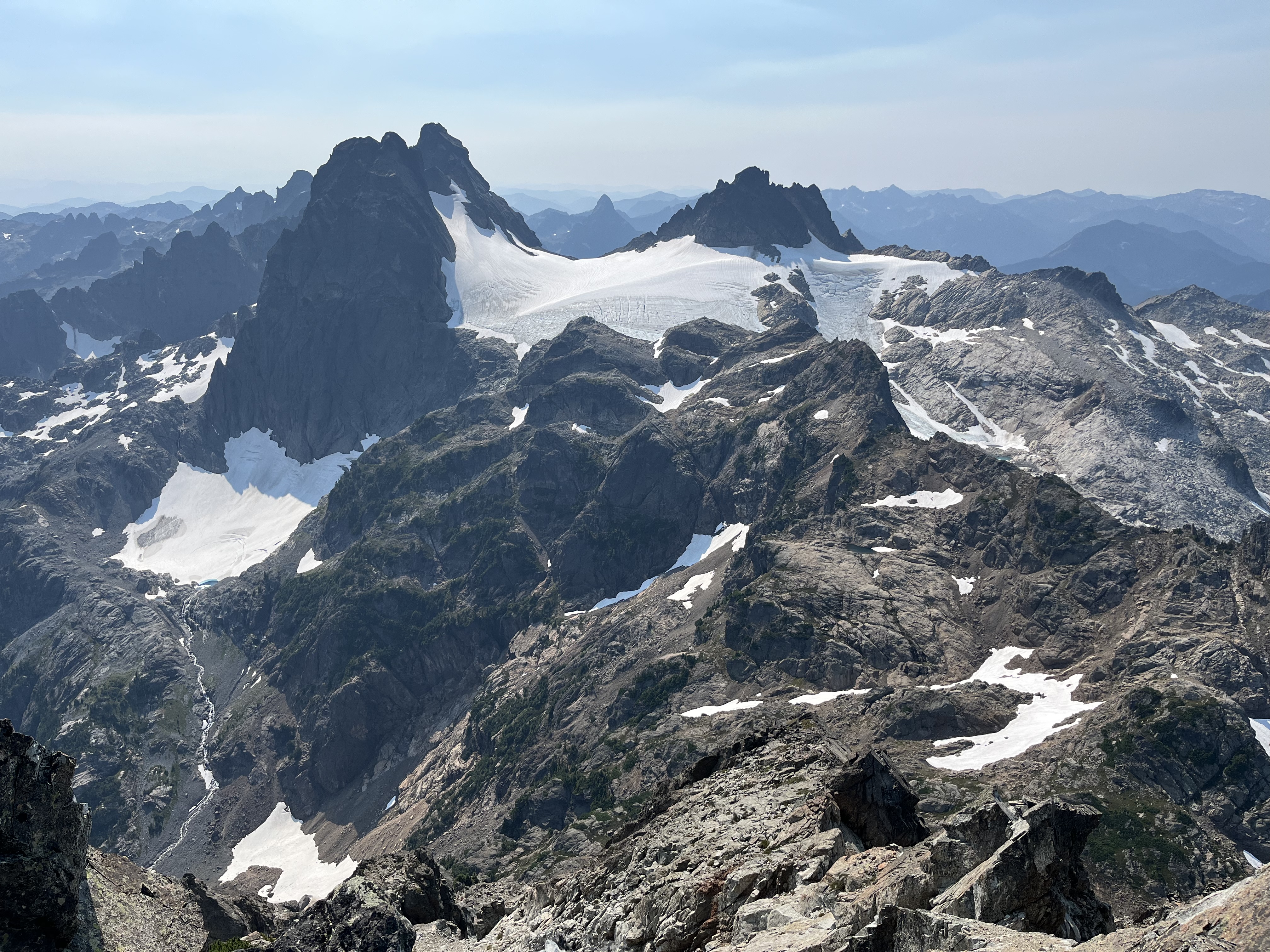
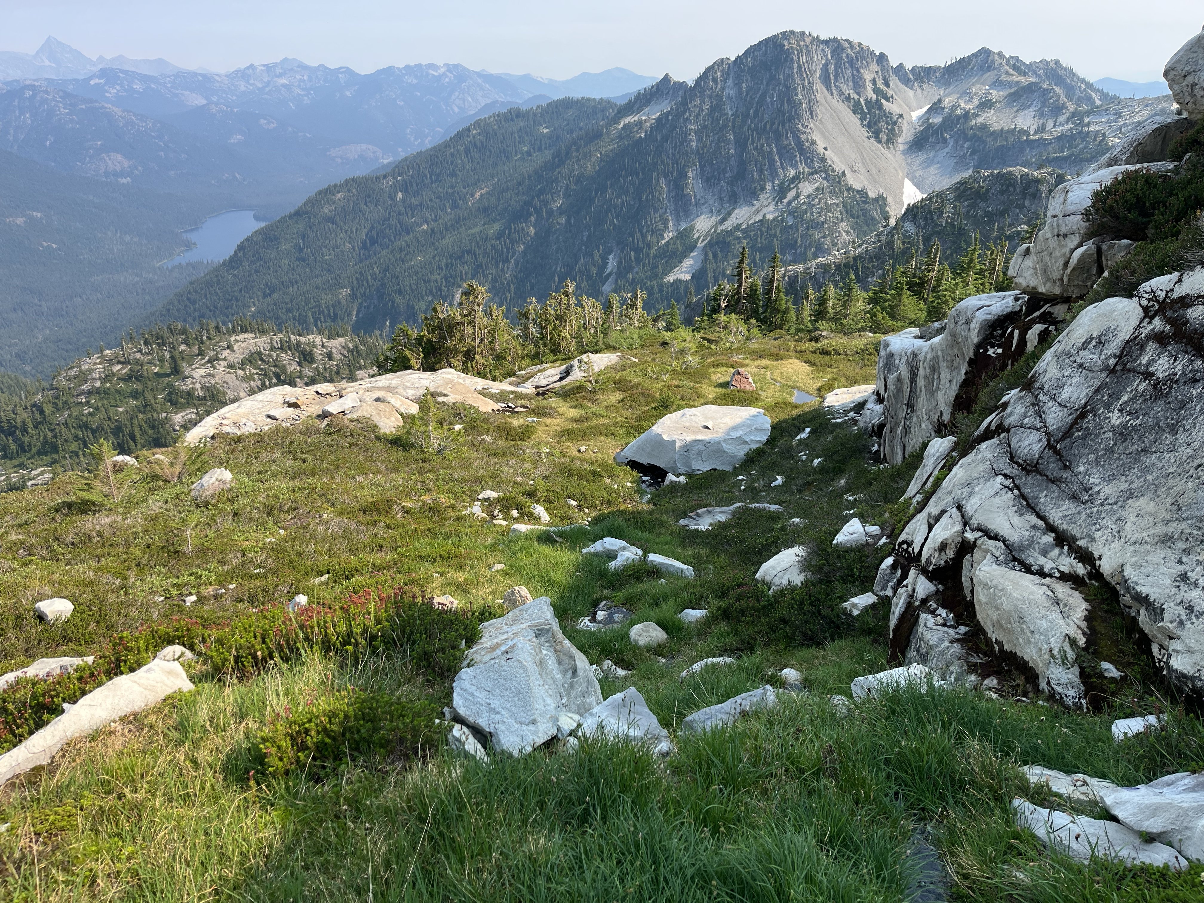
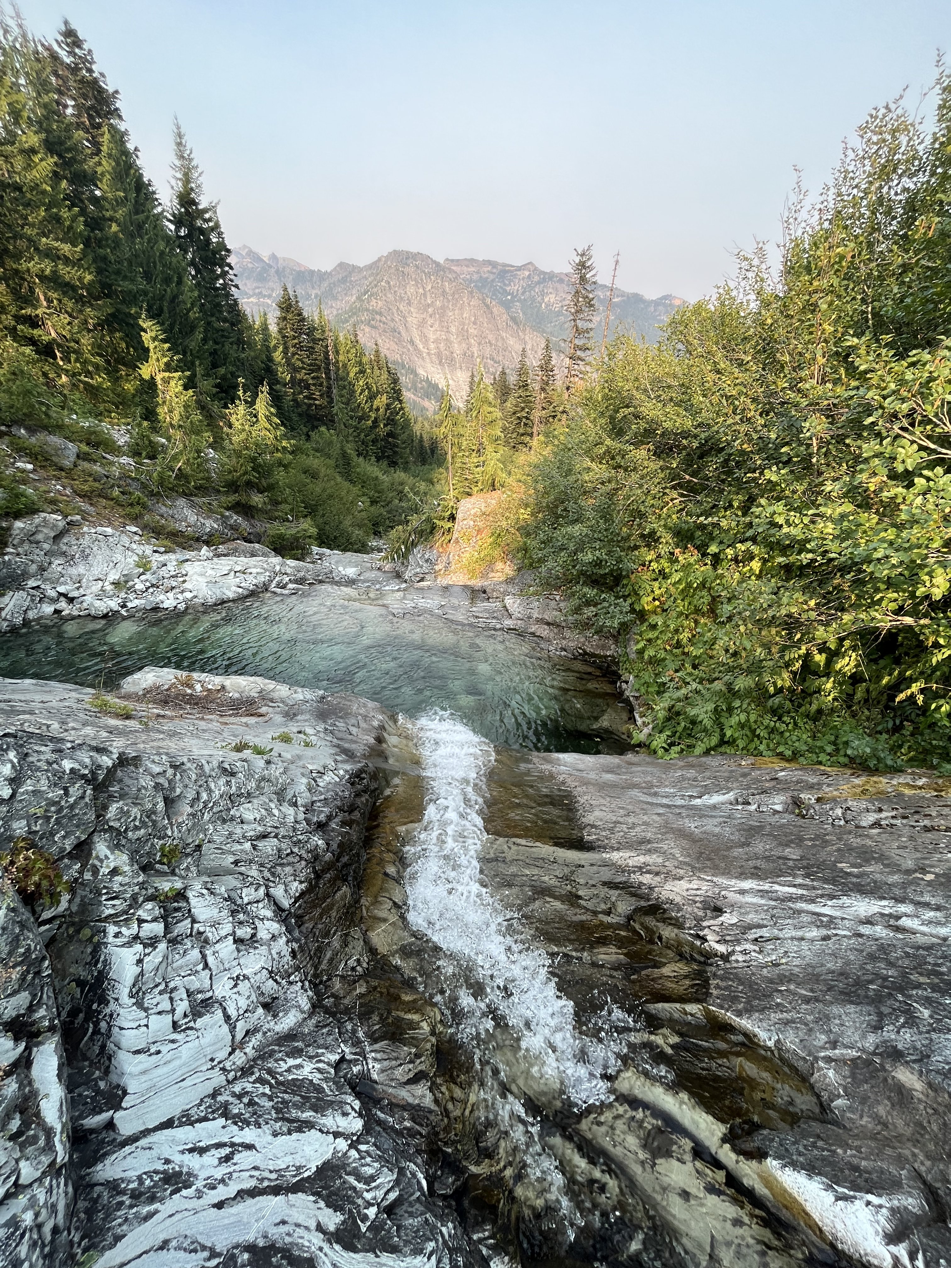
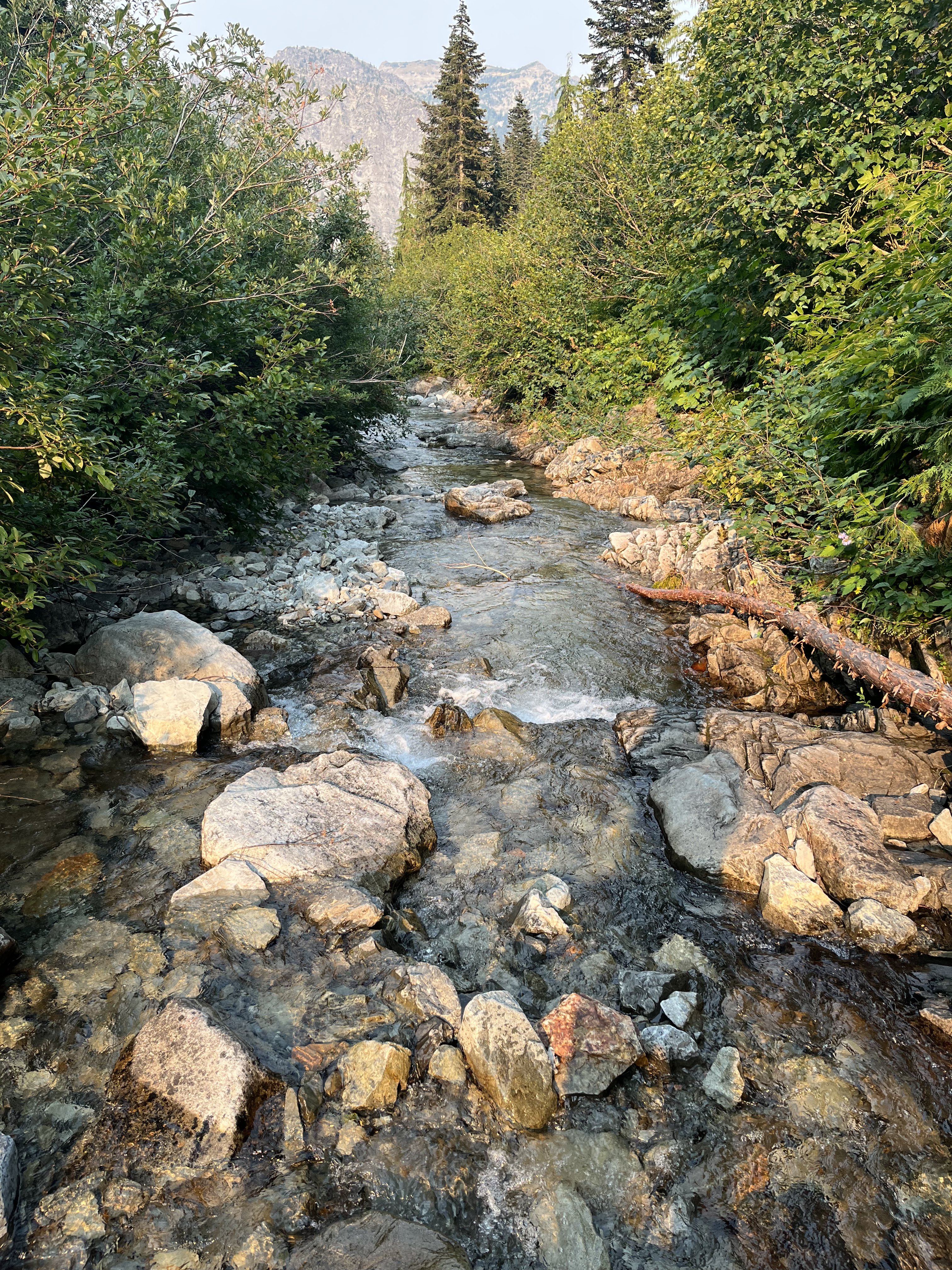
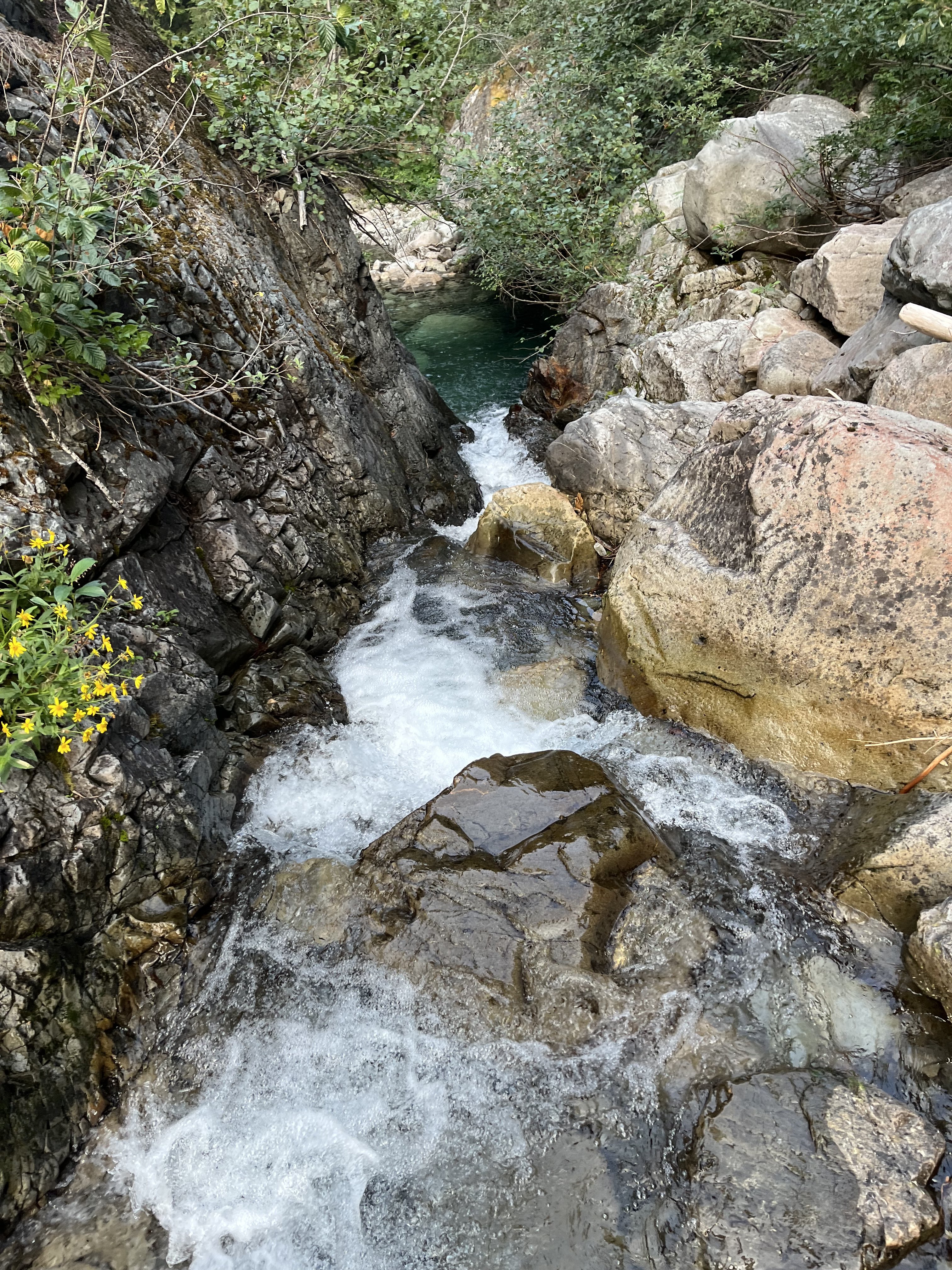
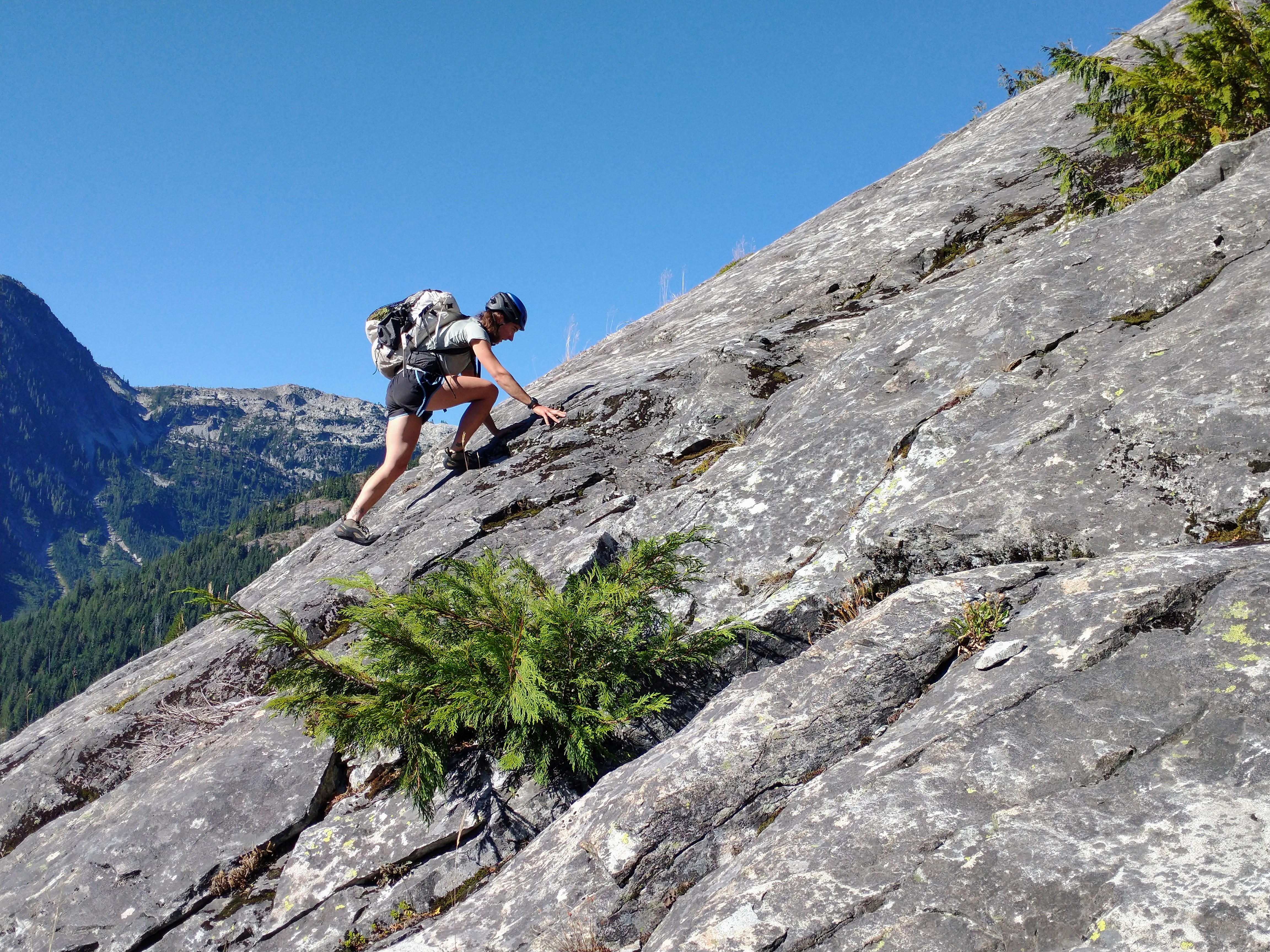
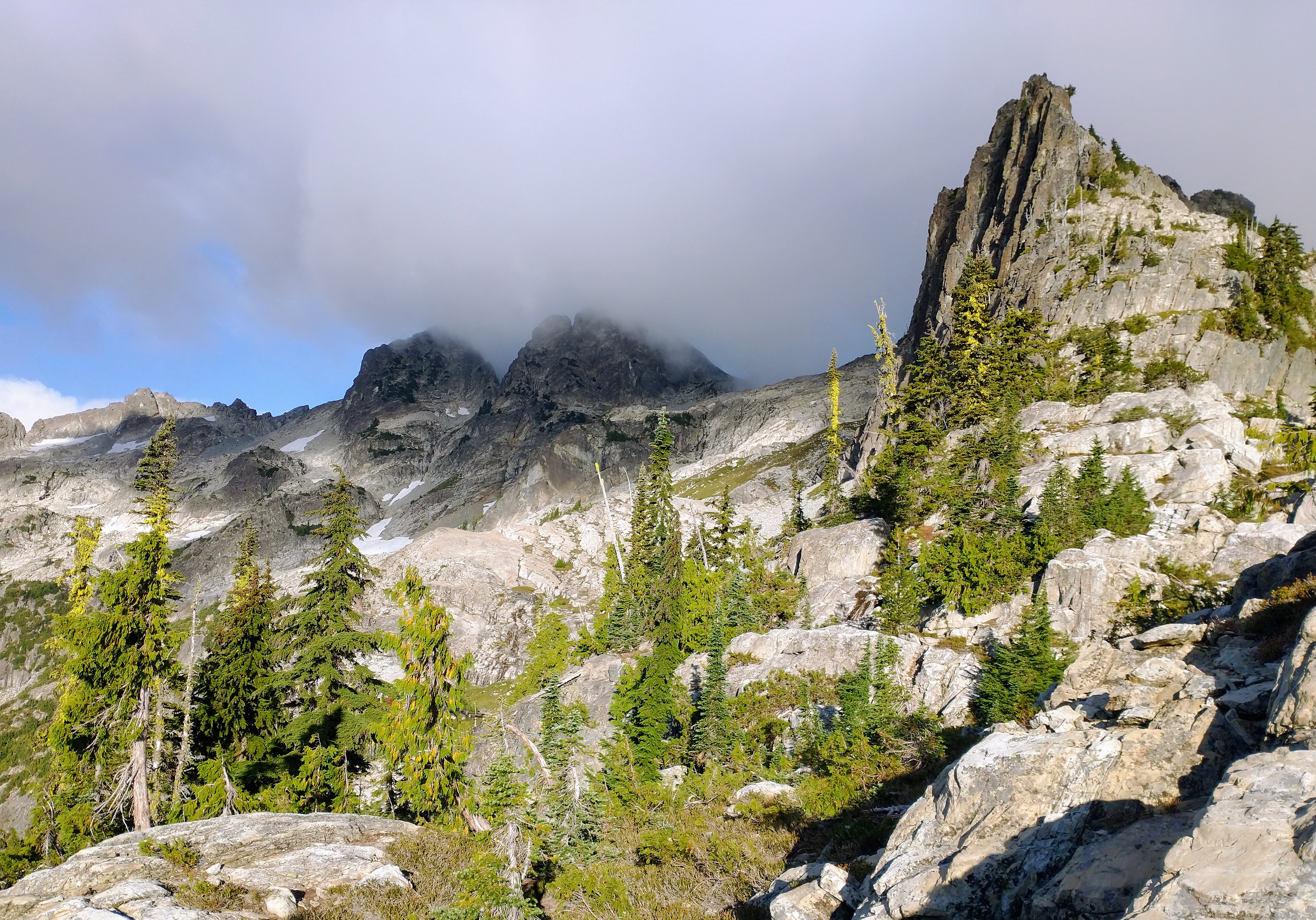
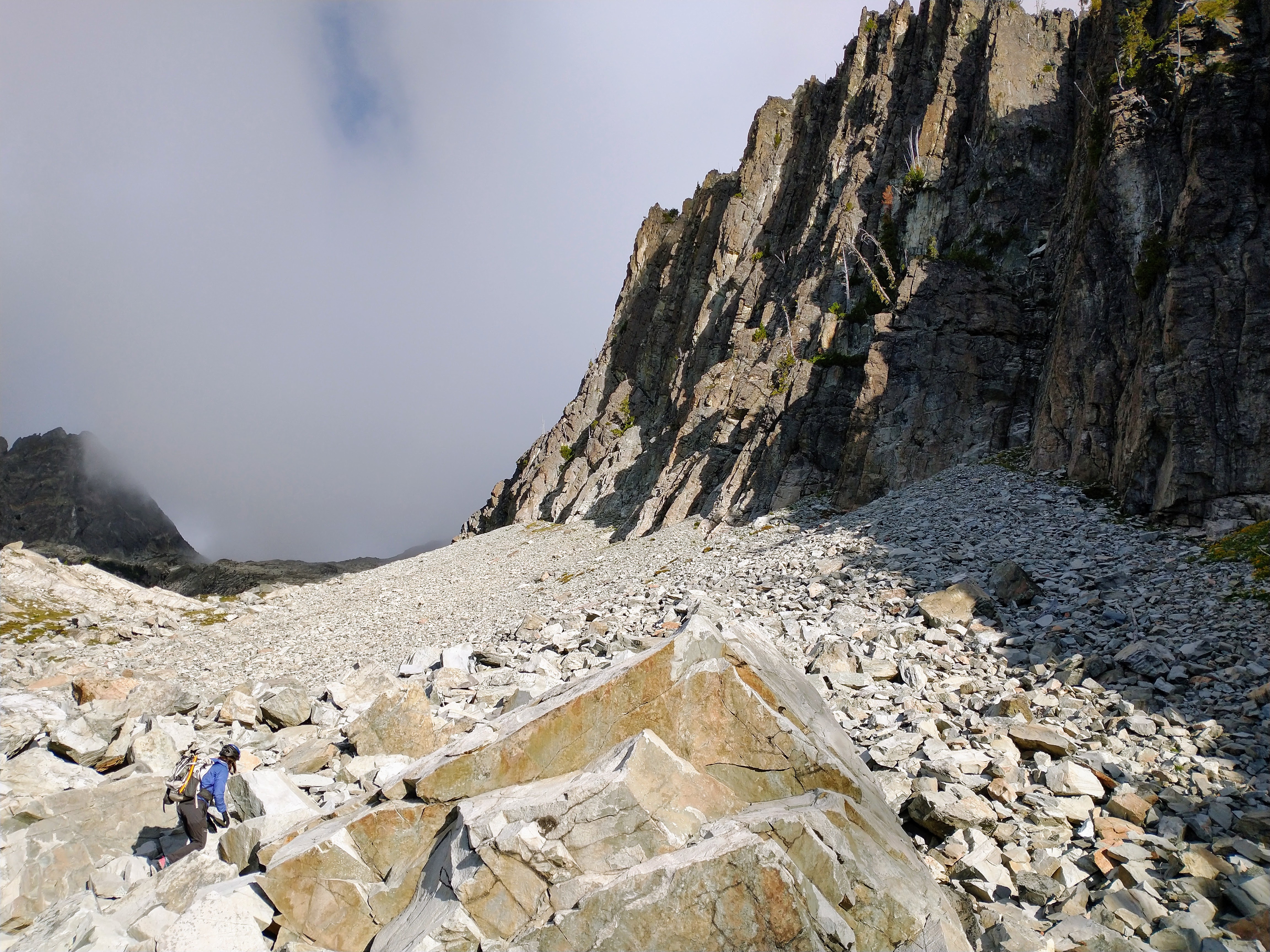
Trip: LITTLE JOHANNESBURG (7945') - East Col / South Face Traverse Trip Date: 09/10/2022 Trip Report: LITTLE JOHANNESBURG (7945')– Fisher Creek Basin Approach - SEPT. 10-11, 2022 I’ve been eyeballing this peak for years from all the other peaks I’ve climbed around the area. From Easy Pass it just stares at you looking steep and nasty. On maps it doesn’t have a name, like a forgotten step child. Climbers refer to it as Little Johannesburg. There’s not much information about this climb, if you can find anything at all. I’ve taken pictures of this peak from almost all sides over the years. From my pictures, it looked like the east side of the mountain would offer the least difficult summit route. Since this area seemed to have the least amount of smoke from the various fires burning around the region, I decided this weekend was the time to make the attempt on Little Johannesburg. Saturday: I started from the Easy Pass Trailhead at 9:00am. I arrived at Easy Pass at 11:00am. I followed Fisher Creek trail down to the base of the switchbacks to the beaten up sign post (5140’) and turned left heading up the Fisher Creek Basin. The climbers trail is in pretty good shape at the start but disappears and reappears as you travel up the basin. I reached the camp on the bluff at the top of the Fisher Creek Basin at 1:45pm. I setup camp and heemed and hawed whether I should go for the summit or wait for the next day. The weather was looking good and the smoke was light so I decided to go for the summit and left at 2:50pm. From camp I could see directly up the talus and heather shelves to the East Col at the top that was to the left of the spire. I figured it would take me about 3 hours up and 2 down which would put me back at camp at dark. Most of the route up to the East Col was loose talus side hilling. There was two or three heather and rock plateaus separated by loose talus sections. I climbed on solid rock as much as possible heading up as the talus was not too fun. Most of the rock was Class 2 with a few sections of Class 3 depending on route. The final ramp to the East Col looked pretty steep from a distance, but the closer I got the less steep the ramp appeared. I reached the East Col (7500’) at 4:10pm. From the col I traveled across and diagonal on a rising traverse across the South Face. There was a pretty good shelf system that would work around the several gullies on the way. All the rock was loose so I made sure of all holds before moving through. I aimed for what appeared to be the highest peak from the col, which was the farthest away peak that I could see. Once I made it to the final peak ridge I climbed up on decent rock (Class 3) to the summit arriving at 5:10pm. The summit registry was in an old aluminum can with a screw top lid. The registry was the original from 1968 and was in good shape considering its age. I looked over the summit entries and was surprised how few entries there were. The first entry was 1968 and the second was 1974. There are several years between entries. The more recent entries average about 2 parties per year. I was the second this year. The views were excellent even with the smoke. I started back down at 5:30pm and reached camp at 7:25pm. It was nice to have the summit knocked out on day 1 so I could sleep in the next day. Sunday: It got pretty windy overnight. I woke to a fair amount of smoke in the valley, it had finally caught up to me. I was very happy that I had summited on day 1 as the views on day 2 would not have been that great. I broke down camp and was on my way back at 9:00am. I was back at Easy Pass at 11:15am and I was back at the trailhead at 1:00pm. Overall this was a good climb that has seen very little attention over the years. A hidden gem in plain sight. Some Tips and Notes: 1. Easy Pass Trail is pretty dry right now. The best place for water is the creek crossing with the small logs placed side by side for crossing around 4400’. The next water supply is at the Fisher Creek Basin. 2. The bluff camp (5960’) at the top of the Fisher Creek Basin has lots of water and two defined camp spots. 3. Be ready for extended time on loose rock for this summit. There is not much traffic to clean the route. Travel Time for reference: Saturday: Trailhead (3700’) to Camp (5960’) to Summit (7945’) to Camp – 10:30 hours. Sunday: Camp to Trailhead – 4:00 hours. Total Mileage: around 19.5 miles Total Elevation Gain: around 7200’ Gear used: Trekking Poles, Helmet. Little Johannesburg (Front) Arriva (Behind) taken from Katsuk Camp in late July. Little Johannesburg from Easy Pass. Looking up the talus and heather plateaus to the East Col from upper Fisher Creek Basin. Looking down and toward camp on my way back from the East Col. Looking up to East Col. View across the South Face from the East Col, the summit is the farthest peak in the back. Summit Registry. Summit View straight to Easy Pass. Summit View looking back over route traveled. Mount Arriva, Fisher Peak and Black Peak views. Gear Notes: Trekking Poles, Helmet. Approach Notes: Easy Pass to Fisher Creek Trail to Fisher Creek Basin2 points
-
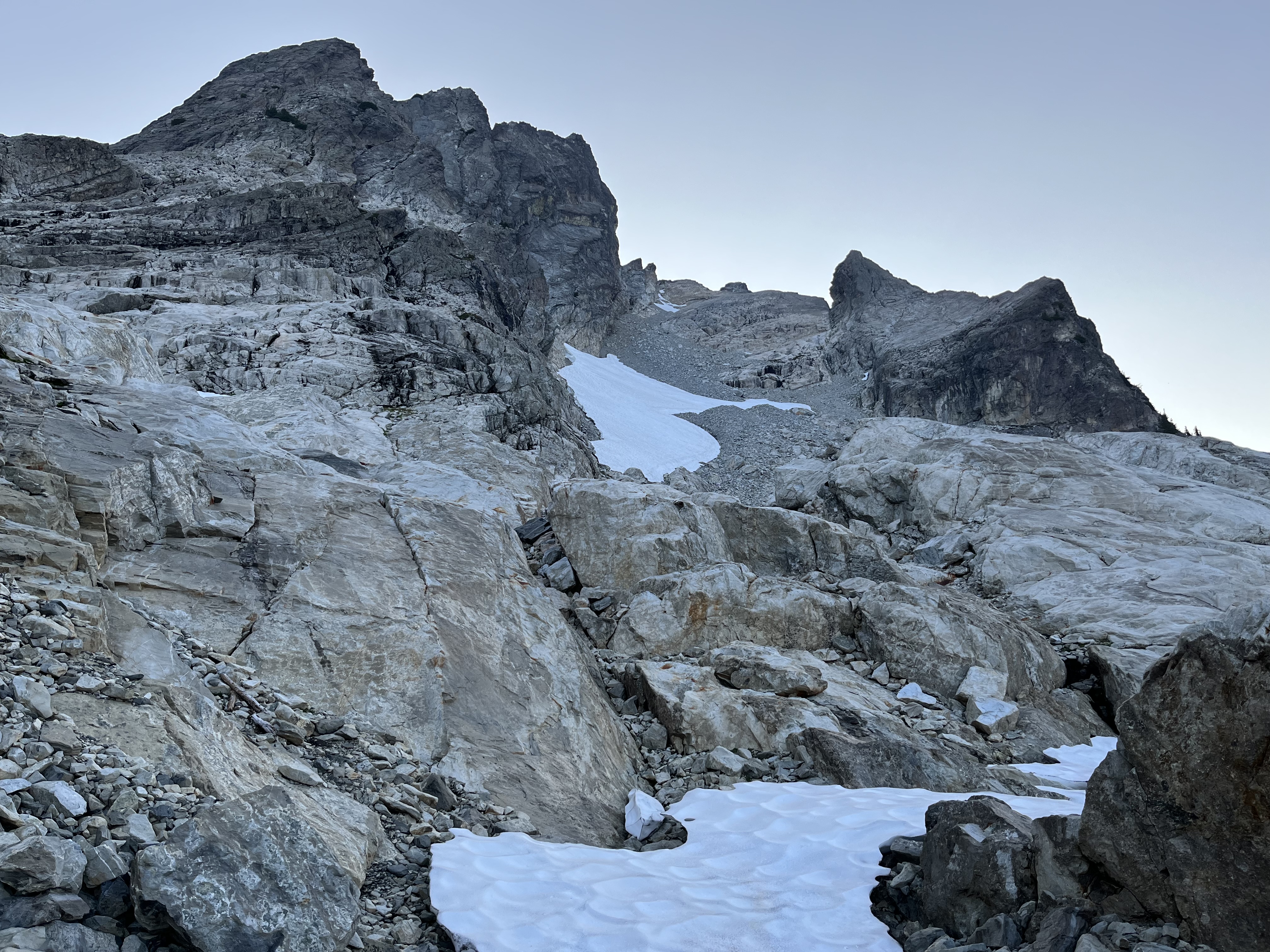
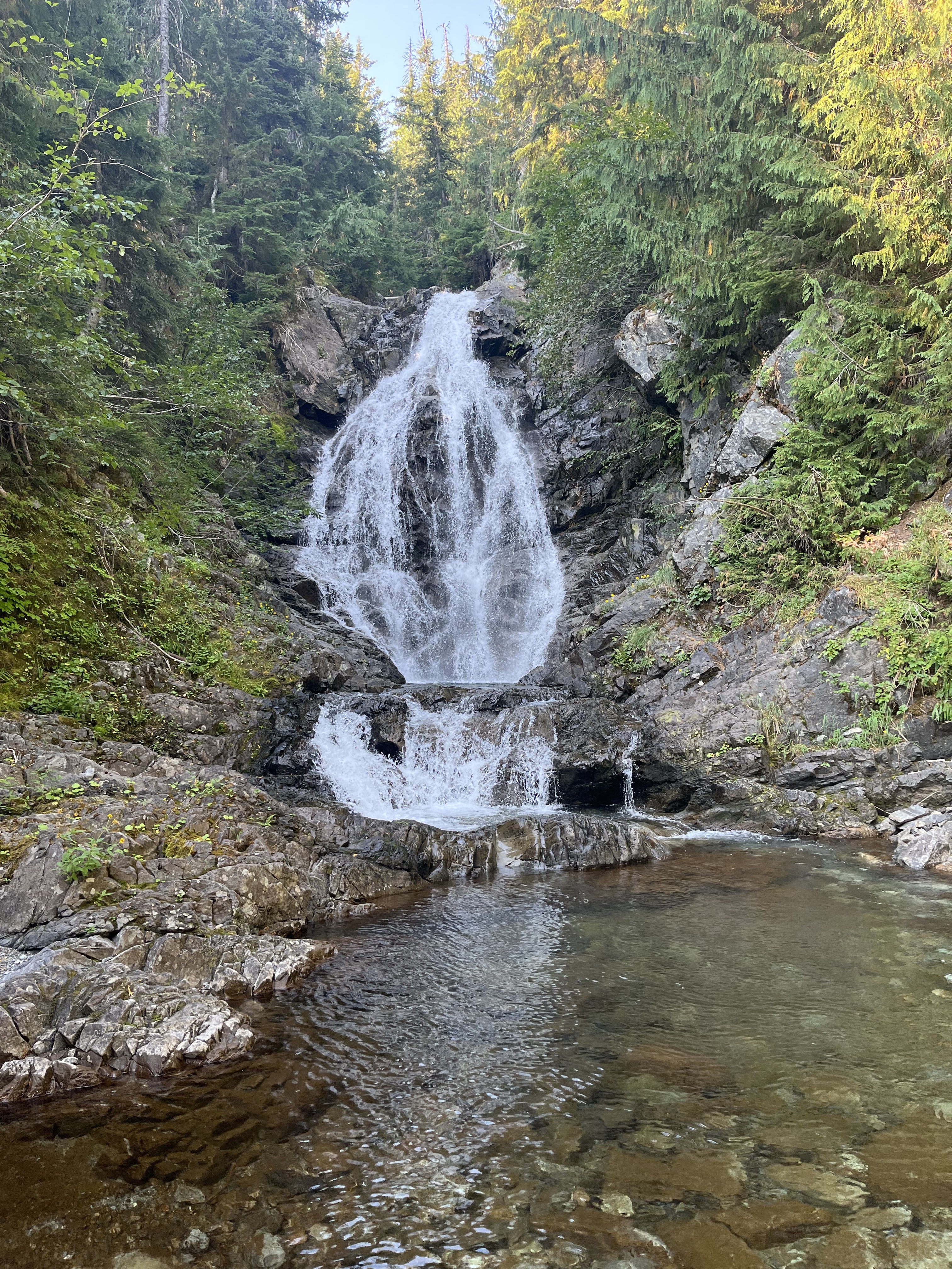
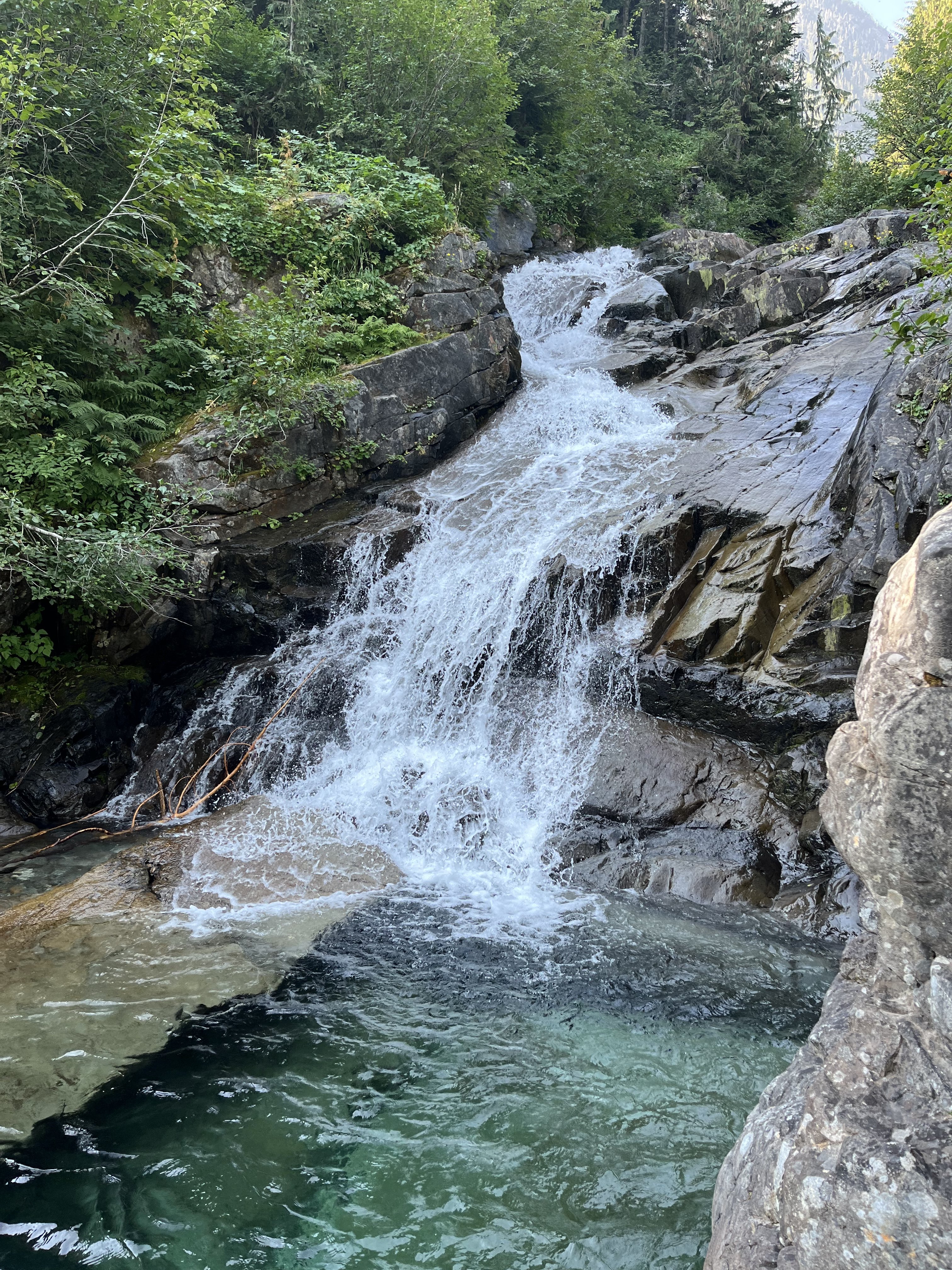
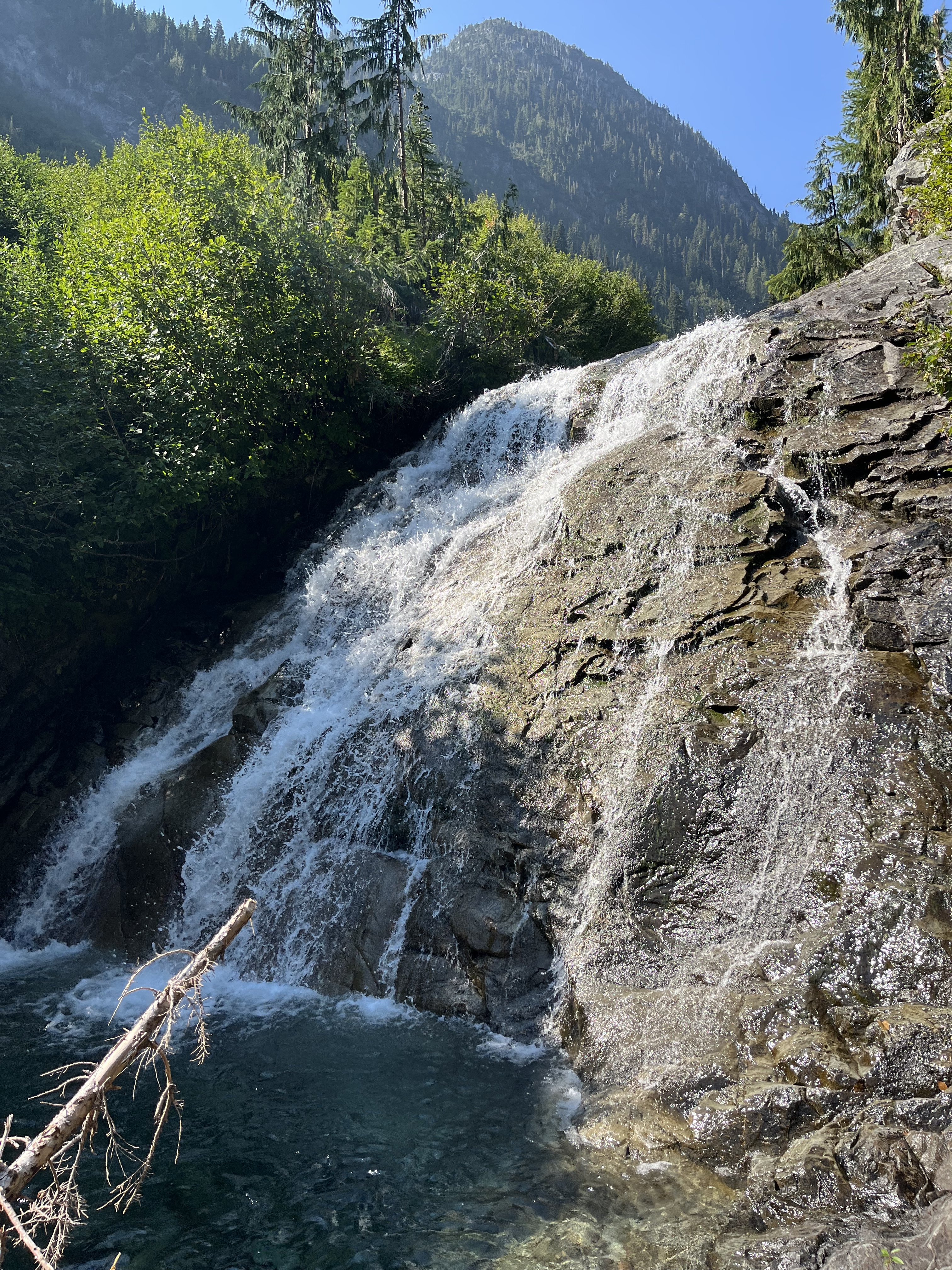
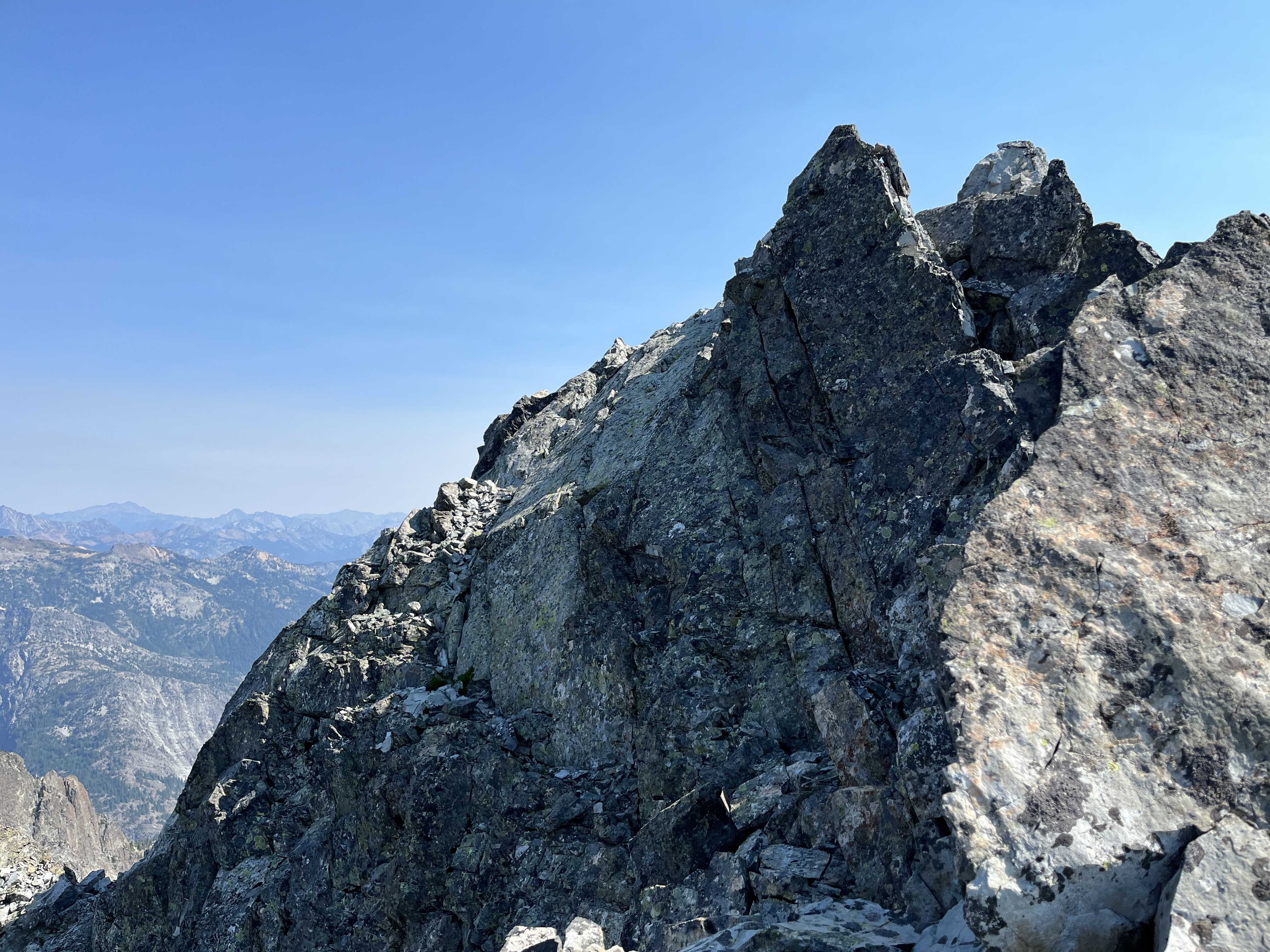
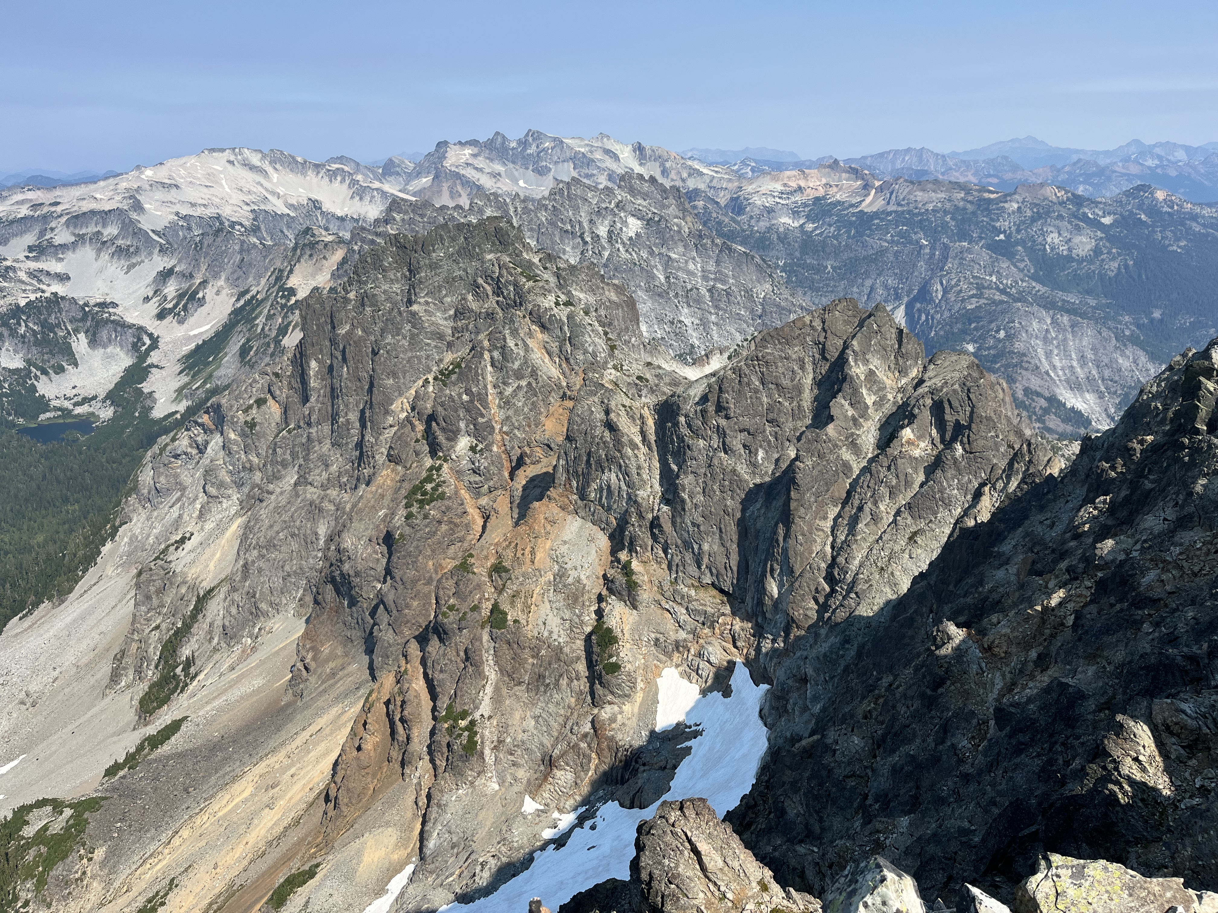
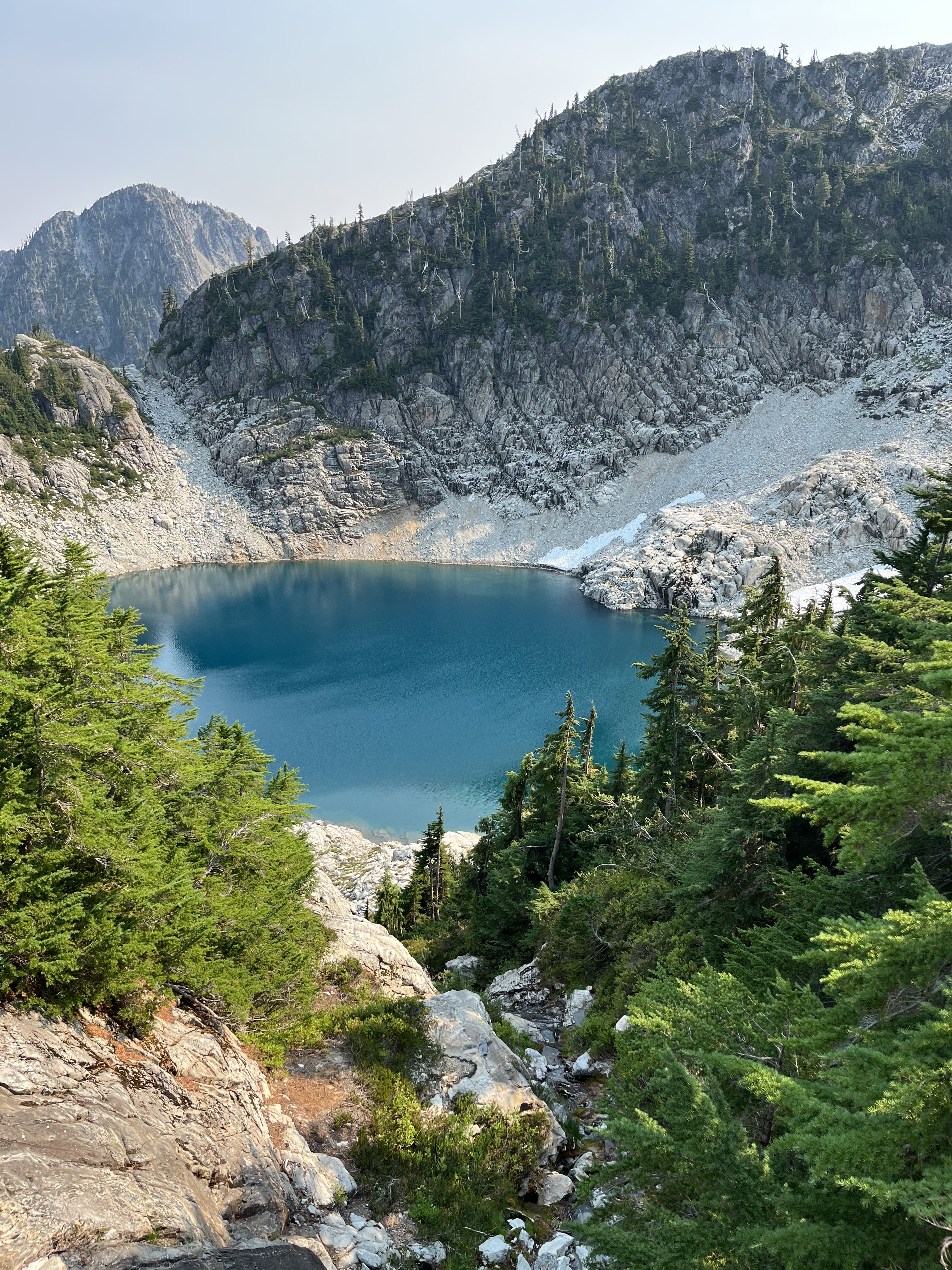
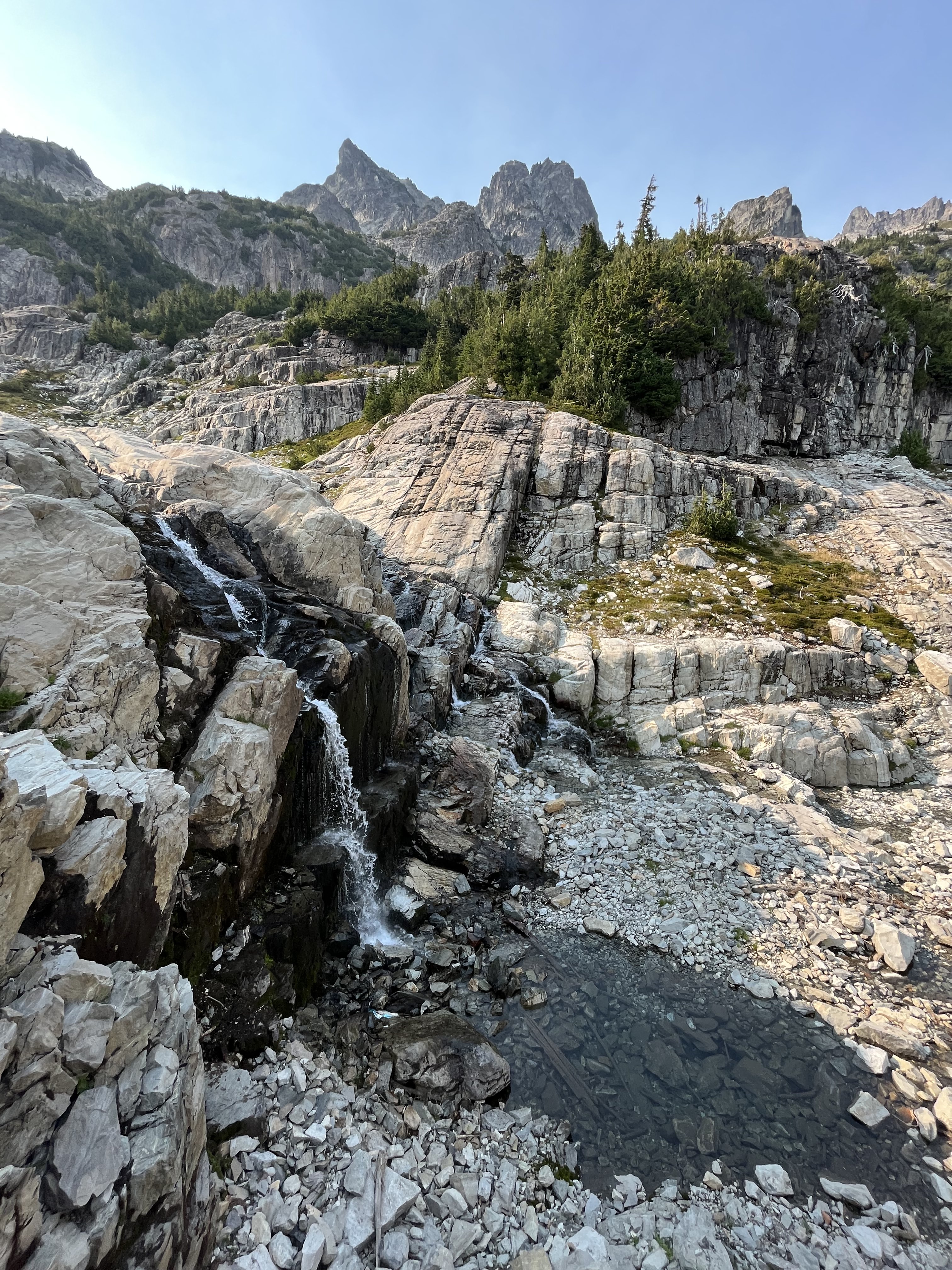
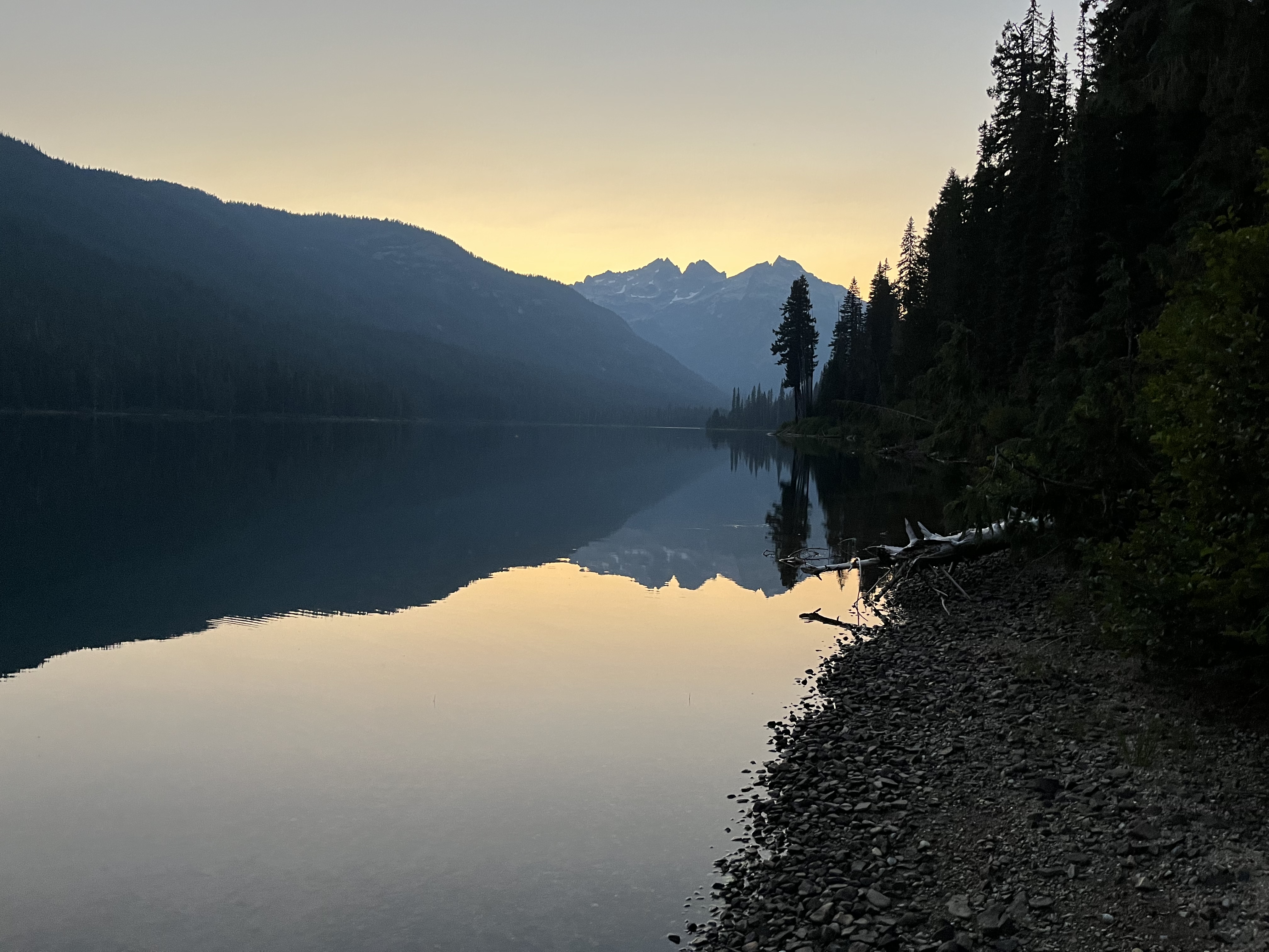
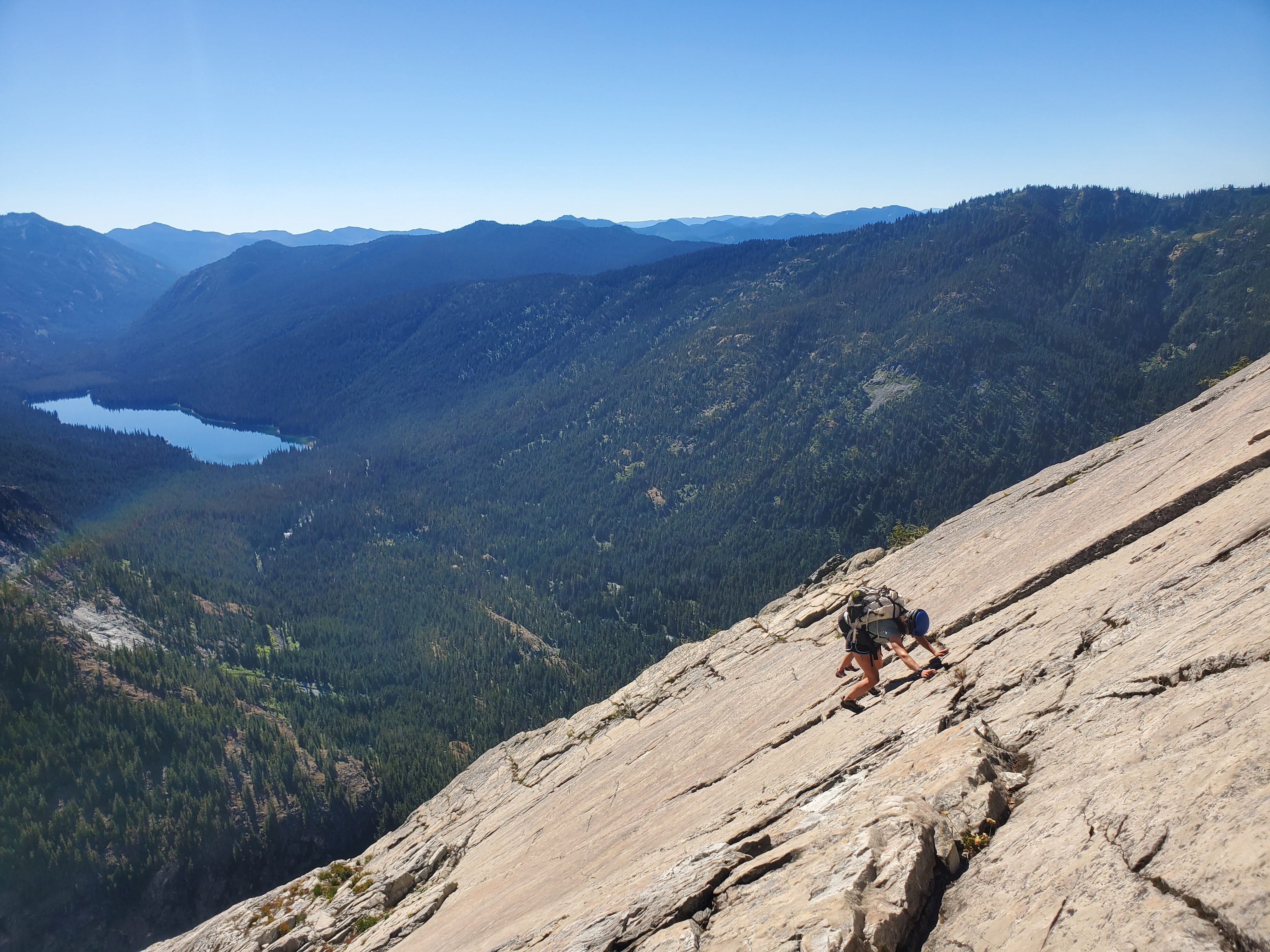
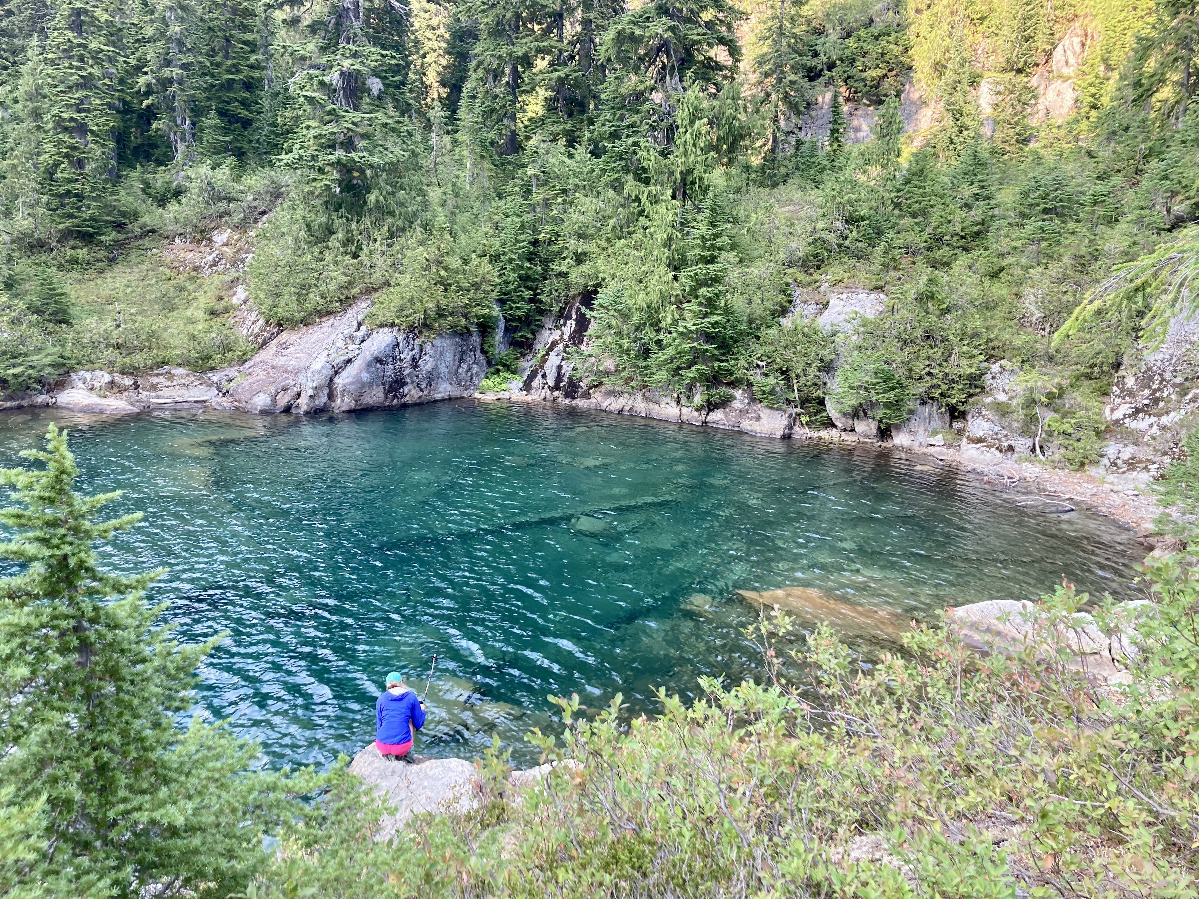
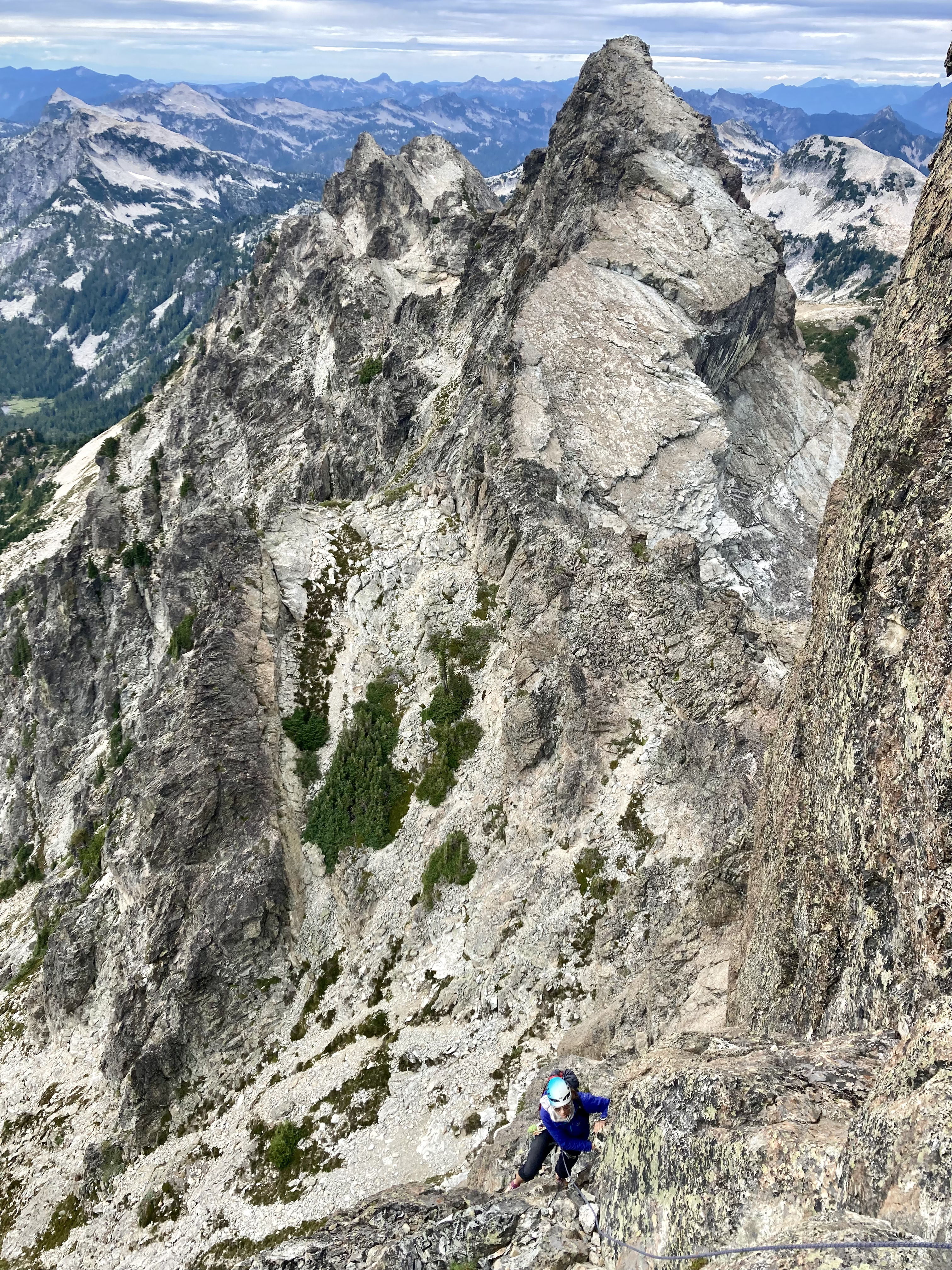
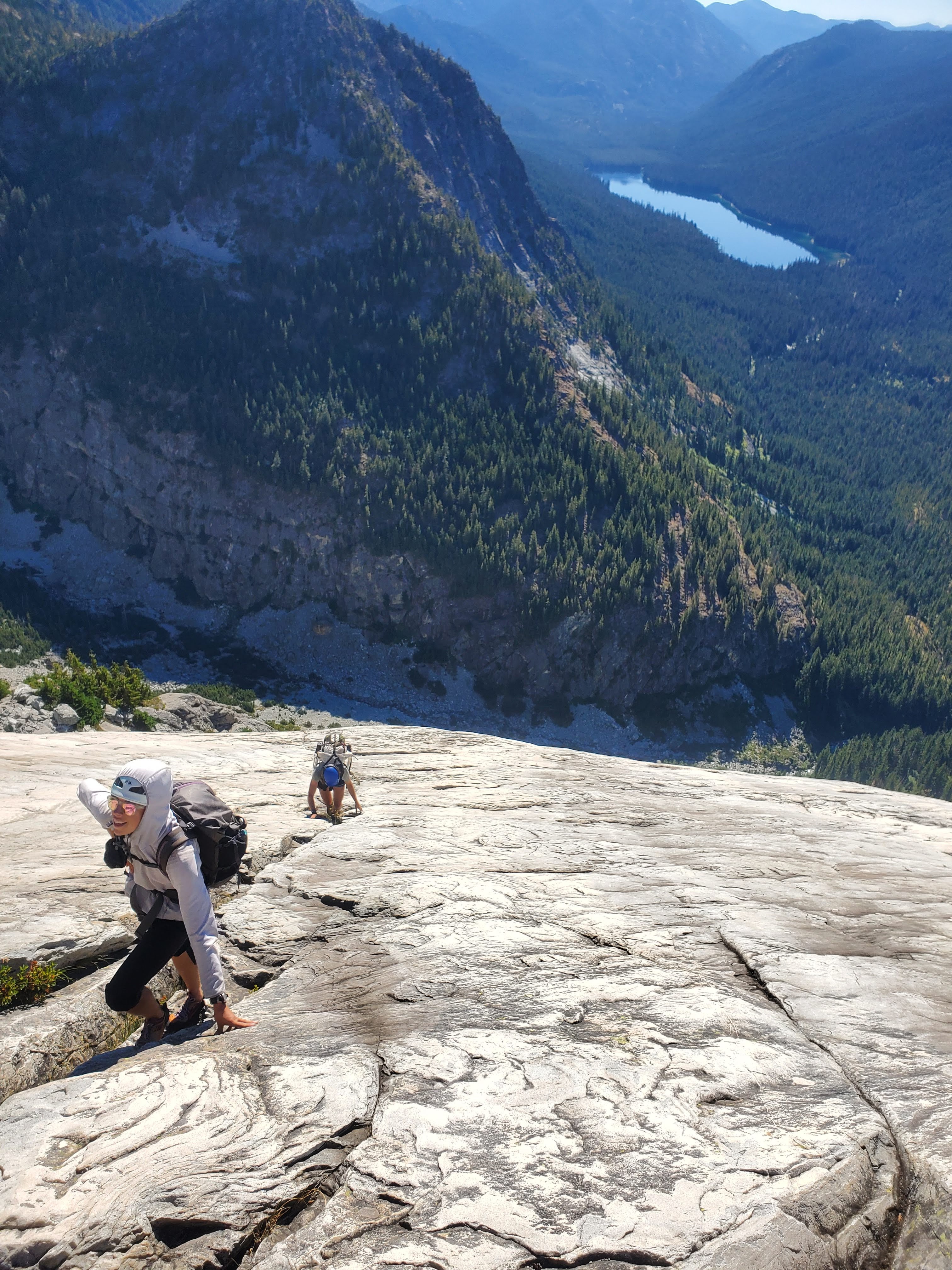
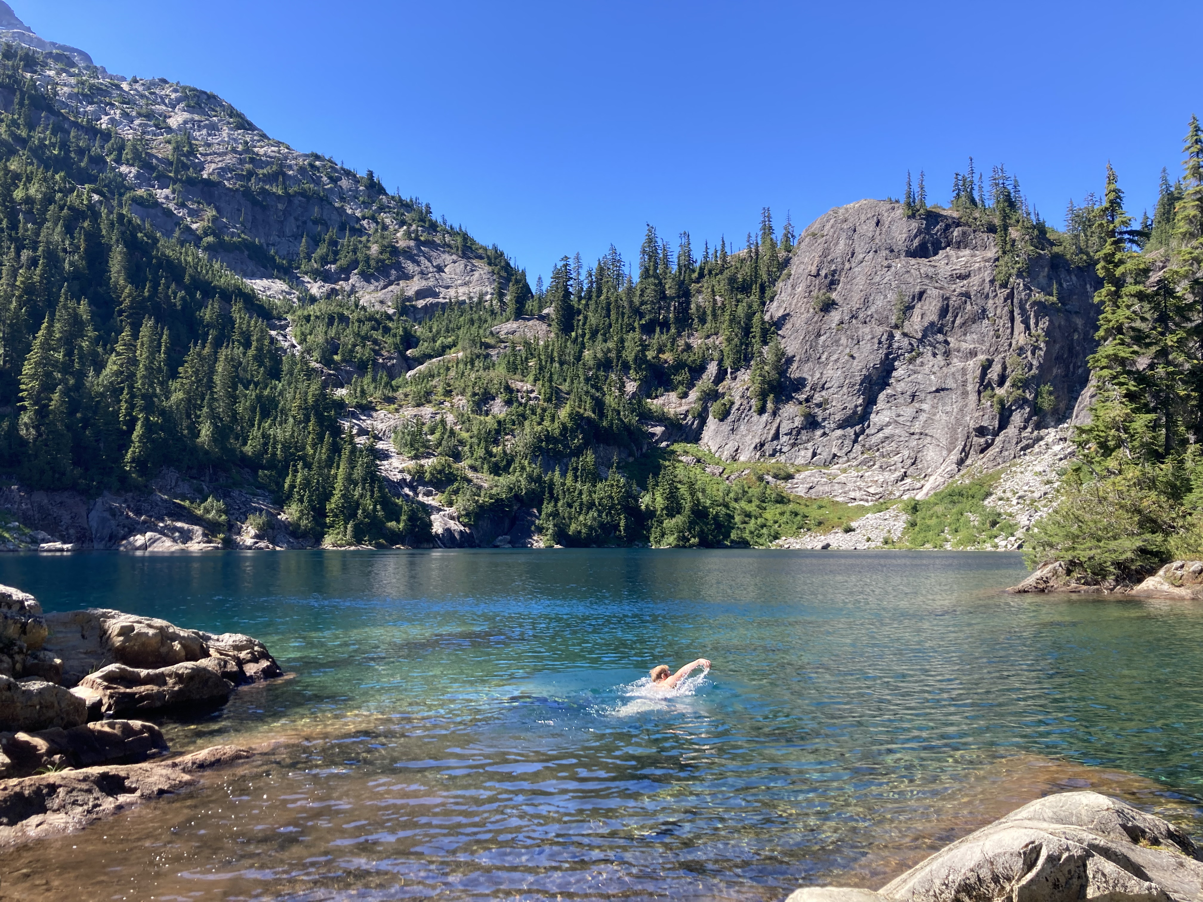
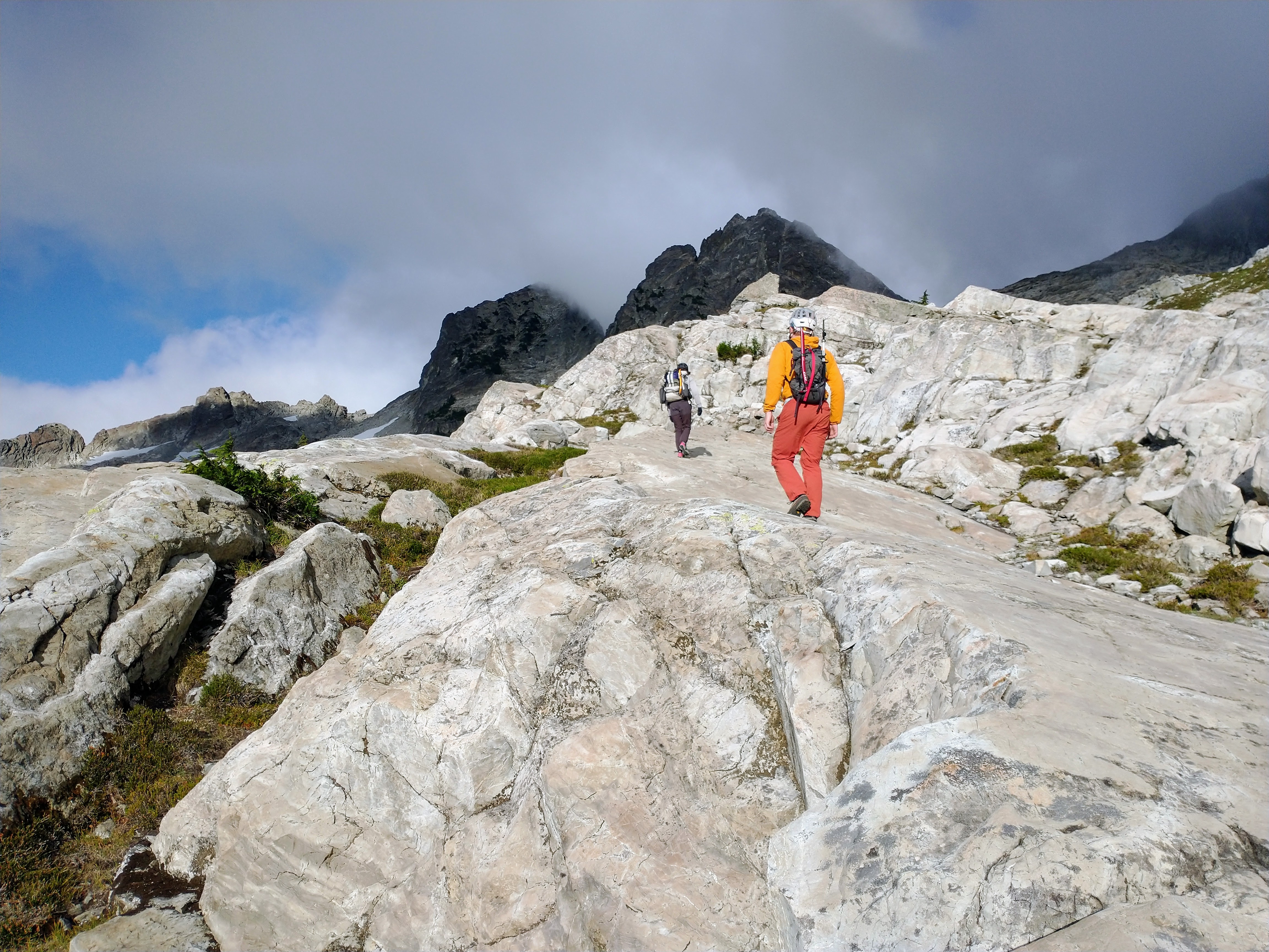
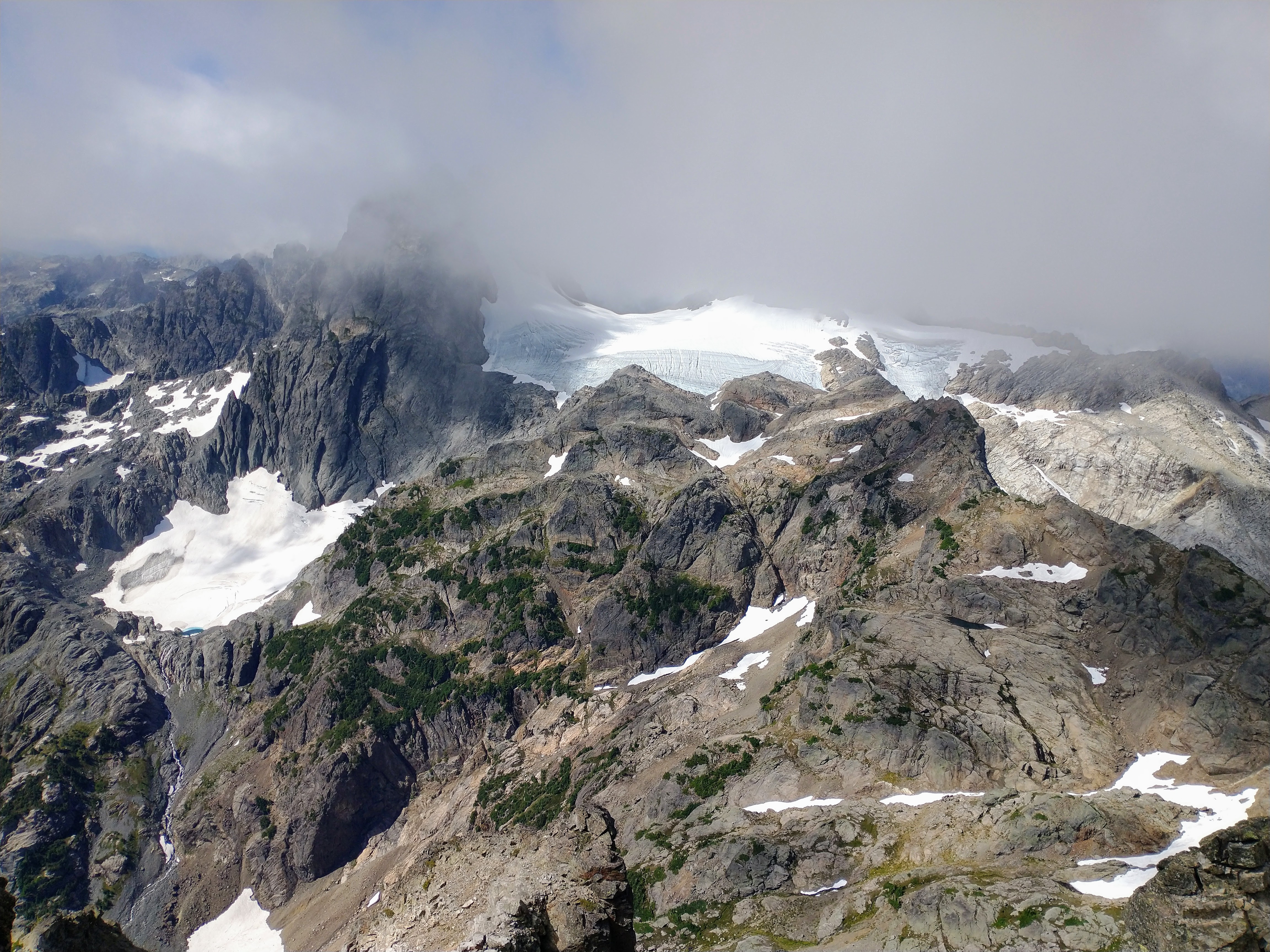
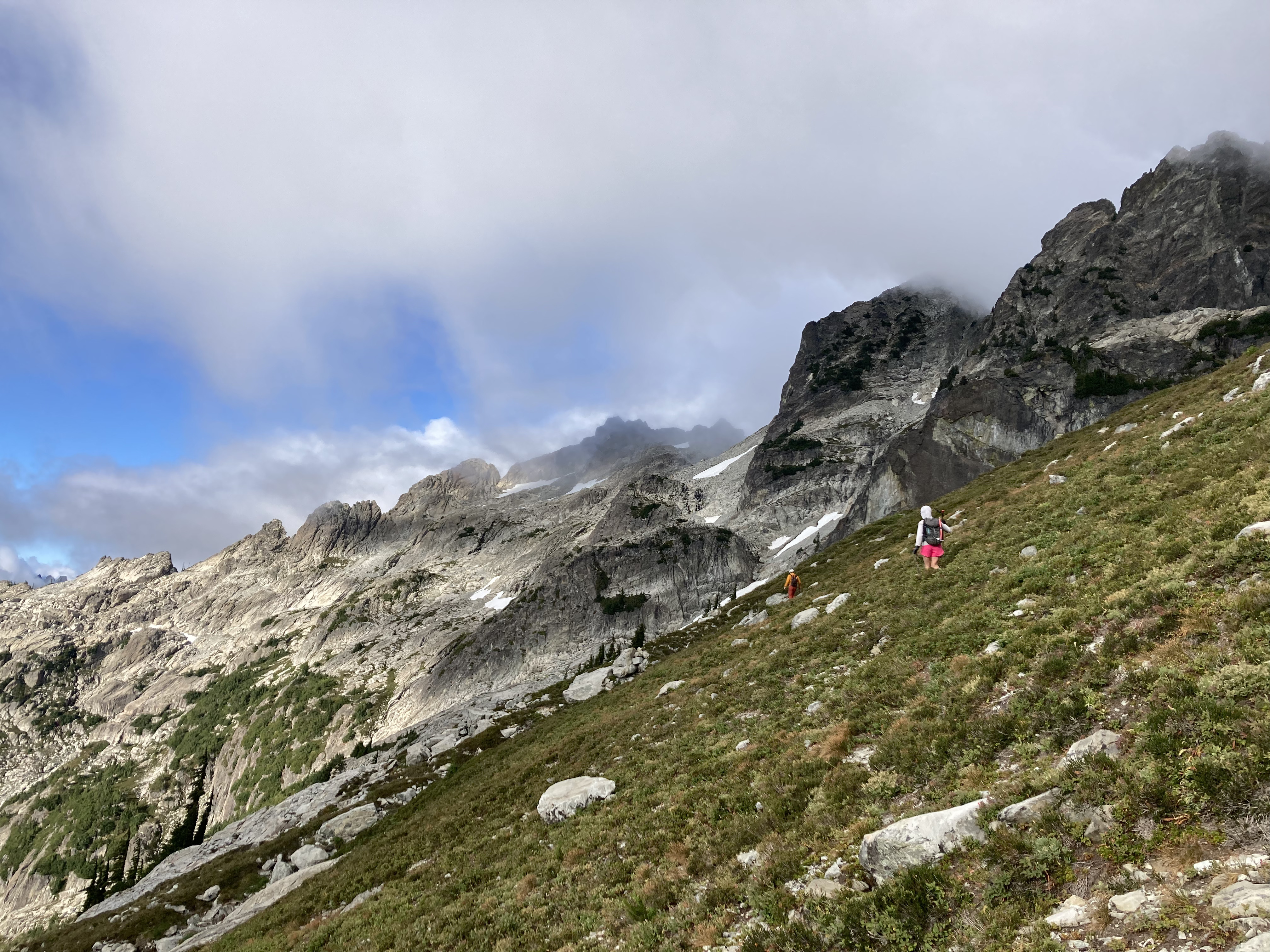
Trip: Bear’s Breast + Summit Chief - SE Face on Bear’s Breast; E to W ridge traverse on Summit Chief Trip Date: 09/01/2022 Trip Report: On Thursday I climbed the slab on SE face of Bear’s Breast (BB). From a bivy at Shovel creek, the next day I hiked to Chief creek and followed it to a lake below Summit Chief (SC), climbed the east side of the massif, traversed the ridge to the summit, descended south back to the lake, then went back down Chief creek to trails leading eventually back to the car. This involved tons of hiking but the mega slab on BB was really fun and the process of discovery made the SC excursion especially rewarding. Early Thursday morning I had driven an hour in the direction of the N cascades before I remembered to check the forecast one last time. I didn’t like what I saw. I had somewhat bold plans for 3 days in the Eldorado area. It seemed like a fair bit of smoke was forecast. The area’s main draw for me is the view, so I shelved that plan for another day. The smoke forecast looked clearer further south so I turned around and headed that way. Jason’s mega slab TR came to mind. I took screen shots of his unusually detailed beta before leaving service. Neighboring SC was also in the back of my mind. I didn’t know anything about it, but was pretty sure it had a scramble route. To make up for the comically long drive I did a mix of fast walking and slow jogging on the trail to Waptus lake, reaching it in 2.5 hours. I kept going until I found the Shovel creek campsite. I put my harness on to save space in my tiny summit sack and headed to the wall, reaching it about 4.5 hours from the car. I got water at the base, but partly due to the tiny pack I deluded myself into thinking 2L water would be enough for the climb. I would have probably run out even if it took 3L. It was a hot day and the route was in full sun. And the climbing, though easy, was pretty physical. The movement was close enough to hiking that I would invariably go too fast and have to stop to catch my breath. I found mostly class 4 (felt like 3 as long as you didn’t look down) and felt like I had to go out of my way to find low 5th bits, which I did seek out. High up on the face I found a repeating pattern of perfect horizontal foot/hand rails that I used to traverse right, trying to find a little shade. I eventually reached a crest and continued on to its apex, but cliffed out there. I backtracked a little and downclimbed suspect choss to the west side of the ridge, finding a gravelly path leading to the notch by the summit block. I was bonking pretty badly at this point and still hadn’t realized that I was becoming massively dehydrated. I put my rock shoes on at the the notch N of the summit block. I found the climbing just barely difficult enough to justify bringing these, my harness, and some rap cord this far. The chimney pitch might be cruxy if you’re a wide person. I’m pretty slim and I managed to wedge my torso quite snugly. The summit views weren’t great. It was hazy enough that I couldn’t make out much of the Chimney rock area. To the east I saw a landscape comprised mainly of dirt. On the descent I climbed down past the first rap to the station above the chimney pitch. It took me forever to set up my rap due to my growing exhaustion. After the rap I downclimbed exposed ledges to the skier’s left of where I began the climb. Back at the notch I had no choice but to sit and rest for a while despite noticing that I was beginning to fall behind schedule. The snow was firm coming down the E side of the mountain, so I used my axe. Crampons would have been nice but they didn’t fit in my tiny summit sack. At the first seeps I found I took another long rest and began guzzling water. As I drank and drank I finally realized how dehydrated I was. A few liters later I started to come back to life and picked up the pace. The scrambling on this side had pleasant solid slabs and ledges. I was racing the fading light. The darkness won but by the time I had resort to headlamp I had less than 200 feet to descend to reach Shovel lake. I did a bit of controlled veggie assisted sliding down the final slope, stumbling out at the exact spot where a single big river shoe sat. Descending Shovel creek in the dark turned out to be nontrivial. It wasn’t terrible but there was a little bit of everything, from dry log jams to bushes to gravel bars to boulder fields. The highlight was running into a small patch of berries that I wasn’t familiar with. Seemed to be delicious small red salmon berries, cap-like, almost as thin as thimble berries. I reached my bivy near 10pm, about 13 hours after leaving the car. It was a longer and more difficult day than I anticipated. I tried to eat and continue rehydrating. I slept poorly and felt physically and mentally sluggish the next morning. I considered hiking back early, or the grim prospect of relaxing by Waptus lake for a couple hours Instead I adopted a low commitment mindset to exploring for a way to Summit Chief. I crossed Waptus river and hiked to the junction with the DMG trail. Maybe I could take up the hill for while, and then traverse west at around 3600’. I’ll probably never know how that works because I was enticed by Chief creek. When I reached it I saw that it was perfect for rock hopping. Given the hour and the unknown, a summit seemed unlikely, so I decided to just go up the creek for fun and see what happened. It felt good to explore with this low commitment mindset, but it also weighed heavily on my mind that every step forward was a step further from pizza. I used some dry open ground to the left of the creek but mostly hopped rocks for 15 minutes until I reached a waterfall. I bypassed it with a bushwhack up to the side then rejoined the creek. More waterfalls followed. One bypass on the S side took me high above the creek and I went for a while through the forest there, trying to find the driest ground I could. I may have crossed the creek once or twice more, I’m already forgetting. At one point on the S side of the creek I realized I was entering a mile long stretch of impenetrable alder, but saw mature forest on the N side, so fought my way down to the creek and crossed again. There is another creek running S and E from a 5200’ knoll down to Chief creek. After crossing this I gradually moved several hundred feet uphill from Chief creek with relatively reasonable shwacking. This path reached a drainage leading N into the alpine. The huckleberries were out of control here. I contoured around another knoll and reached a beautiful unnamed lake SE of SC only 3 hours after I started up river. From there I saw appealing rock on the east side of the mountain and took high quality white ledgey slabs adjacent to a water course. I reached a shoulder and found that the nice slabs continued up a broad, barely convex gully-face. I rapidly ascended from the lake to near the top of this face. The wide face was narrowing to a point and the rock transitioned to blocky choss. The large blocks formed a fun hand crack system that I climbed at 5.5ish for around 40 feet to the first false summit. The false summit wasn’t too surprising given the topo, but I failed to notice how far away the true summit was. I kept expecting the next tower or blob to the west to be the summit. I was fooled about 3 times before I got a view of the real summit, still quite a ways off with several more notches in between. I began to feel concerned about my exit strategy should I encounter a gap too steep to climb. I could downclimb the way I came, but it would be more time consuming and mentally taxing than I would like. Continuing on I did one short low 5th downclimb on the S side to get around a small tower. I was able to traverse on dirty but sufficiently wide and flat ledges on the N side to bypass a couple more bumps nearing the summit block. At the base of the real summit block I took a ~5.0 left trending ramp to top out. The ridge traverse had been an exciting and interesting way to go, with some pretty fun climbing. I’m really glad it worked out the way it did. I think it took about a half hour from the false summit. The day was much clearer than the day prior, so I enjoyed the summit views more than the last one. I could see that descending S looked pretty smooth. Going that way I reached more great slabs which led to snow. Even in the warm sun it was firm enough that I had to find a low angle entry (didn’t bring traction on this day) to keep it safe. I glissaded with sharp rocks for brakes then kept down climbing fun ledgy slabs. I gradually trended skiers left to meet my ascent path near the bottom. I gorged myself on more huckleberries past the lovely lake and found minor improvements to my path traversing slopes above Chief creek. At the creek’s junction with another creek, I found that I could keep my bypasses to the S shorter and nearer the creek, and did more rock hopping between waterfalls than I had on the way up. This was probably a little slower than traversing in the forest but it was downright delightful. I reached my overnight pack 9.5 hours after I left it where DMG trail crosses Chief creek. I was very happy with the way the river travel turned out, with all the nice solid rock, with ‘onsighting’ a ridge I knew nothing of, and all those berries. It was a strange contrast to the day before, which felt a little like the mountain was working against me. This day it felt like the mountain gave way, continually drawing me upward with a steady rhythm of dissolving riddles. There was the small matter of being I don’t know, 14 miles or so (? I didn’t record it) from the car. I packed up and hiked to Waptus lake. Had a short swim at dusk then marched on through the night. I passed many tents but shared the trail only with nocturnal insects, toads of unusual size, and ridiculous amounts of horse shit. Autopilot worked well until about 2 miles from the car, when I started to get drunk legs. I finally arrived at the car a little before midnight for a 15.5 hour day. If anyone has been up Chief creek or traversed the SC ridge I’d be curious to know how you liked it. I rarely set off exploring with no beta. I found it very engaging and rewarding to do so. Easy to say, but I think it was mostly just good fortune that Chief creek ended up being relatively sane and that I wasn’t forced by terrain to settle for some sub-summit on SC. Gear Notes: Axe, rock shoes, rap for BB (crampons would be useful) Approach shoes for SC. Traction for snow is useful but didn’t seem mandatory. Approach Notes: Follow the creek . . . ?
 1 point
 -
Stellar write-up, Darin, and props for the extensive after-hours work. Really enjoyed finally connecting with @dberdinka to uncover this route, and the climbing was fun even in its raw state--looking forward to going back for the pleasure cruise on the cleaned-up version. As Darin pointed out, there are a lot of promising variations and parallel lines--folks should enjoy exploring up there. And thanks for the sweet track, @kmfoerster1 point
-
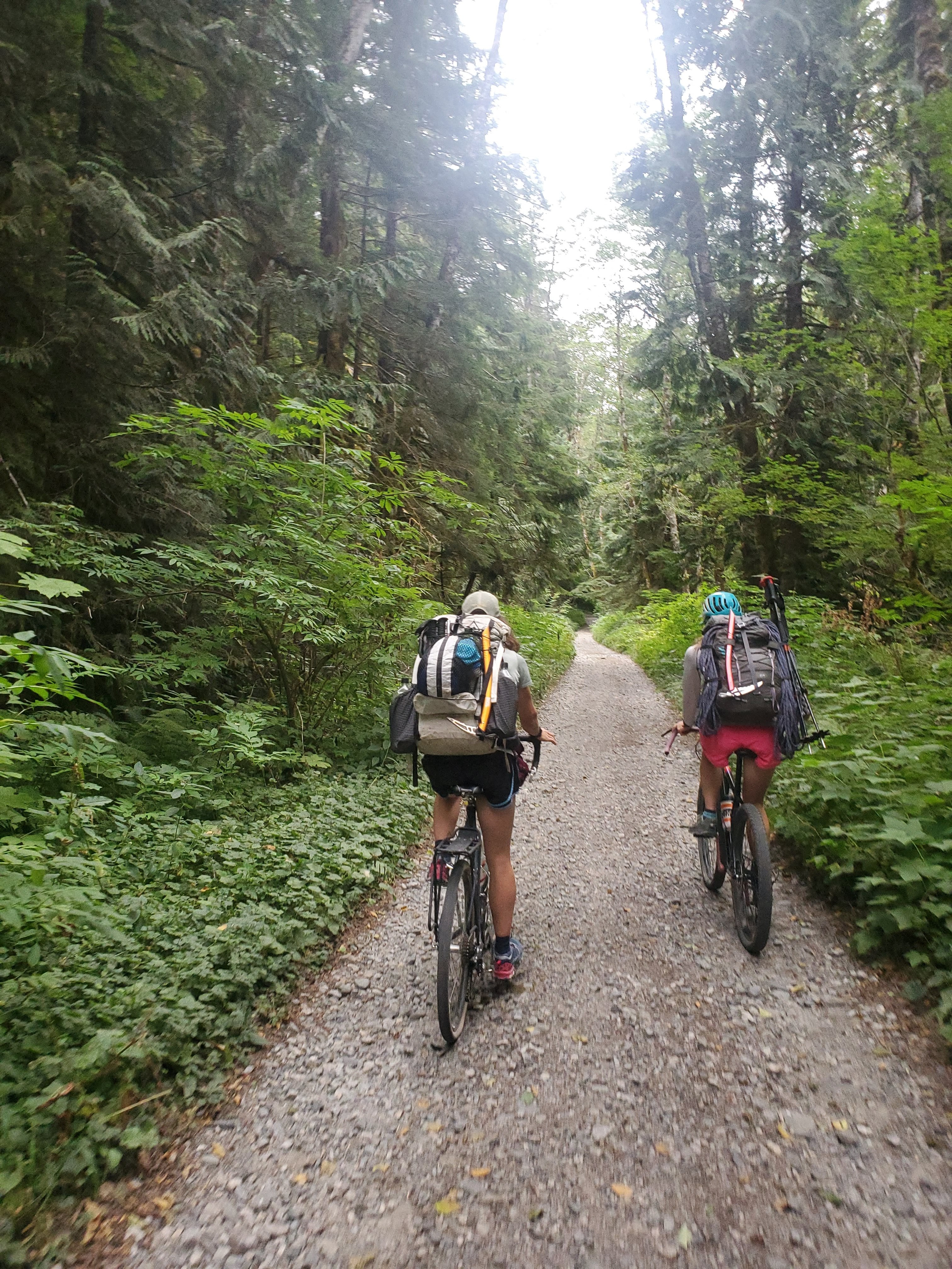
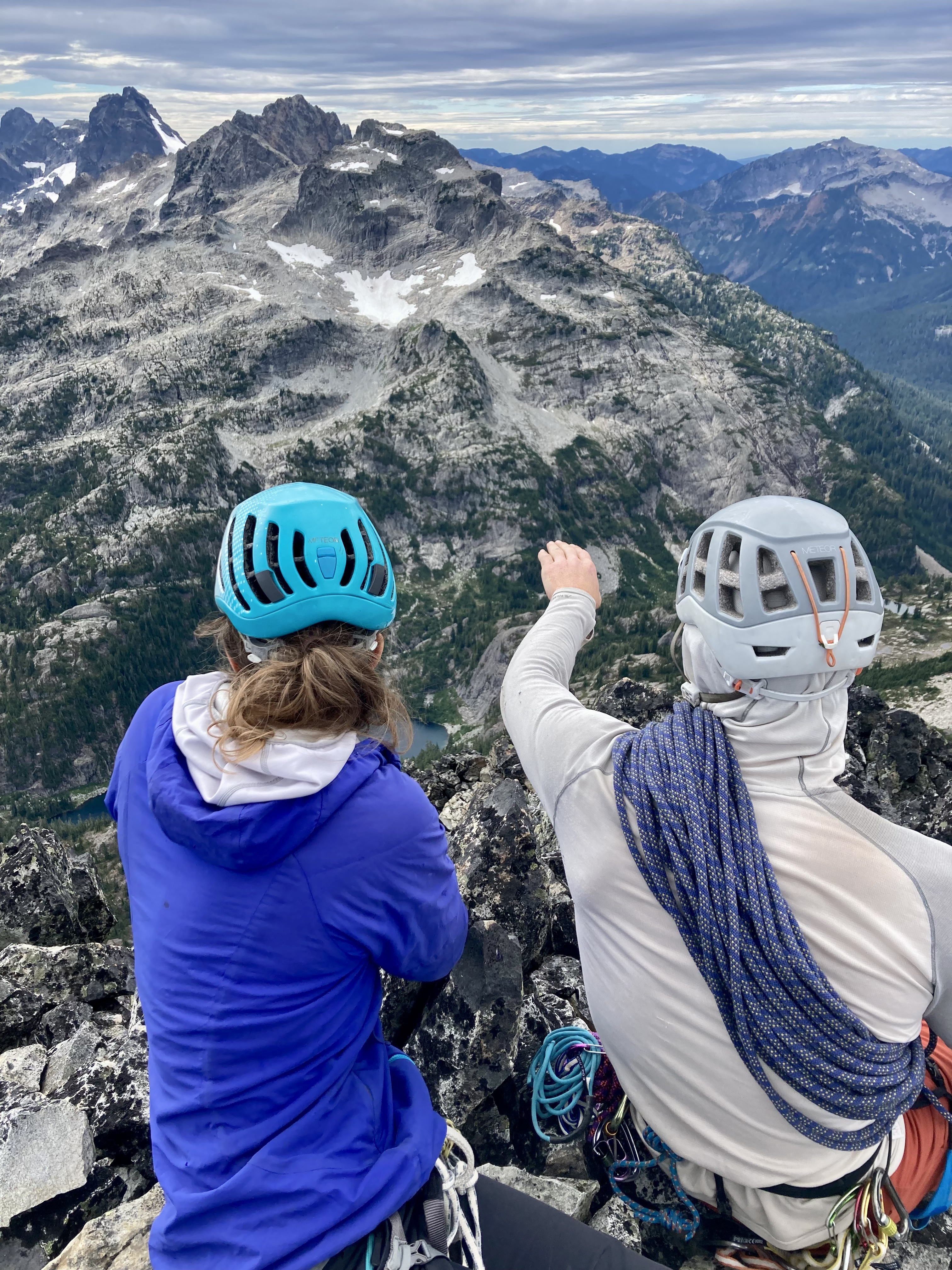
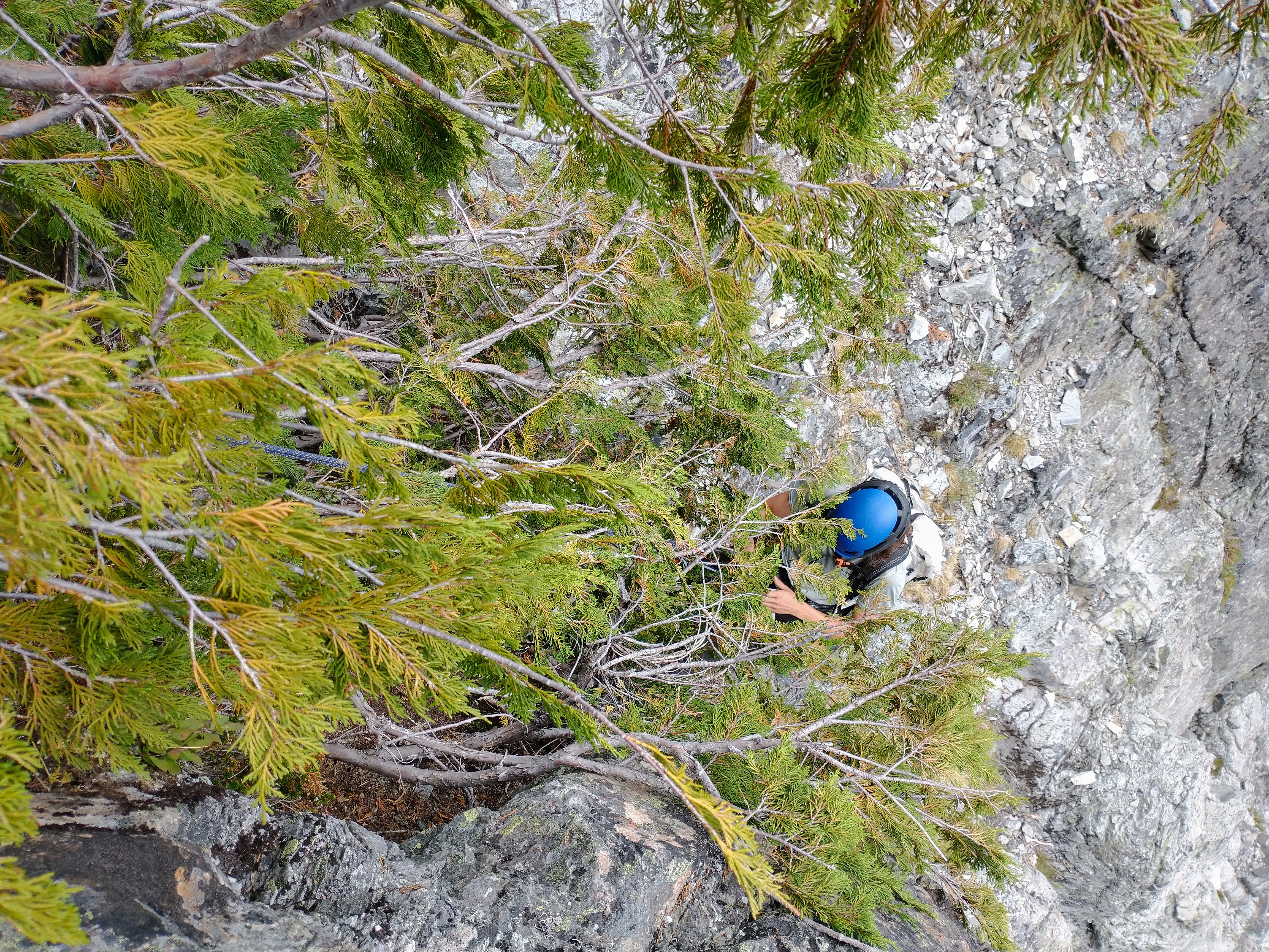
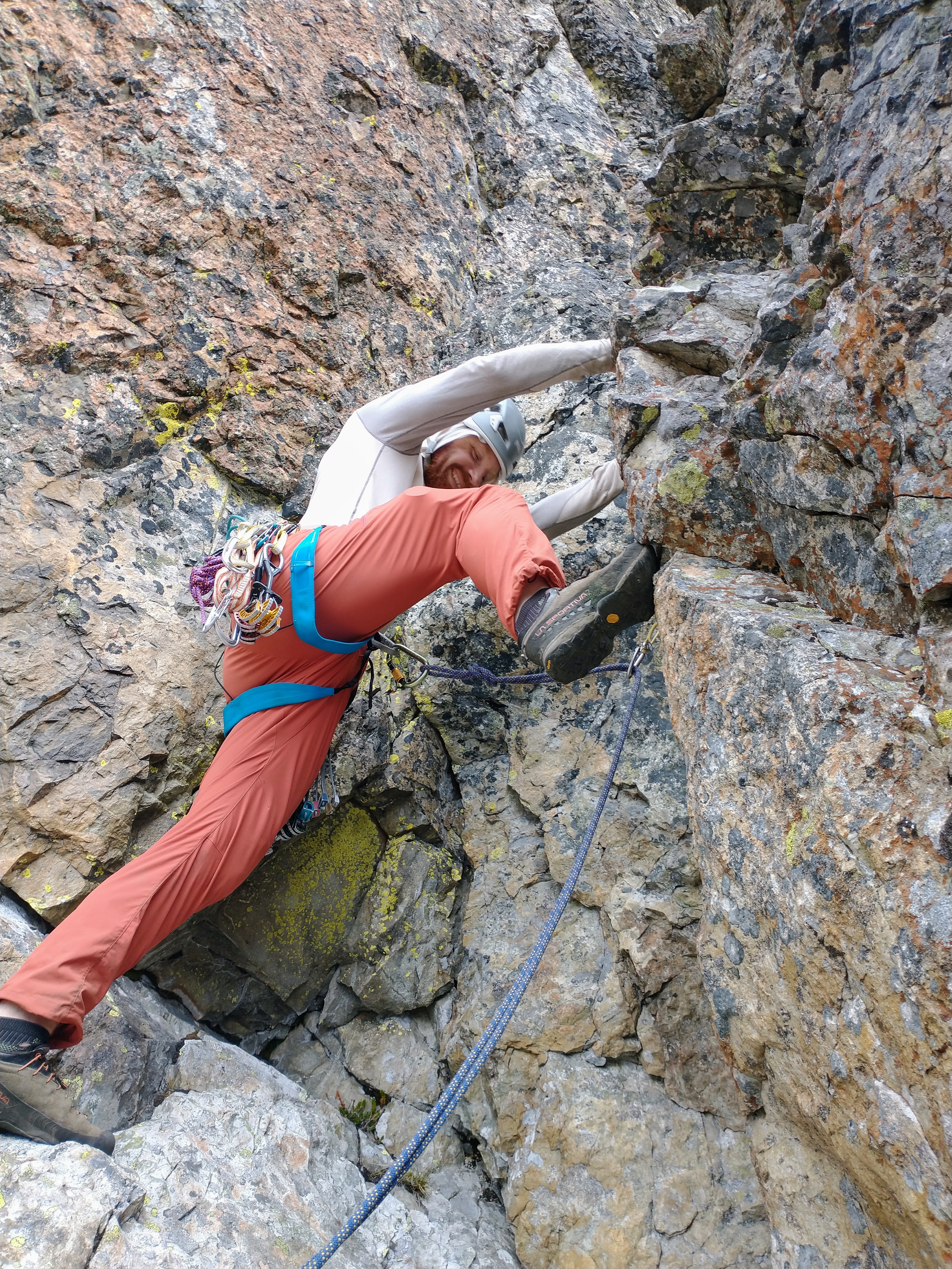
Jon! May I rudely interject some other perspectives in (slightly hijack) your TR? We saw your name in the summit registers just a few days after you signed them. It sounds like you had an awesome adventure!! We did too, and although our adventure visited the same summits, we took some slightly different approaches.....(I debated posting this but some people convinced me.) Thanks, @JasonG for the inspiring original BB TR! - Kat, Micah, and I biked from Dingford Creek TH to Dutch Miller Gap TH on Saturday at a humane hour: - We thoroughly approved of the Dutch Miller Gap trail. We camped at Lake Ivanhoe and did a good amount of hangin' at The Cove. I did not catch any fish but it's OK: - In the morning, we took the trail down and then tromped around and had some B1- open forest schwack for a bit, crossed Shovel Creek, then started up...I agree: the mega slabs were awesome!! So fun! That foot-then-handrail crack you describe/have a photo of was definitely memorable. I feel like none of these photos really do this route justice: - We scrambled the first bit of the summit tower, pitched out the chimney, then scrambled up to the summit of BB: - I agree the summit views were not the most amazing, Hinman and Daniel south sides in late summer... oof, so dry! Hinman cradling Lake Rowena and tiny part of Rebecca: Slightly more solid views: - We descended the SW face route. Happily, my partners nailed the complex descent while I attempted to keep up. Shout out to @Hoo for great chossy gully and cliff navigation. No one knocked rocks on each other and no one slipped on exposed 4th class. Hurray! We rapped the summit block (3x) and then down lower did two raps off cedars. Kat led, quite vocally, this memorable one: - The next morning we walked down the trail, stepped into the "timber" and did some B1+/B2- schwacking, then took a high traverse over to the notch and then up to Summit Chief. Summit Chief Lake basin was spectacular! - Glaciers around Chimney Rock from the summit: - The Cove delivered yet again that afternoon with blueberries and swimming and eating some of our last foods (so hungry): The ride out was awesome on my 2.25" tires until I learned some important life lessons about tubeless tires, sealant, and friends carrying the tire levers. (/snaffled) I felt lucky to have this adventure with Kat and Micah. Two very skilled, ridiculously fast climbers. Great people even if they do Strava...


 1 point