Leaderboard


Popular Content
Showing content with the highest reputation on 09/23/19 in all areas
-
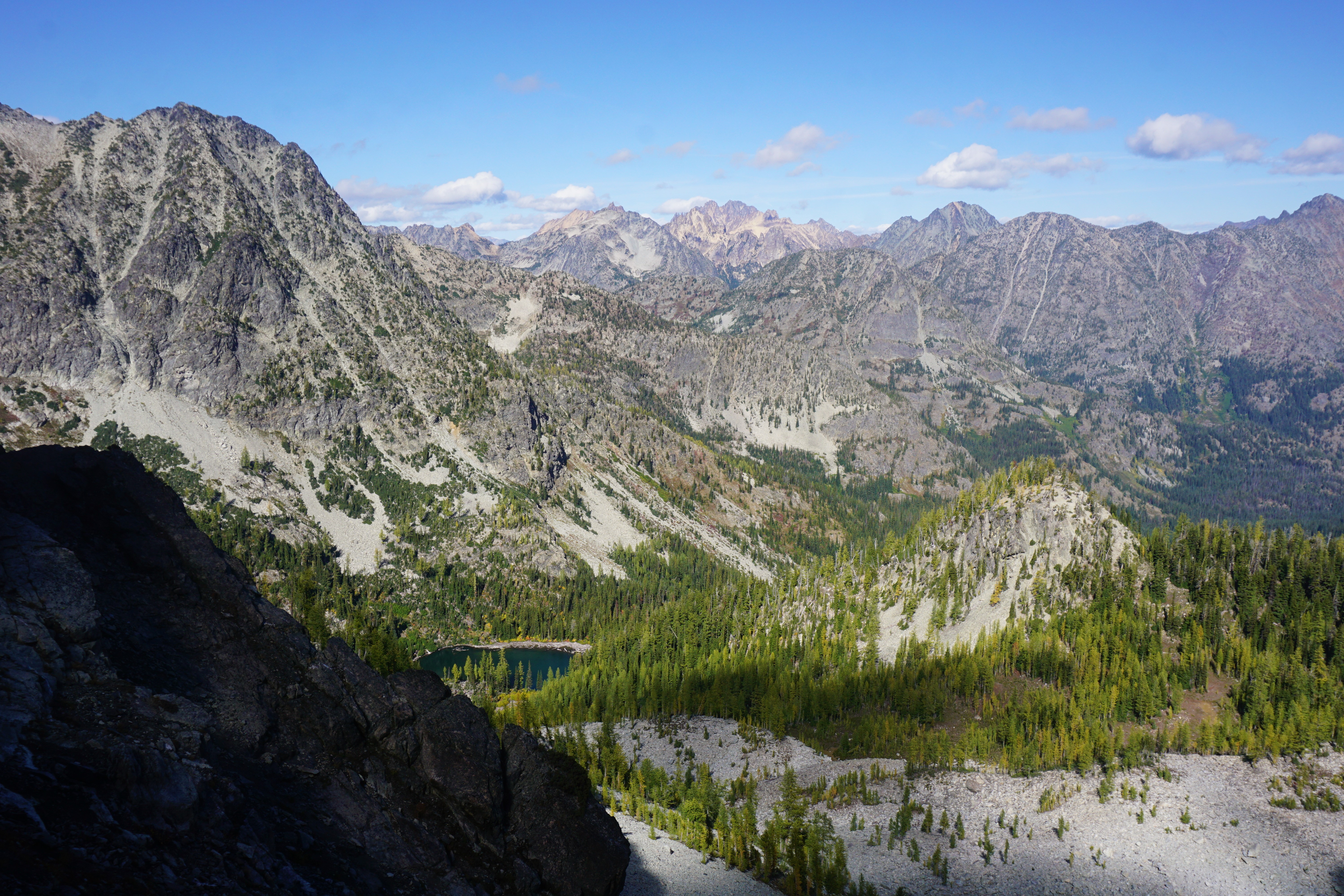
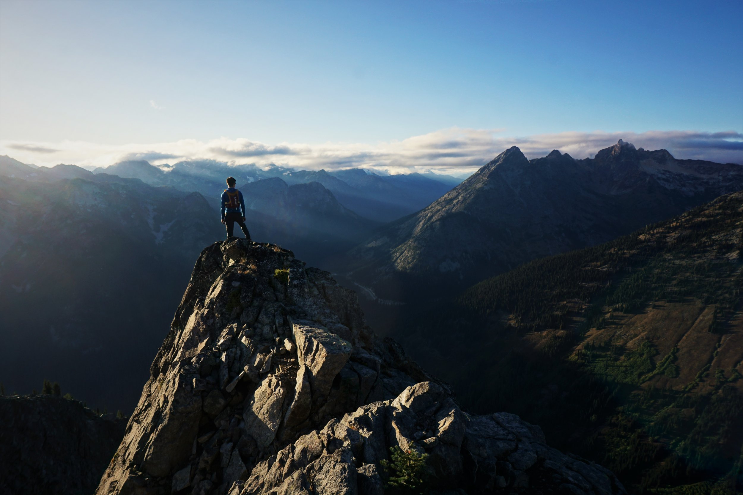
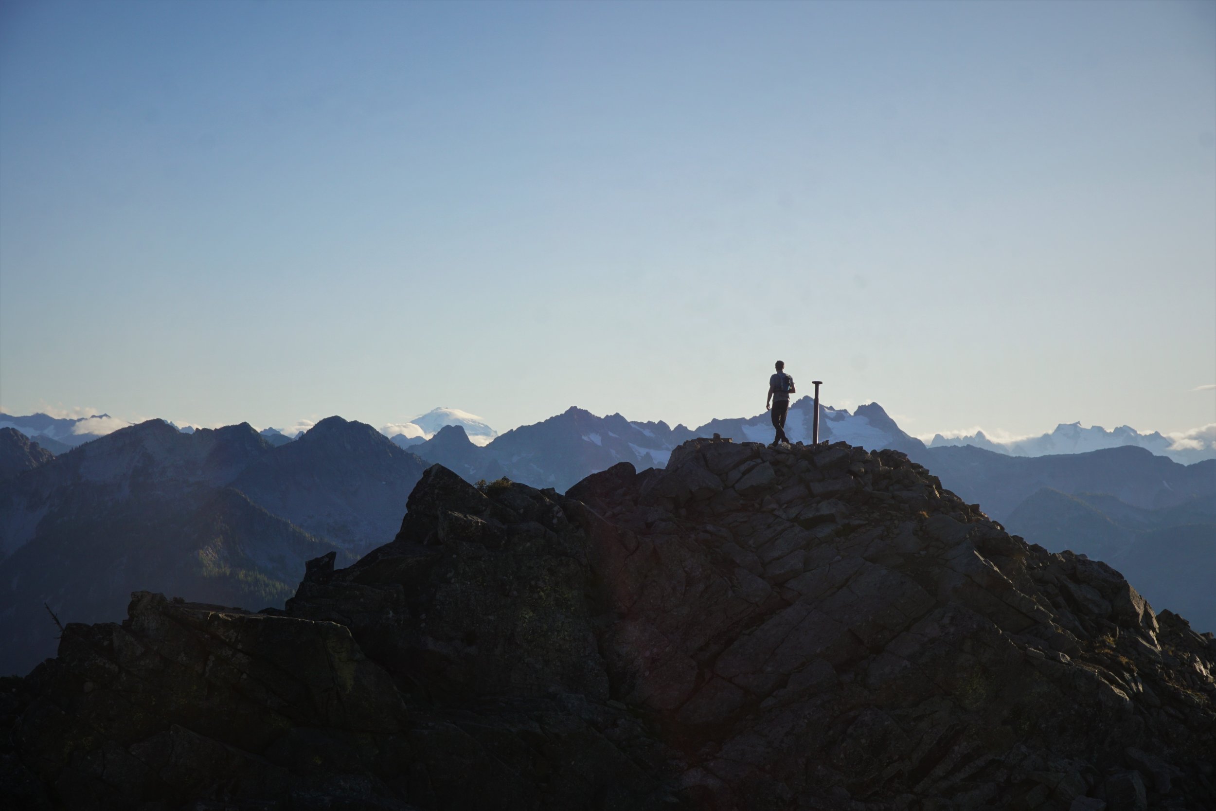
Trip: North Cascades - Isolation / Inspiration Traverse Trip Date: 09/21/2019 Trip Report: Isolation/Inspiration Traverse in Late-Season 2019 My wife, Julie, and I recently completed the Isolation/Inspiration Traverse over eight days beginning September 3rd and ending on the 10th 2019. After our return, I realized that our trip was almost exactly the route described by Doug Walsh in an excellent trip report titled “Isolation Traverse - Thunder Creek Alternate Finish 7/10/2013”. I debated submitting this report because of the route similarity. However, it seemed that our trip was also very different from theirs due to the late season of our trip, as well as the greater glacial retreat in 2019 vs 2013. I hope you will find value in the following. On Sept 2nd, we flew from our home in Wyoming to SeaTac, rented a car, purchased stove fuel, picked up a permit in Marblemount, and camped in the Colonial Creek Campground. The following morning, we parked our rental car near the Thunder Creek trailhead (in the Colonial Creek Campground) and hitched a ride to the Pyramid Lake trailhead (note: this was recommended since there have been a number of break-ins at the Pyramid Lake Trailhead). After the ~2 miles of NPS trail to Pyramid Lake, we climbed the boot trail (photo 1) to Colonial Glacier and Lake (photo 2). FYI: the boot trail is similar in nature (steep and long) to the Lucky Ridge Boot Trail, although we found it easier to follow. From “Colonial Lake” we forded the outlet (photo 3), ascended the low hills to the east and then followed a nice trail to access the glacier. In late season the lower part of the glacier was rock covered and blue ice. The upper portions were somewhat crevassed but easily negotiable. We found decent campsites along the western shore of Colonial Lake, excellent campsites atop the low bounding hills of Colonial Lake (photo 4), and superb campsites at, and near, the pass. The late-season descent from the pass to the Neve Glacier was over rock and boulders but still pleasant even for my worn-out knees. The Neve Glacier was a jumble of broken and very wide crevasses (photo 5). It took considerably more time than anticipated to negotiate--but it was beautiful and fun! We ended up at the western-most and lowest pass between Snowfield Peak and The Needle. We backtracked to the next col east to descend. In hindsight, the furthest pass to the east (adjacent to Snowfield Peak) would probably provide the most pleasant descent--especially in early season. The descent from the Snowfield-Horseman col was mainly over rocks and heather--again, very pleasant for the most part (photo 6). In early season this descent would be over snow. The descent trends to the SW and then turns back to the SE to gain the ridge between Snowfield Peak and Isolation Peak. Our objective was a prominent boulder-filled gully--which proved to be easier and more stable than it appeared from a distance. There were several lovely campsites along the top of the ridge. Once on the ridge, we enjoyed easy hiking towards Isolation Peak. The descent to the lake NE of Isolation Peak was largely thru heather and again, quite pleasant (photo 7). There is a trail atop the low hills bounding the NE lakeshore that crosses the lake outlet and heads up the steep draw east of Isolation Peak. This draw was okay without snow cover, but with some unpleasant sections. From the top of this draw (photo 8), you’re on the E shoulder of Isolation Peak (photo 9). We followed a trail south around the shoulder, through a boulder field, and continuing down through very steep and slick meadows (apparently the same route that Doug Walsh and Robert Crouse took--with similar results (lots of falling on our butts)). After some light ‘schwacking, we gained the beautiful and isolated ridge above Wilcox Lakes (photo 10). In late season there are several fine campsites in dry tarn beds along this ridge. The no-snow ascent to “Wilcox Pass” was pleasant. The descent was hellish 'schwacking--but mercifully short. Before leaving Wilcox Pass we inspected the ascent chute leading just N of The Coccyx. It was largely free of snow and looked confined and dangerous. We elected to climb directly W up the bowl S of Newhalem Peaks to a vegetated ledge system that led us back the the upper portions of the dangerous-looking chute. During our circuitous detour, we heard a number of large boulders bounding down the chute--confirming our cautions. The top of the chute was better (photo 11) but, still quite steep and difficult to the top. The descending traverse below The Coccyx was pleasant with some potential campsites at the base of the small glacier below the NW face of The Coccyx. Gaining the ridge SW of The Coccyx was easy. Once gaining the ridge, we had to walk back towards The Coccyx to find the descent. The crossing below Backbone ridge was delightful. We referred to the basin as “Bear Basin” after seeing six (or was it seven?) very well-behaved black bears feasting on blueberries as we hiked through (photo 12). Suitable campsites were not readily apparent to us at the start of this crossing but, we noticed several nice spots near the end of the crossing (on the slopes SW and below Early Morning Spire). The crossing into Marble Creek drainage was reasonable and allowed fairly easy access to the moraine N of Marble Creek. The moraine was steep but, had excellent footing and was stable--providing an efficient pathway to the upper reaches (photo 13). We had to do some tricky routefinding (and backtracking in several places) to gain access to the lower portion of the glacier (name?) leading to the col SE of Dorado Needle. To this point, we had enjoyed very pleasant weather. However, we were blasted by a very active thunderstorm--including welt-inducing hail--during our ascent of this glacier. As we ascended, we looked at the two options for crossing to the McCallister Glacier and chose the right-most gully (as recommended by Doug Walsh in his report). However, instead of being “elegant, scenic, zero stress and quite pleasant”, it was a nightmare for us in late season. The glacier ended several hundred feet from the top of the gully and the gully was full of steep mud and loose boulders. We frontpointed through this dangerous mess which sometimes felt like swimming. We were totally stressed by the time we reached the top--and we felt anything but elegant. Getting onto the McCallister Glacier was straightforward, although we had to descend a small boulder field in crampons to reach the ice. Fortunately, the sun came out and we enjoyed the warmth and fantastic views (photo 14, photo 15, photo 16). This was the last we would see of the sun for the remainder of our trip... I believe the remainder of our trip followed the typical Inspiration Traverse--we did most of it in dense fog (photo 17). We traversed E just S of Tepeh Towers then along the W face of Klawatti Peak to the col leading to the Klawatti Glacier. We did a short rappel off a bollard to get off of the McCallister Glacier and into the moat below the col. Then we did a 40 foot rappel to get from the col and onto the Klawatti Glacier. To avoid the heavily crevassed lower reaches of the Klawatti Glacier, we traversed almost to the base of the Austera Towers before descending. After leaving the glacier, we had a long descent over glaciated bedrock overlaid with loose “ball-bearing” scree. My old knees were starting to lose their mojo. We rounded the corner of the Austera Towers onto North Klawatti Glacier. The route to Lucky Pass (between Primus and Tricouni) didn’t look promising because of the breakup of the lower North Klawatti Glacier. To avoid that section, we decided to continue up North Klawatti Glacier--which then necessitated going over Primus Peak (photo 18) to reach Lucky Pass. The descent from Primus was complicated and slowed by the lack of visibility but, we eventually made it to Lucky Pass. We totally messed up on the descent from Lucky Pass down the Borealis Glacier--and, to my chagrin, it was my fault. Instead of traversing N across the upper portions of the glacier, we headed straight down. After some tricky routefinding, we managed to gain the rock rib that separates the upper Borealis from the lower. We spent a couple of hours scrambling around on this rock rib until realizing that it wouldn’t work for us--ugh! Julie identified the correct route which involved climbing back up to the upper portion, crossing to the north and descending the drainage back down to the lower portion of the glacier. After some exploration, we found the Lucky Ridge Boot Trail (note: if you’re looking at Borealis Lake from the south (above), there appear to be three small hills above the north shore of the lake. The trail is on the easternmost (right) hill). The trail isn’t hard to lose. I highly recommend downloading the GPS track referenced in a trip report titled "East Ridge of Primus Peak via Thunder Creek and Lucky Ridge" on Summit Post .org (link). When we would lose the trail, we always found that we could use the GPS to relocate the track. After descending the Lucky Ridge Boot Trail, we couldn’t locate a log crossing over Thunder Creek, so, we forded the creek near the old bridge site. We’ve since learned there is a log crossing upstream of the old bridge site. The hike back to the campground was uneventful but spectacular (photo 19). The trip took us eight days. We had planned for seven. We missed our flight as we were hiking down Lucky Ridge. There were a lot of great times and experiences but, with more type II fun than we anticipated. Of course, now that we’re back home, it was a totally wonderful trip--you know what I mean... The lessons we learned about a late season traverse (especially with continued glacial retreat) are to expect less snow cover, slower travel through rougher terrain, more difficult entrances onto and exits from glaciers, and more circuitous route-finding as glaciers break apart. These may be obvious lessons to every Cascade Climber (and maybe that’s why we didn’t see anyone else for seven of our eight days) but they were hard-earned lessons for us boneheads from Wyoming. Stay safe, have fun. Following is a link to our annotated gps file (gpx format): IsolationInspiration.gpx Gear Notes: Nothing special Approach Notes: Delta Airlines from Jackson, Hertz from Seatac...2 points
-
^ x x x x xx x x x x x xx x x x x x xx x x x x x x x x xx x x x x x __________________________________________2 points
-
Trip: Mt. Triumph - NE Ridge Trip Date: 09/21/2019 Trip Report: On Saturday @willgovus and I climbed Mt. Triumph's NE Ridge in a day, roughly 16.5 hours c2c. Camped at the trailhead and set the alarm for dark and early. Only two other cars there, possibly camping around Thornton Lakes. Approach went pretty smooth through the brush around the lakes, felt like hiking through a car wash. Took about 4 hours to get to the base of the ramp before the notch at the start of the NE Ridge. The only snow travel was a ~50yd patch after the notch above Thornton Lakes. After that it was walking along mostly dry slabs. We made the mistake of staying little too high initially on the slabs only to get cliffed out, but found a mellow mossy ramp down lower on the slabs. I'd recommend staying low on the slabs until after crossing the big gully in the middle of the cirque. Climbing on the ridge was almost entirely done simuling, with pitched out sections at the cruxes. I thought the rock quality from after the vegetated beginning to the high gulley towards the top to be really good. The rock was damp here and there and keeping the soles of our shoes dry was a challenge. The 5.7 "off width" crack was pretty fun and protected well, even though a bit moist in spots. I imagine other, easier variations exist on the north side. After the high gulley we traversed the south side on heather ledges and scrambled up to the summit. The scrambling near the top it quite loose and nerve wracking and doesn't get any better when having to down climb. If doing this again I would bring the rope up to rappel down this section. It took us about 3 hours from the notch at the base of the ridge to get to the summit. It took about 2 hours to get back down to the notch at the base, mostly rappelling and simuling the lower angle sections of the ridge. Cant remember how many rappels we did exactly, though enough to make me glad we were only a group of two. Some rappels with a 60m rope ended up being just short of the next station which we delt with just by down climbing 5 to 10ft. Reversed the long hike out and got back to the car around 6:30pm. This is easily one of the more amazing ridge climbs I've ever done. This thing is long and delivers the false summit effect a few times along the way. Very happy to sneak in one more big outing before things get even more rainy around here! Gear Notes: Cams .3 to 3, set of nuts, 7 alpine draws and 5 double length runners. 60m rope is fine if you don't mind down climbing a bit of easy 5th to get to the next station a few times. Otherwise, if you have a 70m that's somehow lighter I'd bring that. Approach Notes: Approach shoes, aluminum crampons and a light axe1 point
-
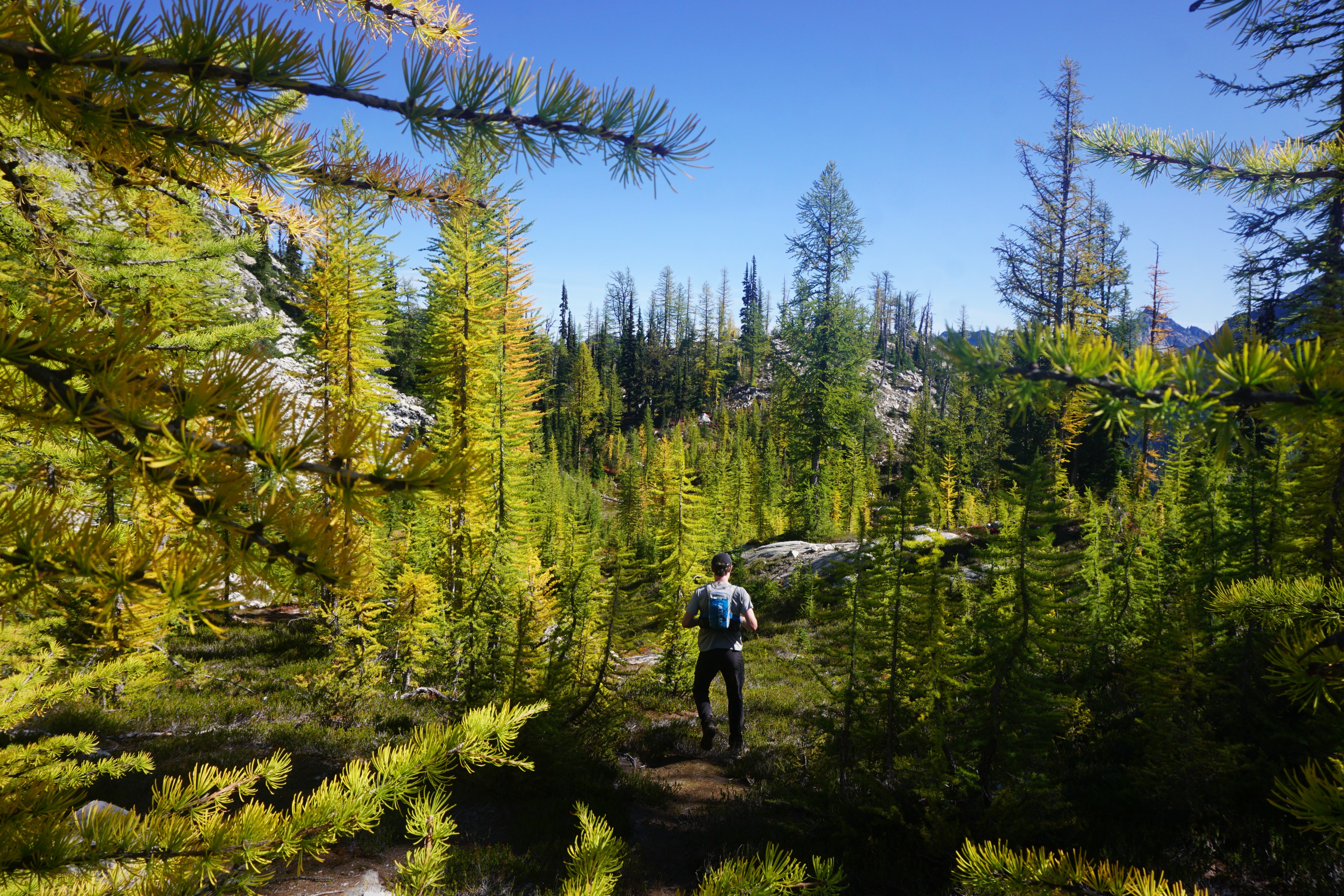
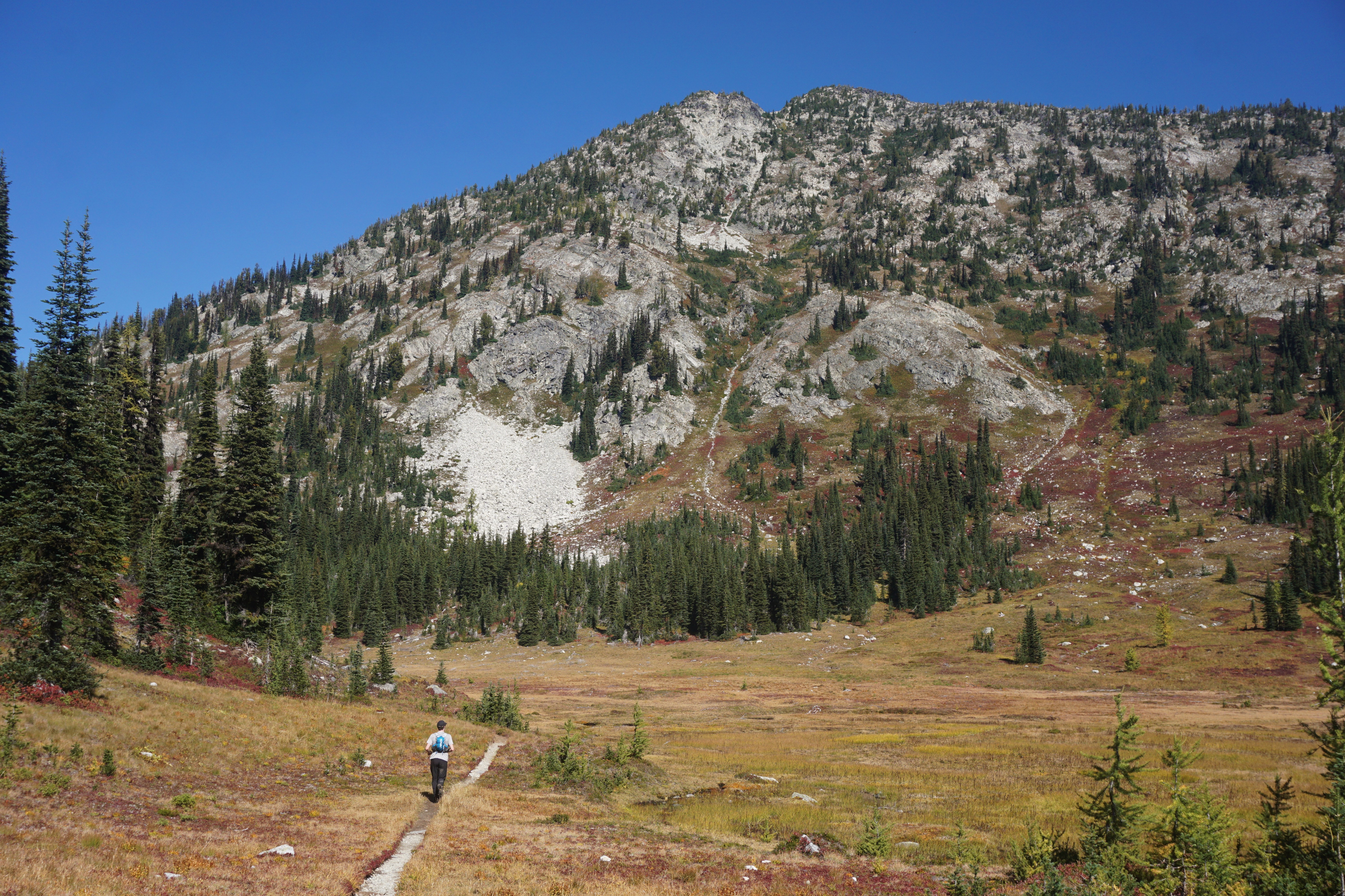
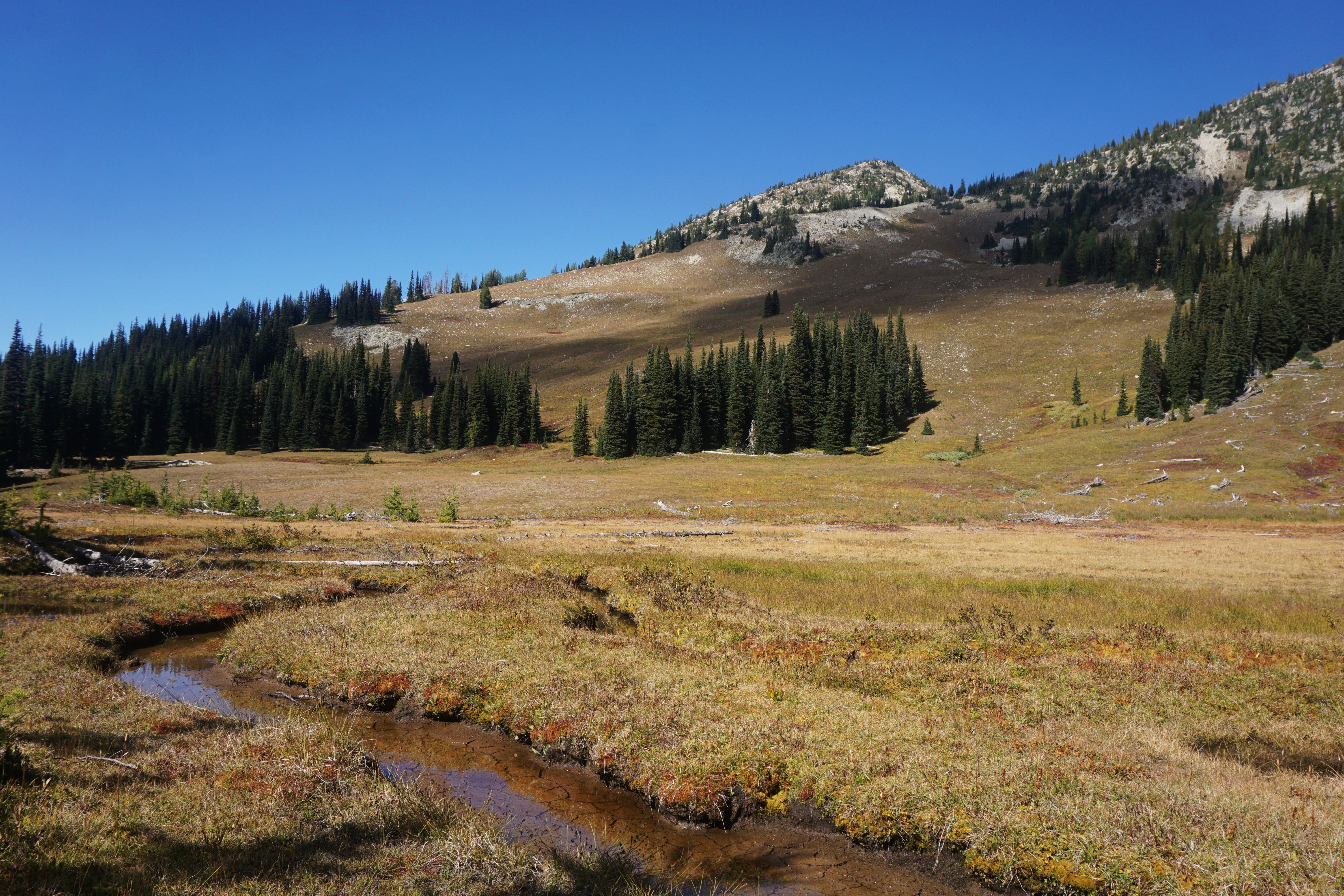
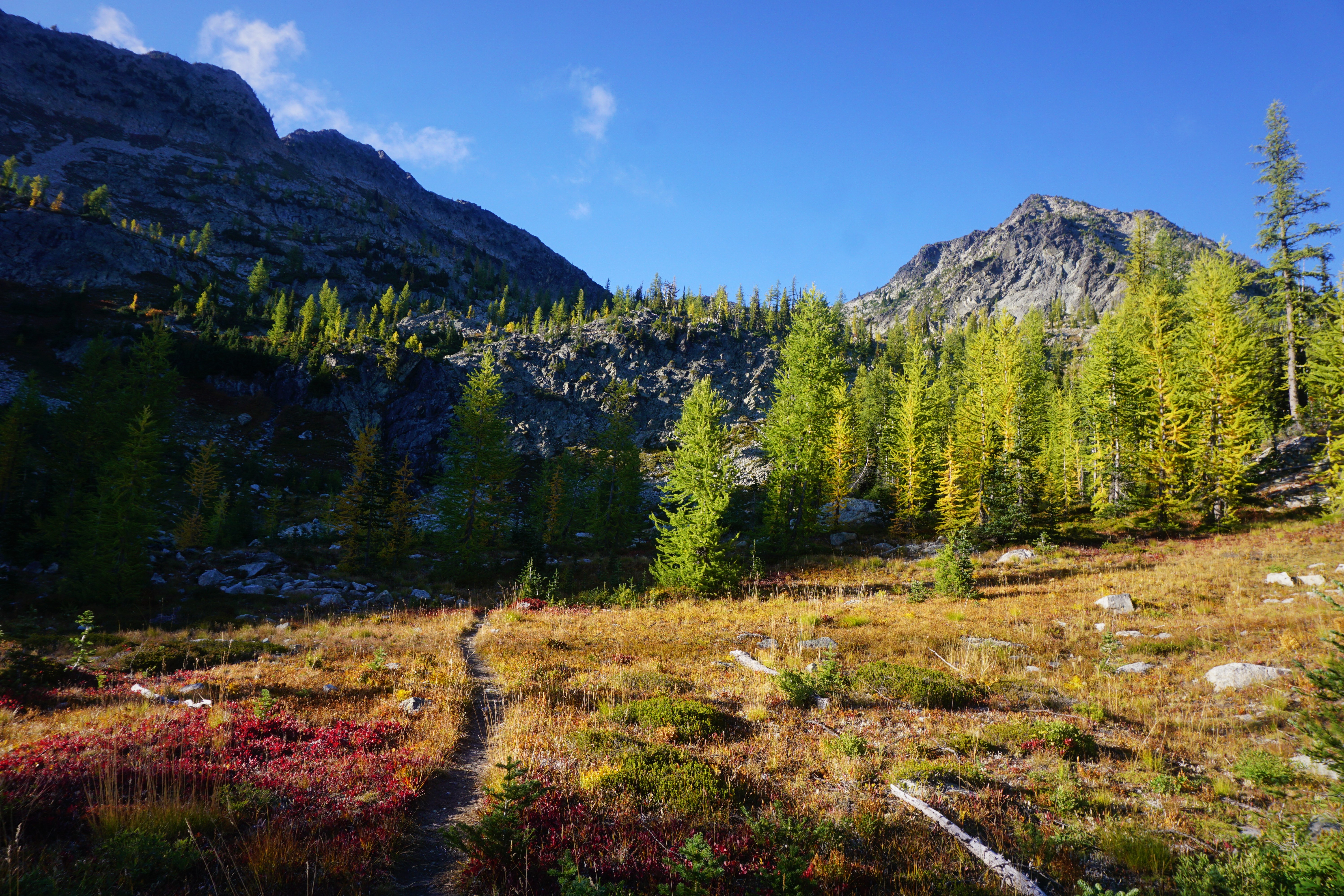
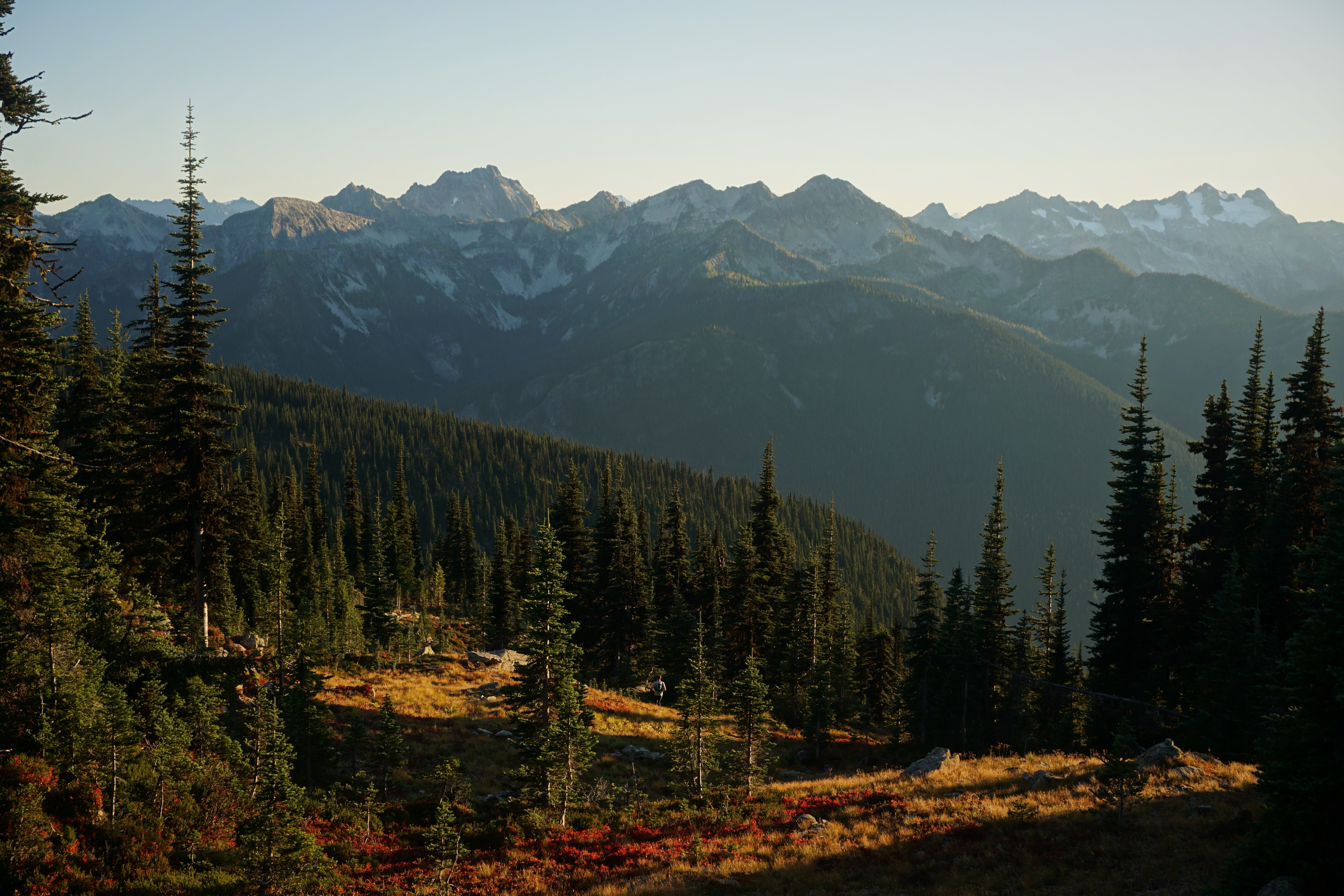
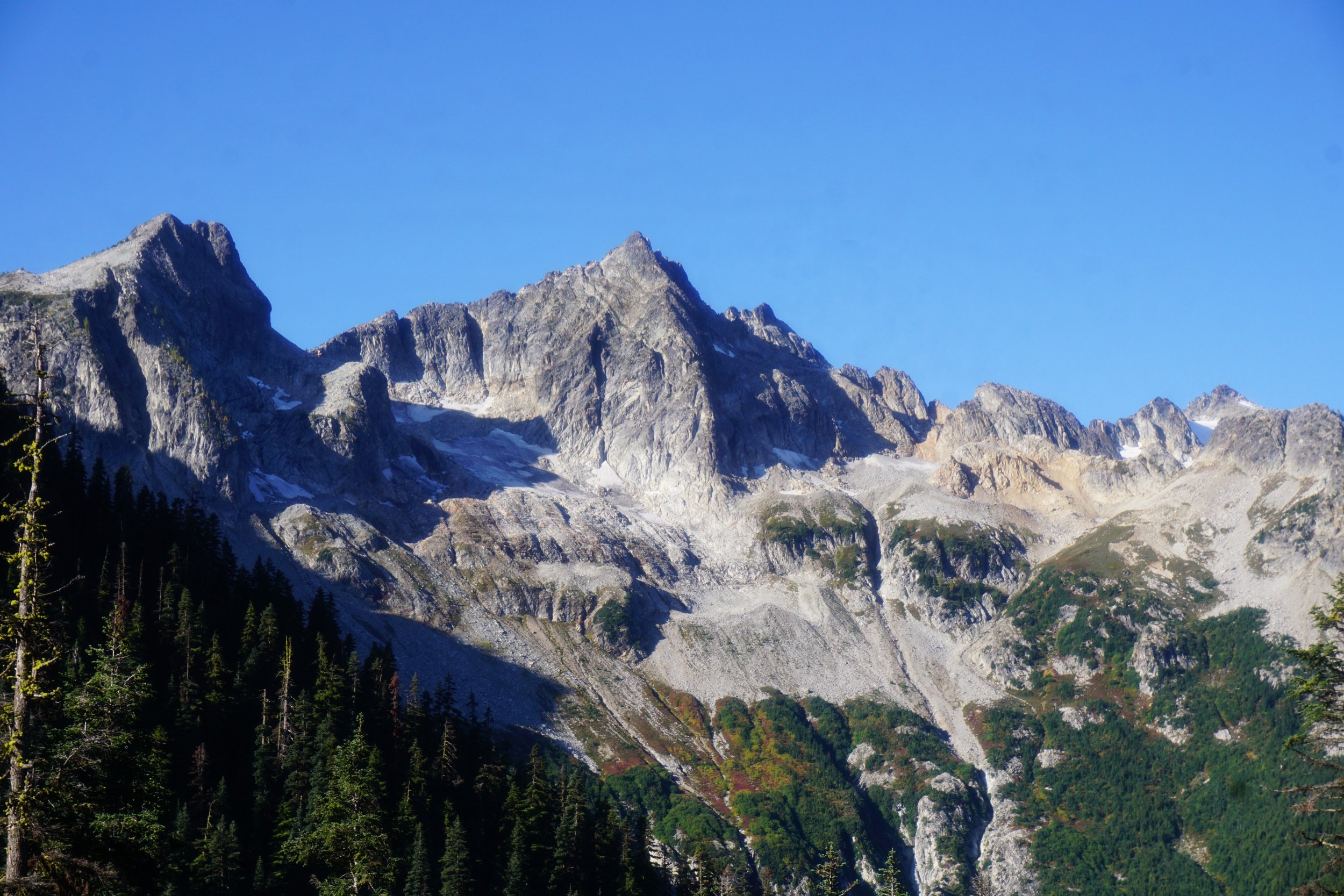
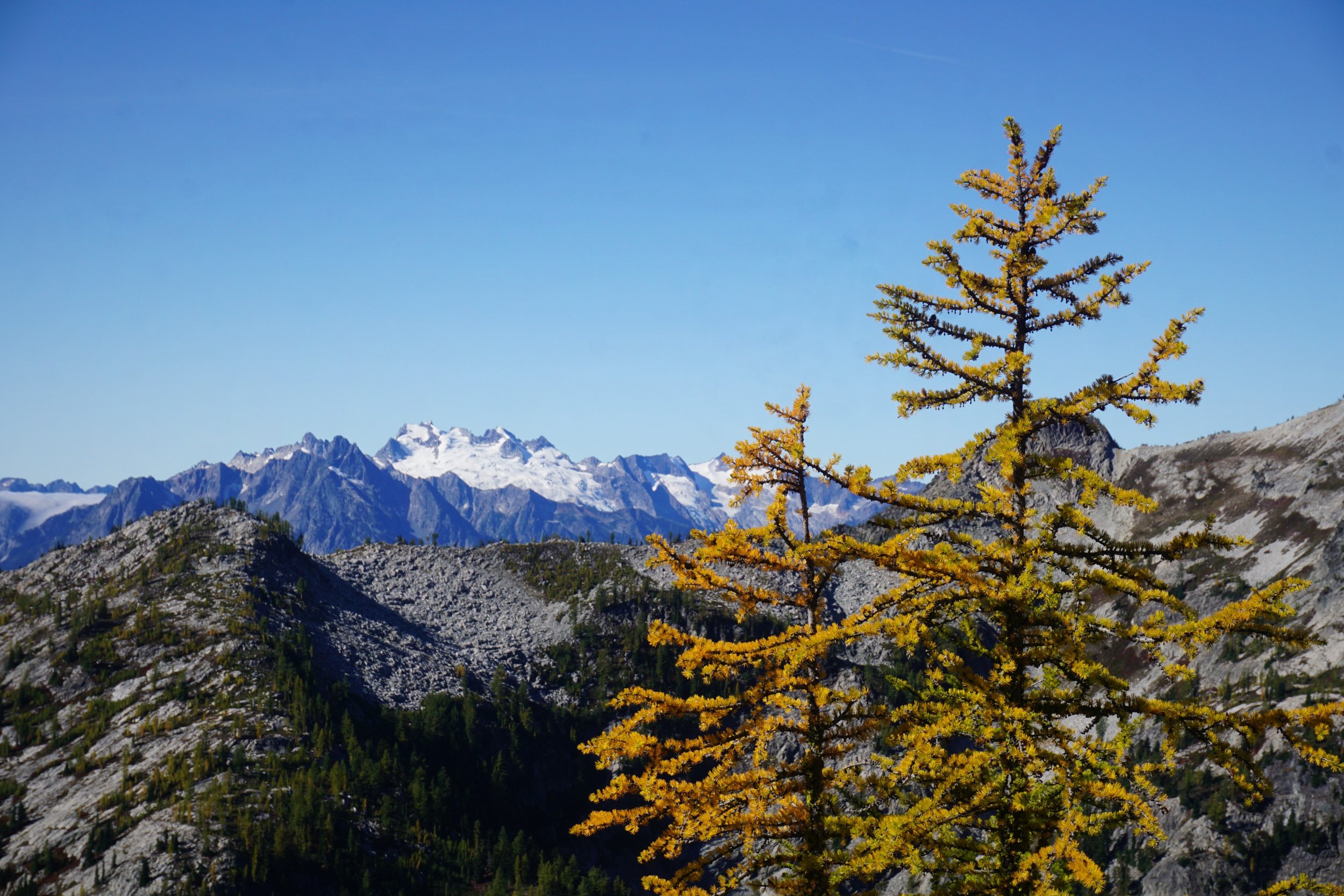
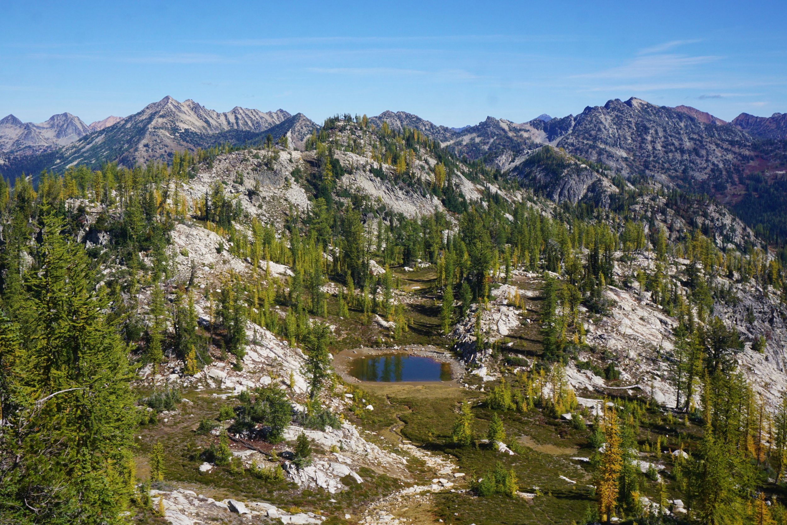
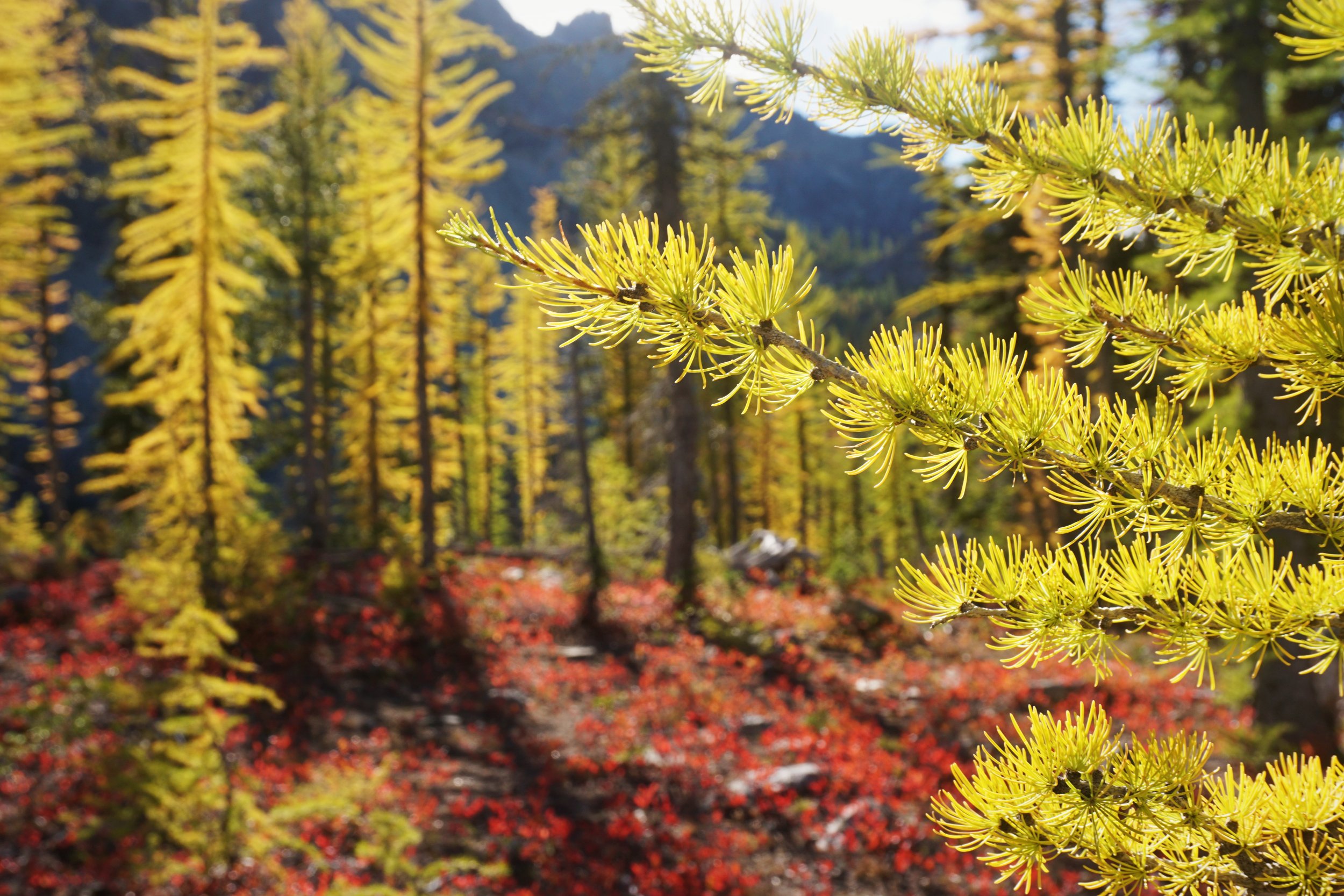
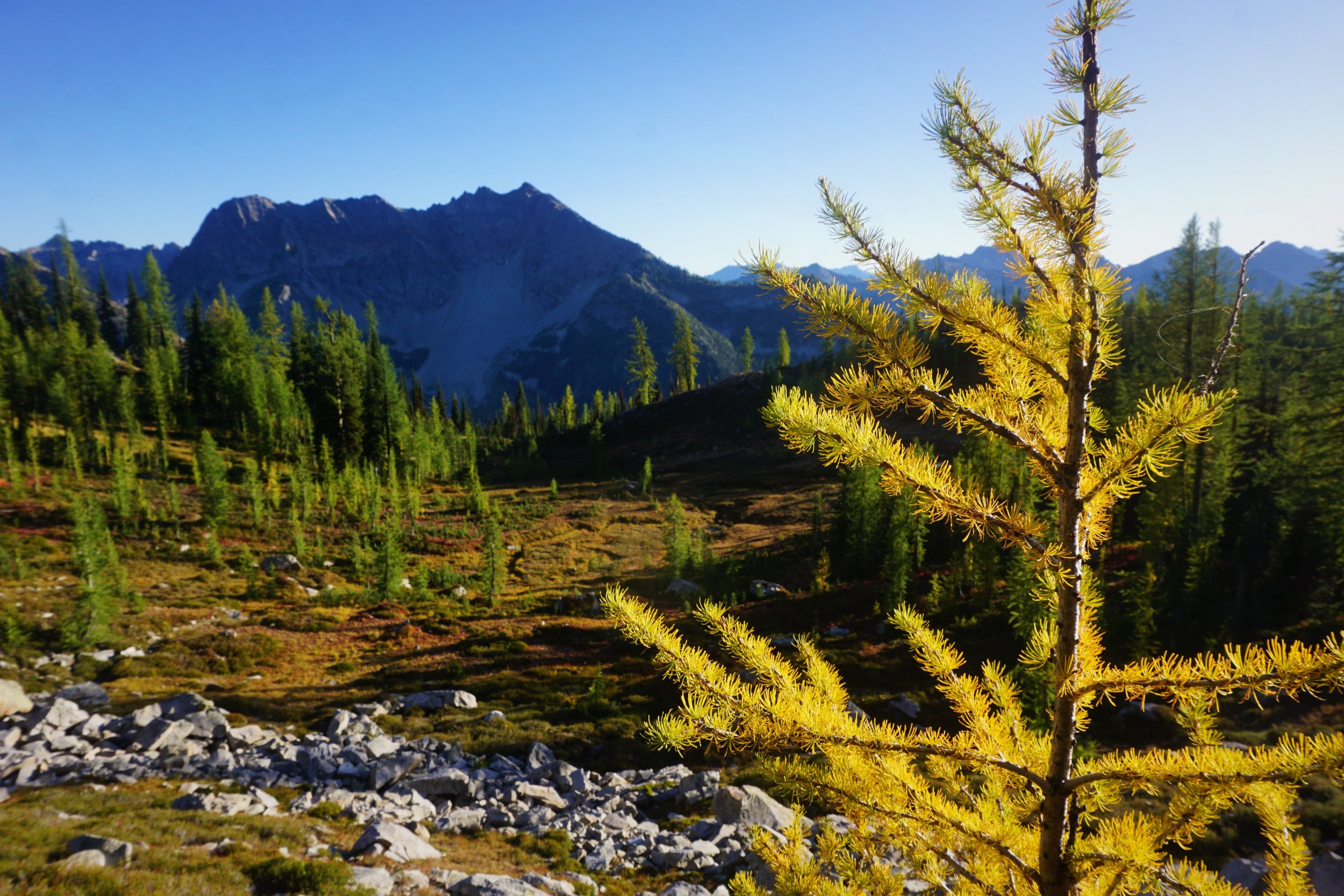
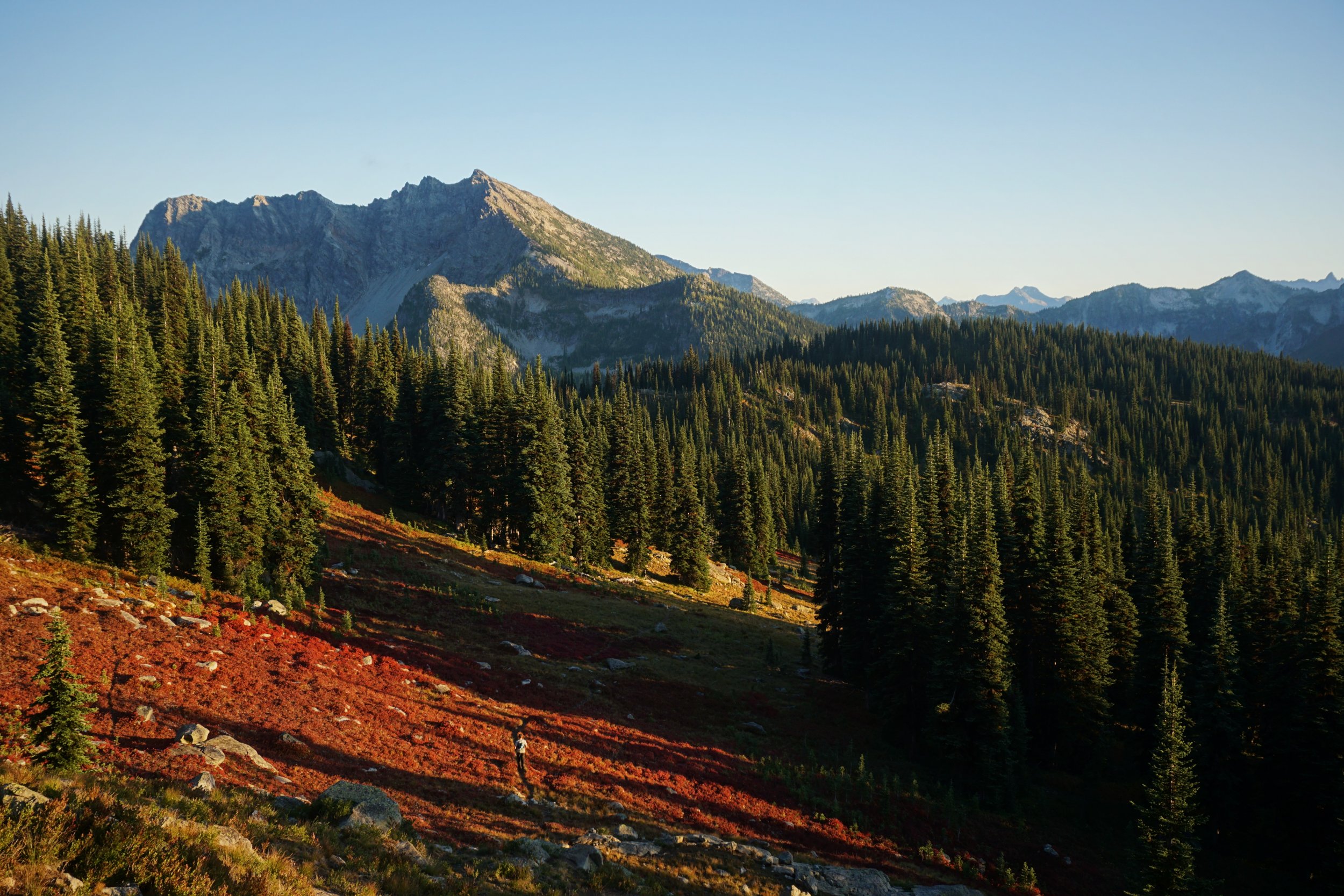
Trip: North Cascade National Park / Lake Chelan National Recreation Area - Triple Rainbow High Route Trip Date: 09/21/2019 Trip Report: @thedylan and I did a fun fall high route from Bowan Mountain to Stilleto Peak. It had three distinct off trail sections, the most stunning of which was Rainbow Ridge, so we decided to call it the Triple Rainbow High Route. Even though the larches were not quite full on, it was still just such a beautiful and inspiring day, with miles and miles of larches and carpets of red. We found the off trail travel to be generally very easy, with some more annoying north facing moraine descents, but nothing really over class 2 or so. In total, it was 30 miles (about 12 "off-trail") and 9.5k ft gain. It took us just under 13 hrs c2c, but we didn't always chose the optimal path, took some wrong trails in the dark, and took hundreds of photos. This is really an underappreciated area, and magnificent in the fall time! Cool rock on the McGregor Massif. Dome Peak and larches. Looking across Rainbow Ridge from the shoulder of Bowan. Lovely Rainbow Ridge. Cruising through larch groves. McAlester Pass. Another nice meadow. Looking at Twisp Lake from the south. Endless larches and red carpets. Another marvelous basin beneath Switchblade Peak. Getting towards Stilleto. Looking down to Rainy Pass. Stilleto Lookout Site. Beautiful meadows on the way down. @thedylan looking like a running star or something. Fun route! Gear Notes: Running shoes, poles. Approach Notes: PCT down bridge creek, then Rainbow Pass trail up to Rainbow Pass.


 1 point
 -
I remember Chuck very fondly as a classmate and friend in graduate school. He was a very curious and deep thinker, and a good poker player. But, what I will remember him for the most was his love of music and introducing me to the Seattle grunge scene. Watching Mudhoney in concert I experienced my first mosh pit and slam dancing. Chuck saw me lose my balance and start to fall and he quickly grabbed my arm, pulled me up and advised me to always stay on my feet. Before going to see The Jesus Lizard, he loaned me a tape recording so I could become familiar with their music in advance of the concert. I did not feel my untrained ear could recognize a single melody on the track yet at the show, halfway through the set, they started to play a song that I recognized from the recording. I looked at Chuck with excitement that he returned with his big knowing smile and slow nod of his head. It was the same smile that appears on many of the wonderful pictures posted on this site. I am forever grateful to Chuck for his gifting me these experiences and creating these fond memories of Seattle in the 90s. I will always remember him for this.1 point