Leaderboard


Popular Content
Showing content with the highest reputation on 10/04/18 in all areas
-
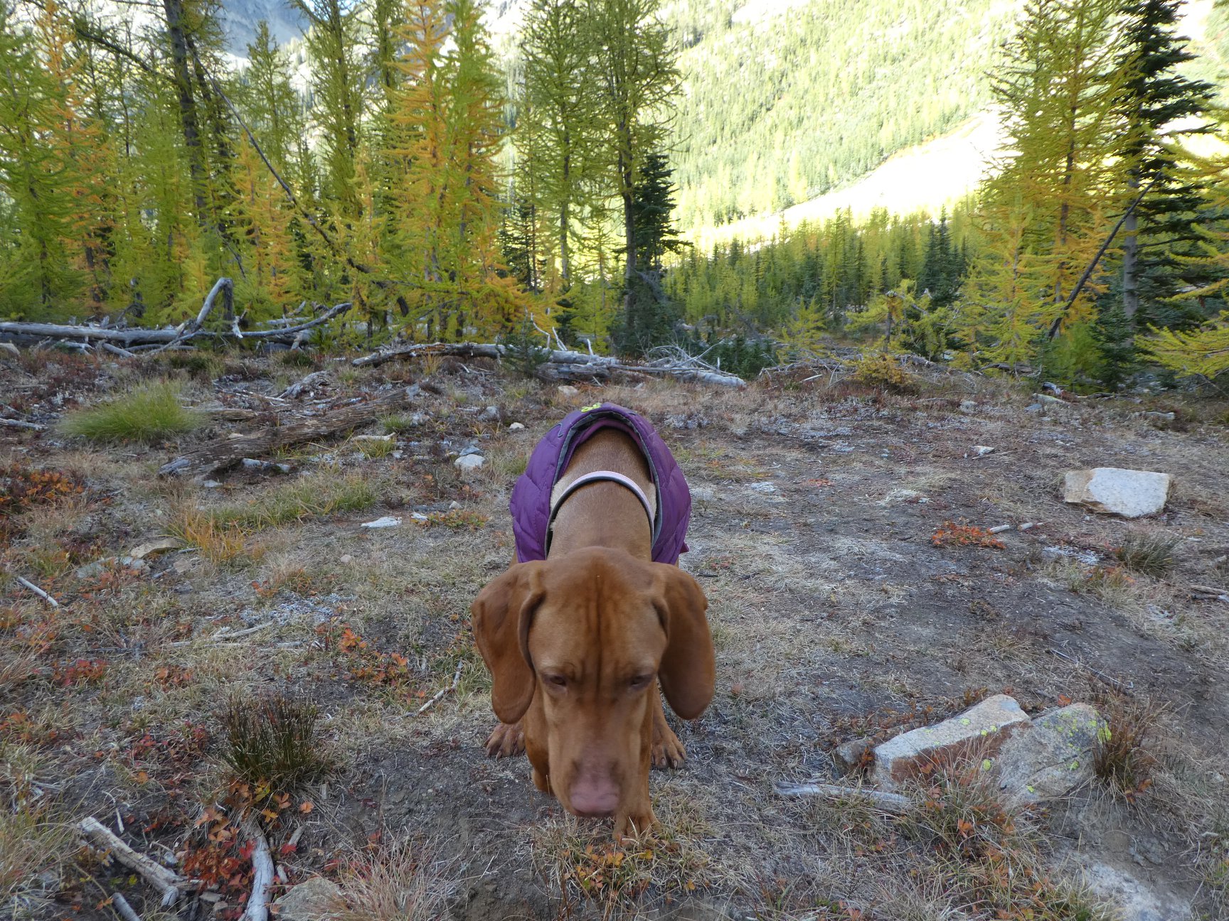
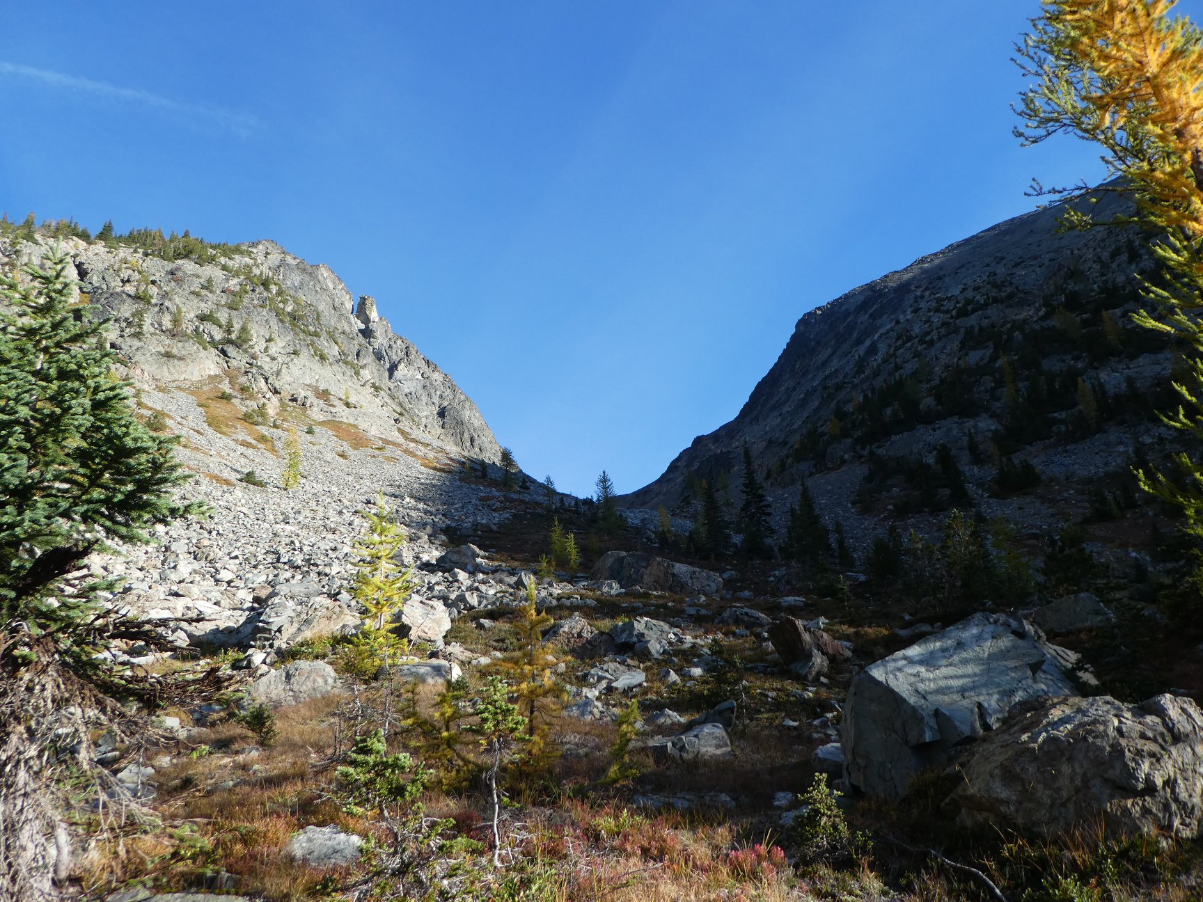
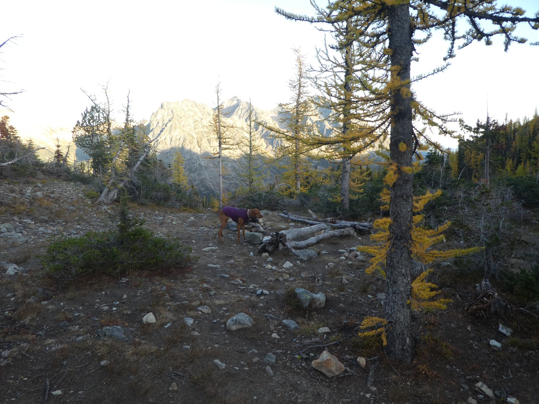
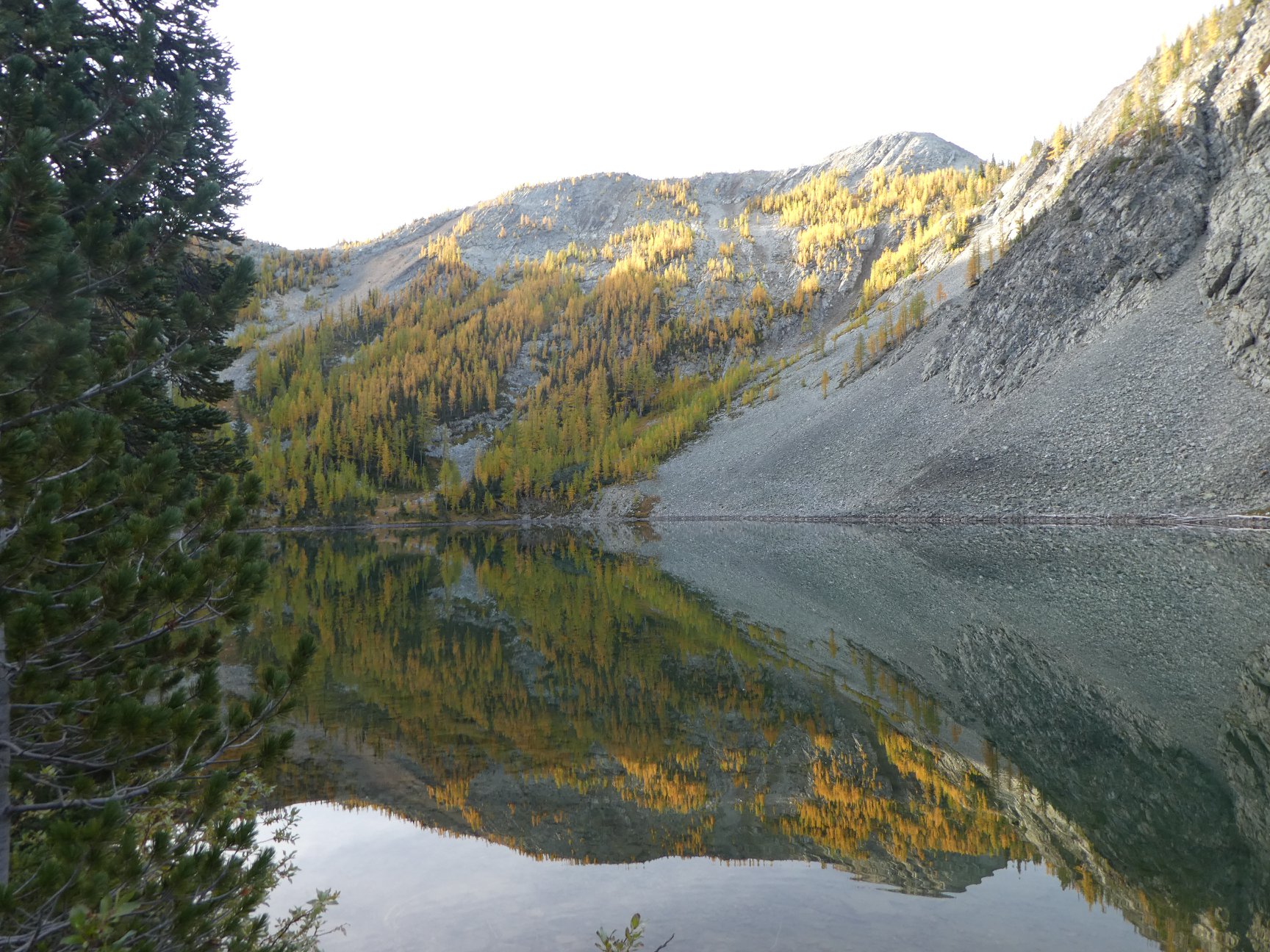
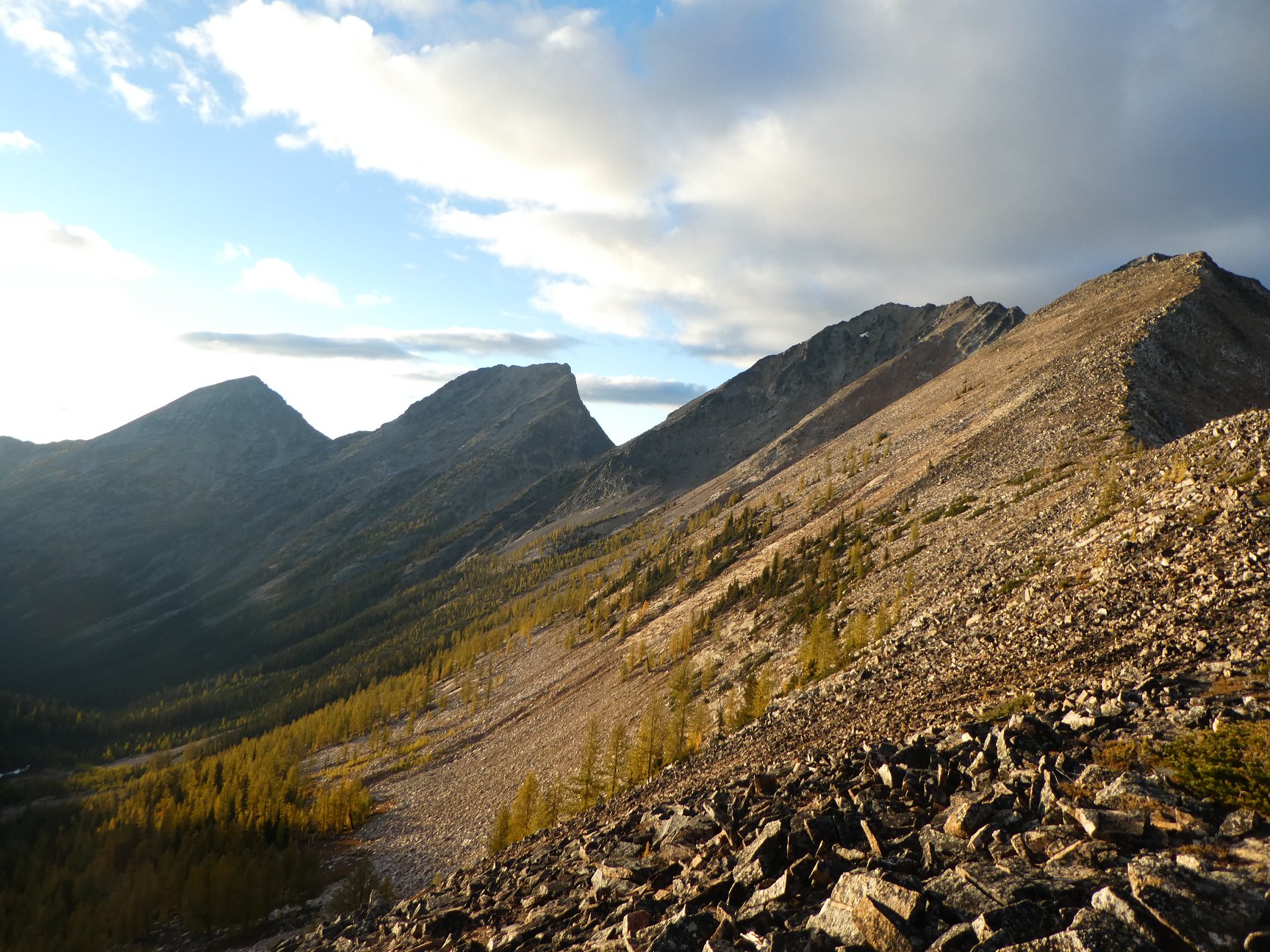
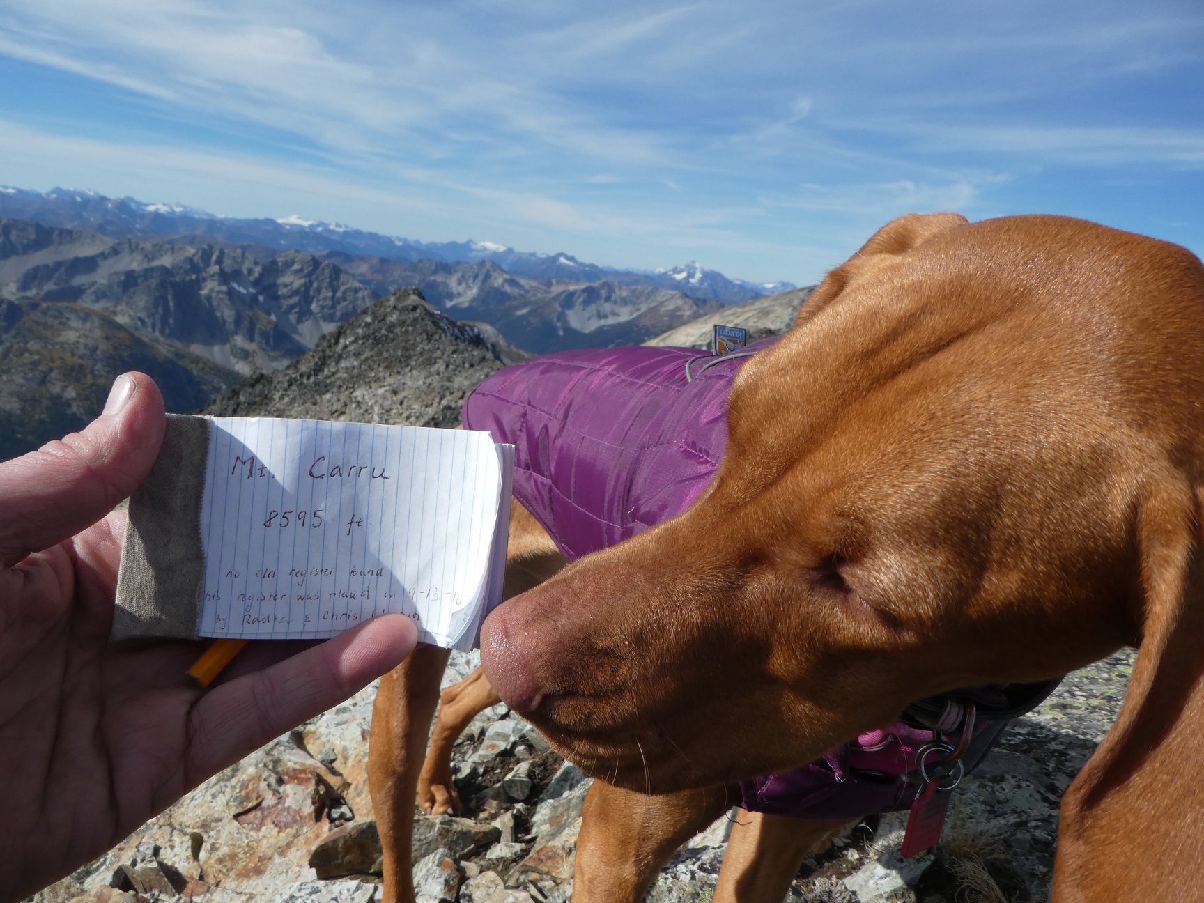
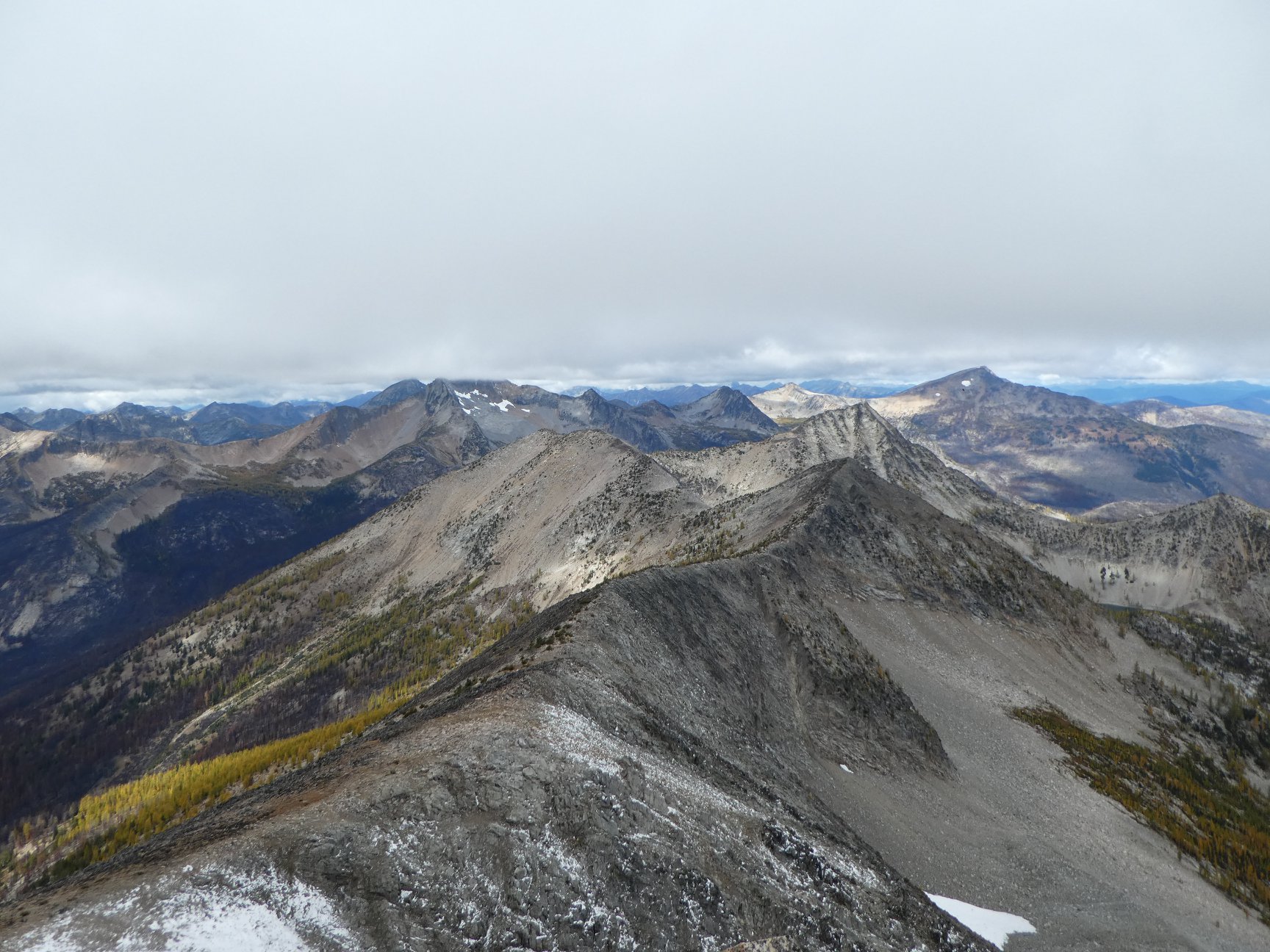
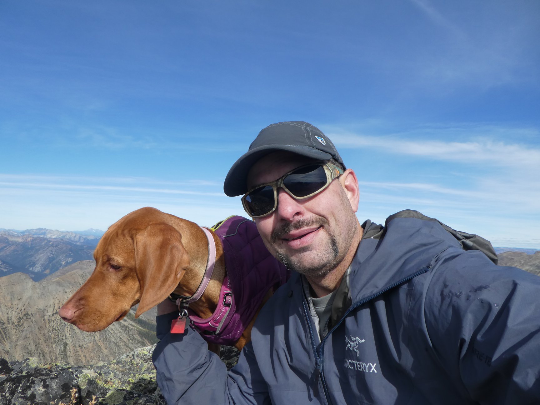
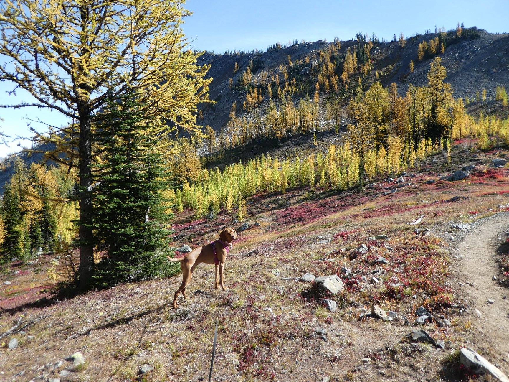
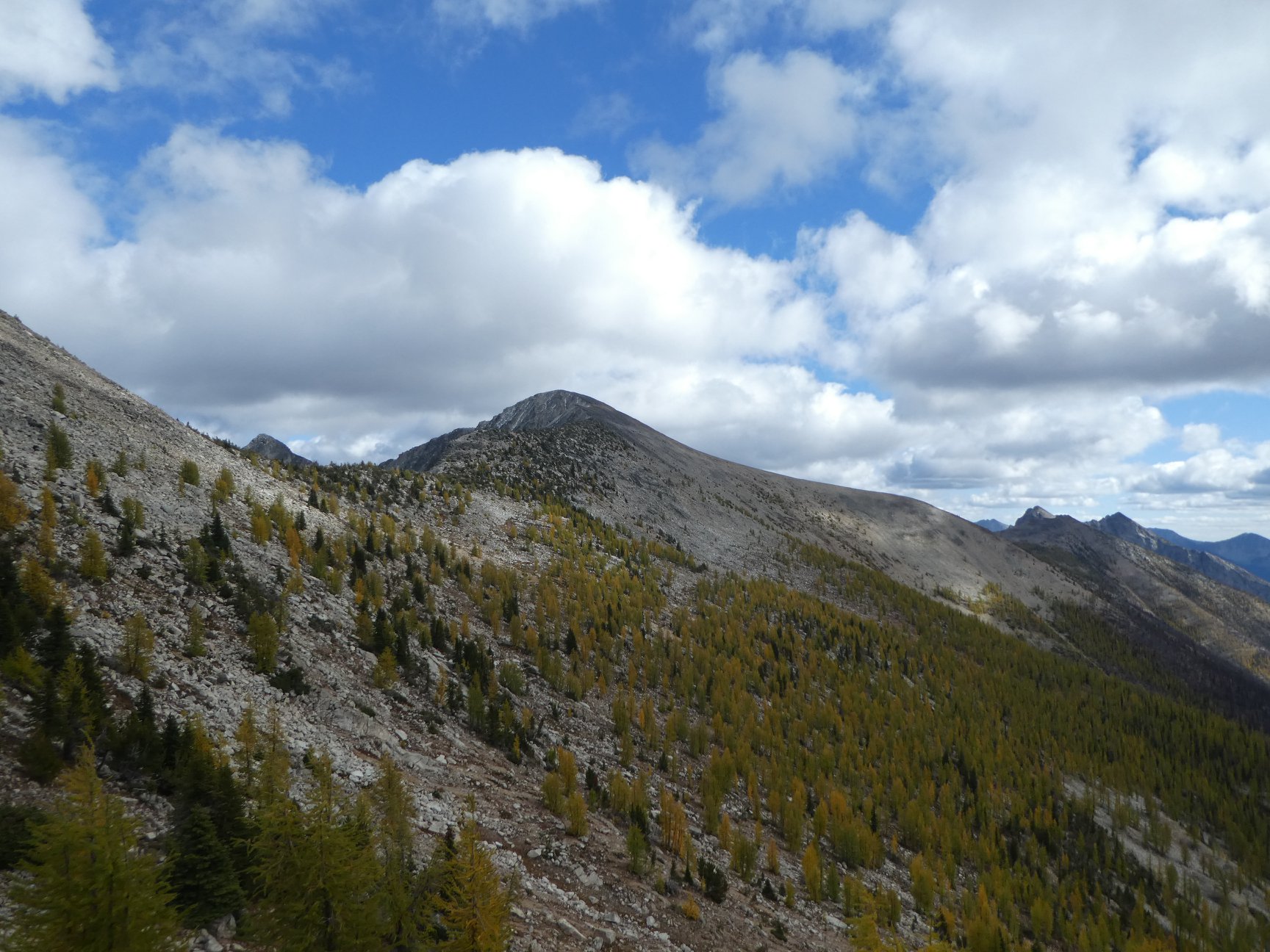
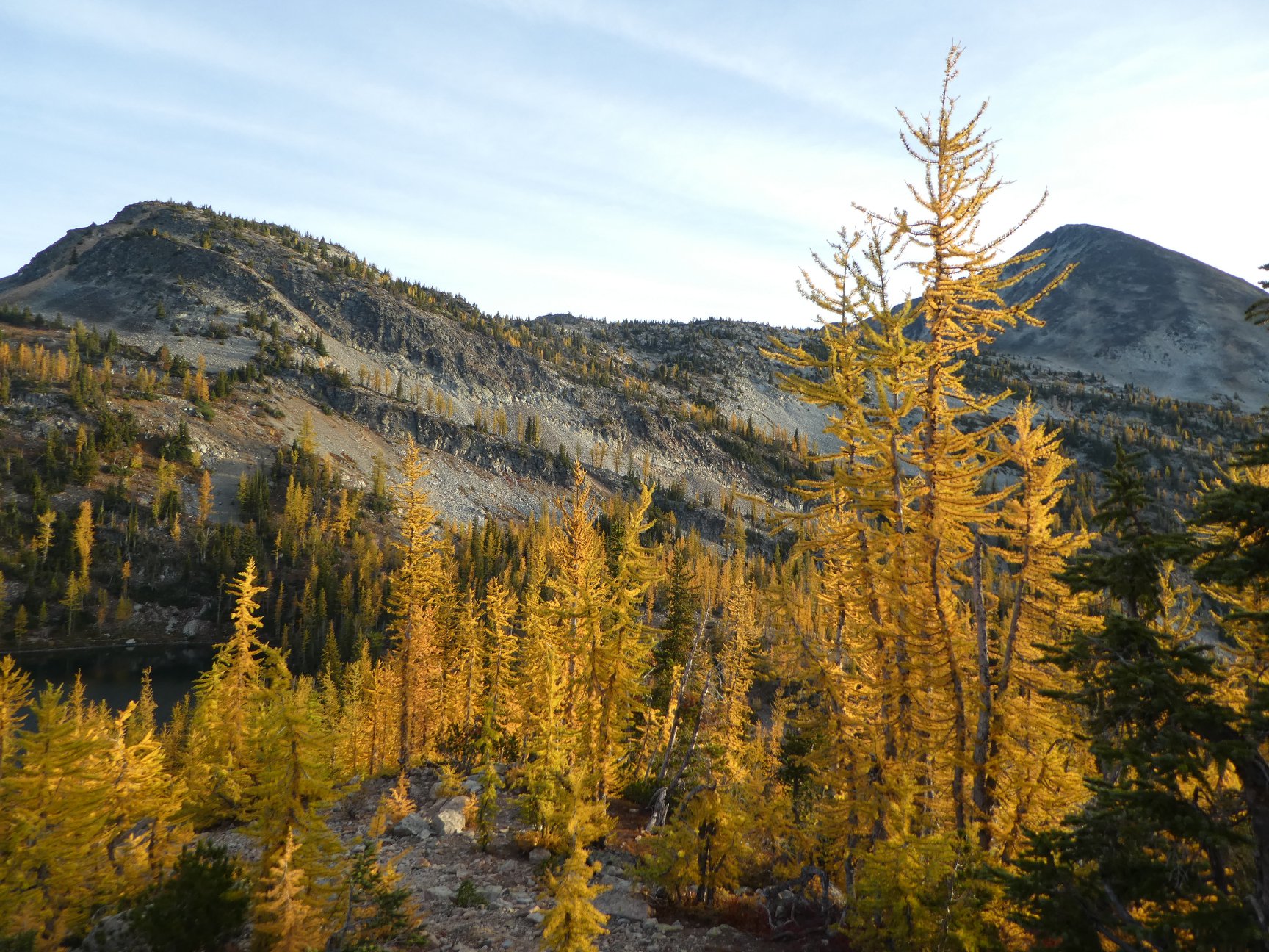
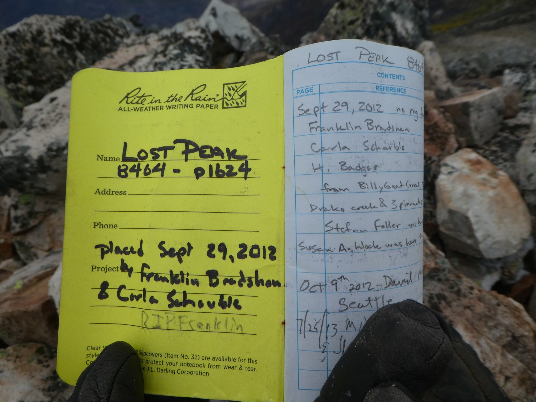
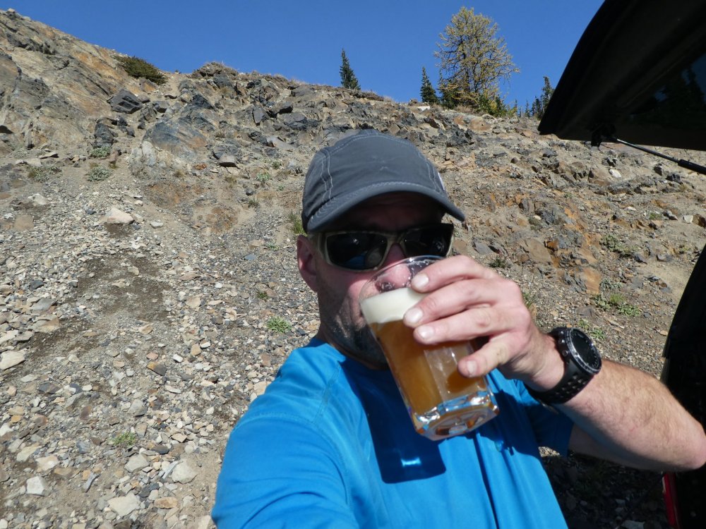
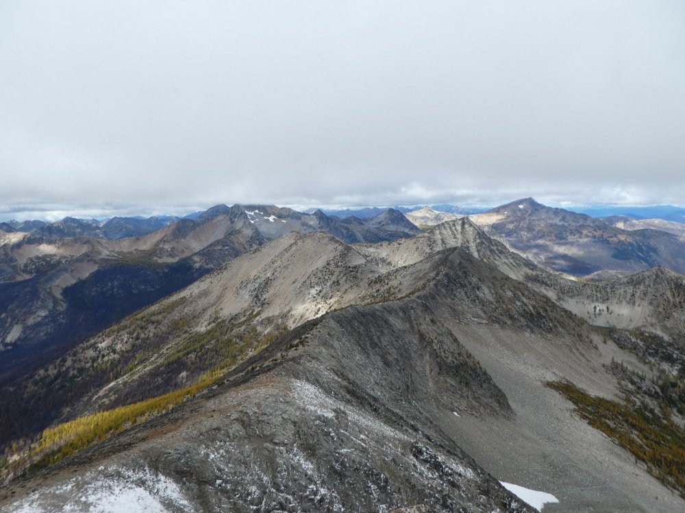
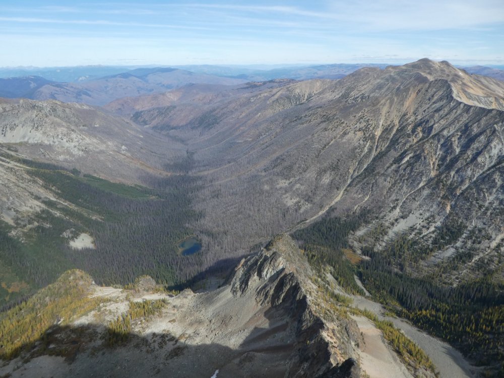
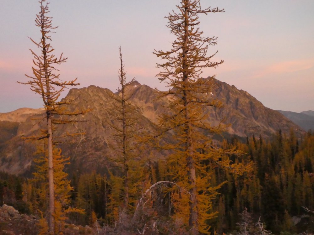
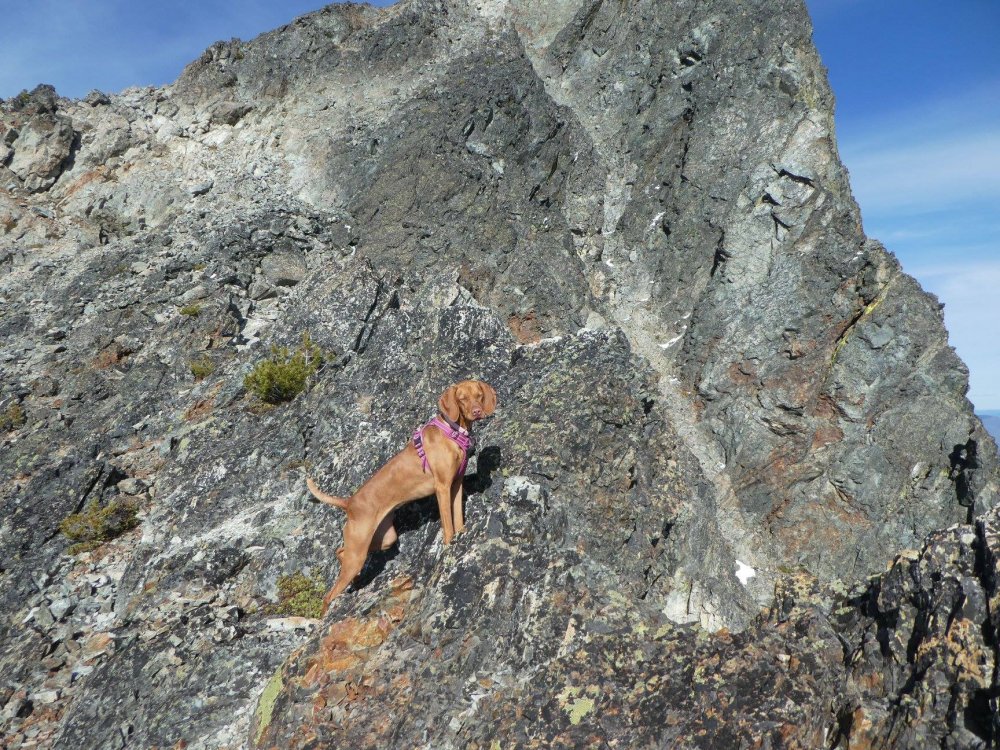
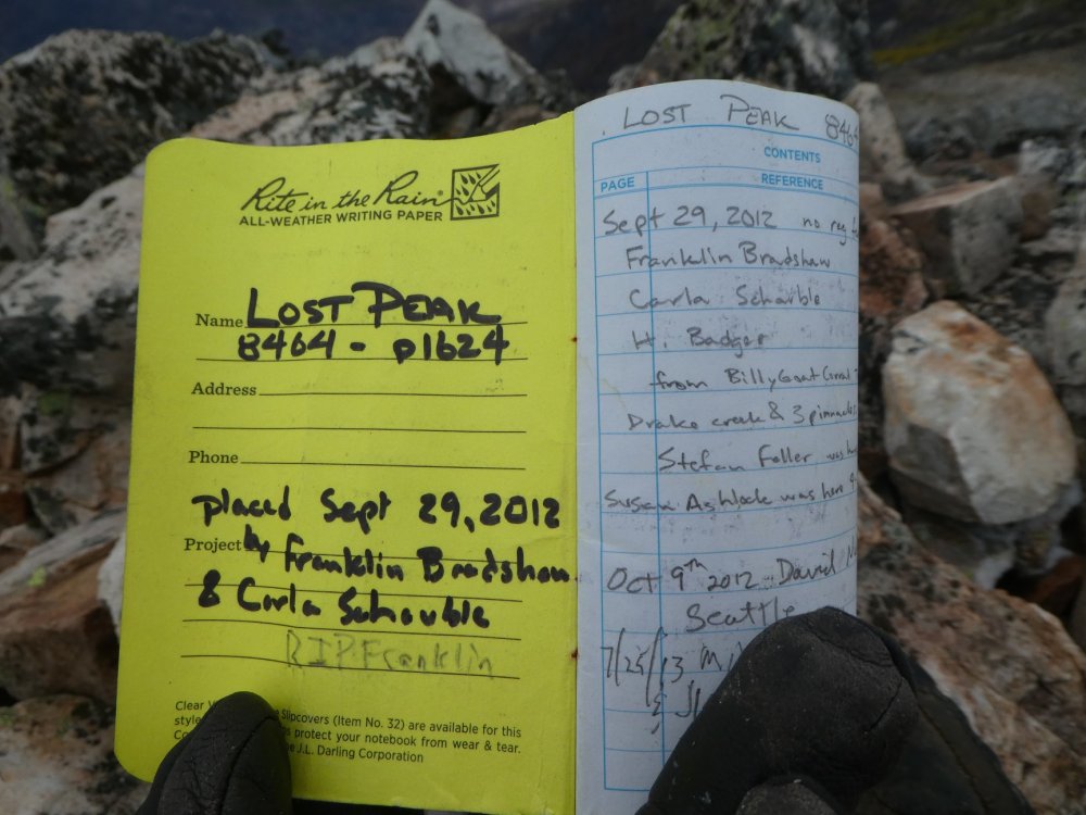
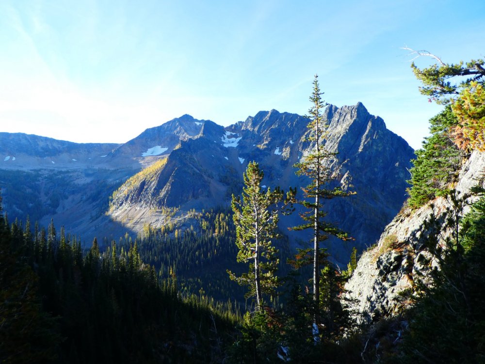
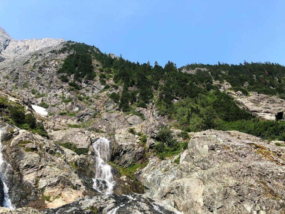
Trip: Lost Peak and Carru - Standards Trip Date: 09/23/2018 Trip Report: This has been a frustrating summer. Smoke and/or bad weather thwarted a few of my trips. With summer waning quickly and snow coming I decided to do a midweek trip, starting on a rainy Sunday and ending three days later. Also, larches. It's been too long since I got a good larch trip in. Oh, and since I couldn't find partners last minute and midweek - solo it (well, I brought my dog). Although I've solo'd many day trip scrambles, I've only done one overnighter before (Robinson) so this stepped it up a notch. On Sunday I packed for most of the afternoon and drove up to Mazama around 7:30. It was dry on the East Side until I got as far north as Kirkland or Bothell. From then on there was rain, sometimes pouring. At least this was the case until Darrington... and towards Rockport. Eventually things became drier as I passed the passes on Hwy 20 and started down the hairpin. I parked at the Monument Creek TH and slept in my truck. The weather was good all night (cloudy, no rain) and I headed up towards Slate's Pass around 7 am. As I passed the exposed hairpin the weather became increasingly socked in, and it was actually lightly snowing at the Slate Pass TH. Good times. This reminded me of my previous trip to the area where I hiked in the first 6-7 miles in the rain. Oh well, time to HTFU and go. The hike in went well. It took about 6.5 hours to get to Doris Lake and another 2+ hours to the meadows below Shellrock Pass. The weather got better the farther in I got and was dry at camp. We ate dinner and got water ready just in time for it to start raining. Bed time at 6:30! It snowed and rained lightly all night and the tent had a lot of condensation. By 6 am it was clear and we were up and moving soon. We made short work of the hike to Shellrock Pass and started to descend the E side. The trail started out clear and easy to follow, then hit meadows where occasional cairns marked the way and were not too hard to link up. After crossing the small stream we soon hit the recent fire burnout (from last year I believe). At first I could follow cairns and a lighter-colored line through the blackened earth. Then it was all cross country. I overshot the proper trail turnoff (Monument Creek Trail) I believe and aimed for the notch directly next to the W base of point 7275 on the ridge. The last 150 feet or so were up a very blocky gully. At this point the weather was getting bad - fog was rolling in with a lot of wind. I wasn't worried yet though. I climbed up and over point 7275 and dropped to the next saddle (~7000') then ascended to 7700' and began traversing. Now I was worried about the weather. The boulders were covered with a thin layer of snow and were slippery. It was getting more socked in, cold and miserable. I knew I had at least 1.5 miles of this traverse and could not see the top of Lost Peak. Nevertheless I kept going, hoping hypothermia would not be an issue. My pup seemed fine. As I rounded the first pair of humps in the ridge (Pass Butte), the rock became dry and snow-free and that helped with my morale. It was still not very clear up high though. I traversed under Point 8107 and could see lighter colored, sandier terrain ahead. I moved onto that. Then the the fog lifted and I could see the summit of Lost and realized I had traversed farther than necessary and headed straight up to the summit. Time up? 6 hours. Uggh. At least I was done, but I doubted I could tag Blackcap on the way out with the late start and shorter fall days. Summit shots on Lost Peak: Looking back at Lost Peak: Tres Bulger Hombres from Shellrock Pass at sunset: After some time up top, we headed down, retracing our steps. We had more trouble than expected finding the trail back. Once past the burnout I just headed towards Shellrock offtrail including steep heather slopes and meadows. We only located the trail at the stream crossing. As expected we got to Shellrock Pass too late to get Blackcap and dropped down to camp instead. It was dusk and about 7:45. We quickly ate and crashed. Up again on day 3 and moving by 7:20. I debated in my mind weather I'd get Ptarmigan and hope for Carru on the way back or just climb Carru. I opted for the latter. It was a quick ascent - 3:20 up. I decided to savor this summit. It was sunny and quite pleasant. The views were spectacular! Starting up to Carru with gorgeous morning sunlight: The meadows at 7000', just below the Carru-Lago col: The only class 3 we encountered on Carru: Summit shots on Carru: Stark contrast between live trees and burnout on Lease Creek drainage. Ptarmigan on right: I knew it would be tight to bag Ptarmigan before dark, so I opted to just descend to camp. It took 3 hours from the summit. At that point it was midday and I wanted a less strenuous final day so we broke camp and moved to Doris Lake. It was about 6:15 - plenty of time to eat, relax and enjoy a gorgeous sunset over the larches. Sad to leave the Shellrock Pass camp: But happy at Doris Lake: Sunset colors: We were up early again Wednesday and headed out at 7. It took longer to get back to Slate Pass than in, but that was fine. We got to greet quite a few PCT through-hikers on their last leg since the PCT had been rerouted to the Middle Fork Pasayten trail. Osceola over Larches: Reflections on Fred's Luck on the way out: Just below Slate's Pass: KK enjoys his victory beer (Super Fuzz!): Gear Notes: Ursack Approach Notes: No snow


 2 points
 -
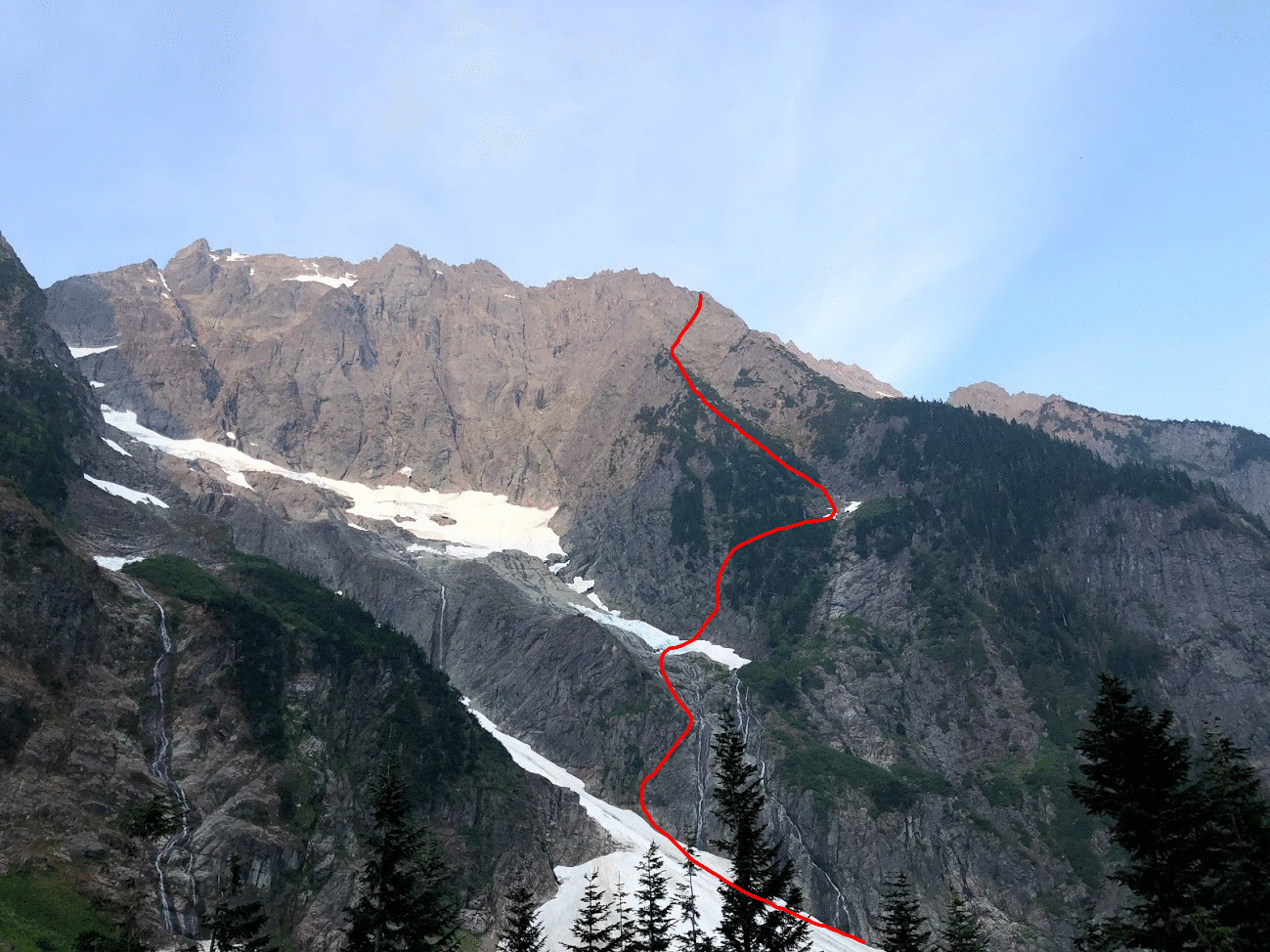
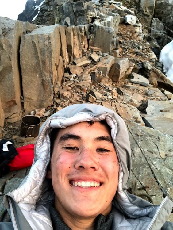
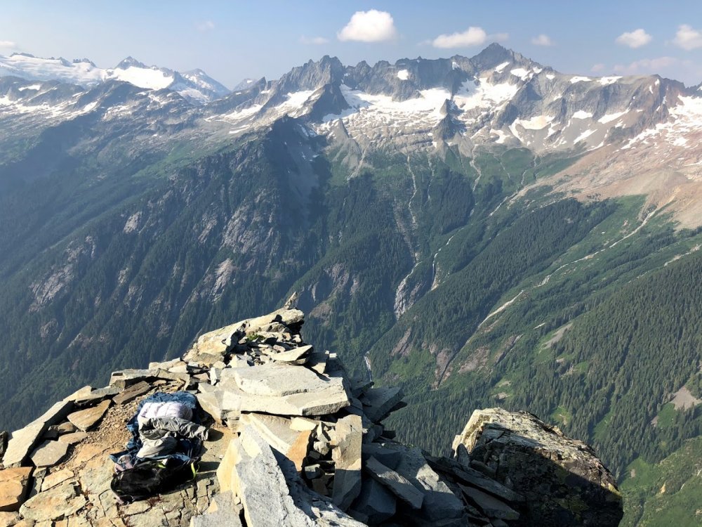
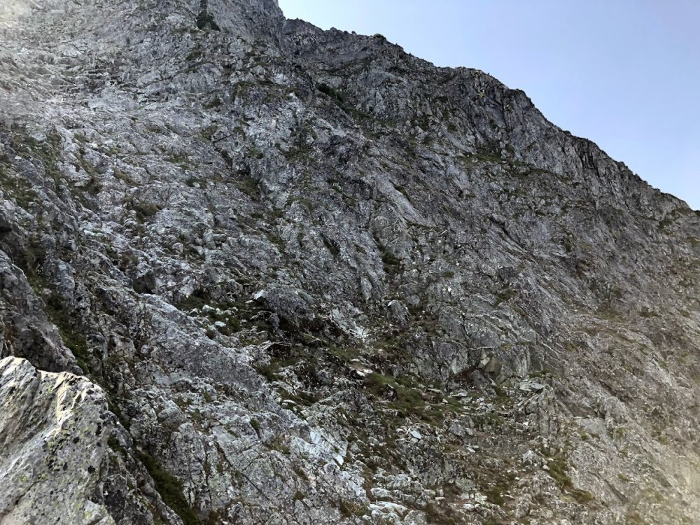
Trip: Johannesburg Mountain - NE Buttress Solo Trip Date: 08/01/2018 Trip Report: I overheard some friends talking about Bill Amos' solo of Johannesburg and was immediately inspired. The allure of the mountain and style of climbing was too much to pass up. Before I start my senior year of high school I wanted to do something really fun. After binge reading trip reports and training for a few months, I felt psyched and ready. I already have a decent bit of soloing under my belt so the climb just seemed right. Fast forward to Monday night, I got in my car and drove out to Cascade Pass. I set my alarm for 7:00 but woke up at 6:30 (probably due to the anticipation). The sheer beauty of Johannesburg is impossible to ignore; its imposing face shows so much promise. After scarfing down a breakfast bar and some pop-tarts, I locked my car and began the arduous approach. A grueling .2 miles down the road lead me to a dirt mound with access to the river. Crossing over rocks and walking up a talus field put me at the first snow on the route. The snow was rock hard so my crampons begrudgingly came out of my pack. I was careful to move fast across the snow because I didn't want to get taken out by an avalanche. A rock ramp to the left of the second waterfall provided seemingly easy access to the buttress. Looking up at Johannesburg After some easy slab and low 5th class I arrived at the second snowfield. Here's where I made my first mistake. Once again, the snow was rock solid. I put on my crampons to walk the 100 something feet across it to the rock. Thinking more snow was soon to come, I clipped my crampons to my harness. Looking for a good line through the trees, I decided to go straight up some 4th class rock and then traverse right later on. This beta absolutely sucked. The initial 200 feet or so was smooth sailing. I soon encountered more and more trees, eventually reaching an impassible rock band within the brush. From here I traversed right until I found a gully within the trees that allowed me to climb up. It was hot, steep, and heinous bushwhacking. Finally I could see the third snowfield. At this point I was well above it but had a clear view of the 1957 route. This snowfield basically cuts the buttress in half until they join up again high on the vertical rock. Tired, I took off my pack to eat a probar and drink some water. Looking at my harness I realize only 1 crampon is clipped on. My other must have gotten eaten by trees earlier in the bushwhack! Thinking about Jean-Christophe's rescue on Annapurna reminded me that I'm probably not going to die if I'm short one crampon. Slabs before second snowfield. It's hard to describe how much the trees suck. I found no evidence of a path and basically pulled on branches, heather, and devil's club the whole way up. Things would frequently get caught on my rope or ice tools during this section. Another hour or so of this put me at the heather slopes. For about 800 feet I walked up some easy 3rd class slopes covered in heather. The 70 degree heat made me really thirsty. I brought 2 liters of water and realized it probably wasn't going to last all the way to the bivy. Rationing out water was uncomfortable but that's life. More scrambling finally put me on the rock. What a relief! Soon 4th class rock turned into low 5th and life was peachy. It felt absolutely euphoric to move well on the steep slopes. I didn't find loose rock to be that big of an issue. I checked my watch and realized I was about 400 feet from the bivy. Up ahead of me looked to be the "crux" rock section. I traversed right from the 1951 route on to the approximate 1957 route. I think this allowed me to skip some hard sections because I encountered maybe 5.6 rock up to this point. Though the glacier was still obscured by rock, I knew I was close. Rock face. I stayed in the middleish left My fatigue meant I wasn't climbing at my best. I elected to take off my pack for the next 200 feet or so and just haul it up. Some 5.8 face climbing through loose rocks put me on top of a small ridge. I was at the glacier! After bringing up my pack, I scrambled up some 4th class rock and was at the bivy. I drank straight from the glacial runoff. This was the first time in my life I was happy to see mosquitoes. The struggles of the day melted when confronted with the beauty of the mountains around me. After a warm meal and some relaxing. I was sound asleep in my bivy sack. Bivy of the decade Me stoked to be fed and hydrated Waking up at 6:30 was kind of cold. I didn't bring a sleeping bag but was pretty was comfy nonetheless. After some packing and eating, it was time to get on the glacier. This part was less than ideal. The snow was luckily much softer than at the base of the mountain. Despite only having one crampon, climbing up the snow to the arete was easy. After carefully walking on the arete I decided going straight up the headwall would be hard. I downclimbed a few meters to the rock ridge. The rock actually went! Easy scrambling and some short traverses on the snow allowed me to skip almost all of the glacier and headwall. At the summit ridge I scrambled up right to the biggest peak. I made it! It turns out I was the first person there in almost a year! The log could also use some more paper if anyone is going up there soon. The feeling of being up there is indescribable. Signing the summit log and snapping a few photos, I was ready to head down. Headwall. I scrambled on the rock to the left Obligatory summit selfie Signing the climber's log Staying to the south side of the gendarmes, follow a loosely marked carin path to the East face. I opted to rap instead of downclimb initially. 8 bomber rappels brought me to some low angle heather. It's important to aim straight for the CJ col. There looks like other paths would be better but they cliff out. About 600 feet of downclimbing brought me to the col in one piece. Looking up from the col Now sidehilling ensued. Going close under the buttress and heading straight toward Doug's Direct seemed to work best. Walking through all the brush isn't fun but the ascent to mix up peak was easy. About 1000 feet 3rd and 4th class scrambling down the north ridge of Mix Up brought me to Cache Glacier. The climbers trail is visible from the top of the ridge; go there. Walking down the climbers trail felt like one of those flat escalators at an airport compared to the rest of the climb. 3.7 miles of running and I was back to the parking lot. Looking down from the top of Doug's Direct. This was a climb to remember. The beauty of the North Cascades is hard to forget. I don't think I'll be back to Johannesburg for at least a few more months. I would really love to try and get up it in the winter. Shoutout to Steph Abegg and everyone else who has previously made trip reports. I have mad respect for anyone who has done this climb. Don't let your guard down when you get to the summit. Johannesburg is the mountain that keeps on giving. Now its time to get ready for Bear Mountain. Here's the general route I took. I could have screwed up but I'm pretty sure this is where I went. Gear Notes: Took climbing shoes and chalk but didn't need them. Approach Notes: Walk .2 miles down the road. Cross river.

 1 point
 -
I am probably assuming more thought in a dogs brain, but I often wonder what dogs think about what we are doing. nice looking dog and trip.1 point