Leaderboard


Popular Content
Showing content with the highest reputation on 05/28/18 in all areas
-
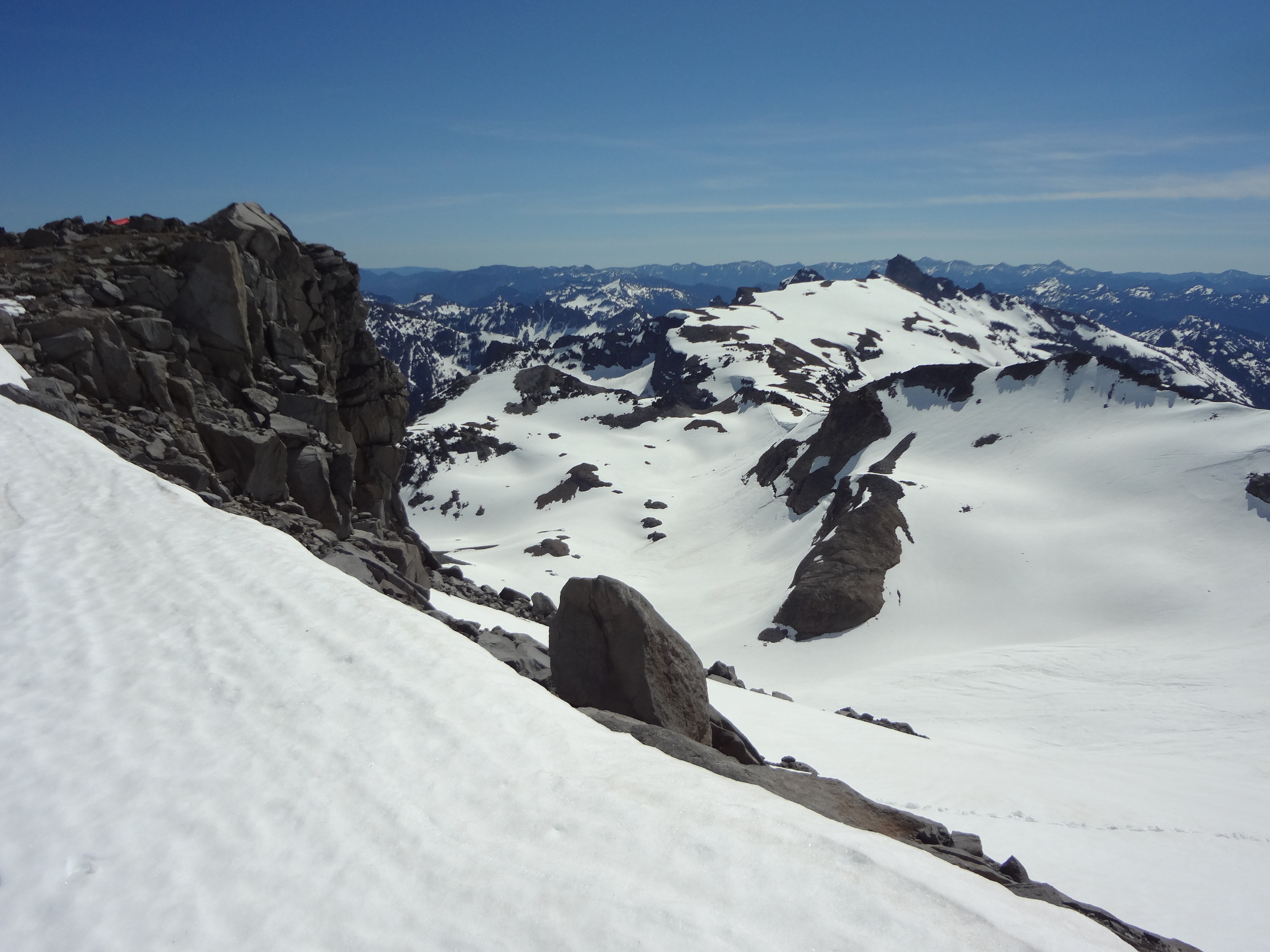
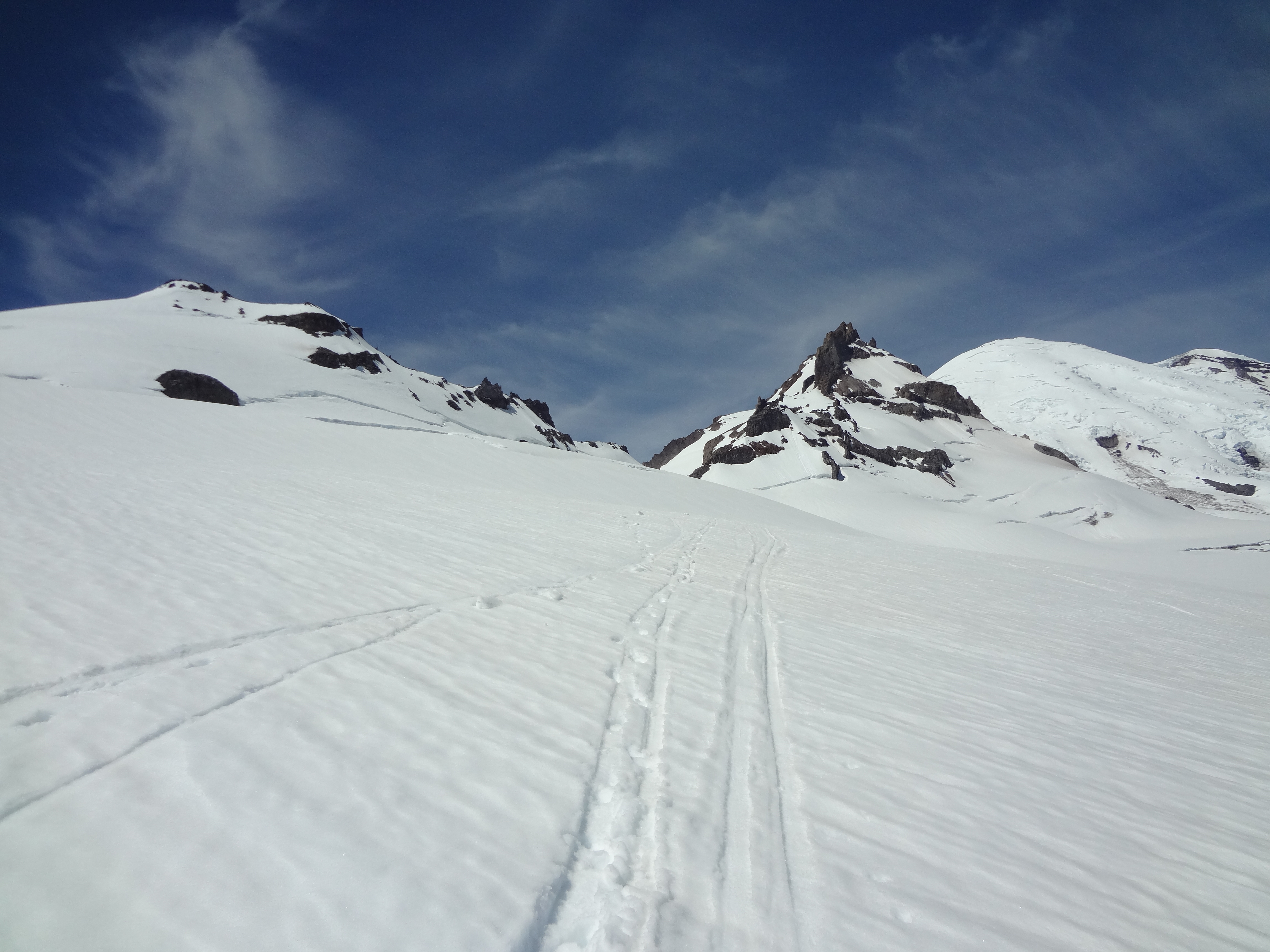
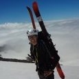
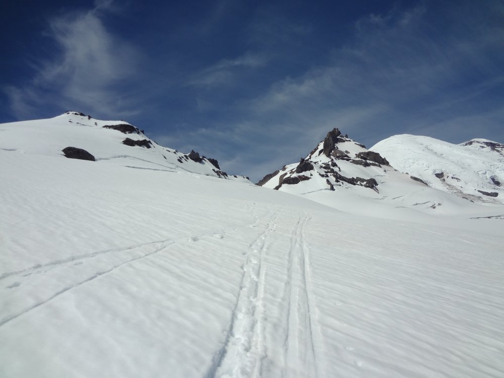
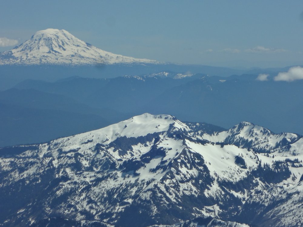
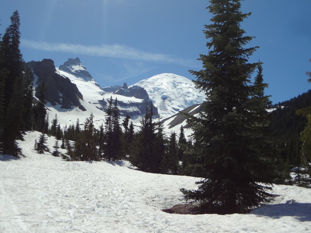
Trip: Little Tahoma - Fryingpan Glacier Trip Date: 05/27/2018 Trip Report: Did a ski tour of Little Tahoma on Sunday, May 27 on one of the most spectacular May days I've had in a while. Thought I'd post so information for those considering making the trip. Approach via Summerland trail is basically snow-free for the first mile and then switches to snow with sections of dirt thereafter. From the final bridge, snow is continuous. On the ascent I booted and did not bother with skis. From the flats beyond the bridge it's a straight shot up to the left to gain Meany Crest. Meany crest is snow free and lots of good camping available. No running water at this point, so plan to melt. I booted to Meany Crest and then skinned up Fryingpan keeping to the right of the glacial bulge. Crevasse problems are minimal, though there is one crossing that could probably be avoided by trending to climbers right and downhill. Despite the warm weather and soft snow, I skinned the bridges without issue though I could see where someone had punched through earlier in the day. From Fryingpan kicked steps up to Whitman Crest and then set out across the Whitman Glacier. There are two open crevasses on the Whitman that can be avoided by skirting them to the right. Whitman is ~30 degrees up to a bench on the ridge at 10,300 feet. From there you can ascend on steeper snow (~40 degrees) either to the left or right of the ridge. If you go right, expect steep, crappy, downward sloping rock at the exit onto the ridge. Descent was same as ascent, but on skis. Yay! Travel Times: Left car at 7:15 AM Meany Crest at 10:45 Summit at 2:00 PM Car at 5 PM Gear Notes: Ice axe, crampons, helmet. Glacier gear if desired Approach Notes: All snow after the last bridge Meany Crest Camp Fryingpan Glacier Mt Adams from Whitman Crest Little T and Big T from just past the final bridge

 1 point
 -
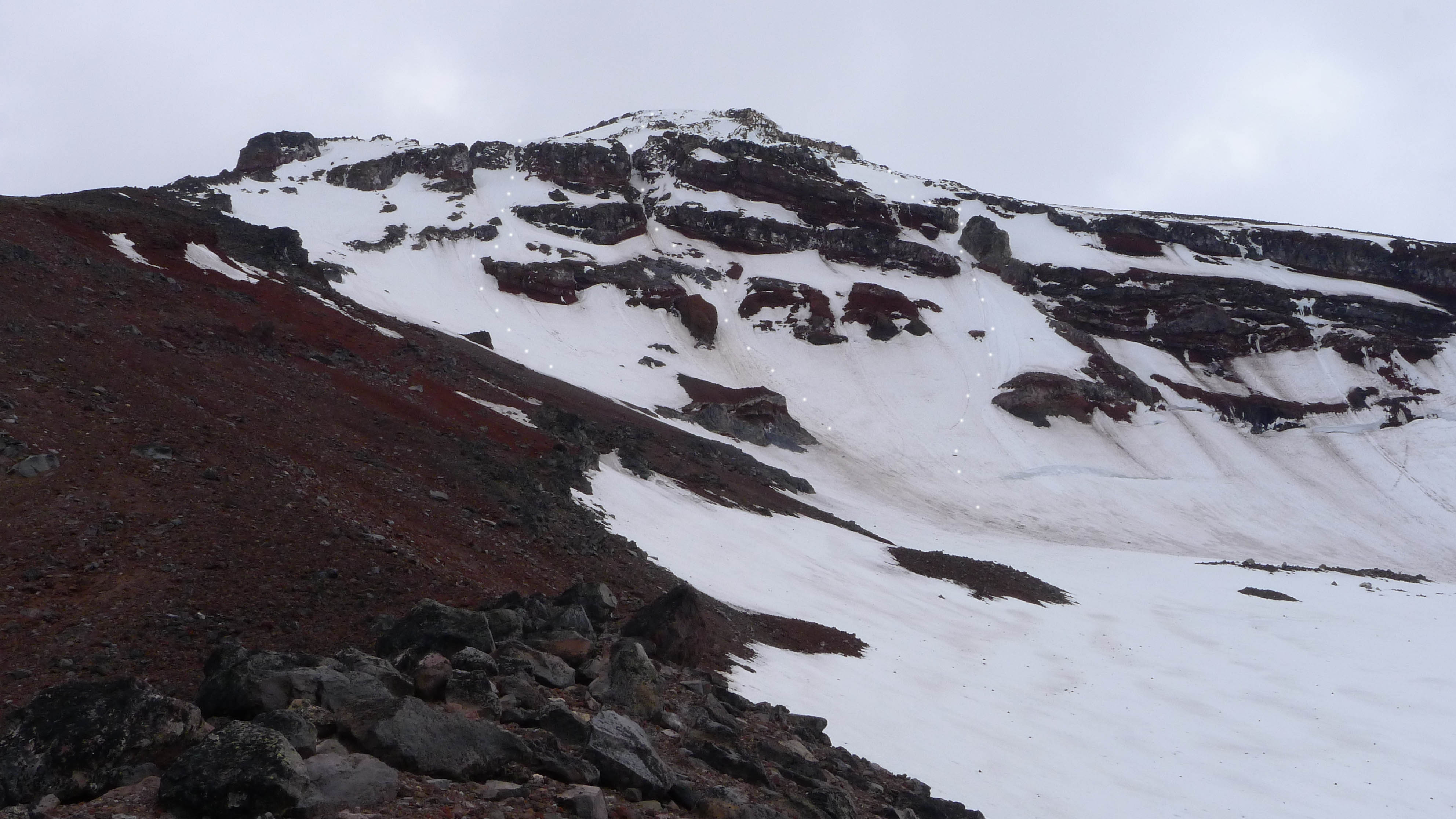
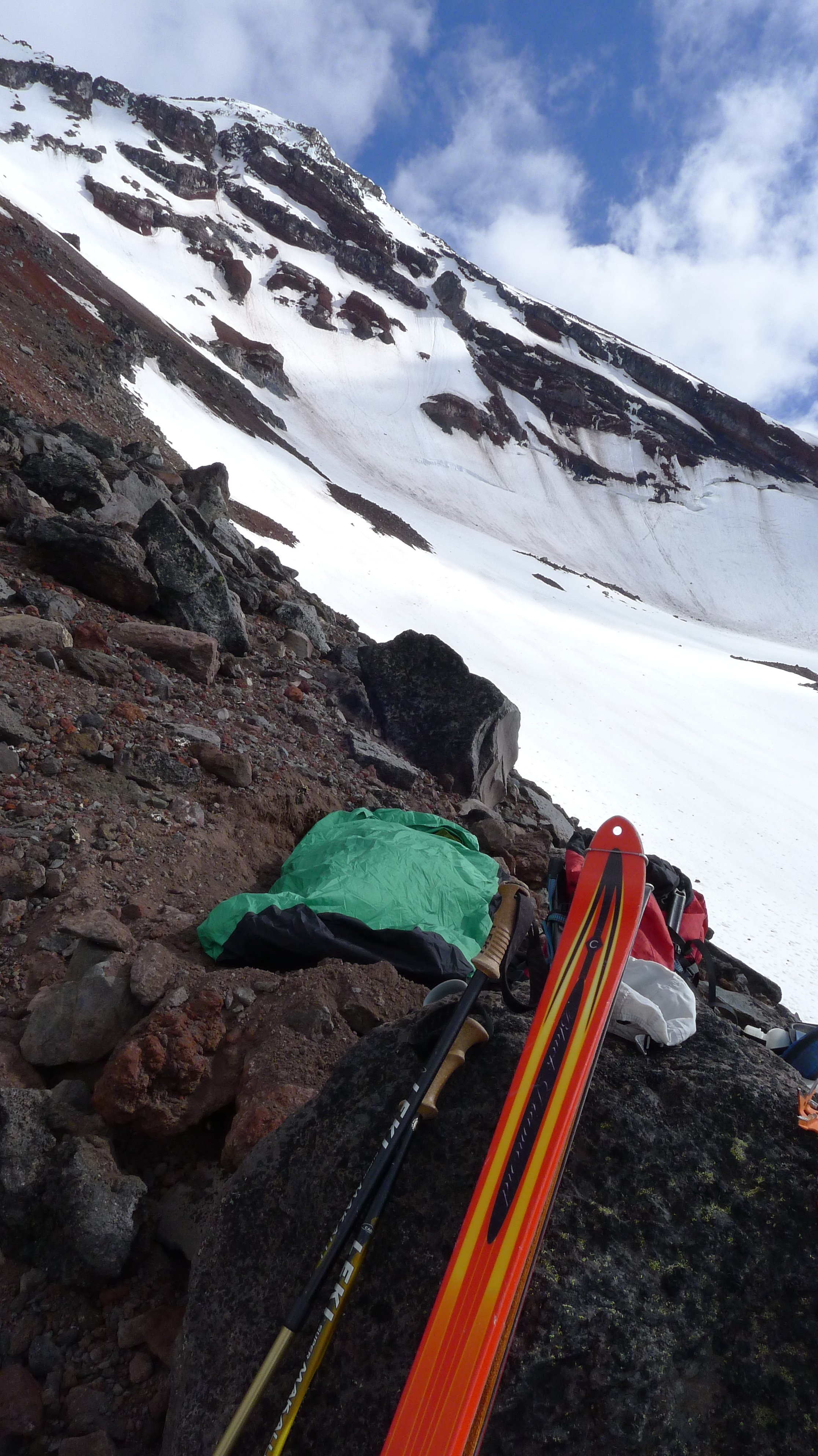
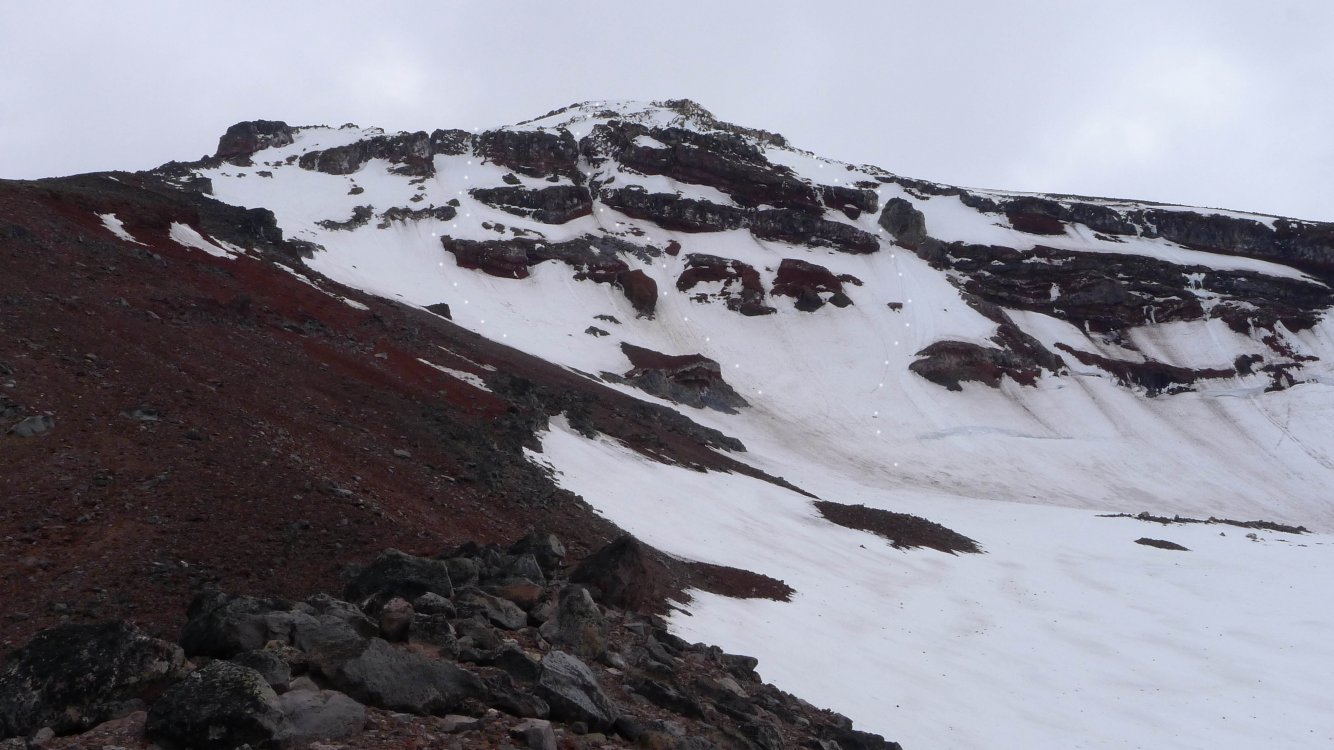
Trip: South Sister - North Face Trip Date: 05/22/2018 Trip Report: Edit: See post below by Drocka on a June 2011 ascent which I believe should be credited as the FA. Sometime ago I noticed a blank spot on the map on the north face of South Sister. If one looks at Oregon High on page 109, there are two routes on the face, the Silver Couloir (22) and North Face Couloir (23). Further to the west is the Northwest Ridge (24). The blank spot is between the North Face Couloir and the Northwest Ridge. As such, on Monday I decided to ski over for a look about. I started up via Green Lakes and the Prouty Glacier, traversing at around 8200-8400 foot level of the glacier til the North Ridge. Unfortunately, it did not have as much snow as I hoped so I carried my skis for the last bit til I reached the Skinner Glacier which sits below the face. The lack of snow was an issue because I had planned to ditch my skis and bivy gear, descend the north ridge, and ski back out. As such the option was now to carry everything up and over. Which in hindsight worked out but at the time I did know if such idea was going to be amicable given the route was a blank spot. In the morning after a crack of dawn start, I skied up to the base of the face, swapped out skis and poles for crampons and ice axes and started up. Initially it was nevé and canning, then plunging picks, to eventually swinging tools. Overall the slope was 45-50 degrees with a short 10 foot ice step just below the gap. The gap is the critical bit and cannot be seen on some photos. After the gap, I traversed up and left until it was possible to gain the Northwest Ridge which I followed for the last 300 feet or so to the summit rim. Had there been more snow one could probably continue up and left even more. But given I was climbing solo (in tele boots) and carrying skis I did not want to have to deal with crappy rock or rotten rim ice. After reaching the summit, I hung out for a bit before going down the south side. I descend til I was on the Lewis Glacier where the snow soft enough to be enjoyable skiing. I skied out until about the last mile. Where a couple picked me up and shuttled me back to the Green Lakes Trailhead. One photo of the routes and one from my bivy - sorry there are not more. I have marked all three routes on the face. From left to right Silver Couloir, North Face Couloir, and what I did. As you can see for May there is not a lot of snow.. Gear Notes: Crampons, two tools, screws and pickets if climbing roped Approach Notes: Via Green Lakes and Prouty Glacier
 1 point
 -
Today we went in through Boston Basin, summitted Sahale, and skiied out via Cascade Pass. The Quien Sabe glacier was in great shape, very few crevasses. Skinning was great, firm snow, great for ski crampons. I bet it was excellent skiing. I'll post a TR later today.1 point