
Leaderboard


Popular Content
Showing content with the highest reputation on 10/06/25 in Posts
-
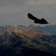
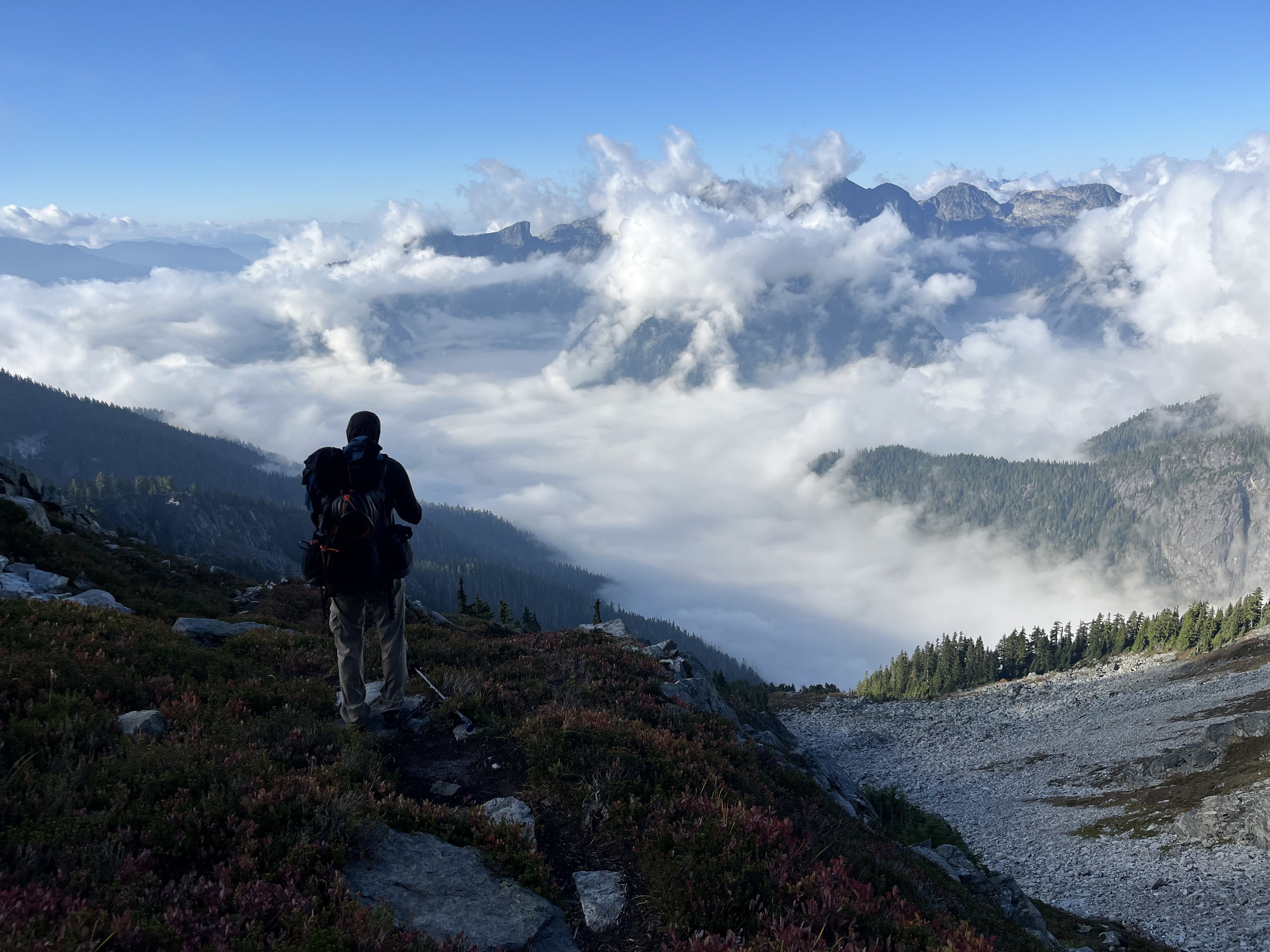
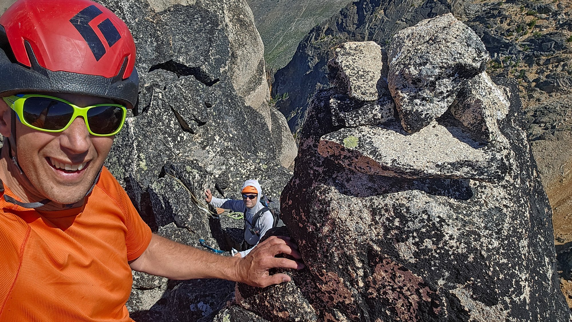
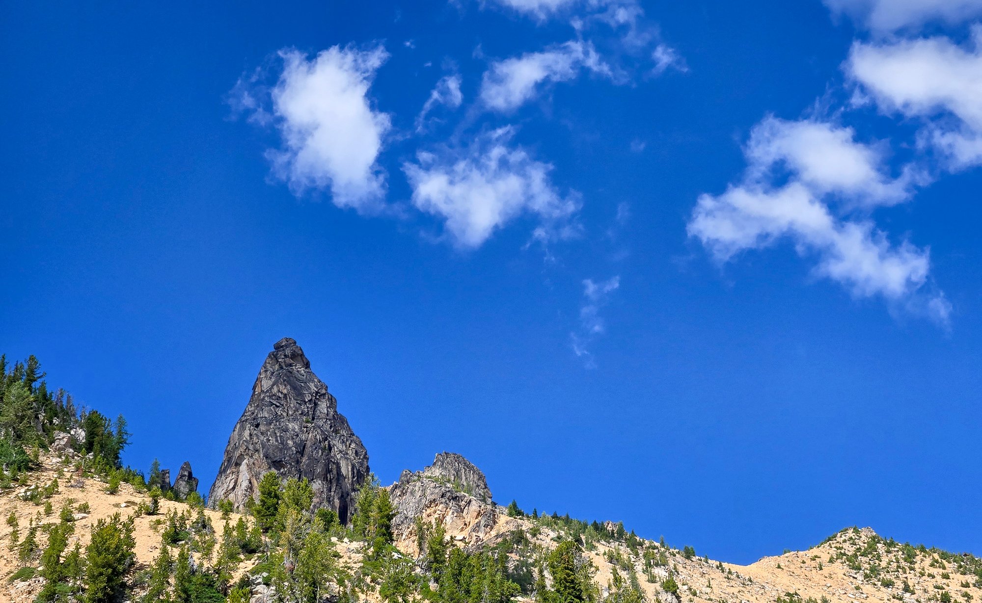
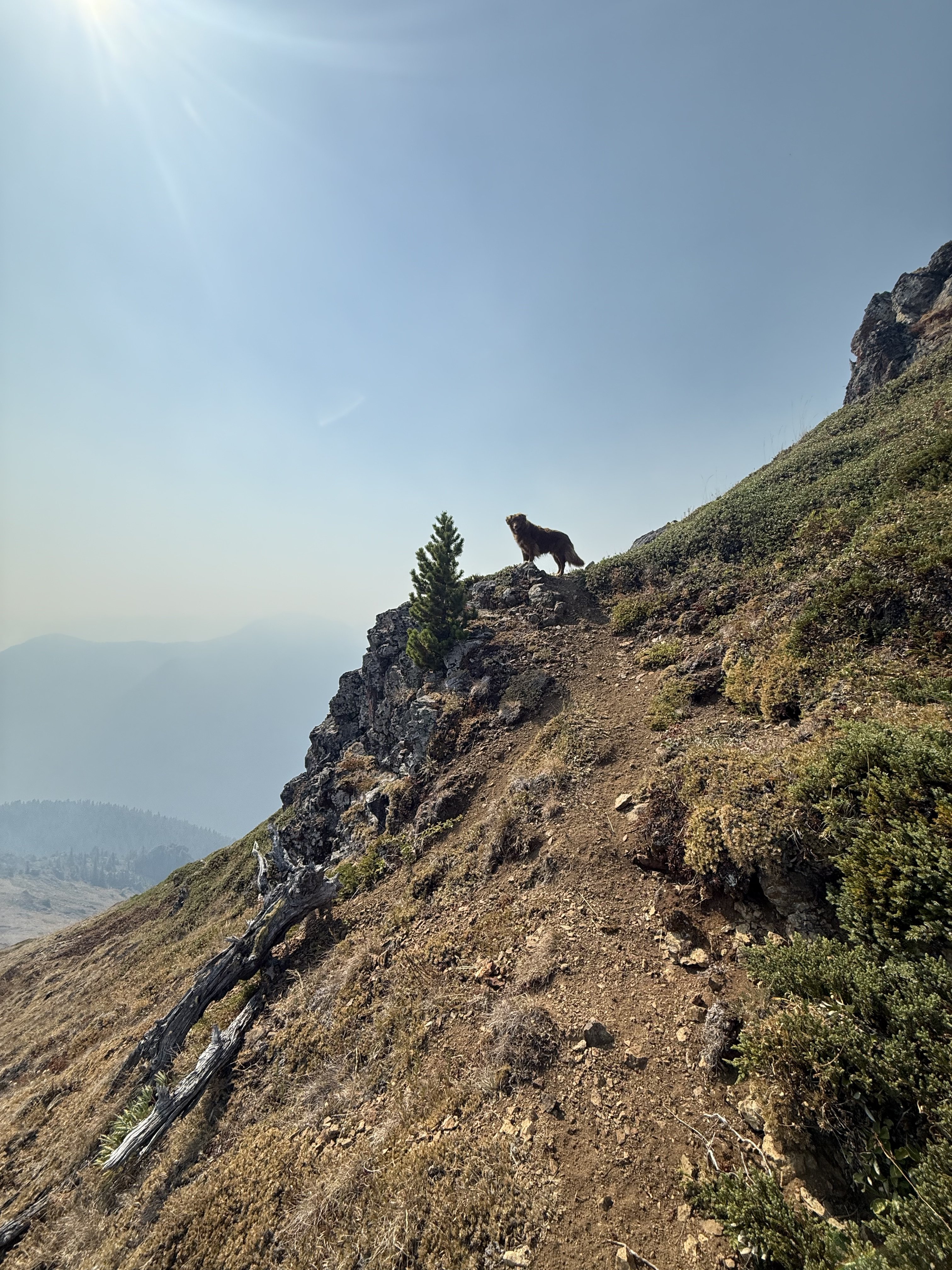
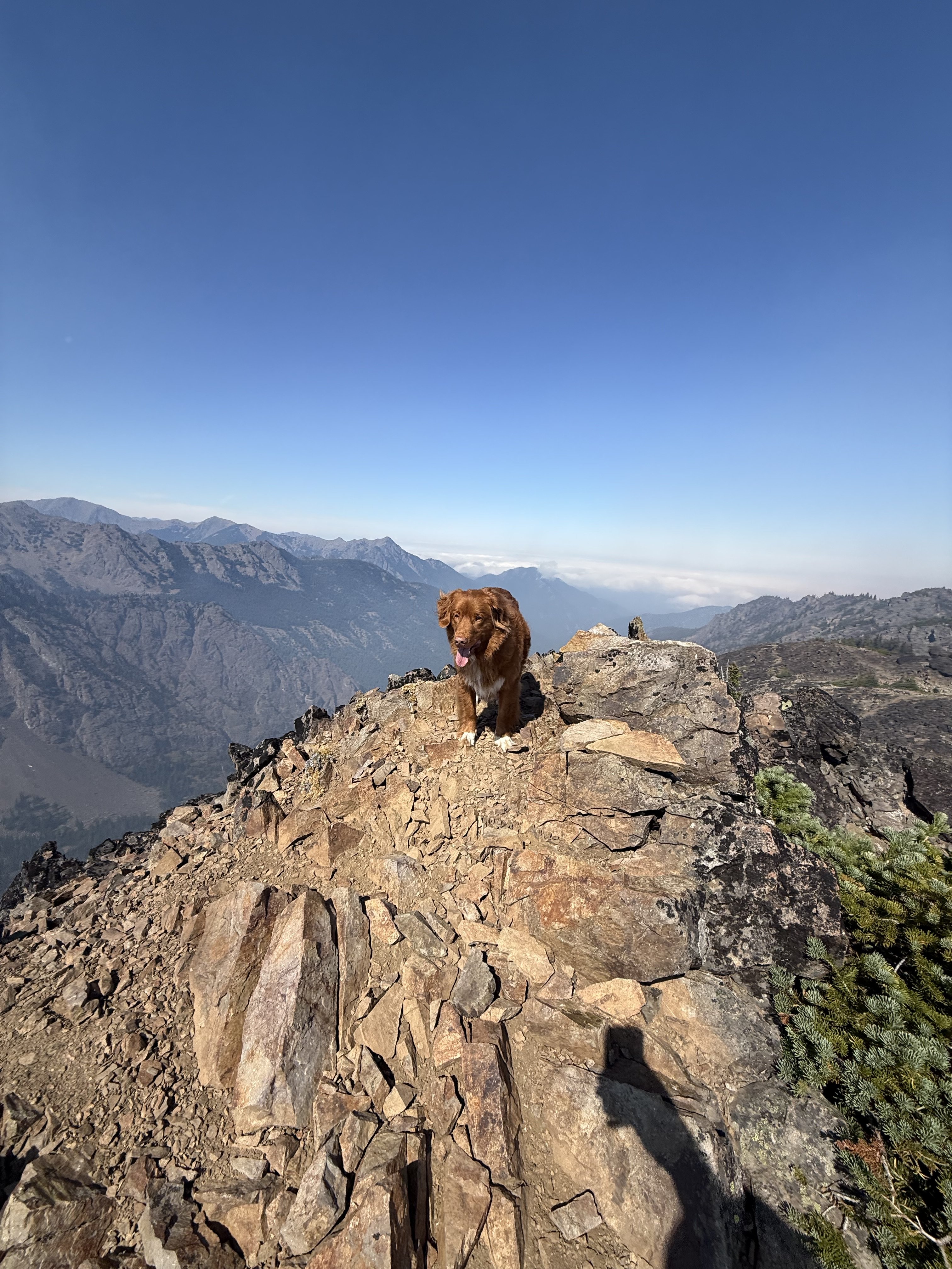
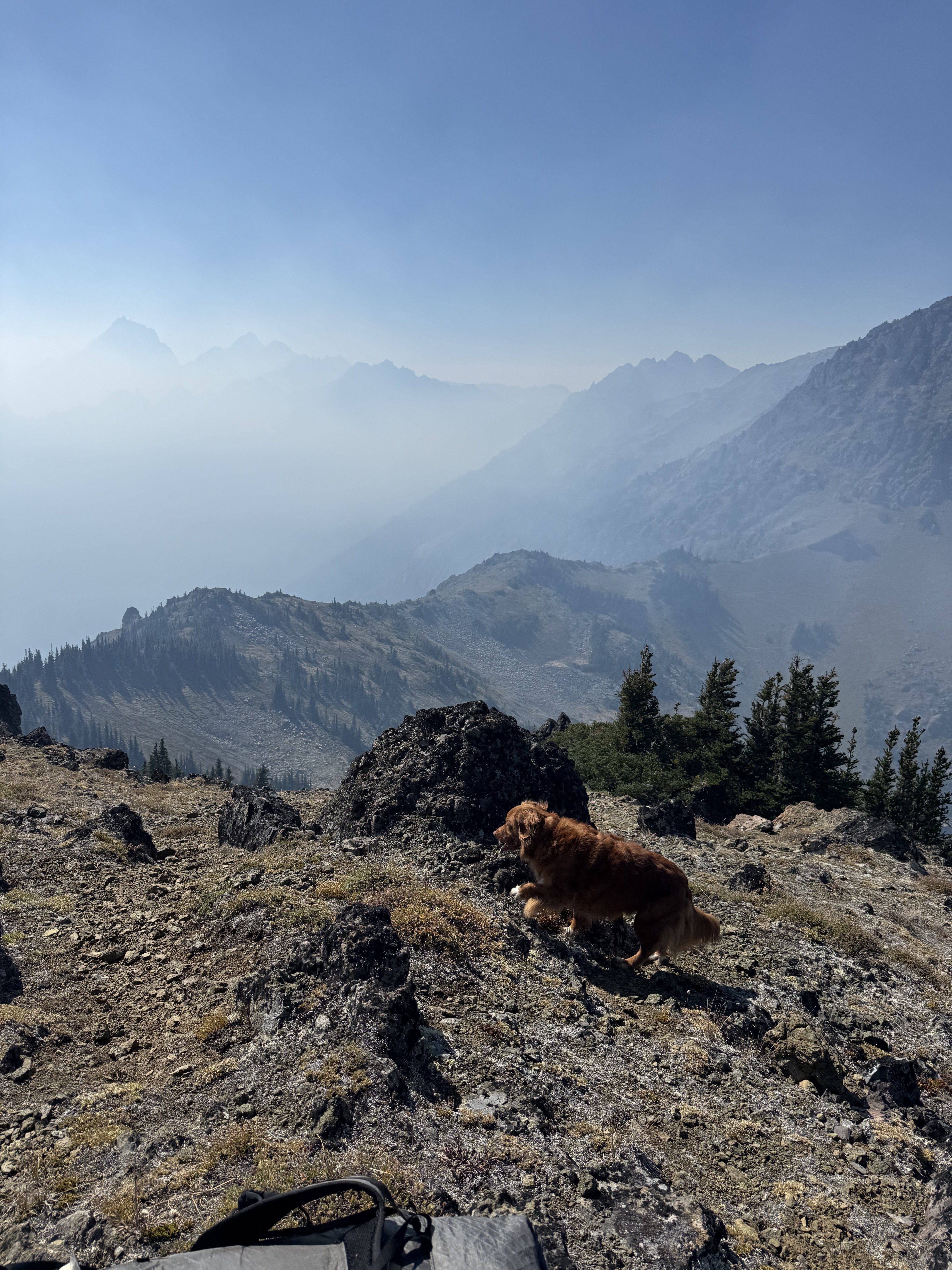
Trip: Strathcona Provincial Park Ramblings - Big Interior, Septimus, and Kings Peaks Trip Date: 07/21/2025 Trip Report: This past July @Trent and I went on a ramble to Strathcona Provincial Park up on Vancouver Island. We were supposed to meet up with @wbk at the end of the week to give the Colonel Foster Traverse a go, but we wanted to ease into it. And so we did, sort of. Or maybe we just got schooled by the "Island Alpine" we had heard so much about from @wbk. First off we had to navigate the BC ferry options to the island, which tend to book up early. Nevertheless their ferry system makes ours look decidedly second class, and it all worked our pretty smoothly once we were booked and in line. First stop was the trail to Bedwell Lake which I suppose is a good trail by Island standards, but a grunt nontheless. The bugs weren't bad at the lake but increasingly became annoying as we climbed to our camp just below Jim Lake. We were up early the next morning, rambling up and across on the climber's path to Big Interior. It turns out most use this as an approach to Nine Peaks, but we didn't fancy carrying all of our overnight and climbing gear over the summit and so we settled for the "approach" summit of Big Interior. The bugs, heat, and humidity followed us every step of the way. Nine Peaks from Big Interior: @Trent pulling up on to the summit of Big Interior: The views, of course, were grand, and we barely knew any of the peaks in any direction. So much to do in every range it seems like, there is never enough time to climb them all! But we at least had to climb another on this trip, so we reluctantly retraced our steps to camp. And then promptly moved it to Cream lake, to prepare for the aptly named Green Ridge on Septimus. Camp at Cream lake with Septimus looming above: Septimus: Cream lake: We were up early the next morning, crashing around the lake and down, down, down to meet the start of the Green ridge. Do not underestimate this approach! It is every bit a thrash as anything in the Pickets or North Cascades and was especially character building in the heat, bugs, and humidity. Thankfully we were through most of it in a few hours and soon battling the steep rock and veg into the alpine. @Trent out of the brush and about to do battle with steep veg on the Green Ridge: But soon enough we emerged into the full blown Island Alpine and the grand north wall of Septimus and Rosseau was revealed: Looking down at Green lake from Green Ridge: As we scrambled higher, we came across one of the more vivid bits of rock I have encountered in the mountains. Maybe some pillow basalts that have been smoothed by ice? And then a short rap, some steep snow and steeper rock (but still 4th class) as we wheezed our way above the bugs and on to the summit of Septimus: @Trent on the summit of Septimus: There was quite a flower garden directly on the summit of Septimus: And then the 5-6 raps down the South (regular) route on Septimus. We had heard that you may need two ropes to make this work, but it went fine with a single 60m. Take care if anyone is below you though, much loose rock! By the time we got back to camp it was late afternoon, the bugs were fierce, and a swim was called for to think about our options. It was decided that we would spend another night at Cream Lake, hike out for a "rest" day and then try for a single day trip before meeting up with @wbk later in the week for Colonel Foster. I mean, we're going to do all that, right? But first, there was a sunset to enjoy: In the morning the bugs were still fierce, the heat and humidity back in full force as we packed up to hike the Bedwell trail back to the car. Parting view of Septimus: Big Interior and Bedwell Lake: Thanks to a friendly campground host in the park, we found an excellent free place to camp just outside the park and on the way to Gold River. It was about this point that our appetite for Colonel Foster was waning as the pull of home and no bugs was growing stronger: But first, another peak! We had chosen the "hiker's" route up Kings Peak as the day trip the following, knowing that it was a big grunt and was likely to be hot and buggy as well. Still, it was enough of a challenge as to feel like easy mountaineering, and it was hard to beat the views. There are loads of very steep climbs on Kings, maybe the highest concentration of hard routes on any peak in Strathcona Provincial Park. But we didn't climb any of them! We did oogle other nearby mountains like Elkhorn, for a future trip to the Island: And of course, the Colonel: Soon we were on the summit with the ravens on a perfect day, finally above the bugs and the heat, feeling the bliss of "Island Alpine": But it wouldn't last. We were tired from 5 days of rugged Island peak bagging, and a bit mad from the bugs as we descended. We got in the car, changed our ferry reservation and headed home. Sorry @wbk, we'll have to come back for the Colonel! Gear Notes: 60m half rope (Septimus Green Arete), ice axe, helmet, crampons Approach Notes: BC Ferries2 points
-
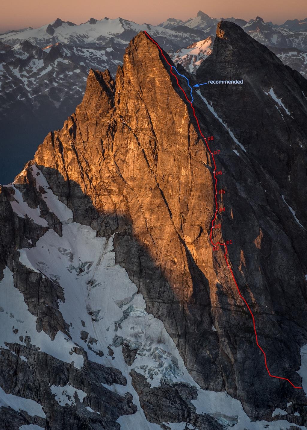
Thanks for the kind words. And yeah, it was way more casual than I expected. I figured there was a decent chance we'd climb through the night. But, nothing went wrong (mostly, we didn't blank out and have to pendulum). Also, while I expected decent rock compared to the Pickets reputation, the rock was vastly better than I'd dared hope. Like, legitimately good. I could list a lot of local granite routes with similar or worse rock. I mean, this is obviously an extremely serious route and environment with some loose, wet, and vegetated rock, and a slight deviation from our path could yield a very different experience. Bailing would be spectacularly unpleasant and expensive. But it's also a much more pleasant and, yeah, casual route than I would have ever expected. And right, re: snow on the approach: the 76/86/08 parties encountered substantial difficulties with glaciers/ice blocks. I also know someone that recently tried to traverse under the McMillan cirque North faces from Stettatle Ridge in late spring, and was turned around by some weird messed up crevasse situation with what seems to be a seasonal glacier (following roughly the Volken ski approach). But, I think they were lower than you'd be to approach the buttress, so maybe it's not a big problem these days. These glacial remnants seem to always be gone by Sept, and we just had one short section under some mildly threatening blocks where we felt the need to scoot (similar to approaching Triumph NE ridge). Here's some more detail: Approach: from the Terror basin bivy, walk/scramble up slabs diagonally toward base of Little Mac. There are bivy sites with year-round water around 6400-6700ft below/S of Little Mac. Find a narrow ledge below Little Mac to access the NE trending ridge toward Elephant Butte. Scramble NE along this ridge for 10-20 minutes, finding a slung boulder about 50m before the first low point/col. Make four 45-55m rappels starting from the boulder, at first in the corner. After the second rappel, walk 20m skiers right on a ledge to find another slung boulder. The fourth rappel finishes over a rotten, red overhang. From the base of the rappels, walk/scramble to the base of the buttress, continuing around to the right/W side, and scramble up and back left toward the crest. In late season (Sept) there will likely be no need to cross snow (although plentiful flowing water), with one area below broken up ice blocks where you’ll want to scoot with some urgency. Early season, though, there may be a seasonal glacier with substantial crevassing that could hinder access (a la Slesse). Route: When the buttress steepens to fifth class, simul climb for 200-300m until a ledge where it steepens further and the pitched climbing begins. Looking up, you will see the buttress crest on your left, then to its right a right-facing corner (2008 route, we think, we climbed this), a rotten looking roof, and further right another weakness/corner (1986 route, I think). Belayed pitches range from perhaps 5.8 to 5.10-, and it’s hard to give per-pitch grades, but p3 is the mental and physical crux. p1 (50m): Begin in the corner directly below the rotten roof (to the right of the upper, left-hand R-facing corner that you're aiming for). When the cracks become wet and filled with moss, traverse a couple of meters right to a cleaner corner, and belay just below the rotten roof. Note: this is what we did, but it may be better to take the next corner left, which aims you straight toward the left end of the chossy looking roof, and thus avoid the traversing pitching. p2 (20-30m): Traverse horizontally left, out from under the chossy roof, passing below another crackless roof/overlap, aiming for the solid/clean rock near the crest. Belay near two rusty pins. p3 (45m): From the old pin anchor, go up and left into the solid corner with clean cracks, passing an ominous looking fridge-sized block that, once you reach it, sounds solid enough to (gingerly) climb on. Continue up placing gear behind surprisingly solid flakes to pass a small roof, emerging on a slab that provides entry to the large R-facing corner at which you've been aiming. Climb the slab up and into the corner on solid rock, but at times little gear, until you can step right onto a pedestal belay. p4 (50m): Climb up from the pedestal toward the left side of the mossy, chossy-looking roof; but traverse right just under the roof on solid, clean face holds, using the roof only at its solid right edge. Emerge onto a large grassy ledge, climb up solid blocks/boulders into a steep, splitter thin hand/finger crack leading to another, larger but sloping grassy ledge. Continue up the grass/heather slightly rightwards to belay at the base of a corner. p5 (45m): Go up and right on the face R of the corner. There are numerous options but they all deposit you on a small sloping ledge where the face converges below the main corner. p6 (50m): Climb up cracks and grooves on the right wall of the corner, aiming for the right side of an overlap below a larger roof. After placing gear in the roof, step left above the overlap and continue up to belay in a small sloping alcove. p7 (50m): Climb rightwards out of the alcove, passing a small roof on its right to emerge onto a rightward-sloping ledge. Walking right will lead to bivy sites; but if not bivying, continue straight up into a steeper, shallow corner with several cruxes (one just off the ledge), belay when you find a good stance. p8 (50m): Climb straight up in a slightly easier corner/groove, stopping to belay when the angle eases. You are now in the schist band: rock quality deteriorates. Simul climb for 50-60m, straight up a broad depression, exiting on steeper, splitter cracks slightly rightwards leading to lower angle slopes facing more westward. We continued simuling, aiming for a steeper ramp 30-50m right of the crest, which had a fixed pin, but was the only bad/scary/chossy pitch of the route. Not recommended. Instead, after exiting the steep cracks, stay low and traverse harder right toward the E Mac-W Mac col, until you reach a broad depression leading straight up (3rd class) to the summit. Descent: Downclimb SW toward the E Mac-W Mac col (2nd-3rd, one 4th move at bottom). Continue downclimbing the dirty gully S for 50-100m, looking for where the left wall of the gully becomes less steep/flat (i.e. creates a small shoulder), where you will find a slung boulder. Make four 45-55m rappels roughly straight down off slung horns/boulders to reach lower-angle slopes. And a route line on a gorgeous picture by @JasonG (happy to pass along higher resolution, just ask): And finally views of the upper and lower buttress, and the rappel corner, from a little past the rappel point:
 2 points
 -
Trip: Cascade Volcanoes - Bike-athon Trip Date: 06/06/2025 Trip Report: Summary: I set out to stand all 5 WA volcanoes in the same 7 day (168 hour) period, bike powered between them. As usual, antics ensued. An unplanned road closure added ~100 miles on the bike and the goal was adjusted to 8 days/192 hours. In the end, I stood atop Mount Baker on hour 189 since departing the Mount Adams summit. The journey in between had deep suffering, even deeper discovery and an adventure I’ll always remember. The trip had to be solo. But the story was too good not to share… Classic DC shot, peak 3 of 5 In recent years I’ve become increasingly obsessed with long bike-hikes. But it's hard to remember exactly where, when or why this dream came to be. A while back some lunatic bike/climbed all the Cascade volcanos and that certainly added some fuel to the fire. There is something about doing it all on human power makes the adventure feel a little more....real…for lack of a better term. Earning every inch helps put me more in touch with the broader landscapes which connect our High Places Planning an effort like this was sort of an impossible task. Timing the trip would require some favor from the weather gods. But knowing the patterns of the PNW and its’ volcanoes, June would be the time. Without better criteria I figured lets pencil it in around the longest days of the year in order to limit the odds of after-dark cycling. The snow coverage on Rainier in particular would also help mitigate the risks of solo travel on big glaciers. So I wrote it in for June 14-22…but a forecast presented in the first days of June that was too good to pass up. I was not fully recovered from training, nor was my equipment or logistics in order. But that was all figureoutable. With a week of solid high pressure I eeked my way out of whatever responsibilities I had, and set off. Originally the plan had been to start the trek from the Adams TH and climb with a friend. The new plan instead had me start the ride from White Salmon, at the Oregon border. That green-blue-white color scheme ? Its finally summer in the hills Call it a warm up! The 37 miles to the Adams TH went pretty quick until the last few. Reports warned of a “rough” “dirt” road leading up to the south side climb. Rough was fine, dirt was fine. The sandy parts were nearly impossible on a bike loaded up with camping and climbing gear. Despite that, I eventually reached the TH, unpacked and slept as soon as I could. By 2am it was too cold to stay asleep. The forecast for the week was going to be very warm. So I chose the lightest quilt I had in order to save weight. But that first night I paid the price. Preferring to rest longer but knowing when to bend I got up, packed, ate and started trudging upwards. Because my concept of this challenge was starting the clock when I departed the first summit, I kept my pace slow to conserve energy for what would inevitably be a very long first full day. By 830am I reached the top. Perfectly clear, sunny…but bitter cold wind. By 845am I started the clock and raced down the mountain. A few thousand feet down the surface was soft enough for efficient plunge stepping. By 1130am I was back with the bike, repacked and ready to coast a bit. The road would not make this as carefree as I hoped. Tedious, bumpy miles eventually lead to a delightful (paved!) forested downhill. Once in Trout Lake I found the restaurants closed. So I had my first gas station meal of the trip. A secondary goal of the trip was to eat ice cream at every country side store I could. Feasting junk food on the front porch, the staff asked “isn’t it early for through hikers?” I must have smelled like one already. The first of 22 ice creams... As we chatted I learned that forest road 25 was still closed due to a combination of landslide, construction, lingering snow and owl conservation. I spent most of the day having my at home contact help brainstorm how I would re route after climbing Mount Saint Helens. In the mean time I continued, but the uncertainty weighed me down. Riding to MSH took the rest of the day. There were a few miles of pushing the bike through snow. Definitely among the low points of the trip. That night I slept at the climbers bivouac TH after 19 hours and 12k of combined vertical gain. I was exhausted and the stoke was low. That night I had some thoughts of giving up. Ultimately a series of bad dreams in the early morning were disturbing enough to force me awake. Sometimes nightmares can serve that benefit. Within seconds of waking my mind refocused. Trying to close the distance before dark on day 1 Hiking MSH under good weather was a treat. The ascent went fast and easy, but not as easy as the descent. I was totally out of water but snagged a liter that had fallen out of someone’s pack on the glissade track. Back at the road, some kind soul had packed a can of coconut water in a snow patch they built near my bike. A little trail magic- bike touring edition. It really made me happy. Not just the fluid intake but that some strangers had the consideration of doing that for me. Solid folks can still be found… At first I thought it was a beer...probably for the better that I was wrong... Another huge boost came that morning when I was high enough to catch cell signal. I was able to devise a re route to get me to Rainier. It would add a day of cycling, and push the 7 day goal to 8, but the mission would continue! Riding back to the I5 corridor was definitely not my preference but flexibility is a trait we learn on quests like this. I spent the night at a trashy motel near the freeway. The next day was type 1 touring. Flat farmlands with many, many ice creams to be had. I reached Ashford in the late afternoon and settled in for a 13 hour sleep. The next “day” (actually two days, no sleep in between) would be huge. Arguably the crux “day”. It was some of the best sleep I’ve ever had. The schedule for the next segment required I wait til around noon to start. Timing travel on the upper slopes of Rainier was the priority. The 20 miles from Ashford to Paradise was actually pretty nice for being continuously uphill. I took my time through there, keeping my heart rate and mental stimulation as low as possible. Reaching Paradise at 4pm on a perfect Saturday, I remembered why I avoid this place on summer weekends. Luckily, on a bike parking is not an issue… A nice melty treat...and also an ice cream The permit stop was pretty seamless. Months prior I had received approval for a solo climb. Checking in was a simple formality. I killed a couple hours (and ice creams), letting the sun begin setting and the snow firming up. By 630pm I could wait no longer. Setting out from Paradise I continued to be intentional about managing my pace. Once on the snowfield I started to open it up a bit. At Muir I was surprised to find absolutely zero wind. I took this opportunity to rest for an hour. After that break, something came over me. My energy was maniacal. It felt like nothing could stop me. By the time I reached the top of disappointment cleaver I had passed 52 people. 3h 53m after leaving Muir, I was standing alone on Columbia Crest, well ahead of sunrise and ahead of schedule. I had stood there many times before, sometimes alone, but this was a very powerful moment. Its hard to describe the feelings that came over me as the first bits of dawn stumbled over the horizon. Its amazing how full life can be…I hope some day I can better explain what came over me. The descent was uneventful… fast, efficient. By now I was getting better at repacking the bike, even though one of my cheap panniers had exploded. Riding down from Paradise was probably my favorite segment of cycling in my life. Almost no pedaling, fantastic views. Hardly any traffic, surprisingly. The bliss would not last. The rest of the day would be 80 relatively flat miles but with a strong headwind and temperatures reaching the low 90s. To boot, it was the first hot Sunday of summer and the roads were bustling. The miles were stressful and seemed to never end. Eventually I reached home in South Seattle. I had started the effort 32 hours earlier. In the end I would gain over 16k feet of vert and drink 15L of water. It was nice to be home for a second. But I had many tasks to complete in order to be ready to ride out the next morning. New panniers arrived. I did laundry. Tuned up the bike…and even had a few minutes to tend to garden tasks. The next morning I had pizza and cake for breakfast and then hit the road. The day would be 12 hours and 117 miles but it actually went pretty well. The first ⅓ of that were on routes that I ride often. I encountered some nice bike paths from Snohomish to Arlington, and beyond to Darrington. The gas station there was closed due to “extreme heat”. But I still managed to find some ice cream and groceries before continuing to the Glacier Peak TH. It was at this point that I started to feel like this could actually happen… It was a poor night of sleep there. But by 550am I was on the move, even if it was a little sluggish. If you’ve hiked GP before you know what a slog it is. It seems never ending, like you’re making no progress. My morale and energy improved as the day went on. I made the summit around 430pm. What a view. Glacier Peak is a highly underrated IMO One of the few photos that day. Rainier seems real far away ! It would be a long ways back to my sleeping pad and fart sack. But I made pretty good time. When I left White Pass at sunset the beauty was astounding. I had enough energy to run a few miles. The slog along the river valley did seem to take forever but at the stroke of midnight I strolled back into the parking lot. It did not take long to eat and fall asleep. The next morning I woke up and ate the 100 calories of crumbs left in my bag and started the (easy) 25 miles back to Darrington. Once at Moe’s I ate an unspeakable amount of food. Probably it was “too much” because my pace slowed to a crawl on the miles from there to Concrete. Once in town I decided I had better over-eat again… holy cow! just one left... It would be just a few more hours of uphill pedaling until I’d park the bike for the final time on this trip. There is something odd that happens at this stage in a grand-journey. Two strong but opposing feelings. On the one hand there is incredible relief that the work was nearly over. But the part that might be unexpected to some is the feeling of sadness that the mission would soon be over. So many years of planning and preparation, and now this week of total focus…it would be done soon. I had found comfort and identity in my striving. And with the finish line in sight I would lose them both At Schreibers Meadow I had a few hours to rest before starting up. A friend was at Sandy Camp and would be joining me for the final hours. Before the trip I wondered how my energy would be at this point. Would I be exhausted and barely hanging on? Or would I have tapped into some deeper energy and be racing to the top… A night to remember...headlamps stayed in the pack It was the latter...stoke was through the roof...through the clouds even... At 550am we stood on top So much of what makes a journey like this worthwhile are the elements that can't be transmitted in words or photograph...but I've enjoyed trying Gear Notes: no gear. just ice cream Approach Notes: no1 point
-
Great trip Jason! I guess there is a lot more alpine than I realized on Vancouver Island. Do the bugs go away late season?1 point
-
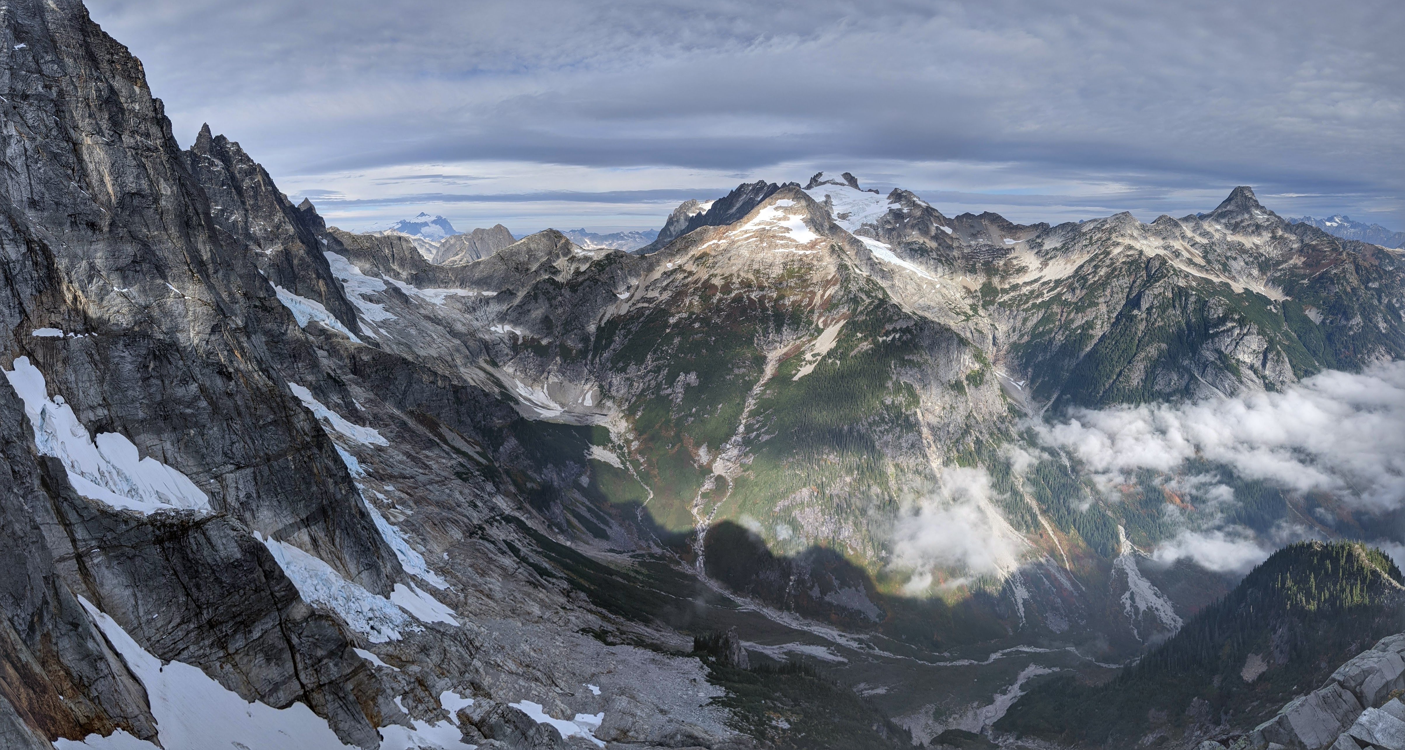
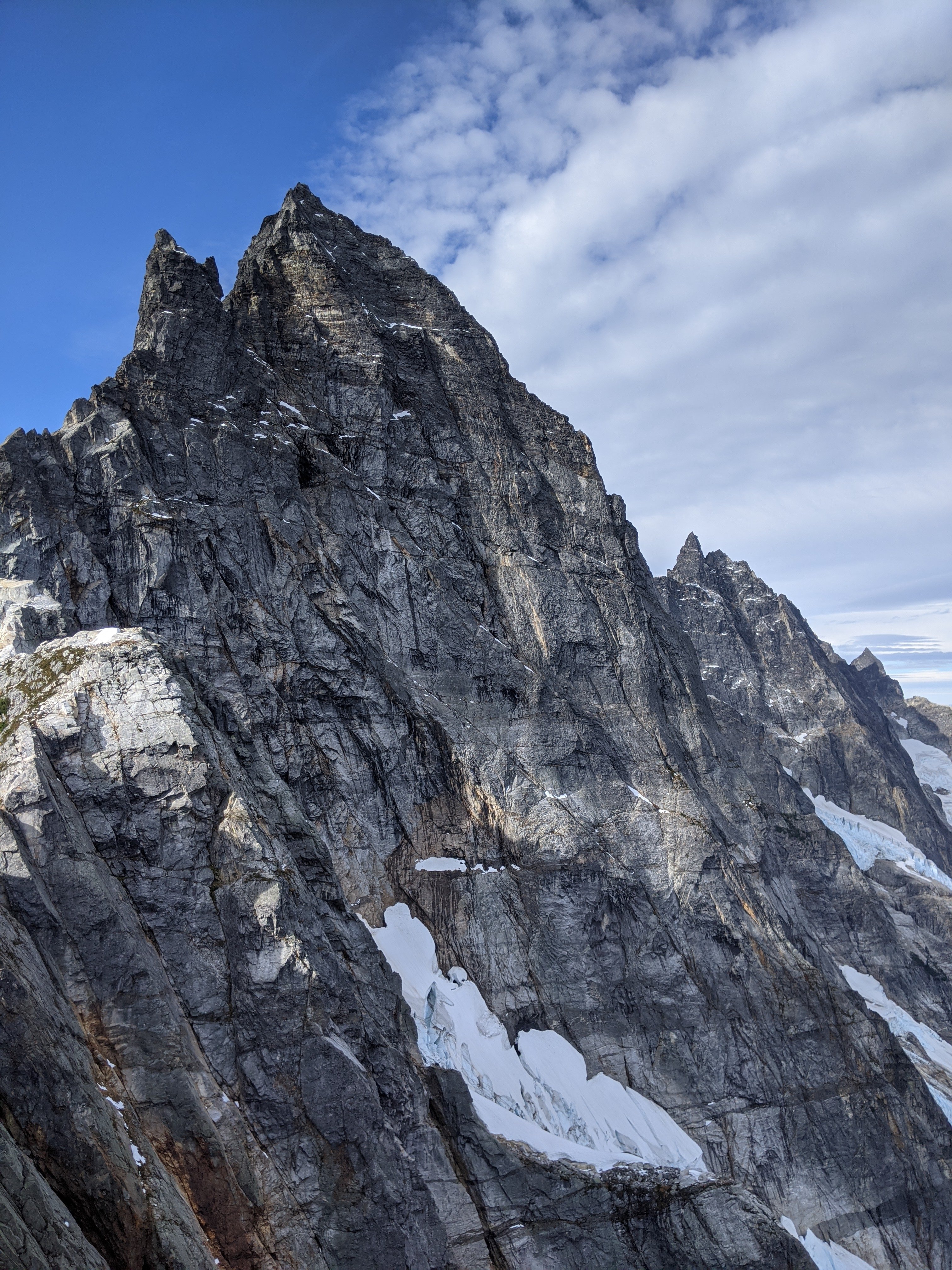
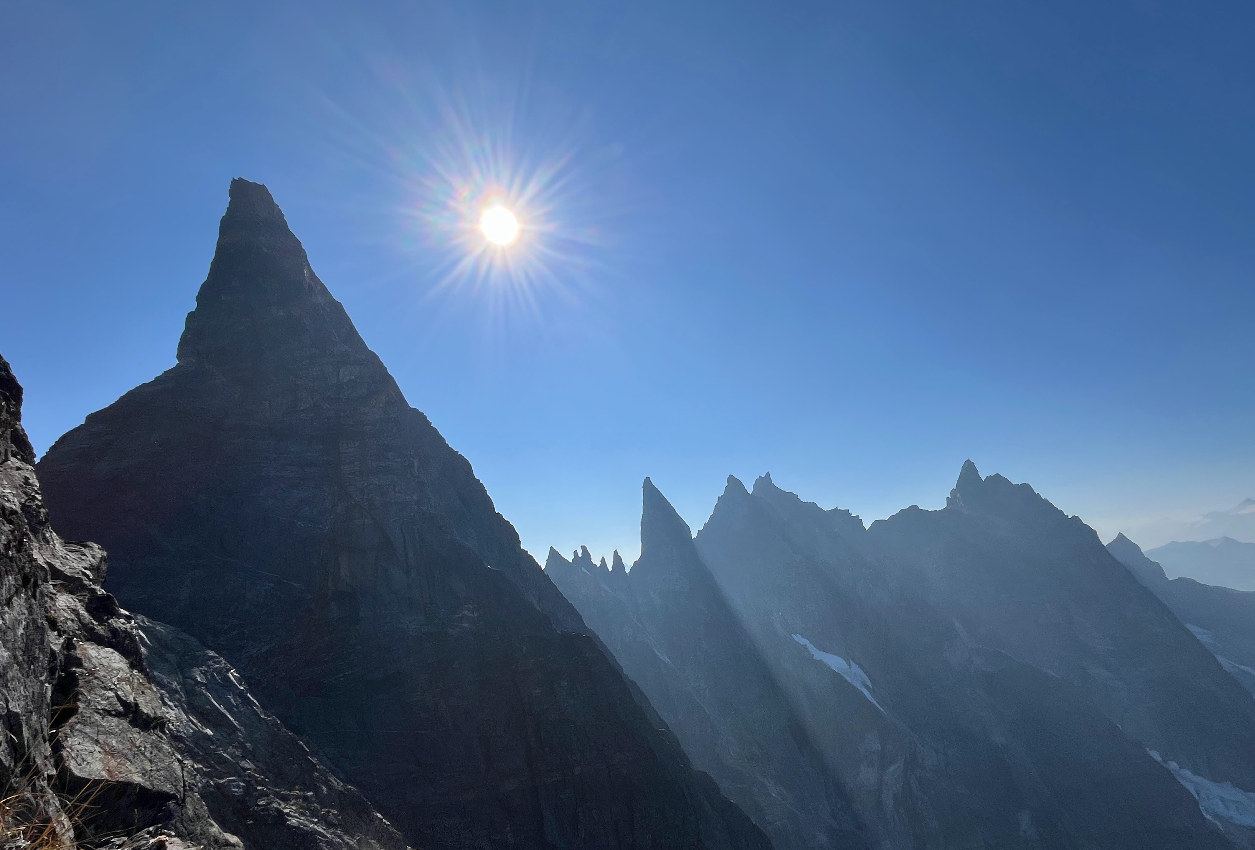
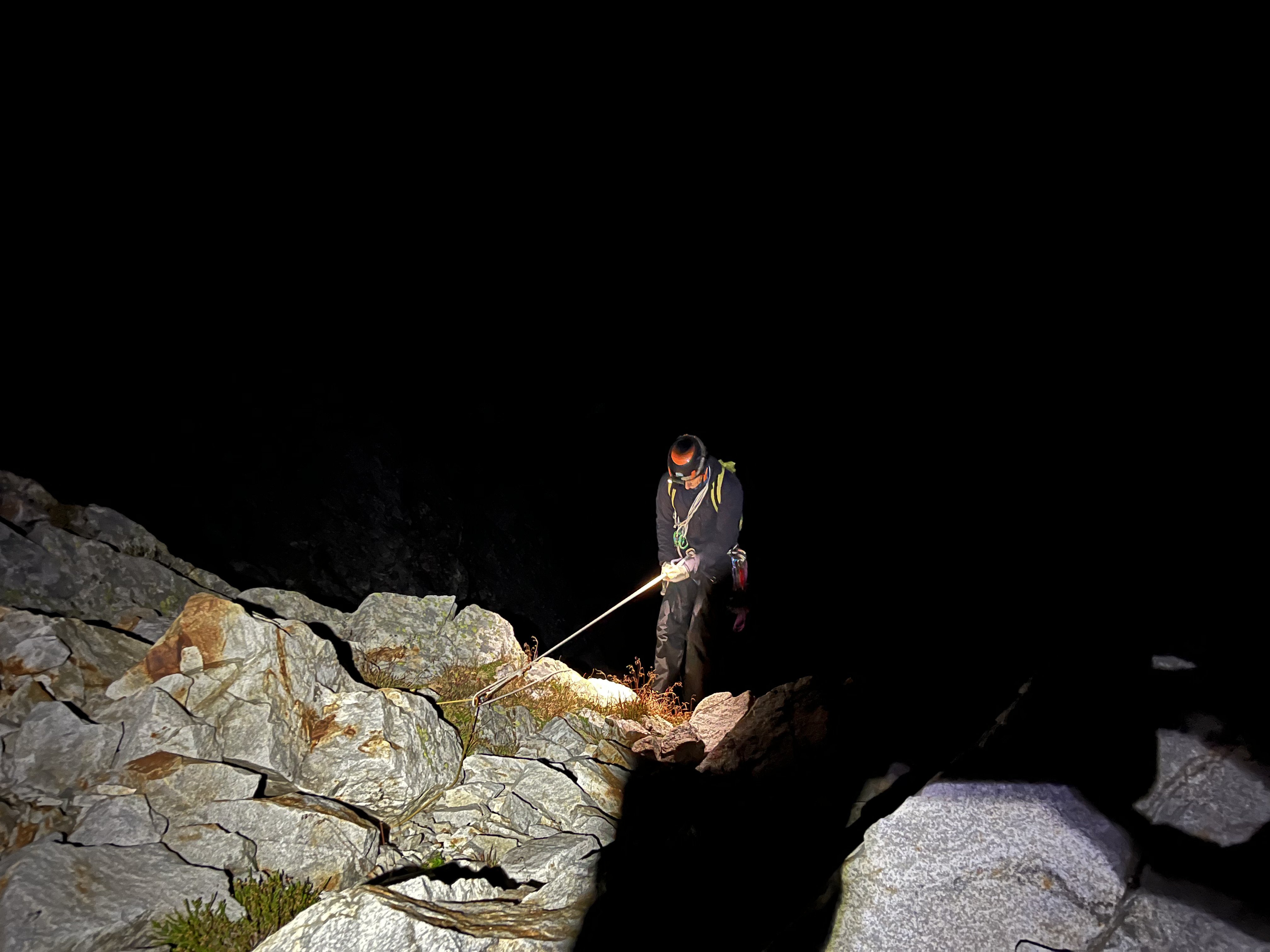
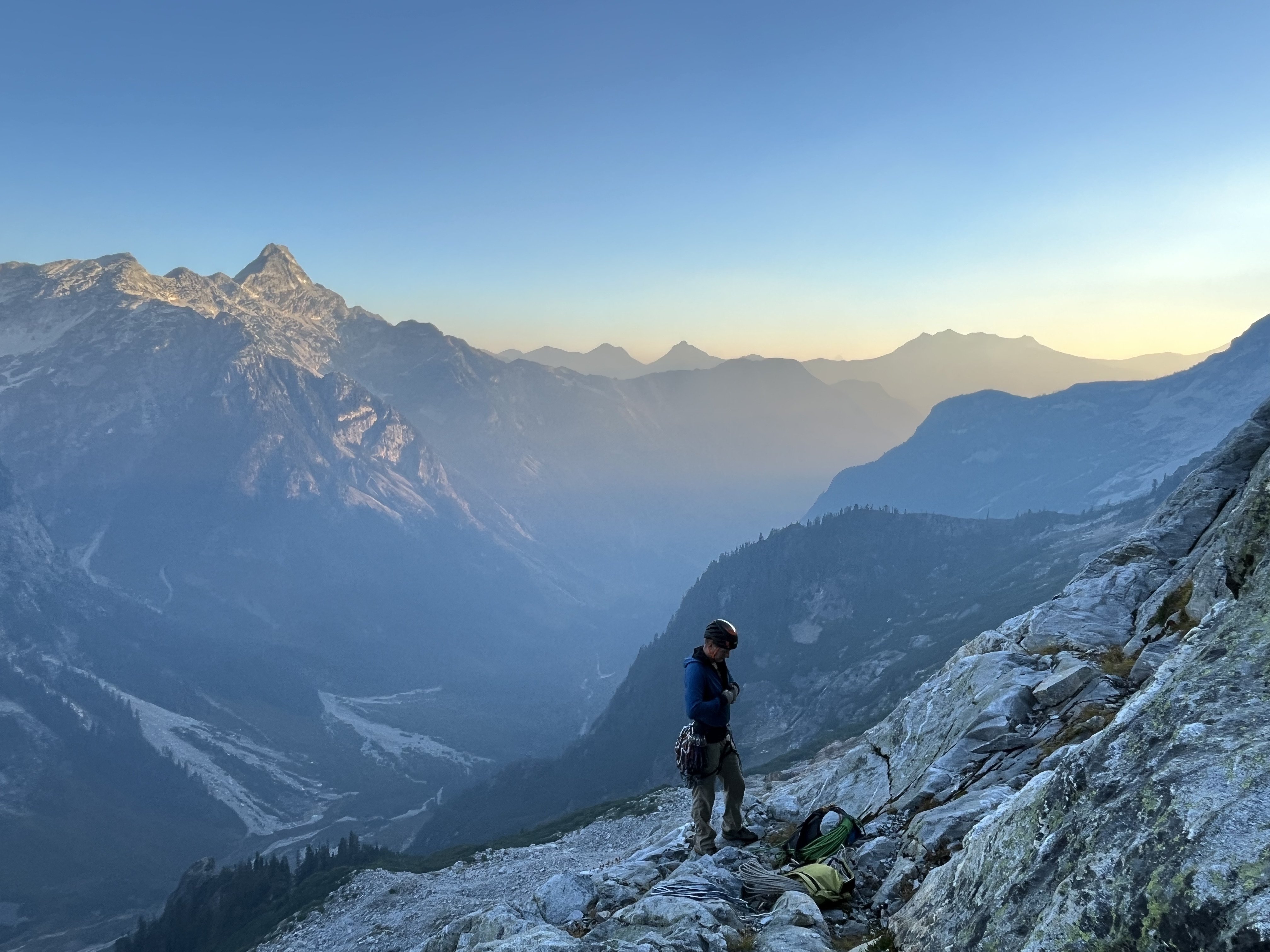
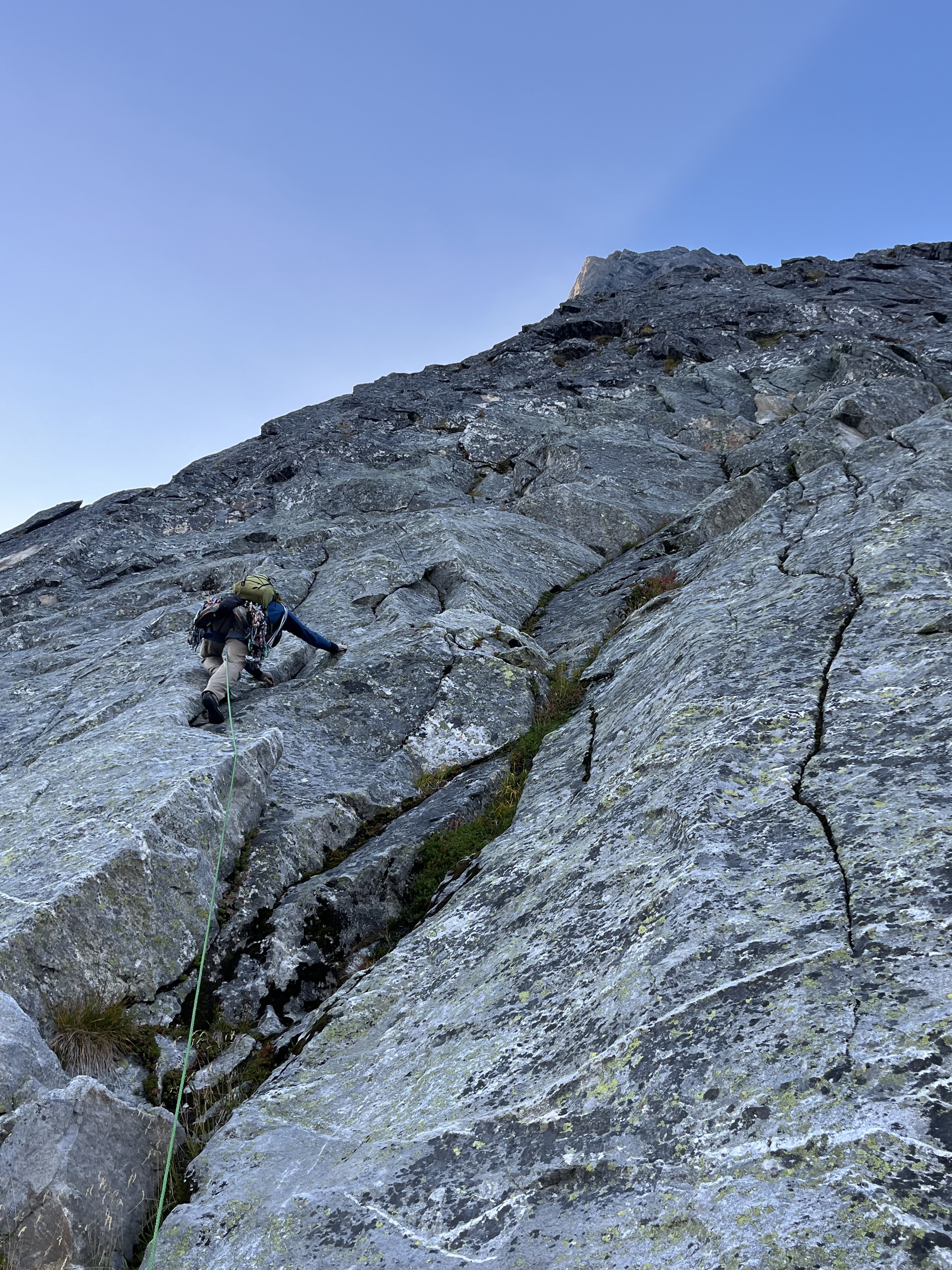
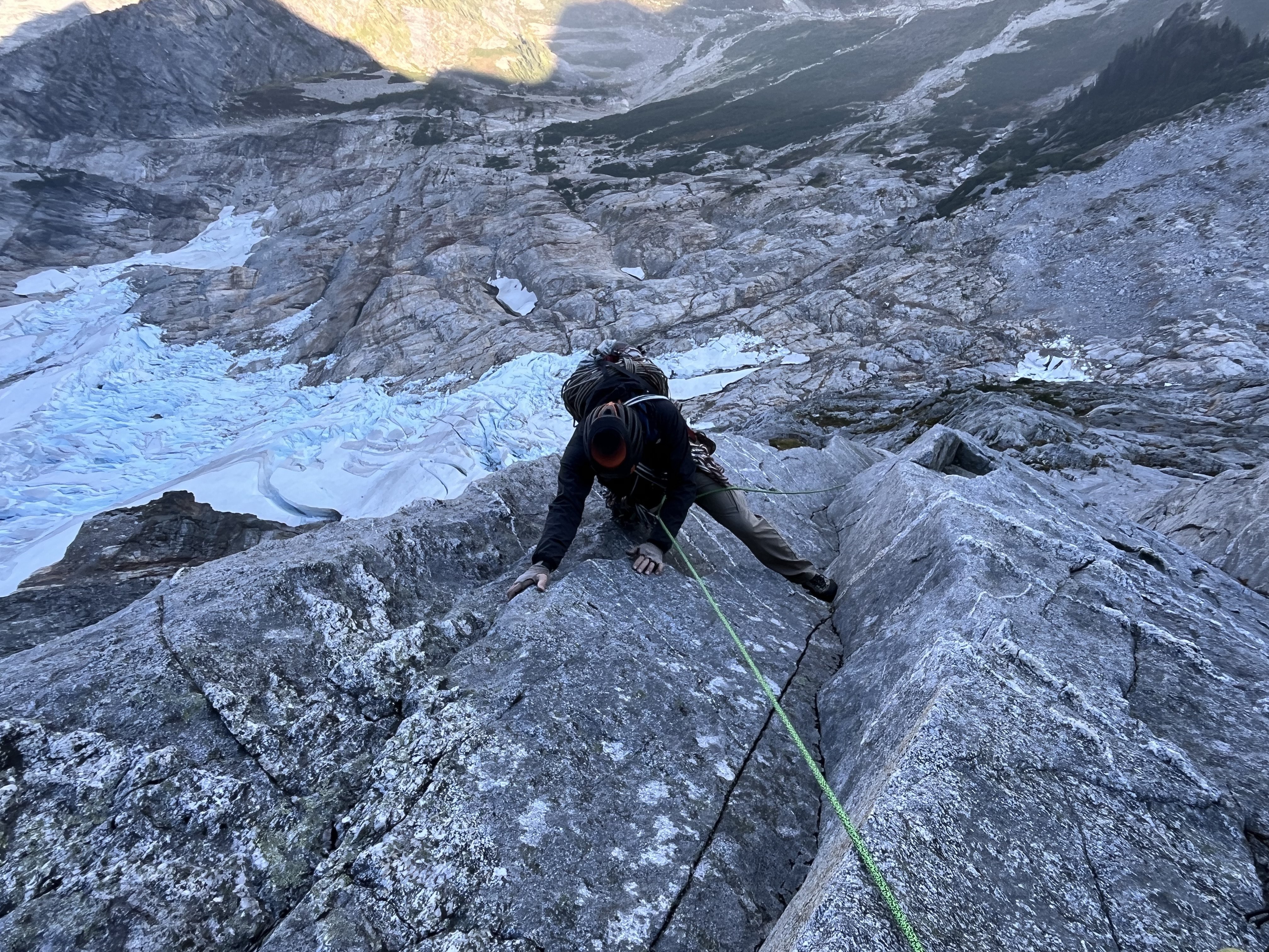
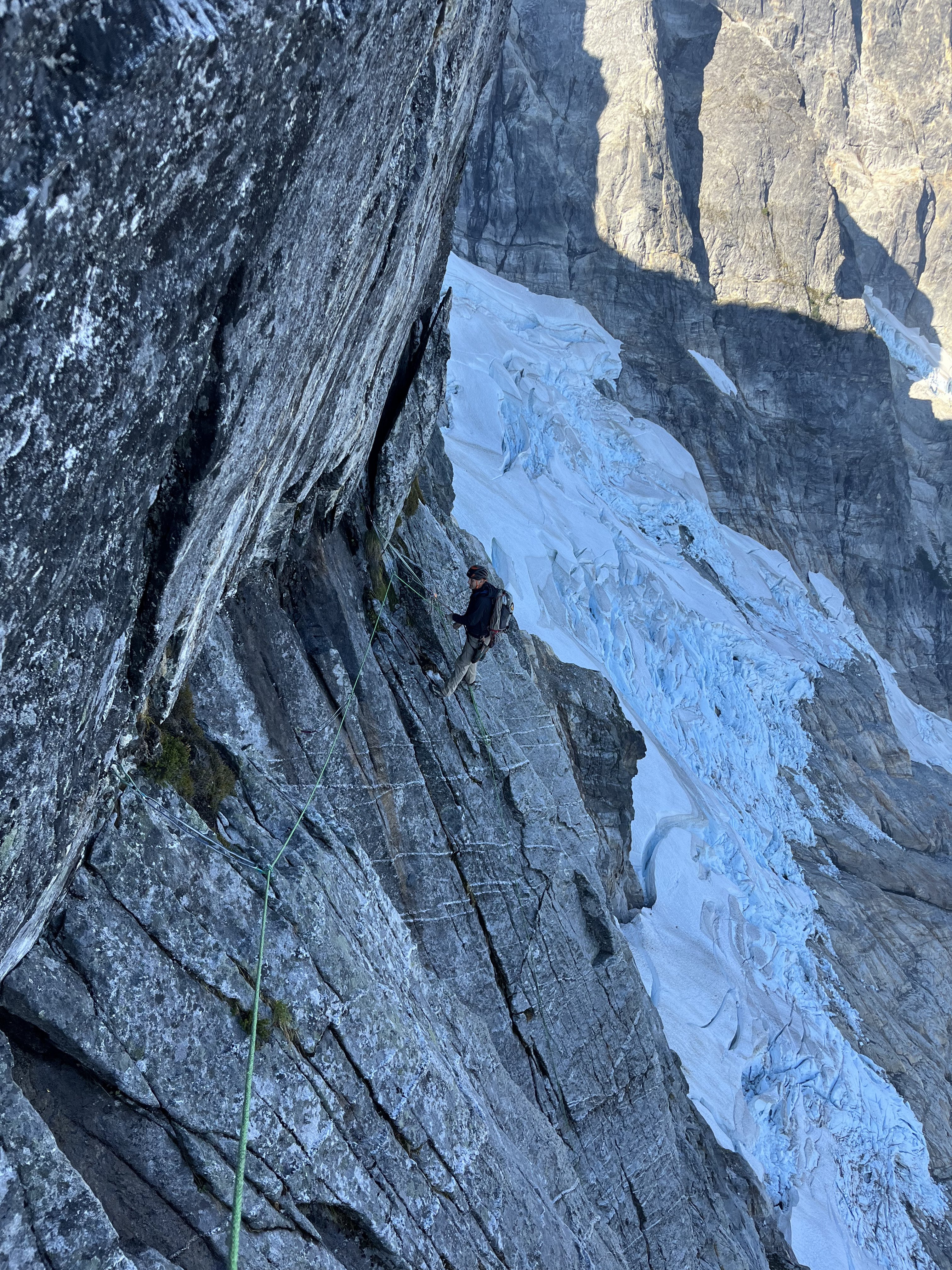
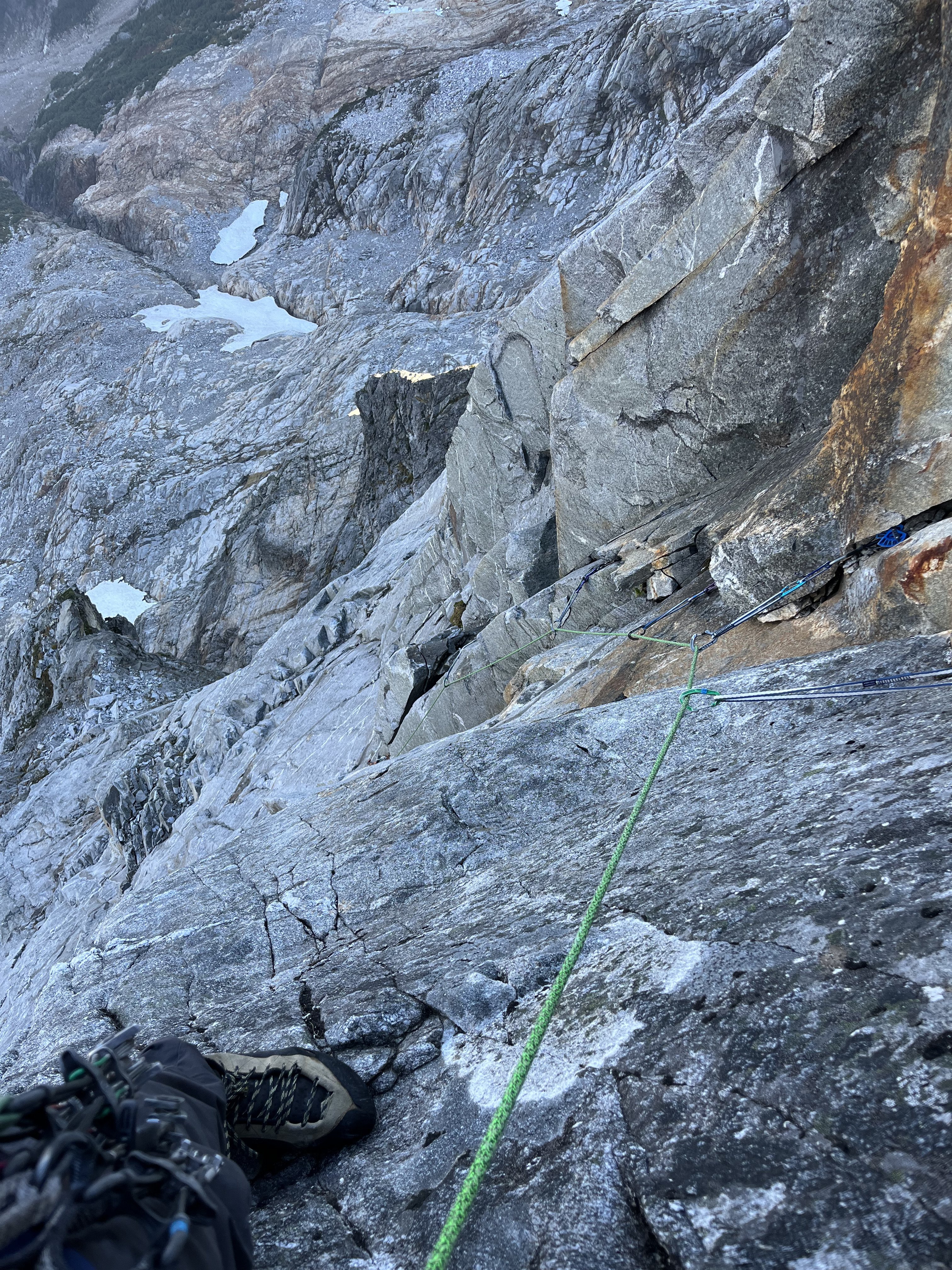
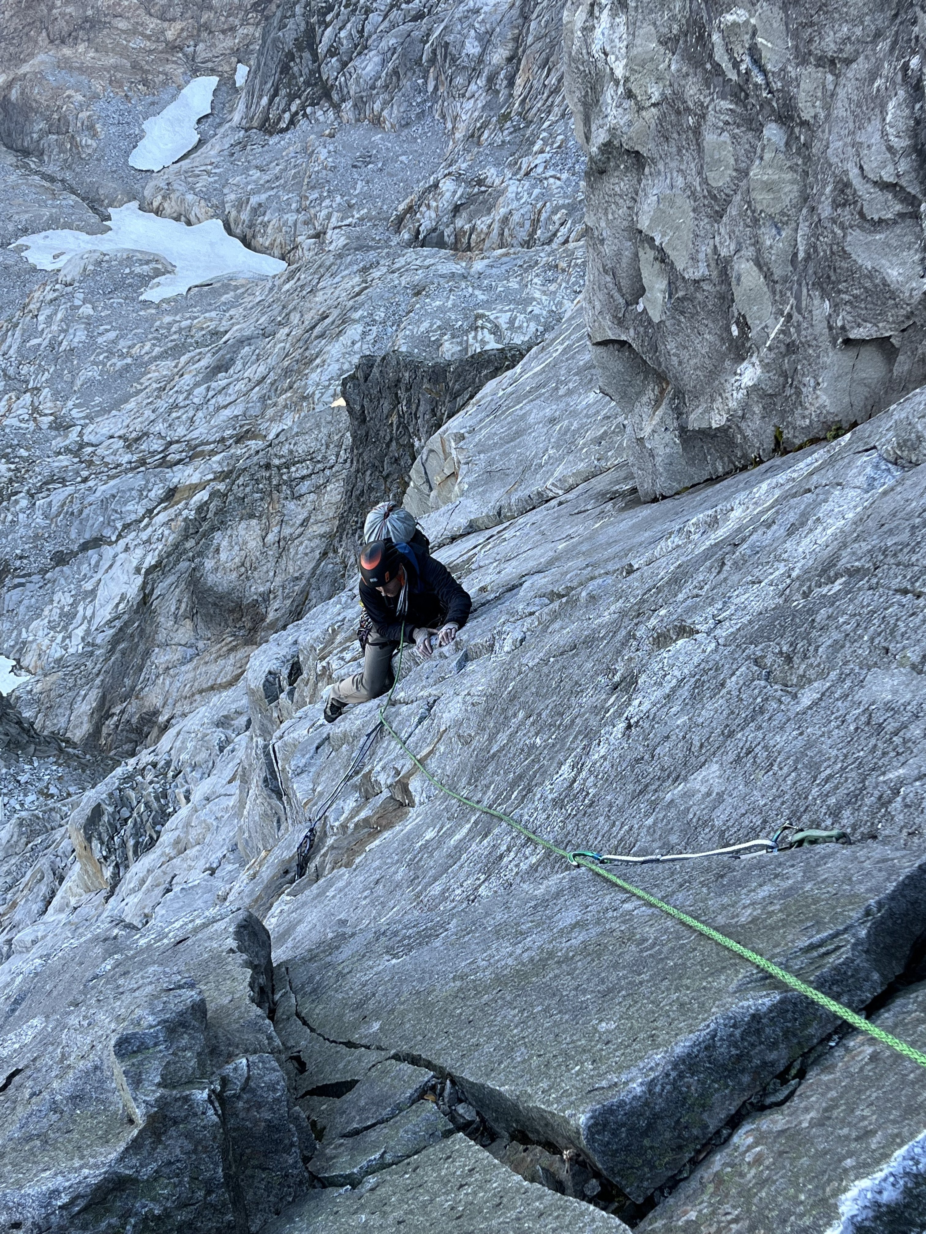
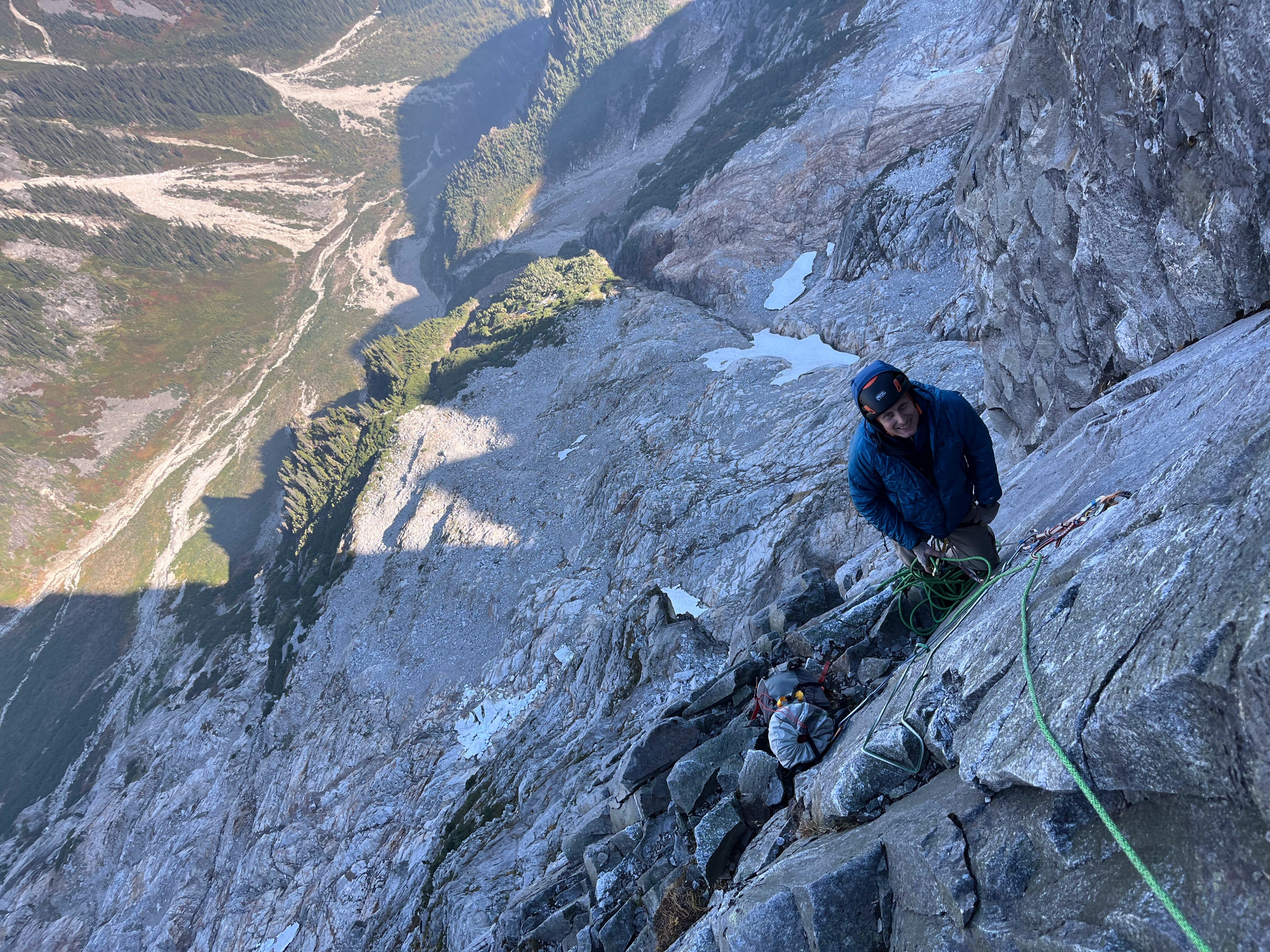
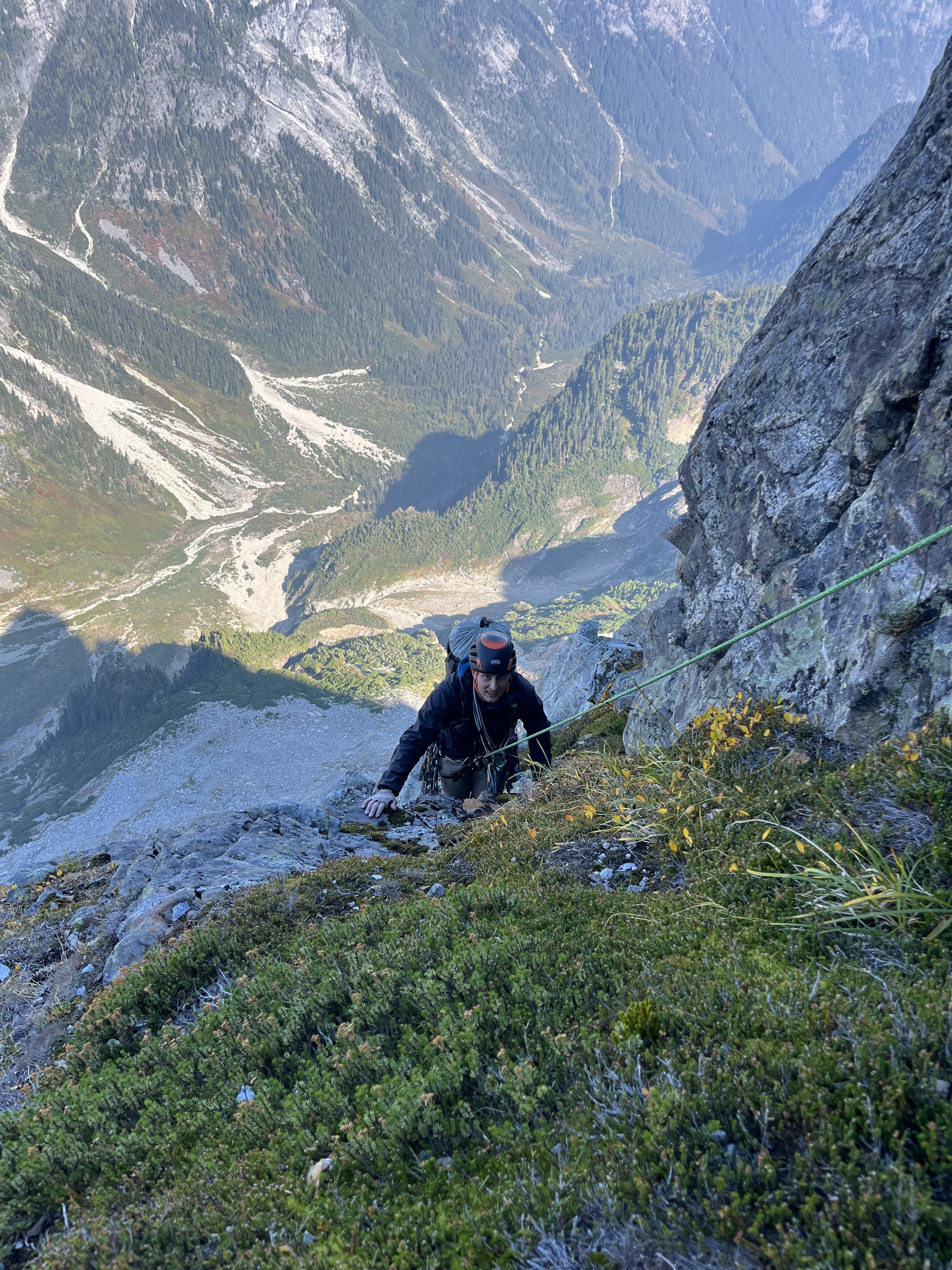
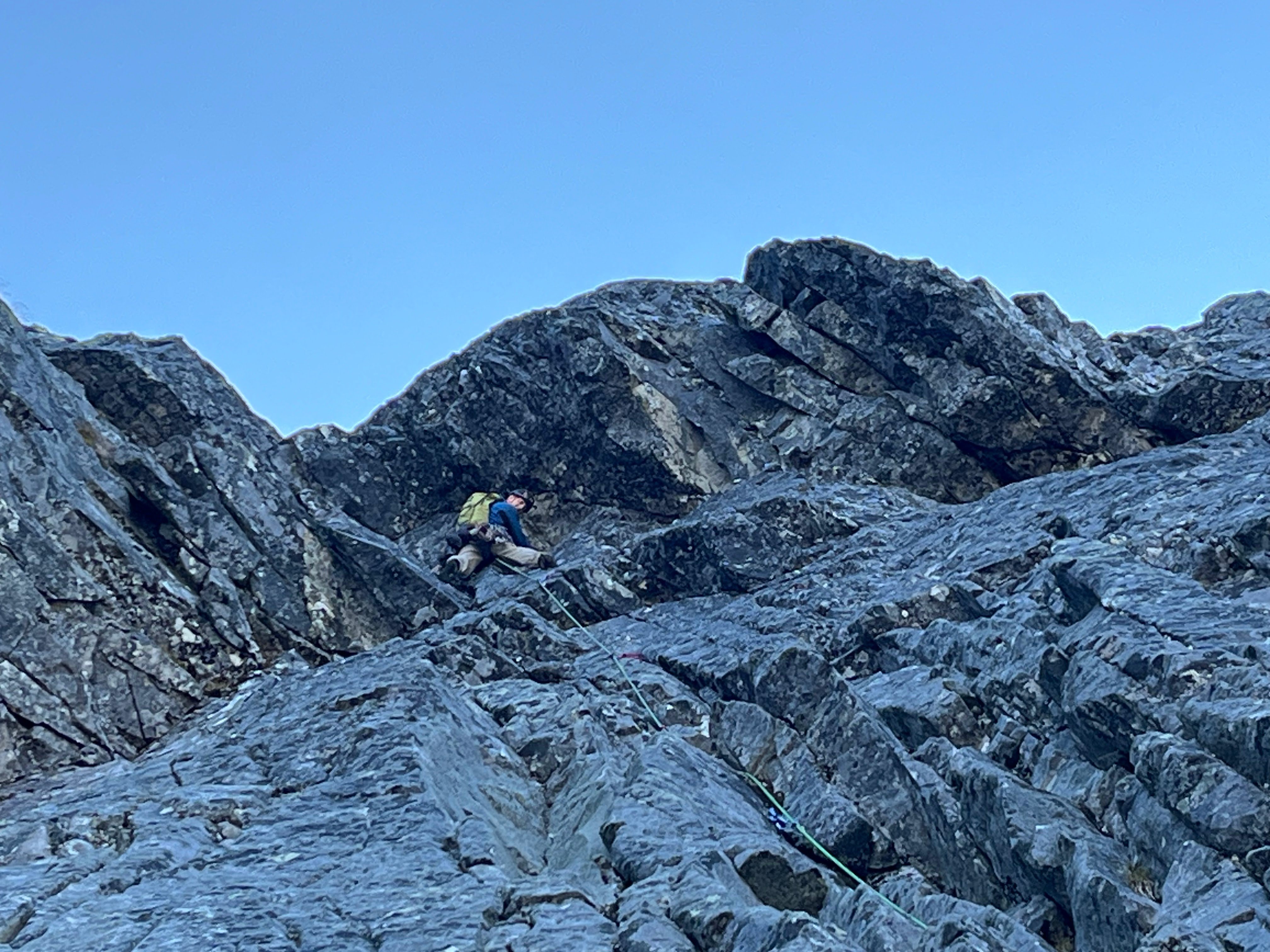
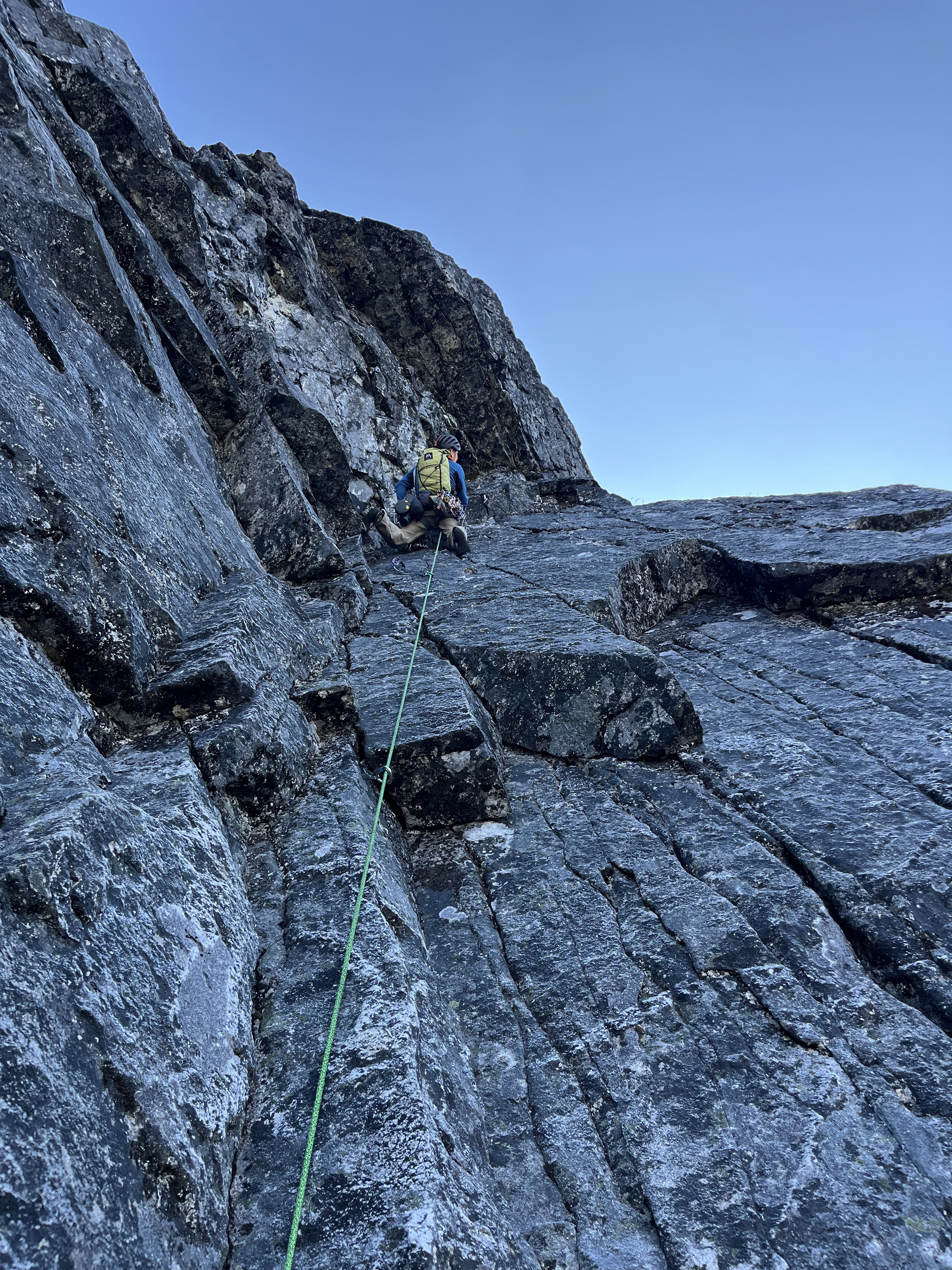
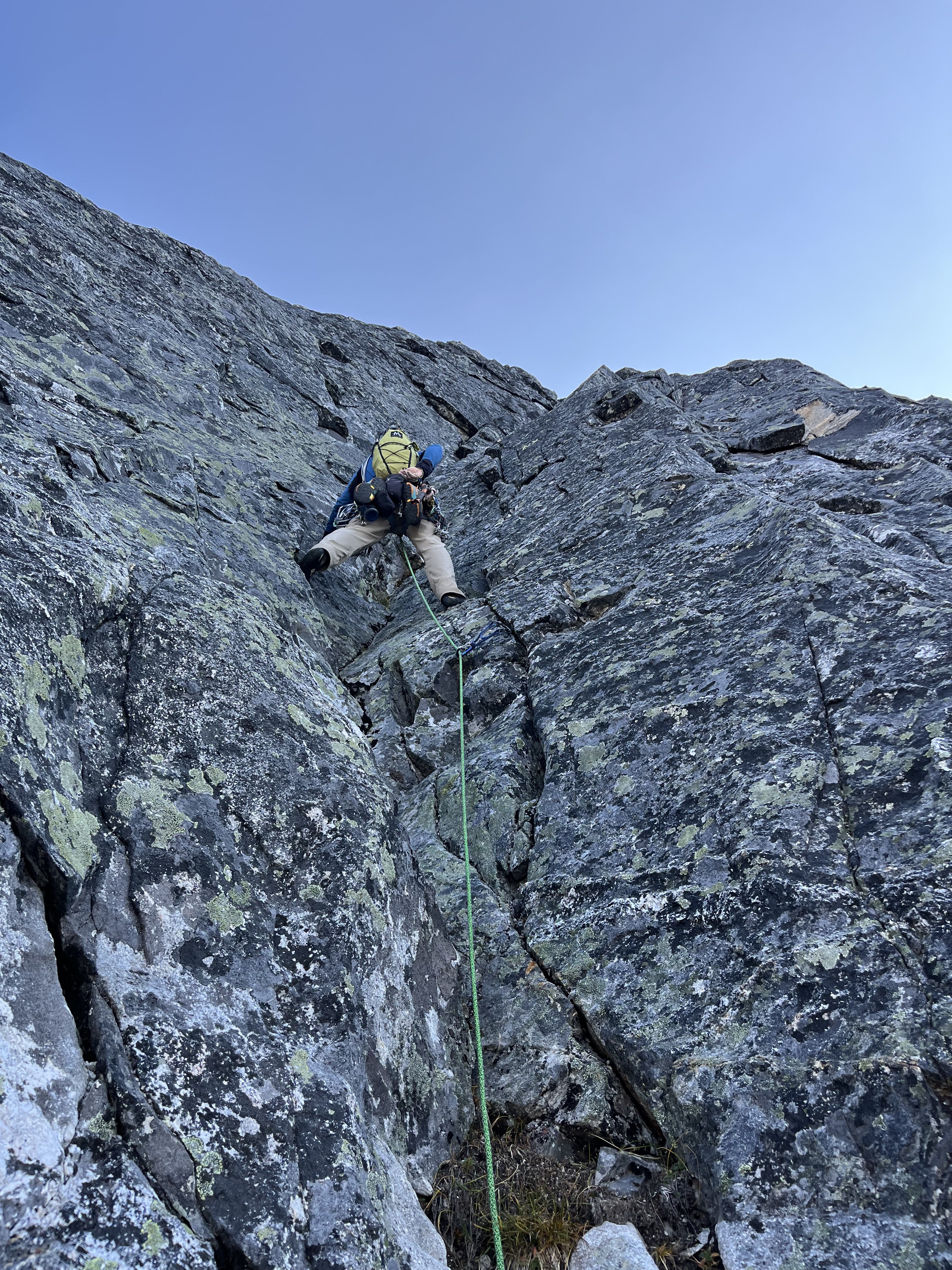
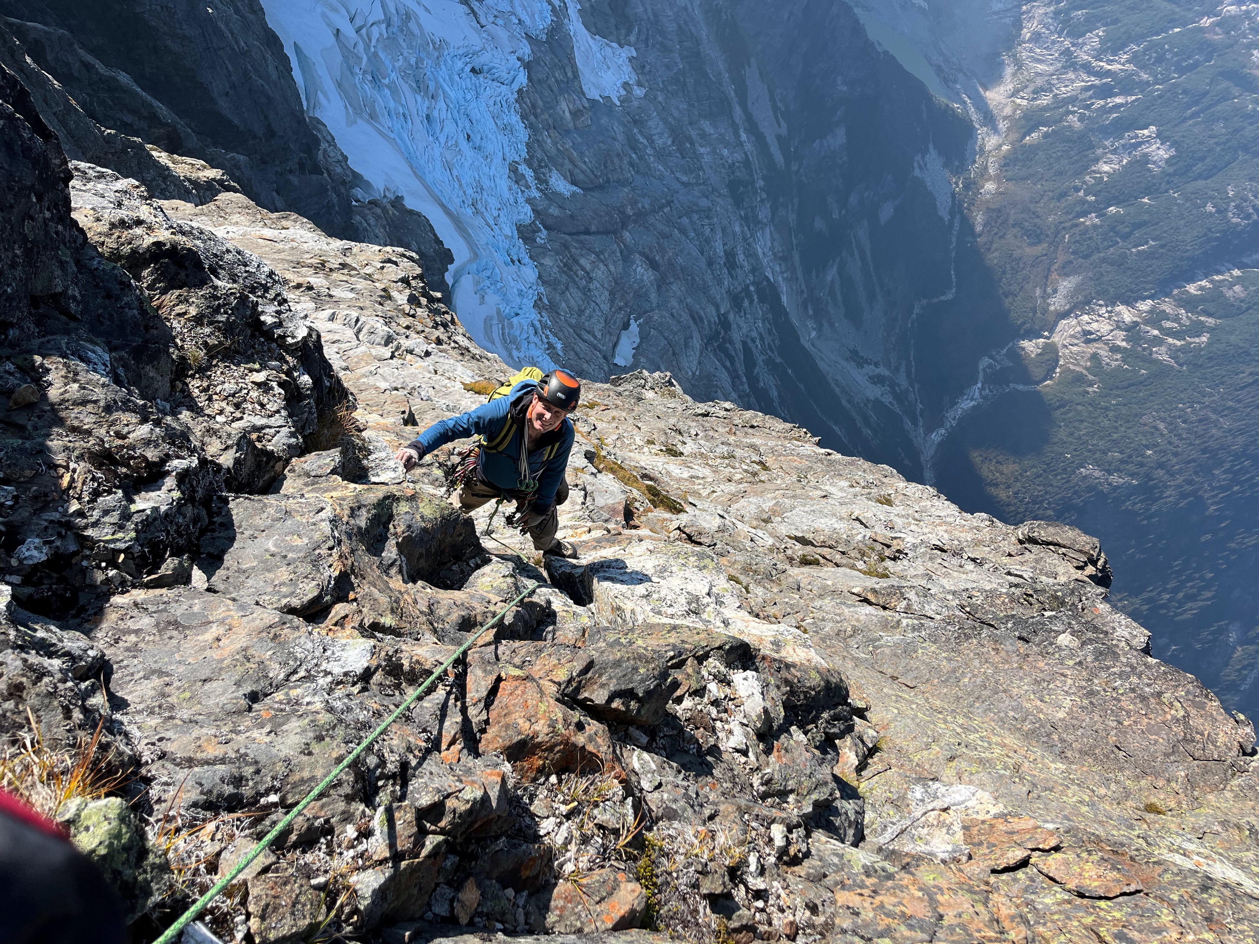
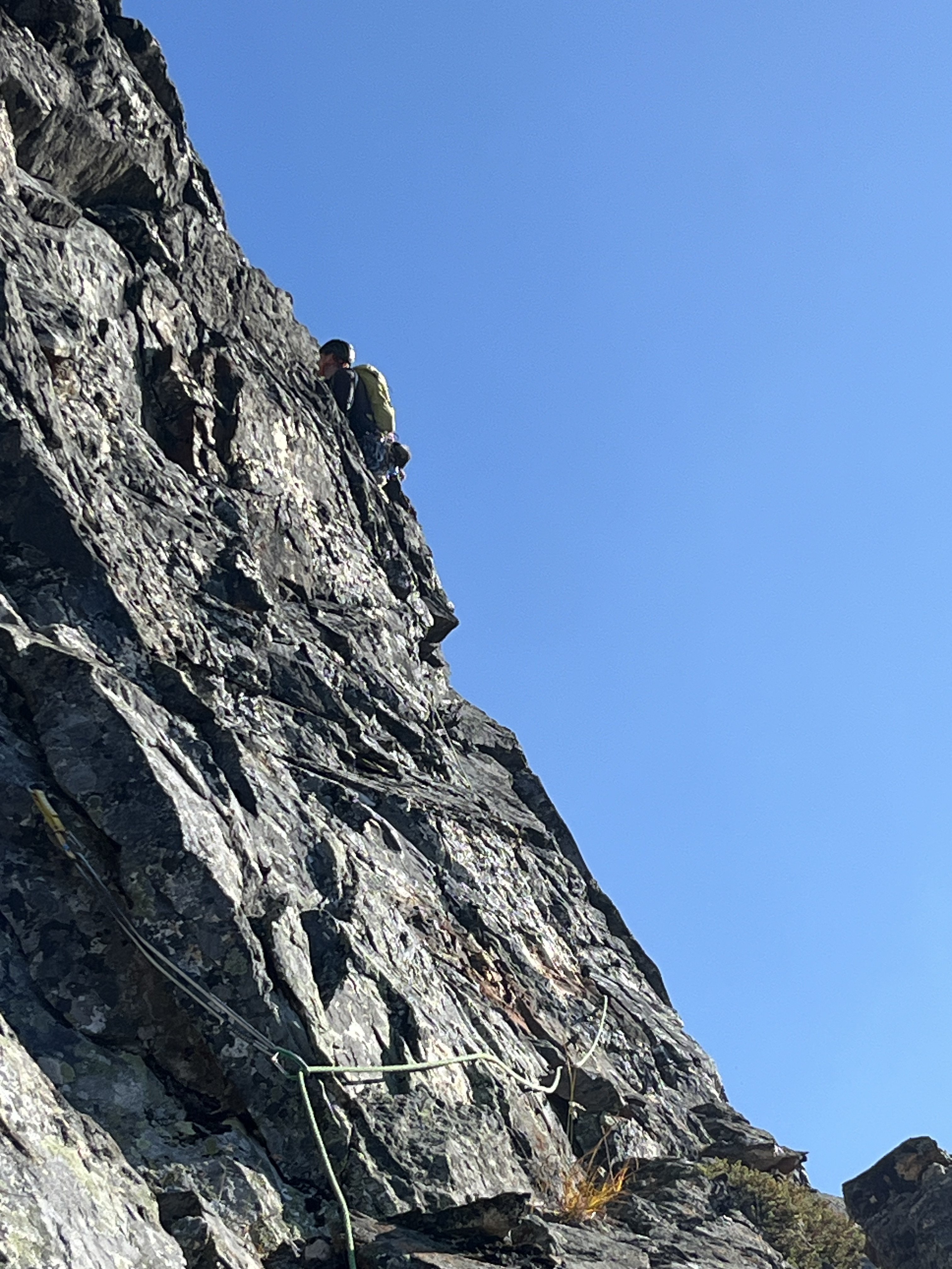
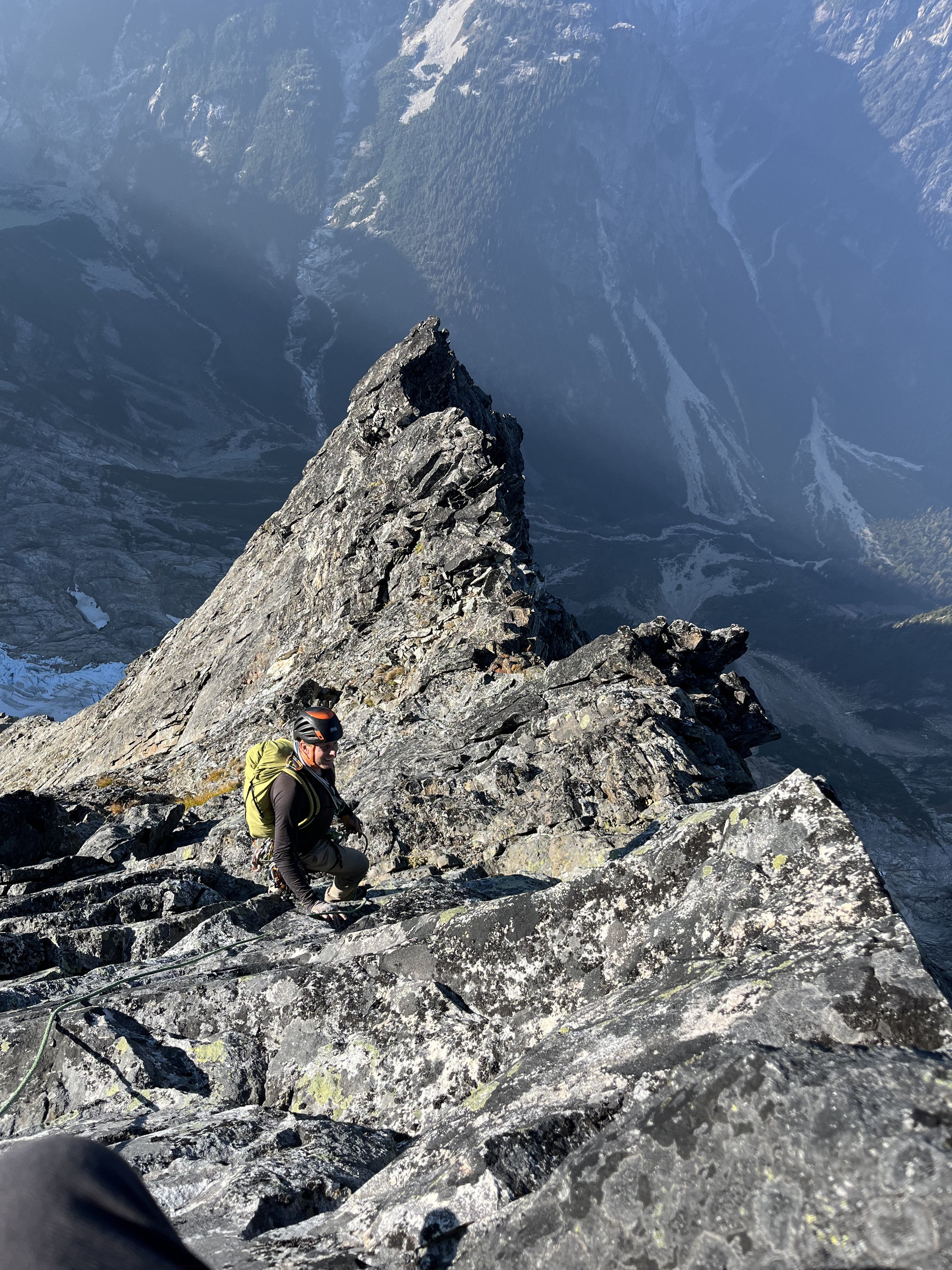
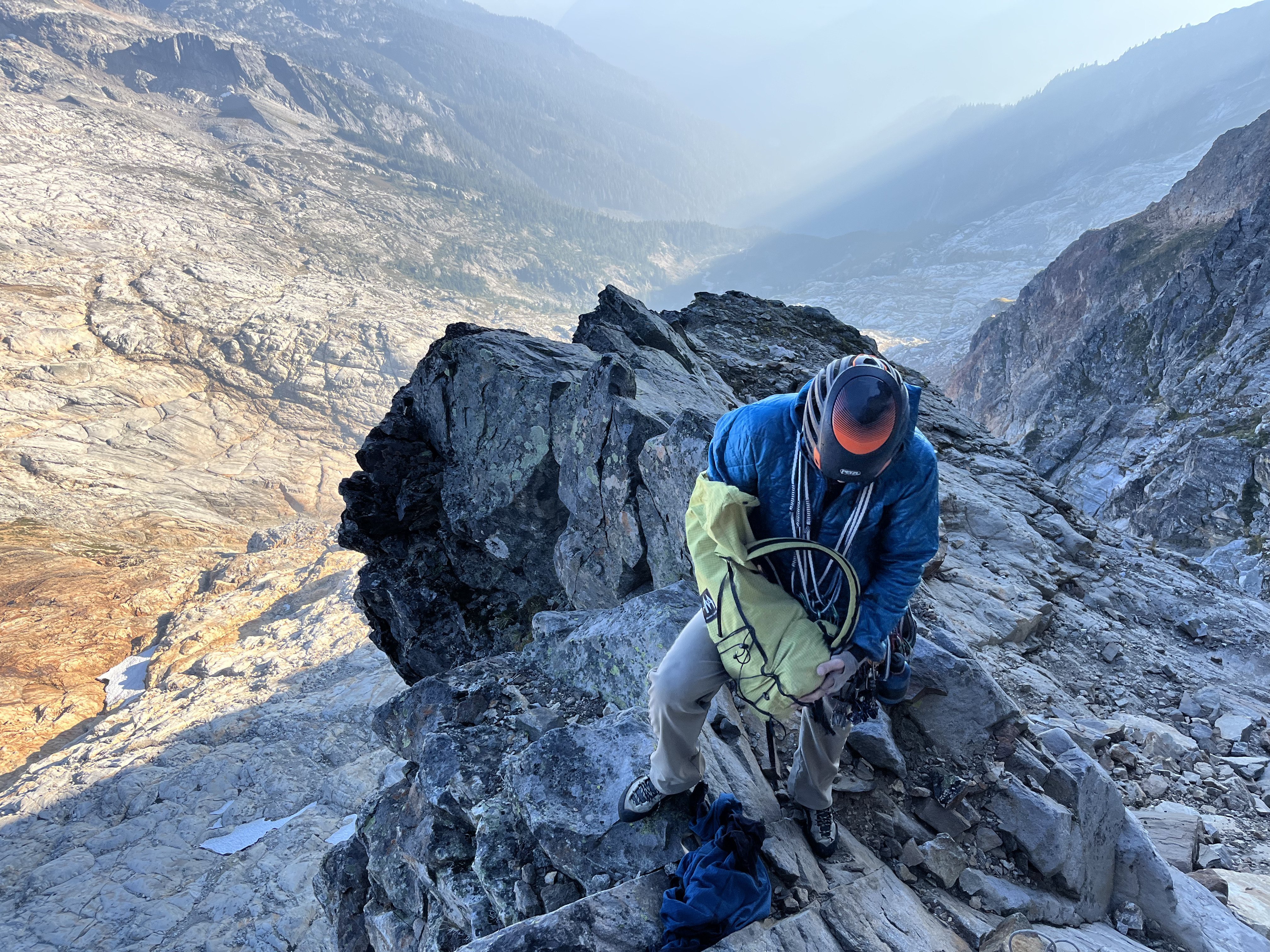
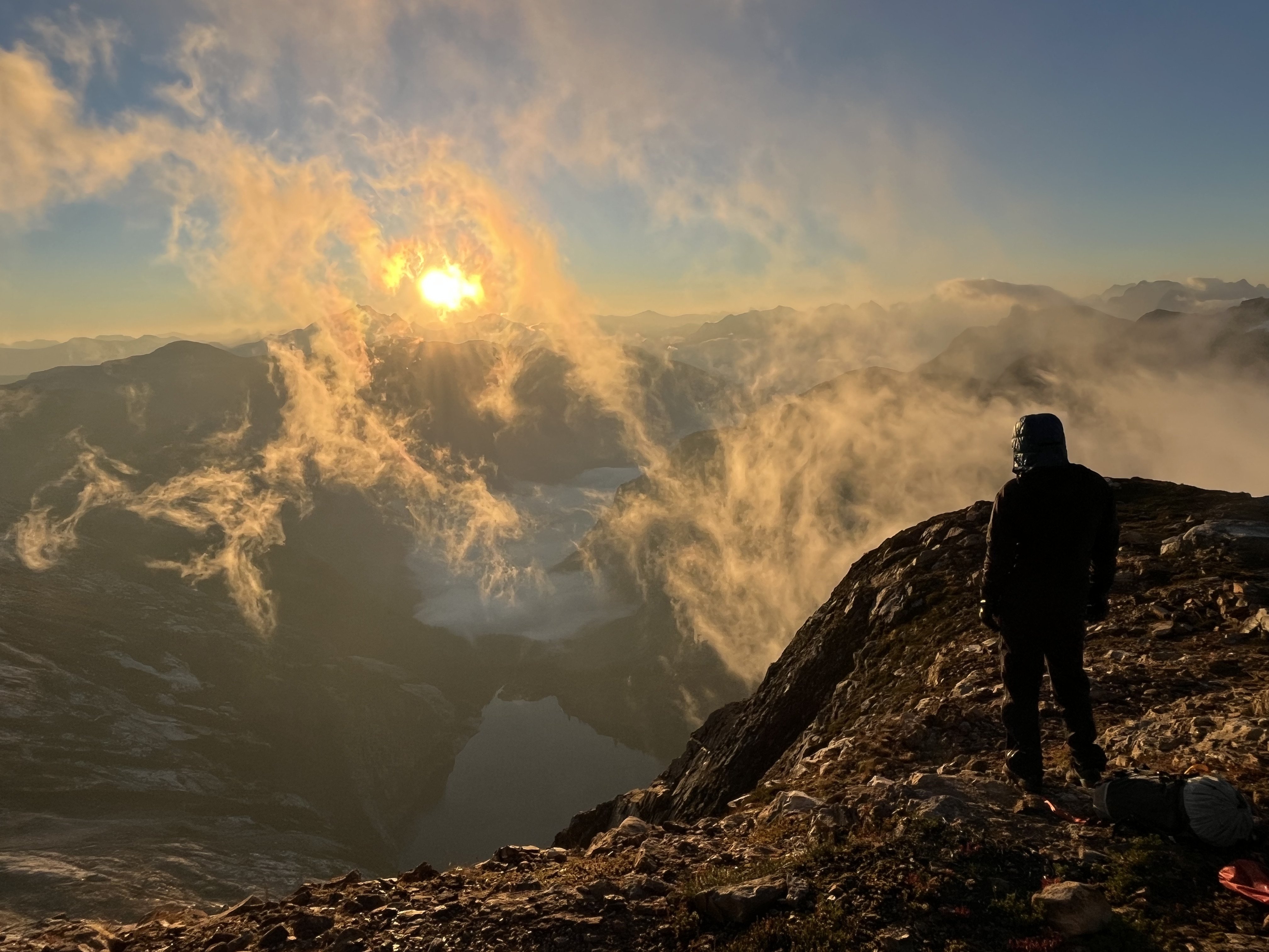
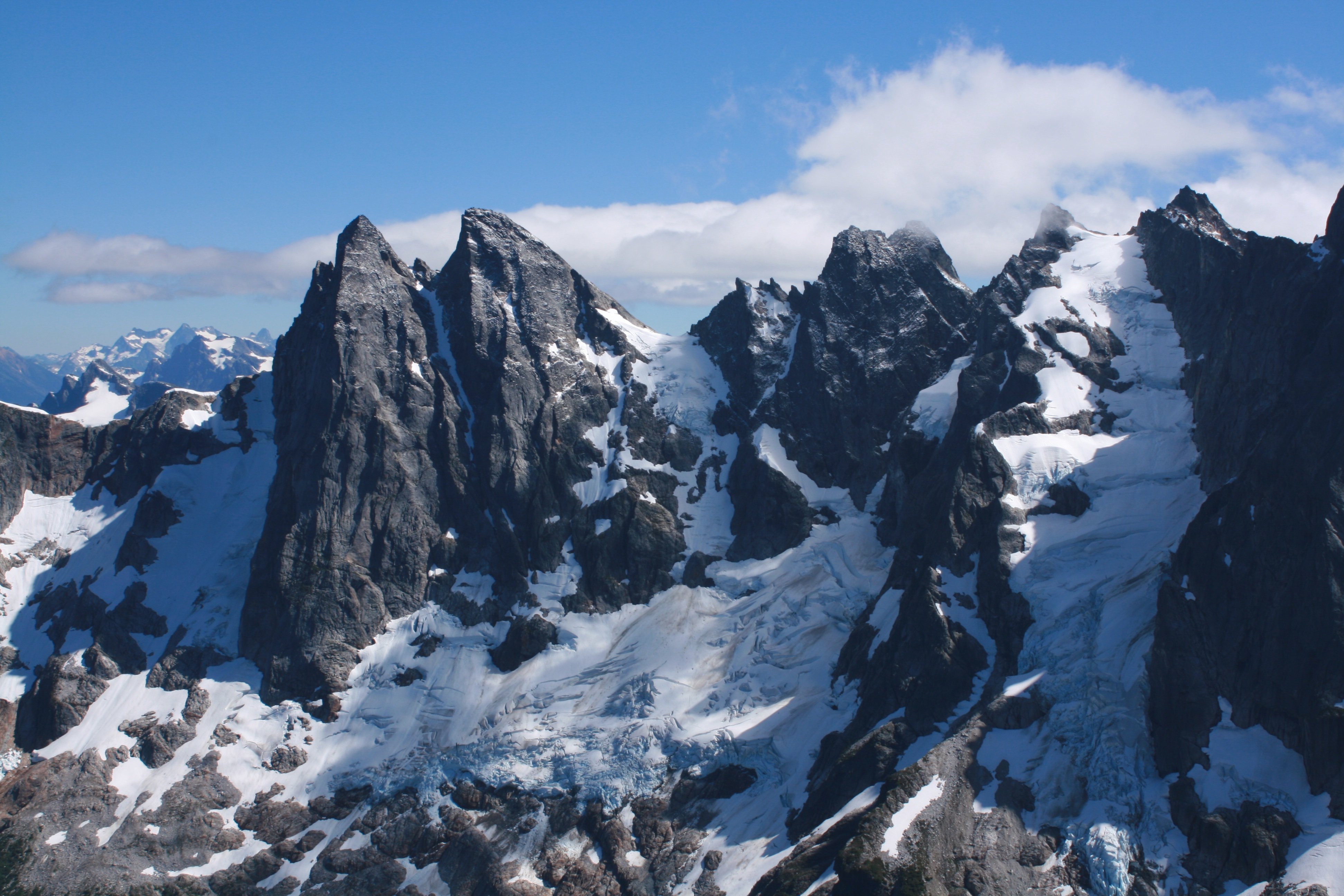
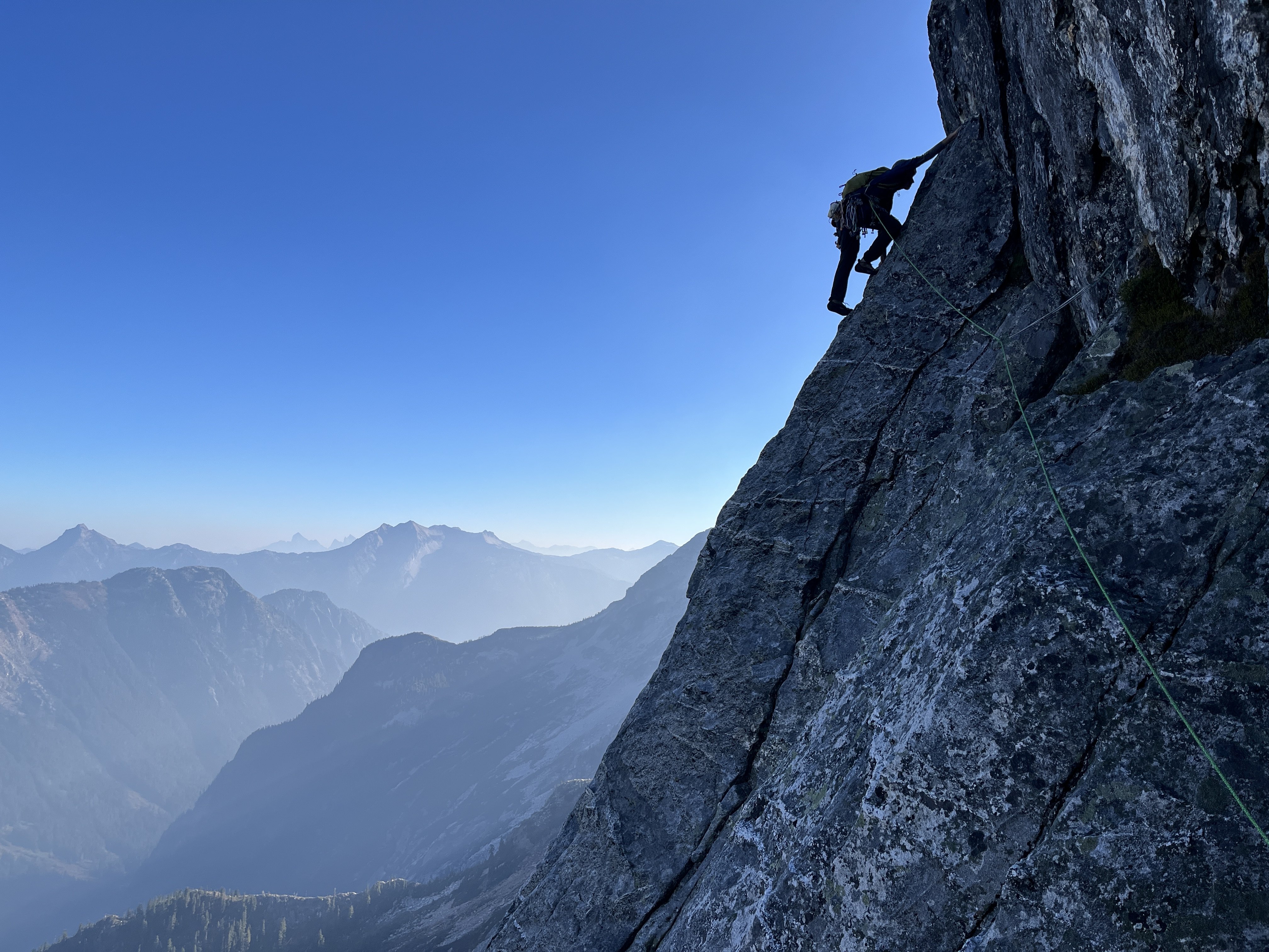
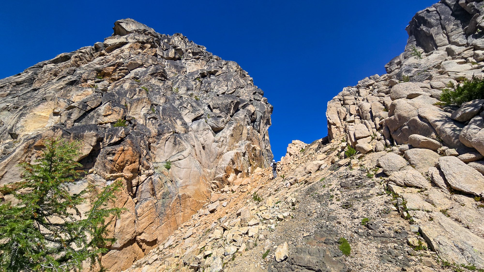
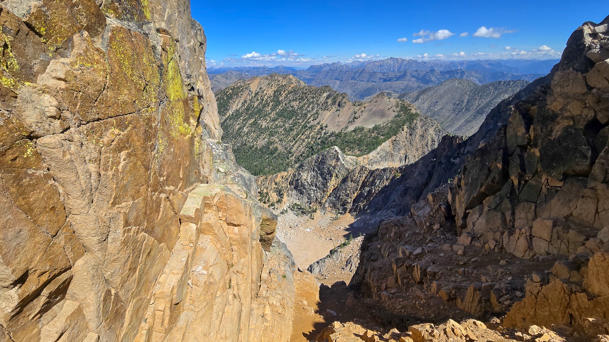
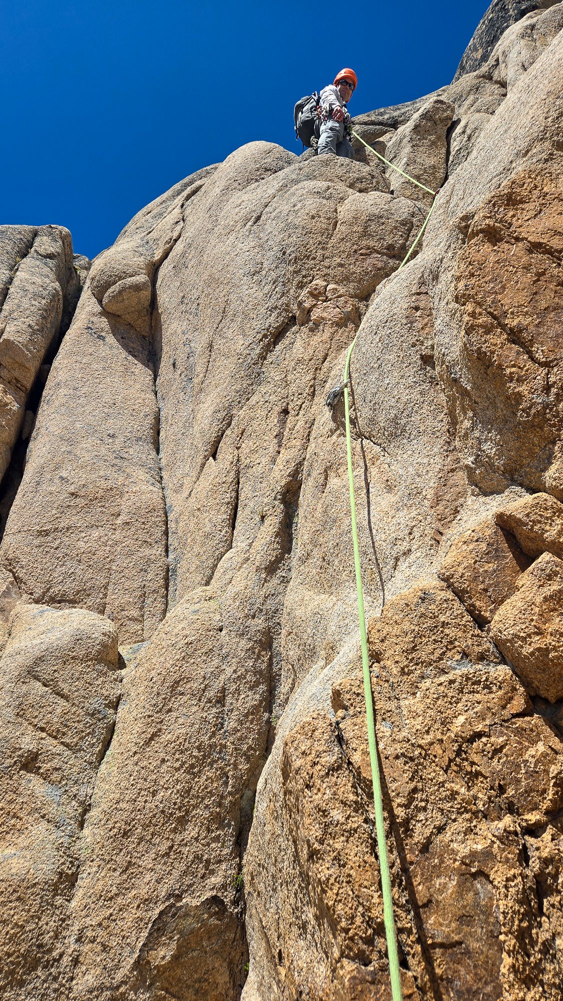
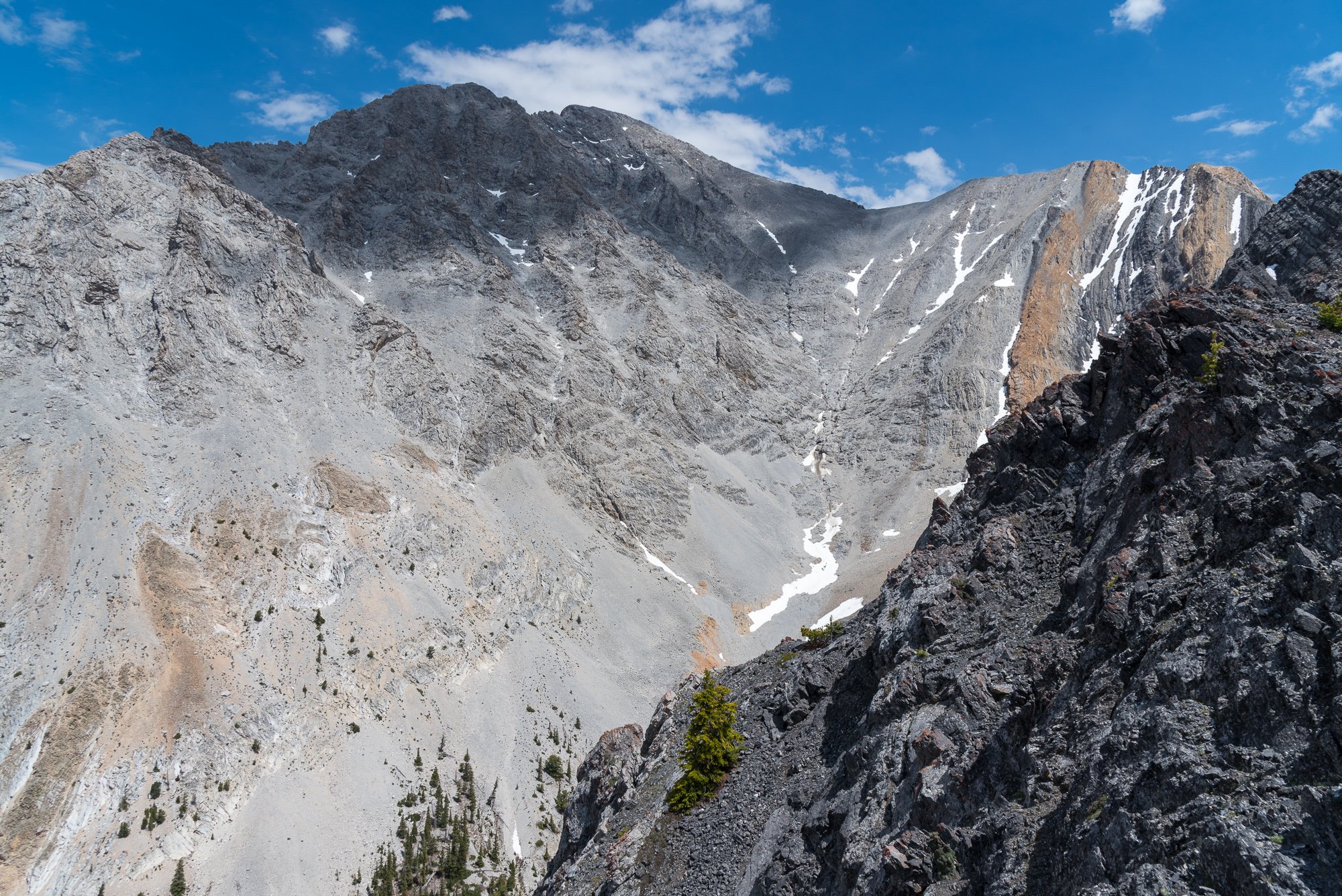
Trip: East McMillan Spire - North Buttress Trip Date: 09/24/2025 Trip Report: As Blake seems to speculate in the back of Cascades Rock, this is a legitimately high quality route. While the rock is of course worse than Index or Supercave, it is better than the E ridge of Inspiration or Stoddard Buttress on Terror (and much better than Megalodon). It's also less vegetated than the E face of Triumph or Sloan SW face. There was only one pitch we wouldn't recommend (up high in the schist band), but it can and should be avoided. The steep middle section is characterized by thin parallel cracks, highly textured ripples, and shady climbing with a shocking lack of lichen. When you emerge onto the slightly more West facing schist band for the last few hundred meters, lichen becomes tiresome as the angle eases and rock deteriorates. There are absolutely a couple of serious runouts, but they occur on clean, solid rock. From camp on a small heather patch a few minutes below Little Mac, we approached via a ledge just below Little Mac that accesses the NW trending ridge toward Elephant Butte. We made four rappels beginning at at an old station I had found during a recon trip in October 2020. This seems likely to be the rappel used by the 1986 party, maybe also the 1976 party, and I think @rat has also mentioned climbing the buttress, so perhaps used it as well. The 2008 party (AAJ, NWMJ) approached via Stetattle ridge. After four 45-55m rappels, we walked and scrambled easily to the base of the buttress. We simulclimbed 200-300m on the lower buttress, then belayed eight ~45-50m pitches (5.8 to 5.10-), then simulclimbed (interrupted by one belayed pitch, which we would recommend avoiding) to the summit. For the central, steep section we wanted to climb near but right of the buttress crest, which except for pitch 2 (a horizontal leftward traverse) yielded a logical path almost directly upward. Looking upwards from low on the buttress, two corners right of the crest (separated by a chossy roof) seem to provide the obvious options into the steeper middle section. We aimed for the left corner (which we presumed was the 2008 route), and thought the right corner was probably the 1986 route. We encountered many pieces of fixed gear throughout the route (mostly knifeblades, with a few nuts, a hex, and a rigid stem friend). Since the 2008 party rappelled the face (!!!), presumably close to their line of ascent, we think we followed large portions of their route (Come Over to the Dark Side). That said, I haven't really managed to match the route lines in either the NWMJ or AAJ to our experience (at least at the resolution I can manage to download). From the summit, we downclimbed SW to the col with West McMillan, then continued downclimbing S in the gully for a few minutes. When the gully's left wall flattened, we slung a boulder and made four 45-55m rappels to reach low angle slopes and walked back to camp, arriving about 15 hours after leaving that morning. West McMillan, Inspiration, The Pyramid, Degenhardt, and Terror from high on the route: From left to right: E McMillan, W McMillan, Inspiration, The Pyramid, and Degenhardt. The route goes just right of the sun/shade line on the leftmost peak. The approach rappels start down a relatively solid corner just right of the low point on the left). Photo by Steph Abegg: First rappel into McMillan Creek cirque: Racking up before the first simul block: Marlin starting up the first simul block: Marlin at the top of pitch 1: Partway across the pitch 2 traverse (photo by Marlin). There was a fixed two-pin anchor at the end of this traverse that may be that in the 2008 NWMJ "Erik starts the crux" photo: Looking down partway up pitch 3. This section had some blocks and flakes that looked ominous from below, but sounded and felt solid on closer inspection: The upper part of pitch 3. This was probably the most runout section of the route: Looking down the start of pitch 4: Marlin at the top of pitch 4: Marlin starting up pitch 5: Marlin starting up pitch 6: And navigating the roof on pitch 6: Starting pitch 7: And pitch 8, which should have been the last belayed pitch: Simuling in the schist band: Marlin leading the very-not-recommended lichen covered, loose pitch in the schist band. Go right before here, toward the E Mac col, to keep it scrambly. There was a fixed pin near his feet here, so we weren't the first to get suckered into it: Belaying on the summit. The buttress crest in this section is stacked, lichenous blocks that seem to overhang the impressively steep East face. You want nothing to do with the crest here: Setting up the first rappel out of the E Mac-W Mac gully: Impressive ambience the next morning, looking toward Azure lake from camp: Hiking out, looking toward Triumph: And a friend from the start of the schist band. It was still solidly placed and easily removed after, probably, 17 years (although could use some lube): Gear Notes: Modern gear made a huge difference on this route, especially microcams (compare the 2008 party's rack in the NWMJ pictures), microtrax simuling, and fix-and-following. We took a 50m lead and 65m tag line (we didn't haul), ~5 kbs/lost arrows, at least triples to fingers with offset aluminum and brass nuts, doubles to #1, single #2 and #3, and four microtraxions. Our smallest cams (purple C3 and green/#0 Z4) were used in several critical placements. Approach Notes: Goodell Creek to Terror Basin, then up slabs toward Little Mac.
 1 point
 -
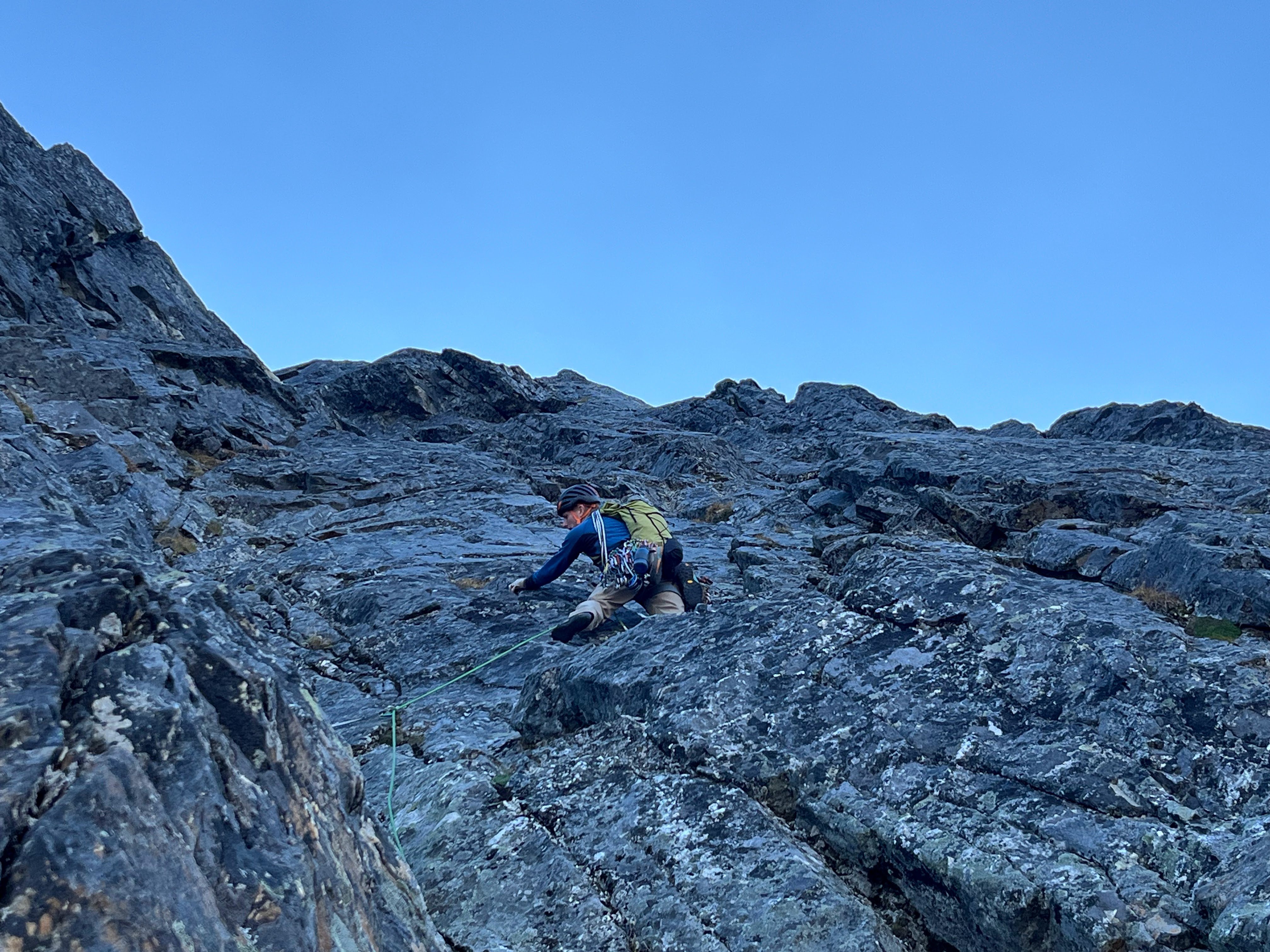
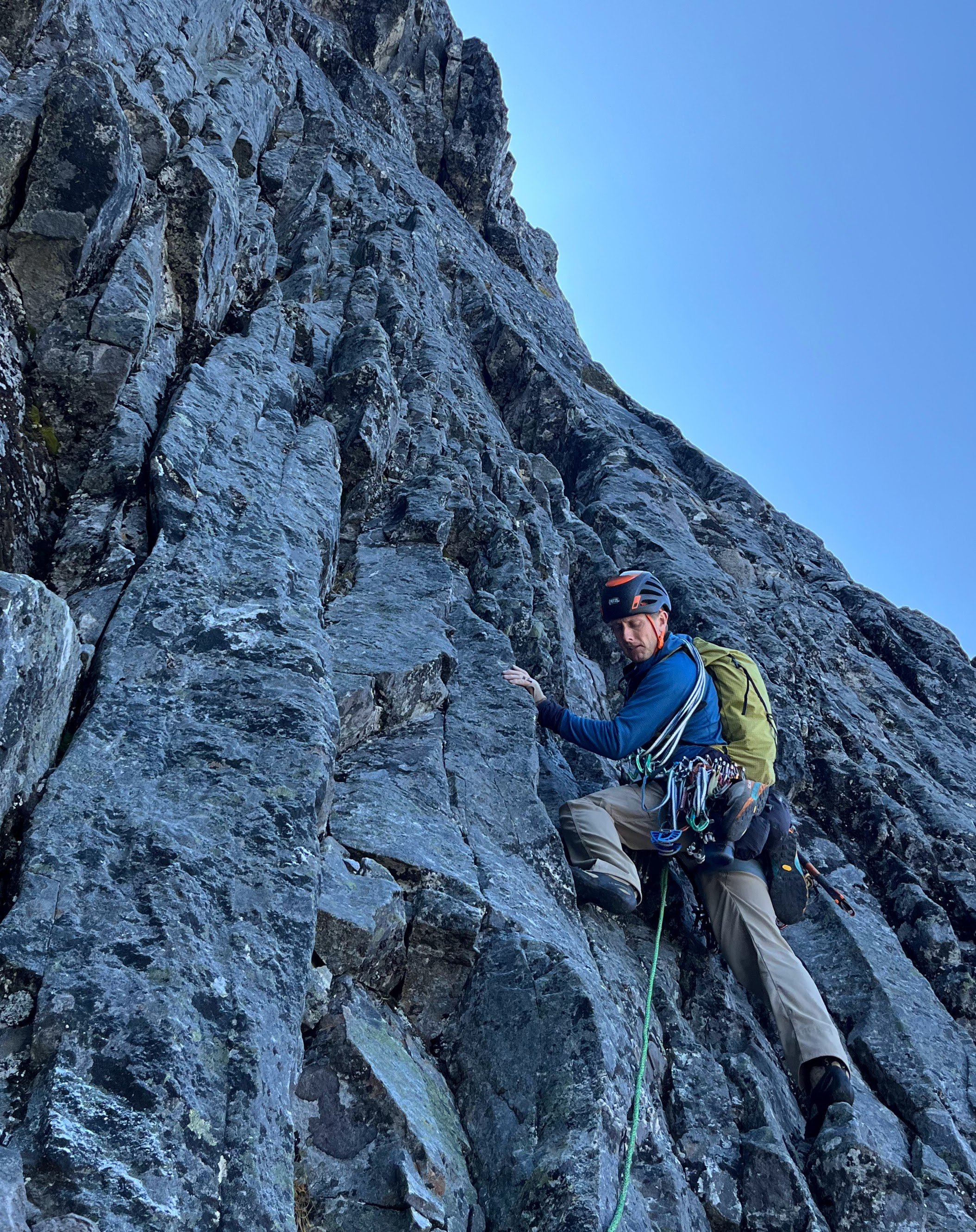
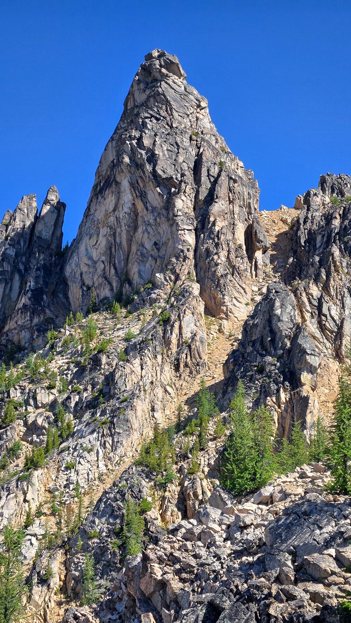
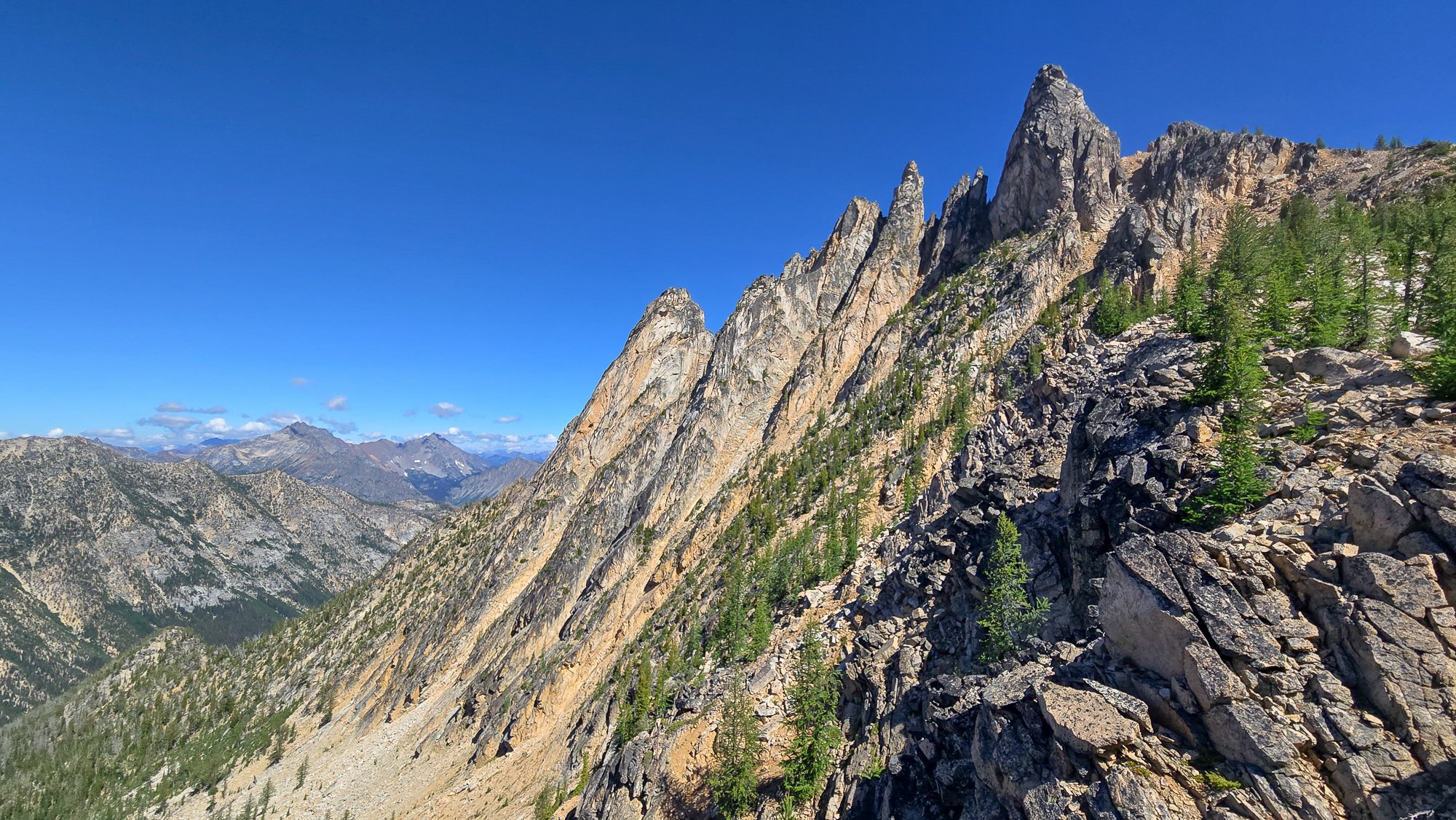
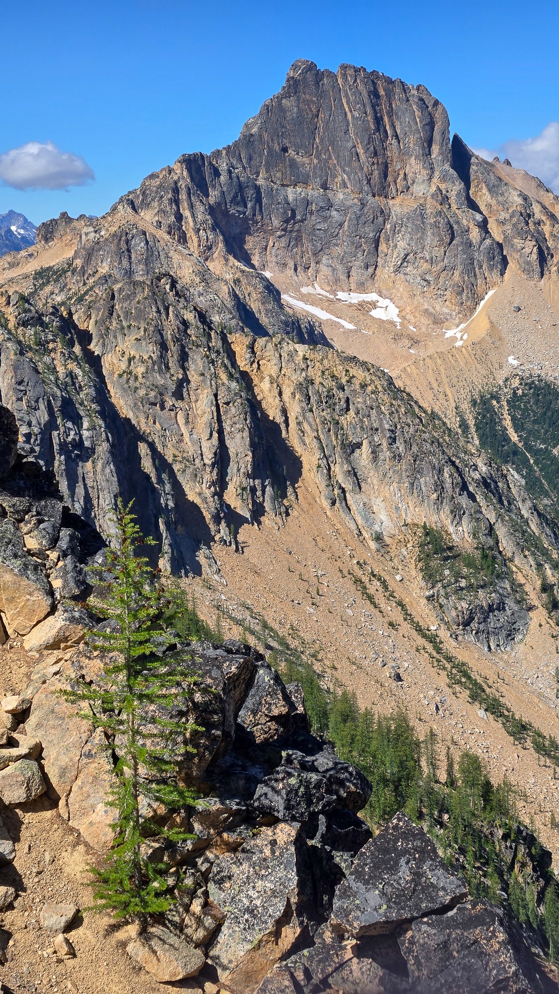
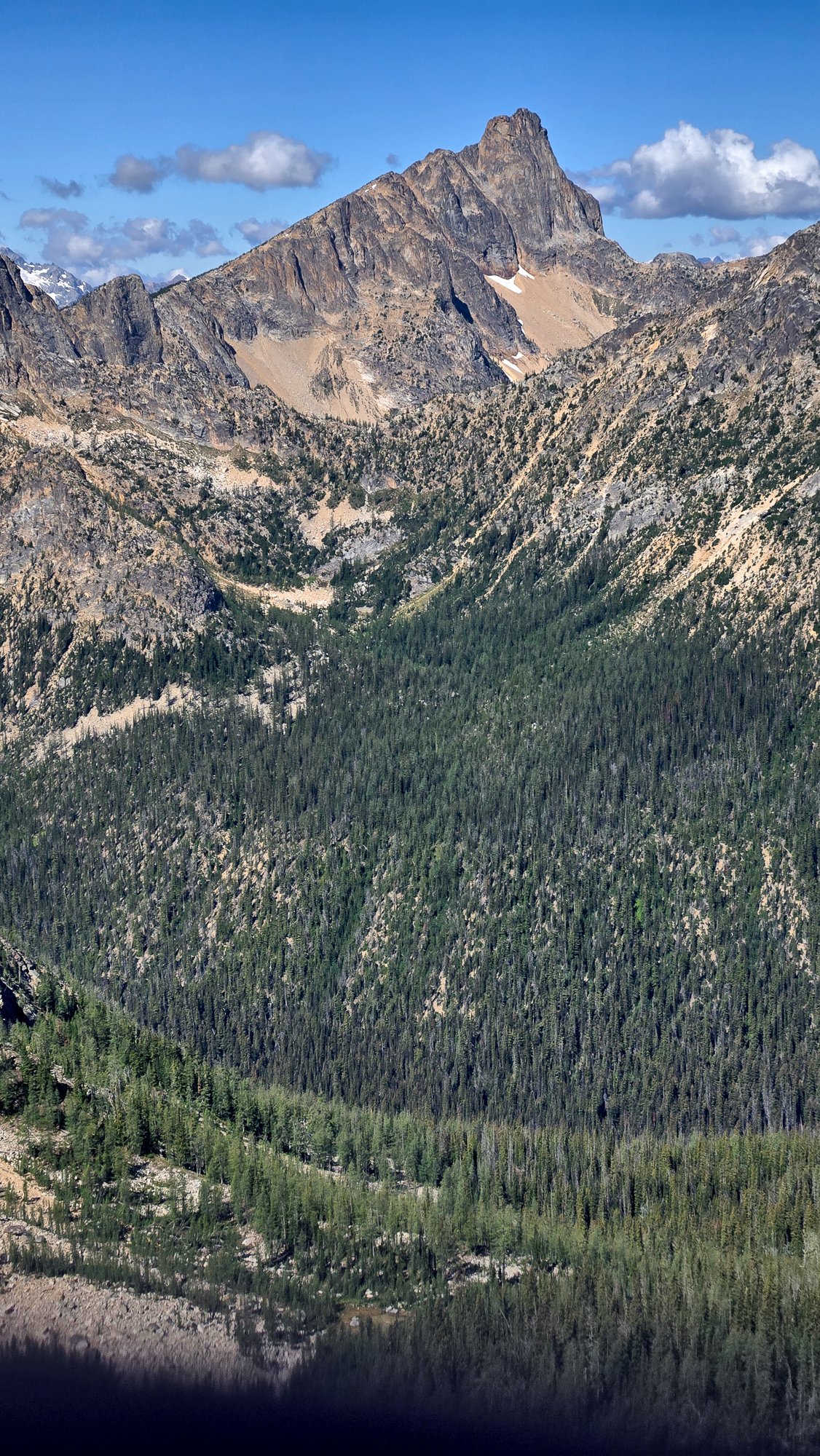
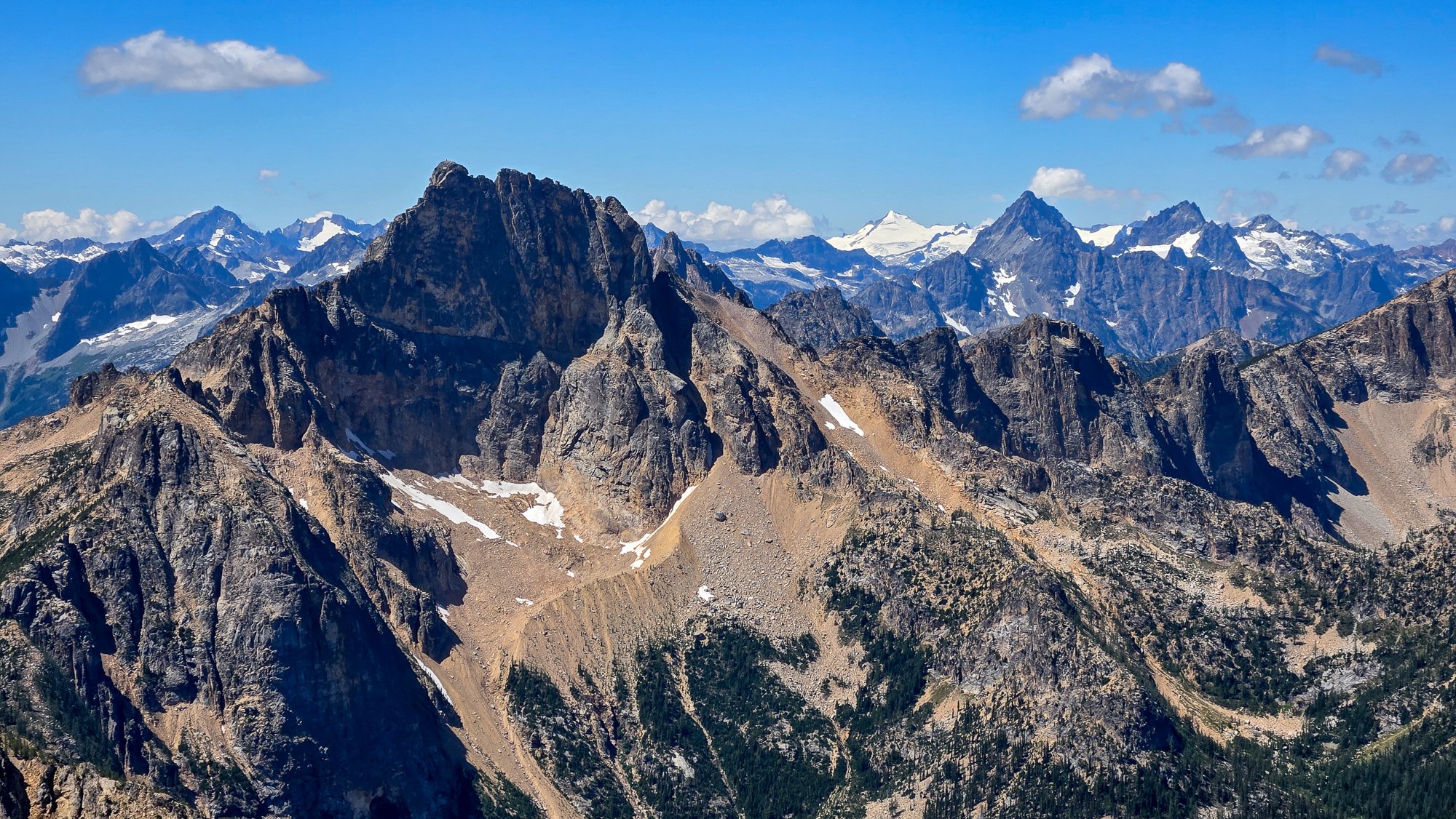
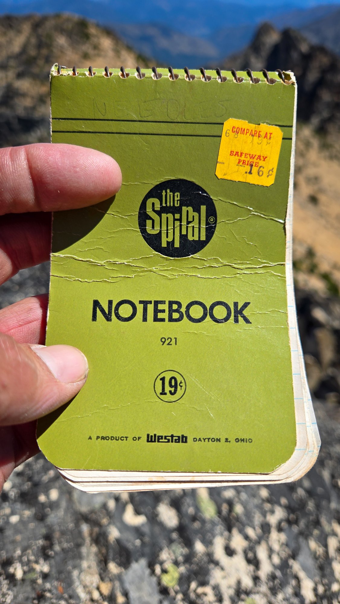
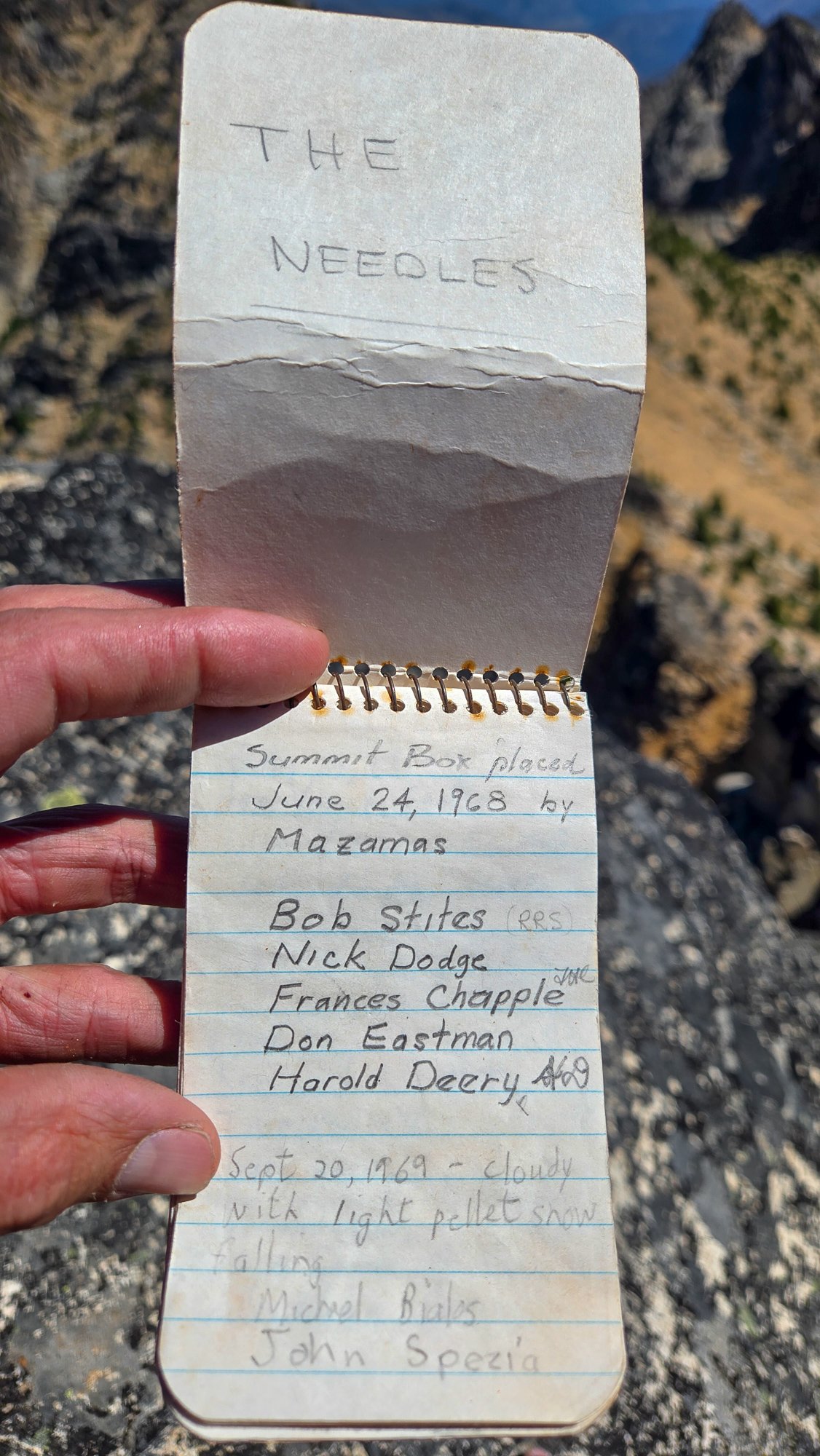
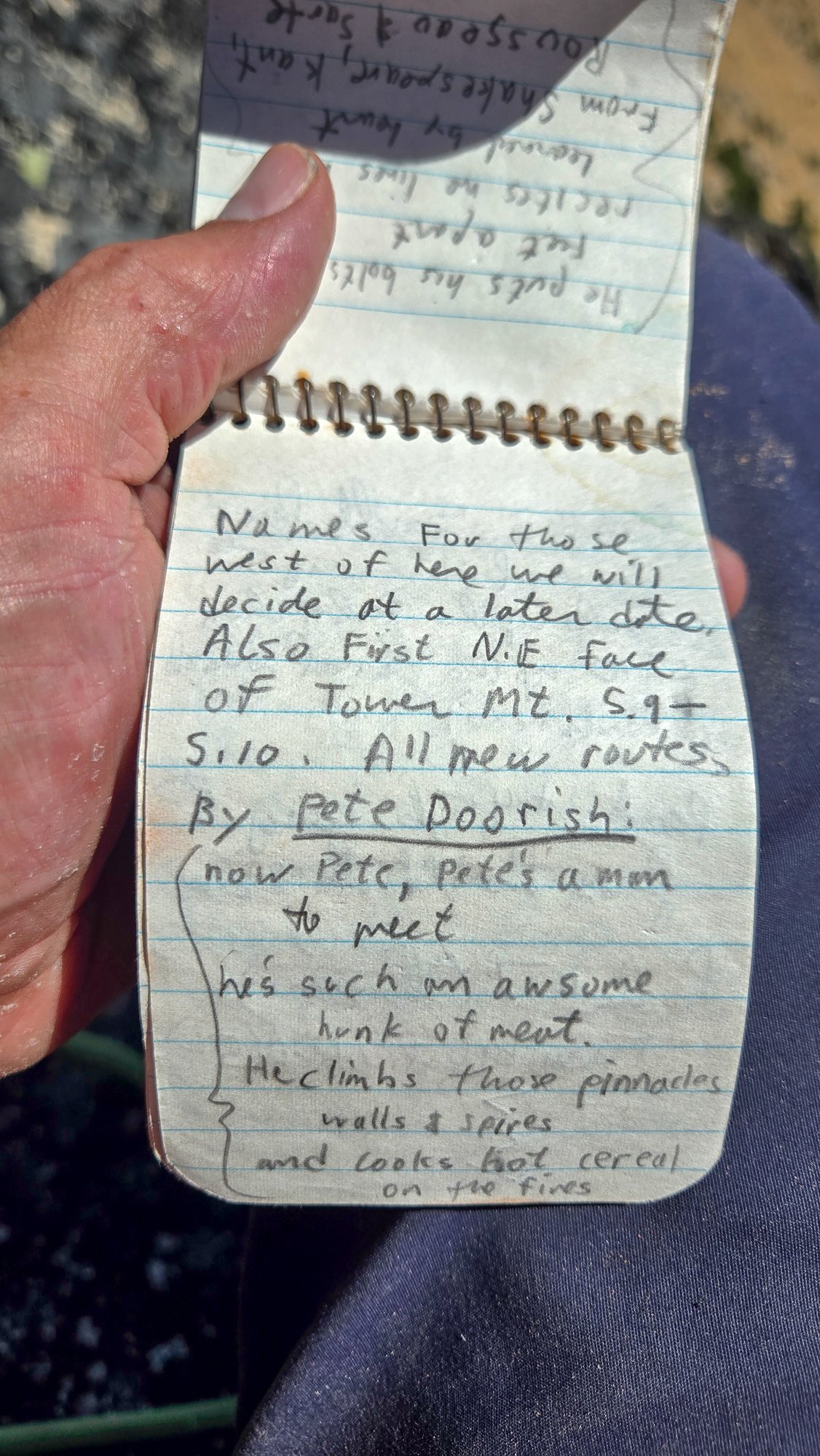
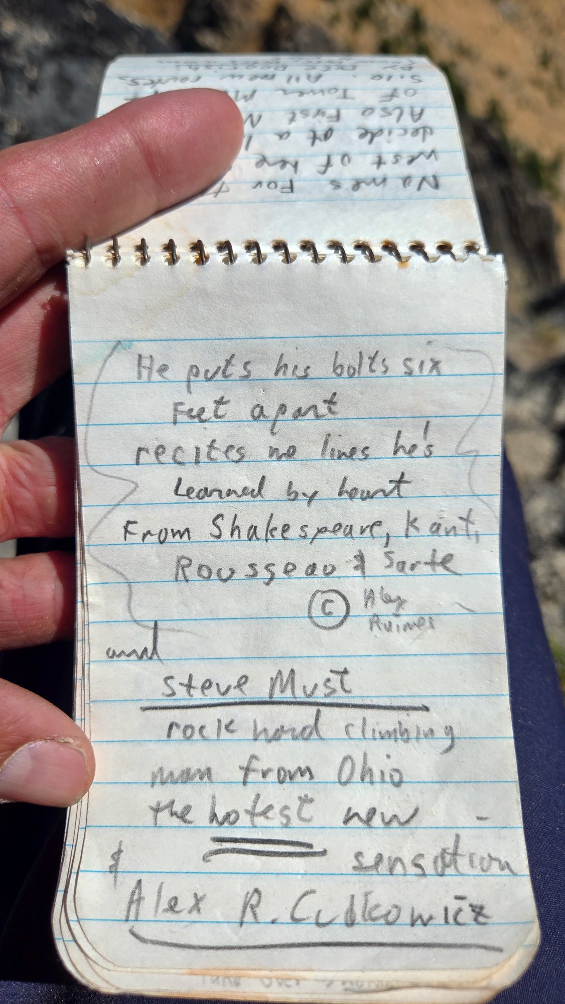
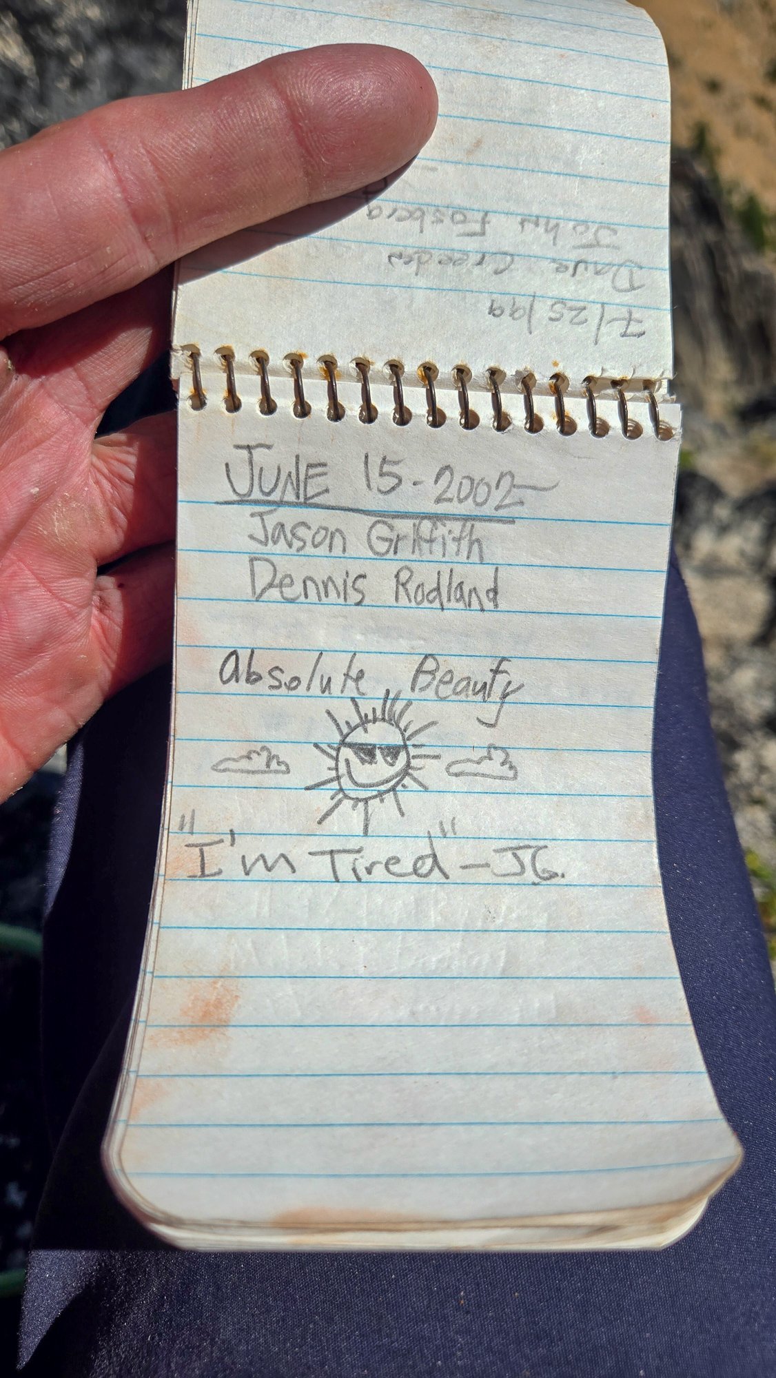
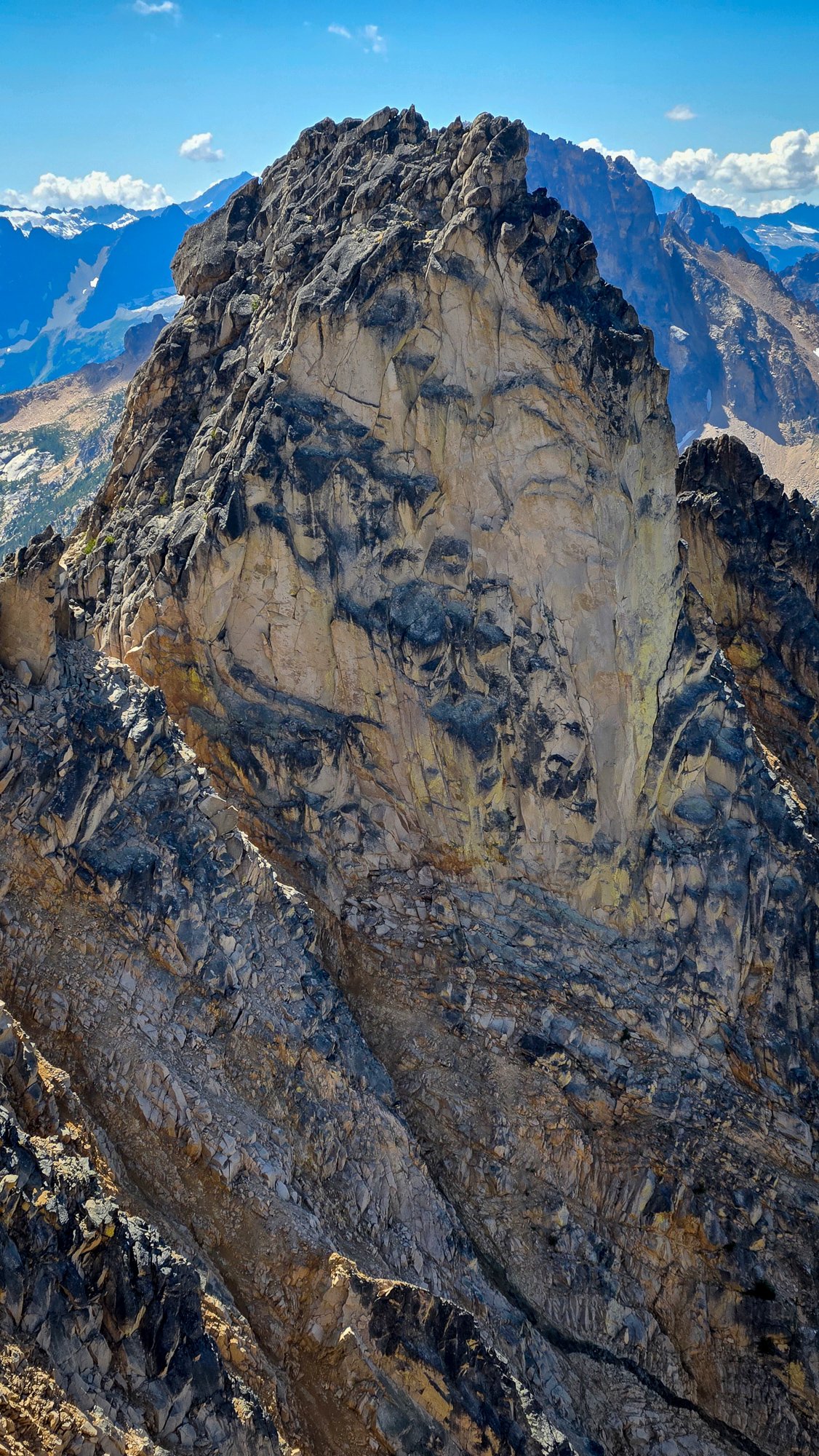
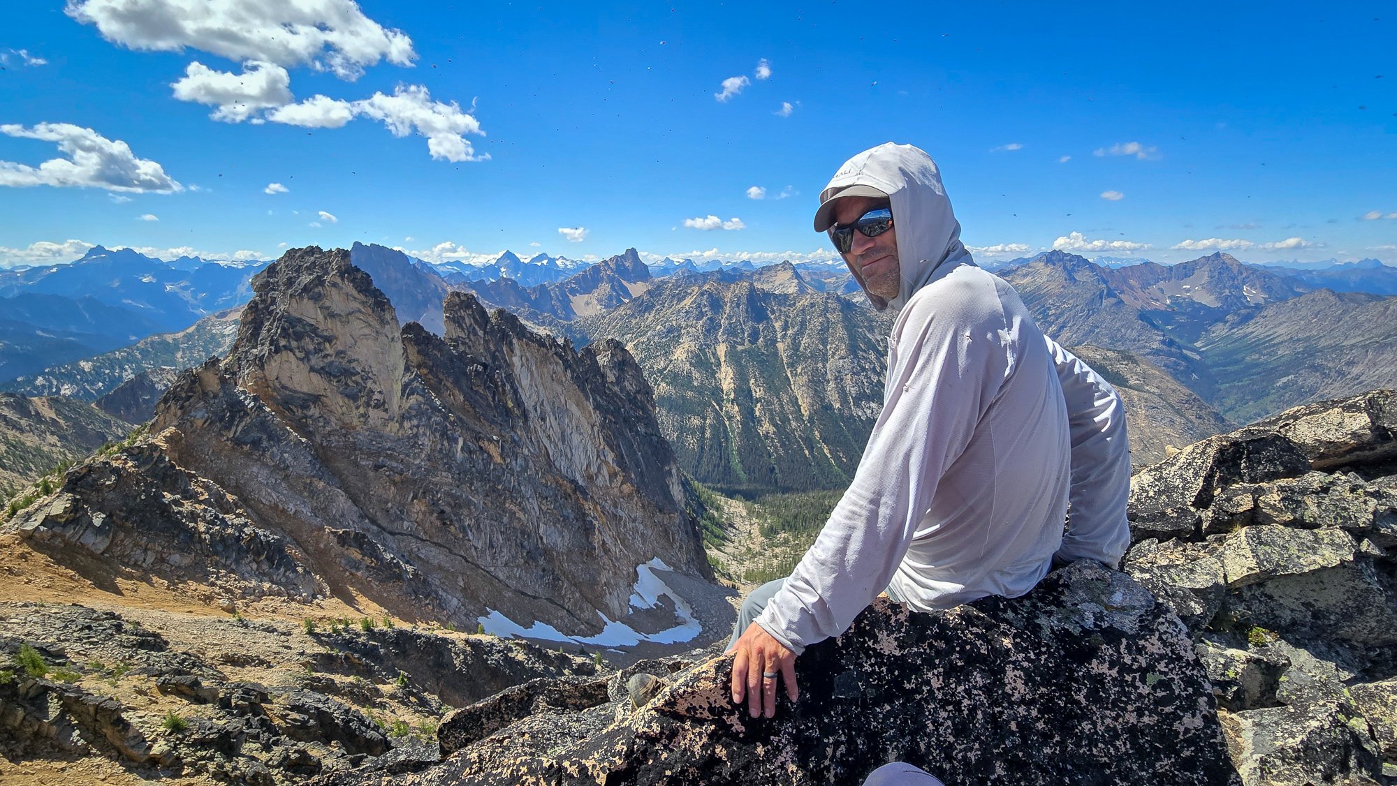
Trip: High point of The Needles (AKA Big Methow Needle) plus the East Peak - Standard Trip Date: 08/02/2025 Trip Report: It seems to be that after 20 years you can repeat a peak and it is almost like you've never climbed it before. Almost. The memory of the character building approach in soft snow wasn't entirely forgotten when @Trent suggested the high point of the Needles (Top 200!) on a Saturday a few weeks back. I had last been up that way 23 years before with my friend Dennis and we had gone straight up from the highway/campground, traversing endless ribs and isothermic mush for a few short 5th class pitches. BUT, Steve had found a better way! Or, so I sincerely hoped, and so I found myself gearing up on the shoulder of 20 again, peering into the brush and looking for the faint hint of a trail @Eric Gilbertson had mentioned was in there. After some minimal thrashing indeed a halfway decent trail emerged, though downed logs were beginning to reclaim it slowly but surely. Things were looking better than I remembered and we continued up. Thankfully the valley thrashing is relatively short lived and the ascent up an open forest rib soon lifts one to views and cooling breezes. A couple hours slogging brought our first views of the Methow Needle, which was more impressive than I remembered. The views to Tower and Golden Horn were also much better than I remembered: Soon we were at the base of the climbing, racking up for 3 pitches of 4th/mid fifth class: @Trent took the sharp end first and launched up on the surprisingly steep first pitch, which was solid, if somewhat kitty litterish: A couple more rambly pitches brought to the lonesome summit, which really hasn't gotten much more popular since the register was placed in 1968. It was a much more entertaining read than most, and I especially enjoyed the firsthand accounts of FAs by Pete Doorish and his partners many moons ago: We were definitely not worthy, but we were there, on the summit nonetheless: And the views, of course, were better than I remembered. Buckner, Boston, Sahale, Tower, Eldorado, Mesahchie, Katsuk, Kimtah (L-R): When I had last climbed it via the not recommended approach in less than ideal snow conditions, I was a young man and was still thoroughly whupped by the end of the day after climbing only Big Methow Needle. This time, we were older and wiser and had some extra energy to head over to the East Peak of the Needles which afforded a grand view of the North side of The Needles, along with many ladybugs (visble at black specs in the photo of @Trent below): But, pleasant as it was up there, we couldn't stay forever and reluctantly had to descend back to the brush and blowdown to battle the masses back west across the pass. Still, a parting view of Big Methow Needle as we dropped to treeline was a good reminder that we have an exceptional backyard here in the North Cascades: Gear Notes: Light Rock rack to 2", 60m rope, helmet Approach Notes: Stay in the valley and find an old trail up Pine Creek on south side. Where it crosses to north side of creek follow for a bit longer into timber until it peters out and you head up via open forest to treeline and the peak.

 1 point
 -
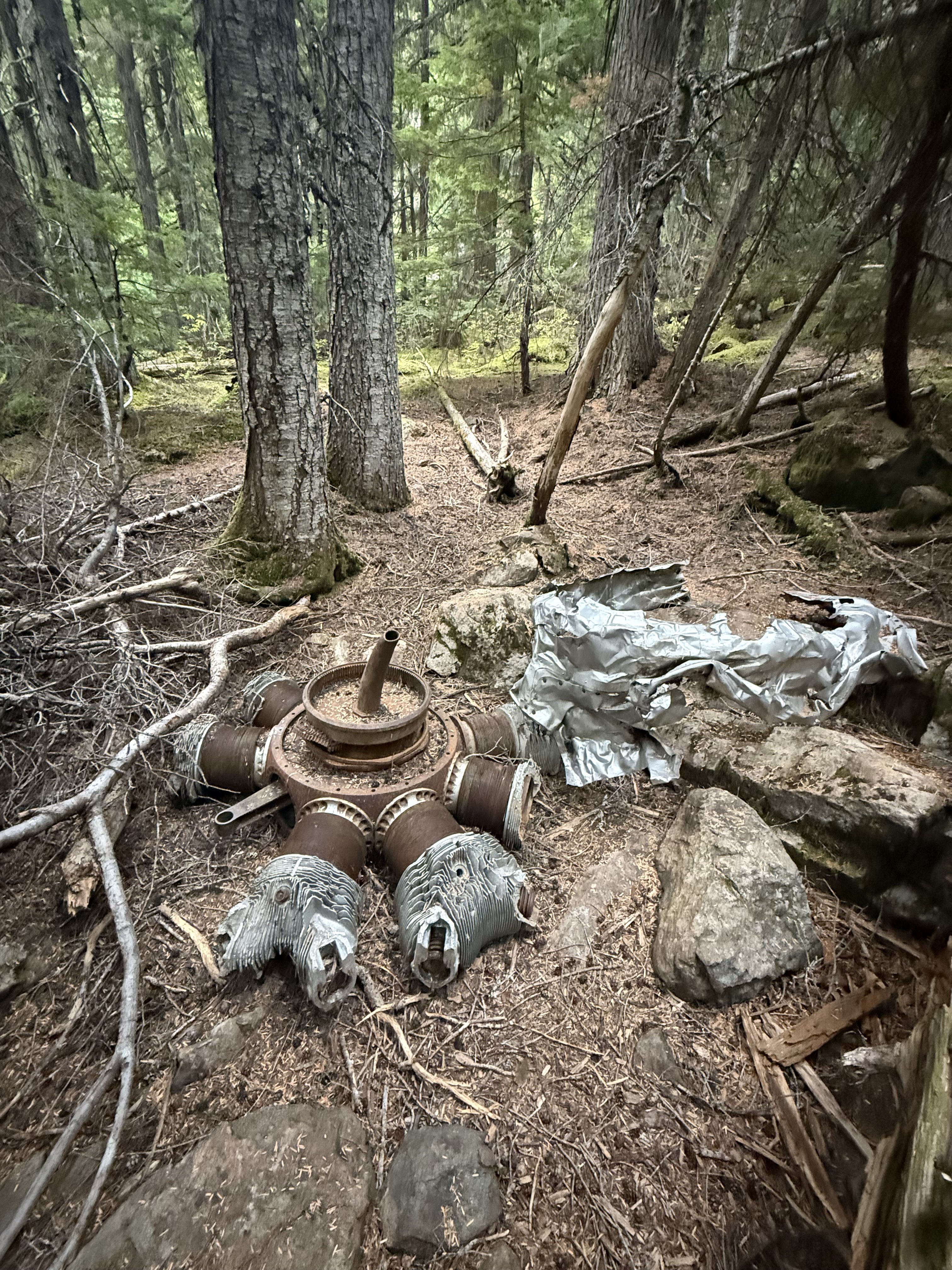
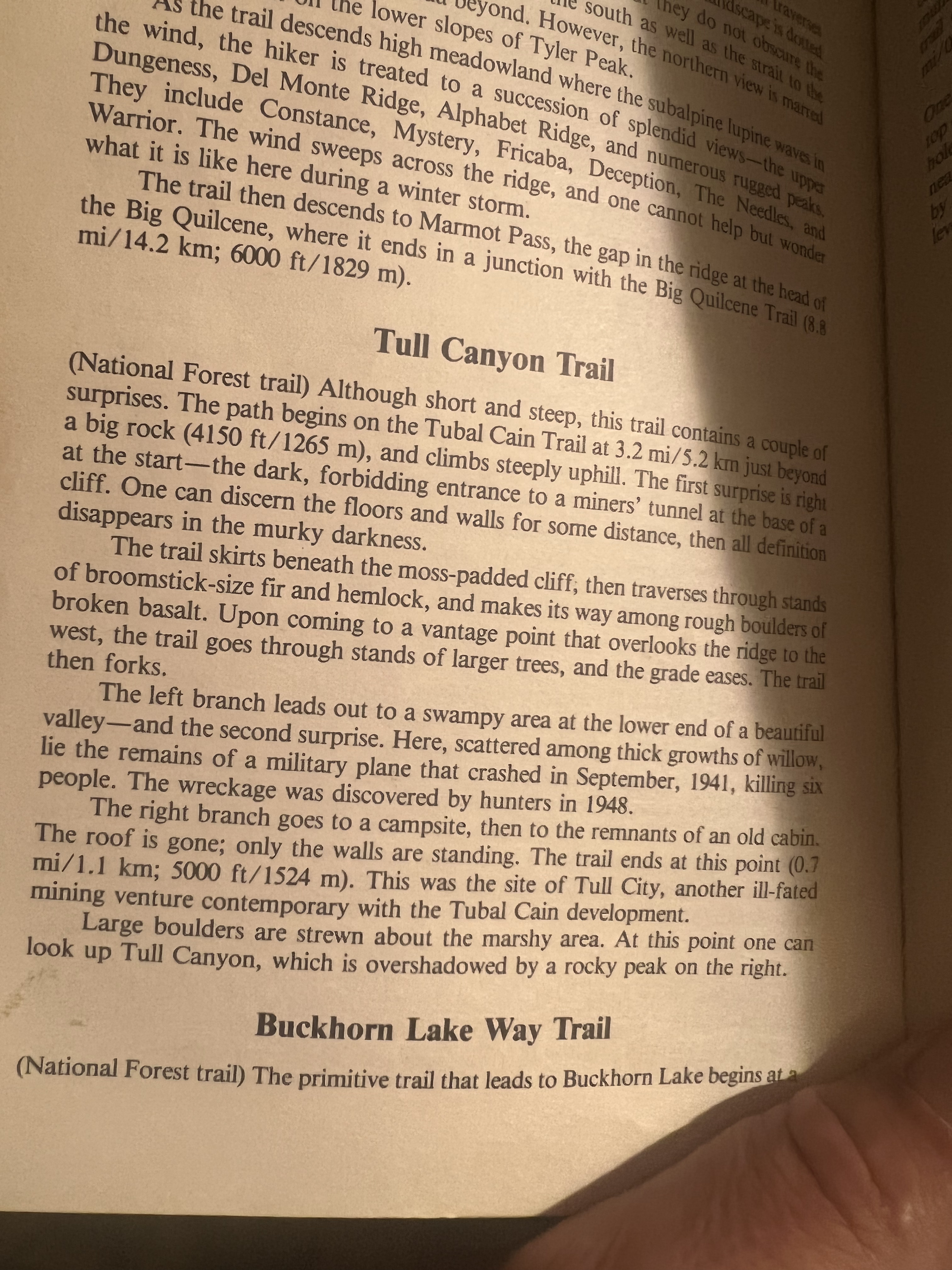
Went up there again. The smoke from the Bear Gulch spoiled the views to the south but we had a good time anyway. Was gonna camp on Hawk Peak but ended up going down to the plane wreck in Tull Canyon to get out of the smoke. plol


 1 point
 -
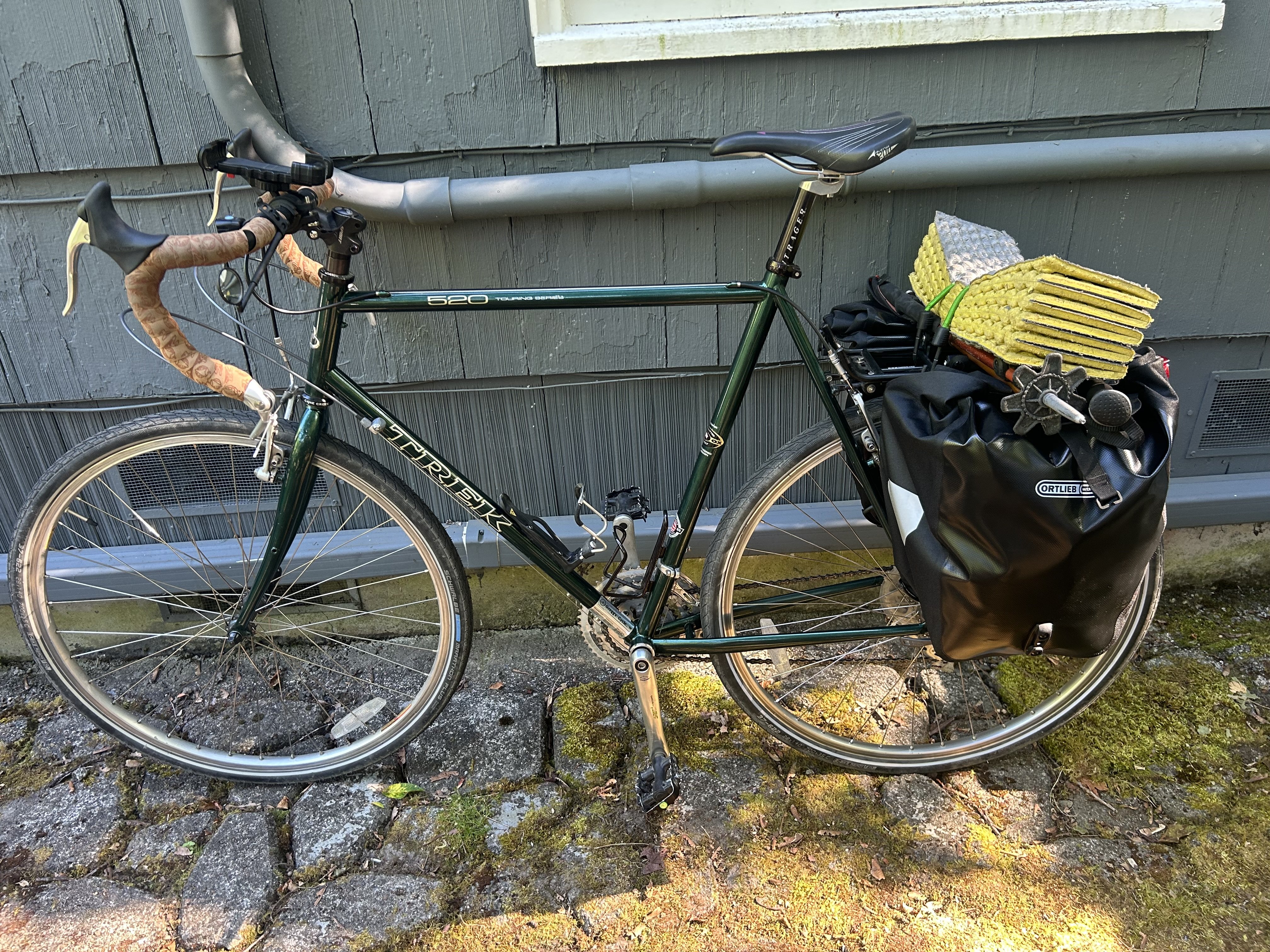
here’s one when I got new panniers on day 5 and just for fun, here’s what I was rolling with when the old ones exploded coming down from MSH ?
 1 point
 -
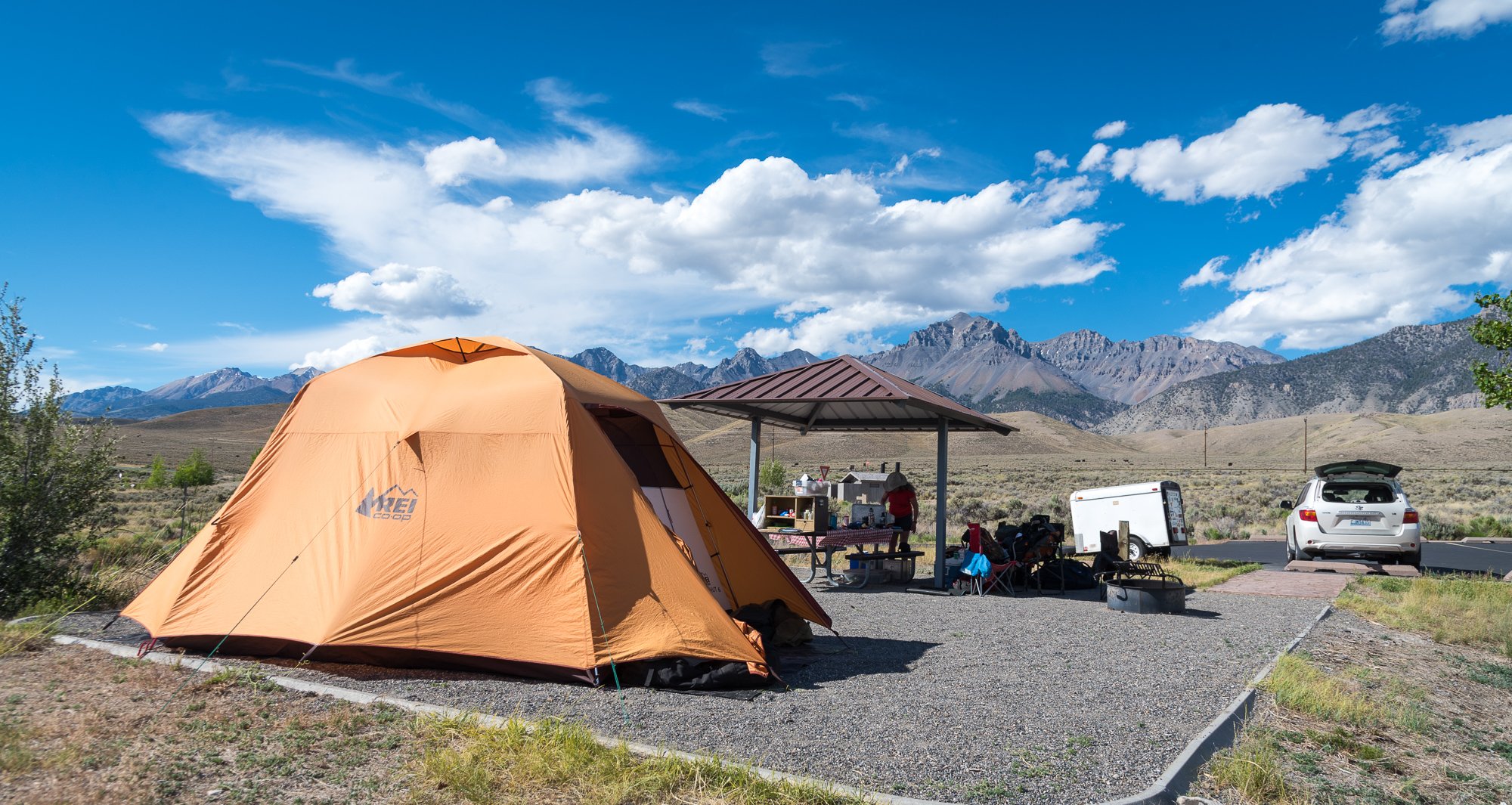
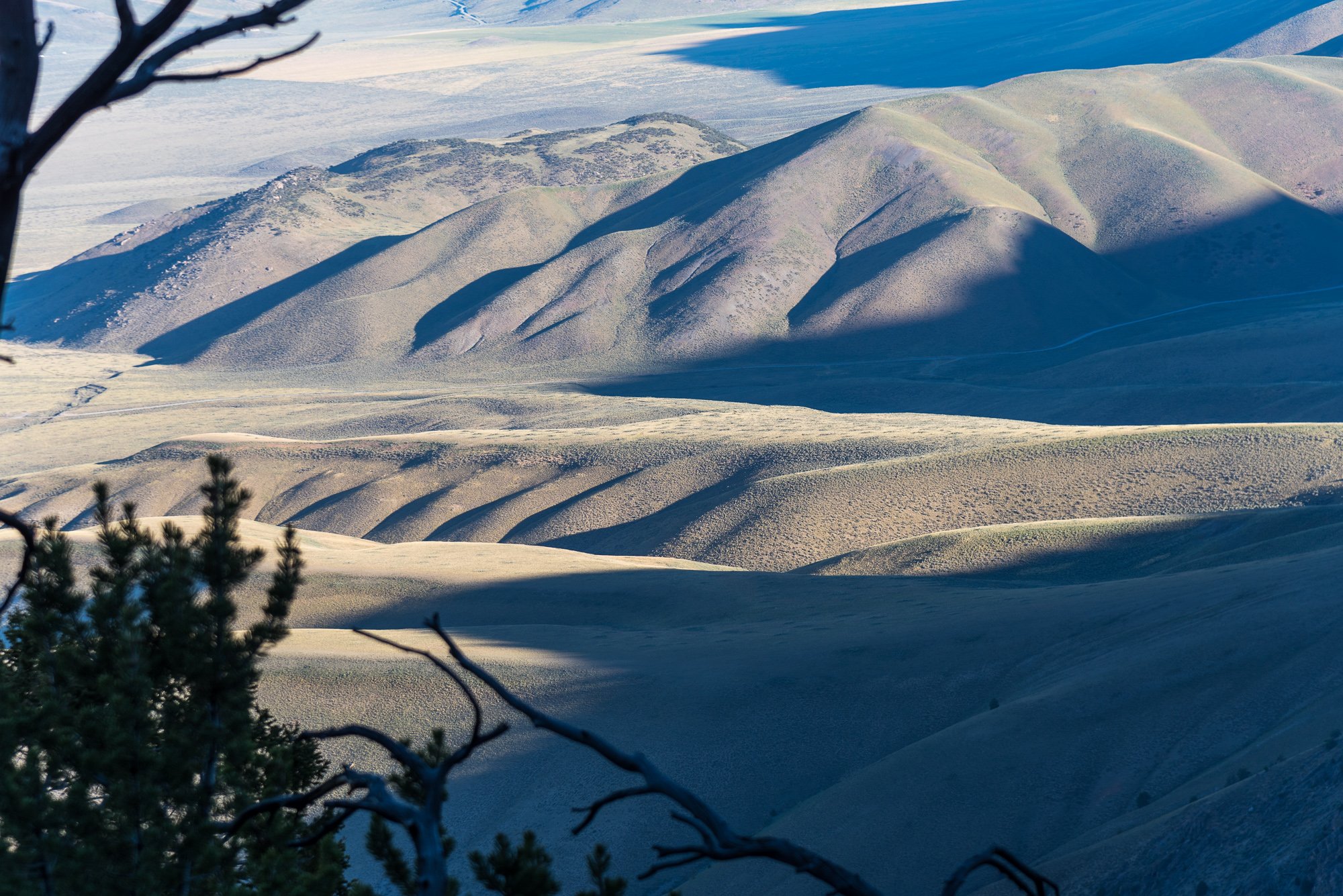
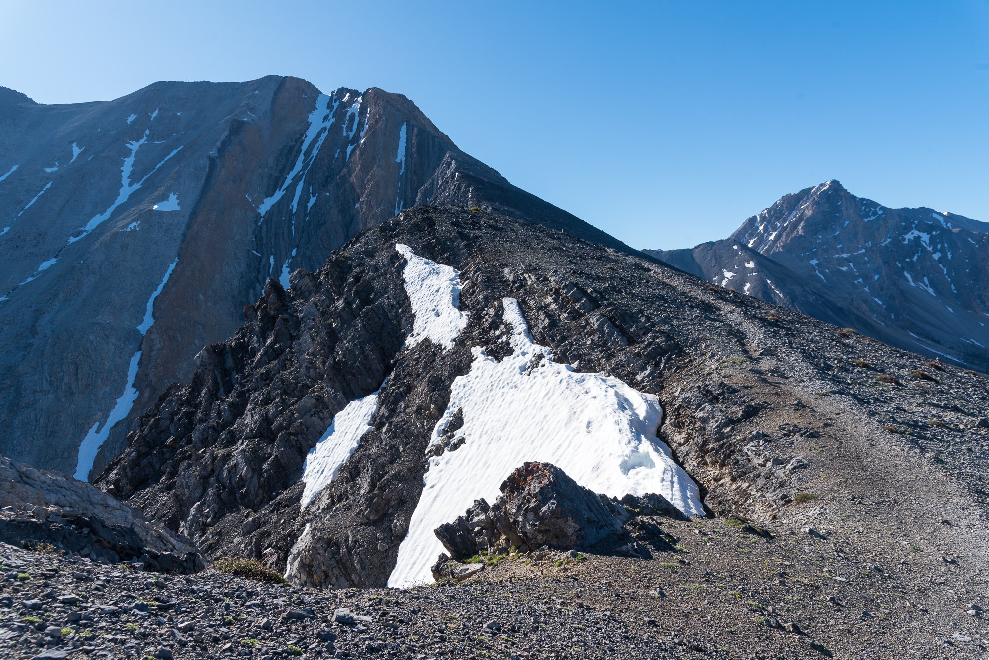
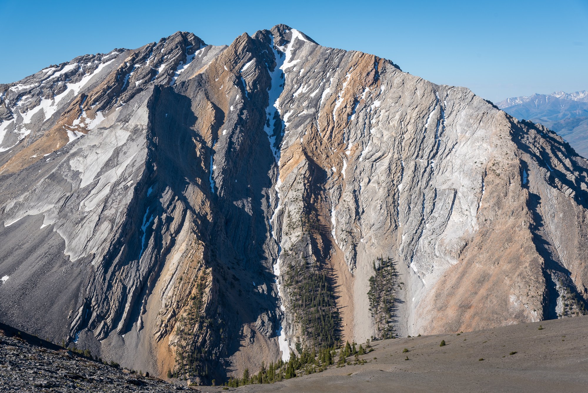
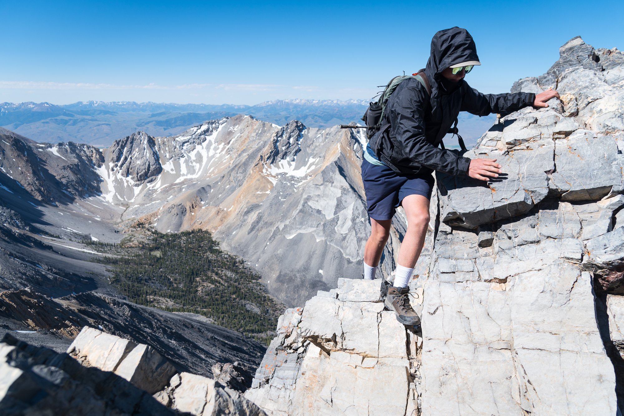
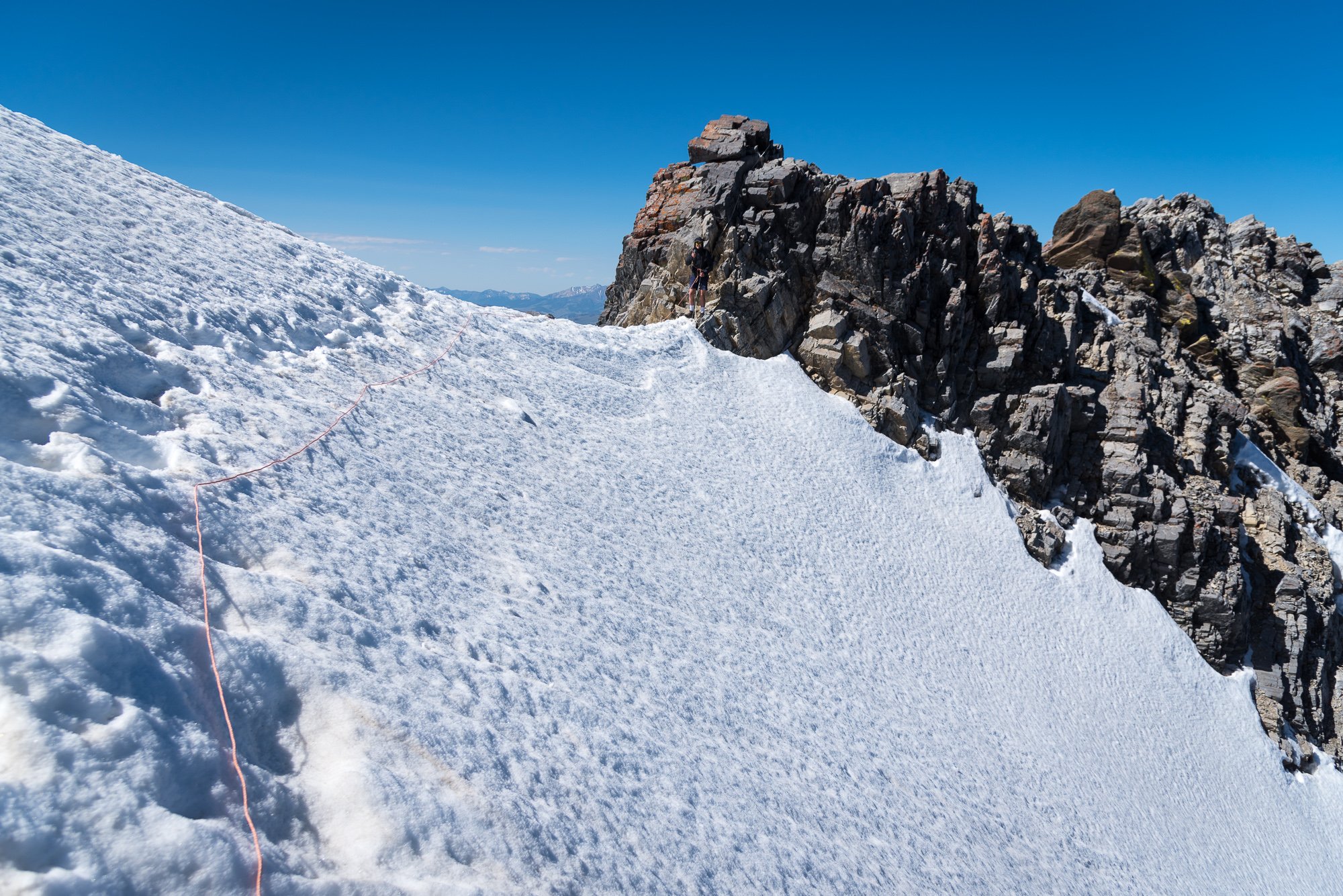
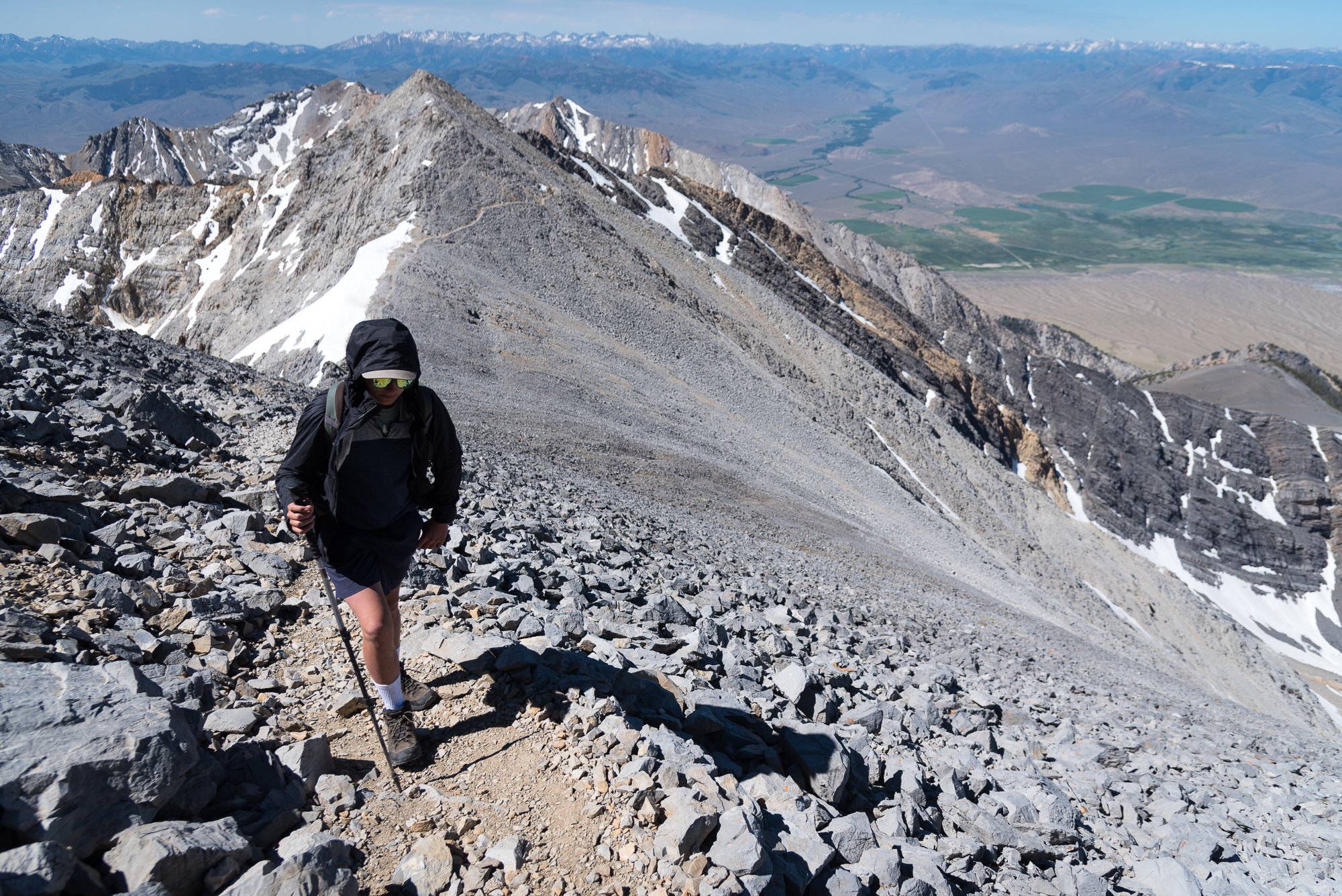
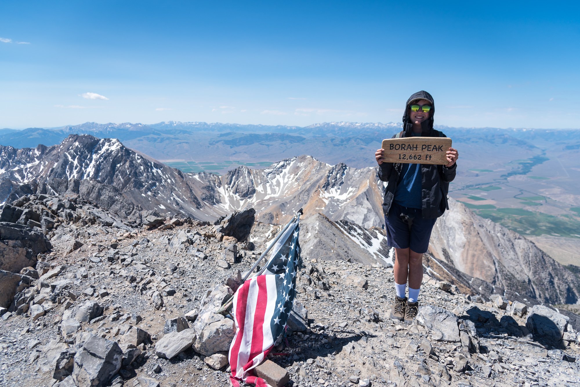
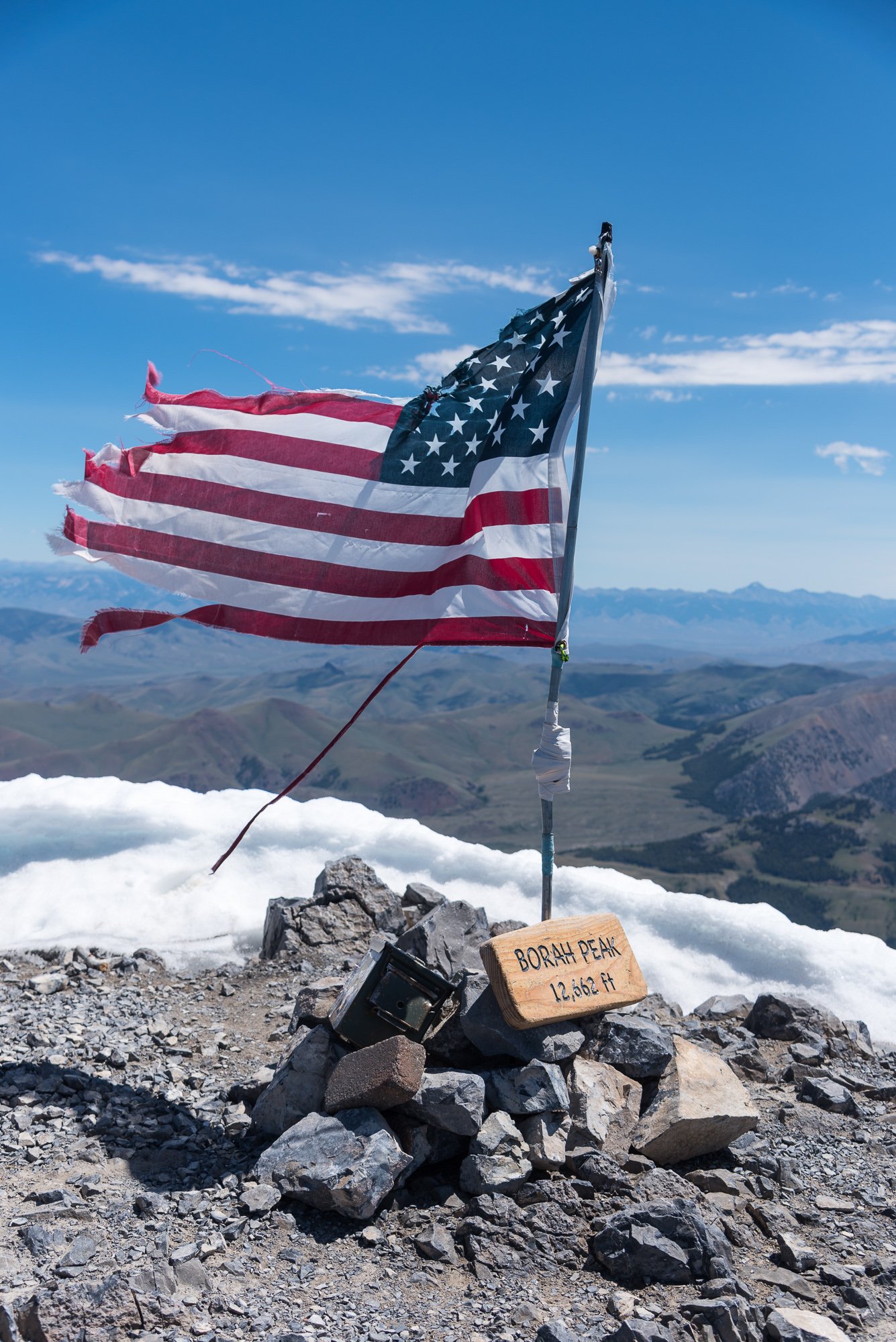
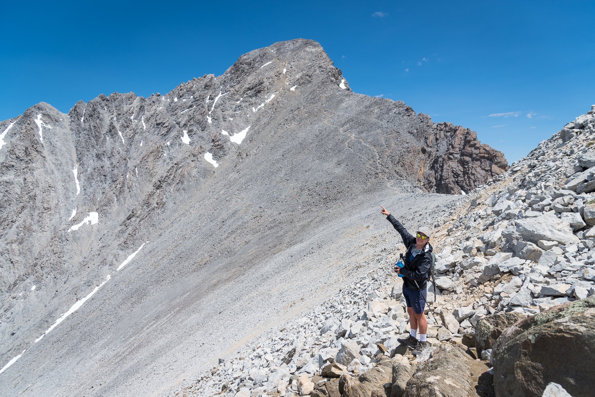
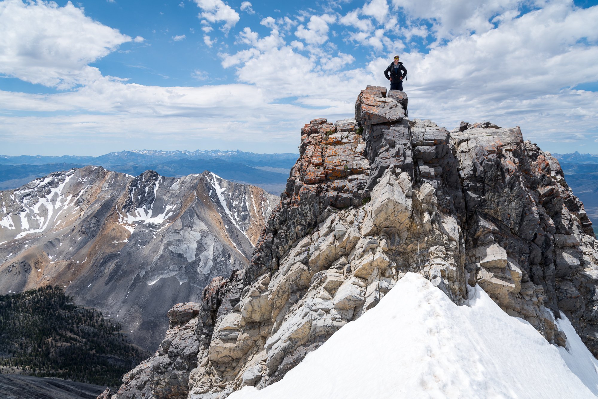
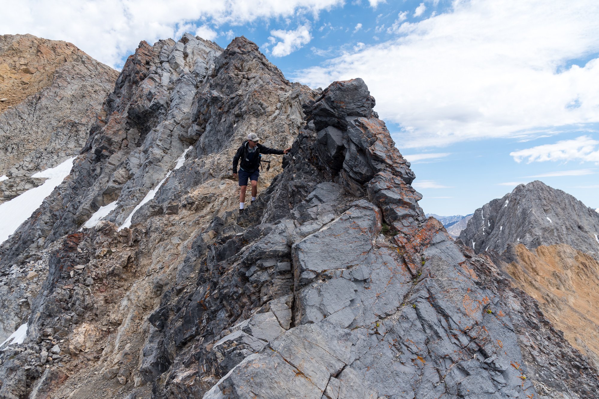
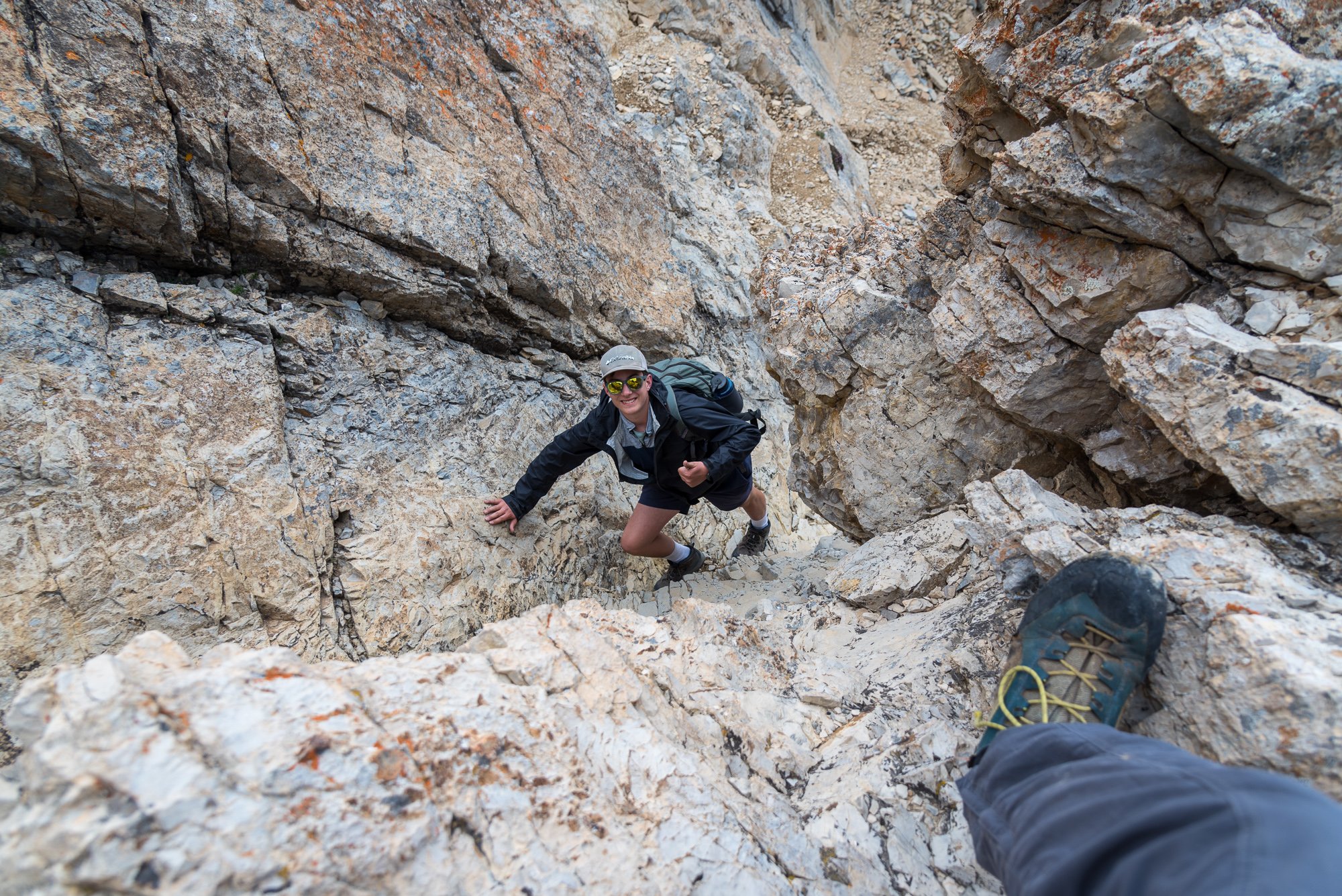
Trip: Borah Peak - Southwest - "Chicken Out"- Ridge Trip Date: 06/29/2024 Trip Report: This past summer I went on a month long, 4300+ mile, road trip with the family all over the West. Mostly we were seeing National Parks that my wife and kids had never been to, but I managed to plan 3 state high points into the itinerary. Borah Peak (12,662') was the first up, coming after a tour through Yellowstone and Grand Teton National Parks. As with all the state high points, Borah has an abundance of beta online so I'll spare you all the nerdy details and mostly share impressions and photos. First, I thought this was a peak worth doing. There is fantastic camping close by at the Joe Fallini Campground, which is cheap and right on a lake with decent swimming and fishing. This campground is about a 30m drive to the trailhead (if you don't blast past it like we did), which puts you in easy striking distance for an alpine start. The views start quickly and expand. There aren't a lot of trees in the Lost River Range and it was fun to see an entirely different range where I basically knew none of the summits. Soon we were up above treeline and the aptly named "Chicken Out" ridge came into view: As did Mt. Morrison: At the base of the knife edge portion of the ridge, my wife and youngest opted to turn back but surprisingly my oldest stuck right on my tail. I had a quick chat with him to make sure he understood that while it wasn't overly difficult (exposed 3rd/4th class), a fall would likely be very, very bad. He said he was fine and was moving calmly and confidently, and so we continued upward. Where the knife edge ends, there was a small snow saddle to cross. Again, not hard, but with a terrible and steep runout. Again, another chat. This time I insisted in tying on a 30m length of 6mm cord I had brought so as to keep my son from a very long ride should he slip out of the steps and not arrest. Of course, he was fine, but I felt better with the added security. And then the real slogging began. We were over 11k with the summit in sight, and surprisingly all by ourselves. My son began to slow way down in the thin air. It was by far the highest he had ever been but appeared to be in good spirits and so we just kept chugging upwards. And then, we made it, finding one other dude up there taking a nap. I think we may have surprised him. We hung around in excellent weather for at least an hour, reading the register, taking in the views, and generally enjoying a perfect day on a high peak. It doesn't get much better! But, of course, all good things must end and so we turned around to begin the 5k+ of downward staggering. Here's a view back at the summit after we had dropped about 1500': And then to reverse Chicken Out Ridge.... of which I was a bit nervous for my son, but he of course thought that it was all just a great adventure: Looking back at the upper mountain from just above treeline: We finished the day back at Joe Fallini Campground, treated to a beautiful sunset as the cattle lowed in the distance. The next day we would begin the trek SE to King's Peak in Utah for a 4th of July Ascent (in the next installment!)... Gear Notes: Poles, helmet (optional), crampons/axe if snowy Approach Notes: The trailhead is located north of Mackay, Idaho along US-93. Look for the signed turn between Mile Markers 129 and 130. Drive to the end of the road where there is camping and an outhouse. It is a bit grungy there, however, and much preferred BLM's Joe Fallini Campground close by.
 1 point
 -
With some variations, again last weekend.
 1 point
 -
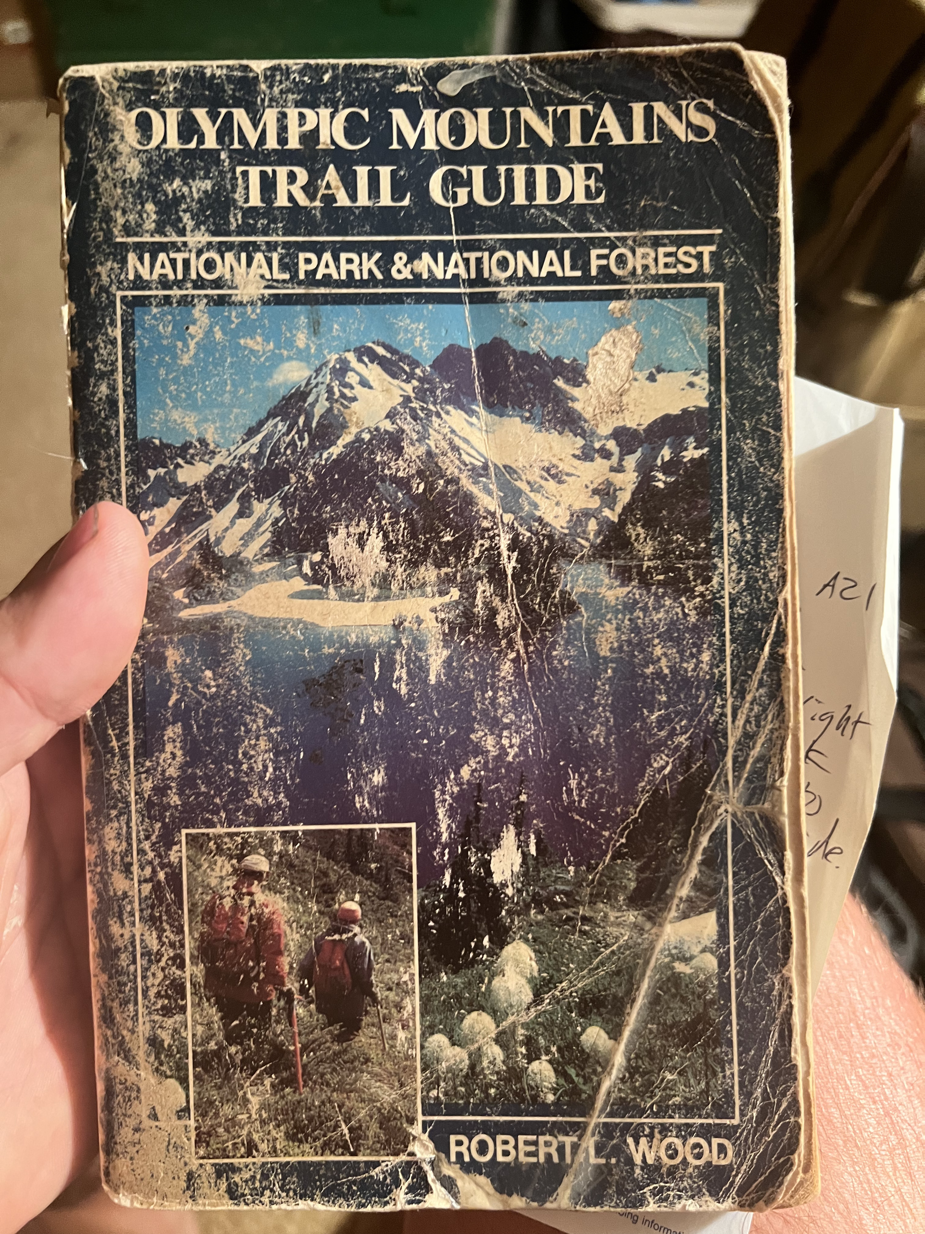
out at my parents I find this guide from my youth that confuses the 1952 crash of a B-17 in Tull Canyon I mention above where most survive another earlier crash on Mt Constance in 1941 where all 6 perished (not the 70s crash of the C141 which my dad remembers occurring). But still this guide was the ticket to my formative years for sure! https://aviation-safety.net/wikibase/76515
 1 point
 -
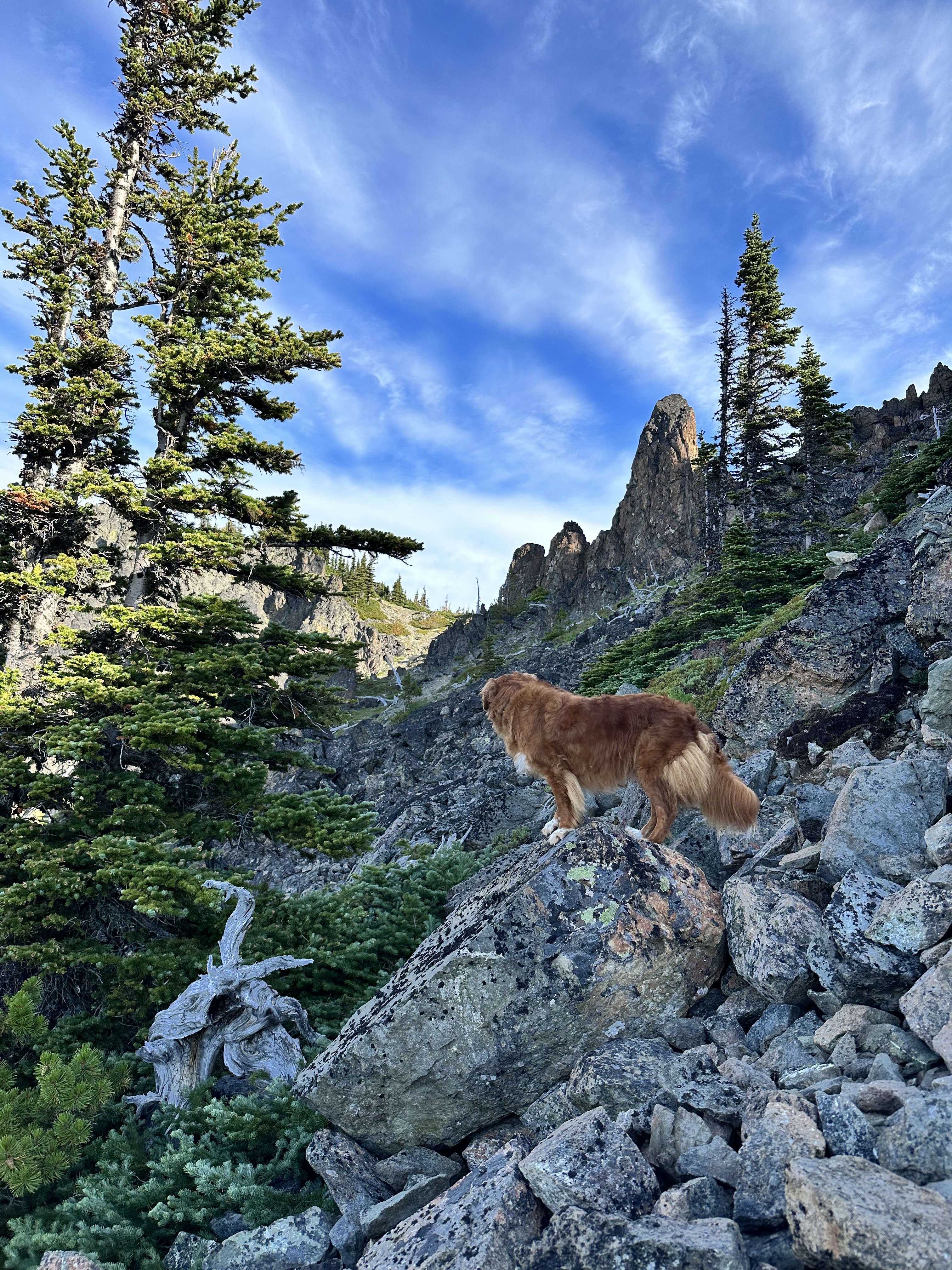
View from Hawk Peak: excuse the heavy breathing...it was probably my climbing partner.1 point

