
Leaderboard


Popular Content
Showing content with the highest reputation on 09/02/25 in all areas
-
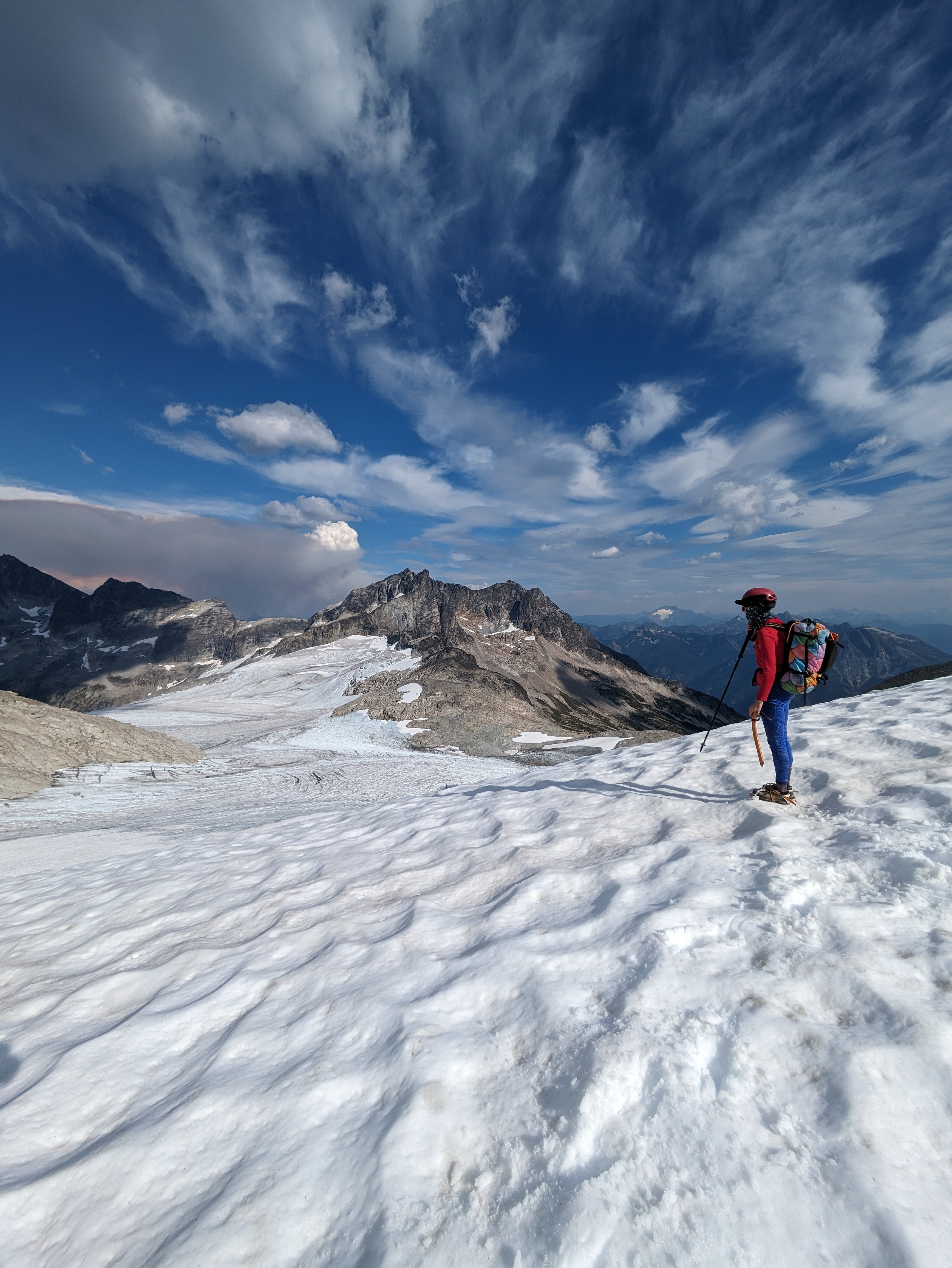
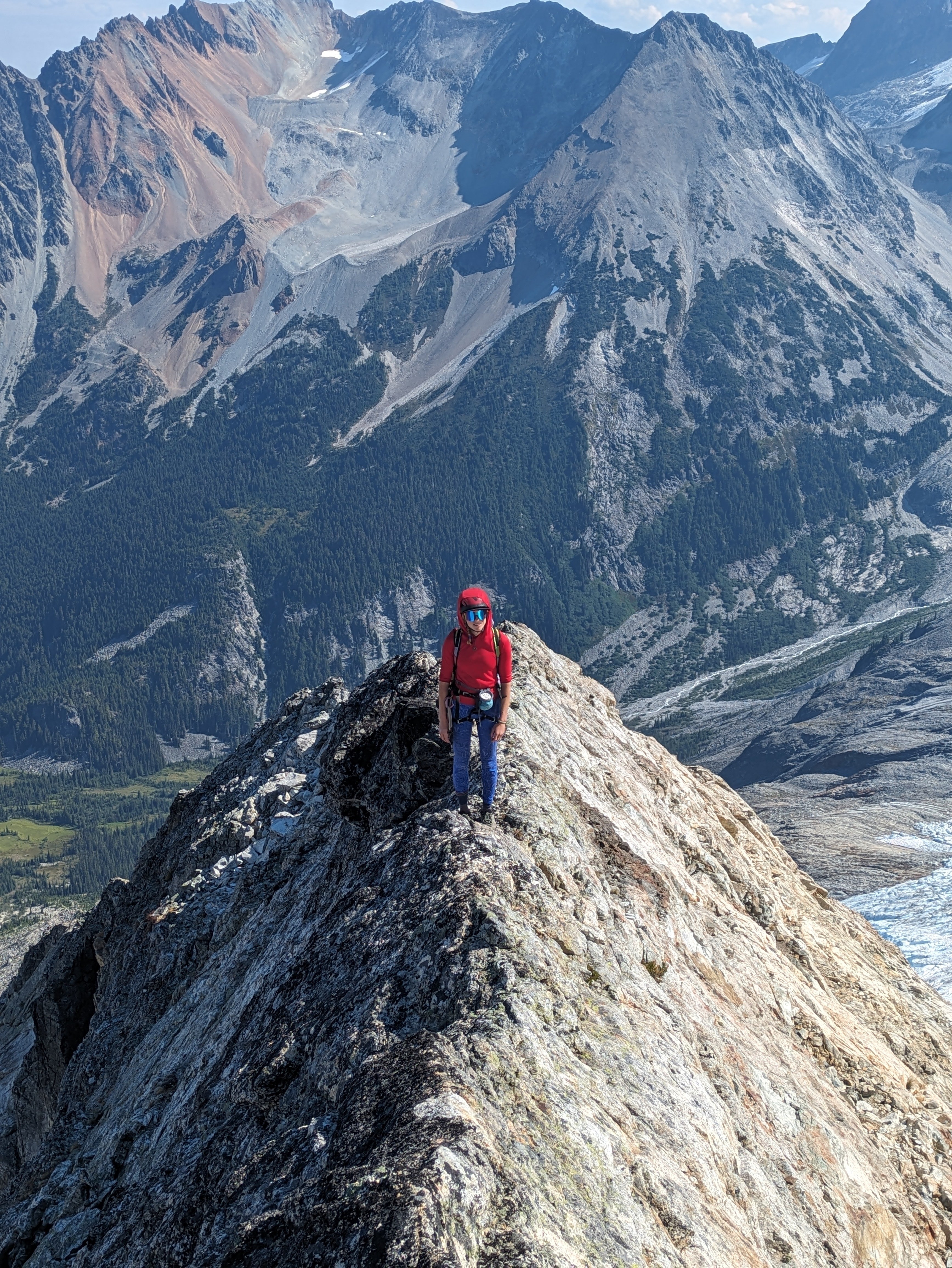
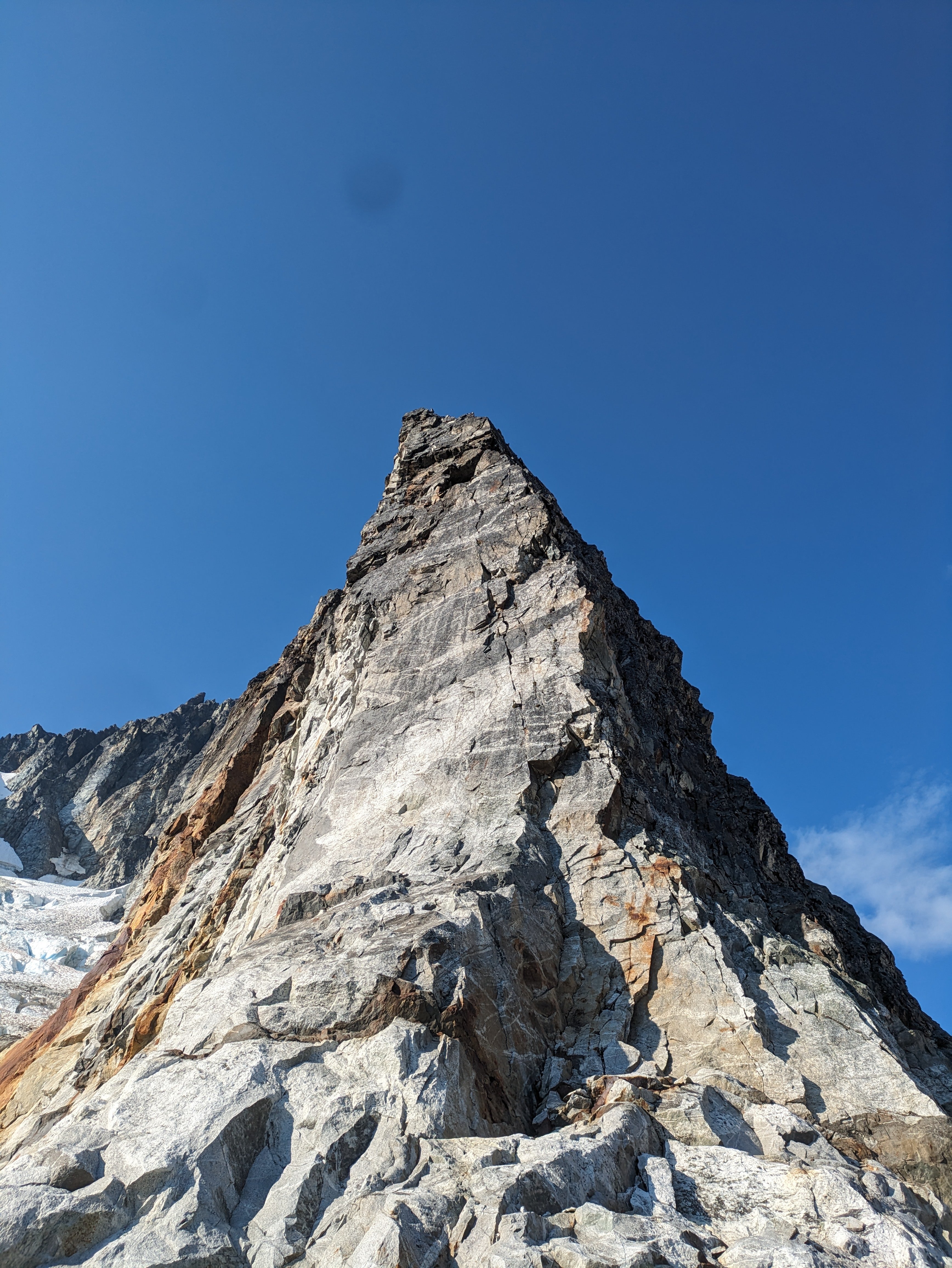
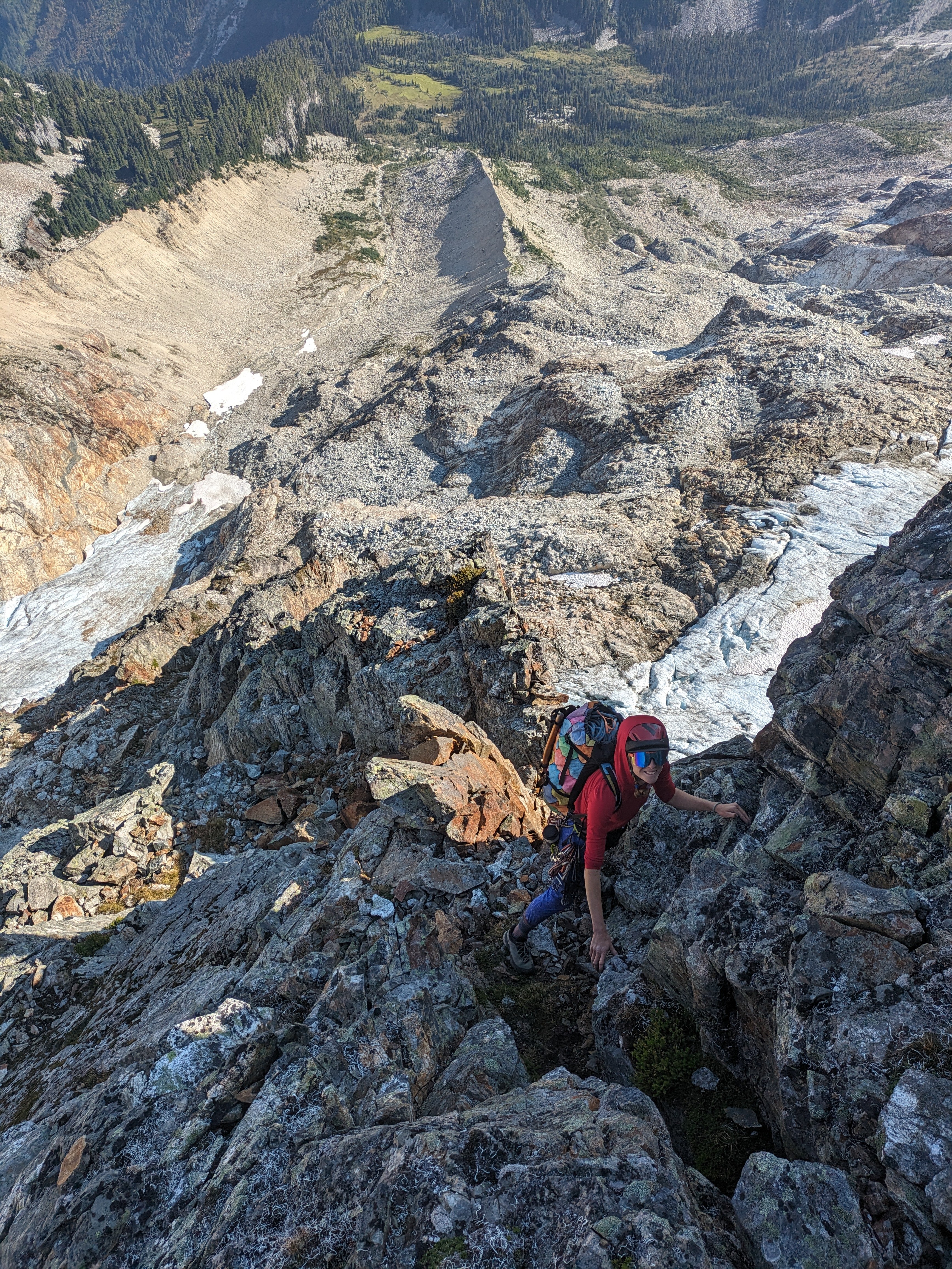
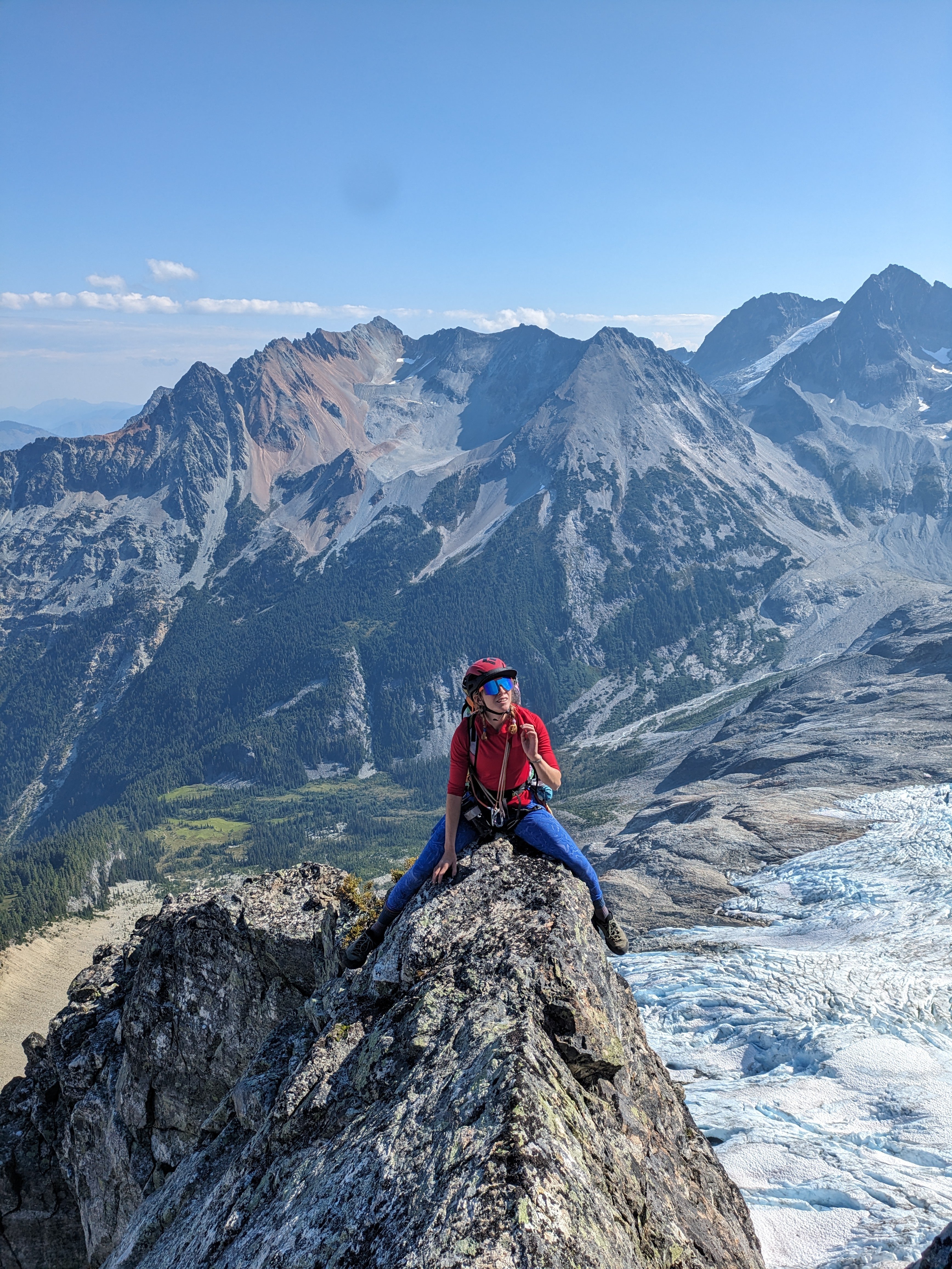
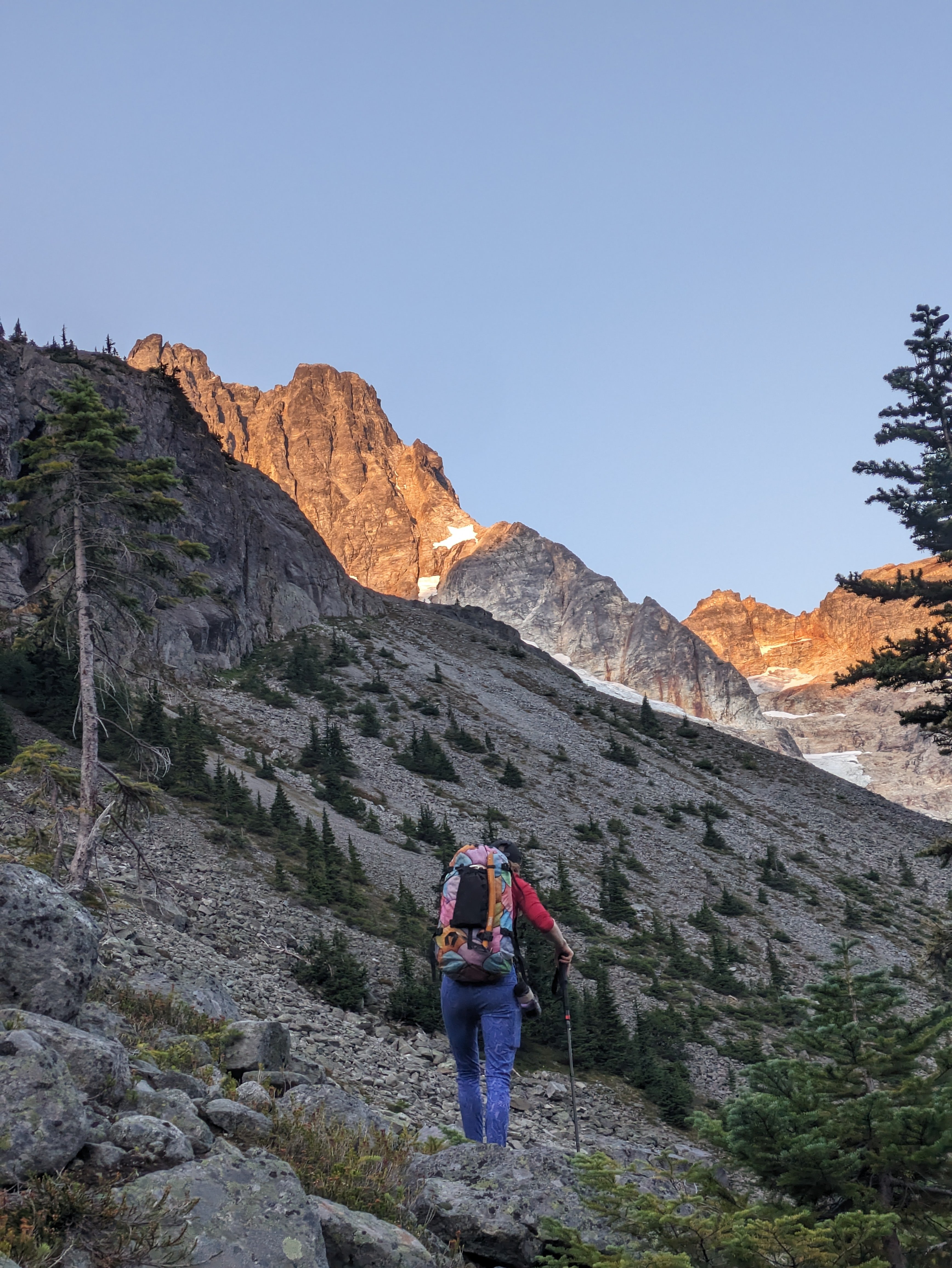
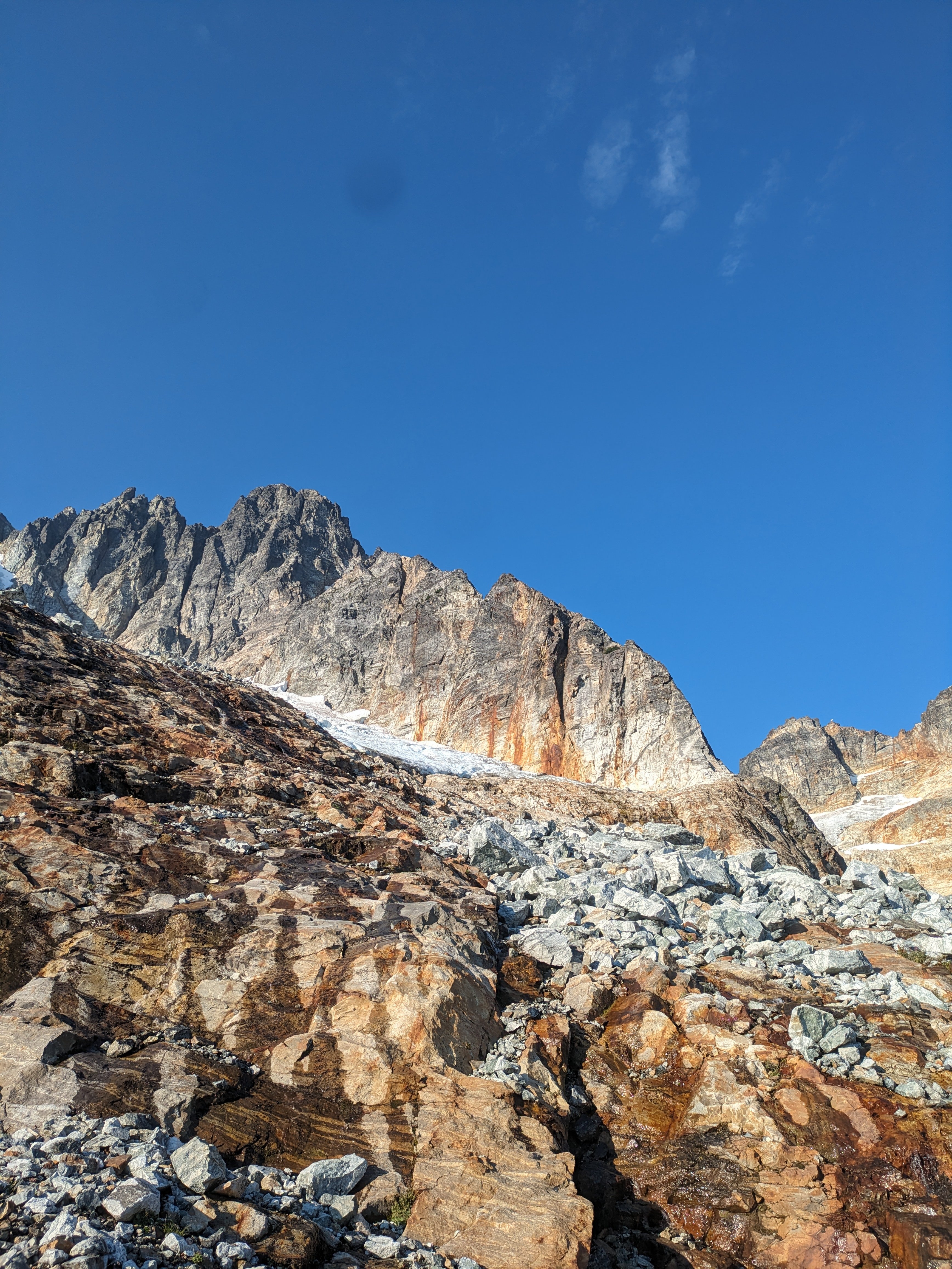
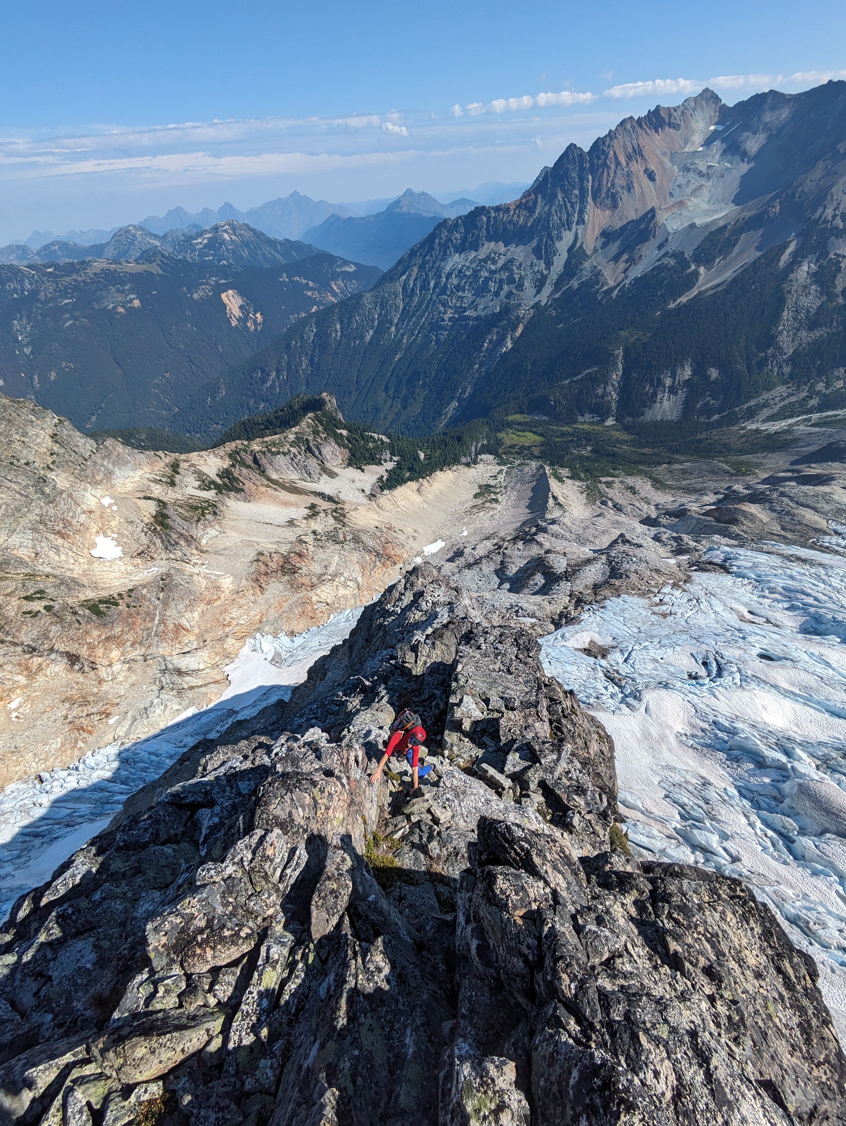
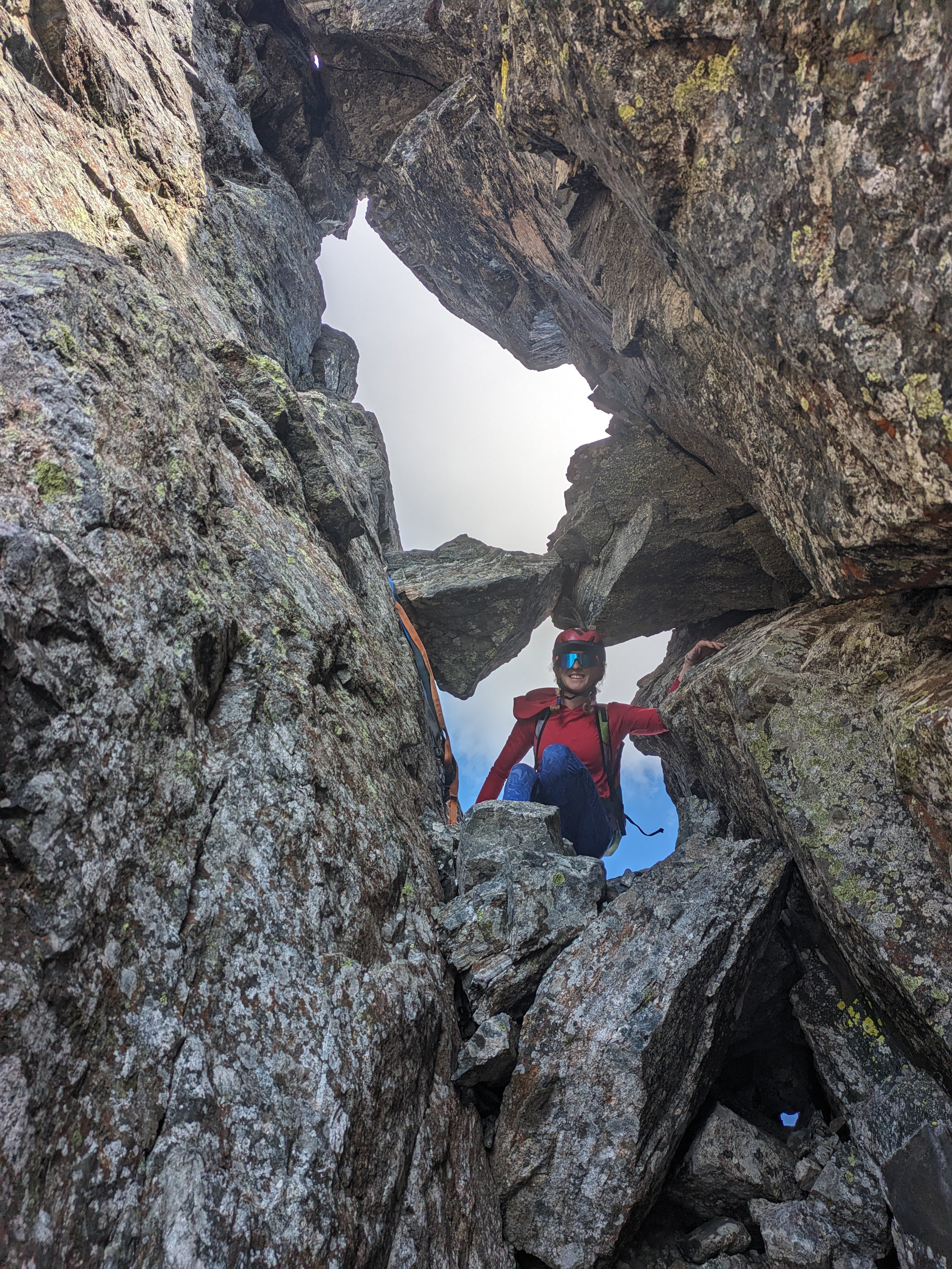
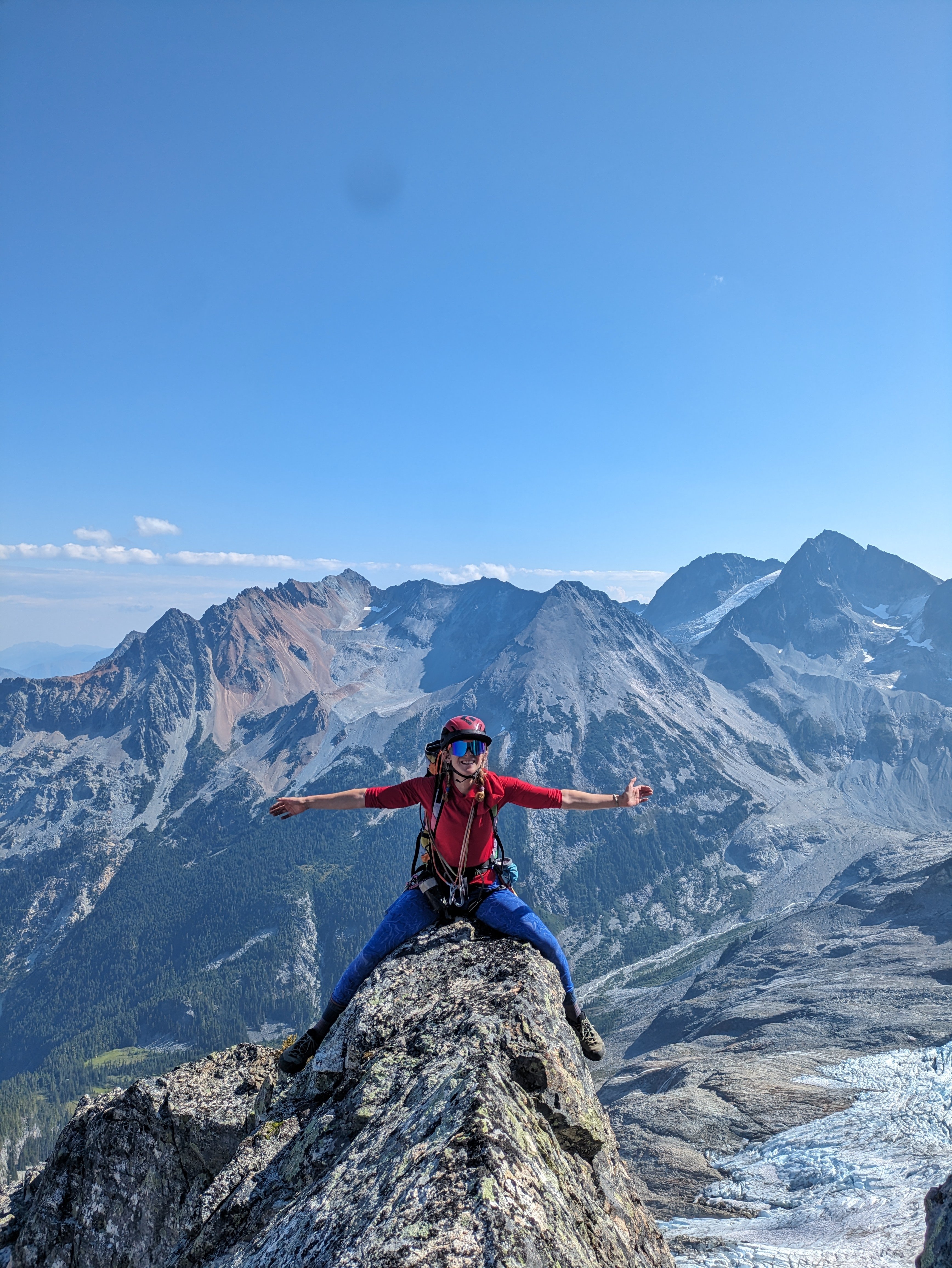
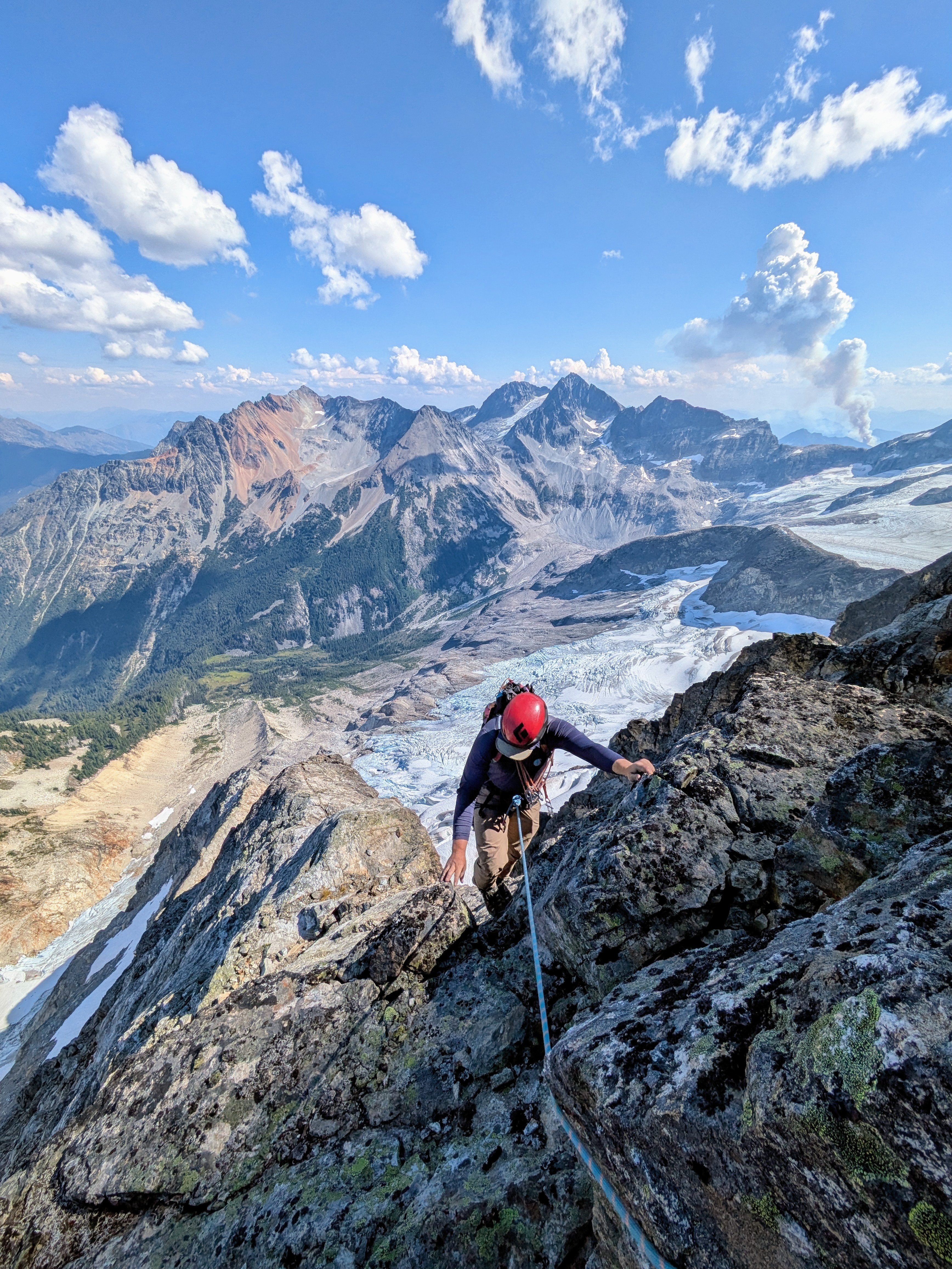
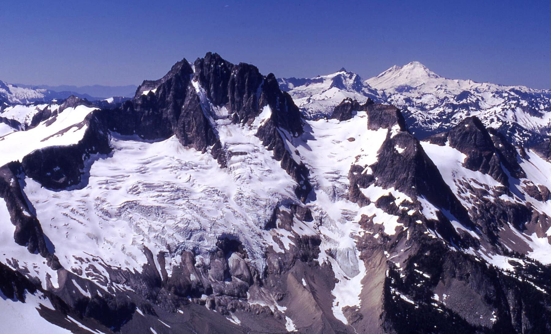
Over the last 3 days, Lani and I climbed what we believe to be the FA of the North Ridge of Redoubt. This is the long, NW trending ridge that looms over the North Face glacier route. The route was actually quite classic and comes with a high recommendation. It is by far more enjoyable than the standard route scree encountered on the descent. The route was primarily low fifth class and fourth class scrambling and we roped up for roughly 1100', though snow coverage and comfort sloping may drastically impact this number. The ridge gains a bit over 2000' over around .5 miles of horizontal. The name is inspired by the little ball of fire, Calcifer, from howls moving castle, as we watched the Perry Creek fire grow in the distance. Day 1 We approached and bivied at Ouzel lake. A bird tells me the Depot Creek "trail" is in particularly excellent condition, requiring NO bushwhacking, and they said handlines are even avoidable. The same bird mentioned that current logging roads take you all the way to the border, making the approach to Ouzel Lake 4.5 miles. We bivied all the way up at Ouzel lake as we were initially planning on climbing Spickard the next day, but growing smoke from the Perry Creek fire changed our minds on that plan. There is also an excellent potential camp at the top of Depot Creek falls, potentially allowing for a direct approach, though this would require bushwhacking of unknown taste... There are also potential bivy options on route to help facilitate a 2 day itinerary. Day 2 From the lake, we made a long contour on talus, loosing only around 400', once near and below the objective, we made our way up talus and slabs to the toe of the ridge. Excellent running water out of the toe of the glacier. We initially attempted the cracks smack on the toe of the ridge, I bailed around halfway up after encountering some 5.11 tips and entering unpleasant looseness. There is an obvious corner left of the toe that potentially holds a very classic potentially moderate direct start. The unsent directismo After bailing off the toe, we looked to the right and zig-zagged up ramps to gain the buttress crest. Snow coverage will drastically impact your experience here. Once on the ridge crest we found thousands of feet of enjoyable scrambling on mostly sound rock. Lani compared it to the NE buttress of triumph but with mostly better rock. We roped up for the occasional pitch, but mostly soloed. There is a broad saddle at 7600' where things begin to steepen subtly. This would also make an excellent bivy with a permanent snowfield for water access. Above the notch, the climbing steepened and we climbed a few back to back pitches until we were below a prominent gendarme. Unsure what the top of the gendarme would be like we traversed into the chossy gully to climbers left and climbed a short, overhanging pitch of surprisingly solid shist. After topping out the gully, we found the descent off the gendarme would have been chill, so Future parties should consider a direct line up the cracks on the gendarme for a more classic finish. Once at the notch in the ridge we met up with the large talus fields that define the slopes on the south summit. The traverse over the sub summits to the true summit was generally easy but involved a few sections of fifth class. Once on the summit, we began the "joys" of doing the standard route late season. Lani in the canonball hole Once at the base of the gullies we encountered awful scree, one could only imagine how much more awful it would be to go up, so there is that... The entire day we had been watching a fire grow in the East. Seeing it expand so quickly and already beginning to envelope spickard in smoke we decided early on our descent to forgo spickard and plan on hiking out the next day. Mordor to the East Day 3 Hike out, blueberries... Suggested Rack Single Rack .3-1, optional 2; full set of nuts; we had a single 60M rope, but it could be done with a 30M line to save weight.
 2 points
 -
Trip: Seefar Peak, Brooks Range, The Long Way - East Gullies From Marsh Fork To Dalton Highway Trip Date: 07/28/2025 Trip Report: TLDR Version/Intro: Me and 4 buddies went to the Brooks Range in Alaska for 12 days of hiking through one of the largest wilderness areas in North America. July 28 to Aug 10. We had a blast and it went great. We got flown in by a bush flight, walked along many river valleys, hiked up a talus pile peak and then through the wilderness, across rivers and over hills to the Dalton Highway where we got picked up by a commercial shuttle service that drove us back to Fairbanks and the World. Long version: Day 0: Drive from Bellingham to Seattle, Fly from Seattle to Fairbanks on Alaska Air (duh), van ride, Uber ride. Walk around town, hit a bar, Thai food. Beers in the hotel room. Day 1: Fly to Coldfoot on Wright Air, slight delay due to missed flight (don’t believe the hotel that you don’t need to be early to Wright Air, they take their business very seriously). Immediately upon landing in Coldfoot we jumped into prop plane the same age as my parents and fly with Dirk of Coyote Air into Upper Marsh Fork landing strip on the Marsh Fork of the Canning River. The flight was incredible, frequently with wheels just clearing ridgetops and flying the terrain up and down valleys. Extremely scenic, caribou and sheep. Upon landing there was much exclaiming and pointing and backslapping. Once we got settled down and the final packing completed we hiked up valley. Warm, patchy sun, overnight hard rain. Glorious, glorious, glorious! I got a good chuckle out of everyone later admitting that they were forcing down the nausea the whole bush flight and hiding it from the others. 5.5 miles, 2.5 hours. “Rainy Camp” Day 2: Hike up Marsh Fork, cross into unnamed very upper East Fork tributary of the Ivishak River drainage. Camp at headwaters. Hard day, with technical talus and side-hilling above cliffs and raging water. The river was running pretty high from the previous night's rain so walking in the canyon bottom was not an option for us, otherwise this would have been easier. Cool and misty with rain. Amazing, just like home but nothing like it at all at the same time, so great all around; we expected weather, didn’t rain enough to get wet. Much exclaiming about the scenery. 12 miles, 9 hours “Frosty camp” Day 3: Awoke to frost on the tents and plants. Hiked down canyon to junction with upper east fork of the Ivishak, down river past multiple small confluences, easy walking. Over interminable ridge with tussocks (our first!) to Ivishak River main stem. Camp in a “hay field”. Bluebird sun and warm, 2 long great breaks for lunch. Much exclaiming about the scenery. We pushed hard on this day to set ourselves up for a potential summit tomorrow assuming the weather held out. We didn't want to get stranded up high looking for a campsite with no water. 16 miles, 11 hours “Hayfield camp” Day 4: Ascended Ivishak valley toward Continental Divide, turn south to climb Seefar Peak via dogleg east gully, awesome snow in first gully, then major talus slog to the summit. Amazing time spent on the summit, warm but breezy. Lots of cool fossils in the limestone. Descent to the south and west terrible talus, so we bailed off the ridge early to Wind River valley. Made camp. Amazing dry tundra camp next to river. Shoes and socks dry at camp! First time since 5 minutes into the trip. Bathed in river and washed clothes. Bluebird, sun, warm. Much exclaiming about the scenery. A good time was had by all. 10 miles 4000', 10 hours “Swimming Hole Camp” Day 5: Hiked down Wind River, saw wolves with puppies, then later moose which led us into a lousy tussock field, camped in side creek. Very mediocre spot, but extremely close to water and some dry wood, so we had a fire and drank margaritas to enliven the spirits a little. It worked. Much exclaiming about the scenery. 14.3 miles, 7.5 hours “Margaritaville Camp” Day 6: Up wind River tributary, saw a grizzly with two cubs, a heard of sheep way up high, and a lone wolf across the valley making quick work of the talus. Up a unique talus-ey canyon, over two passes, one being the Continental Divide, down a tributary of a southern fork of the Ribbon River. Great walking most of the time. We got showered on twice, but mostly sunny. The area where we looked to camp was somewhat brushy with knee-high vegetation and it took a bit of looking to find a good campsite, eventually made a spot work quite well with great moss and blueberries. 13 miles, 8 hours “Barefoot camp” Day 7: Nice enough weather early, quickly turned to rain, then hard rain, despite the Inreach weather saying it would improve throughout the day. Misery. Trudged up to beautiful lake, too windy and cold to enjoy it. Saw wolf puppies briefly. Over pass separating the Ribbon and Accomplishment Creek and down to tundra on other side, just past dangerously slick boulder field. Dove into tents soaked through. Very cold and wet. Lunch in tent, nap. Whiskey helped spirits a lot... at least in my tent. Less exclaiming about the scenery today, though everyone admitted it would have been great if we could have enjoyed it. 8 miles, 4 hours, no breaks. “Sunny dry happy fun camp” Day 8: Woke to fog but no rain, weather improved dramatically throughout the morning. This was clutch since our base layers were completely soaked. First thing in the morning everybody got ready to hike then leapt into our wet clothes and immediately started walking quickly to warm up in an attempt to dry out some clothes. Down Accomplishment Creek, up side creek over a pass with lots of caribou antlers, half way down canyon on other side to camp. Beautiful country, lots of exclaiming over the scenery, sunny and warm, dried out everything. Decent walking. Saw moose, wolverine. Drizzle just before camp. “Sewing camp” due to a near catastrophic pack blowout. 9.5 hours. 16 miles Day 9: Drizzle, fog, cool. Down interesting puzzle canyon, that was tons of fun to figure out, left side, right side, in the creek, does it go? It goes! Saw a griz at a distance, then across a big river, nameless east tributary of the Sagavanirktok, (tough, fast crossing), hardest of the trip. Slogged up a tussock hill, to canyon, over pass and down to Sag valley, mediocre camp, not many options. We were told that the Sag was a tough crossing that kills people from time to time, so we were excited to get a look at it from up high. I had done a lot of satellite and map reconnaissance of the entire route and had picked out an area of the Sag that is quite braided, hopefully making for the easiest crossing. I had read a few scattered reports of people who crossed just a couple miles further north and had to use rafts. “Lumpy camp” 12 miles, 7.5 hours Day 10: Foggy AM, then sunny and warm. Across the Sag! It ended up being not that big a deal, but it helped that we were on day 10 and river crossing 1 million +/- a couple hundred thousand. Up the valley wall to an amazing broad sunny saddle with rolling fog, for a tea break. We were on a plateau above the confluence of the Atigun and Sagavanirktok Rivers. The fog started to break up after break, we walked slowly; some bad weather was predicted today and the next couple so over the previous few days we had hustled to make sure we could get across the Sag before the rain set in. Unlike the previous days, the weather report ended up being pessimistic and we had great afternoon sunshine. We strolled through tussocks to camp on a sunny alpine tundra slope. Amazing day. Surprise sun! Everyone tard sailed all their gear out on the tundra to dry out everything. Dry socks even!! The low tundra around camp made for great lounging and camping, and beautiful. The sun and sense of accomplishment really made the light on the hills glow that long afternoon. “Kick Ass Camp” 5 miles, 5 hours Day 11: Hiked off the plateau to the Atigun River, up the river valley to the road, road!? Long road walk to Galbraith Lake camp. My knees hurt after the 8 miles of road for the first time in the entire trip. Mostly cloudy with sun patches and a short drizzle. Surprising amount of traffic on the road, saw a civic! Fire and celebratory attitude at camp. “Galbraith Lake Campground” 6 hours 15 miles Day 12: Woke up leisurely, lounged around, day hike to West Galbraith Peak, tea and coffee on the summit. Camp time, eating everything that was left. Mostly cloudy, mild. “Galbraith Lake Campground” 5 mi, 4.5 hours Day 13: Lounged in the tent, rain and drizzle, picked up by van at 11. Wes from Dalton Highway Express picked us up in a beater 15 passenger van. Two entrees and a beer at the truck stop in Coldfoot. Food at the farthest north truck stop and bar in America was cheaper than in Bellingham. “Hotel Camp” 10 hours in the van, zero walking. Photo credits to Mike Graw. Gear Notes: backpacking gear, bear spray, rain gear Approach Notes: Airplane, deproach by van.2 points
-
WA taxes are high enough. It's all about what the politicians in Olympia prioritize - and it's NOT wilderness recreation and access!1 point
-
Nice line. Here's what it looked like 54 years ago on July 10, 1971.
 0 points