
Leaderboard


Popular Content
Showing content with the highest reputation on 09/05/24 in all areas
-
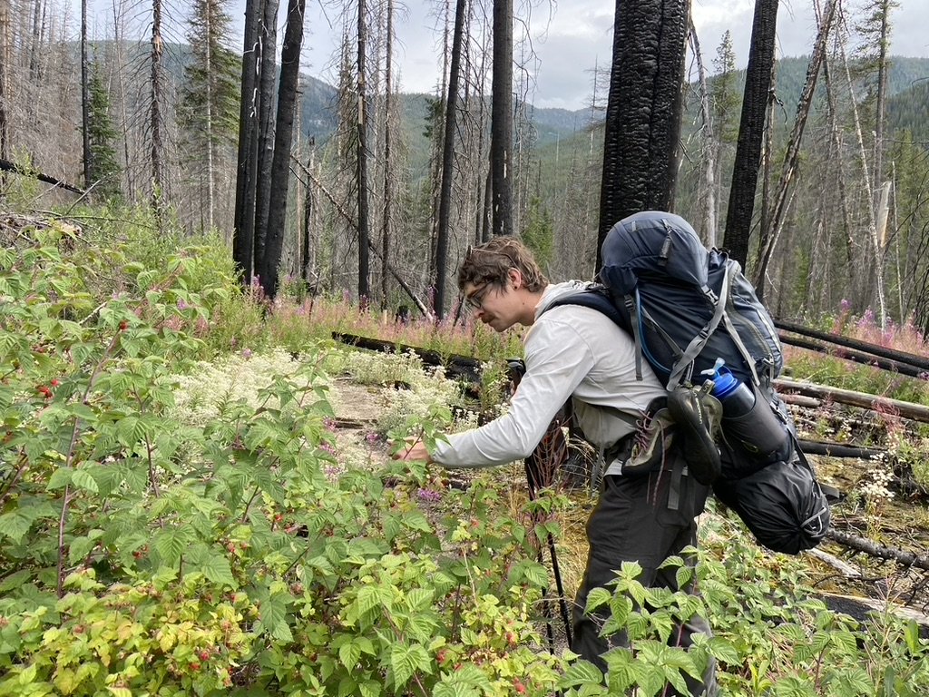
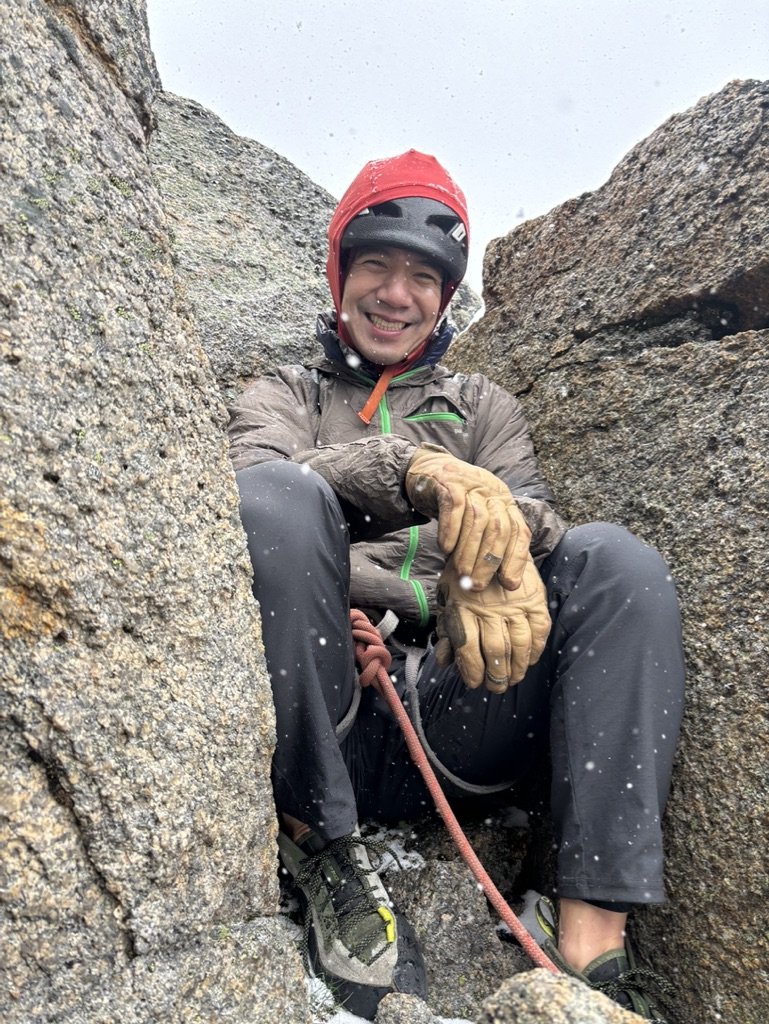
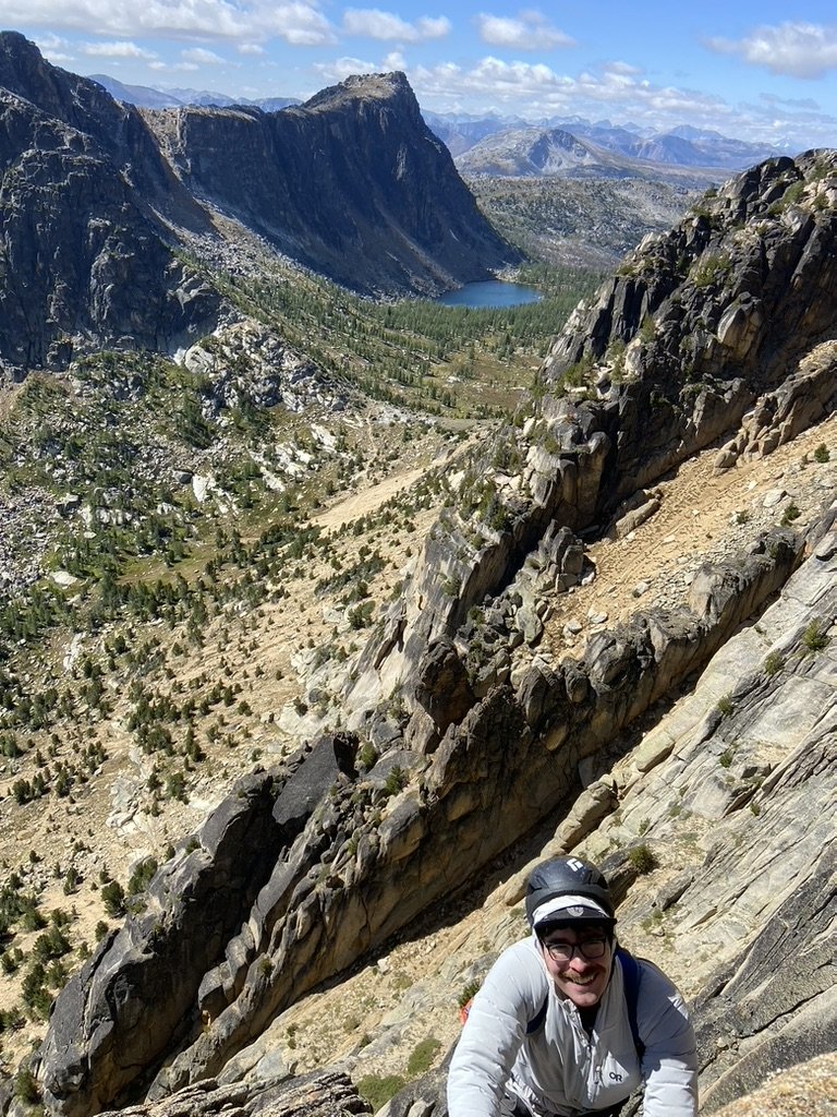
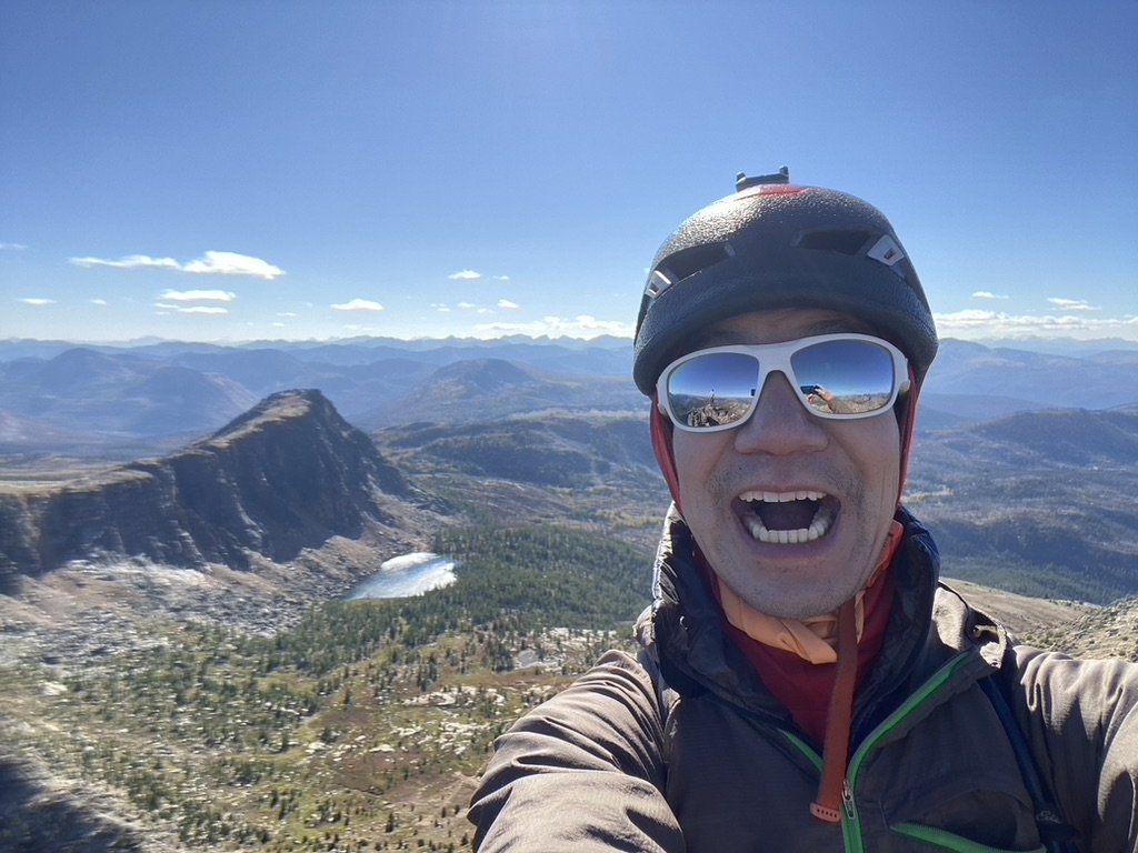
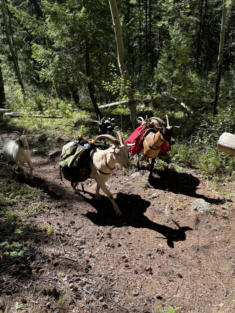
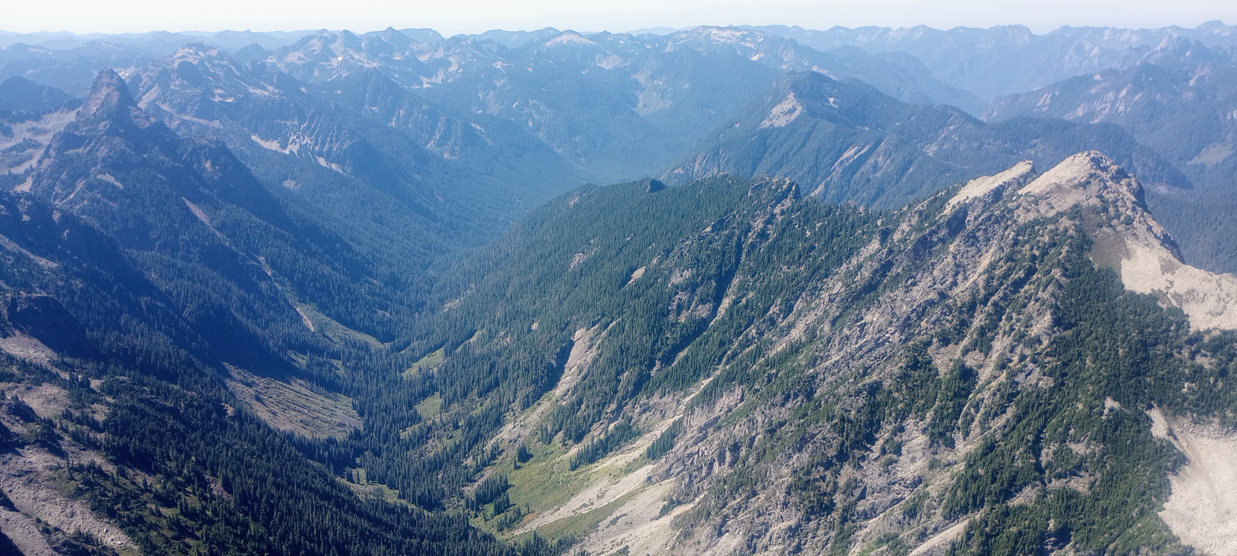
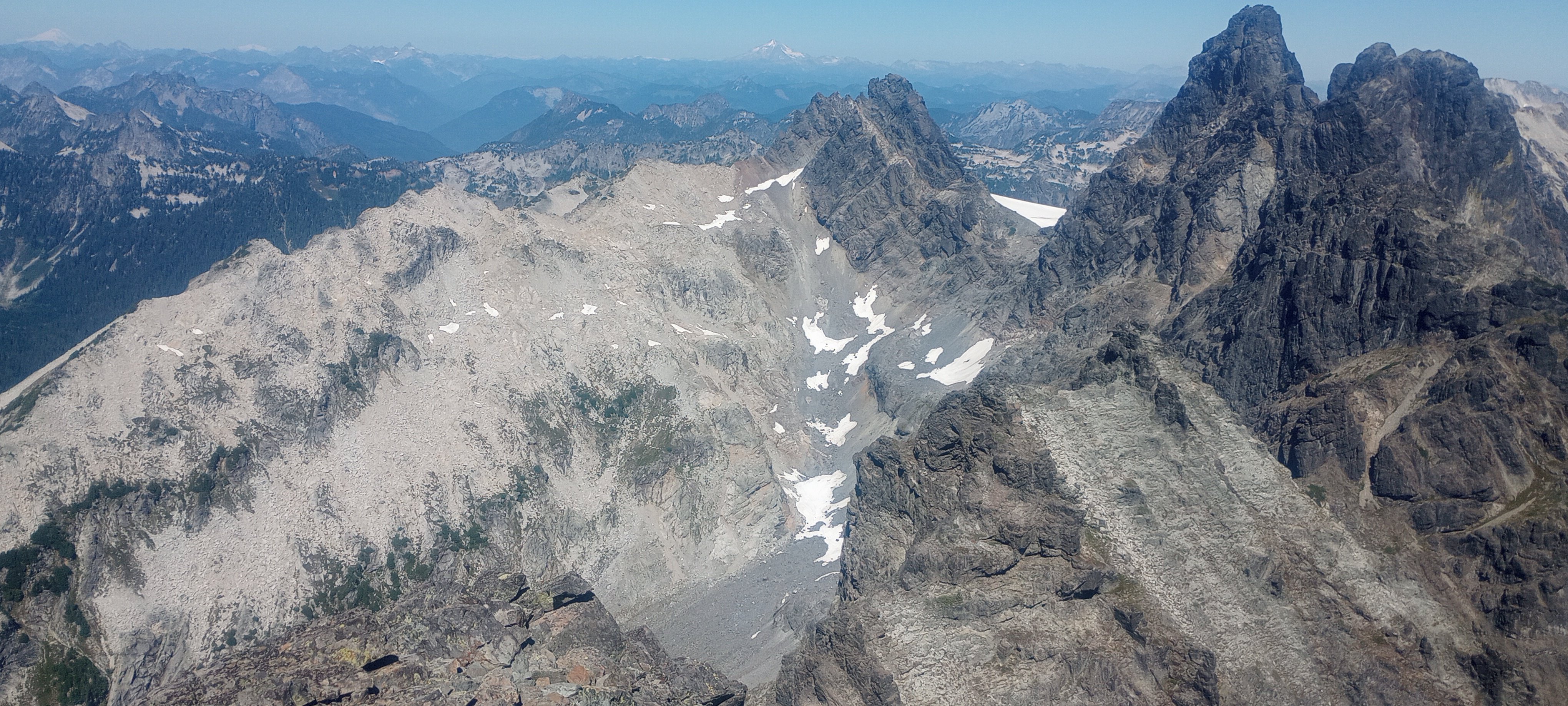
It seemed like fate. The guy seated next to me at my WFR class casually mentioned that his goal for the summer was also to climb Cathedral Peak. Ever since a failed attempt on Goode, I'd been wanting to climb something big with a long approach, and Cathedral had been at the top of the list for a while. I like the planning required for alpine climbing. Is this a backpacking trip or a climbing trip? Yes. Do I need approach shoes or would they be too heavy? Yes. Jacob and I decided on a 4 day trip. We left Seattle for Thirtymile Trailhead on Monday morning and hit the Chewuch Trail by 11:00 AM. The first 8 miles until the intersection with the Tungsten Trail are quite exposed from the various wildfires that have ripped through the gorge over the years. It's a busy horse trail, so it was in good shape with only a couple of blowdowns and very gradual, almost unnoticeable elevation gain. Also, perfectly ripe raspberries that the bears hadn't gotten to yet: We found a small campsite after 15 miles and slept soundly for the night. The next morning, we banged out the last 5 miles to Upper Cathedral Lake and thought we'd snag Pilgrimage to Mecca in the afternoon. A late summer snowstorm doused that plan. It blew in quickly right as we were roping up at the base, so at least we didn't epic and were able to get back to the tent, where we spent the rest of the day staring at the ceiling trying to stay warm. The next morning, we asked the inReach for a forecast. It said partly cloudy and high 40s with gusts up to 15 mph. At least with no more precipitation in the forecast, we decided to make a go for it and were climbing by 8:30. The forecast turned out to be exactly correct. I wasn't exactly freezing, but the wind was sucking the life blood out of my fingers and toes. When I arrived at the first belay, Jacob awarded me official Trad Dad status for wearing wool socks under my climbing shoes. By mid morning, the sun had come out and the wind had died down. In the chockstone chimney on pitch 2, I ripped off a toaster sized flake which luckily missed both Jacob and the rope. For a remote alpine route, the SE Buttress is surprisingly clean with only a few No Touchy blocks. Still, we doubled down on being careful and finished the route in good style in just under 7 hours. After we got down, we packed up camp and made it 5 miles to the horse camp near Apex Pass before resting for the night. The next morning, we finished the loop on the Tungsten Trail. The Tungsten Trail is slightly rockier and steeper in sections than the Chewuch Trail, but I think hiking in either direction would be fine. Water is plentiful along both trails, although stopping to filter water every few miles gives your body more time to express its resentment toward you. On our way out, we met some goatpackers who were training their herd to carry their stuff for them. We felt like such suckers for not thinking of this obvious life hack. This trip was an amazing experience. I liked that it required a ton of different skills to pull off successfully: trip planning, backpacking, climbing, risk management. And serendipity! Finding the right partner at the right time to achieve a shared goal.
 2 points
 -
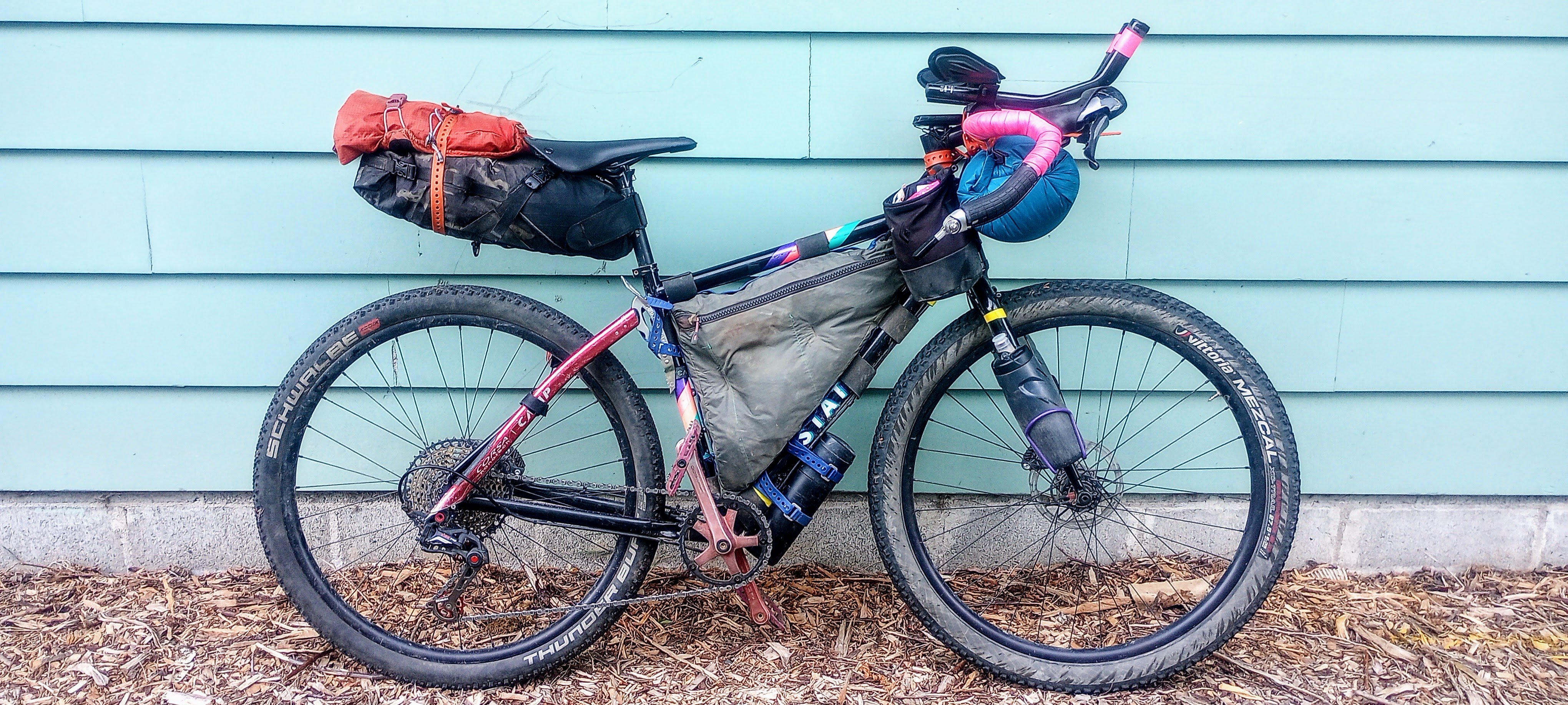
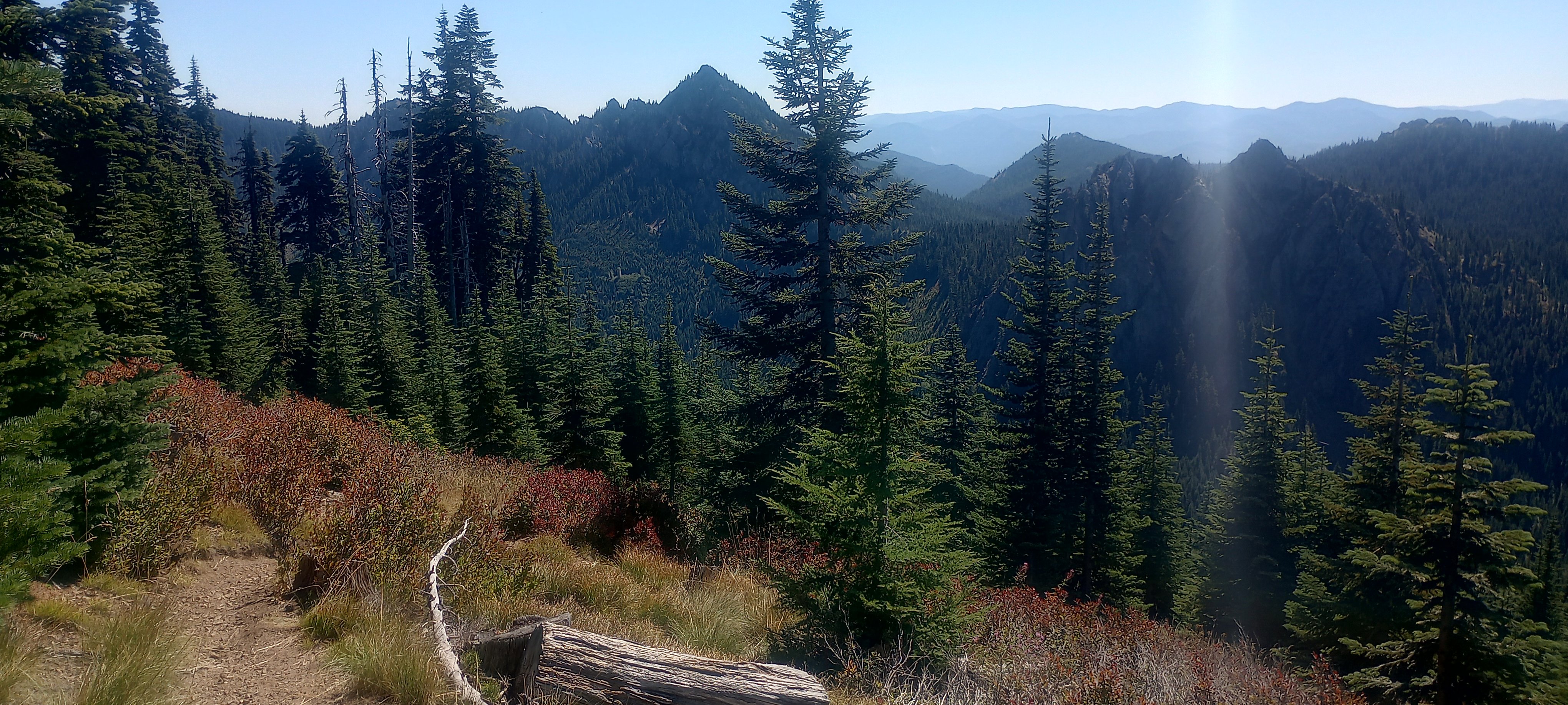
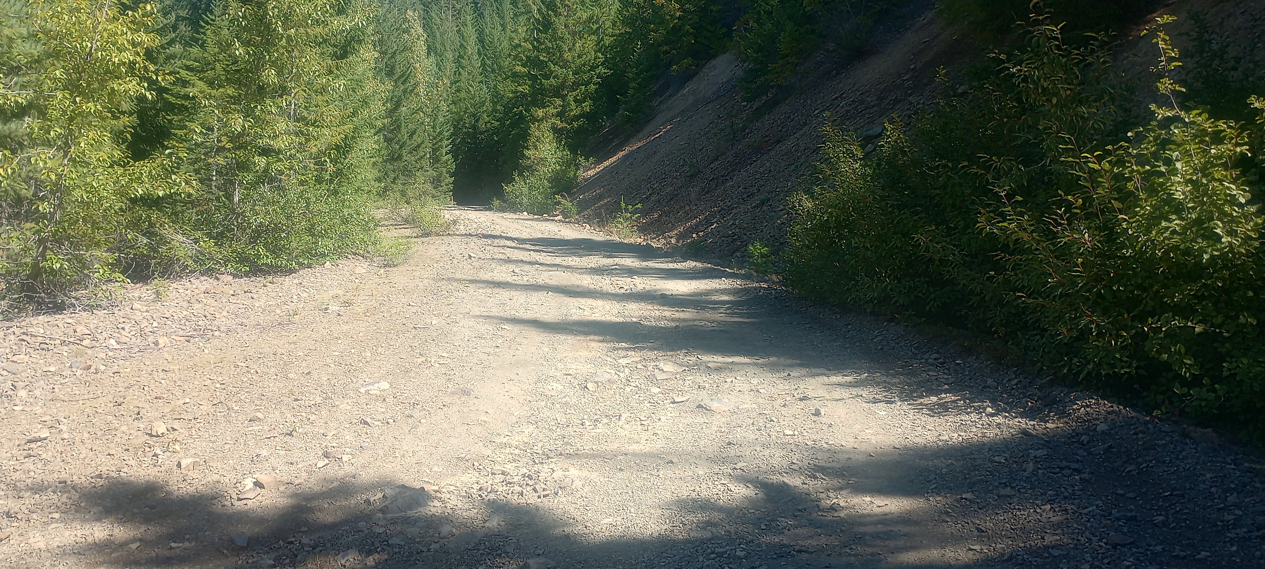
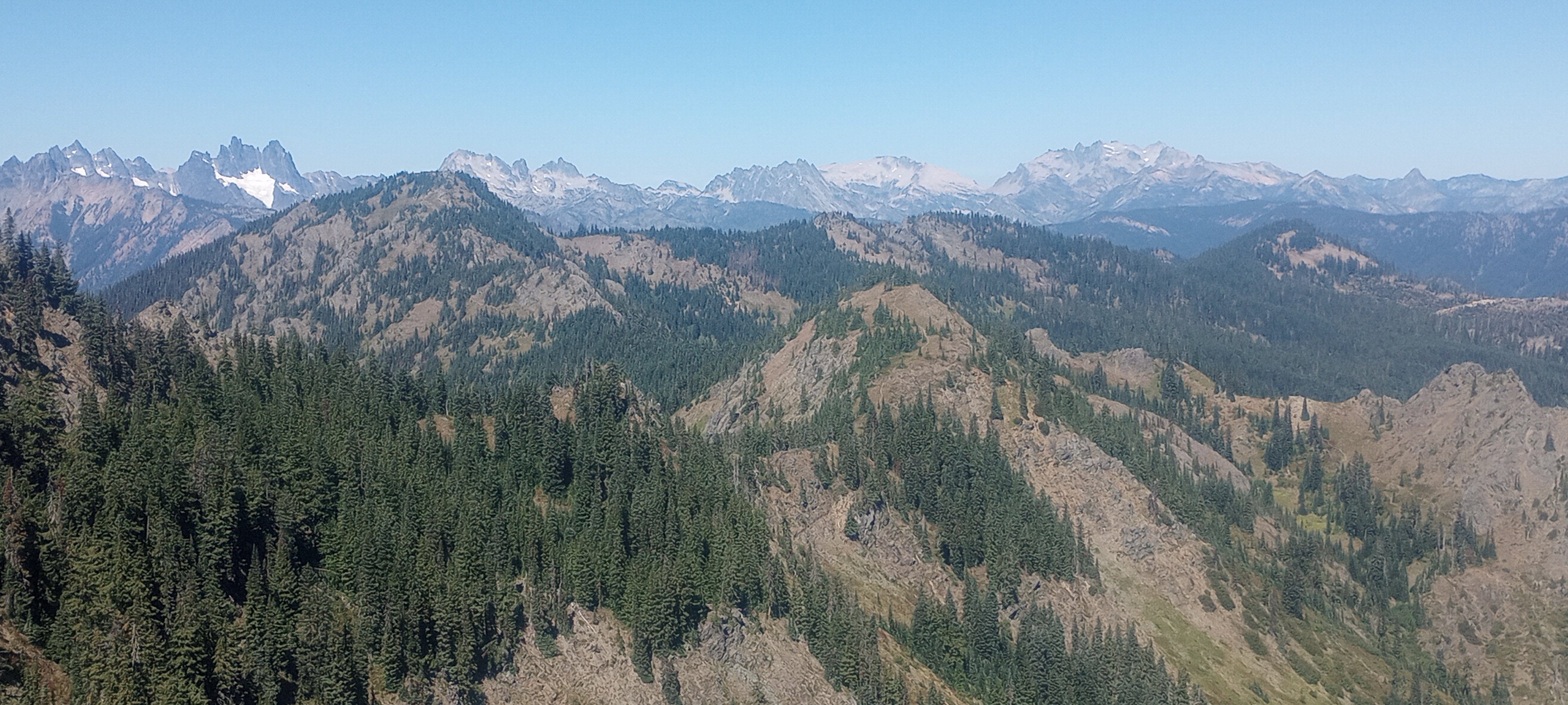
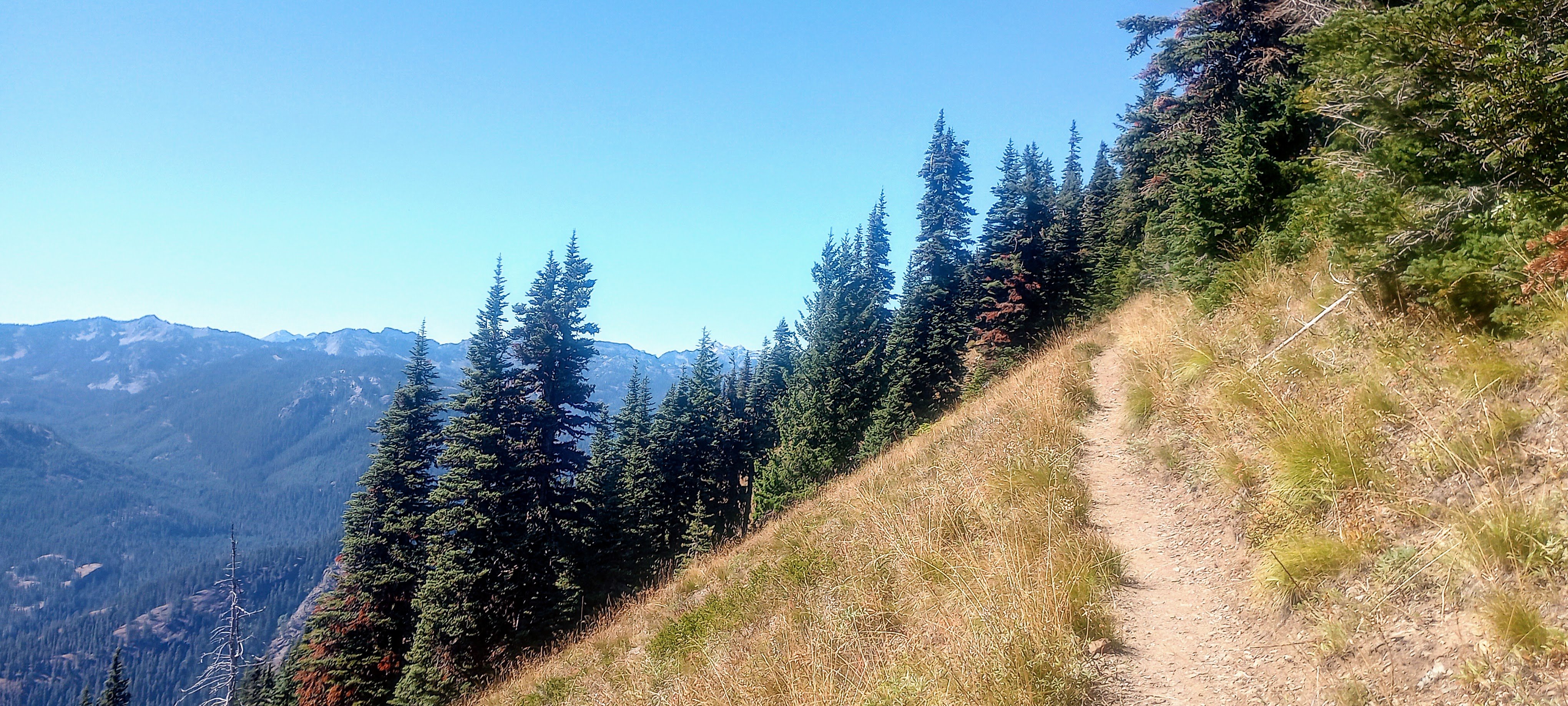
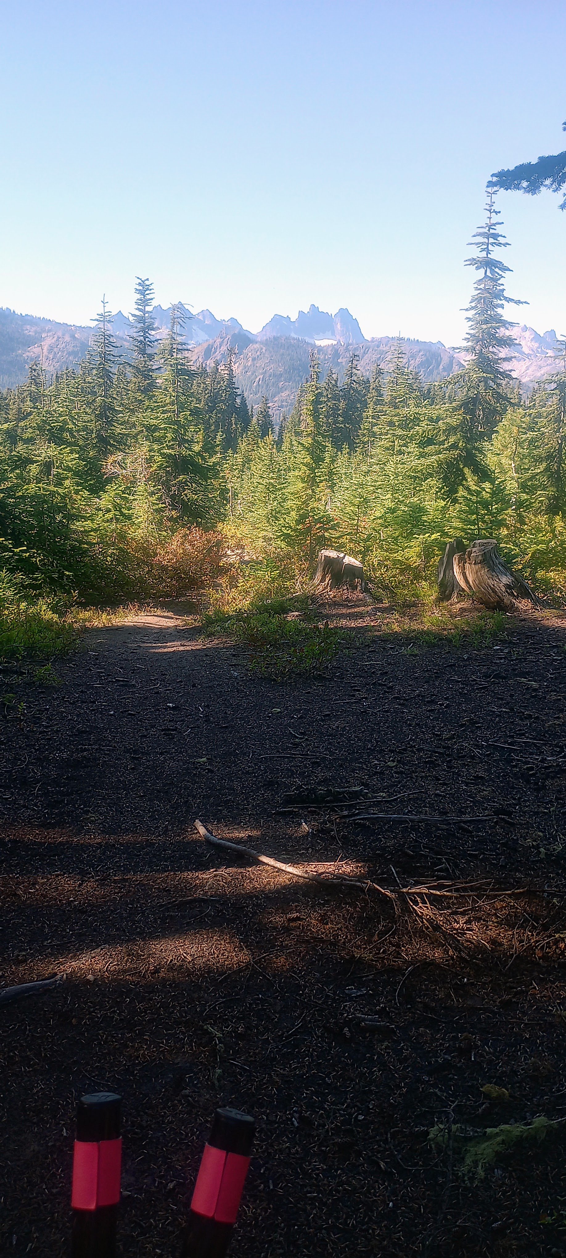
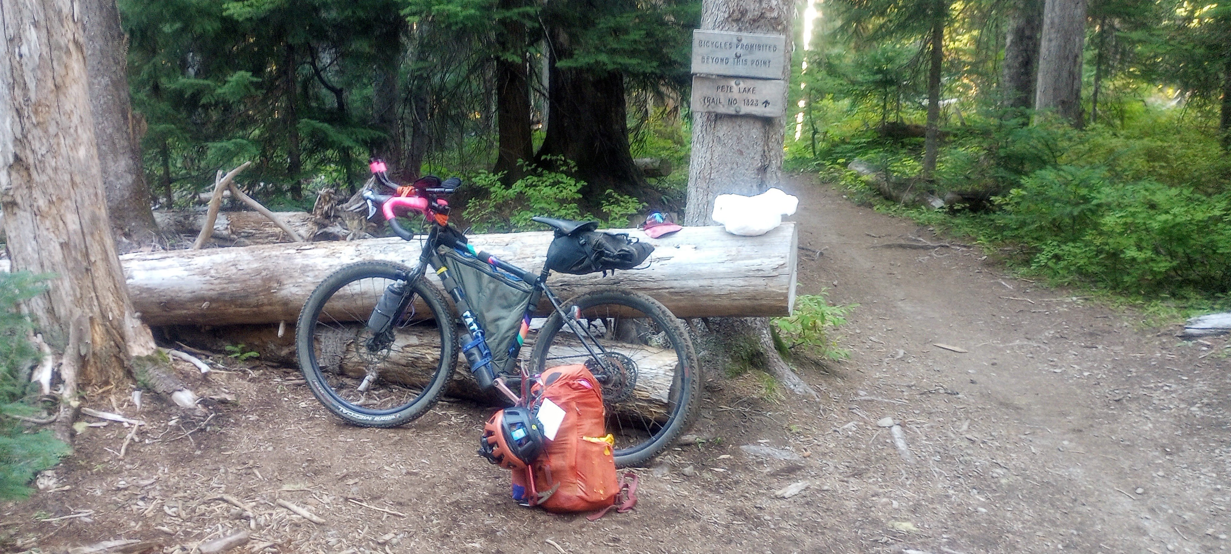
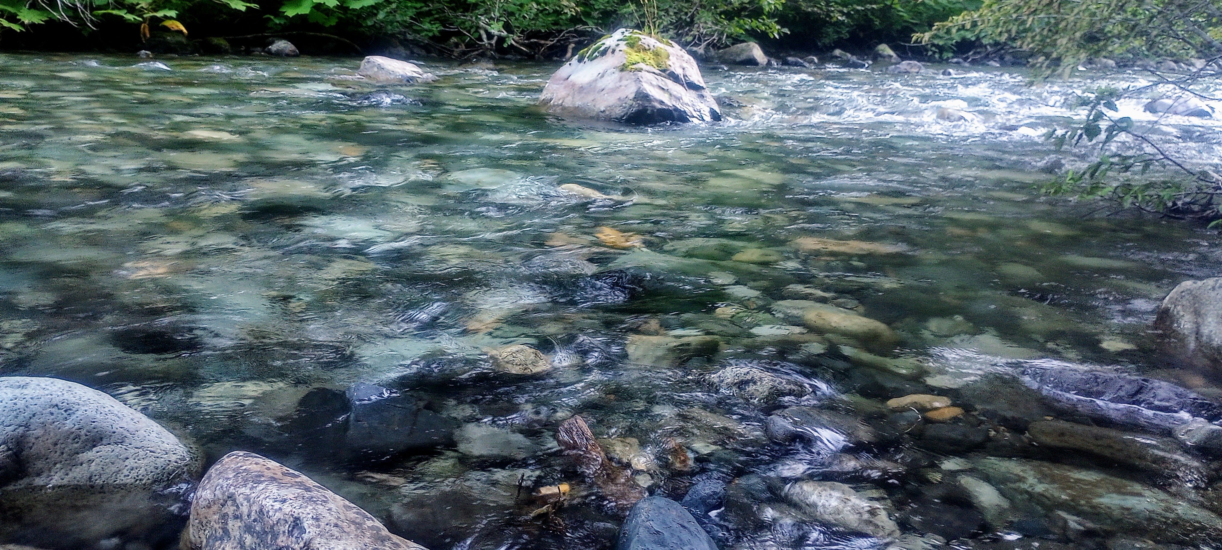
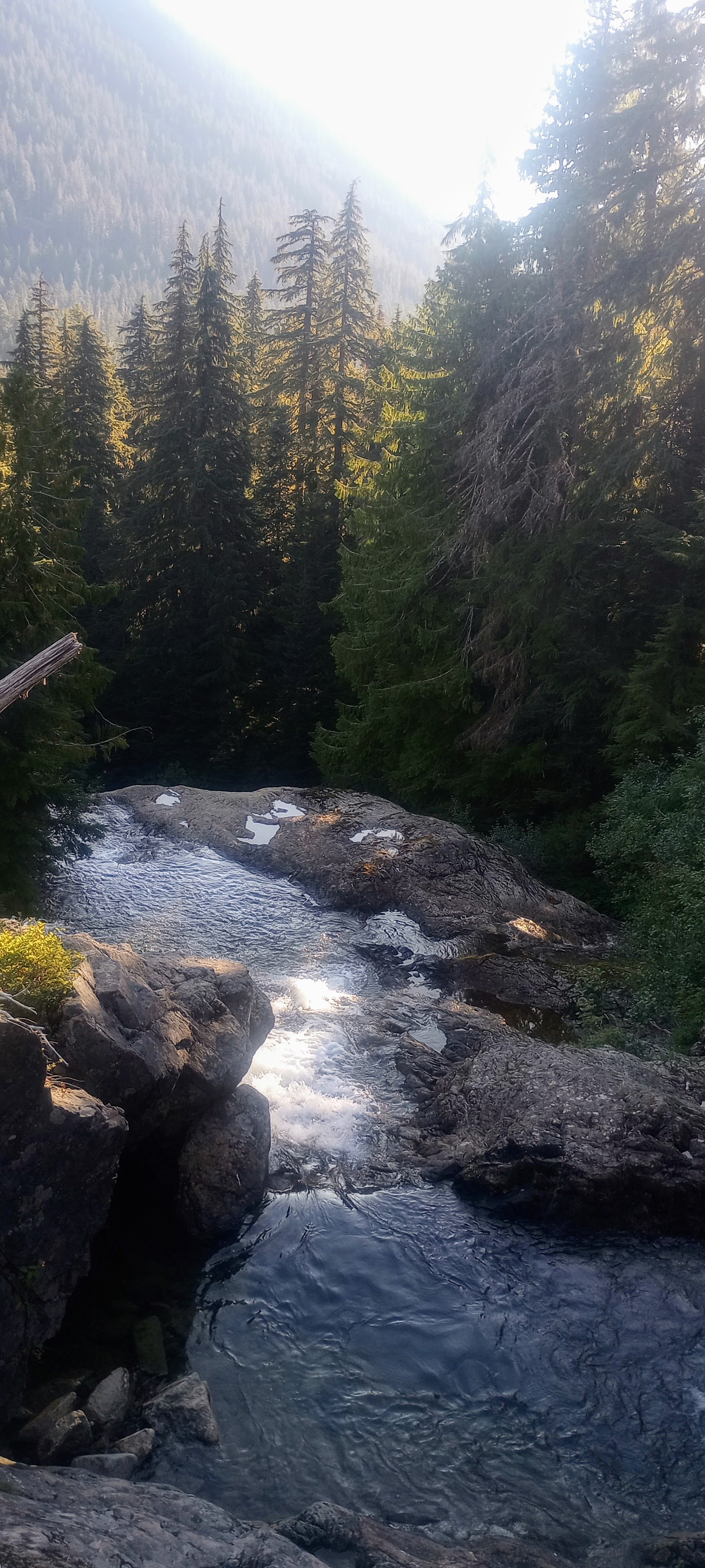
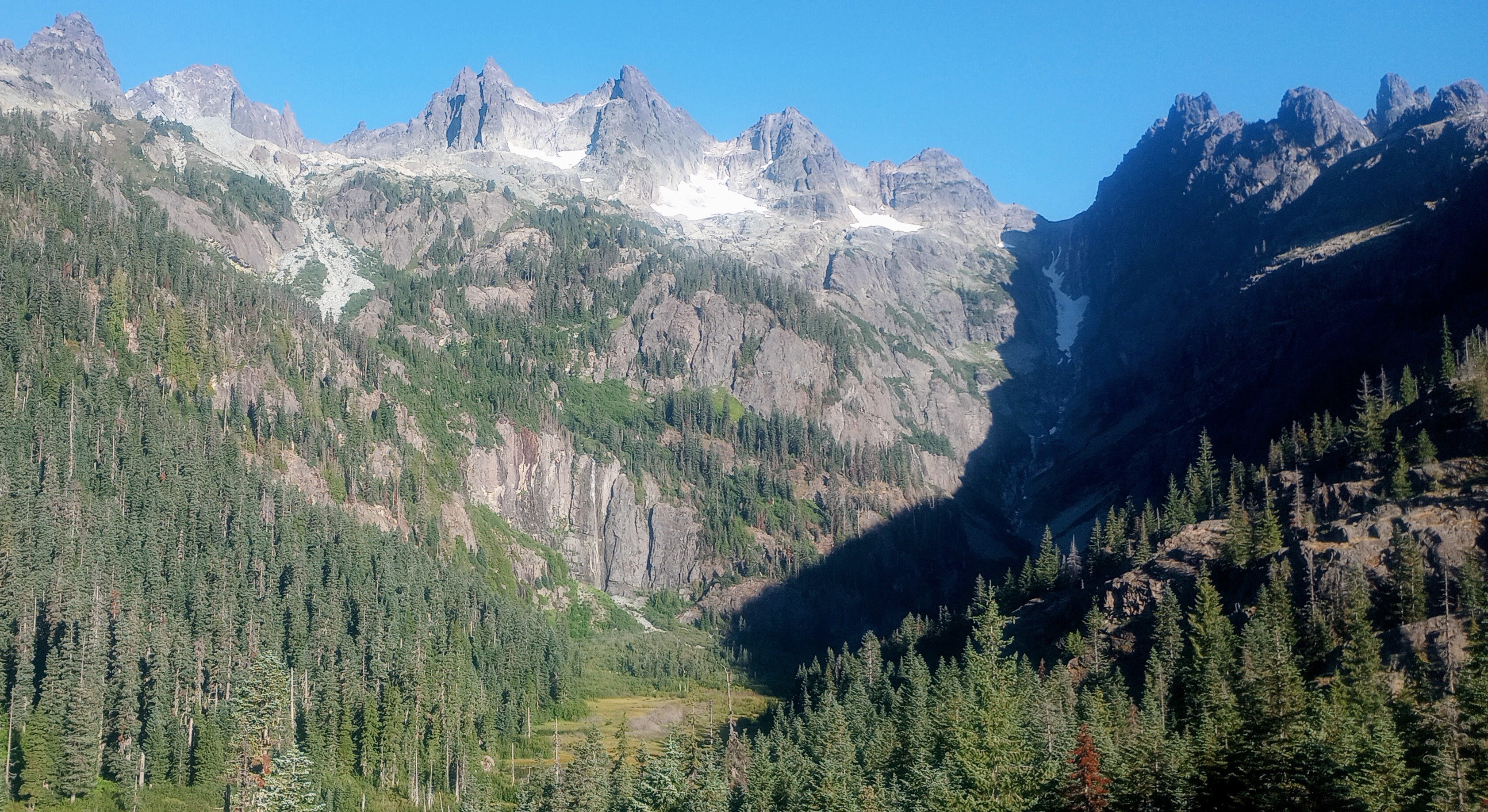
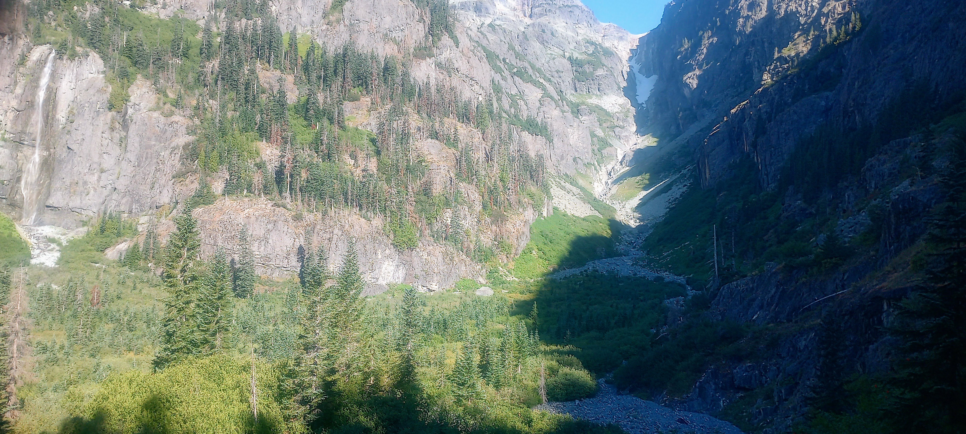
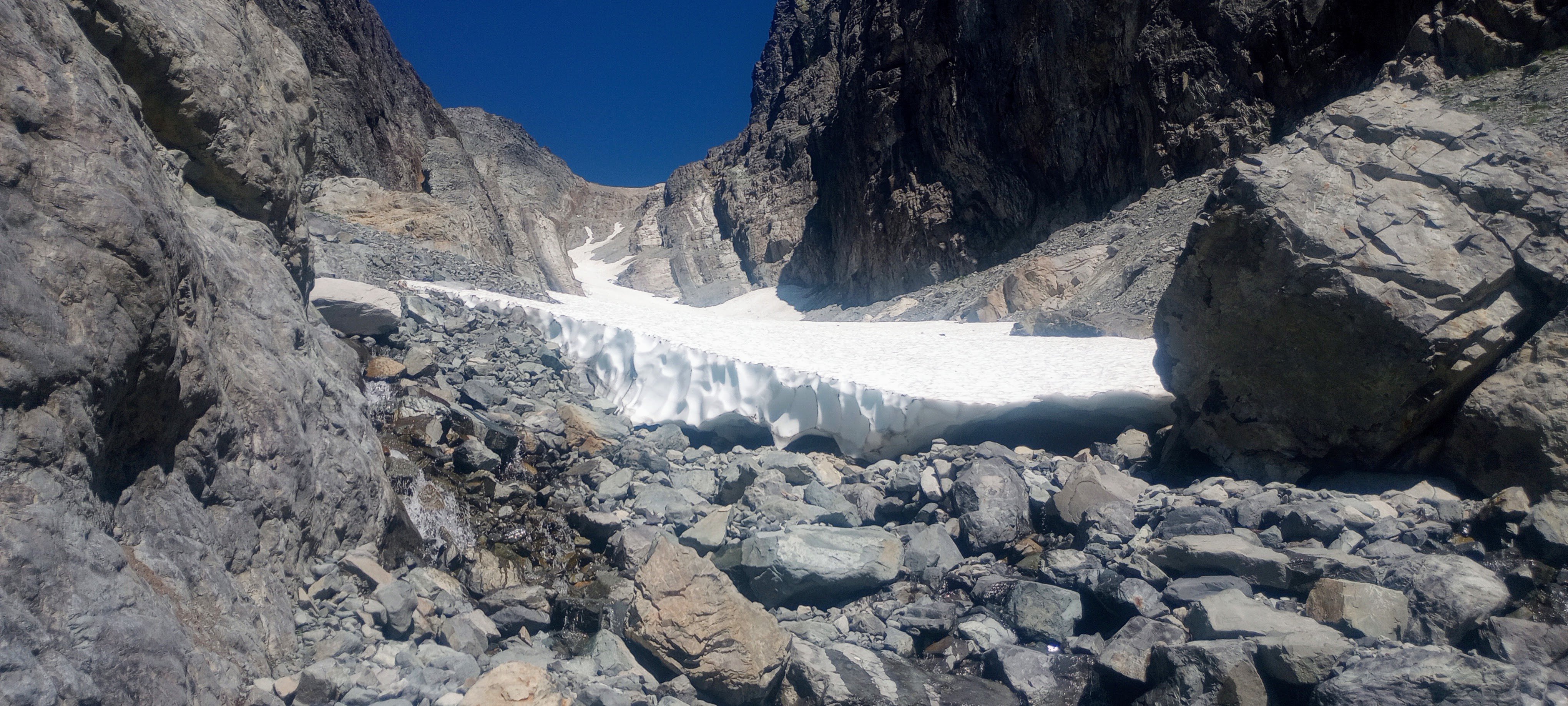
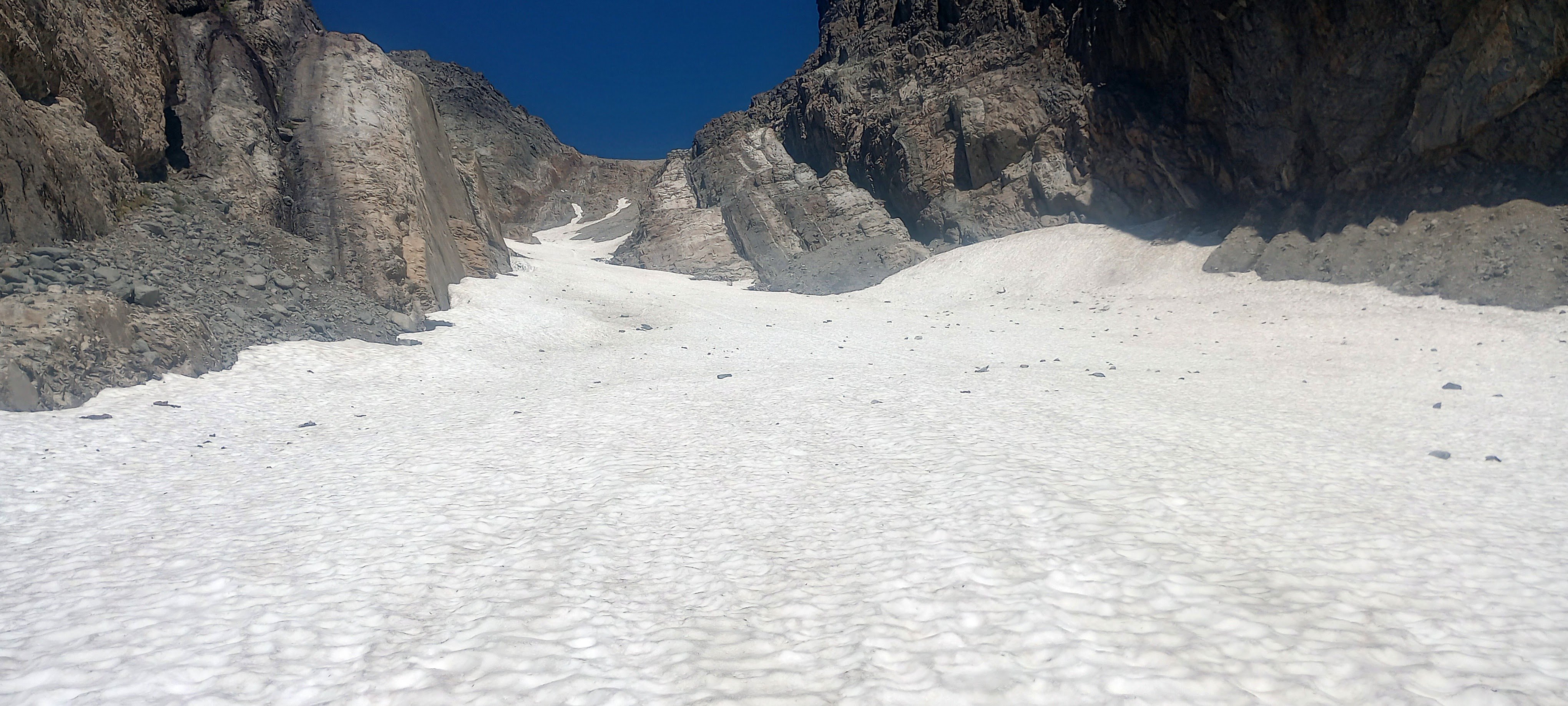
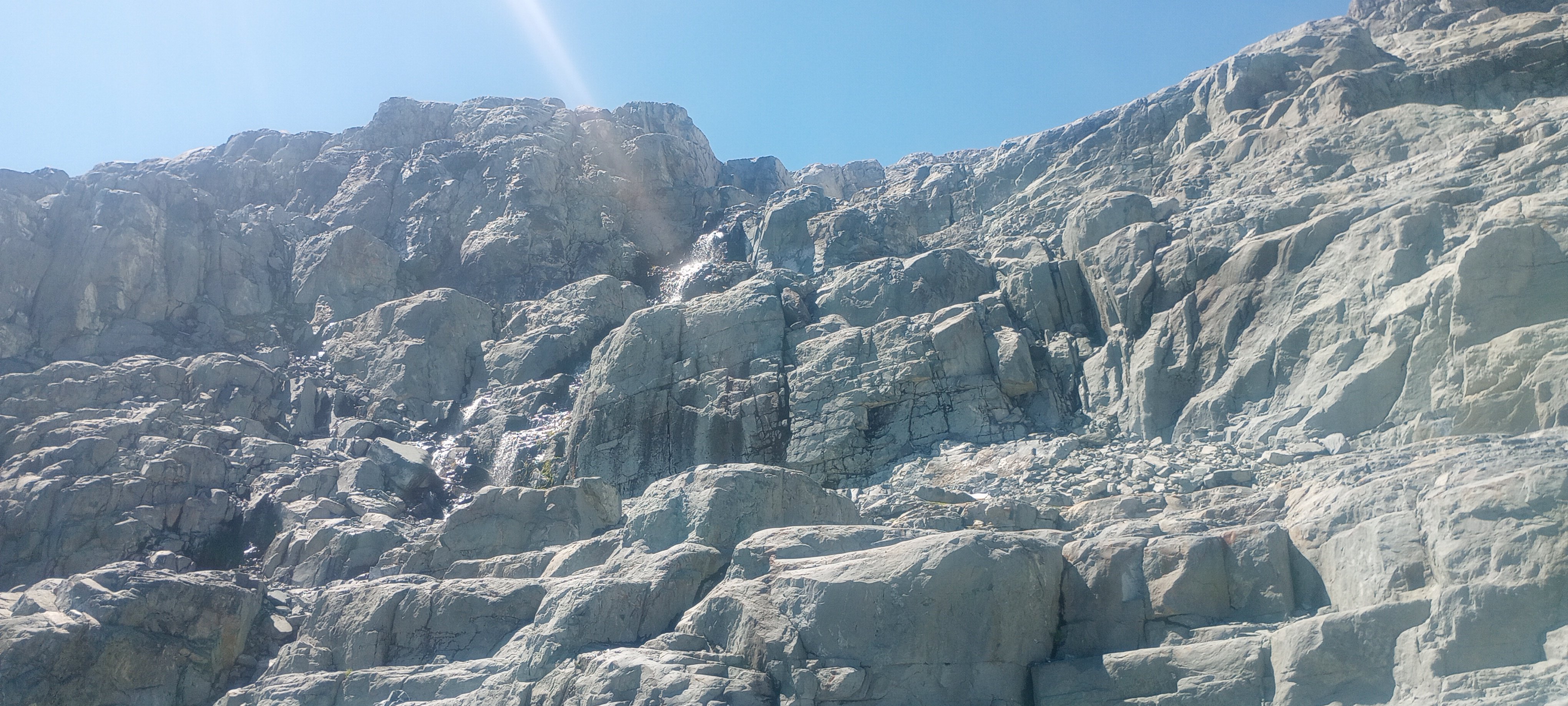
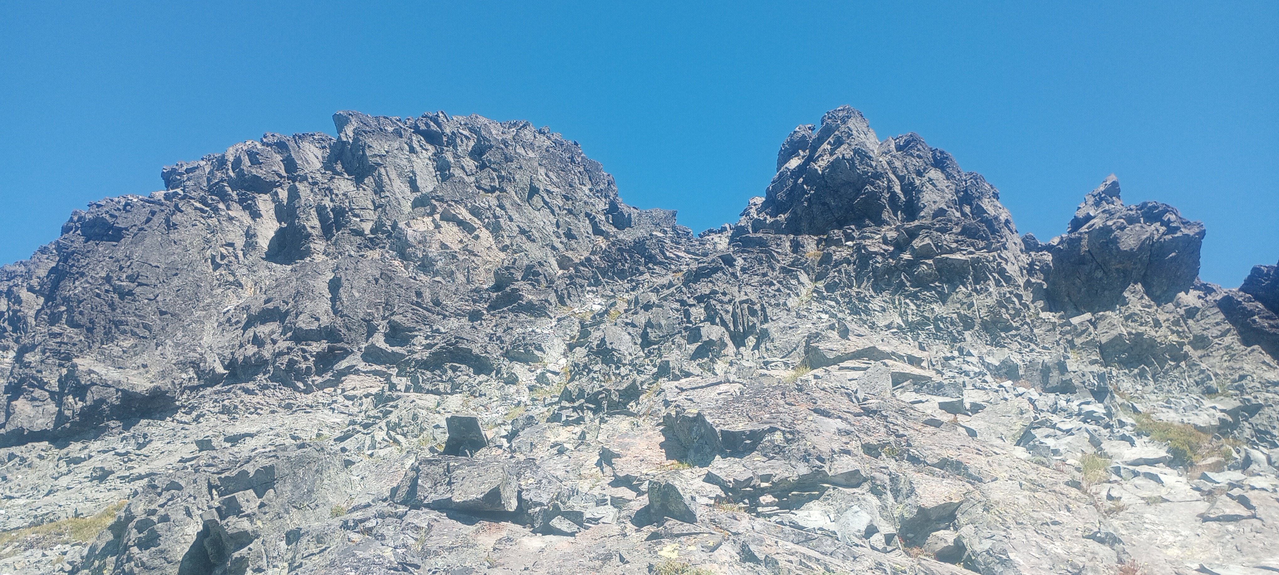
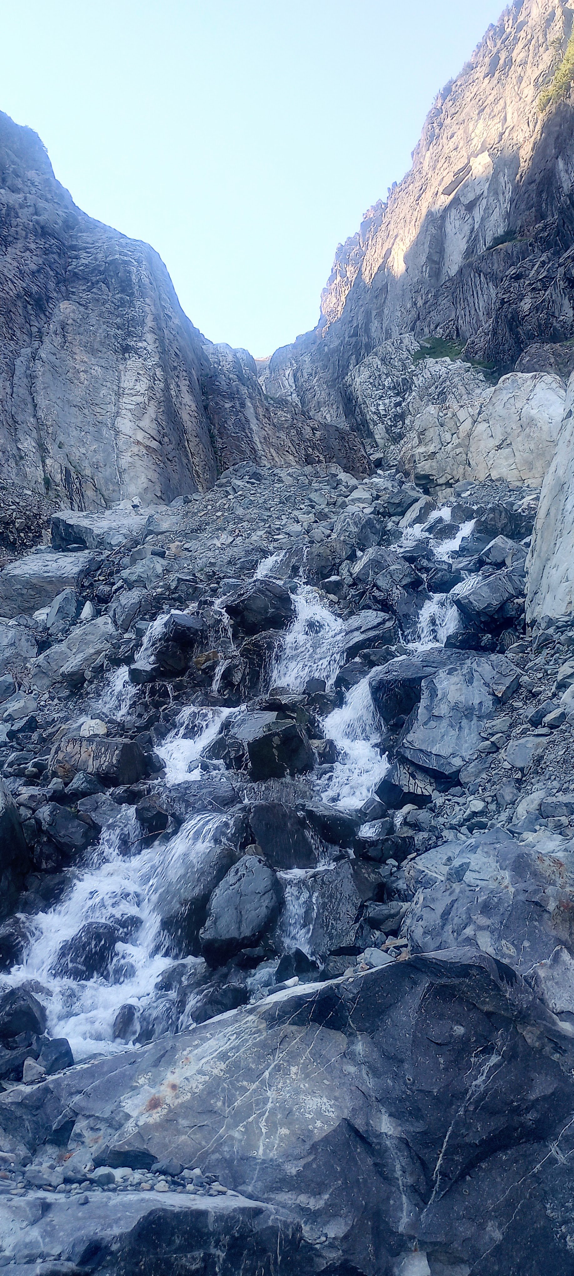
Trip: Lemah Mountain - via Pete Lake (3rd class) (bike approach) Trip Date: 08/31/2024 Trip Report: I used my five-day Labor Day weekend to bike from my house out past the Pete Lake trailhead to climb Lemah and bike home. I really dislike sitting in traffic, and I like riding my bike, so it made a lot of sense! This was a soul-fulfilling trip with lots of time and space to think, not think, observe, and move across the state and up to the top of a really awesome peak! I won’t bore everyone with ALL the bike details, but here’s my VCB (very capable bike) before leaving home. Ready for adventuring! Day 1 - 9:30am - 3:30pm: ~60 miles by bike. Home to Carter Creek camp on the Palouse to Cascades/John Wayne/Iron Horse trail. Started eating a lot of snacks! Talked with fellow bikepacker Craig from Chinook Pass at camp, he looked at my bike and asked what the ice axe was for. He told me about going into the Stuart Range 30+ years ago, “You could camp ANYWHERE back then!” No going back to those days… Day 2 - 6:45am - 7:30pm: ~55 miles by/with bike, ~2.5 miles on foot. Woke up to my brain singing something I hadn’t heard in probably like 25 years: “Are you ready for some FOOTBALL?” – weird stuff! Soon I was pedaling along the trail singing something like, "Heyyyy wild kitties, today's not the day, leave me alone, I don't wanna play.” Stopped when a Douglas squirrel was harassing me from the side of the trail (a common thread throughout the days) and watched it turn a pinecone over and over in its little hands, gnawing and letting the scales fall away, eating the nuts, then discarding the little corn cob. Amazing! Through the Snoqualmie Pass tunnel, turned north in Easton. Had an unexpected cortado at an espresso stand and resupplied at the gas station, then started up the road leading to (kinda chunky, kinda sustained steep, grindy grindy) forest service road. Finally, doing some real elevation gain! Left some mountain bikers in the dust after asking if I could join their bike gang for the climb. Sorry guys! But then I got to the 2.5 miles of black diamond MTB territory heading north. How do people bike up stuff this steep, and narrow?! I hiked my heavy-ass bike about 97% of this, both uphill and downhill. I knew it would be a lot of HAB for this section, but it was steep and dusty and narrow, full value HAB! Happily, there always seemed to be tons of giant delicious shiny mountain huckleberries whenever I really needed the morale boost. After that, things got a little better with four miles on No Name Ridge which is supposedly a blue square trail – maybe old skool, sandbagged blue square? I liked this Trailforks report: “Do you like pushing your bike uphill, nearly, seemingly, endlessly? Then this is the ride for you!” Definitely rode more than 3% of this section, but still – a good amount of HAB. However! Most of this was on the ridge, so stellar views abound! Lemah, Chimney Rock and Overcoat, The Chiefs, Bears Breast, Hinman, Daniel, and Cathedral Rock! (Stu, too, but out of the frame.) And there were actually some really good flowy sections with nice trail. Stopped and watched/listened to a couple of grouse (maybe mom and one juvenile?) traveling along talking to each other. After what felt like a very long time, I reached the end of the climb and the gravel descent down to Cooper River was AWESOME, smooth and fast. Soon I was at the Pete Lake trailhead filling out my little ALW permit and continuing onward on my bike! You can go about 2.5 miles until the ALW boundary where I made the transition to backpacking mode and stashed my bike in the woods. From there I quickly made my way to Pete Lake (about 2 more miles) and found a truly stellar somewhat secret campsite and settled in for the night. Day 3 - 6:30am - 7:45pm: ~13 miles on foot. Lemah! This was an interesting route that included a lot of slab walking, waterfall slabs, tarns and amazing views everywhere. Beautiful start when you start on the climbers’ trail, next to waterfalls and pools of Lemah Creek. I had to do a little extra gain to get this photo, but you can see the route -- along the right side of the marshy area, up the gully, up most of the snow finger, then traverse across, below the second ridge-toe, then the scramble up to ridgeline, along the ridge, and then up the main summit! Whinnimic Falls on the left: The B2 schwack was not that fun, but could have been worse. The gully was Not Fun. It's a cool canyon, memorable feature, but so much churned up, unsettled rock and sand and all the rest. Going earlier in the season seems like a smart and fun snow climb (bring the skis). I took the snow finger up to around 6100’ and then crossed a few some other snowfields (but could have stayed off if I wanted). I was really happy that there were no real issues with the snow – no weird moats, no difficult transitions, no blue ice that I had to go around or anything. I only saw a couple patches of bare ice and a couple of holes, but I didn’t need to go anywhere near them. And none of the snow was very steep and it was all soft enough for the aluminum crampons on my trail runners (glad I had the axe). Lucked out with the freezing levels being so high during this time! Fun slab walkin' (view of Three Queens and Chikamin I think): Lots of solid and enjoyable scrambling in the upper parts of the mountain (lots of options for 4th class if you wanted it): Final scrambly bits to gain the ridge: : Summit views were incredible! Right next to Chimney Rock and Overcoat. Seeing Burnt Boot Peak, Big Snowy, Chikamin, Huckleberry, Thomson, Stuart, Baker, Shuks, Tahoma…Really amazing. Also, lots of flying ants on the summit! Maybe a reproductive swarm of western thatching ants? For the down-scramble, I had Mista Dobalina stuck in my head. I saw a pika pretty close up, then a marmot pretty close up, lots of grasshoppers. On the way down the gully, I was surprised to see a couple coming up. They were planning to do a loop, not climb anything. I said something about “So is this the obvious gully?” and the dude didn’t get it. Awk. Toward the bottom of the creek where things start to level out, saw a couple of those water birds that do the little squat dance (American Dippers or water ouzels). Amazing birds! And lots of huckleberries again, even a few thimbleberries that were still pretty good. I was going to see if I could bypass all of the alder by just wading through the ponds. Unfortunately the water started getting too deep but for a very serene six or seven minutes I was just wading quietly in this really nice clear water up to about my waist and it was awesome, lots of tall reed-like grass around me, I felt like a water creature. If I had had the ability to make my stuff waterproof I would have loved to have traveled by water and bypassed the schwack. The water was cool and refreshing; a really special moment. Later, closer to the actual trail, I ran into another couple of people. Emily and Sky. They were super friendly. Maybe 10 minutes after that I ran into another couple of people! Both parties were trying to camp up on the beautiful domes above the creek. Day 4 and about half of Day 5 were biking home. Pete Lake trail was more fun on the way out, and then there was an amazing paved descent down to the Cle Elum River valley (shirt dip), an experience of culture shock when I rolled into Roslyn’s Sunday farmers/street market (so loud, so many people), super hot riding the trail back westward (another shirt dip in the Yakima). When I stopped in Issaquah to see if I could see any salmon, I saw two making their way up the creek! A great trip! Gear Notes: Light axe, light pons, at least 6 voile straps Approach Notes: https://ridewithgps.com/routes/47332364
.jpg.3fb028d56f567576a3895979ecb8d43c.jpg)
.jpg.c85a7f6102d012fafab9db0c4ff40f46.jpg)
.jpg.e3a2d38bdc4b31f86b1937718d87e060.jpg)
 1 point
 -
Great idea, @Rad! I'll give them a call.1 point
-
BTW.... I for one would not find that boring at all1 point