
.jpg.40c348b15c9f900ce022401fa0dfd570.jpg)

YocumRidge
-
Posts
1231 -
Joined
-
Last visited
-
Days Won
1
Posts posted by YocumRidge
-
-
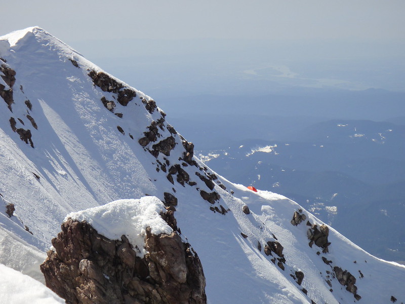
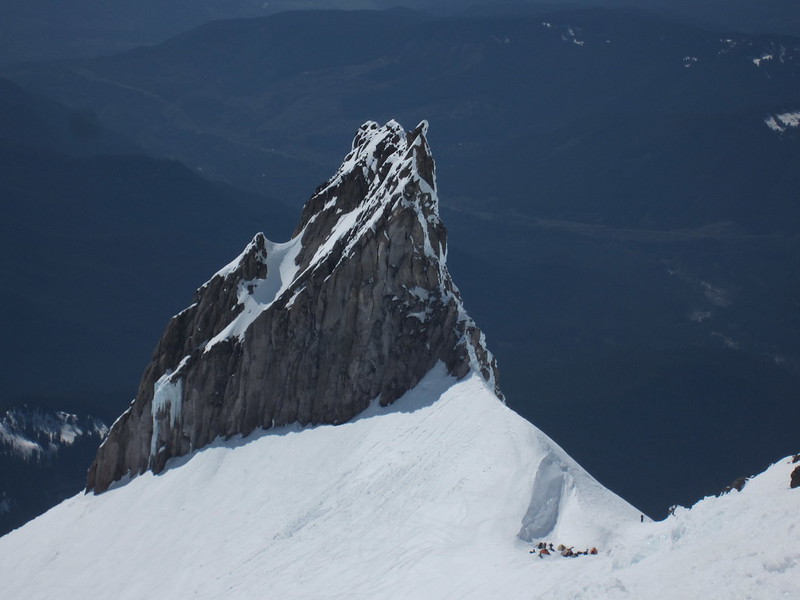
I second taking the chute instead of the NR all way down. As Dan mentioned, if you look up from the camp, the exit to the chute is about 2/3 up on the NR and next to the obvious chossy gendarmes.
40 deg at most. Two times I was up there, my partners glissaded the whole thing.
Also, see p.61 in the brown Beckey. The chute is the upper dotted line connecting the upper NR and lower Adams gl. via the snow slope.
-
The traversing over the "gnarly rock pile" above the shrund to the base of the gullies is the crux IMO. I cried there before, what a sketch, no matter when it is done. Strong work!

-
Very nice S and Stefan Stefanovich!
-
We did not notice much rime on the north side of Jeff.
Jeff Park and Russell glaciers as of 06/01/2012:
-
Patience is a virtue...

-
Is that for real?

-
The book IS going to the publisher June 8th, with all pics and route descriptions including the Eliot HW (the last minute amendment). Thanks to Bill.
-
That is some serious ornamentation going on here, looks much worse than I remember
Hands were more useful than the Nomics.
-
the 'schrund below the n face currently in skeery condition - the right side now overhanging slush w/ essentially nothign to stand on to try to traverse around...
I am still waiting on those pics from you
Oh, and thanks for catching my ass in there.
-
"Route 7A: Stay close to the cleaver [while climbing the Eliot HW] and gain the col behind Cathedral Spire and follow the 500 feet of the north face"
The line we climbed was UP the Cleaver/Cathedral Spire and it cannot be seen from the vantage point shown in the Don Lowe photo. The details of the Combs et al. ascent in 1958 (published in "Letter to Author", Combs, 1985) would be however helpful to resolve this contradiction.
While it can not be seen in Jeff's book but what you climbed matches the description perfectly.
1. Gain the col behind Cathedral Spire - your pictures show you coming up right at the col.
2. Climb the last 500 feet or so of the N. Face route which dumps you right on the summit. Your summit picture that I compared to mine from 2010 is most certainly the North Face "direct" finish.
I say direct because where the North Face (Route 5) splits one can join Cooper Spur on the left or go right. However, above the split to go around the rock outcrop one can regain the ridge from either side and continue directly to the summit. Which what we did coming from the left and you did coming from the right.
So in my mind you climbed 7A albeit under lean conditions and was undoubtably different from the conditions in 1958 which would have probably been a very steep snow slope. I will also add that I think Jeff has the route (7a) drawn in a bit high.
In the photo shown below you topped out on the summit block which is rock out cropping on the left. In fact if you look carefully you can see the summit cornice.
The face to the right would have you top out approximately 50-100 meters to west of the summit. So that is something completely different and appears to me to be the top of the North Cleaver Route but seems like an odd finish as going directly to the summit like you did would make more sense.
That is the standard easterly variation of the Eliot HW which is also indicated as a "7A" in the Jeff's pic and which was 200 m west from the line we were on.
The "7A" route description given in Ore High, as based on the Combs et al. ascent in 1958, seems to refer to a different route all together which might or might not be the Ravine.
We were specifically interested in (and climbed) the obvious ice flow along the Cathedral spire followed by the exit at the col and then finished via whatever was the most straightforward way getting to the summit, i.e. continuing up the north cleaver for a while and taking the standard direct NF exit through the cornice.
-
At least you didn't bring 10 ice screws... then you'd really be in trouble.
So true
. Well, we did use 8 screws and 2 pieces of rock pro on those two pitches. Crazy - what have we been thinking? 
-
Thanks, Dan.
I was expecting a shit-storm on this one so I am going to respond to the psistrom's comment.
I have no interest whatsoever in picking a fight but having struggled up the Eliot Glacier Headwall route many years ago from the bottom up--through the crevasses and over the yawning bergschrund and up the steep rock-scoured ice runnels and then, finally, the rock bands at the top--it seems somehow unearned to slip in from the side, zip up two pitches, and say you've climbed the same route. This seems like Eliot Glacier Headwall Lite.You are correct, that is NOT the Eliot Glacier Headwall route, "lite" or "heavy", whatever you call it, and I thought I made it clear enough to indicate in my TR. I guess not.
Re: the approach. Yes, we did "cheat" and slip in from the side of Cathedral ridge, because when I recently soloed the "heavy" approach, you are referring to, I thought it was not worth the time/interest to drag my friends up there. FYI, the "heavy" approach is also a famous ski destination in spring. So, should I now wait until September to make it even "heavier"?
-
THAT is the 7A variation of the Eliot HW, according to the Jeff Thomas depiction.

"Route 7A: Stay close to the cleaver [while climbing the Eliot HW] and gain the col behind Cathedral Spire..."
The line we climbed was UP the Cleaver/Cathedral Spire and it cannot be seen from the vantage point shown in the Don Lowe photo. The details of the Combs et al. ascent in 1958 (published in "Letter to Author", Combs, 1985) would be however helpful to resolve this contradiction.
-
Trip: HOOD - Cathedral Spire -"Ravine" (possible FA)
Date: 5/10/2012
Trip Report:
WI3+, M4, grade II
Last week my kalifornikan friend Vitaliy Musiyenko, who drove for 11 hrs from San Francisco "to climb peaks in the PNW" with me, and I (Anastasia Blagoveshchenskaya) climbed "Ravine" on the western aspect of the Cathedral Spire on Mt. Hood. The line was originally spotted and pre-named by Wayne Wallace a couple of years ago, but remained unclimbed to our knowledge.
In the current conditions, we have rated it at WI3+, M4, grade II:

“Climbing peaks in the PNW” for Vitaliy got very quickly limited to just one - Mt. Hood, thanks to the convenient access and, for the time being, abundance of ice on the north side thereof. The plan was born to camp on the summit and make day trips for various routes.
We begun the slog to the summit at the unusual hour of Noon.
At the P-lot:

Yes, I do like my sleep in the morning if the "unusual hour of noon" is able to produce sunny skies, frigid temps in 20s F and hard snowpack.

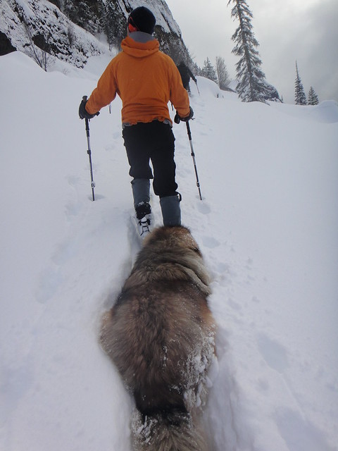
Vitaliy (who never been on Hood before) was curious about the famous dog route:
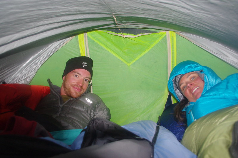
At 5 p.m. , in increasing winds, we had arrived at the summit ridge and pitched in our tent between the rime feathers. At this point, it was really getting windy and I was badly dreaming of my Primaloft (as OlegV defines it, a “fish fur”
) pants.At the camp:
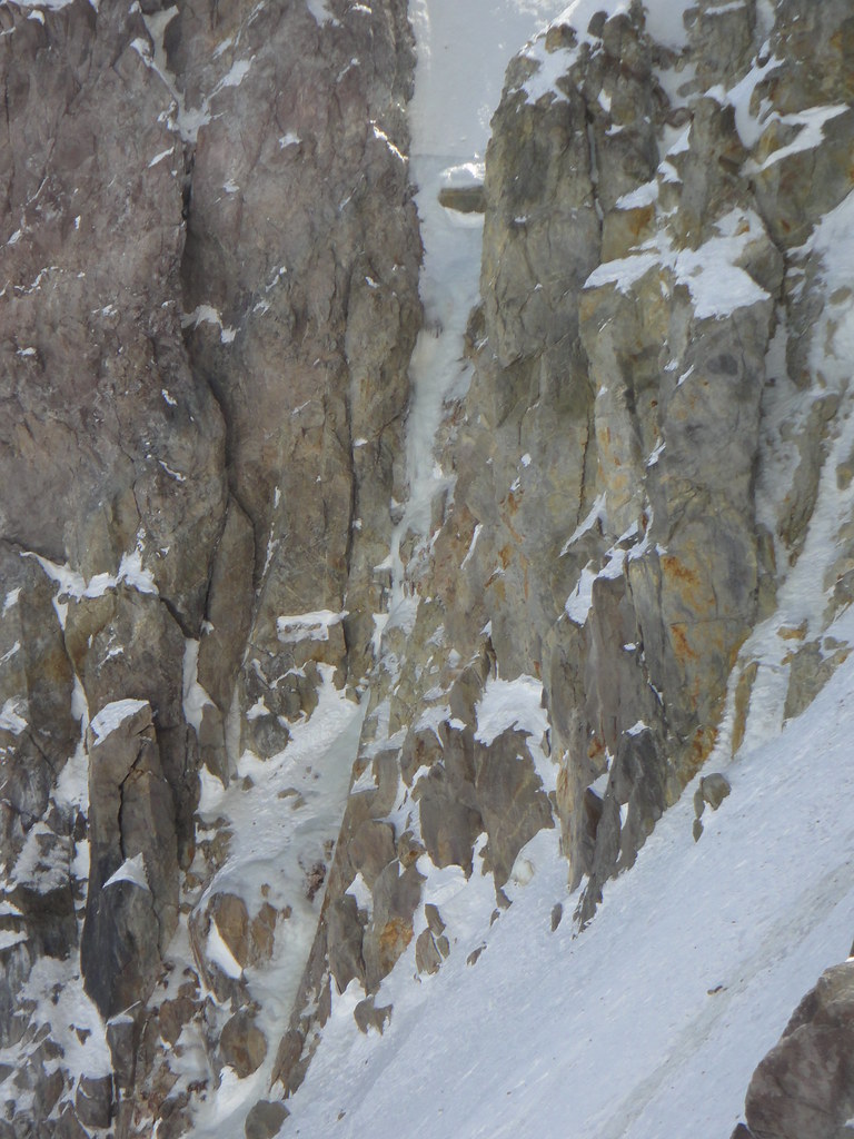
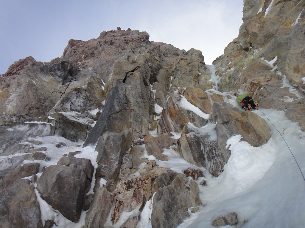
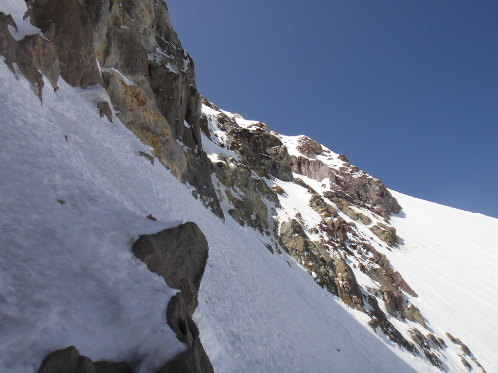
When Oleg, Andy and I climbed the Eliot HW on 05/06/12, Ravine was looking very enticing, so I suggested to Vitaliy that we should go and check it out more closely. So, next morning we hiked down the Cathedral ridge to the Horseshoe rock and traversed the Eliot gl. above the shrund to the base of the Ravine.
At the base of the Ravine after the traverse:

Ravine (detail):
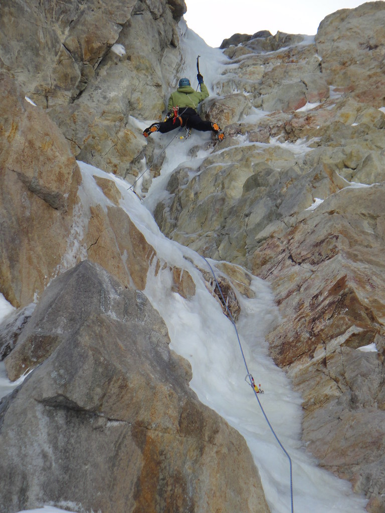
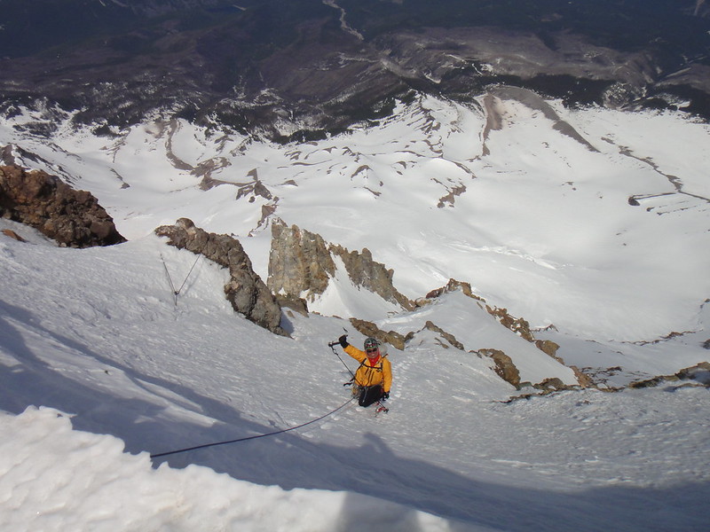
Vitaliy is heading up first 55 m pitch:
Vitaliy at the crux:

Looking down at the shrund and our tracks above it:
Vitaliy coming up the second pitch to the saddle by the Cathedral Spire:
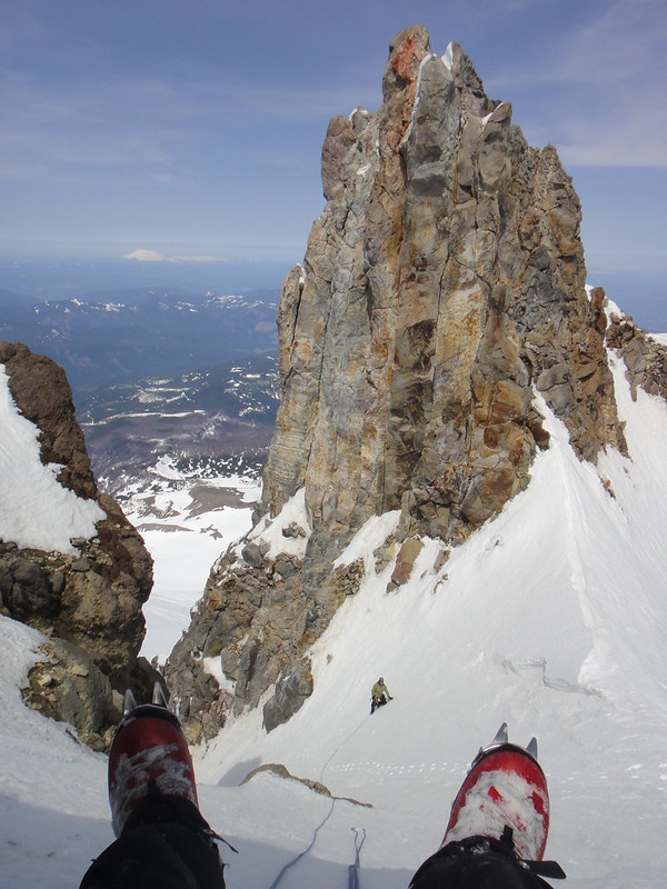
At this point we re-grouped and simul-climbed the North cleaver to the summit cornice arriving at 2 p.m. (after starting at the Horseshoe rock at 10
a.m.).
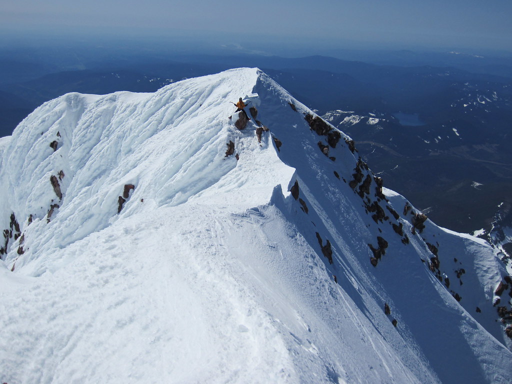
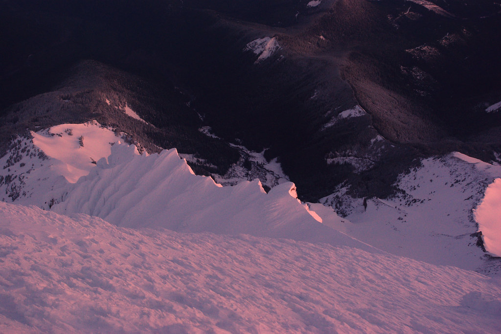
The summit cornice looms above:
Simuling final slopes:
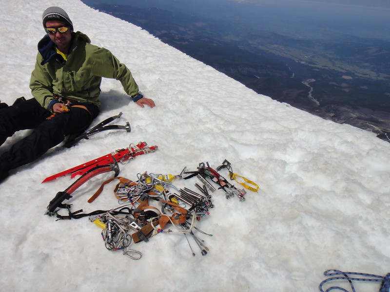
Vitaliy and the rack at the summit:
Stoked:
Gear Notes:
Used: 8 screws, 3 pickets, green C4, orange metolius mastercam, yellow alien, 60 m rope, 1 Nomic, 3 Cobras
Approach Notes:
Summit carryover
-
Great climb, looking forward to another of equal magnitude!
You got it!
-
I start to miss alpine rock, S!
Awesome outing.
-
Why do you think the mountain is dangerous to hike now when it had high pressure and every day freeze/melt? Even if the cold snap would not happen by the end of the next week?
Right now the avy danger is minimal on Hood because of the said freeze/melts.
If you are concerned about hiking in slushy snow, then start early when it is all solid hard. But then again, it is a matter of personal preference if you are to take the Old Chute up. Two days ago when we topped out the North Cleaver, we run into a party of 15 tourists from Indiana who arrived at the summit at 2 pm. In tropical temps of 40F.
Most skiers tend to start later in the day too - to allow the snow to soften up a bit.
-
Oleg, thanks for the best piece of prose I read in a while. If Dostoevsky was alive, he would have been proud of you
.Now that high temps are annihilating the beautiful mixed lines on the I-rock,
we had moved our attention elsewhere - to the Eliot Gl. headwall - located on the northwestern aspect of Mt. Hood and being the object of the Oleg's infatuation for the last couple of years. And deservingly so.
Eliot Glacier Headwall with lots of ice and decent rock as of two days ago:
The long-assed bitchy approach from the Tilly Jane TH with the Cloud Cap road still being closed was rather unappealing to us, so we took advantage of carrying over via the summit from the south side. Not knowing how much trail breaking we were supposed to do (it turned out a lot) - plus Andy was arriving from Seattle, we chose to camp as close as possible to the summit.
However, as of now, with the dog route being pre-cut in place, the Eliot HW should be a straightforward C2C day.
NB.
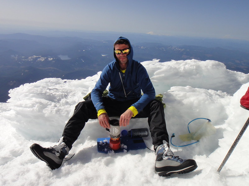
Oleg's igloo building skills were highly appreciated at the somewhat windy Crater rock.
Oleg at the Camp Sulphur:

Gradual evolution of my tent: from the originally manufactured as a 2 person tent to a 1 man, 2 women tent and now to a 2 men, 1 woman tent. Pretty stoked, it might become a circus tent one day
.
Soleil dansant on the Yocum and Cathedral ridges:
Trio on the summit:

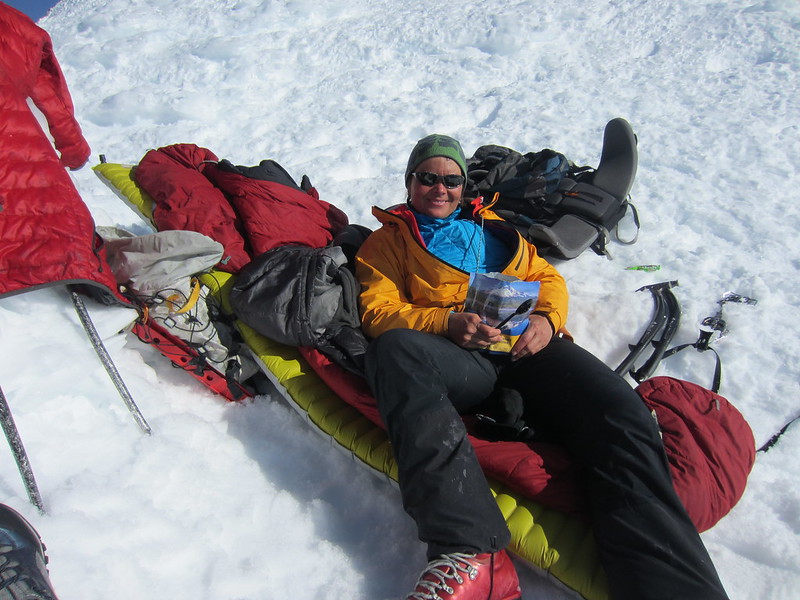
Chillaxing at the camp:

Awesome trip, Andy and Oleg!
-
 1
1
-
-
The I-rock is still in great shape and asking to be climbed.

If the temps are still cold enough as forecasted, I would love to get up either SW Ridge or something on the north side. Will have skis for the approach.
I have a car, ropes, full rack.
Will lead or swap leads.
Anastasia
-
It was nice to see you up there, Matt.
And awesome photos as always!
-
-
That's the plan, man.
Did you happen to look at Iron Maiden?
-
Nice, Wayne.
So, what was the ratio of rime vs "ice"?
-
The Cody dog would make a great tent mate...extra warmth and probably a great cuddler.
Yeah, Codsky is like that. Although he does not enjoy being squeezed in a tent, an open bivy is more his thing.
If things dont go according to a plan, he will ride on a back of your skis. Embrace extra 150 lbs then!
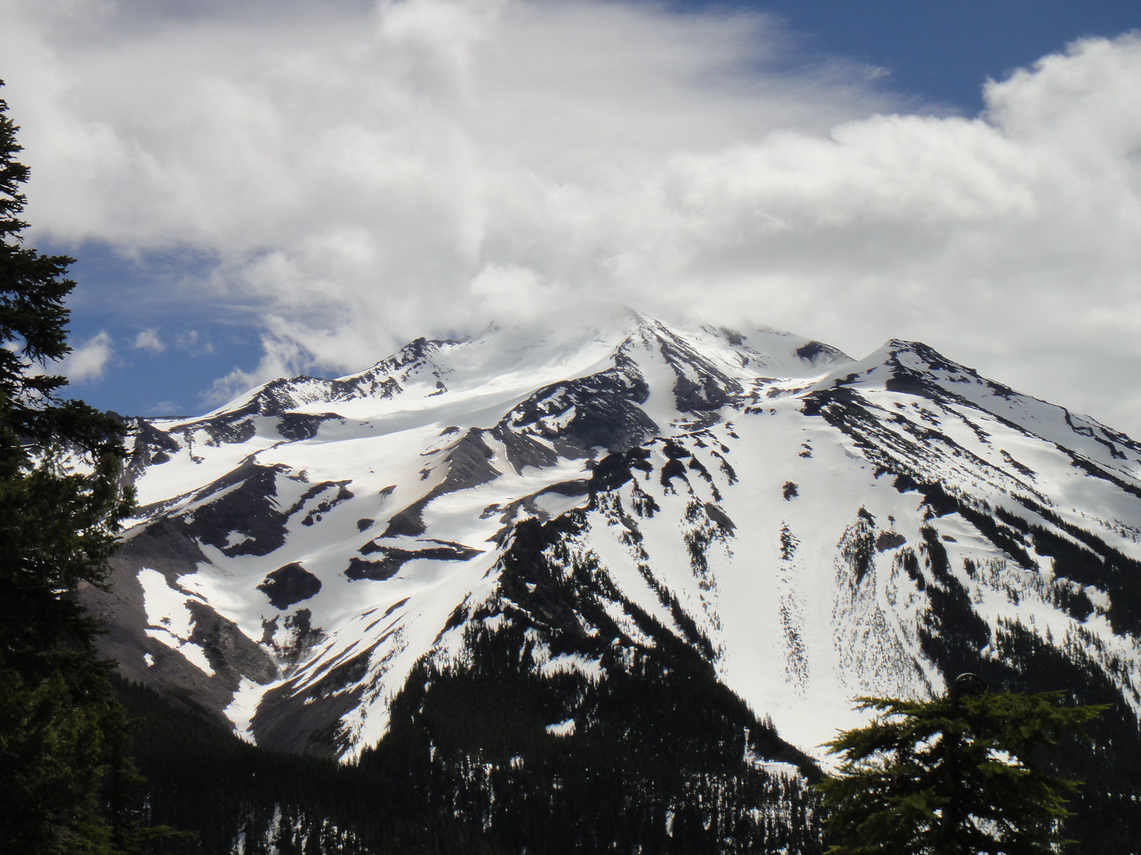
[TR] Mt. Jefferson 6/10/12 - Jefferson Park KER via Woodpecker Ridge 6/10/2012
in Oregon Cascades
Posted
Mt. Jefferson C2C via KER in winterish conditions, hmmm...
The week before the last weekend one foot of fresh snow had successfully emerged both on the approach and on the mountain itself and was quickly transforming into rime at the higher elevation.
Good and painful times were had by all last Sunday. "All" is just two of us - we had not met a single soul on the second tallest Oregonian peak that day. How weird is that .
.
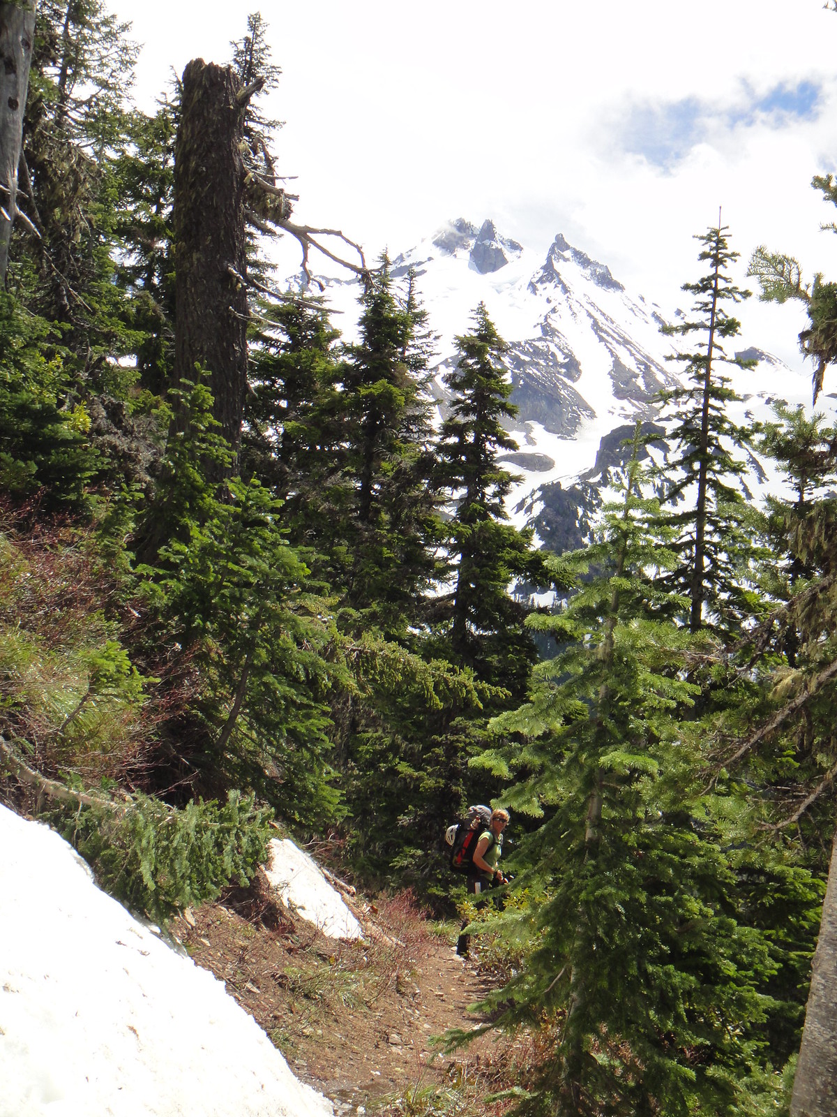
The approach was an ass kicker ranging from postholing, jumping across the moats and tree wells to a full on north cascadian bushwhack. Not something I would like to do again. At least, not right now. Chain saws might also be helpful for making your way along the FS roads. So, come prepared.
The tools were useless on the toilet paper rimed KER. Your best bet is to use hands and excavate as much rime as possible to make holds to stem against. Do not fall - there is no reliable pro in that compound on the entire ridge.
Except the Yocum Ridge has a much more user friendly approach and is wider than 6 inches But then again, the grass is always greener ...
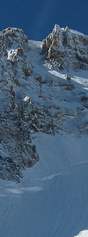
For those looking for the info on the Jeff Park Glacier, it is in a very straightforward solo shape right with the two shrunds easily passable either on the right or left. See pics below.
Our descent had certainly its bright sides too. The Prehistoric Monster tower decided to hit me on the head with a rime bucket that almost knocked me off my feet. Then the avy had happened down the North Mill Creek gully as a result of cornice failure in the afternoon sun. Thankfully we stayed on the ridge all time.
Jeff Park Glacier top out and the upper shrund to the left of Smith Rock (looking down from KER):
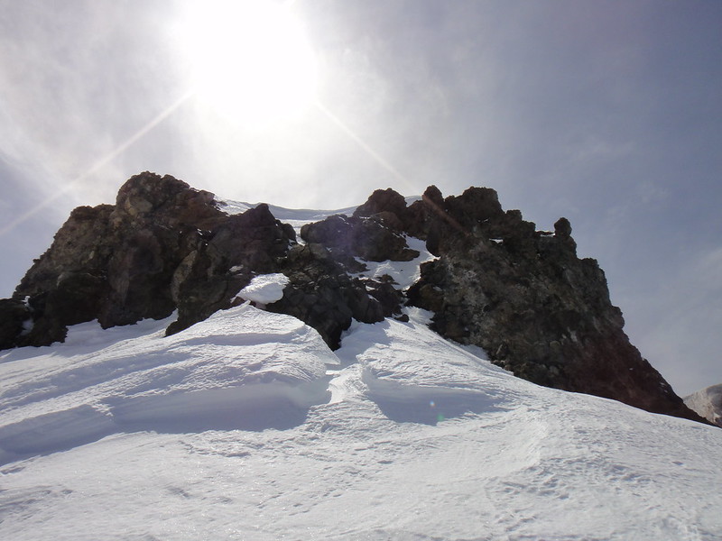
On the top of the first gendarme:
Low on KER:
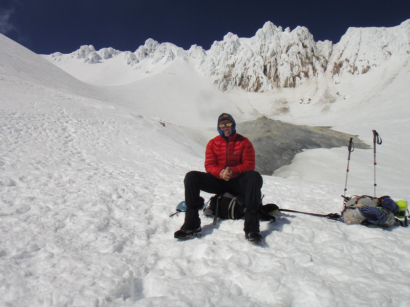
Happy arrival on the summit ridge in the afternoon:
Mohler Tooth on our way down:
Fast growing baby rime: