
.jpg.40c348b15c9f900ce022401fa0dfd570.jpg)

YocumRidge
-
Posts
1230 -
Joined
-
Last visited
Content Type
Profiles
Forums
Events
Posts posted by YocumRidge
-
-
Looking to climb NW ridge on Forbidden (via Sharkfin Col and North ridge) or TFT later this week or over July 27-28 weekend - but not C2C.
Both routes are in prime condition right now.
Have all gear, ropes, car.
mitochondria100@gmail.com
503-901-3837
-
The North Ridge is always "in condition" as it is a 5000' rock scramble, with or without snow cover.
The Adams Gl. is a totally different game. Three days ago, a couple of friends and I went for the "relaxing" weekend on the said route. After a high snow year, it is normally a cramponed walk up on the north side, but currently - not so much. We ended up climbing through overhanging ice for a couple of pitches, backing off, re-leading, routefinding in the maze of ice ramps. Only at 2 pm we made it to the crater. If you are up for this kind of adventure, go for it!
-
Congrats!
When we saw your tent at the Thumb rock from our Ptarmigan high camp, I thought THAT takes some motivation to climb one of the 50 NA classics in the skinniest conditions imaginable.
FYI: Ptarmigan Ridge which is just around the corner of the Liberty Wall is a superb, later season alternative when things gets too slow and hairy on the approach to the Thumb rock. Same approach via Curtis and low Carbon crossing conveniently put you on the Russel gl. and the PR high camp.
-
I would agree with the two weeks - simply because Anastasia and Oleg have a wee bit more experience on the hill and as such know when to suck it up.
My house mate, Nick, was on Anastasia and Oleg's trip. I saw photos of the ridge from when they did it. The difference in conditions between when Anastasia and Oleg climbed it and the the conditions the OP's photos depicted are astonishing to me.
Dan, since your house mate was snoring profusely that day on Curtis and I literally got no sleep
 , we got sucked by mistake into the easterly Carbon approach of the ridge (as the OP team did) while gaining and subsequently loosing extra 500' on the convoluted terrain. After Nick developed altitude problems, we went back from the toe of the ridge to the Curtis camp down via westerly approach and downclimbed some AI2 along the way before reaching the point where the two approach variations split up.
By the time Oleg and the RockyJoe team arrived at the Carbon crossing in their one day push from the car to the Thumb Rock, I already knew so well where to go and where not to, so the second run through Carbon for me that day went "enjoyably" - just get into the 1 hr old tracks and follow them
 .
. -
Thanks!
While at Muir, we saw a blackhawk, apparently involved in a rescue of the Lib Ridge party hit by rock fall. Any news on that? Sending positive vibes...
-
-
Haha, and here I thought that fool would be you
.Need Beacon badly, my brain gets retarded from the oxygen starvation lately!
-
I really have not climbed that much on Rainier, but there are people on this board who have and, way more, including Willis Wall, may be they will chime in as well...
Although we only got to the aid crack at 11200', Curtis Ridge is a winner for me. Intricate knife edge climbing with 2000' exposure on either side, thought-provoking routefinding around gendarmes, breathtaking views of Willis Wall and Liberty Ridge to the west and Russel Cliffs and Winthrop seracs to the east. For the best effect, do it early in the season in cold temps and with some snow cover.
The runner-up is Ptarmigan ridge (right variation). Not technically difficult, it is still sustained, with varied climbing on ice and rock and interesting, always changing terrain. The approach from Spray Park is the most legit in that you are actually climbing the ridge from the start rather than short-cutting from White River and Carbon gl. straight to the high camp below the ice cliff.
-

Is Discovery pass still required to park?
-
Thanks! Yes, we were checking out the SA headwall from the saddle but it looked way dry already.
-
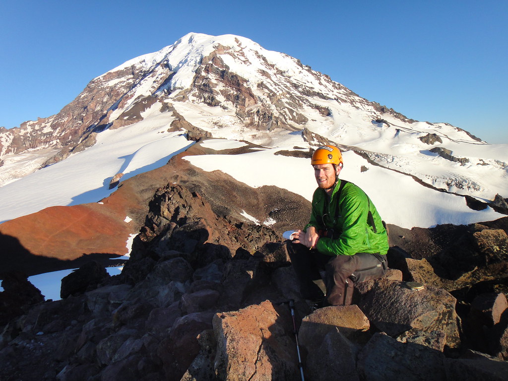
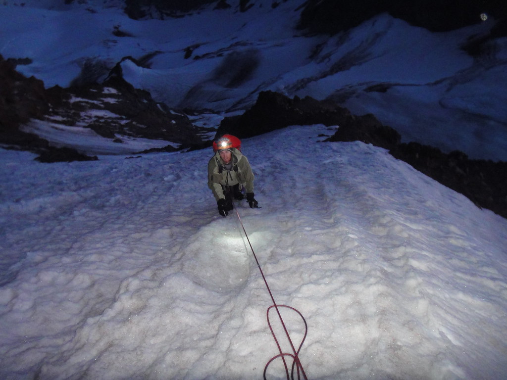
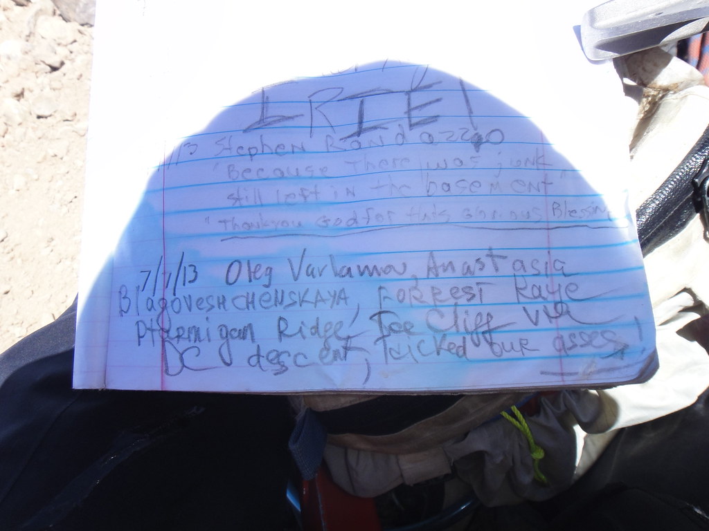
Trip: RAINIER - Ptarmigan Ridge - IceCliff variation
Date: 7/7/2013
Trip Report:
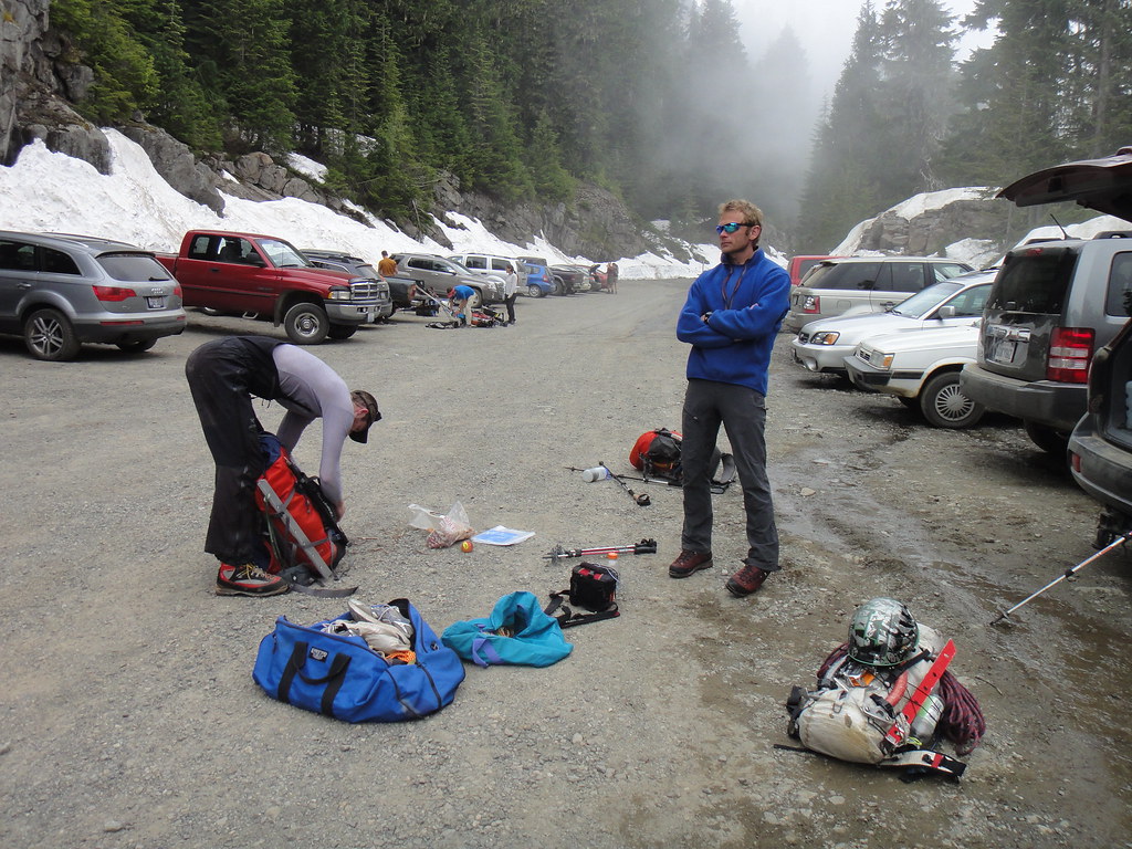
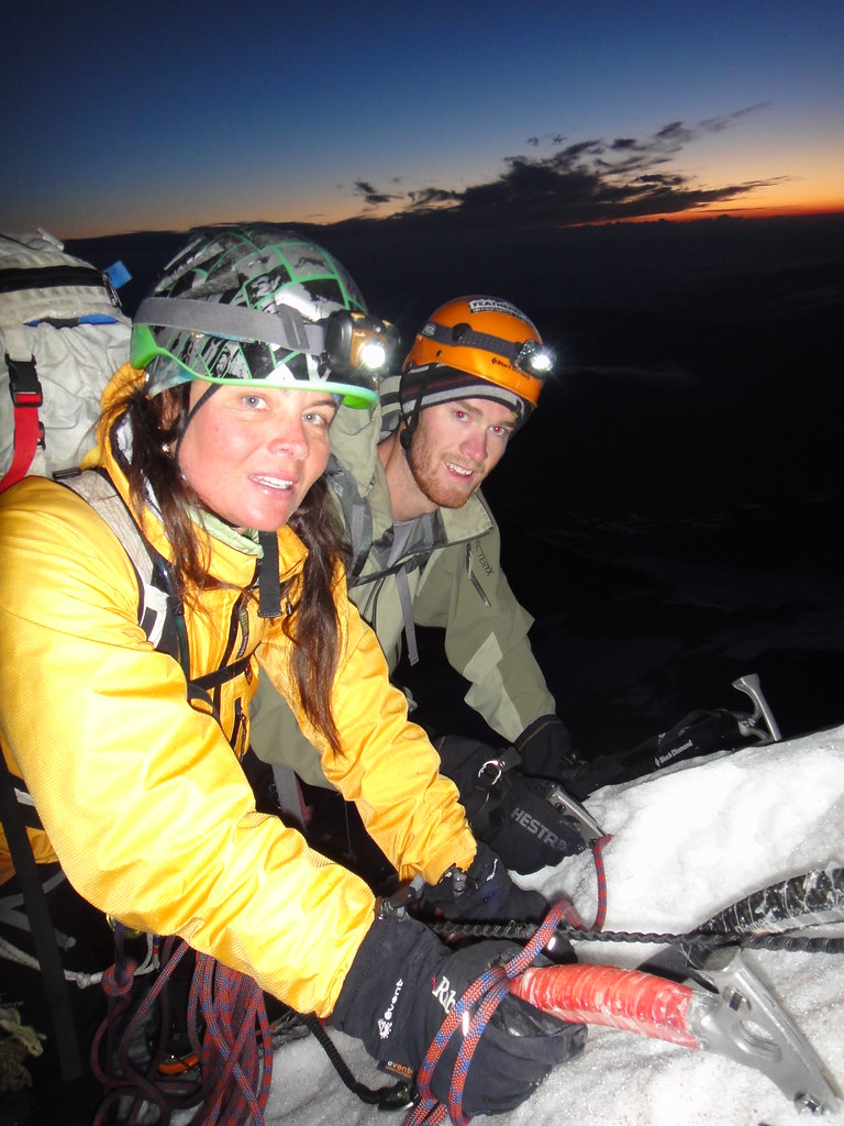
Four days after climbing Lib Ridge in soft conditions, we decided that a worthier and icier objective on the north side of Rainier must be in order. Mowich Lake road had just conveniently opened two days prior (07/03), so the choice was easy – Ptarmigan Ridge. A fair amount of effort was spent on re-arranging our schedules for availability and finally setting up the bitchy 2 car shuttle between Paradise (not my brightest idea) and Mowich Lake TH on Fri. For Oleg and myself, this was second trip up Ptarmigan (PR#1 and PR#2), but the first time on the north side for Forrest.
Getting ready at the Mowich Lake p-lot:
The guys on the approach in Spray Park:
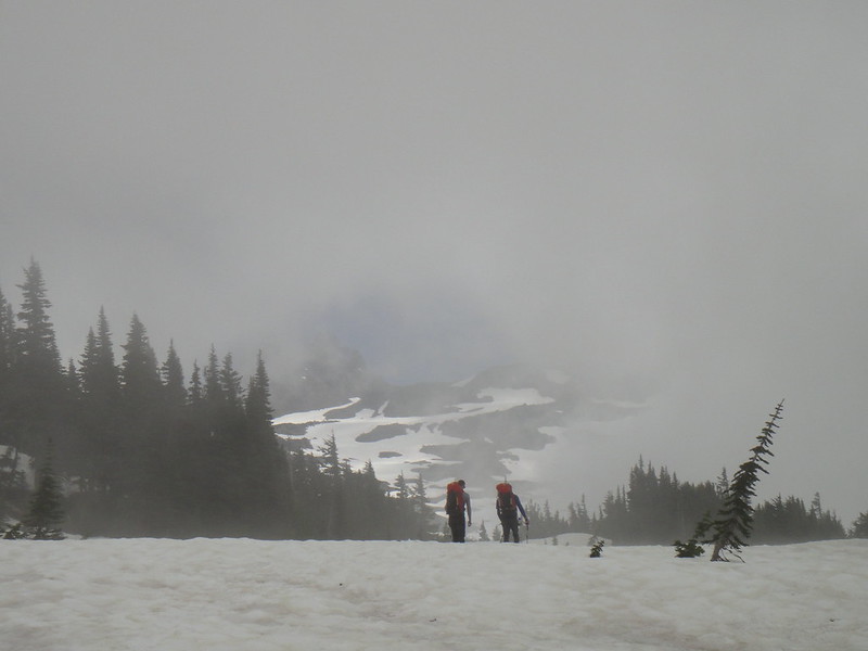
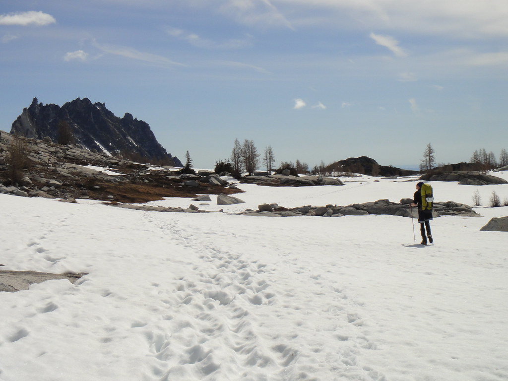
Greatly enjoying the forecasted “mostly sunny” conditions, in our joint navigational effort, we had located the ridge leading to the Flett glacier morains and the saddle between Echo and Observation Rocks.
The clouds however lifted once we reached the bivy site Mark and I built 2 years ago just a few feet away from the running water source:
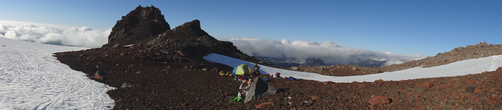
After settling in, Oleg and Forrest took off to tag the Observation rock.
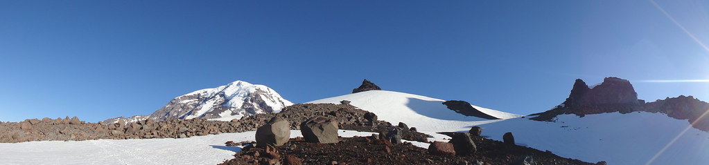
Forrest on the summit of Observation Rock:
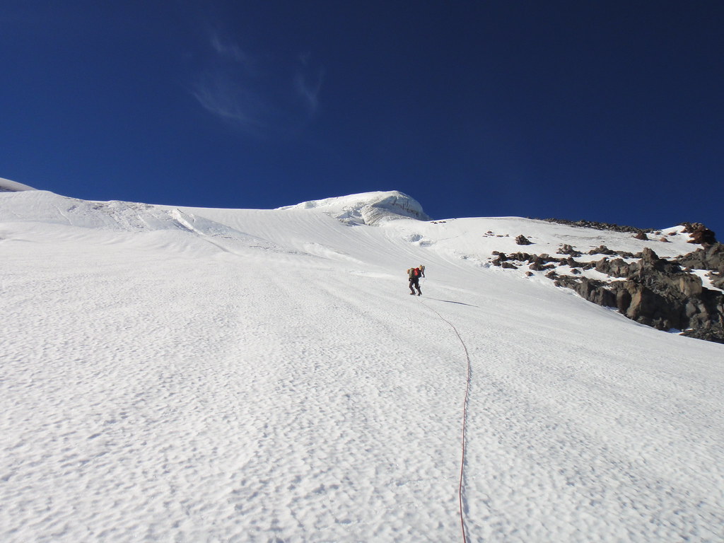
Next day, we headed up the Russel Gl. and merged with the PR crest at 10100’. For whatever reason, the knife edge section leading to the Gendarme at 10500’ got even skinnier and looser since my last time there. I wonder if it would even exist in a few years from now. Oleg makes the appropriate comment :“If you want to get rid of your significant other, then bring her over here”. As before, we downclimbed around the base of the Gendarme and followed the ridgeline on snow (eastern aspect).
On the Russel Gl:
Merging with the crest:
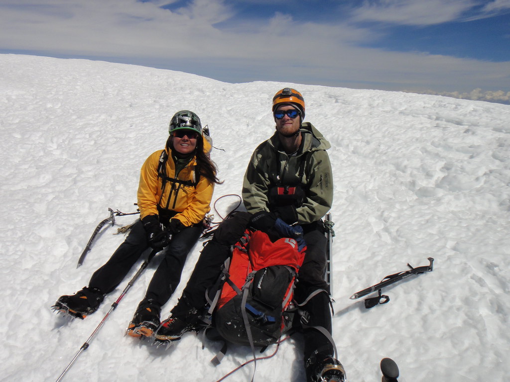
Happy arrival at the high camp below the IceCliff:
Our original idea of heading up directly the left side of the IceCliff did not seem to be that great any more once we realized that getting to its base would require solo traversing over loose cliffs in the dark:
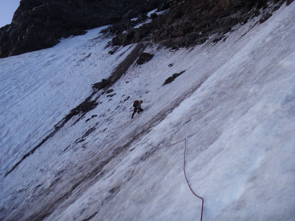
So, we re-diverted our attention to the standard PR line with the left exit through the upper ice cliffs:
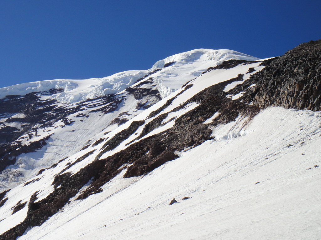
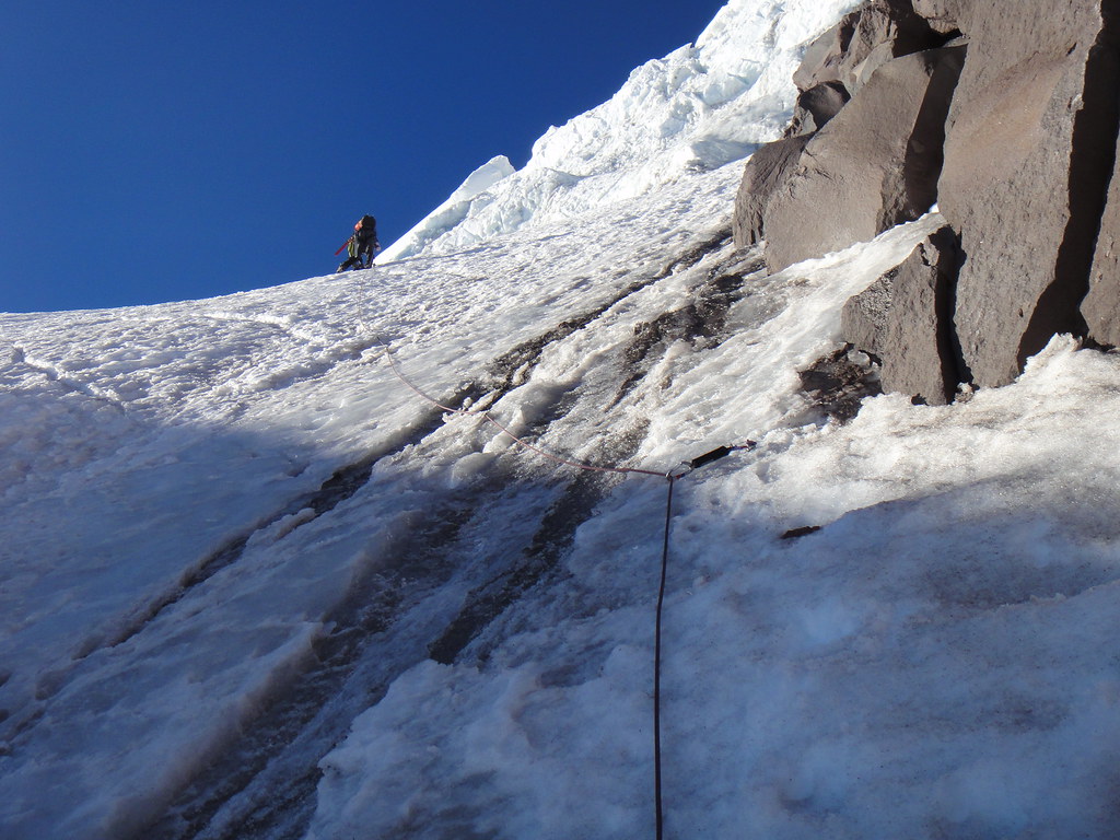
Already boney conditions on the PR headwall and it is only early July:
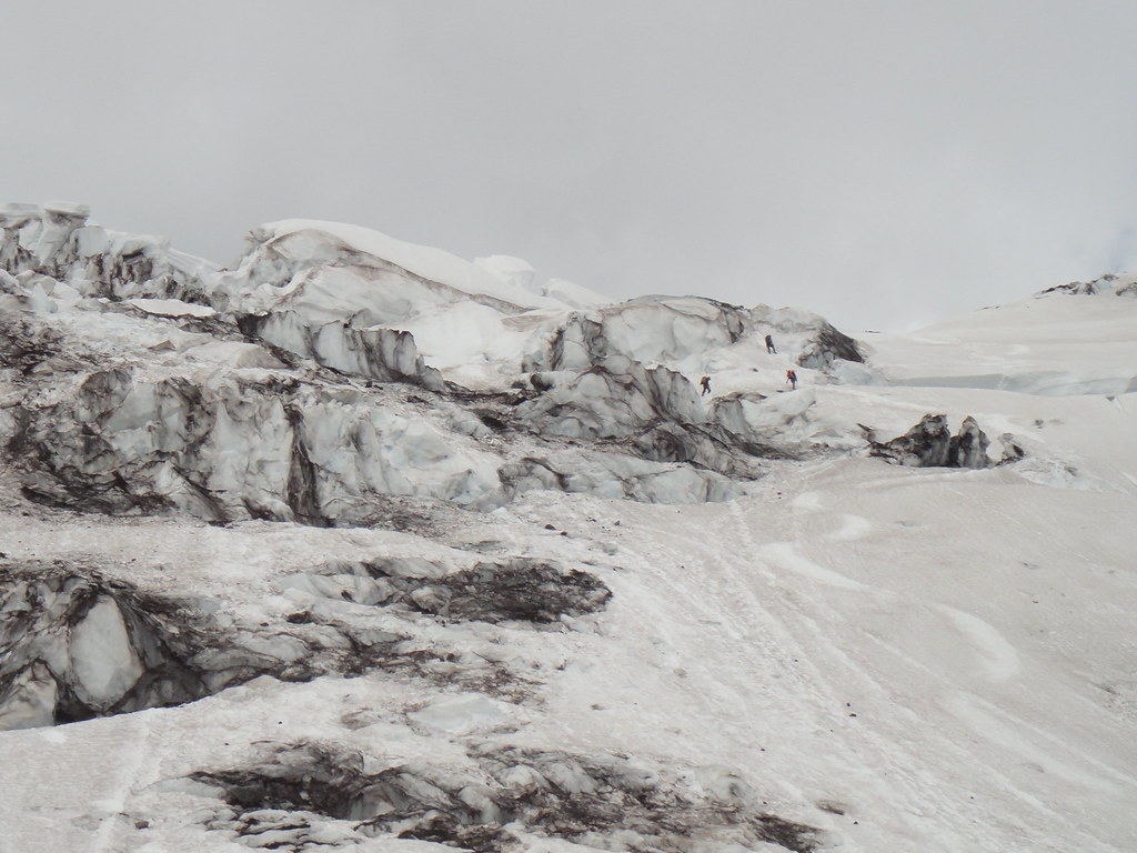
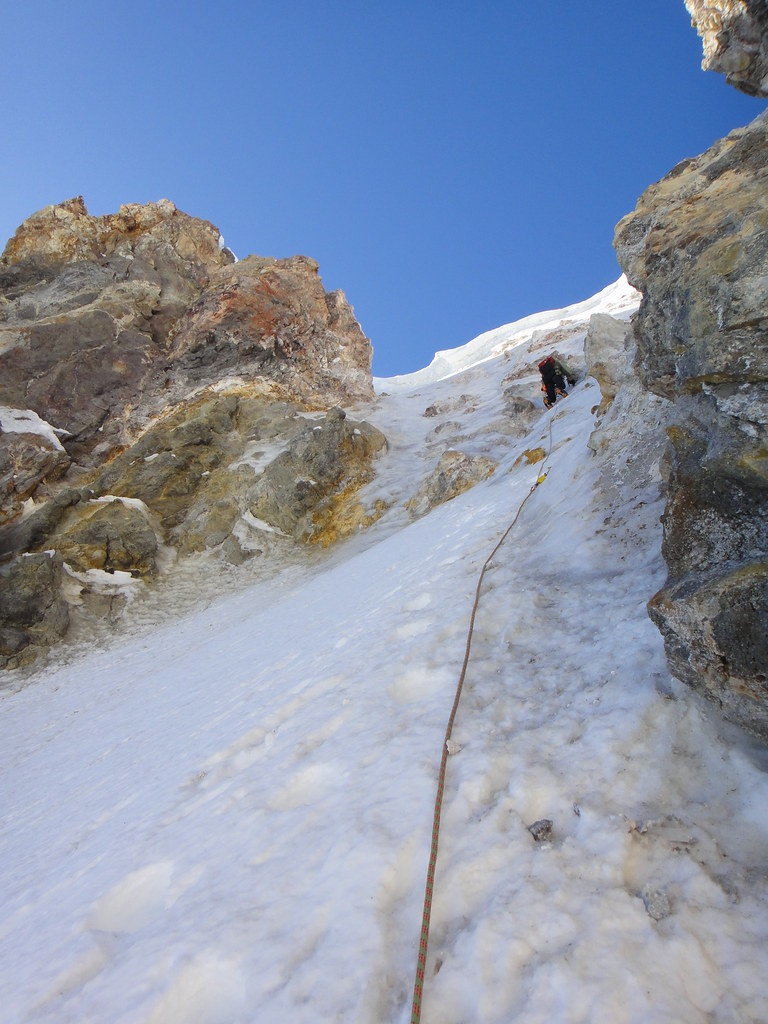
Next day we were packed up and ready to drop down on the North Mowich Gl. at 2 am. After traversing over the IceCliff remnants (a silent reminder that we’ve got to move our asses fast through this section), we got to the main shrund below the Ptarmigan headwall.
Oleg makes a bold, spider-like move and jumps across the abyss straight on to vertical verglassed rock that quickly transforms into the dinner plating water ice and then decent alpine ice below the lip. That quickly sets the stage for the things to come. We got what we came for. We simul rope solo for the next 1500 vertical feet 45-50 deg ice, good and bad, weaving around the rock bands and trying to locate the traverse in the dark.
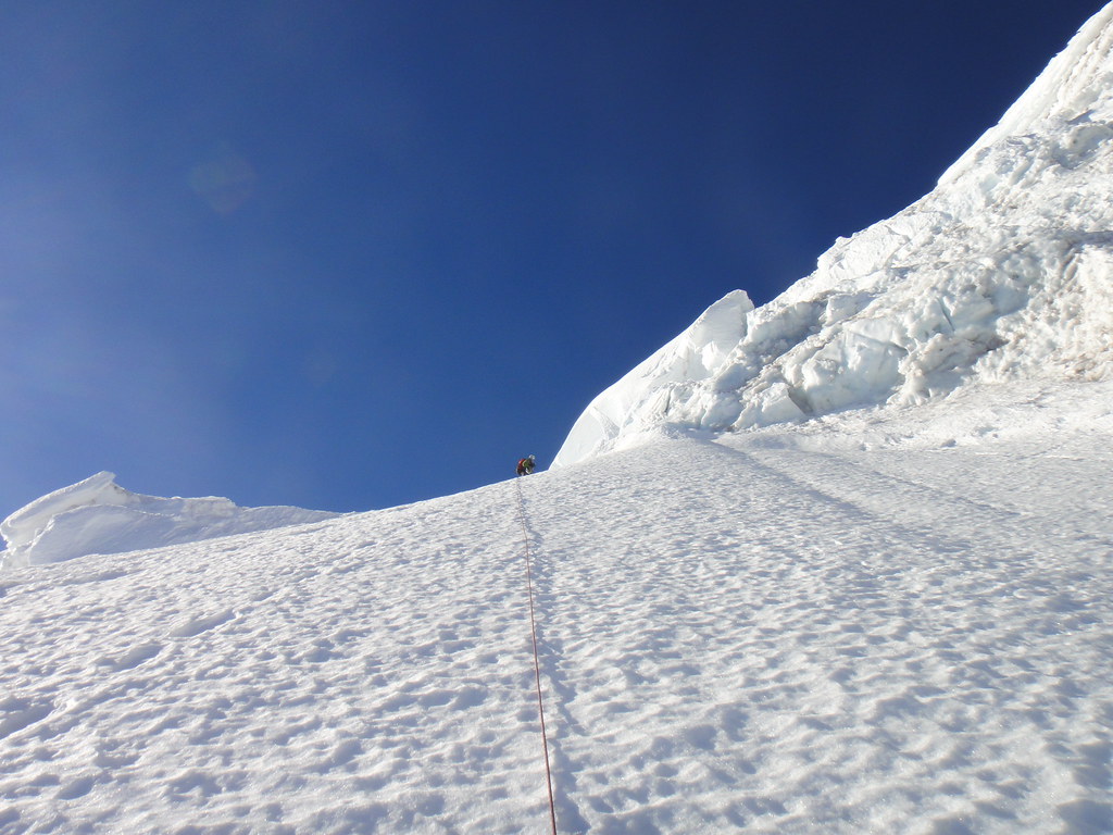
Just below the beginning of traverse:
With the traverse being located, we hit it up and continue up the chute below the buttress that splits the left and right variations of the upper Ptarmigan Ridge.
Forrest on the traverse:
Forrest in the chute below the buttress:
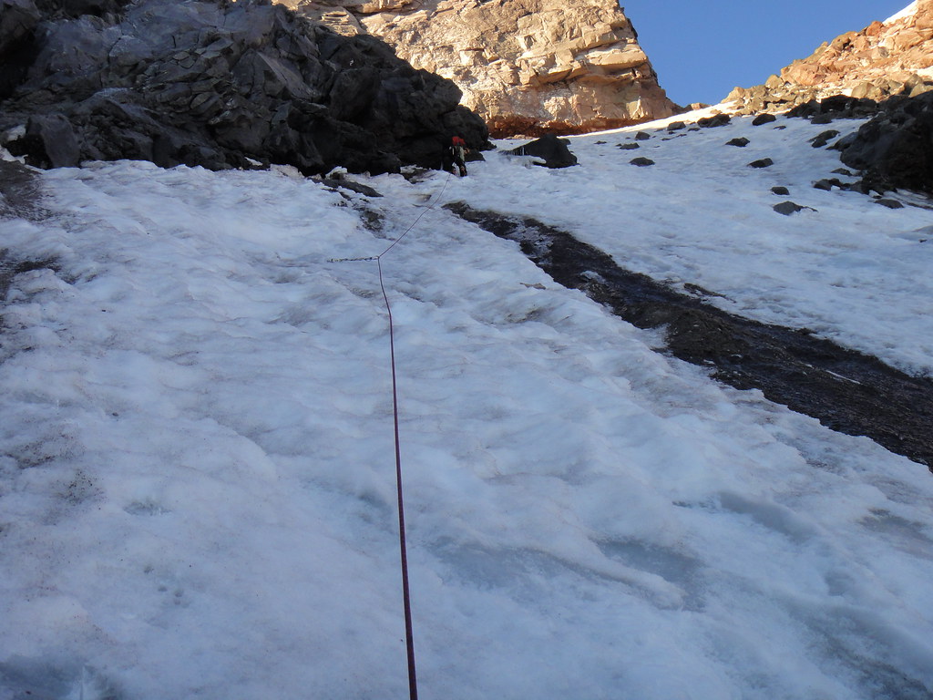
Half way through the traverse, we came across a difficult choice: a loose rock band or a stretch of black ice. To give calves a little rest from frontpointing, I go through the rock when one of the boulders decided to move and jammed my hand. Yeah, I will recall this rock band – with the appropriate epithets – often. After a short delay, we continue to the buttress and reach the ramp leading to the upper ice cliffs on the left.
More black ice on the way:
Oleg higher up on the more user-friendly part on the ramp below the shelf:
At the shelf below the upper ice cliffs:
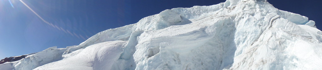
Delicate climbing through the cornices above. Gotta make some moves up there:
[video:vimeo]69944705
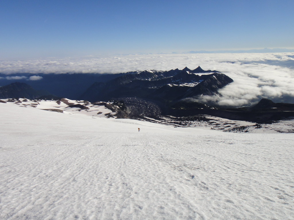
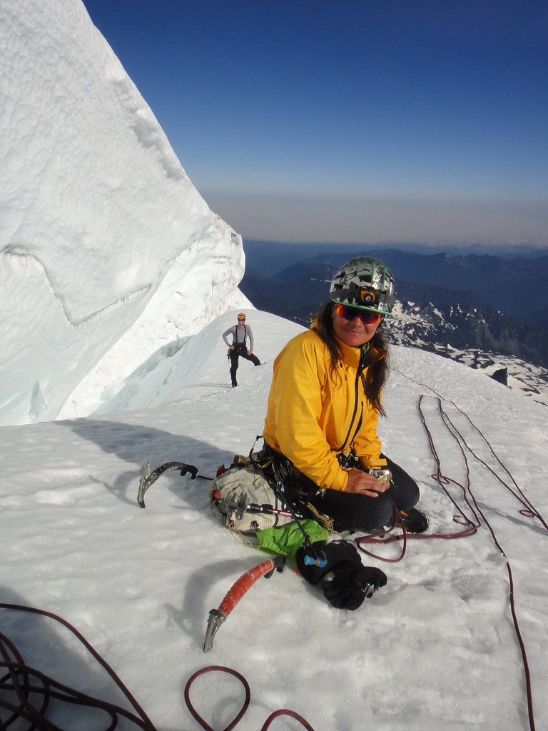
After weaving between a few more crevasses on the upper Liberty Gl., we headed up the final slopes to the Lib Cap:
I totally forgot how long and demoralizing this slog is. Finally, at noon, we are at the Lib Cap - 10 hrs after leaving the high camp @10300’:
That is not all, however. Our shuttle car is at Paradise, which means dropping down from the Lib Cap into the saddle and then heading up again to the Columbia Crest. That was a project by itself. The shortest way down the mountain does not mean to be the quickest way in this case. Only at 2 pm we get to the actual summit. Oleg ingeniously forgets how to spell my name…
Down the DC we hike. It reminds us of the construction site with fixed ropes and ladders hanging everywhere although we had not met a single soul until the Ingraham flats…
-
Awesome adventure, Steopich!
-
I am still trying to figure out if Oleg was calling Anastasia a gypsy AND a witch...
Haha, no, not me! I bet Oleg would need to elaborate more to clarify this
! -
Cale, Nil Desperandum, you will get it soon!
Re: boots. The primary purpose of my Phantom Guides was for ice cragging, but since most my single boots are heavily worn out, the PG begun get used for the bigger stuff like Lib Ridge or Ptarmigan IceCliff, as was yesterday, and now officially became my favorites.
As a matter of fact, two weeks ago I got a very extensive III degree burn on the arch of my foot and was really having second thoughts whether/how I will even make it to the base of the ridge. As we all know, the route requires fully functional pairs of extremities and the boots made it possible - I did not even notice I had them on
. -
Oleg, thanks for the great trip and TR!
Now, Canadian Rockies!

Huge props to the RockyJoe's team for letting Oleg to rope up with while on Winthrop!
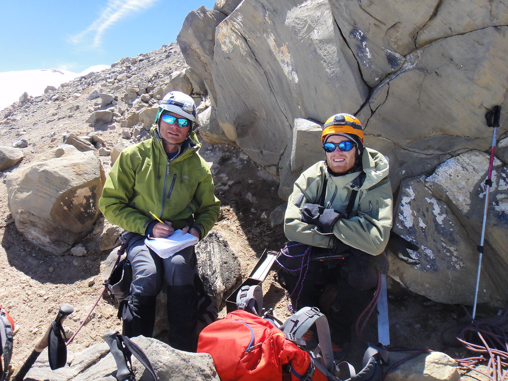
3.5 hrs from the car to Carbon is way to go, guys!Here is one more pic of Joe, Tom and Patrick crossing the Carbon seracs:
-
I arrived to White River ranger Station on Friday at 5:00 pm asking for the climbing permit to start next day, the first response was to deny, reasons no camp spots available, that only it is available permit for !!one person!! and no for two,
Your best options if there are no camping permits available:
1. Don't camp, do it C2C - in the straightforward conditions as they were over the last weekend, it is doable.
2. Camp in the "Carbon alpine zone" at 8600' by the toe of the ridge instead of the Thumb Rock. On snow, but so what? I was issued one of those permits for that infamous last weekend.
3. Climb the route midweek.
-
On Sun 06/30: we traversed over Winthrop and descended Emmons on our way down from the Lib Ridge and found perfect windblown styroform to 12500' and then perfect crotch-deep posthole all way to Shurman. I bet it would have been firmer in the early AM but so much for the carryover routes.

-
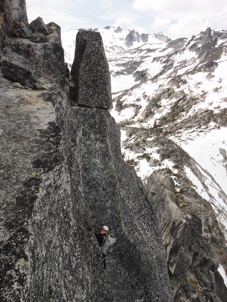
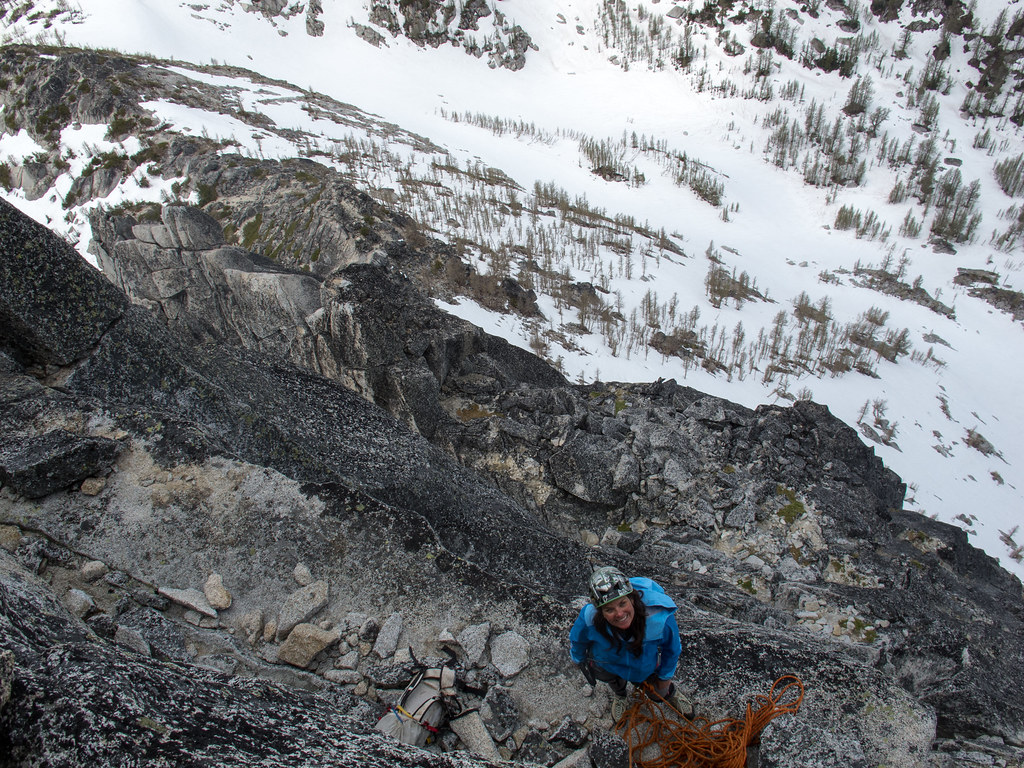
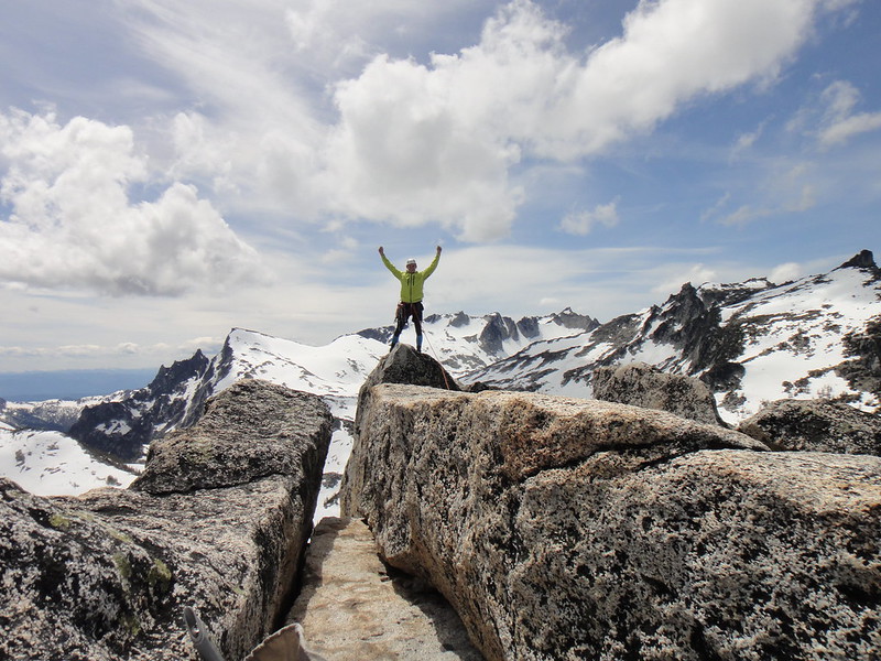
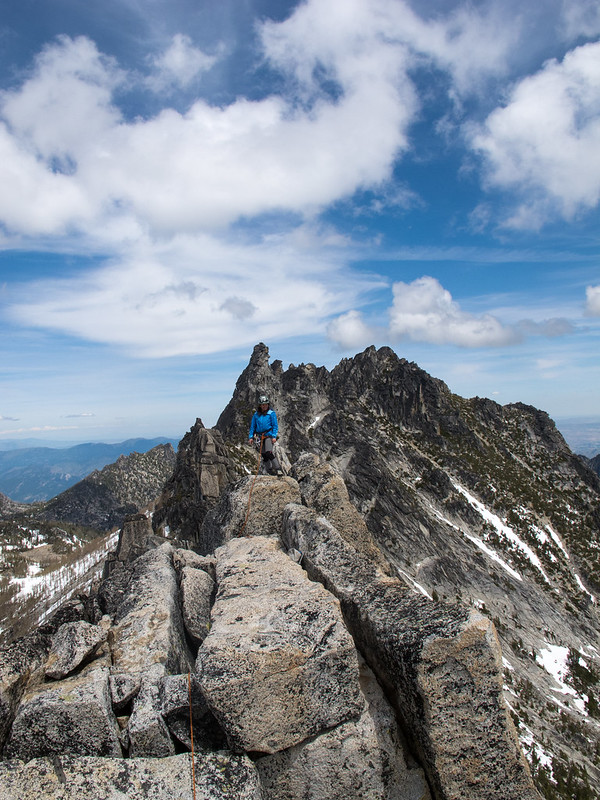
Trip: Prusik - West Ridge
Date: 6/15/2013
Trip Report:
Summer heat, permits, crowds somewhat thwarted my previous visits of this beautiful peak in the Enchantments. So, the current plan was to hit it up earlier in the year.
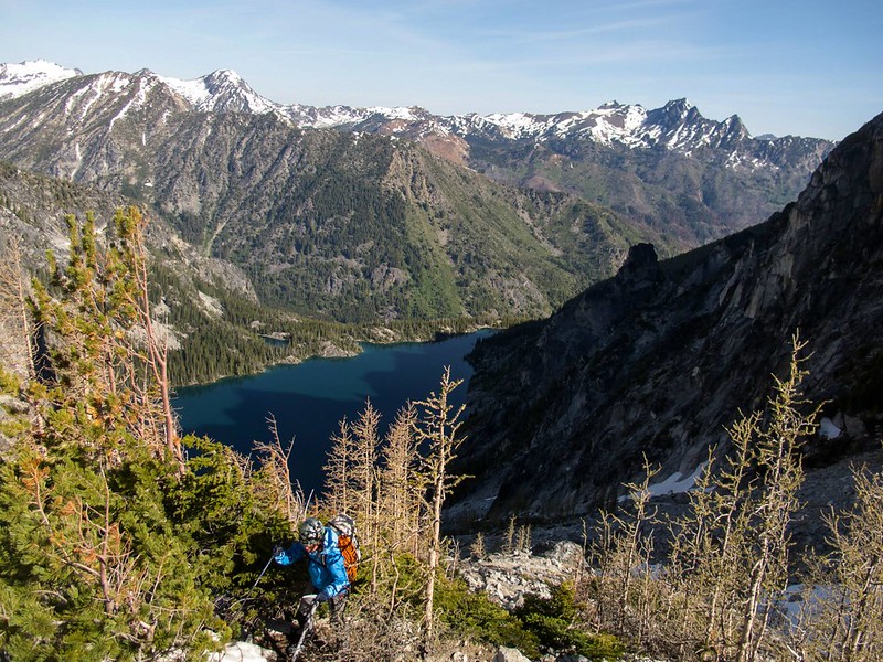
Cameron and I left PDX on Fri pm and rolled in the Stuart lake P-lot in the dusk where we slept in the dirt until 4 a.m.
The approach was pleasantly chilly, the Aasgard pass was still snow covered and the Enchantments still nicely frozen.
Aasgard pass in the morning:
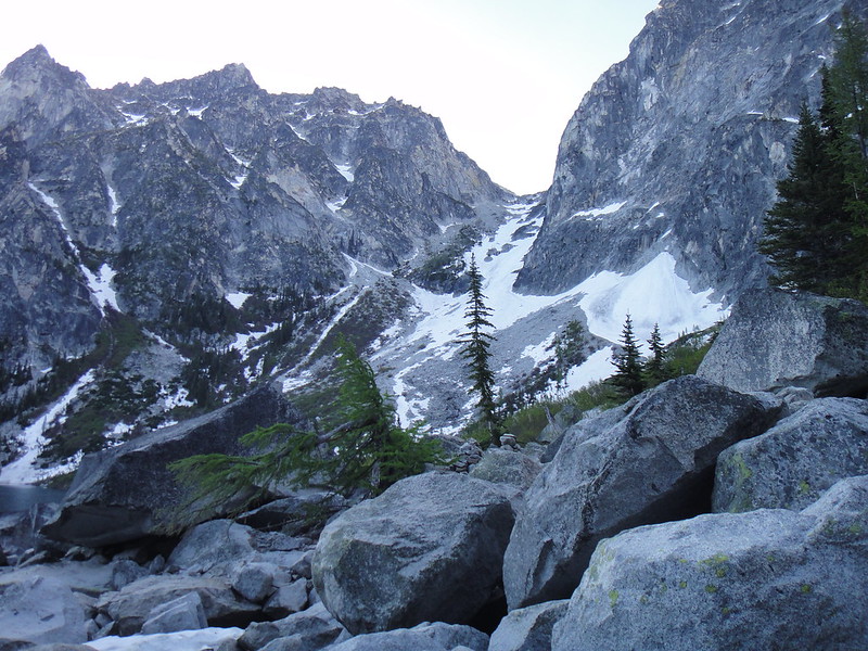
The Temple Ridge comes into view:
After dropping one pack and O/N gear at the Gnome Tarn, we made quick progress to the Balancing rock, roped up and went up the ridge.
At the balancing rock:

Start of the ridge:
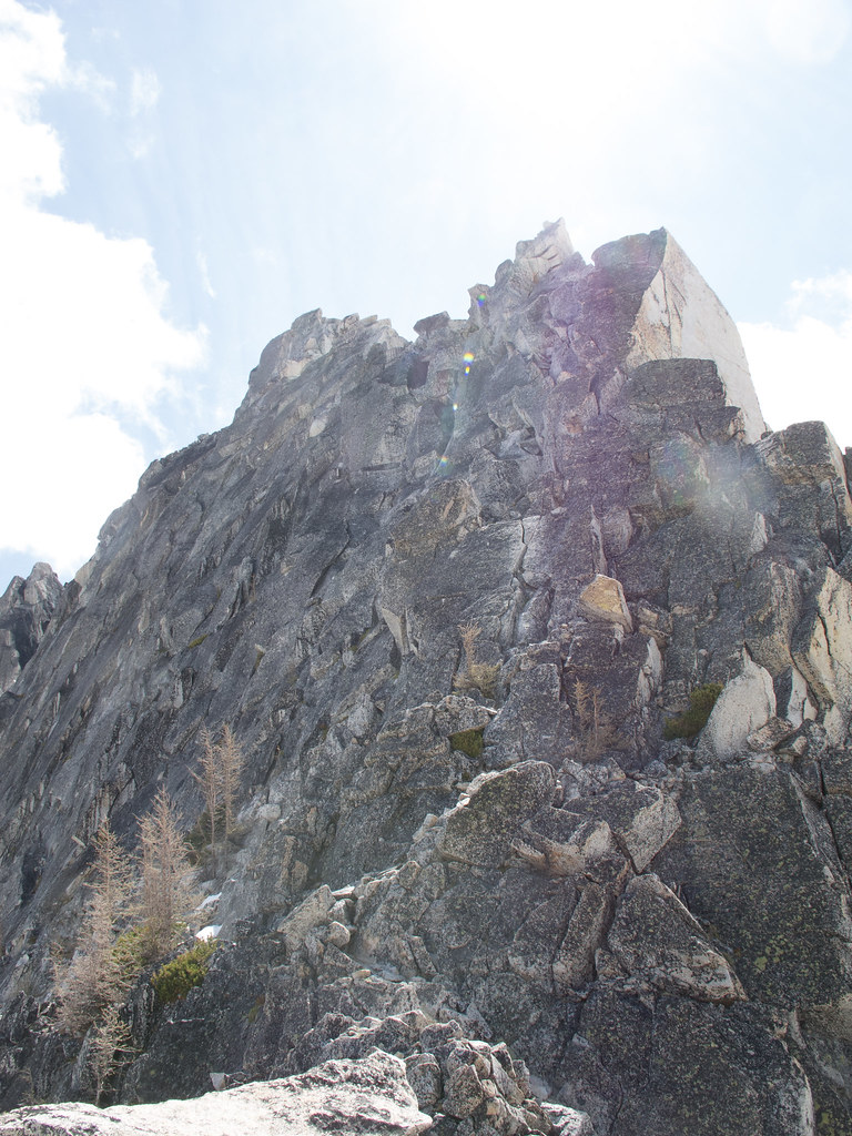
Easy, fast and enjoyable climbing on solid granite and very minimal gear (3-4 pieces total) until the summit block.
Cameron on the slab:
On the traverse:
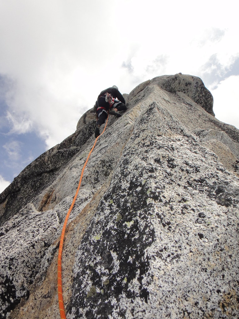
In the dihedral:
Cameron coming up the dihedral:
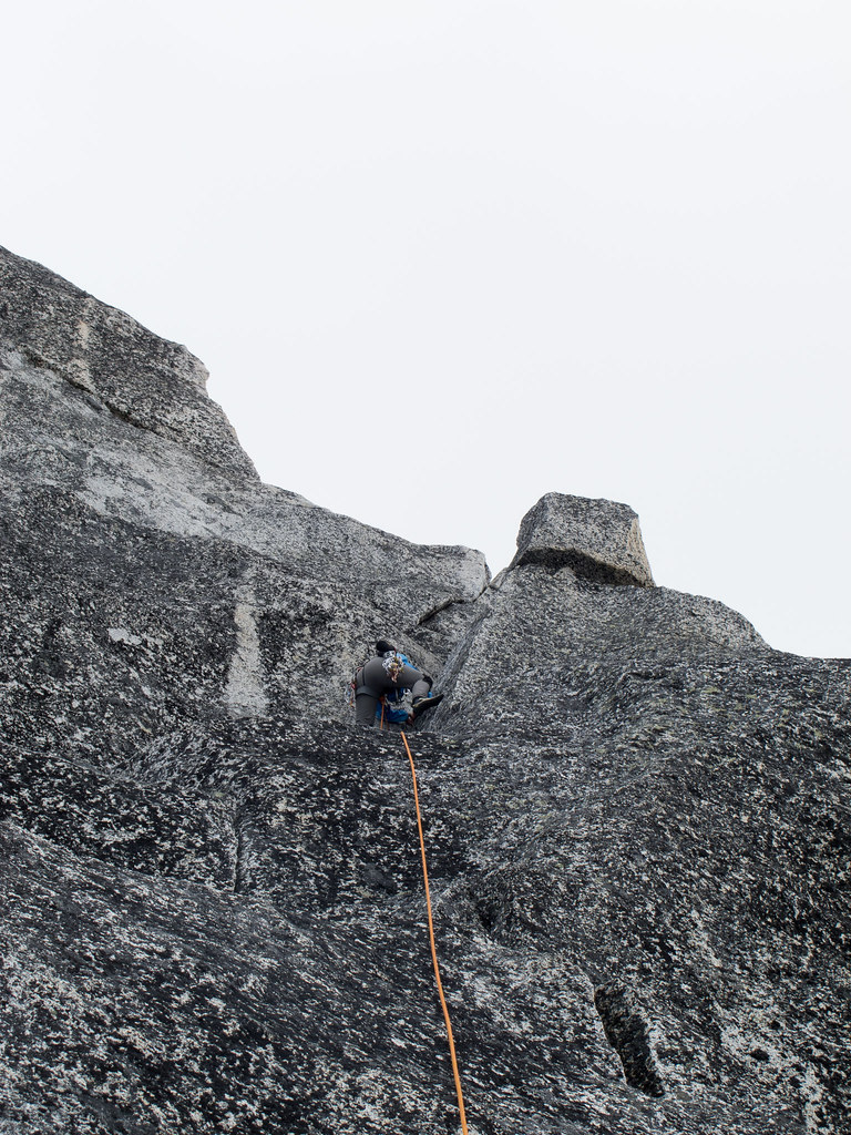
Cameron heading up the OW (Not-Axe-friendly) chimney with some interesting moves:

Looking down from the chimney:
I made up the chimney with some aid moves, thanks to the axe that got successfully stuck in it.
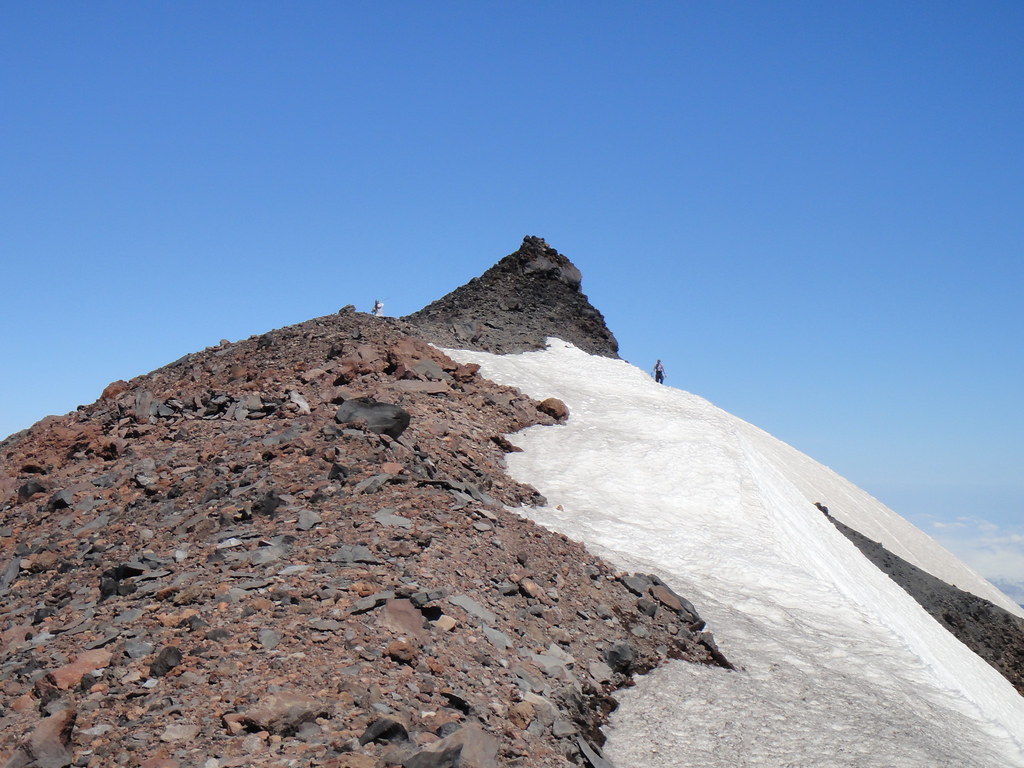
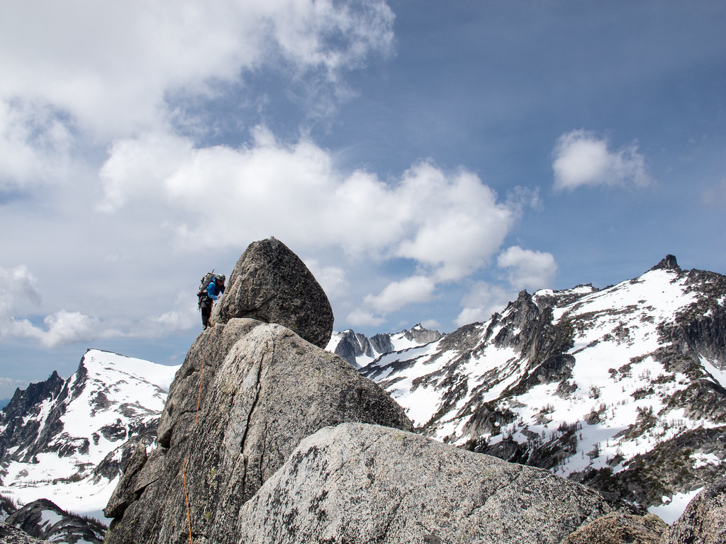
On the summit at 2 pm:
After spending 10 min for extracting the nut that got wedged as a result of my aid moves
, we rapped the north side which still had some snow on it.And occasional ice on the traverse back to the balancing rock:

Luckily, the goats did not drag our gear and food away while we were up on the ridge, so we pitched in the tent and finally enjoyed some solid food.
On the hike out next morning, we run into the usual suspects:

Gear Notes:
60 m rope, rack to 2" (brought way more than we used)
Approach Notes:
Stuart Lake TH
-
White River do not do passes/self-registration after hours - you've got to do it in person once they are open.
Not sure about Longmire or Paradise, I am trying to stay away from that side of the mountain.
-
I am missing Stuie, John
.Handicapped or not, there is some sweet ice to be climbed in the IC right now:

Oh else, I will need to resort to the Zebra Zion at Smith and it is so hot there

-
If weather holds, I would like to do it this Sat/Sun - C2C or camp below the Sherpa gl. According to friends who just got back, it is in fine alpine ice shape with some mixed moves at the top.
Have all the gear, rope, car.
503-901-3837 or PM
Anastasia
-
Sorry about the jacket, Ben.
We did not come across any jackets or water bottles on the NF this Sun, but I did fetch a screw that was dropped from the summit ridge
. -
Thanks, dude. It is hard to say "no" to the decent ice in June.
But it is time to move on Rainier though
-
Good times, Forrest!
"The nice leisurely approach" in the rain and whiteout was kind of hmmm, though. Our lives certainly did not suck then
.The last pitch was interesting: the rock was as if made of a toothpaste but luckily frozen in place. The summit cornice took some tunneling work.
[TR] Maude - Circumnavigation and Return 7/28/2013
in North Cascades
Posted
Looks like a scenic voyage, S.