
.jpg.40c348b15c9f900ce022401fa0dfd570.jpg)

YocumRidge
-
Posts
1230 -
Joined
-
Last visited
Content Type
Profiles
Forums
Events
Posts posted by YocumRidge
-
-
Happy B-day, white boy.
Clipping screamers to those bolts? How fitting...

-
Approach via torment basin or Roush Basin (eldo) and do a high traverse. You could at least bag torment and evaluate from there. Go for it, Oleg! :-)
Why to wallow TFT, if there is Yocum Ridge?

Close to home too.

-
now we should do the NF of Hood.
And right now it comes with the pretty green undertones. If we get lucky and it freezes next week, you should be able to plug a screw into that compound
Photo by OlegV:
-
Nice work, S!
There is a bivy site like that at 8500' on the crest of Ptarmigan ridge:
but then you have no choice but go and climb/ski Mowich Face
-
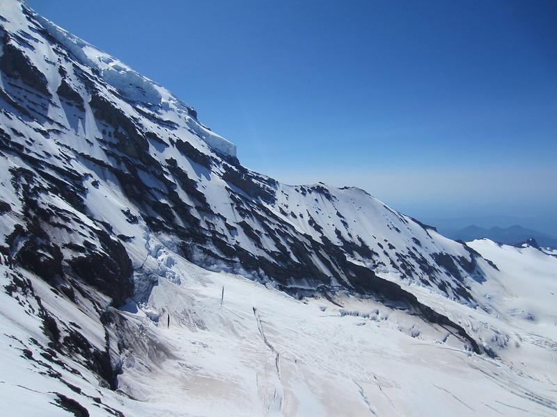
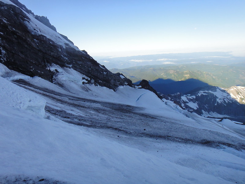
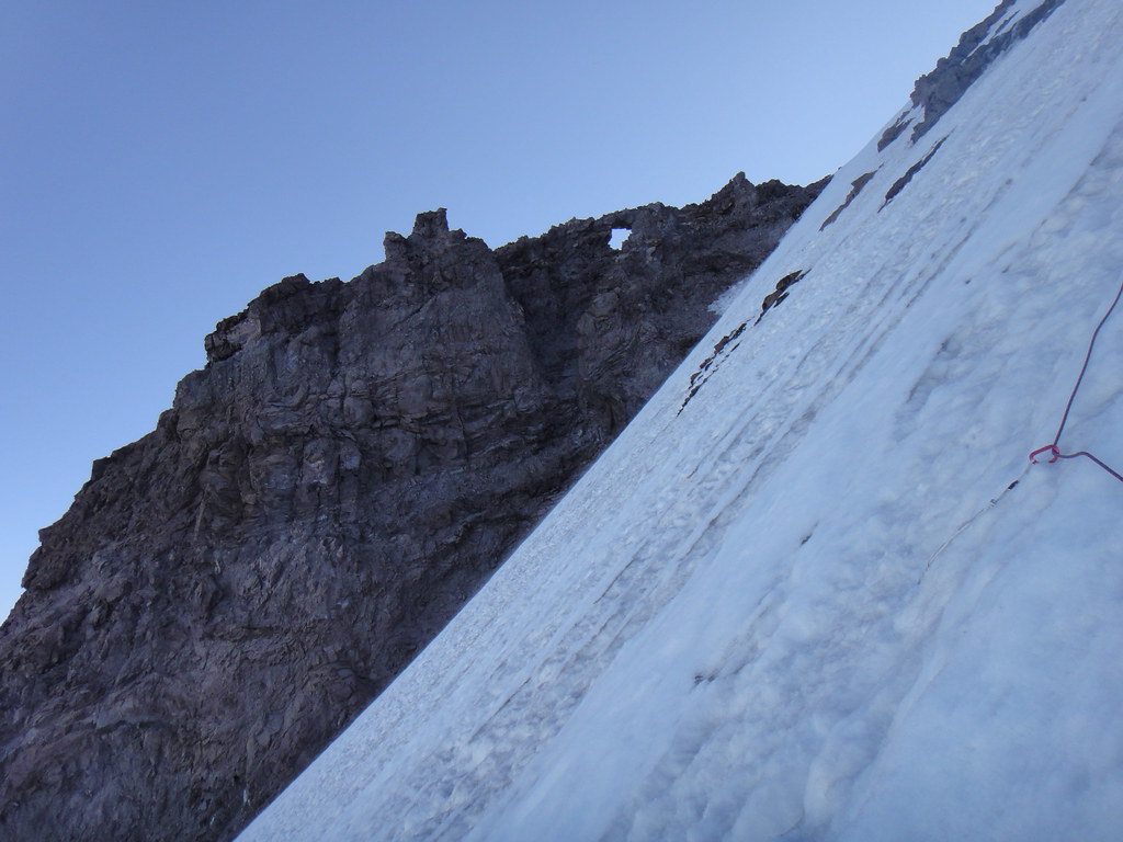
FYI: the left lobe of the Coleman HW is impassable above 9500' as of last week and unlikely it is going to change much as the temps were above freezing since.
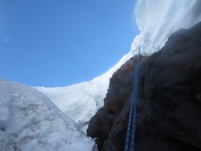
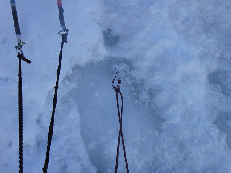
We went up the middle icecliff (AI3) for a few pitches to find an abyss on the top of it, then V-threaded the whole thing and rapped down.
The avy chute to the left of the icecliff was producing lethal rock and ice avies on average every half hour. To the right of the icecliff you will find running water over volcanic slab and one inch of rotten ice here and there for 800'.
-
Found mittens in the compression zone between Coleman and Roosevelt glaciers at about 6100'. It looks like they were dropped by someone who turned around from the North Ridge on Sat 09/22. If you tell me the vendor/color, I will get them back to you.
-
Boots or rock shoes on the ridge line?
Alternating between - depending on the mood
-
Oleg, you do kinda have that Putin eye thing going on.
Yeah, Pat, you've got to be gentle with Oleg - I know you are - or else he is losing it
. -
Did you spend a lot of time at your bivy site waiting for nightfall?
Is that a determining factor as to whether we qualify for the permit and for which zone?
-
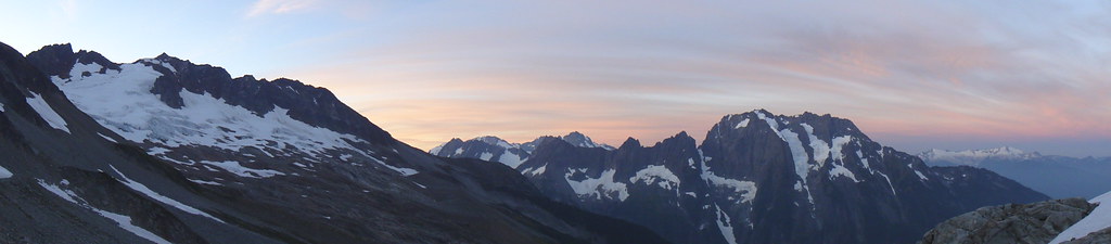
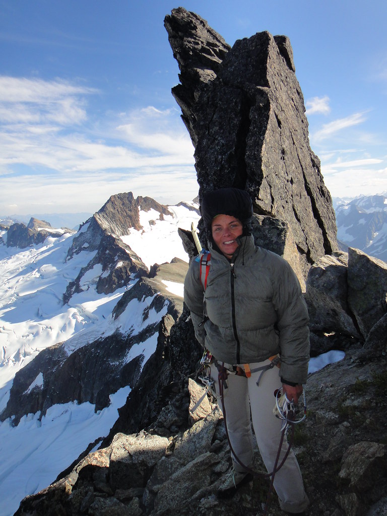
Trip: FORBIDDEN Fruit - East Ridge direct - West Ridge carryover
Date: 9/15/2012
Trip Report:
Now that the alpine rock season is almost over, OlegV and I decided that we should get some in the real mountains. Still being a limping cripple and in the recovery phase after my MCL injury, I am not allowed the knee twisting long approaches for 6 months, but apparently I am allowed to climb, according to PT. Still trying to figure out how that works though.
On our way back from the tormented Torment a couple weeks ago, Oleg was admiring Forbidden he never visited before, and that made for the obvious choice. East ridge direct – West ridge traverse carryover here it comes.
We left PDX on Fri after work and before we knew it, we had arrived at the Cascade Pass where we managed to get some decent sleep in the Oleg’s rig. Time always flies when you are anxious to get out of the city and still have energy to polemicize about the obese transgenic monkeys and Golgi gradients – another hobby for which we are getting paid to our surprise.
We started on Sat am and hauled our bivy gear up and over in anticipation to bivy somewhere on route.
Boston basin sucks. Why would anyone ever want to come here
?
Morning whisper in the North Cascades:
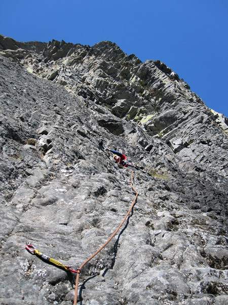
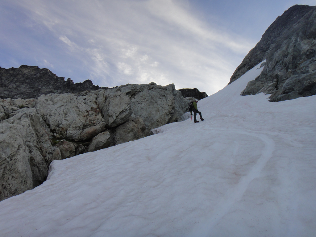
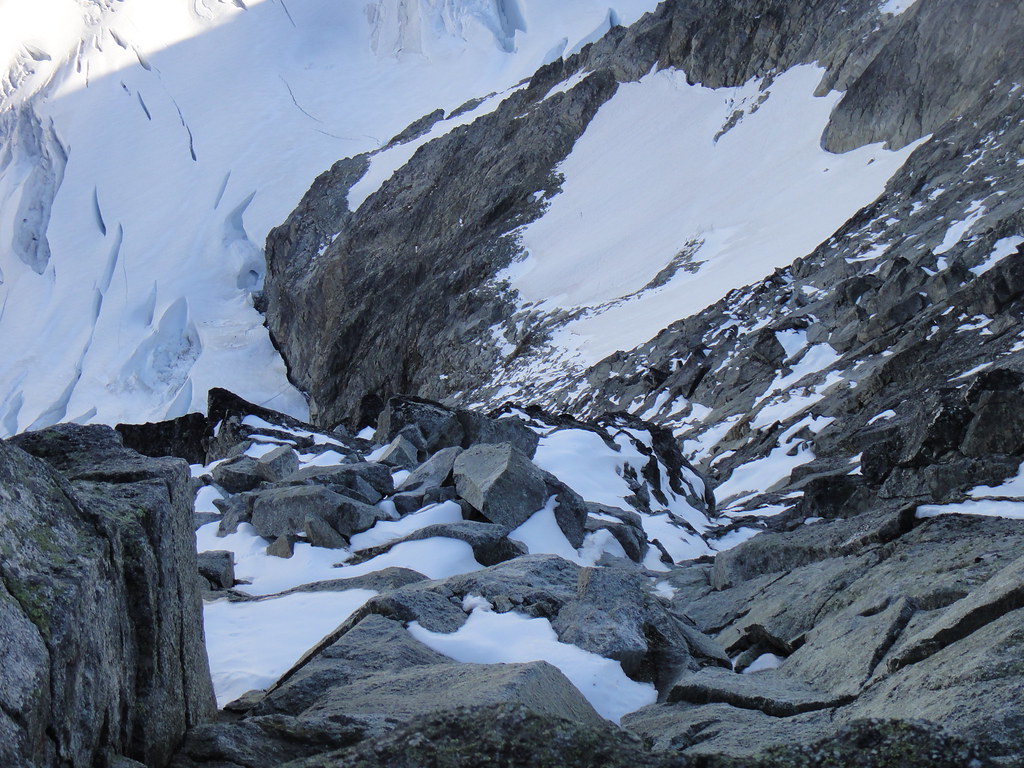
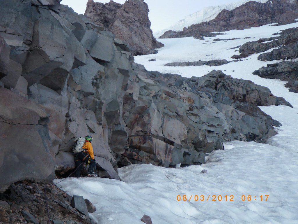
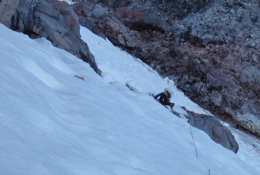
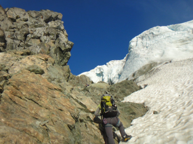
Heading up the couloir that is currently filled with the alpine ice was not easy in the aluminum crampons and I wasted a lot of time trying to pre-cut steps. After taking the yellow gully by the moat, we reached the saddle on the East ridge at 10 am.
Oleg in the couloir:
Oleg above the yellow gully:
Approaching the saddle on the East ridge:
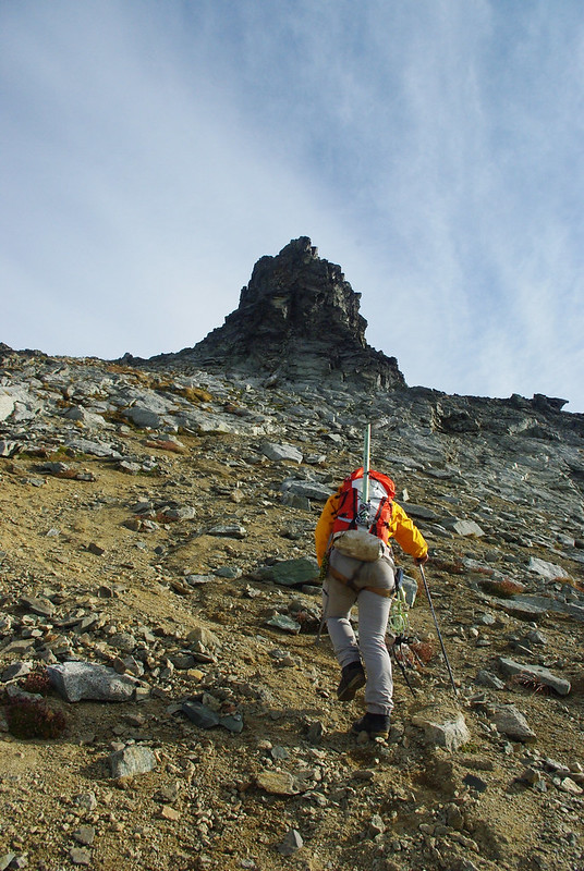
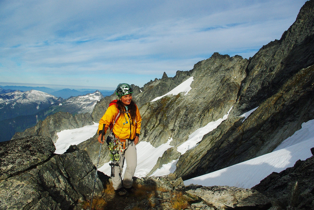
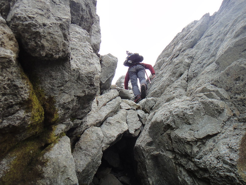
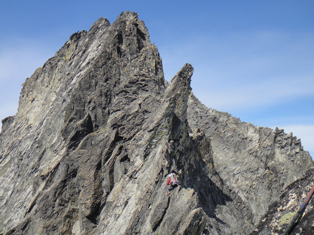
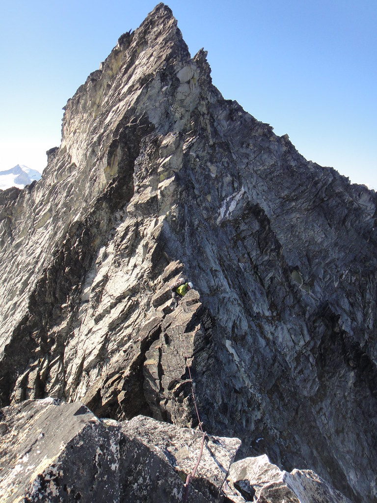
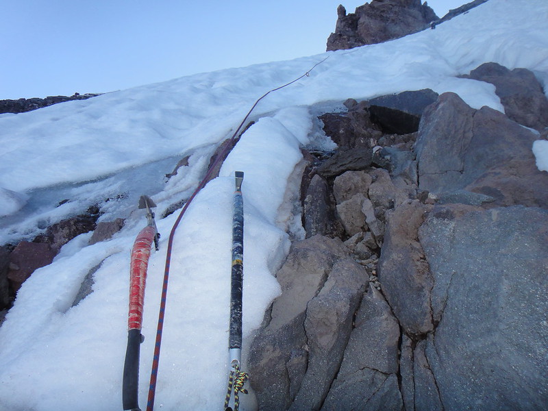
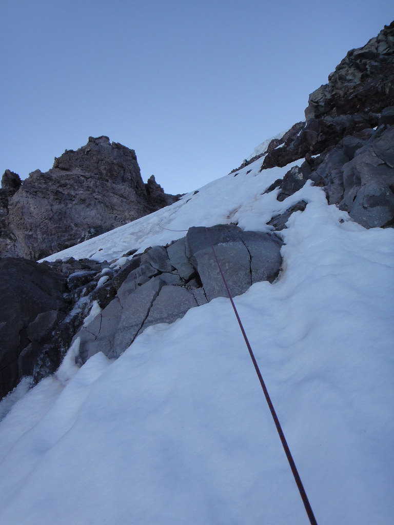
After a break, we roped up and started up the ridge. Due to fresh snow on the north side of Forbidden, we stayed pretty much on the crest the entire time except for the bypass of the second gendarme. A lot of downclimbing ensued.
Getting up on the Tyrannosaur at the start of the East ridge:
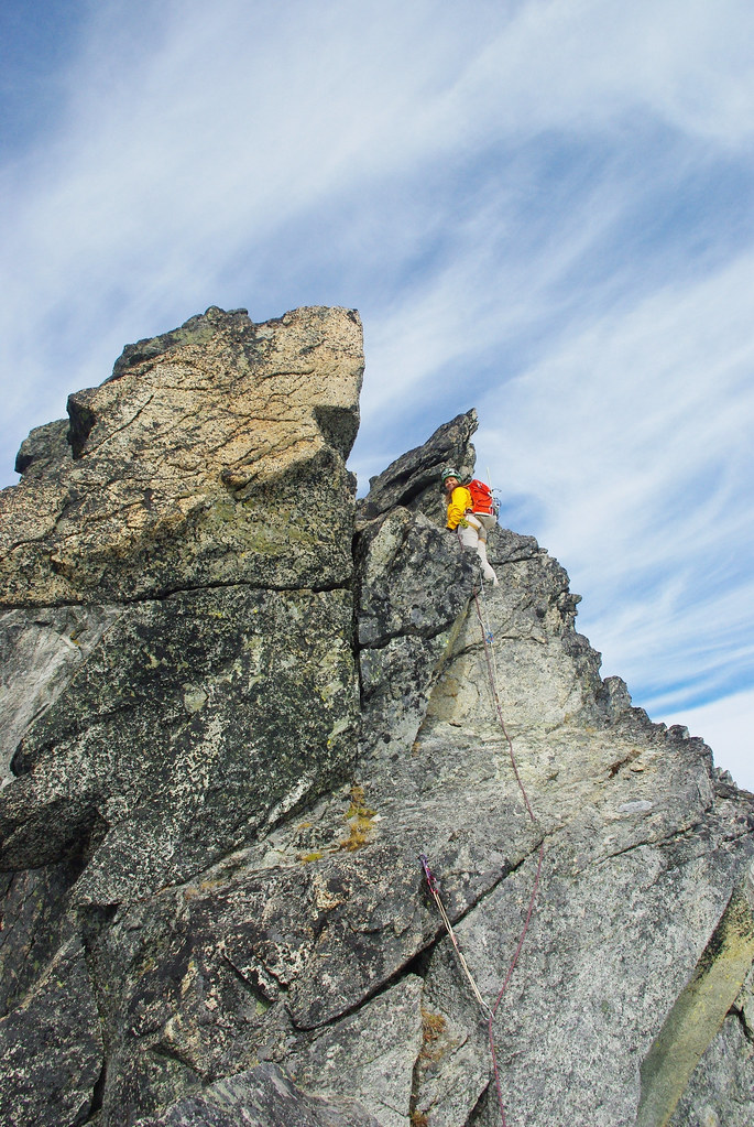
Oleg going up and over the first gendarme:
On the first paper thin knife edge ridge traverse:
Somehow we ended up on the top of the flake which we had to downclimb to get back on the crest. In fact, the flake is not as intimidating as it looks. One could jam one leg in the vertical crack and slide down, pretty cool:
On the second knife edge ridge traverse:
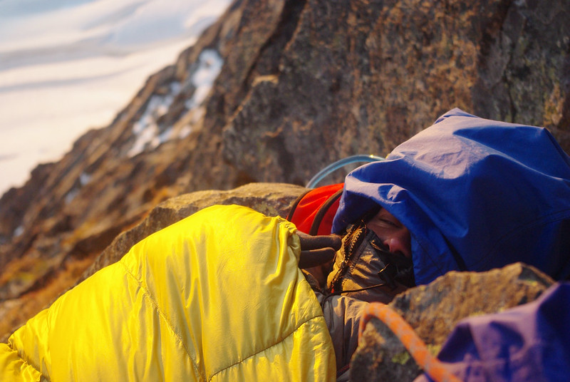
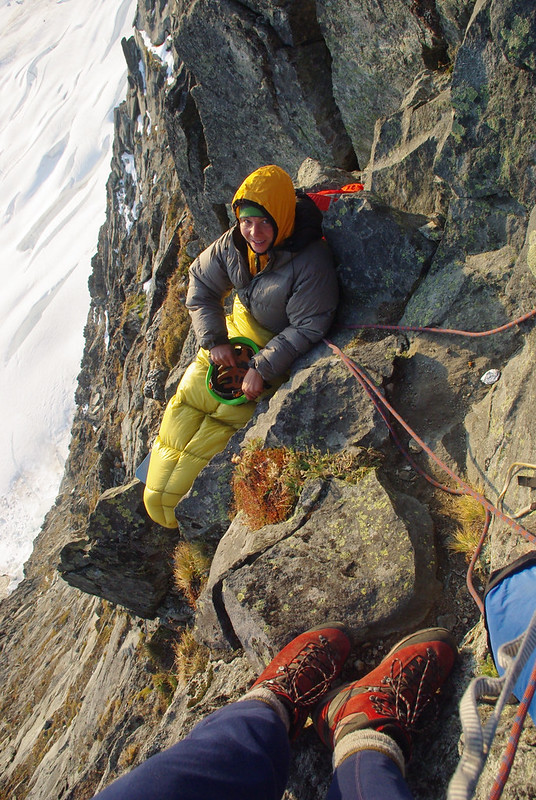
The “5.6 bypass” of the second gendarme on the north side felt like cl. 3 with fresh snow thrown in and quickly brought us to the “U” notch between the second and the third gendarme - a very scenic spot for the bivy, but pricey – got to sleep in the harnesses all night.
Oleg is giving me that famous Putin’s steel stare to make me feel better:
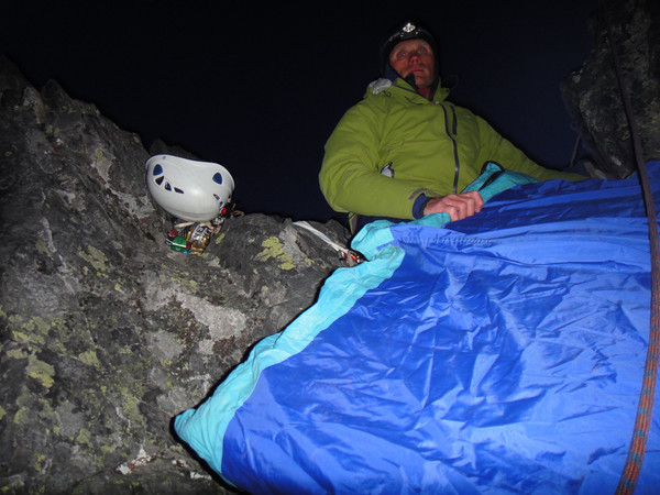
Oh, and it was breezy that night. Very breezy, in fact. Bivving in an X-file style:
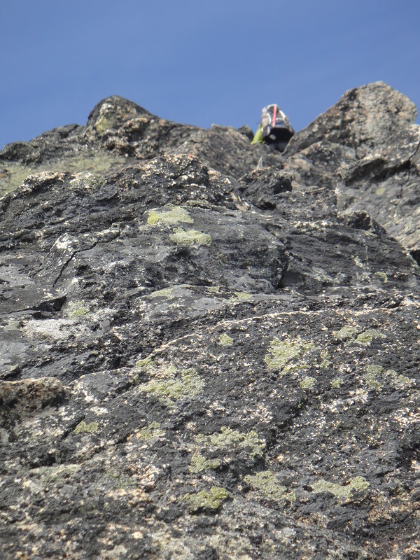
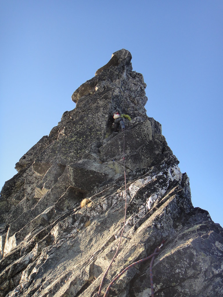
After warming up in the morning sun next day, we continued up the third gendarme. It felt harder than 5.8 for some reason – so much for being out of rock climbing shape:
Oleg leading the third gendarme:
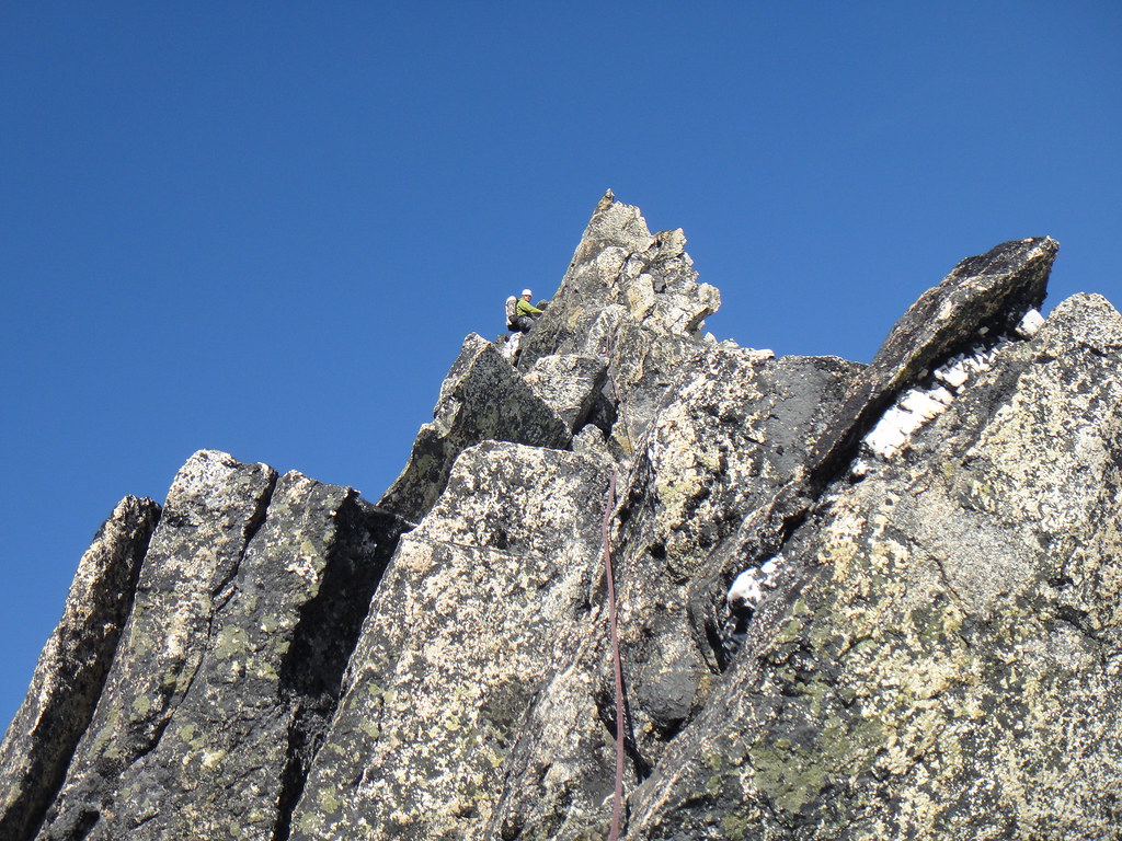
On the final stretch to the summit:
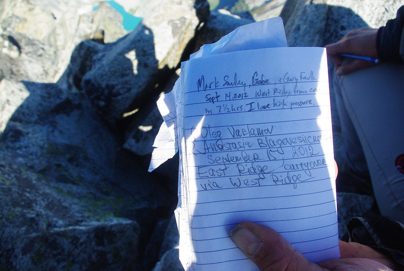
At the summit:
The descent down the West ridge took longer than expected - thanks again to the new snow. We downclimbed/rapped the ridge while staying on the crest rather than using part of the easier north side of WR.
Fresh snow on the north side of WR:
The snow couloir below the bypass gullies is officially out for the season. Rapping down the east most bypass gully puts you in a better position for scrambling down to the last rap anchor. 70 m ropes are needed for getting over the moat to get back down on the glacier on the final rap.
Looking back at the Forbidden fruit's east-west traverse:
Gear Notes:
8 mm x 60 m rope, alpine rack to 2", a bunch of double slings
Approach Notes:
Boston basin
-
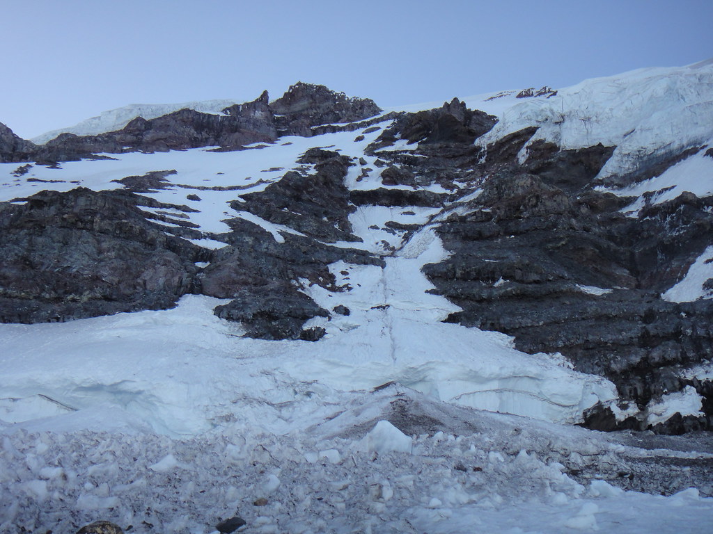
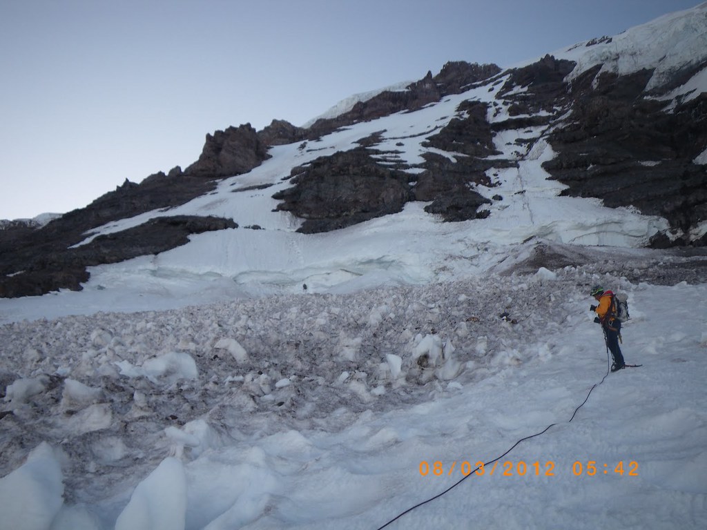
As of the last month, the Upper Curtis gl and Hells hwy were very straightforward with one axe. However, there is one pitch of hard alpine 45 deg ice if you take the lower Winnie slide crossover on Curtis.
When we carryovered from Hanging glacier down FC route, we downclimbed the rock band from the upper WS crossing which was not our brigthest idea - it was slow.
I had also noticed that currently there is a rap set up to get you from the upper crossing down on the glacier on the other side. In the past, this section was easily downclimbable, now there is a 5 feet wide moat separating the WS rock band and the glacier.
My personal preference would be to climb (and downclimb) the ice pitch on Curtis between the lower and upper WS crossings rather than dealing with the rock band.
-
Looking to buy a used Spectre ice piton(s). Old or new BD version.
If you have it and want to get rid of it, please PM me.
Thanks,
Anastasia
-
I keep wondering how hard should I train to write like this distinguished russian climber. But I guess the saying "born to crawl - cannot fly" is so true
Outstanding TR, Oleg!I also hope that some day Oleg would acquire a sleeping bag more substantial than the one from the french hotel he used on the summit of Torment, so that the bear attacks can be avoided
-
Looks like very straightforward conditions, as I was hoping for
. Thanks for the update.How icy were the snow traverses? Soft enough for Alu crampons?
Did you approach via the South ridge or SE face of Torment?
-
Tricky routefinding always make good stories.
Glad you OK, Nelson.
-
Likewise, it was nice meeting you up there Luke. Hope you enjoyed the summit bivy!
-
Glad you are healed up and back on track, Doug.

-
slow down now
I already have. Cannot do much with the blown knee
. -
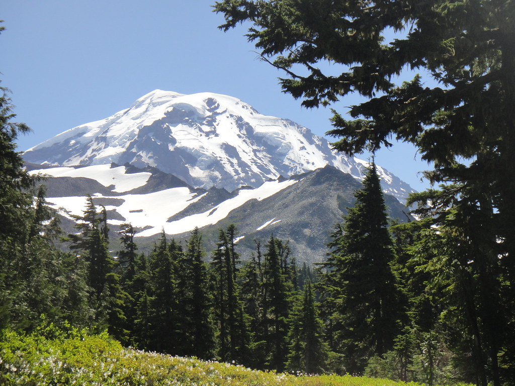
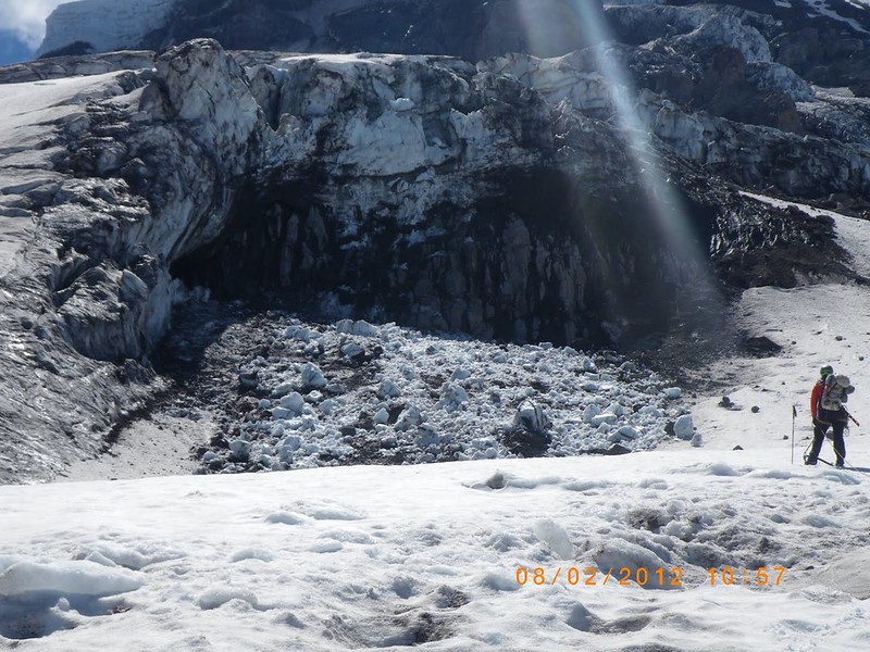
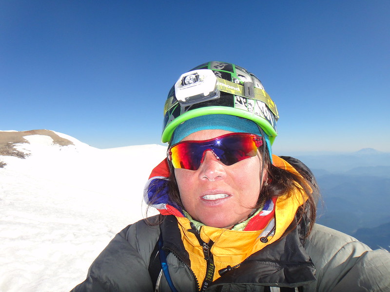
Trip: RAINIER - Mowich Face
Date: 8/1/2012
Trip Report:
There is something about the sunless nordwand Rainier that keeps calling my attention, rejecting my ass and then extending its hostile invitation over again. And again, for some bizarre reason, I drag myself up there to enjoy its ruggedness, its creepy giant icefalls and sickening rock.
In early July, we were turned around by a massive rock fall after reaching the aid crack on the upper headwall of the Curtis Ridge, one of the exposed and my favorite Rainier ridges.
Upper Curtis Ridge:

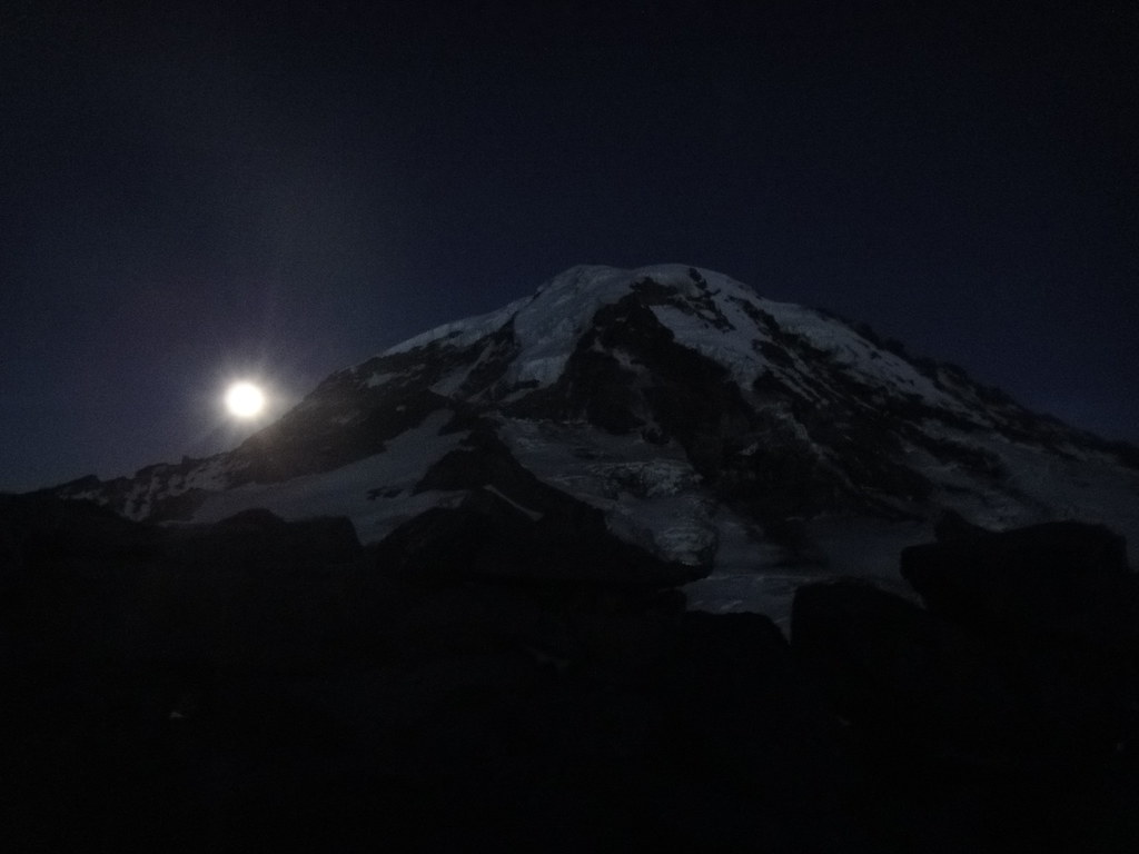
Starry night over Curtis Ridge:

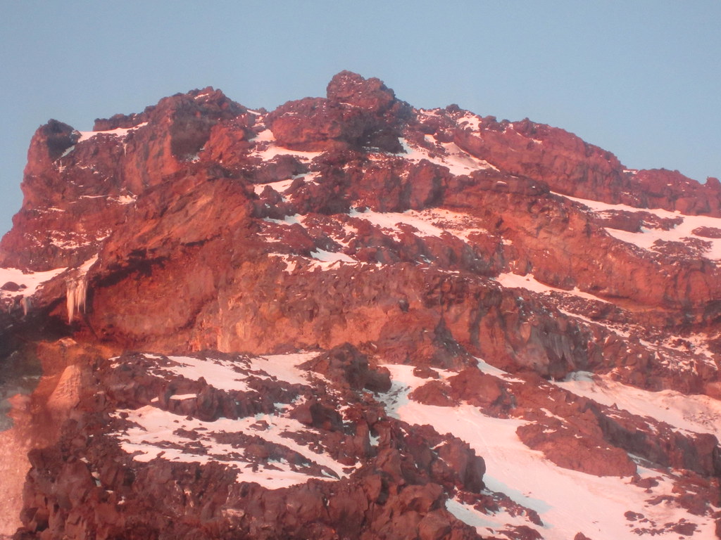
Disintegrating Russell Cliffs threatening to kill us next morning:
Which prompted our 2000’ “crafty descent” of the east aspect of Will It Kill Me Wall down on Carbon glacier. Yes, that Willis Wall everyone talks about…:

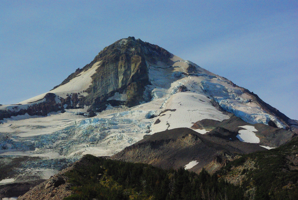
Having survived the “descent”, I was looking forward to go back. Mark however left for Cali, the Curtis ridge got badly out of shape, and it is already freaking August which does not leave you with much of the choice. Kaskadsky Kazak kindly suggested that I would probably enjoy something on Mowich Face. First I was skeptical because Central Mowich face is normally a steep ski route, but this is what we ended up climbing in the current difficult and boney conditions – the largest ice face I ever climbed. If you ever contemplated of skiing it in August, forget it. You WILL die.
So, I talked my friend Lance (aka “Skoolsukz”) into taking advantage of the high pressure nicely setting over Rainier to do a carryover of Mowich Face (or Mowich Headwall – we were flexible with options) via Liberty Cap and DC. Arranging the car shuttle between Paradise and Mowich Lake took as long as getting to Rainier from PDX, and included the obligatory visit to Carbonado. FYI, Carbonado is a black hole, every time I am passing through it, something happens. A few years ago, it was the car transmission that died, this time I crashed my car into a ditch and almost killed myself on a way back.
Day 1. Mowich Lake —> Ptarmigan Ridge
We started at Mowich lake at 10.45 a.m.:
The beautiful approach on Wonderland trail through Spray Park is now snow free.
Spray Park:

Lance on the approach:
Our objective from Wonderland trail is looking good:
Flett glacier morains:

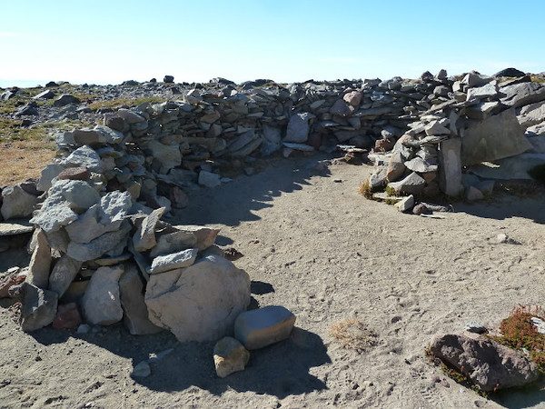
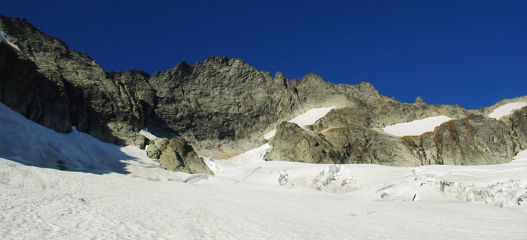
After a refill with running water at the base of Observation rock, we headed up to the col at the crest of Ptarmigan Ridge in the intermittent clouds and followed the crest until we reached an amazing bivy @8600’ at the junction of two smaller ribs merging higher up.
Getting on PR at the col by Observation Rock:
Following the PR crest on the obvious trail:

Looking down at the lower PR and Observation Rock obscured by clouds:

Our luxurious bivy site @8600’ and nordwand ambience:
North Mowich Glacier carbonizing down below (where we will drop next morning):
Day 2. Ptarmigan Ridge —> North Mowich Glacier —> Mowich Headwall
The red line was our approach on day 2 from PR to Mowich Headwall:
Getting down on the North Mowich Glacier was hmmm… lets just forget it. Each rock on that descent was a project by itself. When various sources for the Mowich approach specifically tell you to descend the PR crest to 8200’ and THEN look for a mellow ramp down to the said glacier, go and find that mellow ramp like smart people do! We did not, and instead went straight down from 8500’. That sucked, really sucked. J-burg I just got off a day before Rainier was still fresh in my memory and seemed to be a blessing in comparison.
And of course, once down on the North Mowich Gl., we spotted the correct snow ramp:

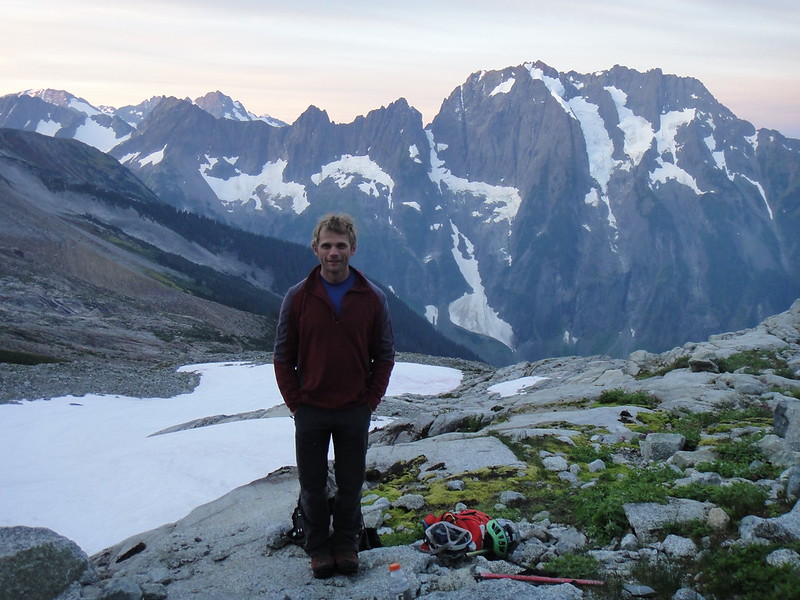
Lance digesting the experience:
We talked about how nice PR would be with more snow on it and Lance pointed to his old ski tracks off the top of the Edmunds headwall in July which was a 2 day trip for him
:
There were no other tracks on this part of the mountain and we did not come across a single human being during the 2 days we were up there.
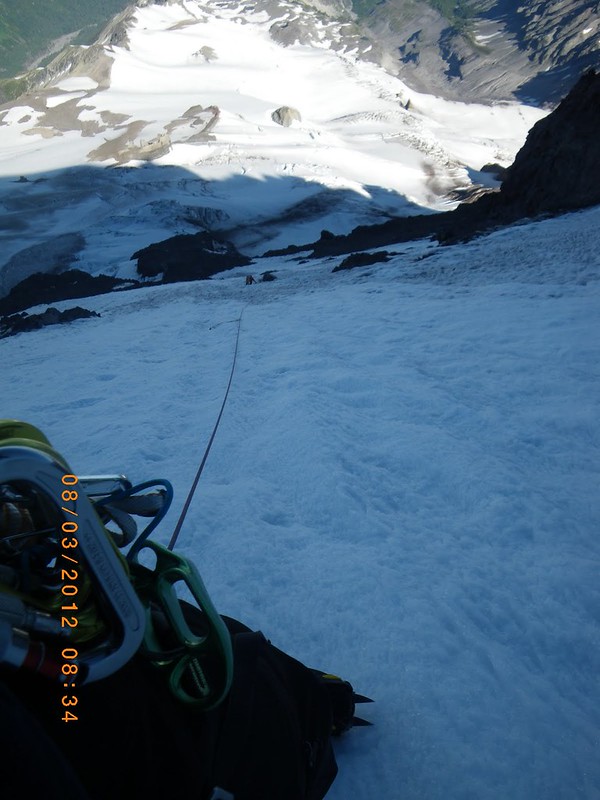
Crossing the North Mowich Glacier was uneventful except for a couple of ice avalanches, a couple of shrunds to navigate and one moat to deal with:

We have casually made it to the base of the North Mowich Icefall – the route I was curious about - it is supposed to have the best class 5 rock on Rainier. But do not look for that awesome class 5 rock – it is no longer there. The route had annihilated itself in the massive rock avalanche just before we showed up there:
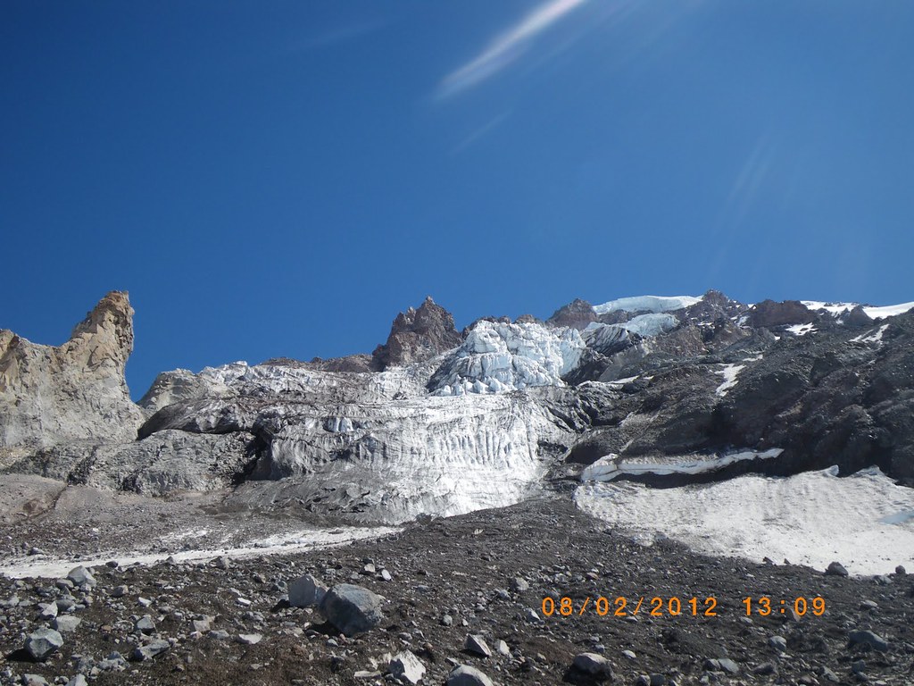
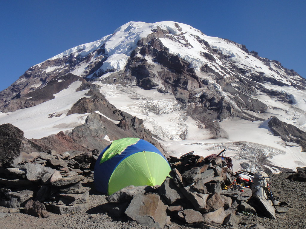
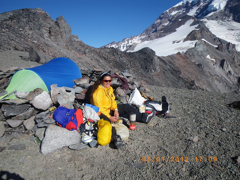
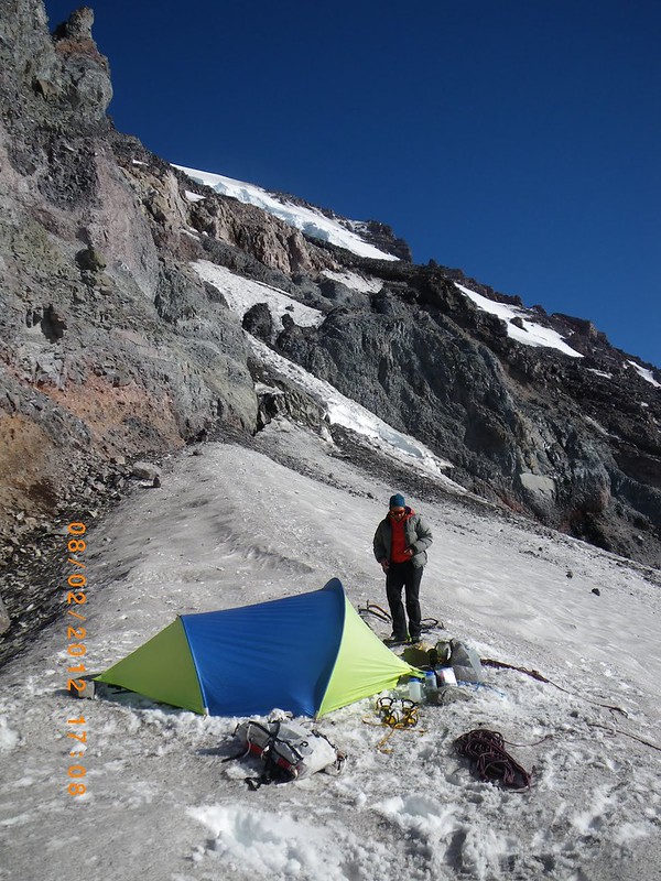
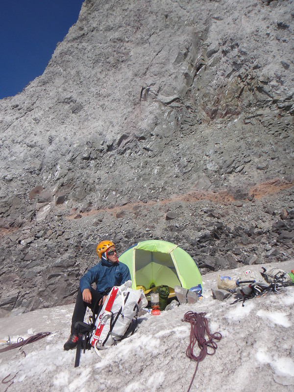
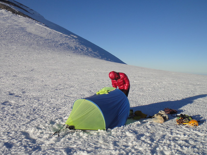
Rainier can do better than that but we were not in luck this time. So we continued slogging higher up to the base of the Mowich Headwall and pitched in the tent at the ledge @10000’ to the left of the main shrund by the headwall entrance. Do yourself a favor and camp low when the temps are above freezing. We had helmets on all night to survive the continuous rockfall:
We decided that we really want to go home once we climb this. “This” is a rather vague term here. My recon of the North Mowich Headwall that afternoon left nothing to be desired. I was never good in kayaking waterfalls and I counted at least two in the lower rock band:

Getting to that rock band would not have been that pleasant as we could tell from the expanding every minute horror show of fallen rock below the main shrund.
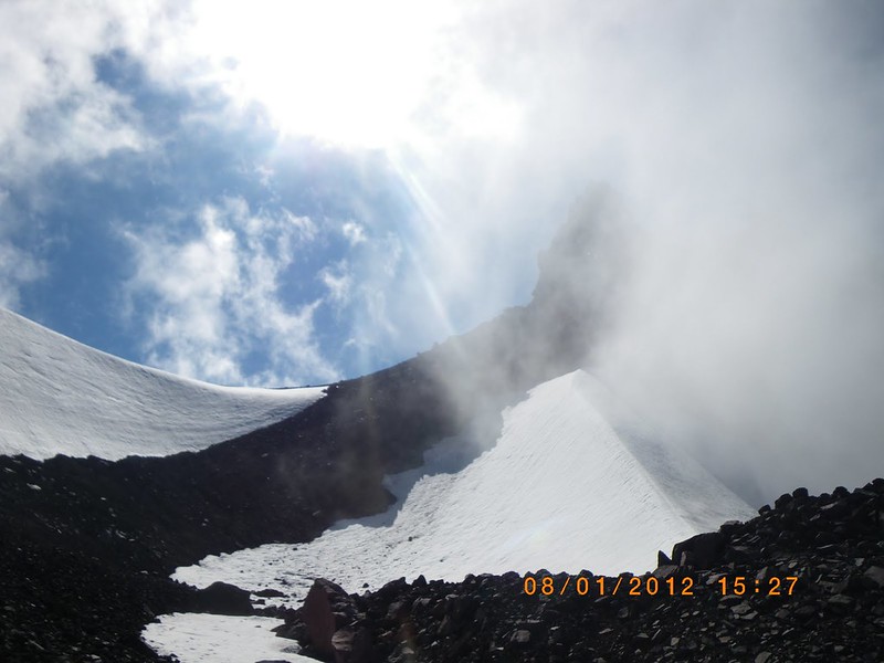
Day 3. Mowich Headwall —> Central Mowich Face —> Liberty Cap —> Columbia Crest Saddle
Here we go again. We descended to the toe of the headwall @9500’ that separates Central Mowich Face:
and went around and up to the main shrund connecting Central Mowich Face and Edmunds Headwall. At a first glance, it seemed crappy and wall-to-wall:
Sunrise at Mowich Face:
Where do we go?
Obviously, through the ice avy debris field to the only weakness on the left – the rock band… I was looking for waterfalls too but in vain
…
The lack of waterfalls was probably a good sign, because soon I found the ramp system in the rock band connecting to the ice ledge above the shrund:
Lance then took over and we simul soloed through the next rock band:
And then simul climbed through yet another one:
And reached the infamous Arch Buttress at about 12000’:
Things were looking good with lots of good ice and some not so good but luckily, frozen in place rock:
It was nice to be in the refreshing shade:

The only miserable moment was getting hit by the spindrifts of ice pellets coming down from the upper Ice Cliff connecting the Upper Ptarmigan Ridge and Mowich face.
We obviously skipped looking for the exit ramp in the upper rock band below the upper Ice Cliff which was supposed to lead to the summit ridge. Instead we went for the ice arête exit variation (grade 4) to the right:

Our toes were trashed by continuous front pointing for almost 4500’. Wow. What a route.
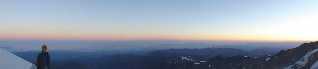
Finally, we arrived at the summit ridge @14000’. I have a bad history of becoming retarded at this elevation and higher:
After melting snow and eating, we continued to the Liberty Cap. Well, Lance continued at the proper pace (he was well acclimatized after Denali, Lib Ridge and Edmunds Headwall) while I was slowly dragging far behind.
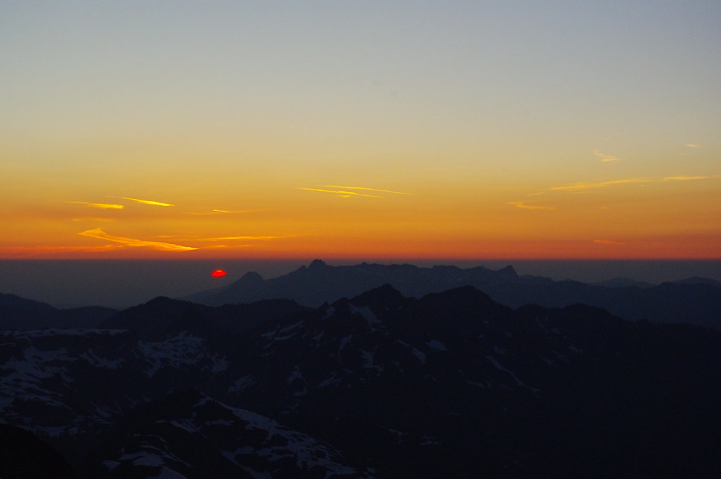
On the Liberty Cap in the refreshing for my brain 25F (and the dreadful 95F in Longmire that day
):
By the time we reached the saddle, I had really slowed down to the point that hiking another 800’ to the actual summit would have taken me freaking forever and the chance of getting to the car the same day was very slim.
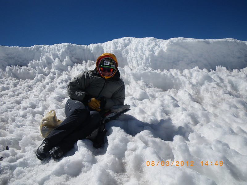
We pitched in the tent on the summit saddle, so that I could deal with my health problems. 250 mg of Diamox was consumed (in my case it works with the onset) and 15 min later my life got its meaning again. I was happy not to be throwing up.
Camping out at the Columbia Crest saddle:
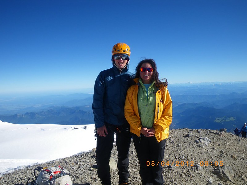
Day 4. Columbia Crest —> Paradise
After sleeping in at the saddle and getting to the summit, it was really weird to see people.
Nice day and great views:
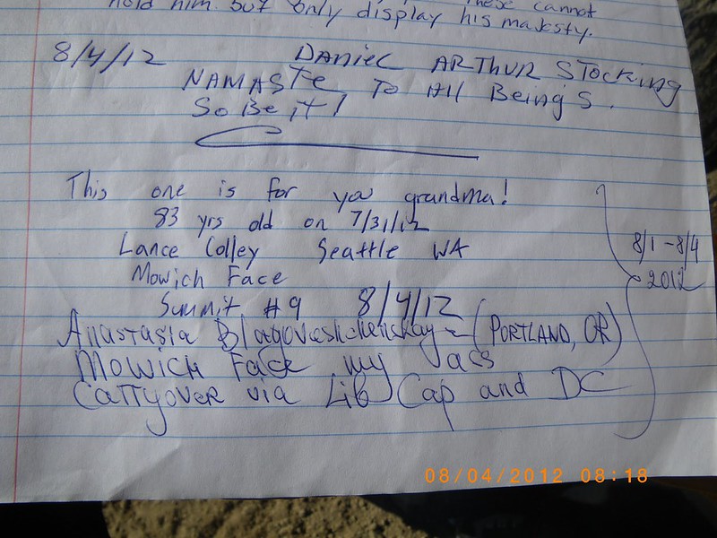
The summit register:
On our way down the DC at 11400’, we run into a 6 year old Peter who was registered by NPS to climb DC with his dad and they both had reached the summit at 5 a.m. next day:

Here is the full story:
That mountain climber is how old?
After stopping at Camp Muir, the rangers reminded us that we are running a little late and that we also are the fourth party to climb Mowich Face this year.
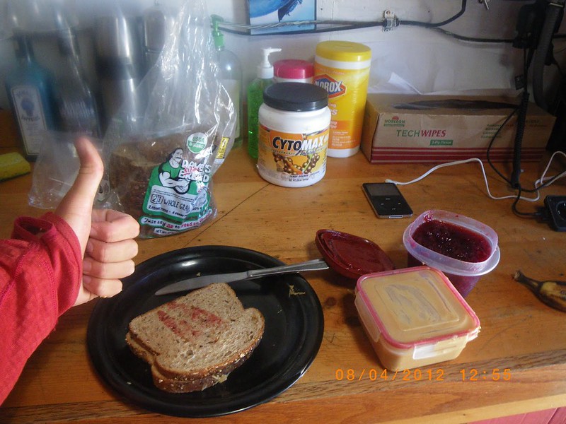
Now You Can Haz Cheezeburger (PB&J):
Thanks to Lance for being solid and motivated partner!
Gear Notes:
4 screws, 1 Spectre, 2 pickets, small alpine rack
Approach Notes:
Carbonado, Mowich Lake, Spray park
-
both (!) of yer partners are chix!
He is climbing better that way. To each his own.

-
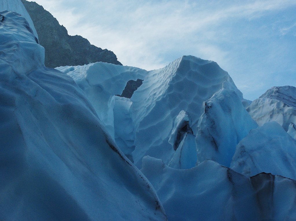
surreal seracs that looked like blue ice cities
More Hanging gardens en route:
-
Thanks for the great TR, Oleg. The trip was certainly an ass kicker and one of the most memorable this year!
A few comments.
This was Oleg's first time on Shuksan; and Oleg's and Anita's first time via Fisher Chimneys approach.
The guys were enjoying some stretchy variations in FC (while I was pathetically lagging behind with a hangover from the night before):
Sunset views from our Winnie Slide bivy @6700':
The start of our route as seen from White Salmon gl. and up the NW rib (NW Arayette is just behind it)
Oleg traversing over to the rotten gully of the NW rib from the moat on White Salmon Gl:
We certainly did NOT take the 1939 Hanging glacier variation - we crossed the NW rib below it - as you can see by the toe' of the Hanging gl we were gunning for higher up (another 200 vert feet?):
Easy rock on the crest of the NW rib before it split into multiple towers higher up was fairly solid and reminded me of Beacon rock. The rest was steeper, sketchier and unprotectable, but we promised to Oleg not to fall
Since the middle part of Hanging gl had wall to wall impassable crevasses and shrunds, I was happy to spot the ephimeral ice flake connecting the glacier' ice fall to the NW arete which seemed to be the only way out. A la Price glacier around the corner which I climbed last year, but worse.
Anita and Oleg attacking the dodgy flake:

Hanging Glacier icefall had quite a few terrain traps, so the best thing was staying by and on the NW arete. Anita above the waterfall and approaching the upper icefall:
-
Thanks for the input, Tom!
Having never done the Doug's Direct, I did have a few waypoints to track it down in case of the aggravating ice fall in the CJ couloir which was not the case for us.
4.5 hrs from the col via the DD is stout; I am fairly sure it would take me closer to 6 hrs but then again I suck at hiking descents.
-
Kids these days!
We were carrying over from the Mowich Face via DC the other day and run into a 6 year old who was registered by NPS for a 2 day DC climb with his dad.
At 11400':
Reasons why Planned Parenthood is awesome
in Spray
Posted
And here I thought you were supposed to get some vodovka and go home to "parent". But what do I see?