


Rad
-
Posts
2925 -
Joined
-
Days Won
25
Content Type
Profiles
Forums
Events
Posts posted by Rad
-
-
-
Thanks for posting a TR.
What a crooked line!
-
The examples you provide are cases where messy humans come to the same spot over and over and the bears know good things can be found. In the wilderness, away from frequently used campsites, bears will keep away from you unless you do something really dumb or they are starved or deranged.
By all means hang your food if there are trees. The key to avoid attracting bears and other varmints is to avoid smelly items. If you have open smelly foods they're going to attract critters. If everything is closed up, perhaps sealed in airtight bags or containers, you should be fine unless they specifically come looking, which they won't do unless they're conditioned to look for it.
I remember one of my early Yosemite trips we went up Snake Dike, starting at the car around 1 am. I'd eaten two muffins out of a 4 pack (the diet of a 20-something) and left 2 on our front seat for our our return. As we were walking away from the car in the parking lot near Curry Village a bear came walking toward us. We stopped. It walked right past us 10 feet away, clearly on his nightly parking lot patrol. I went back and threw the leftover muffins in the trash and put everything else in the bear box before we left for the trail.
-
I'll echo what Gene says. If you're going somewhere that bears are not habituated to people, like Glacier, they probably won't come near your or your camp at all. In contrast, if you camp where people have camped before odds are good that the Jays, ravens, and rodents will be waiting for you and eager to raid your stash. Solution: keep it in your tent.
-
Maybe give it to the starving kids in Africa? They can use it to clobber wildflife to eat for dinner.
-
Was it clean/well traveled?
It was quite clean other than the 5.11 corner, which is now clean enough for free ascents. Ratings felt quite stiff, but then we were pretty cooked. You should go do it!
-
Trip: Les Cornes - Sprung C#$k Erect
Date: 6/28/2015
Trip Report:
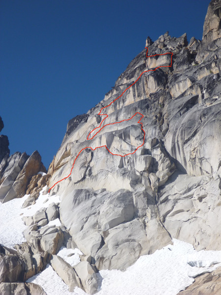
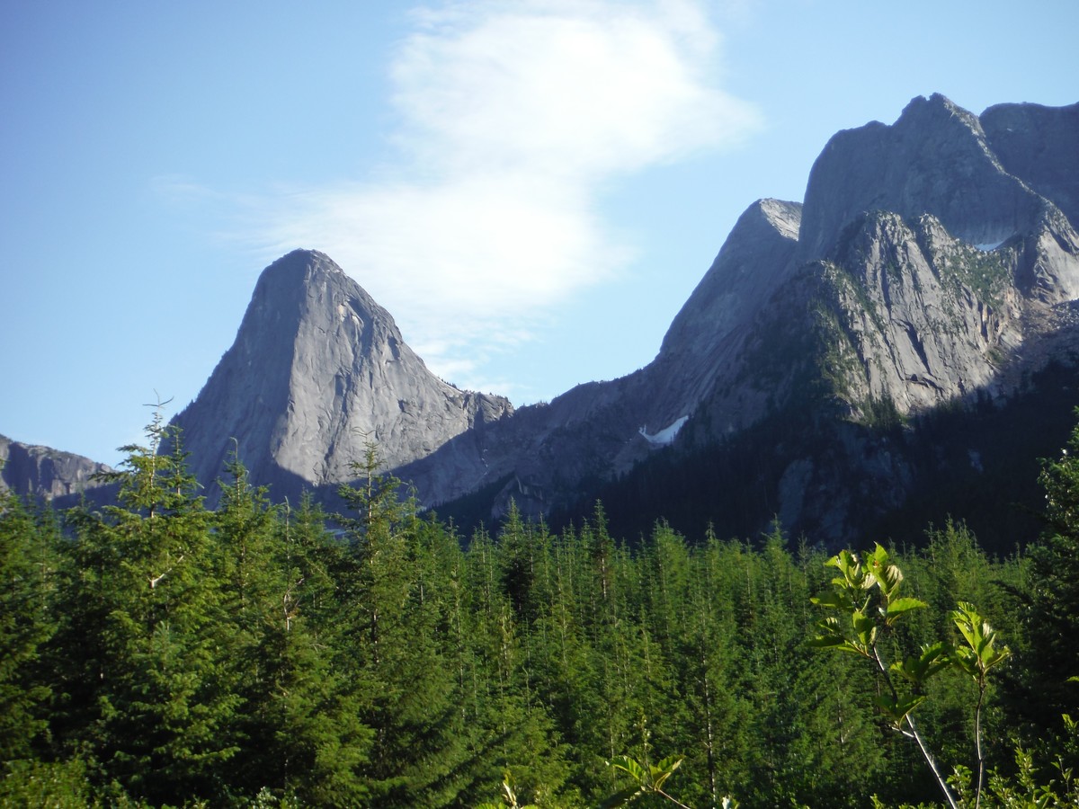
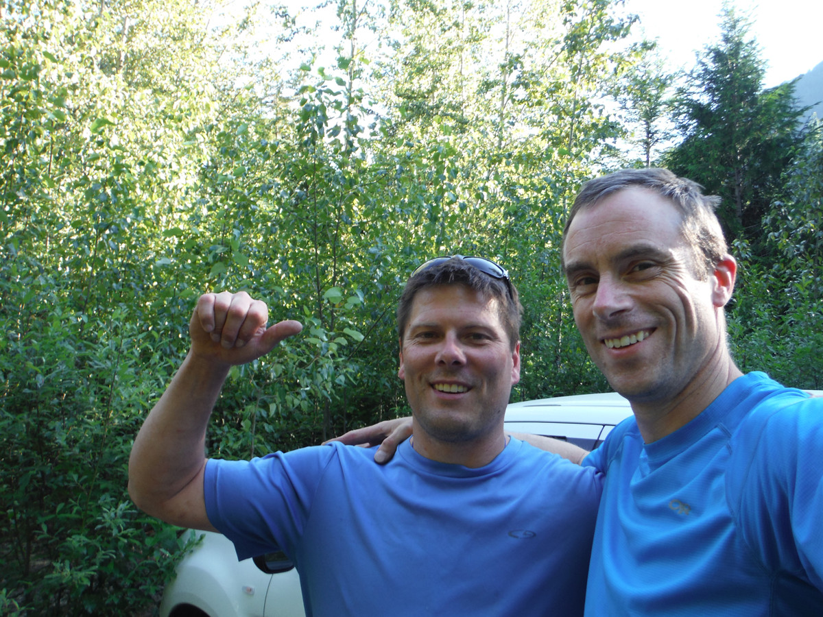
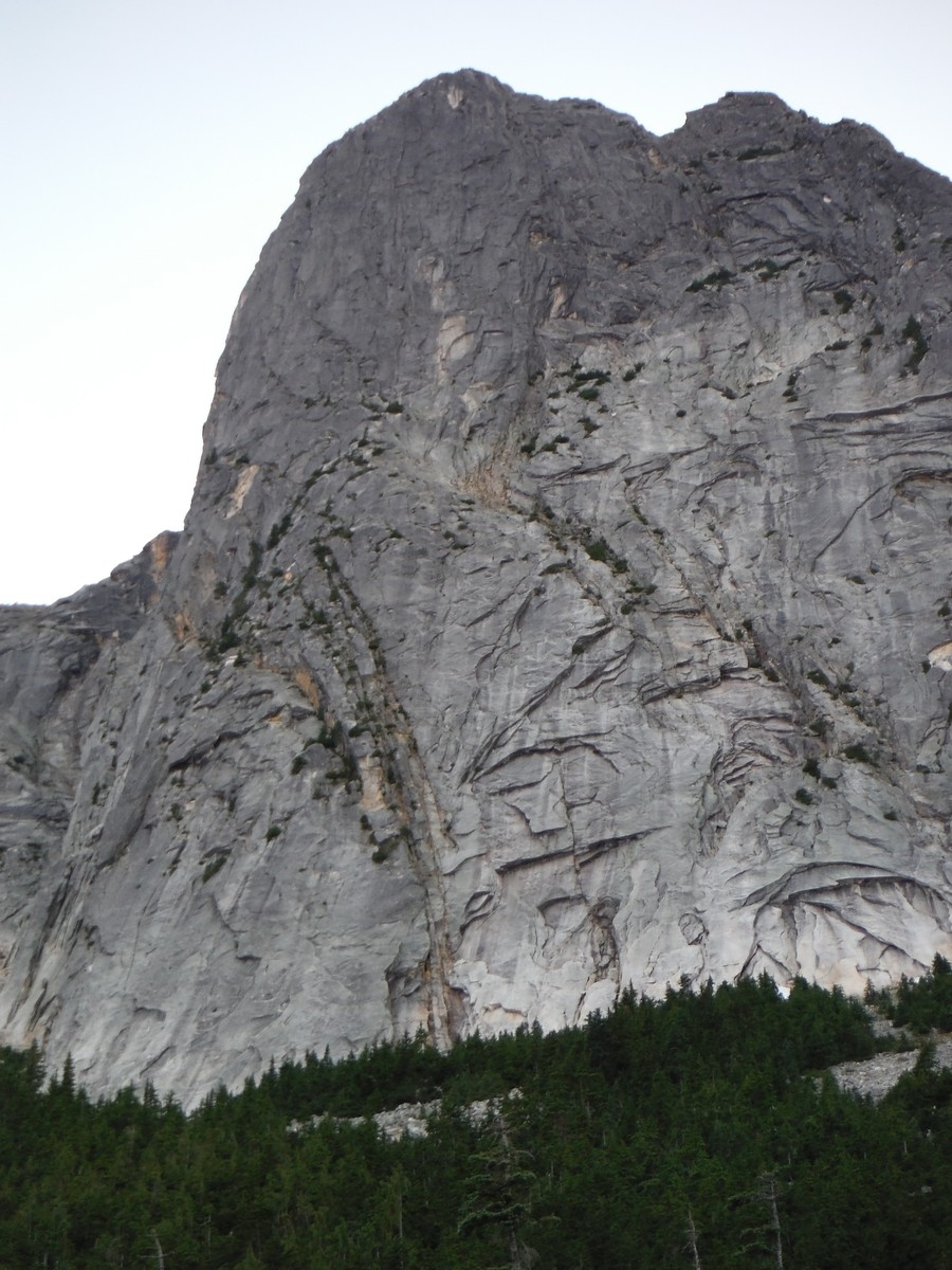
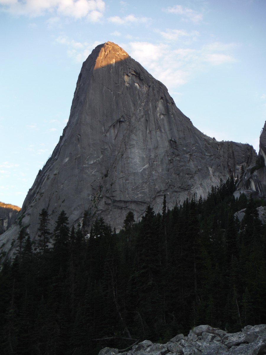
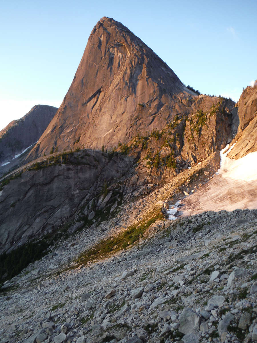
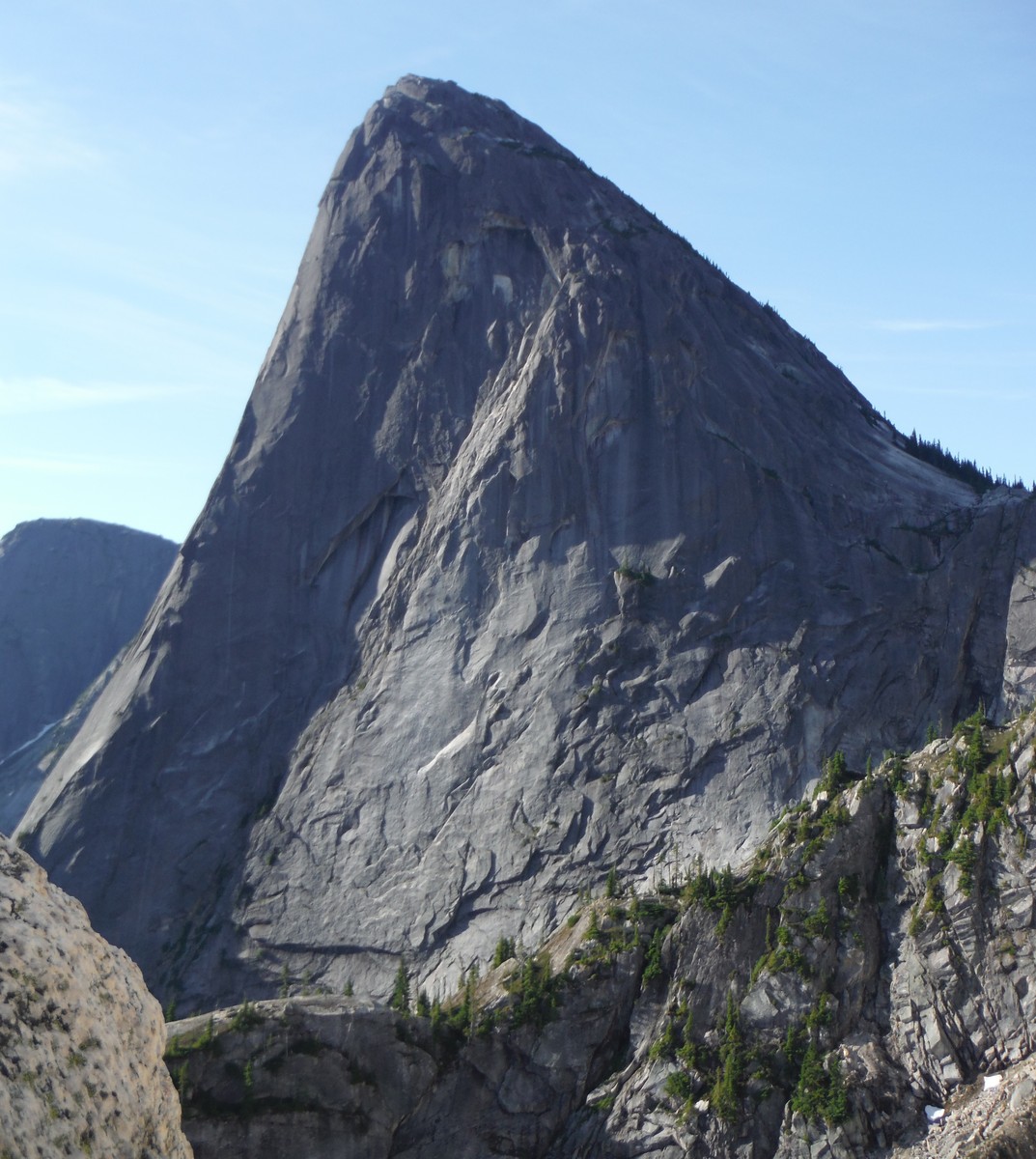
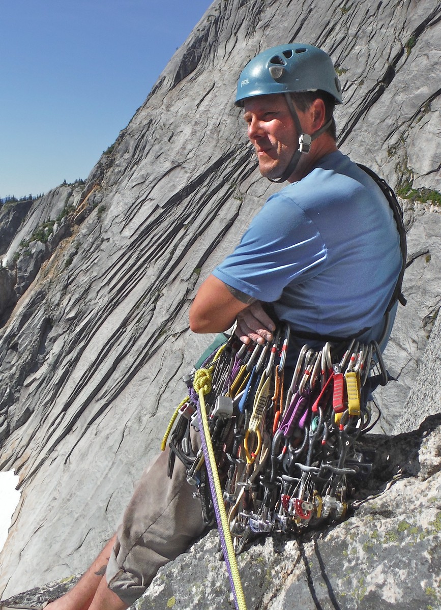
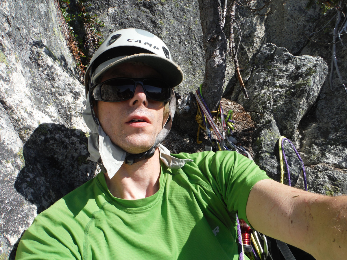
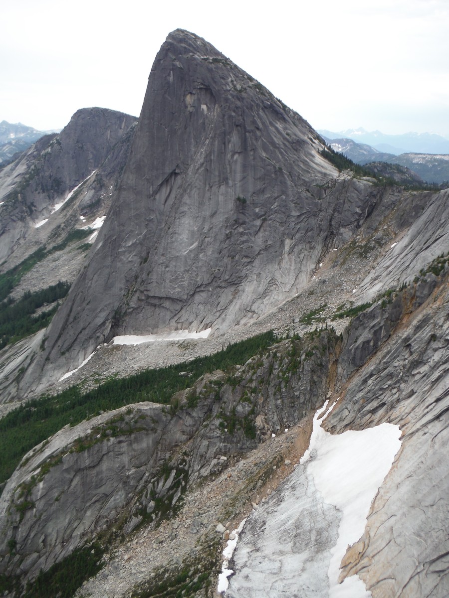
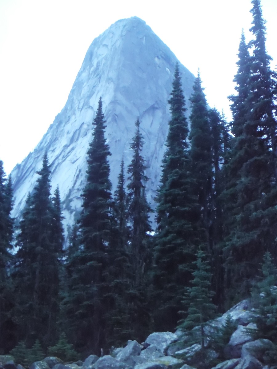
Eight years ago Craig McGee, Jason Kruk, and Brad White put up a new route on the BC backcountry spire Les Cornes they dubbed Sprung C#$k Erect. SCE features a spectacular backcountry alpine setting, 13 pitches of outstanding climbing up to 5.11, some of the best granite in the Northwest, and an approach that makes you really appreciate your couch when you get home. Veteran alpinist Wayne Wallace said this climb challenged him to the fullest and is one of the best rock routes he’s climbed. We didn’t need more reasons to go. Brandon and I negotiated time off work and family obligations to give it a shot.
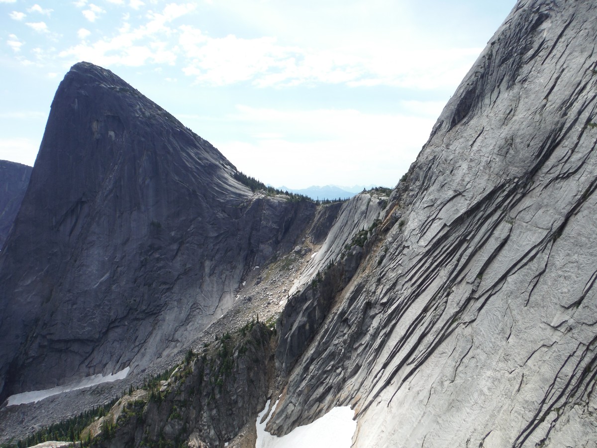
Les Cornes is on the upper right in this photo.
The forecast for Saturday was for 99 degrees and sunny. Not good for rock climbing. It was supposed to hit 90 on Sunday, and the route is in the sun all day, but we figured if we got a super early start we might be OK. Unfortunately, we were both coming off a week of 4-5 hours of sleep per night, but family and work hall passes are non-transferable and non-refundable, so we were determined to climb something awesome in this window. Les Cornes had been on our list for some time, so off we went.
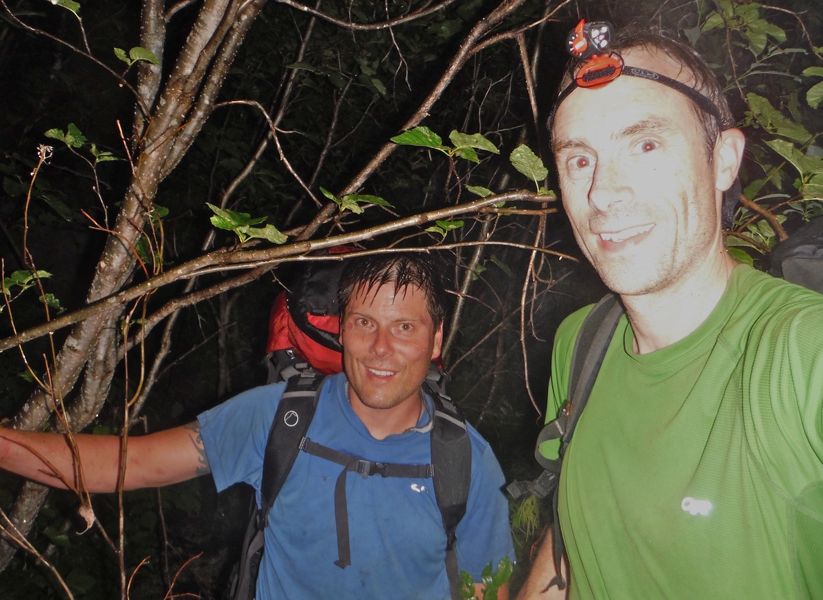
I picked up Brandon on Saturday morning and we headed to MEC to take advantage of the strong US dollar. I got two new 7.8 Sterling Photon Fusion ropes and a #2 C4 camalot to replace one that bit the dust. We headed East on 1 toward Hope. After running a few errands we were off for the logging roads and trailhead. Roads and trails have changed over the years. I’ve included detailed road and x-country approach beta to keep you from getting lost.
We drove in circles for a bit before finding the right road. There were a few sketchy road sections to navigate, but we made it just fine. We finally left the car at 6pm. It was still almost 90 degrees. The route followed old logging roads that were overgrown with alder. The center of the road was marked by the line where the alder sweeping in from the left met the alder sweeping in from the right. It was like walking through a dry car wash.
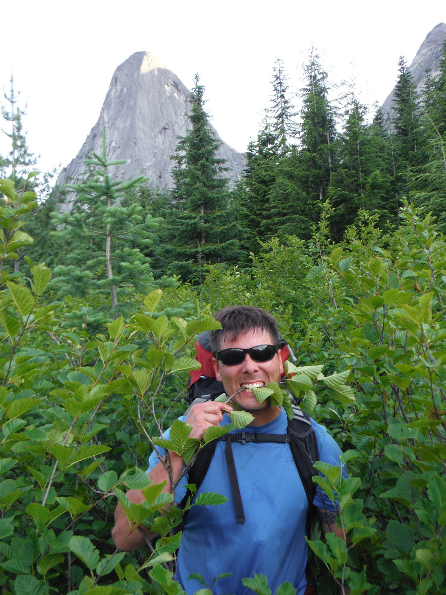
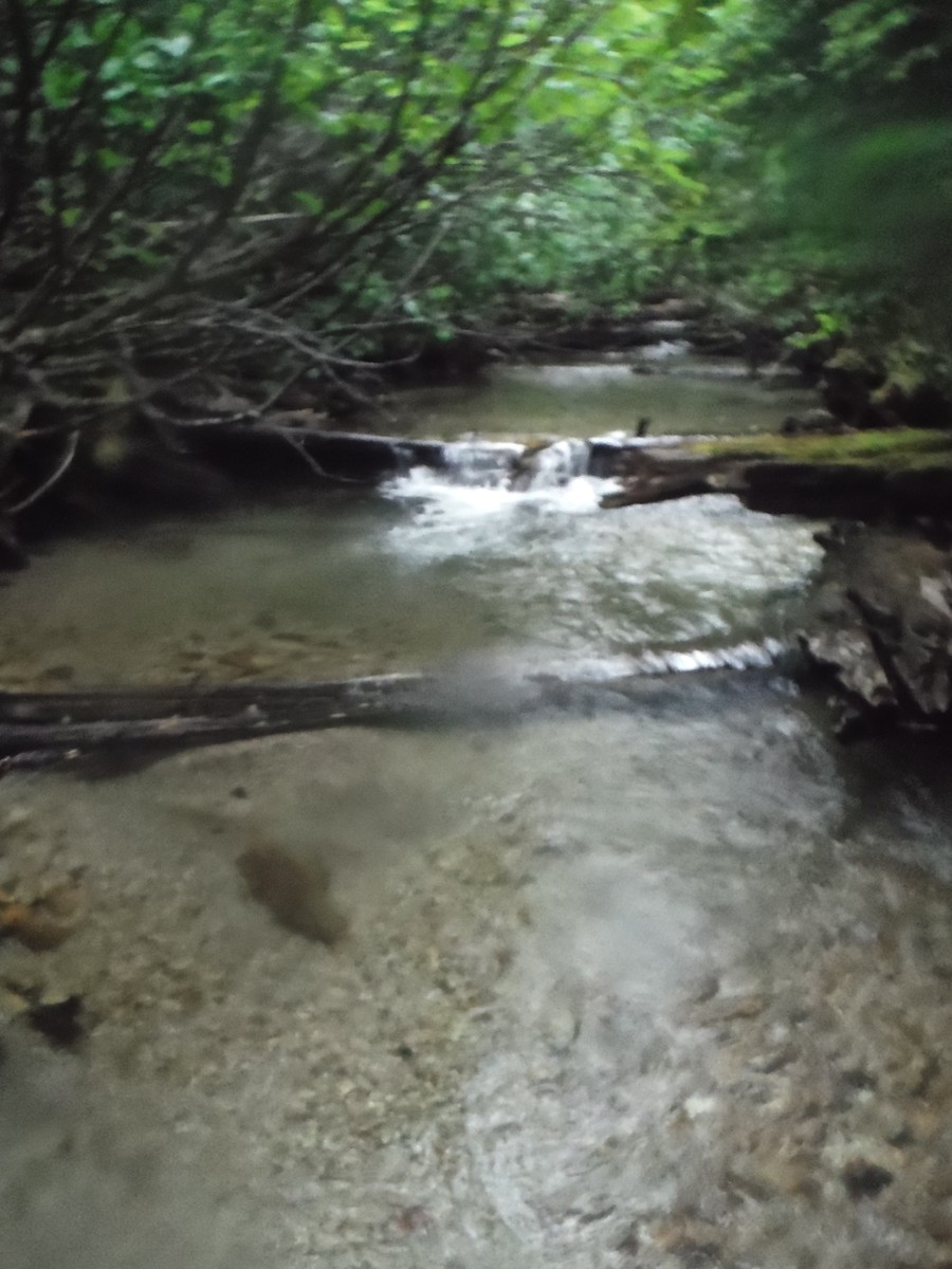
We left one “road”, crossed the creek, and followed another “road” as indicated in our GPS track. The alder here was denser and there was a nasty mud in places.
My scale for gauging bushwhacks involves answering the following questions: Can you see your feet? Is it night? Are you going uphill? Are there fallen trees, rocks, or other sizable obstacles? Are there prickers or toxic plants? Are you carrying a heavy pack? Is it wet?
The Les Cornes approach was not horrible but not great. We found a much better way to go on the descent than on the way up to the route.
Eventually, we left the “road” tramped through blueberries and pine shrubbery and reached talus that led to the base of the Les Cornes wall.
Thankfully, there was a trickle of water from the last melting snow sections. It was greatly appreciated.
I scrambled along the wall to find the base of the SCE start, which consisted of a single bolt below a crack. I made a cairn and went back down to get some rest. It didn’t get dark until almost 11pm.
We went to sleep around midnight in the open under the moon and stars.
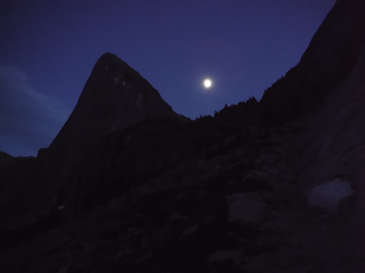
The alarm went off at 3:15am. We ate, hydrated, and headed up to the start of the route at first light.
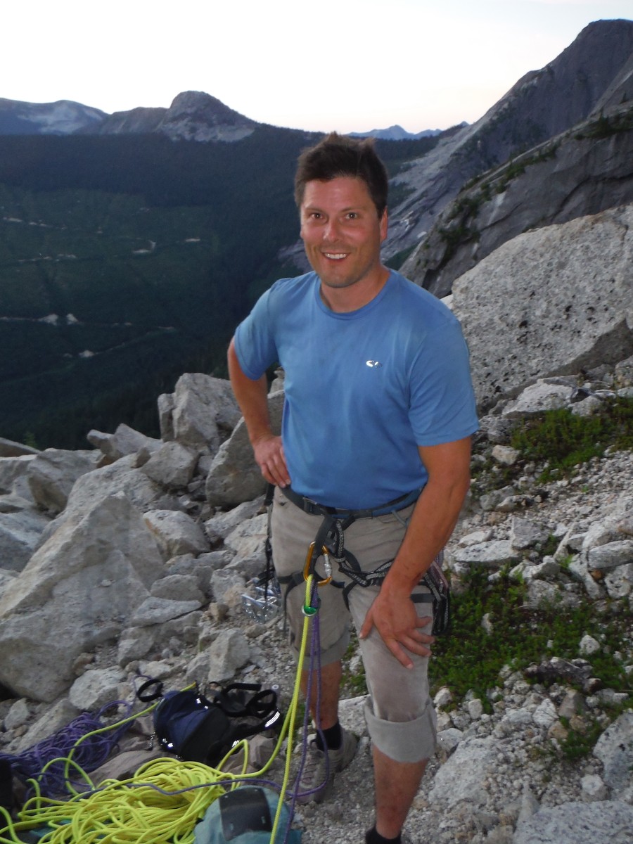
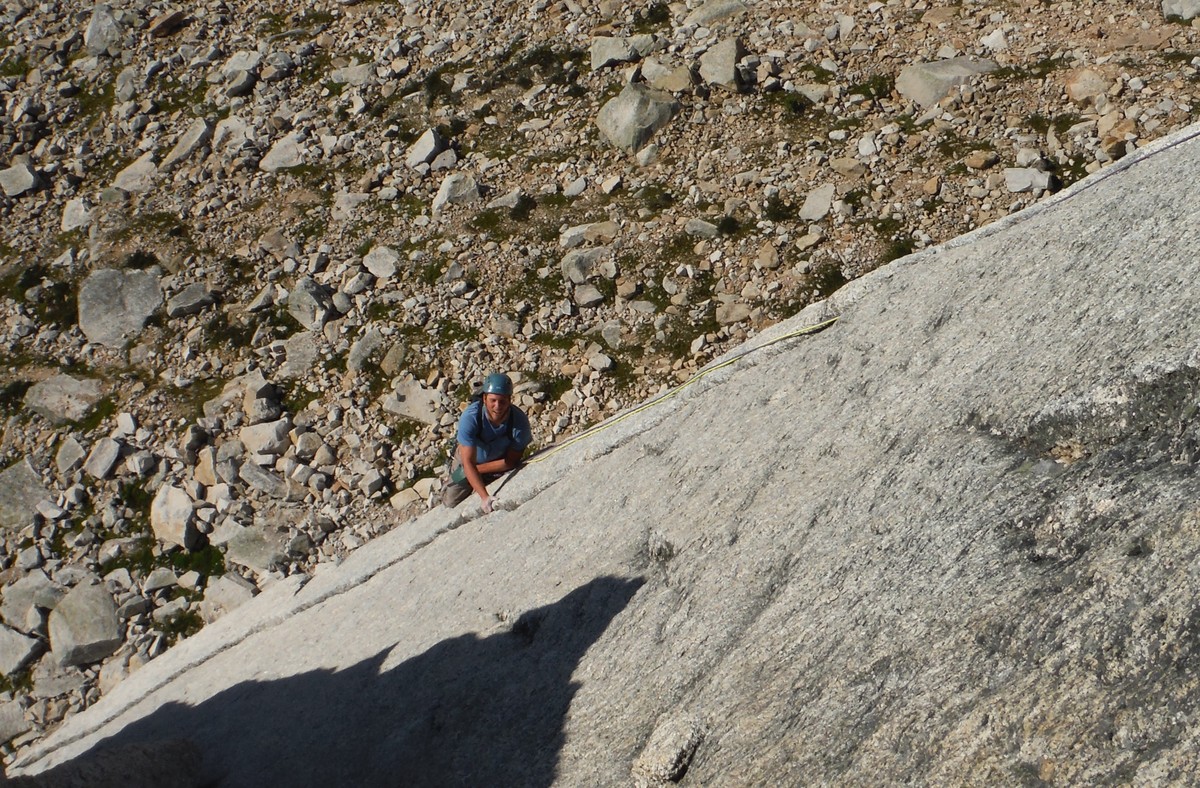
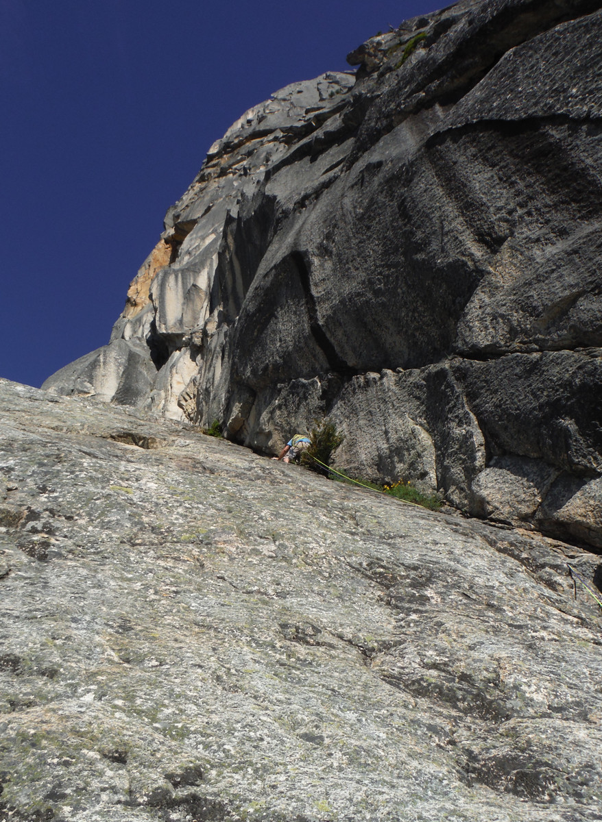
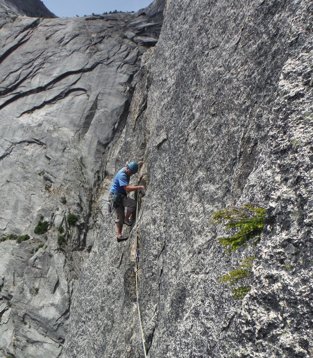
I roped up and cast off on the first pitch at 5am.
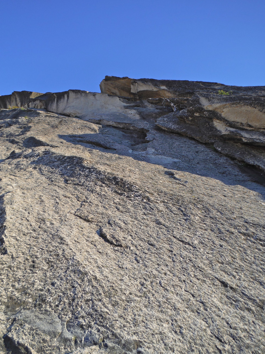
The route starts with a hard 5.10 face move to gain a slightly easier crack.
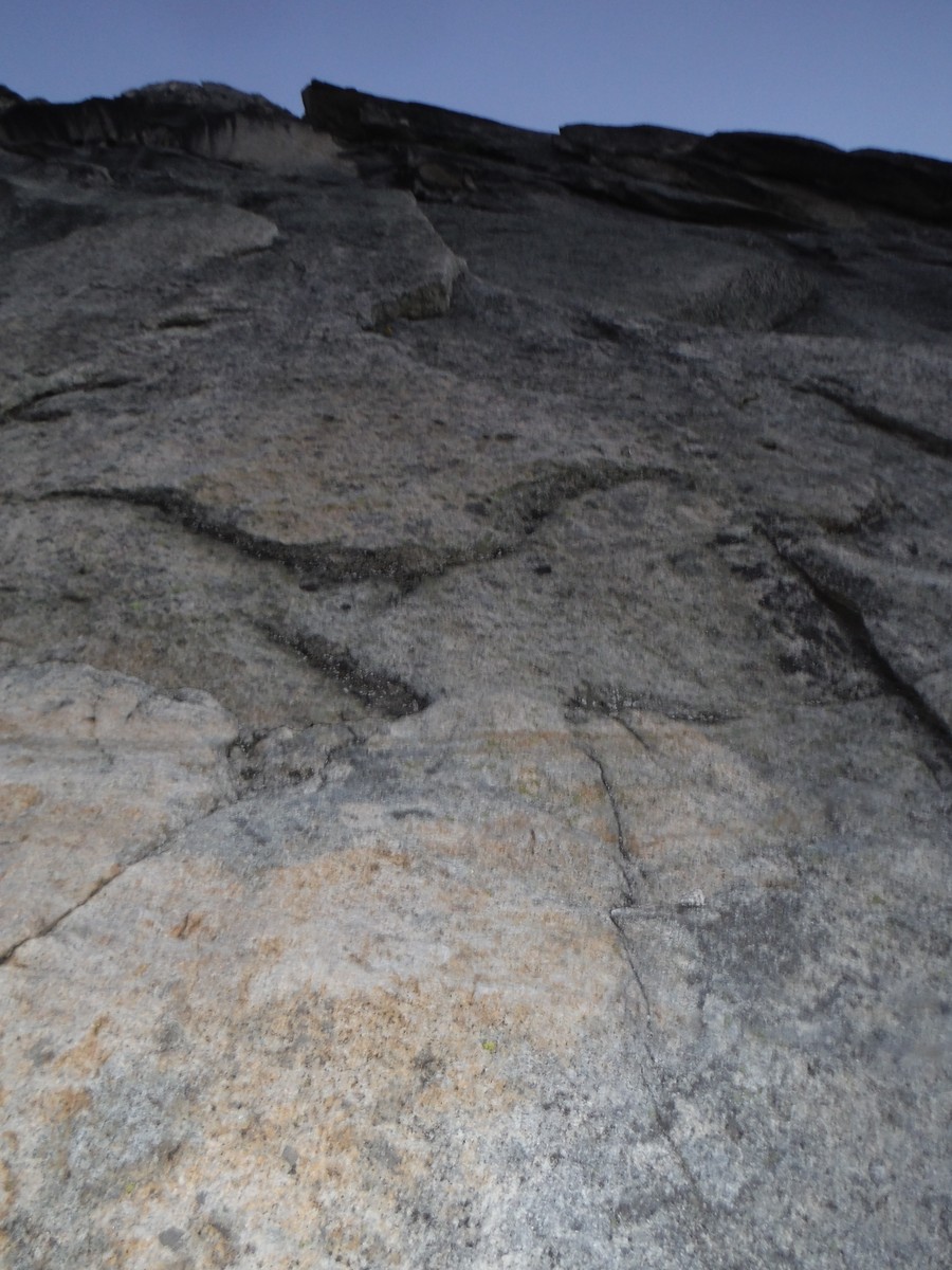
The impeccable rock and stiff ratings set the tone for the day.
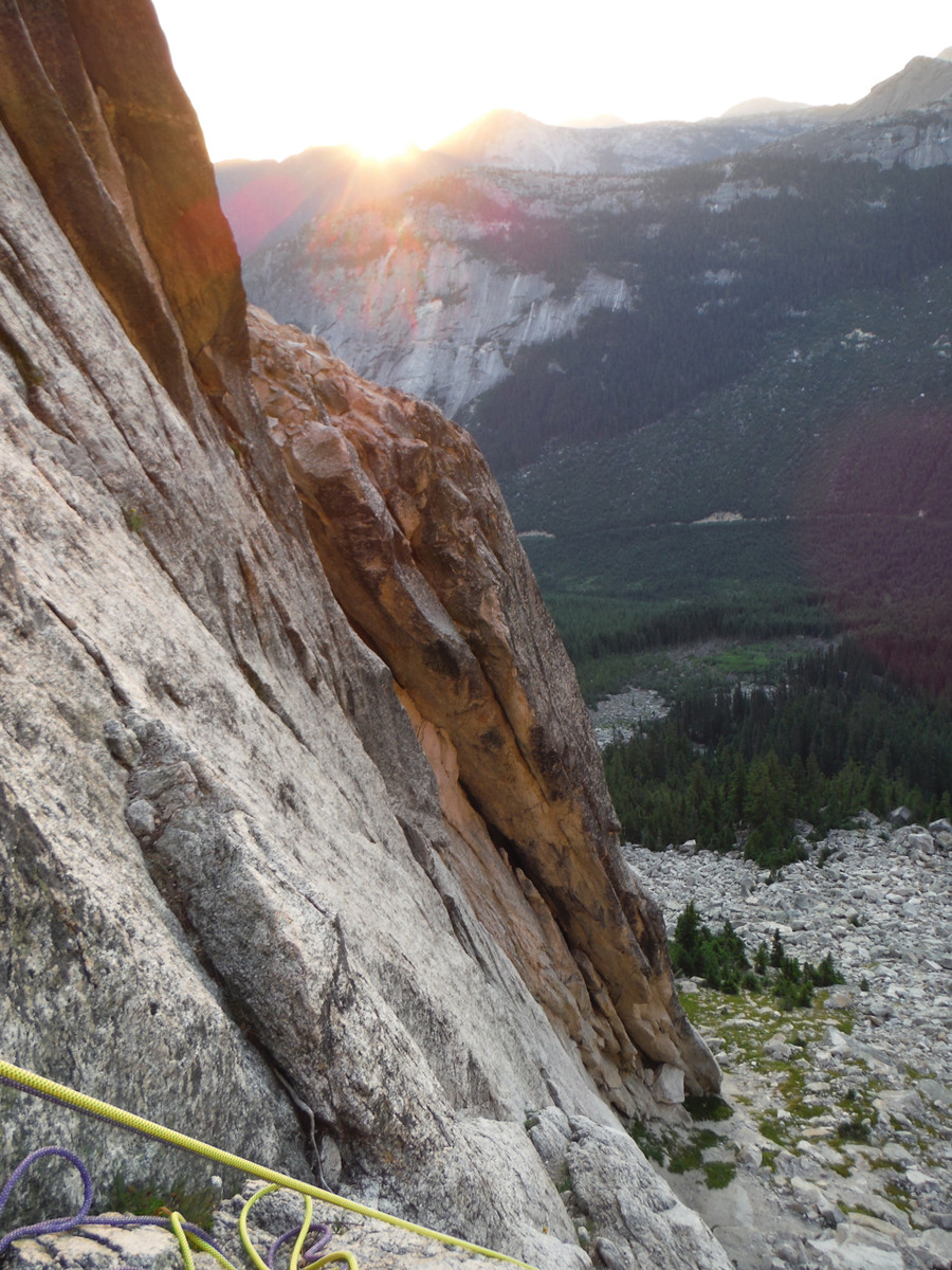
Dawn in the mountains is always beautiful
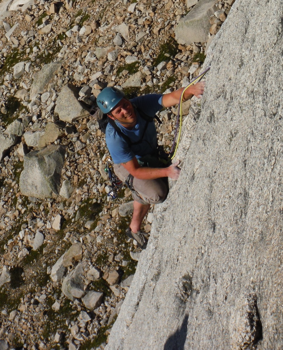
The second pitch looked quite clean and interesting, with face moves, a small corner, and a short slot.
Brandon led pitch 2, with a ledge traverse, face moves, and a cool finish.
How often do you do a knee bar while also doing a fist jam?
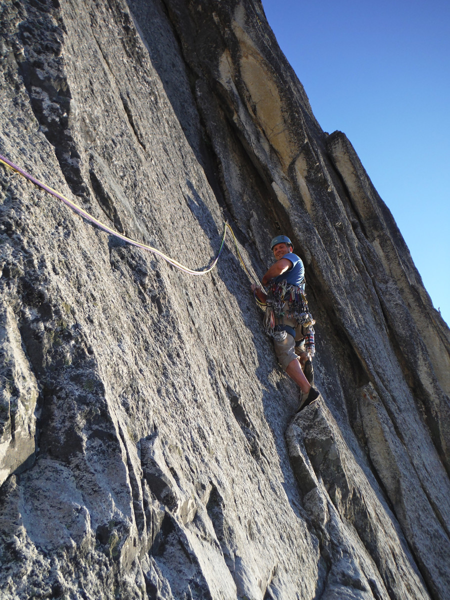
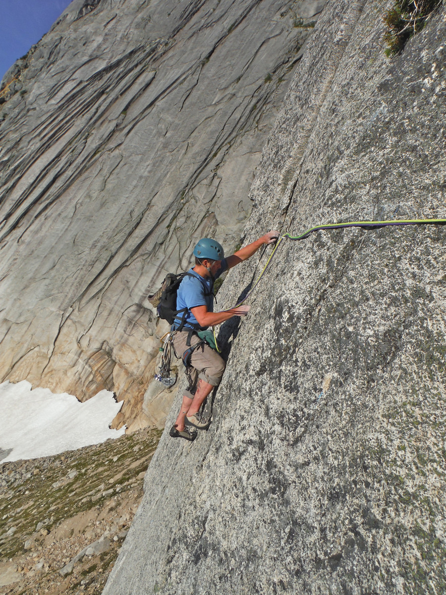
I led pitch 3, which started with a gently overhanging crack before a lower angle wider crack.
At one point I was doing a heel hook and a fist jam at the same time.
Looking down at that section:
The “OW” was more like fist crack for me.
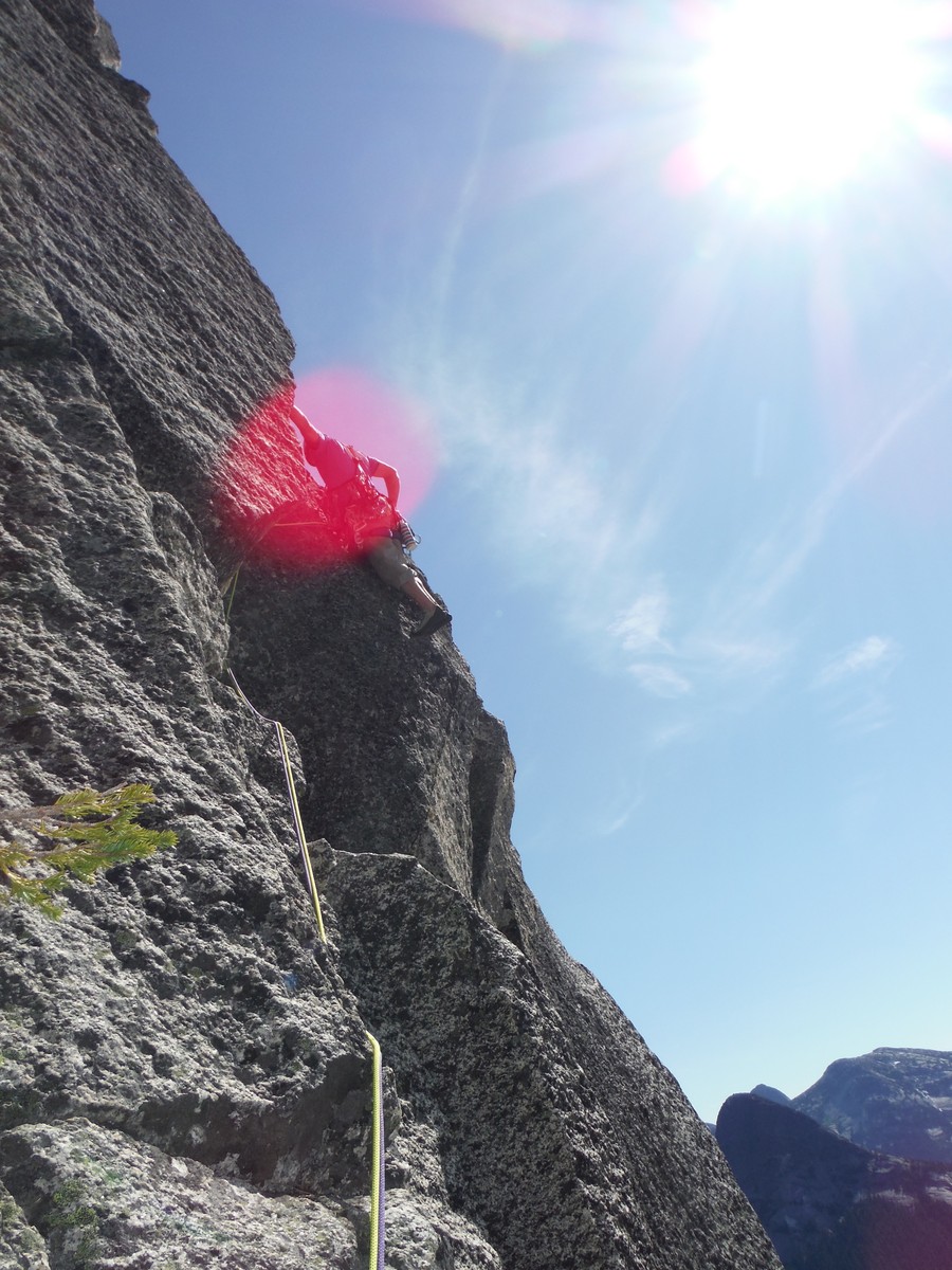
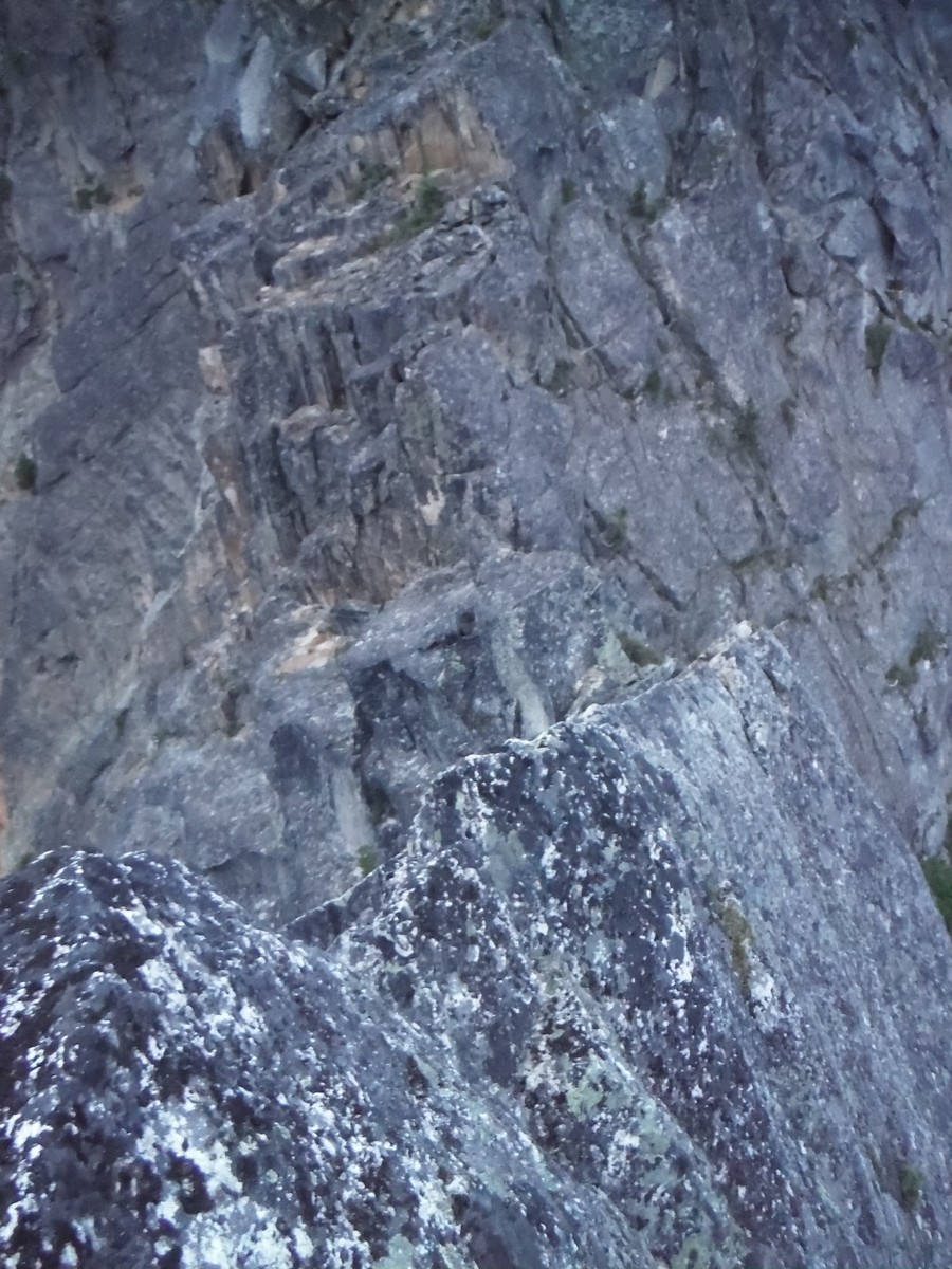
The airy face moves were excellent. Wayne’s photo of Lane doing a Tarzan impression on a bushy tree here stuck in my mind as I stared down the final crux. I locked off on small holds, stood up, and reached up to grab a dangling tree branch as fat as my thumb. The branch snapped off in my hand and I took a 20 foot ride, caught by the bolt. Dang tree! The second time I went up and sent the move using only the rock holds. It’s important for the leader to place a piece in the flaring crack between the last bolt and the bolted belay. Otherwise your second could take a 20 foot fall and pendulum into a corner below the belay.
Here's Brandon following that section with the offending tree at the top of the frame.
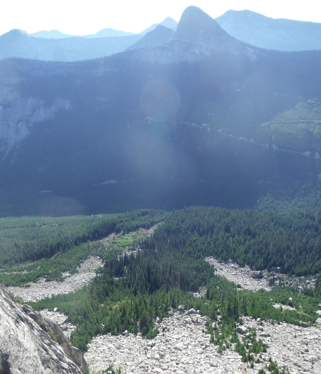
Steinbok looms across the way all day.
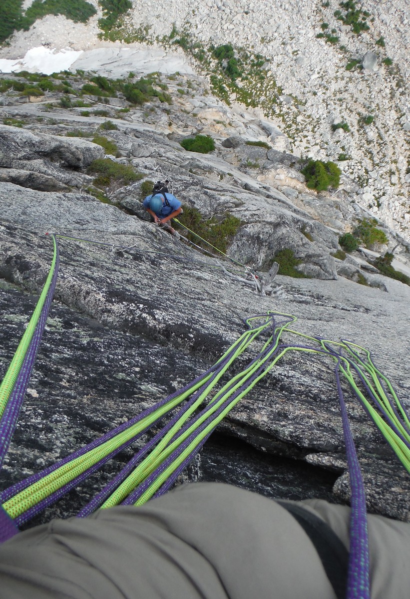
We simul-climbed the next two 5.6 pitches to the base of the first obvious dihedral.
We eyed the terrain below to find a better route out to our car.
I took the right hand variation as it seemed more logical than the steeper left hand side. There were some interesting moves and a handy tree belay.
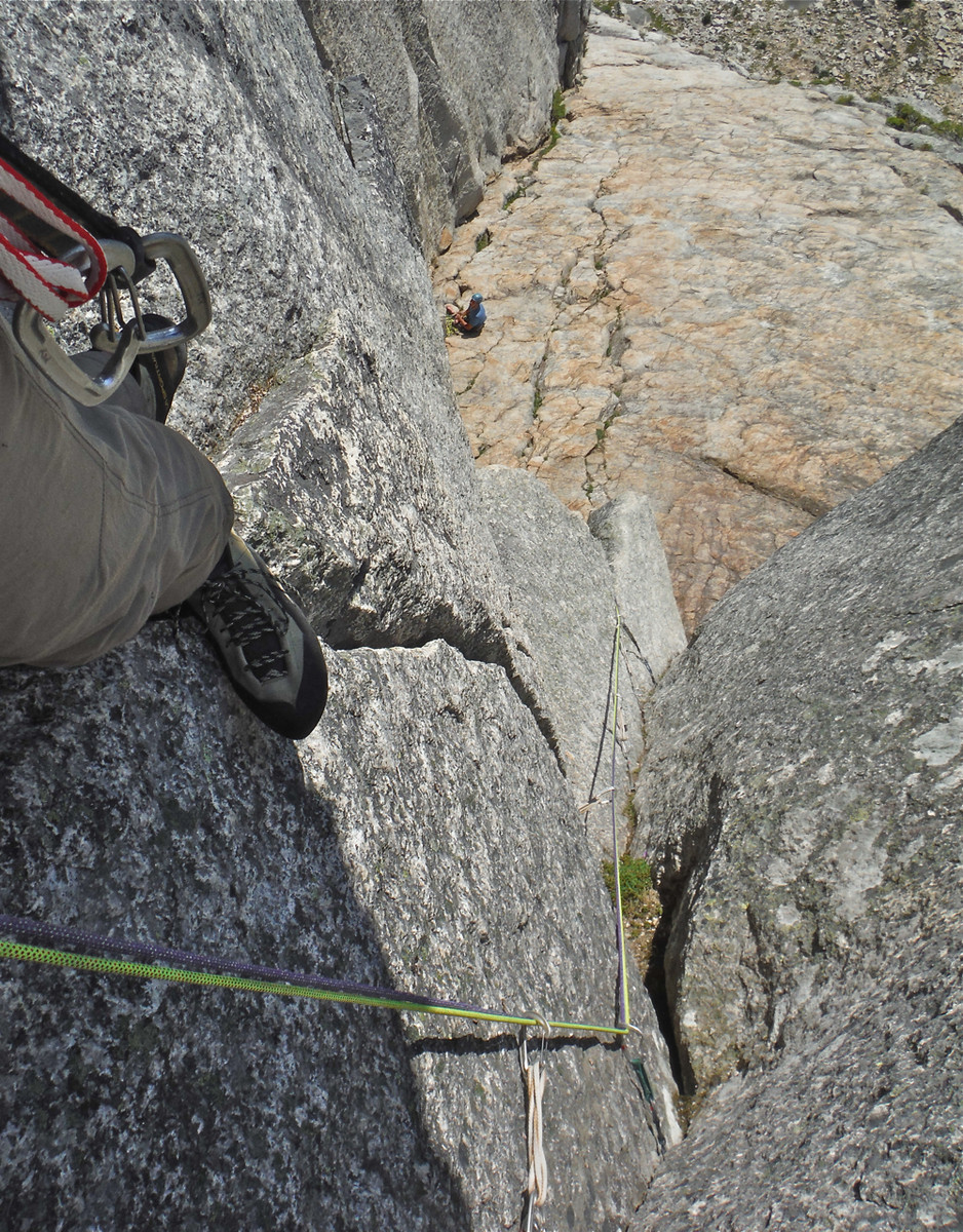
6 pitches down. 9:40am. Only 7 pitches to go.
We thought we were doing pretty well, but we were in for some schooling.
It was quite warm in the direct sun, but not unbearable.
The next pitch starts down and right of the tree and involves a few tricky 5.11 moves
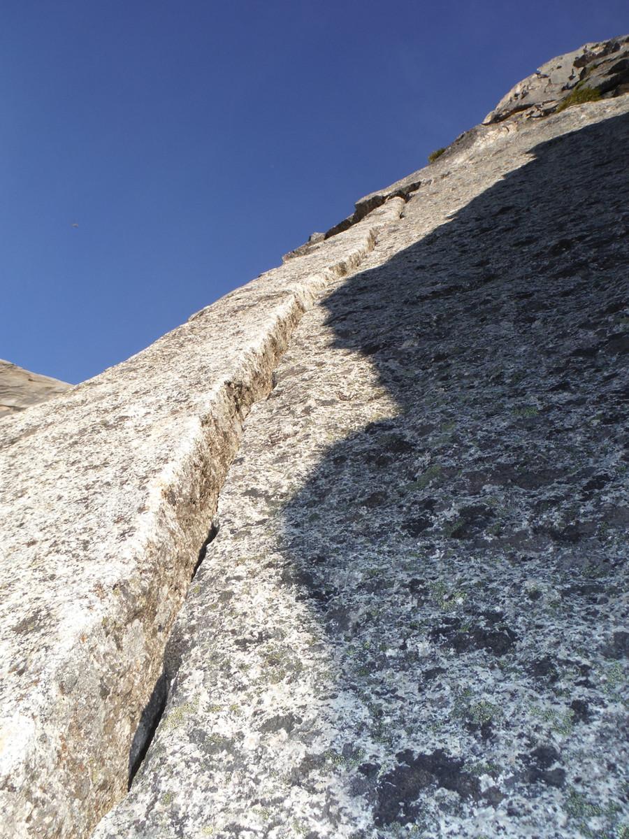
followed by an amazing vertical crack in a shallow corner.
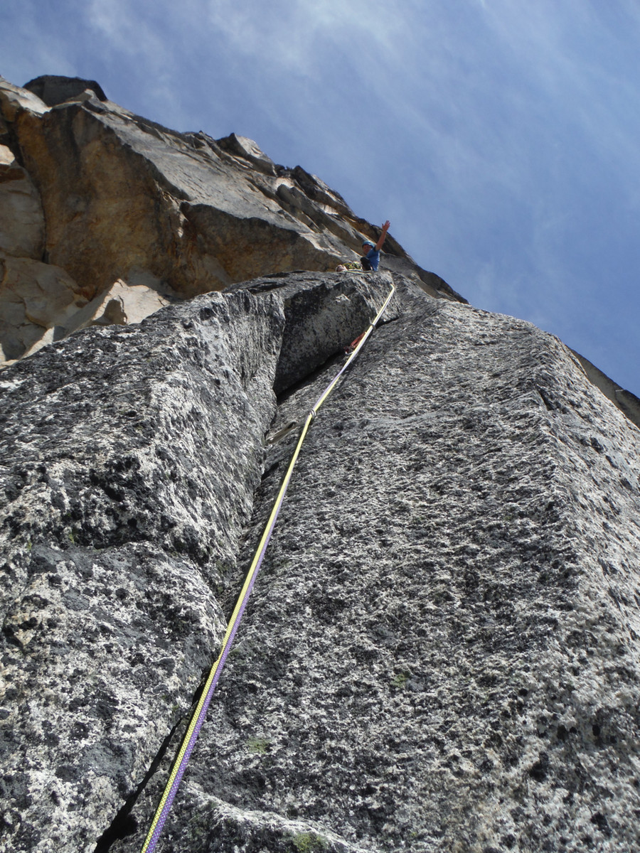
The "10c" downward traverse was harder than expected.
the “5.8 offwidth” involved an overhanging, flaring, scruffy slot where the #4s again came in handy.
It got hotter. We nursed our liquids, but dehydration, heat, sleep deprivation, and the difficulty of the route started to wear on us. I fought my way cleanly through a 5.10+ crack that shifted from liebacking to jamming and back to liebacking. And that was the end of my free climbing gas tank.
We were determined to get to the top. Brandon went up an immaculate but hard 5.11 corner. He had to dig out a few gear placements and A1 his way up the line.
I did the same on the next 5.11 pitch.
Stronger climbers can link these two together and will find the crack now ready to accept plenty of finger size protection.
Looking down, you can see where we camped at the base of the slabs next to the snow patch.
It was torture to listen to the water running below the snow between Les Cornes and Steinbok.
The sun gave way to thin clouds, which in turn gave way to scattered showers. The few drops that fell on us felt wonderful.
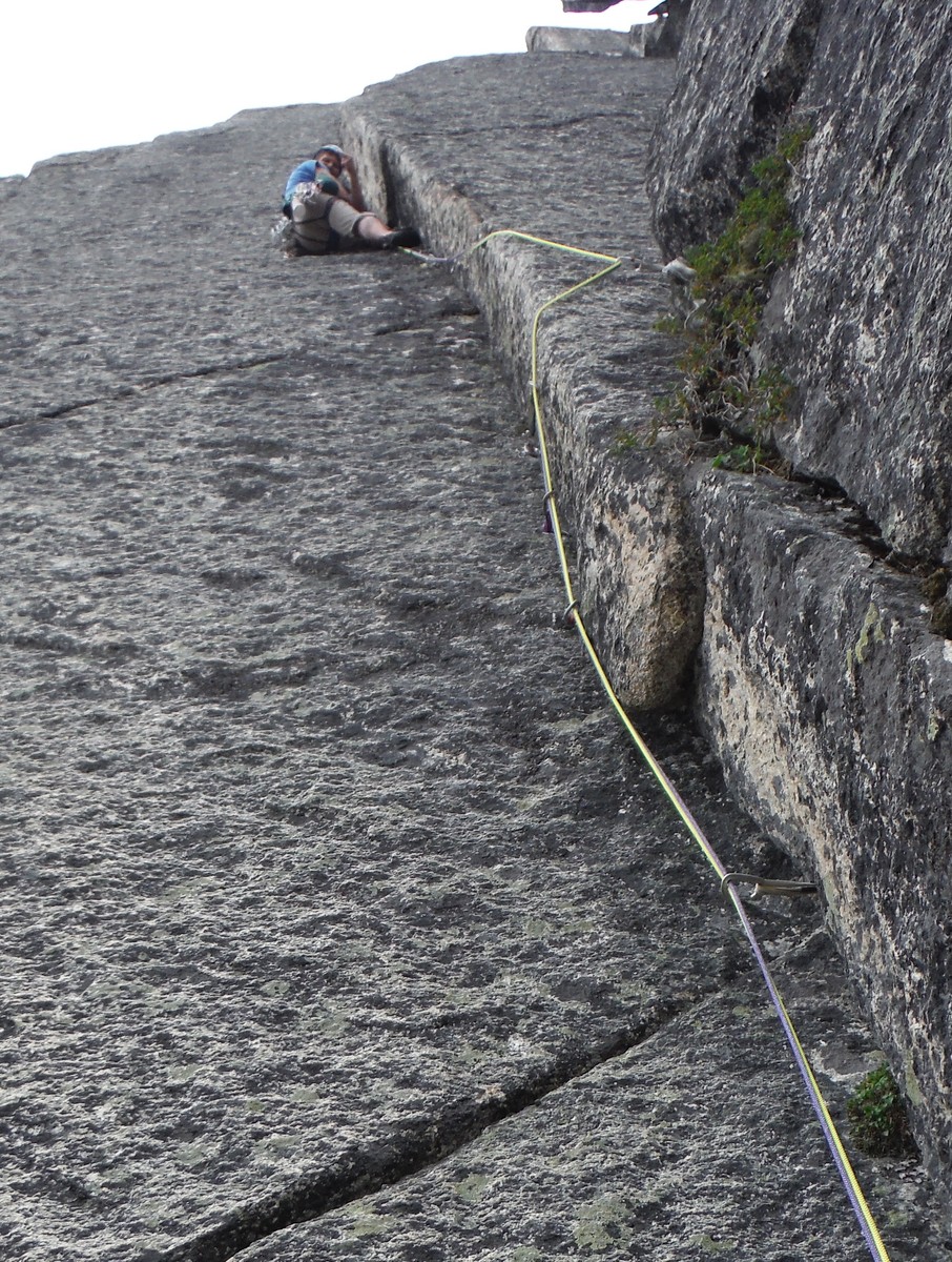
We fought our way up the final 5.9 and 5.8 pitches to the top. These felt hard, but we were cooked and exhausted.
As we topped out a shower wet the rock and made the lichen as slippery as ice.
We dreaded the au cheval descent, but thankfully someone had added a nice new sling we used to rappel the au cheval. I’ve never rappelled down an au cheval ridge. It’s best to keep your man parts all on one side of the fin, but you need to keep one leg on the other side to keep from doing the king swing. Despite scary comments and pictures, this thing is not that bad, and it’s an essential part of the SCE experience.
We did three double rope rappels into the top of the gully as it started to get dark. Some scrambling led us to a drop off. We found a tattered sling on a rusty knife blade and decided not to trust it. So I left a #3 camalot in the only crack we could find. I rapped down 50 feet to an alcove where I could hide from rock fall set off by Brandon and drink deeply from meltwater. This hydration was badly needed and much appreciated. We continued rappelling down steep, smooth, wet slabs and got off the ropes on some small ledges where we could again scramble downward.
But Les Cornes wasn’t ready to let us go just yet. The ropes wouldn’t budge. We tugged and flipped and tugged, but they still didn’t move. Prussiking up 60 meters of stretchy rope didn’t sound fun or fast, and Brandon was concerned if he didn’t make it to work in the morning he might be fired. I didn’t want to leave my new ropes behind, but I eventually conceded that might be an option IF we didn’t need them for a rappel down lower. So I scrambled down a few hundred feet to see what the last steep part of the descent looked like. There was a fifty foot vertical drop past smooth rock into a moat, so we did need the ropes after all.
I scrambled back up to Brandon and we started up the lines, each on one strand.
Fortunately, after about 80 feet we were able to get the ropes to move. I found a block and excavated a groove for a sling. We pulled the ropes and rapped off the sling.
We scrambled down the final section, rappelled down the final step to the snow, and stumbled down toward the base of the route and our camping spot.
Unfortunately, I went right past the start of the route and had to backtrack up a few hundred meters to retrieve my pack and tennis shoes.
River slippers were super light for descent shoes, but they don’t protect your toes very much.
We arrived at our camp at 4am, exactly 24 hours after we left it. We hydrated and then made our way back to the car along a path we spotted from the route.
Talus hopping and old growth forest were much better than the alder roadways we’d used on way in to the route, but old growth also means devil’s club, alder, blueberries, and ferns as we came down close to the creek.
It took us two hours to get from our campsite to the car, and a light rain soaked us the entire way.
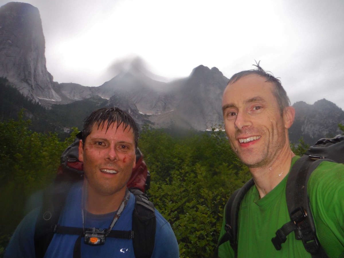
We were wet and tired
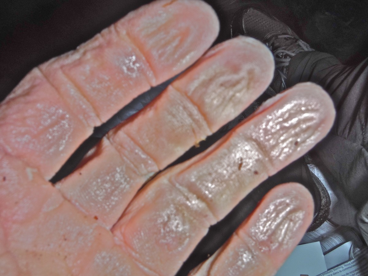
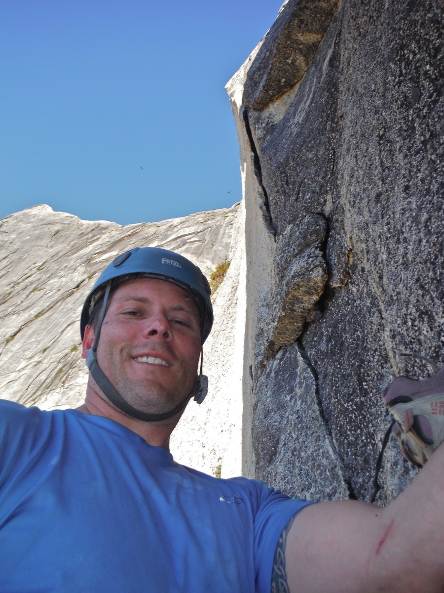
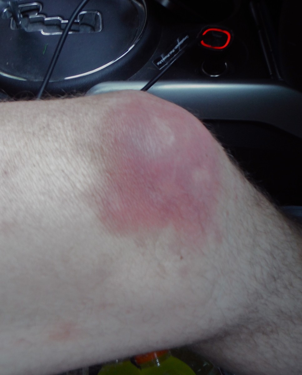
And had a few scrapes and bruises, this one likely from my fall on p3, but we were safe.
We finally had cell service close to the road and told our loved ones not to call in a rescue. Of course, Brandon wasn’t fired. He’s so responsible and dependable that they were worried something had happened to him when he didn’t show up on time. Indeed, we’d had a little alpine epic.
..........................
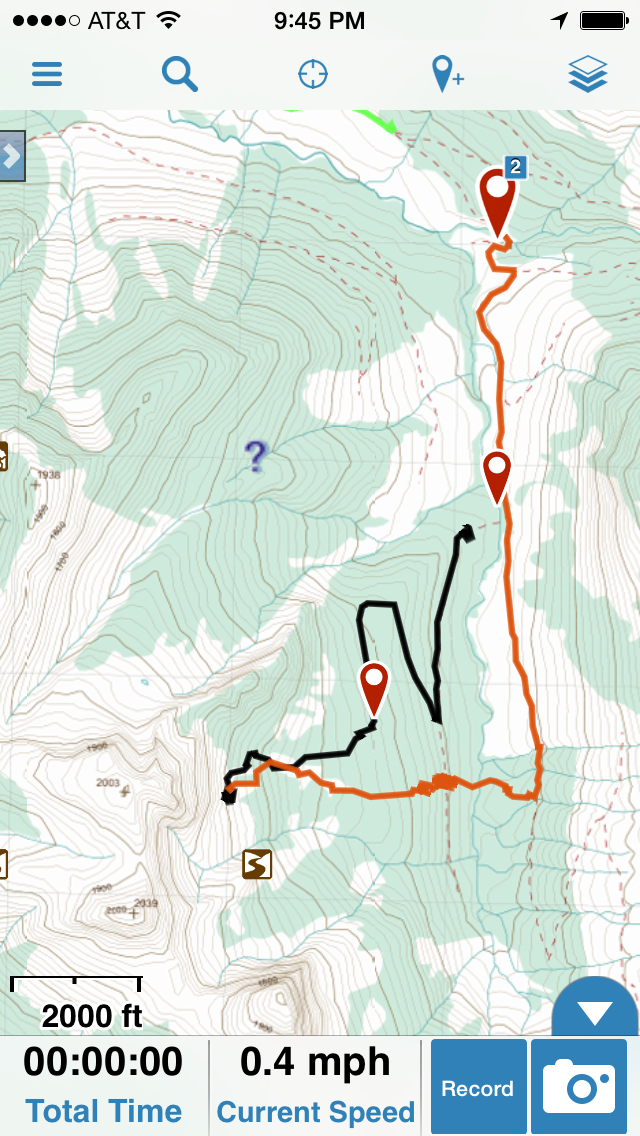
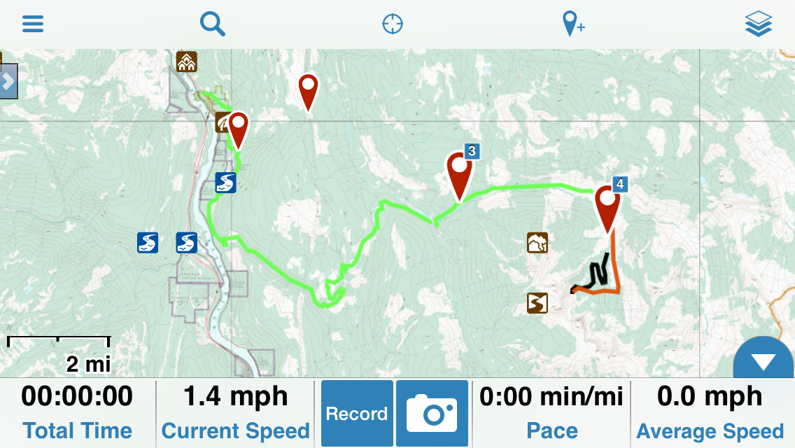
Here are some screen shots from GAIA, my GPS app, that show where we went.
We parked at the red dot by #2 at the top of the image.
We took the black route to the base of the cliff, following overgrown logging roads. DON'T GO THAT WAY.
Our return route our from the wall is in red and was much better. We contoured along the South edge of the longest talus field, jogged right into old growth when that became logical, and had a relatively painless shwack close to the creek.
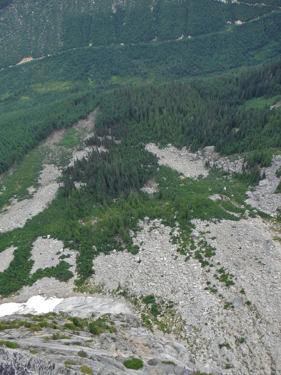
This shot from high on the wall shows our descent. We followed the right edge of the big talus field on the left side of the image, jumped skiers right into the old growth (dark green trees), and shot straight down to the creek, across it, and up the other side to the "road".
We bivied at the base of the slabs next to the snow you can see. It was a perfectly flat spot with a great view.
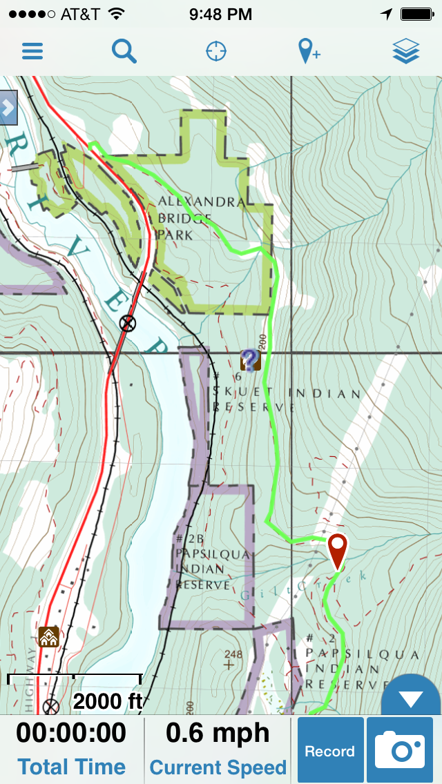
This next track shows our driving path.
The driving directions here are pretty good: Les Cornes driving approach
A few comments:
1 – There are many more roads out there than this description would have you believe. The topo maps have roads that have been reclaimed by shrubbery and are not visible. There are some roads not on the map at all. If you follow the directions here and take a GPS you should make it just fine. We did.
2 - the “veer right” at 1.8 miles has no bus or other remains and the road soon heads downhill. Don’t worry. Keep going. If you go left at this first junction you go up over a crest to the Anderson River valley, which sounds right but it is not. GPS helped us backtrack and get to the correct route.
3 – There is no logging camp infrastructure any more, but we saw some shiny helicopters around 3 miles up the road. Drool!
4 - There are water bars on the section before the “Big Bridge”. A short wheel base and/or high clearance are helpful.
5 – There are three somewhat sketchy sections of road past the bridge where you have to navigate some washout, rocks, and try not to pitch over the edge. We got out of the car, moved rocks as needed, and made it just fine. 4WD helped in two small spots but might not be essential.
6 – The spur road right turn off Anderson Main at 15.8 is pretty much impossible to spot wo GPS. We were only able to go a couple hundred yards before a lumpy section of road convinced us to park and start walking.
This is the GPS section close to where you depart the road. The red waypoint marks the 1.8 mile jxn where you stay right.
..................
It took me two days to fully rehydrate and recover normal energy levels after this trip.
If you can climb trad 5.11 or are willing to aid a few 5.11 sections I’d highly recommend this route. You could make this climb a bit easier by doing the first pitches we did and then jumping over to the Springbok Arete route to finish. Just don’t skip the first three pitches of SCE as they are amazing!
There is some snow at the base of the wall where we camped that will provide water for a few more weeks. There was water in the gully on the descent.
Go get it!
Gear Notes:
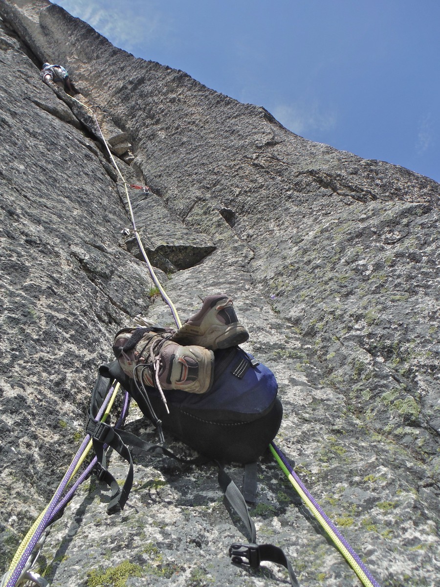
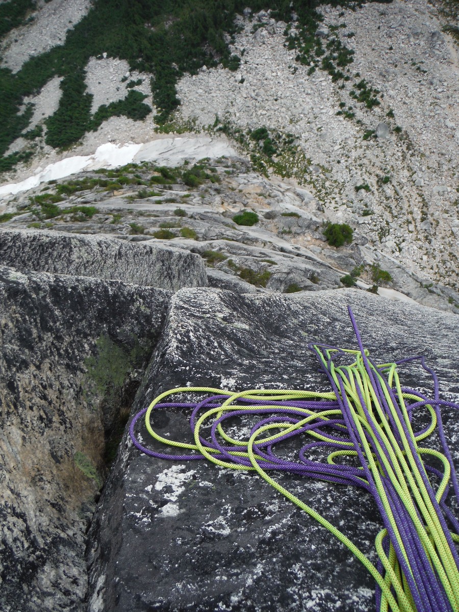
We brought two 60m ropes and a standard rack with doubles to #4 Camalot.
Approach Notes:
See detailed beta above.
-
Don, we brought 2 ropes (new Fusion Photon 7.8s I picked up at MEC on the way) and they were essential for getting down the gully in one piece.
The first three pitches of Sprung ... Erect were outstanding and should not be missed.
-
Go ahead youth, just try asking me if I know what climb I'm about to do. Or if I know where Air Guitar is. I'd be more than happy to ignore you....
Don't miss a good sandbag opportunity!
-
Me:
"There are two important traits for climbing partners:
1 - a willingness to suffer. 2 - A short memory".
Partner:
"What was the first thing again?"
-
Sprung c#ck Erect is an outstanding route guarded by a non-trivial approach. Roads and trail choices seem to have changed from past posts so I'll put together a trip report at some point here.
-
08 or 09 for the block in question.
-
Bump. What is the latest drive approach beta?
Are two ropes needed or is one sufficient?
Thx!
Rad
-
FWIW the summit block is short. A single 60m got us up and down with rope to spare, so your twin 30s should be fine.
Glacier travel rules remind me of the rules of white water boating:
#1: stay in the boat.
#2: stay in the boat.
#3: stay in the boat.
#4: if you fall out get back in the boat.
-
I got speedy email responses, sent shoes out May 6th, and got them back a few weeks later.
Try: Cascade cobbler
-
Sounds like an amazing response from local climbers and SAR. Hats off to all involved, and I'm very glad the subject is doing well.
-
I haven't been in a month or so. Did something new fall off? There was a large block that fell off the bottom and changed the starting moves for Steep Street and Under Arrest. But that was several years ago now, nothing else has fallen off those routes, and this doesn't affect Rude.
-
Awesome! Probably a good idea to go early this year.
-
Bump. Looking for two new packs:
1 for long alpine rock routes no overnight.
1 for long alpine rock routes overnight carry over.
I was thinking CiloGear but this thread has confused matters substantially.
I'm 6'1", tall, appreciate weight on hips not shoulders and appreciate a hip belt with some padding. I'm wiling to suffer more on the day alpnie rock routes. Less on 2 day outings that generally involve covering a lot more non-technical ground and have easier technical rock climbing.
Suggestions appreciated. Thx.
-
How was the trail to Hedlee pass? Any snow down there? Thinking of another objective in the area...
-
Awesome! Thanks for posting.
-
38 pages? Wow. Y'all should unplug and try this thing called climbing. It's pretty RAD.
-
Finally watched Beth on Meltdown on Dosage V. She places all gear on lead except the first piece, which is pre-placed and pre-clipped. An impressive send indeed, and perhaps still the hardest female trad lead.
-
Cutting trees is not the same as scraping moss and pine needles out of cracks. There are cases where it makes sense, cases where it clearly doesn't, and a continuum in between.
Perhaps more importantly, the day is coming soon when Index will be a State Park and it will not be possible to just do whatever the f##k we want without consulting anyone. For that type of freedom you'll have to develop crags on your own land. Right now the property is owned by the Climber's Coalition, so you should seek permission from them for any projects beyond basic gardening.


[TR] Cathedral Peak - NE Buttress 7/15/2015
in North Cascades
Posted
40 miles for one awesome route. Ouch. Your capacity for masochism will serve you well in the PNW.
Good luck with your next adventure!