


Rad
-
Posts
2925 -
Joined
-
Days Won
25
Content Type
Profiles
Forums
Events
Posts posted by Rad
-
-
Not glacier glasses but UV, eyes, sunglasses: Article on UV damage to eyes
Explanation w scientific references
You'll note that a significant mode of exposure is reflection off the back of the glasses into the eyes. IMHO, reflection off snow is a concern in alpine climbing. When planning extended snow travel, consider using darker glasses and minimizing exposure due to reflection off the back of the glasses by wearing glasses that are larger and/or fit closer to your eyes and/or have barriers to prevent light entry from the sides/bottom.
-
 1
1
-
-
Lovely. Such good rock.
Thanks for the TR!
-
 1
1
-
-
Holy Himmelgeisterhorn!
We must now engrave thy names in the Choss Chalice alongside the alpinists of yore!


-
2
-
 1
1
-
 1
1
-
-
Buy local, support the good guys: Feathered Friends, Pro Mountain Sports, real guidebook authors instead of Rakkup, etc.
-
 1
1
-
-
2 minutes ago, JasonG said:
I thought we were talking about the photo above? I think if you prevent future parties from stepping in or grabbing your poo, and you've not gone so close to a stream as to sicken someone, you've done a pretty good job. But, then again, I'm no Poop Nazi.

The photo above is clearly over the top. But I'm arguing that we need to do more than cover our business and hope for the best. Marmots, mountain goats, rodents, and perhaps other critters may dig up your smelly offering and spread it around. Moreover, if it lies in gravel where there are few or no bacteria and fungi living it'll run into the nearest water source when the fall rains wash through the gravel. So yes, we need to do more than cover it in the alpine. See what Climbing has to say: Poop guide for climbers
Maybe I should apply for the PN job
")
-
1
-
-
49 minutes ago, JasonG said:
I find this hard to believe in this day and age. But this is just an assumption. I've never come upon someone crapping improperly and asked them their reasons.

I'd be willing to bet you've had partners who've taken a dump in alpine terrain, laid it to rest in a shallow grave of gravel, put a rock over it, and called it good even though there was little chance their deposit would be biodegraded in a reasonable timeframe compared to if they had sought richer soils...
-
1 hour ago, JasonG said:
Someone needs to have a conversation with the NOCA Poop Nazi.
Anybody remember her? The ranger with a thick German accent who worked the desk in Marblemount in the late 90's and was quite fond of the LNT video that they used to show people before issuing a permit.
To be fair, people can be assholes, literally, in the environment. Sometimes it's from laziness or downright deliberate disregard for protocol, but sometimes it's from ignorance. I think a lot of people don't understand that there is little opportunity for biodegradation of their poop in many alpine settings. Bottom line (so to speak) is people should first try to use toilets in the vicinity when possible and learn to do their business 200 feet from any water source, find rich organic soil where decay is likely to happen, dig a hole at least 10 inches deep, bury all business, and put a rock on it afterward to keep critters from digging it up again. If the soil is too rocky to dig a hole it's probably not a good place to go in the first place because there won't be enough microbial activity to decompose things. If you can't find a place to go properly, then use the blue bags you've been provided.
-
2 hours ago, G-spotter said:
4th class can mean so many things.
It can mean: "This terrain is 5th class with no pro opportunities" (runout). You run into that a lot on old mountain routes. Especially Culbert/Woodsworth/Clarke mountain routes. Just give'r till you find a spot you can belay.
This was our experience on the 4th class "Pink Slabs" of Sky Pilot a few weeks ago. We didn't have a rope, and my son didn't feel comfortable soloing the slab in his mountaineering boots, which I respected. After some discussion, he decided to wait on the ridge there while I tagged the summit and returned. I told him I was proud of his decision and explained that the views weren't that much better from the top.
@montypiton I'm a fan of the hip belay. It doesn't require any rigging and can be quite secure if the person doing it is properly anchored and/or situated. It's also faster than pulling the rope through a belay device.
-
2 hours ago, dberdinka said:
I like you're TR a lot but before others follow you down the gully of doom I recall it being fairly straightforward to follow your "second option". Climb some broken rock to near Marble Needle where a couple short rappels put you on the Mccallister Glacier near the standard route on Dorado Needle.
Agreed. That's the path that JasonG suggested. ForestM had another variation of that involving traversing closer to the Dorado itself. He described 60 degree down climbing on snow, which deterred us. We took photos of the upper McAllister glacier (which you can see on the approach to Dorado Col) and decided the angle of the slope combined with the extent of open crevasses made that less desirable for us. I'm not suggesting our is the only way to go. Everyone should do their homework and read conditions on the ground and come to their own plan.
-
Very cool. Sounds like you solved the mystery yourself.
If those two were plucked from the mtn in a heli SAR probably told them to leave their packs behind.
Why don't you contact them directly yourself?
-
14 hours ago, dberdinka said:
Maybe your epic was a result of all that photo taking. Great pics, looks like an awesome climb, wish I could remember it.
Photos gave me an excuse to stop for a few seconds here and there. Besides, on a trip like this if I don't take photos it all just passes through my consciousness and out the other side without sticking. This way I get to revisit it again and again.
-
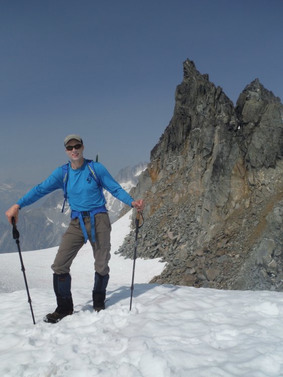
Trip: Early Morning Spire - Southwest Face
Trip Date: 08/18/2018
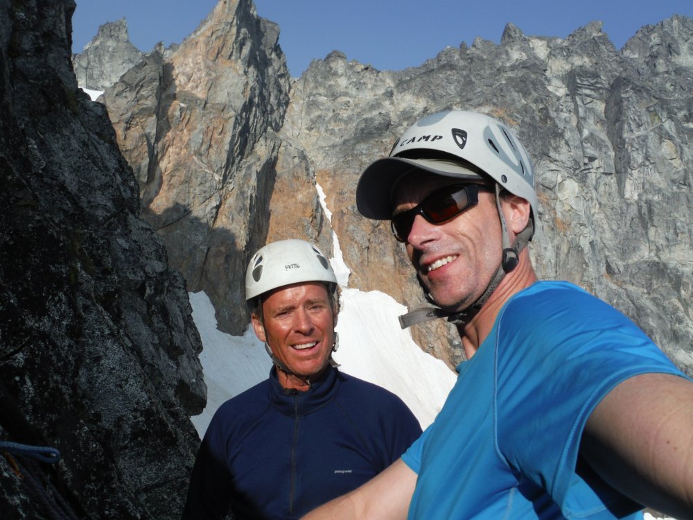
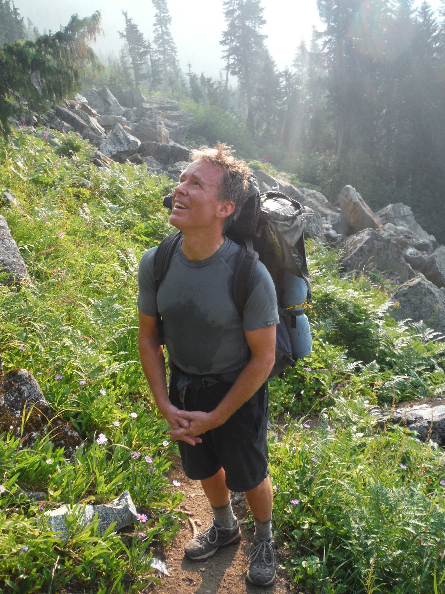
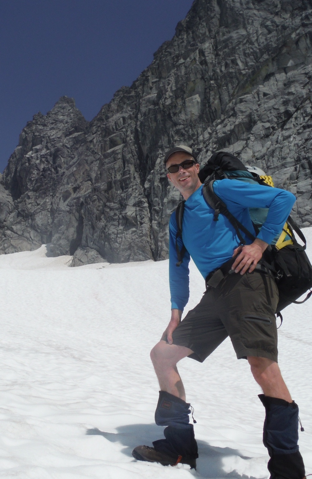
Trip Report:David and I are masochists who love alpine adventures. We don't get many opportunities to get out into the mountains so we try to make them count.
We left Seattle after work, got back country permits in Marblemount, found a great campsite near the Eldorado approach trail, sorted gear, went to bed at a reasonable hour. The next morning we started at 6am, which is late by our standards, but our goal was just to get in position for a big second day and to scout out the glacier approach we'd do in the dark the following morning. David was hoping to catch a flight 48 hours later.
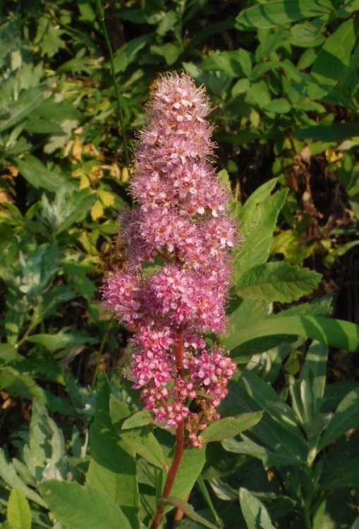
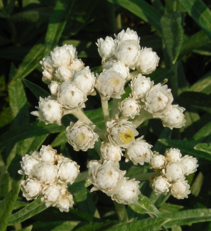
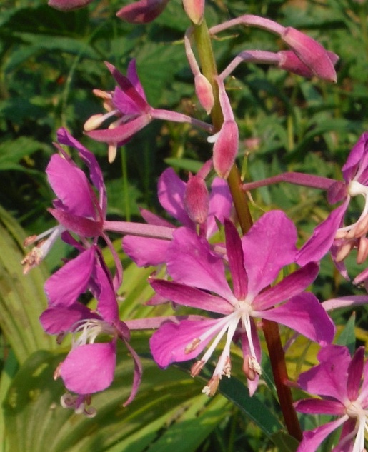
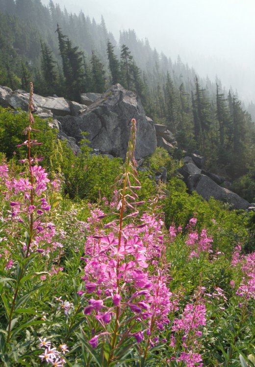
We crossed the river on logs and easily found the trail. It goes straight up through dusty forest, big talus, and lush meadows filled with wildflowers before bursting into the alpine. There is no water available until high in the talus. Everything is snow-free until you reach the glacier.
We would gain about 5500 feet in ~4 miles, but great conversation distracted us from the effort.
A cliff band runs along the West side of the steep talus and meadows.
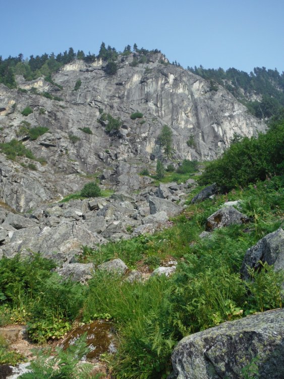
The talus field and meadows were smoky but still pretty.
Johannesberg in the smoke.
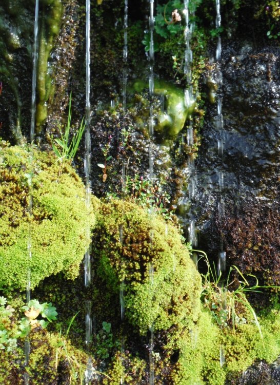
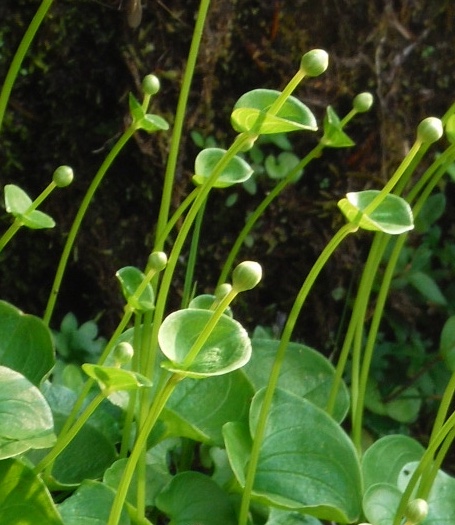
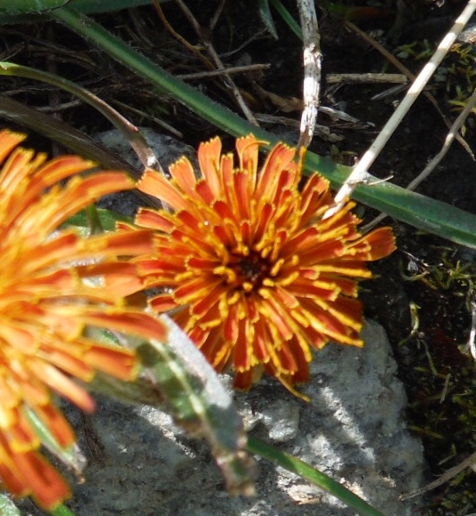
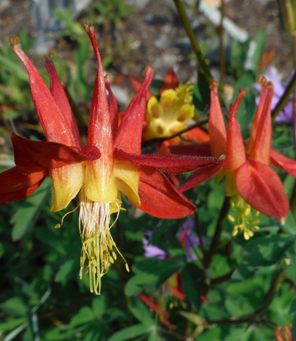
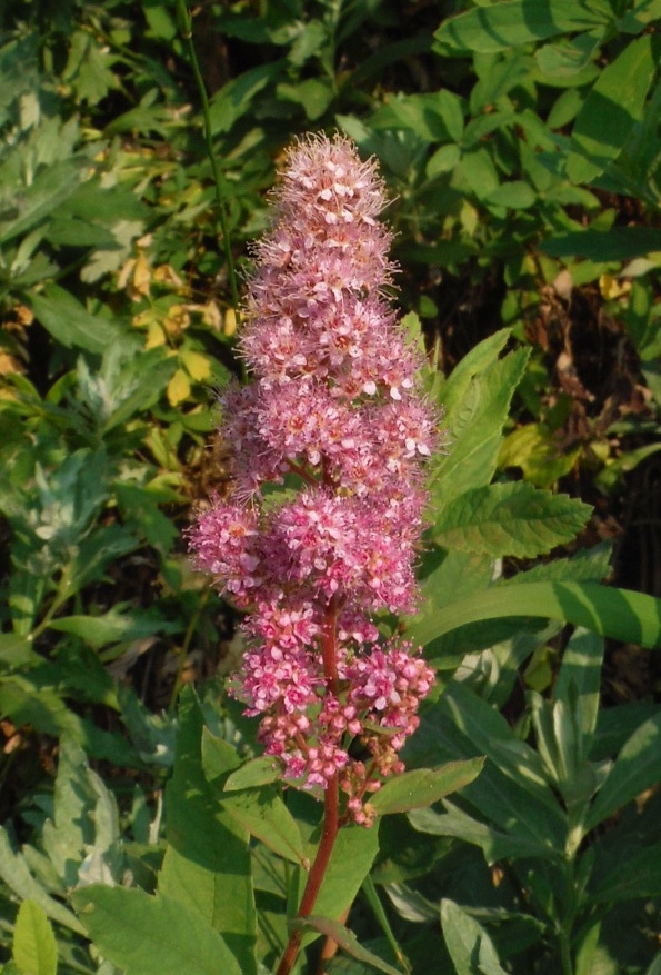
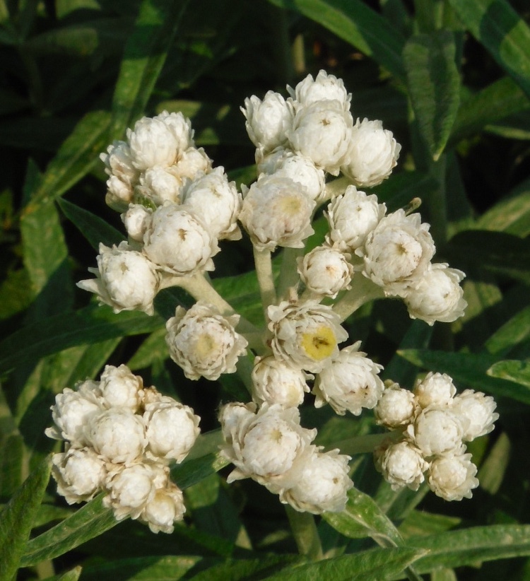
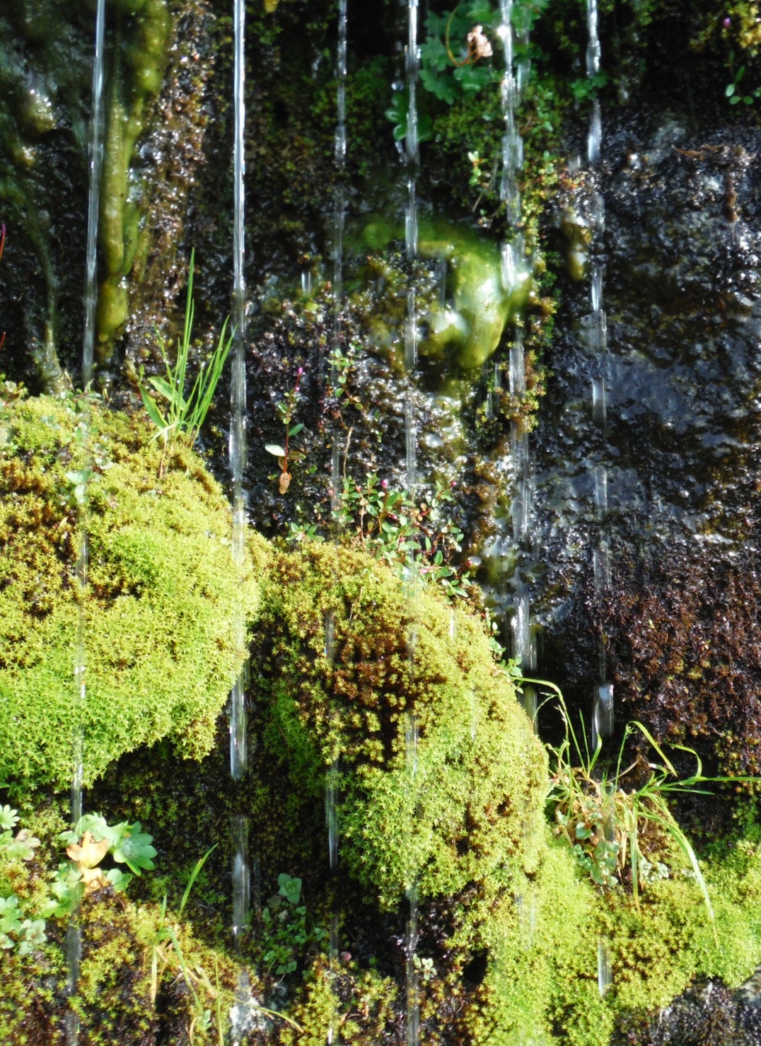
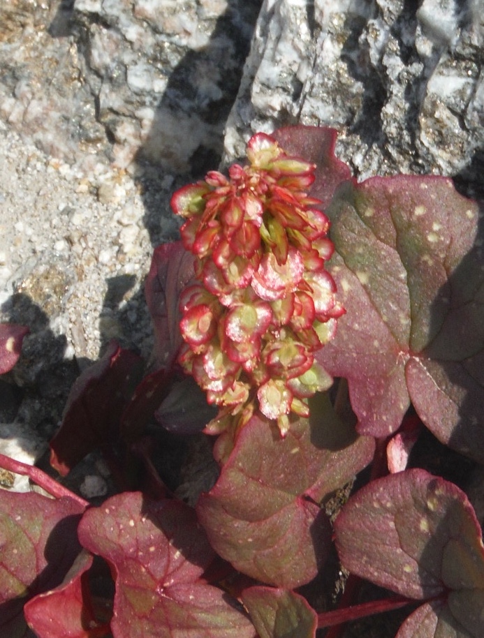
Wild flowers and waterfalls made good excuses to stop for a few seconds to enjoy the alpine ambience.

The small waterfall where the shot below was taken is the first water source you encounter when ascending late season. It's near the top of the talus.
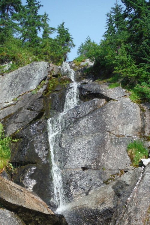
This waterfall is a little upstream of the smaller waterfall in the photo above.
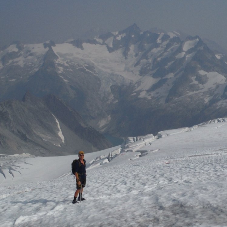
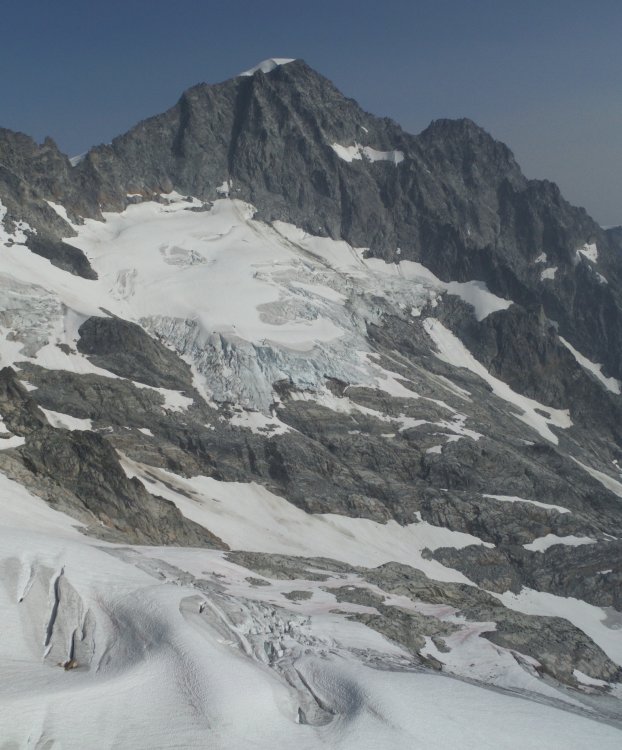
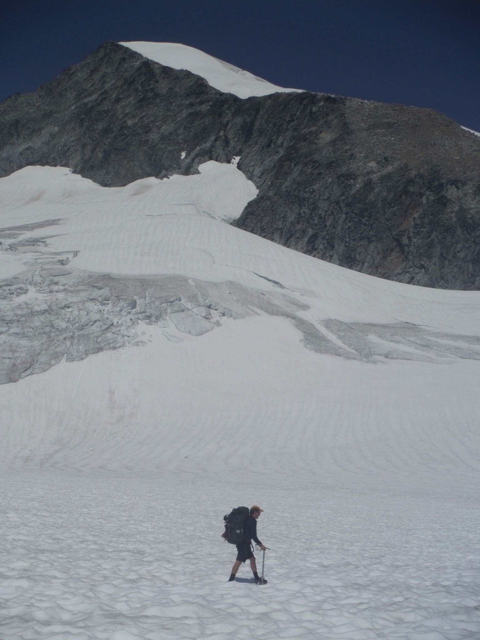
We crossed over to the Eldorado drainage, dropped down to glacier-polished slabs and made our way up onto the Eldorado Glacier, the first of five glaciers we would cross in two days. There were a few crevasses, but these were all open and obvious and we never broke out the rope.

We only encountered one other party on the glacier.
Eldorado from the South.
We reached the campsites at the base of the E Ridge of Eldorado and dropped our packs. Our next goal was to scout out the approach to the Dorado Col as we planned to cover this ground in the dark the following morning. Crossing the Inspiration and McAllister Glaciers to the Col was pretty straightforward.
Towers on the upper Inspiration Glacier.

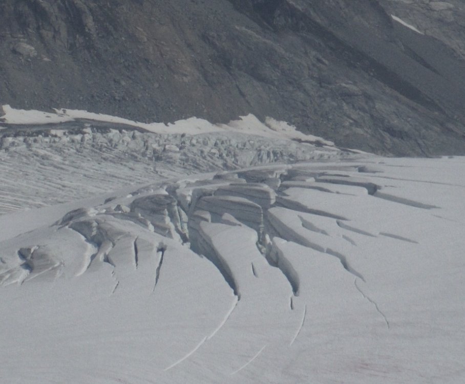
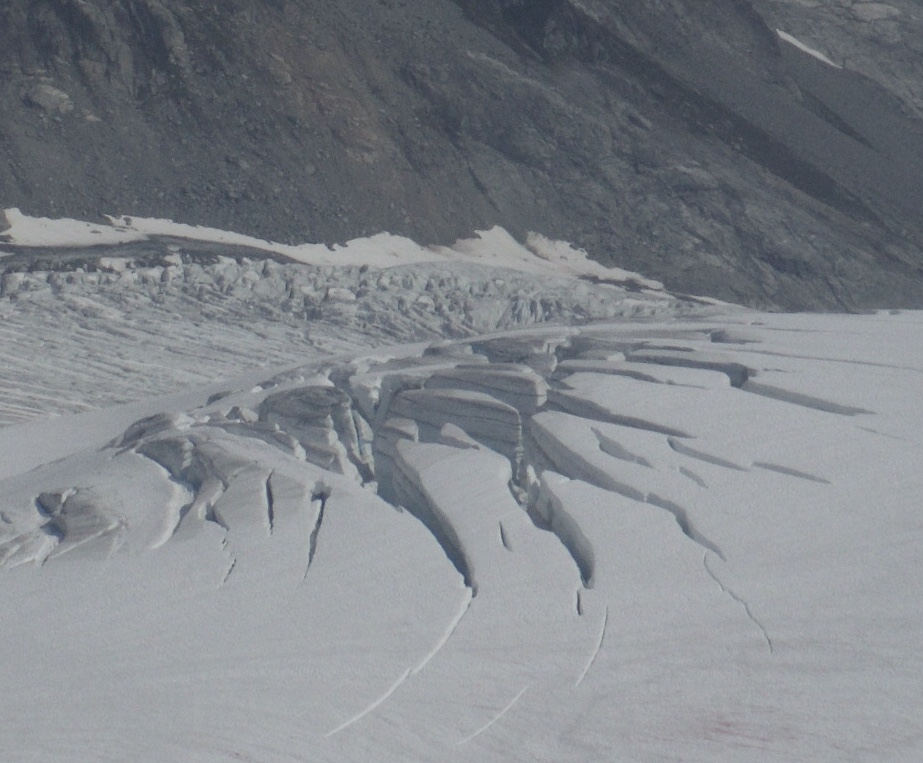
Crevasses on the lower Inspiration Glacier. We didn't go anywhere near these.
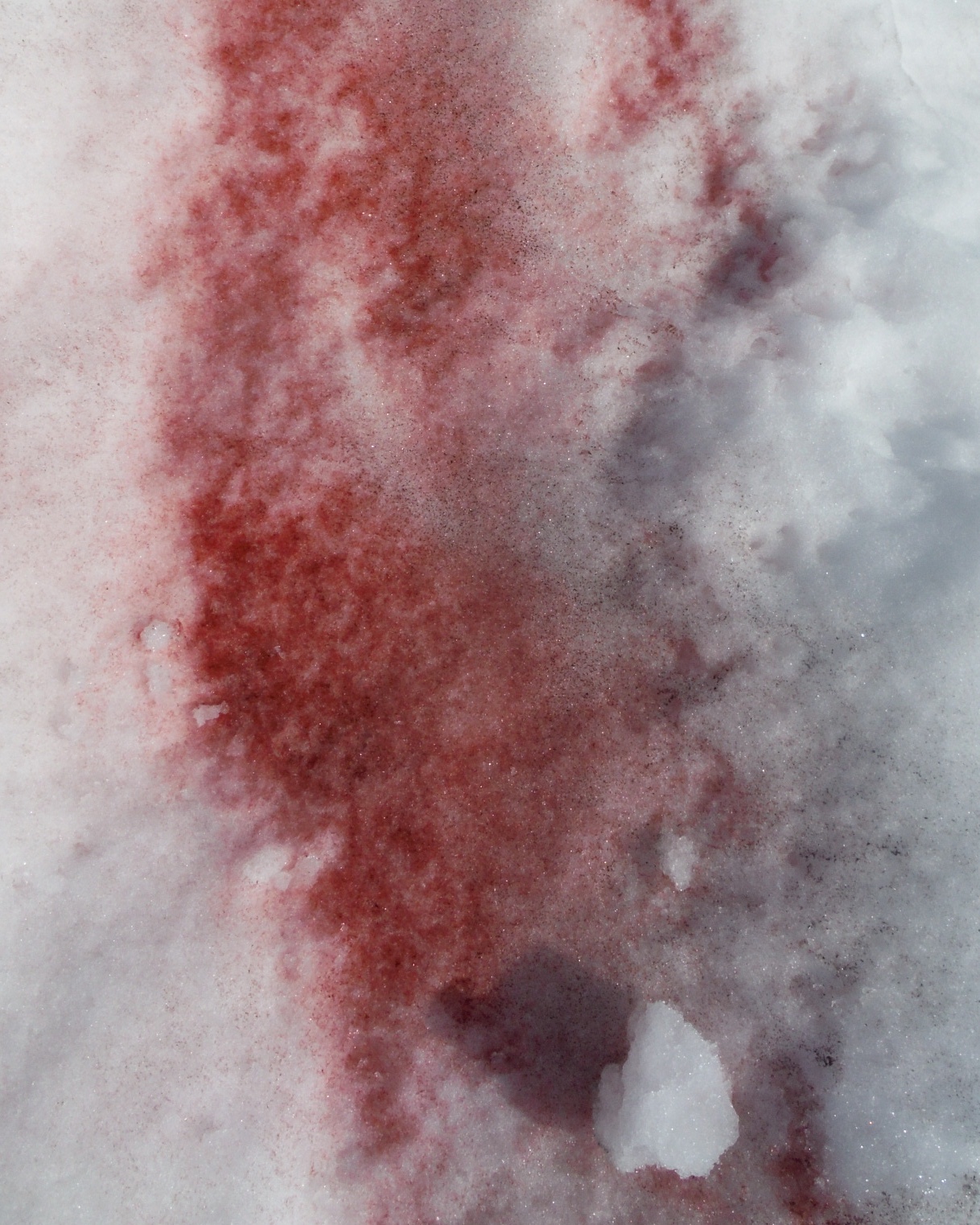
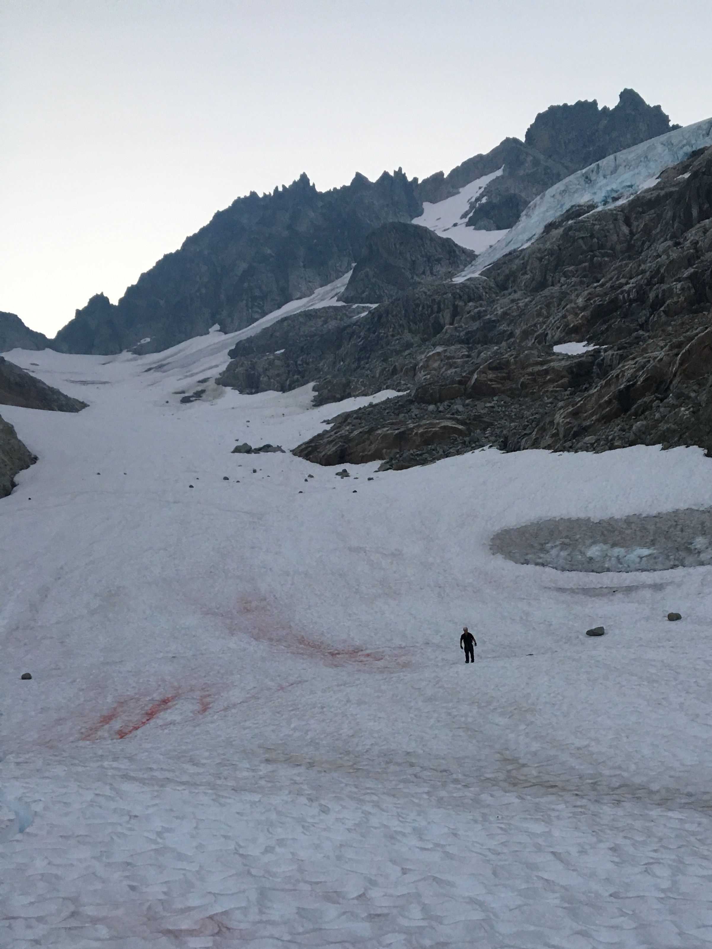
Murder scene? Nope. Algae. The snow worms love it, and no, it does NOT taste like watermelon! Don't ask how I know.

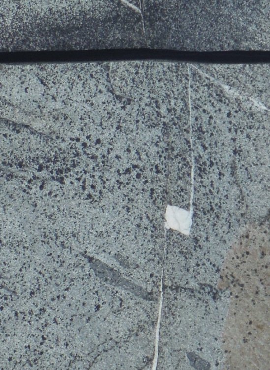
Old and new fractures in granite.
Glacier Pass
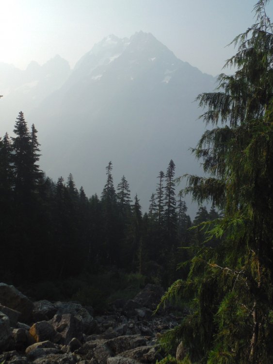
It was smoky, but the views of Forbidden, Torment, Boston, Sahale, and other peaks were still jaw-dropping.
We didn't encounter any major obstacles on the glaciers and never used the rope.
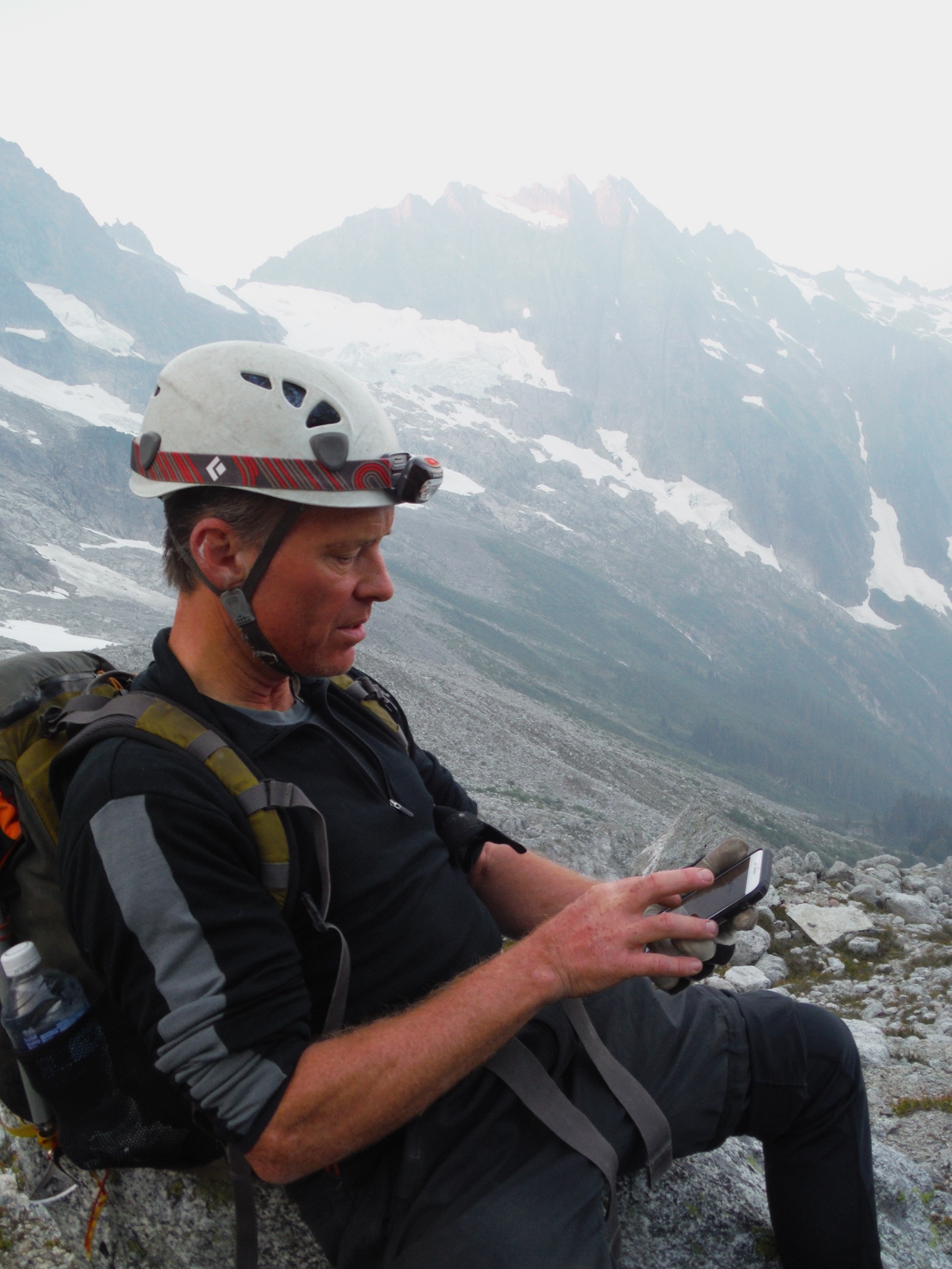
The biggest question for our trip was how we would get down off the summit the following day. There were multiple accounts that seemed to contradict each other. We talked through all the options several times and tried to envision where we would come back to the McAllister Glacier. As we retraced our steps back to camp, we laid down a GPS track we could follow the next morning. We had originally thought about tagging the summit of Eldorado, only 1300 feet above us via snow, but I'd been up there before and wanted to save my energy for the following day. David didn't feel like going up either.
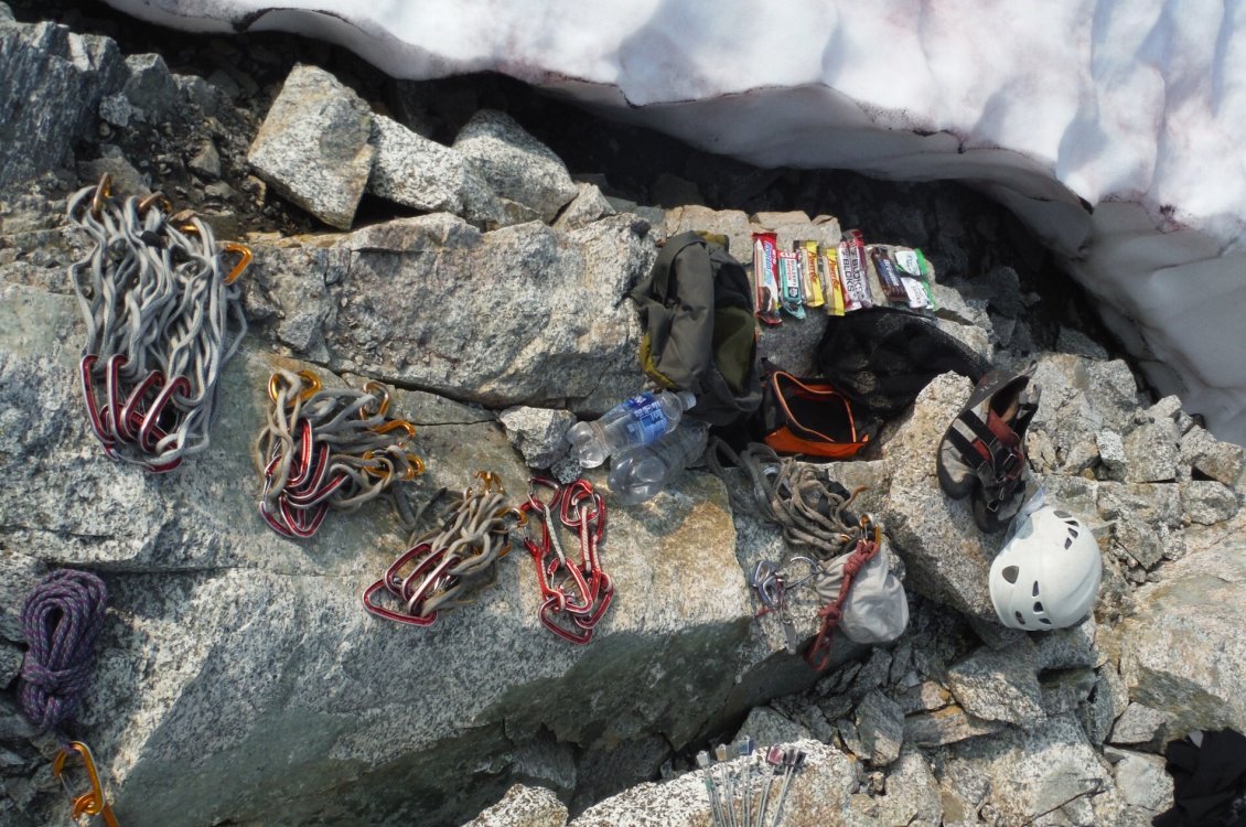
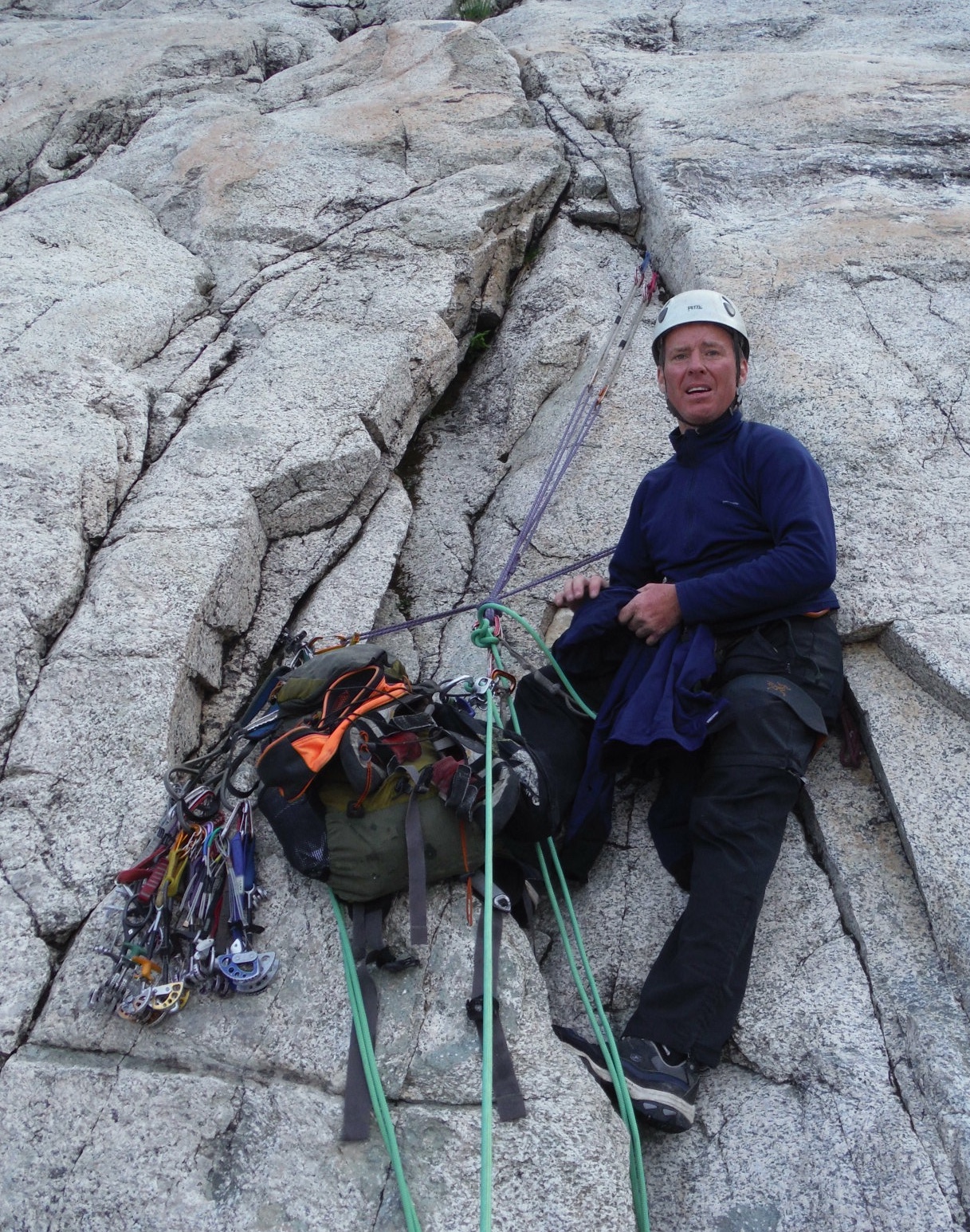
During dinner, we continued our discussion of descent options, and this culminated in me using rocks and drawings in the dirt to build a 3D map of our approach, route, and each of the descent options. We sorted gear and settled in for the night as soon as it was dark. Note the evil tricams. Easily placed by the leader (4 in one pitch, mind you), but they take two hands and a nut tool to clean if set properly (guess who had to clean those four tricams!). Best to leave those clanky beasts at home.

Temps were mild, the air was calm, there were no bugs, and surprisingly no rodents raided our bivy spots. We lay out under the stars for a few hours. As is typical for me before big alpine outings, I found myself running through our plans for the approach, route, and descent before drifting off to sleep.
We slept a few hours and left camp shortly before 4am.
The snow worms were out at night. David had never seen them before. I told him they taste like watermelon
Night ops.

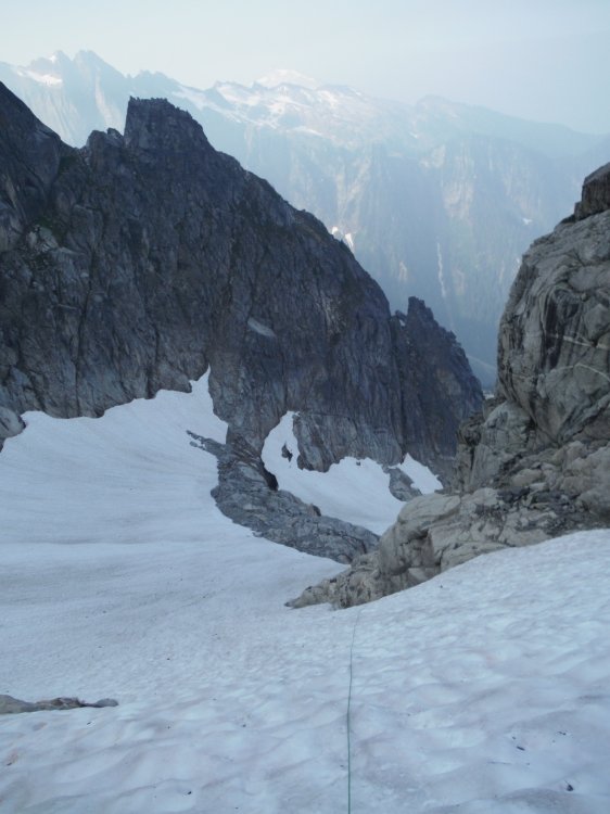
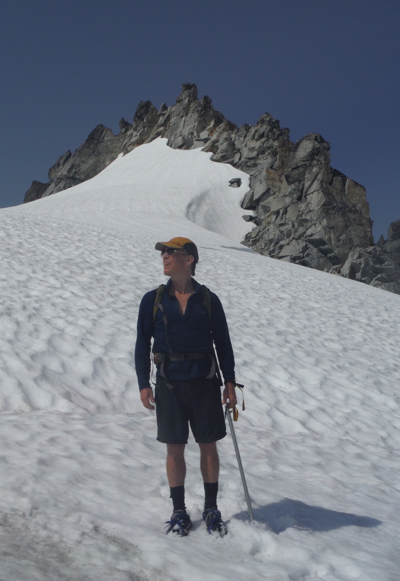
Crossing the glaciers was quick and easy and we arrived at the Dorado Col at first light.
We scrambled down loose scree, hopped onto an unnamed glacier, and descended.
This is a shot looking back up at Dorado Col (left edge) from the unnamed glacier on the approach. Eldo is out of frame up and right.

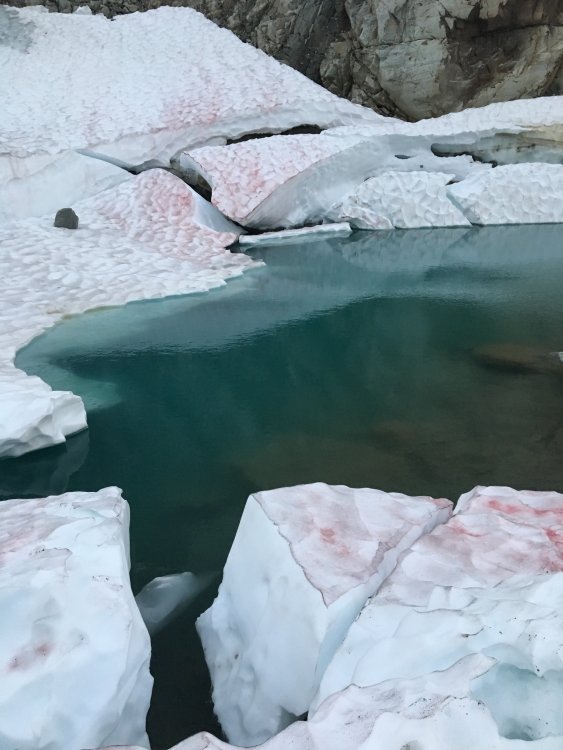
This small lake at the toe of the glacier is where you start the traverse to the North at about 6100.
The traverse starts on a bench and this fades into a moderate slope.

We crossed into the trees and traversed to the snow below the Early Morning Spire.
There was plenty of water at the lower elevations to drink and fill our bottles.
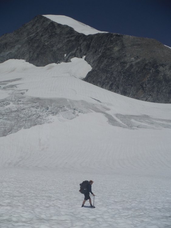
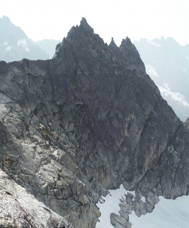
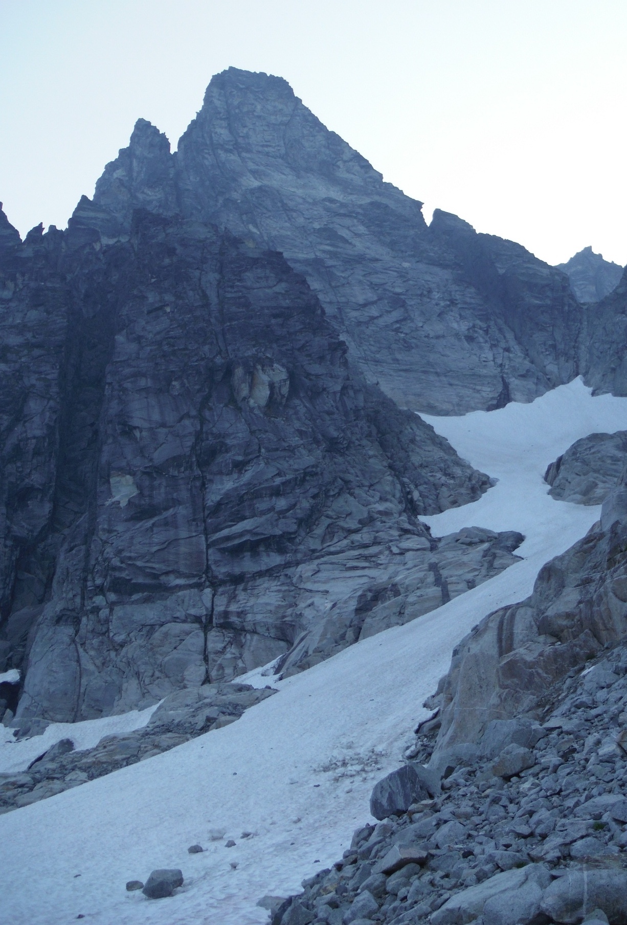
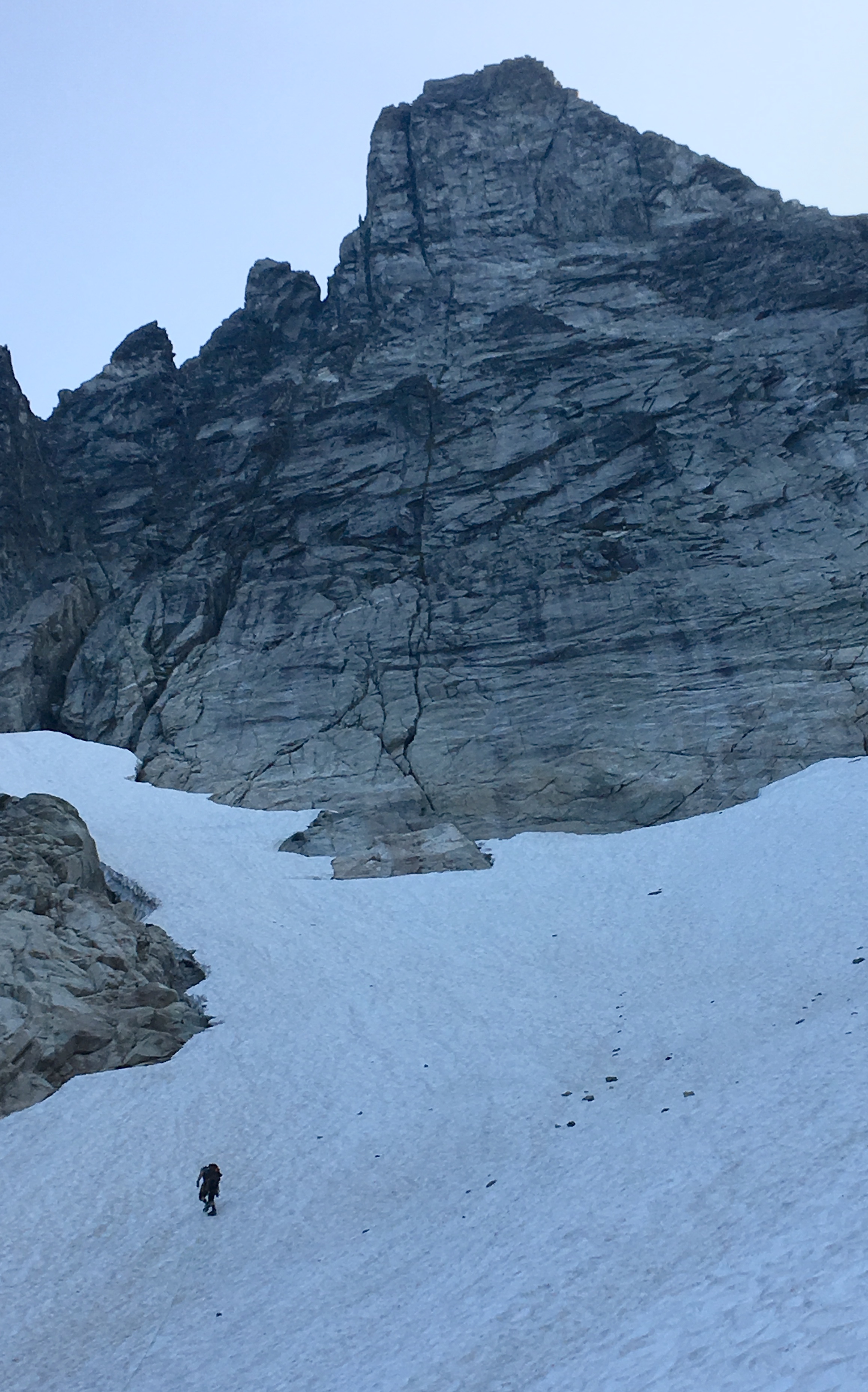
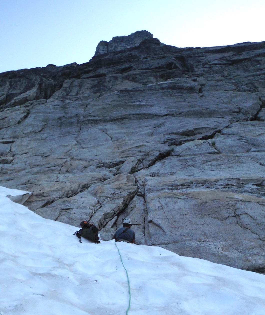
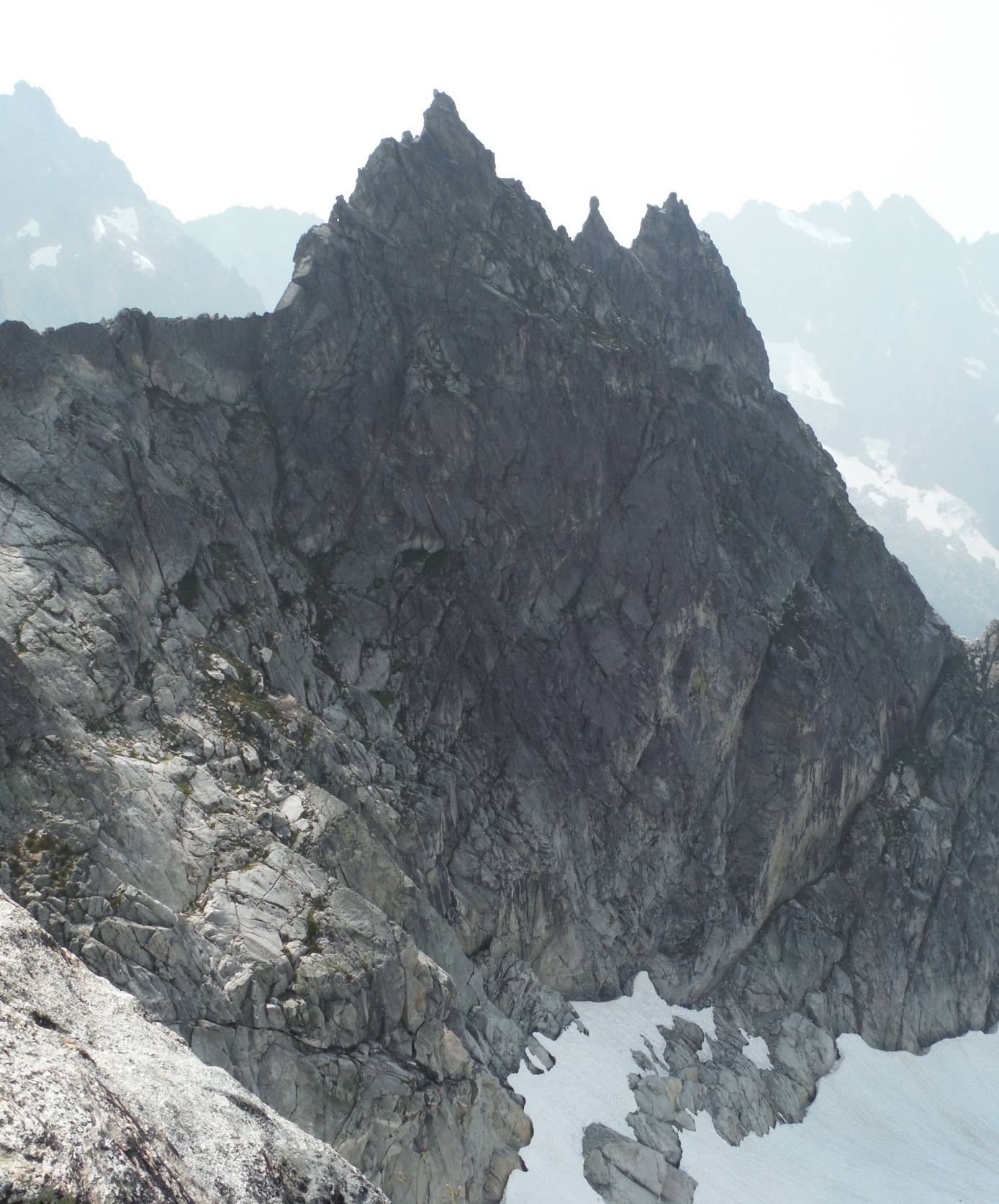
We ascended snow to the base of the route, which is on the upper rock face here.
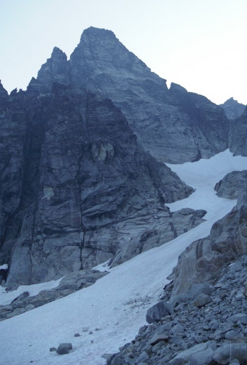
The obvious vertical crack in the center of this image is where pitches 2-5 run. We started on the crack about 70 feet to the left that angles up and right about 45 degrees before joining the main crack.

I belayed David as he stepped across the 50+ foot deep moat between snow and rock.
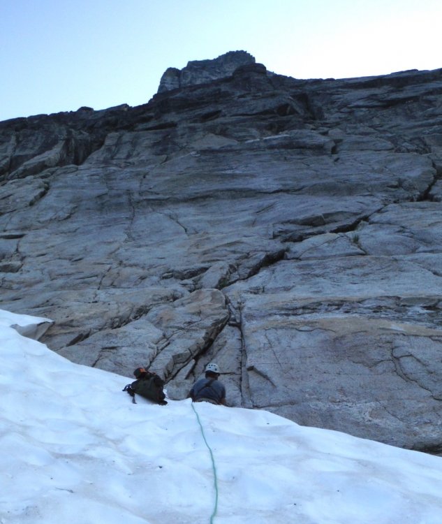
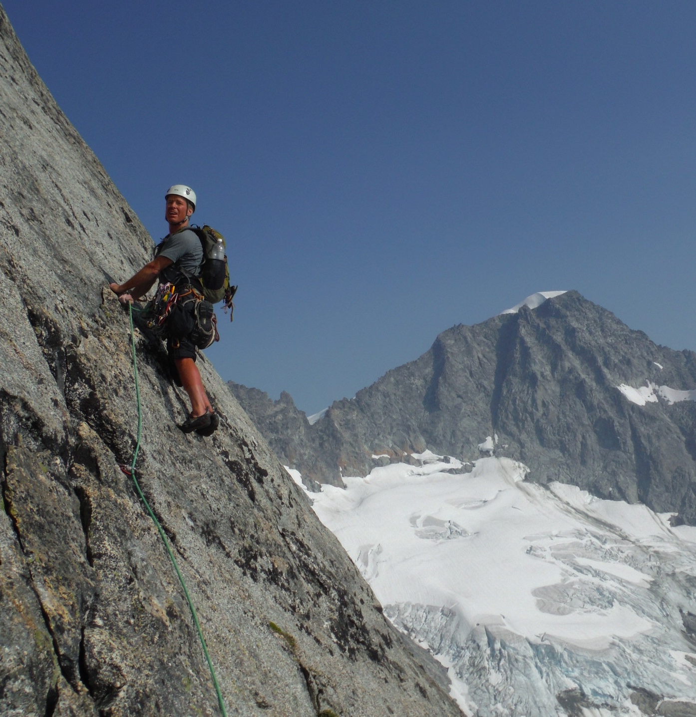
I changed into my rock shoes, crossed the moat, grabbed the rack, and led off on the first pitch.

This is a shot looking back down the snow approach. The upper portion was about 35 degrees.
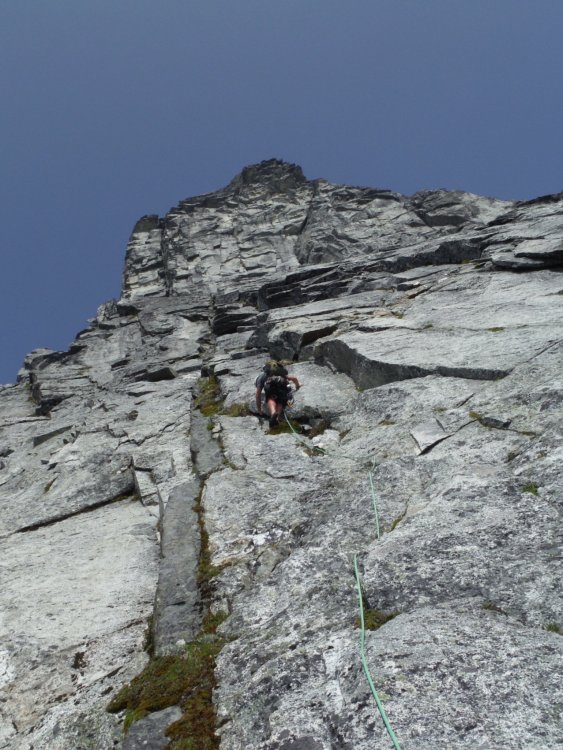
David led the second pitch, which included a vertical 5.8 section with nice features. The rock was clean and solid.

I led pitch 3, which was physical because I kept placing the #3, climbing up to place another piece, climbing down to clean the #3, continuing higher, placing the #3, placing another piece, cleaning the #3, and so forth. I probably climbed up and down the first 40 feet of the pitch at least twice before getting to the crux roof. Thankfully, there is a jug right where you want it and the troubles are over quickly. The #3 was indeed the key piece to protect the roof moves, so I was glad to have it. Above the roof there was a mossy 8 inch crack above that looked unpleasant. I headed 20 feet right to the splitter crack below that angled back left and climbed that instead. It was nice. I did a mossy mantle and scrambled up a face to some large blocks (maybe 180 feet for this pitch?).

Towers to the South.
David led pitch 4, a rope-stretcher that the book said was 5.6.

At the crux, you had to stem between a vertical wall and a steep slab with few features, jam your fingers into an undercling, and reach for a hold at the lip of a 4 foot roof. Felt hard for 5.6, but it was fun, well-protected, and we didn't fall.
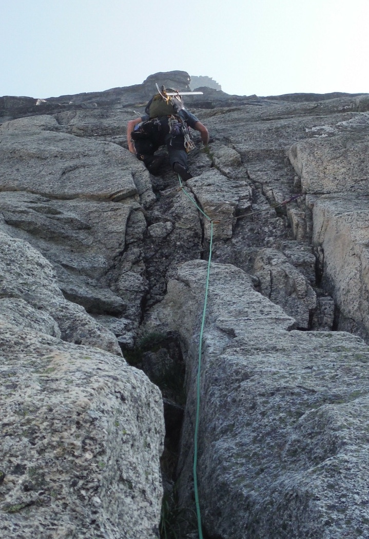
I then led a full rope length P5 up ledgy broken terrain, looking for the 4th class ledges leading to the right.
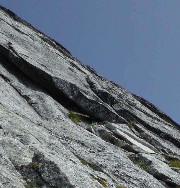
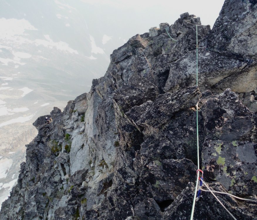
David took the sharp end for P6. He wandered off to the right, looking for the lost ledge, and then came back and climbed straight up next to a dark gray dike pictured below.
About a hundred feet above me he stopped. "David, the crack above you looks steep and vegetated." "Yes". "Is it protectable?" "No" "OK, then I'm not leading it".
Do NOT go straight up from the top of P5. David did an aborted lead and had to downclimb.
It looked like it would be a long and ugly retreat from our position. Surely that was a last resort.
David down-climbed the entire pitch next to the black dike back to me and we swapped leads.
Hoping to go up rather than down, I channelled my alpine mindset and asked where I would go if I were heading up from here. There: a crack behind a flake that seemed solid and looked like it might lead to lower angle terrain above. I decided to try it.
Given David's experience, I placed a fair amount of gear so I'd be protected in the event I had to down climb the entire pitch. But this was exactly the passage we needed. The rock was clean, protectable, moderate, and 5.fun. It may have started with 3rd/4th class, but it was not the 4th class section described in the guides. This pitch 6 led to a large ledge consistent with the 4th class rightward traverse described in the guides. We were back on track. We were going to make it to the top.
For me, the best climbs are ones where the outcome is in doubt. There is typically a turning point where you realize you're going to succeed. This was it.
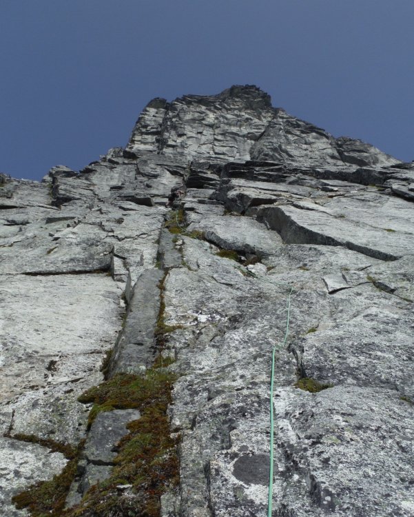
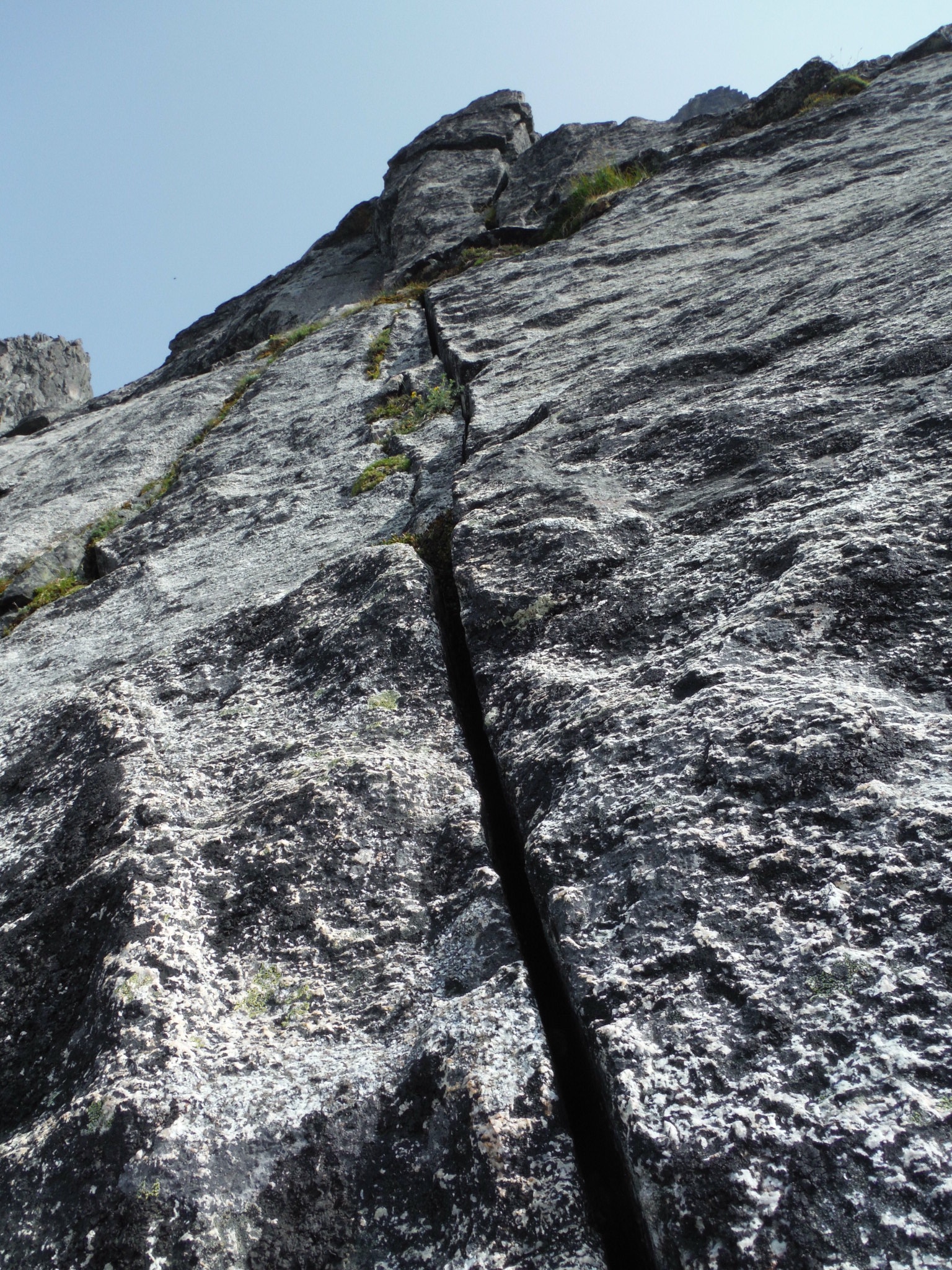
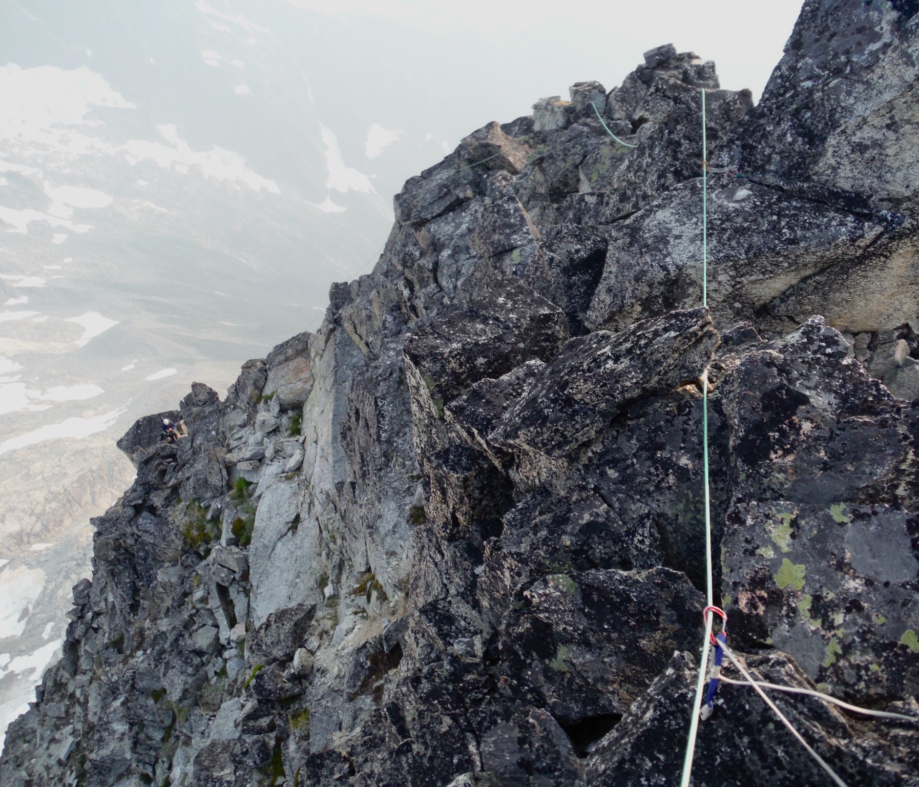
For those of you coming this way, 50 feet right of the vertical dark gray dike in the photo above you'll find the overlap and a flake above its right edge seen in the photo below. THIS IS WHAT YOU WANT. It leads to the 4th class ledge mentioned in guides. Follow that up and right to the base of steep cracks.
We chose the left-most crack, a vertical hand crack just left of a left-facing corner. This is very short and could be linked with p8, though that would be less fun.
David then led an amazing thin rightward traverse on excellent finger ledges and small but good footholds on a steep slap (a joy!). This eventually reaches an engaging move off the slab into a scoop with a crack. Follow that straight up 20 feet and then move right to a belay just right of the ridge crest. There was another crack higher on this slab but it looked licheny and less fun.

We were doing well, but it was already 6pm. The summit was several pitches above us and a long descent and return to the car still loomed over us.
Our hopes of covering all that ground in 13 hours was slim, but life was good. One step at a time.
Eldorado from the North.
I led a full rope length up solid blocks and cracks on the crest. David led another rope stretcher, and then I led the final pitch to the summit. In all, it was three long 60m rope pitches between where we joined the ridgecrest and the summit. Some parties may wish to simulclimb this section.
The final few hundred feet was spectacular, with the headwall dropping away to the West, exposure to the East, and solid rock and large blocks to follow on the crest.
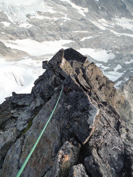
We arrived at the summit at 7pm and got our first glimpse of the Marble Creek Glacier we might have to cross.
The sun was sinking into the smoke, and we still had a long way to go.
Did I mention that David had a flight out of Seatac at 7am the following morning? There was no way he was going to make that, but he wanted to be in cell service by 6:45 so he could change his flight without a penalty, so I popped a caffeine pill and we started on the descent.
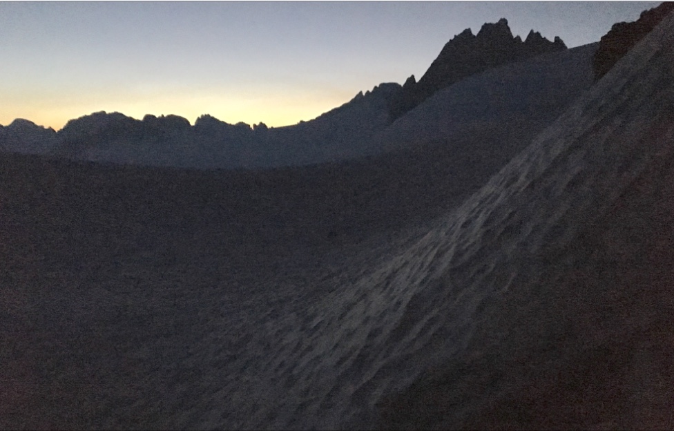
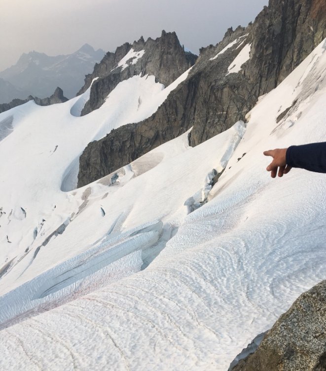
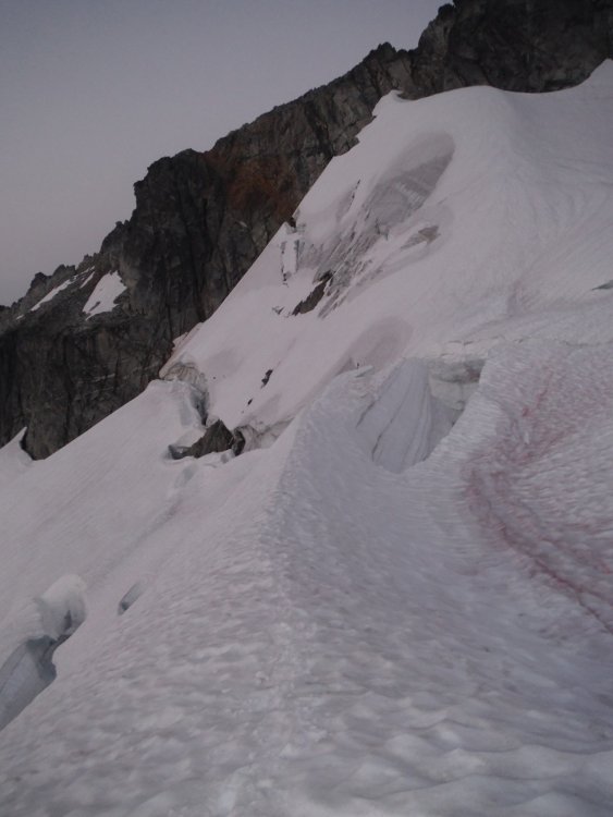
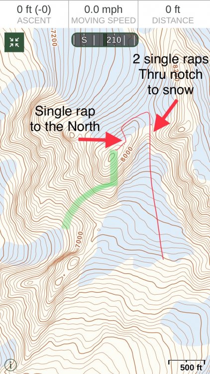
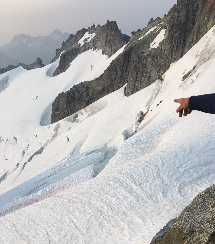
We scrambled down to the East and looked around until we found the rap station on the North side of the formation a few hundred feet down from the summit. A single rap brought us down onto the Marble Creek Glacier. The sun had disappeared into the smoky haze and we knew that darkness would soon be upon us. It would be hard to cross new glaciers in the dark because you can't see far enough to choose the right path through the crevasses. We moved with a sense of urgency in the fading light.
Our first choice descent route was to get onto the glacier remnant South of the Marble Creek Glacier and retrace our steps back to the Dorado Col via the red line above. We didn't know if that was feasible. Some parties said it looked too ugly to attempt. David went to check it out.
Meanwhile, I went to scope out our second option, which was to make our way North across the Marble Creek Glacier to a notch that would lead to the McAllister Glacier. This would likely involve a long slog through heavily crevasses terrain followed by fifth class climbing on unknown terrain, one or more rappels down to the McAllister Glacier, and a long traverse between large crevasses on a glacier we'd photographed from a distance. I've found photos can be valuable navigational aids in the dark. But first we needed to work out how to get across the upper Marble Creek glacier. The key was passing through several large crevasses. Maybe if we walk from the left onto that ridge in the middle...
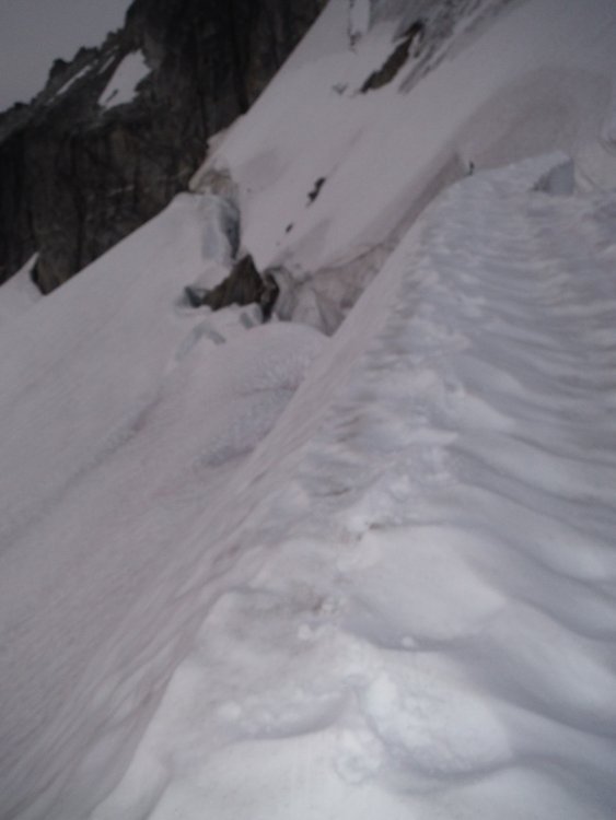
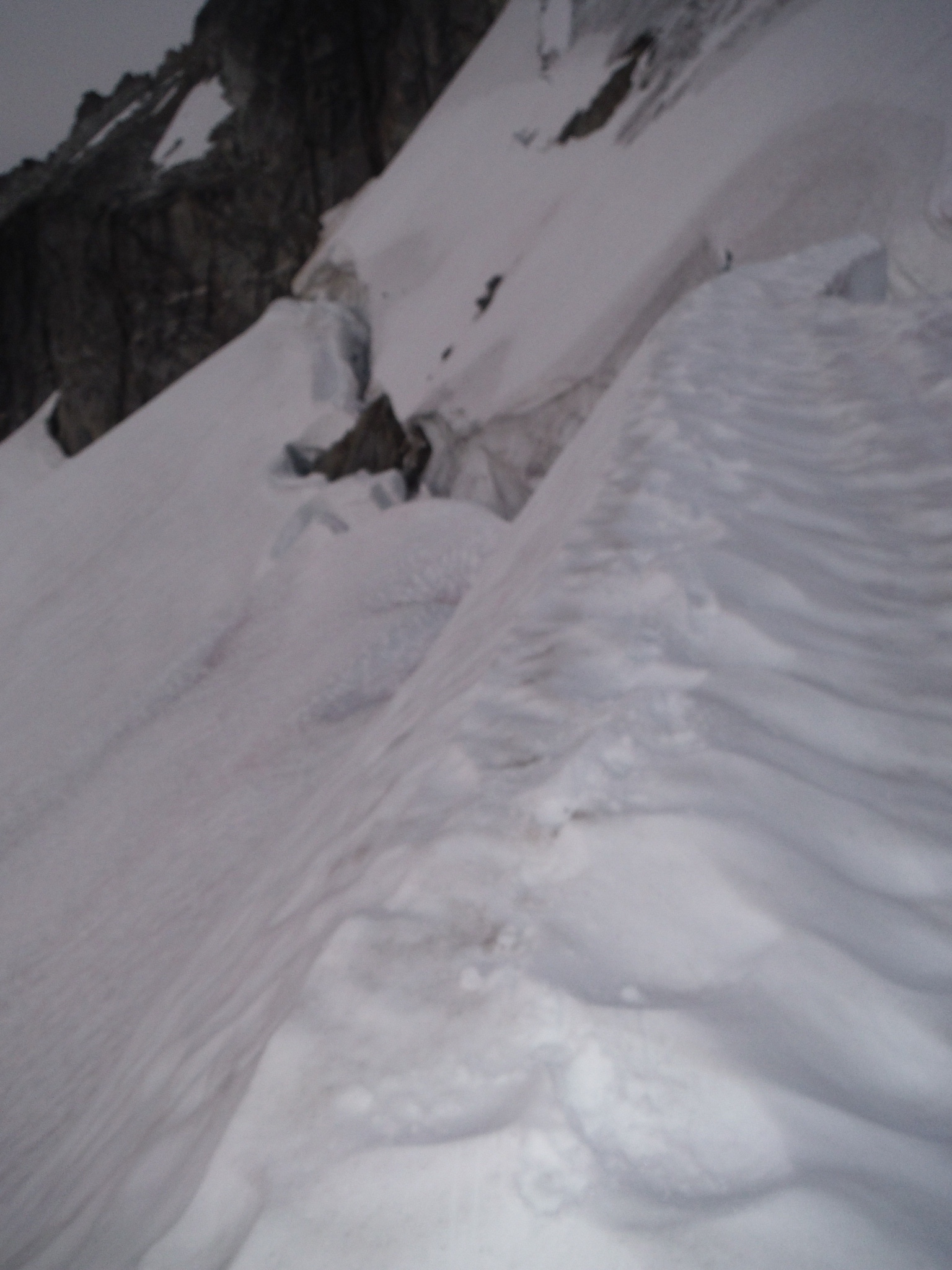
While David explored option #1, I carefully descended onto the ridge in question. It ran out between two giant crevasses and got narrower and narrower. The top was flat, but it was about 18 inches wide and a slip in either direction would be bad. The whole thing looked like a snow-covered freight train frozen in mid-flight as it shot off the track and rolled off the mountain. I'm calling it the Crazy Train. Here is the start of it.
I knew the snow under my feet hid thousands of tons of glacial ice. Surely, my additional weight wasn't going to send the train calving off down the slope, but I didn't want to linger. We could go this way, but it wouldn't be fun. We'd have to walk out to a point near the end of the train, rappel off a piece of webbing I'd just buried in the snow, likely with me going first with David's belay as a backup. I would get down 25 feet to a sloping area between crevasses and belay David as he down-climbed or rappelled down steep snow above a gaping crevasse. If the upper snow anchor failed I'd have to catch David with my ax anchor or we'd both end up in a large crevasse. I was visualizing and planning this as the sun was setting somewhere behind the smoke to the West.
This is about where I set up the buried sling anchor
Then I heard a voice up above me: "Rad!" "Yes?" "It goes!"
David had found the anchors that would take us down our first choice gully to the glacier that led back to our approach. Phew. We gathered the rope, headed over, and rigged the first rappel.
The gully wasn't pretty, with running water, brown muck, and a river of small and large stones that moved with every step. David said it was the ugliest gully he's seen, but it wasn't steep enough to be dangerous. The West gully of Inspiration in the Pickets is still the worst gully I've had to descend, but that's another story.
We made it to an intermediate anchor on the right wall and stood on a tower of cemented mud and rock. The water cascaded into a hole at our feet of unknown depth. I imagined when we pulled the rope it might catch on some blocks so I tossed a few into the hole. They clattered into the abyss and we could hear them come crashing out under the snowy moat below us. David had said he's seen light near the bottom of the hole, confirming that it was open at the base. I wouldn't want to have to go through there. I'm calling it the Pit of Despair.
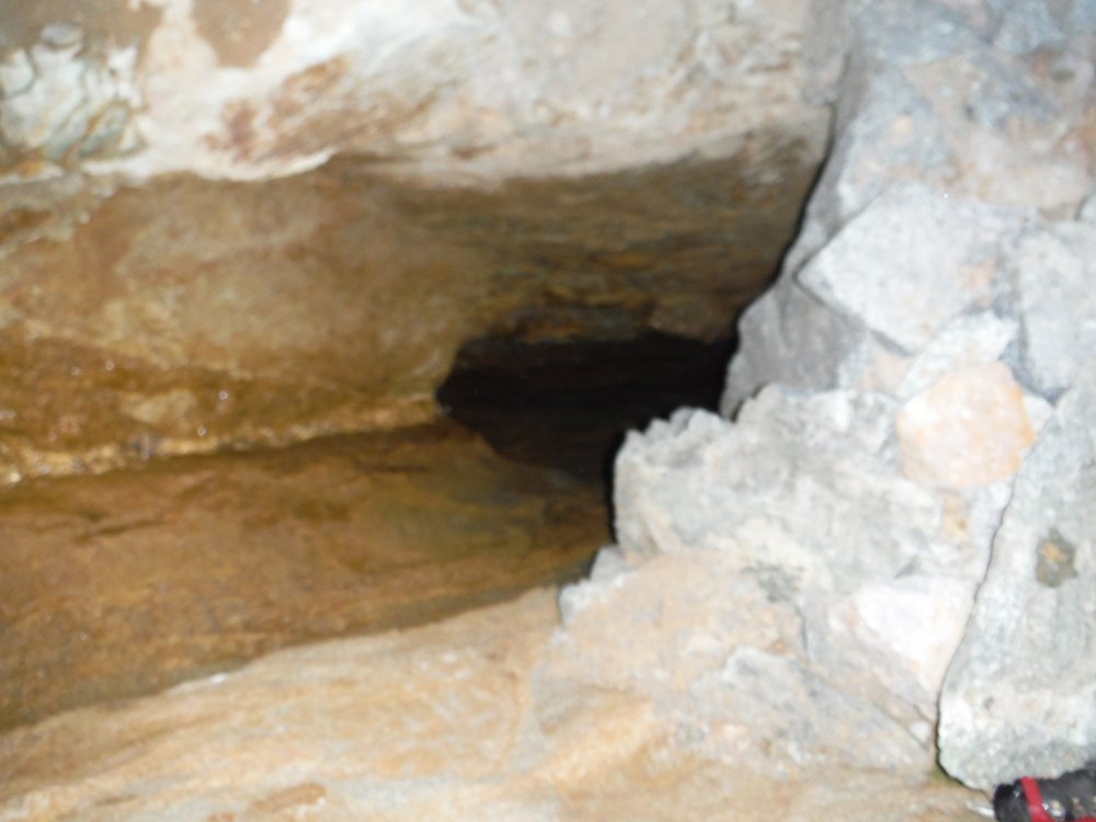
I closed my eyes and clicked my ruby slippers together, "There's no place like sport climbing, there's no place like sport climbing." But when I opened my eyes I was still standing on a pile of choss above a moat in the gathering darkness deep in the mountains.
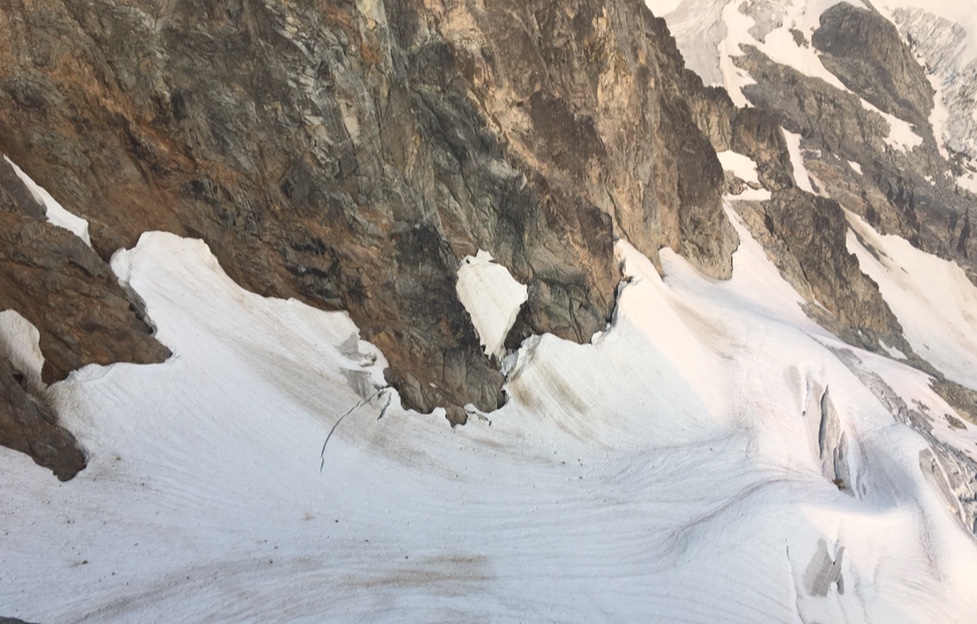
I rappelled down into the moat and this is where I had my most exciting moment of the day.
The top of the glacial remnant was shaped like a ship's prow, with a wall 6-8 ft high that would need to be scaled. It was separated from the rock by a 10 foot wide moat. Inside the moat was a pathetic and putrid pile of loose pebbles running with water. They sloped down toward a dark overhang under the rock I'd just descended. As I got to their height, I had to spring over to land precariously on them.
I perched on the pitiful pebbles, which crumbled and rolled away under my feet, threatening to toss me into the void. I was on the rope, but if I slipped I'd swing under the overhang. From there, I'd likely have to rappel into the darkness and try to climb out using the rope. I didn't want to think about that scenario.
Instead, I focused on a small ledge in the snow about ten feet from me. That could be my path to freedom, but first I had to get there. I pulled an armful of rope through my belay device, planted a foot on what appeared to be a solid foot hold, and leaned over toward the pebbly patch below the ledge. The prow refused to let me pass. It overhung above me and pressed me out into the void. I had to crouch low and spring like a desperate animal toward the sacred solid ground, simultaneously hunching over my torso and lifting my legs in a hurdler's lunge. But I crashed into the icy bulge and came up short. I paddled my feet and wormed on my elbow through the muddy pebbles. Blood ran down my forearm where I'd gouged it on something sharp, and a muddy slurry ran through the wound and down several parts of my clothing, but I'd made it. Sometimes climbing feels like one part ballet and two parts MMA.
I stuck my ax into the frozen prow, high stepped up onto the snow ledge with my cramponed boot, and threw my body up onto the snowy apex of the unnamed glacier. Safe.
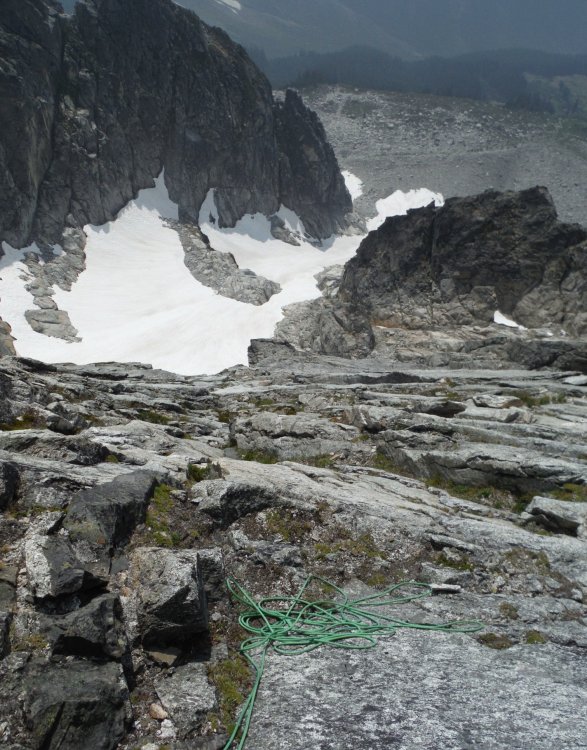
Now we had to cross the glacial remnant below the Pit of Despair back to our approach route. We headed skier's left in the photo below to the rock and were able to get back without incident.
We scrambled down a waterfall through boulders and made it onto the snow, passing the last of our unknown obstacles. From here on out we would be on familiar ground.
At this point it was 11pm, and we weren't done yet.
We had to ascend a thousand vertical feet to the Dorado Col, cross the McAllister, Inspiration, and Eldorado Glaciers, and descend a vertical mile to the car. I was pretty spent and knew I'd go too slowly for us to get back in time for David to change his flight.
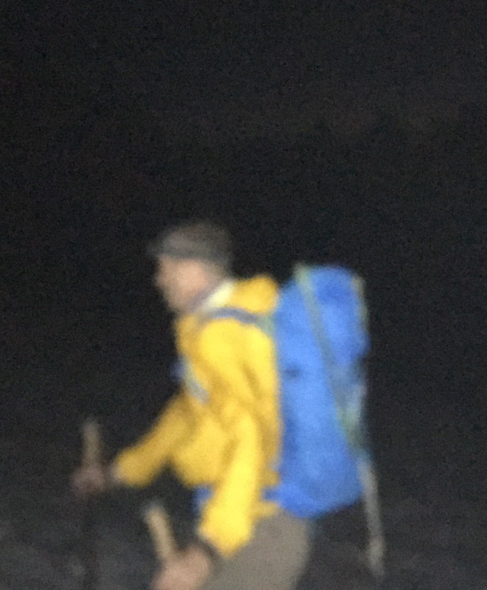
On a trip a few years ago, I paid David $20 to carry both the rope and the rack on our descent. It was well worth it for both of us, and my knees were thankful for the break. This time, our descent would be much more physical and our packs would be heavier. So we struck a similar deal. David carried the rope and rack. He would later carry much more...
.We thought if we made it to the car by 5:30am we'd have a fighting chance to get to cell service by 6:30. And that was the stretch goal we needed to push us into overdrive. We made it to the Dorado Col by 11:40pm.
We crossed the glaciers and made it back to our camp at 12:40 AM, where we ate, drank, and sorted the gear. David stuffed as many heavy items into his pack as possible, and I took everything else. We estimated that David's pack weighed about 60 pounds while mine was closer to 20-25. David was glad for the extra challenge, my spine and knees were glad to have less weight, my ego was not a factor, and I was glad to make a contribution to the climbing fund.
We started across the Eldorado Glacier at 1:40am. The glacier gave way to snow slopes, then to polished granite slabs, then to the jumbled lateral moraine.
We had just one steep uphill scramble to gain the notch between drainages, and then we were back in the meadows West of Mount Torment.
We nearly bumped into two deer in the meadows that acted like deer in the headlights - literally - they stood still, starting at our lights until we were almost on top of them. Finally, they sauntered off into the night.
Moths flew up in my face, drawn to the luminous moon of my headlamp that seemed to float through the meadow.
We passed a group of 6 sleeping out in the meadows - illegal and lame.
We danced from stone to stone down the talus and tried not to stir up the dust in the forest.
On the last stretch, we passed a pair of climbers ascending in the dark on their own alpine adventure.
We arrived at the log crossing at 5:01am, well ahead of our 5:30am target, having descended 5500 feet over 4 miles in 3 hours and 40 minutes.
The reward I'd been anticipating was at hand. I quickly stripped off my boots, removed all electronics, and plunged into the river fully clothed. It felt so good. Fine silt squished between my toes. I waded out to where the river ran swiftly over polished stones. Heaven.
David slumped on the log in near delirium, having kept is heart rate aerobic for nearly four hours on a treacherous trail trying valiantly to keep up with me.
In our parlance, it was civil twilight, the time before sunrise when you can walk without a headlamp.
We crossed the logs together, David with a heavy beast on his back, me barefoot and refreshed. I stripped off my wet clothes, put on fresh clothes, and we zipped down to Marblemount, arriving around 6am.
Thankfully, David had cell reception. He called Southwest and changed his flight. No fees.
I had ice cream and Tim's Jalapeno chips for breakfast and opted for V8 instead of beer for fear the latter would put me to sleep.
We drove home feeling dead but very much alive.
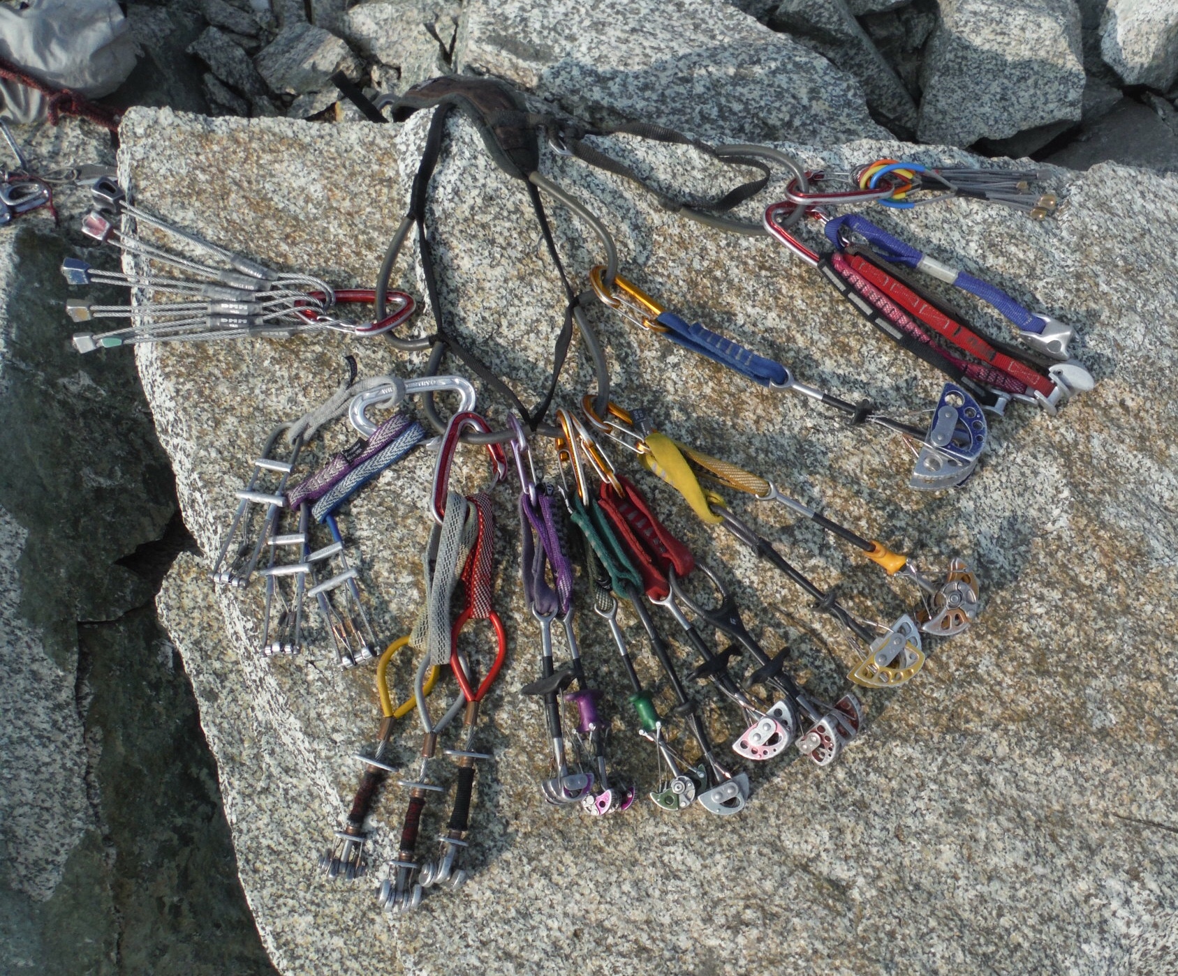
Gear Notes:
Doubles to #2 Camalot, single #3 Camalot. Single 60 meter 9.2 rope, ax, crampons. Leave the tricams at home
Approach Notes:
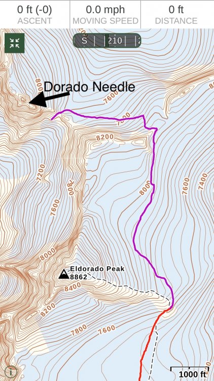
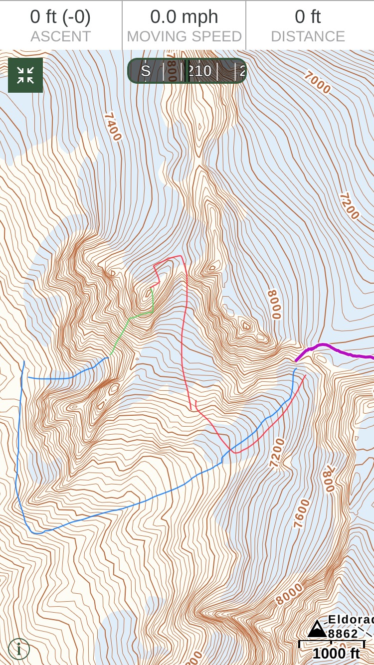
Climber's trail to the E Ridge of Eldorado, cross Inspiration to McAllister Glacier to Dorado Col. Descend to an obvious bench around 6000 feet. Traverse right, cross a short bit of forest, cross talus, then ascend a snow tongue to the base of the route.Day 1: Ascend 5500 feet in just over 4 miles on the climber's trail to the camp at the base of the E Ridge of Eldorado (red line). There was running water, a toilet (in rocks SE of tent sites), and tent/bivy sites. We scouted the approach across the Inspiration and McAllister Glaciers to Dorado Col (purple).
Day 2: we crossed the glaciers on the purple track in the dark, descended and traversed to the base of the route (blue), climbed the route (green), and descended (red) before retracing our steps back to Dorado Col.
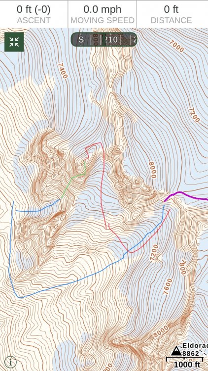
To descend, we followed the red line in the image below. We made our way to a rap station on a ledge on the North side of the summit buttress. We made a single rope rappel (left red arrow below) from this station to the Marble Creek Glacier (red line). The moat did not present an obstacle. From there, we contoured East along the top of the glacier toward a notch that leads down toward the unnamed glacier. We found and used two rap stations. One was on a pyramid-shaped block in talus in the center of the notch (second red arrow). The second was on the wall skier's right of the gully at a ledge. The gully was filled with loose stones, running water, and mud. From the second rap station, we rappelled into a moat and scrambled onto the snow of the unnamed glacier. We stayed skier's left and followed a path we'd scoped out from below and from the summit that led us back to the glacier below Dorado Col. We ascended to the col, returned to camp, and retraced our steps to the car.
-
1
-
1
-
-
Two spectacular routes you could do in a day car to car without a rope (be careful) are the E Ridge of Eldorado to its summit snow arete and Sahale. Hopefully the smoke will be mostly gone by the time you get here.
-
This is a good question, and one that I recently wrestled with on an alpine outing.
On snow and on loose scree/talus, you'll be more comfortable in stiffer shoes/boots. Tennis shoes or approach shoes plus aluminum crampons will exhaust your feet and get wet. My old Makalus are great on snow, ice, scree, and talus. But they are very heavy and large to put in a pack and carry over for an alpine rock route. Stiff boots are uncomfortable for longer hikes because the steel shank that makes them great on snow prevents them from flexing as you walk. The result for me is a sore foot if I have to cover more then 6+ miles on non-steep trail.
Tennis shoes or approach shoes, are very light and confortable but don't fare as well on snow, ice, scree, talus.
I've found a good, light compromise is Five Tennies (insert your favorite approach shoe w climbing rubber) with Super Feet in them to make them slightly stiffer. They are fine for hiking on the trail, fare OK on snow (though they will get wet in sloppy snow, gators help), and have climbing rubber that works fine for climbing up to about 5.9, assuming there are some actual holds and you're not just climbing a pure friction slab.
When you figure out a better solution please let me know!
-
Gorgeous! Thanks for posting.
-
Lovely. Great vision and execution. I need to get back in there again. It's been too long.
-
Is this the accident you're thinking of @Bronco
-
I agree this type of terrain can be very dangerous and it's very hard to avoid it on alpine approaches and descents. I try to see the failure scenarios and evaluate probabilities and consequences just as you would for the "real" climbing on your trip. That and stay focused, present, not distracted. As Jason said, I don't see the rope being helpful in very many cases.
-
Smoke forecasts can be powerful, but there can be local effects in valleys and mountains that push things around quite a bit on a daily basis. On the down side you might not get the best distance photos. On the plus side, you might see some great sunsets!
-
Learn as much as you can about glaciers. They're fascinating, but they command respect. Do your homework, try to objectively evaluate conditions, discuss both with your partners, come to your own decisions and don't worry too much about what other people think. They weren't there.
Most importantly, don't let what other people do or don't do drive your decisions in the mountains. If you climb for any length of time you'll meet people with higher risk tolerance than you and others with lower risk tolerance. This is an important thing to discuss with potential partners. Just because some people got away with something doesn't mean you will, or that they will next time. That said, in the mountains speed is often closely linked to safety, so there are non-trivial trade-offs to make. If you rope up for everything you'll never get far.
-
1
-
-
On 8/1/2018 at 7:12 AM, ken4ord said:
Hi all, looking for some info on the Nez de Zmutt route. Unfortunately my French sucks and most of the write ups are in French. Anyone got any information in English you are willing to share? Current route descriptions, current route conditions or tr's all would be helpful thanks.
Note: Interested in Zmutt not any of the other ridges.
Google translate. If you use Chrome it will recognize other languages and ask if you want the page translated. Not perfect, and will probably botch climbing terms, but these things are getting pretty good.
-
Slipped on a banana peel. You can see it at 1:20
That hair!!!
-
A wonderful Pickets adventure. Thanks for sharing and for not getting beaned in the RCOD!
-
Best climbing film I've seen in a while.
You might want to wear a diaper while watching the sequence starting around 28:00.
Lama is the real deal and it seems like he's maturing well while still pushing the limits.
-
1
-
2
-


[TR] Tupshin and Devore - SE Routes 09/01/2018
in North Cascades
Posted
Super. Thanks for the TR. Glad you got lucky on the smoke!
Our family goes to Stehekin every year and I've been eyeing those peaks since 2003, wondering if there was any quality rock up there. Sounds like the views are great but the loose rock and choss guarding the summits are rather unpleasant. I appreciate your honest assessment.