


KingsMM
-
Posts
158 -
Joined
-
Last visited
-
Days Won
1
Everything posted by KingsMM
-
Has anyone been rock climbing on Neahkahnie Mountain? I saw a really sweet picture while at the mazamas clubrooms. It looked extrem! Dose anyone know anything about Oregon's coastal rock I am very interested in what others have done or climbed.
-
Climb: Kings Mt. Thrash-South Trail Date of Climb: 1/8/2005 Trip Report: We hiked up kings Mountain in the oregon coast range and our plan was to find some rock and climb it. We did find rock and a little ice. We down climbed/untill fell and then went head over heels on the gully. Check www.geocities.com/kingsmtman for pictures and vids. Gear Notes: Brought too much and could have used a rope to rap but we were stupid and didn't Approach Notes: Powder on summit 1-3ft
-
Hey this is a site I made. It's a site where I show the crags of my area.(Which I am still finding...) Around McMinnville oregon there isn't a whole lot. I also have some beta for the coast range rock. Check it out at www.geocities.com/kingsmtman
-
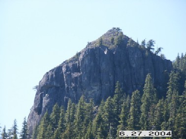
Is this it? What is it?
-
Has anyone here climbed up in those hills? Seems like there is some BLM land up there.
-
Well lets see... None of these are for willamte valley but here goes PRCII Portland Bouldering Guide Oregon Rock (smiff and stein's pillar) Climbing SW Oregon (goes as far north as wolf rock and Skinner Butte Collums) Rock N Road (has some remote crags listings but not much as far as directions) Smith Guide Dodge's Climbing Guide to Oregon (has some nice adventure climbing) I am trying to put up a website for Northern Willamtte Vally and Coast Range But it's still work in progress check it out at www.climb.rock.com or www.geocities.com/kingsmtman There is an Underground Menagerie guide By Jim Anglin Rockclimbing.com has some good Beta Not a guide book but there is climbing down by Lakeview that I know about. That's all I have found so far. -kip
-
Contact Tom Thrall Thur the website I have emailed him. It seems he has bolted at least one route rated 5.10. It is located off Elk Mtn Trail.
-
Nice pictures Thanks
-
I live in Dayton OR and was wondering if there are any other climbers in the McMinnville area. I only know about 5 right now.
-
Anyone done any climbing in the coast range? There are some limited possibilities. Saddle mountain has some nice looking slabs. Kings and Elk mountain have some exposed ridges 100-200ft high. There are also lots of seacliffs that could use exploring. I have heard of some routes and would like hear to hear more. Tom Thrall has done some routes up at Kings/Elk Mtn This picture is of a 5.10 along elk mtn trail. Check out http://ors.alpineclub.org/AAC/tsf.html for a littel arctical about it.
-
Dose anyone have information about the newer routes up there. I have looked at both PRCII and Dodge's guide. I have herd of some on Rooster Rock. Thanks
-
Climb: Diamond Peak-South Ridge Date of Climb: 5/9/2004 Trip Report: Well we got to the snow line about 2:00 P.M. Which was along Rd 380 below 5000ft. We packed up our packs and got going about 4:00. We took the road up to the trail head. Had some trouble following the trail. We followed old tree scars. Which are always fun because haft of them are not real scars. After loosing the trail we arrived at the place where another trail crosses Diamond Rock trail. We made camp here. After eating a few home dried bananas I hit the sack. Next day we got up and out about 6:00 and headed up the trail. We ditched our overnight gear which made the packs much more bearable. We totally lost the trail this time. So we ended up cutting cross country. With the help of a map and compass we arrived at the lake. From there we took another bearing Due North. At this time my brother was having great back pains so he stopped. From below the tree line I got to the false summit in 40 min then from there to the true summit in 20 min. I was going full speed. I didn't want to leave my brother for too long. Then I descended to him in 20 min. the snow was really deep up till the tree line. After that the wind blew a lot of it away. I used an ice axe on the summit ridge but didn't have to crampon up. We returned the whole way by following our tracks. We were lucky but we might not be so lucky next time. I have pics but don't know how to atach them. Help Gear Notes: Bring flagger tape because the trail is not marked at all. Approach Notes: I'm guessing that the road will clear up to the trail head in late May. We were stoped about 2.5 miles from the trail head. Which made the trip longer.
-
Climb: TFJ Open Yet- Date of Climb: 5/6/2004 Trip Report: Hey dose anyone know if it's open yet? I heard the area was closed off due to last years fires. Also how much snow is up there? thanks
-
What do the belay anchors look like? Is there and fixed gear, if so how much? Oregon high has a good description but not much on gear.
-
You think that Bulu is still snowed in this time of year? I would think not.
-
Planing a trip to the area, and need more information. What would you say is a route not to be missed. I have seen Dodge's book but want more up to date beta. thanks
-
How can I find who ones it?
-
I was looking at the rock n' road and saw that there are caves out of Eugene. Has anyone every been there, climbed there? I am looking for beta and directions. This is all I know. From Eugene go N to Coburg Rd. To the town of coburg. Turn east on Mckenzie View Dr. For 1/2 Mi. Then Hike N of the road for aprox. 1.5mi to west, middel, whale, and east caves.
-
Climb approaches mostly.
-
I am looking to buy some AT skis and bindings. The cheaper the better. What would you recommend doing? Have any good advice? I have been sking down hill for 3 years but can ski black diamonds. About how much money are we talking for a used set up? Skis, Bindings,and Skins (I own boots)
-
Just a thought, what do these things mean? HC! mmmm ?
-
Anyone know any ratings for bulu?
-
How much info. does it have? Any beta for mt.hood area?
-
Nice Pics!!! Anymore?
-
Hey I am trying to get more information on Petes Pile. Any route ratings, names, ect. Any information would be much apperciated.
