Leaderboard


Popular Content
Showing content with the highest reputation on 09/07/20 in all areas
-
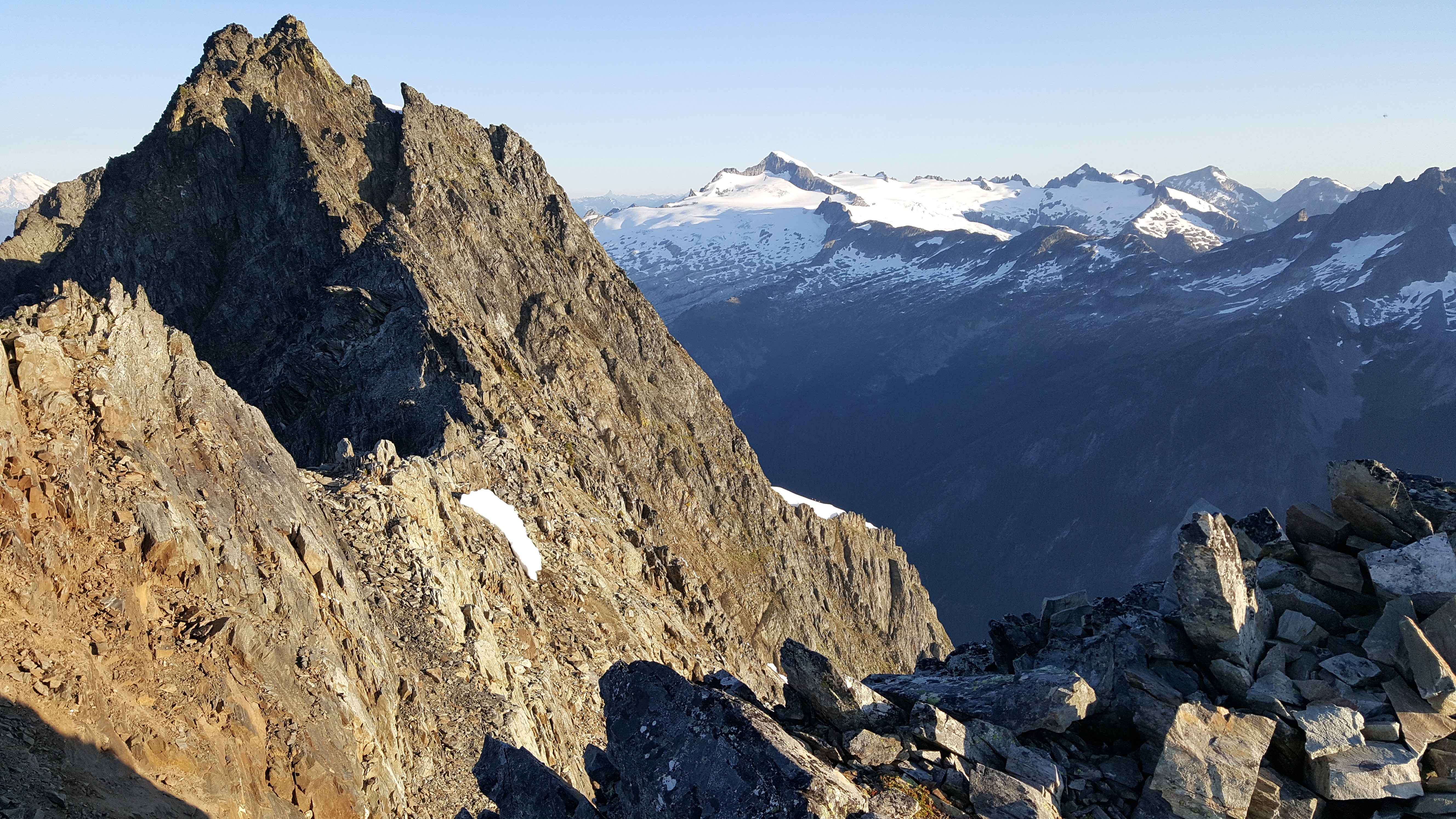
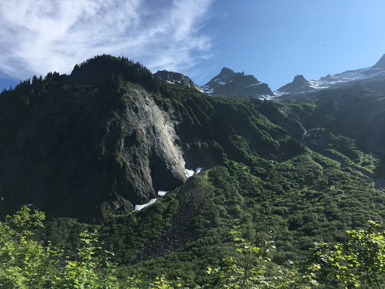
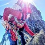
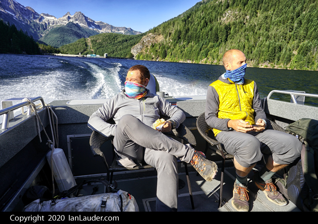
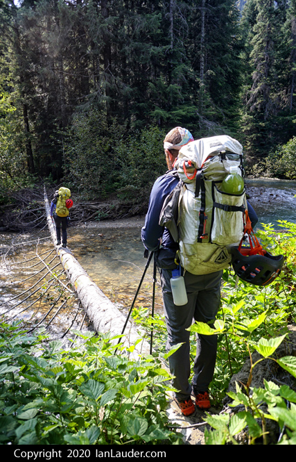
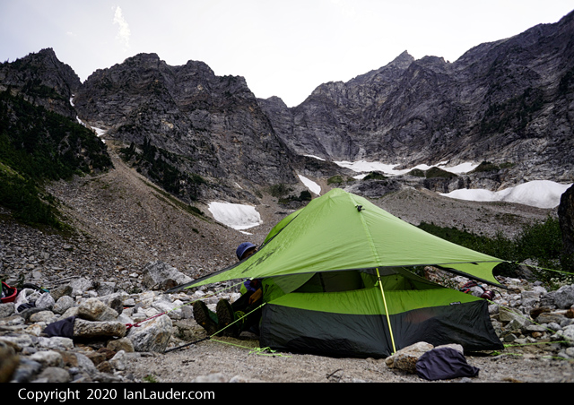
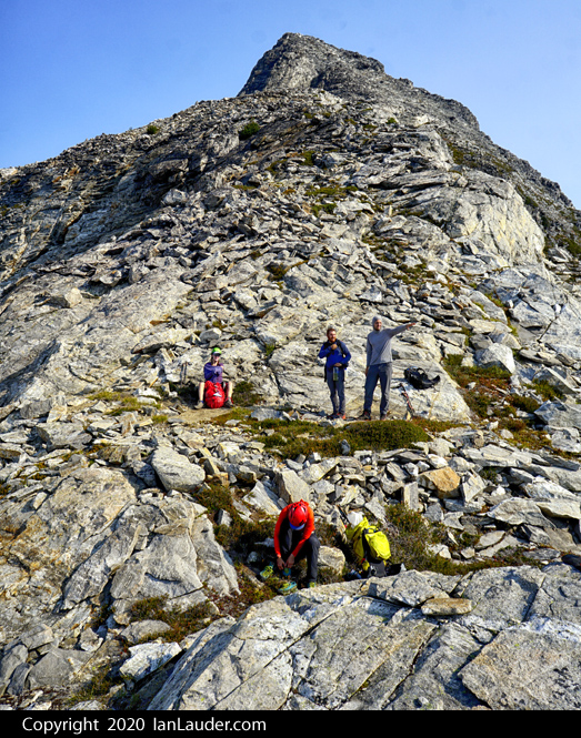
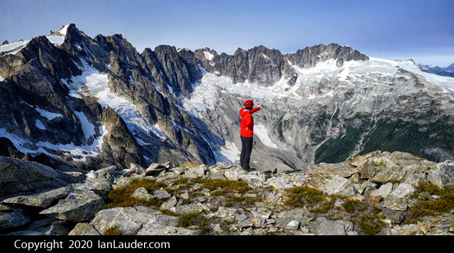
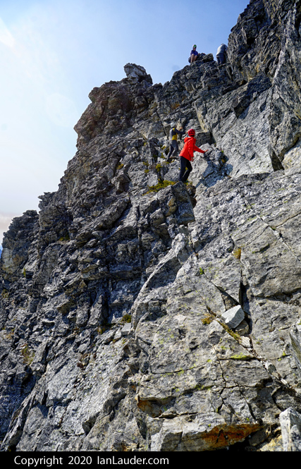
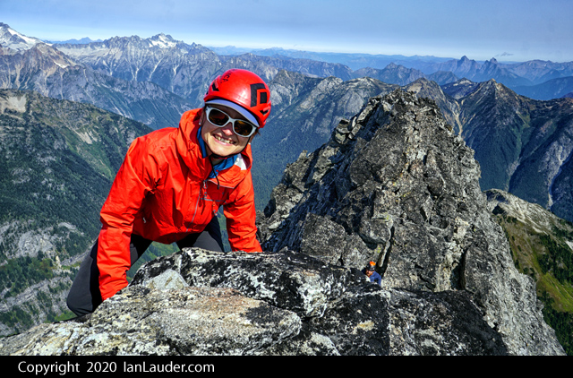
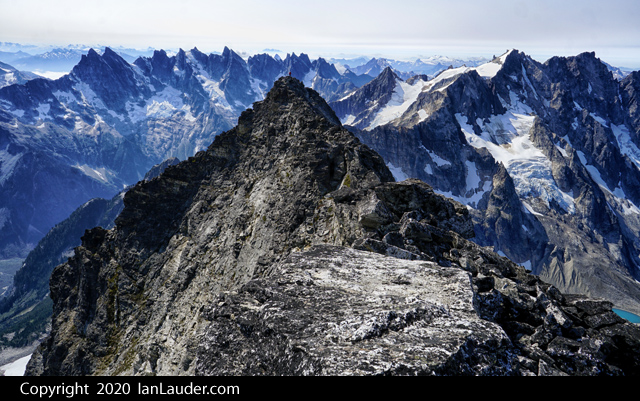
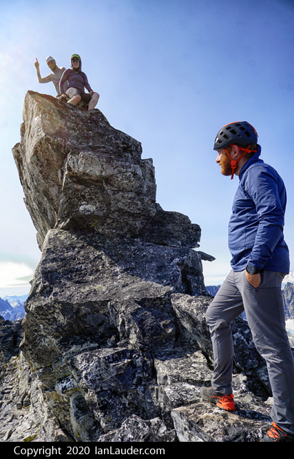
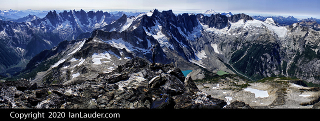
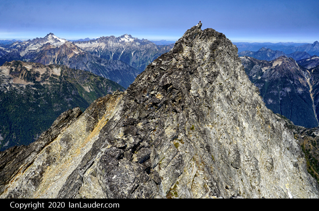
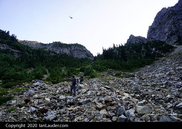
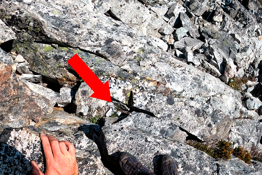
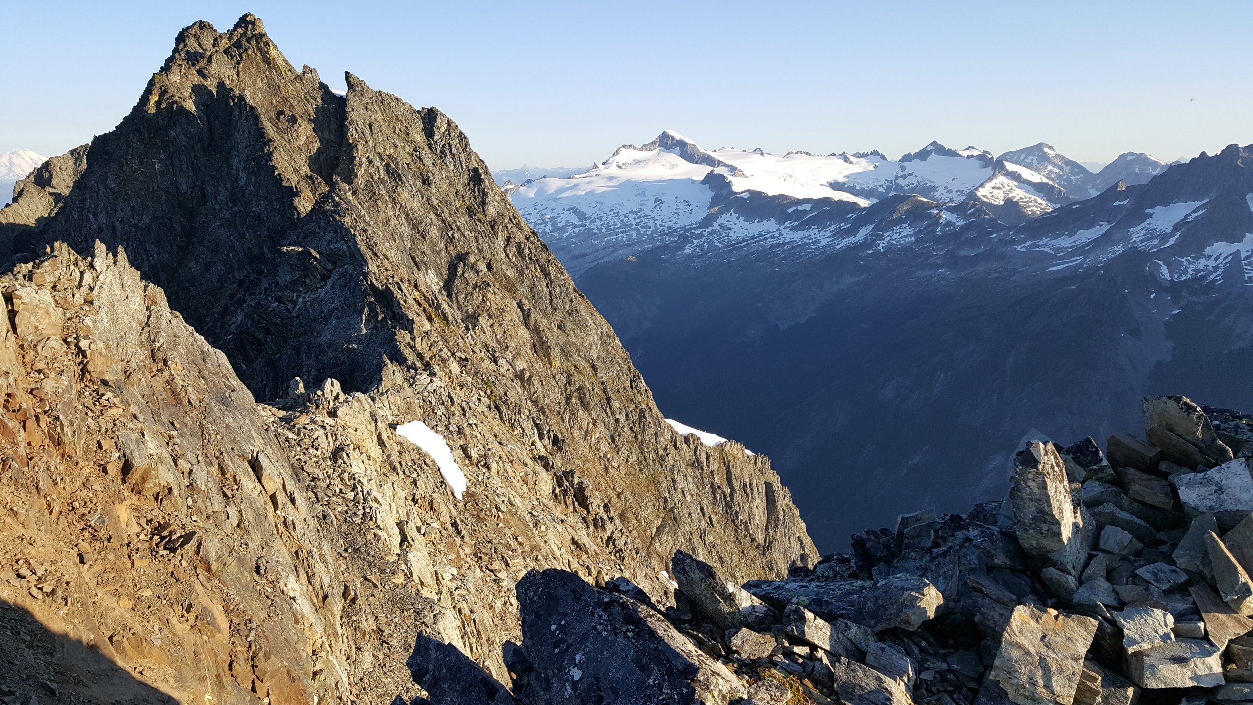
Trip: Luna Peak - Standard Route - True Summit Trip Date: 09/05/2020 Trip Report: With it being Labor Day weekend, we sent someone ahead the night before to get a ticket at the ranger station for the next morning since we had a 9am boat taxi scheduled on Friday. Luckily, we got our permit within a half hour or so of them opening and got to the boat pickup on time. YouTube Video With pleasant weather we made quick work of the first 10 miles to the Luna Camp signpost. Sitting around taking a lunch break a solo guy came by on his way to do Fury. A couple people in our party had thought the Luna signpost was for a trail split to where you head off to Luna and told the guy he was taking the wrong path. He seemed to have that response that sounds like he knew where he was going and was wondering if we knew where we were going. A couple people had gps tracks though that did show someone went to Luna from the Luna Camp split. Never caught up to him to say sorry about that. We did eventually spot him just topping out on Fury as we were on top of Luna the next day. One mile later we got to the cairn that marked the spot to head up to Luna Peak. There really isn’t any kind of trail to follow so unless you know just where to find the log crossings it could get really tricky getting through the first mile. The boat driver mentioned he had dropped of a couple the day before who had gotten lost the week before trying to get to Luna who were trying it again. But we never ran across a couple ahead of us all the way to Luna so not sure where they went. We all wondered if there was a couple still lost in the brush somewhere on their 2nd try. We found the log crossing we were aiming for without any problem and found climbers trail on and off the rest of the way into the basin. We found a lot more of the trail on the way out but still managed to do a fair amount of bushwhacking both ways. Took us about 7.5 hours to do the 15 miles into Access Creek basin where we setup camp. Figured shooting for Luna Col would have had us there in the dark so Access Creek was a good spot to stop with views of Luna and the boulder field we needed to go up in the morning. Next morning, we took off up the narrow rocky gully, but going wider right and up and then across through the trees works too (probably a bit easier too). Knocked out the first 2000ft gain then rounded the corner for the first view of the col and Luna. Another easy 1000ft up to the col put us at the base of Luna Peak in just a few hours. Just a bit up the scramble to the false summit we past a pair of climbers coming back who had stopped at the false summit. Another hour (about 4 hours from camp) put us at the false summit where the fun really starts. Beta we had said you could run the entire ridge (harder) or take ledges across but requires a bit of a 4th class downclimb. After shimmying down most of the chimney the last move or two just felt too sketchy with the drop-off into nothing below and it feels like there were not solid holds for the amount of exposure. So, we split the difference and ran the first 30 feet of the ridge which is exposed but felt more solid and that took us to a ramp down to the ledges. Once there it was easy scrambling across picking our way across then switch backing at the end to get under the summit block. Once under the summit block, we wrapped around the backside and found a few easy moves up to the summit block. Just as most of our party were down to the ledges a group of three guys came up behind us who were pretty chill about hanging out waiting for us to get over and back since they were camped at the col and it was only about 11:30am. The summit register was full, and we wound up signing the back cover. If anyone goes up anytime soon it could use a new register. On the way down from the summit instead of heading straight over I had gone down a couple ledges and wound up finding an old rusty metal film canister. I thought there might be a film roll inside but instead there were a few loose pages of an old summit register. Most of the pages were faded too much to read or disintegrated but some were clearly dated from 1971, 77 and 78 which was a cool find. I brought the canister back out since it had been sitting there for so many decades. Not sure how long It had been dropped down on the ledges. I found a trip report from CascadeOriginals where someone had mentioned signing a register in a film canister back in 2003. Mailing it over to the Mountaineers to archive it. On the way back everyone else retraced their steps to go back up to the ridge then to the false summit. I went up the chimney which was a little awkward but went up fine. The party of 3 waiting for us then took off for the true summit while we took a lunch break before heading back. On the way back to the rocky gully above the basin we passed a couple trail runners who mentioned a pair in the gulley that had an accident and appeared on of them broke an ankle. On our way down we stopped by and chatted for a moment. It turned out to be the pair we had passed and chatted with a moment on the scramble up to the false summit in the morning. They had everything handled and were waiting for a heli rescue that was on the way and didn’t need anything. Props to them for getting hundreds of feet down the upper gulley to a flat area and props to SAR for pulling them out hours later. Next morning had a leisurely hike out and found more of the climbers trail going out than we found on the way in. Still got off track a few times and took a bit of navigating to find the log crossing. Fantastic trip overall with good weather and good company. Gear Notes: None Approach Notes: Bushwacky from the trail to Access Creek basin in places.
 1 point
 -
Amazing country for sure. There are two toes of rock meeting snow in your photo. I crossed snow there and gained the nice ledgy slabs somewhere between those two toes.1 point
-
I had a great time "cascadian hilarity" describes it well. @zaworotiuk here's you guys coming up the snow arete in the morning! Might have to zoom in.
 1 point
 -
What’s this buttress called? Routes? Topos? Beta? It’s on the opposite side of Ruth Creek from Mamie Peak. It descends off of the north side of Nooksack Ridge between Ruth and Sefrit (not the similarly named Nooksack Ridge which is nearby between Nooksack Tower and Shuksan’s summit).
 1 point