Leaderboard


Popular Content
Showing content with the highest reputation on 08/01/18 in all areas
-
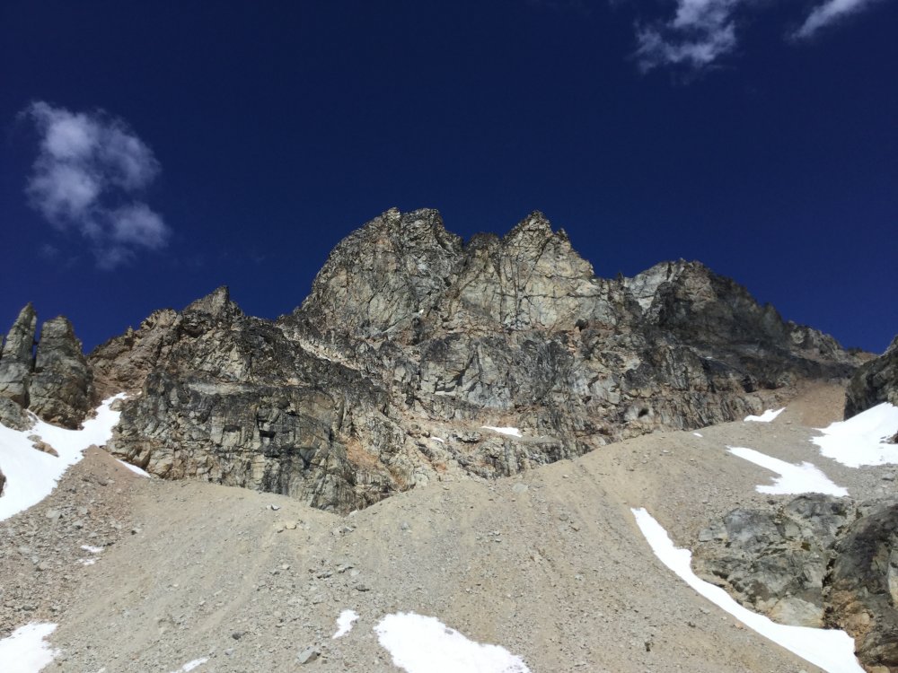
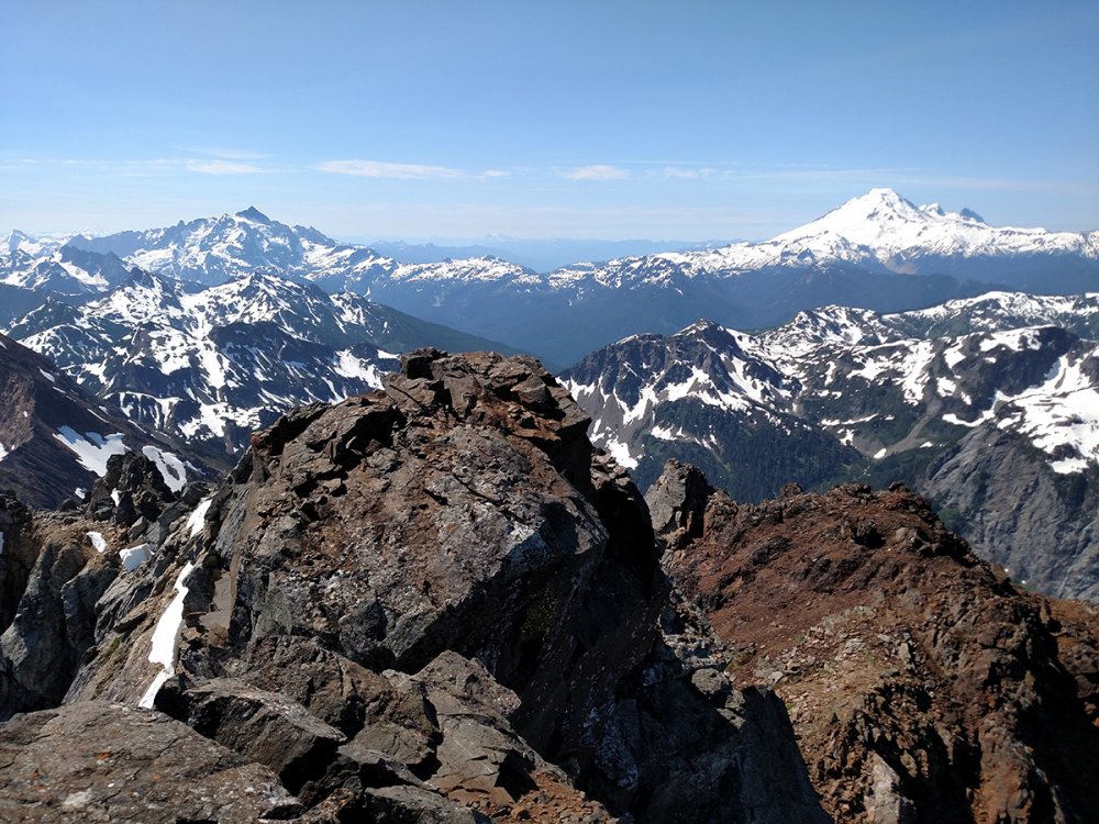
Trip: Mt. Slesse - NEB Trip Date: 07/19/2018 Trip Report: Anyways went up and climbed North East Butress on Mt. Slesse with friends Chuck and Yale on July 19th-21st. Great trip full of adventure. Went up on the 19th, on the way up got the truck stuck and had visions of spending the weekend digging the sucker out. Luckily after a half hour of piling rocks and digging out the undercarriage we were able to drive away and continue as planned. The plan was to hike to the view point today and check out pocket glacier, there was word that it was still in place. Which it was, we hung out for a while listening and watching and all seemed good and stable, but not completely reassuring after hearing tales of it sliding from the likes of Otto. Anyways we decided to give it a go and check it out. The next day we were up at 2:00 and hitting the trail at 2:30, from the parking lot. The plan was to get to the glacier before the sun hit it. It appeared our plan worked out since we arrived before the sun and things seemed quite stable. After a quick crossing we were finally on the climb proper and we could put all the apprehension about the glacier behind us, though I kept thinking what if we need to retreat. Luckily that didn’t happen. Not much to say except it was a stellar climb with lots of pitches. Chuck led the crux 10a in good style with an big overnight pack on. We were running short on daylight towards the end so motor out the class 4 scramble at the end, but we’re still benighted and spent the night on the summit. Since it was a planned bivy I was quite comfortable I had a sleeping bag, even had coffee and muesli in the morning though cold. It was by far one best bivy I have had on a climb. The crossover descent was sort of uneventful, though there was still a lot of snow slopes in place, which probably slowed things down, but we eventually back down to the car around 4:00pm on the 21st. Can’t stop thinking of the climbing and can’t wait for my Upcoming Matterhorn trip. Gear Notes: Alpine rack Approach Notes: Missed the parking lot on the drive in. Basically where there is a sign pointing to Mt. Rexford is where the parking is for Slesse.3 points
-
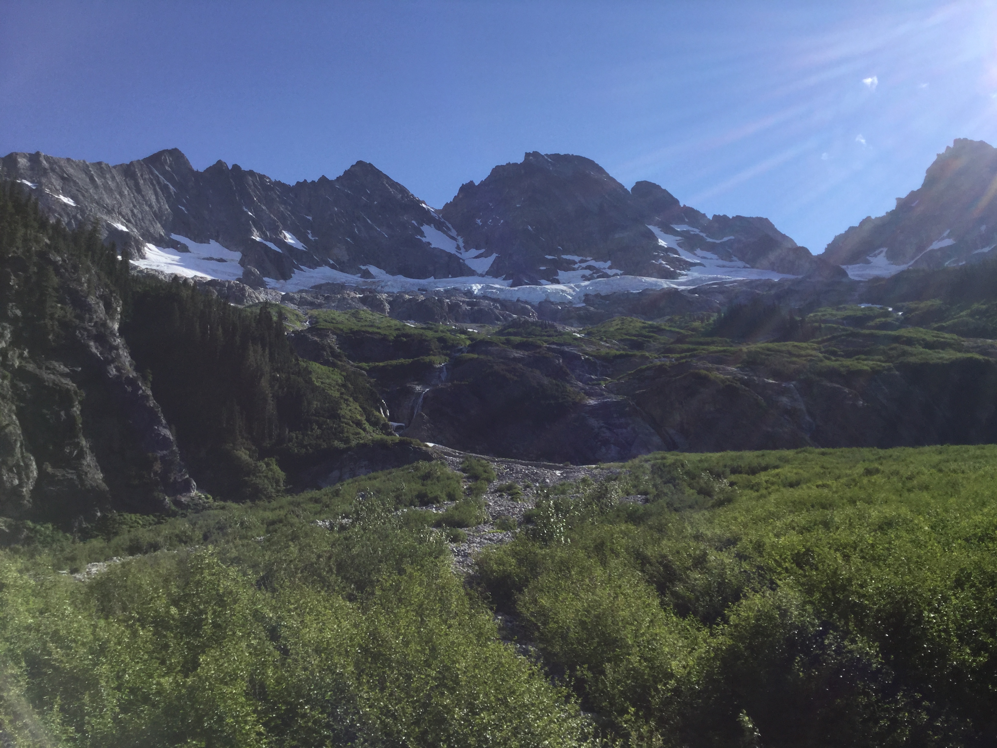
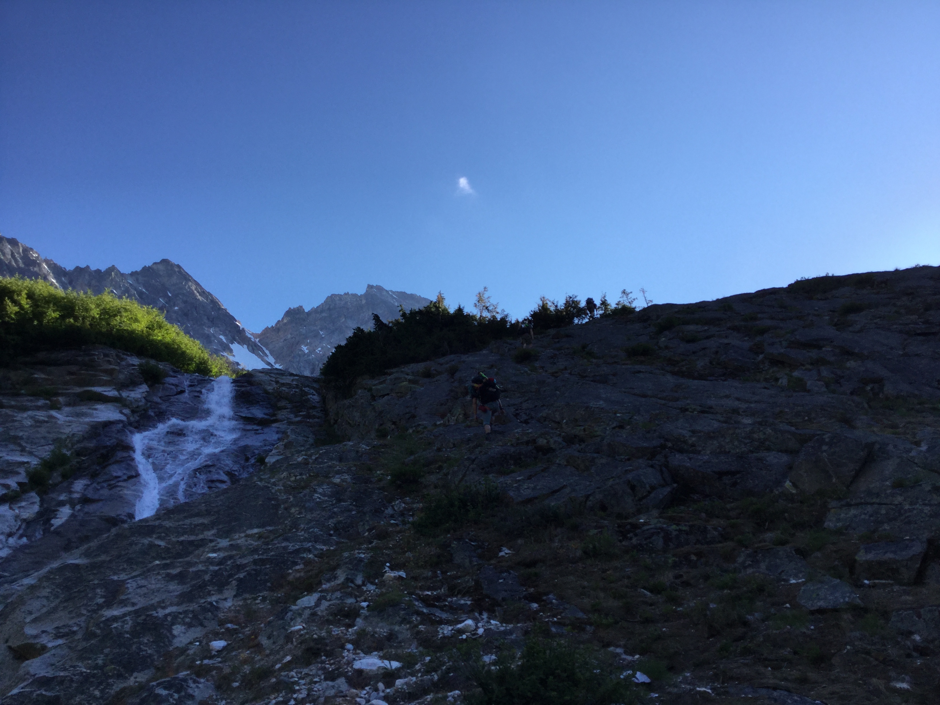
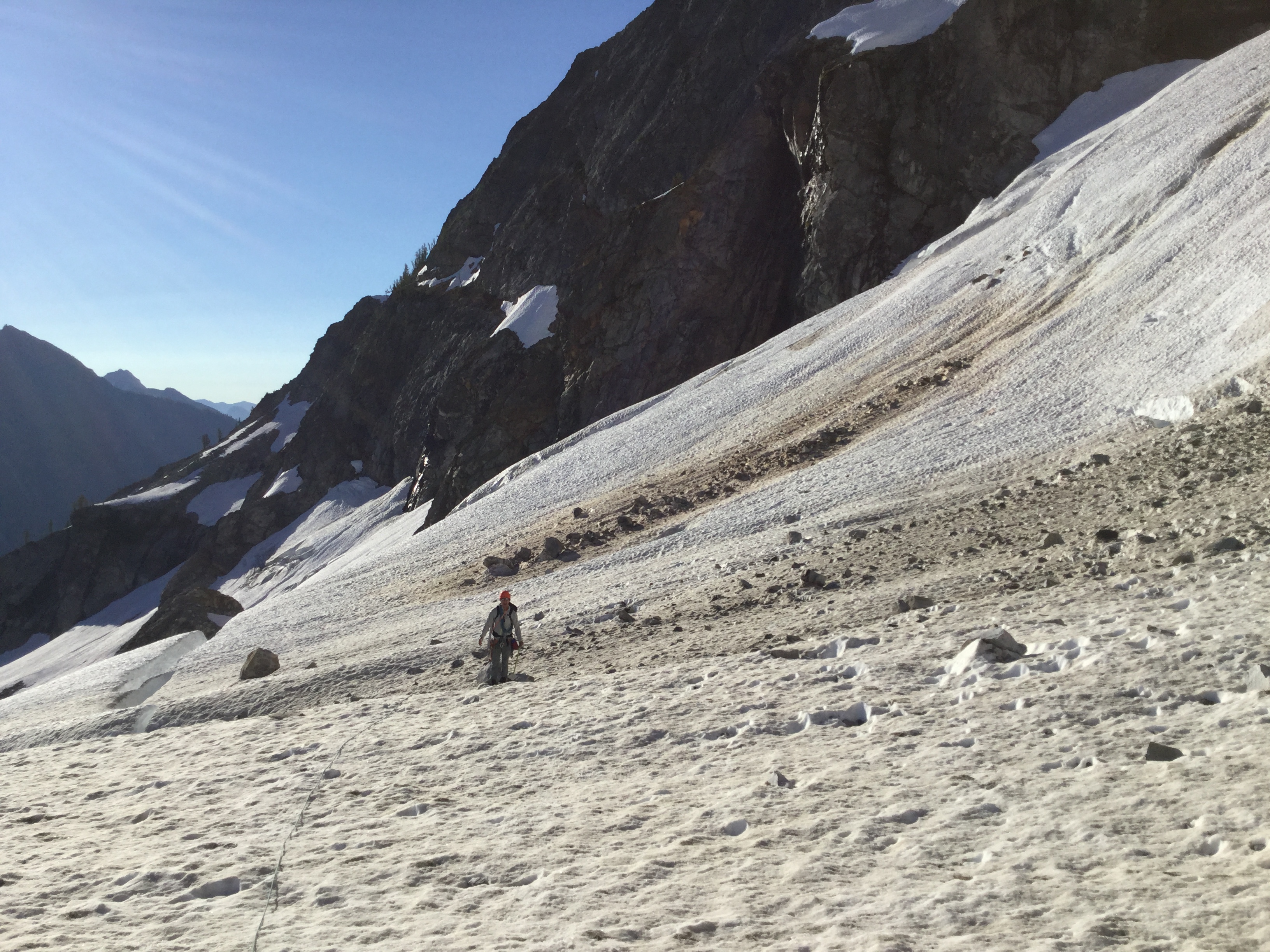
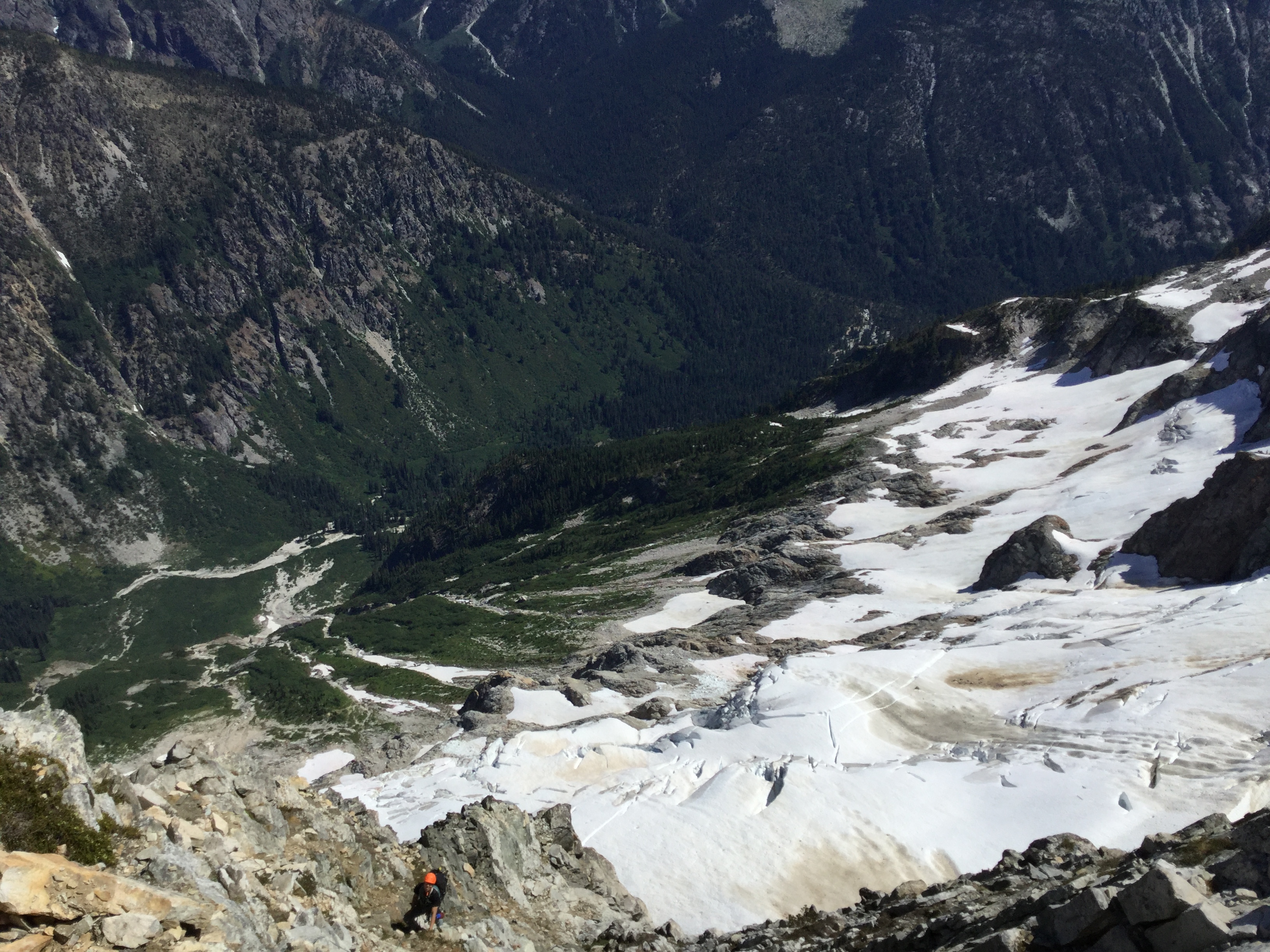
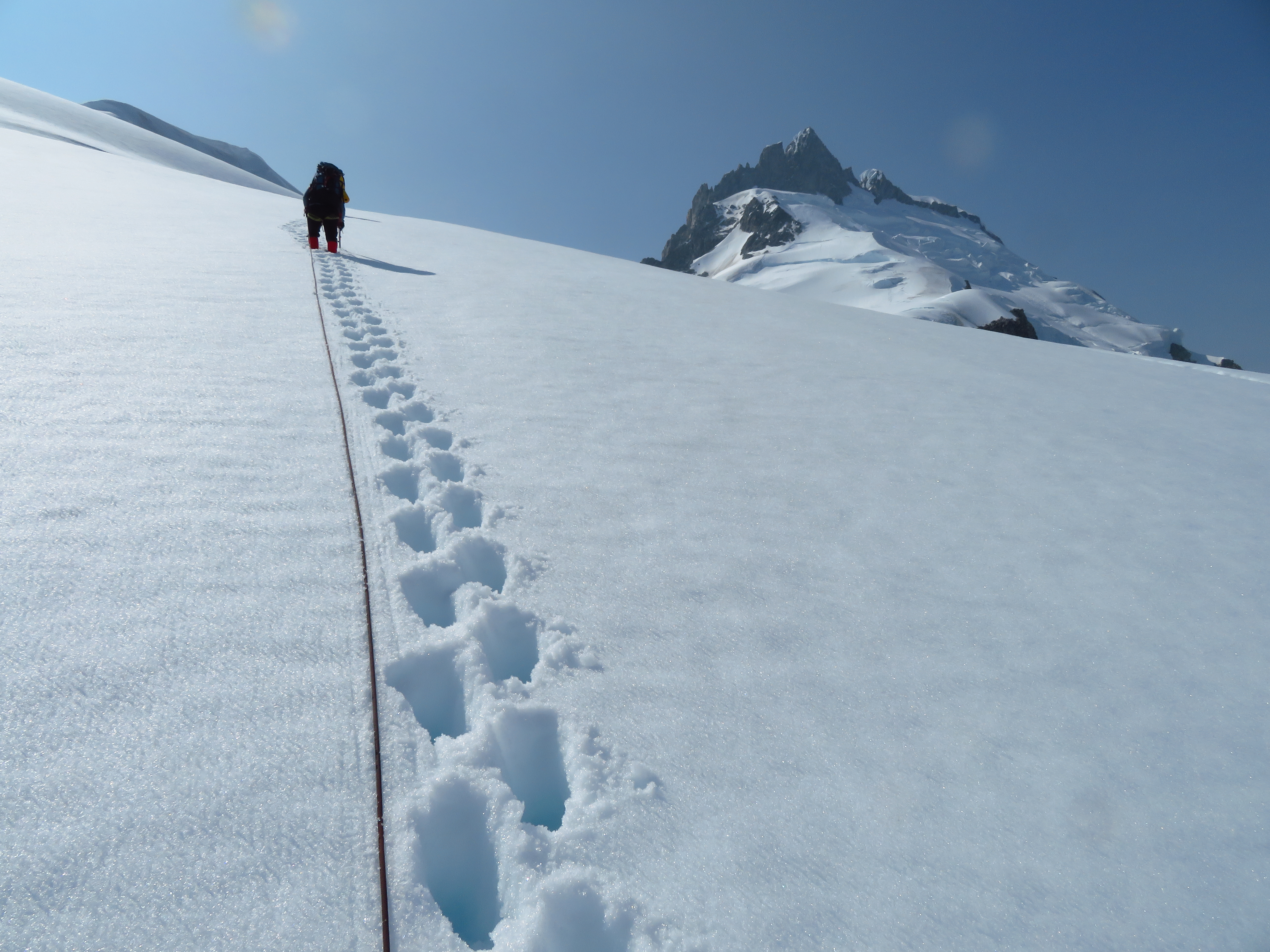
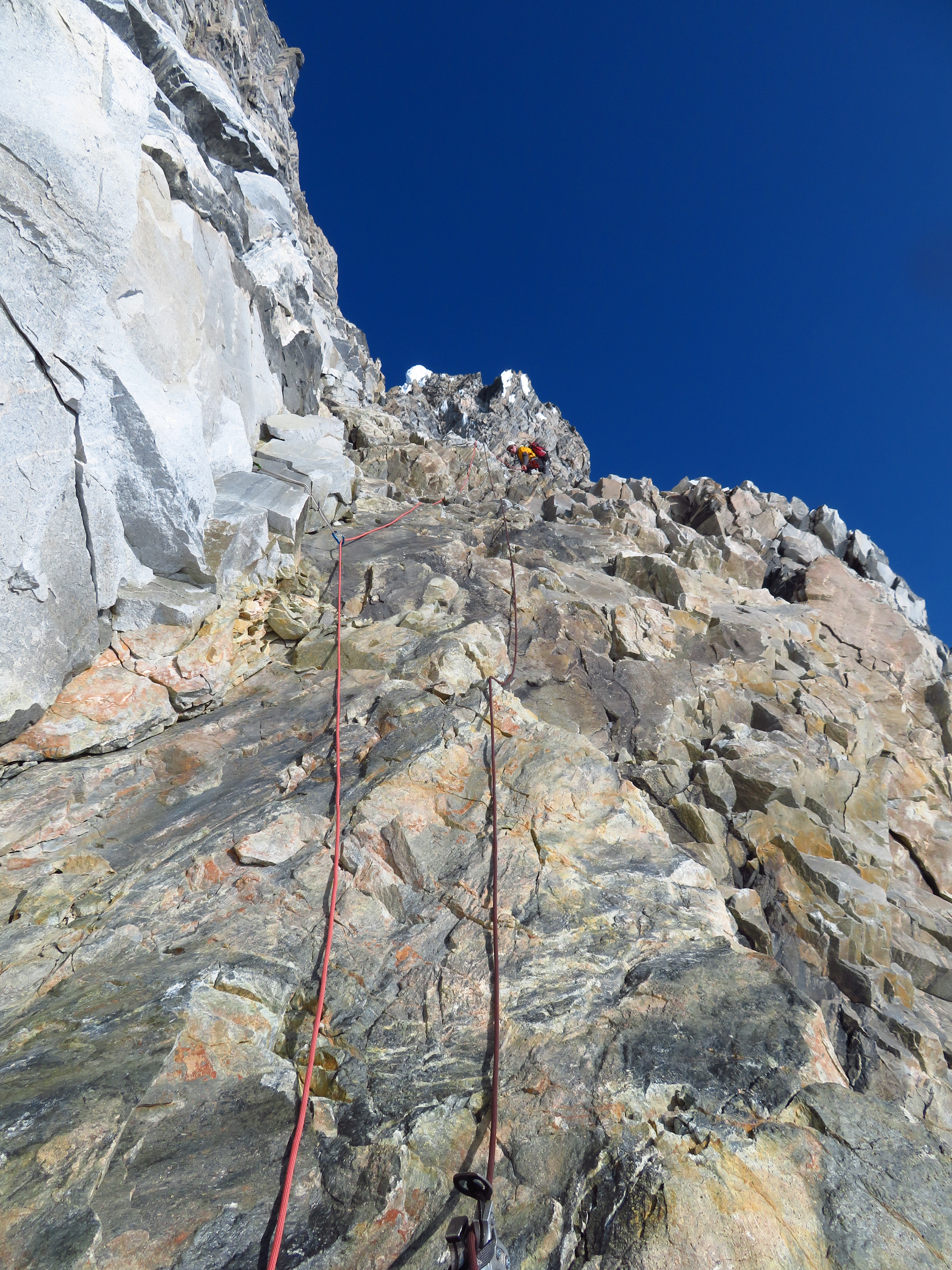
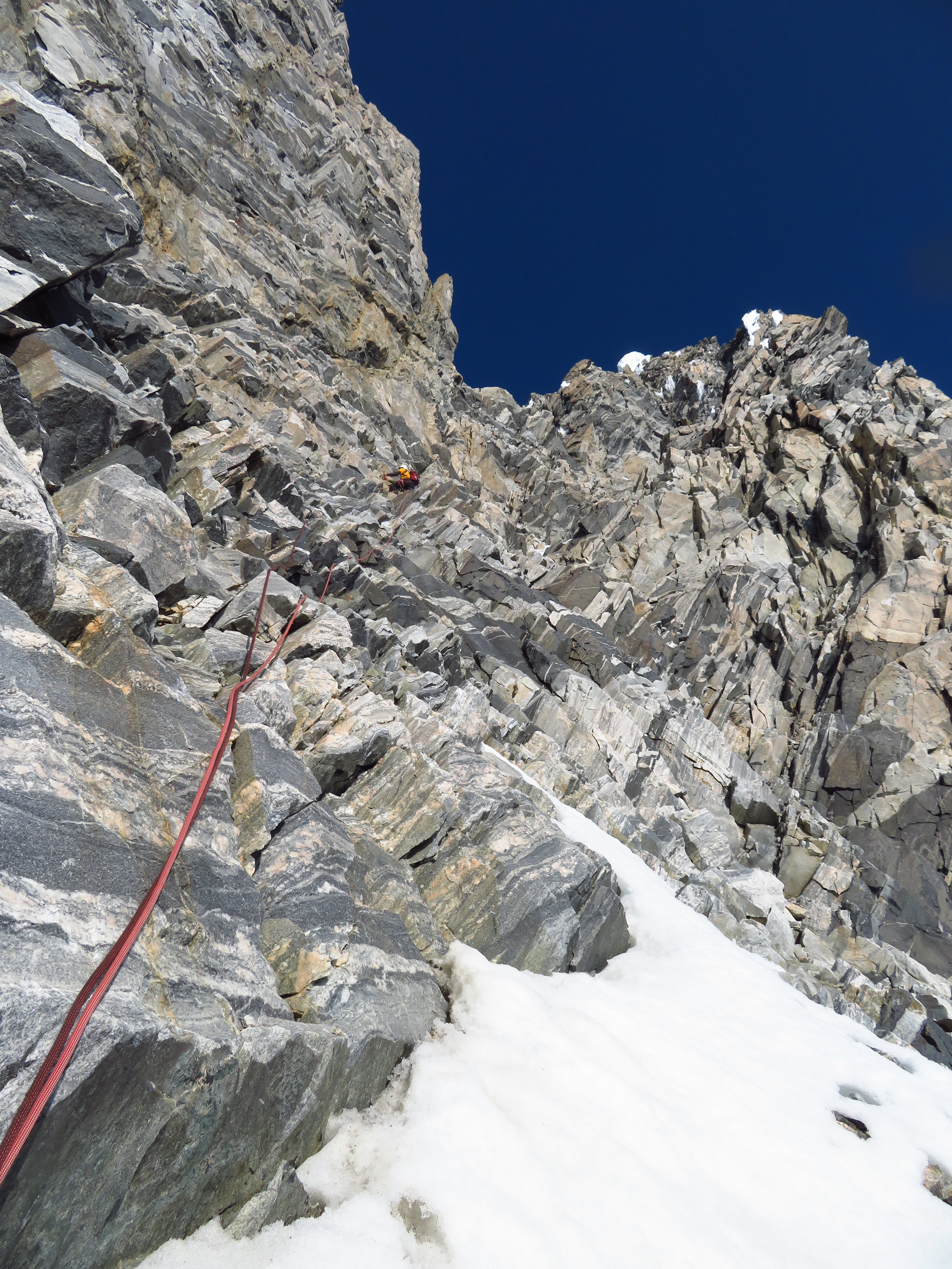
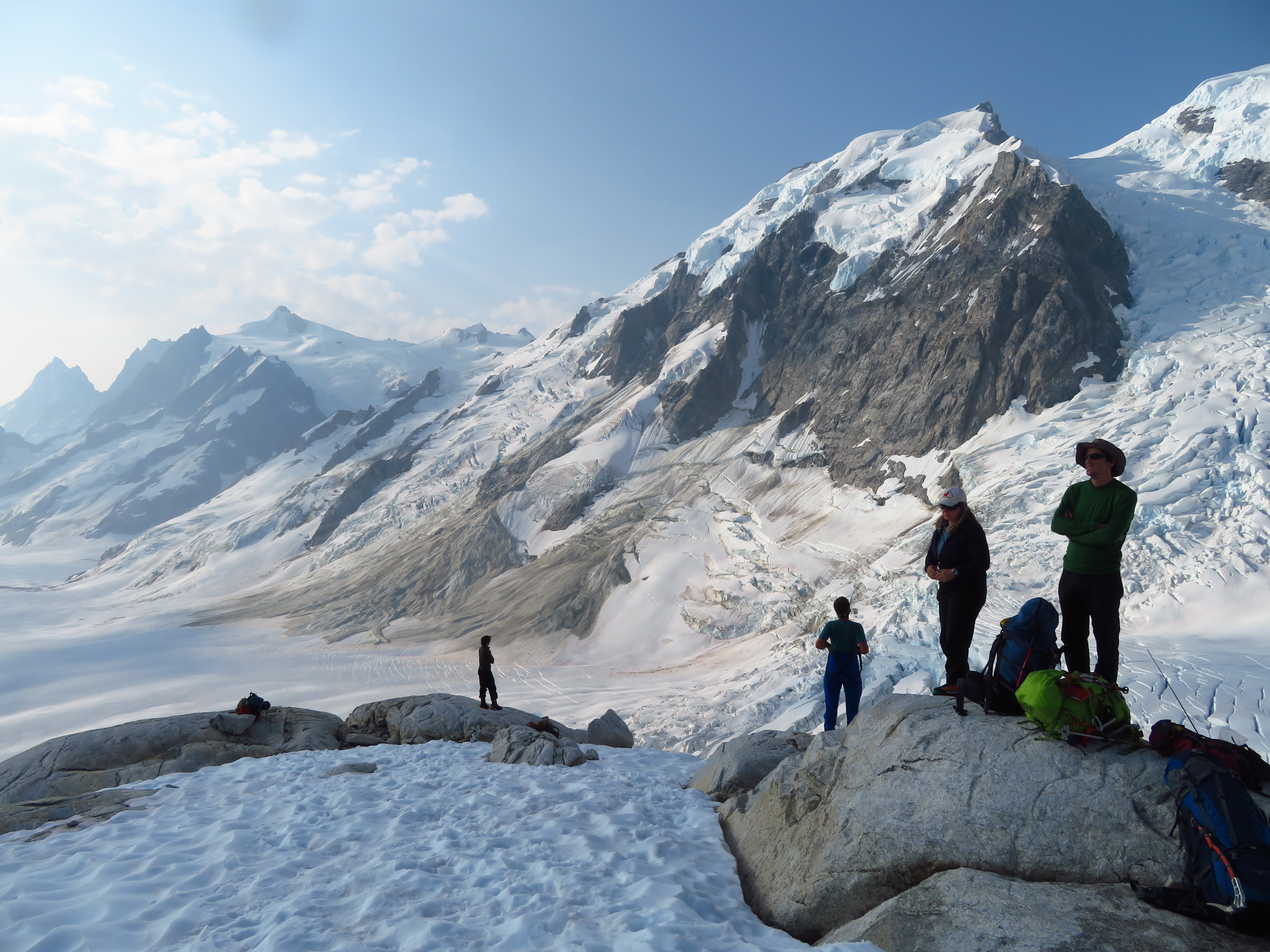
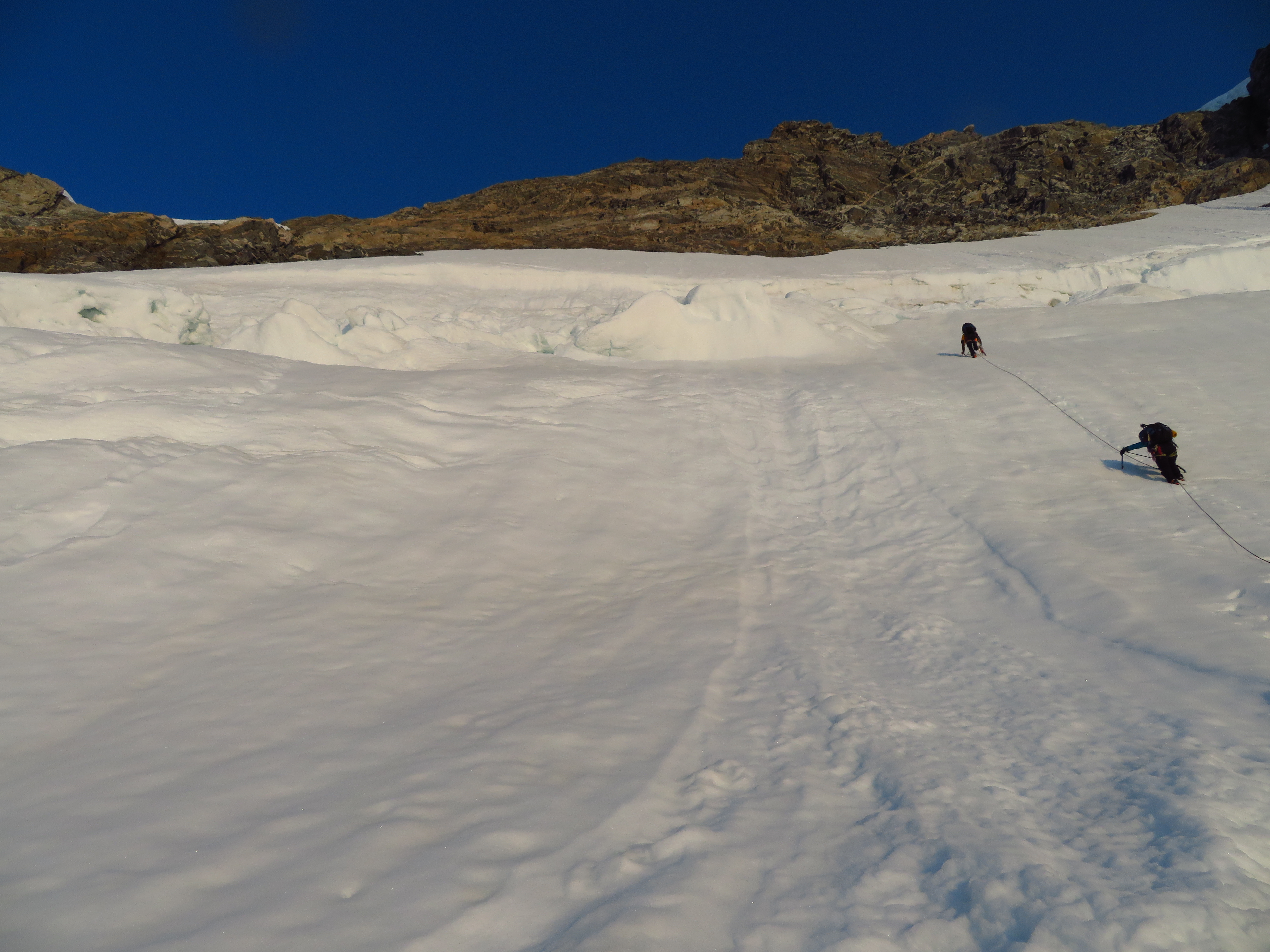
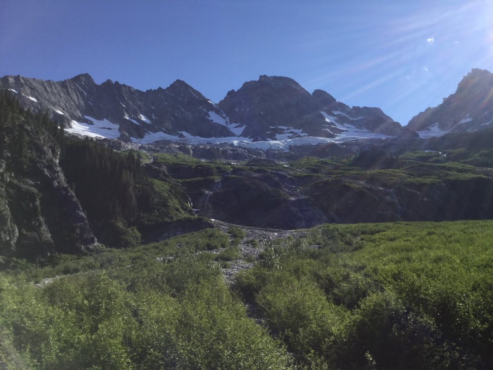
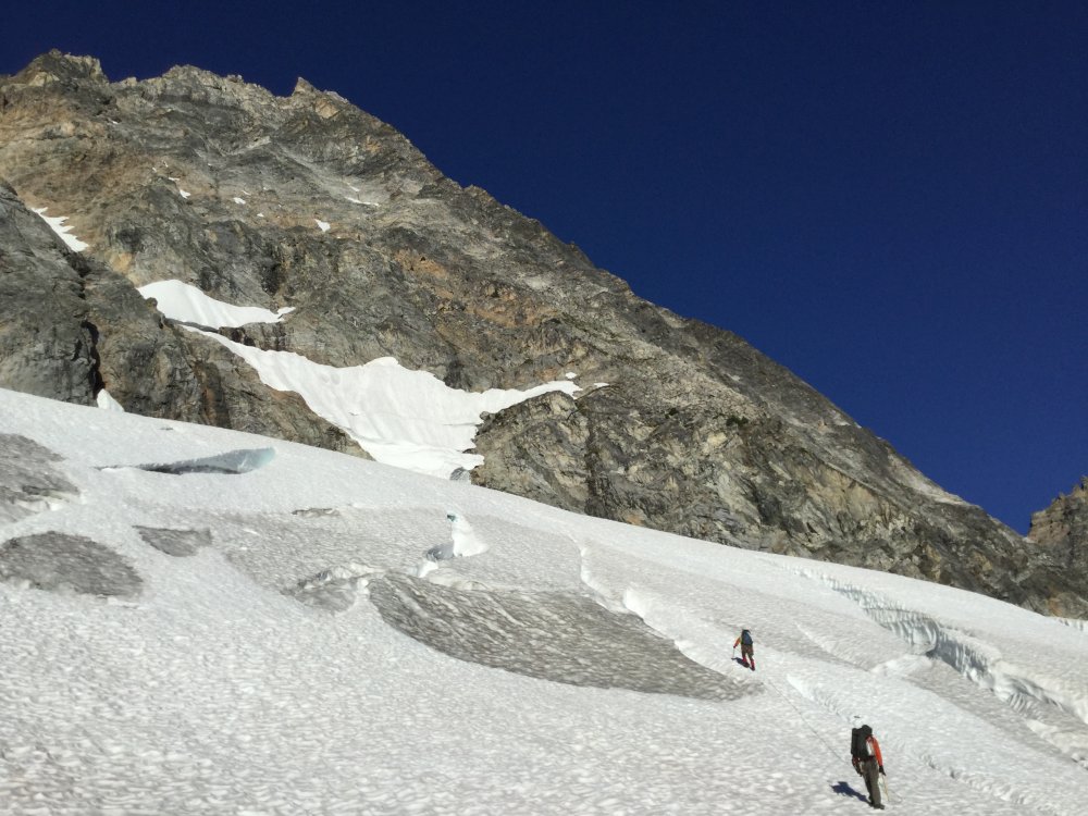
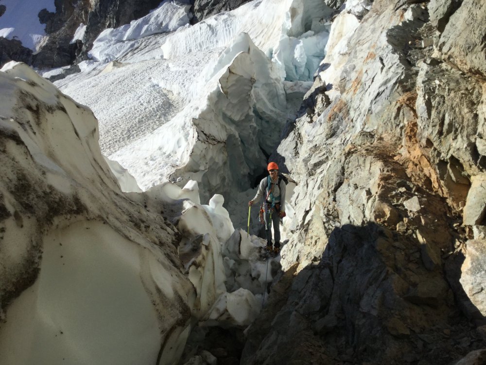
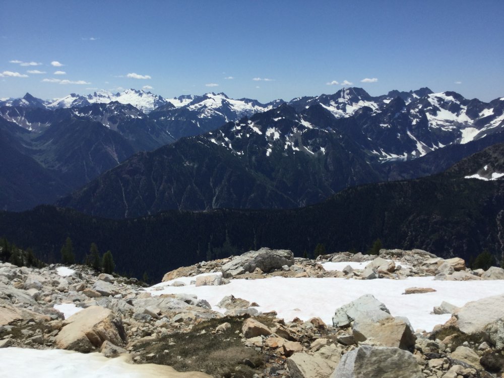
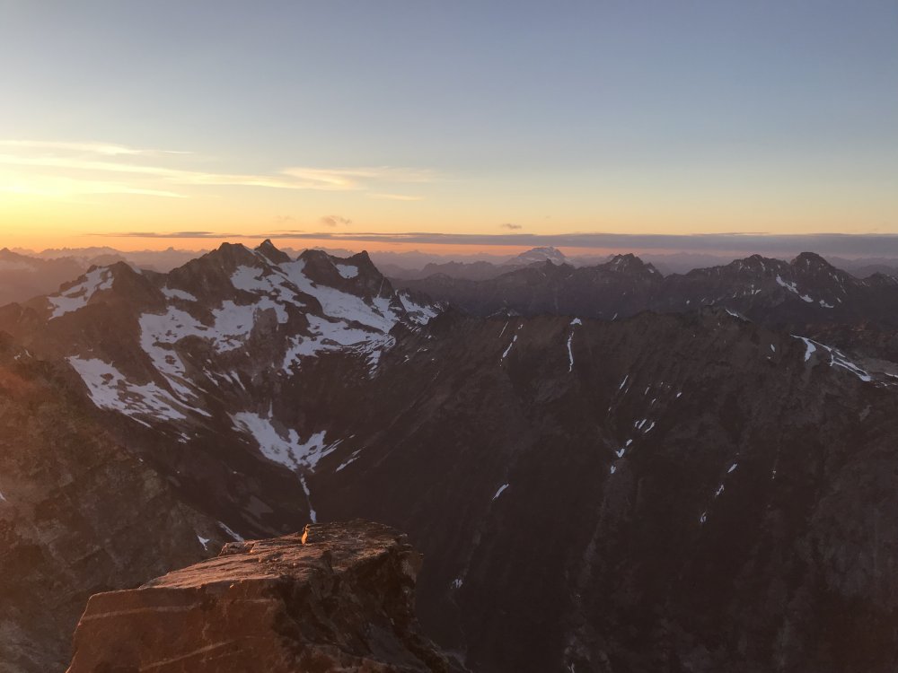
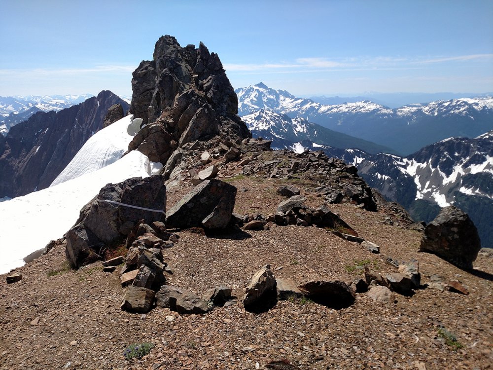
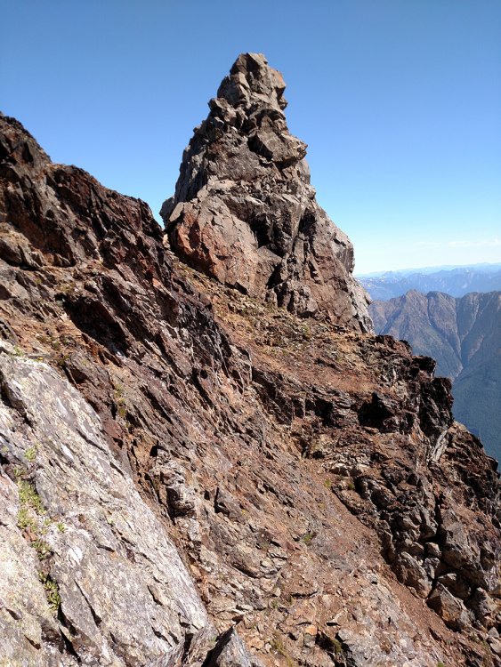
Trip: Goode - NE Buttress Trip Date: 07/22/2018 Trip Report: I've had this route on the calendar every July since 2012 and every year something has thwarted me (partners dropping, rain or thunderstorms in the forecast, etc). Last year was the only year I actually had boots on the trail and we ended up with a late start and making a route-finding mistake after crossing the N Fork of Bridge Creek that cost us the climb. This year the stars finally fucking all aligned and it was glorious! The view of the final approach after crossing the knee-deep N Fork of Bridge Creek. Follow talus between the lower slide alder up to the waterfall on the left, climb slabs to its right, then ascend talus through "magic tunnels" and onto open terrain. We bivied at 5600', just below the glacier. Last year we neglected to check out these slabs next to the left-most waterfall until it was too late. This year we went right to them. The slabs are exposed and a bit butt-puckering with full packs, but not enough to motivate us to get out a rope or give us pause about this endeavor. Opportunities like this (4 days of clear weather, motivated partners, time off work) are not so easy to come by in mid-to-late July, and I am not getting any younger. Ascending the Goode Glacier in the morning. It was broken up and we had to navigate crevasses and seracs. Nothing too serious. We all wore approach shoes, which worked well enough with crampons (I had my Grivel G1's that I got via a gift certificate from cc.com a few years ago, purchased at Jim Nelson's store). From TRs we knew that the higher up you gain the buttress, the less pitches of loose shittiness you must climb. Lower down you might get up to three pitches and up high as few as one. We opted to try for a snow bridge up high and found this one at about 6800'. It involved one face in move with a low step to block of ice. It might not go now, but there appeared to be a few other place to gain the rock below this that might last longer. We did one pitch of low-mid-fifth class rock then simulclimbed until about 8000'. I think we had a total of 3 simul-leads, with transitions only due to rope drag. I did not place much pro on these. When the buttress steepened we pitched 4 or so pitches and got to the bivy alcove at 8600'. From there 3 pitches to the ridge crest. It was lat-ish (6:30 pm) and 4 people were ahead of us and going for the summit. Figuring they would all bivy on the limited space there and seeing a nice snow patch at 8900' right next to a small bivy site we stopped, made dinner, drank water, drank whisky, and enjoyed a spectacular sunset: In the morning we waited for one of the parties to rappel. We saw them around 6 am. They said the other party was still hanging out so we headed up. After two pitches we were on the summit. We stayed on the summit for well over an hour, savoring the views. Having had been on the S side two years ago to climb Storm King, I knew we had a long day ahead. We started down. Truth be told the SW couloir and the trail down to the Park Creek trail was unsavory, and we got several blisters in our approach shoes. There is a nice spot to camp at about 7200'. Having been here before, we headed for it and looked for a stream out of the snow pack. We took a long break here to get water and savor views one last time. The views of Sinister and Dome, the rest of the Ptarmigan Traverse and Buckner are spectacular. From here it took us 3 hours to get to the "nice" trail. The length of the day and this trip with full packs was starting to take its toll. A few hours on the 4 miles to the base of this trail, then a connector (2.5 miles?) to the PCT, and about 3 more to the N Fork Camp where we had stashed food and a fuel cannister. We arrived at camp at 9:40 pm. I have never enjoyed a Mountain House more. Sadly, I had no whisky left. In the morning of the fourth day, we hiked out the last 10 miles, where beer awaited in the truck. Gear Notes: Ice axe, crampons, appoach shoes, helmet, small alpine rack with several double slings Approach Notes: Long, brutal


 2 points
 -
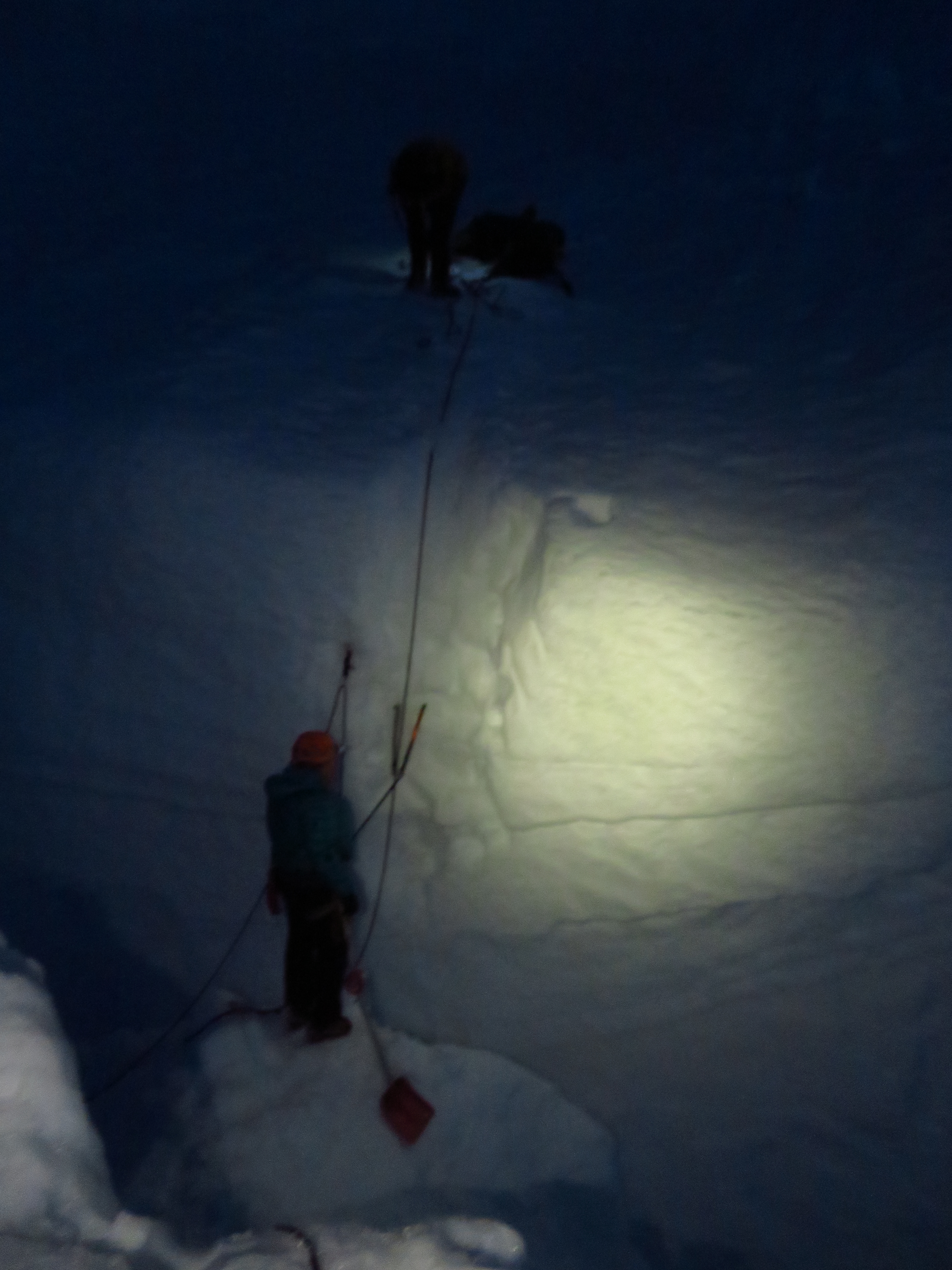
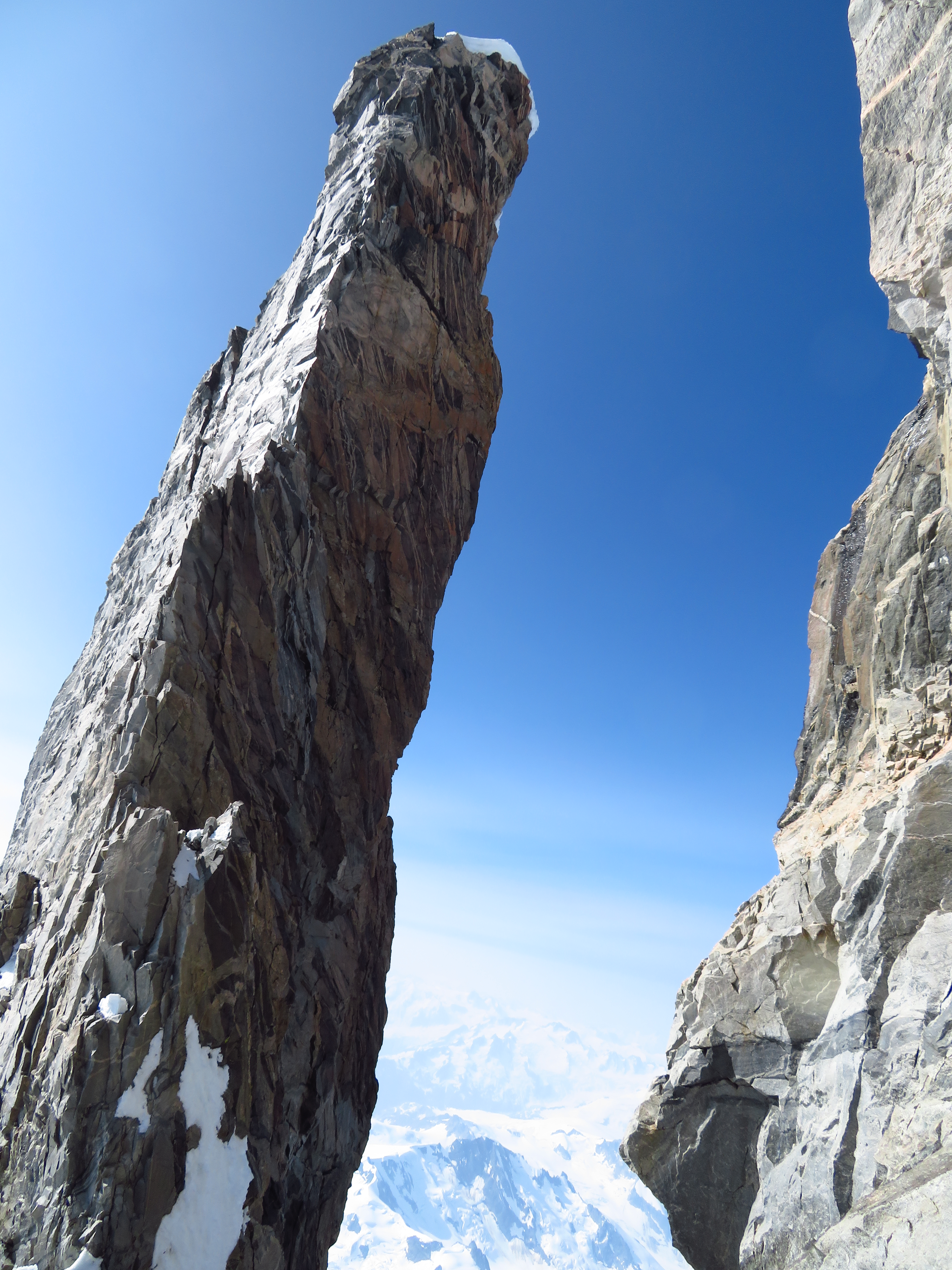
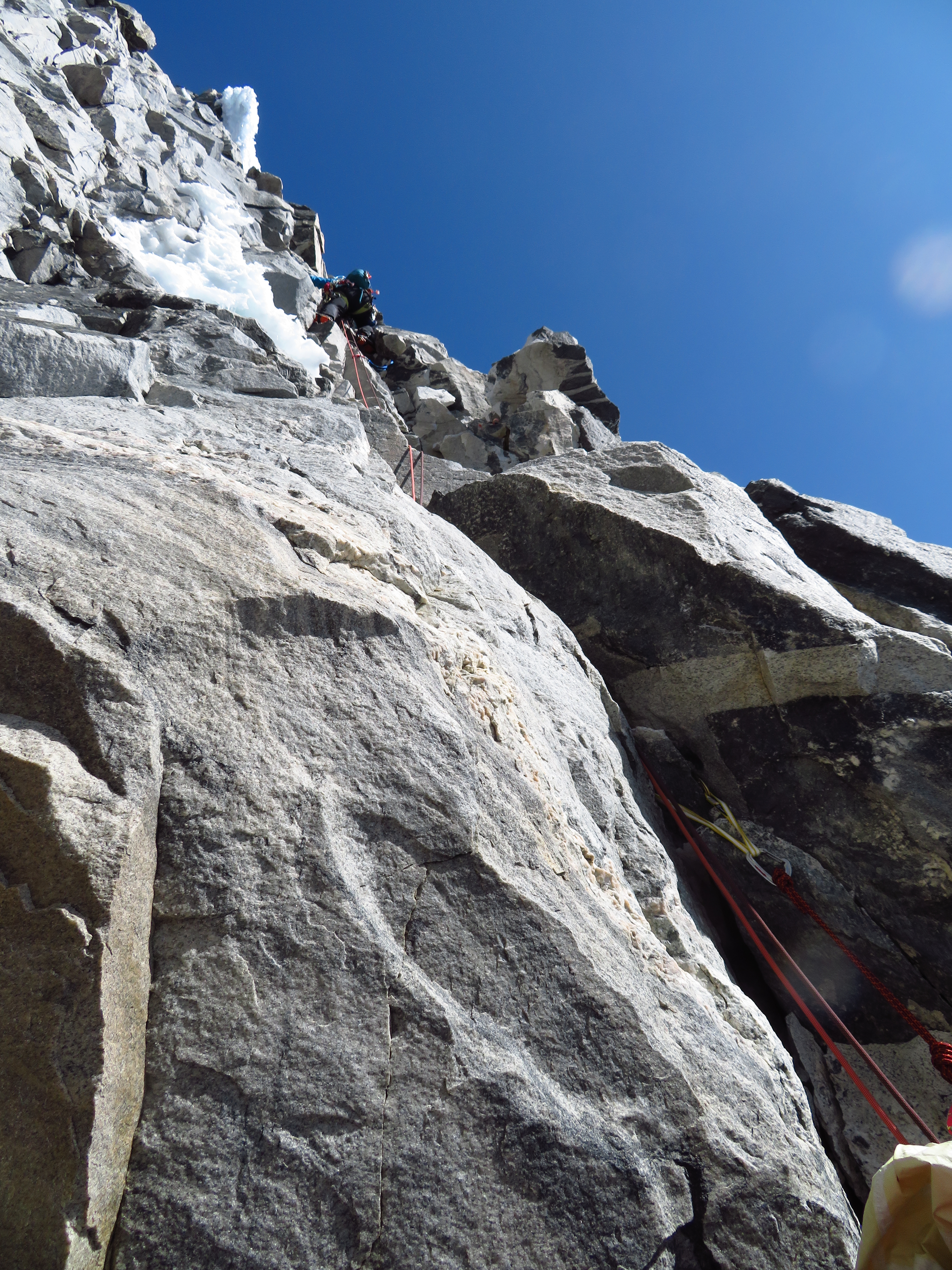
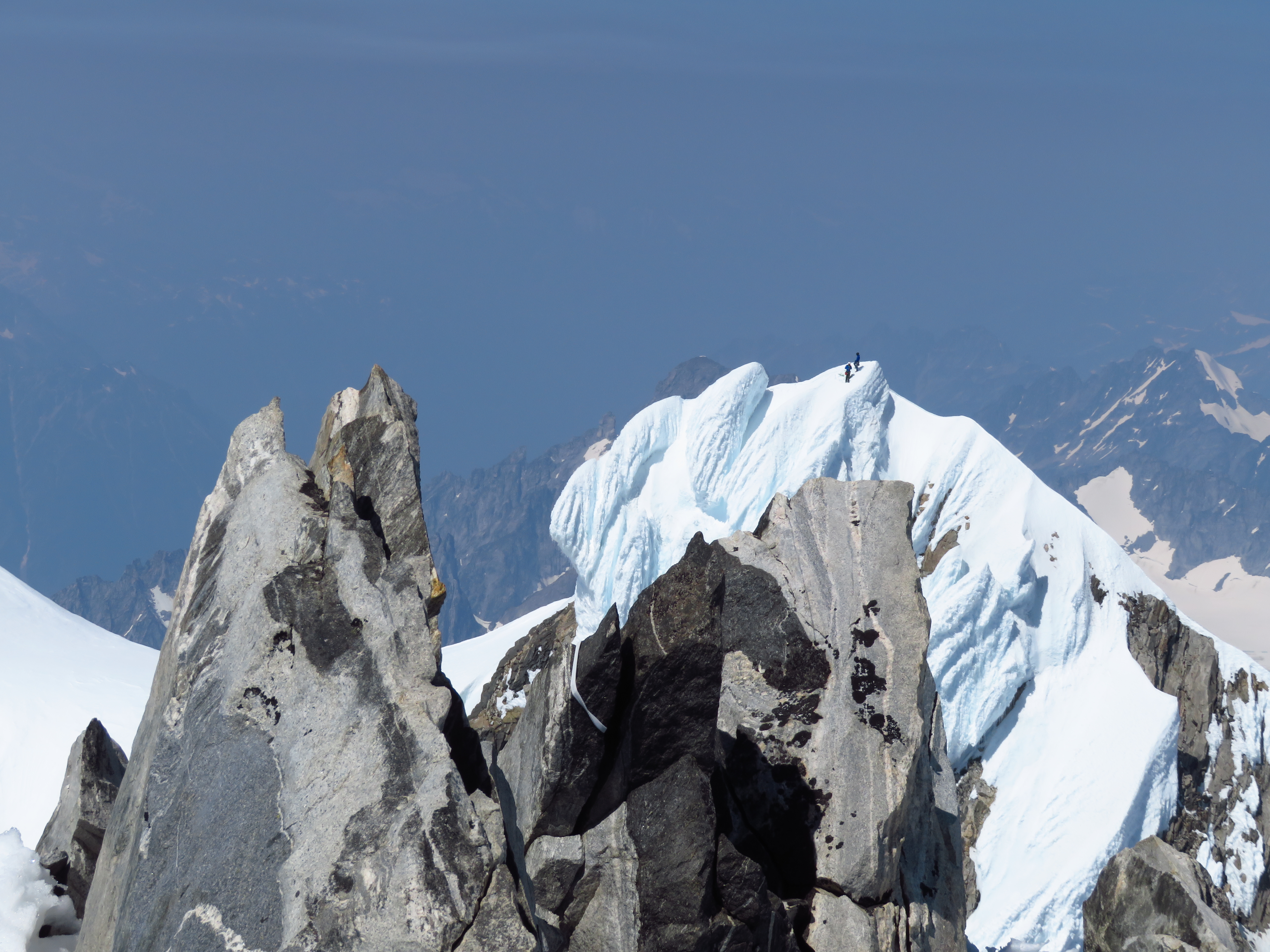
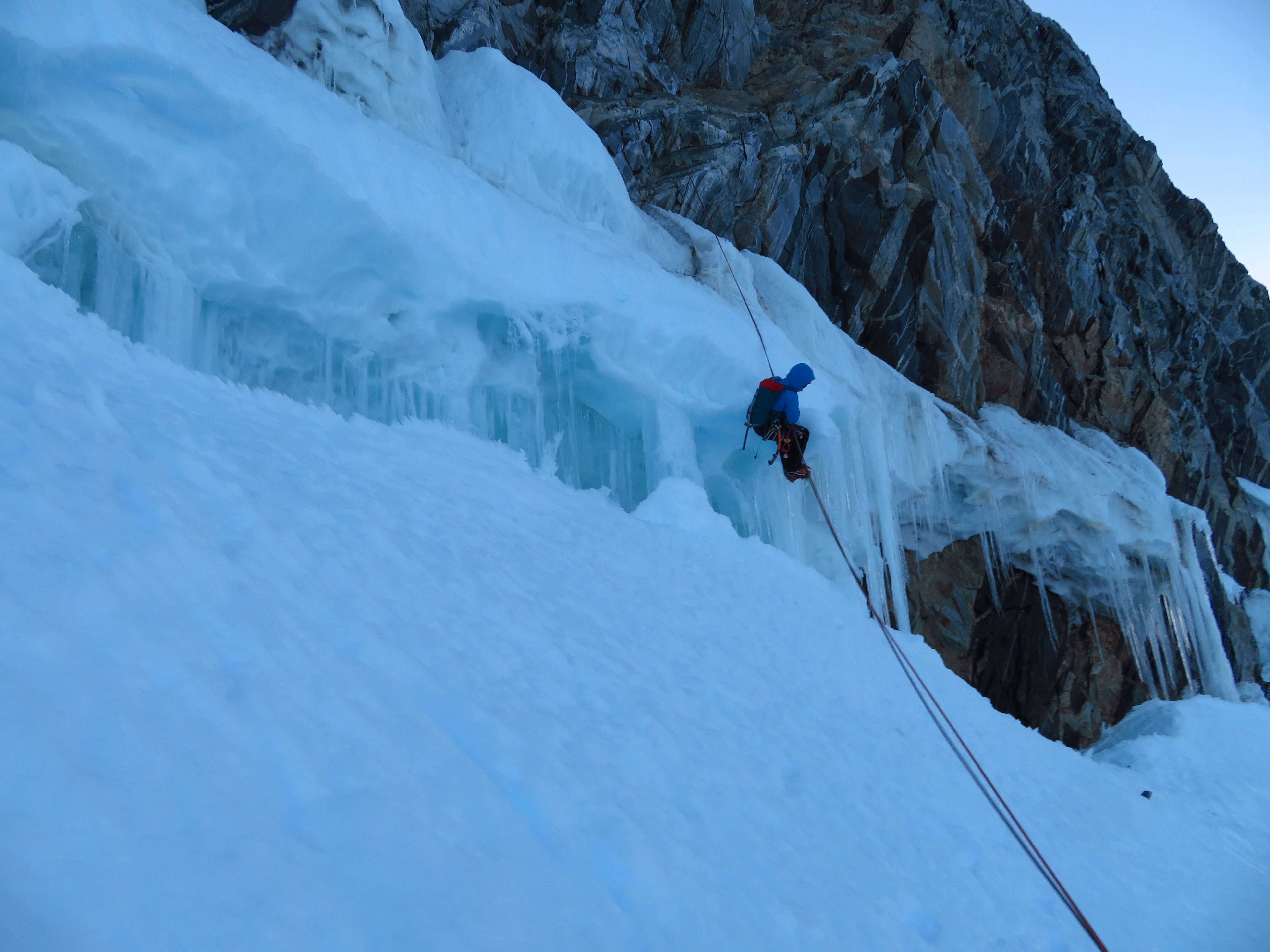
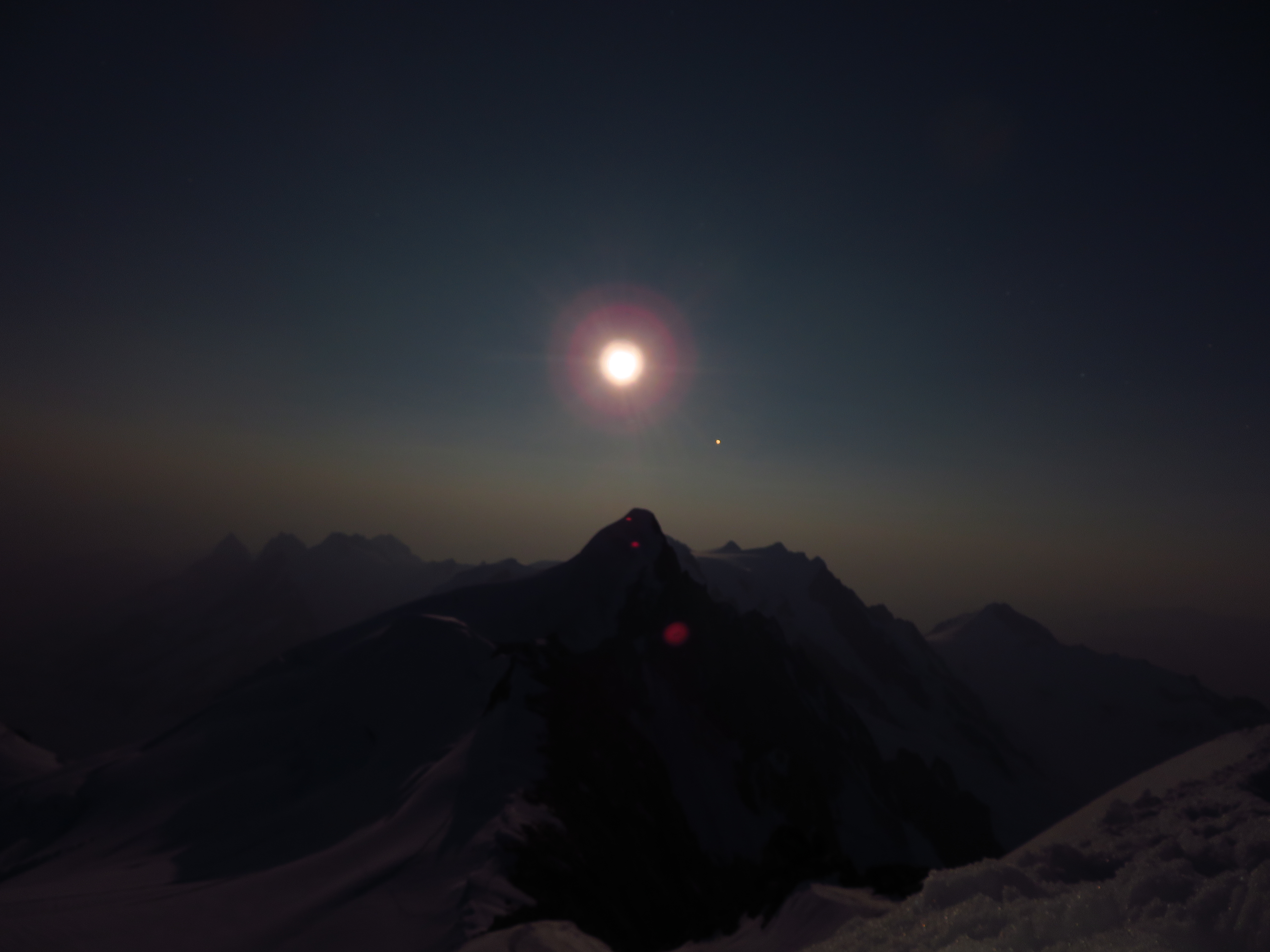
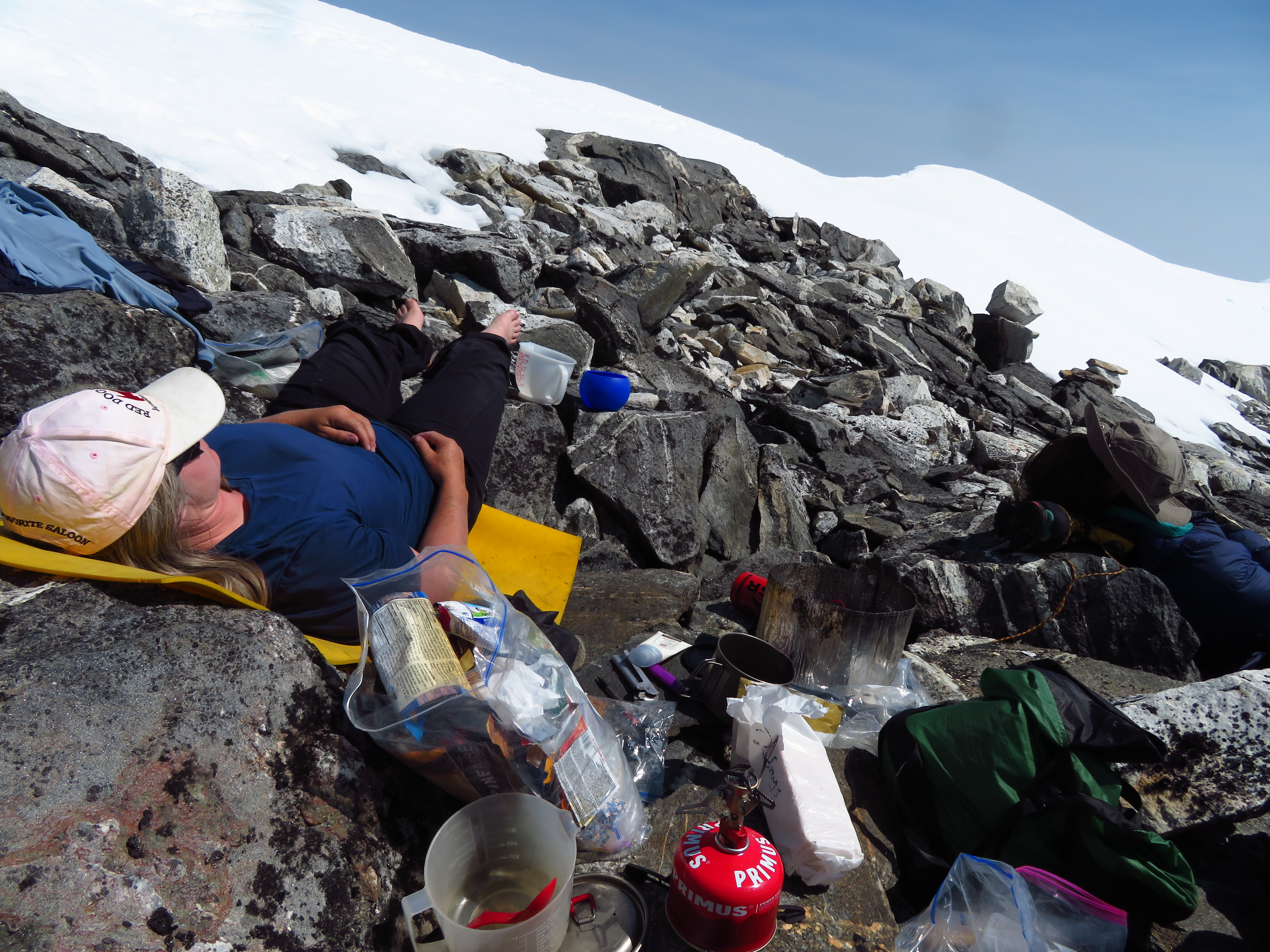
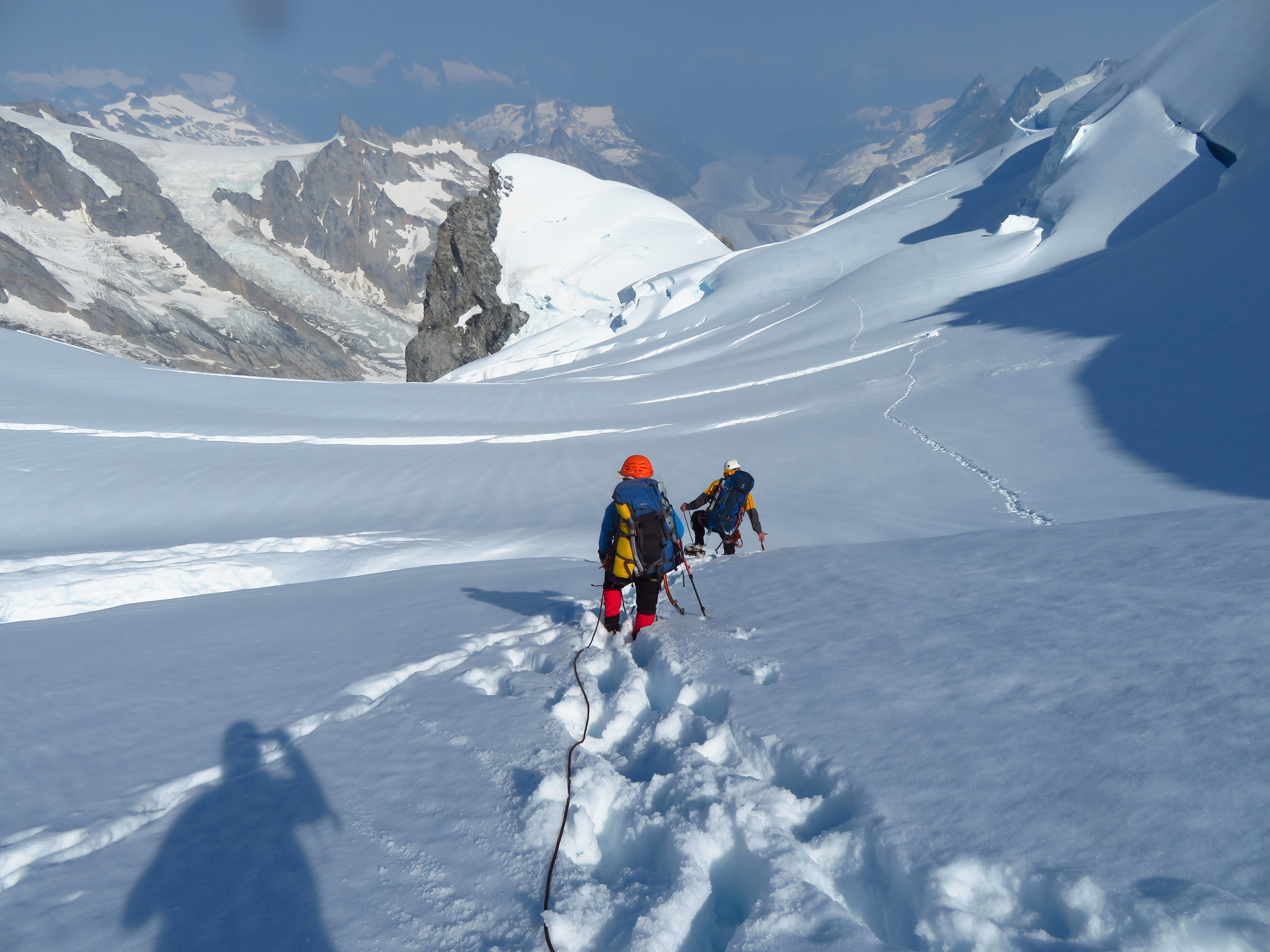
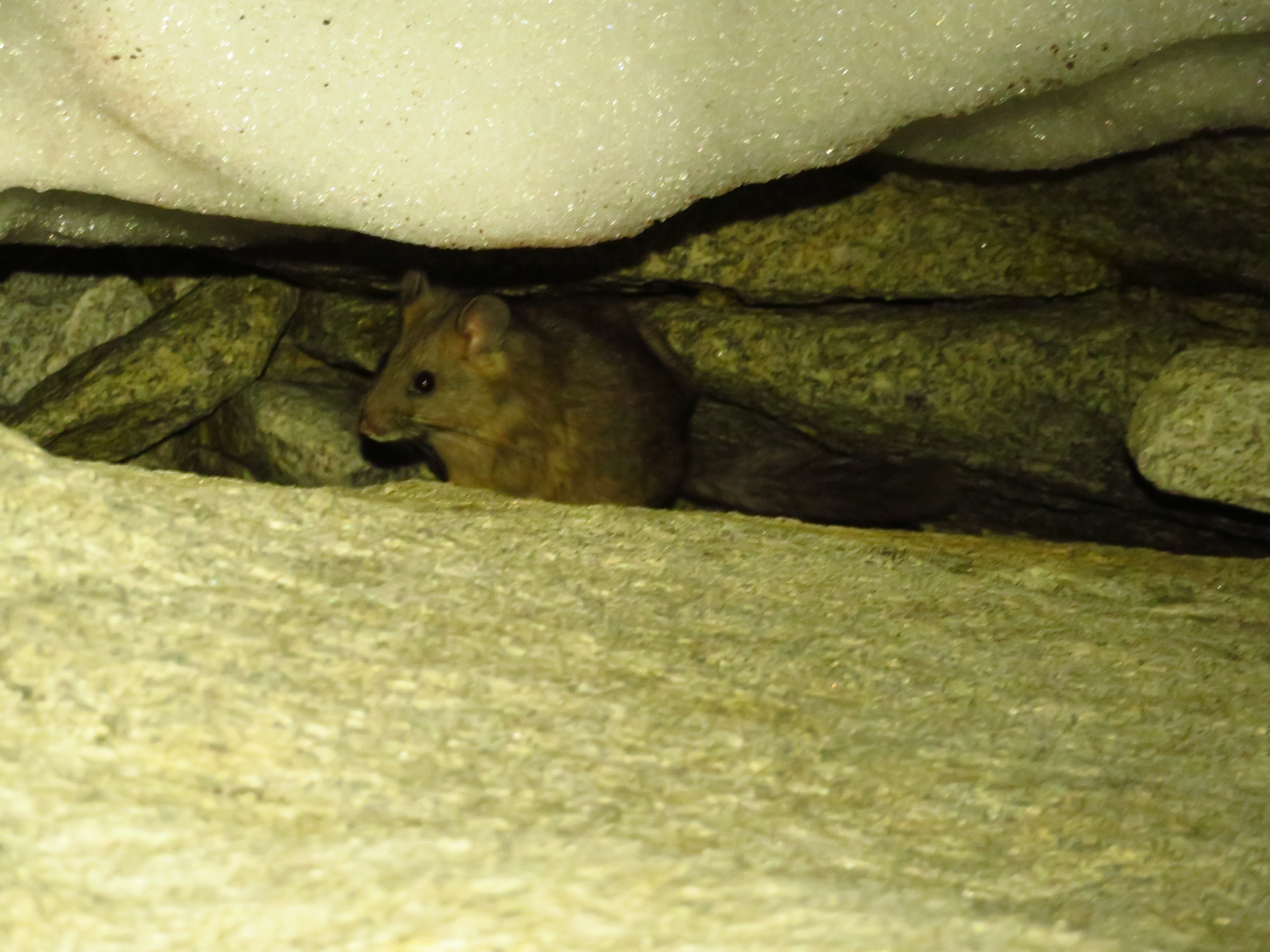
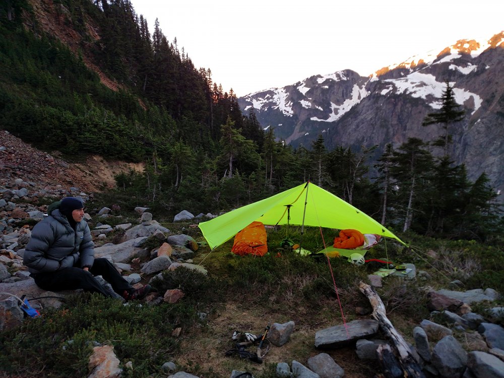
Trip: Waddington - Bravo Glacier to SE Chimney w/ Right Flank Trip Date: 07/24/2018 Trip Report: Fern, Vance and I climbed the standard route (& official Beckey Favorite) over the July 24 to 29 interval. We drove up on July 24th and spent the night camped at the end of the Whitesaddle airstrip at Bluff Lake. On July 25th we got an early morning flight to Rainy Knob. Conditions were ideal. We built a basecamp, stashed unneeded gear, ate, and spent the afternoon reading and kibitzing. We got an early night, got up at 11 PM, and started the climb, carrying three-day packs. Negotiating the Bravo Glacier at night required some intuition as well as info gleaned from a quick overflight while coming in to Rainy the day before. We got around most crevasses. One near the base of the east spur of Bravo Peak required some extensive overhead shovelling at its lowest point , on a mound of recent debris, by Vance to turn it from a slushy overhang to a more solid vertical wall. We hauled the packs on that one and got on top just at sunrise. Several hundred meters higher, we had to make a long horizontal traverse across a 65-70 degree shelf above another crevasse, where the lip had sheared off, to reach the upper snowfield. Easy scrambling and a snowslog got us to Bravo Col by about 9 AM. The snow had started to turn from firm to breakable crust by then, so after some crawling and knee-walking, we gave up, dug a snow hole, and spent a few hours napping and watching jet fighters do loop-de-loops up and down the Tiedemann and thru Combatant Col. Zoom, zoom. The sound of freedom! Around 4 PM we figured the crust was all gone, so we roped up once more and slogged through the slop to Spearman Saddle, where we set up ABC. The next day the alarm went off at 1:30 and we left camp by 3:15, not wanting to start the rock climbing in the dark. We had firm snow up to the base of the Tooth and found a traverse across the lip of a randkluft to get onto the actual Tooth traverse ledges at a prominent brown slabby scar. There wasn't much snow on the ledges, just lots of loose rock, so we pitched it out to the notch, and to the base of the actual SE chimneys. The actual chimneys had lots of loose rock and a little wet slush masquerading as ice pitches under the chockstones. We chose to take the Right Flank variation (169B in Don's guide) which provided mostly solid rock climbing with two avoidable rime gargoyle remnants to add spice. Two pitches of the Right Variation (which felt like 5.8 to me btw, but then again, we were climbing in boots and crampons, but mostly with bare hands) led to one more long easy pitch up the scree- and snow slope above the Chimneys and a 2 PM summit. There was a Seattle/Colorado party on the NW summit at the same time, which was entertaining because they gave a sense of scale to our photos. We hung out on top for almost an hour (complete with a horsefly - where do these things come from?) before heading down. The first rap was 60 m to the top of the Chimney. We made another 60 to below the first chockstone but managed to get the knot stuck. Vance tiblocked up the stuck rope, unstuck it, and made two shorter raps - 30 m to above the second chockstone and then 30 m back to us. We elected to continue back down the Tooth ledges rather than the Harvard Notch line because it was so dry that there was substantial loose rock visible down that route and you rap in the fall line there whereas rapping and downclimbing the ledges traverses, giving one some protection. We made a couple 30 m raps here, then tried a 60, hoping it would reach the snow, but it didn't and the rope got stuck again, this time just due to slab friction near the anchor. Fern freed it up, and we made one more 60 m over the schrund and were down on the snow by sunset. We got back to ABC around 11 PM, for around a 20 hour day. The next day we lazed until 3 pm and then set off down the Bravo. We rapped twice (from rock anchors) on the Cauldron headwall to avoid the serac-lip traverse, and once more at the overhanging serac, where we used a bollard plus picket to take a 30 m rap/cimb/rap shortcut through two overhanging crevasse walls and an intervening tottering ice fin. We got back to Rainy Knob basecamp at sunset. There is a ferocious snafflehound at Rainy Knob. She tried to eat my socks but I'd worn them for three days straight in my boots and they stank so bad she not only gave up, but left our Mountain House dinners alone too! On Sunday, we got a morning pickup by Mike King and were back in Bluff Lake by 9 and back in the Lower Mainland by dinnertime. Gear Notes: Three pickets, crampons (dual horizontal front points worked best), two tools each, nuts and cams to 3" (doubles 1" and 2"), six tricams, six pins. Many slings and webbing. Left pins, nuts, tricams and slings behind on the descent. Took four screws and didn't use them. Superlight 3-person tent for advanced base camp. Two stoves (one canister, one white gas). Double 60s. Four or five light jacket layers, softshell bibs. Temps varied from below freezing at night to 25C in the day. Approach Notes: Save yourself the extra two weeks of walking in and out and fly Whitesaddle. Vance had previously kayaked and skied from Vancouver to the NW summit so he had a fair comparison of means. He says the helicopter is much faster.1 point
-
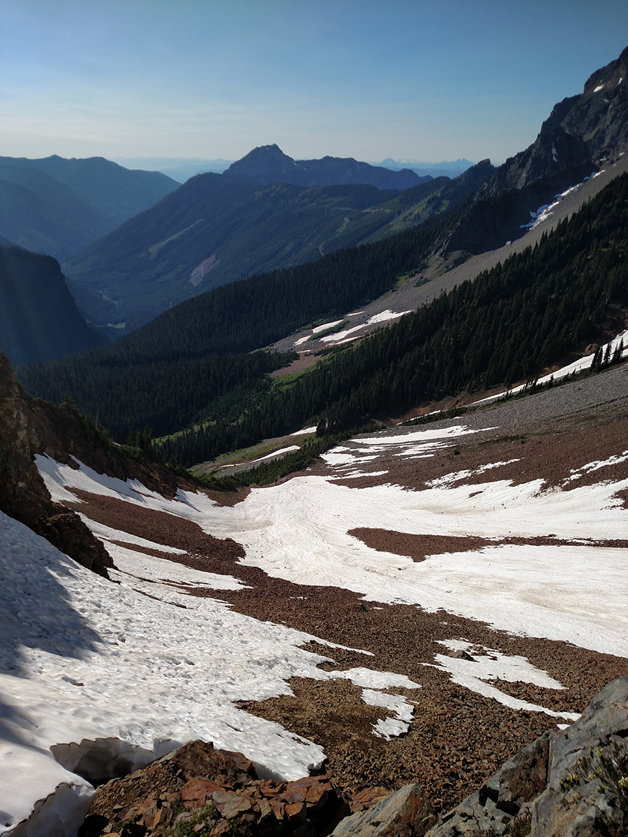
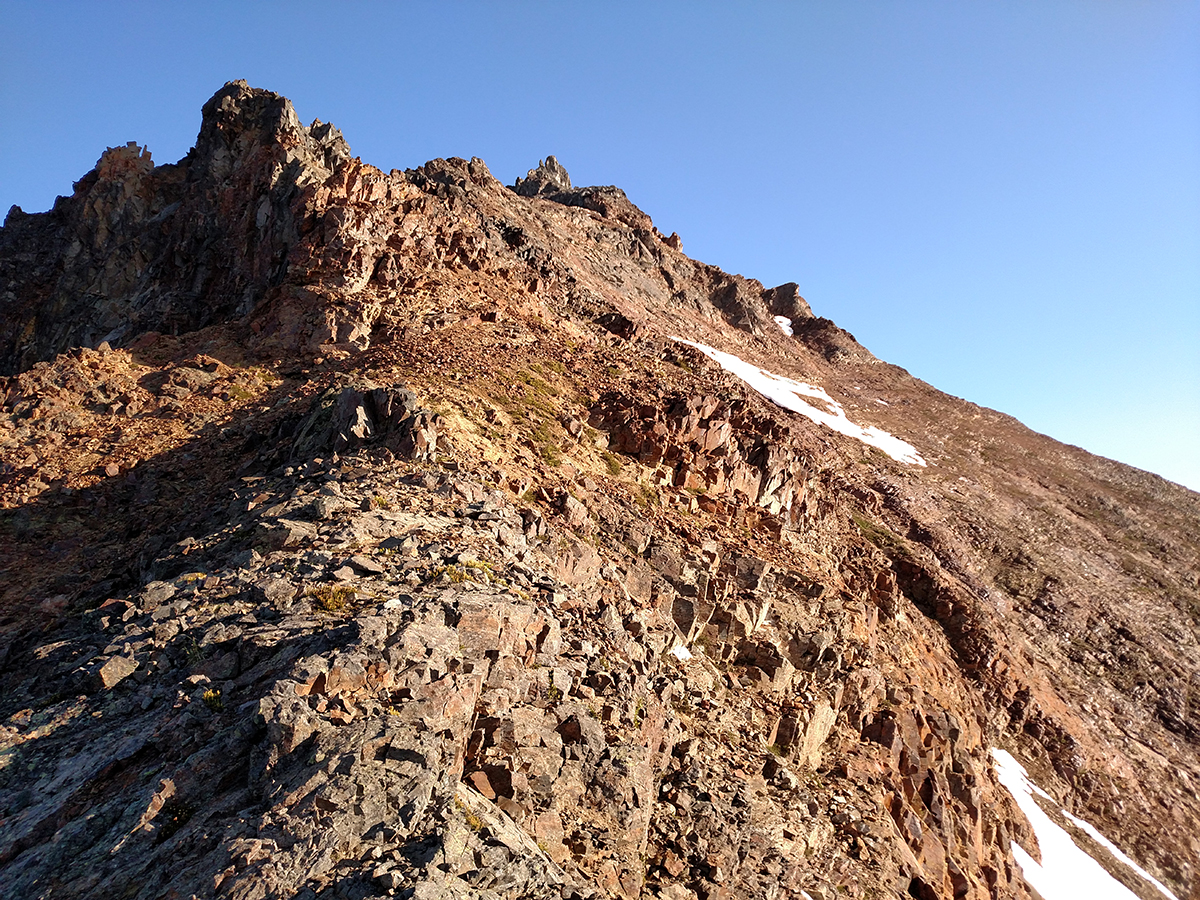
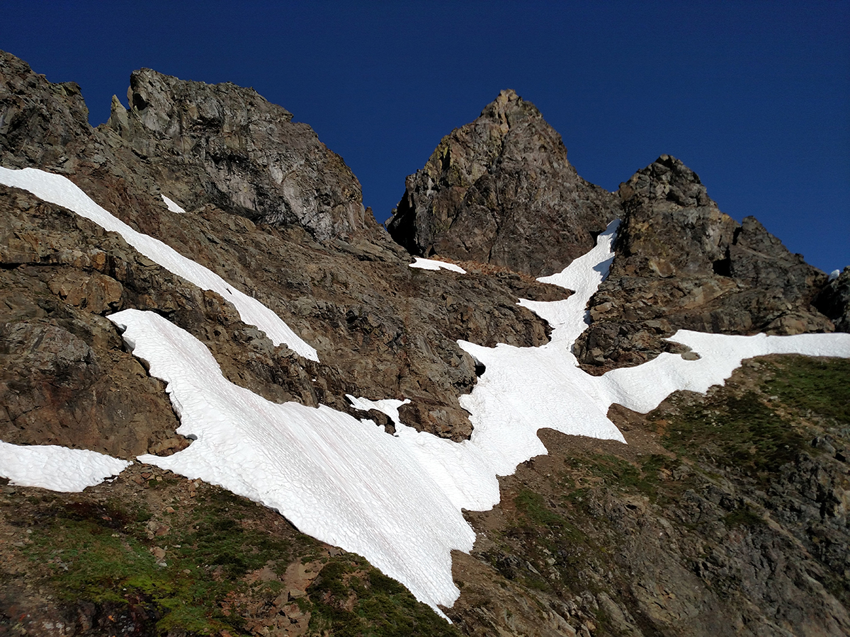
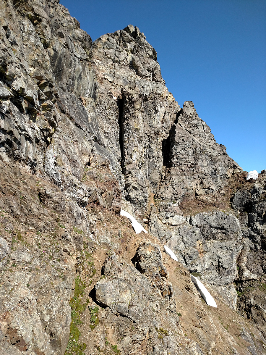
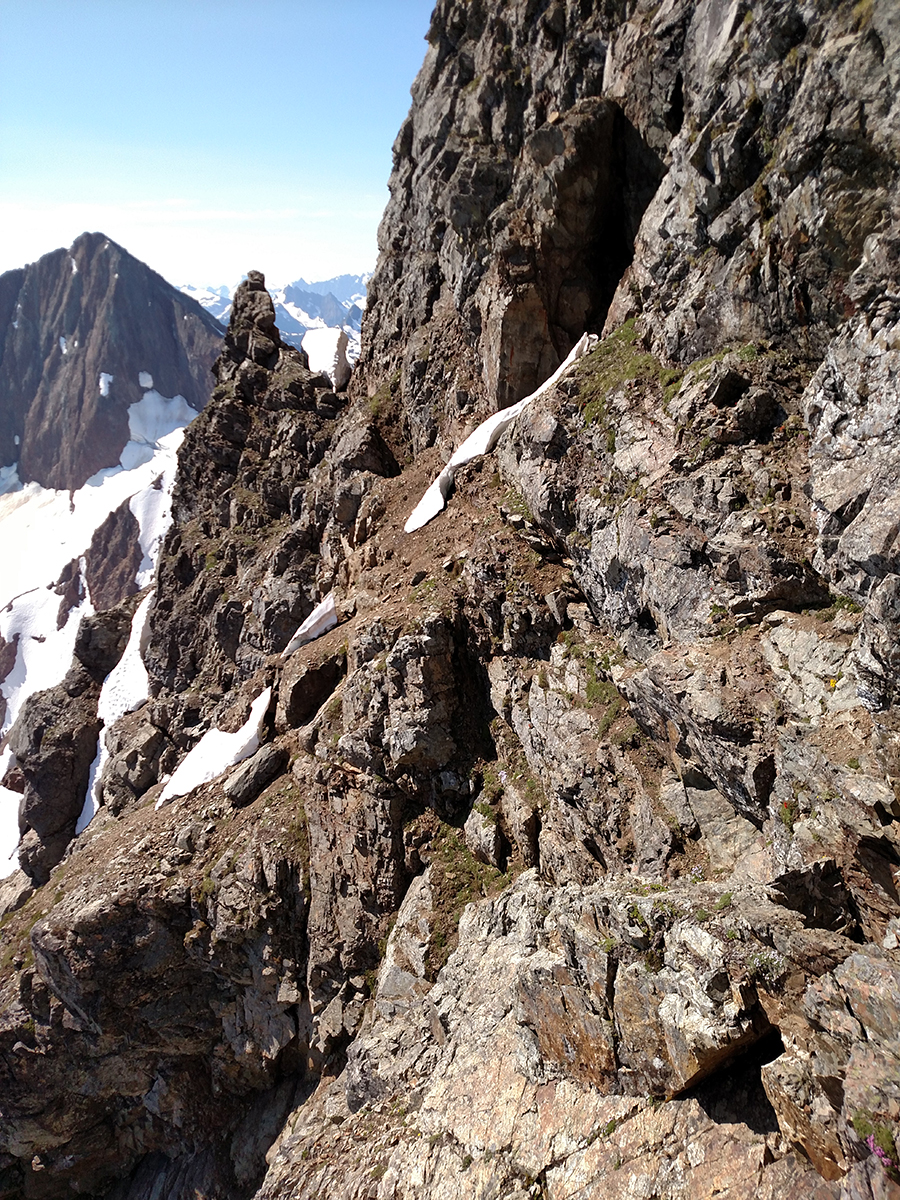
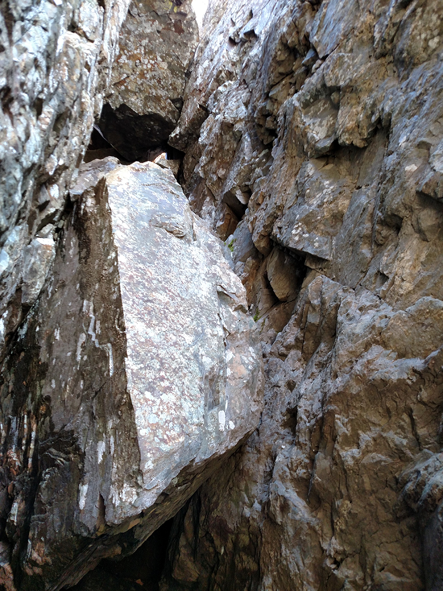
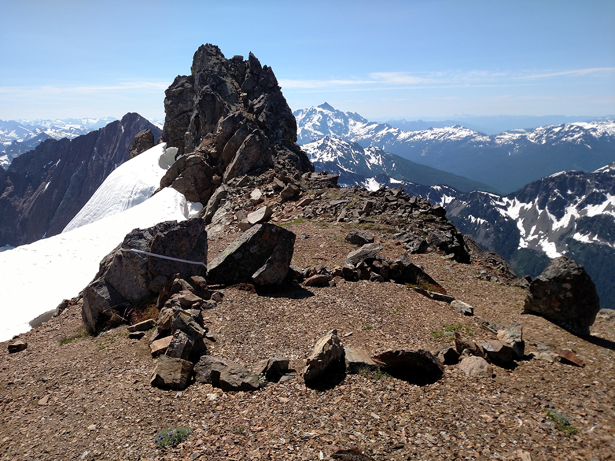
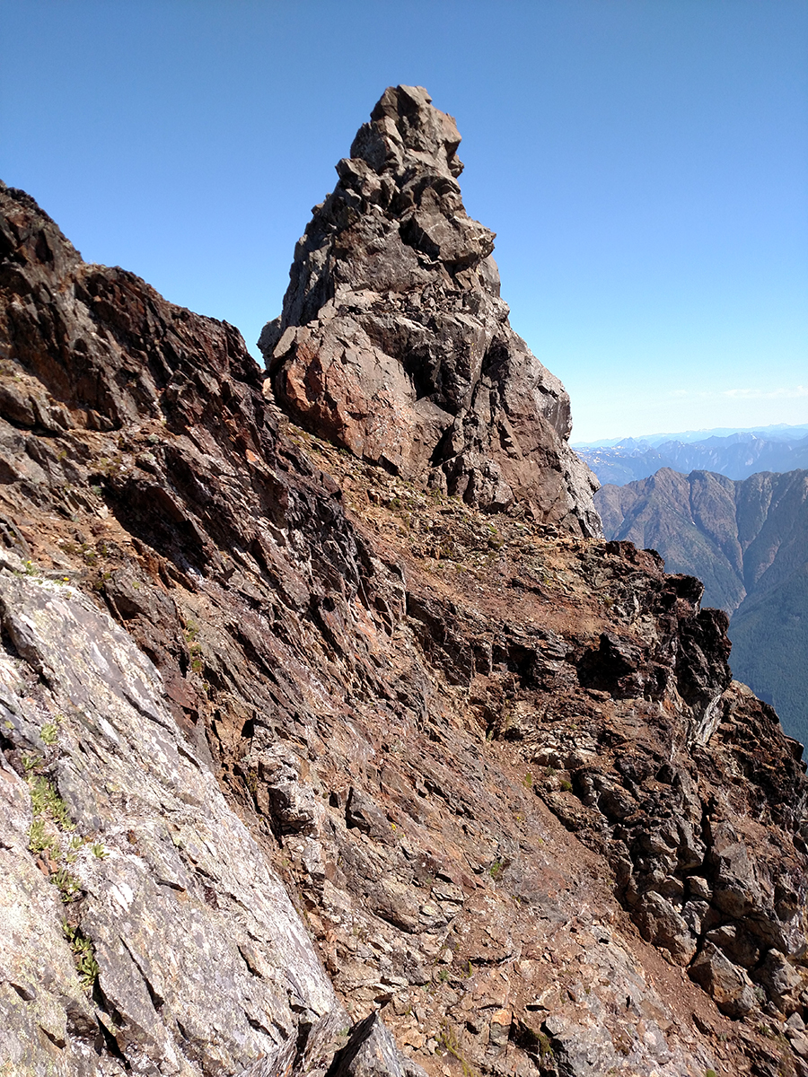
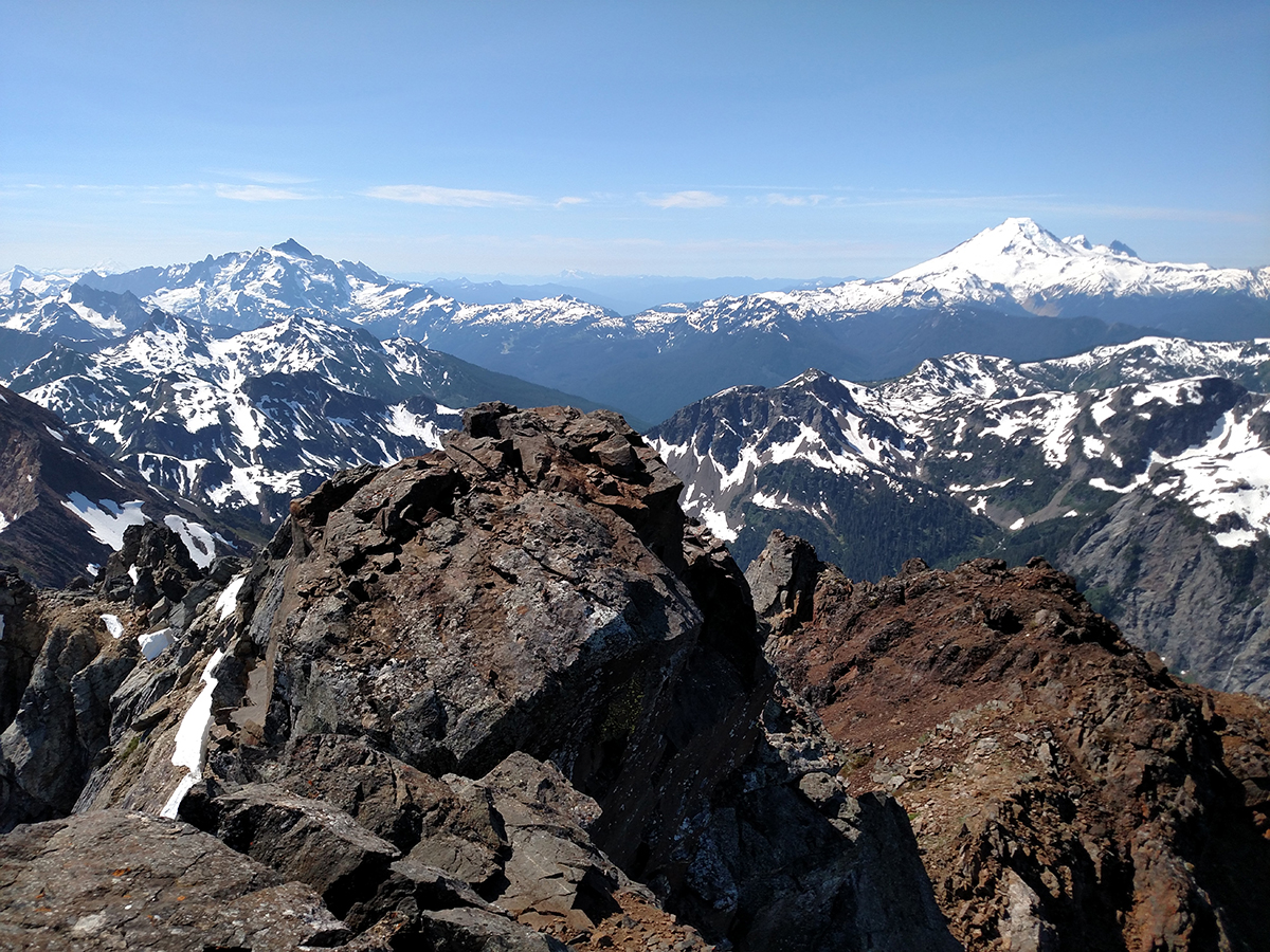
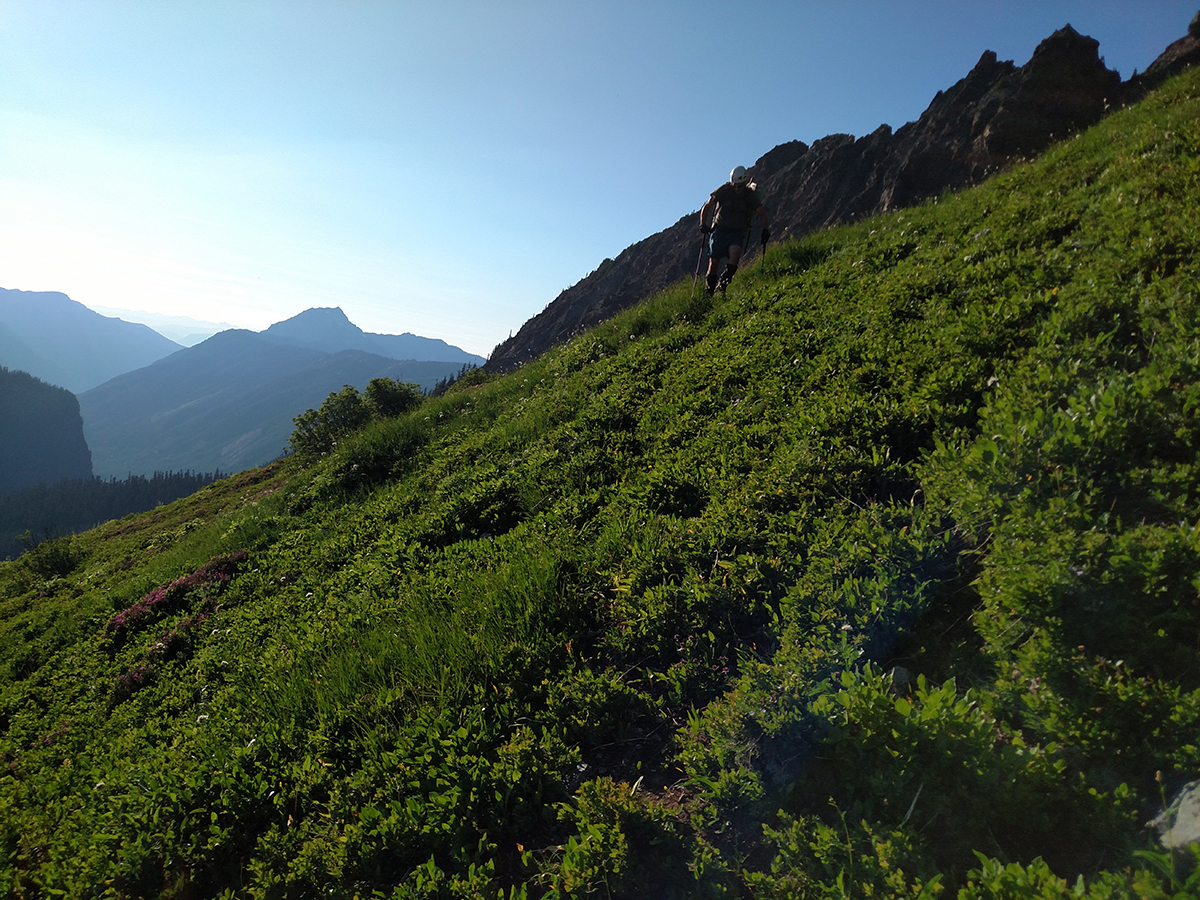
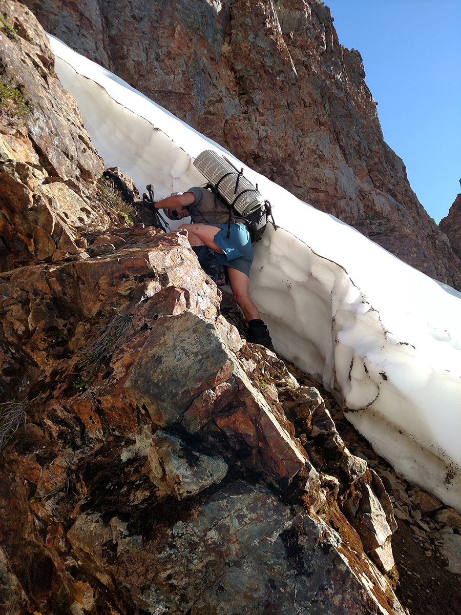
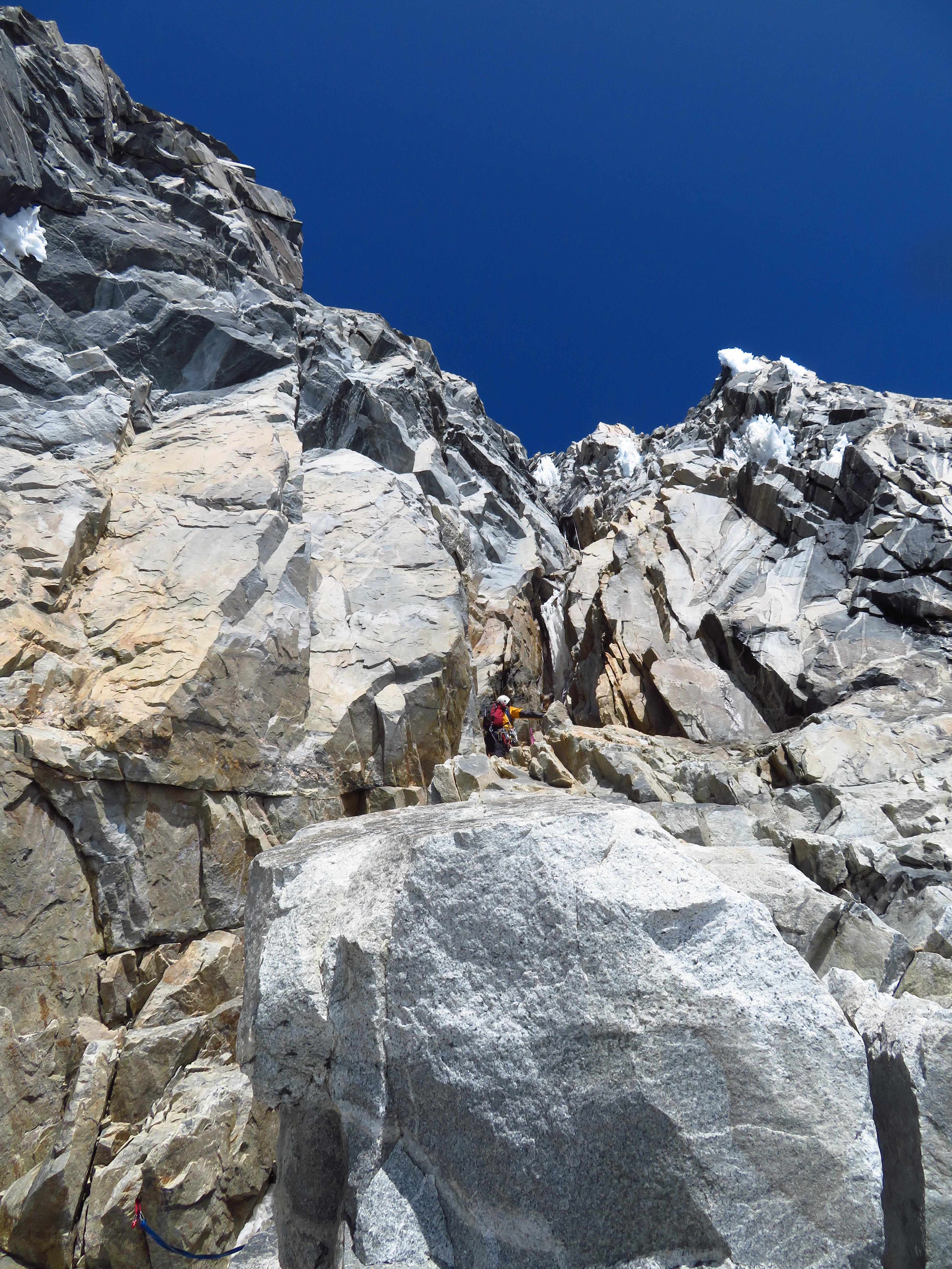
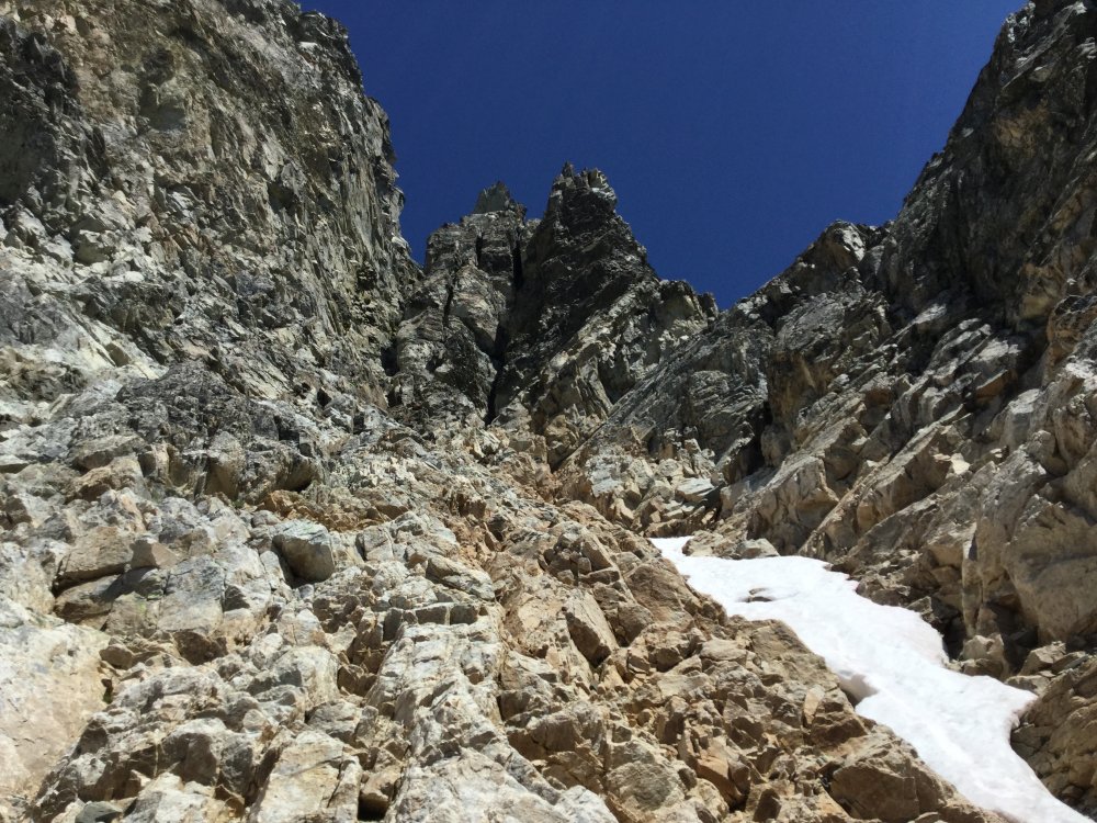
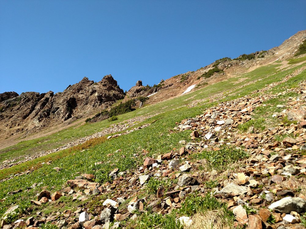
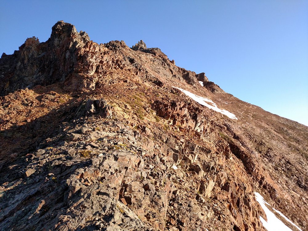
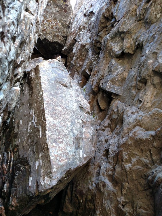
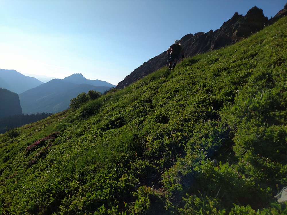
Trip: American Border Peak - SE Traverse Chimney Route Trip Date: 07/14/2018 Trip Report: Cascade Pass Road was still closed past the Eldorado parking area. Well shit! Time for plan B. Or Plan A if you like an epic climb for the ages! I texted DanO and asked if he was ready for some pain, he said sure. I see several reports of American Border Peak being climbed in September and I thought, "Why not try it in mid July and take one for the team?". Twin lakes parking was packed because the weather was perfect and it was the weekend. We arrived at the trailhead and were on the move at 11:30 am. There were several patches of snow to cross along the way to High Pass which was a bit tedious but it was part of the glory of early season. Once to High Pass we started down into the 1st gully. A word of advise, stay low in the gully and wrap around the bottom of the rib through the trees to the 2nd gully. We went high in the 1st gully to cross to the 2nd gully and it resulted in slow travel and a skinned ass, again adding to the glory. 1st Gully from High Pass 2nd Gully looking toward 6300' Gully to Col The second gully was quite pleasant, less rock and lots of green. We aimed for the notch at 6300'. Getting up to the col and down to the 3rd gully required some patience with the loose rock. We reached camp at the base of the talus slope in the 3rd gully at 6:00 pm. 3rd Gully from 6300' Col Camp at the base of the talus in the 3rd Gully DanO decided he was fine with hanging out at camp for summit day so I left for the summit solo at 5:45 am. It has been said that this route to American Border Peak has lots of loose rock and that is the absolute truth. Make peace with slipping constantly or it will drive you insane. Rocks will be falling so if you are climbing in a group, keep it tight or spread out. The terrain is steep to go along with the loose rock so make sure of your footing or pay the piper. I topped out on the 6900' col at 7:15 am. I was happy to see the snow was not an issue for the SE traverse to de Gaulle's gully. After getting to the top of de Gaulle's gully, I had to take some time to figure the best option for crossing the snow covered, steep hillside as well as the snow filled gully up to the ledges. It was gut check time. I decided to climb down and diagonal to the base of the snow and edge along to the base of the snow gully. The snow gully was steep and the snow was not in the greatest of conditions. I followed some goat tracks up the snow gully carefully kicking steps and planting my ice axe. I love mountain goats! They always seem to be looking out for me on the mountain, like guardian angels. I was very happy to make it to the top of the snow gully without incident. Once to the top of the snow gully I could see the route had very little snow remaining. The ledges leading to the chimney were wide enough to move fairly quickly. There are 3 chockstones wedged in the chimney. The bottom chockstone requires the most skill to climb. Since I was going solo, I decided to do the 4th class work around to get above the bottom chockstone. The rest of the chimney is still solid 5th class so take your time. Once to the top of the chimney you will have to go under the top chockstone and wiggle through a hole commonly referred to as the keyhole. It is a tight fit so you will probably need to push or pull your pack through separately. There is a great camp site below the summit after the keyhole. The summit from the keyhole is class 3 to 4. I finally reached the summit at 10:45 am. The view was great and I was feeling good. Time to head down. I started down from the summit at 11:20 am. There was a new rappel sling around the top chockstone complete with a donut, very nice. I had a 40m static rappel rope that worked perfect for the rappel down the chimney. There is a second rappel station halfway down the chimney. I rappelled the majority of the way down the snow gully then worked my way across the ledges above the snow to get to the top of de Gaulle's gully. The rest of the descent to camp was loose rock slipping and sliding but controllable. I arrived at camp at 4:00 pm. DanO was happy to see me alive and in one piece. The summit and back took a lot of time. I needed to be back home the next day so we decided to pack up camp and head out. We made it back to the car at a midnight exhausted and happy to be done. The night was beautiful and full of stars. This is a challenging climb and I am glad that I waited a few years to get more experience on other climbs before attempting it. This will go down as one of my favorite climbs. We are not freaky fast climbers and we are not super slow either. Taking that into consideration, here are the times for the climb. Day 1: 11:30 am (left car) to 6:00 pm (camp) - 6.5 hours Day 2: 5:45 am (camp) to 10:45 am (summit) - 5 hours, 11:20 am (summit) to 4:00 pm (camp) - 4hr40min, 5:30 pm (camp) to Midnight (car) - 6.5 hours. Total time for Day 2 - 18 hours Doing this climb earlier in the year is a lot slower than later in the year. If I had to do it again, I'd do it in 3 days and enjoy the experience. We brought crampons, ice axes, trekking poles and a 40m static rappel rope and we used everything. Gear Notes: Crampons, Ice Axe, Trekking Poles, 40 meter static rope, Helmets Approach Notes: Started from Twin Lakes parking lot.


 1 point
 -
Didnt even see it. Thanks!1 point
-
You were well ahead of us. We didn't start hiking from High Bridge until about 3:30, arrived at North Fork around 6. We both had absolutely perfect weather. Not a cloud in the sky for days on end, no smoke, not too hot. Truly magnificient. On our trip, I snapped photos of 31 different types of wildflowers in bloom.1 point
-
You'll get more hits if you re-post 'want to buy' rather than 'for sale'. Good luck!1 point
-
1 point