
Leaderboard

Popular Content
Showing content with the highest reputation on 09/28/25 in all areas
-
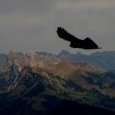
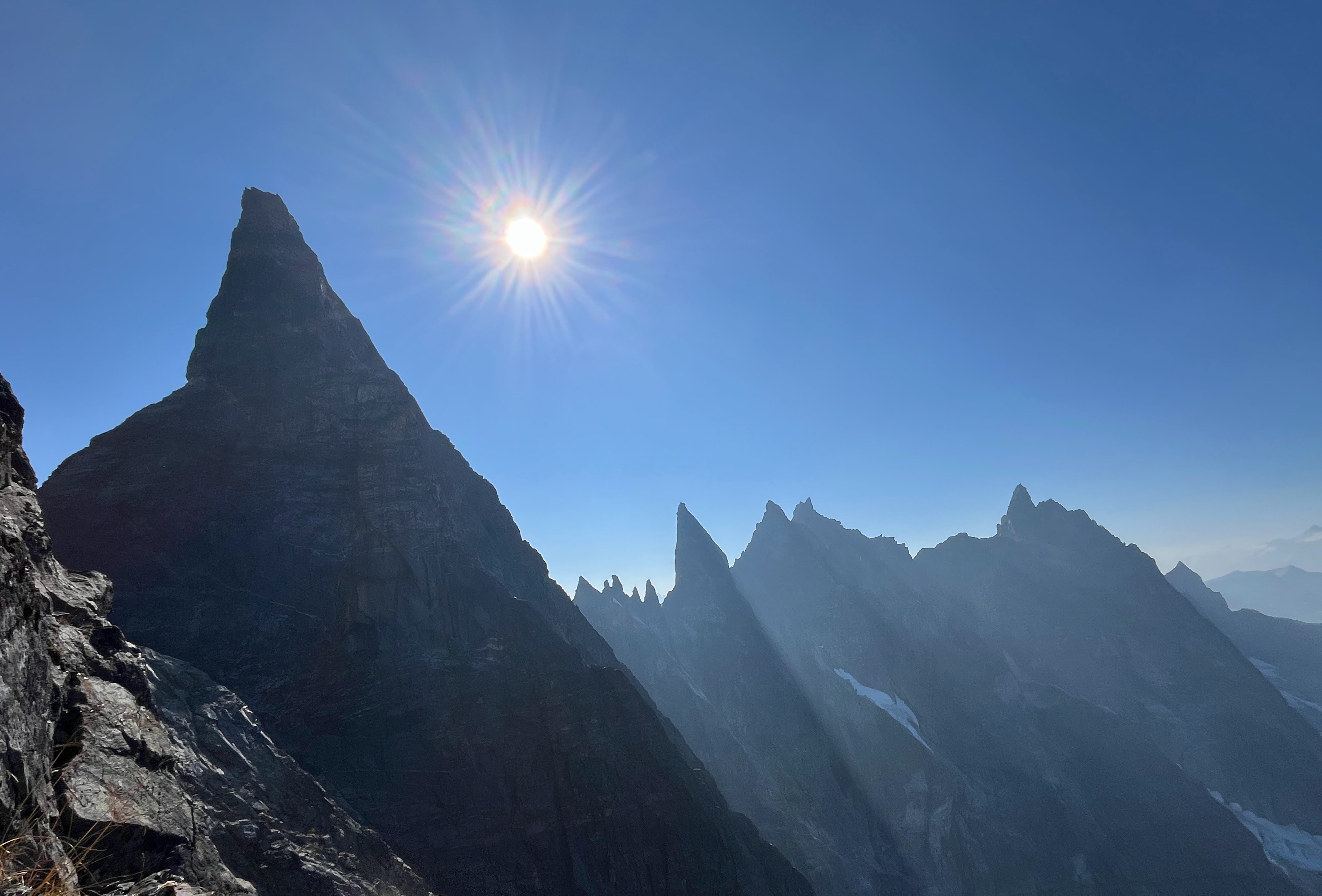
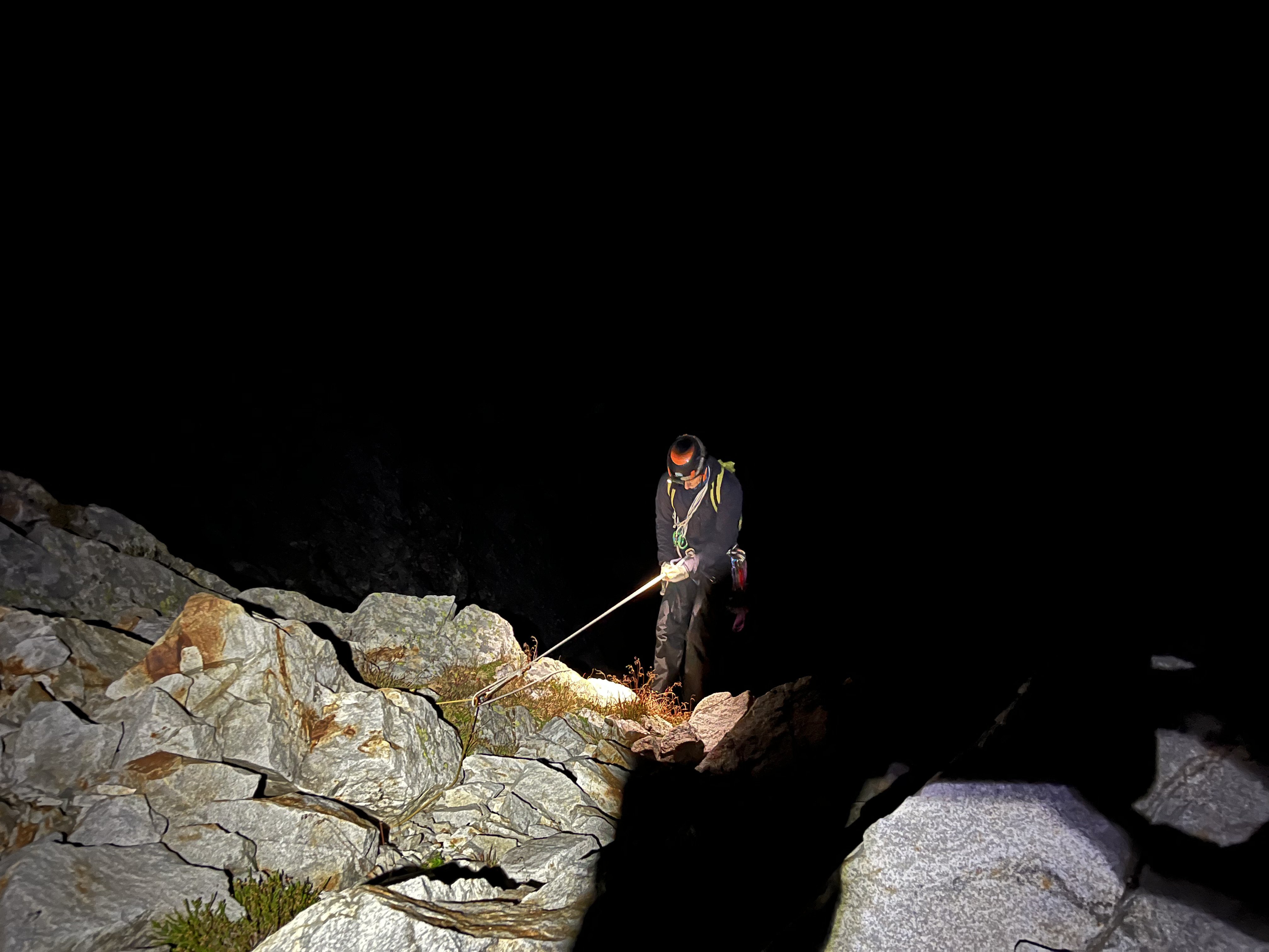
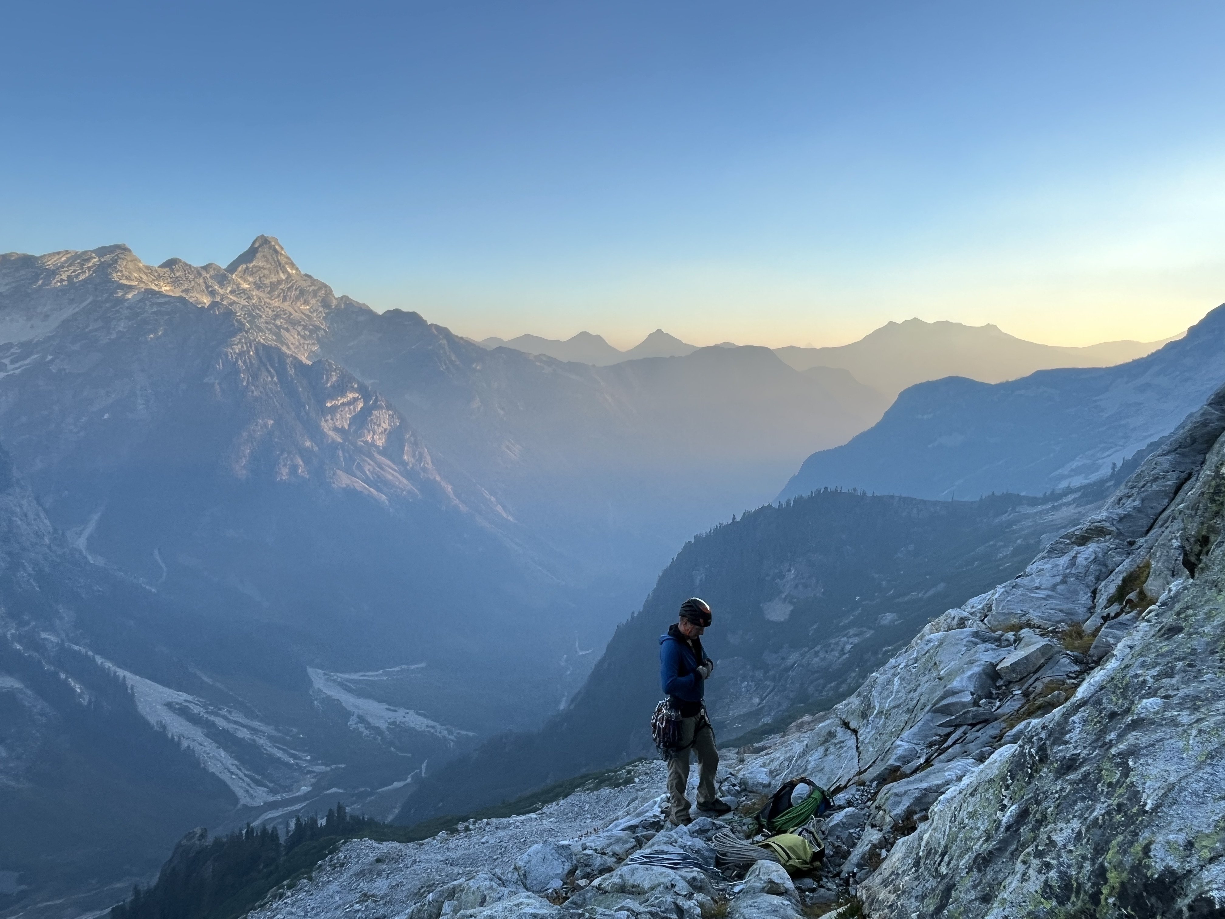
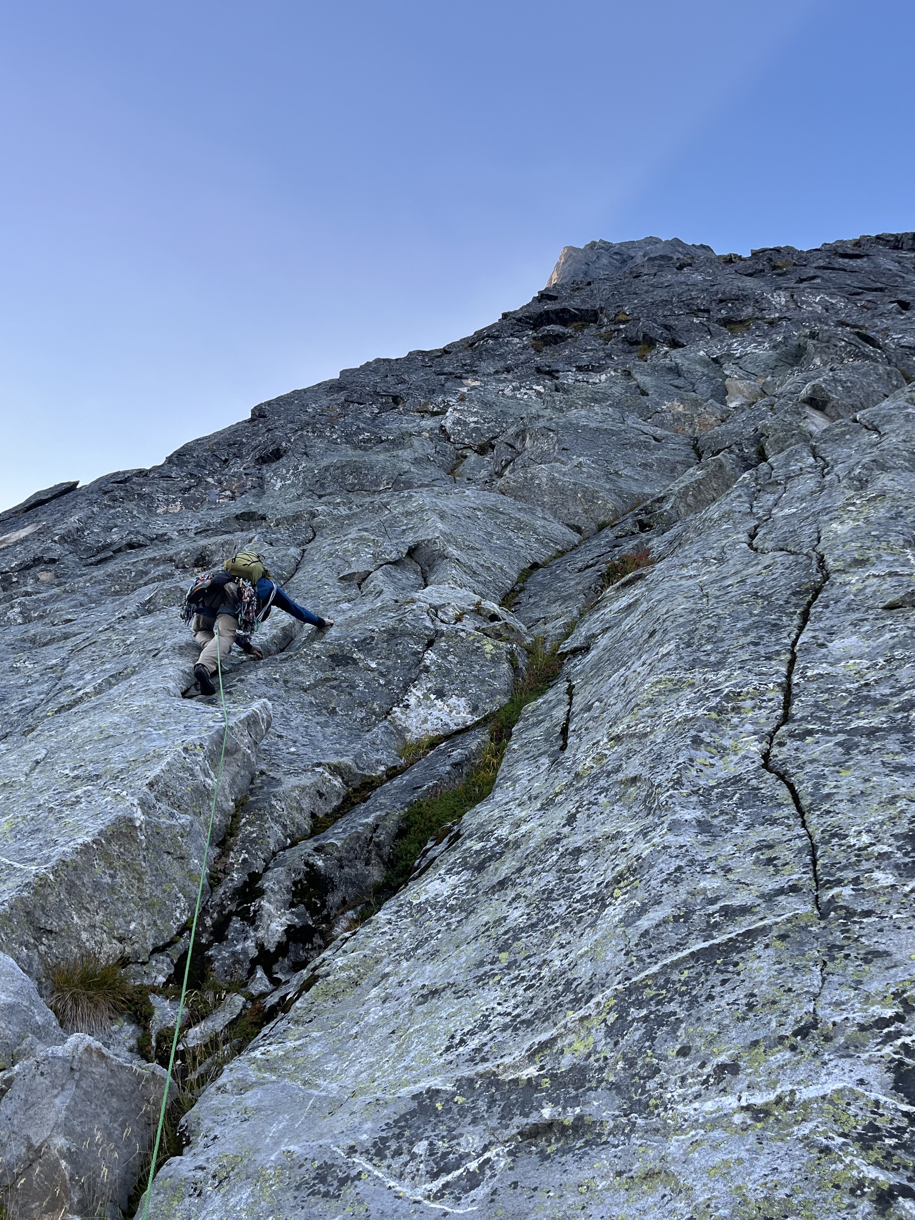
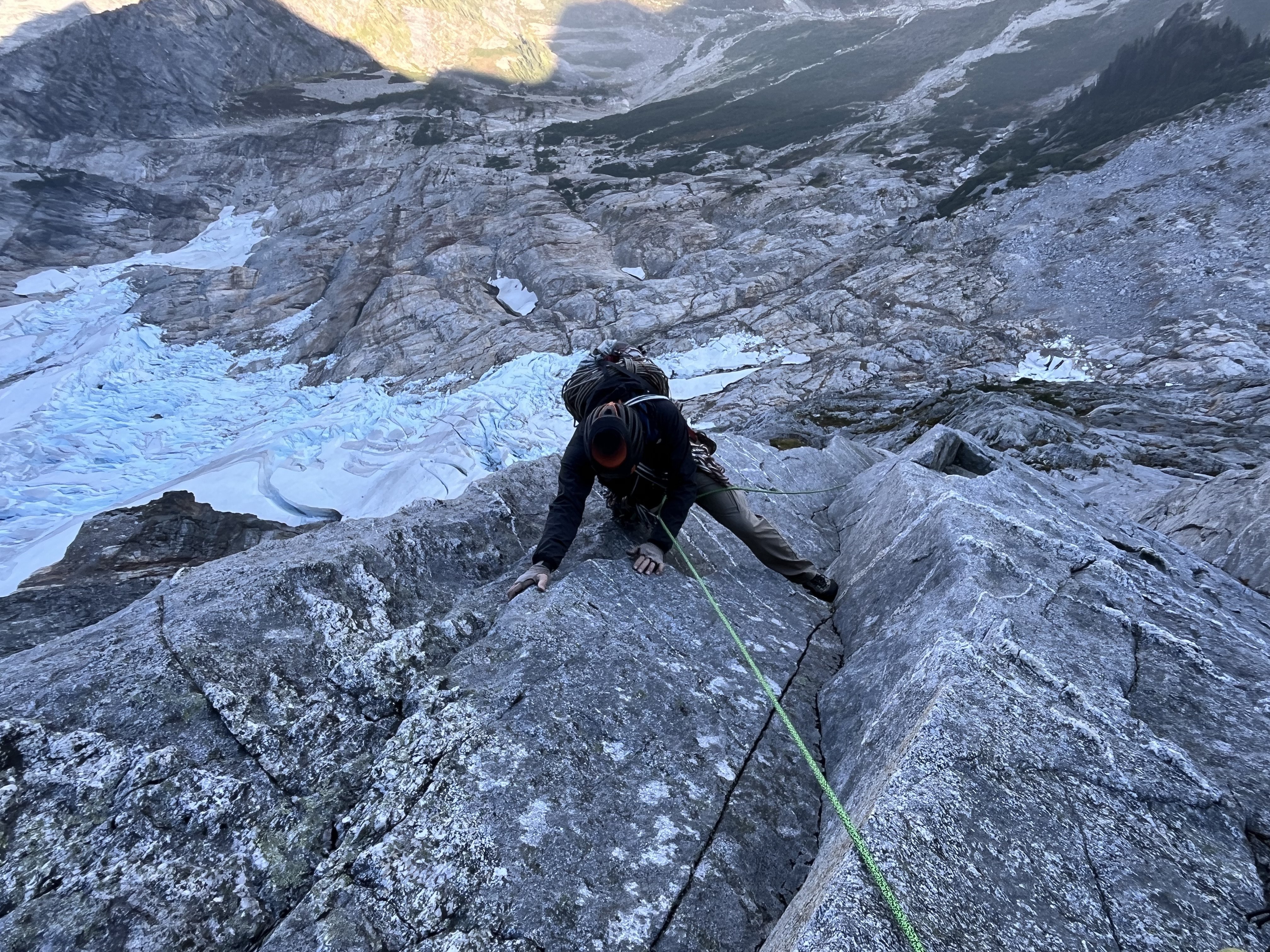
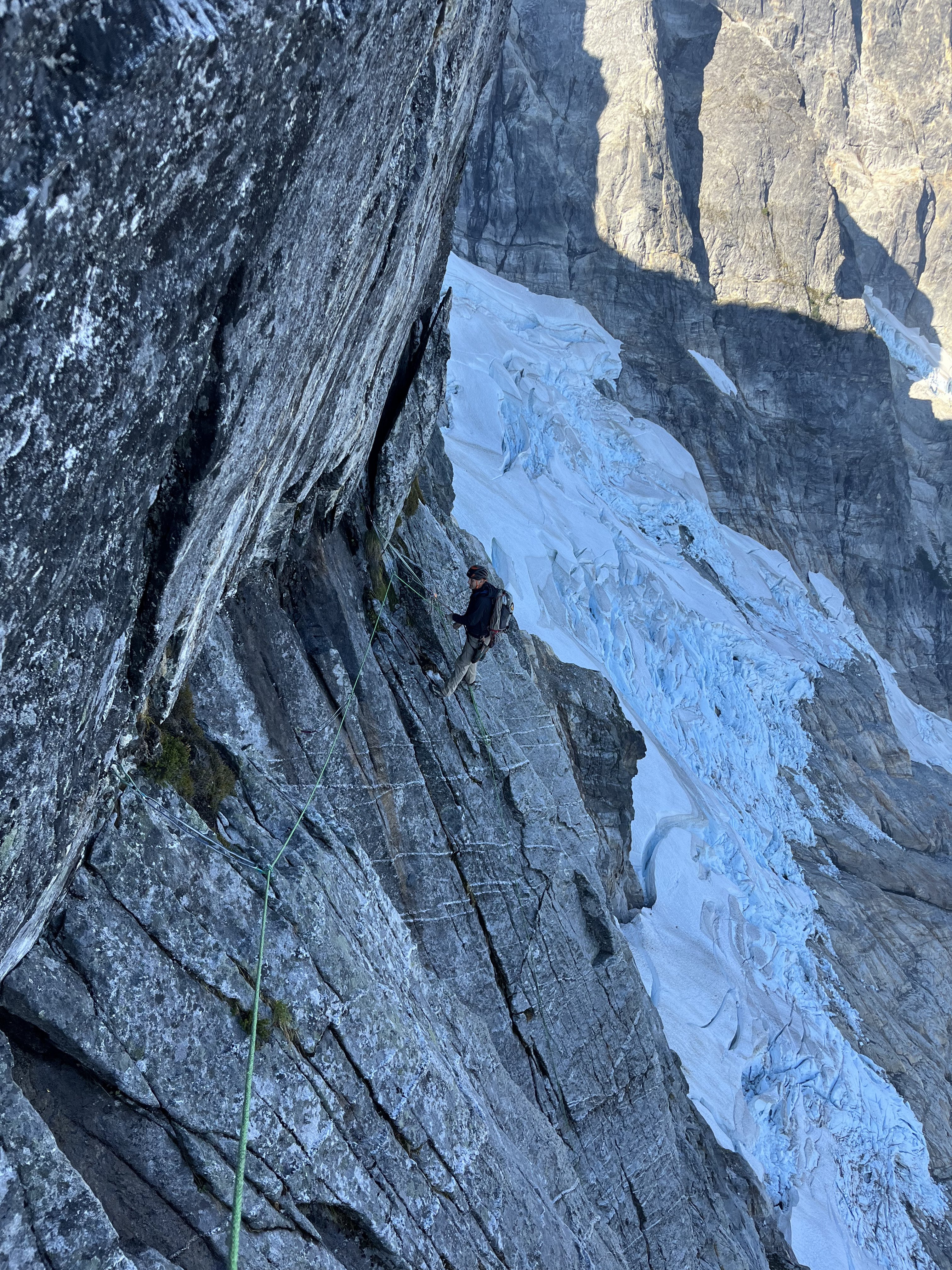
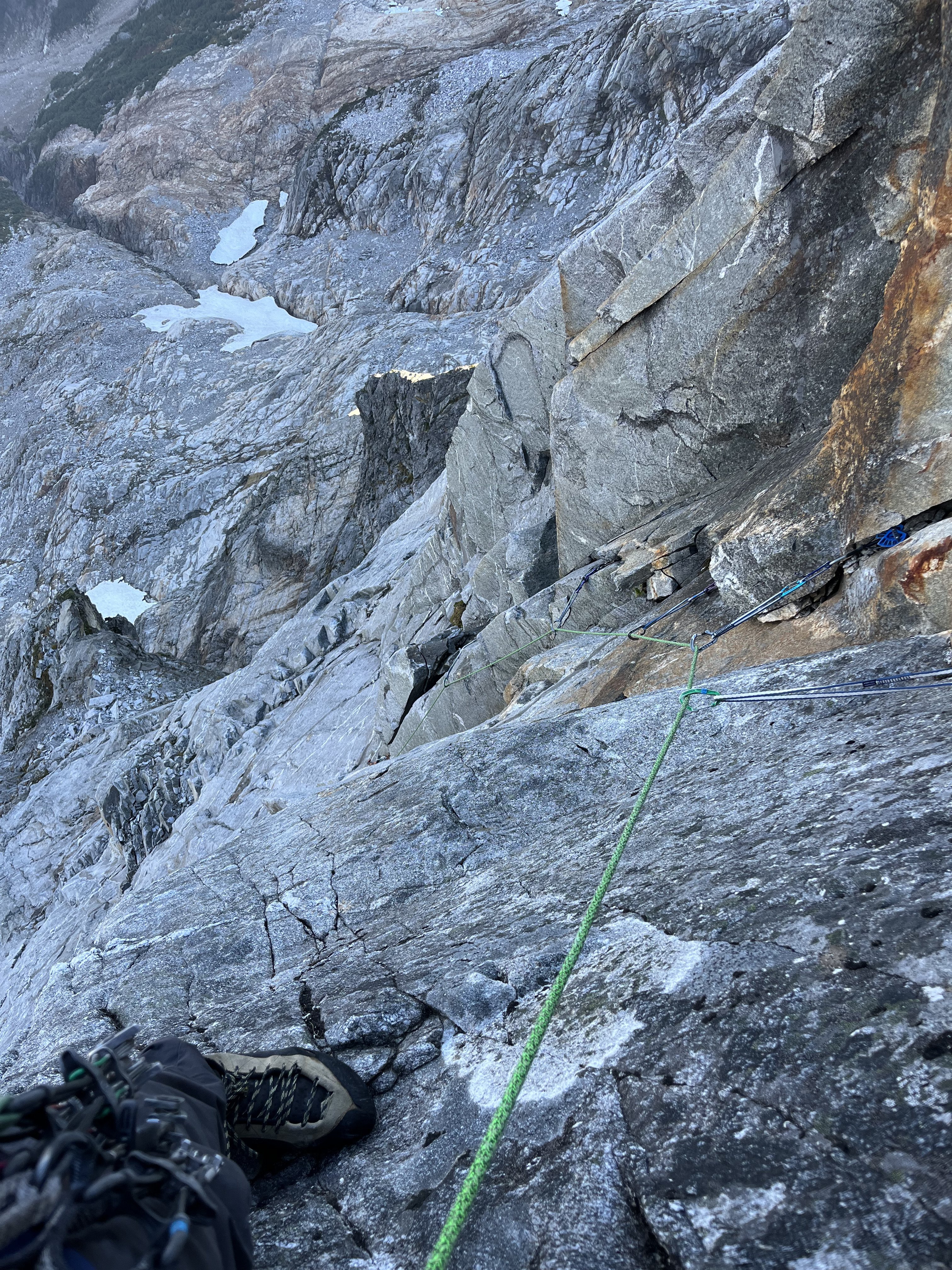
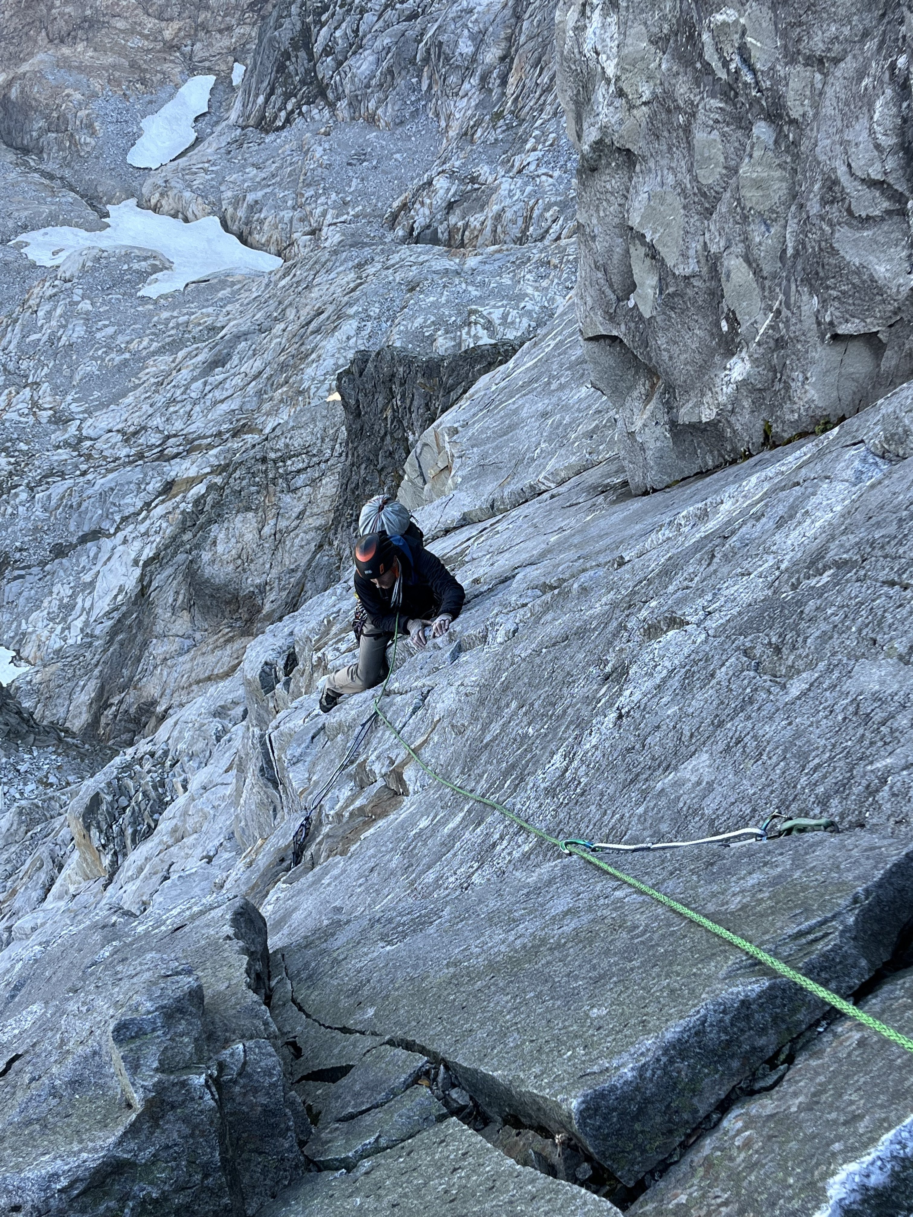
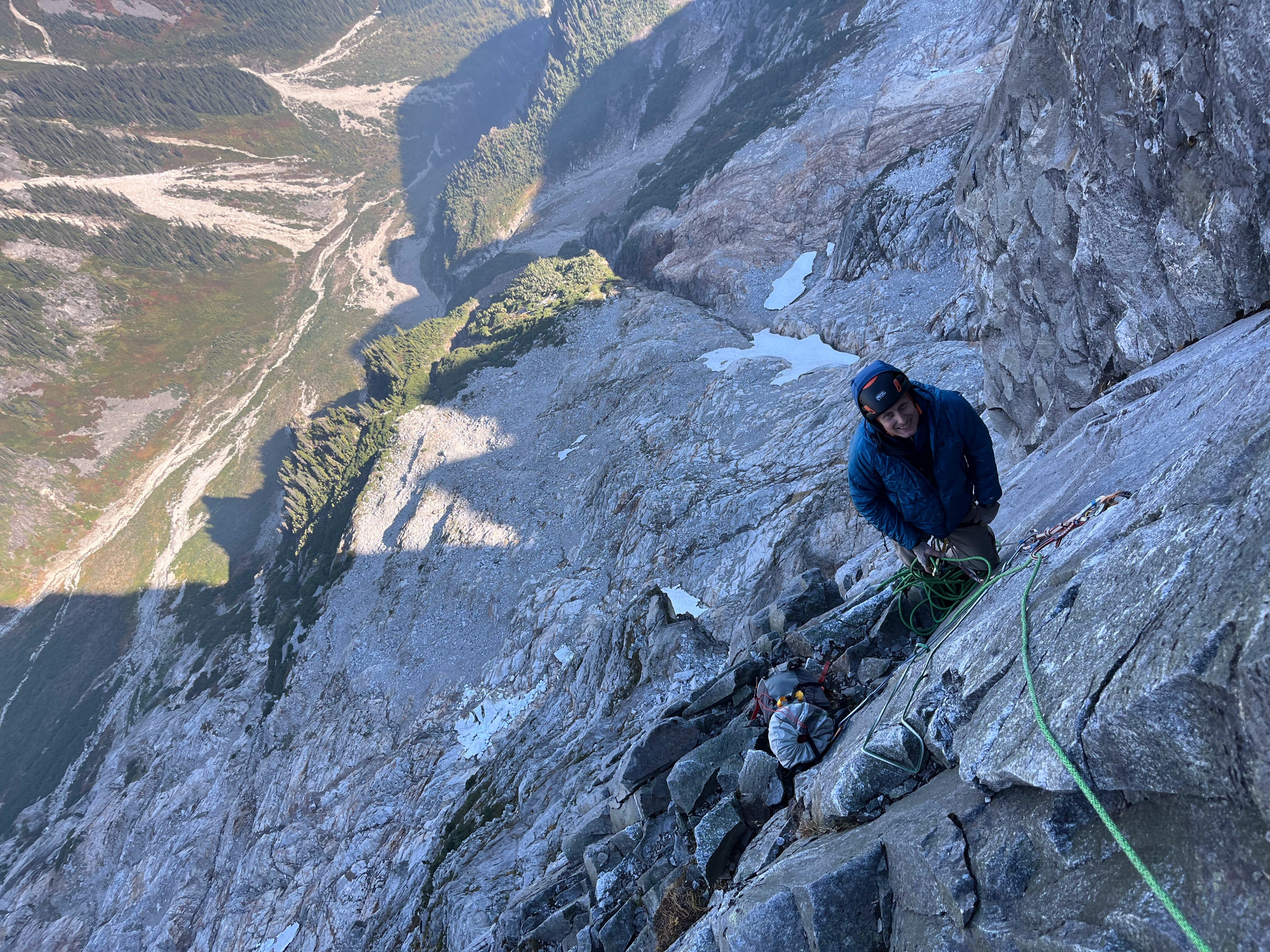
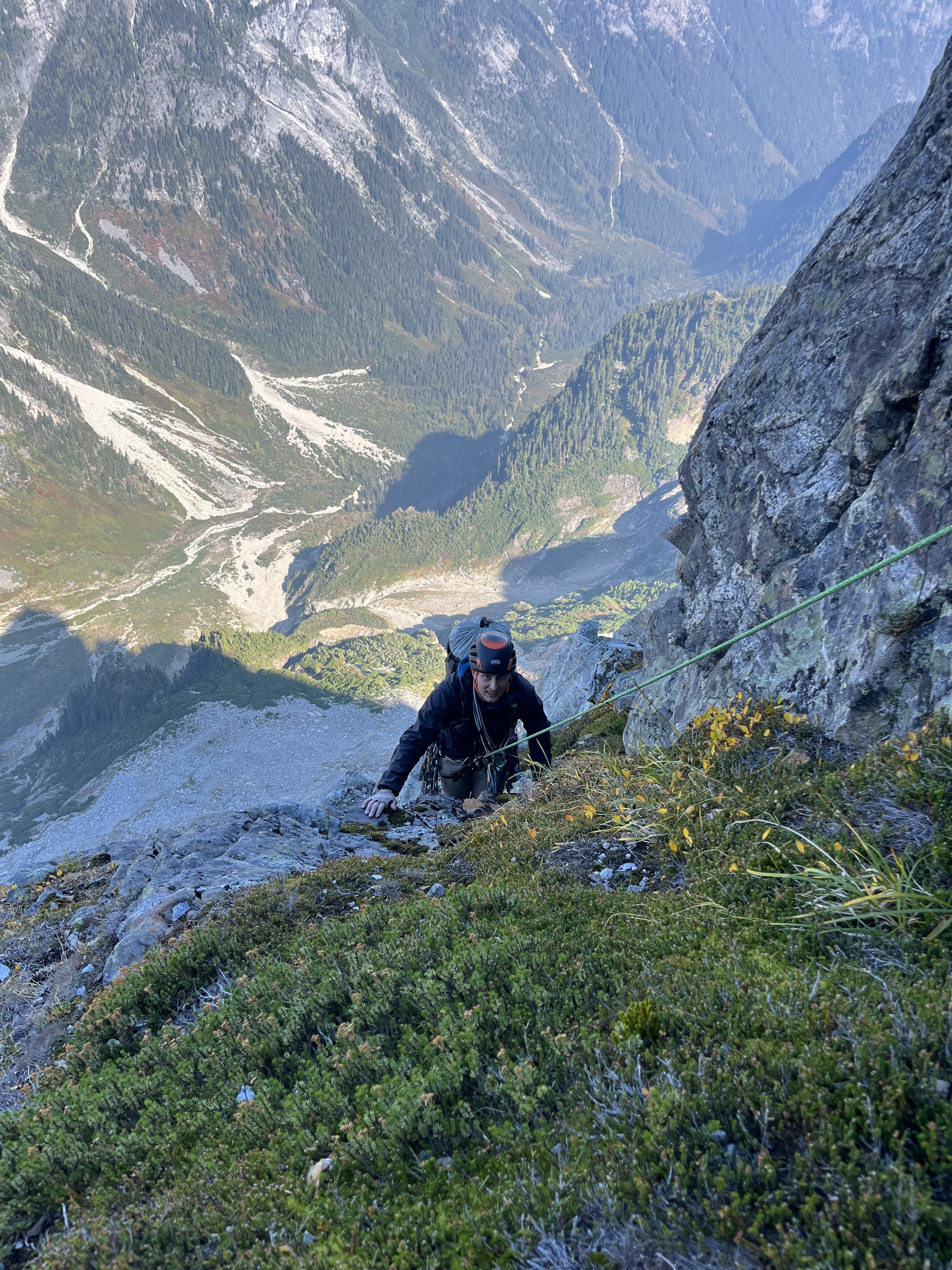
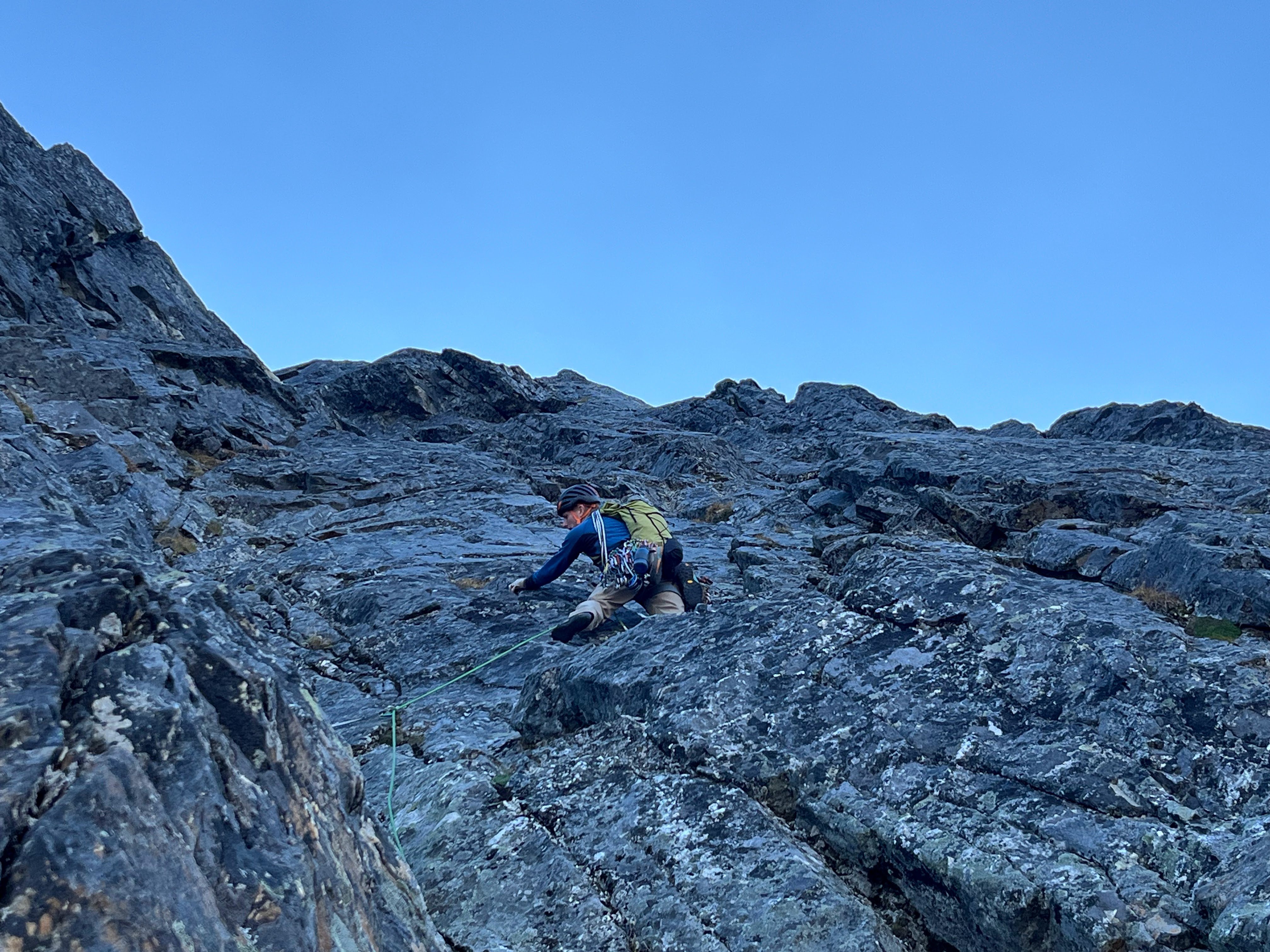
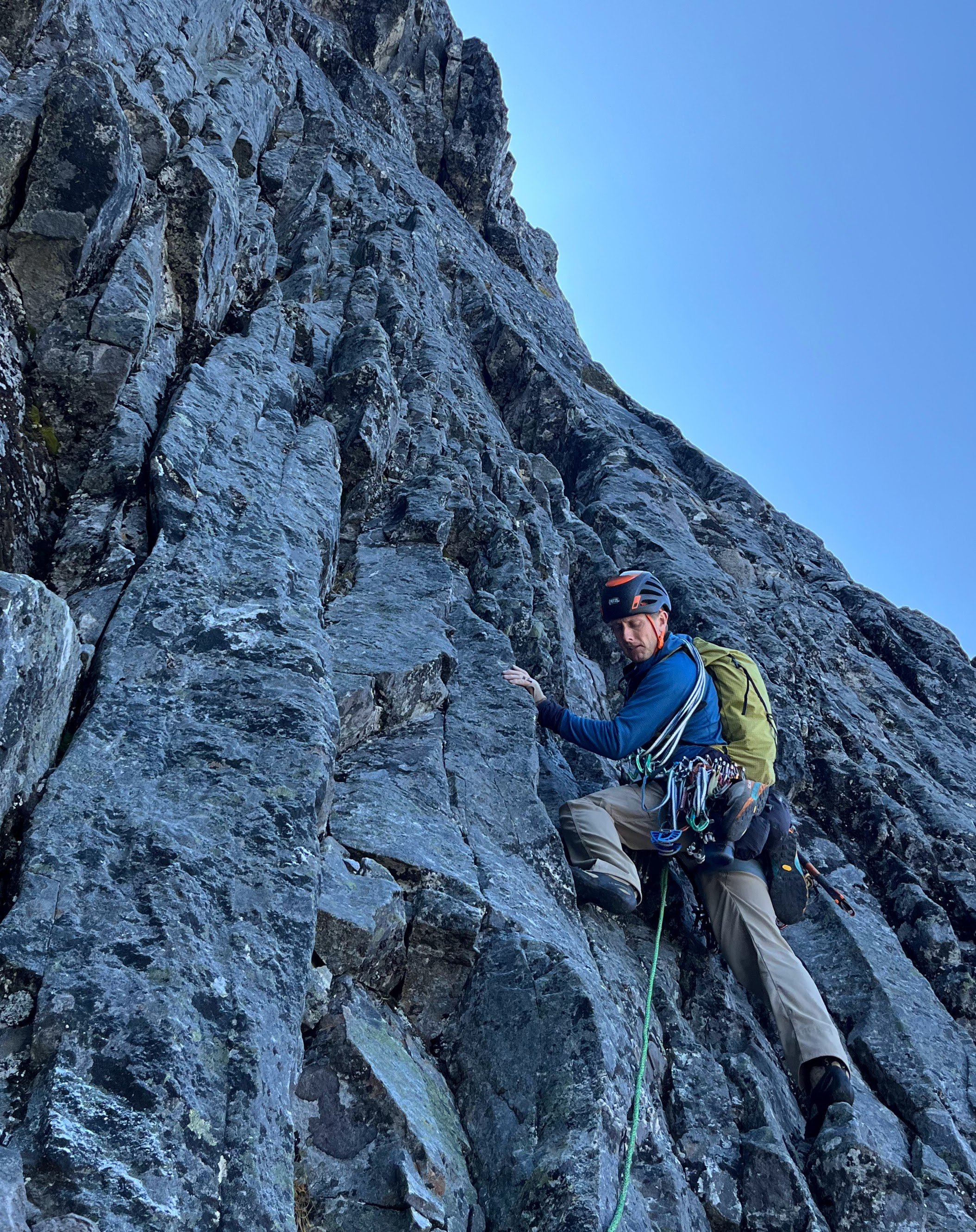
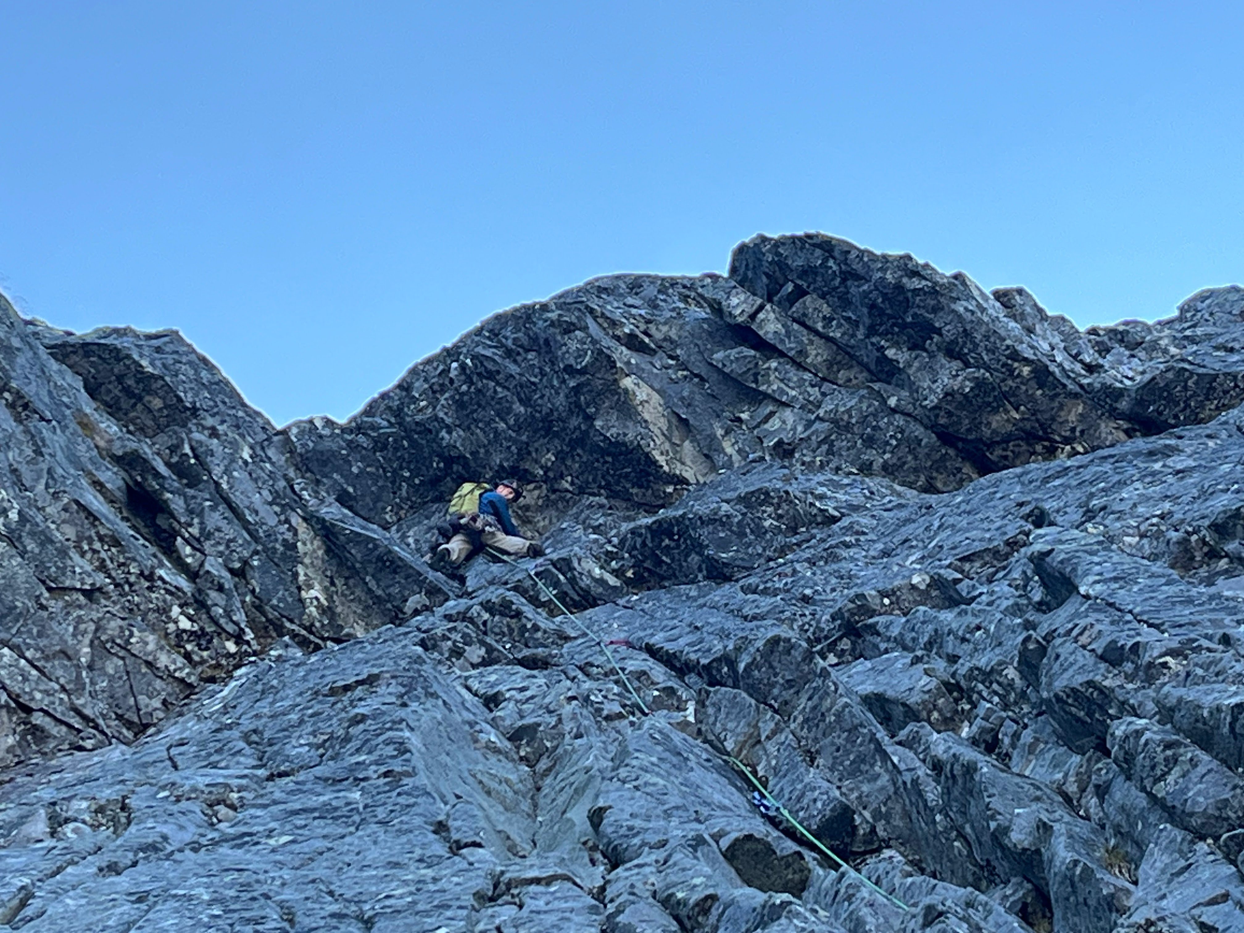
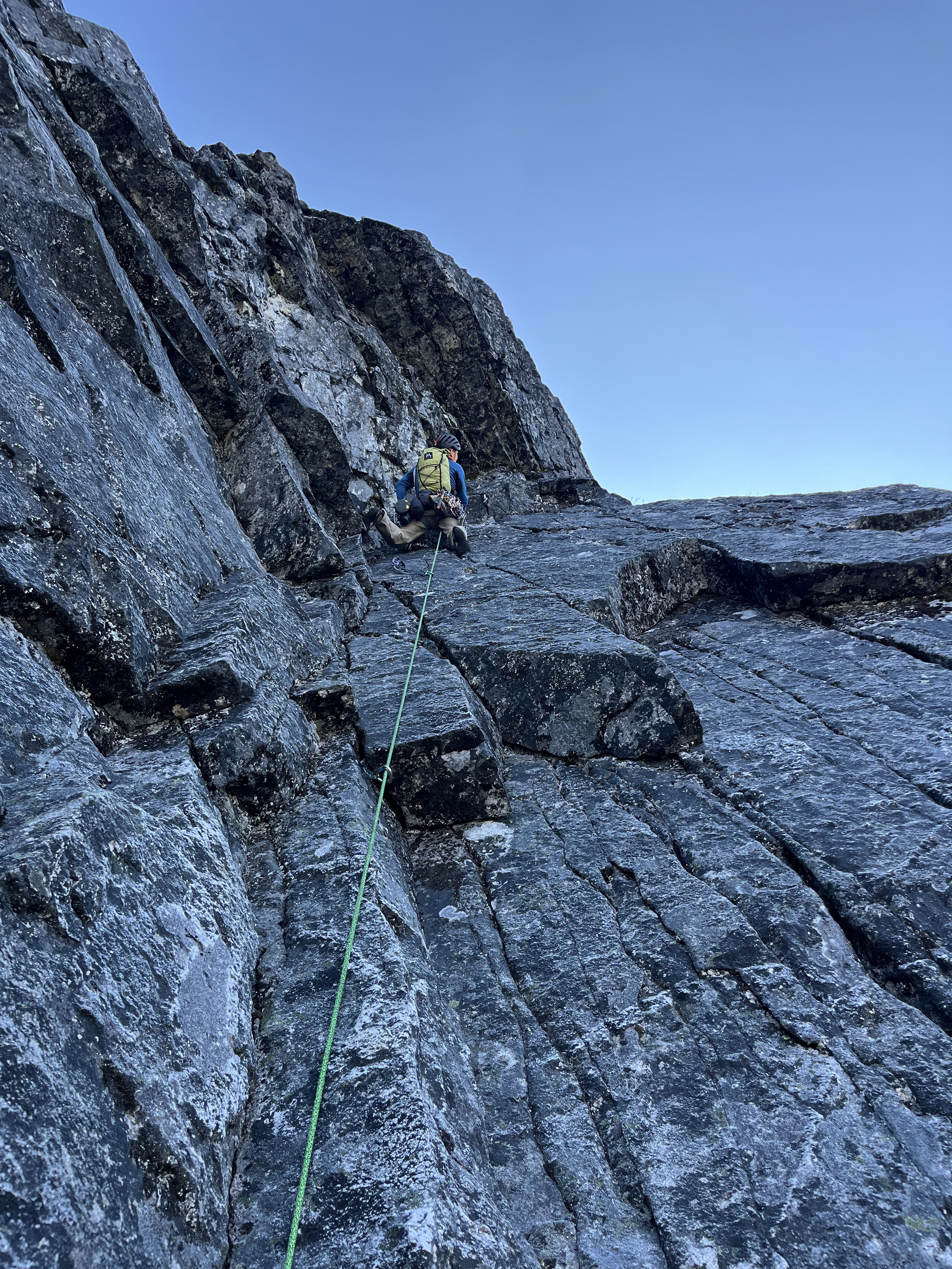
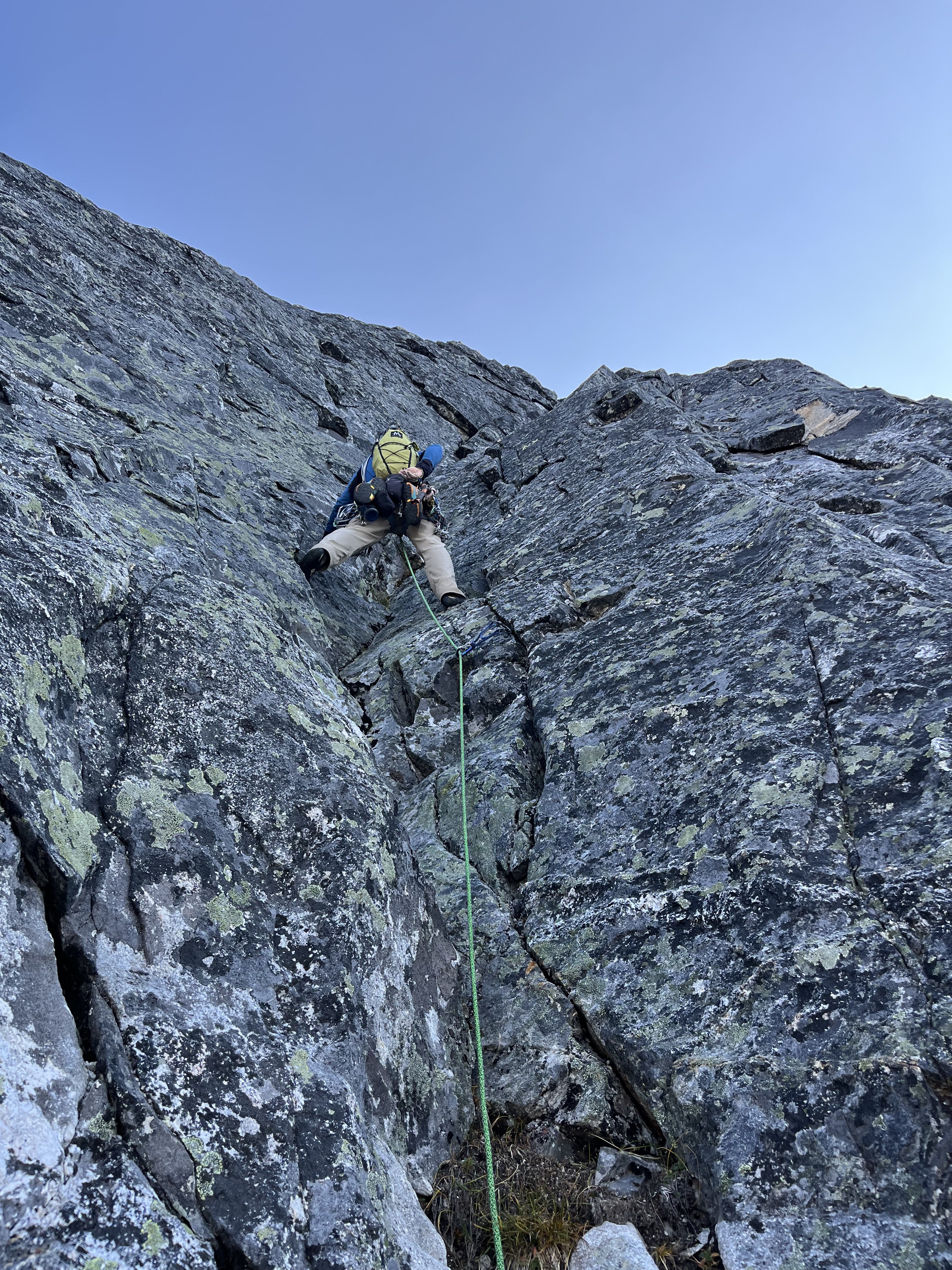
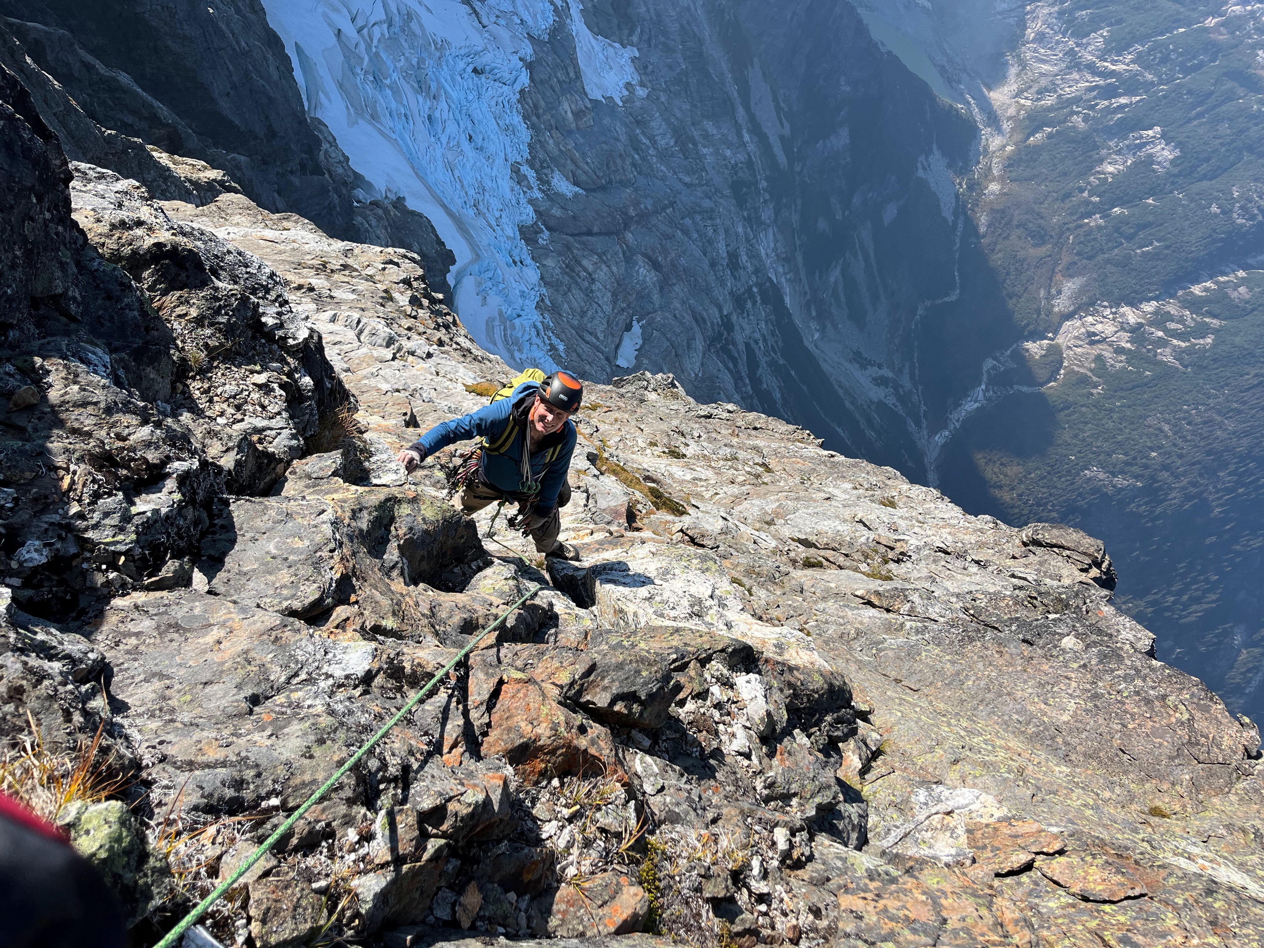
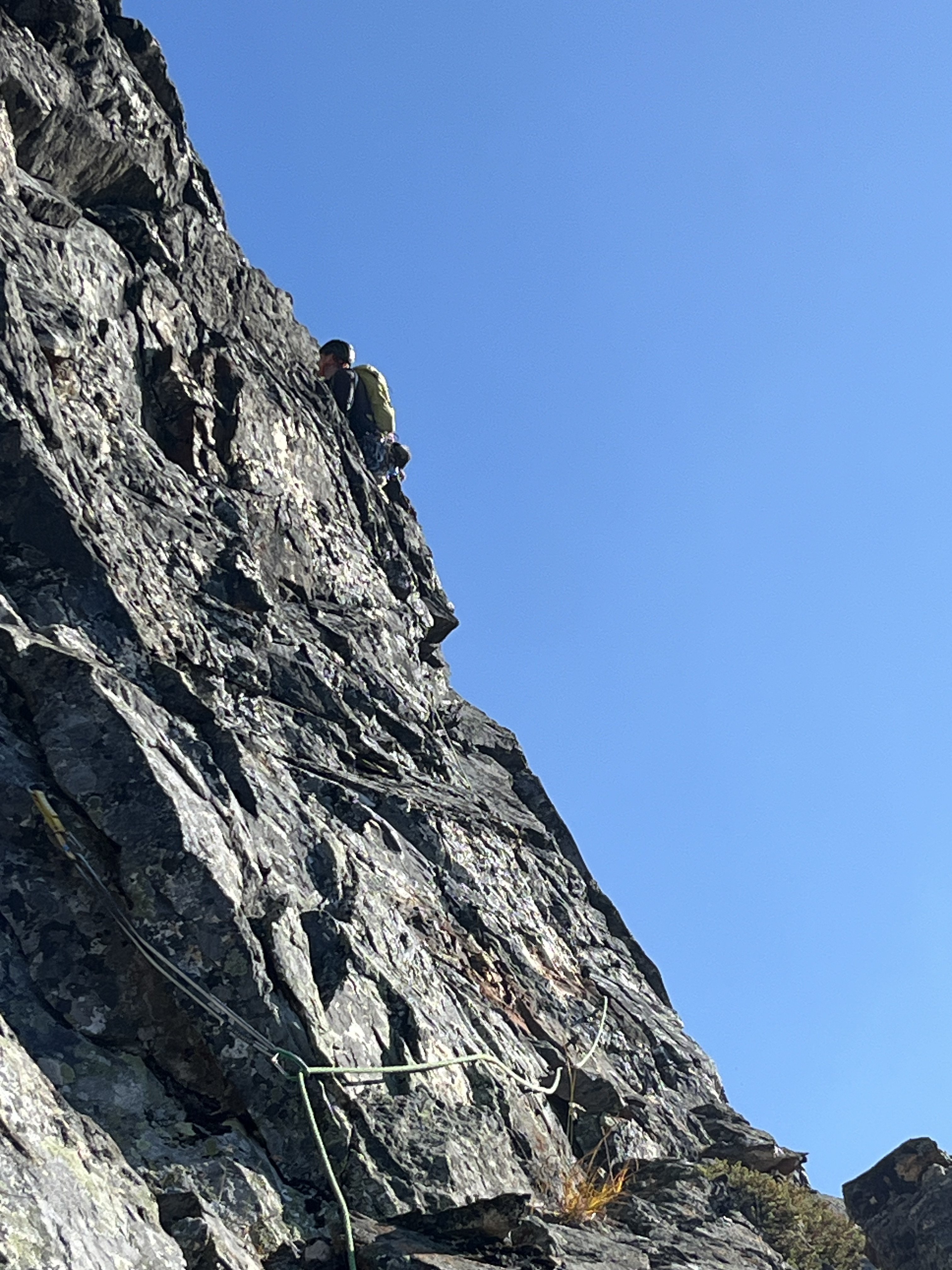
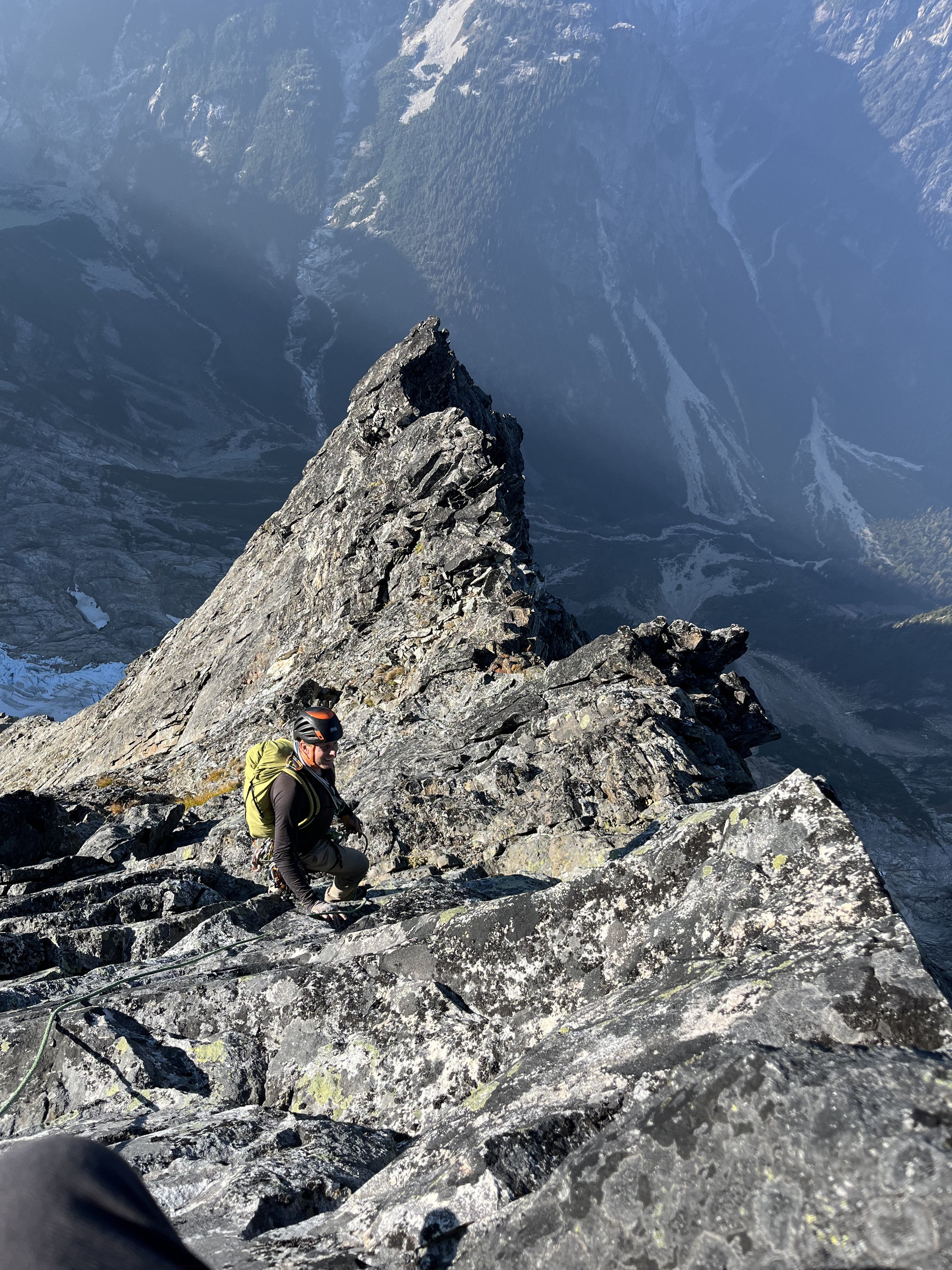
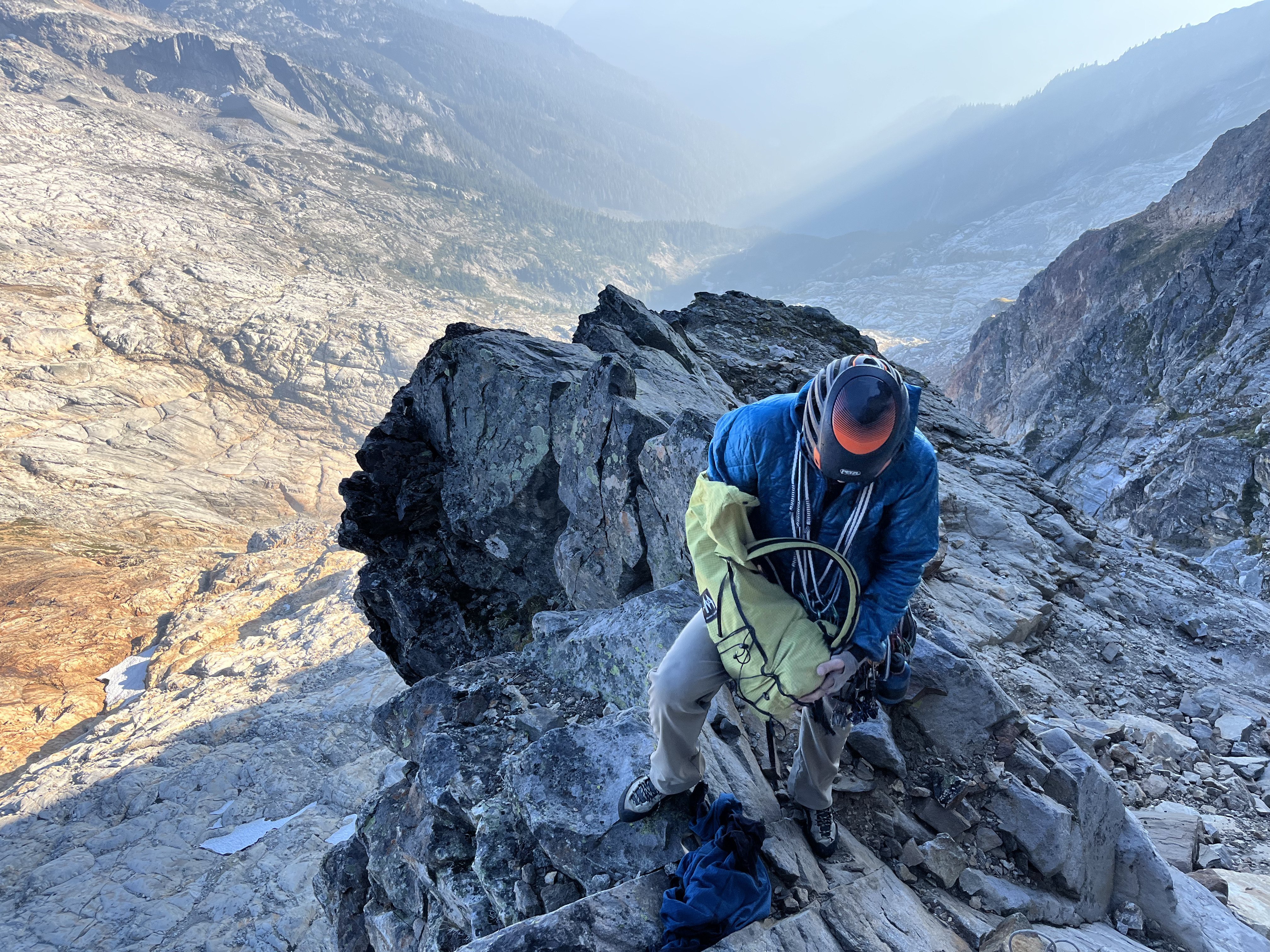
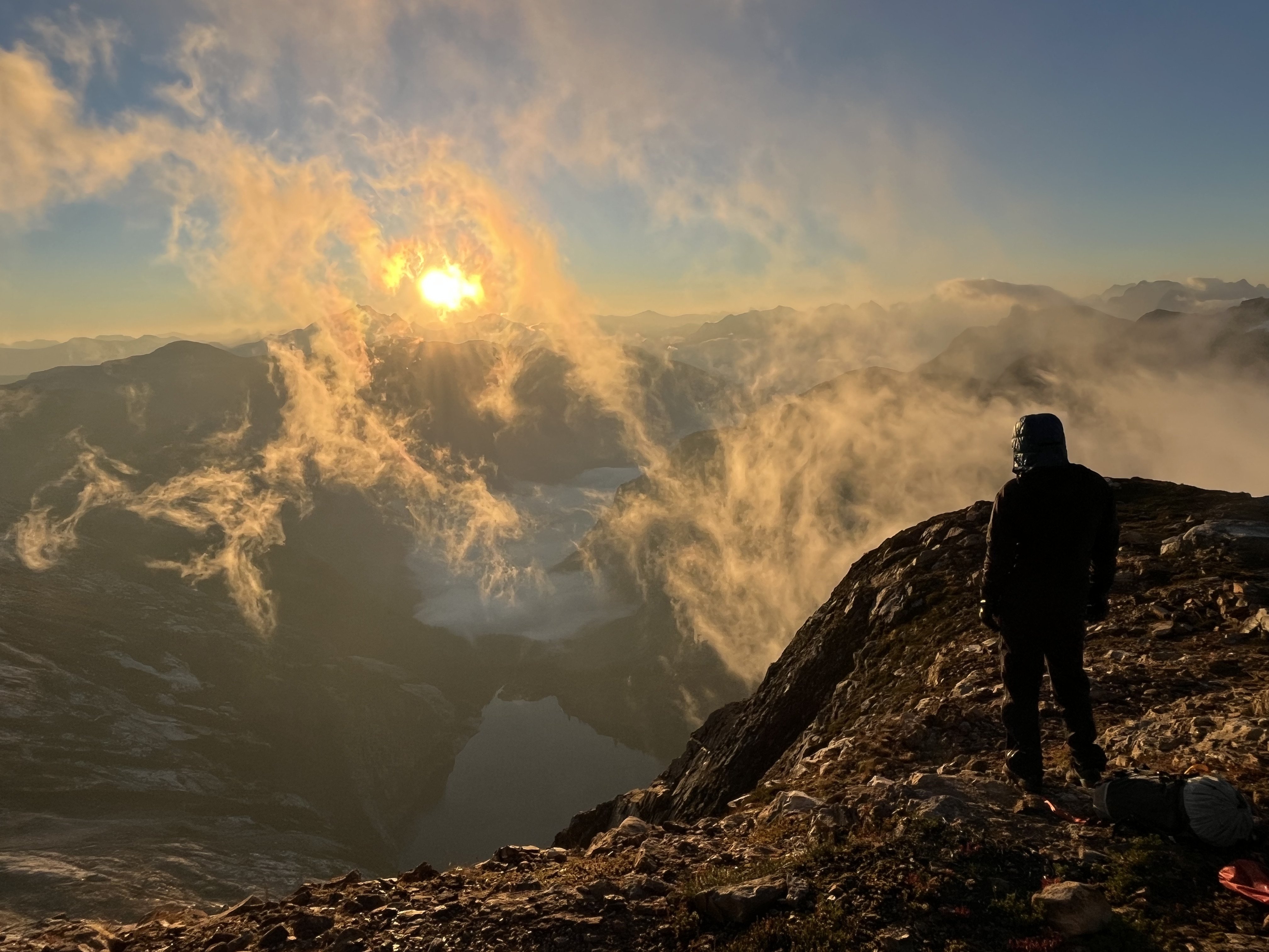
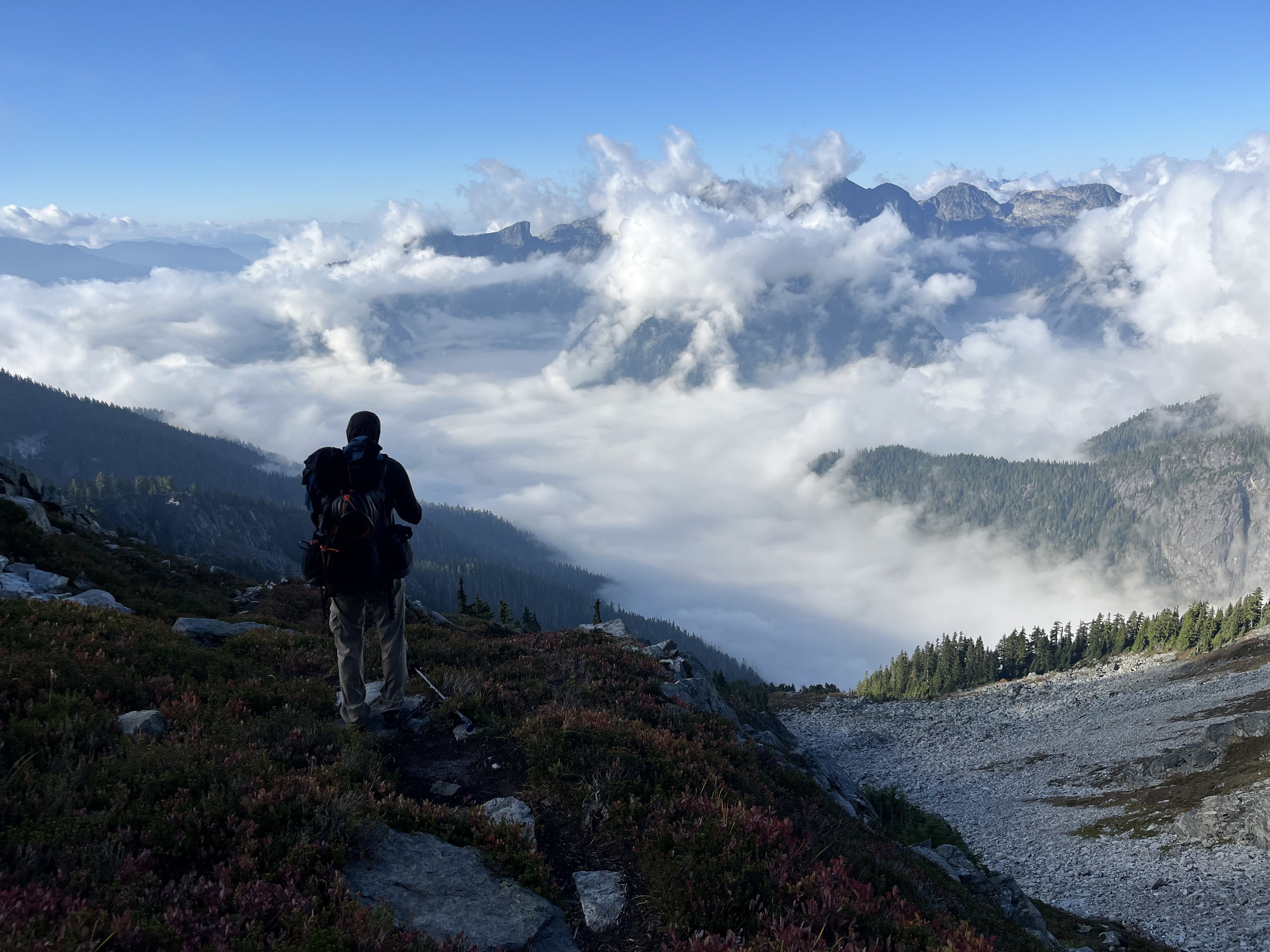
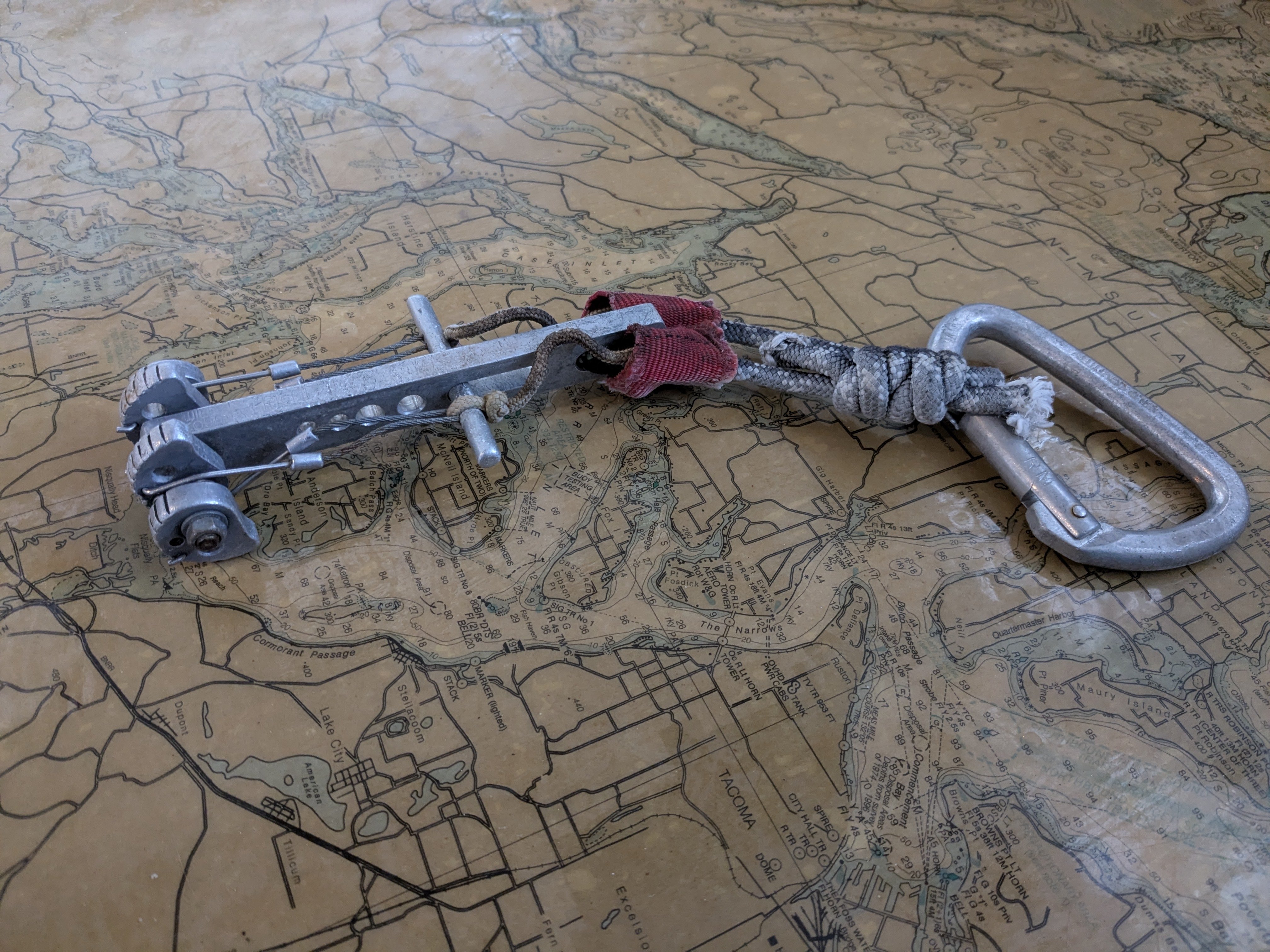
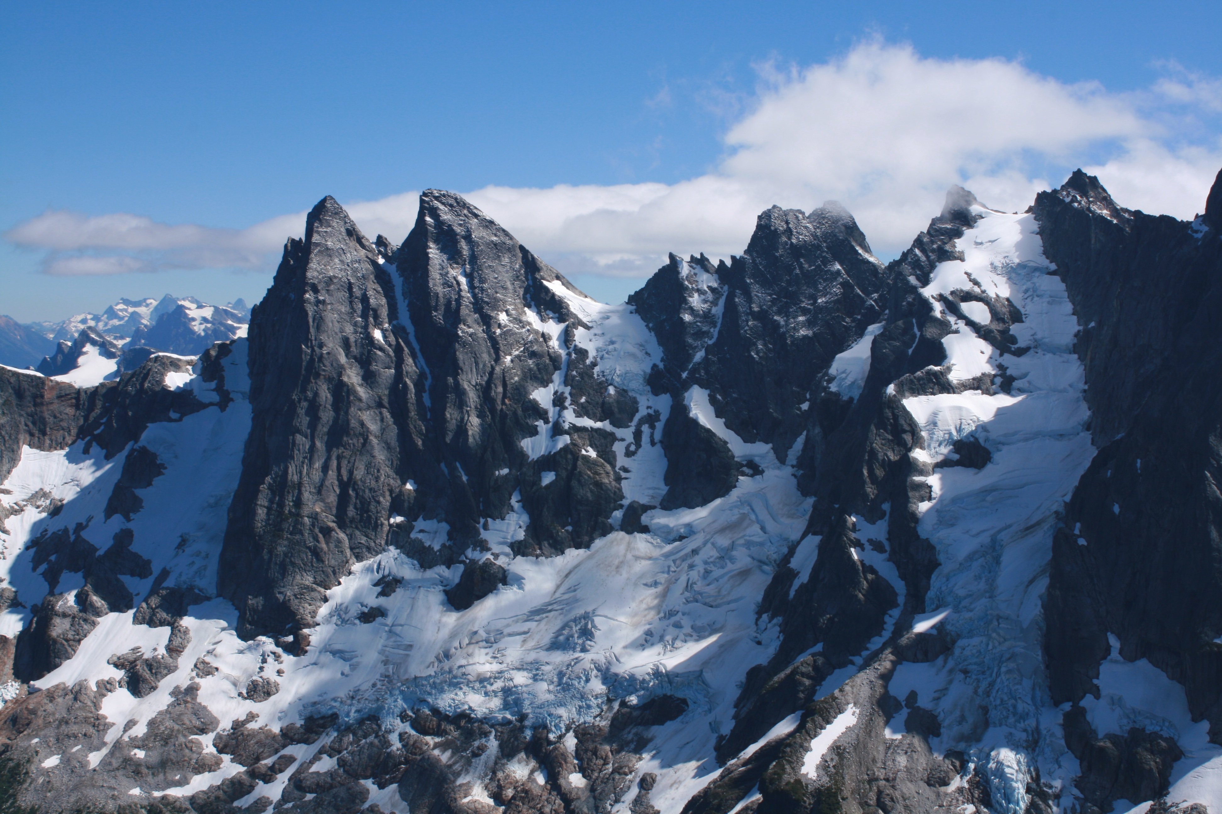
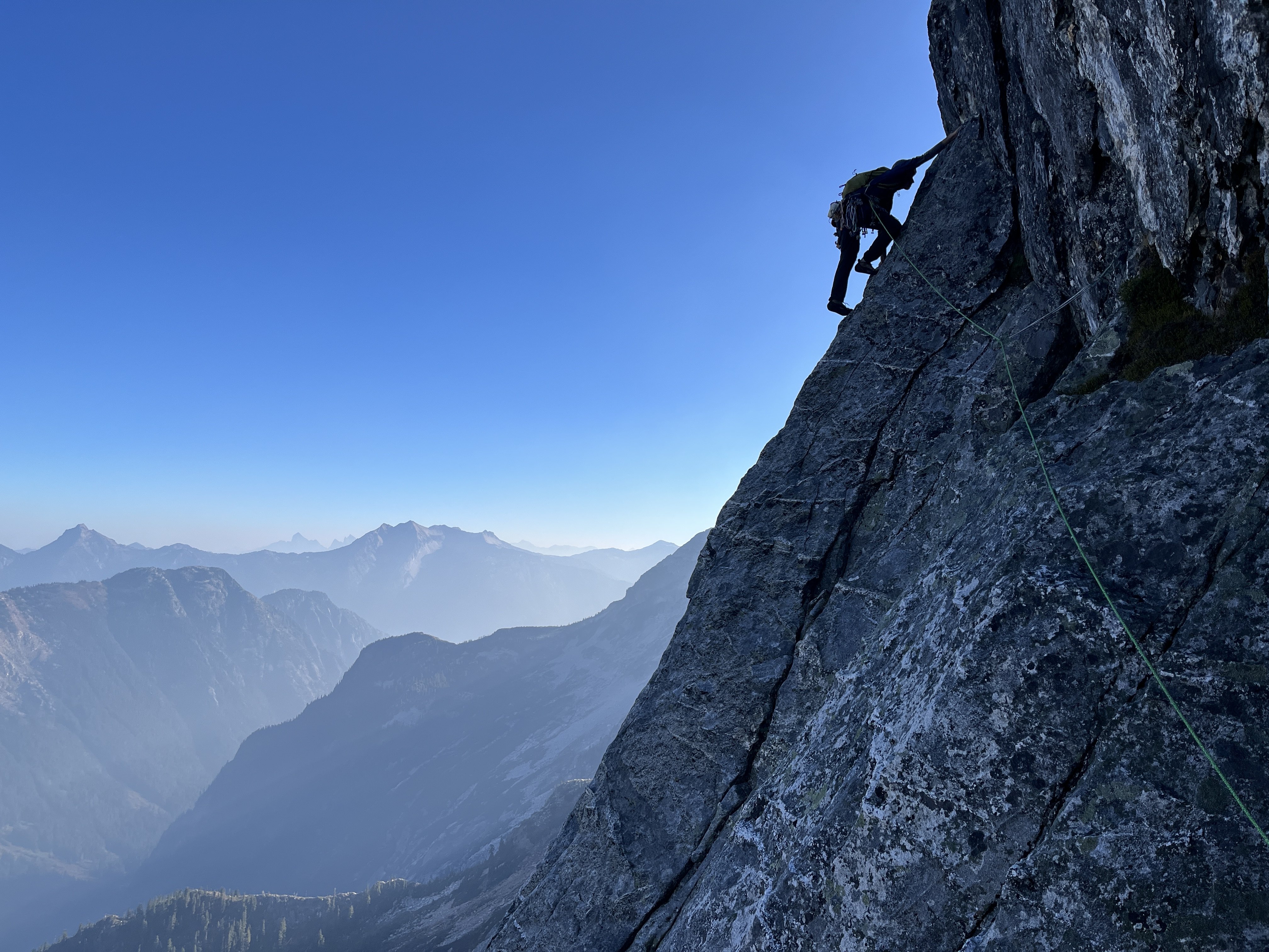
Trip: East McMillan Spire - North Buttress Trip Date: 09/24/2025 Trip Report: As Blake seems to speculate in the back of Cascades Rock, this is a legitimately high quality route. While the rock is of course worse than Index or Supercave, it is better than the E ridge of Inspiration or Stoddard Buttress on Terror (and much better than Megalodon). It's also less vegetated than the E face of Triumph or Sloan SW face. There was only one pitch we wouldn't recommend (up high in the schist band), but it can and should be avoided. The steep middle section is characterized by thin parallel cracks, highly textured ripples, and shady climbing with a shocking lack of lichen. When you emerge onto the slightly more West facing schist band for the last few hundred meters, lichen becomes tiresome as the angle eases and rock deteriorates. There are absolutely a couple of serious runouts, but they occur on clean, solid rock. From camp on a small heather patch a few minutes below Little Mac, we approached via a ledge just below Little Mac that accesses the NW trending ridge toward Elephant Butte. We made four rappels beginning at at an old station I had found during a recon trip in October 2020. This seems likely to be the rappel used by the 1986 party, maybe also the 1976 party, and I think @rat has also mentioned climbing the buttress, so perhaps used it as well. The 2008 party (AAJ, NWMJ) approached via Stetattle ridge. After four 45-55m rappels, we walked and scrambled easily to the base of the buttress. We simulclimbed 200-300m on the lower buttress, then belayed eight ~45-50m pitches (5.8 to 5.10-), then simulclimbed (interrupted by one belayed pitch, which we would recommend avoiding) to the summit. For the central, steep section we wanted to climb near but right of the buttress crest, which except for pitch 2 (a horizontal leftward traverse) yielded a logical path almost directly upward. Looking upwards from low on the buttress, two corners right of the crest (separated by a chossy roof) seem to provide the obvious options into the steeper middle section. We aimed for the left corner (which we presumed was the 2008 route), and thought the right corner was probably the 1986 route. We encountered many pieces of fixed gear throughout the route (mostly knifeblades, with a few nuts, a hex, and a rigid stem friend). Since the 2008 party rappelled the face (!!!), presumably close to their line of ascent, we think we followed large portions of their route (Come Over to the Dark Side). That said, I haven't really managed to match the route lines in either the NWMJ or AAJ to our experience (at least at the resolution I can manage to download). From the summit, we downclimbed SW to the col with West McMillan, then continued downclimbing S in the gully for a few minutes. When the gully's left wall flattened, we slung a boulder and made four 45-55m rappels to reach low angle slopes and walked back to camp, arriving about 15 hours after leaving that morning. West McMillan, Inspiration, The Pyramid, Degenhardt, and Terror from high on the route: From left to right: E McMillan, W McMillan, Inspiration, The Pyramid, and Degenhardt. The route goes just right of the sun/shade line on the leftmost peak. The approach rappels start down a relatively solid corner just right of the low point on the left). Photo by Steph Abegg: First rappel into McMillan Creek cirque: Racking up before the first simul block: Marlin starting up the first simul block: Marlin at the top of pitch 1: Partway across the pitch 2 traverse (photo by Marlin). There was a fixed two-pin anchor at the end of this traverse that may be that in the 2008 NWMJ "Erik starts the crux" photo: Looking down partway up pitch 3. This section had some blocks and flakes that looked ominous from below, but sounded and felt solid on closer inspection: The upper part of pitch 3. This was probably the most runout section of the route: Looking down the start of pitch 4: Marlin at the top of pitch 4: Marlin starting up pitch 5: Marlin starting up pitch 6: And navigating the roof on pitch 6: Starting pitch 7: And pitch 8, which should have been the last belayed pitch: Simuling in the schist band: Marlin leading the very-not-recommended lichen covered, loose pitch in the schist band. Go right before here, toward the E Mac col, to keep it scrambly. There was a fixed pin near his feet here, so we weren't the first to get suckered into it: Belaying on the summit. The buttress crest in this section is stacked, lichenous blocks that seem to overhang the impressively steep East face. You want nothing to do with the crest here: Setting up the first rappel out of the E Mac-W Mac gully: Impressive ambience the next morning, looking toward Azure lake from camp: Hiking out, looking toward Triumph: And a friend from the start of the schist band. It was still solidly placed and easily removed after, probably, 17 years (although could use some lube): Gear Notes: Modern gear made a huge difference on this route, especially microcams (compare the 2008 party's rack in the NWMJ pictures), microtrax simuling, and fix-and-following. We took a 50m lead and 65m tag line (we didn't haul), ~5 kbs/lost arrows, at least triples to fingers with offset aluminum and brass nuts, doubles to #1, single #2 and #3, and four microtraxions. Our smallest cams (purple C3 and green/#0 Z4) were used in several critical placements. Approach Notes: Goodell Creek to Terror Basin, then up slabs toward Little Mac.
 2 points
 -
Trip: Seefar Peak, Brooks Range, The Long Way - East Gullies From Marsh Fork To Dalton Highway Trip Date: 07/28/2025 Trip Report: TLDR Version/Intro: Me and 4 buddies went to the Brooks Range in Alaska for 12 days of hiking through one of the largest wilderness areas in North America. July 28 to Aug 10. We had a blast and it went great. We got flown in by a bush flight, walked along many river valleys, hiked up a talus pile peak and then through the wilderness, across rivers and over hills to the Dalton Highway where we got picked up by a commercial shuttle service that drove us back to Fairbanks and the World. Long version: Day 0: Drive from Bellingham to Seattle, Fly from Seattle to Fairbanks on Alaska Air (duh), van ride, Uber ride. Walk around town, hit a bar, Thai food. Beers in the hotel room. Day 1: Fly to Coldfoot on Wright Air, slight delay due to missed flight (don’t believe the hotel that you don’t need to be early to Wright Air, they take their business very seriously). Immediately upon landing in Coldfoot we jumped into prop plane the same age as my parents and fly with Dirk of Coyote Air into Upper Marsh Fork landing strip on the Marsh Fork of the Canning River. The flight was incredible, frequently with wheels just clearing ridgetops and flying the terrain up and down valleys. Extremely scenic, caribou and sheep. Upon landing there was much exclaiming and pointing and backslapping. Once we got settled down and the final packing completed we hiked up valley. Warm, patchy sun, overnight hard rain. Glorious, glorious, glorious! I got a good chuckle out of everyone later admitting that they were forcing down the nausea the whole bush flight and hiding it from the others. 5.5 miles, 2.5 hours. “Rainy Camp” Day 2: Hike up Marsh Fork, cross into unnamed very upper East Fork tributary of the Ivishak River drainage. Camp at headwaters. Hard day, with technical talus and side-hilling above cliffs and raging water. The river was running pretty high from the previous night's rain so walking in the canyon bottom was not an option for us, otherwise this would have been easier. Cool and misty with rain. Amazing, just like home but nothing like it at all at the same time, so great all around; we expected weather, didn’t rain enough to get wet. Much exclaiming about the scenery. 12 miles, 9 hours “Frosty camp” Day 3: Awoke to frost on the tents and plants. Hiked down canyon to junction with upper east fork of the Ivishak, down river past multiple small confluences, easy walking. Over interminable ridge with tussocks (our first!) to Ivishak River main stem. Camp in a “hay field”. Bluebird sun and warm, 2 long great breaks for lunch. Much exclaiming about the scenery. We pushed hard on this day to set ourselves up for a potential summit tomorrow assuming the weather held out. We didn't want to get stranded up high looking for a campsite with no water. 16 miles, 11 hours “Hayfield camp” Day 4: Ascended Ivishak valley toward Continental Divide, turn south to climb Seefar Peak via dogleg east gully, awesome snow in first gully, then major talus slog to the summit. Amazing time spent on the summit, warm but breezy. Lots of cool fossils in the limestone. Descent to the south and west terrible talus, so we bailed off the ridge early to Wind River valley. Made camp. Amazing dry tundra camp next to river. Shoes and socks dry at camp! First time since 5 minutes into the trip. Bathed in river and washed clothes. Bluebird, sun, warm. Much exclaiming about the scenery. A good time was had by all. 10 miles 4000', 10 hours “Swimming Hole Camp” Day 5: Hiked down Wind River, saw wolves with puppies, then later moose which led us into a lousy tussock field, camped in side creek. Very mediocre spot, but extremely close to water and some dry wood, so we had a fire and drank margaritas to enliven the spirits a little. It worked. Much exclaiming about the scenery. 14.3 miles, 7.5 hours “Margaritaville Camp” Day 6: Up wind River tributary, saw a grizzly with two cubs, a heard of sheep way up high, and a lone wolf across the valley making quick work of the talus. Up a unique talus-ey canyon, over two passes, one being the Continental Divide, down a tributary of a southern fork of the Ribbon River. Great walking most of the time. We got showered on twice, but mostly sunny. The area where we looked to camp was somewhat brushy with knee-high vegetation and it took a bit of looking to find a good campsite, eventually made a spot work quite well with great moss and blueberries. 13 miles, 8 hours “Barefoot camp” Day 7: Nice enough weather early, quickly turned to rain, then hard rain, despite the Inreach weather saying it would improve throughout the day. Misery. Trudged up to beautiful lake, too windy and cold to enjoy it. Saw wolf puppies briefly. Over pass separating the Ribbon and Accomplishment Creek and down to tundra on other side, just past dangerously slick boulder field. Dove into tents soaked through. Very cold and wet. Lunch in tent, nap. Whiskey helped spirits a lot... at least in my tent. Less exclaiming about the scenery today, though everyone admitted it would have been great if we could have enjoyed it. 8 miles, 4 hours, no breaks. “Sunny dry happy fun camp” Day 8: Woke to fog but no rain, weather improved dramatically throughout the morning. This was clutch since our base layers were completely soaked. First thing in the morning everybody got ready to hike then leapt into our wet clothes and immediately started walking quickly to warm up in an attempt to dry out some clothes. Down Accomplishment Creek, up side creek over a pass with lots of caribou antlers, half way down canyon on other side to camp. Beautiful country, lots of exclaiming over the scenery, sunny and warm, dried out everything. Decent walking. Saw moose, wolverine. Drizzle just before camp. “Sewing camp” due to a near catastrophic pack blowout. 9.5 hours. 16 miles Day 9: Drizzle, fog, cool. Down interesting puzzle canyon, that was tons of fun to figure out, left side, right side, in the creek, does it go? It goes! Saw a griz at a distance, then across a big river, nameless east tributary of the Sagavanirktok, (tough, fast crossing), hardest of the trip. Slogged up a tussock hill, to canyon, over pass and down to Sag valley, mediocre camp, not many options. We were told that the Sag was a tough crossing that kills people from time to time, so we were excited to get a look at it from up high. I had done a lot of satellite and map reconnaissance of the entire route and had picked out an area of the Sag that is quite braided, hopefully making for the easiest crossing. I had read a few scattered reports of people who crossed just a couple miles further north and had to use rafts. “Lumpy camp” 12 miles, 7.5 hours Day 10: Foggy AM, then sunny and warm. Across the Sag! It ended up being not that big a deal, but it helped that we were on day 10 and river crossing 1 million +/- a couple hundred thousand. Up the valley wall to an amazing broad sunny saddle with rolling fog, for a tea break. We were on a plateau above the confluence of the Atigun and Sagavanirktok Rivers. The fog started to break up after break, we walked slowly; some bad weather was predicted today and the next couple so over the previous few days we had hustled to make sure we could get across the Sag before the rain set in. Unlike the previous days, the weather report ended up being pessimistic and we had great afternoon sunshine. We strolled through tussocks to camp on a sunny alpine tundra slope. Amazing day. Surprise sun! Everyone tard sailed all their gear out on the tundra to dry out everything. Dry socks even!! The low tundra around camp made for great lounging and camping, and beautiful. The sun and sense of accomplishment really made the light on the hills glow that long afternoon. “Kick Ass Camp” 5 miles, 5 hours Day 11: Hiked off the plateau to the Atigun River, up the river valley to the road, road!? Long road walk to Galbraith Lake camp. My knees hurt after the 8 miles of road for the first time in the entire trip. Mostly cloudy with sun patches and a short drizzle. Surprising amount of traffic on the road, saw a civic! Fire and celebratory attitude at camp. “Galbraith Lake Campground” 6 hours 15 miles Day 12: Woke up leisurely, lounged around, day hike to West Galbraith Peak, tea and coffee on the summit. Camp time, eating everything that was left. Mostly cloudy, mild. “Galbraith Lake Campground” 5 mi, 4.5 hours Day 13: Lounged in the tent, rain and drizzle, picked up by van at 11. Wes from Dalton Highway Express picked us up in a beater 15 passenger van. Two entrees and a beer at the truck stop in Coldfoot. Food at the farthest north truck stop and bar in America was cheaper than in Bellingham. “Hotel Camp” 10 hours in the van, zero walking. Photo credits to Mike Graw. Gear Notes: backpacking gear, bear spray, rain gear Approach Notes: Airplane, deproach by van.1 point