
Leaderboard


Popular Content
Showing content with the highest reputation on 07/23/24 in all areas
-
Thanks @JonParker! I missed this.... Yes, agree on all of the above. I think it is a fun and straightforward class 3 ramble @Hartselle Mountain Hikers, but then again, I'm biased. And, you may have guessed, I like to keep the beta to an absolute minimum to keep the spirit of North Cascades adventure alive. It is a lot of fun to have the route unfold before you, hunting and guessing like those who came before. Or, at least I find that part fun. Good luck and please post a TR with your thoughts on the route. It is fun to see how folks experience this corner of the Cascades.1 point
-
This kind of storytelling is why I fight to keep this place going. I would love to read the poem. thank you1 point
-
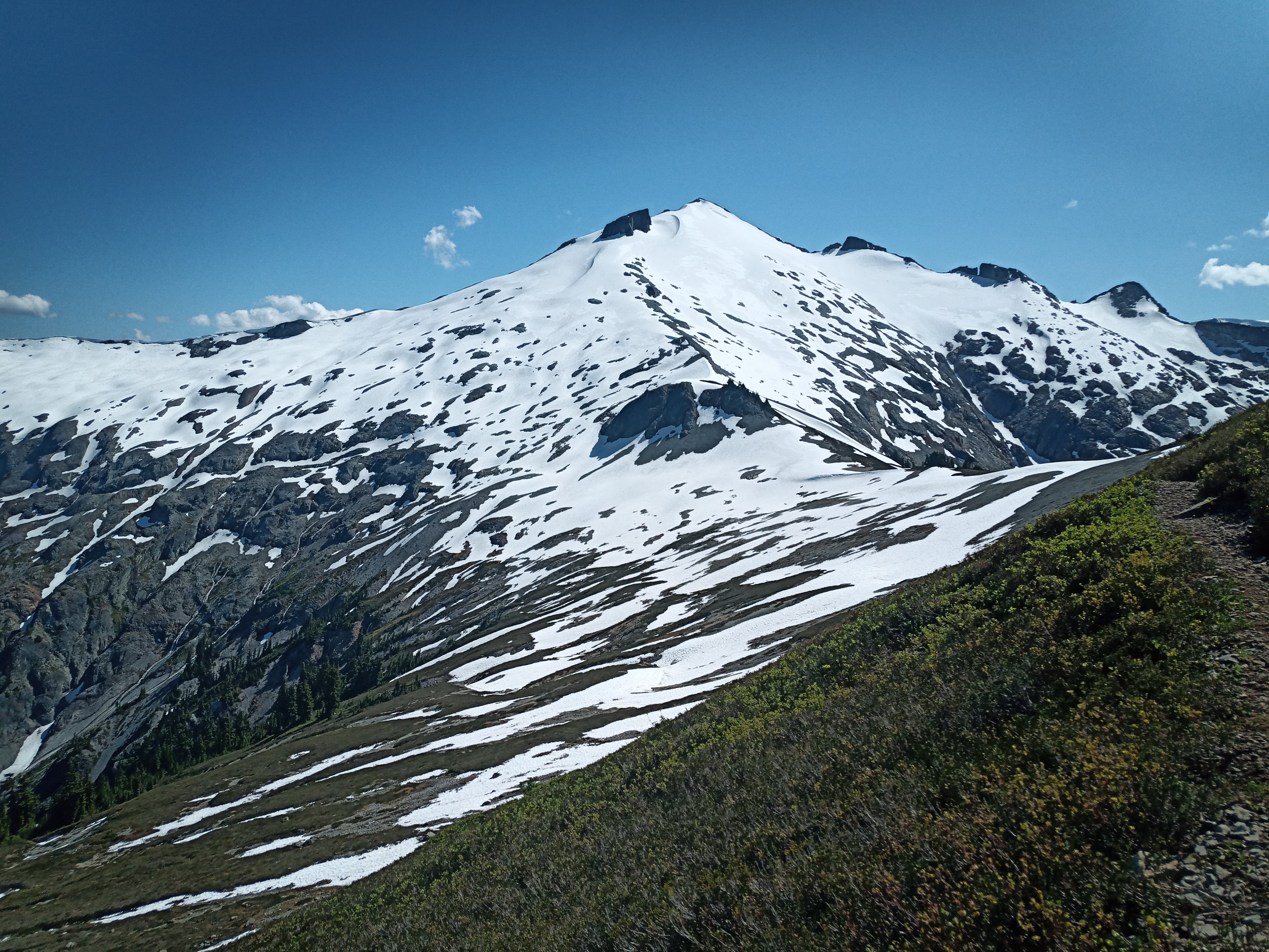
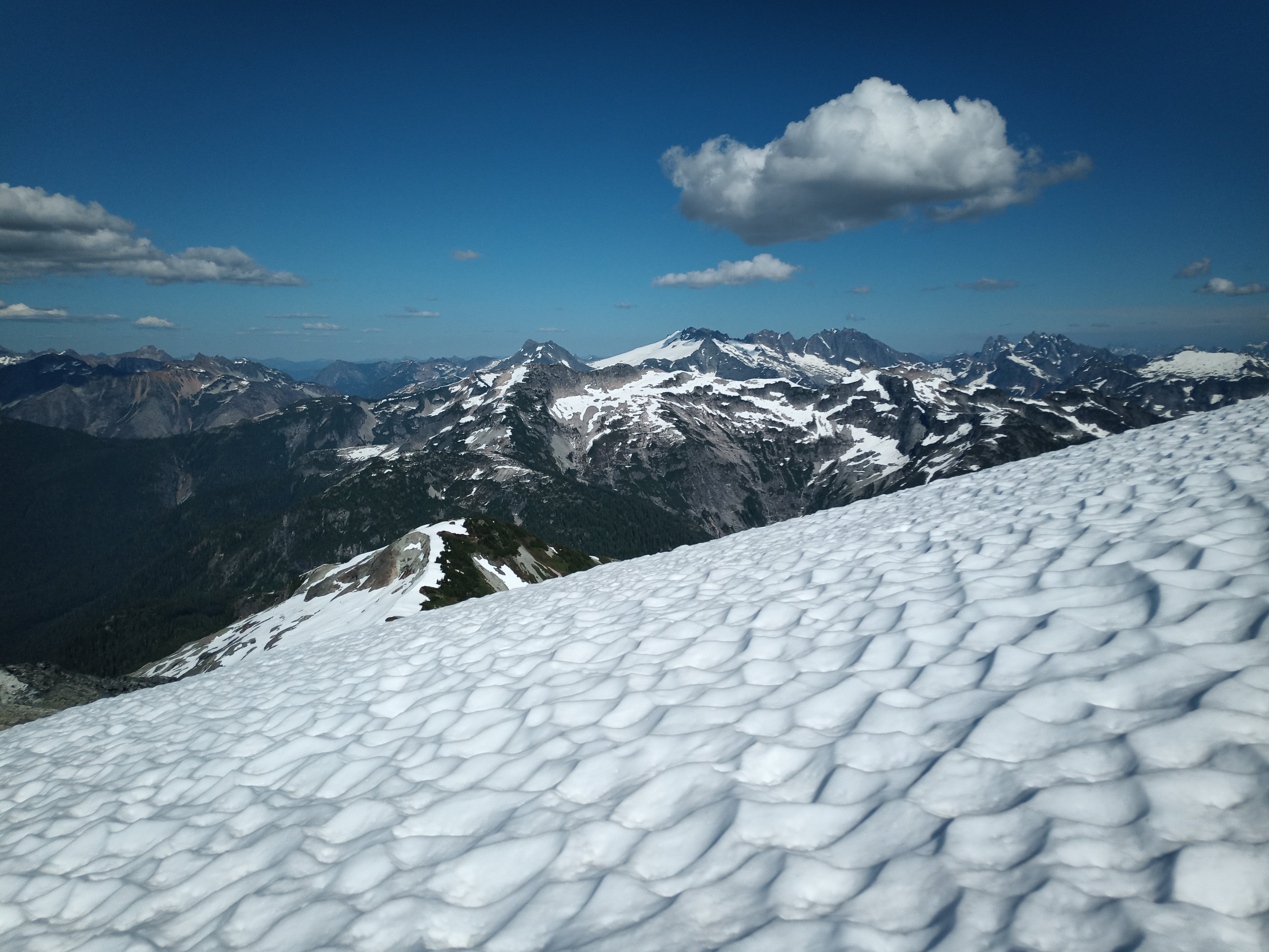
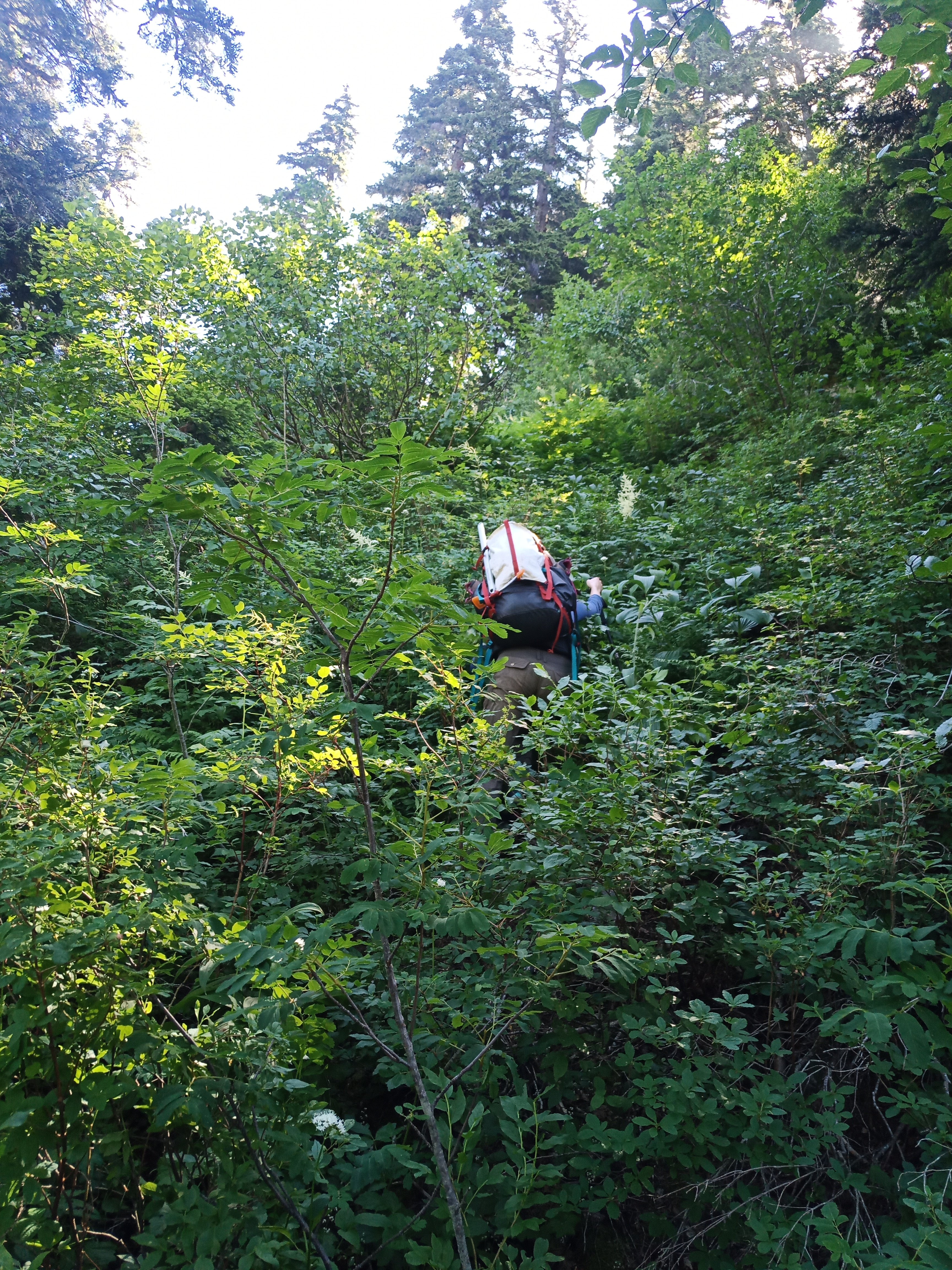
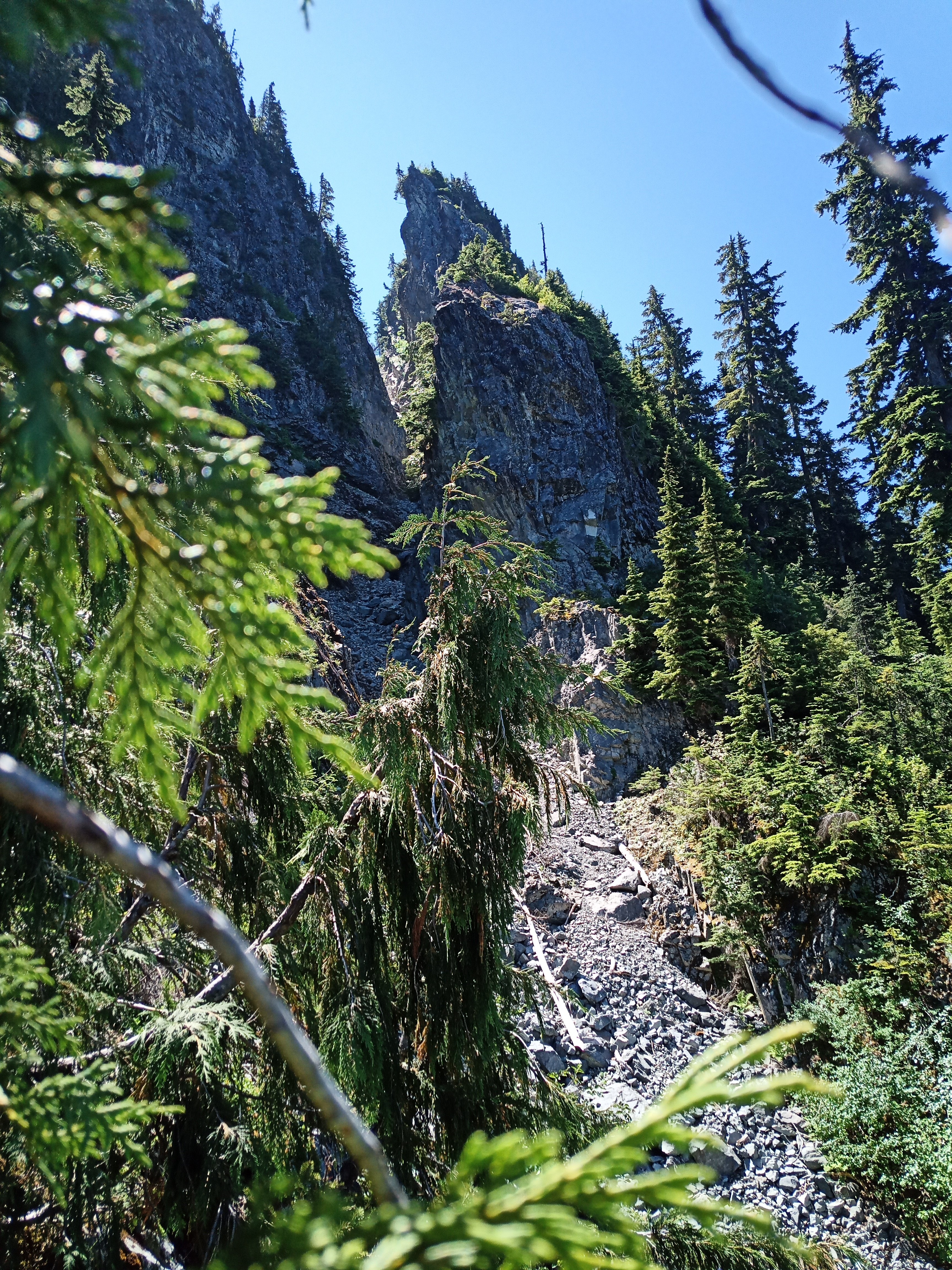
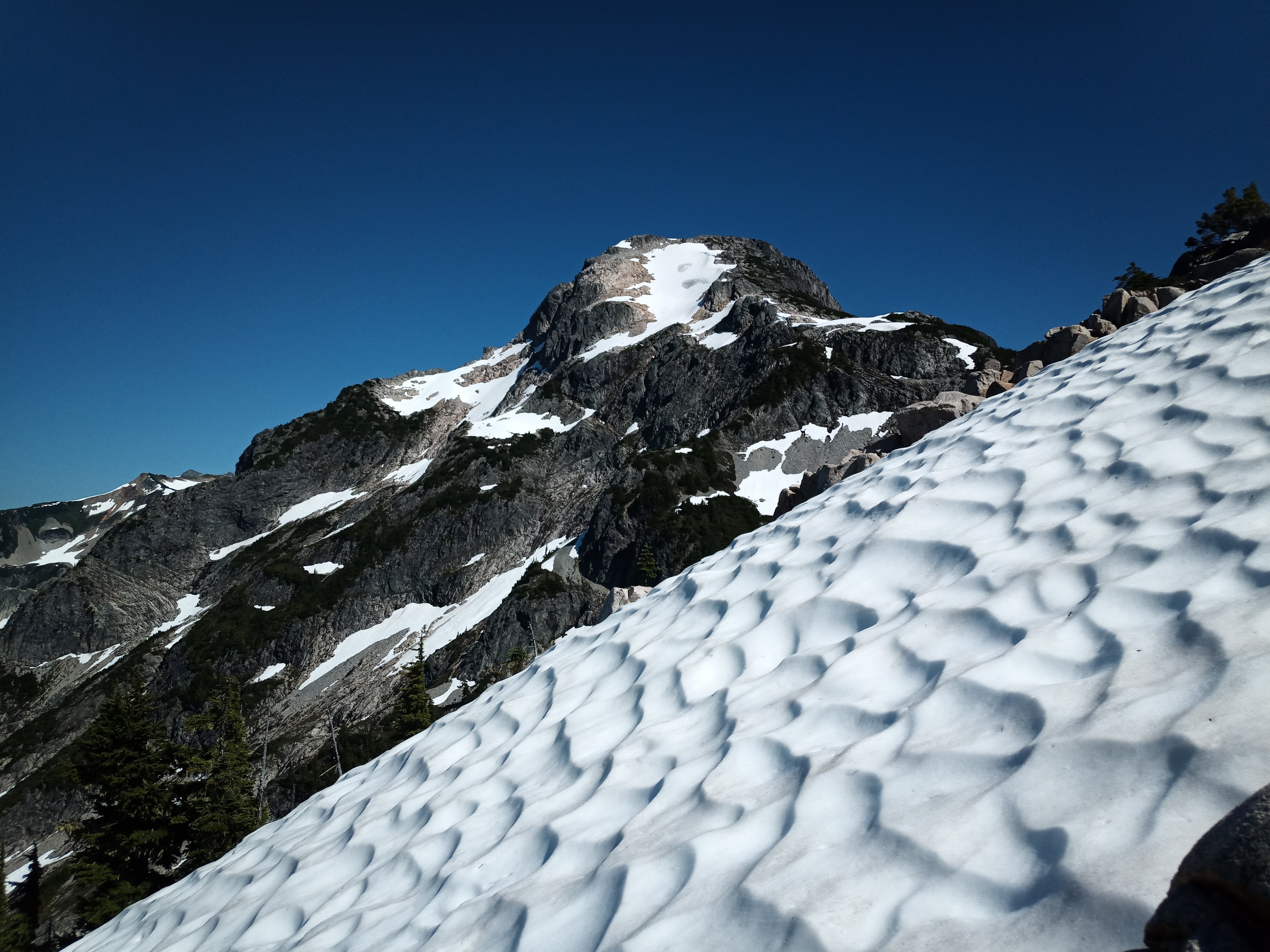
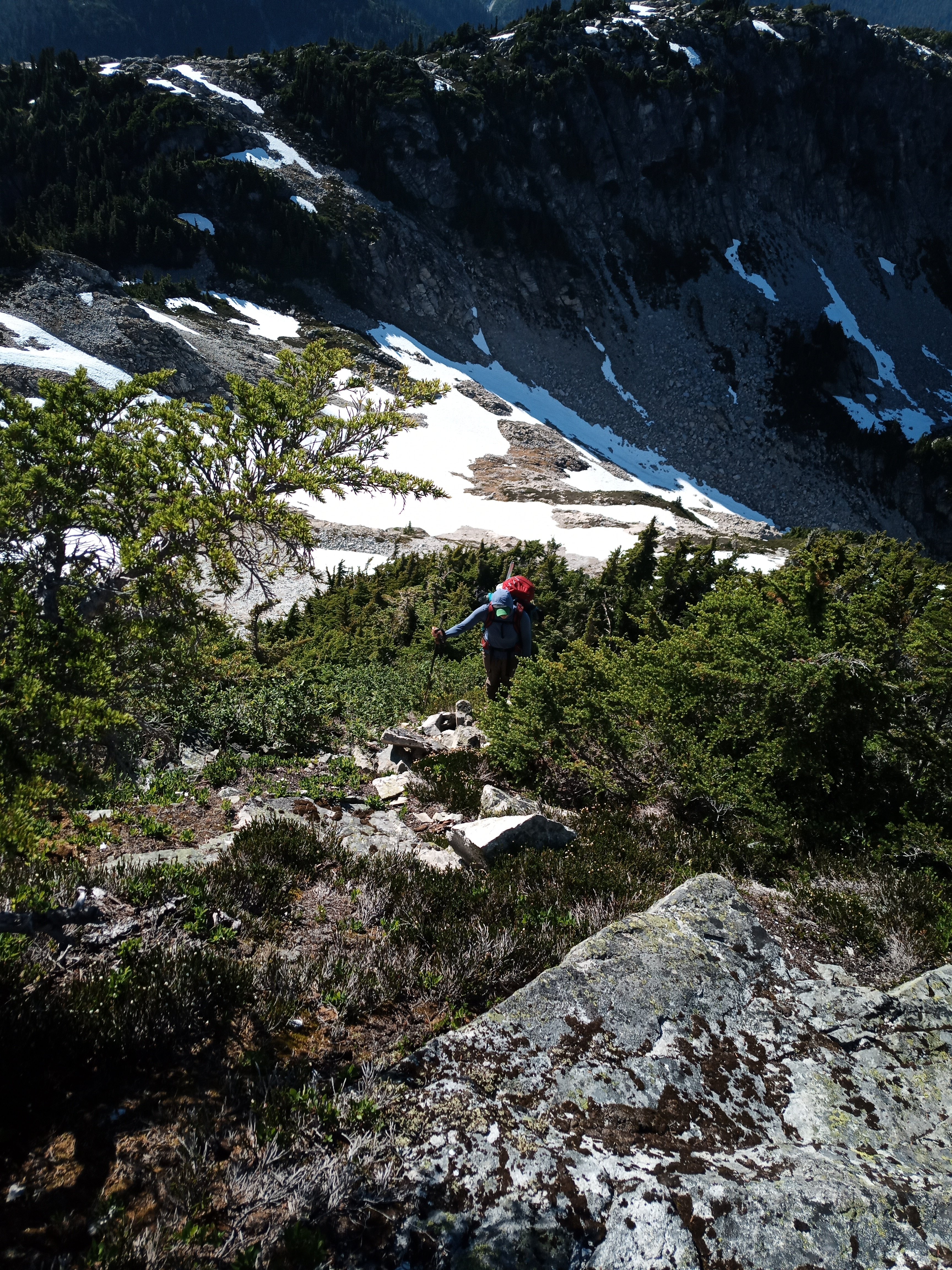
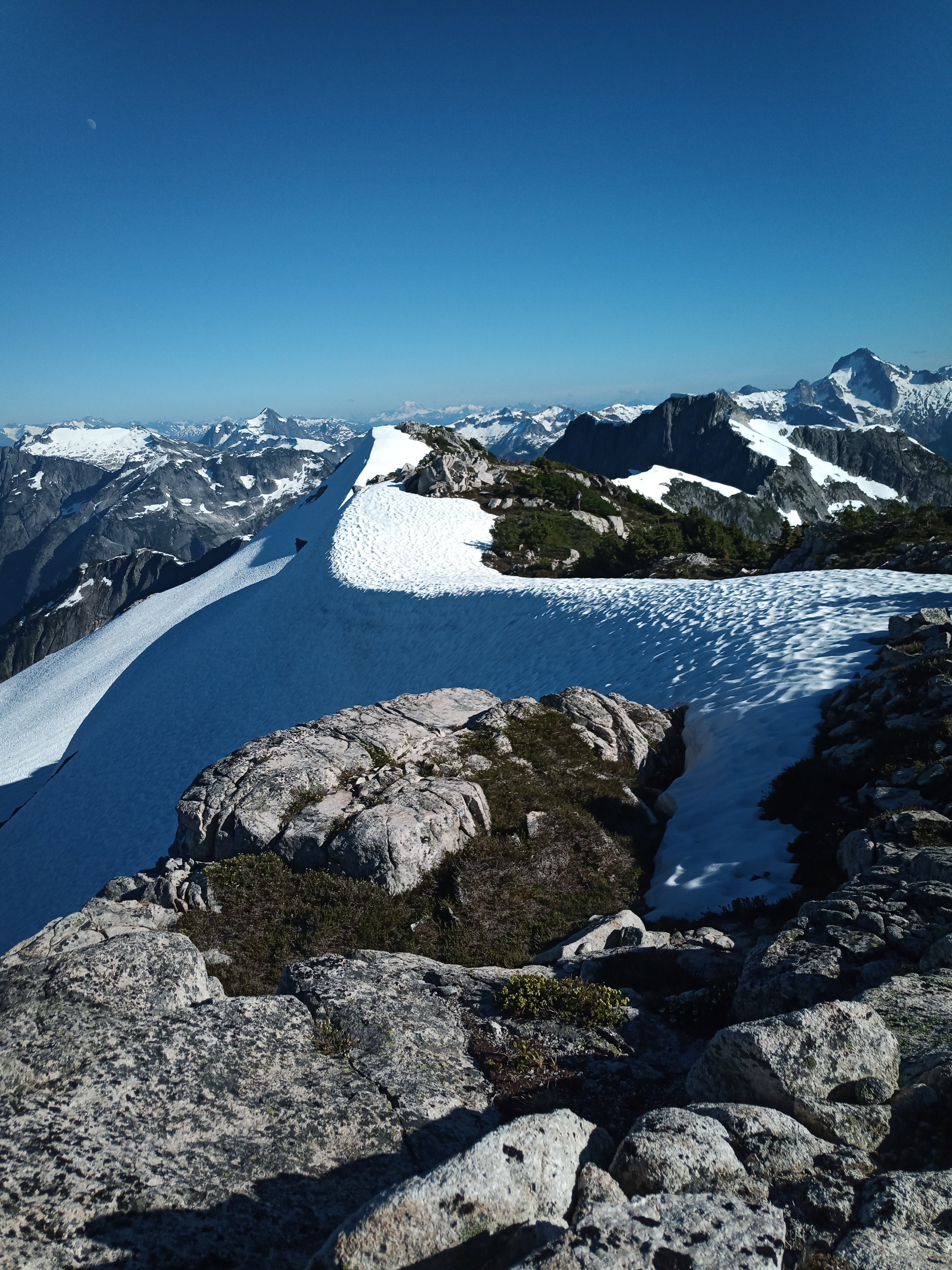
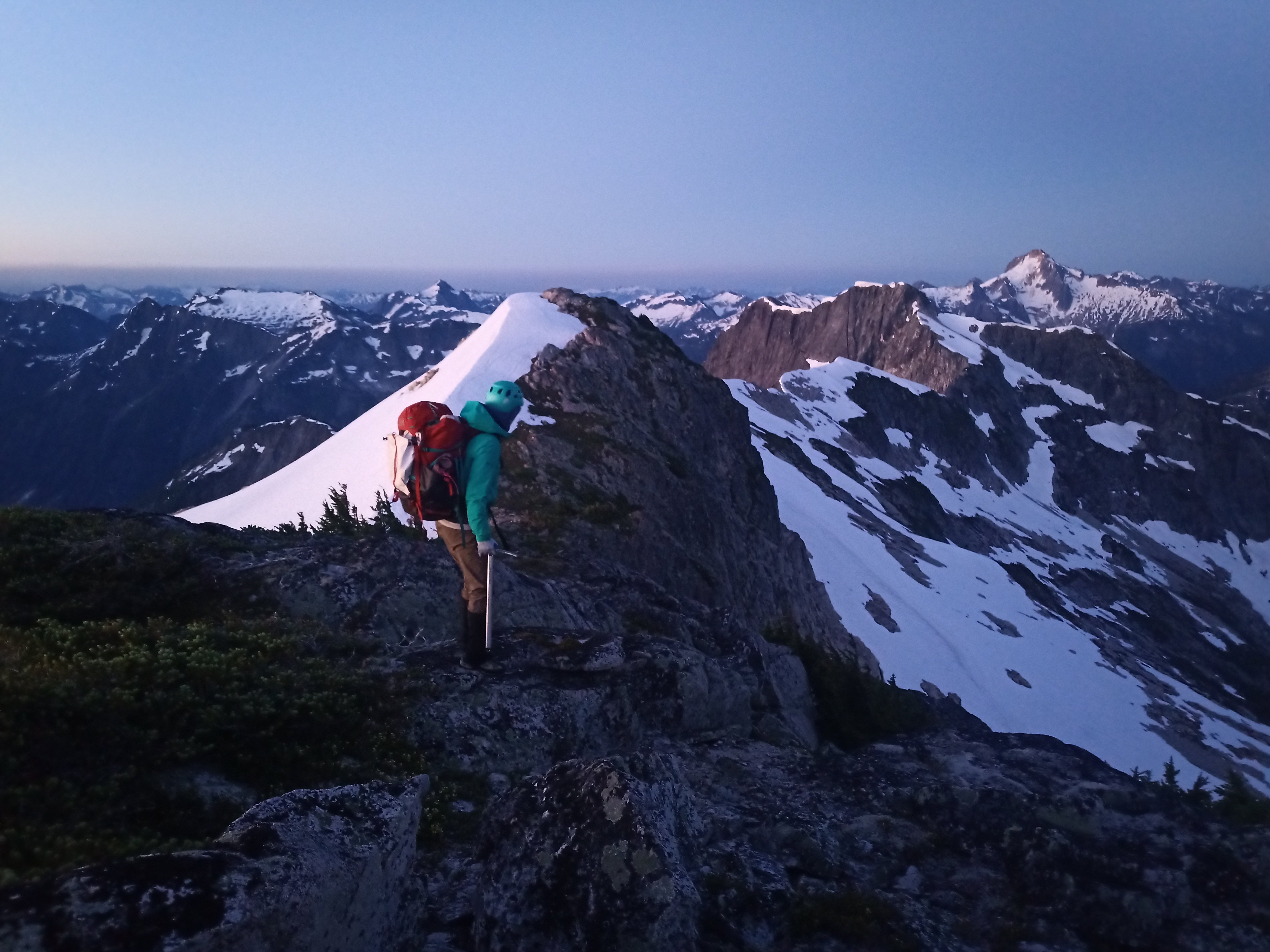
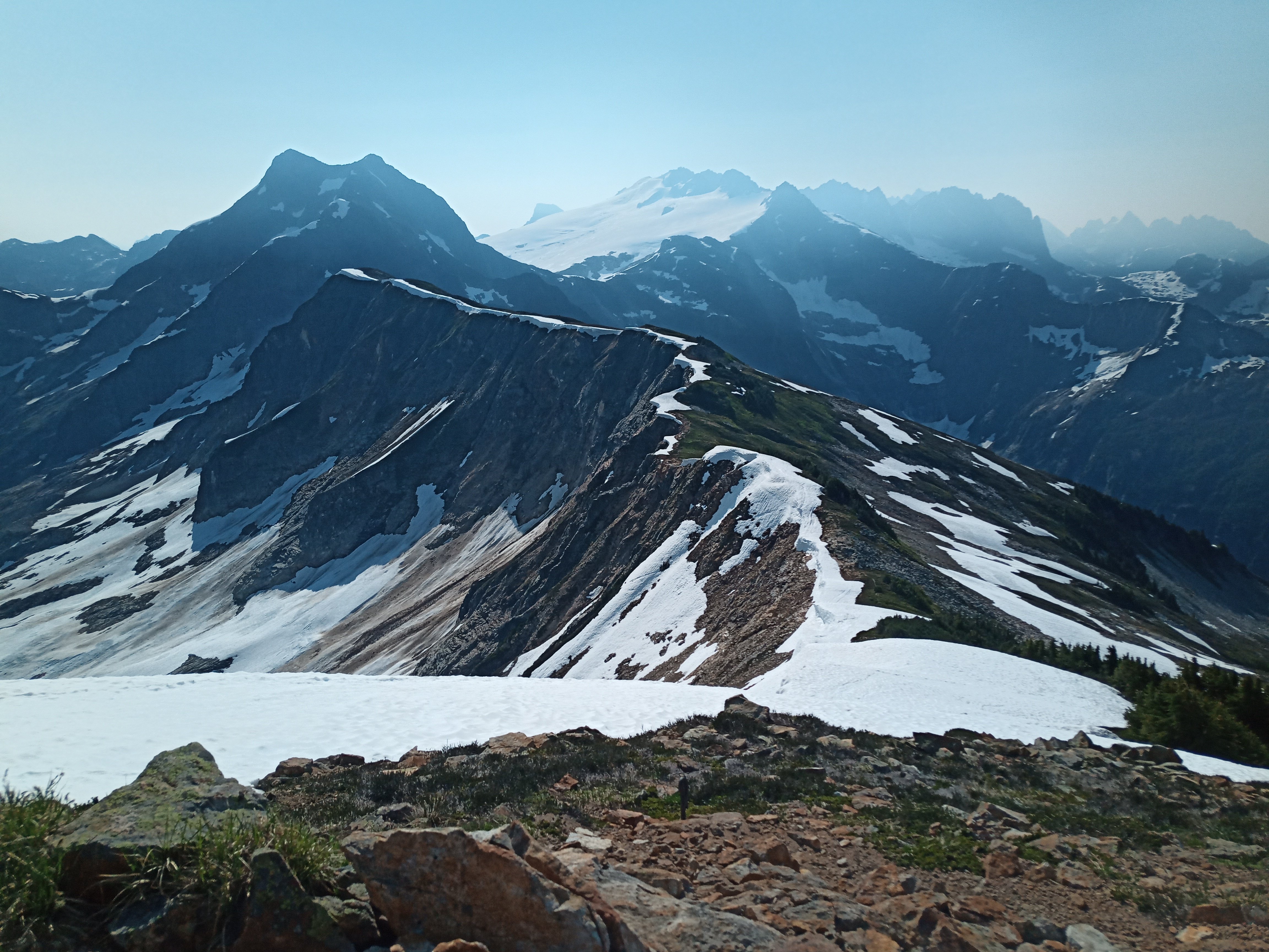
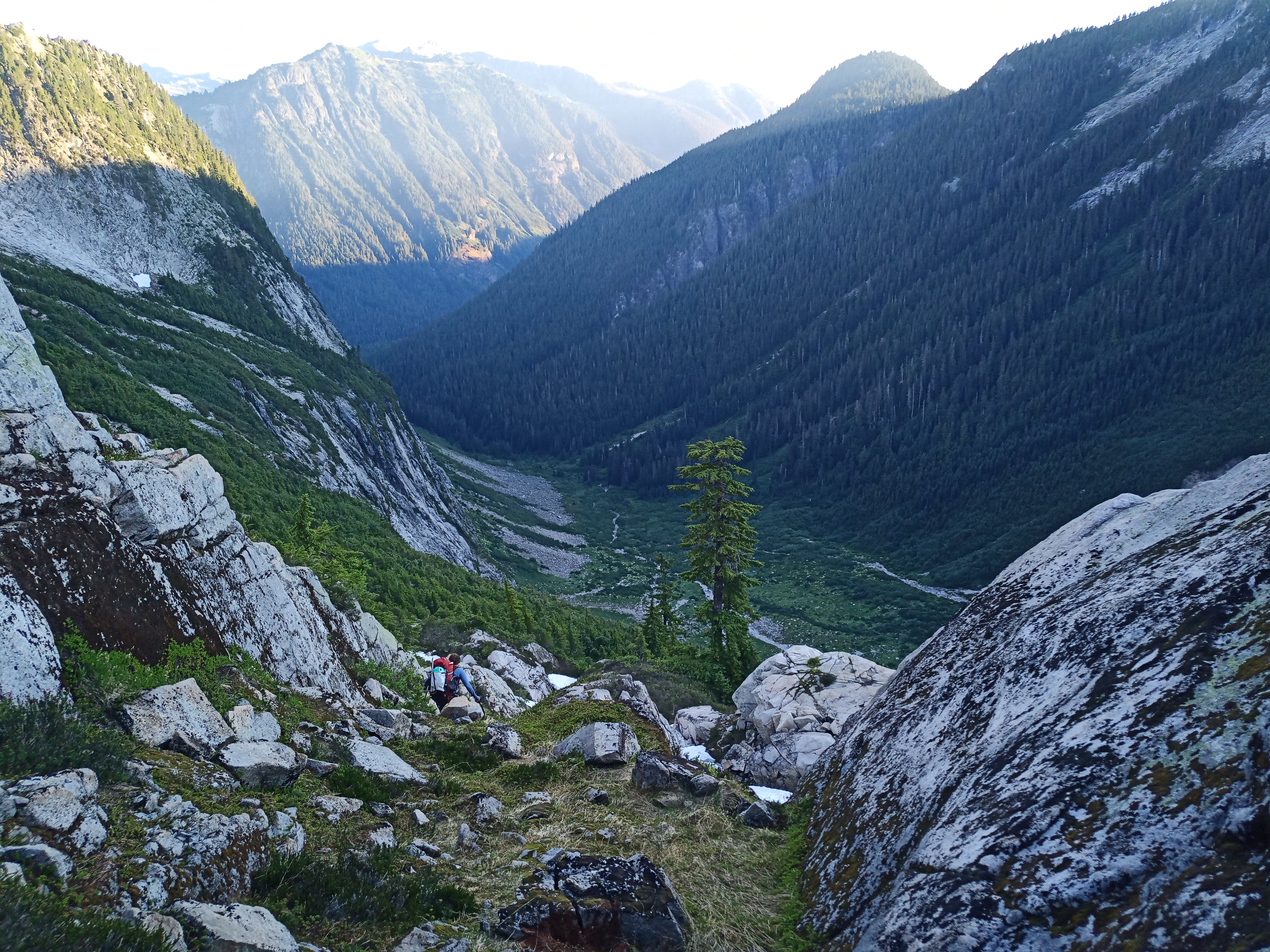
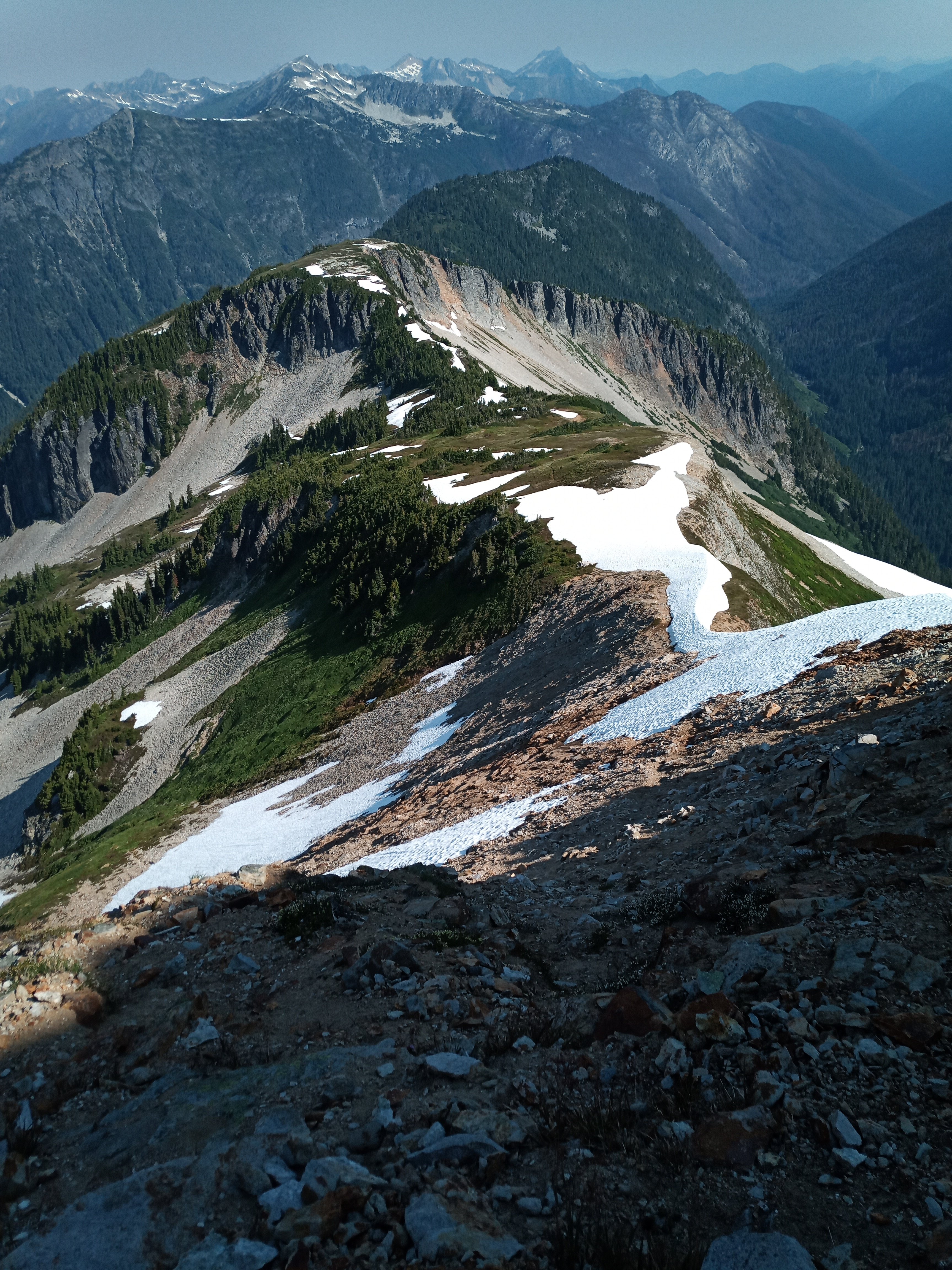
Trip: North Cascades - Mineral Mtn High Route- a trip into a Caldera Trip Date: 07/14/2024 Trip Report: K and I decided to try the Mineral Mtn High Route for our annual trip together, documented beautifully by Roland Tabor, and then by a few cascade climbers thereafter. Correct me if I'm wrong but we might be the first all female team to do this long schwack. We decided to complete the route counter clockwise, starting with a bivy on Ruth and ending with a bivy on Easy peak. At an alpine start of 12:30 pm, we started our hike to Ruth and casually crawled to the bivy sites, happy that a breeze alleviated us from the summer heat. We shared the bivy with a kind stranger and discussed the route ahead while watching the alpine glow light up the snow around us. By 7 am the next day, we were leisurely making our way down, curious to see what sort of bushwhacking was previously dubbed "blue collar" by Climber Kyle. It's a good name, don't get me wrong. I generally like hanging out with blue collar folks, so maybe this schwack would be a fun experience. In retrospect, we should have walked a lot faster and started a lot earlier. Finding our way to Chilliwack Pass was easy enough, but venturing up the flanks of Mineral was a stout challenge. Thrashing and pulling ourselves up steep, thickly forested slopes we would emerge into brief open patches covered in sticky sap to recollect ourselves. The leaves in the NW create the sap to prevent too much water loss, and it was on every leaf we touched. "What the hell...." either one of us would shout to each other, really just to keep tabs on where the other person was while completely emersed in huckleberry bushes and thick fir. The first gully was not difficult to cross, but the second had us stumped. Luckily, we had beta that the crossing was around 4700'. We climbed down past a dry waterfall and found passage at 4700', thankful for this information. The rest of the route was manageable but long. At some points, we had to choose between a consequential schwack or a quick class 4 scramble. Some moments were just pulling on anything you could see to aid up the climb. To gain the ridge by Mineral, we climbed a steep fin instead of a gully. Navigation eased once on the ridges of Mineral where the lush subalpine danced in a light breeze. We were happy to see plenty of water all along the route. The shoulder is a series of subalpine benches, a simple task to master after the morning's schwack. By 530 pm, we were 300' from the stunning summit of Mineral and decided to camp at the summit instead of pursue Easy Peak that night. So we spent the rest of the evening with our toes basking in the sunset light, watching Shuksan yawn... At 3 am, I sat and watched the sun rise. By 5 am, we were heading down from the summit towards the next saddle. The flanks were still snow covered although massive glide cracks and holes were forming. The snow was steep and suncupped, but we found passage on skier's right and hurried our way towards Easy. Easy peak and ridge earns its name, having long stretches of subalpine scenery and moderate slopes to climb. We walked down Easy on the unmaintained trail and waded across the Chilliwack with our boots on. The hike out felt long, hot, and slow but that felt appropriate given that this was a tour of a long extinct caldera. A wonderful trip! The Mineral route as seen from Ruth and Ruth snow coverage This was when I could take my phone out to take a quick picture of K in some shrubs Mineral Mountain micro terrain and gully systems First view of Mineral from the ridge and K ascending Minerals shoulder. A taste of morning light on Mineral. Looking towards Whatcom Peak and Challenger through incoming haze , Easy ridge in the forefront. Easy-Mineral Pass Easy ridge towards the Lookout. Thanks for reading and have a wonderful day! Gear Notes: Ice axe, chocolate Approach Notes: Plenty of bivy sites with sweeping views. Expect to find fir needles in pockets days later.
 1 point
 -
Trip: The Chief, Squamish. - Uncle Ben's (V 5.8 A2+) Date: 7/20/2008 Trip Report: Big walls marked the start and finish of a month and a half long climbing road trip with my friend Darin this summer. After starting in the Valley in June, we worked our way north and ended with a week in Squamish. We had looked forward to being back in an area where there was a “scene,” but were dismayed to find the chaos of the Mountain Festival in full swing. We spent an afternoon bouldering in the forest and got to have a session with Cedar Wright on Easy Chair. We decided to head for the high lonesome to avoid the crowds. We bived out at the Spit on Saturday night (the good, hidden pull off on the right side is now closed BTW), and began gearing up for Uncle Ben’s, something that I had had my sites on for quite a while. After running around town to pick up some requisite items, we bumped two loads of junk up to the top of Flake Ledge and fixed the first two pitches of Merci Me (heading left mid way up the second pitch, not towards the Grand), sans chalk and in street shoes. We bived on top the Flake that night (not that comfortable. Oh, and thanks to whoever shit right in the middle of the ledge like a wild animal). We met a couple of Quebec dudes who were rappelling down fixed lines from the third pitch. They said that they had attempted to do the wall in a day, but that was not going to happen. We shared a beer with them and swapped some funny stories. The fixed lines where not theirs, however. The owners of these lines returned the next morning and toped out that afternoon. From the top of Merci Me I aided a 10c pitch (I only had street shoes) that heads straight left. You get to sit on the tree for the belay. This is where we did our first haul from, bringing the bags up from Flake Ledge. The pig on Flake Ledge waiting to be dragged up the slab. Darin took the next pitch, a beautiful right ward slanting crack that ends with some airy moves out over a roof (we skipped the anchors under the roof). Above the roof there are three bolts, then some hooking/free climbing to the anchors. The rock blew on Darins first hook move and he whipped past the bolts and under the roof, in the full blast of two other parties awe. After the roof, I lead an invigorating pitch with lots of tiny hook moves in a row. This took us to our first bivy, just below the "classic bivy" that is written in the guide (didn't look to classic to me when we passed it the next day). We patched up some gear that got shredded on the slab haul and put on all our layers, as it was chilly. The next day we climbed to two pitches from the top. Chunky soup sponsorship? We watched a speeding motorcycle get pulled over the second night. We heckled the whole scene loudly. We woke to threatening weather both mornings, but our trusty radio, El Pepe put our fears to rest. It was pleasant climbing weather. A young Warren Harding? The final day we broke the first traversing pitch in half so that we could leave our gear at the rappel station in the middle. The last pitch was a grunt. Something larger that the #4's we had would have helped here. We enjoyed some lunch on the Dance Platform before our raps The raps took us 1.5 hours from top to bottom. We did 6 double rope raps in total. The third was a bit sketch and you might want to break it in two. I found my self 50m out on the rope with a huge load under me, my feet barely able to touch the wall, and my next rap anchors 30 feet to my right. It took a bit of timing with the wind and momentum to final stick them. Sketch. Gear Notes: Bring hooks. Double sky hooks and maybe double talons. There are a number of areas where you are 4-5 hook moves out. I found myself wishing I could use the hook I was currently sitting on for the next move. The black sickle has lots of fresh copper heads that should last for a number of years, but a couple of beaks, knife blades, and lost arrows should get you past any missing fixed gear. We only had to place one pin on the white sickle pitch where it looks like a knife blade used to be. Sorry, rock. Bigger gear than #4 for the last pitch; number 5 of 6. All the bolts are solid and most of the stations have chains. Approach Notes: Can all big walls have such a short approach? We hiked to the top of Flake Ledge and began with the firs two pitches of Merci Me.1 point
-
Trip: Lemah Mountain - Date: 8/24/2007 Trip Report: I climbed Lemah Mountain in 11 hours, 26 minutes roundtrip (5:52 up, 29 minute rest on summit, 5:05 down. I made a few routefinding errors that cost me a little bit of time, but regardless, this mountain is long and physically taxing. The trip was about 32 miles roundtrip, 22 miles on trail and 10 miles of rugged cross country travel. Location (Elevation): Time Elapsed / Split / Real Time Pete Lake TH (2,800 ft) : 0 / 0 / 07:16 Pete Lake (2,980 ft) : 38.31.11 / 38.31.11 / 07:55 PCT Junction [Lemah Mdws Trail] (3,200 ft) : 1:00.05 / 21.34.52 / 08:17 Spectacle Lake (4,239 ft) : 2:00.46 / 1:00.40 / 09:17 Arrive Lemah Summit (7,540 ft) : 5:52.27 / 3:51.41 / 13:09 Depart Lemah Summit (7,540 ft) : 6:21.31 / 29.04.78 / 13:48 [spectacle Lake (4,239 ft) : 9:28 elapsed / 3:07 split from summit / 16:55 real time] Pete Lake (2,980 ft) : 10:37.40 / 4:16.08 / 17:54 Pete Lake TH (2,800 ft) : 11:26.29 / 48.48.34 / 18:42 Lemah Mountain, together with Chimney Rock and Summit Chief Mountain, comprise the "Snoqualmie Pickets." While these mountains are located relatively close to the metropolis and a popular section of the PCT, they are rugged and provide a real wilderness feeling. The climb of Lemah Mountain is even true to Picket fashion with routefinding issues, brush, and slow boulder fields. Aside from a cairn on the summit and a couple along the approach, I saw no evidence of human travel - no paths, camp spots, bootprints, or snow tracks. It’s becoming tough to find such solitude and untrampled terrain in the Cascades, even in the real Pickets... The 22 miles of trail to get to and from Spectacle Lake from the Pete Lake Trailhead are the easy part. I made a minor mistake and took the Lemah Meadows Trail to the PCT which added about 1 mile of running and also took the longer (standard) route to Spectacle Lake. By the time I made it to the lake I had covered 11+ miles. You can see the five fingers of Lemah Mountain in this photo (just right of center). The middle finger is the main summit. The shores of Spectacle Lake are rugged and rocky and one must first ascend to a shoulder in order get around the north side of the lake. From here, I traversed through talus and brush below cliff bands. It is difficult to see where to ascend to the ridge to cross over to the Lemah Creek drainage and I spent some time here as well figuring it out. Finally atop the ridge, the hard part is over, but Lemah Mountain still seems far away and there is much walking through heather meadows, talus fields, an old moraine, and granite slabs. Finally below the mountain! At the glacial remnant, I put on crampons, which were helpful on the snow slopes which became steeper near the top. A class 3 scramble and then another snow field brought me to the ridge leading to Lemah's main summit. A short scramble later and I was on the summit. I spent nearly 30 minutes resting and enjoying the great views, especially to Chimney Rock and Overcoat Peak. Chimney Rock, Overcoat Peak, and Glacier Peak in the distance. Nothing in between Lemah and Rainier. Middle Fork Snoqualmie, Mount Thompson, and peaks near Snoqualmie Pass. Spectacle Lake, a LONG ways away! Summit shot. Lemah #2 (left) and the Main Summit (right) Glacial tarn. Chimney Rock massif. Four of the Lemah Fingers. Close-up of Lemah #2 and the Main Summit. While I didn't make any errors on the return trip, it still took 5:05 hours from the summit to the car! Gear Notes: Axe, crampons. The La Sportiva Exum Ridge trail shoes handled the terrain great! Approach Notes: Around 32 miles roundtrip - 22 miles of trail and ~10 miles of rugged cross country travel. Trails are in good shape, no path after Spectacle Lake.1 point
