
Leaderboard


Popular Content
Showing content with the highest reputation on 07/09/24 in all areas
-
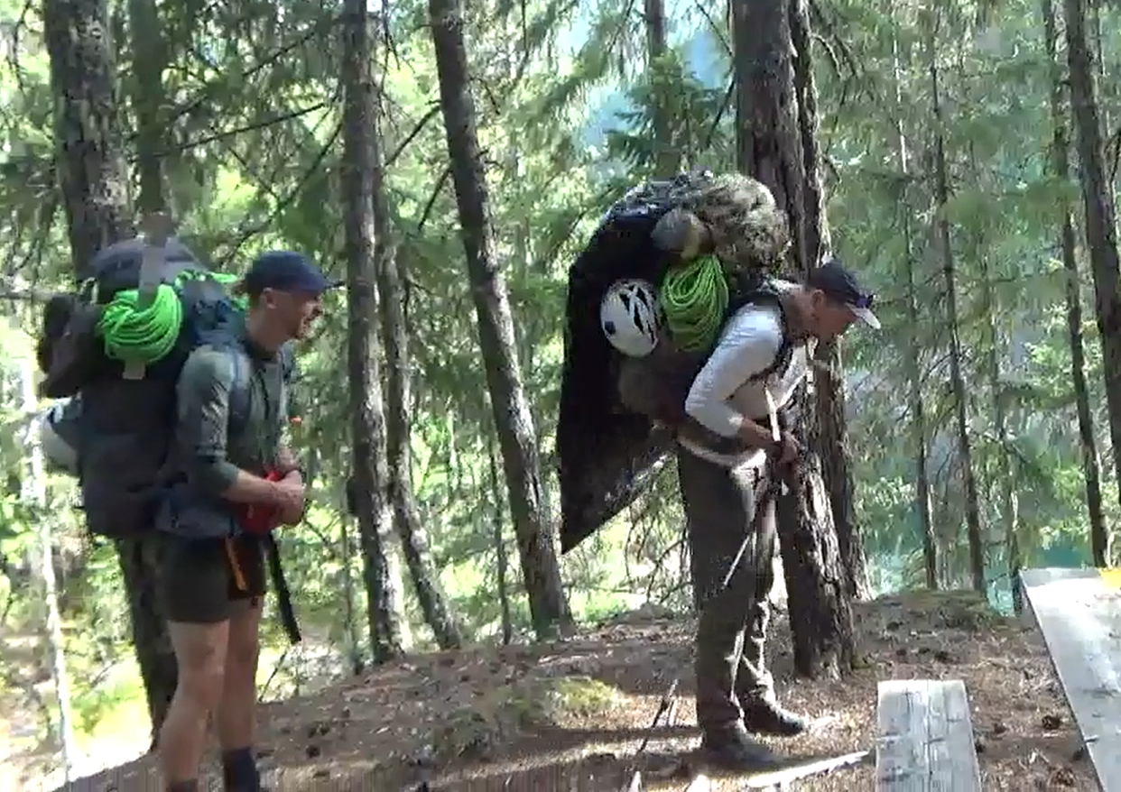
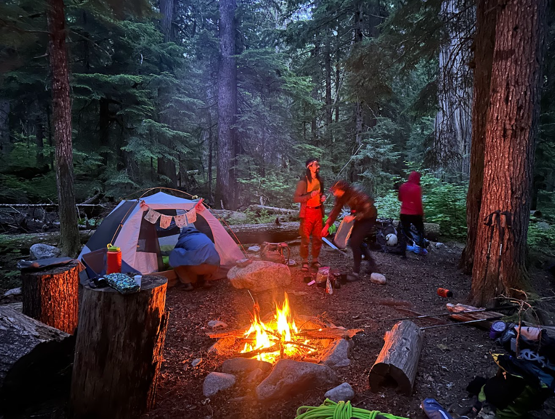
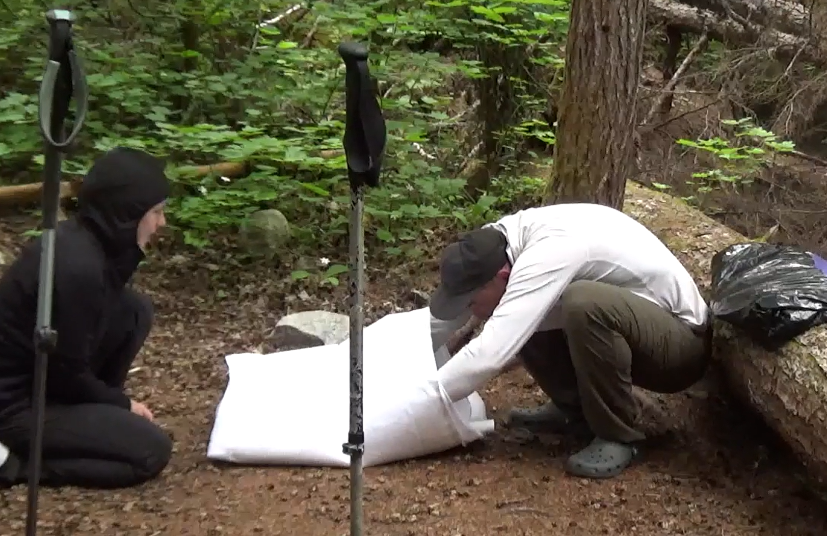
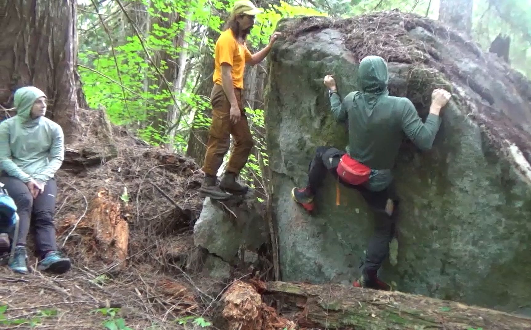
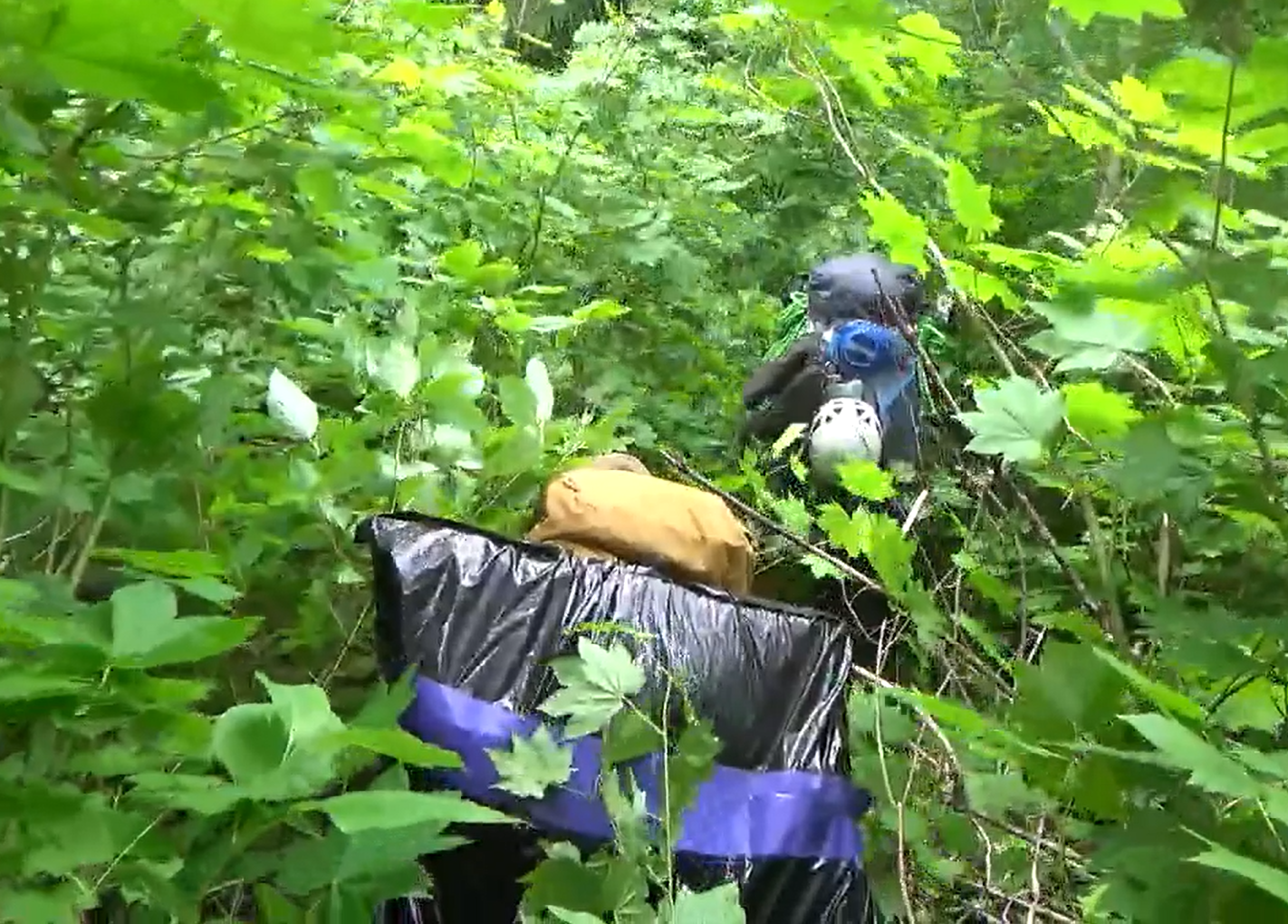
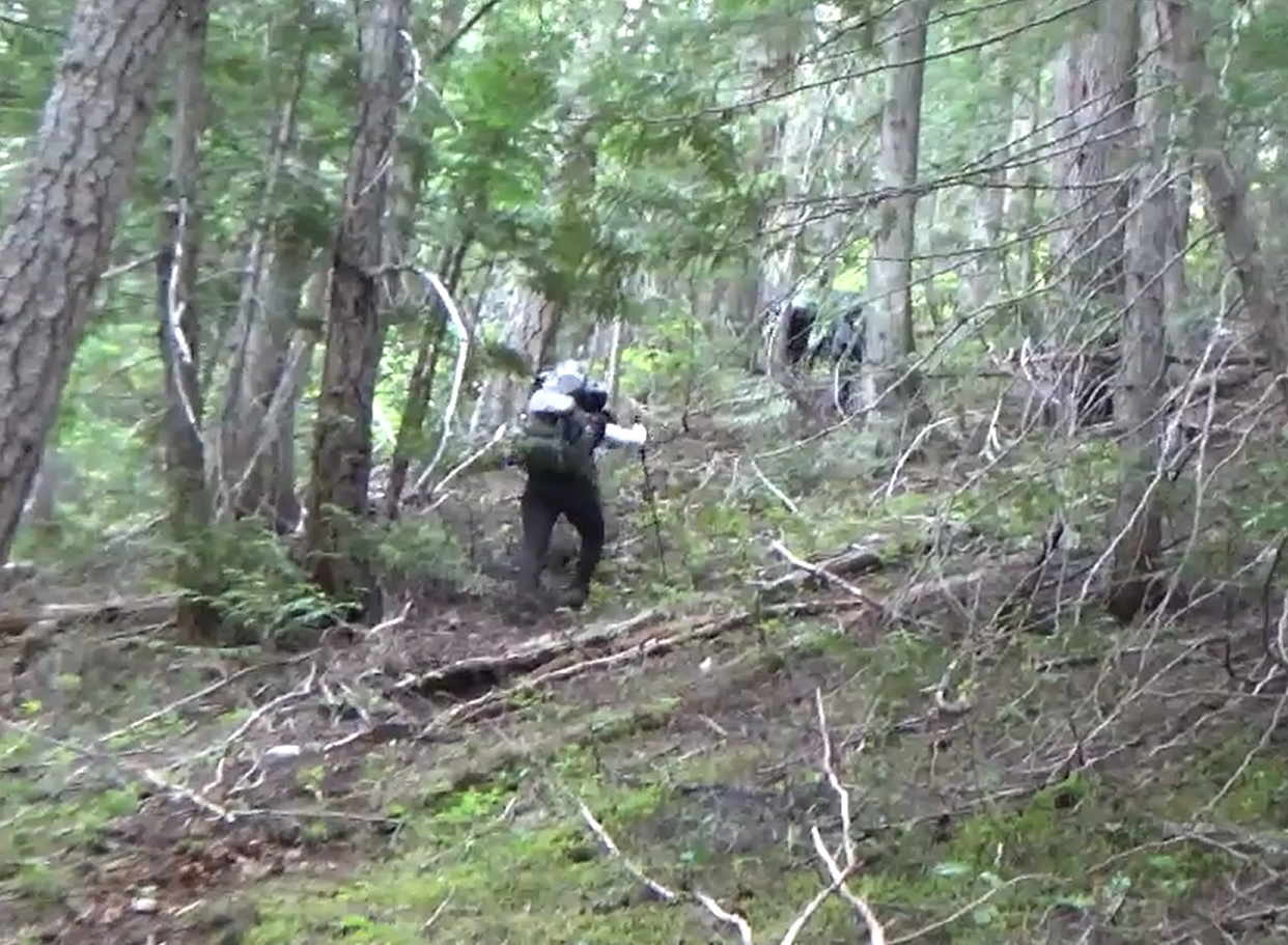
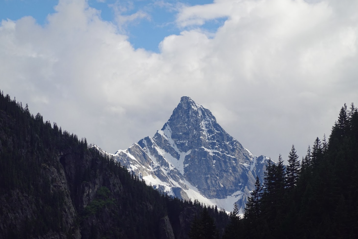
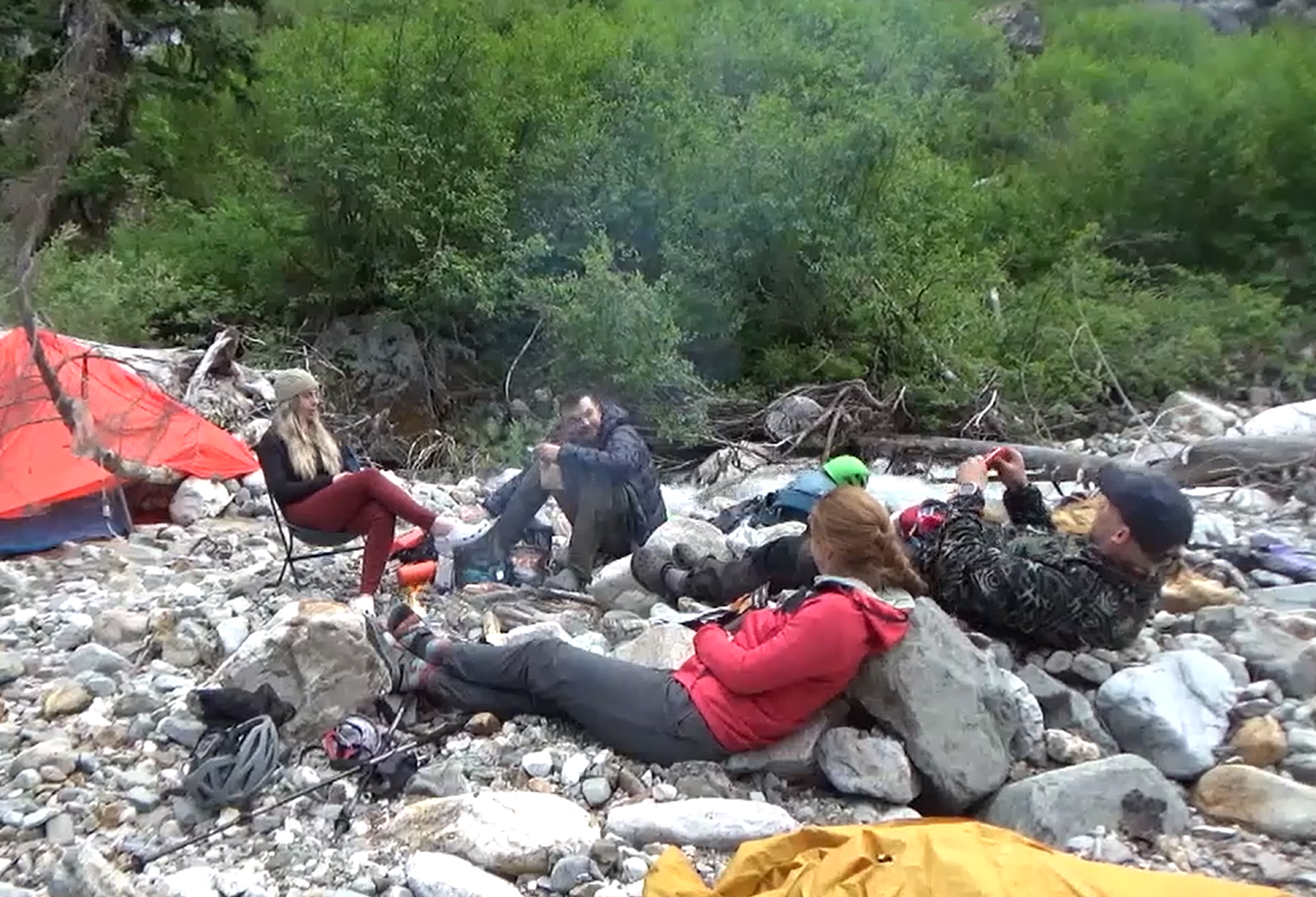
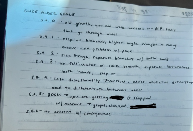
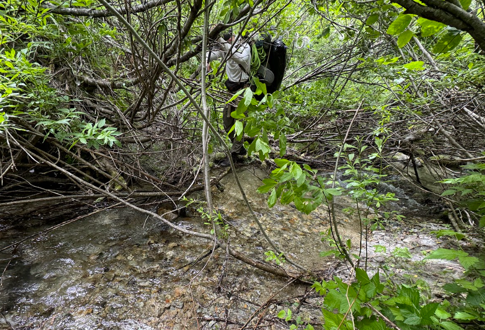
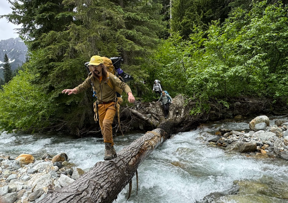
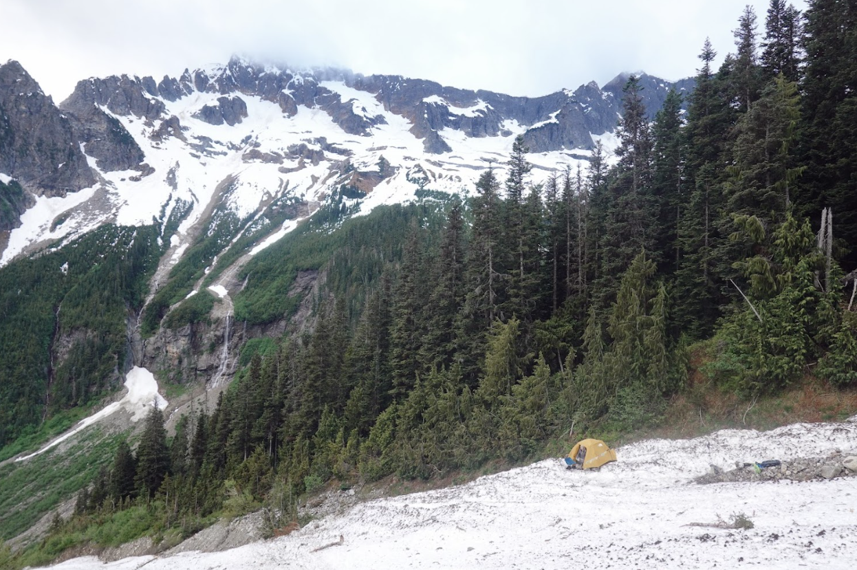
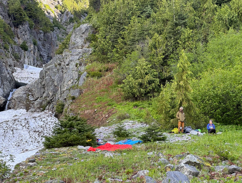
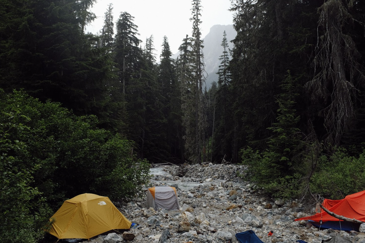
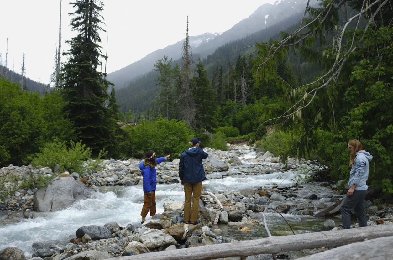
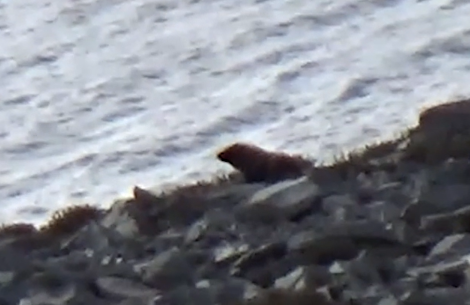
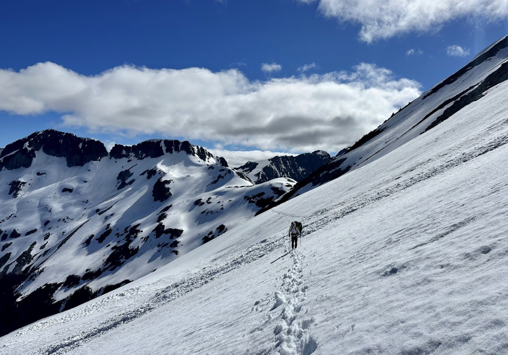
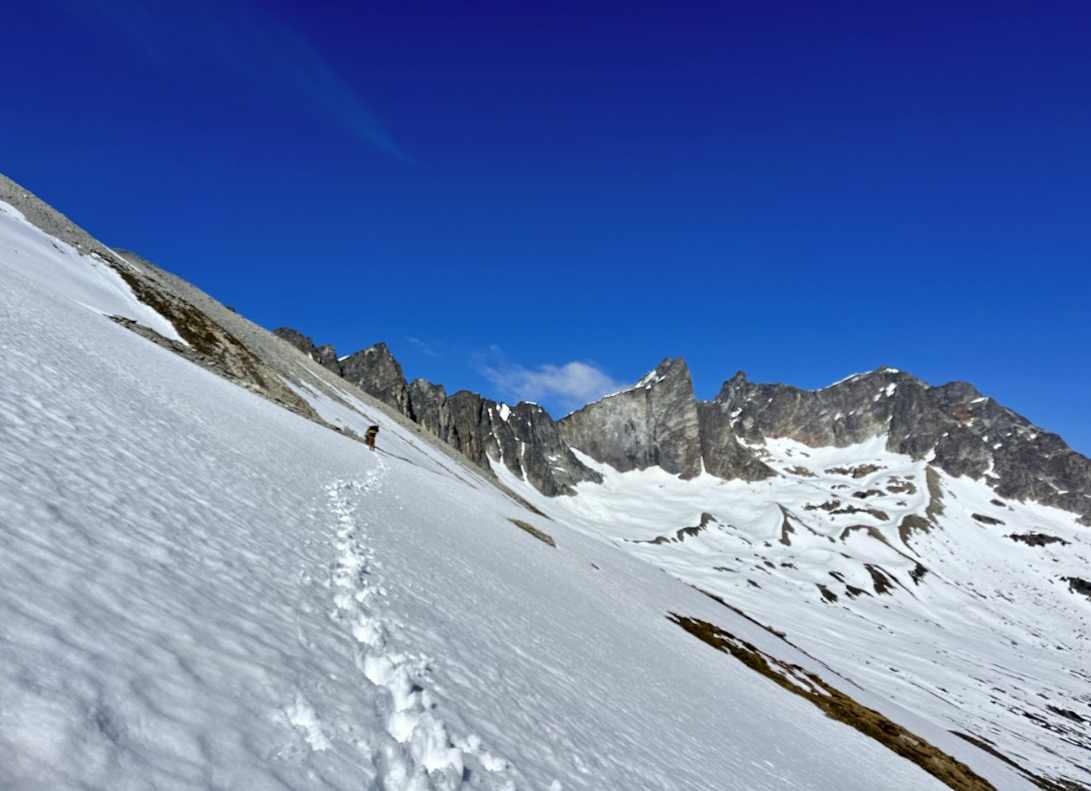
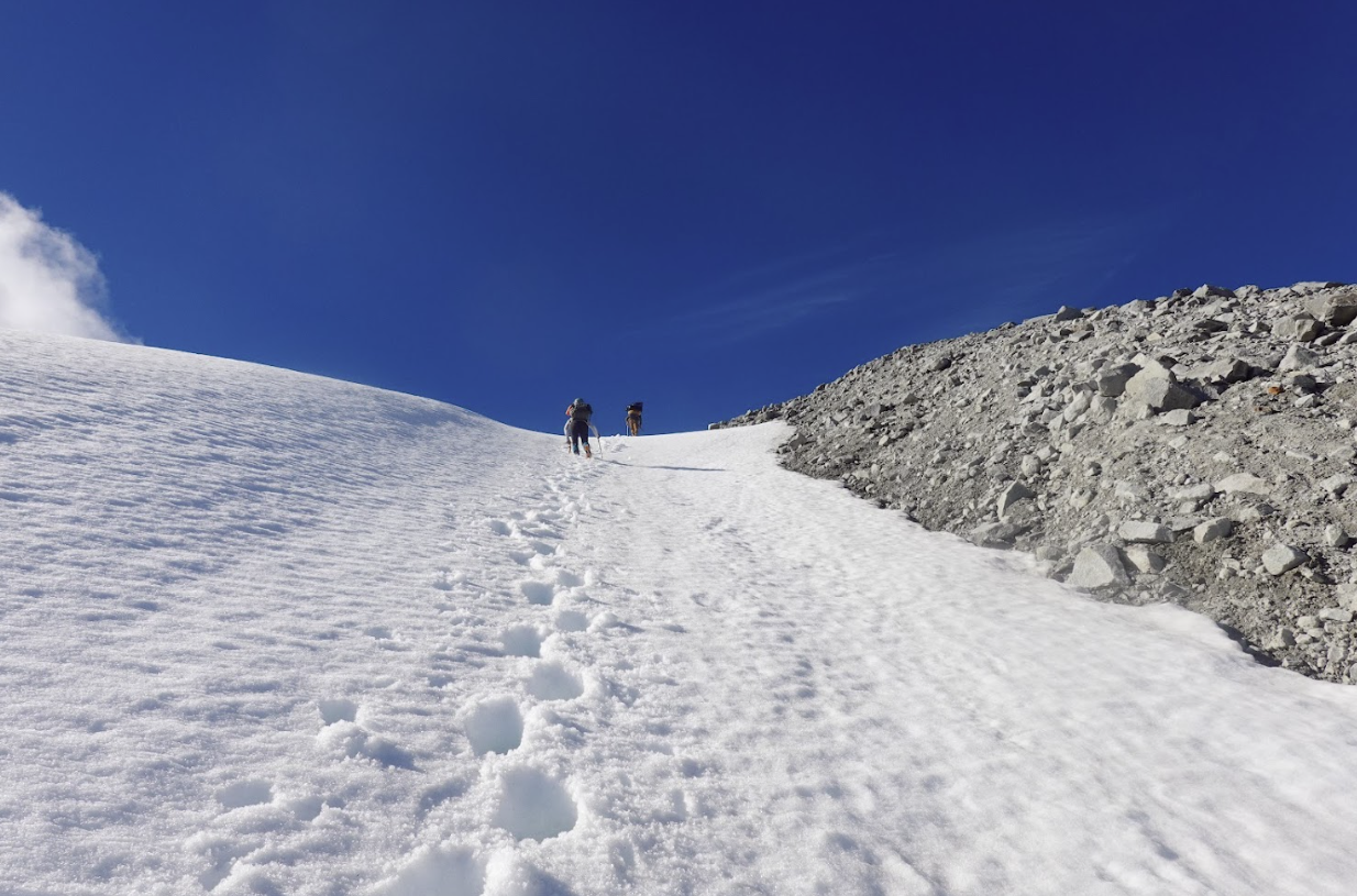
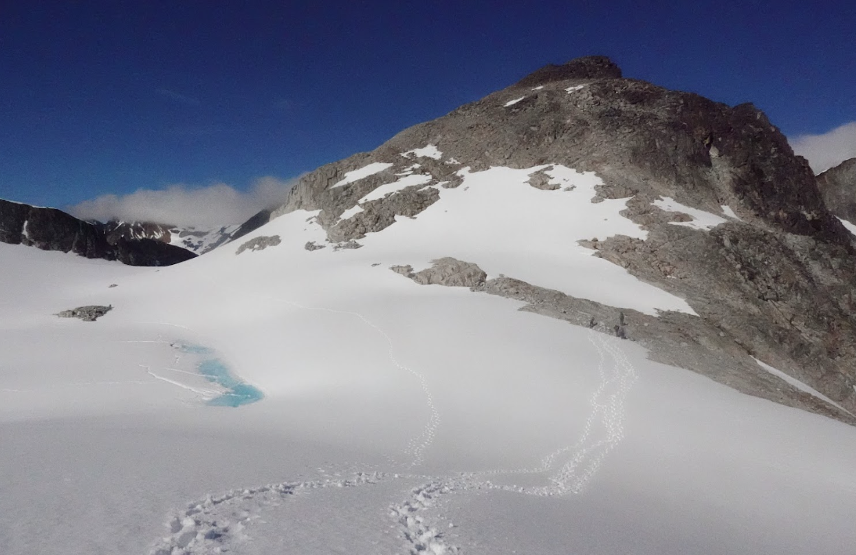
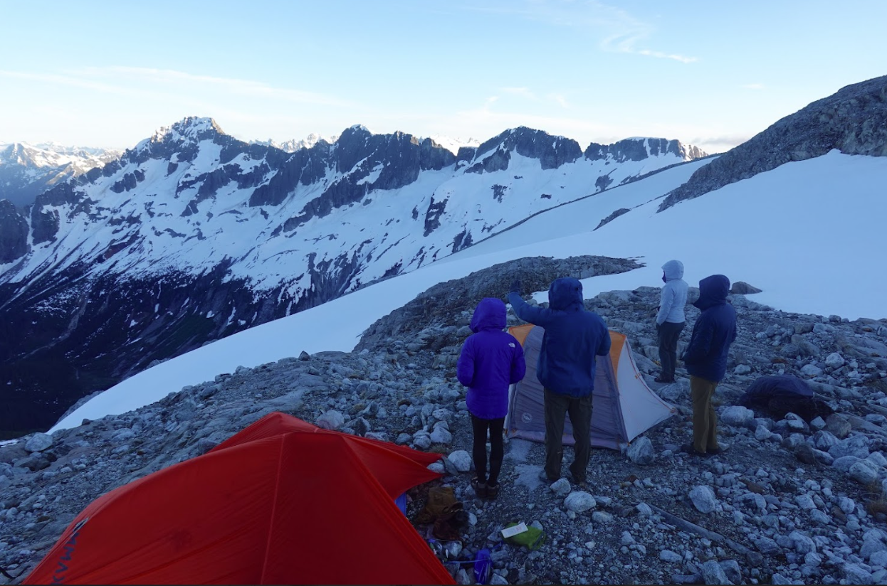
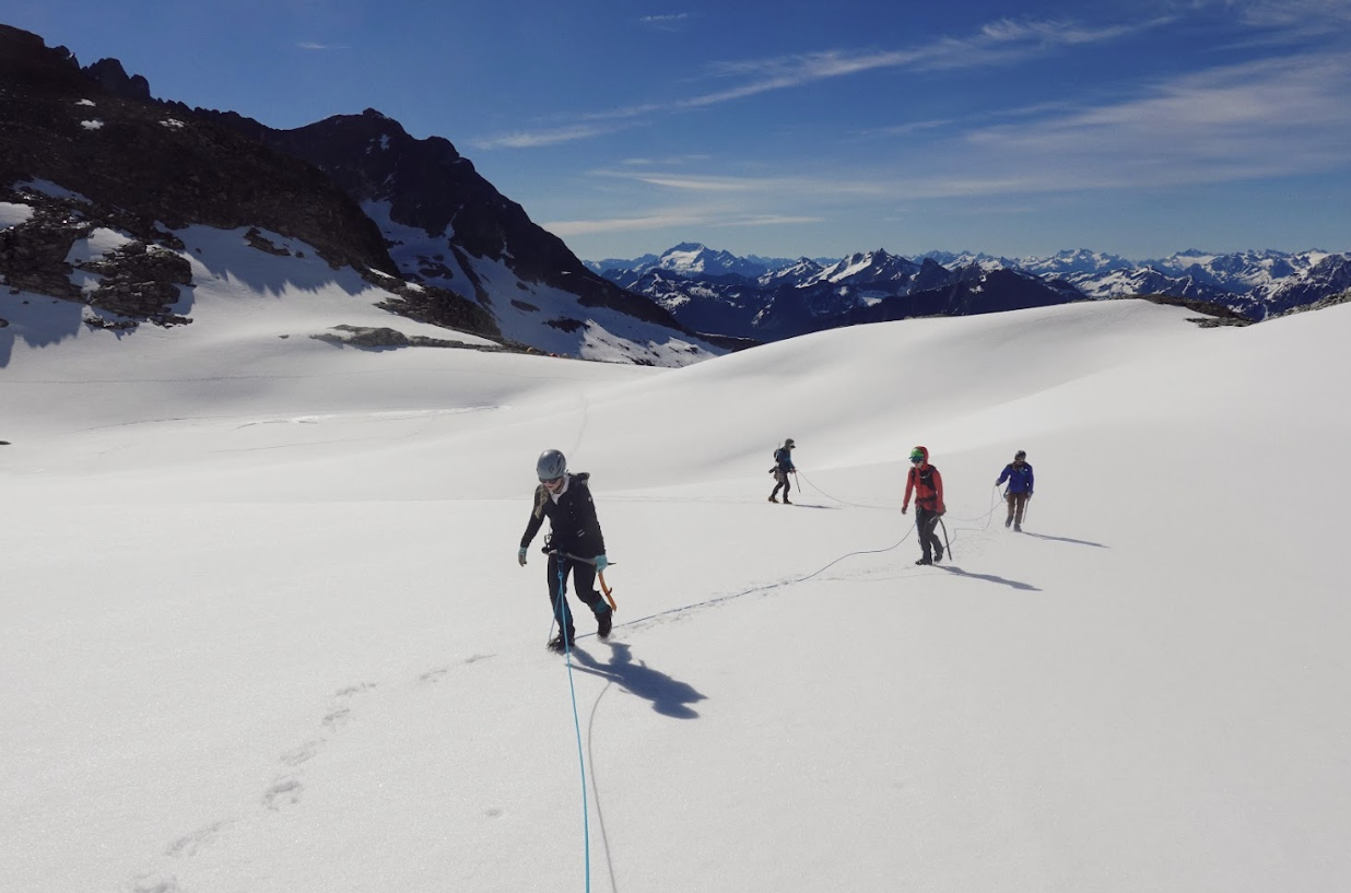
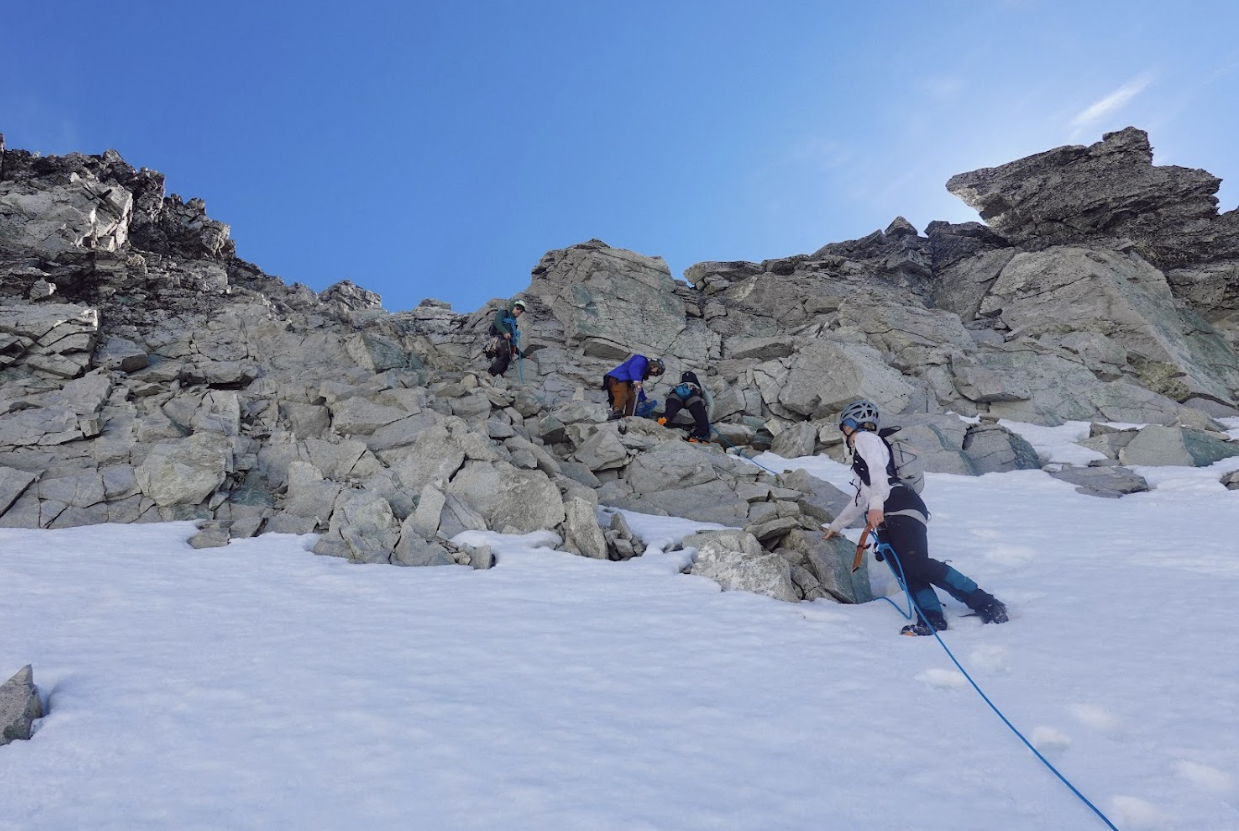
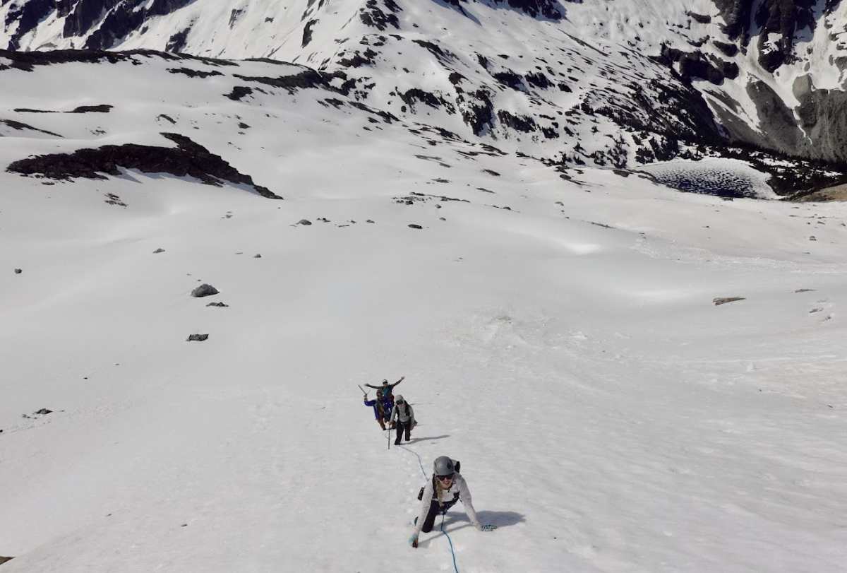
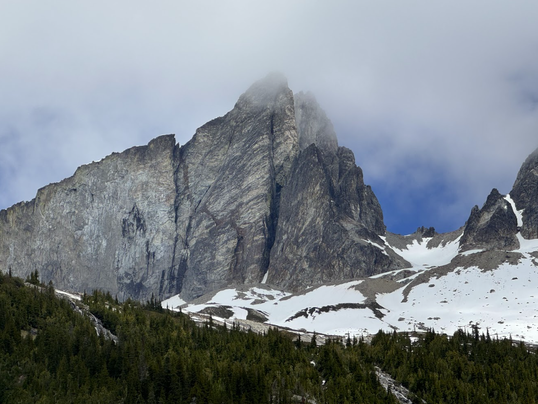
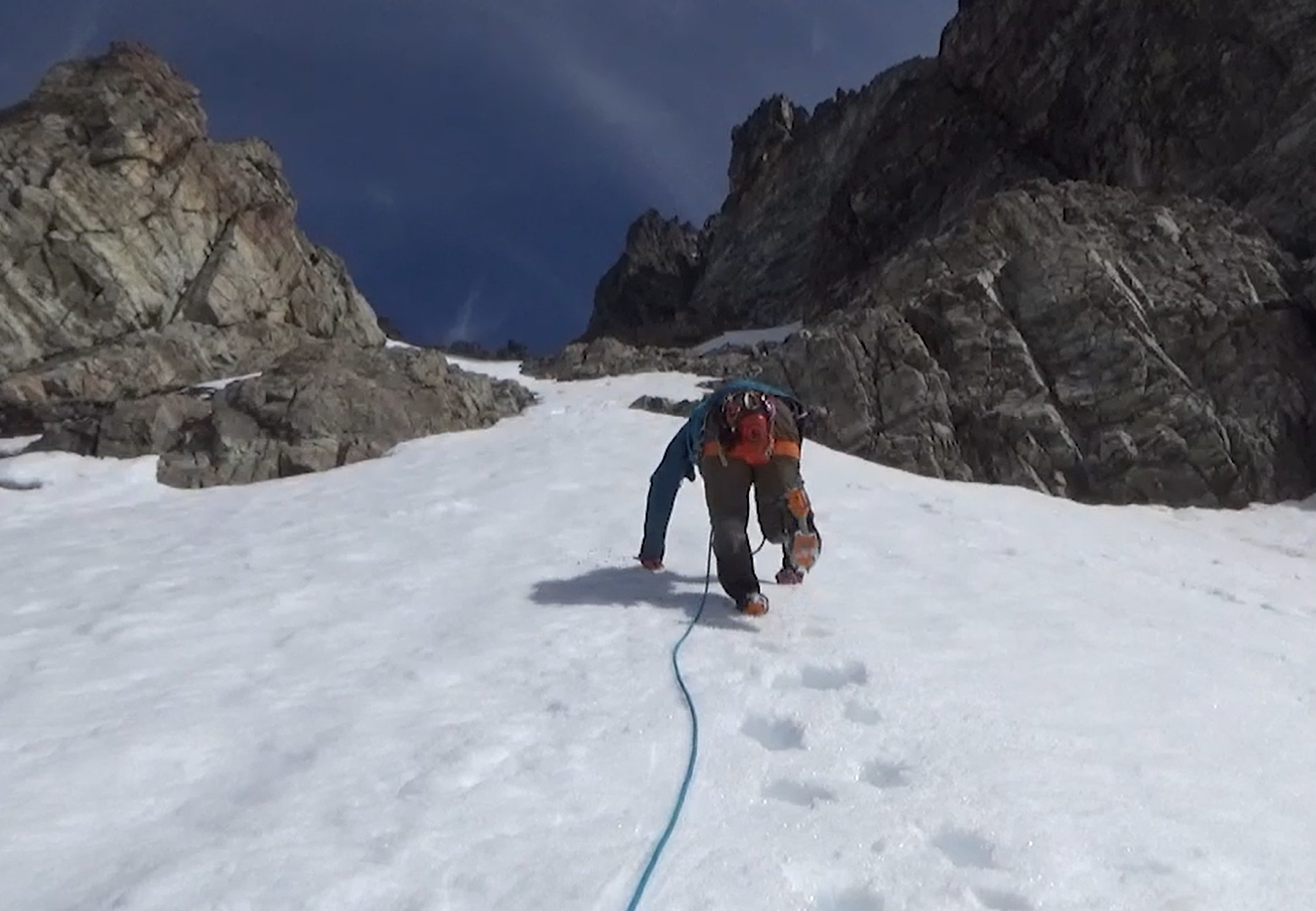
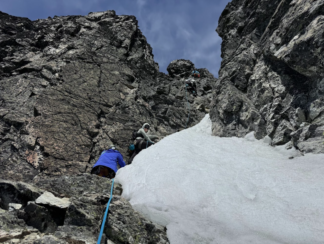
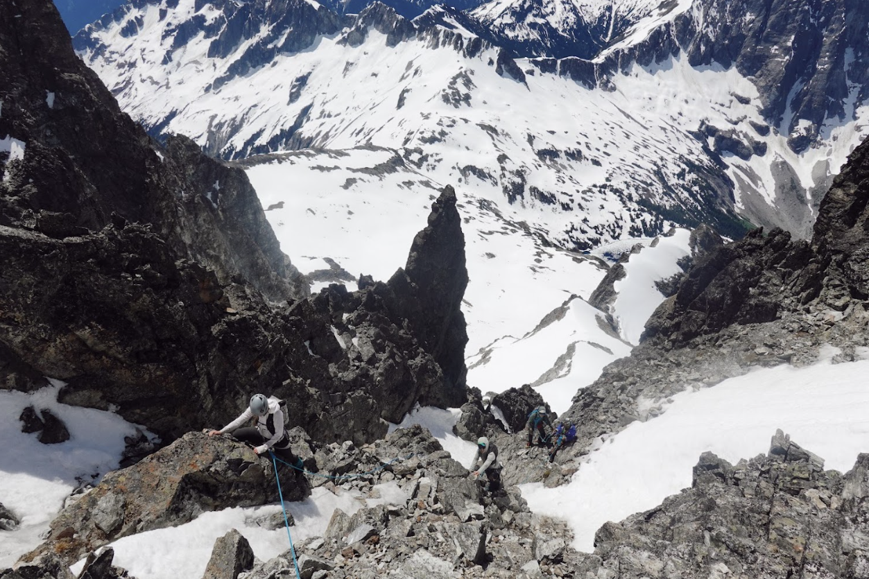
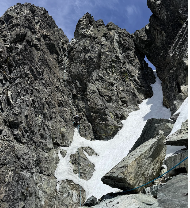
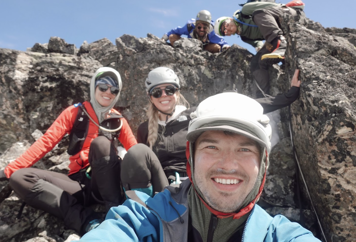
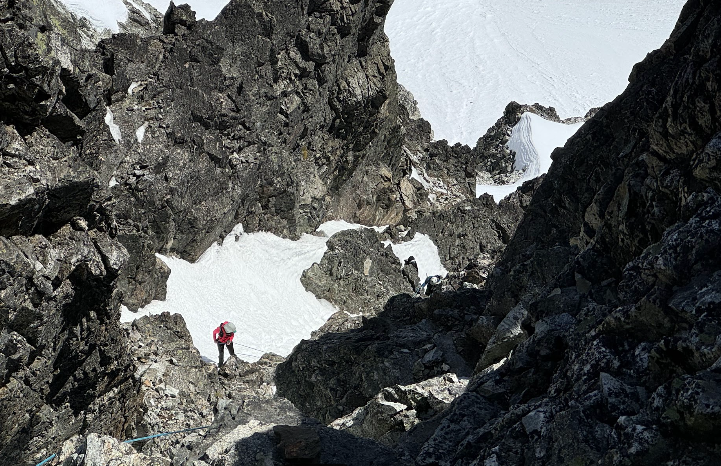
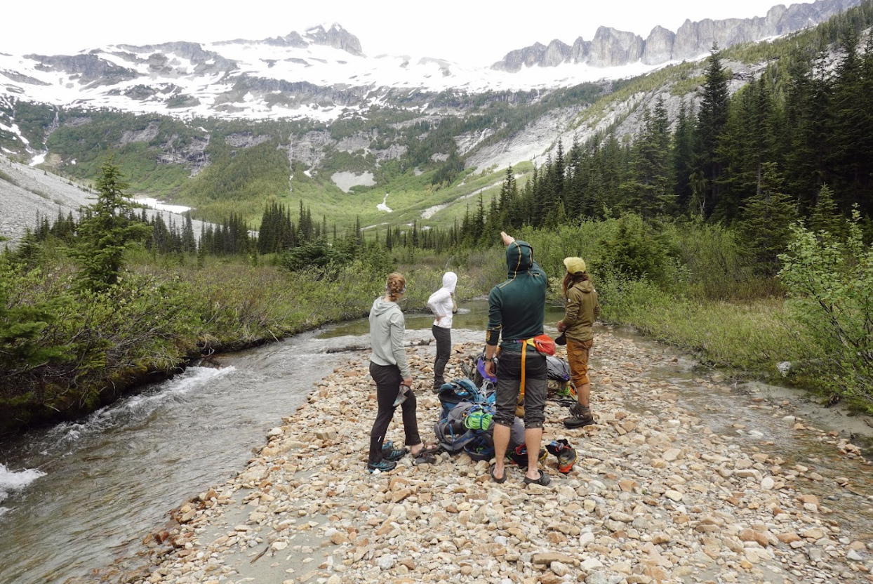
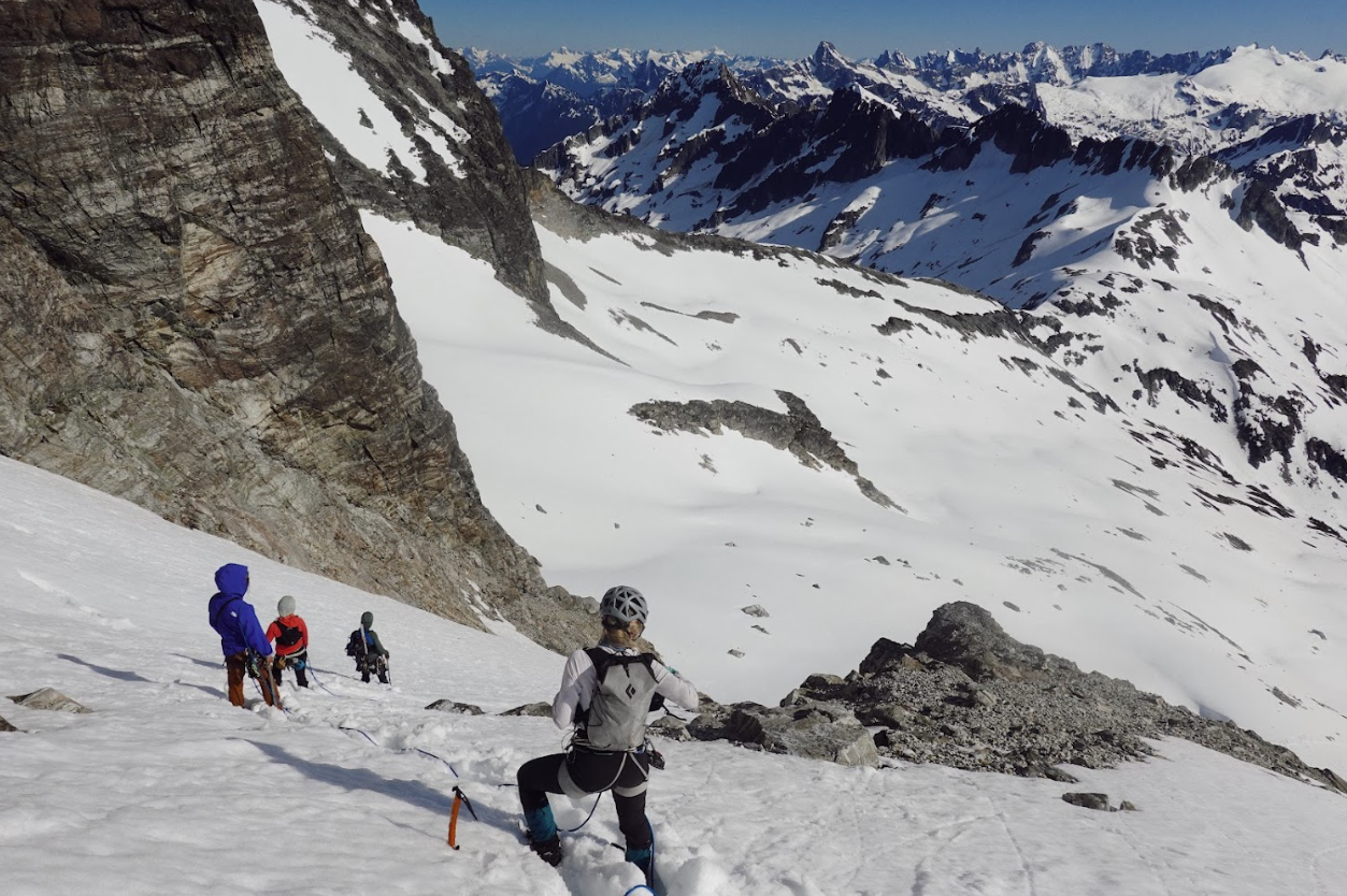
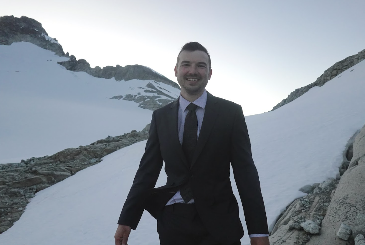
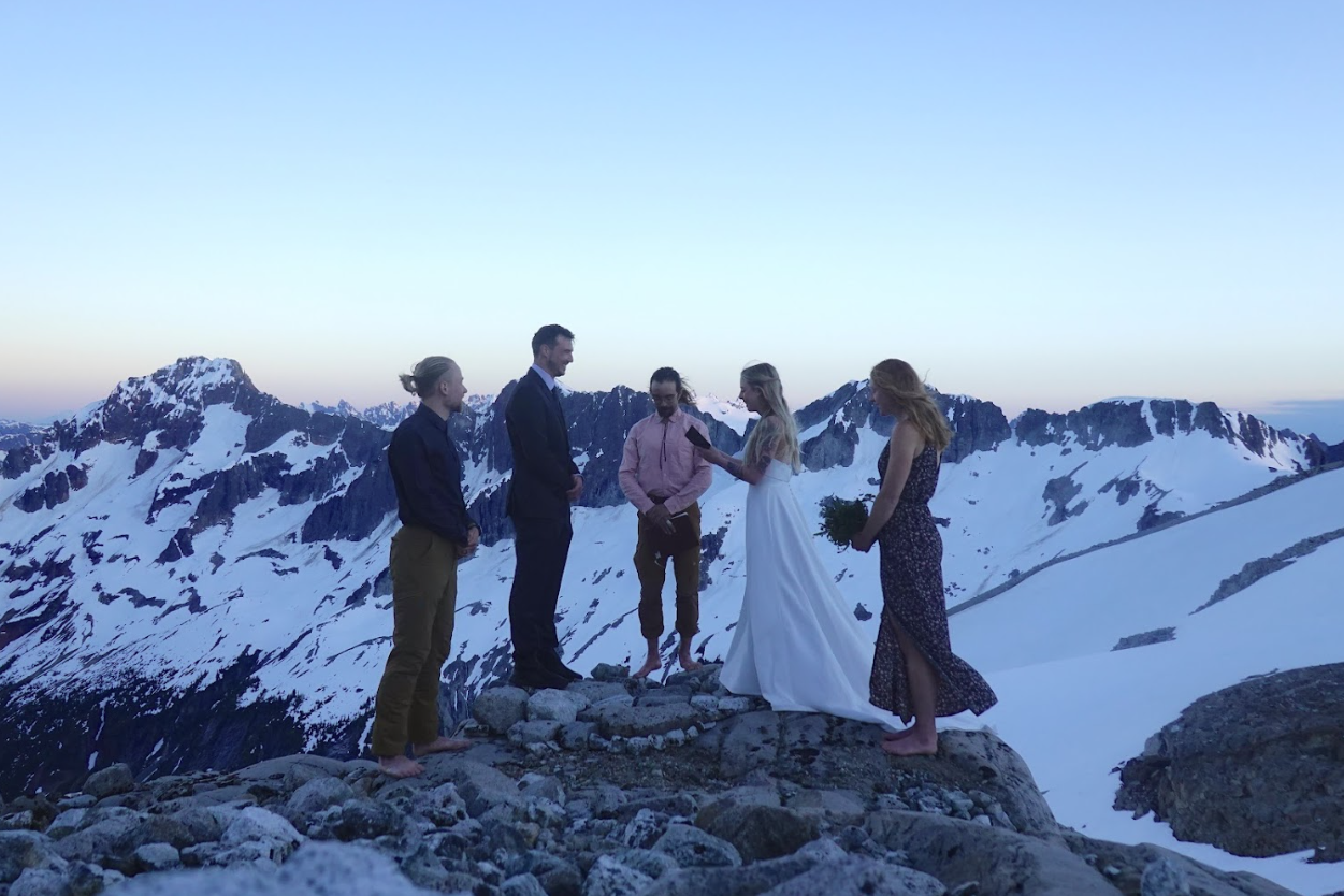
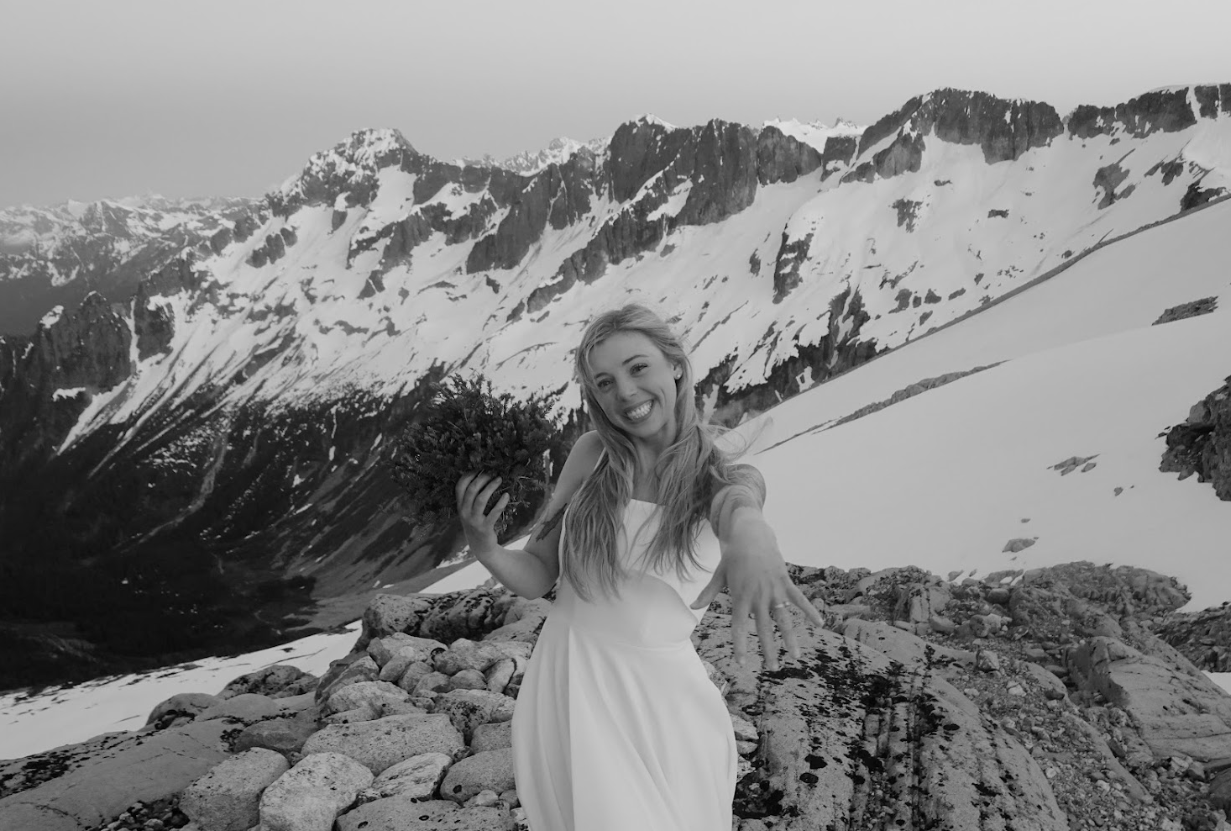
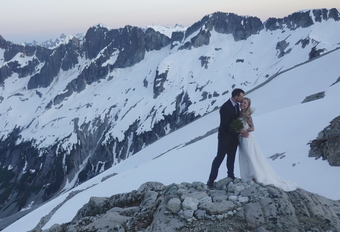
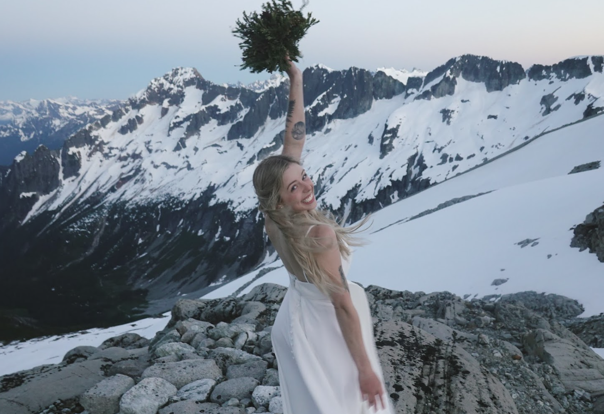
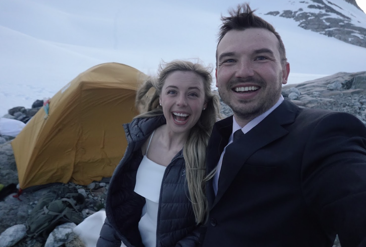
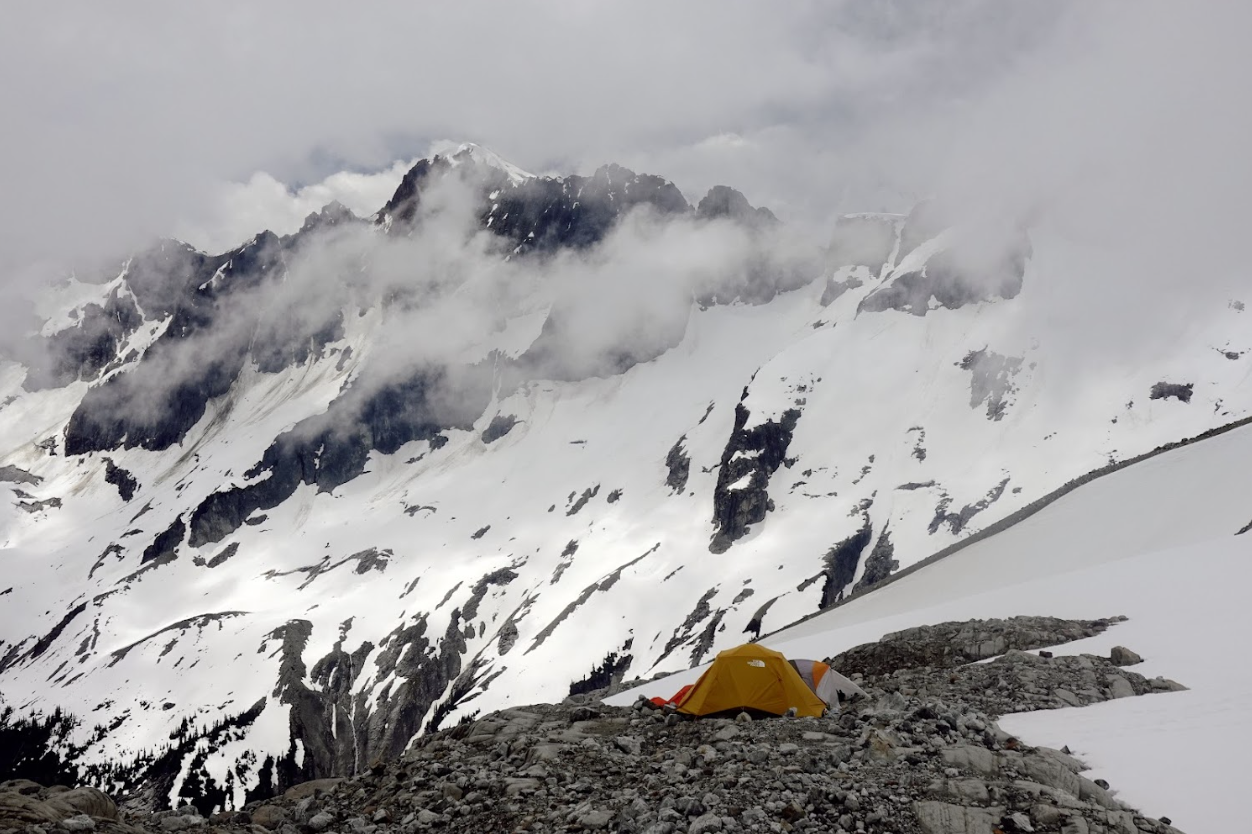
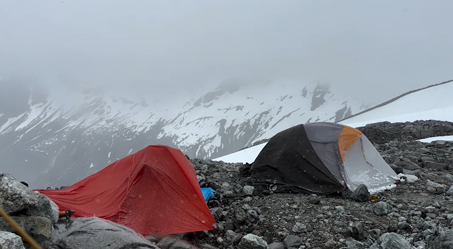
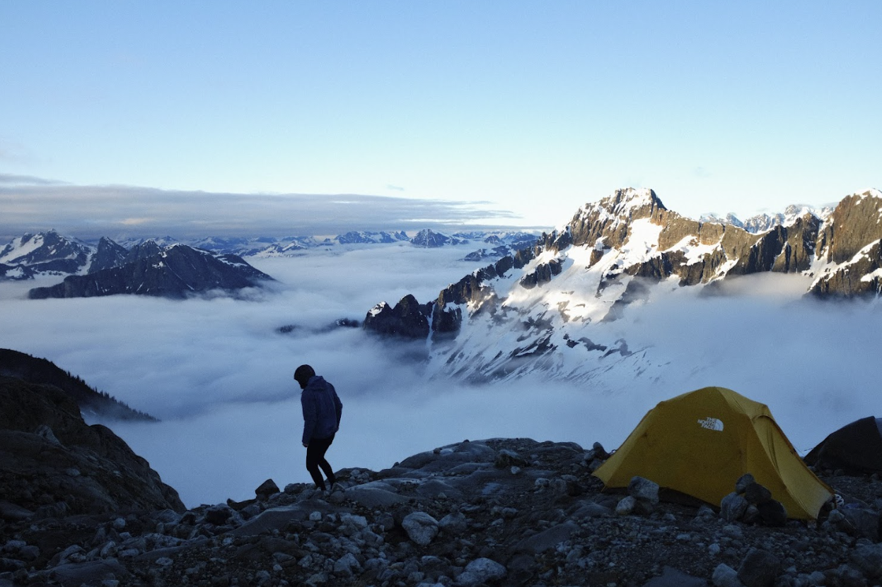
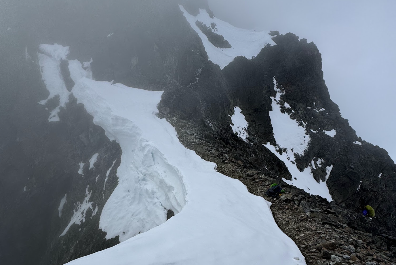
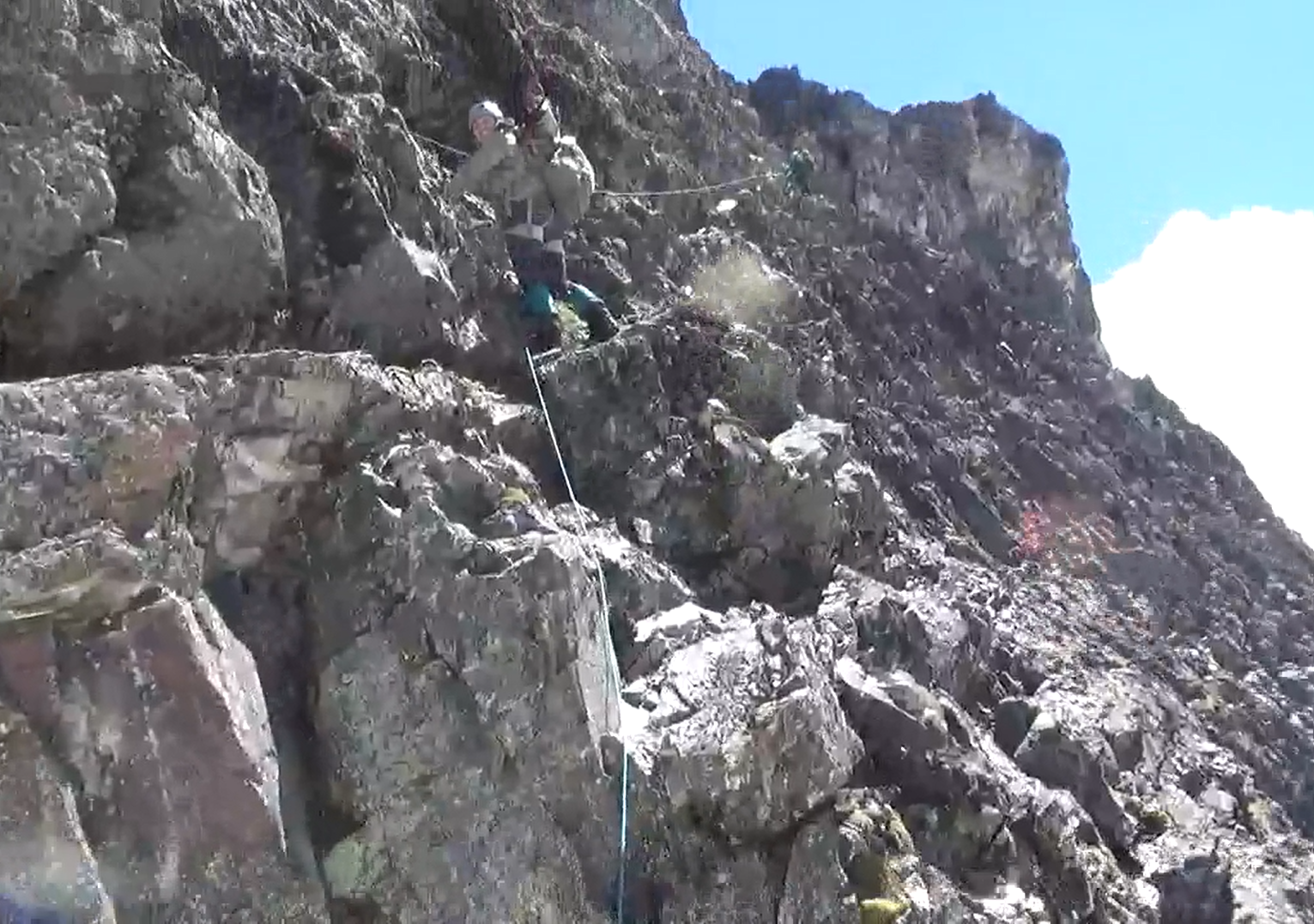
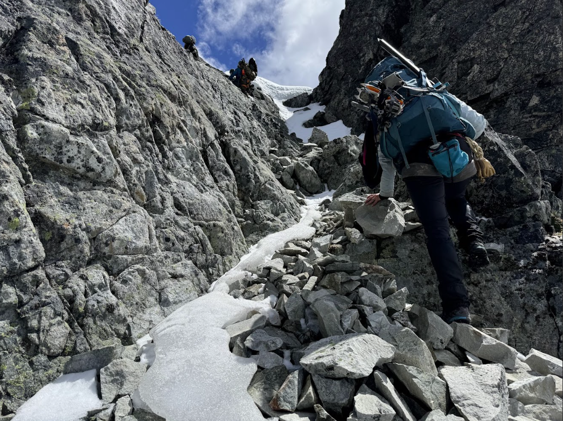
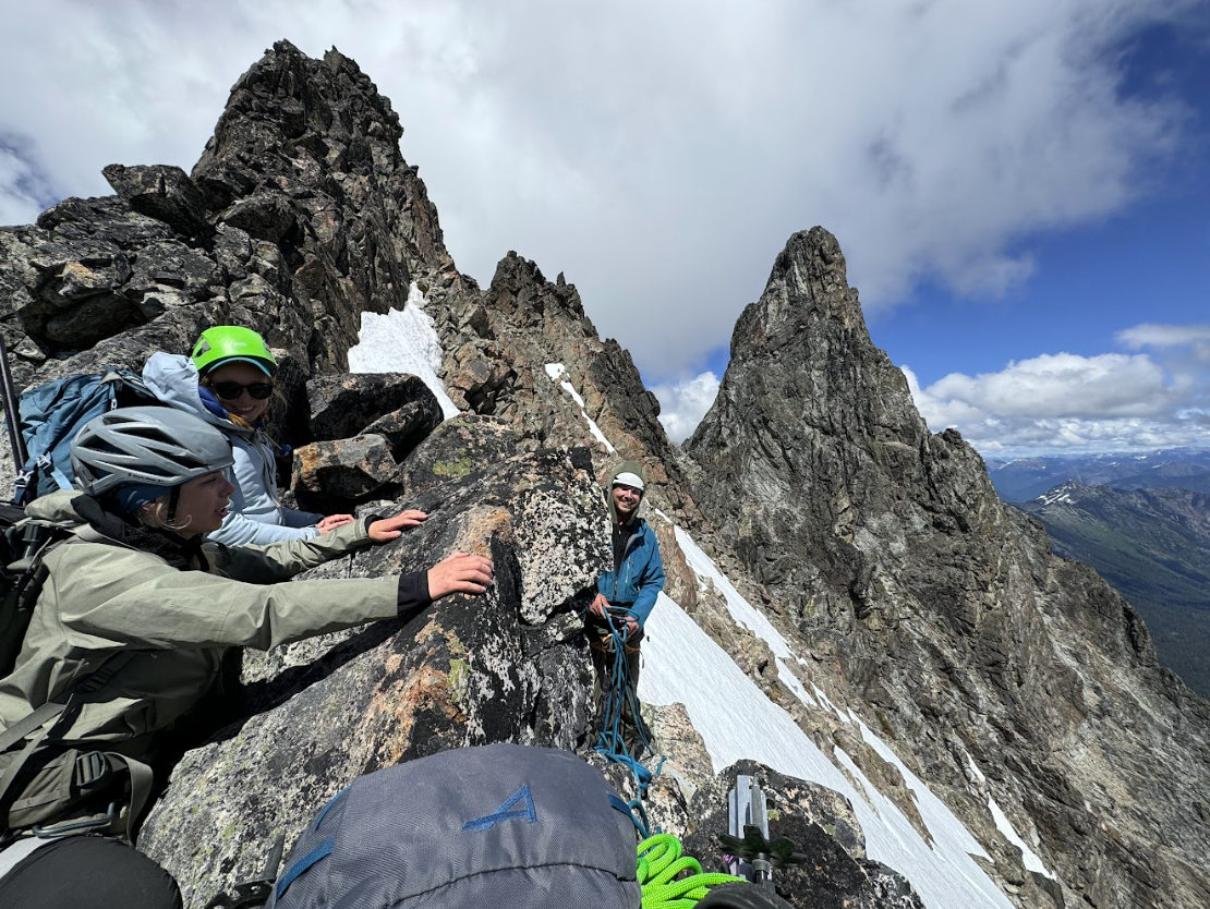
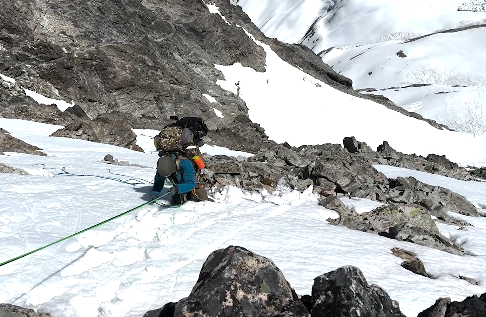
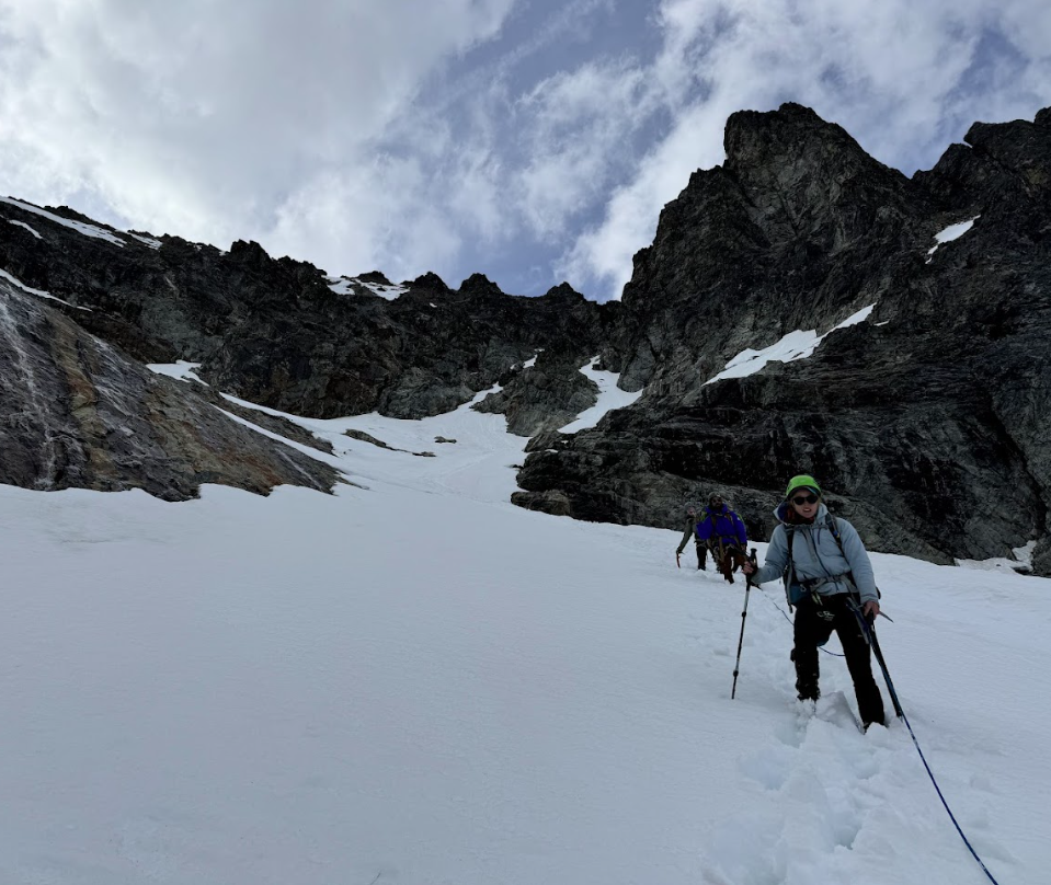
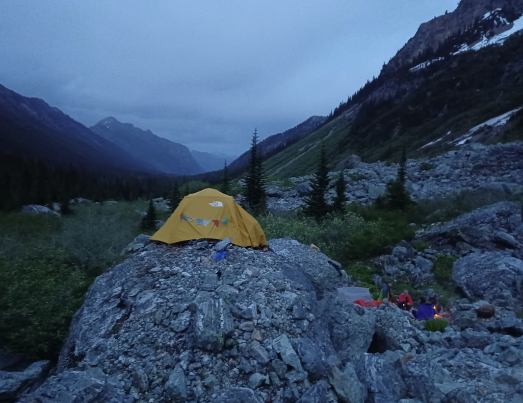
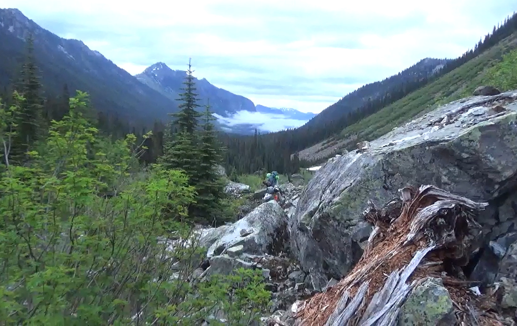
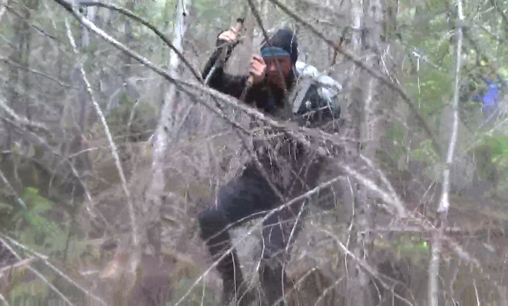
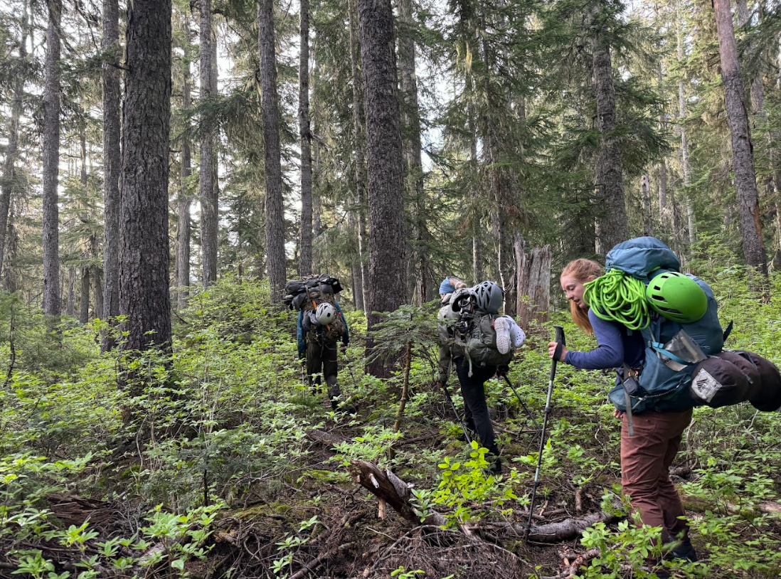
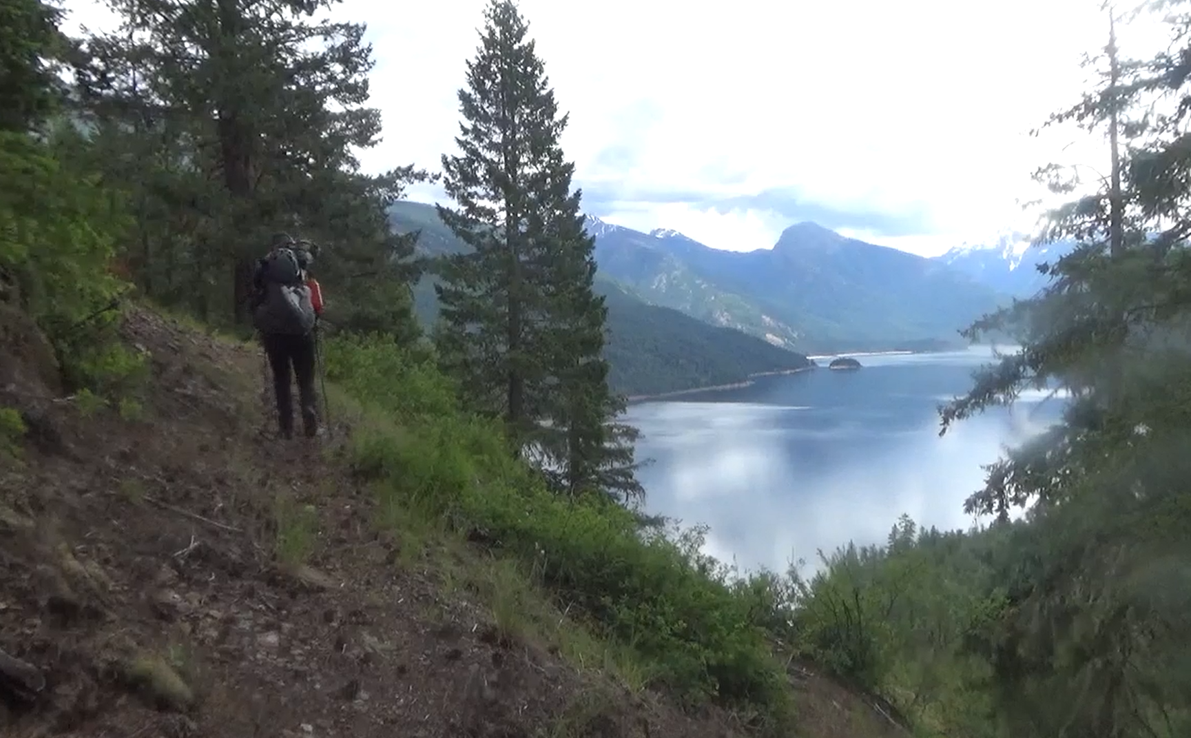
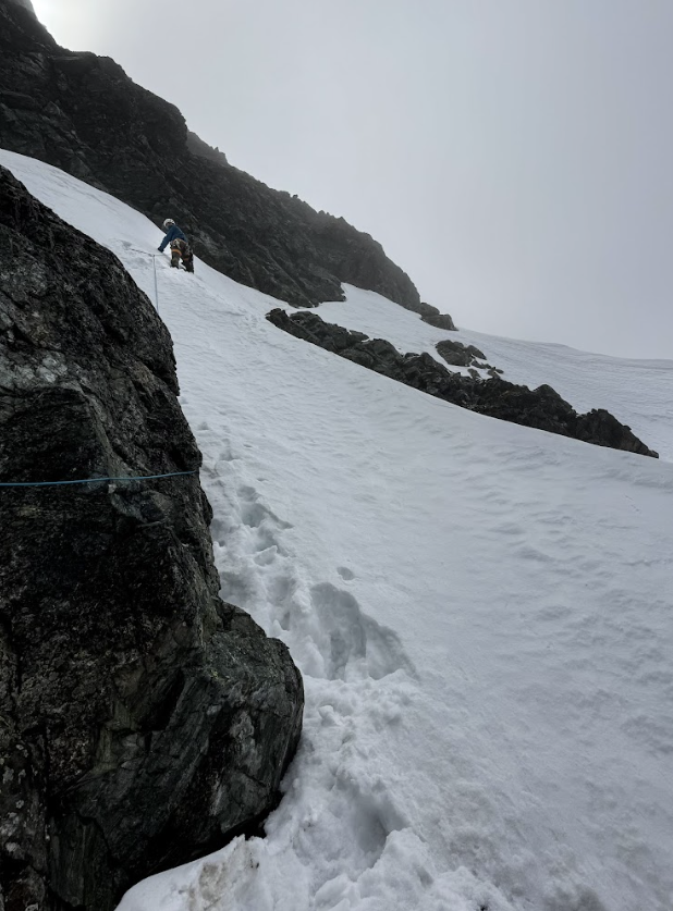
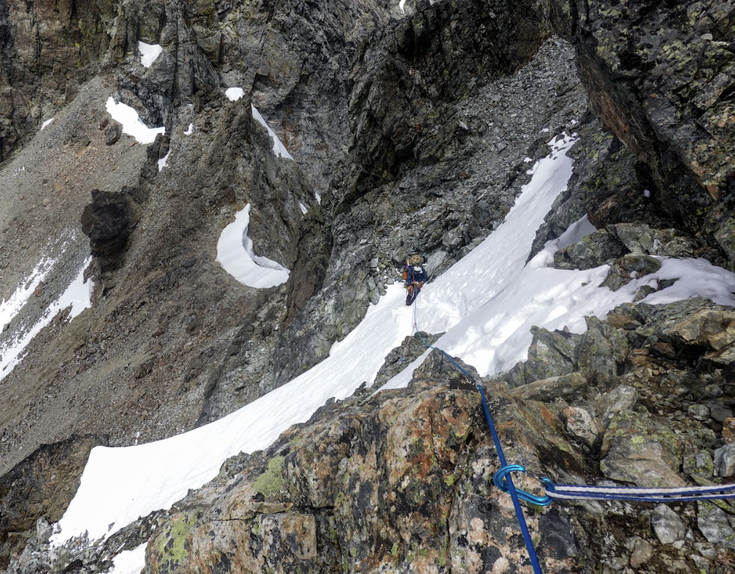
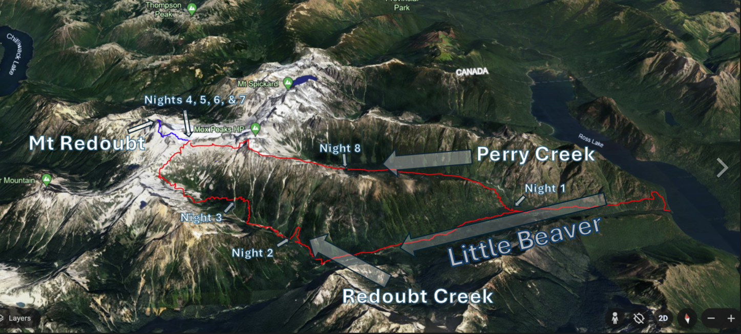
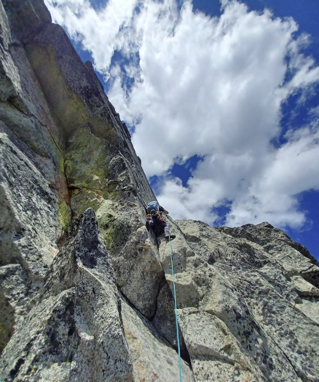
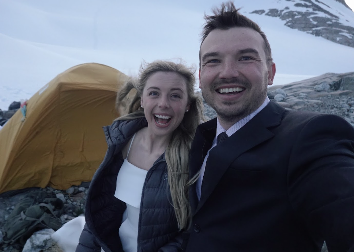
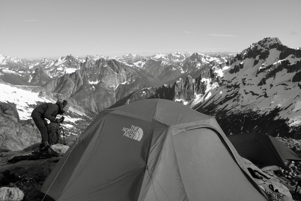
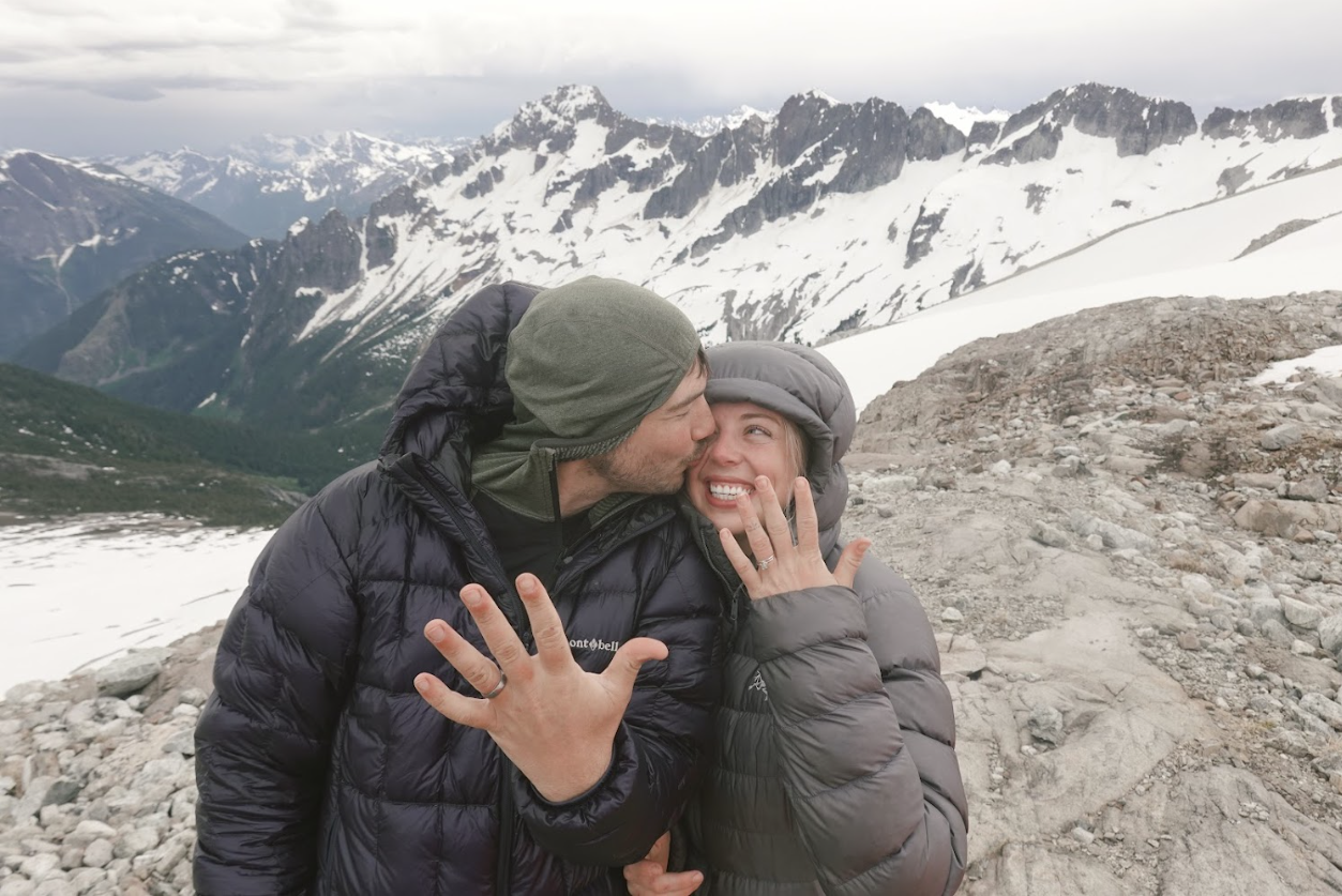
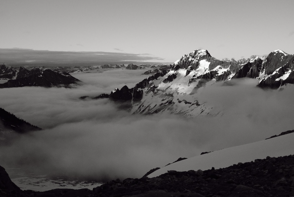
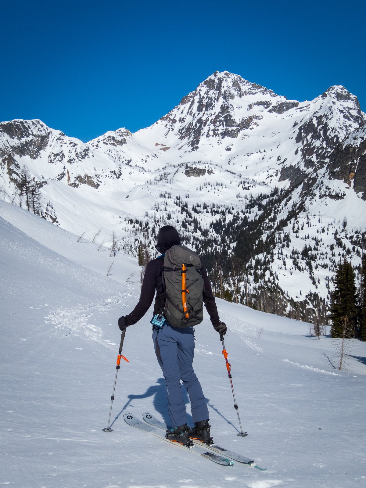
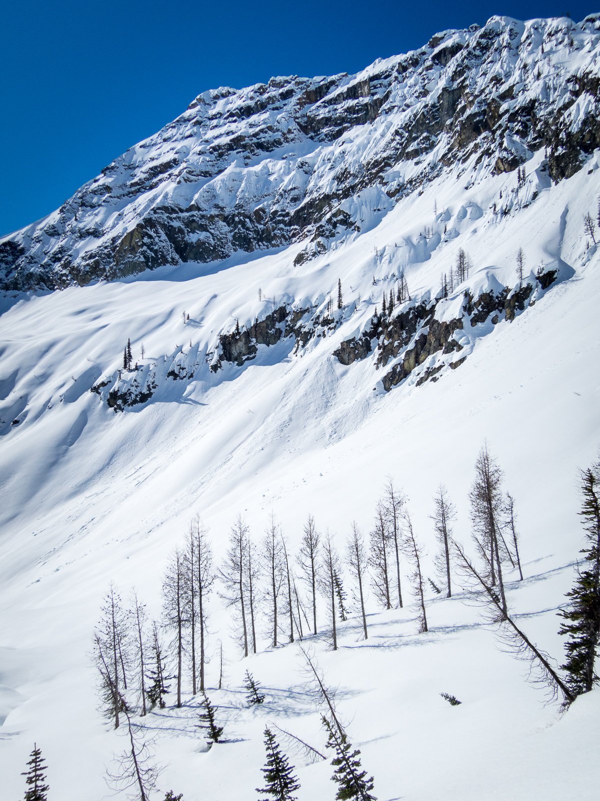
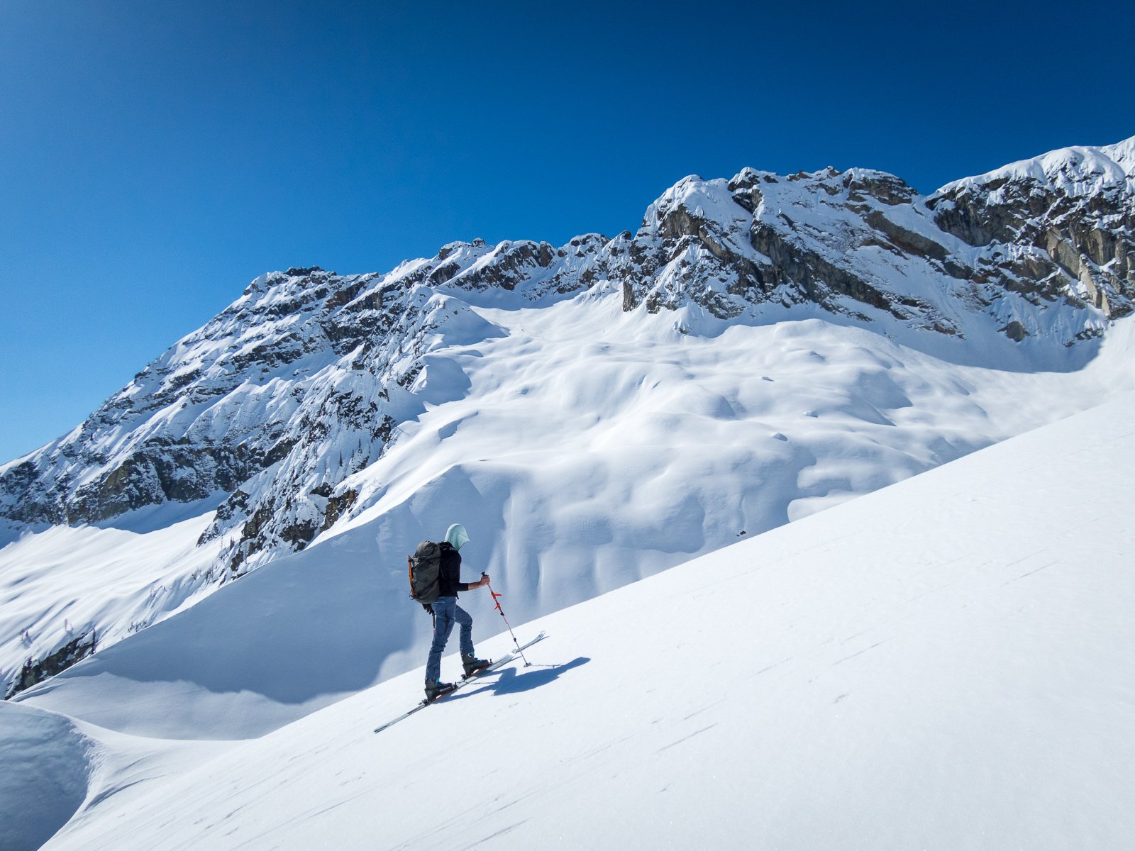
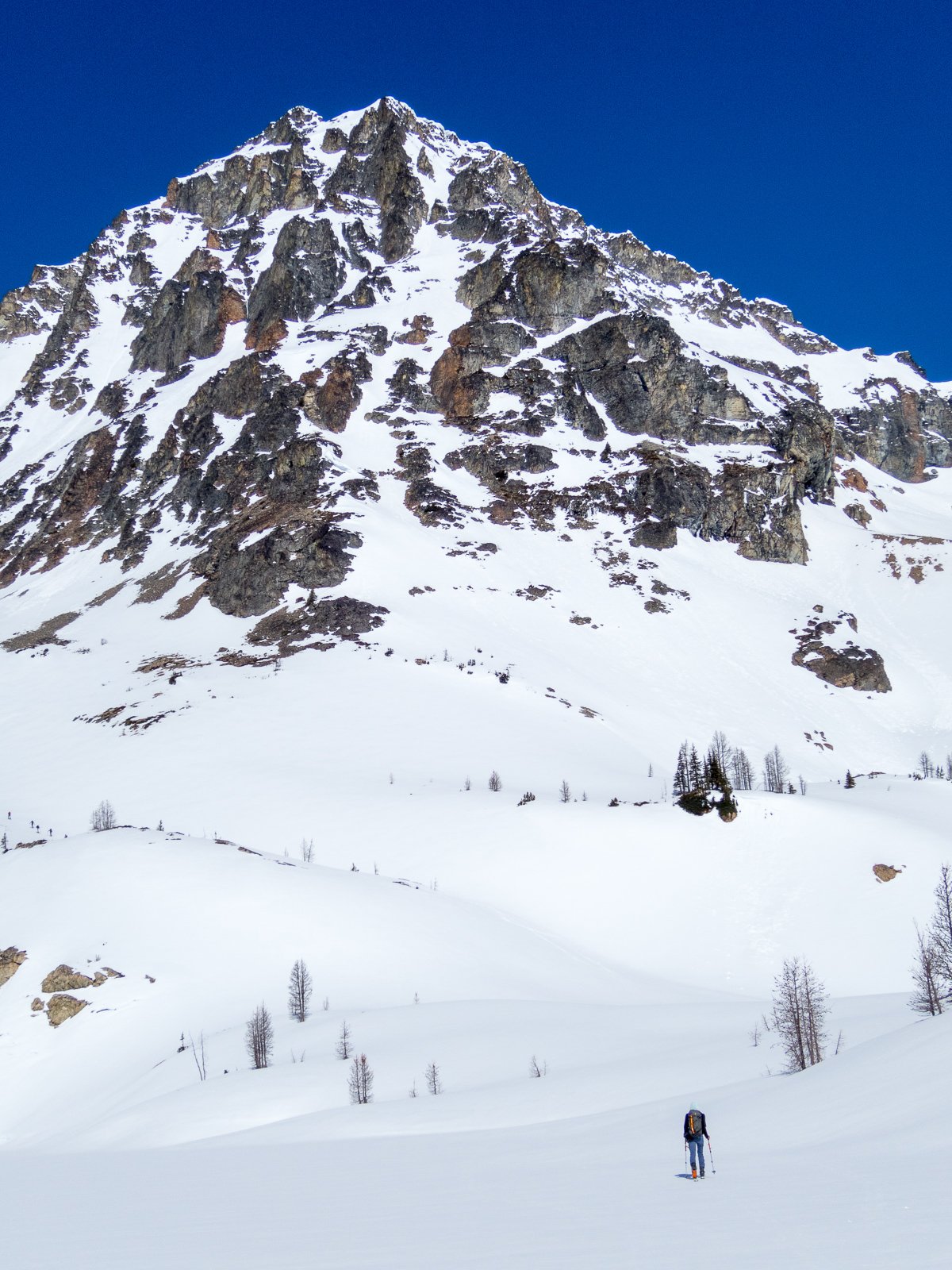
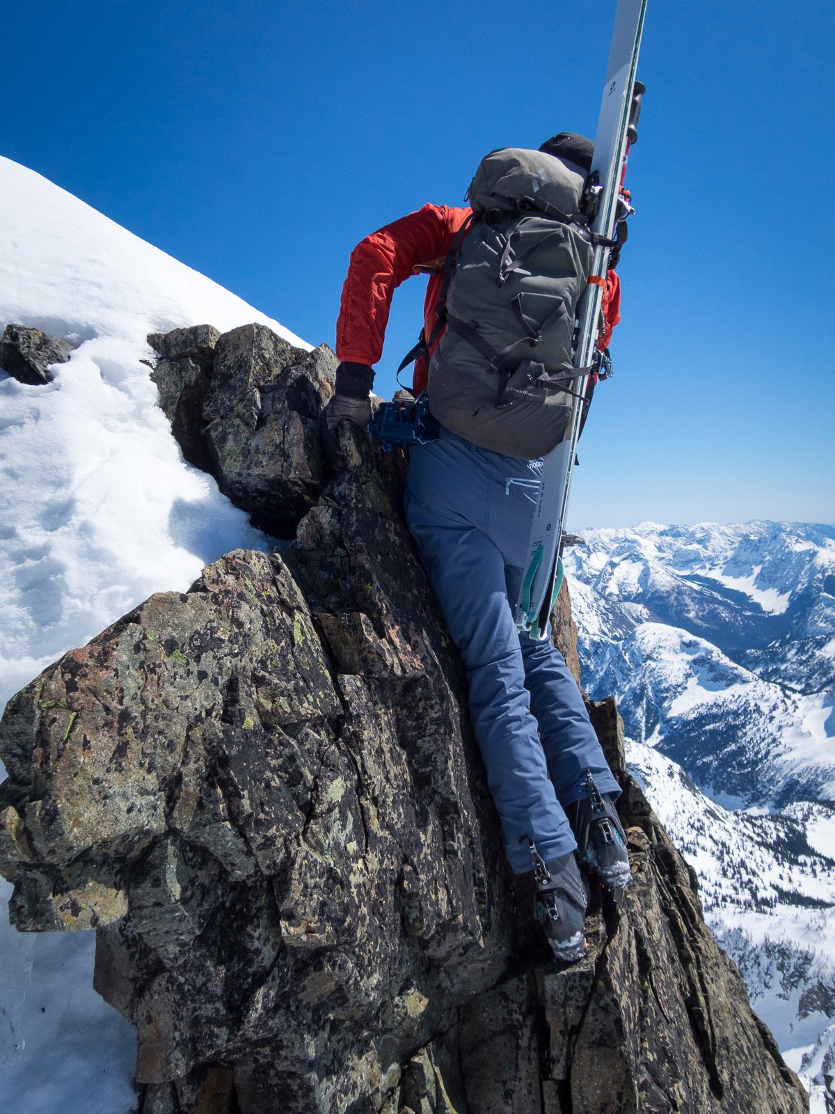
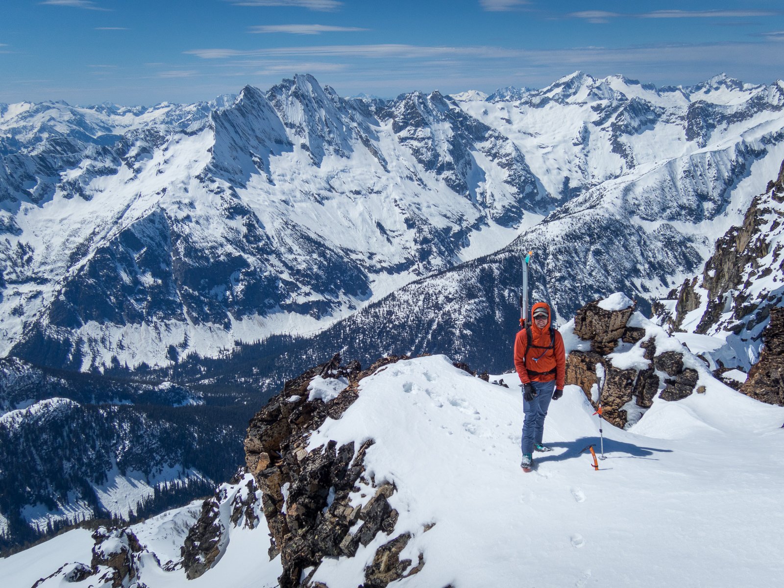
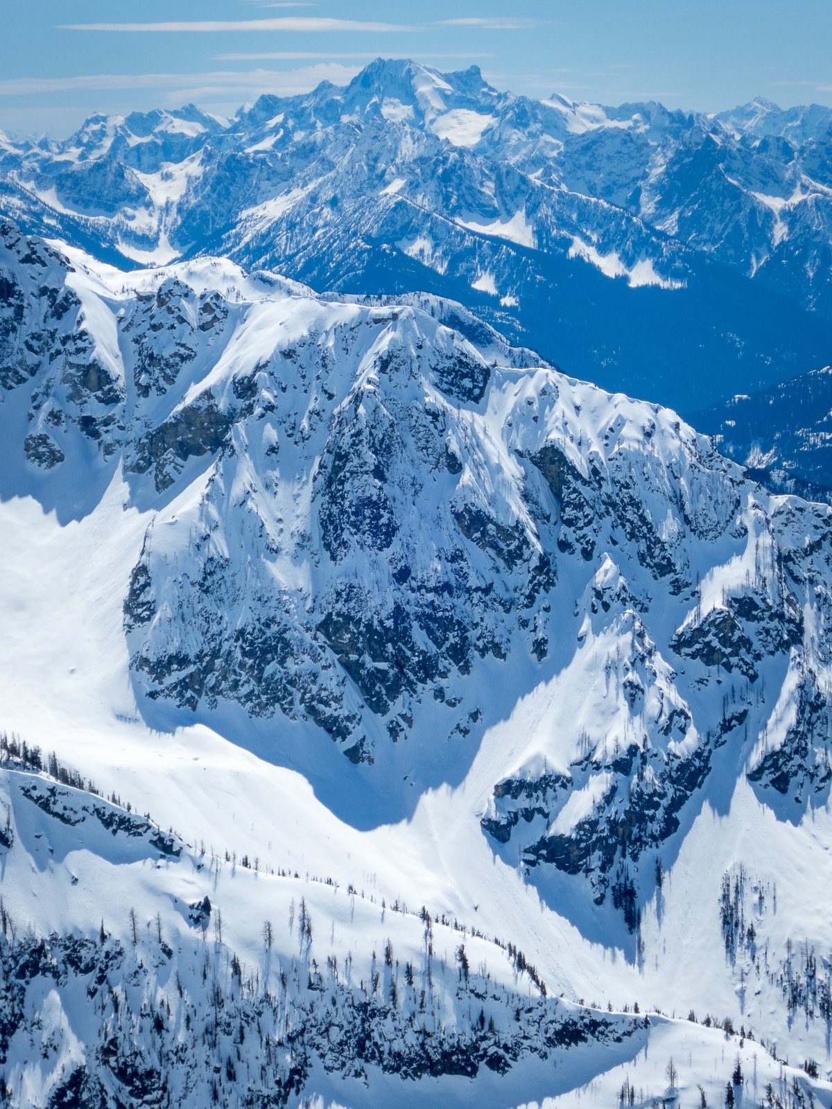
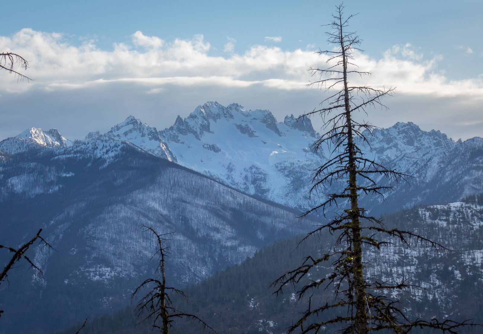
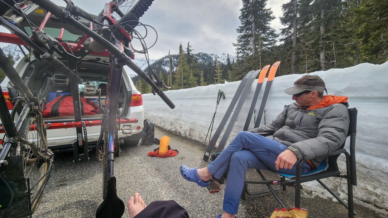
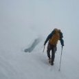 Trip: Chilliwack Range - Redoubt Creek to Mt Redoubt, Alpine Wedding, Perry Creek deproach Trip Date: 06/21/2024 Trip Report: Climbers: Jake and Julia Johnson – Sandpoint, ID Emilio Taiveaho - Saxapahaw, NC (Emilio’s wife Krysten could not join on this trip, but was very much with us in spirit) Adam and Monica Moline – Olympia, WA Summary: 9 Days and 8 nights in the Chilliwack Range with the primary objective of an alpine wedding. Weather kept us off most of our climbing objectives, which was a known risk by going in June. The approach, deproach, and riding out the storm proved to be an excellent adventure by themselves, and we were successful in our primary objective of getting married! I enjoy packing detail into these reports, primarily for my own benefit, while the detail is still fresh in my mind. Thus, it’s a lengthy report. But I also tried to make it photo heavy for readers that prefer to skip to the sections that interest them. Preface: Julia and I have been discussing our ideal wedding venue for a long time. After ruling out traditional options, we decided on an alpine elopement. Our first thought was to make a trip to the Cirque of the Unclimbables, in Canada’s Northwest Territories, but the timing and logistics for that trip weren’t lining up. We decided on the Chilliwack Range, for its beauty and remoteness, and the fact that it didn't require coordinating float planes to get to. The Depot Creek route from Canada was the obvious approach option for hauling in a suit, wedding dress, lots of camping luxuries, and a good bit more food than a normal trip. However, we had some last minute reservations about our wedding involving an illegal border crossing. After chatting with several friendly border patrol officers on the phone, we confirmed that there is no process or permissions to make the Depot Creek approach legal. They essentially told us that, although they would do their best not to catch us, they couldn’t guarantee it. Emilio, Adam, and I had climbed in the Chilliwacks in 2021, and accessed via the Perry Creek approach. However, the thought of doing the Perry Creek bushwack and climbing over the Ridge of Gendarmes with a wedding dress on my back wasn’t inspiring. We reached out to Ross Lake Resort to see if their water taxi would drop us at Silver Creek so that we could approach via that valley, but the lake levels were too low for them to take us there – the furthest they could get us was Little Beaver. I combed over reports for other approach options. Hiking all the way from Hannegan wasn’t appealing; we planned to bring heavy packs to live in alpine luxury for the week. While studying satellite imagery, I noticed that Redoubt Creek, the drainage west of Perry Creek, was relatively short and contained a wide creek bed – over 100 yds wide in places – which would be nice for keeping the dress out of the brush. Since it was a smaller drainage, I reasoned that the creek might be smaller too, and traveling directly up the creek bed could be a viable option. If so, there would only be a short distance to bushwack with the wedding dress before breaking into the wide section of the creek bed and the alpine. I could not find ANYTHING online about using Redoubt Creek as an approach for the Chilliwacks. When I reached out the national park for information about Redoubt Creek as an approach, they didn’t know what I was talking about, and they provided me with information about Depot Creek - I assume they thought I was just confused, and that I meant Depot Creek. The idea of venturing up a remote valley with little information was intriguing for us, and it seemed like it might work ok. After all, it couldn’t be any harder than Perry Creek, could it? Trip Map: (Spoiler - we ended up bailing to Perry Creek for the way out) Wednesday June 19 & Thursday June 20 Emilio had flown into Spokane on Wednesday the 19th and we had done some cragging. Then on Thursday we ran / climbed Harrison Peak in the Selkirks after I got done with work. Julia's parents drove from Illinois to Idaho to house and dog sit for us, so we had a full house Thursday night. Friday June 21 On Friday we packed up and departed Sandpoint mid-morning and met Adam and Monica at Ross Lake Trailhead at 3pm. The boat was late, so we snacked on Monica’s homemade sourdough bread on the dock and did some swimming. When the boat dropped us at Little Beaver, we ate dinner – Monica’s specialty sandwiches: a healthy serving of a variety of meats and cheese on a pretzel bun – then began the hike in. The first mile of Little Beaver the trail immediately gains 1000 ft, and I was still adjusting to the weight and balance of my new pack-body with the wedding dress hanging off the back. The delayed boat and the weight of our packs made it easy to justify a short first day on the trail, and we stopped at Perry Creek Camp for the night after ~4.5 trail miles. Saturday June 22 We all tried to take advantage of the pit toilet at Perry Camp before departing for the day. Julia and I also spent some time repacking the dress – the “cape” method we had tried on day 1 was meant to avoid getting wrinkles and creases in the dress, but it did not seem like it would work for the shwacking. We knocked out the remaining 5 miles of trail walking to Little Beaver’s Junction with Redoubt Creek, stopping for a few quick breaks that included some trailside bouldering. After searching a bit for a good route to start up on, we gave up and Adam led the schwack straight through some moderate alder and devils club on climber's right of the creek. After a few hundred yards, the slope steepened significantly, but the forest floor thinned and we followed some heavily used bear trails straight up the mountainside. The slope cliffed out a bit as Redoubt Creek plummeted through waterfalls to our left. We were able to find some gullies to navigate up these sections with only a few climbing moves. Emilio kept our spirits high by singing Marty Robbins' "You Gotta Climb" - a real mountain jam! Above the cliffy sections we made some great progress, again following steep bear trails straight up the steep mountain valley. The Redoubt Creek valley bottom levels out significantly after this, and the goal here was to get down into the creek bed and use that to rock hop our way up the remainder of the valley. However, based on the roar of the creek, we decided to continue up on the bear trail as far as it would take us. Eventually the old growth and bear trail wanted to force us to the right, straight up the mountainside and perpendicular to the direction we needed to go. We dropped down into a tributary creek bed and crossed it into some thick alder. We hacked our way through alder for 200 yards, angling down towards Redoubt Creek. This was the thickest, most sustained alder I had ever climbed through. I checked the gps map on my phone – we still had 300+ yards of this to go before the next section of old growth forest, and it felt like we had already been in it for an hour. We changed our angle, to head directly downhill through the alder to get to the creek, in hopes that we could find some relief in the creek bed. Once we got to it, there was a sheer 20 ft drop from the alder straight down to the raging river. So much for the creek being small! We briefly discussed options – the alder had somehow been getting thicker, and it felt like our slow progress through this grove was getting slower. We decided to backtrack to the tributary we had crossed before entering the grove. To add to our frustration, it began to rain softly on us. We used the tributary’s creek bed to head straight up the mountainside for a quarter mile until it met with some old growth above the alder grove, as a way to circumvent it. Looking south at Luna Peak's North Face: The old growth was incredibly steep with significant blow down, so we took a line angling around the alder grove, but right back down towards Redoubt Creek. A bit more bushwacking near the valley bottom, and we stumbled out onto a beach that provided a place to camp for the evening. In camp, we studied the map and tried to formulate a plan for the remainder of the valley. The creek was moving a lot more water than we had hoped, so crossing it would be very sketchy without log crossings. If we couldn’t cross the creek, it would force us up into the alder every 100 yards or so because of the way it snaked from side to side within the creek bed. The negative thoughts started to creep in a bit – Maybe this way wouldn’t go. Why did we pack so heavy? If this doesn’t go, would we need to celebrate our wedding down here in the alder? Sunday June 23 The upper valley was filled with fog, and the drizzle was on and off throughout the morning. We took our time to stretch, hydrate, and relax all morning until noon when the forecast showed a lower chance of rain. We needed a bit of a mental break before engaging in another fight with the alder. At noon we backtracked downstream a hundred yards so that we could cross the creek at a log crossing, then quickly regained that ground in the creek bed on that side of the creek. Another hundred yards and we were forced out of the creek bed by the creek, and we were back in the alder. Emilio had been developing a rating scale for “Technical Slide Alder” and this was at least “SA 4”, which is the point at which the alder decides which direction you get to go, and you have no say in the matter. After a few hundred yards, the alder spat us out right at a log crossing that got us to good creek bed on the other side of the creek – a lucky break. It was great walking for a few hundred yards, and we marveled at how wide the creek bed was here, with tall walls on either side leading straight up to dense alder at the top. After that bit of good walking, the creek wound back to our side of the bed and pressed right up against the steep wall on our side. To climb up the bank and around this pinch point looked to be about a 5.9+ climbing move with the packs, and then an “SA 5” bushwack for a long ways. The alternative was to traverse just above the raging creek on the steep and sandy bank. Julia and I backtracked down the creek looking for a log we may have missed, to cross over on; no luck. Emilio led the charge across the bank, kicking collapsing steps in the sand as he went. Adam and Monica followed, and finally - after a bit of deliberation - Julia and I reluctantly followed as well. We made it just a short bit further in the creek bed before the creek wound back and presented a similar challenge again. But this time, we had a better opportunity to escape the creek bed and dive into a short alder shwack, and then climb some steep old growth. We had eaten our fill of alder, and we couldn’t take much more of following the creek. We plotted a new line that would take us higher up the side of the valley in the trees, and then sidehill the remainder of the valley. The trees initially provided some relief from the density of the valley bottom. However, the slope quickly became very steep, to the point where I would frequently need to hold Julia’s feet into the soil in front of me to allow her to step up without slipping back down. Once we had climbed to an elevation that would be clear of most of the alder groves reaching up from the valley, we began side-hilling. This was also slow moving due to the steepness of the terrain, and needing to negotiate a good amount of blow down. The moving required confident footwork, and both hands. Whenever there was a space flat enough to stop and rest without rolling down the mountain, we took advantage of it. Light rain came and went, and the forest thickened – still very steep. As it got dark, we dropped down a steep alder-lined bank into a tributary that was filled with snow, but was also flanked by a sloping heather bench. I had never been so relieved to arrive at so poor of a campsite. Emilio pitched his tent above a small tree to avoid rolling down the hill, Adam and Monica spent some time landscaping with rocks to create a small flat-ish area, while Julia and I chose to use our axes to chop out a spot on the snow flat enough that we wouldn’t take the big ride in the night. We had to fight to keep our spirits up. In total, we had only covered maybe 2 miles as-the-crow-flies the entire day. It was starting to become a possibility, if we didn’t increase our pace, that we would need to turn around without ever getting into the alpine, and our entire trip would be bushwacking. Julia wasn’t open to that possibility – “I’m not going back down this valley”. We talked to the rest of the group, and all happily agreed that we would bail to Perry Creek as the deproach, assuming we could make it up and out of this valley. Monday June 24 We needed this day to be productive, and we were happy to find good weather when we woke up. The forest was kind, with reasonable old growth walking right away in the morning. We picked a line that aimed for the clear meadows at the head of the valley. After a short section of side-hilling, we dropped straight down towards the valley bottom and were greeted by a now-much-smaller Redoubt Creek and a bog. Mt Redoubt standing proud at the head of the Redoubt Creek valley We crossed the creek in sandals, then picked our way through the bog over to some talus on the west side of the valley. In just over an hour, we had covered as much ground as the entire previous day. Looking up at the unclimbed "Crazy Crushed Contours" wall on NW Mox Peak We topped off water before hopping on a snow finger that took us straight up head of the valley. Here, we found an abundance of wolverine tracks, and higher up in the cirque Monica spotted the creature itself, scampering through the talus! Some easy snow walking led us up the remainder of the way to Camp 7200. We had used one of the few good weather days of the trip to get here, but we all felt very accomplished to have completed such a complex and heinous approach. Tuesday June 25 The forecast said clear, and then rain for the remainder of the week, so we needed to make the most of it. We accidentally slept in a bit later than expected, then roped up for the glacier walking on the first section of the route up Redoubt. The walking was great for the first bit, but as sun baked the snow I began to fall through and it became a slog. We crossed the rock rib without issue and worked around to the south side of the mountain. Here the snow steepens, and it also deepened. I did my best to stay on top of the snow by getting my toe in solidly enough, then dropping my knee to distribute my weight across the surface of the snow. This technique was basically just crawling up the mountain, and our pace was as slow as you’d expect. As we neared the rock at the top of the snow, the snow got softer and deeper - over waist deep - and I was forced to change techniques again. I would use my axe and my knees to tunnel out the 2 feet of snow in front of me, then use my feet and crampons to compress this chopped snow into a step. Then repeat. The rest of the team practiced patience while I slowly engineered the route up the last 15 meters onto the rock. I was excited to get the crampons off my feet and scramble rock. We probably should have kept the crampons on and climbed the snow in the gully up to the summit block, but the rock did provided a reasonable route up, by traversing above the snow in the gully. We remained roped up as we had been on the snow, and we gave each other body belays through any short stiff sections. At the top of the gully, we found a good amount of snow below the final rock pitch. We decided to pitch it out one person at a time – another time-suck. The guys gave me the lead again, a wedding present for me. I crossed the snow by kicking steps with my trail running shoes, then traversed into the rock chimney leading to the summit. I placed a cam and pulled the slightly overhanging summit move. It felt stiffer than I expected, probably due to the wet trail runners. I slung a block to belay and brought everyone else up the pitch. Summit Success! There were a lot of moments over the previous days when I thought there was little chance of tagging any summits on this trip, so it felt good to stand on at least one. However, it was WAY later in the day than we had anticipated, and we still needed to get down, get beautiful, and get married. We made several rappels to get down. If we had anticipated the amount of snow on the route, we would have brought multiple ropes to speed this process up. Once we were back on the snow, we plunged heels into the deep slush snow and made great time following our tracks back to camp. It was evening when we got back to camp, and there was some anxiety and emotions regarding what we should do with our wedding ceremony. We felt like there was a reasonable chance of a small break in the weather over the next 2 days for us to do the ceremony, but that wasn’t a guarantee. We decided to get ready quickly and make it happen before dark. We boiled water in the jetboil and added it to the water filter reservoir to provide Julia with a hot shower. Adam adjusted some rocks to make a flat spot for the ceremony above camp, and Monica made a small bouquet from heather and a hair tie. I put on my suit, which Emilio had carried in his pack the whole way up, and I was pleased to find it in great condition. I set up some cameras and got myself and the guys in position. Then I closed my eyes and waited for my bride. Emilio kicked off the ceremony with some opening remarks. I opened my eyes and laid eyes on my alpine queen. She looked beautiful. We read our vows to each other and exchanged rings. It was perfect. The wind picked up towards the end of our ceremony and provided some dramatic effect for the few photos we were able to take before it got too dark. We celebrated with the best freeze dried and dehydrated meals we had brought with us, as well as freeze dried pudding for dessert! The wind continued to increase, and we turned in for the night. Wednesday June 26 & Thursday June 27 There was not any rain in the night, just steady wind blowing the storm closer. We scrambled around on the rocks around camp in the morning hours, and watched the mountains to the south disappear as the storm engulfed them. We knew there was little chance of tagging any summits over the next 2 days, but we made note of the boulders we wanted to work around camp, and other activities we might want to do during any upcoming breaks in the weather. We scampered into tents as it began to rain – it wouldn’t stop once for the next 40 hours. We had all reinforced the south sides of our tents, as that was the direction the storm blew in from. But at some point during Wednesday night the wind changed directions and completely flattened our tents, blowing strong from the north. We did our best to keep our things dry, but Adam and Monica ended up with a small indoor swimming pool. Every now and then I could hear some singing over the sound the rain and wind, coming from Emilio's tent: "♪ Rider's on the Storm ♪.... ♪ Rider's on the Storm ♪" On Thursday the rain changed to snow, which was a welcome relief from the wet of the rain. Friday June 28 Our boat out from Little Beaver was at 4pm on Saturday, so we hadn’t left much extra time to hike out. Friday morning started with a beautiful cloud inversion and some sunshine. By the time we started hiking towards Col of the Wild, the clouds had risen to our level and we were back inside the ping pong ball. On this hike, my right crampon broke – probably the consequence of using them too much with my trail runners. (I like using the strap style crampons with my trail runners on trips where there is any chance of hard multipitch climbing - which we had planned for, but were unable to do on this trip. I feel pretty confident in most snow conditions with this setup, and you can't beat clipping light weight trail runners to your harness while climbing in rock shoes. However, we've found that the bar on the Black Diamond Contact crampon is only good for 1 or 2 big trips before breaking when working them hard on such a flexible shoe.) I reasoned that the snow would be soft enough for the remainder of the trip that not having both crampons shouldn’t matter all too much. We kicked through moderately deep snow up to Col of the Wild; not anything like what we had encountered on Redoubt. From the col, we were able to see the first section of the Ridge of Gendarmes through the fog. What is 3rd and 4th class in the summer was covered in some deep and steep looking snow, with cornices guarding some sections at the top. We picked a line that climbed straight up the snow, then traversed right to the low point in the first ridge. Adam had carried a picket in his pack this entire trip without any expectation of needing it, but we were happy to have it for this section. Emilio made his case for taking the lead on this pitch – he had two crampons compared to my one, he pointed out. I was greedy, and formulated some weak argument for why I should get it anyways. Emilio conceded and offered to belay. This was the steepest, iciest, and most dramatic mixed lead I had ever done, and I savored the unexpected adrenaline surge. The stability and varied depth of the snow required careful and delicate movement. What an awesome, unexpected challenge on our "hike out"! I took my time tunneling upwards through the deep snow and kicking good steps for the rest to follow with their packs. After about 10 meters I placed the picket and traversed rightward. Again, I spent a good amount of time tunneling out the snow and packing down a solid shelf for the others to follow on. I worked into some sections with exposed rock and chipped away ice to get to some handholds and solid gear placements. Eventually I was able to work upwards to a belay at the notch in the ridge. We ate up a lot of the morning getting everyone and their packs up this pitch, but Emilio began working the next pitch once he was up. This next pitch contains the only 5th class move on the ridge in summer conditions, and it is pretty straight forward. But we roped up for it because of the heavy packs and some snow on the ledges. Emilio led and Adam and Monica followed, simuling on the end of the first rope. Adam towed up a second rope that Julia and I then simuled up the end of. After this pitch, Julia and I remained roped together simuling on a short rope for a bit of added confidence as Julia led us the remainder of the way up to the top of the ridge. We encountered a few low 5th class moves to avoid snow and ice where the route would normally be. The other side of the Ridge of Gendarmes leading down to Perry Creek is less steep, but contained more snow, so we made 2 rappels to get down to the glacier. Prepping to rappel at the Ridge of Gendarmes. SE Mox in the back right of the frame. Once down on the glacier, we roped together and made quick progress down to the head of Perry Creek. It was getting dark in the valley bottom, but we pushed for another 30 minutes on the talus to shorten our hike out the next day. Without any good flat spots for camping nearby, and without feeling like pushing any further, we made do by adjusting some rocks in the talus. Saturday June 29 We were up with the sun and hopping down the talus of upper Perry Creek early in the morning. We cut into the old growth and made good time despite less than perfect route finding. Julia and Monica joked at our previous fear of Perry Creek – this was nothing compared to Redoubt Creek. However, the bugs were thick and the Perry Creek descent saves the best for last - Thick dead pines and steep terrain on the final drop down into Little Beaver. We did find a faint climbers trail that was definitely not there in 2021, but we found it only as we were coming out of the thickest part of the schwack, so it didn't benefit us much. I had kept my hard shell jacket on to protect me during the plunge down the thick stuff, so I was overheating when we landed on the Little Beaver trail. We topped off our water and enjoyed a well-earned rest. The 4.5 miles of trail back to Ross Lake felt like they took forever, but perspective is a beautiful thing, and we did not take for granted how easy covering the ground was, compared to the week we had. We had an hour to spare before the boat picked us up, so we swam and basked in the sun at Ross Lake. The boat ride back to Ross Dam is always satisfying after a week in the mountains. We hiked up the trail to the cars in our sandals, loaded into the cars, and drove to Marblemount where we proceeded to order an absurd amount of food. We enjoyed the next 2 nights at an AirBnb that Julia and I had reserved for the group. There, we continued to make and consume an outrageous amount of food. Final Thoughts I need to express my gratitude to the team that made this adventure what it was. First and foremost, my new wife, Julia. I would have agreed to any wedding venue she wanted – for her to choose this place says a lot about who she is. I’m incredibly lucky. This was Monica’s first real trip into the Cascades backcountry, despite many years of climbing in Washington. She crushed it, and I’m sure it won’t be long until she’s back for more. Adam and Emilio have been my primary climbing partners for a long time, and they came through for me at my wedding, carrying heavy packs (70+ lbs) and keeping the stoke high throughout. They only took 1 full day of rest after this trip before heading back to Ross Lake, and hiking into the Pickets. That should say plenty about how hardcore they are. As I write this, they’re getting on Mongo Ridge with a great weather forecast to get some redemption from our attempt in poor weather in 2022. Update - they sent! Up next, Jules and I are heading to Alaska to do some honeymoon climbing (again – her idea, I’m lucky), but also some fishing and relaxing. Gear Notes: Standard Wedding Rack Approach Notes: SA5 Schwacking
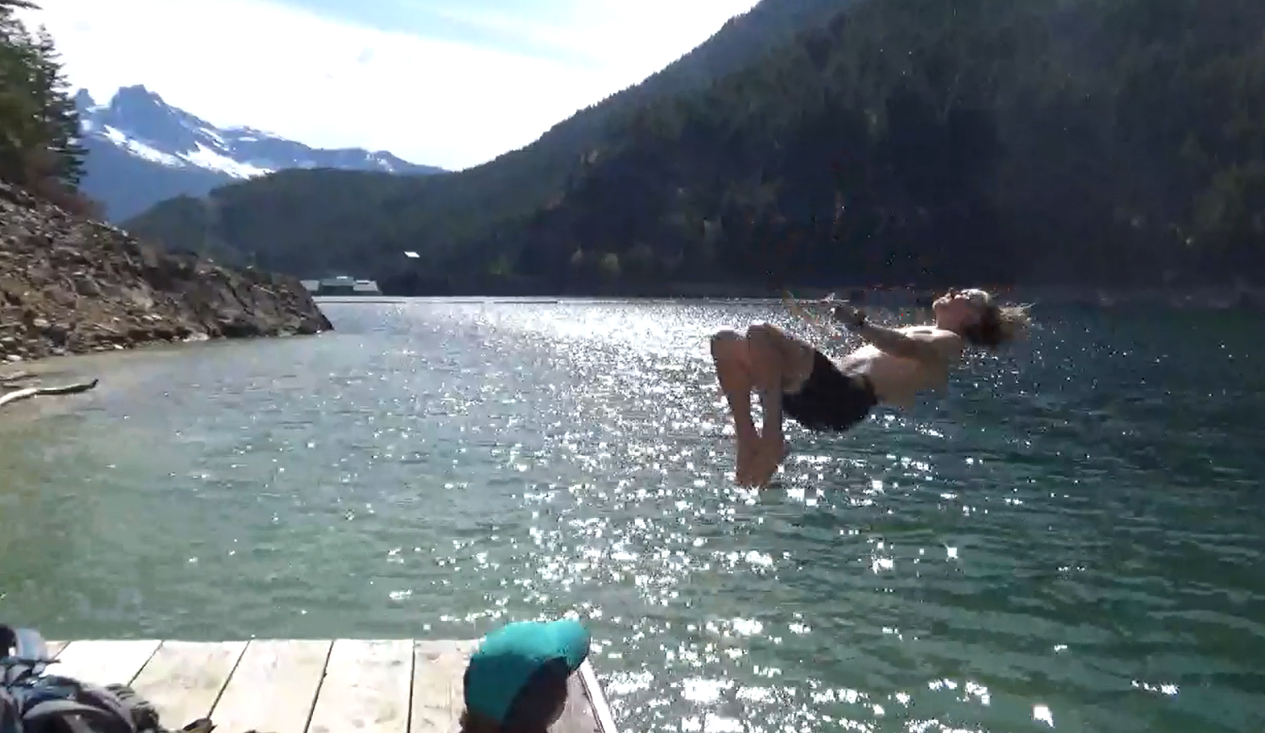

 3 points
 -
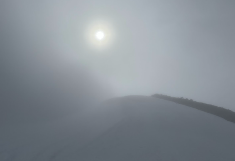
Trip: Black Peak - SE Ridge Trip Date: 07/06/2024 Trip Report: Ended up with a free day Saturday and haven't been up Black Peak. Left the trailhead a little after 6:00 am after driving up from Mazama. No snow until the descending traverse from Maple Pass to Lewis Lake. Saw a pica. Looking at Corteo from Lewis Lake. Wing Lake still frozen but melting out. Lot's of running water on the approach which was great, I think I went through around 6 liters in the heat. Got off route a bit below the summit block and climbed some low 5th on ok rock. Great view of Goode, still pretty snowy looking. Probably 8 folks on the summit around 11:00 am, all were stoked to be out with great visibility. Quick glissade down to Wing lake. Took a detour on the trails around Lewis Lake that cost me some time and elevation. Back at the trailhead by 3:00. Great day to be out in the mountains! Gear Notes: Took an ice axe and crampons but didn't need them as the snow was pretty soft in the heat. Sun hoody was nice. Approach Notes: My GPS tracked 13.5 miles and 5,703' elevation gain.1 point
-
Trip: Sloan Peak - Bedal creek Trip Date: 07/04/2024 Trip Report: High clearance vehicles only. Brushy road scratched truck. Bedal creek trail overgrown. SAR trail to Bedal/Sloan saddle was well flagged and nice direct climber’s trail in open timber. Tarn still melting out. Glacier in good condition. Few crevasses near top. Went high right then cut under first rock band. Significant rock debris littered the center of the glacier. Scramble route was still snow covered. Beyond my comfort level. Turned back. Last two photos compare July 2023 (from YouTube video) to July 2024. Gear Notes: Standard glacier gear Approach Notes: No water between Bedal creek and Bedal/Sloan saddle until tarn. Plenty in basin above tarn.1 point
-
Trip: Black Peak and Prime Rib - #methowmultisport Trip Date: 04/20/2024 Trip Report: For those of us up here in the north sound, it is hard to ignore the gravitational pull when Hwy 20 opens for the year. It is like someone pulls the plug in the backyard pool and we are inexorably pulled east into the vortex of Sprinters and Teslas. But not this past weekend. It was like older, mellower times. Maybe it was the front moving through in the middle of the weekend. Maybe everyone was like my brother and were caught unawares of the opening? Whatever the reason, I'll take it. It was a good thing that the masses weren't up there though. @geosean and I myself weren't terribly original with the plan- a ski of Black on Saturday followed by Prime Rib on Goat wall on Sunday. We even brought bikes to enliven the descent from Goat Wall (this is a good bit more fun than rapping the route). And, mostly it went off without a hitch. And by that I mean we had fun, didn't get hurt, and came home friends. However, we did stop a few feet shy of the true summit of Black due to the typical spring shenanigans of steep snow, exposed rock, and no climbing gear. But, that slight disappointment was soon forgotten amidst the better than average corn skiing down to Lakes Ann and Wing. I think it has been over 20 years since I've been up on Black and I can see that I need to return more frequently. Thankfully the weather on Goat Creek Road was reasonable, though chilly, Saturday night. We started early to beat the crowds the never arrived and shivered in the wind and snow squalls as a result. It felt distinctly alpine, climbing in long johns and belaying in puffys all day. I'm sure it would be good training for something hard and high, if I still cared about those sorts of objectives. Mostly though, I shivered and muttered. But, it had been about 11 years since I had climbed the route, and so Prime Rib felt sort of like a new and interesting experience. This pronounced alpine amnesia is definitely one of the benefits of entering my "mature mountaineer" phase. Maybe I need to climb things all over again. Except Nooksack Tower. @geosean at Heather Pass: @geosean and Black at Wing Lake: I was not having this and turned us around: #methowmultisport: Dispersed camping views of Silverstar from Goat creek road: @geosean living the alpine dream on Goat Wall: The hordes will descend next weekend! Gear Notes: the full kit Approach Notes: Follow the herd
 1 point