
Leaderboard


Popular Content
Showing content with the highest reputation on 05/08/23 in all areas
-
You're in for a treat if you get the weather and permit:2 points
-
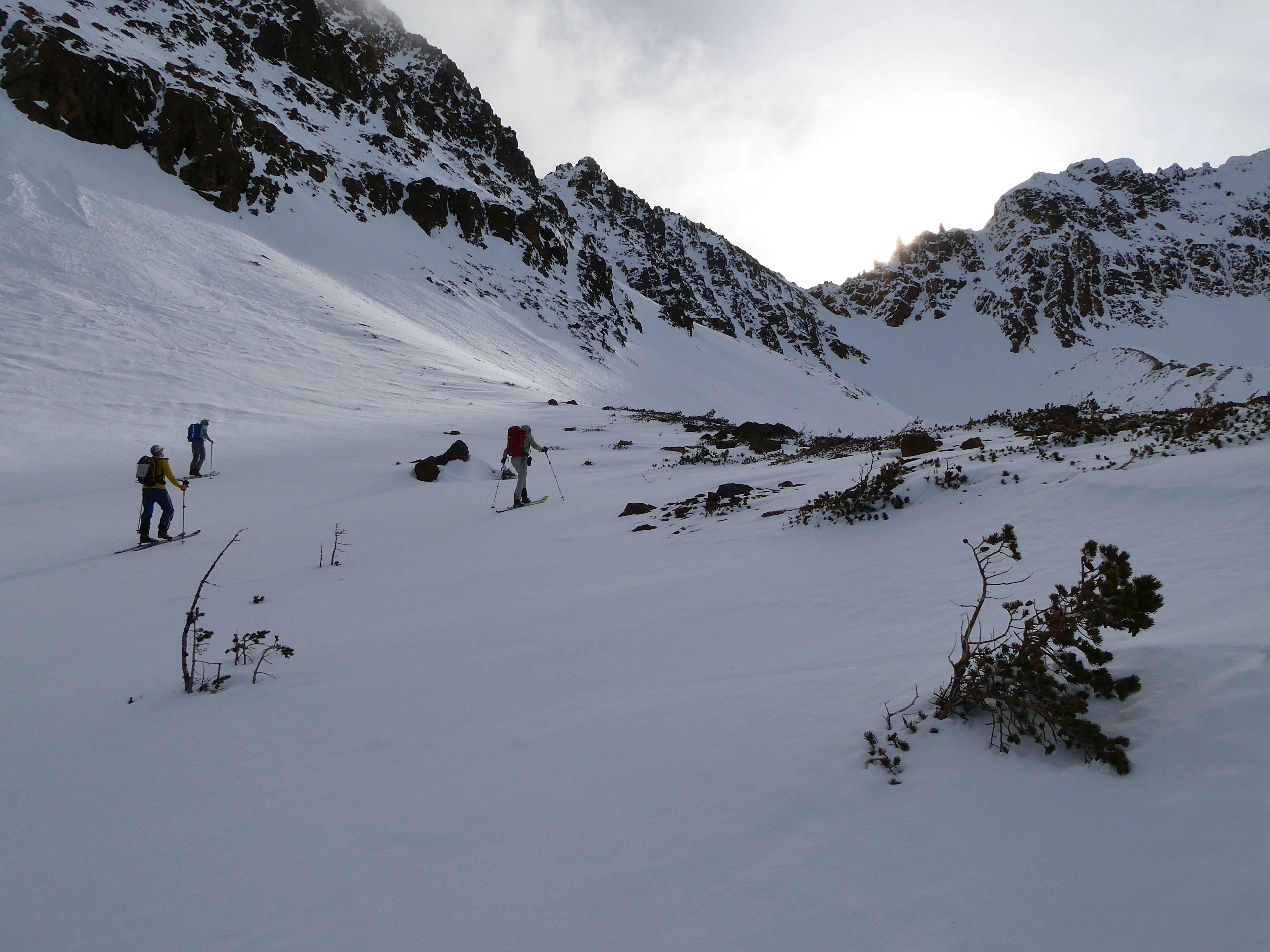
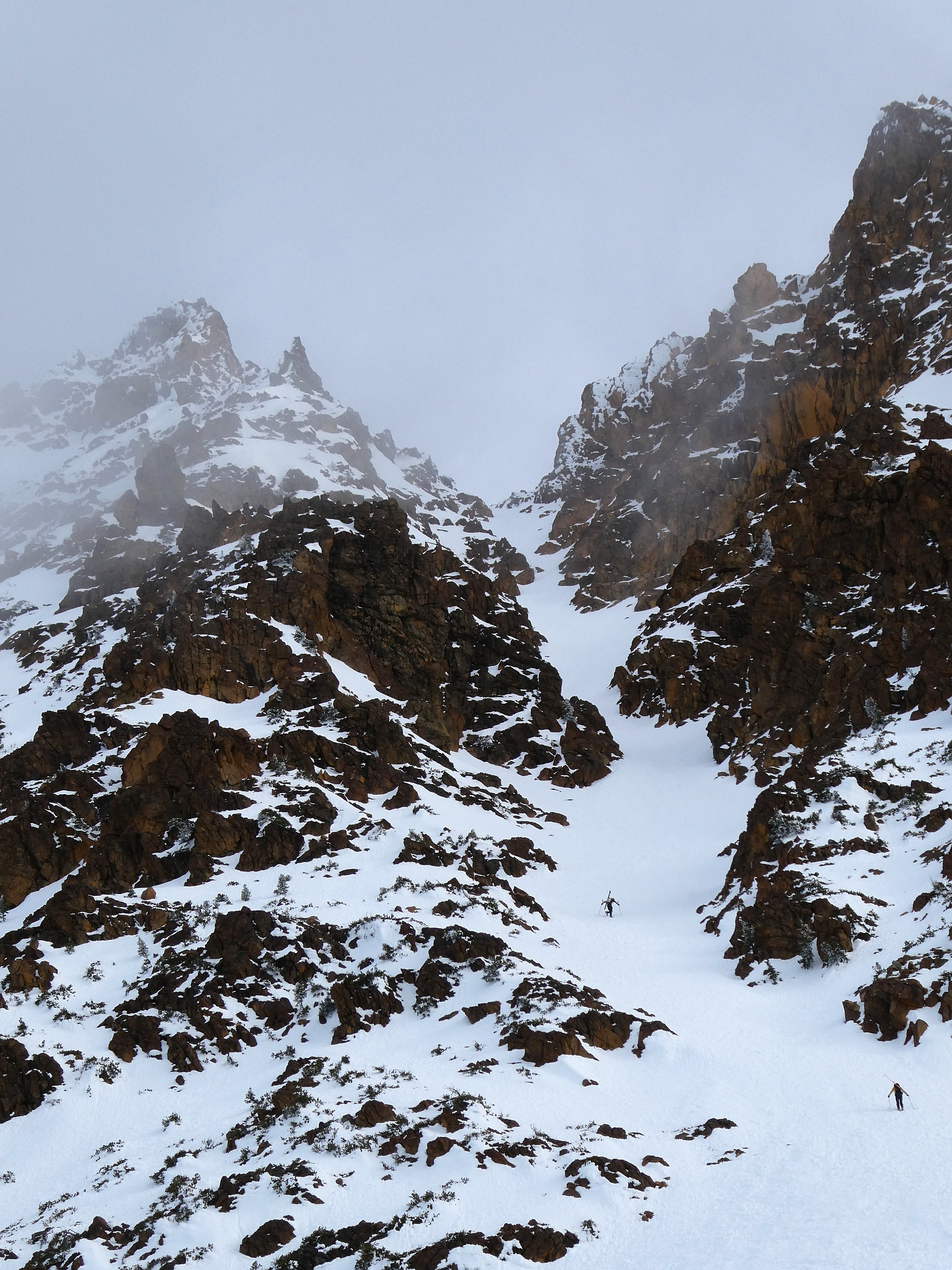
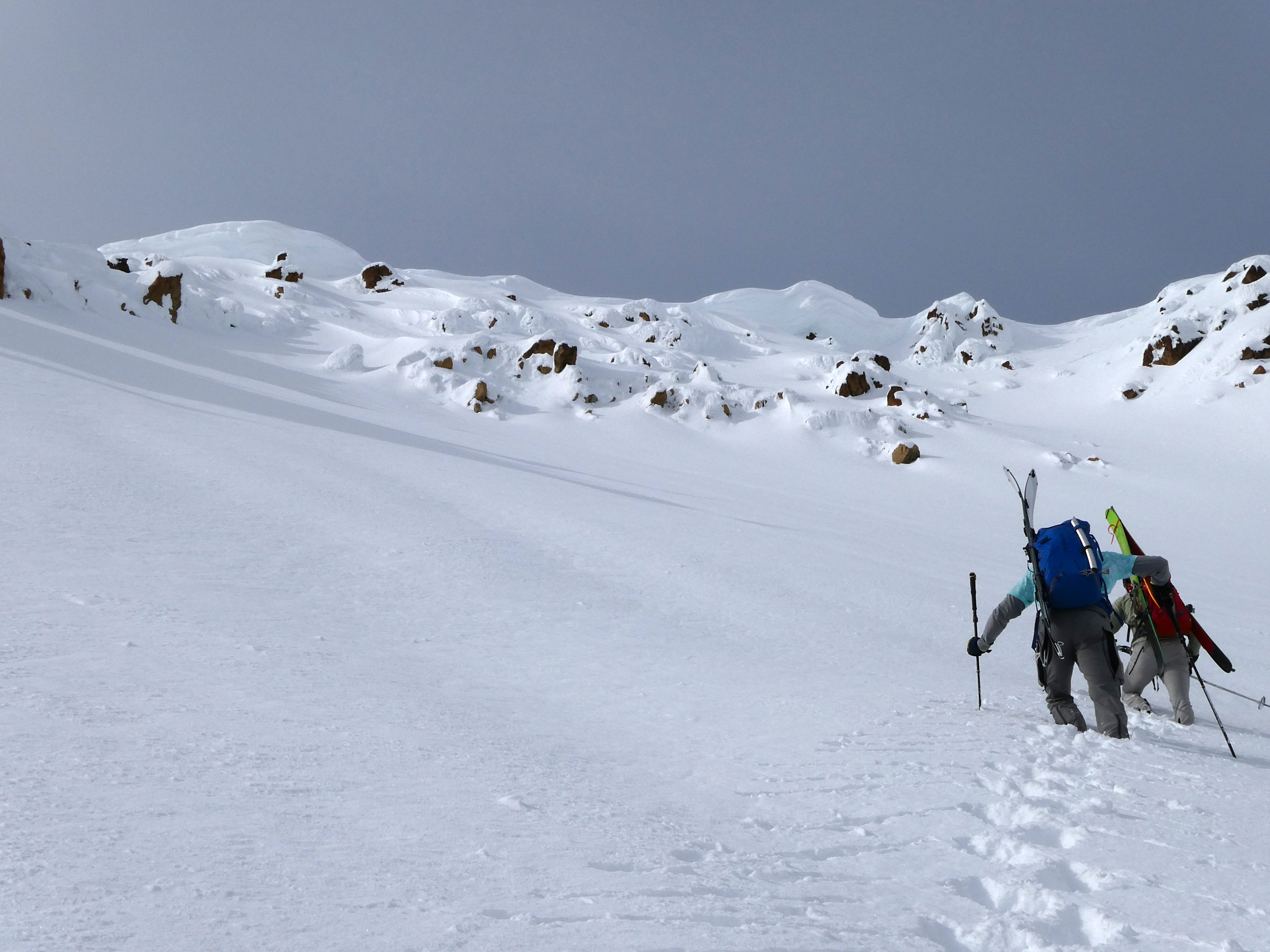
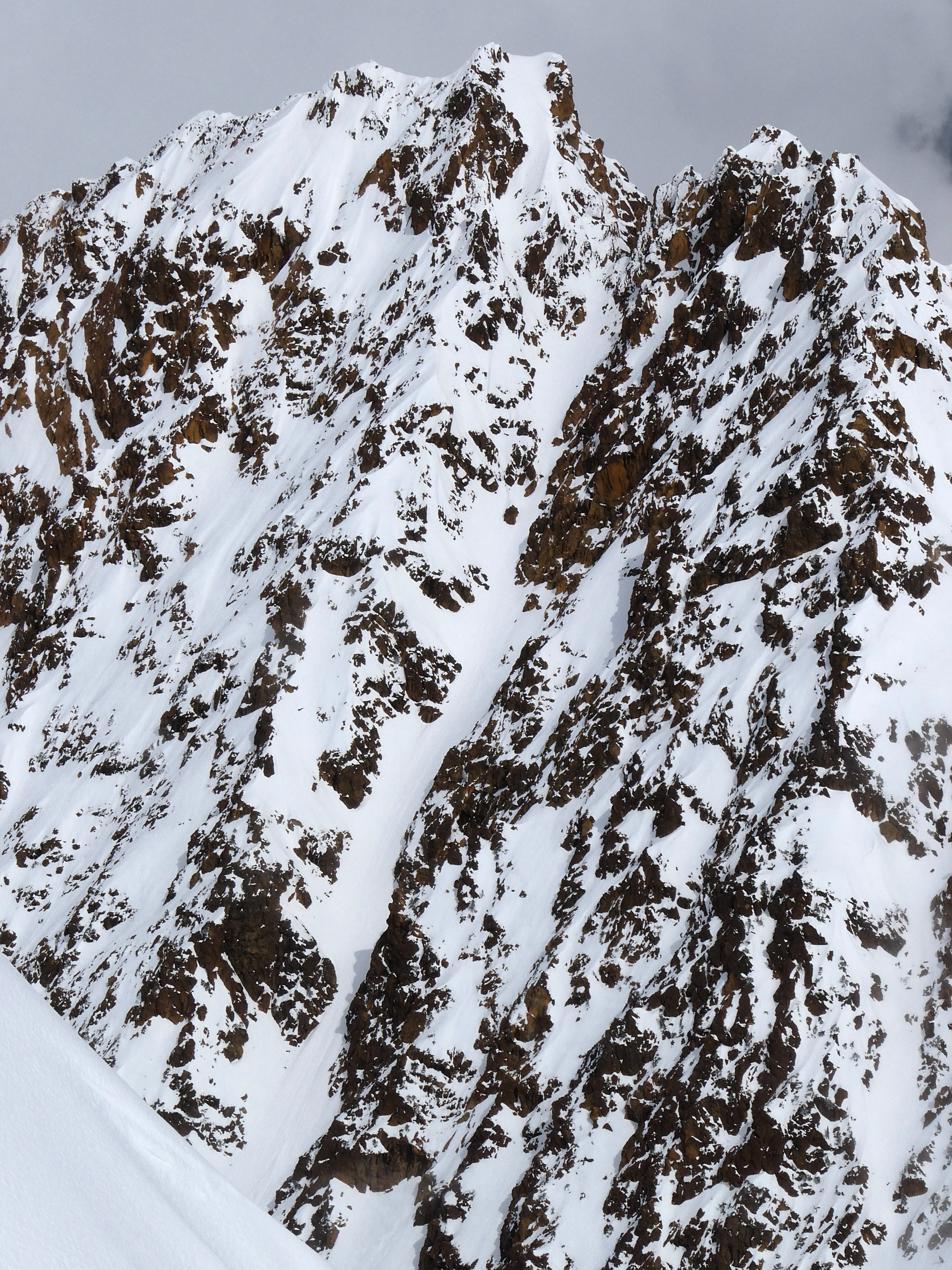
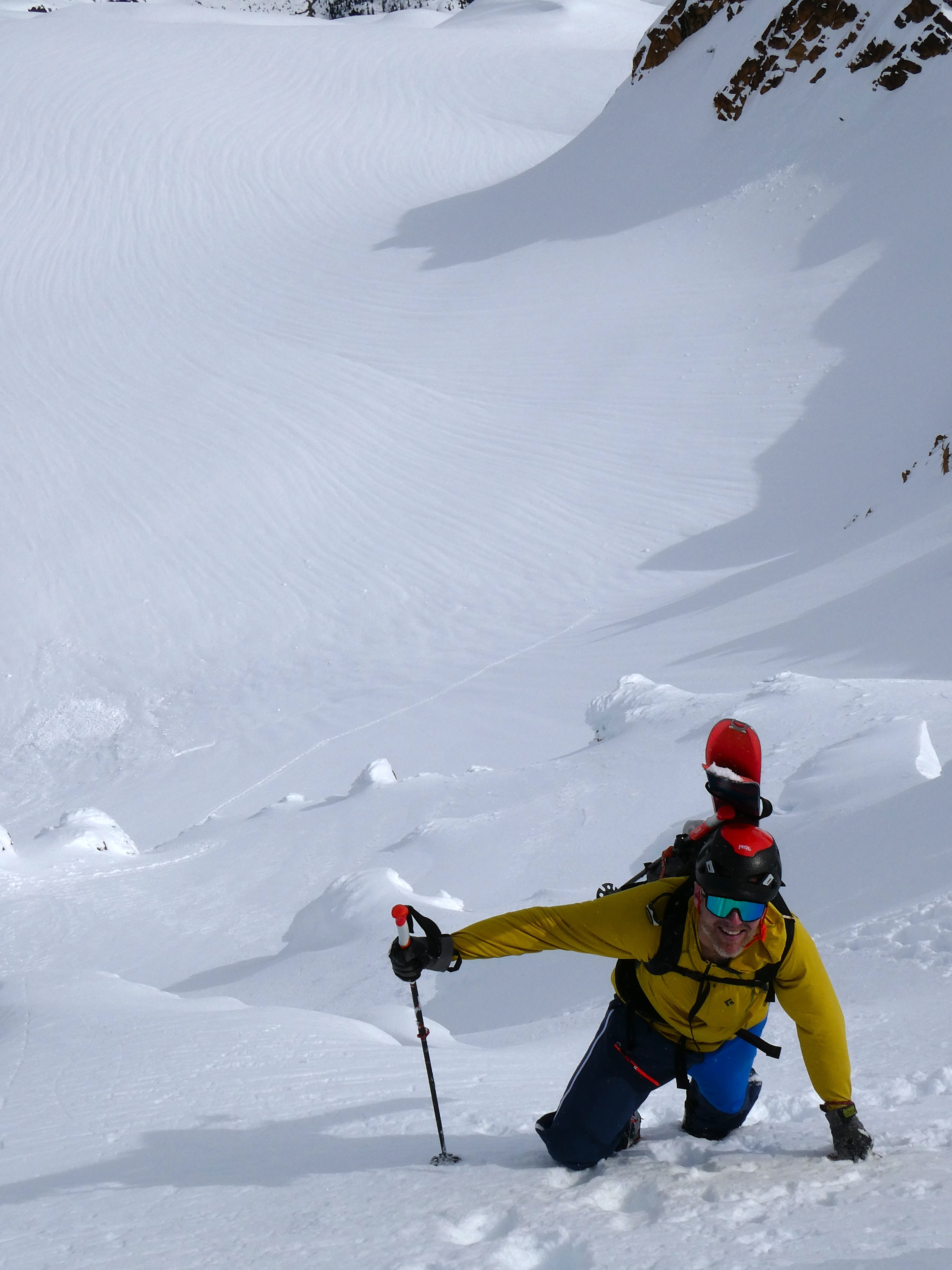
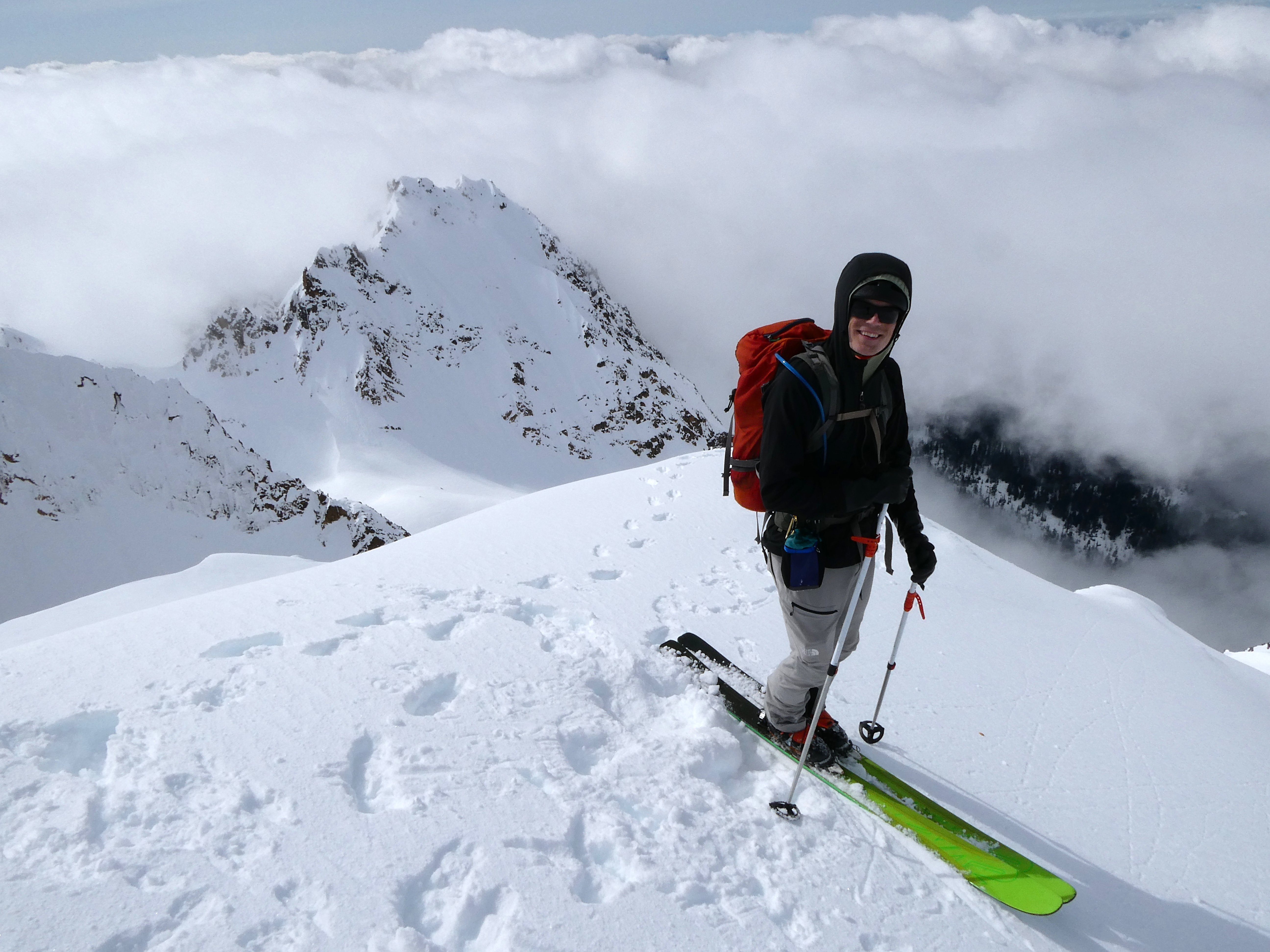
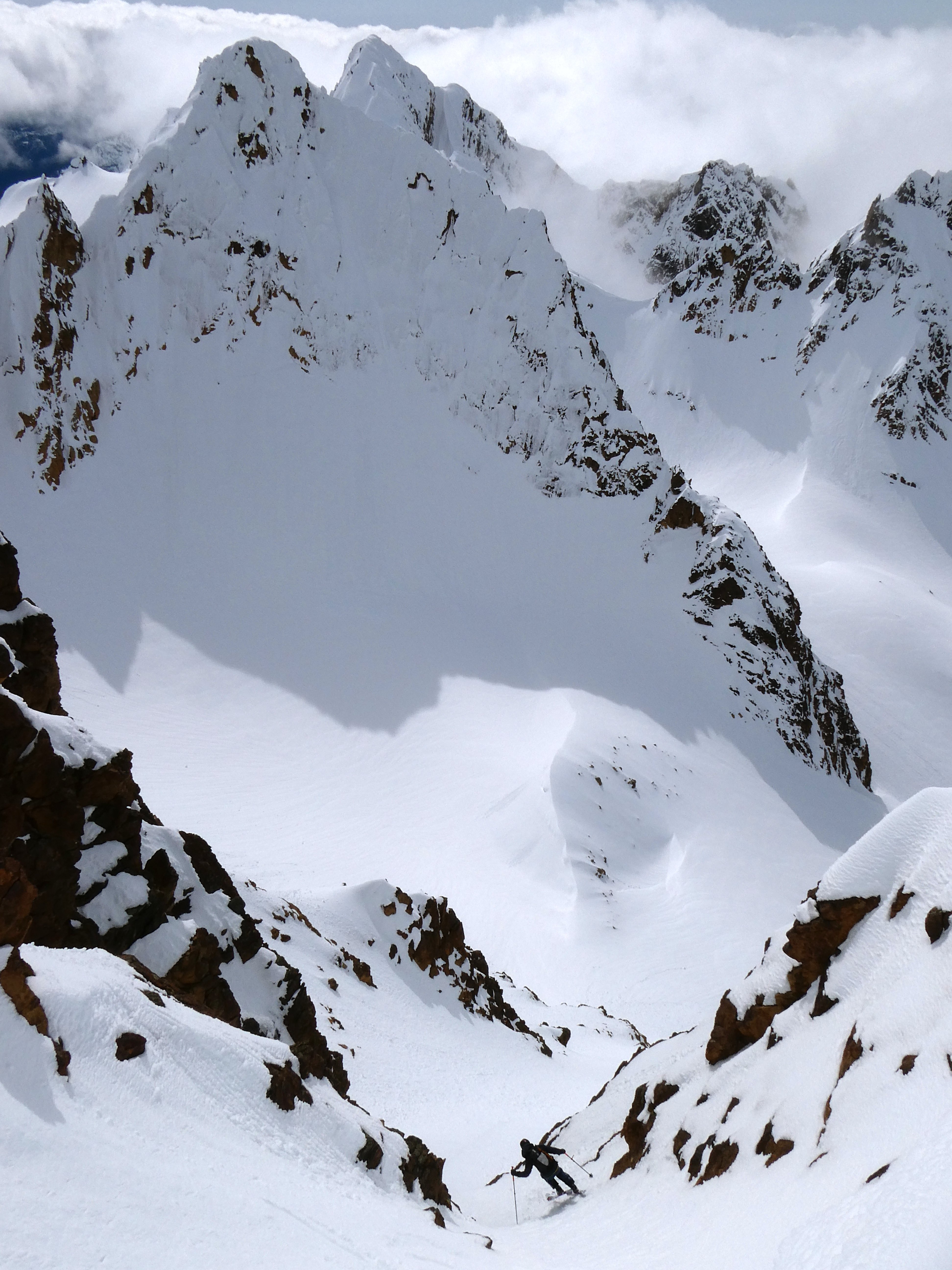
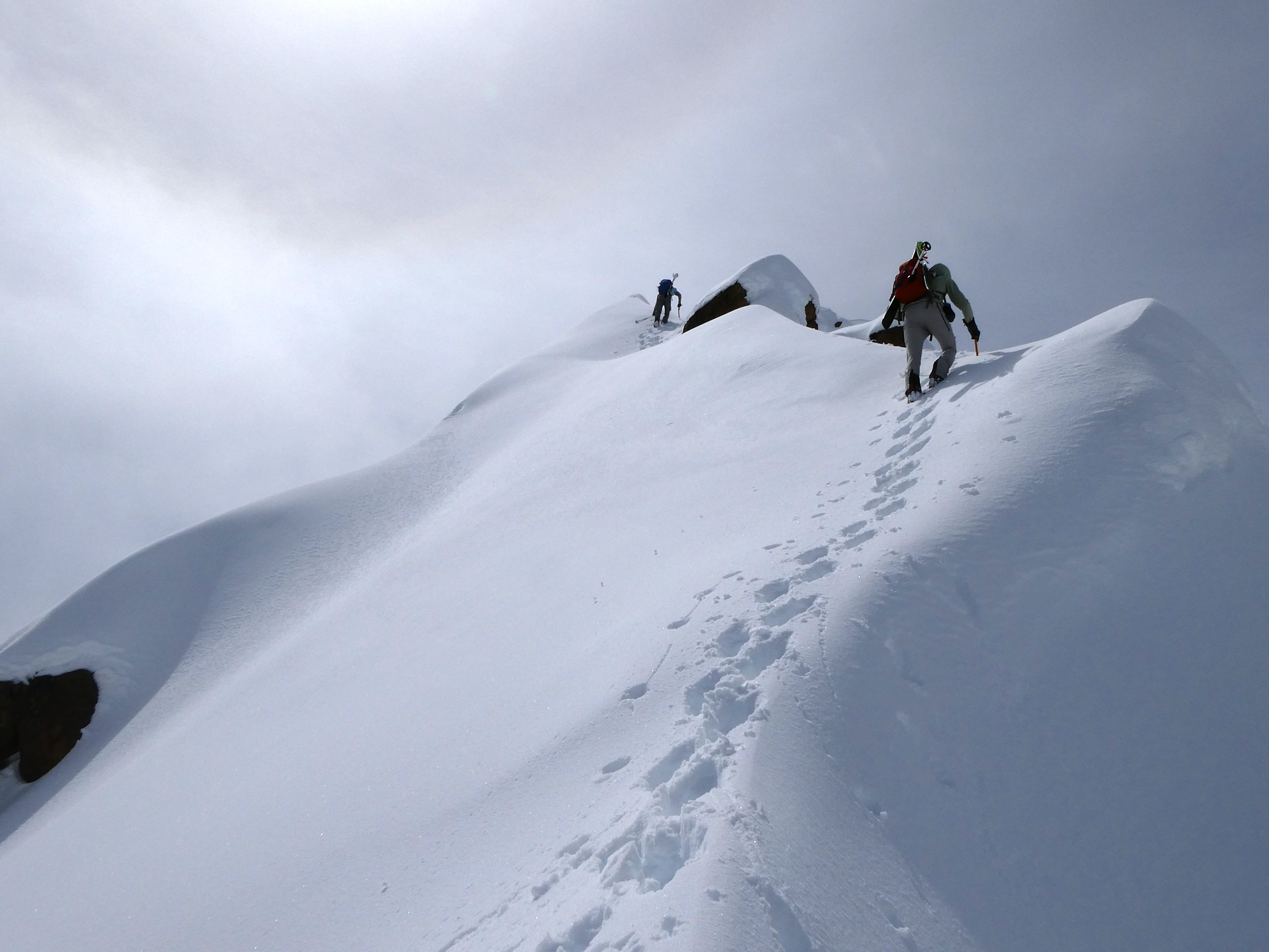
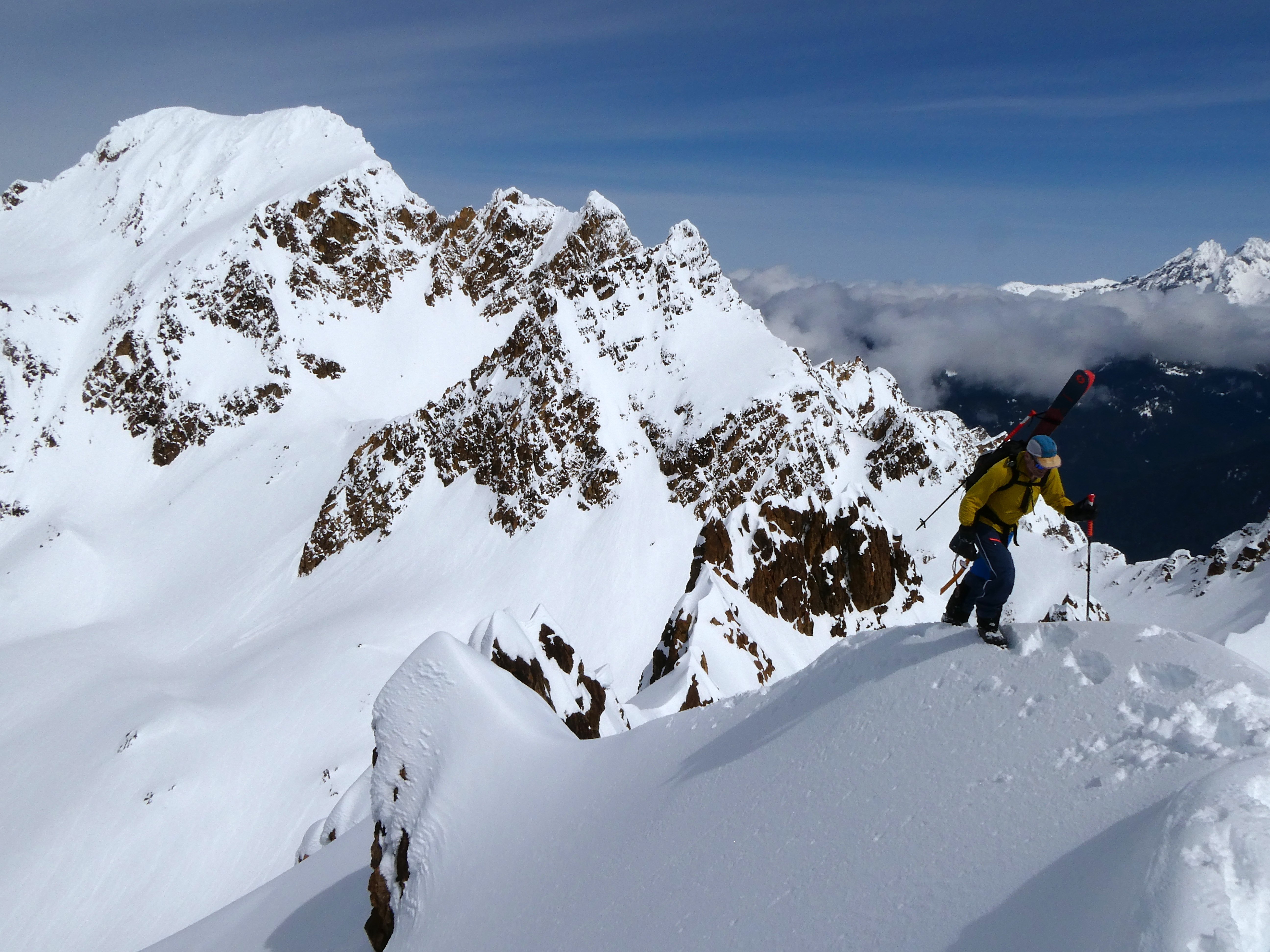
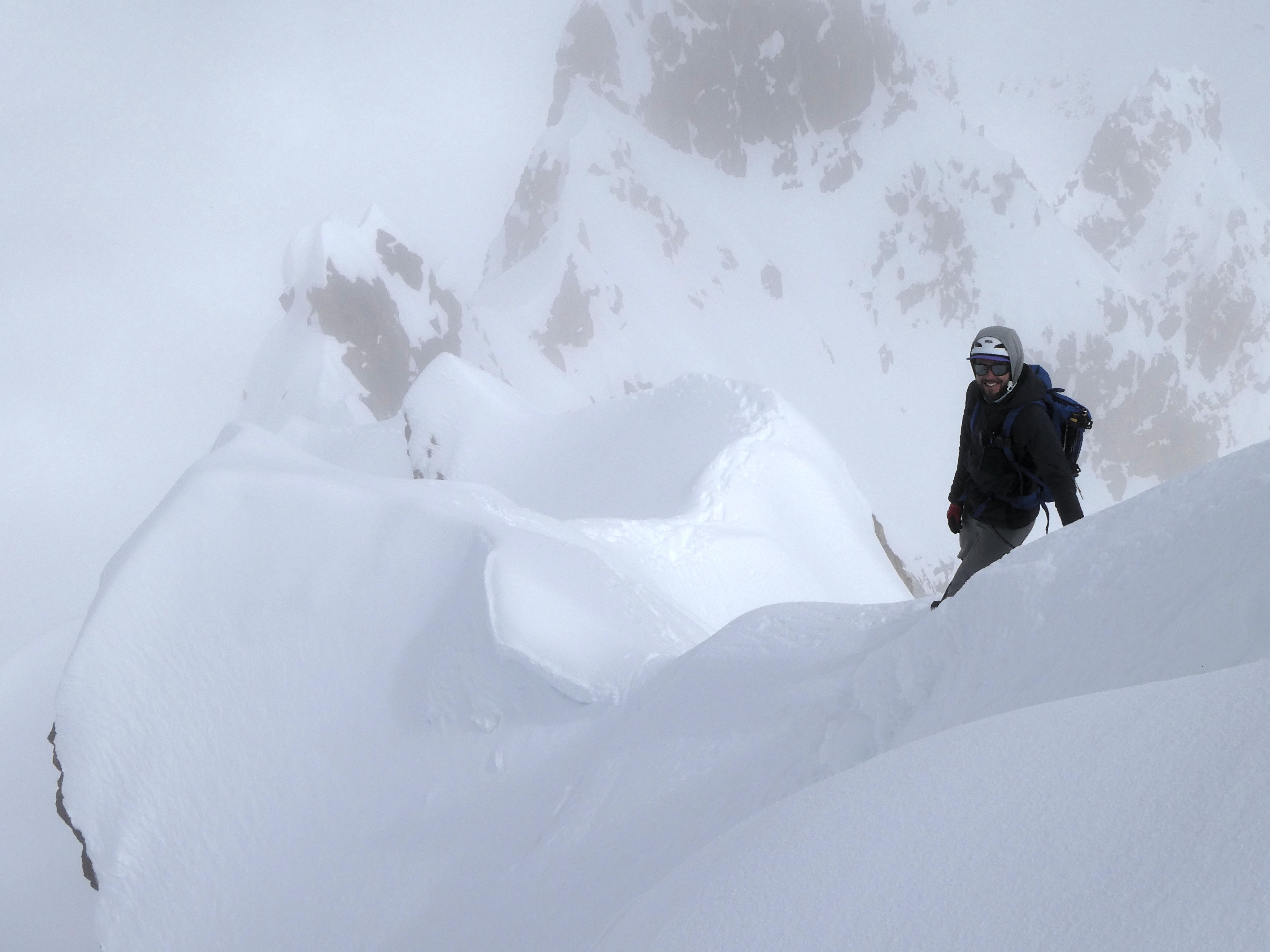
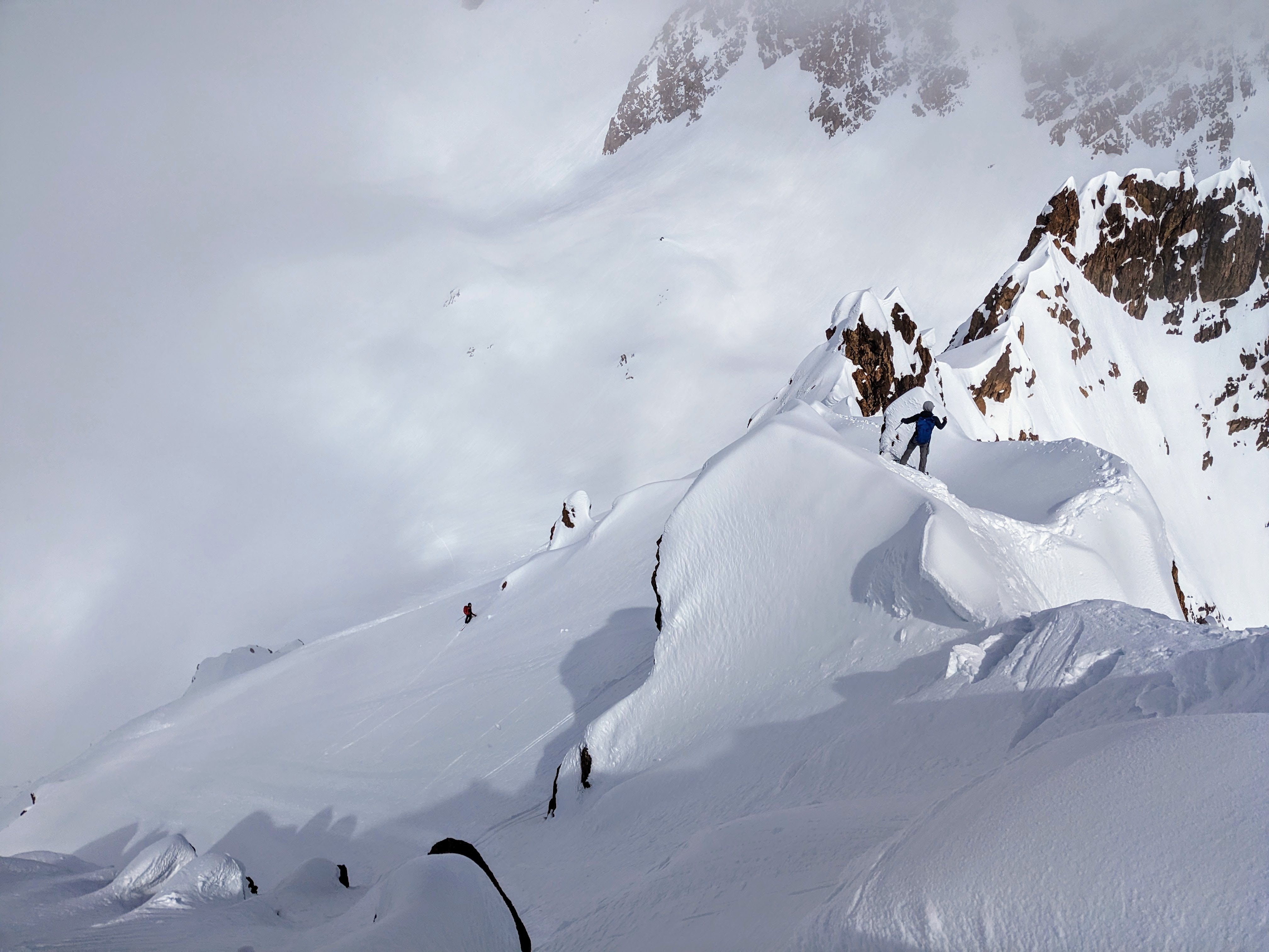
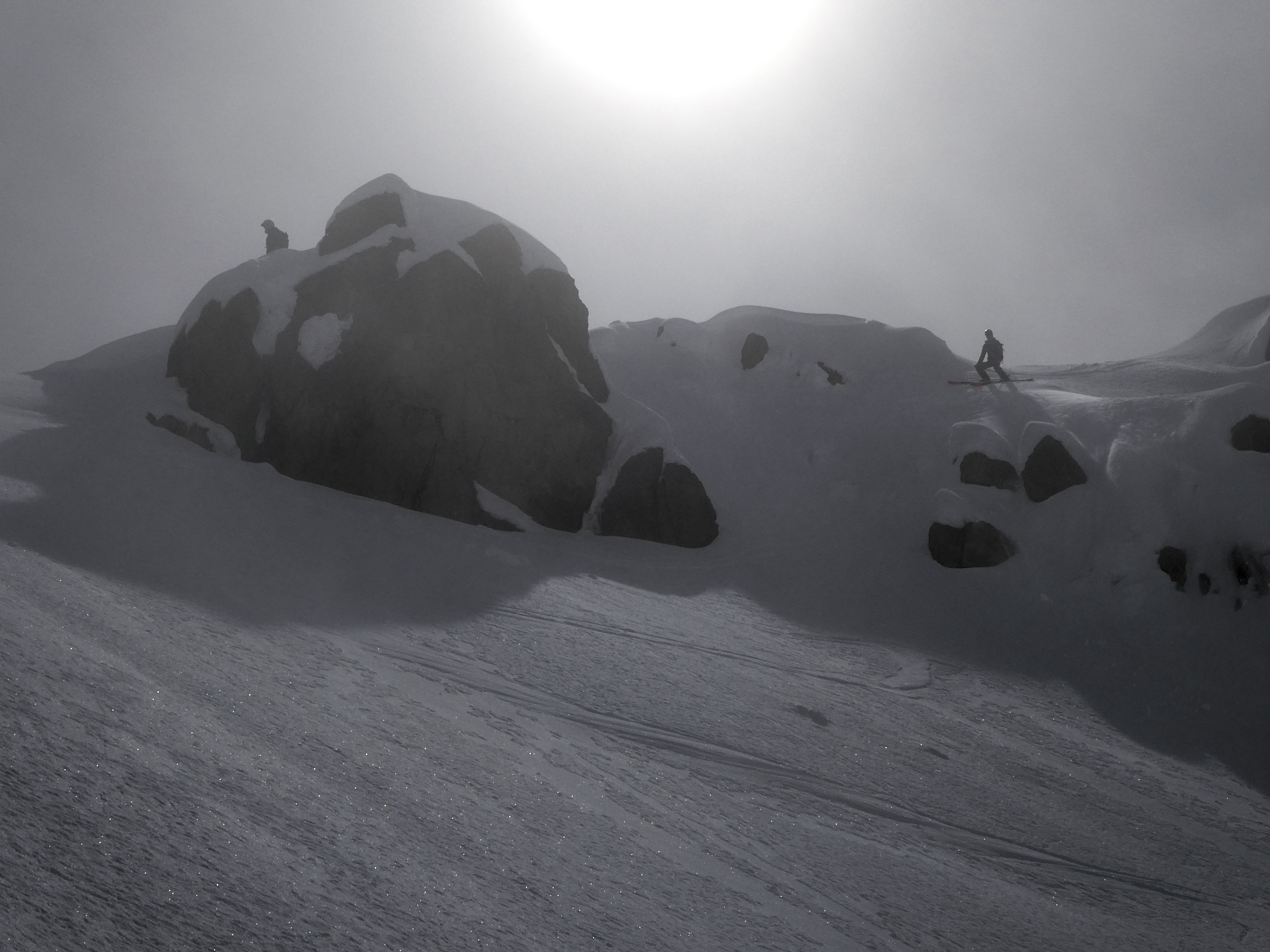
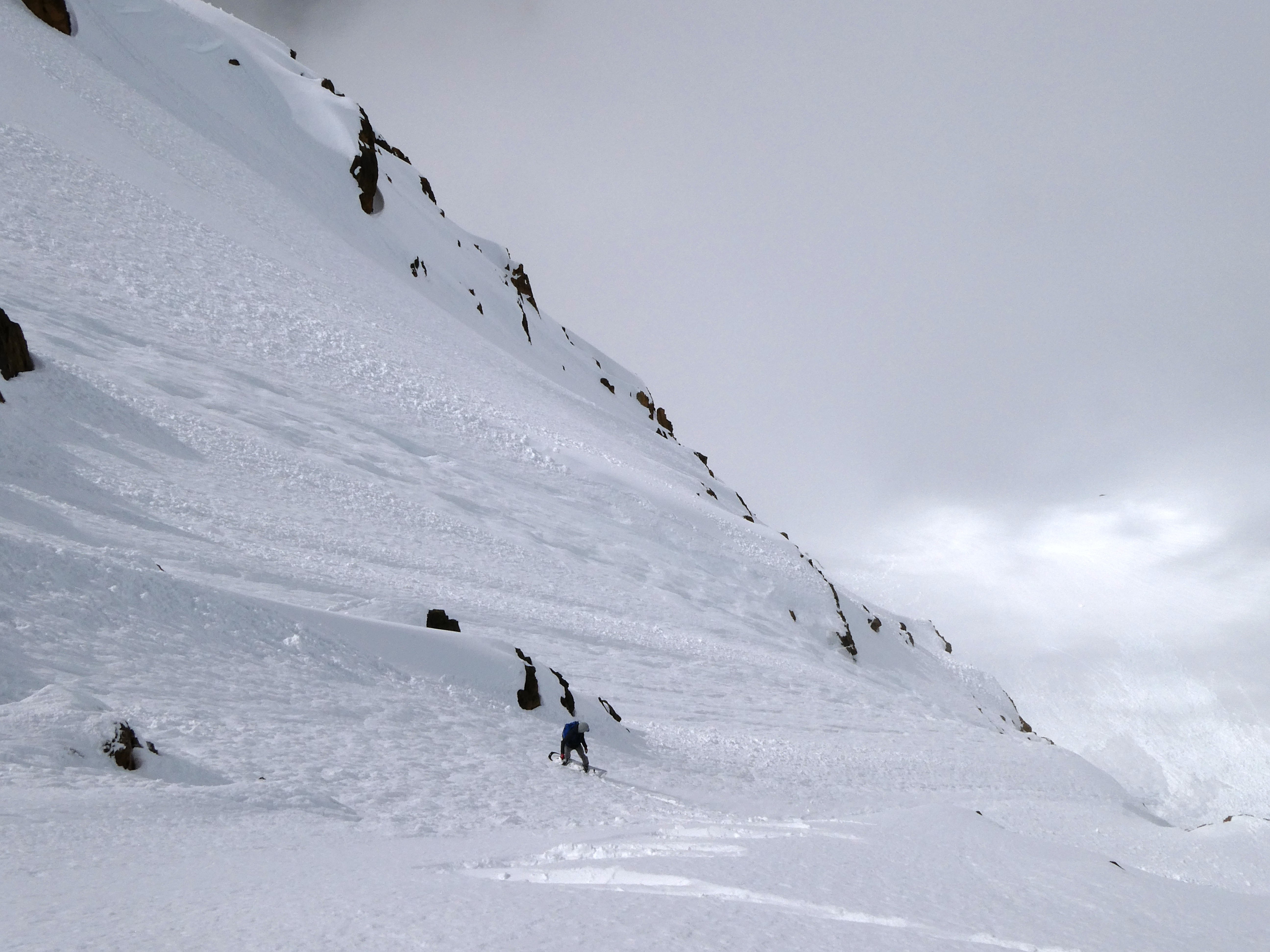
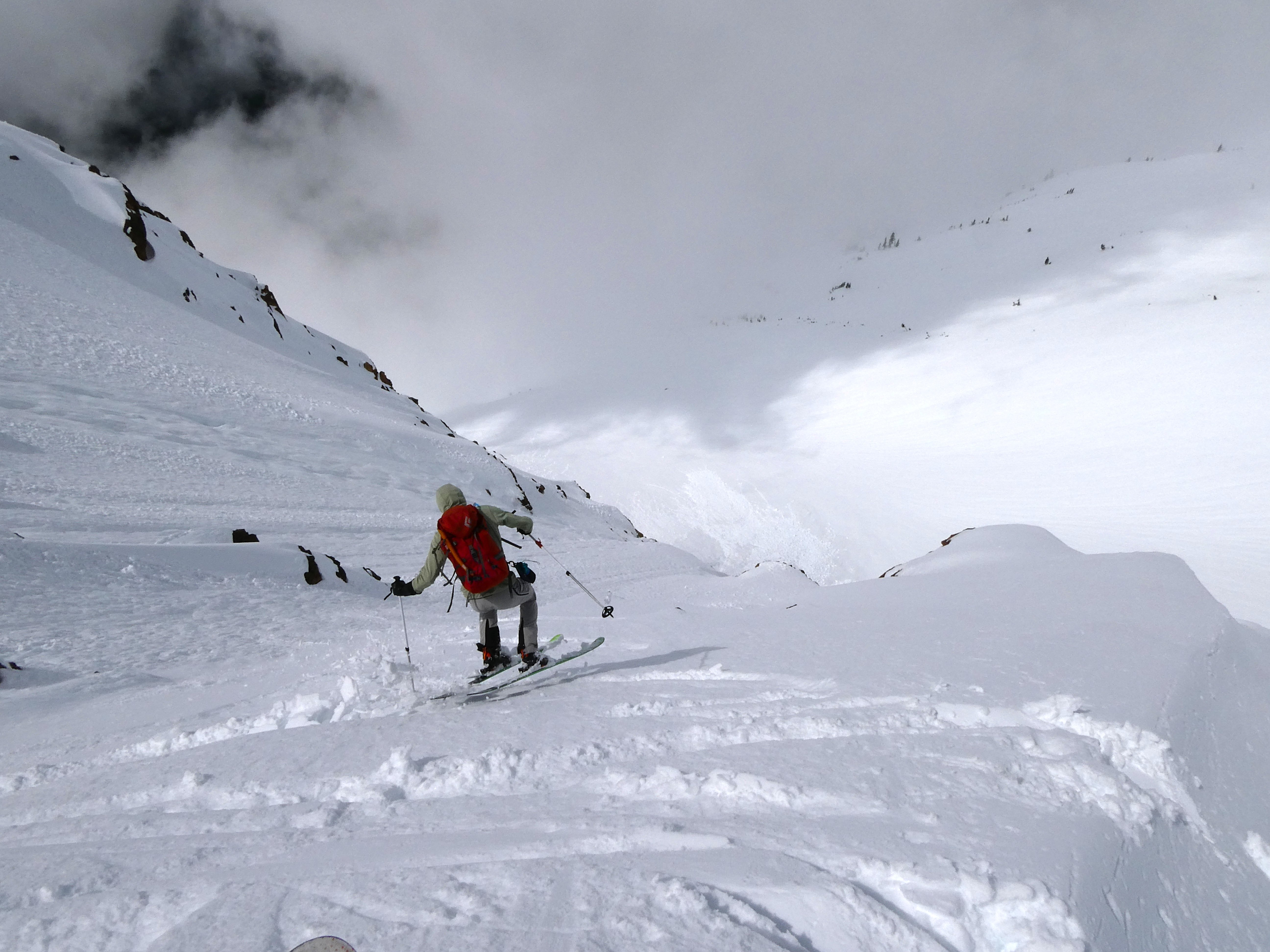
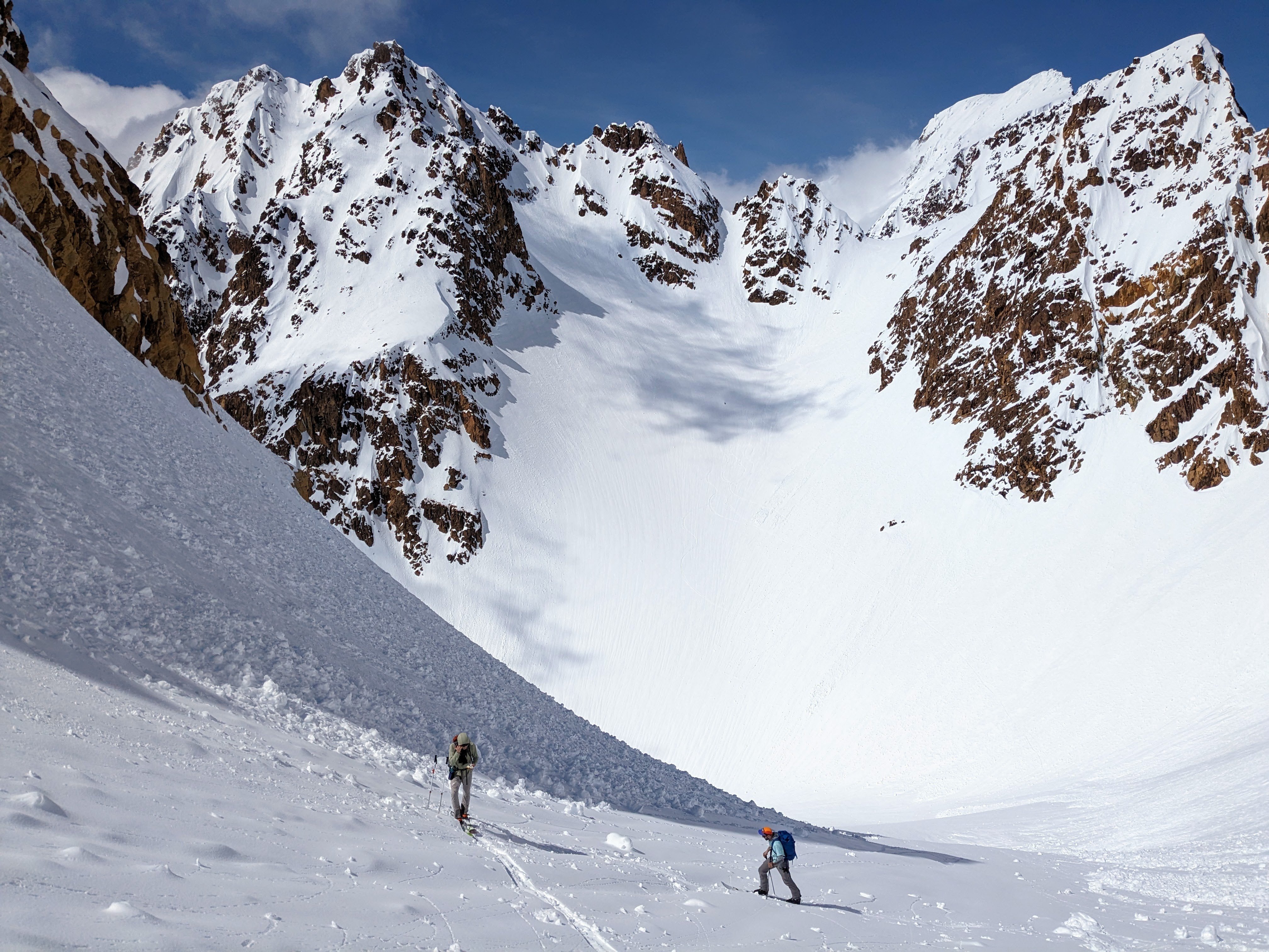
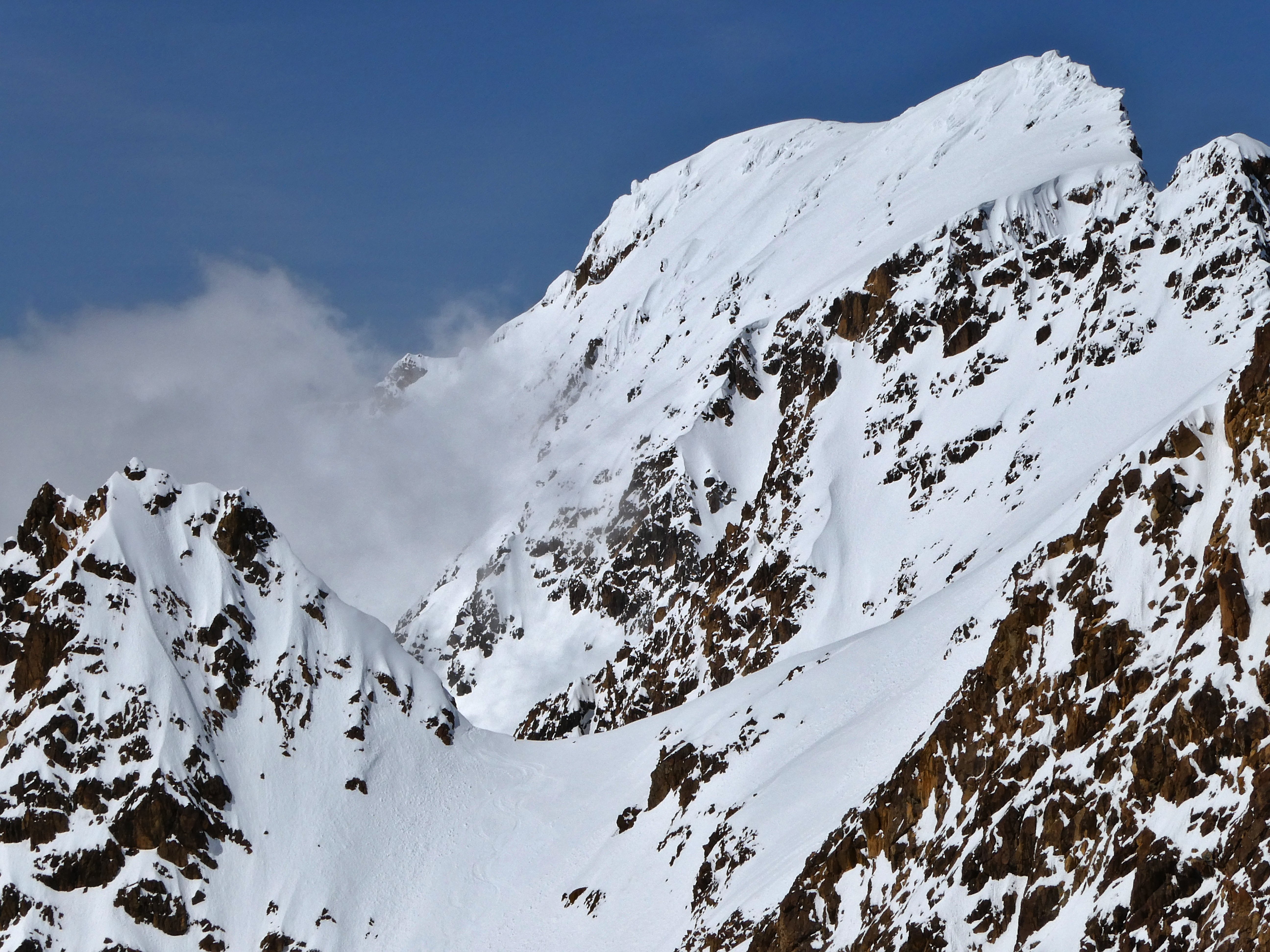
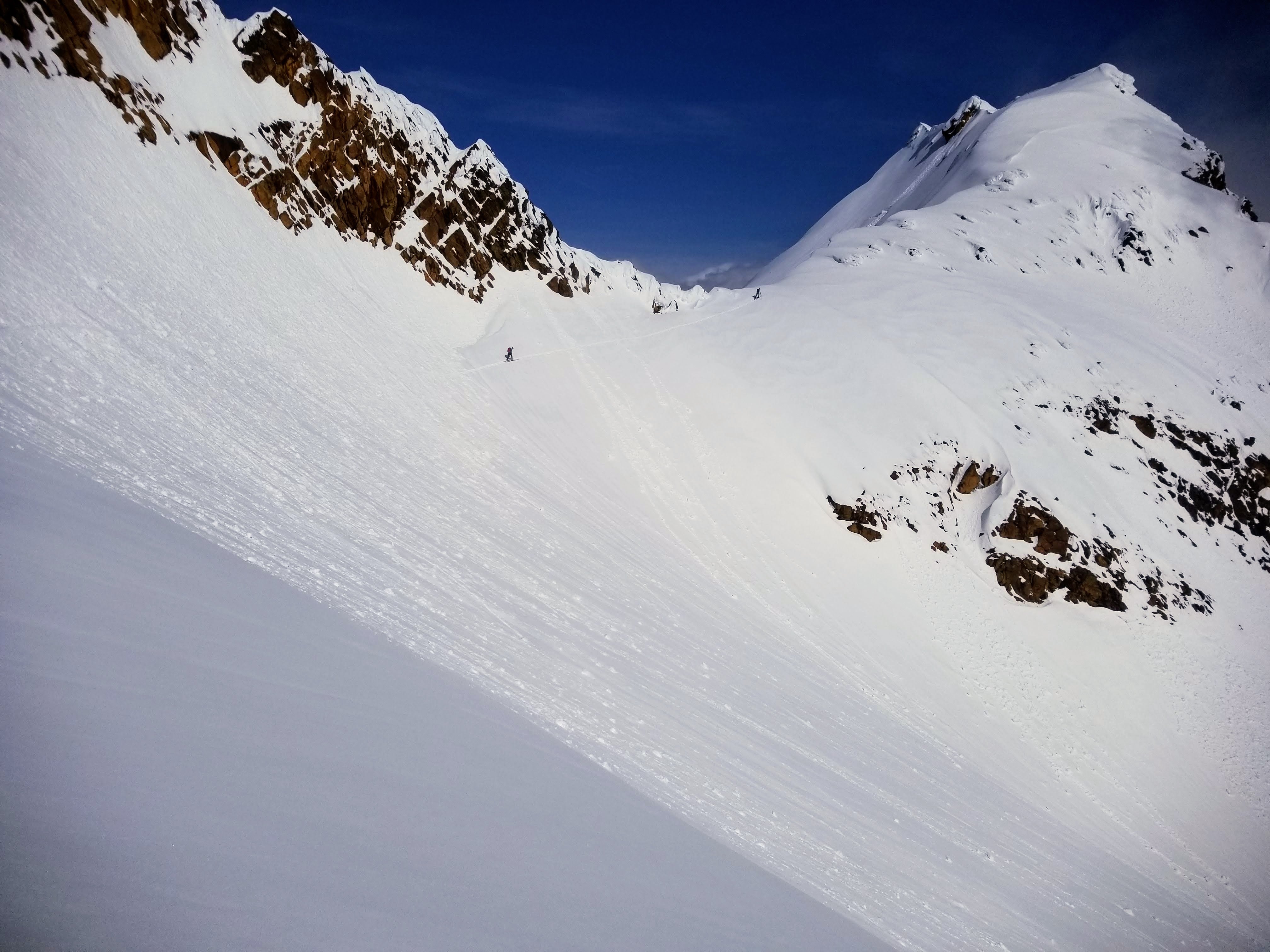
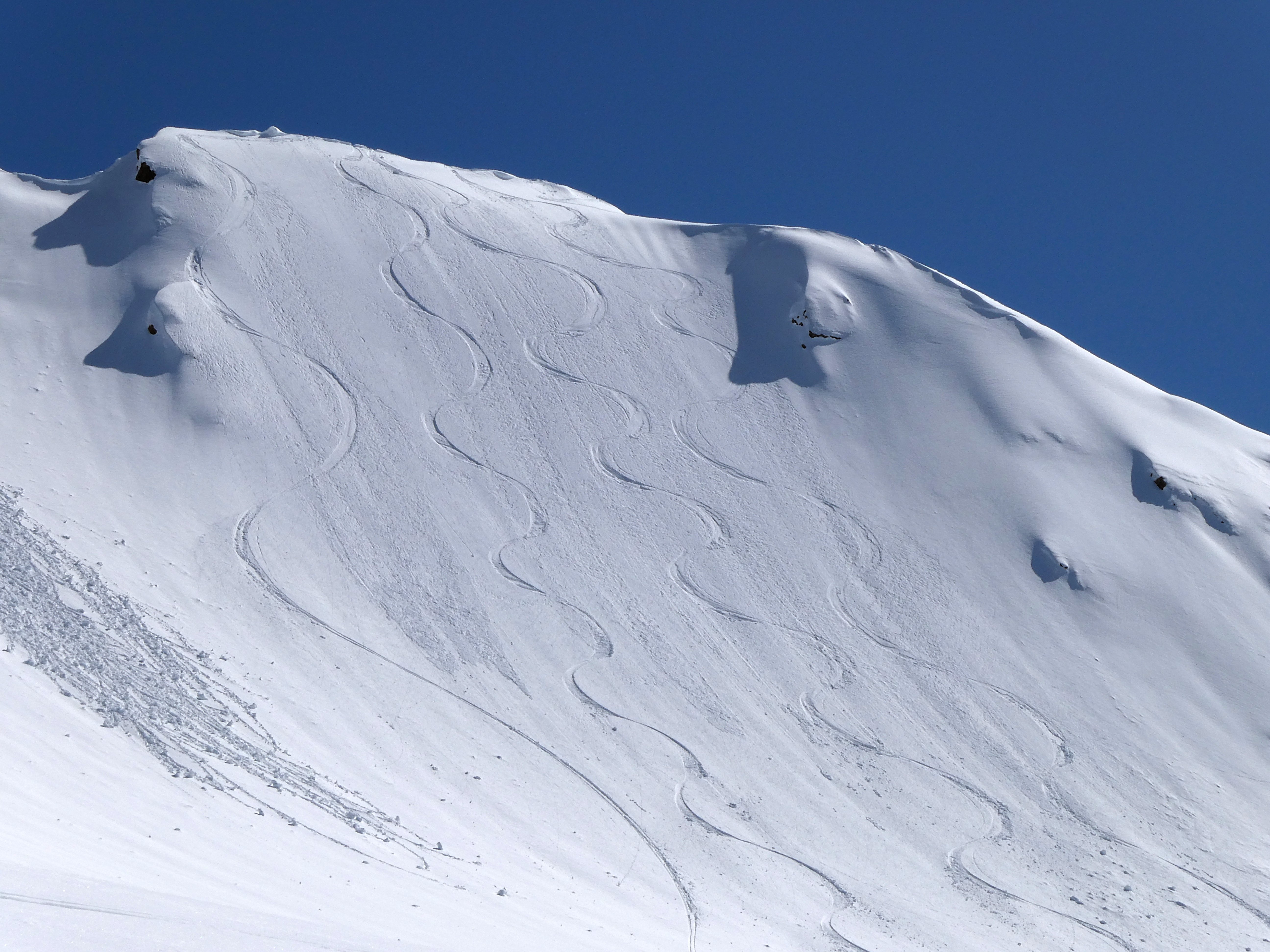
Trip: Augustin Peak - Trident Glacier - Kichatna Mountains - [FA] North Buttress (Alaska Grade V, AI4, 4,600ft) Trip Date: 04/21/2023 Trip Report: I will likely continue to update this TR with pictures, history and info about this part of the range. So stay tuned. On April 19th Kurt Ross, Nelson Neirinck and I flew into the Kichatna Mountains of Alaska with three weeks of food and hopes to climb a couple new routes if weather allowed. We got dropped off on the Trident, a tri-forked glacier on the east edge of the range. Our primary objective was to attempt the unclimbed N-Buttress of Augustin Peak up to the north ridge, which we would then follow to the summit. We arrived right at the end of a stellar weather window, allowing us no time to explore or get a feel for conditions. We crossed our fingers hoping for good neve, but accepted that sugar snow wallowing was entirely possible. While Kurt finished setting up our hasty basecamp, and Nelson slept off his jet lag (he had just flown in from Norway), I skied over to get photos of our route and choose a line as the sun fell behind the neighboring peaks. My alarm went off at 4am the next morning. Nerves were high as we ate a hefty breakfast and discussed our planned route. With so many question marks, we almost bailed on our plan in favor of poking around to get more info on the snowpack. Thankfully we stuck with plan A, but in turn got a somewhat comfortable start at 6am with two and a half days of food and fuel. We expected to bivy somewhere on the north ridge that night, hopefully summiting and descending the next day. Following my skin track over to the base, we trudged up the snow cone to the start of the route which boasted nice looking water ice to start the day. Nelson took the first block, leading us up the ice steps in a fun ~100m pitch of AI3. From there he led up another 250m pitch up through some more easy ice and up the lower snowfield to the base of the runnels I had spotted the day prior. This was the last time we used the Ice screws for the remainder of the route. This part of the buttress was one of the bigger question marks. From below we could see a series of narrow runnels cutting perfectly through the face, but whether it was Ice, neve or sugar snow was what we were scared of. As Kurt took off, we were delighted to find almost perfect neve plastered to the walls, and just enough rock gear to keep it reasonable. These two long pitches were by far the best climbing on the route. I wished it would go on forever. A small cornice crux led us out of the runnels and into the upper snowfield. Here we unroped and trudged for around 350 meters up to where the buttress met the ridge. It was only 3pm at this point, and with 8 hours of daylight remaining, we hoped we could make it up and over to the east ridge where we could chop out a bivy to spend the night. Based on the conditions up to that point, we decided to skip the crux of the ridge, and traverse lower along the exposed NE face to surpass the corniced knife edge above. After brewing up in the sun, I took over the lead for the ridge ahead. The middle gendarme provided sunbaked rotten slush climbing to get up and over. Once on the NE face I tried to make a shortcut through a rock band, but encountered vertical facets over rock, so backed off and descended around instead on the easier but faster terrain below. Once the pro ran out, we unroped and continued to the summit simul soloing the same steep snow to AI2 conditions we had been on for the past several hours. We reached the summit around 9pm as the evening sun began to set. Despite being pretty tuckered out, the increasing winds and rapidly dropping temps encouraged us to keep moving. Chopping out a platform for our two person tent while being hammered by wind did not seem appealing. Down climbing to flatter, less exposed terrain did. Still unroped, we began our slow trudge down the east ridge toward the NE face. 2,500ft and two and a half hours of face in down climbing later, we reached the glacier. Now roped up for glacier travel, Kurt led the way down over numerous schrunds and through the jumbled mess of the icefall in the dark with impressive accuracy. The only hiccups being myself punching through a fairly inconsequential schrund, and Kurt nearly being eaten by a crevasse. Once back on the SE fork of the trident, we wallowed our way out of serac danger and collapsed into the snow to brew up some more water and eat dinner. We were safe at this point, so it felt like a good time to celebrate with some warm food. It was 1:30 in the morning. The incoming storm had filled the sky with clouds, cutting off all ambient star/moon light, making for the darkest night I have ever experienced. We arrived back at our skis at 2:40am, and I crawled back into my tent at 4am. Exactly 24 hours after waking up the day prior. The next 8 days involved a lot of lounging, eating, a little bit of skiing, and no climbing. A series of storms dumped nearly four feet of snow on us. Our bathroom area was buried and required a grid search, Nelson's tent was almost completely buried, and all chances of more climbing were buried along with it. On Saturday, May 29th we got picked up by TAT before another endless series of storms came in. If we hadn’t come out the day we did, we would surely still be trapped in the Kichatnas right now, running out of food, missing flights and being generally really bummed. While quite moderate, I believe the North Buttress of Augustin Peak is now the longest route in the Kichatna Mountains. To the best of our knowledge this was the third ascent of the mountain Gear Notes: Single rack to #3, maybe doubles in middle sizes. Medium selection of iron including NB's a small angle or two and all sizes of beaks. Full rack of nuts from brass to big. 5-8 screws 70m ropes We brought a picket, but didn't use. Different conditions or a different party may find these very useful. Approach Notes: Charter a flight through TAT. Ski 25 minutes to the base.2 points
-
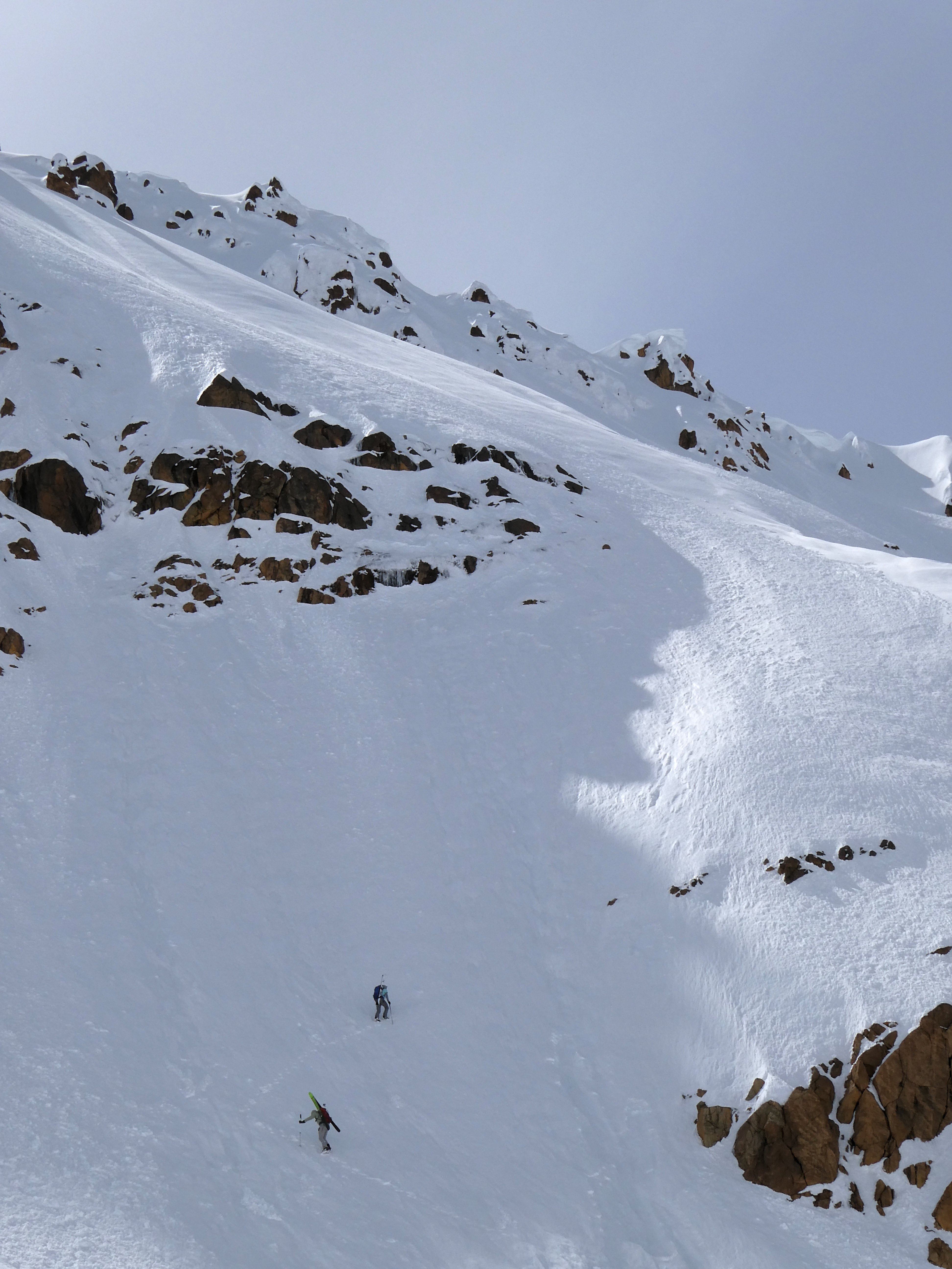
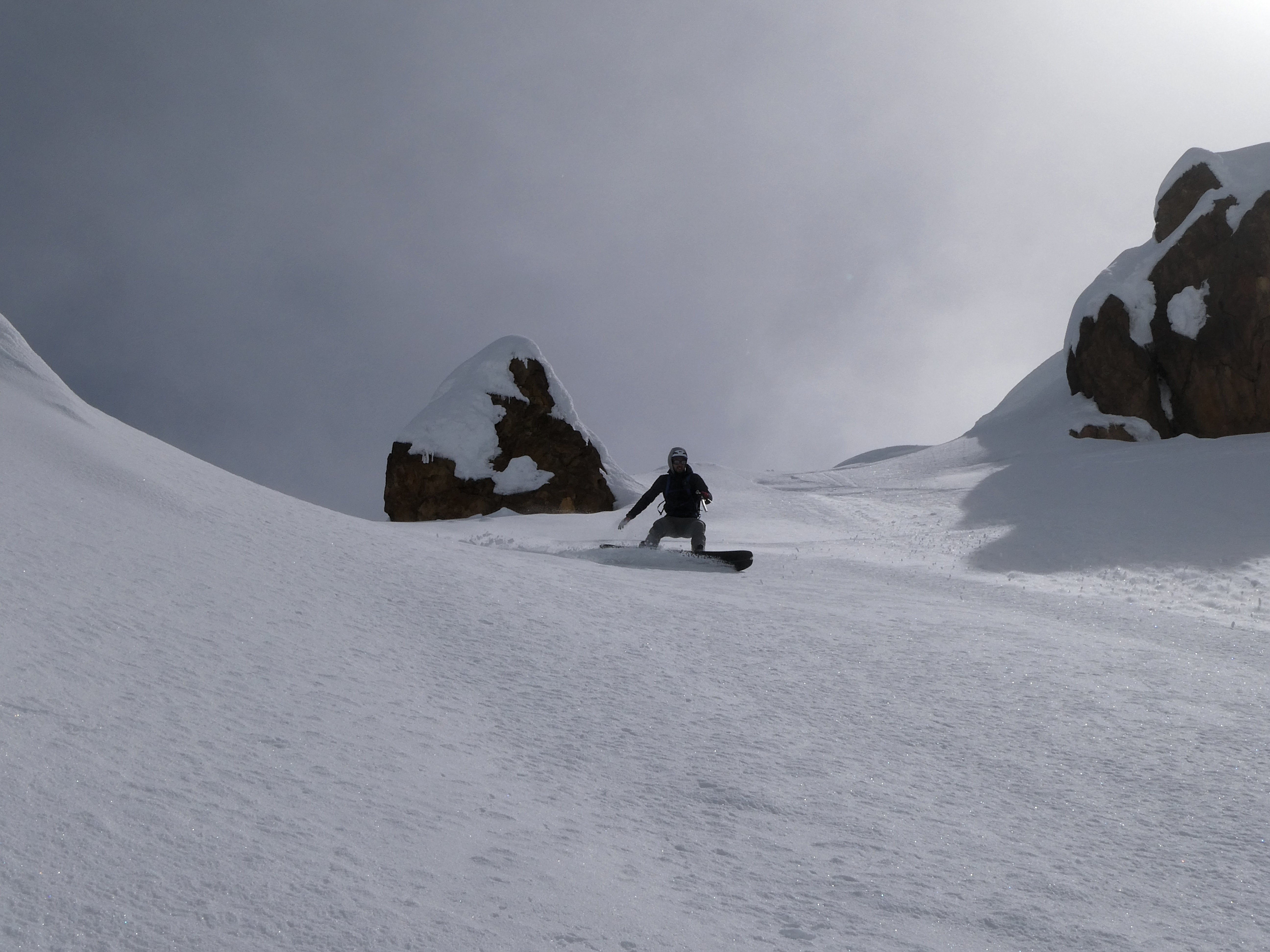
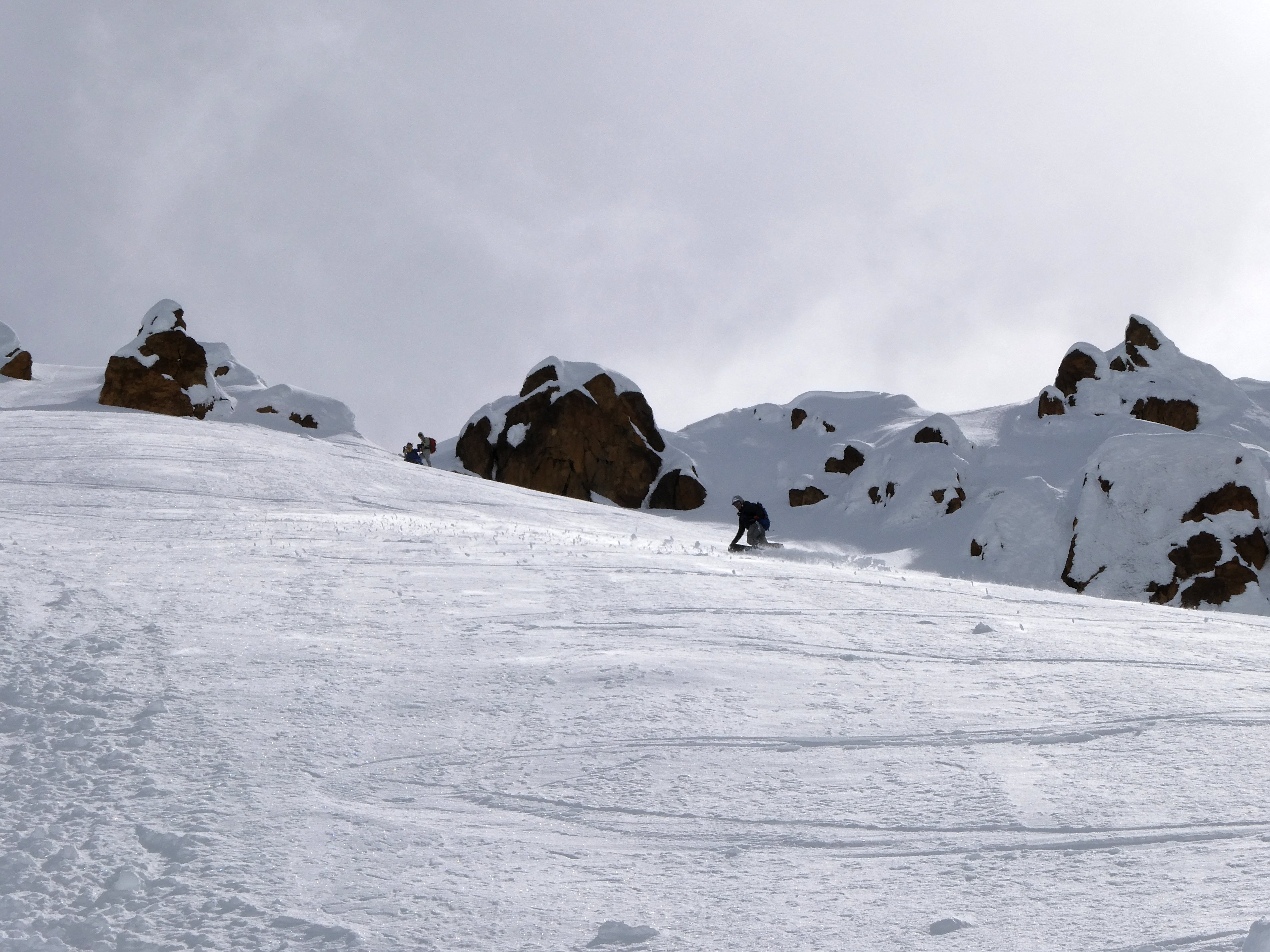
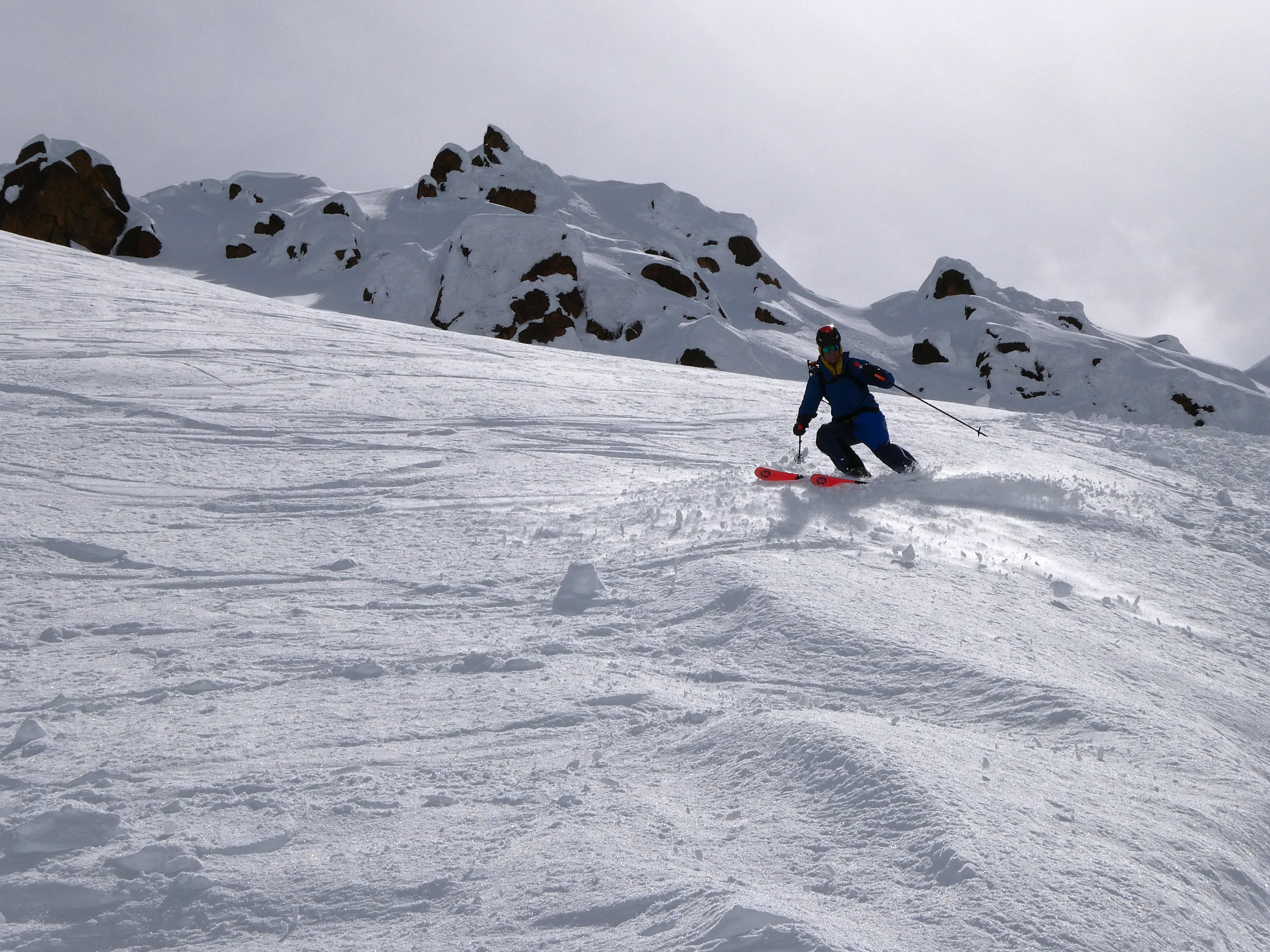
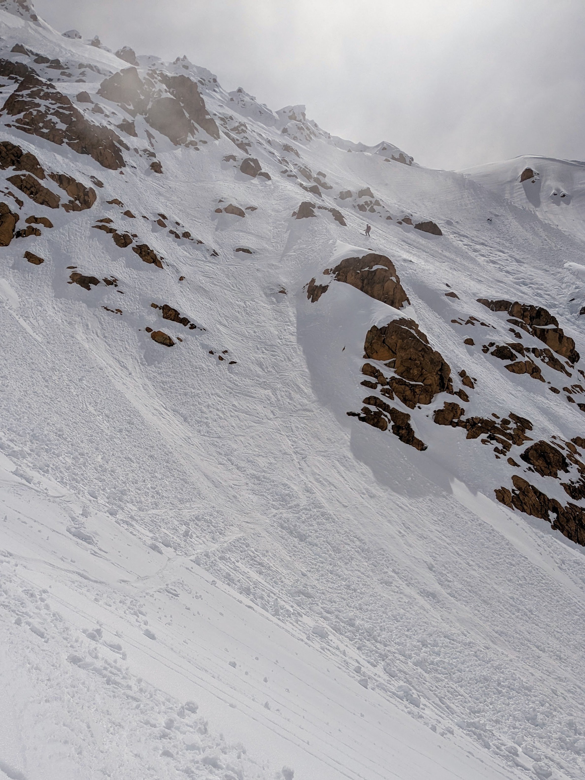
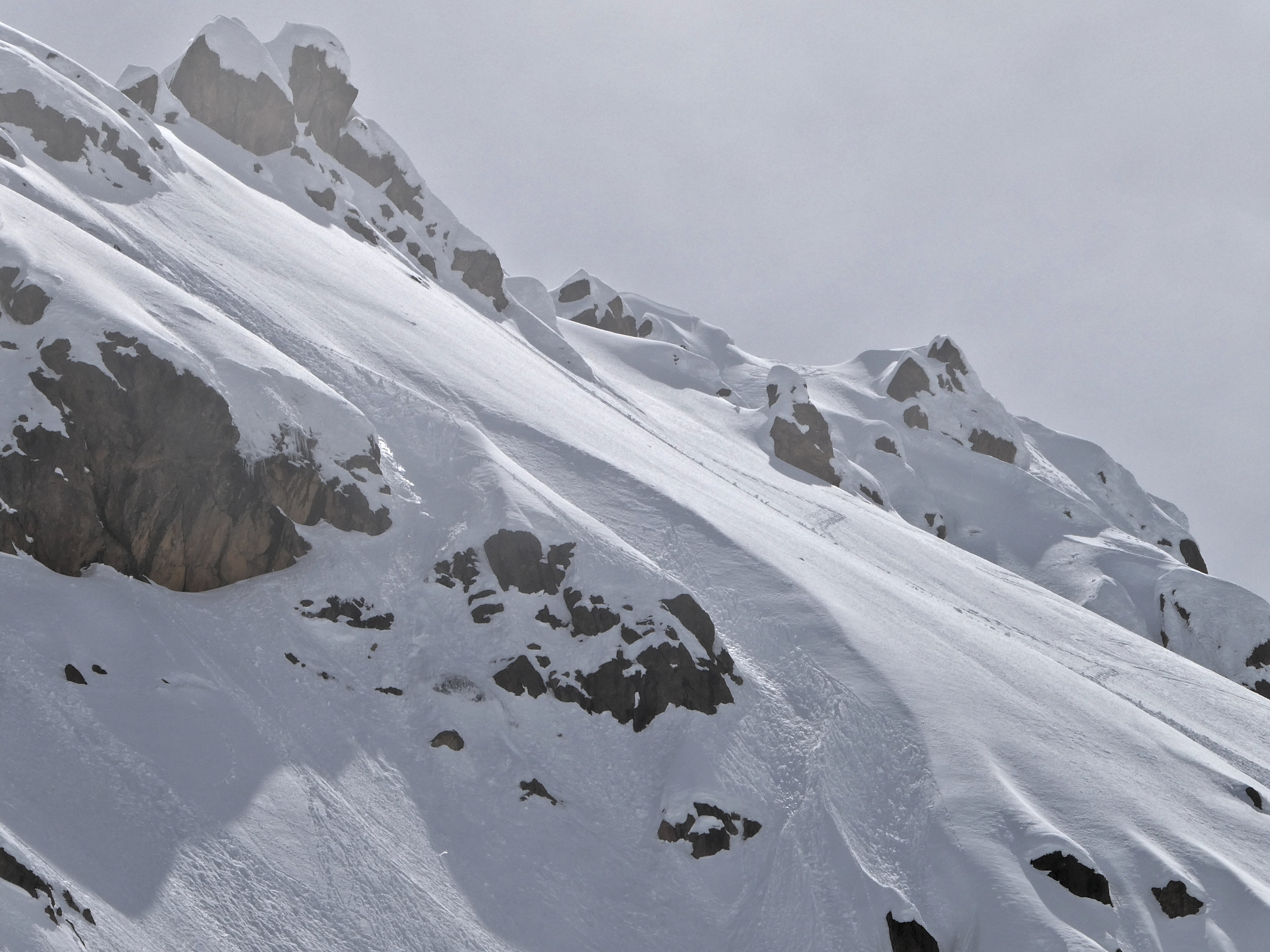
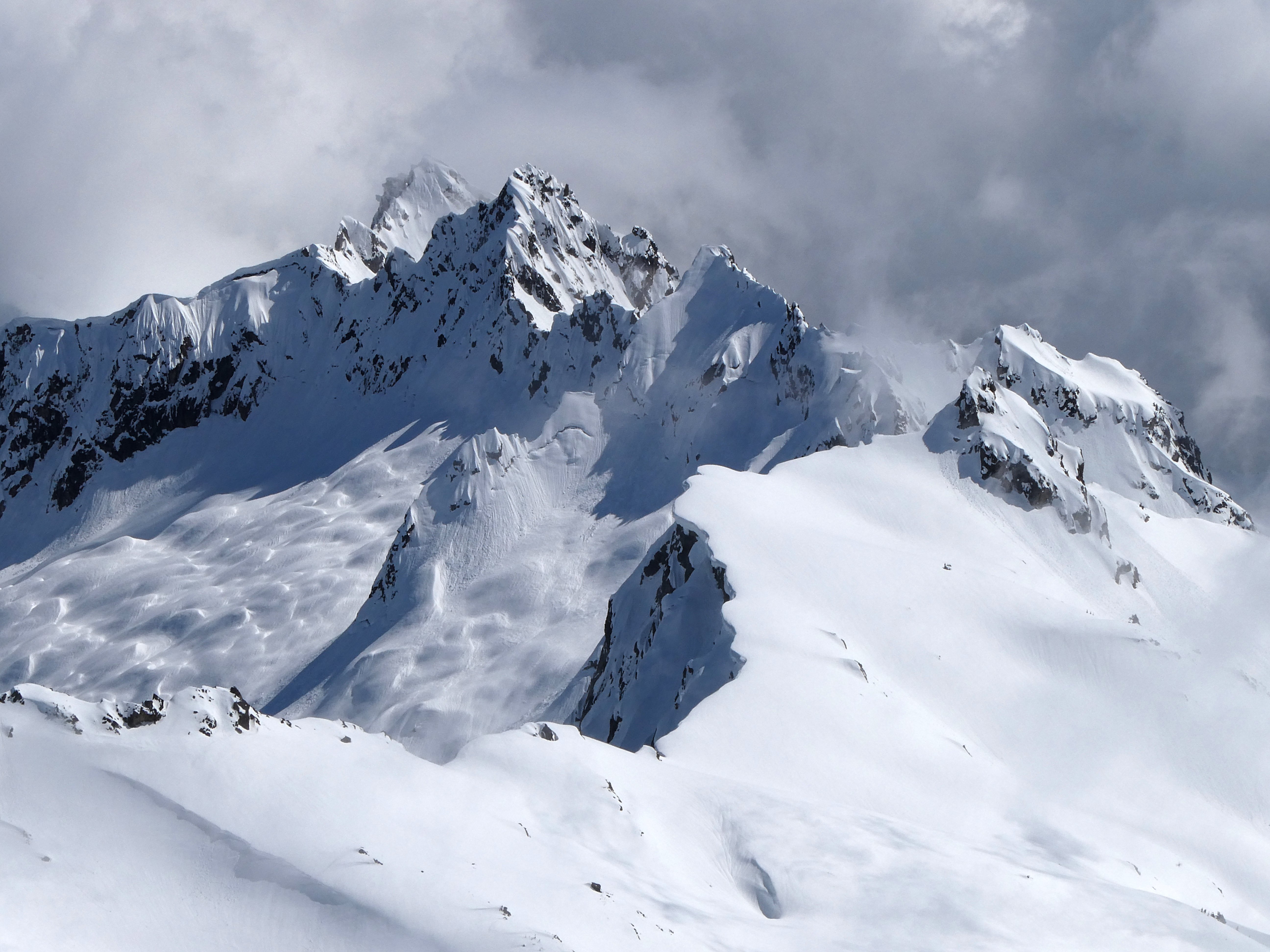
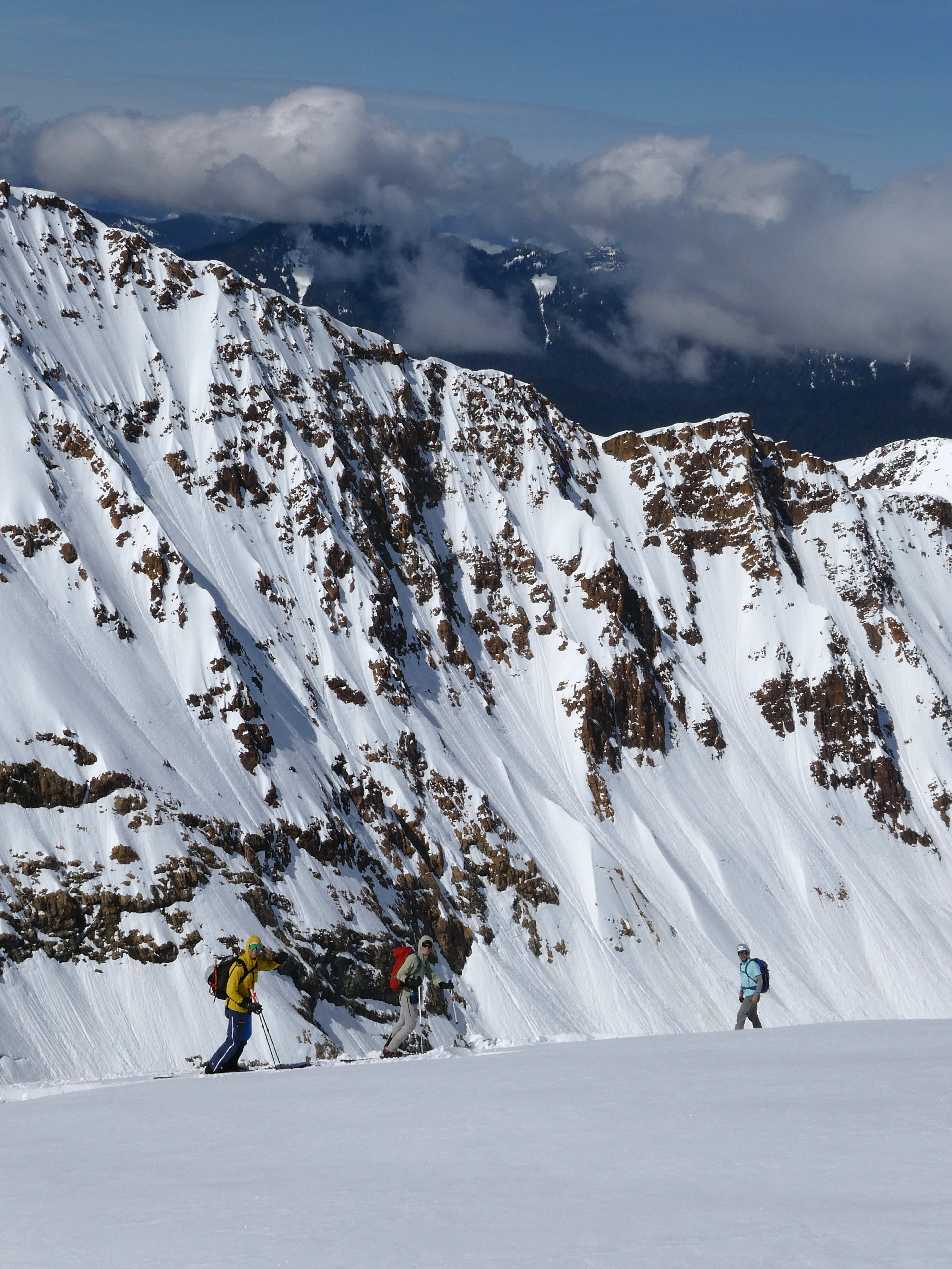
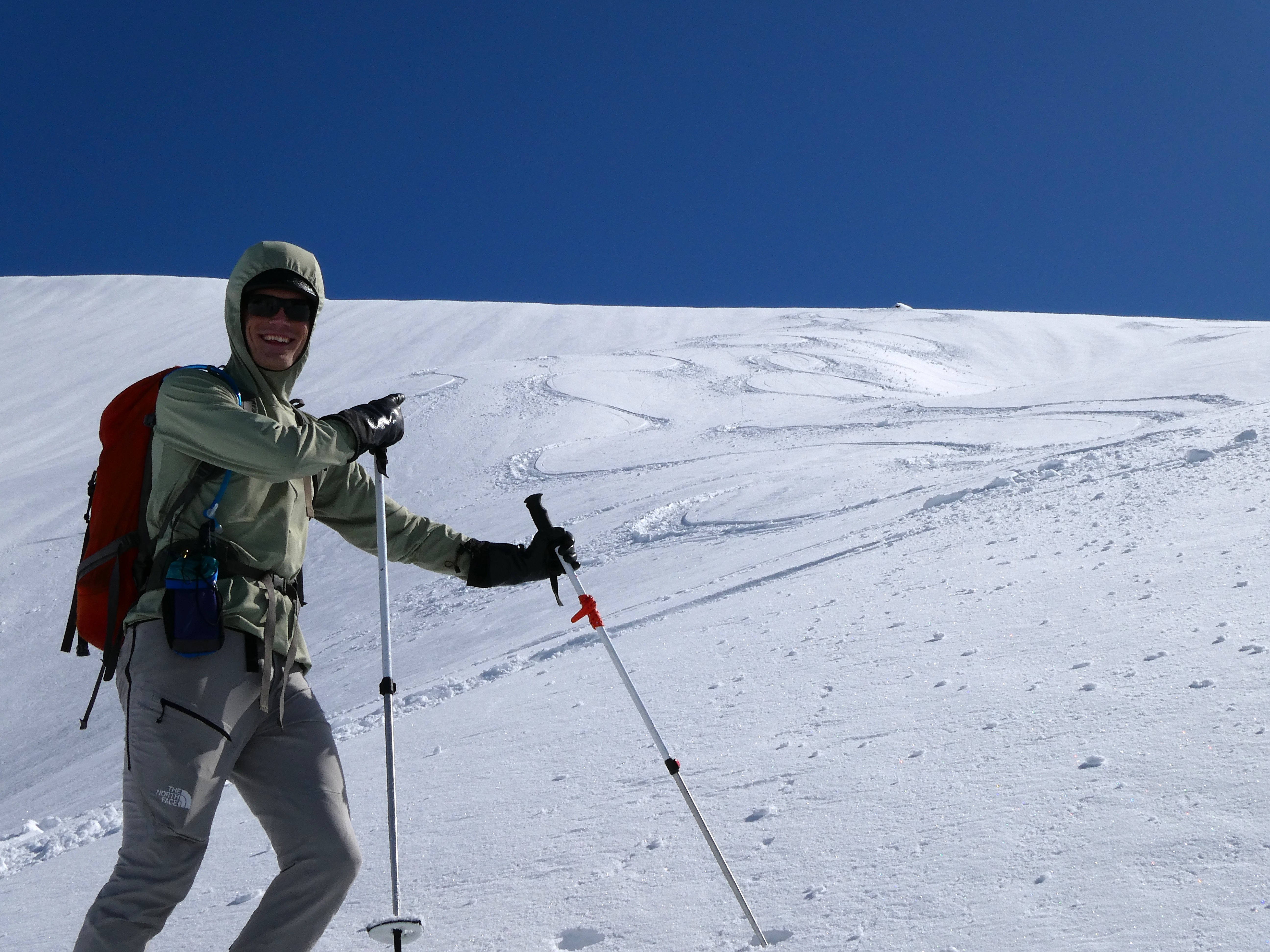
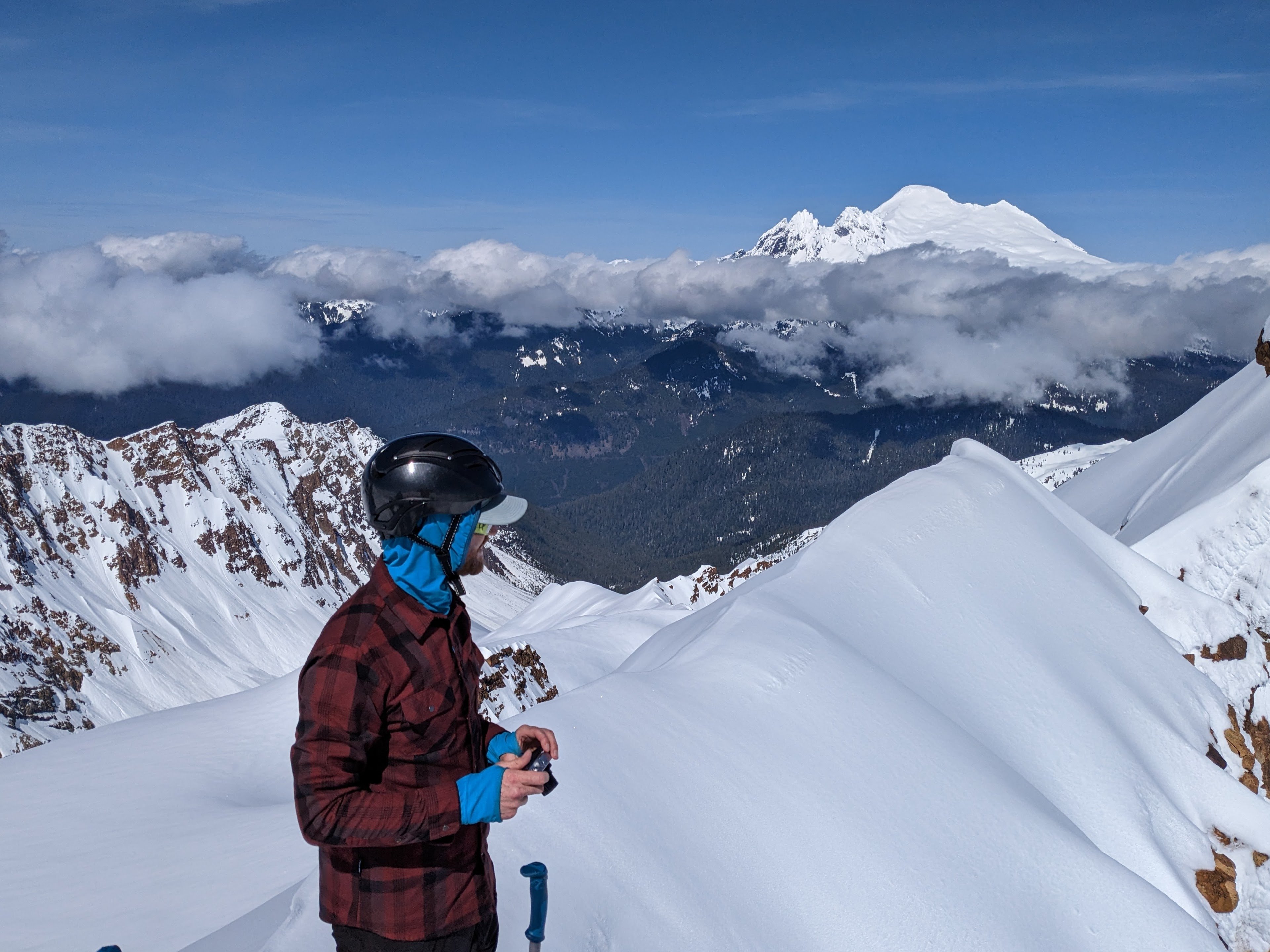
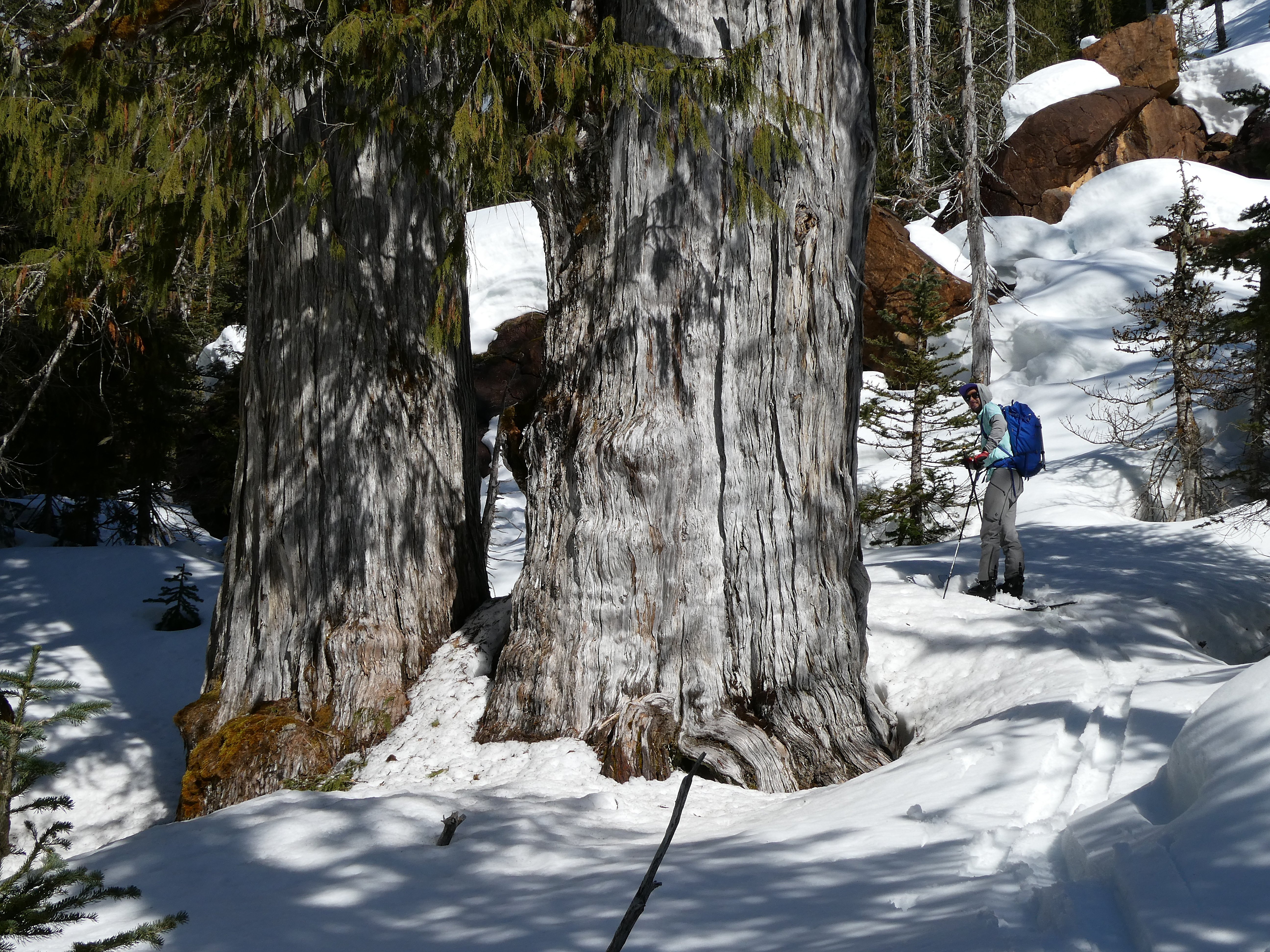
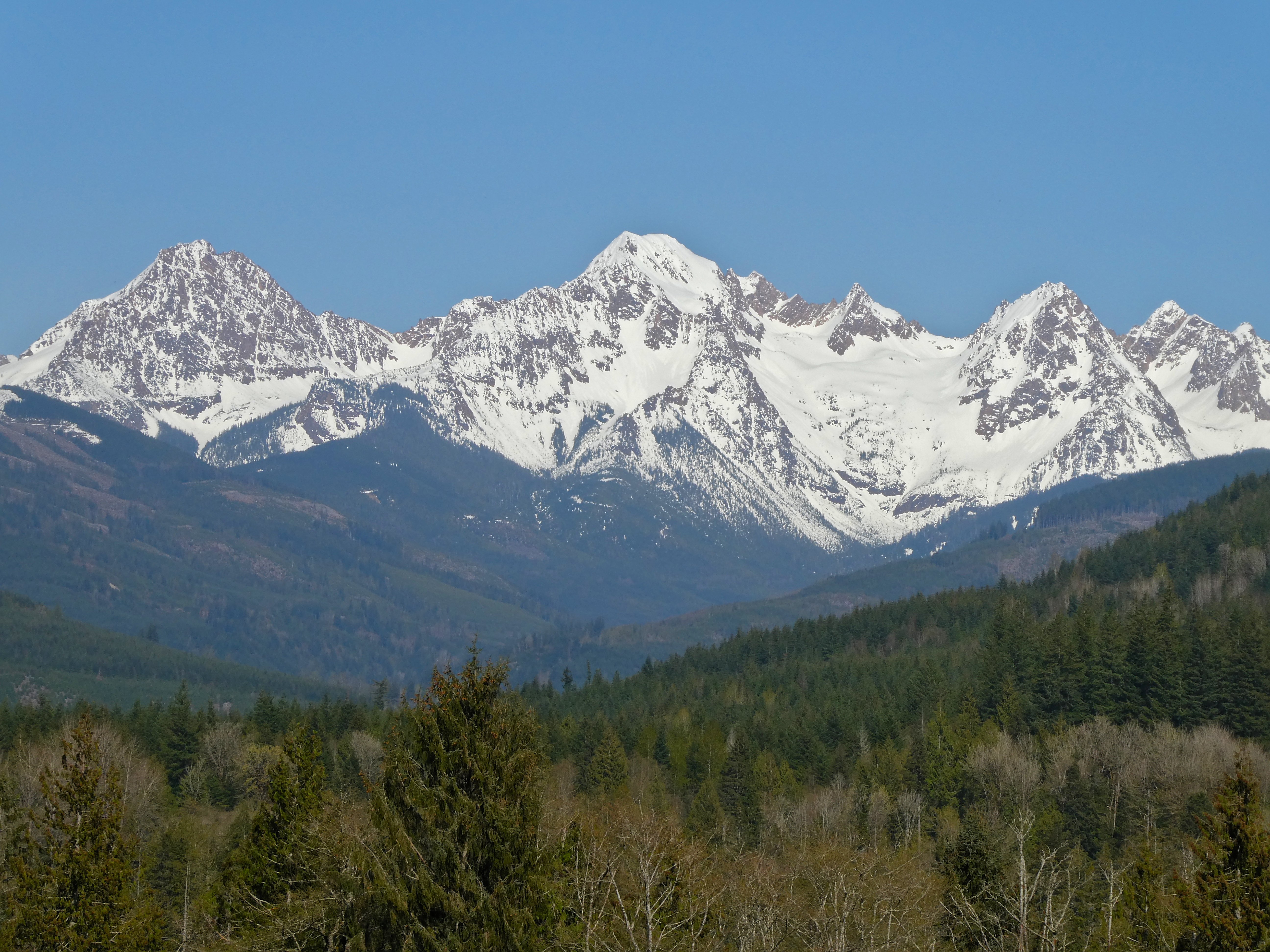
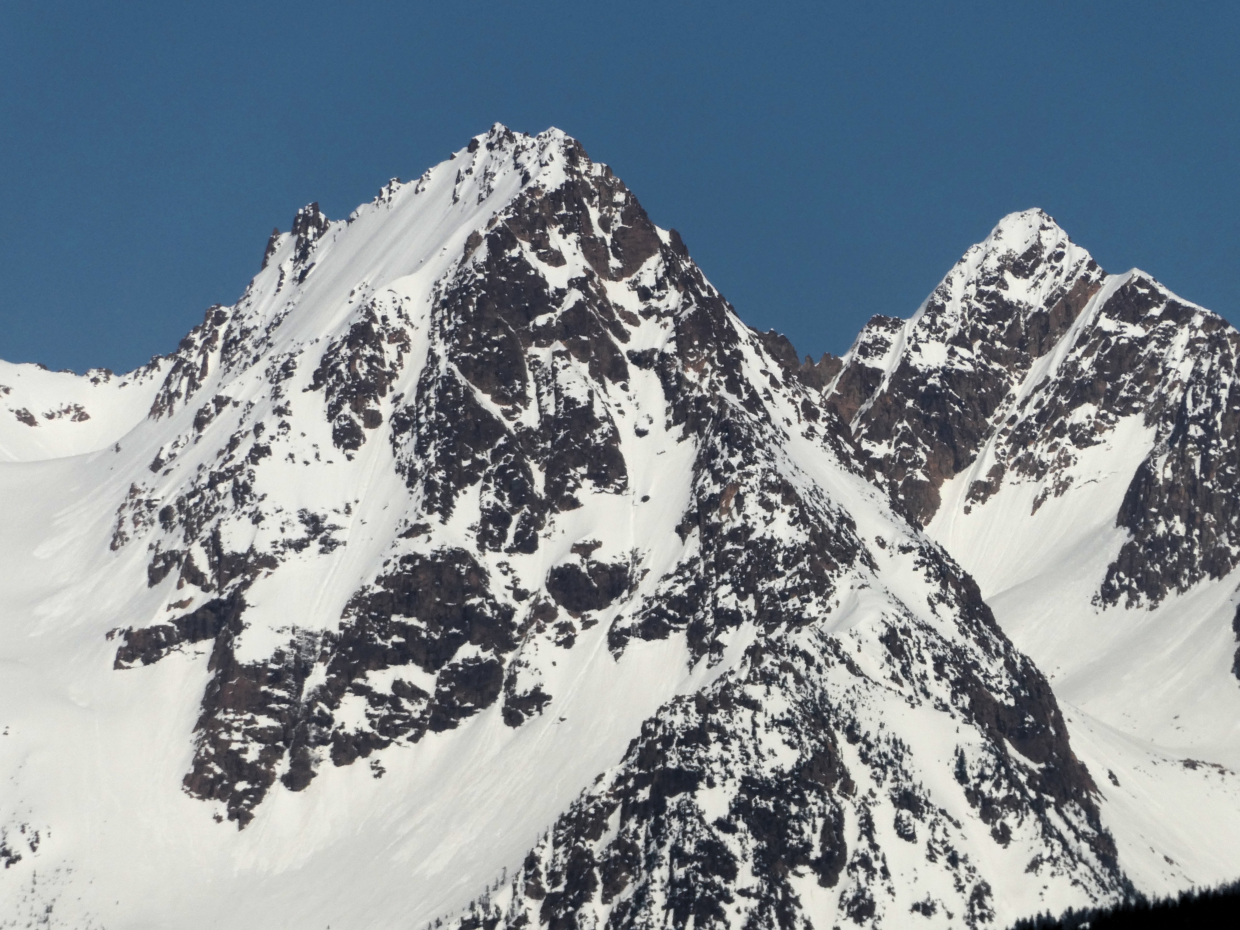
On 4/25, together with @lunger @thedylan and Mike Elges, I was finally able to complete a ski descent of Kloke peak (formerly called Hayden and recently renamed) in the Twin Sisters range. This area was apparently first referred to as Kwik-Kwek Smanik or Land of Orange Rock. Kloke first caught my eye two years ago when perusing old TRs from the area and seeing the amazing picture in this report from 2012: https://www.famousinternetskiers.com/trip-reports/11-12/twin-sisters-traverse/4/. With Wehrly and Gregg Oliveri, we skied the N faces of S and N Twin in a day a few years back and I got a look. Last season I made two attempts on Hayden, both via Green Creek -> Cinderella col -> basins West of the crest. On the first try (4/17/22 with Eric, Scarlett, and Jesse) we had deep, blower powder conditions but tough travel through the approach forest. We got onto the line but found ice on the mid-face wind feature that would have been puckering to ski. Bailing from part-way up, we still had a great ski and amazing knee-deep blower down the Green ck glacier at sunset. The second try (6/15/22 with Dylan and Mike G) was just too late in the season with mushy conditions. We looked at the face and turned around, then I got caught in a small wet loose on a steep kick turn while exiting and took a small ride. The time we skied over the Mythic wall was actually another attempt but rerouted midway because my partners didn't like the cornices above the NE face of S Twin. The stage was set over the past few weeks. A couple of trips into the area showed that faces were very filled in, and we had some incredible powder skiing on 4/19 on N Twin. (These adventures will get their own TRs.) The road has been plowed to ~1 mile from the trailhead most of the season for logging, and some friends happen to pay for key access to the area. We were just able to stash a car at the Elbow lk TH with the end of the road blocked by snow. The nice log crossing is still in place. A more elegant route to Kloke seemed like an actual traverse up and over S Twin then out Green ck. This would make the approach travel easier due to higher starting elevation and an established non-bushwacky route. The Green ck exit would prove to still involve some thrashing, but all the options to loop back to N Twin seemed like they would have either too much wet slide hazard by afternoon or an unknown bushwack and likely sufferfest through Fish ck... no thanks! So we started really early from town, did the car shuttle, and were putting on boots around 6 am when some friends showed up at the trailhead. Funnily enough, they were also headed towards the basin between the Twins to ski the "Twisted Sister" (S couloir on N Twin). We followed their skintrack onto the W ridge of N Twin, climbed up a ways, then did a diagonal descent into that basin. Snow conditions there were hardpack, rain crusted, and entirely stripped of any new snow. I was pessimistic that we would find any soft snow except in the sun later at this point. Ingmar and Jake booting up the Twisted Sister: However, crossing the notch onto the Sisters glacier, the snow suddenly got deeper. We foolishly avoided transitioning to skins and trudged up the flat glacier, postholing more and more as we went but too stubborn at that point to add two more transitions. The NE face of S Twin was really nice powder. Cornices loomed. We moved fast in the steps of Dylan and Mike. E$ Good perspective on the Twisted Sister On top of South, we had to decide whether to commit to the traverse or ski the known quantity/quality powder back onto the glacier and maybe do some kind of linkup from there. Kloke didn't look very clean from this point. There were some slides that had ran on the lower part of the face, but the upper part looked smooth. I am grateful that my partners wanted to continue. Dylan dropped first and skied down to the main gully that spits you towards Skookum basin. Eric and Mike had pulled off earlier, having spotted an alternate gully leading into the same area. We shouted with Dylan and he dropped down, leaving the 3 of us to ski this nice mini line with a steep entrance. On top of South with Kloke to the left of Dylan Eric opening up his line after passing through the narrow choke We reconvened below Skookum and Kloke, all smiles. The snow had been smooth where firm and starting to corn up in areas with an E tilt. After a long break, we started up Kloke to see what we would find. Mike and Dylan again did all the bootpacking, crushers! The avy debris was firm but the other parts were set-up powder that was well-pasted onto the slope. It would ski like breakable, supportive, but grippy crust. The climb finished with an esthetic ridge Looking back towards S Twin, you can see the main line at left that Dylan took and the other couloir dropping from higher. We put on boards on the summit proper. Some clouds started swirling around, so we waited a minute for them to open, and I scratched my wait through a constricted entrance. Wehrly also came this way, and Mike and Dylan rode down the ridge a touch to a more open entrance. The snow was slightly grabby but the edges held very well, pretty perfect for steep skiing. We hemmed and hawed but decided to ski the lower, rockier face. There was some icier snow but still quite edgeable with caution. Mike opened up that section. Our bootpack and turns off the summit Happily reunited at the bottom, libations were enjoyed, and then we kept boogieing for the long ski out. We skinned to a col, descended towards Little Sister, then climbed again wary of the cornices and wet slide potential that was ramping up. I took a digger on basically the flattest terrain of the entire day when a tip dove in some mushier snow. The legs were feeling tired. I took a good turn breaking trail but Mike brought us to the ridge of Cinderella. Incredibly, the N aspect was still POW. We took in the views to all directions and then ripped turns down onto the glacier. The pow led on and on and eventually turned to mush, but that was fine. We traversed rightwards away from the steep lower roll and down to the impressive avalanche debris under the Mythic wall, skiing until we hit the creek near the usual summer crossing. From there we skinned down hill through the forest until it didn't make sense any more. We booted, postholed, found the Elbow lk trail, crossed some blowdowns, and slogging out hit the river crossing and our car. We paid our respects to these grandmothers. I wish the summer trail here kept more distance from their roots. It was an epic tour and definitely one I would recommend! Such great country out there. The N face of Kloke is about 1000' and maxes out around 50 degrees but probably averages somewhere in the 45 range. I went back and got some photos from Hwy 9 after some tulip touristing on Friday.
 1 point
 -
Maaaaybe. I'll check with my partner from that climb to see if he minds. It was a bit of an epic, so you know how that can go with tell-all reports ?1 point