Leaderboard
Popular Content
Showing content with the highest reputation on 03/09/22 in all areas
-
Trip: Mount Hood - Elliot Headwall. Wallace - Olson Trip Date: 02/13/2022 Trip Report: http://www.gorobets.com/TRs/Hood_Elliot_Headwall_2022_02_13.html Gear Notes: 2 ropes 60 m x 8.2 mm A pair of ice tools each A single rack of cams from 0.2” to 3”. Used 2. A set of nuts. Not used. 4 pitons. Not used. BD Spectra. Not used. 9 ice screws. Used. 2 pickets. Used. Approach Notes: No flotation used.1 point
-
Trip: North Twin Sister - West ridge Trip Date: 02/25/2022 Trip Report: Hey everybody! A week and a bit ago I noticed questionable avy conditons but decent weather. Without a partner to go out with I was looking for something not to gnar. I had heard the west ridge of the north twin was a decent winter objective. In my mind with questionable conditions the worst case is a good workout! I drove up thursday evening and slept at the trailhead for a little bit more sleep. Up by 4 moving by 5. following the road up a few switch backs then getting ontop of the west ridge almost directly after the road ends to aviod as much avy terrian as possible. Leaving my skis and ski boots behind once skining became less favorable I head up the ridge by 8 am. I carried but didn't end up using crampons rope and rock pro. The ridge itself was slow going due to about 6"-1' of snow covering most of the rock on the ridge. Not having much beta on the ridge itself I found a line that stayed mostly in 4th - low 5th class terrian and the best climbing was found mostly on the ridge propper. Staying on the ridge proper meant lots of up and downs making movement even slower. IMG_7044 (2).MOV After a few false summits I popped up onto the real top at around 1pm! On top I met two guys who had just come up the north face. They offered to let me rap off the picket they were placing and I accepted happily not wanting to rap and downclimb the more complicated west ridge decent. So much for staying out of avy terrain haha. After a short run down the north face and a traverse over to the base of the ridge I was reunited with my skis. Right down the ridge from where I left my skis I found someone had left a treat directally on the route. A little bit of etticite please don't poop directally on a popular route on an even more popular mountain. Btw I dropped one of my ice tools directally below the notch on the false summit in the second picture. It was on my harness with a wiregate and somehow it unclipped. I'm sure this summer it will be found, lunch is on me for whoever returns it! After skiing down the road I met up with my new friends from the summit and they offered me a ride out to where I left my car. Apparently they have the gate key and permits to drive up there! Who knew! Didnt get many pictures but it was a fun solo mission! Gear Notes: Rock pro I probably should have used but I didnt find anything to challenging Approach Notes: Even if the gate is open don't drive past the bridge over the nooksack apparently the gate gets closed and people get there cars stuck!1 point
-
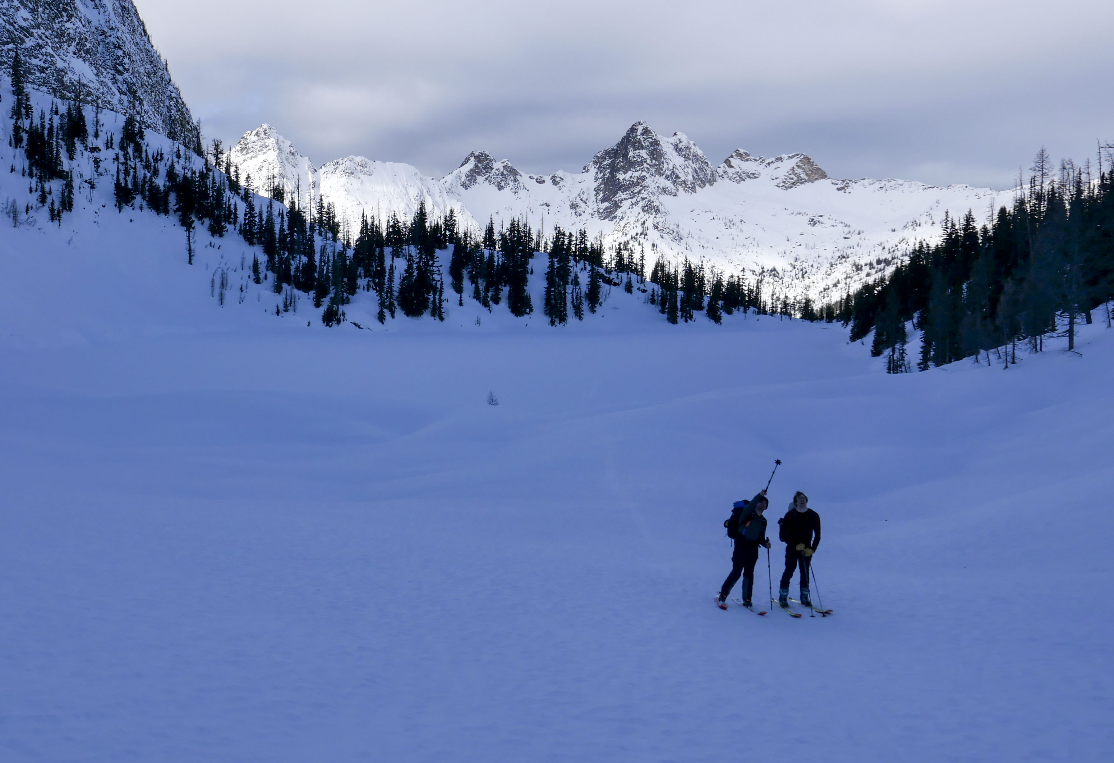
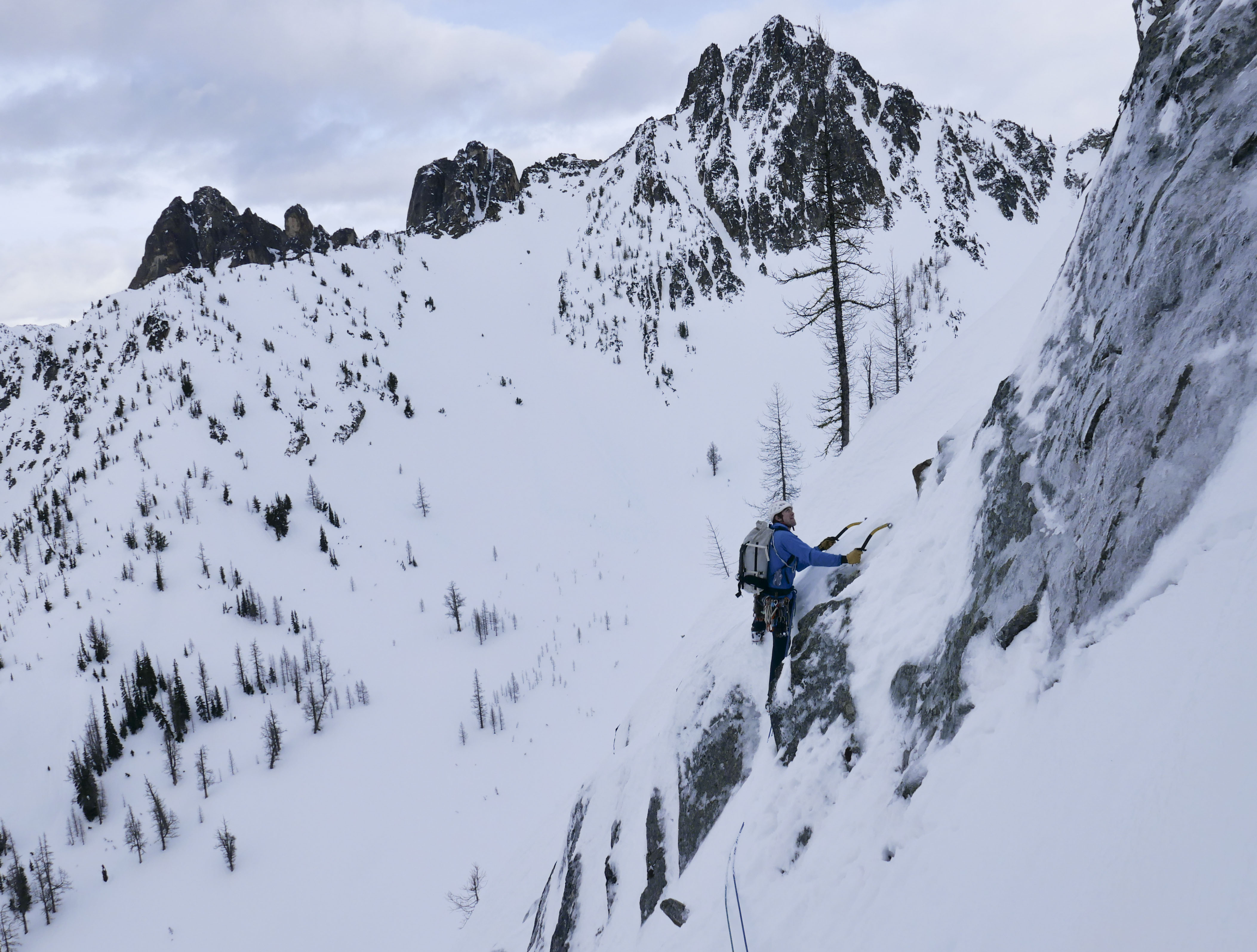
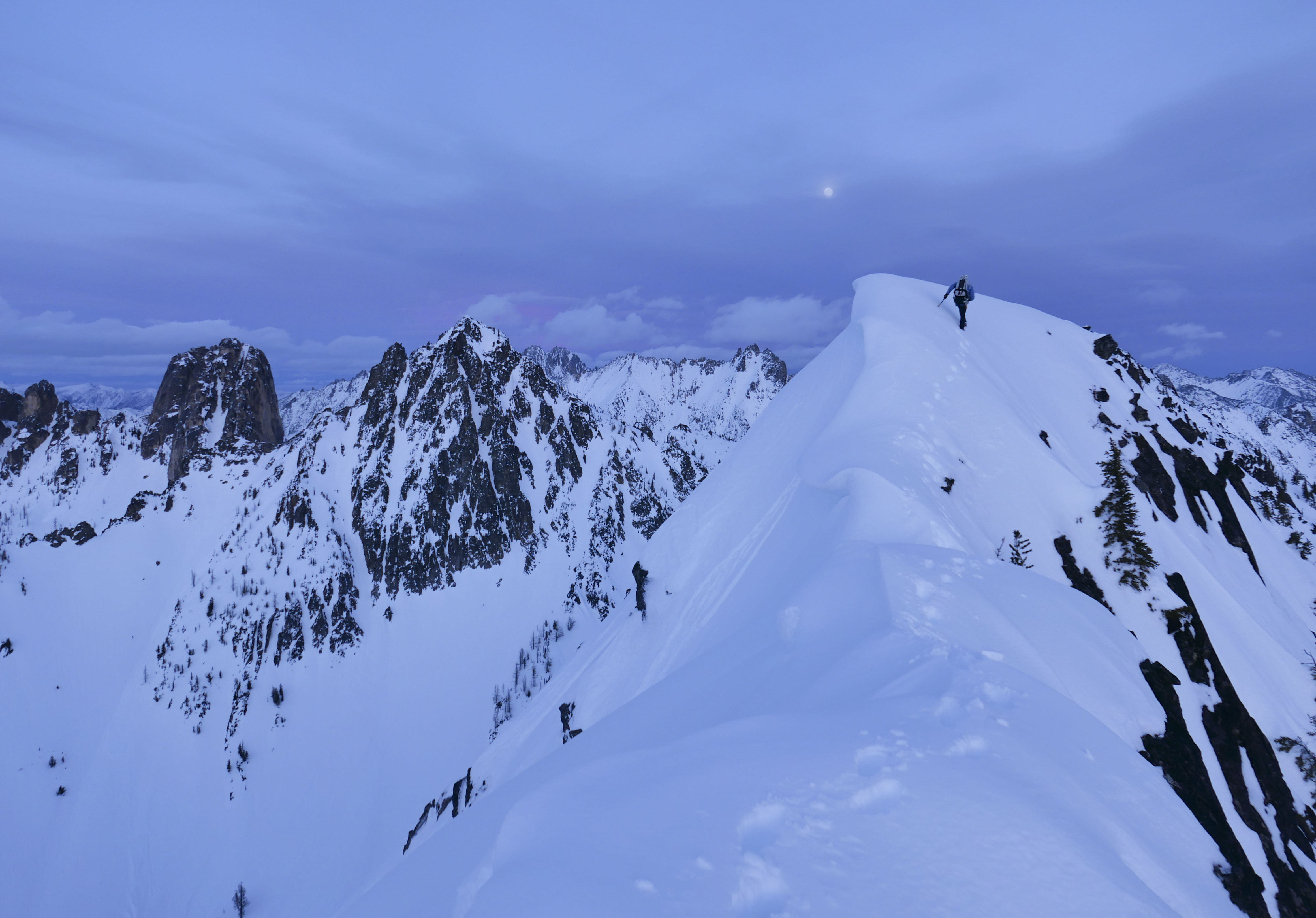
Trip: Posthole Peak - [FA?] North Face Right Side (WI3 M4) Trip Date: 01/16/2022 Trip Report: My motivation to spray has been dwindling lately, as such this trip report is a couple months late and will not be as detailed as past reports. In mid January Kurt Ross, Erik Richardson and I ventured into the WA Pass area with plans to repeat the Keena-Williams on Silverstar. While driving over on Saturday night, Kurt and I got word from Erik that the route wasn't in, and his recon informed us that both skiing, and booting conditions were far from ideal. We nearly turned the car around two or three times, but the prospect of a break from the W-side rain kept us on course. As we waffled over what to do, I remembered some cool N-facing walls behind Blue Lake that might hold some potential. The straightforward access and low commitment made this an easy decision. The next morning Erik towed us up the highway, and we skied from the blue lake TH up to the lake. Upon laying eyes on the faces, the main things we noticed was A: they look really cool in the winter, B: a distinct lack of ice (duh), and C: All of the coolest lines had big(enough to kill you) cornices hanging over them. The overhead hazard and warm temps gave us real pause, and we doddled around the base for a while trying to make a call. Eventually we decided on a mellow looking smear on the right side of the left wall (posthole peak). This route had the smallest cornice, and seemed like it would climb the fastest to limit our time in danger. The first third of the route consisted of good low angle ice that somehow wasn't covered in snow. I lead an 80+m pitch of mostly WI2 with a single vertical 12ft step to a screw belay. My next pitch started with some more easy water ice in a groove up to a snowfield. This pitch ended with some trenching to get to a bad rock belay (beaks and KB's). Kurt took over the lead here and lead us most of the way to the top in one ~140m pitch. The first half was snow with an easy mixed step up to 50M of fun albeit very snowy M4 to just below the ridge. I took over the sharp end again and lead a funky pitch of tree climbing and trenching in steep/deep snow up to the ridge crest. At this point we unroped and continued scrambling along the ridge with hopes of reaching the summit before sunset. About half way along the ridge, I fell in a hole while breaking trail, while Kurt was either coming over to laugh at me or help me out, he triggered a large cornice break presumably by just plunging his tool too far to the left. Luckily we had both stayed far enough to the side that we were both safe, but it was a great example of how far back cornices can break. There was roughly three feet of flat rock exposed by the now missing chunk of snow. Poor Erik was out of sight and likely assumed we were both gonezo. With the sun now fully set, and plenty more complex ridge ahead of us, we opted to turn around and investigate our descent options. The ridge took us down to an easy couloir that would be really fun to ski in better conditions. For us it was rather firm booting down to our skis at the base. Large chunks of cornice debris covered our skin track from earlier in the day, solidifying our choice to avoid the more threatened routes. The ski out was err... character building. To the best of my knowledge this was a new route. If anyone has info on previous winter ascents on these walls I'd love to hear about it. Kurt (left) & Erik (right) Following P1 Kurt Leading out on P3 Erik following the snowy mixed awesomeness Questing into the night. Goode in all it's winter glory above Erik's head. Gear Notes: Standard winter alpine rack w/ maybe a couple extra 10-13cm screws Approach Notes: Sled to the Blue Lake trailhead. Skin or boot up to and across the lake.1 point
-
Trip: Axis Peak - South Gully Trip Date: 02/19/2022 Trip Report: @Albuquerque Fred and I were at it again. We really felt the need to climb Axis Peak this time, it just calls to you from every vantage... note the sarcasm. I was foolish enough to say "I'm up for anything". Fred thinks is cool to climb lists, I don't; but then I'm not opposed to it on principle either. So off we went on Friday night to TH bivy on Icicle Creek Road at the gated and snowed in 8-Mile road. Fortunately, Eminem was not present. We were up early but it was stupid warm in the morning (tomorrow would bring a fast moving cold front). We knew we had to get out early as a big storm was moving in and we didn't want to be in the mountains, plus we still had the drive back west over the pass. The road went easy but the Bellevue crowd had been slacking as the trail was super not packed out (I assume it is Instagram that causes the normal luge chute and not Leavenworth locals, correct me if I'm wrong, I don't travel here often). We skinned ice crust with occasional post holes and snowshoe crampon scratches to within 1/4 mile of Lake Stuart, then ascended the fan up the gully on the south side of Axis peak. I had a bad experience the previous weekend with ice crust skiing so I was adamant that skis were only for that approach today and we left them at the fan at around 5300'. It was super icy here with about half a dusting of snow from throughout the morning. The gully was a dream, perfect secure cramponing on moderate slopes with some dirt and moss to remind you that you're in the cascades. The gully actually served to focus the sun and block the wind as well so it was amazingly pleasant. The weather called for intense ridgecrest winds. We tagged the summit, signed in, and bailed down a couple hundred feet out of the gale to eat lunch. The descent was amazing, but firm enough the I was still glad we ditched the skis. I got to try out my new skis on frozen avy debris, and sun crust, plus dirty, thin forest on the way out, so that's a plus. We only skied down to 4660' then skinned again, all the way to the road. At least I did, Fred insisted on shuffling in walk mode with no skins despite it obviously being slower and sketchier. Oh well, at least I was proven right. Photos: Oh yeah, in case you are not aware, Axis Peak is the next ridge north of Stuart. Before you ask... North side of Dragontail. Approach skinning: Argonaut: Not the best coverage out there these days: Up the gully, it's better than it looks: There is no summit photo that doesn't look cheezy is there? Gear Notes: Axe, crampons, helmet, skis for the approach. Approach Notes: Road was easy, trail was terrible.1 point
-
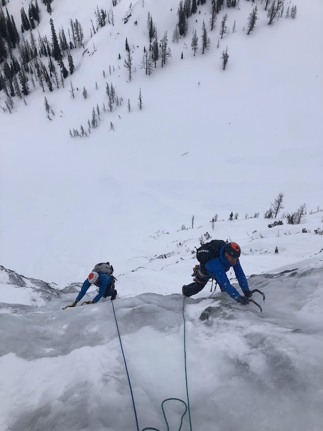
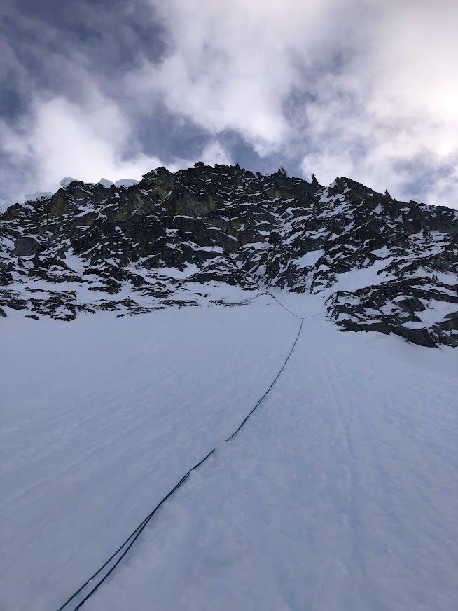
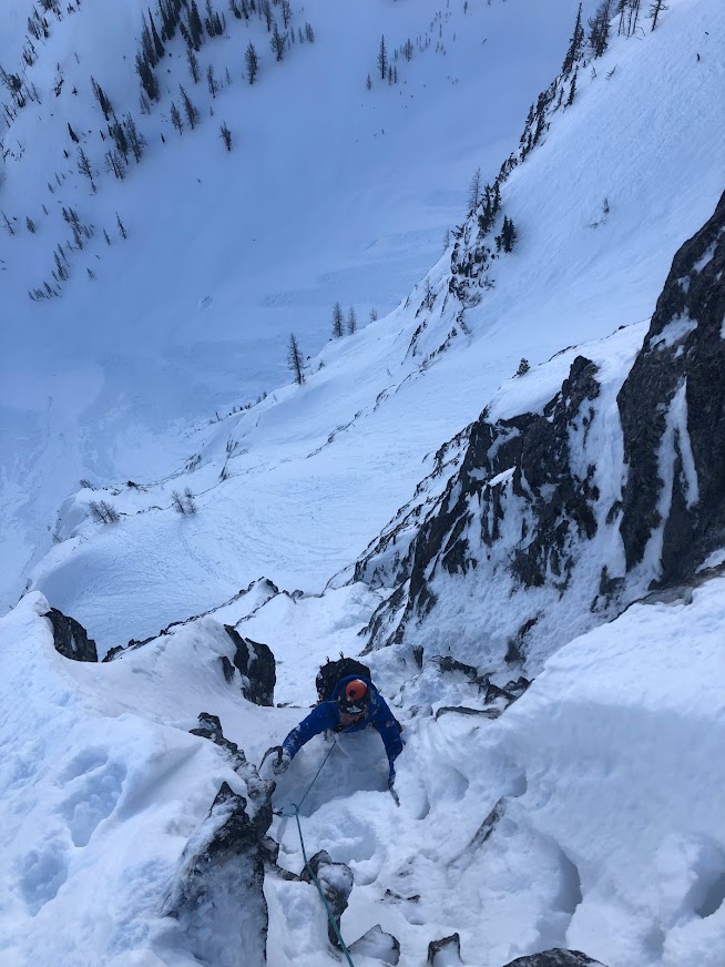
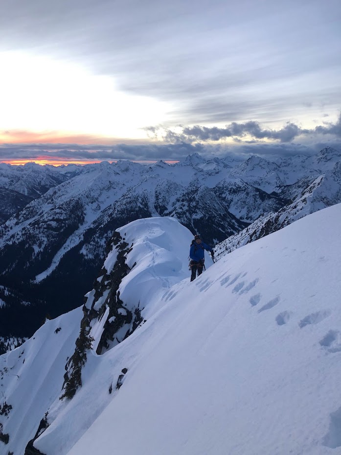
Trip: Mt Hood - Wallace-Olson/Eliot Headwall Trip Date: 02/18/2022 Trip Report: My partner and I climbed the Wallace-Olson Route on the Eliot Headwall and found fantastic conditions on the route. It was either alpine ice, snice, or very hard neve from top to bottom. We departed from Timberline, went up the Old Chute, and descended via the Sunshine to approach the route. This took about six hours to the base of the climb. There was some knee-deep wallowing approaching the Hogsback that slowed us down. The coverage on the Eliot is relatively thin, proved when I punched a leg through a crevasse on the traverse to the route. There were only about 18 inches of hard snow covering the crack. I could tell from high on the route that there was some sag indicating its presence, but it was not evident from the glacier. We climbed the route in four pitches to a point just above the exit chimney and then did a short pitch to the summit. The total time on the route was about 3.5 hours. Pitch one had about 30 meters of AI3 which was fat and took screws well. Pitch two had a variety of options. We took an AI3-bulge to steep neve but you could have skirted it and climbed lower angle ice. Pitch three was more steep neve and AI2 with some protection options where blobs of ice stuck through. The final exit pitch up the chimney was not protectable with screws because the ice was very aerated, so it was about 10 meters steep, no-fall-zone climbing. It went at AI3. We were able to get solid screw belays all the way up and plenty of protection options, minus the final chimney. In the photos, you can see this feature just right of the obvious tower. There were many variations that one could have taken on the route. The mixed exit ramps were all iced up and looked tempting as well, but we chose to take the steep line. The route as a whole was nearly a perfect plumb line from bottom to top and well worth the approach. It was a stellar day in the alpine with near-perfect conditions. Photos: Pitch One (there is a little camera trickery happening here. It was not that steep). Pitch two. Looking up pitch three. Exit pitch Gear Notes: 10 screws: I was able to place 16cm's and in one case a 22cm at the belays. Stubbies were not necessary as there was almost always ice for at least a 13cm. We brought a small rock rack, pins, and a picket but didn't use any of it Approach Notes: Via the South Side Route and down the Sunshine. Keep an eye out on the Eliot Glacier for weak spots. I was not the first to recently bust through.1 point

