Leaderboard


Popular Content
Showing content with the highest reputation on 08/15/20 in all areas
-
Trip: Cabinet Mountains - Multiple Trip Date: 03/21/2020 Trip Report: I just wanted to share some photos and descriptions from the last couple ice seasons in the Cabinet Mountains. Anyone who got the 2019 AAJ or Alpinist 64 might have already seen pictures of the area. There have been a handful of Spokane area climbers putting up routes over the last couple seasons. All the climbing has been done out of Granite Lake which is near Libby, MT in the Cabinet Mountains. The climbing is quite varied, from single pitch WI3 to 1000ft hard ice and mixed routes. The area has been divided up into 3 big areas….A Peak, The Thunderdome, and Three Tiers. A picture is worth a thousand words so I will just resort to numerous pictures instead of more text……let the stoke begin for next season!! Looking across Granite Lake with A Peak towering 4000 feet above. The Thunderdome is the large sub dome in the center of the picture. The Thunderdome!! Some of the best ice routes anywhere around. Scott Coldiron and Matt Cornell on the first ascent of Mad Max, WI5+ (8 pitches). Nate Kenney climbing a steep skinny pillar called War Boys, WI5+. Scott Coldiron climbing a crazy pitch called Underworld, WI3. This route is 20m long and entirely inside an ice cave 500 feet up the Thunderdome! Another view of the spectacular A Peak and the upper wall of the Thunderdome. The big ice in the center of the wall is Road Warrior, WI5, M5 (8 pitches). Looking up the huge gash on A Peak. Scott Coldiron and Jess Roskelley put up the route Canmore Wedding Party AI5, M7, 750m, which ascends this central gash. The climb got nominated for a Piolet d'Or in 2019. Note: the large sheet of ice on the bottom rock band is still unclimbed as of 2020. Looking up the wide start to the "Blaster Routes". Blaster, WI4 is five pitches of ice while Master Blaster WI4, M5, (10 pitches) continues to the top of the Thunderdome. Looking up from the lake at the "Three Tiers". These cliffs have about 20-25 ice and mixed routes that have been done. A closer view of the the ice (during a fat season) on the center of the 2nd Tier with the 3rd Tier above. Scott Coldiron on the first ascent of Toast, WI5 on the 2nd Tier. Zach Turner leading The Dag, WI3 on the 2nd Tier......a super fun mellow corner. A shot of some of the 3rd Tier routes. Gyro Captain, WI4, goes up the ice on the right while Pig Killer, WI3, takes a line up some of the ice on the left. Multiple possibilities exist for mixed routes connecting the lower ice flows in the center up through the rock to the hanging ice above. Zach Tuner rappelling off Max's Bloodline, WI4, with the impressive routes on Thunderdome in the background. Jonathan Klaucke climbing funky ice on Cheedo, WI3-4, on the 2nd Tier. Looking across at the right hand end of the Three Tiers from the Thunderdome. The wide flow in the center is the start of Tomorrow Land, WI3+, 3 pitches, while the ice up on the right is Devil's Brownies, WI4, 2 pitches, and then farther right is Scales of Justice, WI4/5. Zach Tuner on the skinny pillar start to Splendid Angharad, WI5. The flow farther left is called Capable, WI4. Looking up the 2nd pitch of Tomorrow Land, WI3+ on the first ascent. This fat climb called Nightrider, WI4, 3 pitches, is on the far left of the Thunderdome. It is a bit longer of a hike from the lake but the route is a stellar moderate! Scott Coldiron climbing the crux 2nd pitch of Nightrider, WI4. Brian White starting up the classic Toast, WI5 on the 2nd Tier. The ice beyond him is the route Cheedo, WI3-4. Zack Turner on the sharp end during the first ascent of Grease Rat, WI4....a really fun route on the 3rd Tier. Matt Cornell working through the crux of Sarcophagus of Lies, M6. The route continues up and left until you can stem between the rock and the ice dagger above. This is a stellar line on the 3rd Tier with "quality climbing as good as Come and Get It" according to Matt. Brian White putting up a short route called Mystery Gas, WI3 on the 3rd Tier. Syd Atencio and Nate Kenney climbing up Devil's Brownies, WI4, on the Three Tiers. Granite Lake and the surrounding basin in the background. I think one of my favorite things about the climbing here is the views....it just never gets old!! Every time I walk across Granite Lake I have to pause and just look up. Hopefully this will get some people stoked about climbing up there because it is a beautiful spot with fantastic climbing. Happy to answer any beta questions or run them through Scott. Gear Notes: Ice screws......rock gear for mixed routes. Approach Notes: All climbs are best accessed from the Granite Lake trailhead. In winter it is a 9 mile hike/skin into the lake with about 2000 ft of elevation gain. Count on 4-9 hours depending on conditions. From downtown Libby, take Highway 2 east one mile to Shaugnessy road. Take a right and follow this for .7 miles before turning left onto Snowshoe road. After 1/2 mile take a right turn onto Granite Lake road. In .8 miles stay left on Granite Lake road and continue for 4 miles. This is the end of the pavement and where the snowplows stop in the winter. The Granite Lake trailhead is still another 3 miles but you will have to walk/skin/snowmobile that distance in the winter. There is usually plenty of room to park several cars just be mindful not to block the road or any of the neighbor’s driveways. From here follow the snow covered road for 3 miles to the actual Granite Lake trailhead. The road is mostly level with a few gradual climbs (400 feet of elevation gain in 3 miles). From the trailhead hike/skin the trail 6 miles up to the lake.1 point
-
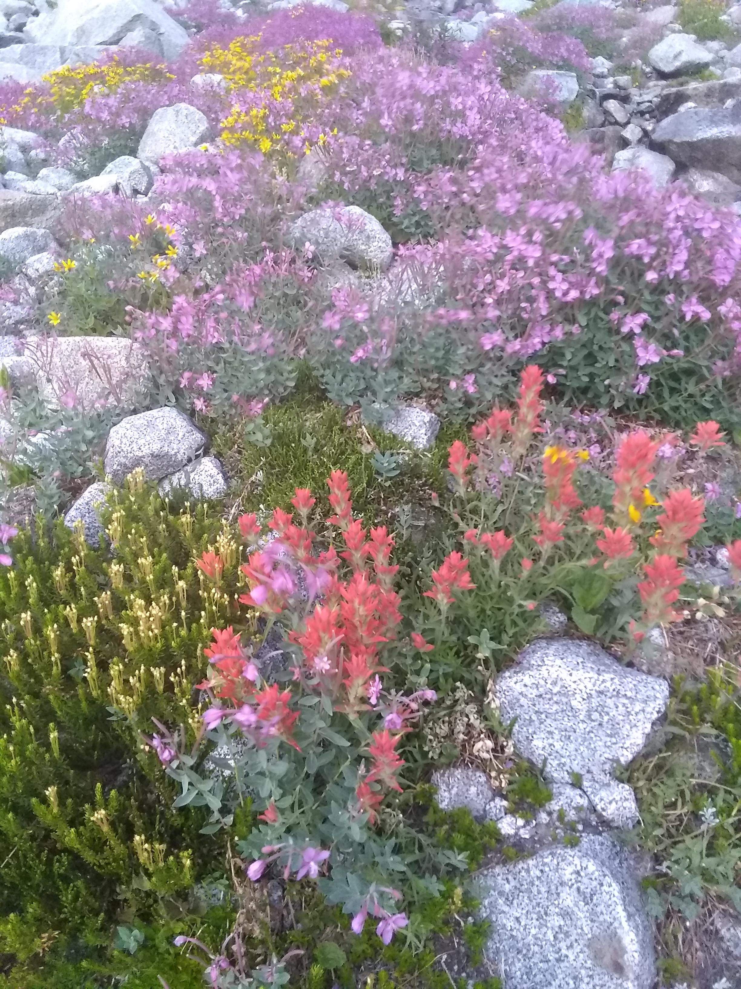
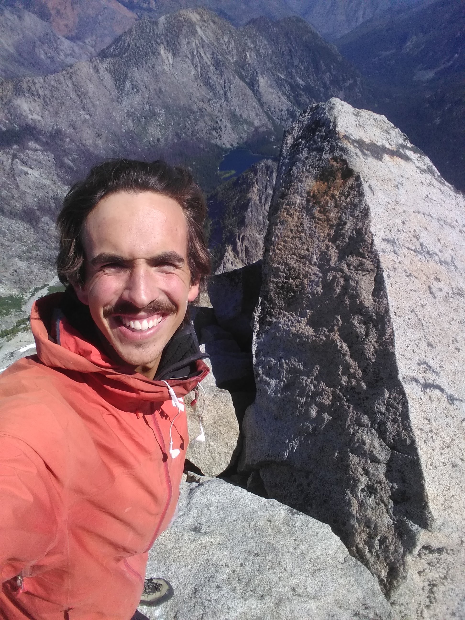
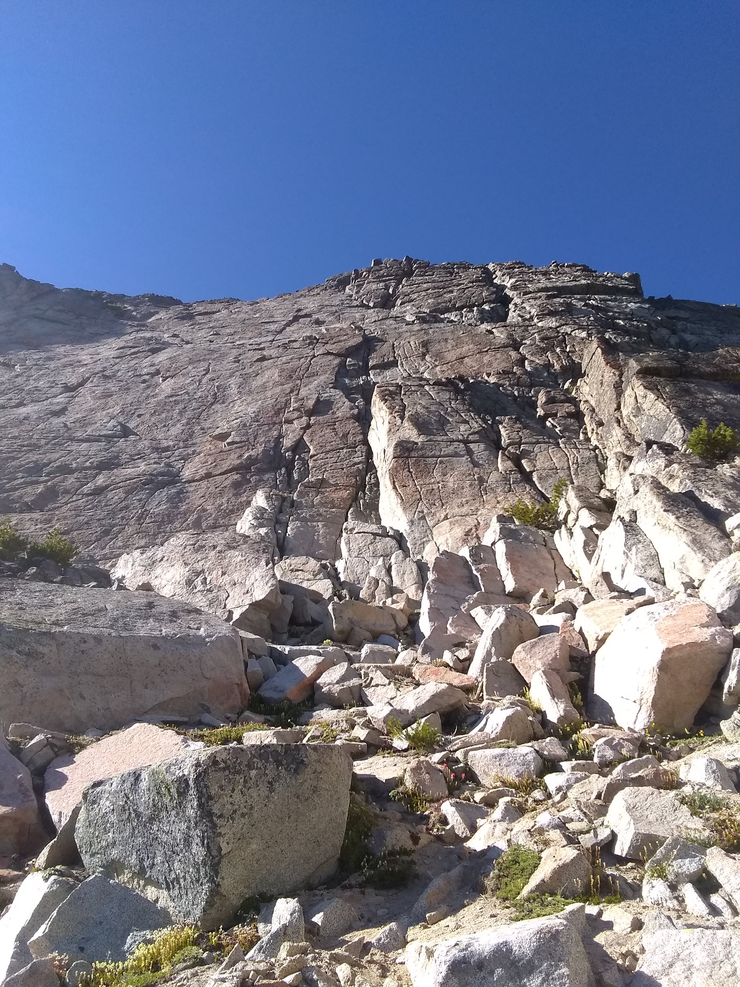
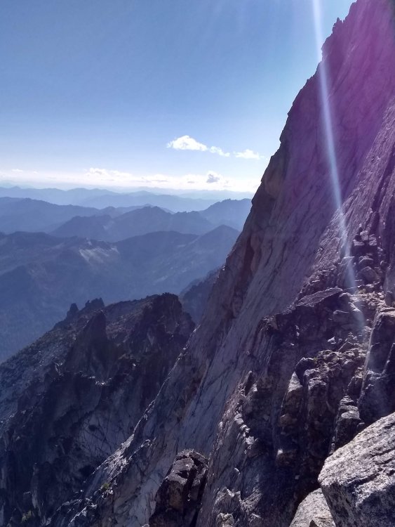
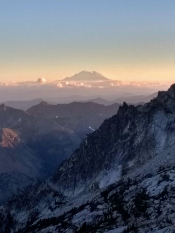
Trip: Stuart Range Traverse - SRT Trip Date: 08/10/2020 Trip Report: Should maybe be titled Stuart Range Traverse* because there's always some disclaimer in there, good style is just about doing it with as few asterisks as possible. My main asterisk is I didn't actually summit Sherpa. I'm also no Peter Croft, but based off all the TRs that are out there for this thing, none of us quite are. Anyway, I've had a weird relationship with climbing this year. There have been a lot of other things going on (perhaps an understatement in this wild year) that demand more attention. I came back from a full season deep down south feeling absolutely on top of my game, a feeling which quarantine somehow morphed into a sense of burnout, fear, overanalysis and a general loss of motivation for big objectives. I've wondered if maybe I've finally developed a frontal lobe in my brain. Seeking comfort and sticking close the ground, I've focused on running and bouldering. While the Stuart Range Traverse is neither of those things, I did feel a certain motivation to get it done before I move to Colorado (I know) for a bit, and all it really boils down to is a nice long run with some V0 highballs. Plotz told me it's kind of a slog. He was right. But I still had fun, and given enough time I might even consider doing it again, with fewer asterisks. lovely little garden below Stuart. The first bit of excitement came on the slabs below the Stuart Glacier, where I felt my pack suddenly lose a lot of weight. I turned around to see one of my two liters of water careening down towards the snowy gully where it shall spend the remainder of eternity. Somehow my pack had come unzipped, and I almost lost a lot more kit than I did. I kinda thought my plans for the traverse tumbled down into the moat along with it, as I had just passed the last water source and I couldn't bank on finding anything between the ridge and Argonaut. But I still had one liter infused with electrolyte-whatever, and I could bail at Sherpa Pass if I had to. Not much to be said about the North Ridge of Stuart, other than the fact it's phenomenal. I had never climbed it, or Stuart for that matter, until yesterday. It was worth the wait. Was on route for about 2 hours. stuart summit selfie. that's what everyone likes about TRs, right? selfies? As soon as I was on the south side of the crest the wind was gone and it was hot. I was really worried about running out of water. I also made the classic rookie mistake and got suckered down the wrong gully (not ulrich's) while searching for water. I did find some, but also found myself well below Sherpa. I had already had a few routefinding snafus early on and was a couple hours behind schedule, doing the math I figured if I tagged Sherpa's summit I'd most likely bail at the pass - which turned into a cost-benefit analysis of what I valued more, another summit or a more solid chance at the traverse? I chose the traverse. There was an excellent ledge system below Sherpa, complete with a goat highway, that got me to Sherpa Pass quickly. If it wasn't chest deep in the boonies, the south-facing slopes between Sherpa and Argo would host excellent cragging - I spied numerous perfect cracks and checkerboard patina reminiscent of Red Rock's Brownstone Wall, all on perfect red granite. And if you keep your eyes and ears open, water can be found in small springs that quickly dive underground. Overall, I didn't think this section was as bad as people say. I mostly stayed just barely below the ridge crest. I stayed hydrated, stayed psyched, and speaking of sweet crags, soon found myself at the base of the S Face of Argo. choose your own adventure! knobs and splitters galore! s face of argo from the right margin. This was also my first time on Argonaut's summit, which was quite nice. Great view, and fun, easy climbing. I had brought a skinny half rope to use as a rap line if I needed it - not totally necessary in hindsight, but I was glad to have brought it as it did give me a little nicer sense of security, which like I said, I haven't really had that feeling of security with climbing lately. Well, turns out that shiny new half rope came all this way just to be put under the knife on some short rappel I ended up soloing up and down anyway. Getting it stuck on the rap pull was a result of my own negligence and it cost me a lot of time - so if you're trying to descend into Argo's east gully and find a well-used rap station above a splitter looking dihedral, just downclimb. There's maybe one section of 5.6 to get you down to a big ledge. As you jam the perfect hand crack (seriously, why didn't I just downclimb this from the get go), take a moment to admire the remains of about 3 or 4 different ropes stuck deep inside. Mine's one of them. Hooray! But ultimately, I can't really blame myself for taking an extra precaution when I was already tired and clumsy. From there, it's loose third and fourth class down the east gully. man, I wish I had a better phone camera. Once at the shelf between Argo and Colchuck, I put the headphones in and motored up and over Colchuck and Dragontail, arriving at Aasgard in the dark. Pop Tarts and Prince carried me to the finish. 22.5 hrs C2C. Gear Notes: an extra liter of water so you can jettison the first one into the void Approach Notes: there is one, yes.


 1 point
 -
Trip: Glacier Peak - Frostbite Ridge Trip Date: 08/09/2020 Trip Report: Glacier Peak, Frostbite Ridge 8/9/20 (descending Cool Glacier) Anna B and I chose Frostbite Ridge route on Glacier Peak since it would offer us more technical challenges, but we devised a route that would take us down the Cool Glacier standard route and make a 4 day loop of the climb. One reason for choosing a loop was that we were doing it in early August and as 2020 was an above average snow year and a cooler than normal summer I anticipated that the ice steps just below the summit might have snice and not be melted down to the glacial ice. If this was true (it mostly was), descending on the Frostbite Ridge with several rappels on the ice steps could mean spending a lot of time and energy clearing away the snice to get to the glacial ice to build v-threads for the rappels. Something I wanted to avoid. A loop also is just more appealing anyway. The normal route for Frostbite Ridge starts at the Suiattle Pass Trailhead up the PCT and then to the Vista Glacier. We started our loop at the North Fork Sauk trailhead and so this would require many extra miles to get to where the standard Frostbite Ridge route peels off the PCT. Luckily, I found some old trip reports where, in years past, climbers used the now decommissioned White Chuck river road and trail to attain the either the Kennedy Ridge and up to the Kennedy glacier or one trip report that cited a bivy at 6,200 feet near the base of the Kennedy glacier. This would save us time and miles and turned out to be the best choice for our route. We started at the North Fork Sauk River trailhead, the starting point for the Cool Glacier approach. Day 1 we hiked from the trailhead up to the PCT and covering over 3,000 feet in a short distance. At the PCT we went left to Red Pass and down the other side. After passing several good campsites just as the PCT started heading north we found a nice flat campsite at around 5,000 feet just off the trail before it descended steeply in a small gorge. We chose wisely as this was the last campsite for a few miles. Total distance was about 13 miles with 5,000 feet of gain and 2,200 feet of loss. Day 2 we continued on the PCT for about 7.5 miles, going past Kennedy Creek and up onto Kennedy Ridge. The PCT had a lot of overgrown bushes/ small trees wet from the recent rains and fog and parts of the trail had small streams diverted on them. We got soaked and our boots were wet for the entire remaining days of the climb. There is a PCT camping area with a sign for a toilet just before the PCT crosses Glacier Creek and makes a sharp turn left. Opposite the entrance to the PCT campsite is a small drainage that flows into Glacier Creek (not the actual Glacier Creek) where we could see a climbers trail (5,300 feet). We followed this up and within a few hundred feet the trail mostly disappeared. We continued with not too difficult bushwhacking up the drainage and stayed right to gain a small ridge just above the base of the Kennedy Glacier where we found the bivy site mentioned in the old trip reports at approximately 6,100 feet (48.131760, -121.140130). Running water nearby made this ideal for our summit bid the next day. Day 3 we got an early start and headed up the Kennedy Glacier staying on the climbers left (north side) portion of the glacier but not too close to the cliffs below Kennedy peak as there was plenty of evidence of rock fall. From 7,400 feet to about 7,700 feet we had to find our way around open crevasses and crossed on several bridges that looked fairly thick and strong but still made us a bit nervous to cross over the gaping crevasses blow our feet. I believe that in a few weeks time the route finding through this crevassed area may pose some difficulties. At 8,200 feet we joined the standard Frostbite Ridge route just after the Kennedy and Vista glaciers col. From base of Kennedy Glacier. Frostbite Ridge in the alpenglow. There are plenty of trip reports out there and the Cascade Climber report from 8/2/2015 has the best information and photos of the route that I can’t really improve upon. For us, we went up the ridgeline which was pumice and dirt and included a short narrow catwalk that was a bit nerve wracking but doable. At the first large rock gendarme (named the rabbit’s dick in the aforementioned trip report) we went right and stayed on a rock ramp since we felt the steep snow was icy and the runout was long. This probably got us a bit off course, we followed the ramp and then headed up where there was a short 4th class section with some exposure so Anna B put in a few stoppers and a short belay and we climbed back to the left side of the gendarme, dropping onto the top of the snow pitch on the left side and went through a notch to descend back on route. After this first rock pinnacle we got to the rabbit ears and went up on the right side (we thought we were going through the middle of the ears) and once beyond the “ears” we had to traverse left to gain the ridge that was an easy class 3 scramble down to the base of the upper portion of the Kennedy Glacier climbing section. This looked rather steep when we looked down on it from the rabbits ears, but it was probably not much more than 45 degrees at the base and then quickly mellowed out a bit to around 40 degrees. The snow was perfect and we climbed up solo getting through this glacier portion quickly. After the glacier climb, there was a quick little downclimb into the snow covered crater where we got to the base of the ice steps at 10,200 feet. The steps were still mostly covered in snice which, as I expected, had not melted out yet. The first step is maybe a pitch at maybe 55+ degrees. The snice was perfect enough that an easy wrist flick sent the pick into the snice a ½ inch or more. We felt comfortable on this and soloed up the pitch. There was one small section where there was water ice though it was maybe 15 feet or so and didn’t pose a problem for us. The second step is longer (2 pitches of 60 m rope?) but a bit less step so we also soloed on this portion. At last the summit! The ice steps starting at 10,200. It was a couple hours to descend Glacier Peak on the opposite side, mostly on snow, down to Cool Glacier and we camped at Glacier Gap with awesome views. Day 4 we left Glacier Gap and descended on the former glacier known as White Chuck (not much of the glacier is left now, just to prove science deniers wrong) and back to our car at the North Fork Sauk trailhead. This is a great way to do Glacier peak, offering a loop instead of an out and back, providing more challenging glacier travel on the lower Kennedy, semi-technical rock scramble and ice steps at the top of the route, and an easier descent via the Cool Glacier route. It took us 4 days and I doubt we could have done it quicker but possibly for a fit team traveling light and fast it could be done in 3 days. But why rush if you’re in Glacier Peak Wilderness, enjoy the experience. Gear Notes: 40m rope (if descending and planning on rappels a 60m is better) 4 ice screws (not used) 4 pickets (not used) a few stopers to 2" (used 2 but not totally needed) Approach Notes: Starting at North Fork Sauk River trailhead1 point
-
@dberdinka, let's hear some stories about the effort it took to put up Ellation!? It seems that there is tons of potential up there for someone with enough motivation.1 point
-
Thanks! Should probably clarify as I realized I didn't in the TR, it was just the upper, not the full. @tanstaafl the south side of Argonaut is very appealing but definitely a slog no matter how you cut it - worse hike/climb ratio than Prusik, but that S Face has so many really nice lines. The West Buttress as well has a steep and clean looking prow not too far east of Sherpa Pass. Really cool mountain.1 point