Josh Lewis Posted May 1, 2013 Share Posted May 1, 2013 I'm trying to create a new or unique route up Mount Index which I'm considering going up this next weekend. Has it been done? Is there any beta on it? I'm banking on it being a snow climb, but could be surprised. Here's a map of my intended route: http://www.alpinejosh.com/host/kml/h2/Anderson-Cirque.kml&t=t4'>http://www.mappingsupport.com/p/gmap4.php?q=http://www.alpinejosh.com/host/kml/h2/Anderson-Cirque.kml&t=t4 Here's the KML file for those interested: http://www.alpinejosh.com/host/kml/h2/Anderson-Cirque.kml Here's the best pic I could find of the route (on the right side): http://images.summitpost.org/original/725627.jpg Quote Link to comment Share on other sites More sharing options...
JasonG Posted May 1, 2013 Share Posted May 1, 2013 I suspect that the crux will be battling the brush below 2K. The topo and photos make the actual route higher up look pretty reasonable. Of course most of it is threatened by avalanches, so be careful if the forecasted sustained warming occurs. May is the month of slurpee death after all. Quote Link to comment Share on other sites More sharing options...
Josh Lewis Posted May 1, 2013 Author Share Posted May 1, 2013 The primary crux appears to be at 2,200 feet where there is a questionable spot. If that's all clear, then yes, bush whacking might be the crux. A lot of snow has melted off Index which is what made this appealing. Of course I'd have to still be careful about avy danger. I specifically didn't go earlier due to the snow gullies that may bring down a mountain of snow. But I don't want to go too late in season due to the waterfall slabs. Quote Link to comment Share on other sites More sharing options...
layton Posted May 1, 2013 Share Posted May 1, 2013 Josh, go for it! My advice to to bring two ropes and a shitload of tat plus a few assorted pitons in case it doesn't go. The best advice I can give is too wait for a solid forecast and bring a partner who won't bail even if it is shitty. Can't wait to read the TR! Quote Link to comment Share on other sites More sharing options...
ivan Posted May 1, 2013 Share Posted May 1, 2013 The best advice ...bring a partner who won't bail even if it is shitty. or alternatively, a light and compact pistol as "motivatation" Quote Link to comment Share on other sites More sharing options...
Bronco Posted May 1, 2013 Share Posted May 1, 2013 Hi Josh: This looks like a slight variation to the Anderson Creek Route (pg 204 and 205 of the CAG vol. 1.) If I were going up Index this weekend, I'd give heavy consideration of following the Peris-Index traverse to avoid potential cornice collapses and avalanches coming down the Anderson Creek drainage or the Hourglass drainage on the Lake Serene side. After this weekend, it looks like the snowpack should stabilize after it cools off a little. http://www.nwac.us/forecast/avalanche/current/zone/2/ Most of the easy routes have been done on Index due to it's proximity to HWY 2. There are probably some unclimbed couliors that I've seen from the summit of Persis but they are likely winter routes. Have fun and enjoy whatever route you decide to do! Look forward to your TR. Quote Link to comment Share on other sites More sharing options...
layton Posted May 1, 2013 Share Posted May 1, 2013 The best advice ...bring a partner who won't bail even if it is shitty. or alternatively, a light and compact pistol as "motivatation" Ah yes, the old alpine partner motivator. Didn't work on the Nav Wall on Slesse last time I packed it Quote Link to comment Share on other sites More sharing options...
ivan Posted May 1, 2013 Share Posted May 1, 2013 didn't work too well for crawley on k2 neither a solution for an unbearable bivy at least... Quote Link to comment Share on other sites More sharing options...
Josh Lewis Posted May 1, 2013 Author Share Posted May 1, 2013 This looks like a slight variation to the Anderson Creek Route (pg 204 and 205 of the CAG vol. 1.) If I were going up Index this weekend, I'd give heavy consideration of following the Peris-Index traverse to avoid potential cornice collapses and avalanches coming down the Anderson Creek drainage or the Hourglass drainage on the Lake Serene side. What's the CAG? book? Regarding cornices, that was one of my biggest fears about the trip. It would probably be best if I wait for the weekend after this one. Perhaps do it in a day and a half? @layton: What's "tat"? Quote Link to comment Share on other sites More sharing options...
Bronco Posted May 2, 2013 Share Posted May 2, 2013 CAG is the Cascade Alpine Guide by Fred Becky. Volume 1 covers Hwy 2 south to the Columbia River. You can pick one up cheap on Amazon.com if you don't have one. Quote Link to comment Share on other sites More sharing options...
Josh Lewis Posted May 2, 2013 Author Share Posted May 2, 2013 Thanks, one of these days I really ought to get it. I been using a mix between web pages, Google Earth, pictures, and friends to figure out my destinations. Quote Link to comment Share on other sites More sharing options...
layton Posted May 2, 2013 Share Posted May 2, 2013 TAT is 1/2" webbing or 5mil cord (or whatever) used to bail off of Quote Link to comment Share on other sites More sharing options...
Josh Lewis Posted May 2, 2013 Author Share Posted May 2, 2013 Tomorrow's goal is Sky Rocket Couloir. Next week is the gamble chocolate Index route. Quote Link to comment Share on other sites More sharing options...
CaleHoopes Posted May 2, 2013 Share Posted May 2, 2013 Josh, considering the stuff you like to do and where you want to go with your climbing, I really think you SHOULD get the CAG. This route you are going to do is actually in the book and the beta in there can be really good. I know funds are cheap, but I think Beckey's guide would be a huge help to you in your adventures! Good luck up there! Quote Link to comment Share on other sites More sharing options...
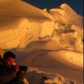
trumpetsailor Posted May 6, 2013 Share Posted May 6, 2013 (edited) In ~2005, I experienced my first "epic" thrashing up and down that valley. At our high point atop the talus field in the lower right of your picture at ~5 pm on a day trip, we grasped the full meaning of the difference between 20' and 40' contour intervals. Then it got cold and rained. Denny's in Monroe the following morning was awesome. Expect notable brush, including devils' club. Our experience seemed to be that the eastern side of the valley was easier. I think we did our return trip on the eastern side all the way to the highway. Much of the upper valley we did in the creekbottom, as it was early autumn. Cale has the right idea with Beckey. The guidebooks are worth the investment. There must be tons of older ones floating around at book sales and such. They're terse, but they're the best single guide to the goods. Most recent edition recommended, but not inherently requisite. With these temperatures, I'd guess that there'll be stuff falling - climb safe! Edit: Looked at your map -- that was the line we'd hoped to scramble. It was too-long ago for me to have photos from about where the "36" is on the map, but I'd guess that there's a way that the route is climbable in summer, too. It'll just be scrappy and Cascadian. From the Beckey guide, it would appear that the first recorded ascent was via Anderson Creek. Beckey recommends "early season", in part to suppress brush. Edited May 6, 2013 by trumpetsailor Quote Link to comment Share on other sites More sharing options...
Josh Lewis Posted May 6, 2013 Author Share Posted May 6, 2013 I might not be able to do this route this year. I have college Monday through Friday, no car, no one willing to do it with me, and the bus doesn't run on Sunday. Despite these complications I would still try to pull it off. A few days ago I finished up Sky Rocket Couloir and missed the last bus (we got to Gold Bar at 7:20 p.m.). Fortunately we got lucky with getting out of town. Now if this was the good old days of 2011 or even better 2008 I could probably make the last bus in time. And unlike this time, if I miss the last bus, I'm not only stuck in Gold Bar for 2 nights, but my schooling would be compromised making it a significant risk. However it might be possible to try this route at night. What time of year did you do this? Quote Link to comment Share on other sites More sharing options...
trumpetsailor Posted May 6, 2013 Share Posted May 6, 2013 I edited my reply above with more thoughts/info. I think it was late September/early October, in Indian summer before the turn, but I'm not sure. Quote Link to comment Share on other sites More sharing options...
Josh Lewis Posted May 6, 2013 Author Share Posted May 6, 2013 Thanks for the info. It's fun to do hard and strange routes. Quote Link to comment Share on other sites More sharing options...
trumpetsailor Posted May 6, 2013 Share Posted May 6, 2013 Beckey's description of the route: http://books.google.com/books?id=BHK2xoJhlVoC&lpg=PA332&ots=OyLvF_G55c&dq=cascade%20alpine%20guide%20anderson%20creek&pg=PA223#v=onepage&q=%22anderson%20creek%22&f=false And his description of the lower portion of the route (In my fuzzy memory, I recommend starting east of the creek at the highway, and not taking the tempting road to Swanson's Cabins.) http://books.google.com/books?id=BHK2xoJhlVoC&lpg=PA332&ots=OyLvF_G55c&dq=cascade%20alpine%20guide%20anderson%20creek&pg=PA332#v=onepage&q=cascade%20alpine%20guide%20anderson%20creek&f=false Quote Link to comment Share on other sites More sharing options...


Recommended Posts
Join the conversation
You can post now and register later. If you have an account, sign in now to post with your account.