-
Posts
32 -
Joined
-
Last visited
-
Days Won
11
Content Type
Profiles
Forums
Events
Everything posted by adventure43
-
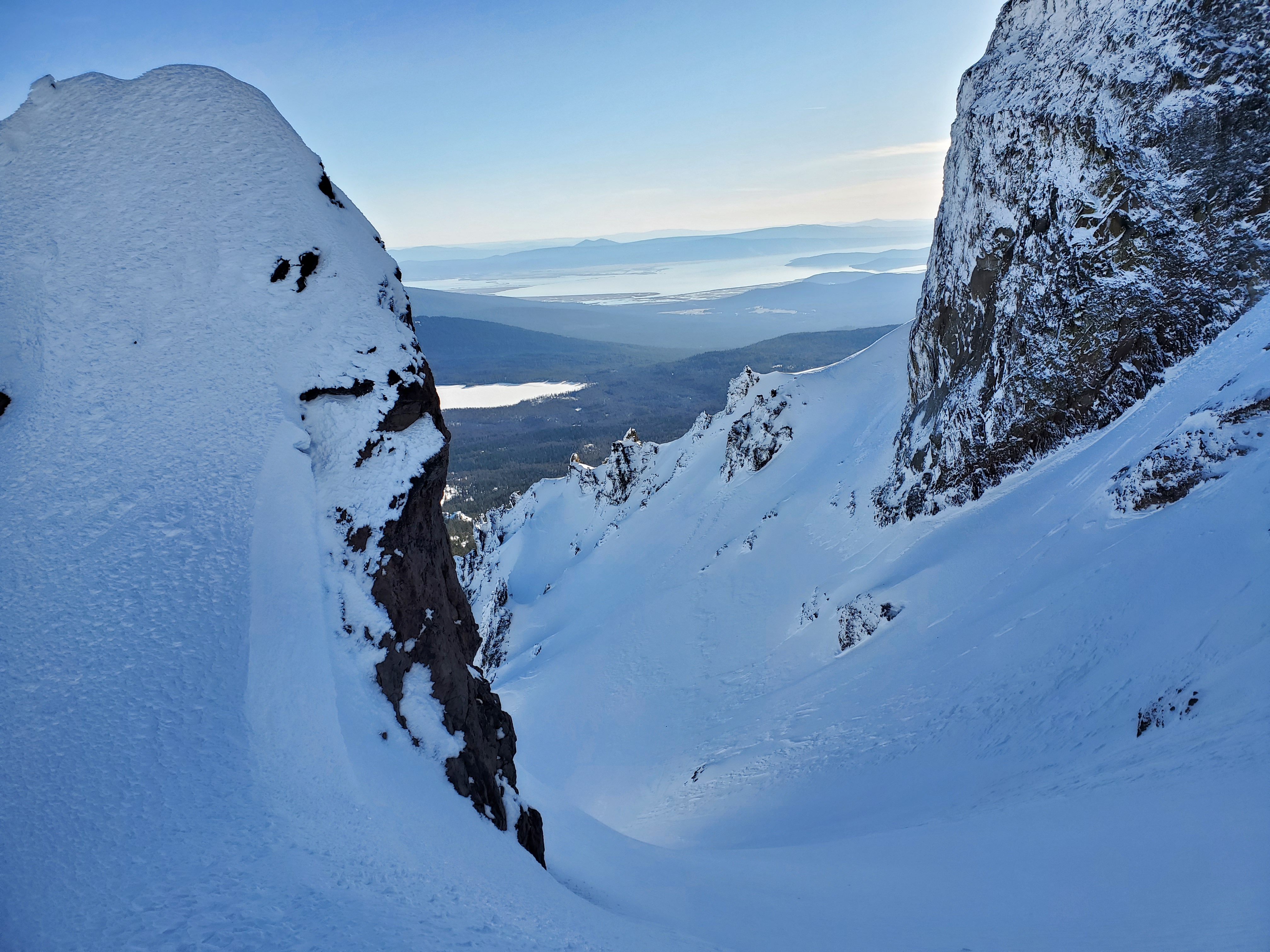
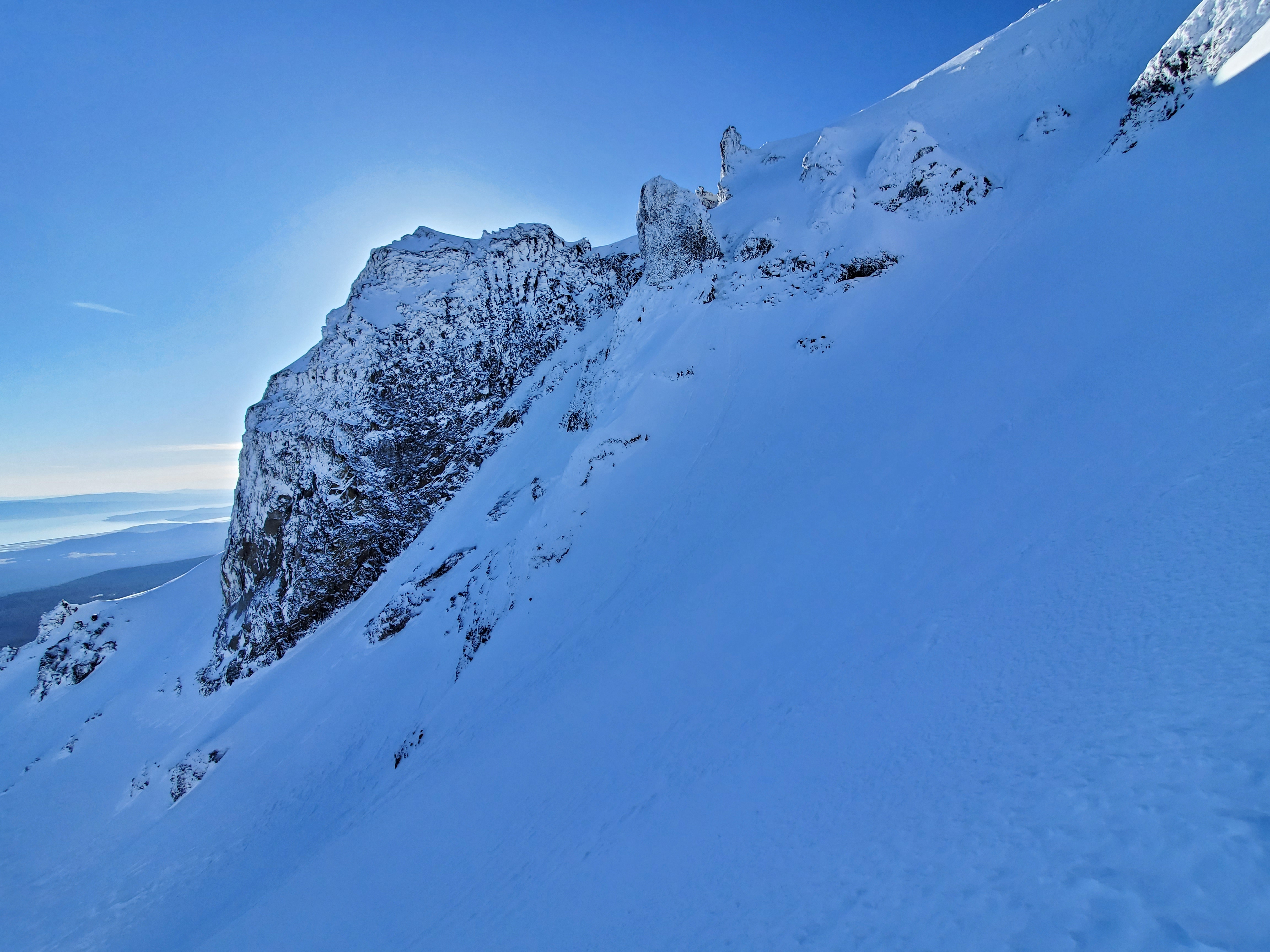
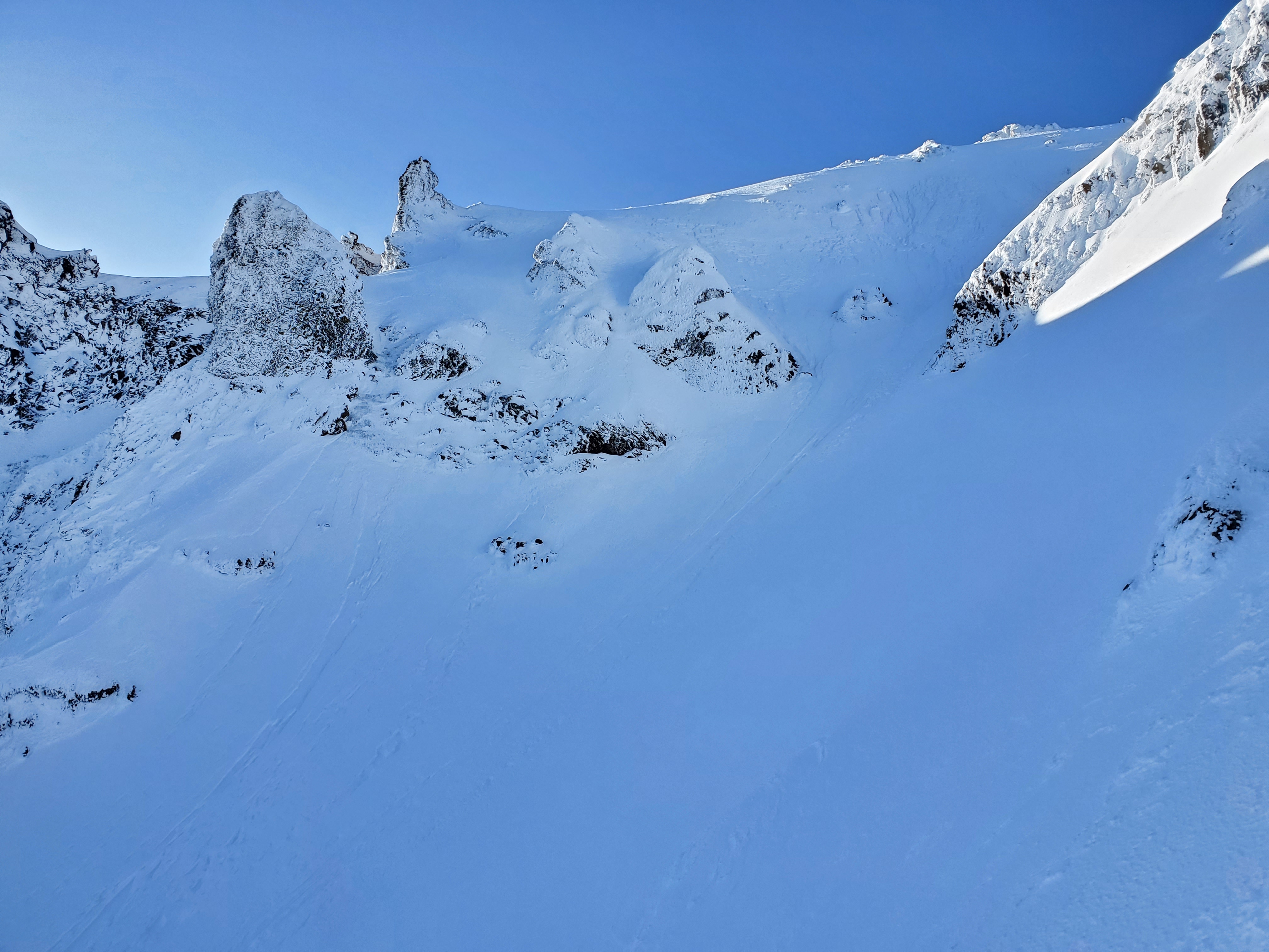
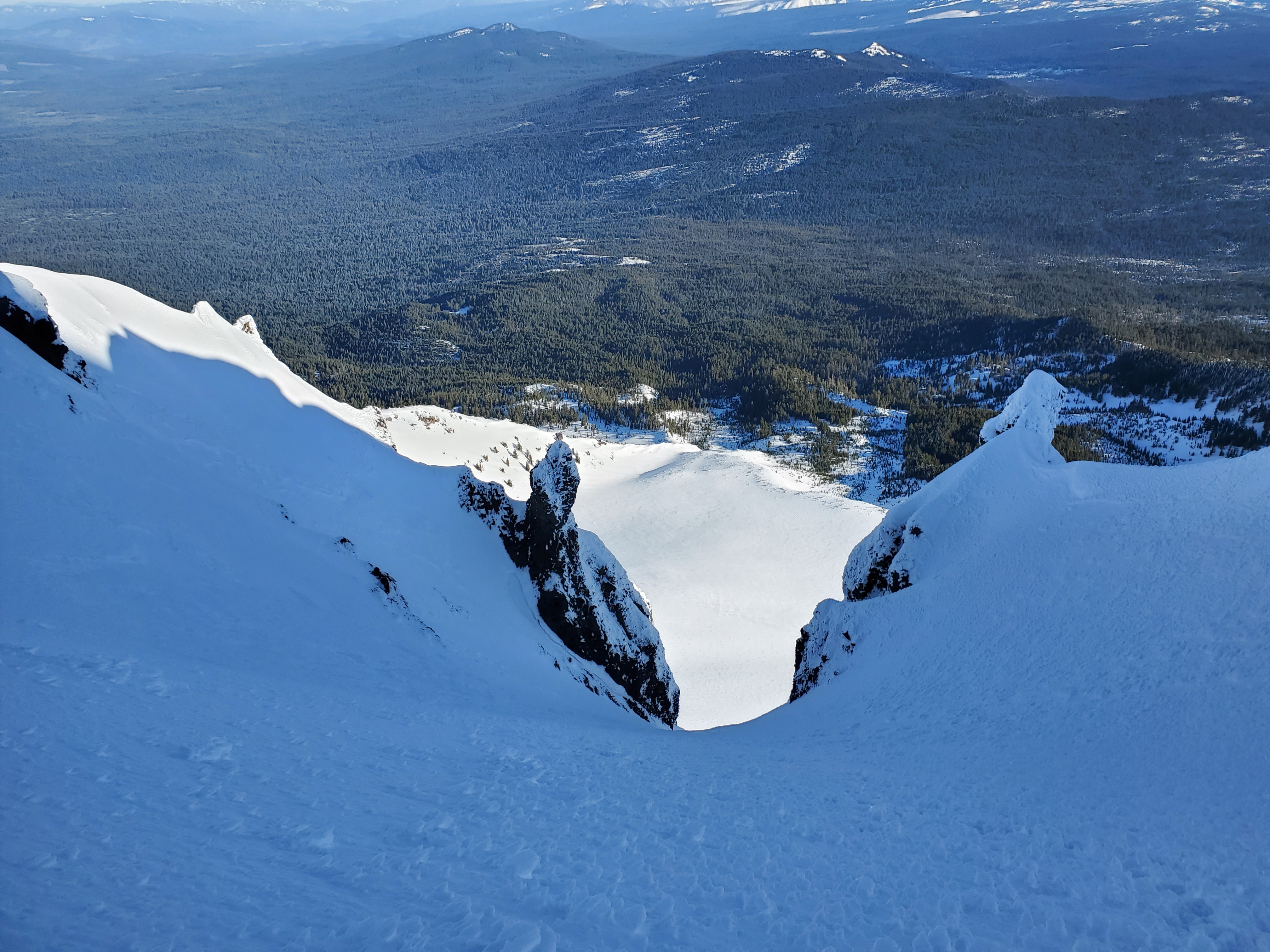
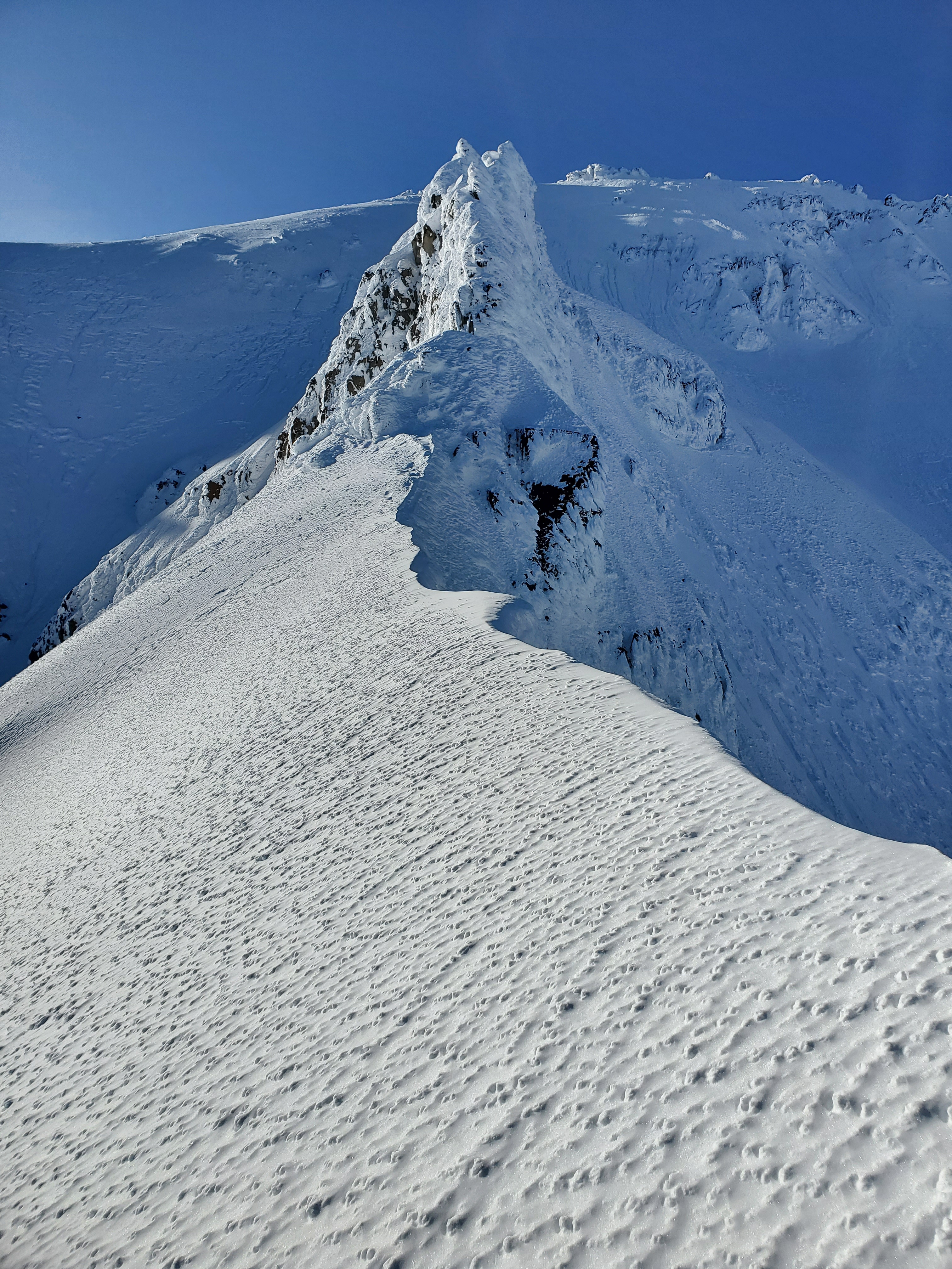
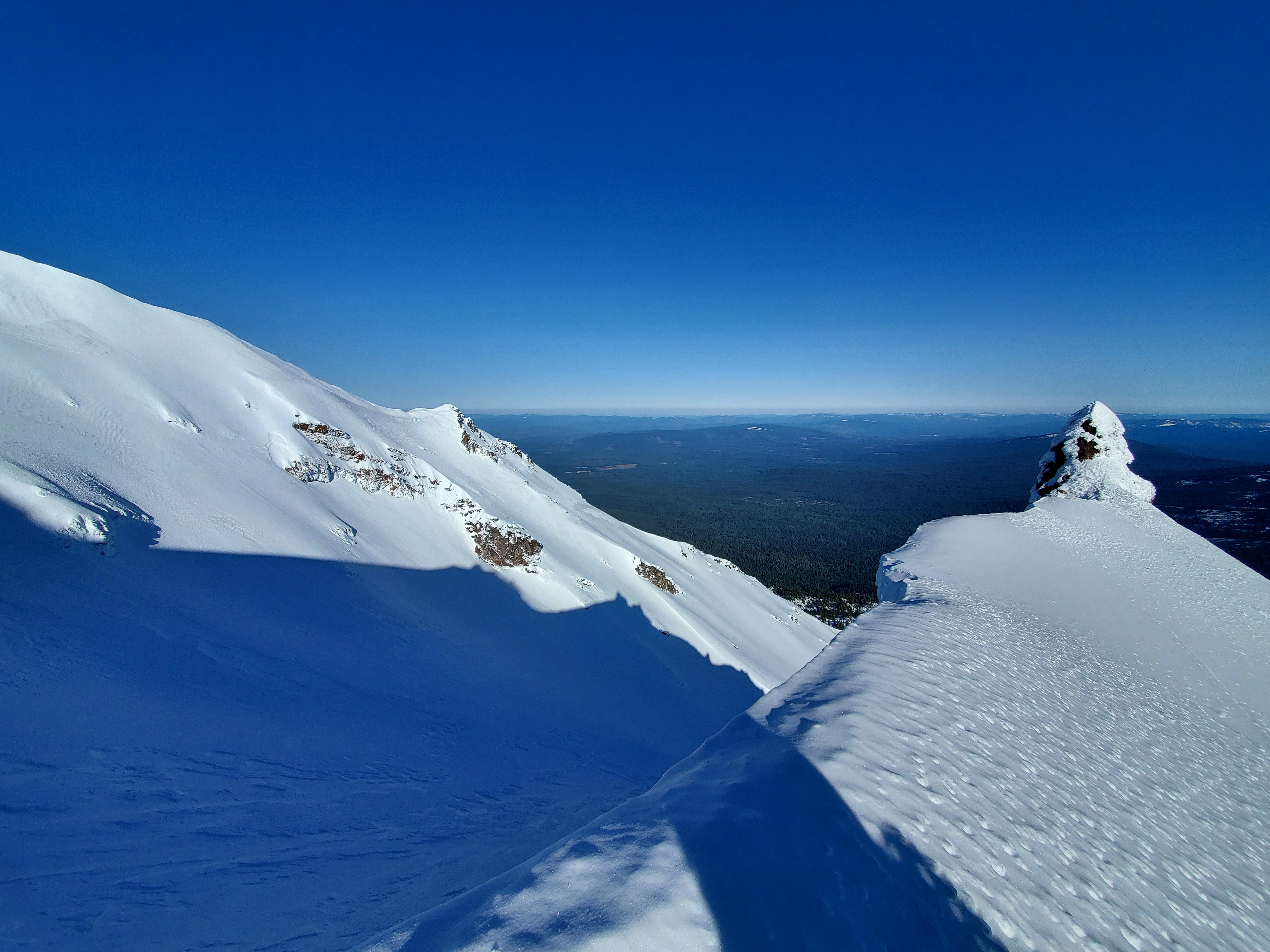
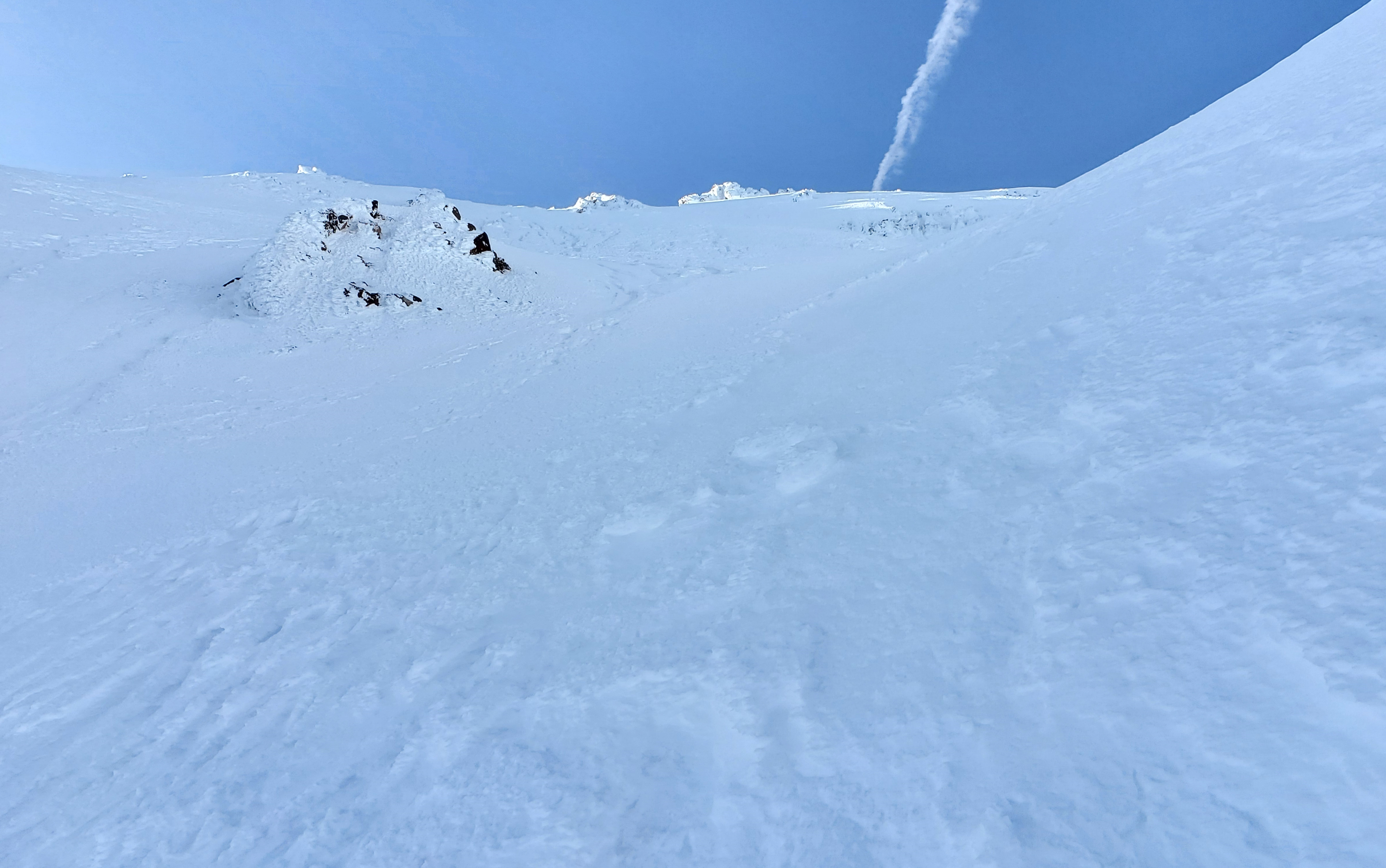
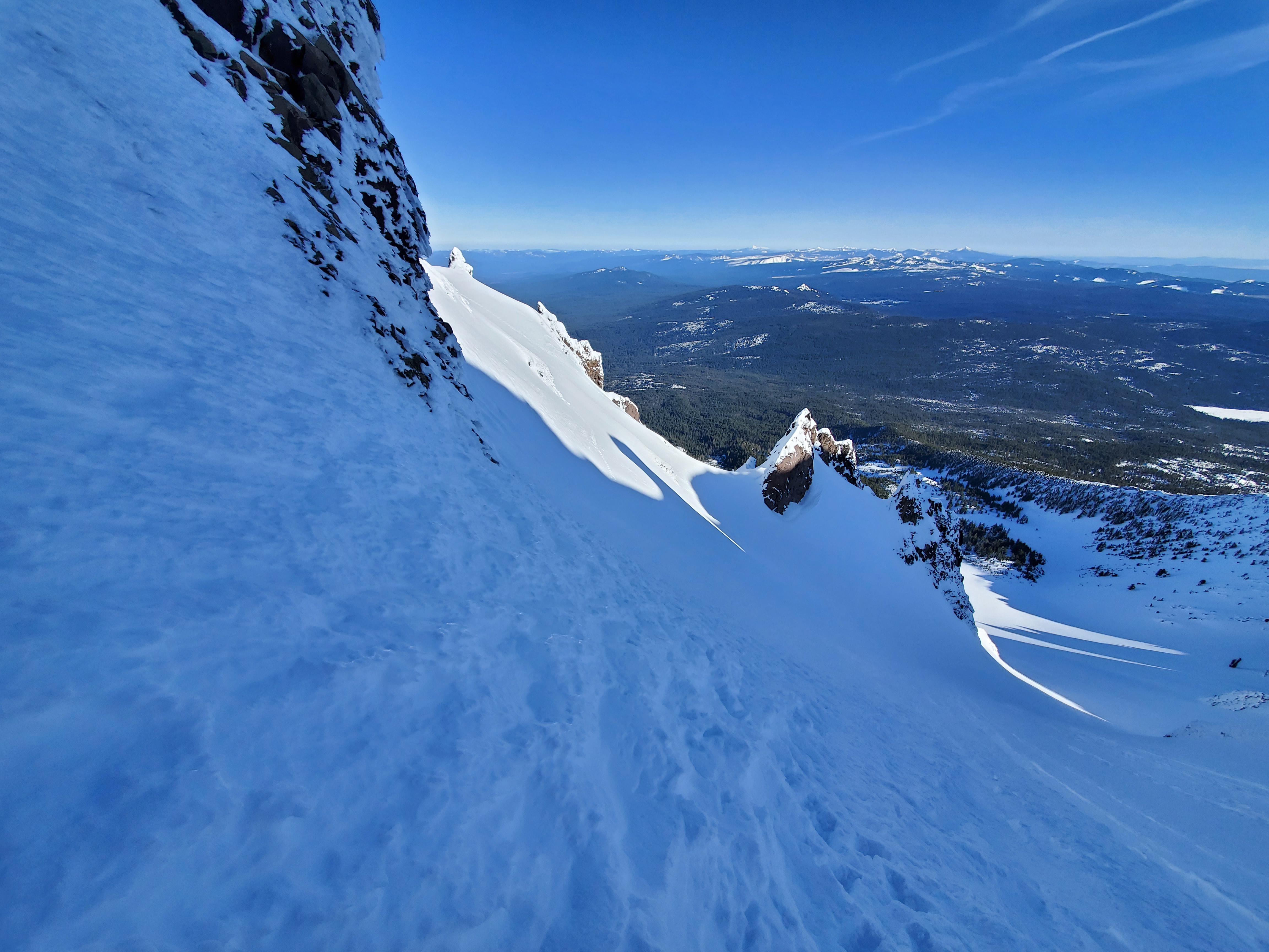
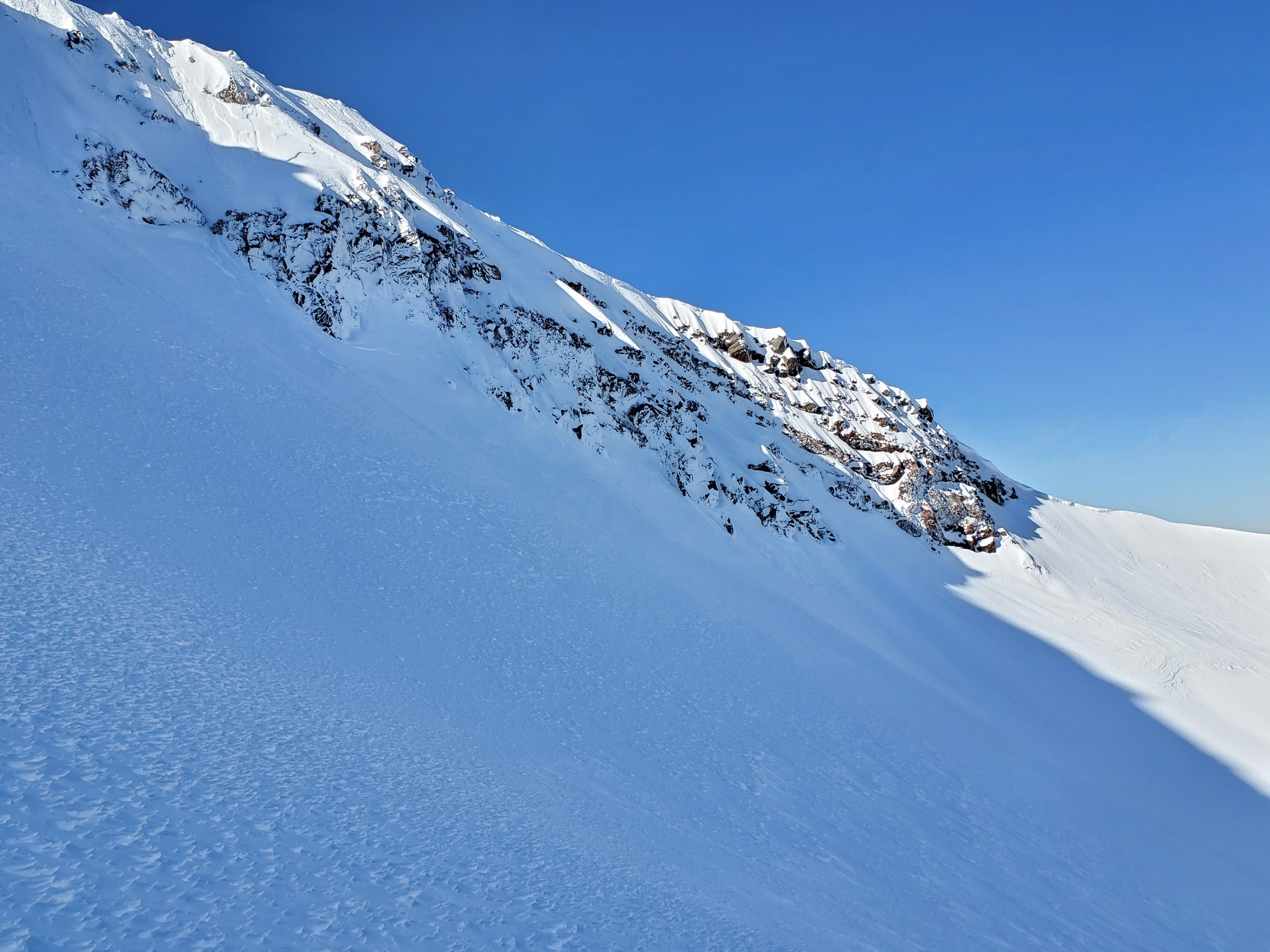
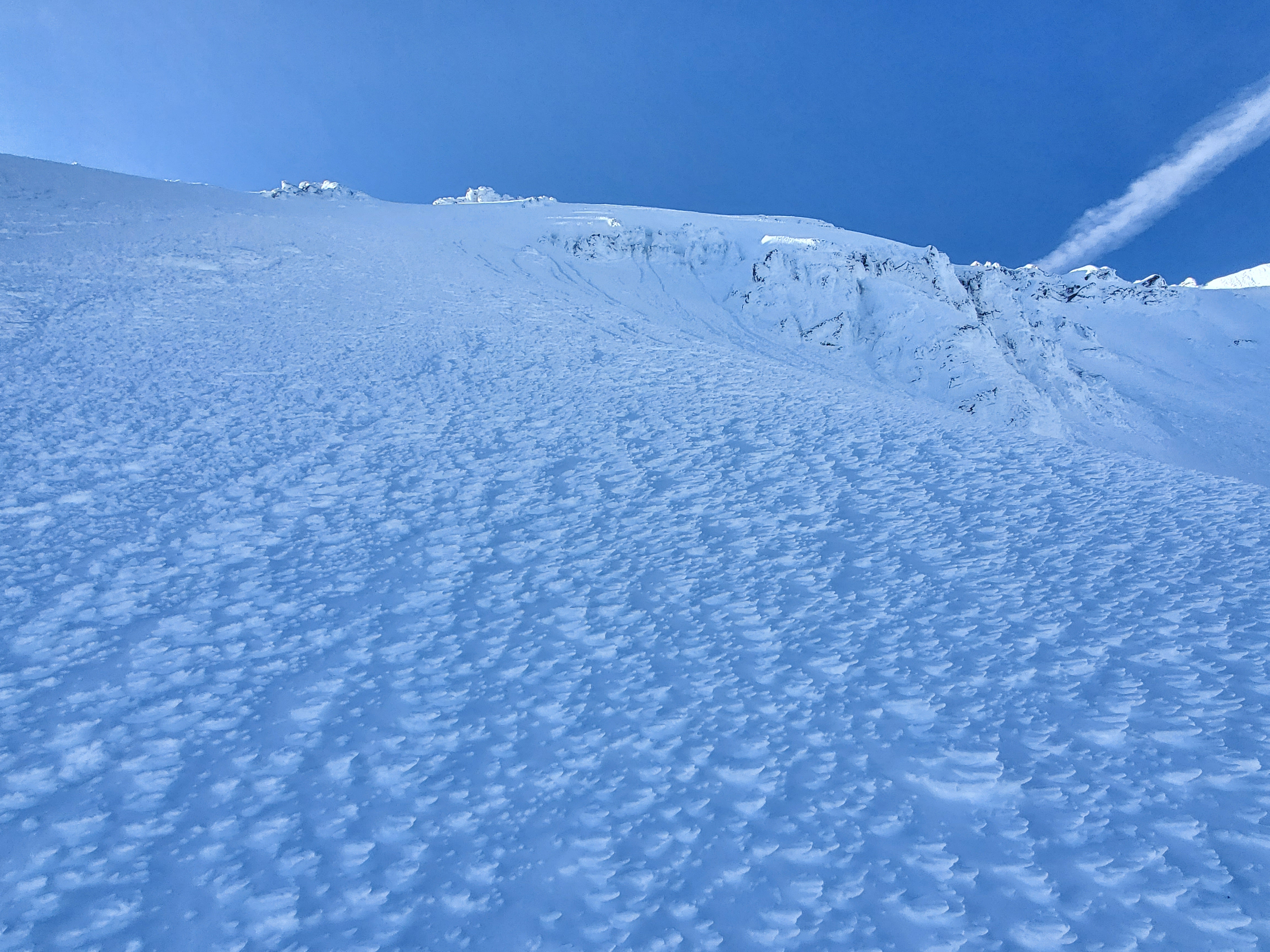
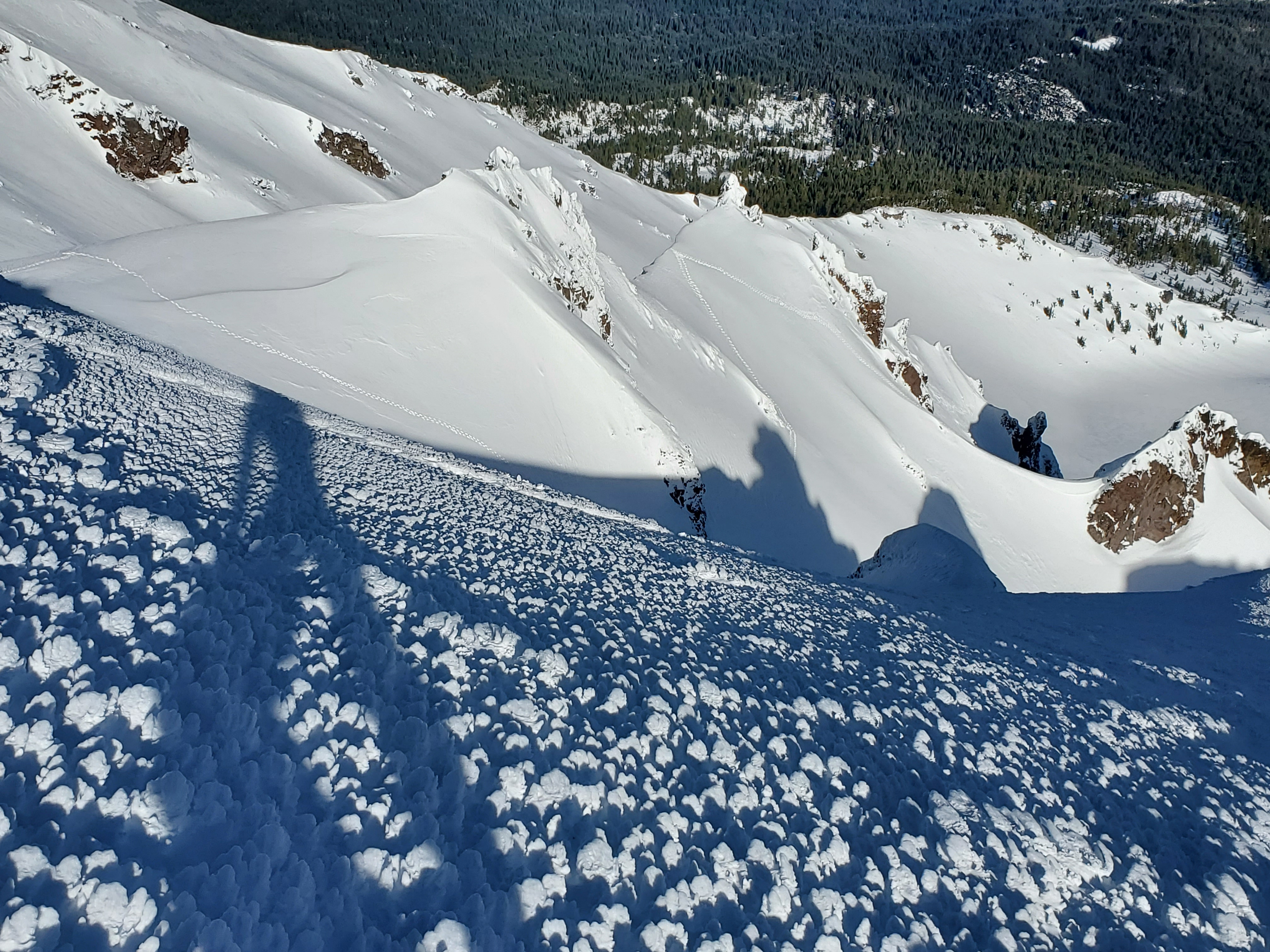
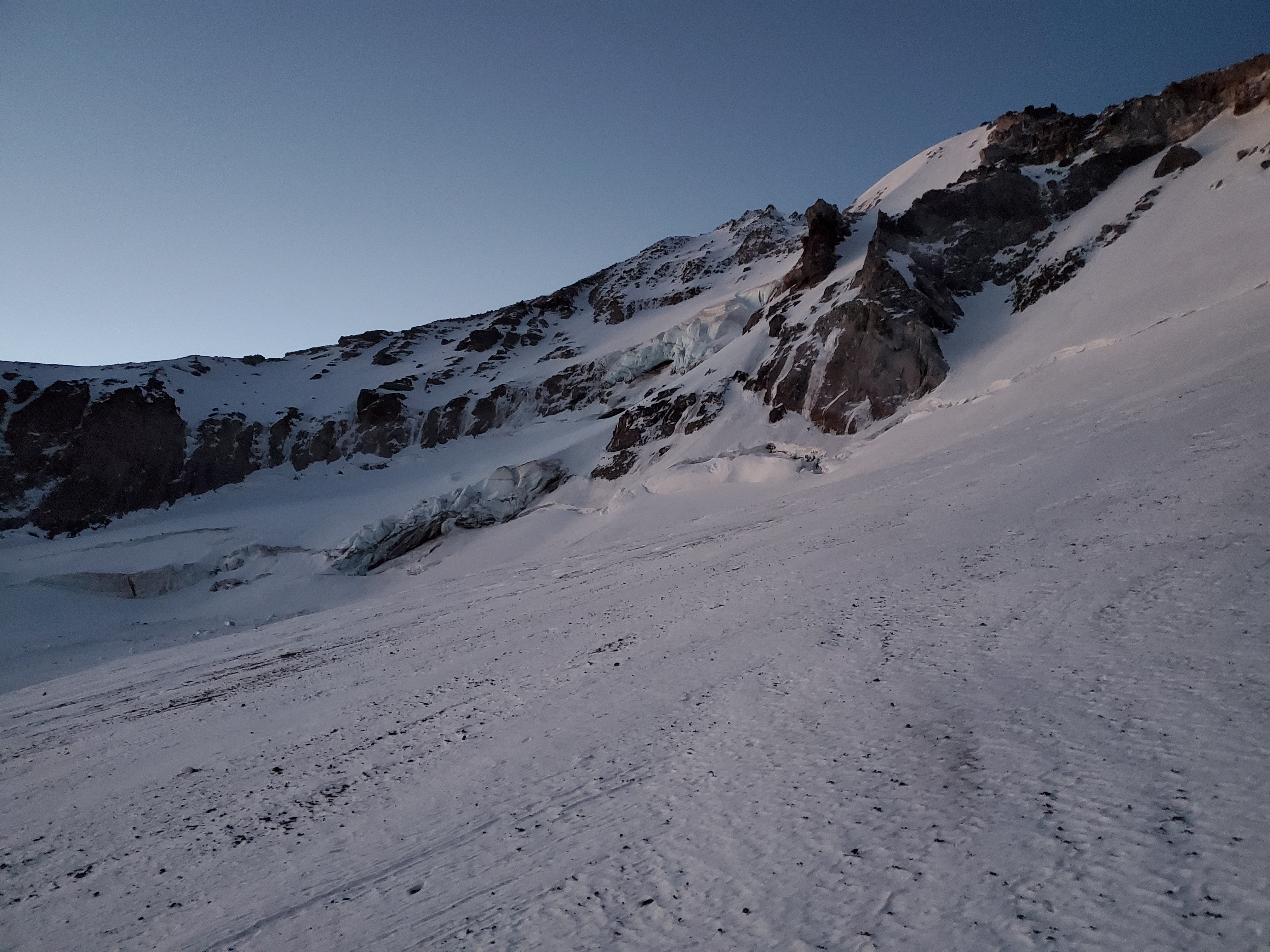
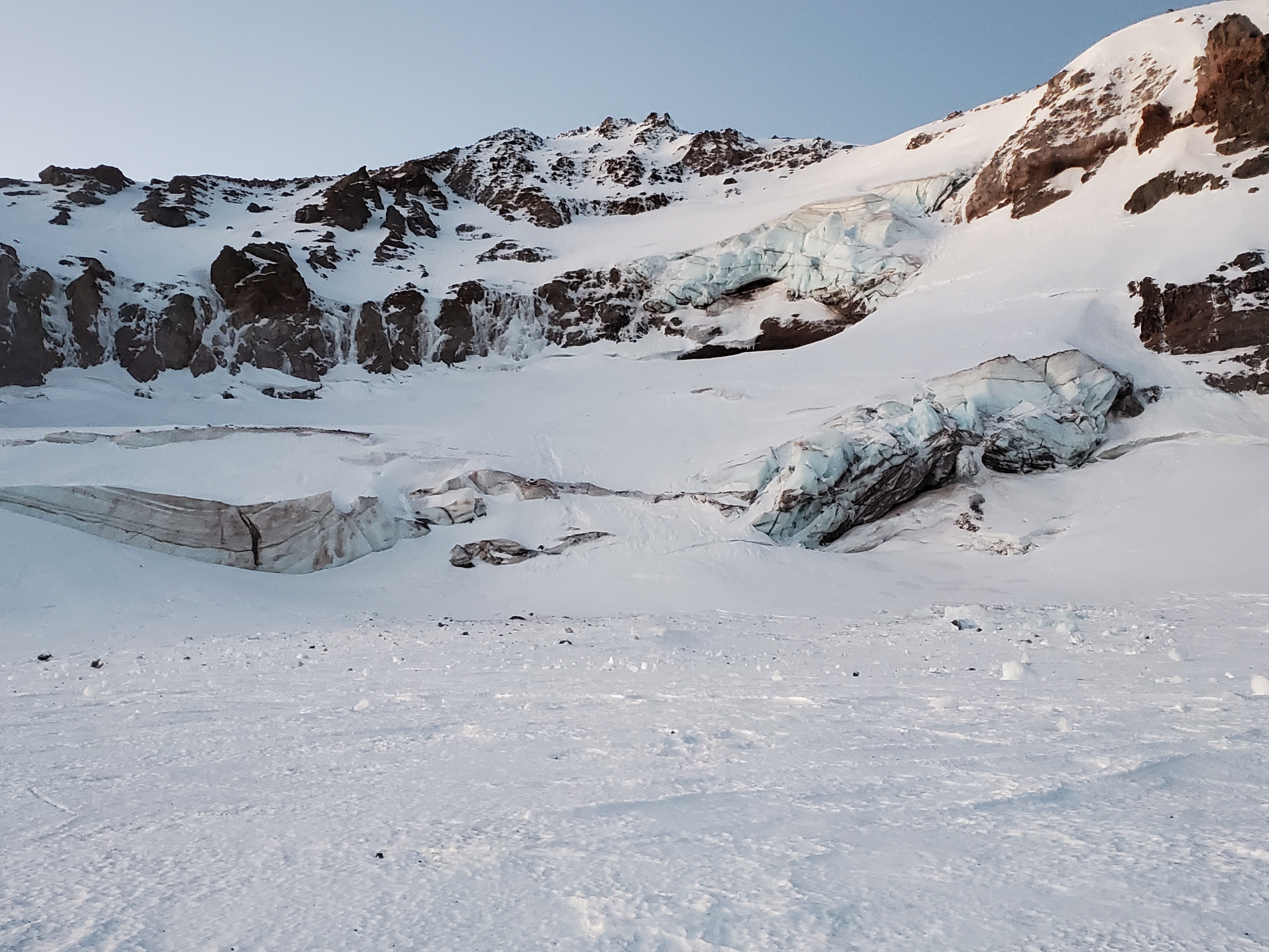
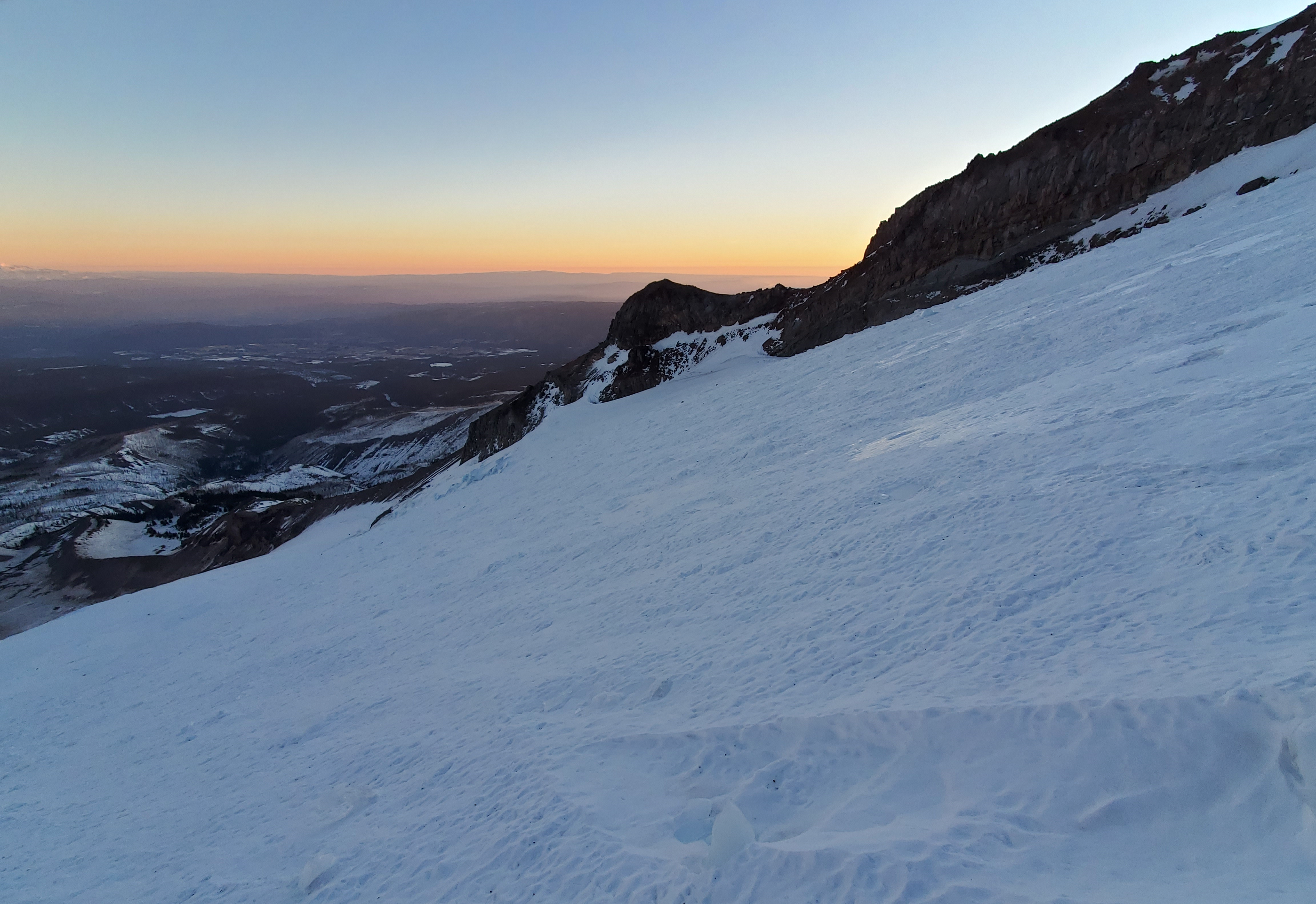
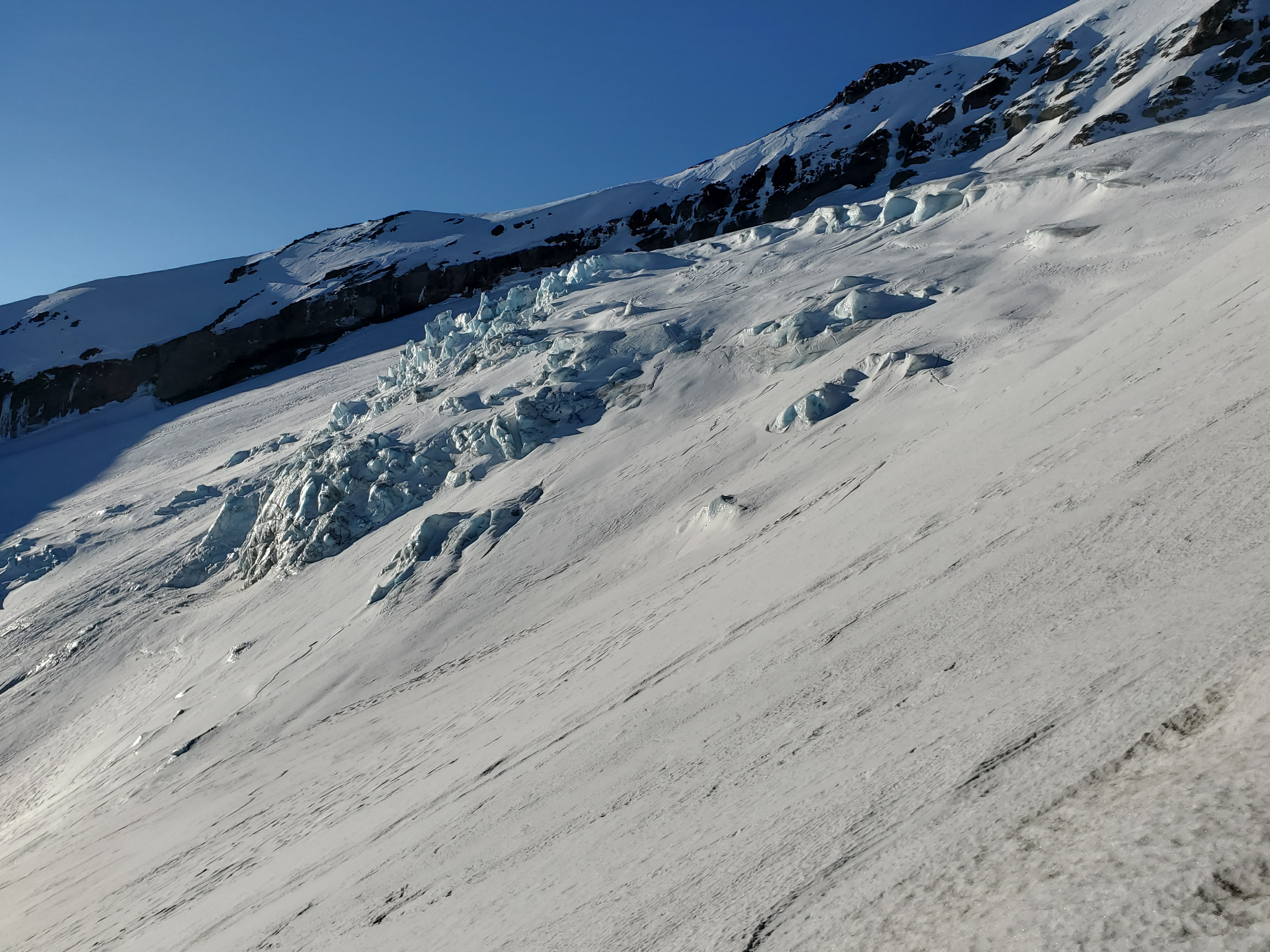
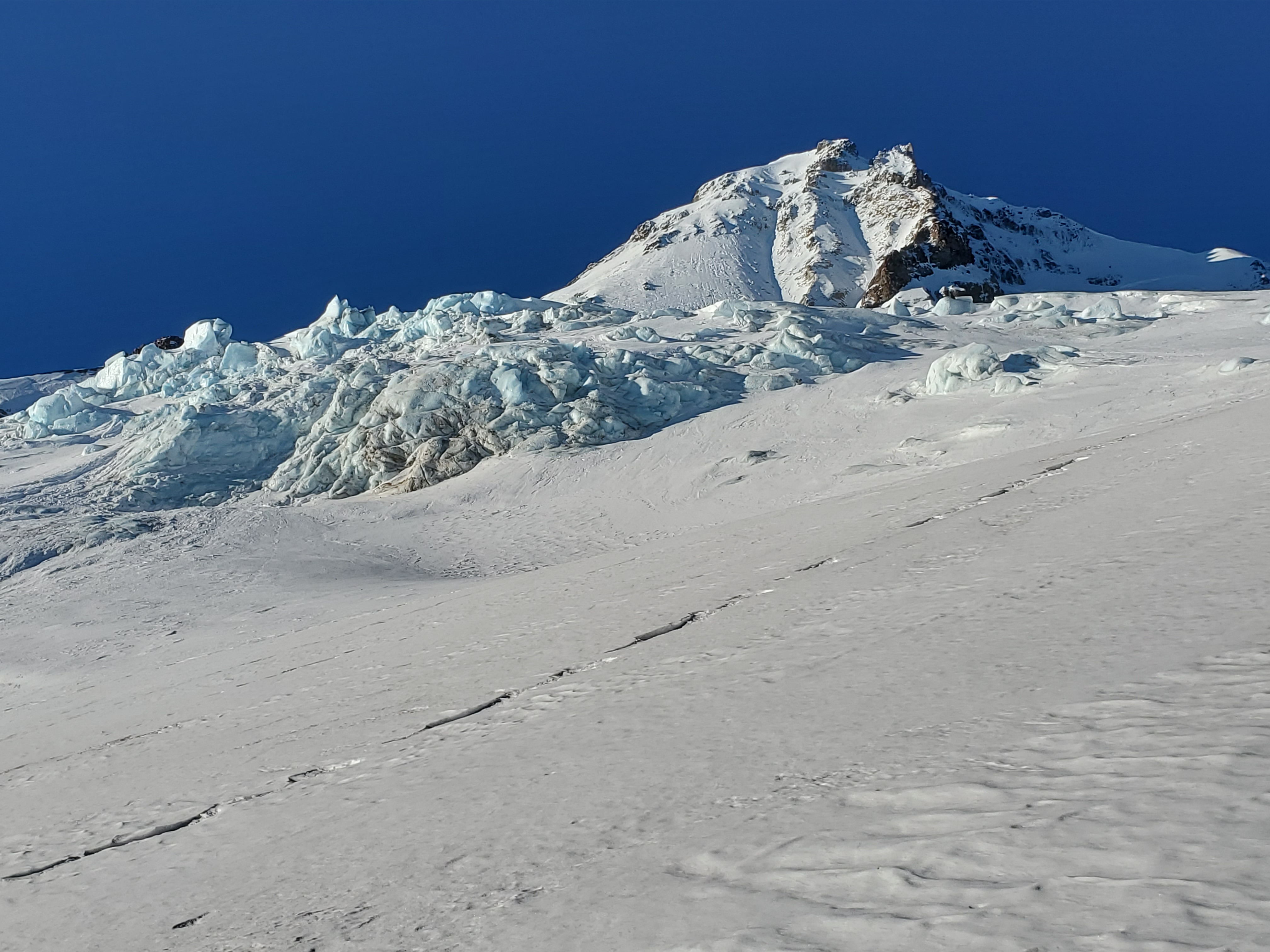
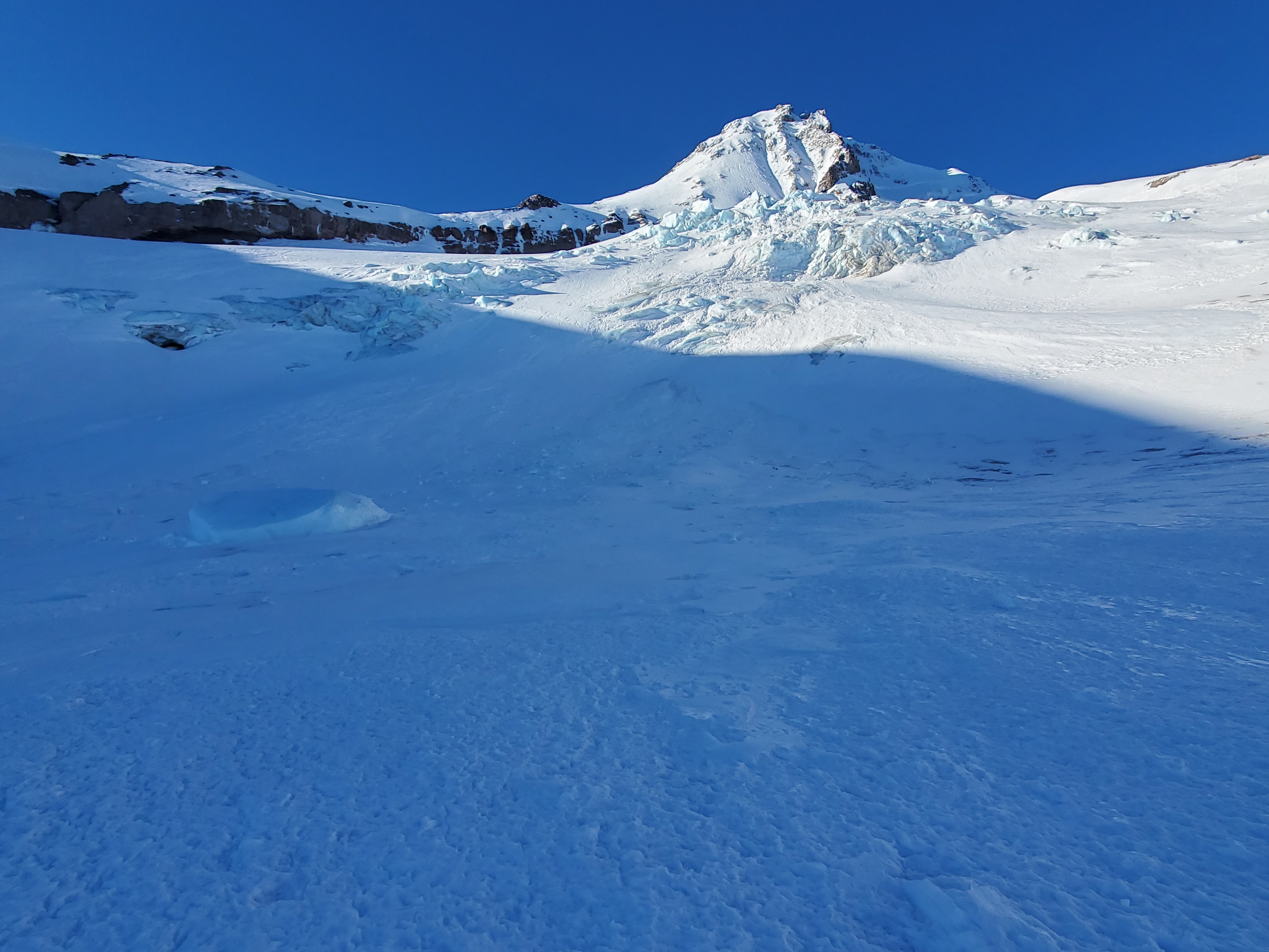
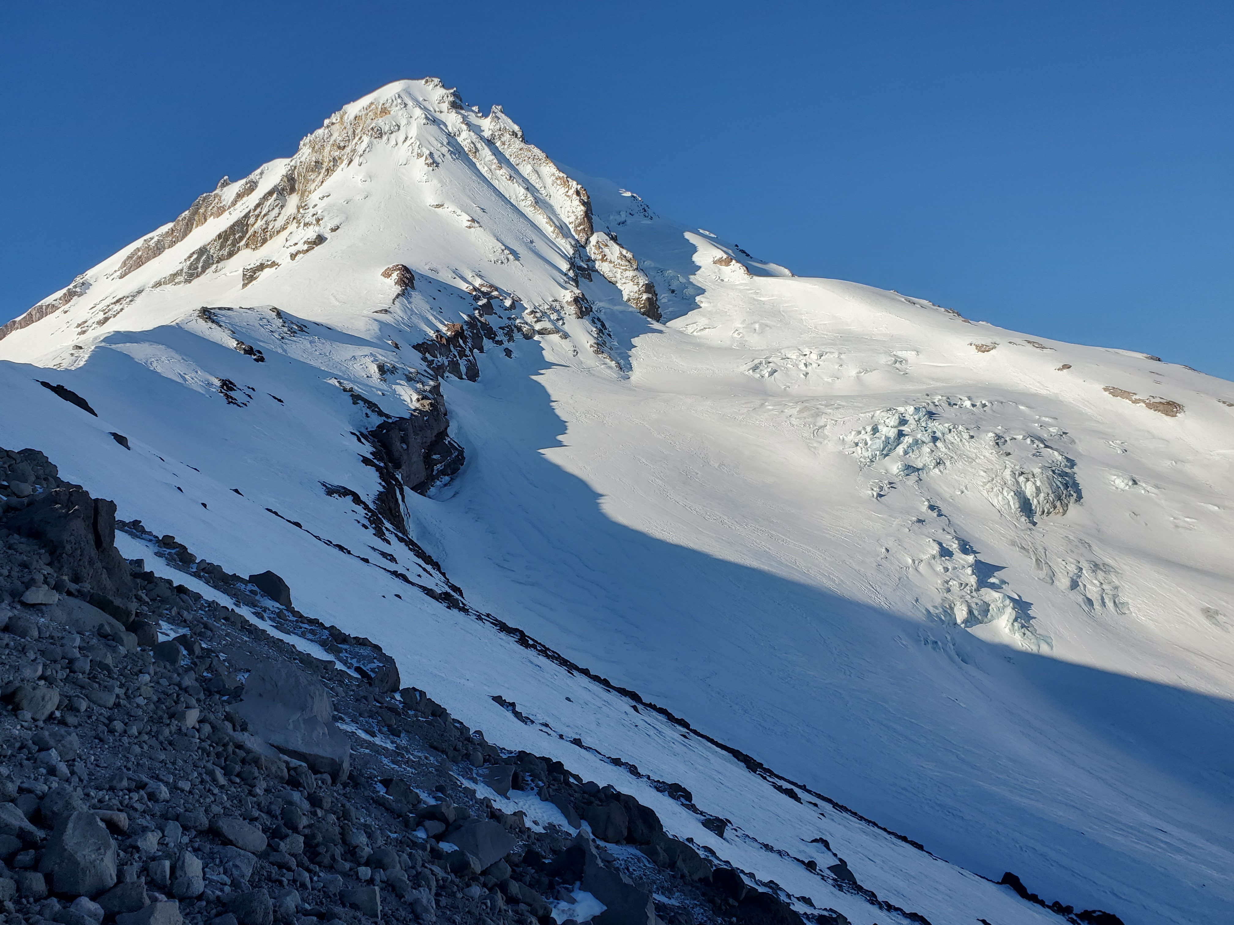
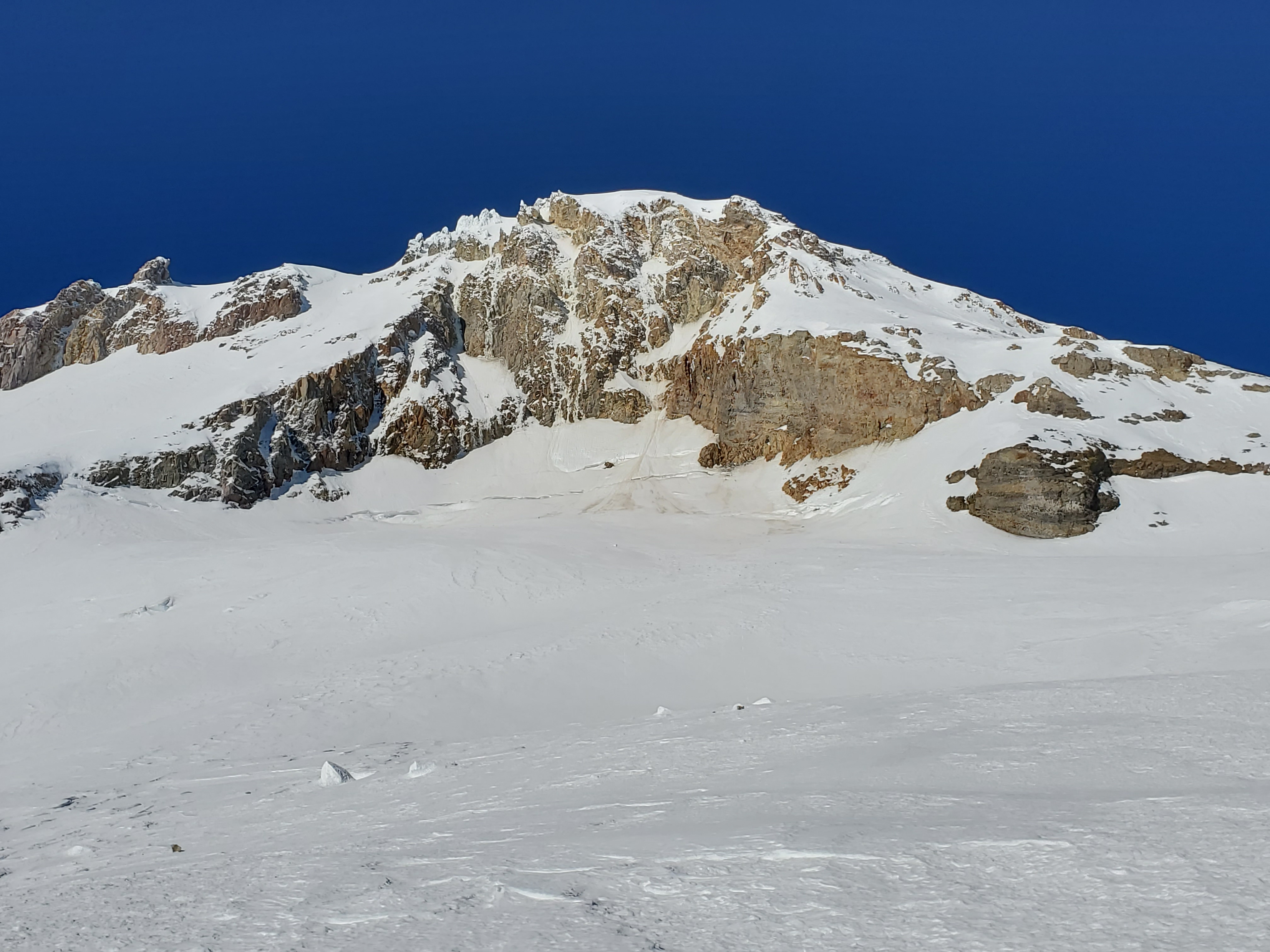
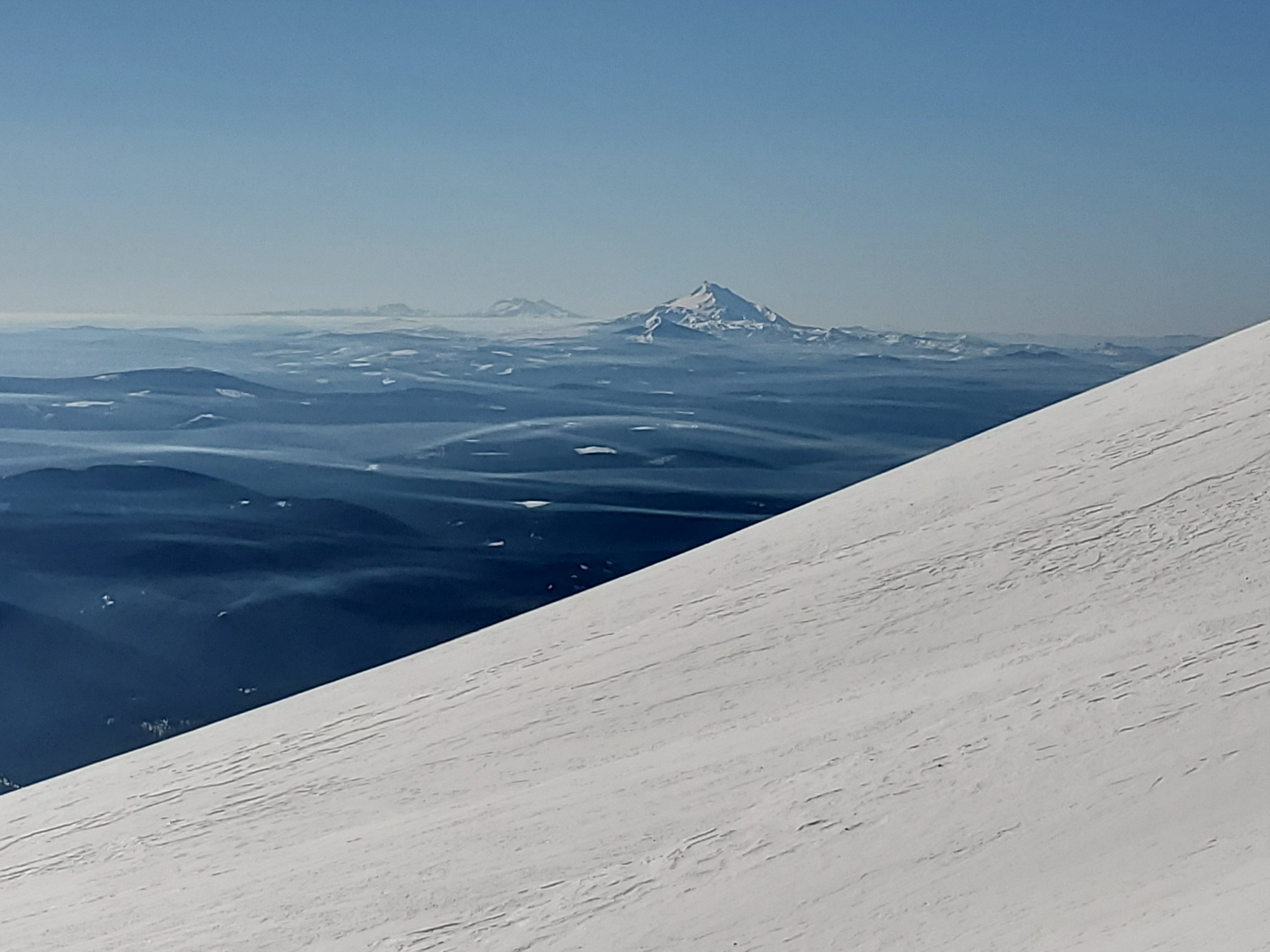
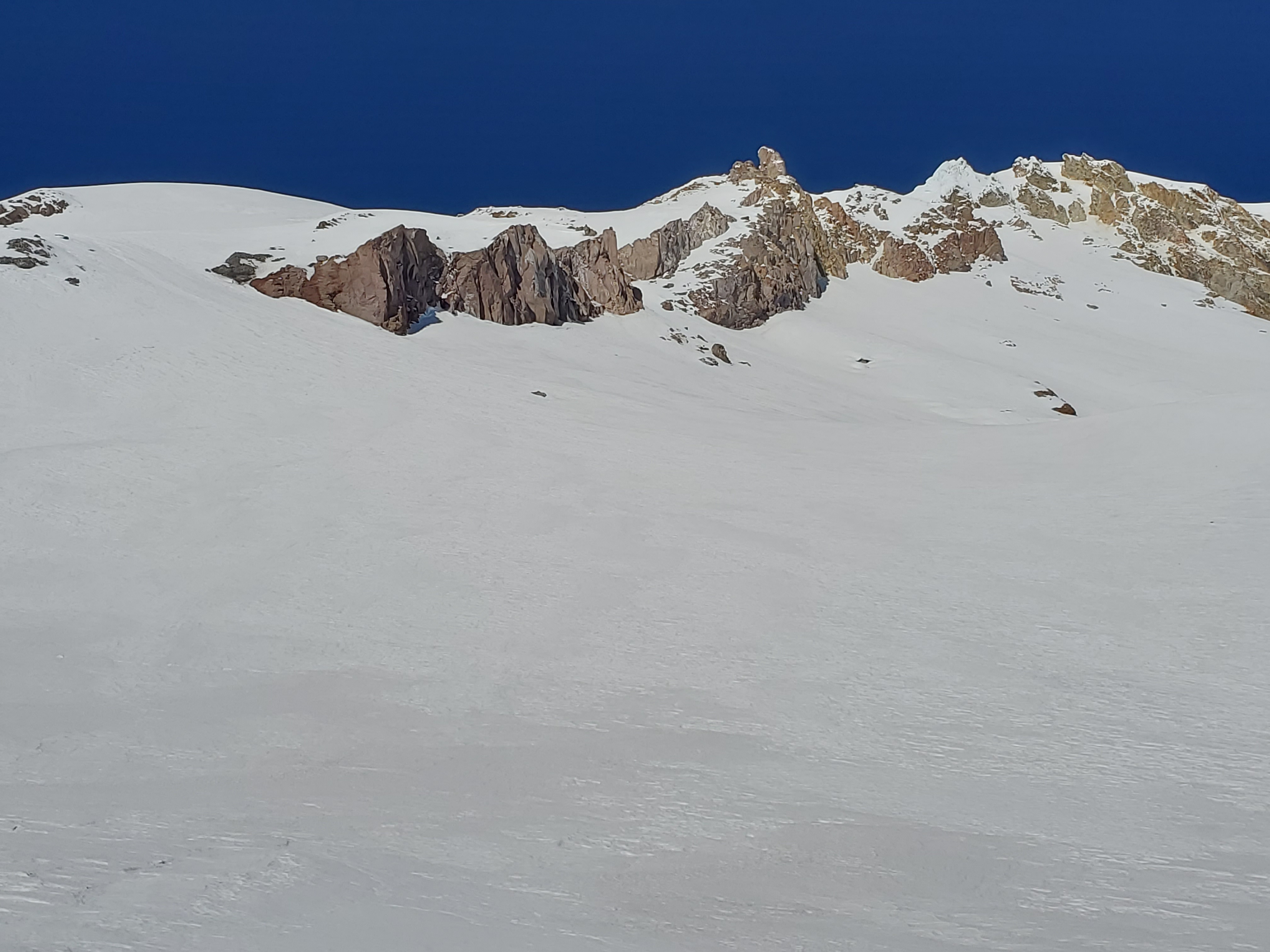
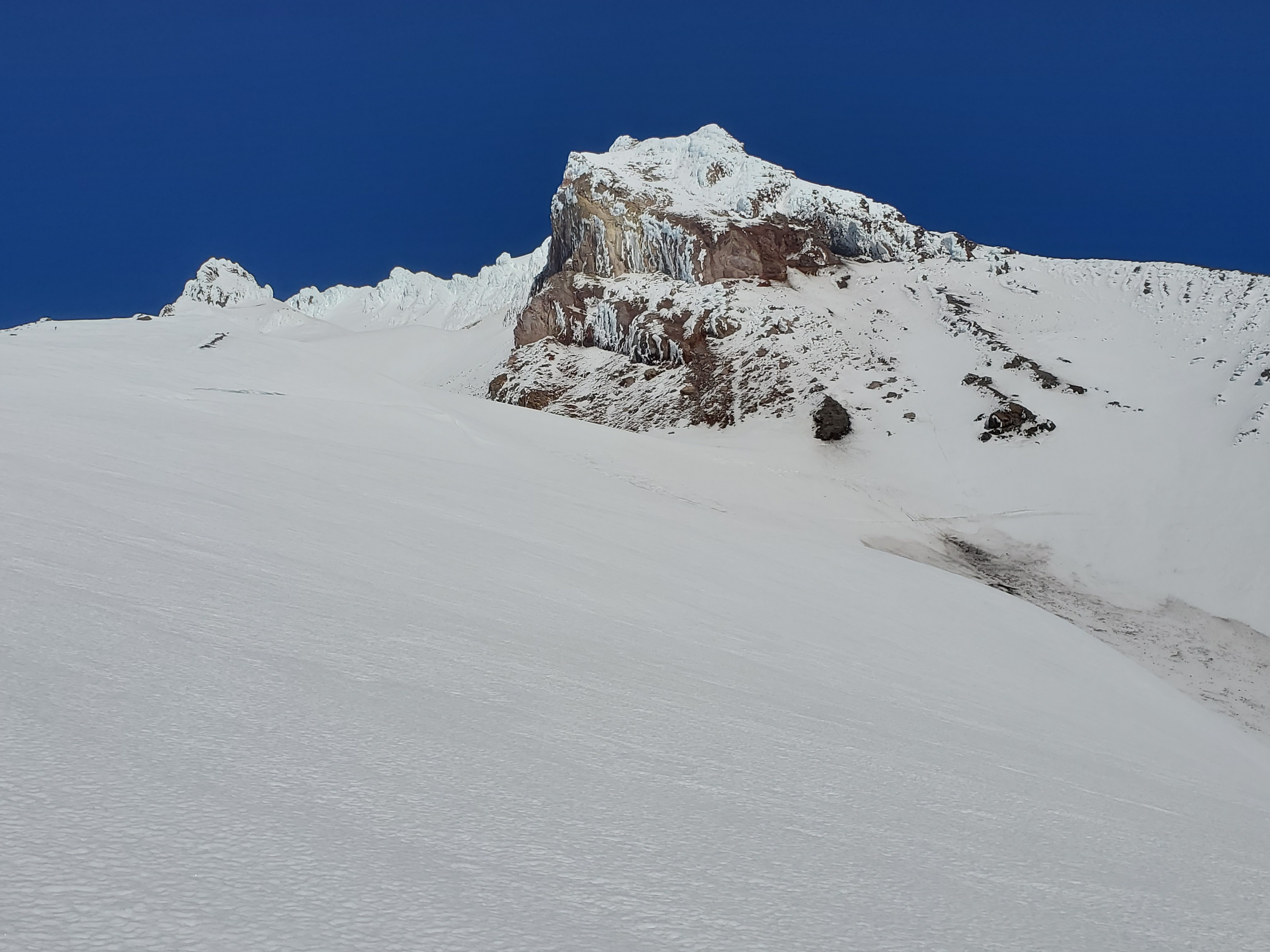
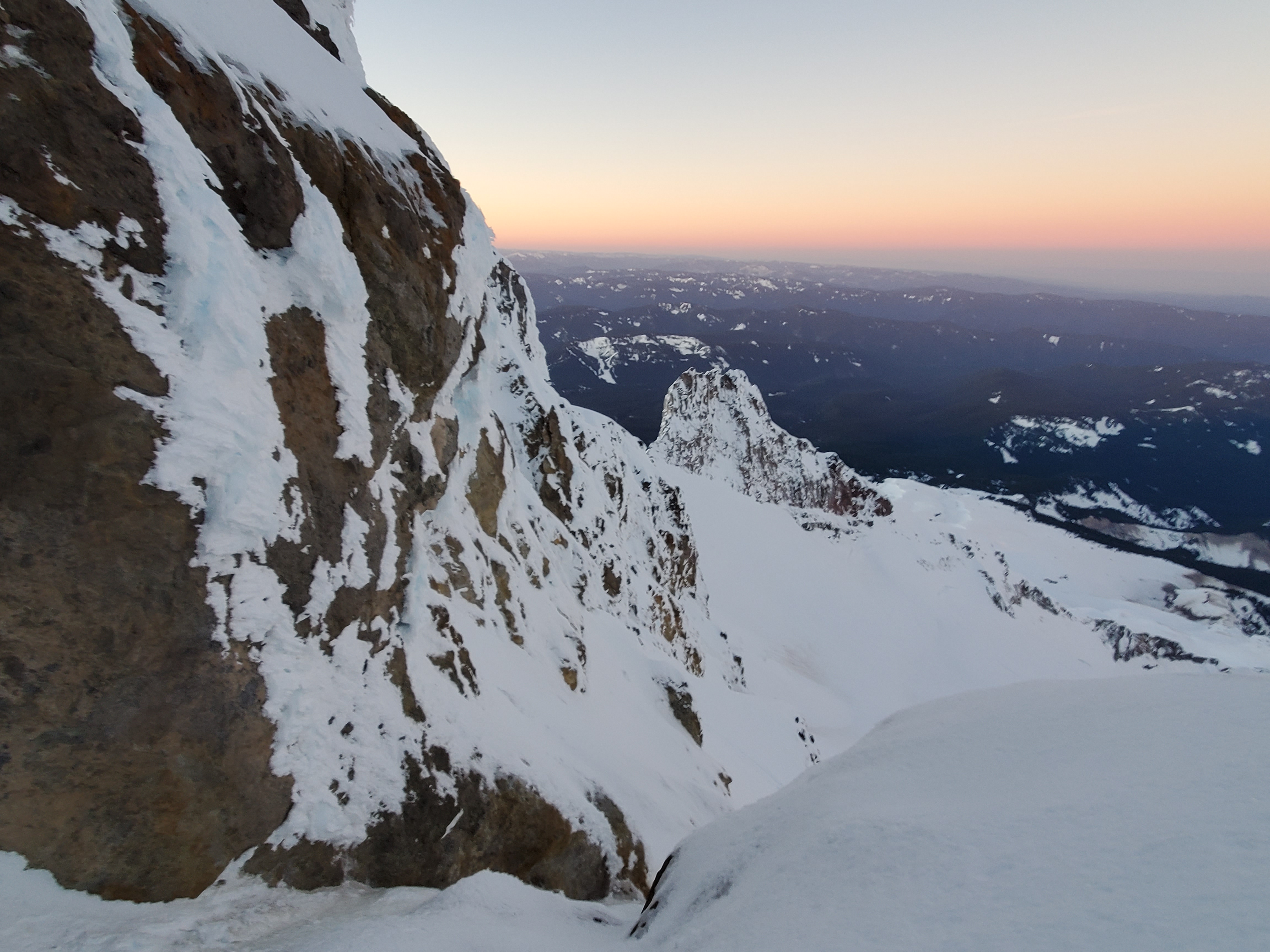
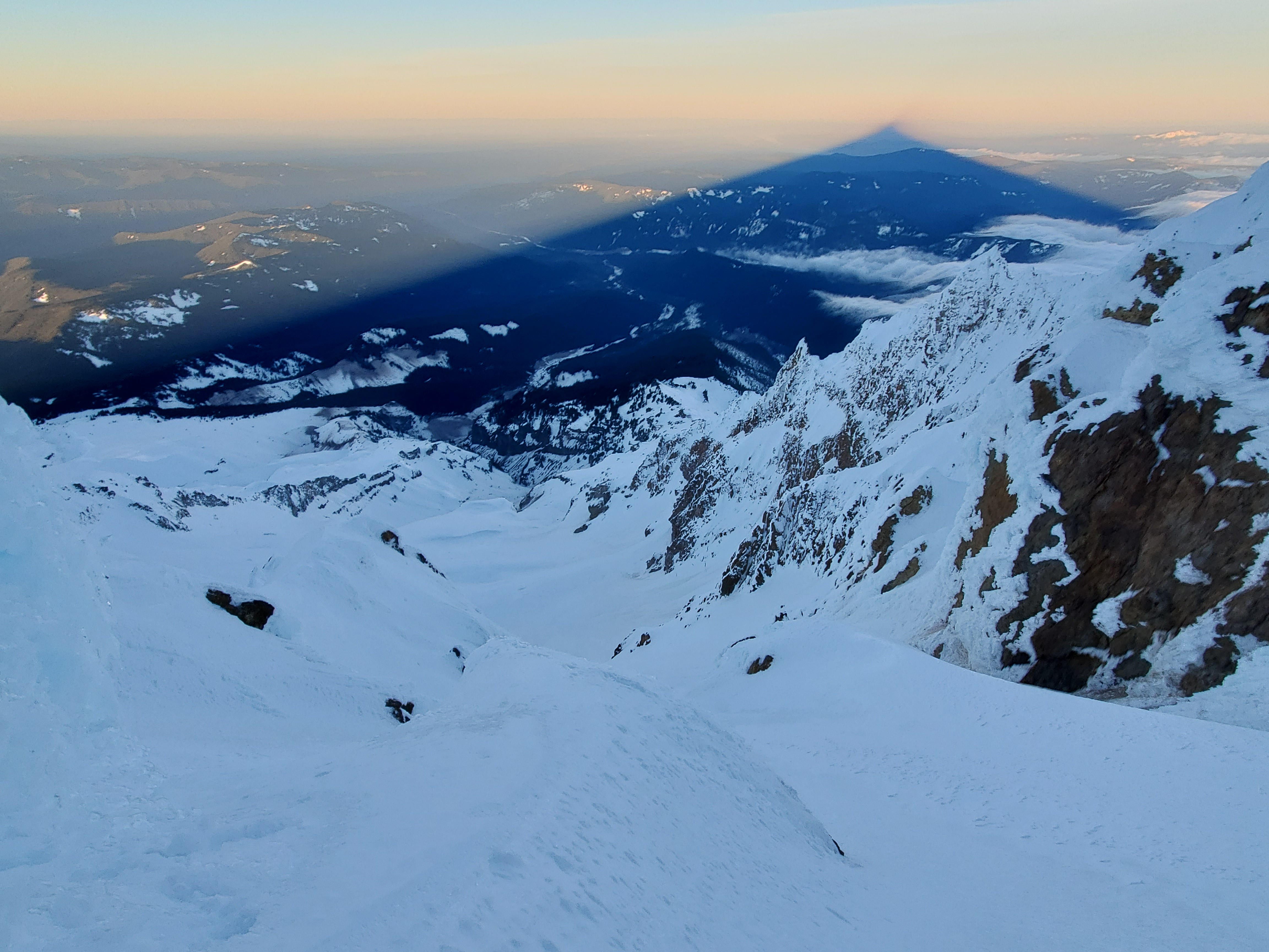
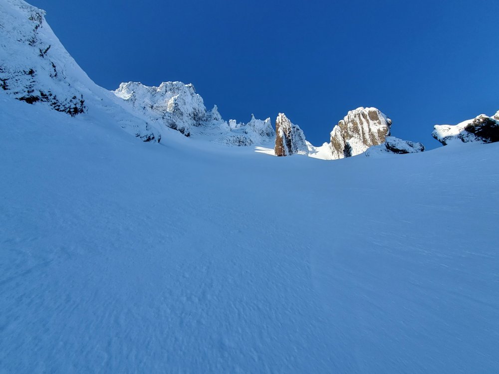
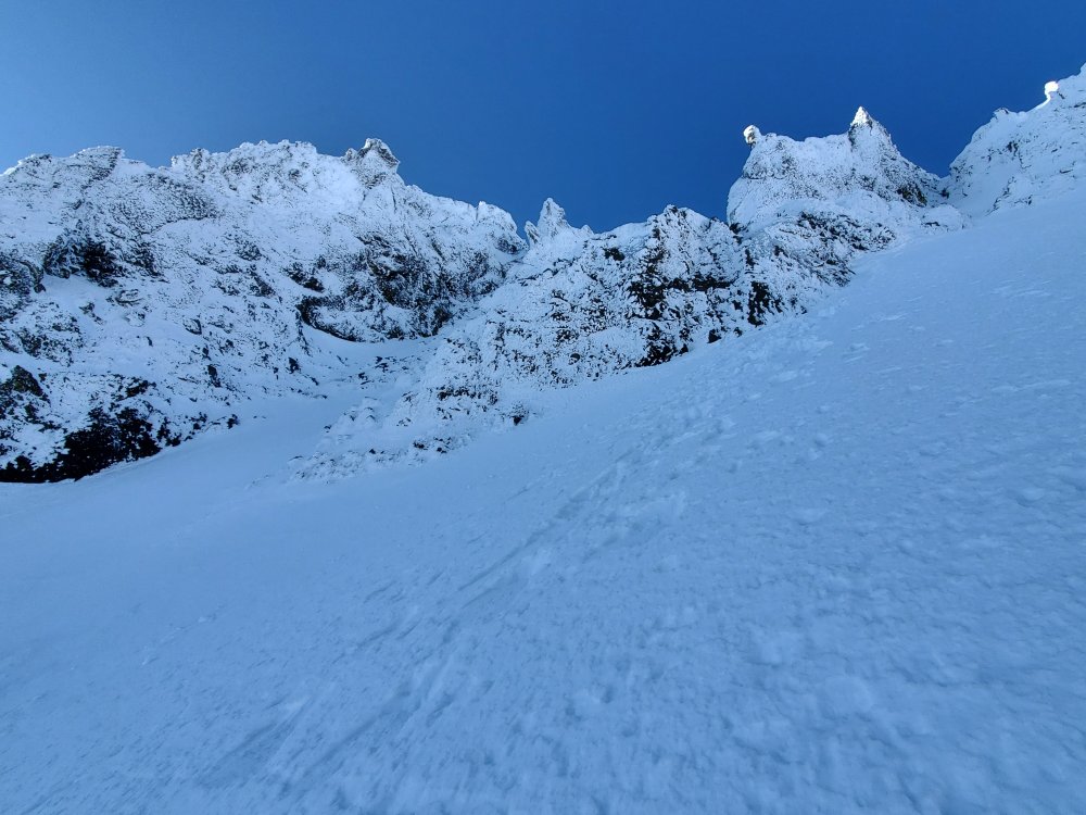
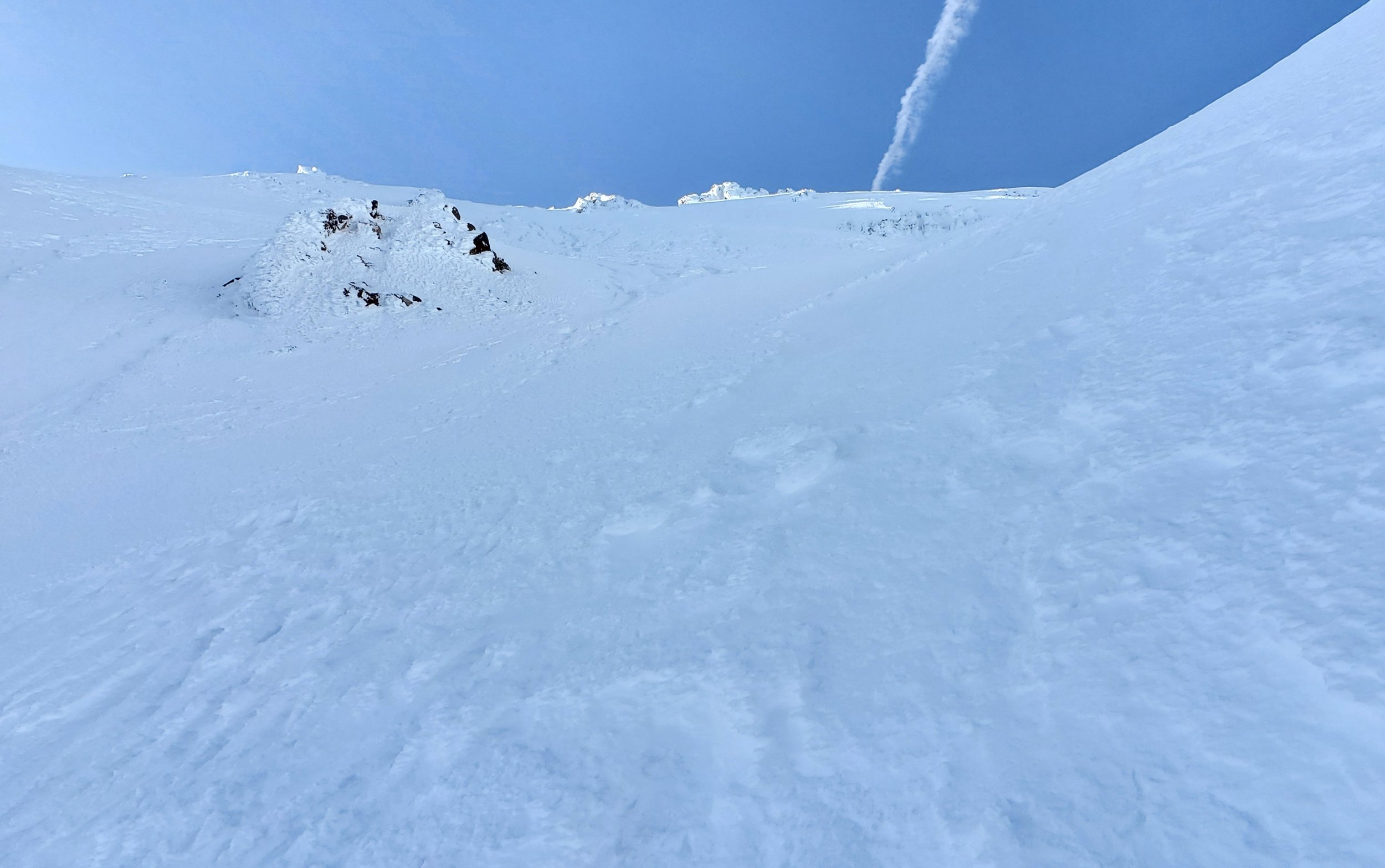
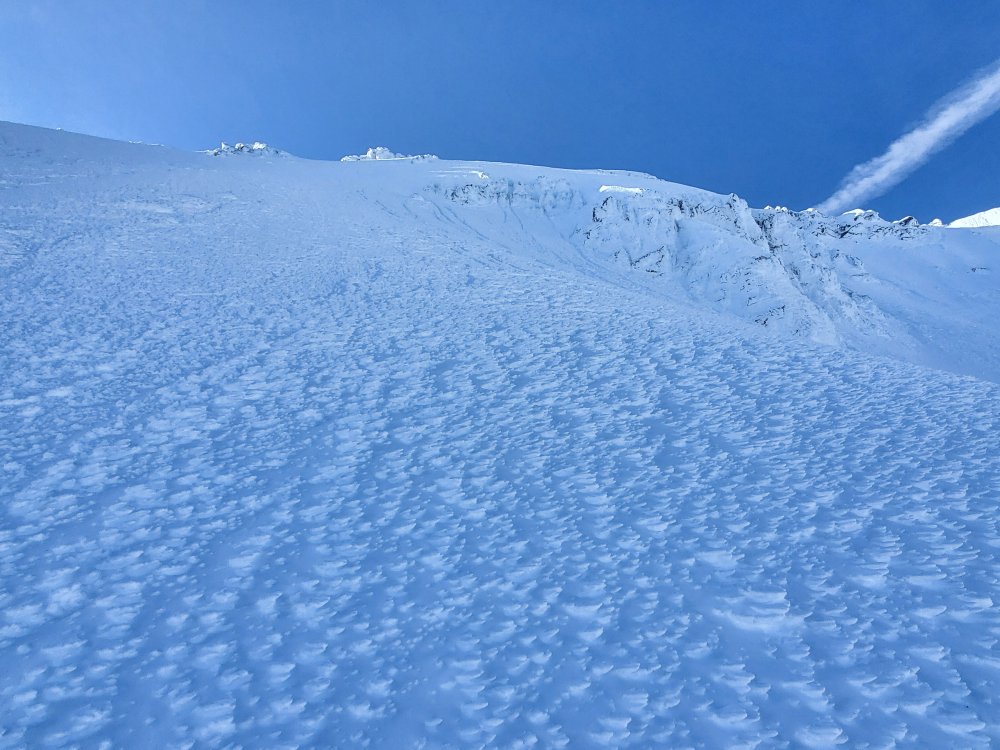
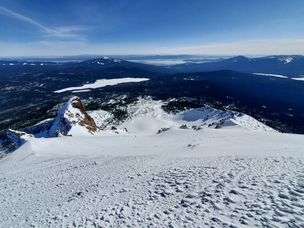
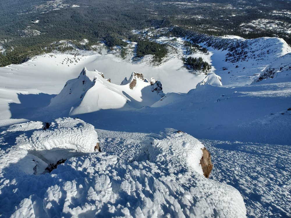
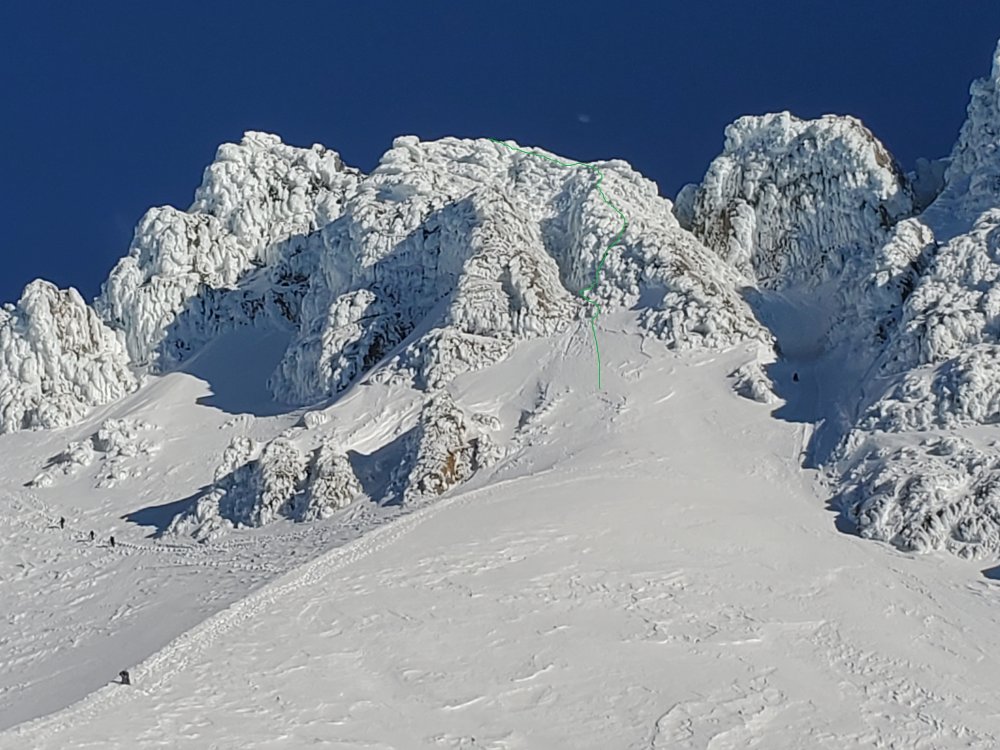
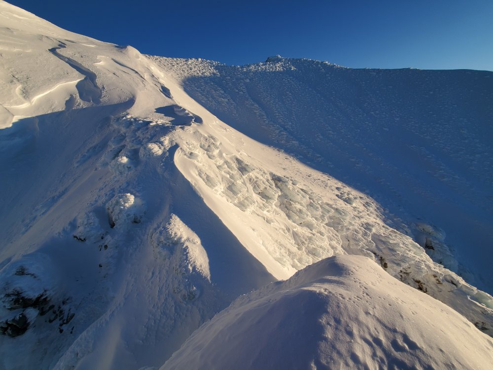
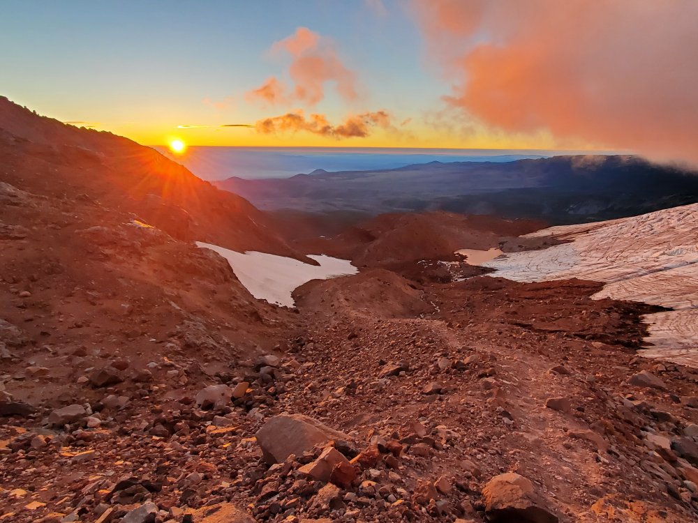
Trip: Mt Hood - South Face Steel Cliffs Trip Date: 02/10/2024 Trip Report: Went up the east side of the rock at the bottom of the cliff band of the South Face. Both little chutes prior to gaining the South Face were filled with deep unconsolidated snow. Not a ton of snow at the top of the face so avoiding the vents wasn't hard but I did frog over the flat area because it was obvious that there were holes lurking underneath. A hollow sounding crust, roller balls, wet unconsolidated snow on the Wy'East portion was unnerving. Hoping the snow events later this week will fill out some of the routes. A few more shots here https://imgur.com/gallery/mQ2vNxF. Gear Notes: Two tools, crampons, helmet Approach Notes: Walked up nice groomed trail to the top of Palmer lift
-
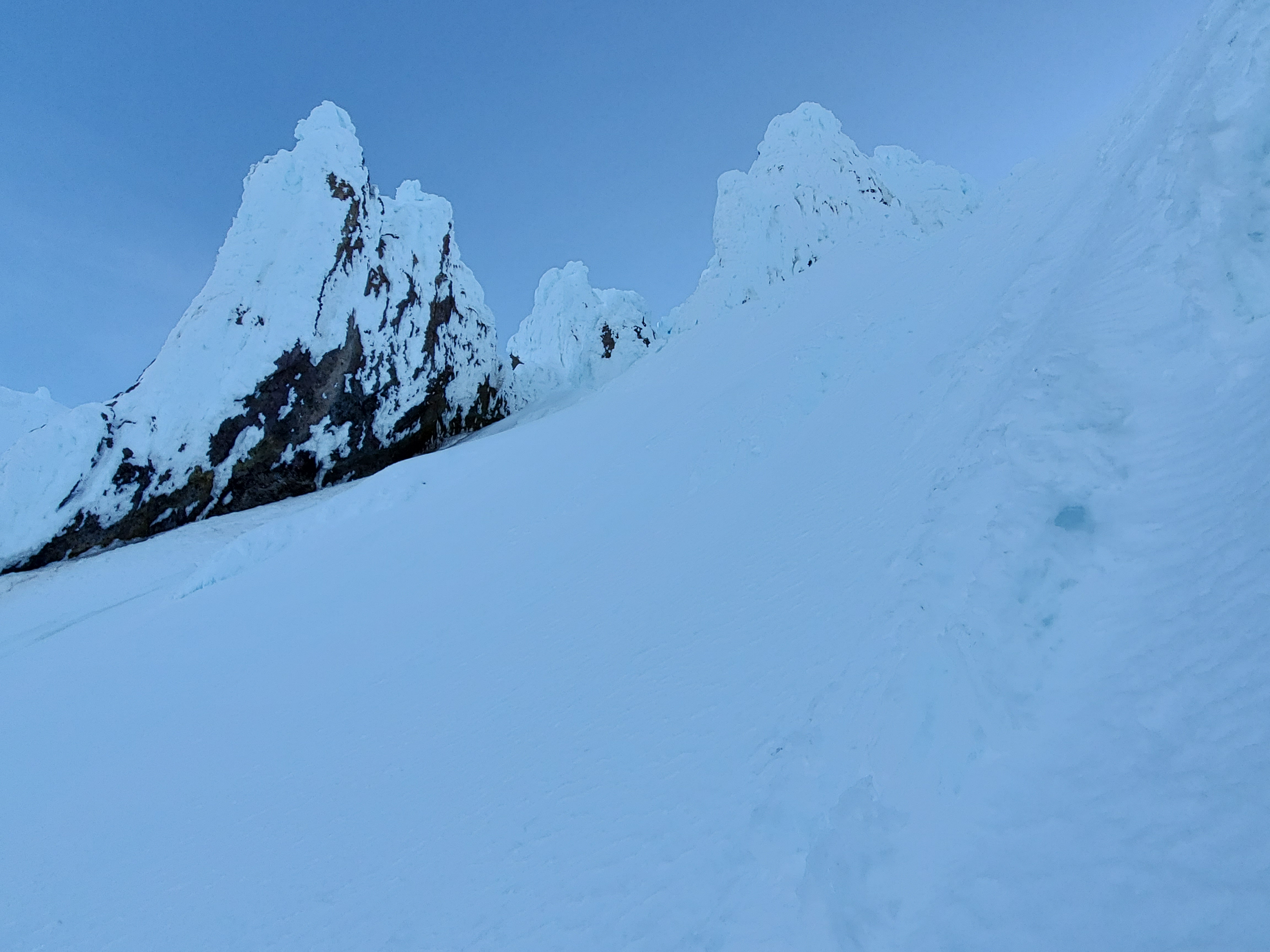
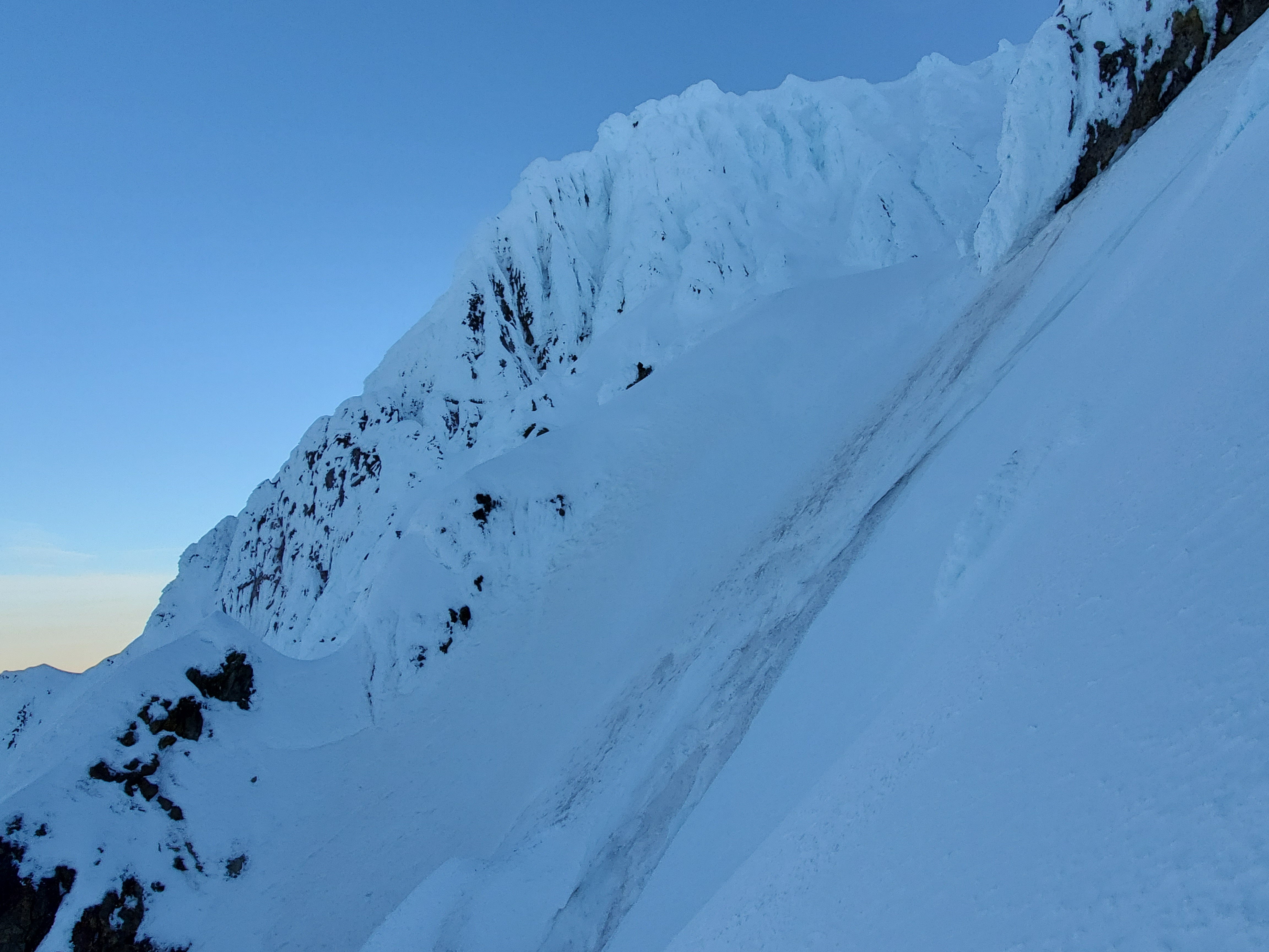
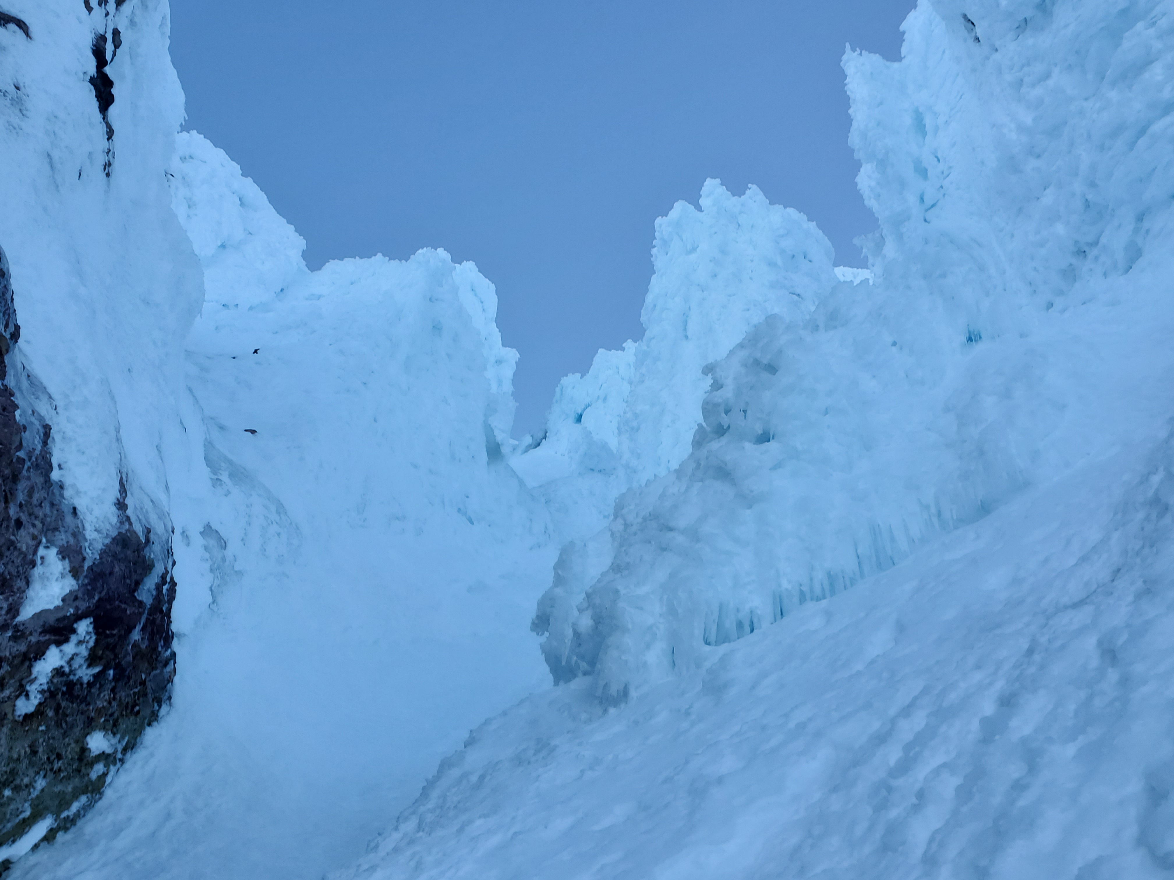
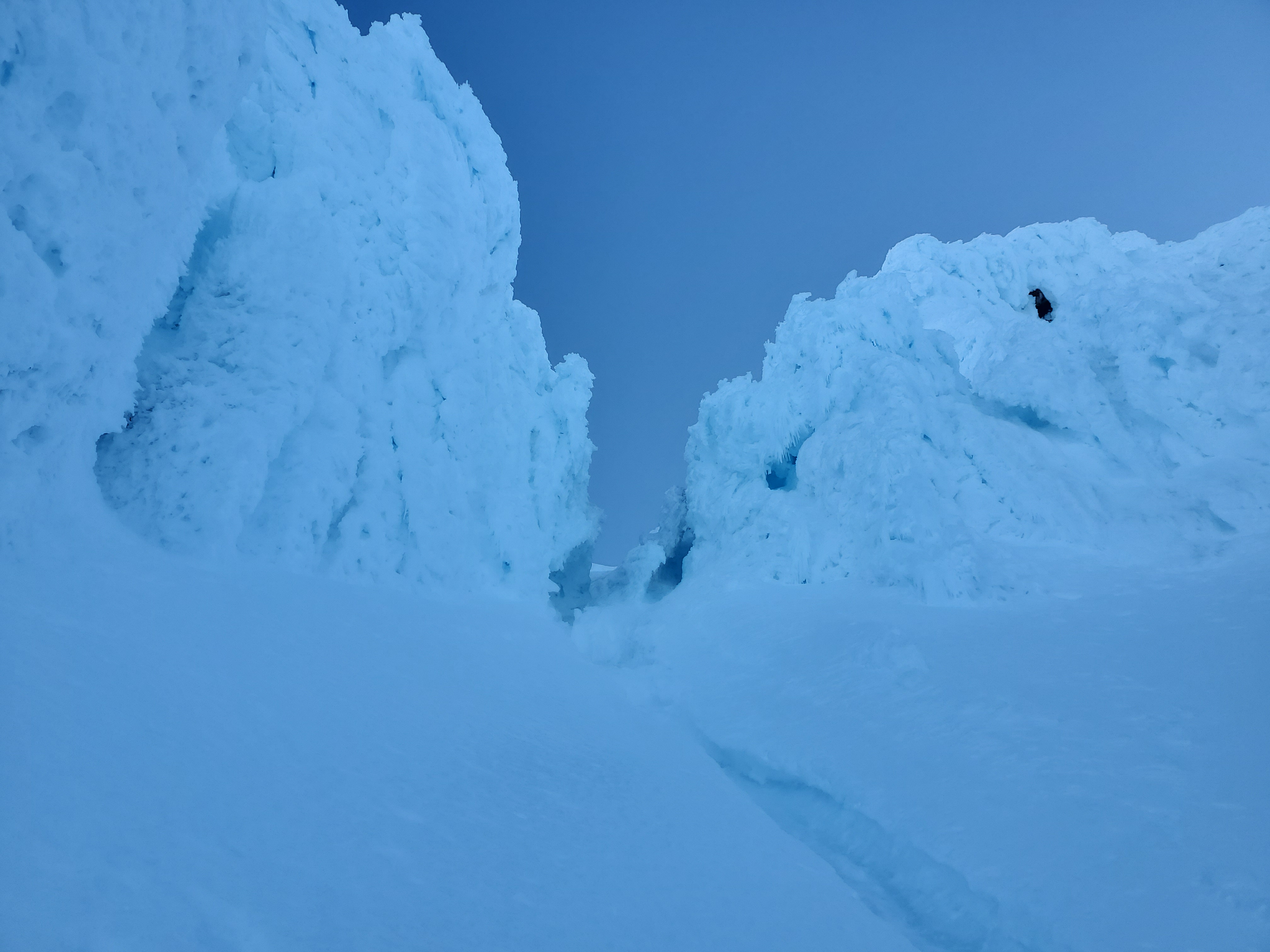
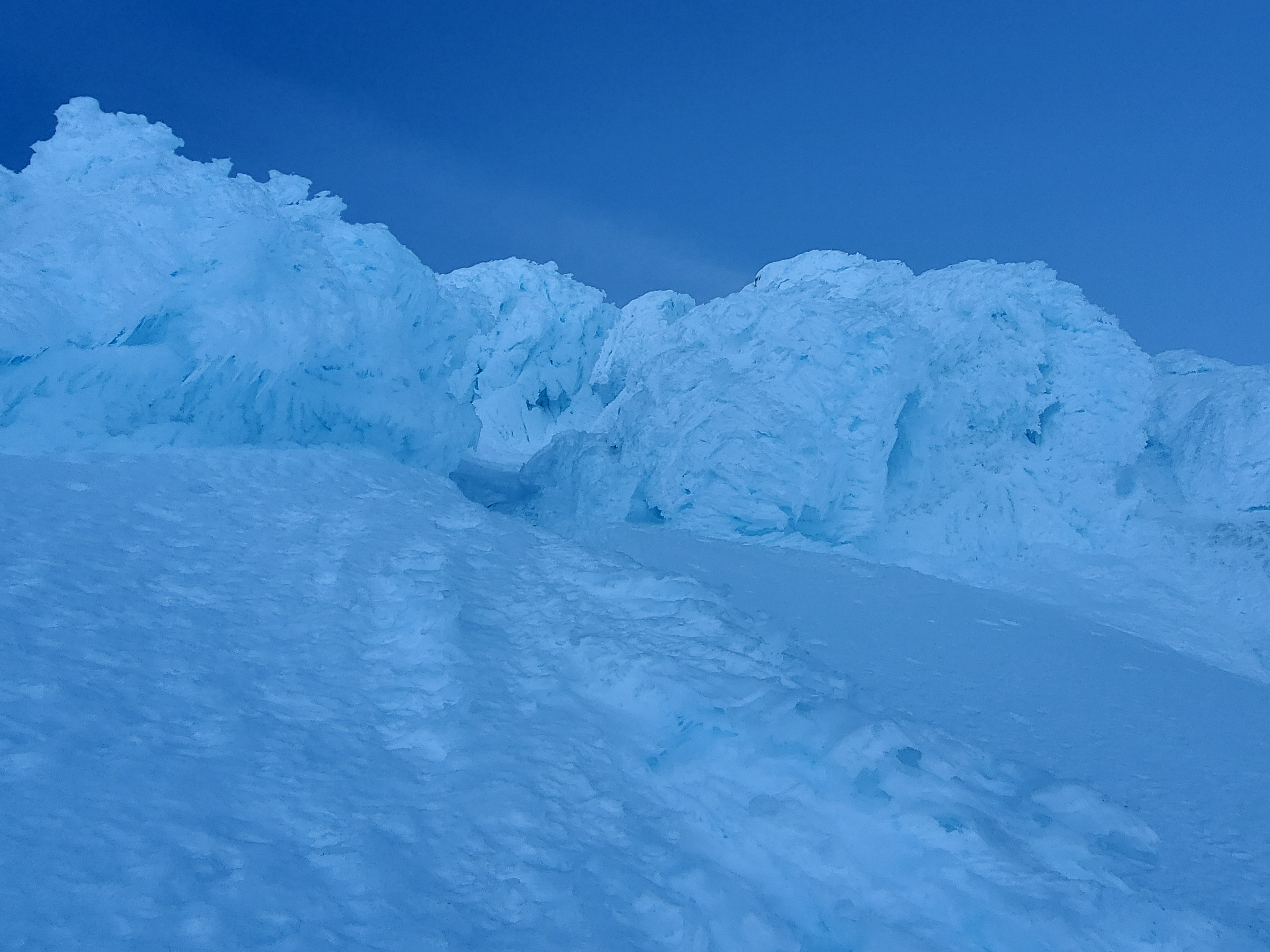
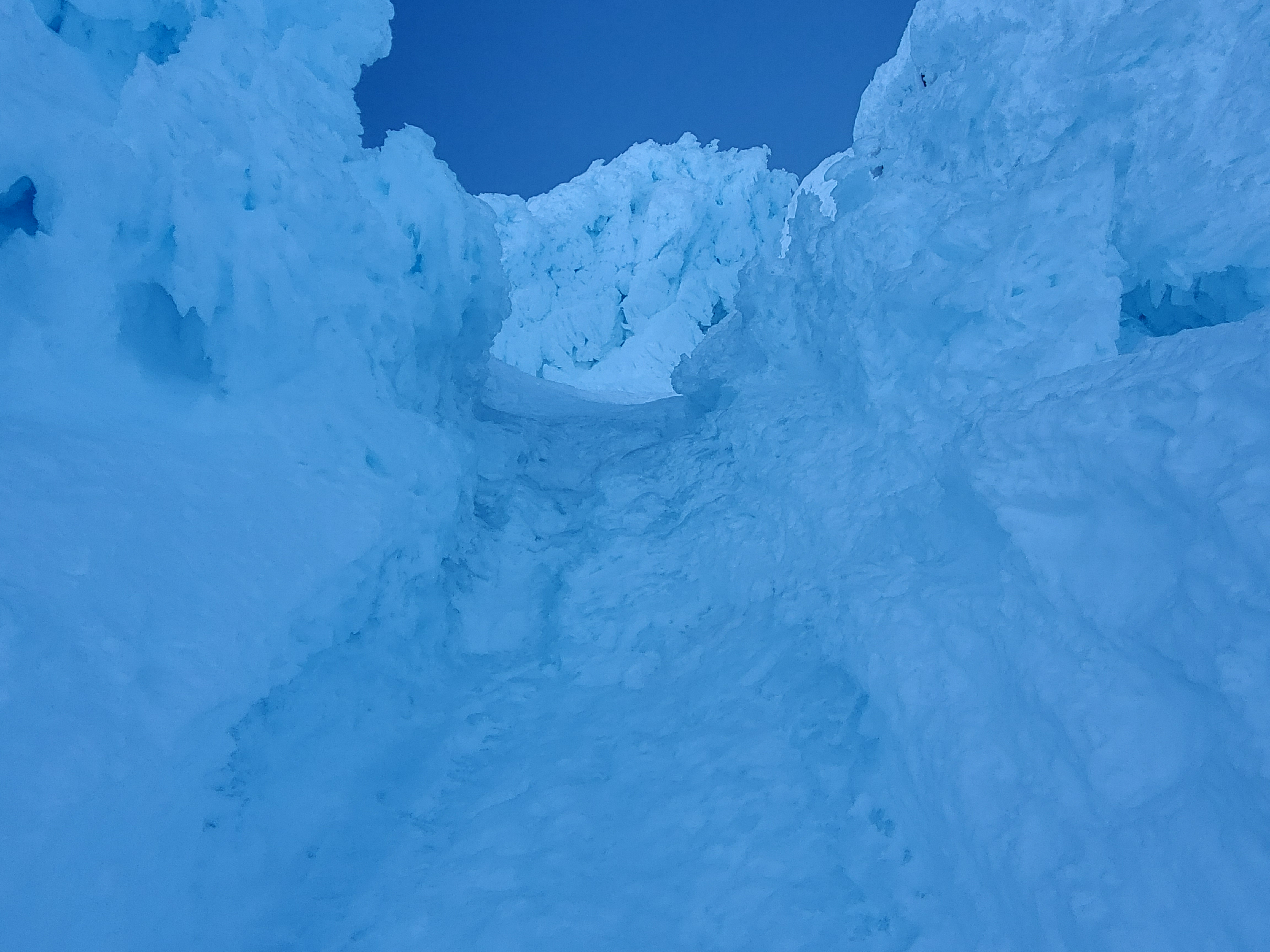
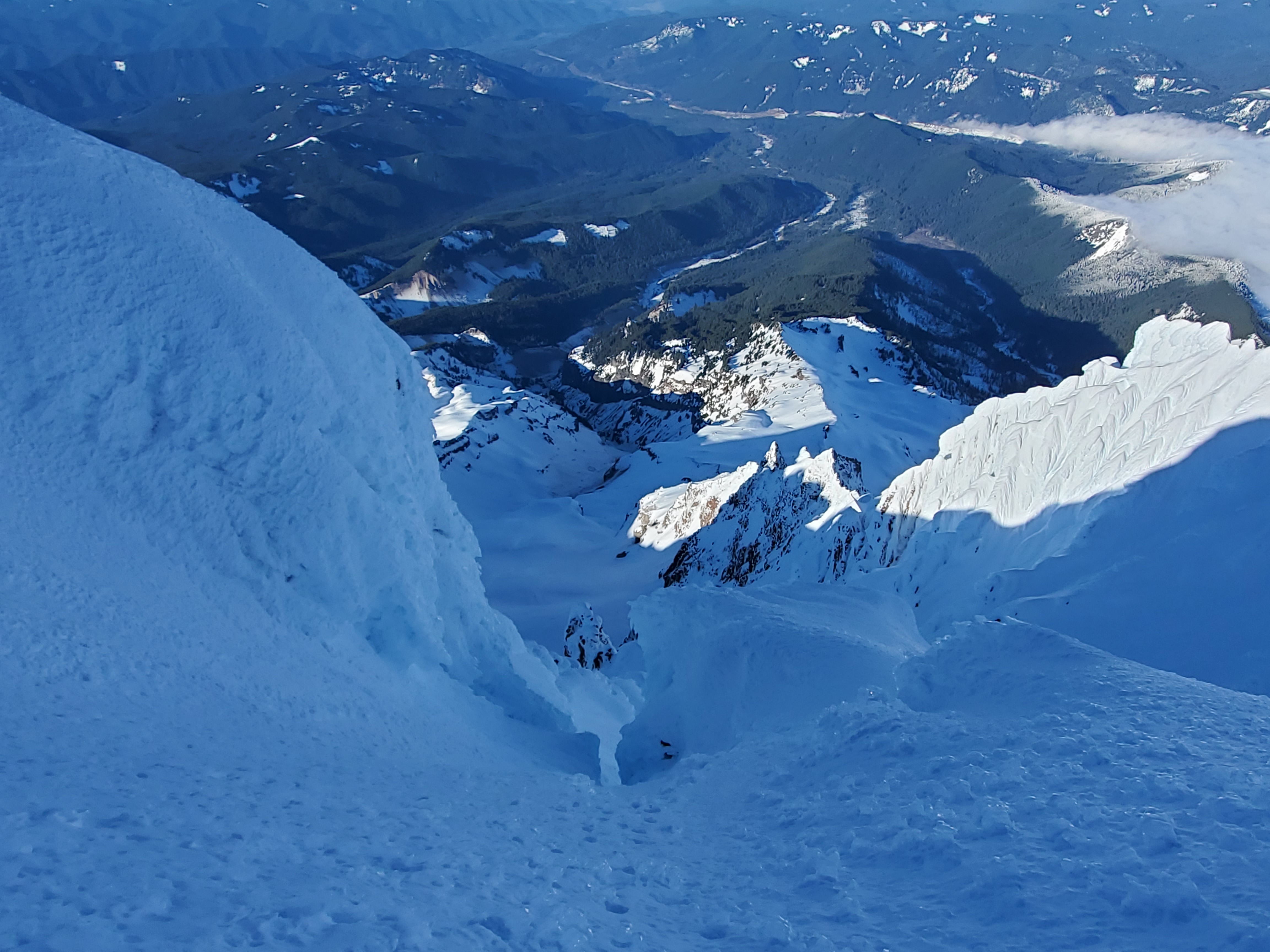
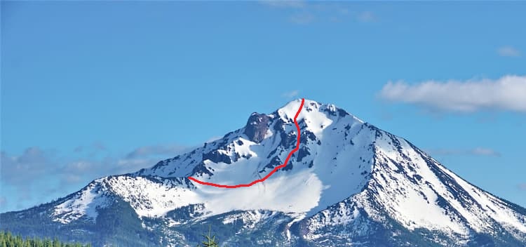
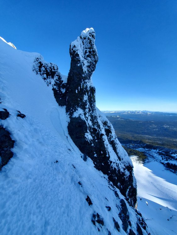
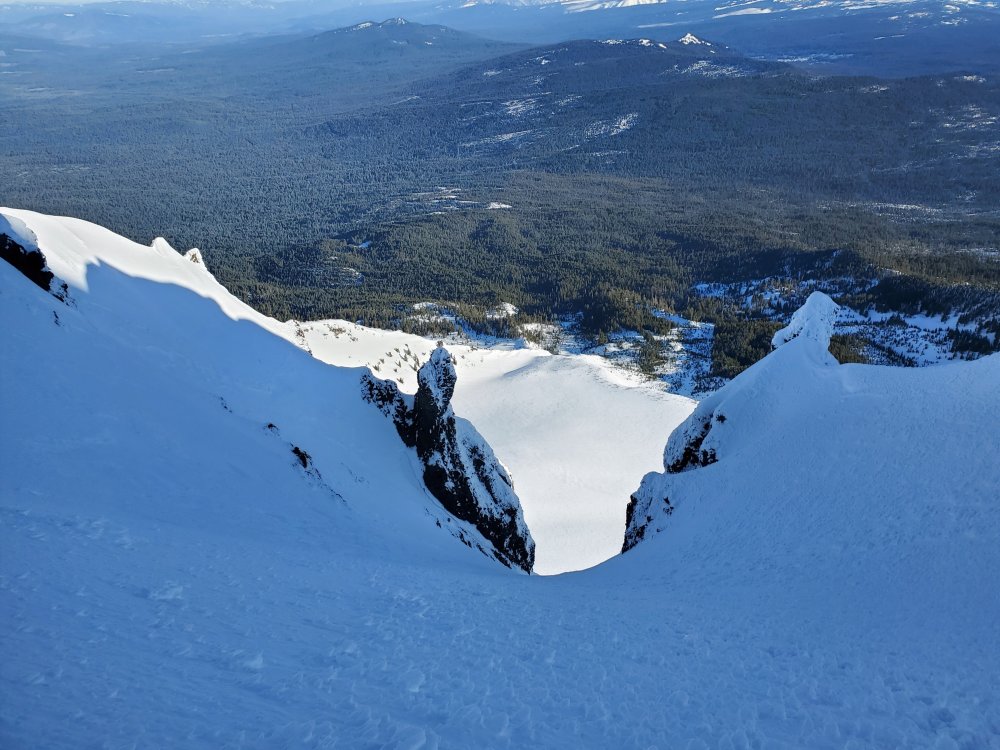
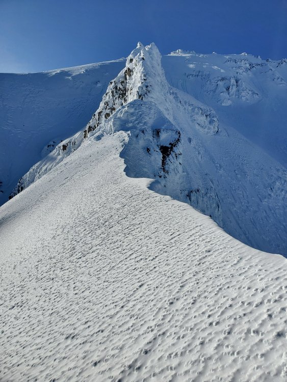
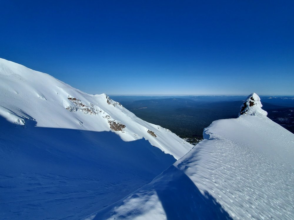
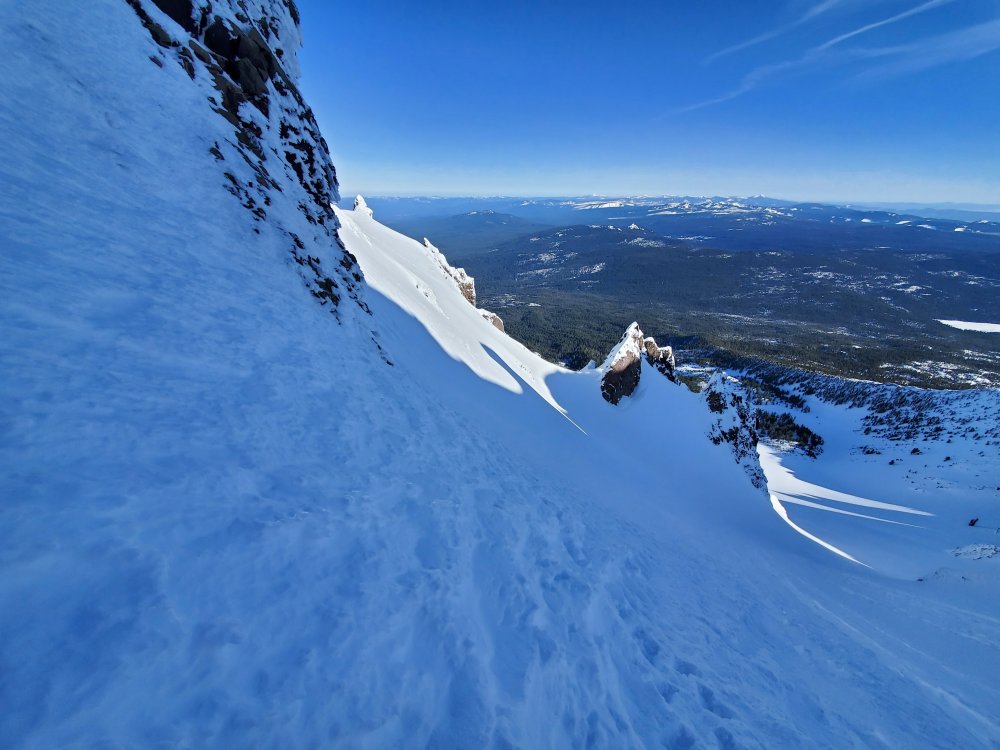
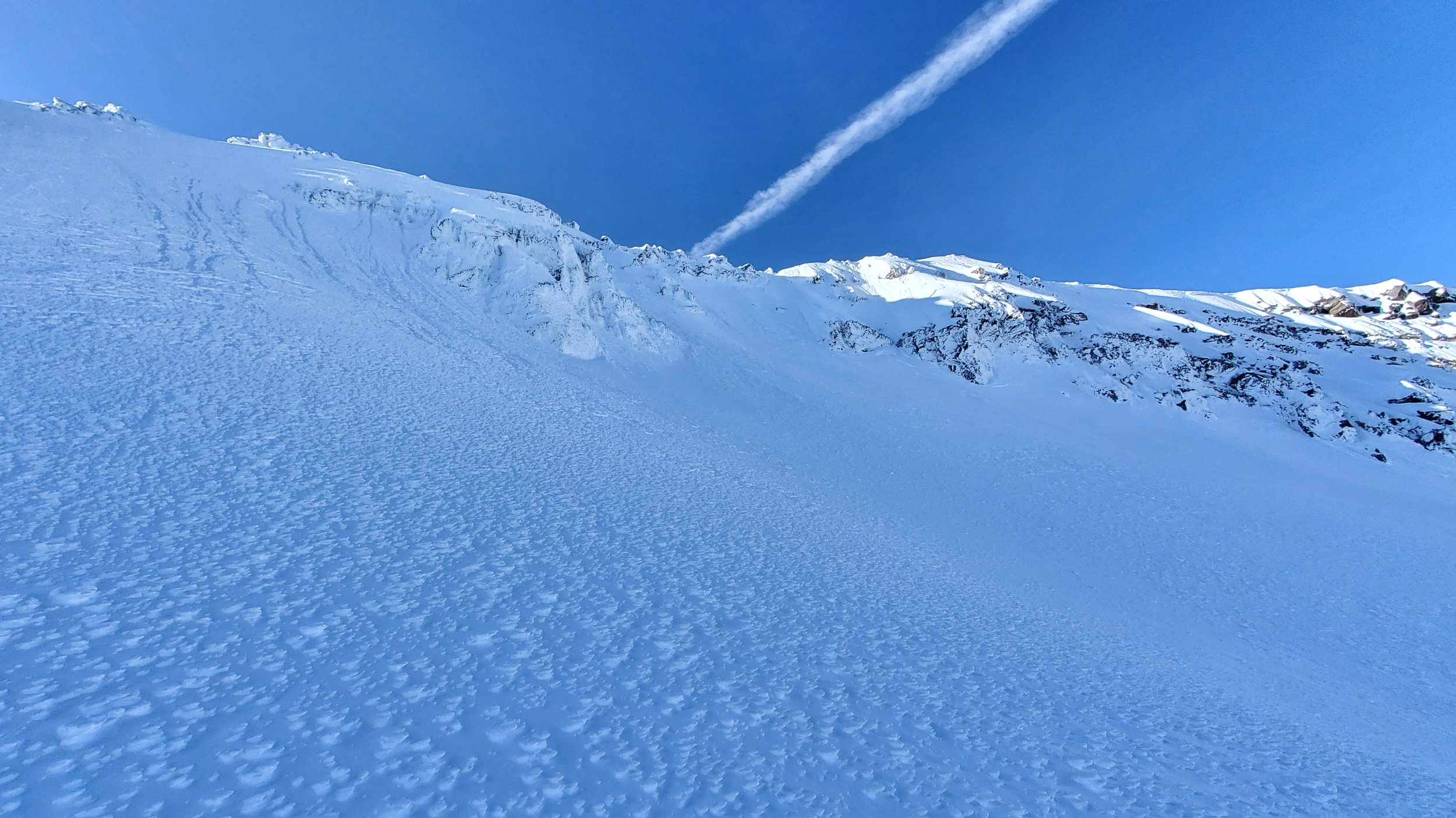
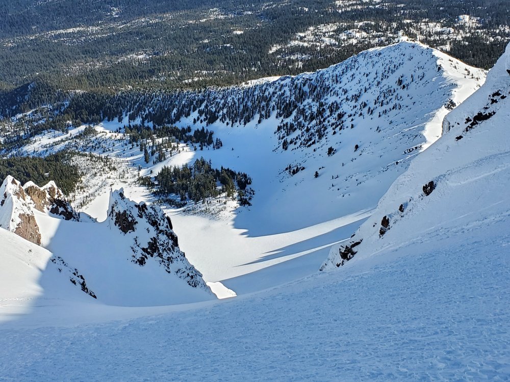
Trip: Mt Hood - Reid Headwall Right Variation Trip Date: 05/24/2022 Trip Report: Coming down onto the Reid from Illumination Saddle wasn't horrible but the ice crust at the top wasn't great. Pretty easy to get over the bergschrund. About to head through the gap. Stayed to the right to avoid the ice fall. Getting some elevation, starting to punch through the ice crust - some hollow sounds. I should have gone up the green line initially instead of trying to go right from the location the picture was shot. Going right here takes one to a flat-ish spot on top of Castle Crags. I did eventually go up the green line but the standard route is one gully left from it. Route was consistently steep. The slightly less steep parts had more ice fall too. After descending and traversing climber's left to the gully with the green line shown before. Whew, I'm going to make it out of here, I think. The ice crust wasn't great on much of the climb and a couple of times I could feel vibrations in my left foot through the crust when kicking in with my right foot. Shot of Castle Crags before heading up any further. Previously I was climbing toward the sunlit middle part of the ridge. Fun climbing. Upper part of Castle Crags. Made it to the West Crater Rim, nice. Looking East. Looking down route. Very cool. Wow. 1 O'clock couloir needed some love. Used teeth to keep umbilicals from getting caught on rime feather on the center fin. Barely fit through with the pack on. Had the summit to myself. Headed down the right Pearly Gate. Gear Notes: 2 tools, crampons, helmet, feet - no skis. Approach Notes: Followed cat tracks.
- 1 reply
-
- 2
-

-

-
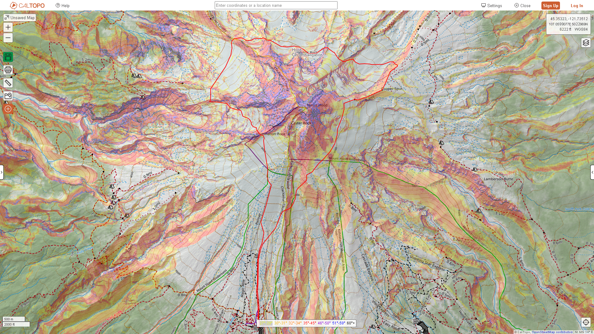
[TR] Mt Hood - Circumnavigation 02/12/2022
adventure43 replied to adventure43's topic in Oregon Cascades
Correct, no skis, just walked around the mountain. -
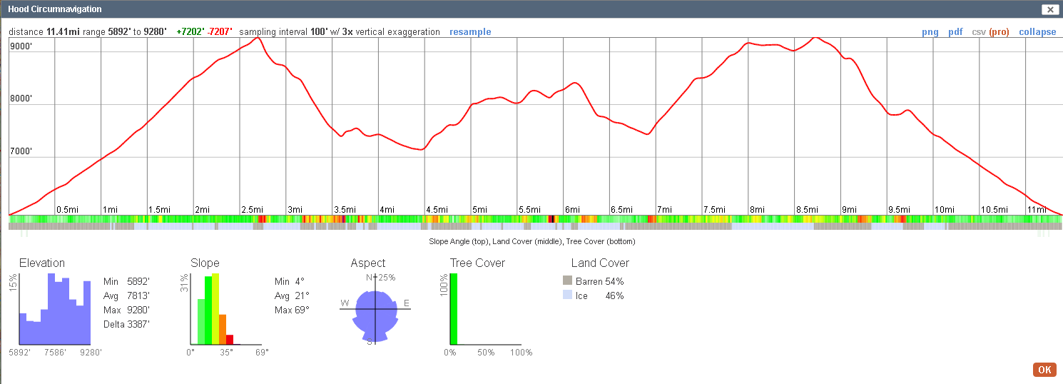
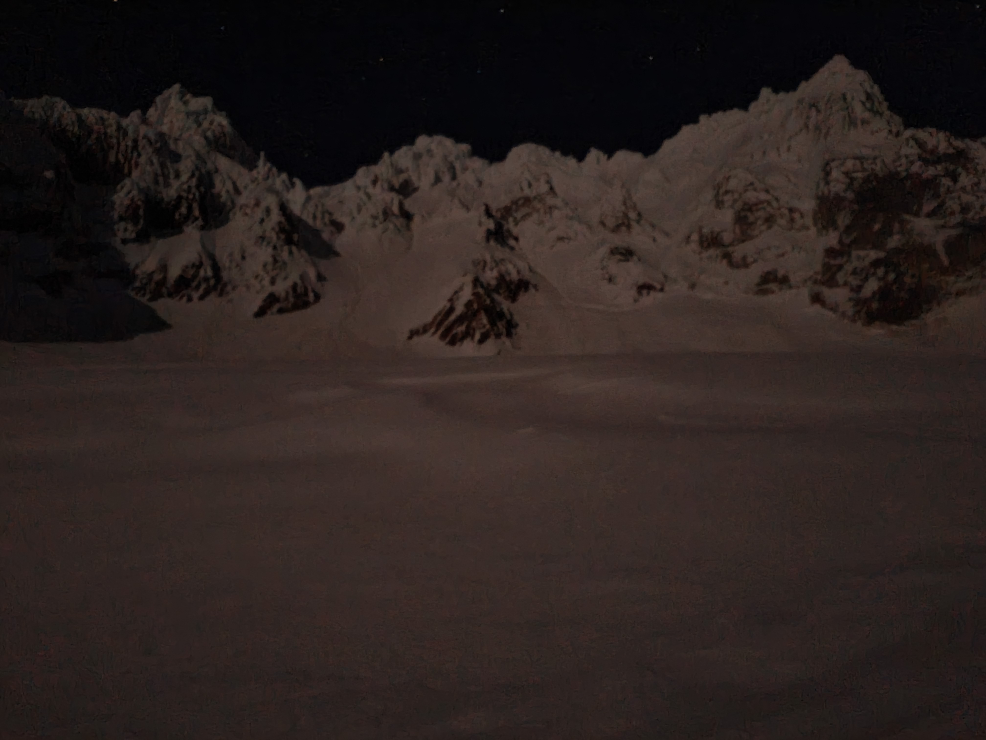
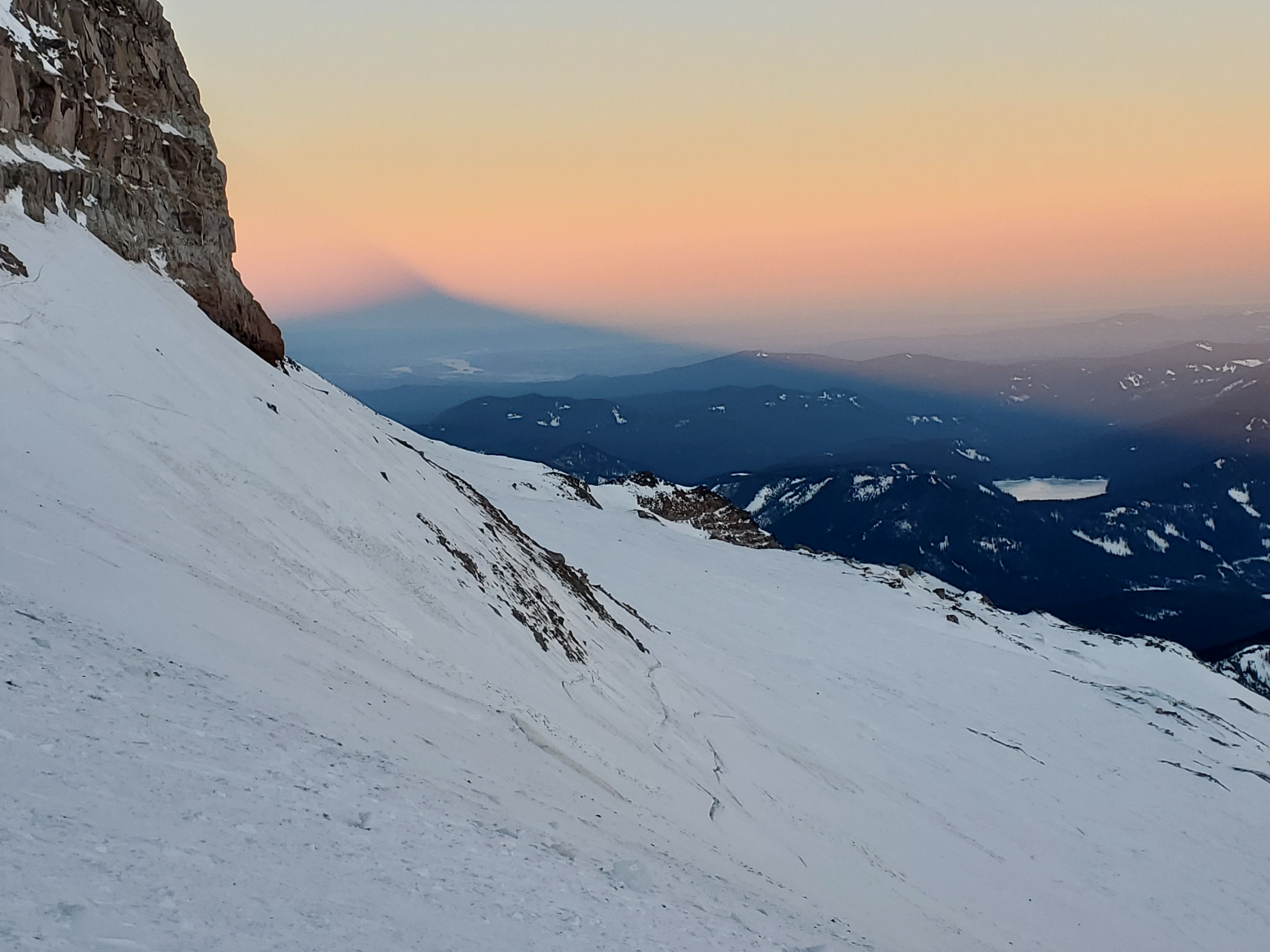
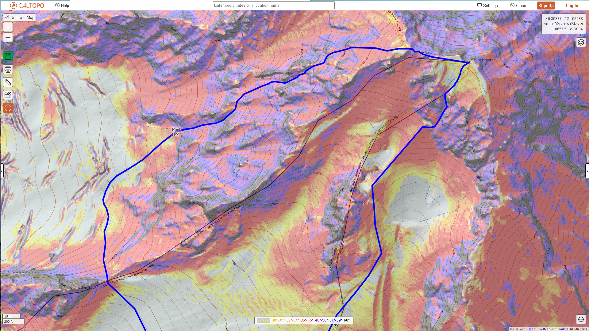
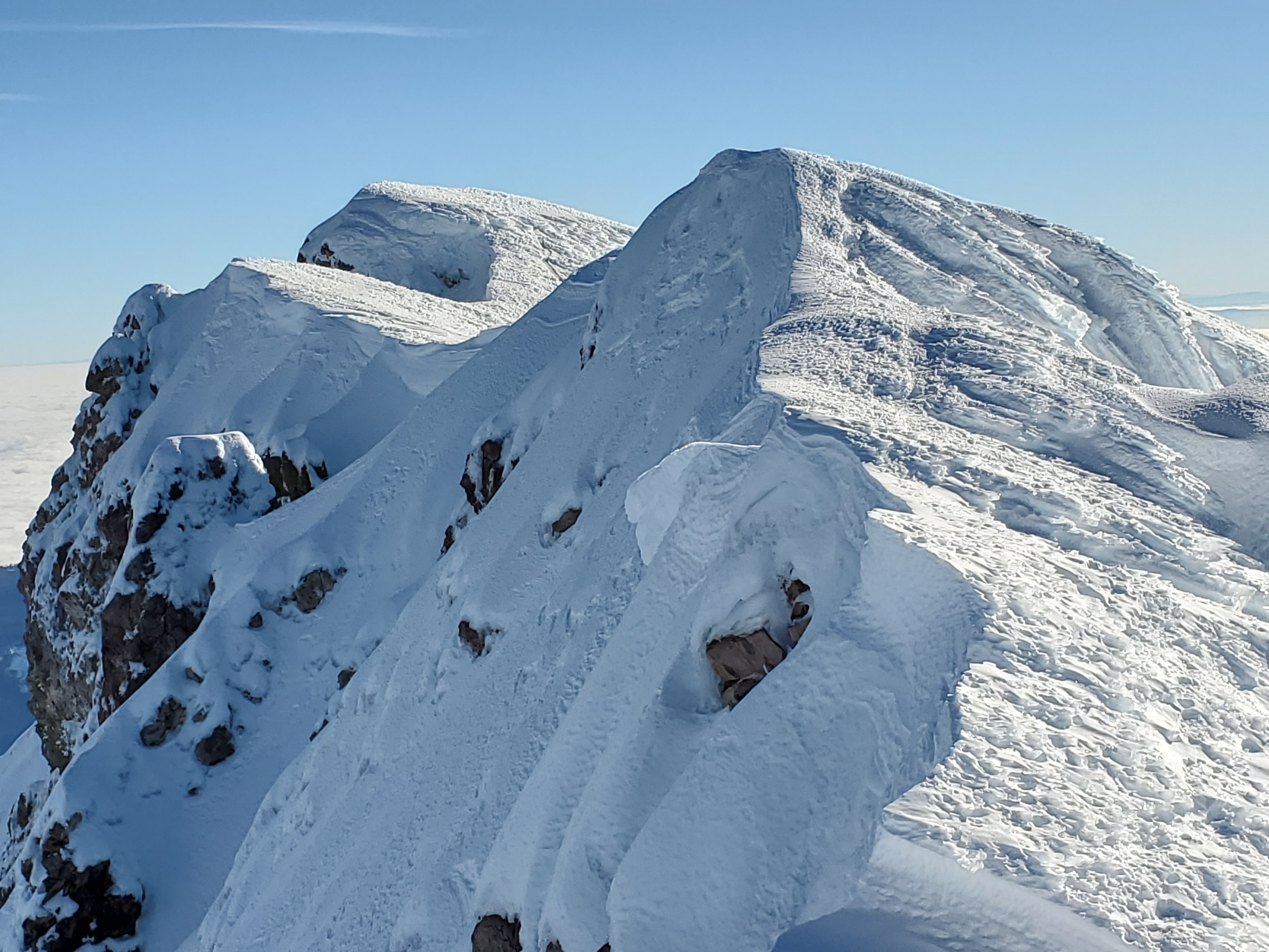
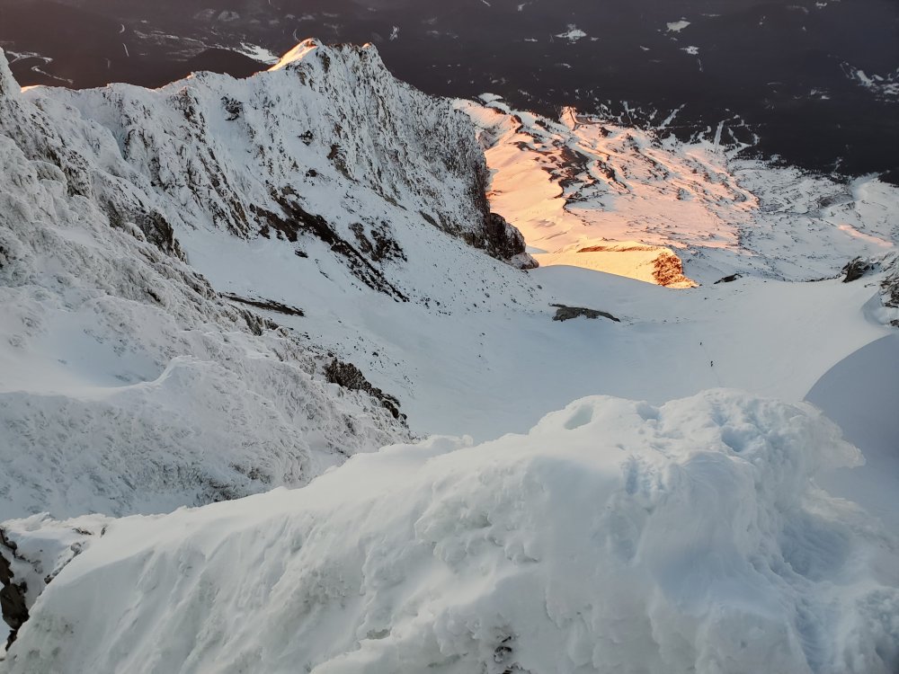
Trip: Mt Hood - Circumnavigation Trip Date: 02/12/2022 Trip Report: Solo'd clockwise from Timberline, started around 1 AM and finished around 1 PM. It was fun to step foot on the Ladd, Coe and Langille glaciers - hadn't done that before. Got a shot of the Reid Headwall by moonlight but the moon was setting when I reached the Sandy, so no shots of that. No crevasses on route and only two parts were a pain. (WRC had crevasses on the west slope.) The upper part of the Coe had a short bit of low angle hard but garbage ice that required tooling across. And of course the White River Canyon is always a pain in one way or another - getting down into it from up high required descending supportable junky ice - no easy dager-ing down. GPX attached. Gear Notes: Helmet, crampons, 2 tools, whippets, feet for walking. Approach Notes: Normal walk up to the top of Palmer.
-
[TR] Mt Hood - Reid Glacial Headwall 01/28/2022
adventure43 replied to adventure43's topic in Oregon Cascades
Unfortunately, yes, solo. -
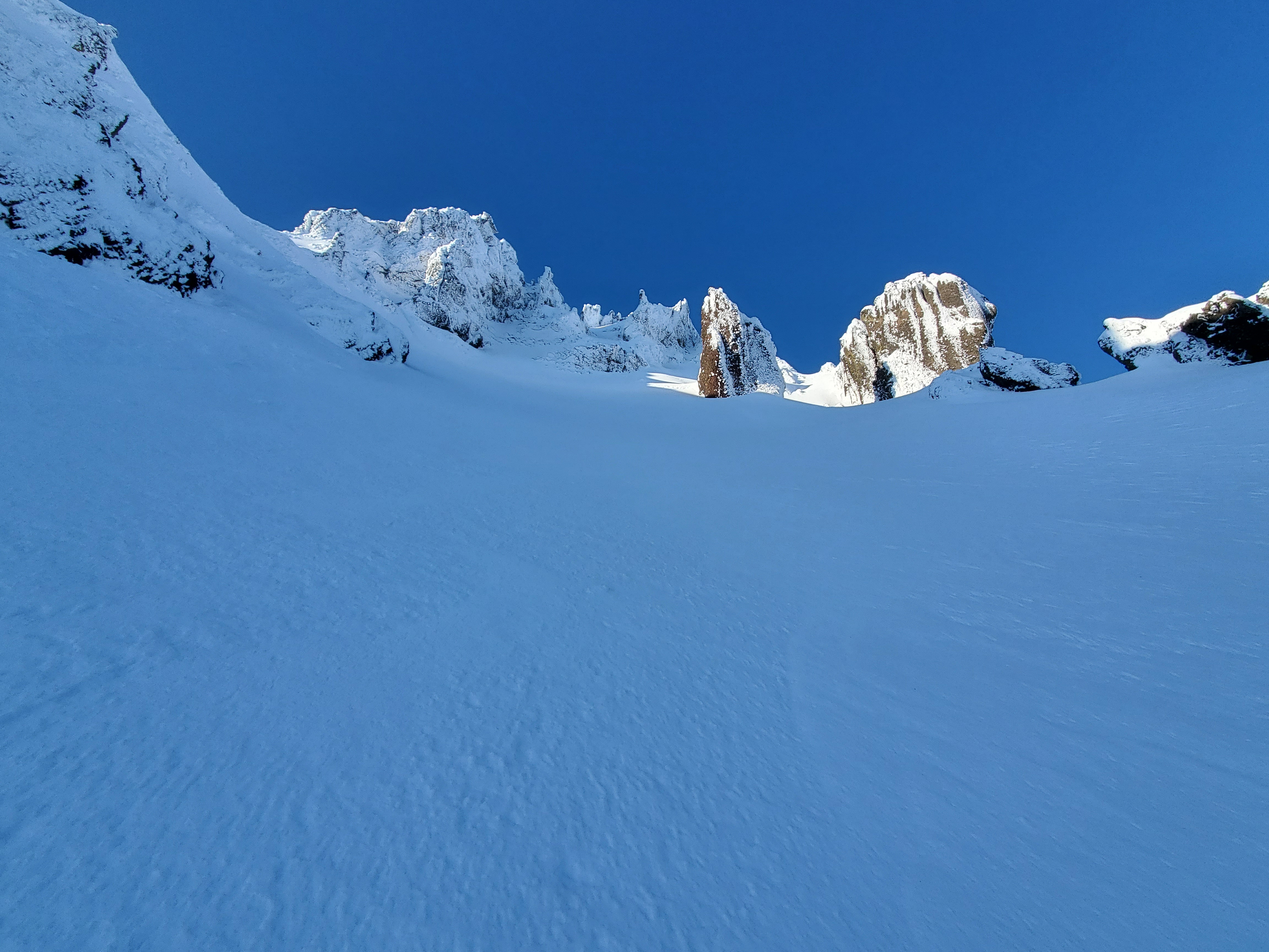
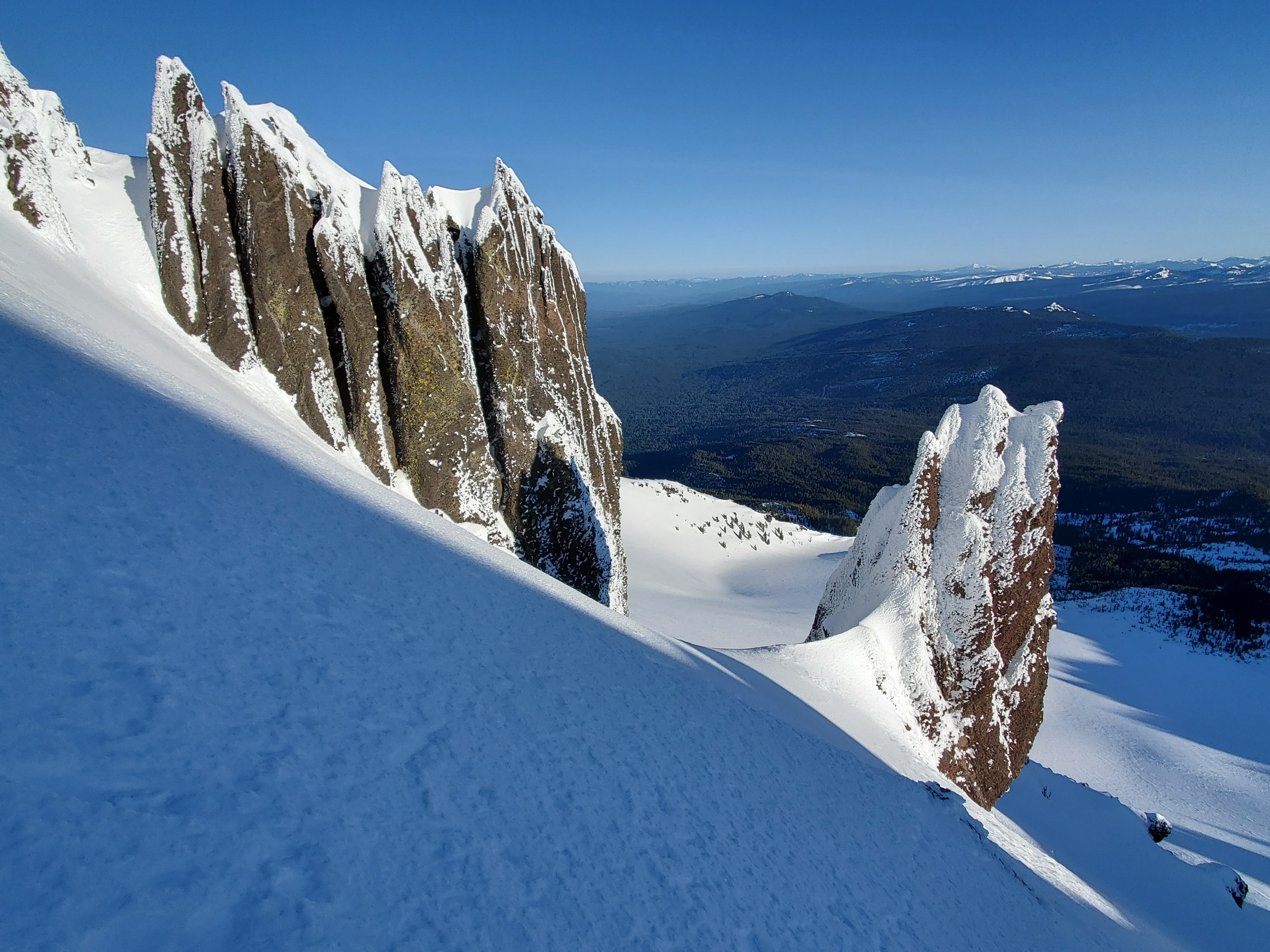
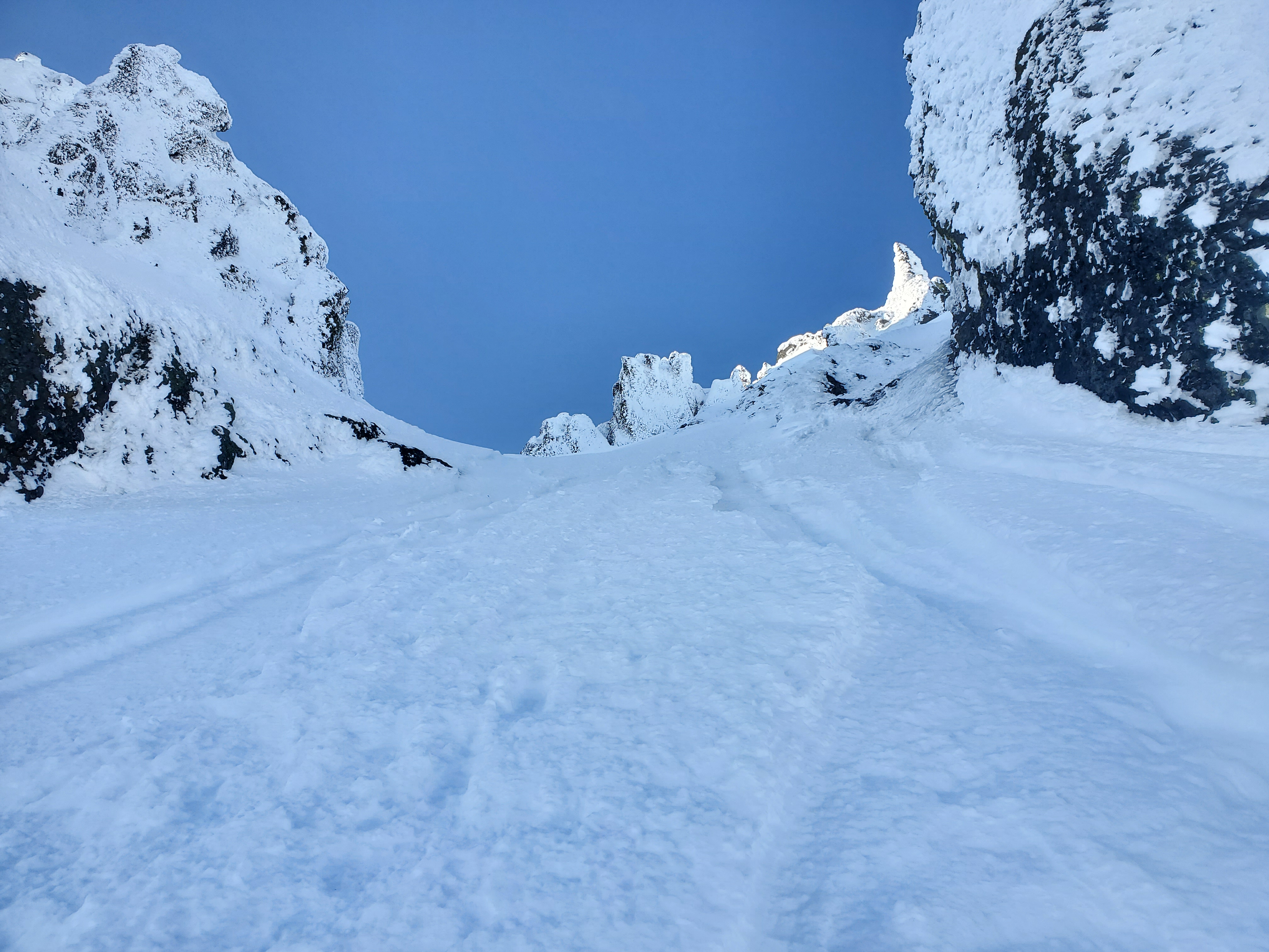
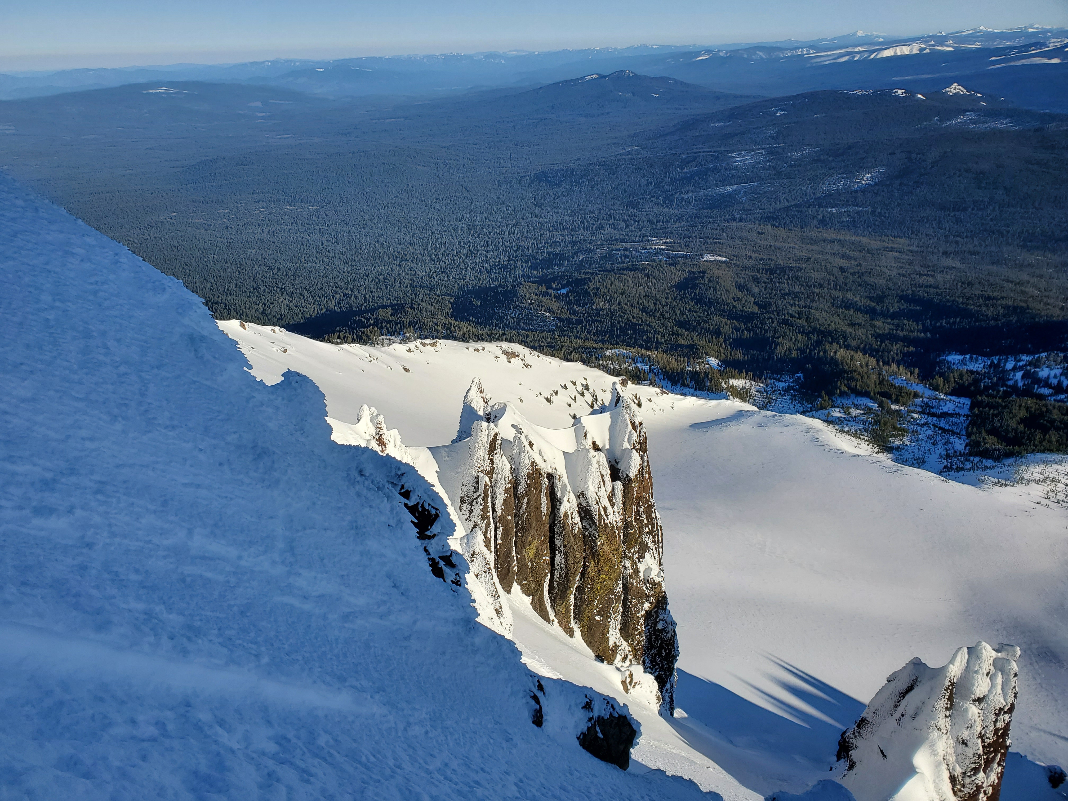
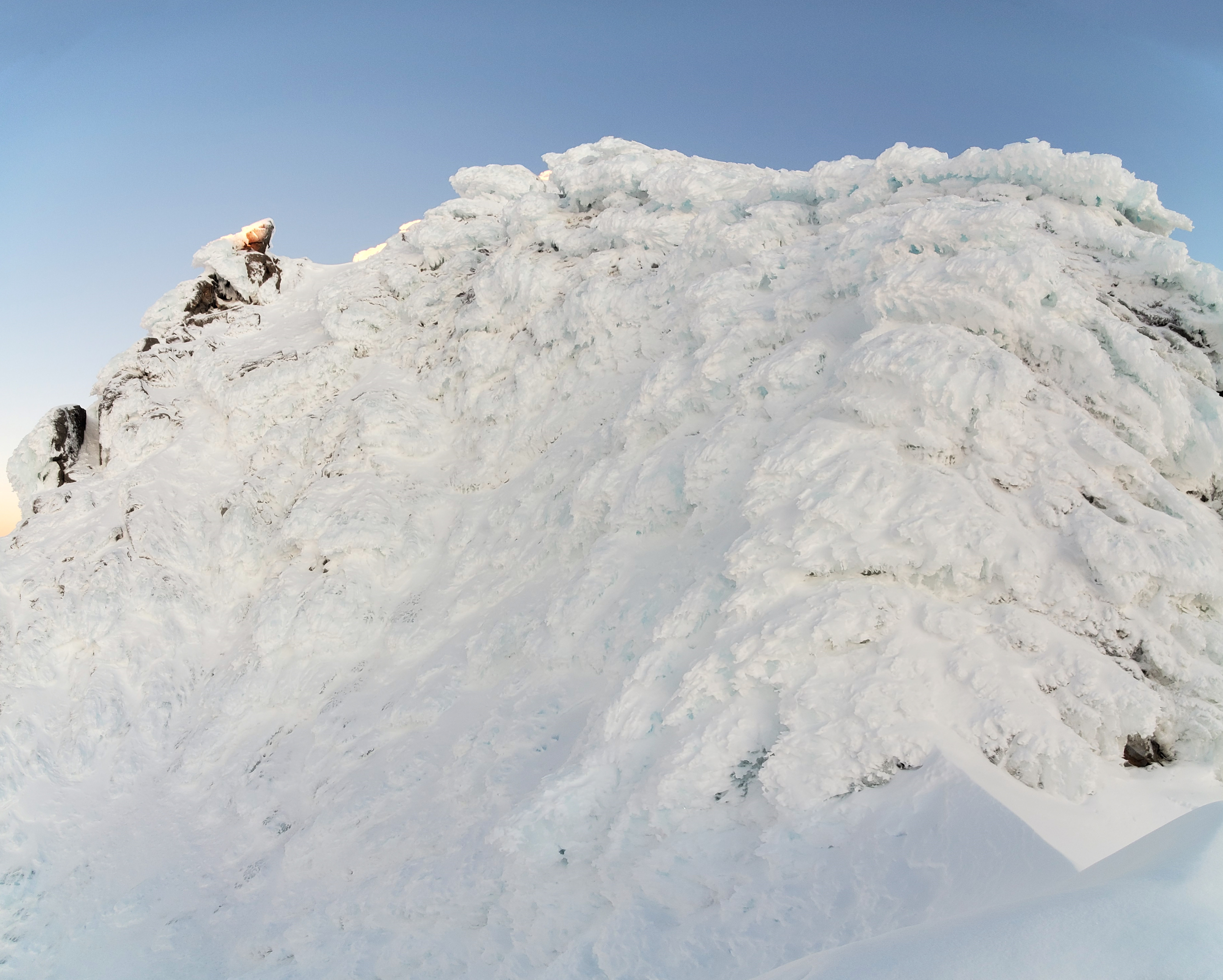
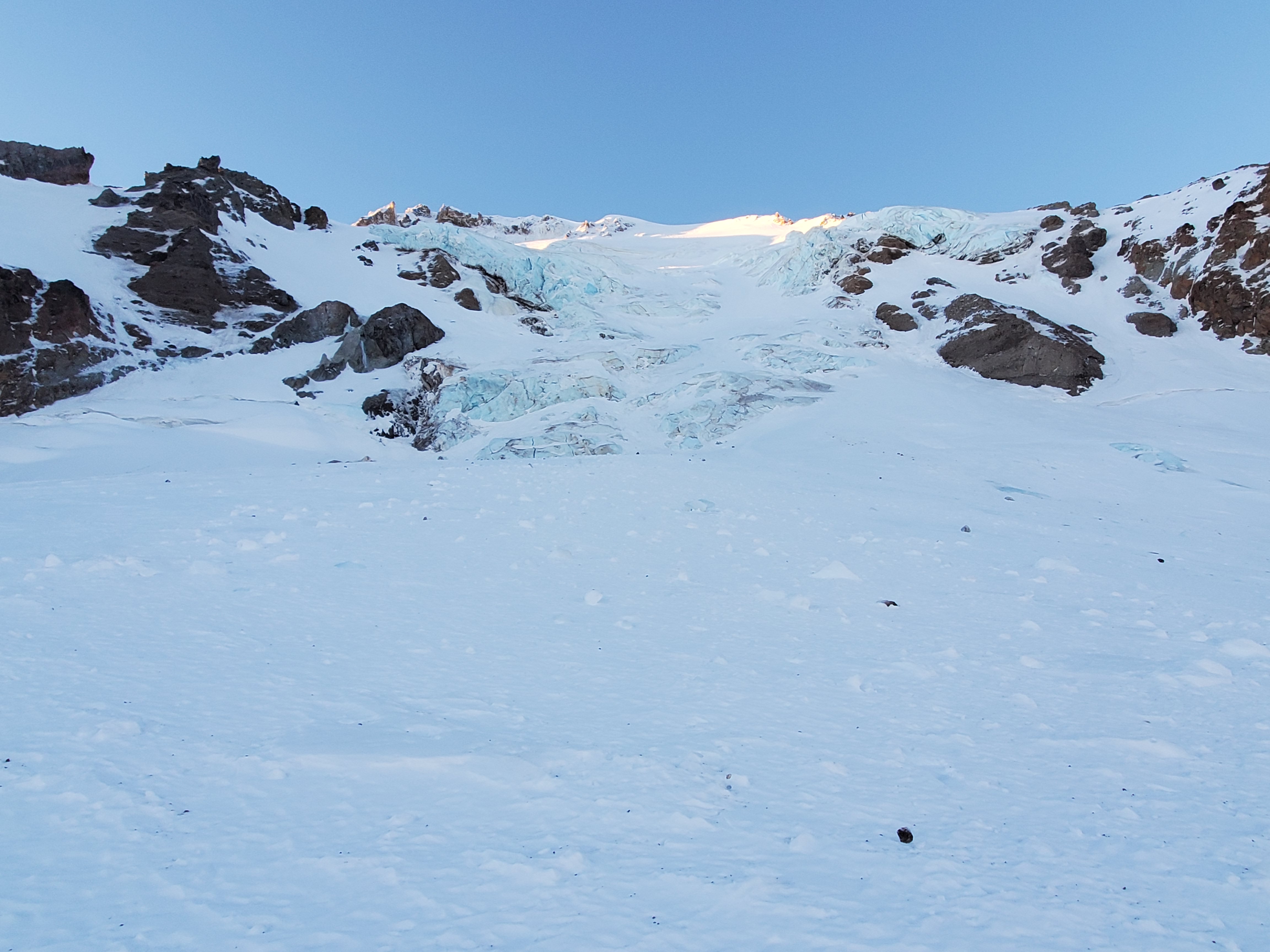
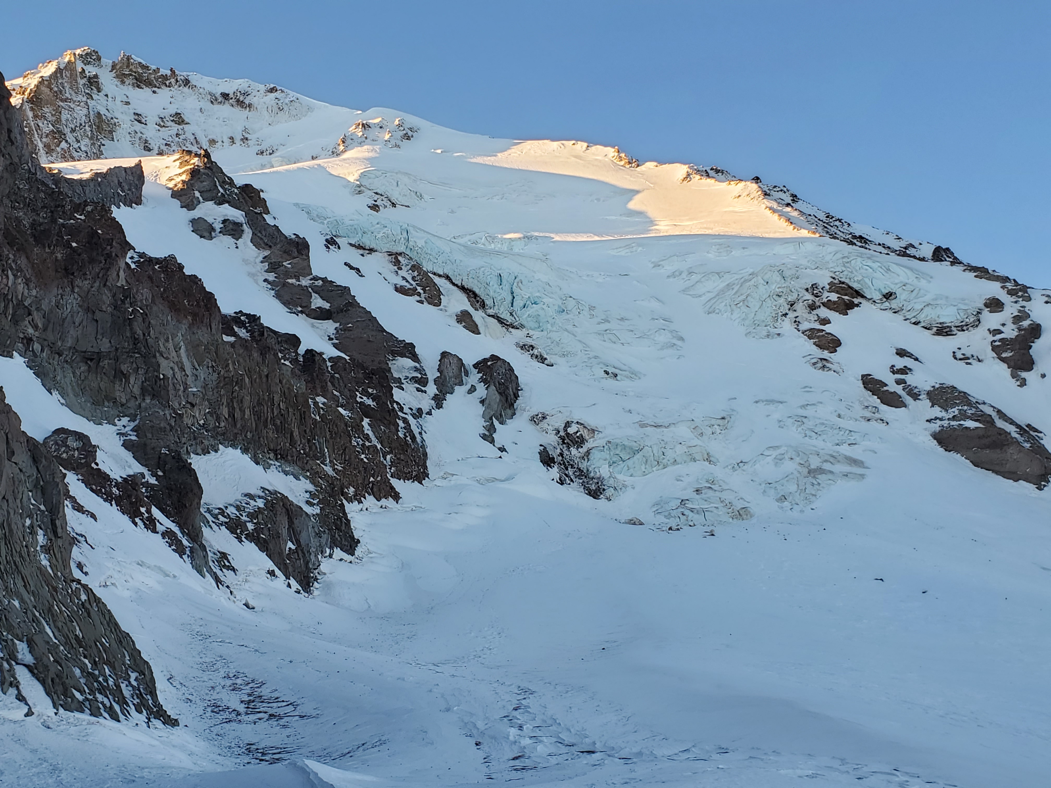
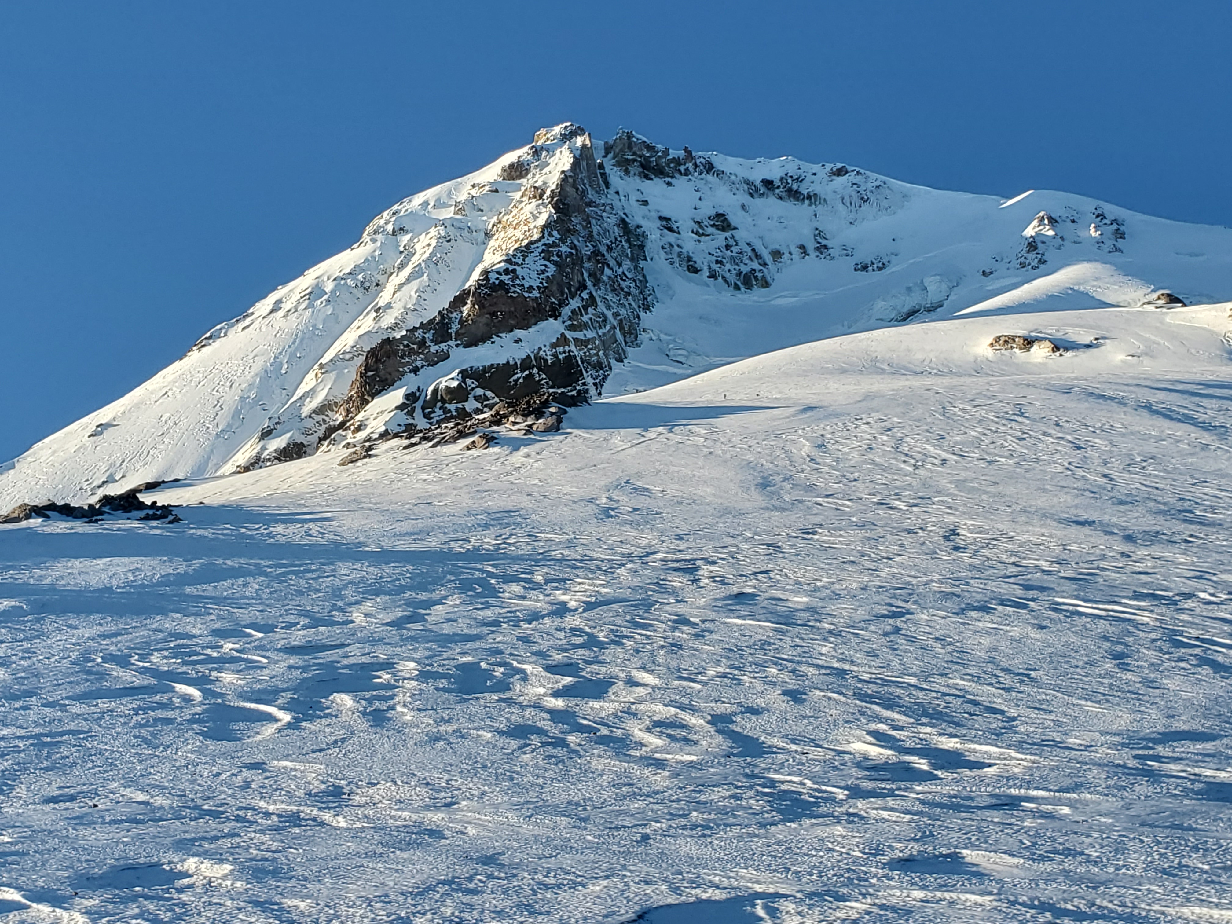
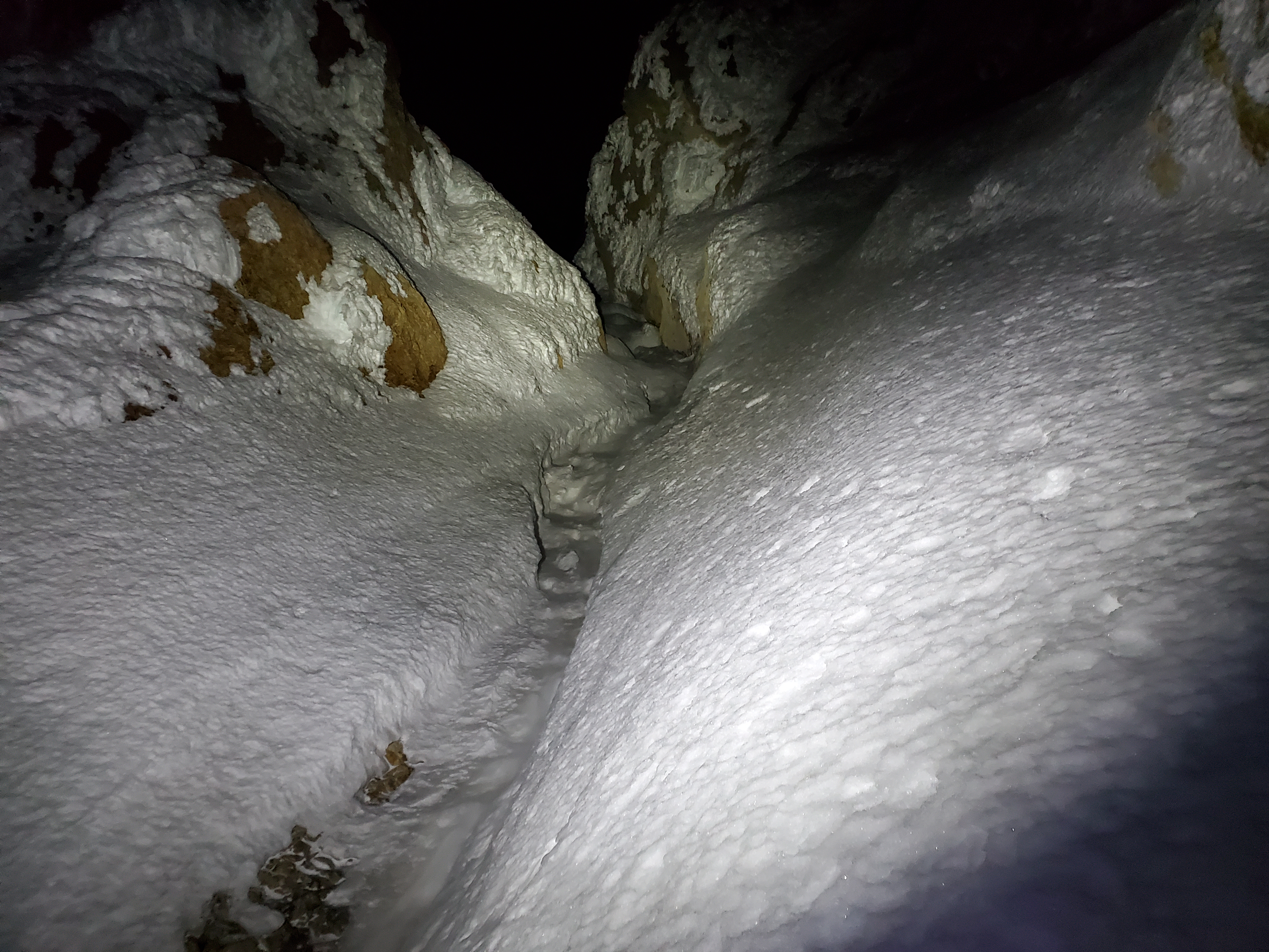
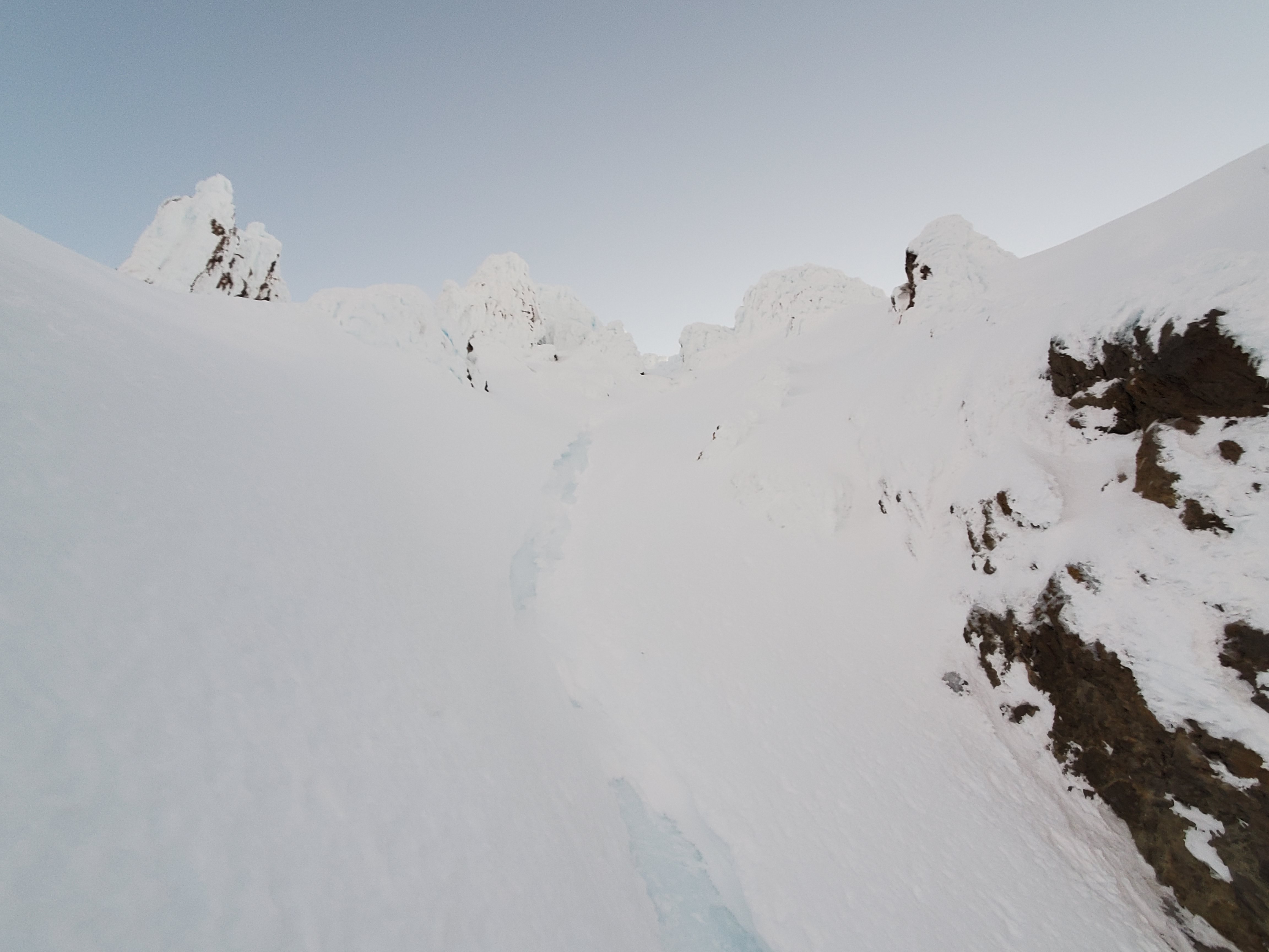
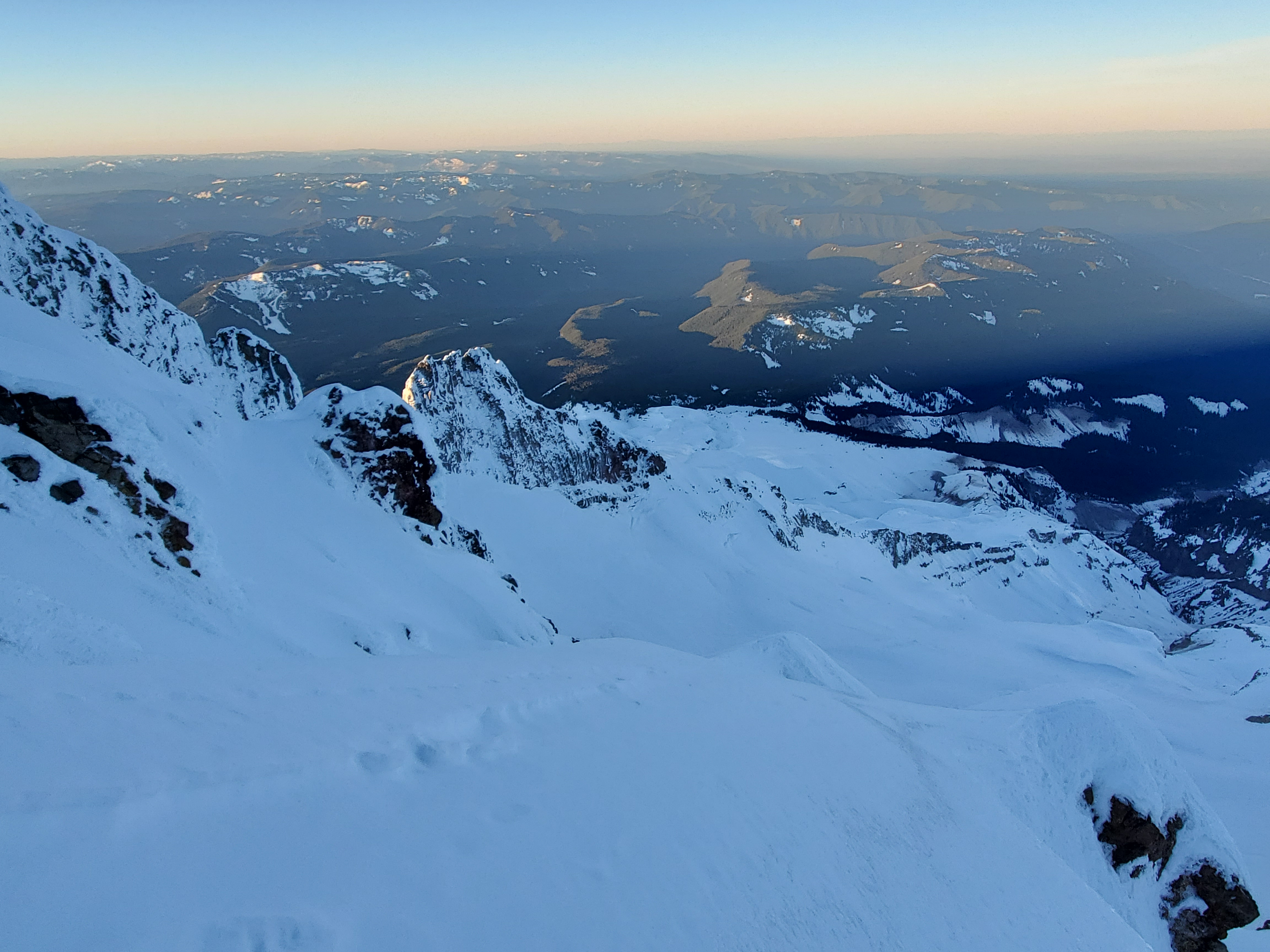
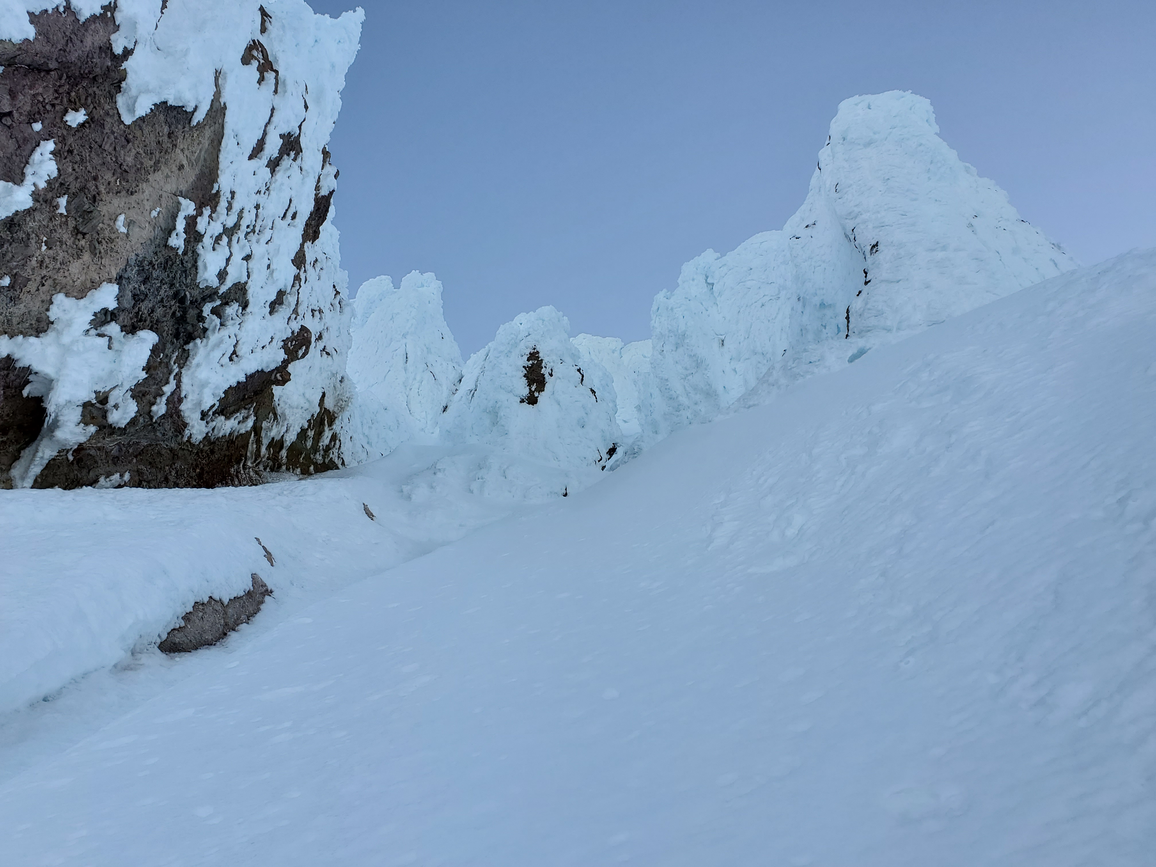
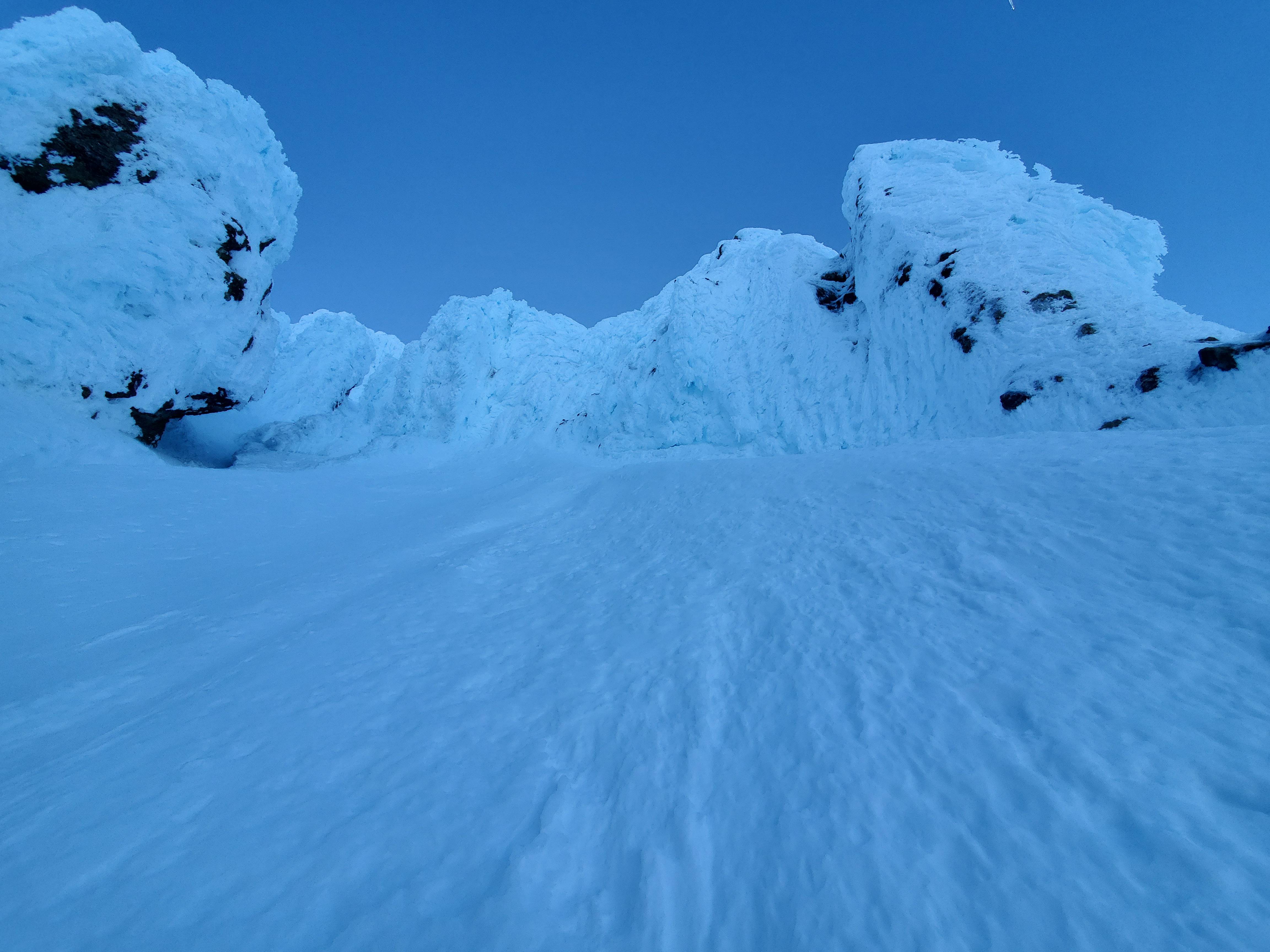
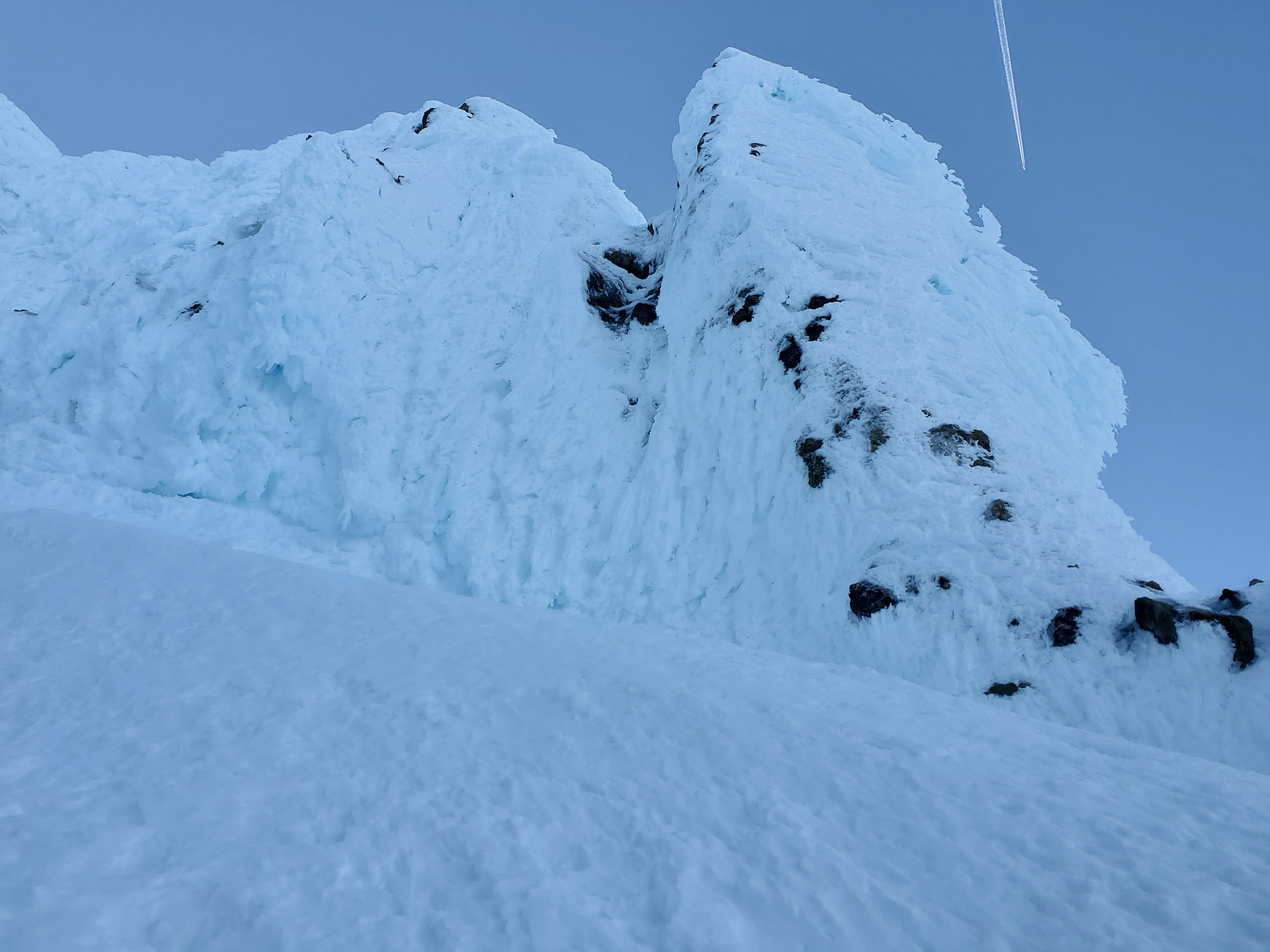
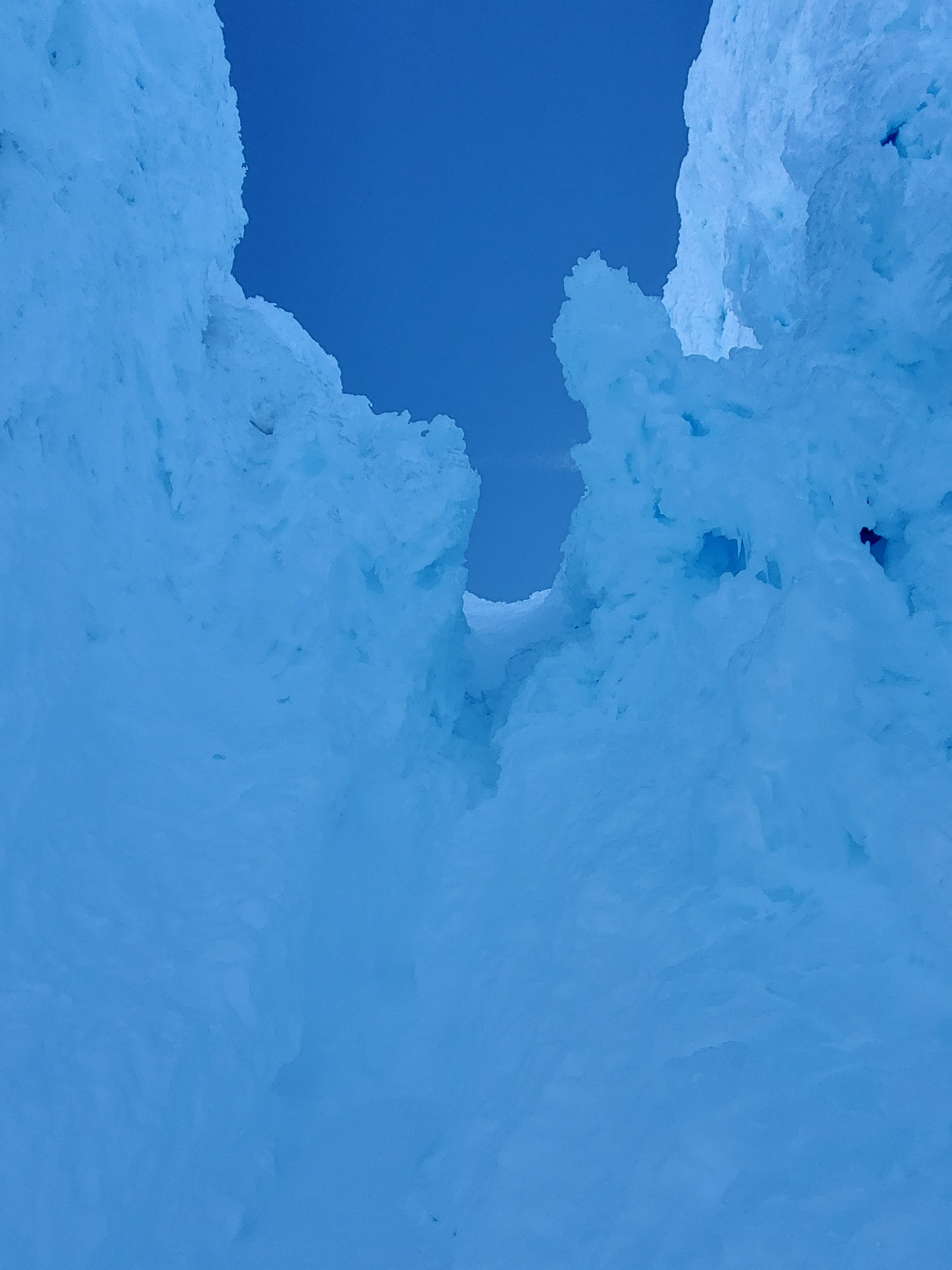
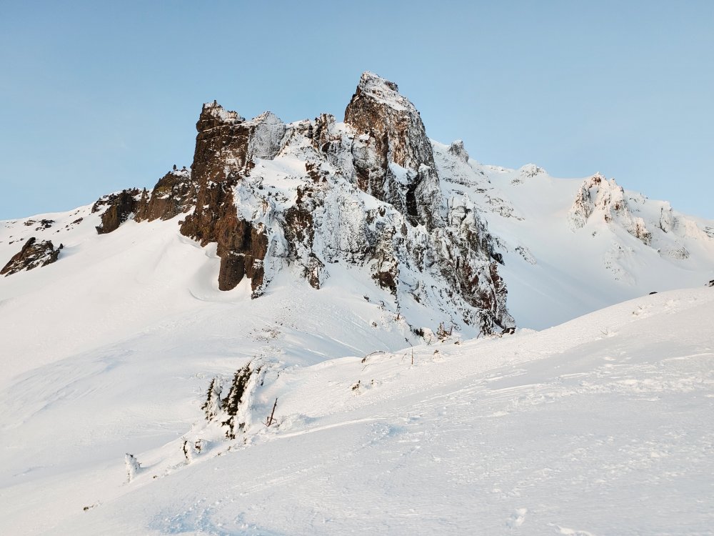
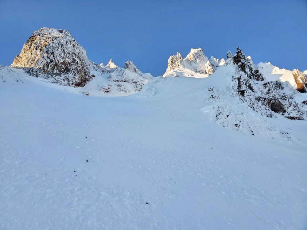
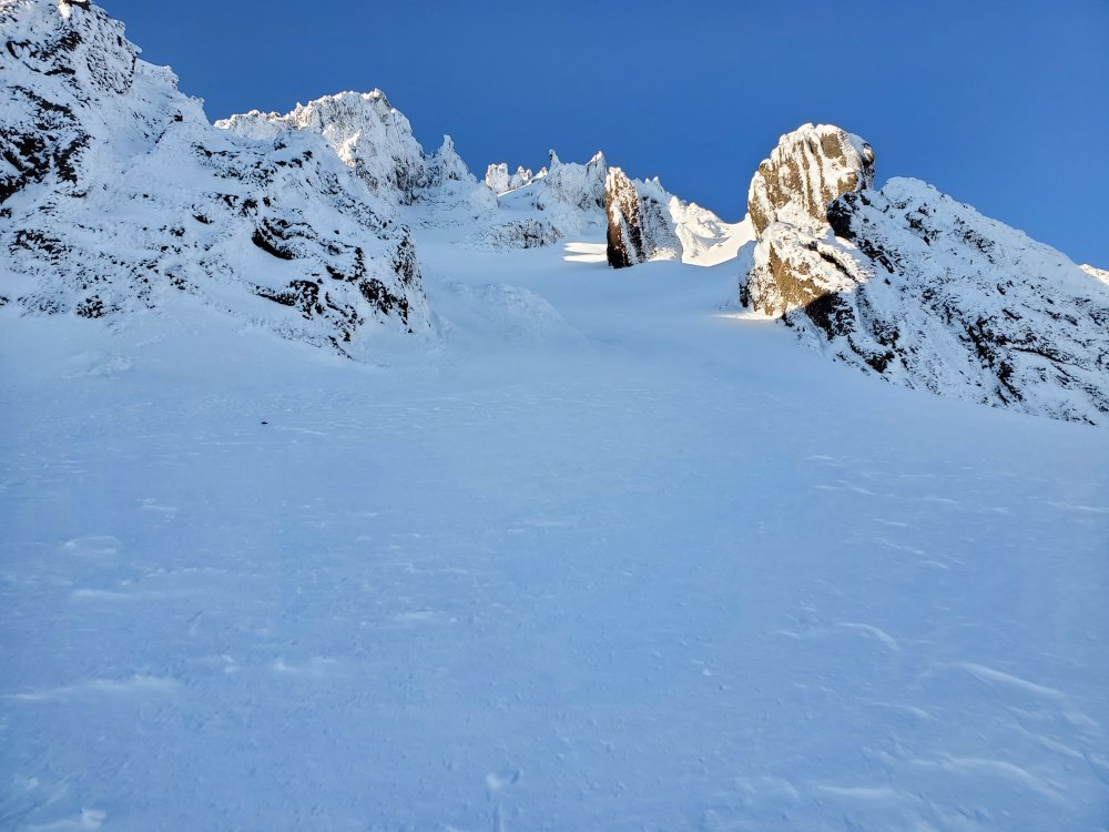
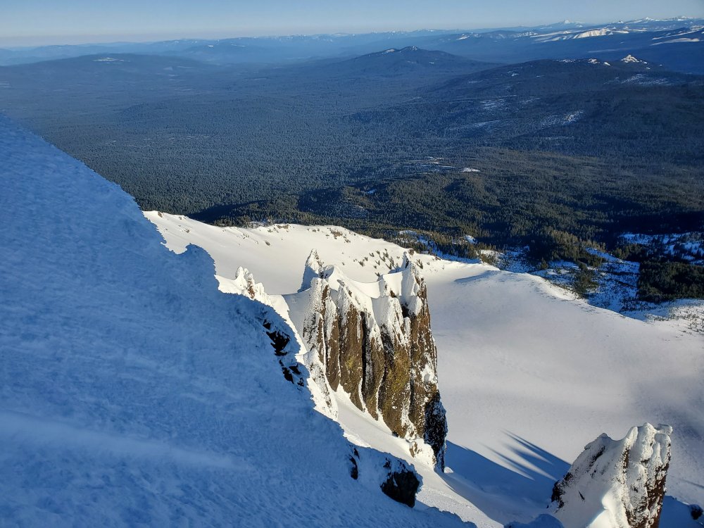
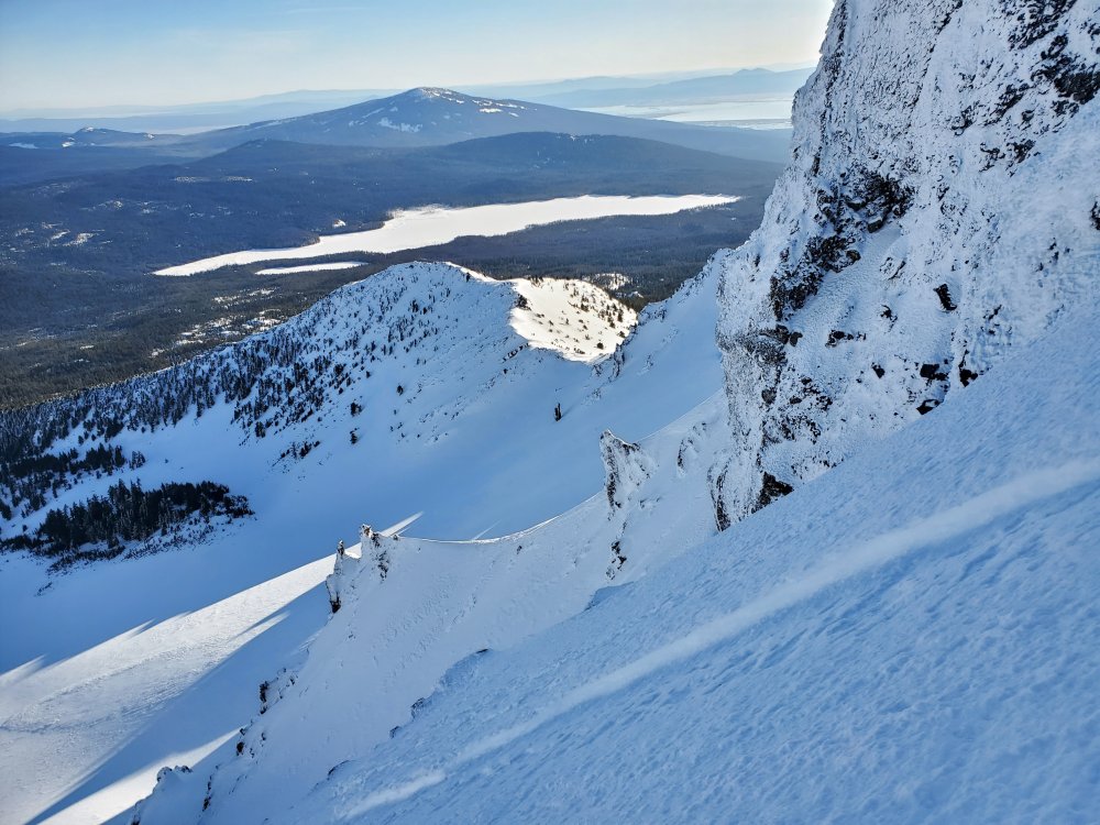
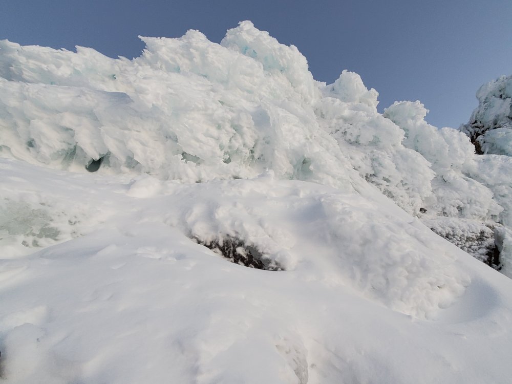
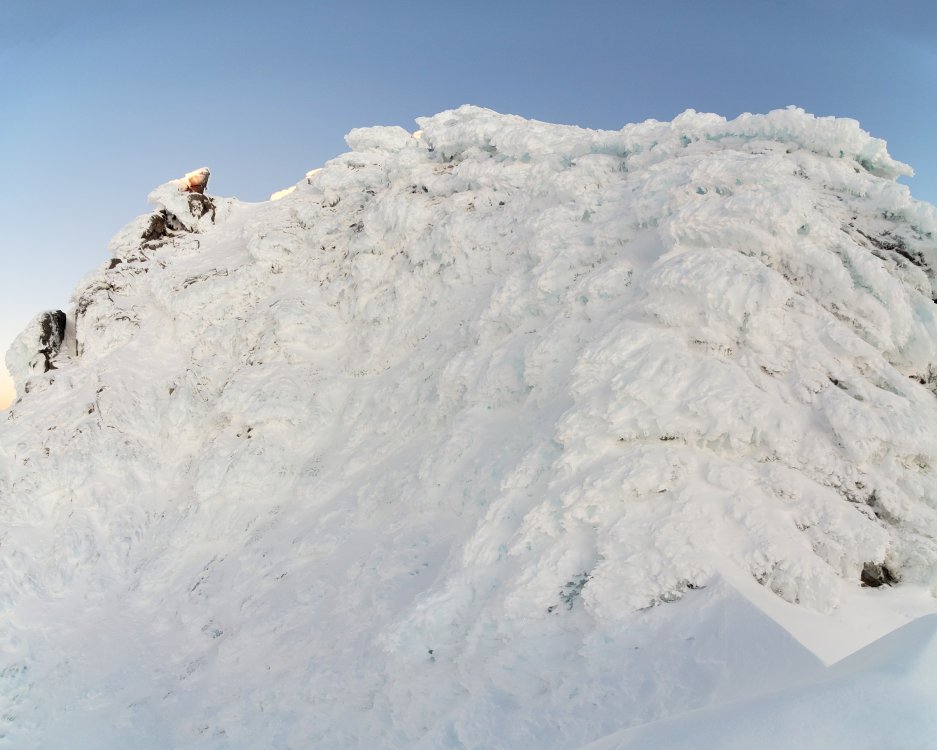
Trip: Mt Hood - Reid Glacial Headwall Trip Date: 01/28/2022 Trip Report: Blown away at the coolness of the left variation of Reid Headwall, Mullee 8a. Bergschrund at the bottom of the glacier was easy to get over. I tried to skirt the first garbage chute at the bottom by staying right of the big runnel but had to down climb back and go directly up it. Ice fall wasn't bad and winds on route were low. Daggered most of the way though there were at least a couple of steep ice ramps that necessitated swinging. There was 10 - 15 feet of unconsolidated deep snow on the leftward traverse around 10200 before heading into more rock towers. The last pinch point required several minutes of rime removal to make it wide enough to get through. Probably spent over 1/2 an hour gawking and taking pictures of the towers and surrounding ridges. For me, the route is definitely worth a repeat in the future. Gear Notes: 2 tools, helmet, crampons Approach Notes: Icy above Palmer

.jpg.d3b3caa403f6584ae1176a6bd02ab588.jpg)
-
[TR] Mt Jefferson - South Ridge 07/23/2021
adventure43 replied to adventure43's topic in Oregon Cascades
More images https://imgur.com/a/YCI9i0w -
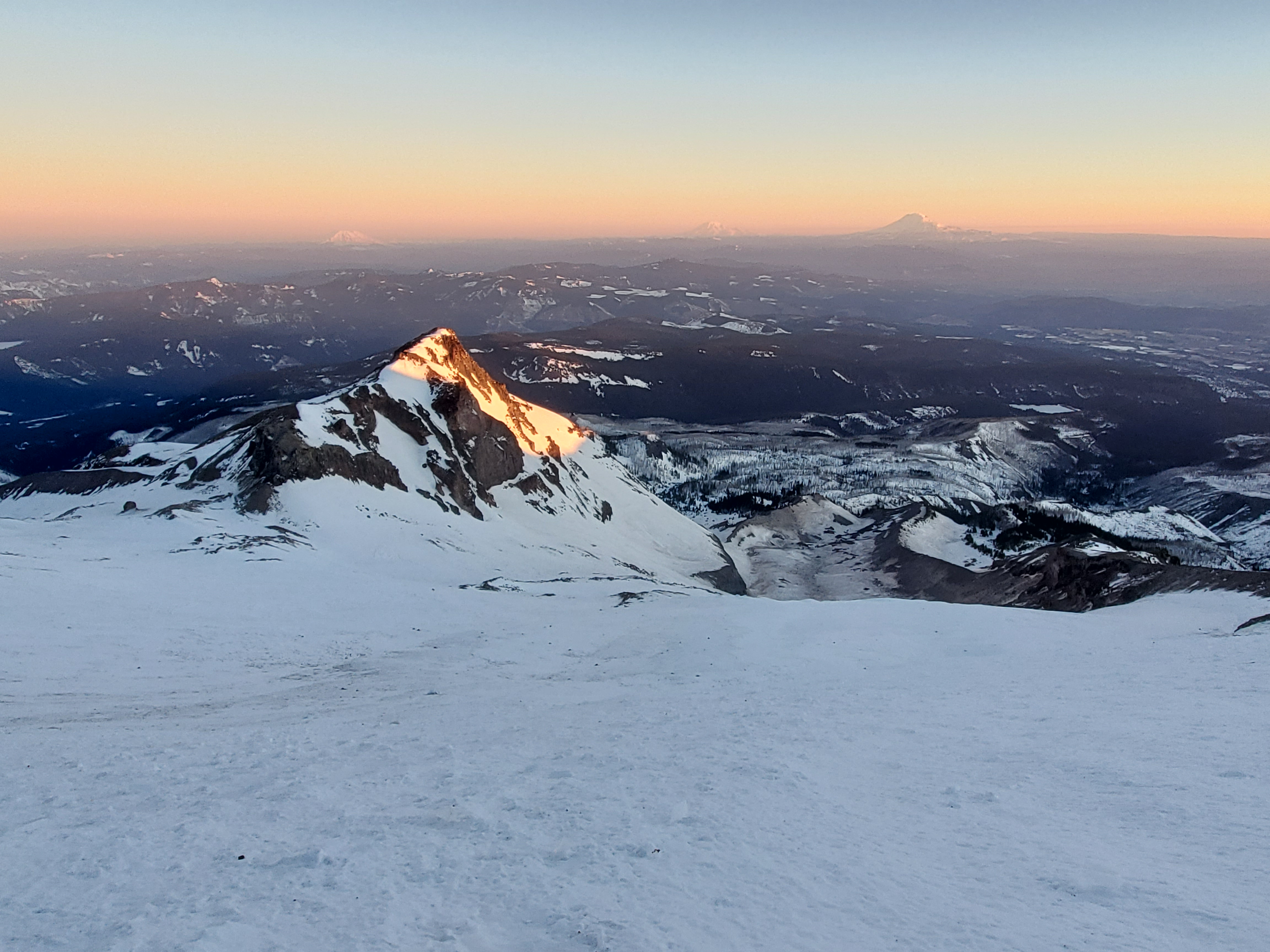
Trip: Mt Jefferson - South Ridge Trip Date: 07/23/2021 Trip Report: Since this was my first attempt at Mt Jefferson, I figured I’d go with the easiest route. Too many stories about the SW ridge to consider it. Started off Thursday night from Pamelia Lake Trailhead. Great trail over to Coyote Lake but no trail after that. Was surprised that the route went over a small rock outcropping with a little class 3 section – was following the Whole Enchilada route. The rocks started not far after that. There were a couple of snow fields in the path of the route but were easy to get around. Reached the Red Saddle around 5:10 AM. Only about 30 to 40 percent of the traverse had snow and the middle was very steep. Followed a few faint boot prints rather than trying to stay in the moat. Snow was very firm. Got only a couple inches of penetration when plunging the axe so instead, daggered with the axe and a tool the whole way over. Traversed around to the north side. This part seemed to have worse rock quality than North Sister but with slightly less runout danger. Followed a path / cairn to wind back over to west side directly below the summit then climbed the rocks with white covering. Came down the south side of the pinnacle and back over to the west – much easier than the climb up. Gear Notes: Trail runners for the approach, mountaineering boots for the rock and snow, crampons, an axe, a tool, poles, helmet Approach Notes: Long and rocky
- 1 reply
-
- 1
-
-
There are images of Middle and North Sisters in the following albums (my recent climbs in the area) + you can get an idea of how things have been progressing, melt-wise. The Husband 2021 06 05 https://imgur.com/gallery/TayLDaF South Sister Prouty Glacier 2021 05 29 https://imgur.com/gallery/ux2GaHQ South Sister NW Ridge 2021 05 15 https://imgur.com/gallery/ORuKxPS Middle Sister North Ridge 2021 05 09 https://imgur.com/gallery/8Bvqw1k
-
Trip: Mt Adams - South Spur Trip Date: 04/21/2021 Trip Report: Hiked up from the Wicky Shelter. If one can drive through the foot high snow on the sweeping corner above Wicky Shelter, there is a bunch of dry road above it. But, it was clear that at least one vehicle had been stuck in it. Followed the normal winter route but headed right to view the sunrise on the Mazama Glacier Headwall(?), below image. Hiked up a bit more and then left to get back to the normal route - had to cross a narrow crevasse to do so. Descended the summer route. Seems like it is melting out fast as there were exposed rocks on the normal climbing route up to the Piker's Peak plateau. More images https://imgur.com/gallery/CYAsv8p Gear Notes: Whippets, crampons, helmet (didn't use), axe (barely used), snow shoes Approach Notes: Long road walk from Wicky Shelter
-
[TR] Mt Hood - Cathedral Ridge 04/18/2021
adventure43 replied to chrisc88's topic in Oregon Cascades
Great job sending the route and what a fantastic write up. Watermelon sized, ouch! Glad you two made it without serious injury. Love seeing the full resolution shots by opening images in another window and removing the extra filter from the URL. Definitely beats trying to figure out where Instagram hides full res images locally. You are correct that the 7775 crossing of Yocum is right under that big ass rock in your 4th picture. So yeah, overhead danger but so nice not losing more elevation. The route appears to be melting out fast. Seemed like there was full, or nearly full, snow coverage 20 days previously. The part where you decided to skirt rather than do the bouldering thing was much easier earlier. Had the same reaction as you did, no way on the left, right was maybe OK, but let’s give going straight up a chance – not too bad with snow coverage. Always wondered who uses those string crampons things – scary 😊. Here is to wishing next season Mt Hood will get several storm cycles without accompanying 40+ MPH winds. -
[TR] Mt Hood - DKH- Elliot HW linkup 04/03/2021
adventure43 replied to ACosta's topic in Oregon Cascades
Great job up there and nice to bump into to you as you were heading down the ridge to get to the Eliot. I’d hoped to get a few shots of you coming up the headwall but you were probably having a nice lunch. -
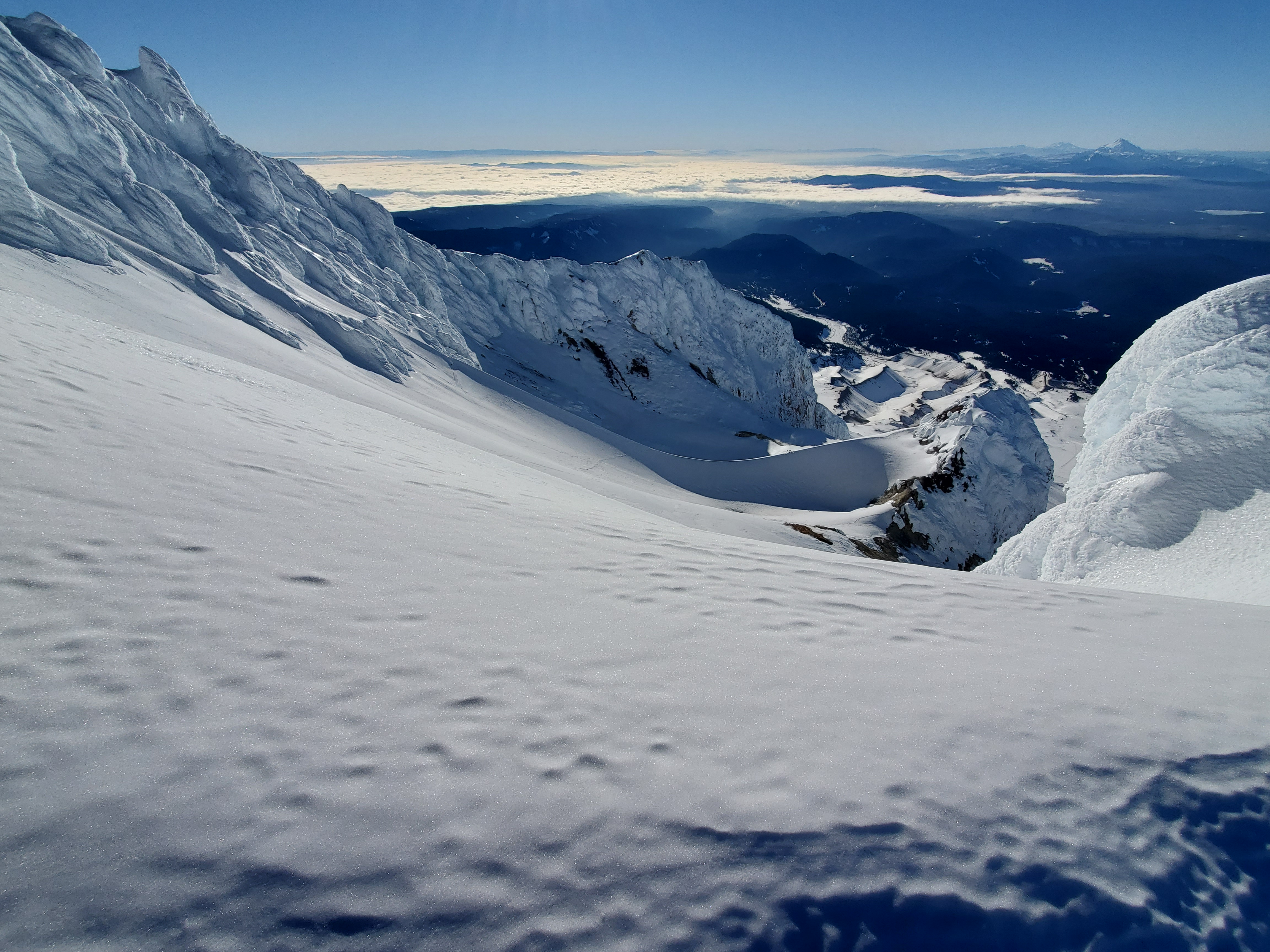
Trip: Mt Hood - Cathedral Ridge Trip Date: 04/03/2021 Trip Report: Images https://imgur.com/gallery/qoDJPvE 10:00 PM Climbers lot at Timberline 12:00 AM Top of Palmer 01:10 AM Illumination Saddle 02:40 AM 7775 feet at Yocum Ridge crossing 03:30 AM At bottom of Cathedral Ridge ramp 05:20 AM At top of ramp and on ridge 06:30 AM 9345 feet 08:30 AM Past crux pyramid rock tower 09:45 AM 10540 feet 10:50 AM Summit Climbed Cathedral Ridge on Saturday on foot from Timberline. A little bit of breakable crust but not bad from Palmer to Illumination Saddle. Downclimb onto the Reid was easy. Across the Reid had mostly semi firm nice snow. No crevasses in sight. Crossing of Yocum at 7775 was easy. Ran out of energy in the middle of crossing the Sandy Glacier. Only had a single bar to that point, not that my stomach would have like more. Sounded like a river of small ice pieces was coming down from the cliffs to the left of the ramp up to Cathedral Ridge. Also, there was a ~4-foot-wide rock that had recently fallen down off the ridge sitting on the Sandy. Not good signs but oh well. Went up the ramp. The right side was getting a good bit of ice fall. One barrage had several 2-3-inch sized chunks and one football sized or larger. Seriously contemplated turning around. Staying to the left kept me out most of it, was hit only once and not too bad. Got up into the rocks on the left side of the ramp and around something that I though might take me to the ridge but was a dead end / cliff on the left. Traversed right back to the route and then up to the ridge proper and was able to stay out of any icefall. In the future, if I try this again it will have to be where there is a better freeze. Freezing level this morning was only forecast for 7800 feet. Getting around the gum drop was super easy, barely noticed there was exposure on the right. The crux pyramid rock tower had good snow and the lower part was easy to climb. About half way up traversed left and then climbed that side. Seemed a whole lot safer than down climbing out on the Ladd Headwall or whatever it is called on the left side even though it is much less steep. One slip and that’d be it. Another option would be to stay at the same elevation and climb through the rocks - a bunch more work and still have to climb up later in maybe worse conditions. Went on hands and feet along the knife edge traverse though it was still better than expected. Gear Notes: Crampons, 2 tools, helmet Approach Notes: Normal slog up cat tracks. MtHoodCathedralRidge.gpx
-
[TR] Mt. Hood - Steel cliffs south face 03/17/2021
adventure43 replied to DET's topic in Oregon Cascades
Great job DEP. That sounded pretty adventurey. Definitely not for solo-ing. You both were gone by the time I got up there but I did see a couple of climbers (only one in the pic) on the NW ridge from doing Reid or Leuthold around 11:30. Was that you Nolan? -
[TR] MT HOOD - Sandy Glacier HW 03/13/2021
adventure43 replied to kadyakerbob's topic in Oregon Cascades
Thanks kadyakerbob for the trip report. I wanted to do it the same day your party did but conditions didn't seem right. Did you guys go all the way down to 7600? I got tired of skirting around and bee-lined to the ridge at 7770 and saw that it was easy to get on to the Sandy there, so I did. A few images from my climb on 2021 03 17 https://imgur.com/gallery/WBap5Qe. nonbasketless, I saw 4-6, 6 - 8 wide inch seems opening up around 8400 on the Sandy as I was heading to the climb. All were covered or at least mostly. I looked at one more carefully as it had small holes, an inch around, at its edge and one could see black below. The crevasse at the top of the Hogsback is very open as is the tube just above the Devil's Kitchen area. Didn't see any opening on the Reid but it was dark. -
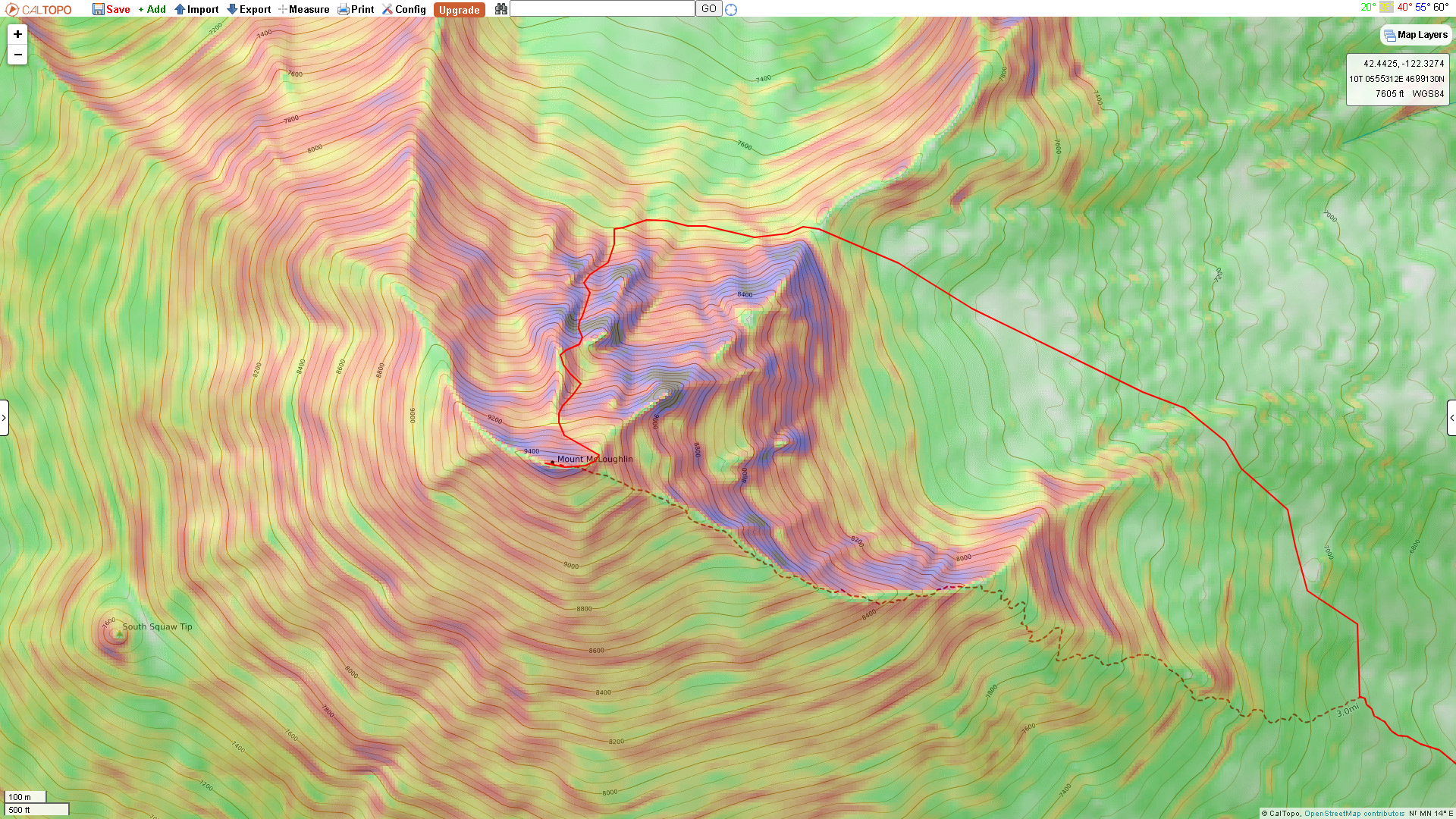
Trip: Mt McLoughlin - Through rock in North bowl Trip Date: 03/03/2021 Trip Report: Somehow I stumbled across this image of Mt McLoughlin and decided the route in red would be fun. Is this covered in any guide books? https://image.shutterstock.com/shutterstock/photos/1105471811/display_1500/stock-photo-mount-mcloughlin-oregon-1105471811.jpg For the past couple of months mountain-forecast showed a good weather window a week or more out but every time the forecast changed and spoiled the party. I tried once before, https://imgur.com/gallery/uB410zr, but gave up en route since conditions weren’t suitable. This time looked good and after a storm cycle that ended on Sat - Sun, three clear days in a row were forecast. Headed down to Summit Snow Park after work on Tuesday and caught a nap before heading out. Arrived too early at the saddle between the North and NE bowls so hung around for the sunrise. Should have brought a long ice axe and a stubby but had two ice tools. There was 0.5 inch crust with no too consolidated snow underneath. Easy to kick in but not solid. A few more pictures here https://imgur.com/a/H4XqwZC Gear Notes: Snow shoes, helmet, crampons, two ice tools - should have brought axes. Approach Notes: From Summit Snow Park headed down FS 3650 and up the normal hiker route. Off trail traverse wasn't too bad with just a bit of side hill action. See attached GPX for the route.


-
Trip: Mt Shasta - Avalanche Gulch Trip Date: 02/22/2021 Trip Report: https://imgur.com/gallery/2HQrTOd Followed tracks until they disappeared somewhere after the Horse Camp turnoff. Snow was varied as usual; some firm crust, some breakable, some soft and fluffy that required kicking in several times to get any support. The steeper section by the Heart was firm. Switched from snowshoes to crampons at Thumb Rock then down climbed and walked way around the crevasse / bergschrund. Rocks on Misery Hill had a thin rime coating making travel easy. Didn't sink in too deep on the summit plateau. Summit block had neat undisturbed rime formations. Gear Notes: Snowshoes, whippets, crampons, helmet, ice axe (used for little down climb from Thumb Rock) Approach Notes: Walk up the gulch
-
Trip: Shastina - Lightning Bolt Trip Date: 02/07/2021 Trip Report: https://imgur.com/gallery/x2a9sHq There was a good trail over to Horse Camp and signs of people doing avy rescue drills above it but past that, it was choose your own adventure. The snow on the climb up to the traverse over to Hidden Valley was soft and snowshoes sunk several inches. The rocks on the traverse were largely uncovered - took off snowshoes and tried with just boots but eventually switched to crampons. Snow in Hidden Valley was not too bad - didn't sink more than 6 inches w\ crampons. The Lightning Bolt couloir was the only section with good snow cover and was decently firm. Gear Notes: Snowshoes, whippets, crampons, helmet - didn't use axe Approach Notes: Slog from Bunny Flat
-
Thanks jiepj. I didn't know it was a known route until after the trip. The Mullee book has a green dashed line on page 81 showing the route but doesn't talk about it at all. Icefall / Boy Scouts Chute The Chute
-
Trip: Mt Hood - Right Ridge of Icefall / Boy Scouts Chute Trip Date: 12/04/2020 Trip Report: Climbed up the rime encrusted rocks on the right ridge of the Icefall / Boy Scouts Chute. Tool and foot placements were difficult since there was little consolidated snow or hard ice. Most of the ice was rime on large rocks. The lower part of the route was the most difficult. More image here https://imgur.com/gallery/x2t3tMU Route: Some mid-route shots: About to top out: Gear Notes: Two tools, crampons, helmet Approach Notes: Walk up the chewed up cat tracks
-
[TR] Three Sisters Marathon - Standard Route(s) 08/22/2020
adventure43 replied to dinomyte's topic in Oregon Cascades
Did the marathon yesterday but went up the West Ridge of South https://imgur.com/gallery/yYDUvoc and got a ride back to Pole Creek Trailhead (cheating). See attached GPX of the route. There is small stream of water to climber's right coming off the snow between Middle and North in the saddle - didn't get any from this. Between Middle and South there is a snow field near the bottom on descender's right which had a nice stream of water that ran into one of the Chambers Lakes - drank from this. There was also a nice stream at the plateau north of the West Ridge - drank from this. I took 4 liters and wished I had 6, it was warm though. Probably drank 1.5 liter of water from the snow melts. Three Sisters Marathon - S Sister W.gpx -
Thanks a ton dinomyte. I very much look forward to reading your report and seeing the pictures. I'll probably try again this Friday if the weather holds out.
-
Anyone been up recently? Is the snow off the terrible traverse and out of the bowling alley? I was up on the SE ridge Friday AM but turned around due to poor visibility, wet and rockfall. There sure seemed like a lot of snow up the side of the ridge for this time of year. Some images from the trip https://imgur.com/gallery/wEwQCUz. Heading up the moraines before the clouds rolled in
-
[TR] South Sister - Up-Down-Swimmin' Around 08/05/2020
adventure43 replied to Alisse's topic in Oregon Cascades
Looks like a blast going down the NW ridge. You two are brave to swim in Carver Lake. Glad you only got cold and not sick. Carver Lake looks like liquid scree to me. -
Trip: Mt Adams - NW Ridge Trip Date: 06/19/2020 Trip Report: Images: https://imgur.com/gallery/xtuhf6H Started from a turnout near Takhlakh Lake and headed up the Divide Camp Trail. Probably could have driven to the Divide Camp Trail but there was a bit of snow – a Lexus 4x4 was at the trail head. Crossed over the PCT intersection and just followed a route that seemed reasonable. I went up a couple of the moraines that didn’t have snow cover. It probably would have been better to have stayed lower in the valleys and then climbed up the moraines at the very ends. Some of the tops of the valleys had deep moats at their ends. Gained the ridge around 8000 feet. Didn’t see any bergschrund lower down as mentioned on summitpost. I was on a rock ridge for a bit and then stayed to the left to keep on the snow. Conditions weren’t ideal, since very little was firmly consolidated. It was nice to have two tools when heading left towards the North Face of the ridge (40 degrees?). Down climbing the steep parts was a chore given the slushiness of the snow. It was at most just freezing on the summit that night and morning. Saw a few people on the summit but none while I was there. There were three boot tracks that appeared to come from the North Ridge / Cleaver route but I didn’t see them. The big chunks separating at the top of the Adams glacier were a spectacular sight and well worth the climb. Definitely will come up the north side again. Attached GPX file is not a recorded route, just a best guess. Gear Notes: Helmet, crampons, axe, two tools Approach Notes: Divide Camp Trail - a walk through the woods
- 1 reply
-
- 1
-