

Tom_Sjolseth
-
Posts
541 -
Joined
-
Last visited
-
Days Won
2
Content Type
Profiles
Forums
Events
Posts posted by Tom_Sjolseth
-
-
From S America to S Africa to the S Pickets. Tim really gets around!
Thanks for the stoke.
-
Nice work and thanks for the report.
-
@kevbone.. relief meaning vertical relief.
@bronco.. Mt. Index is not in the Alpine Lakes Wilderness nor is it in the N Cascades. It is in CAG 1 (brown) where the Alpine Lakes peaks can be found. Mt. Index (exactly on the King-Snohomish County line) lies N of Steven's Pass (which is South of the King-Snohomish County line), so technically, this is the forum it belongs in if the guidelines are as stated on the forum index page "anywhere North of Steven's Pass and South of the US-Canadian border".
-
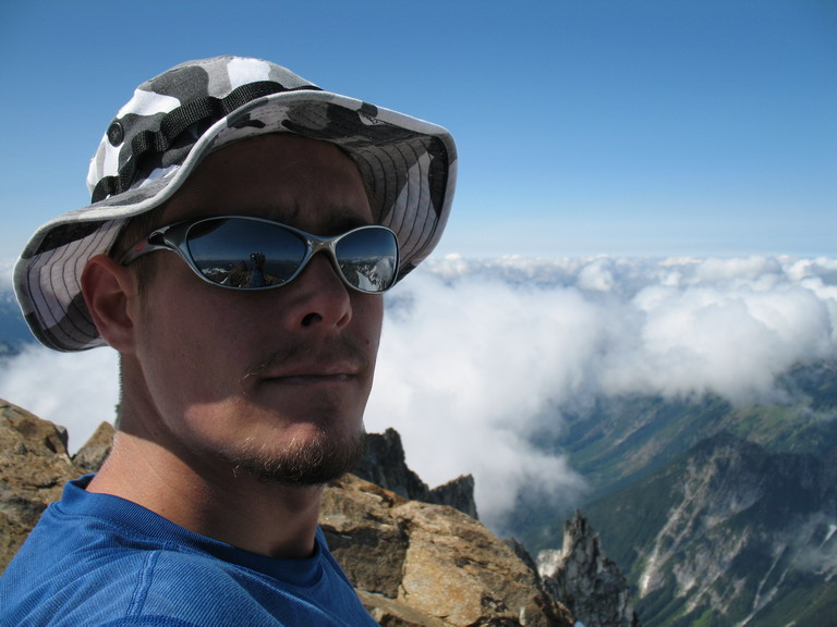
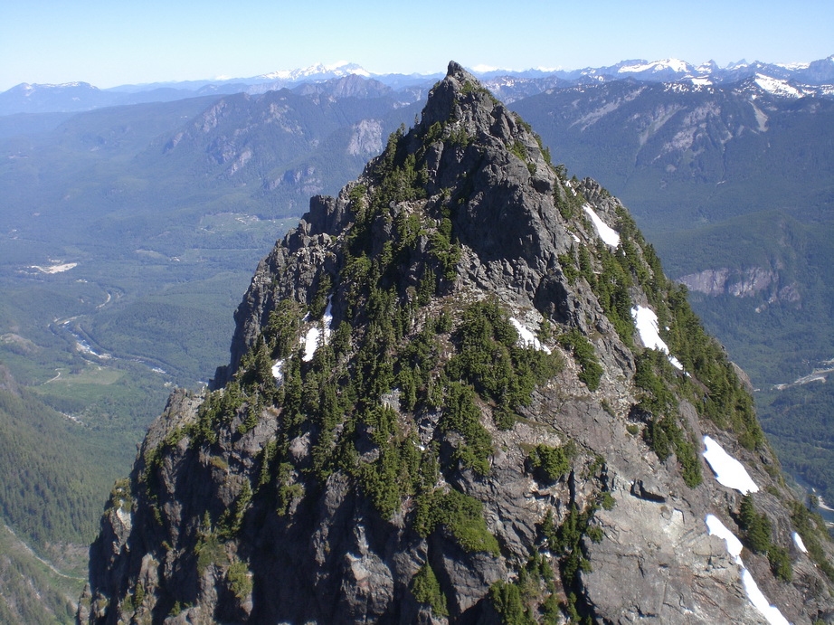
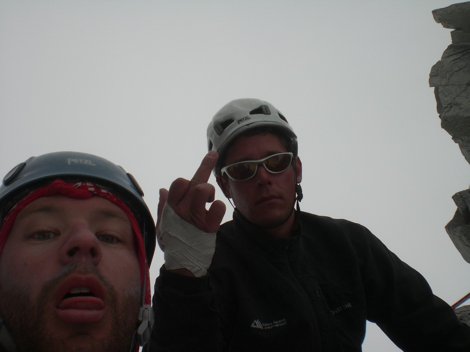
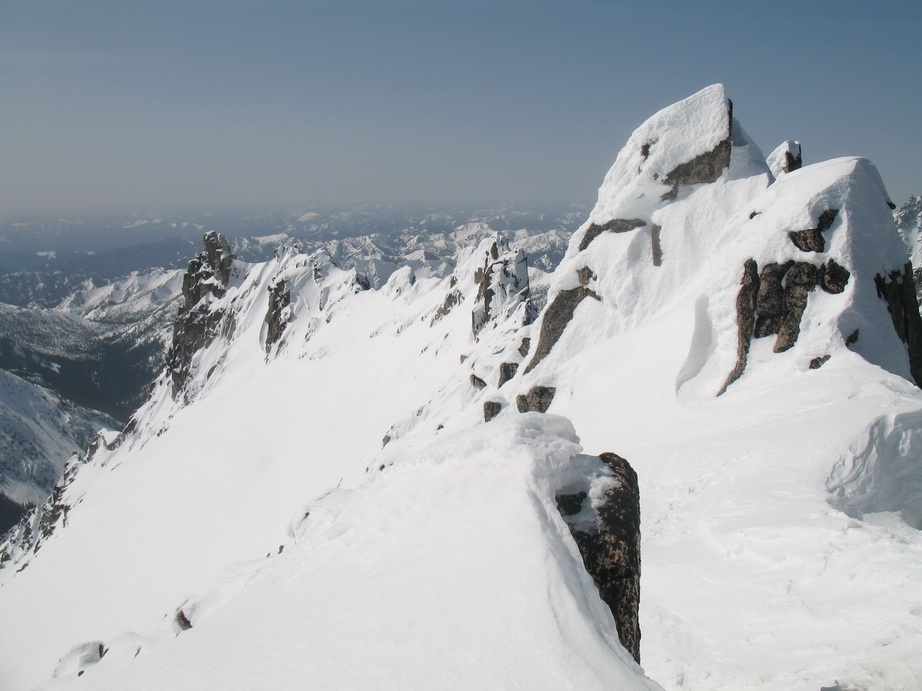
Trip: Mt. Index - Traverse - North -> Middle -> Main
Date: 7/7/2010
Trip Report:
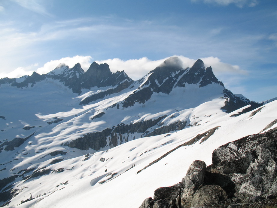
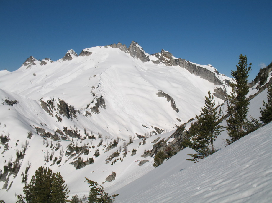
The Mt Index Traverse – North, Middle, and Main
Wayne's trip report can be found here.
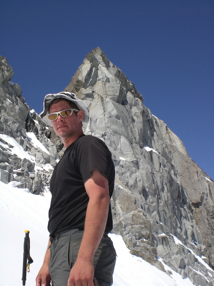
Wayne and I linked up on Monday for a great traverse of the three summits of Mt. Index.
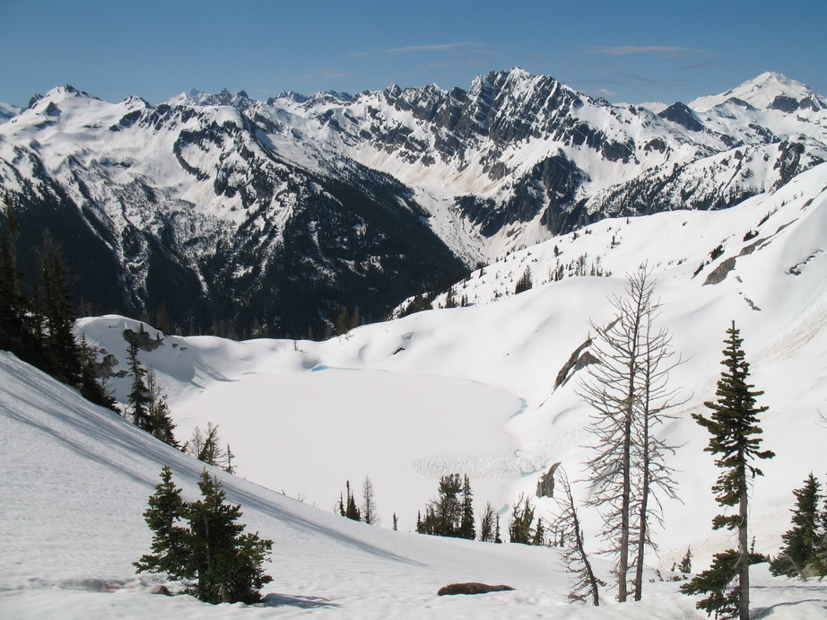
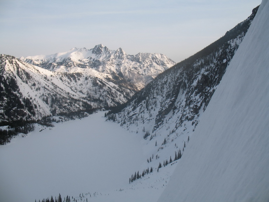
The trailhead was packed when we pulled up, due in no small part to decent weather and it being the tail end of a four-day Fourth of July weekend. Lucky for us we spied a parking spot right next to the TH sign, and saddled up. We arrived at Lake Serene a little over an hour later. People were everywhere, but our destination was the W side of the lake which appeared to be deserted. We made camp on a flat slab and went to bed early.
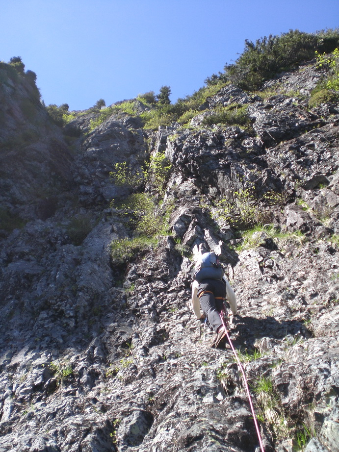
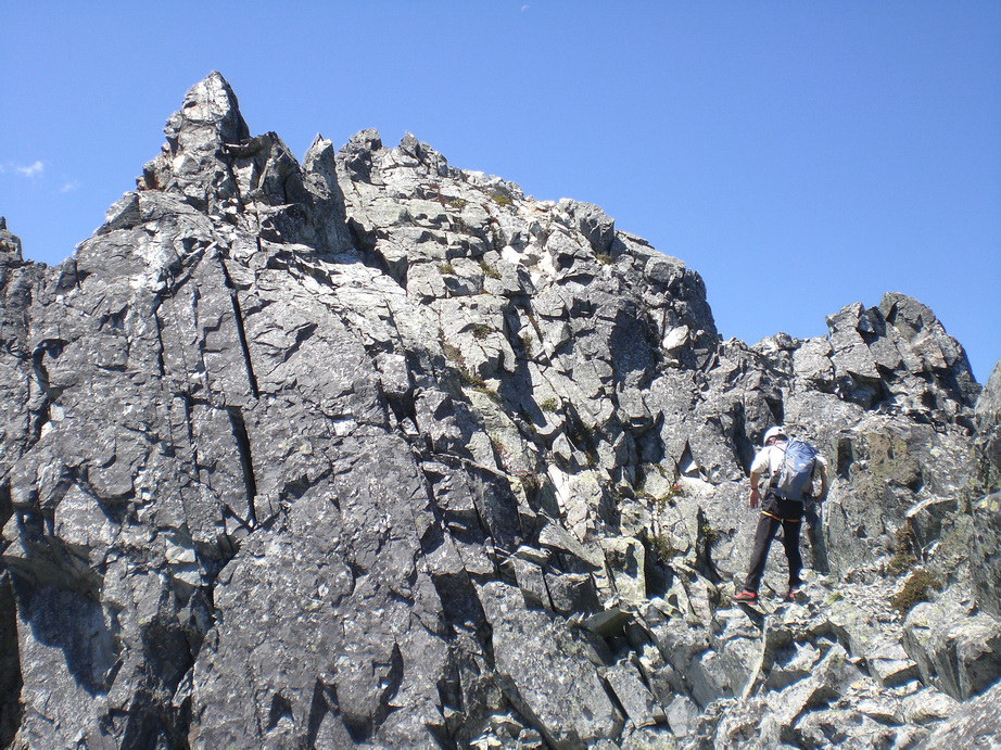
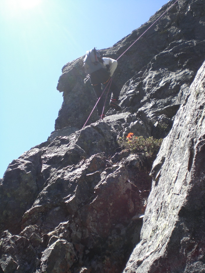
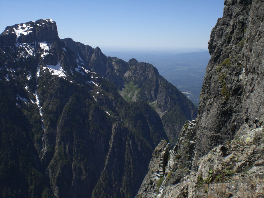
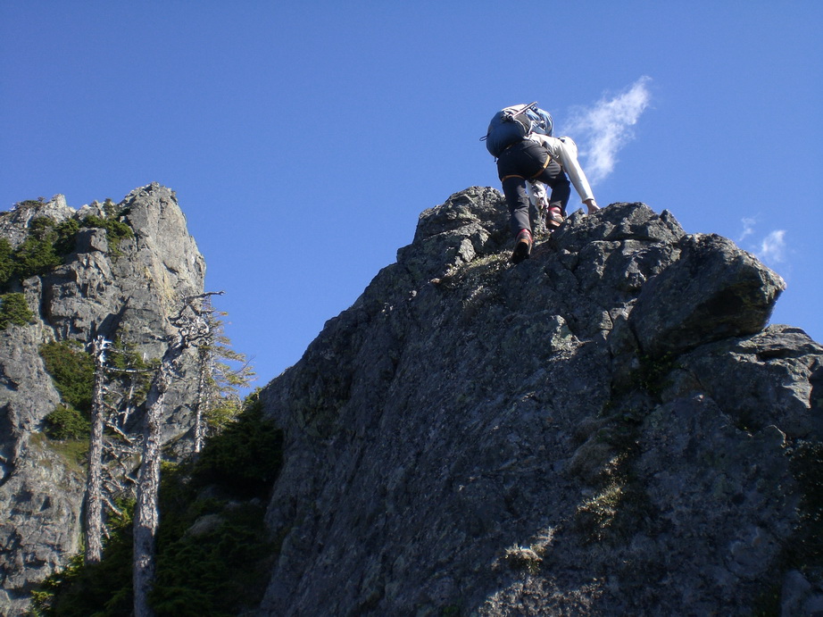
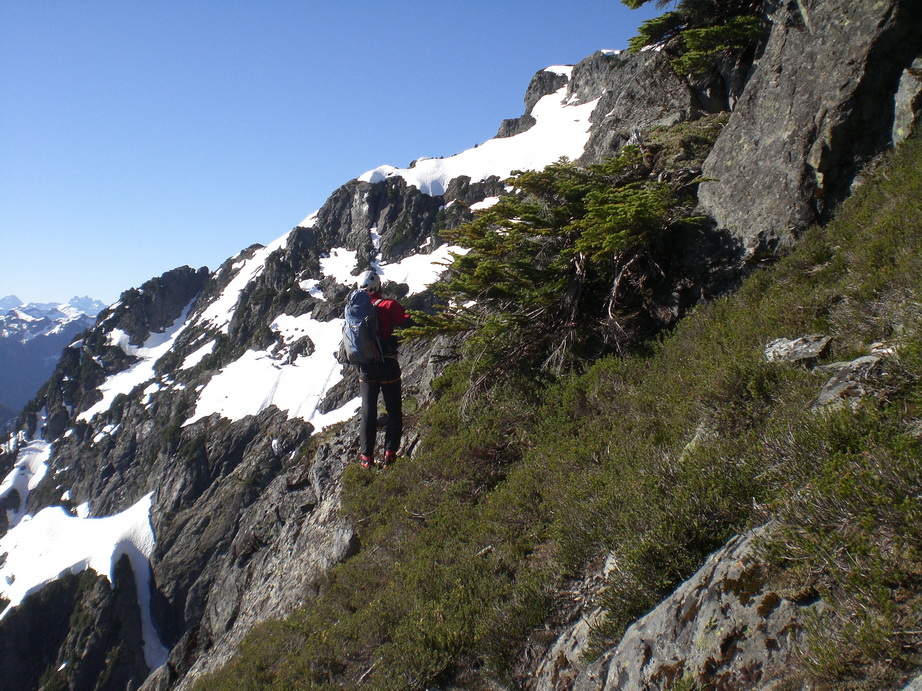
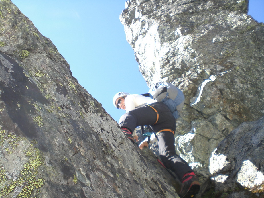
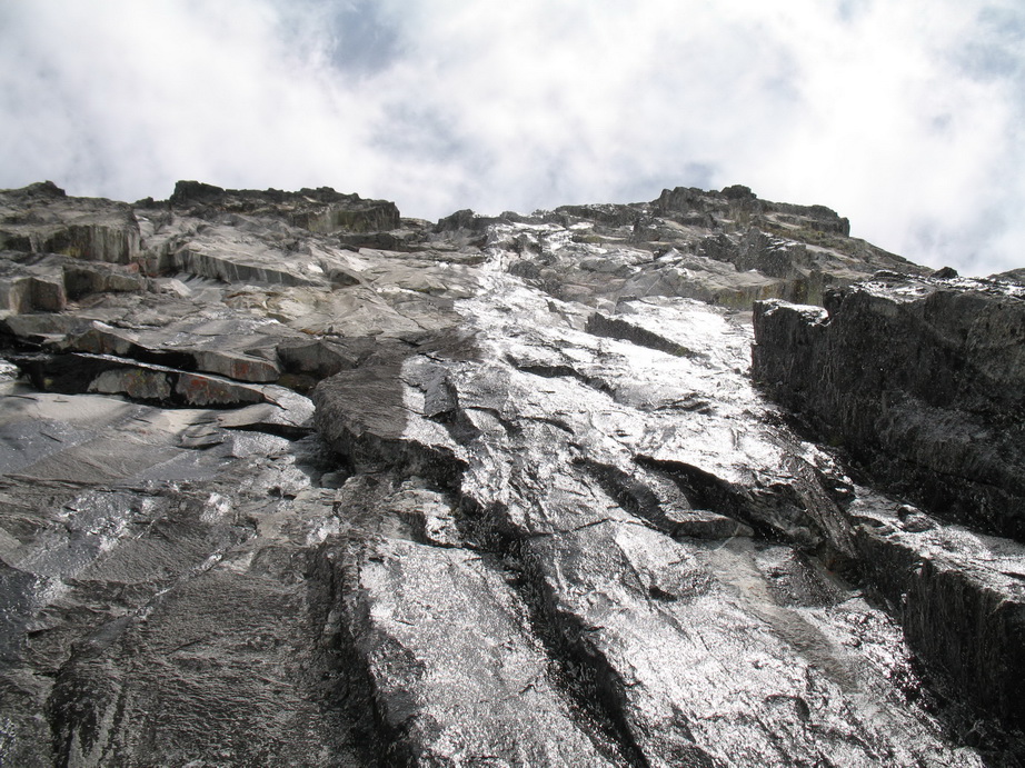
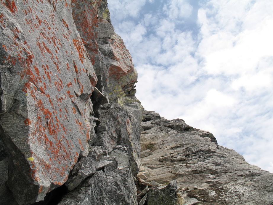
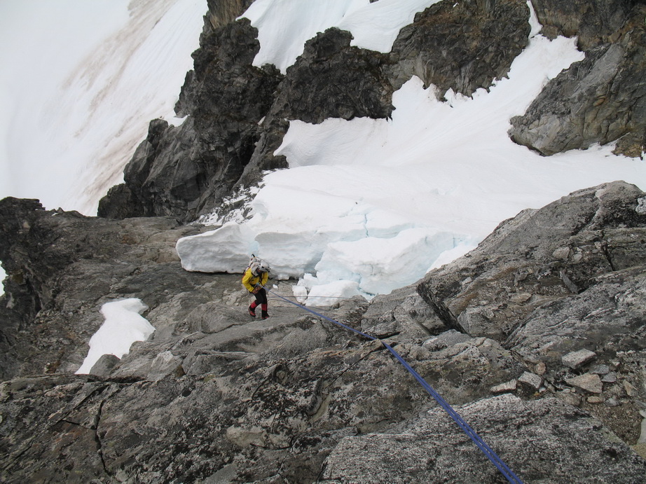
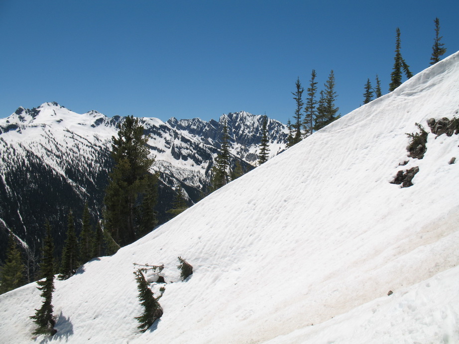
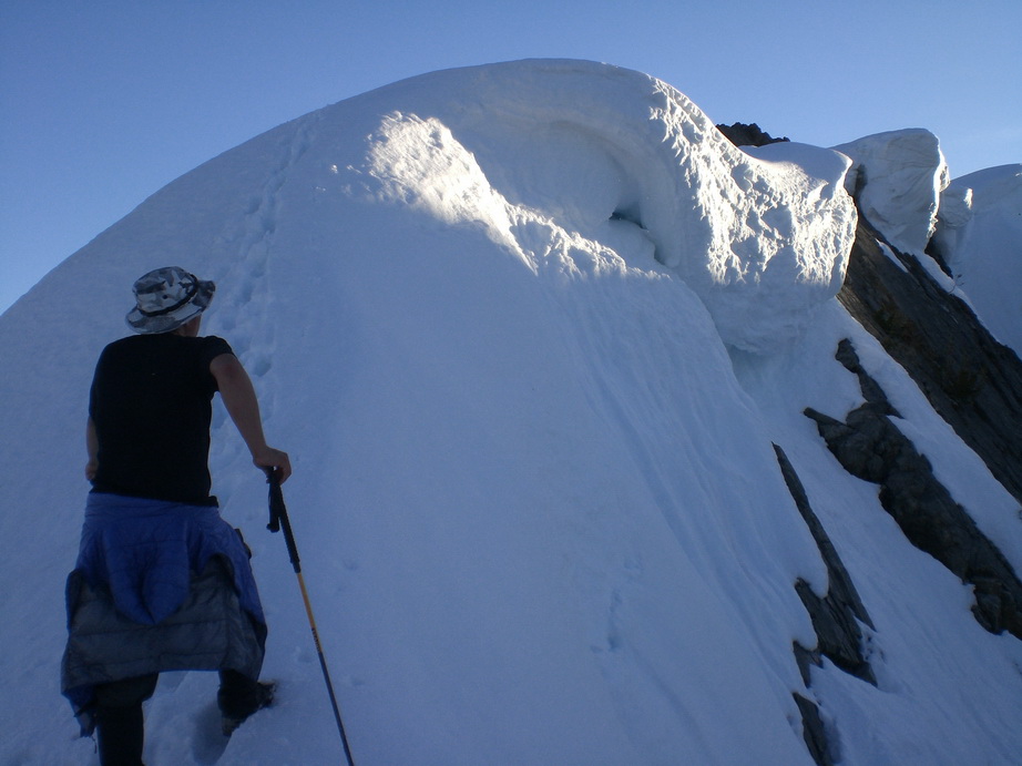
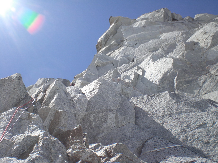
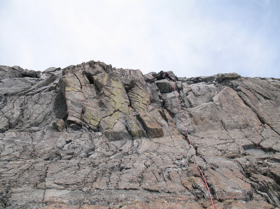
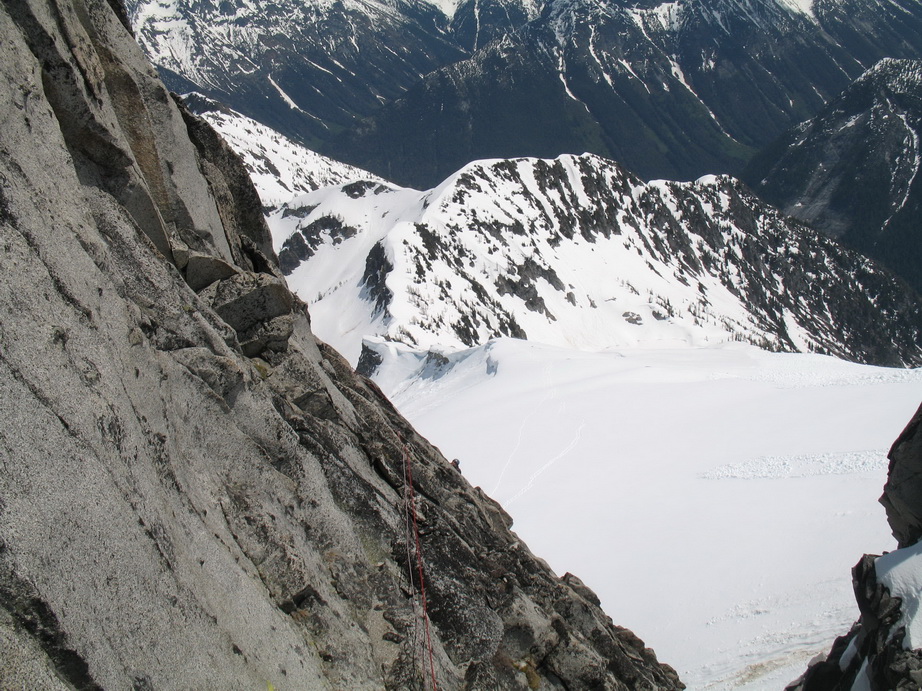
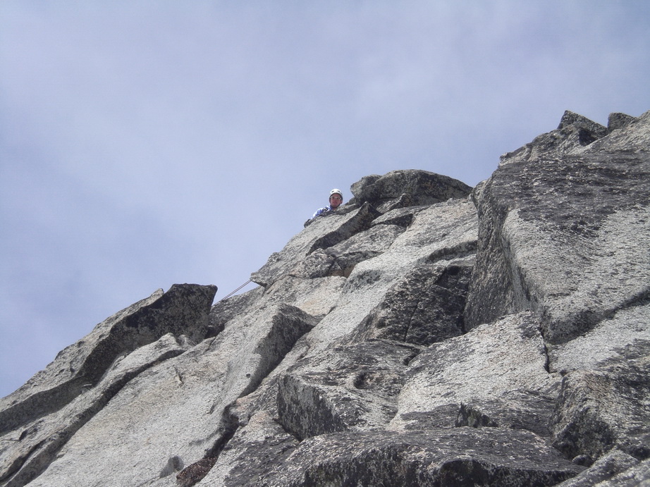
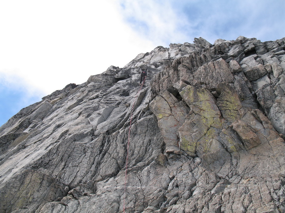
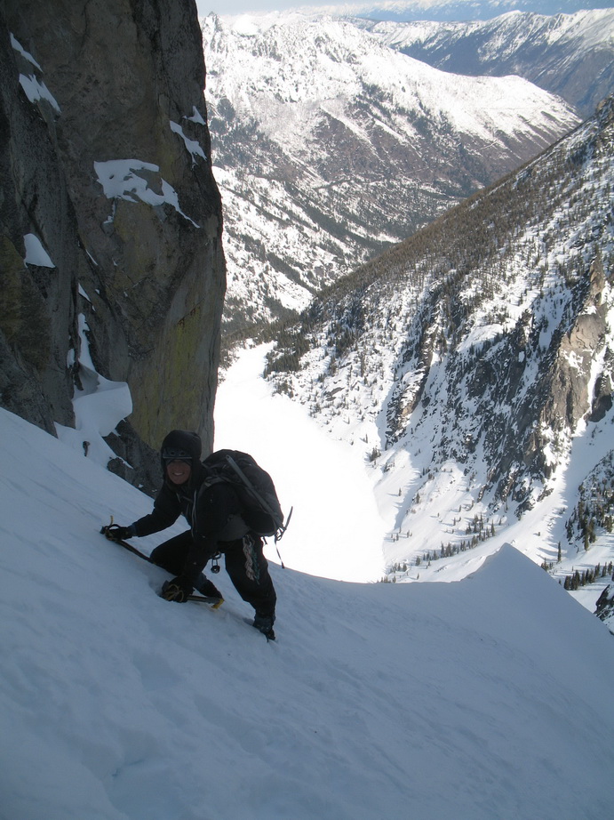
Tuesday morning, we were up at 6:00. It was a perfect bluebird day.. just what we needed to dry out the wet vegetation that existed from the days prior. By the time we were moving at 7:30, the sun was blazing and things were drying out nicely. We ascended talus slopes to the NW end of Lake Serene, where we crossed over a rib and began to ascend a steep drainage running off of the N peak. We encountered very steep brush and heather slopes with rocky steps. The rock was surprisingly solid where we needed it. We roped up at the beginning of the NE Rib arete, and remained roped up until the false summit. The climbing was exposed and enjoyable.
 Wayne preparing to tackle the brush on the N Face of N Index.
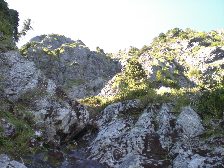
The view up the N Face from low on the route.
Looking down.

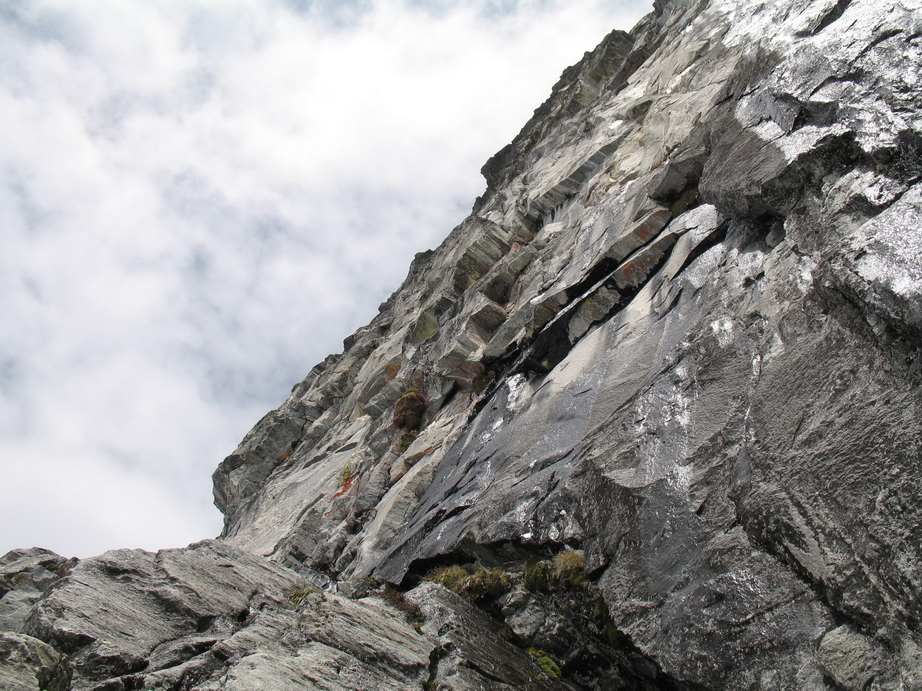
The town of Index and Index Town Walls from the N Face.
Typical climbing on the N Face of Index.
Mt. Persis from somewhere on the N Peak of Index.
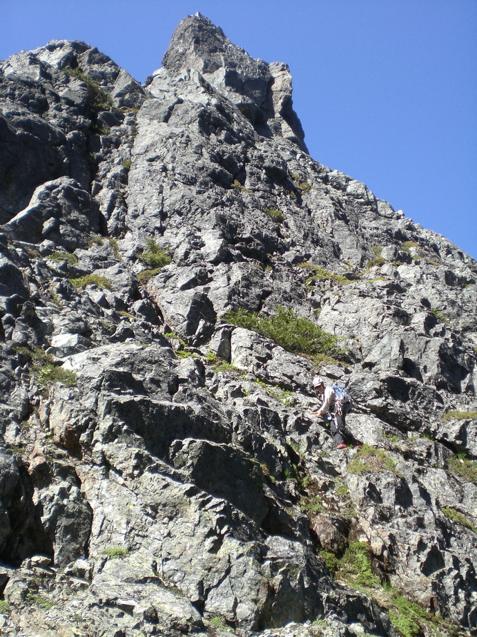
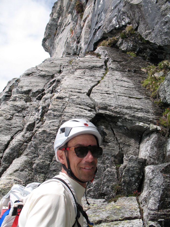
Wayne climbing solid rock on the NE Rib of N Peak.
Wayne approaching the summit of N Peak.
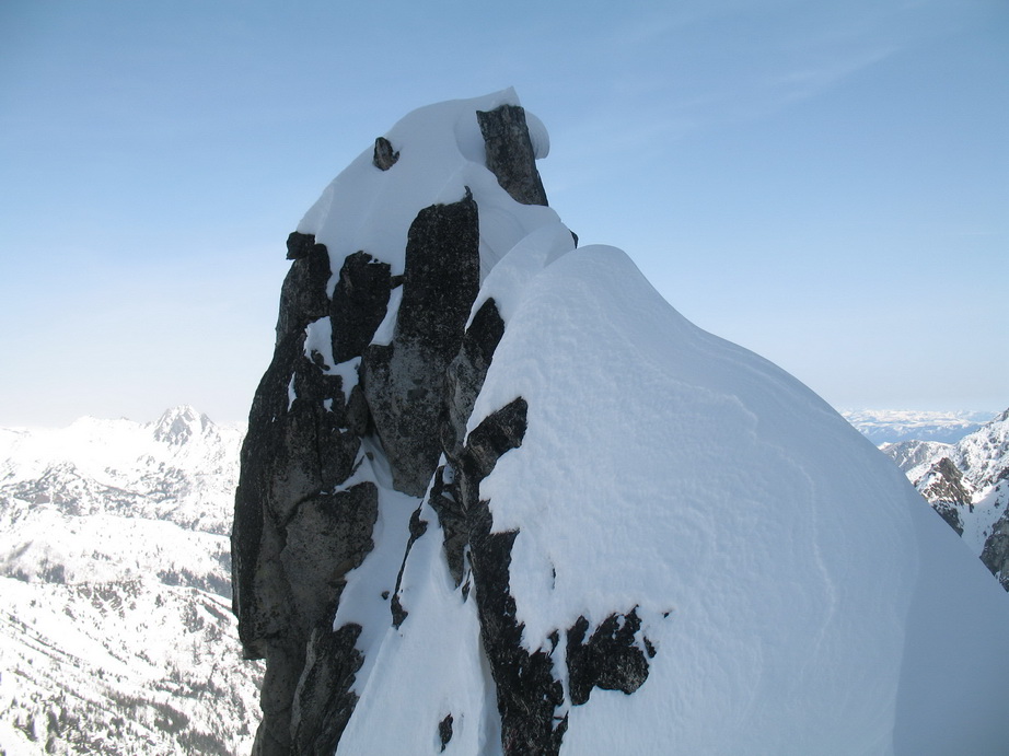
The summit of N Index.
Impressive relief.
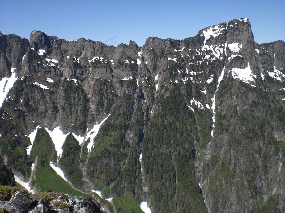
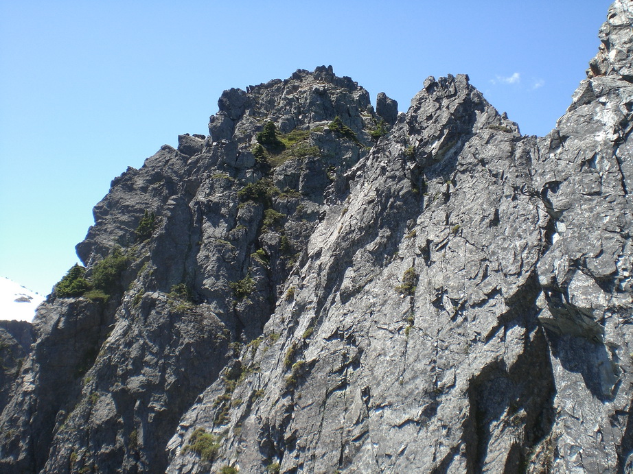
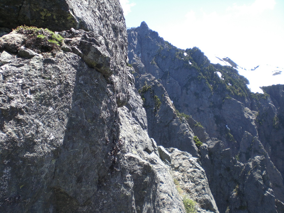
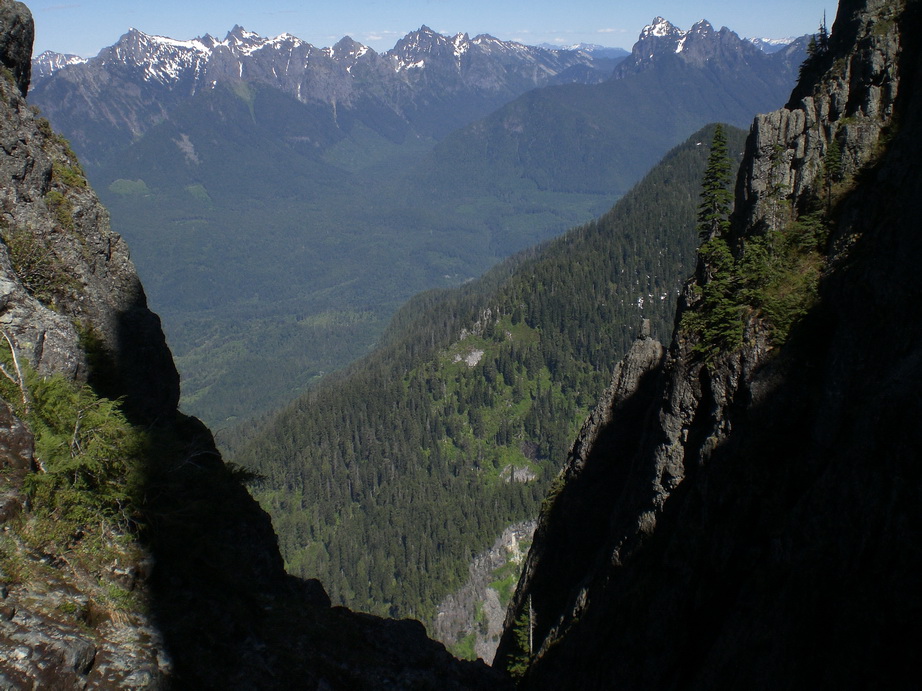
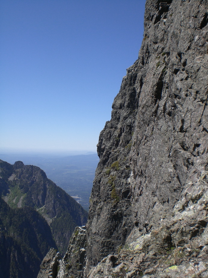
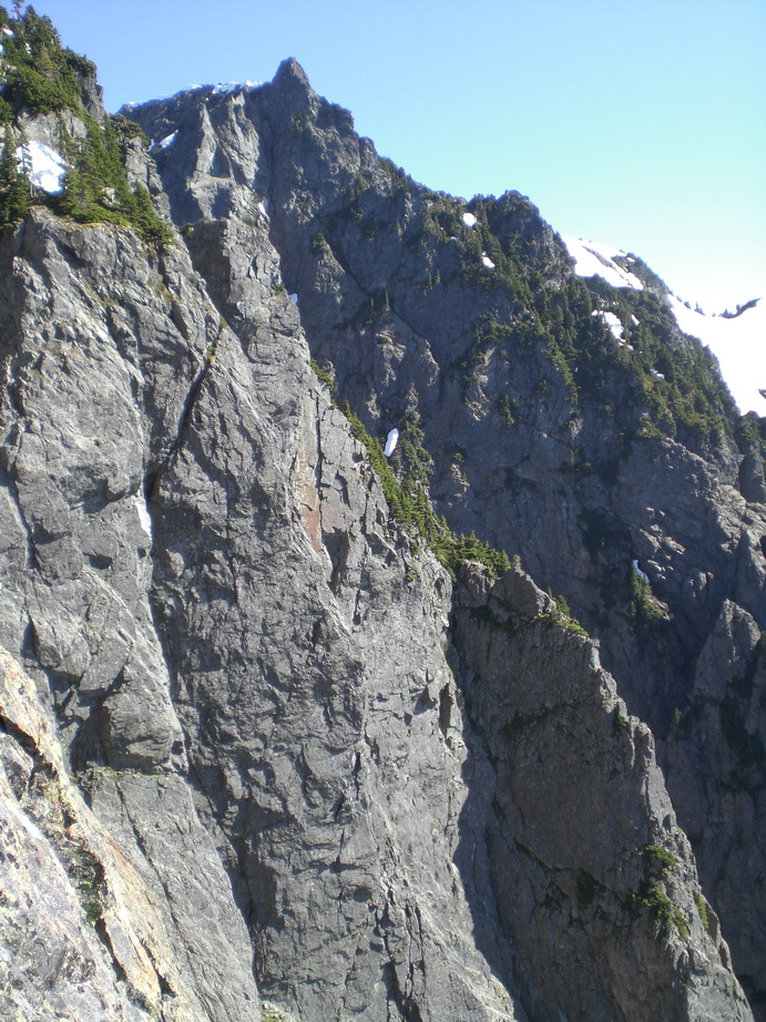
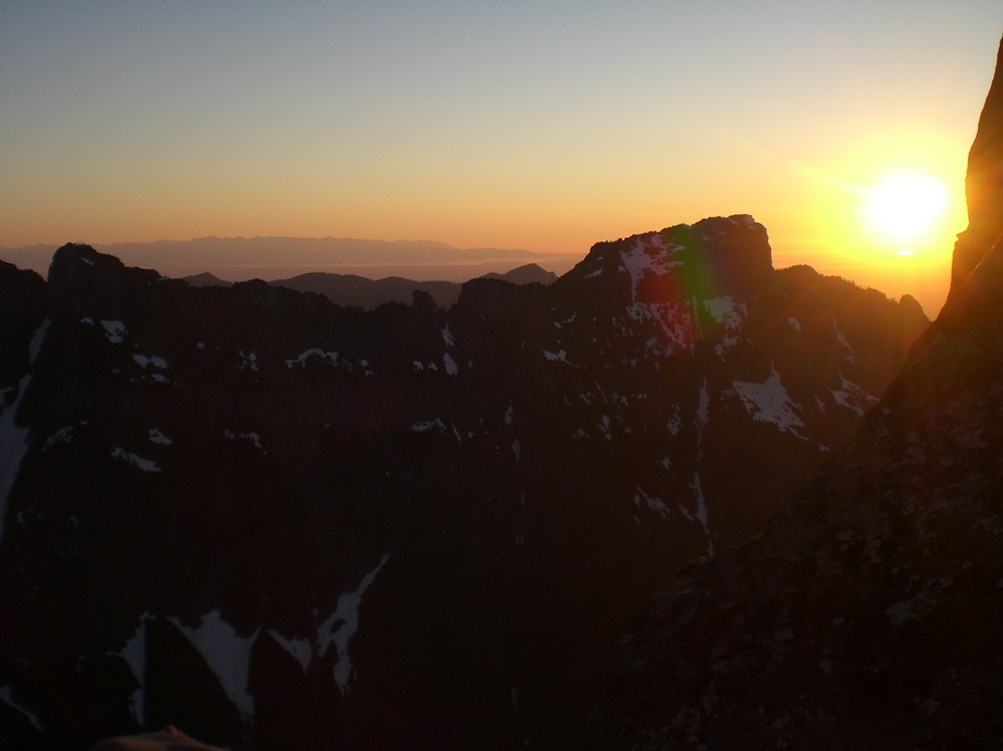
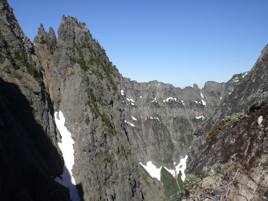
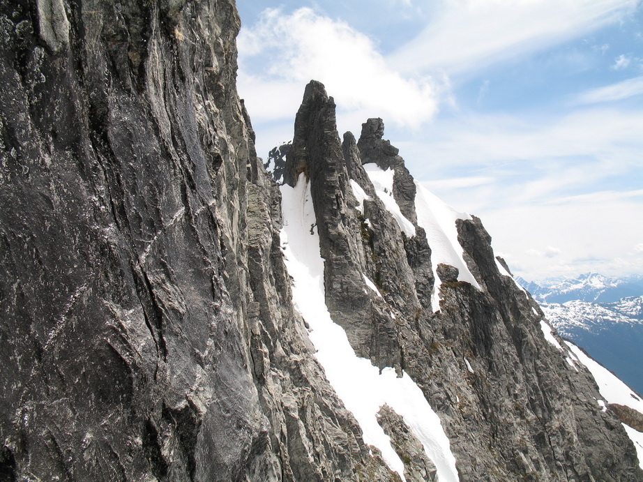
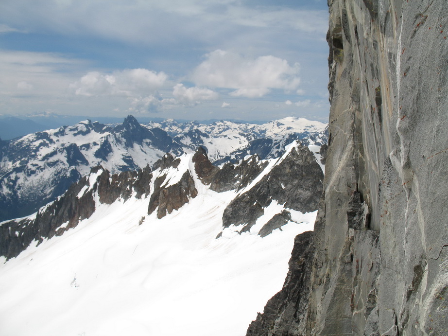
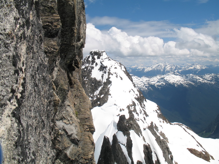
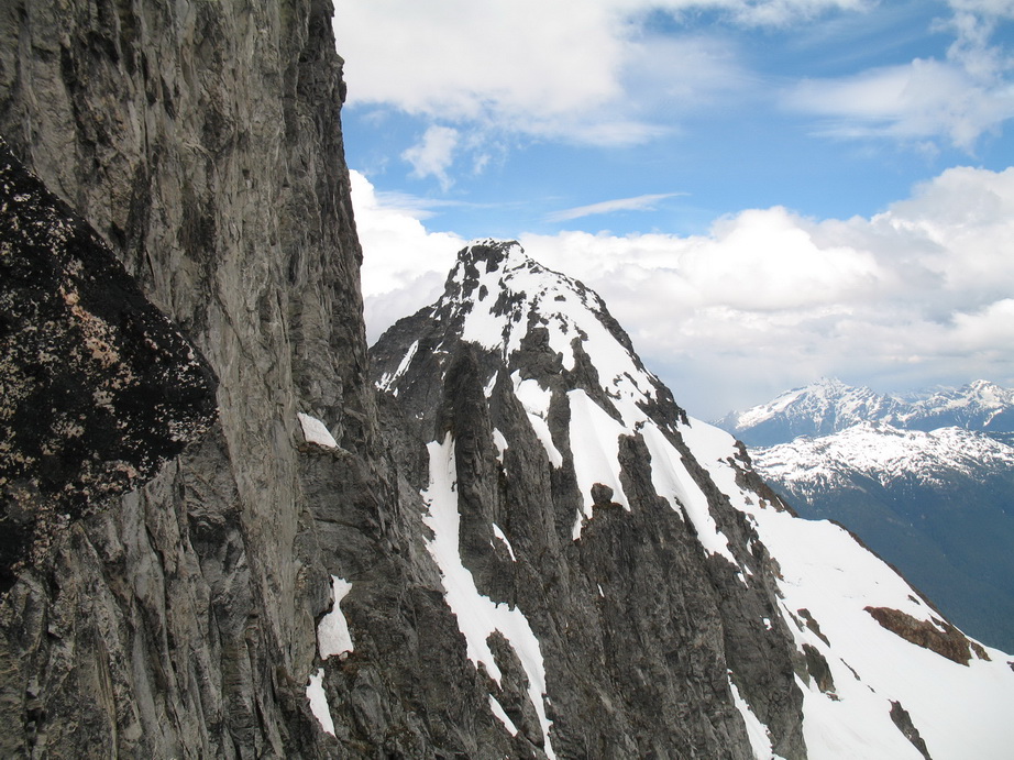
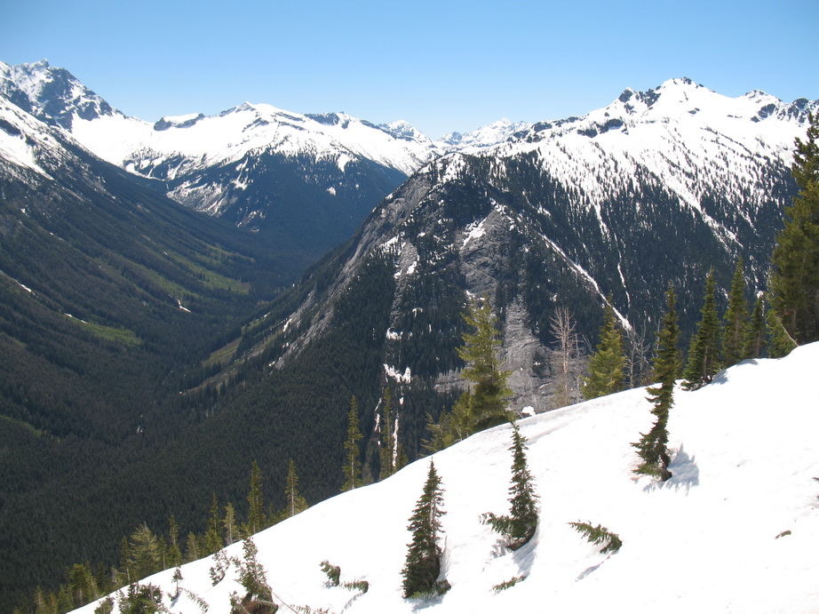
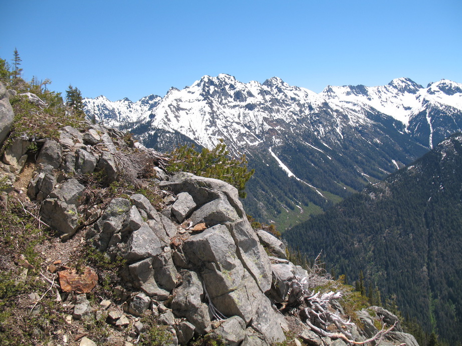
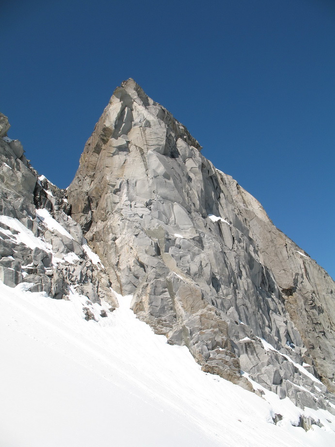
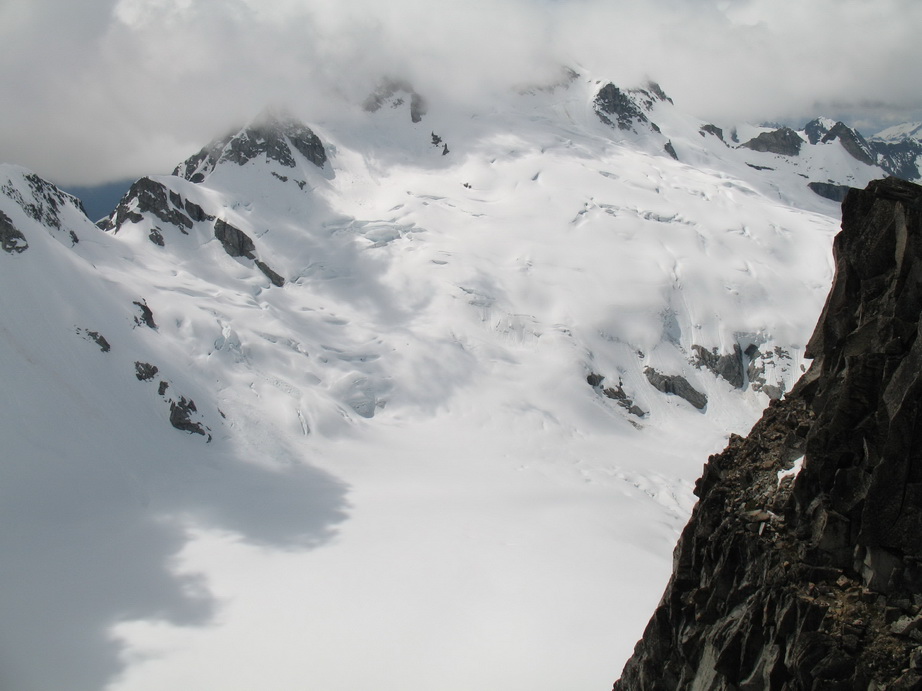
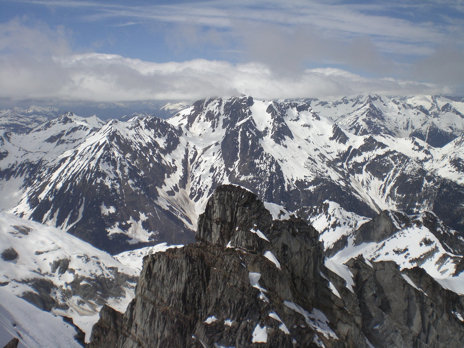
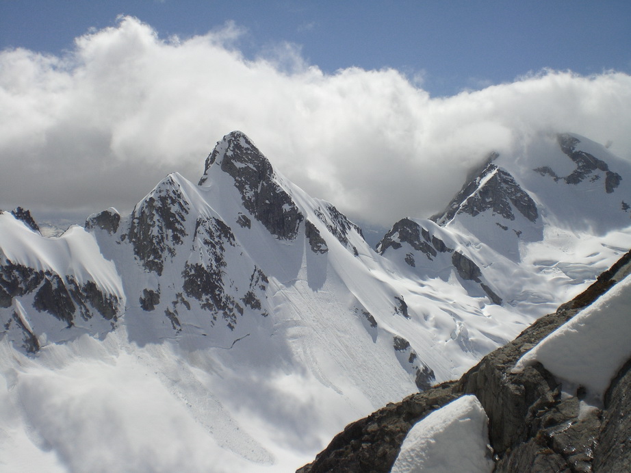
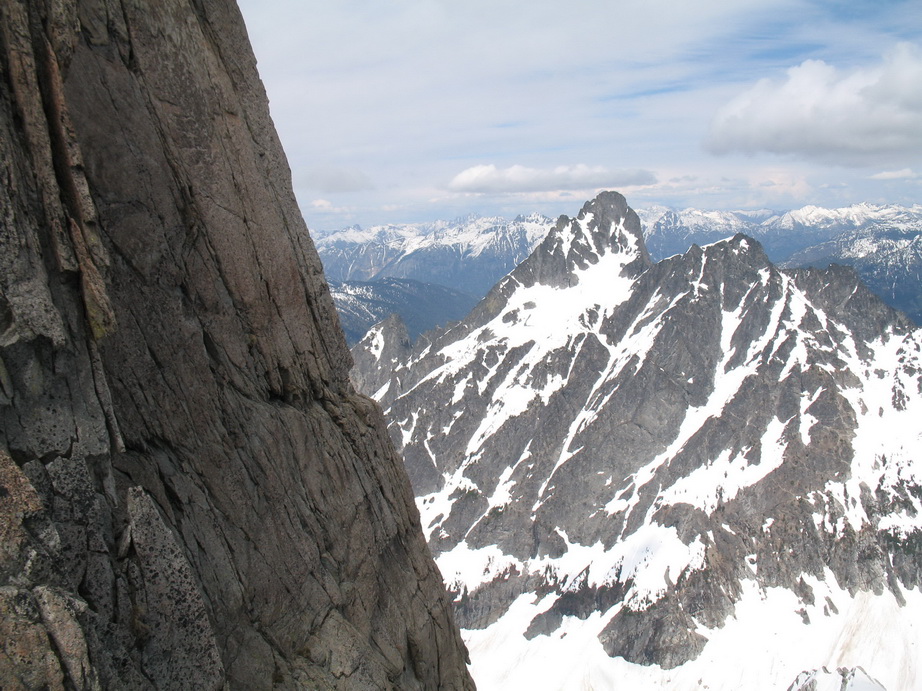
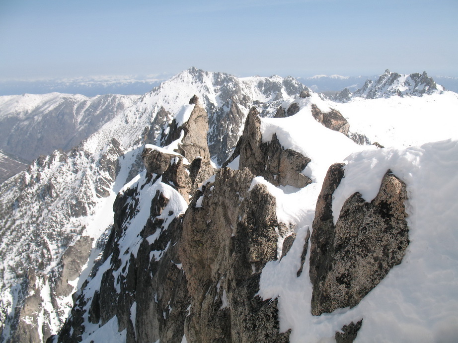
Once on the false summit, we traversed class 3 terrain to the true summit. The views from the summit are amazing, revealing a huge jumble of jagged rock and steep, relentless and incredible cliffs. The traverse to the Middle summit looked improbable at best – very steep, very rugged everywhere. We looked for a summit register, but could not find one. We stayed for about 15 minutes on the summit drinking water, eating, and enjoying the impressive views.

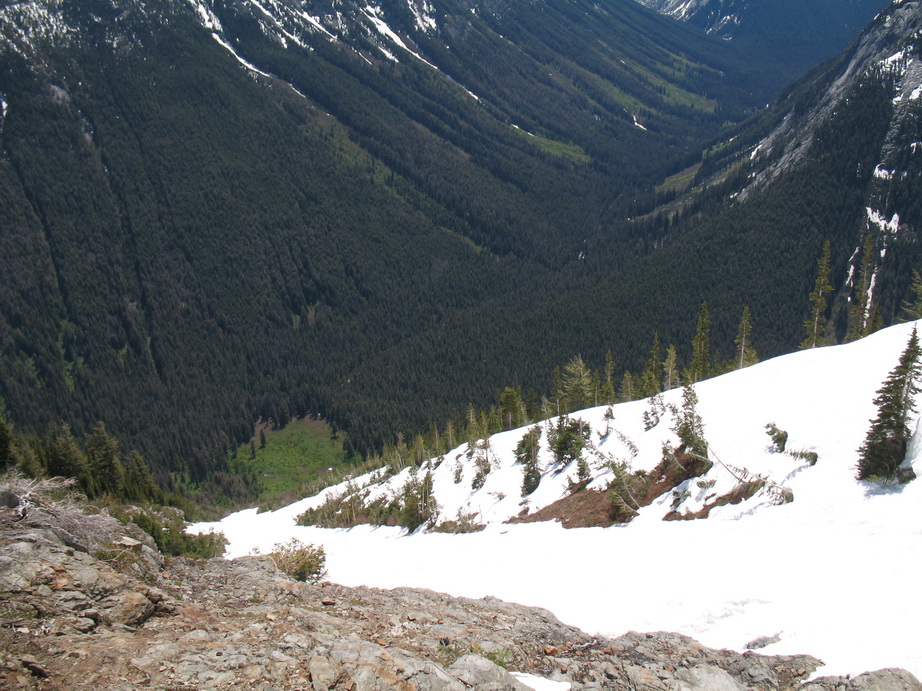
Looking down more than 4000’ to the valley below.
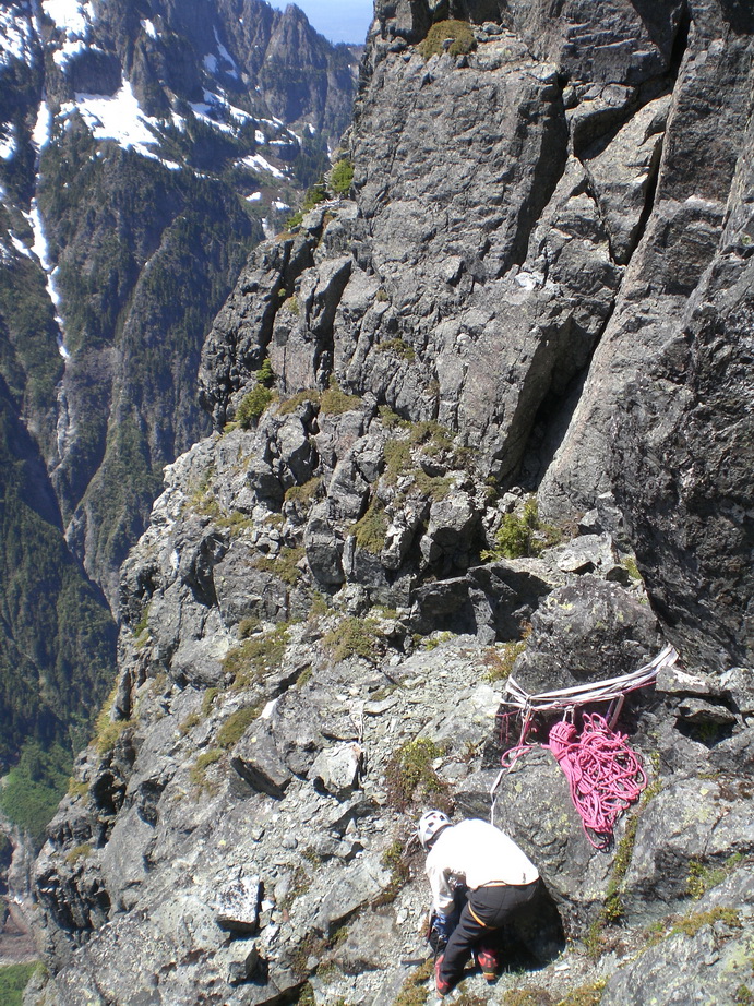
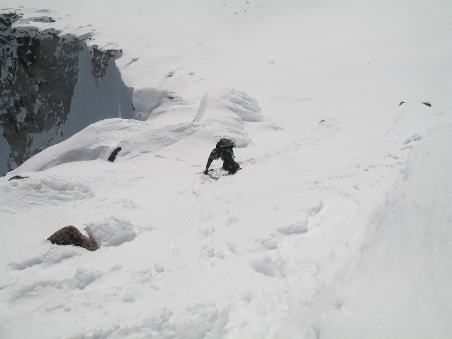
Wayne readying the rappel. Notice the old tat behind. None of it was fresher than 5 years old.
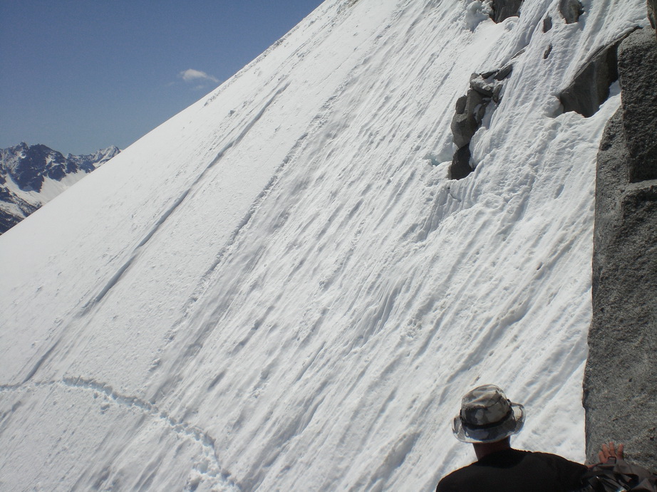
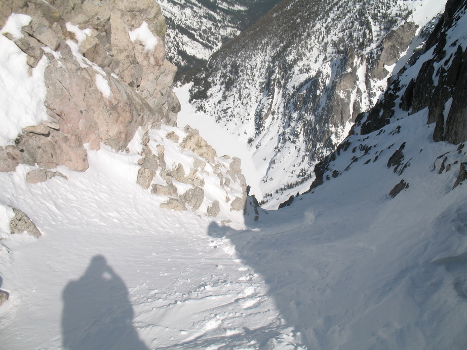
Steep traversing.
Wayne rappeling on the way to Middle Peak.
More downclimbing.
Gorgeous.
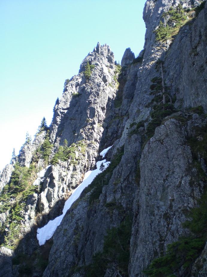
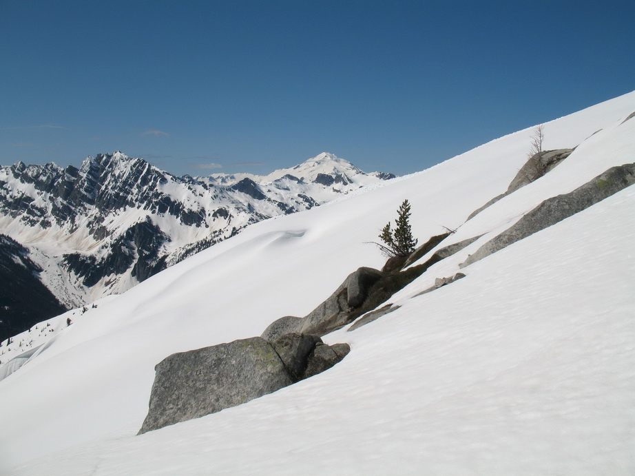
Views along the traverse from N to Middle Peak.
Relief
...
A long way down.
A view of the Middle Peak from the traverse.
Wayne on the ridge crest.
Good grief, more relief!
Wayne.
Middle to Main.
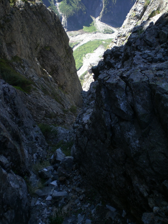
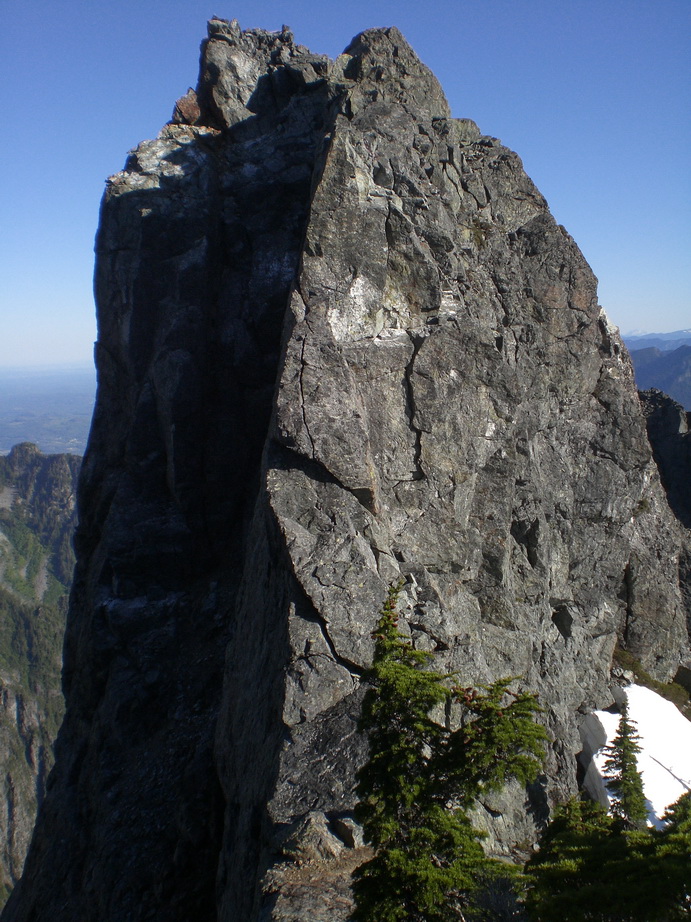
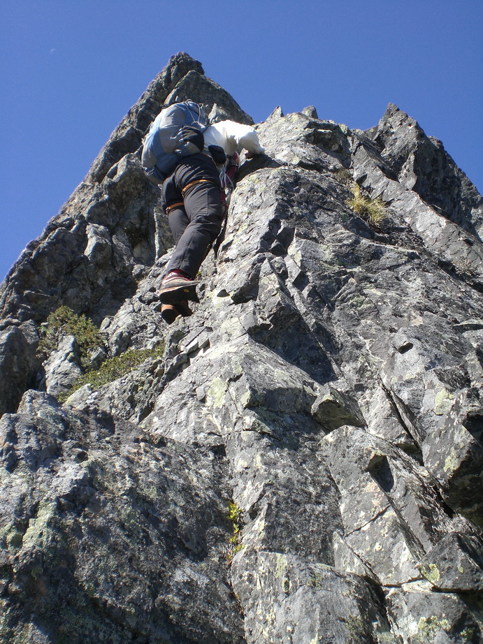
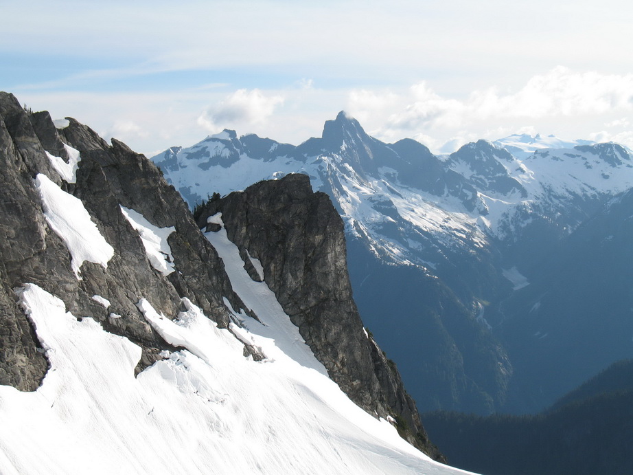
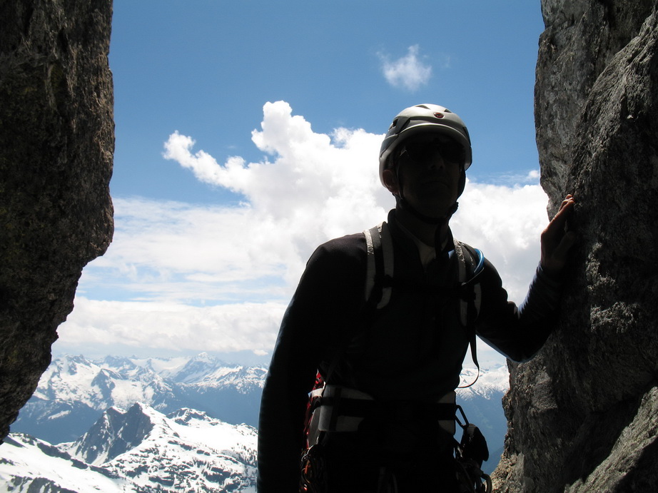
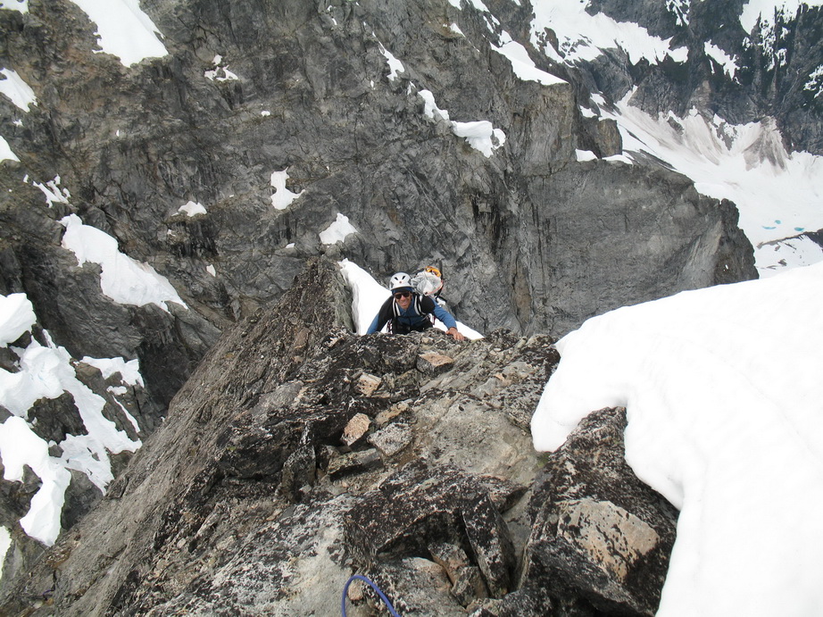
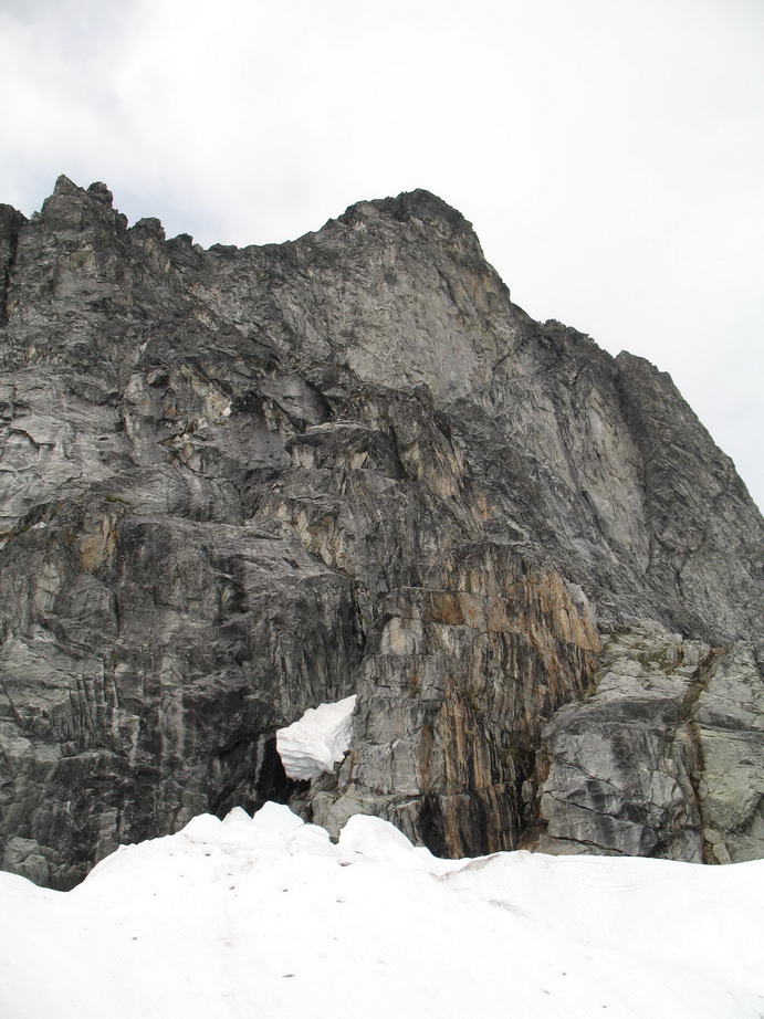
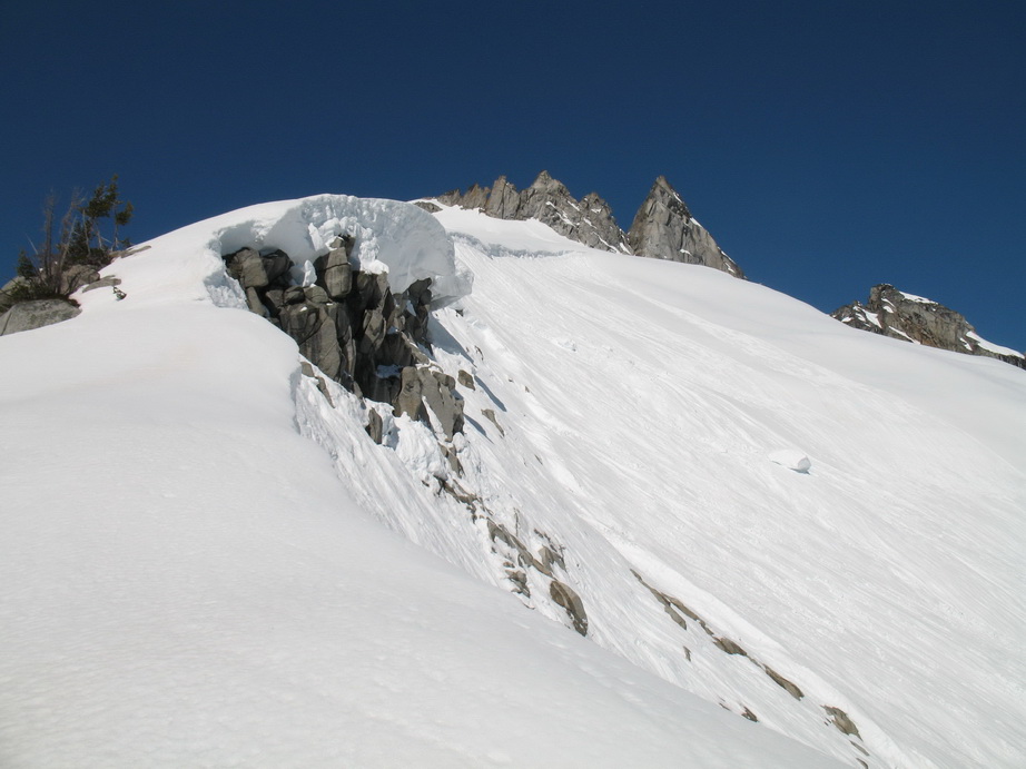
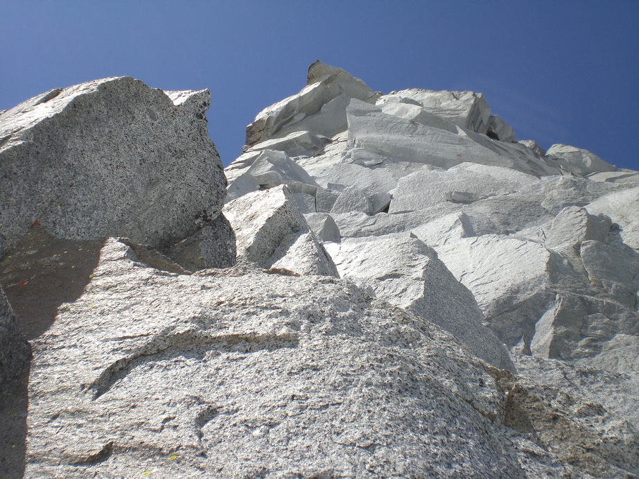
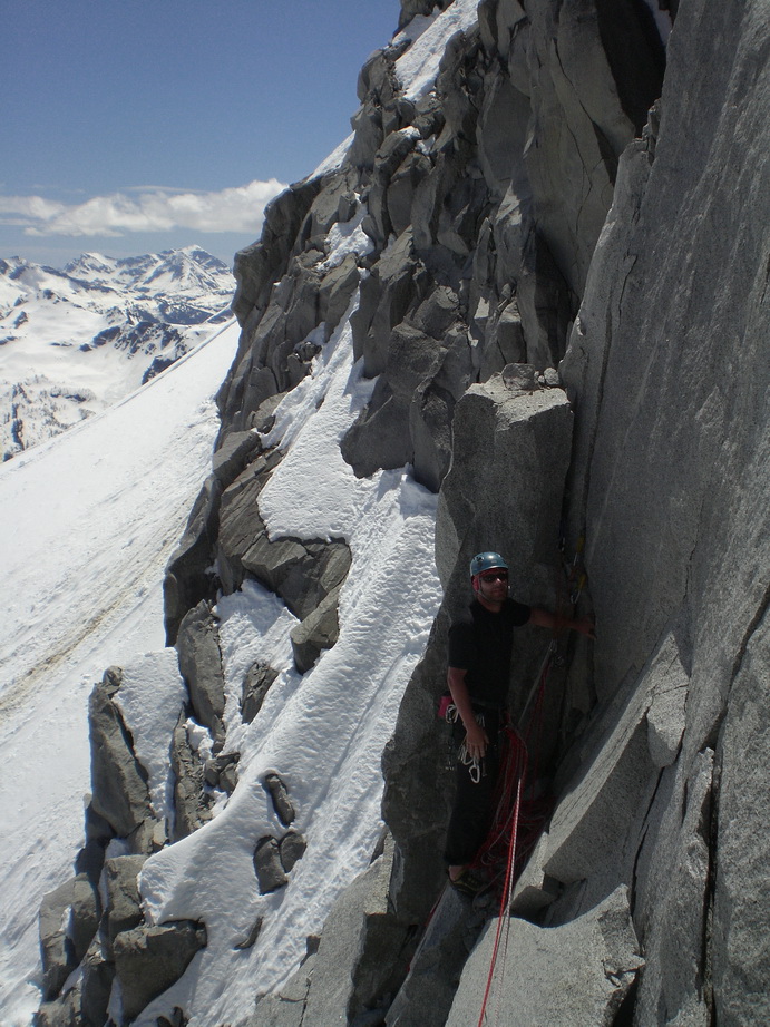
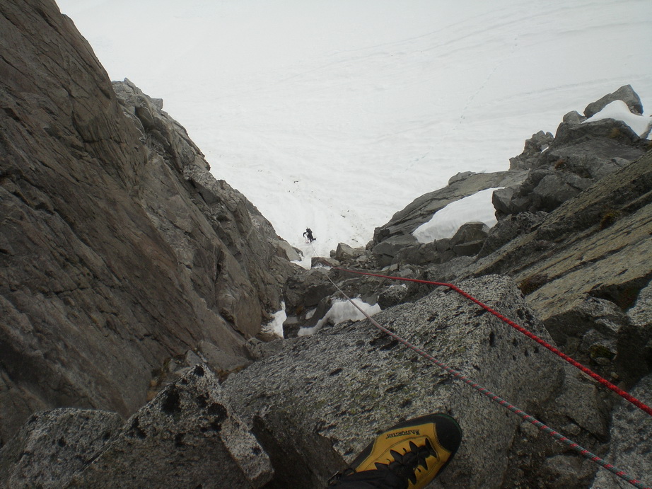
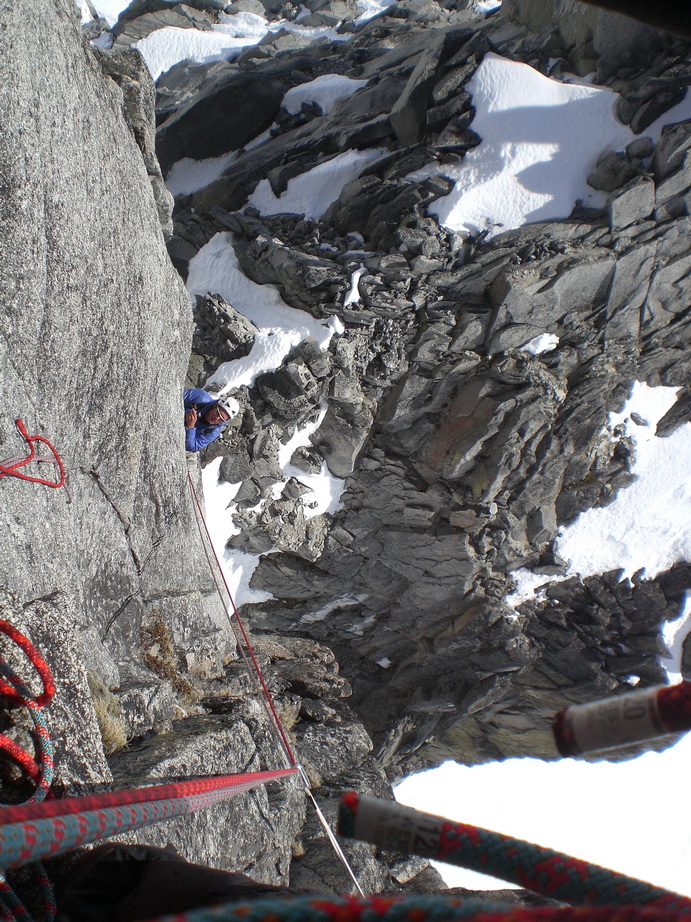
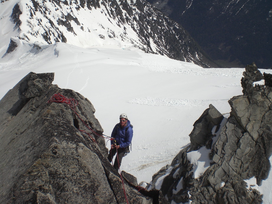
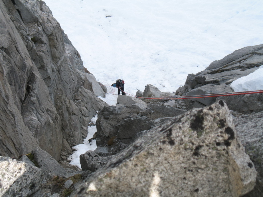
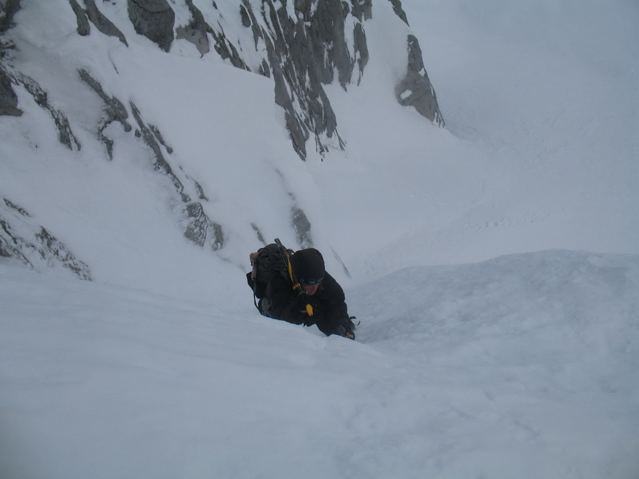
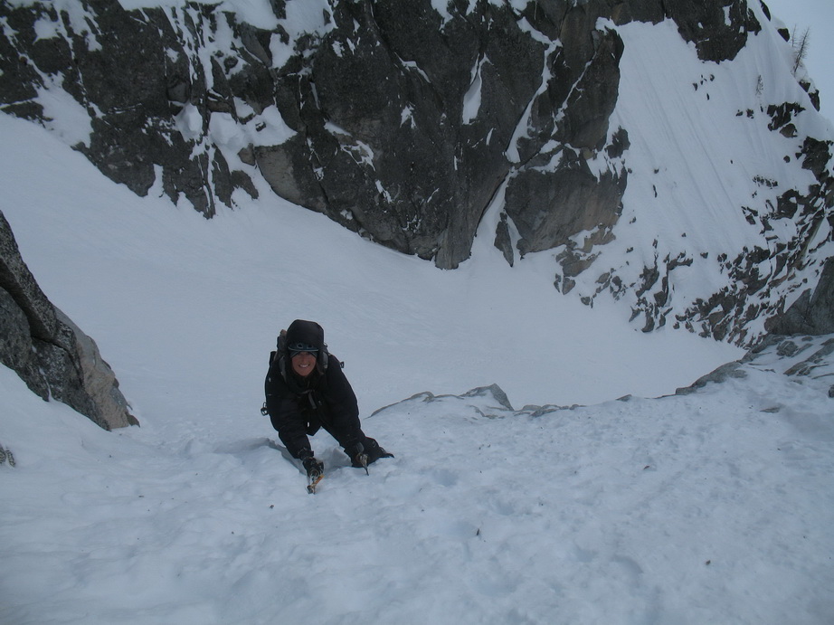
Soon we were packed up and heading down towards the Middle Peak. We descended about 200’ of class 3 into a W-facing fully. From here, we found a ledge that traversed around to the SW side of the 1st gendarme below the N summit. From here, we made a very committing rappel into the abyss. Rigorous routefinding ensued and after three more rappels and quite a bit of downclimbing, we finally made it to the intimidating N-Middle notch. It is hard to describe the ruggedness of the N-middle notch. Vertical walls surround and drop away 4500’ to the valley bottom. Of all the places I’ve been in the mountains, this is one of the most rugged places I’ve been.
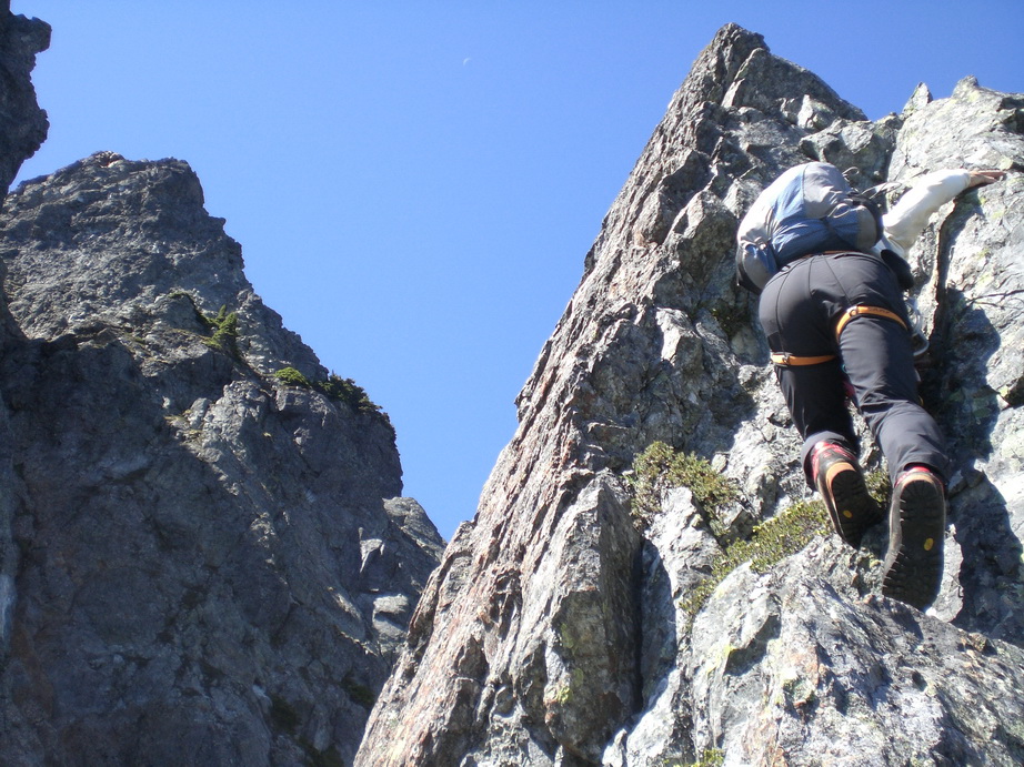
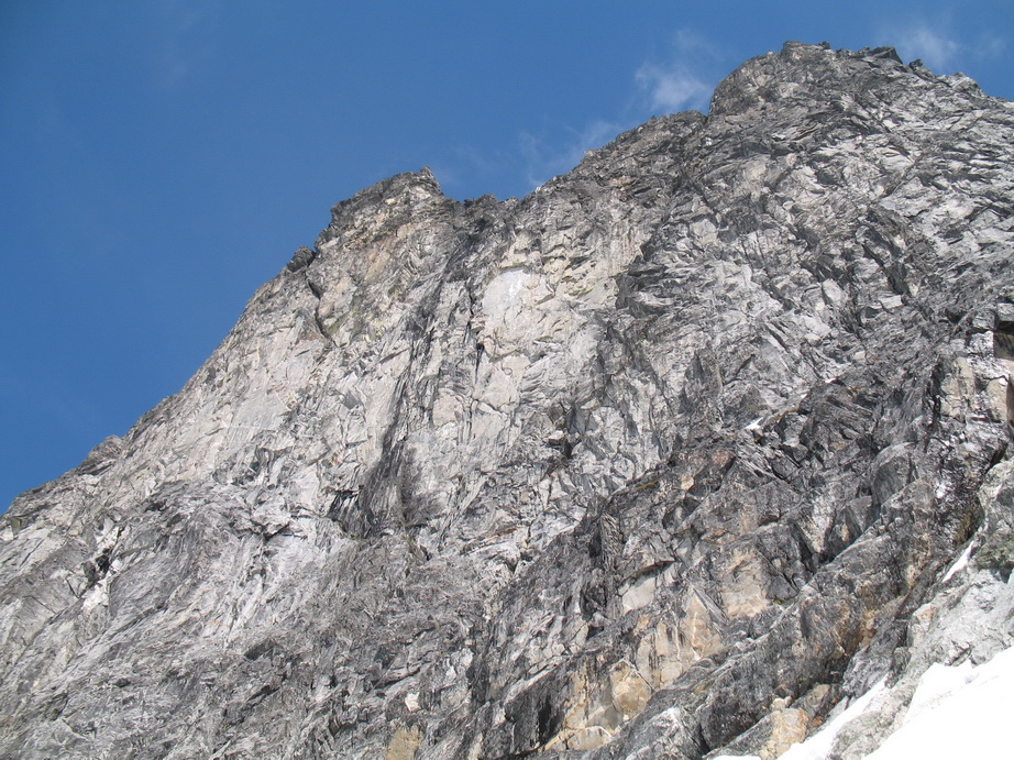
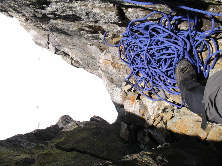
From here, we didn’t have a whole lot of info on what to do next, but a steep wall directly in front of us looked like it might offer a good route. Wayne led off (thanks Wayne) up mid-fifth rock with sparse pro (solid, but few fractures). After about 50’ of climbing, we came to an overhang. The overhang looked difficult, so we descended about 20’ and gained a gully system to climber’s right. Super sketchy, fairly sustained and difficult climbing ensued (~5.9) under sparse pro. This pitch was a full 60m and we were glad to have our ‘A’ game on this day.
After this pitch, we worked our way up and over a gendarme, before dropping down to a most perfect bivy platform on a flat slab between the two summits of Middle. The views from here were amazing, and we we fortunate to get a lot of time before the sun set to enjoy them.
Sunset from our bivy spot.
The view to the N from our Bivy.
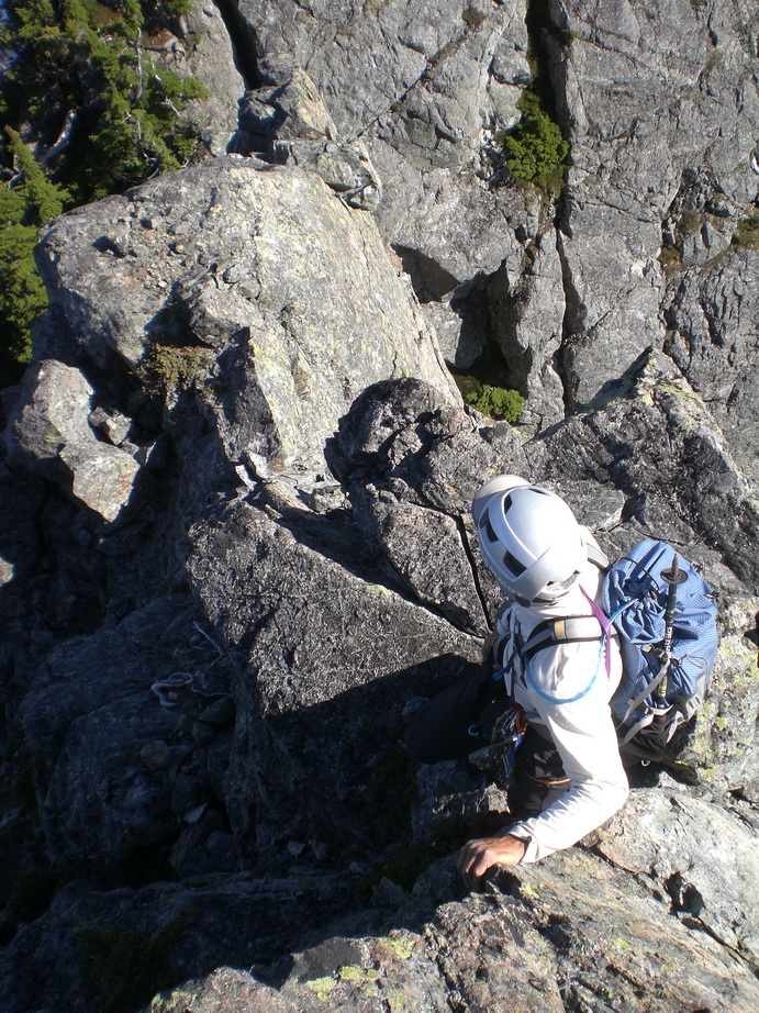
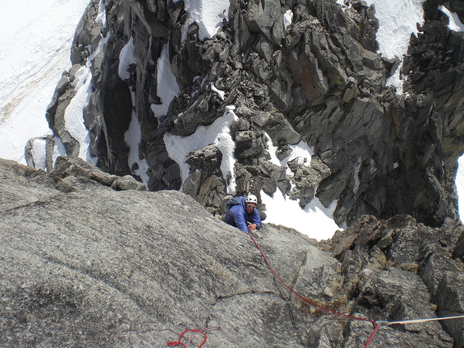
This morning we were moving by 7:45 and summited Middle via some involved routefinding, but generally staying E of the crest. We found two summit registers on Middle Peak, one from Don Goodman and Chris Robertson in 2004, and one buried below the summit rocks in an old Kodak film cannister.
Routefinding our way to the Middle Summit.
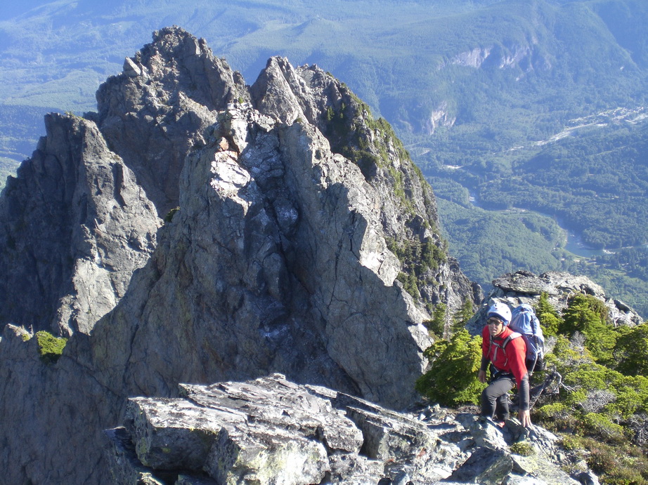
Wayne approaching the summit of Middle Index.
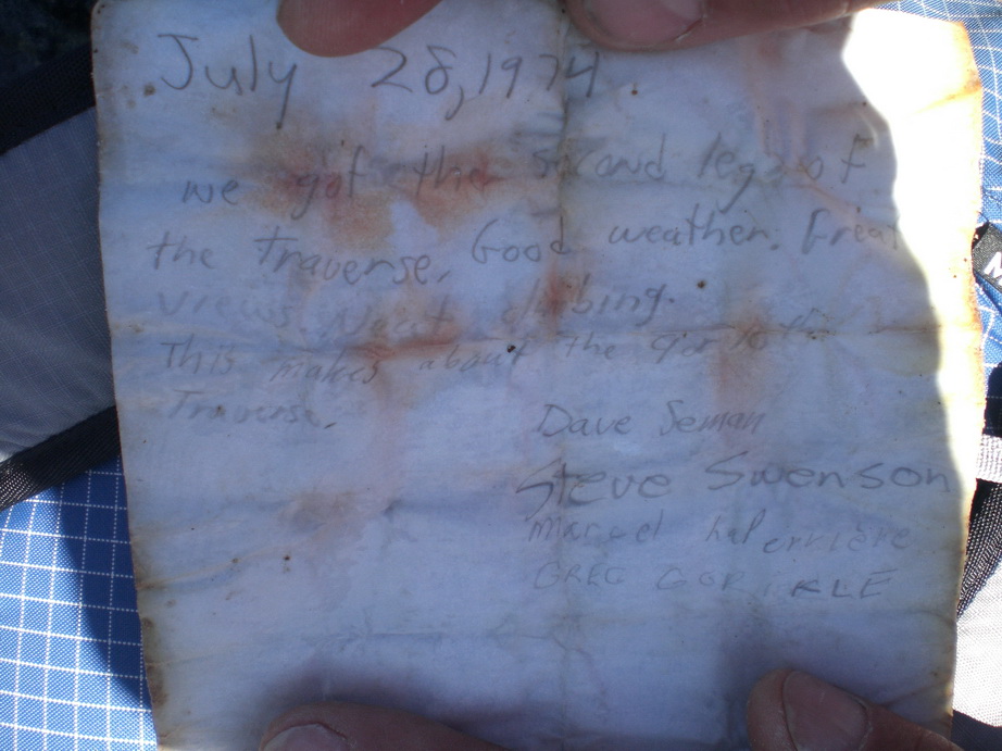
Steve who?
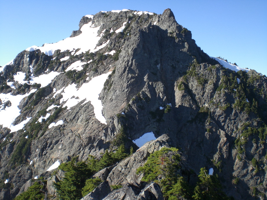
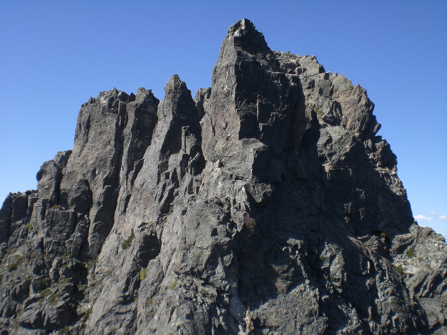
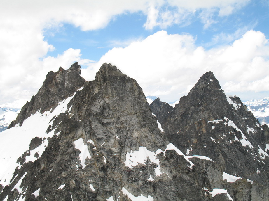
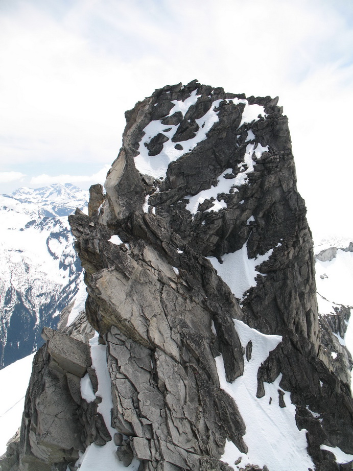
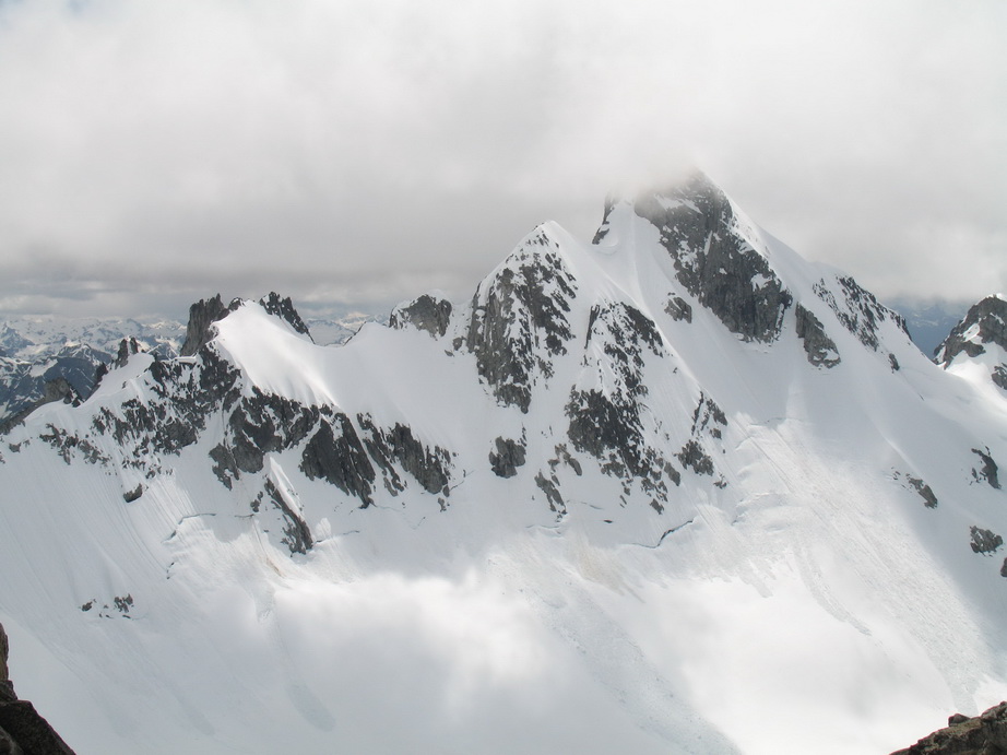
The Main Peak as seen from Middle Index.
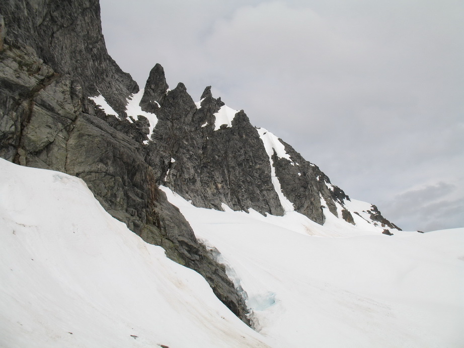
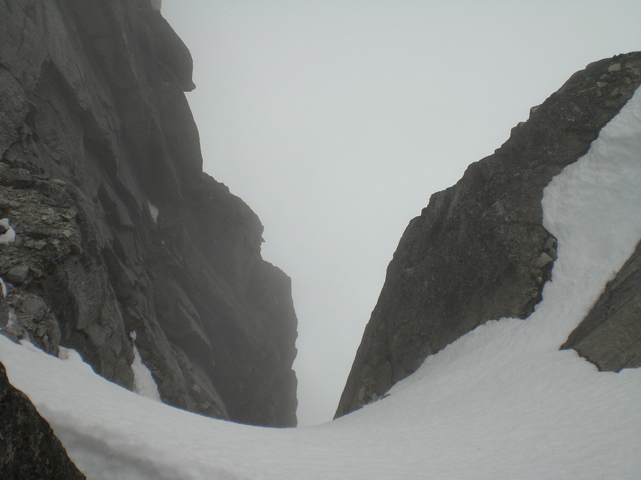
From the Middle peak, the terrain doesn’t relent one bit, and we were once again working hard to find a good route. It seemed like there were seldom ever two ways to climb something, it’s either you find the magic door or you don’t. We wound up mainly downclimbing Middle Peak, but did a few raps too. We found running water here.
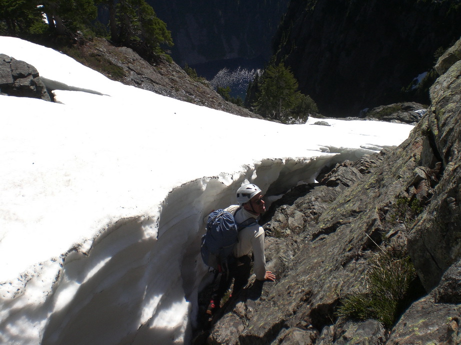
A little moat crawling between Middle and Main.
Running water below Middle and Main.
Wayne on solid rock.
Wow!

Lake Serene framed through the gap.
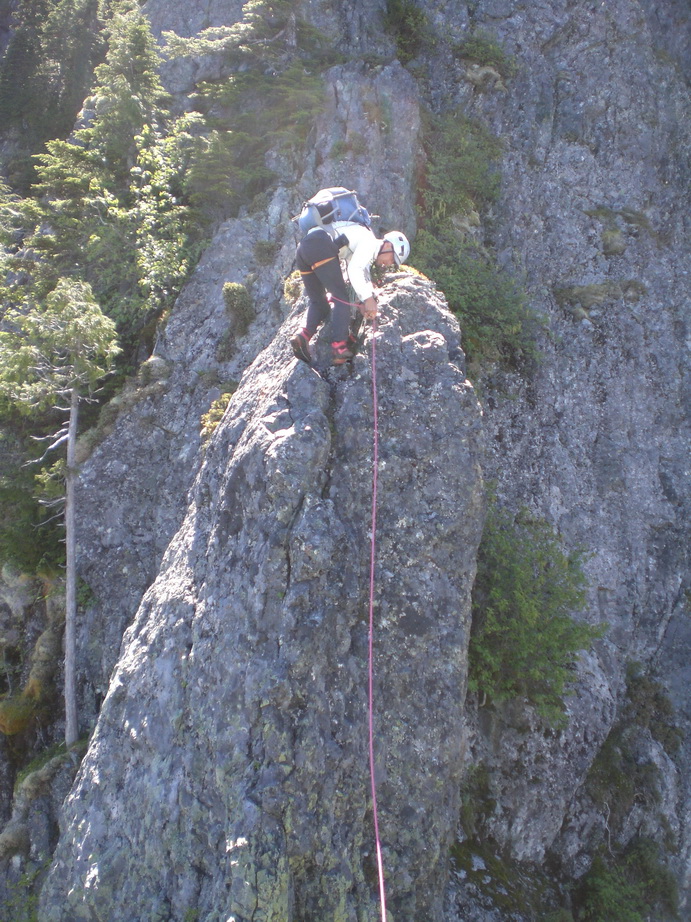
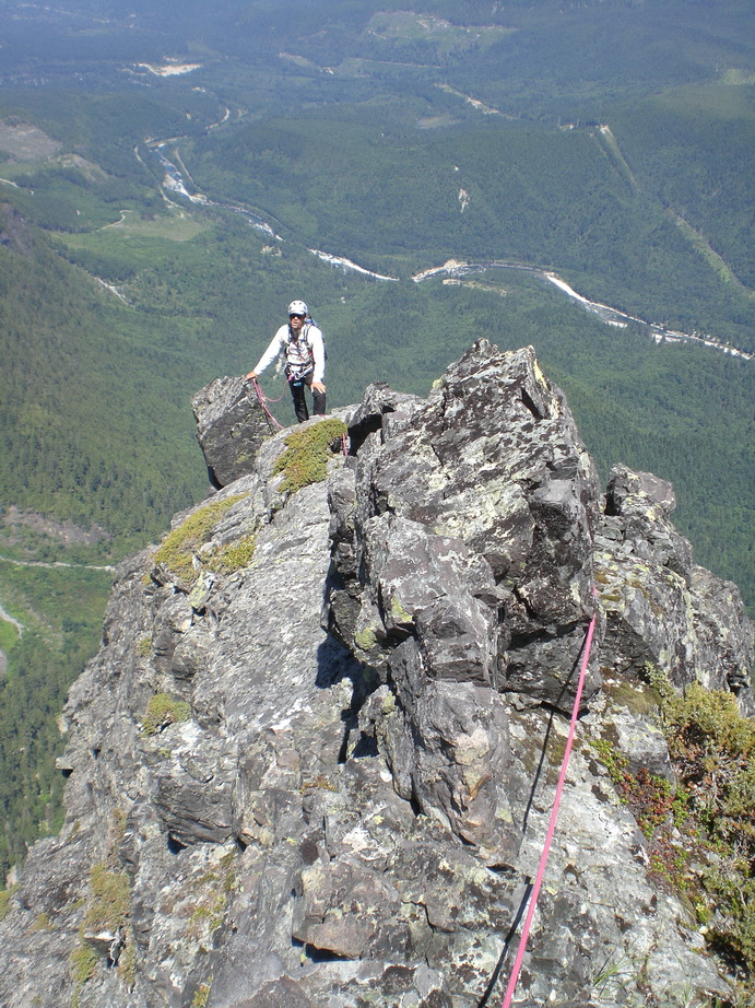
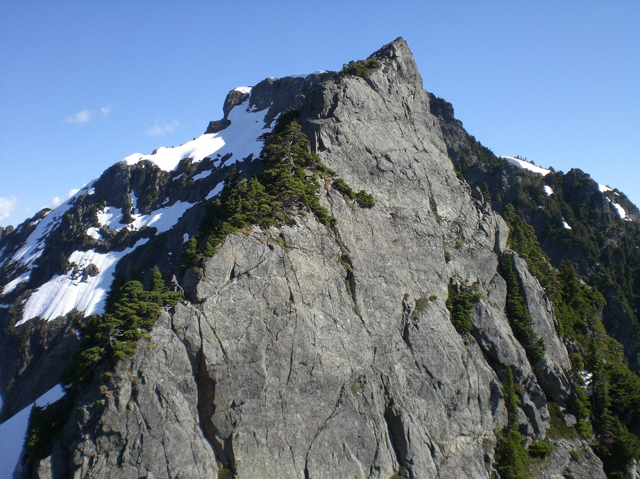
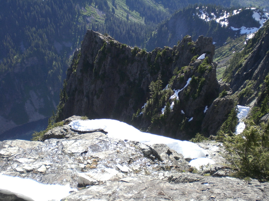
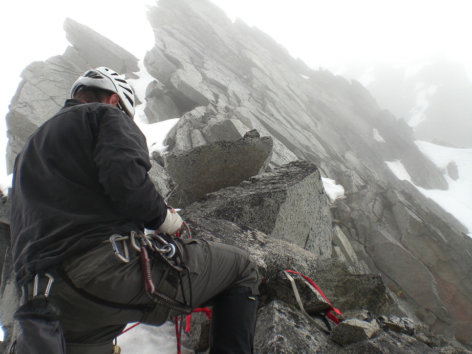
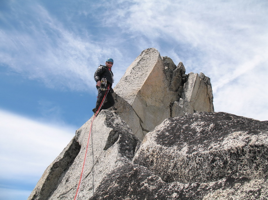
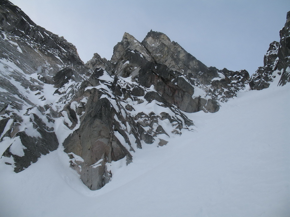
The last notch between Middle and Main is also in an amazing position, and the views are unbelievable. Here, we climbed up and left on relatively easy rock (5.5), and then up again to a belay. From here, we stayed on the crest of the Wedge Gendarme until we could climb up and right towards a prominent gully on climber’s right. We crossed the gully high on a loose bench, then continued on up steep heather slopes to the summit of Main.
Traversing ledges below Main.
More enjoyable climbing on solid rock.
A look back at Middle from Main.
More solid rock!
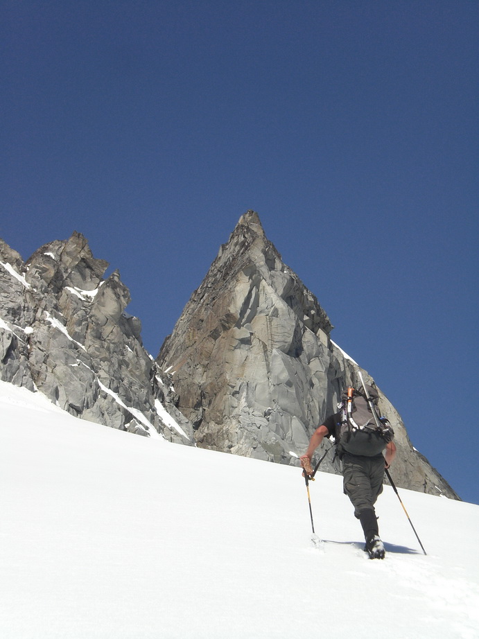
 Wayne approaching the summit of Main Index.
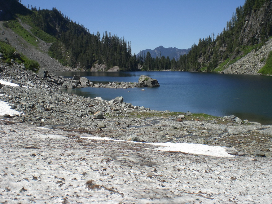
One last look at beautiful Lake Serene.
This traverse epitomizes (to me) the ruggedness the Cascade Range has to offer. It is unbelievable to me that the first ascentionists ventured onto this traverse with archaic gear and no information whatsoever, not even the knowledge that the route would go. It is an extremely impressive alpine route – one that will test every skill you have.
The trip out to the car was hot, but we eventually made it. Thanks to Wayne (again) for being such a great partner.
-
 1
1
-
-
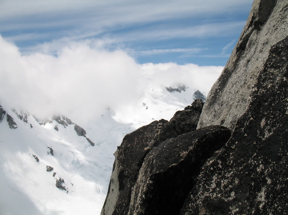
Trip: Southern Pickets - Inspiration Peak - South Face
Date: 6/23/2010
Trip Report:
Inspiration Peak – South Face - June 22-23, 2010
You know it’s not going to be a dull trip when your backup plan is the South Face of Inspiration Peak.
Wayne Wallace and I linked up for a great trip into the Southern Pickets on Tuesday.
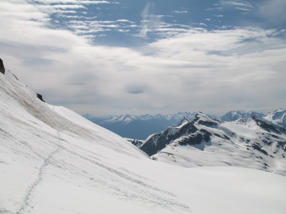
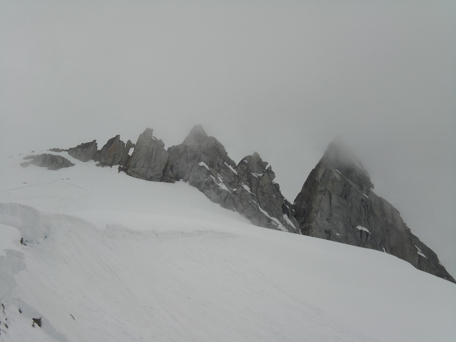
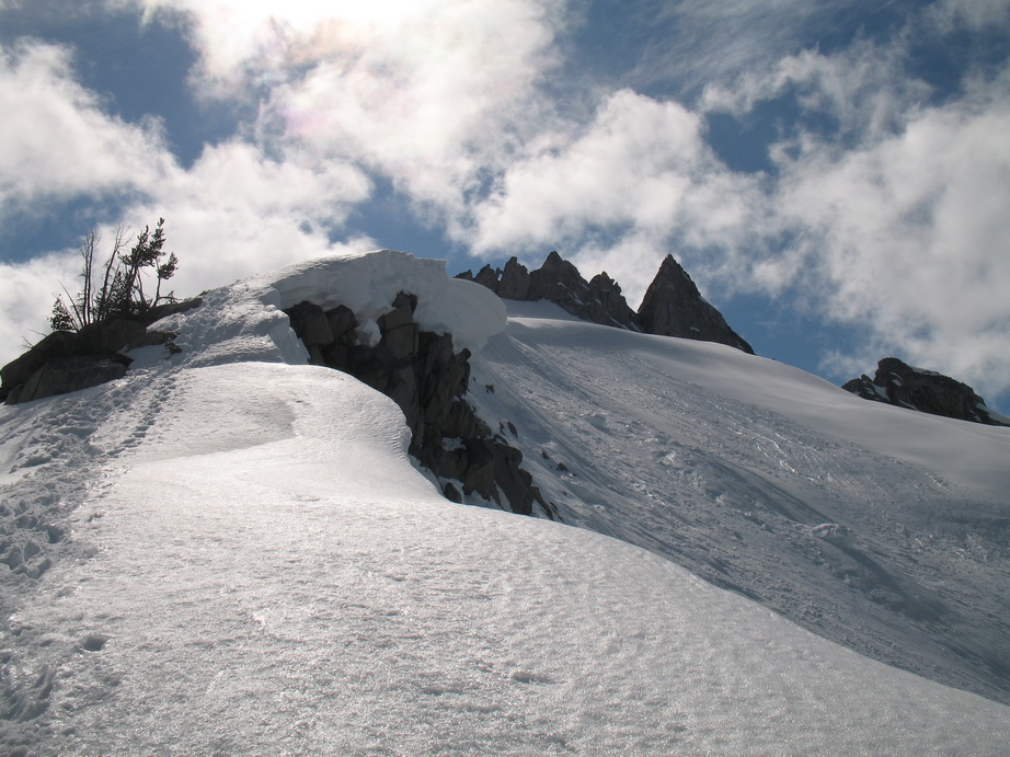
The approach to Terror Cirque was fairly straightforward, thanks to recent work on the trail. We hit solid snow at about 4800’. Snow conditions varied from consolidated down low, to 8-12” of mush over aging spring snowpack up high. Recent fresh snows followed by warm days have made the snowpack very water-logged. Postholing was a nuisance and our boots were soaked by the time we got into camp below Pt. 6484 (6.5 hours, 6200' gain, 8.5 miles). The weather was pleasant in the afternoon, with mostly sunny skies and moderate temps. We lounged around camp taking photos and eating, then headed to bed fairly early.
Clouds blowing over the Southern Pickets.
Mt. Triumph from camp.
The next morning, we awoke to warm temperatures and soft snow. Our initial objective was out of the question, so we went to plan B – the South Face of Inspiration Peak.
The imposing South Face of Inspiration Peak.
Views from the Terror Glacier.

Approaching Inspiration Peak.
It took about 2 hours to get to the base of the route, after a late start from camp. We were able to take a rather direct line up to the start of the route thanks to a class 4 cliffband. Otherwise, we would have had to make a long end run around crevasses.
Drips coming down the center portion of Inspiration Peak’s South Face.
Once at the base of the face, we got off the snow via a fairly sketchy snowbridge (the moat is deep here), onto slabby rock. We went up here, then left to gain a ramp system. We followed the ramp for about 2 pitches before the final chimney. We pitched out the chimney in 2 pitches and encountered serious, loose and exposed climbing on broken, often wet rock with marginal pro (to ~5.9). In total we pitched out 6 pitches, of which Wayne led 5. We were both wearing mountaineering boots and packs which added to the difficulty of the route. Wayne did a solid job leading the wet crux pitches. Thanks, Wayne.
The ramp system up the lower portion of the face.
Looking E from midway up the face.
Wayne getting ready to belay me up the next pitch.

Me leading one of the ramp pitches.

Wayne coming up the final bit of ramp to the belay.
More ramp climbing.
Views from the route.

Me in the lower chimney.
Wayne framed in the chimney, just before the last chimney pitch.
Looking down from the belay in the chimney.

Why do they call this a 'squeeze chimney'?
W McMillan Spire.
 Wayne approaching the summit of Inspiration Peak.
Me on the summit of Inspiration Peak.
Degenhardt, Pyramid, and Terror Peaks from the summit of Inspiration Peak.
We topped out at about 1:15PM, and made 12 single rope rappels (one of which was entirely free-hanging) down the W Ridge. Huge chunks of hanging blocks of snow were bombarding the W Ridge gully as we descended, so we obviously chose to avoid it.
Wayne rappeling down the W Ridge.
These huge blocks of snow kept collapsing as we descended. We were safely out of their path.
W McMillan Spire from the descent.

Free-hanging rappel.
One last look at the face.
A parting shot.
Back to the tent to grab our things around 5:30, then packed up and headed out by 6:30. We got back to the car at 11pm after 17 hours on the move. Rather than drive home in our condition, we decided to bivy at the TH and drive out this morning.
This was a serious climb on a large, steep face with challenging routefinding and exhilarating, exposed climbing. Definitely a worthwhile plan B!
Thanks to Wayne for being a solid partner. :up:
-
J,
The route highlighted in this TR is the way to go in my opinion. We hit maybe 400' of brush. Follow the streambed on its left side until you gain a grassy rib. Of the three times I've been in there, this was the sweet spot.
PS.. the route penciled in above is approximate. Stay left (within earshot) of the prominent streambed coming off the cliffs directly below the summit of ASA.
-
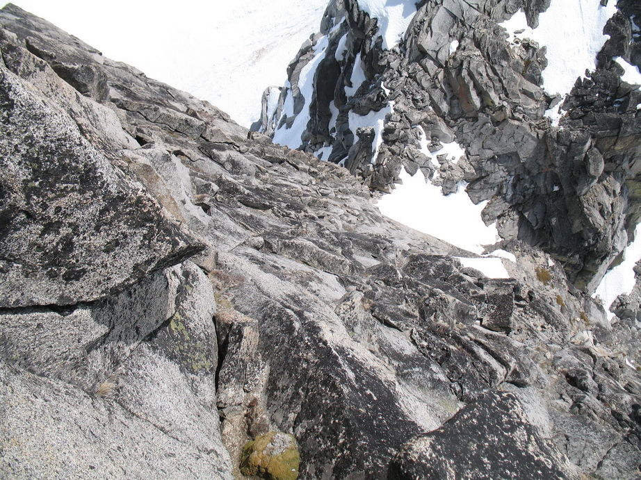
Trip: Gunsight Peak - S Face
Date: 6/17/2010
Trip Report:
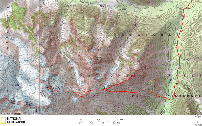
On June 11, Daniel Jeffrey and I made the trip to Stehekin en route to Gunsight Peak via Agnes and Spruce Creeks. Over a period of 7 days, we had a great adventure in one of the most beautiful areas in the North Cascades.
In the days leading up to our climb, the long-range forecast (although admittedly unreliable) called for pleasant weather for the next 7 days. As encouraging as the forecast was, the avalanche forecast was equally discouraging. NWAC had posted warnings of high to extreme avalanche danger between 7-8000’. Despite the NWAC forecast, and since I had been in the area twice before, we were confident we could navigate the terrain on the approach to Gunsight Peak safely. Daniel and I were excited to embark on a trip we had been planning for quite a while. We would take the boat up Lake Chelan to Stehekin, then ride a National Park Service shuttle to High Bridge, and finally hike 9 miles of forest followed by a 4500’ climb of steep, brushy terrain to a high camp at 7000’ along the Yew/Spruce Creek divide. From our high camp, we had hopes of climbing the obscure Asa Peak as well as several routes on Gunsight Peak, a peak consisting of some of the most solid, aesthetic rock in the range.
Route topo.
Day 1
The logistics involved with getting to Stehekin are somewhat of a hassle, but necessary for those wishing to explore this remote corner of the range. To begin with, one must take a two hour and forty-five minute ride on a passenger ferry from Field’s Point to Stehekin Landing. Once in Stehekin, a National Park Service shuttle delivers you up valley to High Bridge, where the trail up the West Fork of Agnes Creek begins. Nine miles and 1400’ later, you arrive at the relatively plush Swamp Creek Camp, one of many established sites for thru-hikers on the PCT.
After all was said and done, Daniel and I arrived in camp at 6PM, and we felt “jet-lagged” from the long trip. Along the trail, we narrowly escaped being smashed by a rogue windfallen tree that came crashing down onto the trail not 100 yards behind us. Thankful to survive an otherwise mundane approach, we got to bed early after eating dinner and sharing some spiced rum.
Day 2
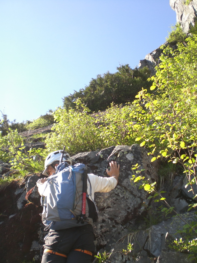
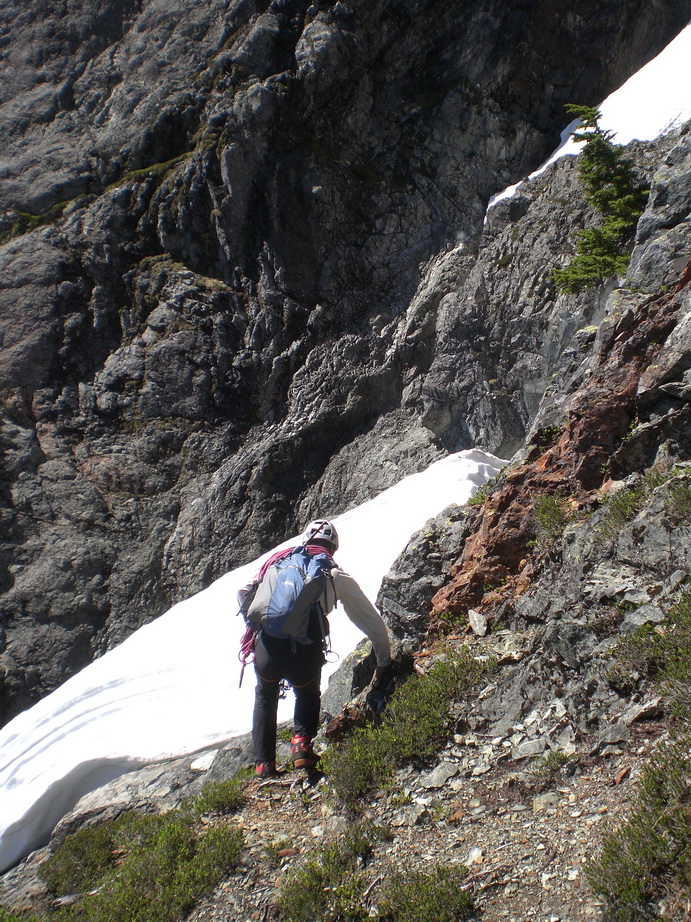
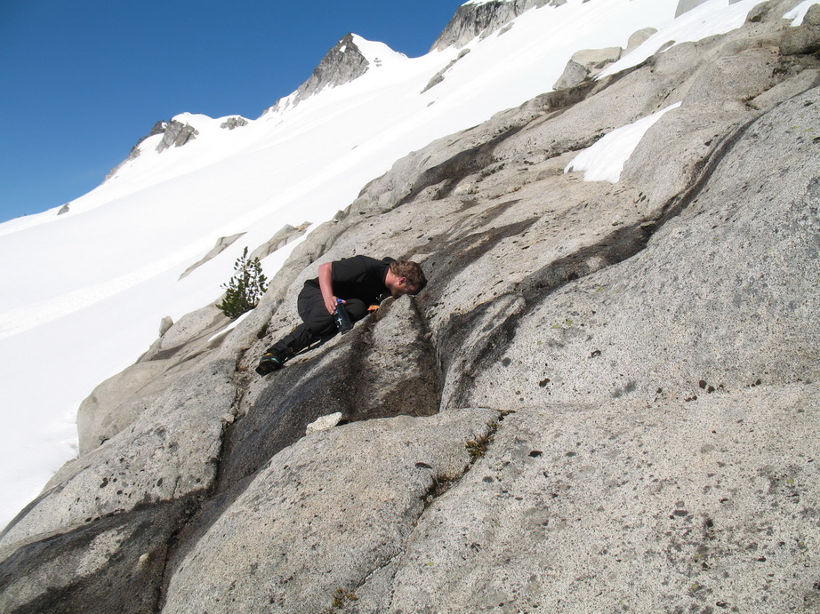
S Fork of Agnes creek was flowing heavily, but we were able to find a huge log to cross on about a 9 minute hike up the trail from Swamp Creek. Once on the other side, the brush stole the MP3 player right out of Daniel’s pocket. From the valley bottom, we worked up between two giant swaths of slide alder, within earshot (and climber’s left) of a small watercourse. There is no avoiding dense Slide Alder and Vine Maple here, you pretty much have to just dive in. We bushwhacked for about 400 vertical feet before breaking out into the open on a steep, grassy, slabby rib. From here, the brush all but ends.
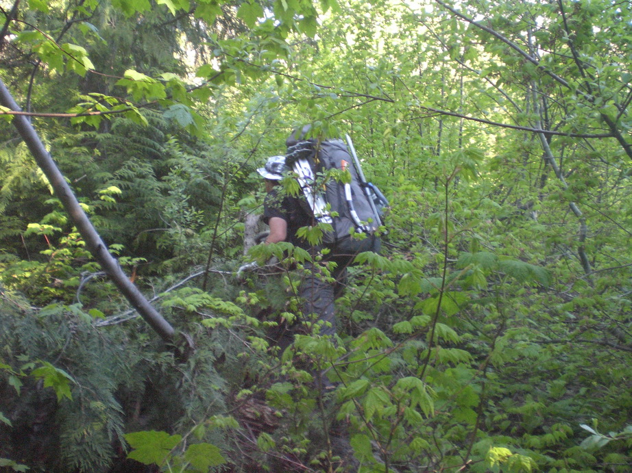
Typical Bushwhacking above Spruce Creek
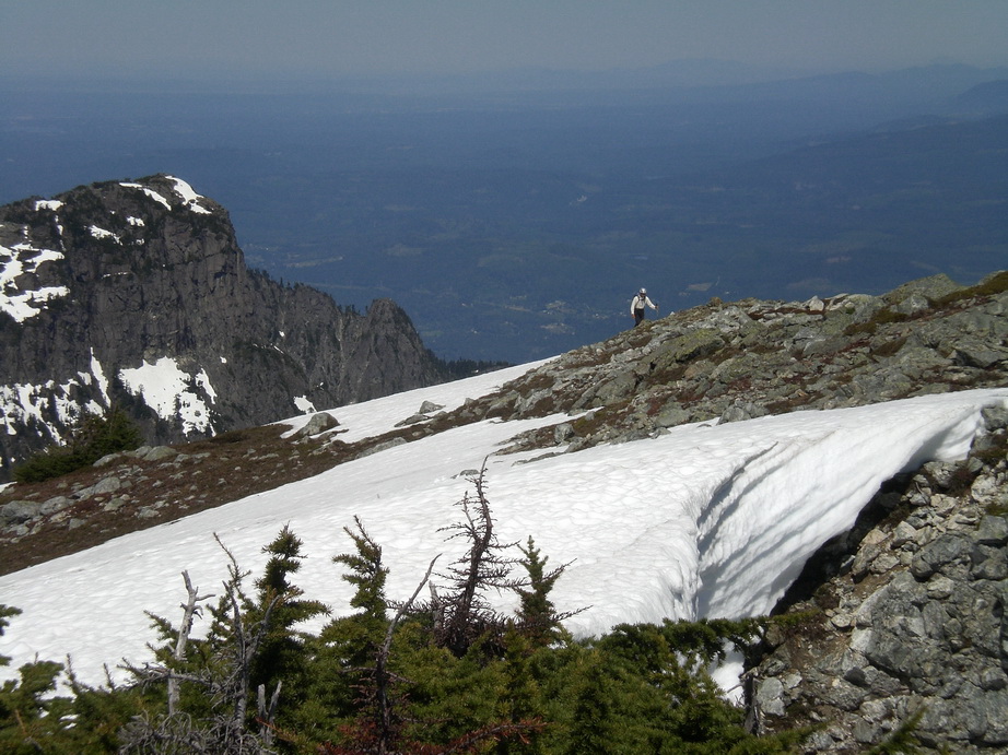
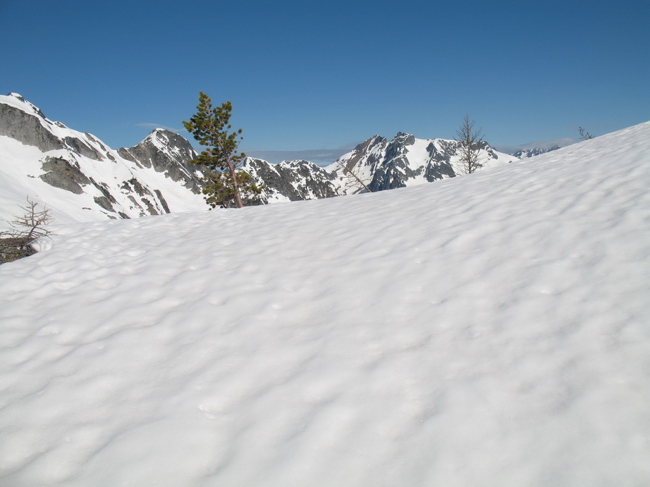
We ascended the rib as high as we could go before it enters cliffy terrain below ASA Peak. At the apex of the rib, we traversed left for about a mile below ASA Peak and the Yew/Spruce Creek divide, finally gaining the divide itself at the obvious saddle SE of Pt 7458. This would be our camp for the remainder of the trip.
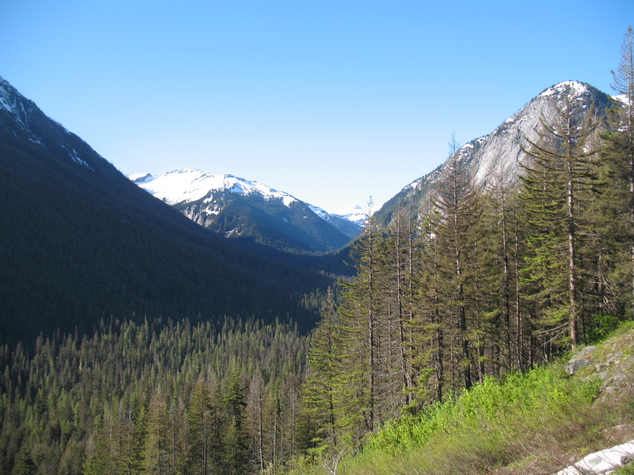
Views up the S Fork Agnes Creek valley.
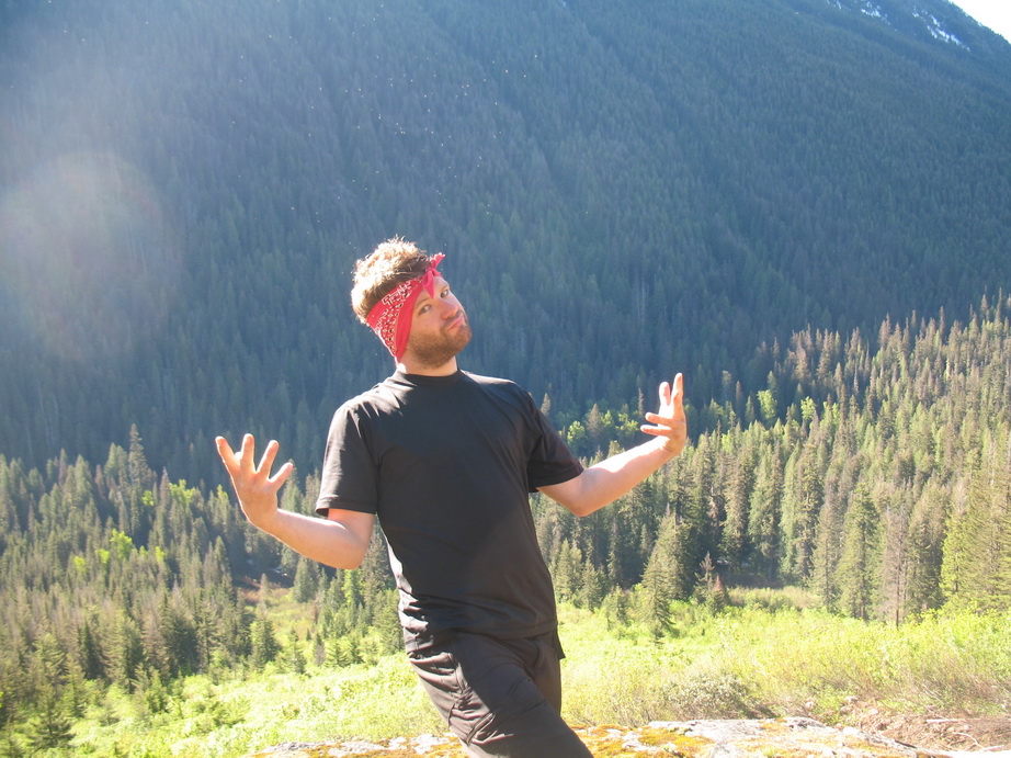
Daniel getting a little weird after bushwhacking through dense brush. Notice the plume of flies surrounding his head.
Getting into the snow now.
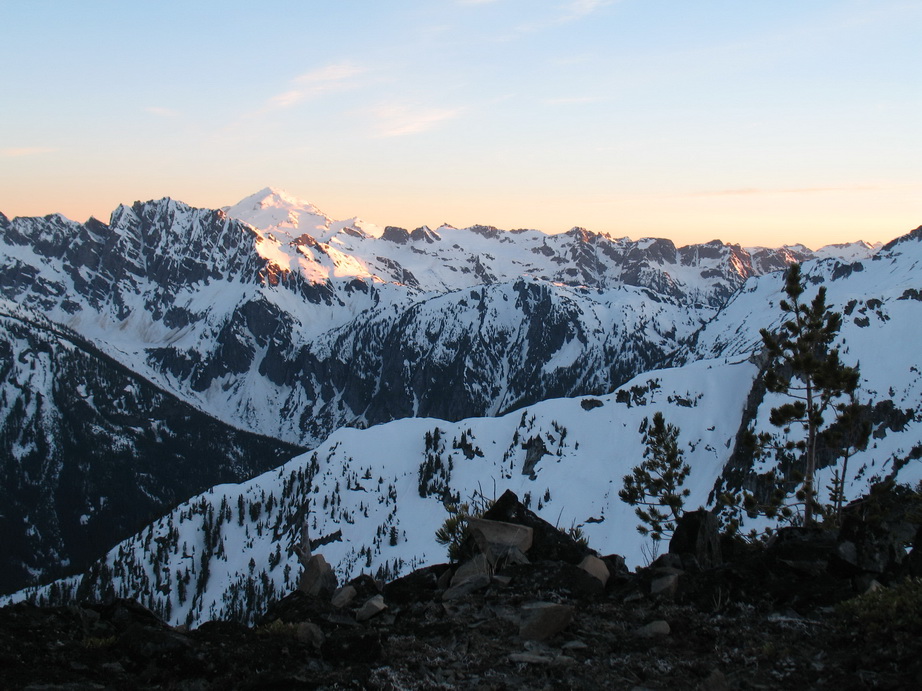
Bonanza Peak to Saddle Bow Mountain. Suiattle and Cloudy Passes between.
Looking down into S Fork of Agnes Creek.
Lyall Ridge from the approach.
Before turning in for the night, Daniel and I traversed the Yew/Spruce Creek divide to Asa Peak (Pt 7060). Here, we were delighted to find the oldest summit register we’ve ever seen. Asa Post, as part of a Government scouting party, first signed the register on August 2, 1908 – 102 years prior to our visit. The slip of paper on which he signed his name was in perfect condition, protected by some cans that they carried up on the original ascent. 37 years after Asa made his first ascent, his son Austin signed the register with, “Hello Dad”. We knew at least one person in every party that had signed the register since. Along with the historic slips of paper was a neat photo of the first ascent party lounging around the summit. We held the photo up to nearby Agnes Peak and the scene we were looking at in front of us was identical to the scene depicted in the photo. What a neat piece of history!
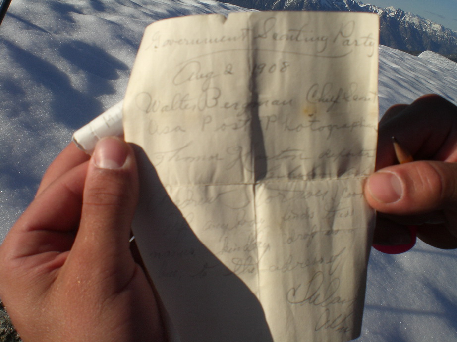
Asa Post’s historic summit entry in the Asa Peak summit register.
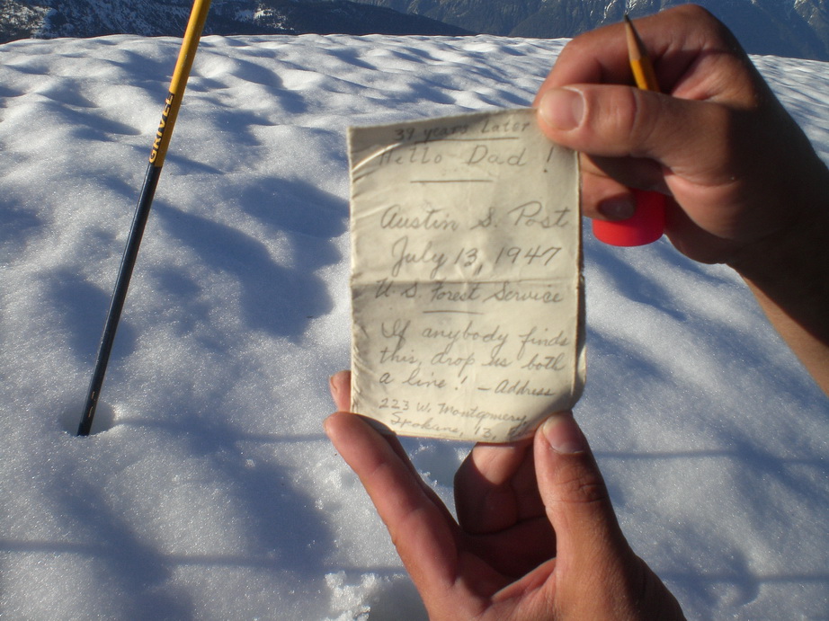
Austin Post’s summit entry.
Views to the west from Asa Peak.
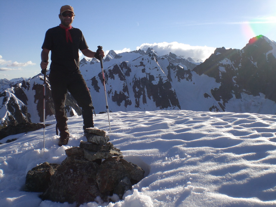
Daniel on the summit of Asa Peak.
Traversing the ridge back to camp from Asa Peak.
Views from camp.

Ticks!
Day 3
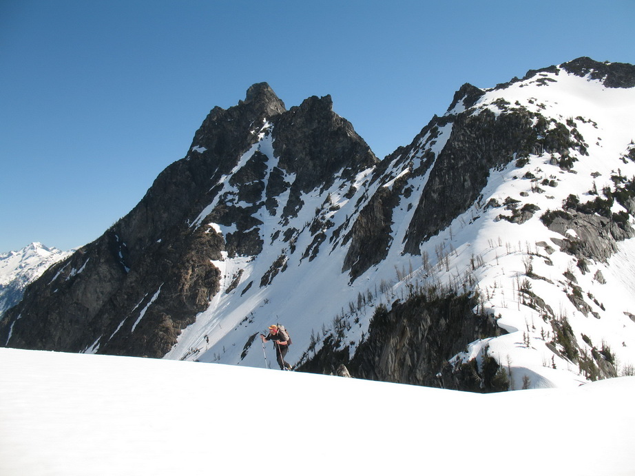
On day 3, we awoke to clear skies. By the time we got moving around 8AM, it was already getting warm. We made our way over to Gunsight Peak traversing the obvious ridge. The snow was very soft, and we were glad to have snowshoes. At times we were walking on top of the snow, and at other times we were postholing knee deep in snowshoes! It took us quite a while to cover the 2 miles between camp and the base of Gunsight Peak, thanks to the soft snow. By the time we got there, temperatures were in the 80s and we were getting cooked by the sun.
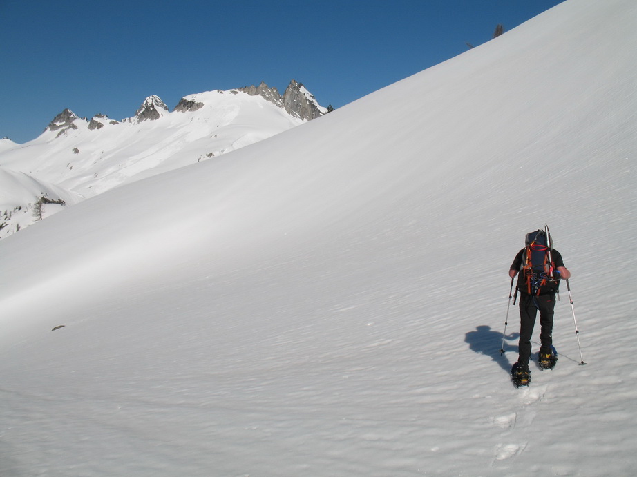
Daniel traversing to Gunsight.
Views along the way.
Gunsight Peak.
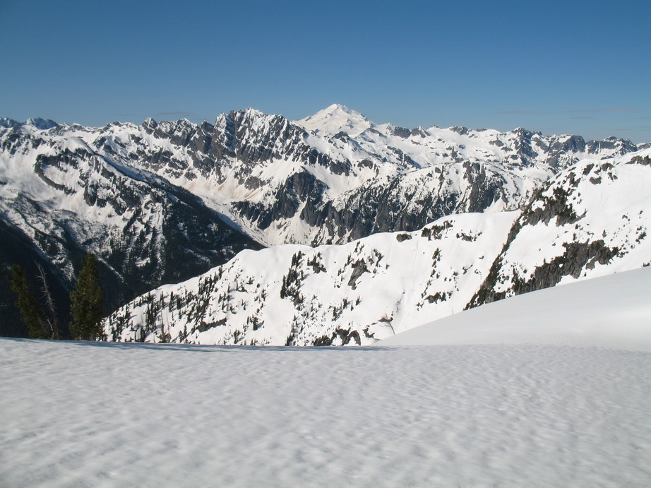
Looking North to Old Guard and Sentinel Peaks.
Agnes Mountain looms behind Daniel.
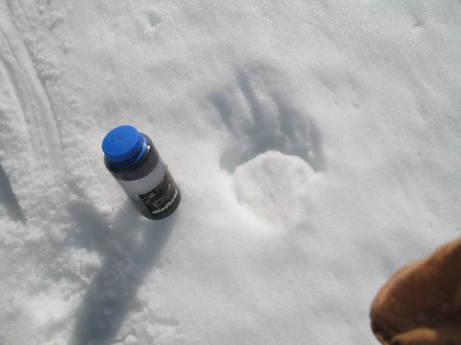
A large bear track in the snow.
A frozen Blue Lake.
More views from the traverse to Gunsight Peak.
Huge cornices loom above Icy Creek.
Me approaching Gunsight Peak.
Me in front of Gunsight.
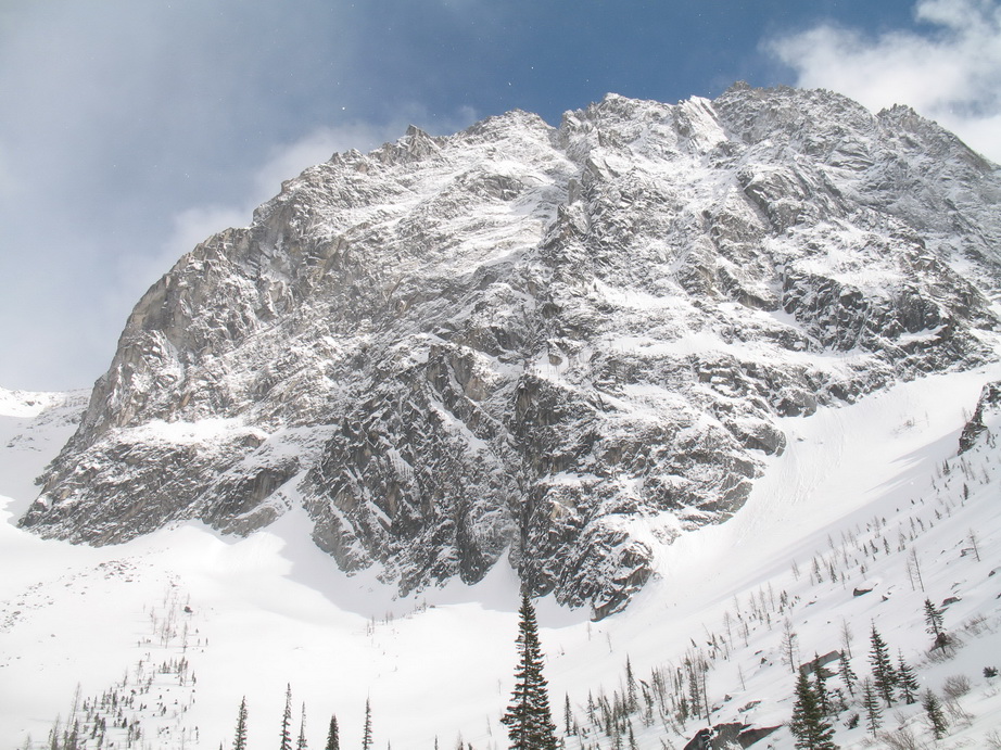
The main peak of Gunsight.
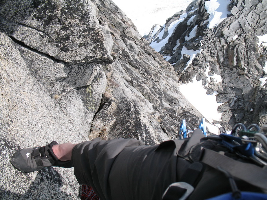
Our original objective was the NE Face of Main Gunsight, a 6 pitch route to 5.10d. Upon arriving at the base of the main peak, however, we were deterred by the soft snow over the bergschrund. Instead, we spied another line to climber’s left that we thought might go. It started out with loose 5.7 climbing leading up to a steep headwall where we encountered twin cracks (5.10). In the lower section, we found a rusty stopper that someone had left on a previous ascent (attempt?). Daniel led up the twin cracks, removing loose chockstones as he climbed. Above the cracks, he worked behind a huge block. Ahead was an ice and snow filled chimney, which looked impossible in the current conditions. Minus the snow and ice, the chimney looked like a great route. We bailed from a sling on a horn and did one and a half 60m rappels back to the base of the peak. As we were doing so, Steve Trent made two fly overs in an EA6B Prowler. On the second pass, he headed straight towards us. What a neat sight!
The traverse from the ridge to the base of the route.
Looking up from low on the route.
Moderate climbing on relatively loose rock (loose for Gunsight).
Daniel belaying me over to the start of the twin cracks.

The beautiful twin cracks. We turned around above these cracks, just out of view.
After backing off the E Face, we decided to check out the S Face route from the notch between the Main and S Peaks. After ascending loose, dangerous rock and snow to the notch, the clouds began to move in and envelop us. At that point, it appeared as if weather was moving in. Rain soon began to fall lightly, dashing any hopes we had to summit that day.
Me rigging the rappel to get the heck out of dodge.
Looking down the gully to the west, down to the Chickamin Glacier.
Our opinion of the situation.
Looking down the loose approach gully.
From sunshine to gray in two hours!
We made it back to camp without getting too much precipitation. We had no idea what the future held in store for us in terms of weather, so we were a bit anxious that night to see what tomorrow would bring.
Day 4
On the fourth day, we awoke (surprisingly) to mostly sunny skies. We were thankful to get another chance at Gunsight Peak. In light of how quick the weather conditions changed the previous day, we were eager to move fast to beat any possible precipitation that might hamper our climb.
Daniel rehydrating on the way back to Gunsight Peak.
Since the night was so cold, the snow had firmed up quite nicely. We were hopeful that we would get on the NE Face. As we traversed over to the face from the ridge, we noticed that the initial 5.10b finger crack had snow at the bottom. Higher up, we saw drips from snowpatches in the middle of our route. Aside from all this, we didn’t want to carry boots with us for the difficult climbing and we were unsure how to get back across the snow to the base of our route to retrieve our packs in rock shoes. With all this considered, we decided to bail on the NE Face and go check out the S Face again.
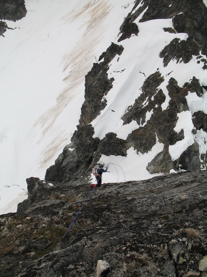
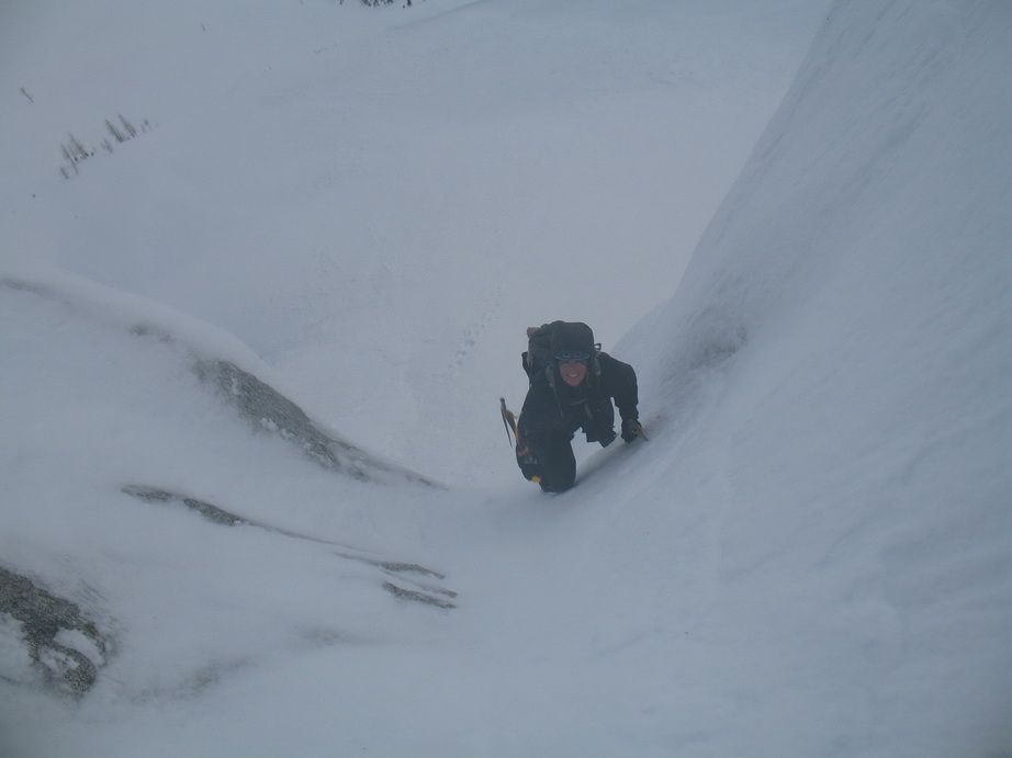
We climbed up the loose gully again to the notch between the Main and S Peaks. From here, the routes described in Beckey traverse W before ascending. Instead, we decided to climb straight up from the notch. On the first pitch, we encountered fun, solid 5.8 climbing with good pro. Daniel led this pitch and belayed me up. I took over for the second pitch and led us up and left, eventually gaining the ridge crest just below the summit (5.8). From here, we finished the last bit to the tiny summit on wildly exposed terrain among stunning views.
Daniel climbing the first pitch above the notch.
Looking down at the first pitch.
Me climbing the first pitch out of the notch.
Looking back at the S Peak from pitch 1.

Daniel at the first belay.

Me beginning the second pitch.
Looking back from mid way up the second pitch.
Me nearing the ridgecrest on pitch 2.
Belaying Daniel up the final bit to the summit.

Looking back at me from just below the summit.
Daniel climbing just below the summit.
Clouds over Dome Peak.
Looking back down the route from the final belay.
Another look down the route.
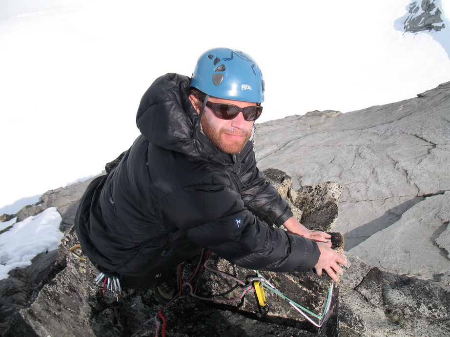
Daniel on the summit block.
Summit views.

More views.
Sinister Peak from the summit.

Me on the summit of Gunsight Peak.
More views.
More summit views.
Daniel rappelling back to the notch from the summit.
The view to Agnes Mountain from the notch.

Daniel getting ready to toss the rope for our rappel from the notch.
Daniel on rappel.
We headed back to camp just as weather began to move in again. As we ate our dinner that evening, it began to snow. The winds picked up, and we headed inside the tent.
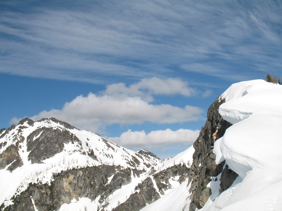
Gunsight Peak from the return trip.
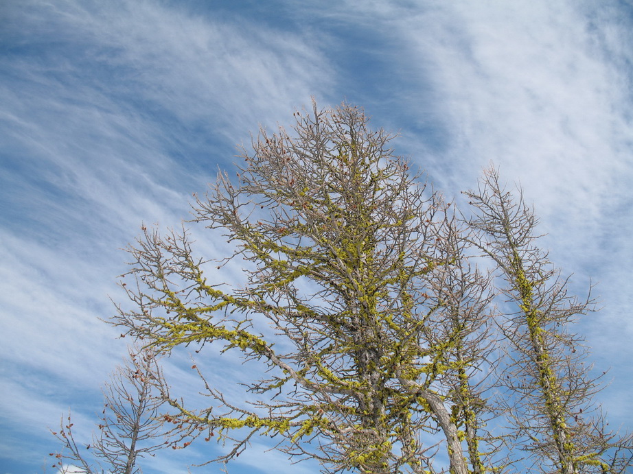
Artsy tree shot.
Weather moving in as we return to camp.
Daniel returning to camp.
Day 5
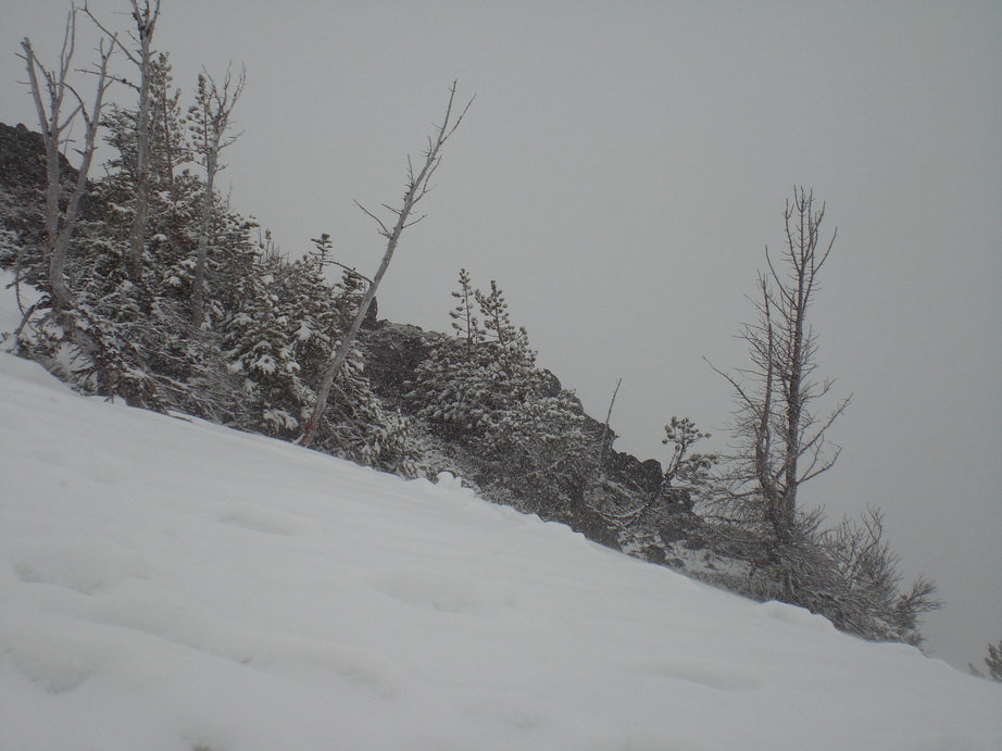
It snowed all night and when we awoke on the morning of the fifth day, it was still snowing. There was ~4” of fresh snow all around us, and it continued to come down. We decided to sit it out and wait for it to clear before beginning our descent.
Fresh snow.
...
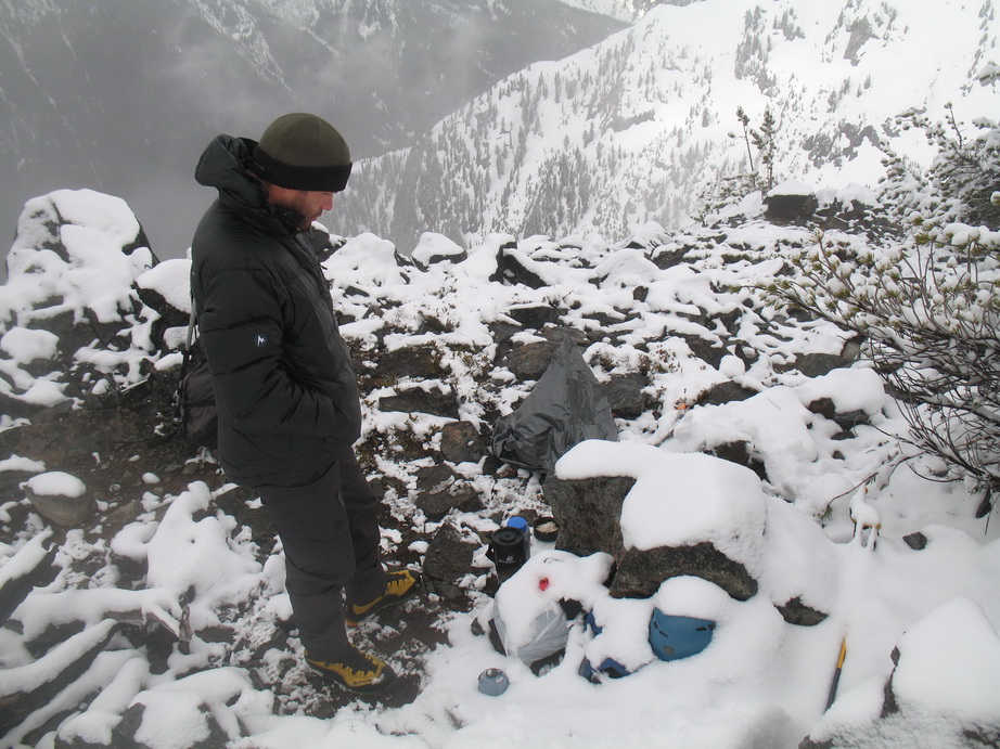
Daniel enjoying a brief break in the weather to brew coffee.

Our camp under a fresh blanket of snow.
What’s that smell?
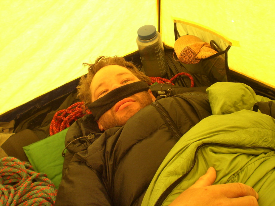
Day 6 and 7
Icicles hanging out on our tent.
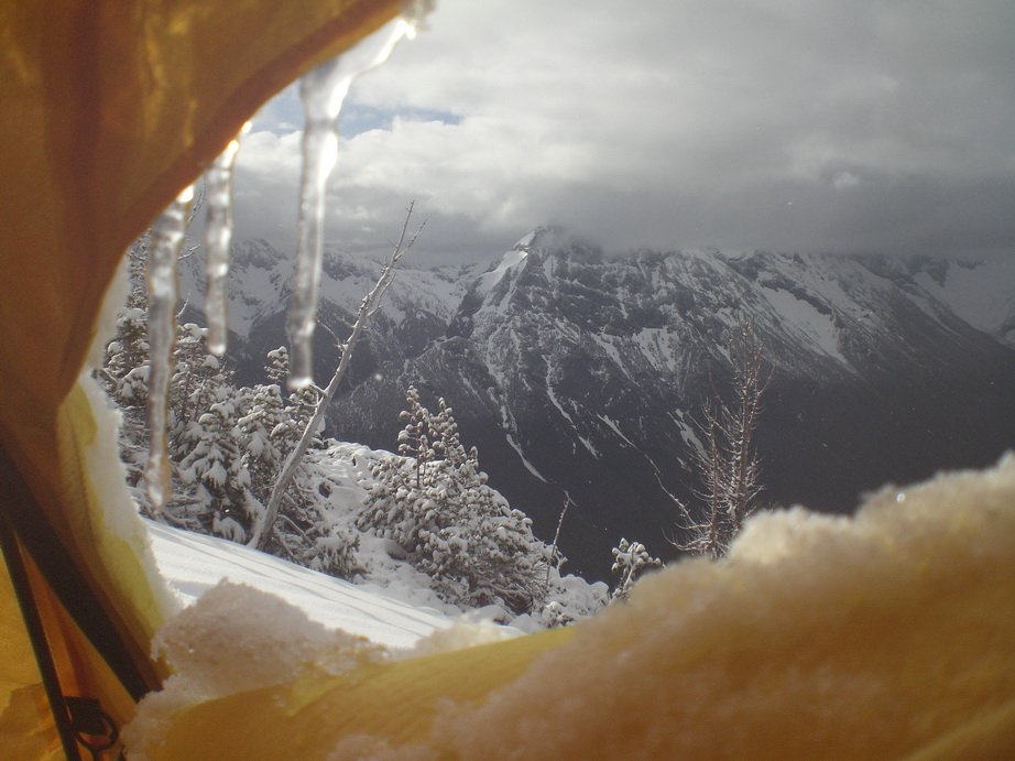
We awoke on the morning of the sixth day to mostly cloudy skies and light flurries. At this point, we had spent the past 36 hours in the tent. We were beginning to go stir crazy. We got out of the tent, made some coffee, and the snow magically let up - but not before dumping about 8" of fresh snow on us. At this point, we packed up and headed down before the weather decided to change its mind.
We were surprised to encounter dry brush on the way out. The brief sun breaks had been warm enough to dry everything out so we weren’t completely soaked by the time we got to the creek. Anxious to have a beer and some normal food, we huffed it all the way out to the TH in ~6 hours from our 7,000’ high camp. We caught the last shuttle back to Stehekin just as it began to rain in earnest.
The rain didn’t let up until the following morning. We were glad to make it back without getting soaked, and enjoyed the last few hours in Stehekin talking with local residents while waiting for the ferry.
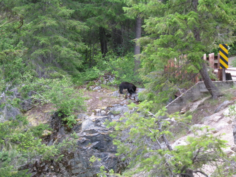
Bear sighting at High Bridge.
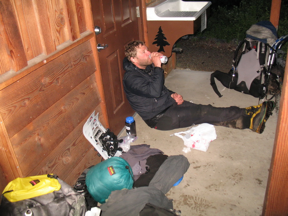
Camping in Stehekin – Hobo style.
So despite not climbing the routes we wanted to, it was still another fine adventure into the N Cascades!
Gear Notes:
Two 60m ropes
Double rack of cams
Two pickets
Snowshoes
Bourbon
Approach Notes:
Devil's clubs, slide alder
-
Follow the Cascade Pass Trail for ~2.5 miles to a switchback that cuts back to climber's right. To your left will be open slopes (some brush in late season, probably snow-covered right now). From here, you climb straight up (and slightly left) to intersect the Sahale Arm trail. It works well as long as it's snow-covered.
-
Very entertaining (in retrospect, of course). Between the raptor, the ticks, and the barbed wire, you guys sure had your work cut out for you!
-
Trip: Mt. Stuart - Stuart Glacier Couloir
Date: 5/1/2010
Trip Report:
I finally got around to climbing this gem on Saturday.
Steph Abegg and I met at the Mountaineer's Creek TH on Saturday morning at 4AM. We were able to drive to within 1/4 mile of the trailhead in high clearance vehicles. Another climber was supposed to join us there, but apparently he got stuck in the snow about 1 mile from the TH.
We left the TH at 4:35 under cloudy skies. We put on snowshoes immediately, and wore them all the way to the base of the route. The trail to the Colchuck Lake junction was fairly well-packed, but the snow beyond that was soft.
We arrived in the basin below the route and saw three climbers making their way up the Ice Cliff Glacier. We stashed our snowshoes by a big boulder in the middle of the basin and headed off.
The snow here was perfect with a walkable crust in places, sinking up to ankle deep in others. As we ascended, the winds (out of the NW) steadily increased.
We stopped at the 'schrund and looked for a good spot to cross. The snow here was sugary and light, and we found it tricky to find a place to cross safely. We belayed across the bergschrund without incident.
The rest of the couloir to the notch in the W Ridge was very straightforward (snow to 55 degrees). We were disappointed to not find any ice. The winds were ferocious at this point, and spindrift was a nuisance. Visibility was very limited (50 feet?).
But what the couloir lacked in ice, the W Ridge sure made up for it. The entire way from the notch to the summit was completely caked in ice and snow (much of it rime). This provided challenging conditions for the mid fifth class rock.
The first pitch from the notch went up a short, vertical rime mushroom. The perch atop it was airy, and there was no reliable pro, so we belayed each other up off a solid belay. From here, we traversed the extremely exposed rimed up ridgecrest (again, little to no pro). We tried to use natural pro where available, as this was all we could find in most places.
We came to the 5.6 lieback and, no surprise, it was caked in ice (the rock was totally plastered). We decided to bypass this by doing a delicate traverse across the upper N Face. Again, pro was sparse as cracks were filled with ice and snow. Pitons came in handy for belays, and I was able to place a few cams (4 total on the rock pitches). We were using a 30m rope and we belayed 6 pitches of very exciting, very exposed climbing.
The summit block was one big rime mushroom - no rock could be seen. To climb it involved a delicate traverse along a downward sloping, icy rock ledge (in crampons) pushed outward by bulging rime (no apparent pro). I chopped at the bulging rime for 5 minutes in an attempt to create a wider ledge. My last piece was 20 feet below me and about 10 feet to my side!
I belayed Steph up from the summit at 6:30. The climbing was very time-consuming, and we had to hurry to get down before dark. With winds still howling wildly (steady 25, gusting to 40+), sideways snow pelting us in the face, and visibility at about 50 feet, we down climbed towards the false summit, in search of the Sherpa Glacier (our descent route). Accurate routefinding was nearly impossible. A mini-epic ensued.
Steph took a few photos, hopefully she'll add them here (or a link to them on her website).
An excellent climb with an excellent partner.
-
I was up there Memorial Day Weekend of 2003, and we experienced excellent conditions.
-
You're not kidding.. they were pretty thick.
-
Nice summary, and great trip, BD.
This was the first time I ever led multiple pitches with nothing but cams.
Looking forward to the next one.
-
We spotted no closure signs when we were up there on Saturday 4/24. We climbed Outer Space and had the whole wall to ourselves!
-
It barely sprinkled for like 5 minutes. The rock remained dry and we climbed all day. We were intending to climb Outer Space, but it was wet at the top. Another week or so.
The watch is waterproof..
-
I stupidly put my altimeter watch down on the ground while climbing at Pearly Gates on Saturday. If you could return it to me, I would appreciate it. I've had this thing for 9 years now and it has been great to me. It is stainless steel and has numerous scratches on the face.
tsjolseth@hotmail.com or PM me here.
-
Excellent thread.
-
I would say the route is just coming into shape. It's not completely formed up yet. Give it some melt-freeze and I think it'll be a lot better than it is right now. Usually the route is good into May.
-
Crushing it! Very impressive TR, possibly the best I've seen all season.
-
nice! you guys just cruised it.
how long of a rap is it? could you do it with just 1 50m rope? also, looks like you guys didn't really rope up for anything. did you pull out the rope for anything other than the rap?
The rap is like 10m, so you're fine with a 30m rope. I didn't use a rope for anything, but my partner wanted one at the top of the runnels (just after the rappel), and again at the transition between the second and third couloirs. The rest we soloed.
Nice work. That was me you glissaded past while I skinned toward the pass. Thanks for leaving those rap anchors at the N face entry, I snowboarded down the Option #3 route finding excellent steep skiing conditions. Did you guys pick up a BCA probe 240cm in an orange case about 1.5 miles from the gate? I had stashed a shovel and probe there about 50ft. from the road behind a rock, and under a couple cabeza sized rocks. When I came back the rocks were upturned, and the probe was gone...? Cheers.Sorry I didn't stop to chat, the glissade was quicker than I anticipated. I did not pick up your probe (or even see it). Shitty that someone would pick it up.
We didn't leave the rap anchor on the N Face, that was there already. Right on for snowboarding that, I have great respect for all of those who would snowboard/ski that!
-
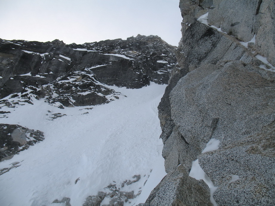
Trip: Dragontail Peak - Route du Jour - Triple Couloirs
Date: 3/23/2010
Trip Report:
This forum seems to be lacking in TC reports, so here's mine from yesterday:
Erin B and I had a great time today on Dragontail Peak.
We left the Bridge Creek Campground at 3:15AM. We managed to get a few hours of sleep after our drive from Seattle late the previous evening, but we were still groggy.
We made quick work of the road/lake approach and arrived at Colchuck Lake in a little under 3 hours (7 miles, 3700' gain). The bootpack was frozen solid, and if anything we could have cramponed the approach. From the N end of the lake, we walked across to the S and took a long break on the other side. After eating, drinking, donning our climbing gear, and admiring the views, we took off towards the base of the route in calf-deep snow.
Although several parties had climbed the route on Saturday, their tracks had all but disappeared, forcing us to break our own trail. This took a bit longer than anticipated, and we didn't wind up getting to the base of the route until about 8AM. From here, we broke trail up the first couloir and walked past the runnels. I was tempted to give the runnels a go, but I didn't want to scare Erin off on only our second trip out, so I opted to go for the rappel into the upper runnels.
One short section of verglas here led up and out of the runnels. From here, we again broke trail up the second couloir, a painfully slow process.
The transition from second to third couloirs was dry. There looked to be two feasible ways through, and we chose the direct route drytooling on rock and turf.
After breaking trail up the third couloir, our calves were singing to us. We were glad when we finally topped out and saw the summit a short distance above us.
We reached the summit a little after noon. We stayed up there for about an hour, before heading down to Asgard Pass. The slopes of Asgard Pass were very firm and wind-scoured, dashing any hopes of ours to glissade it. The slopes softened up near the bottom, and I was able to glissade the lower 600' or so, which was a welcome relief.
The road walk seemed to go on forever, and the snow was soft from the afternoon sun. We were glad we lugged our snowshoes, else we'd be postholing pretty deep. Back to the car at 4:20PM.
Stats:
18 miles
7,000' gain
13:05 RT (From Bridge Creek CG)
A view of the N Face of Dragontail Peak as seen on a previous attempt. Photo taken April 20, 2008.
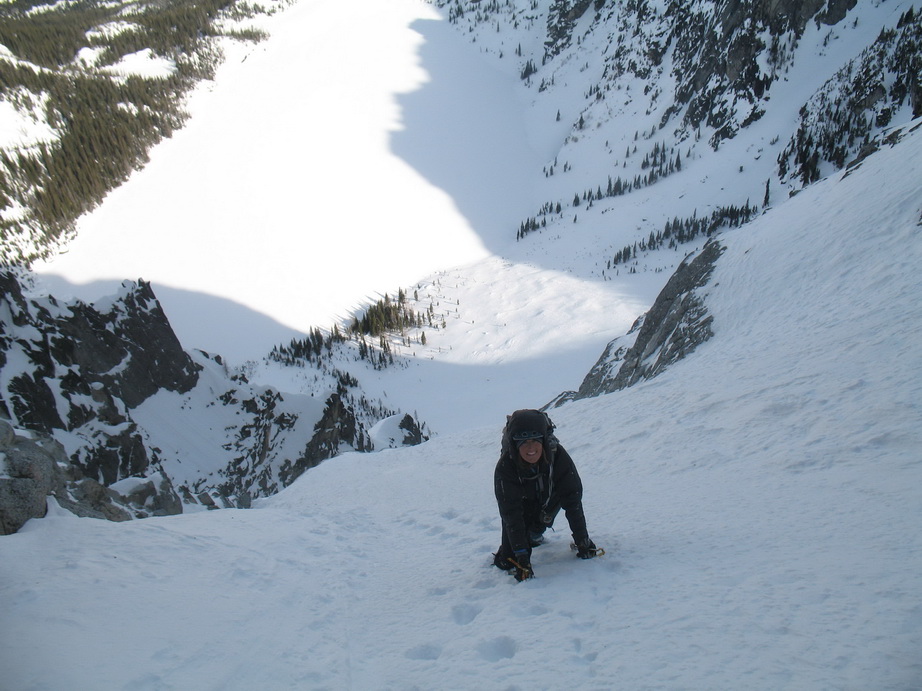
Erin starting up the first couloir.
Cashmere Mountain from low on the route.
Climbing in the first couloir.
Looking up at the dry runnels.
More climbing.
The view up from the rappel station.
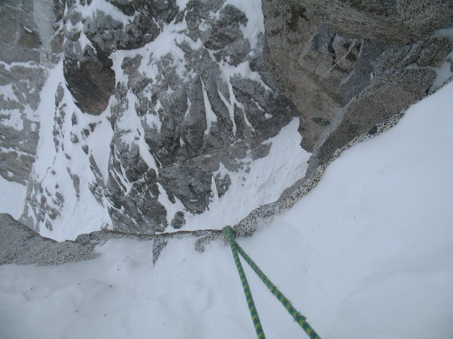
The view down from the rappel station.
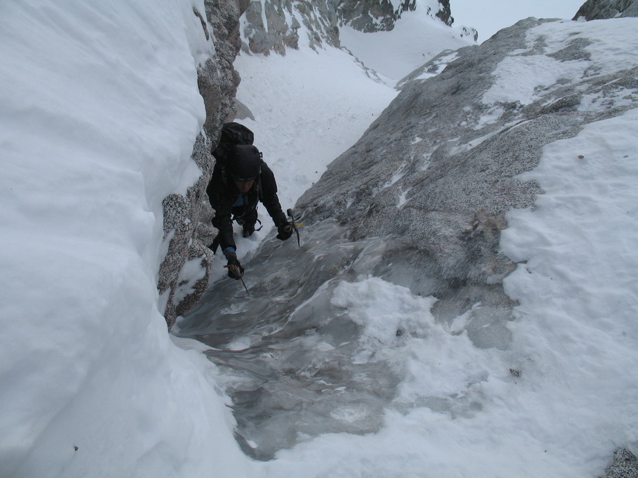
Erin climbing thin ice over slab at the top of the runnels.
Colchuck Lake as the backdrop.
Low in the third couloir.
Neat gendarme on route.

Looking down from the bottom of the third couloir.

E Dragontail from the summit.
Cannon and Temple Ridge in the background.
Looking down from the top of the third couloir.
View to Pandora's Box from the summit.
Erin making the final steps to the summit of Dragontail Peak.
-
We climbed the route today. The runnels are not in ice form, but could be an interesting drytool problem. They looked climbable to me, but it would be better to wait until the ice forms fat. As it was, I thought it was a mediocre route.
-
Nieve... The Warm Creek approach via the Middle Fork of the Nooksack appeared to be the most direct approach route to us. It worked out to be ~5 miles and 3200' gain to camp from the TH. I think it would have worked out to be about the same (in terms of time spent) if we started from the Heliotrope Ridge TH.
-
If anyone is considering climbing the hanging glacier itself, it is overhanging by at least 10 degrees (more like 20). Go get it!
@Gene.. a combination of dreaming, Scurlock Photos, and a few hops.

[TR] Liberty Bell - Thin Red Line - Free Ascent -
in North Cascades
Posted
BAD ASS!! Nice work boys.