

Tom_Sjolseth
-
Posts
541 -
Joined
-
Last visited
-
Days Won
2
Content Type
Profiles
Forums
Events
Posts posted by Tom_Sjolseth
-
-
Good times.. sorry I didn't get to meet everyone. Thanks to Klenke and his better half for the beer.
-
Very cool trip! I love that area. Any photos on route?
-
That is a great area.. nice trip! Any photos?
-
Very nice! I met Justin in Nepal about 5 years ago and he is a super cool guy. I don't doubt this one bit, he didn't seem like the type of guy who'd just make this up.
-
Thanks fellers.
Rob - yes the six pack tasted great. I couldn't believe I got a buzz off of two beers..
Sol - I looked through my photos and don't see anything that would be of any use to you. I do remember looking down on that side of Swiss and thinking I was glad I wasn't down there. We sent some trundlers down it and they got some huge air. You might dig it though.. wear a brain bucket!
-
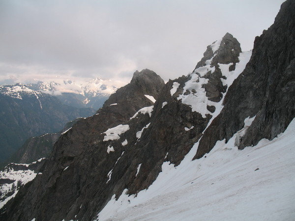
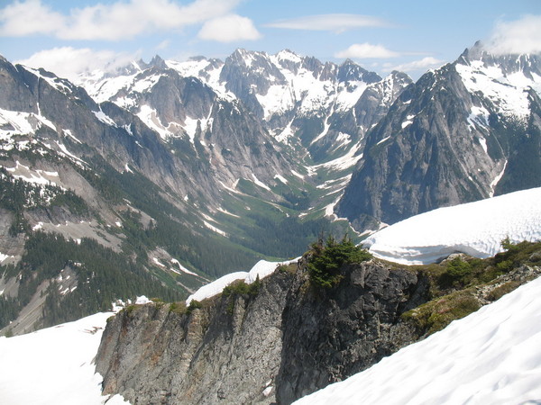
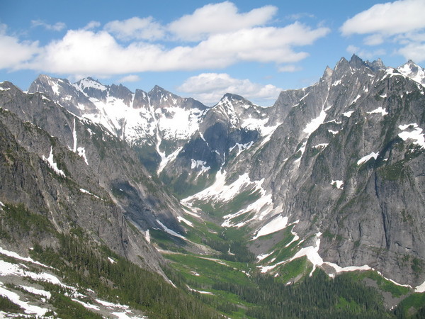
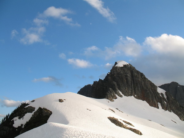
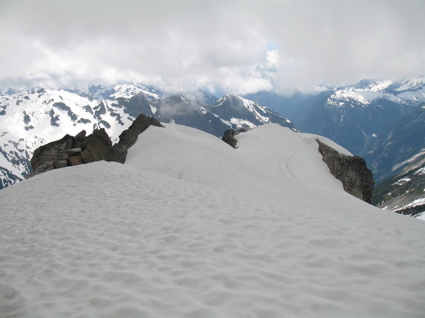
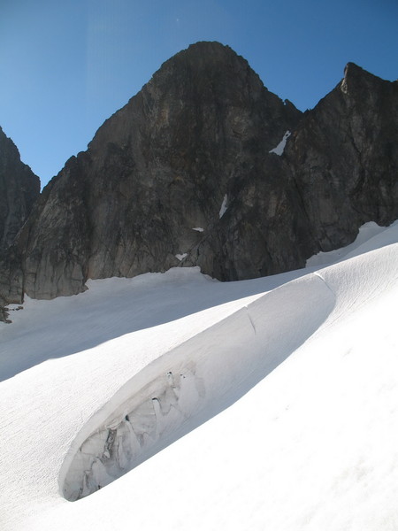
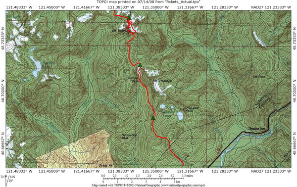
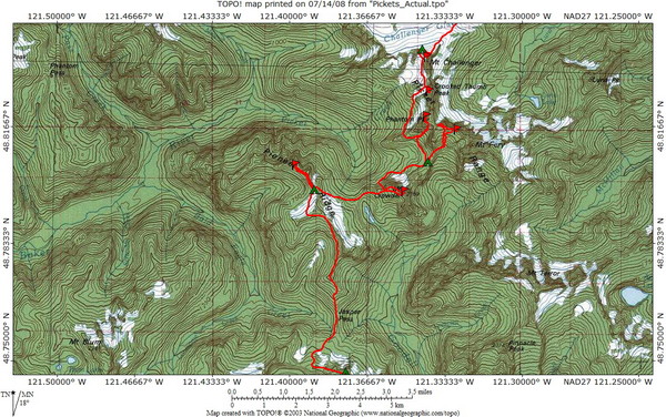
Pickets Traverse – July 3-12, 2008
Due to the length of this TR, Firefox will not load it all. Internet Explorer recommended for your full viewing pleasure.
10 days and 8 summits from Thornton Creek to Big Beaver
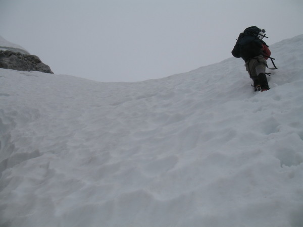
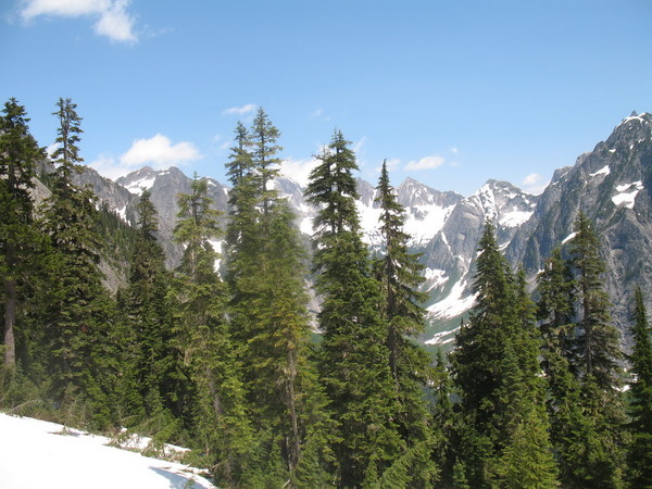
From July 3-12, Sean Martin and I did an alpine traverse beginning at Thornton Creek, and ending at the Ross Lake TH via Big Beaver Creek. Along the way, we climbed Mt. Despair, North Despair, Pioneer Ridge, Mt. Crowder, Swiss Peak, Phantom Peak, Crooked Thumb Peak, and Mt. Challenger. This is the story..
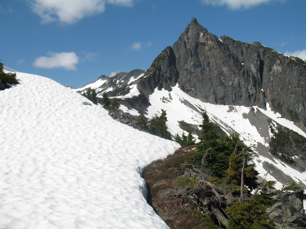
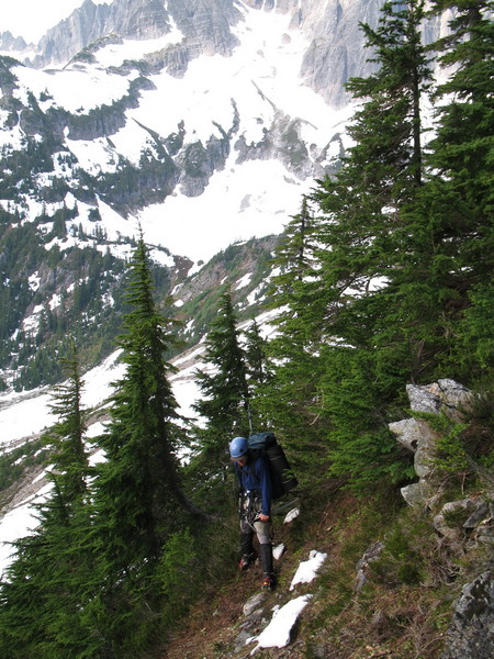
Day 1
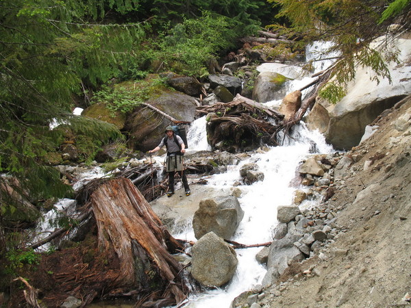
Sean amidst one of the creek crossings on the approach.
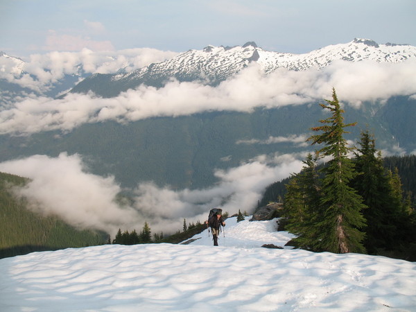
Sean ascending to the ridge.
Views from the ridge.
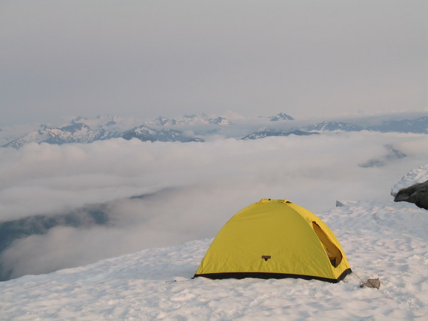
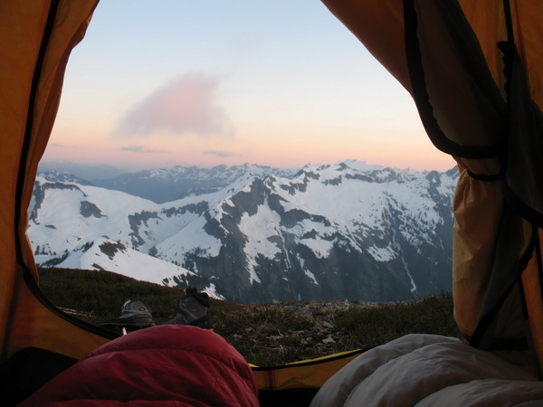
Camp 1.
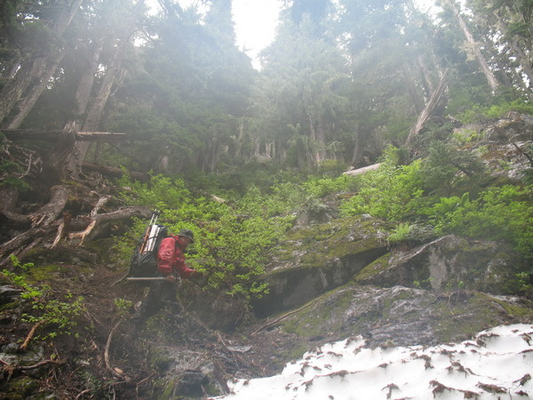
Initially the plan was to take the Thornton Creek Trail to Thornton Lakes for a leisurely first day. After trying to cross Thornton Creek, however, we spontaneously changed plans and headed directly up to the ridge dividing Damnation and Thornton Creeks. I had been this way twice previously, once to climb Triumph, and once on an attempt of Despair. I had never camped at Thornton Lakes, and that appealed to me, but the creek was running WILD that day, and we had no other choice but to cut uphill.
The going is easy up to the ridge – mainly steep, open forest with occasional rock steps. Upon arrival in camp, we were greeted to some pretty sweet views.
Day 2
Camp 2.
On day 2, we awoke to a whiteout. We could not see the stove and cookpot ten feet away from our tent. Although it did not rain on our approach day, it rained the night before, and so all the brush on the approach was wet. We were soaked upon arrival in camp and had hoped that day 2 would provide us with an opportunity to dry things out. This was not to be. We decided to make day 2 our one weather day for the trip. This would mean no rest days would be feasible considering the magnitude of our schedule.
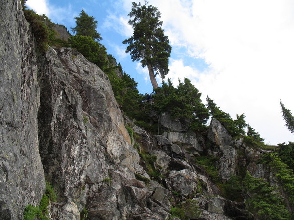
Day 3
Sean amidst wet brush on the way to Triumph Pass.
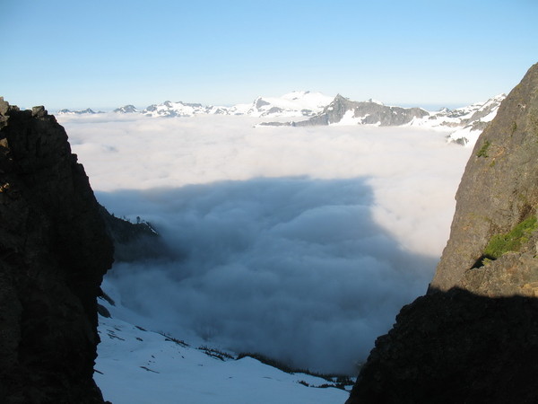
We awoke on day 3 to another whiteout and steady rain. Since I had to be back on the 12th, we had two choices given our busy itinerary: bag the trip, or press on in crappy weather. We chose option B. Fortunately, at this point our gear had dried out enough to be functional. We both had down bags which were able to be dried from body heat throughout the past 36 hours spent in the tent. We packed our packs with our remaining 8 days worth of food and fuel and climbing gear and headed down into Triumph Creek towards Triumph Pass. The steep forest traverse was wet, which made it pretty tricky. The forest here is coated with moss and heather and pine needles over mossy cliffy steps. In steady rain and whiteout, we made it through unscathed, and continued on fairly easily to a very windy Triumph Pass. From Triumph Pass we couldn’t see much, but through whisping clouds we were able to locate the lake in the lower basin, on the shoulder of Triumph. We made camp here since we were drenched. We hoped Day 4 would clear, but we weren’t convinced.
Day 4
The best picture of Despair we got.
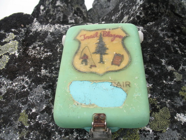
Long live the Trail Blazers!
Bollard rap #1.
Sean in our rap gulley.
Traversing to the col.
Our descent from the notch on Despair.
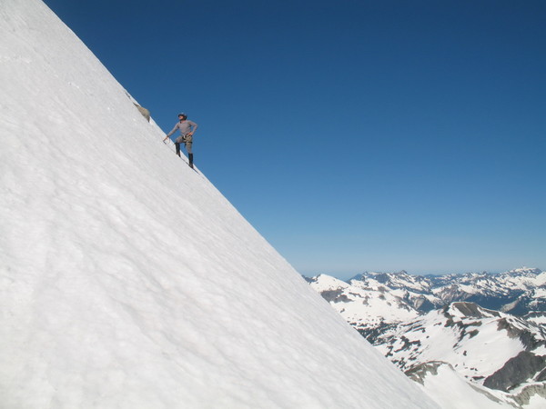
Descending steep snow on the N side of the Col.
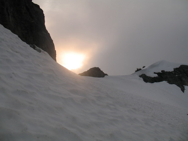
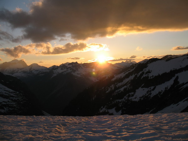
The sun over Despair arm.
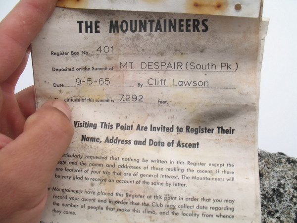
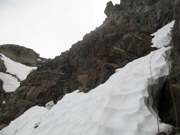
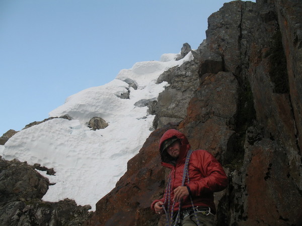
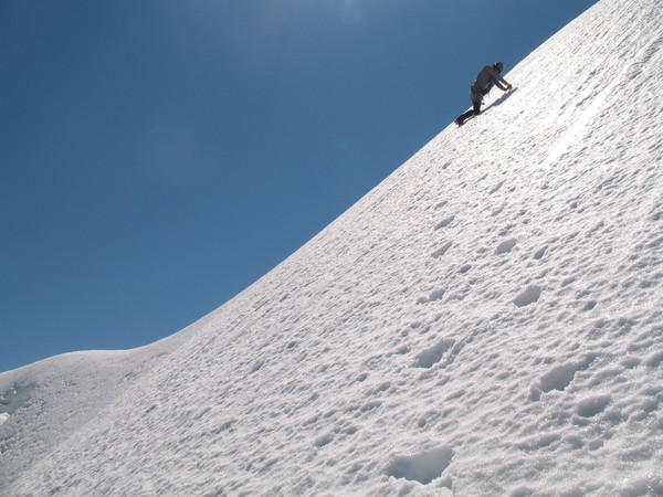
On day 4, we awoke – to another whiteout. We were beginning to wonder if we should continue on or head back out. The last forecast I caught before we left indicated sunny weather was in store, so we crossed our fingers and hoped for the best. And so we embarked once again, packs fully loaded, up to the summit of Despair. It was a little tough finding the summit in swirling clouds, but we were able to feel our way up through the breaks and soon we stood on the summit. The summit register was placed by a good friend of my Father’s, the late Cliff Lawson., in 1968. The original Trailblazer summit register is still in place as it should be. This one doesn’t get climbed much. Last to sign in were Mike Collins and Dave Creeden in 2007. From the summit of Despair, we could see patches of blue through the cloud deck.
From the summit, we dropped down about 400’ to a N-Facing gully (steep snow). This would be our gate to the next leg of the journey. We made one rap off a rock horn to the moat, where we looked for reliable rock anchors. We had three pickets which we could have used, but we wanted to save them for later in the trip. After not finding any reliable rock anchors, we made a bollard from the moat. Rapping off this down to another moat, we did the same again to a rock ledge. The rock ledge offered no reliable rap anchors either, but I did have one piton which we placed in a shallow crack. From here we made one 30m rap onto the glacier N of Despair.
We traversed the glacier North up and over a col, then down the other side on steep snow (corniced). From here, we couldn’t see much except for a possible camp on the arm leading North from North Despair, our next objective. We found a nice camp on snow here and called it a day.
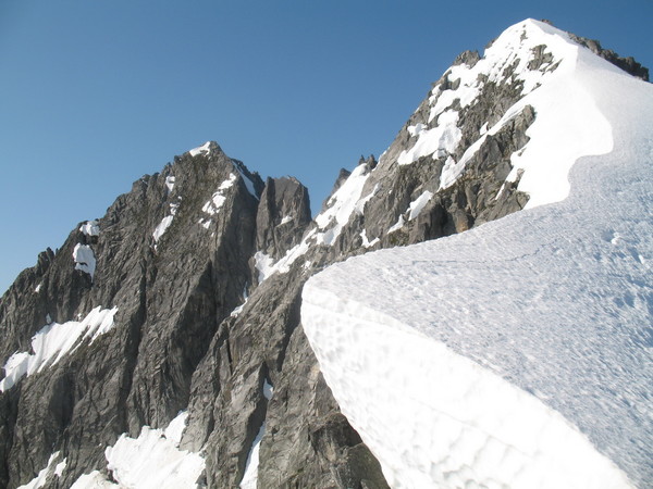
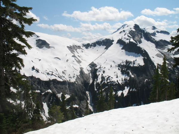
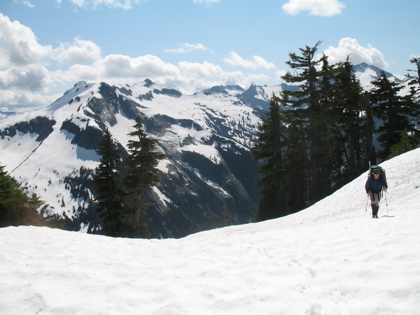
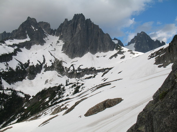
Day 5
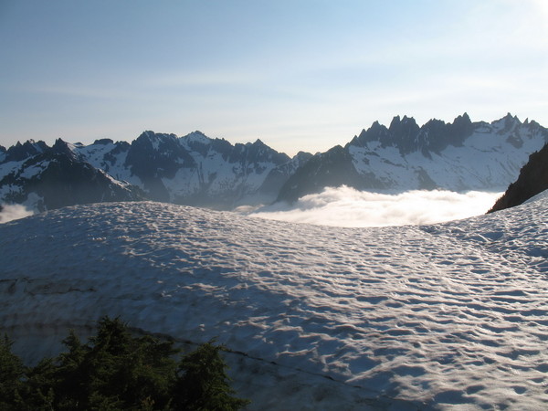
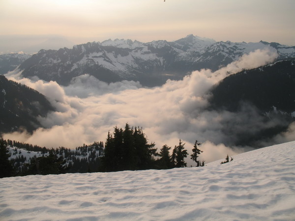
Sunshine – finally!
Clouds hanging around the valley.
N Despair.
Views from camp.
Sean on N Despair.
Despair from N. Despair.
Sean descending N Despair.
A perfect arête.
One of the many traverses.
Views deep into the heart of the Pickets.
Views from Jasper Pass.
More views.
And more.
Pioneer Ridge.
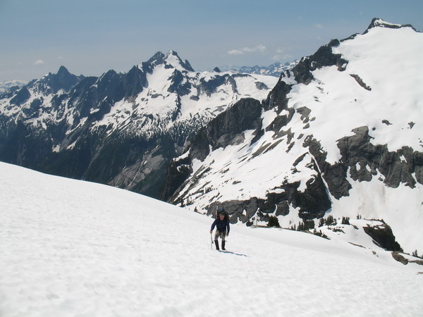
Sean ascending to Pioneer Ridge.
Alpenglow from camp.
Baker at sunset.
The view from the tent.
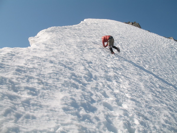
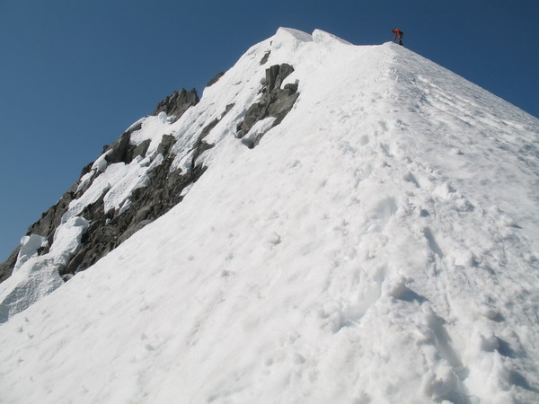
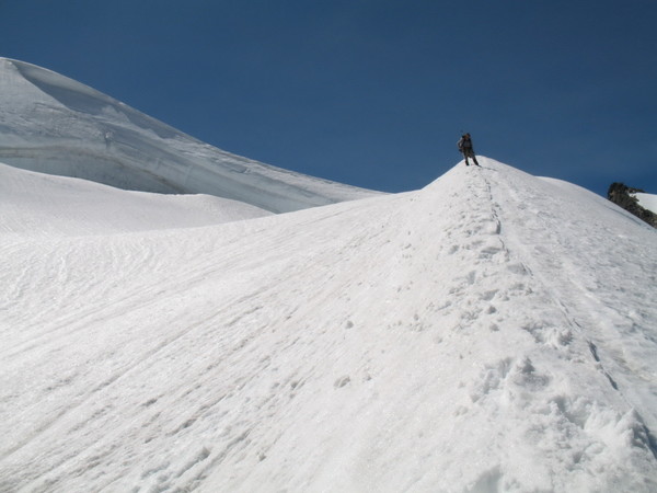
On day 5, we awoke – to SUNSHINE! Not a cloud in the sky. We were amazed at the turn of events, and were eager to get up North Despair, which looked phenomenal. N Despair has one of the most impressive arêtes of any I’ve seen. Eldorado’s arête looks a bit meek in comparison.
The climb of N Despair is straightforward, and we didn’t take a rope. Firm snow made for easy cramponing up the fairly steep slope (40 degrees steepening to 55 degrees at the summit). The summit register is a small rusty container with a few scraps of paper dating back to Mike Swayne and Gordon Thompson’s first ascent in July, 1963. There have been about 8 parties who have signed in since.
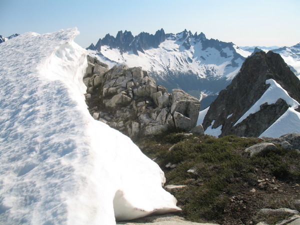
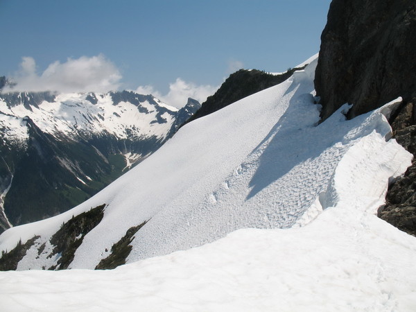
From here, we dropped back down to our lovely camp and packed up for a traverse down to Jasper Pass, and up to Pioneer Ridge. The traverse was made on steep snow over cliffs – all a bit tiring (physically and mentally) considering we had heavy packs.
Jasper Pass is nothing to write home about. Thankfully it was 75% snow-covered because it looks like it’s got some nasty brush. We didn’t stop for long on the way through, instead setting our sights on the beautiful Pioneer Ridge which Beckey calls one of the most rugged spots in the range.
We arrived on Pioneer Ridge with enough time to head to the summit. The tough part was, we had no map for this zone (USGS Blum) since I failed to get one in time before the trip, so we didn’t know which was the true summit. We camped less than 200 vertical feet below what was later determined to be the true summit, but instead took it upon ourselves to travel an hour out of our way to get to the point which we thought was highest. Upon arrival, we did not see a register (which didn’t jive with reports from recent summit parties), but we just thought it got taken by one of those register Nazis. We should have taken the 15 minute stroll up from camp to the other knoll which looked similar in height. Oh well.
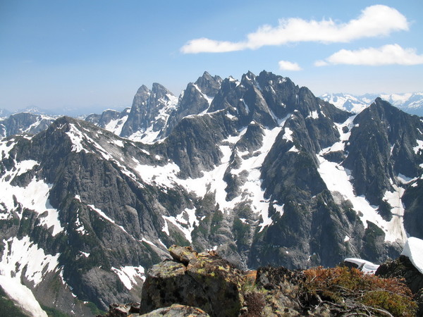
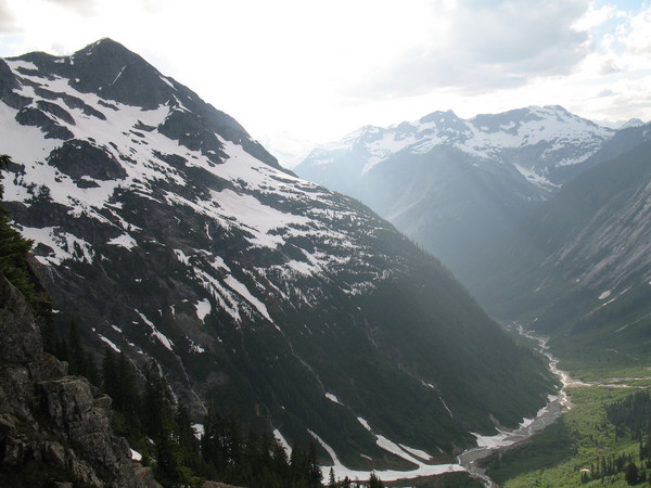
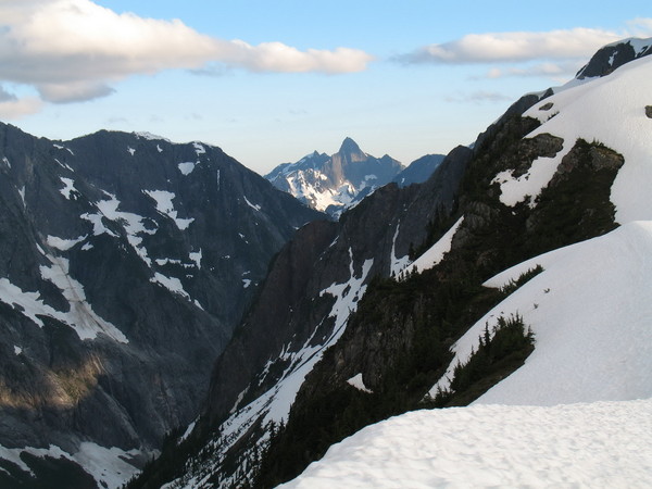
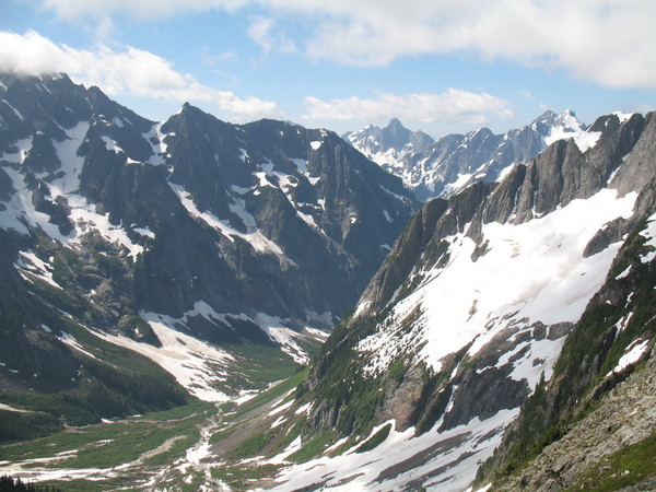
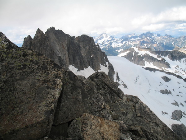
The views from Pioneer Ridge to Mystery Ridge, Blum/Bacon/Hagan, and the entire Pickets range North to South is stunning. We were now able to see nearly our entire journey from start to finish. It looked huge.
We settled into camp that night with our sights set on Wild Pass and Mt Crowder to Pickell Pass the following day.
Day 6
A frozen Wild Lake.
Sean ascending slopes below Crowder.
Crowder’s dramatic N Face.
Just some yahoos.
Views from Crowder.
Sean downclimbing on Crowder.
Sean descending steep snow in the gulley.
Dirt-ponning on Crowder.
Vegetable raps.
Ascending to Pickell Pass.
Picket Creek.
The moon over Crowder.
Spectre Peak.
Triumph through the gap.
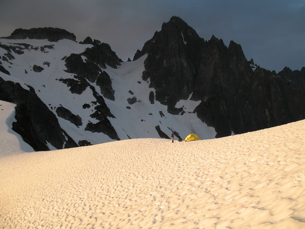
A magnificent camp.
Sunset.
On Day 6, our plan was to drop to Wild Pass from Pioneer Ridge and ascend Crowder. Then we were to drop to Pickell Pass where we would set up camp.
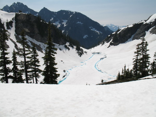
Dropping off Pioneer Ridge entailed more steep snow traversing over cliffs with heavy packs. The descent to Wild Pass took no time at all due to the fact that we glissaded a great portion of it. Wild Lake was 95% frozen still, but we could see the turquoise blue water starting to appear on its shores. This is a magnificent lake, and I can’t wait to come back and see it when it’s melted out.
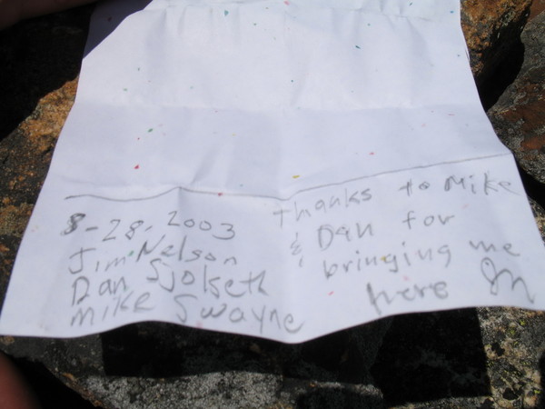
From Wild Pass, we made the 2000’ ascent to the summit of Mt. Crowder. Again, not too many people climb this one. The last party to sign in was none other than Dan Sjolseth (my father), Jim Nelson, and Mike Swayne – in 2003! I can’t believe it hasn’t been climbed in that time, but then again there’s no pencil in the register and the peak is REMOTE.
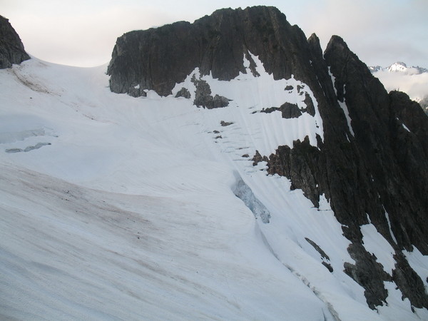
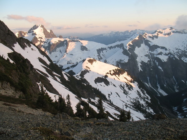
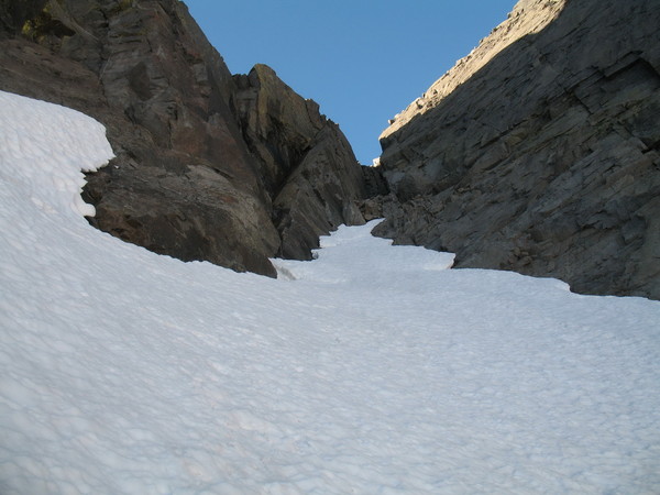
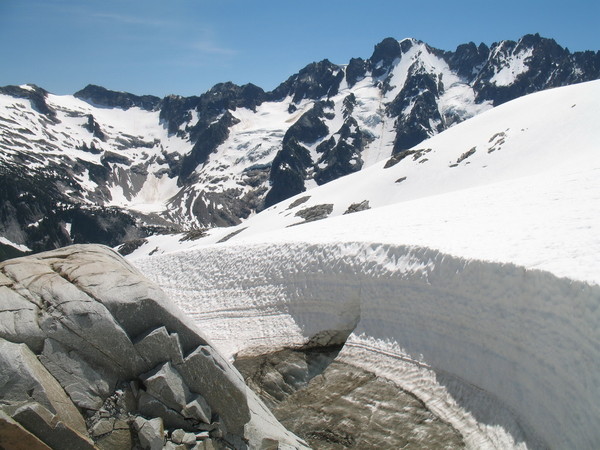
From Crowder, there really is no information out there on how to get to Pickell Pass (that I was able to obtain). I knew it had been done, since Roger Jung had signed in the N Despair summit register that he made it from Pickell Pass to N Triumph via Crowder. We decided to descend straight off the summit, directly towards Pickell Pass. This went great for about 300 vertical feet, but then we encountered lack of rap anchors again. 70 degree heather (and crappy rock) made us reconsider our options. We climbed back up to the summit and descended back down towards Wild Pass, eventually finding a weakness in Crowder’s N flank. We rapped off a tree into a steep (60 degrees) snow-filled gully. From here, we rapped off one picket down to the moat where we found OK rock to sling for one more rap. From here, we downclimbed 50 degree snow, gradually lessening in angle to the glacier below. At this point, the traverse around Crowder was still not trivial. We encountered very steep heather again, and it was wet. We donned crampons and traversed a quarter-mile around Crowder’s N Buttress on steep, wet dirt and heather, eventually finding a goat trail at the base of cliffs which brought us to the basin in upper Picket Creek. From here, it was a 1200’ gain to Pickell Pass on low-angle snow. We placed camp here with the Northern Pickets towering high above us.
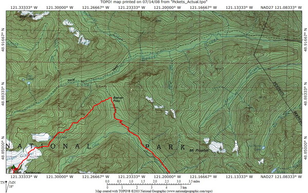
Day 7
More views.
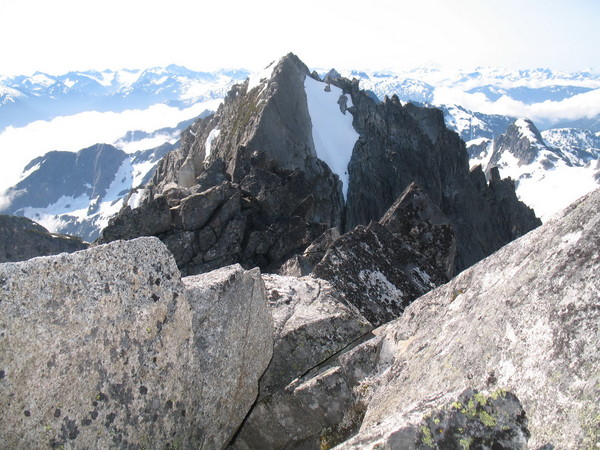
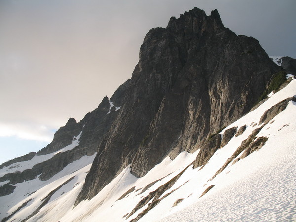
W Fury from the slopes below swiss.
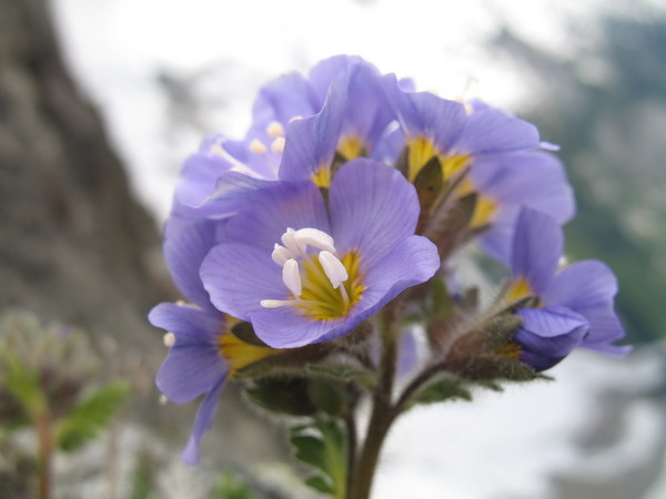
Some flower on the summit of Swiss.
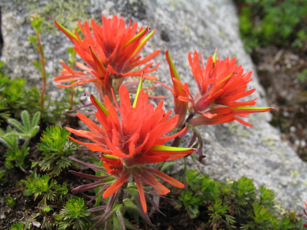
Indian Paintbrush on Swiss.
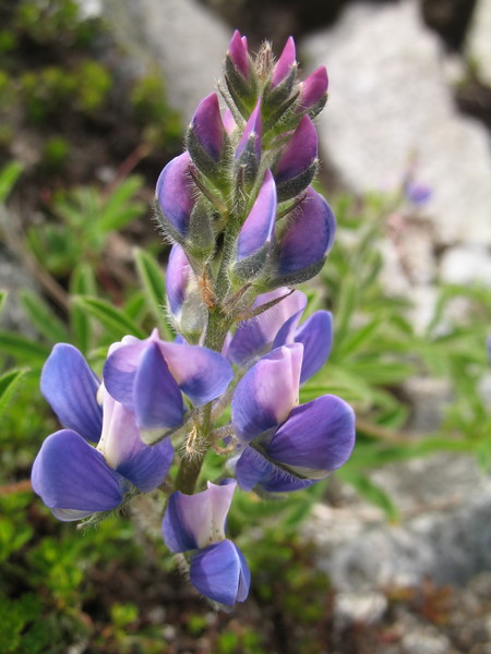
Lupine on Swiss.
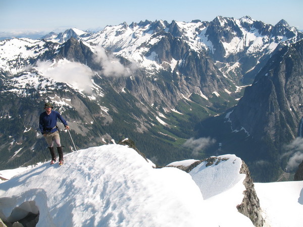
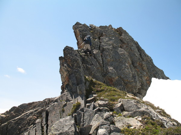
On Day 7, we went up to explore Swiss Peak and possibly attempt W Fury. Upon summitting Swiss, we couldn’t spot an easy way up W Fury. It was tough to convince Sean that we should drop down on the E side of the Fury-Swiss Col and find easier terrain there, and we didn’t want an epic this far away from home, with other summits still on our plate. Plus I reasoned that I could always get W Fury a lot easier from Picket Pass, or possibly even on a traverse from E Fury from Access Creek. So we goofed around up around Spectre Peak and took lots of photos, generally turning this into a “rest” day. We returned to camp hopeful that the good weather would continue.
Day 8
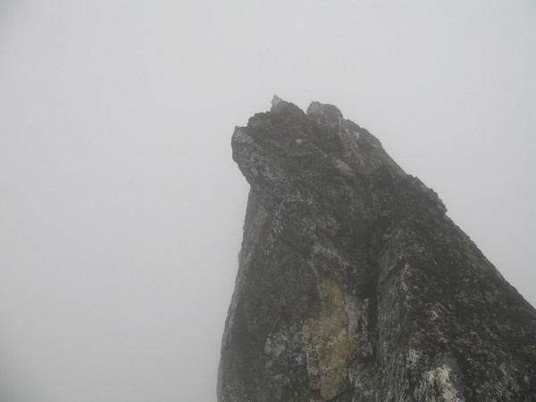
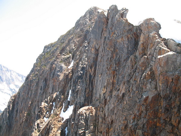
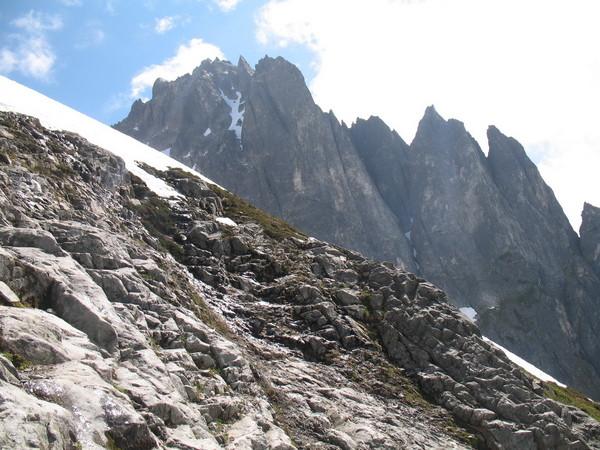
Phantom Peak’s true summit.
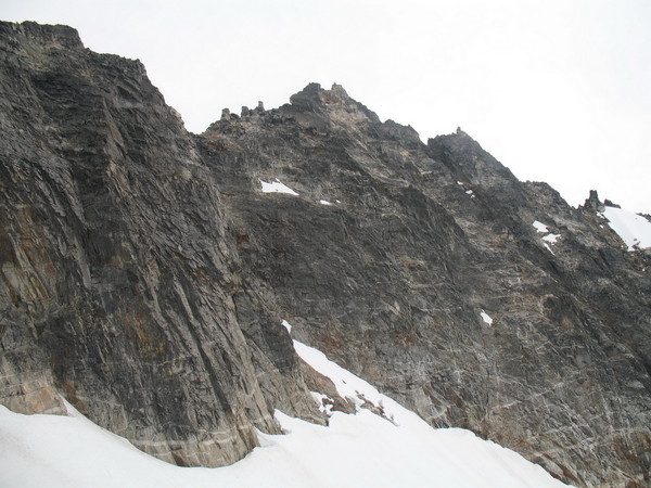
Crooked Thumb and its ascent gulley.
Challenger/Crooked Thumb Col.
Views from Crooked Thumb to Challenger.
Descending Crooked Thumb’s gulley.
Sean traversing to Challenger.
Unique swale on the way to Challenger.
The gulley we used to gain Challenger Arm.
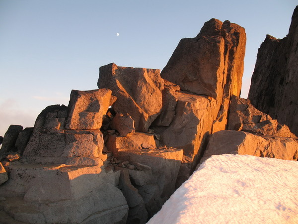
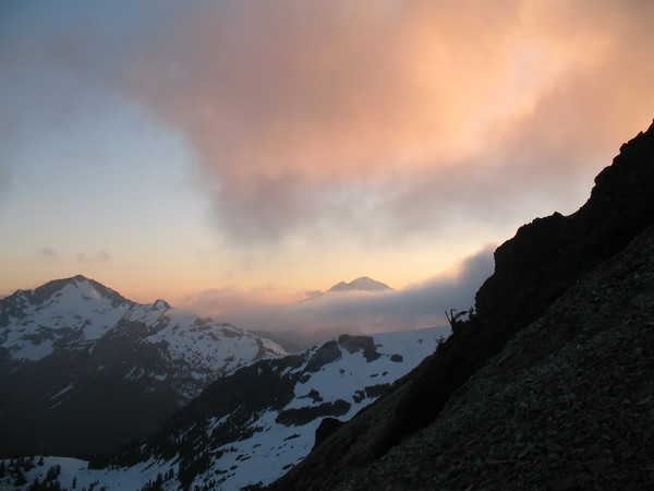
The moon over our camp.
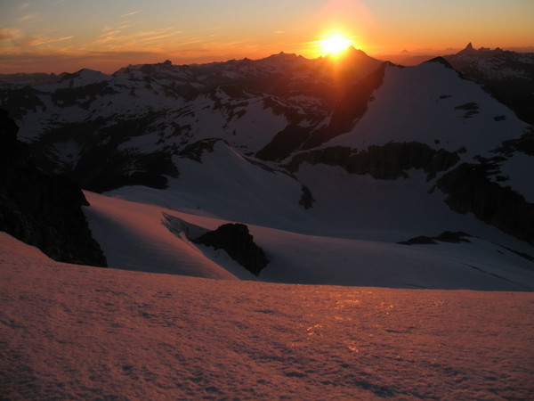
Sunset from camp.
On day 8, we awoke – to a whiteout – again! This was a little disconcerting, since we only had 3 days left until we needed to be back to Ross Lake TH, and we still had 3 peaks to climb (Phantom, Crooked Thumb, and Challenger).
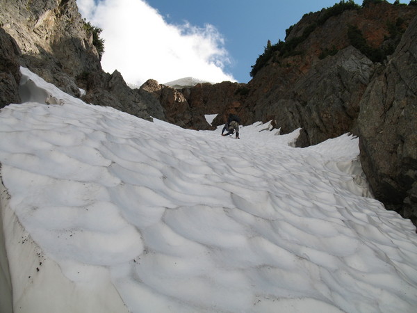
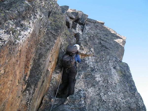
We packed up camp quickly and made a traverse towards Challenger. At this point, I had trashed the idea of summitting Phantom or Crooked Thumb in lieu of getting out out in time. I knew negotiating our route up through Challenger Arm and down Eiley Wiley to Big Beaver would be tough in whiteout conditions, so I wanted to give ourselves as much time as possible to get it done. But while on our way out of camp, the clouds started to whisp away into sucker holes. Brief sucker holes, but sucker holes nonetheless. While passing Phantom, I noticed a clearing in the clouds, and thought we should go for it. Sean disagreed. Plus he was beginning to get blisters from all the traversing with heavy packs and no rest. Sean agreed to wait in the swirling mist and clouds while I soloed Phantom. While on the summit, I encountered some very strong winds (gusting to 50) – and mist, which made the lichen-slick rock a little tricky. It took me a little less than 2 hours round trip to climb the 2000’ to the summit and back (snow to 50 degrees, class 3-4 rock). I signed the summit register and got down as fast as I could. When I got back, Sean was patiently waiting for me on a subsidiary ridge on the way to Challenger. We got rolling again, and the weather (thankfully) began to improve.
The weather improved so much that I was able to convince Sean in accompanying me on climb of Crooked Thumb. We started up a steep snow gully at the Challenger/Crooked Thumb Col. From here, we got onto the SW Face and followed a series of ledges and class 3-4 gullies (and enormous blocks) to just below the summit on the N Side. From here, we traversed onto the E Side, then worked our way S of the summit block. From here, a meandering 5.4 pitch got us on the summit.
We descended off Crooked Thumb (which took about as long as it did to climb), and headed back to our packs at the col. From the col, we spotted a steep gully (snow, then rock) leading to the Challenger Glacier, 300’ or so feet below the summit. We headed up it without much difficulty and were treated to some of the most amazing sunset views I’ve seen. Awesome!!
Day 9
Sean ascending to the summit of Challenger.
Challenger’s summit block.
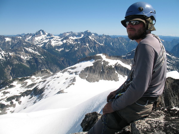
Sean on the summit of Challenger.
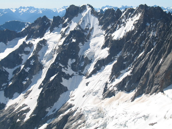
NE Face of Fury from Challenger.
Descending to camp.
Going home.
We’re going to miss this place.
On day 9, we awoke to bluebird skies. Phew! We quickly climbed the 300’ up to the base of the summit pitch and cruised up to the summit thanks to 3 fixed pitons. The views from Challenger are great. We could see Slesse peeking to the North, and the entire Chilliwack group. Baker and Shuksan were slapping us in the face, and so were the N Pickets and our entire traverse. Luna looked stunning and Luna Creek looked like a maze of brush. From the summit, we made one rap and descended the short distance back to camp.
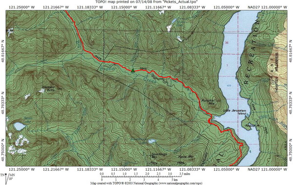
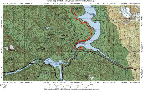
We decided that we wanted to try and make it all the way out to the TH on this day because we were hankering for a beer and Good Food. So we packed camp and were rolling by noon. We made quick work of the descent to Eiley Wiley courtesy of easy glacier walking. Eiley Wiley seemed to drag on forever though, and at 6PM we finally touched down at Beaver Pass. Instead of stopping to rest, we kept going down the trail, finally being stopped by blisters at 39 mile camp, ~11 miles from the TH. So much for getting out today.
Day 10
The last 11 miles dragged on due to our blisters, but we eventually made it out to the TH at 11AM. We hitchhiked into Marblemount and got a 6-pack at the Shell station. I made a call to the best Dad in the world who then came out from Tacoma (thanks Dad) and dropped us off back at Thornton Creek.
This was an amazing trip spanning a vast array of terrain, and posing a wide assortment of challenges. A true Cascade traverse of epic proportions.
Trip stats:
-53 miles
-30,000' gain
10 days
Route topos:
-
That's a pretty good list, John.
If it were my $5, I think Inspiration or Nooksack Tower would win the prize. Klenke might just be out $10 ($5 to Berdinka for Nooksack [or me since that's what I said when he asked the question on the climb] and $5 to Sky for Inspiration).
-
Interesting, Sky. I think we might have a winner.
Although I hear Nooksack Tower ratings are sandbagged (right PMS??).
-
I'm embarassed to have even written a TR after reading Klenke's masterpiece. Nice write-up, Paul.
Since the question has been posed, I'd like to put in my two cents. Having climbed N Hozomeen, I can say it is easier than Lincoln by a long shot. Fay has climbed both Hozomeens (and is closing in on 2000 summits) and she said Lincoln is the single hardest peak she has ever climbed. N Hozomeen can and has been climbed in a fairly normal day via the border swath. I challenge anyone to make a daytrip of Lincoln.
Having also climbed SE Mox, I can also say it too is much easier. The E Peak of SE Mox might be harder, however -- especially the Layton/Wolfe route, but that's not the easiest route on the mountain which is what Klenke's question is about. Of course the approach on the Moxes is much longer, but I don't remember a single time where I was stopped on an approach. I can't say the same about an actual climb.
I'd also say the best answer to Klenke's question is Nooksack Tower.
I haven't climbed in the N Pickets yet, so I guess I can't compare. I'll let you know in about 12 days, though.
-
That's a big wall! I remember looking down on it climbing the W Ridge and thinking to myself I'm glad I'm not on it.
Nice TR, even if you didn't summit.
-
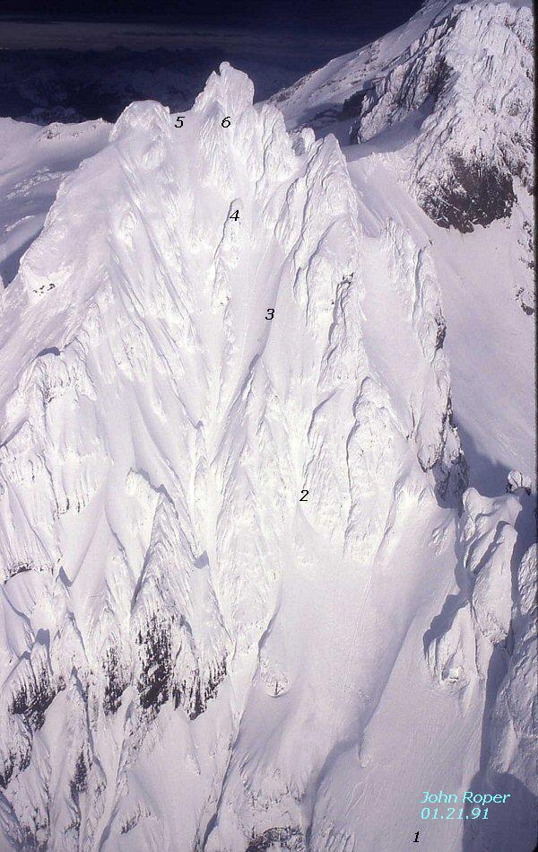
Photo courtesy of John Roper
This weekend, Fay Pullen, Paul Klenke, Sean Martin and I summitted Lincoln Peak (9,080'+) via the only known route (The X-Couloir, as John Roper has dubbed it). Lincoln Peak is one of the Black Buttes, a subsidiary summit of Mt. Baker, and is on the Washington Top 100 x P400 list. Only John Roper, Don Goodman, and Silas Wild have finished this list. It is a variation of the Bulger List which omits the Volcanic sub-summit 800ft prominence rule and relys strictly on elevation and prominence.
This was my third attempt, and Paul, Fay, and Sean's second.
Fay picked us up at Sean's house in Seattle. We made a quick stop for breakfast in Burlington, then drove up the Middle Fork Nooksack Road to the Rankin Creek Rd. We were able to drive all the way to the current road's end at ~3600', adding some sweet new slide alder markings to Fay's paint job (thanks Fay). I'm not sure the extra 500' and 3/4 mile was worth it, and I'm pretty sure Fay isn't either, but it was fun.
After having used the Rankin Ridge approach the past two attempts, we decided to try something different this time and walk the road to its end right below the basin. This turned out to be the right choice. From road's end it's a 2000' gain to the basin through fairly easy forest. After 3 hours of pleasant walking on solid snowpack, we reached camp at 6,000' on an island of conglomerate with great views over to Lincoln and Seward, the Twin Sisters Range, and Heliotrope Ridge.
We got to sleep early in the blazing heat, and attempted to get a few hours of shut eye before our planned wake up time of 2:30AM. This would provide us with the window we needed to avoid the sluffalanches, rockfall, and numerous other objective dangers that plague this route.
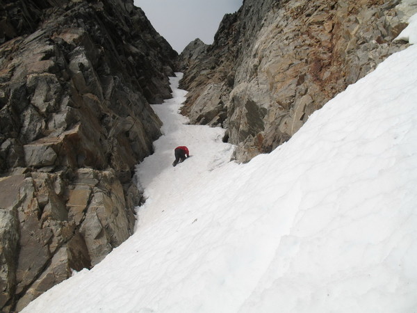
At 3AM we started up towards the bergschrund. On past attempts, the bergschrund was easily bypassed on the left side, but this time a huge moat had opened up and we were forced to find another route through. The schrund was open quite a bit, and there was one weak looking snow bridge on the right side that looked OK. Paul and Fay probed around for an alternative route on rock to the left, but ultimately decided to follow Sean and I over the exposed snowbridge above gaping cracks (protected with 2 pickets).
Above the 'schrund, it's easy climbing on moderately steep snow for about 500' (#1 in above photo), before crossing over an arete (dramatic knife-edge in early season). The arete this time was fairly benign. We then made a traverse to the first crux gully, a very narrow 50+ degree constriction between huge conglomerate cliffs with an avalanche runnel running right down the center (#2 in above photo). We simul-climbed this pitch to the top, making quick time to avoid being hit by sluff. At the top of this gully we encountered rotten, unprotectable snow that eroded away with every step. It was very tough to make progress through this section, and we were very careful. This ate up some time.
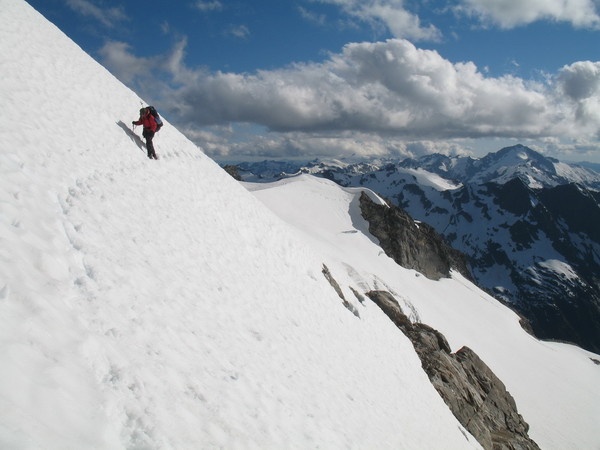
After the first gully, we encountered the second knife-edge snow arete, which was [thankfully] far less pronounced than on our May attempt (#3 in above photo). Klenke led accross this arete to a tiny, fragile rock island with about 1500' of vertical drop below us. Paul belayed the rest of us accross so we could regroup before the final steep snow gully.
The final gully (200', 45 degrees - #6 in above photo), although superbly exposed, posed no great challenge other than psychological. When I heard Paul's rebel yell, I knew we only had a rope length to go before all four of us stood together on the summit.
The final summit scramble (again extremely exposed), was partially snow-covered 4th class, crumbly volcanic conglomerate.
And finally after all the planning, blood & sweat, lost pickets, and 5 attempts between us, our ecclectic group of climbers stood on the summit of one of the least climbed mountains in the state. The summit, an aerie perch barely capable of holding 4 climbers, is a great place. The views were 360 degrees of pure awe. Lincoln's proximity to the Puget Sound, Vancouver, Mt. Baker, the Cheam Range, and the rest of the Cascades and Olympics makes it an unbelievable vantage point. The view of Mt. Baker was second to none. Lots of little climbers down there.
Our trip down took 7 hours. 11 rappels got us down (7 on deadmen pickets, 4 on rock horns). Our final rappel was over an overhanging full-flowing torrent of a waterfall guarded by a gaping crevasse at the bottom. Both Sean and Fay were completely soaked and had to immediately head back to camp (thankfully only a 30 minute walk away). Meanwhile, Paul and I made it out a bit on the drier side.
65 year-old Fay Pullen, an amazing woman of superhero proportions, continues to amaze me. She was with us every step on this climb and didn't seem shaken one bit. Congratulations, Fay for such a great achievement in your climbing career. Fay only has one peak left to climb to finish the Top 100 x P400 list. WOW. My hat's off to you, Fay.
Thanks to everyone for making this trip happen, and thanks to Klenke for the invite. This was a long time in the making for all of us, and such a sweet victory in the end.
And nothing could wipe the smile off our faces.
I didn't take any photos this time, but Klenke and Fay did. Paul intends to write up a TR with pics soon (in which case we'll combine them into one thread).
EDIT: We didn't find a summit register, but we did place one. We logged every name in it that we knew had summitted (approximately 20 people going back to Fred Beckey and team in 1956). We know there are probably others who have climbed it, and would be interested in hearing from people that have.
-
I assume you're talking about the Cutthroat Pass Trail. I have not been up there recently, so can't offer any info on it, but I can tell you that there is a lot faster way in from HWY 20 at Swamp Creek (probably cuts the approach time in about half).
Gain the ridge to Methow Pass (cross-country), with very minimal brush. Traverse the ridge up and over Pt 7140 and descend into Snowy Lakes. Now would be a GREAT time for this route.
-
My follower failed to get my purple C6 out of Givler's Crack and I didn't notice until we got back to the car. A free 6-pack and good karma to whoever brings it back.
-
Hey Malcolm,
Out of curiosity, why do you not like the Dynafit Brakes? I'm thinking about switching to Dynafit, but several accounts of accidental releases bothers me.
I'm currently on Naxo NX01s. I'm 6'0, 235# and the Naxos seemed like a good choice for me, but I'd like to switch to a lighter setup, but only if I don't have to worry about a) gear breaking and b) accidental release.
-
Good info. Thanks for posting.
-
There's a few ways to do this, the best choice dependent on conditions. If there's a lot of snow when you go (like now), then it could be a nice ski out the Chikamin, up and over Sinister, and out down Spruce Creek to S Fork Agnes. A lot of the brush could be covered with snow right now, but it won't be for very much longer. I'd bet you'll see solid snow down to 4500' over there right now.
Another way to go is around the S side of Dome, but you have to drop a little bit of elevation (down to ~6800' - Klenke knows this route well). To go this way, you'd have to drop down from the summit of Dome onto the Dome Glacier and go around the W side, then the S side of the mountain eventually finding a gully that allows you to access the basin due S of Dome. From here you can find a gully (class 3) that'll bring you up onto the unnamed (on the USGS) glacier S of Sinister Peak.
Another way is to go out Holden via Ross Pass and Lyman Lake, but this is the longest option (brush free, though).
Your best bet if you're bailing (beleve it or not) is to go back out Bachelor Creek.
Have fun, that's a nice area.
-
Some of my first climbs were in jeans, too (I know I'm not the only one). Keep on keeping on. Having fun is what climbing and being in the mountains is all about.
-
There are a couple of small cracks on this very minor glacier, but they are shallow. Definitely not worth bringing a rope.
-
Thanks for sharing, Amar. I think we can all learn from your story. I know I did.
-
It's within a week or two of melting out. Steady snow doesn't start until just before the bridge, ~1 mile before the TH. It is mountain bikeable to there. Snow in the parking lot is about 12"-18" deep. The aforementioned slide is no longer a factor. This info is from a trip I made 4/20-21.
-
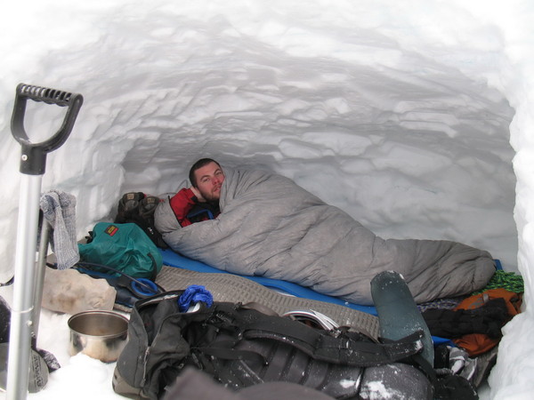
I did a little experiment this weekend..
I slept in a snowcave wearing only a FF Icefall down parka, primaloft jacket, Volant pants, hat, gloves, and Scarpa Freney boots (on a blue foam pad). I was warm enough to fall sleep everywhere except my feet - which kept me awake. My watch read 4 degrees at 3AM. My partner slept in a 30 degree rated bag with all his clothes on and he seemed to be about as warm as I was, but his feet weren't cold in the bag and he slept the majority of the night. His bag weighs about 1.5 lbs. He didn't have a down jacket, but had a down vest and primaloft and was wearing them. Conclusion: sleeping bags are the way to go. I would absolutely not want to go up to 11,000' in January and rely only on down clothing. Although it probably won't be any colder than it was this weekend where we were, things have a potential to get a lot nastier at 11,000'. I doubt the addition of a bivvy sack would be the deal maker.
The snowcave was not designed to stay "warm" for this experiment (i.e. sleeping chamber was not above the entrance). It was only designed to keep the snow and wind off of us.
-
Bummer. That tent had history.
-
Summitted Hood via Hogsback this morning (4/12)..
Conditions were OK during the night (we left the parking lot at 1:30AM), but a little bit warmer even than expected so postholing was a factor (for those without skis or shoes). We saw lots of folks booting it up and suffering (many turned back). We didn't hear any rumbling all day, just minor sluffs and ice pellets. Back down to the car at 10AM. What a beautiful day!
-
I have not done the route in June, but have climbed it in February. True, the ledges are the standard route for a Winter ascent. In average snow years, the ledges are usually out of shape by mid-June. Who knows if that'll be the case this season. Obviously (or not) that's all going to depend on what happens between now and June.
I don't know your background, but I feel obligated to offer this advice: There's been an extraordinary amount of snowfall this Winter, with not much consolidation. Consider that when you're gauging conditions for a trip to the ledges this year, even in June.
Check out Gauthier's blog, the avy forecast, and this forum for recent conditions before you head out.
Golden Gardens Pub Club (Seattle)
in Events Forum
Posted
NW protective services started announcing they were going to close the gate in 10 minutes starting at about midnight. We figured that was a good time to leave!