

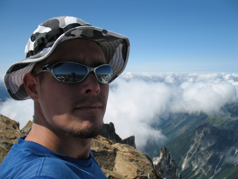
Tom_Sjolseth
-
Posts
541 -
Joined
-
Last visited
-
Days Won
2
Content Type
Profiles
Forums
Events
Posts posted by Tom_Sjolseth
-
-
Likewise. Except I'm still paying for the meatloaf.
-
@Gene.. funny, I said the same thing about the antennae.
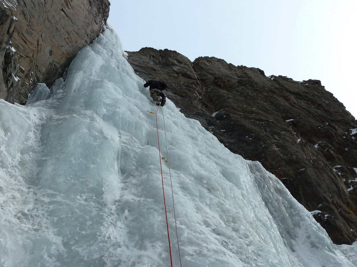
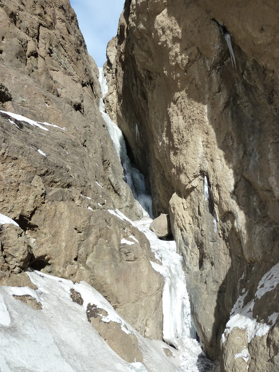
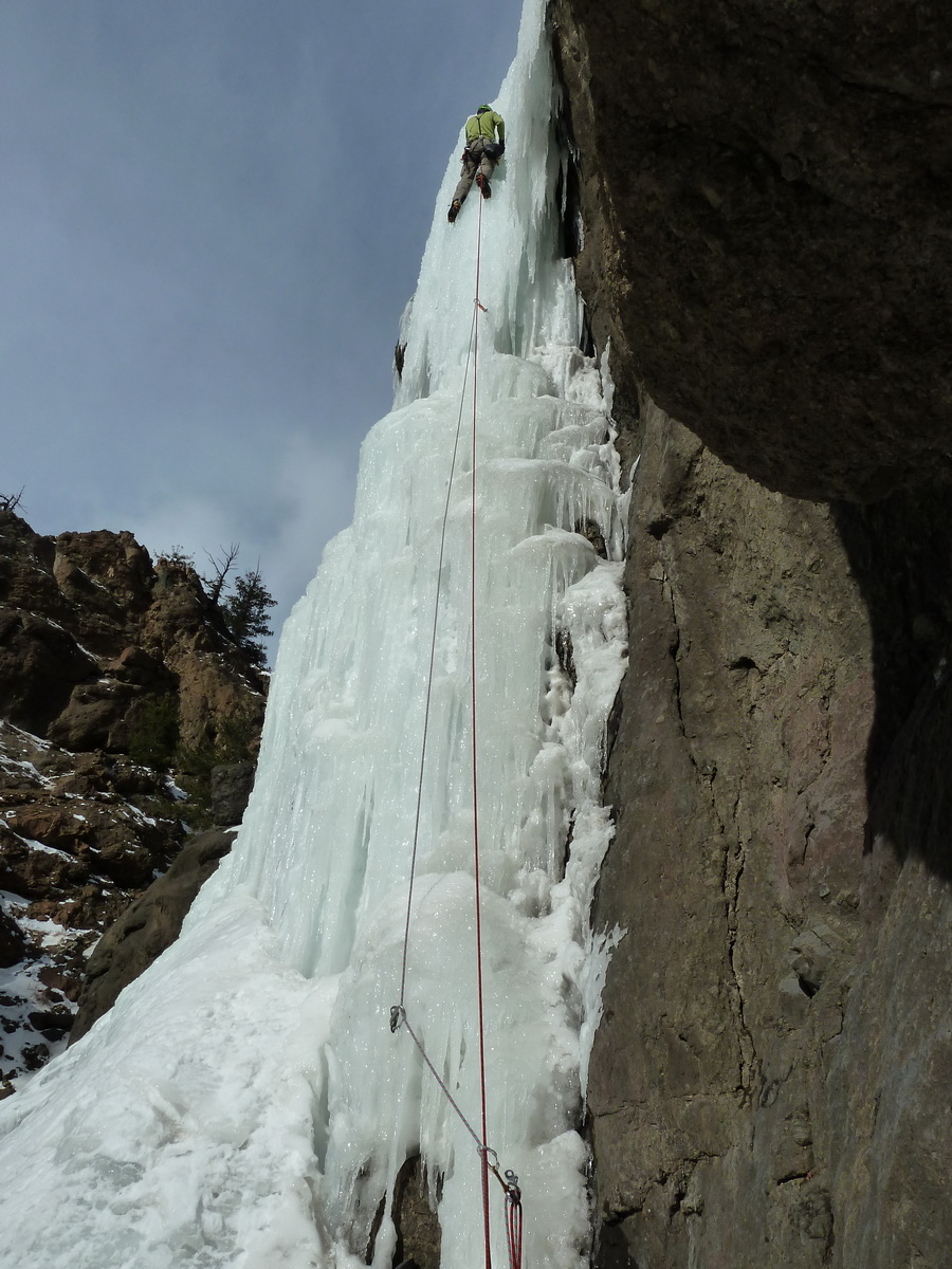
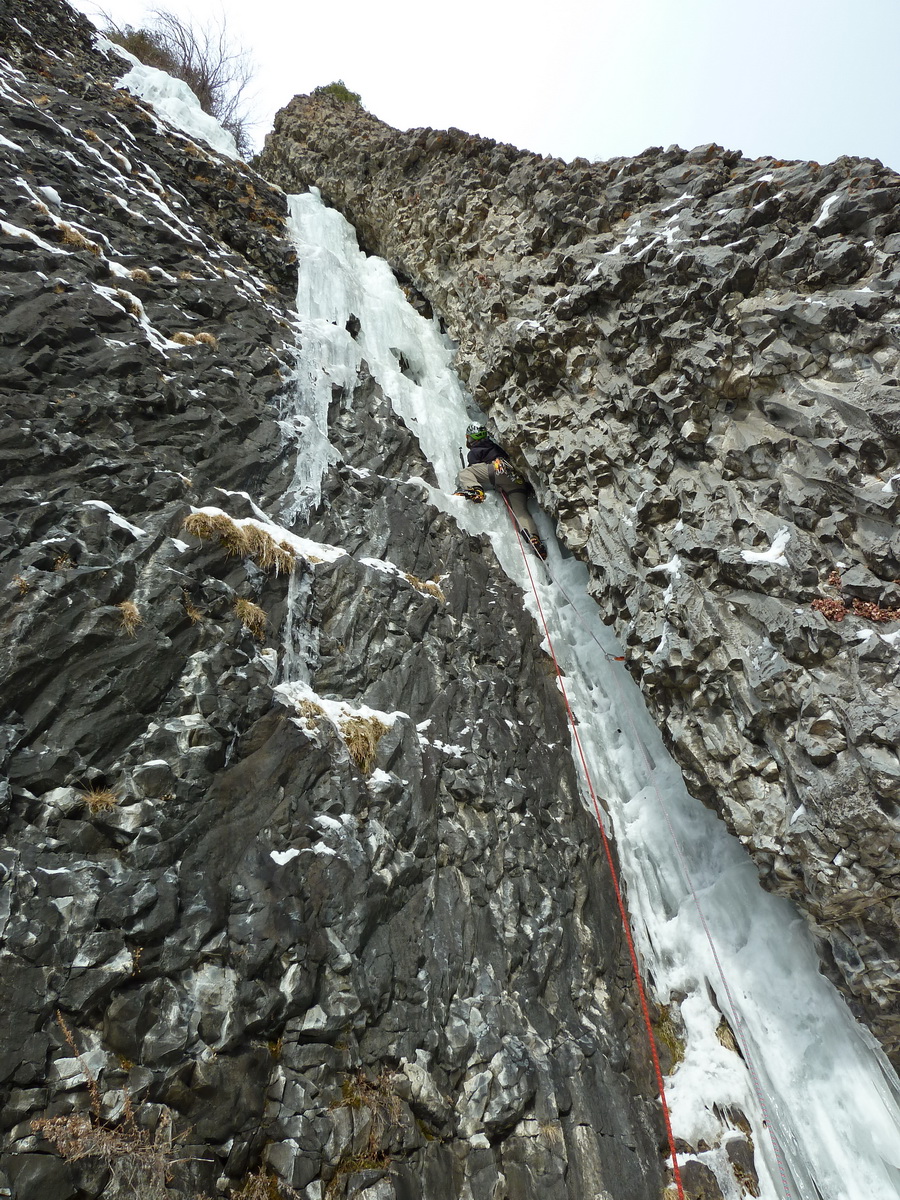
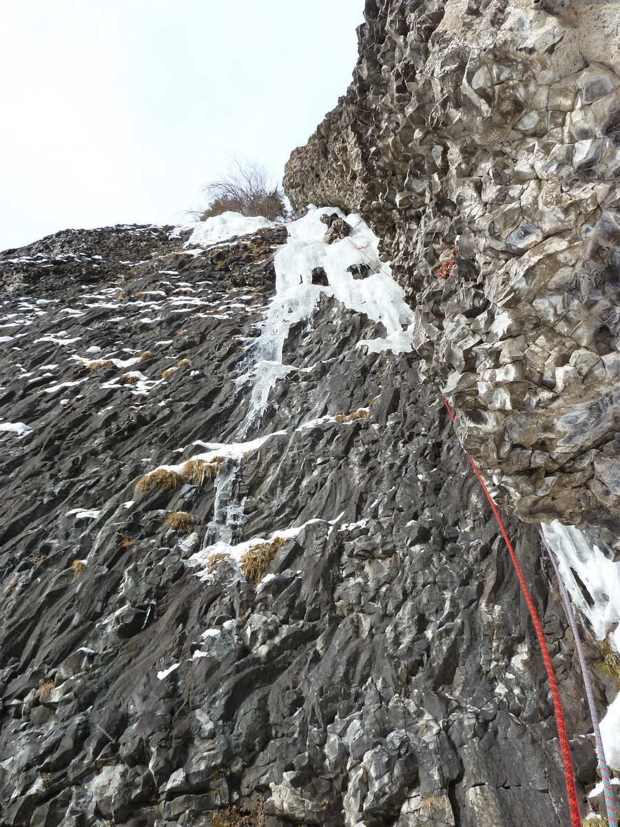
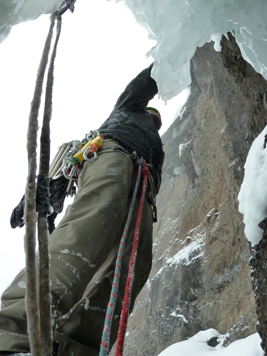
@mhux.. Considering the crux had essentially no ice covering the slab, the M6 rating seems legit.
The final crack above NY Gully felt difficult to me.. 5.8 in crampons, but good pro.
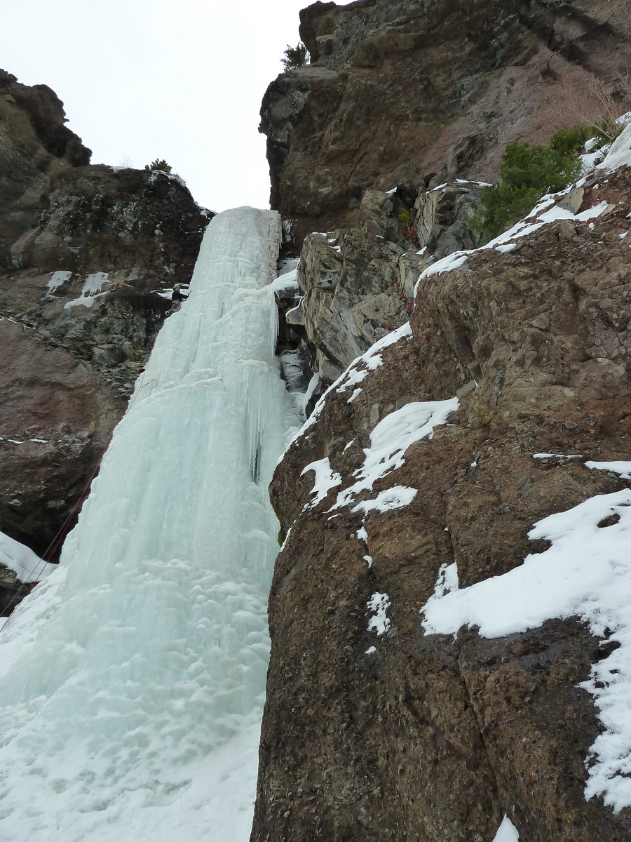
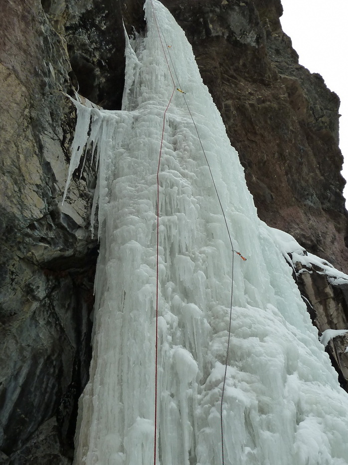
The first two pitches of PE are straightforward right now (AI3). So straightforward that we felt fine soloing. I didn't see any WI at all on the entire route.
I'd say the only difference between the grade the original party established and the difficulty you'd experience in current conditions is that the R rating could be dropped.
So IV, AI3, 5.8, M6 seems right.
Wayne could probably elaborate more.
-
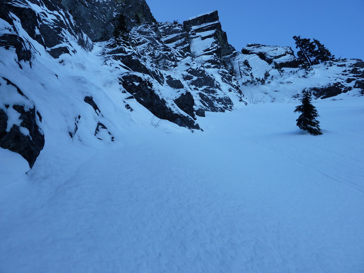
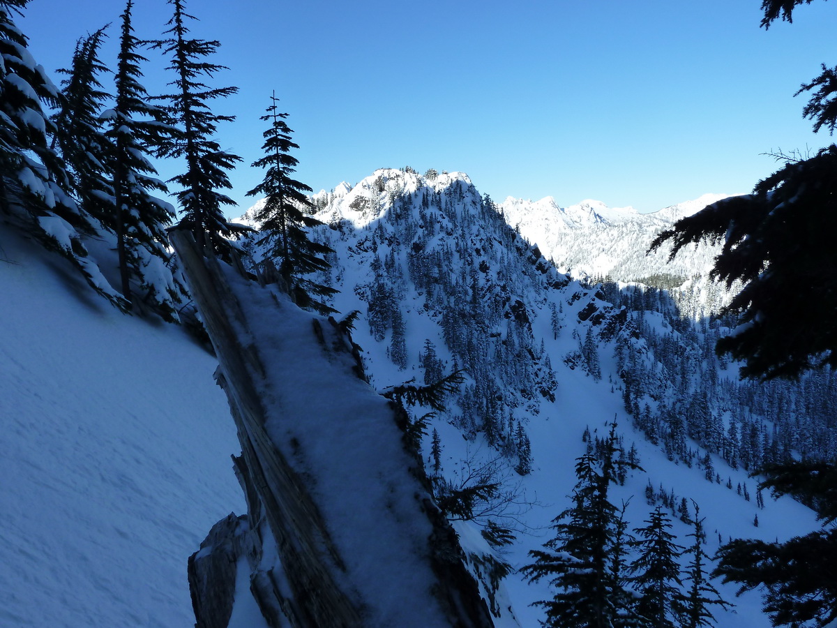
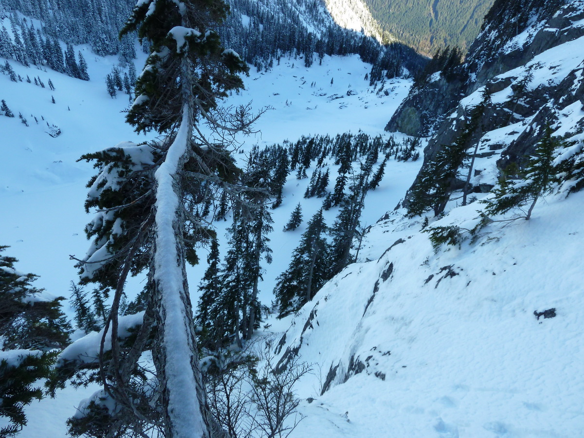
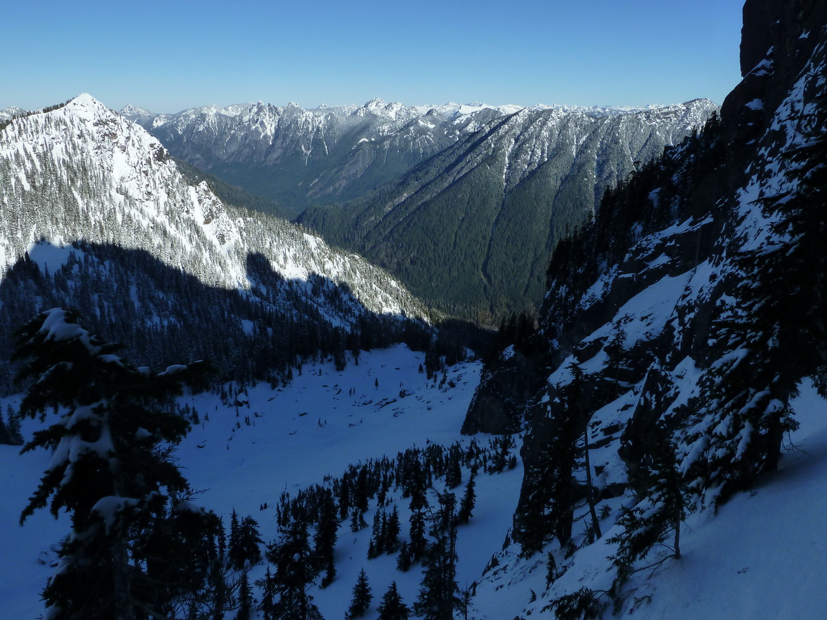
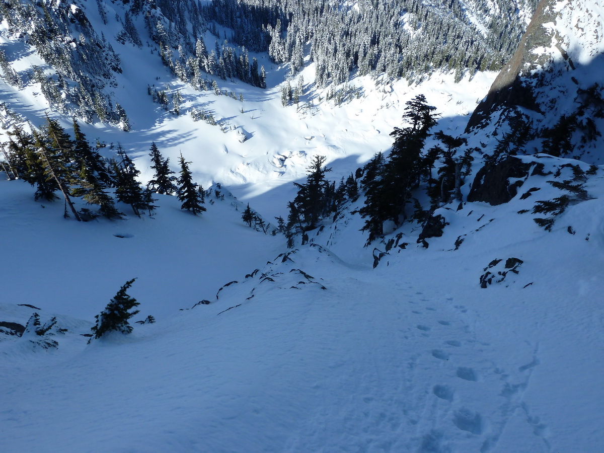
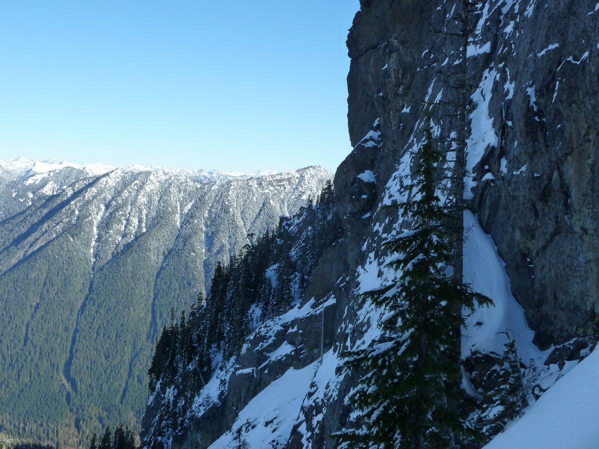
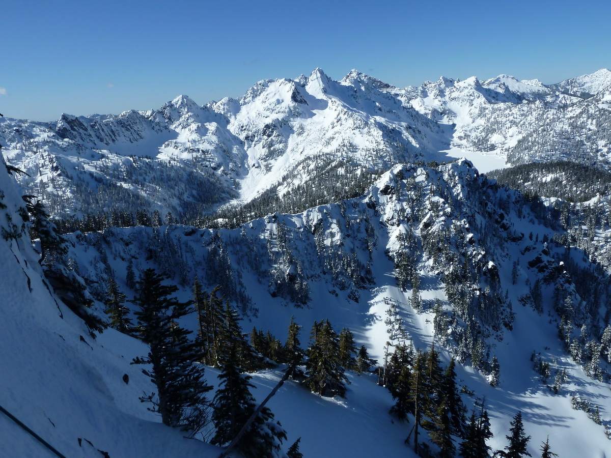
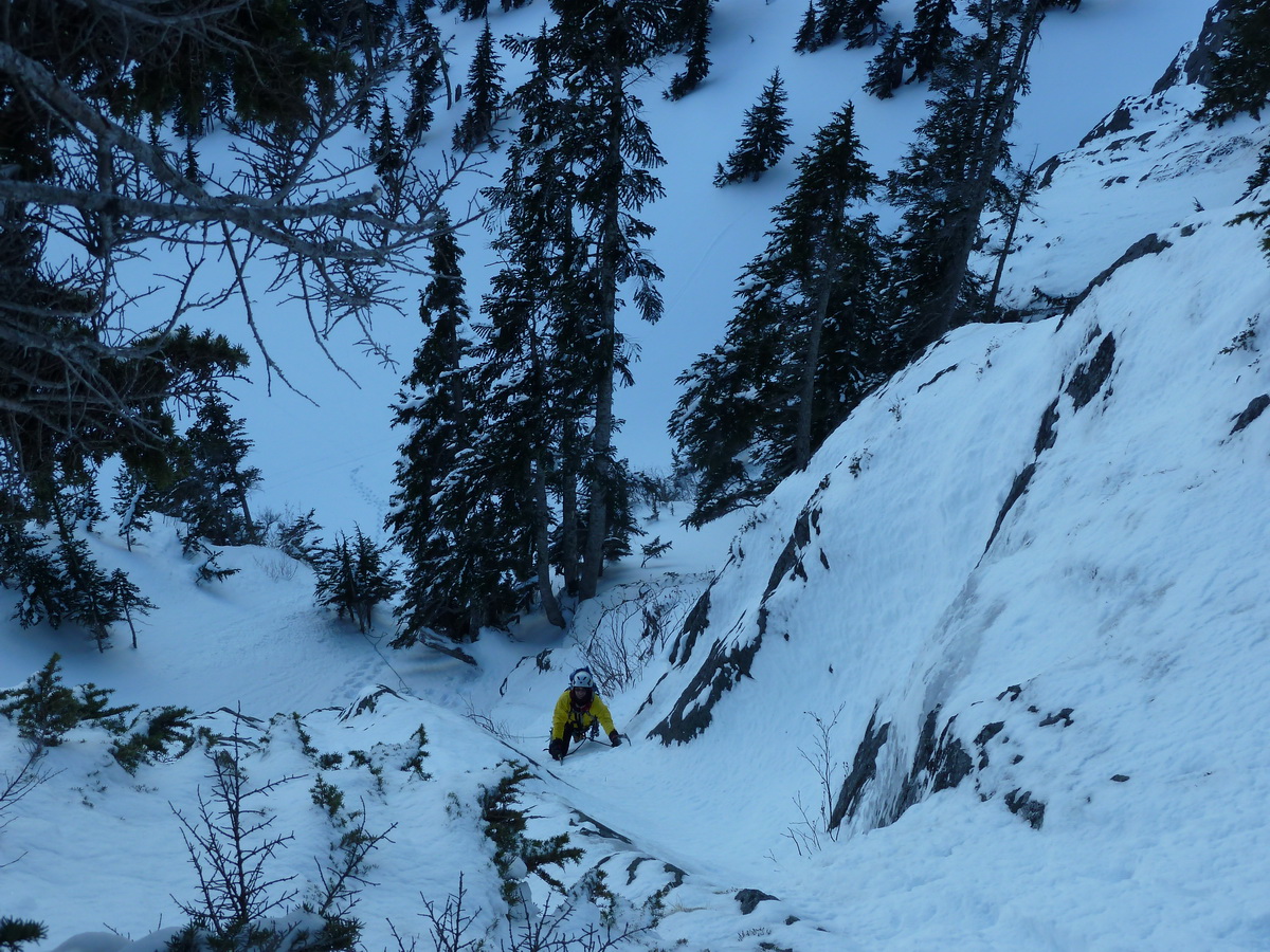
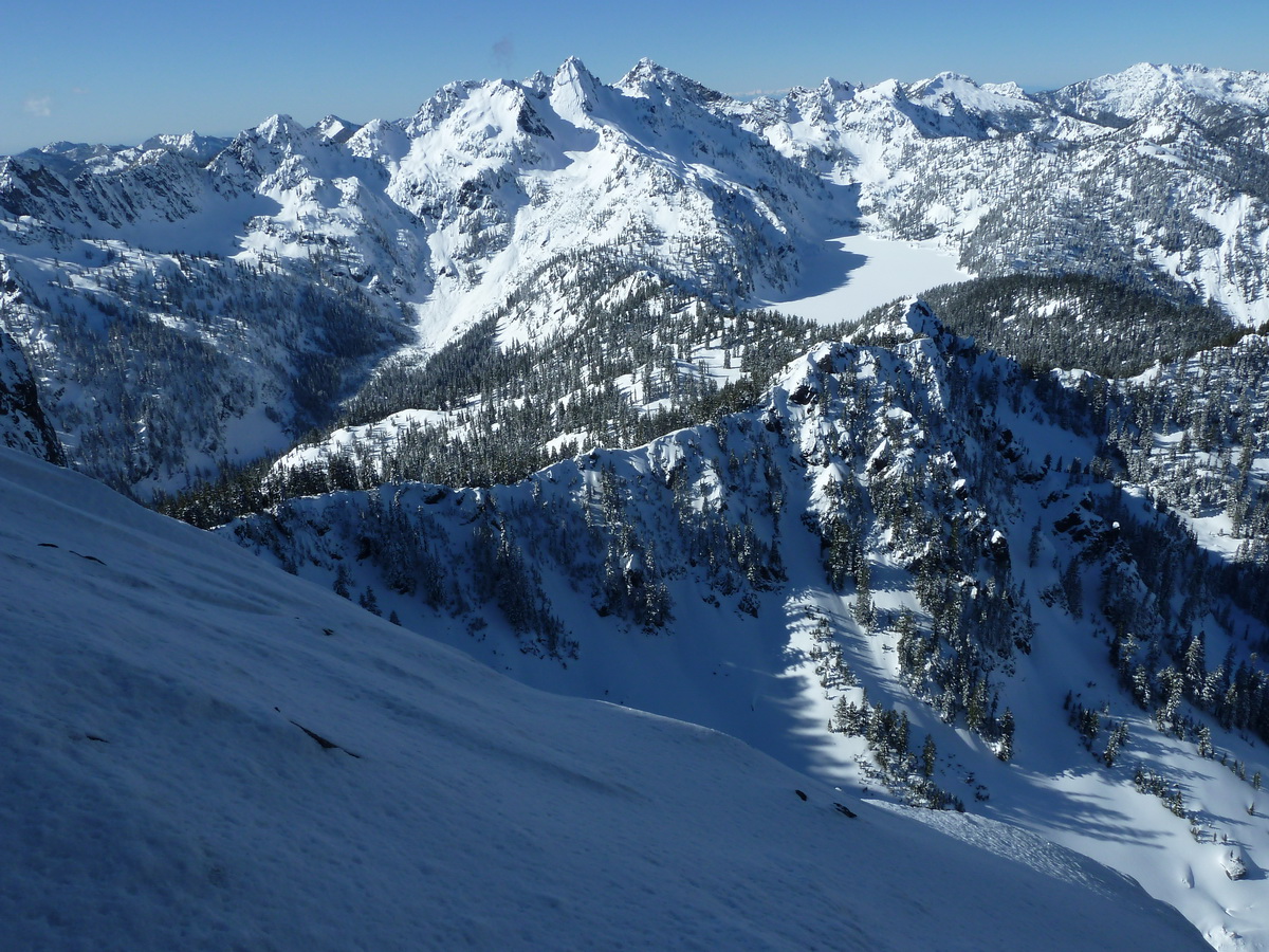
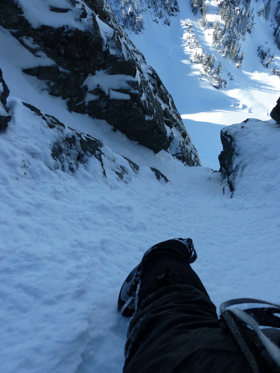
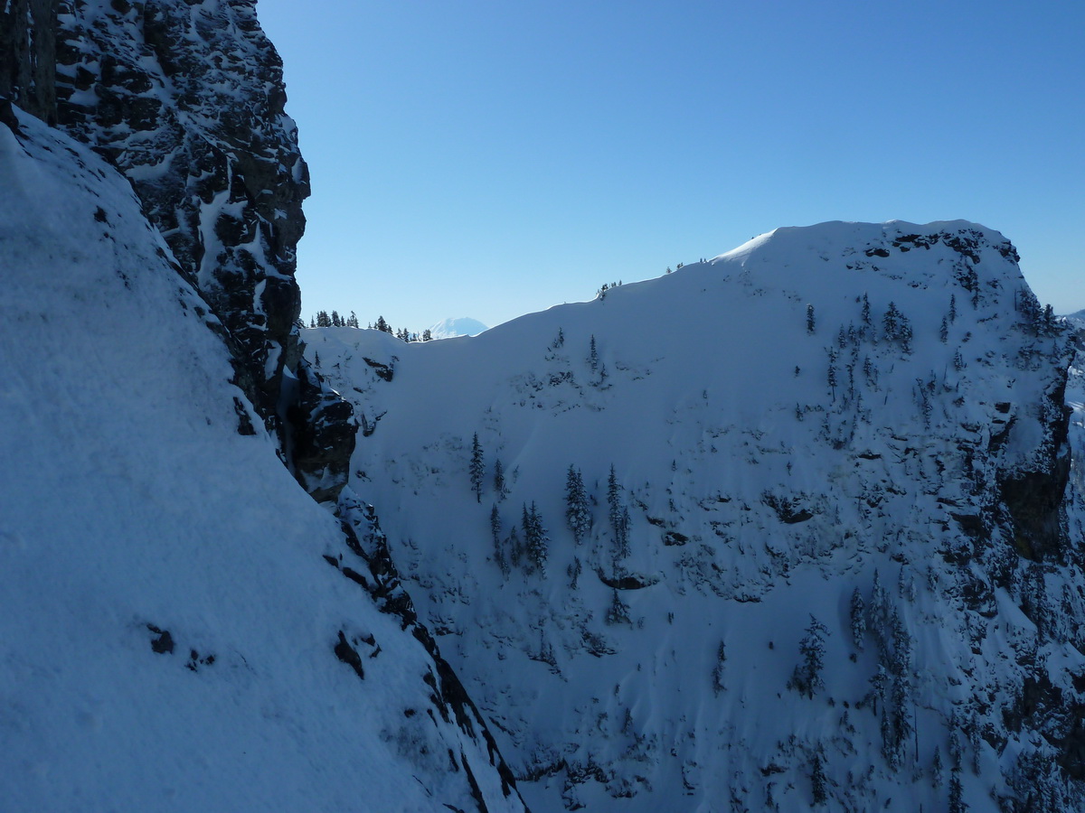
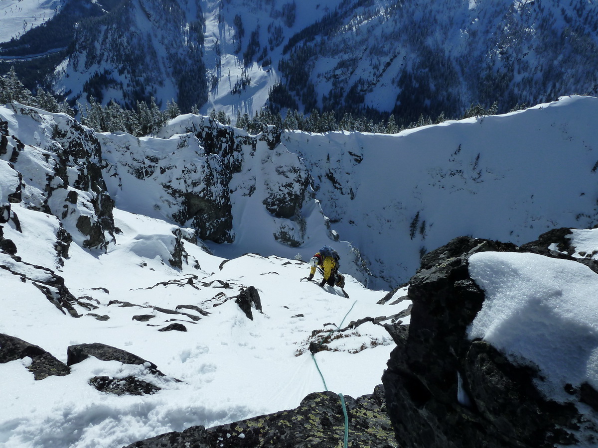
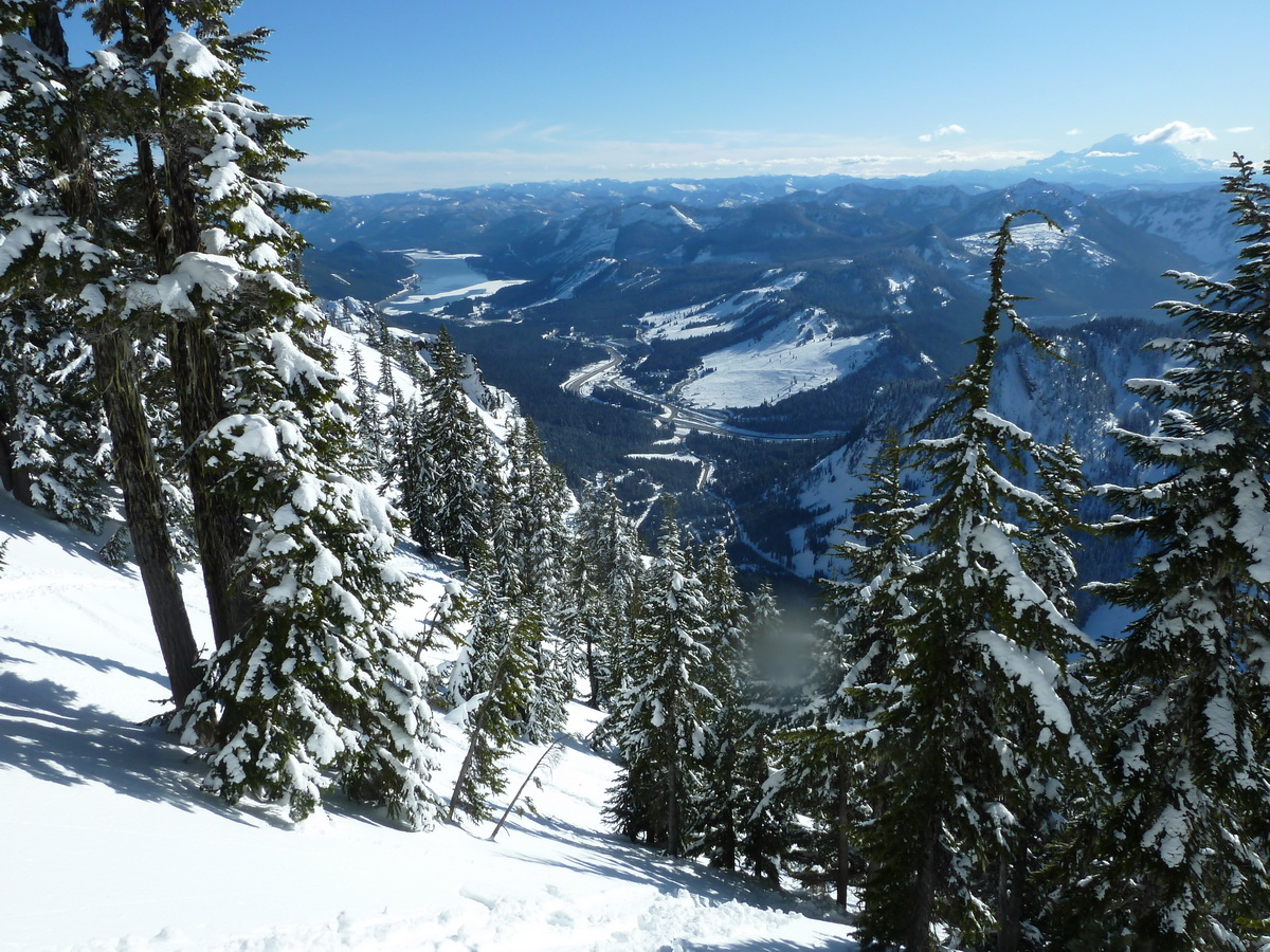
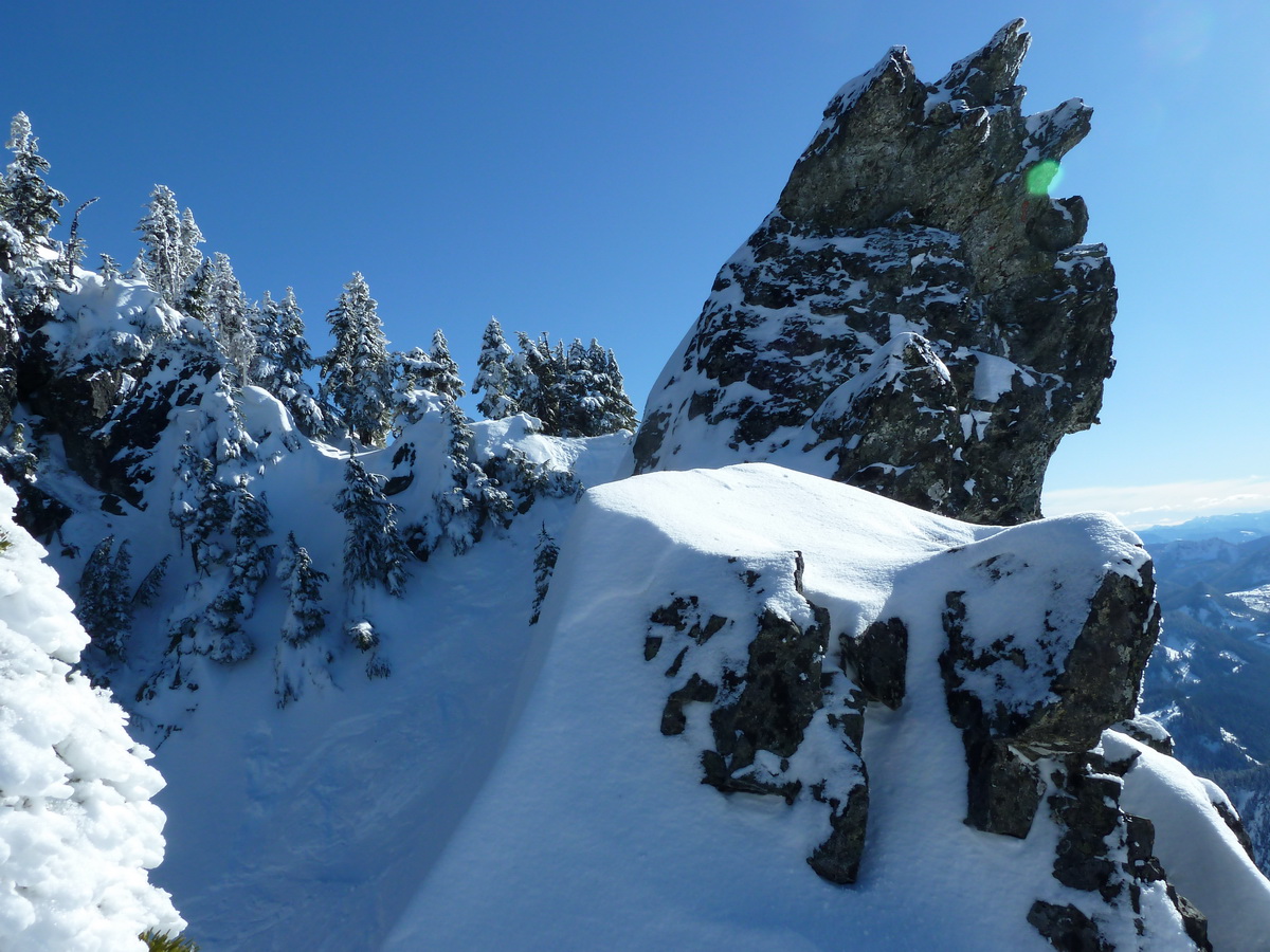
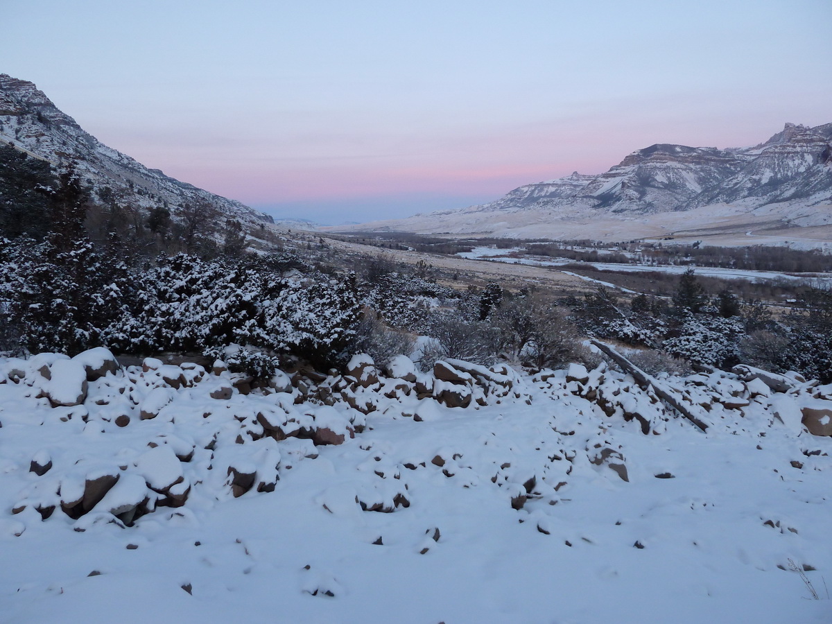
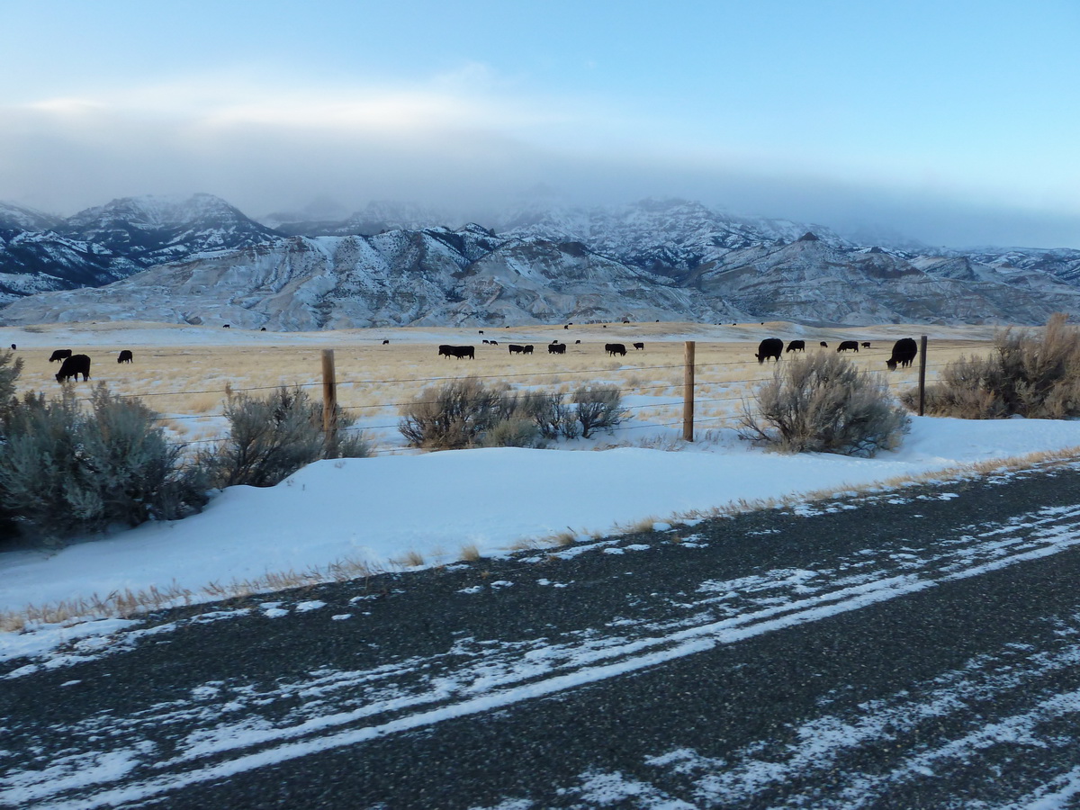
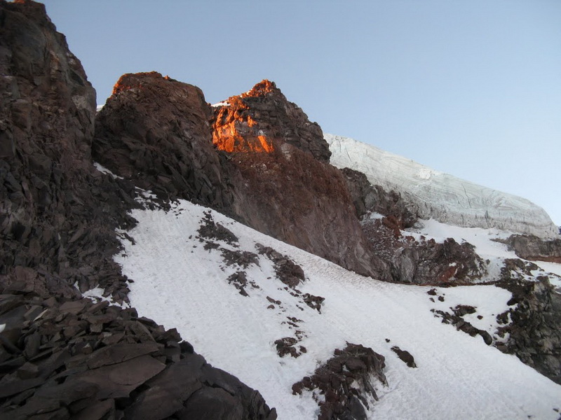
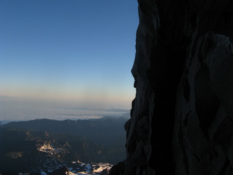
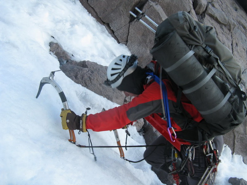
Trip: Snoqualmie Mountain - Pineapple Express
Date: 2/19/2011
Trip Report:
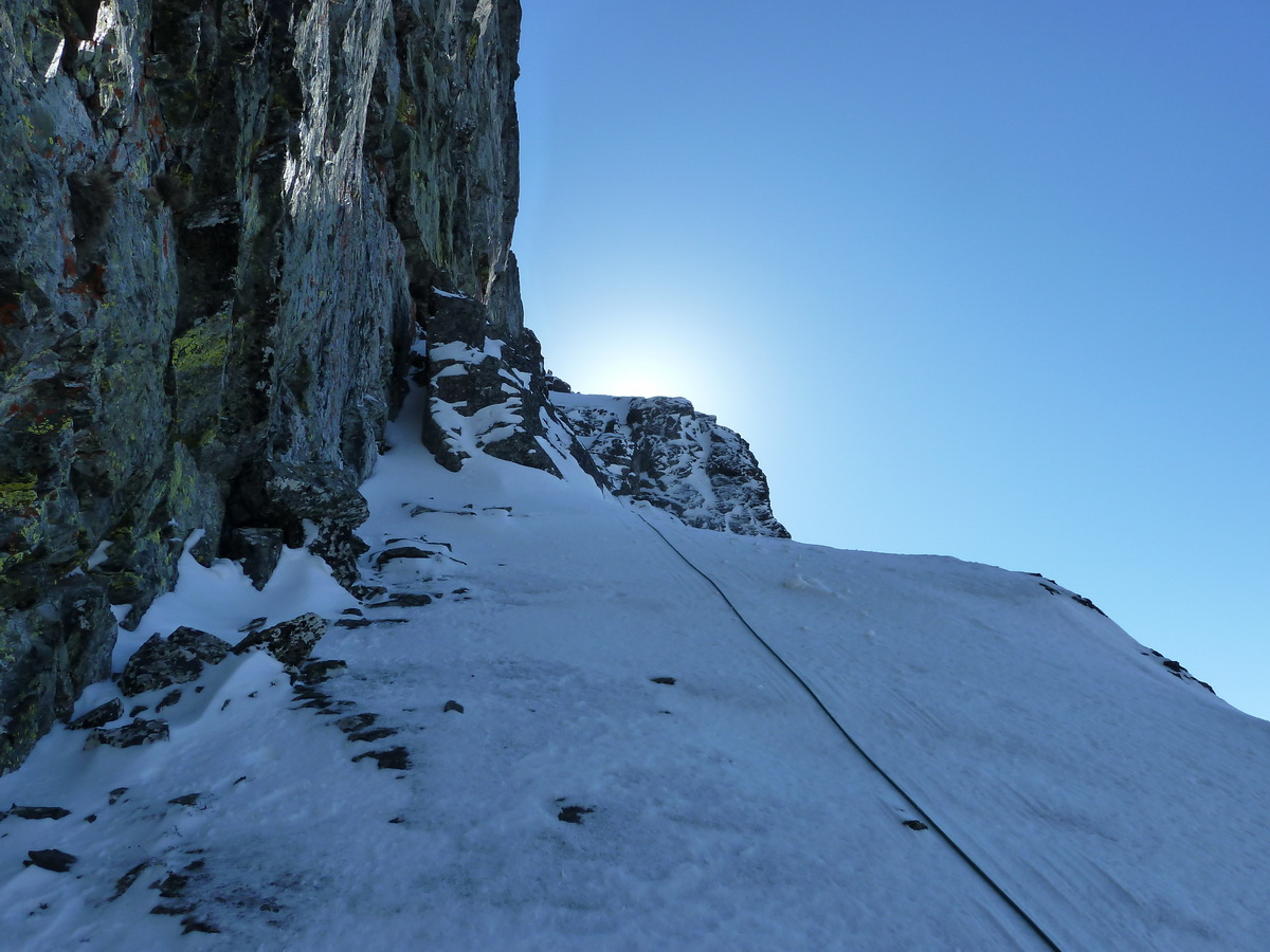
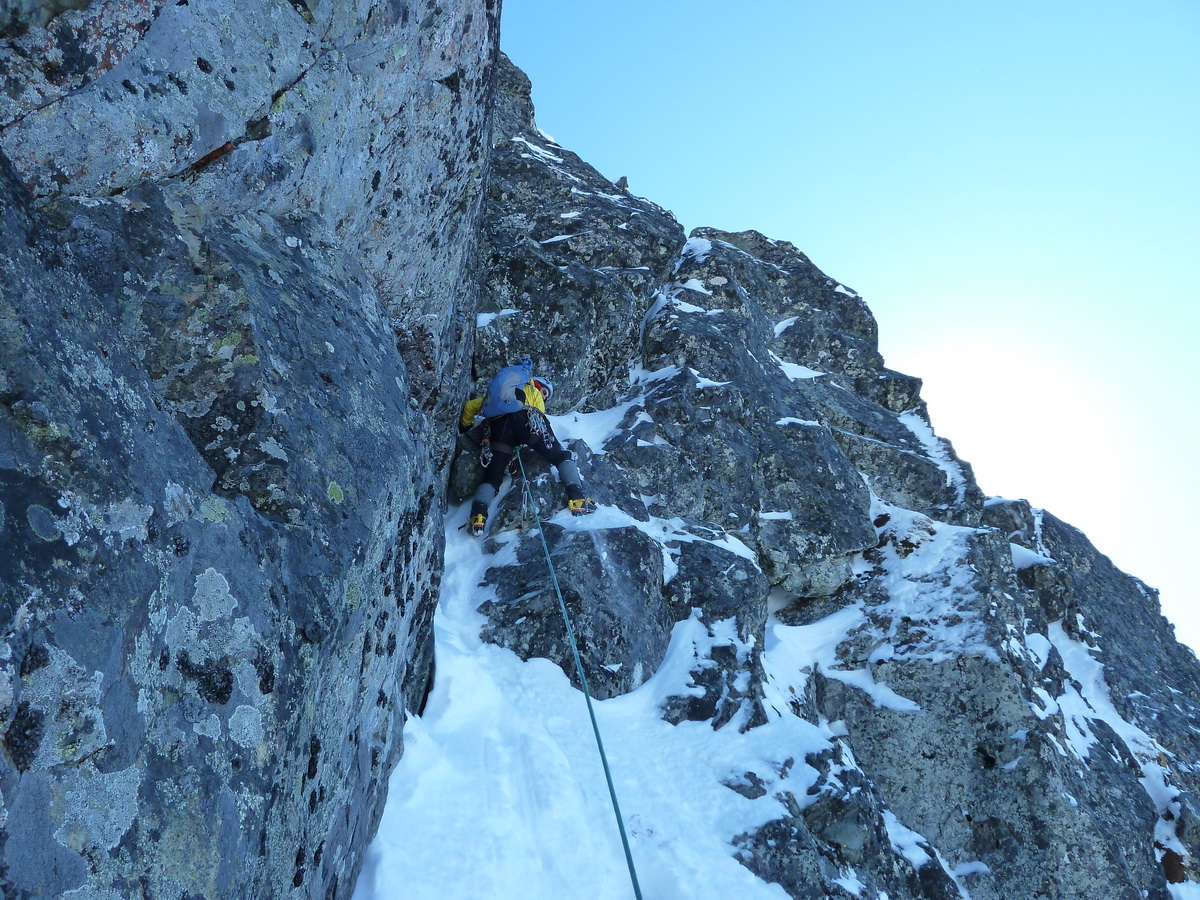
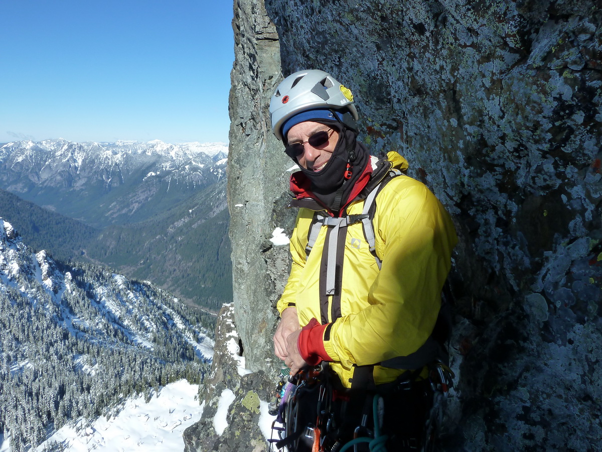
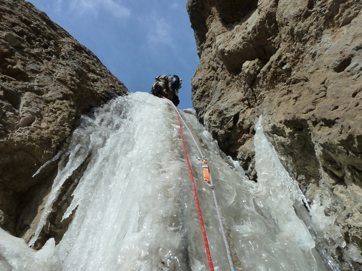
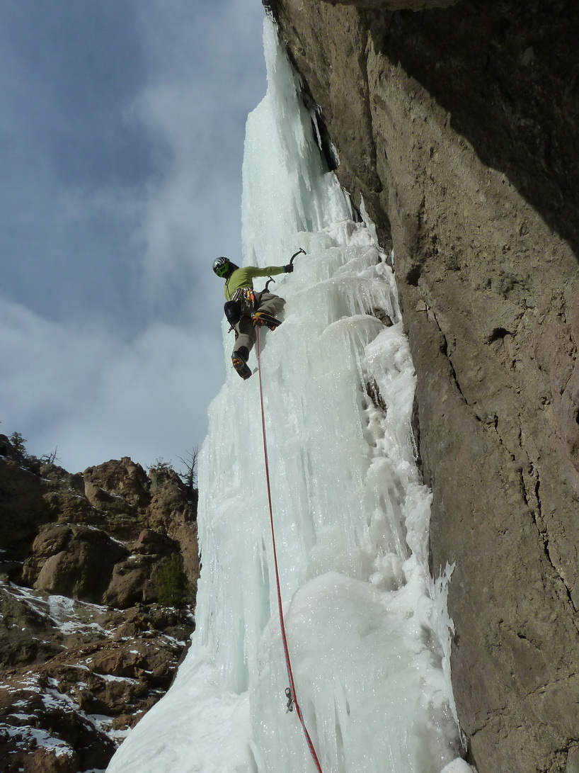
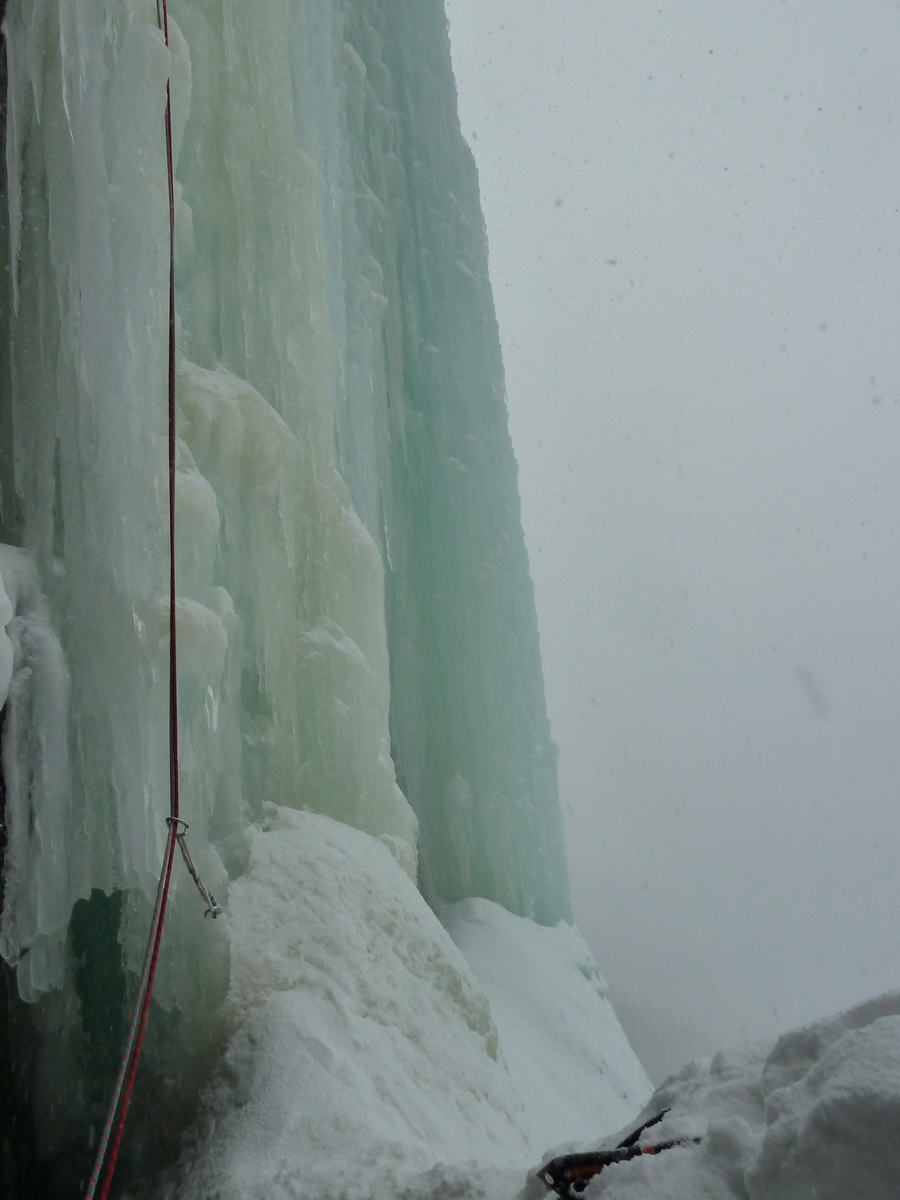
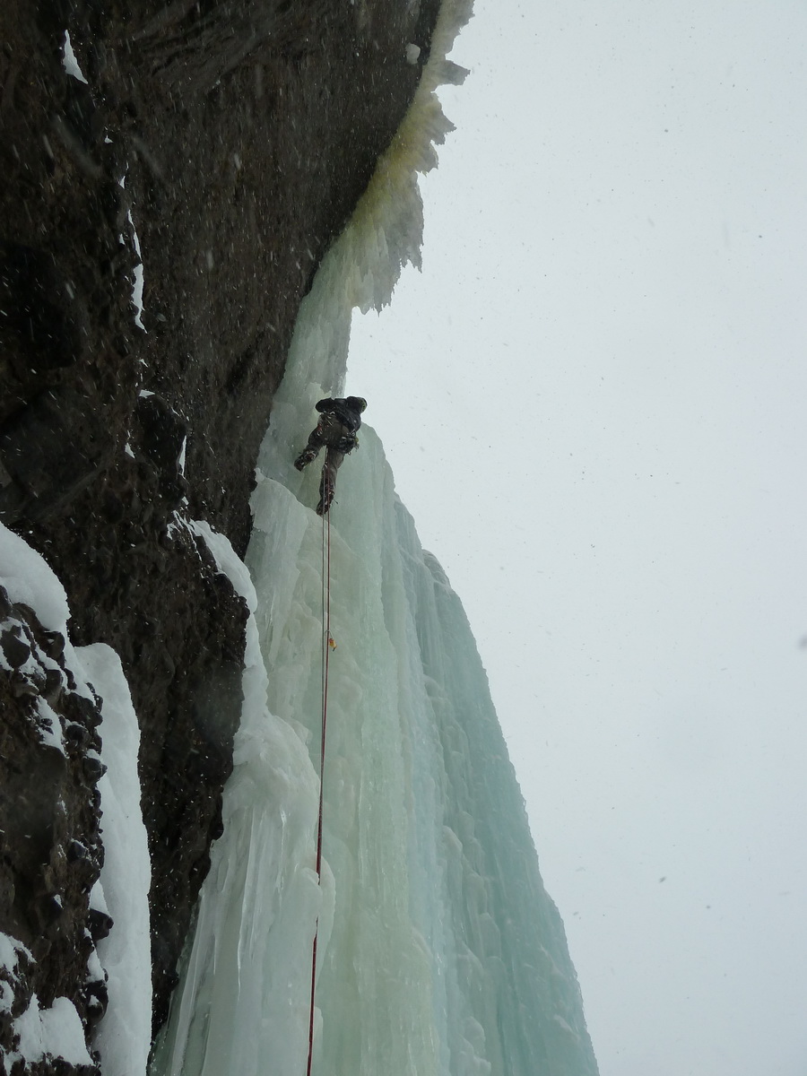
Wayne and I climbed Pineapple Express on the North Face of Snoqualmie Mountain today.
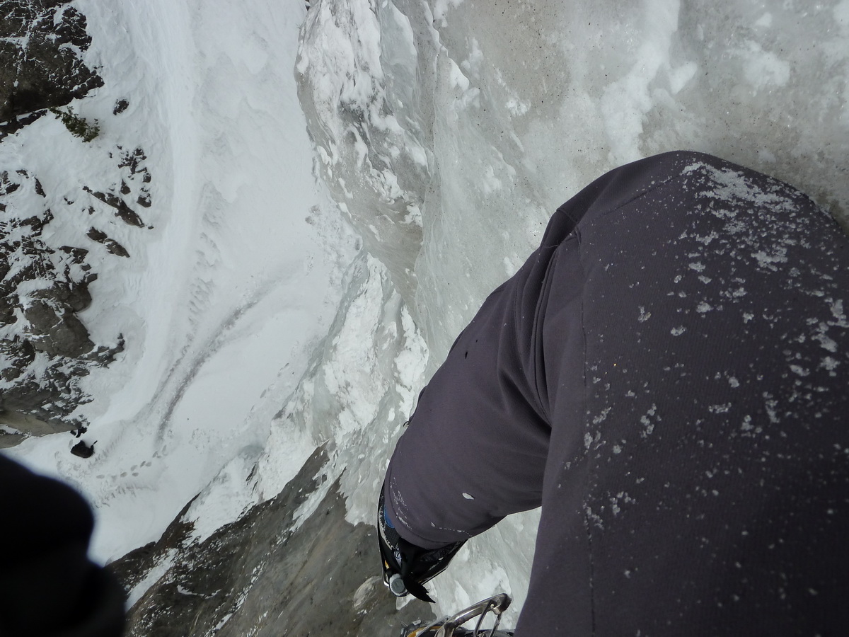
We started off from the parking lot around 5:15. We took our time heading up the Phantom Slide under vibrant moonlight. After some technical difficulties including a dropped camera, we soloed the first two pitches on perfect alpine ice. We roped up at the base of the third pitch and belayed three pitches from there, simuling the ledge traverse.
The route is in fat conditions right now. In fact, NY Gully, Blue Moon, and Pineapple Express are all fat.
On the way out, we ran into a few cc.com locals and rendezvous'd with them at NBB&G for beers and food. What a great day!
Thanks to Wayne for being a great partner and leading the money pitch.

-
It dumped for about two days, then cleared out again. Overall, we had pretty excellent conditions.
-
Nice trip, and great photos.. helmet or not.
-
What a great trip! Thanks to Wayne for being a great partner.


-
Nice work. Looks like fun!
-
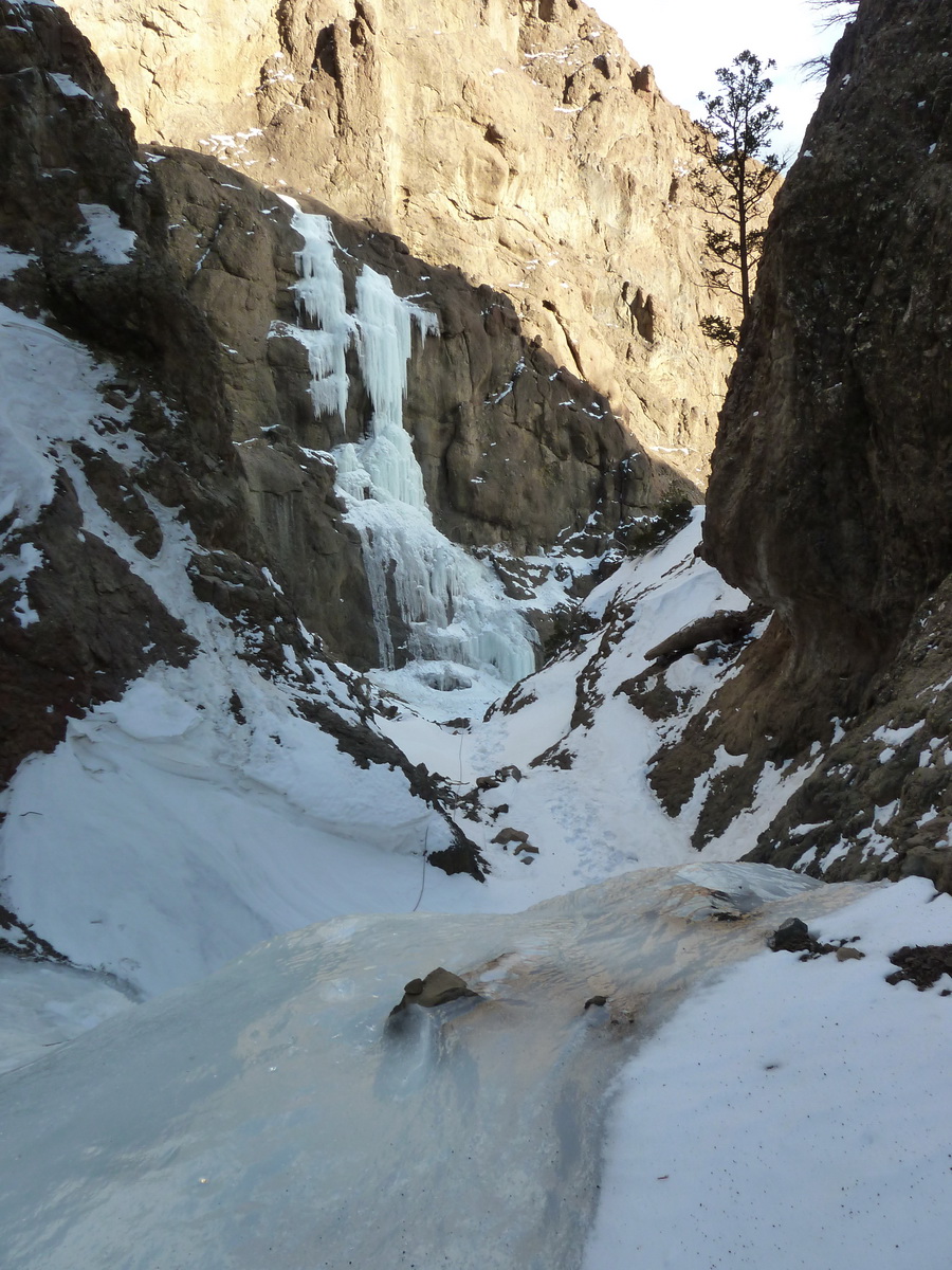
Unfortunately we didn't know we were even on Slow Turning because we had left the book in the car, and only intended to climb Stringer. Upon looking at the upper pitches of Stringer, they looked boring, so we decided to climb the more exciting ST pitch #6 which we spied from the drainage. We didn't see any more obvious pitches above the one we climbed, so we set up a top rope and did laps. Upon returning to the car, we realized we were on a nice route and wished we had investigated further up and climbed the remaining 2 pitches (reportedly WI5, WI6). Oh well, next time (hopefully in March).
Cody is an amazing place, and far exceeds the quality of routes that Hyalite has to offer. That said, we had a blast in both places and will be returning soon.
Brad.. that was us. If you need any beta, feel free to PM me. I got a lot of good info from Mr Frieh.. much appreciated.
-
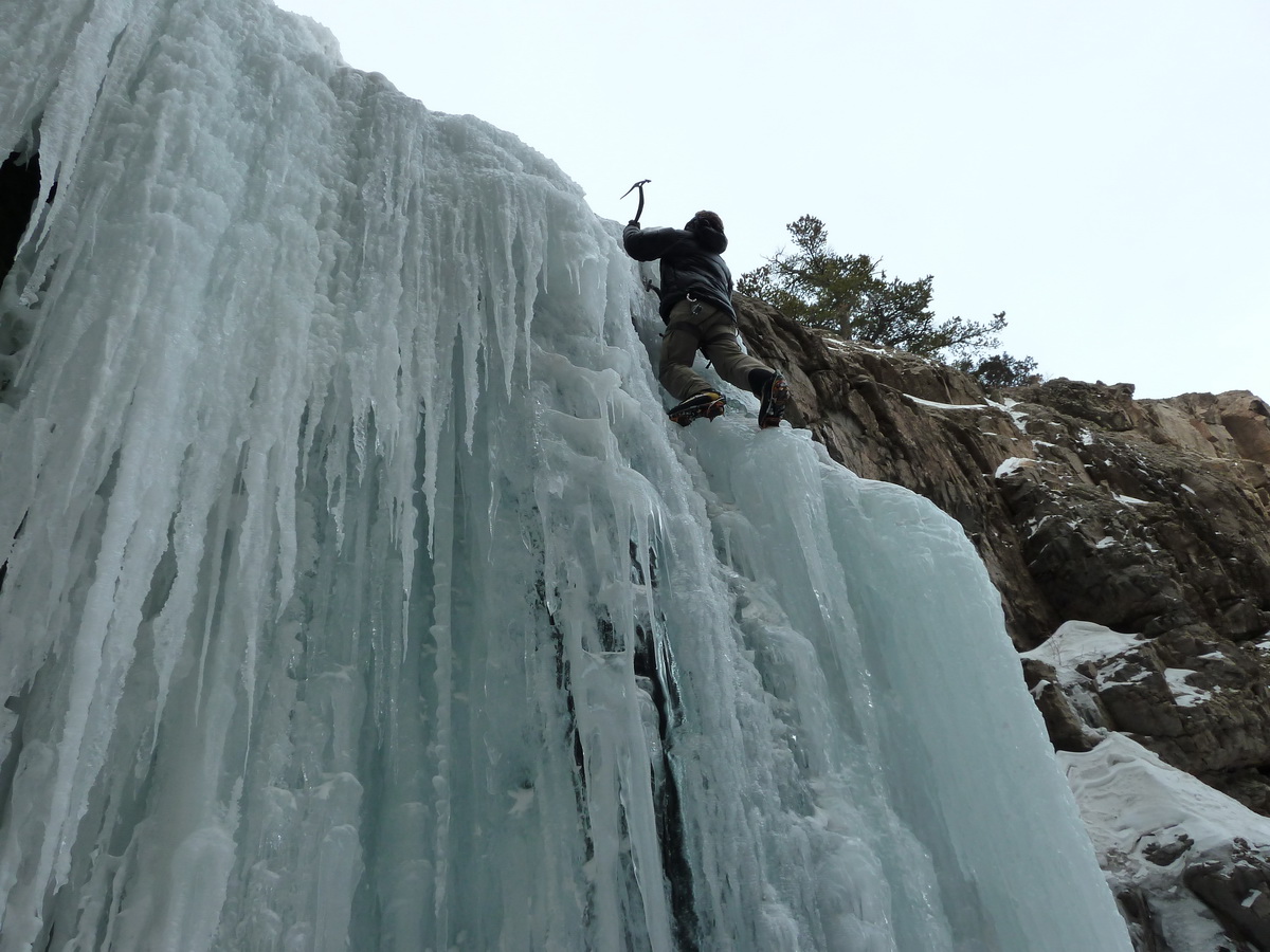
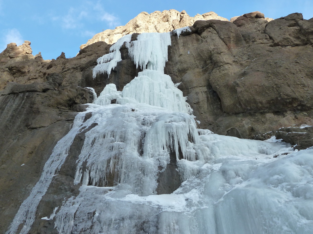
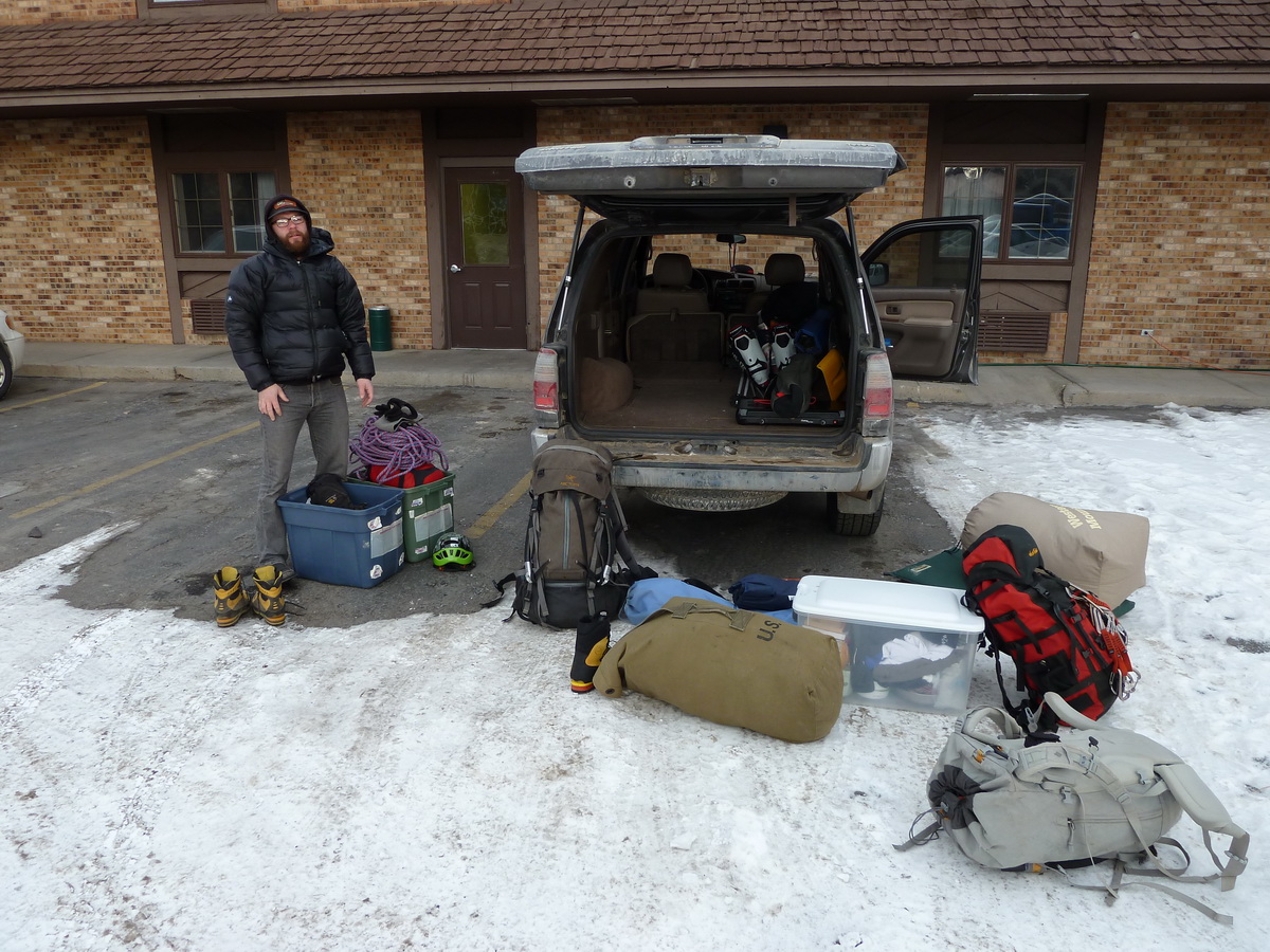
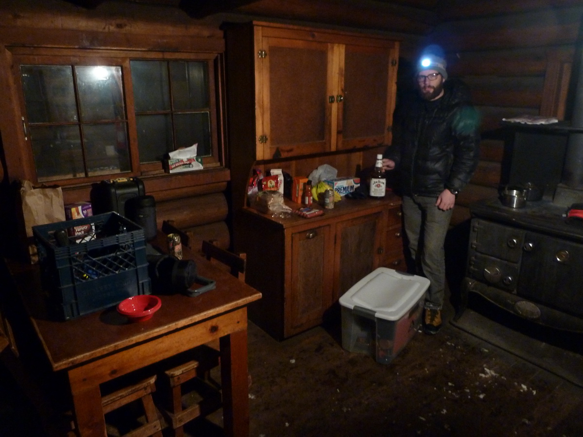
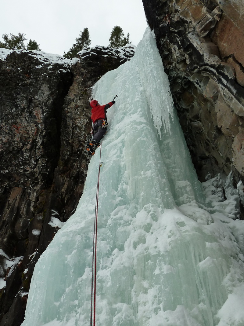
Trip: Cody, WY & Hyalite, MT - Various
Date: 1/9/2011
Trip Report: No Country for Cold Men
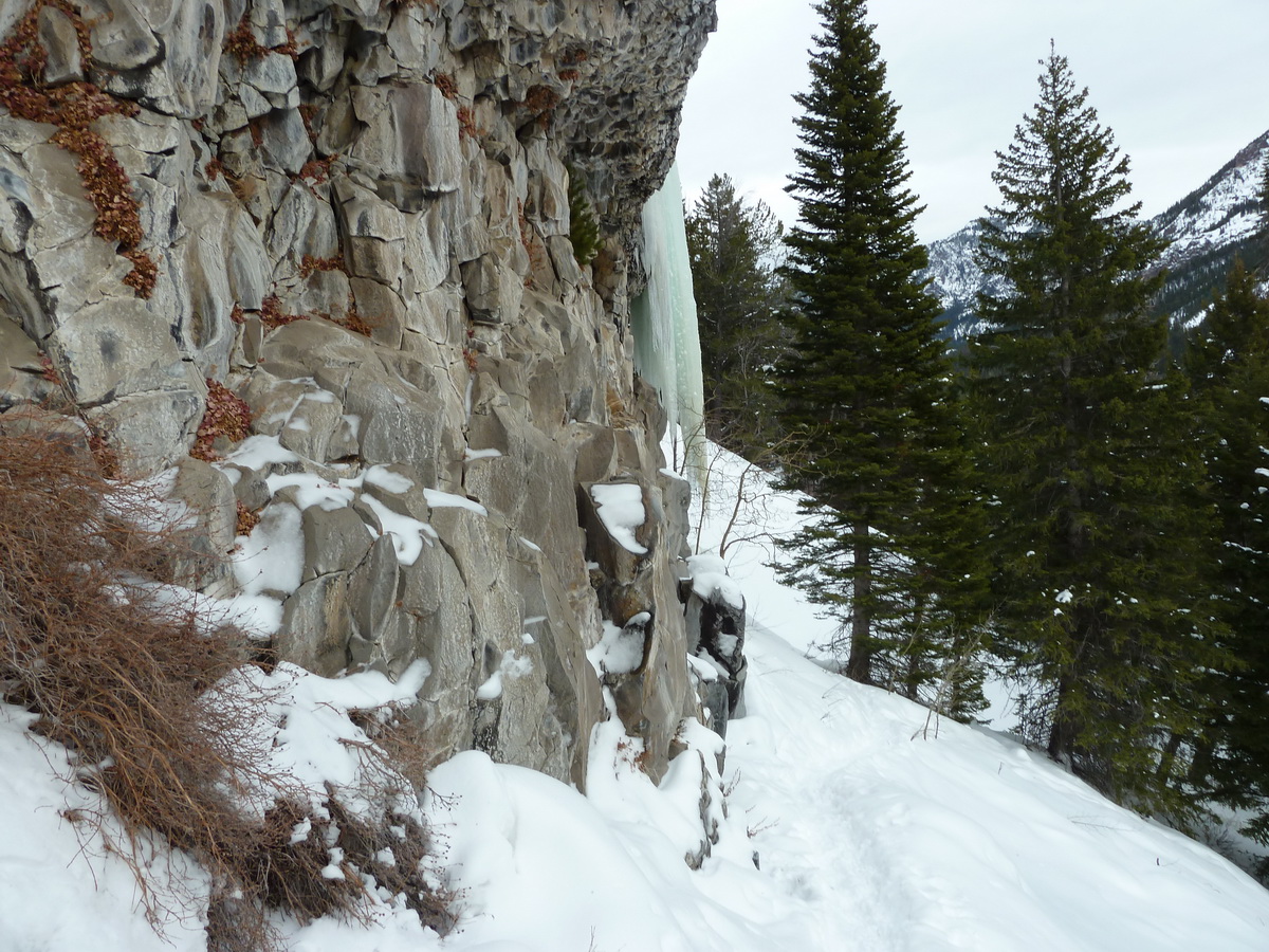
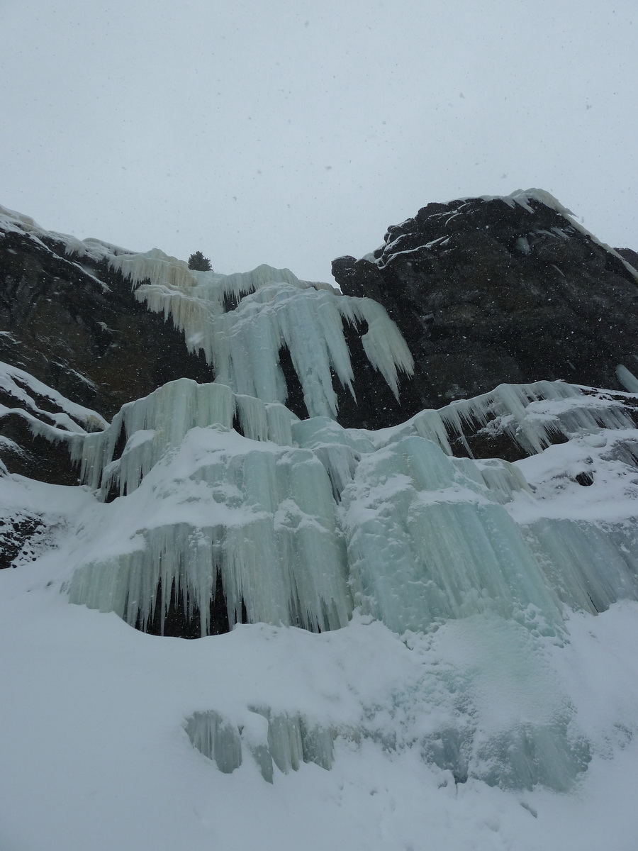
Had a good time in Cody & Hyalite recently. Temps were super cold when we arrived (down to -20). The ice was brittle on most of the climbs we did in Cody, but we still had a blast.
Cody:
Welcome Wagon (WI4)
High on Boulder (WI4)
Stringer (WI3+)
Slow Turning (WI5)
Hyalite:
Elevator Shaft (WI3+)
Thrill is Gone (WI4)
Curtains (WI4)
Scepter (WI5)
Cleopatra's Needle (WI5)
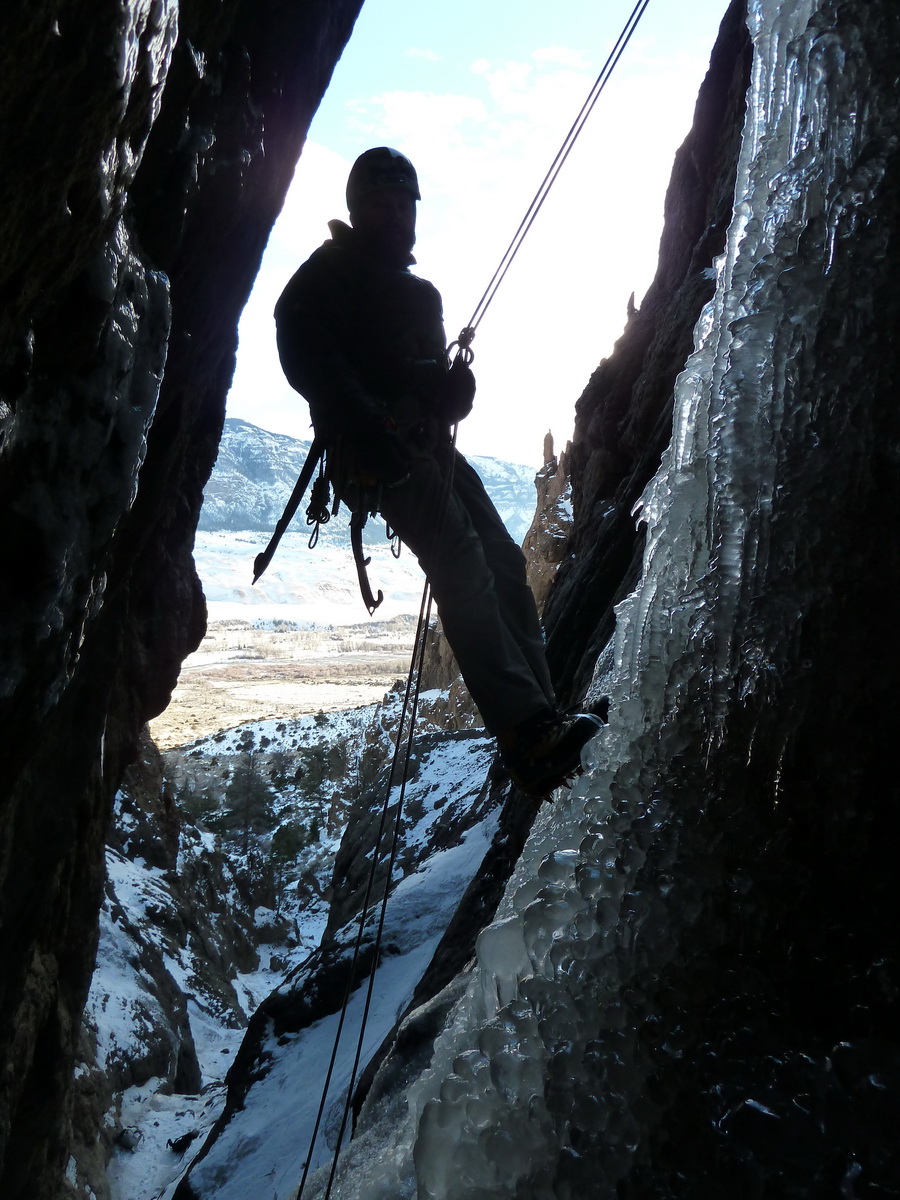
I can't remember what else we climbed. Here are the photos..


-
-
Nice work, folks!
Daniel and I are down here in Cody right now having a blast. The ice is FAT right now, but it's cold and brittle. Temps dropped into the -20s on 12/30-1/1. High on Boulder today was fun, but very brittle. We climbed Chasing the Sun yesterday (just to the right up Cabin Creek). We climbed Welcome Wagon on our first day out here. It's been really windy too with gusts yesterday in the 50s, sustained at 35.
Probably headed for Ovisight tomorrow, or possibly Moratorium. Then off to Hyalite for 7 more days of bliss.
Sorry to hijack your TR. Thanks for the photos!
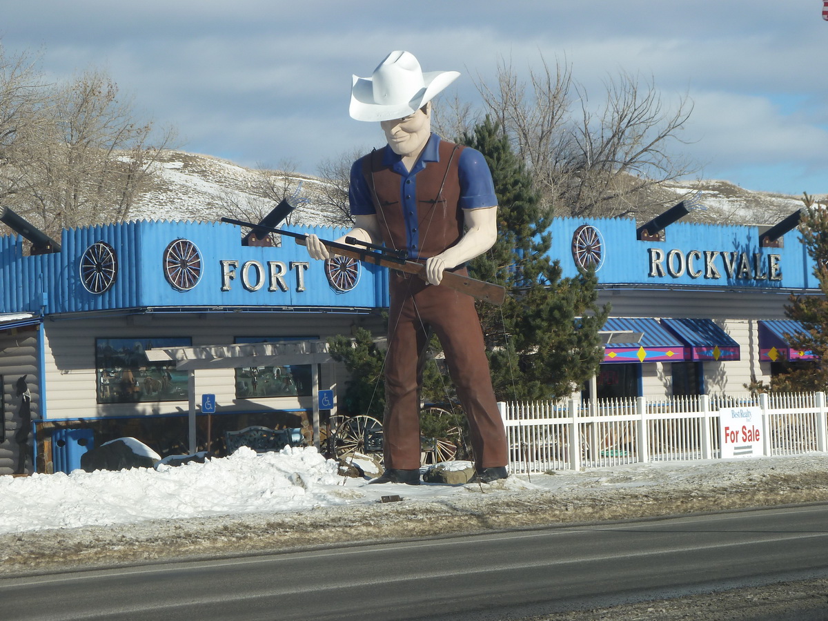
PS.. I want to plug the Cody Motor Lodge.. we got a room with two queens for $40/night. It's not bad here. A little smoky in the hallways, but inside our non-smoking room it's fine. They gave us two free coupons for an all-you-can-eat breakfast buffet at Irma's which I highly recommend.
-
I know two of the guys in the photos. I'll put them in touch with you. Thanks for the good deed.
EDIT:: noticed this post is a year old. Did you ever reunite the owner with their memory card?
-
Wow, this is very sad news. Dallas is someone I truly admired. My condolences to his friends and family.
-
Thanks to Matt, the WCC, and all the groups and individuals who did something to save Index.
Sounds like a fun event, I plan to be there.
-
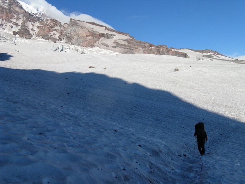
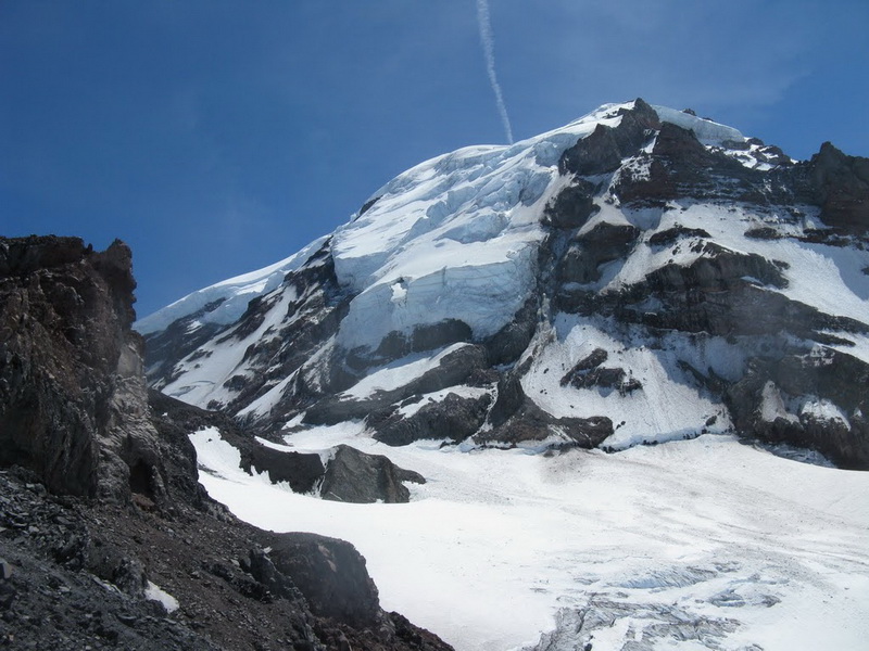
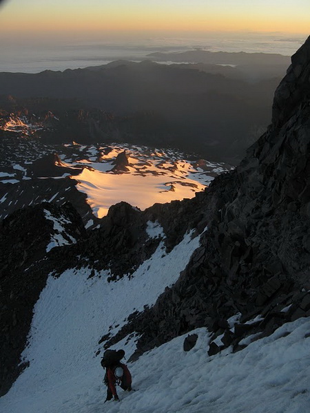
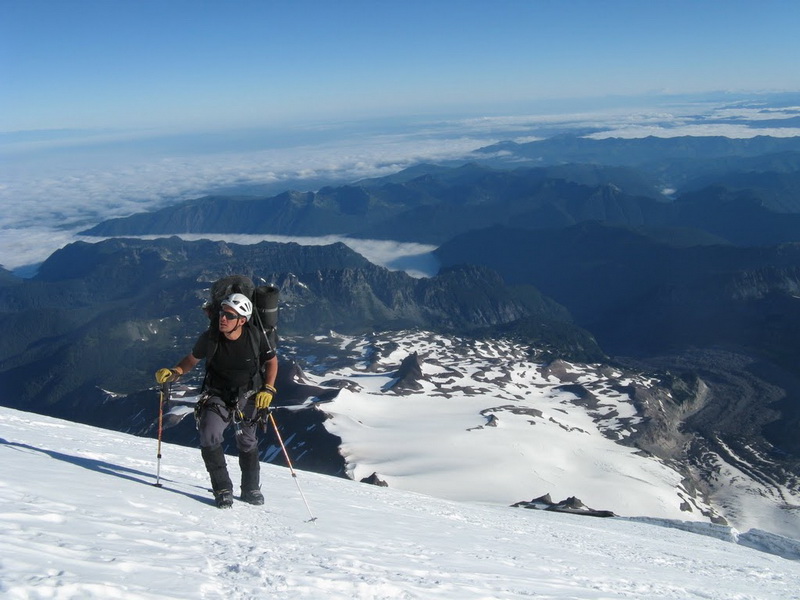
Trip: Mt. Rainier - Ptarmigan Ridge
Date: 7/23/2010
Trip Report:
Ptarmigan Ridge has been on my to-do list ever since climbing Liberty Ridge in 2003. After seeing a few TRs from Ptarmigan Ridge this season, I figured now was a great time to give it a go. Tim Halder (therunningdog) agreed, and so we decided to check it out.
We left Seattle at the relatively lazy hour of 9AM Wednesday morning. By noon, we had our permit in hand and were walking up the White River trail towards Glacier Basin and St. Elmo's Pass, our eventual destination for that evening. After about 2.5 hours, we were at St. Elmo's Pass, making camp for the night. The temps were perfect, but the wind was howling, and we huddled behind some rocks to find peace. We enjoyed the 6-pack of beer that I packed up to the pass while getting fantastic views of the mountain. We settled in early that night.
Thursday morning we awoke at around 5:30AM. Our goal today was to get to 10,200' on Ptarmigan Ridge, the last safe camping spot before the climb. Crossing the Winthrop, Carbon, and Russel Glaciers was surprisingly straightforward. On the way past Liberty Ridge, we noticed a huge slab that had been recently cut. I would say the crown was in the 3 foot range, but hard to tell from afar.. people definitely heard it.
We battled high winds all the way to high camp. I would guess that winds were a steady 35MPH gusting to 65MPH. Our approach had us facing into the wind, and climbing up the snow slopes with heavy packs was very taxing. We got into camp just after noon at which time we boiled water, ate, and prepared for the next day's climb. It was hard to sleep in high winds and blazing sunshine, but we both managed to get some z's. When we awoke at 12:30AM to climb, the winds had miraculously stopped and it was entirely clear and calm. Nice!
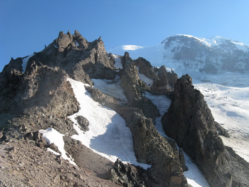
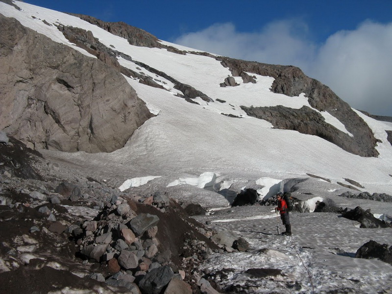
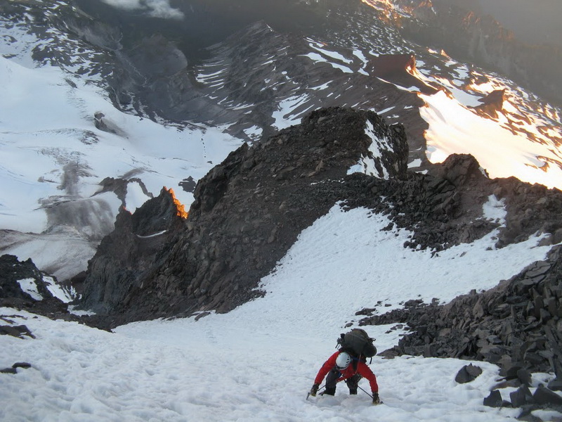
From camp, we worked along the ridgecrest, eventually downclimbing a rock step to get to a loose, dirty gully. This gully brought us down to the North Mowich Glacier, which we descended about 300' to the base of the route. The route goes up a diagonal 45 degree snow ramp, steepening at the top. The conditions were firm and icy, making for rapid progress. Near the top of the gully, the route diverges. Climber's left leads to two steep, exposed ice pitches. Climber's right leads to a steep ice ramp followed by a rock step. At this point, I looked down, and my left boot was missing a crampon. My guess is the strap broke on my 9 year-old crampons. I have noticed the straps fraying for a few months now, so I should have replaced them but.. here I am perched on a 55 or 60-degree ice slope with one crampon-- my choice is press on with one crampon, or bail and make the long walk back across the N side of the mountain to the TH. I decided to press on, confident in the sticks I was getting with my ice tools. From then on, I would climb up with my right foot, then sink my ice tools to the hilt, then flat foot my non-cramponed foot against the ice while I leaned back onto my tools and walked up. This worked OK and was reasonably secure, but still not entirely safe. Needless to say we did not take the ice chute variation.
We got to the rock step and it looked fairly burly for "5.4". I would say if there was more snow it might be 5.4, but with a lack of snow, one starts out quite a bit lower where the climbing is more difficult. I decided to dry tool it. It worked to my advantage that my right foot had a crampon, since that was the side that was icy. I stemmed onto rock and ice, found a good hook, and pulled up. I clipped the fixed piton and continued to stem and hook. Once at the top of the pitch, I set up an anchor - which took some creativity - and belayed Tim up.
The top of the rock pitch puts you right onto the Liberty Cap Glacier. From here, it's a 1600' slog to the top of Liberty Cap. We encountered firm snow, and a great deal of annoying neve penitentes. The wind started to pick up as we climbed, and was blowing a steady 40MPH near Liberty Cap. We gained Liberty Cap at 9:30, exactly 8 hours after we left camp. We placed no snow or ice pro on the entire route. The fixed pins on the rock pitch made it so rock pro is unnecessary (we carried some stoppers up anyway).
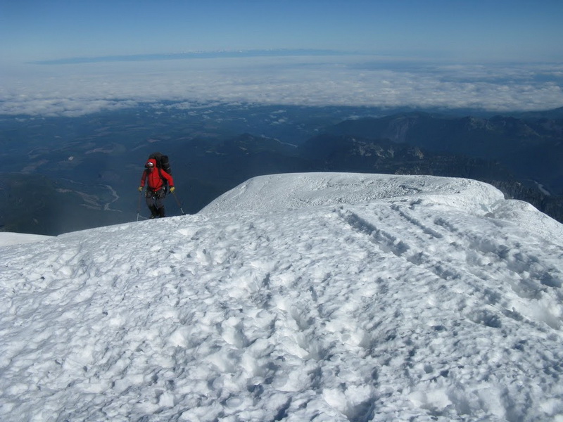
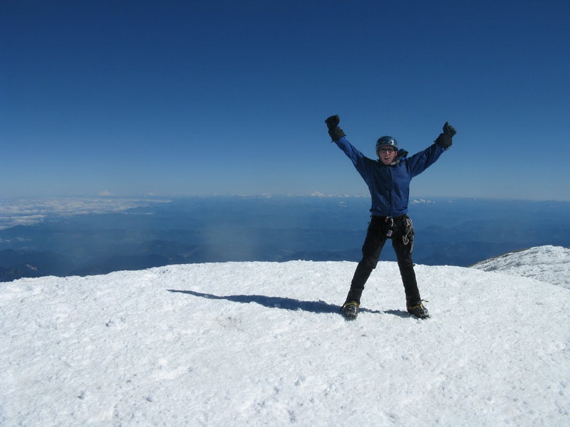
From Liberty Cap, we dropped 300 feet or so, then traversed and climbed 800' to Columbia Crest. The summit was relatively quiet for a nice summer day. I would guess there was about 9 teams on the upper mountain at a time.
We descended the Emmons Glacier and got to Camp Shurman at about noon. From here, we took a short break then continued down, making a great 3000' glissade down the Inter Glacier. There are crevasses on the Inter Glacier, so keep that in mind if you decide to glissade.
On the way out, we received a pleasant surprise. The new trail is now open. The old trail, built alongside White River, was washed out and featured several rough, washed-out sections. The new trail is well done with a gentle grade, smooth surface, and extensive rock work.
Back at the car at 3PM, 4 hours and 15 minutes after leaving Columbia Crest.
This was my fifth summit of Mt Rainier by five different routes - Liberty Ridge being my favorite, and this a close second.
Heading up to St. Elmo's Pass.
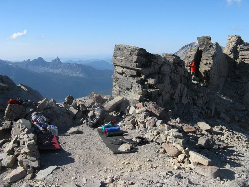
Camp at St. Elmo's Pass.
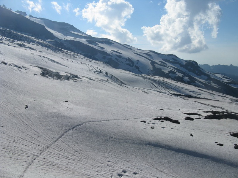
Looking across the Winthrop Glacier.
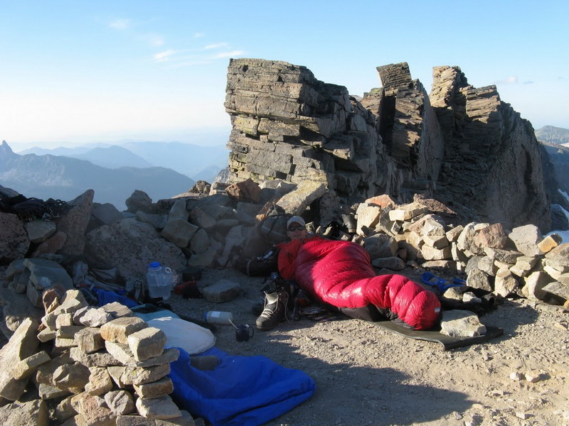
Bumming around camp.
The view up the mountain from St. Elmo's Pass.
Starting out across the Winthrop Glacier on day 2.
Traversing the Carbon Glacier.

Me ascending slopes on lower Ptarmigan Ridge in high winds.
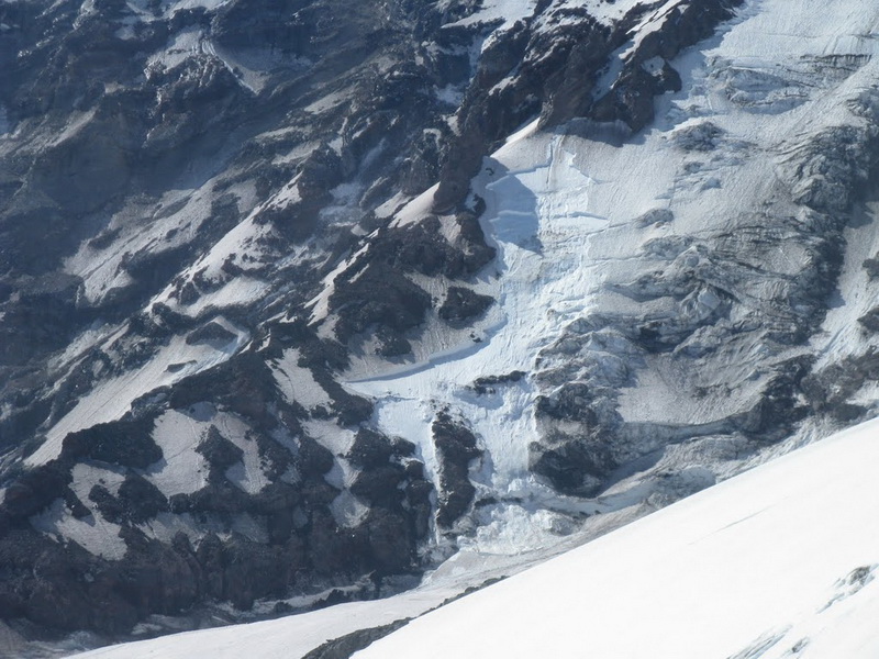
Huge slab avalanche crown on Liberty Ridge.
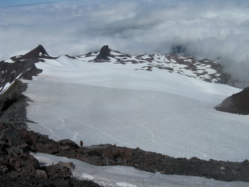
Looking back down on lower Ptarmigan Ridge.
Looking up at upper Ptarmigan Ridge and the upper mountain.
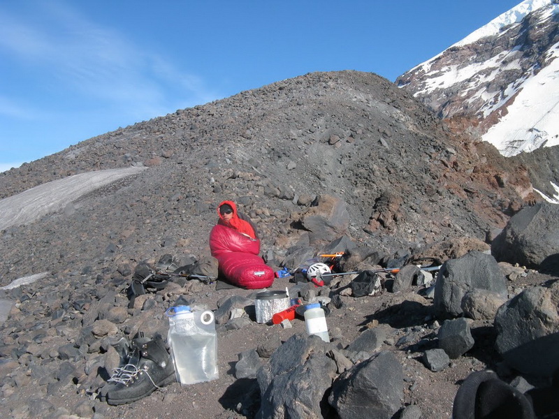
10,200' camp on Ptarmigan Ridge.

Climbing steep, firm snow high on Ptarmigan Ridge.
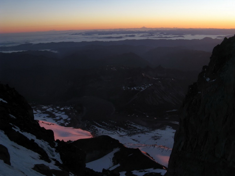
Dawn.
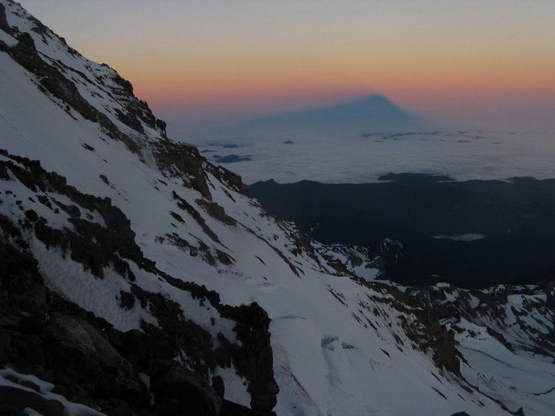
The mountain's shadow at sunrise.
The last snow traverse before the rock exit.
More views from the route.
Climbing with one crampon.
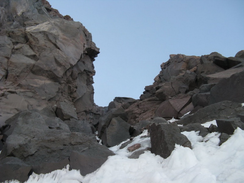
The rock step at the exit to Liberty Cap Glacier.
More views from the route.
More steep snow climbing on Ptarmigan Ridge.
Sloggin up Liberty Cap Glacier.
Me approaching the summit of Liberty Cap.
Tim celebrates on Columbia Crest.
All images courtesy of Tim Halder.
-
I read somewhere about a list of peaks that Dallas Kloke considers the most difficult to climb in the state of Washington (and he ought to know). I don't have it written down but I think it went something like this (in no particular order):
Inspiration
Burgundy Spire
SE Mox
S Hozomeen
Middle Index
Johannesberg
Lincoln Peak
Nooksack Tower
West Fury
Bear
Don't quote me on these - a Google search turns up nothing. I'm fairly confident on the first 8. I think I'd have to replace SE Mox with Lemolo and Lincoln with Assassin, but other than that, I think it's a pretty accurate list.
-
That rock looks amazing.

-
Wow, very sad! I met Lee a couple of times, and he was a super nice guy. This is terrible news.
My condolences to his family and friends.
-
@Ivan.. me too!
@MattP.. Not casual, but certainly not epic. I think Steph and I would both agree that this route was a lot easier than we expected.
-
Nice going! I need to get in there soon.
-
Trip: Johannesberg - NE Buttress (1951 - Eastern Rib)
Date: 7/27/2010
Trip Report:
WOW.
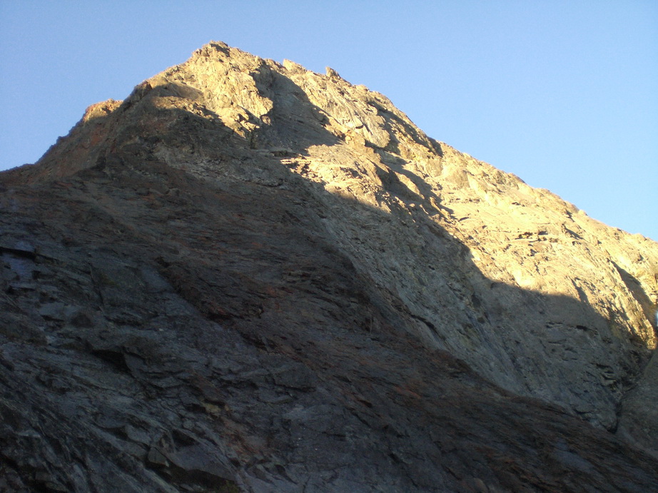
For anyone who has gazed up in amazement at Johannesberg Mountain from the Cascade Pass parking lot, it is a sight to see. Waterfalls and glaciers cascade down 5000' of sheer cliffs in a chaotic display of objective hazard. Booms and thunks from falling rock and ice comprise the soundtrack of Cascade Pass. It is a sheer, massive, intimidating mountain - no doubt, the epitome of N Cascades mountaineering.
A prior trip into climb the NE Buttress had us reconsidering our options not 5 minutes out of the parking lot. On that day, wet brush forced us to go to plan B, and we wound up summitting via the C-J Couloir. When it comes to vertical brush, I prefer mine dry.
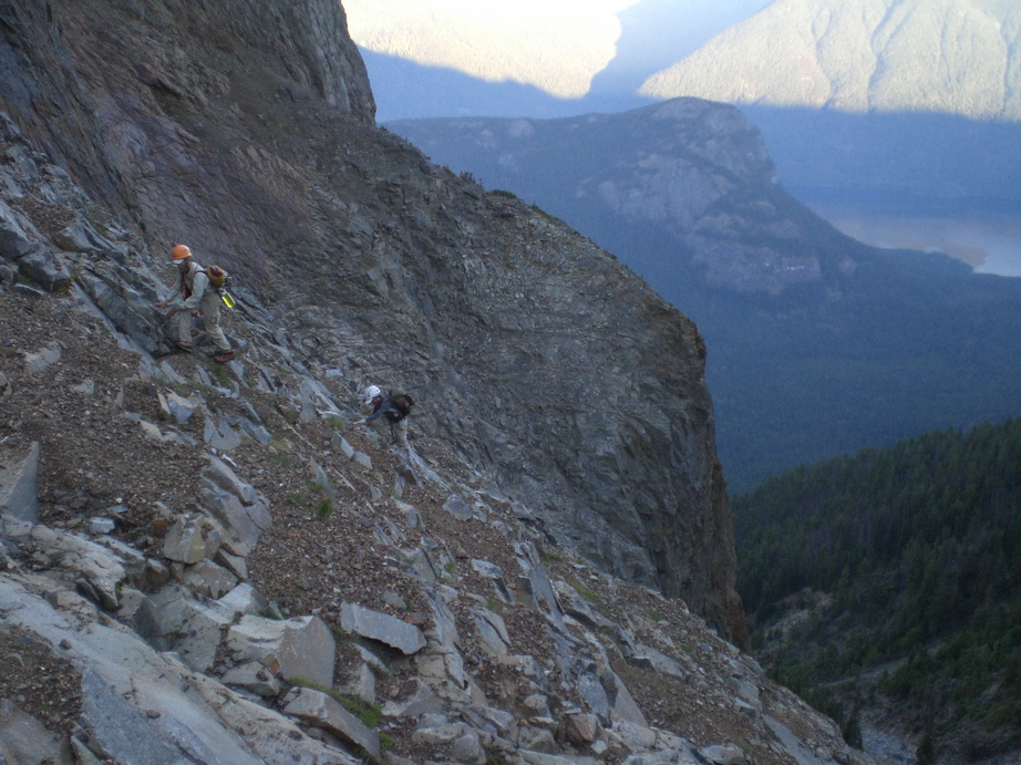
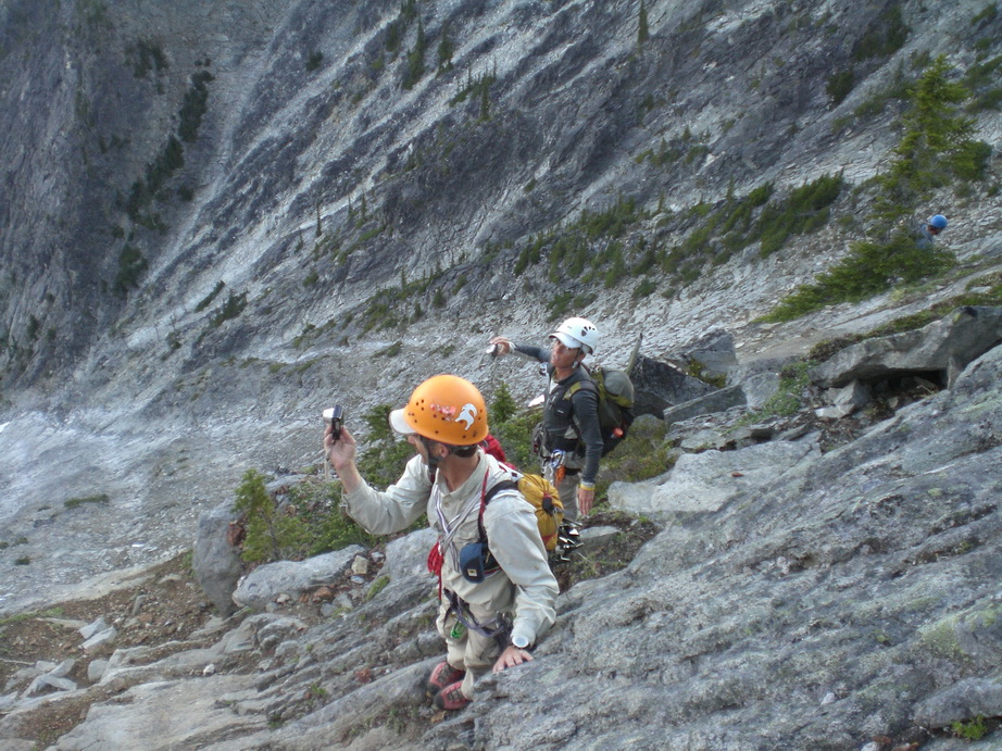
Fast forward to Monday morning, when Steph Abegg and I connected for what would become a fabulous trip into the mountains. We arrived at the relatively empty Cascade Pass TH at 7AM, and embarked on the 30 minute approach shortly thereafter. We ascended the C-J Couloir for ~800’ before trying to find the best route up dirty slabs to gain the route. After our first attempt fell short due to ugliness, we backed off and reconsidered. Eventually, we found another way that worked. Barely. I led up on some super sketchy, jungle slab with downward sloping holds and abundant lichen. Pro was sparse, and I had to be creative to find it. After about 30 tense minutes, I was able to pull through and belay Steph up. From here, it looked like a steep brush bash with good green belays, so we decided to put the rope away. It never came out of our packs again the entire trip.
Lots of steep (vertical) bushwhacking ensued. It was hot, and carrying a full pack made it quite strenuous. Routefinding was tricky, but we managed to find a great, direct line through the dense brush and cliffbands. About 1500’ later, we emerged from the vegetable abyss onto steep but sublime heather slopes and class 4 rock. The rock was solid, and we felt entirely comfortable climbing without the rope. After about 500’ of this, the buttress steepened even more, to some vertical walls. This is where we had heard (from prior trip reports) of loose chimneys and sketchy snow couloirs. We crossed a gully to our right, gained the 1957 (western) rib and proceeded to climb straight up the crest on surprisingly good rock. Could this be our bivy site? It was!! We were amazed.
The position of our bivy site was unreal. 3500’ below us was the parking lot. I could see my car and people walking around. Across the valley, peaks like Forbidden, Boston, Eldorado, and Buckner beckoned. Being in camp so early (3PM), we had plenty of time to relax and enjoy the views. We melted snow in Steph’s pack cover, taking advantage of the sun’s energy to supply us with the vital fluid. By 8:30PM, Steph’s camera was operating at warp speed, as the sunset cast an array of beautiful colors on the surrounding peaks. This is what mountaineering is all about!!
We awoke at the leisurely hour of 6AM this morning to finish the climb. By 7:20, we were cramponing up the beautiful snow arete that leads almost directly to the summit. An hour later, we were on the summit, enjoying excellent views into the heart of the rugged N Cascades. Upon signing the register, we noticed two parties had climbed the route in the past 4 days. This is a mountain that rarely gets climbed by any route, and here we were looking at three ascents in four days of the NE Buttress – one solo.
We spent about 30 minutes on the summit before heading back down. Since I had already done the descent down the E Ridge before, I had the descent dialed. Less than 3 hours later, we had downclimbed the entire ridge and were standing on terra firma below C-J Col.
The hike out to the TH via Doug’s Direct was long, but we eventually made it, returning to the cars at 4:30, 9 hours after we left our bivy site.
There are trips into the mountains that are great, and then there are those that are perfect. This trip was definitely perfect – one of the best trips I’ve ever been on. Thanks again to Steph for being such a strong partner.
I was too lazy to take a lot of photos, so only got a few. However, Steph took a ton of [most likely] great photos. She will post them soon.
Stats
TH to Camp: 1 mile, 3500’ gain, 8 hours
Camp to summit: .3 miles, 1100’ gain, 1 hour
Summit to C-J Col: .5 mile, 1400’ loss, 3 hours
C-J Col to TH: 7 miles, 4500’ loss, 1500’ gain, 4.5 hours
Total climbing time: 17.5 hours
-
Yeah for sure, any attempt on those walls is serious. From what I understand though, the attempts did not get very far. Kudos to those who have the balls to even consider it though!
-
@Alpine Tom.. we took the boat up the lake.
I think the terrible rock on Hozomeen will prevent anyone from making any serious attempts at any of those big walls.
As for the scramble route, I didn't think it was all that bad, only the 12 foot crux pitch which is basically unprotectable (loose, but easy climbing).
I'm surprised it doesn't get climbed more due to the great views it has of the range.
-
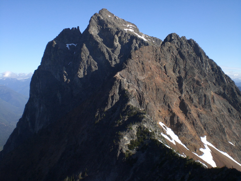
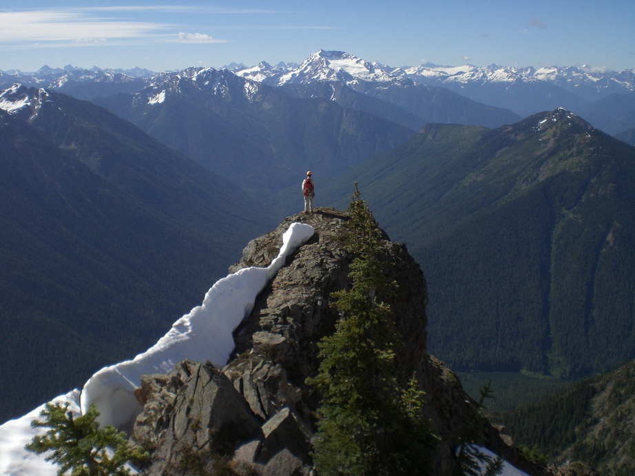
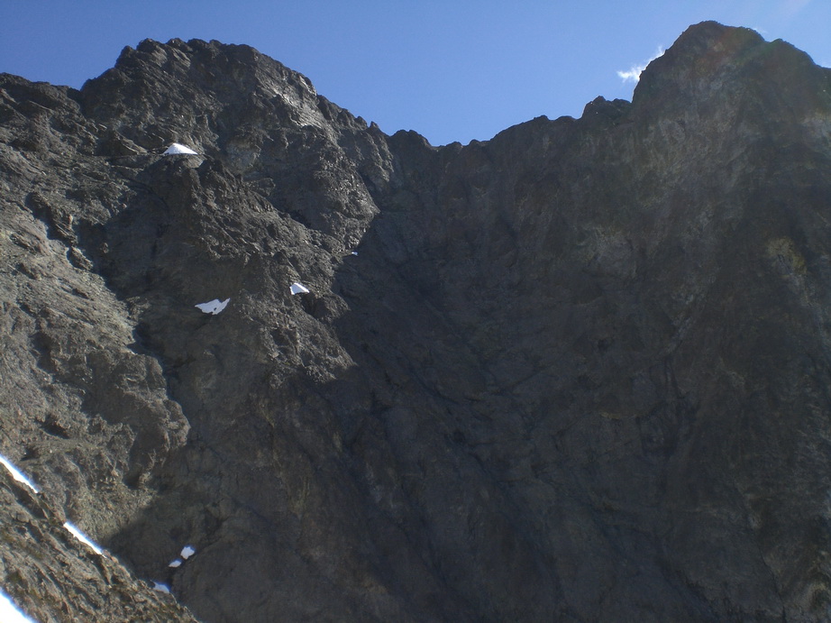
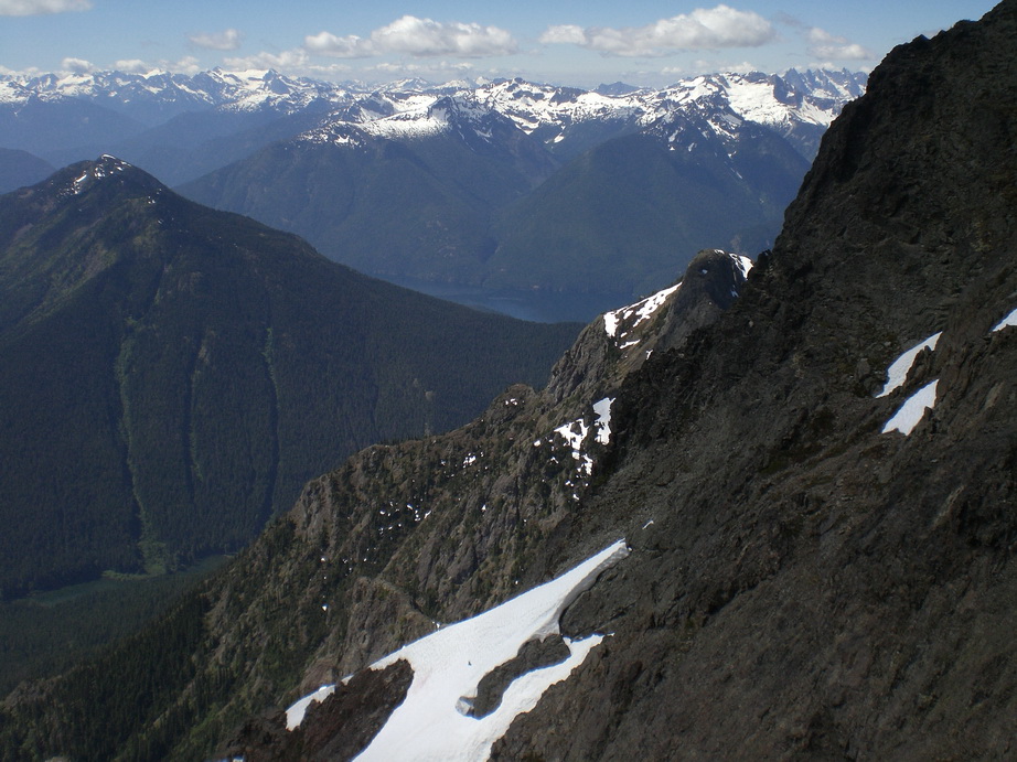
Trip: South Hozomeen - SW Face
Date: 7/17/2010
Trip Report:
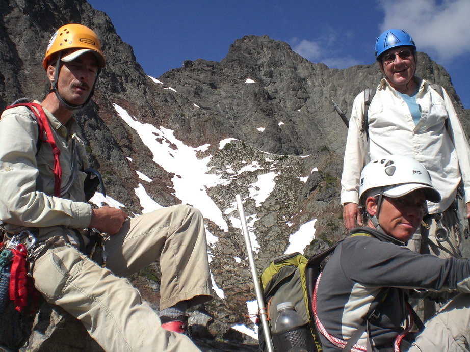
Carla, Franklin, Jeff and I connected for a great trip up South Hozomeen. Here are some photos.
A gendarme on the W Ridge of South Hozomeen.
Franklin and Carla scrambling on slabs, just above camp.
Carla and Franklin practice synchronized photography.

Upper Ross Lake from ~7000’.
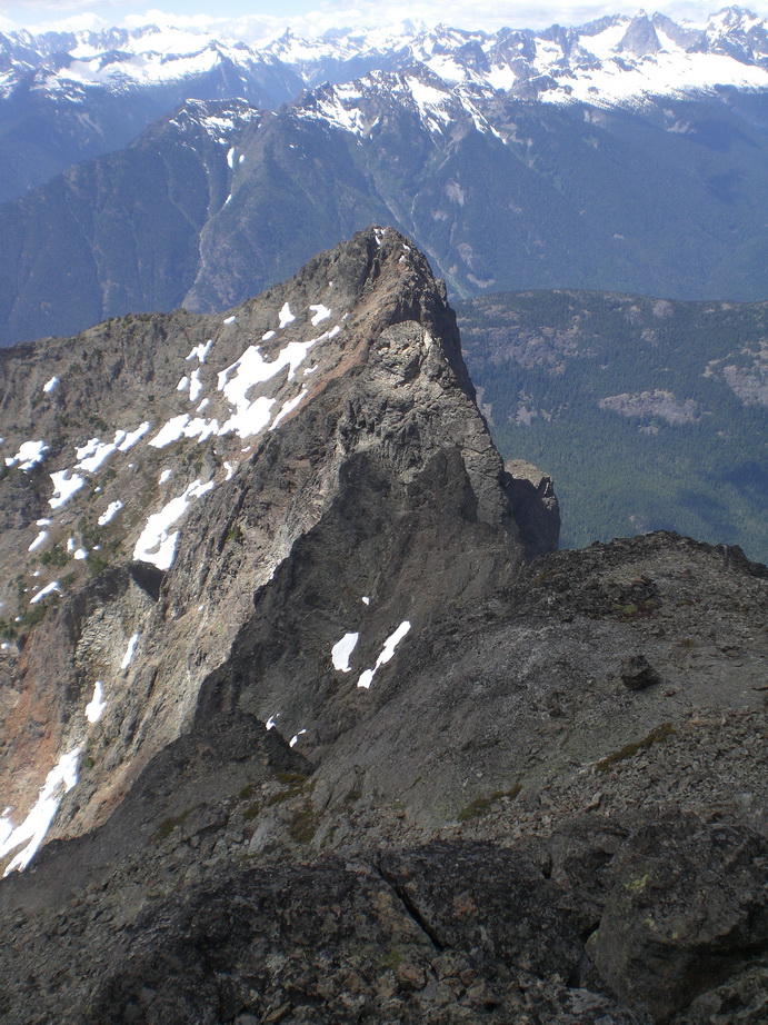
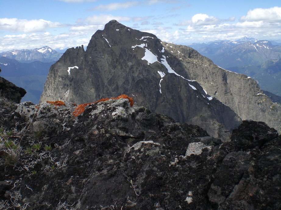
Rugged and majestic North Hozomeen.

Ross Lake and N Hozomeen.
Franklin taking in some amazing views!
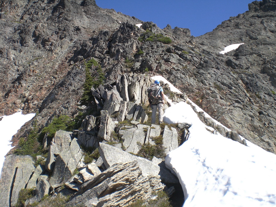
Jeff pondering the slabs on the way up.
The South Face of the summit block of S Hozomeen.
Looking SW.

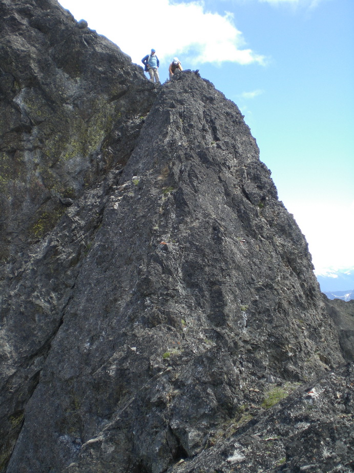
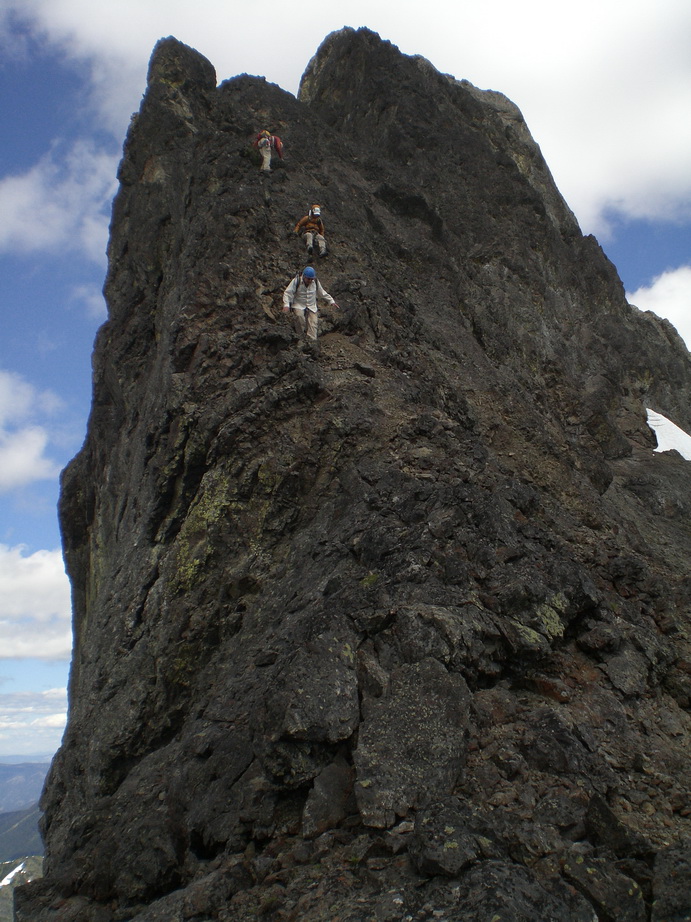
Easy but exposed scrambling on S Hozomeen.
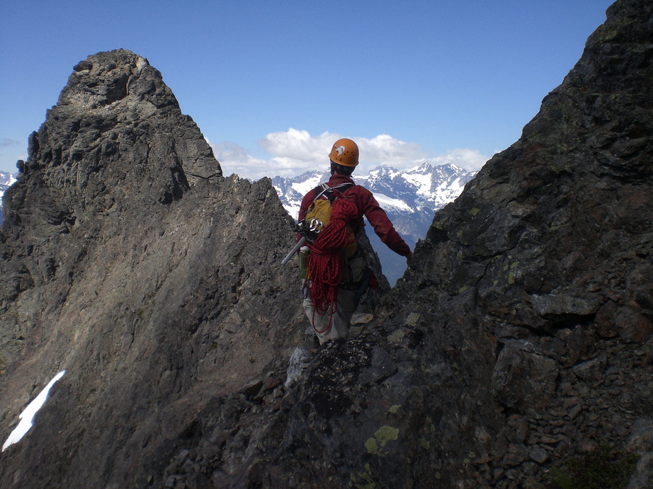
Franklin and one of the gendarmes on S Hozomeen.
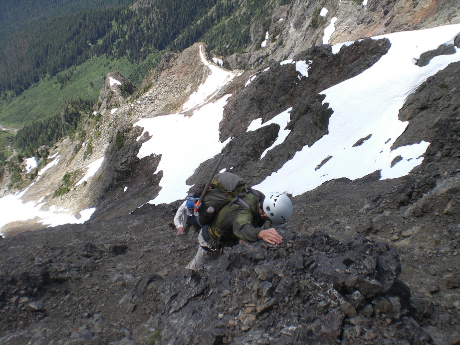
Carla scrambling steeper terrain.
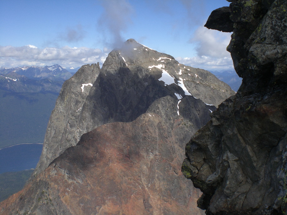
N Hozomeen from the Notch.
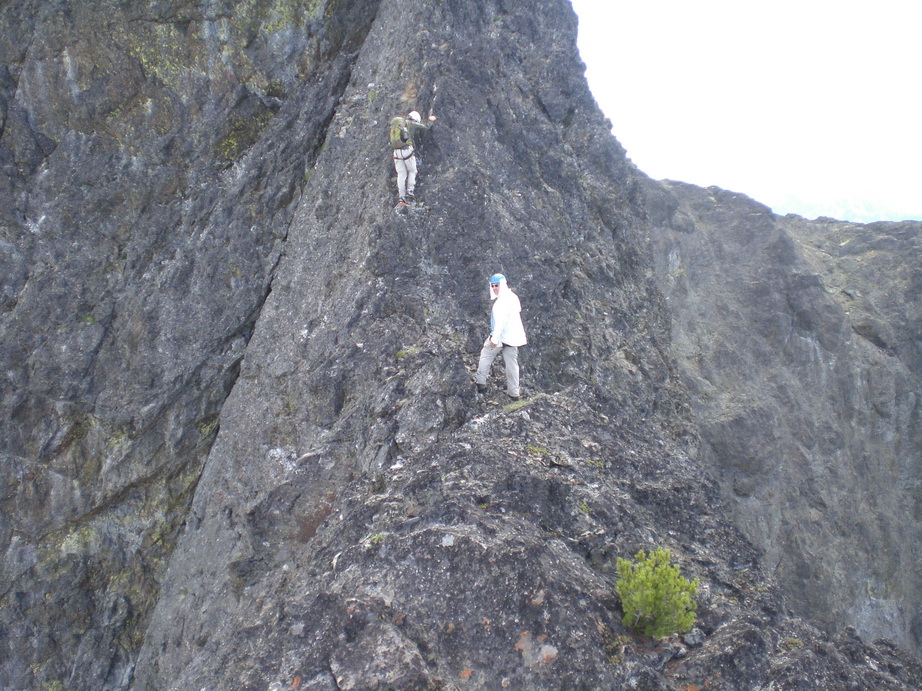
Carla and Jeff negotiate a class 4 step above the notch.
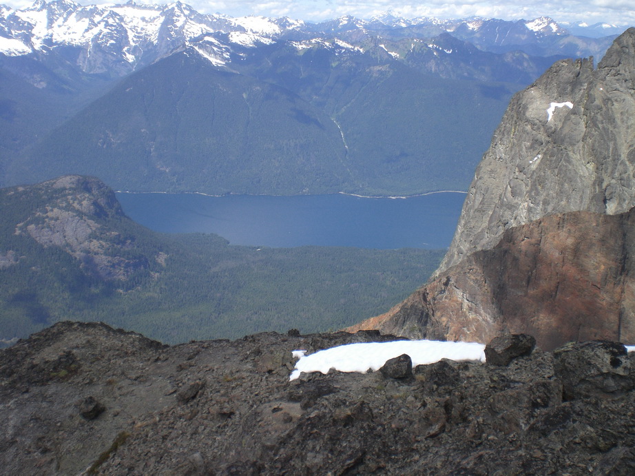
The views down to Ross Lake from just below the summit of S Hozomeen.
Looking down at the SW Peak from near the summit.
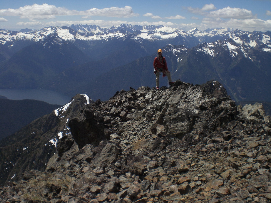
Franklin poses on the summit of S Hozomeen.
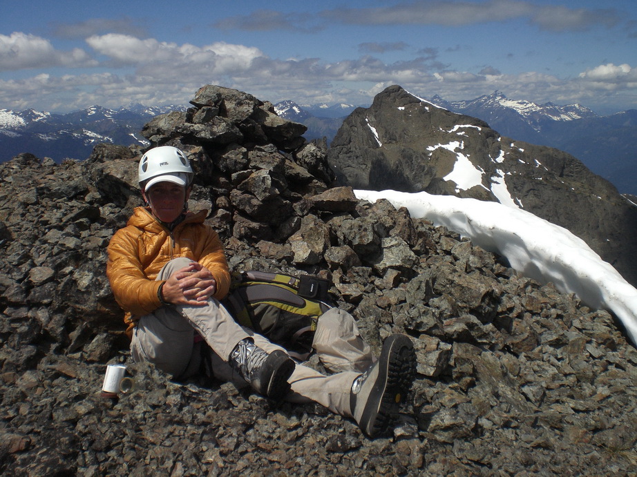
Carla relaxing on a gorgeous July afternoon in the N Cascades.

Carla downclimbing.
We have to downclimb this?
A little color amongst an otherwise barren landscape.
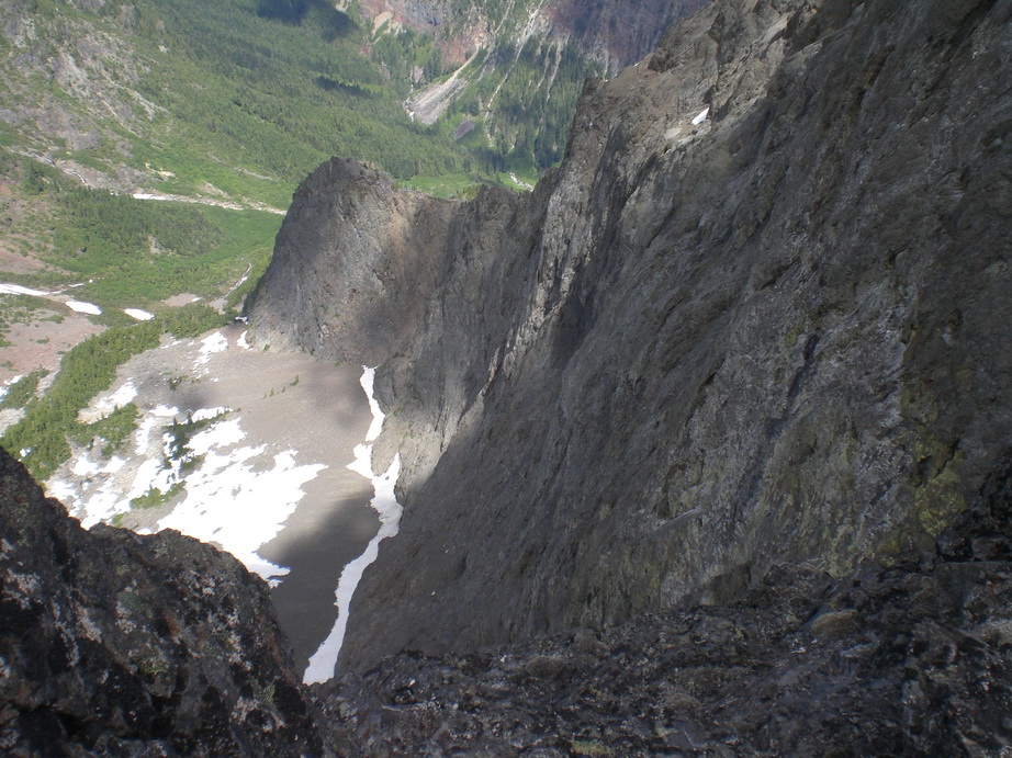
Looking down the N Face from the notch.
More downclimbing.
Thanks for a great climb, guys.
Top Performing Mountaineering Gloves
in The Gear Critic
Posted
For that purpose I'd go with the ORs. I have a pair and they keep my hands toasty anywhere in the Cascades, even in Winter.