


joepuryear
-
Posts
89 -
Joined
-
Last visited
Content Type
Profiles
Forums
Events
Everything posted by joepuryear
-
First ascent of Mt. Hunter, Mt. Deborah, and Mt. Drum all in one season! (Hunter and Deborah with Beckey) Amazing guy. RIP Hienrich Harrer.
-
I’m not one to really give out advice on how or what people should climb based on their experience, but I’d be inclined to say “hell, go for it”. You’ll find out real fast whether or not it is right for you once you get there. Your right, there is a big difference between looking at a route in a guidebook and standing at the base of that same route in Alaska. Assuming you have some basic sense about objective dangers, generally it will either feel right or it won’t. Nice thing about AK is if you don’t like the looks of your intended route, there are a ton of other routes very easily accessible. And as far as the Mt. Hunter goes, the West Ridge is not an easy route. It has gone many seasons with out an ascent (at one point in recent times, 4 years in a row). 8,000 vertical feet of climbing over 4.5 miles, including rock, ice, mixed, and extensive cornicing – it’s a handful for being the “standard” route. I’d say go up there with a lot of time and open mind. Warm up on a few easier routes, get used to the venue, and go from there. If you don’t go – you’ll never know.
-
The Kennedy-Lowe does not get done often, and I believe there hasn't been a recorded ascent in over a decade. (Would love to hear about it if someone knows otherwise.) The problem with the route is that the lower approach slopes have become terribly broken - although this seems to change year to year and at least one year it actually looked pretty good. If I remember right, two guys actually made it to the base of the triangle face a few years back, but couldn't overcome the bergschrund at the bottom of it. It also looks like the hanging glacier that sits at the end of the knife-edge ridge at the top of the arête is pulling back which will eventually (if it hasn’t happened already) create a formidable obstacle in the route. The approach slopes are not nearly as threatened as R+H and M. Jewel and there may be a fairly safe way onto the route on its left side. What Dan says about the approach to other routes is right on. You can also land on a southwest fork of the Tokositna to access some of the southeast side routes with not too bad of an approach.
-
vw4ever- Both Mystic Jewel and Rattle and Hum have an extremely dangerous approach that cannot be recommended to anyone. It might be understandable how a first ascentionist might take the risk for such aesthetic lines, but I’d say its definitely not worth repeating. Climbers are faced with several hours of direct exposure beneath many very active (and very large) hanging glaciers with no chance of escape. In fact the approach has already claimed the lives of two climbers trying to make a second ascent. Anyways, I don’t have time for a lengthy response now, but I’ll try and post more info after the holidays. Merry Christmas all.
-
Historically June is a much better month. Summit successes go way up in June, not because of better conditions necessarily but because of warmer temperatures. May can be a tough month for any route on the mountain due to the extreme cold sometimes encountered at altitude. I'd say leave for the mountain around the last week of May, putting you on the route in early to mid-June.
-
If anyone is interested - this discussion is picking up over at the Alaska Mountain Forum: http://www.alaskamountainforum.com/viewtopic.php?p=12159#12159 Jedi - you might want to post your response over there - since you are the master of the route!
-
first ascent [TR] Kichatna Spire - The Black Crystal Arete
joepuryear replied to joepuryear's topic in Alaska
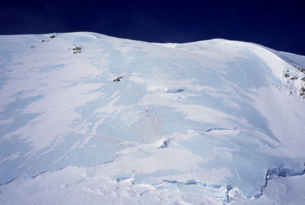
The main glaciers are still relatively smooth and unbroken, so as long as there is an adequate snowfall over the winter, there shouldn’t be any problem with landing there anytime soon. The warm temps and slightly less than average snow pack out there this year meant an early termination of the climbing season. Of course there were only two parties including us out there the entire year so it’s not like a major destination anyways. There is a real noticeable recession in snow pack on the cliffs. The glaciers in general have pulled away from the surrounding cliff faces, in some places in excess of 150 feet, and several smaller glaciers and hanging glaciers are nearly gone. This has left a lot of newly exposed rock which appears to be very loose and flaky. I don’t have a good picture of the crystals, but I’m sure they were a type of quartz – very perfectly formed and hexagonal in shape and a very black or deep purple color. They were falling out of a large cave in the rock about 100 feet above a ledge. Many of them were shattered but several survived the fall quite well. -
Chad Kellogg and I spent a few weeks in the remote Kichatna Mountains of the Alaska Range. We managed to climb Kichatna Spire by a new route. This was the eighth ascent of the mountain by its seventh route to the summit. The Black Crystal Arête is the first route to tackle the peak’s southern aspect by climbing the slender ridge that splits its south and east faces. Kichatna Spire from the Shadows Glacier. Aerial view of Kichatna Spire from the south. Paul Roderick flew us into the Shadows Glacier on the evening of July 6. Immediately upon landing we went for the route but were turned around by rain. On the third day we made a second attempt only to be stopped on pitch four by more rain. After spending 5 hours with our feet in plastic garbage bags we pulled the plug and rappelled back to the ground. A few more days of bad weather came and went as we scouted other route possibilities. Finally a splitter two day weather window arrived and we were off and running. We left in the morning of July 11 and made our way quickly to the base of the spire’s south arête. The first six pitches climbed the east wall of the feature. However, what had been dry rock before, was now drifted in with fresh snowfall from the previous day’s storm. What had been relatively straight forward pitches became quite tedious. Pitch 2 proved to be the first crux. I led a small wet roof, followed by a thin detached flake led to a super mantle-reach. Delicate moves with thin gear above a ledge finally moved into more positive terrain. Chad following up the east wall. Once on the ridge proper, a few gendarmes provided interesting route finding. The first major one we climbed in three pitches and were able to traverse around its right side just 50’ from its top. Climbing along the ridge crest. The Sunshine Glacier is in the distance. A short downclimb off the backside, led to the “Ore Chasm” – a 5-foot wide cleft that require a wide stem. The first gendarme. Chad can be seen down climbing toward the “Ore Chasm”. A few easier pitches led to another gendarme only passable by a rotten chimney on its right side. Chad led up the “Bombay’s Away” pitch – named after a huge booger of rock five times his size that flushed out of the chimney as he climbed up and stood on top of it. Unscathed, he continued aiding and climbing up huge overhanging flakes to the top. The actual ridge was pretty short lived, however, as it completely dead-ended into the upper south face. The only way to continue seemed to be a set of horizontal twin seems that led out left. Gaining instant 2,000+-foot exposure, Chad led across the thin traverse to the base of another nasty looking chimney. Chad leading the key horizontal traverse high on the route. I got the next pitch – a vertical ice-smeared chimney we dubbed “Icebox Desperado”. It might have been a brilliant M6 pitch had we had crampons and ice-tools. But with only rock shoes it proved to be an interesting mix of aid and free up disintegrating ice filled cracks. This gave way to slightly easier terrain and after a few more pitches we crested the summit ridge, just 200 horizontal feet from the true summit. We topped out on a beautiful, albeit smoky, evening, as we watched the sun make its long descent towards Mt. Foraker. On the summit looking northwest. A view to the west. Middle Triple peak is on the left. We sat on the warm and windless summit for about 45 minutes, before starting the long and dreaded descent. The 2nd rappel. We rappelled throughout the night. The crux was having to repeat a few of the key traverses with frozen fingers and toes. Repeating the key traverse just after midnight. About 20 rappels later, we returned to the Shadows glacier just in time for the sun to warm us up again. A short stroll back to camp and we were back just 25 and half hours after starting. We named our route after the most amazing black rock crystals we found on the summit ridge, some of which were upwards of 2 feet long! The next 10 days or so we spent attempting the Citadel. We spent a week in a portaledge on the peak’s east face, but were thwarted by weather and bad rock. We also made another single-push attempt on its unclimbed south ridge, but we fell short of the summit by about 800-feet (that might be considered a new route by some people. ha!) We knew our time on the glacier was drawing to an end with the rapid recession of the fern line toward our landing spot. Soon we would be camped on top of ice and after another week, we may not have been able to be picked up. So we packed it up, dialed Paul on the Sat phone and headed home.
-
Joe Puryear and Chad Kellogg in the AK Range
joepuryear replied to Hans_Blix's topic in Climber's Board
Well it looks like news travels a lot faster than me. I'll definitely post a TR on this website as soon as I get some pics developed. All I can say is that the Kichatnas are an amazing place with an incredible amount of granite. We had a fun couple weeks out there and were lucky enough to sqeeze in at least one good climb during a brief clear weather spell. -
I've got a bunch of stuff for sale including - Feathered Friends Peregrine Bag -25F Ice Screws Biners Coleman Stove Pika Rock Drill North Face day pack Mountain Hardwear Jacket Helmet Petzl Headlamps All items and prices are pictured on my web page: http://www.cascadeimages.com/cascadeclimbers/yardsale.htm I'll probably have more stuff on there too in a little while. Please use email correspondence not pm's.
-
It has been a pretty heavy snow year up there this year, even so I'd say the route is generally out by June 1. The first ascent was done in July, but a lot of the climbing was done in waterfalls. The couloir is certainly safer earlier in the season (April may be best) as it is essentially a garbage chute for the surrounding cliffs, so the colder the conditions the better. Email me for route specific info. joe at cascadeimages dot com.
-
No Trader Joes up there. Freddies sometimes sells it in blocks by weight and also in 8oz. cakes. Natural Pantry or New Seguya generally carry the bars, although climbers can sometimes wipe out thier supply.
-
If Fred Meyers doesn't have it (haven't seen it there in last couple years) try Natural Pantry or New Seguya - they're across the street from each other on the Old Seward.
-
Hi Everybody, I'm looking for a quality aerial color image of the Muldrow and Harper Glaciers. If you have one or know someone who does, please email me - joepuryear at hotmail Thanks! -Joe Puryear
-
Climzalot summed it up pretty well. Although it is true that Beckey et al. summited on July 5, May and April have historically had the highest success rates. There have been several seasons where the mountain has gone without a single successful ascent. The North Buttress and Kennedy-Lowe are pretty much out of shape by June 1.
-
Why actually it is. Past Winners of the All-America City Award Winning Communities - 1994 Porterville, CA Columbus, IN Alexandria, LA Kansas City, MO Taos, NM Mt. Airy, NC Philadelphia, PA Plano, TX Yakima, WA Powell, WY
-
Wanted: Current beta for THE TALON
joepuryear replied to yakimuchacho's topic in Central/Eastern Washington
Yeah you pretty much have to trust those first two pins. The climbing through there isn't bad - about 5.6. The crux comes just after the second pin. It may have been 5.6 at some point but after a few holds have probably broken off, I'd call it a solid 5.7. A green Alien and a #10 stopper can be placed in a small crack just before the moves. From there, traverse around the corner and belay at the tree. Its possible to make the summit in one pitch if you don't clip (or unclip) the second pin and use long runners to keep the rope drag down. Above the tree there is no pro to the summit. Besides the Alien and nut, bring 2 or 3 cams to 1". After the 5.7 crux, a direct route can be followed straight up the face to the rap anchor. Bring 5 extra quickdraws for that. By the way my website has really suffered lately due to other projects - hope to work on it again this winter. -
Here are a couple of shots: London Tower area: Bradley:
-
Here's a link to the article in the Yakima paper: http://www.yakima-herald.com/?storyid=281436279211428 It made the front page today.
-
best of cc.com [TR] Alaska Range; April 19 to July 22
joepuryear replied to joepuryear's topic in Alaska
I guess after traversing underneath that thing all these years, eventually you are going to be there when it lets loose. The avalache started 5000 feet above us and we were less than a half-mile from the base. We were lucky, it was relatively small and after running as far as we could in the opposite direction (minus some picture time), we just got dusted. A party or three earlier in the season got to experience the full wrath of a blast that went up the other side of the valley. They were all fine but a little shook up. -
climbing close to walla walla?
joepuryear replied to corvallisclimb's topic in Central/Eastern Washington
Here's the best site for that info: http://people.whitman.edu/~pogue/climbing_areas.html -
best of cc.com [TR] Alaska Range; April 19 to July 22
joepuryear replied to joepuryear's topic in Alaska
Finally got done developing and sorting my slides from the trip. Here are some pictures for ya... http://www.cascadeimages.com/cr/alaska/images/2004.htm Has anyone climbed the East Buttress of Royal Tower? Curious how those last few pitches are. -
Yeah its definitely still a little hot over here in Yakivegas. If you can find shade it could be okay in the morning. Most of the areas get a lot of sun in the summer. Some of the areas you might be able to keep cool at are Moon Rocks, the Bend North, and Wildcat Wall. The Goose Egg is pleasant early in the morning, but will be baking by noon. The plus side is, Rimrock lake is only a mile away - great swimming. Temperatures become more manageable by mid-September. The season typically lasts until late November, then starts up again in February. The most comprehensive current guide book is the 'Quick and Dirty Guide' by Preston & Reid. You can pick it up in Yakima at Hyperspud Sports on 1st Street. I called today and they said they had 3 copies left. A new more complete guide book is due out soon. The Tieton is great - lots of variety, uncrowded, great camping, and pretty much hassle free. Watch out for rattlesnakes at Royal Columns and the Cave.
-
Climbed the complete '54 South Buttress back in 1996. Email me for beta/photos - joe at cascadeimages.com Its probably the longest climbing route on Denali and one of the most incredible features in the range - well worth the effort. Here's the face in question.
-
I just returned from a great trip in the Alaska Range. I started out flying into the Mountain House with David Gottlieb. We walked down the hill and camped in the middle of the Ruth Amp., a spot I highly recommend over camping in the Gorge due to more sunlight and much less wind. The weather and conditions were great so we immediately went for the Japanese Couloir on Mt. Barill. This was a great natural line up the east side of one of the Gorge peaks. We descended the same way. After a rest day and continued good weather, we decided to have a look at the South Face of Mt. Dan Beard. Not knowing much about the route, we followed the main couloir up the left hand south ridge, and then continued up the ridge above. The snow conditions quickly deteriorated in the afternoon sun and after a few route finding errors, we descended around 500 feet from the summit. Not feeling complete with the climb, we took another rest day, and then with better knowledge of the route, climbed it to the summit just as the first big storm hit. We descended in the raging storm and returned to camp for five days of tent time. The weather finally cleared a little and with only a few days left in the trip, we decided to race up to the West Fork for a look at the Southwest Ridge of Peak 11,300. We moved camp up to the West Fork and in the foggy mist we met Jedi, who had just climbed it and gave us tons of good info. The next morning dawned clear. We were torn between waiting a day to let all the new snow settle and letting a clear day go by. We decided to go for it. We summited that evening and spent an amazing night on the summit and descended the next morning. The next day we skied out to the Mountain House and were flown back to Talkeetna. After a few rest days I picked up my next climbing partner Daniel Zimmermann from Switzerland. We flew into Kahiltna Base Camp intent on Hunter’s North Buttress, but this never materialized due to the very warm and moist season the range had. Instead we focused on smaller objectives. We headed up the first morning to look at the Mini-Moonflower, but seeing a party already on it we shifted our focus to the South Face of Peak 12,200. We climbed through 2000 feet of rock bands then broke out onto a long snow slope above to reach the summit. We descended the dangerous Southeast Face back to our skis. Our next mission was an attempt on the Mini-Moonflower which saw us up 9 pitches before the spin-drift nightmare occurred. Upset with the general trend of the weather, we decided to climb the Southwest Ridge of Mt. Frances one day regardless of conditions. It snowed the entire day, but we found this climb to be one of the better base camp area climbs, very similar to the Southwest Ridge of 11,300. After a rest day, a small break in the weather opened up so we ran up and did the North Couloir of the Mini-Moonflower. This as well proved to be an awesome moderate route up a really cool feature. The next eight days were stormy and depressing. We almost flew out at one point but were lured into the promise of a short high pressure spell. We left for the West Face of Kahiltna Queen one clear evening. It started snowing after three hours of climbing but we pushed onto the summit in a bit of a bad storm. Descending was interesting amidst the rash of avalanches but we returned back to base camp unhurt and flew out that evening. After a bit of rest and a relaxing boat trip on Prince William Sound with some good friends, my next climbing partner Chris McNamara came up. The weather had been marginal for another week in the range and we flew into the Ruth Gorge one morning in light rain. However, just a few hours later the weather cleared. Chris looked over toward Barrill and said “I want to go climb that. Now.” So just a few hours after landing, I found myself at the base of the Cobra Pillar of Mt. Barrill. After a frenzy of climbing, 15 hours and 10 minutes later we found ourselves on the summit. It was our first climb ever together – what a way to warm up. A shitty descent down the Northwest slopes allowed us to walk all the way back around that morning and crash in our tent for the next four days for the biggest storm of the season. After surviving three days of torrential rain we headed down the Gorge for a look at Werewolf and Hut Tower. Not liking the line on the Werewolf, we climbed up the Southwest Face of Hut Tower, a line I had done before but was certainly worth repeating – 10 pitches up to 5.10 on some of the better rock in the Gorge. Our next objective was the West Pillar of the Eye Tooth. This might well have been the best alpine rock climb I’ve ever done. The rock is good, the climbing interesting, and the line is aesthetically amazing. We topped out on the last rock tower (don’t be fooled by the route topo!) with snow leading to the summit. Without snow gear, this was to be our high point and we started the long descent, getting our rope stuck no less than five times. With some time left but no fingertips left, we decided to have a look at the ‘small’ (1800 foot) Stump formation on the side of the Wisdom Tooth. The left of two major dihedral systems on the south face caught our attention. The climbing was incredible and the rock outstanding, until it abruptly exited left, off the face and dead ended into a steep gravel wall 600 feet below the summit. This was apparently the route of the first ascentionists and we were rather disappointed as we rapped off. After another day of rest we decided to straighten the route out and complete it direct to the summit. We headed back up and climbed several new pitches of amazing terrain. We haven’t yet named our new variation on the South Face of the Stump (Wisdom Tooth), but it is one that shouldn’t be missed next time you’re in the Gorge – 12 long sustained pitches up to .11a. We set up the route with bomber descent anchors with clean pulls. With our time was coming to an end and our fingertips really worked we pulled our big sleds up to the Mountain House (which Chris maintains was the crux of the entire trip), and had a beautiful evening flight back to Talkeetna. And for the crux of my trip: On July 8, Michelle O’Neil and I were married on the Pika Glacier in Little Switzerland. We flew up with two airplanes with most of our family and some close friends for a beautiful ceremony amidst the great peaks of the Alaska Range. We had a big reception in Talkeetna that evening. Michelle Puryear and I flew back into the Pika the next week. The weather had definitely changed back to a wet pattern. Our first objective was the West Face of Middle Troll. We found the climbing to be quite fun as we simuled the route in one pitch. At the top I conned Michelle into scooting out to the edge of the huge diving board feature for a neat photo op. Two days of rain ensued but a clear morning dawned and we got an early start to climb the South Face of The Throne. Being rather uninspired by the routes on the right side of the South Face, we climbed the rounded ridge to the left of the South Face Gulley. The climbing again was solid and fun, and we were pleased to find that the summit ridge had no snow or cornices, allowing us to summit via the upper West Ridge. The next day again dawned clear so we decided to take a shot at the East Buttress (Gargoyle Buttress) of the Royal Tower. The climbing was interesting; not quite as solid or straightforward as the other climbs, and the routefinding was tricky. The weather was decidedly going down hill all day and on the 11th pitch, about 2-3 from the buttress top, we decided to bail. After the first rappel it was raining. Toward the bottom the rain was intense and so was the rockfall. The bottom three pitches are quite threatened from the gully on the right. We pulled our drenched bodies back into camp without incident. After another day of rain, we decided to try one more peak. During a very short weather window, we were able to climb the South Ridge of South Troll. Twice we set up rappel anchors to bail, as waves of rain came over, separated by sunny breaks. At one point we made a hasty rappel, only to reclimb the pitch. After we summited, we realized we were in for it. We quickly rappelled the north face then climbed over to the West Face of the Middle Troll to continue that decent line. Hail, rain, wind, and thunder buffeted us, but we again made it down safely. We flew out that evening during a brief clearing in the weather.