
Leaderboard


Popular Content
Showing content with the highest reputation on 05/03/22 in all areas
-
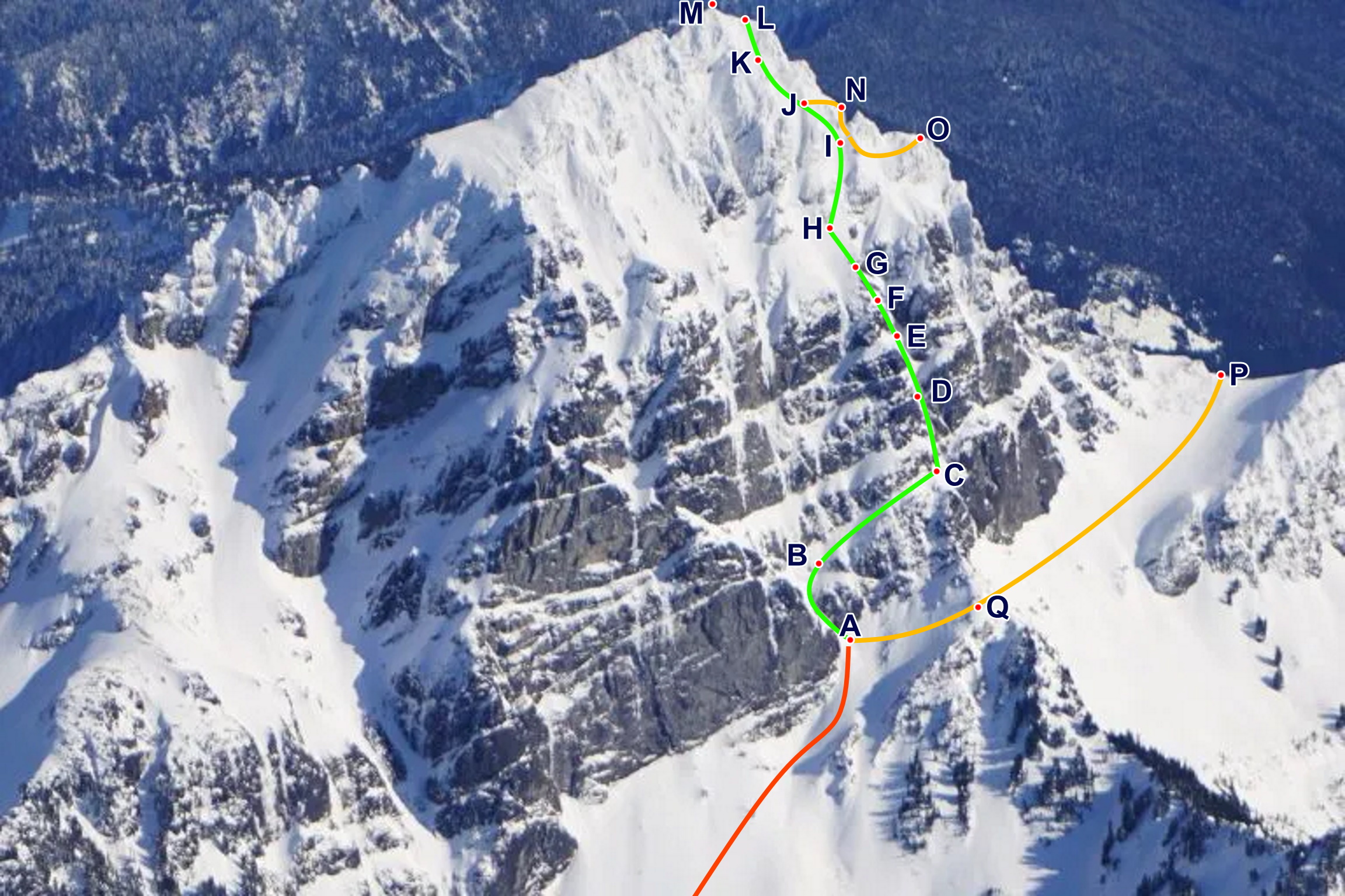
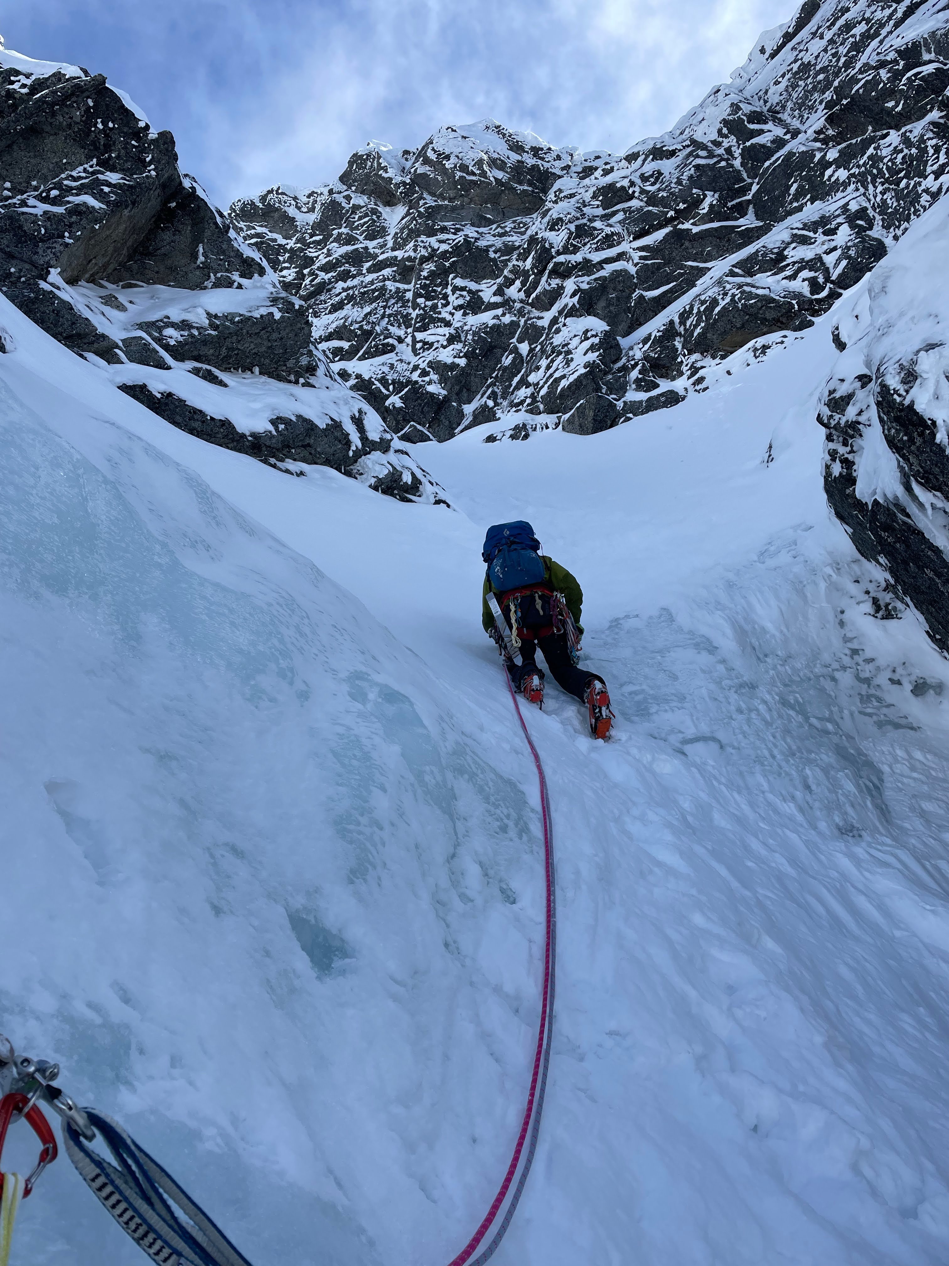
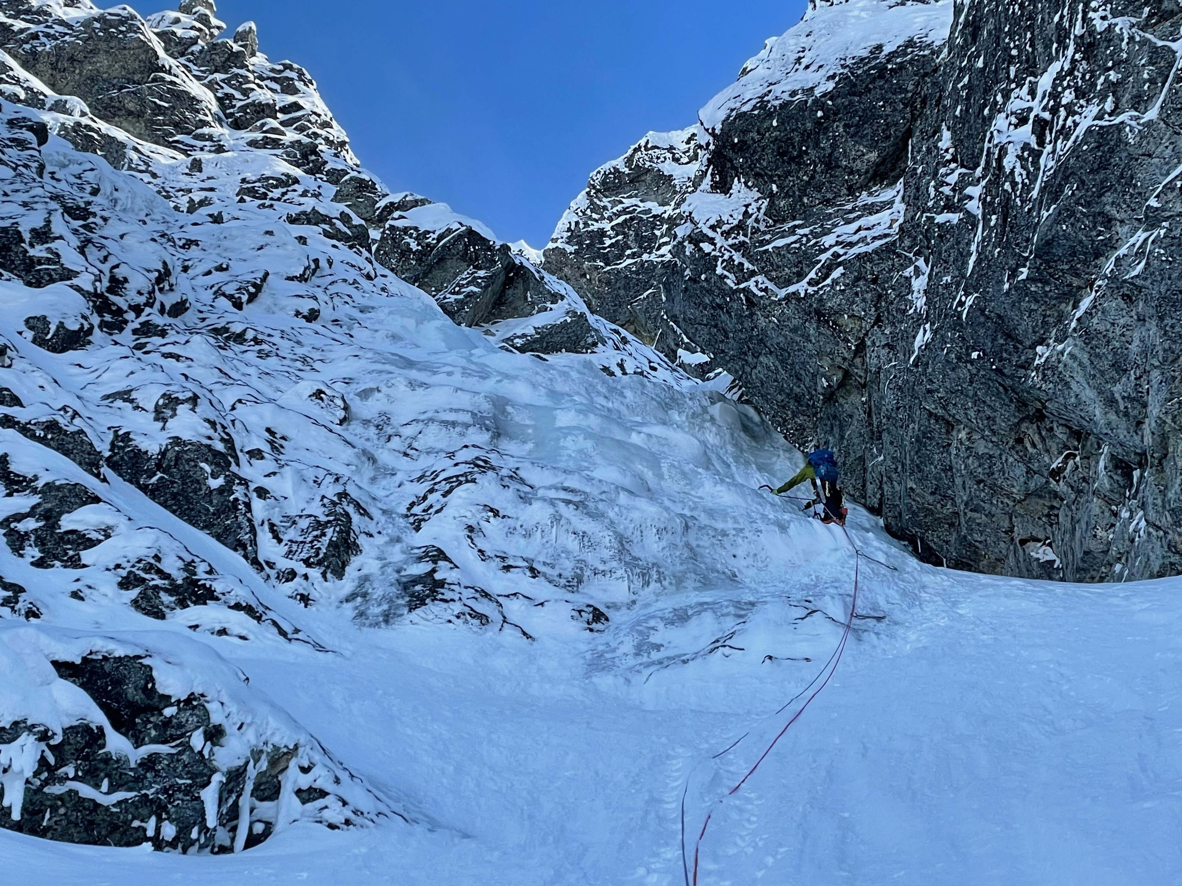
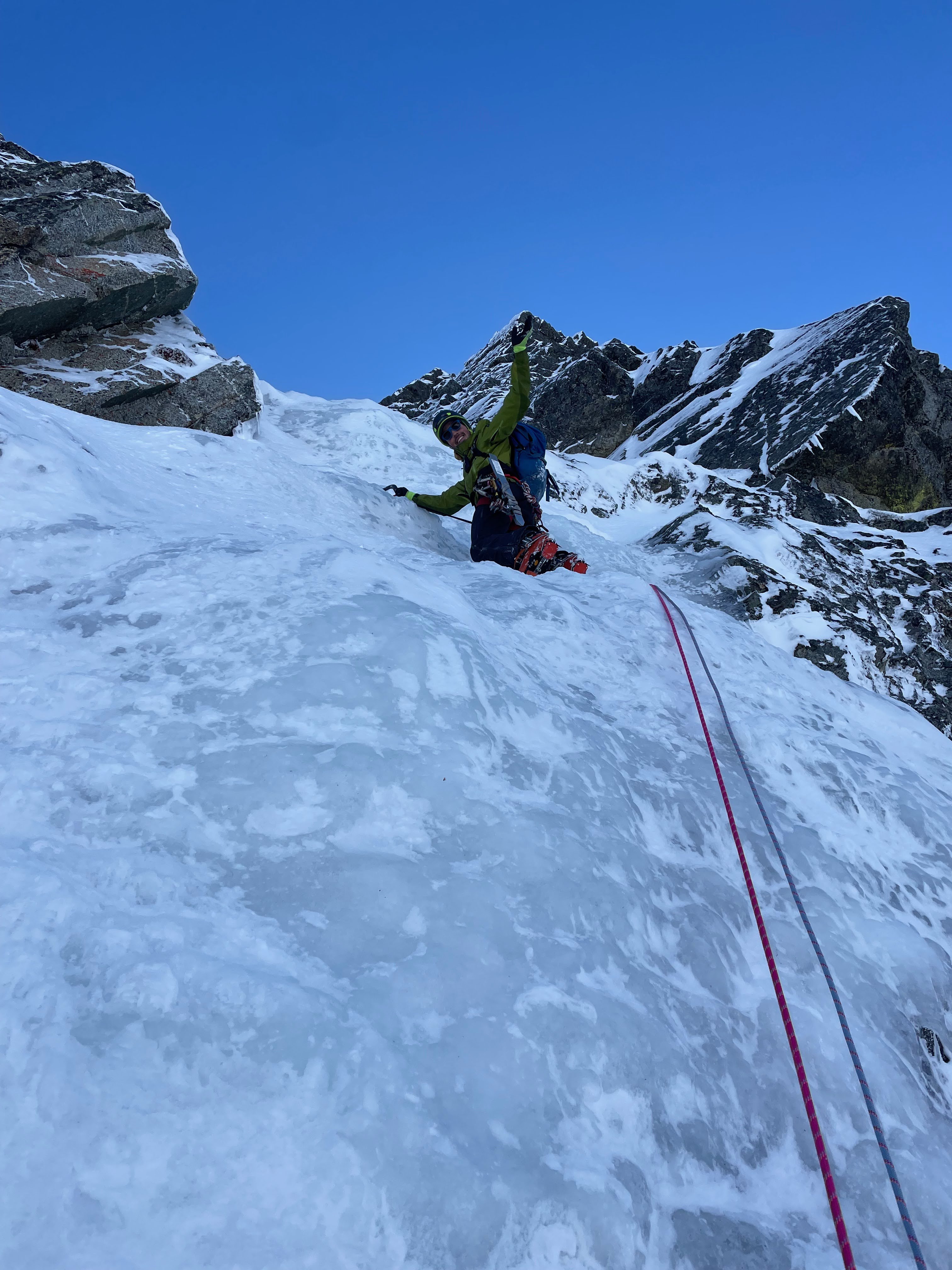
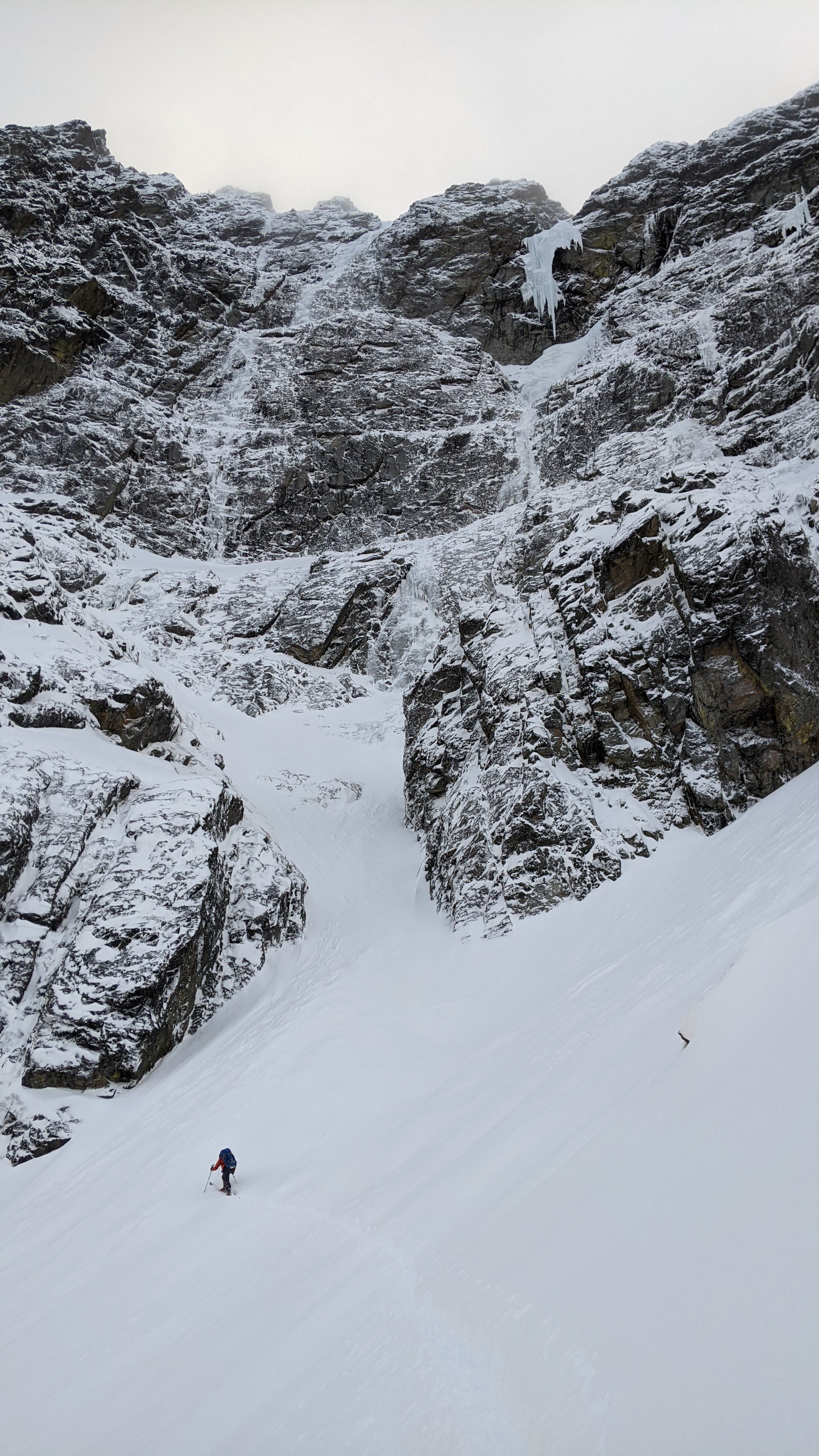
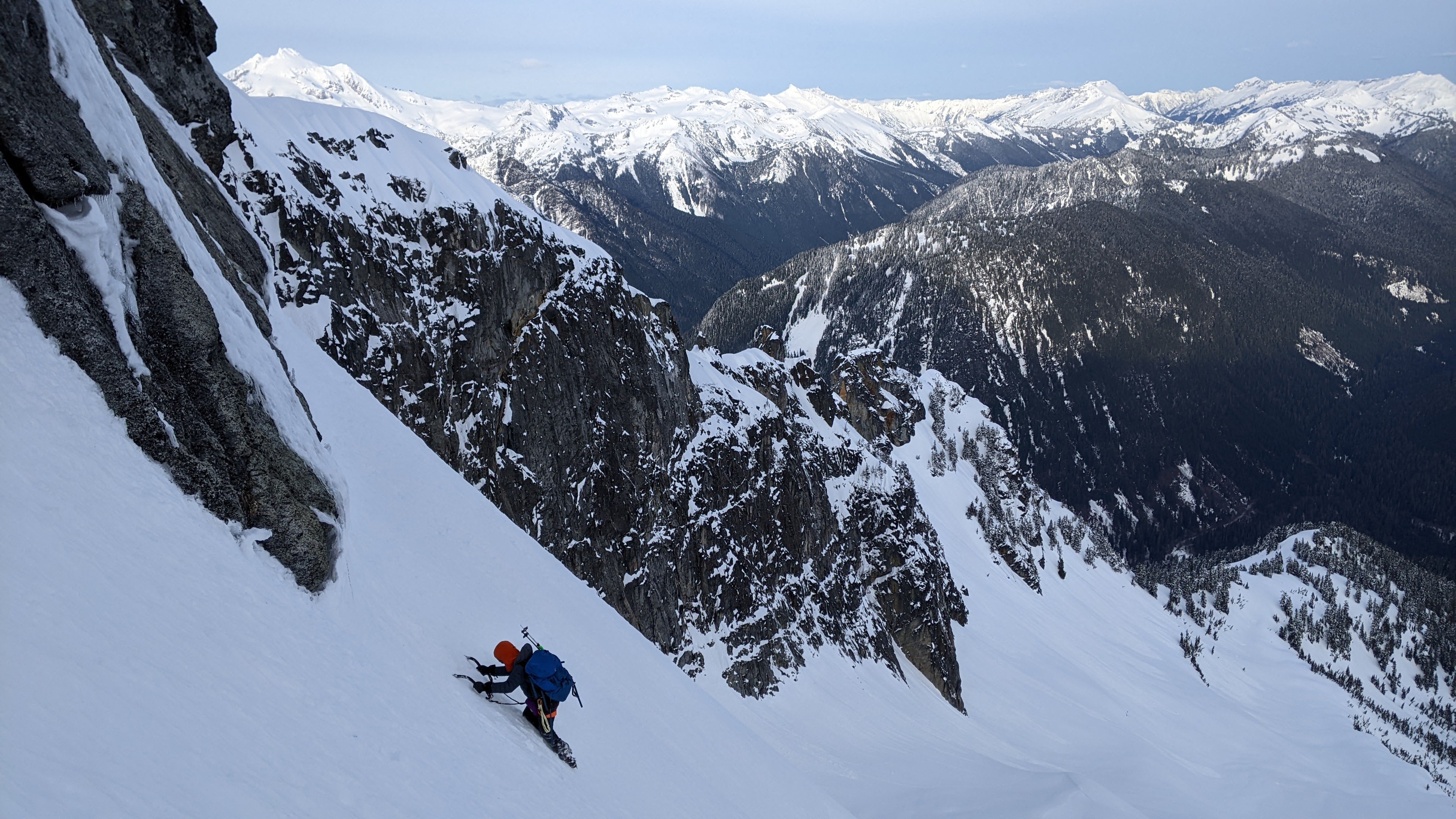
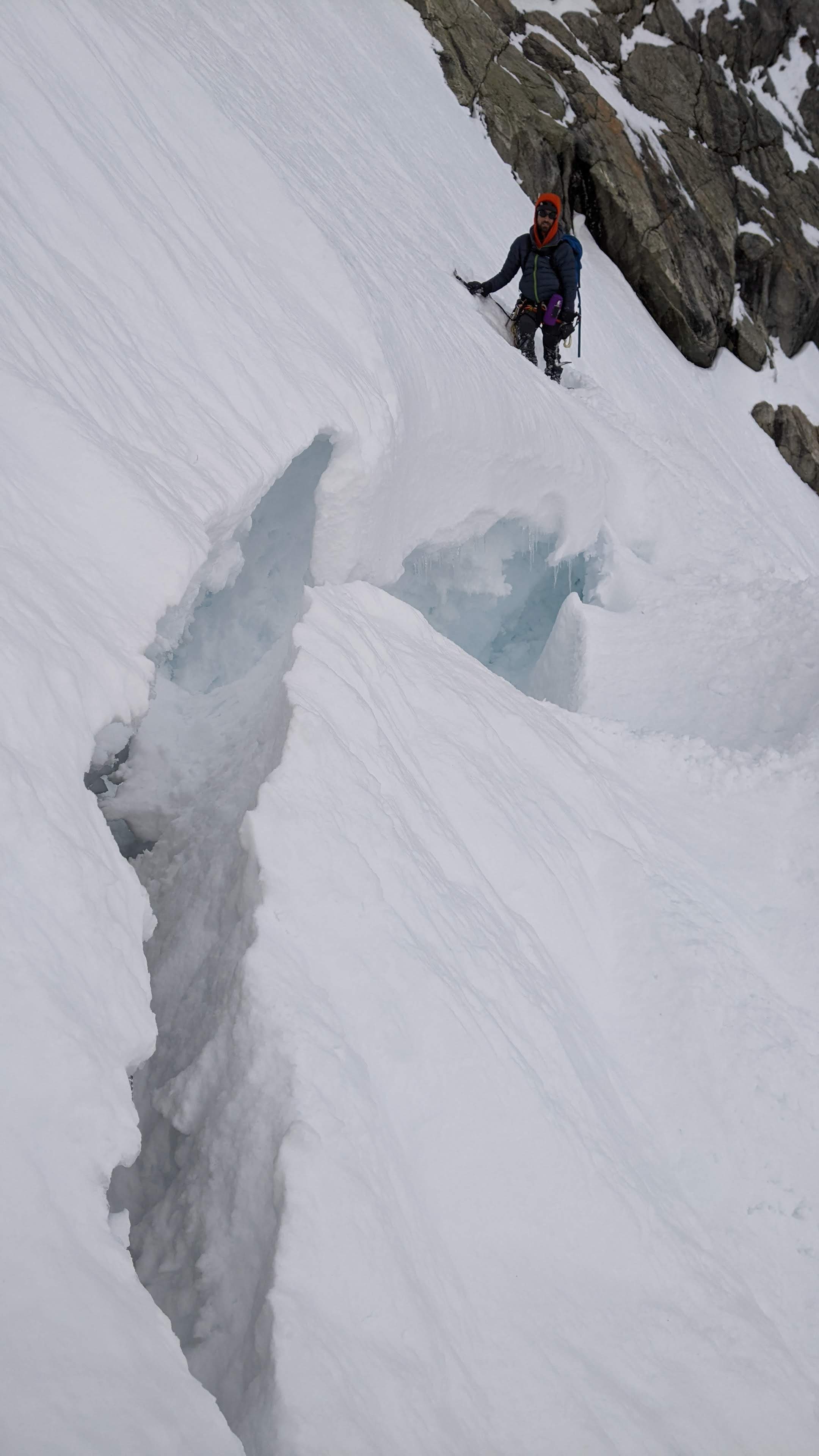
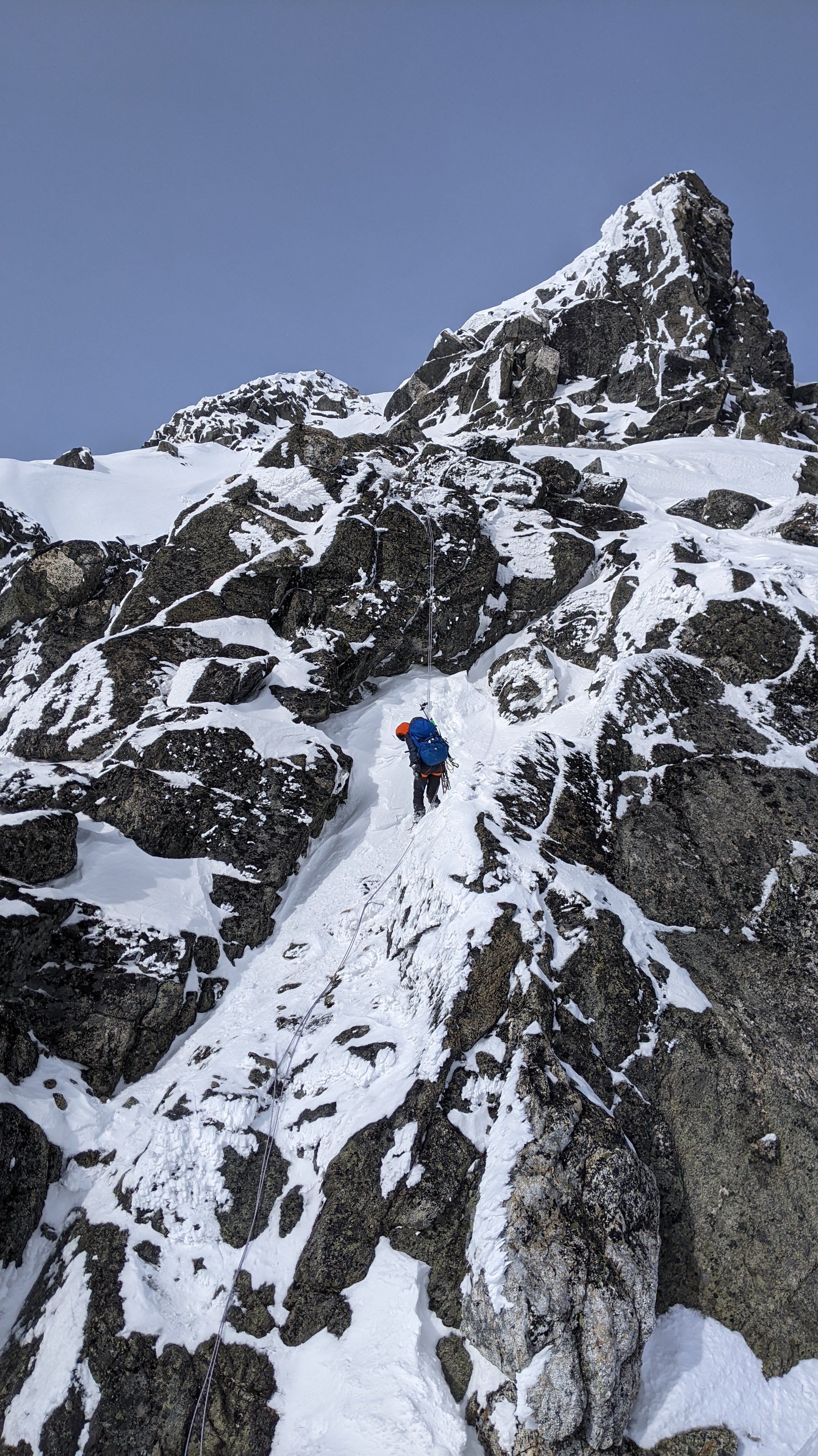
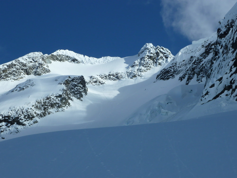
Trip: North Cascades - Sloan Peak - Superalpine (WI3-4, 1000') 04/17/2022 Trip Date: 04/17/2022 Trip Report: Fabien and I climbed Superalpine this past Sunday and topped out on Sloan peak. History: This route was attempted on 02/28/2020 by Kyle and Porter and on 03/15/2020 by Porter and Tavish We left Saturday afternoon, got the car to about 2000ft on FS 4096 just before the snow became continuous. We skinned in with overnight gear and setup camp near a small accessible stream feeding Bedal Creek at 3600ft. Sunday we woke up at 4:00 a.m. and we're breaking trail soon after. We found an easy crossing across the creek at 3950ft and stayed climber's right of the moraine to avoid being in an avy path until we were forced back in the forest. We started seeing the route peeking through the trees and reached the large snow field below the West face of Sloan peak. We approached up to the base of a left leading couloir and stashed the skis there (A). Route: We booted up the couloir, encountered a small step (B) and roped up at (C). (C-D) Short WI4 followed by easier climbing. Careful with rope drag on the rock if the belayer is in the sheltered area before the ice. (D-E) Short ice steps separated by snow. Setup an anchor on the right side at (E) (E-F) Left leaning ice staircase in what looks like a dihedral. (F-G) Snow up to a belay stance in a 5ft step. (G-H) Small ice step then snow up to belay in thin ice. (H-I) Mostly snow with some good ice screw placements. Belayed off a snow anchor. (I-J) 30ft of Easy mixed climbing. Placed cams 0.5 to 1 and made a snow anchor on a wind hardened snow fin: (J-K) Snow bowl. This can have a lot of sluffing and is dangerous if the snow is unstable. We were able to follow a path up that had already sluffed away. It was mostly the top 2in of snow that had fallen the previous night. (K-L) Snow bowl up to a notch on the ridge slightly climbers right (L-M) About 200ft of ridge traverse to the summit. Descent: (J-N) We decided to go down the snow ramp on the other side of the mountain that the corksrew follows for a bit. We aimed for a gendarme (Below the N). From there we did one 30M rappel off and traversed under the gendarme to the corkscrew route (O). By then the East side of Sloan Peak was in the shade and we found good snow to front-point sideways and down a ramp for almost 1000ft. (650ft elevation loss) There was a moat at the bottom which we negotiated skier's right. We had brought two poles up for the next section that involved wallowing across the bottom of the SE face to reach the South ridge of Sloan at 6750ft. (P) From there, we headed back to the W ridge near where the route starts (Q). It doesn't look like it can be traversed easily a first but there's a passage around 6100ft. At this point, we could see our skis and felt like it was in the bag. The chute skied amazingly well but once we reached the snow field, the snow had started to crust making it quite hard to turn. We arrived back at camp at dark pretty tired. Since we both had engagements on Monday, we slept until 4:00 a.m then skied most of the way back and made it home by 11:00 a.m. Overall, this is a fun route when the conditions are there. The snow bowl at the top is probably the most dangerous part of the route when the snow is unstable. It may be possible to bypass by staying on the ridge (Probably from J). Strava GPX Enjoy! Gear Notes: Gear: 11 ice screws (Used all) 8 draws 2 pre-rigged quads 0.3 - 2" cams 1 picket (2 would be better) Small Nuts (Unused) Approach Notes: Drive from Darrington while Bedal pass is closed. High clearance vehicle recommended for FS 4096
 1 point
 -
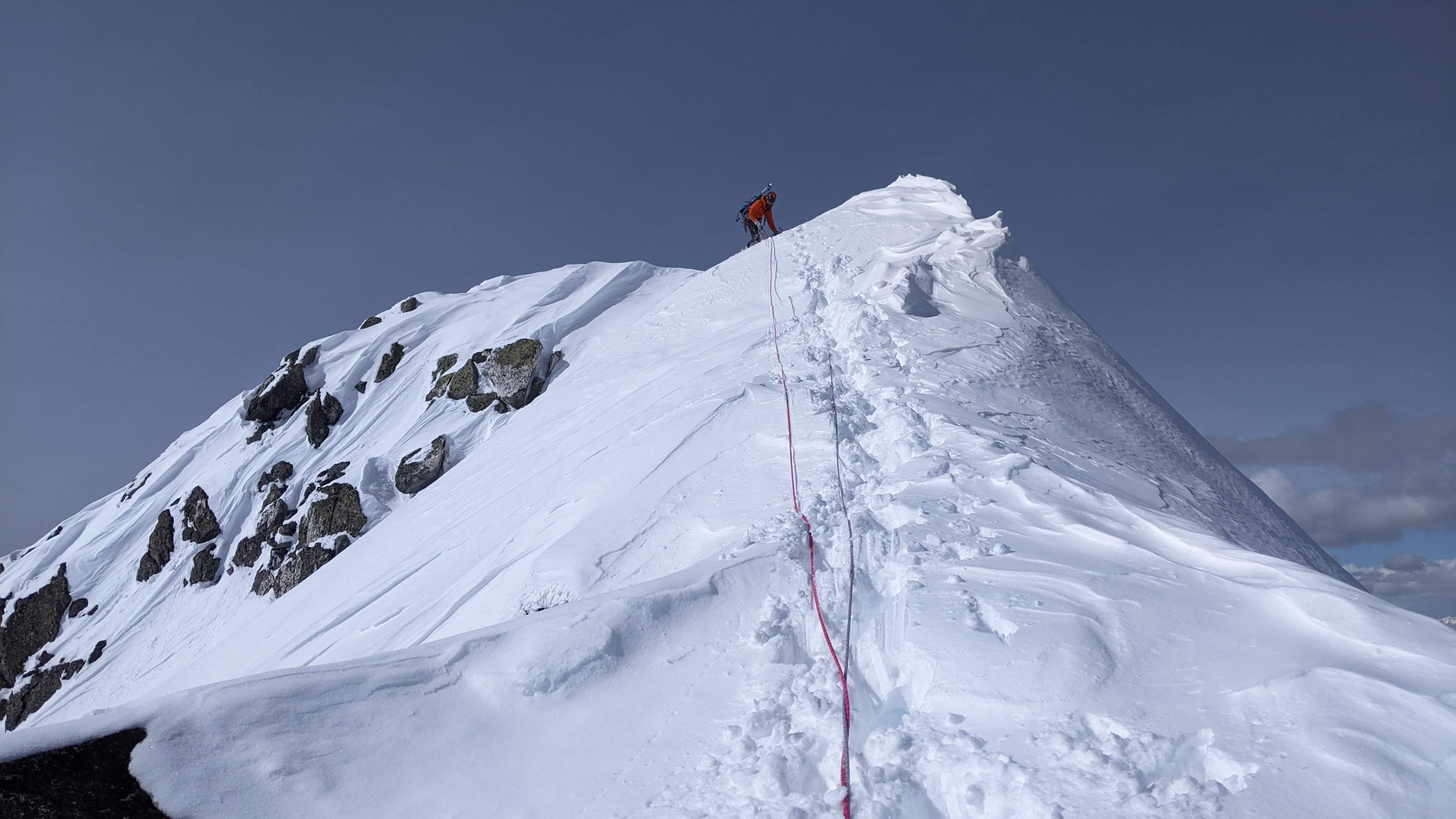
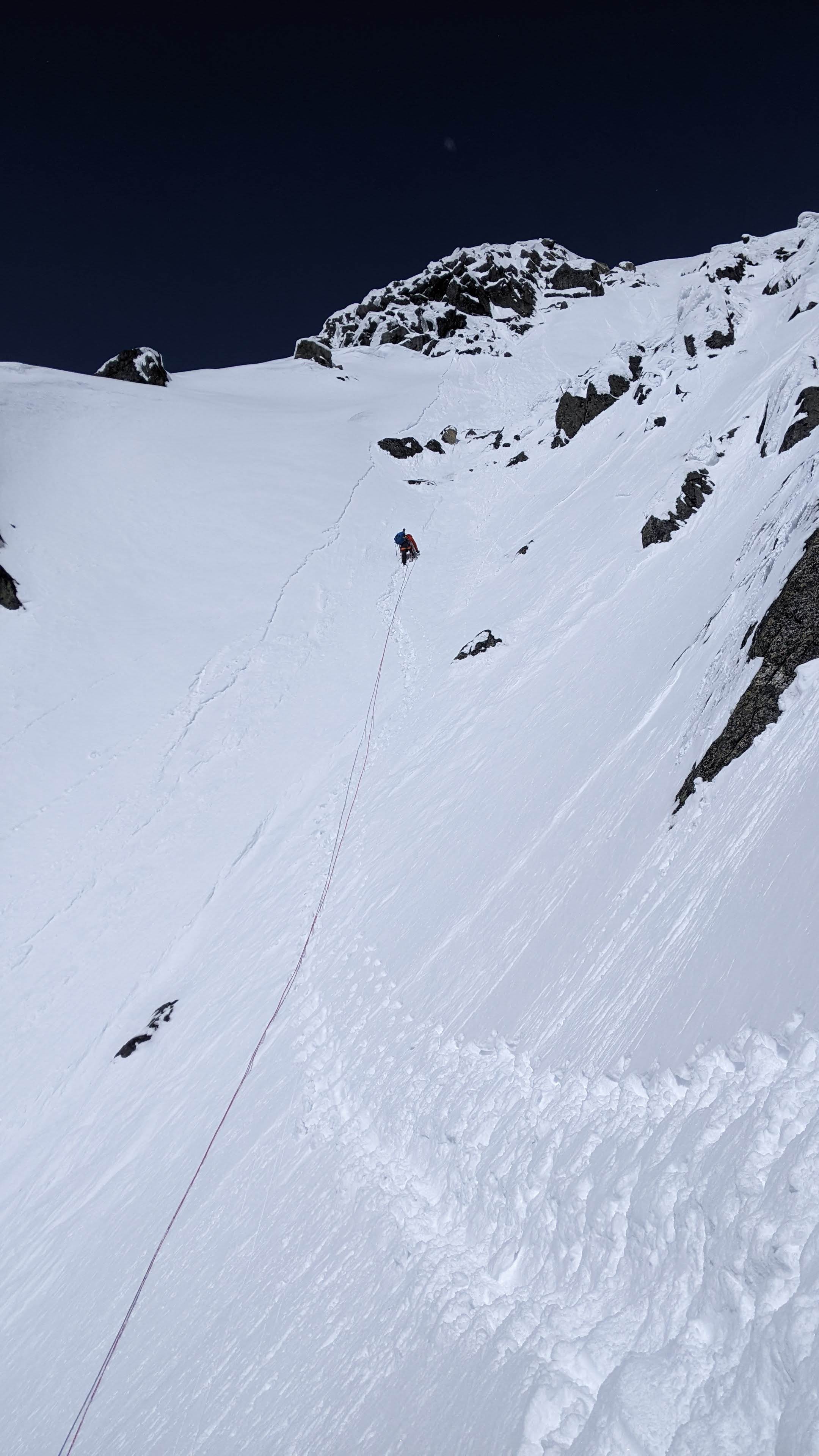
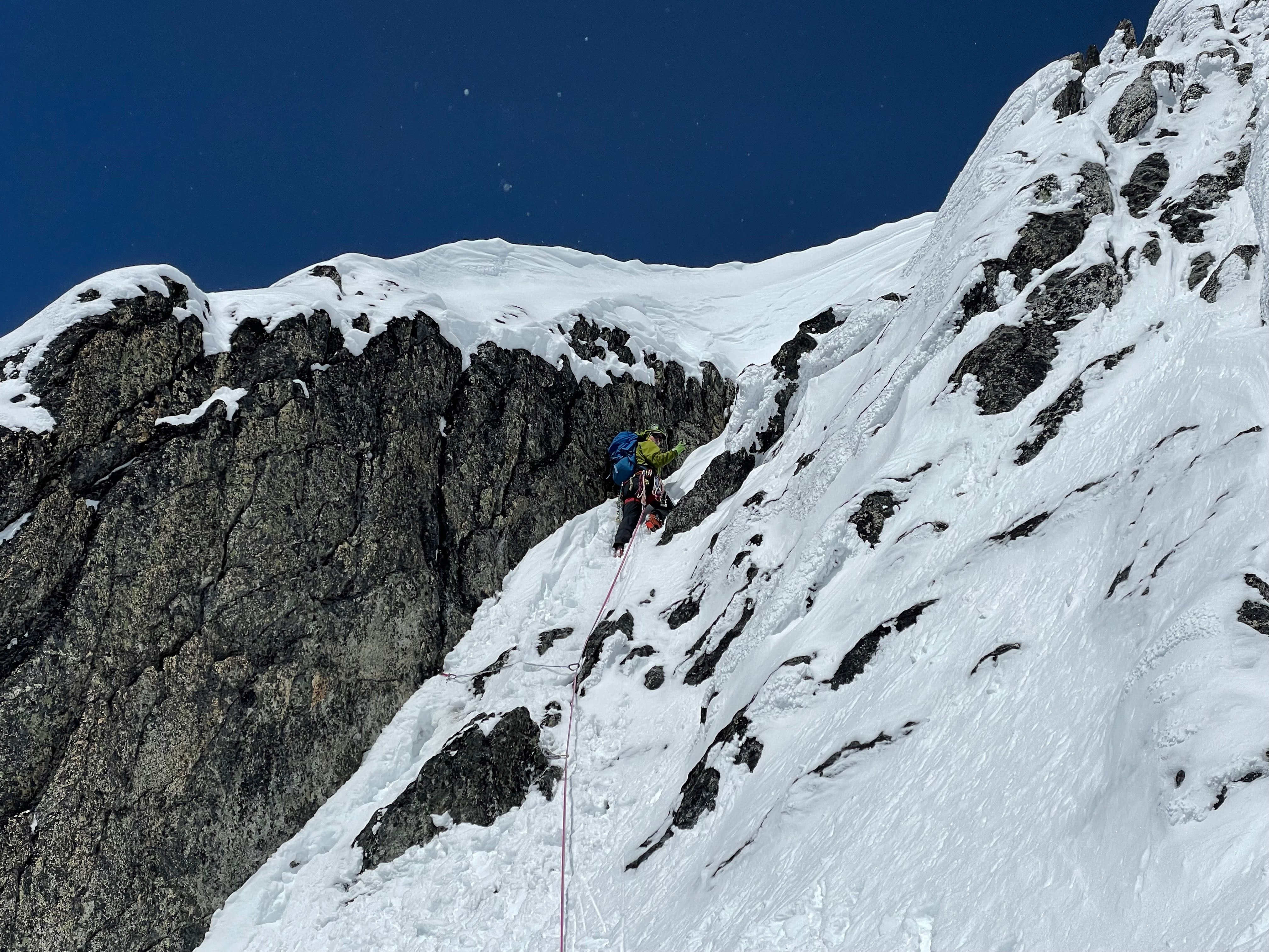
Trip: A Peak - Knickerbocker and the Bull Moose (FA) Trip Date: 04/25/2022 Trip Report: With a short good weather window and high hopes Earl and I set off into the Cabinets to see what we could find on the North Face of A Peak. We left the trailhead under warm and sunny skies and enjoyed the dirt trail and glacier lily's for the first couple miles. It was definitely spring and we wondered if maybe we were too late in the season already. But about halfway in on the Granite Lake Trail we started hitting snow and by the time we arrived at Granite Lake there had been multiple postholes. Thankfully we arrived an hour before dark so we had time to scope the face of A Peak with binoculars. There was still ice on the Thunderdome and 3 Tiers but it was looking warm and rotting. The north face of A Peak looked good however and we soon decided on our line. The goal was to climb up a main couloir that slices up the face and then follow the corner system above to the summit ridge. After a short night we were hiking out of camp by 3:15am. A couple hours later as the sun rose, we had crampons on and were booting up mostly neve snow in the entrance couloir. The couloir climbing was steep but easy and I was surprised at how good the ice flows were that poured in from the left wall. My partner Earl had climbed these ice features to the snow field above and then connected a line to the summit ridge 3 weeks ago as a solo first ascent (Bull River Prowler, M4, AI3, 600m). At the top of the couloir the real climbing began. We followed the corner system above mostly containing mixed rock with a few patches of ice in the corners. The gear was generally good but the climbing slow and tedious cleaning snow off the rock or testing holds for loose rock. On the 3rd pitch Earl was cleaning some loose rocks when the snow mushroom he was standing on collapsed. He was suddenly left dangling from one hand on a great steinpull. Somehow he kept his composure and reestablished his feet on the rock before taking the fall. After 4 pitches of engaging climbing we reached a saddle in the buttress that had been on our right. From here the obvious line continued another 4 pitches up the corner systems above. These pitches were all easier in difficulty and had more ice. The 6th pitch was probably the most aesthetic if only because it started on a thin ice traverse that allowed for some great pictures. By this point on the face we had an incredible view of the basin below and even across the ridges towards the town of Libby. The last pitch ended with a chimney, then a "birth canal" squeeze to some cornice digging to reach the summit ridge. All in all it was a proper adventure. We were 12hrs climbing the 8 pitches and 18hrs camp to camp. The decent was pretty straightforward because we could see. We hiked the ridge to the south towards Snowshoe Peak until we found a steep slope between cliff bands to descend back down into the basin to the east. From there it was a couple miles and several thousand feet of postholing down the basin and back around to Granite Lake. We called our line Knickerbocker and the Bull Moose in reference to both the Wool Knickers that Earl wore on the ascent as well as the moose that continually likes to post hole and destroy our trail into granite lake. It was an awesome experience to be able to put up such an amazing line on A peak. The climbing is quite good and in my opinion on par with many of the classic climbs I have done in the Ruth Gorge of AK (in terms of difficulty and quality). Knickerbocker and the Bull Moose, IV, M5, AI4, 600m. Looking up at A Peak from Granite Lake in the fading light. Roughly the route we took. Passing by the route that Earl had put up 3 weeks before called Bull River Prowler. Our route continued up the couloir and then the corner system above. Looking down the couloir from the top as we rack up for the mixed pitches. Earl starting up pitch 1. Looking up the top half of pitch 2 which turned out to be the crux. Looking down from the top of Pitch 2. Earl starting up Pitch 3. Earl starting up pitch 5 where the climbing got easier. Enjoying some thin ice on the beautiful Pitch 6. Me looking up Pitch 7 before starting out. The upper half of the route was mostly this terrain...fun moderate mixed climbing. Looking up the beginning of pitch 8 with the cornice looming overhead. Earl and I on the summit ridge while on the decent with the true summit directly behind us. Gear Notes: We had double set of cams from .4 to #2 with single #3, 8-10 pins (heavy on the LAs and KBs), set of offset nuts, set of tri-cams(doubles in the 2 smallest sizes) and 5 screws (all short). We placed a lot of pins and the tri-cams came in very useful as well. In addition we wished we had a couple more small cams below .4. Approach Notes: Hike the Granite Lake Trail to Granite Lake in the Cabinet Mountains. From the lake hike up 2000ft to the base of the North Face.1 point
-
It may have been possible to skin through the step but it didn't look probable. I suspect the step is a victim of glacial recession. Here is May 2011 when Tom was there: And April 2022:
 1 point