Leaderboard


Popular Content
Showing content with the highest reputation on 03/17/21 in Posts
-
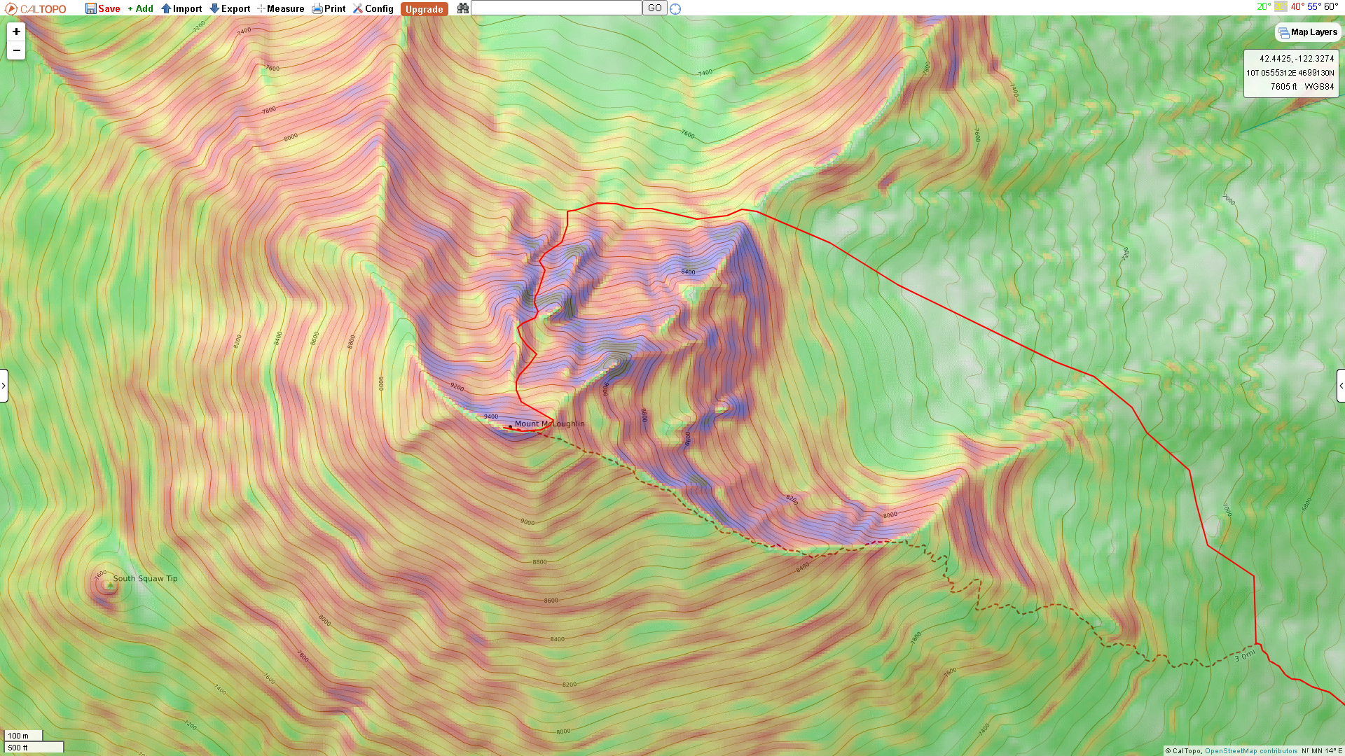
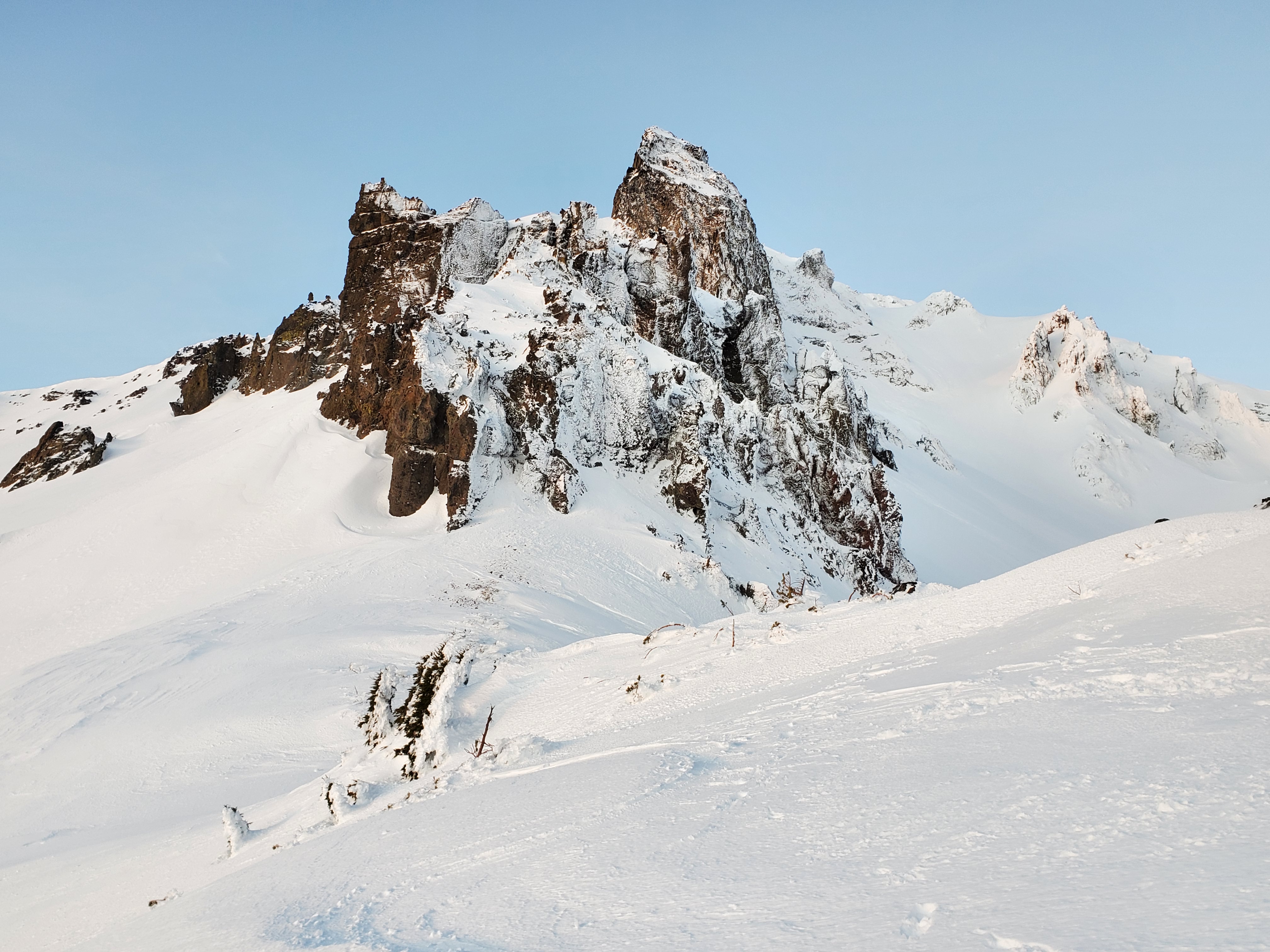
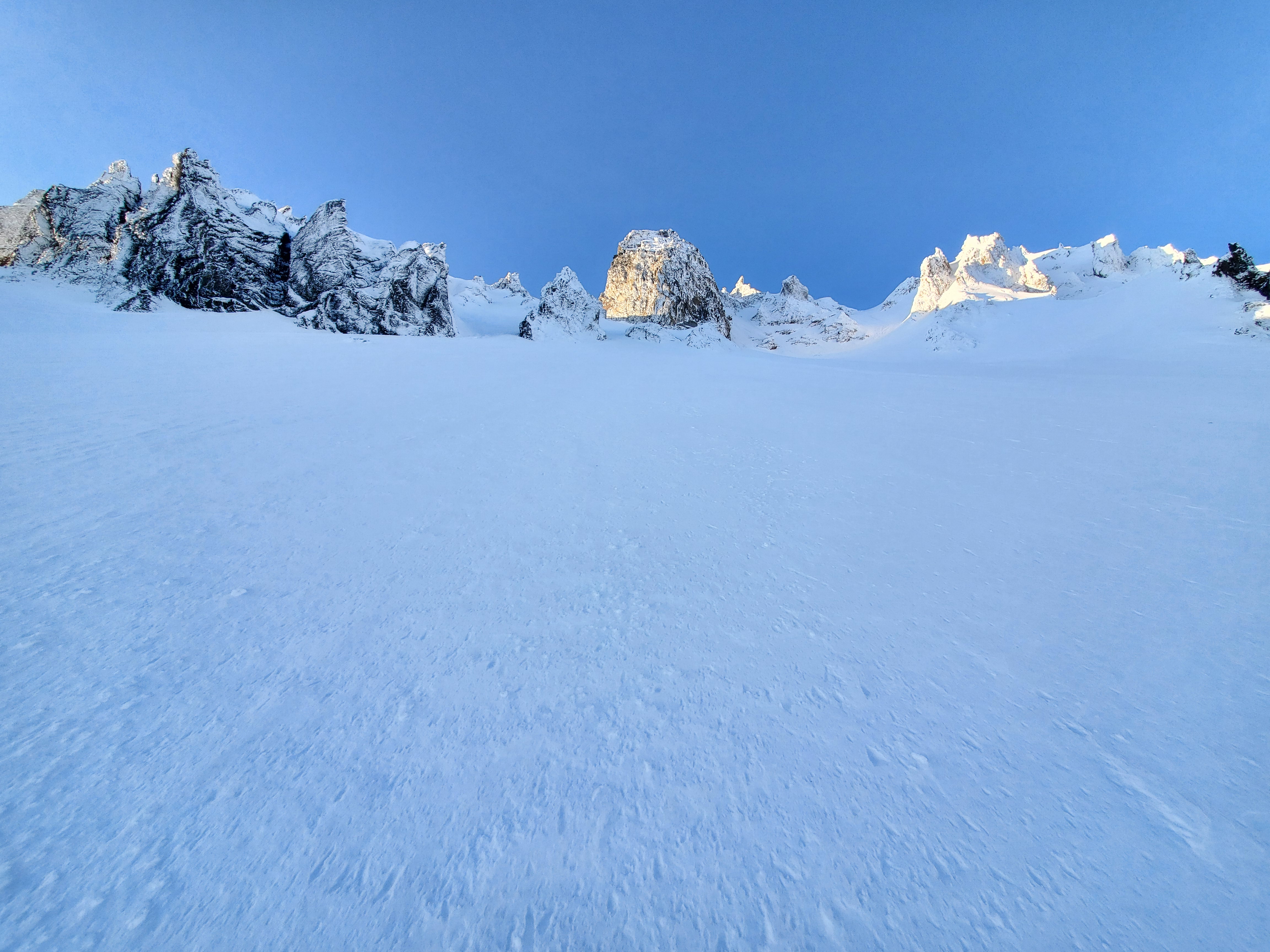
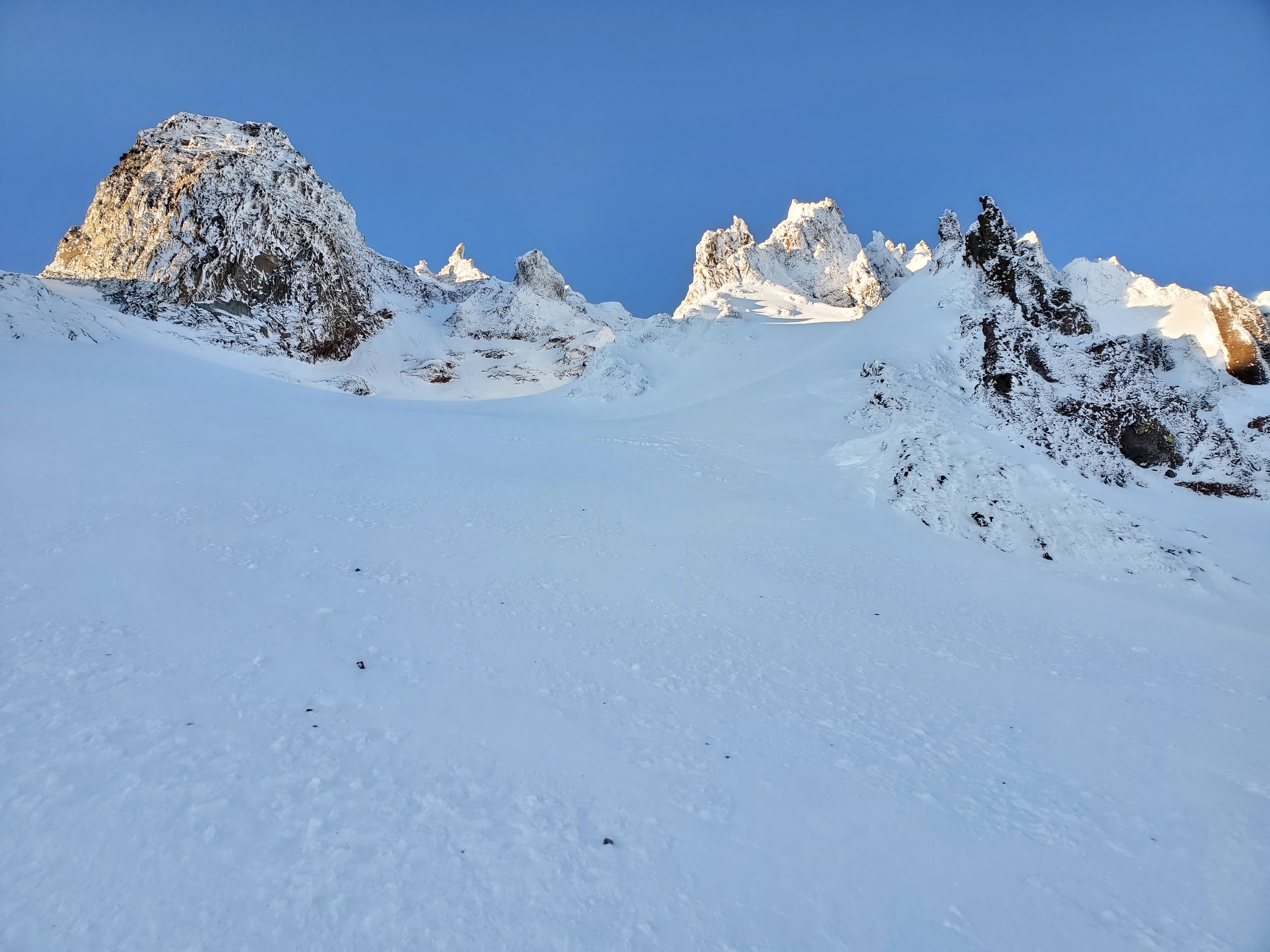
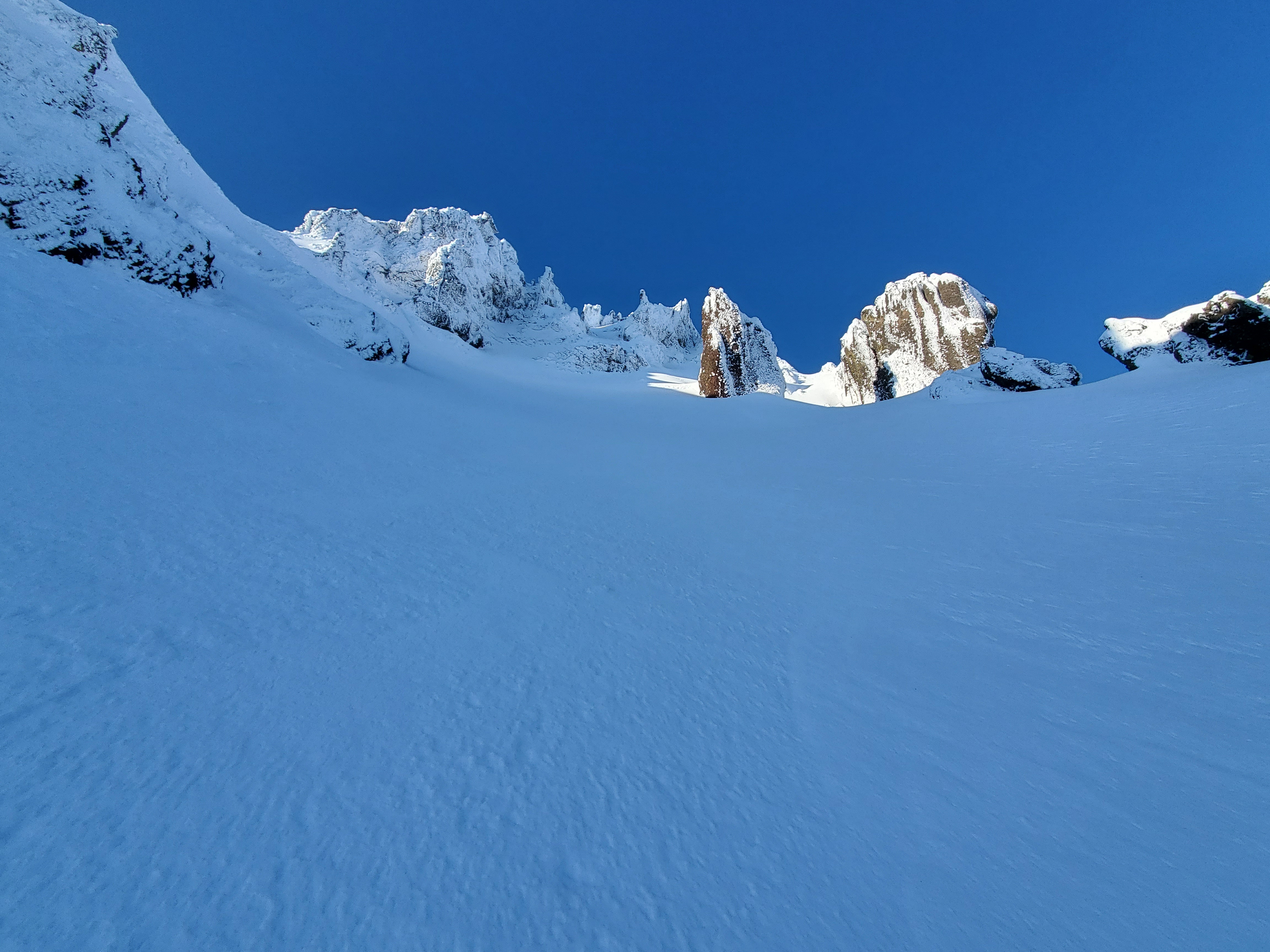
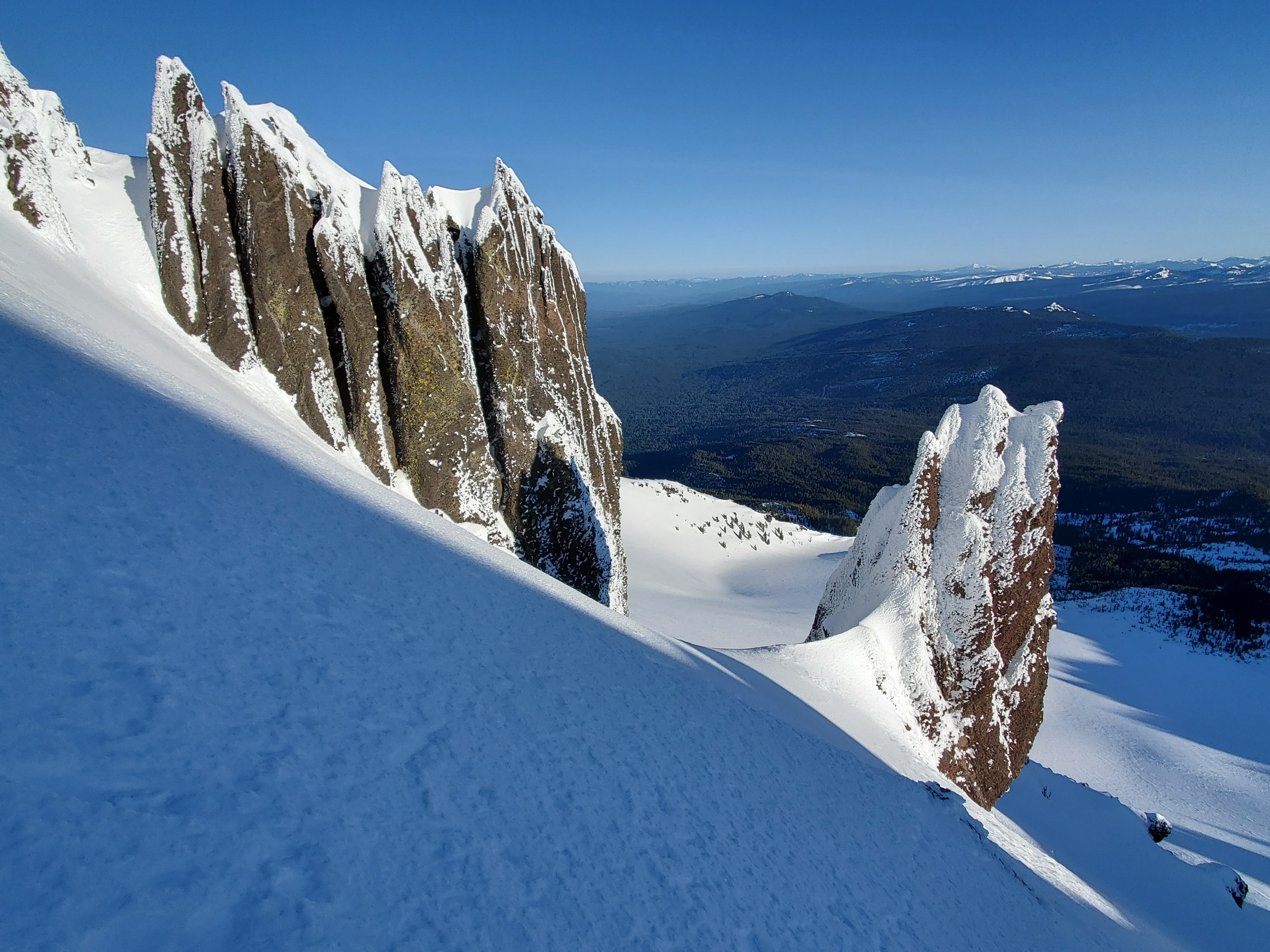
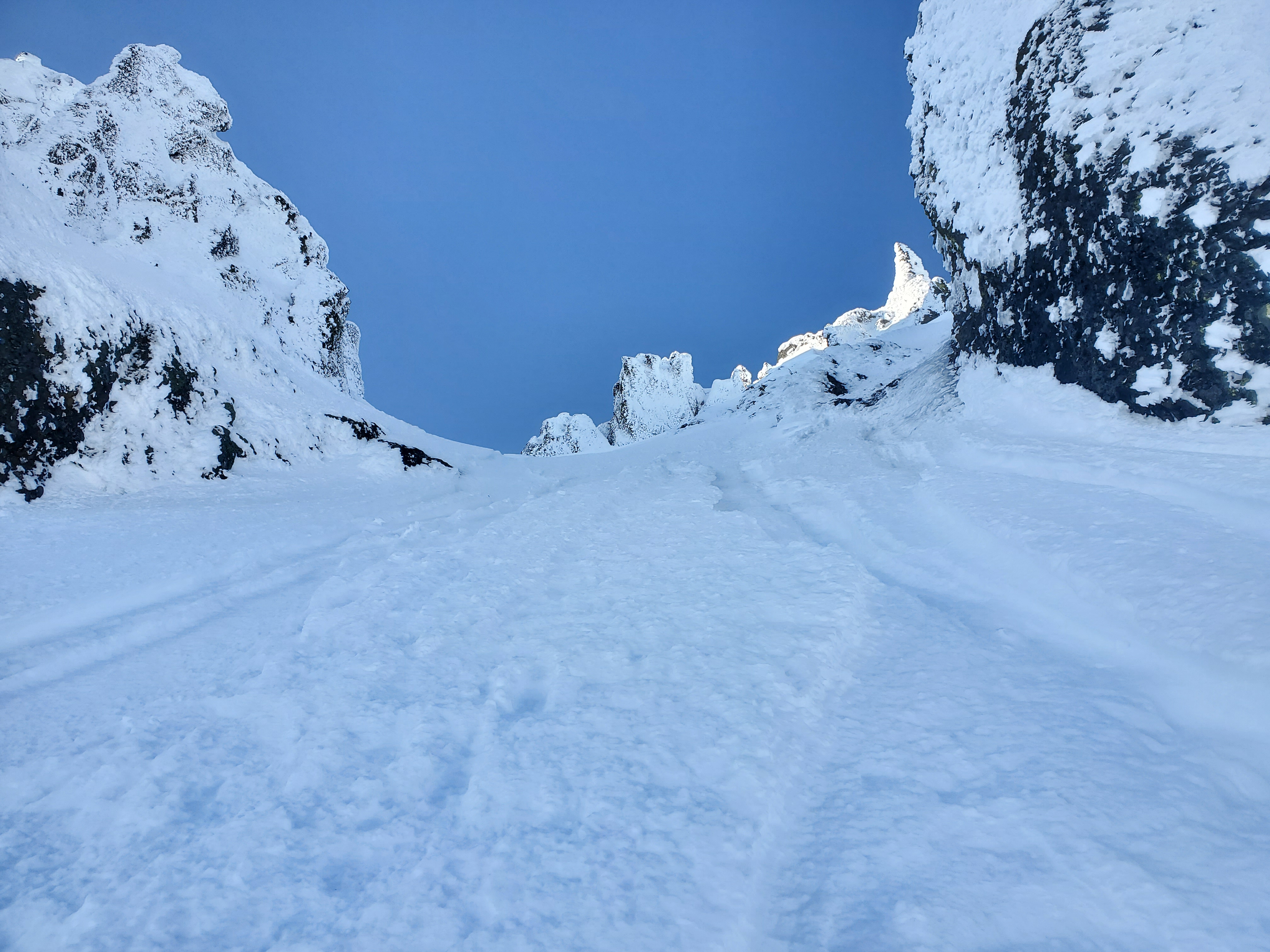
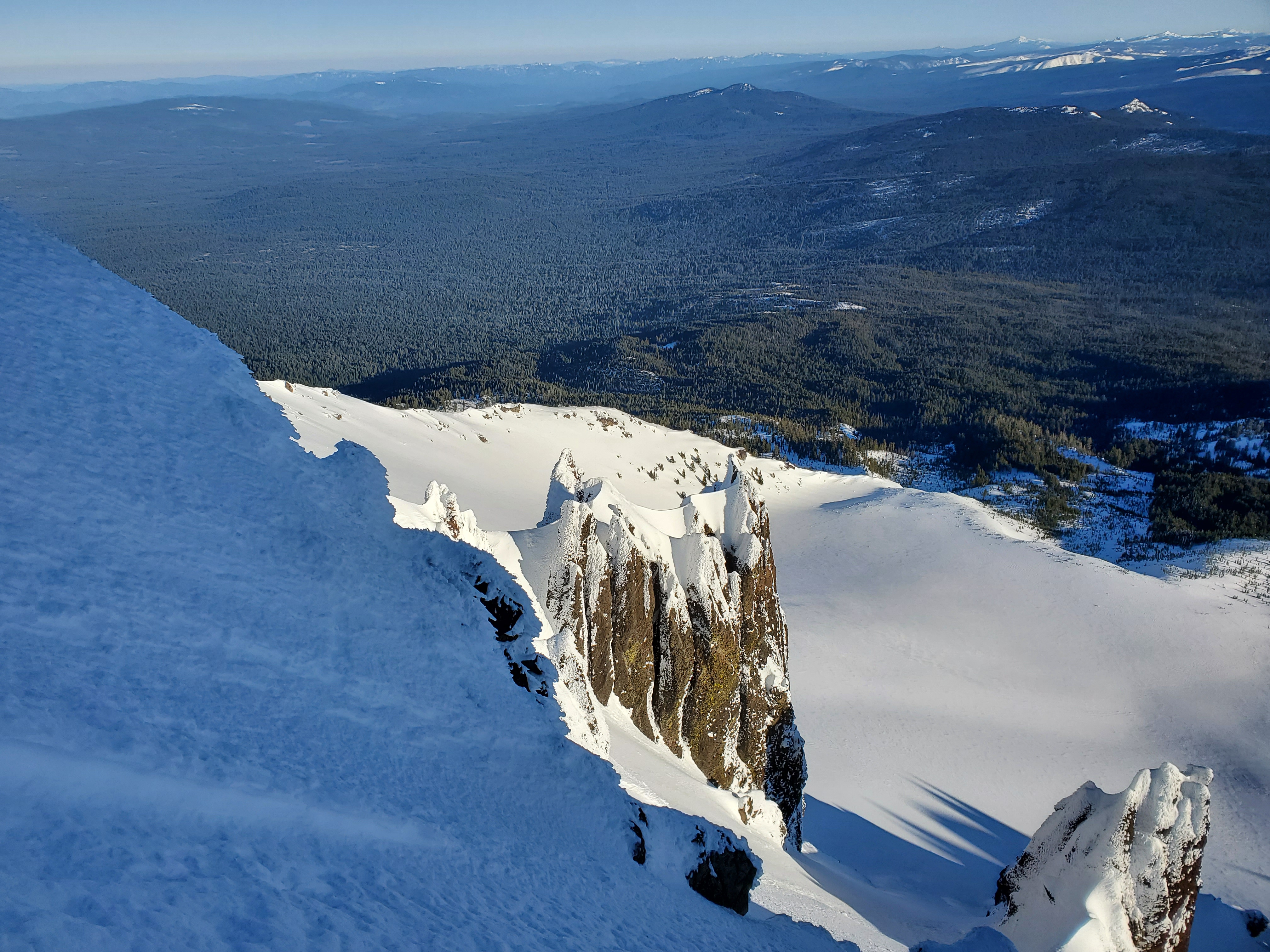
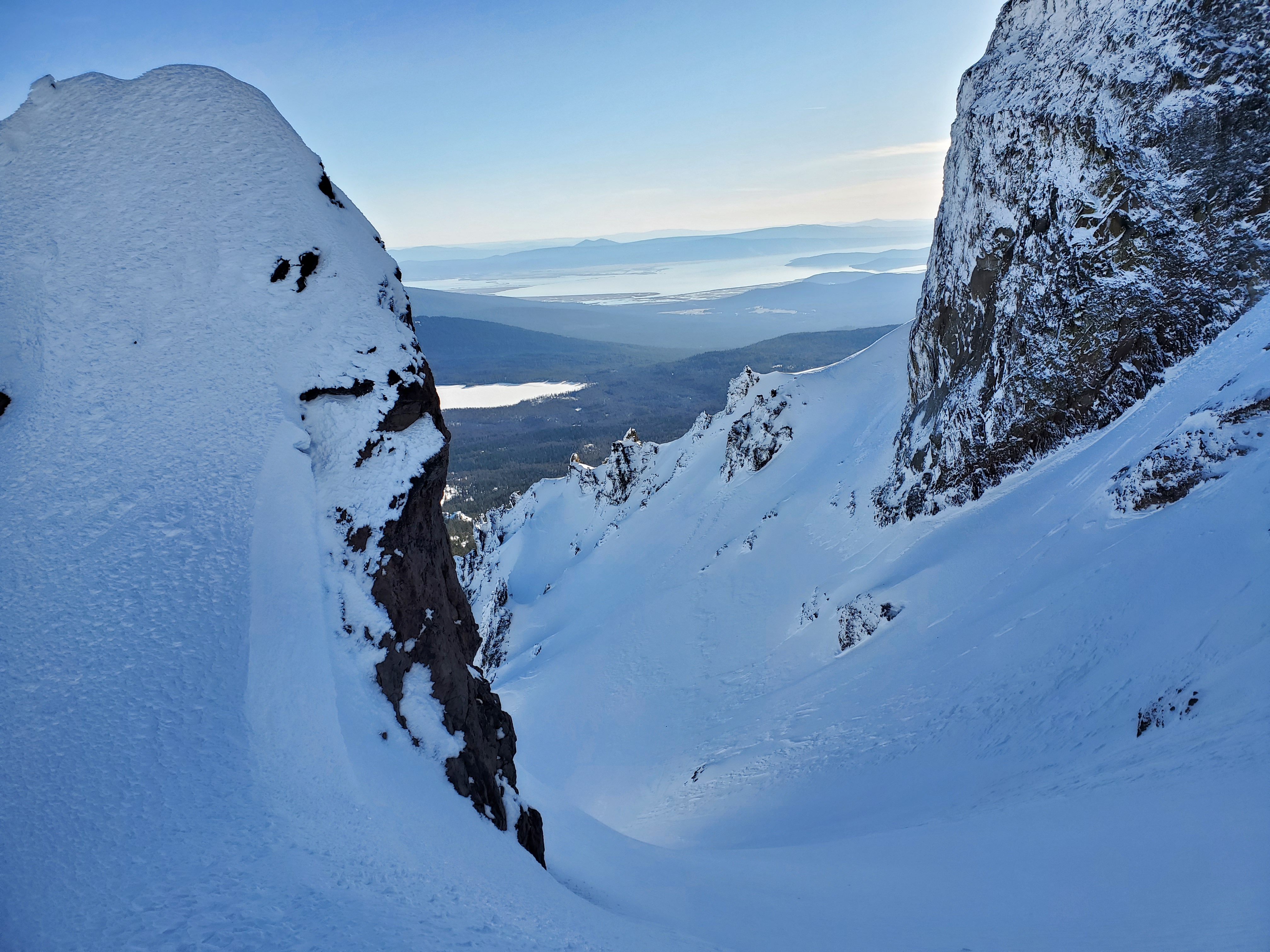
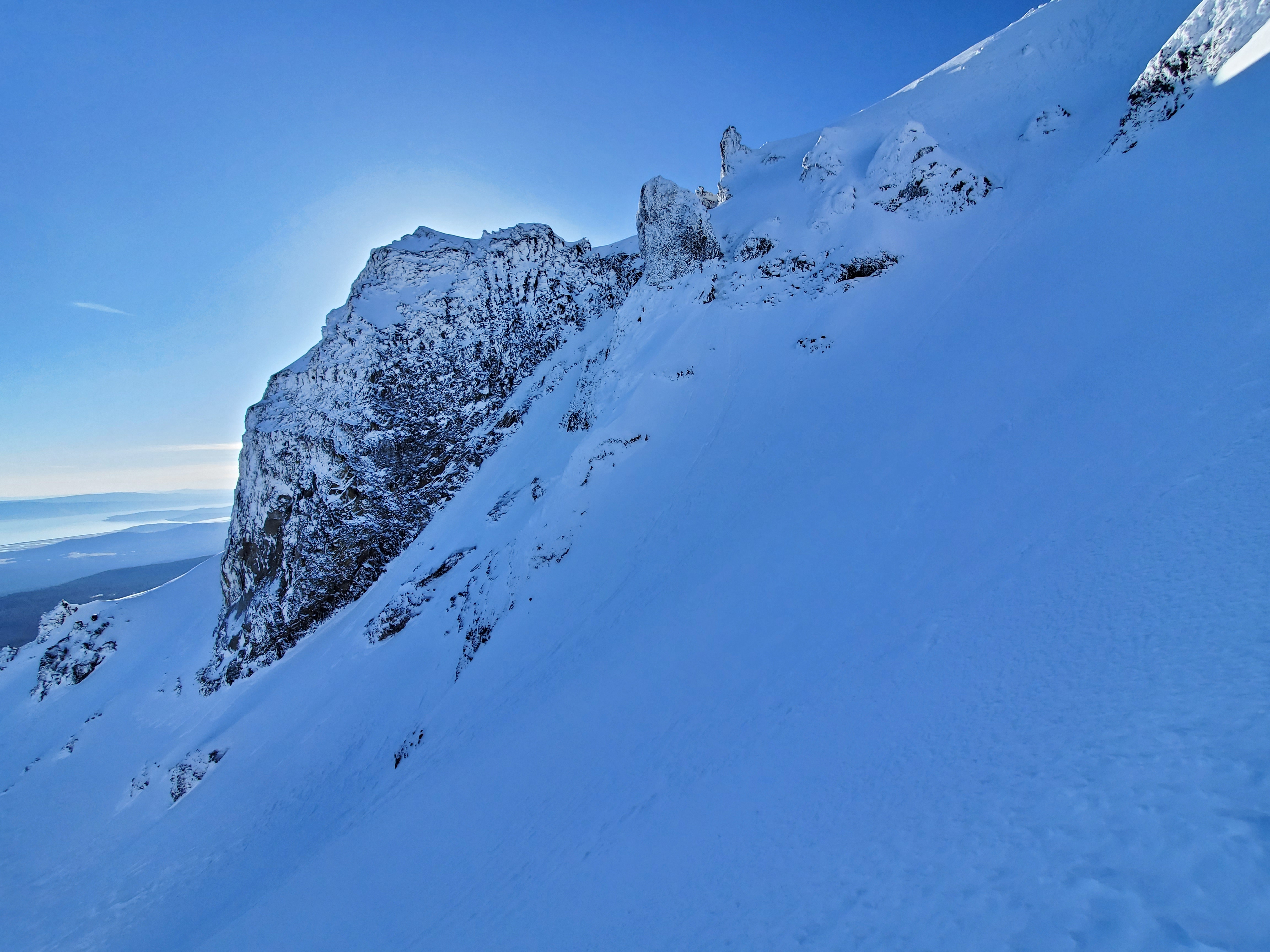
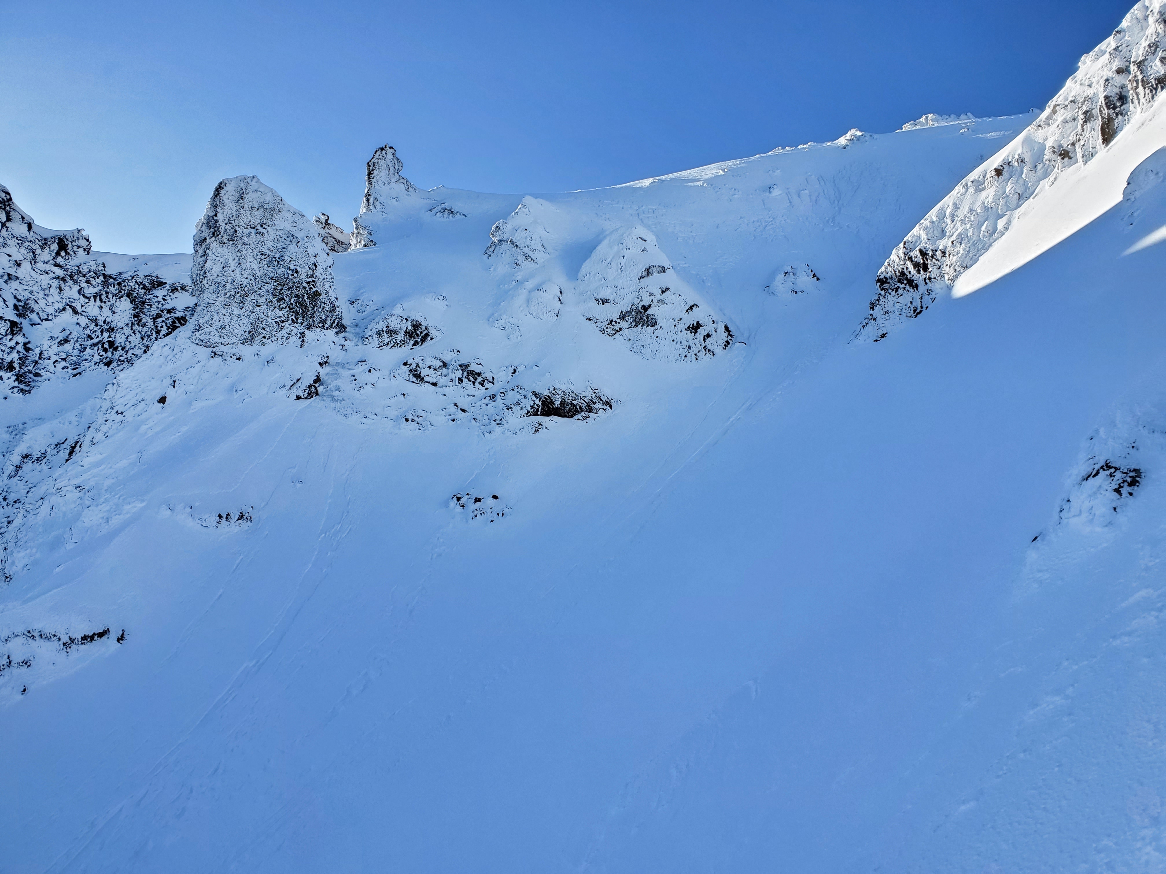
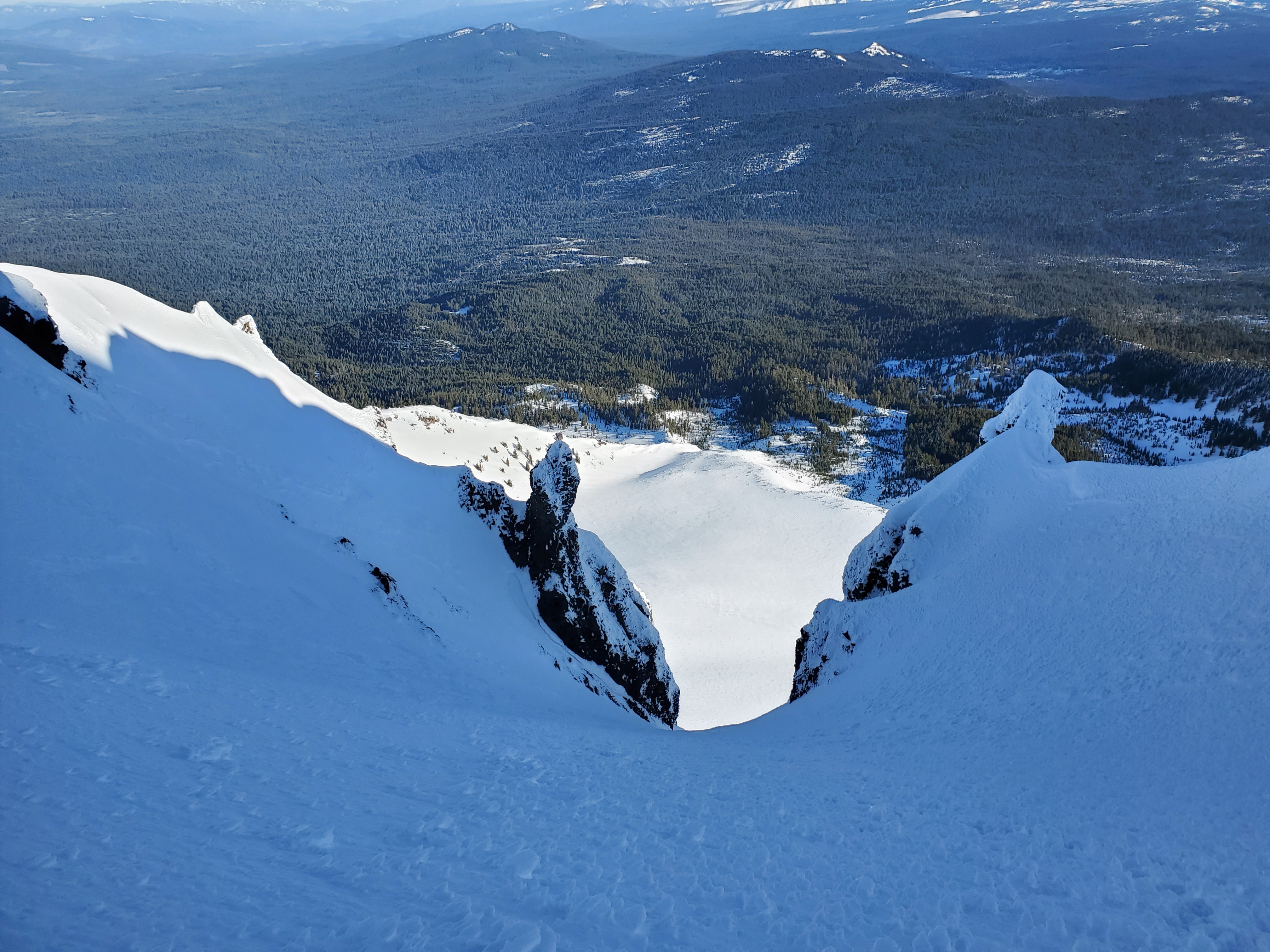
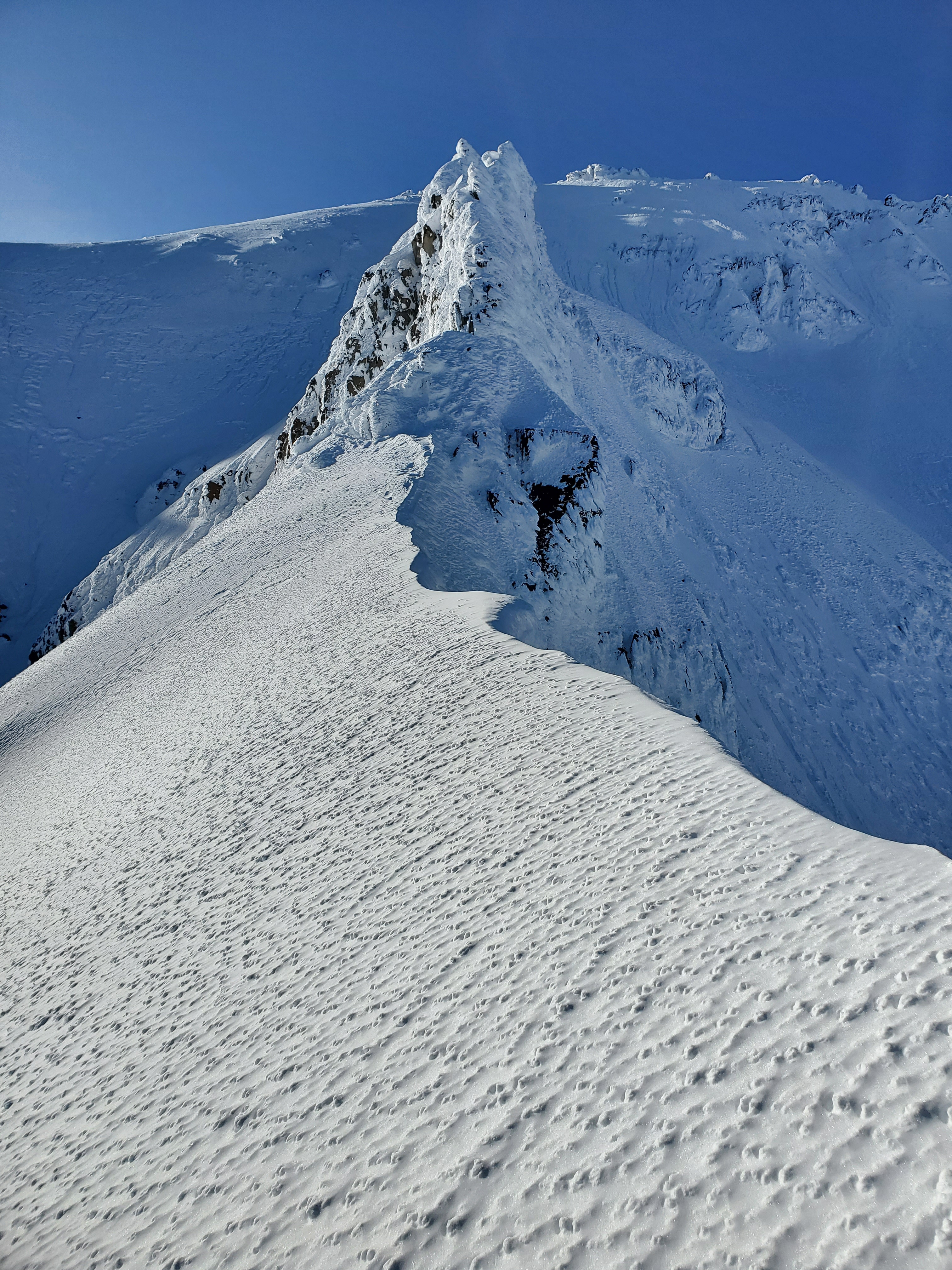
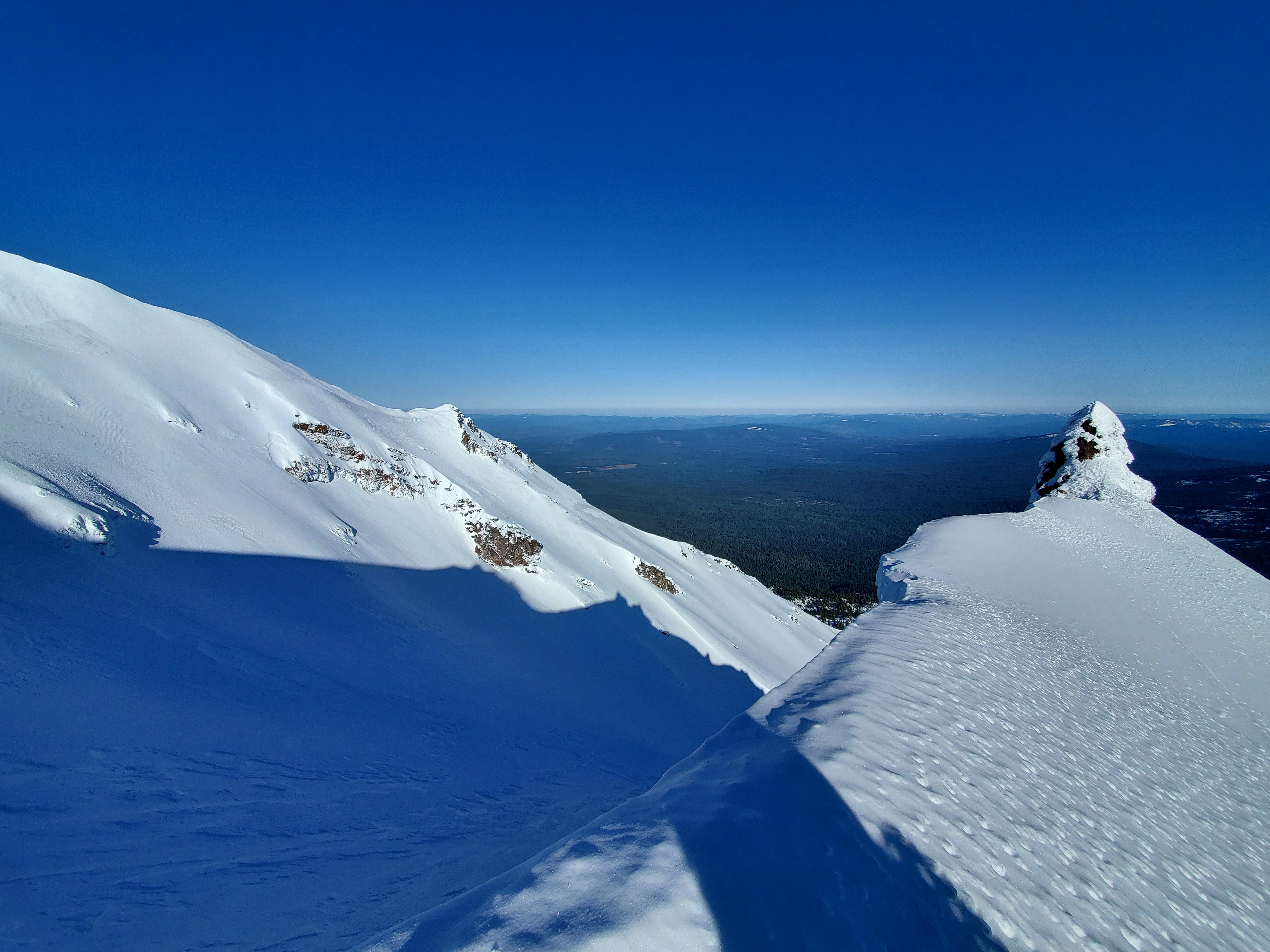
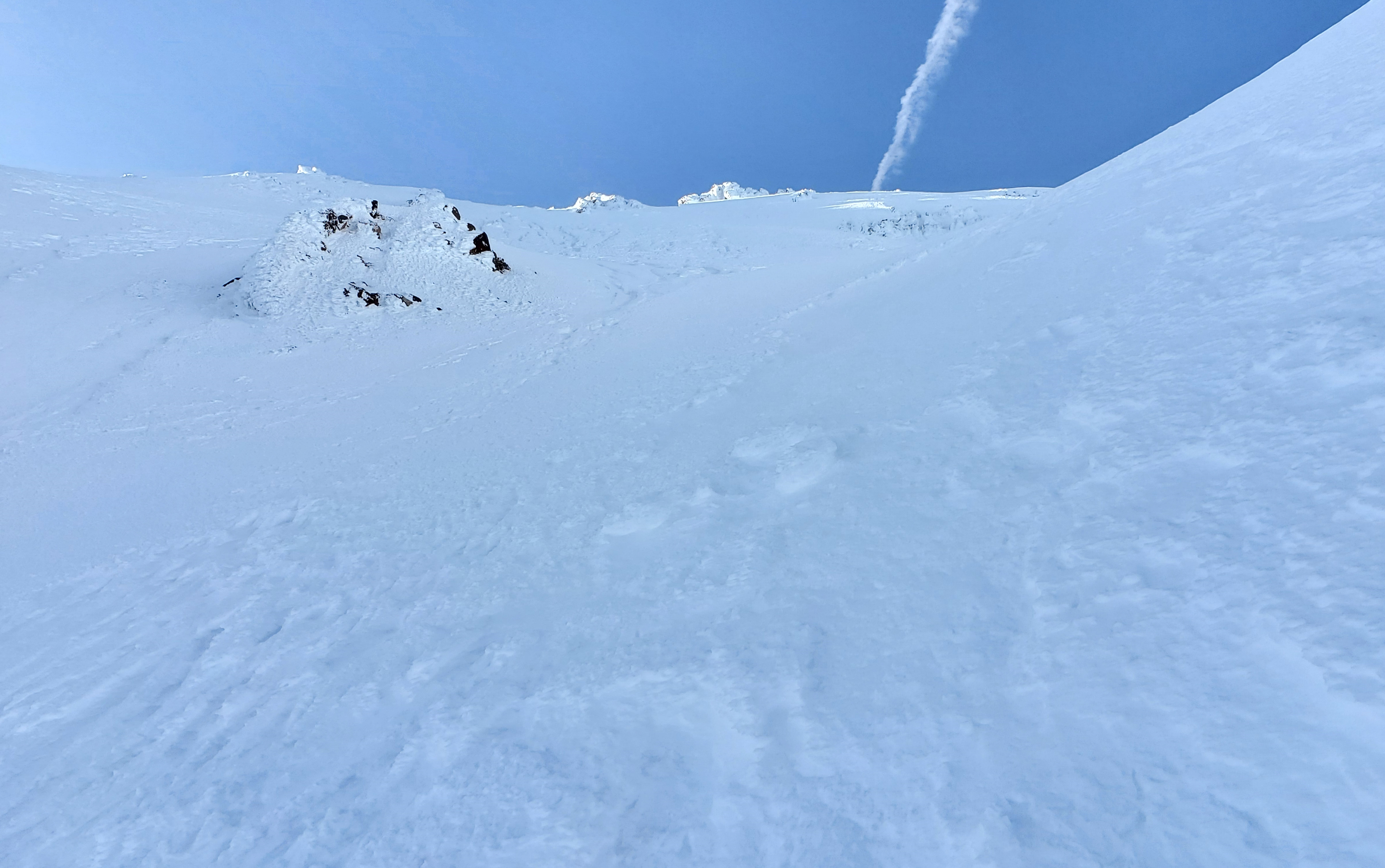
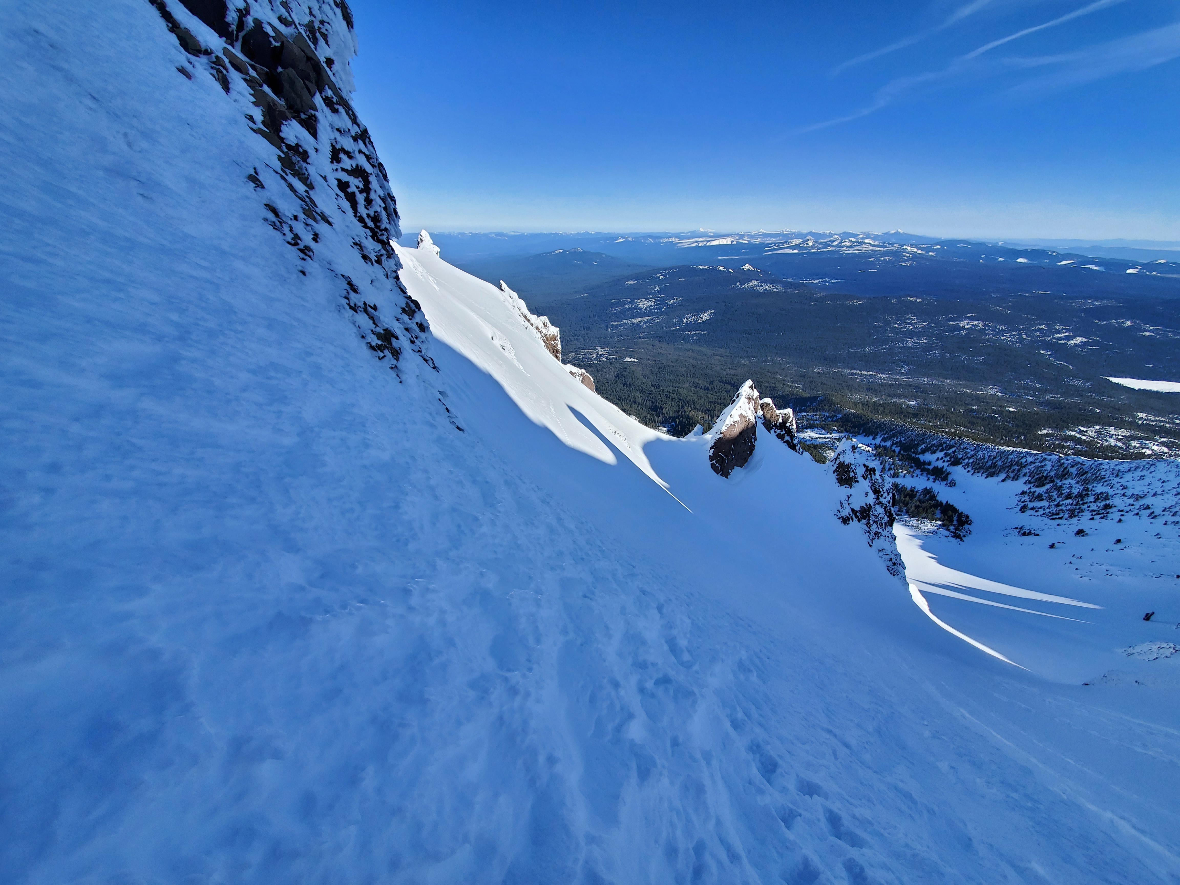
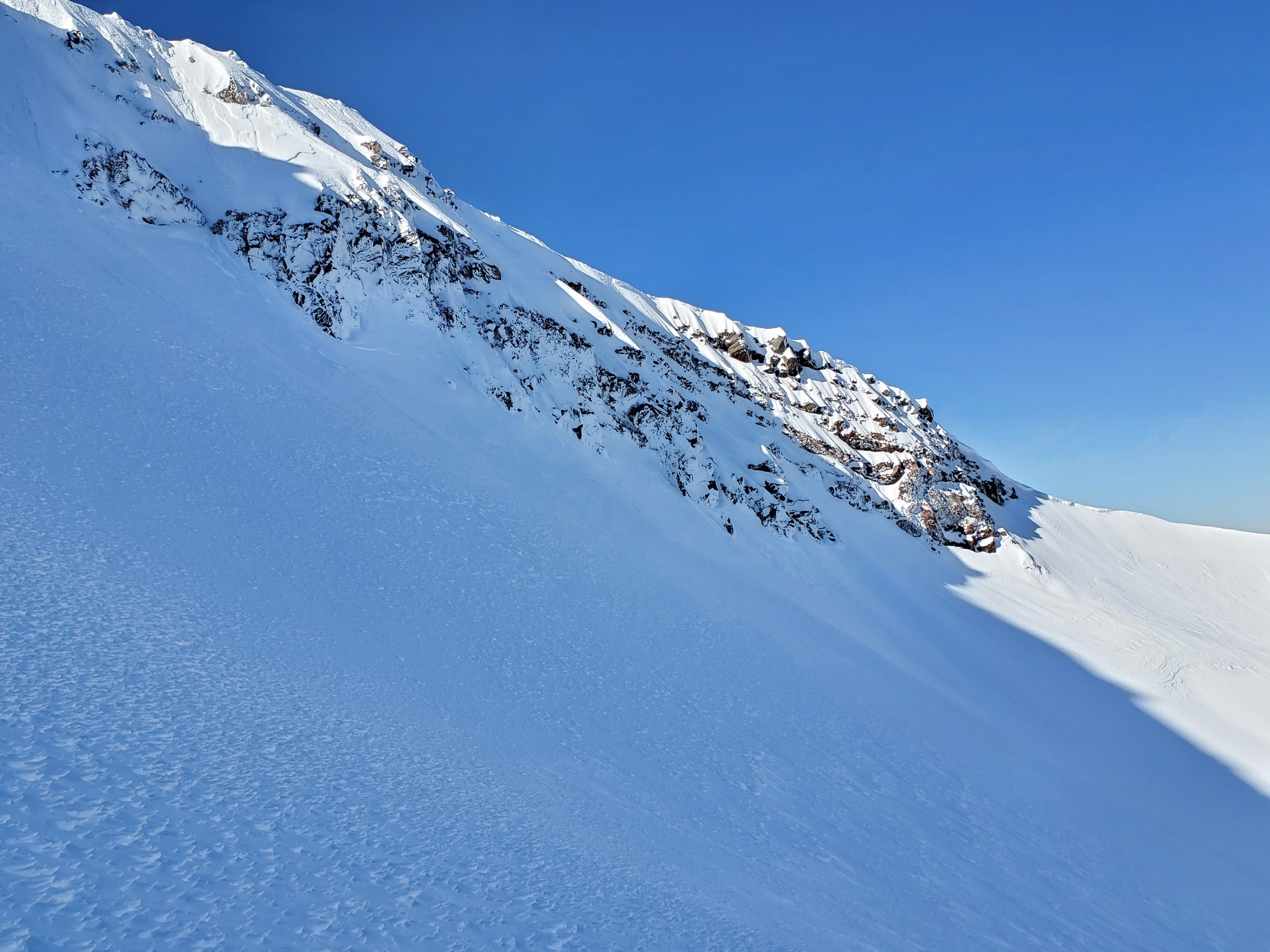
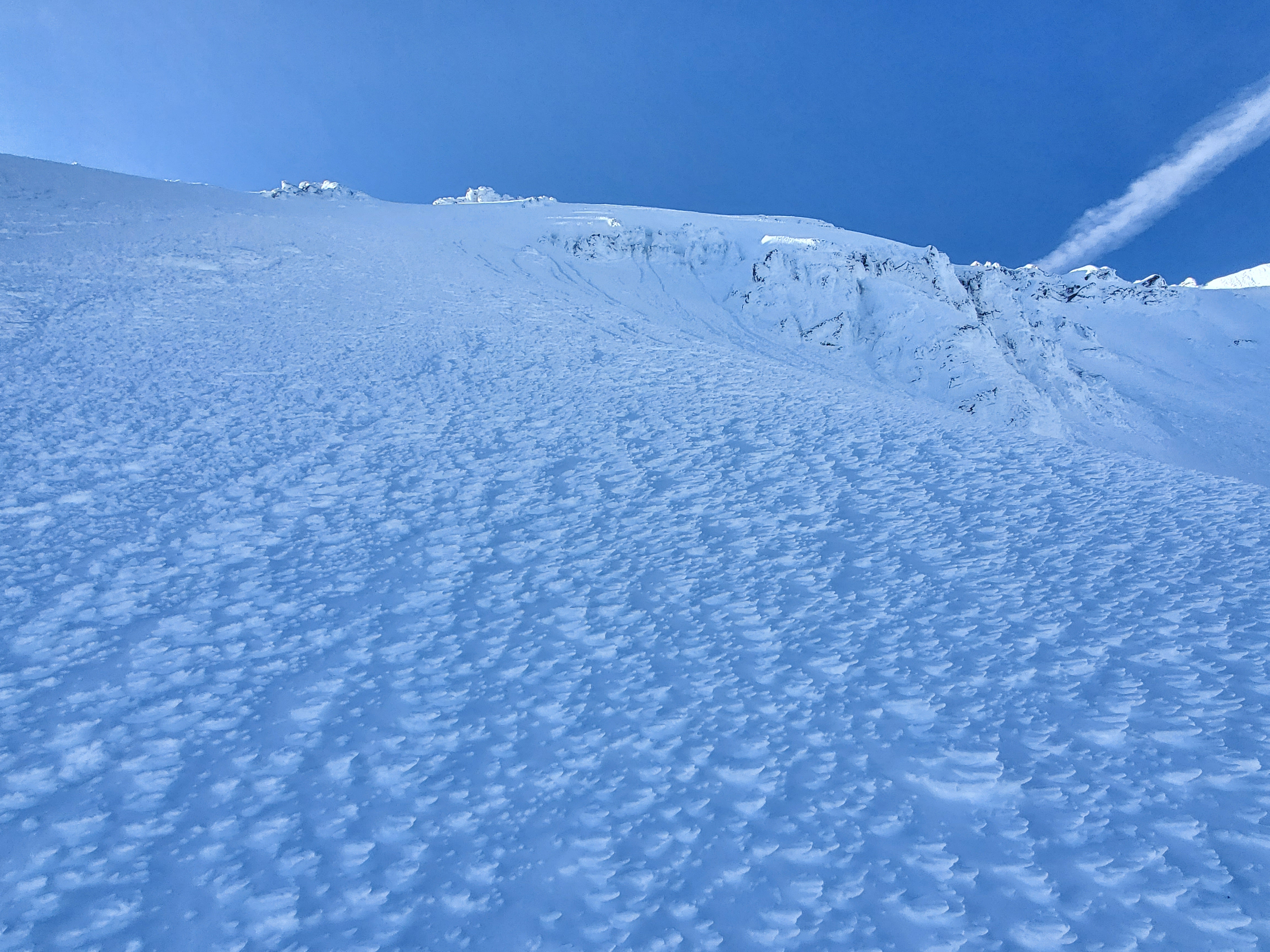
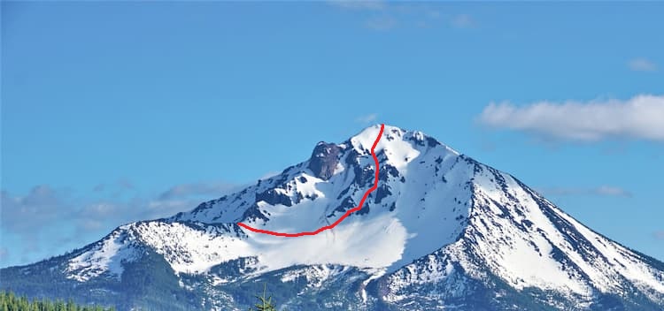
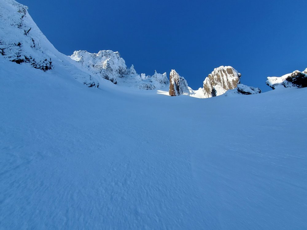
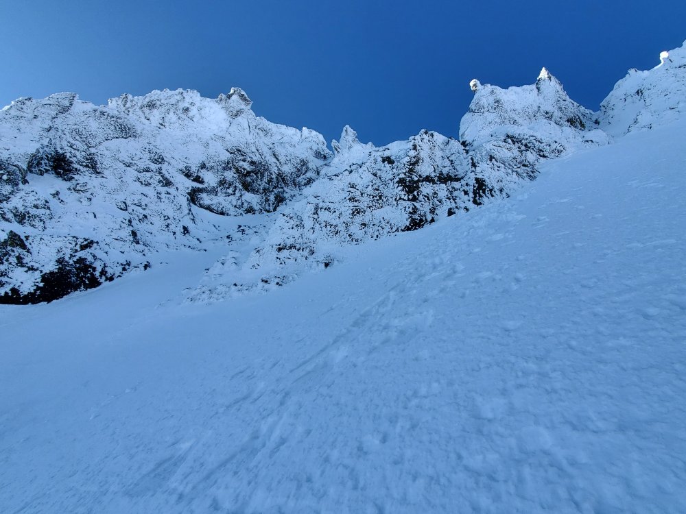
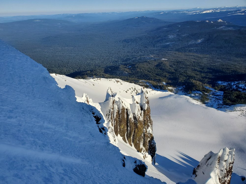
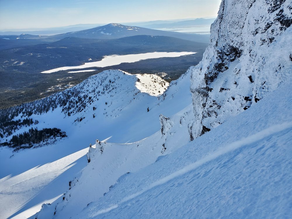
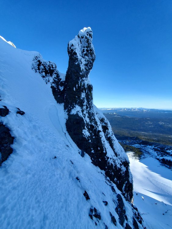
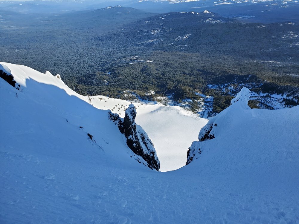
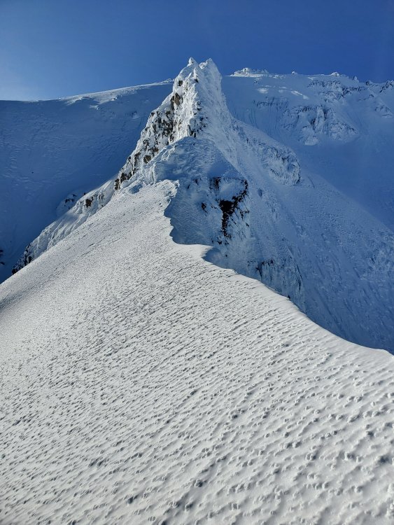
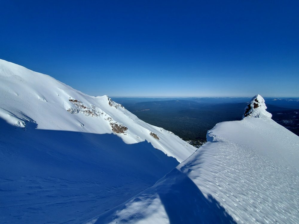
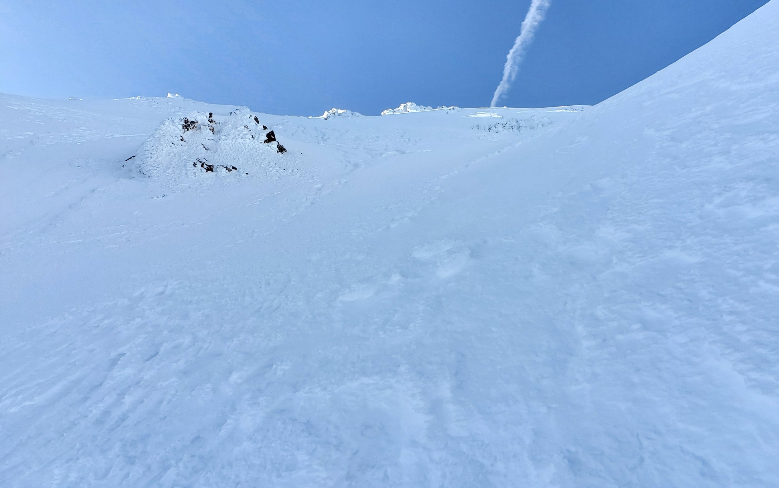
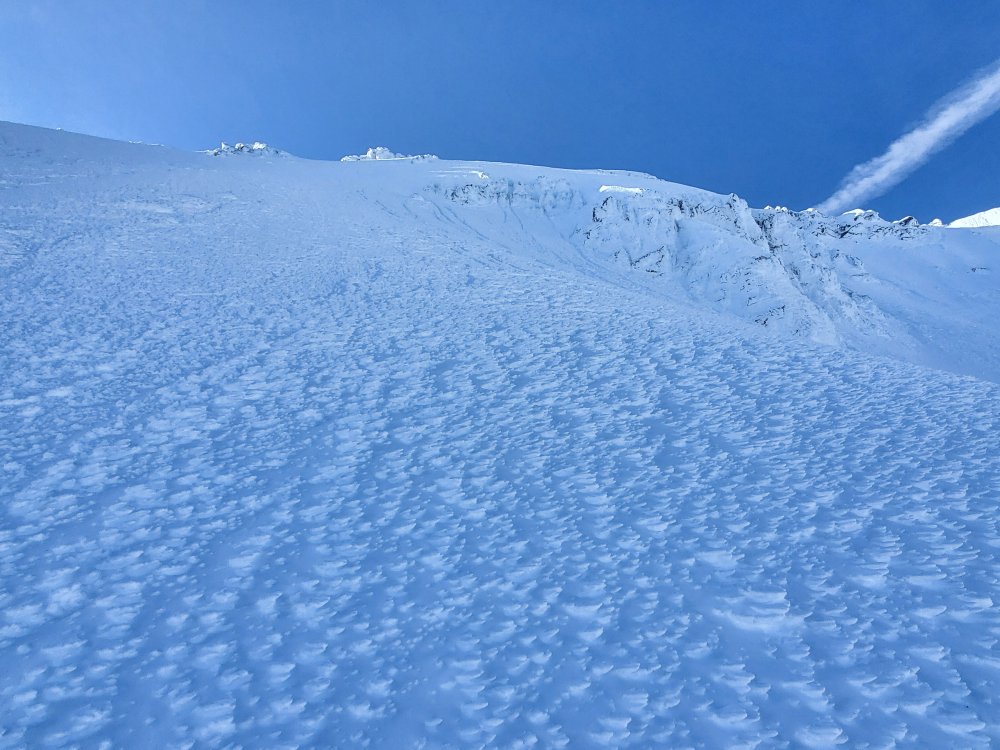
Trip: Mt McLoughlin - Through rock in North bowl Trip Date: 03/03/2021 Trip Report: Somehow I stumbled across this image of Mt McLoughlin and decided the route in red would be fun. Is this covered in any guide books? https://image.shutterstock.com/shutterstock/photos/1105471811/display_1500/stock-photo-mount-mcloughlin-oregon-1105471811.jpg For the past couple of months mountain-forecast showed a good weather window a week or more out but every time the forecast changed and spoiled the party. I tried once before, https://imgur.com/gallery/uB410zr, but gave up en route since conditions weren’t suitable. This time looked good and after a storm cycle that ended on Sat - Sun, three clear days in a row were forecast. Headed down to Summit Snow Park after work on Tuesday and caught a nap before heading out. Arrived too early at the saddle between the North and NE bowls so hung around for the sunrise. Should have brought a long ice axe and a stubby but had two ice tools. There was 0.5 inch crust with no too consolidated snow underneath. Easy to kick in but not solid. A few more pictures here https://imgur.com/a/H4XqwZC Gear Notes: Snow shoes, helmet, crampons, two ice tools - should have brought axes. Approach Notes: From Summit Snow Park headed down FS 3650 and up the normal hiker route. Off trail traverse wasn't too bad with just a bit of side hill action. See attached GPX for the route.


 1 point
 -
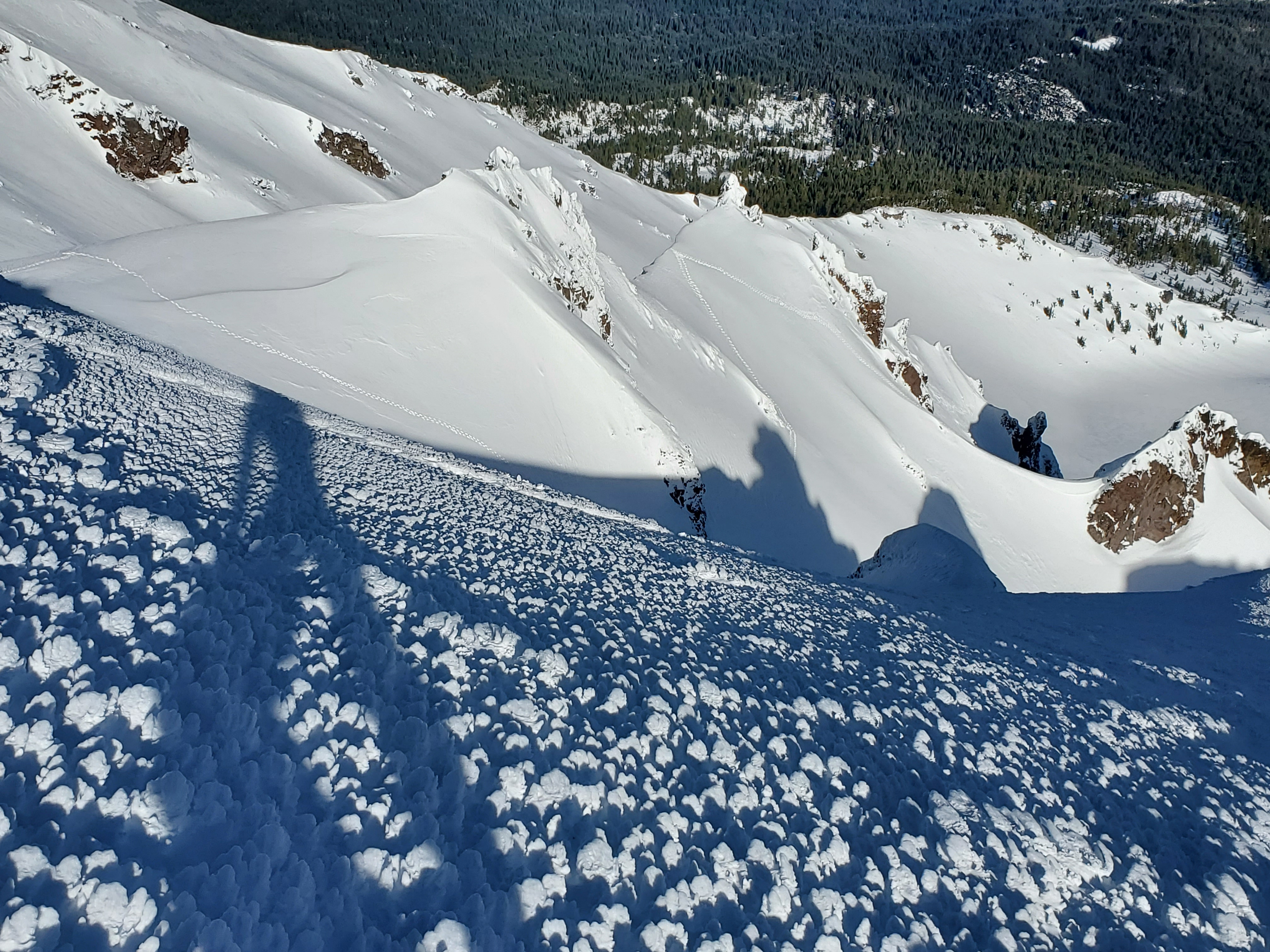
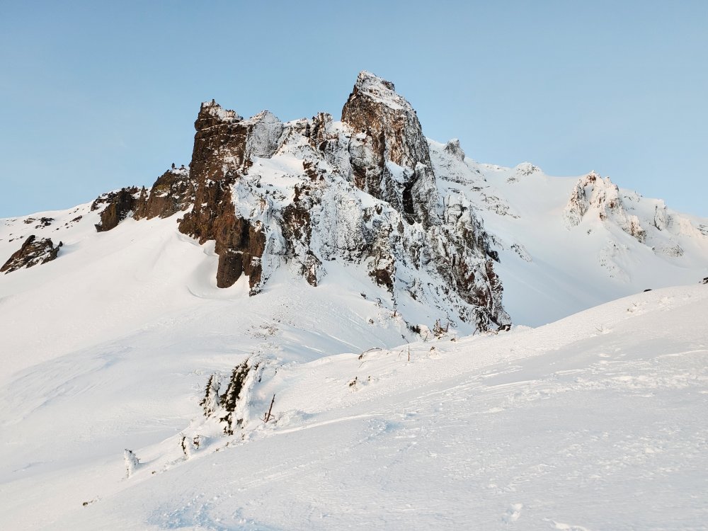
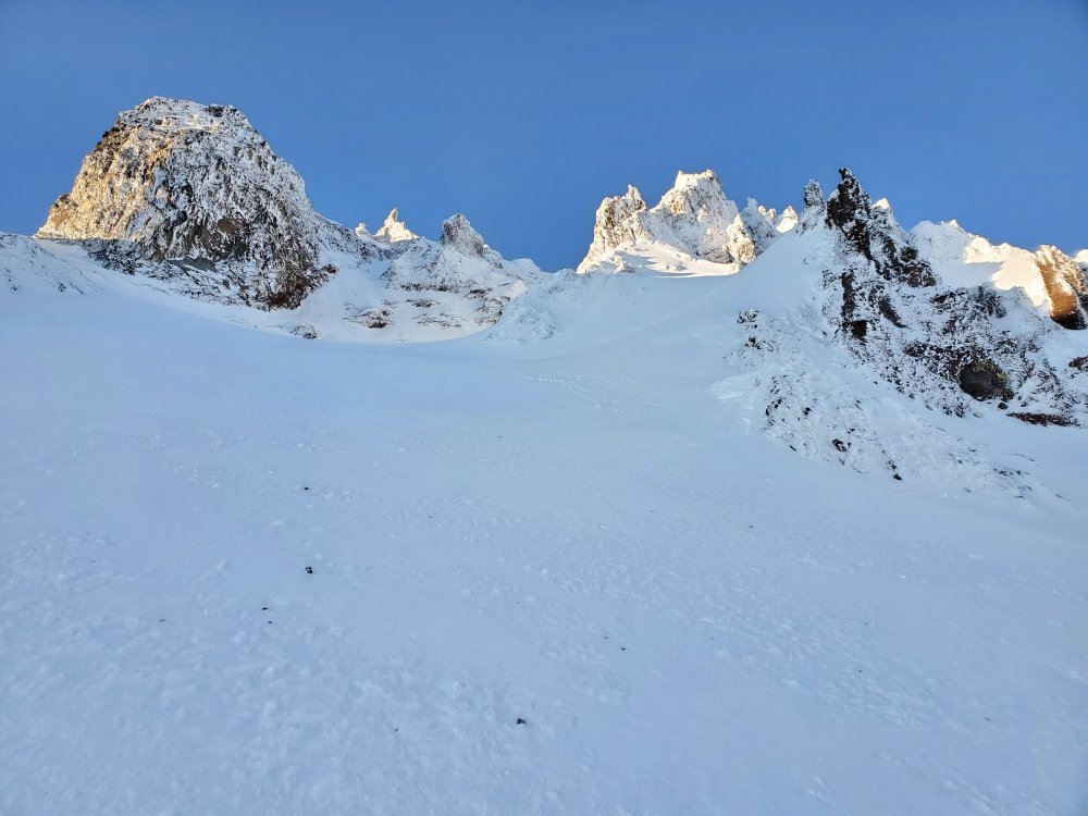
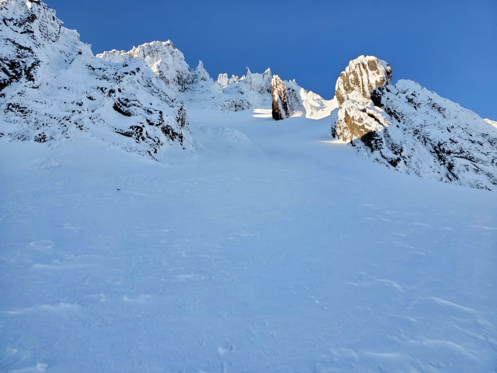
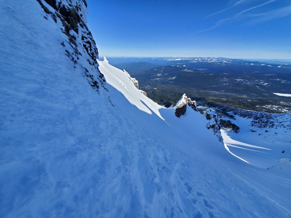
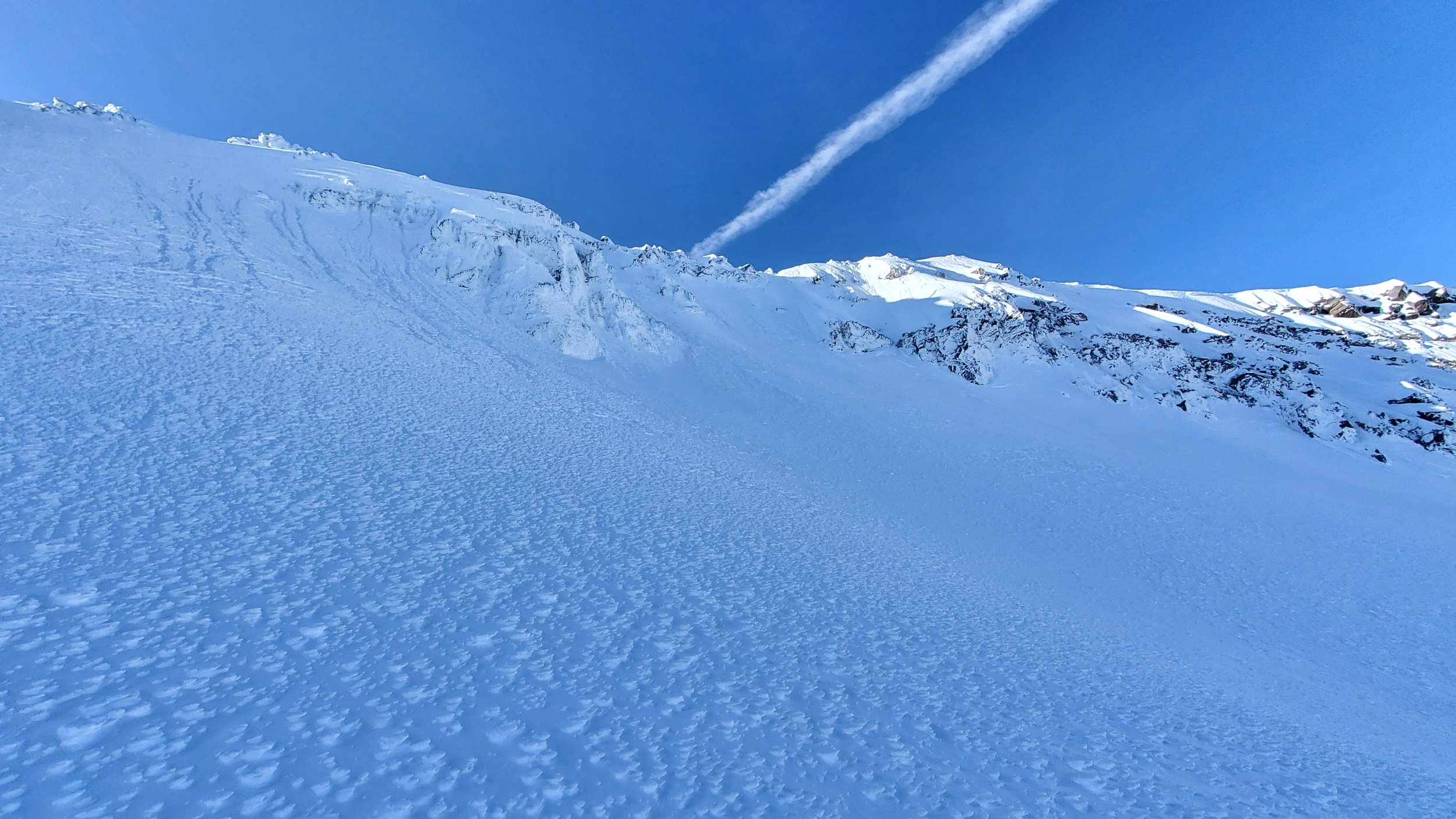
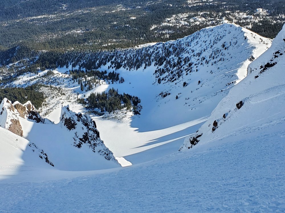
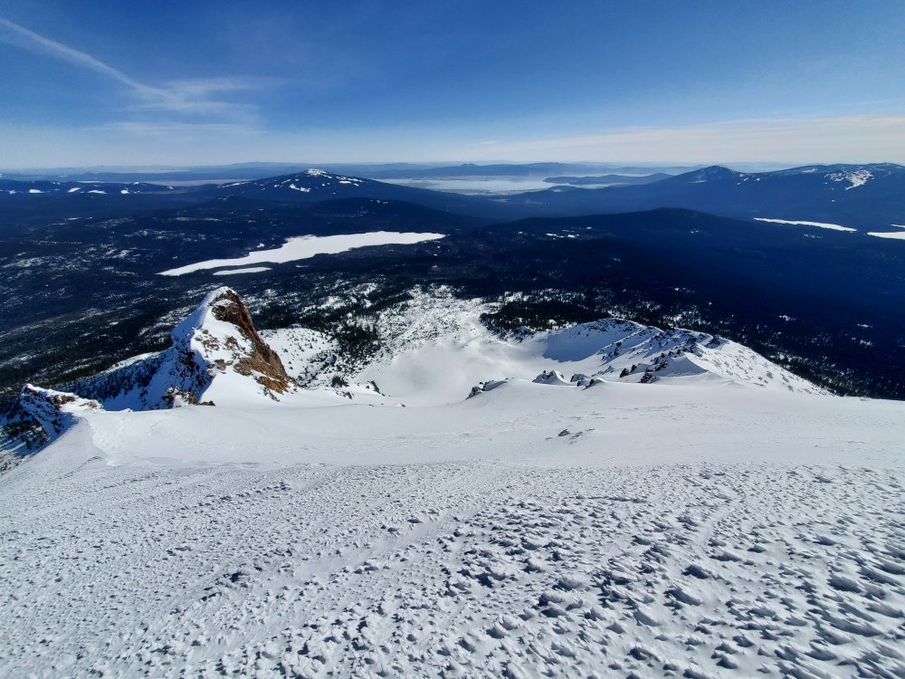
Trip: Tahoma / Mt. Rainier - Gibraltar Ledges Trip Date: 03/13/2021 Trip Report: @aikidjoe and I hiked / climbed Gibraltar Ledges on Saturday, March 13th. Left the parking lot Friday evening about 5:30pm and returned about the same time Saturday. Skinned to Muir with a great track(s) and easy snow conditions. Had our fingers crossed that the hut would be open - alas, four to six folks had set up in there. Given we're not done with the plague quite yet, we elected to dig a little double-wide snow coffin and settle in for an open bivy. Thankfully the wind was light and our 20 degree bags were sufficient. I want to thank the gentleman who came out of the hut and insisted we stay in there, the gesture was appreciated! We felt good sleeping out despite the insistence that there was 'no covid' in the hut. After a solid 6+ hour sleep, we left Muir about 6am. A superb bootpack led all the way up to, across, and out of the ledges. Roped up at the shoulder of Gib Rock (~12,500), shortly after Joseph put his whole left leg in a hidden crack. Wands on the upper mountain were helpful in navigating crevasses and led pretty nicely to the top. We ran into three skiers who got to enjoy some chalky, not really icy snow on the upper mountain. There was also one set of ski tracks in Gib Chute which appeared to be in great shape. Looking down the Ingraham, it was clear no one was descending that way and getting down it would be a pain with how broken up the glacier was. We hit the summit crater about noon and decided to call that good, based on having to re-cross the ledges in the afternoon sun, as well as some threatening clouds gathering on the other side of the summit zone. Descending was made easier by whoever left the wands up there. Not to let Joseph be outdone, I also managed to put a whole leg in a crack that was thinly covered by some wind transported snow. Getting back across the ledges after noon was a tad stressful, fortunately no rockfall occurred on the way through. The nice snow we had skinning up the night before had transformed into a crusty nightmare just below Muir. It got softer and more consistent by Pan Face, which made for some fun turns on tired legs. No trip to Rainier is complete without a wildlife sighting - this parking lot fox was pretty tame and hardly wild. Can't believe it had been almost 4 years since my last time up Rainier, almost forgot how much fun the slog can be! It helps to have great weather, a solid partner, and nice folks ahead to break all the trail. To paraphrase a dear friend, the mark of a good weekend is whether or not one's soul was refreshed. By that measure, it was certainly a soul refreshing weekend. Spring is here and the mountains are calling! Gear Notes: 60m skinny cord, glacier gear, sunscreen, warm layers, splitboard w/ ski boots Approach Notes: Well established trail all the way1 point
-
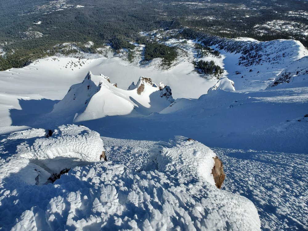
Trip: MT HOOD - Sandy Glacier HW Trip Date: 03/13/2021 Trip Report: With the long Conga Line heading up the mtn Saturday morning our plans to head somewhere different was set. Sandy Glacier HW being the last face we haven’t climbed this year seemed like a great choice. Made great time up to Illumination and quickly headed down and over to cross Yokum at 8600ft. Made it up and mostly over Yokum but a huge fracture line had me second guess that variation so we down climbed and traversed back down to the Reid and made our way down to the normal low crossing route around 7600ft. At this point the snow wasn’t too bad and travel was fairly quick. Once we hit the Sandy we encountered some really amazing powder and had a few thousand painfully slow feet of snow swimming intermixed with a few feet of front pointing on ice. Overall the route is more of a hike than a climb. Definitely can be done with just ski poles With the conditions we had. Overall summary/recommendations for anyone looking to head over to the Sandy HW would be definitely jet down to the lower traverse around Yokum. in my opinion it is an overall faster option. The HW itself is not technical but is a really long slog up although it’s a beautiful side of the mtn that most of us rarely see. Gear Notes: 30M rad line for the glacier crossing Approach Notes: TImberline to IR down and over to Sandy.1 point
-
"They will be logging around the Heliotrope trailhead right up to the Wilderness boundary" is somewhat inaccurate. If you drill down on the map on Pg.5 of Appendix D, you will see that the project area does not extend south of the Grouse Creek tributary bisecting the road turn where the trailhead is located. Grouse Creek, the wilderness boundary, is almost certainly a fish bearing stream downstream of this trib's junction and will get a no-cut 100' buffer. The language on the NCCC's webpage is so over-the-top emotional that I strongly urge diving into the USFS documents before commenting. Makes a person long for the smell of the GP tissue mill to give the crack "pulp farm for Trump's business cronies" a veneer of respectability. Just a sample after a quick perusal of the documents: NCCC's cited acreages bear no resemblance to either Alt.1 or Alt.2 acreages shown on Fig.14 of the DEA. Road runoff & fill/cut slope failures are a legit concern among others. However, if you look at Pg.26 of the Draft EA this proposal will ultimately reduce road mileage & density of roads. This project is expected to take 10-15 years. Recreationalists of all stripes are bound to be inconvenienced for some period of time near these units. I believe most don't lack imagination. Have at it.1 point