Leaderboard


Popular Content
Showing content with the highest reputation on 05/04/20 in all areas
-
Hey there, I am new to the forums. I've always done multi-day backpacking trip and short 1 day climbs of non-technical mountains. Once the COVID-19 situation blows over I'm going to Washington to get some mountaineering I am looking forward to the shared knowledge here.2 points
-
Trip: The Bugaboos - Pigeon Spire - W Ridge / South Howser Tower - Beckey-Chouinard / Bugaboo Spire - NE Ridge Trip Date: 08/02/2019 Trip Report: Aug 2-8, 2019 Our initial plan was to head down to The Bugaboos a week earlier, but according to a weather forecast, a storm was coming, so we decided to wait it out. Luckily, several days later we saw another window of good weather. I’ve heard some people plan a trip months ahead only to sit in a wet tent with snow all around . We used https://www.meteoblue.com/ for the weather forecast. Itinerary: Aug 2: Meet after work. Drive as far as we could. Spend a night at a campground along the way. Aug 3: Drive the rest of the way. Hike to the Applebee campground and setup tents. Aug 4: Leisure morning. Climb Pigeon Spire W ridge. Aug 5: Alpine start. Climb South Howser Tower. Aug 6: Rest day. Aug 7: Alpine start. Climb NE ridge of Bugaboo Spire. Aug 8: Hike down and drive home. We did not bring chicken wire. There will be plenty. I’m not sure if it helps – I saw porcupines walking behind it, or make sure it's solid and there are no holes between the wire and ground. TH to the Applebee campground – 2.5h. The campground has tap water and plenty of toilet paper. The place is swarming with rodents. Don’t leave any food in a tent or a backpack – there are metal boxes and hangers for it. Pigeon Spire - W Ridge The route is longer than I anticipated. I’d call it three-summit traverse (the last is the true). We simul-climbed on the way up. On the way down, we did two rappels from the summit and down-climbed the rest unroped. I was wearing mountaineering boots. Timeline: 9:25 – Start 10:25 – Top of Snowpatch col 11:20 – Base of the climb About 13:15 - Summit 14:30 – Back to the base Pigeon Spire on the right as seen from the summit of South Howser Tower: South Howser Tower – Beck-Chouinard route I did wear boots until Pigeon col, then switched to approach shoes. For the rest of the approach we had one pair of crampons and an ice axe for both of us. There was stream water after descending the col. We were lucky to have only three parties total on the mountain and we left the first at the base. We simul-climbed until the forth (5.10-) pitch. First few pitches after the bivy site seemed shorter, and watch for loose rock. For rappels, we used 60m and followed instructions from Steph Abegg supplemented by @JeffreyW’s comments. Here are my additional comments: #3 - stay on the ridge, at the end where will be a step down with a small ledge. When standing on the ledge bolt anchor is about climbers 1pm o’clock. Silly I were standing on the ledge, did not see bolts, swung left, and had to ascent a rope after. #6 – after finishing #5 use nearby bolts. Rappel (walk) left (climbers) along the ledge, i.e. what Jeff describes as “rappel parallel to the handline down the scrambley ledge”, until find next bolts: #last – the first person got lowered and extended rappel with a cordelette just in case. Timeline: 3:40? – Start 7:10 – Base of the climb 11:15 – Big ledge 18:10 – Short rappel 19:40 – Summit Shortly after pitch-dark – Finished rappels 1:20 – Back to the campground Not as big, huh: Standing on the summit: North and South Hoswer towers: Bugaboo Spire – NE Ridge Scrambling up Bugaboo-Crescent col was fine, but there was one insecure move, that made my back chill. I tried to link first two pitches with 60m, but end up short 3-5m. Make sure to well extend the third pitch, because of its nature. Left variations and 5.10 to gain South summit were great. Scrambling down Kain route was endless. There are multiple paths, generally marked with cairns, do not drop down too fast and keep traversing skiers right. I can see why parties descending in the dark often get in trouble on this route. Timeline: 5:00? – Start 5:50 – Base of Bugaboo-Crescent col 6:20 – Top of Bugaboo-Crescent col 7:00 – Base of the climb 11:00 – North summit 12:30 – South summit 15:40 – Top of Snowpatch col 17:00 – Back to the campground Traverse from N to S summit (looking forward): Traverse from N to S summit (looking backwards): Bonus 1. On the way home, we stopped by Kinsmen Beach at Windermere Lake to wash off all sweat and dust. It was delightful. 2. Below is my food plan. All food was portioned into zip-lock bags. What worked well: none left with no starving. Instant potatoes with tuna was the best meal. Egg noodles and cheese was the worst. Fri Dinner Grocery/Restaurant take out Sat Breakfast Buy a sandwich Lunch Buy a sandwich/etc Dinner Couscous 363 cal Turkey Jerky 105 cal Pita bread 140 cal Chocolate 150 cal Sun Breakfast Instant oat + powdered milk 300 cal + dried blueberries (oatmeal) Granola bar 130 cal Lunch Gummy bears 180 cal Pita bread 140 cal Trail mix 250 cal Snickers 250 cal Tailwind 400 cal Dinner Instant potatoes 392 cal Tuna 160 cal Pita bread 140 cal Garlic oil Mon Breakfast Oatmeal 300 cal Granola bar 130 cal Lunch Couscous 320 cal Salami 200 cal Pita bread 140 cal Trail mix 250 cal Dinner Egg Noodles 381 cal Cheese 170 cal Chocolate 150 cal Tue Breakfast Oatmeal 130 cal Granola bar 300 cal Lunch Gummy bears 180 cal Pita bread 140 cal Trail mix 250 cal Snickers 250 cal Dinner Mountain house? Wed Breakfast Oatmeal/Bars/leftovers 300 cal Granola bar 130 cal Lunch Stash some food at the car Gear Notes: A tent, two 8 oz fuels (we ended up using only one), jetboil, water filter. 8 singles, 6 doubles, 2x cordelette, BD cams .1-.3, doubles in .4-4”, 60m rope, grigri, set of BD nuts. Approach Notes: Some comments in TR1 point
-
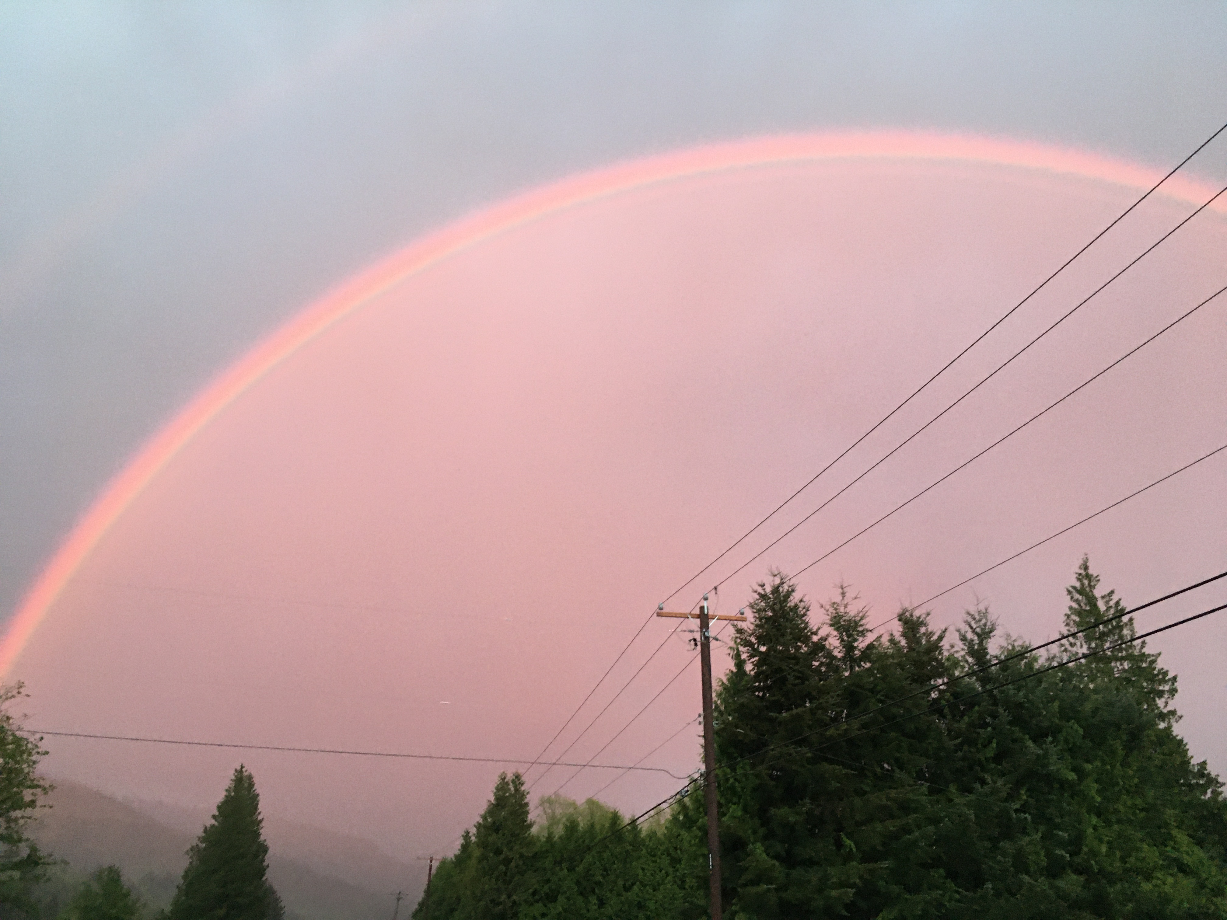
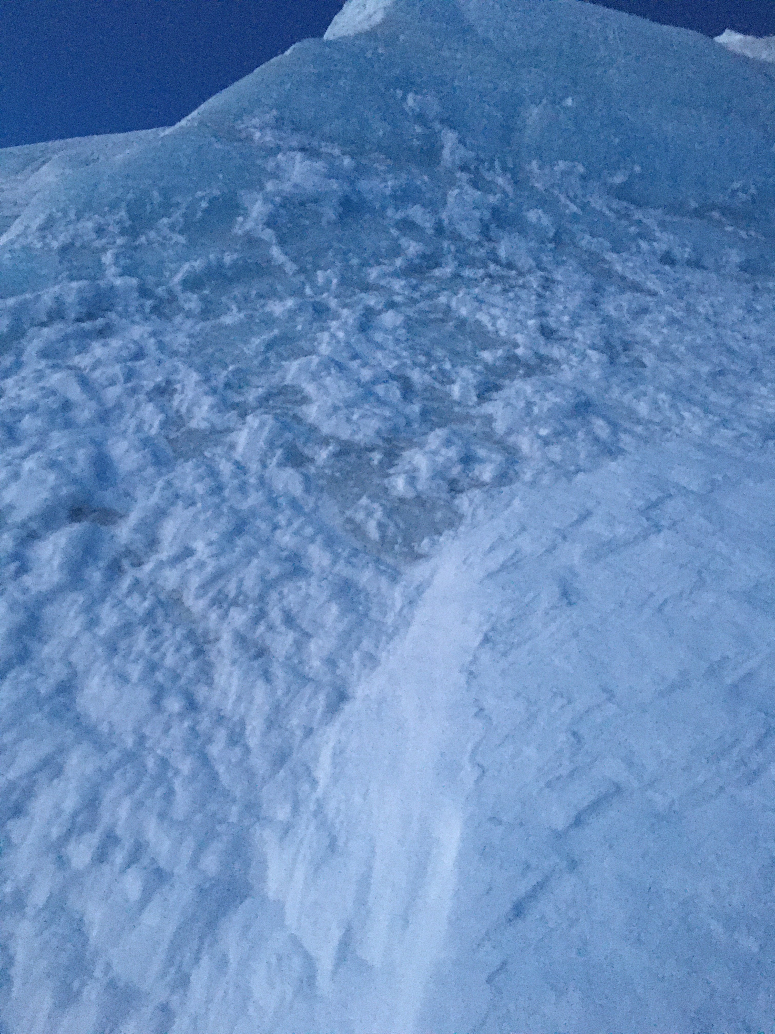
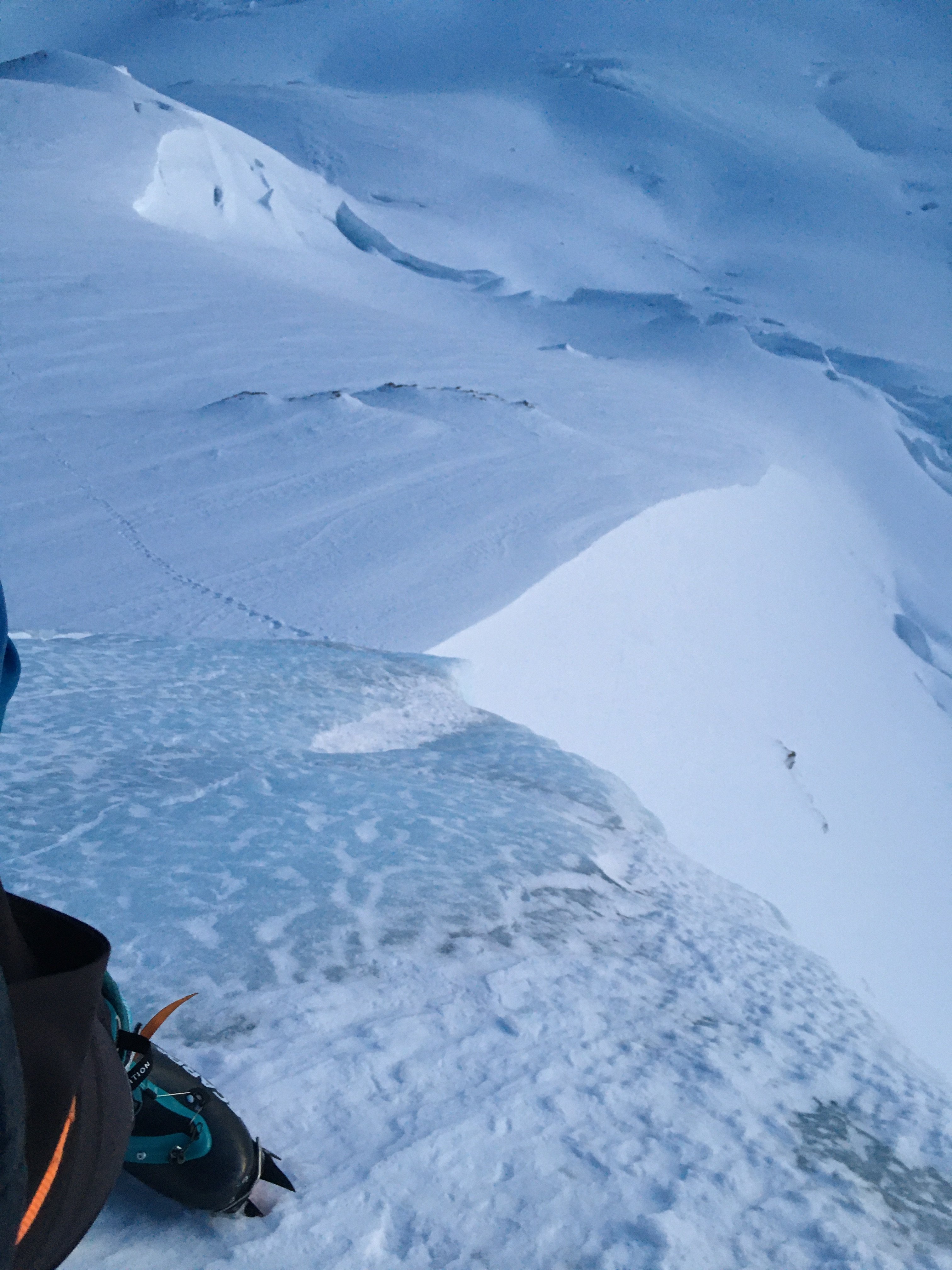
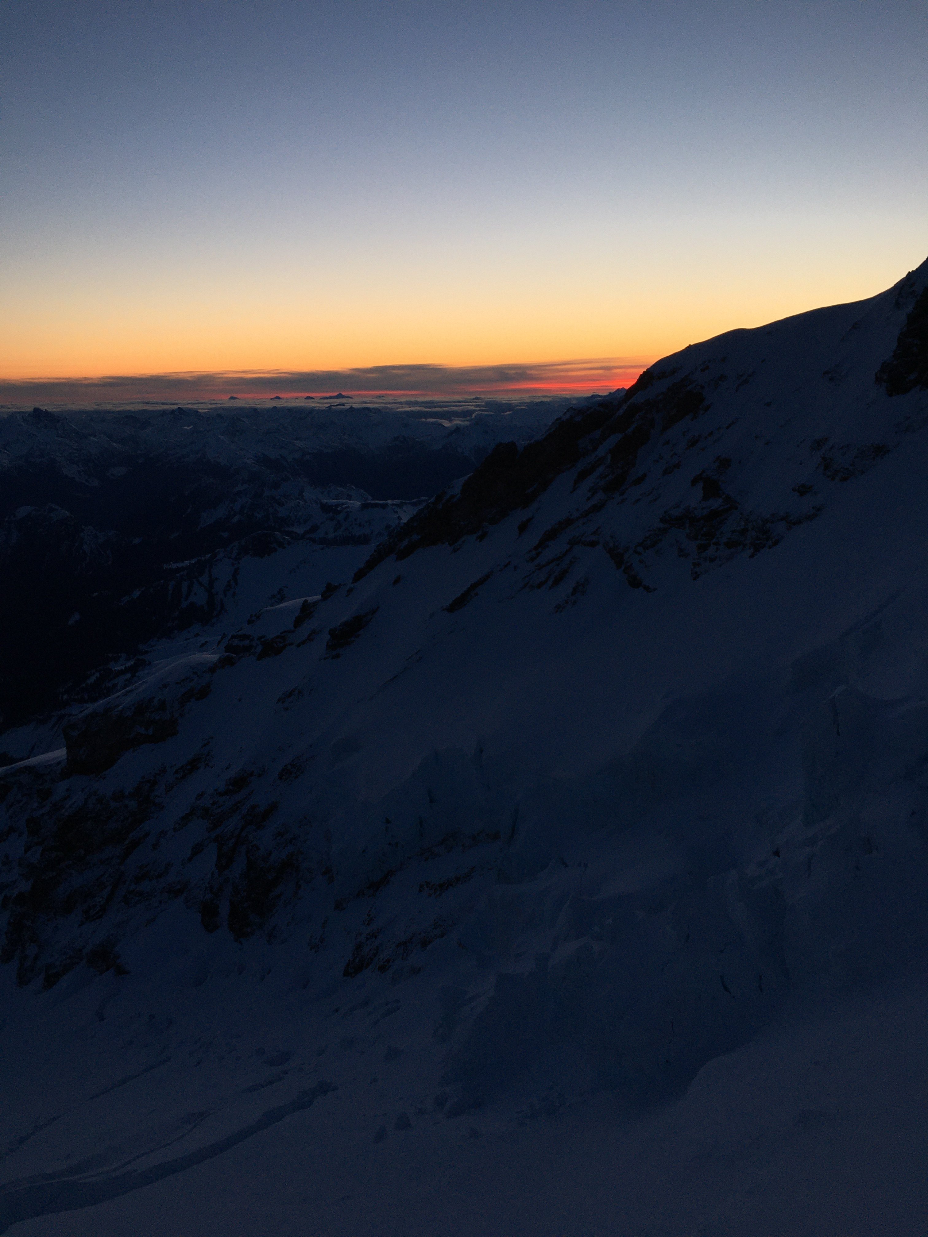
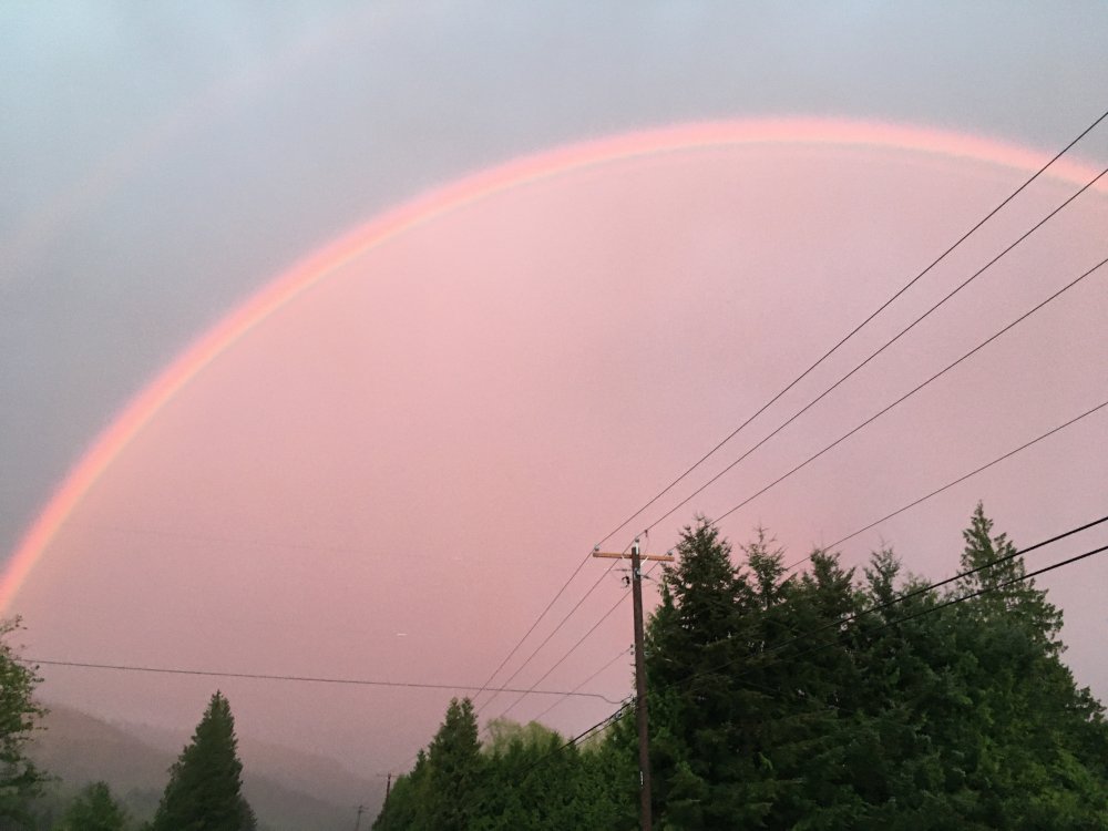
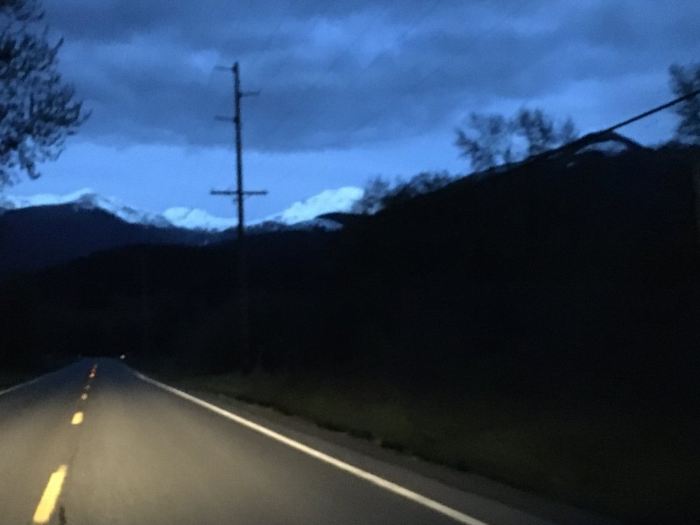
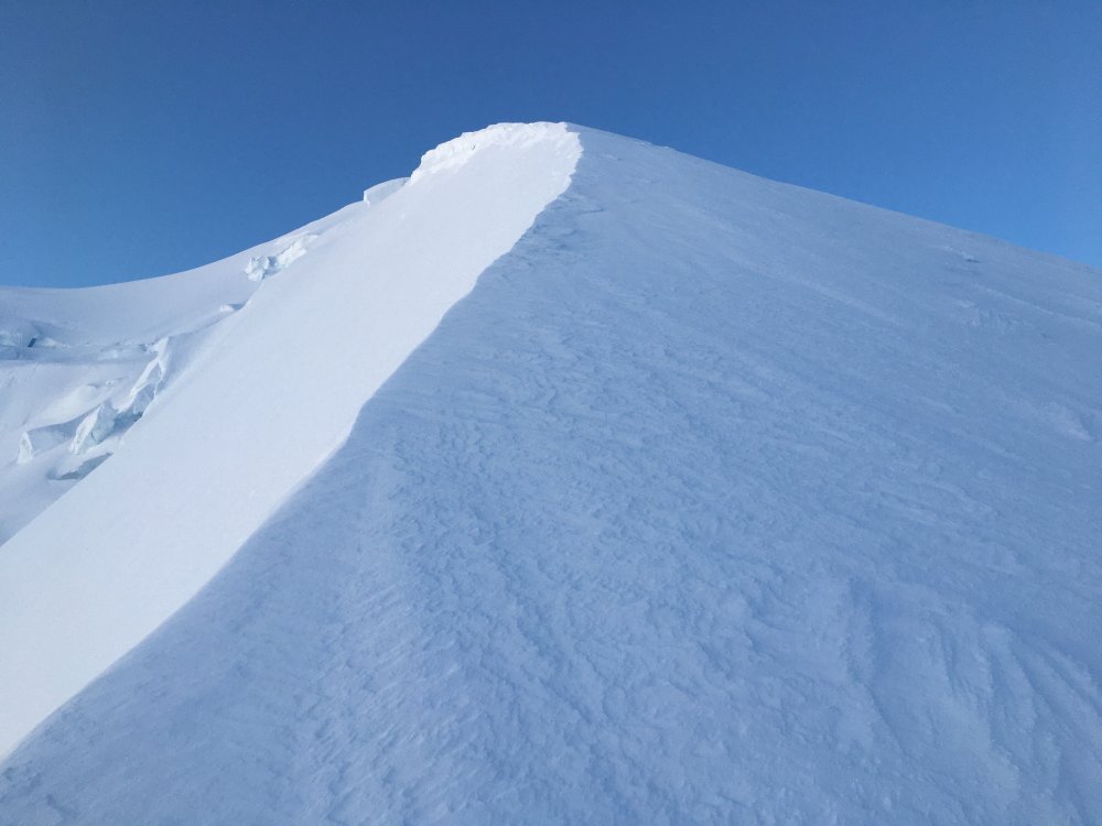
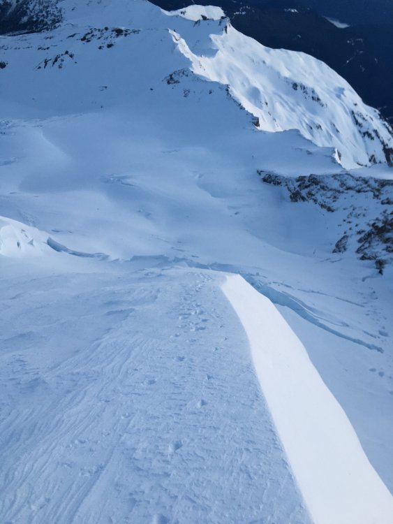
Trip: Mt. Baker - North Ridge Trip Date: 05/01/2020 Trip Report: Baker's North Ridge has been one of the many climbs on my mind in the past couple weeks. I saw a weather window this Thursday night/Friday morning so I asked for Friday off from work and left Seattle as soon as I got off Thursday afternoon. The weather on the drive there was iffy. I saw clouds in every direction, but with little tiny pockets of blue sky and thin gold light. Somewhere just after Bellingham the rain came down hard and no mountains were visible and my expectations of getting on the ridge were dwindling. Then the rain stopped in an instant, and in front of me was the most stunning rainbow I've ever seen. Everything leading up to this point, the packing, the driving, the missing work, was all worth it just to see this. I kept driving, through the rainbow and into the clouds still unsure what was going to happen in the next 12 hours. I was nearing Glacier, about a mile outside of it, when all those dark stormy clouds lifted just enough to reveal Baker. I knew it was on now. It was go time. Glacier Creek Road was in mostly good condition for the first 6.5 miles until the snow became too much for my Forester. It was 9:45 pm when I started skinning up the road. I took with me a pair of Irvis Hybrid crampons, Quark tools, extra puffy, 2 bars, 4 gels, and. a liter of water. I arrived at the outhouse at 10:20 and was able to skin all the way up Grouse Creek without boot packing. Made it to the Coleman Glacier by midnight and tried to make out a route to the base of the north ridge but the darkness was deceptive. I ended up having to retrace my skin track to go higher up on the glacier before cutting across underneath the headwall. Snow was plentiful and the pack was firm on the glacier so route finding was pretty straight forward. Made it to the base of the ridge (upper right start) at about 2 am and swapped skis for crampons. The snow was about mid-shin deep with a layer of crust so it was slow going. Just before gaining the ridge proper I did encounter some ice and firm neve that helped speed things up and add some flavor to the climbing. As the crux ice pitch came into view the darkness started to lift and I could put my headlamp away. Instead of climbing left or right as suggested by other trip reports I decided to go straight up the "arete" which went at about AI 2+/3. There was some good dinner plate chunks of ice coming off but for the most part the climbing was secure and really fun. The sun was really coming out now and I could see the summit. I navigated to the right and through the upper serac section with a few AI 2 moves. Once on flatter ground I put skis back on and skinned to the true summit. After eating some food and taking in the view I started my journey down the Roman Headwall at about 7 am. The upper portion was wind blown and icy but I was able to get through it and found fantastic turns in the middle section. It turned icy once more at the bottom but wasn't too bad. The last steep section dropping onto the Coleman glacier was pure bliss with neve topped with 6-8 inches of fresh snow. The rest of the ski down was probably the best skiing I've had on Mt. Baker out of the 4 other times I've been up there. Made it back down Grouse Creek and to the car by 8:30. I'm really glad the weather held and I was able to find some good ice up there. I think the ski down was the best part though Gear Notes: Ice tools and crampons Approach Notes: 1.5 mile skin up Glacier Creek Rd to outhouse.


 1 point
 -
New ice guidebook is live!1 point