
Leaderboard


Popular Content
Showing content with the highest reputation on 05/09/18 in all areas
-
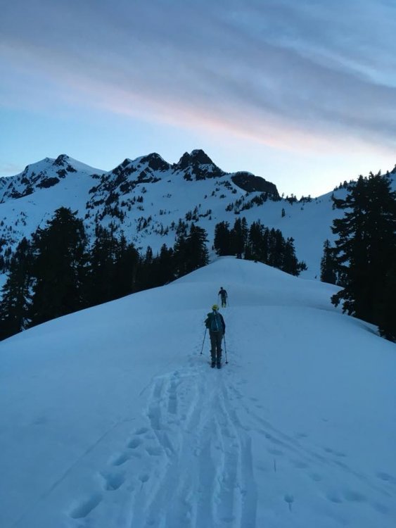
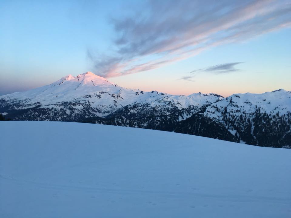
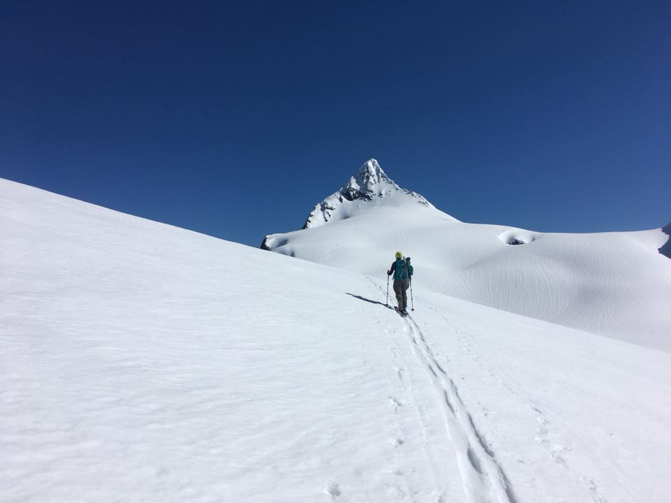
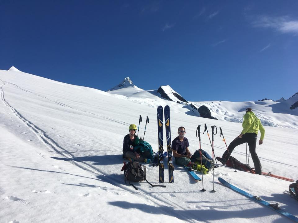
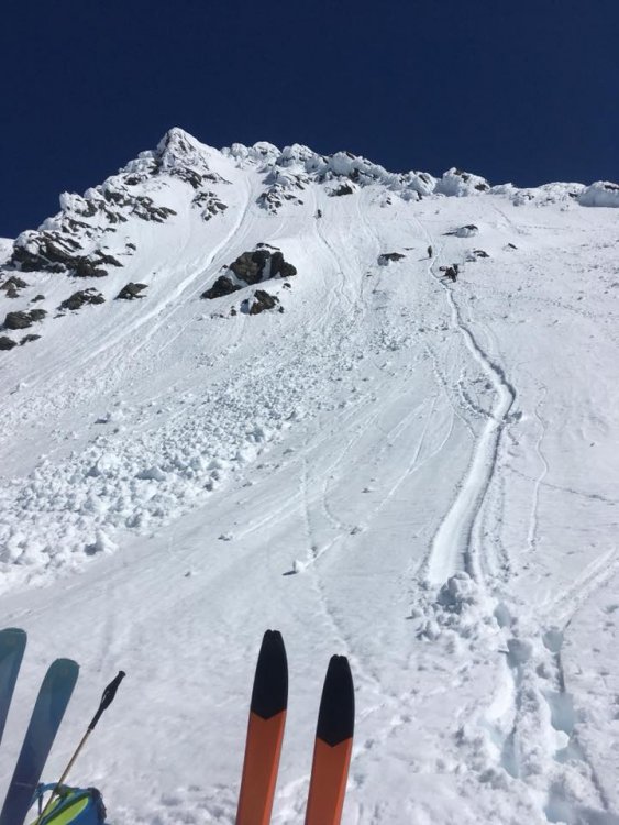
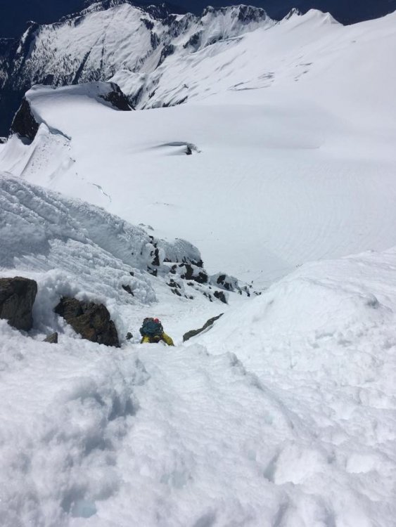
Trip: Mount Shuksan - Sulphide Glacier Trip Date: 05/05/2018 Trip Report: Went up Shuksan via the Sulphide Glacier route this past Saturday. We drove out towards Shannon Ridge trailhead Friday night and hit patches of snow around 0.5 miles from the trailhead that prevented us from making it all the way there. After helping another party get their car un-stuck from some snow we packed our bags and got to trying to sleep around 10:30pm. We woke up at 2:30am and after a cold breakfast we were headed down the road by 3. Where the trail wasn't fully exposed there existed some nice boot pack and then skin track after the snow became continuous after ~30min of hiking. We made it up to the top of Shannon Ridge and we were headed for the notch at approximately 6:00 am. Heading up to the notch the grade steepened and we encountered more difficult skinning conditions. About half way up to the notch a member of our part slipped and fell, and as she was on her side I shouted down to her, "Don't lose your skii!". Sure enough, seconds later her ski popped off and went rocketing down towards a gully on the east side of Shannon Ridge. The 3 of us watched it in dead silence, until it fortunately came to a stop in some avalanche debris 2 or 300 feet below us. I was feeling like I had energy to spare so I volunteered to go get the ski while the rest of the party generate some bootpack up to the notch. After fetching the skii I caught up to them roughly 3/4 of the way up. Once in the sunlight at the notch we took a break and eyed up the traverse that would take us over to the Sulphide. We opted to continue bootpacking, not wanting to repeat the earlier debacle, and made our way over to the more gentle slops of the Sulphide. Here a few additional parties caught up and thanked us for the bootpack. We graciously let them pass us, looking forward to leveraging their bootback on the summit pyramid. The softer snow on the west edge of the Sulphide provided easy skinning and we just put our heads down and slogged towards the summit pyramid. Around 7200 a member of our party opted to descend due to sever blisters and foot pain. We made it to the base of the summit pyramid (~11am) just as the other parties were starting to head up. After a snack and some water we headed up as well. Snow conditions were good, the majority of the axe placements were very secure and the steps felt solid. Despite our lack of familiarity with steep snow we made good progress and did not feel the need to use the pickets or rope we had along, although we were glad we had two axes (other individuals only had a single mountaineering axe and seemed fine). We stood on the summit at about 12:00 and then descended in slightly mushier snow. Down at the base of the summit pyramid we melted some snow for extra water and began our ski descent. The snow on the descent was OK. It was a little heavy at this point in the day but still very enjoyable. The descent isn't entirely continuous as there are some sections where you need to shuffle uphill a bit to get to the next elevation drop. After many turns and only 1 face-plant, we made it to the notch then Shannon ridge and ultimately the location where I started skinning earlier that morning. We threw the skis on the packs and made it back to the car at 4pm. Good day out! Gear Notes: Skis, Ice axe, extra tool, - pickets and 30 rope brought but never used. Approach Notes: Snow 0.5 miles before the Shannon Ridge Trailhead stopped our vehicle. This snow shouldn't last long.
 2 points
 -
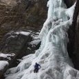
Trip: Ingalls Peak - South Ridge Trip Date: 05/05/2018 Trip Report: Slog is a four letter word. With rain and thunderstorms in the forecast my buddy and I headed up to Ingalls peak this weekend for an attempt at the South Ridge. The road is still snow covered 2.5 miles from the trailhead with downed trees and some minor washouts to boot. It will be a while before that trailhead is drivable. We debated crampons or snowshoes at the trailhead, and opted for snowshoes. Boy, was that a good idea. We booted up towards Longs Pass before strapping on the snowshoes and traversing towards Ingalls pass around 5600'. Fresh light slides were visible everywhere and the traverse was a slow going at ~one mile an hour. We reached the pass after five hours and didn't see any other tracks. Running water at falls right before the pass. Ingalls and Stuart were magnificent and Ingalls lake is still snowbound. We setup camp in the basin just west of the pass and soon hail and rain drove us into tent and bivy for the next ~12 hours. In keeping with the true Cascade experience my air mattress deflated and I learned the value of twin ropes and a pack as insulation. One party came past us following in our tracks without snowshoes and headed down towards Ingalls creek. I have great respect for the frustrating knee plunges it took for them to get there. The next morning, expecting worse weather we awoke to mixed weather. Having come all this way, but expecting more rain, we opted to go check out the route "just to see." In what I will hereafter refer to as "hem-haw point" in the basin below Ingalls, we assessed the dark clouds in the distance, the soft slides all around, and discussed our options. We decided to just get a little closer just to see what we could see. After some careful traversing and avoidance of slides we were suddenly at Dogtooth with sunshine and no clouds moving in. Fortunately we brought our climbing gear. The "first" pitch of the route is all snow covered with maybe 6-8 feet of snow that was very soft and won't last much longer. We took snowshoes and ice axe up it, hugging the left side. We then scrambled to the base of what most people consider the 2nd pitch (ledge belay) and roped up. After a brief attempt, the 5.6 crack was not happening with wet numb toes in mountaineering boots on that slick serpentine. The 5.4 crack on the left was fantastic as my buddy lead it in sunshine. He belayed me up to the bolts and then lead the last pitch to the top. Old piton! The scramble to the summit was the spiciest bit of the climb, with shallow snow on slick serpentine on the left, cornices on the right, and a small bit of dry rock in between. We opted to skip the slab on the summit as it was snow covered. I'm going to venture we were the first ones up this season.....at least that's what I'm telling my friends. Twin ropes brought us to the two bolts for the first rap. I backed up the perlon that was already slung through the bolts with some cordellette. I didn't like the way the perlon creaked when weighted and didn't know if it sat there all winter. A second rappel with twins brought us all the way to the top of the snow ramp (or first pitch) where we slung a boulder for a final rappel on the snow ramp to the dogtooth. The thunder politely waited until we slogged back to the car. ~3 hours up and down for the climb from dogtooth. ~4.5 hours from base to camp to car A fantastic alpine climb! Gear Notes: snowshoes, rack, ice axe, no crampons Approach Notes: Teanaway Road snow covered 2.5 miles from Ingalls trailhead. Multiple downed trees and minor washouts.2 points
-
You might be reading about the access couloir, which is snow until later in the season and then can be climbed on rock. The glacier just below Forbidden is about as tame as they come. It is disappearing and won't be around much longer. Poke around for photos of Forbidden "Unnamed Glacier" (actually the name) to get an idea.1 point
-
True, early does mitigate some of the hazard. Yep, that's the north peak of Hozomeen. The right skyline is a recommended route, provided you find someone to lead the first bit!1 point


