
Leaderboard


Popular Content
Showing content with the highest reputation on 09/04/23 in all areas
-
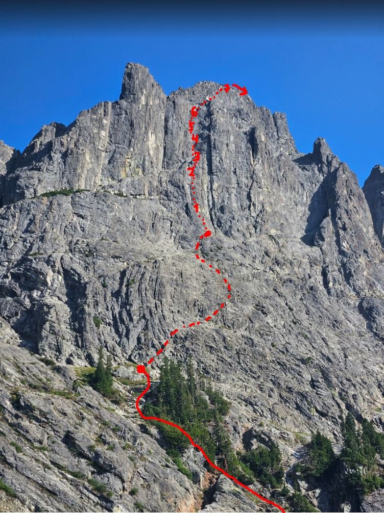
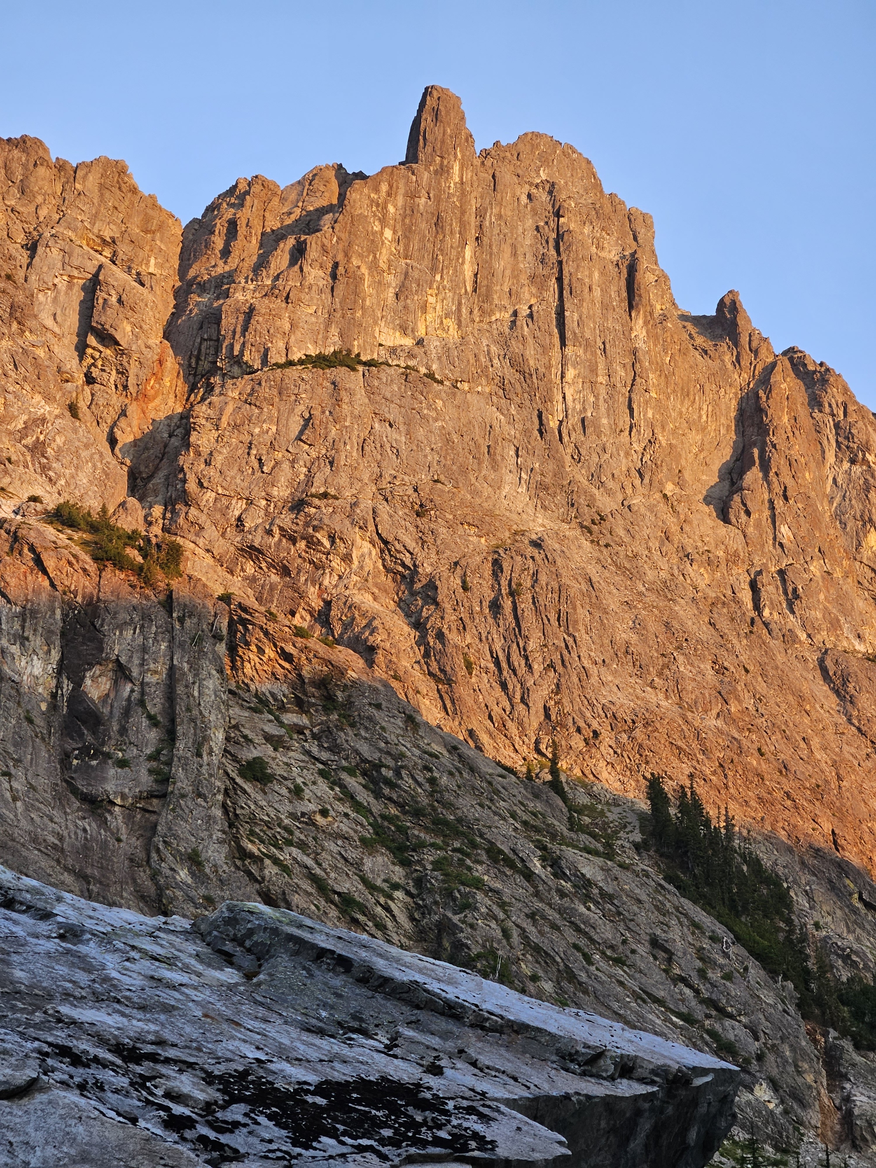
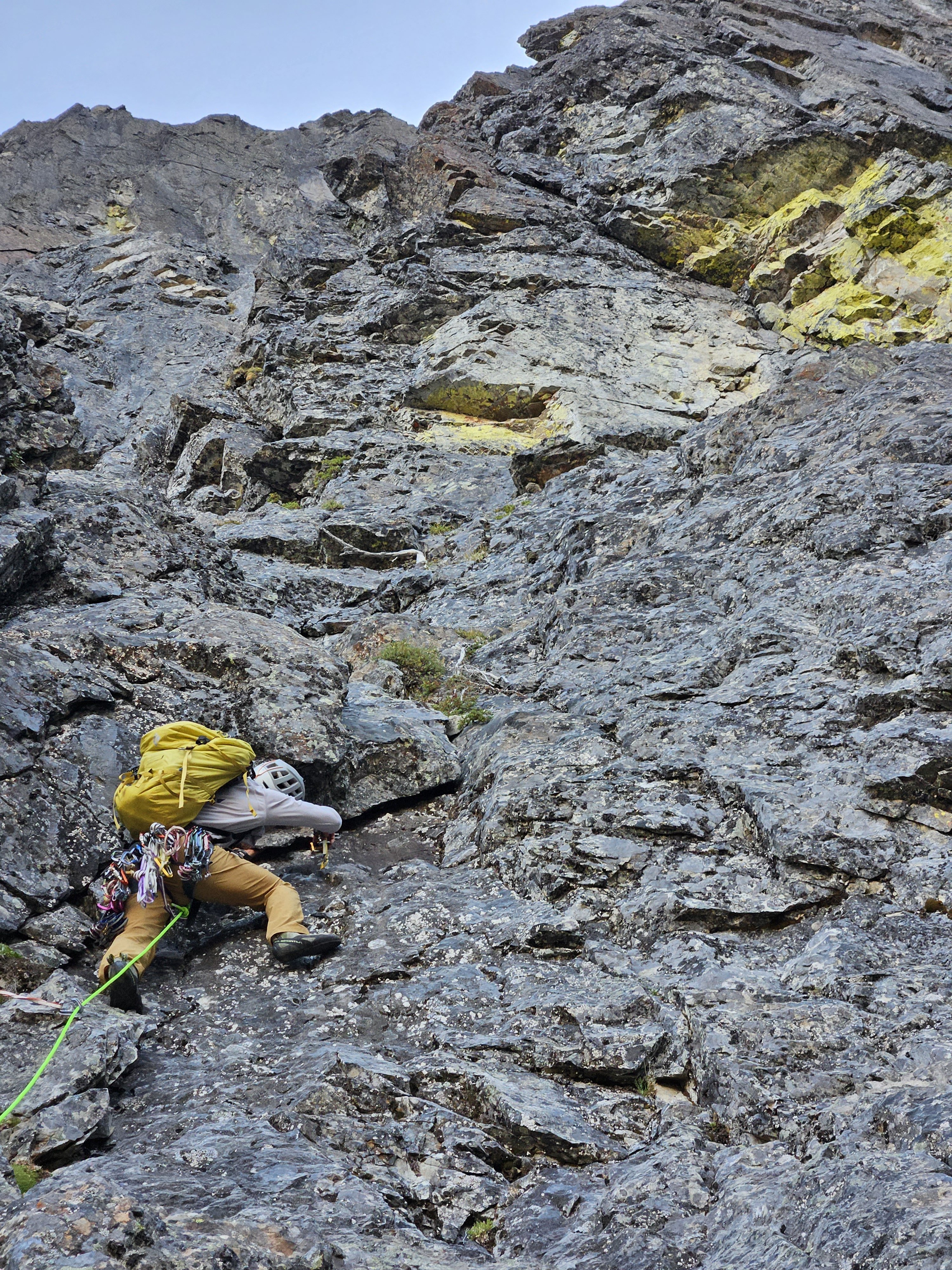
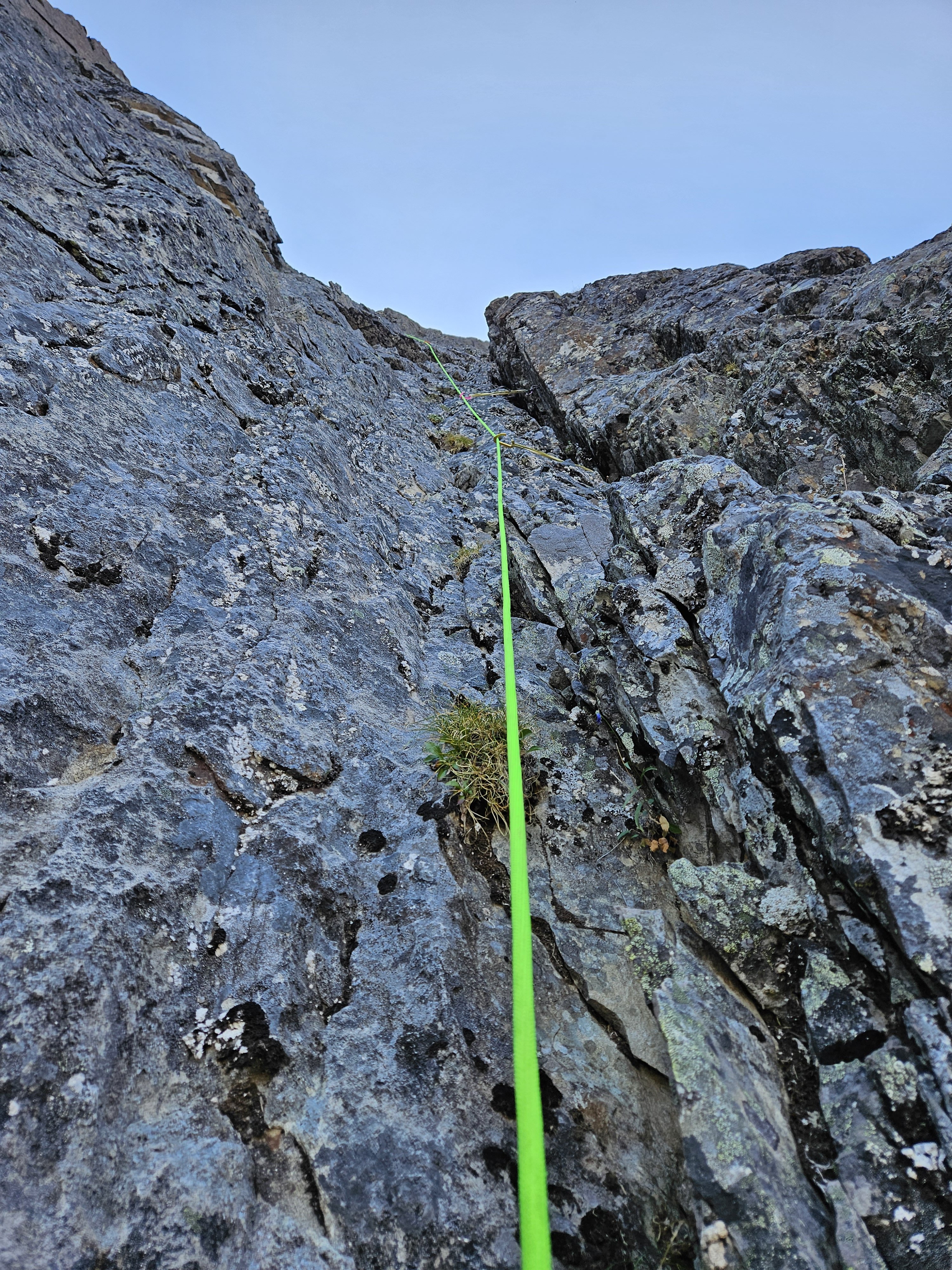
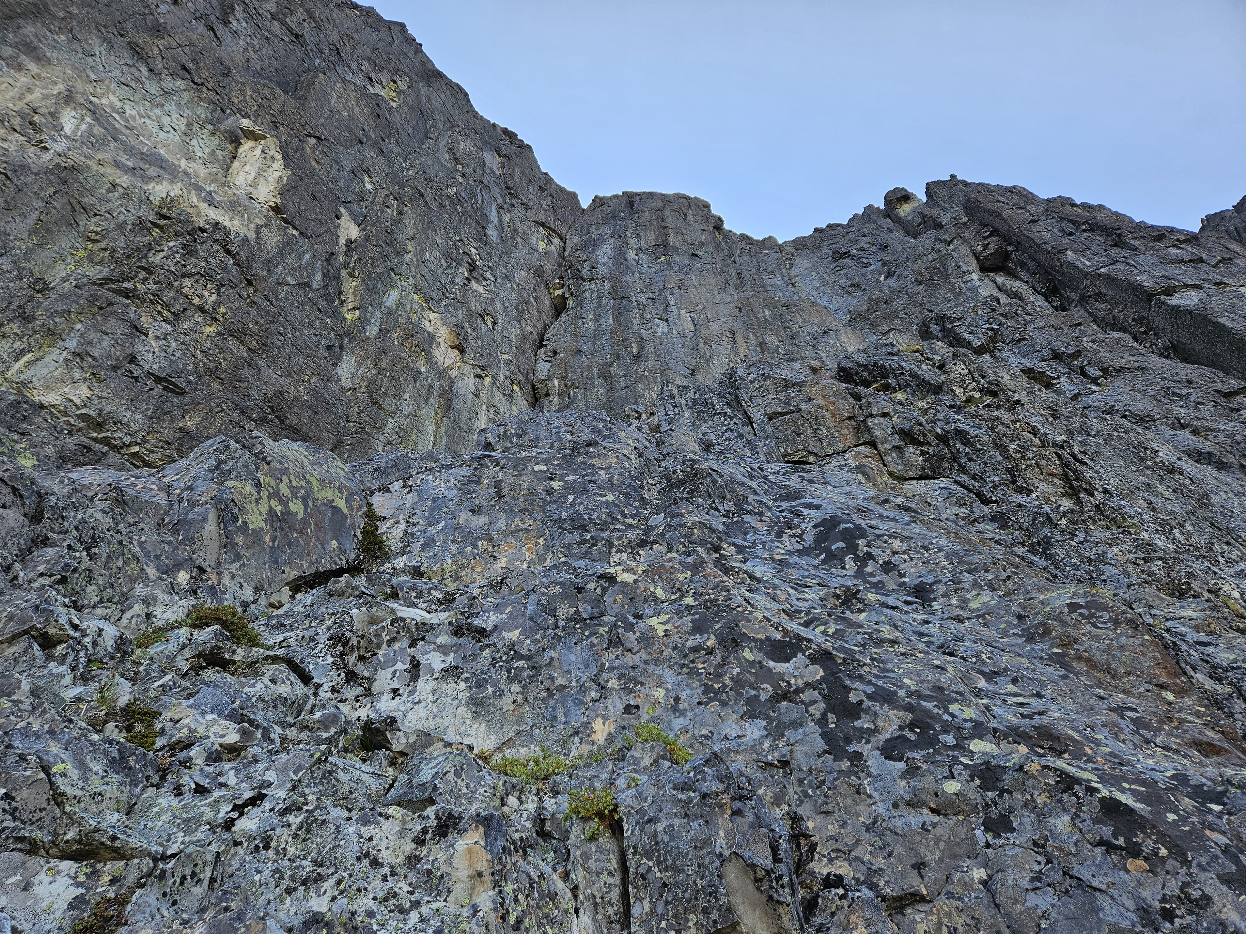
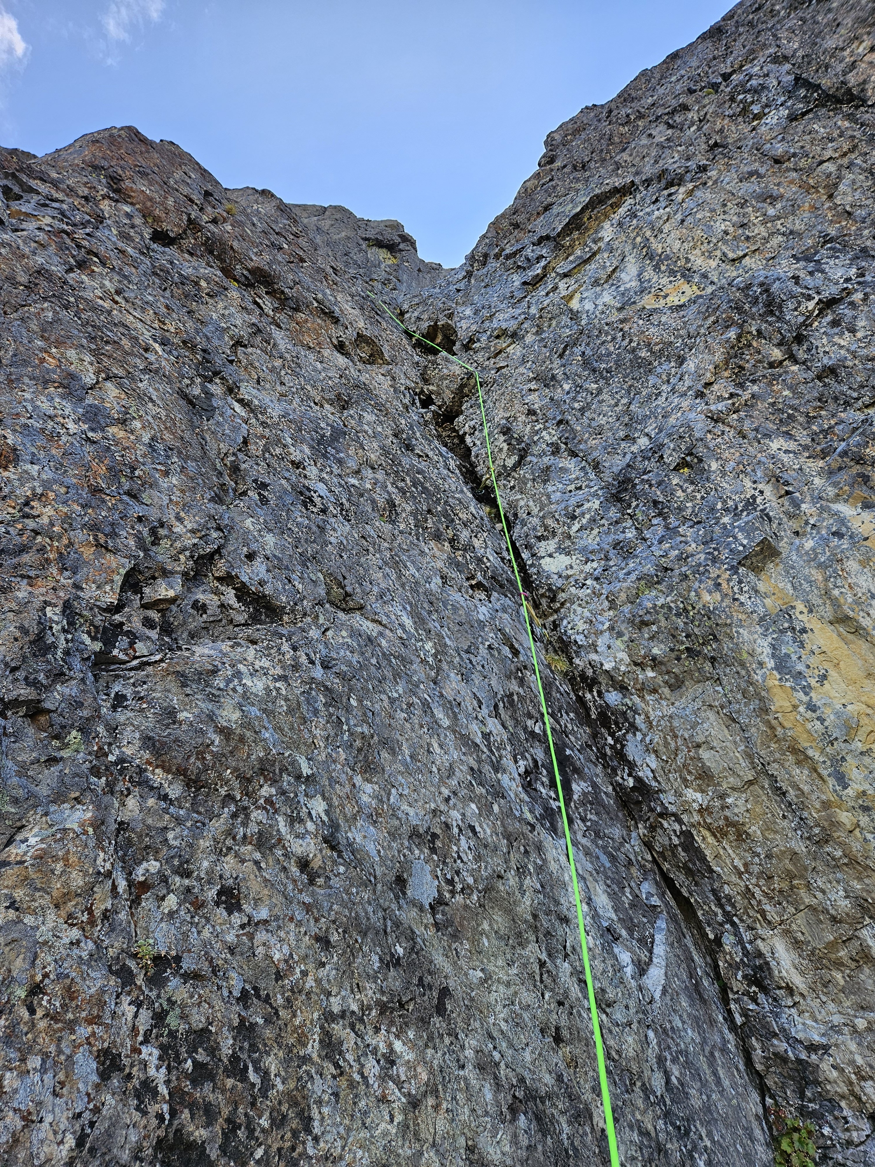
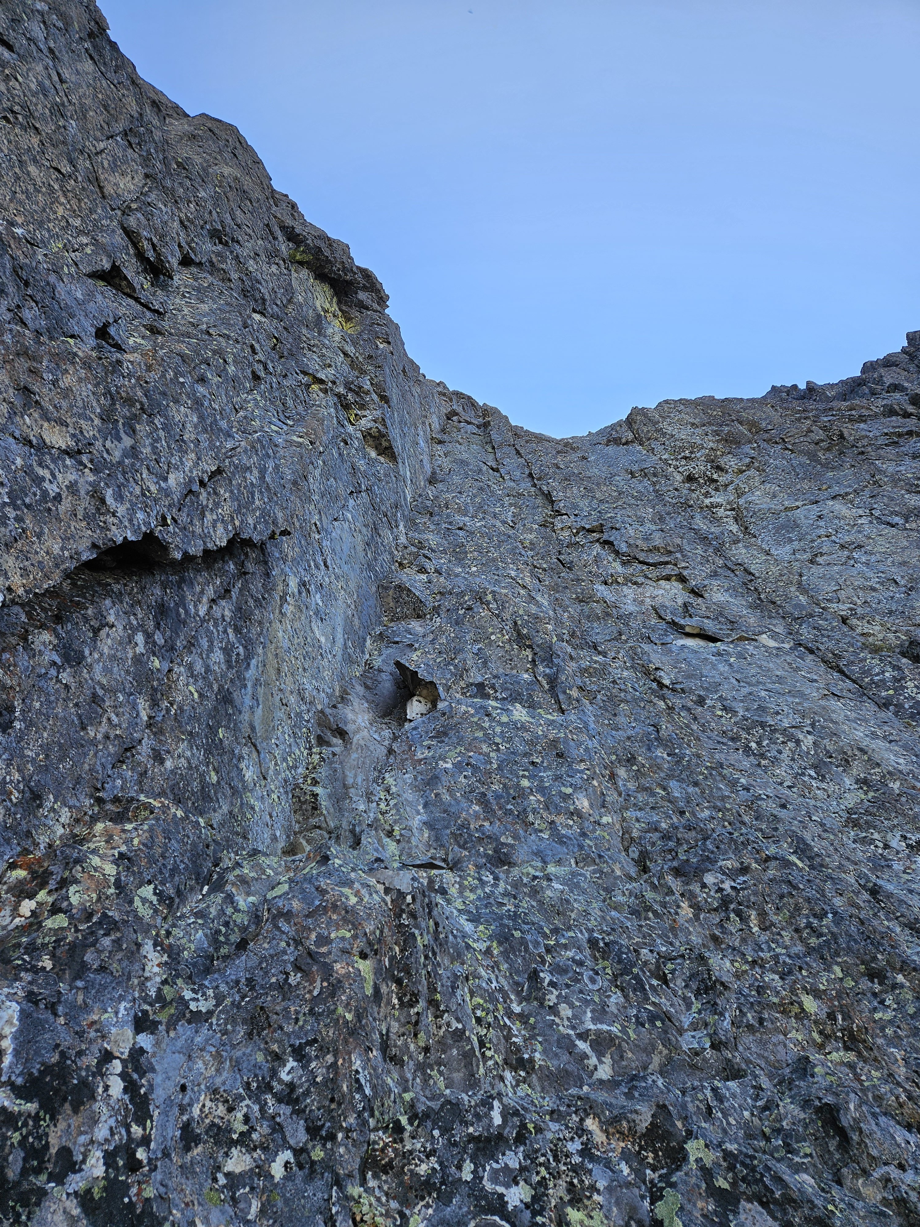
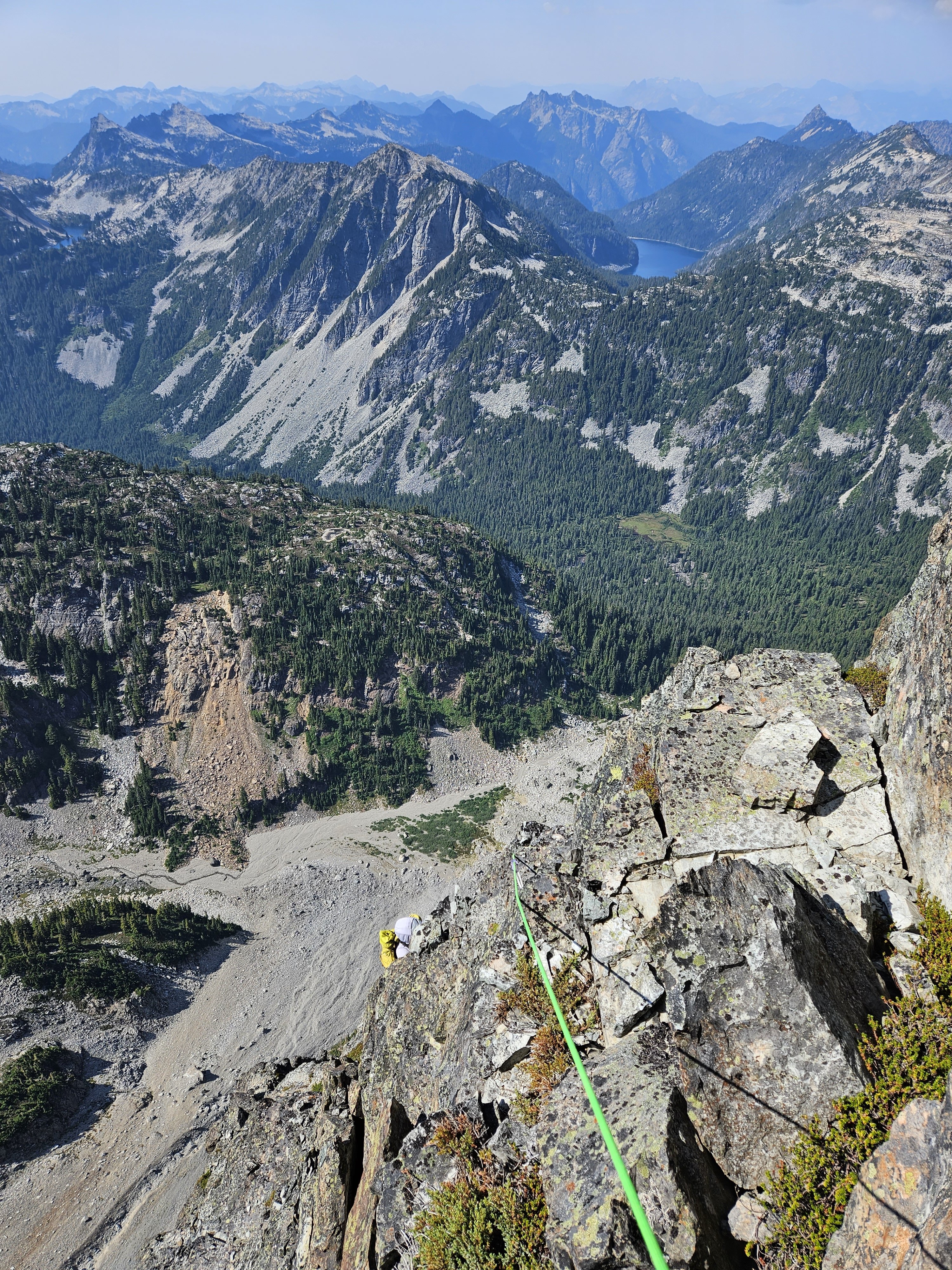
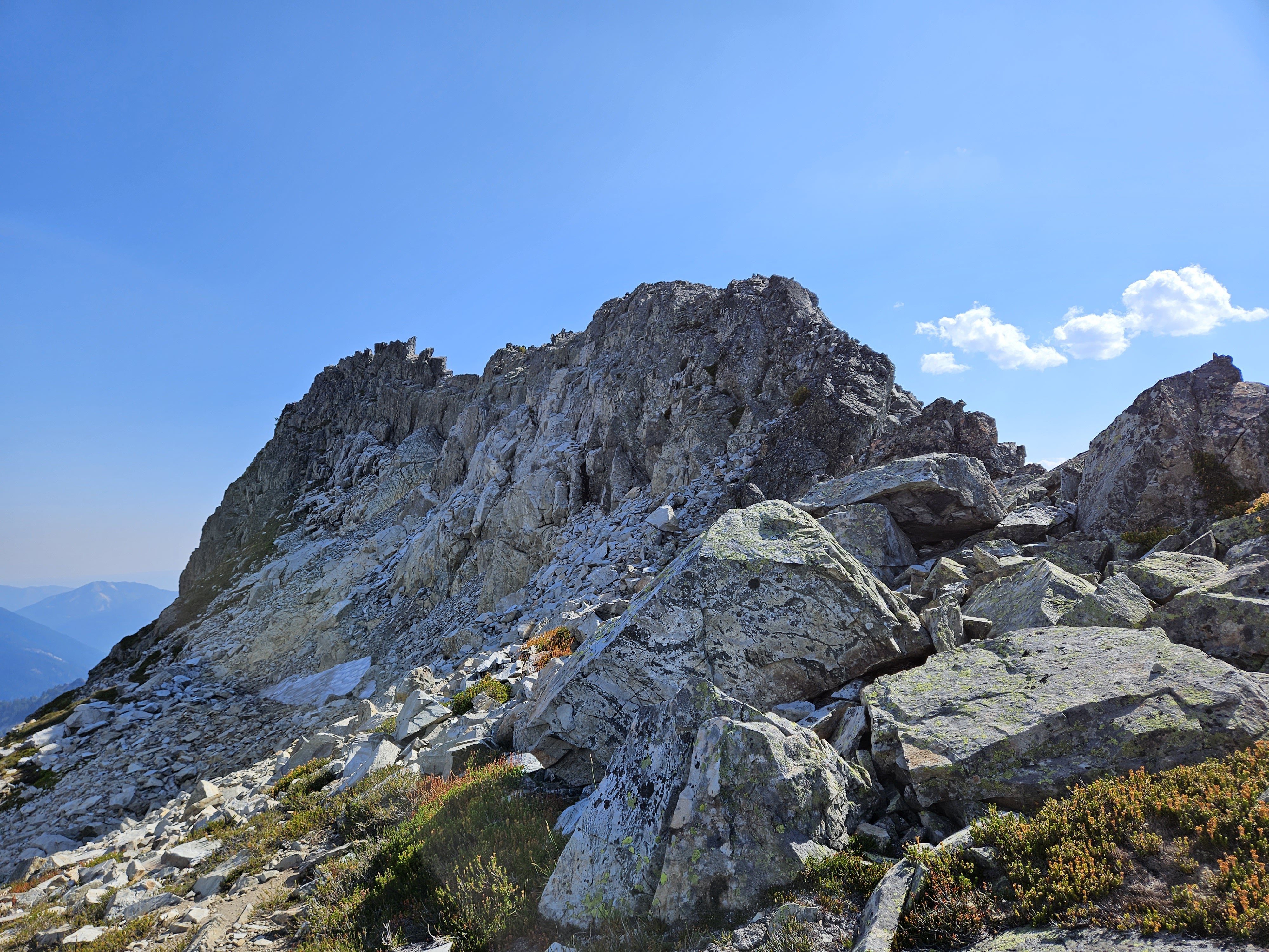
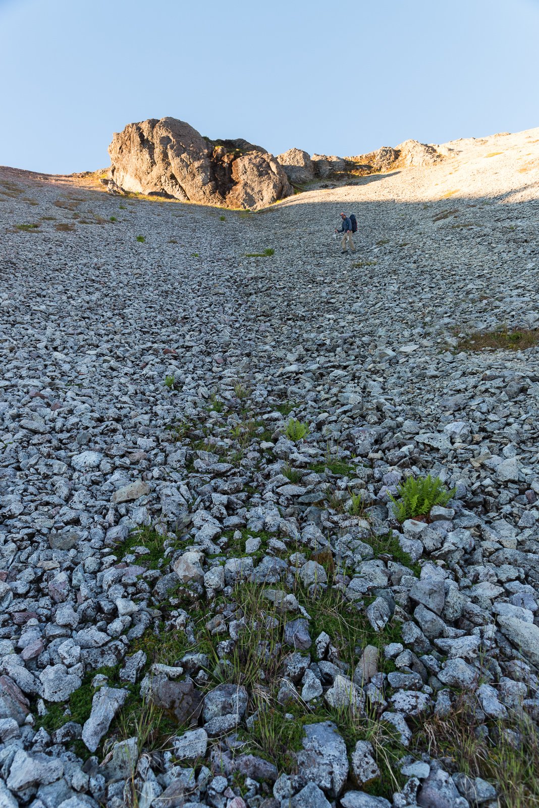
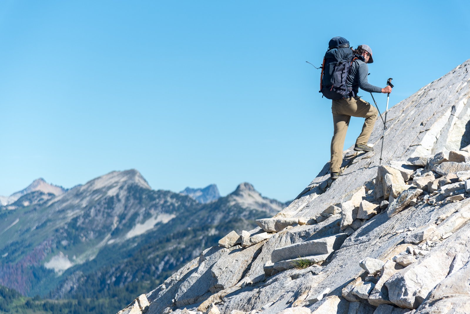
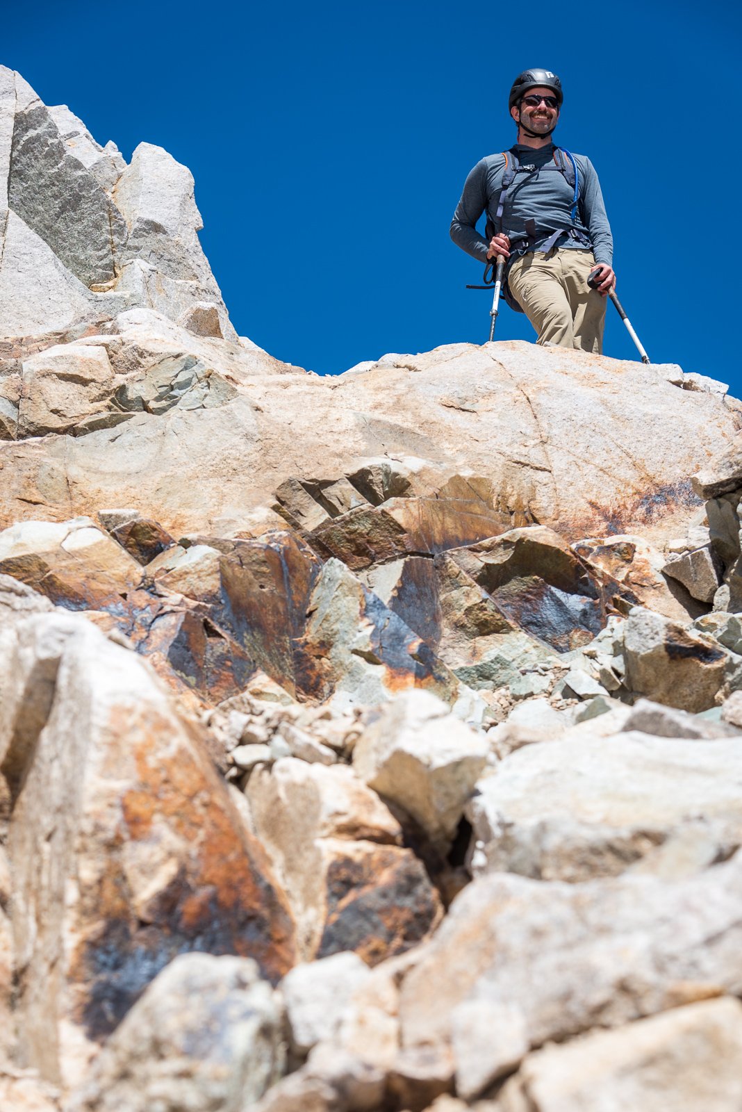
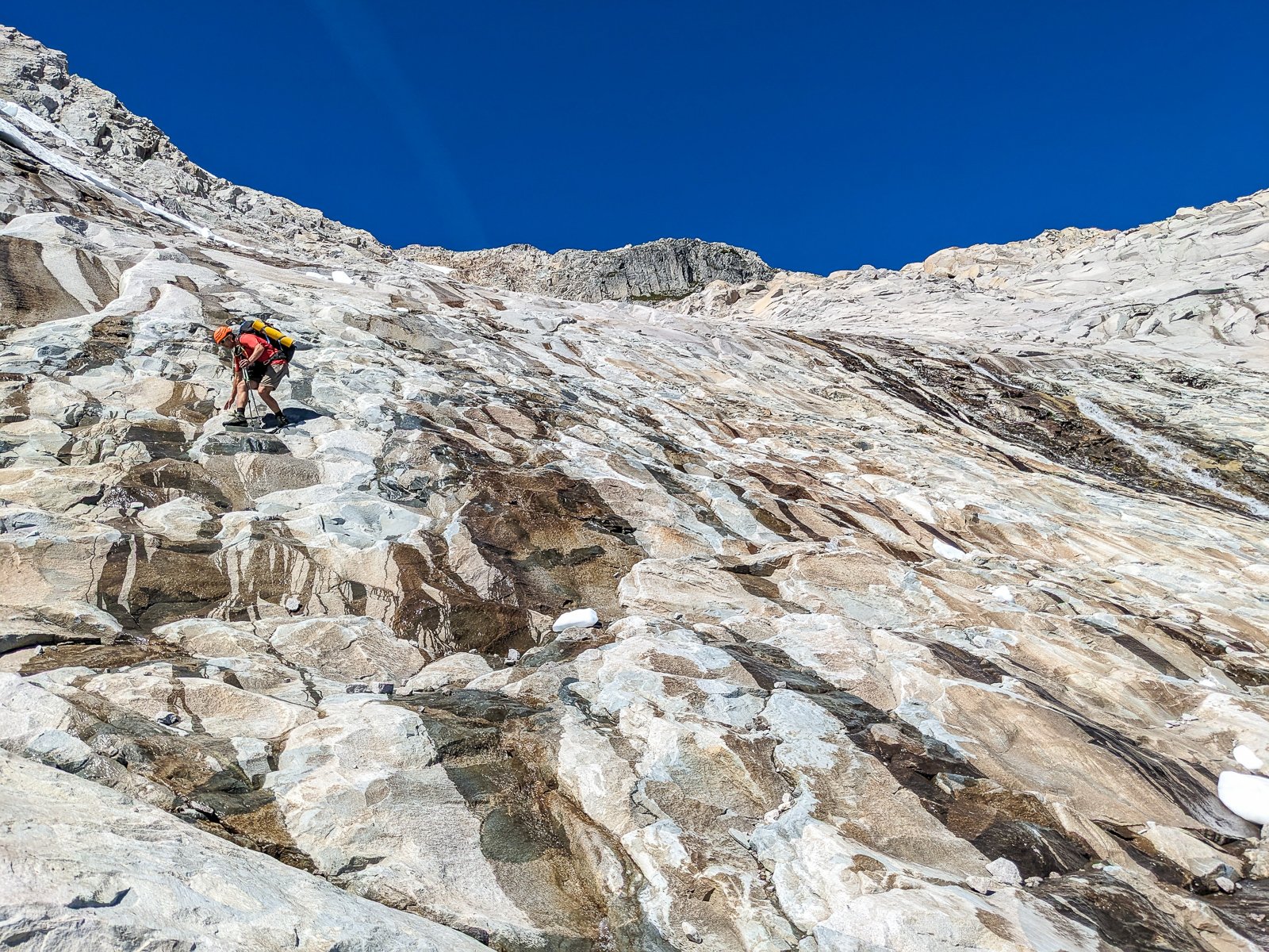
My friend Danyon and I climbed the NW Face on Little Big Chief last weekend on Aug 27th. This route is referenced as "Falcon Route" on mountain project, although I couldn't find the origin of this name as it is not mentioned in the FA (trip report here on CC: Saturday evening view of the face we were gonna climb: We approached from the Dingford Creek trailhead, which is about 13-14 miles on road/trail to the turn-off for the Summit Chief valley. We turned off the trail a 5 minute walk past the steel bridge referenced on MP and found relatively easy going with minimal bushwhacking up to camp below the NW face of Little Big Chief. Leaving camp at about 5:30 AM we wound our way up the talus, little gulley, and heather ledges to the base of the route, where we racked up for simuling and did the 200-250m of 4th-low 5th in a single simul block. This is roughly the way we went and the pitches aligned closely with the descriptions on MP: Pitch 1 had the promised undercling that must be traversed to the right, a good marker that you are at the right spot on the route, just left of of the big vertical "chimney" that splits the face. From here, we followed a groove on pitch 2: To easier ground on pitch 3 (trending up and slightly right along the crest of a convex feature) to the base of the headwall above. We found pitch 3 to be littered with a lot of death blocks sitting on the lower angle rock which we had to carefully maneuver around. A widening crack got us up the bottom of the headwall (P4): The pitches above (5,6) looked good at a distance but also had a lot of loose rock and some death blocks we had to work around. From there, we climbed up and right on easier ground over a bunch of choss covered ledges and one final pitch of ~5.7 climbing to gain the ridge. From there, we were a short distance from the summit, which we reached about 3:30pm. The MP description said to descend the ridge to the south from there. Definitely DON'T do that as that way looks extremely steep, loose, and uncertain. Instead, we descended to the north and followed the north ridge back down to Dutch Miller gap. This descent had 2 rappels from the summit on existing tat, followed by going along some easy heather ledges to skiers left to get to the north ridge. From there we easily scrambled down the ridge, where one airy step is passed by using another established rappel station. After that, it is all non-technical scrambling/walking down to Dutch Miller gap, from where we had to loop back around the trail and up to camp (had we known we would descend all the way to Dutch Miller gap we would have camped by the main trail rather than camping by the base of the NW face). As it was, we reached camp at 9pm, hiked part way out to the horse camp near the Hardscrabble Lakes trail turnoff and bivied there (1am-4am) for a few hours before getting up early Monday morning to hike out the rest of the way and go to work. Hopefully this beta helps someone. Overall, a pretty cool climb although it had more loose rock than we were hoping for and I would be wary of that. If you decide to climb it, definitely DO NOT do it under another party, be very careful about picking your belay stances to shield the belayer from rockfall above, and plan on descending to Dutch Miller gap. We brought the following gear: 60m rope 1x BD 0, 0.1, 0.2, 2x 0.3-#2, 1x #3 A set of pitons (never used, leave these at home) A set of nuts (never used)


 1 point
 -
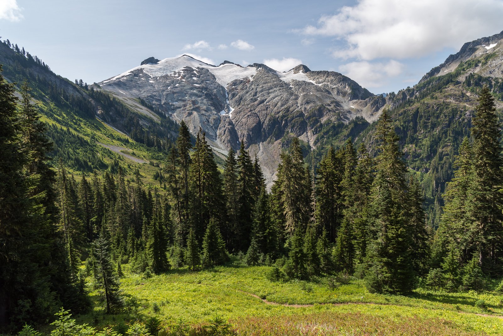
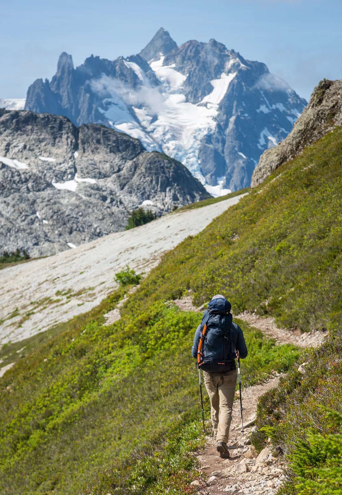
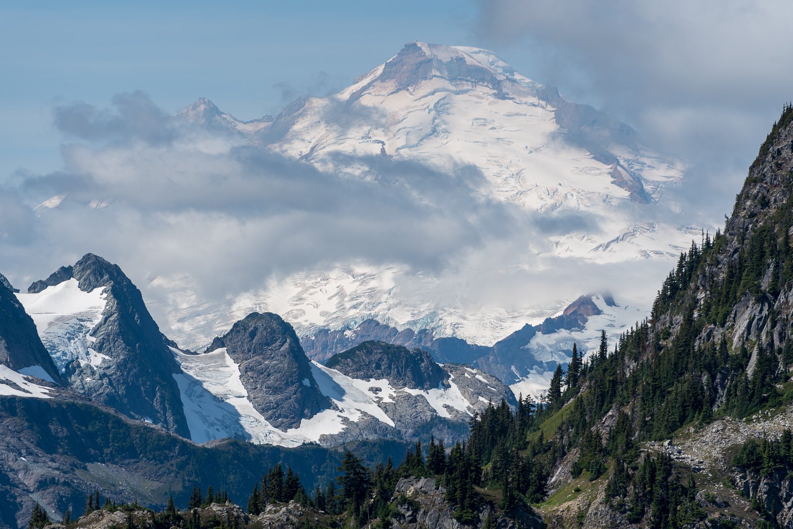
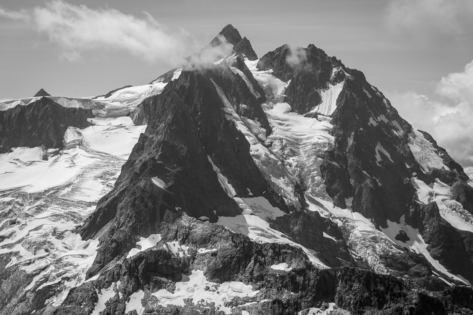
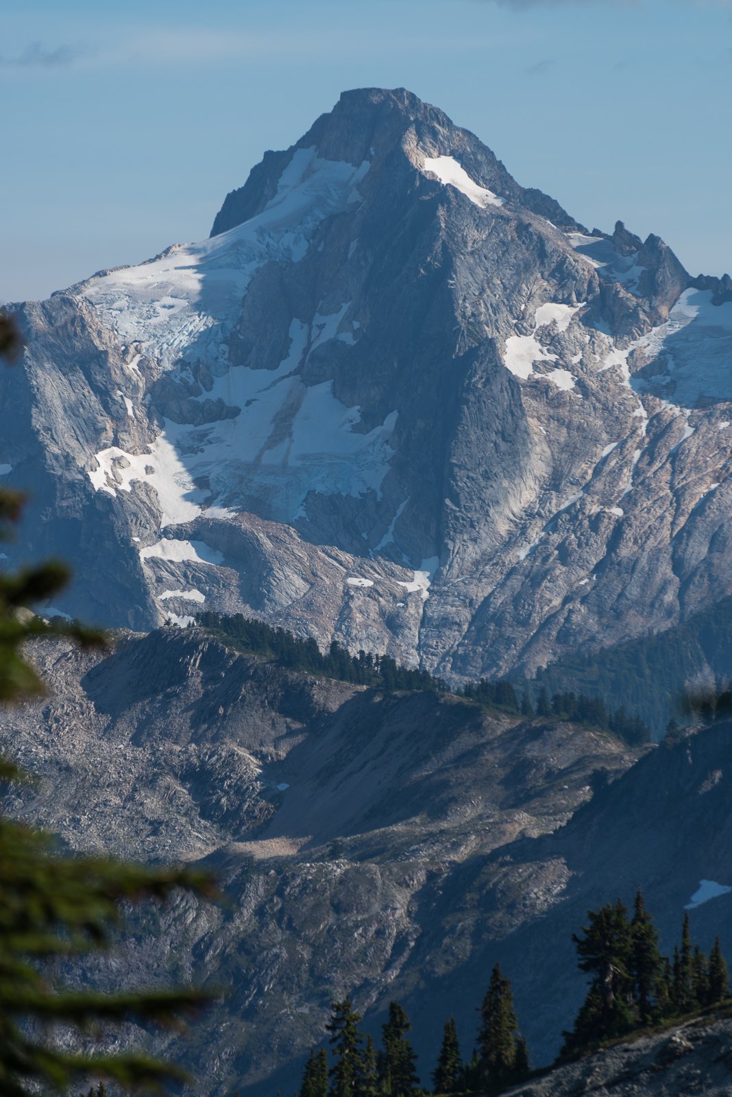
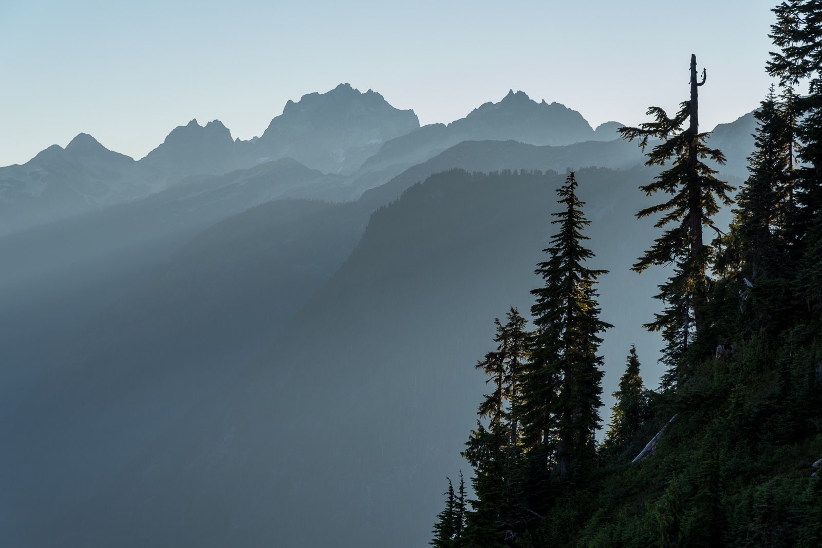
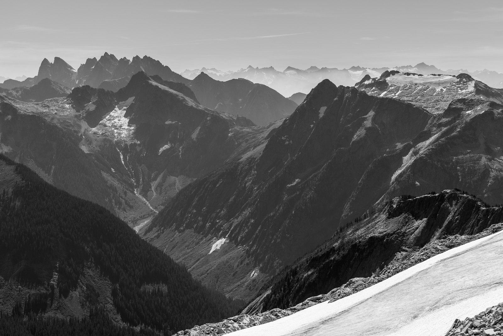
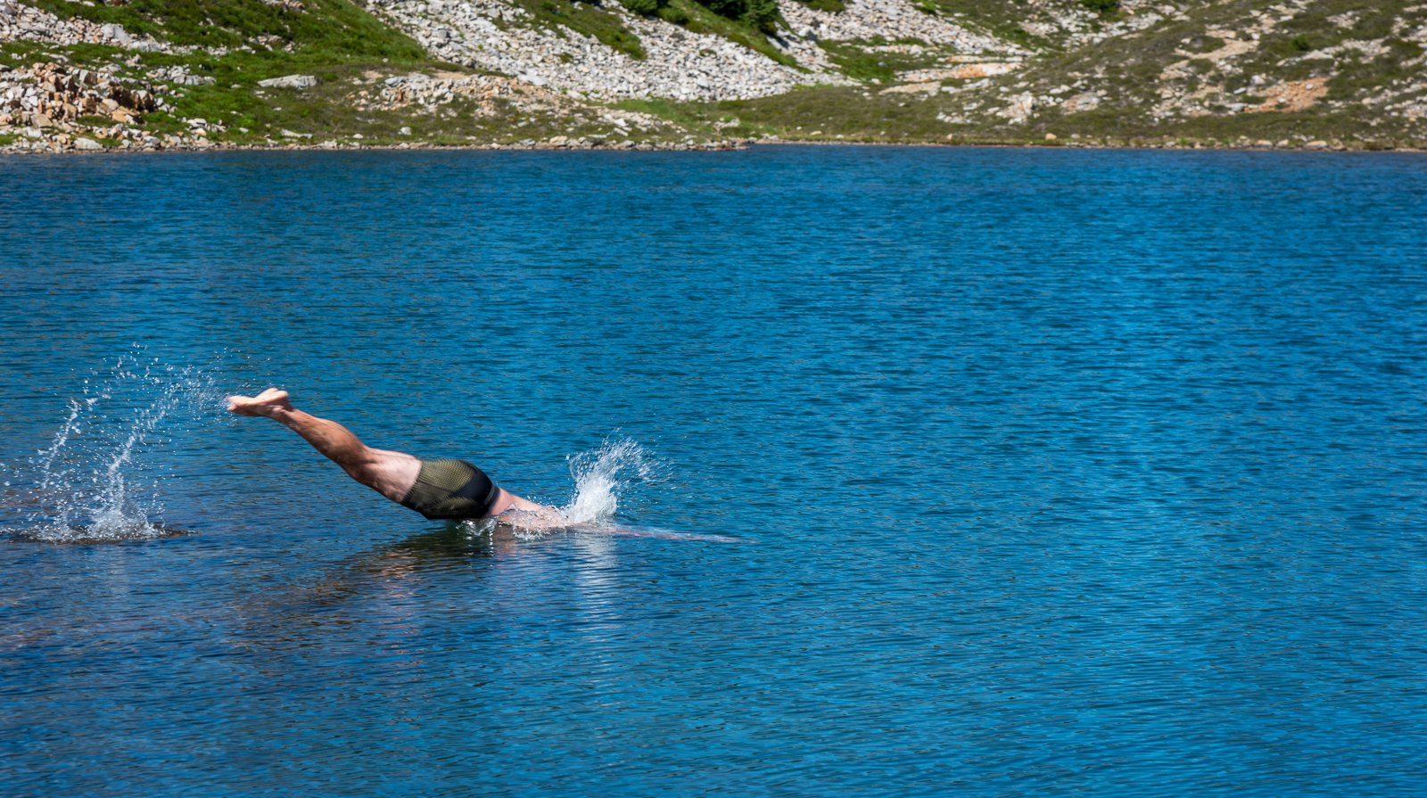
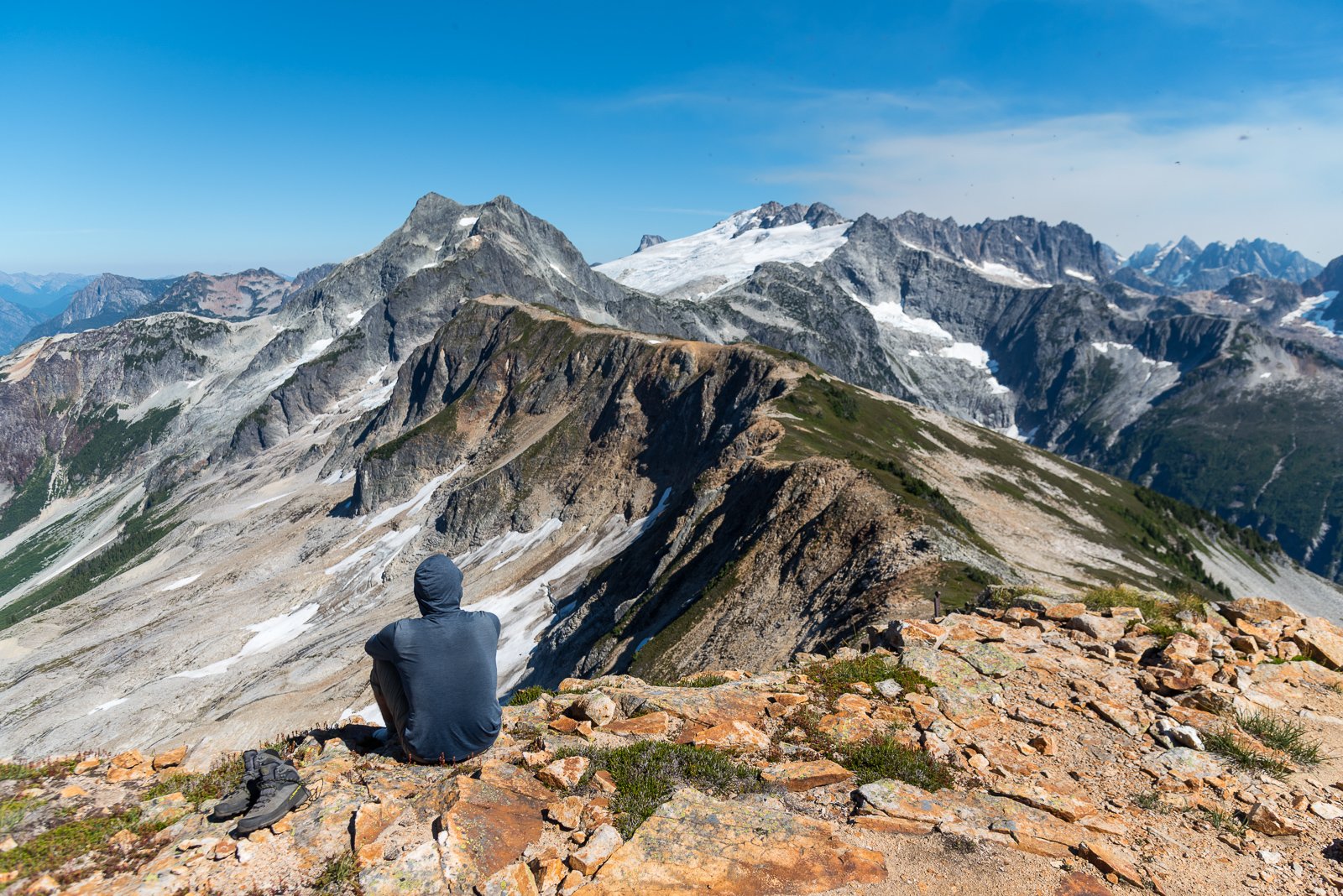
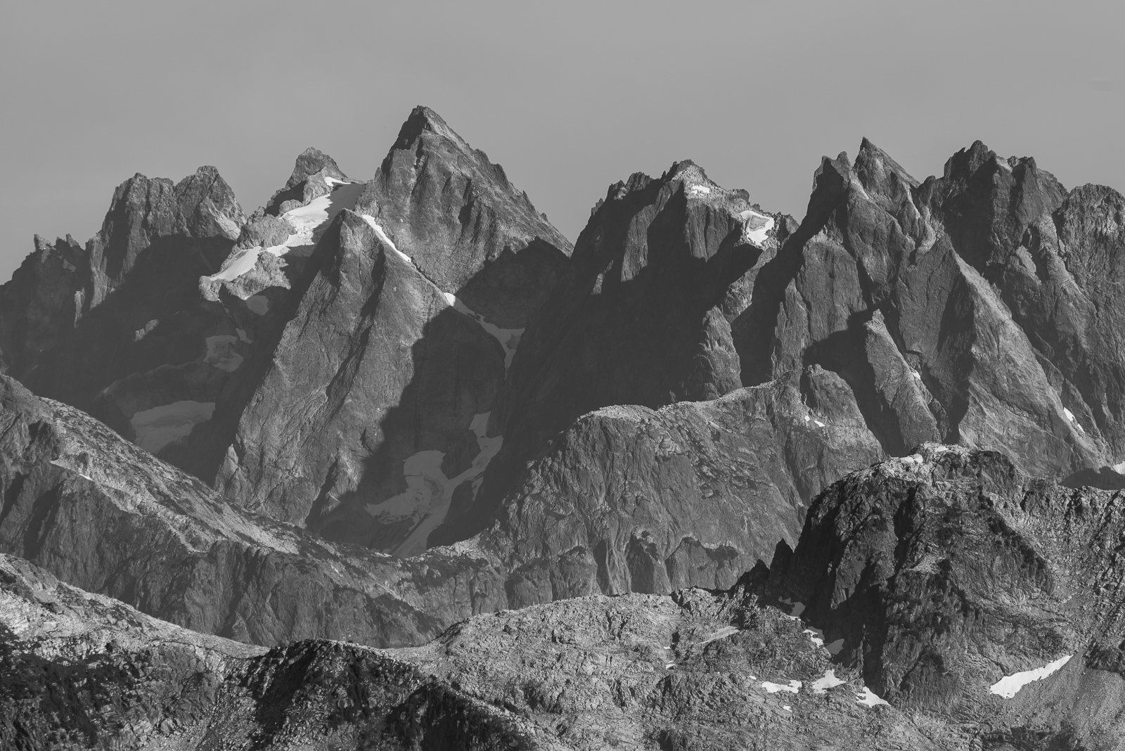
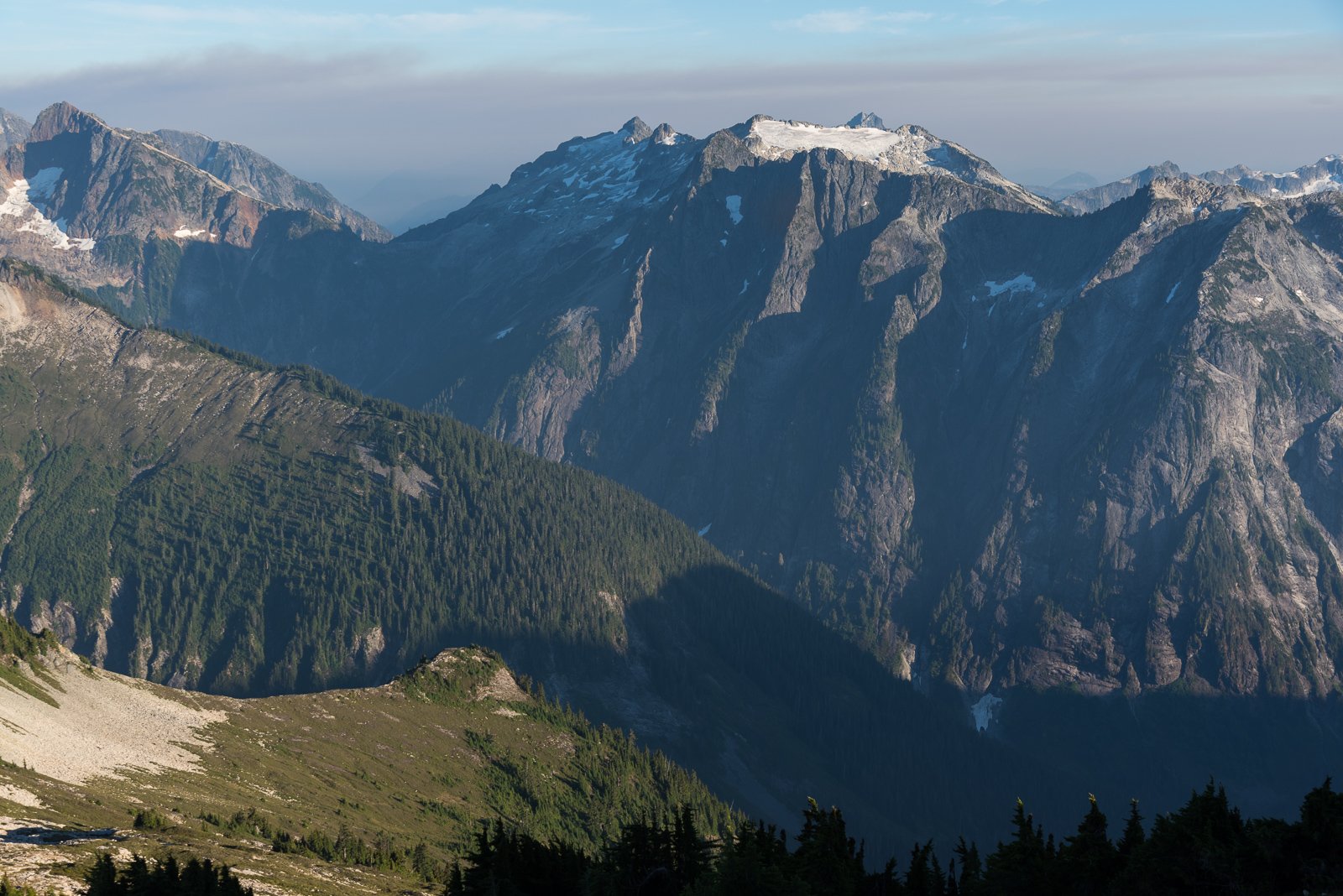
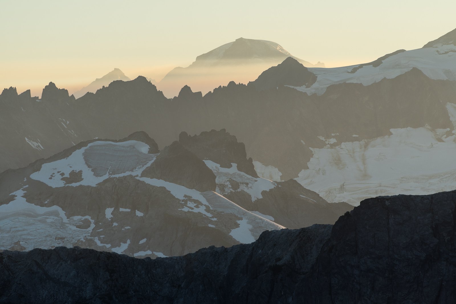
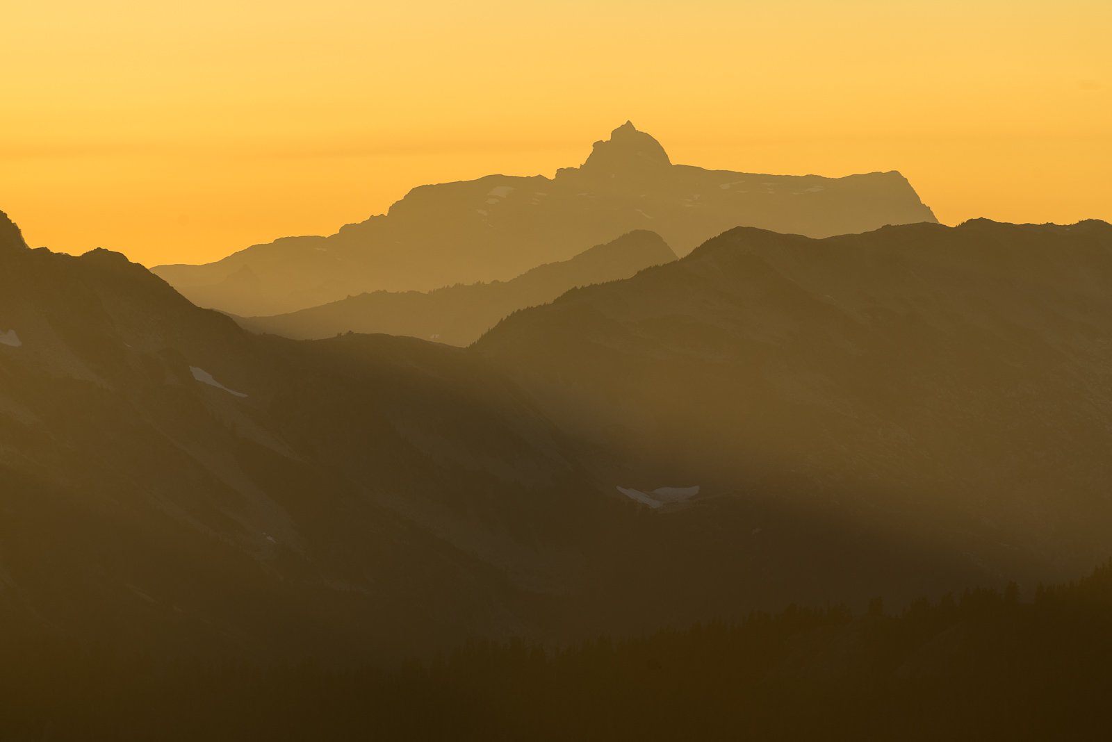
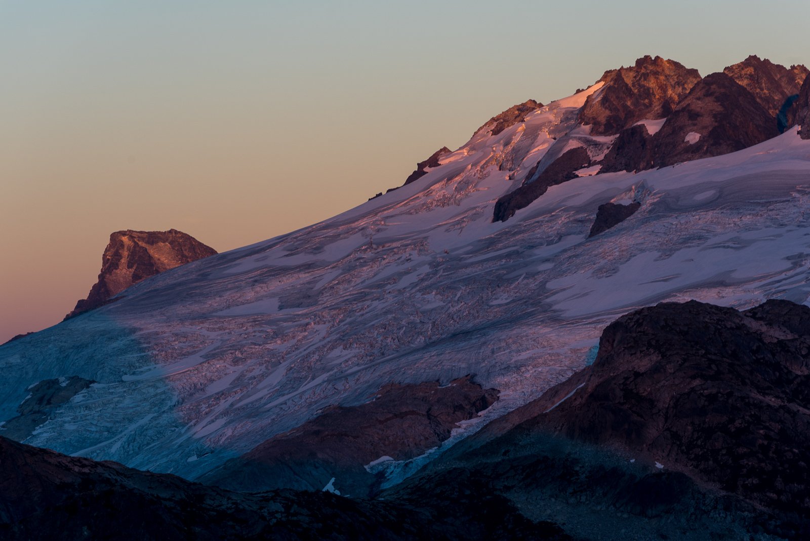
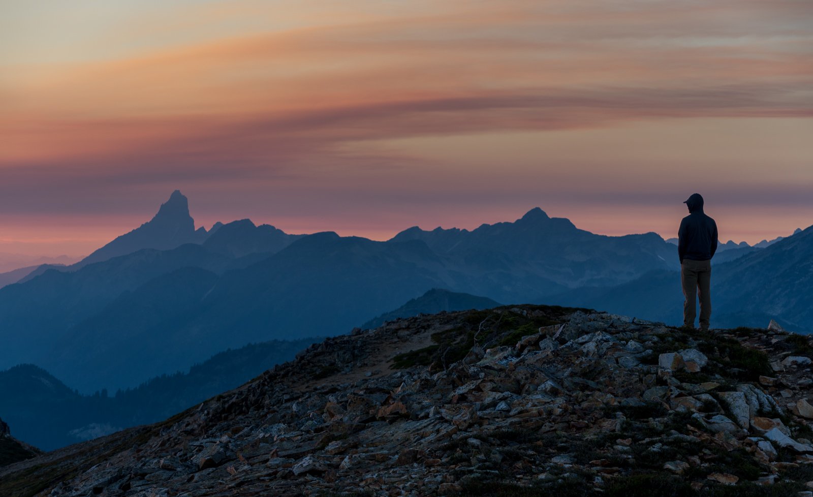
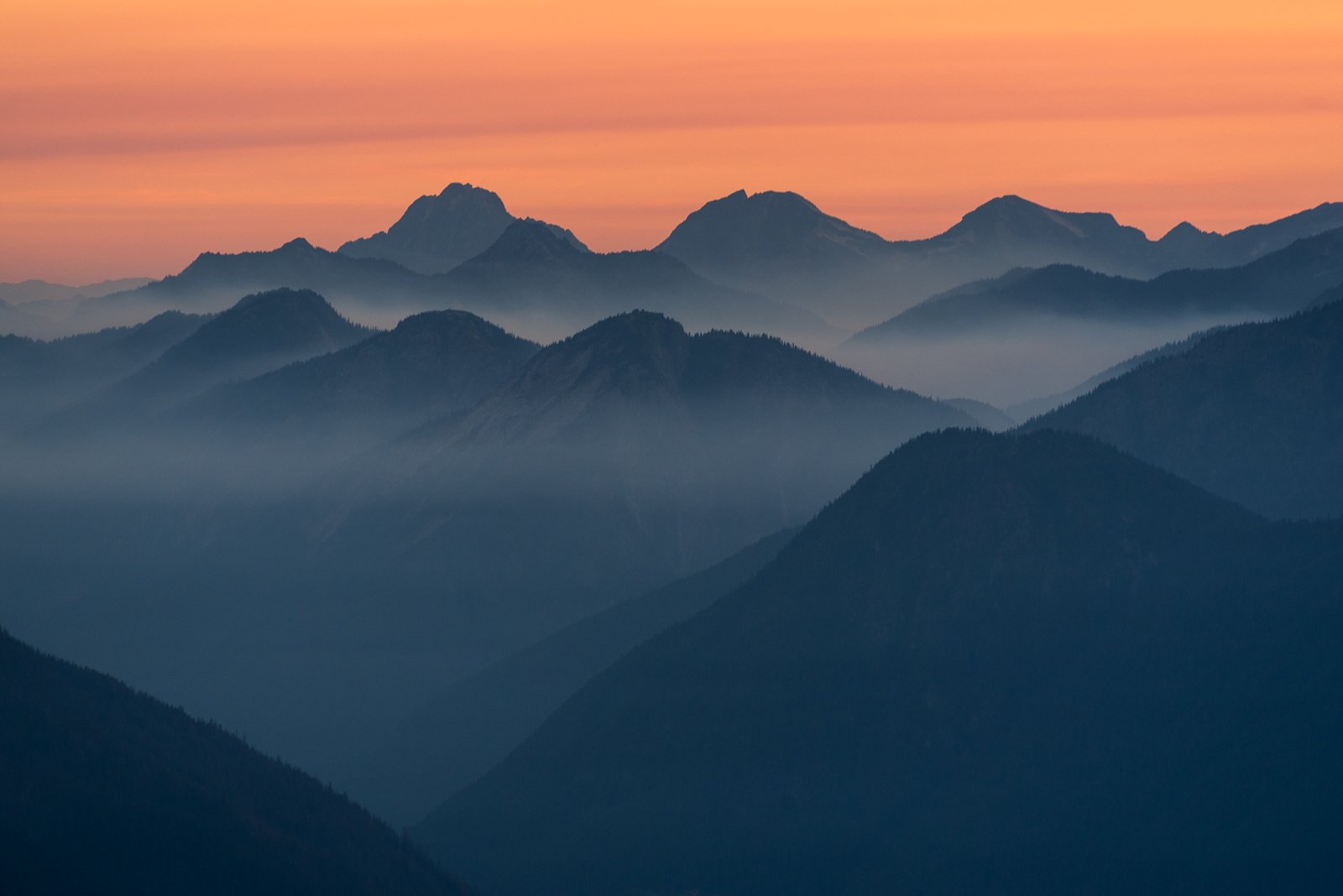
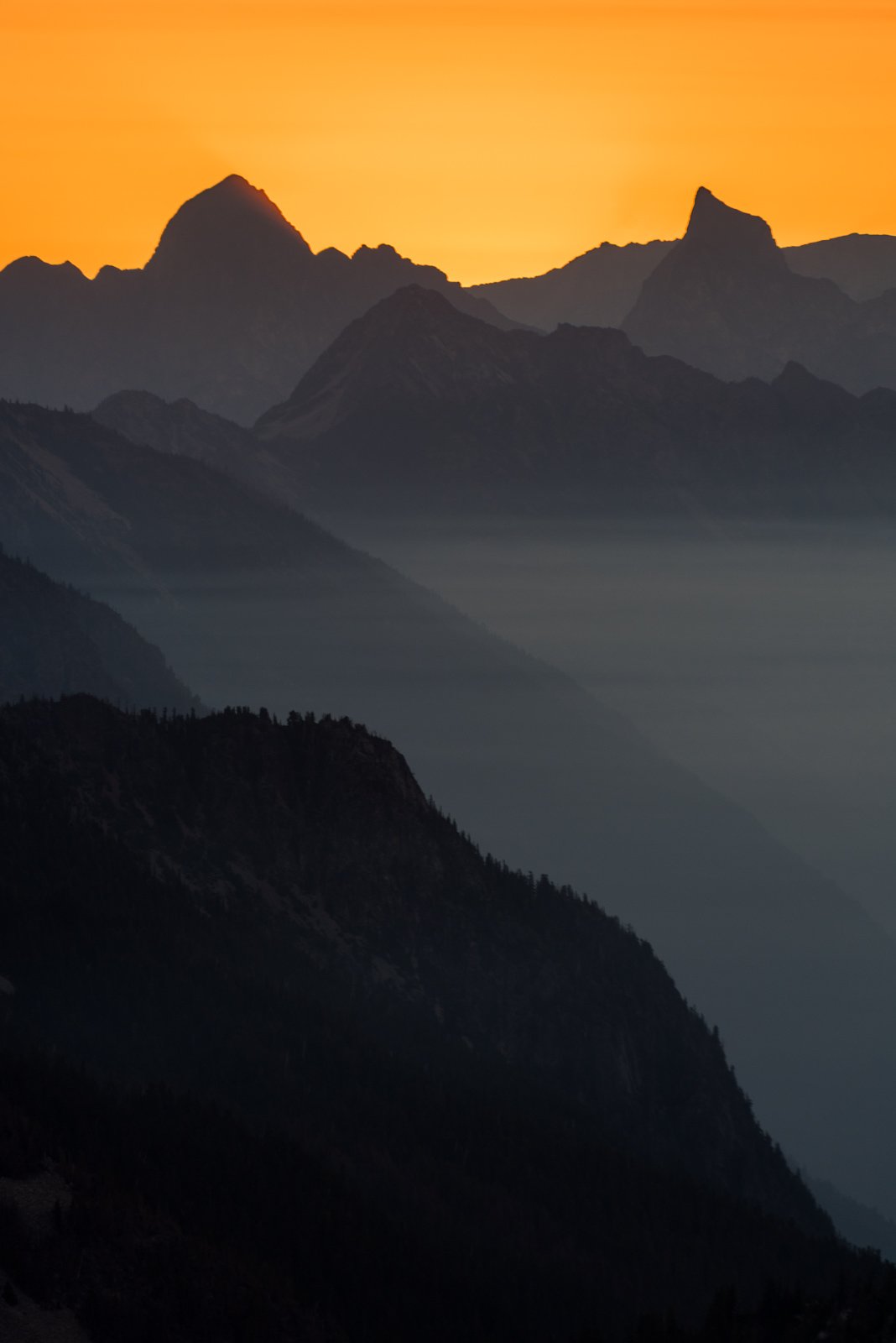
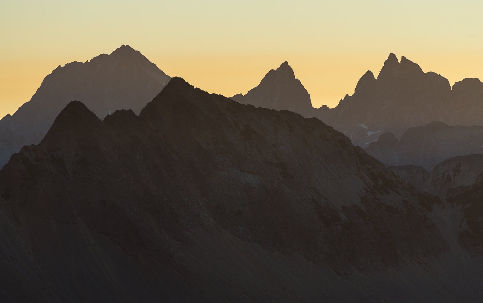
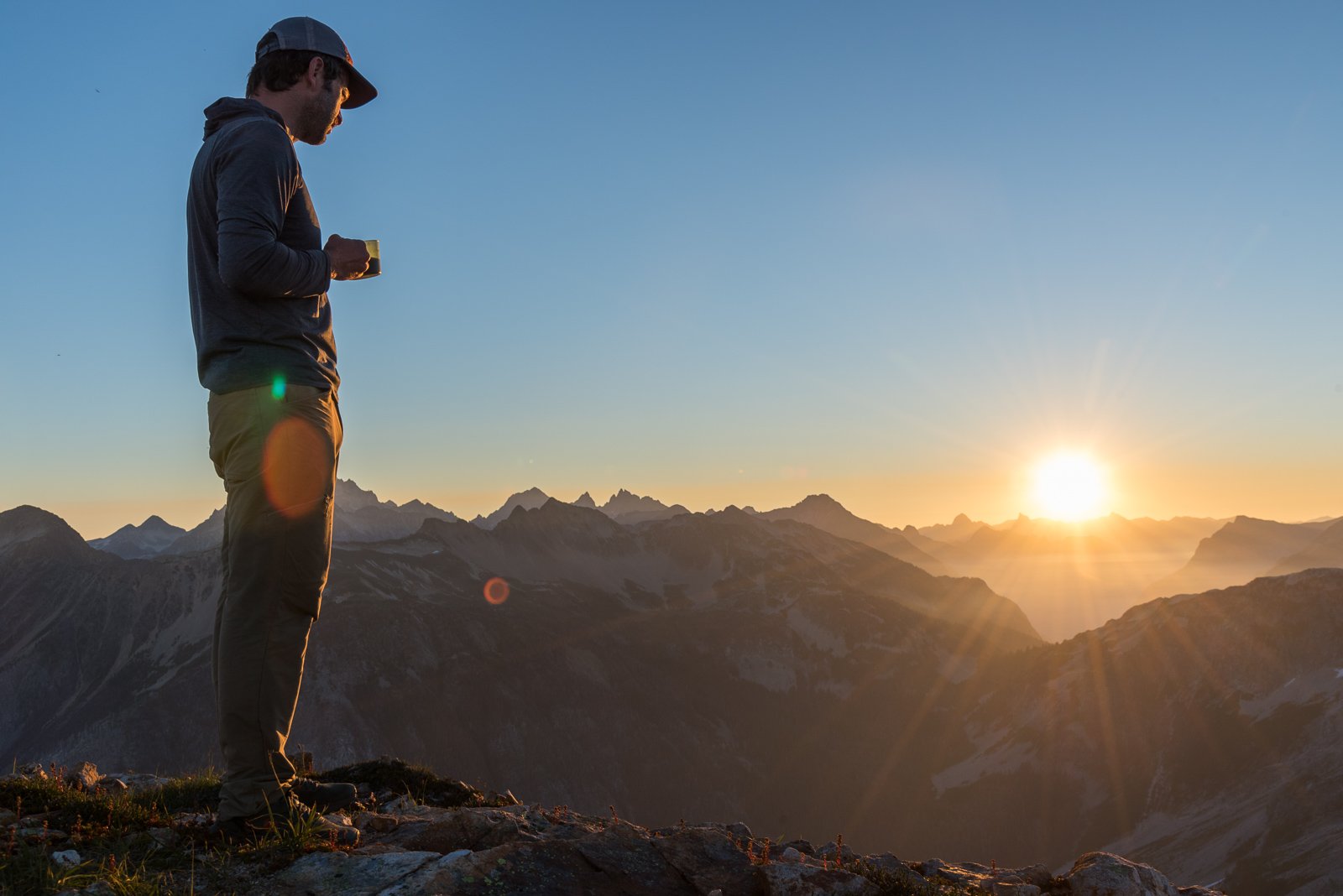
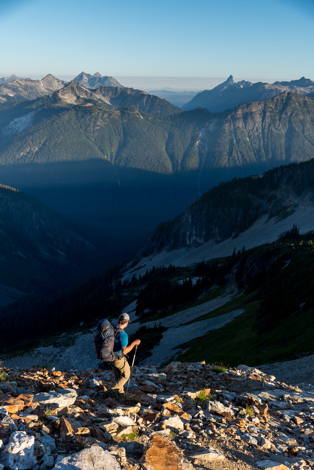
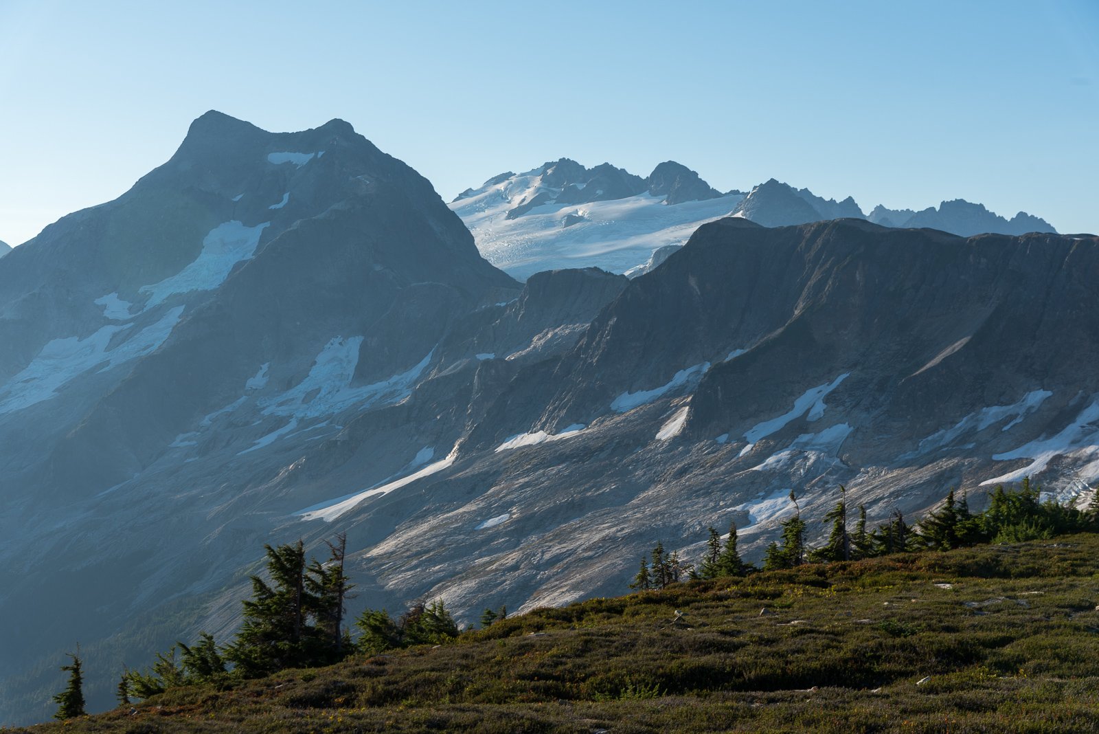
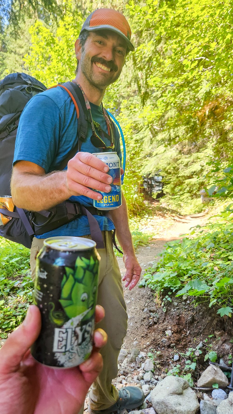
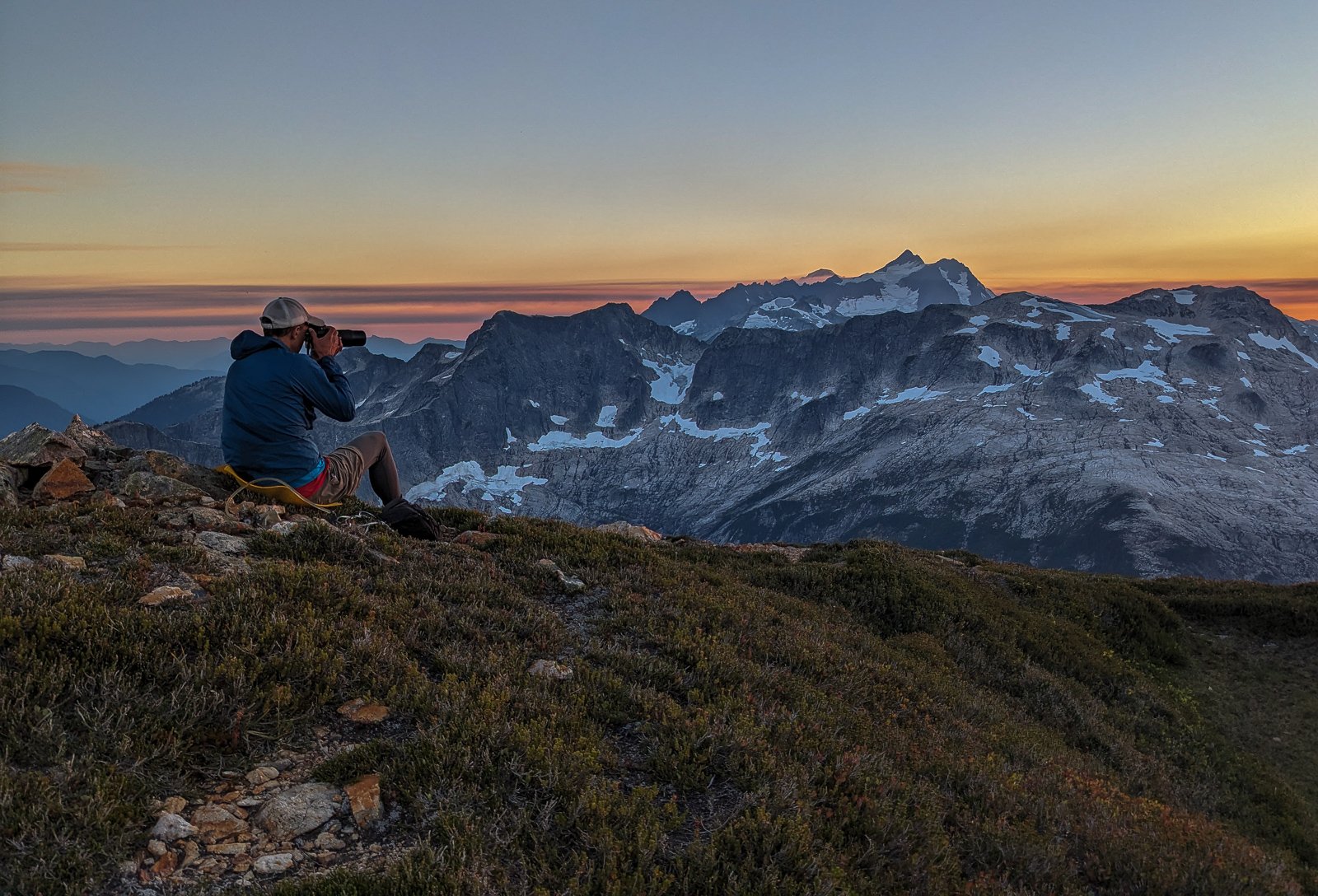
Trip: Ruth, Mineral, and the not so Easy way to Easy Peak - Mineral Mountain High Route Trip Date: 08/12/2023 Trip Report: "This route goes from Hannegan Pass to join the Easy Ridge High Route. It is an arduous approach to the Northern Pickets. The most gruesome moments of green hell and cliffs are at Chilliwack Pass: the rest is alpine nectar." - Routes and Rocks In the Mt. Challenger Quadrangle. Tabor and Crowder. 1968 And so it goes- the yin and yang of North Cascades High routes. I like "alpine nectar" as much as anyone, and so does @BrettS, so we chose to ignore the first part of that description and headed out to find out for ourselves. As expected with a description like that, NOCA permits in Glacier were a breeze. A welcome break from the madness of Saturday mornings in Marblemount. Then ......we went into the hills for three days and walked a lot - sometimes on a trail, sometimes hovering over the ground on brush, sometimes skipping through alpine meadows that would make @rat break out in song. We had nice camps, we had tunes, we had whiskey and too much camera gear. The verdict- either we are getting toughened up, or forgetful, but I don't think either of us found the crux to be much of a "green hell"- more "black flies and heat" hell. Regardless, the trip certainly traverses some of the more scenic ridge lines in the range, and exit out Easy Ridge is especially, well, easy. Same with the entry via Hannegan Pass and Mount Ruth. The middle involves..... some shenanigans, but you knew that. Pretty pictures never tell the full story in the North Cascades. Both our camps near Ruth and on the summit of Easy Peak were highlights, as was the midday swim in the tarn below Easy Peak. Lowlights, as mentioned earlier, were the heat and bugs. But, having the Tom Selleck of the alpine along made it all seem like a breeze. Ruth from Hannegan trail: Alpine nectar! Blum and Icy: Go do the North Ridge of Blum! Slesse, the Haunted House of the Chilliwack: If you see this, you are about to start the shenanigans: The view distracts from the sidehill of green steepness: @BrettS past most of the shenanigans: This summer has been really hard on the glaciers: Crowder and Pioneer in front of the Southern Pickets: Get your autograph pens ready! Rare @JasonG sighting in the wild: Alpine nectar! Summit of Easy Peak: Southern Pickets: Pioneer and the mysterious depths of the Baker River: Late season insanity around Kulshan and Shuksan: Tomyhoi at sunset: I've never seen Challenger looking so grim: Putting in the work on the photos....Now do you see why I carry that yellow pad? The smoke teased, but never fully engulfed us: Looking across the border into Canada, where there is another fire: A tad soft, unfortunately, but the Hozomeens at sunrise: Spickard and the Mox Peaks: Alpine Nectar! fin: Gear Notes: We were able to avoid all ice and didn't need anything other than helmets. No glacier gear needed if you go around on Ruth Approach Notes: Follow Tabor and Crowder. Find yourself a copy of Routes and Rocks!


 1 point