Leaderboard
Popular Content
Showing content with the highest reputation on 11/23/20 in all areas
-
Trip: Mount Hood - North Face Right Gully Solo Trip Date: 11/21/2020 Trip Report: X-posted from PNW Mountaineers on FB for those not on there. Stoke: The gullies are in! Skied to the bergshrund with Evan and Andrew and then solo'd the R gully. Hardest climb I've done both physically and mentally, but it was so rad! Snow conditions in the gully were overall great, ice was fat (albeit a little brittle), and sticks were generous. Carried over skis and had a sunset ski down Old Chute back to Timberline with my quads telling me to go fuck myself the whole time. Evan and Andrew brought me a surprise burrito after driving back around, winning the most thoughtful and amazing climbing partner awards for at least the next year! Conditions: **Given the new snow starting today, this will be theoretically obsolete by the time the weather turns nice in a few days, but this week looks eerily similar to last week (little more wind), so shouldn't be too far off for the window next weekend.** Skinnable snow from the trailhead Tilly Jane, pretty firm and tracked out and an easy skin to where we dropped onto the glacier. The descent onto the glacier was fairly rocky where we went down (about a hundred yards up from the cairn), but the smart move would have been to keep skinning up the ridge towards Cooper Spur and there were some great, rockless lines to ski which also would have cut off some down and up. The snow on the glacier was pretty deep so skis or snowshoes are mandatory, post-holing would have been up to the thighs or waist. Sticking to the left of the glacier avoided any obvious crevasses and those that were still open were mostly filled and only about 20 feet deep. Just before the bergshrund, I punched through into what looked to be a fairly deep cathedral while I was testing a suspicious spot. The bergy was open but on the right it was less than a foot across, though the unconsolidated snow made for a tougher crossing for those heavier than about 200lb (gear included). The L gully entrance was near vertical for probably 40m, but looked fat. Also a few nice flows along the L cirque that looked to be in very climbable condition. Once in the gully, the snow was overall waaaaay more ideal than the unconsolidated Eliot had made us think it would be. For the first 2/3, I was able to kick in enough to have a platform to the arch or my foot or heel, but it was consolidated enough that the kicked steps fully supported my weight. There were some areas where I had to find the certain line that was consolidated enough, but it was never difficult and rarely had to move more than a few feet to either side. Towards the top, it got steeper and less consolidated and I was swimming for the last five hundred desperate feet to the summit. The last step (staying R after cathedral rock) was super thin with some mixed moves and I was way to gassed to feel safe on it, so traversed to the left and topped out at the top of the L gully. Check out the pics for descriptions of the three steps I got on. Summited about thirty minutes before the sun set and enjoyed a ski down in the twilight and then dark, quads screaming at me the entire time. The snow in Old Chute was fantastic and I was able to find at least a few inches of powder the entire way back to the lot. First step, WI3+. 25-30m. Took the line just to the right of the snow (60-70 degrees) and then traversed over the bulge to the right (a few vertical moves) to stay on the water ice. From the top of the first step looking at a small AI2 step before entering the main snowfield. Don't think this is typically ice. Main snowfield with the third step (2nd?) in the distance. Nice ice! Steps were kickable, post-holing wasn't bad, and made for easy rests through the main section. Third step, WI/AI3+, 25-30m. Some sections of water and some alpine ice with great sticks throughout. Again, 2-3 vertical or near vertical moves. Third step, beginning was about 60 degrees before becoming more vertical. Final snowfield before cutting left to the L gully. To the R of the buttress is the final ice step, was so burnt that I forgot to take pics of that step. Second favorite Hood summit (proposing to my fiance has to take the cake). Last light halfway down hogsback, great snow. Stats: 12:25:41 Tilly Jane to Timberline 7300 ft ascent 5410 ft descent Max speed 49.4 mph Gear Notes: Skis, glacier rope, two North Machines Approach Notes: See TR.3 points
-
Trip: Mount Jupiter - East Ridge (standard) Trip Date: 05/08/2020 Trip Report: My trip down 2020 memory lane continues! We've moved up to May now. The pandemic is still slowing unfolding but people are going back to work and the lockdowns are easing. Public land is open in some instances (Olympic National Forest) but closed in other (MBSNF, national parks, etc.). Your friends were likely in two camps- those still locked down and those that were straining for the freedom of the hills. Quietly, I rallied @therunningdog and @Trent, two of the chossdawgs who were straining at their tethers. It didn't take much cajoling to convince them to launch across the sound for a quick strike to the east side of the Peninsula. Growing up around Seattle you can't ignore ol' Jupe, it is right there on the Olympic skyline, standing proud at sunset like an Olympic version of Mt. Pilchuck. Jupiter is small, beautifully shaped, and larger looking than it really is, sitting at the edge of the range like it does. We were all smitten, or at least mildly interested. Beggers can't be choosers! The Brothers (L) and Jupiter (R) from the Edmonds Kingston ferry We drove up to the trailhead from the ferry the night before, finding an excellent spot to throw down our gear in the dirt for the night The next morning dawned clear and crisp and we climbed on the bikes for the punishing grind up to the normal TH. Recent logging has made this section view rich, but also has meant that the public is no longer allowed to drive the few thousand vert to the proper trailhead (which has been logged over anyways). We opted to take the road a bit further to the ridge crest then go cross country to the trail. It might not have saved much on the way up but meant for a longer descent on the bikes. And so we began the long hike to the summit. A former lookout site, Jupiter has a well graded trail all 7 miles to the summit. It was just what we needed after many weeks of limited mountain access. Steve hiking the scenic trail with the Brothers beyond Another great look at the Brothers It was a glorious day with 360 views of the Olympics, Puget lowlands and Cascades. You could easily see from Canada to well south of Rainier! A long break was called and observed with some well earned R&R. Way sooner than we would have liked (we had a ferry to catch) we began the descent back to the bikes. We hadn't seen anyone all day and that theme continued on the exit. I think many are scared off by the long distances involved in doing this in a day, but bikes make is quite reasonable with a trailhead bivy. Just make sure you have disc brakes and suspension! It was an adventure on my bike.... This view is just leaving the summit, looking down the ridge that is ascended. The trail roughly follows the ridge east, all the way to the clear cut in the distance. From there bikes will take you steeply down to your car deep down in the trees. Now, when I watch the sunset from the park by my parents house, I can look Jupiter in the eye and tip my hat to a fine peak. And to the memories of a perfect day in the alpine with good friends. May is coming soon, best be ready! Gear Notes: bikes are key since the road is gated low these days. Approach Notes: Follow the descriptions and drive as far up the road as you can2 points
-
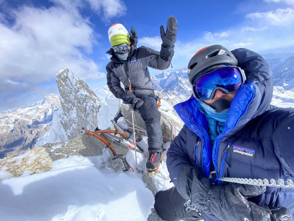
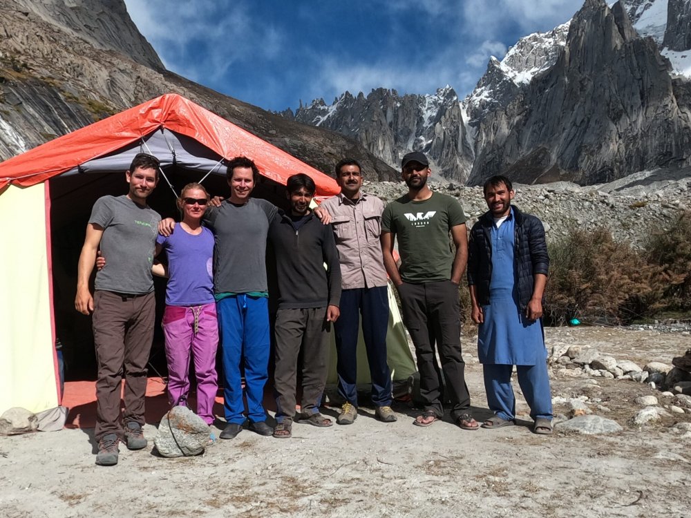
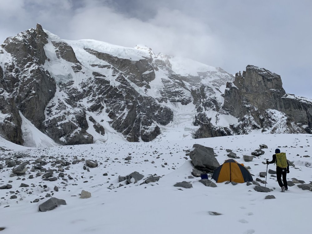
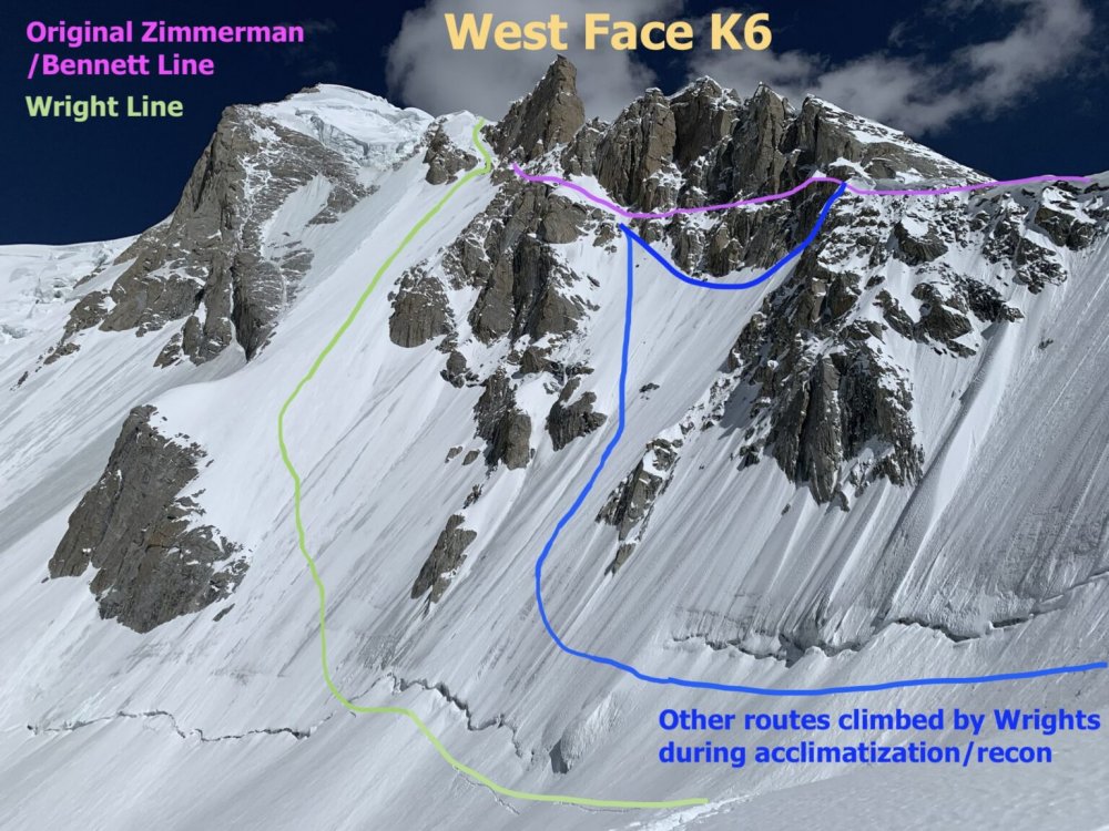
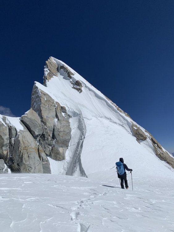
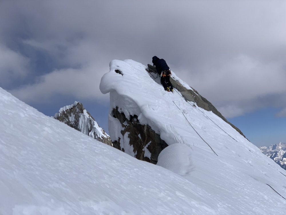
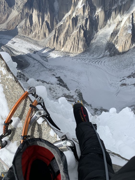
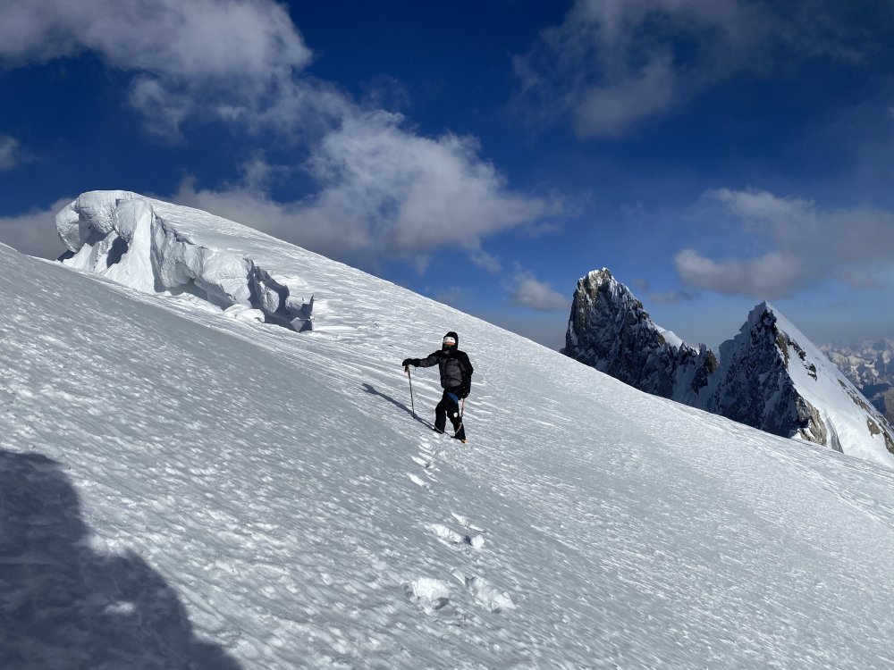
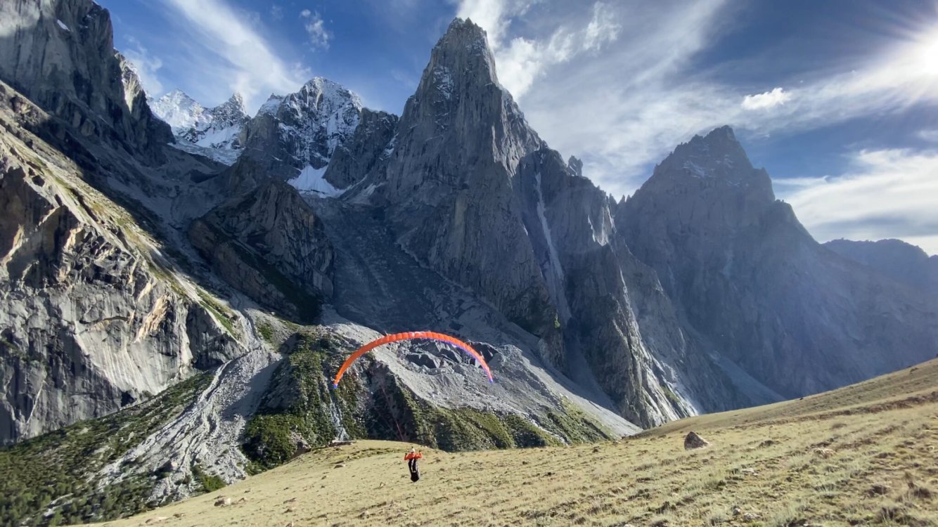
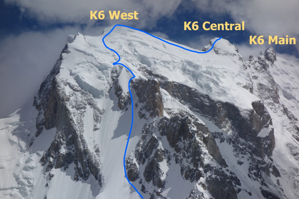
Trip: Pakistan - K6 Central Trip Date: 10/09/2020 Trip Report: Dear CC friends, Sorry we haven't been on here much, but we've been working a lot on our blog. It's more of a diary for us since we don't care about hits or ad content. We really don't want to just post a link to our blog TR and leave it at that. We want to see CC thrive and grow! So we've copied our latest TR from Pakistan below. If you are interested in other TR's from our 2020 year of traveling and climbing, like our ascent of all Six of the Great Alps North Faces and Cerro Torre in Patagonia, check out our blog or Vimeo page. https://alpinevagabonds.com https://vimeo.com/user37304873 Stats Location: Masherbrum Range, Karakoram Mountains, Gilgit-Baltistan, Pakistan K6 West, 7,140m, 3rd ascent, October 8, 2020 K6 Central, 7,155m, 1st ascent, October 9, 2020 Climbers: Jeff and Priti Wright Trip Report K6 Central Summit Selfie (7,155m) We climbed K6 West (third ascent 7,140m) and K6 Central (first ascent 7,155m) this October. We summited West on Oct 8th and Central on Oct 9th. We had been planning to climb K6 from the Nangmah valley side for over two years. When COVID struck, we held on to the hope of going but delayed our trip from the original June-August until late September-October when the country announced they were allowing tourists to enter with a valid COVID test. A week before we departed, Colin Haley decided to join our trip to climb various objectives solo. Colin has been a hero to us, and was a major inspiration for us to start Alpine Climbing over six years ago. In fact, we modeled our Sabbatical Year on a typical year in Colin’s life (Patagonia – Chamonix – Pakistan). It was a real treat for us to have him join us at Base Camp, and he provided us with a wealth of knowledge and advice in this new game (for us) of high altitude Alpinism. Jeff on K6 Central’s summit This was a difficult year for climbers, world-wide, due to COVID. Nearly all serious expeditions canceled their plans, so when we continued with our planned Karakoram expedition to K6, we were quite alone in the whole range. Certainly no one expected us to make a first ascent of K6 Central, a 7,000m peak, in late season. K6 has three major summits along its summit ridge: West (7,140m), Central (7,155m), and Main (7,281m). K6 Main was first climbed by an Austrian Expedition in 1970 led by Eduard Koblmueller. Before the expedition, we were lucky enough to get in contact with one of the original expedition members of the young Austrian team, Fred Pressl, who graciously shared pictures and stories from his 1970 expedition. In 2013, Ian Welsted and Raphael Slawinski became the first ascensionists of K6 West via a highly technical route from the North (Charakusa) side (for which they won a Piolet d’Or). Then in 2015, Graham Zimmerman and Scott Bennett became the second ascensionists of K6 West from the South (Nangmah) side. But an impending storm forced them to retreat without continuing the traverse to K6 Central, and it remained unclimbed. Priti with K6 West on the left, Main in the middle and Central on the right The first hurdle to overcome was getting to Pakistan. We kept in contact with Ali Saltoro, our expedition tour operator, who kept us informed on the COVID status there. We delayed our trip a month and a half, but when he told us that tourism had opened up in Pakistan, we dusted off our Visas from December 2019, bought plane tickets and got the fresh COVID tests required for entry. We had heard of no expeditions traveling this season, and we didn’t know what to expect. We arrived in Islamabad on August 23rd, Ali met us at the airport, and hours later we flew to Skardu, without even leaving the airport. We arrived smoothly and safely at basecamp in the Nangmah valley on Aug 26th, with zero hassle. Advanced Base Camp, with the South Face of K6 behind Once we got to basecamp, we started acclimatizing on nearby Kapura Peak and had a full view of K6’s SW Ridge and West Face from what’s called Alam’s Col (a route first climbed by Portugese Daniela Teixeira and Paulo Roxo in 2013). From this vantage point, we could see that there were several options for climbing the West Face. After acclimatizing on Kapura Peak (no summit attempt) located on the West Nangmah Glacier, we moved over to the East Nangmah Glacier and made an Advanced Base Camp. We continued acclimatizing, exploring two of the three alternative lines that would bypass nearly all of the technical mixed climbing found by Graham and Steve. We climbed up to 6200m and slept above 5700m for 5 nights, before determining that Graham and Scott’s descent line would be the ideal line of ascent as well. Bivy high on K6, with the East and West Nangmah Glaciers below We descended back to Base Camp (4,400m), upon learning that Colin had fallen ill. Colin ended his trip and returned to France, but we made plans for a summit attempt when we received a promising weather forecast. We were well acclimatized, and poised for attack, despite the dropping temperatures and rapidly shortening days. Paragliding near base camp, Shingu Charpa behind On October 2nd, we headed back up to ABC at 5,150m. From there, the route starts on a major ramp on the southwest flank of the peak, following up to 60 degrees ice/snow to the SW ridge for about 600m to the southwest ridge. We then traversed for 300m across the West Face, across the bergschrund, then straight up the icy 900m West Face. When Graham and Scott descended by this line in 2015, they made 19 Abolokov’s to get below the bergschrund. The 900m ascent of the West Face was a strenuous, calf-burning, 12hr day to reach 6,600m on the southwest ridge. The West Face consisted primarily of a few inches of névé over solid, very hard ice (~70deg for 900m), which we simul-climbed. The West Face of K6 The upper slopes consisted of deep snow, and we wallowed the last 400m to the summit ridge at 7,000m. Our weather forecaster warned us that we would encounter the jet stream above 6,500m with sustained winds of at least 45km/hr and a morning low of -21C; he was correct. This late season ascent meant climbing in cold, clear, windy weather, and especially short days and cold, long nights. We climbed new terrain along the traverse from K6 West to K6 Central. The West Face of K6 Central was up to 80 deg ice/snow including a bergschrund and a tenuous cornice to overcome. Final slopes to K6 Central The North side of the sharp, rocky summit ridge of K6 Central precipitously dropped dead vertically into the Charakusa Valley. When we finally reached the highest point of the fan-shaped crest of K6 Central’s summit, we sat on the knife-edge ridge with one leg over the Lachit Valley and one leg over the Charakusa Valley. Strangely, climbing an unclimbed peak did not feel any different from climbing any other peak. However the clear weather gave us great views of the enormous 7,000 and 8,000 meter peaks that spread out around us in a vast panorama in all directions, and we felt exuberant and humbled. But our elation was short-lived because we had a long way to descend. Priti’s foot dangling from the summit of K6 Central, over the Charakusa glacier We owe many thanks to Steve Swenson, Graham Zimmerman, and Ian Welsted for their helpful beta, to Colin Haley for his great advice and wonderful company, to the rest of our base camp crew, Ishaq our basecamp manager, Azhar our cook, Captain Zohaib our liaison officer, and of course Ali Saltoro, our expedition tour operator. We couldn’t have done it without them! Our basecamp crew: Jeff, Priti, Colin, Azhar, Ali, Captain Zohaib, Ishaq Gear Notes: 6 Ice Screws, 6 Alpine Draws, 60m Beal Opera, 60m tag line, two tools each, dual points. Gear brought but not used (bummer!): 5 cams, extra Alpine Draws, small rack of nuts Approach Notes: Approach via East Nangmah Glacier1 point

