Leaderboard
Popular Content
Showing content with the highest reputation on 08/12/19 in all areas
-
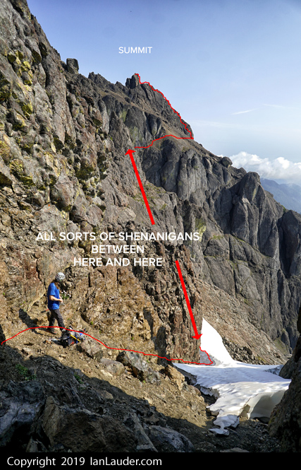
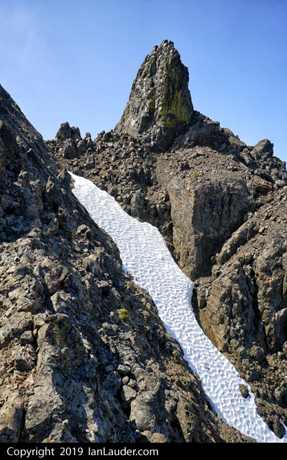
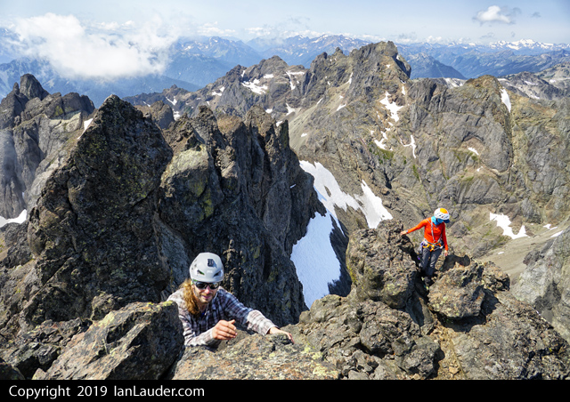
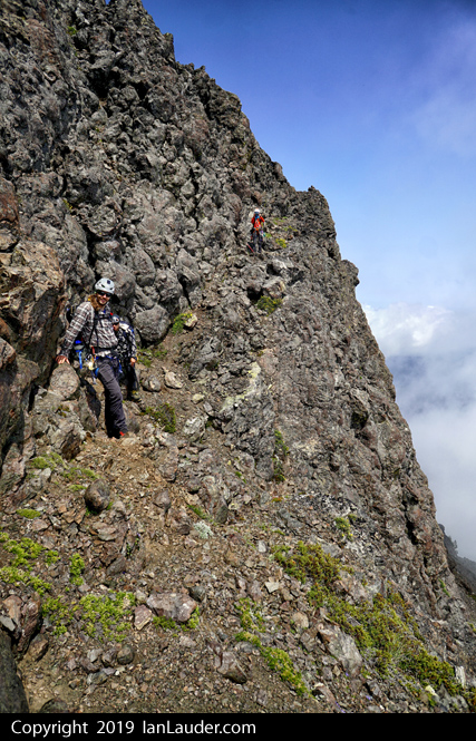
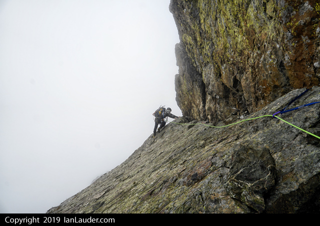
Trip: South to North Pickets Traverse- Goodell to Access Crks - Wild Hair Crack, East and West Fury, Luna Trip Date: 07/24/2019 Trip Report: Images stick with me. So much so that often I'll plan a trip around a specific place that I've seen either on a screen, a print, a slide, or in just my mind, after looking at a map. Frenzel camp is such a spot, its draw powerful enough to compel a 7 day traverse from Goodell Creek to the Big Beaver just to spend a few hours (well, a few more hours than planned) looking all around in wonder. The yin and yang of such trips, at least for me these days, is that they aren't getting any easier. Some of that is age, some of that is self-induced suffering from my own stubbornness of carrying a full frame dSLR and several lenses, NO MATTER WHAT. I cursed this decision more than a few times on this trip, but when I slip that card into my desktop and get to work, it all melts away. I know I was heard saying that I'll never do another 7 day Pickets trip, but....... This one started like most- swatting bugs, dividing up group gear, and taking swigs from a bottle of Hunter stashed in the car. Hey, this isn't the Olympics, and a whiskey morning jacket can do wonders for morale. My pack was way too large, as usual, but it turned out I did an even worse job than normal of packing food. This would be apparent on day 7 as I packed probably 4 lbs of extra food out of the Big Beaver AFTER spending the week trying to give it away. I really should be better at this by now. Anyways, the pain began.... and continued. By the time we reached the Chopping Block col I was thoroughly wrung out and cramping, trying to look as carefree as Tyler (who had climbed J'berg THE DAY BEFORE). I wasn't fooling anybody though, especially myself. So, I went off to get water for the group and have a good cry (Well, maybe on the inside, a little). Recomposed, I came back and guzzled some whiskey. Much better. Next, through the wonders of modern technology, I cheerily texted my wife to tell her how much fun I was having and that it was just an easy stroll over the ridge the next day. Oh, and maybe she could move the boat to a day later? I was going to need it. The easy stroll the next morning started with some talus side-hilling and steep snow traversing that led to more boulder hopping and a general team mutiny as we all sought a line that was superior to our teammates. Somewhere in there we spooked a bear (surprising for all involved), met a party of ladies headed to Terror ("The Terror Twins"- not actually twins), and had some fun ascending the the steep snow and "loosey goosey" rock to the Ottohorn-Himmelgeisterhorn col. Whew. Gearing up, we joked about who was going to lead the first pitch. "Not I" came the reply from General Weakness (AKA me). Tyler gamely stepped up and promptly gunned us all to the the false summit before we knew what happened, including a sparsely protected section of off-width that he exclaimed was "fun" as we all clenched our butts in solidarity. It is quite a climb though, and my hat's off to John, Silas and Russ for establishing such a gem on probably the best rock in the Pickets. Highly recommended! Next stop was Frenzel camp after the usual moaty rappel shenanigans off the col. Suffice to say, the camp didn't disappoint, it truly is a remarkable spot. I'll leave it at that. Listening to the weather radio that evening, General Weakness declared that the next day the team would remain in Frenzel camp to wait out a squall coming through. Coincidentally, it also meant that the General's load, which had to be carried over Outrigger and to the summit of East Fury, would get a tad lighter. Post dinner activities that first night included feeling sorry for the Terror Twins who we could see having an unplanned(?), open bivy on the NF of Terror (photo below). Tough ladies! The next day was spent lounging at one of the best camps I've had the pleasure of staying in, watching the weather deteriorate, and keeping tabs on the Twins as they ascended up into the mists. Packs were lightened, whiskey stores reduced, and tired legs rested. It was a great spot to spend a weather day. That night, the forecasted rain and wind arrived and we were all glad that we weren't up on the summit of East Fury. This was especially true the next day as the weather continued to linger into the afternoon. Fearing that our chances for West Fury were fading, we opted to pack up in the mist and grope our way over to the the summit of Outrigger just as the weather began to improve. It was still harder than it should have been to get off Outrigger and ascend to the summit of East Fury. The General arrived crabby and didn't relish carving out a platform in the snow, melting snow, and generally having to pretend to be a tough alpine climber. Thankfully I had one of those bourgeois NeoAir mattresses to insulate my sorry ass from the snow and provide some much needed rest. I can't imagine spending THREE DAYS up here in a flapping megamid. West Fury. Why? Well, why not? We were here, we had the time, and in the words of @Trent, "It must be climbed!". And so we did. It is actually a lot better than it looks from East Fury, but still takes some time and a rope (if you're partial to such things, as I am). I think it was about 7 hours RT East Fury to East Fury, including about an hour on the summit. We were the 20th party to sign in, I believe, but I don't think I saw @wayne in there? So maybe it was the 21st ascent? Anyway, always cool to see the complete ascent history in a register. And then it was down, down, up, down, and over, over to Luna col and the comfortable camps there. At this point a weight was lifted from the team since it was all pretty much downhill with the pigs and we were on friendly and familiar ground. Watching the sunset, listening to tunes, and chatting with a team from Salem headed to East Fury the next day was a very civilized end to a few days of ruggedness. The last few drops of whiskey sealed it- tomorrow we would set the alarms and watch sunrise from Luna. Because, why not? Well, I could think of a few reasons when my alarm went off the next morning. But I gamely tried forget all of them and keep @tylerhs01 in my sights as he streaked for the summit like a well-chiseled alpinist fired from a cannon. I failed, of course, but arrived on the false summit in time to capture the scene pretty well. Like most places along our trip, though, pictures really don't do it justice. But no matter, the summit of Luna has 4G now (??!!) so you can pretend that the pictures you're sending everyone are EXACTLY HOW IT IS, RIGHT NOW. No wonder the Luna XC zone is full most weekends in high summer. Listening to the weather radio again at Luna col, more rain was on the horizon so we broke camp and headed down into the head of Access (Axes? Pickaxes?) Creek. Again, this turned out to be a good move, driven home our final morning when I awoke to find my mattress floating in a bass pond while rain pounded on the fly. D'oh! Access creek is brushy, but at least it was going to be wet. We were long out of whiskey as well, so it was going to be a character building descent which, in the case of General Weakness, might actually be a good thing. But that extra character was never beaten into the weak General since Tyler had a gpx track that he had recorded a few weeks prior WHEN HE CLIMBED LUNA (??!!) on a casual three day romp with some family friends (a record for shortest time between Luna ascents?). We even found bits of a trail! And a couple large logs across the Big Beaver! And a freshly logged and brushed Big Beaver Trail! It was all just so reasonable, right down to the customary dip in the lake while waiting for the water taxi. I guess there is always hope that the General will get some character beat into him on the next one. Until then.... (Captions refer to the photo(s) below the words- seems to work for scrolling? Let me know if not) The Mac Spires: John approaches camp: Der Shuksan: "Has the General always been this weak?": @tylerhs01 photo of us headed up to the O-H col, on the fun part (it ended in less fun when the snow ran out): Wild Hair Crack!! Tyler gunning us up the crazy good rock: Almost at the summit of the Himmelgeisterhorn... @tylerhs01 and @Trent contemplate the drop off each side: @Trent on the way to Frenzel camp I think this is the West Peak of the Southern Pickets? I could be wrong: The top of the "Thread of Gneiss" remains unclimbed to the summit of the East Twin Needle. Will you be the one?: For the full story behind this photo (and you really need the full story, trust me), read THIS: The Terror Twins building character: While the General fluffs his pillow: Looking past Terror to the NF of the Mac Spires: Frenzel Camp: Jack as the weather comes in: Frenzelspitz: Watching the storm brewing on Fury. Glad we aren't up there!: But this is the next day and it wasn't a lot better. Getting wet and wild on the way to the summit of Outrigger: Figuring out how to get off Outrigger as the weather begins to clear. Luna behind: The team approaching the summit of East Fury: (L)Uh, does this really need to be climbed? "West Fury MUST BE CLIMBED!" Summit camp lyfe on East Fury: Well, I guess it is time to climb this thing: Auspicious start to the day, looking east from the summit of East Fury: @Trent photo of @tylerhs01 and the General leaving the summit of East Fury heading west: @tylerhs01 posing effectively: The FA party carried a brass can and this register up there. Impressive!: Much of the way to and from West Fury is better than it looks, but still requires care: I was much faster back then: Larrabee and American Border Peaks: @tylerhs01 on the true summit of Luna at sunrise: Fury at first light: Terror: McMillan Spires: Worth waking up early for every 12 years whether I want to or not: You really should go climb both North and South Hozomeen: The Big Beaver pointed right at Jack: West Fury (L) and the team walking towards Elephant Butte (R): I think I saw an old Crowder or Tabor photo from this vantage many years ago. The hook was set: Luna: Last Camp: Dark Eyed Junco with a good meal: Mount Prophet. The prominent rib on the right is known as Jacob's Ladder : Good times crossing the Big Beaver. PM me for a GPS point if you need one: Gear Notes: The full kit- ice axe, Al crampons, helmet, whiskey, etc. One 70m half rope sufficient for Wild Hair. Medium rack to 2" Approach Notes: Crescent Creek climber's path to Access Creek Climber's path. Both are getting more defined by the year. Expect Shenanigans between the two.2 points
-
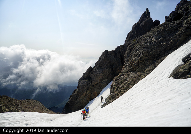
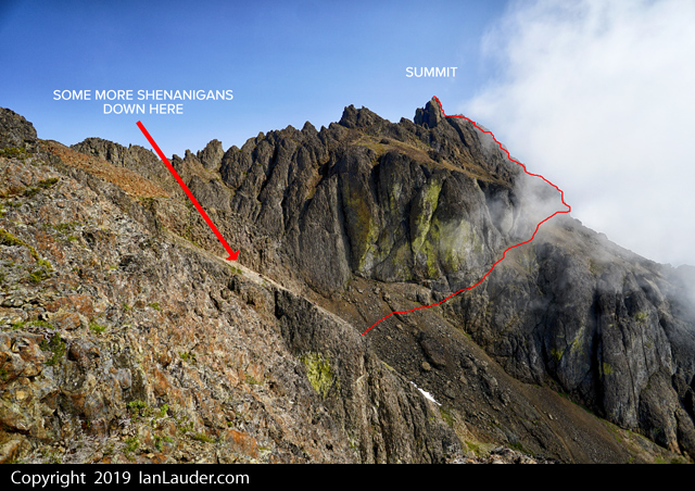
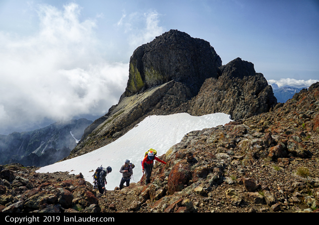
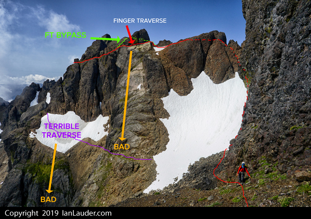
Trip: Mount Constance - South Chute & Finger Traverse & FT Bypass Trip Date: 08/03/2019 Trip Report: SummitPost wasn't kidding saying Mt Constance is one of the most challenging peaks to climb in the Olympics. Its the peak seen from Seattle that has the biggest prominence on the horizon. We did a "Leisurely" 3-day trip (24 miles & 9400ft gain) to climb Mount Constance in the Olympics. We figured it would be a 20+ hours of hiking and climbing and pushing bikes up the approach would only make the hot day hike in harder only to shave maybe an hour off the whole thing. In the end we were just fine having not brought bikes. Its a quick enough and easy hike out they really aren't needed. That said the rangers did warn us if we were taking bikes to hide them as people even 5 miles in will strip bikes of parts and just leave the locked frame behind. After picking up our permit we did the 8 mile hike and 3rd class tree root scramble on Friday to get to Lake Constance in 5 1/2 hrs. Maybe a bit slower than usual but it was hot and humid so we took our time since we really weren't in a hurry. Great campsite right at the lakes edge and not a bug to be seen. 6am start on Saturday, returned to camp 6pm. 6.5 hours up and 5.5 hours return. Great to not feel rushed trying to pack it into 2-day or even car to car. This would be a 20+ hour day trying to do it in a day and with it mostly melted out its a huge amount of boulder, scree and loose rock scrambling which would probably added some hours vs if it had been more snow covered. Did the Finger Traverse Bypass route on the way up which was some interesting navigation around a hidden ledge and chimney system around the backside of that block of rock. If you find two tiny rock bivy site rings near the start of the Finger Traverse you are pretty close to finding the drop down to a ledge that looks like it cliffs out, but if you work your way down a narrow 10ft chimney you almost have to wedge yourself into it drops onto another ledge that works its way around and spits you out on the other side of the Finger Traverse. No running water on the route once we left the camp but were able to refill water bottles from snow patches along the way and wound up with plenty of water. On the way back we soloed the first half of the Finger Traverse then broke out the rope to lead around the corner considering its a literal finger traverse with not much in the way of foot holds if you are short with a monster runout over a cliff. You can setup a belay about halfway across in a nice alcove with a boulder to sling. Then sling a horn on the way over, place a #1 cam, then around the tricky corner there is an easy to miss rusty piton as you angle back up to where you can setup a multi-point gear anchor. A solo climber we passed planning on doing the route in a day on our way out was planning on soling across the Finger Traverse but wound up turning back once he saw how exposed it was. We also saw a pair on our way out around 8:30am still an hour from the lake who were carrying light day packs planning on doing the route in a day but they were hours behind where they should have been to get out of the technical terrain before dark. If you like scree surfing coming down was a fun run down 3 long scree fields. I wouldn't want to do this route in wet conditions. We had great weather and everything was dry. I think this one set the bar for the most amount of scree, loose rock and boulder hopping we've ever done in a day. And a lot of twists and turns navigating a complex route. While it wasn't high on the technical scale its a beast stringing the whole thing together. Over 20hrs moving time between the climb and hikes in and out. Gear Notes: ice axe, crampons, light alpine rack (#1 and a couple smaller cams & a few nuts), 40m rope (the one that used to be 60m before a snaffulhound on Mt Cruiser chewed through it...) Approach Notes: boulders, scree, more scree, boulders, scree, little bit of snow patch, more scree.... don't under estimate the amount of scree, loose rock scrambling and boulder hopping once its melted out.1 point
-
Trip: Buckhorn Mountain - High Traverse Trip Date: 11/18/2018 Trip Report: Sunday was summer-like t-shirt weather in the Olympics! I took advantage and did a high traverse over Buckhorn, NE Buckhorn, Iron, and Worthington from the Big Quilcene valley. The views were incredible and the terrain was engaging albeit a bit chossy. Surprisingly, despite the traverse being well above 6000' elevation, there was zero snow on the entire thing. The difference between the Olympics and Cascades right now is significant. Approximate route: Foreshortened view of Buckhorn(s) and Iron from the Big Q trail: Marmot Pass: Buckhorn from Marmot Pass. The main peak is an easy walkup on trail: Constance, Warrior, and Inner Constance from Buckhorn trail: Mystery, Fricaba, and Deception from Buckhorn trail: View of the traverse from the top of Buckhorn. NE peak in the middle, Worthington on the left. Iron is hidden behind the NE peak. The descent off NE Peak (pictured here) was easily the crux. In general, stay on the east side and pick your way down various chimney/groove/ledge systems. It's never more than 4th class, but a rope could be useful here. Choss lovers delight: Easy slopes up to Worthington: Looking back on the traverse from Worthington. Iron Mountain is middle left, NE Buckhorn middle right, and Buckhorn proper on the right. Big Q Valley from Worthington: After tagging Worthington I dropped down on the east side and traversed below cliffs back to ~4800' on the Big Q trail to avoid any bushwhacking. A staged bike and a continuation over Hawk, Welch and all the way to Townsend (pictured here) would be a great alternative exit: That'll do summer 2018, that'll do... Gear Notes: Helmet! Approach Notes: Nice trail1 point


