Leaderboard


Popular Content
Showing content with the highest reputation on 07/09/19 in all areas
-
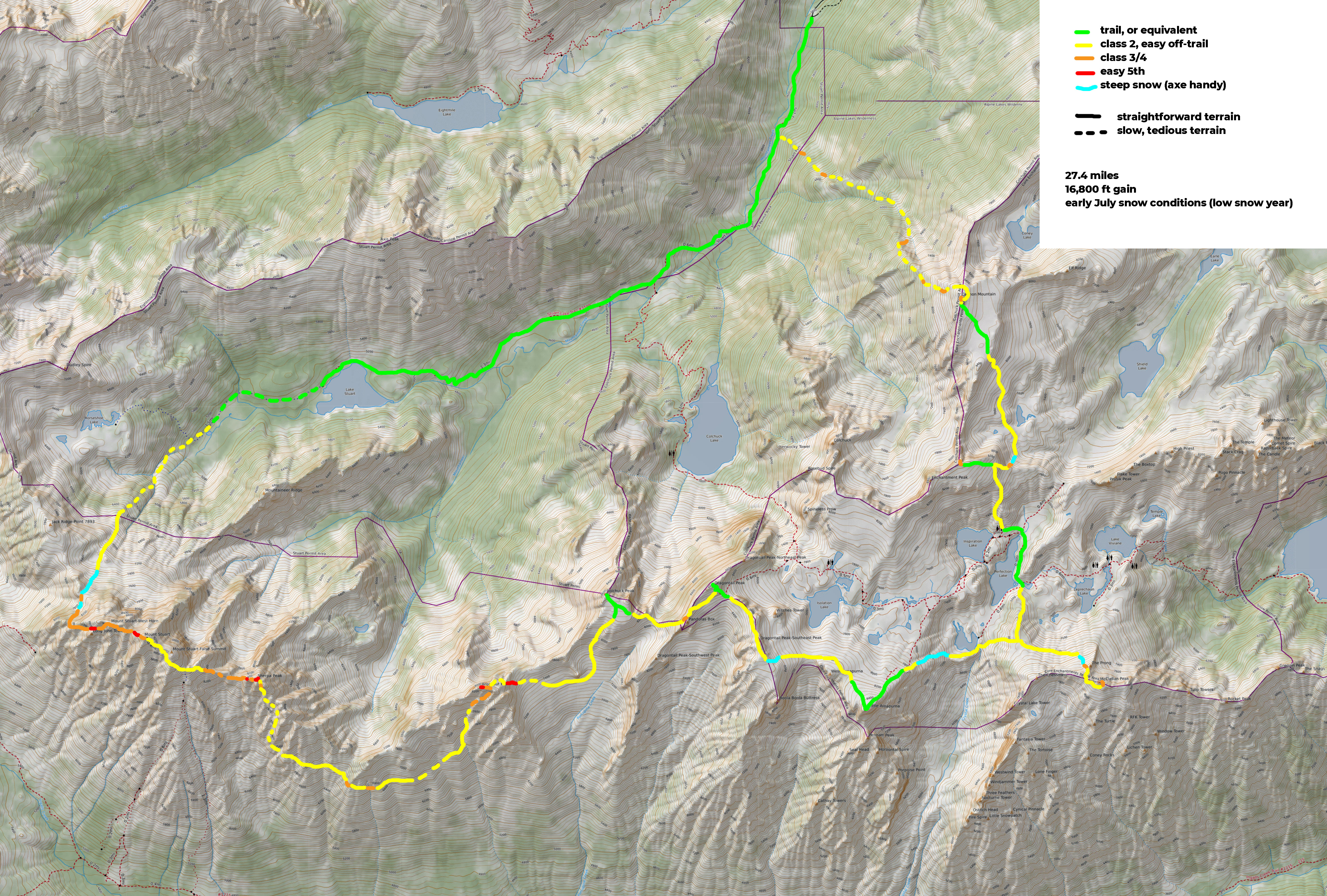
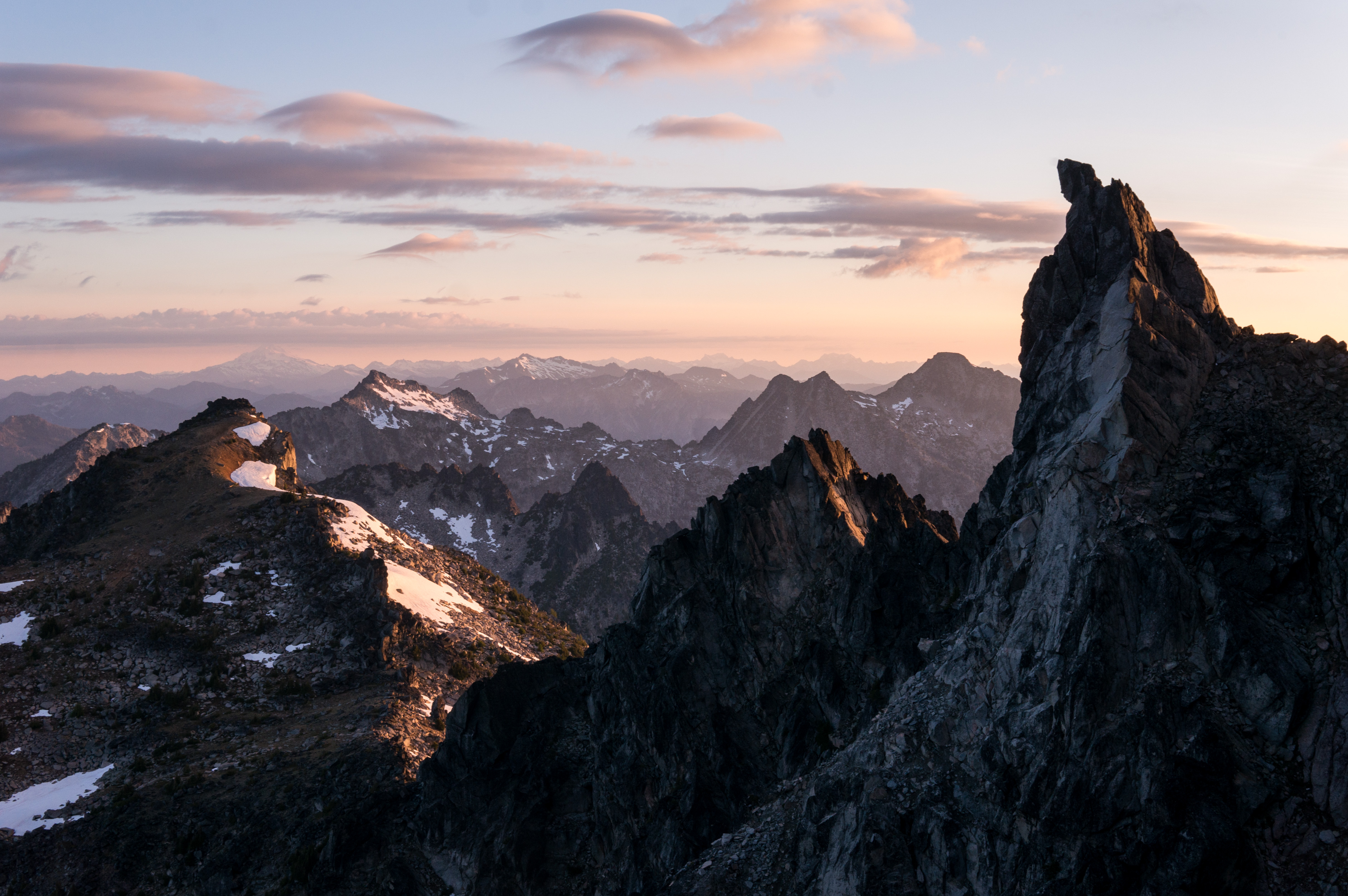
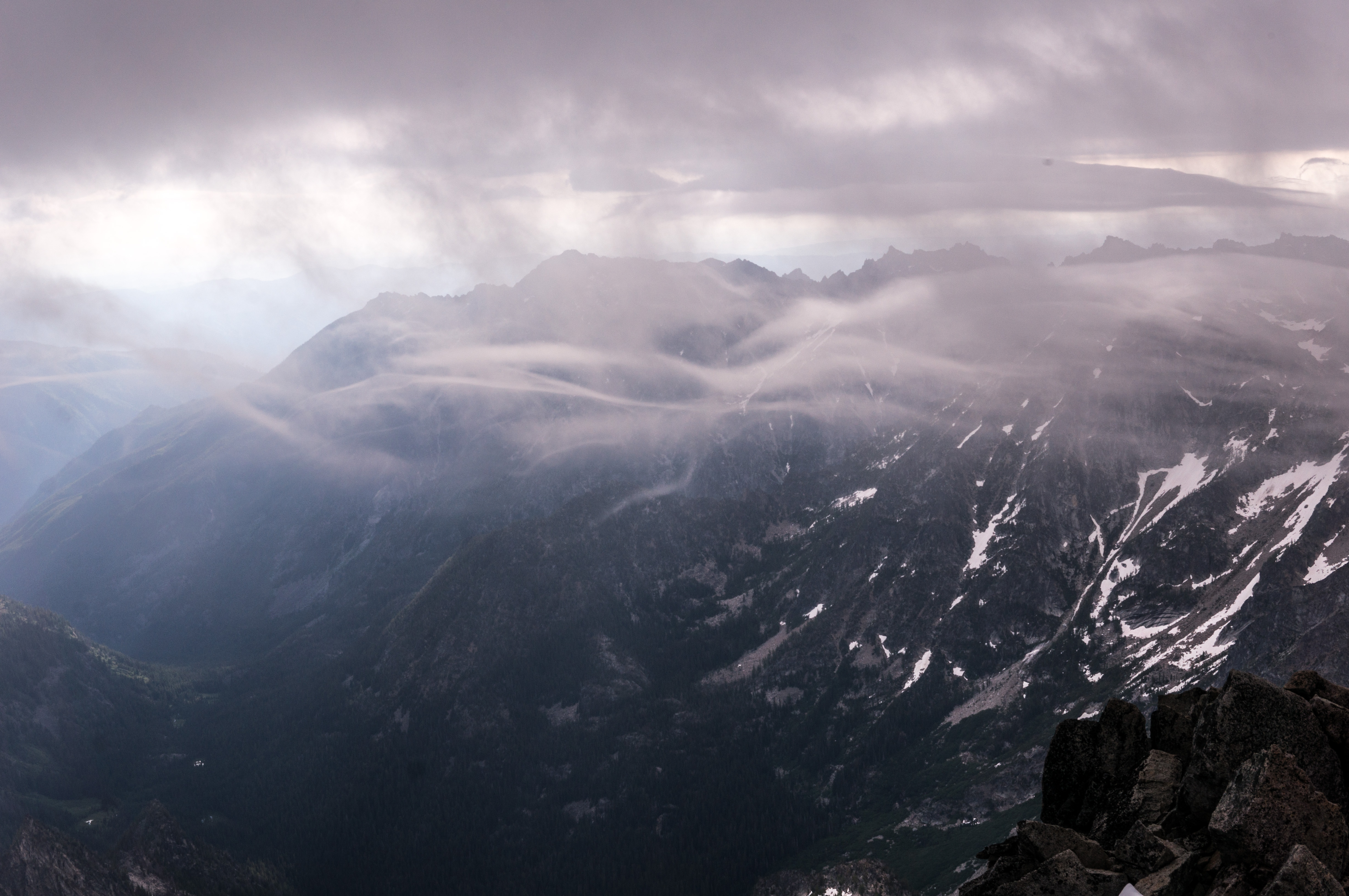
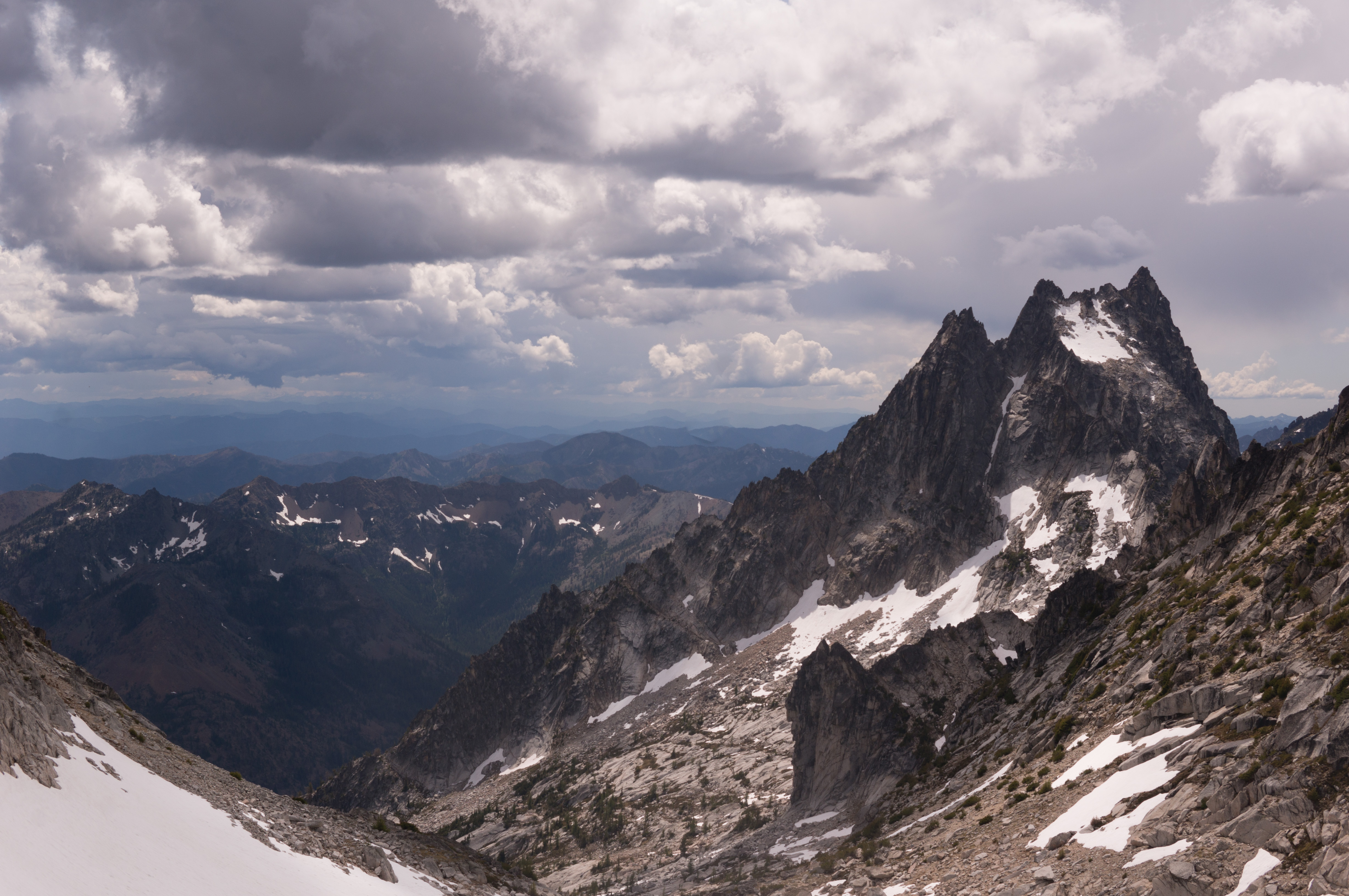
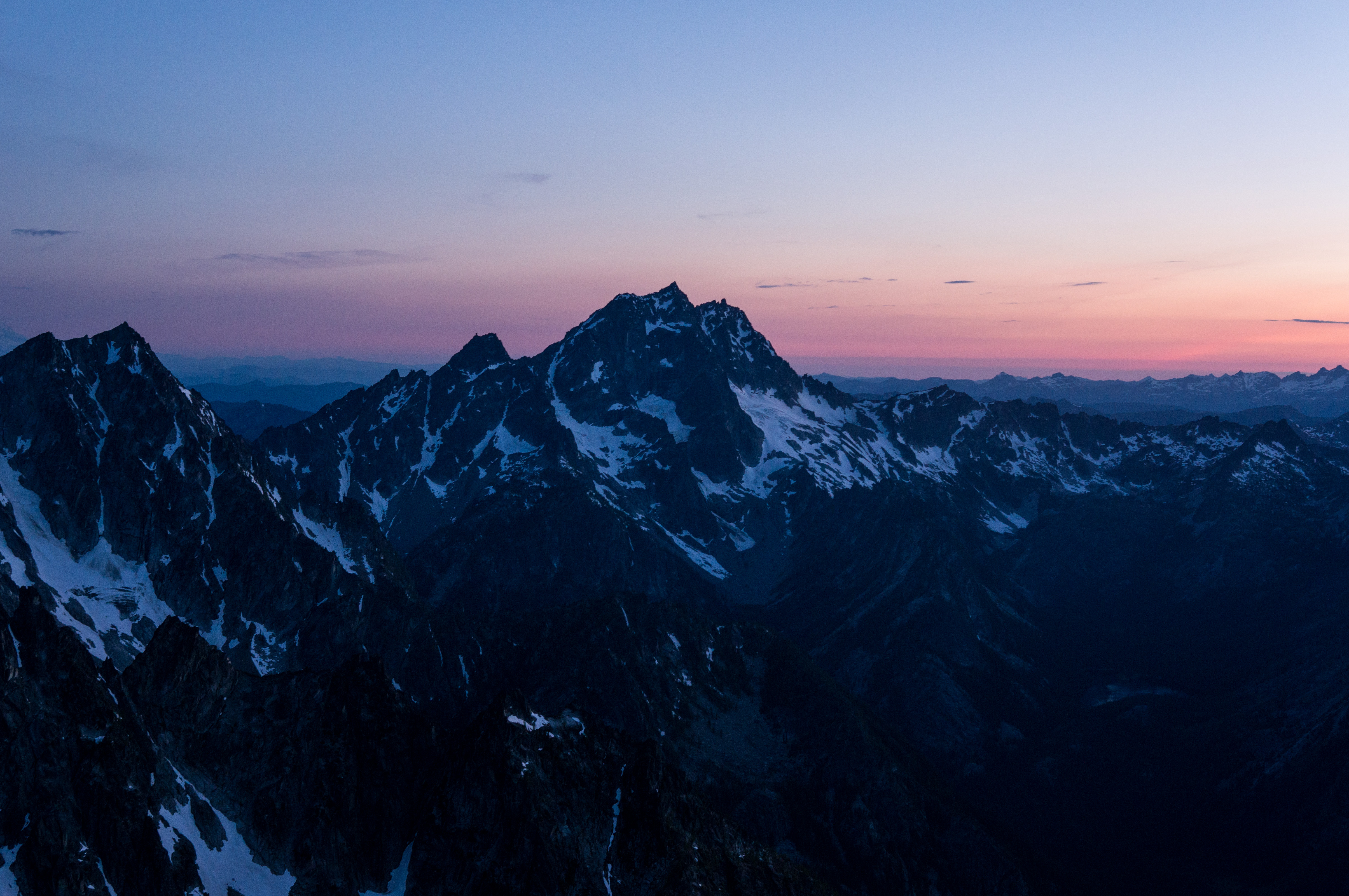
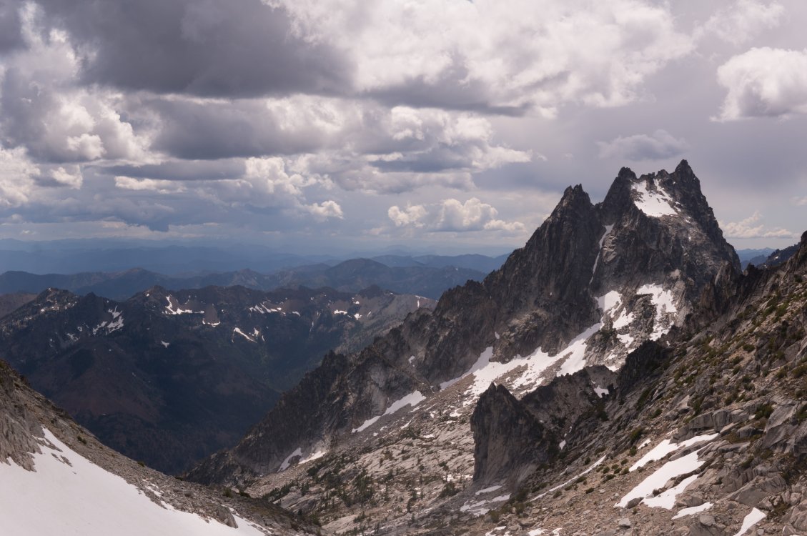
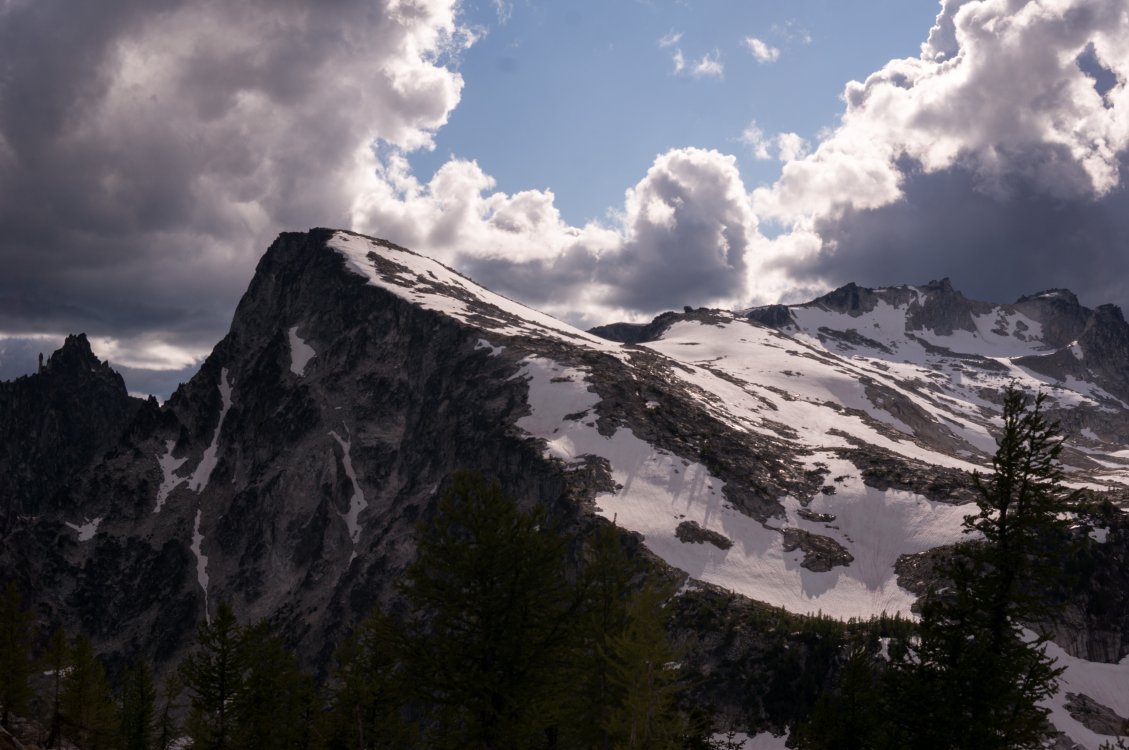
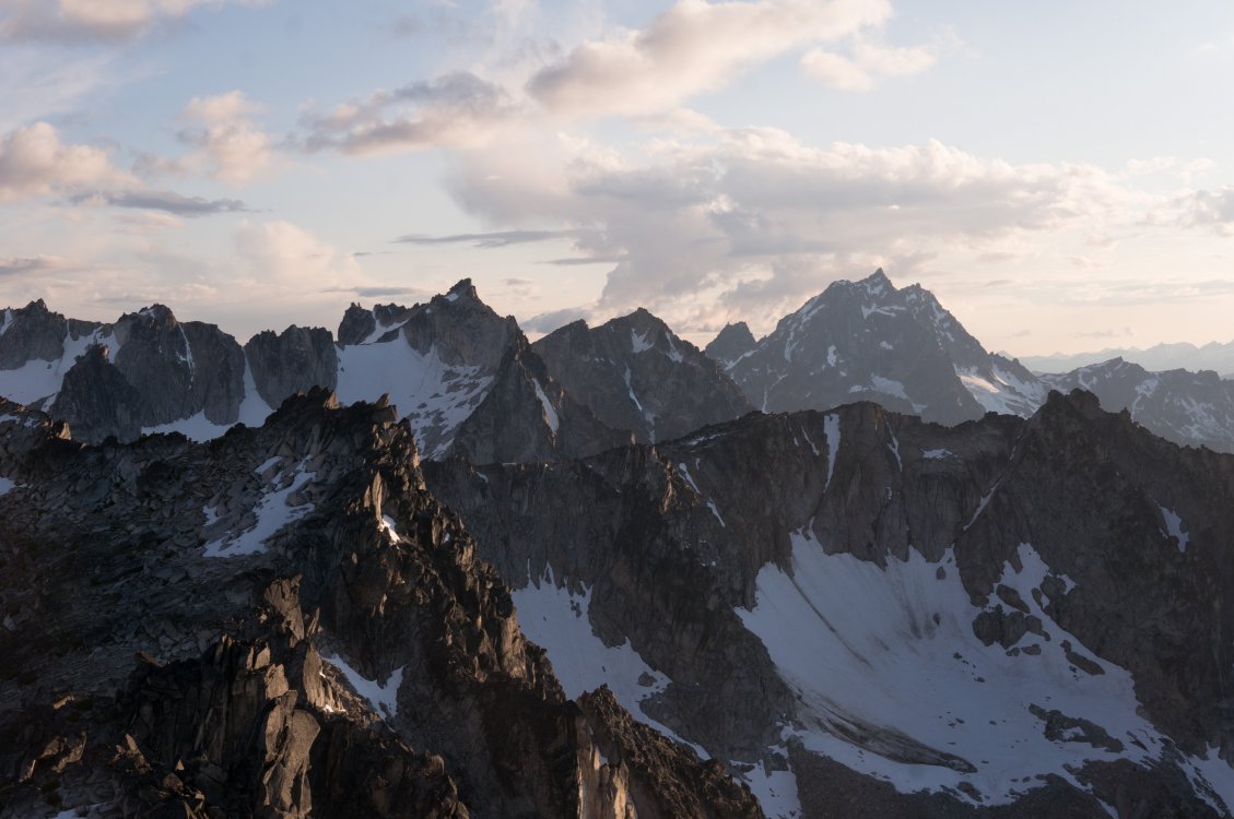
Trip: Stuart/Enchantments - The Enchanted Enchainment Trip Date: 06/30/2019 Trip Report: On Sunday June 30th, I managed to complete a whirlwind tour of the Enchantments' 9 tallest peaks. I think "enchainment" is the right word, since I did not stay true to the ridge crests like a "traverse" would imply. Ever since my route through the Core zone last summer, ticking off the 7 major peaks from Mclellan to Cannon to Argonaut (and also Prusik), I’ve been pondering the feasibility (and stupidity) of adding Stuart to the list. I'm no Peter Croft, so I'd start with Stuart's west ridge. Much route-planning was done. At first I was considering an approach from the south side, to facilitate an easier romp up Stuart, but I think the mileage for that route would be too much for my non-trail-runner legs. So I settled on the Stuart Lake approach and hoped I would be able to find a shortcut to Stuart’s West Ridge (since the West Ridge is almost always approached from the south). Jake Robinson and his buddies did a 3 day trip, ticking the same peaks and provided helpful beta. The ridge from Stuart to Sherpa is fairly straightforward, but I knew from them and others that Sherpa to Argonaut was gnarly. I considered dropping all the way down to the valley trail after Sherpa, but decided I would try a high-ish traverse to save some calf-burn. The only other route-planning decision was to drop straight off Cannon to the car. It is just so friggin alluring!! Cannon is such a slog via the normal route, and the fact that it is geographically so close to the trailhead was too much for me to pass up. Future Tyler be fucked, I suppose. I created an illustrated route overlay of what went down (with actual gpx data), using fancy color-coding and dashed lines to indicate difficulty and tediousness of terrain. (gpx file here). Cause information and maps are fun. I started my pilgrimage at 1:30am, in order to have some light once it got steep on Stuart. I pandered my way through the burned stuff past Stuart Lake and managed to ascend the slopes toward Long Pass without too much difficulty in the dark. I encountered some steep snow to get up to the 7950’ notch on Stuart’s NW face. From the notch I dropped down a bit and traversed some more snow to get to the shortcut gully. The gully had continuous snow, but I was sick of the hard snow in my cramponed approach shoes, so I scrambled up class 3 rock to the right. All in all, shortcutting the west ridge was pretty straightforward and required no technical climbing whatsoever. ^ the view back toward the 7950 notch Everyone and their uncle has posted their version of the west ridge, so I won’t dive into that. I reached el primero cumbre at 7:40am, a bit behind my self-prescribed schedule. From Stuart I meandered down the Cascadian and stepped off toward the Stuart-Sherpa Col. I encountered a short 4th class downclimb, and didn’t reach the col until 8:40am. ^ Fun clouds from the top of Stuart Sherpa’s west ridge was great fun, and I was almost suckered into a beautiful splitter crack before I more responsibly found easier terrain off to the left. I reached Sherpa summit around 9:10am, looked auspiciously at the balanced rock, and decided to save it for another day. The descent off Sherpa was quite straightforward after reading beta on folks descending from the north ridge. A short 4th/5th downclimb followed by trending skier’s left into a scrambly gully until I reached a big-ass vegetated ledge at about 8100 ft, and then more leftward traversing to a broader gully, which I took all the way down to 7200 ft. From here I began the long, much-not-looking-forward-to traverse to Argonaut. In actuality, it was not bad at all, and perhaps even vaguely enjoyable! There are some huge swaths of granite on these high slopes, many of which are littered with fun knobs for easy scrambling. The rest of the terrain was quite straightforward goat-trail meandering. Time-consuming, but not god-awful by any means. I eventually reached Argonaut’s southern gullies and ascended easy terrain until right below the east ridge where I climbed a probably unnecessary section of easy-5th. From there I scampered to the summit (at 12:30pm), with a bit of apprehension as storm clouds began rolling in. From Argonaut, I descended a rap route on the east face, which I had done the summer before. I had found some unused webbing/rings on Sherpa, and used the rings as a nut placement to aid down a somewhat tricky section near the base of Arg (for the next party wondering what the heck is going on there). From here, spirits were high, as I knew I had completed most of the tedious stuff and would be on fairly well-traveled terrain for the rest of the day (not including the hail-mary off Cannon at the end of my route). ^ Looking back at Argonaut A few splits: Colchuck – 2:30pm Dragontail – 3:40pm Little Anna – 4:30pm Mclellan – 6:20pm Enchantment Peak – 8:10pm (I only tagged the NE summit, which may be lower than the SW?) Cannon Peak – 9:40pm ^ Into the core... ^ Stuart & friends from the Enchantment Peaks ^ Stuart & Enchantment Peaks & friends from Cannon Managed to top out on Cannon with a bit of light to admire a hard day’s work (damn Stuart looks so far away!) From Cannon I was feeling pretty good about making it down before my 24 hour goal. After all, the car was only 2 miles away… In the weeks prior, I had done some route-planning using satellite imagery and a topo to figure out the least-bushy way off Cannon. This was helpful but not a perfect solution to the hell-hole that is the 5000 vertical feet of bush, dirt, rock, bush, scree, and bush. Maybe I’m exaggerating, as I was quite delirious at the time and it was dark. The first 3,000 ft were fairly straightforward, with a few cliff-bands to avoid but mostly loose dirt/talus. The next 2,000 ft of vert went from bad to worse. Many cliff-bands were not hinted at by my topo map, and where I had previously plotted a viable line through rocky terrain (while comfortably sipping tea in front of a computer at work), was not actually viable terrain. So into the bushes I went and I didn’t arrive at the trail until around 1:00am. From the trail it was a short, but damn-did-my-feet-hurt, hike to the car. Roundtrip was 23 hours and 35 minutes, 16,865 ft of gain, and 27.4 miles. Frankly, those numbers seem pretty small considering, which I attribute to all the little (and big) shortcuts I connected to make quite an aesthetic loop through some beautiful country. I hope some of this beta is helpful for those looking to enchain some peaks out there or just get some damn good exercise. Gear Notes: Axe, crampons used. Approach Notes: Stuart Lake


 1 point
 -
Trip: Sahale - Sahale Glacier/South Face Trip Date: 06/30/2019 Trip Report: We (team of 3) arrived at the trailhead around 6am and got moving a bit after. Immediately there was a bear on the trail, and it cut a few switchbacks staying near us as we made our way up. Made it to cascade pass in just over an hour, crossing a few small snow patches, and up to the base of the Sahale glacier by about 9:30 or 10am. Between the pass and the glacier we saw a ton of goats. We ate some food and then roped up. There was one open crevasse on the glacier. We started up the glacier, traversing NE, then NW up a short section of easy snow and arriving at the base of the south face on the pyramid. I started up with the rope and scrambled up and slightly right to the base of a corner with a crack which leaned to the left. This looked harder than the 3rd-4th class I was expecting. I had brought some gear and there were good placements all around, so I climbed straight up the corner, jamming my boots into the crack a few times, passing a sketchy weird fixed sling around a chockstone. I felt this went around 5.5 for 20-25 feet or so, and I was happy to have the pro. The rock in the corner was okay, but there was plenty of crumbling rock on the faces around it. After this, I hit a ledge and there was one more awkward move to the summit. We had climbed essentially slightly to the climbers right (5-10ft) of the rappel route. A single rappel with a 60m rope barely brought us right to the base where the snow ended, and we were back at the car by 4pm. Sahale: On route: Forbidden and Eldorado: Gear Notes: BD 0.75, #1 Smaller to med nuts 4 draws Approach Notes: Bear1 point
-
https://cascadeclimbers.com/forum/profile/20452-donnybaker/1 point