Leaderboard
Popular Content
Showing content with the highest reputation on 10/19/18 in all areas
-
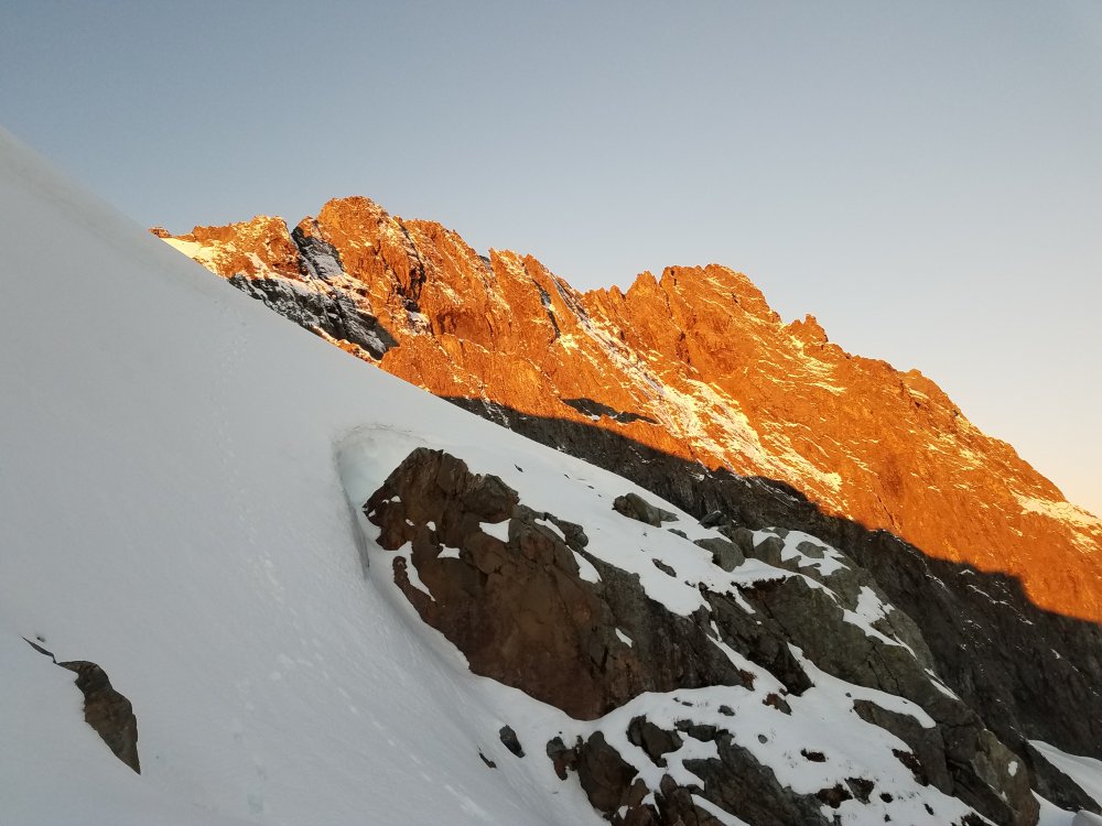
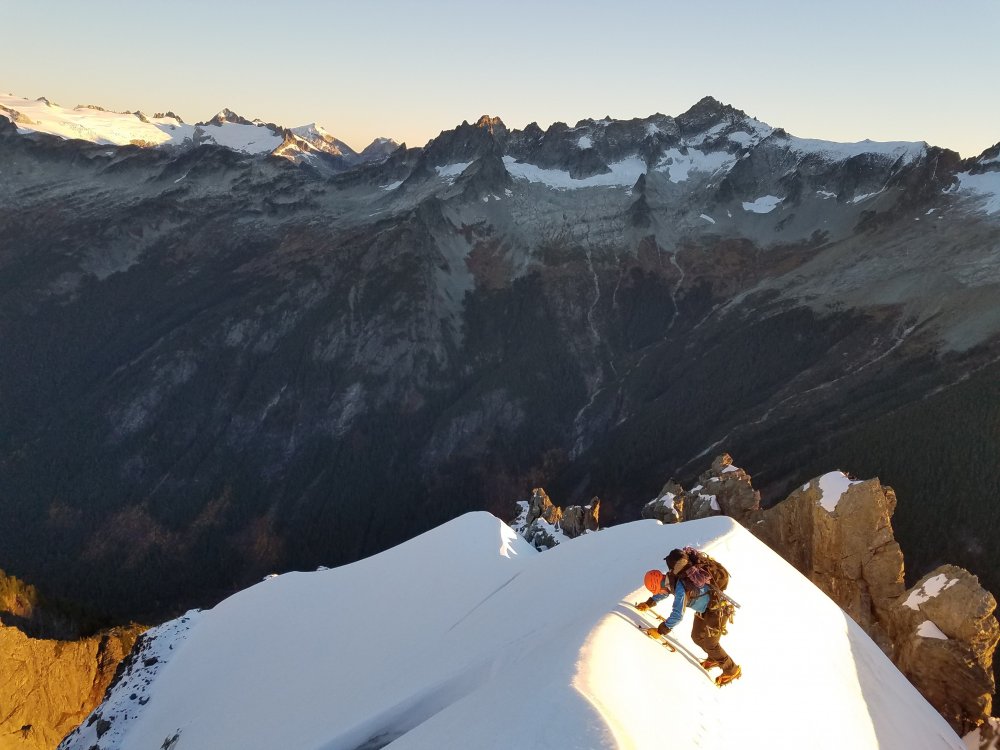
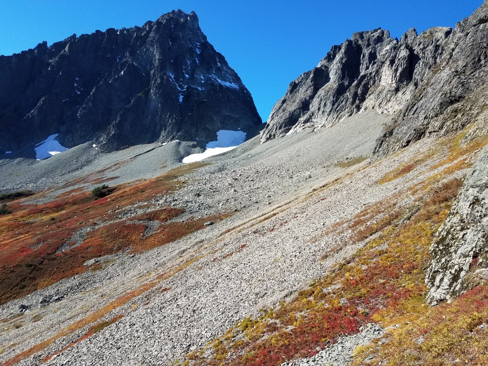
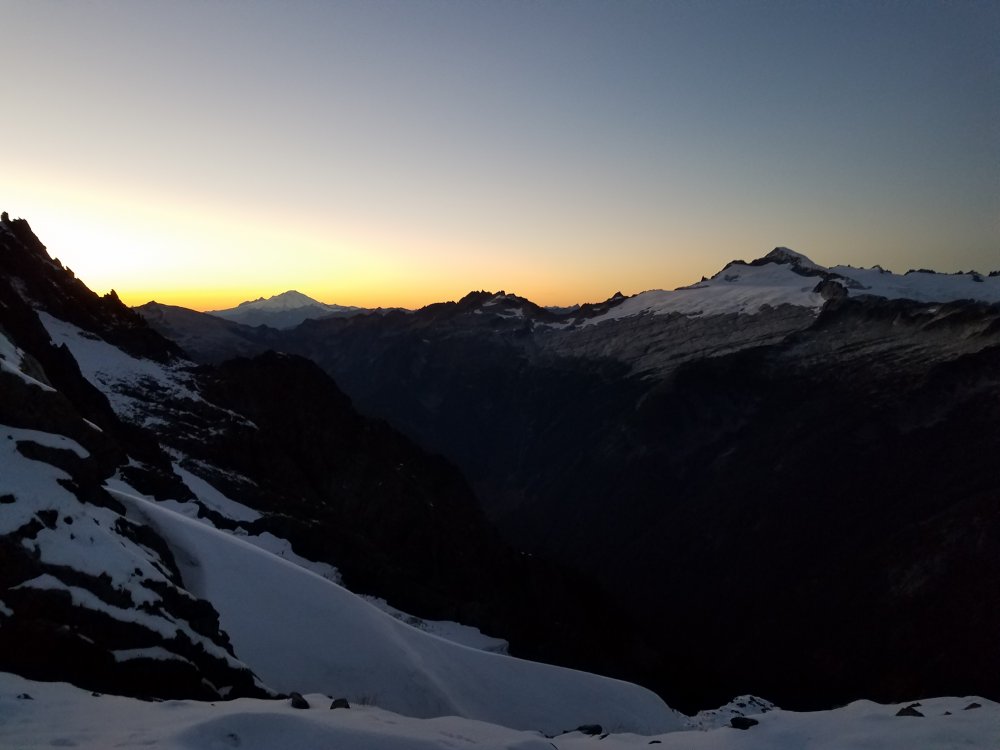
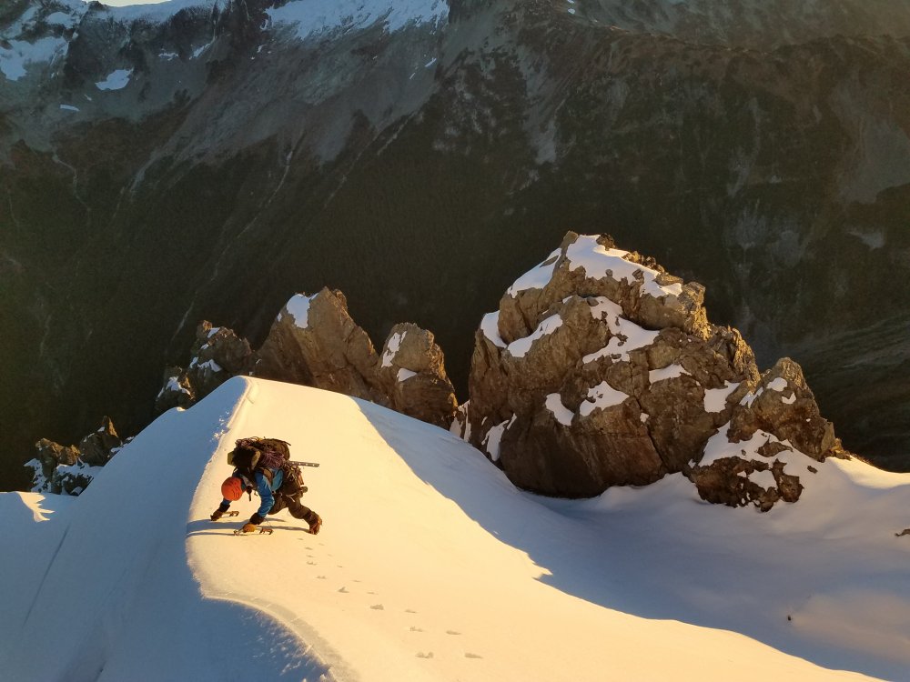
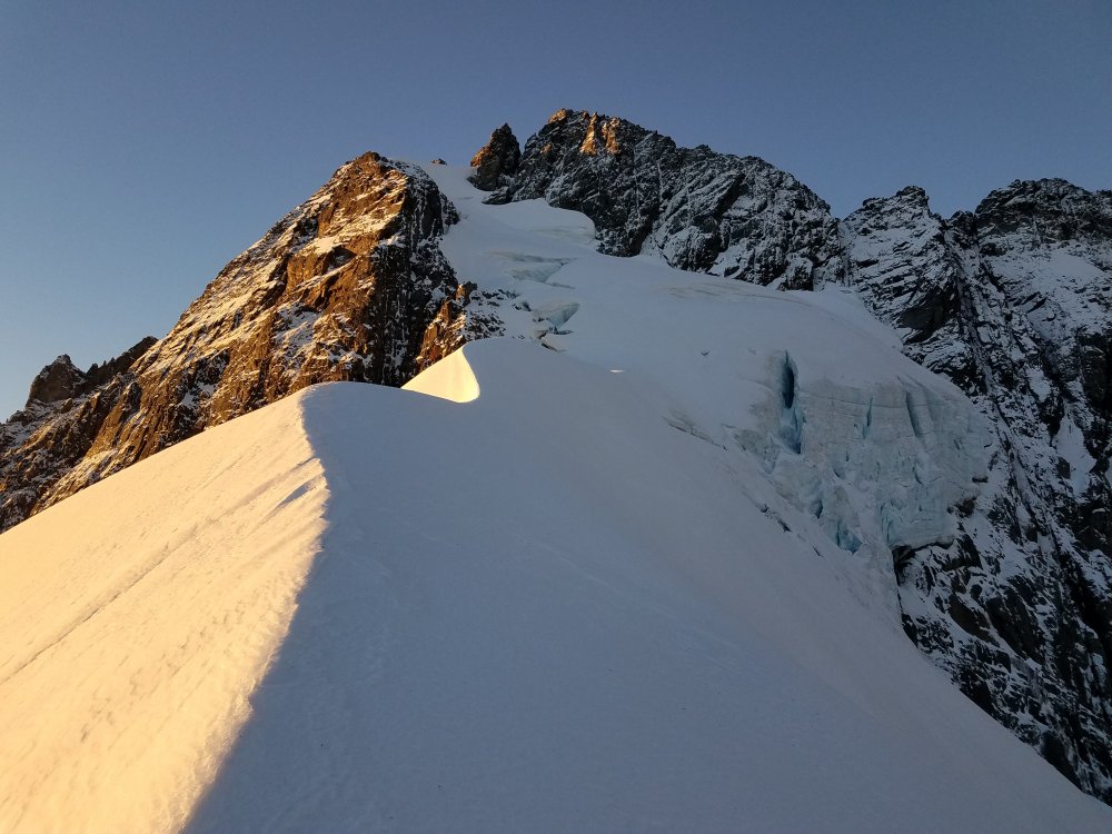
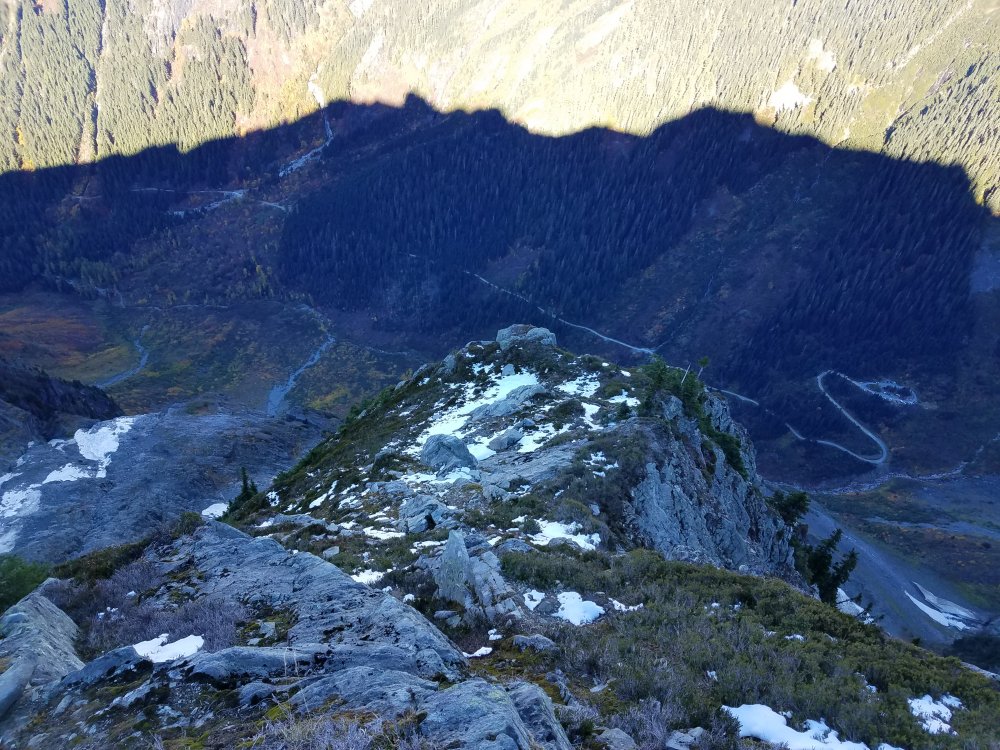
Trip: Johannesburg - NE Rib 1957 Trip Date: 13-14 October 2018 Trip Report: started 715 Sat AM from the parking lot. took the lowest start posible, scrambling a few hundred feet before a 100m roped pitch into the trees. lots of unroped climbing before realizing we were too far right. we did another roped pitch thinking we'd be out - wrong. a single 30m rappel down and skiers right put us back in business. a long stretch of unroped climbing into a gullet. roped back up for a few of the moves and that deposited up on the main ridge's shoulder. this was the large climbers right trend in the topos. lots of steep vegetated climbing and steep exposed climbing brought us to a short (10m) knife edge ridge crossing - officially out of the shit. this is where you could drop into the gulley to climb up to the bivy or stay on the rope. gulley obviously looked nasty in October. we scrambled another short distance to where we needed a rope. either the ugly offwidth or the steep face up and right. not entirely sure if the face is what others had chosen, but it's what we opted for. it was a little hard down low, but opened up nicely. we hauled packs on this particular pitch. from that beltway we were a 150m pitch then a 45m pitch to the bivy site. arrived around 530pm - just under 10 hrs on the route. no running water for us, so we went ultraconservative with fuel only melting water and saving some fuel just in case. we were treated with an awesome sunset and sunrise. we were nestled between the snow and the rock and stayed protected from the wind. next morning we were moving by 745am and summited around 920am. glacier was very simple all things considered. snow arete was very cool and truly unique. started to descent around 10am, opting to downclimb vs rappel. some serious exposure on sometimes pretty delicate climbing. we were pretty close to the top, only dropping to maybe 100 feet below occasionally and not for very long. we reached the main descent around noon. on the main descent we made one anchor for a belayed downclimb relatively high up, then lots of downclimbing snow and rock until an obvious rappel station. this was a real rope stretcher (full 30m) to a subtle ledge skiers left of running water, we loaded about 1.5 liters knowing we'd get more soon - it was euphoric to get nice cold water. more snow and rock brought us to a second obvious station, going skiers left. another 30m with some downclimbing and we were onto a broad apron. traversing skiers left, going more directly to C-J Col, we found three more rap stations, plus a lot of downclimbing. we reached the col around 230pm. we were moving quite slow. after quickly adjusting layers we were off to Doug's direct and searching for water. we were at the top around 5pm and made fast work down to the 6k foot level. here is where were made our only route finding mistakes: dropping too low too early twice. this cost us probably a at least an hour. we then got back on track and were to cascade pass by 8pm and the TH by 930pm. all in all, full value route that was surprisingly straightforward. I'd do it again. Gear Notes: single rack to 3in was nice to have, 60m rope was shortest we would have wanted Approach Notes: short, or long, depending on your perspective2 points
-
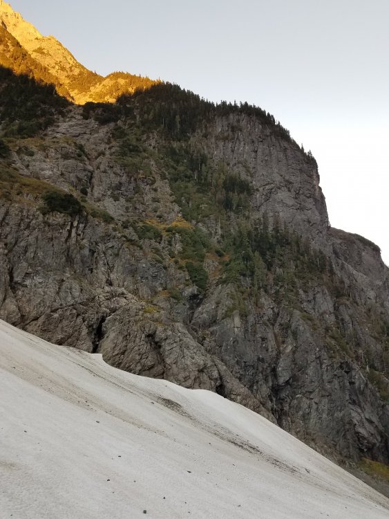
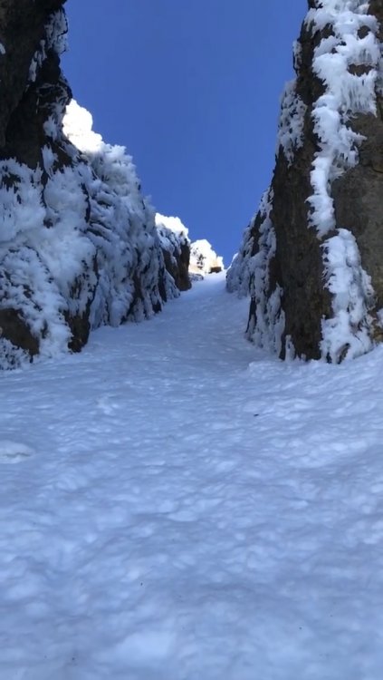
Trip: Washington North Cascades - West Ridge of Colfax Peak Trip Date: 10/06/2018 Trip Report: With a minor storm dumping snow and quite a few days with sub-zero temperatures, Paul and I headed from Squamish down to Baker to try the Cosley-Houston Route on Colfax. We endured the Friday evening traffic to Sumas and then blasted on to the Heliotrope Ridge TH and bivvied in the back of the truck. Our alarm went off at 0500 and we were on the trail at 0545 by headlamp. We transitioned to boots at the toe of the glacier and immediately started dodging thinly bridged crevasses up to the football field and beyond. One major detour and a pitch of steep neve climbing and we found ourselves at the base of Colfax. The crux on the CH looked a bit too thin for our bravery levels and we weren’t sure how the snowfields above would be - we were a bit worried we'd find fresh pow over kitty litter. So, feeling a bit dejected, we decided to go have a look at the view towards Lincoln Peak from the col and get a photo of Ford’s Theatre. Crevasses were well hidden and a hassle: We noticed the West Ridge looked pretty chill and that aside from a rock step, it might give a reasonably quick access to the snowfields above the CH crux. So we decided to go for it. One mixed snow/rock simul-pitch took us onto the ridge crest (amazing views of Lincoln Peak). A second pitch got us up the ridge to a rock step. It seemed unlikely but a 10m downclimb on the E side dropped us into a perfect SW facing snow couloir with super cool rimed up rock walls. One pitch to the top of this and back onto the ridge crest and we were at another difficult looking rock step. Instead of taking the step, we delicately traversed to a snow ramp and a 20m downclimb to the top of the ice of Ford’s Theatre. From here we followed the route and simuled up perfectly crunchy snow to the top of the CH. Paul doing the downclimb into the convenient SW facing couloir: Descent was via the normal route with one rappel and a MAJOR detour around a full width crevasse on the Coleman at 2650m. More photos attached at the bottom. It would be hard to believe the W Ridge hasn’t been climbed before but I have no idea. Seems pretty unlikely that no-one has wandered up like we did. It would be interesting to find out if anyone had finished the W Ridge directly without bumping left over to the CH snow slopes as the rock walls above us looked serious enough that we didn't give them a serious look. There's probably a way through though! Route: Gear Notes: We used one stubby screw in rime ice, a handful of cams and pins and, actually for the first time in my life, used a picket as pro (and was kinda glad to have it). Approach Notes: Standard Heliotrope Ridge/Coleman Glacier1 point
-
Trip: McMillan Spire - South Face to West Ridge Trip Date: 09/28/2018 Trip Report: The idea first occurred to me last spring, during a casual jog around Green Lake. Solo trip to the Pickets. I’d been in Terror Basin once before, in 2014, but our packs were too heavy (camera equipment and booze), our route finding skills abysmal (lost the trail, twice), and our timing wrong (hiked into a storm front). Now, with a toddler at home and a heavy work load, light and fast was paramount. But my summer was full of other adventures and commitments. By the first heavy rains of mid-September, I’d almost given up on the idea. Then a one-day weather window opened on Friday 9/28. I was in need of a raw experience, and decided to act. After a long day at work, I pulled into the Goodell trailhead at 10pm on Thursday night and started hiking. I forgot to check the batteries in my headlight, and suffered under a dim bulb for the first 4.5 miles of overgrown trail. The number of spiders at this time of night was truly frightening. I took hundreds of webs to the face, finally calling it around 1am at the base of the great big hill. The upwards slog began at 7am. Unlike my previous trip, I was rewarded with increasingly spectacular views as dawn broke over the North Cascades. After the first 4000 feet, I “took my time” traversing the heather bench, occasionally stopping to pick the last ripe blueberries and photograph mountain goats. Dropping into Terror Basin from the notch is an exhilarating experience -- the abrupt face of the range in your face, glacial rivers pouring down polished slabs, big talus fields erasing any hope for a trail. It’s even more spectacular you’re the only one there. With no other cars at the trailhead, and a storm scheduled to arrive Saturday, I was blissfully alone. I dropped my pack at Terror Creek, directly below the southern face of Inspiration. When I climbed that peak in September of 2014, the glacier was significantly more established. Anecdotal evidence of a trend that is sure to worsen in the coming years. This trip I headed for McMillan spire. The typical approach takes a snow tongue that traverses under an unstable looking cliff. It was littered with rockfall. Without a helmet, I made the decision to take a different route up the lower part of the south face. It appeared that a few fifth class moves would be required, but I’ll trust my climbing ability over objective hazards any day. The route turned out to be relatively straightforward, and I gained the west ridge 1/3 of the way up. The west ridge itself is more of a hike than a climb, besides a few interesting moves over the final 100’ of summit blocks. But the views couldn’t disappoint even the most cynical. In fall, the lower valleys are filled with bursts of red and orange. The north side of the southern pickets were already covered with a thin layer of snow. There was an eerie calm floating in the air: the last strained grip of summer before winter’s relentless blast of snow and ice. Truly incredible. I spent the night atop a rock perch in the middle of Terror Basin. After a peaceful sunset, the weather rapidly deteriorated. Without a tent, I was blasted by wind the entire night and hardly slept. I began the hike out at 5am amid dark clouds. The rain hit at 7am, and I was soaked and cold by the time I reached my car at 11:30am. Gear Notes: Approach shoes, aluminum crampons, axe Approach Notes: Strong legs and a desire to suffer1 point
-
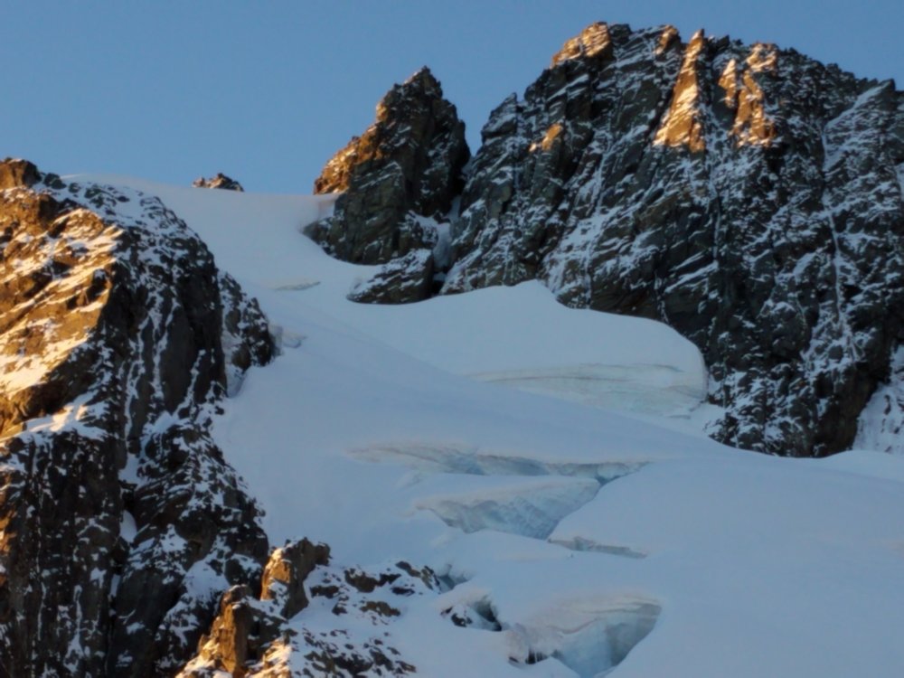
Trip: Colfax Peak - West Ridge Trip Date: 10/14/2018 Trip Report: Brief TR and pictures from the west ridge of Colfax yesterday. Huge thanks to Eric Carter for bringing this line into the light and being willing to give a go beta-less. We had his beta so it was perhaps a less stressful endeavor. Sunday morning we looked at the C-H, hoping it would be in, but expecting it wouldn't be, and it wasn't (but getting there). So we wrapped around Colfax (on a pretty major boot pack) to take a look at the west ridge. With hard snow and a fun looking line we started up, following occasional faint boot marks from Eric's party. We opted to solo as we both felt comfortable with the positive, stiff, snow. Climbing was straight forward and very fun up the first steep section to gain the ridge, steepest slope was likely around 55-60 degrees. We followed the ridge to a rock face and saw the snow couloir down to the south, we tied an equivocation hitch, rapped into the gully, pulled and coiled the rope, and continued up. The gully was very easy, perhaps 45 degrees on great snow and steepening up to 55ish near the tight exit with some alpine ice. Here we followed the cliffy headwall left and after a steep soft down-climb into the upper chutes of the C-H (probably the scariest part of the climb, but would be easy to protect with pickets). From there we followed the standard route up to the summit, encountering our steepest climbing (65 degrees? Maybe a few steeper steps? Never actually measured) and a mix of hard snice (snow/ice), breakable crust over powder, and more stiff snow. We had a blast as we wove our way up the chutes toward the top. We must have had our heads down as we climbed because about 150ft from the top we missed an obvious left hand gully that has an easy top out. Instead we ended up with 15 to the top of very steep snice and rime covered rocks, we pitched this out, and Peter lead us to the summit plateau and belayed me up. Route took 3hrs bottom to top only stopping to rappel and pitch out the last section. We descended the East ridge (one rap on good tat) and had to end run a crack on the Coleman all the way to the east, long detour, just as Carter mentioned. Lots of new snow up there but with cold temps things stayed solid and we never punched through any cracks. Colfax ice, sorry no better photos, upper curtain on C-H is not yet fat enough for our ability. Looking at the start of the West Ridge Missed everything until we were in the couloir Sorry I didn't get many photos, here is the first stretch of the upper gullies of the C-H Next 2 photos we are already too far right to have an easy top out Baker, large y shaped crack requires an end run to the East One short rappel on tat to get off the east ridge and to the col between Baker and Colfax Long afternoon shadows as we near the trail Fun route, deserves more ascents!! If I were to grade it I'd say grade 3, steep snow 65deg ?PG13?. Not sure this route would always get a danger rating, would depend on what the gullies do in the spring, maybe they'd be easier to protect and slightly lower angle. Gear Notes: Brought screws, pins, cams, and nuts, used none. Approach Notes: Heliotrope trail1 point
-
Trip: Northern Chiwaukum Range - Chiwaukum Brush Battle Trip Date: 09/23/2018 Trip Report: After plans changed last minute, I had to search for a solo trip idea for Sunday. I really didn't feel like driving super far but weather looked suspect on the west side of the Cascades once again, so I figured the Chiwaukum Mountains would be a good compromise. I scratched together a rough idea: park at White Pine TH, take the direct route up the ridge south to North Chiwaukum, descend to Larch Lakes trail, from Cup Lake ascend to the summit of Big Chiwaukum, descend by the Grace Lakes and down the Wildhorse trail back to the car. It would include peaks, scrambling, pristine lakes, and lots of fall colors! Well, it had most of that, and some more I didn't ask for... I had only heard of the direct route up to North Chiwaukum in the winter, but I can verify it works when in not snow cover too, as long as you have a tolerance for thousands of feet of steep (and in my case, terribly wet and slippery) brush. All the downed leaves and branches were slick from a storm the night before and I sometimes had trouble gripping. Poles were helpful. The first bit was the worse. There was a brief moment when I began to reconsider my decision in a thicket of Devil's club and downed trees. I then realized I had to embrace the futility of all my actions to find peace with my struggles. The zen of bushwhack. Around 4200 ft the ridge got less steep and a faint climber's trail appeared at times. It kept getting better and eventually, close to 6000 ft, I got my first views of the valley nearby. At this point, I was thoroughly soaked and a cold wind was blowing over the ridge. Pretty soon the trees were covered in rime ice. It was cold. The cold had advanced the stages of the larches to a nice yellow behind the icy covering. When I got to the ridge at 7000 ft, it was full on gnar. No trees for protection, just barren icy tundra. I tagged the summit of North Chiwaukum 3 hours in. The (imaginary) views were exceptional. As I contoured toward the saddle to the SE, I dropped beneath the clouds briefly and was treated to a beautiful little basin with sparkling ice covered larches! There indeed was hope. Stepping over that saddle in the raging wind, I was treated to an incredible spectacle: raging clouds spilling over the Chiwaukum Crest, Larch Lake surrounded by yearning larches who in short time will earn the status of golden, and carpets of red, yellow, and orange sprawling across a deep valley. It made me want to cry. All was good. I descended through a short scrambly section and then started to weave my way down the path of the least resistance. This quickly became the path of greater resistance, as I got sucked into some nasty alder and had to burrow through a creekbed for a good 15 minutes to get out. When I finally reached the bottom of the valley, and looked back, I saw that there was an easier path climber's right. I went down more with the streams in the middle. Finally on a trail, I had a nice stroll to Larch Lake and was even able to jog a little. The larches were just getting going and in another week they'll be in their prime. I filtered some water and appreciated the lake. It was Enchanment like! Great granite walls and larches studded all the way up the mountainsides. I then proceeded a few hundred feet up to Cup Lake. Here, I met one family, the only party I would see all day expect for close to the White Pine TH. We were once again socked in the clouds and it even hailed a little. I explained to them my plan and that I at least had to get over the crest somehow to get back. I think they took pity on seeing a skinny boy with such a tiny little vest pack in such poor conditions. I had counted on "Partly Sunny" by the afternoon as NWS promised, but it seemed things were going the other direction. I was doing fine on time, just over 5 hours in, but with the poor visibility and a dying GPS, I wasn't sure about continuing to Big Chiwaukum. I knew that once I entered the clouds I wouldn't be able to see more than a hundred feet and there was a lot of tedious terrain in front of me, so I made the decision to pass on it and instead go back over Deadhorse Pass. I didn't know anything about the route over Deadhorse Pass, but if a horse made it up (and then died) as the name suggested, it couldn't be that bad right? Still, the pass looked suspiciously steep on a map and I got glimpses of cliffs through the clouds. I got a compass bearing and started up towards the pass in minimal visibility, but cliffs kept pushing me right. I was getting a little concerned, but then out of the darkness on the left emerged a cut through the cliffs: a passageway! This gully looked loose, but would hopefully go. It was pretty easy down low, but got pretty loose and insecure up top. The fresh rain had really stirred the soil up. Still, it wasn't as bad as the Mountaineer's Route on Whitney (sorry, California, your "classic" route might be the worst scramble I've ever done) after two weeks of continuous afternoon thunderstorms. I topped out and was greeted with a blast of cold wind. If coming from the other side, there were a few other similar looking gullies, not sure which one is the right one but they all look kinda spooky from the top: I headed down from the pass pretty quickly. It was pretty eerie. It got super still as I walked through this spooky basin. Watch out for the shadow-creatures appearing out of the mist. Or the wet bushes trying to soak you. Let's be honest, hypothermia is the real threat in the Cascades. After this flat basin, I was greeted with a bunch of steep cliffs and unattractive gullies. I inspected four or five of them like an unimpressed suitor before settling on the one that seemed "least ugly". It was class 2, but weird loose, slippery class 2 that had me maybe more uncomfortable than I was when I free soloed the West Ridge of Stuart. I don't know, maybe I'm just getting old. Finally being of legal drinking age will do that I guess. From here, the fun wasn't over. As I got lower, the brush got thicker and thicker once again. And this time, I really got soaked. Not like, mama I peed my pants damp. Like, Mommy I fell in the toilet wet. My pants actually clung to my skin, they were completely soaked. I was getting pretty tired of this brush, but I guess it was my own doing. One thing about solo trips is you have no one else really to blame for your follies. It's nice to be self-reliant but it's also nice to have a scapegoat (and partner for support and safety, of course). I generally trended skier's right and felt like it sorta worked. After about an hour, I finally found a climber's trail. My speed greatly increased and then at about 4900 ft, I hit the Wildhorse trail, elated to out of the brush. From here, I was able to cruise down the trail back to the car, for a round trip time of just under 9 hours. Total, it was about 15 miles and 7k gain with nearly all the gain off trail. In good weather, the views would be great. I think it's a cool route because of the lack of established climber trails or cairns, but it's not for everyone. I'd love to see someone complete it or even throw in some other Chiwaukum peaks. The falls colors are second to none. The Chiwaukum are massive, lonely peaks. They hold a very special place in my heart. Here's a map showing my track in red. Blue shows the extension I wanted to do. Gear Notes: UD running vest, Z poles, some clothing that would become wet, LS ultraraptors (tripled in weight because of water) Approach Notes: Go straight up. Basically due south from the parking lot.1 point

.thumb.jpg.cfcdfe2598dc61c43a4b4e26b530a5fe.jpg)
.thumb.jpg.36a393495322d435d70f855ad3626d02.jpg)
