
All Activity
- Today
-

"Rescued" While Vlogging on Chianti Spire?
Fairweather replied to Fairweather's topic in Climber's Board
“It was supposed to freeze overnight and didn’t," she says, “I was just, like, standing, and then all of a sudden, the snow underneath me collapsed." Ummm, yea. Ok. And you're a guide? -
Is it just me? IMO this episode reflects very poorly on the climbing community. No broken bones? Hike the f^ck out. At a minimum, turn off your "live feed" while good people are trying to rescue you. https://www.msn.com/en-us/news/us/washington-woman-records-mountainside-rescue/ar-AA1H3KjQ?ocid=BingNewsSerp
-
Check out the sweet granite stash in Renton. Tons of plumb lines waiting to be put up if you’re hard enough.
-
Index. Go easy on FA froth until you've been around a particular crag for a bit and gotten to know it and its crew.
-
Hiya, I'm new to the area and looking to get on some rock. Is there anywhere in the greater seattle area that I can go and fix a line for an afternoon and mini-trax? Preferably crack climbing on granite. Preferable quiet during the week. I don't mind an approach if it gets me what I want. Also a curious question - what's the general FA ethic around here? Ground up by stance I hope? kev
-
 kev joined the community
 - Yesterday
-
 AlexPablo joined the community
 - Last week
-
Oh, and post up a TR when you get back (unlike me)!
-
Climbed S. Twin last weekend and snow starts about 4900' in the basin between N and S Twin, but the west ridges of both peaks are dry. One approach for a 2-3 day trip would be to camp in basin between peaks at about 4900. Good flat camps there along the climber's trail. When you packed up after climbing the WR of the S Twin, you could leave the S Twin climber's trail ~4200' and 'schwack NW to intersect the N Twin climber's trail ~4500' on the WR. Drop overnight stuff there and go up and down the WR of N Twin, picking up the stuff before heading out (or camping another night at the end of the logging spur where the N Twin climber's trail begins. Note- I have not done the connection described above so I have no idea how 'schwacky it is, but it would save a lot of distance and elevation gain from going back to the road before heading up for N Twin.
-
 JMAC989 joined the community
 -
Anyone been up Twin Sisters lately? Looking for snow conditions. Thinking of leaving late some night soon and taking a couple days/nights to do them both at a leisurely pace. I love the long ridge scrambles so going to do them individually and not the traverse. Can't decide what order to hit them or where to camp, so any beta or recommendations welcome.
-
Beautiful trip; great photos!
-
Don't be trying to access your public lands @Fairweather!
-
MRNP Carbon River/Mowich Lake Access Closed
Fairweather replied to Fairweather's topic in Access Issues
https://www.nps.gov/mora/planyourvisit/carbon-river-and-mowich.htm Based on a conversation I had with staff and the link above, it is illegal to access the park via Mowich or Carbon entrances--period. No bicycle workarounds, not via Foothill Trail, no secret back doors. No access except from Sunrise or Westside Road on foot. (I didn't mention Lake Eleanor.) Unless, of course, you are NPS staff in a white pickup truck. -

[TR] Argonaut Peak - NW Arete 06/14/2025
bsmith3491 replied to Christopher Fisher's topic in Alpine Lakes
Any photos of that pass between colchuck and dragon tail? Looking for beta on those south facing slopes. -
Nice work!
-

[TR] Argonaut Peak - NW Arete 06/14/2025
Nick Sweeney replied to Christopher Fisher's topic in Alpine Lakes
Great work! I'd really like to do this one. I've been to that basin twice and that shwacky section in the woods is very hard to navigate. Enough so that I took detailed notes each time and made a GPX track for myself. How was the climbing on route? -
You may be right. Are we not men? We are DEVO.
-
this could be the Scopes Trial of our era
-
It's nearly impossible to climb an alpine route without getting off the trail. The NPS must know this. Another reason not to post GPS tracks online.
-
 Theo4 joined the community
 -
Conflicted. Not a big fan of trail runners--or the NPS.
-
Great TR! Thanks. We did this one back in the 1990s--I think it was mid May and the Boulder Shelter was buried to the roof. I do recall some very, very steep snow below the top that was obviously covering a cliff band. This was the era of 35mm slides; I'll have to flip through the book.
- Earlier
-

[TR] Argonaut Peak - NW Arete 06/14/2025
Christopher Fisher replied to Christopher Fisher's topic in Alpine Lakes
Thanks! The traverse over to Colchuck Glacier wasn't too bad. The only challenges were dealing with the continuous rock/snow transitions as the snow had firmed up quite a bit since we didn't wrap up the rappels until close to sunset (and we didn't feel like putting on crampons until we hit the constant snow higher up), and the unfortunate uphill to get up to the pass between Colchuck and Dragontail. But that stuff was just your typical slog after dealing with the technical climb/rappels on Argonaut (we decided it better than going back through the trees/slide alder in the dark though). -


-

[TR] Argonaut Peak - NW Arete 06/14/2025
Lucas Ng replied to Christopher Fisher's topic in Alpine Lakes
Props for following that approach in the dark. Was tricky even with light. How was the traverse between bottom of Argo raps and the Colchuck glacier? I Remember it seemed like a slog so we quit and descended back into the Argo basin. -

[TR] Argonaut Peak - NW Arete 06/14/2025
JasonG replied to Christopher Fisher's topic in Alpine Lakes
Wow, that is a big effort! I have had this on my list for a long time and still do....thanks for the report! -
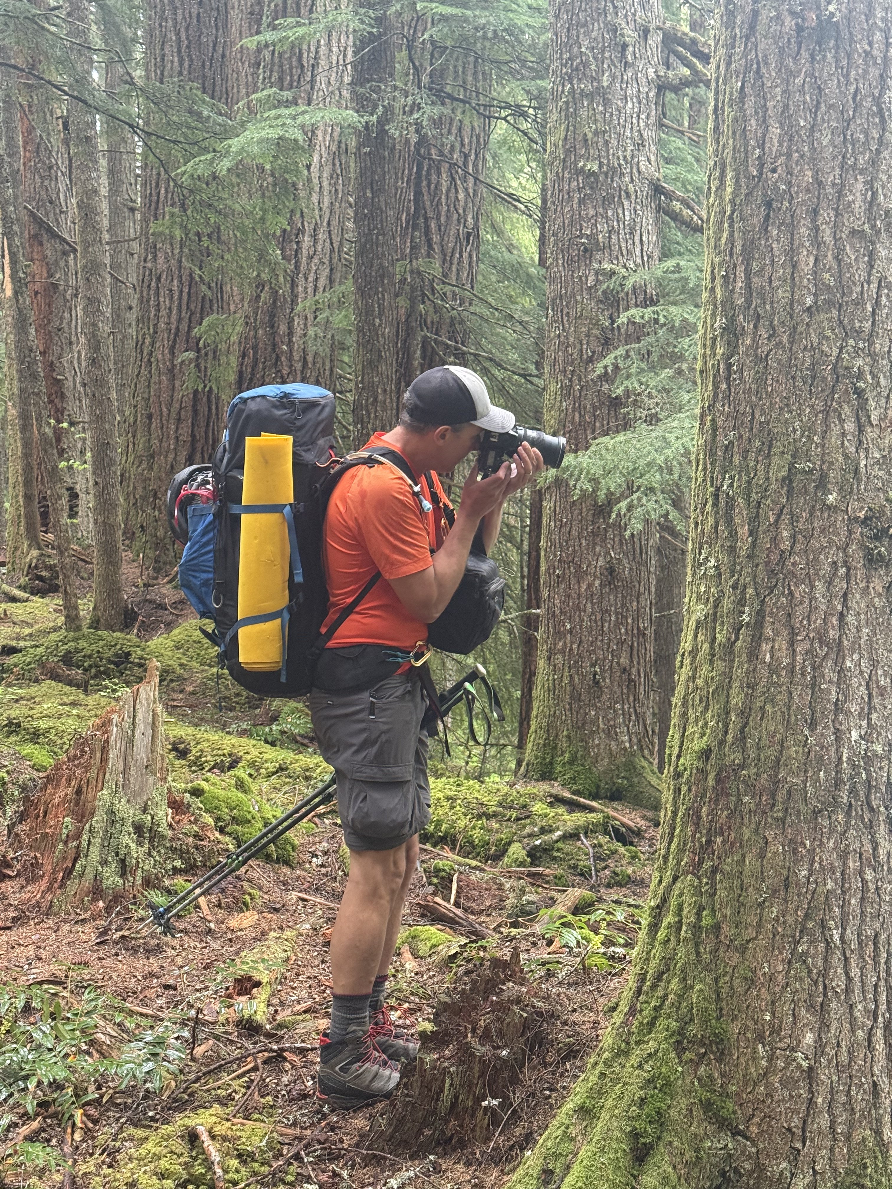
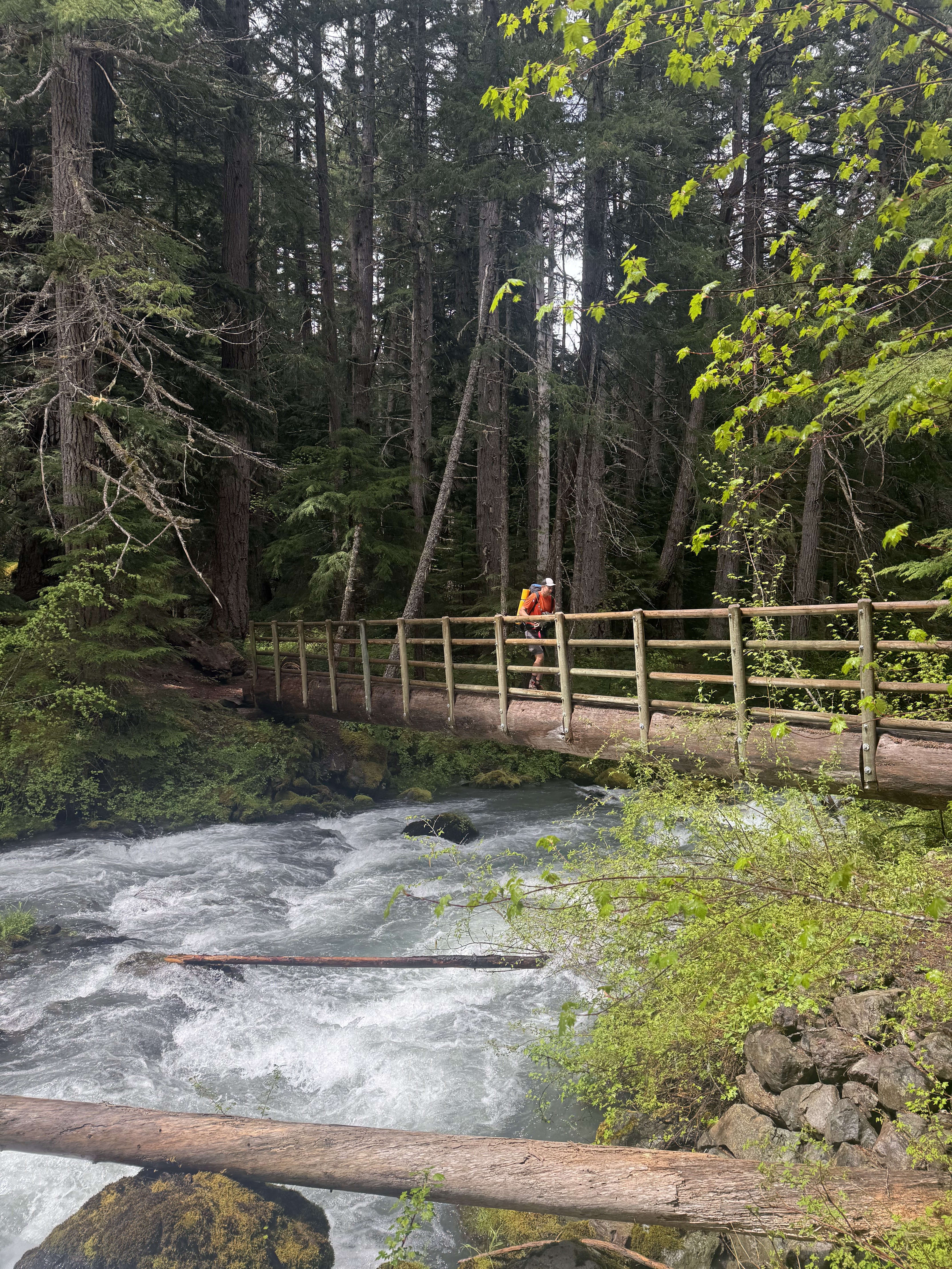
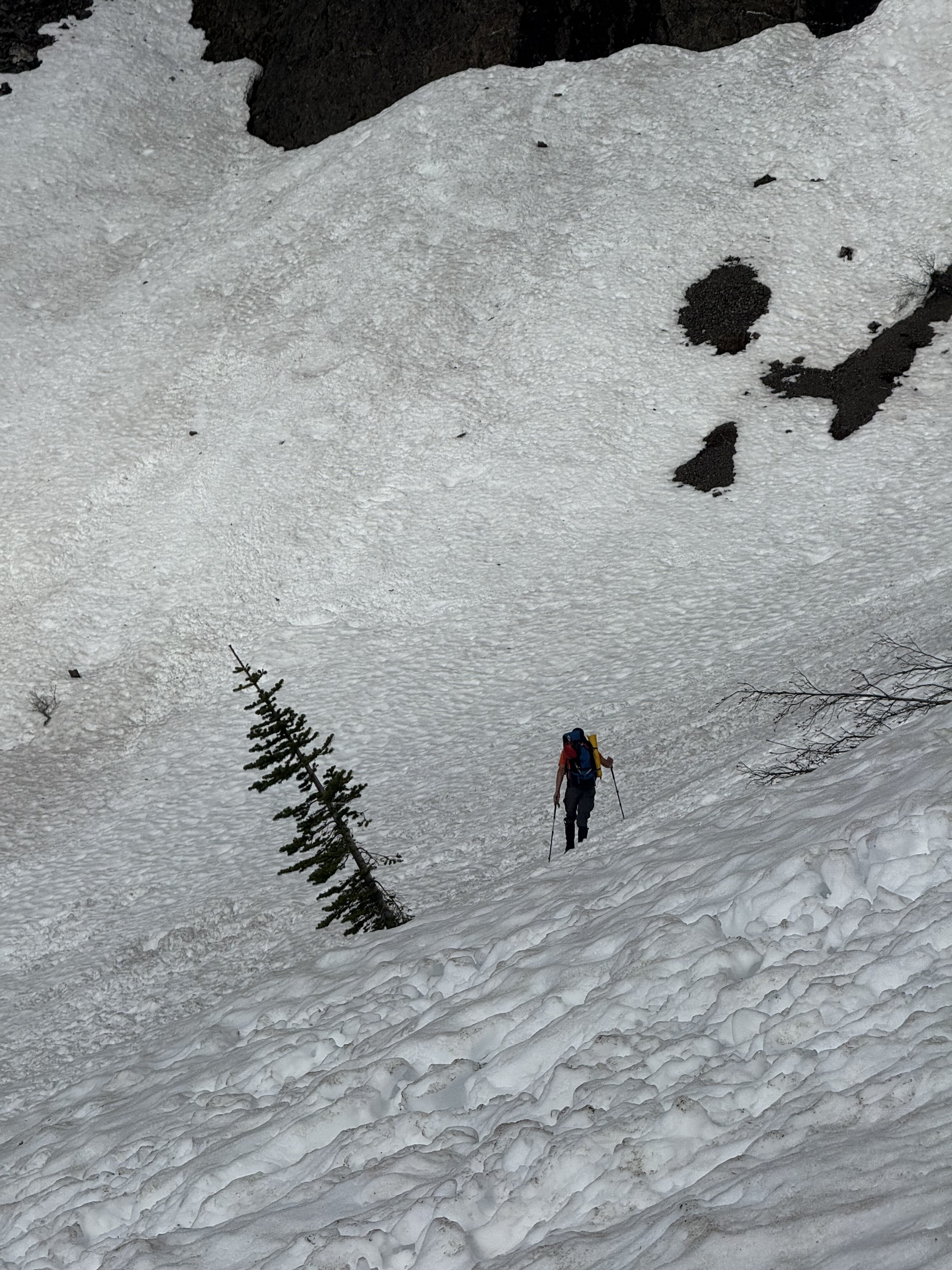
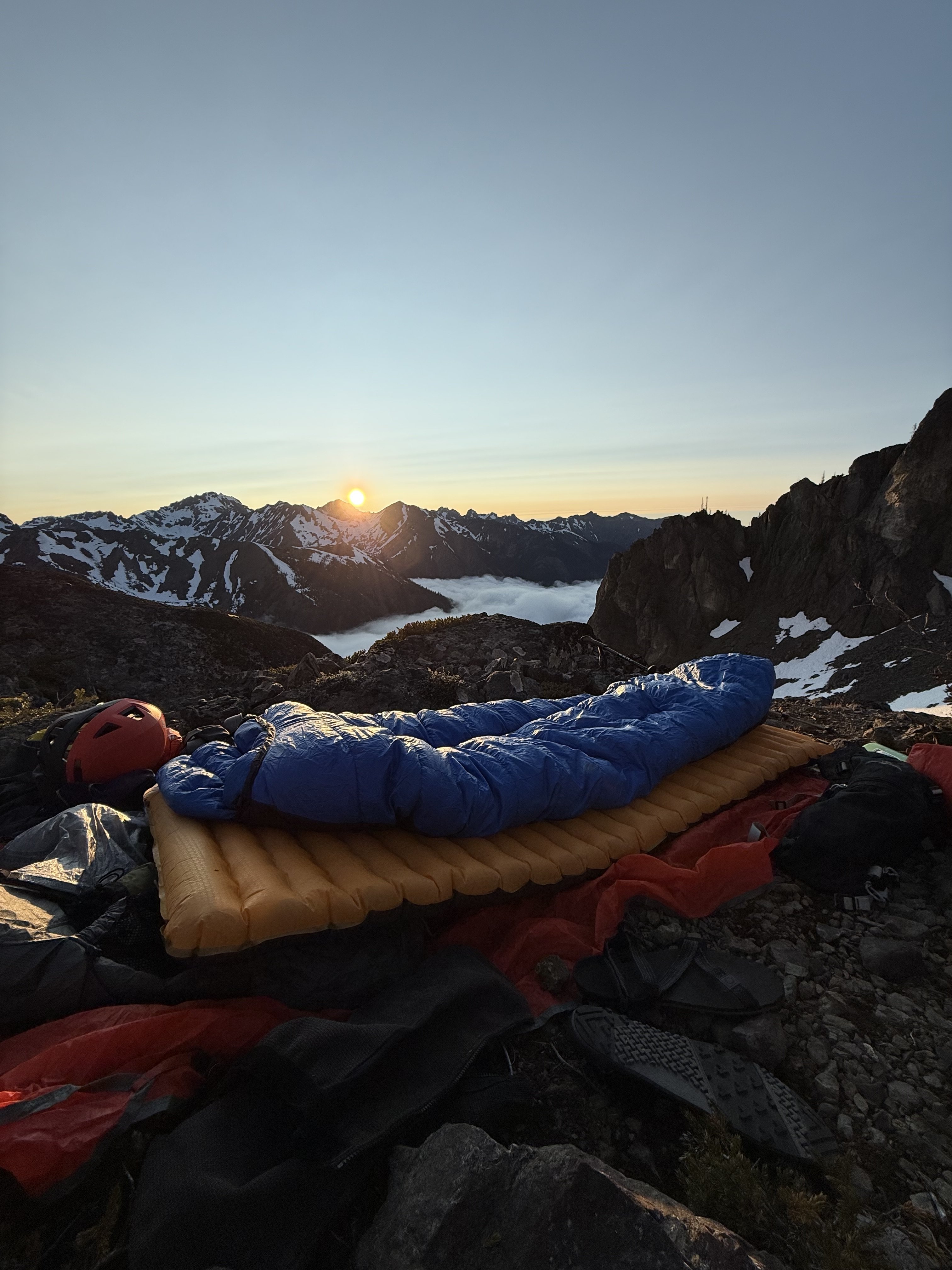
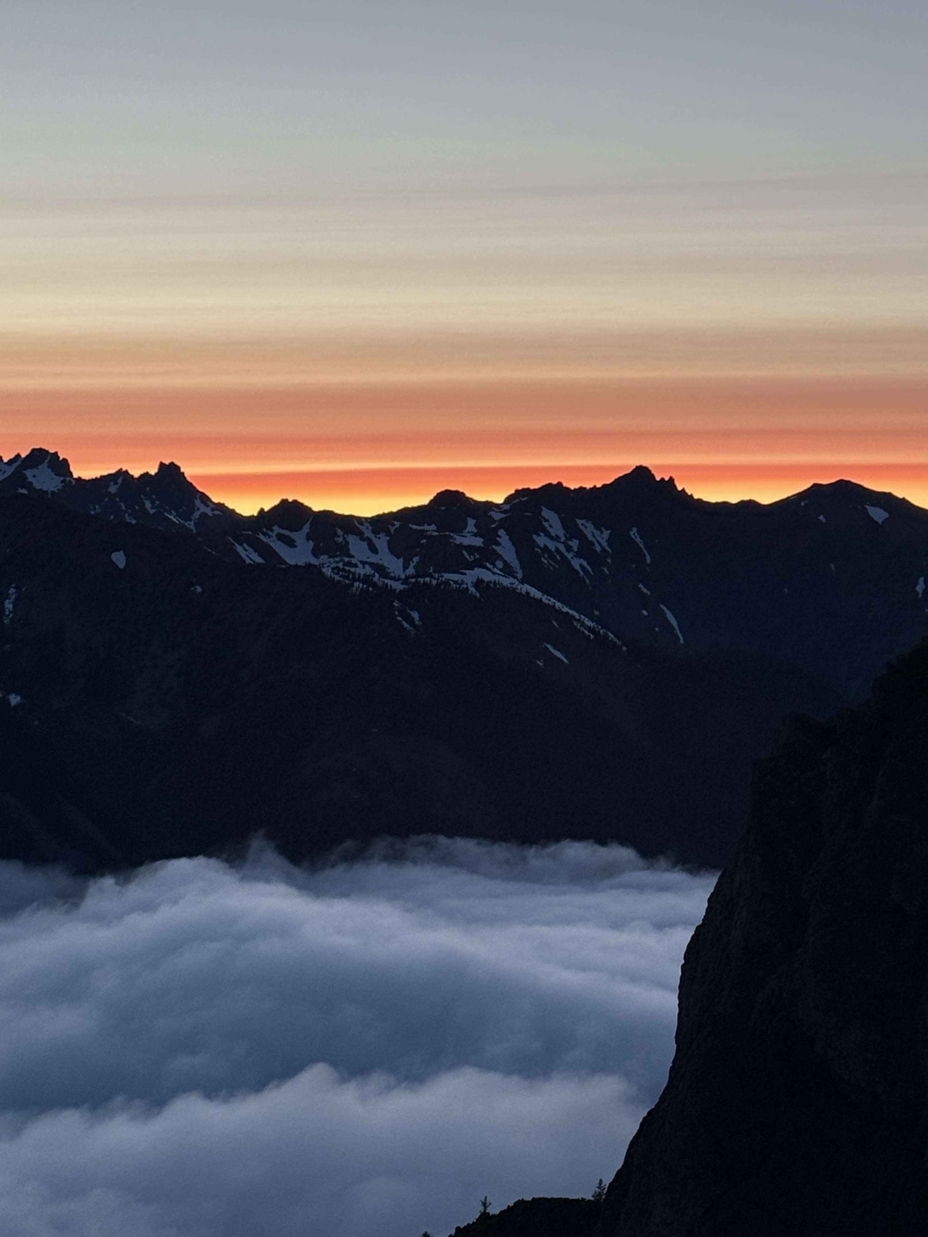
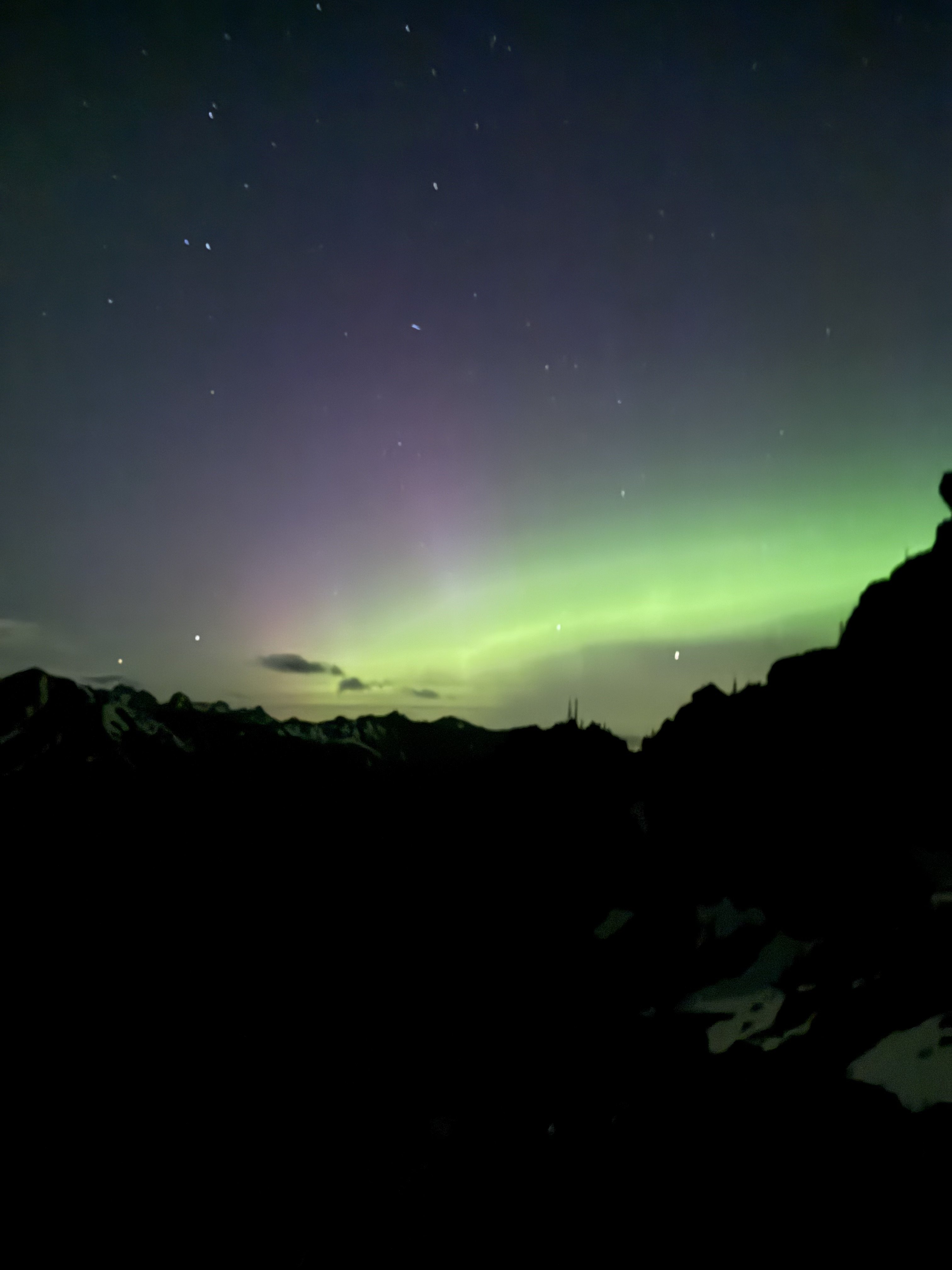
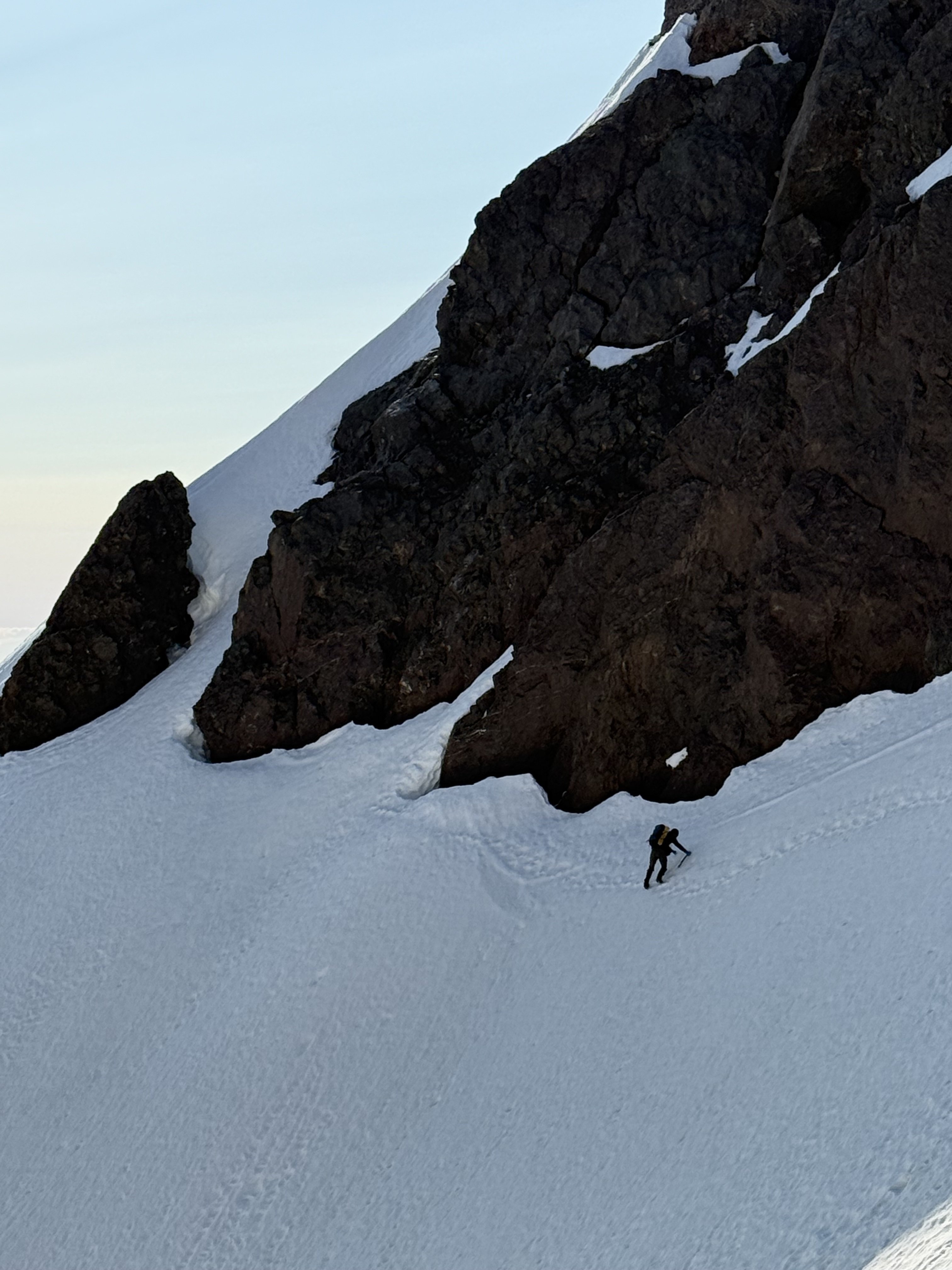
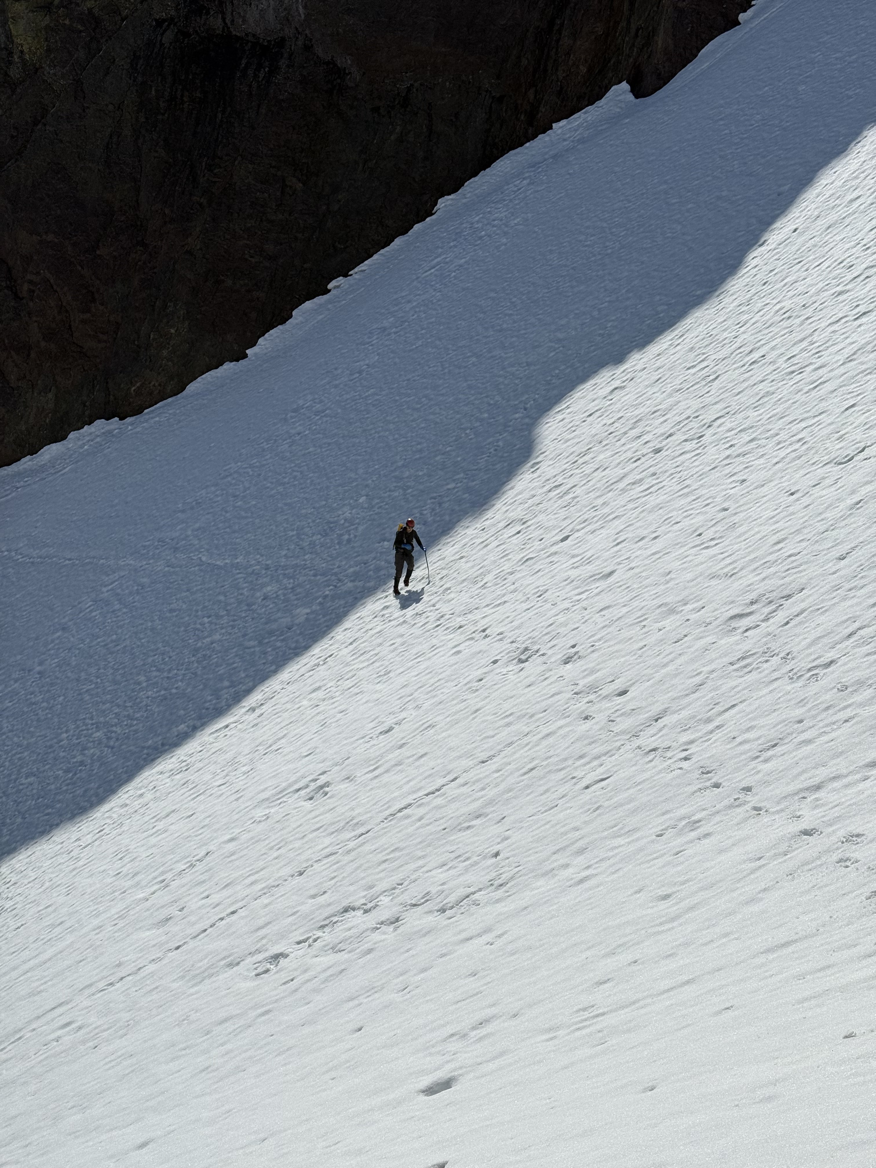
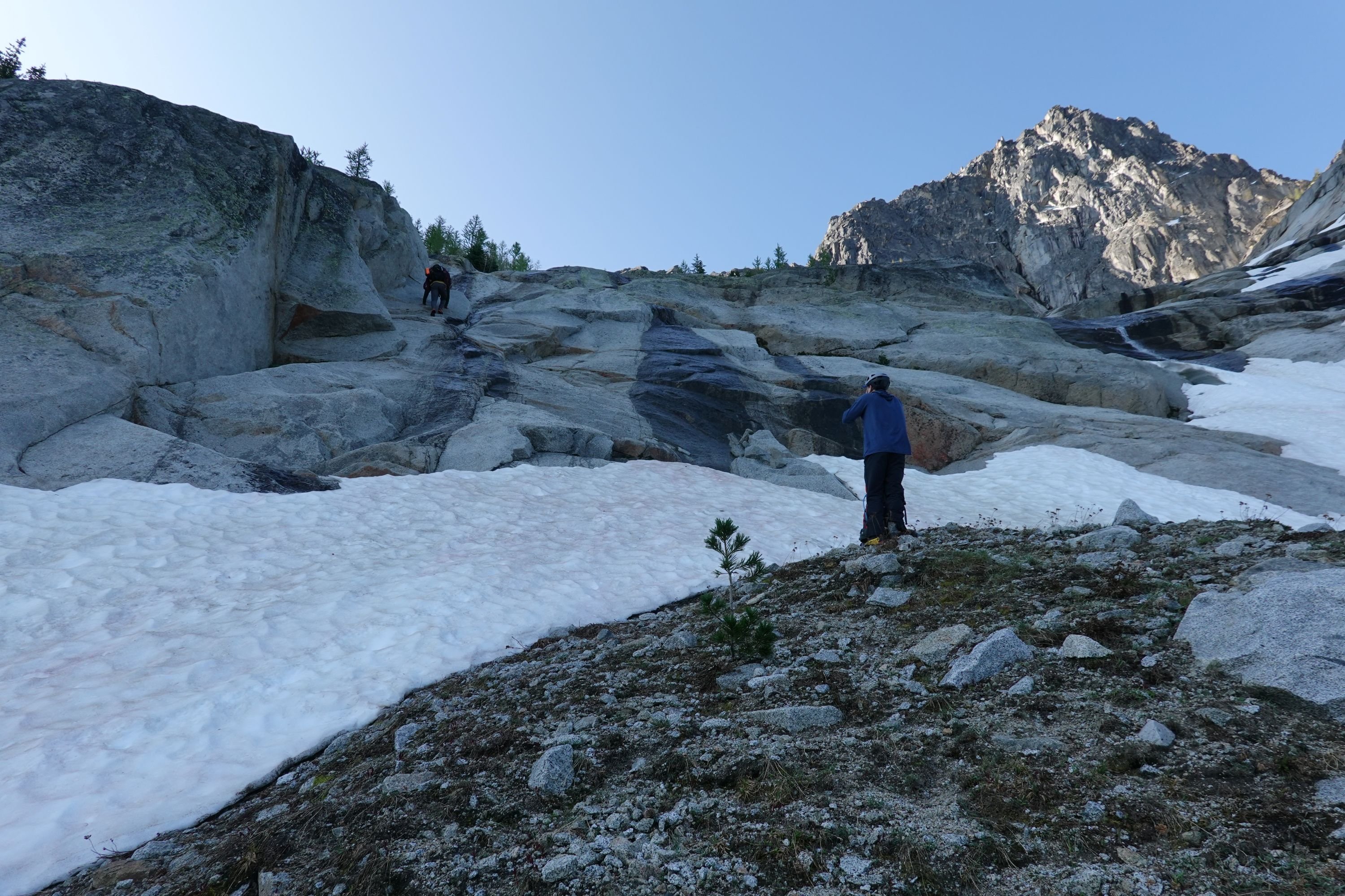
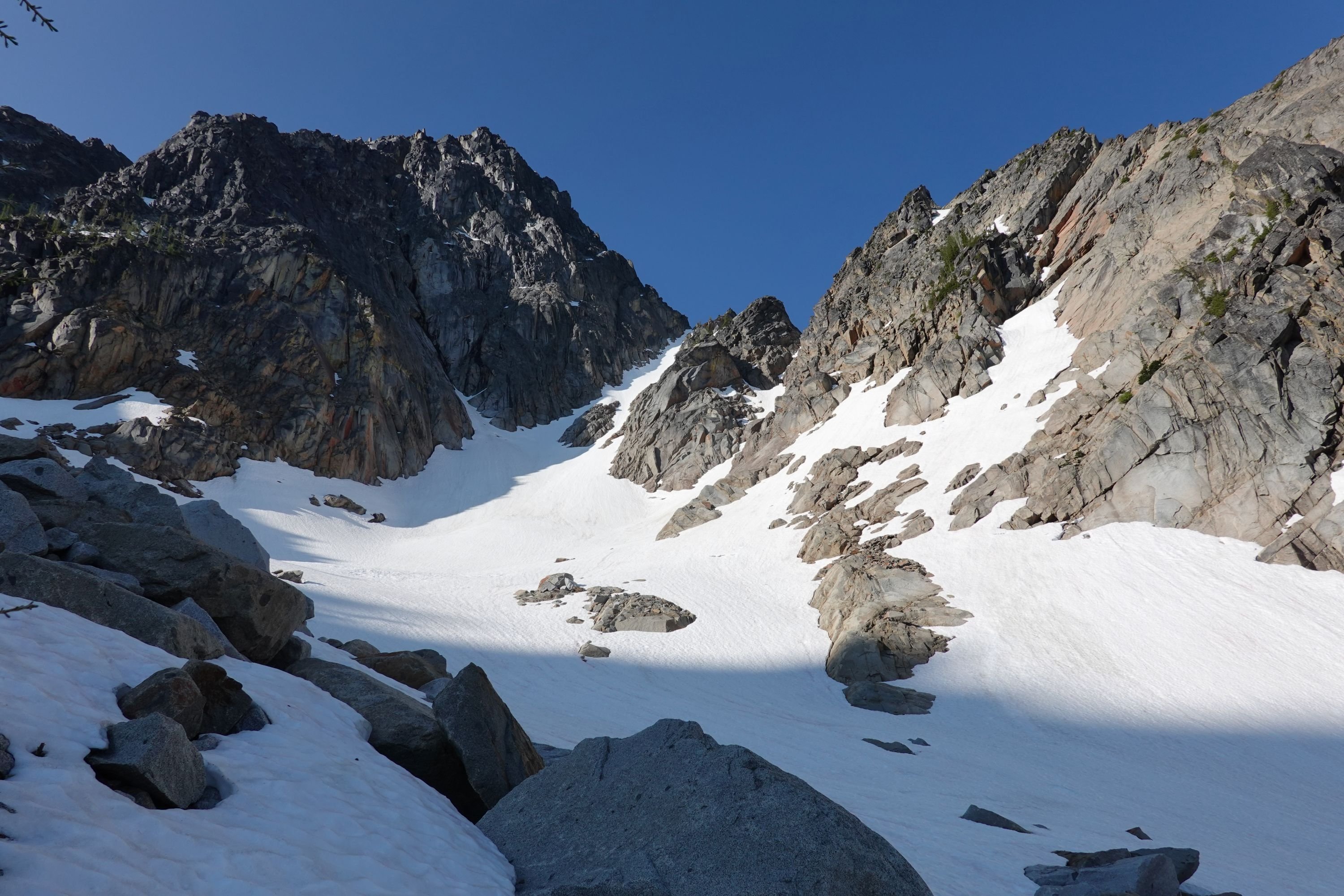
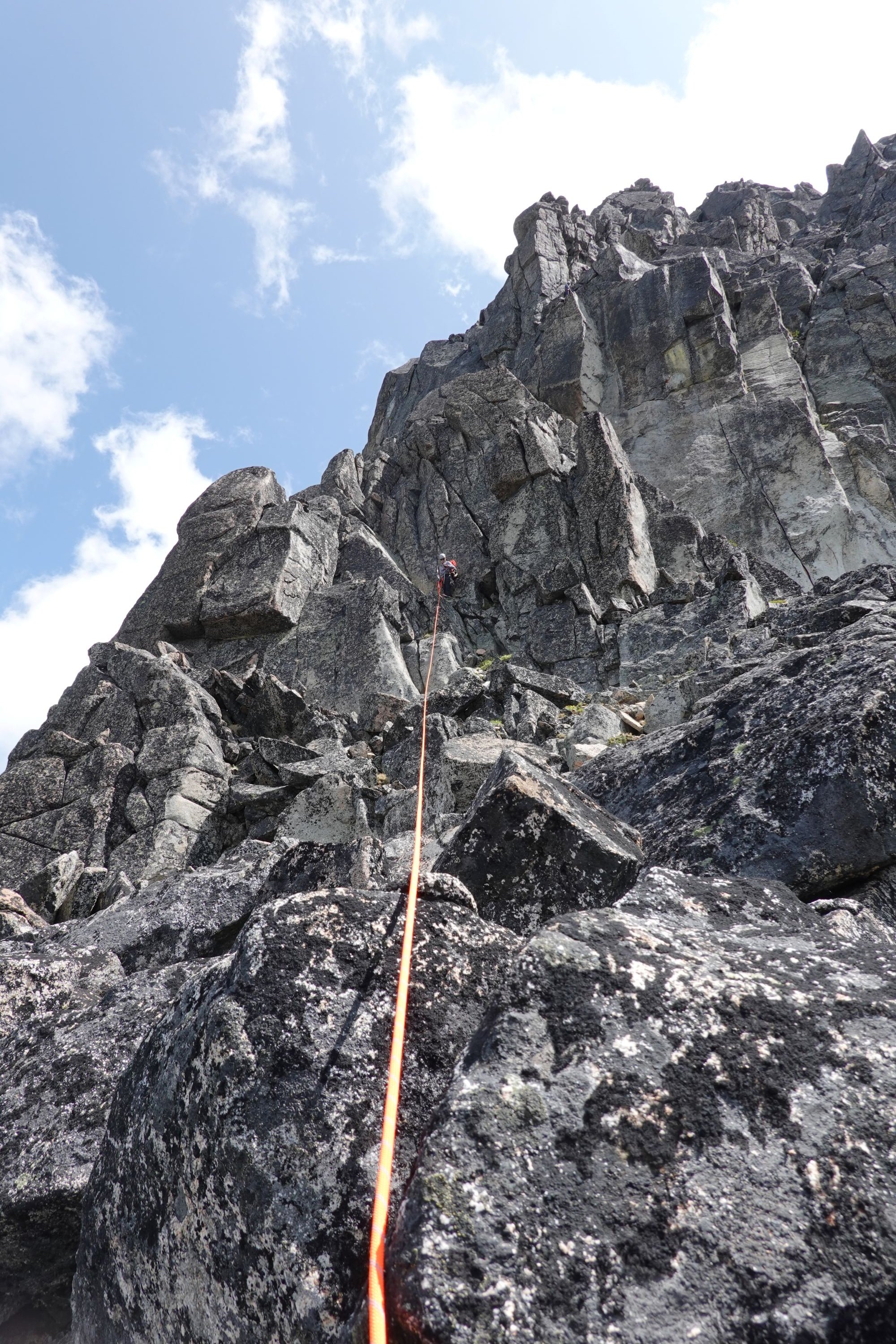
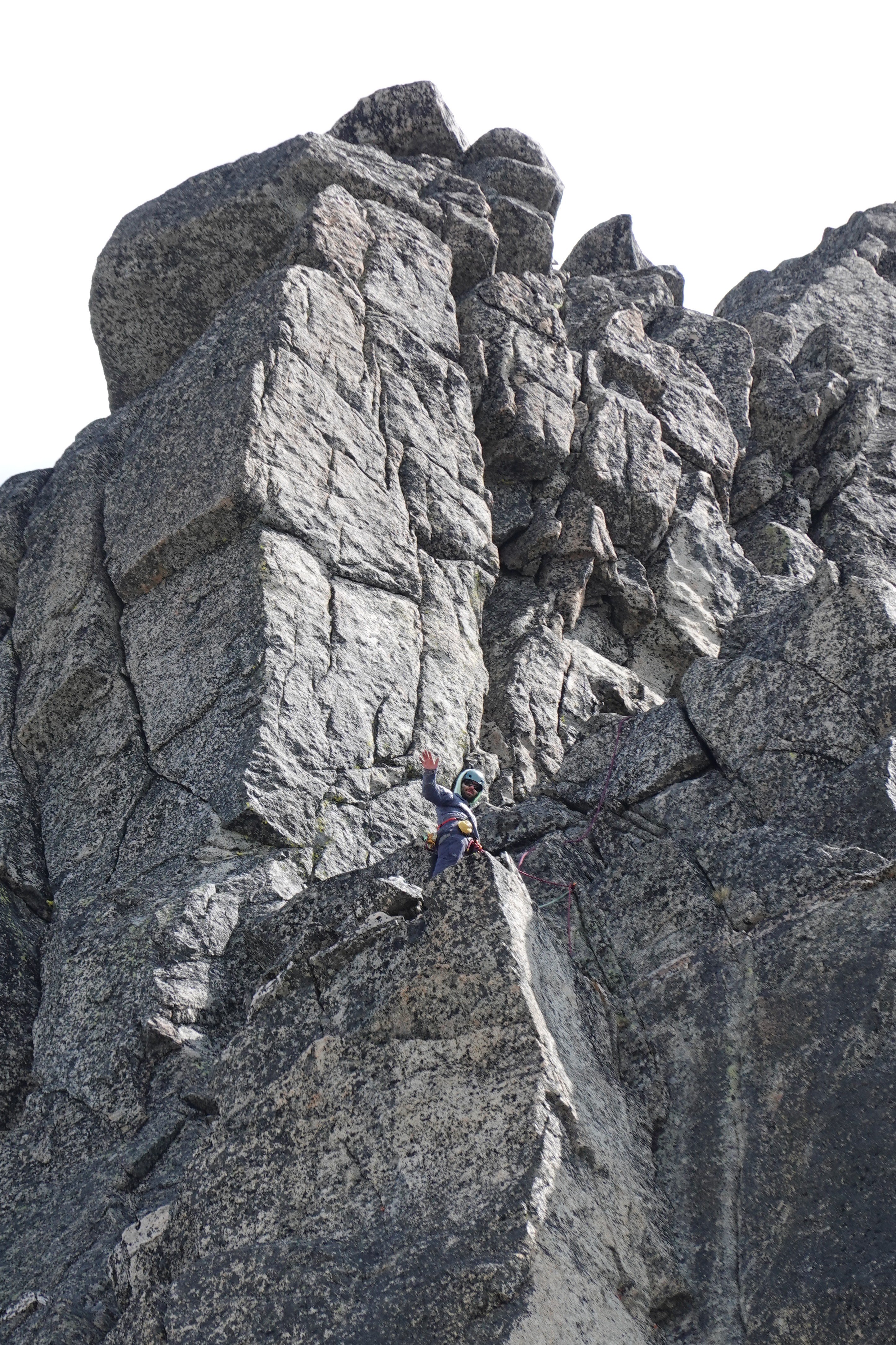
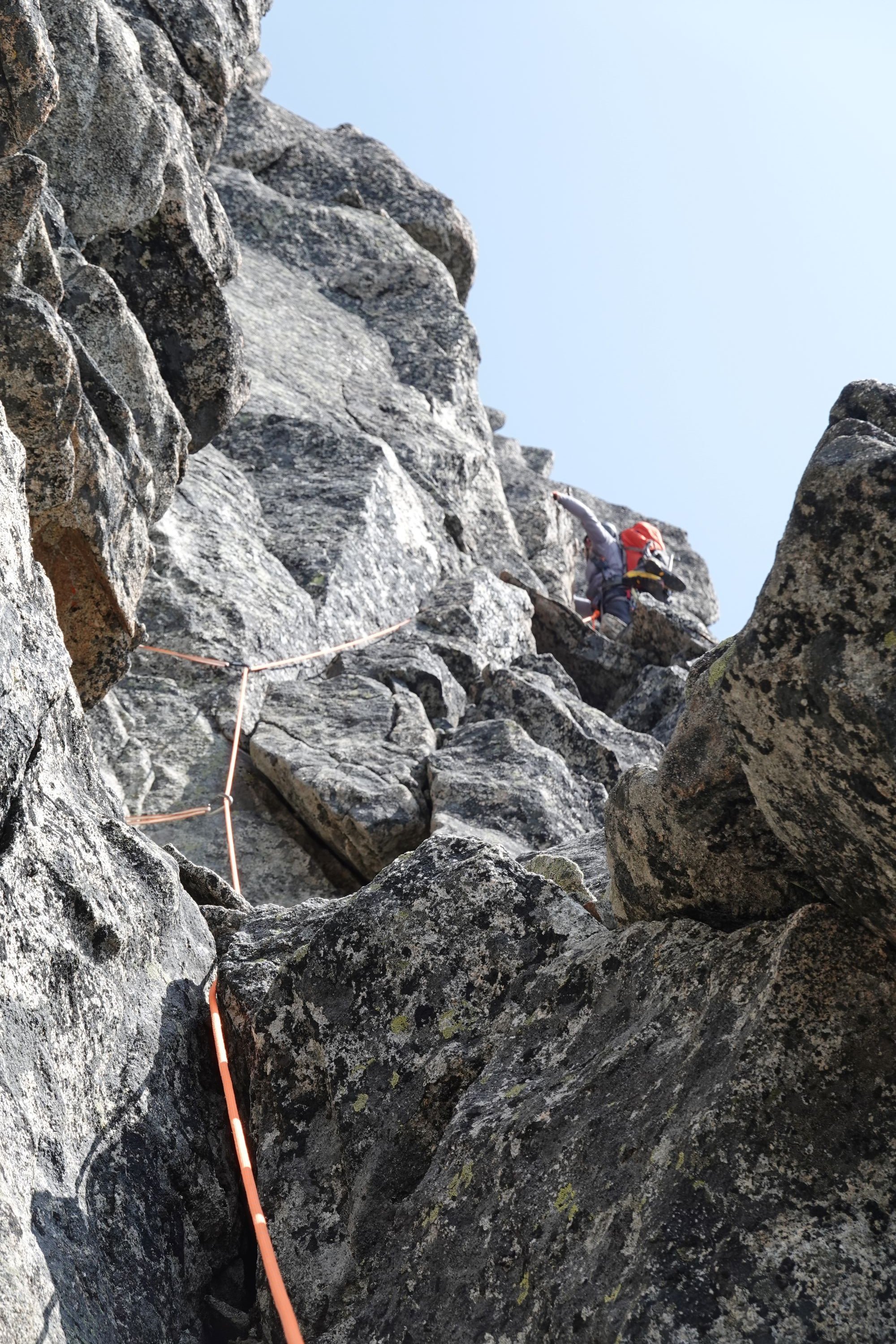
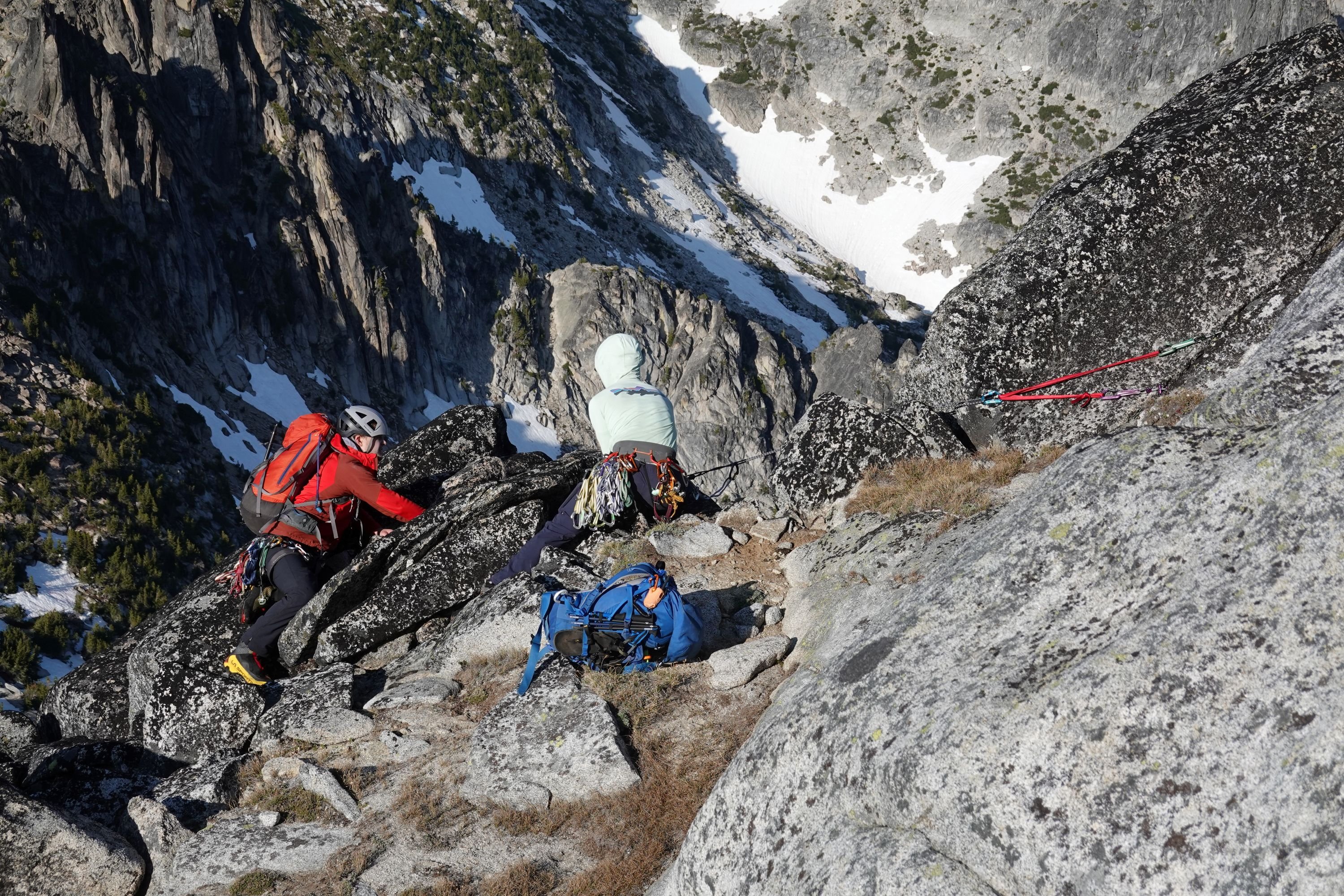
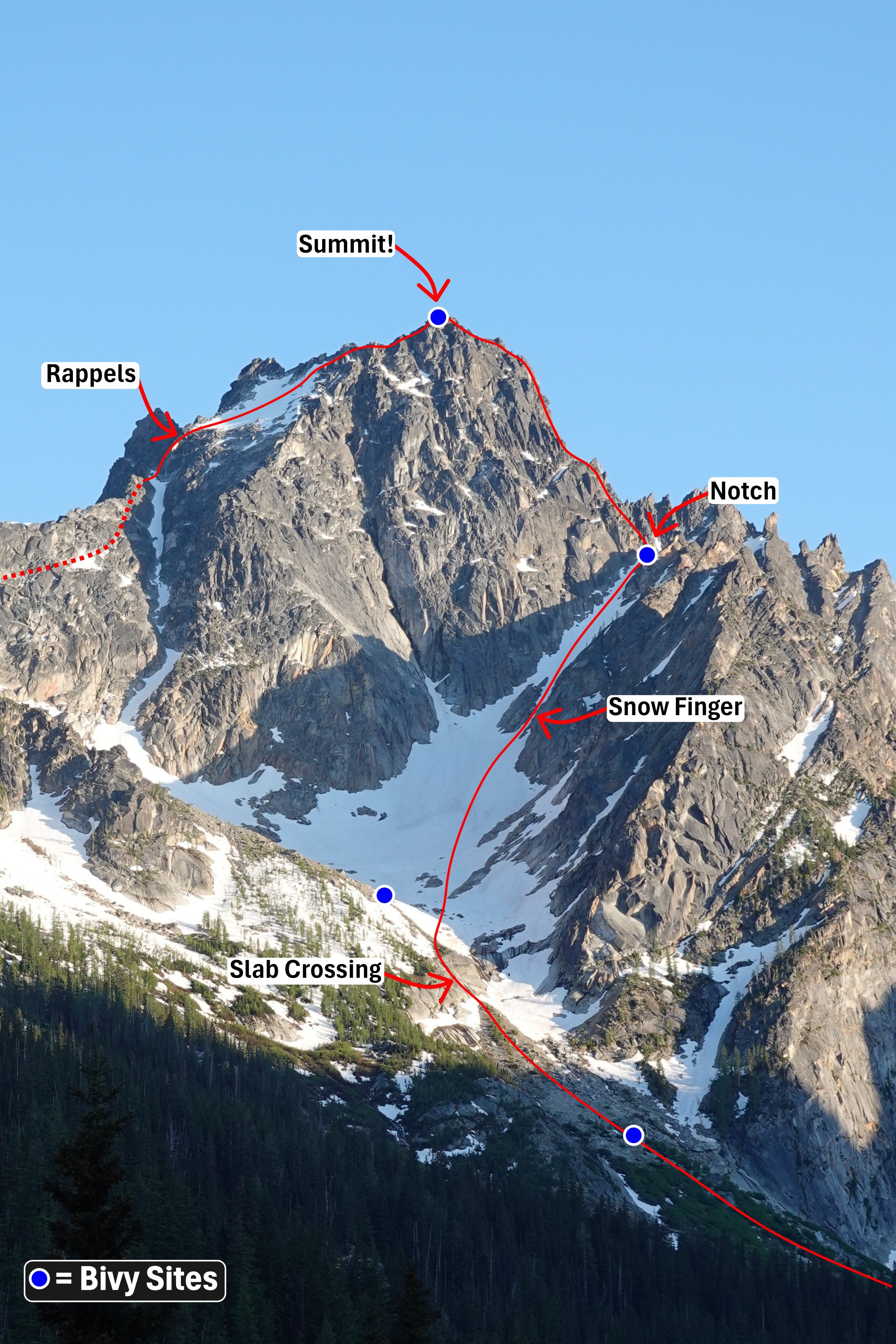
Trip: Argonaut Peak - NW Arete Trip Date: 06/14/2025 Trip Report: Climbed the NW Arete of Argonaut over the weekend with a party of 4! Haven’t seen any trip reports yet this year, so here is a relatively brief one outlining conditions. Our plan to split the climb into a Friday evening approach + Saturday climb did not quite go as planned, and ended up becoming my longest summit day yet at 21 hours… But we got the summit! Our timeline was roughly as follows Friday: 6:45 PM - Departure from trailhead 8:15 PM - Start of climbers trail 11:30 PM - Finally broke out of the treeline 12:30 PM - Bivy Saturday: 6:15 AM Start 7:20 AM - Slab crossing 9:40 AM - Top of notch 5:00 PM - Summit 8:50 PM - Bottom of rappels 11:50 PM - Back to main trail on Colchuck Lake 3:00 AM - Back to trailhead Notes on the route: -Navigating the off trail portion out of the treeline is nontrivial. We lost a lot of time trying to do this by headlamp, as we weren’t able to see the most efficient route out of the trees/slide alder. -For navigating the slab before the snow climb, we had one person solo it, then build an anchor and drop a rope for the rest of us. -I believe the snow finger going up to the notch where the climb starts usually defines if the route is still in. There was still a reasonable snow finger for us to climb up. -There’s a topo and route description floating around that describes the route in 5 long pitches, which we found generally as advertised. - We got off the summit in two double rope rappels. I hadn’t seen this mentioned in other trip reports, but the first rappel was the sketchiest rappel station I’ve ever used. It’s just a mid sized detached rock with webbing wrapped around its contact point with the ground. We backed this up with a gear anchor for everyone but the last to rappel. -Most of our trip after this was by headlamp. Thankfully I had been out there two weekends ago for Colchuck Peak, and was able to help plot a reasonably efficient path down Colchuck glacier and the boulder field in the dark. We dipped left into the moraine, then skirted the left side of the boulder field down until the lake. -The rest after this was an eventful if slow hike back to the trailhead due to navigating by headlamp + the fatigue starting to set in. Long day, but a fun climb! Has about all you can ask for in an alpine climb (could maybe do without the slide alder though lol) Route overview, including the bivy sites I saw on route Slab crossing Current snow finger conditions Top of pitch 3 Top of pitch 4/start of pitch 5. If using the topo map, I believe this station is actually ~10 meters earlier than recommended, and we needed to simul ~10 feet so that my partner could build an anchor at the actual end of pitch 5. Climber crossing the flakes on pitch 5 Backing up the sketchy first rappel station Gear Notes: Full rack. Not all was needed for the climb, but was helpful in completing the climb in 5 long pitches Approach Notes: see report above
-
Does anyone have pics or memories of a potential single bivy spot on the summit of Mt. Despair? I've scrounged around but haven't found any images of the summit area.


