eeelip Posted July 15, 2024 Posted July 15, 2024 (edited) The traverse of Mount Index has been on Ian and I’s radar for over three years. It summits two of WA’s supposed “Difficult 10” peaks in one fell swoop, and has a legendary reputation in the WA climbing community. I first heard of it when I stumbled across the Difficult 10 list online. The climb immediately got my attention, but at the time I did not think I would ever have the skills or the partner to complete it. The exposure and route reports were pretty terrifying and looked so far beyond anything I had done up to that time. The route is very aesthetically pleasing, and can be seen from the highway. There are a few trip reports for the traverse online, most done by blue-collar legends of the WA climbing community. There is also Colin Haley’s report of doing the traverse in 24hrs in winter, which seems super-human to me at this point. Unsure of the technical difficulties that would be involved, we wanted two full days for the climb to increase our chance of success. Ian and I left my house at 1am Sat morning 7/13. We were hiking up towards Lake Serene by 2:30. At the lake, we followed the convoluted trail towards the West rim of the lake, then veered upwards for some bushwhacking until we reached the talus slopes. We followed them up towards the North Face of the North Peak until we reached around 3,300’. At that point we scrambled up easy but unstable red rock until things got bushy. There are rap anchors everywhere on the North Face from so many people bailing, and it is very hard to tell if you are going in the right direction. Ian and I basically foraged upward through very steep brush until we reached the saddle of the huge and distinctive gendarme feature. From there, we realized we were too far East and had skipped most of the easy “open bowl” section. We downclimbed slightly and traversed West into the hidden gully that becomes obvious at the top of the bowl. This easy gully led us straight up to a notch at the start of the North Ridge at 9am. The sun hit and it went from hot to very hot. The forecasts for the summit were in the 70s, but I did not believe it before we left. The rib climbing is super fun as stated in other trip reports and is around 5.5. Ian led the first section then we simuled up to the upper slopes where the brush begins again and a large snow patch is located. We were soaked in sweat and already dehydrated at this point. We melted and ate a meal there, then continued up some very vegetated terrain to the North Peak False Summit. From there it is a short and VERY exposed 4th class scramble to the North Peak. We arrived on top at noon feeling a bit fatigued but confident we could make it to Middle. We both agreed that North Peak by itself is quite a bit steeper, more exposed, and difficult than Johannesburg Mountain, to which it is often compared. After the North Peak summit, the traverse becomes even more exposed. There are massive cliffs on both sides the entire time, and even when the terrain is moderate near the ridge crest, there are still massive cliffs just below those slopes with nothing to catch you from falling. From the North Peak, we followed Riley81’s trip report on CascadeClimbers.com. His is one of the most helpful trip report for any climb that I have come across. Very concise and clear directions that made sense when we were on route. We downclimbed a bit from the summit, then made a rappel, then climbed back up to the East side of the ridge, then back down a long loose gully, then another rappel, this time overhanging, down into the North-Middle notch. A bit complex. At the notch, I finally grasped why the Middle Peak has such an intimidating reputation. Once you make that rappel, the easiest method of rescue is to finish the traverse, which is not easy even from that point. A helicopter rescue would be very difficult as well, and they would have to long-line you out. It feels like you are in a completely different world, with HWY 2 and the busy Lake Serene Trail at your feet. From the notch Ian led the technical crux pitch of the route. A full 60m gully with a few 5.7 moves. Ian led his way up like a champ and I grunted my way up like a chump. At the top of this gully we were on the ridge crest, and we simul-climbed 3 pitches to the false summit of Middle. We were totally out of water at this point and very thirsty. Luckily, we could see a snow patch ahead. We made a very overhanging rappel and made a beeline for the water source. We cruised right by the bivy site without even seeing it. We melted more snow, ate some snacks, then summited Middle via easy heather scrambling. At the top, we both agreed why this is at the top of the Difficult 10 list. The climbing on the peak itself is not terribly hard, it is more due to the amount of effort it takes to get there. I called Maddy to check in from the top around 4pm. Ian and I discussed going to bed, but we still had 6hrs of daylight. We started the complex descent from Main Peak by following the ridge crest and deviating to the East to downclimb a ~200’ long gully. From the bottom of this gully, we climbed up to the ridge crest via another gully and over to the West side. We then descended some easier slopes to a small gendarme where we crossed back to East side of the ridge. More complexities. There are some white colored slabs with snow, and a few vegetated sloping ledges. It was just after 6pm when we reached said ledges, and we were worried about the time/energy to reach Main Peak that day, as well as the availability of bivy sites at the Middle-Main notch (there were none). We brewed up and I spent 6hrs sweating profusely and trying to sleep on an angled 10 degree slope with swarms of mosquitoes targeting my exposed face all night. I somehow drifted off around 2am and awoke to Ian climbing down to my ledge at 4:45. I had overslept our 4am wakeup, and my punishment was skipping breakfast and just eating a Cliff bar. We were on our way by 5am after filtering water. We down-climbed the white slabs which were wet and sketchy, but they led us to a tree with a rap anchor leading down toward the notch. From the bottom of the rap it is a short scramble up and over a hump and down to the Middle-Main notch itself. From the Notch, Ian led again. The pitch was a shallow 5.6 gully, this time only 35m or so. Distinctly easier than the pitch coming out of the North-Middle gully. I quickly followed him and led the way up some steep brushy slopes while Ian flaked the rope. After 30min or so, we popped out on a ridge crest, which is actually the top of the South Norwegian Buttress. We simuled 3 very exposed but easy pitches to the “Wedge Gendarme”. From there we down climbed to a notch between the Gendarme and the North Face of Main Peak. From this notch, the route is actually quite obvious. The route up the face of Main is much easier than it appears at a distance, and we scrambled easy 4th class slopes until we were forced into the long red gully. We climbed in the gully for a few feet before starting the rightward traverse on a grassy ramp. After the ramp, a ledge takes you around to the West side of Main peak and the technicalities are over. It is a short hike up past the false summits of Main Peak to the top. We reached the summit at 8am Sun morning. We then put away the rope, ate a few snacks, and walked east to the top of the Hourglass Gully. At the top of Hourglass, we were about to make a new tree anchor when Ian found a new-ish sling already there. We rappelled down the first waterfall getting a bit wet in the process. We then pulled the soaking wet rope and made a second rappel on our own new tree anchor to the steep snowfields below. We then spent about an hour baking and slowly down-climbing the sketchy snow. Neither of us had an ice axe, and Ian didn’t have crampons. A light axe would probably have been worth the carry. After a short rock section, I found another tree anchor and made a full rappel down another waterfall and got completely soaked. This rap led to another very short rappel onto some less-steep snow. We glissaded down to the bottom of the snowfield, then picked our way down through the trees until we could make the traverse to the East Ridge route. From there, we stayed exactly on the ridge crest and proceeded with the hard-core bushwhacking descent for around 1,000’. My shorts and T-shirt were not very useful and my arms and legs got shredded by the spiky vegetation. Once at the saddle above Lake Serene, we descended towards the lake on boulders staying left to avoid vegetation as much as possible. As soon as we got to the lake I took off my boots and jumped in with my clothes on. My shorts and T-shirt were disgusting and the water felt amazing. After that we filtered water and made meals. Around 1pm we started our way around the lake. Around 2pm we walked past all the crowds of Seattleites at Lunch Rock. We were back to the car by 3:30pm and home by 5pm. My opinion is that this is a very good route. The traverse style, exposure, and amount of work required make it classic, and the proximity to civilization makes it unique. The climbing itself is a lot of work, but that is Ian and I’s specialty. I would recommend this route to any experienced climber in WA looking to test their abilities. It is certainly harder than any other route we have done so far in the state, with the Price Glacier + Noocksack attempt coming to mind as our other long effort. I am very satisfied to have this one done, and from now on my trips over HWY 2 will bring a sense of accomplishment, rather than anxiety. GPX Track: https://www.alltrails.com/explore/recording/afternoon-hike-6ecbdd6-436 Gear List: https://www.packwizard.com/s/Q0Fbxc1 Edited July 19, 2024 by eeelip 2 1 3 Quote
geosean Posted July 15, 2024 Posted July 15, 2024 Daaaaaamn, nice work! We did two 16-hour days on that route. You guys cruised, it sounds like you soloed a lot more than we did. Very strong work and thanks for the writeup. 1 Quote
eeelip Posted July 15, 2024 Author Posted July 15, 2024 3 minutes ago, geosean said: Daaaaaamn, nice work! We did two 16-hour days on that route. You guys cruised, it sounds like you soloed a lot more than we did. Very strong work and thanks for the writeup. We were basically a 16 and a 10, so not much faster! Huge respect for completing this route. It is a serious test piece. Quote
kmfoerster Posted July 17, 2024 Posted July 17, 2024 Nice work! I think the traverse is actually one to write home about. 1 Quote
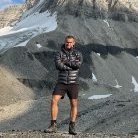
kmfoerster Posted July 20, 2024 Posted July 20, 2024 Great video!. Was great getting to see a lot of that terrain again other than photo. Genuinely curious, what's with the no helmet? 1 Quote
olyclimber Posted July 22, 2024 Posted July 22, 2024 Thanks for posting here! What you say in the video is exactly what I’ve been trying to tell people: this site lets you tell the whole story. 1 Quote
eeelip Posted July 25, 2024 Author Posted July 25, 2024 On 7/20/2024 at 6:12 AM, kmfoerster said: Great video!. Was great getting to see a lot of that terrain again other than photo. Genuinely curious, what's with the no helmet? Thanks! I had one. It was super hot on this climb so I was not always wearing it, guess it didn’t make the video. Quote


Recommended Posts
Join the conversation
You can post now and register later. If you have an account, sign in now to post with your account.