
Alisse
-
Posts
410 -
Joined
-
Last visited
-
Days Won
29
Content Type
Profiles
Forums
Events
Posts posted by Alisse
-
-
1 hour ago, Rad said:
Ditto. But I installed the app, logged in (I already had an acct) and then went back and scanned QR code again and it allowed me to donate to cc.com. Mission accomplished.
Oh, and PLEASE come out to pub club so it's not just old white guys
")
I just didn't want to install the app 🙃
We'll see about pub club...thanks for the special invite 🥰 (even if it is basically 100% because of my gender) 😝
-
6 hours ago, olyclimber said:
I have set up a PayPal account for Cascadeclimbers. You can use this to donate to the site. Please use the below QR code (just use the camera on your phone and it will let you use Paypal). I will set up another option if you want to do it just from your computer, but the fees are more for that way for some dumb reason....so with this way the most money goes to this site.
If this does not work for you then use the "DONATE" button on the right hand side of the forums main listing. Using the QR code is better though as Paypal takes less.

I'm on my phone (Android). When I use Google Lens on this code, it prompts me to install the PayPal app. Weird.
Not sure if this is true for all mobile users, but the DONATE button is at the very bottom of the general forum list page and at the bottom of each individual forum.
Long live CC and all the beta contained herein! Thank you Oly!
-
So glad I got around to looking at your pics here @JasonG! I think one of my favorites is the close-up of the larch branch with some red blueberries/? out of focus in the background. Stunning colors!
S face of the Mole has been on my list, too. Let's do it 😎
-
 1
1
-
-
A moose! The aspens! What a great trip. I really enjoyed the SE Buttress on Cathedral when I was there a few years ago and I was lucky enough to have a partner that could carry me up the headwall 10a finger crack (super fun). I'm happy you got to have so many good adventures in the mountains this summer 😊
-
https://www.bellinghamherald.com/news/local/article266805861.html
What a great piece of news!
@JasonG it's only taken a few years, but.. yay!
-
2
-
 2
2
-
-
Looks amazing!! Funny, I just stumbled across Luke's report the other day and had it on my list to look into further...
-
1
-
-
That first non-map photo 😍
-
 1
1
-
-
15 hours ago, tanstaafl said:
I also failed to pack a pot
I know some long-distance hikers take a no-cook strategy that includes some hours of cold soaking their food. If this one says like 10 minutes with boiling/near-boiling water, then maybe it would work with like...6 hours of cold soak?
I'm sure there is someone here who knows the answer.
Glad you got out to the mountains even without a companion
")
-
Fantastic photos! Love the snow bridge one the hawk one, the rock one, the glacier one...
-
1
-
-
On 9/9/2022 at 9:01 AM, jared_j said:
Snaffles chewing on your tires?
Oh, that would be a way better excuse. I snaffled myself 🙂 I think my mistake was not adding more sealant before leaving home when there were small signs that I should have. And then not carrying, as an individual, a full kit to install a tube as backup. Won't forget these lessons!
-
1 hour ago, Kuato said:
Out of the back side of the bush came a Grizzly Bear running down the slope heading toward Lake Chelan.
😱😱😱😱
Wow!! Incredible! Lucky you to get to see one! I'm kind of terrified of grizzlies so I hope these are the only kinds of (rare) reports we'll get out of the North Cascades...
And the church group with the smorgasbord at the trailhead -- also incredible. I'd be an easy convert in this context, I think.
-
This was a lot of fun to read. Thank you and congrats on the route!
-
Great trip report! And fantastic photos -- especially the one that Jason commented on above. I bet Joe and Rob are hooked on climbing for life now
I climbed that route in early August in 2019 and Winnie's Slide was noticeably less fat than in your photos. On our way out we came across an accident -- a young girl had fallen down the chimneys and had to be helicoptered off the mountain. Luckily we found out later she was generally OK. It sounds like the time you took with all the rappels and everything was wise. Stoked for you!
-
Jon!
May I rudely interject some other perspectives in (slightly hijack) your TR? We saw your name in the summit registers just a few days after you signed them. It sounds like you had an awesome adventure!! We did too, and although our adventure visited the same summits, we took some slightly different approaches.....(I debated posting this but some people convinced me.) Thanks, @JasonG for the inspiring original BB TR!
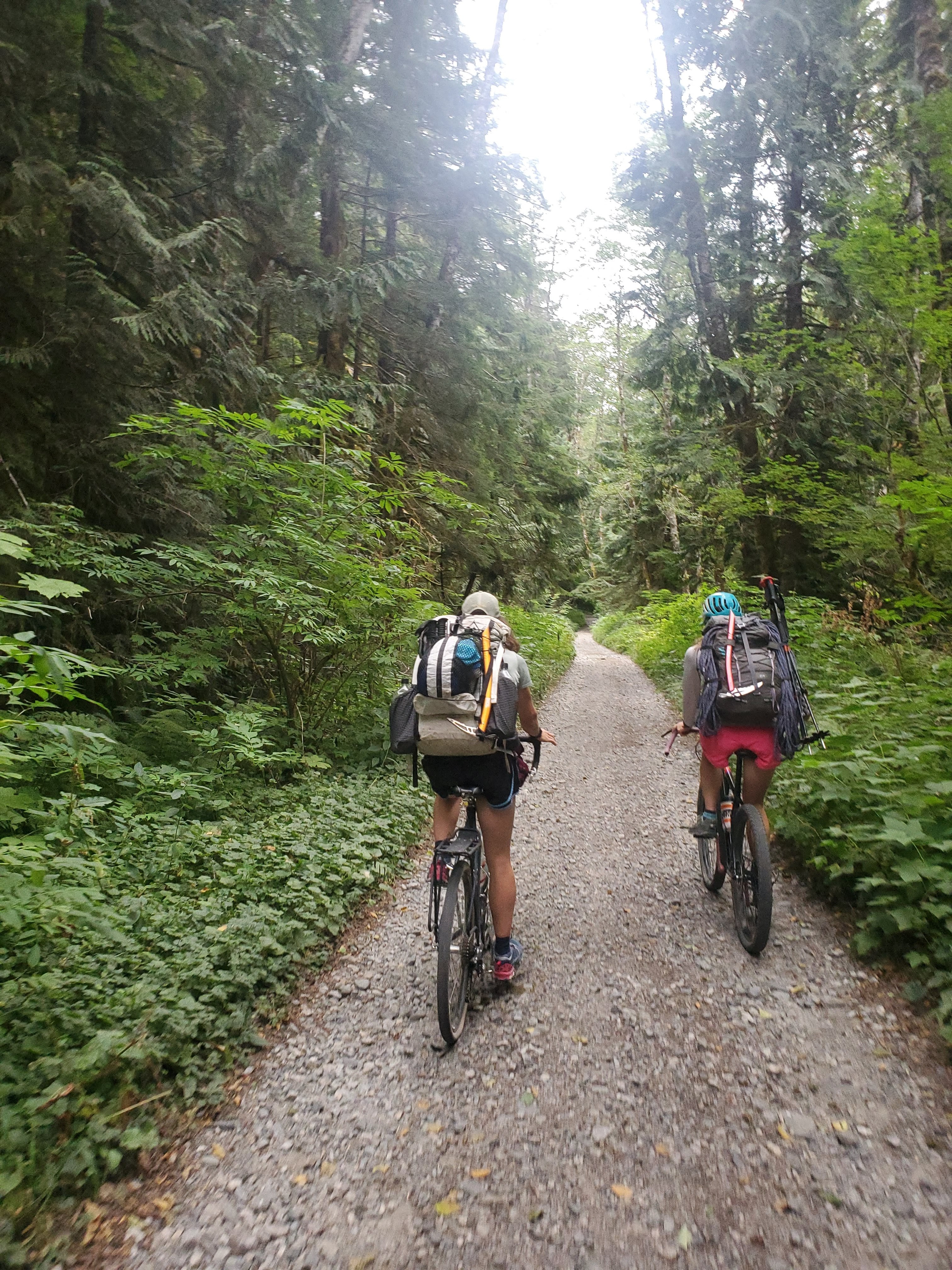
- Kat, Micah, and I biked from Dingford Creek TH to Dutch Miller Gap TH on Saturday at a humane hour:
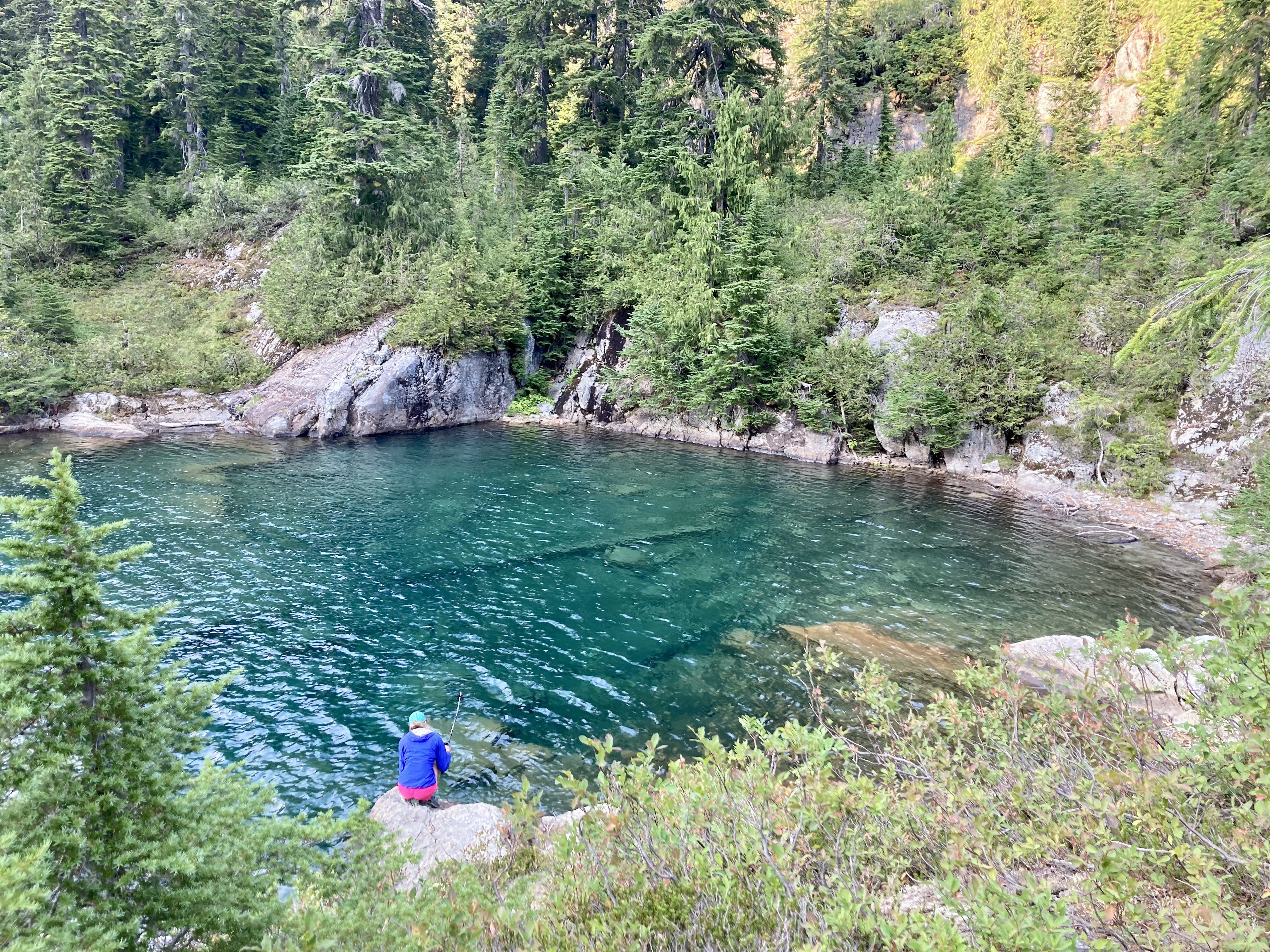
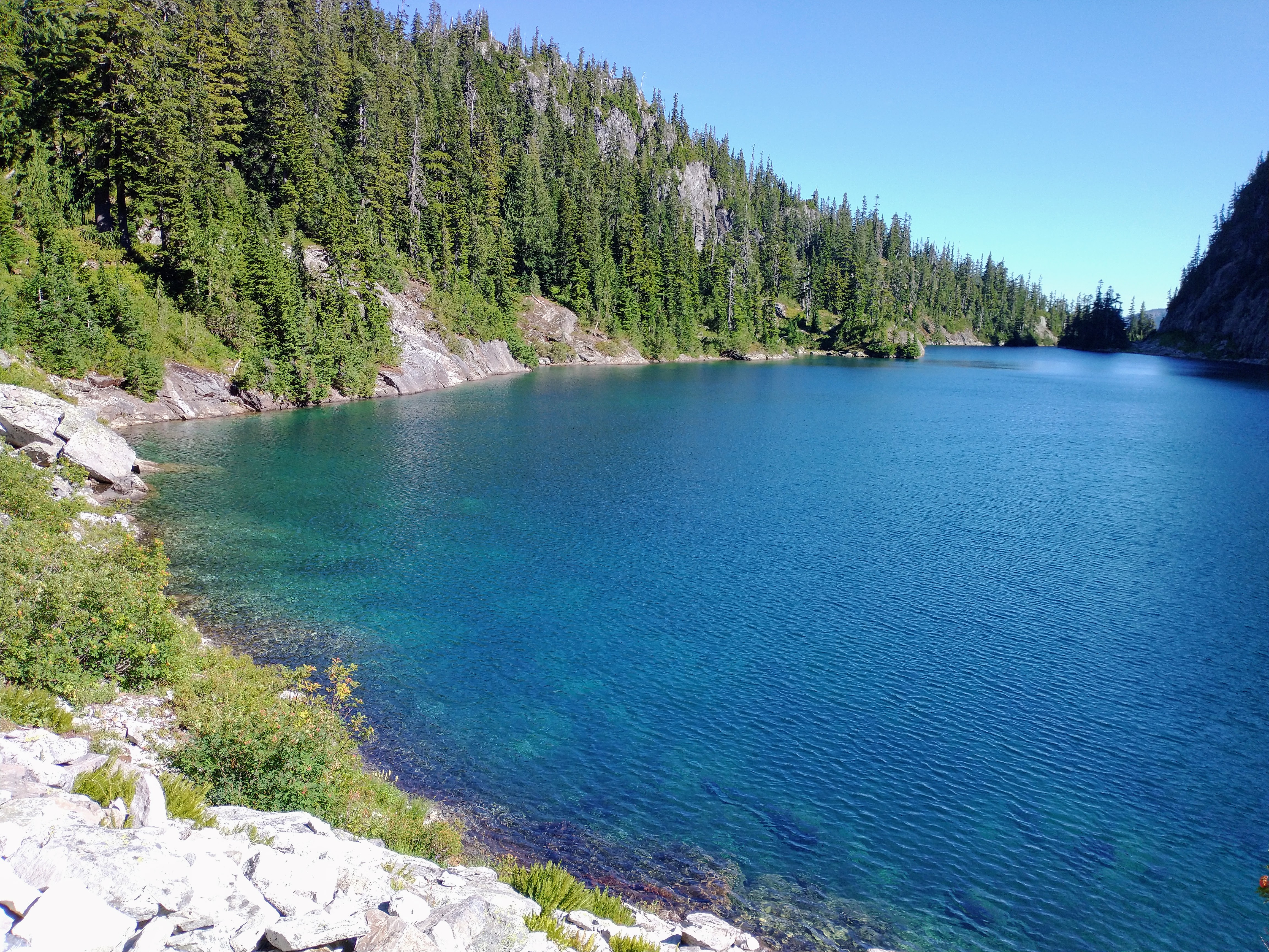
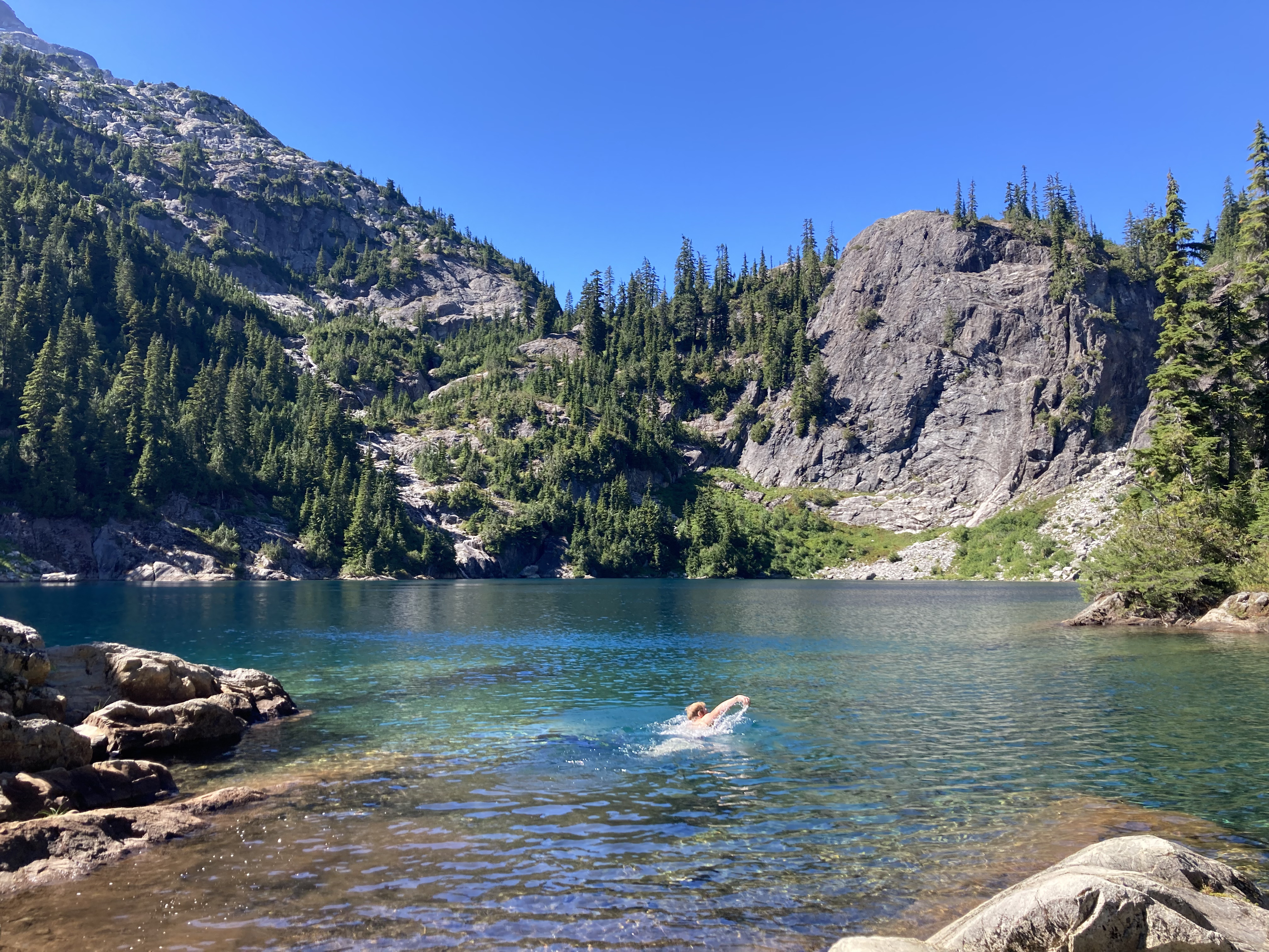
- We thoroughly approved of the Dutch Miller Gap trail. We camped at Lake Ivanhoe and did a good amount of hangin' at The Cove. I did not catch any fish but it's OK:
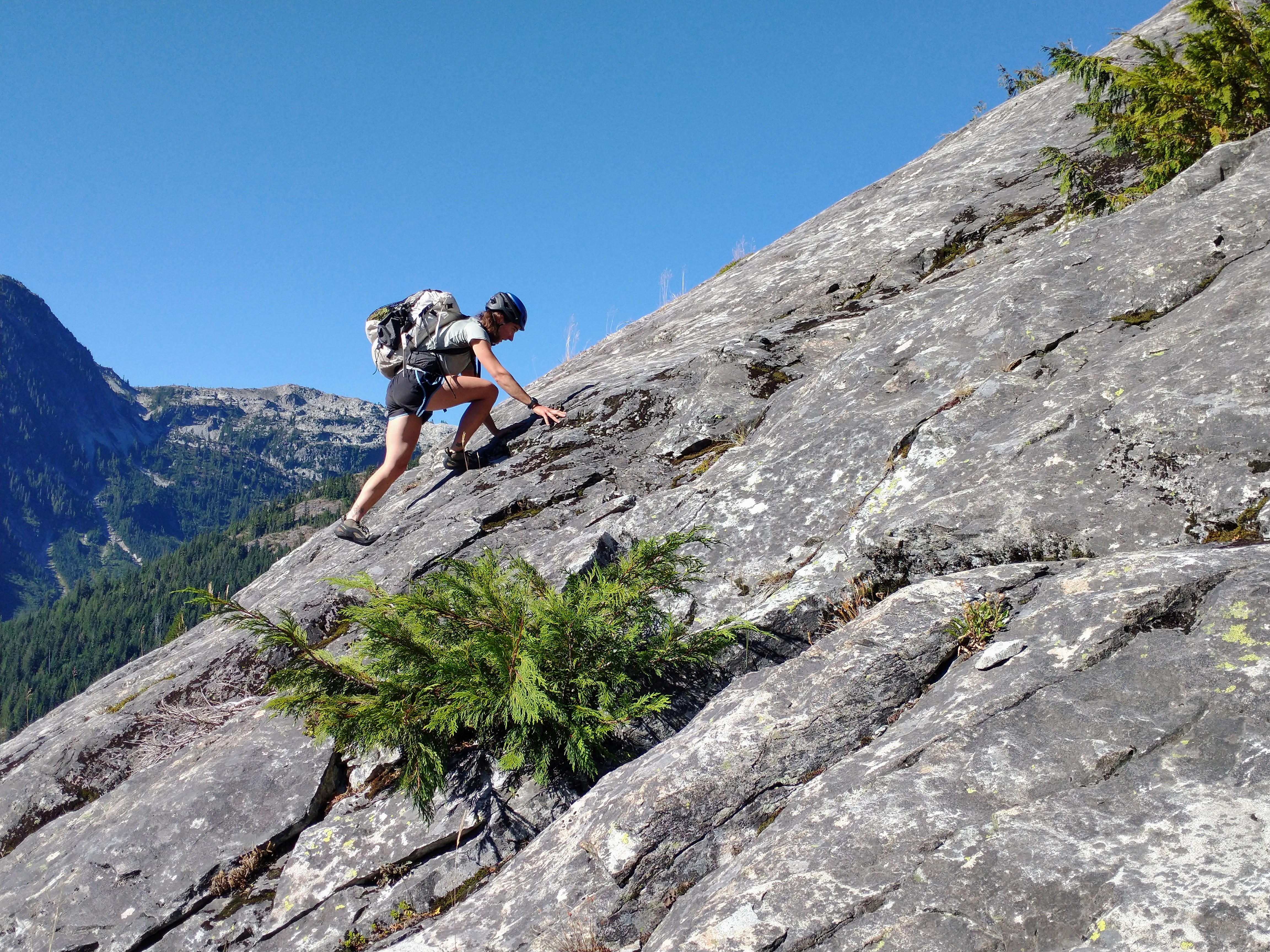
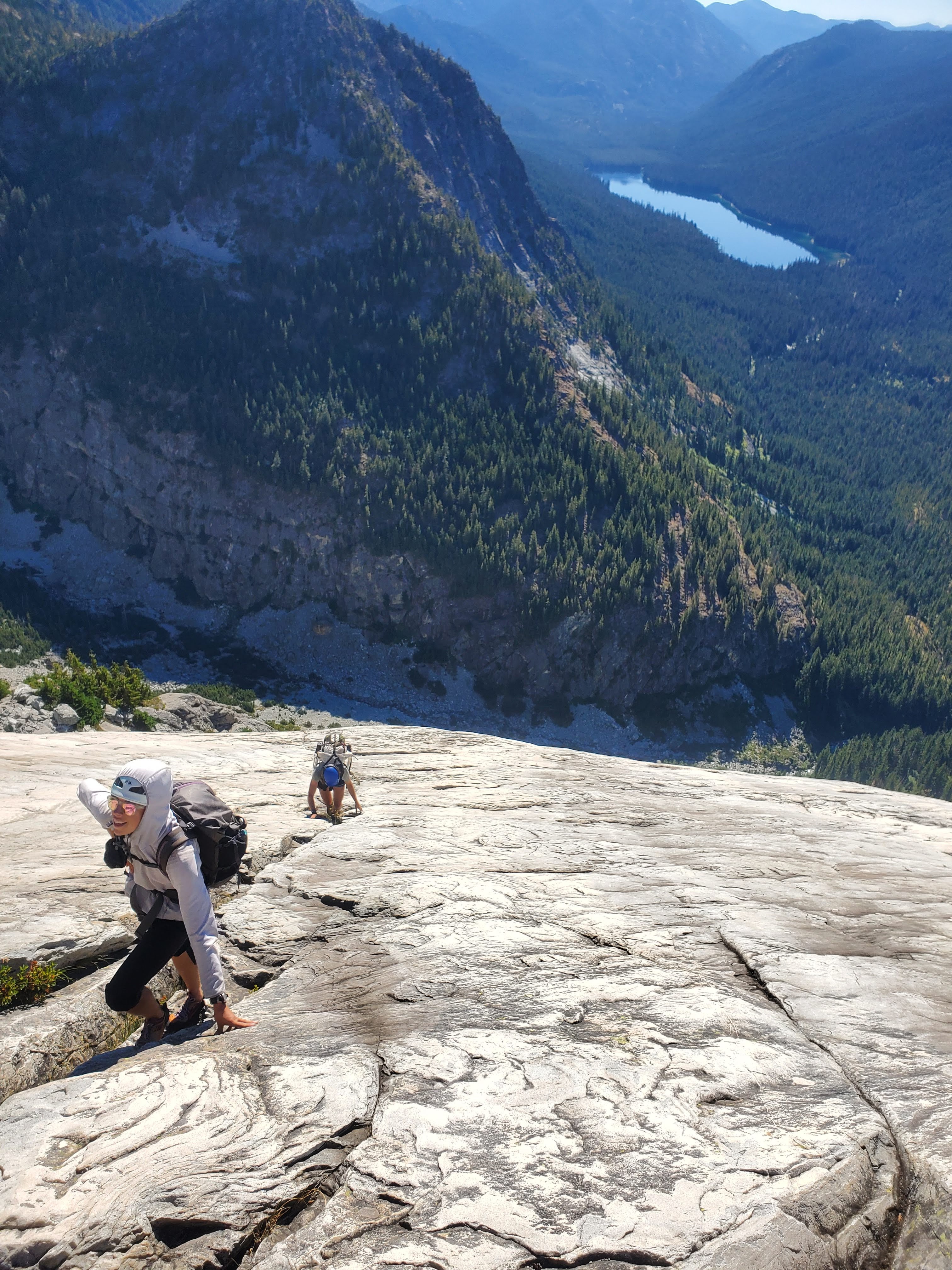
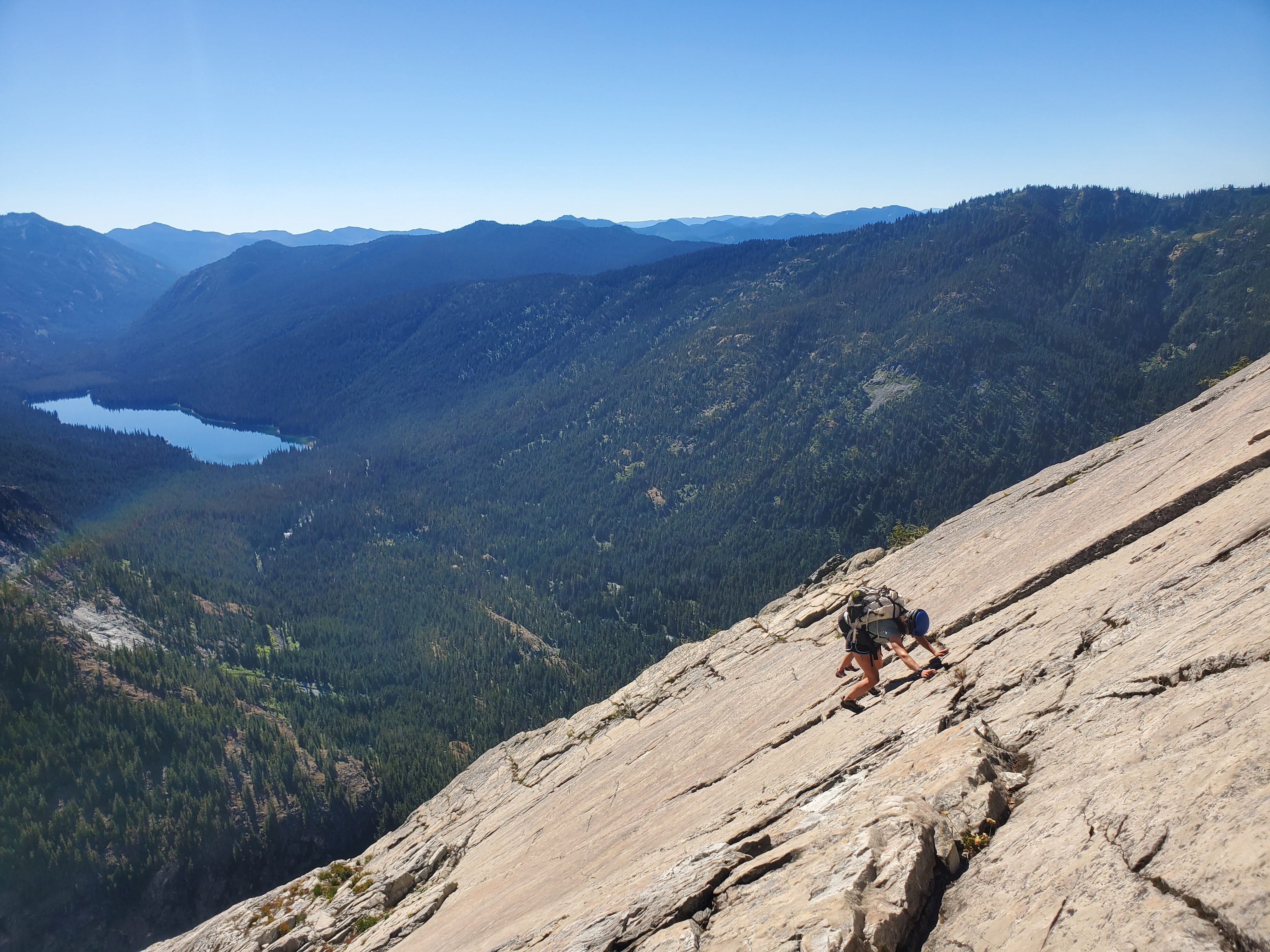
- In the morning, we took the trail down and then tromped around and had some B1- open forest schwack for a bit, crossed Shovel Creek, then started up...I agree: the mega slabs were awesome!! So fun! That foot-then-handrail crack you describe/have a photo of was definitely memorable. I feel like none of these photos really do this route justice:
- We scrambled the first bit of the summit tower, pitched out the chimney, then scrambled up to the summit of BB:
- I agree the summit views were not the most amazing, Hinman and Daniel south sides in late summer... oof, so dry! Hinman cradling Lake Rowena and tiny part of Rebecca:

Slightly more solid views:
- We descended the SW face route. Happily, my partners nailed the complex descent while I attempted to keep up. Shout out to @Hoo for great chossy gully and cliff navigation. No one knocked rocks on each other and no one slipped on exposed 4th class. Hurray! We rapped the summit block (3x) and then down lower did two raps off cedars. Kat led, quite vocally, this memorable one:
- The next morning we walked down the trail, stepped into the "timber" and did some B1+/B2- schwacking, then took a high traverse over to the notch and then up to Summit Chief. Summit Chief Lake basin was spectacular!

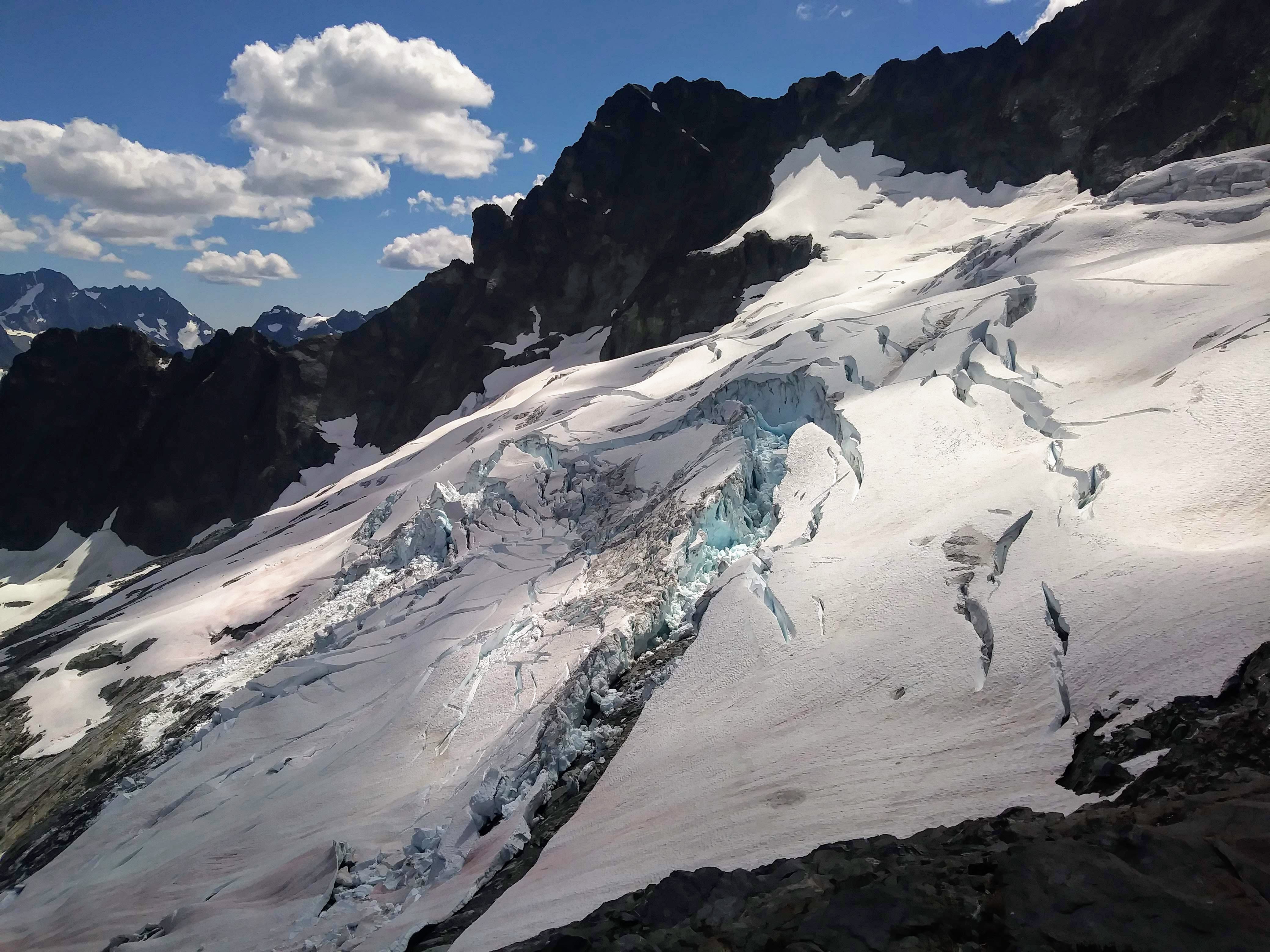
- Glaciers around Chimney Rock from the summit:
- The Cove delivered yet again that afternoon with blueberries and swimming and eating some of our last foods (so hungry):
The ride out was awesome on my 2.25" tires until I learned some important life lessons about tubeless tires, sealant, and friends carrying the tire levers. (/snaffled)
I felt lucky to have this adventure with Kat and Micah. Two very skilled, ridiculously fast climbers. Great people even if they do Strava...
-
3
-
 1
1
-
4
-
-
Woah, what a way to start the morning!
Great photos, as usual. Love a good ridge run and some easy rock, will have to add this to my list
-
1
-
-
2 hours ago, Rad said:
Can't speak for Joshua, but I've made luggage tags from sections of old rope. Slide out the core and the sheath can be pretty flat and works in water knots and other flat knots generally used for webbing.
Ahhh, thanks! Of course. That makes sense.
-
A noble endeavor! Joshua, how do you process the rope to create the belt? I'm thinking to myself: I don't want a belt that's round, 9.8mm thick... But it looks like maybe you cut them lengthwise or ?
-
@Chris_H glad this inspired you to join CC
hope you'll post some TRs! No, unfortunately we did not get any pics of you two climbing the face. Sorry!
-
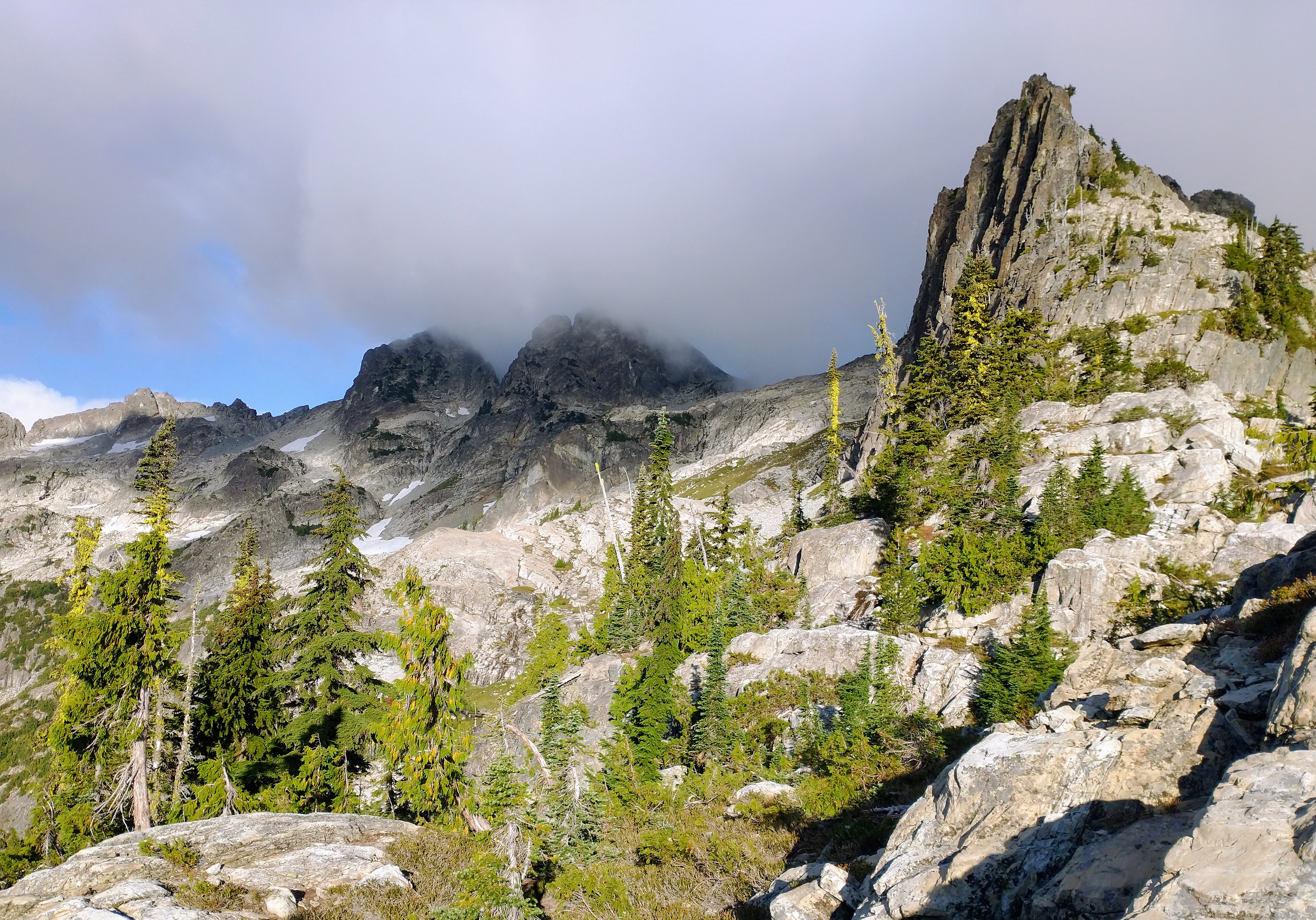
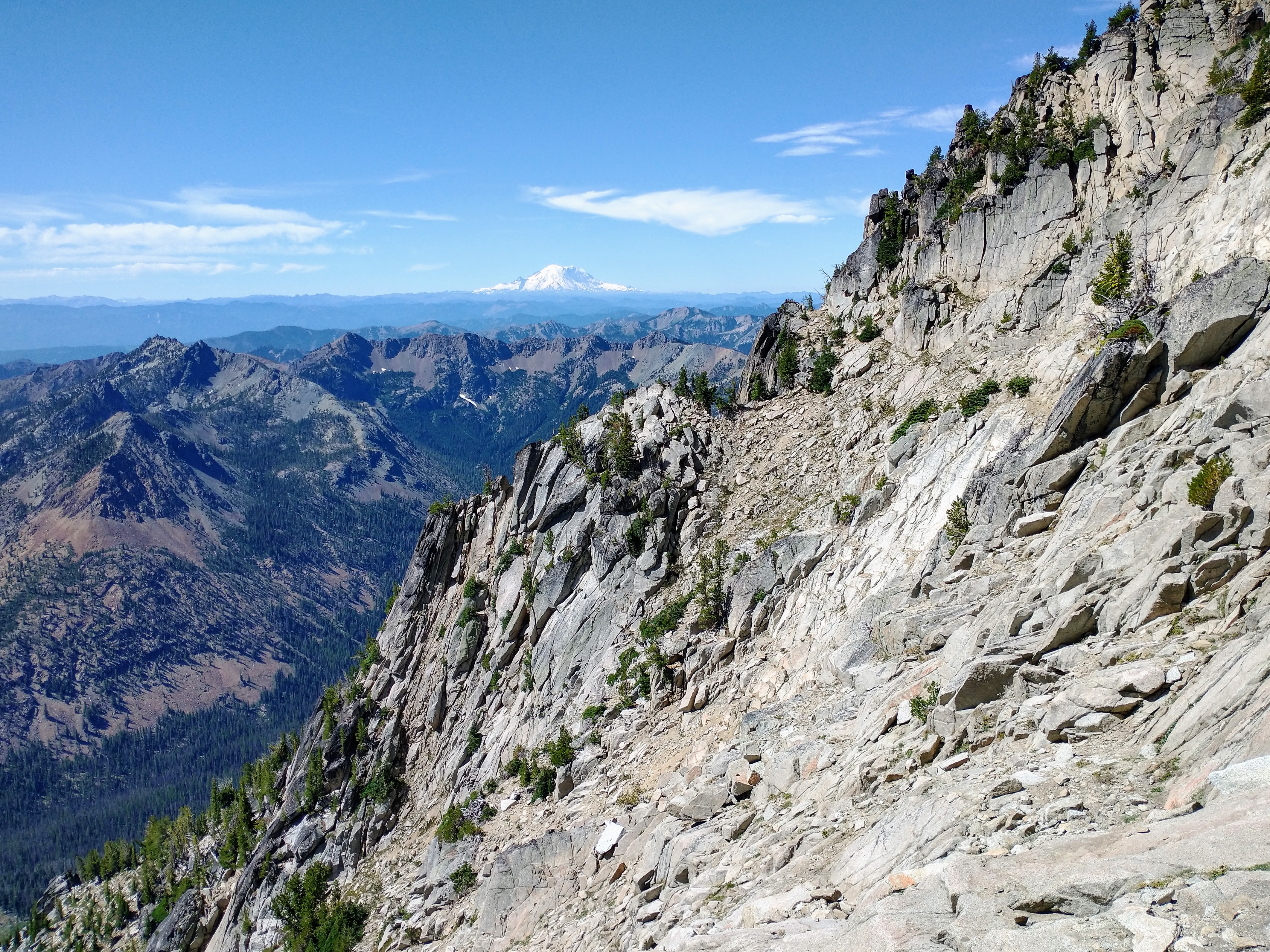
Trip: Argonaut - South Face
Trip Date: 08/14/2022
Trip Report:
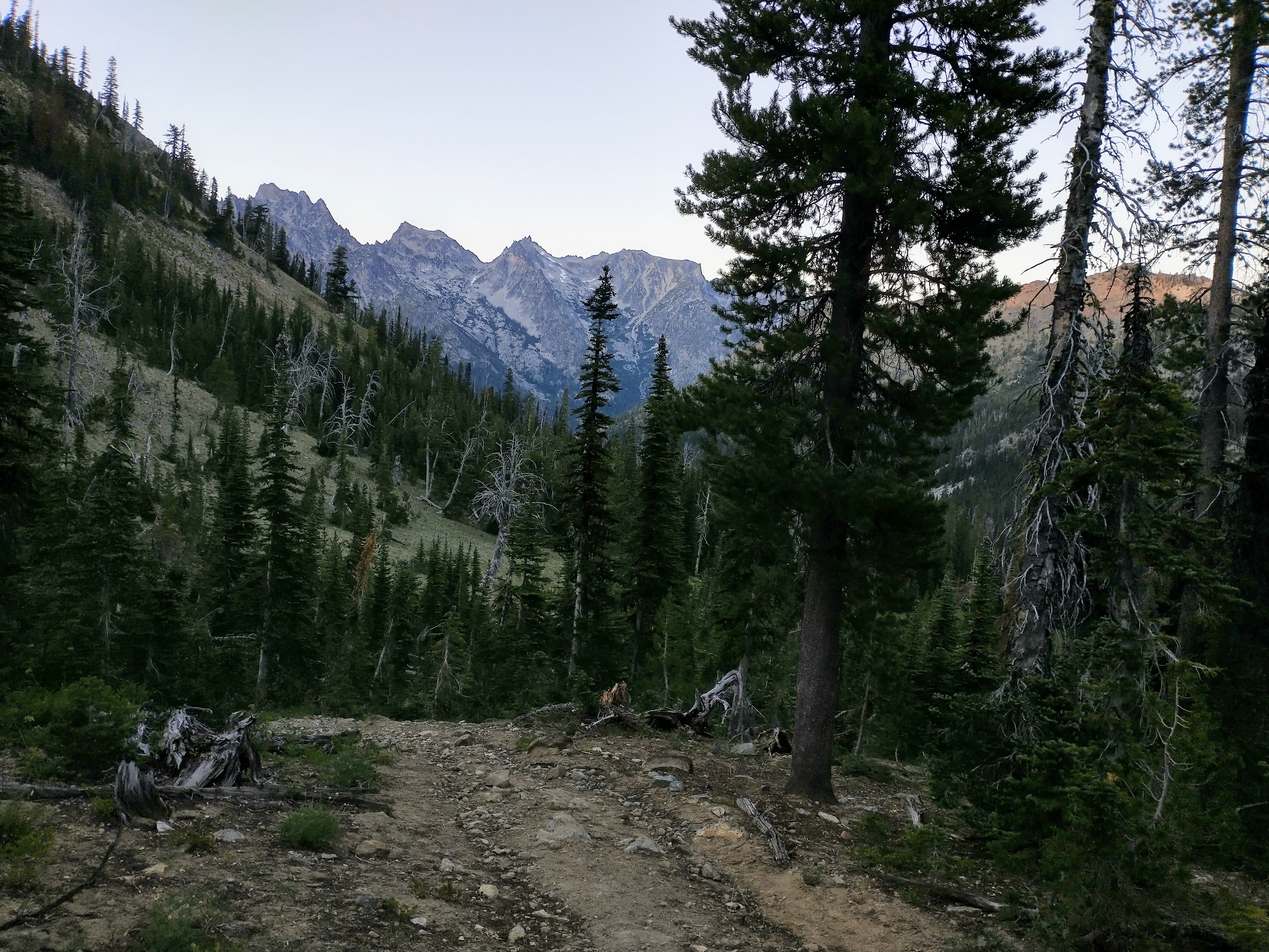
I've been out to the Teanaway (Teanaways?) several times this summer and it's been pretty awesome to become better acquainted with the area! For this trip, D and I decided to haul gear up to Argonaut's south face for a supposed "5.3" route. "What is the difference between 5.3 and 5.6?" I asked myself...
We hiked in via Beverly Creek then over Fourth of July Pass on Saturday late afternoon and camped at Ingalls Creek. In the parking lot, we met Jennifer and Chris, also heading to do the same route!
In the early evening, two climbers came down back to their camp at Ingalls Creek from Argonaut and gave us some approach beta, said that there's a legit "climber's trail," and shared that it took them 3 hours from camp to summit (via the 4th class scramble route; they soloed everything/didn't rap). Wow, we thought! Maybe we will be out of here way earlier than we expected!
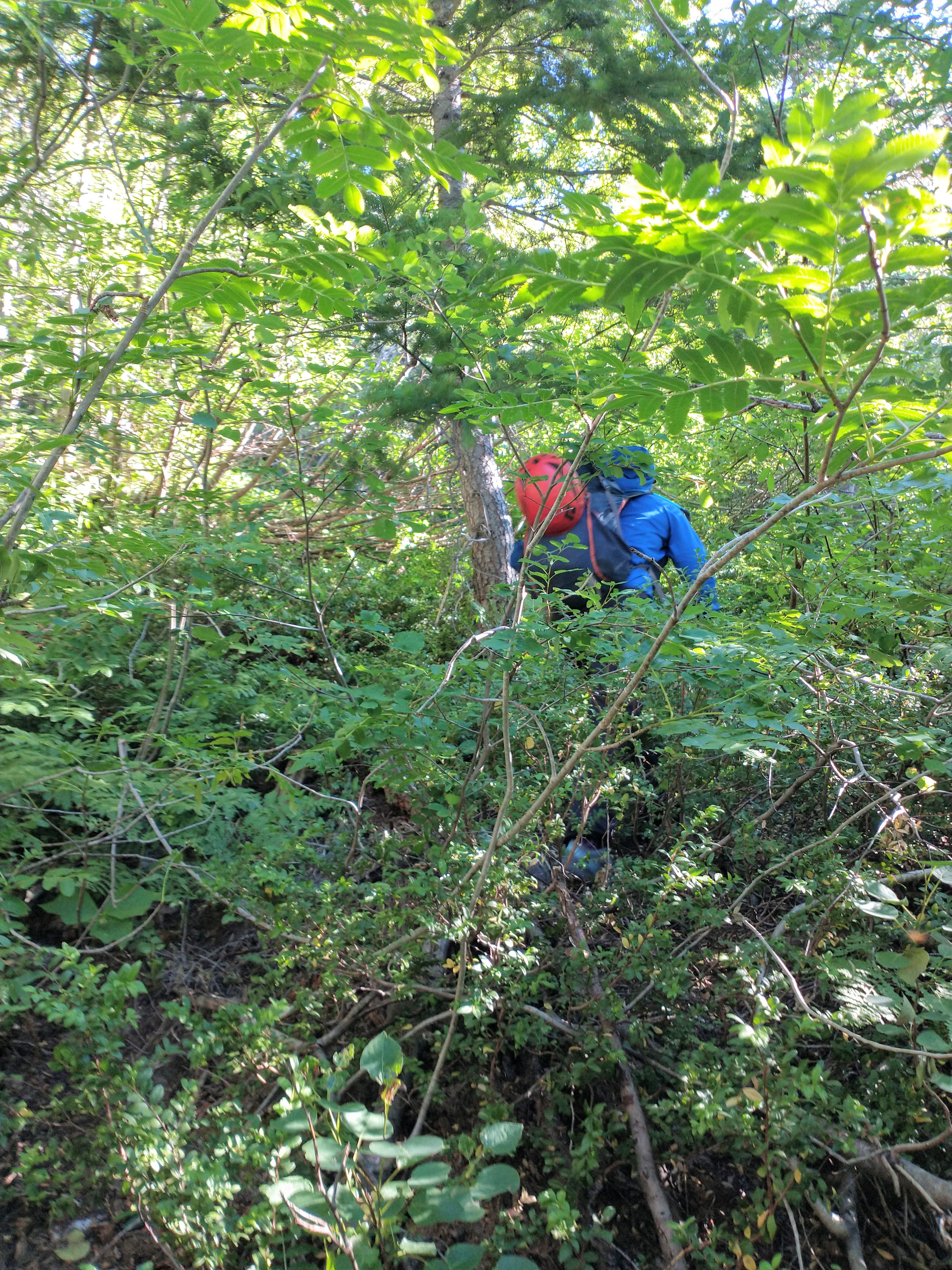
We set off from camp a bit past 7am and quickly found a solid trail up through the scrubby open-ish eastside forest. Very unfortunately, it did not last forever, and some B2ish schwack ensued between pieces of game trail until we got into more open meadow with sandy trails. OK, all good.
Not my favorite part of the approach:
A much more scenic part of the approach:
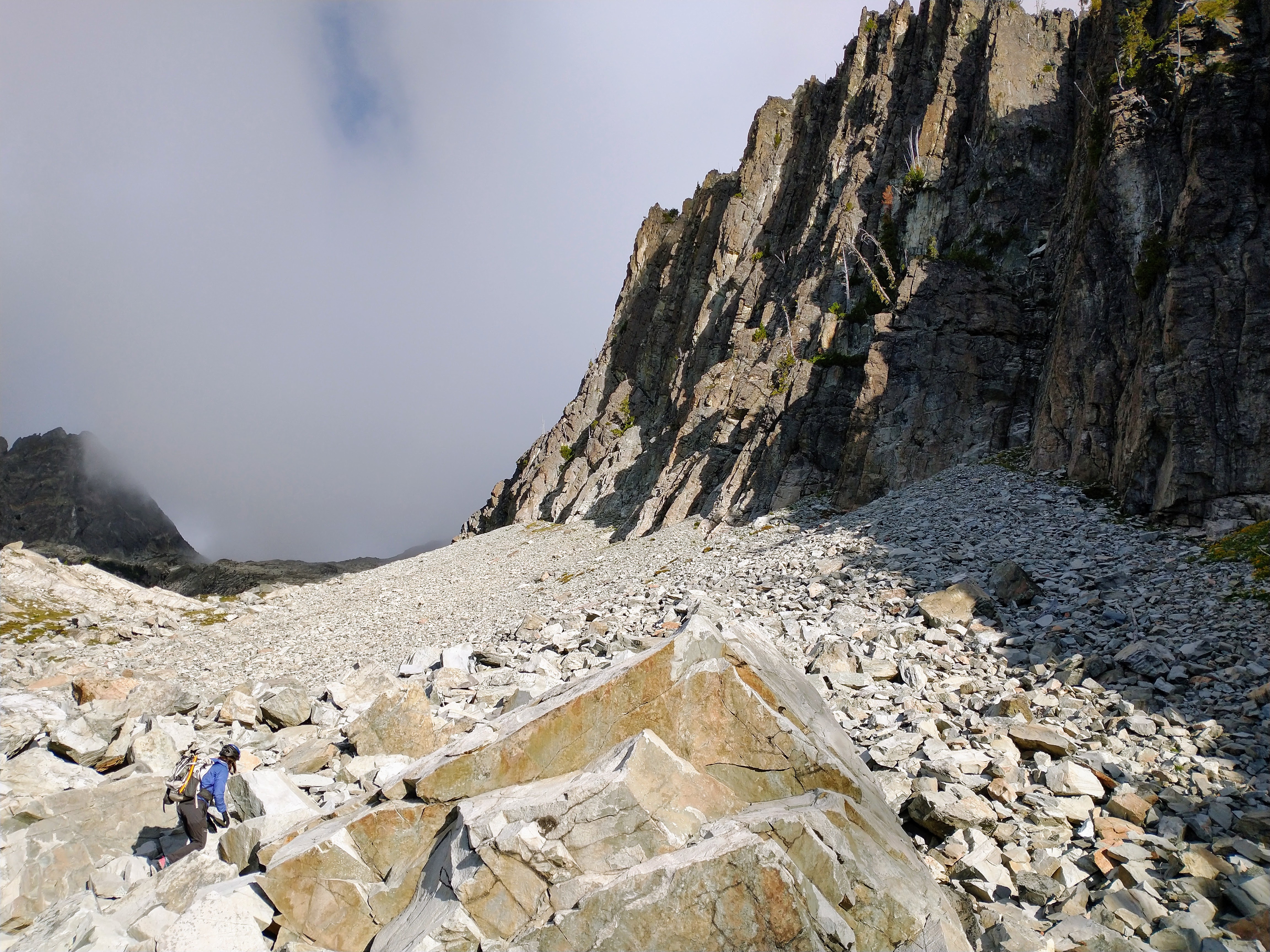
At this point, we aren't sure what happened, but we clearly did not pay enough attention to the navigation/GPS and we crossed into a gully too far east, thinking it was the main gully, and started ascending. We realized our mistake a bit on the later side and tried to carefully poke out a way to traverse west into the gully that we wanted, but after some 4th class stuff ("accidents often happen when people are off-route..."), we decided to go back, down, and around. Welp, that was fun exploratory bonus el!
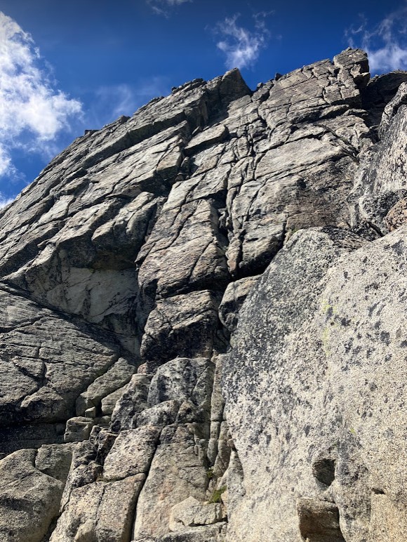
Up and up the gully, D and I being careful not to trundle things onto each other, then finally at the base of the south face. We used a Mountain Project photo overlay to locate the start the 5.3 route, and it really looked like the picture.. but anyway, that first pitch we ended up calling 5.8. Lots and lots of options on the face, lots of cool features (some chicken knobs, crystally ledges, etc), cracks, and good pro. Definitely plenty of lichen and lots of loose and jumbled blocks in cracks, as expected. I ended the first pitch at a small alcove with a giant block that was slung that I stumbled upon (the sling looked kinda old). I apologized a bunch to D for clearly getting us off-route, but she was grateful we were getting up it and safely. Very nice of her
 The second pitch was much easier -- I did go around a chimney feature due to the pile of microwave blocks sitting in it and then I traversed right at the top, all to keep the rope from dislodging rocks onto D. I chatted a bit with Jennifer and Chris, who had started where we did but had followed cracks trending to climber's left and had topped out a bit before us.
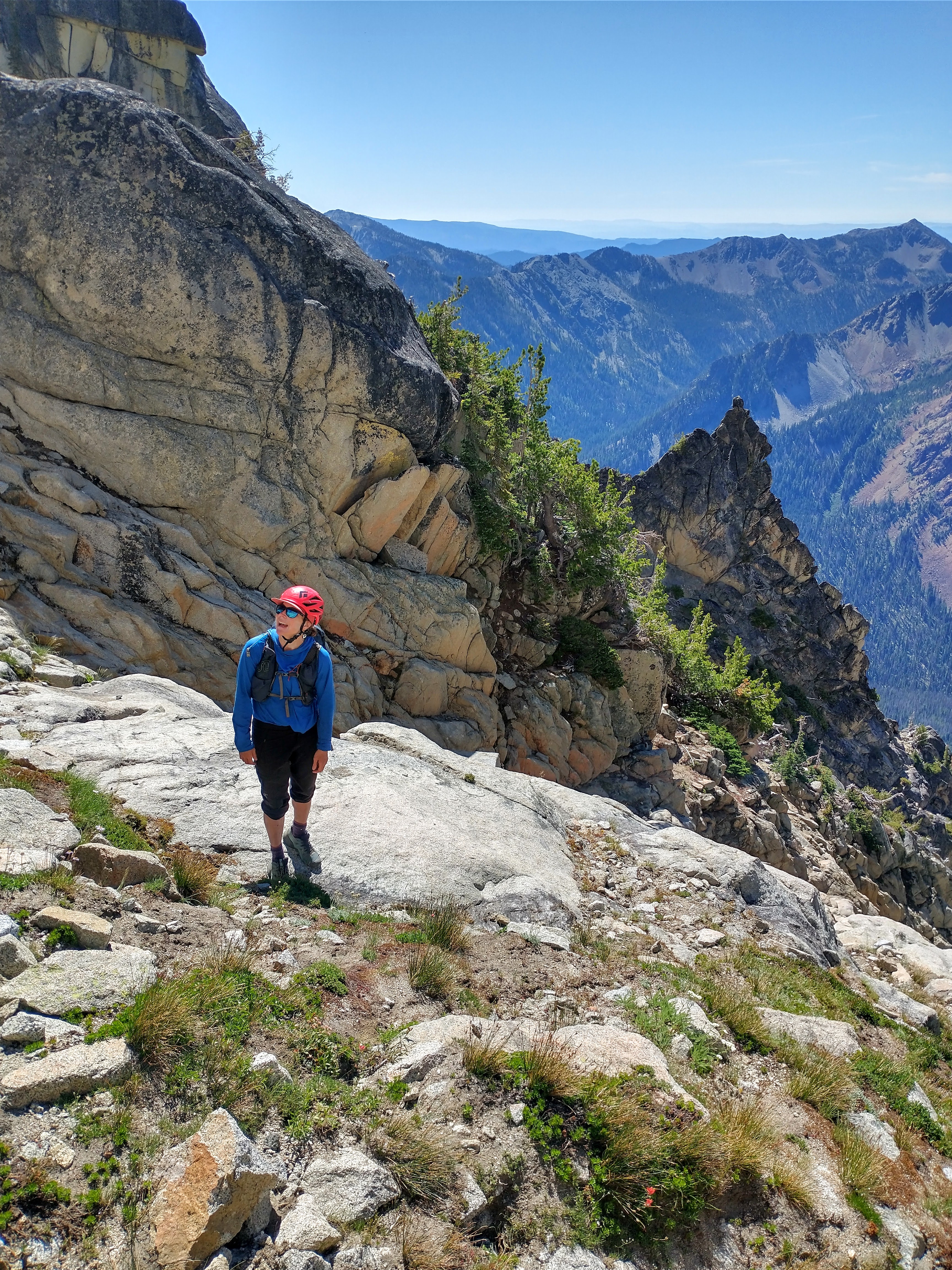
Bringing D up to the top of the second/last pitch:
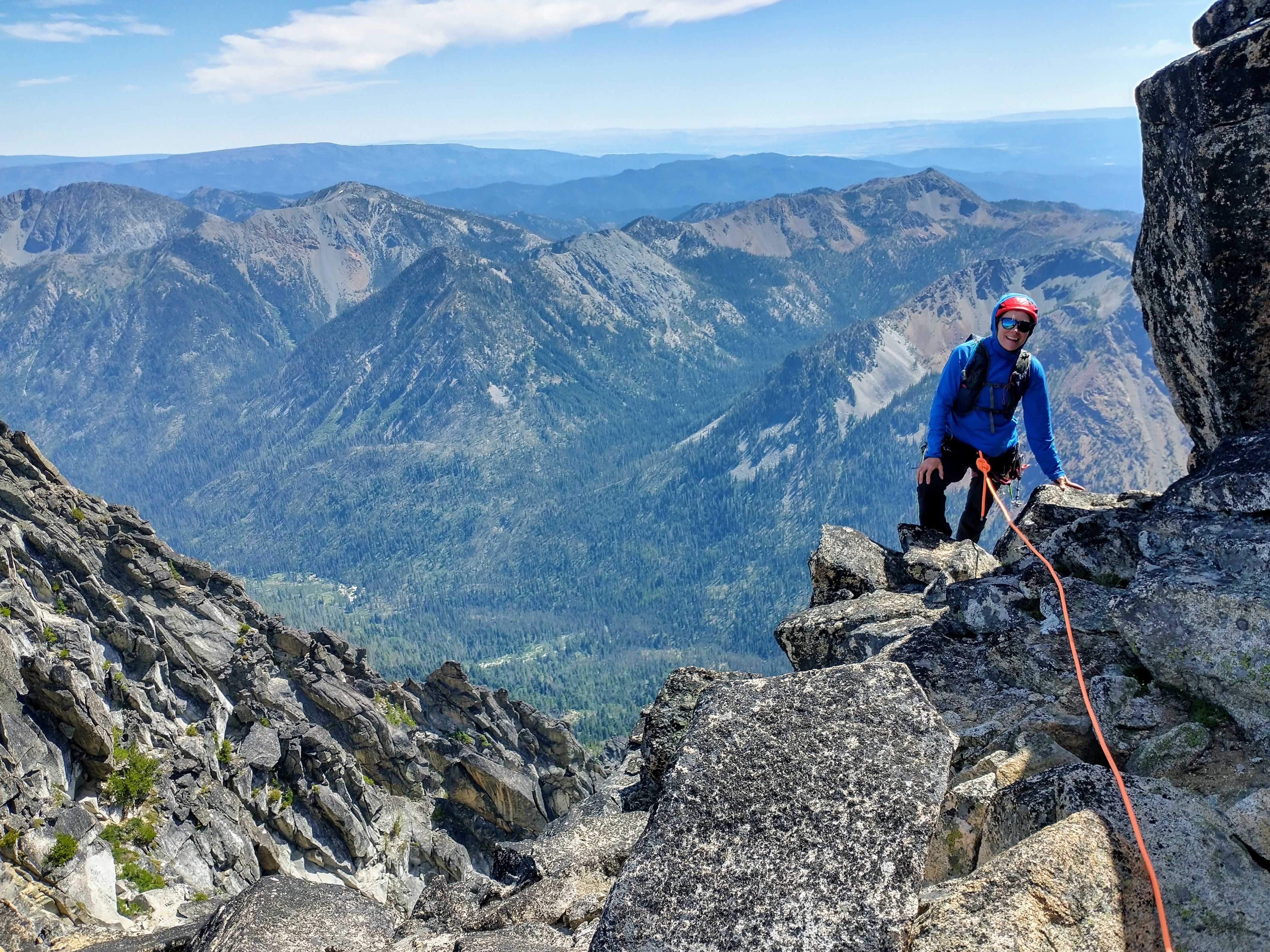
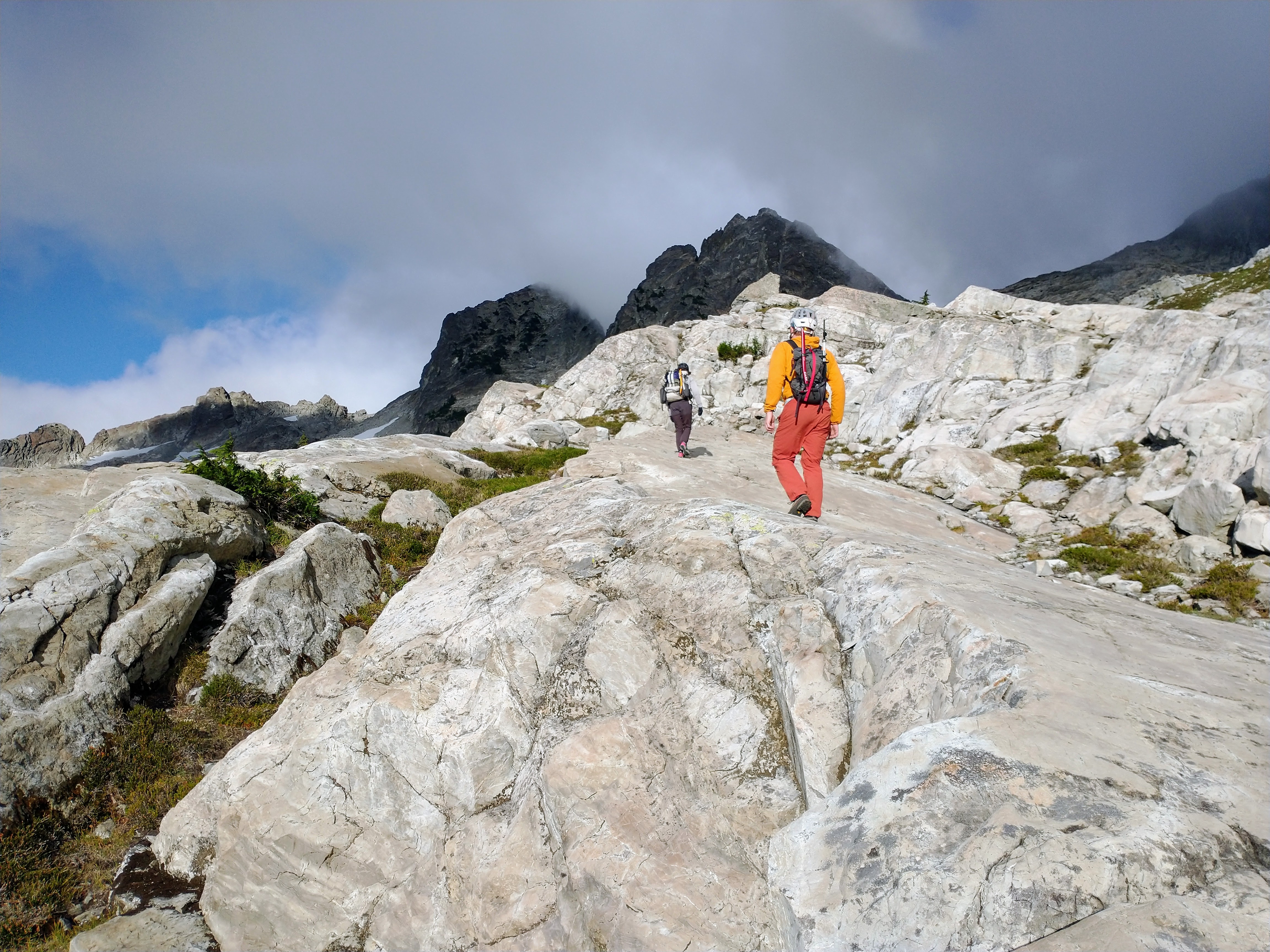
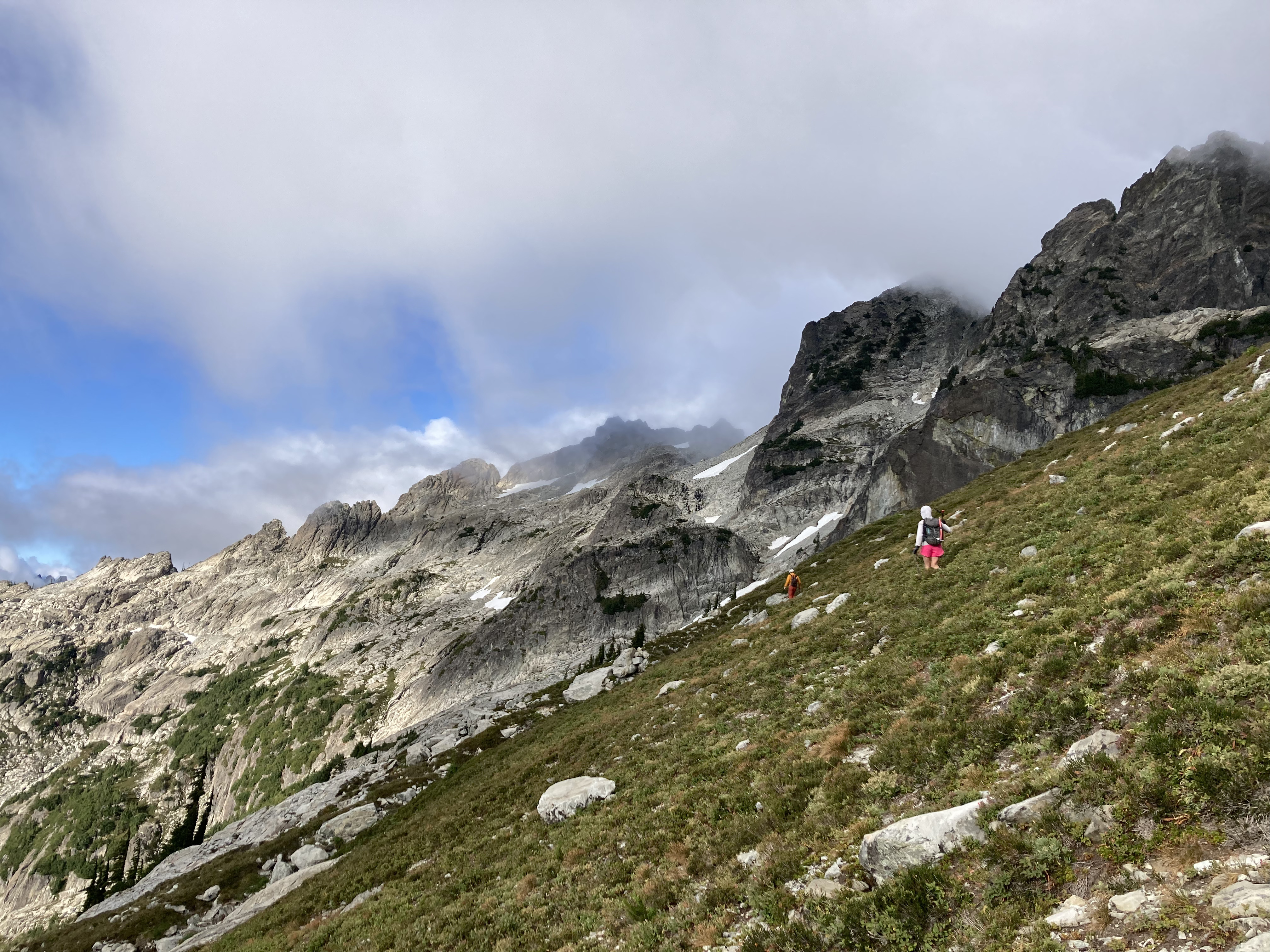
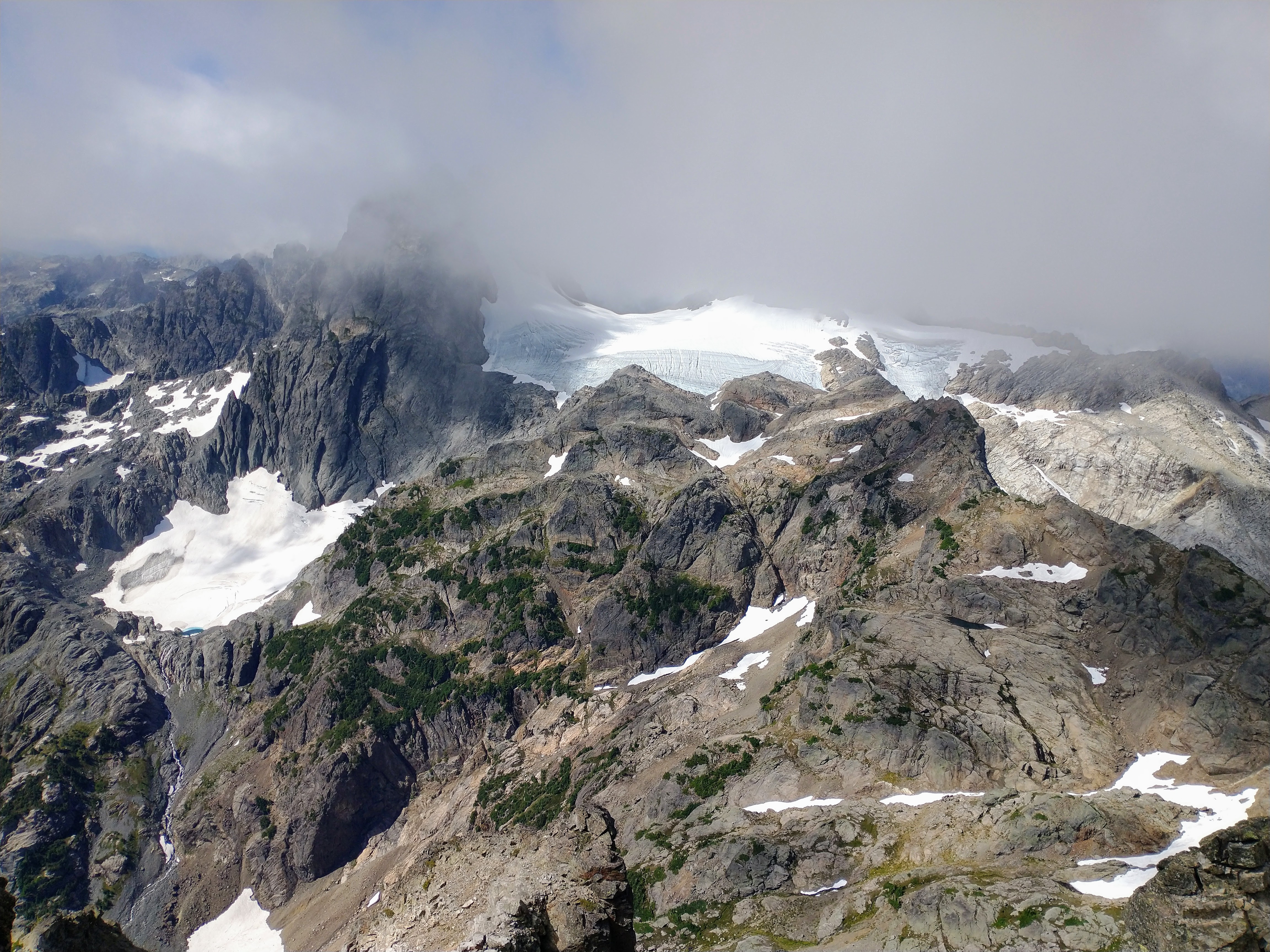
Anyway, we scrambled to the top, got cool, up-close views of Colchuck and Sherpa plus FOUR volcanoes, and then we scrambled down to the rap station for the 50-foot 4th class gully.
One of the amazing views from the summit:

Some photos of the face, from below after rappelling:
.jpg.9b98db917b153ece0eb7d239bf3a9110.jpg)
Descending the gully:
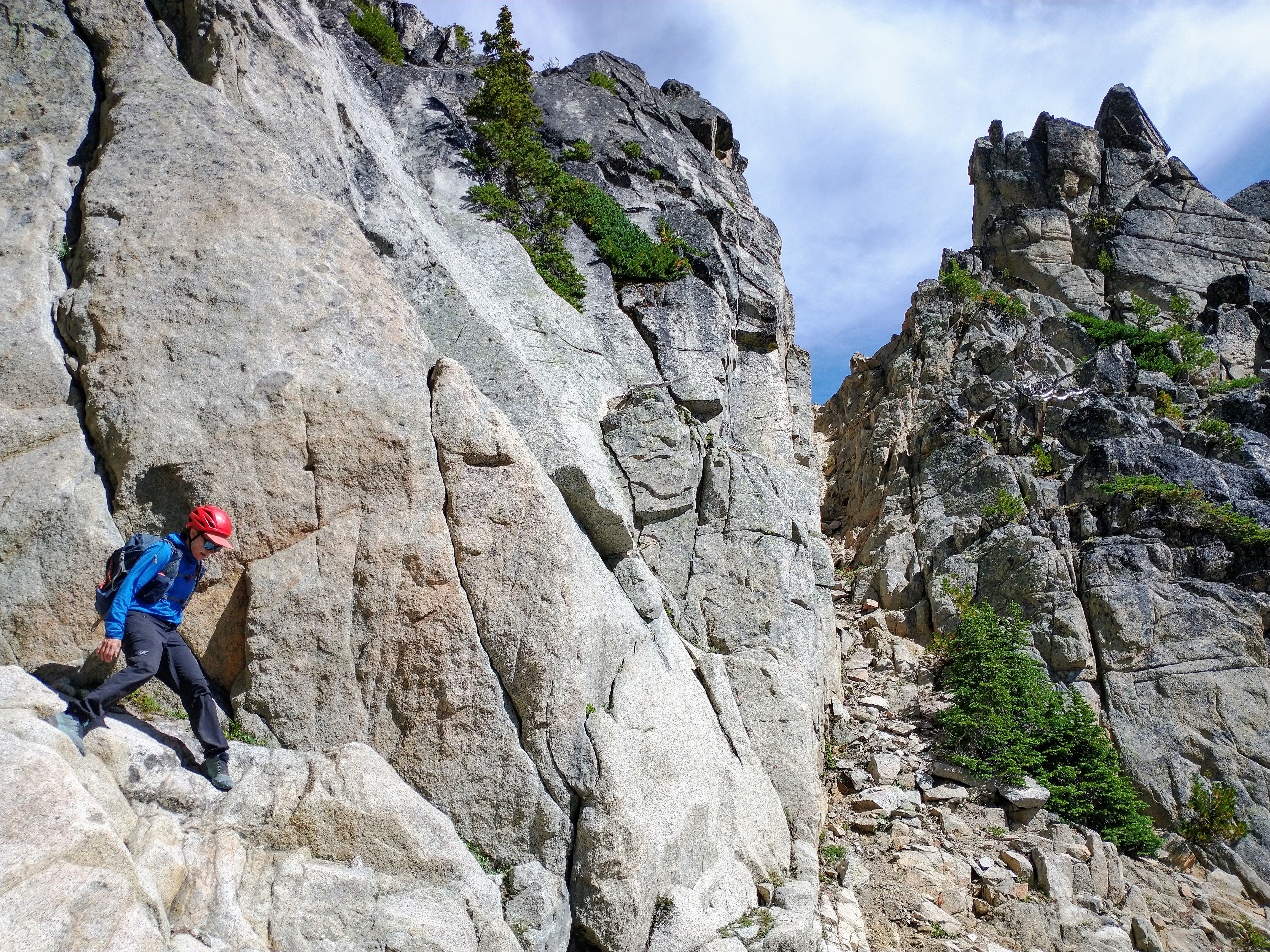
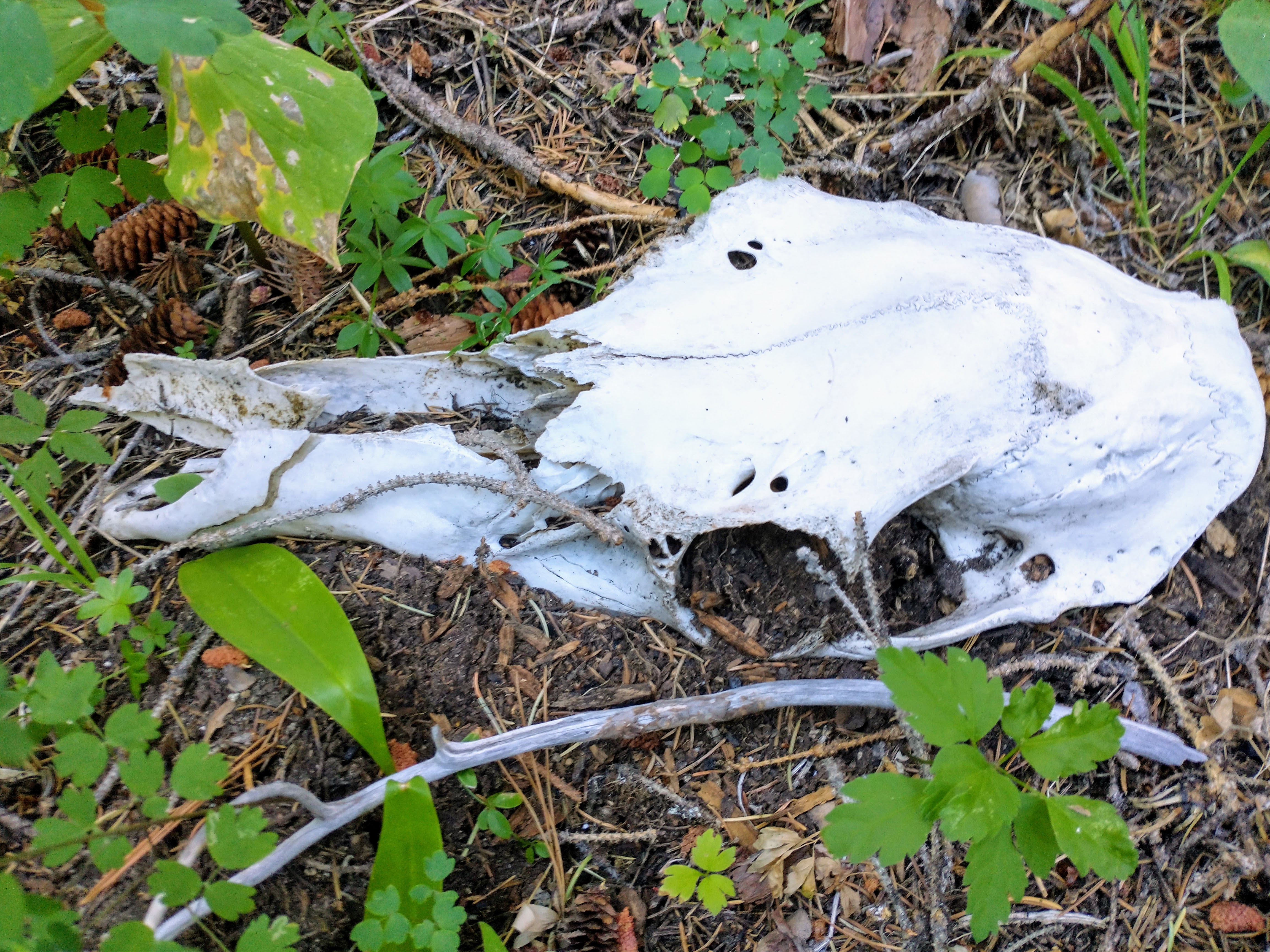
As the talus gully became meadow and then forest and stripes of slide alder, we started on solid trails and then...very unfortunately, had a hell of a time finding our way down to the main trail. Time is meaningless when you're trying to be zen in slide alder, but this was some of the more memorable schwacking I've done in awhile.. and on the east side! Oh, but we did come across what I think were some bones of a mountain goat?
Skull:
Finally made it down to camp, apparently our friends hadn't fared much better than us on the descent. Our 6-ish mile hike out went very quickly due to D's blazing speed and pace-setting which I was so grateful for!
Good bye, Argonaut, I am glad to tick you off my list. I wish I could get a ride up and just play around on that south face, but I probably won't be going up there again (at least until this memory fades).
Jennifer and Chris, it was lovely chatting with you two throughout the weekend and it was very sweet of you to wait until my Civic cleared that washout/rut on the forest road before driving off on Sunday night. Thank you!
Gear Notes:
60m rope, single light rack, rock shoes, fully engaged trail-ish senses, fully engaged quiet feet
Approach Notes:
up, down, up, up, up...I'm sure you're better than me at finding those trails!-
2
-
1
-
2
-
-
Awesome! Sounds like a grand adventure. Yes, we are so very lucky to have the Cascades. 100% agree with @Rad on the slinging blocks vs. cams. An alpine mentor once advised that cams go in "cracks of the earth".. in other words, that rock better be *solid* if you're putting a cam in there.
@aaronohn and I climbed these peaks in August 2020. I called it the Snoqualmie Slam 🙂 We climbed Kendall and Thomson the first day, schwacked down and camped at Joe Lake, and then climbed Huckleberry (E Ridge) and and Alaska on the way out. One of the more memorable parts of that trip was that we came across an unopened bag of fruit snacks (!) on the W ridge of Thomson, and I remember eating tons of those V. deliciosum huckleberries (that's Latin for "Very delicious"). I also remember the rap anchor on top of Huckleberry being pretty minimal, as you noted, and backing it up for the first rappel-er.
Stay stoked and safe!
-
1
-
1
-
-
Congratulations!
-
Awesome! After hiking Section K of the PCT, I got quite interested in that route but never made it happen. Sounds like you hit conditions just right, sounds so fun! Thanks for posting about it!
-
Found some, thank you!
-
Adding some nori or chopped dried shiitake really ups the tuna-ramen game 💯
Nice work!
-
1
-
Pub Club
in Climber's Board
Posted
Sweet, a solid 26-mile round trip bike ride! I hope it isn't raining. Rad, I also vote for the Roanoke Tavern, next time!